Deprecated: Creation of dynamic property Zend_View::$sMode is deprecated in /var/www/stall-frei/htdocs/staging.stall-frei.de/library/vendor/shardj/zf1-future/library/Zend/View/Abstract.php on line 308
Stallplatz oder Offenstall in Kreuzstraße
Gesucht wird in "Kreuzstraße, Römerstraße, 83626 Kreuzstraße, Deutschland"
6.333 Einträge
Deprecated: Creation of dynamic property Zend_View::$listObjects is deprecated in /var/www/stall-frei/htdocs/staging.stall-frei.de/library/vendor/shardj/zf1-future/library/Zend/View/Abstract.php on line 308
Gesponsort


Deprecated: Creation of dynamic property Zend_View::$listMode is deprecated in /var/www/stall-frei/htdocs/staging.stall-frei.de/library/vendor/shardj/zf1-future/library/Zend/View/Abstract.php on line 308
Deprecated: Creation of dynamic property Zend_View::$renderedObjects is deprecated in /var/www/stall-frei/htdocs/staging.stall-frei.de/library/vendor/shardj/zf1-future/library/Zend/View/Abstract.php on line 308
Deprecated: Creation of dynamic property Zend_View::$index is deprecated in /var/www/stall-frei/htdocs/staging.stall-frei.de/library/vendor/shardj/zf1-future/library/Zend/View/Abstract.php on line 308
Deprecated: Creation of dynamic property Zend_View::$displayMode is deprecated in /var/www/stall-frei/htdocs/staging.stall-frei.de/library/vendor/shardj/zf1-future/library/Zend/View/Abstract.php on line 308
Deprecated: Creation of dynamic property Zend_View::$remarketingIds is deprecated in /var/www/stall-frei/htdocs/staging.stall-frei.de/library/vendor/shardj/zf1-future/library/Zend/View/Abstract.php on line 308
Deprecated: Creation of dynamic property Zend_View::$listItem is deprecated in /var/www/stall-frei/htdocs/staging.stall-frei.de/library/vendor/shardj/zf1-future/library/Zend/View/Abstract.php on line 308
Deprecated: Creation of dynamic property Zend_View::$object is deprecated in /var/www/stall-frei/htdocs/staging.stall-frei.de/library/vendor/shardj/zf1-future/library/Zend/View/Abstract.php on line 308
Deprecated: Creation of dynamic property Zend_View::$attributes is deprecated in /var/www/stall-frei/htdocs/staging.stall-frei.de/library/vendor/shardj/zf1-future/library/Zend/View/Abstract.php on line 308
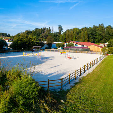
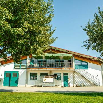
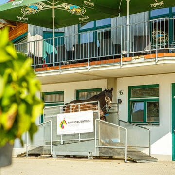
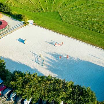
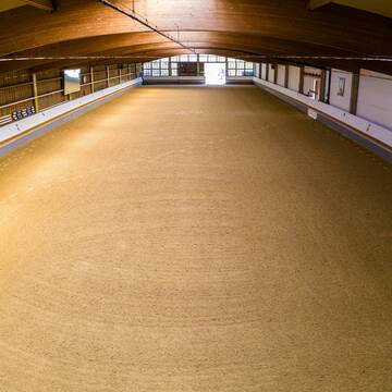
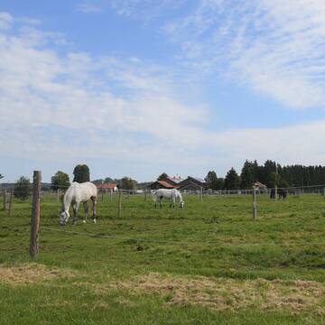
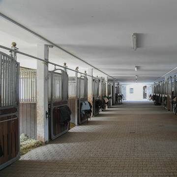
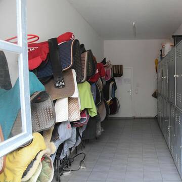
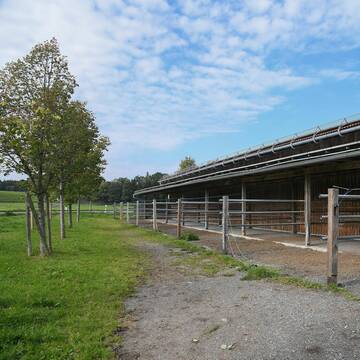
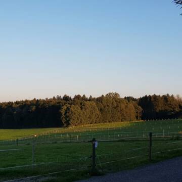
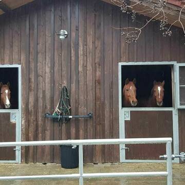
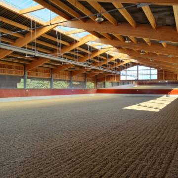
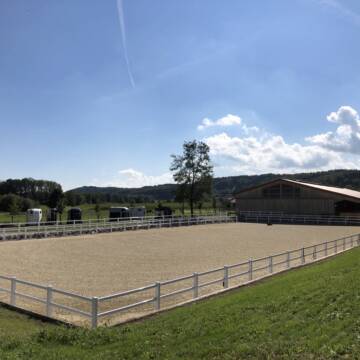
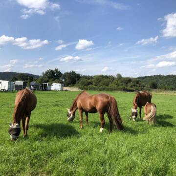
Reitsportzentrum München - S-Bahn Anschluss
Aying
Reitsportzentrum-Muenchen
@Reitsportzentrum-Muenchen
Gastronomie
Pferdeausbildung
Vermieten
Führanlage
Laufband
Allergikerstall
18 weitere...
S


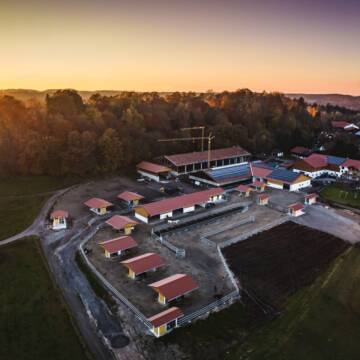
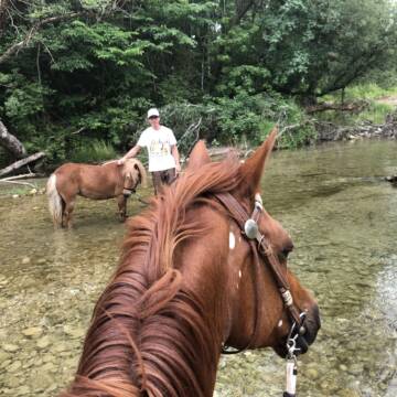
Reitanlage Schneiderhof mit Boxen/ HIT Aktivstall
Aying
Josef Jehl
@Martin-Jehl1
Freizeitstall
Geländestrecke
Vermieten
Krankenbox
Paddock
Notfallboxen
23 weitere...
S
Deprecated: Creation of dynamic property Zend_View_Helper_Ads::$adLink is deprecated in /var/www/stall-frei/htdocs/staging.stall-frei.de/library/Psf/View/Helper/Ads.php on line 108

Futtersack HeuToy, Fressbremse in pink
Mechtersen
STALL-FREIde Marketing
@STALL-FREI-Marketing
Stundenlange Beschäftigung die
Koliken vorbeugt, geringe Staubinhalation mit
steuerbarer Futterentnahme


Offenstall sucht einen Wallach
Feldkirchen-Westerham
Stefanie Bornschlegel
@Stefanie-Bornschlegel
Freizeitstall
Vermieten
Krankenbox
Longierzirkel/Roundpen
Gnadenbrothof
Notfallboxen
12 weitere...
aktuell
S


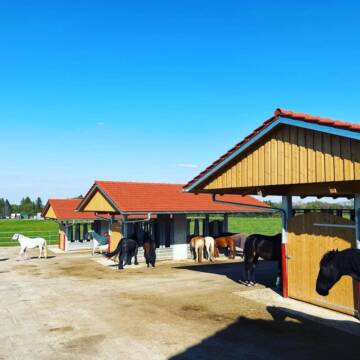
HIT-Aktiv Offenstall
Egmating
Reitanlage zum Kastl
@Reitanlage_zum_Kastl
Vermieten
Krankenbox
Longierzirkel/Roundpen
Hufrehe geeignet
Bewegungsstall
Offenstall
12 weitere...
aktuell
S

Pischlhof - für Sport- & Freizeitreiter
Valley-Mitterdarching
Christina-und-Andreas-Koenig
@Christina-und-Andreas-Koenig
Freizeitstall
Pferdeausbildung
Vermieten
Führanlage
Hunde willkommen
Allergikerstall
Hengsthaltung möglich
24 weitere...
P+
Messerschmidhof - Artgerecht und Individuell
Feldkirchen-Westerham
Messerschmidhof
@Messerschmidhof
FN-Mitglied
Führanlage
Hunde willkommen
Allergikerstall
bedampftes/gewaschenes Heu
Außenbox mit Paddock
Außenboxen
18 weitere...
P+
Hofgut Goldenes Tal
Weyarn
Hofgut-Goldenes-Tal
@Hofgut-Goldenes-Tal
Freizeitstall
Pferdeausbildung
Vermieten
Führanlage
Krankenbox
Hufrehe geeignet
20 weitere...
P+

Neuer HIT Aktivstall - Gut Moosrain
Murnau am Staffelsee
Markus-Simson
@Markus-Simson
Wir bieten Ihnen das HIT Aktivstall Konzept auf dem neuesten Stand in einzigartiger Lage und in einer geschlossenen Anlage:
- Fut
neu
R

Offenstall, Stute, Wallach, Pony bei Holzkirchen
Holzkirchen
Veronika Killer
@PferdeAlpakaFleckerl
Freizeitstall
Vermieten
Hunde willkommen
Krankenbox
Notfallboxen
12 weitere...
P


Paddock Box
Feldkirchen-Westerham
Stefanie Bornschlegel
@Stefanie-Bornschlegel
Freizeitstall
Vermieten
Krankenbox
Longierzirkel/Roundpen
Allergikerstall
Gnadenbrothof
12 weitere...
P+


HIT-Aktivstall Kastenmüller Reine Wallachgruppe
Ascholding
Matthias Kastenmüller
@Houcht
Freizeitstall
Krankenbox
Longierzirkel/Roundpen
bedampftes/gewaschenes Heu
Bewegungsstall
Laufstall
14 weitere...
S
Deprecated: Creation of dynamic property Zend_View::$pageCount is deprecated in /var/www/stall-frei/htdocs/staging.stall-frei.de/library/vendor/shardj/zf1-future/library/Zend/View/Abstract.php on line 308
Deprecated: Creation of dynamic property Zend_View::$itemCountPerPage is deprecated in /var/www/stall-frei/htdocs/staging.stall-frei.de/library/vendor/shardj/zf1-future/library/Zend/View/Abstract.php on line 308
Deprecated: Creation of dynamic property Zend_View::$first is deprecated in /var/www/stall-frei/htdocs/staging.stall-frei.de/library/vendor/shardj/zf1-future/library/Zend/View/Abstract.php on line 308
Deprecated: Creation of dynamic property Zend_View::$current is deprecated in /var/www/stall-frei/htdocs/staging.stall-frei.de/library/vendor/shardj/zf1-future/library/Zend/View/Abstract.php on line 308
Deprecated: Creation of dynamic property Zend_View::$last is deprecated in /var/www/stall-frei/htdocs/staging.stall-frei.de/library/vendor/shardj/zf1-future/library/Zend/View/Abstract.php on line 308
Deprecated: Creation of dynamic property Zend_View::$next is deprecated in /var/www/stall-frei/htdocs/staging.stall-frei.de/library/vendor/shardj/zf1-future/library/Zend/View/Abstract.php on line 308
Deprecated: Creation of dynamic property Zend_View::$pagesInRange is deprecated in /var/www/stall-frei/htdocs/staging.stall-frei.de/library/vendor/shardj/zf1-future/library/Zend/View/Abstract.php on line 308
Deprecated: Creation of dynamic property Zend_View::$firstPageInRange is deprecated in /var/www/stall-frei/htdocs/staging.stall-frei.de/library/vendor/shardj/zf1-future/library/Zend/View/Abstract.php on line 308
Deprecated: Creation of dynamic property Zend_View::$lastPageInRange is deprecated in /var/www/stall-frei/htdocs/staging.stall-frei.de/library/vendor/shardj/zf1-future/library/Zend/View/Abstract.php on line 308
Deprecated: Creation of dynamic property Zend_View::$currentItemCount is deprecated in /var/www/stall-frei/htdocs/staging.stall-frei.de/library/vendor/shardj/zf1-future/library/Zend/View/Abstract.php on line 308
Deprecated: Creation of dynamic property Zend_View::$totalItemCount is deprecated in /var/www/stall-frei/htdocs/staging.stall-frei.de/library/vendor/shardj/zf1-future/library/Zend/View/Abstract.php on line 308
Deprecated: Creation of dynamic property Zend_View::$firstItemNumber is deprecated in /var/www/stall-frei/htdocs/staging.stall-frei.de/library/vendor/shardj/zf1-future/library/Zend/View/Abstract.php on line 308
Deprecated: Creation of dynamic property Zend_View::$lastItemNumber is deprecated in /var/www/stall-frei/htdocs/staging.stall-frei.de/library/vendor/shardj/zf1-future/library/Zend/View/Abstract.php on line 308
Deprecated: Creation of dynamic property Zend_View::$router is deprecated in /var/www/stall-frei/htdocs/staging.stall-frei.de/library/vendor/shardj/zf1-future/library/Zend/View/Abstract.php on line 308
Deprecated: Creation of dynamic property Zend_View::$urlParams is deprecated in /var/www/stall-frei/htdocs/staging.stall-frei.de/library/vendor/shardj/zf1-future/library/Zend/View/Abstract.php on line 308
Deprecated: Creation of dynamic property Zend_View::$showAds is deprecated in /var/www/stall-frei/htdocs/staging.stall-frei.de/library/vendor/shardj/zf1-future/library/Zend/View/Abstract.php on line 308
Deprecated: Creation of dynamic property Zend_View::$objectIds is deprecated in /var/www/stall-frei/htdocs/staging.stall-frei.de/library/vendor/shardj/zf1-future/library/Zend/View/Abstract.php on line 308
Deprecated: Creation of dynamic property Zend_View::$showNavbar is deprecated in /var/www/stall-frei/htdocs/staging.stall-frei.de/library/vendor/shardj/zf1-future/library/Zend/View/Abstract.php on line 308
Deprecated: Creation of dynamic property Zend_View::$showBreadcrumb is deprecated in /var/www/stall-frei/htdocs/staging.stall-frei.de/library/vendor/shardj/zf1-future/library/Zend/View/Abstract.php on line 308
Deprecated: Creation of dynamic property Zend_View::$showFooter is deprecated in /var/www/stall-frei/htdocs/staging.stall-frei.de/library/vendor/shardj/zf1-future/library/Zend/View/Abstract.php on line 308
Deprecated: Creation of dynamic property Zend_View::$showInternalAds is deprecated in /var/www/stall-frei/htdocs/staging.stall-frei.de/library/vendor/shardj/zf1-future/library/Zend/View/Abstract.php on line 308
Deprecated: Creation of dynamic property Zend_View::$blNoContent is deprecated in /var/www/stall-frei/htdocs/staging.stall-frei.de/library/vendor/shardj/zf1-future/library/Zend/View/Abstract.php on line 308
Deprecated: Creation of dynamic property Zend_View::$sMetaDesc is deprecated in /var/www/stall-frei/htdocs/staging.stall-frei.de/library/vendor/shardj/zf1-future/library/Zend/View/Abstract.php on line 308
Deprecated: Creation of dynamic property Zend_View::$useGmaps is deprecated in /var/www/stall-frei/htdocs/staging.stall-frei.de/library/vendor/shardj/zf1-future/library/Zend/View/Abstract.php on line 308
Deprecated: Creation of dynamic property Zend_View::$touches is deprecated in /var/www/stall-frei/htdocs/staging.stall-frei.de/library/vendor/shardj/zf1-future/library/Zend/View/Abstract.php on line 308
Deprecated: Creation of dynamic property Zend_View::$oProject is deprecated in /var/www/stall-frei/htdocs/staging.stall-frei.de/library/vendor/shardj/zf1-future/library/Zend/View/Abstract.php on line 308
Deprecated: Creation of dynamic property Zend_View::$pageHeadline is deprecated in /var/www/stall-frei/htdocs/staging.stall-frei.de/library/vendor/shardj/zf1-future/library/Zend/View/Abstract.php on line 308
Deprecated: Creation of dynamic property Zend_View::$disableLocationField is deprecated in /var/www/stall-frei/htdocs/staging.stall-frei.de/library/vendor/shardj/zf1-future/library/Zend/View/Abstract.php on line 308
Deprecated: Creation of dynamic property Zend_View::$isSearch is deprecated in /var/www/stall-frei/htdocs/staging.stall-frei.de/library/vendor/shardj/zf1-future/library/Zend/View/Abstract.php on line 308
Deprecated: Creation of dynamic property Zend_View::$pageTitle is deprecated in /var/www/stall-frei/htdocs/staging.stall-frei.de/library/vendor/shardj/zf1-future/library/Zend/View/Abstract.php on line 308
Deprecated: Creation of dynamic property Psf_Form_Element_Text::$class is deprecated in /var/www/stall-frei/htdocs/staging.stall-frei.de/library/vendor/shardj/zf1-future/library/Zend/Form/Element.php on line 874
Deprecated: Creation of dynamic property Psf_Form_Element_Text::$size is deprecated in /var/www/stall-frei/htdocs/staging.stall-frei.de/library/vendor/shardj/zf1-future/library/Zend/Form/Element.php on line 874
Deprecated: Creation of dynamic property Psf_Form_Element_Text::$placeholder is deprecated in /var/www/stall-frei/htdocs/staging.stall-frei.de/library/vendor/shardj/zf1-future/library/Zend/Form/Element.php on line 874
Deprecated: Creation of dynamic property Psf_Form_Element_Hidden::$class is deprecated in /var/www/stall-frei/htdocs/staging.stall-frei.de/library/vendor/shardj/zf1-future/library/Zend/Form/Element.php on line 874
Deprecated: Creation of dynamic property Psf_Form_Element_Hidden::$class is deprecated in /var/www/stall-frei/htdocs/staging.stall-frei.de/library/vendor/shardj/zf1-future/library/Zend/Form/Element.php on line 874
Deprecated: Creation of dynamic property Psf_Form_Element_Hidden::$class is deprecated in /var/www/stall-frei/htdocs/staging.stall-frei.de/library/vendor/shardj/zf1-future/library/Zend/Form/Element.php on line 874
Deprecated: Creation of dynamic property Psf_Form_Element_Hidden::$class is deprecated in /var/www/stall-frei/htdocs/staging.stall-frei.de/library/vendor/shardj/zf1-future/library/Zend/Form/Element.php on line 874
Deprecated: Creation of dynamic property Psf_Form_Element_Select::$class is deprecated in /var/www/stall-frei/htdocs/staging.stall-frei.de/library/vendor/shardj/zf1-future/library/Zend/Form/Element.php on line 874
Deprecated: Creation of dynamic property Psf_Form_Element_Select::$class is deprecated in /var/www/stall-frei/htdocs/staging.stall-frei.de/library/vendor/shardj/zf1-future/library/Zend/Form/Element.php on line 874
Deprecated: Creation of dynamic property Psf_Form_Element_Select::$class is deprecated in /var/www/stall-frei/htdocs/staging.stall-frei.de/library/vendor/shardj/zf1-future/library/Zend/Form/Element.php on line 874
Deprecated: Creation of dynamic property Psf_Form_Element_Select::$class is deprecated in /var/www/stall-frei/htdocs/staging.stall-frei.de/library/vendor/shardj/zf1-future/library/Zend/Form/Element.php on line 874
Deprecated: Creation of dynamic property Psf_Form_Element_Text::$class is deprecated in /var/www/stall-frei/htdocs/staging.stall-frei.de/library/vendor/shardj/zf1-future/library/Zend/Form/Element.php on line 874
Deprecated: Creation of dynamic property Psf_Form_Element_Checkbox::$label is deprecated in /var/www/stall-frei/htdocs/staging.stall-frei.de/library/vendor/shardj/zf1-future/library/Zend/Form/Element.php on line 874
Deprecated: Creation of dynamic property Zend_View::$sort is deprecated in /var/www/stall-frei/htdocs/staging.stall-frei.de/library/vendor/shardj/zf1-future/library/Zend/View/Abstract.php on line 308
Deprecated: Creation of dynamic property Zend_View::$searchLocation is deprecated in /var/www/stall-frei/htdocs/staging.stall-frei.de/library/vendor/shardj/zf1-future/library/Zend/View/Abstract.php on line 308
Deprecated: Creation of dynamic property Zend_View::$locationHint is deprecated in /var/www/stall-frei/htdocs/staging.stall-frei.de/library/vendor/shardj/zf1-future/library/Zend/View/Abstract.php on line 308
Psf_GeoCoder_Abstract::getLocation: Kreuzstraße Get Location CachedOrLive
Psf_GeoCoder_Abstract::getCachedOrLive: Kreuzstraße
Psf_GeoCoder_OpenCageData::makeApiRequest: response:
Array
(
[documentation] => https://opencagedata.com/api
[licenses] => Array
(
[0] => Array
(
[name] => see attribution guide
[url] => https://opencagedata.com/credits
)
)
[results] => Array
(
[0] => Array
(
[bounds] => Array
(
[northeast] => Array
(
[lat] => 47.9221236
[lng] => 11.7644933
)
[southwest] => Array
(
[lat] => 47.9121236
[lng] => 11.7544933
)
)
[components] => Array
(
[ISO_3166-1_alpha-2] => DE
[ISO_3166-1_alpha-3] => DEU
[ISO_3166-2] => Array
(
[0] => DE-BY
)
[_category] => transportation
[_normalized_city] => Valley
[_type] => railway
[city] => Valley
[continent] => Europe
[country] => Deutschland
[country_code] => de
[county] => Landkreis Miesbach
[political_union] => European Union
[postcode] => 83626
[railway] => Kreuzstraße
[road] => Römerstraße
[state] => Bayern
[state_code] => BY
[village] => Kreuzstraße
)
[confidence] => 9
[formatted] => Kreuzstraße, Römerstraße, 83626 Kreuzstraße, Deutschland
[geometry] => Array
(
[lat] => 47.9171236
[lng] => 11.7594933
)
)
[1] => Array
(
[bounds] => Array
(
[northeast] => Array
(
[lat] => 47.9402559
[lng] => 11.7768254
)
[southwest] => Array
(
[lat] => 47.9002559
[lng] => 11.7368254
)
)
[components] => Array
(
[ISO_3166-1_alpha-2] => DE
[ISO_3166-1_alpha-3] => DEU
[ISO_3166-2] => Array
(
[0] => DE-BY
)
[_category] => place
[_normalized_city] => Valley
[_type] => village
[city] => Valley
[continent] => Europe
[country] => Deutschland
[country_code] => de
[county] => Landkreis Miesbach
[political_union] => European Union
[postcode] => 83626
[state] => Bayern
[state_code] => BY
[village] => Kreuzstraße
)
[confidence] => 7
[formatted] => 83626 Kreuzstraße, Deutschland
[geometry] => Array
(
[lat] => 47.9202559
[lng] => 11.7568254
)
)
[2] => Array
(
[bounds] => Array
(
[northeast] => Array
(
[lat] => 48.0885224
[lng] => 12.4087583
)
[southwest] => Array
(
[lat] => 48.0485224
[lng] => 12.3687583
)
)
[components] => Array
(
[ISO_3166-1_alpha-2] => DE
[ISO_3166-1_alpha-3] => DEU
[ISO_3166-2] => Array
(
[0] => DE-BY
)
[_category] => place
[_normalized_city] => Schnaitsee
[_type] => hamlet
[continent] => Europe
[country] => Deutschland
[country_code] => de
[county] => Landkreis Traunstein
[hamlet] => Kreuzstraße
[political_union] => European Union
[postcode] => 83530
[state] => Bayern
[state_code] => BY
[village] => Schnaitsee
)
[confidence] => 7
[formatted] => Kreuzstraße, 83530 Schnaitsee, Deutschland
[geometry] => Array
(
[lat] => 48.0685224
[lng] => 12.3887583
)
)
[3] => Array
(
[bounds] => Array
(
[northeast] => Array
(
[lat] => 48.8462228
[lng] => 13.5601166
)
[southwest] => Array
(
[lat] => 48.8062228
[lng] => 13.5201166
)
)
[components] => Array
(
[ISO_3166-1_alpha-2] => DE
[ISO_3166-1_alpha-3] => DEU
[ISO_3166-2] => Array
(
[0] => DE-BY
)
[_category] => place
[_normalized_city] => Freyung
[_type] => hamlet
[continent] => Europe
[country] => Deutschland
[country_code] => de
[county] => Landkreis Freyung-Grafenau
[hamlet] => Kreuzstraße
[political_union] => European Union
[postcode] => 94078
[state] => Bayern
[state_code] => BY
[town] => Freyung
)
[confidence] => 7
[formatted] => Kreuzstraße, 94078 Freyung, Deutschland
[geometry] => Array
(
[lat] => 48.8262228
[lng] => 13.5401166
)
)
[4] => Array
(
[bounds] => Array
(
[northeast] => Array
(
[lat] => 48.265132
[lng] => 11.5929051
)
[southwest] => Array
(
[lat] => 48.265032
[lng] => 11.5928051
)
)
[components] => Array
(
[ISO_3166-1_alpha-2] => DE
[ISO_3166-1_alpha-3] => DEU
[ISO_3166-2] => Array
(
[0] => DE-BY
)
[_category] => building
[_normalized_city] => Unterschleißheim
[_type] => building
[continent] => Europe
[country] => Deutschland
[country_code] => de
[county] => Landkreis München
[isolated_dwelling] => Kreuzstraße
[political_union] => European Union
[postcode] => 85716
[state] => Bayern
[state_code] => BY
[town] => Unterschleißheim
)
[confidence] => 10
[formatted] => Kreuzstraße, 85716 Unterschleißheim, Deutschland
[geometry] => Array
(
[lat] => 48.265082
[lng] => 11.5928551
)
)
[5] => Array
(
[bounds] => Array
(
[northeast] => Array
(
[lat] => 49.1837056
[lng] => 8.9176317
)
[southwest] => Array
(
[lat] => 49.1801653
[lng] => 8.9112894
)
)
[components] => Array
(
[ISO_3166-1_alpha-2] => DE
[ISO_3166-1_alpha-3] => DEU
[ISO_3166-2] => Array
(
[0] => DE-BW
)
[_category] => agriculture
[_normalized_city] => Ittlingen
[_type] => farmland
[continent] => Europe
[country] => Deutschland
[country_code] => de
[county] => Landkreis Heilbronn
[farmland] => Kreuzstraße
[municipality] => VVG der Stadt Eppingen
[political_union] => European Union
[postcode] => 74930
[state] => Baden-Württemberg
[state_code] => BW
[village] => Ittlingen
)
[confidence] => 9
[formatted] => Kreuzstraße, 74930 Ittlingen, Deutschland
[geometry] => Array
(
[lat] => 49.1819522
[lng] => 8.9148638
)
)
[6] => Array
(
[bounds] => Array
(
[northeast] => Array
(
[lat] => 47.788334
[lng] => 11.7335927
)
[southwest] => Array
(
[lat] => 47.768334
[lng] => 11.7135927
)
)
[components] => Array
(
[ISO_3166-1_alpha-2] => DE
[ISO_3166-1_alpha-3] => DEU
[ISO_3166-2] => Array
(
[0] => DE-BY
)
[_category] => place
[_normalized_city] => Gmund
[_type] => hamlet
[city] => Gmund
[continent] => Europe
[country] => Deutschland
[country_code] => de
[county] => Landkreis Miesbach
[hamlet] => Radlhaus
[locality] => Kreuzstraße
[political_union] => European Union
[postcode] => 83703
[state] => Bayern
[state_code] => BY
)
[confidence] => 8
[formatted] => Radlhaus, 83703 Gmund, Deutschland
[geometry] => Array
(
[lat] => 47.778334
[lng] => 11.7235927
)
)
[7] => Array
(
[bounds] => Array
(
[northeast] => Array
(
[lat] => 49.709475
[lng] => 8.7069792
)
[southwest] => Array
(
[lat] => 49.689475
[lng] => 8.6869792
)
)
[components] => Array
(
[ISO_3166-1_alpha-2] => DE
[ISO_3166-1_alpha-3] => DEU
[ISO_3166-2] => Array
(
[0] => DE-HE
)
[_category] => place
[_normalized_city] => Lautertal (Odenwald)
[_type] => hamlet
[continent] => Europe
[country] => Deutschland
[country_code] => de
[county] => Kreis Bergstraße
[locality] => Kreuzstraße
[municipality] => Lautertal (Odenwald)
[political_union] => European Union
[postcode] => 64686
[state] => Hessen
[state_code] => HE
)
[confidence] => 8
[formatted] => Kreuzstraße, 64686 Lautertal (Odenwald), Deutschland
[geometry] => Array
(
[lat] => 49.699475
[lng] => 8.6969792
)
)
[8] => Array
(
[bounds] => Array
(
[northeast] => Array
(
[lat] => 48.5574166
[lng] => 10.2916462
)
[southwest] => Array
(
[lat] => 48.5374166
[lng] => 10.2716462
)
)
[components] => Array
(
[ISO_3166-1_alpha-2] => DE
[ISO_3166-1_alpha-3] => DEU
[ISO_3166-2] => Array
(
[0] => DE-BW
)
[_category] => place
[_normalized_city] => Sontheim an der Brenz
[_type] => hamlet
[continent] => Europe
[country] => Deutschland
[country_code] => de
[county] => Landkreis Heidenheim
[locality] => Kreuzstraße
[municipality] => GVV Sontheim-Niederstotzingen
[political_union] => European Union
[postcode] => 89567
[state] => Baden-Württemberg
[state_code] => BW
[village] => Sontheim an der Brenz
)
[confidence] => 8
[formatted] => Kreuzstraße, 89567 Sontheim an der Brenz, Deutschland
[geometry] => Array
(
[lat] => 48.5474166
[lng] => 10.2816462
)
)
[9] => Array
(
[bounds] => Array
(
[northeast] => Array
(
[lat] => 47.9712896
[lng] => 8.8480196
)
[southwest] => Array
(
[lat] => 47.9686665
[lng] => 8.8441532
)
)
[components] => Array
(
[ISO_3166-1_alpha-2] => DE
[ISO_3166-1_alpha-3] => DEU
[ISO_3166-2] => Array
(
[0] => DE-BW
)
[_category] => road
[_normalized_city] => Tuttlingen
[_type] => road
[continent] => Europe
[country] => Deutschland
[country_code] => de
[county] => Landkreis Tuttlingen
[municipality] => VVG der Stadt Tuttlingen
[political_union] => European Union
[postcode] => 78532
[road] => Kreuzstraße
[road_type] => primary
[state] => Baden-Württemberg
[state_code] => BW
[town] => Tuttlingen
)
[confidence] => 9
[formatted] => Kreuzstraße, 78532 Tuttlingen, Deutschland
[geometry] => Array
(
[lat] => 47.970179
[lng] => 8.8462225
)
)
)
[status] => Array
(
[code] => 200
[message] => OK
)
[stay_informed] => Array
(
[blog] => https://blog.opencagedata.com
[mastodon] => https://en.osm.town/@opencage
)
[thanks] => For using an OpenCage API
[timestamp] => Array
(
[created_http] => Mon, 09 Feb 2026 01:21:20 GMT
[created_unix] => 1770600080
)
[total_results] => 10
)
Psf_GeoCoder_Abstract::convertLocationResult
{"documentation":"https:\/\/opencagedata.com\/api","licenses":[{"name":"see attribution guide","url":"https:\/\/opencagedata.com\/credits"}],"results":[{"bounds":{"northeast":{"lat":47.9221236,"lng":11.7644933},"southwest":{"lat":47.9121236,"lng":11.7544933}},"components":{"ISO_3166-1_alpha-2":"DE","ISO_3166-1_alpha-3":"DEU","ISO_3166-2":["DE-BY"],"_category":"transportation","_normalized_city":"Valley","_type":"railway","city":"Valley","continent":"Europe","country":"Deutschland","country_code":"de","county":"Landkreis Miesbach","political_union":"European Union","postcode":"83626","railway":"Kreuzstra\u00dfe","road":"R\u00f6merstra\u00dfe","state":"Bayern","state_code":"BY","village":"Kreuzstra\u00dfe"},"confidence":9,"formatted":"Kreuzstra\u00dfe, R\u00f6merstra\u00dfe, 83626 Kreuzstra\u00dfe, Deutschland","geometry":{"lat":47.9171236,"lng":11.7594933}},{"bounds":{"northeast":{"lat":47.9402559,"lng":11.7768254},"southwest":{"lat":47.9002559,"lng":11.7368254}},"components":{"ISO_3166-1_alpha-2":"DE","ISO_3166-1_alpha-3":"DEU","ISO_3166-2":["DE-BY"],"_category":"place","_normalized_city":"Valley","_type":"village","city":"Valley","continent":"Europe","country":"Deutschland","country_code":"de","county":"Landkreis Miesbach","political_union":"European Union","postcode":"83626","state":"Bayern","state_code":"BY","village":"Kreuzstra\u00dfe"},"confidence":7,"formatted":"83626 Kreuzstra\u00dfe, Deutschland","geometry":{"lat":47.9202559,"lng":11.7568254}},{"bounds":{"northeast":{"lat":48.0885224,"lng":12.4087583},"southwest":{"lat":48.0485224,"lng":12.3687583}},"components":{"ISO_3166-1_alpha-2":"DE","ISO_3166-1_alpha-3":"DEU","ISO_3166-2":["DE-BY"],"_category":"place","_normalized_city":"Schnaitsee","_type":"hamlet","continent":"Europe","country":"Deutschland","country_code":"de","county":"Landkreis Traunstein","hamlet":"Kreuzstra\u00dfe","political_union":"European Union","postcode":"83530","state":"Bayern","state_code":"BY","village":"Schnaitsee"},"confidence":7,"formatted":"Kreuzstra\u00dfe, 83530 Schnaitsee, Deutschland","geometry":{"lat":48.0685224,"lng":12.3887583}},{"bounds":{"northeast":{"lat":48.8462228,"lng":13.5601166},"southwest":{"lat":48.8062228,"lng":13.5201166}},"components":{"ISO_3166-1_alpha-2":"DE","ISO_3166-1_alpha-3":"DEU","ISO_3166-2":["DE-BY"],"_category":"place","_normalized_city":"Freyung","_type":"hamlet","continent":"Europe","country":"Deutschland","country_code":"de","county":"Landkreis Freyung-Grafenau","hamlet":"Kreuzstra\u00dfe","political_union":"European Union","postcode":"94078","state":"Bayern","state_code":"BY","town":"Freyung"},"confidence":7,"formatted":"Kreuzstra\u00dfe, 94078 Freyung, Deutschland","geometry":{"lat":48.8262228,"lng":13.5401166}},{"bounds":{"northeast":{"lat":48.265132,"lng":11.5929051},"southwest":{"lat":48.265032,"lng":11.5928051}},"components":{"ISO_3166-1_alpha-2":"DE","ISO_3166-1_alpha-3":"DEU","ISO_3166-2":["DE-BY"],"_category":"building","_normalized_city":"Unterschlei\u00dfheim","_type":"building","continent":"Europe","country":"Deutschland","country_code":"de","county":"Landkreis M\u00fcnchen","isolated_dwelling":"Kreuzstra\u00dfe","political_union":"European Union","postcode":"85716","state":"Bayern","state_code":"BY","town":"Unterschlei\u00dfheim"},"confidence":10,"formatted":"Kreuzstra\u00dfe, 85716 Unterschlei\u00dfheim, Deutschland","geometry":{"lat":48.265082,"lng":11.5928551}},{"bounds":{"northeast":{"lat":49.1837056,"lng":8.9176317},"southwest":{"lat":49.1801653,"lng":8.9112894}},"components":{"ISO_3166-1_alpha-2":"DE","ISO_3166-1_alpha-3":"DEU","ISO_3166-2":["DE-BW"],"_category":"agriculture","_normalized_city":"Ittlingen","_type":"farmland","continent":"Europe","country":"Deutschland","country_code":"de","county":"Landkreis Heilbronn","farmland":"Kreuzstra\u00dfe","municipality":"VVG der Stadt Eppingen","political_union":"European Union","postcode":"74930","state":"Baden-W\u00fcrttemberg","state_code":"BW","village":"Ittlingen"},"confidence":9,"formatted":"Kreuzstra\u00dfe, 74930 Ittlingen, Deutschland","geometry":{"lat":49.1819522,"lng":8.9148638}},{"bounds":{"northeast":{"lat":47.788334,"lng":11.7335927},"southwest":{"lat":47.768334,"lng":11.7135927}},"components":{"ISO_3166-1_alpha-2":"DE","ISO_3166-1_alpha-3":"DEU","ISO_3166-2":["DE-BY"],"_category":"place","_normalized_city":"Gmund","_type":"hamlet","city":"Gmund","continent":"Europe","country":"Deutschland","country_code":"de","county":"Landkreis Miesbach","hamlet":"Radlhaus","locality":"Kreuzstra\u00dfe","political_union":"European Union","postcode":"83703","state":"Bayern","state_code":"BY"},"confidence":8,"formatted":"Radlhaus, 83703 Gmund, Deutschland","geometry":{"lat":47.778334,"lng":11.7235927}},{"bounds":{"northeast":{"lat":49.709475,"lng":8.7069792},"southwest":{"lat":49.689475,"lng":8.6869792}},"components":{"ISO_3166-1_alpha-2":"DE","ISO_3166-1_alpha-3":"DEU","ISO_3166-2":["DE-HE"],"_category":"place","_normalized_city":"Lautertal (Odenwald)","_type":"hamlet","continent":"Europe","country":"Deutschland","country_code":"de","county":"Kreis Bergstra\u00dfe","locality":"Kreuzstra\u00dfe","municipality":"Lautertal (Odenwald)","political_union":"European Union","postcode":"64686","state":"Hessen","state_code":"HE"},"confidence":8,"formatted":"Kreuzstra\u00dfe, 64686 Lautertal (Odenwald), Deutschland","geometry":{"lat":49.699475,"lng":8.6969792}},{"bounds":{"northeast":{"lat":48.5574166,"lng":10.2916462},"southwest":{"lat":48.5374166,"lng":10.2716462}},"components":{"ISO_3166-1_alpha-2":"DE","ISO_3166-1_alpha-3":"DEU","ISO_3166-2":["DE-BW"],"_category":"place","_normalized_city":"Sontheim an der Brenz","_type":"hamlet","continent":"Europe","country":"Deutschland","country_code":"de","county":"Landkreis Heidenheim","locality":"Kreuzstra\u00dfe","municipality":"GVV Sontheim-Niederstotzingen","political_union":"European Union","postcode":"89567","state":"Baden-W\u00fcrttemberg","state_code":"BW","village":"Sontheim an der Brenz"},"confidence":8,"formatted":"Kreuzstra\u00dfe, 89567 Sontheim an der Brenz, Deutschland","geometry":{"lat":48.5474166,"lng":10.2816462}},{"bounds":{"northeast":{"lat":47.9712896,"lng":8.8480196},"southwest":{"lat":47.9686665,"lng":8.8441532}},"components":{"ISO_3166-1_alpha-2":"DE","ISO_3166-1_alpha-3":"DEU","ISO_3166-2":["DE-BW"],"_category":"road","_normalized_city":"Tuttlingen","_type":"road","continent":"Europe","country":"Deutschland","country_code":"de","county":"Landkreis Tuttlingen","municipality":"VVG der Stadt Tuttlingen","political_union":"European Union","postcode":"78532","road":"Kreuzstra\u00dfe","road_type":"primary","state":"Baden-W\u00fcrttemberg","state_code":"BW","town":"Tuttlingen"},"confidence":9,"formatted":"Kreuzstra\u00dfe, 78532 Tuttlingen, Deutschland","geometry":{"lat":47.970179,"lng":8.8462225}}],"status":{"code":200,"message":"OK"},"stay_informed":{"blog":"https:\/\/blog.opencagedata.com","mastodon":"https:\/\/en.osm.town\/@opencage"},"thanks":"For using an OpenCage API","timestamp":{"created_http":"Mon, 09 Feb 2026 01:21:20 GMT","created_unix":1770600080},"total_results":10}Array
(
[0] => stdClass Object
(
[bounds] => stdClass Object
(
[northeast] => stdClass Object
(
[lat] => 47.9221236
[lng] => 11.7644933
)
[southwest] => stdClass Object
(
[lat] => 47.9121236
[lng] => 11.7544933
)
)
[components] => stdClass Object
(
[ISO_3166-1_alpha-2] => DE
[ISO_3166-1_alpha-3] => DEU
[ISO_3166-2] => Array
(
[0] => DE-BY
)
[_category] => transportation
[_normalized_city] => Valley
[_type] => railway
[city] => Valley
[continent] => Europe
[country] => Deutschland
[country_code] => de
[county] => Landkreis Miesbach
[political_union] => European Union
[postcode] => 83626
[railway] => Kreuzstraße
[road] => Römerstraße
[state] => Bayern
[state_code] => BY
[village] => Kreuzstraße
)
[confidence] => 9
[formatted] => Kreuzstraße, Römerstraße, 83626 Kreuzstraße, Deutschland
[geometry] => stdClass Object
(
[lat] => 47.9171236
[lng] => 11.7594933
)
)
[1] => stdClass Object
(
[bounds] => stdClass Object
(
[northeast] => stdClass Object
(
[lat] => 47.9402559
[lng] => 11.7768254
)
[southwest] => stdClass Object
(
[lat] => 47.9002559
[lng] => 11.7368254
)
)
[components] => stdClass Object
(
[ISO_3166-1_alpha-2] => DE
[ISO_3166-1_alpha-3] => DEU
[ISO_3166-2] => Array
(
[0] => DE-BY
)
[_category] => place
[_normalized_city] => Valley
[_type] => village
[city] => Valley
[continent] => Europe
[country] => Deutschland
[country_code] => de
[county] => Landkreis Miesbach
[political_union] => European Union
[postcode] => 83626
[state] => Bayern
[state_code] => BY
[village] => Kreuzstraße
)
[confidence] => 7
[formatted] => 83626 Kreuzstraße, Deutschland
[geometry] => stdClass Object
(
[lat] => 47.9202559
[lng] => 11.7568254
)
)
[2] => stdClass Object
(
[bounds] => stdClass Object
(
[northeast] => stdClass Object
(
[lat] => 48.0885224
[lng] => 12.4087583
)
[southwest] => stdClass Object
(
[lat] => 48.0485224
[lng] => 12.3687583
)
)
[components] => stdClass Object
(
[ISO_3166-1_alpha-2] => DE
[ISO_3166-1_alpha-3] => DEU
[ISO_3166-2] => Array
(
[0] => DE-BY
)
[_category] => place
[_normalized_city] => Schnaitsee
[_type] => hamlet
[continent] => Europe
[country] => Deutschland
[country_code] => de
[county] => Landkreis Traunstein
[hamlet] => Kreuzstraße
[political_union] => European Union
[postcode] => 83530
[state] => Bayern
[state_code] => BY
[village] => Schnaitsee
)
[confidence] => 7
[formatted] => Kreuzstraße, 83530 Schnaitsee, Deutschland
[geometry] => stdClass Object
(
[lat] => 48.0685224
[lng] => 12.3887583
)
)
[3] => stdClass Object
(
[bounds] => stdClass Object
(
[northeast] => stdClass Object
(
[lat] => 48.8462228
[lng] => 13.5601166
)
[southwest] => stdClass Object
(
[lat] => 48.8062228
[lng] => 13.5201166
)
)
[components] => stdClass Object
(
[ISO_3166-1_alpha-2] => DE
[ISO_3166-1_alpha-3] => DEU
[ISO_3166-2] => Array
(
[0] => DE-BY
)
[_category] => place
[_normalized_city] => Freyung
[_type] => hamlet
[continent] => Europe
[country] => Deutschland
[country_code] => de
[county] => Landkreis Freyung-Grafenau
[hamlet] => Kreuzstraße
[political_union] => European Union
[postcode] => 94078
[state] => Bayern
[state_code] => BY
[town] => Freyung
)
[confidence] => 7
[formatted] => Kreuzstraße, 94078 Freyung, Deutschland
[geometry] => stdClass Object
(
[lat] => 48.8262228
[lng] => 13.5401166
)
)
[4] => stdClass Object
(
[bounds] => stdClass Object
(
[northeast] => stdClass Object
(
[lat] => 48.265132
[lng] => 11.5929051
)
[southwest] => stdClass Object
(
[lat] => 48.265032
[lng] => 11.5928051
)
)
[components] => stdClass Object
(
[ISO_3166-1_alpha-2] => DE
[ISO_3166-1_alpha-3] => DEU
[ISO_3166-2] => Array
(
[0] => DE-BY
)
[_category] => building
[_normalized_city] => Unterschleißheim
[_type] => building
[continent] => Europe
[country] => Deutschland
[country_code] => de
[county] => Landkreis München
[isolated_dwelling] => Kreuzstraße
[political_union] => European Union
[postcode] => 85716
[state] => Bayern
[state_code] => BY
[town] => Unterschleißheim
)
[confidence] => 10
[formatted] => Kreuzstraße, 85716 Unterschleißheim, Deutschland
[geometry] => stdClass Object
(
[lat] => 48.265082
[lng] => 11.5928551
)
)
[5] => stdClass Object
(
[bounds] => stdClass Object
(
[northeast] => stdClass Object
(
[lat] => 49.1837056
[lng] => 8.9176317
)
[southwest] => stdClass Object
(
[lat] => 49.1801653
[lng] => 8.9112894
)
)
[components] => stdClass Object
(
[ISO_3166-1_alpha-2] => DE
[ISO_3166-1_alpha-3] => DEU
[ISO_3166-2] => Array
(
[0] => DE-BW
)
[_category] => agriculture
[_normalized_city] => Ittlingen
[_type] => farmland
[continent] => Europe
[country] => Deutschland
[country_code] => de
[county] => Landkreis Heilbronn
[farmland] => Kreuzstraße
[municipality] => VVG der Stadt Eppingen
[political_union] => European Union
[postcode] => 74930
[state] => Baden-Württemberg
[state_code] => BW
[village] => Ittlingen
)
[confidence] => 9
[formatted] => Kreuzstraße, 74930 Ittlingen, Deutschland
[geometry] => stdClass Object
(
[lat] => 49.1819522
[lng] => 8.9148638
)
)
[6] => stdClass Object
(
[bounds] => stdClass Object
(
[northeast] => stdClass Object
(
[lat] => 47.788334
[lng] => 11.7335927
)
[southwest] => stdClass Object
(
[lat] => 47.768334
[lng] => 11.7135927
)
)
[components] => stdClass Object
(
[ISO_3166-1_alpha-2] => DE
[ISO_3166-1_alpha-3] => DEU
[ISO_3166-2] => Array
(
[0] => DE-BY
)
[_category] => place
[_normalized_city] => Gmund
[_type] => hamlet
[city] => Gmund
[continent] => Europe
[country] => Deutschland
[country_code] => de
[county] => Landkreis Miesbach
[hamlet] => Radlhaus
[locality] => Kreuzstraße
[political_union] => European Union
[postcode] => 83703
[state] => Bayern
[state_code] => BY
)
[confidence] => 8
[formatted] => Radlhaus, 83703 Gmund, Deutschland
[geometry] => stdClass Object
(
[lat] => 47.778334
[lng] => 11.7235927
)
)
[7] => stdClass Object
(
[bounds] => stdClass Object
(
[northeast] => stdClass Object
(
[lat] => 49.709475
[lng] => 8.7069792
)
[southwest] => stdClass Object
(
[lat] => 49.689475
[lng] => 8.6869792
)
)
[components] => stdClass Object
(
[ISO_3166-1_alpha-2] => DE
[ISO_3166-1_alpha-3] => DEU
[ISO_3166-2] => Array
(
[0] => DE-HE
)
[_category] => place
[_normalized_city] => Lautertal (Odenwald)
[_type] => hamlet
[continent] => Europe
[country] => Deutschland
[country_code] => de
[county] => Kreis Bergstraße
[locality] => Kreuzstraße
[municipality] => Lautertal (Odenwald)
[political_union] => European Union
[postcode] => 64686
[state] => Hessen
[state_code] => HE
)
[confidence] => 8
[formatted] => Kreuzstraße, 64686 Lautertal (Odenwald), Deutschland
[geometry] => stdClass Object
(
[lat] => 49.699475
[lng] => 8.6969792
)
)
[8] => stdClass Object
(
[bounds] => stdClass Object
(
[northeast] => stdClass Object
(
[lat] => 48.5574166
[lng] => 10.2916462
)
[southwest] => stdClass Object
(
[lat] => 48.5374166
[lng] => 10.2716462
)
)
[components] => stdClass Object
(
[ISO_3166-1_alpha-2] => DE
[ISO_3166-1_alpha-3] => DEU
[ISO_3166-2] => Array
(
[0] => DE-BW
)
[_category] => place
[_normalized_city] => Sontheim an der Brenz
[_type] => hamlet
[continent] => Europe
[country] => Deutschland
[country_code] => de
[county] => Landkreis Heidenheim
[locality] => Kreuzstraße
[municipality] => GVV Sontheim-Niederstotzingen
[political_union] => European Union
[postcode] => 89567
[state] => Baden-Württemberg
[state_code] => BW
[village] => Sontheim an der Brenz
)
[confidence] => 8
[formatted] => Kreuzstraße, 89567 Sontheim an der Brenz, Deutschland
[geometry] => stdClass Object
(
[lat] => 48.5474166
[lng] => 10.2816462
)
)
[9] => stdClass Object
(
[bounds] => stdClass Object
(
[northeast] => stdClass Object
(
[lat] => 47.9712896
[lng] => 8.8480196
)
[southwest] => stdClass Object
(
[lat] => 47.9686665
[lng] => 8.8441532
)
)
[components] => stdClass Object
(
[ISO_3166-1_alpha-2] => DE
[ISO_3166-1_alpha-3] => DEU
[ISO_3166-2] => Array
(
[0] => DE-BW
)
[_category] => road
[_normalized_city] => Tuttlingen
[_type] => road
[continent] => Europe
[country] => Deutschland
[country_code] => de
[county] => Landkreis Tuttlingen
[municipality] => VVG der Stadt Tuttlingen
[political_union] => European Union
[postcode] => 78532
[road] => Kreuzstraße
[road_type] => primary
[state] => Baden-Württemberg
[state_code] => BW
[town] => Tuttlingen
)
[confidence] => 9
[formatted] => Kreuzstraße, 78532 Tuttlingen, Deutschland
[geometry] => stdClass Object
(
[lat] => 47.970179
[lng] => 8.8462225
)
)
)
Psf_GeoCoder_OpenCageData::getKeyMap: 0
stdClass Object
(
    [bounds] => stdClass Object
        (
            [northeast] => stdClass Object
                (
                    [lat] => 47.9221236
                    [lng] => 11.7644933
                )

            [southwest] => stdClass Object
                (
                    [lat] => 47.9121236
                    [lng] => 11.7544933
                )

        )

    [components] => stdClass Object
        (
            [ISO_3166-1_alpha-2] => DE
            [ISO_3166-1_alpha-3] => DEU
            [ISO_3166-2] => Array
                (
                    [0] => DE-BY
                )

            [_category] => transportation
            [_normalized_city] => Valley
            [_type] => railway
            [city] => Valley
            [continent] => Europe
            [country] => Deutschland
            [country_code] => de
            [county] => Landkreis Miesbach
            [political_union] => European Union
            [postcode] => 83626
            [railway] => Kreuzstraße
            [road] => Römerstraße
            [state] => Bayern
            [state_code] => BY
            [village] => Kreuzstraße
        )

    [confidence] => 9
    [formatted] => Kreuzstraße, Römerstraße, 83626 Kreuzstraße, Deutschland
    [geometry] => stdClass Object
        (
            [lat] => 47.9171236
            [lng] => 11.7594933
        )

)
Psf_GeoCoder_OpenCageData::getCounty: Miesbach
Psf_GeoCoder_OpenCageData::addMissingData REFETCH!
Array
(
    [address] => Kreuzstraße, Römerstraße, 83626 Kreuzstraße, Deutschland
    [type] => railway
    [street] => Römerstraße
    [city] => Kreuzstraße
    [county] => Miesbach
    [state] => Bayern
    [zip] => 83626
    [country] => Deutschland
    [suburb] =>
    [countrycode] => de
    [latitude] => 47.9171236
    [longitude] => 11.7594933
    [accuracy] => 1
    [confidence] => 9
    [bounds] => stdClass Object
        (
            [northeast] => stdClass Object
                (
                    [lat] => 47.9221236
                    [lng] => 11.7644933
                )

            [southwest] => stdClass Object
                (
                    [lat] => 47.9121236
                    [lng] => 11.7544933
                )

        )

)
reformat!
Array
(
    [address] => Kreuzstraße, Römerstraße, 83626 Kreuzstraße, Deutschland
    [type] => railway
    [street] => Römerstraße
    [city] => Kreuzstraße
    [county] => Miesbach
    [state] => Bayern
    [zip] => 83626
    [country] => Deutschland
    [suburb] =>
    [countrycode] => de
    [latitude] => 47.9171236
    [longitude] => 11.7594933
    [accuracy] => 1
    [confidence] => 9
    [bounds] => stdClass Object
        (
            [northeast] => stdClass Object
                (
                    [lat] => 47.9221236
                    [lng] => 11.7644933
                )

            [southwest] => stdClass Object
                (
                    [lat] => 47.9121236
                    [lng] => 11.7544933
                )

        )

    [place] => Römerstraße, 83626 Kreuzstraße, Bayern
    [hash] => 9a89beb9bad3f56b39dce1c32a56d4c4
)
Psf_GeoCoder_OpenCageData::getKeyMap: 1
stdClass Object
(
    [bounds] => stdClass Object
        (
            [northeast] => stdClass Object
                (
                    [lat] => 47.9402559
                    [lng] => 11.7768254
                )

            [southwest] => stdClass Object
                (
                    [lat] => 47.9002559
                    [lng] => 11.7368254
                )

        )

    [components] => stdClass Object
        (
            [ISO_3166-1_alpha-2] => DE
            [ISO_3166-1_alpha-3] => DEU
            [ISO_3166-2] => Array
                (
                    [0] => DE-BY
                )

            [_category] => place
            [_normalized_city] => Valley
            [_type] => village
            [city] => Valley
            [continent] => Europe
            [country] => Deutschland
            [country_code] => de
            [county] => Landkreis Miesbach
            [political_union] => European Union
            [postcode] => 83626
            [state] => Bayern
            [state_code] => BY
            [village] => Kreuzstraße
        )

    [confidence] => 7
    [formatted] => 83626 Kreuzstraße, Deutschland
    [geometry] => stdClass Object
        (
            [lat] => 47.9202559
            [lng] => 11.7568254
        )

)
Psf_GeoCoder_OpenCageData::getCounty: Miesbach
Psf_GeoCoder_OpenCageData::addMissingData REFETCH!
Array
(
    [address] => 83626 Kreuzstraße, Deutschland
    [type] => village
    [street] =>
    [city] => Kreuzstraße
    [county] => Miesbach
    [state] => Bayern
    [zip] => 83626
    [country] => Deutschland
    [suburb] =>
    [countrycode] => de
    [latitude] => 47.9202559
    [longitude] => 11.7568254
    [accuracy] => 1
    [confidence] => 7
    [bounds] => stdClass Object
        (
            [northeast] => stdClass Object
                (
                    [lat] => 47.9402559
                    [lng] => 11.7768254
                )

            [southwest] => stdClass Object
                (
                    [lat] => 47.9002559
                    [lng] => 11.7368254
                )

        )

)
reformat!
Array
(
    [address] => 83626 Kreuzstraße, Deutschland
    [type] => village
    [street] =>
    [city] => Kreuzstraße
    [county] => Miesbach
    [state] => Bayern
    [zip] => 83626
    [country] => Deutschland
    [suburb] =>
    [countrycode] => de
    [latitude] => 47.9202559
    [longitude] => 11.7568254
    [accuracy] => 1
    [confidence] => 7
    [bounds] => stdClass Object
        (
            [northeast] => stdClass Object
                (
                    [lat] => 47.9402559
                    [lng] => 11.7768254
                )

            [southwest] => stdClass Object
                (
                    [lat] => 47.9002559
                    [lng] => 11.7368254
                )

        )

    [place] => 83626 Kreuzstraße, Bayern
    [hash] => 3af4ca26fd546368eed74a10be277115
)
Psf_GeoCoder_OpenCageData::getKeyMap: 2
stdClass Object
(
    [bounds] => stdClass Object
        (
            [northeast] => stdClass Object
                (
                    [lat] => 48.0885224
                    [lng] => 12.4087583
                )

            [southwest] => stdClass Object
                (
                    [lat] => 48.0485224
                    [lng] => 12.3687583
                )

        )

    [components] => stdClass Object
        (
            [ISO_3166-1_alpha-2] => DE
            [ISO_3166-1_alpha-3] => DEU
            [ISO_3166-2] => Array
                (
                    [0] => DE-BY
                )

            [_category] => place
            [_normalized_city] => Schnaitsee
            [_type] => hamlet
            [continent] => Europe
            [country] => Deutschland
            [country_code] => de
            [county] => Landkreis Traunstein
            [hamlet] => Kreuzstraße
            [political_union] => European Union
            [postcode] => 83530
            [state] => Bayern
            [state_code] => BY
            [village] => Schnaitsee
        )

    [confidence] => 7
    [formatted] => Kreuzstraße, 83530 Schnaitsee, Deutschland
    [geometry] => stdClass Object
        (
            [lat] => 48.0685224
            [lng] => 12.3887583
        )

)
Psf_GeoCoder_OpenCageData::getCounty: Traunstein
Psf_GeoCoder_OpenCageData::addMissingData REFETCH!
Array
(
    [address] => Kreuzstraße, 83530 Schnaitsee, Deutschland
    [type] => hamlet
    [street] => Kreuzstraße
    [city] => Schnaitsee
    [county] => Traunstein
    [state] => Bayern
    [zip] => 83530
    [country] => Deutschland
    [suburb] =>
    [countrycode] => de
    [latitude] => 48.0685224
    [longitude] => 12.3887583
    [accuracy] => 1
    [confidence] => 7
    [bounds] => stdClass Object
        (
            [northeast] => stdClass Object
                (
                    [lat] => 48.0885224
                    [lng] => 12.4087583
                )

            [southwest] => stdClass Object
                (
                    [lat] => 48.0485224
                    [lng] => 12.3687583
                )

        )

)
reformat!
Array
(
    [address] => Kreuzstraße, 83530 Schnaitsee, Deutschland
    [type] => hamlet
    [street] => Kreuzstraße
    [city] => Schnaitsee
    [county] => Traunstein
    [state] => Bayern
    [zip] => 83530
    [country] => Deutschland
    [suburb] =>
    [countrycode] => de
    [latitude] => 48.0685224
    [longitude] => 12.3887583
    [accuracy] => 1
    [confidence] => 7
    [bounds] => stdClass Object
        (
            [northeast] => stdClass Object
                (
                    [lat] => 48.0885224
                    [lng] => 12.4087583
                )

            [southwest] => stdClass Object
                (
                    [lat] => 48.0485224
                    [lng] => 12.3687583
                )

        )

    [place] => Kreuzstraße, 83530 Schnaitsee, Bayern
    [hash] => 5d96eb84bcd7400b136502275cd627c6
)
Psf_GeoCoder_OpenCageData::getKeyMap: 3
stdClass Object
(
    [bounds] => stdClass Object
        (
            [northeast] => stdClass Object
                (
                    [lat] => 48.8462228
                    [lng] => 13.5601166
                )

            [southwest] => stdClass Object
                (
                    [lat] => 48.8062228
                    [lng] => 13.5201166
                )

        )

    [components] => stdClass Object
        (
            [ISO_3166-1_alpha-2] => DE
            [ISO_3166-1_alpha-3] => DEU
            [ISO_3166-2] => Array
                (
                    [0] => DE-BY
                )

            [_category] => place
            [_normalized_city] => Freyung
            [_type] => hamlet
            [continent] => Europe
            [country] => Deutschland
            [country_code] => de
            [county] => Landkreis Freyung-Grafenau
            [hamlet] => Kreuzstraße
            [political_union] => European Union
            [postcode] => 94078
            [state] => Bayern
            [state_code] => BY
            [town] => Freyung
        )

    [confidence] => 7
    [formatted] => Kreuzstraße, 94078 Freyung, Deutschland
    [geometry] => stdClass Object
        (
            [lat] => 48.8262228
            [lng] => 13.5401166
        )

)
Psf_GeoCoder_OpenCageData::getCounty: Freyung-Grafenau
Psf_GeoCoder_OpenCageData::addMissingData REFETCH!
Array
(
    [address] => Kreuzstraße, 94078 Freyung, Deutschland
    [type] => hamlet
    [street] => Kreuzstraße
    [city] => Freyung
    [county] => Freyung-Grafenau
    [state] => Bayern
    [zip] => 94078
    [country] => Deutschland
    [suburb] =>
    [countrycode] => de
    [latitude] => 48.8262228
    [longitude] => 13.5401166
    [accuracy] => 1
    [confidence] => 7
    [bounds] => stdClass Object
        (
            [northeast] => stdClass Object
                (
                    [lat] => 48.8462228
                    [lng] => 13.5601166
                )

            [southwest] => stdClass Object
                (
                    [lat] => 48.8062228
                    [lng] => 13.5201166
                )

        )

)
reformat!
Array
(
    [address] => Kreuzstraße, 94078 Freyung, Deutschland
    [type] => hamlet
    [street] => Kreuzstraße
    [city] => Freyung
    [county] => Freyung-Grafenau
    [state] => Bayern
    [zip] => 94078
    [country] => Deutschland
    [suburb] =>
    [countrycode] => de
    [latitude] => 48.8262228
    [longitude] => 13.5401166
    [accuracy] => 1
    [confidence] => 7
    [bounds] => stdClass Object
        (
            [northeast] => stdClass Object
                (
                    [lat] => 48.8462228
                    [lng] => 13.5601166
                )

            [southwest] => stdClass Object
                (
                    [lat] => 48.8062228
                    [lng] => 13.5201166
                )

        )

    [place] => Kreuzstraße, 94078 Freyung, Bayern
    [hash] => 296b198094b3349a62f41fb3ed17e565
)
Psf_GeoCoder_OpenCageData::getKeyMap: 4
stdClass Object
(
    [bounds] => stdClass Object
        (
            [northeast] => stdClass Object
                (
                    [lat] => 48.265132
                    [lng] => 11.5929051
                )

            [southwest] => stdClass Object
                (
                    [lat] => 48.265032
                    [lng] => 11.5928051
                )

        )

    [components] => stdClass Object
        (
            [ISO_3166-1_alpha-2] => DE
            [ISO_3166-1_alpha-3] => DEU
            [ISO_3166-2] => Array
                (
                    [0] => DE-BY
                )

            [_category] => building
            [_normalized_city] => Unterschleißheim
            [_type] => building
            [continent] => Europe
            [country] => Deutschland
            [country_code] => de
            [county] => Landkreis München
            [isolated_dwelling] => Kreuzstraße
            [political_union] => European Union
            [postcode] => 85716
            [state] => Bayern
            [state_code] => BY
            [town] => Unterschleißheim
        )

    [confidence] => 10
    [formatted] => Kreuzstraße, 85716 Unterschleißheim, Deutschland
    [geometry] => stdClass Object
        (
            [lat] => 48.265082
            [lng] => 11.5928551
        )

)
Psf_GeoCoder_OpenCageData::getCounty: München
Psf_GeoCoder_OpenCageData::addMissingData REFETCH!
Array
(
    [address] => Kreuzstraße, 85716 Unterschleißheim, Deutschland
    [type] => building
    [street] =>
    [city] => Unterschleißheim
    [county] => München
    [state] => Bayern
    [zip] => 85716
    [country] => Deutschland
    [suburb] =>
    [countrycode] => de
    [latitude] => 48.265082
    [longitude] => 11.5928551
    [accuracy] => 1
    [confidence] => 10
    [bounds] => stdClass Object
        (
            [northeast] => stdClass Object
                (
                    [lat] => 48.265132
                    [lng] => 11.5929051
                )

            [southwest] => stdClass Object
                (
                    [lat] => 48.265032
                    [lng] => 11.5928051
                )

        )

)
reformat!
Array
(
    [address] => Kreuzstraße, 85716 Unterschleißheim, Deutschland
    [type] => building
    [street] =>
    [city] => Unterschleißheim
    [county] => München
    [state] => Bayern
    [zip] => 85716
    [country] => Deutschland
    [suburb] =>
    [countrycode] => de
    [latitude] => 48.265082
    [longitude] => 11.5928551
    [accuracy] => 1
    [confidence] => 10
    [bounds] => stdClass Object
        (
            [northeast] => stdClass Object
                (
                    [lat] => 48.265132
                    [lng] => 11.5929051
                )

            [southwest] => stdClass Object
                (
                    [lat] => 48.265032
                    [lng] => 11.5928051
                )

        )

    [place] => 85716 Unterschleißheim, Bayern
    [hash] => 2d2668b2d984669fd89174f71d1a00d3
)
Psf_GeoCoder_OpenCageData::getKeyMap: 5
stdClass Object
(
    [bounds] => stdClass Object
        (
            [northeast] => stdClass Object
                (
                    [lat] => 49.1837056
                    [lng] => 8.9176317
                )

            [southwest] => stdClass Object
                (
                    [lat] => 49.1801653
                    [lng] => 8.9112894
                )

        )

    [components] => stdClass Object
        (
            [ISO_3166-1_alpha-2] => DE
            [ISO_3166-1_alpha-3] => DEU
            [ISO_3166-2] => Array
                (
                    [0] => DE-BW
                )

            [_category] => agriculture
            [_normalized_city] => Ittlingen
            [_type] => farmland
            [continent] => Europe
            [country] => Deutschland
            [country_code] => de
            [county] => Landkreis Heilbronn
            [farmland] => Kreuzstraße
            [municipality] => VVG der Stadt Eppingen
            [political_union] => European Union
            [postcode] => 74930
            [state] => Baden-Württemberg
            [state_code] => BW
            [village] => Ittlingen
        )

    [confidence] => 9
    [formatted] => Kreuzstraße, 74930 Ittlingen, Deutschland
    [geometry] => stdClass Object
        (
            [lat] => 49.1819522
            [lng] => 8.9148638
        )

)
Psf_GeoCoder_OpenCageData::getCounty: Heilbronn
Psf_GeoCoder_OpenCageData::addMissingData REFETCH!
Array
(
    [address] => Kreuzstraße, 74930 Ittlingen, Deutschland
    [type] => farmland
    [street] =>
    [city] => Ittlingen
    [county] => Heilbronn
    [state] => Baden-Württemberg
    [zip] => 74930
    [country] => Deutschland
    [suburb] =>
    [countrycode] => de
    [latitude] => 49.1819522
    [longitude] => 8.9148638
    [accuracy] => 1
    [confidence] => 9
    [bounds] => stdClass Object
        (
            [northeast] => stdClass Object
                (
                    [lat] => 49.1837056
                    [lng] => 8.9176317
                )

            [southwest] => stdClass Object
                (
                    [lat] => 49.1801653
                    [lng] => 8.9112894
                )

        )

)
reformat!
Array
(
    [address] => Kreuzstraße, 74930 Ittlingen, Deutschland
    [type] => farmland
    [street] =>
    [city] => Ittlingen
    [county] => Heilbronn
    [state] => Baden-Württemberg
    [zip] => 74930
    [country] => Deutschland
    [suburb] =>
    [countrycode] => de
    [latitude] => 49.1819522
    [longitude] => 8.9148638
    [accuracy] => 1
    [confidence] => 9
    [bounds] => stdClass Object
        (
            [northeast] => stdClass Object
                (
                    [lat] => 49.1837056
                    [lng] => 8.9176317
                )

            [southwest] => stdClass Object
                (
                    [lat] => 49.1801653
                    [lng] => 8.9112894
                )

        )

    [place] => 74930 Ittlingen, Baden-Württemberg
    [hash] => 7e06c021c80b923d8f321582f8f6b5eb
)
Psf_GeoCoder_OpenCageData::getKeyMap: 6
stdClass Object
(
    [bounds] => stdClass Object
        (
            [northeast] => stdClass Object
                (
                    [lat] => 47.788334
                    [lng] => 11.7335927
                )

            [southwest] => stdClass Object
                (
                    [lat] => 47.768334
                    [lng] => 11.7135927
                )

        )

    [components] => stdClass Object
        (
            [ISO_3166-1_alpha-2] => DE
            [ISO_3166-1_alpha-3] => DEU
            [ISO_3166-2] => Array
                (
                    [0] => DE-BY
                )

            [_category] => place
            [_normalized_city] => Gmund
            [_type] => hamlet
            [city] => Gmund
            [continent] => Europe
            [country] => Deutschland
            [country_code] => de
            [county] => Landkreis Miesbach
            [hamlet] => Radlhaus
            [locality] => Kreuzstraße
            [political_union] => European Union
            [postcode] => 83703
            [state] => Bayern
            [state_code] => BY
        )

    [confidence] => 8
    [formatted] => Radlhaus, 83703 Gmund, Deutschland
    [geometry] => stdClass Object
        (
            [lat] => 47.778334
            [lng] => 11.7235927
        )

)
Psf_GeoCoder_OpenCageData::getCounty: Miesbach
Psf_GeoCoder_OpenCageData::addMissingData REFETCH!
Array
(
    [address] => Radlhaus, 83703 Gmund, Deutschland
    [type] => hamlet
    [street] => Radlhaus
    [city] => Gmund
    [county] => Miesbach
    [state] => Bayern
    [zip] => 83703
    [country] => Deutschland
    [suburb] =>
    [countrycode] => de
    [latitude] => 47.778334
    [longitude] => 11.7235927
    [accuracy] => 1
    [confidence] => 8
    [bounds] => stdClass Object
        (
            [northeast] => stdClass Object
                (
                    [lat] => 47.788334
                    [lng] => 11.7335927
                )

            [southwest] => stdClass Object
                (
                    [lat] => 47.768334
                    [lng] => 11.7135927
                )

        )

)
reformat!
Array
(
    [address] => Radlhaus, 83703 Gmund, Deutschland
    [type] => hamlet
    [street] => Radlhaus
    [city] => Gmund
    [county] => Miesbach
    [state] => Bayern
    [zip] => 83703
    [country] => Deutschland
    [suburb] =>
    [countrycode] => de
    [latitude] => 47.778334
    [longitude] => 11.7235927
    [accuracy] => 1
    [confidence] => 8
    [bounds] => stdClass Object
        (
            [northeast] => stdClass Object
                (
                    [lat] => 47.788334
                    [lng] => 11.7335927
                )

            [southwest] => stdClass Object
                (
                    [lat] => 47.768334
                    [lng] => 11.7135927
                )

        )

    [place] => Radlhaus, 83703 Gmund, Bayern
    [hash] => 2844cc43406a457a74115e158444ba48
)
Psf_GeoCoder_OpenCageData::getKeyMap: 7
stdClass Object
(
    [bounds] => stdClass Object
        (
            [northeast] => stdClass Object
                (
                    [lat] => 49.709475
                    [lng] => 8.7069792
                )

            [southwest] => stdClass Object
                (
                    [lat] => 49.689475
                    [lng] => 8.6869792
                )

        )

    [components] => stdClass Object
        (
            [ISO_3166-1_alpha-2] => DE
            [ISO_3166-1_alpha-3] => DEU
            [ISO_3166-2] => Array
                (
                    [0] => DE-HE
                )

            [_category] => place
            [_normalized_city] => Lautertal (Odenwald)
            [_type] => hamlet
            [continent] => Europe
            [country] => Deutschland
            [country_code] => de
            [county] => Kreis Bergstraße
            [locality] => Kreuzstraße
            [municipality] => Lautertal (Odenwald)
            [political_union] => European Union
            [postcode] => 64686
            [state] => Hessen
            [state_code] => HE
        )

    [confidence] => 8
    [formatted] => Kreuzstraße, 64686 Lautertal (Odenwald), Deutschland
    [geometry] => stdClass Object
        (
            [lat] => 49.699475
            [lng] => 8.6969792
        )

)
Psf_GeoCoder_OpenCageData::getCounty: Bergstraße
Psf_GeoCoder_OpenCageData::addMissingData REFETCH!
Array
(
    [address] => Kreuzstraße, 64686 Lautertal (Odenwald), Deutschland
    [type] => hamlet
    [street] =>
    [city] =>
    [county] => Bergstraße
    [state] => Hessen
    [zip] => 64686
    [country] => Deutschland
    [suburb] =>
    [countrycode] => de
    [latitude] => 49.699475
    [longitude] => 8.6969792
    [accuracy] => 1
    [confidence] => 8
    [bounds] => stdClass Object
        (
            [northeast] => stdClass Object
                (
                    [lat] => 49.709475
                    [lng] => 8.7069792
                )

            [southwest] => stdClass Object
                (
                    [lat] => 49.689475
                    [lng] => 8.6869792
                )

        )

)
reformat!
Array
(
    [address] => Kreuzstraße, 64686 Lautertal (Odenwald), Deutschland
    [type] => hamlet
    [street] =>
    [city] =>
    [county] => Bergstraße
    [state] => Hessen
    [zip] => 64686
    [country] => Deutschland
    [suburb] =>
    [countrycode] => de
    [latitude] => 49.699475
    [longitude] => 8.6969792
    [accuracy] => 1
    [confidence] => 8
    [bounds] => stdClass Object
        (
            [northeast] => stdClass Object
                (
                    [lat] => 49.709475
                    [lng] => 8.7069792
                )

            [southwest] => stdClass Object
                (
                    [lat] => 49.689475
                    [lng] => 8.6869792
                )

        )

    [place] => 64686 , Hessen
    [hash] => 8f1cd51a7871577acae51fe319d68244
)
Psf_GeoCoder_OpenCageData::getKeyMap: 8
stdClass Object
(
    [bounds] => stdClass Object
        (
            [northeast] => stdClass Object
                (
                    [lat] => 48.5574166
                    [lng] => 10.2916462
                )

            [southwest] => stdClass Object
                (
                    [lat] => 48.5374166
                    [lng] => 10.2716462
                )

        )

    [components] => stdClass Object
        (
            [ISO_3166-1_alpha-2] => DE
            [ISO_3166-1_alpha-3] => DEU
            [ISO_3166-2] => Array
                (
                    [0] => DE-BW
                )

            [_category] => place
            [_normalized_city] => Sontheim an der Brenz
            [_type] => hamlet
            [continent] => Europe
            [country] => Deutschland
            [country_code] => de
            [county] => Landkreis Heidenheim
            [locality] => Kreuzstraße
            [municipality] => GVV Sontheim-Niederstotzingen
            [political_union] => European Union
            [postcode] => 89567
            [state] => Baden-Württemberg
            [state_code] => BW
            [village] => Sontheim an der Brenz
        )

    [confidence] => 8
    [formatted] => Kreuzstraße, 89567 Sontheim an der Brenz, Deutschland
    [geometry] => stdClass Object
        (
            [lat] => 48.5474166
            [lng] => 10.2816462
        )

)
Psf_GeoCoder_OpenCageData::getCounty: Heidenheim
Psf_GeoCoder_OpenCageData::addMissingData REFETCH!
Array
(
    [address] => Kreuzstraße, 89567 Sontheim an der Brenz, Deutschland
    [type] => hamlet
    [street] =>
    [city] => Sontheim an der Brenz
    [county] => Heidenheim
    [state] => Baden-Württemberg
    [zip] => 89567
    [country] => Deutschland
    [suburb] =>
    [countrycode] => de
    [latitude] => 48.5474166
    [longitude] => 10.2816462
    [accuracy] => 1
    [confidence] => 8
    [bounds] => stdClass Object
        (
            [northeast] => stdClass Object
                (
                    [lat] => 48.5574166
                    [lng] => 10.2916462
                )

            [southwest] => stdClass Object
                (
                    [lat] => 48.5374166
                    [lng] => 10.2716462
                )

        )

)
reformat!
Array
(
    [address] => Kreuzstraße, 89567 Sontheim an der Brenz, Deutschland
    [type] => hamlet
    [street] =>
    [city] => Sontheim an der Brenz
    [county] => Heidenheim
    [state] => Baden-Württemberg
    [zip] => 89567
    [country] => Deutschland
    [suburb] =>
    [countrycode] => de
    [latitude] => 48.5474166
    [longitude] => 10.2816462
    [accuracy] => 1
    [confidence] => 8
    [bounds] => stdClass Object
        (
            [northeast] => stdClass Object
                (
                    [lat] => 48.5574166
                    [lng] => 10.2916462
                )

            [southwest] => stdClass Object
                (
                    [lat] => 48.5374166
                    [lng] => 10.2716462
                )

        )

    [place] => 89567 Sontheim an der Brenz, Baden-Württemberg
    [hash] => a29747b0e8712a2e8cd88913be537f90
)
Psf_GeoCoder_OpenCageData::getKeyMap: 9
stdClass Object
(
    [bounds] => stdClass Object
        (
            [northeast] => stdClass Object
                (
                    [lat] => 47.9712896
                    [lng] => 8.8480196
                )

            [southwest] => stdClass Object
                (
                    [lat] => 47.9686665
                    [lng] => 8.8441532
                )

        )

    [components] => stdClass Object
        (
            [ISO_3166-1_alpha-2] => DE
            [ISO_3166-1_alpha-3] => DEU
            [ISO_3166-2] => Array
                (
                    [0] => DE-BW
                )

            [_category] => road
            [_normalized_city] => Tuttlingen
            [_type] => road
            [continent] => Europe
            [country] => Deutschland
            [country_code] => de
            [county] => Landkreis Tuttlingen
            [municipality] => VVG der Stadt Tuttlingen
            [political_union] => European Union
            [postcode] => 78532
            [road] => Kreuzstraße
            [road_type] => primary
            [state] => Baden-Württemberg
            [state_code] => BW
            [town] => Tuttlingen
        )

    [confidence] => 9
    [formatted] => Kreuzstraße, 78532 Tuttlingen, Deutschland
    [geometry] => stdClass Object
        (
            [lat] => 47.970179
            [lng] => 8.8462225
        )

)
Psf_GeoCoder_OpenCageData::getCounty: Tuttlingen
Psf_GeoCoder_OpenCageData::addMissingData REFETCH!
Array
(
    [address] => Kreuzstraße, 78532 Tuttlingen, Deutschland
    [type] => road
    [street] => Kreuzstraße
    [city] => Tuttlingen
    [county] => Tuttlingen
    [state] => Baden-Württemberg
    [zip] => 78532
    [country] => Deutschland
    [suburb] =>
    [countrycode] => de
    [latitude] => 47.970179
    [longitude] => 8.8462225
    [accuracy] => 1
    [confidence] => 9
    [bounds] => stdClass Object
        (
            [northeast] => stdClass Object
                (
                    [lat] => 47.9712896
                    [lng] => 8.8480196
                )

            [southwest] => stdClass Object
                (
                    [lat] => 47.9686665
                    [lng] => 8.8441532
                )

        )

)
reformat!
Array
(
    [address] => Kreuzstraße, 78532 Tuttlingen, Deutschland
    [type] => road
    [street] => Kreuzstraße
    [city] => Tuttlingen
    [county] => Tuttlingen
    [state] => Baden-Württemberg
    [zip] => 78532
    [country] => Deutschland
    [suburb] =>
    [countrycode] => de
    [latitude] => 47.970179
    [longitude] => 8.8462225
    [accuracy] => 1
    [confidence] => 9
    [bounds] => stdClass Object
        (
            [northeast] => stdClass Object
                (
                    [lat] => 47.9712896
                    [lng] => 8.8480196
                )

            [southwest] => stdClass Object
                (
                    [lat] => 47.9686665
                    [lng] => 8.8441532
                )

        )

    [place] => Kreuzstraße, 78532 Tuttlingen, Baden-Württemberg
    [hash] => c4f8642c5dd86a4a3d0fd84e9055167c
)
Deprecated: Creation of dynamic property Zend_View::$locationHintStyle is deprecated in /var/www/stall-frei/htdocs/staging.stall-frei.de/library/vendor/shardj/zf1-future/library/Zend/View/Abstract.php on line 308
Deprecated: Creation of dynamic property Zend_View::$adGeoLocation is deprecated in /var/www/stall-frei/htdocs/staging.stall-frei.de/library/vendor/shardj/zf1-future/library/Zend/View/Abstract.php on line 308
Deprecated: Creation of dynamic property Zend_View::$recordCount is deprecated in /var/www/stall-frei/htdocs/staging.stall-frei.de/library/vendor/shardj/zf1-future/library/Zend/View/Abstract.php on line 308
Deprecated: explode(): Passing null to parameter #2 ($string) of type string is deprecated in /var/www/stall-frei/htdocs/staging.stall-frei.de/application/models/SearchAgent.php on line 100
Deprecated: explode(): Passing null to parameter #2 ($string) of type string is deprecated in /var/www/stall-frei/htdocs/staging.stall-frei.de/application/models/SearchAgent.php on line 100
Deprecated: explode(): Passing null to parameter #2 ($string) of type string is deprecated in /var/www/stall-frei/htdocs/staging.stall-frei.de/application/models/SearchAgent.php on line 100
Deprecated: explode(): Passing null to parameter #2 ($string) of type string is deprecated in /var/www/stall-frei/htdocs/staging.stall-frei.de/application/models/SearchAgent.php on line 100
Deprecated: explode(): Passing null to parameter #2 ($string) of type string is deprecated in /var/www/stall-frei/htdocs/staging.stall-frei.de/application/models/SearchAgent.php on line 100
Deprecated: explode(): Passing null to parameter #2 ($string) of type string is deprecated in /var/www/stall-frei/htdocs/staging.stall-frei.de/application/models/SearchAgent.php on line 100
Deprecated: explode(): Passing null to parameter #2 ($string) of type string is deprecated in /var/www/stall-frei/htdocs/staging.stall-frei.de/application/models/SearchAgent.php on line 100
Deprecated: explode(): Passing null to parameter #2 ($string) of type string is deprecated in /var/www/stall-frei/htdocs/staging.stall-frei.de/application/models/SearchAgent.php on line 100
Deprecated: explode(): Passing null to parameter #2 ($string) of type string is deprecated in /var/www/stall-frei/htdocs/staging.stall-frei.de/application/models/SearchAgent.php on line 100
Deprecated: trim(): Passing null to parameter #1 ($string) of type string is deprecated in /var/www/stall-frei/htdocs/staging.stall-frei.de/application/models/Account/Search.php on line 82
Warning: Cannot modify header information - headers already sent by (output started at /var/www/stall-frei/htdocs/staging.stall-frei.de/library/vendor/shardj/zf1-future/library/Zend/View/Abstract.php:308) in /var/www/stall-frei/htdocs/staging.stall-frei.de/application/models/Account/Search.php on line 71
Deprecated: Creation of dynamic property Zend_View::$paginationParams is deprecated in /var/www/stall-frei/htdocs/staging.stall-frei.de/library/vendor/shardj/zf1-future/library/Zend/View/Abstract.php on line 308
Deprecated: Creation of dynamic property Zend_View::$objectPaginator is deprecated in /var/www/stall-frei/htdocs/staging.stall-frei.de/library/vendor/shardj/zf1-future/library/Zend/View/Abstract.php on line 308
Deprecated: Creation of dynamic property Zend_View::$featuredObjects is deprecated in /var/www/stall-frei/htdocs/staging.stall-frei.de/library/vendor/shardj/zf1-future/library/Zend/View/Abstract.php on line 308
Deprecated: Creation of dynamic property Zend_View::$hints is deprecated in /var/www/stall-frei/htdocs/staging.stall-frei.de/library/vendor/shardj/zf1-future/library/Zend/View/Abstract.php on line 308
Deprecated: Creation of dynamic property Zend_View::$attributeHints is deprecated in /var/www/stall-frei/htdocs/staging.stall-frei.de/library/vendor/shardj/zf1-future/library/Zend/View/Abstract.php on line 308
Deprecated: Creation of dynamic property Zend_View::$oSearchForm is deprecated in /var/www/stall-frei/htdocs/staging.stall-frei.de/library/vendor/shardj/zf1-future/library/Zend/View/Abstract.php on line 308