Deprecated: Creation of dynamic property Zend_View::$sMode is deprecated in /var/www/stall-frei/htdocs/staging.stall-frei.de/library/vendor/shardj/zf1-future/library/Zend/View/Abstract.php on line 308
Stallplatz oder Offenstall in Hochfeld
Gesucht wird in "86159 Hochfeld"
6.349 Einträge
Deprecated: Creation of dynamic property Zend_View::$listObjects is deprecated in /var/www/stall-frei/htdocs/staging.stall-frei.de/library/vendor/shardj/zf1-future/library/Zend/View/Abstract.php on line 308
Gesponsort


Deprecated: Creation of dynamic property Zend_View::$listMode is deprecated in /var/www/stall-frei/htdocs/staging.stall-frei.de/library/vendor/shardj/zf1-future/library/Zend/View/Abstract.php on line 308
Deprecated: Creation of dynamic property Zend_View::$renderedObjects is deprecated in /var/www/stall-frei/htdocs/staging.stall-frei.de/library/vendor/shardj/zf1-future/library/Zend/View/Abstract.php on line 308
Deprecated: Creation of dynamic property Zend_View::$index is deprecated in /var/www/stall-frei/htdocs/staging.stall-frei.de/library/vendor/shardj/zf1-future/library/Zend/View/Abstract.php on line 308
Deprecated: Creation of dynamic property Zend_View::$displayMode is deprecated in /var/www/stall-frei/htdocs/staging.stall-frei.de/library/vendor/shardj/zf1-future/library/Zend/View/Abstract.php on line 308
Deprecated: Creation of dynamic property Zend_View::$remarketingIds is deprecated in /var/www/stall-frei/htdocs/staging.stall-frei.de/library/vendor/shardj/zf1-future/library/Zend/View/Abstract.php on line 308
Deprecated: Creation of dynamic property Zend_View::$listItem is deprecated in /var/www/stall-frei/htdocs/staging.stall-frei.de/library/vendor/shardj/zf1-future/library/Zend/View/Abstract.php on line 308
Deprecated: Creation of dynamic property Zend_View::$object is deprecated in /var/www/stall-frei/htdocs/staging.stall-frei.de/library/vendor/shardj/zf1-future/library/Zend/View/Abstract.php on line 308
Deprecated: Creation of dynamic property Zend_View::$attributes is deprecated in /var/www/stall-frei/htdocs/staging.stall-frei.de/library/vendor/shardj/zf1-future/library/Zend/View/Abstract.php on line 308


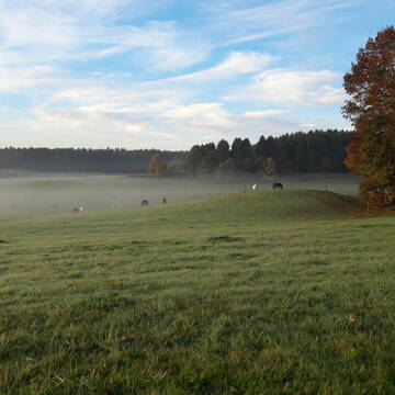
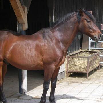
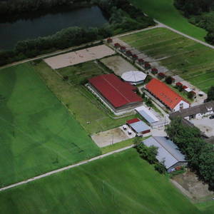
Gut Schmuttermühle - HIT Aktivstall
Neusäß
Gut Schmuttermühle
@Gut-Schmuttermuehle
Krankenbox
Laufband
Allergikerstall
Gnadenbrothof
Bewegungsstall
Laufstall
HIT-Aktivstall
18 weitere...
S
Deprecated: Creation of dynamic property Zend_View_Helper_Ads::$adLink is deprecated in /var/www/stall-frei/htdocs/staging.stall-frei.de/library/Psf/View/Helper/Ads.php on line 108

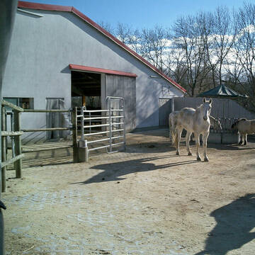
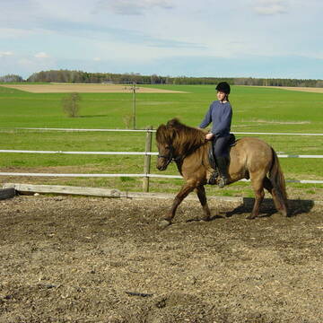
Aktivstall Blaslhof , der Weg lohnt sich!!
Uffing am Staffelsee
Blaslhof Aktivstall
@Blaslhof
Unser HIT Aktivstall ist 2008 mit 5 Stallsternen, der höchstmöglichen Auszeichnung für Artgerechte Pferdehaltung belohnt worde


Bewegungsstall für Allergiker
Bobingen
Martin Gawronski Virthahof GbR
@Virthahof
Fahrstall, Kutschwagen
FN-Mitglied
Vermieten
Hunde willkommen
Krankenbox
Allergikerstall
Hufrehe geeignet
22 weitere...
P+
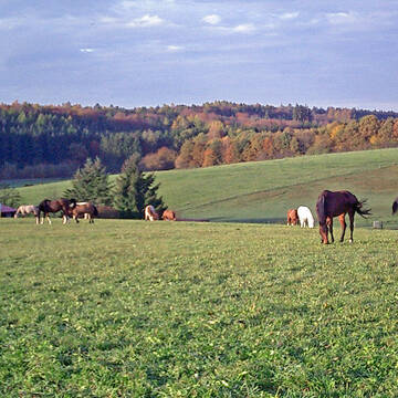
Haldenhof Aystetten, Großzügiger Offenstall
Aystetten
Haldenhof Aystetten
@Mechthild-v-Stetten-Willenberg
Freizeitstall
Geländestrecke
Vermieten
Hunde willkommen
Krankenbox
Bewegungsstall
Laufstall
14 weitere...
ganz aktuell
P+
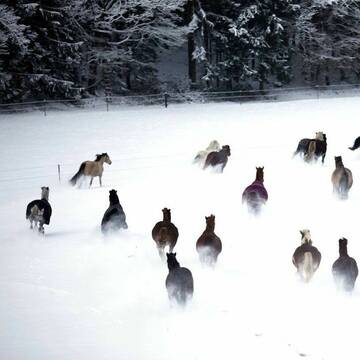
Offenstall mit 5 ha Koppeln in 1a Reitgebiet
Dünzelbach
Offenstall-Lithof
@Offenstall-Lithof
Freizeitstall
Geländestrecke
Vermieten
Krankenbox
Sattelkammer/Sattelschränke
Offenstall
6 weitere...
S
Reitstall Lindermayr (Box,Offenstall)
Friedberg Rederzhausen
Helmut Lindermayr
@HelmutLindermayr
Freizeitstall
Vermieten
Longierzirkel/Roundpen
Paddock
Außenboxen
Innenbox
11 weitere...
P
Reitanlage Nerz
Neusäß
Andreas-Nerz
@Andreas-Nerz
Reitlehrer und -unterricht
Führanlage
Paddock
Außenbox mit Paddock
Außenboxen
Vollpension
9 weitere...
P

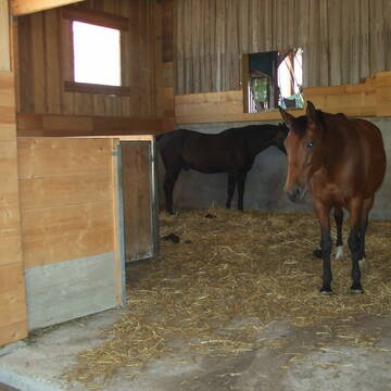
Pferdepension Hit Aktivstall Kürmerhof
Hohenkammer
Kuermerhof
@Kuermerhof
*******JETZT NEU MIT ENTSTAUBTEM BIOHEU*********
*******Demnächst mit einem Abenteuerspielplatz für Pferde ( Extrem Trail/Pa
Reitanlage Schwarz - Freizeitstall Schwarz
Königsbrunn
Andreas-Schwarz
@Andreas-Schwarz
FN-Mitglied
Freizeitstall
Vermieten
Krankenbox
Longierzirkel/Roundpen
Außenbox mit Paddock
15 weitere...
P


Paddocktrail mit Magerheufütterung
Mammendorf
Ruth Wermes
@Pferdegarten-Mammendorf
Freizeitstall
Hunde willkommen
Krankenbox
Allergikerstall
Hufrehe geeignet
Bewegungsstall
Laufstall
11 weitere...
aktuell
S
Leider kein Vorschaubild
Leider kein Vorschaubild
Offenstallplatz für Islandspferd frei
Friedberg
Ursula Stadtmüller
@IslandpferdeLindenau
Freizeitstall
Gangpferdereiten
Laufband
Longierzirkel/Roundpen
Allergikerstall
bedampftes/gewaschenes Heu
Offenstall
18 weitere...
B
Leider kein Vorschaubild
Leider kein Vorschaubild
Reitstall Herrmann Friedberg
Friedberg
Reitstall-Herrmann-in-Friedberg
@Reitstall-Herrmann-in-Friedber...
Führanlage
Paddock
Außenbox mit Paddock
Außenboxen
Vollpension
Einzelne Boxen oder Stallplätze
10 weitere...
aktuell
B
Deprecated: Creation of dynamic property Zend_View::$pageCount is deprecated in /var/www/stall-frei/htdocs/staging.stall-frei.de/library/vendor/shardj/zf1-future/library/Zend/View/Abstract.php on line 308
Deprecated: Creation of dynamic property Zend_View::$itemCountPerPage is deprecated in /var/www/stall-frei/htdocs/staging.stall-frei.de/library/vendor/shardj/zf1-future/library/Zend/View/Abstract.php on line 308
Deprecated: Creation of dynamic property Zend_View::$first is deprecated in /var/www/stall-frei/htdocs/staging.stall-frei.de/library/vendor/shardj/zf1-future/library/Zend/View/Abstract.php on line 308
Deprecated: Creation of dynamic property Zend_View::$current is deprecated in /var/www/stall-frei/htdocs/staging.stall-frei.de/library/vendor/shardj/zf1-future/library/Zend/View/Abstract.php on line 308
Deprecated: Creation of dynamic property Zend_View::$last is deprecated in /var/www/stall-frei/htdocs/staging.stall-frei.de/library/vendor/shardj/zf1-future/library/Zend/View/Abstract.php on line 308
Deprecated: Creation of dynamic property Zend_View::$next is deprecated in /var/www/stall-frei/htdocs/staging.stall-frei.de/library/vendor/shardj/zf1-future/library/Zend/View/Abstract.php on line 308
Deprecated: Creation of dynamic property Zend_View::$pagesInRange is deprecated in /var/www/stall-frei/htdocs/staging.stall-frei.de/library/vendor/shardj/zf1-future/library/Zend/View/Abstract.php on line 308
Deprecated: Creation of dynamic property Zend_View::$firstPageInRange is deprecated in /var/www/stall-frei/htdocs/staging.stall-frei.de/library/vendor/shardj/zf1-future/library/Zend/View/Abstract.php on line 308
Deprecated: Creation of dynamic property Zend_View::$lastPageInRange is deprecated in /var/www/stall-frei/htdocs/staging.stall-frei.de/library/vendor/shardj/zf1-future/library/Zend/View/Abstract.php on line 308
Deprecated: Creation of dynamic property Zend_View::$currentItemCount is deprecated in /var/www/stall-frei/htdocs/staging.stall-frei.de/library/vendor/shardj/zf1-future/library/Zend/View/Abstract.php on line 308
Deprecated: Creation of dynamic property Zend_View::$totalItemCount is deprecated in /var/www/stall-frei/htdocs/staging.stall-frei.de/library/vendor/shardj/zf1-future/library/Zend/View/Abstract.php on line 308
Deprecated: Creation of dynamic property Zend_View::$firstItemNumber is deprecated in /var/www/stall-frei/htdocs/staging.stall-frei.de/library/vendor/shardj/zf1-future/library/Zend/View/Abstract.php on line 308
Deprecated: Creation of dynamic property Zend_View::$lastItemNumber is deprecated in /var/www/stall-frei/htdocs/staging.stall-frei.de/library/vendor/shardj/zf1-future/library/Zend/View/Abstract.php on line 308
Deprecated: Creation of dynamic property Zend_View::$router is deprecated in /var/www/stall-frei/htdocs/staging.stall-frei.de/library/vendor/shardj/zf1-future/library/Zend/View/Abstract.php on line 308
Deprecated: Creation of dynamic property Zend_View::$urlParams is deprecated in /var/www/stall-frei/htdocs/staging.stall-frei.de/library/vendor/shardj/zf1-future/library/Zend/View/Abstract.php on line 308
Deprecated: Creation of dynamic property Zend_View::$showAds is deprecated in /var/www/stall-frei/htdocs/staging.stall-frei.de/library/vendor/shardj/zf1-future/library/Zend/View/Abstract.php on line 308
Deprecated: Creation of dynamic property Zend_View::$objectIds is deprecated in /var/www/stall-frei/htdocs/staging.stall-frei.de/library/vendor/shardj/zf1-future/library/Zend/View/Abstract.php on line 308
Deprecated: Creation of dynamic property Zend_View::$showNavbar is deprecated in /var/www/stall-frei/htdocs/staging.stall-frei.de/library/vendor/shardj/zf1-future/library/Zend/View/Abstract.php on line 308
Deprecated: Creation of dynamic property Zend_View::$showBreadcrumb is deprecated in /var/www/stall-frei/htdocs/staging.stall-frei.de/library/vendor/shardj/zf1-future/library/Zend/View/Abstract.php on line 308
Deprecated: Creation of dynamic property Zend_View::$showFooter is deprecated in /var/www/stall-frei/htdocs/staging.stall-frei.de/library/vendor/shardj/zf1-future/library/Zend/View/Abstract.php on line 308
Deprecated: Creation of dynamic property Zend_View::$showInternalAds is deprecated in /var/www/stall-frei/htdocs/staging.stall-frei.de/library/vendor/shardj/zf1-future/library/Zend/View/Abstract.php on line 308
Deprecated: Creation of dynamic property Zend_View::$blNoContent is deprecated in /var/www/stall-frei/htdocs/staging.stall-frei.de/library/vendor/shardj/zf1-future/library/Zend/View/Abstract.php on line 308
Deprecated: Creation of dynamic property Zend_View::$sMetaDesc is deprecated in /var/www/stall-frei/htdocs/staging.stall-frei.de/library/vendor/shardj/zf1-future/library/Zend/View/Abstract.php on line 308
Deprecated: Creation of dynamic property Zend_View::$useGmaps is deprecated in /var/www/stall-frei/htdocs/staging.stall-frei.de/library/vendor/shardj/zf1-future/library/Zend/View/Abstract.php on line 308
Deprecated: Creation of dynamic property Zend_View::$touches is deprecated in /var/www/stall-frei/htdocs/staging.stall-frei.de/library/vendor/shardj/zf1-future/library/Zend/View/Abstract.php on line 308
Deprecated: Creation of dynamic property Zend_View::$oProject is deprecated in /var/www/stall-frei/htdocs/staging.stall-frei.de/library/vendor/shardj/zf1-future/library/Zend/View/Abstract.php on line 308
Deprecated: Creation of dynamic property Zend_View::$pageHeadline is deprecated in /var/www/stall-frei/htdocs/staging.stall-frei.de/library/vendor/shardj/zf1-future/library/Zend/View/Abstract.php on line 308
Deprecated: Creation of dynamic property Zend_View::$disableLocationField is deprecated in /var/www/stall-frei/htdocs/staging.stall-frei.de/library/vendor/shardj/zf1-future/library/Zend/View/Abstract.php on line 308
Deprecated: Creation of dynamic property Zend_View::$isSearch is deprecated in /var/www/stall-frei/htdocs/staging.stall-frei.de/library/vendor/shardj/zf1-future/library/Zend/View/Abstract.php on line 308
Deprecated: Creation of dynamic property Zend_View::$pageTitle is deprecated in /var/www/stall-frei/htdocs/staging.stall-frei.de/library/vendor/shardj/zf1-future/library/Zend/View/Abstract.php on line 308
Deprecated: Creation of dynamic property Psf_Form_Element_Text::$class is deprecated in /var/www/stall-frei/htdocs/staging.stall-frei.de/library/vendor/shardj/zf1-future/library/Zend/Form/Element.php on line 874
Deprecated: Creation of dynamic property Psf_Form_Element_Text::$size is deprecated in /var/www/stall-frei/htdocs/staging.stall-frei.de/library/vendor/shardj/zf1-future/library/Zend/Form/Element.php on line 874
Deprecated: Creation of dynamic property Psf_Form_Element_Text::$placeholder is deprecated in /var/www/stall-frei/htdocs/staging.stall-frei.de/library/vendor/shardj/zf1-future/library/Zend/Form/Element.php on line 874
Deprecated: Creation of dynamic property Psf_Form_Element_Hidden::$class is deprecated in /var/www/stall-frei/htdocs/staging.stall-frei.de/library/vendor/shardj/zf1-future/library/Zend/Form/Element.php on line 874
Deprecated: Creation of dynamic property Psf_Form_Element_Hidden::$class is deprecated in /var/www/stall-frei/htdocs/staging.stall-frei.de/library/vendor/shardj/zf1-future/library/Zend/Form/Element.php on line 874
Deprecated: Creation of dynamic property Psf_Form_Element_Hidden::$class is deprecated in /var/www/stall-frei/htdocs/staging.stall-frei.de/library/vendor/shardj/zf1-future/library/Zend/Form/Element.php on line 874
Deprecated: Creation of dynamic property Psf_Form_Element_Hidden::$class is deprecated in /var/www/stall-frei/htdocs/staging.stall-frei.de/library/vendor/shardj/zf1-future/library/Zend/Form/Element.php on line 874
Deprecated: Creation of dynamic property Psf_Form_Element_Select::$class is deprecated in /var/www/stall-frei/htdocs/staging.stall-frei.de/library/vendor/shardj/zf1-future/library/Zend/Form/Element.php on line 874
Deprecated: Creation of dynamic property Psf_Form_Element_Select::$class is deprecated in /var/www/stall-frei/htdocs/staging.stall-frei.de/library/vendor/shardj/zf1-future/library/Zend/Form/Element.php on line 874
Deprecated: Creation of dynamic property Psf_Form_Element_Select::$class is deprecated in /var/www/stall-frei/htdocs/staging.stall-frei.de/library/vendor/shardj/zf1-future/library/Zend/Form/Element.php on line 874
Deprecated: Creation of dynamic property Psf_Form_Element_Select::$class is deprecated in /var/www/stall-frei/htdocs/staging.stall-frei.de/library/vendor/shardj/zf1-future/library/Zend/Form/Element.php on line 874
Deprecated: Creation of dynamic property Psf_Form_Element_Text::$class is deprecated in /var/www/stall-frei/htdocs/staging.stall-frei.de/library/vendor/shardj/zf1-future/library/Zend/Form/Element.php on line 874
Deprecated: Creation of dynamic property Psf_Form_Element_Checkbox::$label is deprecated in /var/www/stall-frei/htdocs/staging.stall-frei.de/library/vendor/shardj/zf1-future/library/Zend/Form/Element.php on line 874
Deprecated: Creation of dynamic property Zend_View::$sort is deprecated in /var/www/stall-frei/htdocs/staging.stall-frei.de/library/vendor/shardj/zf1-future/library/Zend/View/Abstract.php on line 308
Deprecated: Creation of dynamic property Zend_View::$searchLocation is deprecated in /var/www/stall-frei/htdocs/staging.stall-frei.de/library/vendor/shardj/zf1-future/library/Zend/View/Abstract.php on line 308
Deprecated: Creation of dynamic property Zend_View::$locationHint is deprecated in /var/www/stall-frei/htdocs/staging.stall-frei.de/library/vendor/shardj/zf1-future/library/Zend/View/Abstract.php on line 308
Psf_GeoCoder_Abstract::getLocation: Hochfeld Get Location CachedOrLive
Psf_GeoCoder_Abstract::getCachedOrLive: Hochfeld
Psf_GeoCoder_OpenCageData::makeApiRequest: response:
Array
(
[documentation] => https://opencagedata.com/api
[licenses] => Array
(
[0] => Array
(
[name] => see attribution guide
[url] => https://opencagedata.com/credits
)
)
[results] => Array
(
[0] => Array
(
[bounds] => Array
(
[northeast] => Array
(
[lat] => 48.3601184
[lng] => 10.9117113
)
[southwest] => Array
(
[lat] => 48.3392976
[lng] => 10.8894902
)
)
[components] => Array
(
[ISO_3166-1_alpha-2] => DE
[ISO_3166-1_alpha-3] => DEU
[ISO_3166-2] => Array
(
[0] => DE-BY
)
[_category] => place
[_normalized_city] => Augsburg
[_type] => neighbourhood
[city] => Augsburg
[continent] => Europe
[country] => Deutschland
[country_code] => de
[political_union] => European Union
[postcode] => 86159
[state] => Bayern
[state_code] => BY
[suburb] => Hochfeld
)
[confidence] => 7
[formatted] => 86159 Augsburg, Deutschland
[geometry] => Array
(
[lat] => 48.3469522
[lng] => 10.899245
)
)
[1] => Array
(
[bounds] => Array
(
[northeast] => Array
(
[lat] => 50.0748028
[lng] => 10.259588
)
[southwest] => Array
(
[lat] => 50.0348028
[lng] => 10.219588
)
)
[components] => Array
(
[ISO_3166-1_alpha-2] => DE
[ISO_3166-1_alpha-3] => DEU
[ISO_3166-2] => Array
(
[0] => DE-BY
)
[_category] => place
[_normalized_city] => Schweinfurt
[_type] => neighbourhood
[continent] => Europe
[country] => Deutschland
[country_code] => de
[political_union] => European Union
[postcode] => 97422
[state] => Bayern
[state_code] => BY
[suburb] => Hochfeld
[town] => Schweinfurt
)
[confidence] => 7
[formatted] => 97422 Schweinfurt, Deutschland
[geometry] => Array
(
[lat] => 50.0548028
[lng] => 10.239588
)
)
[2] => Array
(
[bounds] => Array
(
[northeast] => Array
(
[lat] => 51.4301749
[lng] => 6.7718532
)
[southwest] => Array
(
[lat] => 51.4077215
[lng] => 6.7248824
)
)
[components] => Array
(
[ISO_3166-1_alpha-2] => DE
[ISO_3166-1_alpha-3] => DEU
[ISO_3166-2] => Array
(
[0] => DE-NW
)
[_category] => place
[_normalized_city] => Duisburg
[_type] => neighbourhood
[city] => Duisburg
[city_district] => Duisburg-Mitte
[continent] => Europe
[country] => Deutschland
[country_code] => de
[political_union] => European Union
[postcode] => 47053
[state] => Nordrhein-Westfalen
[state_code] => NW
[suburb] => Hochfeld
)
[confidence] => 7
[formatted] => 47053 Duisburg, Deutschland
[geometry] => Array
(
[lat] => 51.4191438
[lng] => 6.7550194
)
)
[3] => Array
(
[bounds] => Array
(
[northeast] => Array
(
[lat] => 54.3086274
[lng] => 9.7112857
)
[southwest] => Array
(
[lat] => 54.2992143
[lng] => 9.6995043
)
)
[components] => Array
(
[ISO_3166-1_alpha-2] => DE
[ISO_3166-1_alpha-3] => DEU
[ISO_3166-2] => Array
(
[0] => DE-SH
)
[_category] => place
[_normalized_city] => Rendsburg
[_type] => neighbourhood
[city_district] => Rendsburg-Ost
[continent] => Europe
[country] => Deutschland
[country_code] => de
[county] => Kreis Rendsburg-Eckernförde
[political_union] => European Union
[state] => Schleswig-Holstein
[state_code] => SH
[suburb] => Hochfeld
[town] => Rendsburg
)
[confidence] => 9
[formatted] => Hochfeld, Rendsburg, Schleswig-Holstein, Deutschland
[geometry] => Array
(
[lat] => 54.3050822
[lng] => 9.7056514
)
)
[4] => Array
(
[bounds] => Array
(
[northeast] => Array
(
[lat] => 48.8230704
[lng] => 10.8939851
)
[southwest] => Array
(
[lat] => 48.7830704
[lng] => 10.8539851
)
)
[components] => Array
(
[ISO_3166-1_alpha-2] => DE
[ISO_3166-1_alpha-3] => DEU
[ISO_3166-2] => Array
(
[0] => DE-BY
)
[_category] => place
[_normalized_city] => Daiting
[_type] => village
[city] => Daiting
[continent] => Europe
[country] => Deutschland
[country_code] => de
[county] => Landkreis Donau-Ries
[municipality] => Monheim
[political_union] => European Union
[postcode] => 86653
[state] => Bayern
[state_code] => BY
[village] => Hochfeld
)
[confidence] => 7
[formatted] => 86653 Hochfeld, Deutschland
[geometry] => Array
(
[lat] => 48.8030704
[lng] => 10.8739851
)
)
[5] => Array
(
[bounds] => Array
(
[northeast] => Array
(
[lat] => 48.9208279
[lng] => 13.4021317
)
[southwest] => Array
(
[lat] => 48.8808279
[lng] => 13.3621317
)
)
[components] => Array
(
[ISO_3166-1_alpha-2] => DE
[ISO_3166-1_alpha-3] => DEU
[ISO_3166-2] => Array
(
[0] => DE-BY
)
[_category] => place
[_normalized_city] => Sankt Oswald-Riedlhütte
[_type] => hamlet
[city] => Sankt Oswald-Riedlhütte
[continent] => Europe
[country] => Deutschland
[country_code] => de
[county] => Landkreis Freyung-Grafenau
[hamlet] => Hochfeld
[political_union] => European Union
[postcode] => 94566
[state] => Bayern
[state_code] => BY
)
[confidence] => 7
[formatted] => Hochfeld, 94566 Sankt Oswald-Riedlhütte, Deutschland
[geometry] => Array
(
[lat] => 48.9008279
[lng] => 13.3821317
)
)
[6] => Array
(
[bounds] => Array
(
[northeast] => Array
(
[lat] => 54.2885451
[lng] => 9.1760478
)
[southwest] => Array
(
[lat] => 54.2485451
[lng] => 9.1360478
)
)
[components] => Array
(
[ISO_3166-1_alpha-2] => DE
[ISO_3166-1_alpha-3] => DEU
[ISO_3166-2] => Array
(
[0] => DE-SH
)
[_category] => place
[_normalized_city] => Fedderingen
[_type] => hamlet
[continent] => Europe
[country] => Deutschland
[country_code] => de
[county] => Kreis Dithmarschen
[hamlet] => Hochfeld
[municipality] => Eider
[political_union] => European Union
[postcode] => 25779
[state] => Schleswig-Holstein
[state_code] => SH
[village] => Fedderingen
)
[confidence] => 7
[formatted] => Hochfeld, 25779 Fedderingen, Deutschland
[geometry] => Array
(
[lat] => 54.2685451
[lng] => 9.1560478
)
)
[7] => Array
(
[bounds] => Array
(
[northeast] => Array
(
[lat] => 48.9319134
[lng] => 13.1974536
)
[southwest] => Array
(
[lat] => 48.8919134
[lng] => 13.1574536
)
)
[components] => Array
(
[ISO_3166-1_alpha-2] => DE
[ISO_3166-1_alpha-3] => DEU
[ISO_3166-2] => Array
(
[0] => DE-BY
)
[_category] => place
[_normalized_city] => Kirchberg i.Wald
[_type] => hamlet
[city] => Kirchberg i.Wald
[continent] => Europe
[country] => Deutschland
[country_code] => de
[county] => Landkreis Regen
[hamlet] => Hochfeld
[political_union] => European Union
[postcode] => 94259
[state] => Bayern
[state_code] => BY
)
[confidence] => 7
[formatted] => Hochfeld, 94259 Kirchberg i.Wald, Deutschland
[geometry] => Array
(
[lat] => 48.9119134
[lng] => 13.1774536
)
)
[8] => Array
(
[bounds] => Array
(
[northeast] => Array
(
[lat] => 54.2209347
[lng] => 9.0858426
)
[southwest] => Array
(
[lat] => 54.1809347
[lng] => 9.0458426
)
)
[components] => Array
(
[ISO_3166-1_alpha-2] => DE
[ISO_3166-1_alpha-3] => DEU
[ISO_3166-2] => Array
(
[0] => DE-SH
)
[_category] => place
[_normalized_city] => Heide
[_type] => hamlet
[continent] => Europe
[country] => Deutschland
[country_code] => de
[county] => Kreis Dithmarschen
[hamlet] => Hochfeld
[municipality] => Stelle-Wittenwurth
[political_union] => European Union
[postcode] => 25746
[state] => Schleswig-Holstein
[state_code] => SH
[town] => Heide
)
[confidence] => 7
[formatted] => Hochfeld, 25746 Heide, Deutschland
[geometry] => Array
(
[lat] => 54.2009347
[lng] => 9.0658426
)
)
[9] => Array
(
[bounds] => Array
(
[northeast] => Array
(
[lat] => 49.4738025
[lng] => 8.4170066
)
[southwest] => Array
(
[lat] => 49.4538025
[lng] => 8.3970066
)
)
[components] => Array
(
[ISO_3166-1_alpha-2] => DE
[ISO_3166-1_alpha-3] => DEU
[ISO_3166-2] => Array
(
[0] => DE-RP
)
[_category] => place
[_normalized_city] => Ludwigshafen am Rhein
[_type] => neighbourhood
[city] => Ludwigshafen am Rhein
[continent] => Europe
[country] => Deutschland
[country_code] => de
[political_union] => European Union
[postcode] => 67067
[quarter] => Hochfeld
[state] => Rheinland-Pfalz
[state_code] => RP
[suburb] => Ludwigshafen-Gartenstadt
)
[confidence] => 8
[formatted] => 67067 Ludwigshafen am Rhein, Deutschland
[geometry] => Array
(
[lat] => 49.4638025
[lng] => 8.4070066
)
)
)
[status] => Array
(
[code] => 200
[message] => OK
)
[stay_informed] => Array
(
[blog] => https://blog.opencagedata.com
[mastodon] => https://en.osm.town/@opencage
)
[thanks] => For using an OpenCage API
[timestamp] => Array
(
[created_http] => Fri, 06 Feb 2026 22:47:11 GMT
[created_unix] => 1770418031
)
[total_results] => 10
)
Psf_GeoCoder_Abstract::convertLocationResult
{"documentation":"https:\/\/opencagedata.com\/api","licenses":[{"name":"see attribution guide","url":"https:\/\/opencagedata.com\/credits"}],"results":[{"bounds":{"northeast":{"lat":48.3601184,"lng":10.9117113},"southwest":{"lat":48.3392976,"lng":10.8894902}},"components":{"ISO_3166-1_alpha-2":"DE","ISO_3166-1_alpha-3":"DEU","ISO_3166-2":["DE-BY"],"_category":"place","_normalized_city":"Augsburg","_type":"neighbourhood","city":"Augsburg","continent":"Europe","country":"Deutschland","country_code":"de","political_union":"European Union","postcode":"86159","state":"Bayern","state_code":"BY","suburb":"Hochfeld"},"confidence":7,"formatted":"86159 Augsburg, Deutschland","geometry":{"lat":48.3469522,"lng":10.899245}},{"bounds":{"northeast":{"lat":50.0748028,"lng":10.259588},"southwest":{"lat":50.0348028,"lng":10.219588}},"components":{"ISO_3166-1_alpha-2":"DE","ISO_3166-1_alpha-3":"DEU","ISO_3166-2":["DE-BY"],"_category":"place","_normalized_city":"Schweinfurt","_type":"neighbourhood","continent":"Europe","country":"Deutschland","country_code":"de","political_union":"European Union","postcode":"97422","state":"Bayern","state_code":"BY","suburb":"Hochfeld","town":"Schweinfurt"},"confidence":7,"formatted":"97422 Schweinfurt, Deutschland","geometry":{"lat":50.0548028,"lng":10.239588}},{"bounds":{"northeast":{"lat":51.4301749,"lng":6.7718532},"southwest":{"lat":51.4077215,"lng":6.7248824}},"components":{"ISO_3166-1_alpha-2":"DE","ISO_3166-1_alpha-3":"DEU","ISO_3166-2":["DE-NW"],"_category":"place","_normalized_city":"Duisburg","_type":"neighbourhood","city":"Duisburg","city_district":"Duisburg-Mitte","continent":"Europe","country":"Deutschland","country_code":"de","political_union":"European Union","postcode":"47053","state":"Nordrhein-Westfalen","state_code":"NW","suburb":"Hochfeld"},"confidence":7,"formatted":"47053 Duisburg, Deutschland","geometry":{"lat":51.4191438,"lng":6.7550194}},{"bounds":{"northeast":{"lat":54.3086274,"lng":9.7112857},"southwest":{"lat":54.2992143,"lng":9.6995043}},"components":{"ISO_3166-1_alpha-2":"DE","ISO_3166-1_alpha-3":"DEU","ISO_3166-2":["DE-SH"],"_category":"place","_normalized_city":"Rendsburg","_type":"neighbourhood","city_district":"Rendsburg-Ost","continent":"Europe","country":"Deutschland","country_code":"de","county":"Kreis Rendsburg-Eckernf\u00f6rde","political_union":"European Union","state":"Schleswig-Holstein","state_code":"SH","suburb":"Hochfeld","town":"Rendsburg"},"confidence":9,"formatted":"Hochfeld, Rendsburg, Schleswig-Holstein, Deutschland","geometry":{"lat":54.3050822,"lng":9.7056514}},{"bounds":{"northeast":{"lat":48.8230704,"lng":10.8939851},"southwest":{"lat":48.7830704,"lng":10.8539851}},"components":{"ISO_3166-1_alpha-2":"DE","ISO_3166-1_alpha-3":"DEU","ISO_3166-2":["DE-BY"],"_category":"place","_normalized_city":"Daiting","_type":"village","city":"Daiting","continent":"Europe","country":"Deutschland","country_code":"de","county":"Landkreis Donau-Ries","municipality":"Monheim","political_union":"European Union","postcode":"86653","state":"Bayern","state_code":"BY","village":"Hochfeld"},"confidence":7,"formatted":"86653 Hochfeld, Deutschland","geometry":{"lat":48.8030704,"lng":10.8739851}},{"bounds":{"northeast":{"lat":48.9208279,"lng":13.4021317},"southwest":{"lat":48.8808279,"lng":13.3621317}},"components":{"ISO_3166-1_alpha-2":"DE","ISO_3166-1_alpha-3":"DEU","ISO_3166-2":["DE-BY"],"_category":"place","_normalized_city":"Sankt Oswald-Riedlh\u00fctte","_type":"hamlet","city":"Sankt Oswald-Riedlh\u00fctte","continent":"Europe","country":"Deutschland","country_code":"de","county":"Landkreis Freyung-Grafenau","hamlet":"Hochfeld","political_union":"European Union","postcode":"94566","state":"Bayern","state_code":"BY"},"confidence":7,"formatted":"Hochfeld, 94566 Sankt Oswald-Riedlh\u00fctte, Deutschland","geometry":{"lat":48.9008279,"lng":13.3821317}},{"bounds":{"northeast":{"lat":54.2885451,"lng":9.1760478},"southwest":{"lat":54.2485451,"lng":9.1360478}},"components":{"ISO_3166-1_alpha-2":"DE","ISO_3166-1_alpha-3":"DEU","ISO_3166-2":["DE-SH"],"_category":"place","_normalized_city":"Fedderingen","_type":"hamlet","continent":"Europe","country":"Deutschland","country_code":"de","county":"Kreis Dithmarschen","hamlet":"Hochfeld","municipality":"Eider","political_union":"European Union","postcode":"25779","state":"Schleswig-Holstein","state_code":"SH","village":"Fedderingen"},"confidence":7,"formatted":"Hochfeld, 25779 Fedderingen, Deutschland","geometry":{"lat":54.2685451,"lng":9.1560478}},{"bounds":{"northeast":{"lat":48.9319134,"lng":13.1974536},"southwest":{"lat":48.8919134,"lng":13.1574536}},"components":{"ISO_3166-1_alpha-2":"DE","ISO_3166-1_alpha-3":"DEU","ISO_3166-2":["DE-BY"],"_category":"place","_normalized_city":"Kirchberg i.Wald","_type":"hamlet","city":"Kirchberg i.Wald","continent":"Europe","country":"Deutschland","country_code":"de","county":"Landkreis Regen","hamlet":"Hochfeld","political_union":"European Union","postcode":"94259","state":"Bayern","state_code":"BY"},"confidence":7,"formatted":"Hochfeld, 94259 Kirchberg i.Wald, Deutschland","geometry":{"lat":48.9119134,"lng":13.1774536}},{"bounds":{"northeast":{"lat":54.2209347,"lng":9.0858426},"southwest":{"lat":54.1809347,"lng":9.0458426}},"components":{"ISO_3166-1_alpha-2":"DE","ISO_3166-1_alpha-3":"DEU","ISO_3166-2":["DE-SH"],"_category":"place","_normalized_city":"Heide","_type":"hamlet","continent":"Europe","country":"Deutschland","country_code":"de","county":"Kreis Dithmarschen","hamlet":"Hochfeld","municipality":"Stelle-Wittenwurth","political_union":"European Union","postcode":"25746","state":"Schleswig-Holstein","state_code":"SH","town":"Heide"},"confidence":7,"formatted":"Hochfeld, 25746 Heide, Deutschland","geometry":{"lat":54.2009347,"lng":9.0658426}},{"bounds":{"northeast":{"lat":49.4738025,"lng":8.4170066},"southwest":{"lat":49.4538025,"lng":8.3970066}},"components":{"ISO_3166-1_alpha-2":"DE","ISO_3166-1_alpha-3":"DEU","ISO_3166-2":["DE-RP"],"_category":"place","_normalized_city":"Ludwigshafen am Rhein","_type":"neighbourhood","city":"Ludwigshafen am Rhein","continent":"Europe","country":"Deutschland","country_code":"de","political_union":"European Union","postcode":"67067","quarter":"Hochfeld","state":"Rheinland-Pfalz","state_code":"RP","suburb":"Ludwigshafen-Gartenstadt"},"confidence":8,"formatted":"67067 Ludwigshafen am Rhein, Deutschland","geometry":{"lat":49.4638025,"lng":8.4070066}}],"status":{"code":200,"message":"OK"},"stay_informed":{"blog":"https:\/\/blog.opencagedata.com","mastodon":"https:\/\/en.osm.town\/@opencage"},"thanks":"For using an OpenCage API","timestamp":{"created_http":"Fri, 06 Feb 2026 22:47:11 GMT","created_unix":1770418031},"total_results":10}Array
(
[0] => stdClass Object
(
[bounds] => stdClass Object
(
[northeast] => stdClass Object
(
[lat] => 48.3601184
[lng] => 10.9117113
)
[southwest] => stdClass Object
(
[lat] => 48.3392976
[lng] => 10.8894902
)
)
[components] => stdClass Object
(
[ISO_3166-1_alpha-2] => DE
[ISO_3166-1_alpha-3] => DEU
[ISO_3166-2] => Array
(
[0] => DE-BY
)
[_category] => place
[_normalized_city] => Augsburg
[_type] => neighbourhood
[city] => Augsburg
[continent] => Europe
[country] => Deutschland
[country_code] => de
[political_union] => European Union
[postcode] => 86159
[state] => Bayern
[state_code] => BY
[suburb] => Hochfeld
)
[confidence] => 7
[formatted] => 86159 Augsburg, Deutschland
[geometry] => stdClass Object
(
[lat] => 48.3469522
[lng] => 10.899245
)
)
[1] => stdClass Object
(
[bounds] => stdClass Object
(
[northeast] => stdClass Object
(
[lat] => 50.0748028
[lng] => 10.259588
)
[southwest] => stdClass Object
(
[lat] => 50.0348028
[lng] => 10.219588
)
)
[components] => stdClass Object
(
[ISO_3166-1_alpha-2] => DE
[ISO_3166-1_alpha-3] => DEU
[ISO_3166-2] => Array
(
[0] => DE-BY
)
[_category] => place
[_normalized_city] => Schweinfurt
[_type] => neighbourhood
[continent] => Europe
[country] => Deutschland
[country_code] => de
[political_union] => European Union
[postcode] => 97422
[state] => Bayern
[state_code] => BY
[suburb] => Hochfeld
[town] => Schweinfurt
)
[confidence] => 7
[formatted] => 97422 Schweinfurt, Deutschland
[geometry] => stdClass Object
(
[lat] => 50.0548028
[lng] => 10.239588
)
)
[2] => stdClass Object
(
[bounds] => stdClass Object
(
[northeast] => stdClass Object
(
[lat] => 51.4301749
[lng] => 6.7718532
)
[southwest] => stdClass Object
(
[lat] => 51.4077215
[lng] => 6.7248824
)
)
[components] => stdClass Object
(
[ISO_3166-1_alpha-2] => DE
[ISO_3166-1_alpha-3] => DEU
[ISO_3166-2] => Array
(
[0] => DE-NW
)
[_category] => place
[_normalized_city] => Duisburg
[_type] => neighbourhood
[city] => Duisburg
[city_district] => Duisburg-Mitte
[continent] => Europe
[country] => Deutschland
[country_code] => de
[political_union] => European Union
[postcode] => 47053
[state] => Nordrhein-Westfalen
[state_code] => NW
[suburb] => Hochfeld
)
[confidence] => 7
[formatted] => 47053 Duisburg, Deutschland
[geometry] => stdClass Object
(
[lat] => 51.4191438
[lng] => 6.7550194
)
)
[3] => stdClass Object
(
[bounds] => stdClass Object
(
[northeast] => stdClass Object
(
[lat] => 54.3086274
[lng] => 9.7112857
)
[southwest] => stdClass Object
(
[lat] => 54.2992143
[lng] => 9.6995043
)
)
[components] => stdClass Object
(
[ISO_3166-1_alpha-2] => DE
[ISO_3166-1_alpha-3] => DEU
[ISO_3166-2] => Array
(
[0] => DE-SH
)
[_category] => place
[_normalized_city] => Rendsburg
[_type] => neighbourhood
[city_district] => Rendsburg-Ost
[continent] => Europe
[country] => Deutschland
[country_code] => de
[county] => Kreis Rendsburg-Eckernförde
[political_union] => European Union
[state] => Schleswig-Holstein
[state_code] => SH
[suburb] => Hochfeld
[town] => Rendsburg
)
[confidence] => 9
[formatted] => Hochfeld, Rendsburg, Schleswig-Holstein, Deutschland
[geometry] => stdClass Object
(
[lat] => 54.3050822
[lng] => 9.7056514
)
)
[4] => stdClass Object
(
[bounds] => stdClass Object
(
[northeast] => stdClass Object
(
[lat] => 48.8230704
[lng] => 10.8939851
)
[southwest] => stdClass Object
(
[lat] => 48.7830704
[lng] => 10.8539851
)
)
[components] => stdClass Object
(
[ISO_3166-1_alpha-2] => DE
[ISO_3166-1_alpha-3] => DEU
[ISO_3166-2] => Array
(
[0] => DE-BY
)
[_category] => place
[_normalized_city] => Daiting
[_type] => village
[city] => Daiting
[continent] => Europe
[country] => Deutschland
[country_code] => de
[county] => Landkreis Donau-Ries
[municipality] => Monheim
[political_union] => European Union
[postcode] => 86653
[state] => Bayern
[state_code] => BY
[village] => Hochfeld
)
[confidence] => 7
[formatted] => 86653 Hochfeld, Deutschland
[geometry] => stdClass Object
(
[lat] => 48.8030704
[lng] => 10.8739851
)
)
[5] => stdClass Object
(
[bounds] => stdClass Object
(
[northeast] => stdClass Object
(
[lat] => 48.9208279
[lng] => 13.4021317
)
[southwest] => stdClass Object
(
[lat] => 48.8808279
[lng] => 13.3621317
)
)
[components] => stdClass Object
(
[ISO_3166-1_alpha-2] => DE
[ISO_3166-1_alpha-3] => DEU
[ISO_3166-2] => Array
(
[0] => DE-BY
)
[_category] => place
[_normalized_city] => Sankt Oswald-Riedlhütte
[_type] => hamlet
[city] => Sankt Oswald-Riedlhütte
[continent] => Europe
[country] => Deutschland
[country_code] => de
[county] => Landkreis Freyung-Grafenau
[hamlet] => Hochfeld
[political_union] => European Union
[postcode] => 94566
[state] => Bayern
[state_code] => BY
)
[confidence] => 7
[formatted] => Hochfeld, 94566 Sankt Oswald-Riedlhütte, Deutschland
[geometry] => stdClass Object
(
[lat] => 48.9008279
[lng] => 13.3821317
)
)
[6] => stdClass Object
(
[bounds] => stdClass Object
(
[northeast] => stdClass Object
(
[lat] => 54.2885451
[lng] => 9.1760478
)
[southwest] => stdClass Object
(
[lat] => 54.2485451
[lng] => 9.1360478
)
)
[components] => stdClass Object
(
[ISO_3166-1_alpha-2] => DE
[ISO_3166-1_alpha-3] => DEU
[ISO_3166-2] => Array
(
[0] => DE-SH
)
[_category] => place
[_normalized_city] => Fedderingen
[_type] => hamlet
[continent] => Europe
[country] => Deutschland
[country_code] => de
[county] => Kreis Dithmarschen
[hamlet] => Hochfeld
[municipality] => Eider
[political_union] => European Union
[postcode] => 25779
[state] => Schleswig-Holstein
[state_code] => SH
[village] => Fedderingen
)
[confidence] => 7
[formatted] => Hochfeld, 25779 Fedderingen, Deutschland
[geometry] => stdClass Object
(
[lat] => 54.2685451
[lng] => 9.1560478
)
)
[7] => stdClass Object
(
[bounds] => stdClass Object
(
[northeast] => stdClass Object
(
[lat] => 48.9319134
[lng] => 13.1974536
)
[southwest] => stdClass Object
(
[lat] => 48.8919134
[lng] => 13.1574536
)
)
[components] => stdClass Object
(
[ISO_3166-1_alpha-2] => DE
[ISO_3166-1_alpha-3] => DEU
[ISO_3166-2] => Array
(
[0] => DE-BY
)
[_category] => place
[_normalized_city] => Kirchberg i.Wald
[_type] => hamlet
[city] => Kirchberg i.Wald
[continent] => Europe
[country] => Deutschland
[country_code] => de
[county] => Landkreis Regen
[hamlet] => Hochfeld
[political_union] => European Union
[postcode] => 94259
[state] => Bayern
[state_code] => BY
)
[confidence] => 7
[formatted] => Hochfeld, 94259 Kirchberg i.Wald, Deutschland
[geometry] => stdClass Object
(
[lat] => 48.9119134
[lng] => 13.1774536
)
)
[8] => stdClass Object
(
[bounds] => stdClass Object
(
[northeast] => stdClass Object
(
[lat] => 54.2209347
[lng] => 9.0858426
)
[southwest] => stdClass Object
(
[lat] => 54.1809347
[lng] => 9.0458426
)
)
[components] => stdClass Object
(
[ISO_3166-1_alpha-2] => DE
[ISO_3166-1_alpha-3] => DEU
[ISO_3166-2] => Array
(
[0] => DE-SH
)
[_category] => place
[_normalized_city] => Heide
[_type] => hamlet
[continent] => Europe
[country] => Deutschland
[country_code] => de
[county] => Kreis Dithmarschen
[hamlet] => Hochfeld
[municipality] => Stelle-Wittenwurth
[political_union] => European Union
[postcode] => 25746
[state] => Schleswig-Holstein
[state_code] => SH
[town] => Heide
)
[confidence] => 7
[formatted] => Hochfeld, 25746 Heide, Deutschland
[geometry] => stdClass Object
(
[lat] => 54.2009347
[lng] => 9.0658426
)
)
[9] => stdClass Object
(
[bounds] => stdClass Object
(
[northeast] => stdClass Object
(
[lat] => 49.4738025
[lng] => 8.4170066
)
[southwest] => stdClass Object
(
[lat] => 49.4538025
[lng] => 8.3970066
)
)
[components] => stdClass Object
(
[ISO_3166-1_alpha-2] => DE
[ISO_3166-1_alpha-3] => DEU
[ISO_3166-2] => Array
(
[0] => DE-RP
)
[_category] => place
[_normalized_city] => Ludwigshafen am Rhein
[_type] => neighbourhood
[city] => Ludwigshafen am Rhein
[continent] => Europe
[country] => Deutschland
[country_code] => de
[political_union] => European Union
[postcode] => 67067
[quarter] => Hochfeld
[state] => Rheinland-Pfalz
[state_code] => RP
[suburb] => Ludwigshafen-Gartenstadt
)
[confidence] => 8
[formatted] => 67067 Ludwigshafen am Rhein, Deutschland
[geometry] => stdClass Object
(
[lat] => 49.4638025
[lng] => 8.4070066
)
)
)
Psf_GeoCoder_OpenCageData::getKeyMap: 0
stdClass Object
(
    [bounds] => stdClass Object
        (
            [northeast] => stdClass Object
                (
                    [lat] => 48.3601184
                    [lng] => 10.9117113
                )

            [southwest] => stdClass Object
                (
                    [lat] => 48.3392976
                    [lng] => 10.8894902
                )

        )

    [components] => stdClass Object
        (
            [ISO_3166-1_alpha-2] => DE
            [ISO_3166-1_alpha-3] => DEU
            [ISO_3166-2] => Array
                (
                    [0] => DE-BY
                )

            [_category] => place
            [_normalized_city] => Augsburg
            [_type] => neighbourhood
            [city] => Augsburg
            [continent] => Europe
            [country] => Deutschland
            [country_code] => de
            [political_union] => European Union
            [postcode] => 86159
            [state] => Bayern
            [state_code] => BY
            [suburb] => Hochfeld
        )

    [confidence] => 7
    [formatted] => 86159 Augsburg, Deutschland
    [geometry] => stdClass Object
        (
            [lat] => 48.3469522
            [lng] => 10.899245
        )

)
Psf_GeoCoder_OpenCageData::getCounty: Augsburg
Psf_GeoCoder_OpenCageData::addMissingData REFETCH!
Array
(
    [address] => 86159 Augsburg, Deutschland
    [type] => neighbourhood
    [street] =>
    [city] => Hochfeld
    [county] => Augsburg
    [state] => Bayern
    [zip] => 86159
    [country] => Deutschland
    [suburb] => Hochfeld
    [countrycode] => de
    [latitude] => 48.3469522
    [longitude] => 10.899245
    [accuracy] => 1
    [confidence] => 7
    [bounds] => stdClass Object
        (
            [northeast] => stdClass Object
                (
                    [lat] => 48.3601184
                    [lng] => 10.9117113
                )

            [southwest] => stdClass Object
                (
                    [lat] => 48.3392976
                    [lng] => 10.8894902
                )

        )

)
reformat!
Array
(
    [address] => 86159 Hochfeld
    [type] => neighbourhood
    [street] =>
    [city] => Hochfeld
    [county] => Augsburg
    [state] => Bayern
    [zip] => 86159
    [country] => Deutschland
    [suburb] => Hochfeld
    [countrycode] => de
    [latitude] => 48.3469522
    [longitude] => 10.899245
    [accuracy] => 1
    [confidence] => 7
    [bounds] => stdClass Object
        (
            [northeast] => stdClass Object
                (
                    [lat] => 48.3601184
                    [lng] => 10.9117113
                )

            [southwest] => stdClass Object
                (
                    [lat] => 48.3392976
                    [lng] => 10.8894902
                )

        )

    [place] => 86159 Hochfeld, Bayern
    [hash] => 6b795d6a1e29343657d75f8e1350ab27
)
Psf_GeoCoder_OpenCageData::getKeyMap: 1
stdClass Object
(
    [bounds] => stdClass Object
        (
            [northeast] => stdClass Object
                (
                    [lat] => 50.0748028
                    [lng] => 10.259588
                )

            [southwest] => stdClass Object
                (
                    [lat] => 50.0348028
                    [lng] => 10.219588
                )

        )

    [components] => stdClass Object
        (
            [ISO_3166-1_alpha-2] => DE
            [ISO_3166-1_alpha-3] => DEU
            [ISO_3166-2] => Array
                (
                    [0] => DE-BY
                )

            [_category] => place
            [_normalized_city] => Schweinfurt
            [_type] => neighbourhood
            [continent] => Europe
            [country] => Deutschland
            [country_code] => de
            [political_union] => European Union
            [postcode] => 97422
            [state] => Bayern
            [state_code] => BY
            [suburb] => Hochfeld
            [town] => Schweinfurt
        )

    [confidence] => 7
    [formatted] => 97422 Schweinfurt, Deutschland
    [geometry] => stdClass Object
        (
            [lat] => 50.0548028
            [lng] => 10.239588
        )

)
Psf_GeoCoder_OpenCageData::getCounty:
Psf_GeoCoder_OpenCageData::addMissingData REFETCH!
Array
(
    [address] => 97422 Schweinfurt, Deutschland
    [type] => neighbourhood
    [street] =>
    [city] => Schweinfurt
    [county] =>
    [state] => Bayern
    [zip] => 97422
    [country] => Deutschland
    [suburb] => Hochfeld
    [countrycode] => de
    [latitude] => 50.0548028
    [longitude] => 10.239588
    [accuracy] => 1
    [confidence] => 7
    [bounds] => stdClass Object
        (
            [northeast] => stdClass Object
                (
                    [lat] => 50.0748028
                    [lng] => 10.259588
                )

            [southwest] => stdClass Object
                (
                    [lat] => 50.0348028
                    [lng] => 10.219588
                )

        )

)
reformat!
Array
(
    [address] => 97422 Schweinfurt, Deutschland
    [type] => neighbourhood
    [street] =>
    [city] => Schweinfurt
    [county] =>
    [state] => Bayern
    [zip] => 97422
    [country] => Deutschland
    [suburb] => Hochfeld
    [countrycode] => de
    [latitude] => 50.0548028
    [longitude] => 10.239588
    [accuracy] => 1
    [confidence] => 7
    [bounds] => stdClass Object
        (
            [northeast] => stdClass Object
                (
                    [lat] => 50.0748028
                    [lng] => 10.259588
                )

            [southwest] => stdClass Object
                (
                    [lat] => 50.0348028
                    [lng] => 10.219588
                )

        )

    [place] => 97422 Schweinfurt, Bayern
    [hash] => 738511ed3435fe91eea405719e4ff7ad
)
Psf_GeoCoder_OpenCageData::getKeyMap: 2
stdClass Object
(
    [bounds] => stdClass Object
        (
            [northeast] => stdClass Object
                (
                    [lat] => 51.4301749
                    [lng] => 6.7718532
                )

            [southwest] => stdClass Object
                (
                    [lat] => 51.4077215
                    [lng] => 6.7248824
                )

        )

    [components] => stdClass Object
        (
            [ISO_3166-1_alpha-2] => DE
            [ISO_3166-1_alpha-3] => DEU
            [ISO_3166-2] => Array
                (
                    [0] => DE-NW
                )

            [_category] => place
            [_normalized_city] => Duisburg
            [_type] => neighbourhood
            [city] => Duisburg
            [city_district] => Duisburg-Mitte
            [continent] => Europe
            [country] => Deutschland
            [country_code] => de
            [political_union] => European Union
            [postcode] => 47053
            [state] => Nordrhein-Westfalen
            [state_code] => NW
            [suburb] => Hochfeld
        )

    [confidence] => 7
    [formatted] => 47053 Duisburg, Deutschland
    [geometry] => stdClass Object
        (
            [lat] => 51.4191438
            [lng] => 6.7550194
        )

)
Psf_GeoCoder_OpenCageData::getCounty: Duisburg
Psf_GeoCoder_OpenCageData::addMissingData REFETCH!
Array
(
    [address] => 47053 Duisburg, Deutschland
    [type] => neighbourhood
    [street] =>
    [city] => Hochfeld
    [county] => Duisburg
    [state] => Nordrhein-Westfalen
    [zip] => 47053
    [country] => Deutschland
    [suburb] => Hochfeld
    [countrycode] => de
    [latitude] => 51.4191438
    [longitude] => 6.7550194
    [accuracy] => 1
    [confidence] => 7
    [bounds] => stdClass Object
        (
            [northeast] => stdClass Object
                (
                    [lat] => 51.4301749
                    [lng] => 6.7718532
                )

            [southwest] => stdClass Object
                (
                    [lat] => 51.4077215
                    [lng] => 6.7248824
                )

        )

)
reformat!
Array
(
    [address] => 47053 Hochfeld
    [type] => neighbourhood
    [street] =>
    [city] => Hochfeld
    [county] => Duisburg
    [state] => Nordrhein-Westfalen
    [zip] => 47053
    [country] => Deutschland
    [suburb] => Hochfeld
    [countrycode] => de
    [latitude] => 51.4191438
    [longitude] => 6.7550194
    [accuracy] => 1
    [confidence] => 7
    [bounds] => stdClass Object
        (
            [northeast] => stdClass Object
                (
                    [lat] => 51.4301749
                    [lng] => 6.7718532
                )

            [southwest] => stdClass Object
                (
                    [lat] => 51.4077215
                    [lng] => 6.7248824
                )

        )

    [place] => 47053 Hochfeld, Nordrhein-Westfalen
    [hash] => cc7419622edbd14448bc105f46a67d41
)
Psf_GeoCoder_OpenCageData::getKeyMap: 3
stdClass Object
(
    [bounds] => stdClass Object
        (
            [northeast] => stdClass Object
                (
                    [lat] => 54.3086274
                    [lng] => 9.7112857
                )

            [southwest] => stdClass Object
                (
                    [lat] => 54.2992143
                    [lng] => 9.6995043
                )

        )

    [components] => stdClass Object
        (
            [ISO_3166-1_alpha-2] => DE
            [ISO_3166-1_alpha-3] => DEU
            [ISO_3166-2] => Array
                (
                    [0] => DE-SH
                )

            [_category] => place
            [_normalized_city] => Rendsburg
            [_type] => neighbourhood
            [city_district] => Rendsburg-Ost
            [continent] => Europe
            [country] => Deutschland
            [country_code] => de
            [county] => Kreis Rendsburg-Eckernförde
            [political_union] => European Union
            [state] => Schleswig-Holstein
            [state_code] => SH
            [suburb] => Hochfeld
            [town] => Rendsburg
        )

    [confidence] => 9
    [formatted] => Hochfeld, Rendsburg, Schleswig-Holstein, Deutschland
    [geometry] => stdClass Object
        (
            [lat] => 54.3050822
            [lng] => 9.7056514
        )

)
Psf_GeoCoder_OpenCageData::getCounty: Rendsburg-Eckernförde
Psf_GeoCoder_OpenCageData::addMissingData REFETCH!
Array
(
    [address] => Hochfeld, Rendsburg, Schleswig-Holstein, Deutschland
    [type] => neighbourhood
    [street] =>
    [city] => Rendsburg
    [county] => Rendsburg-Eckernförde
    [state] => Schleswig-Holstein
    [zip] =>
    [country] => Deutschland
    [suburb] => Hochfeld
    [countrycode] => de
    [latitude] => 54.3050822
    [longitude] => 9.7056514
    [accuracy] => 1
    [confidence] => 9
    [bounds] => stdClass Object
        (
            [northeast] => stdClass Object
                (
                    [lat] => 54.3086274
                    [lng] => 9.7112857
                )

            [southwest] => stdClass Object
                (
                    [lat] => 54.2992143
                    [lng] => 9.6995043
                )

        )

)
reformat!
Array
(
    [address] => Hochfeld, Rendsburg, Schleswig-Holstein, Deutschland
    [type] => neighbourhood
    [street] =>
    [city] => Rendsburg
    [county] => Rendsburg-Eckernförde
    [state] => Schleswig-Holstein
    [zip] =>
    [country] => Deutschland
    [suburb] => Hochfeld
    [countrycode] => de
    [latitude] => 54.3050822
    [longitude] => 9.7056514
    [accuracy] => 1
    [confidence] => 9
    [bounds] => stdClass Object
        (
            [northeast] => stdClass Object
                (
                    [lat] => 54.3086274
                    [lng] => 9.7112857
                )

            [southwest] => stdClass Object
                (
                    [lat] => 54.2992143
                    [lng] => 9.6995043
                )

        )

    [place] => Rendsburg, Schleswig-Holstein
    [hash] => d6c30fa2ad7cbd3add4fb8f1a850af6a
)
Psf_GeoCoder_OpenCageData::getKeyMap: 4
stdClass Object
(
    [bounds] => stdClass Object
        (
            [northeast] => stdClass Object
                (
                    [lat] => 48.8230704
                    [lng] => 10.8939851
                )

            [southwest] => stdClass Object
                (
                    [lat] => 48.7830704
                    [lng] => 10.8539851
                )

        )

    [components] => stdClass Object
        (
            [ISO_3166-1_alpha-2] => DE
            [ISO_3166-1_alpha-3] => DEU
            [ISO_3166-2] => Array
                (
                    [0] => DE-BY
                )

            [_category] => place
            [_normalized_city] => Daiting
            [_type] => village
            [city] => Daiting
            [continent] => Europe
            [country] => Deutschland
            [country_code] => de
            [county] => Landkreis Donau-Ries
            [municipality] => Monheim
            [political_union] => European Union
            [postcode] => 86653
            [state] => Bayern
            [state_code] => BY
            [village] => Hochfeld
        )

    [confidence] => 7
    [formatted] => 86653 Hochfeld, Deutschland
    [geometry] => stdClass Object
        (
            [lat] => 48.8030704
            [lng] => 10.8739851
        )

)
Psf_GeoCoder_OpenCageData::getCounty: Donau-Ries
Psf_GeoCoder_OpenCageData::addMissingData REFETCH!
Array
(
    [address] => 86653 Hochfeld, Deutschland
    [type] => village
    [street] =>
    [city] => Hochfeld
    [county] => Donau-Ries
    [state] => Bayern
    [zip] => 86653
    [country] => Deutschland
    [suburb] =>
    [countrycode] => de
    [latitude] => 48.8030704
    [longitude] => 10.8739851
    [accuracy] => 1
    [confidence] => 7
    [bounds] => stdClass Object
        (
            [northeast] => stdClass Object
                (
                    [lat] => 48.8230704
                    [lng] => 10.8939851
                )

            [southwest] => stdClass Object
                (
                    [lat] => 48.7830704
                    [lng] => 10.8539851
                )

        )

)
reformat!
Array
(
    [address] => 86653 Hochfeld, Deutschland
    [type] => village
    [street] =>
    [city] => Hochfeld
    [county] => Donau-Ries
    [state] => Bayern
    [zip] => 86653
    [country] => Deutschland
    [suburb] =>
    [countrycode] => de
    [latitude] => 48.8030704
    [longitude] => 10.8739851
    [accuracy] => 1
    [confidence] => 7
    [bounds] => stdClass Object
        (
            [northeast] => stdClass Object
                (
                    [lat] => 48.8230704
                    [lng] => 10.8939851
                )

            [southwest] => stdClass Object
                (
                    [lat] => 48.7830704
                    [lng] => 10.8539851
                )

        )

    [place] => 86653 Hochfeld, Bayern
    [hash] => 772db66b3c2ce36f6a3015ded24cf4cf
)
Psf_GeoCoder_OpenCageData::getKeyMap: 5
stdClass Object
(
    [bounds] => stdClass Object
        (
            [northeast] => stdClass Object
                (
                    [lat] => 48.9208279
                    [lng] => 13.4021317
                )

            [southwest] => stdClass Object
                (
                    [lat] => 48.8808279
                    [lng] => 13.3621317
                )

        )

    [components] => stdClass Object
        (
            [ISO_3166-1_alpha-2] => DE
            [ISO_3166-1_alpha-3] => DEU
            [ISO_3166-2] => Array
                (
                    [0] => DE-BY
                )

            [_category] => place
            [_normalized_city] => Sankt Oswald-Riedlhütte
            [_type] => hamlet
            [city] => Sankt Oswald-Riedlhütte
            [continent] => Europe
            [country] => Deutschland
            [country_code] => de
            [county] => Landkreis Freyung-Grafenau
            [hamlet] => Hochfeld
            [political_union] => European Union
            [postcode] => 94566
            [state] => Bayern
            [state_code] => BY
        )

    [confidence] => 7
    [formatted] => Hochfeld, 94566 Sankt Oswald-Riedlhütte, Deutschland
    [geometry] => stdClass Object
        (
            [lat] => 48.9008279
            [lng] => 13.3821317
        )

)
Psf_GeoCoder_OpenCageData::getCounty: Freyung-Grafenau
Psf_GeoCoder_OpenCageData::addMissingData REFETCH!
Array
(
    [address] => Hochfeld, 94566 Sankt Oswald-Riedlhütte, Deutschland
    [type] => hamlet
    [street] => Hochfeld
    [city] => Sankt Oswald-Riedlhütte
    [county] => Freyung-Grafenau
    [state] => Bayern
    [zip] => 94566
    [country] => Deutschland
    [suburb] =>
    [countrycode] => de
    [latitude] => 48.9008279
    [longitude] => 13.3821317
    [accuracy] => 1
    [confidence] => 7
    [bounds] => stdClass Object
        (
            [northeast] => stdClass Object
                (
                    [lat] => 48.9208279
                    [lng] => 13.4021317
                )

            [southwest] => stdClass Object
                (
                    [lat] => 48.8808279
                    [lng] => 13.3621317
                )

        )

)
reformat!
Array
(
    [address] => Hochfeld, 94566 Sankt Oswald-Riedlhütte, Deutschland
    [type] => hamlet
    [street] => Hochfeld
    [city] => Sankt Oswald-Riedlhütte
    [county] => Freyung-Grafenau
    [state] => Bayern
    [zip] => 94566
    [country] => Deutschland
    [suburb] =>
    [countrycode] => de
    [latitude] => 48.9008279
    [longitude] => 13.3821317
    [accuracy] => 1
    [confidence] => 7
    [bounds] => stdClass Object
        (
            [northeast] => stdClass Object
                (
                    [lat] => 48.9208279
                    [lng] => 13.4021317
                )

            [southwest] => stdClass Object
                (
                    [lat] => 48.8808279
                    [lng] => 13.3621317
                )

        )

    [place] => Hochfeld, 94566 Sankt Oswald-Riedlhütte, Bayern
    [hash] => 36edd012ad8ea7b658a0f13f19038410
)
Psf_GeoCoder_OpenCageData::getKeyMap: 6
stdClass Object
(
    [bounds] => stdClass Object
        (
            [northeast] => stdClass Object
                (
                    [lat] => 54.2885451
                    [lng] => 9.1760478
                )

            [southwest] => stdClass Object
                (
                    [lat] => 54.2485451
                    [lng] => 9.1360478
                )

        )

    [components] => stdClass Object
        (
            [ISO_3166-1_alpha-2] => DE
            [ISO_3166-1_alpha-3] => DEU
            [ISO_3166-2] => Array
                (
                    [0] => DE-SH
                )

            [_category] => place
            [_normalized_city] => Fedderingen
            [_type] => hamlet
            [continent] => Europe
            [country] => Deutschland
            [country_code] => de
            [county] => Kreis Dithmarschen
            [hamlet] => Hochfeld
            [municipality] => Eider
            [political_union] => European Union
            [postcode] => 25779
            [state] => Schleswig-Holstein
            [state_code] => SH
            [village] => Fedderingen
        )

    [confidence] => 7
    [formatted] => Hochfeld, 25779 Fedderingen, Deutschland
    [geometry] => stdClass Object
        (
            [lat] => 54.2685451
            [lng] => 9.1560478
        )

)
Psf_GeoCoder_OpenCageData::getCounty: Dithmarschen
Psf_GeoCoder_OpenCageData::addMissingData REFETCH!
Array
(
    [address] => Hochfeld, 25779 Fedderingen, Deutschland
    [type] => hamlet
    [street] => Hochfeld
    [city] => Fedderingen
    [county] => Dithmarschen
    [state] => Schleswig-Holstein
    [zip] => 25779
    [country] => Deutschland
    [suburb] =>
    [countrycode] => de
    [latitude] => 54.2685451
    [longitude] => 9.1560478
    [accuracy] => 1
    [confidence] => 7
    [bounds] => stdClass Object
        (
            [northeast] => stdClass Object
                (
                    [lat] => 54.2885451
                    [lng] => 9.1760478
                )

            [southwest] => stdClass Object
                (
                    [lat] => 54.2485451
                    [lng] => 9.1360478
                )

        )

)
reformat!
Array
(
    [address] => Hochfeld, 25779 Fedderingen, Deutschland
    [type] => hamlet
    [street] => Hochfeld
    [city] => Fedderingen
    [county] => Dithmarschen
    [state] => Schleswig-Holstein
    [zip] => 25779
    [country] => Deutschland
    [suburb] =>
    [countrycode] => de
    [latitude] => 54.2685451
    [longitude] => 9.1560478
    [accuracy] => 1
    [confidence] => 7
    [bounds] => stdClass Object
        (
            [northeast] => stdClass Object
                (
                    [lat] => 54.2885451
                    [lng] => 9.1760478
                )

            [southwest] => stdClass Object
                (
                    [lat] => 54.2485451
                    [lng] => 9.1360478
                )

        )

    [place] => Hochfeld, 25779 Fedderingen, Schleswig-Holstein
    [hash] => e3da51f52f4b732167b5ce0ef85ac51d
)
Psf_GeoCoder_OpenCageData::getKeyMap: 7
stdClass Object
(
    [bounds] => stdClass Object
        (
            [northeast] => stdClass Object
                (
                    [lat] => 48.9319134
                    [lng] => 13.1974536
                )

            [southwest] => stdClass Object
                (
                    [lat] => 48.8919134
                    [lng] => 13.1574536
                )

        )

    [components] => stdClass Object
        (
            [ISO_3166-1_alpha-2] => DE
            [ISO_3166-1_alpha-3] => DEU
            [ISO_3166-2] => Array
                (
                    [0] => DE-BY
                )

            [_category] => place
            [_normalized_city] => Kirchberg i.Wald
            [_type] => hamlet
            [city] => Kirchberg i.Wald
            [continent] => Europe
            [country] => Deutschland
            [country_code] => de
            [county] => Landkreis Regen
            [hamlet] => Hochfeld
            [political_union] => European Union
            [postcode] => 94259
            [state] => Bayern
            [state_code] => BY
        )

    [confidence] => 7
    [formatted] => Hochfeld, 94259 Kirchberg i.Wald, Deutschland
    [geometry] => stdClass Object
        (
            [lat] => 48.9119134
            [lng] => 13.1774536
        )

)
Psf_GeoCoder_OpenCageData::getCounty: Regen
Psf_GeoCoder_OpenCageData::addMissingData REFETCH!
Array
(
    [address] => Hochfeld, 94259 Kirchberg i.Wald, Deutschland
    [type] => hamlet
    [street] => Hochfeld
    [city] => Kirchberg i.Wald
    [county] => Regen
    [state] => Bayern
    [zip] => 94259
    [country] => Deutschland
    [suburb] =>
    [countrycode] => de
    [latitude] => 48.9119134
    [longitude] => 13.1774536
    [accuracy] => 1
    [confidence] => 7
    [bounds] => stdClass Object
        (
            [northeast] => stdClass Object
                (
                    [lat] => 48.9319134
                    [lng] => 13.1974536
                )

            [southwest] => stdClass Object
                (
                    [lat] => 48.8919134
                    [lng] => 13.1574536
                )

        )

)
reformat!
Array
(
    [address] => Hochfeld, 94259 Kirchberg i.Wald, Deutschland
    [type] => hamlet
    [street] => Hochfeld
    [city] => Kirchberg i.Wald
    [county] => Regen
    [state] => Bayern
    [zip] => 94259
    [country] => Deutschland
    [suburb] =>
    [countrycode] => de
    [latitude] => 48.9119134
    [longitude] => 13.1774536
    [accuracy] => 1
    [confidence] => 7
    [bounds] => stdClass Object
        (
            [northeast] => stdClass Object
                (
                    [lat] => 48.9319134
                    [lng] => 13.1974536
                )

            [southwest] => stdClass Object
                (
                    [lat] => 48.8919134
                    [lng] => 13.1574536
                )

        )

    [place] => Hochfeld, 94259 Kirchberg i.Wald, Bayern
    [hash] => 5799dda1e42dcda003329f9a5ef3a586
)
Psf_GeoCoder_OpenCageData::getKeyMap: 8
stdClass Object
(
    [bounds] => stdClass Object
        (
            [northeast] => stdClass Object
                (
                    [lat] => 54.2209347
                    [lng] => 9.0858426
                )

            [southwest] => stdClass Object
                (
                    [lat] => 54.1809347
                    [lng] => 9.0458426
                )

        )

    [components] => stdClass Object
        (
            [ISO_3166-1_alpha-2] => DE
            [ISO_3166-1_alpha-3] => DEU
            [ISO_3166-2] => Array
                (
                    [0] => DE-SH
                )

            [_category] => place
            [_normalized_city] => Heide
            [_type] => hamlet
            [continent] => Europe
            [country] => Deutschland
            [country_code] => de
            [county] => Kreis Dithmarschen
            [hamlet] => Hochfeld
            [municipality] => Stelle-Wittenwurth
            [political_union] => European Union
            [postcode] => 25746
            [state] => Schleswig-Holstein
            [state_code] => SH
            [town] => Heide
        )

    [confidence] => 7
    [formatted] => Hochfeld, 25746 Heide, Deutschland
    [geometry] => stdClass Object
        (
            [lat] => 54.2009347
            [lng] => 9.0658426
        )

)
Psf_GeoCoder_OpenCageData::getCounty: Dithmarschen
Psf_GeoCoder_OpenCageData::addMissingData REFETCH!
Array
(
    [address] => Hochfeld, 25746 Heide, Deutschland
    [type] => hamlet
    [street] => Hochfeld
    [city] => Heide
    [county] => Dithmarschen
    [state] => Schleswig-Holstein
    [zip] => 25746
    [country] => Deutschland
    [suburb] =>
    [countrycode] => de
    [latitude] => 54.2009347
    [longitude] => 9.0658426
    [accuracy] => 1
    [confidence] => 7
    [bounds] => stdClass Object
        (
            [northeast] => stdClass Object
                (
                    [lat] => 54.2209347
                    [lng] => 9.0858426
                )

            [southwest] => stdClass Object
                (
                    [lat] => 54.1809347
                    [lng] => 9.0458426
                )

        )

)
reformat!
Array
(
    [address] => Hochfeld, 25746 Heide, Deutschland
    [type] => hamlet
    [street] => Hochfeld
    [city] => Heide
    [county] => Dithmarschen
    [state] => Schleswig-Holstein
    [zip] => 25746
    [country] => Deutschland
    [suburb] =>
    [countrycode] => de
    [latitude] => 54.2009347
    [longitude] => 9.0658426
    [accuracy] => 1
    [confidence] => 7
    [bounds] => stdClass Object
        (
            [northeast] => stdClass Object
                (
                    [lat] => 54.2209347
                    [lng] => 9.0858426
                )

            [southwest] => stdClass Object
                (
                    [lat] => 54.1809347
                    [lng] => 9.0458426
                )

        )

    [place] => Hochfeld, 25746 Heide, Schleswig-Holstein
    [hash] => b8a81848c22ad8a5bef0c80d96406cd1
)
Psf_GeoCoder_OpenCageData::getKeyMap: 9
stdClass Object
(
    [bounds] => stdClass Object
        (
            [northeast] => stdClass Object
                (
                    [lat] => 49.4738025
                    [lng] => 8.4170066
                )

            [southwest] => stdClass Object
                (
                    [lat] => 49.4538025
                    [lng] => 8.3970066
                )

        )

    [components] => stdClass Object
        (
            [ISO_3166-1_alpha-2] => DE
            [ISO_3166-1_alpha-3] => DEU
            [ISO_3166-2] => Array
                (
                    [0] => DE-RP
                )

            [_category] => place
            [_normalized_city] => Ludwigshafen am Rhein
            [_type] => neighbourhood
            [city] => Ludwigshafen am Rhein
            [continent] => Europe
            [country] => Deutschland
            [country_code] => de
            [political_union] => European Union
            [postcode] => 67067
            [quarter] => Hochfeld
            [state] => Rheinland-Pfalz
            [state_code] => RP
            [suburb] => Ludwigshafen-Gartenstadt
        )

    [confidence] => 8
    [formatted] => 67067 Ludwigshafen am Rhein, Deutschland
    [geometry] => stdClass Object
        (
            [lat] => 49.4638025
            [lng] => 8.4070066
        )

)
Psf_GeoCoder_OpenCageData::getCounty: Ludwigshafen am Rhein
Psf_GeoCoder_OpenCageData::addMissingData REFETCH!
Array
(
    [address] => 67067 Ludwigshafen am Rhein, Deutschland
    [type] => neighbourhood
    [street] =>
    [city] => Ludwigshafen-Gartenstadt
    [county] => Ludwigshafen am Rhein
    [state] => Rheinland-Pfalz
    [zip] => 67067
    [country] => Deutschland
    [suburb] => Ludwigshafen-Gartenstadt
    [countrycode] => de
    [latitude] => 49.4638025
    [longitude] => 8.4070066
    [accuracy] => 1
    [confidence] => 8
    [bounds] => stdClass Object
        (
            [northeast] => stdClass Object
                (
                    [lat] => 49.4738025
                    [lng] => 8.4170066
                )

            [southwest] => stdClass Object
                (
                    [lat] => 49.4538025
                    [lng] => 8.3970066
                )

        )

)
reformat!
Array
(
    [address] => 67067 Ludwigshafen-Gartenstadt
    [type] => neighbourhood
    [street] =>
    [city] => Ludwigshafen-Gartenstadt
    [county] => Ludwigshafen am Rhein
    [state] => Rheinland-Pfalz
    [zip] => 67067
    [country] => Deutschland
    [suburb] => Ludwigshafen-Gartenstadt
    [countrycode] => de
    [latitude] => 49.4638025
    [longitude] => 8.4070066
    [accuracy] => 1
    [confidence] => 8
    [bounds] => stdClass Object
        (
            [northeast] => stdClass Object
                (
                    [lat] => 49.4738025
                    [lng] => 8.4170066
                )

            [southwest] => stdClass Object
                (
                    [lat] => 49.4538025
                    [lng] => 8.3970066
                )

        )

    [place] => 67067 Ludwigshafen-Gartenstadt, Rheinland-Pfalz
    [hash] => 14ab3e81cbc7b64071a3e5da535bfdd1
)
Deprecated: Creation of dynamic property Zend_View::$locationHintStyle is deprecated in /var/www/stall-frei/htdocs/staging.stall-frei.de/library/vendor/shardj/zf1-future/library/Zend/View/Abstract.php on line 308
Deprecated: Creation of dynamic property Zend_View::$adGeoLocation is deprecated in /var/www/stall-frei/htdocs/staging.stall-frei.de/library/vendor/shardj/zf1-future/library/Zend/View/Abstract.php on line 308
Deprecated: Creation of dynamic property Zend_View::$recordCount is deprecated in /var/www/stall-frei/htdocs/staging.stall-frei.de/library/vendor/shardj/zf1-future/library/Zend/View/Abstract.php on line 308
Deprecated: explode(): Passing null to parameter #2 ($string) of type string is deprecated in /var/www/stall-frei/htdocs/staging.stall-frei.de/application/models/SearchAgent.php on line 100
Deprecated: explode(): Passing null to parameter #2 ($string) of type string is deprecated in /var/www/stall-frei/htdocs/staging.stall-frei.de/application/models/SearchAgent.php on line 100
Deprecated: explode(): Passing null to parameter #2 ($string) of type string is deprecated in /var/www/stall-frei/htdocs/staging.stall-frei.de/application/models/SearchAgent.php on line 100
Deprecated: explode(): Passing null to parameter #2 ($string) of type string is deprecated in /var/www/stall-frei/htdocs/staging.stall-frei.de/application/models/SearchAgent.php on line 100
Deprecated: explode(): Passing null to parameter #2 ($string) of type string is deprecated in /var/www/stall-frei/htdocs/staging.stall-frei.de/application/models/SearchAgent.php on line 100
Deprecated: explode(): Passing null to parameter #2 ($string) of type string is deprecated in /var/www/stall-frei/htdocs/staging.stall-frei.de/application/models/SearchAgent.php on line 100
Deprecated: explode(): Passing null to parameter #2 ($string) of type string is deprecated in /var/www/stall-frei/htdocs/staging.stall-frei.de/application/models/SearchAgent.php on line 100
Deprecated: explode(): Passing null to parameter #2 ($string) of type string is deprecated in /var/www/stall-frei/htdocs/staging.stall-frei.de/application/models/SearchAgent.php on line 100
Deprecated: explode(): Passing null to parameter #2 ($string) of type string is deprecated in /var/www/stall-frei/htdocs/staging.stall-frei.de/application/models/SearchAgent.php on line 100
Deprecated: trim(): Passing null to parameter #1 ($string) of type string is deprecated in /var/www/stall-frei/htdocs/staging.stall-frei.de/application/models/Account/Search.php on line 82
Warning: Cannot modify header information - headers already sent by (output started at /var/www/stall-frei/htdocs/staging.stall-frei.de/library/vendor/shardj/zf1-future/library/Zend/View/Abstract.php:308) in /var/www/stall-frei/htdocs/staging.stall-frei.de/application/models/Account/Search.php on line 71
Deprecated: Creation of dynamic property Zend_View::$paginationParams is deprecated in /var/www/stall-frei/htdocs/staging.stall-frei.de/library/vendor/shardj/zf1-future/library/Zend/View/Abstract.php on line 308
Deprecated: Creation of dynamic property Zend_View::$objectPaginator is deprecated in /var/www/stall-frei/htdocs/staging.stall-frei.de/library/vendor/shardj/zf1-future/library/Zend/View/Abstract.php on line 308
Deprecated: Creation of dynamic property Zend_View::$featuredObjects is deprecated in /var/www/stall-frei/htdocs/staging.stall-frei.de/library/vendor/shardj/zf1-future/library/Zend/View/Abstract.php on line 308
Deprecated: Creation of dynamic property Zend_View::$hints is deprecated in /var/www/stall-frei/htdocs/staging.stall-frei.de/library/vendor/shardj/zf1-future/library/Zend/View/Abstract.php on line 308
Deprecated: Creation of dynamic property Zend_View::$attributeHints is deprecated in /var/www/stall-frei/htdocs/staging.stall-frei.de/library/vendor/shardj/zf1-future/library/Zend/View/Abstract.php on line 308
Deprecated: Creation of dynamic property Zend_View::$oSearchForm is deprecated in /var/www/stall-frei/htdocs/staging.stall-frei.de/library/vendor/shardj/zf1-future/library/Zend/View/Abstract.php on line 308