Deprecated: Creation of dynamic property Zend_View::$sMode is deprecated in /var/www/stall-frei/htdocs/staging.stall-frei.de/library/vendor/shardj/zf1-future/library/Zend/View/Abstract.php on line 308
Stallplatz oder Offenstall in Heimberg
Gesucht wird in "3627 Heimberg, Schweiz"
6.334 Einträge
Deprecated: Creation of dynamic property Zend_View::$listObjects is deprecated in /var/www/stall-frei/htdocs/staging.stall-frei.de/library/vendor/shardj/zf1-future/library/Zend/View/Abstract.php on line 308
Gesponsort


Deprecated: Creation of dynamic property Zend_View::$listMode is deprecated in /var/www/stall-frei/htdocs/staging.stall-frei.de/library/vendor/shardj/zf1-future/library/Zend/View/Abstract.php on line 308
Deprecated: Creation of dynamic property Zend_View::$renderedObjects is deprecated in /var/www/stall-frei/htdocs/staging.stall-frei.de/library/vendor/shardj/zf1-future/library/Zend/View/Abstract.php on line 308
Deprecated: Creation of dynamic property Zend_View::$index is deprecated in /var/www/stall-frei/htdocs/staging.stall-frei.de/library/vendor/shardj/zf1-future/library/Zend/View/Abstract.php on line 308
Deprecated: Creation of dynamic property Zend_View::$displayMode is deprecated in /var/www/stall-frei/htdocs/staging.stall-frei.de/library/vendor/shardj/zf1-future/library/Zend/View/Abstract.php on line 308
Deprecated: Creation of dynamic property Zend_View::$remarketingIds is deprecated in /var/www/stall-frei/htdocs/staging.stall-frei.de/library/vendor/shardj/zf1-future/library/Zend/View/Abstract.php on line 308
Deprecated: Creation of dynamic property Zend_View::$listItem is deprecated in /var/www/stall-frei/htdocs/staging.stall-frei.de/library/vendor/shardj/zf1-future/library/Zend/View/Abstract.php on line 308
Deprecated: Creation of dynamic property Zend_View::$object is deprecated in /var/www/stall-frei/htdocs/staging.stall-frei.de/library/vendor/shardj/zf1-future/library/Zend/View/Abstract.php on line 308
Deprecated: Creation of dynamic property Zend_View::$attributes is deprecated in /var/www/stall-frei/htdocs/staging.stall-frei.de/library/vendor/shardj/zf1-future/library/Zend/View/Abstract.php on line 308

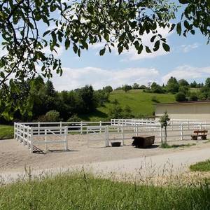
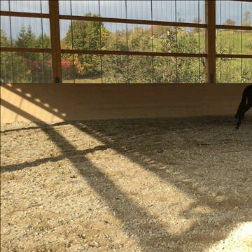
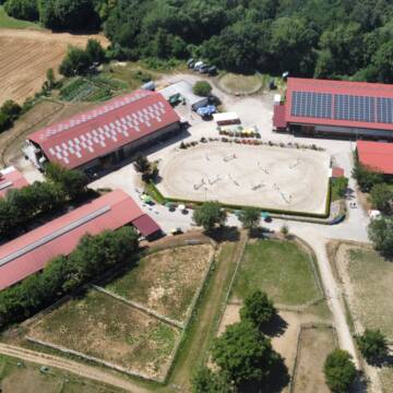
Hit Aktivstall Paulinenhof
Grenzach-Wyhlen
Moench-beate
@Moench-beate
FN-Mitglied
Freizeitstall
Hunde willkommen
Krankenbox
Notfallboxen
Bewegungsstall
Offenstall
16 weitere...
S
Deprecated: Creation of dynamic property Zend_View_Helper_Ads::$adLink is deprecated in /var/www/stall-frei/htdocs/staging.stall-frei.de/library/Psf/View/Helper/Ads.php on line 108

Futtersack HeuToy, Fressbremse in pink
Mechtersen
STALL-FREIde Marketing
@STALL-FREI-Marketing
Stundenlange Beschäftigung die
Koliken vorbeugt, geringe Staubinhalation mit
steuerbarer Futterentnahme
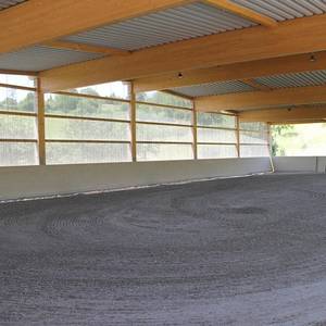
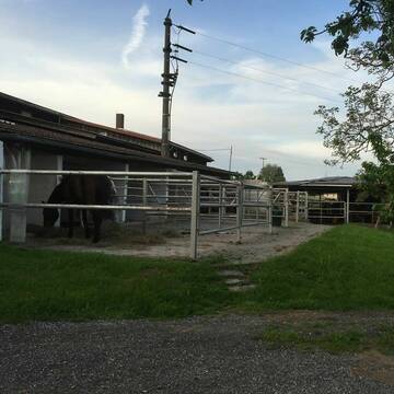
Idyllischer Reitstall mit Reithalle + Reitplatz
Rheinfelden
Elderberry Ranch
@ElderberryRanch
Fahrstall, Kutschwagen
FN-Mitglied
Vermieten
Hunde willkommen
Longierzirkel/Roundpen
Allergikerstall
Einhornhaltung möglich
37 weitere...
S


Reitstall Goldberghof
Laufenburg
Stefan Ebner
@Goldberghof1
FN-Mitglied
Freizeitstall
Vermieten
Hunde willkommen
Krankenbox
Allergikerstall
bedampftes/gewaschenes Heu
23 weitere...
S
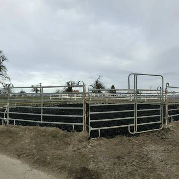
Freie Pferdeboxen/Paddocks und Doppelpaddocks
Rheinfelden
Frech-City-Pferdepension
@Frech-City-Pferdepension
FN-Mitglied
Freizeitstall
Vermieten
Führanlage
Hunde willkommen
Allergikerstall
Gnadenbrothof
23 weitere...
P+


Offenstall - Trail und Weiden - Pferde und Ponies
Lörrach
Quellhof-GmbH
@Quellhof-GmbH
Freizeitstall
Gangpferdereiten
Krankenbox
Laufband
Notfallboxen
Bewegungsstall
Laufstall
11 weitere...
P+


Reitstall Hemmer
Efringen-Kirchen
Jürgen Hemmer Reitlehrer FN
@JuergenHemmerReitlehrerFN
FN-Mitglied
Geländestrecke
Vermieten
Hunde willkommen
Longierzirkel/Roundpen
Außenbox mit Paddock
Außenboxen
15 weitere...
P+

Persönlichkeitsentwicklung mit Pferden
Bad Salzuflen
Katja Dors
@Pferdezeiten
Begleite andere auf ihrem Entwicklungsweg und entdecke die transformative Kraft der pferdegestützten Persönlichkeitsentwicklung !
neu
R
Pensionsplätze frei beim Reiterverein Lörrach e....
Lörrach
Reiterverein Lörrach e.V.
@RVLoerrach
FN-Mitglied
Reitlehrer und -unterricht
Hunde willkommen
Longierzirkel/Roundpen
Außenbox mit Paddock
Außenboxen
Vollpension
9 weitere...
P
Reitsportzentrum Lehmann
Weil am Rhein
Peter-Lehmann
@Peter-Lehmann
FN-Mitglied
Gastronomie
Vermieten
Führanlage
Longierzirkel/Roundpen
Außenboxen
Innenbox
13 weitere...
P

XXL- und Paddockboxen auf idyllischer Privatanlage
Lörrach
PRIMEUR Equestrian Centre
@PrimeurEquestrianCentre
Pferdeausbildung
Rehabilitationsstall
Vermieten
Laufband
Paddock
Allergikerstall
Fohlenaufzucht möglich
22 weitere...
P

Offenstall, Infrastruktur - ganzjährige Weide
Schwörstadt
Eichbühlhof
@Eichbuehlhof
Freizeitstall
Pferdeausbildung
Hunde willkommen
Krankenbox
Hufrehe geeignet
Notfallboxen
Außenbox mit Paddock
Offenstall
19 weitere...
P
Deprecated: Creation of dynamic property Zend_View::$pageCount is deprecated in /var/www/stall-frei/htdocs/staging.stall-frei.de/library/vendor/shardj/zf1-future/library/Zend/View/Abstract.php on line 308
Deprecated: Creation of dynamic property Zend_View::$itemCountPerPage is deprecated in /var/www/stall-frei/htdocs/staging.stall-frei.de/library/vendor/shardj/zf1-future/library/Zend/View/Abstract.php on line 308
Deprecated: Creation of dynamic property Zend_View::$first is deprecated in /var/www/stall-frei/htdocs/staging.stall-frei.de/library/vendor/shardj/zf1-future/library/Zend/View/Abstract.php on line 308
Deprecated: Creation of dynamic property Zend_View::$current is deprecated in /var/www/stall-frei/htdocs/staging.stall-frei.de/library/vendor/shardj/zf1-future/library/Zend/View/Abstract.php on line 308
Deprecated: Creation of dynamic property Zend_View::$last is deprecated in /var/www/stall-frei/htdocs/staging.stall-frei.de/library/vendor/shardj/zf1-future/library/Zend/View/Abstract.php on line 308
Deprecated: Creation of dynamic property Zend_View::$next is deprecated in /var/www/stall-frei/htdocs/staging.stall-frei.de/library/vendor/shardj/zf1-future/library/Zend/View/Abstract.php on line 308
Deprecated: Creation of dynamic property Zend_View::$pagesInRange is deprecated in /var/www/stall-frei/htdocs/staging.stall-frei.de/library/vendor/shardj/zf1-future/library/Zend/View/Abstract.php on line 308
Deprecated: Creation of dynamic property Zend_View::$firstPageInRange is deprecated in /var/www/stall-frei/htdocs/staging.stall-frei.de/library/vendor/shardj/zf1-future/library/Zend/View/Abstract.php on line 308
Deprecated: Creation of dynamic property Zend_View::$lastPageInRange is deprecated in /var/www/stall-frei/htdocs/staging.stall-frei.de/library/vendor/shardj/zf1-future/library/Zend/View/Abstract.php on line 308
Deprecated: Creation of dynamic property Zend_View::$currentItemCount is deprecated in /var/www/stall-frei/htdocs/staging.stall-frei.de/library/vendor/shardj/zf1-future/library/Zend/View/Abstract.php on line 308
Deprecated: Creation of dynamic property Zend_View::$totalItemCount is deprecated in /var/www/stall-frei/htdocs/staging.stall-frei.de/library/vendor/shardj/zf1-future/library/Zend/View/Abstract.php on line 308
Deprecated: Creation of dynamic property Zend_View::$firstItemNumber is deprecated in /var/www/stall-frei/htdocs/staging.stall-frei.de/library/vendor/shardj/zf1-future/library/Zend/View/Abstract.php on line 308
Deprecated: Creation of dynamic property Zend_View::$lastItemNumber is deprecated in /var/www/stall-frei/htdocs/staging.stall-frei.de/library/vendor/shardj/zf1-future/library/Zend/View/Abstract.php on line 308
Deprecated: Creation of dynamic property Zend_View::$router is deprecated in /var/www/stall-frei/htdocs/staging.stall-frei.de/library/vendor/shardj/zf1-future/library/Zend/View/Abstract.php on line 308
Deprecated: Creation of dynamic property Zend_View::$urlParams is deprecated in /var/www/stall-frei/htdocs/staging.stall-frei.de/library/vendor/shardj/zf1-future/library/Zend/View/Abstract.php on line 308
Deprecated: Creation of dynamic property Zend_View::$showAds is deprecated in /var/www/stall-frei/htdocs/staging.stall-frei.de/library/vendor/shardj/zf1-future/library/Zend/View/Abstract.php on line 308
Deprecated: Creation of dynamic property Zend_View::$objectIds is deprecated in /var/www/stall-frei/htdocs/staging.stall-frei.de/library/vendor/shardj/zf1-future/library/Zend/View/Abstract.php on line 308
Deprecated: Creation of dynamic property Zend_View::$showNavbar is deprecated in /var/www/stall-frei/htdocs/staging.stall-frei.de/library/vendor/shardj/zf1-future/library/Zend/View/Abstract.php on line 308
Deprecated: Creation of dynamic property Zend_View::$showBreadcrumb is deprecated in /var/www/stall-frei/htdocs/staging.stall-frei.de/library/vendor/shardj/zf1-future/library/Zend/View/Abstract.php on line 308
Deprecated: Creation of dynamic property Zend_View::$showFooter is deprecated in /var/www/stall-frei/htdocs/staging.stall-frei.de/library/vendor/shardj/zf1-future/library/Zend/View/Abstract.php on line 308
Deprecated: Creation of dynamic property Zend_View::$showInternalAds is deprecated in /var/www/stall-frei/htdocs/staging.stall-frei.de/library/vendor/shardj/zf1-future/library/Zend/View/Abstract.php on line 308
Deprecated: Creation of dynamic property Zend_View::$blNoContent is deprecated in /var/www/stall-frei/htdocs/staging.stall-frei.de/library/vendor/shardj/zf1-future/library/Zend/View/Abstract.php on line 308
Deprecated: Creation of dynamic property Zend_View::$sMetaDesc is deprecated in /var/www/stall-frei/htdocs/staging.stall-frei.de/library/vendor/shardj/zf1-future/library/Zend/View/Abstract.php on line 308
Deprecated: Creation of dynamic property Zend_View::$useGmaps is deprecated in /var/www/stall-frei/htdocs/staging.stall-frei.de/library/vendor/shardj/zf1-future/library/Zend/View/Abstract.php on line 308
Deprecated: Creation of dynamic property Zend_View::$touches is deprecated in /var/www/stall-frei/htdocs/staging.stall-frei.de/library/vendor/shardj/zf1-future/library/Zend/View/Abstract.php on line 308
Deprecated: Creation of dynamic property Zend_View::$oProject is deprecated in /var/www/stall-frei/htdocs/staging.stall-frei.de/library/vendor/shardj/zf1-future/library/Zend/View/Abstract.php on line 308
Deprecated: Creation of dynamic property Zend_View::$pageHeadline is deprecated in /var/www/stall-frei/htdocs/staging.stall-frei.de/library/vendor/shardj/zf1-future/library/Zend/View/Abstract.php on line 308
Deprecated: Creation of dynamic property Zend_View::$disableLocationField is deprecated in /var/www/stall-frei/htdocs/staging.stall-frei.de/library/vendor/shardj/zf1-future/library/Zend/View/Abstract.php on line 308
Deprecated: Creation of dynamic property Zend_View::$isSearch is deprecated in /var/www/stall-frei/htdocs/staging.stall-frei.de/library/vendor/shardj/zf1-future/library/Zend/View/Abstract.php on line 308
Deprecated: Creation of dynamic property Zend_View::$pageTitle is deprecated in /var/www/stall-frei/htdocs/staging.stall-frei.de/library/vendor/shardj/zf1-future/library/Zend/View/Abstract.php on line 308
Deprecated: Creation of dynamic property Psf_Form_Element_Text::$class is deprecated in /var/www/stall-frei/htdocs/staging.stall-frei.de/library/vendor/shardj/zf1-future/library/Zend/Form/Element.php on line 874
Deprecated: Creation of dynamic property Psf_Form_Element_Text::$size is deprecated in /var/www/stall-frei/htdocs/staging.stall-frei.de/library/vendor/shardj/zf1-future/library/Zend/Form/Element.php on line 874
Deprecated: Creation of dynamic property Psf_Form_Element_Text::$placeholder is deprecated in /var/www/stall-frei/htdocs/staging.stall-frei.de/library/vendor/shardj/zf1-future/library/Zend/Form/Element.php on line 874
Deprecated: Creation of dynamic property Psf_Form_Element_Hidden::$class is deprecated in /var/www/stall-frei/htdocs/staging.stall-frei.de/library/vendor/shardj/zf1-future/library/Zend/Form/Element.php on line 874
Deprecated: Creation of dynamic property Psf_Form_Element_Hidden::$class is deprecated in /var/www/stall-frei/htdocs/staging.stall-frei.de/library/vendor/shardj/zf1-future/library/Zend/Form/Element.php on line 874
Deprecated: Creation of dynamic property Psf_Form_Element_Hidden::$class is deprecated in /var/www/stall-frei/htdocs/staging.stall-frei.de/library/vendor/shardj/zf1-future/library/Zend/Form/Element.php on line 874
Deprecated: Creation of dynamic property Psf_Form_Element_Hidden::$class is deprecated in /var/www/stall-frei/htdocs/staging.stall-frei.de/library/vendor/shardj/zf1-future/library/Zend/Form/Element.php on line 874
Deprecated: Creation of dynamic property Psf_Form_Element_Select::$class is deprecated in /var/www/stall-frei/htdocs/staging.stall-frei.de/library/vendor/shardj/zf1-future/library/Zend/Form/Element.php on line 874
Deprecated: Creation of dynamic property Psf_Form_Element_Select::$class is deprecated in /var/www/stall-frei/htdocs/staging.stall-frei.de/library/vendor/shardj/zf1-future/library/Zend/Form/Element.php on line 874
Deprecated: Creation of dynamic property Psf_Form_Element_Select::$class is deprecated in /var/www/stall-frei/htdocs/staging.stall-frei.de/library/vendor/shardj/zf1-future/library/Zend/Form/Element.php on line 874
Deprecated: Creation of dynamic property Psf_Form_Element_Select::$class is deprecated in /var/www/stall-frei/htdocs/staging.stall-frei.de/library/vendor/shardj/zf1-future/library/Zend/Form/Element.php on line 874
Deprecated: Creation of dynamic property Psf_Form_Element_Text::$class is deprecated in /var/www/stall-frei/htdocs/staging.stall-frei.de/library/vendor/shardj/zf1-future/library/Zend/Form/Element.php on line 874
Deprecated: Creation of dynamic property Psf_Form_Element_Checkbox::$label is deprecated in /var/www/stall-frei/htdocs/staging.stall-frei.de/library/vendor/shardj/zf1-future/library/Zend/Form/Element.php on line 874
Deprecated: Creation of dynamic property Zend_View::$sort is deprecated in /var/www/stall-frei/htdocs/staging.stall-frei.de/library/vendor/shardj/zf1-future/library/Zend/View/Abstract.php on line 308
Deprecated: Creation of dynamic property Zend_View::$searchLocation is deprecated in /var/www/stall-frei/htdocs/staging.stall-frei.de/library/vendor/shardj/zf1-future/library/Zend/View/Abstract.php on line 308
Deprecated: Creation of dynamic property Zend_View::$locationHint is deprecated in /var/www/stall-frei/htdocs/staging.stall-frei.de/library/vendor/shardj/zf1-future/library/Zend/View/Abstract.php on line 308
Psf_GeoCoder_Abstract::getLocation: Obere Au Get Location CachedOrLive
Psf_GeoCoder_Abstract::getCachedOrLive: Obere Au
Psf_GeoCoder_OpenCageData::makeApiRequest: response:
Array
(
[documentation] => https://opencagedata.com/api
[licenses] => Array
(
[0] => Array
(
[name] => see attribution guide
[url] => https://opencagedata.com/credits
)
)
[results] => Array
(
[0] => Array
(
[bounds] => Array
(
[northeast] => Array
(
[lat] => 46.7808415
[lng] => 7.6109204
)
[southwest] => Array
(
[lat] => 46.7758057
[lng] => 7.6040966
)
)
[components] => Array
(
[ISO_3166-1_alpha-2] => CH
[ISO_3166-1_alpha-3] => CHE
[ISO_3166-2] => Array
(
[0] => CH-BE
)
[_category] => place
[_normalized_city] => Heimberg
[_type] => village
[continent] => Europe
[country] => Schweiz
[country_code] => ch
[county] => Verwaltungskreis Thun
[local_administrative_area] => Heimberg
[postcode] => 3627
[state] => Bern
[state_code] => BE
[state_district] => Verwaltungsregion Oberland
[suburb] => Obere Au
[village] => Heimberg
)
[confidence] => 9
[formatted] => 3627 Heimberg, Schweiz
[geometry] => Array
(
[lat] => 46.7783697
[lng] => 7.6077411
)
)
[1] => Array
(
[bounds] => Array
(
[northeast] => Array
(
[lat] => 47.120705
[lng] => 13.512265
)
[southwest] => Array
(
[lat] => 47.080705
[lng] => 13.472265
)
)
[components] => Array
(
[ISO_3166-1_alpha-2] => AT
[ISO_3166-1_alpha-3] => AUT
[ISO_3166-2] => Array
(
[0] => AT-5
)
[_category] => place
[_normalized_city] => Muhr
[_type] => hamlet
[continent] => Europe
[country] => Österreich
[country_code] => at
[county] => Bezirk Tamsweg
[hamlet] => Obere Au
[political_union] => European Union
[postcode] => 5583
[state] => Salzburg
[state_code] => 5
[village] => Muhr
)
[confidence] => 7
[formatted] => Obere Au, 5583 Muhr, Österreich
[geometry] => Array
(
[lat] => 47.100705
[lng] => 13.492265
)
)
[2] => Array
(
[bounds] => Array
(
[northeast] => Array
(
[lat] => 46.8677223
[lng] => 9.5152255
)
[southwest] => Array
(
[lat] => 46.8477223
[lng] => 9.4952255
)
)
[components] => Array
(
[ISO_3166-1_alpha-2] => CH
[ISO_3166-1_alpha-3] => CHE
[ISO_3166-2] => Array
(
[0] => CH-GR
)
[_category] => place
[_normalized_city] => Chur
[_type] => neighbourhood
[continent] => Europe
[country] => Schweiz
[country_code] => ch
[county] => Plessur
[local_administrative_area] => Chur
[postcode] => 7000
[quarter] => Obere Au
[state] => Graubünden
[state_code] => GR
[suburb] => Industriegebiet
[town] => Chur
)
[confidence] => 8
[formatted] => 7000 Chur, Schweiz
[geometry] => Array
(
[lat] => 46.8577223
[lng] => 9.5052255
)
)
[3] => Array
(
[bounds] => Array
(
[northeast] => Array
(
[lat] => 48.1794758
[lng] => 14.3731499
)
[southwest] => Array
(
[lat] => 48.1394758
[lng] => 14.3331499
)
)
[components] => Array
(
[ISO_3166-1_alpha-2] => AT
[ISO_3166-1_alpha-3] => AUT
[ISO_3166-2] => Array
(
[0] => AT-4
)
[_category] => place
[_normalized_city] => Niederneukirchen
[_type] => hamlet
[continent] => Europe
[country] => Österreich
[country_code] => at
[county] => Bezirk Linz-Land
[hamlet] => Obere Au
[political_union] => European Union
[postcode] => 4491
[state] => Oberösterreich
[state_code] => 4
[village] => Niederneukirchen
)
[confidence] => 7
[formatted] => Obere Au, 4491 Niederneukirchen, Österreich
[geometry] => Array
(
[lat] => 48.1594758
[lng] => 14.3531499
)
)
[4] => Array
(
[bounds] => Array
(
[northeast] => Array
(
[lat] => 48.1335934
[lng] => 11.5979302
)
[southwest] => Array
(
[lat] => 48.1135934
[lng] => 11.5779302
)
)
[components] => Array
(
[ISO_3166-1_alpha-2] => DE
[ISO_3166-1_alpha-3] => DEU
[ISO_3166-2] => Array
(
[0] => DE-BY
)
[_category] => place
[_normalized_city] => München
[_type] => neighbourhood
[city] => München
[city_district] => Au-Haidhausen
[continent] => Europe
[country] => Deutschland
[country_code] => de
[political_union] => European Union
[postcode] => 81541
[quarter] => Obere Au
[state] => Bayern
[state_code] => BY
[suburb] => Au
)
[confidence] => 8
[formatted] => 81541 München, Deutschland
[geometry] => Array
(
[lat] => 48.1235934
[lng] => 11.5879302
)
)
[5] => Array
(
[bounds] => Array
(
[northeast] => Array
(
[lat] => 49.3206206
[lng] => 9.475479
)
[southwest] => Array
(
[lat] => 49.3175406
[lng] => 9.4687699
)
)
[components] => Array
(
[ISO_3166-1_alpha-2] => DE
[ISO_3166-1_alpha-3] => DEU
[ISO_3166-2] => Array
(
[0] => DE-BW
)
[_category] => natural/water
[_normalized_city] => Jagsthausen
[_type] => scrub
[continent] => Europe
[country] => Deutschland
[country_code] => de
[county] => Landkreis Heilbronn
[municipality] => VVG der Stadt Möckmühl
[political_union] => European Union
[postcode] => 74249
[scrub] => Obere Au
[state] => Baden-Württemberg
[state_code] => BW
[village] => Jagsthausen
)
[confidence] => 9
[formatted] => Obere Au, 74249 Jagsthausen, Deutschland
[geometry] => Array
(
[lat] => 49.3190019
[lng] => 9.4713936
)
)
[6] => Array
(
[bounds] => Array
(
[northeast] => Array
(
[lat] => 47.5562073
[lng] => 12.1237573
)
[southwest] => Array
(
[lat] => 47.5561073
[lng] => 12.1236573
)
)
[components] => Array
(
[ISO_3166-1_alpha-2] => AT
[ISO_3166-1_alpha-3] => AUT
[ISO_3166-2] => Array
(
[0] => AT-7
)
[_category] => building
[_normalized_city] => Langkampfen
[_type] => building
[city] => Langkampfen
[continent] => Europe
[country] => Österreich
[country_code] => at
[county] => Bezirk Kufstein
[isolated_dwelling] => Obere Au
[political_union] => European Union
[postcode] => 6336
[state] => Tirol
[state_code] => 7
)
[confidence] => 10
[formatted] => Obere Au, 6336 Langkampfen, Österreich
[geometry] => Array
(
[lat] => 47.5561573
[lng] => 12.1237073
)
)
[7] => Array
(
[bounds] => Array
(
[northeast] => Array
(
[lat] => 47.9400286
[lng] => 16.4703017
)
[southwest] => Array
(
[lat] => 47.9225607
[lng] => 16.4317822
)
)
[components] => Array
(
[ISO_3166-1_alpha-2] => AT
[ISO_3166-1_alpha-3] => AUT
[ISO_3166-2] => Array
(
[0] => AT-3
)
[_category] => natural/water
[_normalized_city] => Wampersdorf
[_type] => forest
[continent] => Europe
[country] => Österreich
[country_code] => at
[county] => Bezirk Baden
[forest] => Obere Au
[political_union] => European Union
[state] => Niederösterreich
[state_code] => 3
[village] => Wampersdorf
)
[confidence] => 7
[formatted] => Obere Au, Wampersdorf, Bezirk Baden, Österreich
[geometry] => Array
(
[lat] => 47.9312965
[lng] => 16.4457536
)
)
[8] => Array
(
[bounds] => Array
(
[northeast] => Array
(
[lat] => 48.1601278
[lng] => 16.617604
)
[southwest] => Array
(
[lat] => 48.1471889
[lng] => 16.5771202
)
)
[components] => Array
(
[ISO_3166-1_alpha-2] => AT
[ISO_3166-1_alpha-3] => AUT
[ISO_3166-2] => Array
(
[0] => AT-3
)
[_category] => natural/water
[_normalized_city] => Groß-Enzersdorf
[_type] => forest
[continent] => Europe
[country] => Österreich
[country_code] => at
[county] => Bezirk Gänserndorf
[forest] => Obere Au
[political_union] => European Union
[state] => Niederösterreich
[state_code] => 3
[town] => Groß-Enzersdorf
[village] => Schönau an der Donau
)
[confidence] => 7
[formatted] => Obere Au, Groß-Enzersdorf, Bezirk Gänserndorf, Österreich
[geometry] => Array
(
[lat] => 48.1534728
[lng] => 16.5944133
)
)
[9] => Array
(
[bounds] => Array
(
[northeast] => Array
(
[lat] => 47.513843
[lng] => 7.6139561
)
[southwest] => Array
(
[lat] => 47.5079779
[lng] => 7.6067805
)
)
[components] => Array
(
[ISO_3166-1_alpha-2] => CH
[ISO_3166-1_alpha-3] => CHE
[ISO_3166-2] => Array
(
[0] => CH-BL
)
[_category] => natural/water
[_normalized_city] => Münchenstein
[_type] => forest
[continent] => Europe
[country] => Schweiz
[country_code] => ch
[county] => Bezirk Arlesheim
[forest] => Obere Au
[local_administrative_area] => Münchenstein
[state] => Basel-Landschaft
[state_code] => BL
[town] => Münchenstein
)
[confidence] => 9
[formatted] => Obere Au, Münchenstein, Bezirk Arlesheim, Schweiz
[geometry] => Array
(
[lat] => 47.5108423
[lng] => 7.6094027
)
)
)
[status] => Array
(
[code] => 200
[message] => OK
)
[stay_informed] => Array
(
[blog] => https://blog.opencagedata.com
[mastodon] => https://en.osm.town/@opencage
)
[thanks] => For using an OpenCage API
[timestamp] => Array
(
[created_http] => Mon, 09 Feb 2026 01:17:45 GMT
[created_unix] => 1770599865
)
[total_results] => 10
)
Psf_GeoCoder_Abstract::convertLocationResult
{"documentation":"https:\/\/opencagedata.com\/api","licenses":[{"name":"see attribution guide","url":"https:\/\/opencagedata.com\/credits"}],"results":[{"bounds":{"northeast":{"lat":46.7808415,"lng":7.6109204},"southwest":{"lat":46.7758057,"lng":7.6040966}},"components":{"ISO_3166-1_alpha-2":"CH","ISO_3166-1_alpha-3":"CHE","ISO_3166-2":["CH-BE"],"_category":"place","_normalized_city":"Heimberg","_type":"village","continent":"Europe","country":"Schweiz","country_code":"ch","county":"Verwaltungskreis Thun","local_administrative_area":"Heimberg","postcode":"3627","state":"Bern","state_code":"BE","state_district":"Verwaltungsregion Oberland","suburb":"Obere Au","village":"Heimberg"},"confidence":9,"formatted":"3627 Heimberg, Schweiz","geometry":{"lat":46.7783697,"lng":7.6077411}},{"bounds":{"northeast":{"lat":47.120705,"lng":13.512265},"southwest":{"lat":47.080705,"lng":13.472265}},"components":{"ISO_3166-1_alpha-2":"AT","ISO_3166-1_alpha-3":"AUT","ISO_3166-2":["AT-5"],"_category":"place","_normalized_city":"Muhr","_type":"hamlet","continent":"Europe","country":"\u00d6sterreich","country_code":"at","county":"Bezirk Tamsweg","hamlet":"Obere Au","political_union":"European Union","postcode":"5583","state":"Salzburg","state_code":"5","village":"Muhr"},"confidence":7,"formatted":"Obere Au, 5583 Muhr, \u00d6sterreich","geometry":{"lat":47.100705,"lng":13.492265}},{"bounds":{"northeast":{"lat":46.8677223,"lng":9.5152255},"southwest":{"lat":46.8477223,"lng":9.4952255}},"components":{"ISO_3166-1_alpha-2":"CH","ISO_3166-1_alpha-3":"CHE","ISO_3166-2":["CH-GR"],"_category":"place","_normalized_city":"Chur","_type":"neighbourhood","continent":"Europe","country":"Schweiz","country_code":"ch","county":"Plessur","local_administrative_area":"Chur","postcode":"7000","quarter":"Obere Au","state":"Graub\u00fcnden","state_code":"GR","suburb":"Industriegebiet","town":"Chur"},"confidence":8,"formatted":"7000 Chur, Schweiz","geometry":{"lat":46.8577223,"lng":9.5052255}},{"bounds":{"northeast":{"lat":48.1794758,"lng":14.3731499},"southwest":{"lat":48.1394758,"lng":14.3331499}},"components":{"ISO_3166-1_alpha-2":"AT","ISO_3166-1_alpha-3":"AUT","ISO_3166-2":["AT-4"],"_category":"place","_normalized_city":"Niederneukirchen","_type":"hamlet","continent":"Europe","country":"\u00d6sterreich","country_code":"at","county":"Bezirk Linz-Land","hamlet":"Obere Au","political_union":"European Union","postcode":"4491","state":"Ober\u00f6sterreich","state_code":"4","village":"Niederneukirchen"},"confidence":7,"formatted":"Obere Au, 4491 Niederneukirchen, \u00d6sterreich","geometry":{"lat":48.1594758,"lng":14.3531499}},{"bounds":{"northeast":{"lat":48.1335934,"lng":11.5979302},"southwest":{"lat":48.1135934,"lng":11.5779302}},"components":{"ISO_3166-1_alpha-2":"DE","ISO_3166-1_alpha-3":"DEU","ISO_3166-2":["DE-BY"],"_category":"place","_normalized_city":"M\u00fcnchen","_type":"neighbourhood","city":"M\u00fcnchen","city_district":"Au-Haidhausen","continent":"Europe","country":"Deutschland","country_code":"de","political_union":"European Union","postcode":"81541","quarter":"Obere Au","state":"Bayern","state_code":"BY","suburb":"Au"},"confidence":8,"formatted":"81541 M\u00fcnchen, Deutschland","geometry":{"lat":48.1235934,"lng":11.5879302}},{"bounds":{"northeast":{"lat":49.3206206,"lng":9.475479},"southwest":{"lat":49.3175406,"lng":9.4687699}},"components":{"ISO_3166-1_alpha-2":"DE","ISO_3166-1_alpha-3":"DEU","ISO_3166-2":["DE-BW"],"_category":"natural\/water","_normalized_city":"Jagsthausen","_type":"scrub","continent":"Europe","country":"Deutschland","country_code":"de","county":"Landkreis Heilbronn","municipality":"VVG der Stadt M\u00f6ckm\u00fchl","political_union":"European Union","postcode":"74249","scrub":"Obere Au","state":"Baden-W\u00fcrttemberg","state_code":"BW","village":"Jagsthausen"},"confidence":9,"formatted":"Obere Au, 74249 Jagsthausen, Deutschland","geometry":{"lat":49.3190019,"lng":9.4713936}},{"bounds":{"northeast":{"lat":47.5562073,"lng":12.1237573},"southwest":{"lat":47.5561073,"lng":12.1236573}},"components":{"ISO_3166-1_alpha-2":"AT","ISO_3166-1_alpha-3":"AUT","ISO_3166-2":["AT-7"],"_category":"building","_normalized_city":"Langkampfen","_type":"building","city":"Langkampfen","continent":"Europe","country":"\u00d6sterreich","country_code":"at","county":"Bezirk Kufstein","isolated_dwelling":"Obere Au","political_union":"European Union","postcode":"6336","state":"Tirol","state_code":"7"},"confidence":10,"formatted":"Obere Au, 6336 Langkampfen, \u00d6sterreich","geometry":{"lat":47.5561573,"lng":12.1237073}},{"bounds":{"northeast":{"lat":47.9400286,"lng":16.4703017},"southwest":{"lat":47.9225607,"lng":16.4317822}},"components":{"ISO_3166-1_alpha-2":"AT","ISO_3166-1_alpha-3":"AUT","ISO_3166-2":["AT-3"],"_category":"natural\/water","_normalized_city":"Wampersdorf","_type":"forest","continent":"Europe","country":"\u00d6sterreich","country_code":"at","county":"Bezirk Baden","forest":"Obere Au","political_union":"European Union","state":"Nieder\u00f6sterreich","state_code":"3","village":"Wampersdorf"},"confidence":7,"formatted":"Obere Au, Wampersdorf, Bezirk Baden, \u00d6sterreich","geometry":{"lat":47.9312965,"lng":16.4457536}},{"bounds":{"northeast":{"lat":48.1601278,"lng":16.617604},"southwest":{"lat":48.1471889,"lng":16.5771202}},"components":{"ISO_3166-1_alpha-2":"AT","ISO_3166-1_alpha-3":"AUT","ISO_3166-2":["AT-3"],"_category":"natural\/water","_normalized_city":"Gro\u00df-Enzersdorf","_type":"forest","continent":"Europe","country":"\u00d6sterreich","country_code":"at","county":"Bezirk G\u00e4nserndorf","forest":"Obere Au","political_union":"European Union","state":"Nieder\u00f6sterreich","state_code":"3","town":"Gro\u00df-Enzersdorf","village":"Sch\u00f6nau an der Donau"},"confidence":7,"formatted":"Obere Au, Gro\u00df-Enzersdorf, Bezirk G\u00e4nserndorf, \u00d6sterreich","geometry":{"lat":48.1534728,"lng":16.5944133}},{"bounds":{"northeast":{"lat":47.513843,"lng":7.6139561},"southwest":{"lat":47.5079779,"lng":7.6067805}},"components":{"ISO_3166-1_alpha-2":"CH","ISO_3166-1_alpha-3":"CHE","ISO_3166-2":["CH-BL"],"_category":"natural\/water","_normalized_city":"M\u00fcnchenstein","_type":"forest","continent":"Europe","country":"Schweiz","country_code":"ch","county":"Bezirk Arlesheim","forest":"Obere Au","local_administrative_area":"M\u00fcnchenstein","state":"Basel-Landschaft","state_code":"BL","town":"M\u00fcnchenstein"},"confidence":9,"formatted":"Obere Au, M\u00fcnchenstein, Bezirk Arlesheim, Schweiz","geometry":{"lat":47.5108423,"lng":7.6094027}}],"status":{"code":200,"message":"OK"},"stay_informed":{"blog":"https:\/\/blog.opencagedata.com","mastodon":"https:\/\/en.osm.town\/@opencage"},"thanks":"For using an OpenCage API","timestamp":{"created_http":"Mon, 09 Feb 2026 01:17:45 GMT","created_unix":1770599865},"total_results":10}Array
(
[0] => stdClass Object
(
[bounds] => stdClass Object
(
[northeast] => stdClass Object
(
[lat] => 46.7808415
[lng] => 7.6109204
)
[southwest] => stdClass Object
(
[lat] => 46.7758057
[lng] => 7.6040966
)
)
[components] => stdClass Object
(
[ISO_3166-1_alpha-2] => CH
[ISO_3166-1_alpha-3] => CHE
[ISO_3166-2] => Array
(
[0] => CH-BE
)
[_category] => place
[_normalized_city] => Heimberg
[_type] => village
[continent] => Europe
[country] => Schweiz
[country_code] => ch
[county] => Verwaltungskreis Thun
[local_administrative_area] => Heimberg
[postcode] => 3627
[state] => Bern
[state_code] => BE
[state_district] => Verwaltungsregion Oberland
[suburb] => Obere Au
[village] => Heimberg
)
[confidence] => 9
[formatted] => 3627 Heimberg, Schweiz
[geometry] => stdClass Object
(
[lat] => 46.7783697
[lng] => 7.6077411
)
)
[1] => stdClass Object
(
[bounds] => stdClass Object
(
[northeast] => stdClass Object
(
[lat] => 47.120705
[lng] => 13.512265
)
[southwest] => stdClass Object
(
[lat] => 47.080705
[lng] => 13.472265
)
)
[components] => stdClass Object
(
[ISO_3166-1_alpha-2] => AT
[ISO_3166-1_alpha-3] => AUT
[ISO_3166-2] => Array
(
[0] => AT-5
)
[_category] => place
[_normalized_city] => Muhr
[_type] => hamlet
[continent] => Europe
[country] => Österreich
[country_code] => at
[county] => Bezirk Tamsweg
[hamlet] => Obere Au
[political_union] => European Union
[postcode] => 5583
[state] => Salzburg
[state_code] => 5
[village] => Muhr
)
[confidence] => 7
[formatted] => Obere Au, 5583 Muhr, Österreich
[geometry] => stdClass Object
(
[lat] => 47.100705
[lng] => 13.492265
)
)
[2] => stdClass Object
(
[bounds] => stdClass Object
(
[northeast] => stdClass Object
(
[lat] => 46.8677223
[lng] => 9.5152255
)
[southwest] => stdClass Object
(
[lat] => 46.8477223
[lng] => 9.4952255
)
)
[components] => stdClass Object
(
[ISO_3166-1_alpha-2] => CH
[ISO_3166-1_alpha-3] => CHE
[ISO_3166-2] => Array
(
[0] => CH-GR
)
[_category] => place
[_normalized_city] => Chur
[_type] => neighbourhood
[continent] => Europe
[country] => Schweiz
[country_code] => ch
[county] => Plessur
[local_administrative_area] => Chur
[postcode] => 7000
[quarter] => Obere Au
[state] => Graubünden
[state_code] => GR
[suburb] => Industriegebiet
[town] => Chur
)
[confidence] => 8
[formatted] => 7000 Chur, Schweiz
[geometry] => stdClass Object
(
[lat] => 46.8577223
[lng] => 9.5052255
)
)
[3] => stdClass Object
(
[bounds] => stdClass Object
(
[northeast] => stdClass Object
(
[lat] => 48.1794758
[lng] => 14.3731499
)
[southwest] => stdClass Object
(
[lat] => 48.1394758
[lng] => 14.3331499
)
)
[components] => stdClass Object
(
[ISO_3166-1_alpha-2] => AT
[ISO_3166-1_alpha-3] => AUT
[ISO_3166-2] => Array
(
[0] => AT-4
)
[_category] => place
[_normalized_city] => Niederneukirchen
[_type] => hamlet
[continent] => Europe
[country] => Österreich
[country_code] => at
[county] => Bezirk Linz-Land
[hamlet] => Obere Au
[political_union] => European Union
[postcode] => 4491
[state] => Oberösterreich
[state_code] => 4
[village] => Niederneukirchen
)
[confidence] => 7
[formatted] => Obere Au, 4491 Niederneukirchen, Österreich
[geometry] => stdClass Object
(
[lat] => 48.1594758
[lng] => 14.3531499
)
)
[4] => stdClass Object
(
[bounds] => stdClass Object
(
[northeast] => stdClass Object
(
[lat] => 48.1335934
[lng] => 11.5979302
)
[southwest] => stdClass Object
(
[lat] => 48.1135934
[lng] => 11.5779302
)
)
[components] => stdClass Object
(
[ISO_3166-1_alpha-2] => DE
[ISO_3166-1_alpha-3] => DEU
[ISO_3166-2] => Array
(
[0] => DE-BY
)
[_category] => place
[_normalized_city] => München
[_type] => neighbourhood
[city] => München
[city_district] => Au-Haidhausen
[continent] => Europe
[country] => Deutschland
[country_code] => de
[political_union] => European Union
[postcode] => 81541
[quarter] => Obere Au
[state] => Bayern
[state_code] => BY
[suburb] => Au
)
[confidence] => 8
[formatted] => 81541 München, Deutschland
[geometry] => stdClass Object
(
[lat] => 48.1235934
[lng] => 11.5879302
)
)
[5] => stdClass Object
(
[bounds] => stdClass Object
(
[northeast] => stdClass Object
(
[lat] => 49.3206206
[lng] => 9.475479
)
[southwest] => stdClass Object
(
[lat] => 49.3175406
[lng] => 9.4687699
)
)
[components] => stdClass Object
(
[ISO_3166-1_alpha-2] => DE
[ISO_3166-1_alpha-3] => DEU
[ISO_3166-2] => Array
(
[0] => DE-BW
)
[_category] => natural/water
[_normalized_city] => Jagsthausen
[_type] => scrub
[continent] => Europe
[country] => Deutschland
[country_code] => de
[county] => Landkreis Heilbronn
[municipality] => VVG der Stadt Möckmühl
[political_union] => European Union
[postcode] => 74249
[scrub] => Obere Au
[state] => Baden-Württemberg
[state_code] => BW
[village] => Jagsthausen
)
[confidence] => 9
[formatted] => Obere Au, 74249 Jagsthausen, Deutschland
[geometry] => stdClass Object
(
[lat] => 49.3190019
[lng] => 9.4713936
)
)
[6] => stdClass Object
(
[bounds] => stdClass Object
(
[northeast] => stdClass Object
(
[lat] => 47.5562073
[lng] => 12.1237573
)
[southwest] => stdClass Object
(
[lat] => 47.5561073
[lng] => 12.1236573
)
)
[components] => stdClass Object
(
[ISO_3166-1_alpha-2] => AT
[ISO_3166-1_alpha-3] => AUT
[ISO_3166-2] => Array
(
[0] => AT-7
)
[_category] => building
[_normalized_city] => Langkampfen
[_type] => building
[city] => Langkampfen
[continent] => Europe
[country] => Österreich
[country_code] => at
[county] => Bezirk Kufstein
[isolated_dwelling] => Obere Au
[political_union] => European Union
[postcode] => 6336
[state] => Tirol
[state_code] => 7
)
[confidence] => 10
[formatted] => Obere Au, 6336 Langkampfen, Österreich
[geometry] => stdClass Object
(
[lat] => 47.5561573
[lng] => 12.1237073
)
)
[7] => stdClass Object
(
[bounds] => stdClass Object
(
[northeast] => stdClass Object
(
[lat] => 47.9400286
[lng] => 16.4703017
)
[southwest] => stdClass Object
(
[lat] => 47.9225607
[lng] => 16.4317822
)
)
[components] => stdClass Object
(
[ISO_3166-1_alpha-2] => AT
[ISO_3166-1_alpha-3] => AUT
[ISO_3166-2] => Array
(
[0] => AT-3
)
[_category] => natural/water
[_normalized_city] => Wampersdorf
[_type] => forest
[continent] => Europe
[country] => Österreich
[country_code] => at
[county] => Bezirk Baden
[forest] => Obere Au
[political_union] => European Union
[state] => Niederösterreich
[state_code] => 3
[village] => Wampersdorf
)
[confidence] => 7
[formatted] => Obere Au, Wampersdorf, Bezirk Baden, Österreich
[geometry] => stdClass Object
(
[lat] => 47.9312965
[lng] => 16.4457536
)
)
[8] => stdClass Object
(
[bounds] => stdClass Object
(
[northeast] => stdClass Object
(
[lat] => 48.1601278
[lng] => 16.617604
)
[southwest] => stdClass Object
(
[lat] => 48.1471889
[lng] => 16.5771202
)
)
[components] => stdClass Object
(
[ISO_3166-1_alpha-2] => AT
[ISO_3166-1_alpha-3] => AUT
[ISO_3166-2] => Array
(
[0] => AT-3
)
[_category] => natural/water
[_normalized_city] => Groß-Enzersdorf
[_type] => forest
[continent] => Europe
[country] => Österreich
[country_code] => at
[county] => Bezirk Gänserndorf
[forest] => Obere Au
[political_union] => European Union
[state] => Niederösterreich
[state_code] => 3
[town] => Groß-Enzersdorf
[village] => Schönau an der Donau
)
[confidence] => 7
[formatted] => Obere Au, Groß-Enzersdorf, Bezirk Gänserndorf, Österreich
[geometry] => stdClass Object
(
[lat] => 48.1534728
[lng] => 16.5944133
)
)
[9] => stdClass Object
(
[bounds] => stdClass Object
(
[northeast] => stdClass Object
(
[lat] => 47.513843
[lng] => 7.6139561
)
[southwest] => stdClass Object
(
[lat] => 47.5079779
[lng] => 7.6067805
)
)
[components] => stdClass Object
(
[ISO_3166-1_alpha-2] => CH
[ISO_3166-1_alpha-3] => CHE
[ISO_3166-2] => Array
(
[0] => CH-BL
)
[_category] => natural/water
[_normalized_city] => Münchenstein
[_type] => forest
[continent] => Europe
[country] => Schweiz
[country_code] => ch
[county] => Bezirk Arlesheim
[forest] => Obere Au
[local_administrative_area] => Münchenstein
[state] => Basel-Landschaft
[state_code] => BL
[town] => Münchenstein
)
[confidence] => 9
[formatted] => Obere Au, Münchenstein, Bezirk Arlesheim, Schweiz
[geometry] => stdClass Object
(
[lat] => 47.5108423
[lng] => 7.6094027
)
)
)
Psf_GeoCoder_OpenCageData::getKeyMap: 0
stdClass Object
(
    [bounds] => stdClass Object
        (
            [northeast] => stdClass Object
                (
                    [lat] => 46.7808415
                    [lng] => 7.6109204
                )

            [southwest] => stdClass Object
                (
                    [lat] => 46.7758057
                    [lng] => 7.6040966
                )

        )

    [components] => stdClass Object
        (
            [ISO_3166-1_alpha-2] => CH
            [ISO_3166-1_alpha-3] => CHE
            [ISO_3166-2] => Array
                (
                    [0] => CH-BE
                )

            [_category] => place
            [_normalized_city] => Heimberg
            [_type] => village
            [continent] => Europe
            [country] => Schweiz
            [country_code] => ch
            [county] => Verwaltungskreis Thun
            [local_administrative_area] => Heimberg
            [postcode] => 3627
            [state] => Bern
            [state_code] => BE
            [state_district] => Verwaltungsregion Oberland
            [suburb] => Obere Au
            [village] => Heimberg
        )

    [confidence] => 9
    [formatted] => 3627 Heimberg, Schweiz
    [geometry] => stdClass Object
        (
            [lat] => 46.7783697
            [lng] => 7.6077411
        )

)
Psf_GeoCoder_OpenCageData::getCounty: Verwaltungskreis Thun
Psf_GeoCoder_OpenCageData::addMissingData REFETCH!
Array
(
    [address] => 3627 Heimberg, Schweiz
    [type] => village
    [street] =>
    [city] => Heimberg
    [county] => Verwaltungskreis Thun
    [state] => Bern
    [zip] => 3627
    [country] => Schweiz
    [suburb] => Obere Au
    [countrycode] => ch
    [latitude] => 46.7783697
    [longitude] => 7.6077411
    [accuracy] => 1
    [confidence] => 9
    [bounds] => stdClass Object
        (
            [northeast] => stdClass Object
                (
                    [lat] => 46.7808415
                    [lng] => 7.6109204
                )

            [southwest] => stdClass Object
                (
                    [lat] => 46.7758057
                    [lng] => 7.6040966
                )

        )

)
reformat!
Array
(
    [address] => 3627 Heimberg, Schweiz
    [type] => village
    [street] =>
    [city] => Heimberg
    [county] => Verwaltungskreis Thun
    [state] => Bern
    [zip] => 3627
    [country] => Schweiz
    [suburb] => Obere Au
    [countrycode] => ch
    [latitude] => 46.7783697
    [longitude] => 7.6077411
    [accuracy] => 1
    [confidence] => 9
    [bounds] => stdClass Object
        (
            [northeast] => stdClass Object
                (
                    [lat] => 46.7808415
                    [lng] => 7.6109204
                )

            [southwest] => stdClass Object
                (
                    [lat] => 46.7758057
                    [lng] => 7.6040966
                )

        )

    [place] => 3627 Heimberg, Bern
    [hash] => babde26952ff4a4845c2edecacecba59
)
Psf_GeoCoder_OpenCageData::getKeyMap: 1
stdClass Object
(
    [bounds] => stdClass Object
        (
            [northeast] => stdClass Object
                (
                    [lat] => 47.120705
                    [lng] => 13.512265
                )

            [southwest] => stdClass Object
                (
                    [lat] => 47.080705
                    [lng] => 13.472265
                )

        )

    [components] => stdClass Object
        (
            [ISO_3166-1_alpha-2] => AT
            [ISO_3166-1_alpha-3] => AUT
            [ISO_3166-2] => Array
                (
                    [0] => AT-5
                )

            [_category] => place
            [_normalized_city] => Muhr
            [_type] => hamlet
            [continent] => Europe
            [country] => Österreich
            [country_code] => at
            [county] => Bezirk Tamsweg
            [hamlet] => Obere Au
            [political_union] => European Union
            [postcode] => 5583
            [state] => Salzburg
            [state_code] => 5
            [village] => Muhr
        )

    [confidence] => 7
    [formatted] => Obere Au, 5583 Muhr, Österreich
    [geometry] => stdClass Object
        (
            [lat] => 47.100705
            [lng] => 13.492265
        )

)
Psf_GeoCoder_OpenCageData::getCounty: Bezirk Tamsweg
Psf_GeoCoder_OpenCageData::addMissingData REFETCH!
Array
(
    [address] => Obere Au, 5583 Muhr, Österreich
    [type] => hamlet
    [street] => Obere Au
    [city] => Muhr
    [county] => Bezirk Tamsweg
    [state] => Salzburg
    [zip] => 5583
    [country] => Österreich
    [suburb] =>
    [countrycode] => at
    [latitude] => 47.100705
    [longitude] => 13.492265
    [accuracy] => 1
    [confidence] => 7
    [bounds] => stdClass Object
        (
            [northeast] => stdClass Object
                (
                    [lat] => 47.120705
                    [lng] => 13.512265
                )

            [southwest] => stdClass Object
                (
                    [lat] => 47.080705
                    [lng] => 13.472265
                )

        )

)
reformat!
Array
(
    [address] => Obere Au, 5583 Muhr, Österreich
    [type] => hamlet
    [street] => Obere Au
    [city] => Muhr
    [county] => Bezirk Tamsweg
    [state] => Salzburg
    [zip] => 5583
    [country] => Österreich
    [suburb] =>
    [countrycode] => at
    [latitude] => 47.100705
    [longitude] => 13.492265
    [accuracy] => 1
    [confidence] => 7
    [bounds] => stdClass Object
        (
            [northeast] => stdClass Object
                (
                    [lat] => 47.120705
                    [lng] => 13.512265
                )

            [southwest] => stdClass Object
                (
                    [lat] => 47.080705
                    [lng] => 13.472265
                )

        )

    [place] => Obere Au, 5583 Muhr, Salzburg
    [hash] => 68f2441c447dc5449019a2dea25f1996
)
Psf_GeoCoder_OpenCageData::getKeyMap: 2
stdClass Object
(
    [bounds] => stdClass Object
        (
            [northeast] => stdClass Object
                (
                    [lat] => 46.8677223
                    [lng] => 9.5152255
                )

            [southwest] => stdClass Object
                (
                    [lat] => 46.8477223
                    [lng] => 9.4952255
                )

        )

    [components] => stdClass Object
        (
            [ISO_3166-1_alpha-2] => CH
            [ISO_3166-1_alpha-3] => CHE
            [ISO_3166-2] => Array
                (
                    [0] => CH-GR
                )

            [_category] => place
            [_normalized_city] => Chur
            [_type] => neighbourhood
            [continent] => Europe
            [country] => Schweiz
            [country_code] => ch
            [county] => Plessur
            [local_administrative_area] => Chur
            [postcode] => 7000
            [quarter] => Obere Au
            [state] => Graubünden
            [state_code] => GR
            [suburb] => Industriegebiet
            [town] => Chur
        )

    [confidence] => 8
    [formatted] => 7000 Chur, Schweiz
    [geometry] => stdClass Object
        (
            [lat] => 46.8577223
            [lng] => 9.5052255
        )

)
Psf_GeoCoder_OpenCageData::getCounty: Plessur
Psf_GeoCoder_OpenCageData::addMissingData REFETCH!
Array
(
    [address] => 7000 Chur, Schweiz
    [type] => neighbourhood
    [street] =>
    [city] => Chur
    [county] => Plessur
    [state] => Graubünden
    [zip] => 7000
    [country] => Schweiz
    [suburb] => Industriegebiet
    [countrycode] => ch
    [latitude] => 46.8577223
    [longitude] => 9.5052255
    [accuracy] => 1
    [confidence] => 8
    [bounds] => stdClass Object
        (
            [northeast] => stdClass Object
                (
                    [lat] => 46.8677223
                    [lng] => 9.5152255
                )

            [southwest] => stdClass Object
                (
                    [lat] => 46.8477223
                    [lng] => 9.4952255
                )

        )

)
reformat!
Array
(
    [address] => 7000 Chur, Schweiz
    [type] => neighbourhood
    [street] =>
    [city] => Chur
    [county] => Plessur
    [state] => Graubünden
    [zip] => 7000
    [country] => Schweiz
    [suburb] => Industriegebiet
    [countrycode] => ch
    [latitude] => 46.8577223
    [longitude] => 9.5052255
    [accuracy] => 1
    [confidence] => 8
    [bounds] => stdClass Object
        (
            [northeast] => stdClass Object
                (
                    [lat] => 46.8677223
                    [lng] => 9.5152255
                )

            [southwest] => stdClass Object
                (
                    [lat] => 46.8477223
                    [lng] => 9.4952255
                )

        )

    [place] => 7000 Chur, Graubünden
    [hash] => 7281ff51a066e70207013d20e34e13e9
)
Psf_GeoCoder_OpenCageData::getKeyMap: 3
stdClass Object
(
    [bounds] => stdClass Object
        (
            [northeast] => stdClass Object
                (
                    [lat] => 48.1794758
                    [lng] => 14.3731499
                )

            [southwest] => stdClass Object
                (
                    [lat] => 48.1394758
                    [lng] => 14.3331499
                )

        )

    [components] => stdClass Object
        (
            [ISO_3166-1_alpha-2] => AT
            [ISO_3166-1_alpha-3] => AUT
            [ISO_3166-2] => Array
                (
                    [0] => AT-4
                )

            [_category] => place
            [_normalized_city] => Niederneukirchen
            [_type] => hamlet
            [continent] => Europe
            [country] => Österreich
            [country_code] => at
            [county] => Bezirk Linz-Land
            [hamlet] => Obere Au
            [political_union] => European Union
            [postcode] => 4491
            [state] => Oberösterreich
            [state_code] => 4
            [village] => Niederneukirchen
        )

    [confidence] => 7
    [formatted] => Obere Au, 4491 Niederneukirchen, Österreich
    [geometry] => stdClass Object
        (
            [lat] => 48.1594758
            [lng] => 14.3531499
        )

)
Psf_GeoCoder_OpenCageData::getCounty: Bezirk Linz-Land
Psf_GeoCoder_OpenCageData::addMissingData REFETCH!
Array
(
    [address] => Obere Au, 4491 Niederneukirchen, Österreich
    [type] => hamlet
    [street] => Obere Au
    [city] => Niederneukirchen
    [county] => Bezirk Linz-Land
    [state] => Oberösterreich
    [zip] => 4491
    [country] => Österreich
    [suburb] =>
    [countrycode] => at
    [latitude] => 48.1594758
    [longitude] => 14.3531499
    [accuracy] => 1
    [confidence] => 7
    [bounds] => stdClass Object
        (
            [northeast] => stdClass Object
                (
                    [lat] => 48.1794758
                    [lng] => 14.3731499
                )

            [southwest] => stdClass Object
                (
                    [lat] => 48.1394758
                    [lng] => 14.3331499
                )

        )

)
reformat!
Array
(
    [address] => Obere Au, 4491 Niederneukirchen, Österreich
    [type] => hamlet
    [street] => Obere Au
    [city] => Niederneukirchen
    [county] => Bezirk Linz-Land
    [state] => Oberösterreich
    [zip] => 4491
    [country] => Österreich
    [suburb] =>
    [countrycode] => at
    [latitude] => 48.1594758
    [longitude] => 14.3531499
    [accuracy] => 1
    [confidence] => 7
    [bounds] => stdClass Object
        (
            [northeast] => stdClass Object
                (
                    [lat] => 48.1794758
                    [lng] => 14.3731499
                )

            [southwest] => stdClass Object
                (
                    [lat] => 48.1394758
                    [lng] => 14.3331499
                )

        )

    [place] => Obere Au, 4491 Niederneukirchen, Oberösterreich
    [hash] => d608b026c8468fb77c28c8741d736158
)
Psf_GeoCoder_OpenCageData::getKeyMap: 4
stdClass Object
(
    [bounds] => stdClass Object
        (
            [northeast] => stdClass Object
                (
                    [lat] => 48.1335934
                    [lng] => 11.5979302
                )

            [southwest] => stdClass Object
                (
                    [lat] => 48.1135934
                    [lng] => 11.5779302
                )

        )

    [components] => stdClass Object
        (
            [ISO_3166-1_alpha-2] => DE
            [ISO_3166-1_alpha-3] => DEU
            [ISO_3166-2] => Array
                (
                    [0] => DE-BY
                )

            [_category] => place
            [_normalized_city] => München
            [_type] => neighbourhood
            [city] => München
            [city_district] => Au-Haidhausen
            [continent] => Europe
            [country] => Deutschland
            [country_code] => de
            [political_union] => European Union
            [postcode] => 81541
            [quarter] => Obere Au
            [state] => Bayern
            [state_code] => BY
            [suburb] => Au
        )

    [confidence] => 8
    [formatted] => 81541 München, Deutschland
    [geometry] => stdClass Object
        (
            [lat] => 48.1235934
            [lng] => 11.5879302
        )

)
Psf_GeoCoder_OpenCageData::getCounty: München
Psf_GeoCoder_OpenCageData::addMissingData REFETCH!
Array
(
    [address] => 81541 München, Deutschland
    [type] => neighbourhood
    [street] =>
    [city] => Au
    [county] => München
    [state] => Bayern
    [zip] => 81541
    [country] => Deutschland
    [suburb] => Au
    [countrycode] => de
    [latitude] => 48.1235934
    [longitude] => 11.5879302
    [accuracy] => 1
    [confidence] => 8
    [bounds] => stdClass Object
        (
            [northeast] => stdClass Object
                (
                    [lat] => 48.1335934
                    [lng] => 11.5979302
                )

            [southwest] => stdClass Object
                (
                    [lat] => 48.1135934
                    [lng] => 11.5779302
                )

        )

)
reformat!
Array
(
    [address] => 81541 Au
    [type] => neighbourhood
    [street] =>
    [city] => Au
    [county] => München
    [state] => Bayern
    [zip] => 81541
    [country] => Deutschland
    [suburb] => Au
    [countrycode] => de
    [latitude] => 48.1235934
    [longitude] => 11.5879302
    [accuracy] => 1
    [confidence] => 8
    [bounds] => stdClass Object
        (
            [northeast] => stdClass Object
                (
                    [lat] => 48.1335934
                    [lng] => 11.5979302
                )

            [southwest] => stdClass Object
                (
                    [lat] => 48.1135934
                    [lng] => 11.5779302
                )

        )

    [place] => 81541 Au, Bayern
    [hash] => b16934076aa04e3239f661133da7818b
)
Psf_GeoCoder_OpenCageData::getKeyMap: 5
stdClass Object
(
    [bounds] => stdClass Object
        (
            [northeast] => stdClass Object
                (
                    [lat] => 49.3206206
                    [lng] => 9.475479
                )

            [southwest] => stdClass Object
                (
                    [lat] => 49.3175406
                    [lng] => 9.4687699
                )

        )

    [components] => stdClass Object
        (
            [ISO_3166-1_alpha-2] => DE
            [ISO_3166-1_alpha-3] => DEU
            [ISO_3166-2] => Array
                (
                    [0] => DE-BW
                )

            [_category] => natural/water
            [_normalized_city] => Jagsthausen
            [_type] => scrub
            [continent] => Europe
            [country] => Deutschland
            [country_code] => de
            [county] => Landkreis Heilbronn
            [municipality] => VVG der Stadt Möckmühl
            [political_union] => European Union
            [postcode] => 74249
            [scrub] => Obere Au
            [state] => Baden-Württemberg
            [state_code] => BW
            [village] => Jagsthausen
        )

    [confidence] => 9
    [formatted] => Obere Au, 74249 Jagsthausen, Deutschland
    [geometry] => stdClass Object
        (
            [lat] => 49.3190019
            [lng] => 9.4713936
        )

)
Psf_GeoCoder_OpenCageData::getCounty: Heilbronn
Psf_GeoCoder_OpenCageData::addMissingData REFETCH!
Array
(
    [address] => Obere Au, 74249 Jagsthausen, Deutschland
    [type] => scrub
    [street] =>
    [city] => Jagsthausen
    [county] => Heilbronn
    [state] => Baden-Württemberg
    [zip] => 74249
    [country] => Deutschland
    [suburb] =>
    [countrycode] => de
    [latitude] => 49.3190019
    [longitude] => 9.4713936
    [accuracy] => 1
    [confidence] => 9
    [bounds] => stdClass Object
        (
            [northeast] => stdClass Object
                (
                    [lat] => 49.3206206
                    [lng] => 9.475479
                )

            [southwest] => stdClass Object
                (
                    [lat] => 49.3175406
                    [lng] => 9.4687699
                )

        )

)
reformat!
Array
(
    [address] => Obere Au, 74249 Jagsthausen, Deutschland
    [type] => scrub
    [street] =>
    [city] => Jagsthausen
    [county] => Heilbronn
    [state] => Baden-Württemberg
    [zip] => 74249
    [country] => Deutschland
    [suburb] =>
    [countrycode] => de
    [latitude] => 49.3190019
    [longitude] => 9.4713936
    [accuracy] => 1
    [confidence] => 9
    [bounds] => stdClass Object
        (
            [northeast] => stdClass Object
                (
                    [lat] => 49.3206206
                    [lng] => 9.475479
                )

            [southwest] => stdClass Object
                (
                    [lat] => 49.3175406
                    [lng] => 9.4687699
                )

        )

    [place] => 74249 Jagsthausen, Baden-Württemberg
    [hash] => e7d7dce7f510c9ba631b9fa23f7eb050
)
Psf_GeoCoder_OpenCageData::getKeyMap: 6
stdClass Object
(
    [bounds] => stdClass Object
        (
            [northeast] => stdClass Object
                (
                    [lat] => 47.5562073
                    [lng] => 12.1237573
                )

            [southwest] => stdClass Object
                (
                    [lat] => 47.5561073
                    [lng] => 12.1236573
                )

        )

    [components] => stdClass Object
        (
            [ISO_3166-1_alpha-2] => AT
            [ISO_3166-1_alpha-3] => AUT
            [ISO_3166-2] => Array
                (
                    [0] => AT-7
                )

            [_category] => building
            [_normalized_city] => Langkampfen
            [_type] => building
            [city] => Langkampfen
            [continent] => Europe
            [country] => Österreich
            [country_code] => at
            [county] => Bezirk Kufstein
            [isolated_dwelling] => Obere Au
            [political_union] => European Union
            [postcode] => 6336
            [state] => Tirol
            [state_code] => 7
        )

    [confidence] => 10
    [formatted] => Obere Au, 6336 Langkampfen, Österreich
    [geometry] => stdClass Object
        (
            [lat] => 47.5561573
            [lng] => 12.1237073
        )

)
Psf_GeoCoder_OpenCageData::getCounty: Bezirk Kufstein
Psf_GeoCoder_OpenCageData::addMissingData REFETCH!
Array
(
    [address] => Obere Au, 6336 Langkampfen, Österreich
    [type] => building
    [street] =>
    [city] => Langkampfen
    [county] => Bezirk Kufstein
    [state] => Tirol
    [zip] => 6336
    [country] => Österreich
    [suburb] =>
    [countrycode] => at
    [latitude] => 47.5561573
    [longitude] => 12.1237073
    [accuracy] => 1
    [confidence] => 10
    [bounds] => stdClass Object
        (
            [northeast] => stdClass Object
                (
                    [lat] => 47.5562073
                    [lng] => 12.1237573
                )

            [southwest] => stdClass Object
                (
                    [lat] => 47.5561073
                    [lng] => 12.1236573
                )

        )

)
reformat!
Array
(
    [address] => Obere Au, 6336 Langkampfen, Österreich
    [type] => building
    [street] =>
    [city] => Langkampfen
    [county] => Bezirk Kufstein
    [state] => Tirol
    [zip] => 6336
    [country] => Österreich
    [suburb] =>
    [countrycode] => at
    [latitude] => 47.5561573
    [longitude] => 12.1237073
    [accuracy] => 1
    [confidence] => 10
    [bounds] => stdClass Object
        (
            [northeast] => stdClass Object
                (
                    [lat] => 47.5562073
                    [lng] => 12.1237573
                )

            [southwest] => stdClass Object
                (
                    [lat] => 47.5561073
                    [lng] => 12.1236573
                )

        )

    [place] => 6336 Langkampfen, Tirol
    [hash] => 0a3e22c06117f44d7a4adbb3073c4312
)
Psf_GeoCoder_OpenCageData::getKeyMap: 7
stdClass Object
(
    [bounds] => stdClass Object
        (
            [northeast] => stdClass Object
                (
                    [lat] => 47.9400286
                    [lng] => 16.4703017
                )

            [southwest] => stdClass Object
                (
                    [lat] => 47.9225607
                    [lng] => 16.4317822
                )

        )

    [components] => stdClass Object
        (
            [ISO_3166-1_alpha-2] => AT
            [ISO_3166-1_alpha-3] => AUT
            [ISO_3166-2] => Array
                (
                    [0] => AT-3
                )

            [_category] => natural/water
            [_normalized_city] => Wampersdorf
            [_type] => forest
            [continent] => Europe
            [country] => Österreich
            [country_code] => at
            [county] => Bezirk Baden
            [forest] => Obere Au
            [political_union] => European Union
            [state] => Niederösterreich
            [state_code] => 3
            [village] => Wampersdorf
        )

    [confidence] => 7
    [formatted] => Obere Au, Wampersdorf, Bezirk Baden, Österreich
    [geometry] => stdClass Object
        (
            [lat] => 47.9312965
            [lng] => 16.4457536
        )

)
Psf_GeoCoder_OpenCageData::getCounty: Bezirk Baden
Psf_GeoCoder_OpenCageData::addMissingData REFETCH!
Array
(
    [address] => Obere Au, Wampersdorf, Bezirk Baden, Österreich
    [type] => forest
    [street] =>
    [city] => Wampersdorf
    [county] => Bezirk Baden
    [state] => Niederösterreich
    [zip] =>
    [country] => Österreich
    [suburb] =>
    [countrycode] => at
    [latitude] => 47.9312965
    [longitude] => 16.4457536
    [accuracy] => 1
    [confidence] => 7
    [bounds] => stdClass Object
        (
            [northeast] => stdClass Object
                (
                    [lat] => 47.9400286
                    [lng] => 16.4703017
                )

            [southwest] => stdClass Object
                (
                    [lat] => 47.9225607
                    [lng] => 16.4317822
                )

        )

)
reformat!
Array
(
    [address] => Obere Au, Wampersdorf, Bezirk Baden, Österreich
    [type] => forest
    [street] =>
    [city] => Wampersdorf
    [county] => Bezirk Baden
    [state] => Niederösterreich
    [zip] =>
    [country] => Österreich
    [suburb] =>
    [countrycode] => at
    [latitude] => 47.9312965
    [longitude] => 16.4457536
    [accuracy] => 1
    [confidence] => 7
    [bounds] => stdClass Object
        (
            [northeast] => stdClass Object
                (
                    [lat] => 47.9400286
                    [lng] => 16.4703017
                )

            [southwest] => stdClass Object
                (
                    [lat] => 47.9225607
                    [lng] => 16.4317822
                )

        )

    [place] => Wampersdorf, Niederösterreich
    [hash] => b810c71e3c6a9ea0830a8c9012cbf2c2
)
Psf_GeoCoder_OpenCageData::getKeyMap: 8
stdClass Object
(
    [bounds] => stdClass Object
        (
            [northeast] => stdClass Object
                (
                    [lat] => 48.1601278
                    [lng] => 16.617604
                )

            [southwest] => stdClass Object
                (
                    [lat] => 48.1471889
                    [lng] => 16.5771202
                )

        )

    [components] => stdClass Object
        (
            [ISO_3166-1_alpha-2] => AT
            [ISO_3166-1_alpha-3] => AUT
            [ISO_3166-2] => Array
                (
                    [0] => AT-3
                )

            [_category] => natural/water
            [_normalized_city] => Groß-Enzersdorf
            [_type] => forest
            [continent] => Europe
            [country] => Österreich
            [country_code] => at
            [county] => Bezirk Gänserndorf
            [forest] => Obere Au
            [political_union] => European Union
            [state] => Niederösterreich
            [state_code] => 3
            [town] => Groß-Enzersdorf
            [village] => Schönau an der Donau
        )

    [confidence] => 7
    [formatted] => Obere Au, Groß-Enzersdorf, Bezirk Gänserndorf, Österreich
    [geometry] => stdClass Object
        (
            [lat] => 48.1534728
            [lng] => 16.5944133
        )

)
Psf_GeoCoder_OpenCageData::getCounty: Bezirk Gänserndorf
Psf_GeoCoder_OpenCageData::addMissingData REFETCH!
Array
(
    [address] => Obere Au, Groß-Enzersdorf, Bezirk Gänserndorf, Österreich
    [type] => forest
    [street] =>
    [city] => Groß-Enzersdorf
    [county] => Bezirk Gänserndorf
    [state] => Niederösterreich
    [zip] =>
    [country] => Österreich
    [suburb] =>
    [countrycode] => at
    [latitude] => 48.1534728
    [longitude] => 16.5944133
    [accuracy] => 1
    [confidence] => 7
    [bounds] => stdClass Object
        (
            [northeast] => stdClass Object
                (
                    [lat] => 48.1601278
                    [lng] => 16.617604
                )

            [southwest] => stdClass Object
                (
                    [lat] => 48.1471889
                    [lng] => 16.5771202
                )

        )

)
reformat!
Array
(
    [address] => Obere Au, Groß-Enzersdorf, Bezirk Gänserndorf, Österreich
    [type] => forest
    [street] =>
    [city] => Groß-Enzersdorf
    [county] => Bezirk Gänserndorf
    [state] => Niederösterreich
    [zip] =>
    [country] => Österreich
    [suburb] =>
    [countrycode] => at
    [latitude] => 48.1534728
    [longitude] => 16.5944133
    [accuracy] => 1
    [confidence] => 7
    [bounds] => stdClass Object
        (
            [northeast] => stdClass Object
                (
                    [lat] => 48.1601278
                    [lng] => 16.617604
                )

            [southwest] => stdClass Object
                (
                    [lat] => 48.1471889
                    [lng] => 16.5771202
                )

        )

    [place] => Groß-Enzersdorf, Niederösterreich
    [hash] => 9e4ad66866053427a63036b2f723d12c
)
Psf_GeoCoder_OpenCageData::getKeyMap: 9
stdClass Object
(
    [bounds] => stdClass Object
        (
            [northeast] => stdClass Object
                (
                    [lat] => 47.513843
                    [lng] => 7.6139561
                )

            [southwest] => stdClass Object
                (
                    [lat] => 47.5079779
                    [lng] => 7.6067805
                )

        )

    [components] => stdClass Object
        (
            [ISO_3166-1_alpha-2] => CH
            [ISO_3166-1_alpha-3] => CHE
            [ISO_3166-2] => Array
                (
                    [0] => CH-BL
                )

            [_category] => natural/water
            [_normalized_city] => Münchenstein
            [_type] => forest
            [continent] => Europe
            [country] => Schweiz
            [country_code] => ch
            [county] => Bezirk Arlesheim
            [forest] => Obere Au
            [local_administrative_area] => Münchenstein
            [state] => Basel-Landschaft
            [state_code] => BL
            [town] => Münchenstein
        )

    [confidence] => 9
    [formatted] => Obere Au, Münchenstein, Bezirk Arlesheim, Schweiz
    [geometry] => stdClass Object
        (
            [lat] => 47.5108423
            [lng] => 7.6094027
        )

)
Psf_GeoCoder_OpenCageData::getCounty: Bezirk Arlesheim
Psf_GeoCoder_OpenCageData::addMissingData REFETCH!
Array
(
    [address] => Obere Au, Münchenstein, Bezirk Arlesheim, Schweiz
    [type] => forest
    [street] =>
    [city] => Münchenstein
    [county] => Bezirk Arlesheim
    [state] => Basel-Landschaft
    [zip] =>
    [country] => Schweiz
    [suburb] =>
    [countrycode] => ch
    [latitude] => 47.5108423
    [longitude] => 7.6094027
    [accuracy] => 1
    [confidence] => 9
    [bounds] => stdClass Object
        (
            [northeast] => stdClass Object
                (
                    [lat] => 47.513843
                    [lng] => 7.6139561
                )

            [southwest] => stdClass Object
                (
                    [lat] => 47.5079779
                    [lng] => 7.6067805
                )

        )

)
reformat!
Array
(
    [address] => Obere Au, Münchenstein, Bezirk Arlesheim, Schweiz
    [type] => forest
    [street] =>
    [city] => Münchenstein
    [county] => Bezirk Arlesheim
    [state] => Basel-Landschaft
    [zip] =>
    [country] => Schweiz
    [suburb] =>
    [countrycode] => ch
    [latitude] => 47.5108423
    [longitude] => 7.6094027
    [accuracy] => 1
    [confidence] => 9
    [bounds] => stdClass Object
        (
            [northeast] => stdClass Object
                (
                    [lat] => 47.513843
                    [lng] => 7.6139561
                )

            [southwest] => stdClass Object
                (
                    [lat] => 47.5079779
                    [lng] => 7.6067805
                )

        )

    [place] => Münchenstein, Basel-Landschaft
    [hash] => 057a60674c7bd80d4603d07303ddef2f
)
Deprecated: Creation of dynamic property Zend_View::$locationHintStyle is deprecated in /var/www/stall-frei/htdocs/staging.stall-frei.de/library/vendor/shardj/zf1-future/library/Zend/View/Abstract.php on line 308
Deprecated: Creation of dynamic property Zend_View::$adGeoLocation is deprecated in /var/www/stall-frei/htdocs/staging.stall-frei.de/library/vendor/shardj/zf1-future/library/Zend/View/Abstract.php on line 308
Deprecated: Creation of dynamic property Zend_View::$recordCount is deprecated in /var/www/stall-frei/htdocs/staging.stall-frei.de/library/vendor/shardj/zf1-future/library/Zend/View/Abstract.php on line 308
Deprecated: explode(): Passing null to parameter #2 ($string) of type string is deprecated in /var/www/stall-frei/htdocs/staging.stall-frei.de/application/models/SearchAgent.php on line 100
Deprecated: explode(): Passing null to parameter #2 ($string) of type string is deprecated in /var/www/stall-frei/htdocs/staging.stall-frei.de/application/models/SearchAgent.php on line 100
Deprecated: explode(): Passing null to parameter #2 ($string) of type string is deprecated in /var/www/stall-frei/htdocs/staging.stall-frei.de/application/models/SearchAgent.php on line 100
Deprecated: explode(): Passing null to parameter #2 ($string) of type string is deprecated in /var/www/stall-frei/htdocs/staging.stall-frei.de/application/models/SearchAgent.php on line 100
Deprecated: explode(): Passing null to parameter #2 ($string) of type string is deprecated in /var/www/stall-frei/htdocs/staging.stall-frei.de/application/models/SearchAgent.php on line 100
Deprecated: explode(): Passing null to parameter #2 ($string) of type string is deprecated in /var/www/stall-frei/htdocs/staging.stall-frei.de/application/models/SearchAgent.php on line 100
Deprecated: explode(): Passing null to parameter #2 ($string) of type string is deprecated in /var/www/stall-frei/htdocs/staging.stall-frei.de/application/models/SearchAgent.php on line 100
Deprecated: explode(): Passing null to parameter #2 ($string) of type string is deprecated in /var/www/stall-frei/htdocs/staging.stall-frei.de/application/models/SearchAgent.php on line 100
Deprecated: explode(): Passing null to parameter #2 ($string) of type string is deprecated in /var/www/stall-frei/htdocs/staging.stall-frei.de/application/models/SearchAgent.php on line 100
Deprecated: trim(): Passing null to parameter #1 ($string) of type string is deprecated in /var/www/stall-frei/htdocs/staging.stall-frei.de/application/models/Account/Search.php on line 82
Warning: Cannot modify header information - headers already sent by (output started at /var/www/stall-frei/htdocs/staging.stall-frei.de/library/vendor/shardj/zf1-future/library/Zend/View/Abstract.php:308) in /var/www/stall-frei/htdocs/staging.stall-frei.de/application/models/Account/Search.php on line 71
Deprecated: Creation of dynamic property Zend_View::$paginationParams is deprecated in /var/www/stall-frei/htdocs/staging.stall-frei.de/library/vendor/shardj/zf1-future/library/Zend/View/Abstract.php on line 308
Deprecated: Creation of dynamic property Zend_View::$objectPaginator is deprecated in /var/www/stall-frei/htdocs/staging.stall-frei.de/library/vendor/shardj/zf1-future/library/Zend/View/Abstract.php on line 308
Deprecated: Creation of dynamic property Zend_View::$featuredObjects is deprecated in /var/www/stall-frei/htdocs/staging.stall-frei.de/library/vendor/shardj/zf1-future/library/Zend/View/Abstract.php on line 308
Deprecated: Creation of dynamic property Zend_View::$hints is deprecated in /var/www/stall-frei/htdocs/staging.stall-frei.de/library/vendor/shardj/zf1-future/library/Zend/View/Abstract.php on line 308
Deprecated: Creation of dynamic property Zend_View::$attributeHints is deprecated in /var/www/stall-frei/htdocs/staging.stall-frei.de/library/vendor/shardj/zf1-future/library/Zend/View/Abstract.php on line 308
Deprecated: Creation of dynamic property Zend_View::$oSearchForm is deprecated in /var/www/stall-frei/htdocs/staging.stall-frei.de/library/vendor/shardj/zf1-future/library/Zend/View/Abstract.php on line 308