Deprecated: Creation of dynamic property Zend_View::$sMode is deprecated in /var/www/stall-frei/htdocs/staging.stall-frei.de/library/vendor/shardj/zf1-future/library/Zend/View/Abstract.php on line 308
Stallplatz oder Offenstall in Gernlinden
Gesucht wird in "82216 Gernlinden, Deutschland"
6.333 Einträge
Deprecated: Creation of dynamic property Zend_View::$listObjects is deprecated in /var/www/stall-frei/htdocs/staging.stall-frei.de/library/vendor/shardj/zf1-future/library/Zend/View/Abstract.php on line 308
Gesponsort


Deprecated: Creation of dynamic property Zend_View::$listMode is deprecated in /var/www/stall-frei/htdocs/staging.stall-frei.de/library/vendor/shardj/zf1-future/library/Zend/View/Abstract.php on line 308
Deprecated: Creation of dynamic property Zend_View::$renderedObjects is deprecated in /var/www/stall-frei/htdocs/staging.stall-frei.de/library/vendor/shardj/zf1-future/library/Zend/View/Abstract.php on line 308
Deprecated: Creation of dynamic property Zend_View::$index is deprecated in /var/www/stall-frei/htdocs/staging.stall-frei.de/library/vendor/shardj/zf1-future/library/Zend/View/Abstract.php on line 308
Deprecated: Creation of dynamic property Zend_View::$displayMode is deprecated in /var/www/stall-frei/htdocs/staging.stall-frei.de/library/vendor/shardj/zf1-future/library/Zend/View/Abstract.php on line 308
Deprecated: Creation of dynamic property Zend_View::$remarketingIds is deprecated in /var/www/stall-frei/htdocs/staging.stall-frei.de/library/vendor/shardj/zf1-future/library/Zend/View/Abstract.php on line 308
Deprecated: Creation of dynamic property Zend_View::$listItem is deprecated in /var/www/stall-frei/htdocs/staging.stall-frei.de/library/vendor/shardj/zf1-future/library/Zend/View/Abstract.php on line 308
Deprecated: Creation of dynamic property Zend_View::$object is deprecated in /var/www/stall-frei/htdocs/staging.stall-frei.de/library/vendor/shardj/zf1-future/library/Zend/View/Abstract.php on line 308
Deprecated: Creation of dynamic property Zend_View::$attributes is deprecated in /var/www/stall-frei/htdocs/staging.stall-frei.de/library/vendor/shardj/zf1-future/library/Zend/View/Abstract.php on line 308


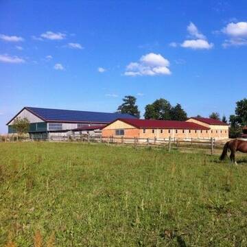
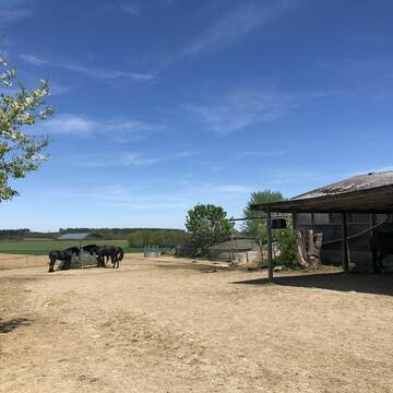
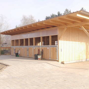
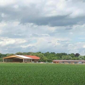
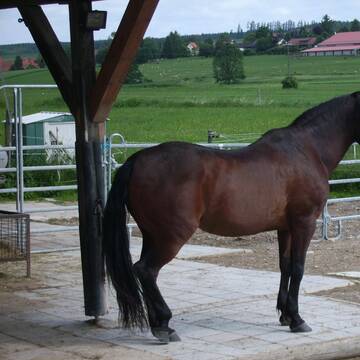
Paddocktrail mit Magerheufütterung
Mammendorf
Ruth Wermes
@Pferdegarten-Mammendorf
Freizeitstall
Hunde willkommen
Krankenbox
Allergikerstall
Hufrehe geeignet
Bewegungsstall
Laufstall
11 weitere...
ganz aktuell
S
Deprecated: Creation of dynamic property Zend_View_Helper_Ads::$adLink is deprecated in /var/www/stall-frei/htdocs/staging.stall-frei.de/library/Psf/View/Helper/Ads.php on line 108

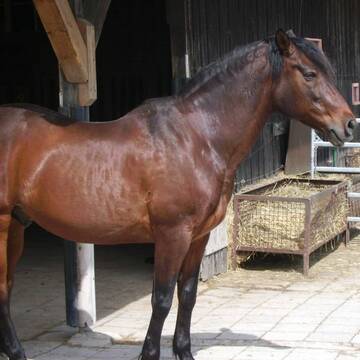
Neuer HIT Aktivstall - Gut Moosrain
Murnau am Staffelsee
Markus-Simson
@Markus-Simson
Wir bieten Ihnen das HIT Aktivstall Konzept auf dem neuesten Stand in einzigartiger Lage und in einer geschlossenen Anlage:
- Fut
neu
R
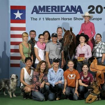

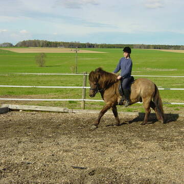
Lucky Horse Corral
Schwabhausen
Harald-Betz
@Harald-Betz
Pferdeausbildung
Reitlehrer und -unterricht
Paddock
Parkplatz für Pferdeanhänger
Allergikerstall
Hengsthaltung möglich
Außenbox mit Paddock
Innenbox
16 weitere...
S


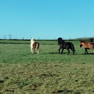
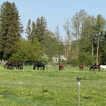
Stutenherde in Alling
Alling
Freizeitstall Alling
@Freizeitstall-Alling
Freizeitstall
Vermieten
Hunde willkommen
Krankenbox
bedampftes/gewaschenes Heu
Notfallboxen
17 weitere...
P+
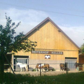
Reiterhof Keller
Gilching
Reiterhof-Keller
@Reiterhof-Keller
FN-Mitglied
Freizeitstall
Vermieten
Longierzirkel/Roundpen
Paddock
Hufrehe geeignet
15 weitere...
P+
Reit- und Trainingsstall Niedermayr
Olching
Westerntraining-wagner-franzisca
@Westerntraining-wagner-franzis...
Fahrstall, Kutschwagen
Freizeitstall
Vermieten
Longierzirkel/Roundpen
Paddock
Außenbox mit Paddock
Offenstall
13 weitere...
P

Boxen Frei!!
Maisach
Reitstall Thurner
@ReitstallThurner
Freizeitstall
Vermieten
Hunde willkommen
Longierzirkel/Roundpen
Notfallboxen
11 weitere...
aktuell
P
Reitstall Loder
Palsweis
Reitstall-Loder
@Reitstall-Loder
Vermieten
Verpachten
Krankenbox
Longierzirkel/Roundpen
Außenbox mit Paddock
Außenboxen
Selbstversorgung
Vollpension
15 weitere...
P


Reitstall Strobl - Boxen frei - Münchner Westen
München
Reit- und Trabrennstall Strobl
@REITSTALL_STROBL
Fahrstall, Kutschwagen
Freizeitstall
Führanlage
Hunde willkommen
bedampftes/gewaschenes Heu
Hengsthaltung möglich
Außenboxen
Innenbox
22 weitere...
P+

Aktivstall Blaslhof , der Weg lohnt sich!!
Uffing am Staffelsee
Blaslhof Aktivstall
@Blaslhof
Unser HIT Aktivstall ist 2008 mit 5 Stallsternen, der höchstmöglichen Auszeichnung für Artgerechte Pferdehaltung belohnt worde
Offenstall mit 5 ha Koppeln in 1a Reitgebiet
Dünzelbach
Offenstall-Lithof
@Offenstall-Lithof
Freizeitstall
Geländestrecke
Vermieten
Krankenbox
Sattelkammer/Sattelschränke
Offenstall
6 weitere...
S


AktivStall am Holzgarten bei München
Dachau
AktivStall am Holzgarten
@AktivStall-am-Holzgarten
FN-Mitglied
VFD-Mitglied
Vermieten
Hunde willkommen
Krankenbox
Notfallboxen
16 weitere...
P+
Deprecated: Creation of dynamic property Zend_View::$pageCount is deprecated in /var/www/stall-frei/htdocs/staging.stall-frei.de/library/vendor/shardj/zf1-future/library/Zend/View/Abstract.php on line 308
Deprecated: Creation of dynamic property Zend_View::$itemCountPerPage is deprecated in /var/www/stall-frei/htdocs/staging.stall-frei.de/library/vendor/shardj/zf1-future/library/Zend/View/Abstract.php on line 308
Deprecated: Creation of dynamic property Zend_View::$first is deprecated in /var/www/stall-frei/htdocs/staging.stall-frei.de/library/vendor/shardj/zf1-future/library/Zend/View/Abstract.php on line 308
Deprecated: Creation of dynamic property Zend_View::$current is deprecated in /var/www/stall-frei/htdocs/staging.stall-frei.de/library/vendor/shardj/zf1-future/library/Zend/View/Abstract.php on line 308
Deprecated: Creation of dynamic property Zend_View::$last is deprecated in /var/www/stall-frei/htdocs/staging.stall-frei.de/library/vendor/shardj/zf1-future/library/Zend/View/Abstract.php on line 308
Deprecated: Creation of dynamic property Zend_View::$next is deprecated in /var/www/stall-frei/htdocs/staging.stall-frei.de/library/vendor/shardj/zf1-future/library/Zend/View/Abstract.php on line 308
Deprecated: Creation of dynamic property Zend_View::$pagesInRange is deprecated in /var/www/stall-frei/htdocs/staging.stall-frei.de/library/vendor/shardj/zf1-future/library/Zend/View/Abstract.php on line 308
Deprecated: Creation of dynamic property Zend_View::$firstPageInRange is deprecated in /var/www/stall-frei/htdocs/staging.stall-frei.de/library/vendor/shardj/zf1-future/library/Zend/View/Abstract.php on line 308
Deprecated: Creation of dynamic property Zend_View::$lastPageInRange is deprecated in /var/www/stall-frei/htdocs/staging.stall-frei.de/library/vendor/shardj/zf1-future/library/Zend/View/Abstract.php on line 308
Deprecated: Creation of dynamic property Zend_View::$currentItemCount is deprecated in /var/www/stall-frei/htdocs/staging.stall-frei.de/library/vendor/shardj/zf1-future/library/Zend/View/Abstract.php on line 308
Deprecated: Creation of dynamic property Zend_View::$totalItemCount is deprecated in /var/www/stall-frei/htdocs/staging.stall-frei.de/library/vendor/shardj/zf1-future/library/Zend/View/Abstract.php on line 308
Deprecated: Creation of dynamic property Zend_View::$firstItemNumber is deprecated in /var/www/stall-frei/htdocs/staging.stall-frei.de/library/vendor/shardj/zf1-future/library/Zend/View/Abstract.php on line 308
Deprecated: Creation of dynamic property Zend_View::$lastItemNumber is deprecated in /var/www/stall-frei/htdocs/staging.stall-frei.de/library/vendor/shardj/zf1-future/library/Zend/View/Abstract.php on line 308
Deprecated: Creation of dynamic property Zend_View::$router is deprecated in /var/www/stall-frei/htdocs/staging.stall-frei.de/library/vendor/shardj/zf1-future/library/Zend/View/Abstract.php on line 308
Deprecated: Creation of dynamic property Zend_View::$urlParams is deprecated in /var/www/stall-frei/htdocs/staging.stall-frei.de/library/vendor/shardj/zf1-future/library/Zend/View/Abstract.php on line 308
Deprecated: Creation of dynamic property Zend_View::$showAds is deprecated in /var/www/stall-frei/htdocs/staging.stall-frei.de/library/vendor/shardj/zf1-future/library/Zend/View/Abstract.php on line 308
Deprecated: Creation of dynamic property Zend_View::$objectIds is deprecated in /var/www/stall-frei/htdocs/staging.stall-frei.de/library/vendor/shardj/zf1-future/library/Zend/View/Abstract.php on line 308
Deprecated: Creation of dynamic property Zend_View::$showNavbar is deprecated in /var/www/stall-frei/htdocs/staging.stall-frei.de/library/vendor/shardj/zf1-future/library/Zend/View/Abstract.php on line 308
Deprecated: Creation of dynamic property Zend_View::$showBreadcrumb is deprecated in /var/www/stall-frei/htdocs/staging.stall-frei.de/library/vendor/shardj/zf1-future/library/Zend/View/Abstract.php on line 308
Deprecated: Creation of dynamic property Zend_View::$showFooter is deprecated in /var/www/stall-frei/htdocs/staging.stall-frei.de/library/vendor/shardj/zf1-future/library/Zend/View/Abstract.php on line 308
Deprecated: Creation of dynamic property Zend_View::$showInternalAds is deprecated in /var/www/stall-frei/htdocs/staging.stall-frei.de/library/vendor/shardj/zf1-future/library/Zend/View/Abstract.php on line 308
Deprecated: Creation of dynamic property Zend_View::$blNoContent is deprecated in /var/www/stall-frei/htdocs/staging.stall-frei.de/library/vendor/shardj/zf1-future/library/Zend/View/Abstract.php on line 308
Deprecated: Creation of dynamic property Zend_View::$sMetaDesc is deprecated in /var/www/stall-frei/htdocs/staging.stall-frei.de/library/vendor/shardj/zf1-future/library/Zend/View/Abstract.php on line 308
Deprecated: Creation of dynamic property Zend_View::$useGmaps is deprecated in /var/www/stall-frei/htdocs/staging.stall-frei.de/library/vendor/shardj/zf1-future/library/Zend/View/Abstract.php on line 308
Deprecated: Creation of dynamic property Zend_View::$touches is deprecated in /var/www/stall-frei/htdocs/staging.stall-frei.de/library/vendor/shardj/zf1-future/library/Zend/View/Abstract.php on line 308
Deprecated: Creation of dynamic property Zend_View::$oProject is deprecated in /var/www/stall-frei/htdocs/staging.stall-frei.de/library/vendor/shardj/zf1-future/library/Zend/View/Abstract.php on line 308
Deprecated: Creation of dynamic property Zend_View::$pageHeadline is deprecated in /var/www/stall-frei/htdocs/staging.stall-frei.de/library/vendor/shardj/zf1-future/library/Zend/View/Abstract.php on line 308
Deprecated: Creation of dynamic property Zend_View::$disableLocationField is deprecated in /var/www/stall-frei/htdocs/staging.stall-frei.de/library/vendor/shardj/zf1-future/library/Zend/View/Abstract.php on line 308
Deprecated: Creation of dynamic property Zend_View::$isSearch is deprecated in /var/www/stall-frei/htdocs/staging.stall-frei.de/library/vendor/shardj/zf1-future/library/Zend/View/Abstract.php on line 308
Deprecated: Creation of dynamic property Zend_View::$pageTitle is deprecated in /var/www/stall-frei/htdocs/staging.stall-frei.de/library/vendor/shardj/zf1-future/library/Zend/View/Abstract.php on line 308
Deprecated: Creation of dynamic property Psf_Form_Element_Text::$class is deprecated in /var/www/stall-frei/htdocs/staging.stall-frei.de/library/vendor/shardj/zf1-future/library/Zend/Form/Element.php on line 874
Deprecated: Creation of dynamic property Psf_Form_Element_Text::$size is deprecated in /var/www/stall-frei/htdocs/staging.stall-frei.de/library/vendor/shardj/zf1-future/library/Zend/Form/Element.php on line 874
Deprecated: Creation of dynamic property Psf_Form_Element_Text::$placeholder is deprecated in /var/www/stall-frei/htdocs/staging.stall-frei.de/library/vendor/shardj/zf1-future/library/Zend/Form/Element.php on line 874
Deprecated: Creation of dynamic property Psf_Form_Element_Hidden::$class is deprecated in /var/www/stall-frei/htdocs/staging.stall-frei.de/library/vendor/shardj/zf1-future/library/Zend/Form/Element.php on line 874
Deprecated: Creation of dynamic property Psf_Form_Element_Hidden::$class is deprecated in /var/www/stall-frei/htdocs/staging.stall-frei.de/library/vendor/shardj/zf1-future/library/Zend/Form/Element.php on line 874
Deprecated: Creation of dynamic property Psf_Form_Element_Hidden::$class is deprecated in /var/www/stall-frei/htdocs/staging.stall-frei.de/library/vendor/shardj/zf1-future/library/Zend/Form/Element.php on line 874
Deprecated: Creation of dynamic property Psf_Form_Element_Hidden::$class is deprecated in /var/www/stall-frei/htdocs/staging.stall-frei.de/library/vendor/shardj/zf1-future/library/Zend/Form/Element.php on line 874
Deprecated: Creation of dynamic property Psf_Form_Element_Select::$class is deprecated in /var/www/stall-frei/htdocs/staging.stall-frei.de/library/vendor/shardj/zf1-future/library/Zend/Form/Element.php on line 874
Deprecated: Creation of dynamic property Psf_Form_Element_Select::$class is deprecated in /var/www/stall-frei/htdocs/staging.stall-frei.de/library/vendor/shardj/zf1-future/library/Zend/Form/Element.php on line 874
Deprecated: Creation of dynamic property Psf_Form_Element_Select::$class is deprecated in /var/www/stall-frei/htdocs/staging.stall-frei.de/library/vendor/shardj/zf1-future/library/Zend/Form/Element.php on line 874
Deprecated: Creation of dynamic property Psf_Form_Element_Select::$class is deprecated in /var/www/stall-frei/htdocs/staging.stall-frei.de/library/vendor/shardj/zf1-future/library/Zend/Form/Element.php on line 874
Deprecated: Creation of dynamic property Psf_Form_Element_Text::$class is deprecated in /var/www/stall-frei/htdocs/staging.stall-frei.de/library/vendor/shardj/zf1-future/library/Zend/Form/Element.php on line 874
Deprecated: Creation of dynamic property Psf_Form_Element_Checkbox::$label is deprecated in /var/www/stall-frei/htdocs/staging.stall-frei.de/library/vendor/shardj/zf1-future/library/Zend/Form/Element.php on line 874
Deprecated: Creation of dynamic property Zend_View::$sort is deprecated in /var/www/stall-frei/htdocs/staging.stall-frei.de/library/vendor/shardj/zf1-future/library/Zend/View/Abstract.php on line 308
Deprecated: Creation of dynamic property Zend_View::$searchLocation is deprecated in /var/www/stall-frei/htdocs/staging.stall-frei.de/library/vendor/shardj/zf1-future/library/Zend/View/Abstract.php on line 308
Deprecated: Creation of dynamic property Zend_View::$locationHint is deprecated in /var/www/stall-frei/htdocs/staging.stall-frei.de/library/vendor/shardj/zf1-future/library/Zend/View/Abstract.php on line 308
Psf_GeoCoder_Abstract::getLocation: Gernlinden, Maisach Get Location CachedOrLive
Psf_GeoCoder_Abstract::getCachedOrLive: Gernlinden, Maisach
Psf_GeoCoder_OpenCageData::makeApiRequest: response:
Array
(
[documentation] => https://opencagedata.com/api
[licenses] => Array
(
[0] => Array
(
[name] => see attribution guide
[url] => https://opencagedata.com/credits
)
)
[results] => Array
(
[0] => Array
(
[bounds] => Array
(
[northeast] => Array
(
[lat] => 48.2310265
[lng] => 11.3129572
)
[southwest] => Array
(
[lat] => 48.1910265
[lng] => 11.2729572
)
)
[components] => Array
(
[ISO_3166-1_alpha-2] => DE
[ISO_3166-1_alpha-3] => DEU
[ISO_3166-2] => Array
(
[0] => DE-BY
)
[_category] => place
[_normalized_city] => Maisach
[_type] => village
[city] => Maisach
[continent] => Europe
[country] => Deutschland
[country_code] => de
[county] => Landkreis Fürstenfeldbruck
[political_union] => European Union
[postcode] => 82216
[state] => Bayern
[state_code] => BY
[village] => Gernlinden
)
[confidence] => 7
[formatted] => 82216 Gernlinden, Deutschland
[geometry] => Array
(
[lat] => 48.2110265
[lng] => 11.2929572
)
)
[1] => Array
(
[bounds] => Array
(
[northeast] => Array
(
[lat] => 48.2127984
[lng] => 11.3005562
)
[southwest] => Array
(
[lat] => 48.2126984
[lng] => 11.3004562
)
)
[components] => Array
(
[ISO_3166-1_alpha-2] => DE
[ISO_3166-1_alpha-3] => DEU
[ISO_3166-2] => Array
(
[0] => DE-BY
)
[_category] => transportation
[_normalized_city] => Maisach
[_type] => railway
[city] => Maisach
[continent] => Europe
[country] => Deutschland
[country_code] => de
[county] => Landkreis Fürstenfeldbruck
[political_union] => European Union
[postcode] => 82216
[railway] => Gernlinden
[road] => Heinestraße
[state] => Bayern
[state_code] => BY
[village] => Gernlinden
)
[confidence] => 9
[formatted] => Gernlinden, Heinestraße, 82216 Gernlinden, Deutschland
[geometry] => Array
(
[lat] => 48.2127484
[lng] => 11.3005062
)
)
[2] => Array
(
[components] => Array
(
[ISO_3166-1_alpha-2] => FR
[ISO_3166-1_alpha-3] => FRA
[ISO_3166-2] => Array
(
[0] => FR-OCC
[1] => FR-12
)
[_category] => road
[_normalized_city] => Combret
[_type] => road
[city] => Combret
[continent] => Europe
[country] => France
[country_code] => fr
[county] => Aveyron
[local_authority] => Communauté de communes Monts, Rance et Rougier
[political_union] => European Union
[postcode] => 12370
[road] => Chemin de Cayzac
[state] => Occitanie
[state_code] => OCC
)
[confidence] => 10
[formatted] => Chemin de Cayzac, 12370 Combret, France
[geometry] => Array
(
[lat] => 43.873604
[lng] => 2.662026
)
)
[3] => Array
(
[components] => Array
(
[ISO_3166-1_alpha-2] => FR
[ISO_3166-1_alpha-3] => FRA
[ISO_3166-2] => Array
(
[0] => FR-OCC
[1] => FR-81
)
[_category] => road
[_normalized_city] => Barre
[_type] => road
[city] => Barre
[continent] => Europe
[country] => France
[country_code] => fr
[county] => Tarn
[local_authority] => Communauté de communes des Monts de Lacaune et de la Montagne du Haut Languedoc
[political_union] => European Union
[postcode] => 81320
[road] => Chemin de Cayzac
[state] => Occitanie
[state_code] => OCC
)
[confidence] => 10
[formatted] => Chemin de Cayzac, 81320 Barre, France
[geometry] => Array
(
[lat] => 43.742626
[lng] => 2.7896
)
)
[4] => Array
(
[components] => Array
(
[ISO_3166-1_alpha-2] => FR
[ISO_3166-1_alpha-3] => FRA
[ISO_3166-2] => Array
(
[0] => FR-OCC
[1] => FR-09
)
[_category] => road
[_normalized_city] => Belloc
[_type] => road
[city] => Belloc
[continent] => Europe
[country] => France
[country_code] => fr
[county] => Ariège
[local_authority] => Communauté de communes du Pays de Mirepoix
[political_union] => European Union
[postcode] => 09600
[road] => Chemin de Gayzac
[state] => Occitanie
[state_code] => OCC
)
[confidence] => 10
[formatted] => Chemin de Gayzac, 09600 Belloc, France
[geometry] => Array
(
[lat] => 43.01219
[lng] => 1.931266
)
)
[5] => Array
(
[components] => Array
(
[ISO_3166-1_alpha-2] => FR
[ISO_3166-1_alpha-3] => FRA
[ISO_3166-2] => Array
(
[0] => FR-NAQ
[1] => FR-19
)
[_category] => road
[_normalized_city] => Lubersac
[_type] => road
[city] => Lubersac
[continent] => Europe
[country] => France
[country_code] => fr
[county] => Corrèze
[local_authority] => Communauté de communes du Pays de Lubersac-Pompadour
[political_union] => European Union
[postcode] => 19210
[road] => Impasse de Meyzac
[state] => Nouvelle-Aquitaine
[state_code] => NAQ
)
[confidence] => 10
[formatted] => Impasse de Meyzac, 19210 Lubersac, France
[geometry] => Array
(
[lat] => 45.451436
[lng] => 1.396348
)
)
[6] => Array
(
[components] => Array
(
[ISO_3166-1_alpha-2] => FR
[ISO_3166-1_alpha-3] => FRA
[ISO_3166-2] => Array
(
[0] => FR-NAQ
[1] => FR-19
)
[_category] => road
[_normalized_city] => Lubersac
[_type] => road
[city] => Lubersac
[continent] => Europe
[country] => France
[country_code] => fr
[county] => Corrèze
[local_authority] => Communauté de communes du Pays de Lubersac-Pompadour
[political_union] => European Union
[postcode] => 19210
[road] => Impasse des Champs de Meyzac
[state] => Nouvelle-Aquitaine
[state_code] => NAQ
)
[confidence] => 10
[formatted] => Impasse des Champs de Meyzac, 19210 Lubersac, France
[geometry] => Array
(
[lat] => 45.452341
[lng] => 1.403076
)
)
[7] => Array
(
[components] => Array
(
[ISO_3166-1_alpha-2] => FR
[ISO_3166-1_alpha-3] => FRA
[ISO_3166-2] => Array
(
[0] => FR-OCC
[1] => FR-12
)
[_category] => road
[_normalized_city] => Saint-Jean-Delnous
[_type] => road
[city] => Saint-Jean-Delnous
[continent] => Europe
[country] => France
[country_code] => fr
[county] => Aveyron
[local_authority] => Communauté de communes du Réquistanais
[political_union] => European Union
[postcode] => 12170
[road] => Route de Cayzac
[state] => Occitanie
[state_code] => OCC
)
[confidence] => 10
[formatted] => Route de Cayzac, 12170 Saint-Jean-Delnous, France
[geometry] => Array
(
[lat] => 44.03017
[lng] => 2.493429
)
)
[8] => Array
(
[components] => Array
(
[ISO_3166-1_alpha-2] => FR
[ISO_3166-1_alpha-3] => FRA
[ISO_3166-2] => Array
(
[0] => FR-NAQ
[1] => FR-19
)
[_category] => road
[_normalized_city] => Lubersac
[_type] => road
[city] => Lubersac
[continent] => Europe
[country] => France
[country_code] => fr
[county] => Corrèze
[local_authority] => Communauté de communes du Pays de Lubersac-Pompadour
[political_union] => European Union
[postcode] => 19210
[road] => Rue de la Croix de Meyzac
[state] => Nouvelle-Aquitaine
[state_code] => NAQ
)
[confidence] => 10
[formatted] => Rue de la Croix de Meyzac, 19210 Lubersac, France
[geometry] => Array
(
[lat] => 45.449053
[lng] => 1.400567
)
)
[9] => Array
(
[components] => Array
(
[ISO_3166-1_alpha-2] => FR
[ISO_3166-1_alpha-3] => FRA
[ISO_3166-2] => Array
(
[0] => FR-NAQ
[1] => FR-47
)
[_category] => road
[_normalized_city] => Salles
[_type] => road
[city] => Salles
[continent] => Europe
[country] => France
[country_code] => fr
[county] => Lot-et-Garonne
[local_authority] => Communauté de communes des Bastides en Haut-Agenais Périgord
[political_union] => European Union
[postcode] => 47150
[road] => route de cayzac
[state] => Nouvelle-Aquitaine
[state_code] => NAQ
)
[confidence] => 10
[formatted] => route de cayzac, 47150 Salles, France
[geometry] => Array
(
[lat] => 44.532526
[lng] => 0.870438
)
)
)
[status] => Array
(
[code] => 200
[message] => OK
)
[stay_informed] => Array
(
[blog] => https://blog.opencagedata.com
[mastodon] => https://en.osm.town/@opencage
)
[thanks] => For using an OpenCage API
[timestamp] => Array
(
[created_http] => Sun, 08 Feb 2026 19:31:14 GMT
[created_unix] => 1770579074
)
[total_results] => 10
)
Psf_GeoCoder_Abstract::convertLocationResult
{"documentation":"https:\/\/opencagedata.com\/api","licenses":[{"name":"see attribution guide","url":"https:\/\/opencagedata.com\/credits"}],"results":[{"bounds":{"northeast":{"lat":48.2310265,"lng":11.3129572},"southwest":{"lat":48.1910265,"lng":11.2729572}},"components":{"ISO_3166-1_alpha-2":"DE","ISO_3166-1_alpha-3":"DEU","ISO_3166-2":["DE-BY"],"_category":"place","_normalized_city":"Maisach","_type":"village","city":"Maisach","continent":"Europe","country":"Deutschland","country_code":"de","county":"Landkreis F\u00fcrstenfeldbruck","political_union":"European Union","postcode":"82216","state":"Bayern","state_code":"BY","village":"Gernlinden"},"confidence":7,"formatted":"82216 Gernlinden, Deutschland","geometry":{"lat":48.2110265,"lng":11.2929572}},{"bounds":{"northeast":{"lat":48.2127984,"lng":11.3005562},"southwest":{"lat":48.2126984,"lng":11.3004562}},"components":{"ISO_3166-1_alpha-2":"DE","ISO_3166-1_alpha-3":"DEU","ISO_3166-2":["DE-BY"],"_category":"transportation","_normalized_city":"Maisach","_type":"railway","city":"Maisach","continent":"Europe","country":"Deutschland","country_code":"de","county":"Landkreis F\u00fcrstenfeldbruck","political_union":"European Union","postcode":"82216","railway":"Gernlinden","road":"Heinestra\u00dfe","state":"Bayern","state_code":"BY","village":"Gernlinden"},"confidence":9,"formatted":"Gernlinden, Heinestra\u00dfe, 82216 Gernlinden, Deutschland","geometry":{"lat":48.2127484,"lng":11.3005062}},{"components":{"ISO_3166-1_alpha-2":"FR","ISO_3166-1_alpha-3":"FRA","ISO_3166-2":["FR-OCC","FR-12"],"_category":"road","_normalized_city":"Combret","_type":"road","city":"Combret","continent":"Europe","country":"France","country_code":"fr","county":"Aveyron","local_authority":"Communaut\u00e9 de communes Monts, Rance et Rougier","political_union":"European Union","postcode":"12370","road":"Chemin de Cayzac","state":"Occitanie","state_code":"OCC"},"confidence":10,"formatted":"Chemin de Cayzac, 12370 Combret, France","geometry":{"lat":43.873604,"lng":2.662026}},{"components":{"ISO_3166-1_alpha-2":"FR","ISO_3166-1_alpha-3":"FRA","ISO_3166-2":["FR-OCC","FR-81"],"_category":"road","_normalized_city":"Barre","_type":"road","city":"Barre","continent":"Europe","country":"France","country_code":"fr","county":"Tarn","local_authority":"Communaut\u00e9 de communes des Monts de Lacaune et de la Montagne du Haut Languedoc","political_union":"European Union","postcode":"81320","road":"Chemin de Cayzac","state":"Occitanie","state_code":"OCC"},"confidence":10,"formatted":"Chemin de Cayzac, 81320 Barre, France","geometry":{"lat":43.742626,"lng":2.7896}},{"components":{"ISO_3166-1_alpha-2":"FR","ISO_3166-1_alpha-3":"FRA","ISO_3166-2":["FR-OCC","FR-09"],"_category":"road","_normalized_city":"Belloc","_type":"road","city":"Belloc","continent":"Europe","country":"France","country_code":"fr","county":"Ari\u00e8ge","local_authority":"Communaut\u00e9 de communes du Pays de Mirepoix","political_union":"European Union","postcode":"09600","road":"Chemin de Gayzac","state":"Occitanie","state_code":"OCC"},"confidence":10,"formatted":"Chemin de Gayzac, 09600 Belloc, France","geometry":{"lat":43.01219,"lng":1.931266}},{"components":{"ISO_3166-1_alpha-2":"FR","ISO_3166-1_alpha-3":"FRA","ISO_3166-2":["FR-NAQ","FR-19"],"_category":"road","_normalized_city":"Lubersac","_type":"road","city":"Lubersac","continent":"Europe","country":"France","country_code":"fr","county":"Corr\u00e8ze","local_authority":"Communaut\u00e9 de communes du Pays de Lubersac-Pompadour","political_union":"European Union","postcode":"19210","road":"Impasse de Meyzac","state":"Nouvelle-Aquitaine","state_code":"NAQ"},"confidence":10,"formatted":"Impasse de Meyzac, 19210 Lubersac, France","geometry":{"lat":45.451436,"lng":1.396348}},{"components":{"ISO_3166-1_alpha-2":"FR","ISO_3166-1_alpha-3":"FRA","ISO_3166-2":["FR-NAQ","FR-19"],"_category":"road","_normalized_city":"Lubersac","_type":"road","city":"Lubersac","continent":"Europe","country":"France","country_code":"fr","county":"Corr\u00e8ze","local_authority":"Communaut\u00e9 de communes du Pays de Lubersac-Pompadour","political_union":"European Union","postcode":"19210","road":"Impasse des Champs de Meyzac","state":"Nouvelle-Aquitaine","state_code":"NAQ"},"confidence":10,"formatted":"Impasse des Champs de Meyzac, 19210 Lubersac, France","geometry":{"lat":45.452341,"lng":1.403076}},{"components":{"ISO_3166-1_alpha-2":"FR","ISO_3166-1_alpha-3":"FRA","ISO_3166-2":["FR-OCC","FR-12"],"_category":"road","_normalized_city":"Saint-Jean-Delnous","_type":"road","city":"Saint-Jean-Delnous","continent":"Europe","country":"France","country_code":"fr","county":"Aveyron","local_authority":"Communaut\u00e9 de communes du R\u00e9quistanais","political_union":"European Union","postcode":"12170","road":"Route de Cayzac","state":"Occitanie","state_code":"OCC"},"confidence":10,"formatted":"Route de Cayzac, 12170 Saint-Jean-Delnous, France","geometry":{"lat":44.03017,"lng":2.493429}},{"components":{"ISO_3166-1_alpha-2":"FR","ISO_3166-1_alpha-3":"FRA","ISO_3166-2":["FR-NAQ","FR-19"],"_category":"road","_normalized_city":"Lubersac","_type":"road","city":"Lubersac","continent":"Europe","country":"France","country_code":"fr","county":"Corr\u00e8ze","local_authority":"Communaut\u00e9 de communes du Pays de Lubersac-Pompadour","political_union":"European Union","postcode":"19210","road":"Rue de la Croix de Meyzac","state":"Nouvelle-Aquitaine","state_code":"NAQ"},"confidence":10,"formatted":"Rue de la Croix de Meyzac, 19210 Lubersac, France","geometry":{"lat":45.449053,"lng":1.400567}},{"components":{"ISO_3166-1_alpha-2":"FR","ISO_3166-1_alpha-3":"FRA","ISO_3166-2":["FR-NAQ","FR-47"],"_category":"road","_normalized_city":"Salles","_type":"road","city":"Salles","continent":"Europe","country":"France","country_code":"fr","county":"Lot-et-Garonne","local_authority":"Communaut\u00e9 de communes des Bastides en Haut-Agenais P\u00e9rigord","political_union":"European Union","postcode":"47150","road":"route de cayzac","state":"Nouvelle-Aquitaine","state_code":"NAQ"},"confidence":10,"formatted":"route de cayzac, 47150 Salles, France","geometry":{"lat":44.532526,"lng":0.870438}}],"status":{"code":200,"message":"OK"},"stay_informed":{"blog":"https:\/\/blog.opencagedata.com","mastodon":"https:\/\/en.osm.town\/@opencage"},"thanks":"For using an OpenCage API","timestamp":{"created_http":"Sun, 08 Feb 2026 19:31:14 GMT","created_unix":1770579074},"total_results":10}Array
(
[0] => stdClass Object
(
[bounds] => stdClass Object
(
[northeast] => stdClass Object
(
[lat] => 48.2310265
[lng] => 11.3129572
)
[southwest] => stdClass Object
(
[lat] => 48.1910265
[lng] => 11.2729572
)
)
[components] => stdClass Object
(
[ISO_3166-1_alpha-2] => DE
[ISO_3166-1_alpha-3] => DEU
[ISO_3166-2] => Array
(
[0] => DE-BY
)
[_category] => place
[_normalized_city] => Maisach
[_type] => village
[city] => Maisach
[continent] => Europe
[country] => Deutschland
[country_code] => de
[county] => Landkreis Fürstenfeldbruck
[political_union] => European Union
[postcode] => 82216
[state] => Bayern
[state_code] => BY
[village] => Gernlinden
)
[confidence] => 7
[formatted] => 82216 Gernlinden, Deutschland
[geometry] => stdClass Object
(
[lat] => 48.2110265
[lng] => 11.2929572
)
)
[1] => stdClass Object
(
[bounds] => stdClass Object
(
[northeast] => stdClass Object
(
[lat] => 48.2127984
[lng] => 11.3005562
)
[southwest] => stdClass Object
(
[lat] => 48.2126984
[lng] => 11.3004562
)
)
[components] => stdClass Object
(
[ISO_3166-1_alpha-2] => DE
[ISO_3166-1_alpha-3] => DEU
[ISO_3166-2] => Array
(
[0] => DE-BY
)
[_category] => transportation
[_normalized_city] => Maisach
[_type] => railway
[city] => Maisach
[continent] => Europe
[country] => Deutschland
[country_code] => de
[county] => Landkreis Fürstenfeldbruck
[political_union] => European Union
[postcode] => 82216
[railway] => Gernlinden
[road] => Heinestraße
[state] => Bayern
[state_code] => BY
[village] => Gernlinden
)
[confidence] => 9
[formatted] => Gernlinden, Heinestraße, 82216 Gernlinden, Deutschland
[geometry] => stdClass Object
(
[lat] => 48.2127484
[lng] => 11.3005062
)
)
[2] => stdClass Object
(
[components] => stdClass Object
(
[ISO_3166-1_alpha-2] => FR
[ISO_3166-1_alpha-3] => FRA
[ISO_3166-2] => Array
(
[0] => FR-OCC
[1] => FR-12
)
[_category] => road
[_normalized_city] => Combret
[_type] => road
[city] => Combret
[continent] => Europe
[country] => France
[country_code] => fr
[county] => Aveyron
[local_authority] => Communauté de communes Monts, Rance et Rougier
[political_union] => European Union
[postcode] => 12370
[road] => Chemin de Cayzac
[state] => Occitanie
[state_code] => OCC
)
[confidence] => 10
[formatted] => Chemin de Cayzac, 12370 Combret, France
[geometry] => stdClass Object
(
[lat] => 43.873604
[lng] => 2.662026
)
)
[3] => stdClass Object
(
[components] => stdClass Object
(
[ISO_3166-1_alpha-2] => FR
[ISO_3166-1_alpha-3] => FRA
[ISO_3166-2] => Array
(
[0] => FR-OCC
[1] => FR-81
)
[_category] => road
[_normalized_city] => Barre
[_type] => road
[city] => Barre
[continent] => Europe
[country] => France
[country_code] => fr
[county] => Tarn
[local_authority] => Communauté de communes des Monts de Lacaune et de la Montagne du Haut Languedoc
[political_union] => European Union
[postcode] => 81320
[road] => Chemin de Cayzac
[state] => Occitanie
[state_code] => OCC
)
[confidence] => 10
[formatted] => Chemin de Cayzac, 81320 Barre, France
[geometry] => stdClass Object
(
[lat] => 43.742626
[lng] => 2.7896
)
)
[4] => stdClass Object
(
[components] => stdClass Object
(
[ISO_3166-1_alpha-2] => FR
[ISO_3166-1_alpha-3] => FRA
[ISO_3166-2] => Array
(
[0] => FR-OCC
[1] => FR-09
)
[_category] => road
[_normalized_city] => Belloc
[_type] => road
[city] => Belloc
[continent] => Europe
[country] => France
[country_code] => fr
[county] => Ariège
[local_authority] => Communauté de communes du Pays de Mirepoix
[political_union] => European Union
[postcode] => 09600
[road] => Chemin de Gayzac
[state] => Occitanie
[state_code] => OCC
)
[confidence] => 10
[formatted] => Chemin de Gayzac, 09600 Belloc, France
[geometry] => stdClass Object
(
[lat] => 43.01219
[lng] => 1.931266
)
)
[5] => stdClass Object
(
[components] => stdClass Object
(
[ISO_3166-1_alpha-2] => FR
[ISO_3166-1_alpha-3] => FRA
[ISO_3166-2] => Array
(
[0] => FR-NAQ
[1] => FR-19
)
[_category] => road
[_normalized_city] => Lubersac
[_type] => road
[city] => Lubersac
[continent] => Europe
[country] => France
[country_code] => fr
[county] => Corrèze
[local_authority] => Communauté de communes du Pays de Lubersac-Pompadour
[political_union] => European Union
[postcode] => 19210
[road] => Impasse de Meyzac
[state] => Nouvelle-Aquitaine
[state_code] => NAQ
)
[confidence] => 10
[formatted] => Impasse de Meyzac, 19210 Lubersac, France
[geometry] => stdClass Object
(
[lat] => 45.451436
[lng] => 1.396348
)
)
[6] => stdClass Object
(
[components] => stdClass Object
(
[ISO_3166-1_alpha-2] => FR
[ISO_3166-1_alpha-3] => FRA
[ISO_3166-2] => Array
(
[0] => FR-NAQ
[1] => FR-19
)
[_category] => road
[_normalized_city] => Lubersac
[_type] => road
[city] => Lubersac
[continent] => Europe
[country] => France
[country_code] => fr
[county] => Corrèze
[local_authority] => Communauté de communes du Pays de Lubersac-Pompadour
[political_union] => European Union
[postcode] => 19210
[road] => Impasse des Champs de Meyzac
[state] => Nouvelle-Aquitaine
[state_code] => NAQ
)
[confidence] => 10
[formatted] => Impasse des Champs de Meyzac, 19210 Lubersac, France
[geometry] => stdClass Object
(
[lat] => 45.452341
[lng] => 1.403076
)
)
[7] => stdClass Object
(
[components] => stdClass Object
(
[ISO_3166-1_alpha-2] => FR
[ISO_3166-1_alpha-3] => FRA
[ISO_3166-2] => Array
(
[0] => FR-OCC
[1] => FR-12
)
[_category] => road
[_normalized_city] => Saint-Jean-Delnous
[_type] => road
[city] => Saint-Jean-Delnous
[continent] => Europe
[country] => France
[country_code] => fr
[county] => Aveyron
[local_authority] => Communauté de communes du Réquistanais
[political_union] => European Union
[postcode] => 12170
[road] => Route de Cayzac
[state] => Occitanie
[state_code] => OCC
)
[confidence] => 10
[formatted] => Route de Cayzac, 12170 Saint-Jean-Delnous, France
[geometry] => stdClass Object
(
[lat] => 44.03017
[lng] => 2.493429
)
)
[8] => stdClass Object
(
[components] => stdClass Object
(
[ISO_3166-1_alpha-2] => FR
[ISO_3166-1_alpha-3] => FRA
[ISO_3166-2] => Array
(
[0] => FR-NAQ
[1] => FR-19
)
[_category] => road
[_normalized_city] => Lubersac
[_type] => road
[city] => Lubersac
[continent] => Europe
[country] => France
[country_code] => fr
[county] => Corrèze
[local_authority] => Communauté de communes du Pays de Lubersac-Pompadour
[political_union] => European Union
[postcode] => 19210
[road] => Rue de la Croix de Meyzac
[state] => Nouvelle-Aquitaine
[state_code] => NAQ
)
[confidence] => 10
[formatted] => Rue de la Croix de Meyzac, 19210 Lubersac, France
[geometry] => stdClass Object
(
[lat] => 45.449053
[lng] => 1.400567
)
)
[9] => stdClass Object
(
[components] => stdClass Object
(
[ISO_3166-1_alpha-2] => FR
[ISO_3166-1_alpha-3] => FRA
[ISO_3166-2] => Array
(
[0] => FR-NAQ
[1] => FR-47
)
[_category] => road
[_normalized_city] => Salles
[_type] => road
[city] => Salles
[continent] => Europe
[country] => France
[country_code] => fr
[county] => Lot-et-Garonne
[local_authority] => Communauté de communes des Bastides en Haut-Agenais Périgord
[political_union] => European Union
[postcode] => 47150
[road] => route de cayzac
[state] => Nouvelle-Aquitaine
[state_code] => NAQ
)
[confidence] => 10
[formatted] => route de cayzac, 47150 Salles, France
[geometry] => stdClass Object
(
[lat] => 44.532526
[lng] => 0.870438
)
)
)
Psf_GeoCoder_OpenCageData::getKeyMap: 0
stdClass Object
(
    [bounds] => stdClass Object
        (
            [northeast] => stdClass Object
                (
                    [lat] => 48.2310265
                    [lng] => 11.3129572
                )

            [southwest] => stdClass Object
                (
                    [lat] => 48.1910265
                    [lng] => 11.2729572
                )

        )

    [components] => stdClass Object
        (
            [ISO_3166-1_alpha-2] => DE
            [ISO_3166-1_alpha-3] => DEU
            [ISO_3166-2] => Array
                (
                    [0] => DE-BY
                )

            [_category] => place
            [_normalized_city] => Maisach
            [_type] => village
            [city] => Maisach
            [continent] => Europe
            [country] => Deutschland
            [country_code] => de
            [county] => Landkreis Fürstenfeldbruck
            [political_union] => European Union
            [postcode] => 82216
            [state] => Bayern
            [state_code] => BY
            [village] => Gernlinden
        )

    [confidence] => 7
    [formatted] => 82216 Gernlinden, Deutschland
    [geometry] => stdClass Object
        (
            [lat] => 48.2110265
            [lng] => 11.2929572
        )

)
Psf_GeoCoder_OpenCageData::getCounty: Fürstenfeldbruck
Psf_GeoCoder_OpenCageData::addMissingData REFETCH!
Array
(
    [address] => 82216 Gernlinden, Deutschland
    [type] => village
    [street] =>
    [city] => Gernlinden
    [county] => Fürstenfeldbruck
    [state] => Bayern
    [zip] => 82216
    [country] => Deutschland
    [suburb] =>
    [countrycode] => de
    [latitude] => 48.2110265
    [longitude] => 11.2929572
    [accuracy] => 1
    [confidence] => 7
    [bounds] => stdClass Object
        (
            [northeast] => stdClass Object
                (
                    [lat] => 48.2310265
                    [lng] => 11.3129572
                )

            [southwest] => stdClass Object
                (
                    [lat] => 48.1910265
                    [lng] => 11.2729572
                )

        )

)
reformat!
Array
(
    [address] => 82216 Gernlinden, Deutschland
    [type] => village
    [street] =>
    [city] => Gernlinden
    [county] => Fürstenfeldbruck
    [state] => Bayern
    [zip] => 82216
    [country] => Deutschland
    [suburb] =>
    [countrycode] => de
    [latitude] => 48.2110265
    [longitude] => 11.2929572
    [accuracy] => 1
    [confidence] => 7
    [bounds] => stdClass Object
        (
            [northeast] => stdClass Object
                (
                    [lat] => 48.2310265
                    [lng] => 11.3129572
                )

            [southwest] => stdClass Object
                (
                    [lat] => 48.1910265
                    [lng] => 11.2729572
                )

        )

    [place] => 82216 Gernlinden, Bayern
    [hash] => 7e605167936d165ccb2d67346494e255
)
Psf_GeoCoder_OpenCageData::getKeyMap: 1
stdClass Object
(
    [bounds] => stdClass Object
        (
            [northeast] => stdClass Object
                (
                    [lat] => 48.2127984
                    [lng] => 11.3005562
                )

            [southwest] => stdClass Object
                (
                    [lat] => 48.2126984
                    [lng] => 11.3004562
                )

        )

    [components] => stdClass Object
        (
            [ISO_3166-1_alpha-2] => DE
            [ISO_3166-1_alpha-3] => DEU
            [ISO_3166-2] => Array
                (
                    [0] => DE-BY
                )

            [_category] => transportation
            [_normalized_city] => Maisach
            [_type] => railway
            [city] => Maisach
            [continent] => Europe
            [country] => Deutschland
            [country_code] => de
            [county] => Landkreis Fürstenfeldbruck
            [political_union] => European Union
            [postcode] => 82216
            [railway] => Gernlinden
            [road] => Heinestraße
            [state] => Bayern
            [state_code] => BY
            [village] => Gernlinden
        )

    [confidence] => 9
    [formatted] => Gernlinden, Heinestraße, 82216 Gernlinden, Deutschland
    [geometry] => stdClass Object
        (
            [lat] => 48.2127484
            [lng] => 11.3005062
        )

)
Psf_GeoCoder_OpenCageData::getCounty: Fürstenfeldbruck
Psf_GeoCoder_OpenCageData::addMissingData REFETCH!
Array
(
    [address] => Gernlinden, Heinestraße, 82216 Gernlinden, Deutschland
    [type] => railway
    [street] => Heinestraße
    [city] => Gernlinden
    [county] => Fürstenfeldbruck
    [state] => Bayern
    [zip] => 82216
    [country] => Deutschland
    [suburb] =>
    [countrycode] => de
    [latitude] => 48.2127484
    [longitude] => 11.3005062
    [accuracy] => 1
    [confidence] => 9
    [bounds] => stdClass Object
        (
            [northeast] => stdClass Object
                (
                    [lat] => 48.2127984
                    [lng] => 11.3005562
                )

            [southwest] => stdClass Object
                (
                    [lat] => 48.2126984
                    [lng] => 11.3004562
                )

        )

)
reformat!
Array
(
    [address] => Gernlinden, Heinestraße, 82216 Gernlinden, Deutschland
    [type] => railway
    [street] => Heinestraße
    [city] => Gernlinden
    [county] => Fürstenfeldbruck
    [state] => Bayern
    [zip] => 82216
    [country] => Deutschland
    [suburb] =>
    [countrycode] => de
    [latitude] => 48.2127484
    [longitude] => 11.3005062
    [accuracy] => 1
    [confidence] => 9
    [bounds] => stdClass Object
        (
            [northeast] => stdClass Object
                (
                    [lat] => 48.2127984
                    [lng] => 11.3005562
                )

            [southwest] => stdClass Object
                (
                    [lat] => 48.2126984
                    [lng] => 11.3004562
                )

        )

    [place] => Heinestraße, 82216 Gernlinden, Bayern
    [hash] => 976be49a9e62f23854d5323c8aa89295
)
Psf_GeoCoder_OpenCageData::getKeyMap: 2
stdClass Object
(
    [components] => stdClass Object
        (
            [ISO_3166-1_alpha-2] => FR
            [ISO_3166-1_alpha-3] => FRA
            [ISO_3166-2] => Array
                (
                    [0] => FR-OCC
                    [1] => FR-12
                )

            [_category] => road
            [_normalized_city] => Combret
            [_type] => road
            [city] => Combret
            [continent] => Europe
            [country] => France
            [country_code] => fr
            [county] => Aveyron
            [local_authority] => Communauté de communes Monts, Rance et Rougier
            [political_union] => European Union
            [postcode] => 12370
            [road] => Chemin de Cayzac
            [state] => Occitanie
            [state_code] => OCC
        )

    [confidence] => 10
    [formatted] => Chemin de Cayzac, 12370 Combret, France
    [geometry] => stdClass Object
        (
            [lat] => 43.873604
            [lng] => 2.662026
        )

)
Psf_GeoCoder_OpenCageData::getCounty: Aveyron
Psf_GeoCoder_OpenCageData::addMissingData REFETCH!
Array
(
    [address] => Chemin de Cayzac, 12370 Combret, France
    [type] => road
    [street] => Chemin de Cayzac
    [city] => Combret
    [county] => Aveyron
    [state] => Occitanie
    [zip] => 12370
    [country] => France
    [suburb] =>
    [countrycode] => fr
    [latitude] => 43.873604
    [longitude] => 2.662026
    [accuracy] => 1
    [confidence] => 10
    [bounds] =>
)
reformat!
Array
(
    [address] => Chemin de Cayzac, 12370 Combret, France
    [type] => road
    [street] => Chemin de Cayzac
    [city] => Combret
    [county] => Aveyron
    [state] => Occitanie
    [zip] => 12370
    [country] => France
    [suburb] =>
    [countrycode] => fr
    [latitude] => 43.873604
    [longitude] => 2.662026
    [accuracy] => 1
    [confidence] => 10
    [bounds] =>
    [place] => Chemin de Cayzac, 12370 Combret, Occitanie
    [hash] => d487283c9e045ec70e42f3c9ee5271b6
)
Psf_GeoCoder_OpenCageData::getKeyMap: 3
stdClass Object
(
    [components] => stdClass Object
        (
            [ISO_3166-1_alpha-2] => FR
            [ISO_3166-1_alpha-3] => FRA
            [ISO_3166-2] => Array
                (
                    [0] => FR-OCC
                    [1] => FR-81
                )

            [_category] => road
            [_normalized_city] => Barre
            [_type] => road
            [city] => Barre
            [continent] => Europe
            [country] => France
            [country_code] => fr
            [county] => Tarn
            [local_authority] => Communauté de communes des Monts de Lacaune et de la Montagne du Haut Languedoc
            [political_union] => European Union
            [postcode] => 81320
            [road] => Chemin de Cayzac
            [state] => Occitanie
            [state_code] => OCC
        )

    [confidence] => 10
    [formatted] => Chemin de Cayzac, 81320 Barre, France
    [geometry] => stdClass Object
        (
            [lat] => 43.742626
            [lng] => 2.7896
        )

)
Psf_GeoCoder_OpenCageData::getCounty: Tarn
Psf_GeoCoder_OpenCageData::addMissingData REFETCH!
Array
(
    [address] => Chemin de Cayzac, 81320 Barre, France
    [type] => road
    [street] => Chemin de Cayzac
    [city] => Barre
    [county] => Tarn
    [state] => Occitanie
    [zip] => 81320
    [country] => France
    [suburb] =>
    [countrycode] => fr
    [latitude] => 43.742626
    [longitude] => 2.7896
    [accuracy] => 1
    [confidence] => 10
    [bounds] =>
)
reformat!
Array
(
    [address] => Chemin de Cayzac, 81320 Barre, France
    [type] => road
    [street] => Chemin de Cayzac
    [city] => Barre
    [county] => Tarn
    [state] => Occitanie
    [zip] => 81320
    [country] => France
    [suburb] =>
    [countrycode] => fr
    [latitude] => 43.742626
    [longitude] => 2.7896
    [accuracy] => 1
    [confidence] => 10
    [bounds] =>
    [place] => Chemin de Cayzac, 81320 Barre, Occitanie
    [hash] => 9c6bc0b76c2249f575e56809fae3d3f9
)
Psf_GeoCoder_OpenCageData::getKeyMap: 4
stdClass Object
(
    [components] => stdClass Object
        (
            [ISO_3166-1_alpha-2] => FR
            [ISO_3166-1_alpha-3] => FRA
            [ISO_3166-2] => Array
                (
                    [0] => FR-OCC
                    [1] => FR-09
                )

            [_category] => road
            [_normalized_city] => Belloc
            [_type] => road
            [city] => Belloc
            [continent] => Europe
            [country] => France
            [country_code] => fr
            [county] => Ariège
            [local_authority] => Communauté de communes du Pays de Mirepoix
            [political_union] => European Union
            [postcode] => 09600
            [road] => Chemin de Gayzac
            [state] => Occitanie
            [state_code] => OCC
        )

    [confidence] => 10
    [formatted] => Chemin de Gayzac, 09600 Belloc, France
    [geometry] => stdClass Object
        (
            [lat] => 43.01219
            [lng] => 1.931266
        )

)
Psf_GeoCoder_OpenCageData::getCounty: Ariège
Psf_GeoCoder_OpenCageData::addMissingData REFETCH!
Array
(
    [address] => Chemin de Gayzac, 09600 Belloc, France
    [type] => road
    [street] => Chemin de Gayzac
    [city] => Belloc
    [county] => Ariège
    [state] => Occitanie
    [zip] => 09600
    [country] => France
    [suburb] =>
    [countrycode] => fr
    [latitude] => 43.01219
    [longitude] => 1.931266
    [accuracy] => 1
    [confidence] => 10
    [bounds] =>
)
reformat!
Array
(
    [address] => Chemin de Gayzac, 09600 Belloc, France
    [type] => road
    [street] => Chemin de Gayzac
    [city] => Belloc
    [county] => Ariège
    [state] => Occitanie
    [zip] => 09600
    [country] => France
    [suburb] =>
    [countrycode] => fr
    [latitude] => 43.01219
    [longitude] => 1.931266
    [accuracy] => 1
    [confidence] => 10
    [bounds] =>
    [place] => Chemin de Gayzac, 09600 Belloc, Occitanie
    [hash] => fbe9831234c459f9bd8d9559e66d0cd6
)
Psf_GeoCoder_OpenCageData::getKeyMap: 5
stdClass Object
(
    [components] => stdClass Object
        (
            [ISO_3166-1_alpha-2] => FR
            [ISO_3166-1_alpha-3] => FRA
            [ISO_3166-2] => Array
                (
                    [0] => FR-NAQ
                    [1] => FR-19
                )

            [_category] => road
            [_normalized_city] => Lubersac
            [_type] => road
            [city] => Lubersac
            [continent] => Europe
            [country] => France
            [country_code] => fr
            [county] => Corrèze
            [local_authority] => Communauté de communes du Pays de Lubersac-Pompadour
            [political_union] => European Union
            [postcode] => 19210
            [road] => Impasse de Meyzac
            [state] => Nouvelle-Aquitaine
            [state_code] => NAQ
        )

    [confidence] => 10
    [formatted] => Impasse de Meyzac, 19210 Lubersac, France
    [geometry] => stdClass Object
        (
            [lat] => 45.451436
            [lng] => 1.396348
        )

)
Psf_GeoCoder_OpenCageData::getCounty: Corrèze
Psf_GeoCoder_OpenCageData::addMissingData REFETCH!
Array
(
    [address] => Impasse de Meyzac, 19210 Lubersac, France
    [type] => road
    [street] => Impasse de Meyzac
    [city] => Lubersac
    [county] => Corrèze
    [state] => Nouvelle-Aquitaine
    [zip] => 19210
    [country] => France
    [suburb] =>
    [countrycode] => fr
    [latitude] => 45.451436
    [longitude] => 1.396348
    [accuracy] => 1
    [confidence] => 10
    [bounds] =>
)
reformat!
Array
(
    [address] => Impasse de Meyzac, 19210 Lubersac, France
    [type] => road
    [street] => Impasse de Meyzac
    [city] => Lubersac
    [county] => Corrèze
    [state] => Nouvelle-Aquitaine
    [zip] => 19210
    [country] => France
    [suburb] =>
    [countrycode] => fr
    [latitude] => 45.451436
    [longitude] => 1.396348
    [accuracy] => 1
    [confidence] => 10
    [bounds] =>
    [place] => Impasse de Meyzac, 19210 Lubersac, Nouvelle-Aquitaine
    [hash] => 1255e0d9af7b7db4f5521d263f7281a7
)
Psf_GeoCoder_OpenCageData::getKeyMap: 6
stdClass Object
(
    [components] => stdClass Object
        (
            [ISO_3166-1_alpha-2] => FR
            [ISO_3166-1_alpha-3] => FRA
            [ISO_3166-2] => Array
                (
                    [0] => FR-NAQ
                    [1] => FR-19
                )

            [_category] => road
            [_normalized_city] => Lubersac
            [_type] => road
            [city] => Lubersac
            [continent] => Europe
            [country] => France
            [country_code] => fr
            [county] => Corrèze
            [local_authority] => Communauté de communes du Pays de Lubersac-Pompadour
            [political_union] => European Union
            [postcode] => 19210
            [road] => Impasse des Champs de Meyzac
            [state] => Nouvelle-Aquitaine
            [state_code] => NAQ
        )

    [confidence] => 10
    [formatted] => Impasse des Champs de Meyzac, 19210 Lubersac, France
    [geometry] => stdClass Object
        (
            [lat] => 45.452341
            [lng] => 1.403076
        )

)
Psf_GeoCoder_OpenCageData::getCounty: Corrèze
Psf_GeoCoder_OpenCageData::addMissingData REFETCH!
Array
(
    [address] => Impasse des Champs de Meyzac, 19210 Lubersac, France
    [type] => road
    [street] => Impasse des Champs de Meyzac
    [city] => Lubersac
    [county] => Corrèze
    [state] => Nouvelle-Aquitaine
    [zip] => 19210
    [country] => France
    [suburb] =>
    [countrycode] => fr
    [latitude] => 45.452341
    [longitude] => 1.403076
    [accuracy] => 1
    [confidence] => 10
    [bounds] =>
)
reformat!
Array
(
    [address] => Impasse des Champs de Meyzac, 19210 Lubersac, France
    [type] => road
    [street] => Impasse des Champs de Meyzac
    [city] => Lubersac
    [county] => Corrèze
    [state] => Nouvelle-Aquitaine
    [zip] => 19210
    [country] => France
    [suburb] =>
    [countrycode] => fr
    [latitude] => 45.452341
    [longitude] => 1.403076
    [accuracy] => 1
    [confidence] => 10
    [bounds] =>
    [place] => Impasse des Champs de Meyzac, 19210 Lubersac, Nouvelle-Aquitaine
    [hash] => 246d01fe19714b3591bb1706c01bb07c
)
Psf_GeoCoder_OpenCageData::getKeyMap: 7
stdClass Object
(
    [components] => stdClass Object
        (
            [ISO_3166-1_alpha-2] => FR
            [ISO_3166-1_alpha-3] => FRA
            [ISO_3166-2] => Array
                (
                    [0] => FR-OCC
                    [1] => FR-12
                )

            [_category] => road
            [_normalized_city] => Saint-Jean-Delnous
            [_type] => road
            [city] => Saint-Jean-Delnous
            [continent] => Europe
            [country] => France
            [country_code] => fr
            [county] => Aveyron
            [local_authority] => Communauté de communes du Réquistanais
            [political_union] => European Union
            [postcode] => 12170
            [road] => Route de Cayzac
            [state] => Occitanie
            [state_code] => OCC
        )

    [confidence] => 10
    [formatted] => Route de Cayzac, 12170 Saint-Jean-Delnous, France
    [geometry] => stdClass Object
        (
            [lat] => 44.03017
            [lng] => 2.493429
        )

)
Psf_GeoCoder_OpenCageData::getCounty: Aveyron
Psf_GeoCoder_OpenCageData::addMissingData REFETCH!
Array
(
    [address] => Route de Cayzac, 12170 Saint-Jean-Delnous, France
    [type] => road
    [street] => Route de Cayzac
    [city] => Saint-Jean-Delnous
    [county] => Aveyron
    [state] => Occitanie
    [zip] => 12170
    [country] => France
    [suburb] =>
    [countrycode] => fr
    [latitude] => 44.03017
    [longitude] => 2.493429
    [accuracy] => 1
    [confidence] => 10
    [bounds] =>
)
reformat!
Array
(
    [address] => Route de Cayzac, 12170 Saint-Jean-Delnous, France
    [type] => road
    [street] => Route de Cayzac
    [city] => Saint-Jean-Delnous
    [county] => Aveyron
    [state] => Occitanie
    [zip] => 12170
    [country] => France
    [suburb] =>
    [countrycode] => fr
    [latitude] => 44.03017
    [longitude] => 2.493429
    [accuracy] => 1
    [confidence] => 10
    [bounds] =>
    [place] => Route de Cayzac, 12170 Saint-Jean-Delnous, Occitanie
    [hash] => 84029b9fb4a96b9add9bfb73156e6fcb
)
Psf_GeoCoder_OpenCageData::getKeyMap: 8
stdClass Object
(
    [components] => stdClass Object
        (
            [ISO_3166-1_alpha-2] => FR
            [ISO_3166-1_alpha-3] => FRA
            [ISO_3166-2] => Array
                (
                    [0] => FR-NAQ
                    [1] => FR-19
                )

            [_category] => road
            [_normalized_city] => Lubersac
            [_type] => road
            [city] => Lubersac
            [continent] => Europe
            [country] => France
            [country_code] => fr
            [county] => Corrèze
            [local_authority] => Communauté de communes du Pays de Lubersac-Pompadour
            [political_union] => European Union
            [postcode] => 19210
            [road] => Rue de la Croix de Meyzac
            [state] => Nouvelle-Aquitaine
            [state_code] => NAQ
        )

    [confidence] => 10
    [formatted] => Rue de la Croix de Meyzac, 19210 Lubersac, France
    [geometry] => stdClass Object
        (
            [lat] => 45.449053
            [lng] => 1.400567
        )

)
Psf_GeoCoder_OpenCageData::getCounty: Corrèze
Psf_GeoCoder_OpenCageData::addMissingData REFETCH!
Array
(
    [address] => Rue de la Croix de Meyzac, 19210 Lubersac, France
    [type] => road
    [street] => Rue de la Croix de Meyzac
    [city] => Lubersac
    [county] => Corrèze
    [state] => Nouvelle-Aquitaine
    [zip] => 19210
    [country] => France
    [suburb] =>
    [countrycode] => fr
    [latitude] => 45.449053
    [longitude] => 1.400567
    [accuracy] => 1
    [confidence] => 10
    [bounds] =>
)
reformat!
Array
(
    [address] => Rue de la Croix de Meyzac, 19210 Lubersac, France
    [type] => road
    [street] => Rue de la Croix de Meyzac
    [city] => Lubersac
    [county] => Corrèze
    [state] => Nouvelle-Aquitaine
    [zip] => 19210
    [country] => France
    [suburb] =>
    [countrycode] => fr
    [latitude] => 45.449053
    [longitude] => 1.400567
    [accuracy] => 1
    [confidence] => 10
    [bounds] =>
    [place] => Rue de la Croix de Meyzac, 19210 Lubersac, Nouvelle-Aquitaine
    [hash] => 1bef99554f560e98b1524d89f70b2ee5
)
Psf_GeoCoder_OpenCageData::getKeyMap: 9
stdClass Object
(
    [components] => stdClass Object
        (
            [ISO_3166-1_alpha-2] => FR
            [ISO_3166-1_alpha-3] => FRA
            [ISO_3166-2] => Array
                (
                    [0] => FR-NAQ
                    [1] => FR-47
                )

            [_category] => road
            [_normalized_city] => Salles
            [_type] => road
            [city] => Salles
            [continent] => Europe
            [country] => France
            [country_code] => fr
            [county] => Lot-et-Garonne
            [local_authority] => Communauté de communes des Bastides en Haut-Agenais Périgord
            [political_union] => European Union
            [postcode] => 47150
            [road] => route de cayzac
            [state] => Nouvelle-Aquitaine
            [state_code] => NAQ
        )

    [confidence] => 10
    [formatted] => route de cayzac, 47150 Salles, France
    [geometry] => stdClass Object
        (
            [lat] => 44.532526
            [lng] => 0.870438
        )

)
Psf_GeoCoder_OpenCageData::getCounty: Lot-et-Garonne
Psf_GeoCoder_OpenCageData::addMissingData REFETCH!
Array
(
    [address] => route de cayzac, 47150 Salles, France
    [type] => road
    [street] => route de cayzac
    [city] => Salles
    [county] => Lot-et-Garonne
    [state] => Nouvelle-Aquitaine
    [zip] => 47150
    [country] => France
    [suburb] =>
    [countrycode] => fr
    [latitude] => 44.532526
    [longitude] => 0.870438
    [accuracy] => 1
    [confidence] => 10
    [bounds] =>
)
reformat!
Array
(
    [address] => route de cayzac, 47150 Salles, France
    [type] => road
    [street] => route de cayzac
    [city] => Salles
    [county] => Lot-et-Garonne
    [state] => Nouvelle-Aquitaine
    [zip] => 47150
    [country] => France
    [suburb] =>
    [countrycode] => fr
    [latitude] => 44.532526
    [longitude] => 0.870438
    [accuracy] => 1
    [confidence] => 10
    [bounds] =>
    [place] => route de cayzac, 47150 Salles, Nouvelle-Aquitaine
    [hash] => b8930e524d0503b1c686886b5d1012b8
)
Deprecated: Creation of dynamic property Zend_View::$locationHintStyle is deprecated in /var/www/stall-frei/htdocs/staging.stall-frei.de/library/vendor/shardj/zf1-future/library/Zend/View/Abstract.php on line 308
Deprecated: Creation of dynamic property Zend_View::$adGeoLocation is deprecated in /var/www/stall-frei/htdocs/staging.stall-frei.de/library/vendor/shardj/zf1-future/library/Zend/View/Abstract.php on line 308
Deprecated: Creation of dynamic property Zend_View::$recordCount is deprecated in /var/www/stall-frei/htdocs/staging.stall-frei.de/library/vendor/shardj/zf1-future/library/Zend/View/Abstract.php on line 308
Deprecated: explode(): Passing null to parameter #2 ($string) of type string is deprecated in /var/www/stall-frei/htdocs/staging.stall-frei.de/application/models/SearchAgent.php on line 100
Deprecated: explode(): Passing null to parameter #2 ($string) of type string is deprecated in /var/www/stall-frei/htdocs/staging.stall-frei.de/application/models/SearchAgent.php on line 100
Deprecated: explode(): Passing null to parameter #2 ($string) of type string is deprecated in /var/www/stall-frei/htdocs/staging.stall-frei.de/application/models/SearchAgent.php on line 100
Deprecated: explode(): Passing null to parameter #2 ($string) of type string is deprecated in /var/www/stall-frei/htdocs/staging.stall-frei.de/application/models/SearchAgent.php on line 100
Deprecated: explode(): Passing null to parameter #2 ($string) of type string is deprecated in /var/www/stall-frei/htdocs/staging.stall-frei.de/application/models/SearchAgent.php on line 100
Deprecated: explode(): Passing null to parameter #2 ($string) of type string is deprecated in /var/www/stall-frei/htdocs/staging.stall-frei.de/application/models/SearchAgent.php on line 100
Deprecated: explode(): Passing null to parameter #2 ($string) of type string is deprecated in /var/www/stall-frei/htdocs/staging.stall-frei.de/application/models/SearchAgent.php on line 100
Deprecated: explode(): Passing null to parameter #2 ($string) of type string is deprecated in /var/www/stall-frei/htdocs/staging.stall-frei.de/application/models/SearchAgent.php on line 100
Deprecated: explode(): Passing null to parameter #2 ($string) of type string is deprecated in /var/www/stall-frei/htdocs/staging.stall-frei.de/application/models/SearchAgent.php on line 100
Deprecated: trim(): Passing null to parameter #1 ($string) of type string is deprecated in /var/www/stall-frei/htdocs/staging.stall-frei.de/application/models/Account/Search.php on line 82
Warning: Cannot modify header information - headers already sent by (output started at /var/www/stall-frei/htdocs/staging.stall-frei.de/library/vendor/shardj/zf1-future/library/Zend/View/Abstract.php:308) in /var/www/stall-frei/htdocs/staging.stall-frei.de/application/models/Account/Search.php on line 71
Deprecated: Creation of dynamic property Zend_View::$paginationParams is deprecated in /var/www/stall-frei/htdocs/staging.stall-frei.de/library/vendor/shardj/zf1-future/library/Zend/View/Abstract.php on line 308
Deprecated: Creation of dynamic property Zend_View::$objectPaginator is deprecated in /var/www/stall-frei/htdocs/staging.stall-frei.de/library/vendor/shardj/zf1-future/library/Zend/View/Abstract.php on line 308
Deprecated: Creation of dynamic property Zend_View::$featuredObjects is deprecated in /var/www/stall-frei/htdocs/staging.stall-frei.de/library/vendor/shardj/zf1-future/library/Zend/View/Abstract.php on line 308
Deprecated: Creation of dynamic property Zend_View::$hints is deprecated in /var/www/stall-frei/htdocs/staging.stall-frei.de/library/vendor/shardj/zf1-future/library/Zend/View/Abstract.php on line 308
Deprecated: Creation of dynamic property Zend_View::$attributeHints is deprecated in /var/www/stall-frei/htdocs/staging.stall-frei.de/library/vendor/shardj/zf1-future/library/Zend/View/Abstract.php on line 308
Deprecated: Creation of dynamic property Zend_View::$oSearchForm is deprecated in /var/www/stall-frei/htdocs/staging.stall-frei.de/library/vendor/shardj/zf1-future/library/Zend/View/Abstract.php on line 308