Deprecated: Creation of dynamic property Zend_View::$sMode is deprecated in /var/www/stall-frei/htdocs/staging.stall-frei.de/library/vendor/shardj/zf1-future/library/Zend/View/Abstract.php on line 308
Stallplatz oder Offenstall in Kirchdorf am Inn
Gesucht wird in "84375 Kirchdorf am Inn, Deutschland"
6.351 Einträge
Deprecated: Creation of dynamic property Zend_View::$listObjects is deprecated in /var/www/stall-frei/htdocs/staging.stall-frei.de/library/vendor/shardj/zf1-future/library/Zend/View/Abstract.php on line 308
Gesponsort


Deprecated: Creation of dynamic property Zend_View::$listMode is deprecated in /var/www/stall-frei/htdocs/staging.stall-frei.de/library/vendor/shardj/zf1-future/library/Zend/View/Abstract.php on line 308
Deprecated: Creation of dynamic property Zend_View::$renderedObjects is deprecated in /var/www/stall-frei/htdocs/staging.stall-frei.de/library/vendor/shardj/zf1-future/library/Zend/View/Abstract.php on line 308
Deprecated: Creation of dynamic property Zend_View::$index is deprecated in /var/www/stall-frei/htdocs/staging.stall-frei.de/library/vendor/shardj/zf1-future/library/Zend/View/Abstract.php on line 308
Deprecated: Creation of dynamic property Zend_View::$displayMode is deprecated in /var/www/stall-frei/htdocs/staging.stall-frei.de/library/vendor/shardj/zf1-future/library/Zend/View/Abstract.php on line 308
Deprecated: Creation of dynamic property Zend_View::$remarketingIds is deprecated in /var/www/stall-frei/htdocs/staging.stall-frei.de/library/vendor/shardj/zf1-future/library/Zend/View/Abstract.php on line 308
Deprecated: Creation of dynamic property Zend_View::$listItem is deprecated in /var/www/stall-frei/htdocs/staging.stall-frei.de/library/vendor/shardj/zf1-future/library/Zend/View/Abstract.php on line 308
Deprecated: Creation of dynamic property Zend_View::$object is deprecated in /var/www/stall-frei/htdocs/staging.stall-frei.de/library/vendor/shardj/zf1-future/library/Zend/View/Abstract.php on line 308
Deprecated: Creation of dynamic property Zend_View::$attributes is deprecated in /var/www/stall-frei/htdocs/staging.stall-frei.de/library/vendor/shardj/zf1-future/library/Zend/View/Abstract.php on line 308
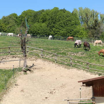
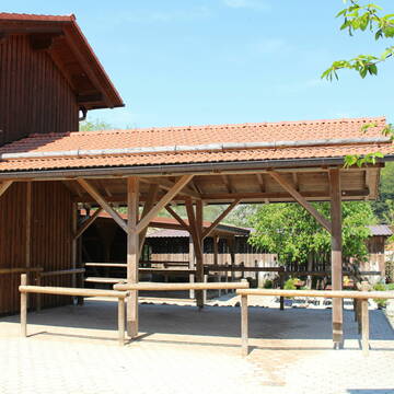
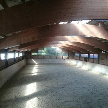
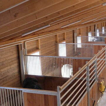
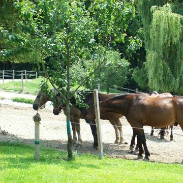
Reiterhof Gensleiten
Reut
Reiterhof-Gensleiten
@Reiterhof-Gensleiten
FN-Mitglied
Freizeitstall
Vermieten
Krankenbox
Paddock
Notfallboxen
23 weitere...
P+
Deprecated: Creation of dynamic property Zend_View_Helper_Ads::$adLink is deprecated in /var/www/stall-frei/htdocs/staging.stall-frei.de/library/Psf/View/Helper/Ads.php on line 108

Futtersack HeuToy, Fressbremse in pink
Mechtersen
STALL-FREIde Marketing
@STALL-FREI-Marketing
Stundenlange Beschäftigung die
Koliken vorbeugt, geringe Staubinhalation mit
steuerbarer Futterentnahme
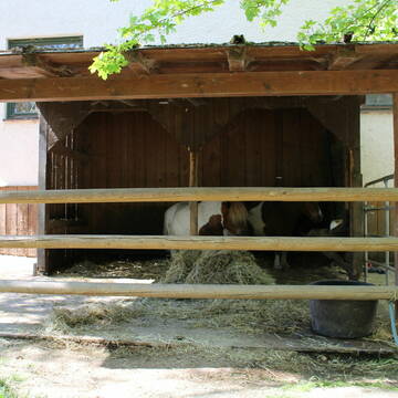
Zucht- und Reitstall Sommer
Simbach am Inn
Sommer Gabriele
@Sommer-Gabriele
FN-Mitglied
Freizeitstall
Vermieten
Verpachten
Führanlage
Krankenbox
Allergikerstall
bedampftes/gewaschenes Heu
33 weitere...
P
Leider kein Vorschaubild
Leider kein Vorschaubild
Offenstallplätze für Wallache bis 150cm Stockmaß...
Simbach am Inn
Christiane Troschke
@Troschke
Offenstall
B

Offen/Laufstall Stuten, Wallache, geschlechtgetren
Stubenberg
Niederbayern Alm
@Niederbayern-Alm
Freizeitstall
Geländestrecke
Vermieten
Hunde willkommen
Krankenbox
Gnadenbrothof
Notfallboxen
29 weitere...
ganz aktuell
P
Leider kein Vorschaubild
Leider kein Vorschaubild
Boxen frei
Zeilarn
Reitanlage Schlagmann
@Bettina73
Paddock
Reithalle
Außenboxen
Innenbox
Halbpension
Einzelne Boxen oder Stallplätze
3 weitere...
B
Große Paddockboxen / Offenstallplätze
Triftern
Huber-Englbert
@Huber-Englbert
Freizeitstall
Geländestrecke
Krankenbox
Longierzirkel/Roundpen
Notfallboxen
Außenbox mit Paddock
Offenstall
11 weitere...
P

Pferdepension Hit Aktivstall Kürmerhof
Hohenkammer
Kuermerhof
@Kuermerhof
*******JETZT NEU MIT ENTSTAUBTEM BIOHEU*********
*******Demnächst mit einem Abenteuerspielplatz für Pferde ( Extrem Trail/Pa


Offenstall mit großer Weide,Stallboxen und Paddo...
Fridolfing
Gramsamer Andreas
@Gramsi
Geländestrecke
Reitlehrer und -unterricht
Vermieten
Verpachten
Hunde willkommen
Krankenbox
Hufrehe geeignet
Notfallboxen
21 weitere...
aktuell
S
pferdepension-demmel
Hebertsfelden
Pferdepension-Demmel
@Pferdepension-Demmel
Freizeitstall
Geländestrecke
Vermieten
Longierzirkel/Roundpen
Paddock
Außenbox mit Paddock
Außenboxen
14 weitere...
P
Leider kein Vorschaubild
Leider kein Vorschaubild
Offenstallplatz frei
Malching
Agnes-Hager
@Agnes-Hager
Freizeitstall
Geländestrecke
Vermieten
Krankenbox
Paddock
Notfallboxen
13 weitere...
B
Leider kein Vorschaubild
Leider kein Vorschaubild
Reiterhof Eschlberg
Mehring
Schiederer-Christine
@Schiederer-Christine
Freizeitstall
Geländestrecke
Vermieten
Hunde willkommen
Paddock
Außenbox mit Paddock
Innenbox
11 weitere...
B
Deprecated: Creation of dynamic property Zend_View::$pageCount is deprecated in /var/www/stall-frei/htdocs/staging.stall-frei.de/library/vendor/shardj/zf1-future/library/Zend/View/Abstract.php on line 308
Deprecated: Creation of dynamic property Zend_View::$itemCountPerPage is deprecated in /var/www/stall-frei/htdocs/staging.stall-frei.de/library/vendor/shardj/zf1-future/library/Zend/View/Abstract.php on line 308
Deprecated: Creation of dynamic property Zend_View::$first is deprecated in /var/www/stall-frei/htdocs/staging.stall-frei.de/library/vendor/shardj/zf1-future/library/Zend/View/Abstract.php on line 308
Deprecated: Creation of dynamic property Zend_View::$current is deprecated in /var/www/stall-frei/htdocs/staging.stall-frei.de/library/vendor/shardj/zf1-future/library/Zend/View/Abstract.php on line 308
Deprecated: Creation of dynamic property Zend_View::$last is deprecated in /var/www/stall-frei/htdocs/staging.stall-frei.de/library/vendor/shardj/zf1-future/library/Zend/View/Abstract.php on line 308
Deprecated: Creation of dynamic property Zend_View::$next is deprecated in /var/www/stall-frei/htdocs/staging.stall-frei.de/library/vendor/shardj/zf1-future/library/Zend/View/Abstract.php on line 308
Deprecated: Creation of dynamic property Zend_View::$pagesInRange is deprecated in /var/www/stall-frei/htdocs/staging.stall-frei.de/library/vendor/shardj/zf1-future/library/Zend/View/Abstract.php on line 308
Deprecated: Creation of dynamic property Zend_View::$firstPageInRange is deprecated in /var/www/stall-frei/htdocs/staging.stall-frei.de/library/vendor/shardj/zf1-future/library/Zend/View/Abstract.php on line 308
Deprecated: Creation of dynamic property Zend_View::$lastPageInRange is deprecated in /var/www/stall-frei/htdocs/staging.stall-frei.de/library/vendor/shardj/zf1-future/library/Zend/View/Abstract.php on line 308
Deprecated: Creation of dynamic property Zend_View::$currentItemCount is deprecated in /var/www/stall-frei/htdocs/staging.stall-frei.de/library/vendor/shardj/zf1-future/library/Zend/View/Abstract.php on line 308
Deprecated: Creation of dynamic property Zend_View::$totalItemCount is deprecated in /var/www/stall-frei/htdocs/staging.stall-frei.de/library/vendor/shardj/zf1-future/library/Zend/View/Abstract.php on line 308
Deprecated: Creation of dynamic property Zend_View::$firstItemNumber is deprecated in /var/www/stall-frei/htdocs/staging.stall-frei.de/library/vendor/shardj/zf1-future/library/Zend/View/Abstract.php on line 308
Deprecated: Creation of dynamic property Zend_View::$lastItemNumber is deprecated in /var/www/stall-frei/htdocs/staging.stall-frei.de/library/vendor/shardj/zf1-future/library/Zend/View/Abstract.php on line 308
Deprecated: Creation of dynamic property Zend_View::$router is deprecated in /var/www/stall-frei/htdocs/staging.stall-frei.de/library/vendor/shardj/zf1-future/library/Zend/View/Abstract.php on line 308
Deprecated: Creation of dynamic property Zend_View::$urlParams is deprecated in /var/www/stall-frei/htdocs/staging.stall-frei.de/library/vendor/shardj/zf1-future/library/Zend/View/Abstract.php on line 308
Deprecated: Creation of dynamic property Zend_View::$showAds is deprecated in /var/www/stall-frei/htdocs/staging.stall-frei.de/library/vendor/shardj/zf1-future/library/Zend/View/Abstract.php on line 308
Deprecated: Creation of dynamic property Zend_View::$objectIds is deprecated in /var/www/stall-frei/htdocs/staging.stall-frei.de/library/vendor/shardj/zf1-future/library/Zend/View/Abstract.php on line 308
Deprecated: Creation of dynamic property Zend_View::$showNavbar is deprecated in /var/www/stall-frei/htdocs/staging.stall-frei.de/library/vendor/shardj/zf1-future/library/Zend/View/Abstract.php on line 308
Deprecated: Creation of dynamic property Zend_View::$showBreadcrumb is deprecated in /var/www/stall-frei/htdocs/staging.stall-frei.de/library/vendor/shardj/zf1-future/library/Zend/View/Abstract.php on line 308
Deprecated: Creation of dynamic property Zend_View::$showFooter is deprecated in /var/www/stall-frei/htdocs/staging.stall-frei.de/library/vendor/shardj/zf1-future/library/Zend/View/Abstract.php on line 308
Deprecated: Creation of dynamic property Zend_View::$showInternalAds is deprecated in /var/www/stall-frei/htdocs/staging.stall-frei.de/library/vendor/shardj/zf1-future/library/Zend/View/Abstract.php on line 308
Deprecated: Creation of dynamic property Zend_View::$blNoContent is deprecated in /var/www/stall-frei/htdocs/staging.stall-frei.de/library/vendor/shardj/zf1-future/library/Zend/View/Abstract.php on line 308
Deprecated: Creation of dynamic property Zend_View::$sMetaDesc is deprecated in /var/www/stall-frei/htdocs/staging.stall-frei.de/library/vendor/shardj/zf1-future/library/Zend/View/Abstract.php on line 308
Deprecated: Creation of dynamic property Zend_View::$useGmaps is deprecated in /var/www/stall-frei/htdocs/staging.stall-frei.de/library/vendor/shardj/zf1-future/library/Zend/View/Abstract.php on line 308
Deprecated: Creation of dynamic property Zend_View::$touches is deprecated in /var/www/stall-frei/htdocs/staging.stall-frei.de/library/vendor/shardj/zf1-future/library/Zend/View/Abstract.php on line 308
Deprecated: Creation of dynamic property Zend_View::$oProject is deprecated in /var/www/stall-frei/htdocs/staging.stall-frei.de/library/vendor/shardj/zf1-future/library/Zend/View/Abstract.php on line 308
Deprecated: Creation of dynamic property Zend_View::$pageHeadline is deprecated in /var/www/stall-frei/htdocs/staging.stall-frei.de/library/vendor/shardj/zf1-future/library/Zend/View/Abstract.php on line 308
Deprecated: Creation of dynamic property Zend_View::$disableLocationField is deprecated in /var/www/stall-frei/htdocs/staging.stall-frei.de/library/vendor/shardj/zf1-future/library/Zend/View/Abstract.php on line 308
Deprecated: Creation of dynamic property Zend_View::$isSearch is deprecated in /var/www/stall-frei/htdocs/staging.stall-frei.de/library/vendor/shardj/zf1-future/library/Zend/View/Abstract.php on line 308
Deprecated: Creation of dynamic property Zend_View::$pageTitle is deprecated in /var/www/stall-frei/htdocs/staging.stall-frei.de/library/vendor/shardj/zf1-future/library/Zend/View/Abstract.php on line 308
Deprecated: Creation of dynamic property Psf_Form_Element_Text::$class is deprecated in /var/www/stall-frei/htdocs/staging.stall-frei.de/library/vendor/shardj/zf1-future/library/Zend/Form/Element.php on line 874
Deprecated: Creation of dynamic property Psf_Form_Element_Text::$size is deprecated in /var/www/stall-frei/htdocs/staging.stall-frei.de/library/vendor/shardj/zf1-future/library/Zend/Form/Element.php on line 874
Deprecated: Creation of dynamic property Psf_Form_Element_Text::$placeholder is deprecated in /var/www/stall-frei/htdocs/staging.stall-frei.de/library/vendor/shardj/zf1-future/library/Zend/Form/Element.php on line 874
Deprecated: Creation of dynamic property Psf_Form_Element_Hidden::$class is deprecated in /var/www/stall-frei/htdocs/staging.stall-frei.de/library/vendor/shardj/zf1-future/library/Zend/Form/Element.php on line 874
Deprecated: Creation of dynamic property Psf_Form_Element_Hidden::$class is deprecated in /var/www/stall-frei/htdocs/staging.stall-frei.de/library/vendor/shardj/zf1-future/library/Zend/Form/Element.php on line 874
Deprecated: Creation of dynamic property Psf_Form_Element_Hidden::$class is deprecated in /var/www/stall-frei/htdocs/staging.stall-frei.de/library/vendor/shardj/zf1-future/library/Zend/Form/Element.php on line 874
Deprecated: Creation of dynamic property Psf_Form_Element_Hidden::$class is deprecated in /var/www/stall-frei/htdocs/staging.stall-frei.de/library/vendor/shardj/zf1-future/library/Zend/Form/Element.php on line 874
Deprecated: Creation of dynamic property Psf_Form_Element_Select::$class is deprecated in /var/www/stall-frei/htdocs/staging.stall-frei.de/library/vendor/shardj/zf1-future/library/Zend/Form/Element.php on line 874
Deprecated: Creation of dynamic property Psf_Form_Element_Select::$class is deprecated in /var/www/stall-frei/htdocs/staging.stall-frei.de/library/vendor/shardj/zf1-future/library/Zend/Form/Element.php on line 874
Deprecated: Creation of dynamic property Psf_Form_Element_Select::$class is deprecated in /var/www/stall-frei/htdocs/staging.stall-frei.de/library/vendor/shardj/zf1-future/library/Zend/Form/Element.php on line 874
Deprecated: Creation of dynamic property Psf_Form_Element_Select::$class is deprecated in /var/www/stall-frei/htdocs/staging.stall-frei.de/library/vendor/shardj/zf1-future/library/Zend/Form/Element.php on line 874
Deprecated: Creation of dynamic property Psf_Form_Element_Text::$class is deprecated in /var/www/stall-frei/htdocs/staging.stall-frei.de/library/vendor/shardj/zf1-future/library/Zend/Form/Element.php on line 874
Deprecated: Creation of dynamic property Psf_Form_Element_Checkbox::$label is deprecated in /var/www/stall-frei/htdocs/staging.stall-frei.de/library/vendor/shardj/zf1-future/library/Zend/Form/Element.php on line 874
Deprecated: Creation of dynamic property Zend_View::$sort is deprecated in /var/www/stall-frei/htdocs/staging.stall-frei.de/library/vendor/shardj/zf1-future/library/Zend/View/Abstract.php on line 308
Deprecated: Creation of dynamic property Zend_View::$searchLocation is deprecated in /var/www/stall-frei/htdocs/staging.stall-frei.de/library/vendor/shardj/zf1-future/library/Zend/View/Abstract.php on line 308
Deprecated: Creation of dynamic property Zend_View::$locationHint is deprecated in /var/www/stall-frei/htdocs/staging.stall-frei.de/library/vendor/shardj/zf1-future/library/Zend/View/Abstract.php on line 308
Psf_GeoCoder_Abstract::getLocation: Ecken Get Location CachedOrLive
Psf_GeoCoder_Abstract::getCachedOrLive: Ecken
Psf_GeoCoder_OpenCageData::makeApiRequest: response:
Array
(
[documentation] => https://opencagedata.com/api
[licenses] => Array
(
[0] => Array
(
[name] => see attribution guide
[url] => https://opencagedata.com/credits
)
)
[results] => Array
(
[0] => Array
(
[bounds] => Array
(
[northeast] => Array
(
[lat] => 48.2923897
[lng] => 12.9858091
)
[southwest] => Array
(
[lat] => 48.2523897
[lng] => 12.9458091
)
)
[components] => Array
(
[ISO_3166-1_alpha-2] => DE
[ISO_3166-1_alpha-3] => DEU
[ISO_3166-2] => Array
(
[0] => DE-BY
)
[_category] => place
[_normalized_city] => Kirchdorf am Inn
[_type] => village
[continent] => Europe
[country] => Deutschland
[country_code] => de
[county] => Landkreis Rottal-Inn
[political_union] => European Union
[postcode] => 84375
[state] => Bayern
[state_code] => BY
[suburb] => Ecken
[village] => Kirchdorf am Inn
)
[confidence] => 7
[formatted] => 84375 Kirchdorf am Inn, Deutschland
[geometry] => Array
(
[lat] => 48.2723897
[lng] => 12.9658091
)
)
[1] => Array
(
[bounds] => Array
(
[northeast] => Array
(
[lat] => 48.300585
[lng] => 12.9853713
)
[southwest] => Array
(
[lat] => 48.260585
[lng] => 12.9453713
)
)
[components] => Array
(
[ISO_3166-1_alpha-2] => DE
[ISO_3166-1_alpha-3] => DEU
[ISO_3166-2] => Array
(
[0] => DE-BY
)
[_category] => place
[_normalized_city] => Kirchdorf am Inn
[_type] => hamlet
[continent] => Europe
[country] => Deutschland
[country_code] => de
[county] => Landkreis Rottal-Inn
[hamlet] => Ecken
[political_union] => European Union
[postcode] => 84375
[state] => Bayern
[state_code] => BY
[village] => Kirchdorf am Inn
)
[confidence] => 7
[formatted] => Ecken, 84375 Kirchdorf am Inn, Deutschland
[geometry] => Array
(
[lat] => 48.280585
[lng] => 12.9653713
)
)
[2] => Array
(
[bounds] => Array
(
[northeast] => Array
(
[lat] => 48.1285749
[lng] => 8.2769098
)
[southwest] => Array
(
[lat] => 48.1284749
[lng] => 8.2768098
)
)
[components] => Array
(
[ISO_3166-1_alpha-2] => DE
[ISO_3166-1_alpha-3] => DEU
[ISO_3166-2] => Array
(
[0] => DE-BW
)
[_category] => building
[_normalized_city] => Triberg im Schwarzwald
[_type] => building
[continent] => Europe
[country] => Deutschland
[country_code] => de
[county] => Schwarzwald-Baar-Kreis
[isolated_dwelling] => Ecken (Obere)
[municipality] => GVV Raumschaft Triberg
[political_union] => European Union
[postcode] => 78098
[state] => Baden-Württemberg
[state_code] => BW
[town] => Triberg im Schwarzwald
[village] => Nußbach
)
[confidence] => 10
[formatted] => Ecken (Obere), 78098 Nußbach, Deutschland
[geometry] => Array
(
[lat] => 48.1285249
[lng] => 8.2768598
)
)
[3] => Array
(
[bounds] => Array
(
[northeast] => Array
(
[lat] => 48.4318709
[lng] => 12.5747572
)
[southwest] => Array
(
[lat] => 48.4118709
[lng] => 12.5547572
)
)
[components] => Array
(
[ISO_3166-1_alpha-2] => DE
[ISO_3166-1_alpha-3] => DEU
[ISO_3166-2] => Array
(
[0] => DE-BY
)
[_category] => agriculture
[_normalized_city] => Gangkofen
[_type] => farm
[continent] => Europe
[country] => Deutschland
[country_code] => de
[county] => Landkreis Rottal-Inn
[farm] => Ecken
[hamlet] => Fußöd
[political_union] => European Union
[postcode] => 84140
[state] => Bayern
[state_code] => BY
[village] => Gangkofen
)
[confidence] => 8
[formatted] => Ecken, Fußöd, 84140 Gangkofen, Deutschland
[geometry] => Array
(
[lat] => 48.4218709
[lng] => 12.5647572
)
)
[4] => Array
(
[bounds] => Array
(
[northeast] => Array
(
[lat] => 53.5675738
[lng] => 12.9172278
)
[southwest] => Array
(
[lat] => 53.5659191
[lng] => 12.9152294
)
)
[components] => Array
(
[ISO_3166-1_alpha-2] => DE
[ISO_3166-1_alpha-3] => DEU
[ISO_3166-2] => Array
(
[0] => DE-MV
)
[_category] => road
[_normalized_city] => Möllenhagen
[_type] => road
[city] => Möllenhagen
[continent] => Europe
[country] => Deutschland
[country_code] => de
[county] => Mecklenburgische Seenplatte
[municipality] => Penzliner Land
[political_union] => European Union
[postcode] => 17219
[road] => Ecken
[road_type] => residential
[state] => Mecklenburg-Vorpommern
[state_code] => MV
)
[confidence] => 9
[formatted] => Ecken, 17219 Möllenhagen, Deutschland
[geometry] => Array
(
[lat] => 53.5667272
[lng] => 12.9162368
)
)
[5] => Array
(
[bounds] => Array
(
[northeast] => Array
(
[lat] => 49.8217624
[lng] => 11.188901
)
[southwest] => Array
(
[lat] => 49.821197
[lng] => 11.1884384
)
)
[components] => Array
(
[ISO_3166-1_alpha-2] => DE
[ISO_3166-1_alpha-3] => DEU
[ISO_3166-2] => Array
(
[0] => DE-BY
)
[_category] => road
[_normalized_city] => Unterleinleiter
[_type] => road
[continent] => Europe
[country] => Deutschland
[country_code] => de
[county] => Landkreis Forchheim
[municipality] => Ebermannstadt (VGem)
[political_union] => European Union
[postcode] => 91364
[road] => Ecken
[road_type] => residential
[state] => Bayern
[state_code] => BY
[village] => Unterleinleiter
)
[confidence] => 9
[formatted] => Ecken, 91364 Unterleinleiter, Deutschland
[geometry] => Array
(
[lat] => 49.8216149
[lng] => 11.1885098
)
)
[6] => Array
(
[bounds] => Array
(
[northeast] => Array
(
[lat] => 50.4039402
[lng] => 11.1176278
)
[southwest] => Array
(
[lat] => 50.4037688
[lng] => 11.1168118
)
)
[components] => Array
(
[ISO_3166-1_alpha-2] => DE
[ISO_3166-1_alpha-3] => DEU
[ISO_3166-2] => Array
(
[0] => DE-TH
)
[_category] => road
[_normalized_city] => Frankenblick
[_type] => road
[city] => Frankenblick
[continent] => Europe
[country] => Deutschland
[country_code] => de
[county] => Landkreis Sonneberg
[political_union] => European Union
[postcode] => 96528
[road] => Ecken
[road_type] => service
[state] => Thüringen
[state_code] => TH
[suburb] => Mengersgereuth-Hämmern
)
[confidence] => 9
[formatted] => Ecken, 96528 Frankenblick, Deutschland
[geometry] => Array
(
[lat] => 50.4038175
[lng] => 11.1172131
)
)
[7] => Array
(
[bounds] => Array
(
[northeast] => Array
(
[lat] => 52.8013319
[lng] => 13.0029299
)
[southwest] => Array
(
[lat] => 52.7935631
[lng] => 12.990362
)
)
[components] => Array
(
[ISO_3166-1_alpha-2] => DE
[ISO_3166-1_alpha-3] => DEU
[ISO_3166-2] => Array
(
[0] => DE-BB
)
[_category] => unknown
[_normalized_city] => Kremmen
[_type] => lake
[city_district] => Kremmen
[continent] => Europe
[country] => Deutschland
[country_code] => de
[county] => Oberhavel
[lake] => Beetzer Ecken
[political_union] => European Union
[postcode] => 16766
[state] => Brandenburg
[state_code] => BB
[town] => Kremmen
)
[confidence] => 9
[formatted] => Beetzer Ecken, 16766 Kremmen, Deutschland
[geometry] => Array
(
[lat] => 52.7974397
[lng] => 12.9963703
)
)
[8] => Array
(
[components] => Array
(
[ISO_3166-1_alpha-2] => FR
[ISO_3166-1_alpha-3] => FRA
[ISO_3166-2] => Array
(
[0] => FR-GES
[1] => FR-6AE
[2] => FR-68
)
[_category] => road
[_normalized_city] => Diefmatten
[_type] => road
[city] => Diefmatten
[continent] => Europe
[country] => France
[country_code] => fr
[county] => Haut-Rhin
[local_authority] => Communauté de communes Sud Alsace Largue
[political_union] => European Union
[postcode] => 68780
[road] => Rue de Hecken
[state] => Grand Est
[state_code] => GES
)
[confidence] => 2
[formatted] => Rue de Hecken, 68780 Diefmatten, France
[geometry] => Array
(
[lat] => 47.706235
[lng] => 7.116336
)
)
[9] => Array
(
[components] => Array
(
[ISO_3166-1_alpha-2] => FR
[ISO_3166-1_alpha-3] => FRA
[ISO_3166-2] => Array
(
[0] => FR-GES
[1] => FR-6AE
[2] => FR-68
)
[_category] => road
[_normalized_city] => Hecken
[_type] => road
[city] => Hecken
[continent] => Europe
[country] => France
[country_code] => fr
[county] => Haut-Rhin
[local_authority] => Communauté de communes Sud Alsace Largue
[political_union] => European Union
[postcode] => 68210
[road] => Rue des Bleuets
[state] => Grand Est
[state_code] => GES
)
[confidence] => 2
[formatted] => Rue des Bleuets, 68210 Hecken, France
[geometry] => Array
(
[lat] => 47.690966
[lng] => 7.121928
)
)
)
[status] => Array
(
[code] => 200
[message] => OK
)
[stay_informed] => Array
(
[blog] => https://blog.opencagedata.com
[mastodon] => https://en.osm.town/@opencage
)
[thanks] => For using an OpenCage API
[timestamp] => Array
(
[created_http] => Sat, 07 Feb 2026 07:18:43 GMT
[created_unix] => 1770448723
)
[total_results] => 10
)
Psf_GeoCoder_Abstract::convertLocationResult
{"documentation":"https:\/\/opencagedata.com\/api","licenses":[{"name":"see attribution guide","url":"https:\/\/opencagedata.com\/credits"}],"results":[{"bounds":{"northeast":{"lat":48.2923897,"lng":12.9858091},"southwest":{"lat":48.2523897,"lng":12.9458091}},"components":{"ISO_3166-1_alpha-2":"DE","ISO_3166-1_alpha-3":"DEU","ISO_3166-2":["DE-BY"],"_category":"place","_normalized_city":"Kirchdorf am Inn","_type":"village","continent":"Europe","country":"Deutschland","country_code":"de","county":"Landkreis Rottal-Inn","political_union":"European Union","postcode":"84375","state":"Bayern","state_code":"BY","suburb":"Ecken","village":"Kirchdorf am Inn"},"confidence":7,"formatted":"84375 Kirchdorf am Inn, Deutschland","geometry":{"lat":48.2723897,"lng":12.9658091}},{"bounds":{"northeast":{"lat":48.300585,"lng":12.9853713},"southwest":{"lat":48.260585,"lng":12.9453713}},"components":{"ISO_3166-1_alpha-2":"DE","ISO_3166-1_alpha-3":"DEU","ISO_3166-2":["DE-BY"],"_category":"place","_normalized_city":"Kirchdorf am Inn","_type":"hamlet","continent":"Europe","country":"Deutschland","country_code":"de","county":"Landkreis Rottal-Inn","hamlet":"Ecken","political_union":"European Union","postcode":"84375","state":"Bayern","state_code":"BY","village":"Kirchdorf am Inn"},"confidence":7,"formatted":"Ecken, 84375 Kirchdorf am Inn, Deutschland","geometry":{"lat":48.280585,"lng":12.9653713}},{"bounds":{"northeast":{"lat":48.1285749,"lng":8.2769098},"southwest":{"lat":48.1284749,"lng":8.2768098}},"components":{"ISO_3166-1_alpha-2":"DE","ISO_3166-1_alpha-3":"DEU","ISO_3166-2":["DE-BW"],"_category":"building","_normalized_city":"Triberg im Schwarzwald","_type":"building","continent":"Europe","country":"Deutschland","country_code":"de","county":"Schwarzwald-Baar-Kreis","isolated_dwelling":"Ecken (Obere)","municipality":"GVV Raumschaft Triberg","political_union":"European Union","postcode":"78098","state":"Baden-W\u00fcrttemberg","state_code":"BW","town":"Triberg im Schwarzwald","village":"Nu\u00dfbach"},"confidence":10,"formatted":"Ecken (Obere), 78098 Nu\u00dfbach, Deutschland","geometry":{"lat":48.1285249,"lng":8.2768598}},{"bounds":{"northeast":{"lat":48.4318709,"lng":12.5747572},"southwest":{"lat":48.4118709,"lng":12.5547572}},"components":{"ISO_3166-1_alpha-2":"DE","ISO_3166-1_alpha-3":"DEU","ISO_3166-2":["DE-BY"],"_category":"agriculture","_normalized_city":"Gangkofen","_type":"farm","continent":"Europe","country":"Deutschland","country_code":"de","county":"Landkreis Rottal-Inn","farm":"Ecken","hamlet":"Fu\u00df\u00f6d","political_union":"European Union","postcode":"84140","state":"Bayern","state_code":"BY","village":"Gangkofen"},"confidence":8,"formatted":"Ecken, Fu\u00df\u00f6d, 84140 Gangkofen, Deutschland","geometry":{"lat":48.4218709,"lng":12.5647572}},{"bounds":{"northeast":{"lat":53.5675738,"lng":12.9172278},"southwest":{"lat":53.5659191,"lng":12.9152294}},"components":{"ISO_3166-1_alpha-2":"DE","ISO_3166-1_alpha-3":"DEU","ISO_3166-2":["DE-MV"],"_category":"road","_normalized_city":"M\u00f6llenhagen","_type":"road","city":"M\u00f6llenhagen","continent":"Europe","country":"Deutschland","country_code":"de","county":"Mecklenburgische Seenplatte","municipality":"Penzliner Land","political_union":"European Union","postcode":"17219","road":"Ecken","road_type":"residential","state":"Mecklenburg-Vorpommern","state_code":"MV"},"confidence":9,"formatted":"Ecken, 17219 M\u00f6llenhagen, Deutschland","geometry":{"lat":53.5667272,"lng":12.9162368}},{"bounds":{"northeast":{"lat":49.8217624,"lng":11.188901},"southwest":{"lat":49.821197,"lng":11.1884384}},"components":{"ISO_3166-1_alpha-2":"DE","ISO_3166-1_alpha-3":"DEU","ISO_3166-2":["DE-BY"],"_category":"road","_normalized_city":"Unterleinleiter","_type":"road","continent":"Europe","country":"Deutschland","country_code":"de","county":"Landkreis Forchheim","municipality":"Ebermannstadt (VGem)","political_union":"European Union","postcode":"91364","road":"Ecken","road_type":"residential","state":"Bayern","state_code":"BY","village":"Unterleinleiter"},"confidence":9,"formatted":"Ecken, 91364 Unterleinleiter, Deutschland","geometry":{"lat":49.8216149,"lng":11.1885098}},{"bounds":{"northeast":{"lat":50.4039402,"lng":11.1176278},"southwest":{"lat":50.4037688,"lng":11.1168118}},"components":{"ISO_3166-1_alpha-2":"DE","ISO_3166-1_alpha-3":"DEU","ISO_3166-2":["DE-TH"],"_category":"road","_normalized_city":"Frankenblick","_type":"road","city":"Frankenblick","continent":"Europe","country":"Deutschland","country_code":"de","county":"Landkreis Sonneberg","political_union":"European Union","postcode":"96528","road":"Ecken","road_type":"service","state":"Th\u00fcringen","state_code":"TH","suburb":"Mengersgereuth-H\u00e4mmern"},"confidence":9,"formatted":"Ecken, 96528 Frankenblick, Deutschland","geometry":{"lat":50.4038175,"lng":11.1172131}},{"bounds":{"northeast":{"lat":52.8013319,"lng":13.0029299},"southwest":{"lat":52.7935631,"lng":12.990362}},"components":{"ISO_3166-1_alpha-2":"DE","ISO_3166-1_alpha-3":"DEU","ISO_3166-2":["DE-BB"],"_category":"unknown","_normalized_city":"Kremmen","_type":"lake","city_district":"Kremmen","continent":"Europe","country":"Deutschland","country_code":"de","county":"Oberhavel","lake":"Beetzer Ecken","political_union":"European Union","postcode":"16766","state":"Brandenburg","state_code":"BB","town":"Kremmen"},"confidence":9,"formatted":"Beetzer Ecken, 16766 Kremmen, Deutschland","geometry":{"lat":52.7974397,"lng":12.9963703}},{"components":{"ISO_3166-1_alpha-2":"FR","ISO_3166-1_alpha-3":"FRA","ISO_3166-2":["FR-GES","FR-6AE","FR-68"],"_category":"road","_normalized_city":"Diefmatten","_type":"road","city":"Diefmatten","continent":"Europe","country":"France","country_code":"fr","county":"Haut-Rhin","local_authority":"Communaut\u00e9 de communes Sud Alsace Largue","political_union":"European Union","postcode":"68780","road":"Rue de Hecken","state":"Grand Est","state_code":"GES"},"confidence":2,"formatted":"Rue de Hecken, 68780 Diefmatten, France","geometry":{"lat":47.706235,"lng":7.116336}},{"components":{"ISO_3166-1_alpha-2":"FR","ISO_3166-1_alpha-3":"FRA","ISO_3166-2":["FR-GES","FR-6AE","FR-68"],"_category":"road","_normalized_city":"Hecken","_type":"road","city":"Hecken","continent":"Europe","country":"France","country_code":"fr","county":"Haut-Rhin","local_authority":"Communaut\u00e9 de communes Sud Alsace Largue","political_union":"European Union","postcode":"68210","road":"Rue des Bleuets","state":"Grand Est","state_code":"GES"},"confidence":2,"formatted":"Rue des Bleuets, 68210 Hecken, France","geometry":{"lat":47.690966,"lng":7.121928}}],"status":{"code":200,"message":"OK"},"stay_informed":{"blog":"https:\/\/blog.opencagedata.com","mastodon":"https:\/\/en.osm.town\/@opencage"},"thanks":"For using an OpenCage API","timestamp":{"created_http":"Sat, 07 Feb 2026 07:18:43 GMT","created_unix":1770448723},"total_results":10}Array
(
[0] => stdClass Object
(
[bounds] => stdClass Object
(
[northeast] => stdClass Object
(
[lat] => 48.2923897
[lng] => 12.9858091
)
[southwest] => stdClass Object
(
[lat] => 48.2523897
[lng] => 12.9458091
)
)
[components] => stdClass Object
(
[ISO_3166-1_alpha-2] => DE
[ISO_3166-1_alpha-3] => DEU
[ISO_3166-2] => Array
(
[0] => DE-BY
)
[_category] => place
[_normalized_city] => Kirchdorf am Inn
[_type] => village
[continent] => Europe
[country] => Deutschland
[country_code] => de
[county] => Landkreis Rottal-Inn
[political_union] => European Union
[postcode] => 84375
[state] => Bayern
[state_code] => BY
[suburb] => Ecken
[village] => Kirchdorf am Inn
)
[confidence] => 7
[formatted] => 84375 Kirchdorf am Inn, Deutschland
[geometry] => stdClass Object
(
[lat] => 48.2723897
[lng] => 12.9658091
)
)
[1] => stdClass Object
(
[bounds] => stdClass Object
(
[northeast] => stdClass Object
(
[lat] => 48.300585
[lng] => 12.9853713
)
[southwest] => stdClass Object
(
[lat] => 48.260585
[lng] => 12.9453713
)
)
[components] => stdClass Object
(
[ISO_3166-1_alpha-2] => DE
[ISO_3166-1_alpha-3] => DEU
[ISO_3166-2] => Array
(
[0] => DE-BY
)
[_category] => place
[_normalized_city] => Kirchdorf am Inn
[_type] => hamlet
[continent] => Europe
[country] => Deutschland
[country_code] => de
[county] => Landkreis Rottal-Inn
[hamlet] => Ecken
[political_union] => European Union
[postcode] => 84375
[state] => Bayern
[state_code] => BY
[village] => Kirchdorf am Inn
)
[confidence] => 7
[formatted] => Ecken, 84375 Kirchdorf am Inn, Deutschland
[geometry] => stdClass Object
(
[lat] => 48.280585
[lng] => 12.9653713
)
)
[2] => stdClass Object
(
[bounds] => stdClass Object
(
[northeast] => stdClass Object
(
[lat] => 48.1285749
[lng] => 8.2769098
)
[southwest] => stdClass Object
(
[lat] => 48.1284749
[lng] => 8.2768098
)
)
[components] => stdClass Object
(
[ISO_3166-1_alpha-2] => DE
[ISO_3166-1_alpha-3] => DEU
[ISO_3166-2] => Array
(
[0] => DE-BW
)
[_category] => building
[_normalized_city] => Triberg im Schwarzwald
[_type] => building
[continent] => Europe
[country] => Deutschland
[country_code] => de
[county] => Schwarzwald-Baar-Kreis
[isolated_dwelling] => Ecken (Obere)
[municipality] => GVV Raumschaft Triberg
[political_union] => European Union
[postcode] => 78098
[state] => Baden-Württemberg
[state_code] => BW
[town] => Triberg im Schwarzwald
[village] => Nußbach
)
[confidence] => 10
[formatted] => Ecken (Obere), 78098 Nußbach, Deutschland
[geometry] => stdClass Object
(
[lat] => 48.1285249
[lng] => 8.2768598
)
)
[3] => stdClass Object
(
[bounds] => stdClass Object
(
[northeast] => stdClass Object
(
[lat] => 48.4318709
[lng] => 12.5747572
)
[southwest] => stdClass Object
(
[lat] => 48.4118709
[lng] => 12.5547572
)
)
[components] => stdClass Object
(
[ISO_3166-1_alpha-2] => DE
[ISO_3166-1_alpha-3] => DEU
[ISO_3166-2] => Array
(
[0] => DE-BY
)
[_category] => agriculture
[_normalized_city] => Gangkofen
[_type] => farm
[continent] => Europe
[country] => Deutschland
[country_code] => de
[county] => Landkreis Rottal-Inn
[farm] => Ecken
[hamlet] => Fußöd
[political_union] => European Union
[postcode] => 84140
[state] => Bayern
[state_code] => BY
[village] => Gangkofen
)
[confidence] => 8
[formatted] => Ecken, Fußöd, 84140 Gangkofen, Deutschland
[geometry] => stdClass Object
(
[lat] => 48.4218709
[lng] => 12.5647572
)
)
[4] => stdClass Object
(
[bounds] => stdClass Object
(
[northeast] => stdClass Object
(
[lat] => 53.5675738
[lng] => 12.9172278
)
[southwest] => stdClass Object
(
[lat] => 53.5659191
[lng] => 12.9152294
)
)
[components] => stdClass Object
(
[ISO_3166-1_alpha-2] => DE
[ISO_3166-1_alpha-3] => DEU
[ISO_3166-2] => Array
(
[0] => DE-MV
)
[_category] => road
[_normalized_city] => Möllenhagen
[_type] => road
[city] => Möllenhagen
[continent] => Europe
[country] => Deutschland
[country_code] => de
[county] => Mecklenburgische Seenplatte
[municipality] => Penzliner Land
[political_union] => European Union
[postcode] => 17219
[road] => Ecken
[road_type] => residential
[state] => Mecklenburg-Vorpommern
[state_code] => MV
)
[confidence] => 9
[formatted] => Ecken, 17219 Möllenhagen, Deutschland
[geometry] => stdClass Object
(
[lat] => 53.5667272
[lng] => 12.9162368
)
)
[5] => stdClass Object
(
[bounds] => stdClass Object
(
[northeast] => stdClass Object
(
[lat] => 49.8217624
[lng] => 11.188901
)
[southwest] => stdClass Object
(
[lat] => 49.821197
[lng] => 11.1884384
)
)
[components] => stdClass Object
(
[ISO_3166-1_alpha-2] => DE
[ISO_3166-1_alpha-3] => DEU
[ISO_3166-2] => Array
(
[0] => DE-BY
)
[_category] => road
[_normalized_city] => Unterleinleiter
[_type] => road
[continent] => Europe
[country] => Deutschland
[country_code] => de
[county] => Landkreis Forchheim
[municipality] => Ebermannstadt (VGem)
[political_union] => European Union
[postcode] => 91364
[road] => Ecken
[road_type] => residential
[state] => Bayern
[state_code] => BY
[village] => Unterleinleiter
)
[confidence] => 9
[formatted] => Ecken, 91364 Unterleinleiter, Deutschland
[geometry] => stdClass Object
(
[lat] => 49.8216149
[lng] => 11.1885098
)
)
[6] => stdClass Object
(
[bounds] => stdClass Object
(
[northeast] => stdClass Object
(
[lat] => 50.4039402
[lng] => 11.1176278
)
[southwest] => stdClass Object
(
[lat] => 50.4037688
[lng] => 11.1168118
)
)
[components] => stdClass Object
(
[ISO_3166-1_alpha-2] => DE
[ISO_3166-1_alpha-3] => DEU
[ISO_3166-2] => Array
(
[0] => DE-TH
)
[_category] => road
[_normalized_city] => Frankenblick
[_type] => road
[city] => Frankenblick
[continent] => Europe
[country] => Deutschland
[country_code] => de
[county] => Landkreis Sonneberg
[political_union] => European Union
[postcode] => 96528
[road] => Ecken
[road_type] => service
[state] => Thüringen
[state_code] => TH
[suburb] => Mengersgereuth-Hämmern
)
[confidence] => 9
[formatted] => Ecken, 96528 Frankenblick, Deutschland
[geometry] => stdClass Object
(
[lat] => 50.4038175
[lng] => 11.1172131
)
)
[7] => stdClass Object
(
[bounds] => stdClass Object
(
[northeast] => stdClass Object
(
[lat] => 52.8013319
[lng] => 13.0029299
)
[southwest] => stdClass Object
(
[lat] => 52.7935631
[lng] => 12.990362
)
)
[components] => stdClass Object
(
[ISO_3166-1_alpha-2] => DE
[ISO_3166-1_alpha-3] => DEU
[ISO_3166-2] => Array
(
[0] => DE-BB
)
[_category] => unknown
[_normalized_city] => Kremmen
[_type] => lake
[city_district] => Kremmen
[continent] => Europe
[country] => Deutschland
[country_code] => de
[county] => Oberhavel
[lake] => Beetzer Ecken
[political_union] => European Union
[postcode] => 16766
[state] => Brandenburg
[state_code] => BB
[town] => Kremmen
)
[confidence] => 9
[formatted] => Beetzer Ecken, 16766 Kremmen, Deutschland
[geometry] => stdClass Object
(
[lat] => 52.7974397
[lng] => 12.9963703
)
)
[8] => stdClass Object
(
[components] => stdClass Object
(
[ISO_3166-1_alpha-2] => FR
[ISO_3166-1_alpha-3] => FRA
[ISO_3166-2] => Array
(
[0] => FR-GES
[1] => FR-6AE
[2] => FR-68
)
[_category] => road
[_normalized_city] => Diefmatten
[_type] => road
[city] => Diefmatten
[continent] => Europe
[country] => France
[country_code] => fr
[county] => Haut-Rhin
[local_authority] => Communauté de communes Sud Alsace Largue
[political_union] => European Union
[postcode] => 68780
[road] => Rue de Hecken
[state] => Grand Est
[state_code] => GES
)
[confidence] => 2
[formatted] => Rue de Hecken, 68780 Diefmatten, France
[geometry] => stdClass Object
(
[lat] => 47.706235
[lng] => 7.116336
)
)
[9] => stdClass Object
(
[components] => stdClass Object
(
[ISO_3166-1_alpha-2] => FR
[ISO_3166-1_alpha-3] => FRA
[ISO_3166-2] => Array
(
[0] => FR-GES
[1] => FR-6AE
[2] => FR-68
)
[_category] => road
[_normalized_city] => Hecken
[_type] => road
[city] => Hecken
[continent] => Europe
[country] => France
[country_code] => fr
[county] => Haut-Rhin
[local_authority] => Communauté de communes Sud Alsace Largue
[political_union] => European Union
[postcode] => 68210
[road] => Rue des Bleuets
[state] => Grand Est
[state_code] => GES
)
[confidence] => 2
[formatted] => Rue des Bleuets, 68210 Hecken, France
[geometry] => stdClass Object
(
[lat] => 47.690966
[lng] => 7.121928
)
)
)
Psf_GeoCoder_OpenCageData::getKeyMap: 0
stdClass Object
(
    [bounds] => stdClass Object
        (
            [northeast] => stdClass Object
                (
                    [lat] => 48.2923897
                    [lng] => 12.9858091
                )

            [southwest] => stdClass Object
                (
                    [lat] => 48.2523897
                    [lng] => 12.9458091
                )

        )

    [components] => stdClass Object
        (
            [ISO_3166-1_alpha-2] => DE
            [ISO_3166-1_alpha-3] => DEU
            [ISO_3166-2] => Array
                (
                    [0] => DE-BY
                )

            [_category] => place
            [_normalized_city] => Kirchdorf am Inn
            [_type] => village
            [continent] => Europe
            [country] => Deutschland
            [country_code] => de
            [county] => Landkreis Rottal-Inn
            [political_union] => European Union
            [postcode] => 84375
            [state] => Bayern
            [state_code] => BY
            [suburb] => Ecken
            [village] => Kirchdorf am Inn
        )

    [confidence] => 7
    [formatted] => 84375 Kirchdorf am Inn, Deutschland
    [geometry] => stdClass Object
        (
            [lat] => 48.2723897
            [lng] => 12.9658091
        )

)
Psf_GeoCoder_OpenCageData::getCounty: Rottal-Inn
Psf_GeoCoder_OpenCageData::addMissingData REFETCH!
Array
(
    [address] => 84375 Kirchdorf am Inn, Deutschland
    [type] => village
    [street] =>
    [city] => Kirchdorf am Inn
    [county] => Rottal-Inn
    [state] => Bayern
    [zip] => 84375
    [country] => Deutschland
    [suburb] => Ecken
    [countrycode] => de
    [latitude] => 48.2723897
    [longitude] => 12.9658091
    [accuracy] => 1
    [confidence] => 7
    [bounds] => stdClass Object
        (
            [northeast] => stdClass Object
                (
                    [lat] => 48.2923897
                    [lng] => 12.9858091
                )

            [southwest] => stdClass Object
                (
                    [lat] => 48.2523897
                    [lng] => 12.9458091
                )

        )

)
reformat!
Array
(
    [address] => 84375 Kirchdorf am Inn, Deutschland
    [type] => village
    [street] =>
    [city] => Kirchdorf am Inn
    [county] => Rottal-Inn
    [state] => Bayern
    [zip] => 84375
    [country] => Deutschland
    [suburb] => Ecken
    [countrycode] => de
    [latitude] => 48.2723897
    [longitude] => 12.9658091
    [accuracy] => 1
    [confidence] => 7
    [bounds] => stdClass Object
        (
            [northeast] => stdClass Object
                (
                    [lat] => 48.2923897
                    [lng] => 12.9858091
                )

            [southwest] => stdClass Object
                (
                    [lat] => 48.2523897
                    [lng] => 12.9458091
                )

        )

    [place] => 84375 Kirchdorf am Inn, Bayern
    [hash] => 9cdf057ec4ad06f6bb926ae5049d32e8
)
Psf_GeoCoder_OpenCageData::getKeyMap: 1
stdClass Object
(
    [bounds] => stdClass Object
        (
            [northeast] => stdClass Object
                (
                    [lat] => 48.300585
                    [lng] => 12.9853713
                )

            [southwest] => stdClass Object
                (
                    [lat] => 48.260585
                    [lng] => 12.9453713
                )

        )

    [components] => stdClass Object
        (
            [ISO_3166-1_alpha-2] => DE
            [ISO_3166-1_alpha-3] => DEU
            [ISO_3166-2] => Array
                (
                    [0] => DE-BY
                )

            [_category] => place
            [_normalized_city] => Kirchdorf am Inn
            [_type] => hamlet
            [continent] => Europe
            [country] => Deutschland
            [country_code] => de
            [county] => Landkreis Rottal-Inn
            [hamlet] => Ecken
            [political_union] => European Union
            [postcode] => 84375
            [state] => Bayern
            [state_code] => BY
            [village] => Kirchdorf am Inn
        )

    [confidence] => 7
    [formatted] => Ecken, 84375 Kirchdorf am Inn, Deutschland
    [geometry] => stdClass Object
        (
            [lat] => 48.280585
            [lng] => 12.9653713
        )

)
Psf_GeoCoder_OpenCageData::getCounty: Rottal-Inn
Psf_GeoCoder_OpenCageData::addMissingData REFETCH!
Array
(
    [address] => Ecken, 84375 Kirchdorf am Inn, Deutschland
    [type] => hamlet
    [street] => Ecken
    [city] => Kirchdorf am Inn
    [county] => Rottal-Inn
    [state] => Bayern
    [zip] => 84375
    [country] => Deutschland
    [suburb] =>
    [countrycode] => de
    [latitude] => 48.280585
    [longitude] => 12.9653713
    [accuracy] => 1
    [confidence] => 7
    [bounds] => stdClass Object
        (
            [northeast] => stdClass Object
                (
                    [lat] => 48.300585
                    [lng] => 12.9853713
                )

            [southwest] => stdClass Object
                (
                    [lat] => 48.260585
                    [lng] => 12.9453713
                )

        )

)
reformat!
Array
(
    [address] => Ecken, 84375 Kirchdorf am Inn, Deutschland
    [type] => hamlet
    [street] => Ecken
    [city] => Kirchdorf am Inn
    [county] => Rottal-Inn
    [state] => Bayern
    [zip] => 84375
    [country] => Deutschland
    [suburb] =>
    [countrycode] => de
    [latitude] => 48.280585
    [longitude] => 12.9653713
    [accuracy] => 1
    [confidence] => 7
    [bounds] => stdClass Object
        (
            [northeast] => stdClass Object
                (
                    [lat] => 48.300585
                    [lng] => 12.9853713
                )

            [southwest] => stdClass Object
                (
                    [lat] => 48.260585
                    [lng] => 12.9453713
                )

        )

    [place] => Ecken, 84375 Kirchdorf am Inn, Bayern
    [hash] => 4f7783b61dc8e004b6c72ba6775afaaa
)
Psf_GeoCoder_OpenCageData::getKeyMap: 2
stdClass Object
(
    [bounds] => stdClass Object
        (
            [northeast] => stdClass Object
                (
                    [lat] => 48.1285749
                    [lng] => 8.2769098
                )

            [southwest] => stdClass Object
                (
                    [lat] => 48.1284749
                    [lng] => 8.2768098
                )

        )

    [components] => stdClass Object
        (
            [ISO_3166-1_alpha-2] => DE
            [ISO_3166-1_alpha-3] => DEU
            [ISO_3166-2] => Array
                (
                    [0] => DE-BW
                )

            [_category] => building
            [_normalized_city] => Triberg im Schwarzwald
            [_type] => building
            [continent] => Europe
            [country] => Deutschland
            [country_code] => de
            [county] => Schwarzwald-Baar-Kreis
            [isolated_dwelling] => Ecken (Obere)
            [municipality] => GVV Raumschaft Triberg
            [political_union] => European Union
            [postcode] => 78098
            [state] => Baden-Württemberg
            [state_code] => BW
            [town] => Triberg im Schwarzwald
            [village] => Nußbach
        )

    [confidence] => 10
    [formatted] => Ecken (Obere), 78098 Nußbach, Deutschland
    [geometry] => stdClass Object
        (
            [lat] => 48.1285249
            [lng] => 8.2768598
        )

)
Psf_GeoCoder_OpenCageData::getCounty: Schwarzwald-Baar-Kreis
Psf_GeoCoder_OpenCageData::addMissingData REFETCH!
Array
(
    [address] => Ecken (Obere), 78098 Nußbach, Deutschland
    [type] => building
    [street] =>
    [city] => Triberg im Schwarzwald
    [county] => Schwarzwald-Baar-Kreis
    [state] => Baden-Württemberg
    [zip] => 78098
    [country] => Deutschland
    [suburb] =>
    [countrycode] => de
    [latitude] => 48.1285249
    [longitude] => 8.2768598
    [accuracy] => 1
    [confidence] => 10
    [bounds] => stdClass Object
        (
            [northeast] => stdClass Object
                (
                    [lat] => 48.1285749
                    [lng] => 8.2769098
                )

            [southwest] => stdClass Object
                (
                    [lat] => 48.1284749
                    [lng] => 8.2768098
                )

        )

)
reformat!
Array
(
    [address] => 78098 Triberg im Schwarzwald
    [type] => building
    [street] =>
    [city] => Triberg im Schwarzwald
    [county] => Schwarzwald-Baar-Kreis
    [state] => Baden-Württemberg
    [zip] => 78098
    [country] => Deutschland
    [suburb] =>
    [countrycode] => de
    [latitude] => 48.1285249
    [longitude] => 8.2768598
    [accuracy] => 1
    [confidence] => 10
    [bounds] => stdClass Object
        (
            [northeast] => stdClass Object
                (
                    [lat] => 48.1285749
                    [lng] => 8.2769098
                )

            [southwest] => stdClass Object
                (
                    [lat] => 48.1284749
                    [lng] => 8.2768098
                )

        )

    [place] => 78098 Triberg im Schwarzwald, Baden-Württemberg
    [hash] => 0f7cd08a44b6d80e23dacc3351f08991
)
Psf_GeoCoder_OpenCageData::getKeyMap: 3
stdClass Object
(
    [bounds] => stdClass Object
        (
            [northeast] => stdClass Object
                (
                    [lat] => 48.4318709
                    [lng] => 12.5747572
                )

            [southwest] => stdClass Object
                (
                    [lat] => 48.4118709
                    [lng] => 12.5547572
                )

        )

    [components] => stdClass Object
        (
            [ISO_3166-1_alpha-2] => DE
            [ISO_3166-1_alpha-3] => DEU
            [ISO_3166-2] => Array
                (
                    [0] => DE-BY
                )

            [_category] => agriculture
            [_normalized_city] => Gangkofen
            [_type] => farm
            [continent] => Europe
            [country] => Deutschland
            [country_code] => de
            [county] => Landkreis Rottal-Inn
            [farm] => Ecken
            [hamlet] => Fußöd
            [political_union] => European Union
            [postcode] => 84140
            [state] => Bayern
            [state_code] => BY
            [village] => Gangkofen
        )

    [confidence] => 8
    [formatted] => Ecken, Fußöd, 84140 Gangkofen, Deutschland
    [geometry] => stdClass Object
        (
            [lat] => 48.4218709
            [lng] => 12.5647572
        )

)
Psf_GeoCoder_OpenCageData::getCounty: Rottal-Inn
Psf_GeoCoder_OpenCageData::addMissingData REFETCH!
Array
(
    [address] => Ecken, Fußöd, 84140 Gangkofen, Deutschland
    [type] => farm
    [street] => Fußöd
    [city] => Gangkofen
    [county] => Rottal-Inn
    [state] => Bayern
    [zip] => 84140
    [country] => Deutschland
    [suburb] =>
    [countrycode] => de
    [latitude] => 48.4218709
    [longitude] => 12.5647572
    [accuracy] => 1
    [confidence] => 8
    [bounds] => stdClass Object
        (
            [northeast] => stdClass Object
                (
                    [lat] => 48.4318709
                    [lng] => 12.5747572
                )

            [southwest] => stdClass Object
                (
                    [lat] => 48.4118709
                    [lng] => 12.5547572
                )

        )

)
reformat!
Array
(
    [address] => Ecken, Fußöd, 84140 Gangkofen, Deutschland
    [type] => farm
    [street] => Fußöd
    [city] => Gangkofen
    [county] => Rottal-Inn
    [state] => Bayern
    [zip] => 84140
    [country] => Deutschland
    [suburb] =>
    [countrycode] => de
    [latitude] => 48.4218709
    [longitude] => 12.5647572
    [accuracy] => 1
    [confidence] => 8
    [bounds] => stdClass Object
        (
            [northeast] => stdClass Object
                (
                    [lat] => 48.4318709
                    [lng] => 12.5747572
                )

            [southwest] => stdClass Object
                (
                    [lat] => 48.4118709
                    [lng] => 12.5547572
                )

        )

    [place] => Fußöd, 84140 Gangkofen, Bayern
    [hash] => cbbefe13225b4d4587439ec0508021e0
)
Psf_GeoCoder_OpenCageData::getKeyMap: 4
stdClass Object
(
    [bounds] => stdClass Object
        (
            [northeast] => stdClass Object
                (
                    [lat] => 53.5675738
                    [lng] => 12.9172278
                )

            [southwest] => stdClass Object
                (
                    [lat] => 53.5659191
                    [lng] => 12.9152294
                )

        )

    [components] => stdClass Object
        (
            [ISO_3166-1_alpha-2] => DE
            [ISO_3166-1_alpha-3] => DEU
            [ISO_3166-2] => Array
                (
                    [0] => DE-MV
                )

            [_category] => road
            [_normalized_city] => Möllenhagen
            [_type] => road
            [city] => Möllenhagen
            [continent] => Europe
            [country] => Deutschland
            [country_code] => de
            [county] => Mecklenburgische Seenplatte
            [municipality] => Penzliner Land
            [political_union] => European Union
            [postcode] => 17219
            [road] => Ecken
            [road_type] => residential
            [state] => Mecklenburg-Vorpommern
            [state_code] => MV
        )

    [confidence] => 9
    [formatted] => Ecken, 17219 Möllenhagen, Deutschland
    [geometry] => stdClass Object
        (
            [lat] => 53.5667272
            [lng] => 12.9162368
        )

)
Psf_GeoCoder_OpenCageData::getCounty: Mecklenburgische Seenplatte
Psf_GeoCoder_OpenCageData::addMissingData REFETCH!
Array
(
    [address] => Ecken, 17219 Möllenhagen, Deutschland
    [type] => road
    [street] => Ecken
    [city] => Möllenhagen
    [county] => Mecklenburgische Seenplatte
    [state] => Mecklenburg-Vorpommern
    [zip] => 17219
    [country] => Deutschland
    [suburb] =>
    [countrycode] => de
    [latitude] => 53.5667272
    [longitude] => 12.9162368
    [accuracy] => 1
    [confidence] => 9
    [bounds] => stdClass Object
        (
            [northeast] => stdClass Object
                (
                    [lat] => 53.5675738
                    [lng] => 12.9172278
                )

            [southwest] => stdClass Object
                (
                    [lat] => 53.5659191
                    [lng] => 12.9152294
                )

        )

)
reformat!
Array
(
    [address] => Ecken, 17219 Möllenhagen, Deutschland
    [type] => road
    [street] => Ecken
    [city] => Möllenhagen
    [county] => Mecklenburgische Seenplatte
    [state] => Mecklenburg-Vorpommern
    [zip] => 17219
    [country] => Deutschland
    [suburb] =>
    [countrycode] => de
    [latitude] => 53.5667272
    [longitude] => 12.9162368
    [accuracy] => 1
    [confidence] => 9
    [bounds] => stdClass Object
        (
            [northeast] => stdClass Object
                (
                    [lat] => 53.5675738
                    [lng] => 12.9172278
                )

            [southwest] => stdClass Object
                (
                    [lat] => 53.5659191
                    [lng] => 12.9152294
                )

        )

    [place] => Ecken, 17219 Möllenhagen, Mecklenburg-Vorpommern
    [hash] => 945965ebcaffa5f299bdfcf5ede65aa0
)
Psf_GeoCoder_OpenCageData::getKeyMap: 5
stdClass Object
(
    [bounds] => stdClass Object
        (
            [northeast] => stdClass Object
                (
                    [lat] => 49.8217624
                    [lng] => 11.188901
                )

            [southwest] => stdClass Object
                (
                    [lat] => 49.821197
                    [lng] => 11.1884384
                )

        )

    [components] => stdClass Object
        (
            [ISO_3166-1_alpha-2] => DE
            [ISO_3166-1_alpha-3] => DEU
            [ISO_3166-2] => Array
                (
                    [0] => DE-BY
                )

            [_category] => road
            [_normalized_city] => Unterleinleiter
            [_type] => road
            [continent] => Europe
            [country] => Deutschland
            [country_code] => de
            [county] => Landkreis Forchheim
            [municipality] => Ebermannstadt (VGem)
            [political_union] => European Union
            [postcode] => 91364
            [road] => Ecken
            [road_type] => residential
            [state] => Bayern
            [state_code] => BY
            [village] => Unterleinleiter
        )

    [confidence] => 9
    [formatted] => Ecken, 91364 Unterleinleiter, Deutschland
    [geometry] => stdClass Object
        (
            [lat] => 49.8216149
            [lng] => 11.1885098
        )

)
Psf_GeoCoder_OpenCageData::getCounty: Forchheim
Psf_GeoCoder_OpenCageData::addMissingData REFETCH!
Array
(
    [address] => Ecken, 91364 Unterleinleiter, Deutschland
    [type] => road
    [street] => Ecken
    [city] => Unterleinleiter
    [county] => Forchheim
    [state] => Bayern
    [zip] => 91364
    [country] => Deutschland
    [suburb] =>
    [countrycode] => de
    [latitude] => 49.8216149
    [longitude] => 11.1885098
    [accuracy] => 1
    [confidence] => 9
    [bounds] => stdClass Object
        (
            [northeast] => stdClass Object
                (
                    [lat] => 49.8217624
                    [lng] => 11.188901
                )

            [southwest] => stdClass Object
                (
                    [lat] => 49.821197
                    [lng] => 11.1884384
                )

        )

)
reformat!
Array
(
    [address] => Ecken, 91364 Unterleinleiter, Deutschland
    [type] => road
    [street] => Ecken
    [city] => Unterleinleiter
    [county] => Forchheim
    [state] => Bayern
    [zip] => 91364
    [country] => Deutschland
    [suburb] =>
    [countrycode] => de
    [latitude] => 49.8216149
    [longitude] => 11.1885098
    [accuracy] => 1
    [confidence] => 9
    [bounds] => stdClass Object
        (
            [northeast] => stdClass Object
                (
                    [lat] => 49.8217624
                    [lng] => 11.188901
                )

            [southwest] => stdClass Object
                (
                    [lat] => 49.821197
                    [lng] => 11.1884384
                )

        )

    [place] => Ecken, 91364 Unterleinleiter, Bayern
    [hash] => b0d9d46034e9f6abf1edbe9272e2879b
)
Psf_GeoCoder_OpenCageData::getKeyMap: 6
stdClass Object
(
    [bounds] => stdClass Object
        (
            [northeast] => stdClass Object
                (
                    [lat] => 50.4039402
                    [lng] => 11.1176278
                )

            [southwest] => stdClass Object
                (
                    [lat] => 50.4037688
                    [lng] => 11.1168118
                )

        )

    [components] => stdClass Object
        (
            [ISO_3166-1_alpha-2] => DE
            [ISO_3166-1_alpha-3] => DEU
            [ISO_3166-2] => Array
                (
                    [0] => DE-TH
                )

            [_category] => road
            [_normalized_city] => Frankenblick
            [_type] => road
            [city] => Frankenblick
            [continent] => Europe
            [country] => Deutschland
            [country_code] => de
            [county] => Landkreis Sonneberg
            [political_union] => European Union
            [postcode] => 96528
            [road] => Ecken
            [road_type] => service
            [state] => Thüringen
            [state_code] => TH
            [suburb] => Mengersgereuth-Hämmern
        )

    [confidence] => 9
    [formatted] => Ecken, 96528 Frankenblick, Deutschland
    [geometry] => stdClass Object
        (
            [lat] => 50.4038175
            [lng] => 11.1172131
        )

)
Psf_GeoCoder_OpenCageData::getCounty: Sonneberg
Psf_GeoCoder_OpenCageData::addMissingData REFETCH!
Array
(
    [address] => Ecken, 96528 Frankenblick, Deutschland
    [type] => road
    [street] => Ecken
    [city] => Mengersgereuth-Hämmern
    [county] => Sonneberg
    [state] => Thüringen
    [zip] => 96528
    [country] => Deutschland
    [suburb] => Mengersgereuth-Hämmern
    [countrycode] => de
    [latitude] => 50.4038175
    [longitude] => 11.1172131
    [accuracy] => 1
    [confidence] => 9
    [bounds] => stdClass Object
        (
            [northeast] => stdClass Object
                (
                    [lat] => 50.4039402
                    [lng] => 11.1176278
                )

            [southwest] => stdClass Object
                (
                    [lat] => 50.4037688
                    [lng] => 11.1168118
                )

        )

)
reformat!
Array
(
    [address] => Ecken, 96528 Mengersgereuth-Hämmern
    [type] => road
    [street] => Ecken
    [city] => Mengersgereuth-Hämmern
    [county] => Sonneberg
    [state] => Thüringen
    [zip] => 96528
    [country] => Deutschland
    [suburb] => Mengersgereuth-Hämmern
    [countrycode] => de
    [latitude] => 50.4038175
    [longitude] => 11.1172131
    [accuracy] => 1
    [confidence] => 9
    [bounds] => stdClass Object
        (
            [northeast] => stdClass Object
                (
                    [lat] => 50.4039402
                    [lng] => 11.1176278
                )

            [southwest] => stdClass Object
                (
                    [lat] => 50.4037688
                    [lng] => 11.1168118
                )

        )

    [place] => Ecken, 96528 Mengersgereuth-Hämmern, Thüringen
    [hash] => 77d5cb7e02d746d8fd5f7d46629983b2
)
Psf_GeoCoder_OpenCageData::getKeyMap: 7
stdClass Object
(
    [bounds] => stdClass Object
        (
            [northeast] => stdClass Object
                (
                    [lat] => 52.8013319
                    [lng] => 13.0029299
                )

            [southwest] => stdClass Object
                (
                    [lat] => 52.7935631
                    [lng] => 12.990362
                )

        )

    [components] => stdClass Object
        (
            [ISO_3166-1_alpha-2] => DE
            [ISO_3166-1_alpha-3] => DEU
            [ISO_3166-2] => Array
                (
                    [0] => DE-BB
                )

            [_category] => unknown
            [_normalized_city] => Kremmen
            [_type] => lake
            [city_district] => Kremmen
            [continent] => Europe
            [country] => Deutschland
            [country_code] => de
            [county] => Oberhavel
            [lake] => Beetzer Ecken
            [political_union] => European Union
            [postcode] => 16766
            [state] => Brandenburg
            [state_code] => BB
            [town] => Kremmen
        )

    [confidence] => 9
    [formatted] => Beetzer Ecken, 16766 Kremmen, Deutschland
    [geometry] => stdClass Object
        (
            [lat] => 52.7974397
            [lng] => 12.9963703
        )

)
Psf_GeoCoder_OpenCageData::getCounty: Oberhavel
Psf_GeoCoder_OpenCageData::addMissingData REFETCH!
Array
(
    [address] => Beetzer Ecken, 16766 Kremmen, Deutschland
    [type] => lake
    [street] =>
    [city] => Kremmen
    [county] => Oberhavel
    [state] => Brandenburg
    [zip] => 16766
    [country] => Deutschland
    [suburb] =>
    [countrycode] => de
    [latitude] => 52.7974397
    [longitude] => 12.9963703
    [accuracy] => 1
    [confidence] => 9
    [bounds] => stdClass Object
        (
            [northeast] => stdClass Object
                (
                    [lat] => 52.8013319
                    [lng] => 13.0029299
                )

            [southwest] => stdClass Object
                (
                    [lat] => 52.7935631
                    [lng] => 12.990362
                )

        )

)
reformat!
Array
(
    [address] => Beetzer Ecken, 16766 Kremmen, Deutschland
    [type] => lake
    [street] =>
    [city] => Kremmen
    [county] => Oberhavel
    [state] => Brandenburg
    [zip] => 16766
    [country] => Deutschland
    [suburb] =>
    [countrycode] => de
    [latitude] => 52.7974397
    [longitude] => 12.9963703
    [accuracy] => 1
    [confidence] => 9
    [bounds] => stdClass Object
        (
            [northeast] => stdClass Object
                (
                    [lat] => 52.8013319
                    [lng] => 13.0029299
                )

            [southwest] => stdClass Object
                (
                    [lat] => 52.7935631
                    [lng] => 12.990362
                )

        )

    [place] => 16766 Kremmen, Brandenburg
    [hash] => 02e70f30420c198e112b6ad89b063fd5
)
Psf_GeoCoder_OpenCageData::getKeyMap: 8
stdClass Object
(
    [components] => stdClass Object
        (
            [ISO_3166-1_alpha-2] => FR
            [ISO_3166-1_alpha-3] => FRA
            [ISO_3166-2] => Array
                (
                    [0] => FR-GES
                    [1] => FR-6AE
                    [2] => FR-68
                )

            [_category] => road
            [_normalized_city] => Diefmatten
            [_type] => road
            [city] => Diefmatten
            [continent] => Europe
            [country] => France
            [country_code] => fr
            [county] => Haut-Rhin
            [local_authority] => Communauté de communes Sud Alsace Largue
            [political_union] => European Union
            [postcode] => 68780
            [road] => Rue de Hecken
            [state] => Grand Est
            [state_code] => GES
        )

    [confidence] => 2
    [formatted] => Rue de Hecken, 68780 Diefmatten, France
    [geometry] => stdClass Object
        (
            [lat] => 47.706235
            [lng] => 7.116336
        )

)
Psf_GeoCoder_OpenCageData::getCounty: Haut-Rhin
Psf_GeoCoder_OpenCageData::addMissingData REFETCH!
Array
(
    [address] => Rue de Hecken, 68780 Diefmatten, France
    [type] => road
    [street] => Rue de Hecken
    [city] => Diefmatten
    [county] => Haut-Rhin
    [state] => Grand Est
    [zip] => 68780
    [country] => France
    [suburb] =>
    [countrycode] => fr
    [latitude] => 47.706235
    [longitude] => 7.116336
    [accuracy] => 1
    [confidence] => 2
    [bounds] =>
)
reformat!
Array
(
    [address] => Rue de Hecken, 68780 Diefmatten, France
    [type] => road
    [street] => Rue de Hecken
    [city] => Diefmatten
    [county] => Haut-Rhin
    [state] => Grand Est
    [zip] => 68780
    [country] => France
    [suburb] =>
    [countrycode] => fr
    [latitude] => 47.706235
    [longitude] => 7.116336
    [accuracy] => 1
    [confidence] => 2
    [bounds] =>
    [place] => Rue de Hecken, 68780 Diefmatten, Grand Est
    [hash] => 8e7a42012e01c26f20b99d2db780f7ec
)
Psf_GeoCoder_OpenCageData::getKeyMap: 9
stdClass Object
(
    [components] => stdClass Object
        (
            [ISO_3166-1_alpha-2] => FR
            [ISO_3166-1_alpha-3] => FRA
            [ISO_3166-2] => Array
                (
                    [0] => FR-GES
                    [1] => FR-6AE
                    [2] => FR-68
                )

            [_category] => road
            [_normalized_city] => Hecken
            [_type] => road
            [city] => Hecken
            [continent] => Europe
            [country] => France
            [country_code] => fr
            [county] => Haut-Rhin
            [local_authority] => Communauté de communes Sud Alsace Largue
            [political_union] => European Union
            [postcode] => 68210
            [road] => Rue des Bleuets
            [state] => Grand Est
            [state_code] => GES
        )

    [confidence] => 2
    [formatted] => Rue des Bleuets, 68210 Hecken, France
    [geometry] => stdClass Object
        (
            [lat] => 47.690966
            [lng] => 7.121928
        )

)
Psf_GeoCoder_OpenCageData::getCounty: Haut-Rhin
Psf_GeoCoder_OpenCageData::addMissingData REFETCH!
Array
(
    [address] => Rue des Bleuets, 68210 Hecken, France
    [type] => road
    [street] => Rue des Bleuets
    [city] => Hecken
    [county] => Haut-Rhin
    [state] => Grand Est
    [zip] => 68210
    [country] => France
    [suburb] =>
    [countrycode] => fr
    [latitude] => 47.690966
    [longitude] => 7.121928
    [accuracy] => 1
    [confidence] => 2
    [bounds] =>
)
reformat!
Array
(
    [address] => Rue des Bleuets, 68210 Hecken, France
    [type] => road
    [street] => Rue des Bleuets
    [city] => Hecken
    [county] => Haut-Rhin
    [state] => Grand Est
    [zip] => 68210
    [country] => France
    [suburb] =>
    [countrycode] => fr
    [latitude] => 47.690966
    [longitude] => 7.121928
    [accuracy] => 1
    [confidence] => 2
    [bounds] =>
    [place] => Rue des Bleuets, 68210 Hecken, Grand Est
    [hash] => d76af58d7152858258ab5aecd19ea389
)
Deprecated: Creation of dynamic property Zend_View::$locationHintStyle is deprecated in /var/www/stall-frei/htdocs/staging.stall-frei.de/library/vendor/shardj/zf1-future/library/Zend/View/Abstract.php on line 308
Deprecated: Creation of dynamic property Zend_View::$adGeoLocation is deprecated in /var/www/stall-frei/htdocs/staging.stall-frei.de/library/vendor/shardj/zf1-future/library/Zend/View/Abstract.php on line 308
Deprecated: Creation of dynamic property Zend_View::$recordCount is deprecated in /var/www/stall-frei/htdocs/staging.stall-frei.de/library/vendor/shardj/zf1-future/library/Zend/View/Abstract.php on line 308
Deprecated: explode(): Passing null to parameter #2 ($string) of type string is deprecated in /var/www/stall-frei/htdocs/staging.stall-frei.de/application/models/SearchAgent.php on line 100
Deprecated: explode(): Passing null to parameter #2 ($string) of type string is deprecated in /var/www/stall-frei/htdocs/staging.stall-frei.de/application/models/SearchAgent.php on line 100
Deprecated: explode(): Passing null to parameter #2 ($string) of type string is deprecated in /var/www/stall-frei/htdocs/staging.stall-frei.de/application/models/SearchAgent.php on line 100
Deprecated: explode(): Passing null to parameter #2 ($string) of type string is deprecated in /var/www/stall-frei/htdocs/staging.stall-frei.de/application/models/SearchAgent.php on line 100
Deprecated: explode(): Passing null to parameter #2 ($string) of type string is deprecated in /var/www/stall-frei/htdocs/staging.stall-frei.de/application/models/SearchAgent.php on line 100
Deprecated: explode(): Passing null to parameter #2 ($string) of type string is deprecated in /var/www/stall-frei/htdocs/staging.stall-frei.de/application/models/SearchAgent.php on line 100
Deprecated: explode(): Passing null to parameter #2 ($string) of type string is deprecated in /var/www/stall-frei/htdocs/staging.stall-frei.de/application/models/SearchAgent.php on line 100
Deprecated: explode(): Passing null to parameter #2 ($string) of type string is deprecated in /var/www/stall-frei/htdocs/staging.stall-frei.de/application/models/SearchAgent.php on line 100
Deprecated: explode(): Passing null to parameter #2 ($string) of type string is deprecated in /var/www/stall-frei/htdocs/staging.stall-frei.de/application/models/SearchAgent.php on line 100
Deprecated: trim(): Passing null to parameter #1 ($string) of type string is deprecated in /var/www/stall-frei/htdocs/staging.stall-frei.de/application/models/Account/Search.php on line 82
Warning: Cannot modify header information - headers already sent by (output started at /var/www/stall-frei/htdocs/staging.stall-frei.de/library/vendor/shardj/zf1-future/library/Zend/View/Abstract.php:308) in /var/www/stall-frei/htdocs/staging.stall-frei.de/application/models/Account/Search.php on line 71
Deprecated: Creation of dynamic property Zend_View::$paginationParams is deprecated in /var/www/stall-frei/htdocs/staging.stall-frei.de/library/vendor/shardj/zf1-future/library/Zend/View/Abstract.php on line 308
Deprecated: Creation of dynamic property Zend_View::$objectPaginator is deprecated in /var/www/stall-frei/htdocs/staging.stall-frei.de/library/vendor/shardj/zf1-future/library/Zend/View/Abstract.php on line 308
Deprecated: Creation of dynamic property Zend_View::$featuredObjects is deprecated in /var/www/stall-frei/htdocs/staging.stall-frei.de/library/vendor/shardj/zf1-future/library/Zend/View/Abstract.php on line 308
Deprecated: Creation of dynamic property Zend_View::$hints is deprecated in /var/www/stall-frei/htdocs/staging.stall-frei.de/library/vendor/shardj/zf1-future/library/Zend/View/Abstract.php on line 308
Deprecated: Creation of dynamic property Zend_View::$attributeHints is deprecated in /var/www/stall-frei/htdocs/staging.stall-frei.de/library/vendor/shardj/zf1-future/library/Zend/View/Abstract.php on line 308
Deprecated: Creation of dynamic property Zend_View::$oSearchForm is deprecated in /var/www/stall-frei/htdocs/staging.stall-frei.de/library/vendor/shardj/zf1-future/library/Zend/View/Abstract.php on line 308