Deprecated: Creation of dynamic property Zend_View::$sMode is deprecated in /var/www/stall-frei/htdocs/staging.stall-frei.de/library/vendor/shardj/zf1-future/library/Zend/View/Abstract.php on line 308
Stallplatz oder Offenstall in Kirchdorf am Inn
Gesucht wird in "84375 Kirchdorf am Inn, Deutschland"
6.333 Einträge
Deprecated: Creation of dynamic property Zend_View::$listObjects is deprecated in /var/www/stall-frei/htdocs/staging.stall-frei.de/library/vendor/shardj/zf1-future/library/Zend/View/Abstract.php on line 308
Gesponsort


Deprecated: Creation of dynamic property Zend_View::$listMode is deprecated in /var/www/stall-frei/htdocs/staging.stall-frei.de/library/vendor/shardj/zf1-future/library/Zend/View/Abstract.php on line 308
Deprecated: Creation of dynamic property Zend_View::$renderedObjects is deprecated in /var/www/stall-frei/htdocs/staging.stall-frei.de/library/vendor/shardj/zf1-future/library/Zend/View/Abstract.php on line 308
Deprecated: Creation of dynamic property Zend_View::$index is deprecated in /var/www/stall-frei/htdocs/staging.stall-frei.de/library/vendor/shardj/zf1-future/library/Zend/View/Abstract.php on line 308
Deprecated: Creation of dynamic property Zend_View::$displayMode is deprecated in /var/www/stall-frei/htdocs/staging.stall-frei.de/library/vendor/shardj/zf1-future/library/Zend/View/Abstract.php on line 308
Deprecated: Creation of dynamic property Zend_View::$remarketingIds is deprecated in /var/www/stall-frei/htdocs/staging.stall-frei.de/library/vendor/shardj/zf1-future/library/Zend/View/Abstract.php on line 308
Deprecated: Creation of dynamic property Zend_View::$listItem is deprecated in /var/www/stall-frei/htdocs/staging.stall-frei.de/library/vendor/shardj/zf1-future/library/Zend/View/Abstract.php on line 308
Deprecated: Creation of dynamic property Zend_View::$object is deprecated in /var/www/stall-frei/htdocs/staging.stall-frei.de/library/vendor/shardj/zf1-future/library/Zend/View/Abstract.php on line 308
Deprecated: Creation of dynamic property Zend_View::$attributes is deprecated in /var/www/stall-frei/htdocs/staging.stall-frei.de/library/vendor/shardj/zf1-future/library/Zend/View/Abstract.php on line 308
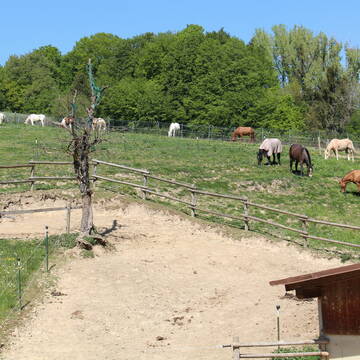
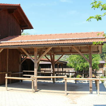
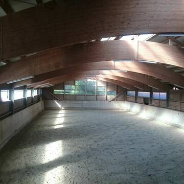
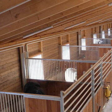
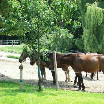
Reiterhof Gensleiten
Reut
Reiterhof-Gensleiten
@Reiterhof-Gensleiten
FN-Mitglied
Freizeitstall
Vermieten
Krankenbox
Paddock
Notfallboxen
23 weitere...
P+
Zucht- und Reitstall Sommer
Simbach am Inn
Sommer Gabriele
@Sommer-Gabriele
FN-Mitglied
Freizeitstall
Vermieten
Verpachten
Führanlage
Krankenbox
Allergikerstall
bedampftes/gewaschenes Heu
33 weitere...
P
Deprecated: Creation of dynamic property Zend_View_Helper_Ads::$adLink is deprecated in /var/www/stall-frei/htdocs/staging.stall-frei.de/library/Psf/View/Helper/Ads.php on line 108

Frisches Stroh zu verkaufen!
Mechtersen
STALL-FREIde Marketing
@STALL-FREI-Marketing
Kaufe frisches Stroh für dein Pferd!
Leider kein Vorschaubild
Leider kein Vorschaubild
Offenstallplätze für Wallache bis 150cm Stockmaß...
Simbach am Inn
Christiane Troschke
@Troschke
Offenstall
B

Offen/Laufstall Stuten, Wallache, geschlechtgetren
Stubenberg
Niederbayern Alm
@Niederbayern-Alm
Freizeitstall
Geländestrecke
Vermieten
Hunde willkommen
Krankenbox
Gnadenbrothof
Notfallboxen
29 weitere...
ganz aktuell
P
Leider kein Vorschaubild
Leider kein Vorschaubild
Boxen frei
Zeilarn
Reitanlage Schlagmann
@Bettina73
Paddock
Reithalle
Außenboxen
Innenbox
Halbpension
Einzelne Boxen oder Stallplätze
3 weitere...
B


Offenstall mit großer Weide,Stallboxen und Paddo...
Fridolfing
Gramsamer Andreas
@Gramsi
Geländestrecke
Reitlehrer und -unterricht
Vermieten
Verpachten
Hunde willkommen
Krankenbox
Hufrehe geeignet
Notfallboxen
21 weitere...
S

Futtersack HeuToy, Fressbremse in pink
Mechtersen
STALL-FREIde Marketing
@STALL-FREI-Marketing
Stundenlange Beschäftigung die
Koliken vorbeugt, geringe Staubinhalation mit
steuerbarer Futterentnahme
Große Paddockboxen / Offenstallplätze
Triftern
Huber-Englbert
@Huber-Englbert
Freizeitstall
Geländestrecke
Krankenbox
Longierzirkel/Roundpen
Notfallboxen
Außenbox mit Paddock
Offenstall
11 weitere...
P
Leider kein Vorschaubild
Leider kein Vorschaubild
Offenstallplatz frei
Malching
Agnes-Hager
@Agnes-Hager
Freizeitstall
Geländestrecke
Vermieten
Krankenbox
Paddock
Notfallboxen
13 weitere...
B
pferdepension-demmel
Hebertsfelden
Pferdepension-Demmel
@Pferdepension-Demmel
Freizeitstall
Geländestrecke
Vermieten
Longierzirkel/Roundpen
Paddock
Außenbox mit Paddock
Außenboxen
14 weitere...
P
Leider kein Vorschaubild
Leider kein Vorschaubild
Reiterhof Eschlberg
Mehring
Schiederer-Christine
@Schiederer-Christine
Freizeitstall
Geländestrecke
Vermieten
Hunde willkommen
Paddock
Außenbox mit Paddock
Innenbox
11 weitere...
B
Deprecated: Creation of dynamic property Zend_View::$pageCount is deprecated in /var/www/stall-frei/htdocs/staging.stall-frei.de/library/vendor/shardj/zf1-future/library/Zend/View/Abstract.php on line 308
Deprecated: Creation of dynamic property Zend_View::$itemCountPerPage is deprecated in /var/www/stall-frei/htdocs/staging.stall-frei.de/library/vendor/shardj/zf1-future/library/Zend/View/Abstract.php on line 308
Deprecated: Creation of dynamic property Zend_View::$first is deprecated in /var/www/stall-frei/htdocs/staging.stall-frei.de/library/vendor/shardj/zf1-future/library/Zend/View/Abstract.php on line 308
Deprecated: Creation of dynamic property Zend_View::$current is deprecated in /var/www/stall-frei/htdocs/staging.stall-frei.de/library/vendor/shardj/zf1-future/library/Zend/View/Abstract.php on line 308
Deprecated: Creation of dynamic property Zend_View::$last is deprecated in /var/www/stall-frei/htdocs/staging.stall-frei.de/library/vendor/shardj/zf1-future/library/Zend/View/Abstract.php on line 308
Deprecated: Creation of dynamic property Zend_View::$next is deprecated in /var/www/stall-frei/htdocs/staging.stall-frei.de/library/vendor/shardj/zf1-future/library/Zend/View/Abstract.php on line 308
Deprecated: Creation of dynamic property Zend_View::$pagesInRange is deprecated in /var/www/stall-frei/htdocs/staging.stall-frei.de/library/vendor/shardj/zf1-future/library/Zend/View/Abstract.php on line 308
Deprecated: Creation of dynamic property Zend_View::$firstPageInRange is deprecated in /var/www/stall-frei/htdocs/staging.stall-frei.de/library/vendor/shardj/zf1-future/library/Zend/View/Abstract.php on line 308
Deprecated: Creation of dynamic property Zend_View::$lastPageInRange is deprecated in /var/www/stall-frei/htdocs/staging.stall-frei.de/library/vendor/shardj/zf1-future/library/Zend/View/Abstract.php on line 308
Deprecated: Creation of dynamic property Zend_View::$currentItemCount is deprecated in /var/www/stall-frei/htdocs/staging.stall-frei.de/library/vendor/shardj/zf1-future/library/Zend/View/Abstract.php on line 308
Deprecated: Creation of dynamic property Zend_View::$totalItemCount is deprecated in /var/www/stall-frei/htdocs/staging.stall-frei.de/library/vendor/shardj/zf1-future/library/Zend/View/Abstract.php on line 308
Deprecated: Creation of dynamic property Zend_View::$firstItemNumber is deprecated in /var/www/stall-frei/htdocs/staging.stall-frei.de/library/vendor/shardj/zf1-future/library/Zend/View/Abstract.php on line 308
Deprecated: Creation of dynamic property Zend_View::$lastItemNumber is deprecated in /var/www/stall-frei/htdocs/staging.stall-frei.de/library/vendor/shardj/zf1-future/library/Zend/View/Abstract.php on line 308
Deprecated: Creation of dynamic property Zend_View::$router is deprecated in /var/www/stall-frei/htdocs/staging.stall-frei.de/library/vendor/shardj/zf1-future/library/Zend/View/Abstract.php on line 308
Deprecated: Creation of dynamic property Zend_View::$urlParams is deprecated in /var/www/stall-frei/htdocs/staging.stall-frei.de/library/vendor/shardj/zf1-future/library/Zend/View/Abstract.php on line 308
Deprecated: Creation of dynamic property Zend_View::$showAds is deprecated in /var/www/stall-frei/htdocs/staging.stall-frei.de/library/vendor/shardj/zf1-future/library/Zend/View/Abstract.php on line 308
Deprecated: Creation of dynamic property Zend_View::$objectIds is deprecated in /var/www/stall-frei/htdocs/staging.stall-frei.de/library/vendor/shardj/zf1-future/library/Zend/View/Abstract.php on line 308
Deprecated: Creation of dynamic property Zend_View::$showNavbar is deprecated in /var/www/stall-frei/htdocs/staging.stall-frei.de/library/vendor/shardj/zf1-future/library/Zend/View/Abstract.php on line 308
Deprecated: Creation of dynamic property Zend_View::$showBreadcrumb is deprecated in /var/www/stall-frei/htdocs/staging.stall-frei.de/library/vendor/shardj/zf1-future/library/Zend/View/Abstract.php on line 308
Deprecated: Creation of dynamic property Zend_View::$showFooter is deprecated in /var/www/stall-frei/htdocs/staging.stall-frei.de/library/vendor/shardj/zf1-future/library/Zend/View/Abstract.php on line 308
Deprecated: Creation of dynamic property Zend_View::$showInternalAds is deprecated in /var/www/stall-frei/htdocs/staging.stall-frei.de/library/vendor/shardj/zf1-future/library/Zend/View/Abstract.php on line 308
Deprecated: Creation of dynamic property Zend_View::$blNoContent is deprecated in /var/www/stall-frei/htdocs/staging.stall-frei.de/library/vendor/shardj/zf1-future/library/Zend/View/Abstract.php on line 308
Deprecated: Creation of dynamic property Zend_View::$sMetaDesc is deprecated in /var/www/stall-frei/htdocs/staging.stall-frei.de/library/vendor/shardj/zf1-future/library/Zend/View/Abstract.php on line 308
Deprecated: Creation of dynamic property Zend_View::$useGmaps is deprecated in /var/www/stall-frei/htdocs/staging.stall-frei.de/library/vendor/shardj/zf1-future/library/Zend/View/Abstract.php on line 308
Deprecated: Creation of dynamic property Zend_View::$touches is deprecated in /var/www/stall-frei/htdocs/staging.stall-frei.de/library/vendor/shardj/zf1-future/library/Zend/View/Abstract.php on line 308
Deprecated: Creation of dynamic property Zend_View::$oProject is deprecated in /var/www/stall-frei/htdocs/staging.stall-frei.de/library/vendor/shardj/zf1-future/library/Zend/View/Abstract.php on line 308
Deprecated: Creation of dynamic property Zend_View::$pageHeadline is deprecated in /var/www/stall-frei/htdocs/staging.stall-frei.de/library/vendor/shardj/zf1-future/library/Zend/View/Abstract.php on line 308
Deprecated: Creation of dynamic property Zend_View::$disableLocationField is deprecated in /var/www/stall-frei/htdocs/staging.stall-frei.de/library/vendor/shardj/zf1-future/library/Zend/View/Abstract.php on line 308
Deprecated: Creation of dynamic property Zend_View::$isSearch is deprecated in /var/www/stall-frei/htdocs/staging.stall-frei.de/library/vendor/shardj/zf1-future/library/Zend/View/Abstract.php on line 308
Deprecated: Creation of dynamic property Zend_View::$pageTitle is deprecated in /var/www/stall-frei/htdocs/staging.stall-frei.de/library/vendor/shardj/zf1-future/library/Zend/View/Abstract.php on line 308
Deprecated: Creation of dynamic property Psf_Form_Element_Text::$class is deprecated in /var/www/stall-frei/htdocs/staging.stall-frei.de/library/vendor/shardj/zf1-future/library/Zend/Form/Element.php on line 874
Deprecated: Creation of dynamic property Psf_Form_Element_Text::$size is deprecated in /var/www/stall-frei/htdocs/staging.stall-frei.de/library/vendor/shardj/zf1-future/library/Zend/Form/Element.php on line 874
Deprecated: Creation of dynamic property Psf_Form_Element_Text::$placeholder is deprecated in /var/www/stall-frei/htdocs/staging.stall-frei.de/library/vendor/shardj/zf1-future/library/Zend/Form/Element.php on line 874
Deprecated: Creation of dynamic property Psf_Form_Element_Hidden::$class is deprecated in /var/www/stall-frei/htdocs/staging.stall-frei.de/library/vendor/shardj/zf1-future/library/Zend/Form/Element.php on line 874
Deprecated: Creation of dynamic property Psf_Form_Element_Hidden::$class is deprecated in /var/www/stall-frei/htdocs/staging.stall-frei.de/library/vendor/shardj/zf1-future/library/Zend/Form/Element.php on line 874
Deprecated: Creation of dynamic property Psf_Form_Element_Hidden::$class is deprecated in /var/www/stall-frei/htdocs/staging.stall-frei.de/library/vendor/shardj/zf1-future/library/Zend/Form/Element.php on line 874
Deprecated: Creation of dynamic property Psf_Form_Element_Hidden::$class is deprecated in /var/www/stall-frei/htdocs/staging.stall-frei.de/library/vendor/shardj/zf1-future/library/Zend/Form/Element.php on line 874
Deprecated: Creation of dynamic property Psf_Form_Element_Select::$class is deprecated in /var/www/stall-frei/htdocs/staging.stall-frei.de/library/vendor/shardj/zf1-future/library/Zend/Form/Element.php on line 874
Deprecated: Creation of dynamic property Psf_Form_Element_Select::$class is deprecated in /var/www/stall-frei/htdocs/staging.stall-frei.de/library/vendor/shardj/zf1-future/library/Zend/Form/Element.php on line 874
Deprecated: Creation of dynamic property Psf_Form_Element_Select::$class is deprecated in /var/www/stall-frei/htdocs/staging.stall-frei.de/library/vendor/shardj/zf1-future/library/Zend/Form/Element.php on line 874
Deprecated: Creation of dynamic property Psf_Form_Element_Select::$class is deprecated in /var/www/stall-frei/htdocs/staging.stall-frei.de/library/vendor/shardj/zf1-future/library/Zend/Form/Element.php on line 874
Deprecated: Creation of dynamic property Psf_Form_Element_Text::$class is deprecated in /var/www/stall-frei/htdocs/staging.stall-frei.de/library/vendor/shardj/zf1-future/library/Zend/Form/Element.php on line 874
Deprecated: Creation of dynamic property Psf_Form_Element_Checkbox::$label is deprecated in /var/www/stall-frei/htdocs/staging.stall-frei.de/library/vendor/shardj/zf1-future/library/Zend/Form/Element.php on line 874
Deprecated: Creation of dynamic property Zend_View::$sort is deprecated in /var/www/stall-frei/htdocs/staging.stall-frei.de/library/vendor/shardj/zf1-future/library/Zend/View/Abstract.php on line 308
Deprecated: Creation of dynamic property Zend_View::$searchLocation is deprecated in /var/www/stall-frei/htdocs/staging.stall-frei.de/library/vendor/shardj/zf1-future/library/Zend/View/Abstract.php on line 308
Deprecated: Creation of dynamic property Zend_View::$locationHint is deprecated in /var/www/stall-frei/htdocs/staging.stall-frei.de/library/vendor/shardj/zf1-future/library/Zend/View/Abstract.php on line 308
Psf_GeoCoder_Abstract::getLocation: Kirchdorf a.Inn Get Location CachedOrLive
Psf_GeoCoder_Abstract::getCachedOrLive: Kirchdorf a.Inn
Psf_GeoCoder_OpenCageData::makeApiRequest: response:
Array
(
[documentation] => https://opencagedata.com/api
[licenses] => Array
(
[0] => Array
(
[name] => see attribution guide
[url] => https://opencagedata.com/credits
)
)
[results] => Array
(
[0] => Array
(
[bounds] => Array
(
[northeast] => Array
(
[lat] => 48.2811601
[lng] => 13.013022
)
[southwest] => Array
(
[lat] => 48.2066557
[lng] => 12.8916107
)
)
[components] => Array
(
[ISO_3166-1_alpha-2] => DE
[ISO_3166-1_alpha-3] => DEU
[ISO_3166-2] => Array
(
[0] => DE-BY
)
[_category] => place
[_normalized_city] => Kirchdorf am Inn
[_type] => village
[continent] => Europe
[country] => Deutschland
[country_code] => de
[county] => Landkreis Rottal-Inn
[political_union] => European Union
[postcode] => 84375
[state] => Bayern
[state_code] => BY
[village] => Kirchdorf am Inn
)
[confidence] => 7
[formatted] => 84375 Kirchdorf am Inn, Deutschland
[geometry] => Array
(
[lat] => 48.2417259
[lng] => 12.9782358
)
)
[1] => Array
(
[bounds] => Array
(
[northeast] => Array
(
[lat] => 48.3164158
[lng] => 13.3191274
)
[southwest] => Array
(
[lat] => 48.2708887
[lng] => 13.250743
)
)
[components] => Array
(
[ISO_3166-1_alpha-2] => AT
[ISO_3166-1_alpha-3] => AUT
[ISO_3166-2] => Array
(
[0] => AT-4
)
[_category] => place
[_normalized_city] => Kirchdorf am Inn
[_type] => village
[continent] => Europe
[country] => Österreich
[country_code] => at
[county] => Bezirk Ried
[political_union] => European Union
[postcode] => 4982
[state] => Oberösterreich
[state_code] => 4
[village] => Kirchdorf am Inn
)
[confidence] => 7
[formatted] => 4982 Kirchdorf am Inn, Österreich
[geometry] => Array
(
[lat] => 48.2943094
[lng] => 13.2819617
)
)
[2] => Array
(
[bounds] => Array
(
[northeast] => Array
(
[lat] => 47.7995631
[lng] => 12.1289407
)
[southwest] => Array
(
[lat] => 47.7595631
[lng] => 12.0889407
)
)
[components] => Array
(
[ISO_3166-1_alpha-2] => DE
[ISO_3166-1_alpha-3] => DEU
[ISO_3166-2] => Array
(
[0] => DE-BY
)
[_category] => place
[_normalized_city] => Raubling
[_type] => city
[continent] => Europe
[country] => Deutschland
[country_code] => de
[county] => Landkreis Rosenheim
[political_union] => European Union
[postcode] => 83064
[state] => Bayern
[state_code] => BY
[town] => Raubling
)
[confidence] => 7
[formatted] => 83064 Raubling, Deutschland
[geometry] => Array
(
[lat] => 47.7795631
[lng] => 12.1089407
)
)
[3] => Array
(
[components] => Array
(
[ISO_3166-1_alpha-2] => FR
[ISO_3166-1_alpha-3] => FRA
[ISO_3166-2] => Array
(
[0] => FR-PDL
[1] => FR-72
)
[_category] => road
[_normalized_city] => Saint-Calais
[_type] => road
[city] => Saint-Calais
[continent] => Europe
[country] => France
[country_code] => fr
[county] => Sarthe
[local_authority] => Communauté de communes des Vallées de la Braye et de l'Anille
[political_union] => European Union
[postcode] => 72120
[road] => Avenue de Kirchdorf
[state] => Pays de la Loire
[state_code] => PDL
)
[confidence] => 3
[formatted] => Avenue de Kirchdorf, 72120 Saint-Calais, France
[geometry] => Array
(
[lat] => 47.924148
[lng] => 0.742826
)
)
[4] => Array
(
[components] => Array
(
[ISO_3166-1_alpha-2] => FR
[ISO_3166-1_alpha-3] => FRA
[ISO_3166-2] => Array
(
[0] => FR-GES
[1] => FR-6AE
[2] => FR-68
)
[_category] => road
[_normalized_city] => Thannenkirch
[_type] => road
[city] => Thannenkirch
[continent] => Europe
[country] => France
[country_code] => fr
[county] => Haut-Rhin
[local_authority] => Communauté de communes du Pays de Ribeauvillé
[political_union] => European Union
[postcode] => 68590
[road] => In Den Felsen
[state] => Grand Est
[state_code] => GES
)
[confidence] => 10
[formatted] => In Den Felsen, 68590 Thannenkirch, France
[geometry] => Array
(
[lat] => 48.238273
[lng] => 7.294523
)
)
[5] => Array
(
[components] => Array
(
[ISO_3166-1_alpha-2] => FR
[ISO_3166-1_alpha-3] => FRA
[ISO_3166-2] => Array
(
[0] => FR-20R
[1] => FR-2A
)
[_category] => road
[_normalized_city] => Sari-d'Orcino
[_type] => road
[city] => Sari-d'Orcino
[continent] => Europe
[country] => France
[country_code] => fr
[county] => Corse-du-Sud
[local_authority] => Communauté de communes Spelunca-Liamone
[political_union] => European Union
[postcode] => 20151
[road] => Acqua In Sù
[state] => Corse
[state_code] => COR
)
[confidence] => 10
[formatted] => Acqua In Sù, 20151 Sari-d'Orcino, France
[geometry] => Array
(
[lat] => 42.059392
[lng] => 8.828311
)
)
[6] => Array
(
[components] => Array
(
[ISO_3166-1_alpha-2] => FR
[ISO_3166-1_alpha-3] => FRA
[ISO_3166-2] => Array
(
[0] => FR-20R
[1] => FR-2A
)
[_category] => road
[_normalized_city] => Grosseto-Prugna
[_type] => road
[city] => Grosseto-Prugna
[continent] => Europe
[country] => France
[country_code] => fr
[county] => Corse-du-Sud
[local_authority] => Communauté de communes de la Pieve de l'Ornano et du Taravo
[political_union] => European Union
[postcode] => 20128
[road] => Figa in La
[state] => Corse
[state_code] => COR
)
[confidence] => 10
[formatted] => Figa in La, 20128 Grosseto-Prugna, France
[geometry] => Array
(
[lat] => 41.87129
[lng] => 8.961366
)
)
[7] => Array
(
[components] => Array
(
[ISO_3166-1_alpha-2] => FR
[ISO_3166-1_alpha-3] => FRA
[ISO_3166-2] => Array
(
[0] => FR-ARA
[1] => FR-01
)
[_category] => road
[_normalized_city] => Vandeins
[_type] => road
[city] => Vandeins
[continent] => Europe
[country] => France
[country_code] => fr
[county] => Ain
[local_authority] => Communauté d'agglomération du Bassin de Bourg-en-Bresse
[political_union] => European Union
[postcode] => 01660
[road] => Chemin des Innes
[state] => Auvergne-Rhône-Alpes
[state_code] => ARA
)
[confidence] => 10
[formatted] => Chemin des Innes, 01660 Vandeins, France
[geometry] => Array
(
[lat] => 46.214274
[lng] => 5.061618
)
)
[8] => Array
(
[components] => Array
(
[ISO_3166-1_alpha-2] => FR
[ISO_3166-1_alpha-3] => FRA
[ISO_3166-2] => Array
(
[0] => FR-CVL
[1] => FR-36
)
[_category] => road
[_normalized_city] => Azay-le-Ferron
[_type] => road
[city] => Azay-le-Ferron
[continent] => Europe
[country] => France
[country_code] => fr
[county] => Indre
[local_authority] => Communauté de communes Cœur de Brenne
[political_union] => European Union
[postcode] => 36290
[road] => Rue de Gars-Am-Inn
[state] => Centre-Val de Loire
[state_code] => CVL
)
[confidence] => 10
[formatted] => Rue de Gars-Am-Inn, 36290 Azay-le-Ferron, France
[geometry] => Array
(
[lat] => 46.850027
[lng] => 1.072795
)
)
[9] => Array
(
[components] => Array
(
[ISO_3166-1_alpha-2] => FR
[ISO_3166-1_alpha-3] => FRA
[ISO_3166-2] => Array
(
[0] => FR-20R
[1] => FR-2A
)
[_category] => road
[_normalized_city] => Sari-d'Orcino
[_type] => road
[city] => Sari-d'Orcino
[continent] => Europe
[country] => France
[country_code] => fr
[county] => Corse-du-Sud
[local_authority] => Communauté de communes Spelunca-Liamone
[political_union] => European Union
[postcode] => 20151
[road] => Acqua In Ghjò
[state] => Corse
[state_code] => COR
)
[confidence] => 10
[formatted] => Acqua In Ghjò, 20151 Sari-d'Orcino, France
[geometry] => Array
(
[lat] => 42.061412
[lng] => 8.824259
)
)
)
[status] => Array
(
[code] => 200
[message] => OK
)
[stay_informed] => Array
(
[blog] => https://blog.opencagedata.com
[mastodon] => https://en.osm.town/@opencage
)
[thanks] => For using an OpenCage API
[timestamp] => Array
(
[created_http] => Sat, 07 Feb 2026 12:37:42 GMT
[created_unix] => 1770467862
)
[total_results] => 10
)
Psf_GeoCoder_Abstract::convertLocationResult
{"documentation":"https:\/\/opencagedata.com\/api","licenses":[{"name":"see attribution guide","url":"https:\/\/opencagedata.com\/credits"}],"results":[{"bounds":{"northeast":{"lat":48.2811601,"lng":13.013022},"southwest":{"lat":48.2066557,"lng":12.8916107}},"components":{"ISO_3166-1_alpha-2":"DE","ISO_3166-1_alpha-3":"DEU","ISO_3166-2":["DE-BY"],"_category":"place","_normalized_city":"Kirchdorf am Inn","_type":"village","continent":"Europe","country":"Deutschland","country_code":"de","county":"Landkreis Rottal-Inn","political_union":"European Union","postcode":"84375","state":"Bayern","state_code":"BY","village":"Kirchdorf am Inn"},"confidence":7,"formatted":"84375 Kirchdorf am Inn, Deutschland","geometry":{"lat":48.2417259,"lng":12.9782358}},{"bounds":{"northeast":{"lat":48.3164158,"lng":13.3191274},"southwest":{"lat":48.2708887,"lng":13.250743}},"components":{"ISO_3166-1_alpha-2":"AT","ISO_3166-1_alpha-3":"AUT","ISO_3166-2":["AT-4"],"_category":"place","_normalized_city":"Kirchdorf am Inn","_type":"village","continent":"Europe","country":"\u00d6sterreich","country_code":"at","county":"Bezirk Ried","political_union":"European Union","postcode":"4982","state":"Ober\u00f6sterreich","state_code":"4","village":"Kirchdorf am Inn"},"confidence":7,"formatted":"4982 Kirchdorf am Inn, \u00d6sterreich","geometry":{"lat":48.2943094,"lng":13.2819617}},{"bounds":{"northeast":{"lat":47.7995631,"lng":12.1289407},"southwest":{"lat":47.7595631,"lng":12.0889407}},"components":{"ISO_3166-1_alpha-2":"DE","ISO_3166-1_alpha-3":"DEU","ISO_3166-2":["DE-BY"],"_category":"place","_normalized_city":"Raubling","_type":"city","continent":"Europe","country":"Deutschland","country_code":"de","county":"Landkreis Rosenheim","political_union":"European Union","postcode":"83064","state":"Bayern","state_code":"BY","town":"Raubling"},"confidence":7,"formatted":"83064 Raubling, Deutschland","geometry":{"lat":47.7795631,"lng":12.1089407}},{"components":{"ISO_3166-1_alpha-2":"FR","ISO_3166-1_alpha-3":"FRA","ISO_3166-2":["FR-PDL","FR-72"],"_category":"road","_normalized_city":"Saint-Calais","_type":"road","city":"Saint-Calais","continent":"Europe","country":"France","country_code":"fr","county":"Sarthe","local_authority":"Communaut\u00e9 de communes des Vall\u00e9es de la Braye et de l'Anille","political_union":"European Union","postcode":"72120","road":"Avenue de Kirchdorf","state":"Pays de la Loire","state_code":"PDL"},"confidence":3,"formatted":"Avenue de Kirchdorf, 72120 Saint-Calais, France","geometry":{"lat":47.924148,"lng":0.742826}},{"components":{"ISO_3166-1_alpha-2":"FR","ISO_3166-1_alpha-3":"FRA","ISO_3166-2":["FR-GES","FR-6AE","FR-68"],"_category":"road","_normalized_city":"Thannenkirch","_type":"road","city":"Thannenkirch","continent":"Europe","country":"France","country_code":"fr","county":"Haut-Rhin","local_authority":"Communaut\u00e9 de communes du Pays de Ribeauvill\u00e9","political_union":"European Union","postcode":"68590","road":"In Den Felsen","state":"Grand Est","state_code":"GES"},"confidence":10,"formatted":"In Den Felsen, 68590 Thannenkirch, France","geometry":{"lat":48.238273,"lng":7.294523}},{"components":{"ISO_3166-1_alpha-2":"FR","ISO_3166-1_alpha-3":"FRA","ISO_3166-2":["FR-20R","FR-2A"],"_category":"road","_normalized_city":"Sari-d'Orcino","_type":"road","city":"Sari-d'Orcino","continent":"Europe","country":"France","country_code":"fr","county":"Corse-du-Sud","local_authority":"Communaut\u00e9 de communes Spelunca-Liamone","political_union":"European Union","postcode":"20151","road":"Acqua In S\u00f9","state":"Corse","state_code":"COR"},"confidence":10,"formatted":"Acqua In S\u00f9, 20151 Sari-d'Orcino, France","geometry":{"lat":42.059392,"lng":8.828311}},{"components":{"ISO_3166-1_alpha-2":"FR","ISO_3166-1_alpha-3":"FRA","ISO_3166-2":["FR-20R","FR-2A"],"_category":"road","_normalized_city":"Grosseto-Prugna","_type":"road","city":"Grosseto-Prugna","continent":"Europe","country":"France","country_code":"fr","county":"Corse-du-Sud","local_authority":"Communaut\u00e9 de communes de la Pieve de l'Ornano et du Taravo","political_union":"European Union","postcode":"20128","road":"Figa in La","state":"Corse","state_code":"COR"},"confidence":10,"formatted":"Figa in La, 20128 Grosseto-Prugna, France","geometry":{"lat":41.87129,"lng":8.961366}},{"components":{"ISO_3166-1_alpha-2":"FR","ISO_3166-1_alpha-3":"FRA","ISO_3166-2":["FR-ARA","FR-01"],"_category":"road","_normalized_city":"Vandeins","_type":"road","city":"Vandeins","continent":"Europe","country":"France","country_code":"fr","county":"Ain","local_authority":"Communaut\u00e9 d'agglom\u00e9ration du Bassin de Bourg-en-Bresse","political_union":"European Union","postcode":"01660","road":"Chemin des Innes","state":"Auvergne-Rh\u00f4ne-Alpes","state_code":"ARA"},"confidence":10,"formatted":"Chemin des Innes, 01660 Vandeins, France","geometry":{"lat":46.214274,"lng":5.061618}},{"components":{"ISO_3166-1_alpha-2":"FR","ISO_3166-1_alpha-3":"FRA","ISO_3166-2":["FR-CVL","FR-36"],"_category":"road","_normalized_city":"Azay-le-Ferron","_type":"road","city":"Azay-le-Ferron","continent":"Europe","country":"France","country_code":"fr","county":"Indre","local_authority":"Communaut\u00e9 de communes C\u0153ur de Brenne","political_union":"European Union","postcode":"36290","road":"Rue de Gars-Am-Inn","state":"Centre-Val de Loire","state_code":"CVL"},"confidence":10,"formatted":"Rue de Gars-Am-Inn, 36290 Azay-le-Ferron, France","geometry":{"lat":46.850027,"lng":1.072795}},{"components":{"ISO_3166-1_alpha-2":"FR","ISO_3166-1_alpha-3":"FRA","ISO_3166-2":["FR-20R","FR-2A"],"_category":"road","_normalized_city":"Sari-d'Orcino","_type":"road","city":"Sari-d'Orcino","continent":"Europe","country":"France","country_code":"fr","county":"Corse-du-Sud","local_authority":"Communaut\u00e9 de communes Spelunca-Liamone","political_union":"European Union","postcode":"20151","road":"Acqua In Ghj\u00f2","state":"Corse","state_code":"COR"},"confidence":10,"formatted":"Acqua In Ghj\u00f2, 20151 Sari-d'Orcino, France","geometry":{"lat":42.061412,"lng":8.824259}}],"status":{"code":200,"message":"OK"},"stay_informed":{"blog":"https:\/\/blog.opencagedata.com","mastodon":"https:\/\/en.osm.town\/@opencage"},"thanks":"For using an OpenCage API","timestamp":{"created_http":"Sat, 07 Feb 2026 12:37:42 GMT","created_unix":1770467862},"total_results":10}Array
(
[0] => stdClass Object
(
[bounds] => stdClass Object
(
[northeast] => stdClass Object
(
[lat] => 48.2811601
[lng] => 13.013022
)
[southwest] => stdClass Object
(
[lat] => 48.2066557
[lng] => 12.8916107
)
)
[components] => stdClass Object
(
[ISO_3166-1_alpha-2] => DE
[ISO_3166-1_alpha-3] => DEU
[ISO_3166-2] => Array
(
[0] => DE-BY
)
[_category] => place
[_normalized_city] => Kirchdorf am Inn
[_type] => village
[continent] => Europe
[country] => Deutschland
[country_code] => de
[county] => Landkreis Rottal-Inn
[political_union] => European Union
[postcode] => 84375
[state] => Bayern
[state_code] => BY
[village] => Kirchdorf am Inn
)
[confidence] => 7
[formatted] => 84375 Kirchdorf am Inn, Deutschland
[geometry] => stdClass Object
(
[lat] => 48.2417259
[lng] => 12.9782358
)
)
[1] => stdClass Object
(
[bounds] => stdClass Object
(
[northeast] => stdClass Object
(
[lat] => 48.3164158
[lng] => 13.3191274
)
[southwest] => stdClass Object
(
[lat] => 48.2708887
[lng] => 13.250743
)
)
[components] => stdClass Object
(
[ISO_3166-1_alpha-2] => AT
[ISO_3166-1_alpha-3] => AUT
[ISO_3166-2] => Array
(
[0] => AT-4
)
[_category] => place
[_normalized_city] => Kirchdorf am Inn
[_type] => village
[continent] => Europe
[country] => Österreich
[country_code] => at
[county] => Bezirk Ried
[political_union] => European Union
[postcode] => 4982
[state] => Oberösterreich
[state_code] => 4
[village] => Kirchdorf am Inn
)
[confidence] => 7
[formatted] => 4982 Kirchdorf am Inn, Österreich
[geometry] => stdClass Object
(
[lat] => 48.2943094
[lng] => 13.2819617
)
)
[2] => stdClass Object
(
[bounds] => stdClass Object
(
[northeast] => stdClass Object
(
[lat] => 47.7995631
[lng] => 12.1289407
)
[southwest] => stdClass Object
(
[lat] => 47.7595631
[lng] => 12.0889407
)
)
[components] => stdClass Object
(
[ISO_3166-1_alpha-2] => DE
[ISO_3166-1_alpha-3] => DEU
[ISO_3166-2] => Array
(
[0] => DE-BY
)
[_category] => place
[_normalized_city] => Raubling
[_type] => city
[continent] => Europe
[country] => Deutschland
[country_code] => de
[county] => Landkreis Rosenheim
[political_union] => European Union
[postcode] => 83064
[state] => Bayern
[state_code] => BY
[town] => Raubling
)
[confidence] => 7
[formatted] => 83064 Raubling, Deutschland
[geometry] => stdClass Object
(
[lat] => 47.7795631
[lng] => 12.1089407
)
)
[3] => stdClass Object
(
[components] => stdClass Object
(
[ISO_3166-1_alpha-2] => FR
[ISO_3166-1_alpha-3] => FRA
[ISO_3166-2] => Array
(
[0] => FR-PDL
[1] => FR-72
)
[_category] => road
[_normalized_city] => Saint-Calais
[_type] => road
[city] => Saint-Calais
[continent] => Europe
[country] => France
[country_code] => fr
[county] => Sarthe
[local_authority] => Communauté de communes des Vallées de la Braye et de l'Anille
[political_union] => European Union
[postcode] => 72120
[road] => Avenue de Kirchdorf
[state] => Pays de la Loire
[state_code] => PDL
)
[confidence] => 3
[formatted] => Avenue de Kirchdorf, 72120 Saint-Calais, France
[geometry] => stdClass Object
(
[lat] => 47.924148
[lng] => 0.742826
)
)
[4] => stdClass Object
(
[components] => stdClass Object
(
[ISO_3166-1_alpha-2] => FR
[ISO_3166-1_alpha-3] => FRA
[ISO_3166-2] => Array
(
[0] => FR-GES
[1] => FR-6AE
[2] => FR-68
)
[_category] => road
[_normalized_city] => Thannenkirch
[_type] => road
[city] => Thannenkirch
[continent] => Europe
[country] => France
[country_code] => fr
[county] => Haut-Rhin
[local_authority] => Communauté de communes du Pays de Ribeauvillé
[political_union] => European Union
[postcode] => 68590
[road] => In Den Felsen
[state] => Grand Est
[state_code] => GES
)
[confidence] => 10
[formatted] => In Den Felsen, 68590 Thannenkirch, France
[geometry] => stdClass Object
(
[lat] => 48.238273
[lng] => 7.294523
)
)
[5] => stdClass Object
(
[components] => stdClass Object
(
[ISO_3166-1_alpha-2] => FR
[ISO_3166-1_alpha-3] => FRA
[ISO_3166-2] => Array
(
[0] => FR-20R
[1] => FR-2A
)
[_category] => road
[_normalized_city] => Sari-d'Orcino
[_type] => road
[city] => Sari-d'Orcino
[continent] => Europe
[country] => France
[country_code] => fr
[county] => Corse-du-Sud
[local_authority] => Communauté de communes Spelunca-Liamone
[political_union] => European Union
[postcode] => 20151
[road] => Acqua In Sù
[state] => Corse
[state_code] => COR
)
[confidence] => 10
[formatted] => Acqua In Sù, 20151 Sari-d'Orcino, France
[geometry] => stdClass Object
(
[lat] => 42.059392
[lng] => 8.828311
)
)
[6] => stdClass Object
(
[components] => stdClass Object
(
[ISO_3166-1_alpha-2] => FR
[ISO_3166-1_alpha-3] => FRA
[ISO_3166-2] => Array
(
[0] => FR-20R
[1] => FR-2A
)
[_category] => road
[_normalized_city] => Grosseto-Prugna
[_type] => road
[city] => Grosseto-Prugna
[continent] => Europe
[country] => France
[country_code] => fr
[county] => Corse-du-Sud
[local_authority] => Communauté de communes de la Pieve de l'Ornano et du Taravo
[political_union] => European Union
[postcode] => 20128
[road] => Figa in La
[state] => Corse
[state_code] => COR
)
[confidence] => 10
[formatted] => Figa in La, 20128 Grosseto-Prugna, France
[geometry] => stdClass Object
(
[lat] => 41.87129
[lng] => 8.961366
)
)
[7] => stdClass Object
(
[components] => stdClass Object
(
[ISO_3166-1_alpha-2] => FR
[ISO_3166-1_alpha-3] => FRA
[ISO_3166-2] => Array
(
[0] => FR-ARA
[1] => FR-01
)
[_category] => road
[_normalized_city] => Vandeins
[_type] => road
[city] => Vandeins
[continent] => Europe
[country] => France
[country_code] => fr
[county] => Ain
[local_authority] => Communauté d'agglomération du Bassin de Bourg-en-Bresse
[political_union] => European Union
[postcode] => 01660
[road] => Chemin des Innes
[state] => Auvergne-Rhône-Alpes
[state_code] => ARA
)
[confidence] => 10
[formatted] => Chemin des Innes, 01660 Vandeins, France
[geometry] => stdClass Object
(
[lat] => 46.214274
[lng] => 5.061618
)
)
[8] => stdClass Object
(
[components] => stdClass Object
(
[ISO_3166-1_alpha-2] => FR
[ISO_3166-1_alpha-3] => FRA
[ISO_3166-2] => Array
(
[0] => FR-CVL
[1] => FR-36
)
[_category] => road
[_normalized_city] => Azay-le-Ferron
[_type] => road
[city] => Azay-le-Ferron
[continent] => Europe
[country] => France
[country_code] => fr
[county] => Indre
[local_authority] => Communauté de communes Cœur de Brenne
[political_union] => European Union
[postcode] => 36290
[road] => Rue de Gars-Am-Inn
[state] => Centre-Val de Loire
[state_code] => CVL
)
[confidence] => 10
[formatted] => Rue de Gars-Am-Inn, 36290 Azay-le-Ferron, France
[geometry] => stdClass Object
(
[lat] => 46.850027
[lng] => 1.072795
)
)
[9] => stdClass Object
(
[components] => stdClass Object
(
[ISO_3166-1_alpha-2] => FR
[ISO_3166-1_alpha-3] => FRA
[ISO_3166-2] => Array
(
[0] => FR-20R
[1] => FR-2A
)
[_category] => road
[_normalized_city] => Sari-d'Orcino
[_type] => road
[city] => Sari-d'Orcino
[continent] => Europe
[country] => France
[country_code] => fr
[county] => Corse-du-Sud
[local_authority] => Communauté de communes Spelunca-Liamone
[political_union] => European Union
[postcode] => 20151
[road] => Acqua In Ghjò
[state] => Corse
[state_code] => COR
)
[confidence] => 10
[formatted] => Acqua In Ghjò, 20151 Sari-d'Orcino, France
[geometry] => stdClass Object
(
[lat] => 42.061412
[lng] => 8.824259
)
)
)
Psf_GeoCoder_OpenCageData::getKeyMap: 0
stdClass Object
(
    [bounds] => stdClass Object
        (
            [northeast] => stdClass Object
                (
                    [lat] => 48.2811601
                    [lng] => 13.013022
                )

            [southwest] => stdClass Object
                (
                    [lat] => 48.2066557
                    [lng] => 12.8916107
                )

        )

    [components] => stdClass Object
        (
            [ISO_3166-1_alpha-2] => DE
            [ISO_3166-1_alpha-3] => DEU
            [ISO_3166-2] => Array
                (
                    [0] => DE-BY
                )

            [_category] => place
            [_normalized_city] => Kirchdorf am Inn
            [_type] => village
            [continent] => Europe
            [country] => Deutschland
            [country_code] => de
            [county] => Landkreis Rottal-Inn
            [political_union] => European Union
            [postcode] => 84375
            [state] => Bayern
            [state_code] => BY
            [village] => Kirchdorf am Inn
        )

    [confidence] => 7
    [formatted] => 84375 Kirchdorf am Inn, Deutschland
    [geometry] => stdClass Object
        (
            [lat] => 48.2417259
            [lng] => 12.9782358
        )

)
Psf_GeoCoder_OpenCageData::getCounty: Rottal-Inn
Psf_GeoCoder_OpenCageData::addMissingData REFETCH!
Array
(
    [address] => 84375 Kirchdorf am Inn, Deutschland
    [type] => village
    [street] =>
    [city] => Kirchdorf am Inn
    [county] => Rottal-Inn
    [state] => Bayern
    [zip] => 84375
    [country] => Deutschland
    [suburb] =>
    [countrycode] => de
    [latitude] => 48.2417259
    [longitude] => 12.9782358
    [accuracy] => 1
    [confidence] => 7
    [bounds] => stdClass Object
        (
            [northeast] => stdClass Object
                (
                    [lat] => 48.2811601
                    [lng] => 13.013022
                )

            [southwest] => stdClass Object
                (
                    [lat] => 48.2066557
                    [lng] => 12.8916107
                )

        )

)
reformat!
Array
(
    [address] => 84375 Kirchdorf am Inn, Deutschland
    [type] => village
    [street] =>
    [city] => Kirchdorf am Inn
    [county] => Rottal-Inn
    [state] => Bayern
    [zip] => 84375
    [country] => Deutschland
    [suburb] =>
    [countrycode] => de
    [latitude] => 48.2417259
    [longitude] => 12.9782358
    [accuracy] => 1
    [confidence] => 7
    [bounds] => stdClass Object
        (
            [northeast] => stdClass Object
                (
                    [lat] => 48.2811601
                    [lng] => 13.013022
                )

            [southwest] => stdClass Object
                (
                    [lat] => 48.2066557
                    [lng] => 12.8916107
                )

        )

    [place] => 84375 Kirchdorf am Inn, Bayern
    [hash] => 9cdf057ec4ad06f6bb926ae5049d32e8
)
Psf_GeoCoder_OpenCageData::getKeyMap: 1
stdClass Object
(
    [bounds] => stdClass Object
        (
            [northeast] => stdClass Object
                (
                    [lat] => 48.3164158
                    [lng] => 13.3191274
                )

            [southwest] => stdClass Object
                (
                    [lat] => 48.2708887
                    [lng] => 13.250743
                )

        )

    [components] => stdClass Object
        (
            [ISO_3166-1_alpha-2] => AT
            [ISO_3166-1_alpha-3] => AUT
            [ISO_3166-2] => Array
                (
                    [0] => AT-4
                )

            [_category] => place
            [_normalized_city] => Kirchdorf am Inn
            [_type] => village
            [continent] => Europe
            [country] => Österreich
            [country_code] => at
            [county] => Bezirk Ried
            [political_union] => European Union
            [postcode] => 4982
            [state] => Oberösterreich
            [state_code] => 4
            [village] => Kirchdorf am Inn
        )

    [confidence] => 7
    [formatted] => 4982 Kirchdorf am Inn, Österreich
    [geometry] => stdClass Object
        (
            [lat] => 48.2943094
            [lng] => 13.2819617
        )

)
Psf_GeoCoder_OpenCageData::getCounty: Bezirk Ried
Psf_GeoCoder_OpenCageData::addMissingData REFETCH!
Array
(
    [address] => 4982 Kirchdorf am Inn, Österreich
    [type] => village
    [street] =>
    [city] => Kirchdorf am Inn
    [county] => Bezirk Ried
    [state] => Oberösterreich
    [zip] => 4982
    [country] => Österreich
    [suburb] =>
    [countrycode] => at
    [latitude] => 48.2943094
    [longitude] => 13.2819617
    [accuracy] => 1
    [confidence] => 7
    [bounds] => stdClass Object
        (
            [northeast] => stdClass Object
                (
                    [lat] => 48.3164158
                    [lng] => 13.3191274
                )

            [southwest] => stdClass Object
                (
                    [lat] => 48.2708887
                    [lng] => 13.250743
                )

        )

)
reformat!
Array
(
    [address] => 4982 Kirchdorf am Inn, Österreich
    [type] => village
    [street] =>
    [city] => Kirchdorf am Inn
    [county] => Bezirk Ried
    [state] => Oberösterreich
    [zip] => 4982
    [country] => Österreich
    [suburb] =>
    [countrycode] => at
    [latitude] => 48.2943094
    [longitude] => 13.2819617
    [accuracy] => 1
    [confidence] => 7
    [bounds] => stdClass Object
        (
            [northeast] => stdClass Object
                (
                    [lat] => 48.3164158
                    [lng] => 13.3191274
                )

            [southwest] => stdClass Object
                (
                    [lat] => 48.2708887
                    [lng] => 13.250743
                )

        )

    [place] => 4982 Kirchdorf am Inn, Oberösterreich
    [hash] => cbdb4897f5656d2156ba144e585d03c2
)
Psf_GeoCoder_OpenCageData::getKeyMap: 2
stdClass Object
(
    [bounds] => stdClass Object
        (
            [northeast] => stdClass Object
                (
                    [lat] => 47.7995631
                    [lng] => 12.1289407
                )

            [southwest] => stdClass Object
                (
                    [lat] => 47.7595631
                    [lng] => 12.0889407
                )

        )

    [components] => stdClass Object
        (
            [ISO_3166-1_alpha-2] => DE
            [ISO_3166-1_alpha-3] => DEU
            [ISO_3166-2] => Array
                (
                    [0] => DE-BY
                )

            [_category] => place
            [_normalized_city] => Raubling
            [_type] => city
            [continent] => Europe
            [country] => Deutschland
            [country_code] => de
            [county] => Landkreis Rosenheim
            [political_union] => European Union
            [postcode] => 83064
            [state] => Bayern
            [state_code] => BY
            [town] => Raubling
        )

    [confidence] => 7
    [formatted] => 83064 Raubling, Deutschland
    [geometry] => stdClass Object
        (
            [lat] => 47.7795631
            [lng] => 12.1089407
        )

)
Psf_GeoCoder_OpenCageData::getCounty: Rosenheim
Psf_GeoCoder_OpenCageData::addMissingData REFETCH!
Array
(
    [address] => 83064 Raubling, Deutschland
    [type] => city
    [street] =>
    [city] => Raubling
    [county] => Rosenheim
    [state] => Bayern
    [zip] => 83064
    [country] => Deutschland
    [suburb] =>
    [countrycode] => de
    [latitude] => 47.7795631
    [longitude] => 12.1089407
    [accuracy] => 1
    [confidence] => 7
    [bounds] => stdClass Object
        (
            [northeast] => stdClass Object
                (
                    [lat] => 47.7995631
                    [lng] => 12.1289407
                )

            [southwest] => stdClass Object
                (
                    [lat] => 47.7595631
                    [lng] => 12.0889407
                )

        )

)
reformat!
Array
(
    [address] => 83064 Raubling, Deutschland
    [type] => city
    [street] =>
    [city] => Raubling
    [county] => Rosenheim
    [state] => Bayern
    [zip] => 83064
    [country] => Deutschland
    [suburb] =>
    [countrycode] => de
    [latitude] => 47.7795631
    [longitude] => 12.1089407
    [accuracy] => 1
    [confidence] => 7
    [bounds] => stdClass Object
        (
            [northeast] => stdClass Object
                (
                    [lat] => 47.7995631
                    [lng] => 12.1289407
                )

            [southwest] => stdClass Object
                (
                    [lat] => 47.7595631
                    [lng] => 12.0889407
                )

        )

    [place] => 83064 Raubling, Bayern
    [hash] => d34aca0507745ed6d45de1b472c86de6
)
Psf_GeoCoder_OpenCageData::getKeyMap: 3
stdClass Object
(
    [components] => stdClass Object
        (
            [ISO_3166-1_alpha-2] => FR
            [ISO_3166-1_alpha-3] => FRA
            [ISO_3166-2] => Array
                (
                    [0] => FR-PDL
                    [1] => FR-72
                )

            [_category] => road
            [_normalized_city] => Saint-Calais
            [_type] => road
            [city] => Saint-Calais
            [continent] => Europe
            [country] => France
            [country_code] => fr
            [county] => Sarthe
            [local_authority] => Communauté de communes des Vallées de la Braye et de l'Anille
            [political_union] => European Union
            [postcode] => 72120
            [road] => Avenue de Kirchdorf
            [state] => Pays de la Loire
            [state_code] => PDL
        )

    [confidence] => 3
    [formatted] => Avenue de Kirchdorf, 72120 Saint-Calais, France
    [geometry] => stdClass Object
        (
            [lat] => 47.924148
            [lng] => 0.742826
        )

)
Psf_GeoCoder_OpenCageData::getCounty: Sarthe
Psf_GeoCoder_OpenCageData::addMissingData REFETCH!
Array
(
    [address] => Avenue de Kirchdorf, 72120 Saint-Calais, France
    [type] => road
    [street] => Avenue de Kirchdorf
    [city] => Saint-Calais
    [county] => Sarthe
    [state] => Pays de la Loire
    [zip] => 72120
    [country] => France
    [suburb] =>
    [countrycode] => fr
    [latitude] => 47.924148
    [longitude] => 0.742826
    [accuracy] => 1
    [confidence] => 3
    [bounds] =>
)
reformat!
Array
(
    [address] => Avenue de Kirchdorf, 72120 Saint-Calais, France
    [type] => road
    [street] => Avenue de Kirchdorf
    [city] => Saint-Calais
    [county] => Sarthe
    [state] => Pays de la Loire
    [zip] => 72120
    [country] => France
    [suburb] =>
    [countrycode] => fr
    [latitude] => 47.924148
    [longitude] => 0.742826
    [accuracy] => 1
    [confidence] => 3
    [bounds] =>
    [place] => Avenue de Kirchdorf, 72120 Saint-Calais, Pays de la Loire
    [hash] => 1926e10108f7e5288735fe86db93a762
)
Psf_GeoCoder_OpenCageData::getKeyMap: 4
stdClass Object
(
    [components] => stdClass Object
        (
            [ISO_3166-1_alpha-2] => FR
            [ISO_3166-1_alpha-3] => FRA
            [ISO_3166-2] => Array
                (
                    [0] => FR-GES
                    [1] => FR-6AE
                    [2] => FR-68
                )

            [_category] => road
            [_normalized_city] => Thannenkirch
            [_type] => road
            [city] => Thannenkirch
            [continent] => Europe
            [country] => France
            [country_code] => fr
            [county] => Haut-Rhin
            [local_authority] => Communauté de communes du Pays de Ribeauvillé
            [political_union] => European Union
            [postcode] => 68590
            [road] => In Den Felsen
            [state] => Grand Est
            [state_code] => GES
        )

    [confidence] => 10
    [formatted] => In Den Felsen, 68590 Thannenkirch, France
    [geometry] => stdClass Object
        (
            [lat] => 48.238273
            [lng] => 7.294523
        )

)
Psf_GeoCoder_OpenCageData::getCounty: Haut-Rhin
Psf_GeoCoder_OpenCageData::addMissingData REFETCH!
Array
(
    [address] => In Den Felsen, 68590 Thannenkirch, France
    [type] => road
    [street] => In Den Felsen
    [city] => Thannenkirch
    [county] => Haut-Rhin
    [state] => Grand Est
    [zip] => 68590
    [country] => France
    [suburb] =>
    [countrycode] => fr
    [latitude] => 48.238273
    [longitude] => 7.294523
    [accuracy] => 1
    [confidence] => 10
    [bounds] =>
)
reformat!
Array
(
    [address] => In Den Felsen, 68590 Thannenkirch, France
    [type] => road
    [street] => In Den Felsen
    [city] => Thannenkirch
    [county] => Haut-Rhin
    [state] => Grand Est
    [zip] => 68590
    [country] => France
    [suburb] =>
    [countrycode] => fr
    [latitude] => 48.238273
    [longitude] => 7.294523
    [accuracy] => 1
    [confidence] => 10
    [bounds] =>
    [place] => In Den Felsen, 68590 Thannenkirch, Grand Est
    [hash] => 171209538d6a8dabfe60c3208c709da9
)
Psf_GeoCoder_OpenCageData::getKeyMap: 5
stdClass Object
(
    [components] => stdClass Object
        (
            [ISO_3166-1_alpha-2] => FR
            [ISO_3166-1_alpha-3] => FRA
            [ISO_3166-2] => Array
                (
                    [0] => FR-20R
                    [1] => FR-2A
                )

            [_category] => road
            [_normalized_city] => Sari-d'Orcino
            [_type] => road
            [city] => Sari-d'Orcino
            [continent] => Europe
            [country] => France
            [country_code] => fr
            [county] => Corse-du-Sud
            [local_authority] => Communauté de communes Spelunca-Liamone
            [political_union] => European Union
            [postcode] => 20151
            [road] => Acqua In Sù
            [state] => Corse
            [state_code] => COR
        )

    [confidence] => 10
    [formatted] => Acqua In Sù, 20151 Sari-d'Orcino, France
    [geometry] => stdClass Object
        (
            [lat] => 42.059392
            [lng] => 8.828311
        )

)
Psf_GeoCoder_OpenCageData::getCounty: Corse-du-Sud
Psf_GeoCoder_OpenCageData::addMissingData REFETCH!
Array
(
    [address] => Acqua In Sù, 20151 Sari-d'Orcino, France
    [type] => road
    [street] => Acqua In Sù
    [city] => Sari-d'Orcino
    [county] => Corse-du-Sud
    [state] => Corse
    [zip] => 20151
    [country] => France
    [suburb] =>
    [countrycode] => fr
    [latitude] => 42.059392
    [longitude] => 8.828311
    [accuracy] => 1
    [confidence] => 10
    [bounds] =>
)
reformat!
Array
(
    [address] => Acqua In Sù, 20151 Sari-d'Orcino, France
    [type] => road
    [street] => Acqua In Sù
    [city] => Sari-d'Orcino
    [county] => Corse-du-Sud
    [state] => Corse
    [zip] => 20151
    [country] => France
    [suburb] =>
    [countrycode] => fr
    [latitude] => 42.059392
    [longitude] => 8.828311
    [accuracy] => 1
    [confidence] => 10
    [bounds] =>
    [place] => Acqua In Sù, 20151 Sari-d'Orcino, Corse
    [hash] => 67fbfb5781d129009af561c24f79a953
)
Psf_GeoCoder_OpenCageData::getKeyMap: 6
stdClass Object
(
    [components] => stdClass Object
        (
            [ISO_3166-1_alpha-2] => FR
            [ISO_3166-1_alpha-3] => FRA
            [ISO_3166-2] => Array
                (
                    [0] => FR-20R
                    [1] => FR-2A
                )

            [_category] => road
            [_normalized_city] => Grosseto-Prugna
            [_type] => road
            [city] => Grosseto-Prugna
            [continent] => Europe
            [country] => France
            [country_code] => fr
            [county] => Corse-du-Sud
            [local_authority] => Communauté de communes de la Pieve de l'Ornano et du Taravo
            [political_union] => European Union
            [postcode] => 20128
            [road] => Figa in La
            [state] => Corse
            [state_code] => COR
        )

    [confidence] => 10
    [formatted] => Figa in La, 20128 Grosseto-Prugna, France
    [geometry] => stdClass Object
        (
            [lat] => 41.87129
            [lng] => 8.961366
        )

)
Psf_GeoCoder_OpenCageData::getCounty: Corse-du-Sud
Psf_GeoCoder_OpenCageData::addMissingData REFETCH!
Array
(
    [address] => Figa in La, 20128 Grosseto-Prugna, France
    [type] => road
    [street] => Figa in La
    [city] => Grosseto-Prugna
    [county] => Corse-du-Sud
    [state] => Corse
    [zip] => 20128
    [country] => France
    [suburb] =>
    [countrycode] => fr
    [latitude] => 41.87129
    [longitude] => 8.961366
    [accuracy] => 1
    [confidence] => 10
    [bounds] =>
)
reformat!
Array
(
    [address] => Figa in La, 20128 Grosseto-Prugna, France
    [type] => road
    [street] => Figa in La
    [city] => Grosseto-Prugna
    [county] => Corse-du-Sud
    [state] => Corse
    [zip] => 20128
    [country] => France
    [suburb] =>
    [countrycode] => fr
    [latitude] => 41.87129
    [longitude] => 8.961366
    [accuracy] => 1
    [confidence] => 10
    [bounds] =>
    [place] => Figa in La, 20128 Grosseto-Prugna, Corse
    [hash] => 933304f7c56a32077156f2fa4c4bde4a
)
Psf_GeoCoder_OpenCageData::getKeyMap: 7
stdClass Object
(
    [components] => stdClass Object
        (
            [ISO_3166-1_alpha-2] => FR
            [ISO_3166-1_alpha-3] => FRA
            [ISO_3166-2] => Array
                (
                    [0] => FR-ARA
                    [1] => FR-01
                )

            [_category] => road
            [_normalized_city] => Vandeins
            [_type] => road
            [city] => Vandeins
            [continent] => Europe
            [country] => France
            [country_code] => fr
            [county] => Ain
            [local_authority] => Communauté d'agglomération du Bassin de Bourg-en-Bresse
            [political_union] => European Union
            [postcode] => 01660
            [road] => Chemin des Innes
            [state] => Auvergne-Rhône-Alpes
            [state_code] => ARA
        )

    [confidence] => 10
    [formatted] => Chemin des Innes, 01660 Vandeins, France
    [geometry] => stdClass Object
        (
            [lat] => 46.214274
            [lng] => 5.061618
        )

)
Psf_GeoCoder_OpenCageData::getCounty: Ain
Psf_GeoCoder_OpenCageData::addMissingData REFETCH!
Array
(
    [address] => Chemin des Innes, 01660 Vandeins, France
    [type] => road
    [street] => Chemin des Innes
    [city] => Vandeins
    [county] => Ain
    [state] => Auvergne-Rhône-Alpes
    [zip] => 01660
    [country] => France
    [suburb] =>
    [countrycode] => fr
    [latitude] => 46.214274
    [longitude] => 5.061618
    [accuracy] => 1
    [confidence] => 10
    [bounds] =>
)
reformat!
Array
(
    [address] => Chemin des Innes, 01660 Vandeins, France
    [type] => road
    [street] => Chemin des Innes
    [city] => Vandeins
    [county] => Ain
    [state] => Auvergne-Rhône-Alpes
    [zip] => 01660
    [country] => France
    [suburb] =>
    [countrycode] => fr
    [latitude] => 46.214274
    [longitude] => 5.061618
    [accuracy] => 1
    [confidence] => 10
    [bounds] =>
    [place] => Chemin des Innes, 01660 Vandeins, Auvergne-Rhône-Alpes
    [hash] => 0147f2e2c58812742658bf8a7c9e55f3
)
Psf_GeoCoder_OpenCageData::getKeyMap: 8
stdClass Object
(
    [components] => stdClass Object
        (
            [ISO_3166-1_alpha-2] => FR
            [ISO_3166-1_alpha-3] => FRA
            [ISO_3166-2] => Array
                (
                    [0] => FR-CVL
                    [1] => FR-36
                )

            [_category] => road
            [_normalized_city] => Azay-le-Ferron
            [_type] => road
            [city] => Azay-le-Ferron
            [continent] => Europe
            [country] => France
            [country_code] => fr
            [county] => Indre
            [local_authority] => Communauté de communes Cœur de Brenne
            [political_union] => European Union
            [postcode] => 36290
            [road] => Rue de Gars-Am-Inn
            [state] => Centre-Val de Loire
            [state_code] => CVL
        )

    [confidence] => 10
    [formatted] => Rue de Gars-Am-Inn, 36290 Azay-le-Ferron, France
    [geometry] => stdClass Object
        (
            [lat] => 46.850027
            [lng] => 1.072795
        )

)
Psf_GeoCoder_OpenCageData::getCounty: Indre
Psf_GeoCoder_OpenCageData::addMissingData REFETCH!
Array
(
    [address] => Rue de Gars-Am-Inn, 36290 Azay-le-Ferron, France
    [type] => road
    [street] => Rue de Gars-Am-Inn
    [city] => Azay-le-Ferron
    [county] => Indre
    [state] => Centre-Val de Loire
    [zip] => 36290
    [country] => France
    [suburb] =>
    [countrycode] => fr
    [latitude] => 46.850027
    [longitude] => 1.072795
    [accuracy] => 1
    [confidence] => 10
    [bounds] =>
)
reformat!
Array
(
    [address] => Rue de Gars-Am-Inn, 36290 Azay-le-Ferron, France
    [type] => road
    [street] => Rue de Gars-Am-Inn
    [city] => Azay-le-Ferron
    [county] => Indre
    [state] => Centre-Val de Loire
    [zip] => 36290
    [country] => France
    [suburb] =>
    [countrycode] => fr
    [latitude] => 46.850027
    [longitude] => 1.072795
    [accuracy] => 1
    [confidence] => 10
    [bounds] =>
    [place] => Rue de Gars-Am-Inn, 36290 Azay-le-Ferron, Centre-Val de Loire
    [hash] => 76d7a293d458b1f2f4670346d91d36f7
)
Psf_GeoCoder_OpenCageData::getKeyMap: 9
stdClass Object
(
    [components] => stdClass Object
        (
            [ISO_3166-1_alpha-2] => FR
            [ISO_3166-1_alpha-3] => FRA
            [ISO_3166-2] => Array
                (
                    [0] => FR-20R
                    [1] => FR-2A
                )

            [_category] => road
            [_normalized_city] => Sari-d'Orcino
            [_type] => road
            [city] => Sari-d'Orcino
            [continent] => Europe
            [country] => France
            [country_code] => fr
            [county] => Corse-du-Sud
            [local_authority] => Communauté de communes Spelunca-Liamone
            [political_union] => European Union
            [postcode] => 20151
            [road] => Acqua In Ghjò
            [state] => Corse
            [state_code] => COR
        )

    [confidence] => 10
    [formatted] => Acqua In Ghjò, 20151 Sari-d'Orcino, France
    [geometry] => stdClass Object
        (
            [lat] => 42.061412
            [lng] => 8.824259
        )

)
Psf_GeoCoder_OpenCageData::getCounty: Corse-du-Sud
Psf_GeoCoder_OpenCageData::addMissingData REFETCH!
Array
(
    [address] => Acqua In Ghjò, 20151 Sari-d'Orcino, France
    [type] => road
    [street] => Acqua In Ghjò
    [city] => Sari-d'Orcino
    [county] => Corse-du-Sud
    [state] => Corse
    [zip] => 20151
    [country] => France
    [suburb] =>
    [countrycode] => fr
    [latitude] => 42.061412
    [longitude] => 8.824259
    [accuracy] => 1
    [confidence] => 10
    [bounds] =>
)
reformat!
Array
(
    [address] => Acqua In Ghjò, 20151 Sari-d'Orcino, France
    [type] => road
    [street] => Acqua In Ghjò
    [city] => Sari-d'Orcino
    [county] => Corse-du-Sud
    [state] => Corse
    [zip] => 20151
    [country] => France
    [suburb] =>
    [countrycode] => fr
    [latitude] => 42.061412
    [longitude] => 8.824259
    [accuracy] => 1
    [confidence] => 10
    [bounds] =>
    [place] => Acqua In Ghjò, 20151 Sari-d'Orcino, Corse
    [hash] => 0746184db030f46d03baa1041a6df911
)
Deprecated: Creation of dynamic property Zend_View::$locationHintStyle is deprecated in /var/www/stall-frei/htdocs/staging.stall-frei.de/library/vendor/shardj/zf1-future/library/Zend/View/Abstract.php on line 308
Deprecated: Creation of dynamic property Zend_View::$adGeoLocation is deprecated in /var/www/stall-frei/htdocs/staging.stall-frei.de/library/vendor/shardj/zf1-future/library/Zend/View/Abstract.php on line 308
Deprecated: Creation of dynamic property Zend_View::$recordCount is deprecated in /var/www/stall-frei/htdocs/staging.stall-frei.de/library/vendor/shardj/zf1-future/library/Zend/View/Abstract.php on line 308
Deprecated: explode(): Passing null to parameter #2 ($string) of type string is deprecated in /var/www/stall-frei/htdocs/staging.stall-frei.de/application/models/SearchAgent.php on line 100
Deprecated: explode(): Passing null to parameter #2 ($string) of type string is deprecated in /var/www/stall-frei/htdocs/staging.stall-frei.de/application/models/SearchAgent.php on line 100
Deprecated: explode(): Passing null to parameter #2 ($string) of type string is deprecated in /var/www/stall-frei/htdocs/staging.stall-frei.de/application/models/SearchAgent.php on line 100
Deprecated: explode(): Passing null to parameter #2 ($string) of type string is deprecated in /var/www/stall-frei/htdocs/staging.stall-frei.de/application/models/SearchAgent.php on line 100
Deprecated: explode(): Passing null to parameter #2 ($string) of type string is deprecated in /var/www/stall-frei/htdocs/staging.stall-frei.de/application/models/SearchAgent.php on line 100
Deprecated: explode(): Passing null to parameter #2 ($string) of type string is deprecated in /var/www/stall-frei/htdocs/staging.stall-frei.de/application/models/SearchAgent.php on line 100
Deprecated: explode(): Passing null to parameter #2 ($string) of type string is deprecated in /var/www/stall-frei/htdocs/staging.stall-frei.de/application/models/SearchAgent.php on line 100
Deprecated: explode(): Passing null to parameter #2 ($string) of type string is deprecated in /var/www/stall-frei/htdocs/staging.stall-frei.de/application/models/SearchAgent.php on line 100
Deprecated: explode(): Passing null to parameter #2 ($string) of type string is deprecated in /var/www/stall-frei/htdocs/staging.stall-frei.de/application/models/SearchAgent.php on line 100
Deprecated: trim(): Passing null to parameter #1 ($string) of type string is deprecated in /var/www/stall-frei/htdocs/staging.stall-frei.de/application/models/Account/Search.php on line 82
Warning: Cannot modify header information - headers already sent by (output started at /var/www/stall-frei/htdocs/staging.stall-frei.de/library/vendor/shardj/zf1-future/library/Zend/View/Abstract.php:308) in /var/www/stall-frei/htdocs/staging.stall-frei.de/application/models/Account/Search.php on line 71
Deprecated: Creation of dynamic property Zend_View::$paginationParams is deprecated in /var/www/stall-frei/htdocs/staging.stall-frei.de/library/vendor/shardj/zf1-future/library/Zend/View/Abstract.php on line 308
Deprecated: Creation of dynamic property Zend_View::$objectPaginator is deprecated in /var/www/stall-frei/htdocs/staging.stall-frei.de/library/vendor/shardj/zf1-future/library/Zend/View/Abstract.php on line 308
Deprecated: Creation of dynamic property Zend_View::$featuredObjects is deprecated in /var/www/stall-frei/htdocs/staging.stall-frei.de/library/vendor/shardj/zf1-future/library/Zend/View/Abstract.php on line 308
Deprecated: Creation of dynamic property Zend_View::$hints is deprecated in /var/www/stall-frei/htdocs/staging.stall-frei.de/library/vendor/shardj/zf1-future/library/Zend/View/Abstract.php on line 308
Deprecated: Creation of dynamic property Zend_View::$attributeHints is deprecated in /var/www/stall-frei/htdocs/staging.stall-frei.de/library/vendor/shardj/zf1-future/library/Zend/View/Abstract.php on line 308
Deprecated: Creation of dynamic property Zend_View::$oSearchForm is deprecated in /var/www/stall-frei/htdocs/staging.stall-frei.de/library/vendor/shardj/zf1-future/library/Zend/View/Abstract.php on line 308