Deprecated: Creation of dynamic property Zend_View::$sMode is deprecated in /var/www/stall-frei/htdocs/staging.stall-frei.de/library/vendor/shardj/zf1-future/library/Zend/View/Abstract.php on line 308
Stallplatz oder Offenstall in Winhöring
Gesucht wird in "Rubenberg, Guntersberg, 84543 Winhöring, Deutschland"
6.330 Einträge
Deprecated: Creation of dynamic property Zend_View::$listObjects is deprecated in /var/www/stall-frei/htdocs/staging.stall-frei.de/library/vendor/shardj/zf1-future/library/Zend/View/Abstract.php on line 308
Gesponsort


Deprecated: Creation of dynamic property Zend_View::$listMode is deprecated in /var/www/stall-frei/htdocs/staging.stall-frei.de/library/vendor/shardj/zf1-future/library/Zend/View/Abstract.php on line 308
Deprecated: Creation of dynamic property Zend_View::$renderedObjects is deprecated in /var/www/stall-frei/htdocs/staging.stall-frei.de/library/vendor/shardj/zf1-future/library/Zend/View/Abstract.php on line 308
Deprecated: Creation of dynamic property Zend_View::$index is deprecated in /var/www/stall-frei/htdocs/staging.stall-frei.de/library/vendor/shardj/zf1-future/library/Zend/View/Abstract.php on line 308
Deprecated: Creation of dynamic property Zend_View::$displayMode is deprecated in /var/www/stall-frei/htdocs/staging.stall-frei.de/library/vendor/shardj/zf1-future/library/Zend/View/Abstract.php on line 308
Deprecated: Creation of dynamic property Zend_View::$remarketingIds is deprecated in /var/www/stall-frei/htdocs/staging.stall-frei.de/library/vendor/shardj/zf1-future/library/Zend/View/Abstract.php on line 308
Deprecated: Creation of dynamic property Zend_View::$listItem is deprecated in /var/www/stall-frei/htdocs/staging.stall-frei.de/library/vendor/shardj/zf1-future/library/Zend/View/Abstract.php on line 308
Deprecated: Creation of dynamic property Zend_View::$object is deprecated in /var/www/stall-frei/htdocs/staging.stall-frei.de/library/vendor/shardj/zf1-future/library/Zend/View/Abstract.php on line 308
Deprecated: Creation of dynamic property Zend_View::$attributes is deprecated in /var/www/stall-frei/htdocs/staging.stall-frei.de/library/vendor/shardj/zf1-future/library/Zend/View/Abstract.php on line 308

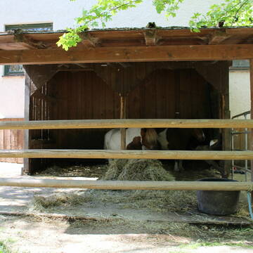
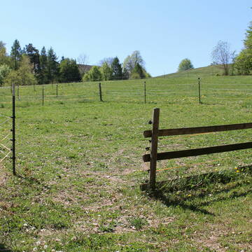
Wir haben wieder Boxen frei!!
Töging am Inn
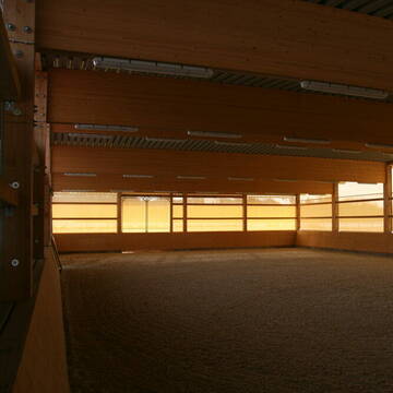
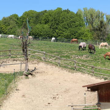
Reitanlage Hubmühle
@Reitanlagehubmuehle
Freizeitstall
Vermieten
Führanlage
Hunde willkommen
Allergikerstall
bedampftes/gewaschenes Heu
21 weitere...
aktuell
P

Großzügige Paddockbox in moderner Reitsportanlag...
Erharting
Christin Schulz
@ReitsportanlageHermansthal
Pferdeausbildung
Reitlehrer und -unterricht
Führanlage
Hunde willkommen
Außenbox mit Paddock
Vollpension
11 weitere...
P
Deprecated: Creation of dynamic property Zend_View_Helper_Ads::$adLink is deprecated in /var/www/stall-frei/htdocs/staging.stall-frei.de/library/Psf/View/Helper/Ads.php on line 108

Futtersack HeuToy, Fressbremse in pink
Mechtersen
STALL-FREIde Marketing
@STALL-FREI-Marketing
Stundenlange Beschäftigung die
Koliken vorbeugt, geringe Staubinhalation mit
steuerbarer Futterentnahme

Pferdestall zu verpachten
Polling
Elisabeth Höll
@Elisabeth-Hoell1
Verpachten
Führanlage
Laufband
Außenbox mit Paddock
Innenbox
Selbstversorgung
10 weitere...
P

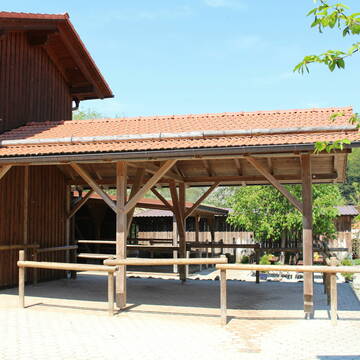
Pferdepension und Therapiezentrum Asthal
Polling
Elisabeth Höll
@Elisabeth-Hoell1
Rehabilitationsstall
Vermieten
Verpachten
Führanlage
Laufband
Allergikerstall
bedampftes/gewaschenes Heu
23 weitere...
P
Leider kein Vorschaubild
Leider kein Vorschaubild
Offenstallplatz für Wallach ab April frei
Pleiskirchen
monika
@monikamaier37
Freizeitstall
Krankenbox
Reitplatz (z.B. Dressur, Springen, Reining)
Offenstall
Paddock Trail
Vollpension
B
Pensionsstall Gestüt Seeor
Polling
Gestuet-Seeor
@Gestuet-Seeor
FN-Mitglied
Freizeitstall
Vermieten
Hunde willkommen
Paddock
Allergikerstall
Gnadenbrothof
22 weitere...
P
Leider kein Vorschaubild
Leider kein Vorschaubild
Aufzuchtplatz Jährling Stute
Erharting
Laura_Schulz
@Laura_Schulz_Maxing
Fohlenaufzucht möglich
Laufstall
Vollpension
B
Leider kein Vorschaubild
Leider kein Vorschaubild
Innenbox für Stute oder Zuchtstute frei
Erharting
Laura_Schulz
@Laura_Schulz_Maxing
Vermieten
Führanlage
Reithalle
Fohlenaufzucht möglich
Pferdezucht
Innenbox
10 weitere...
B

Persönlichkeitsentwicklung mit Pferden
Bad Salzuflen
Katja Dors
@Pferdezeiten
Begleite andere auf ihrem Entwicklungsweg und entdecke die transformative Kraft der pferdegestützten Persönlichkeitsentwicklung !
neu
R
Reiterhof Gensleiten
Reut
Reiterhof-Gensleiten
@Reiterhof-Gensleiten
FN-Mitglied
Freizeitstall
Vermieten
Krankenbox
Paddock
Notfallboxen
23 weitere...
P+
Leider kein Vorschaubild
Leider kein Vorschaubild
Sherwoodranch
Niedertaufkirchen
Sherwoodranch
@Sherwoodranch
FN-Mitglied
Freizeitstall
Longierzirkel/Roundpen
Paddock
Hengsthaltung möglich
Pferdezucht
Außenbox mit Paddock
Außenboxen
28 weitere...
B
Deprecated: Creation of dynamic property Zend_View::$pageCount is deprecated in /var/www/stall-frei/htdocs/staging.stall-frei.de/library/vendor/shardj/zf1-future/library/Zend/View/Abstract.php on line 308
Deprecated: Creation of dynamic property Zend_View::$itemCountPerPage is deprecated in /var/www/stall-frei/htdocs/staging.stall-frei.de/library/vendor/shardj/zf1-future/library/Zend/View/Abstract.php on line 308
Deprecated: Creation of dynamic property Zend_View::$first is deprecated in /var/www/stall-frei/htdocs/staging.stall-frei.de/library/vendor/shardj/zf1-future/library/Zend/View/Abstract.php on line 308
Deprecated: Creation of dynamic property Zend_View::$current is deprecated in /var/www/stall-frei/htdocs/staging.stall-frei.de/library/vendor/shardj/zf1-future/library/Zend/View/Abstract.php on line 308
Deprecated: Creation of dynamic property Zend_View::$last is deprecated in /var/www/stall-frei/htdocs/staging.stall-frei.de/library/vendor/shardj/zf1-future/library/Zend/View/Abstract.php on line 308
Deprecated: Creation of dynamic property Zend_View::$next is deprecated in /var/www/stall-frei/htdocs/staging.stall-frei.de/library/vendor/shardj/zf1-future/library/Zend/View/Abstract.php on line 308
Deprecated: Creation of dynamic property Zend_View::$pagesInRange is deprecated in /var/www/stall-frei/htdocs/staging.stall-frei.de/library/vendor/shardj/zf1-future/library/Zend/View/Abstract.php on line 308
Deprecated: Creation of dynamic property Zend_View::$firstPageInRange is deprecated in /var/www/stall-frei/htdocs/staging.stall-frei.de/library/vendor/shardj/zf1-future/library/Zend/View/Abstract.php on line 308
Deprecated: Creation of dynamic property Zend_View::$lastPageInRange is deprecated in /var/www/stall-frei/htdocs/staging.stall-frei.de/library/vendor/shardj/zf1-future/library/Zend/View/Abstract.php on line 308
Deprecated: Creation of dynamic property Zend_View::$currentItemCount is deprecated in /var/www/stall-frei/htdocs/staging.stall-frei.de/library/vendor/shardj/zf1-future/library/Zend/View/Abstract.php on line 308
Deprecated: Creation of dynamic property Zend_View::$totalItemCount is deprecated in /var/www/stall-frei/htdocs/staging.stall-frei.de/library/vendor/shardj/zf1-future/library/Zend/View/Abstract.php on line 308
Deprecated: Creation of dynamic property Zend_View::$firstItemNumber is deprecated in /var/www/stall-frei/htdocs/staging.stall-frei.de/library/vendor/shardj/zf1-future/library/Zend/View/Abstract.php on line 308
Deprecated: Creation of dynamic property Zend_View::$lastItemNumber is deprecated in /var/www/stall-frei/htdocs/staging.stall-frei.de/library/vendor/shardj/zf1-future/library/Zend/View/Abstract.php on line 308
Deprecated: Creation of dynamic property Zend_View::$router is deprecated in /var/www/stall-frei/htdocs/staging.stall-frei.de/library/vendor/shardj/zf1-future/library/Zend/View/Abstract.php on line 308
Deprecated: Creation of dynamic property Zend_View::$urlParams is deprecated in /var/www/stall-frei/htdocs/staging.stall-frei.de/library/vendor/shardj/zf1-future/library/Zend/View/Abstract.php on line 308
Deprecated: Creation of dynamic property Zend_View::$showAds is deprecated in /var/www/stall-frei/htdocs/staging.stall-frei.de/library/vendor/shardj/zf1-future/library/Zend/View/Abstract.php on line 308
Deprecated: Creation of dynamic property Zend_View::$objectIds is deprecated in /var/www/stall-frei/htdocs/staging.stall-frei.de/library/vendor/shardj/zf1-future/library/Zend/View/Abstract.php on line 308
Deprecated: Creation of dynamic property Zend_View::$showNavbar is deprecated in /var/www/stall-frei/htdocs/staging.stall-frei.de/library/vendor/shardj/zf1-future/library/Zend/View/Abstract.php on line 308
Deprecated: Creation of dynamic property Zend_View::$showBreadcrumb is deprecated in /var/www/stall-frei/htdocs/staging.stall-frei.de/library/vendor/shardj/zf1-future/library/Zend/View/Abstract.php on line 308
Deprecated: Creation of dynamic property Zend_View::$showFooter is deprecated in /var/www/stall-frei/htdocs/staging.stall-frei.de/library/vendor/shardj/zf1-future/library/Zend/View/Abstract.php on line 308
Deprecated: Creation of dynamic property Zend_View::$showInternalAds is deprecated in /var/www/stall-frei/htdocs/staging.stall-frei.de/library/vendor/shardj/zf1-future/library/Zend/View/Abstract.php on line 308
Deprecated: Creation of dynamic property Zend_View::$blNoContent is deprecated in /var/www/stall-frei/htdocs/staging.stall-frei.de/library/vendor/shardj/zf1-future/library/Zend/View/Abstract.php on line 308
Deprecated: Creation of dynamic property Zend_View::$sMetaDesc is deprecated in /var/www/stall-frei/htdocs/staging.stall-frei.de/library/vendor/shardj/zf1-future/library/Zend/View/Abstract.php on line 308
Deprecated: Creation of dynamic property Zend_View::$useGmaps is deprecated in /var/www/stall-frei/htdocs/staging.stall-frei.de/library/vendor/shardj/zf1-future/library/Zend/View/Abstract.php on line 308
Deprecated: Creation of dynamic property Zend_View::$touches is deprecated in /var/www/stall-frei/htdocs/staging.stall-frei.de/library/vendor/shardj/zf1-future/library/Zend/View/Abstract.php on line 308
Deprecated: Creation of dynamic property Zend_View::$oProject is deprecated in /var/www/stall-frei/htdocs/staging.stall-frei.de/library/vendor/shardj/zf1-future/library/Zend/View/Abstract.php on line 308
Deprecated: Creation of dynamic property Zend_View::$pageHeadline is deprecated in /var/www/stall-frei/htdocs/staging.stall-frei.de/library/vendor/shardj/zf1-future/library/Zend/View/Abstract.php on line 308
Deprecated: Creation of dynamic property Zend_View::$disableLocationField is deprecated in /var/www/stall-frei/htdocs/staging.stall-frei.de/library/vendor/shardj/zf1-future/library/Zend/View/Abstract.php on line 308
Deprecated: Creation of dynamic property Zend_View::$isSearch is deprecated in /var/www/stall-frei/htdocs/staging.stall-frei.de/library/vendor/shardj/zf1-future/library/Zend/View/Abstract.php on line 308
Deprecated: Creation of dynamic property Zend_View::$pageTitle is deprecated in /var/www/stall-frei/htdocs/staging.stall-frei.de/library/vendor/shardj/zf1-future/library/Zend/View/Abstract.php on line 308
Deprecated: Creation of dynamic property Psf_Form_Element_Text::$class is deprecated in /var/www/stall-frei/htdocs/staging.stall-frei.de/library/vendor/shardj/zf1-future/library/Zend/Form/Element.php on line 874
Deprecated: Creation of dynamic property Psf_Form_Element_Text::$size is deprecated in /var/www/stall-frei/htdocs/staging.stall-frei.de/library/vendor/shardj/zf1-future/library/Zend/Form/Element.php on line 874
Deprecated: Creation of dynamic property Psf_Form_Element_Text::$placeholder is deprecated in /var/www/stall-frei/htdocs/staging.stall-frei.de/library/vendor/shardj/zf1-future/library/Zend/Form/Element.php on line 874
Deprecated: Creation of dynamic property Psf_Form_Element_Hidden::$class is deprecated in /var/www/stall-frei/htdocs/staging.stall-frei.de/library/vendor/shardj/zf1-future/library/Zend/Form/Element.php on line 874
Deprecated: Creation of dynamic property Psf_Form_Element_Hidden::$class is deprecated in /var/www/stall-frei/htdocs/staging.stall-frei.de/library/vendor/shardj/zf1-future/library/Zend/Form/Element.php on line 874
Deprecated: Creation of dynamic property Psf_Form_Element_Hidden::$class is deprecated in /var/www/stall-frei/htdocs/staging.stall-frei.de/library/vendor/shardj/zf1-future/library/Zend/Form/Element.php on line 874
Deprecated: Creation of dynamic property Psf_Form_Element_Hidden::$class is deprecated in /var/www/stall-frei/htdocs/staging.stall-frei.de/library/vendor/shardj/zf1-future/library/Zend/Form/Element.php on line 874
Deprecated: Creation of dynamic property Psf_Form_Element_Select::$class is deprecated in /var/www/stall-frei/htdocs/staging.stall-frei.de/library/vendor/shardj/zf1-future/library/Zend/Form/Element.php on line 874
Deprecated: Creation of dynamic property Psf_Form_Element_Select::$class is deprecated in /var/www/stall-frei/htdocs/staging.stall-frei.de/library/vendor/shardj/zf1-future/library/Zend/Form/Element.php on line 874
Deprecated: Creation of dynamic property Psf_Form_Element_Select::$class is deprecated in /var/www/stall-frei/htdocs/staging.stall-frei.de/library/vendor/shardj/zf1-future/library/Zend/Form/Element.php on line 874
Deprecated: Creation of dynamic property Psf_Form_Element_Select::$class is deprecated in /var/www/stall-frei/htdocs/staging.stall-frei.de/library/vendor/shardj/zf1-future/library/Zend/Form/Element.php on line 874
Deprecated: Creation of dynamic property Psf_Form_Element_Text::$class is deprecated in /var/www/stall-frei/htdocs/staging.stall-frei.de/library/vendor/shardj/zf1-future/library/Zend/Form/Element.php on line 874
Deprecated: Creation of dynamic property Psf_Form_Element_Checkbox::$label is deprecated in /var/www/stall-frei/htdocs/staging.stall-frei.de/library/vendor/shardj/zf1-future/library/Zend/Form/Element.php on line 874
Deprecated: Creation of dynamic property Zend_View::$sort is deprecated in /var/www/stall-frei/htdocs/staging.stall-frei.de/library/vendor/shardj/zf1-future/library/Zend/View/Abstract.php on line 308
Deprecated: Creation of dynamic property Zend_View::$searchLocation is deprecated in /var/www/stall-frei/htdocs/staging.stall-frei.de/library/vendor/shardj/zf1-future/library/Zend/View/Abstract.php on line 308
Deprecated: Creation of dynamic property Zend_View::$locationHint is deprecated in /var/www/stall-frei/htdocs/staging.stall-frei.de/library/vendor/shardj/zf1-future/library/Zend/View/Abstract.php on line 308
Psf_GeoCoder_Abstract::getLocation: Rubenberg Get Location CachedOrLive
Psf_GeoCoder_Abstract::getCachedOrLive: Rubenberg
Psf_GeoCoder_OpenCageData::makeApiRequest: response:
Array
(
[documentation] => https://opencagedata.com/api
[licenses] => Array
(
[0] => Array
(
[name] => see attribution guide
[url] => https://opencagedata.com/credits
)
)
[results] => Array
(
[0] => Array
(
[bounds] => Array
(
[northeast] => Array
(
[lat] => 48.2797901
[lng] => 12.6708954
)
[southwest] => Array
(
[lat] => 48.2796901
[lng] => 12.6707954
)
)
[components] => Array
(
[ISO_3166-1_alpha-2] => DE
[ISO_3166-1_alpha-3] => DEU
[ISO_3166-2] => Array
(
[0] => DE-BY
)
[_category] => building
[_normalized_city] => Winhöring
[_type] => building
[continent] => Europe
[country] => Deutschland
[country_code] => de
[county] => Landkreis Altötting
[hamlet] => Guntersberg
[isolated_dwelling] => Rubenberg
[political_union] => European Union
[postcode] => 84543
[state] => Bayern
[state_code] => BY
[village] => Winhöring
)
[confidence] => 10
[formatted] => Rubenberg, Guntersberg, 84543 Winhöring, Deutschland
[geometry] => Array
(
[lat] => 48.2797401
[lng] => 12.6708454
)
)
[1] => Array
(
[bounds] => Array
(
[northeast] => Array
(
[lat] => 49.2711898
[lng] => 7.5784163
)
[southwest] => Array
(
[lat] => 49.2710898
[lng] => 7.5783163
)
)
[components] => Array
(
[ISO_3166-1_alpha-2] => DE
[ISO_3166-1_alpha-3] => DEU
[ISO_3166-2] => Array
(
[0] => DE-RP
)
[_category] => natural/water
[_normalized_city] => Thaleischweiler-Fröschen
[_type] => peak
[continent] => Europe
[country] => Deutschland
[country_code] => de
[county] => Südwestpfalz
[municipality] => Thaleischweiler-Wallhalben
[peak] => Rübenberg
[political_union] => European Union
[postcode] => 66987
[state] => Rheinland-Pfalz
[state_code] => RP
[village] => Thaleischweiler-Fröschen
)
[confidence] => 9
[formatted] => Rübenberg, 66987 Thaleischweiler-Fröschen, Deutschland
[geometry] => Array
(
[lat] => 49.2711398
[lng] => 7.5783663
)
)
[2] => Array
(
[bounds] => Array
(
[northeast] => Array
(
[lat] => 49.5774844
[lng] => 9.311855
)
[southwest] => Array
(
[lat] => 49.5773844
[lng] => 9.311755
)
)
[components] => Array
(
[ISO_3166-1_alpha-2] => DE
[ISO_3166-1_alpha-3] => DEU
[ISO_3166-2] => Array
(
[0] => DE-BW
)
[_category] => natural/water
[_normalized_city] => Buchen (Odenwald)
[_type] => peak
[continent] => Europe
[country] => Deutschland
[country_code] => de
[county] => Neckar-Odenwald-Kreis
[peak] => Rübenberg
[political_union] => European Union
[state] => Baden-Württemberg
[state_code] => BW
[town] => Buchen (Odenwald)
)
[confidence] => 9
[formatted] => Rübenberg, Buchen (Odenwald), Baden-Württemberg, Deutschland
[geometry] => Array
(
[lat] => 49.5774344
[lng] => 9.311805
)
)
[3] => Array
(
[bounds] => Array
(
[northeast] => Array
(
[lat] => 54.5912884
[lng] => 13.1241742
)
[southwest] => Array
(
[lat] => 54.5911884
[lng] => 13.1240742
)
)
[components] => Array
(
[ISO_3166-1_alpha-2] => DE
[ISO_3166-1_alpha-3] => DEU
[ISO_3166-2] => Array
(
[0] => DE-MV
)
[_category] => natural/water
[_normalized_city] => Insel Hiddensee
[_type] => peak
[city] => Insel Hiddensee
[continent] => Europe
[country] => Deutschland
[country_code] => de
[county] => Vorpommern-Rügen
[municipality] => West-Rügen
[peak] => Rübenberg
[political_union] => European Union
[postcode] => 18565
[state] => Mecklenburg-Vorpommern
[state_code] => MV
)
[confidence] => 9
[formatted] => Rübenberg, 18565 Insel Hiddensee, Deutschland
[geometry] => Array
(
[lat] => 54.5912384
[lng] => 13.1241242
)
)
[4] => Array
(
[bounds] => Array
(
[northeast] => Array
(
[lat] => 49.3311733
[lng] => 7.6611647
)
[southwest] => Array
(
[lat] => 49.3310733
[lng] => 7.6610647
)
)
[components] => Array
(
[ISO_3166-1_alpha-2] => DE
[ISO_3166-1_alpha-3] => DEU
[ISO_3166-2] => Array
(
[0] => DE-RP
)
[_category] => natural/water
[_normalized_city] => Horbach
[_type] => peak
[continent] => Europe
[country] => Deutschland
[country_code] => de
[county] => Südwestpfalz
[municipality] => Waldfischbach-Burgalben
[peak] => Rübenberg
[political_union] => European Union
[postcode] => 67706
[state] => Rheinland-Pfalz
[state_code] => RP
[village] => Horbach
)
[confidence] => 9
[formatted] => Rübenberg, 67706 Horbach, Deutschland
[geometry] => Array
(
[lat] => 49.3311233
[lng] => 7.6611147
)
)
[5] => Array
(
[bounds] => Array
(
[northeast] => Array
(
[lat] => 51.0464712
[lng] => 9.9748013
)
[southwest] => Array
(
[lat] => 51.0463712
[lng] => 9.9747013
)
)
[components] => Array
(
[ISO_3166-1_alpha-2] => DE
[ISO_3166-1_alpha-3] => DEU
[ISO_3166-2] => Array
(
[0] => DE-HE
)
[_category] => natural/water
[_normalized_city] => Lindenau
[_type] => peak
[continent] => Europe
[country] => Deutschland
[country_code] => de
[county] => Werra-Meißner-Kreis
[municipality] => Sontra
[peak] => Rübenberg
[political_union] => European Union
[postcode] => 36205
[state] => Hessen
[state_code] => HE
[village] => Lindenau
)
[confidence] => 9
[formatted] => Rübenberg, 36205 Lindenau, Deutschland
[geometry] => Array
(
[lat] => 51.0464212
[lng] => 9.9747513
)
)
[6] => Array
(
[bounds] => Array
(
[northeast] => Array
(
[lat] => 47.9506642
[lng] => 8.7053417
)
[southwest] => Array
(
[lat] => 47.9505642
[lng] => 8.7052417
)
)
[components] => Array
(
[ISO_3166-1_alpha-2] => DE
[ISO_3166-1_alpha-3] => DEU
[ISO_3166-2] => Array
(
[0] => DE-BW
)
[_category] => natural/water
[_normalized_city] => Immendingen
[_type] => peak
[continent] => Europe
[country] => Deutschland
[country_code] => de
[county] => Landkreis Tuttlingen
[municipality] => GVV Immendingen-Geisingen
[peak] => Rübenberg
[political_union] => European Union
[postcode] => 78194
[state] => Baden-Württemberg
[state_code] => BW
[village] => Immendingen
)
[confidence] => 9
[formatted] => Rübenberg, 78194 Immendingen, Deutschland
[geometry] => Array
(
[lat] => 47.9506142
[lng] => 8.7052917
)
)
[7] => Array
(
[bounds] => Array
(
[northeast] => Array
(
[lat] => 49.5861962
[lng] => 9.3157133
)
[southwest] => Array
(
[lat] => 49.5661962
[lng] => 9.2957133
)
)
[components] => Array
(
[ISO_3166-1_alpha-2] => DE
[ISO_3166-1_alpha-3] => DEU
[ISO_3166-2] => Array
(
[0] => DE-BW
)
[_category] => place
[_normalized_city] => Buchen (Odenwald)
[_type] => hamlet
[continent] => Europe
[country] => Deutschland
[country_code] => de
[county] => Neckar-Odenwald-Kreis
[locality] => Rübenberg
[political_union] => European Union
[postcode] => 74722
[state] => Baden-Württemberg
[state_code] => BW
[town] => Buchen (Odenwald)
[village] => Hainstadt
)
[confidence] => 8
[formatted] => Rübenberg, 74722 Hainstadt, Deutschland
[geometry] => Array
(
[lat] => 49.5761962
[lng] => 9.3057133
)
)
[8] => Array
(
[bounds] => Array
(
[northeast] => Array
(
[lat] => 53.271334
[lng] => 9.9907877
)
[southwest] => Array
(
[lat] => 53.2699253
[lng] => 9.9875812
)
)
[components] => Array
(
[ISO_3166-1_alpha-2] => DE
[ISO_3166-1_alpha-3] => DEU
[ISO_3166-2] => Array
(
[0] => DE-NI
)
[_category] => road
[_normalized_city] => Asendorf
[_type] => road
[city] => Asendorf
[continent] => Europe
[country] => Deutschland
[country_code] => de
[county] => Landkreis Harburg
[municipality] => Samtgemeinde Hanstedt
[political_union] => European Union
[postcode] => 21271
[road] => Rübenberg
[road_type] => track
[state] => Niedersachsen
[state_code] => NI
)
[confidence] => 9
[formatted] => Rübenberg, 21271 Asendorf, Deutschland
[geometry] => Array
(
[lat] => 53.270103
[lng] => 9.9893779
)
)
[9] => Array
(
[bounds] => Array
(
[northeast] => Array
(
[lat] => 50.1709318
[lng] => 8.85895
)
[southwest] => Array
(
[lat] => 50.1701892
[lng] => 8.8575878
)
)
[components] => Array
(
[ISO_3166-1_alpha-2] => DE
[ISO_3166-1_alpha-3] => DEU
[ISO_3166-2] => Array
(
[0] => DE-HE
)
[_category] => road
[_normalized_city] => Maintal
[_type] => road
[continent] => Europe
[country] => Deutschland
[country_code] => de
[county] => Main-Kinzig-Kreis
[municipality] => Maintal
[political_union] => European Union
[postcode] => 63477
[road] => Rübenberg
[road_type] => residential
[state] => Hessen
[state_code] => HE
)
[confidence] => 9
[formatted] => Rübenberg, 63477 Maintal, Deutschland
[geometry] => Array
(
[lat] => 50.1704091
[lng] => 8.8583777
)
)
)
[status] => Array
(
[code] => 200
[message] => OK
)
[stay_informed] => Array
(
[blog] => https://blog.opencagedata.com
[mastodon] => https://en.osm.town/@opencage
)
[thanks] => For using an OpenCage API
[timestamp] => Array
(
[created_http] => Sun, 08 Feb 2026 10:13:30 GMT
[created_unix] => 1770545610
)
[total_results] => 10
)
Psf_GeoCoder_Abstract::convertLocationResult
{"documentation":"https:\/\/opencagedata.com\/api","licenses":[{"name":"see attribution guide","url":"https:\/\/opencagedata.com\/credits"}],"results":[{"bounds":{"northeast":{"lat":48.2797901,"lng":12.6708954},"southwest":{"lat":48.2796901,"lng":12.6707954}},"components":{"ISO_3166-1_alpha-2":"DE","ISO_3166-1_alpha-3":"DEU","ISO_3166-2":["DE-BY"],"_category":"building","_normalized_city":"Winh\u00f6ring","_type":"building","continent":"Europe","country":"Deutschland","country_code":"de","county":"Landkreis Alt\u00f6tting","hamlet":"Guntersberg","isolated_dwelling":"Rubenberg","political_union":"European Union","postcode":"84543","state":"Bayern","state_code":"BY","village":"Winh\u00f6ring"},"confidence":10,"formatted":"Rubenberg, Guntersberg, 84543 Winh\u00f6ring, Deutschland","geometry":{"lat":48.2797401,"lng":12.6708454}},{"bounds":{"northeast":{"lat":49.2711898,"lng":7.5784163},"southwest":{"lat":49.2710898,"lng":7.5783163}},"components":{"ISO_3166-1_alpha-2":"DE","ISO_3166-1_alpha-3":"DEU","ISO_3166-2":["DE-RP"],"_category":"natural\/water","_normalized_city":"Thaleischweiler-Fr\u00f6schen","_type":"peak","continent":"Europe","country":"Deutschland","country_code":"de","county":"S\u00fcdwestpfalz","municipality":"Thaleischweiler-Wallhalben","peak":"R\u00fcbenberg","political_union":"European Union","postcode":"66987","state":"Rheinland-Pfalz","state_code":"RP","village":"Thaleischweiler-Fr\u00f6schen"},"confidence":9,"formatted":"R\u00fcbenberg, 66987 Thaleischweiler-Fr\u00f6schen, Deutschland","geometry":{"lat":49.2711398,"lng":7.5783663}},{"bounds":{"northeast":{"lat":49.5774844,"lng":9.311855},"southwest":{"lat":49.5773844,"lng":9.311755}},"components":{"ISO_3166-1_alpha-2":"DE","ISO_3166-1_alpha-3":"DEU","ISO_3166-2":["DE-BW"],"_category":"natural\/water","_normalized_city":"Buchen (Odenwald)","_type":"peak","continent":"Europe","country":"Deutschland","country_code":"de","county":"Neckar-Odenwald-Kreis","peak":"R\u00fcbenberg","political_union":"European Union","state":"Baden-W\u00fcrttemberg","state_code":"BW","town":"Buchen (Odenwald)"},"confidence":9,"formatted":"R\u00fcbenberg, Buchen (Odenwald), Baden-W\u00fcrttemberg, Deutschland","geometry":{"lat":49.5774344,"lng":9.311805}},{"bounds":{"northeast":{"lat":54.5912884,"lng":13.1241742},"southwest":{"lat":54.5911884,"lng":13.1240742}},"components":{"ISO_3166-1_alpha-2":"DE","ISO_3166-1_alpha-3":"DEU","ISO_3166-2":["DE-MV"],"_category":"natural\/water","_normalized_city":"Insel Hiddensee","_type":"peak","city":"Insel Hiddensee","continent":"Europe","country":"Deutschland","country_code":"de","county":"Vorpommern-R\u00fcgen","municipality":"West-R\u00fcgen","peak":"R\u00fcbenberg","political_union":"European Union","postcode":"18565","state":"Mecklenburg-Vorpommern","state_code":"MV"},"confidence":9,"formatted":"R\u00fcbenberg, 18565 Insel Hiddensee, Deutschland","geometry":{"lat":54.5912384,"lng":13.1241242}},{"bounds":{"northeast":{"lat":49.3311733,"lng":7.6611647},"southwest":{"lat":49.3310733,"lng":7.6610647}},"components":{"ISO_3166-1_alpha-2":"DE","ISO_3166-1_alpha-3":"DEU","ISO_3166-2":["DE-RP"],"_category":"natural\/water","_normalized_city":"Horbach","_type":"peak","continent":"Europe","country":"Deutschland","country_code":"de","county":"S\u00fcdwestpfalz","municipality":"Waldfischbach-Burgalben","peak":"R\u00fcbenberg","political_union":"European Union","postcode":"67706","state":"Rheinland-Pfalz","state_code":"RP","village":"Horbach"},"confidence":9,"formatted":"R\u00fcbenberg, 67706 Horbach, Deutschland","geometry":{"lat":49.3311233,"lng":7.6611147}},{"bounds":{"northeast":{"lat":51.0464712,"lng":9.9748013},"southwest":{"lat":51.0463712,"lng":9.9747013}},"components":{"ISO_3166-1_alpha-2":"DE","ISO_3166-1_alpha-3":"DEU","ISO_3166-2":["DE-HE"],"_category":"natural\/water","_normalized_city":"Lindenau","_type":"peak","continent":"Europe","country":"Deutschland","country_code":"de","county":"Werra-Mei\u00dfner-Kreis","municipality":"Sontra","peak":"R\u00fcbenberg","political_union":"European Union","postcode":"36205","state":"Hessen","state_code":"HE","village":"Lindenau"},"confidence":9,"formatted":"R\u00fcbenberg, 36205 Lindenau, Deutschland","geometry":{"lat":51.0464212,"lng":9.9747513}},{"bounds":{"northeast":{"lat":47.9506642,"lng":8.7053417},"southwest":{"lat":47.9505642,"lng":8.7052417}},"components":{"ISO_3166-1_alpha-2":"DE","ISO_3166-1_alpha-3":"DEU","ISO_3166-2":["DE-BW"],"_category":"natural\/water","_normalized_city":"Immendingen","_type":"peak","continent":"Europe","country":"Deutschland","country_code":"de","county":"Landkreis Tuttlingen","municipality":"GVV Immendingen-Geisingen","peak":"R\u00fcbenberg","political_union":"European Union","postcode":"78194","state":"Baden-W\u00fcrttemberg","state_code":"BW","village":"Immendingen"},"confidence":9,"formatted":"R\u00fcbenberg, 78194 Immendingen, Deutschland","geometry":{"lat":47.9506142,"lng":8.7052917}},{"bounds":{"northeast":{"lat":49.5861962,"lng":9.3157133},"southwest":{"lat":49.5661962,"lng":9.2957133}},"components":{"ISO_3166-1_alpha-2":"DE","ISO_3166-1_alpha-3":"DEU","ISO_3166-2":["DE-BW"],"_category":"place","_normalized_city":"Buchen (Odenwald)","_type":"hamlet","continent":"Europe","country":"Deutschland","country_code":"de","county":"Neckar-Odenwald-Kreis","locality":"R\u00fcbenberg","political_union":"European Union","postcode":"74722","state":"Baden-W\u00fcrttemberg","state_code":"BW","town":"Buchen (Odenwald)","village":"Hainstadt"},"confidence":8,"formatted":"R\u00fcbenberg, 74722 Hainstadt, Deutschland","geometry":{"lat":49.5761962,"lng":9.3057133}},{"bounds":{"northeast":{"lat":53.271334,"lng":9.9907877},"southwest":{"lat":53.2699253,"lng":9.9875812}},"components":{"ISO_3166-1_alpha-2":"DE","ISO_3166-1_alpha-3":"DEU","ISO_3166-2":["DE-NI"],"_category":"road","_normalized_city":"Asendorf","_type":"road","city":"Asendorf","continent":"Europe","country":"Deutschland","country_code":"de","county":"Landkreis Harburg","municipality":"Samtgemeinde Hanstedt","political_union":"European Union","postcode":"21271","road":"R\u00fcbenberg","road_type":"track","state":"Niedersachsen","state_code":"NI"},"confidence":9,"formatted":"R\u00fcbenberg, 21271 Asendorf, Deutschland","geometry":{"lat":53.270103,"lng":9.9893779}},{"bounds":{"northeast":{"lat":50.1709318,"lng":8.85895},"southwest":{"lat":50.1701892,"lng":8.8575878}},"components":{"ISO_3166-1_alpha-2":"DE","ISO_3166-1_alpha-3":"DEU","ISO_3166-2":["DE-HE"],"_category":"road","_normalized_city":"Maintal","_type":"road","continent":"Europe","country":"Deutschland","country_code":"de","county":"Main-Kinzig-Kreis","municipality":"Maintal","political_union":"European Union","postcode":"63477","road":"R\u00fcbenberg","road_type":"residential","state":"Hessen","state_code":"HE"},"confidence":9,"formatted":"R\u00fcbenberg, 63477 Maintal, Deutschland","geometry":{"lat":50.1704091,"lng":8.8583777}}],"status":{"code":200,"message":"OK"},"stay_informed":{"blog":"https:\/\/blog.opencagedata.com","mastodon":"https:\/\/en.osm.town\/@opencage"},"thanks":"For using an OpenCage API","timestamp":{"created_http":"Sun, 08 Feb 2026 10:13:30 GMT","created_unix":1770545610},"total_results":10}Array
(
[0] => stdClass Object
(
[bounds] => stdClass Object
(
[northeast] => stdClass Object
(
[lat] => 48.2797901
[lng] => 12.6708954
)
[southwest] => stdClass Object
(
[lat] => 48.2796901
[lng] => 12.6707954
)
)
[components] => stdClass Object
(
[ISO_3166-1_alpha-2] => DE
[ISO_3166-1_alpha-3] => DEU
[ISO_3166-2] => Array
(
[0] => DE-BY
)
[_category] => building
[_normalized_city] => Winhöring
[_type] => building
[continent] => Europe
[country] => Deutschland
[country_code] => de
[county] => Landkreis Altötting
[hamlet] => Guntersberg
[isolated_dwelling] => Rubenberg
[political_union] => European Union
[postcode] => 84543
[state] => Bayern
[state_code] => BY
[village] => Winhöring
)
[confidence] => 10
[formatted] => Rubenberg, Guntersberg, 84543 Winhöring, Deutschland
[geometry] => stdClass Object
(
[lat] => 48.2797401
[lng] => 12.6708454
)
)
[1] => stdClass Object
(
[bounds] => stdClass Object
(
[northeast] => stdClass Object
(
[lat] => 49.2711898
[lng] => 7.5784163
)
[southwest] => stdClass Object
(
[lat] => 49.2710898
[lng] => 7.5783163
)
)
[components] => stdClass Object
(
[ISO_3166-1_alpha-2] => DE
[ISO_3166-1_alpha-3] => DEU
[ISO_3166-2] => Array
(
[0] => DE-RP
)
[_category] => natural/water
[_normalized_city] => Thaleischweiler-Fröschen
[_type] => peak
[continent] => Europe
[country] => Deutschland
[country_code] => de
[county] => Südwestpfalz
[municipality] => Thaleischweiler-Wallhalben
[peak] => Rübenberg
[political_union] => European Union
[postcode] => 66987
[state] => Rheinland-Pfalz
[state_code] => RP
[village] => Thaleischweiler-Fröschen
)
[confidence] => 9
[formatted] => Rübenberg, 66987 Thaleischweiler-Fröschen, Deutschland
[geometry] => stdClass Object
(
[lat] => 49.2711398
[lng] => 7.5783663
)
)
[2] => stdClass Object
(
[bounds] => stdClass Object
(
[northeast] => stdClass Object
(
[lat] => 49.5774844
[lng] => 9.311855
)
[southwest] => stdClass Object
(
[lat] => 49.5773844
[lng] => 9.311755
)
)
[components] => stdClass Object
(
[ISO_3166-1_alpha-2] => DE
[ISO_3166-1_alpha-3] => DEU
[ISO_3166-2] => Array
(
[0] => DE-BW
)
[_category] => natural/water
[_normalized_city] => Buchen (Odenwald)
[_type] => peak
[continent] => Europe
[country] => Deutschland
[country_code] => de
[county] => Neckar-Odenwald-Kreis
[peak] => Rübenberg
[political_union] => European Union
[state] => Baden-Württemberg
[state_code] => BW
[town] => Buchen (Odenwald)
)
[confidence] => 9
[formatted] => Rübenberg, Buchen (Odenwald), Baden-Württemberg, Deutschland
[geometry] => stdClass Object
(
[lat] => 49.5774344
[lng] => 9.311805
)
)
[3] => stdClass Object
(
[bounds] => stdClass Object
(
[northeast] => stdClass Object
(
[lat] => 54.5912884
[lng] => 13.1241742
)
[southwest] => stdClass Object
(
[lat] => 54.5911884
[lng] => 13.1240742
)
)
[components] => stdClass Object
(
[ISO_3166-1_alpha-2] => DE
[ISO_3166-1_alpha-3] => DEU
[ISO_3166-2] => Array
(
[0] => DE-MV
)
[_category] => natural/water
[_normalized_city] => Insel Hiddensee
[_type] => peak
[city] => Insel Hiddensee
[continent] => Europe
[country] => Deutschland
[country_code] => de
[county] => Vorpommern-Rügen
[municipality] => West-Rügen
[peak] => Rübenberg
[political_union] => European Union
[postcode] => 18565
[state] => Mecklenburg-Vorpommern
[state_code] => MV
)
[confidence] => 9
[formatted] => Rübenberg, 18565 Insel Hiddensee, Deutschland
[geometry] => stdClass Object
(
[lat] => 54.5912384
[lng] => 13.1241242
)
)
[4] => stdClass Object
(
[bounds] => stdClass Object
(
[northeast] => stdClass Object
(
[lat] => 49.3311733
[lng] => 7.6611647
)
[southwest] => stdClass Object
(
[lat] => 49.3310733
[lng] => 7.6610647
)
)
[components] => stdClass Object
(
[ISO_3166-1_alpha-2] => DE
[ISO_3166-1_alpha-3] => DEU
[ISO_3166-2] => Array
(
[0] => DE-RP
)
[_category] => natural/water
[_normalized_city] => Horbach
[_type] => peak
[continent] => Europe
[country] => Deutschland
[country_code] => de
[county] => Südwestpfalz
[municipality] => Waldfischbach-Burgalben
[peak] => Rübenberg
[political_union] => European Union
[postcode] => 67706
[state] => Rheinland-Pfalz
[state_code] => RP
[village] => Horbach
)
[confidence] => 9
[formatted] => Rübenberg, 67706 Horbach, Deutschland
[geometry] => stdClass Object
(
[lat] => 49.3311233
[lng] => 7.6611147
)
)
[5] => stdClass Object
(
[bounds] => stdClass Object
(
[northeast] => stdClass Object
(
[lat] => 51.0464712
[lng] => 9.9748013
)
[southwest] => stdClass Object
(
[lat] => 51.0463712
[lng] => 9.9747013
)
)
[components] => stdClass Object
(
[ISO_3166-1_alpha-2] => DE
[ISO_3166-1_alpha-3] => DEU
[ISO_3166-2] => Array
(
[0] => DE-HE
)
[_category] => natural/water
[_normalized_city] => Lindenau
[_type] => peak
[continent] => Europe
[country] => Deutschland
[country_code] => de
[county] => Werra-Meißner-Kreis
[municipality] => Sontra
[peak] => Rübenberg
[political_union] => European Union
[postcode] => 36205
[state] => Hessen
[state_code] => HE
[village] => Lindenau
)
[confidence] => 9
[formatted] => Rübenberg, 36205 Lindenau, Deutschland
[geometry] => stdClass Object
(
[lat] => 51.0464212
[lng] => 9.9747513
)
)
[6] => stdClass Object
(
[bounds] => stdClass Object
(
[northeast] => stdClass Object
(
[lat] => 47.9506642
[lng] => 8.7053417
)
[southwest] => stdClass Object
(
[lat] => 47.9505642
[lng] => 8.7052417
)
)
[components] => stdClass Object
(
[ISO_3166-1_alpha-2] => DE
[ISO_3166-1_alpha-3] => DEU
[ISO_3166-2] => Array
(
[0] => DE-BW
)
[_category] => natural/water
[_normalized_city] => Immendingen
[_type] => peak
[continent] => Europe
[country] => Deutschland
[country_code] => de
[county] => Landkreis Tuttlingen
[municipality] => GVV Immendingen-Geisingen
[peak] => Rübenberg
[political_union] => European Union
[postcode] => 78194
[state] => Baden-Württemberg
[state_code] => BW
[village] => Immendingen
)
[confidence] => 9
[formatted] => Rübenberg, 78194 Immendingen, Deutschland
[geometry] => stdClass Object
(
[lat] => 47.9506142
[lng] => 8.7052917
)
)
[7] => stdClass Object
(
[bounds] => stdClass Object
(
[northeast] => stdClass Object
(
[lat] => 49.5861962
[lng] => 9.3157133
)
[southwest] => stdClass Object
(
[lat] => 49.5661962
[lng] => 9.2957133
)
)
[components] => stdClass Object
(
[ISO_3166-1_alpha-2] => DE
[ISO_3166-1_alpha-3] => DEU
[ISO_3166-2] => Array
(
[0] => DE-BW
)
[_category] => place
[_normalized_city] => Buchen (Odenwald)
[_type] => hamlet
[continent] => Europe
[country] => Deutschland
[country_code] => de
[county] => Neckar-Odenwald-Kreis
[locality] => Rübenberg
[political_union] => European Union
[postcode] => 74722
[state] => Baden-Württemberg
[state_code] => BW
[town] => Buchen (Odenwald)
[village] => Hainstadt
)
[confidence] => 8
[formatted] => Rübenberg, 74722 Hainstadt, Deutschland
[geometry] => stdClass Object
(
[lat] => 49.5761962
[lng] => 9.3057133
)
)
[8] => stdClass Object
(
[bounds] => stdClass Object
(
[northeast] => stdClass Object
(
[lat] => 53.271334
[lng] => 9.9907877
)
[southwest] => stdClass Object
(
[lat] => 53.2699253
[lng] => 9.9875812
)
)
[components] => stdClass Object
(
[ISO_3166-1_alpha-2] => DE
[ISO_3166-1_alpha-3] => DEU
[ISO_3166-2] => Array
(
[0] => DE-NI
)
[_category] => road
[_normalized_city] => Asendorf
[_type] => road
[city] => Asendorf
[continent] => Europe
[country] => Deutschland
[country_code] => de
[county] => Landkreis Harburg
[municipality] => Samtgemeinde Hanstedt
[political_union] => European Union
[postcode] => 21271
[road] => Rübenberg
[road_type] => track
[state] => Niedersachsen
[state_code] => NI
)
[confidence] => 9
[formatted] => Rübenberg, 21271 Asendorf, Deutschland
[geometry] => stdClass Object
(
[lat] => 53.270103
[lng] => 9.9893779
)
)
[9] => stdClass Object
(
[bounds] => stdClass Object
(
[northeast] => stdClass Object
(
[lat] => 50.1709318
[lng] => 8.85895
)
[southwest] => stdClass Object
(
[lat] => 50.1701892
[lng] => 8.8575878
)
)
[components] => stdClass Object
(
[ISO_3166-1_alpha-2] => DE
[ISO_3166-1_alpha-3] => DEU
[ISO_3166-2] => Array
(
[0] => DE-HE
)
[_category] => road
[_normalized_city] => Maintal
[_type] => road
[continent] => Europe
[country] => Deutschland
[country_code] => de
[county] => Main-Kinzig-Kreis
[municipality] => Maintal
[political_union] => European Union
[postcode] => 63477
[road] => Rübenberg
[road_type] => residential
[state] => Hessen
[state_code] => HE
)
[confidence] => 9
[formatted] => Rübenberg, 63477 Maintal, Deutschland
[geometry] => stdClass Object
(
[lat] => 50.1704091
[lng] => 8.8583777
)
)
)
Psf_GeoCoder_OpenCageData::getKeyMap: 0
stdClass Object
(
    [bounds] => stdClass Object
        (
            [northeast] => stdClass Object
                (
                    [lat] => 48.2797901
                    [lng] => 12.6708954
                )

            [southwest] => stdClass Object
                (
                    [lat] => 48.2796901
                    [lng] => 12.6707954
                )

        )

    [components] => stdClass Object
        (
            [ISO_3166-1_alpha-2] => DE
            [ISO_3166-1_alpha-3] => DEU
            [ISO_3166-2] => Array
                (
                    [0] => DE-BY
                )

            [_category] => building
            [_normalized_city] => Winhöring
            [_type] => building
            [continent] => Europe
            [country] => Deutschland
            [country_code] => de
            [county] => Landkreis Altötting
            [hamlet] => Guntersberg
            [isolated_dwelling] => Rubenberg
            [political_union] => European Union
            [postcode] => 84543
            [state] => Bayern
            [state_code] => BY
            [village] => Winhöring
        )

    [confidence] => 10
    [formatted] => Rubenberg, Guntersberg, 84543 Winhöring, Deutschland
    [geometry] => stdClass Object
        (
            [lat] => 48.2797401
            [lng] => 12.6708454
        )

)
Psf_GeoCoder_OpenCageData::getCounty: Altötting
Psf_GeoCoder_OpenCageData::addMissingData REFETCH!
Array
(
    [address] => Rubenberg, Guntersberg, 84543 Winhöring, Deutschland
    [type] => building
    [street] => Guntersberg
    [city] => Winhöring
    [county] => Altötting
    [state] => Bayern
    [zip] => 84543
    [country] => Deutschland
    [suburb] =>
    [countrycode] => de
    [latitude] => 48.2797401
    [longitude] => 12.6708454
    [accuracy] => 1
    [confidence] => 10
    [bounds] => stdClass Object
        (
            [northeast] => stdClass Object
                (
                    [lat] => 48.2797901
                    [lng] => 12.6708954
                )

            [southwest] => stdClass Object
                (
                    [lat] => 48.2796901
                    [lng] => 12.6707954
                )

        )

)
reformat!
Array
(
    [address] => Rubenberg, Guntersberg, 84543 Winhöring, Deutschland
    [type] => building
    [street] => Guntersberg
    [city] => Winhöring
    [county] => Altötting
    [state] => Bayern
    [zip] => 84543
    [country] => Deutschland
    [suburb] =>
    [countrycode] => de
    [latitude] => 48.2797401
    [longitude] => 12.6708454
    [accuracy] => 1
    [confidence] => 10
    [bounds] => stdClass Object
        (
            [northeast] => stdClass Object
                (
                    [lat] => 48.2797901
                    [lng] => 12.6708954
                )

            [southwest] => stdClass Object
                (
                    [lat] => 48.2796901
                    [lng] => 12.6707954
                )

        )

    [place] => Guntersberg, 84543 Winhöring, Bayern
    [hash] => a2e8358b04ae6b720e9e7675ef90f54a
)
Psf_GeoCoder_OpenCageData::getKeyMap: 1
stdClass Object
(
    [bounds] => stdClass Object
        (
            [northeast] => stdClass Object
                (
                    [lat] => 49.2711898
                    [lng] => 7.5784163
                )

            [southwest] => stdClass Object
                (
                    [lat] => 49.2710898
                    [lng] => 7.5783163
                )

        )

    [components] => stdClass Object
        (
            [ISO_3166-1_alpha-2] => DE
            [ISO_3166-1_alpha-3] => DEU
            [ISO_3166-2] => Array
                (
                    [0] => DE-RP
                )

            [_category] => natural/water
            [_normalized_city] => Thaleischweiler-Fröschen
            [_type] => peak
            [continent] => Europe
            [country] => Deutschland
            [country_code] => de
            [county] => Südwestpfalz
            [municipality] => Thaleischweiler-Wallhalben
            [peak] => Rübenberg
            [political_union] => European Union
            [postcode] => 66987
            [state] => Rheinland-Pfalz
            [state_code] => RP
            [village] => Thaleischweiler-Fröschen
        )

    [confidence] => 9
    [formatted] => Rübenberg, 66987 Thaleischweiler-Fröschen, Deutschland
    [geometry] => stdClass Object
        (
            [lat] => 49.2711398
            [lng] => 7.5783663
        )

)
Psf_GeoCoder_OpenCageData::getCounty: Südwestpfalz
Psf_GeoCoder_OpenCageData::addMissingData REFETCH!
Array
(
    [address] => Rübenberg, 66987 Thaleischweiler-Fröschen, Deutschland
    [type] => peak
    [street] =>
    [city] => Thaleischweiler-Fröschen
    [county] => Südwestpfalz
    [state] => Rheinland-Pfalz
    [zip] => 66987
    [country] => Deutschland
    [suburb] =>
    [countrycode] => de
    [latitude] => 49.2711398
    [longitude] => 7.5783663
    [accuracy] => 1
    [confidence] => 9
    [bounds] => stdClass Object
        (
            [northeast] => stdClass Object
                (
                    [lat] => 49.2711898
                    [lng] => 7.5784163
                )

            [southwest] => stdClass Object
                (
                    [lat] => 49.2710898
                    [lng] => 7.5783163
                )

        )

)
reformat!
Array
(
    [address] => Rübenberg, 66987 Thaleischweiler-Fröschen, Deutschland
    [type] => peak
    [street] =>
    [city] => Thaleischweiler-Fröschen
    [county] => Südwestpfalz
    [state] => Rheinland-Pfalz
    [zip] => 66987
    [country] => Deutschland
    [suburb] =>
    [countrycode] => de
    [latitude] => 49.2711398
    [longitude] => 7.5783663
    [accuracy] => 1
    [confidence] => 9
    [bounds] => stdClass Object
        (
            [northeast] => stdClass Object
                (
                    [lat] => 49.2711898
                    [lng] => 7.5784163
                )

            [southwest] => stdClass Object
                (
                    [lat] => 49.2710898
                    [lng] => 7.5783163
                )

        )

    [place] => 66987 Thaleischweiler-Fröschen, Rheinland-Pfalz
    [hash] => 87b63c23705cbc5f5f9409c37b7f6cc3
)
Psf_GeoCoder_OpenCageData::getKeyMap: 2
stdClass Object
(
    [bounds] => stdClass Object
        (
            [northeast] => stdClass Object
                (
                    [lat] => 49.5774844
                    [lng] => 9.311855
                )

            [southwest] => stdClass Object
                (
                    [lat] => 49.5773844
                    [lng] => 9.311755
                )

        )

    [components] => stdClass Object
        (
            [ISO_3166-1_alpha-2] => DE
            [ISO_3166-1_alpha-3] => DEU
            [ISO_3166-2] => Array
                (
                    [0] => DE-BW
                )

            [_category] => natural/water
            [_normalized_city] => Buchen (Odenwald)
            [_type] => peak
            [continent] => Europe
            [country] => Deutschland
            [country_code] => de
            [county] => Neckar-Odenwald-Kreis
            [peak] => Rübenberg
            [political_union] => European Union
            [state] => Baden-Württemberg
            [state_code] => BW
            [town] => Buchen (Odenwald)
        )

    [confidence] => 9
    [formatted] => Rübenberg, Buchen (Odenwald), Baden-Württemberg, Deutschland
    [geometry] => stdClass Object
        (
            [lat] => 49.5774344
            [lng] => 9.311805
        )

)
Psf_GeoCoder_OpenCageData::getCounty: Neckar-Odenwald-Kreis
Psf_GeoCoder_OpenCageData::addMissingData REFETCH!
Array
(
    [address] => Rübenberg, Buchen (Odenwald), Baden-Württemberg, Deutschland
    [type] => peak
    [street] =>
    [city] => Buchen (Odenwald)
    [county] => Neckar-Odenwald-Kreis
    [state] => Baden-Württemberg
    [zip] =>
    [country] => Deutschland
    [suburb] =>
    [countrycode] => de
    [latitude] => 49.5774344
    [longitude] => 9.311805
    [accuracy] => 1
    [confidence] => 9
    [bounds] => stdClass Object
        (
            [northeast] => stdClass Object
                (
                    [lat] => 49.5774844
                    [lng] => 9.311855
                )

            [southwest] => stdClass Object
                (
                    [lat] => 49.5773844
                    [lng] => 9.311755
                )

        )

)
reformat!
Array
(
    [address] => Rübenberg, Buchen (Odenwald), Baden-Württemberg, Deutschland
    [type] => peak
    [street] =>
    [city] => Buchen (Odenwald)
    [county] => Neckar-Odenwald-Kreis
    [state] => Baden-Württemberg
    [zip] =>
    [country] => Deutschland
    [suburb] =>
    [countrycode] => de
    [latitude] => 49.5774344
    [longitude] => 9.311805
    [accuracy] => 1
    [confidence] => 9
    [bounds] => stdClass Object
        (
            [northeast] => stdClass Object
                (
                    [lat] => 49.5774844
                    [lng] => 9.311855
                )

            [southwest] => stdClass Object
                (
                    [lat] => 49.5773844
                    [lng] => 9.311755
                )

        )

    [place] => Buchen (Odenwald), Baden-Württemberg
    [hash] => 15d69e780fd5136f3db19e8cfe5a6bdc
)
Psf_GeoCoder_OpenCageData::getKeyMap: 3
stdClass Object
(
    [bounds] => stdClass Object
        (
            [northeast] => stdClass Object
                (
                    [lat] => 54.5912884
                    [lng] => 13.1241742
                )

            [southwest] => stdClass Object
                (
                    [lat] => 54.5911884
                    [lng] => 13.1240742
                )

        )

    [components] => stdClass Object
        (
            [ISO_3166-1_alpha-2] => DE
            [ISO_3166-1_alpha-3] => DEU
            [ISO_3166-2] => Array
                (
                    [0] => DE-MV
                )

            [_category] => natural/water
            [_normalized_city] => Insel Hiddensee
            [_type] => peak
            [city] => Insel Hiddensee
            [continent] => Europe
            [country] => Deutschland
            [country_code] => de
            [county] => Vorpommern-Rügen
            [municipality] => West-Rügen
            [peak] => Rübenberg
            [political_union] => European Union
            [postcode] => 18565
            [state] => Mecklenburg-Vorpommern
            [state_code] => MV
        )

    [confidence] => 9
    [formatted] => Rübenberg, 18565 Insel Hiddensee, Deutschland
    [geometry] => stdClass Object
        (
            [lat] => 54.5912384
            [lng] => 13.1241242
        )

)
Psf_GeoCoder_OpenCageData::getCounty: Vorpommern-Rügen
Psf_GeoCoder_OpenCageData::addMissingData REFETCH!
Array
(
    [address] => Rübenberg, 18565 Insel Hiddensee, Deutschland
    [type] => peak
    [street] =>
    [city] => Insel Hiddensee
    [county] => Vorpommern-Rügen
    [state] => Mecklenburg-Vorpommern
    [zip] => 18565
    [country] => Deutschland
    [suburb] =>
    [countrycode] => de
    [latitude] => 54.5912384
    [longitude] => 13.1241242
    [accuracy] => 1
    [confidence] => 9
    [bounds] => stdClass Object
        (
            [northeast] => stdClass Object
                (
                    [lat] => 54.5912884
                    [lng] => 13.1241742
                )

            [southwest] => stdClass Object
                (
                    [lat] => 54.5911884
                    [lng] => 13.1240742
                )

        )

)
reformat!
Array
(
    [address] => Rübenberg, 18565 Insel Hiddensee, Deutschland
    [type] => peak
    [street] =>
    [city] => Insel Hiddensee
    [county] => Vorpommern-Rügen
    [state] => Mecklenburg-Vorpommern
    [zip] => 18565
    [country] => Deutschland
    [suburb] =>
    [countrycode] => de
    [latitude] => 54.5912384
    [longitude] => 13.1241242
    [accuracy] => 1
    [confidence] => 9
    [bounds] => stdClass Object
        (
            [northeast] => stdClass Object
                (
                    [lat] => 54.5912884
                    [lng] => 13.1241742
                )

            [southwest] => stdClass Object
                (
                    [lat] => 54.5911884
                    [lng] => 13.1240742
                )

        )

    [place] => 18565 Insel Hiddensee, Mecklenburg-Vorpommern
    [hash] => 84ede21c096dd1421a347ca57991bff9
)
Psf_GeoCoder_OpenCageData::getKeyMap: 4
stdClass Object
(
    [bounds] => stdClass Object
        (
            [northeast] => stdClass Object
                (
                    [lat] => 49.3311733
                    [lng] => 7.6611647
                )

            [southwest] => stdClass Object
                (
                    [lat] => 49.3310733
                    [lng] => 7.6610647
                )

        )

    [components] => stdClass Object
        (
            [ISO_3166-1_alpha-2] => DE
            [ISO_3166-1_alpha-3] => DEU
            [ISO_3166-2] => Array
                (
                    [0] => DE-RP
                )

            [_category] => natural/water
            [_normalized_city] => Horbach
            [_type] => peak
            [continent] => Europe
            [country] => Deutschland
            [country_code] => de
            [county] => Südwestpfalz
            [municipality] => Waldfischbach-Burgalben
            [peak] => Rübenberg
            [political_union] => European Union
            [postcode] => 67706
            [state] => Rheinland-Pfalz
            [state_code] => RP
            [village] => Horbach
        )

    [confidence] => 9
    [formatted] => Rübenberg, 67706 Horbach, Deutschland
    [geometry] => stdClass Object
        (
            [lat] => 49.3311233
            [lng] => 7.6611147
        )

)
Psf_GeoCoder_OpenCageData::getCounty: Südwestpfalz
Psf_GeoCoder_OpenCageData::addMissingData REFETCH!
Array
(
    [address] => Rübenberg, 67706 Horbach, Deutschland
    [type] => peak
    [street] =>
    [city] => Horbach
    [county] => Südwestpfalz
    [state] => Rheinland-Pfalz
    [zip] => 67706
    [country] => Deutschland
    [suburb] =>
    [countrycode] => de
    [latitude] => 49.3311233
    [longitude] => 7.6611147
    [accuracy] => 1
    [confidence] => 9
    [bounds] => stdClass Object
        (
            [northeast] => stdClass Object
                (
                    [lat] => 49.3311733
                    [lng] => 7.6611647
                )

            [southwest] => stdClass Object
                (
                    [lat] => 49.3310733
                    [lng] => 7.6610647
                )

        )

)
reformat!
Array
(
    [address] => Rübenberg, 67706 Horbach, Deutschland
    [type] => peak
    [street] =>
    [city] => Horbach
    [county] => Südwestpfalz
    [state] => Rheinland-Pfalz
    [zip] => 67706
    [country] => Deutschland
    [suburb] =>
    [countrycode] => de
    [latitude] => 49.3311233
    [longitude] => 7.6611147
    [accuracy] => 1
    [confidence] => 9
    [bounds] => stdClass Object
        (
            [northeast] => stdClass Object
                (
                    [lat] => 49.3311733
                    [lng] => 7.6611647
                )

            [southwest] => stdClass Object
                (
                    [lat] => 49.3310733
                    [lng] => 7.6610647
                )

        )

    [place] => 67706 Horbach, Rheinland-Pfalz
    [hash] => dd780b990c4602999946916f9b0f7287
)
Psf_GeoCoder_OpenCageData::getKeyMap: 5
stdClass Object
(
    [bounds] => stdClass Object
        (
            [northeast] => stdClass Object
                (
                    [lat] => 51.0464712
                    [lng] => 9.9748013
                )

            [southwest] => stdClass Object
                (
                    [lat] => 51.0463712
                    [lng] => 9.9747013
                )

        )

    [components] => stdClass Object
        (
            [ISO_3166-1_alpha-2] => DE
            [ISO_3166-1_alpha-3] => DEU
            [ISO_3166-2] => Array
                (
                    [0] => DE-HE
                )

            [_category] => natural/water
            [_normalized_city] => Lindenau
            [_type] => peak
            [continent] => Europe
            [country] => Deutschland
            [country_code] => de
            [county] => Werra-Meißner-Kreis
            [municipality] => Sontra
            [peak] => Rübenberg
            [political_union] => European Union
            [postcode] => 36205
            [state] => Hessen
            [state_code] => HE
            [village] => Lindenau
        )

    [confidence] => 9
    [formatted] => Rübenberg, 36205 Lindenau, Deutschland
    [geometry] => stdClass Object
        (
            [lat] => 51.0464212
            [lng] => 9.9747513
        )

)
Psf_GeoCoder_OpenCageData::getCounty: Werra-Meißner-Kreis
Psf_GeoCoder_OpenCageData::addMissingData REFETCH!
Array
(
    [address] => Rübenberg, 36205 Lindenau, Deutschland
    [type] => peak
    [street] =>
    [city] => Lindenau
    [county] => Werra-Meißner-Kreis
    [state] => Hessen
    [zip] => 36205
    [country] => Deutschland
    [suburb] =>
    [countrycode] => de
    [latitude] => 51.0464212
    [longitude] => 9.9747513
    [accuracy] => 1
    [confidence] => 9
    [bounds] => stdClass Object
        (
            [northeast] => stdClass Object
                (
                    [lat] => 51.0464712
                    [lng] => 9.9748013
                )

            [southwest] => stdClass Object
                (
                    [lat] => 51.0463712
                    [lng] => 9.9747013
                )

        )

)
reformat!
Array
(
    [address] => Rübenberg, 36205 Lindenau, Deutschland
    [type] => peak
    [street] =>
    [city] => Lindenau
    [county] => Werra-Meißner-Kreis
    [state] => Hessen
    [zip] => 36205
    [country] => Deutschland
    [suburb] =>
    [countrycode] => de
    [latitude] => 51.0464212
    [longitude] => 9.9747513
    [accuracy] => 1
    [confidence] => 9
    [bounds] => stdClass Object
        (
            [northeast] => stdClass Object
                (
                    [lat] => 51.0464712
                    [lng] => 9.9748013
                )

            [southwest] => stdClass Object
                (
                    [lat] => 51.0463712
                    [lng] => 9.9747013
                )

        )

    [place] => 36205 Lindenau, Hessen
    [hash] => 2adc67bad5eb836428269979f44cd845
)
Psf_GeoCoder_OpenCageData::getKeyMap: 6
stdClass Object
(
    [bounds] => stdClass Object
        (
            [northeast] => stdClass Object
                (
                    [lat] => 47.9506642
                    [lng] => 8.7053417
                )

            [southwest] => stdClass Object
                (
                    [lat] => 47.9505642
                    [lng] => 8.7052417
                )

        )

    [components] => stdClass Object
        (
            [ISO_3166-1_alpha-2] => DE
            [ISO_3166-1_alpha-3] => DEU
            [ISO_3166-2] => Array
                (
                    [0] => DE-BW
                )

            [_category] => natural/water
            [_normalized_city] => Immendingen
            [_type] => peak
            [continent] => Europe
            [country] => Deutschland
            [country_code] => de
            [county] => Landkreis Tuttlingen
            [municipality] => GVV Immendingen-Geisingen
            [peak] => Rübenberg
            [political_union] => European Union
            [postcode] => 78194
            [state] => Baden-Württemberg
            [state_code] => BW
            [village] => Immendingen
        )

    [confidence] => 9
    [formatted] => Rübenberg, 78194 Immendingen, Deutschland
    [geometry] => stdClass Object
        (
            [lat] => 47.9506142
            [lng] => 8.7052917
        )

)
Psf_GeoCoder_OpenCageData::getCounty: Tuttlingen
Psf_GeoCoder_OpenCageData::addMissingData REFETCH!
Array
(
    [address] => Rübenberg, 78194 Immendingen, Deutschland
    [type] => peak
    [street] =>
    [city] => Immendingen
    [county] => Tuttlingen
    [state] => Baden-Württemberg
    [zip] => 78194
    [country] => Deutschland
    [suburb] =>
    [countrycode] => de
    [latitude] => 47.9506142
    [longitude] => 8.7052917
    [accuracy] => 1
    [confidence] => 9
    [bounds] => stdClass Object
        (
            [northeast] => stdClass Object
                (
                    [lat] => 47.9506642
                    [lng] => 8.7053417
                )

            [southwest] => stdClass Object
                (
                    [lat] => 47.9505642
                    [lng] => 8.7052417
                )

        )

)
reformat!
Array
(
    [address] => Rübenberg, 78194 Immendingen, Deutschland
    [type] => peak
    [street] =>
    [city] => Immendingen
    [county] => Tuttlingen
    [state] => Baden-Württemberg
    [zip] => 78194
    [country] => Deutschland
    [suburb] =>
    [countrycode] => de
    [latitude] => 47.9506142
    [longitude] => 8.7052917
    [accuracy] => 1
    [confidence] => 9
    [bounds] => stdClass Object
        (
            [northeast] => stdClass Object
                (
                    [lat] => 47.9506642
                    [lng] => 8.7053417
                )

            [southwest] => stdClass Object
                (
                    [lat] => 47.9505642
                    [lng] => 8.7052417
                )

        )

    [place] => 78194 Immendingen, Baden-Württemberg
    [hash] => abe5dd1301d8ec65fd36b79a74ad6938
)
Psf_GeoCoder_OpenCageData::getKeyMap: 7
stdClass Object
(
    [bounds] => stdClass Object
        (
            [northeast] => stdClass Object
                (
                    [lat] => 49.5861962
                    [lng] => 9.3157133
                )

            [southwest] => stdClass Object
                (
                    [lat] => 49.5661962
                    [lng] => 9.2957133
                )

        )

    [components] => stdClass Object
        (
            [ISO_3166-1_alpha-2] => DE
            [ISO_3166-1_alpha-3] => DEU
            [ISO_3166-2] => Array
                (
                    [0] => DE-BW
                )

            [_category] => place
            [_normalized_city] => Buchen (Odenwald)
            [_type] => hamlet
            [continent] => Europe
            [country] => Deutschland
            [country_code] => de
            [county] => Neckar-Odenwald-Kreis
            [locality] => Rübenberg
            [political_union] => European Union
            [postcode] => 74722
            [state] => Baden-Württemberg
            [state_code] => BW
            [town] => Buchen (Odenwald)
            [village] => Hainstadt
        )

    [confidence] => 8
    [formatted] => Rübenberg, 74722 Hainstadt, Deutschland
    [geometry] => stdClass Object
        (
            [lat] => 49.5761962
            [lng] => 9.3057133
        )

)
Psf_GeoCoder_OpenCageData::getCounty: Neckar-Odenwald-Kreis
Psf_GeoCoder_OpenCageData::addMissingData REFETCH!
Array
(
    [address] => Rübenberg, 74722 Hainstadt, Deutschland
    [type] => hamlet
    [street] =>
    [city] => Buchen (Odenwald)
    [county] => Neckar-Odenwald-Kreis
    [state] => Baden-Württemberg
    [zip] => 74722
    [country] => Deutschland
    [suburb] =>
    [countrycode] => de
    [latitude] => 49.5761962
    [longitude] => 9.3057133
    [accuracy] => 1
    [confidence] => 8
    [bounds] => stdClass Object
        (
            [northeast] => stdClass Object
                (
                    [lat] => 49.5861962
                    [lng] => 9.3157133
                )

            [southwest] => stdClass Object
                (
                    [lat] => 49.5661962
                    [lng] => 9.2957133
                )

        )

)
reformat!
Array
(
    [address] => 74722 Buchen (Odenwald)
    [type] => hamlet
    [street] =>
    [city] => Buchen (Odenwald)
    [county] => Neckar-Odenwald-Kreis
    [state] => Baden-Württemberg
    [zip] => 74722
    [country] => Deutschland
    [suburb] =>
    [countrycode] => de
    [latitude] => 49.5761962
    [longitude] => 9.3057133
    [accuracy] => 1
    [confidence] => 8
    [bounds] => stdClass Object
        (
            [northeast] => stdClass Object
                (
                    [lat] => 49.5861962
                    [lng] => 9.3157133
                )

            [southwest] => stdClass Object
                (
                    [lat] => 49.5661962
                    [lng] => 9.2957133
                )

        )

    [place] => 74722 Buchen (Odenwald), Baden-Württemberg
    [hash] => 2f53ad2e0aee235c2e4ca7e5c52402f4
)
Psf_GeoCoder_OpenCageData::getKeyMap: 8
stdClass Object
(
    [bounds] => stdClass Object
        (
            [northeast] => stdClass Object
                (
                    [lat] => 53.271334
                    [lng] => 9.9907877
                )

            [southwest] => stdClass Object
                (
                    [lat] => 53.2699253
                    [lng] => 9.9875812
                )

        )

    [components] => stdClass Object
        (
            [ISO_3166-1_alpha-2] => DE
            [ISO_3166-1_alpha-3] => DEU
            [ISO_3166-2] => Array
                (
                    [0] => DE-NI
                )

            [_category] => road
            [_normalized_city] => Asendorf
            [_type] => road
            [city] => Asendorf
            [continent] => Europe
            [country] => Deutschland
            [country_code] => de
            [county] => Landkreis Harburg
            [municipality] => Samtgemeinde Hanstedt
            [political_union] => European Union
            [postcode] => 21271
            [road] => Rübenberg
            [road_type] => track
            [state] => Niedersachsen
            [state_code] => NI
        )

    [confidence] => 9
    [formatted] => Rübenberg, 21271 Asendorf, Deutschland
    [geometry] => stdClass Object
        (
            [lat] => 53.270103
            [lng] => 9.9893779
        )

)
Psf_GeoCoder_OpenCageData::getCounty: Harburg
Psf_GeoCoder_OpenCageData::addMissingData REFETCH!
Array
(
    [address] => Rübenberg, 21271 Asendorf, Deutschland
    [type] => road
    [street] => Rübenberg
    [city] => Asendorf
    [county] => Harburg
    [state] => Niedersachsen
    [zip] => 21271
    [country] => Deutschland
    [suburb] =>
    [countrycode] => de
    [latitude] => 53.270103
    [longitude] => 9.9893779
    [accuracy] => 1
    [confidence] => 9
    [bounds] => stdClass Object
        (
            [northeast] => stdClass Object
                (
                    [lat] => 53.271334
                    [lng] => 9.9907877
                )

            [southwest] => stdClass Object
                (
                    [lat] => 53.2699253
                    [lng] => 9.9875812
                )

        )

)
reformat!
Array
(
    [address] => Rübenberg, 21271 Asendorf, Deutschland
    [type] => road
    [street] => Rübenberg
    [city] => Asendorf
    [county] => Harburg
    [state] => Niedersachsen
    [zip] => 21271
    [country] => Deutschland
    [suburb] =>
    [countrycode] => de
    [latitude] => 53.270103
    [longitude] => 9.9893779
    [accuracy] => 1
    [confidence] => 9
    [bounds] => stdClass Object
        (
            [northeast] => stdClass Object
                (
                    [lat] => 53.271334
                    [lng] => 9.9907877
                )

            [southwest] => stdClass Object
                (
                    [lat] => 53.2699253
                    [lng] => 9.9875812
                )

        )

    [place] => Rübenberg, 21271 Asendorf, Niedersachsen
    [hash] => 07132c72019656e23ea7740b509d08ef
)
Psf_GeoCoder_OpenCageData::getKeyMap: 9
stdClass Object
(
    [bounds] => stdClass Object
        (
            [northeast] => stdClass Object
                (
                    [lat] => 50.1709318
                    [lng] => 8.85895
                )

            [southwest] => stdClass Object
                (
                    [lat] => 50.1701892
                    [lng] => 8.8575878
                )

        )

    [components] => stdClass Object
        (
            [ISO_3166-1_alpha-2] => DE
            [ISO_3166-1_alpha-3] => DEU
            [ISO_3166-2] => Array
                (
                    [0] => DE-HE
                )

            [_category] => road
            [_normalized_city] => Maintal
            [_type] => road
            [continent] => Europe
            [country] => Deutschland
            [country_code] => de
            [county] => Main-Kinzig-Kreis
            [municipality] => Maintal
            [political_union] => European Union
            [postcode] => 63477
            [road] => Rübenberg
            [road_type] => residential
            [state] => Hessen
            [state_code] => HE
        )

    [confidence] => 9
    [formatted] => Rübenberg, 63477 Maintal, Deutschland
    [geometry] => stdClass Object
        (
            [lat] => 50.1704091
            [lng] => 8.8583777
        )

)
Psf_GeoCoder_OpenCageData::getCounty: Main-Kinzig-Kreis
Psf_GeoCoder_OpenCageData::addMissingData REFETCH!
Array
(
    [address] => Rübenberg, 63477 Maintal, Deutschland
    [type] => road
    [street] => Rübenberg
    [city] =>
    [county] => Main-Kinzig-Kreis
    [state] => Hessen
    [zip] => 63477
    [country] => Deutschland
    [suburb] =>
    [countrycode] => de
    [latitude] => 50.1704091
    [longitude] => 8.8583777
    [accuracy] => 1
    [confidence] => 9
    [bounds] => stdClass Object
        (
            [northeast] => stdClass Object
                (
                    [lat] => 50.1709318
                    [lng] => 8.85895
                )

            [southwest] => stdClass Object
                (
                    [lat] => 50.1701892
                    [lng] => 8.8575878
                )

        )

)
reformat!
Array
(
    [address] => Rübenberg, 63477 Maintal, Deutschland
    [type] => road
    [street] => Rübenberg
    [city] =>
    [county] => Main-Kinzig-Kreis
    [state] => Hessen
    [zip] => 63477
    [country] => Deutschland
    [suburb] =>
    [countrycode] => de
    [latitude] => 50.1704091
    [longitude] => 8.8583777
    [accuracy] => 1
    [confidence] => 9
    [bounds] => stdClass Object
        (
            [northeast] => stdClass Object
                (
                    [lat] => 50.1709318
                    [lng] => 8.85895
                )

            [southwest] => stdClass Object
                (
                    [lat] => 50.1701892
                    [lng] => 8.8575878
                )

        )

    [place] => Rübenberg, 63477 , Hessen
    [hash] => e3ba5a3495a25150040862eadaa0d5a1
)
Deprecated: Creation of dynamic property Zend_View::$locationHintStyle is deprecated in /var/www/stall-frei/htdocs/staging.stall-frei.de/library/vendor/shardj/zf1-future/library/Zend/View/Abstract.php on line 308
Deprecated: Creation of dynamic property Zend_View::$adGeoLocation is deprecated in /var/www/stall-frei/htdocs/staging.stall-frei.de/library/vendor/shardj/zf1-future/library/Zend/View/Abstract.php on line 308
Deprecated: Creation of dynamic property Zend_View::$recordCount is deprecated in /var/www/stall-frei/htdocs/staging.stall-frei.de/library/vendor/shardj/zf1-future/library/Zend/View/Abstract.php on line 308
Deprecated: explode(): Passing null to parameter #2 ($string) of type string is deprecated in /var/www/stall-frei/htdocs/staging.stall-frei.de/application/models/SearchAgent.php on line 100
Deprecated: explode(): Passing null to parameter #2 ($string) of type string is deprecated in /var/www/stall-frei/htdocs/staging.stall-frei.de/application/models/SearchAgent.php on line 100
Deprecated: explode(): Passing null to parameter #2 ($string) of type string is deprecated in /var/www/stall-frei/htdocs/staging.stall-frei.de/application/models/SearchAgent.php on line 100
Deprecated: explode(): Passing null to parameter #2 ($string) of type string is deprecated in /var/www/stall-frei/htdocs/staging.stall-frei.de/application/models/SearchAgent.php on line 100
Deprecated: explode(): Passing null to parameter #2 ($string) of type string is deprecated in /var/www/stall-frei/htdocs/staging.stall-frei.de/application/models/SearchAgent.php on line 100
Deprecated: explode(): Passing null to parameter #2 ($string) of type string is deprecated in /var/www/stall-frei/htdocs/staging.stall-frei.de/application/models/SearchAgent.php on line 100
Deprecated: explode(): Passing null to parameter #2 ($string) of type string is deprecated in /var/www/stall-frei/htdocs/staging.stall-frei.de/application/models/SearchAgent.php on line 100
Deprecated: explode(): Passing null to parameter #2 ($string) of type string is deprecated in /var/www/stall-frei/htdocs/staging.stall-frei.de/application/models/SearchAgent.php on line 100
Deprecated: explode(): Passing null to parameter #2 ($string) of type string is deprecated in /var/www/stall-frei/htdocs/staging.stall-frei.de/application/models/SearchAgent.php on line 100
Deprecated: trim(): Passing null to parameter #1 ($string) of type string is deprecated in /var/www/stall-frei/htdocs/staging.stall-frei.de/application/models/Account/Search.php on line 82
Warning: Cannot modify header information - headers already sent by (output started at /var/www/stall-frei/htdocs/staging.stall-frei.de/library/vendor/shardj/zf1-future/library/Zend/View/Abstract.php:308) in /var/www/stall-frei/htdocs/staging.stall-frei.de/application/models/Account/Search.php on line 71
Deprecated: Creation of dynamic property Zend_View::$paginationParams is deprecated in /var/www/stall-frei/htdocs/staging.stall-frei.de/library/vendor/shardj/zf1-future/library/Zend/View/Abstract.php on line 308
Deprecated: Creation of dynamic property Zend_View::$objectPaginator is deprecated in /var/www/stall-frei/htdocs/staging.stall-frei.de/library/vendor/shardj/zf1-future/library/Zend/View/Abstract.php on line 308
Deprecated: Creation of dynamic property Zend_View::$featuredObjects is deprecated in /var/www/stall-frei/htdocs/staging.stall-frei.de/library/vendor/shardj/zf1-future/library/Zend/View/Abstract.php on line 308
Deprecated: Creation of dynamic property Zend_View::$hints is deprecated in /var/www/stall-frei/htdocs/staging.stall-frei.de/library/vendor/shardj/zf1-future/library/Zend/View/Abstract.php on line 308
Deprecated: Creation of dynamic property Zend_View::$attributeHints is deprecated in /var/www/stall-frei/htdocs/staging.stall-frei.de/library/vendor/shardj/zf1-future/library/Zend/View/Abstract.php on line 308
Deprecated: Creation of dynamic property Zend_View::$oSearchForm is deprecated in /var/www/stall-frei/htdocs/staging.stall-frei.de/library/vendor/shardj/zf1-future/library/Zend/View/Abstract.php on line 308