Deprecated: Creation of dynamic property Zend_View::$sMode is deprecated in /var/www/stall-frei/htdocs/staging.stall-frei.de/library/vendor/shardj/zf1-future/library/Zend/View/Abstract.php on line 308
Stallplatz oder Offenstall in Kranzberg
Gesucht wird in "85402 Kranzberg, Deutschland"
6.334 Einträge
Deprecated: Creation of dynamic property Zend_View::$listObjects is deprecated in /var/www/stall-frei/htdocs/staging.stall-frei.de/library/vendor/shardj/zf1-future/library/Zend/View/Abstract.php on line 308
Gesponsort


Deprecated: Creation of dynamic property Zend_View::$listMode is deprecated in /var/www/stall-frei/htdocs/staging.stall-frei.de/library/vendor/shardj/zf1-future/library/Zend/View/Abstract.php on line 308
Deprecated: Creation of dynamic property Zend_View::$renderedObjects is deprecated in /var/www/stall-frei/htdocs/staging.stall-frei.de/library/vendor/shardj/zf1-future/library/Zend/View/Abstract.php on line 308
Deprecated: Creation of dynamic property Zend_View::$index is deprecated in /var/www/stall-frei/htdocs/staging.stall-frei.de/library/vendor/shardj/zf1-future/library/Zend/View/Abstract.php on line 308
Deprecated: Creation of dynamic property Zend_View::$displayMode is deprecated in /var/www/stall-frei/htdocs/staging.stall-frei.de/library/vendor/shardj/zf1-future/library/Zend/View/Abstract.php on line 308
Deprecated: Creation of dynamic property Zend_View::$remarketingIds is deprecated in /var/www/stall-frei/htdocs/staging.stall-frei.de/library/vendor/shardj/zf1-future/library/Zend/View/Abstract.php on line 308
Deprecated: Creation of dynamic property Zend_View::$listItem is deprecated in /var/www/stall-frei/htdocs/staging.stall-frei.de/library/vendor/shardj/zf1-future/library/Zend/View/Abstract.php on line 308
Deprecated: Creation of dynamic property Zend_View::$object is deprecated in /var/www/stall-frei/htdocs/staging.stall-frei.de/library/vendor/shardj/zf1-future/library/Zend/View/Abstract.php on line 308
Deprecated: Creation of dynamic property Zend_View::$attributes is deprecated in /var/www/stall-frei/htdocs/staging.stall-frei.de/library/vendor/shardj/zf1-future/library/Zend/View/Abstract.php on line 308
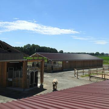


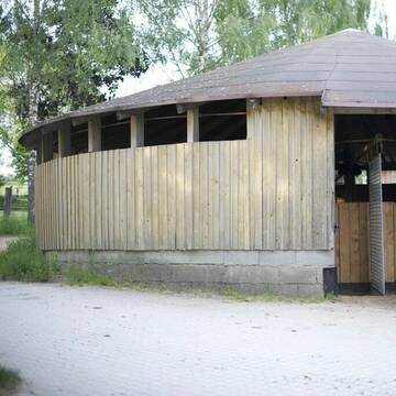
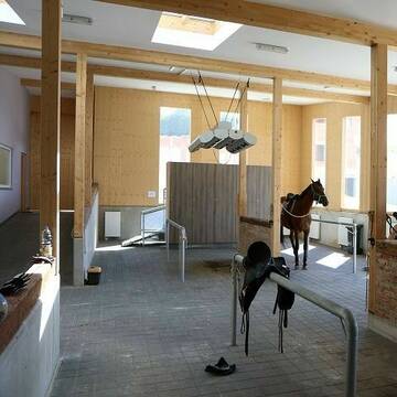
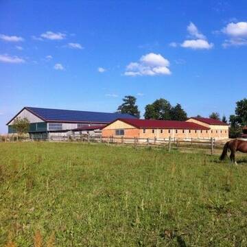
Pferdepension Hit Aktivstall Kürmerhof
Hohenkammer
Kuermerhof
@Kuermerhof
FN-Mitglied
Freizeitstall
Vermieten
Hunde willkommen
Krankenbox
Allergikerstall
Hufrehe geeignet
18 weitere...
S
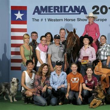
Reitstall Huberhof, Giesenbach
Kranzberg
Sebastian-Kammerloher
@Sebastian-Kammerloher
Gastronomie
Geländestrecke
Vermieten
Führanlage
Krankenbox
Hufrehe geeignet
24 weitere...
P+
Deprecated: Creation of dynamic property Zend_View_Helper_Ads::$adLink is deprecated in /var/www/stall-frei/htdocs/staging.stall-frei.de/library/Psf/View/Helper/Ads.php on line 108

Pferdepension Hit Aktivstall Kürmerhof
Hohenkammer
Kuermerhof
@Kuermerhof
*******JETZT NEU MIT ENTSTAUBTEM BIOHEU*********
*******Demnächst mit einem Abenteuerspielplatz für Pferde ( Extrem Trail/Pa
Kistler Hof, Bewegungsstall, Offenstall, Kranzberg
Kranzberg
Kistler-Hof
@Kistler-Hof
FN-Mitglied
Freizeitstall
Vermieten
Hunde willkommen
Krankenbox
Außenbox mit Paddock
Bewegungsstall
21 weitere...
P
Argerhof
Kranzberg
ARGERHOF
@ARGERHOF
Gastronomie
Geländestrecke
Paddock
Reithalle
Außenbox mit Paddock
Offenstall
Biofutter
Vollpension
9 weitere...
P


Pferdepark Faistenberg
Nandlstadt
Pferdepark-Faistenberg
@Pferdepark-Faistenberg
FN-Mitglied
Freizeitstall
Führanlage
Krankenbox
Allergikerstall
Hufrehe geeignet
Außenbox mit Paddock
Außenboxen
18 weitere...
S


Islandpferde Offenstall Allergiker
Massenhausen
Islandpferde Reschenbach
@Islandpferde-Reschenbach
Gangpferdereiten
Vermieten
Hunde willkommen
Reithalle
Allergikerstall
Fohlenaufzucht möglich
8 weitere...
P
Reit- und Fahrstall FERTLHOF
Schweitenkirchen
Josef Heckmeier
@Josef-Heckmeier
Fahrstall, Kutschwagen
FN-Mitglied
Führanlage
Hunde willkommen
Notfallboxen
Pferdezucht
Außenbox mit Paddock
Außenboxen
23 weitere...
P+
Reitanlage Reit- und Fahrverein Freising e.V.
Massenhausen
Reit-undFahrvereinFreisinge.V.
@RFV_Freising
Freizeitstall
Pferdeausbildung
Vermieten
Paddock
Parkplatz für Pferdeanhänger
Außenbox mit Paddock
Außenboxen
17 weitere...
P

Lucky Horse Corral
Schwabhausen
Harald-Betz
@Harald-Betz
Pferdeausbildung
Reitlehrer und -unterricht
Paddock
Parkplatz für Pferdeanhänger
Allergikerstall
Hengsthaltung möglich
Außenbox mit Paddock
Innenbox
16 weitere...
S


NEU: HIT-Aktiv mit Paddocktrail & Heubedampfer
Moosinning
Kaiser&Kaiser Das Pferderesort
@DasPferderesort
Freizeitstall
Reitlehrer und -unterricht
Vermieten
Krankenbox
Parkplatz für Pferdeanhänger
Allergikerstall
bedampftes/gewaschenes Heu
16 weitere...
S
Deprecated: Creation of dynamic property Zend_View::$pageCount is deprecated in /var/www/stall-frei/htdocs/staging.stall-frei.de/library/vendor/shardj/zf1-future/library/Zend/View/Abstract.php on line 308
Deprecated: Creation of dynamic property Zend_View::$itemCountPerPage is deprecated in /var/www/stall-frei/htdocs/staging.stall-frei.de/library/vendor/shardj/zf1-future/library/Zend/View/Abstract.php on line 308
Deprecated: Creation of dynamic property Zend_View::$first is deprecated in /var/www/stall-frei/htdocs/staging.stall-frei.de/library/vendor/shardj/zf1-future/library/Zend/View/Abstract.php on line 308
Deprecated: Creation of dynamic property Zend_View::$current is deprecated in /var/www/stall-frei/htdocs/staging.stall-frei.de/library/vendor/shardj/zf1-future/library/Zend/View/Abstract.php on line 308
Deprecated: Creation of dynamic property Zend_View::$last is deprecated in /var/www/stall-frei/htdocs/staging.stall-frei.de/library/vendor/shardj/zf1-future/library/Zend/View/Abstract.php on line 308
Deprecated: Creation of dynamic property Zend_View::$next is deprecated in /var/www/stall-frei/htdocs/staging.stall-frei.de/library/vendor/shardj/zf1-future/library/Zend/View/Abstract.php on line 308
Deprecated: Creation of dynamic property Zend_View::$pagesInRange is deprecated in /var/www/stall-frei/htdocs/staging.stall-frei.de/library/vendor/shardj/zf1-future/library/Zend/View/Abstract.php on line 308
Deprecated: Creation of dynamic property Zend_View::$firstPageInRange is deprecated in /var/www/stall-frei/htdocs/staging.stall-frei.de/library/vendor/shardj/zf1-future/library/Zend/View/Abstract.php on line 308
Deprecated: Creation of dynamic property Zend_View::$lastPageInRange is deprecated in /var/www/stall-frei/htdocs/staging.stall-frei.de/library/vendor/shardj/zf1-future/library/Zend/View/Abstract.php on line 308
Deprecated: Creation of dynamic property Zend_View::$currentItemCount is deprecated in /var/www/stall-frei/htdocs/staging.stall-frei.de/library/vendor/shardj/zf1-future/library/Zend/View/Abstract.php on line 308
Deprecated: Creation of dynamic property Zend_View::$totalItemCount is deprecated in /var/www/stall-frei/htdocs/staging.stall-frei.de/library/vendor/shardj/zf1-future/library/Zend/View/Abstract.php on line 308
Deprecated: Creation of dynamic property Zend_View::$firstItemNumber is deprecated in /var/www/stall-frei/htdocs/staging.stall-frei.de/library/vendor/shardj/zf1-future/library/Zend/View/Abstract.php on line 308
Deprecated: Creation of dynamic property Zend_View::$lastItemNumber is deprecated in /var/www/stall-frei/htdocs/staging.stall-frei.de/library/vendor/shardj/zf1-future/library/Zend/View/Abstract.php on line 308
Deprecated: Creation of dynamic property Zend_View::$router is deprecated in /var/www/stall-frei/htdocs/staging.stall-frei.de/library/vendor/shardj/zf1-future/library/Zend/View/Abstract.php on line 308
Deprecated: Creation of dynamic property Zend_View::$urlParams is deprecated in /var/www/stall-frei/htdocs/staging.stall-frei.de/library/vendor/shardj/zf1-future/library/Zend/View/Abstract.php on line 308
Deprecated: Creation of dynamic property Zend_View::$showAds is deprecated in /var/www/stall-frei/htdocs/staging.stall-frei.de/library/vendor/shardj/zf1-future/library/Zend/View/Abstract.php on line 308
Deprecated: Creation of dynamic property Zend_View::$objectIds is deprecated in /var/www/stall-frei/htdocs/staging.stall-frei.de/library/vendor/shardj/zf1-future/library/Zend/View/Abstract.php on line 308
Deprecated: Creation of dynamic property Zend_View::$showNavbar is deprecated in /var/www/stall-frei/htdocs/staging.stall-frei.de/library/vendor/shardj/zf1-future/library/Zend/View/Abstract.php on line 308
Deprecated: Creation of dynamic property Zend_View::$showBreadcrumb is deprecated in /var/www/stall-frei/htdocs/staging.stall-frei.de/library/vendor/shardj/zf1-future/library/Zend/View/Abstract.php on line 308
Deprecated: Creation of dynamic property Zend_View::$showFooter is deprecated in /var/www/stall-frei/htdocs/staging.stall-frei.de/library/vendor/shardj/zf1-future/library/Zend/View/Abstract.php on line 308
Deprecated: Creation of dynamic property Zend_View::$showInternalAds is deprecated in /var/www/stall-frei/htdocs/staging.stall-frei.de/library/vendor/shardj/zf1-future/library/Zend/View/Abstract.php on line 308
Deprecated: Creation of dynamic property Zend_View::$blNoContent is deprecated in /var/www/stall-frei/htdocs/staging.stall-frei.de/library/vendor/shardj/zf1-future/library/Zend/View/Abstract.php on line 308
Deprecated: Creation of dynamic property Zend_View::$sMetaDesc is deprecated in /var/www/stall-frei/htdocs/staging.stall-frei.de/library/vendor/shardj/zf1-future/library/Zend/View/Abstract.php on line 308
Deprecated: Creation of dynamic property Zend_View::$useGmaps is deprecated in /var/www/stall-frei/htdocs/staging.stall-frei.de/library/vendor/shardj/zf1-future/library/Zend/View/Abstract.php on line 308
Deprecated: Creation of dynamic property Zend_View::$touches is deprecated in /var/www/stall-frei/htdocs/staging.stall-frei.de/library/vendor/shardj/zf1-future/library/Zend/View/Abstract.php on line 308
Deprecated: Creation of dynamic property Zend_View::$oProject is deprecated in /var/www/stall-frei/htdocs/staging.stall-frei.de/library/vendor/shardj/zf1-future/library/Zend/View/Abstract.php on line 308
Deprecated: Creation of dynamic property Zend_View::$pageHeadline is deprecated in /var/www/stall-frei/htdocs/staging.stall-frei.de/library/vendor/shardj/zf1-future/library/Zend/View/Abstract.php on line 308
Deprecated: Creation of dynamic property Zend_View::$disableLocationField is deprecated in /var/www/stall-frei/htdocs/staging.stall-frei.de/library/vendor/shardj/zf1-future/library/Zend/View/Abstract.php on line 308
Deprecated: Creation of dynamic property Zend_View::$isSearch is deprecated in /var/www/stall-frei/htdocs/staging.stall-frei.de/library/vendor/shardj/zf1-future/library/Zend/View/Abstract.php on line 308
Deprecated: Creation of dynamic property Zend_View::$pageTitle is deprecated in /var/www/stall-frei/htdocs/staging.stall-frei.de/library/vendor/shardj/zf1-future/library/Zend/View/Abstract.php on line 308
Deprecated: Creation of dynamic property Psf_Form_Element_Text::$class is deprecated in /var/www/stall-frei/htdocs/staging.stall-frei.de/library/vendor/shardj/zf1-future/library/Zend/Form/Element.php on line 874
Deprecated: Creation of dynamic property Psf_Form_Element_Text::$size is deprecated in /var/www/stall-frei/htdocs/staging.stall-frei.de/library/vendor/shardj/zf1-future/library/Zend/Form/Element.php on line 874
Deprecated: Creation of dynamic property Psf_Form_Element_Text::$placeholder is deprecated in /var/www/stall-frei/htdocs/staging.stall-frei.de/library/vendor/shardj/zf1-future/library/Zend/Form/Element.php on line 874
Deprecated: Creation of dynamic property Psf_Form_Element_Hidden::$class is deprecated in /var/www/stall-frei/htdocs/staging.stall-frei.de/library/vendor/shardj/zf1-future/library/Zend/Form/Element.php on line 874
Deprecated: Creation of dynamic property Psf_Form_Element_Hidden::$class is deprecated in /var/www/stall-frei/htdocs/staging.stall-frei.de/library/vendor/shardj/zf1-future/library/Zend/Form/Element.php on line 874
Deprecated: Creation of dynamic property Psf_Form_Element_Hidden::$class is deprecated in /var/www/stall-frei/htdocs/staging.stall-frei.de/library/vendor/shardj/zf1-future/library/Zend/Form/Element.php on line 874
Deprecated: Creation of dynamic property Psf_Form_Element_Hidden::$class is deprecated in /var/www/stall-frei/htdocs/staging.stall-frei.de/library/vendor/shardj/zf1-future/library/Zend/Form/Element.php on line 874
Deprecated: Creation of dynamic property Psf_Form_Element_Select::$class is deprecated in /var/www/stall-frei/htdocs/staging.stall-frei.de/library/vendor/shardj/zf1-future/library/Zend/Form/Element.php on line 874
Deprecated: Creation of dynamic property Psf_Form_Element_Select::$class is deprecated in /var/www/stall-frei/htdocs/staging.stall-frei.de/library/vendor/shardj/zf1-future/library/Zend/Form/Element.php on line 874
Deprecated: Creation of dynamic property Psf_Form_Element_Select::$class is deprecated in /var/www/stall-frei/htdocs/staging.stall-frei.de/library/vendor/shardj/zf1-future/library/Zend/Form/Element.php on line 874
Deprecated: Creation of dynamic property Psf_Form_Element_Select::$class is deprecated in /var/www/stall-frei/htdocs/staging.stall-frei.de/library/vendor/shardj/zf1-future/library/Zend/Form/Element.php on line 874
Deprecated: Creation of dynamic property Psf_Form_Element_Text::$class is deprecated in /var/www/stall-frei/htdocs/staging.stall-frei.de/library/vendor/shardj/zf1-future/library/Zend/Form/Element.php on line 874
Deprecated: Creation of dynamic property Psf_Form_Element_Checkbox::$label is deprecated in /var/www/stall-frei/htdocs/staging.stall-frei.de/library/vendor/shardj/zf1-future/library/Zend/Form/Element.php on line 874
Deprecated: Creation of dynamic property Zend_View::$sort is deprecated in /var/www/stall-frei/htdocs/staging.stall-frei.de/library/vendor/shardj/zf1-future/library/Zend/View/Abstract.php on line 308
Deprecated: Creation of dynamic property Zend_View::$searchLocation is deprecated in /var/www/stall-frei/htdocs/staging.stall-frei.de/library/vendor/shardj/zf1-future/library/Zend/View/Abstract.php on line 308
Deprecated: Creation of dynamic property Zend_View::$locationHint is deprecated in /var/www/stall-frei/htdocs/staging.stall-frei.de/library/vendor/shardj/zf1-future/library/Zend/View/Abstract.php on line 308
Psf_GeoCoder_Abstract::getLocation: Kranzberg Get Location CachedOrLive
Psf_GeoCoder_Abstract::getCachedOrLive: Kranzberg
Psf_GeoCoder_OpenCageData::makeApiRequest: response:
Array
(
[documentation] => https://opencagedata.com/api
[licenses] => Array
(
[0] => Array
(
[name] => see attribution guide
[url] => https://opencagedata.com/credits
)
)
[results] => Array
(
[0] => Array
(
[bounds] => Array
(
[northeast] => Array
(
[lat] => 48.4449748
[lng] => 11.7027186
)
[southwest] => Array
(
[lat] => 48.3717742
[lng] => 11.5497879
)
)
[components] => Array
(
[ISO_3166-1_alpha-2] => DE
[ISO_3166-1_alpha-3] => DEU
[ISO_3166-2] => Array
(
[0] => DE-BY
)
[_category] => place
[_normalized_city] => Kranzberg
[_type] => village
[continent] => Europe
[country] => Deutschland
[country_code] => de
[county] => Landkreis Freising
[political_union] => European Union
[postcode] => 85402
[state] => Bayern
[state_code] => BY
[village] => Kranzberg
)
[confidence] => 7
[formatted] => 85402 Kranzberg, Deutschland
[geometry] => Array
(
[lat] => 48.4061064
[lng] => 11.6130213
)
)
[1] => Array
(
[bounds] => Array
(
[northeast] => Array
(
[lat] => 51.9713573
[lng] => 10.2041657
)
[southwest] => Array
(
[lat] => 51.9712573
[lng] => 10.2040657
)
)
[components] => Array
(
[ISO_3166-1_alpha-2] => DE
[ISO_3166-1_alpha-3] => DEU
[ISO_3166-2] => Array
(
[0] => DE-NI
)
[_category] => natural/water
[_normalized_city] => Langelsheim
[_type] => peak
[continent] => Europe
[country] => Deutschland
[country_code] => de
[county] => Landkreis Goslar
[peak] => Kranzberg
[political_union] => European Union
[state] => Niedersachsen
[state_code] => NI
[town] => Langelsheim
)
[confidence] => 9
[formatted] => Kranzberg, Langelsheim, Niedersachsen, Deutschland
[geometry] => Array
(
[lat] => 51.9713073
[lng] => 10.2041157
)
)
[2] => Array
(
[bounds] => Array
(
[northeast] => Array
(
[lat] => 51.0493331
[lng] => 10.1739926
)
[southwest] => Array
(
[lat] => 51.0492331
[lng] => 10.1738926
)
)
[components] => Array
(
[ISO_3166-1_alpha-2] => DE
[ISO_3166-1_alpha-3] => DEU
[ISO_3166-2] => Array
(
[0] => DE-TH
)
[_category] => natural/water
[_normalized_city] => Ifta
[_type] => peak
[continent] => Europe
[country] => Deutschland
[country_code] => de
[county] => Wartburgkreis
[municipality] => Treffurt
[peak] => Kranzberg
[political_union] => European Union
[postcode] => 37293
[state] => Thüringen
[state_code] => TH
[village] => Ifta
)
[confidence] => 9
[formatted] => Kranzberg, 37293 Ifta, Deutschland
[geometry] => Array
(
[lat] => 51.0492831
[lng] => 10.1739426
)
)
[3] => Array
(
[bounds] => Array
(
[northeast] => Array
(
[lat] => 50.7339732
[lng] => 12.39281
)
[southwest] => Array
(
[lat] => 50.7338732
[lng] => 12.39271
)
)
[components] => Array
(
[ISO_3166-1_alpha-2] => DE
[ISO_3166-1_alpha-3] => DEU
[ISO_3166-2] => Array
(
[0] => DE-SN
)
[_category] => natural/water
[_normalized_city] => Werdau
[_type] => peak
[continent] => Europe
[country] => Deutschland
[country_code] => de
[county] => Zwickau
[peak] => Kranzberg
[political_union] => European Union
[postcode] => 08412
[state] => Sachsen
[state_code] => SN
[town] => Werdau
)
[confidence] => 9
[formatted] => Kranzberg, 08412 Werdau, Deutschland
[geometry] => Array
(
[lat] => 50.7339232
[lng] => 12.39276
)
)
[4] => Array
(
[bounds] => Array
(
[northeast] => Array
(
[lat] => 48.5440264
[lng] => 11.6930673
)
[southwest] => Array
(
[lat] => 48.5439264
[lng] => 11.6929673
)
)
[components] => Array
(
[ISO_3166-1_alpha-2] => DE
[ISO_3166-1_alpha-3] => DEU
[ISO_3166-2] => Array
(
[0] => DE-BY
)
[_category] => building
[_normalized_city] => Au in der Hallertau
[_type] => building
[city] => Au in der Hallertau
[continent] => Europe
[country] => Deutschland
[country_code] => de
[county] => Landkreis Freising
[hamlet] => Grubanger
[isolated_dwelling] => Kranzberg
[political_union] => European Union
[postcode] => 84072
[state] => Bayern
[state_code] => BY
)
[confidence] => 10
[formatted] => Kranzberg, Grubanger, 84072 Au in der Hallertau, Deutschland
[geometry] => Array
(
[lat] => 48.5439764
[lng] => 11.6930173
)
)
[5] => Array
(
[components] => Array
(
[ISO_3166-1_alpha-2] => FR
[ISO_3166-1_alpha-3] => FRA
[ISO_3166-2] => Array
(
[0] => FR-IDF
[1] => FR-92
)
[_category] => road
[_normalized_city] => Levallois-Perret
[_type] => road
[city] => Levallois-Perret
[continent] => Europe
[country] => France
[country_code] => fr
[county] => Hauts-de-Seine
[local_authority] => Métropole du Grand Paris
[political_union] => European Union
[postcode] => 92300
[road] => Rue Charles Deutschmann
[state] => Île-de-France
[state_code] => IDF
)
[confidence] => 2
[formatted] => Rue Charles Deutschmann, 92300 Levallois-Perret, France
[geometry] => Array
(
[lat] => 48.900049
[lng] => 2.2842
)
)
[6] => Array
(
[components] => Array
(
[ISO_3166-1_alpha-2] => FR
[ISO_3166-1_alpha-3] => FRA
[ISO_3166-2] => Array
(
[0] => FR-BRE
[1] => FR-35
)
[_category] => road
[_normalized_city] => Baulon
[_type] => road
[city] => Baulon
[continent] => Europe
[country] => France
[country_code] => fr
[county] => Ille-et-Vilaine
[local_authority] => Vallons de Haute-Bretagne Communauté
[political_union] => European Union
[postcode] => 35580
[road] => Le Haut Crambert
[state] => Bretagne
[state_code] => BRE
)
[confidence] => 10
[formatted] => Le Haut Crambert, 35580 Baulon, France
[geometry] => Array
(
[lat] => 48.012574
[lng] => -1.965695
)
)
[7] => Array
(
[components] => Array
(
[ISO_3166-1_alpha-2] => FR
[ISO_3166-1_alpha-3] => FRA
[ISO_3166-2] => Array
(
[0] => FR-BRE
[1] => FR-35
)
[_category] => road
[_normalized_city] => Bréal-sous-Montfort
[_type] => road
[city] => Bréal-sous-Montfort
[continent] => Europe
[country] => France
[country_code] => fr
[county] => Ille-et-Vilaine
[local_authority] => Communauté de communes de Brocéliande
[political_union] => European Union
[postcode] => 35310
[road] => Crambert
[state] => Bretagne
[state_code] => BRE
)
[confidence] => 10
[formatted] => Crambert, 35310 Bréal-sous-Montfort, France
[geometry] => Array
(
[lat] => 48.057731
[lng] => -1.85444
)
)
[8] => Array
(
[components] => Array
(
[ISO_3166-1_alpha-2] => FR
[ISO_3166-1_alpha-3] => FRA
[ISO_3166-2] => Array
(
[0] => FR-BRE
[1] => FR-35
)
[_category] => road
[_normalized_city] => Baulon
[_type] => road
[city] => Baulon
[continent] => Europe
[country] => France
[country_code] => fr
[county] => Ille-et-Vilaine
[local_authority] => Vallons de Haute-Bretagne Communauté
[political_union] => European Union
[postcode] => 35580
[road] => Crambert
[state] => Bretagne
[state_code] => BRE
)
[confidence] => 10
[formatted] => Crambert, 35580 Baulon, France
[geometry] => Array
(
[lat] => 48.011761
[lng] => -1.962103
)
)
[9] => Array
(
[components] => Array
(
[ISO_3166-1_alpha-2] => FR
[ISO_3166-1_alpha-3] => FRA
[ISO_3166-2] => Array
(
[0] => FR-BRE
[1] => FR-35
)
[_category] => road
[_normalized_city] => Baulon
[_type] => road
[city] => Baulon
[continent] => Europe
[country] => France
[country_code] => fr
[county] => Ille-et-Vilaine
[local_authority] => Vallons de Haute-Bretagne Communauté
[political_union] => European Union
[postcode] => 35580
[road] => Le Bas Crambert
[state] => Bretagne
[state_code] => BRE
)
[confidence] => 10
[formatted] => Le Bas Crambert, 35580 Baulon, France
[geometry] => Array
(
[lat] => 48.008847
[lng] => -1.962068
)
)
)
[status] => Array
(
[code] => 200
[message] => OK
)
[stay_informed] => Array
(
[blog] => https://blog.opencagedata.com
[mastodon] => https://en.osm.town/@opencage
)
[thanks] => For using an OpenCage API
[timestamp] => Array
(
[created_http] => Sat, 07 Feb 2026 14:23:06 GMT
[created_unix] => 1770474186
)
[total_results] => 10
)
Psf_GeoCoder_Abstract::convertLocationResult
{"documentation":"https:\/\/opencagedata.com\/api","licenses":[{"name":"see attribution guide","url":"https:\/\/opencagedata.com\/credits"}],"results":[{"bounds":{"northeast":{"lat":48.4449748,"lng":11.7027186},"southwest":{"lat":48.3717742,"lng":11.5497879}},"components":{"ISO_3166-1_alpha-2":"DE","ISO_3166-1_alpha-3":"DEU","ISO_3166-2":["DE-BY"],"_category":"place","_normalized_city":"Kranzberg","_type":"village","continent":"Europe","country":"Deutschland","country_code":"de","county":"Landkreis Freising","political_union":"European Union","postcode":"85402","state":"Bayern","state_code":"BY","village":"Kranzberg"},"confidence":7,"formatted":"85402 Kranzberg, Deutschland","geometry":{"lat":48.4061064,"lng":11.6130213}},{"bounds":{"northeast":{"lat":51.9713573,"lng":10.2041657},"southwest":{"lat":51.9712573,"lng":10.2040657}},"components":{"ISO_3166-1_alpha-2":"DE","ISO_3166-1_alpha-3":"DEU","ISO_3166-2":["DE-NI"],"_category":"natural\/water","_normalized_city":"Langelsheim","_type":"peak","continent":"Europe","country":"Deutschland","country_code":"de","county":"Landkreis Goslar","peak":"Kranzberg","political_union":"European Union","state":"Niedersachsen","state_code":"NI","town":"Langelsheim"},"confidence":9,"formatted":"Kranzberg, Langelsheim, Niedersachsen, Deutschland","geometry":{"lat":51.9713073,"lng":10.2041157}},{"bounds":{"northeast":{"lat":51.0493331,"lng":10.1739926},"southwest":{"lat":51.0492331,"lng":10.1738926}},"components":{"ISO_3166-1_alpha-2":"DE","ISO_3166-1_alpha-3":"DEU","ISO_3166-2":["DE-TH"],"_category":"natural\/water","_normalized_city":"Ifta","_type":"peak","continent":"Europe","country":"Deutschland","country_code":"de","county":"Wartburgkreis","municipality":"Treffurt","peak":"Kranzberg","political_union":"European Union","postcode":"37293","state":"Th\u00fcringen","state_code":"TH","village":"Ifta"},"confidence":9,"formatted":"Kranzberg, 37293 Ifta, Deutschland","geometry":{"lat":51.0492831,"lng":10.1739426}},{"bounds":{"northeast":{"lat":50.7339732,"lng":12.39281},"southwest":{"lat":50.7338732,"lng":12.39271}},"components":{"ISO_3166-1_alpha-2":"DE","ISO_3166-1_alpha-3":"DEU","ISO_3166-2":["DE-SN"],"_category":"natural\/water","_normalized_city":"Werdau","_type":"peak","continent":"Europe","country":"Deutschland","country_code":"de","county":"Zwickau","peak":"Kranzberg","political_union":"European Union","postcode":"08412","state":"Sachsen","state_code":"SN","town":"Werdau"},"confidence":9,"formatted":"Kranzberg, 08412 Werdau, Deutschland","geometry":{"lat":50.7339232,"lng":12.39276}},{"bounds":{"northeast":{"lat":48.5440264,"lng":11.6930673},"southwest":{"lat":48.5439264,"lng":11.6929673}},"components":{"ISO_3166-1_alpha-2":"DE","ISO_3166-1_alpha-3":"DEU","ISO_3166-2":["DE-BY"],"_category":"building","_normalized_city":"Au in der Hallertau","_type":"building","city":"Au in der Hallertau","continent":"Europe","country":"Deutschland","country_code":"de","county":"Landkreis Freising","hamlet":"Grubanger","isolated_dwelling":"Kranzberg","political_union":"European Union","postcode":"84072","state":"Bayern","state_code":"BY"},"confidence":10,"formatted":"Kranzberg, Grubanger, 84072 Au in der Hallertau, Deutschland","geometry":{"lat":48.5439764,"lng":11.6930173}},{"components":{"ISO_3166-1_alpha-2":"FR","ISO_3166-1_alpha-3":"FRA","ISO_3166-2":["FR-IDF","FR-92"],"_category":"road","_normalized_city":"Levallois-Perret","_type":"road","city":"Levallois-Perret","continent":"Europe","country":"France","country_code":"fr","county":"Hauts-de-Seine","local_authority":"M\u00e9tropole du Grand Paris","political_union":"European Union","postcode":"92300","road":"Rue Charles Deutschmann","state":"\u00cele-de-France","state_code":"IDF"},"confidence":2,"formatted":"Rue Charles Deutschmann, 92300 Levallois-Perret, France","geometry":{"lat":48.900049,"lng":2.2842}},{"components":{"ISO_3166-1_alpha-2":"FR","ISO_3166-1_alpha-3":"FRA","ISO_3166-2":["FR-BRE","FR-35"],"_category":"road","_normalized_city":"Baulon","_type":"road","city":"Baulon","continent":"Europe","country":"France","country_code":"fr","county":"Ille-et-Vilaine","local_authority":"Vallons de Haute-Bretagne Communaut\u00e9","political_union":"European Union","postcode":"35580","road":"Le Haut Crambert","state":"Bretagne","state_code":"BRE"},"confidence":10,"formatted":"Le Haut Crambert, 35580 Baulon, France","geometry":{"lat":48.012574,"lng":-1.965695}},{"components":{"ISO_3166-1_alpha-2":"FR","ISO_3166-1_alpha-3":"FRA","ISO_3166-2":["FR-BRE","FR-35"],"_category":"road","_normalized_city":"Br\u00e9al-sous-Montfort","_type":"road","city":"Br\u00e9al-sous-Montfort","continent":"Europe","country":"France","country_code":"fr","county":"Ille-et-Vilaine","local_authority":"Communaut\u00e9 de communes de Broc\u00e9liande","political_union":"European Union","postcode":"35310","road":"Crambert","state":"Bretagne","state_code":"BRE"},"confidence":10,"formatted":"Crambert, 35310 Br\u00e9al-sous-Montfort, France","geometry":{"lat":48.057731,"lng":-1.85444}},{"components":{"ISO_3166-1_alpha-2":"FR","ISO_3166-1_alpha-3":"FRA","ISO_3166-2":["FR-BRE","FR-35"],"_category":"road","_normalized_city":"Baulon","_type":"road","city":"Baulon","continent":"Europe","country":"France","country_code":"fr","county":"Ille-et-Vilaine","local_authority":"Vallons de Haute-Bretagne Communaut\u00e9","political_union":"European Union","postcode":"35580","road":"Crambert","state":"Bretagne","state_code":"BRE"},"confidence":10,"formatted":"Crambert, 35580 Baulon, France","geometry":{"lat":48.011761,"lng":-1.962103}},{"components":{"ISO_3166-1_alpha-2":"FR","ISO_3166-1_alpha-3":"FRA","ISO_3166-2":["FR-BRE","FR-35"],"_category":"road","_normalized_city":"Baulon","_type":"road","city":"Baulon","continent":"Europe","country":"France","country_code":"fr","county":"Ille-et-Vilaine","local_authority":"Vallons de Haute-Bretagne Communaut\u00e9","political_union":"European Union","postcode":"35580","road":"Le Bas Crambert","state":"Bretagne","state_code":"BRE"},"confidence":10,"formatted":"Le Bas Crambert, 35580 Baulon, France","geometry":{"lat":48.008847,"lng":-1.962068}}],"status":{"code":200,"message":"OK"},"stay_informed":{"blog":"https:\/\/blog.opencagedata.com","mastodon":"https:\/\/en.osm.town\/@opencage"},"thanks":"For using an OpenCage API","timestamp":{"created_http":"Sat, 07 Feb 2026 14:23:06 GMT","created_unix":1770474186},"total_results":10}Array
(
[0] => stdClass Object
(
[bounds] => stdClass Object
(
[northeast] => stdClass Object
(
[lat] => 48.4449748
[lng] => 11.7027186
)
[southwest] => stdClass Object
(
[lat] => 48.3717742
[lng] => 11.5497879
)
)
[components] => stdClass Object
(
[ISO_3166-1_alpha-2] => DE
[ISO_3166-1_alpha-3] => DEU
[ISO_3166-2] => Array
(
[0] => DE-BY
)
[_category] => place
[_normalized_city] => Kranzberg
[_type] => village
[continent] => Europe
[country] => Deutschland
[country_code] => de
[county] => Landkreis Freising
[political_union] => European Union
[postcode] => 85402
[state] => Bayern
[state_code] => BY
[village] => Kranzberg
)
[confidence] => 7
[formatted] => 85402 Kranzberg, Deutschland
[geometry] => stdClass Object
(
[lat] => 48.4061064
[lng] => 11.6130213
)
)
[1] => stdClass Object
(
[bounds] => stdClass Object
(
[northeast] => stdClass Object
(
[lat] => 51.9713573
[lng] => 10.2041657
)
[southwest] => stdClass Object
(
[lat] => 51.9712573
[lng] => 10.2040657
)
)
[components] => stdClass Object
(
[ISO_3166-1_alpha-2] => DE
[ISO_3166-1_alpha-3] => DEU
[ISO_3166-2] => Array
(
[0] => DE-NI
)
[_category] => natural/water
[_normalized_city] => Langelsheim
[_type] => peak
[continent] => Europe
[country] => Deutschland
[country_code] => de
[county] => Landkreis Goslar
[peak] => Kranzberg
[political_union] => European Union
[state] => Niedersachsen
[state_code] => NI
[town] => Langelsheim
)
[confidence] => 9
[formatted] => Kranzberg, Langelsheim, Niedersachsen, Deutschland
[geometry] => stdClass Object
(
[lat] => 51.9713073
[lng] => 10.2041157
)
)
[2] => stdClass Object
(
[bounds] => stdClass Object
(
[northeast] => stdClass Object
(
[lat] => 51.0493331
[lng] => 10.1739926
)
[southwest] => stdClass Object
(
[lat] => 51.0492331
[lng] => 10.1738926
)
)
[components] => stdClass Object
(
[ISO_3166-1_alpha-2] => DE
[ISO_3166-1_alpha-3] => DEU
[ISO_3166-2] => Array
(
[0] => DE-TH
)
[_category] => natural/water
[_normalized_city] => Ifta
[_type] => peak
[continent] => Europe
[country] => Deutschland
[country_code] => de
[county] => Wartburgkreis
[municipality] => Treffurt
[peak] => Kranzberg
[political_union] => European Union
[postcode] => 37293
[state] => Thüringen
[state_code] => TH
[village] => Ifta
)
[confidence] => 9
[formatted] => Kranzberg, 37293 Ifta, Deutschland
[geometry] => stdClass Object
(
[lat] => 51.0492831
[lng] => 10.1739426
)
)
[3] => stdClass Object
(
[bounds] => stdClass Object
(
[northeast] => stdClass Object
(
[lat] => 50.7339732
[lng] => 12.39281
)
[southwest] => stdClass Object
(
[lat] => 50.7338732
[lng] => 12.39271
)
)
[components] => stdClass Object
(
[ISO_3166-1_alpha-2] => DE
[ISO_3166-1_alpha-3] => DEU
[ISO_3166-2] => Array
(
[0] => DE-SN
)
[_category] => natural/water
[_normalized_city] => Werdau
[_type] => peak
[continent] => Europe
[country] => Deutschland
[country_code] => de
[county] => Zwickau
[peak] => Kranzberg
[political_union] => European Union
[postcode] => 08412
[state] => Sachsen
[state_code] => SN
[town] => Werdau
)
[confidence] => 9
[formatted] => Kranzberg, 08412 Werdau, Deutschland
[geometry] => stdClass Object
(
[lat] => 50.7339232
[lng] => 12.39276
)
)
[4] => stdClass Object
(
[bounds] => stdClass Object
(
[northeast] => stdClass Object
(
[lat] => 48.5440264
[lng] => 11.6930673
)
[southwest] => stdClass Object
(
[lat] => 48.5439264
[lng] => 11.6929673
)
)
[components] => stdClass Object
(
[ISO_3166-1_alpha-2] => DE
[ISO_3166-1_alpha-3] => DEU
[ISO_3166-2] => Array
(
[0] => DE-BY
)
[_category] => building
[_normalized_city] => Au in der Hallertau
[_type] => building
[city] => Au in der Hallertau
[continent] => Europe
[country] => Deutschland
[country_code] => de
[county] => Landkreis Freising
[hamlet] => Grubanger
[isolated_dwelling] => Kranzberg
[political_union] => European Union
[postcode] => 84072
[state] => Bayern
[state_code] => BY
)
[confidence] => 10
[formatted] => Kranzberg, Grubanger, 84072 Au in der Hallertau, Deutschland
[geometry] => stdClass Object
(
[lat] => 48.5439764
[lng] => 11.6930173
)
)
[5] => stdClass Object
(
[components] => stdClass Object
(
[ISO_3166-1_alpha-2] => FR
[ISO_3166-1_alpha-3] => FRA
[ISO_3166-2] => Array
(
[0] => FR-IDF
[1] => FR-92
)
[_category] => road
[_normalized_city] => Levallois-Perret
[_type] => road
[city] => Levallois-Perret
[continent] => Europe
[country] => France
[country_code] => fr
[county] => Hauts-de-Seine
[local_authority] => Métropole du Grand Paris
[political_union] => European Union
[postcode] => 92300
[road] => Rue Charles Deutschmann
[state] => Île-de-France
[state_code] => IDF
)
[confidence] => 2
[formatted] => Rue Charles Deutschmann, 92300 Levallois-Perret, France
[geometry] => stdClass Object
(
[lat] => 48.900049
[lng] => 2.2842
)
)
[6] => stdClass Object
(
[components] => stdClass Object
(
[ISO_3166-1_alpha-2] => FR
[ISO_3166-1_alpha-3] => FRA
[ISO_3166-2] => Array
(
[0] => FR-BRE
[1] => FR-35
)
[_category] => road
[_normalized_city] => Baulon
[_type] => road
[city] => Baulon
[continent] => Europe
[country] => France
[country_code] => fr
[county] => Ille-et-Vilaine
[local_authority] => Vallons de Haute-Bretagne Communauté
[political_union] => European Union
[postcode] => 35580
[road] => Le Haut Crambert
[state] => Bretagne
[state_code] => BRE
)
[confidence] => 10
[formatted] => Le Haut Crambert, 35580 Baulon, France
[geometry] => stdClass Object
(
[lat] => 48.012574
[lng] => -1.965695
)
)
[7] => stdClass Object
(
[components] => stdClass Object
(
[ISO_3166-1_alpha-2] => FR
[ISO_3166-1_alpha-3] => FRA
[ISO_3166-2] => Array
(
[0] => FR-BRE
[1] => FR-35
)
[_category] => road
[_normalized_city] => Bréal-sous-Montfort
[_type] => road
[city] => Bréal-sous-Montfort
[continent] => Europe
[country] => France
[country_code] => fr
[county] => Ille-et-Vilaine
[local_authority] => Communauté de communes de Brocéliande
[political_union] => European Union
[postcode] => 35310
[road] => Crambert
[state] => Bretagne
[state_code] => BRE
)
[confidence] => 10
[formatted] => Crambert, 35310 Bréal-sous-Montfort, France
[geometry] => stdClass Object
(
[lat] => 48.057731
[lng] => -1.85444
)
)
[8] => stdClass Object
(
[components] => stdClass Object
(
[ISO_3166-1_alpha-2] => FR
[ISO_3166-1_alpha-3] => FRA
[ISO_3166-2] => Array
(
[0] => FR-BRE
[1] => FR-35
)
[_category] => road
[_normalized_city] => Baulon
[_type] => road
[city] => Baulon
[continent] => Europe
[country] => France
[country_code] => fr
[county] => Ille-et-Vilaine
[local_authority] => Vallons de Haute-Bretagne Communauté
[political_union] => European Union
[postcode] => 35580
[road] => Crambert
[state] => Bretagne
[state_code] => BRE
)
[confidence] => 10
[formatted] => Crambert, 35580 Baulon, France
[geometry] => stdClass Object
(
[lat] => 48.011761
[lng] => -1.962103
)
)
[9] => stdClass Object
(
[components] => stdClass Object
(
[ISO_3166-1_alpha-2] => FR
[ISO_3166-1_alpha-3] => FRA
[ISO_3166-2] => Array
(
[0] => FR-BRE
[1] => FR-35
)
[_category] => road
[_normalized_city] => Baulon
[_type] => road
[city] => Baulon
[continent] => Europe
[country] => France
[country_code] => fr
[county] => Ille-et-Vilaine
[local_authority] => Vallons de Haute-Bretagne Communauté
[political_union] => European Union
[postcode] => 35580
[road] => Le Bas Crambert
[state] => Bretagne
[state_code] => BRE
)
[confidence] => 10
[formatted] => Le Bas Crambert, 35580 Baulon, France
[geometry] => stdClass Object
(
[lat] => 48.008847
[lng] => -1.962068
)
)
)
Psf_GeoCoder_OpenCageData::getKeyMap: 0
stdClass Object
(
    [bounds] => stdClass Object
        (
            [northeast] => stdClass Object
                (
                    [lat] => 48.4449748
                    [lng] => 11.7027186
                )

            [southwest] => stdClass Object
                (
                    [lat] => 48.3717742
                    [lng] => 11.5497879
                )

        )

    [components] => stdClass Object
        (
            [ISO_3166-1_alpha-2] => DE
            [ISO_3166-1_alpha-3] => DEU
            [ISO_3166-2] => Array
                (
                    [0] => DE-BY
                )

            [_category] => place
            [_normalized_city] => Kranzberg
            [_type] => village
            [continent] => Europe
            [country] => Deutschland
            [country_code] => de
            [county] => Landkreis Freising
            [political_union] => European Union
            [postcode] => 85402
            [state] => Bayern
            [state_code] => BY
            [village] => Kranzberg
        )

    [confidence] => 7
    [formatted] => 85402 Kranzberg, Deutschland
    [geometry] => stdClass Object
        (
            [lat] => 48.4061064
            [lng] => 11.6130213
        )

)
Psf_GeoCoder_OpenCageData::getCounty: Freising
Psf_GeoCoder_OpenCageData::addMissingData REFETCH!
Array
(
    [address] => 85402 Kranzberg, Deutschland
    [type] => village
    [street] =>
    [city] => Kranzberg
    [county] => Freising
    [state] => Bayern
    [zip] => 85402
    [country] => Deutschland
    [suburb] =>
    [countrycode] => de
    [latitude] => 48.4061064
    [longitude] => 11.6130213
    [accuracy] => 1
    [confidence] => 7
    [bounds] => stdClass Object
        (
            [northeast] => stdClass Object
                (
                    [lat] => 48.4449748
                    [lng] => 11.7027186
                )

            [southwest] => stdClass Object
                (
                    [lat] => 48.3717742
                    [lng] => 11.5497879
                )

        )

)
reformat!
Array
(
    [address] => 85402 Kranzberg, Deutschland
    [type] => village
    [street] =>
    [city] => Kranzberg
    [county] => Freising
    [state] => Bayern
    [zip] => 85402
    [country] => Deutschland
    [suburb] =>
    [countrycode] => de
    [latitude] => 48.4061064
    [longitude] => 11.6130213
    [accuracy] => 1
    [confidence] => 7
    [bounds] => stdClass Object
        (
            [northeast] => stdClass Object
                (
                    [lat] => 48.4449748
                    [lng] => 11.7027186
                )

            [southwest] => stdClass Object
                (
                    [lat] => 48.3717742
                    [lng] => 11.5497879
                )

        )

    [place] => 85402 Kranzberg, Bayern
    [hash] => 2ae8b5bbecd537ee1a7ec9fa64ba8903
)
Psf_GeoCoder_OpenCageData::getKeyMap: 1
stdClass Object
(
    [bounds] => stdClass Object
        (
            [northeast] => stdClass Object
                (
                    [lat] => 51.9713573
                    [lng] => 10.2041657
                )

            [southwest] => stdClass Object
                (
                    [lat] => 51.9712573
                    [lng] => 10.2040657
                )

        )

    [components] => stdClass Object
        (
            [ISO_3166-1_alpha-2] => DE
            [ISO_3166-1_alpha-3] => DEU
            [ISO_3166-2] => Array
                (
                    [0] => DE-NI
                )

            [_category] => natural/water
            [_normalized_city] => Langelsheim
            [_type] => peak
            [continent] => Europe
            [country] => Deutschland
            [country_code] => de
            [county] => Landkreis Goslar
            [peak] => Kranzberg
            [political_union] => European Union
            [state] => Niedersachsen
            [state_code] => NI
            [town] => Langelsheim
        )

    [confidence] => 9
    [formatted] => Kranzberg, Langelsheim, Niedersachsen, Deutschland
    [geometry] => stdClass Object
        (
            [lat] => 51.9713073
            [lng] => 10.2041157
        )

)
Psf_GeoCoder_OpenCageData::getCounty: Goslar
Psf_GeoCoder_OpenCageData::addMissingData REFETCH!
Array
(
    [address] => Kranzberg, Langelsheim, Niedersachsen, Deutschland
    [type] => peak
    [street] =>
    [city] => Langelsheim
    [county] => Goslar
    [state] => Niedersachsen
    [zip] =>
    [country] => Deutschland
    [suburb] =>
    [countrycode] => de
    [latitude] => 51.9713073
    [longitude] => 10.2041157
    [accuracy] => 1
    [confidence] => 9
    [bounds] => stdClass Object
        (
            [northeast] => stdClass Object
                (
                    [lat] => 51.9713573
                    [lng] => 10.2041657
                )

            [southwest] => stdClass Object
                (
                    [lat] => 51.9712573
                    [lng] => 10.2040657
                )

        )

)
reformat!
Array
(
    [address] => Kranzberg, Langelsheim, Niedersachsen, Deutschland
    [type] => peak
    [street] =>
    [city] => Langelsheim
    [county] => Goslar
    [state] => Niedersachsen
    [zip] =>
    [country] => Deutschland
    [suburb] =>
    [countrycode] => de
    [latitude] => 51.9713073
    [longitude] => 10.2041157
    [accuracy] => 1
    [confidence] => 9
    [bounds] => stdClass Object
        (
            [northeast] => stdClass Object
                (
                    [lat] => 51.9713573
                    [lng] => 10.2041657
                )

            [southwest] => stdClass Object
                (
                    [lat] => 51.9712573
                    [lng] => 10.2040657
                )

        )

    [place] => Langelsheim, Niedersachsen
    [hash] => da45b34e1532451c18b2650a16246c0a
)
Psf_GeoCoder_OpenCageData::getKeyMap: 2
stdClass Object
(
    [bounds] => stdClass Object
        (
            [northeast] => stdClass Object
                (
                    [lat] => 51.0493331
                    [lng] => 10.1739926
                )

            [southwest] => stdClass Object
                (
                    [lat] => 51.0492331
                    [lng] => 10.1738926
                )

        )

    [components] => stdClass Object
        (
            [ISO_3166-1_alpha-2] => DE
            [ISO_3166-1_alpha-3] => DEU
            [ISO_3166-2] => Array
                (
                    [0] => DE-TH
                )

            [_category] => natural/water
            [_normalized_city] => Ifta
            [_type] => peak
            [continent] => Europe
            [country] => Deutschland
            [country_code] => de
            [county] => Wartburgkreis
            [municipality] => Treffurt
            [peak] => Kranzberg
            [political_union] => European Union
            [postcode] => 37293
            [state] => Thüringen
            [state_code] => TH
            [village] => Ifta
        )

    [confidence] => 9
    [formatted] => Kranzberg, 37293 Ifta, Deutschland
    [geometry] => stdClass Object
        (
            [lat] => 51.0492831
            [lng] => 10.1739426
        )

)
Psf_GeoCoder_OpenCageData::getCounty: Wartburgkreis
Psf_GeoCoder_OpenCageData::addMissingData REFETCH!
Array
(
    [address] => Kranzberg, 37293 Ifta, Deutschland
    [type] => peak
    [street] =>
    [city] => Ifta
    [county] => Wartburgkreis
    [state] => Thüringen
    [zip] => 37293
    [country] => Deutschland
    [suburb] =>
    [countrycode] => de
    [latitude] => 51.0492831
    [longitude] => 10.1739426
    [accuracy] => 1
    [confidence] => 9
    [bounds] => stdClass Object
        (
            [northeast] => stdClass Object
                (
                    [lat] => 51.0493331
                    [lng] => 10.1739926
                )

            [southwest] => stdClass Object
                (
                    [lat] => 51.0492331
                    [lng] => 10.1738926
                )

        )

)
reformat!
Array
(
    [address] => Kranzberg, 37293 Ifta, Deutschland
    [type] => peak
    [street] =>
    [city] => Ifta
    [county] => Wartburgkreis
    [state] => Thüringen
    [zip] => 37293
    [country] => Deutschland
    [suburb] =>
    [countrycode] => de
    [latitude] => 51.0492831
    [longitude] => 10.1739426
    [accuracy] => 1
    [confidence] => 9
    [bounds] => stdClass Object
        (
            [northeast] => stdClass Object
                (
                    [lat] => 51.0493331
                    [lng] => 10.1739926
                )

            [southwest] => stdClass Object
                (
                    [lat] => 51.0492331
                    [lng] => 10.1738926
                )

        )

    [place] => 37293 Ifta, Thüringen
    [hash] => 4e84531455d55de5328aa92f8200afb5
)
Psf_GeoCoder_OpenCageData::getKeyMap: 3
stdClass Object
(
    [bounds] => stdClass Object
        (
            [northeast] => stdClass Object
                (
                    [lat] => 50.7339732
                    [lng] => 12.39281
                )

            [southwest] => stdClass Object
                (
                    [lat] => 50.7338732
                    [lng] => 12.39271
                )

        )

    [components] => stdClass Object
        (
            [ISO_3166-1_alpha-2] => DE
            [ISO_3166-1_alpha-3] => DEU
            [ISO_3166-2] => Array
                (
                    [0] => DE-SN
                )

            [_category] => natural/water
            [_normalized_city] => Werdau
            [_type] => peak
            [continent] => Europe
            [country] => Deutschland
            [country_code] => de
            [county] => Zwickau
            [peak] => Kranzberg
            [political_union] => European Union
            [postcode] => 08412
            [state] => Sachsen
            [state_code] => SN
            [town] => Werdau
        )

    [confidence] => 9
    [formatted] => Kranzberg, 08412 Werdau, Deutschland
    [geometry] => stdClass Object
        (
            [lat] => 50.7339232
            [lng] => 12.39276
        )

)
Psf_GeoCoder_OpenCageData::getCounty: Zwickau
Psf_GeoCoder_OpenCageData::addMissingData REFETCH!
Array
(
    [address] => Kranzberg, 08412 Werdau, Deutschland
    [type] => peak
    [street] =>
    [city] => Werdau
    [county] => Zwickau
    [state] => Sachsen
    [zip] => 08412
    [country] => Deutschland
    [suburb] =>
    [countrycode] => de
    [latitude] => 50.7339232
    [longitude] => 12.39276
    [accuracy] => 1
    [confidence] => 9
    [bounds] => stdClass Object
        (
            [northeast] => stdClass Object
                (
                    [lat] => 50.7339732
                    [lng] => 12.39281
                )

            [southwest] => stdClass Object
                (
                    [lat] => 50.7338732
                    [lng] => 12.39271
                )

        )

)
reformat!
Array
(
    [address] => Kranzberg, 08412 Werdau, Deutschland
    [type] => peak
    [street] =>
    [city] => Werdau
    [county] => Zwickau
    [state] => Sachsen
    [zip] => 08412
    [country] => Deutschland
    [suburb] =>
    [countrycode] => de
    [latitude] => 50.7339232
    [longitude] => 12.39276
    [accuracy] => 1
    [confidence] => 9
    [bounds] => stdClass Object
        (
            [northeast] => stdClass Object
                (
                    [lat] => 50.7339732
                    [lng] => 12.39281
                )

            [southwest] => stdClass Object
                (
                    [lat] => 50.7338732
                    [lng] => 12.39271
                )

        )

    [place] => 08412 Werdau, Sachsen
    [hash] => 472360faf5e7d26d6f6d2ef2077ce833
)
Psf_GeoCoder_OpenCageData::getKeyMap: 4
stdClass Object
(
    [bounds] => stdClass Object
        (
            [northeast] => stdClass Object
                (
                    [lat] => 48.5440264
                    [lng] => 11.6930673
                )

            [southwest] => stdClass Object
                (
                    [lat] => 48.5439264
                    [lng] => 11.6929673
                )

        )

    [components] => stdClass Object
        (
            [ISO_3166-1_alpha-2] => DE
            [ISO_3166-1_alpha-3] => DEU
            [ISO_3166-2] => Array
                (
                    [0] => DE-BY
                )

            [_category] => building
            [_normalized_city] => Au in der Hallertau
            [_type] => building
            [city] => Au in der Hallertau
            [continent] => Europe
            [country] => Deutschland
            [country_code] => de
            [county] => Landkreis Freising
            [hamlet] => Grubanger
            [isolated_dwelling] => Kranzberg
            [political_union] => European Union
            [postcode] => 84072
            [state] => Bayern
            [state_code] => BY
        )

    [confidence] => 10
    [formatted] => Kranzberg, Grubanger, 84072 Au in der Hallertau, Deutschland
    [geometry] => stdClass Object
        (
            [lat] => 48.5439764
            [lng] => 11.6930173
        )

)
Psf_GeoCoder_OpenCageData::getCounty: Freising
Psf_GeoCoder_OpenCageData::addMissingData REFETCH!
Array
(
    [address] => Kranzberg, Grubanger, 84072 Au in der Hallertau, Deutschland
    [type] => building
    [street] => Grubanger
    [city] => Au in der Hallertau
    [county] => Freising
    [state] => Bayern
    [zip] => 84072
    [country] => Deutschland
    [suburb] =>
    [countrycode] => de
    [latitude] => 48.5439764
    [longitude] => 11.6930173
    [accuracy] => 1
    [confidence] => 10
    [bounds] => stdClass Object
        (
            [northeast] => stdClass Object
                (
                    [lat] => 48.5440264
                    [lng] => 11.6930673
                )

            [southwest] => stdClass Object
                (
                    [lat] => 48.5439264
                    [lng] => 11.6929673
                )

        )

)
reformat!
Array
(
    [address] => Kranzberg, Grubanger, 84072 Au in der Hallertau, Deutschland
    [type] => building
    [street] => Grubanger
    [city] => Au in der Hallertau
    [county] => Freising
    [state] => Bayern
    [zip] => 84072
    [country] => Deutschland
    [suburb] =>
    [countrycode] => de
    [latitude] => 48.5439764
    [longitude] => 11.6930173
    [accuracy] => 1
    [confidence] => 10
    [bounds] => stdClass Object
        (
            [northeast] => stdClass Object
                (
                    [lat] => 48.5440264
                    [lng] => 11.6930673
                )

            [southwest] => stdClass Object
                (
                    [lat] => 48.5439264
                    [lng] => 11.6929673
                )

        )

    [place] => Grubanger, 84072 Au in der Hallertau, Bayern
    [hash] => 45b38f200f6e783f30e19f1fa9606ec2
)
Psf_GeoCoder_OpenCageData::getKeyMap: 5
stdClass Object
(
    [components] => stdClass Object
        (
            [ISO_3166-1_alpha-2] => FR
            [ISO_3166-1_alpha-3] => FRA
            [ISO_3166-2] => Array
                (
                    [0] => FR-IDF
                    [1] => FR-92
                )

            [_category] => road
            [_normalized_city] => Levallois-Perret
            [_type] => road
            [city] => Levallois-Perret
            [continent] => Europe
            [country] => France
            [country_code] => fr
            [county] => Hauts-de-Seine
            [local_authority] => Métropole du Grand Paris
            [political_union] => European Union
            [postcode] => 92300
            [road] => Rue Charles Deutschmann
            [state] => Île-de-France
            [state_code] => IDF
        )

    [confidence] => 2
    [formatted] => Rue Charles Deutschmann, 92300 Levallois-Perret, France
    [geometry] => stdClass Object
        (
            [lat] => 48.900049
            [lng] => 2.2842
        )

)
Psf_GeoCoder_OpenCageData::getCounty: Hauts-de-Seine
Psf_GeoCoder_OpenCageData::addMissingData REFETCH!
Array
(
    [address] => Rue Charles Deutschmann, 92300 Levallois-Perret, France
    [type] => road
    [street] => Rue Charles Deutschmann
    [city] => Levallois-Perret
    [county] => Hauts-de-Seine
    [state] => Île-de-France
    [zip] => 92300
    [country] => France
    [suburb] =>
    [countrycode] => fr
    [latitude] => 48.900049
    [longitude] => 2.2842
    [accuracy] => 1
    [confidence] => 2
    [bounds] =>
)
reformat!
Array
(
    [address] => Rue Charles Deutschmann, 92300 Levallois-Perret, France
    [type] => road
    [street] => Rue Charles Deutschmann
    [city] => Levallois-Perret
    [county] => Hauts-de-Seine
    [state] => Île-de-France
    [zip] => 92300
    [country] => France
    [suburb] =>
    [countrycode] => fr
    [latitude] => 48.900049
    [longitude] => 2.2842
    [accuracy] => 1
    [confidence] => 2
    [bounds] =>
    [place] => Rue Charles Deutschmann, 92300 Levallois-Perret, Île-de-France
    [hash] => b7dc44def3990e8a7eaf18e019eca466
)
Psf_GeoCoder_OpenCageData::getKeyMap: 6
stdClass Object
(
    [components] => stdClass Object
        (
            [ISO_3166-1_alpha-2] => FR
            [ISO_3166-1_alpha-3] => FRA
            [ISO_3166-2] => Array
                (
                    [0] => FR-BRE
                    [1] => FR-35
                )

            [_category] => road
            [_normalized_city] => Baulon
            [_type] => road
            [city] => Baulon
            [continent] => Europe
            [country] => France
            [country_code] => fr
            [county] => Ille-et-Vilaine
            [local_authority] => Vallons de Haute-Bretagne Communauté
            [political_union] => European Union
            [postcode] => 35580
            [road] => Le Haut Crambert
            [state] => Bretagne
            [state_code] => BRE
        )

    [confidence] => 10
    [formatted] => Le Haut Crambert, 35580 Baulon, France
    [geometry] => stdClass Object
        (
            [lat] => 48.012574
            [lng] => -1.965695
        )

)
Psf_GeoCoder_OpenCageData::getCounty: Ille-et-Vilaine
Psf_GeoCoder_OpenCageData::addMissingData REFETCH!
Array
(
    [address] => Le Haut Crambert, 35580 Baulon, France
    [type] => road
    [street] => Le Haut Crambert
    [city] => Baulon
    [county] => Ille-et-Vilaine
    [state] => Bretagne
    [zip] => 35580
    [country] => France
    [suburb] =>
    [countrycode] => fr
    [latitude] => 48.012574
    [longitude] => -1.965695
    [accuracy] => 1
    [confidence] => 10
    [bounds] =>
)
reformat!
Array
(
    [address] => Le Haut Crambert, 35580 Baulon, France
    [type] => road
    [street] => Le Haut Crambert
    [city] => Baulon
    [county] => Ille-et-Vilaine
    [state] => Bretagne
    [zip] => 35580
    [country] => France
    [suburb] =>
    [countrycode] => fr
    [latitude] => 48.012574
    [longitude] => -1.965695
    [accuracy] => 1
    [confidence] => 10
    [bounds] =>
    [place] => Le Haut Crambert, 35580 Baulon, Bretagne
    [hash] => 2b993d84f2e5983b9924430f68ada1ef
)
Psf_GeoCoder_OpenCageData::getKeyMap: 7
stdClass Object
(
    [components] => stdClass Object
        (
            [ISO_3166-1_alpha-2] => FR
            [ISO_3166-1_alpha-3] => FRA
            [ISO_3166-2] => Array
                (
                    [0] => FR-BRE
                    [1] => FR-35
                )

            [_category] => road
            [_normalized_city] => Bréal-sous-Montfort
            [_type] => road
            [city] => Bréal-sous-Montfort
            [continent] => Europe
            [country] => France
            [country_code] => fr
            [county] => Ille-et-Vilaine
            [local_authority] => Communauté de communes de Brocéliande
            [political_union] => European Union
            [postcode] => 35310
            [road] => Crambert
            [state] => Bretagne
            [state_code] => BRE
        )

    [confidence] => 10
    [formatted] => Crambert, 35310 Bréal-sous-Montfort, France
    [geometry] => stdClass Object
        (
            [lat] => 48.057731
            [lng] => -1.85444
        )

)
Psf_GeoCoder_OpenCageData::getCounty: Ille-et-Vilaine
Psf_GeoCoder_OpenCageData::addMissingData REFETCH!
Array
(
    [address] => Crambert, 35310 Bréal-sous-Montfort, France
    [type] => road
    [street] => Crambert
    [city] => Bréal-sous-Montfort
    [county] => Ille-et-Vilaine
    [state] => Bretagne
    [zip] => 35310
    [country] => France
    [suburb] =>
    [countrycode] => fr
    [latitude] => 48.057731
    [longitude] => -1.85444
    [accuracy] => 1
    [confidence] => 10
    [bounds] =>
)
reformat!
Array
(
    [address] => Crambert, 35310 Bréal-sous-Montfort, France
    [type] => road
    [street] => Crambert
    [city] => Bréal-sous-Montfort
    [county] => Ille-et-Vilaine
    [state] => Bretagne
    [zip] => 35310
    [country] => France
    [suburb] =>
    [countrycode] => fr
    [latitude] => 48.057731
    [longitude] => -1.85444
    [accuracy] => 1
    [confidence] => 10
    [bounds] =>
    [place] => Crambert, 35310 Bréal-sous-Montfort, Bretagne
    [hash] => ea72ea6545abc69665e3cba75df769de
)
Psf_GeoCoder_OpenCageData::getKeyMap: 8
stdClass Object
(
    [components] => stdClass Object
        (
            [ISO_3166-1_alpha-2] => FR
            [ISO_3166-1_alpha-3] => FRA
            [ISO_3166-2] => Array
                (
                    [0] => FR-BRE
                    [1] => FR-35
                )

            [_category] => road
            [_normalized_city] => Baulon
            [_type] => road
            [city] => Baulon
            [continent] => Europe
            [country] => France
            [country_code] => fr
            [county] => Ille-et-Vilaine
            [local_authority] => Vallons de Haute-Bretagne Communauté
            [political_union] => European Union
            [postcode] => 35580
            [road] => Crambert
            [state] => Bretagne
            [state_code] => BRE
        )

    [confidence] => 10
    [formatted] => Crambert, 35580 Baulon, France
    [geometry] => stdClass Object
        (
            [lat] => 48.011761
            [lng] => -1.962103
        )

)
Psf_GeoCoder_OpenCageData::getCounty: Ille-et-Vilaine
Psf_GeoCoder_OpenCageData::addMissingData REFETCH!
Array
(
    [address] => Crambert, 35580 Baulon, France
    [type] => road
    [street] => Crambert
    [city] => Baulon
    [county] => Ille-et-Vilaine
    [state] => Bretagne
    [zip] => 35580
    [country] => France
    [suburb] =>
    [countrycode] => fr
    [latitude] => 48.011761
    [longitude] => -1.962103
    [accuracy] => 1
    [confidence] => 10
    [bounds] =>
)
reformat!
Array
(
    [address] => Crambert, 35580 Baulon, France
    [type] => road
    [street] => Crambert
    [city] => Baulon
    [county] => Ille-et-Vilaine
    [state] => Bretagne
    [zip] => 35580
    [country] => France
    [suburb] =>
    [countrycode] => fr
    [latitude] => 48.011761
    [longitude] => -1.962103
    [accuracy] => 1
    [confidence] => 10
    [bounds] =>
    [place] => Crambert, 35580 Baulon, Bretagne
    [hash] => 4a30954fb3f4dbc9e53e27a0096b2807
)
Psf_GeoCoder_OpenCageData::getKeyMap: 9
stdClass Object
(
    [components] => stdClass Object
        (
            [ISO_3166-1_alpha-2] => FR
            [ISO_3166-1_alpha-3] => FRA
            [ISO_3166-2] => Array
                (
                    [0] => FR-BRE
                    [1] => FR-35
                )

            [_category] => road
            [_normalized_city] => Baulon
            [_type] => road
            [city] => Baulon
            [continent] => Europe
            [country] => France
            [country_code] => fr
            [county] => Ille-et-Vilaine
            [local_authority] => Vallons de Haute-Bretagne Communauté
            [political_union] => European Union
            [postcode] => 35580
            [road] => Le Bas Crambert
            [state] => Bretagne
            [state_code] => BRE
        )

    [confidence] => 10
    [formatted] => Le Bas Crambert, 35580 Baulon, France
    [geometry] => stdClass Object
        (
            [lat] => 48.008847
            [lng] => -1.962068
        )

)
Psf_GeoCoder_OpenCageData::getCounty: Ille-et-Vilaine
Psf_GeoCoder_OpenCageData::addMissingData REFETCH!
Array
(
    [address] => Le Bas Crambert, 35580 Baulon, France
    [type] => road
    [street] => Le Bas Crambert
    [city] => Baulon
    [county] => Ille-et-Vilaine
    [state] => Bretagne
    [zip] => 35580
    [country] => France
    [suburb] =>
    [countrycode] => fr
    [latitude] => 48.008847
    [longitude] => -1.962068
    [accuracy] => 1
    [confidence] => 10
    [bounds] =>
)
reformat!
Array
(
    [address] => Le Bas Crambert, 35580 Baulon, France
    [type] => road
    [street] => Le Bas Crambert
    [city] => Baulon
    [county] => Ille-et-Vilaine
    [state] => Bretagne
    [zip] => 35580
    [country] => France
    [suburb] =>
    [countrycode] => fr
    [latitude] => 48.008847
    [longitude] => -1.962068
    [accuracy] => 1
    [confidence] => 10
    [bounds] =>
    [place] => Le Bas Crambert, 35580 Baulon, Bretagne
    [hash] => d21a9f687c772e2c42c944dc50e18095
)
Deprecated: Creation of dynamic property Zend_View::$locationHintStyle is deprecated in /var/www/stall-frei/htdocs/staging.stall-frei.de/library/vendor/shardj/zf1-future/library/Zend/View/Abstract.php on line 308
Deprecated: Creation of dynamic property Zend_View::$adGeoLocation is deprecated in /var/www/stall-frei/htdocs/staging.stall-frei.de/library/vendor/shardj/zf1-future/library/Zend/View/Abstract.php on line 308
Deprecated: Creation of dynamic property Zend_View::$recordCount is deprecated in /var/www/stall-frei/htdocs/staging.stall-frei.de/library/vendor/shardj/zf1-future/library/Zend/View/Abstract.php on line 308
Deprecated: explode(): Passing null to parameter #2 ($string) of type string is deprecated in /var/www/stall-frei/htdocs/staging.stall-frei.de/application/models/SearchAgent.php on line 100
Deprecated: explode(): Passing null to parameter #2 ($string) of type string is deprecated in /var/www/stall-frei/htdocs/staging.stall-frei.de/application/models/SearchAgent.php on line 100
Deprecated: explode(): Passing null to parameter #2 ($string) of type string is deprecated in /var/www/stall-frei/htdocs/staging.stall-frei.de/application/models/SearchAgent.php on line 100
Deprecated: explode(): Passing null to parameter #2 ($string) of type string is deprecated in /var/www/stall-frei/htdocs/staging.stall-frei.de/application/models/SearchAgent.php on line 100
Deprecated: explode(): Passing null to parameter #2 ($string) of type string is deprecated in /var/www/stall-frei/htdocs/staging.stall-frei.de/application/models/SearchAgent.php on line 100
Deprecated: explode(): Passing null to parameter #2 ($string) of type string is deprecated in /var/www/stall-frei/htdocs/staging.stall-frei.de/application/models/SearchAgent.php on line 100
Deprecated: explode(): Passing null to parameter #2 ($string) of type string is deprecated in /var/www/stall-frei/htdocs/staging.stall-frei.de/application/models/SearchAgent.php on line 100
Deprecated: explode(): Passing null to parameter #2 ($string) of type string is deprecated in /var/www/stall-frei/htdocs/staging.stall-frei.de/application/models/SearchAgent.php on line 100
Deprecated: explode(): Passing null to parameter #2 ($string) of type string is deprecated in /var/www/stall-frei/htdocs/staging.stall-frei.de/application/models/SearchAgent.php on line 100
Deprecated: trim(): Passing null to parameter #1 ($string) of type string is deprecated in /var/www/stall-frei/htdocs/staging.stall-frei.de/application/models/Account/Search.php on line 82
Warning: Cannot modify header information - headers already sent by (output started at /var/www/stall-frei/htdocs/staging.stall-frei.de/library/vendor/shardj/zf1-future/library/Zend/View/Abstract.php:308) in /var/www/stall-frei/htdocs/staging.stall-frei.de/application/models/Account/Search.php on line 71
Deprecated: Creation of dynamic property Zend_View::$paginationParams is deprecated in /var/www/stall-frei/htdocs/staging.stall-frei.de/library/vendor/shardj/zf1-future/library/Zend/View/Abstract.php on line 308
Deprecated: Creation of dynamic property Zend_View::$objectPaginator is deprecated in /var/www/stall-frei/htdocs/staging.stall-frei.de/library/vendor/shardj/zf1-future/library/Zend/View/Abstract.php on line 308
Deprecated: Creation of dynamic property Zend_View::$featuredObjects is deprecated in /var/www/stall-frei/htdocs/staging.stall-frei.de/library/vendor/shardj/zf1-future/library/Zend/View/Abstract.php on line 308
Deprecated: Creation of dynamic property Zend_View::$hints is deprecated in /var/www/stall-frei/htdocs/staging.stall-frei.de/library/vendor/shardj/zf1-future/library/Zend/View/Abstract.php on line 308
Deprecated: Creation of dynamic property Zend_View::$attributeHints is deprecated in /var/www/stall-frei/htdocs/staging.stall-frei.de/library/vendor/shardj/zf1-future/library/Zend/View/Abstract.php on line 308
Deprecated: Creation of dynamic property Zend_View::$oSearchForm is deprecated in /var/www/stall-frei/htdocs/staging.stall-frei.de/library/vendor/shardj/zf1-future/library/Zend/View/Abstract.php on line 308