Deprecated: Creation of dynamic property Zend_View::$sMode is deprecated in /var/www/stall-frei/htdocs/staging.stall-frei.de/library/vendor/shardj/zf1-future/library/Zend/View/Abstract.php on line 308
Stallplatz oder Offenstall in Merkenich
Gesucht wird in "Kasselberg, 50769 Merkenich"
6.338 Einträge
Deprecated: Creation of dynamic property Zend_View::$listObjects is deprecated in /var/www/stall-frei/htdocs/staging.stall-frei.de/library/vendor/shardj/zf1-future/library/Zend/View/Abstract.php on line 308


Deprecated: Creation of dynamic property Zend_View::$listMode is deprecated in /var/www/stall-frei/htdocs/staging.stall-frei.de/library/vendor/shardj/zf1-future/library/Zend/View/Abstract.php on line 308
Deprecated: Creation of dynamic property Zend_View::$renderedObjects is deprecated in /var/www/stall-frei/htdocs/staging.stall-frei.de/library/vendor/shardj/zf1-future/library/Zend/View/Abstract.php on line 308
Deprecated: Creation of dynamic property Zend_View::$index is deprecated in /var/www/stall-frei/htdocs/staging.stall-frei.de/library/vendor/shardj/zf1-future/library/Zend/View/Abstract.php on line 308
Deprecated: Creation of dynamic property Zend_View::$displayMode is deprecated in /var/www/stall-frei/htdocs/staging.stall-frei.de/library/vendor/shardj/zf1-future/library/Zend/View/Abstract.php on line 308
Deprecated: Creation of dynamic property Zend_View::$remarketingIds is deprecated in /var/www/stall-frei/htdocs/staging.stall-frei.de/library/vendor/shardj/zf1-future/library/Zend/View/Abstract.php on line 308
Deprecated: Creation of dynamic property Zend_View::$listItem is deprecated in /var/www/stall-frei/htdocs/staging.stall-frei.de/library/vendor/shardj/zf1-future/library/Zend/View/Abstract.php on line 308
Deprecated: Creation of dynamic property Zend_View::$object is deprecated in /var/www/stall-frei/htdocs/staging.stall-frei.de/library/vendor/shardj/zf1-future/library/Zend/View/Abstract.php on line 308
Deprecated: Creation of dynamic property Zend_View::$attributes is deprecated in /var/www/stall-frei/htdocs/staging.stall-frei.de/library/vendor/shardj/zf1-future/library/Zend/View/Abstract.php on line 308

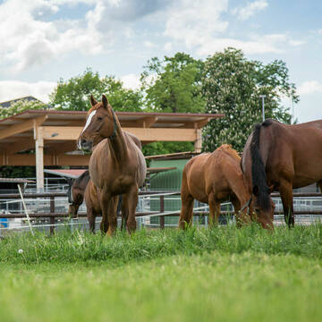
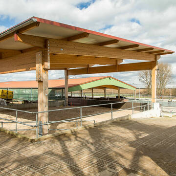
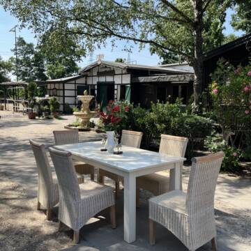
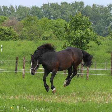
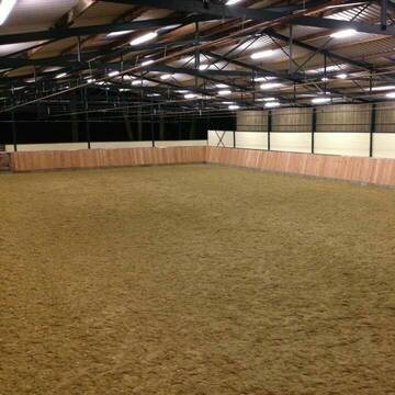
Heinrichshof Aktivstall
Köln Fühlingen
Frenger GbR - Heinrichshof
@Frenger-GbR
FN-Mitglied
Freizeitstall
Hunde willkommen
Krankenbox
Allergikerstall
bedampftes/gewaschenes Heu
Außenbox mit Paddock
Bewegungsstall
22 weitere...
S


***Reitstall Birkenhof*** Pferdegerechte Haltung
Köln
Daniele-Fazzi
@Daniele-Fazzi
Freizeitstall
Geländestrecke
Vermieten
Verpachten
Hunde willkommen
Longierzirkel/Roundpen
Allergikerstall
Hufrehe geeignet
23 weitere...
ganz aktuell
S
Deprecated: Creation of dynamic property Zend_View_Helper_Ads::$adLink is deprecated in /var/www/stall-frei/htdocs/staging.stall-frei.de/library/Psf/View/Helper/Ads.php on line 108

Futtersack HeuToy, Fressbremse in pink
Mechtersen
STALL-FREIde Marketing
@STALL-FREI-Marketing
Stundenlange Beschäftigung die
Koliken vorbeugt, geringe Staubinhalation mit
steuerbarer Futterentnahme


Aktivstall-Andreashof
Dormagen
Aktivstall-Andreashof
@Aktivstall-Andreashof
FN-Mitglied
Freizeitstall
Vermieten
Hunde willkommen
Krankenbox
Allergikerstall
Hufrehe geeignet
21 weitere...
S


Historische Reitanlage in Köln-Dellbrück
Köln
RGS Kornspringer Köln e. V.
@Kornspringer
FN-Mitglied
Freizeitstall
Vermieten
Führanlage
Hunde willkommen
bedampftes/gewaschenes Heu
Notfallboxen
21 weitere...
S
Ivenshof - Historischer Bauernhof/Reitanlage
Köln
Ivenshof 7ha Weideland
@Ivenshof
Freizeitstall
Reitlehrer und -unterricht
Vermieten
Hunde willkommen
Longierzirkel/Roundpen
Allergikerstall
Hufrehe geeignet
14 weitere...
P+

Persönlichkeitsentwicklung mit Pferden
Bad Salzuflen
Katja Dors
@Pferdezeiten
Begleite andere auf ihrem Entwicklungsweg und entdecke die transformative Kraft der pferdegestützten Persönlichkeitsentwicklung !
neu
R
Wir haben aktuell Paddockbox-Fensterbox frei
Pulheim
Schumacher
@Reitanlage-Junkerhof
FN-Mitglied
Pferdeausbildung
Führanlage
Hunde willkommen
Allergikerstall
bedampftes/gewaschenes Heu
Außenbox mit Paddock
Außenboxen
26 weitere...
ganz aktuell
S


Bergische Weidegründe
Burscheid
Bergische Weidegründe
@HufRehastation-Allergiker
Freizeitstall
Geländestrecke
Hunde willkommen
Krankenbox
Allergikerstall
Gnadenbrothof
Bewegungsstall
Laufstall
28 weitere...
ganz aktuell
S
Große moderne Boxen mit und ohne Paddock am Rhein
Dormagen
Grenzhof
@Grenzhof
FN-Mitglied
Geländestrecke
Vermieten
Longierzirkel/Roundpen
Paddock
Außenbox mit Paddock
Außenboxen
16 weitere...
S


Pferdeland Leide Aktivstallhaltung
Leichlingen
Pferdeland Leide
@info2
FN-Mitglied
Freizeitstall
Hunde willkommen
Krankenbox
Allergikerstall
Hufrehe geeignet
Bewegungsstall
Laufstall
22 weitere...
S
Reit-und Wohnanlage Gut Scheuerhof
Köln
Gut-Scheuerhof
@Gut-Scheuerhof
FN-Mitglied
Pferdeausbildung
Führanlage
Hunde willkommen
Außenbox mit Paddock
Außenboxen
Vollpension
14 weitere...
P+
Deprecated: Creation of dynamic property Zend_View::$pageCount is deprecated in /var/www/stall-frei/htdocs/staging.stall-frei.de/library/vendor/shardj/zf1-future/library/Zend/View/Abstract.php on line 308
Deprecated: Creation of dynamic property Zend_View::$itemCountPerPage is deprecated in /var/www/stall-frei/htdocs/staging.stall-frei.de/library/vendor/shardj/zf1-future/library/Zend/View/Abstract.php on line 308
Deprecated: Creation of dynamic property Zend_View::$first is deprecated in /var/www/stall-frei/htdocs/staging.stall-frei.de/library/vendor/shardj/zf1-future/library/Zend/View/Abstract.php on line 308
Deprecated: Creation of dynamic property Zend_View::$current is deprecated in /var/www/stall-frei/htdocs/staging.stall-frei.de/library/vendor/shardj/zf1-future/library/Zend/View/Abstract.php on line 308
Deprecated: Creation of dynamic property Zend_View::$last is deprecated in /var/www/stall-frei/htdocs/staging.stall-frei.de/library/vendor/shardj/zf1-future/library/Zend/View/Abstract.php on line 308
Deprecated: Creation of dynamic property Zend_View::$next is deprecated in /var/www/stall-frei/htdocs/staging.stall-frei.de/library/vendor/shardj/zf1-future/library/Zend/View/Abstract.php on line 308
Deprecated: Creation of dynamic property Zend_View::$pagesInRange is deprecated in /var/www/stall-frei/htdocs/staging.stall-frei.de/library/vendor/shardj/zf1-future/library/Zend/View/Abstract.php on line 308
Deprecated: Creation of dynamic property Zend_View::$firstPageInRange is deprecated in /var/www/stall-frei/htdocs/staging.stall-frei.de/library/vendor/shardj/zf1-future/library/Zend/View/Abstract.php on line 308
Deprecated: Creation of dynamic property Zend_View::$lastPageInRange is deprecated in /var/www/stall-frei/htdocs/staging.stall-frei.de/library/vendor/shardj/zf1-future/library/Zend/View/Abstract.php on line 308
Deprecated: Creation of dynamic property Zend_View::$currentItemCount is deprecated in /var/www/stall-frei/htdocs/staging.stall-frei.de/library/vendor/shardj/zf1-future/library/Zend/View/Abstract.php on line 308
Deprecated: Creation of dynamic property Zend_View::$totalItemCount is deprecated in /var/www/stall-frei/htdocs/staging.stall-frei.de/library/vendor/shardj/zf1-future/library/Zend/View/Abstract.php on line 308
Deprecated: Creation of dynamic property Zend_View::$firstItemNumber is deprecated in /var/www/stall-frei/htdocs/staging.stall-frei.de/library/vendor/shardj/zf1-future/library/Zend/View/Abstract.php on line 308
Deprecated: Creation of dynamic property Zend_View::$lastItemNumber is deprecated in /var/www/stall-frei/htdocs/staging.stall-frei.de/library/vendor/shardj/zf1-future/library/Zend/View/Abstract.php on line 308
Deprecated: Creation of dynamic property Zend_View::$router is deprecated in /var/www/stall-frei/htdocs/staging.stall-frei.de/library/vendor/shardj/zf1-future/library/Zend/View/Abstract.php on line 308
Deprecated: Creation of dynamic property Zend_View::$urlParams is deprecated in /var/www/stall-frei/htdocs/staging.stall-frei.de/library/vendor/shardj/zf1-future/library/Zend/View/Abstract.php on line 308
Deprecated: Creation of dynamic property Zend_View::$showAds is deprecated in /var/www/stall-frei/htdocs/staging.stall-frei.de/library/vendor/shardj/zf1-future/library/Zend/View/Abstract.php on line 308
Deprecated: Creation of dynamic property Zend_View::$objectIds is deprecated in /var/www/stall-frei/htdocs/staging.stall-frei.de/library/vendor/shardj/zf1-future/library/Zend/View/Abstract.php on line 308
Deprecated: Creation of dynamic property Zend_View::$showNavbar is deprecated in /var/www/stall-frei/htdocs/staging.stall-frei.de/library/vendor/shardj/zf1-future/library/Zend/View/Abstract.php on line 308
Deprecated: Creation of dynamic property Zend_View::$showBreadcrumb is deprecated in /var/www/stall-frei/htdocs/staging.stall-frei.de/library/vendor/shardj/zf1-future/library/Zend/View/Abstract.php on line 308
Deprecated: Creation of dynamic property Zend_View::$showFooter is deprecated in /var/www/stall-frei/htdocs/staging.stall-frei.de/library/vendor/shardj/zf1-future/library/Zend/View/Abstract.php on line 308
Deprecated: Creation of dynamic property Zend_View::$showInternalAds is deprecated in /var/www/stall-frei/htdocs/staging.stall-frei.de/library/vendor/shardj/zf1-future/library/Zend/View/Abstract.php on line 308
Deprecated: Creation of dynamic property Zend_View::$blNoContent is deprecated in /var/www/stall-frei/htdocs/staging.stall-frei.de/library/vendor/shardj/zf1-future/library/Zend/View/Abstract.php on line 308
Deprecated: Creation of dynamic property Zend_View::$sMetaDesc is deprecated in /var/www/stall-frei/htdocs/staging.stall-frei.de/library/vendor/shardj/zf1-future/library/Zend/View/Abstract.php on line 308
Deprecated: Creation of dynamic property Zend_View::$useGmaps is deprecated in /var/www/stall-frei/htdocs/staging.stall-frei.de/library/vendor/shardj/zf1-future/library/Zend/View/Abstract.php on line 308
Deprecated: Creation of dynamic property Zend_View::$touches is deprecated in /var/www/stall-frei/htdocs/staging.stall-frei.de/library/vendor/shardj/zf1-future/library/Zend/View/Abstract.php on line 308
Deprecated: Creation of dynamic property Zend_View::$oProject is deprecated in /var/www/stall-frei/htdocs/staging.stall-frei.de/library/vendor/shardj/zf1-future/library/Zend/View/Abstract.php on line 308
Deprecated: Creation of dynamic property Zend_View::$pageHeadline is deprecated in /var/www/stall-frei/htdocs/staging.stall-frei.de/library/vendor/shardj/zf1-future/library/Zend/View/Abstract.php on line 308
Deprecated: Creation of dynamic property Zend_View::$disableLocationField is deprecated in /var/www/stall-frei/htdocs/staging.stall-frei.de/library/vendor/shardj/zf1-future/library/Zend/View/Abstract.php on line 308
Deprecated: Creation of dynamic property Zend_View::$isSearch is deprecated in /var/www/stall-frei/htdocs/staging.stall-frei.de/library/vendor/shardj/zf1-future/library/Zend/View/Abstract.php on line 308
Deprecated: Creation of dynamic property Zend_View::$pageTitle is deprecated in /var/www/stall-frei/htdocs/staging.stall-frei.de/library/vendor/shardj/zf1-future/library/Zend/View/Abstract.php on line 308
Deprecated: Creation of dynamic property Psf_Form_Element_Text::$class is deprecated in /var/www/stall-frei/htdocs/staging.stall-frei.de/library/vendor/shardj/zf1-future/library/Zend/Form/Element.php on line 874
Deprecated: Creation of dynamic property Psf_Form_Element_Text::$size is deprecated in /var/www/stall-frei/htdocs/staging.stall-frei.de/library/vendor/shardj/zf1-future/library/Zend/Form/Element.php on line 874
Deprecated: Creation of dynamic property Psf_Form_Element_Text::$placeholder is deprecated in /var/www/stall-frei/htdocs/staging.stall-frei.de/library/vendor/shardj/zf1-future/library/Zend/Form/Element.php on line 874
Deprecated: Creation of dynamic property Psf_Form_Element_Hidden::$class is deprecated in /var/www/stall-frei/htdocs/staging.stall-frei.de/library/vendor/shardj/zf1-future/library/Zend/Form/Element.php on line 874
Deprecated: Creation of dynamic property Psf_Form_Element_Hidden::$class is deprecated in /var/www/stall-frei/htdocs/staging.stall-frei.de/library/vendor/shardj/zf1-future/library/Zend/Form/Element.php on line 874
Deprecated: Creation of dynamic property Psf_Form_Element_Hidden::$class is deprecated in /var/www/stall-frei/htdocs/staging.stall-frei.de/library/vendor/shardj/zf1-future/library/Zend/Form/Element.php on line 874
Deprecated: Creation of dynamic property Psf_Form_Element_Hidden::$class is deprecated in /var/www/stall-frei/htdocs/staging.stall-frei.de/library/vendor/shardj/zf1-future/library/Zend/Form/Element.php on line 874
Deprecated: Creation of dynamic property Psf_Form_Element_Select::$class is deprecated in /var/www/stall-frei/htdocs/staging.stall-frei.de/library/vendor/shardj/zf1-future/library/Zend/Form/Element.php on line 874
Deprecated: Creation of dynamic property Psf_Form_Element_Select::$class is deprecated in /var/www/stall-frei/htdocs/staging.stall-frei.de/library/vendor/shardj/zf1-future/library/Zend/Form/Element.php on line 874
Deprecated: Creation of dynamic property Psf_Form_Element_Select::$class is deprecated in /var/www/stall-frei/htdocs/staging.stall-frei.de/library/vendor/shardj/zf1-future/library/Zend/Form/Element.php on line 874
Deprecated: Creation of dynamic property Psf_Form_Element_Select::$class is deprecated in /var/www/stall-frei/htdocs/staging.stall-frei.de/library/vendor/shardj/zf1-future/library/Zend/Form/Element.php on line 874
Deprecated: Creation of dynamic property Psf_Form_Element_Text::$class is deprecated in /var/www/stall-frei/htdocs/staging.stall-frei.de/library/vendor/shardj/zf1-future/library/Zend/Form/Element.php on line 874
Deprecated: Creation of dynamic property Psf_Form_Element_Checkbox::$label is deprecated in /var/www/stall-frei/htdocs/staging.stall-frei.de/library/vendor/shardj/zf1-future/library/Zend/Form/Element.php on line 874
Deprecated: Creation of dynamic property Zend_View::$sort is deprecated in /var/www/stall-frei/htdocs/staging.stall-frei.de/library/vendor/shardj/zf1-future/library/Zend/View/Abstract.php on line 308
Deprecated: Creation of dynamic property Zend_View::$searchLocation is deprecated in /var/www/stall-frei/htdocs/staging.stall-frei.de/library/vendor/shardj/zf1-future/library/Zend/View/Abstract.php on line 308
Deprecated: Creation of dynamic property Zend_View::$locationHint is deprecated in /var/www/stall-frei/htdocs/staging.stall-frei.de/library/vendor/shardj/zf1-future/library/Zend/View/Abstract.php on line 308
Psf_GeoCoder_Abstract::getLocation: Kasselberg Get Location CachedOrLive
Psf_GeoCoder_Abstract::getCachedOrLive: Kasselberg
Psf_GeoCoder_OpenCageData::makeApiRequest: response:
Array
(
[documentation] => https://opencagedata.com/api
[licenses] => Array
(
[0] => Array
(
[name] => see attribution guide
[url] => https://opencagedata.com/credits
)
)
[results] => Array
(
[0] => Array
(
[bounds] => Array
(
[northeast] => Array
(
[lat] => 51.0588374
[lng] => 6.9648255
)
[southwest] => Array
(
[lat] => 51.0188374
[lng] => 6.9248255
)
)
[components] => Array
(
[ISO_3166-1_alpha-2] => DE
[ISO_3166-1_alpha-3] => DEU
[ISO_3166-2] => Array
(
[0] => DE-NW
)
[_category] => place
[_normalized_city] => Köln
[_type] => hamlet
[city] => Köln
[city_district] => Chorweiler
[continent] => Europe
[country] => Deutschland
[country_code] => de
[hamlet] => Kasselberg
[political_union] => European Union
[postcode] => 50769
[state] => Nordrhein-Westfalen
[state_code] => NW
[suburb] => Merkenich
)
[confidence] => 7
[formatted] => Kasselberg, 50769 Köln, Deutschland
[geometry] => Array
(
[lat] => 51.0388374
[lng] => 6.9448255
)
)
[1] => Array
(
[bounds] => Array
(
[northeast] => Array
(
[lat] => 48.4837125
[lng] => 8.0417214
)
[southwest] => Array
(
[lat] => 48.4836125
[lng] => 8.0416214
)
)
[components] => Array
(
[ISO_3166-1_alpha-2] => DE
[ISO_3166-1_alpha-3] => DEU
[ISO_3166-2] => Array
(
[0] => DE-BW
)
[_category] => building
[_normalized_city] => Durbach
[_type] => building
[continent] => Europe
[country] => Deutschland
[country_code] => de
[county] => Ortenaukreis
[hamlet] => Oberweiler
[isolated_dwelling] => Kasselberg
[municipality] => VVG der Stadt Offenburg
[political_union] => European Union
[postcode] => 77770
[state] => Baden-Württemberg
[state_code] => BW
[village] => Durbach
)
[confidence] => 10
[formatted] => Kasselberg, Oberweiler, 77770 Durbach, Deutschland
[geometry] => Array
(
[lat] => 48.4836625
[lng] => 8.0416714
)
)
[2] => Array
(
[bounds] => Array
(
[northeast] => Array
(
[lat] => 51.1929261
[lng] => 9.5888116
)
[southwest] => Array
(
[lat] => 51.1917458
[lng] => 9.5873118
)
)
[components] => Array
(
[ISO_3166-1_alpha-2] => DE
[ISO_3166-1_alpha-3] => DEU
[ISO_3166-2] => Array
(
[0] => DE-HE
)
[_category] => road
[_normalized_city] => Eiterhagen
[_type] => road
[continent] => Europe
[country] => Deutschland
[country_code] => de
[county] => Landkreis Kassel
[municipality] => Söhrewald
[political_union] => European Union
[postcode] => 34320
[road] => Kasselberg
[road_type] => residential
[state] => Hessen
[state_code] => HE
[village] => Eiterhagen
)
[confidence] => 9
[formatted] => Kasselberg, 34320 Eiterhagen, Deutschland
[geometry] => Array
(
[lat] => 51.1923802
[lng] => 9.5879515
)
)
[3] => Array
(
[bounds] => Array
(
[northeast] => Array
(
[lat] => 52.1225884
[lng] => 10.225147
)
[southwest] => Array
(
[lat] => 52.1216291
[lng] => 10.2248729
)
)
[components] => Array
(
[ISO_3166-1_alpha-2] => DE
[ISO_3166-1_alpha-3] => DEU
[ISO_3166-2] => Array
(
[0] => DE-NI
)
[_category] => road
[_normalized_city] => Burgdorf
[_type] => road
[city] => Burgdorf
[continent] => Europe
[country] => Deutschland
[country_code] => de
[county] => Landkreis Wolfenbüttel
[municipality] => Samtgemeinde Baddeckenstedt
[political_union] => European Union
[postcode] => 38272
[road] => Kasselberg
[road_type] => residential
[state] => Niedersachsen
[state_code] => NI
)
[confidence] => 9
[formatted] => Kasselberg, 38272 Burgdorf, Deutschland
[geometry] => Array
(
[lat] => 52.1221359
[lng] => 10.2251315
)
)
[4] => Array
(
[bounds] => Array
(
[northeast] => Array
(
[lat] => 48.4839881
[lng] => 8.0423698
)
[southwest] => Array
(
[lat] => 48.4831386
[lng] => 8.0416033
)
)
[components] => Array
(
[ISO_3166-1_alpha-2] => DE
[ISO_3166-1_alpha-3] => DEU
[ISO_3166-2] => Array
(
[0] => DE-BW
)
[_category] => road
[_normalized_city] => Durbach
[_type] => road
[continent] => Europe
[country] => Deutschland
[country_code] => de
[county] => Ortenaukreis
[hamlet] => Oberweiler
[municipality] => VVG der Stadt Offenburg
[political_union] => European Union
[postcode] => 77770
[road] => Kasselberg
[road_type] => service
[state] => Baden-Württemberg
[state_code] => BW
[village] => Durbach
)
[confidence] => 9
[formatted] => Kasselberg, 77770 Durbach, Deutschland
[geometry] => Array
(
[lat] => 48.4836832
[lng] => 8.0417968
)
)
[5] => Array
(
[bounds] => Array
(
[northeast] => Array
(
[lat] => 51.0367434
[lng] => 6.9394342
)
[southwest] => Array
(
[lat] => 51.0366434
[lng] => 6.9393342
)
)
[components] => Array
(
[ISO_3166-1_alpha-2] => DE
[ISO_3166-1_alpha-3] => DEU
[ISO_3166-2] => Array
(
[0] => DE-NW
)
[_category] => transportation
[_normalized_city] => Köln
[_type] => bus_stop
[city] => Köln
[city_district] => Chorweiler
[continent] => Europe
[country] => Deutschland
[country_code] => de
[hamlet] => Kasselberg
[highway] => Kasselberg
[political_union] => European Union
[postcode] => 50769
[road] => Alte Römerstraße
[state] => Nordrhein-Westfalen
[state_code] => NW
[suburb] => Merkenich
)
[confidence] => 9
[formatted] => Kasselberg, Alte Römerstraße, 50769 Köln, Deutschland
[geometry] => Array
(
[lat] => 51.0366934
[lng] => 6.9393842
)
)
[6] => Array
(
[components] => Array
(
[ISO_3166-1_alpha-2] => FR
[ISO_3166-1_alpha-3] => FRA
[ISO_3166-2] => Array
(
[0] => FR-GES
[1] => FR-6AE
[2] => FR-67
)
[_category] => road
[_normalized_city] => Mothern
[_type] => road
[city] => Mothern
[continent] => Europe
[country] => France
[country_code] => fr
[county] => Bas-Rhin
[local_authority] => Communauté de communes de la Plaine du Rhin
[political_union] => European Union
[postcode] => 67470
[road] => Rue du Dasselberg
[state] => Grand Est
[state_code] => GES
)
[confidence] => 3
[formatted] => Rue du Dasselberg, 67470 Mothern, France
[geometry] => Array
(
[lat] => 48.9369
[lng] => 8.15389
)
)
[7] => Array
(
[components] => Array
(
[ISO_3166-1_alpha-2] => FR
[ISO_3166-1_alpha-3] => FRA
[ISO_3166-2] => Array
(
[0] => FR-GES
[1] => FR-57
)
[_category] => road
[_normalized_city] => Œting
[_type] => road
[city] => Œting
[continent] => Europe
[country] => France
[country_code] => fr
[county] => Moselle
[local_authority] => Communauté d'agglomération de Forbach Porte de France
[political_union] => European Union
[postcode] => 57600
[road] => Impasse du Kappelberg
[state] => Grand Est
[state_code] => GES
)
[confidence] => 3
[formatted] => Impasse du Kappelberg, 57600 Œting, France
[geometry] => Array
(
[lat] => 49.170054
[lng] => 6.910622
)
)
[8] => Array
(
[components] => Array
(
[ISO_3166-1_alpha-2] => FR
[ISO_3166-1_alpha-3] => FRA
[ISO_3166-2] => Array
(
[0] => FR-GES
[1] => FR-57
)
[_category] => road
[_normalized_city] => Donnelay
[_type] => road
[city] => Donnelay
[continent] => Europe
[country] => France
[country_code] => fr
[county] => Moselle
[local_authority] => Communauté de communes du Saulnois
[political_union] => European Union
[postcode] => 57810
[road] => Kakelberg
[state] => Grand Est
[state_code] => GES
)
[confidence] => 3
[formatted] => Kakelberg, 57810 Donnelay, France
[geometry] => Array
(
[lat] => 48.750072
[lng] => 6.699346
)
)
[9] => Array
(
[components] => Array
(
[ISO_3166-1_alpha-2] => FR
[ISO_3166-1_alpha-3] => FRA
[ISO_3166-2] => Array
(
[0] => FR-IDF
[1] => FR-92
)
[_category] => road
[_normalized_city] => Levallois-Perret
[_type] => road
[city] => Levallois-Perret
[continent] => Europe
[country] => France
[country_code] => fr
[county] => Hauts-de-Seine
[local_authority] => Métropole du Grand Paris
[political_union] => European Union
[postcode] => 92300
[road] => Rue Charles Deutschmann
[state] => Île-de-France
[state_code] => IDF
)
[confidence] => 2
[formatted] => Rue Charles Deutschmann, 92300 Levallois-Perret, France
[geometry] => Array
(
[lat] => 48.900049
[lng] => 2.2842
)
)
)
[status] => Array
(
[code] => 200
[message] => OK
)
[stay_informed] => Array
(
[blog] => https://blog.opencagedata.com
[mastodon] => https://en.osm.town/@opencage
)
[thanks] => For using an OpenCage API
[timestamp] => Array
(
[created_http] => Mon, 09 Feb 2026 12:53:34 GMT
[created_unix] => 1770641614
)
[total_results] => 10
)
Psf_GeoCoder_Abstract::convertLocationResult
{"documentation":"https:\/\/opencagedata.com\/api","licenses":[{"name":"see attribution guide","url":"https:\/\/opencagedata.com\/credits"}],"results":[{"bounds":{"northeast":{"lat":51.0588374,"lng":6.9648255},"southwest":{"lat":51.0188374,"lng":6.9248255}},"components":{"ISO_3166-1_alpha-2":"DE","ISO_3166-1_alpha-3":"DEU","ISO_3166-2":["DE-NW"],"_category":"place","_normalized_city":"K\u00f6ln","_type":"hamlet","city":"K\u00f6ln","city_district":"Chorweiler","continent":"Europe","country":"Deutschland","country_code":"de","hamlet":"Kasselberg","political_union":"European Union","postcode":"50769","state":"Nordrhein-Westfalen","state_code":"NW","suburb":"Merkenich"},"confidence":7,"formatted":"Kasselberg, 50769 K\u00f6ln, Deutschland","geometry":{"lat":51.0388374,"lng":6.9448255}},{"bounds":{"northeast":{"lat":48.4837125,"lng":8.0417214},"southwest":{"lat":48.4836125,"lng":8.0416214}},"components":{"ISO_3166-1_alpha-2":"DE","ISO_3166-1_alpha-3":"DEU","ISO_3166-2":["DE-BW"],"_category":"building","_normalized_city":"Durbach","_type":"building","continent":"Europe","country":"Deutschland","country_code":"de","county":"Ortenaukreis","hamlet":"Oberweiler","isolated_dwelling":"Kasselberg","municipality":"VVG der Stadt Offenburg","political_union":"European Union","postcode":"77770","state":"Baden-W\u00fcrttemberg","state_code":"BW","village":"Durbach"},"confidence":10,"formatted":"Kasselberg, Oberweiler, 77770 Durbach, Deutschland","geometry":{"lat":48.4836625,"lng":8.0416714}},{"bounds":{"northeast":{"lat":51.1929261,"lng":9.5888116},"southwest":{"lat":51.1917458,"lng":9.5873118}},"components":{"ISO_3166-1_alpha-2":"DE","ISO_3166-1_alpha-3":"DEU","ISO_3166-2":["DE-HE"],"_category":"road","_normalized_city":"Eiterhagen","_type":"road","continent":"Europe","country":"Deutschland","country_code":"de","county":"Landkreis Kassel","municipality":"S\u00f6hrewald","political_union":"European Union","postcode":"34320","road":"Kasselberg","road_type":"residential","state":"Hessen","state_code":"HE","village":"Eiterhagen"},"confidence":9,"formatted":"Kasselberg, 34320 Eiterhagen, Deutschland","geometry":{"lat":51.1923802,"lng":9.5879515}},{"bounds":{"northeast":{"lat":52.1225884,"lng":10.225147},"southwest":{"lat":52.1216291,"lng":10.2248729}},"components":{"ISO_3166-1_alpha-2":"DE","ISO_3166-1_alpha-3":"DEU","ISO_3166-2":["DE-NI"],"_category":"road","_normalized_city":"Burgdorf","_type":"road","city":"Burgdorf","continent":"Europe","country":"Deutschland","country_code":"de","county":"Landkreis Wolfenb\u00fcttel","municipality":"Samtgemeinde Baddeckenstedt","political_union":"European Union","postcode":"38272","road":"Kasselberg","road_type":"residential","state":"Niedersachsen","state_code":"NI"},"confidence":9,"formatted":"Kasselberg, 38272 Burgdorf, Deutschland","geometry":{"lat":52.1221359,"lng":10.2251315}},{"bounds":{"northeast":{"lat":48.4839881,"lng":8.0423698},"southwest":{"lat":48.4831386,"lng":8.0416033}},"components":{"ISO_3166-1_alpha-2":"DE","ISO_3166-1_alpha-3":"DEU","ISO_3166-2":["DE-BW"],"_category":"road","_normalized_city":"Durbach","_type":"road","continent":"Europe","country":"Deutschland","country_code":"de","county":"Ortenaukreis","hamlet":"Oberweiler","municipality":"VVG der Stadt Offenburg","political_union":"European Union","postcode":"77770","road":"Kasselberg","road_type":"service","state":"Baden-W\u00fcrttemberg","state_code":"BW","village":"Durbach"},"confidence":9,"formatted":"Kasselberg, 77770 Durbach, Deutschland","geometry":{"lat":48.4836832,"lng":8.0417968}},{"bounds":{"northeast":{"lat":51.0367434,"lng":6.9394342},"southwest":{"lat":51.0366434,"lng":6.9393342}},"components":{"ISO_3166-1_alpha-2":"DE","ISO_3166-1_alpha-3":"DEU","ISO_3166-2":["DE-NW"],"_category":"transportation","_normalized_city":"K\u00f6ln","_type":"bus_stop","city":"K\u00f6ln","city_district":"Chorweiler","continent":"Europe","country":"Deutschland","country_code":"de","hamlet":"Kasselberg","highway":"Kasselberg","political_union":"European Union","postcode":"50769","road":"Alte R\u00f6merstra\u00dfe","state":"Nordrhein-Westfalen","state_code":"NW","suburb":"Merkenich"},"confidence":9,"formatted":"Kasselberg, Alte R\u00f6merstra\u00dfe, 50769 K\u00f6ln, Deutschland","geometry":{"lat":51.0366934,"lng":6.9393842}},{"components":{"ISO_3166-1_alpha-2":"FR","ISO_3166-1_alpha-3":"FRA","ISO_3166-2":["FR-GES","FR-6AE","FR-67"],"_category":"road","_normalized_city":"Mothern","_type":"road","city":"Mothern","continent":"Europe","country":"France","country_code":"fr","county":"Bas-Rhin","local_authority":"Communaut\u00e9 de communes de la Plaine du Rhin","political_union":"European Union","postcode":"67470","road":"Rue du Dasselberg","state":"Grand Est","state_code":"GES"},"confidence":3,"formatted":"Rue du Dasselberg, 67470 Mothern, France","geometry":{"lat":48.9369,"lng":8.15389}},{"components":{"ISO_3166-1_alpha-2":"FR","ISO_3166-1_alpha-3":"FRA","ISO_3166-2":["FR-GES","FR-57"],"_category":"road","_normalized_city":"\u0152ting","_type":"road","city":"\u0152ting","continent":"Europe","country":"France","country_code":"fr","county":"Moselle","local_authority":"Communaut\u00e9 d'agglom\u00e9ration de Forbach Porte de France","political_union":"European Union","postcode":"57600","road":"Impasse du Kappelberg","state":"Grand Est","state_code":"GES"},"confidence":3,"formatted":"Impasse du Kappelberg, 57600 \u0152ting, France","geometry":{"lat":49.170054,"lng":6.910622}},{"components":{"ISO_3166-1_alpha-2":"FR","ISO_3166-1_alpha-3":"FRA","ISO_3166-2":["FR-GES","FR-57"],"_category":"road","_normalized_city":"Donnelay","_type":"road","city":"Donnelay","continent":"Europe","country":"France","country_code":"fr","county":"Moselle","local_authority":"Communaut\u00e9 de communes du Saulnois","political_union":"European Union","postcode":"57810","road":"Kakelberg","state":"Grand Est","state_code":"GES"},"confidence":3,"formatted":"Kakelberg, 57810 Donnelay, France","geometry":{"lat":48.750072,"lng":6.699346}},{"components":{"ISO_3166-1_alpha-2":"FR","ISO_3166-1_alpha-3":"FRA","ISO_3166-2":["FR-IDF","FR-92"],"_category":"road","_normalized_city":"Levallois-Perret","_type":"road","city":"Levallois-Perret","continent":"Europe","country":"France","country_code":"fr","county":"Hauts-de-Seine","local_authority":"M\u00e9tropole du Grand Paris","political_union":"European Union","postcode":"92300","road":"Rue Charles Deutschmann","state":"\u00cele-de-France","state_code":"IDF"},"confidence":2,"formatted":"Rue Charles Deutschmann, 92300 Levallois-Perret, France","geometry":{"lat":48.900049,"lng":2.2842}}],"status":{"code":200,"message":"OK"},"stay_informed":{"blog":"https:\/\/blog.opencagedata.com","mastodon":"https:\/\/en.osm.town\/@opencage"},"thanks":"For using an OpenCage API","timestamp":{"created_http":"Mon, 09 Feb 2026 12:53:34 GMT","created_unix":1770641614},"total_results":10}Array
(
[0] => stdClass Object
(
[bounds] => stdClass Object
(
[northeast] => stdClass Object
(
[lat] => 51.0588374
[lng] => 6.9648255
)
[southwest] => stdClass Object
(
[lat] => 51.0188374
[lng] => 6.9248255
)
)
[components] => stdClass Object
(
[ISO_3166-1_alpha-2] => DE
[ISO_3166-1_alpha-3] => DEU
[ISO_3166-2] => Array
(
[0] => DE-NW
)
[_category] => place
[_normalized_city] => Köln
[_type] => hamlet
[city] => Köln
[city_district] => Chorweiler
[continent] => Europe
[country] => Deutschland
[country_code] => de
[hamlet] => Kasselberg
[political_union] => European Union
[postcode] => 50769
[state] => Nordrhein-Westfalen
[state_code] => NW
[suburb] => Merkenich
)
[confidence] => 7
[formatted] => Kasselberg, 50769 Köln, Deutschland
[geometry] => stdClass Object
(
[lat] => 51.0388374
[lng] => 6.9448255
)
)
[1] => stdClass Object
(
[bounds] => stdClass Object
(
[northeast] => stdClass Object
(
[lat] => 48.4837125
[lng] => 8.0417214
)
[southwest] => stdClass Object
(
[lat] => 48.4836125
[lng] => 8.0416214
)
)
[components] => stdClass Object
(
[ISO_3166-1_alpha-2] => DE
[ISO_3166-1_alpha-3] => DEU
[ISO_3166-2] => Array
(
[0] => DE-BW
)
[_category] => building
[_normalized_city] => Durbach
[_type] => building
[continent] => Europe
[country] => Deutschland
[country_code] => de
[county] => Ortenaukreis
[hamlet] => Oberweiler
[isolated_dwelling] => Kasselberg
[municipality] => VVG der Stadt Offenburg
[political_union] => European Union
[postcode] => 77770
[state] => Baden-Württemberg
[state_code] => BW
[village] => Durbach
)
[confidence] => 10
[formatted] => Kasselberg, Oberweiler, 77770 Durbach, Deutschland
[geometry] => stdClass Object
(
[lat] => 48.4836625
[lng] => 8.0416714
)
)
[2] => stdClass Object
(
[bounds] => stdClass Object
(
[northeast] => stdClass Object
(
[lat] => 51.1929261
[lng] => 9.5888116
)
[southwest] => stdClass Object
(
[lat] => 51.1917458
[lng] => 9.5873118
)
)
[components] => stdClass Object
(
[ISO_3166-1_alpha-2] => DE
[ISO_3166-1_alpha-3] => DEU
[ISO_3166-2] => Array
(
[0] => DE-HE
)
[_category] => road
[_normalized_city] => Eiterhagen
[_type] => road
[continent] => Europe
[country] => Deutschland
[country_code] => de
[county] => Landkreis Kassel
[municipality] => Söhrewald
[political_union] => European Union
[postcode] => 34320
[road] => Kasselberg
[road_type] => residential
[state] => Hessen
[state_code] => HE
[village] => Eiterhagen
)
[confidence] => 9
[formatted] => Kasselberg, 34320 Eiterhagen, Deutschland
[geometry] => stdClass Object
(
[lat] => 51.1923802
[lng] => 9.5879515
)
)
[3] => stdClass Object
(
[bounds] => stdClass Object
(
[northeast] => stdClass Object
(
[lat] => 52.1225884
[lng] => 10.225147
)
[southwest] => stdClass Object
(
[lat] => 52.1216291
[lng] => 10.2248729
)
)
[components] => stdClass Object
(
[ISO_3166-1_alpha-2] => DE
[ISO_3166-1_alpha-3] => DEU
[ISO_3166-2] => Array
(
[0] => DE-NI
)
[_category] => road
[_normalized_city] => Burgdorf
[_type] => road
[city] => Burgdorf
[continent] => Europe
[country] => Deutschland
[country_code] => de
[county] => Landkreis Wolfenbüttel
[municipality] => Samtgemeinde Baddeckenstedt
[political_union] => European Union
[postcode] => 38272
[road] => Kasselberg
[road_type] => residential
[state] => Niedersachsen
[state_code] => NI
)
[confidence] => 9
[formatted] => Kasselberg, 38272 Burgdorf, Deutschland
[geometry] => stdClass Object
(
[lat] => 52.1221359
[lng] => 10.2251315
)
)
[4] => stdClass Object
(
[bounds] => stdClass Object
(
[northeast] => stdClass Object
(
[lat] => 48.4839881
[lng] => 8.0423698
)
[southwest] => stdClass Object
(
[lat] => 48.4831386
[lng] => 8.0416033
)
)
[components] => stdClass Object
(
[ISO_3166-1_alpha-2] => DE
[ISO_3166-1_alpha-3] => DEU
[ISO_3166-2] => Array
(
[0] => DE-BW
)
[_category] => road
[_normalized_city] => Durbach
[_type] => road
[continent] => Europe
[country] => Deutschland
[country_code] => de
[county] => Ortenaukreis
[hamlet] => Oberweiler
[municipality] => VVG der Stadt Offenburg
[political_union] => European Union
[postcode] => 77770
[road] => Kasselberg
[road_type] => service
[state] => Baden-Württemberg
[state_code] => BW
[village] => Durbach
)
[confidence] => 9
[formatted] => Kasselberg, 77770 Durbach, Deutschland
[geometry] => stdClass Object
(
[lat] => 48.4836832
[lng] => 8.0417968
)
)
[5] => stdClass Object
(
[bounds] => stdClass Object
(
[northeast] => stdClass Object
(
[lat] => 51.0367434
[lng] => 6.9394342
)
[southwest] => stdClass Object
(
[lat] => 51.0366434
[lng] => 6.9393342
)
)
[components] => stdClass Object
(
[ISO_3166-1_alpha-2] => DE
[ISO_3166-1_alpha-3] => DEU
[ISO_3166-2] => Array
(
[0] => DE-NW
)
[_category] => transportation
[_normalized_city] => Köln
[_type] => bus_stop
[city] => Köln
[city_district] => Chorweiler
[continent] => Europe
[country] => Deutschland
[country_code] => de
[hamlet] => Kasselberg
[highway] => Kasselberg
[political_union] => European Union
[postcode] => 50769
[road] => Alte Römerstraße
[state] => Nordrhein-Westfalen
[state_code] => NW
[suburb] => Merkenich
)
[confidence] => 9
[formatted] => Kasselberg, Alte Römerstraße, 50769 Köln, Deutschland
[geometry] => stdClass Object
(
[lat] => 51.0366934
[lng] => 6.9393842
)
)
[6] => stdClass Object
(
[components] => stdClass Object
(
[ISO_3166-1_alpha-2] => FR
[ISO_3166-1_alpha-3] => FRA
[ISO_3166-2] => Array
(
[0] => FR-GES
[1] => FR-6AE
[2] => FR-67
)
[_category] => road
[_normalized_city] => Mothern
[_type] => road
[city] => Mothern
[continent] => Europe
[country] => France
[country_code] => fr
[county] => Bas-Rhin
[local_authority] => Communauté de communes de la Plaine du Rhin
[political_union] => European Union
[postcode] => 67470
[road] => Rue du Dasselberg
[state] => Grand Est
[state_code] => GES
)
[confidence] => 3
[formatted] => Rue du Dasselberg, 67470 Mothern, France
[geometry] => stdClass Object
(
[lat] => 48.9369
[lng] => 8.15389
)
)
[7] => stdClass Object
(
[components] => stdClass Object
(
[ISO_3166-1_alpha-2] => FR
[ISO_3166-1_alpha-3] => FRA
[ISO_3166-2] => Array
(
[0] => FR-GES
[1] => FR-57
)
[_category] => road
[_normalized_city] => Œting
[_type] => road
[city] => Œting
[continent] => Europe
[country] => France
[country_code] => fr
[county] => Moselle
[local_authority] => Communauté d'agglomération de Forbach Porte de France
[political_union] => European Union
[postcode] => 57600
[road] => Impasse du Kappelberg
[state] => Grand Est
[state_code] => GES
)
[confidence] => 3
[formatted] => Impasse du Kappelberg, 57600 Œting, France
[geometry] => stdClass Object
(
[lat] => 49.170054
[lng] => 6.910622
)
)
[8] => stdClass Object
(
[components] => stdClass Object
(
[ISO_3166-1_alpha-2] => FR
[ISO_3166-1_alpha-3] => FRA
[ISO_3166-2] => Array
(
[0] => FR-GES
[1] => FR-57
)
[_category] => road
[_normalized_city] => Donnelay
[_type] => road
[city] => Donnelay
[continent] => Europe
[country] => France
[country_code] => fr
[county] => Moselle
[local_authority] => Communauté de communes du Saulnois
[political_union] => European Union
[postcode] => 57810
[road] => Kakelberg
[state] => Grand Est
[state_code] => GES
)
[confidence] => 3
[formatted] => Kakelberg, 57810 Donnelay, France
[geometry] => stdClass Object
(
[lat] => 48.750072
[lng] => 6.699346
)
)
[9] => stdClass Object
(
[components] => stdClass Object
(
[ISO_3166-1_alpha-2] => FR
[ISO_3166-1_alpha-3] => FRA
[ISO_3166-2] => Array
(
[0] => FR-IDF
[1] => FR-92
)
[_category] => road
[_normalized_city] => Levallois-Perret
[_type] => road
[city] => Levallois-Perret
[continent] => Europe
[country] => France
[country_code] => fr
[county] => Hauts-de-Seine
[local_authority] => Métropole du Grand Paris
[political_union] => European Union
[postcode] => 92300
[road] => Rue Charles Deutschmann
[state] => Île-de-France
[state_code] => IDF
)
[confidence] => 2
[formatted] => Rue Charles Deutschmann, 92300 Levallois-Perret, France
[geometry] => stdClass Object
(
[lat] => 48.900049
[lng] => 2.2842
)
)
)
Psf_GeoCoder_OpenCageData::getKeyMap: 0
stdClass Object
(
    [bounds] => stdClass Object
        (
            [northeast] => stdClass Object
                (
                    [lat] => 51.0588374
                    [lng] => 6.9648255
                )

            [southwest] => stdClass Object
                (
                    [lat] => 51.0188374
                    [lng] => 6.9248255
                )

        )

    [components] => stdClass Object
        (
            [ISO_3166-1_alpha-2] => DE
            [ISO_3166-1_alpha-3] => DEU
            [ISO_3166-2] => Array
                (
                    [0] => DE-NW
                )

            [_category] => place
            [_normalized_city] => Köln
            [_type] => hamlet
            [city] => Köln
            [city_district] => Chorweiler
            [continent] => Europe
            [country] => Deutschland
            [country_code] => de
            [hamlet] => Kasselberg
            [political_union] => European Union
            [postcode] => 50769
            [state] => Nordrhein-Westfalen
            [state_code] => NW
            [suburb] => Merkenich
        )

    [confidence] => 7
    [formatted] => Kasselberg, 50769 Köln, Deutschland
    [geometry] => stdClass Object
        (
            [lat] => 51.0388374
            [lng] => 6.9448255
        )

)
Psf_GeoCoder_OpenCageData::getCounty: Köln
Psf_GeoCoder_OpenCageData::addMissingData REFETCH!
Array
(
    [address] => Kasselberg, 50769 Köln, Deutschland
    [type] => hamlet
    [street] => Kasselberg
    [city] => Merkenich
    [county] => Köln
    [state] => Nordrhein-Westfalen
    [zip] => 50769
    [country] => Deutschland
    [suburb] => Merkenich
    [countrycode] => de
    [latitude] => 51.0388374
    [longitude] => 6.9448255
    [accuracy] => 1
    [confidence] => 7
    [bounds] => stdClass Object
        (
            [northeast] => stdClass Object
                (
                    [lat] => 51.0588374
                    [lng] => 6.9648255
                )

            [southwest] => stdClass Object
                (
                    [lat] => 51.0188374
                    [lng] => 6.9248255
                )

        )

)
reformat!
Array
(
    [address] => Kasselberg, 50769 Merkenich
    [type] => hamlet
    [street] => Kasselberg
    [city] => Merkenich
    [county] => Köln
    [state] => Nordrhein-Westfalen
    [zip] => 50769
    [country] => Deutschland
    [suburb] => Merkenich
    [countrycode] => de
    [latitude] => 51.0388374
    [longitude] => 6.9448255
    [accuracy] => 1
    [confidence] => 7
    [bounds] => stdClass Object
        (
            [northeast] => stdClass Object
                (
                    [lat] => 51.0588374
                    [lng] => 6.9648255
                )

            [southwest] => stdClass Object
                (
                    [lat] => 51.0188374
                    [lng] => 6.9248255
                )

        )

    [place] => Kasselberg, 50769 Merkenich, Nordrhein-Westfalen
    [hash] => 2d860f2da71f1c5d1894000d6ab8606a
)
Psf_GeoCoder_OpenCageData::getKeyMap: 1
stdClass Object
(
    [bounds] => stdClass Object
        (
            [northeast] => stdClass Object
                (
                    [lat] => 48.4837125
                    [lng] => 8.0417214
                )

            [southwest] => stdClass Object
                (
                    [lat] => 48.4836125
                    [lng] => 8.0416214
                )

        )

    [components] => stdClass Object
        (
            [ISO_3166-1_alpha-2] => DE
            [ISO_3166-1_alpha-3] => DEU
            [ISO_3166-2] => Array
                (
                    [0] => DE-BW
                )

            [_category] => building
            [_normalized_city] => Durbach
            [_type] => building
            [continent] => Europe
            [country] => Deutschland
            [country_code] => de
            [county] => Ortenaukreis
            [hamlet] => Oberweiler
            [isolated_dwelling] => Kasselberg
            [municipality] => VVG der Stadt Offenburg
            [political_union] => European Union
            [postcode] => 77770
            [state] => Baden-Württemberg
            [state_code] => BW
            [village] => Durbach
        )

    [confidence] => 10
    [formatted] => Kasselberg, Oberweiler, 77770 Durbach, Deutschland
    [geometry] => stdClass Object
        (
            [lat] => 48.4836625
            [lng] => 8.0416714
        )

)
Psf_GeoCoder_OpenCageData::getCounty: Ortenaukreis
Psf_GeoCoder_OpenCageData::addMissingData REFETCH!
Array
(
    [address] => Kasselberg, Oberweiler, 77770 Durbach, Deutschland
    [type] => building
    [street] => Oberweiler
    [city] => Durbach
    [county] => Ortenaukreis
    [state] => Baden-Württemberg
    [zip] => 77770
    [country] => Deutschland
    [suburb] =>
    [countrycode] => de
    [latitude] => 48.4836625
    [longitude] => 8.0416714
    [accuracy] => 1
    [confidence] => 10
    [bounds] => stdClass Object
        (
            [northeast] => stdClass Object
                (
                    [lat] => 48.4837125
                    [lng] => 8.0417214
                )

            [southwest] => stdClass Object
                (
                    [lat] => 48.4836125
                    [lng] => 8.0416214
                )

        )

)
reformat!
Array
(
    [address] => Kasselberg, Oberweiler, 77770 Durbach, Deutschland
    [type] => building
    [street] => Oberweiler
    [city] => Durbach
    [county] => Ortenaukreis
    [state] => Baden-Württemberg
    [zip] => 77770
    [country] => Deutschland
    [suburb] =>
    [countrycode] => de
    [latitude] => 48.4836625
    [longitude] => 8.0416714
    [accuracy] => 1
    [confidence] => 10
    [bounds] => stdClass Object
        (
            [northeast] => stdClass Object
                (
                    [lat] => 48.4837125
                    [lng] => 8.0417214
                )

            [southwest] => stdClass Object
                (
                    [lat] => 48.4836125
                    [lng] => 8.0416214
                )

        )

    [place] => Oberweiler, 77770 Durbach, Baden-Württemberg
    [hash] => 94ff051b5ace6af6c32b5db1e3fcaeab
)
Psf_GeoCoder_OpenCageData::getKeyMap: 2
stdClass Object
(
    [bounds] => stdClass Object
        (
            [northeast] => stdClass Object
                (
                    [lat] => 51.1929261
                    [lng] => 9.5888116
                )

            [southwest] => stdClass Object
                (
                    [lat] => 51.1917458
                    [lng] => 9.5873118
                )

        )

    [components] => stdClass Object
        (
            [ISO_3166-1_alpha-2] => DE
            [ISO_3166-1_alpha-3] => DEU
            [ISO_3166-2] => Array
                (
                    [0] => DE-HE
                )

            [_category] => road
            [_normalized_city] => Eiterhagen
            [_type] => road
            [continent] => Europe
            [country] => Deutschland
            [country_code] => de
            [county] => Landkreis Kassel
            [municipality] => Söhrewald
            [political_union] => European Union
            [postcode] => 34320
            [road] => Kasselberg
            [road_type] => residential
            [state] => Hessen
            [state_code] => HE
            [village] => Eiterhagen
        )

    [confidence] => 9
    [formatted] => Kasselberg, 34320 Eiterhagen, Deutschland
    [geometry] => stdClass Object
        (
            [lat] => 51.1923802
            [lng] => 9.5879515
        )

)
Psf_GeoCoder_OpenCageData::getCounty: Kassel
Psf_GeoCoder_OpenCageData::addMissingData REFETCH!
Array
(
    [address] => Kasselberg, 34320 Eiterhagen, Deutschland
    [type] => road
    [street] => Kasselberg
    [city] => Eiterhagen
    [county] => Kassel
    [state] => Hessen
    [zip] => 34320
    [country] => Deutschland
    [suburb] =>
    [countrycode] => de
    [latitude] => 51.1923802
    [longitude] => 9.5879515
    [accuracy] => 1
    [confidence] => 9
    [bounds] => stdClass Object
        (
            [northeast] => stdClass Object
                (
                    [lat] => 51.1929261
                    [lng] => 9.5888116
                )

            [southwest] => stdClass Object
                (
                    [lat] => 51.1917458
                    [lng] => 9.5873118
                )

        )

)
reformat!
Array
(
    [address] => Kasselberg, 34320 Eiterhagen, Deutschland
    [type] => road
    [street] => Kasselberg
    [city] => Eiterhagen
    [county] => Kassel
    [state] => Hessen
    [zip] => 34320
    [country] => Deutschland
    [suburb] =>
    [countrycode] => de
    [latitude] => 51.1923802
    [longitude] => 9.5879515
    [accuracy] => 1
    [confidence] => 9
    [bounds] => stdClass Object
        (
            [northeast] => stdClass Object
                (
                    [lat] => 51.1929261
                    [lng] => 9.5888116
                )

            [southwest] => stdClass Object
                (
                    [lat] => 51.1917458
                    [lng] => 9.5873118
                )

        )

    [place] => Kasselberg, 34320 Eiterhagen, Hessen
    [hash] => ea3c5a450fb20c5abc76fee3a8062208
)
Psf_GeoCoder_OpenCageData::getKeyMap: 3
stdClass Object
(
    [bounds] => stdClass Object
        (
            [northeast] => stdClass Object
                (
                    [lat] => 52.1225884
                    [lng] => 10.225147
                )

            [southwest] => stdClass Object
                (
                    [lat] => 52.1216291
                    [lng] => 10.2248729
                )

        )

    [components] => stdClass Object
        (
            [ISO_3166-1_alpha-2] => DE
            [ISO_3166-1_alpha-3] => DEU
            [ISO_3166-2] => Array
                (
                    [0] => DE-NI
                )

            [_category] => road
            [_normalized_city] => Burgdorf
            [_type] => road
            [city] => Burgdorf
            [continent] => Europe
            [country] => Deutschland
            [country_code] => de
            [county] => Landkreis Wolfenbüttel
            [municipality] => Samtgemeinde Baddeckenstedt
            [political_union] => European Union
            [postcode] => 38272
            [road] => Kasselberg
            [road_type] => residential
            [state] => Niedersachsen
            [state_code] => NI
        )

    [confidence] => 9
    [formatted] => Kasselberg, 38272 Burgdorf, Deutschland
    [geometry] => stdClass Object
        (
            [lat] => 52.1221359
            [lng] => 10.2251315
        )

)
Psf_GeoCoder_OpenCageData::getCounty: Wolfenbüttel
Psf_GeoCoder_OpenCageData::addMissingData REFETCH!
Array
(
    [address] => Kasselberg, 38272 Burgdorf, Deutschland
    [type] => road
    [street] => Kasselberg
    [city] => Burgdorf
    [county] => Wolfenbüttel
    [state] => Niedersachsen
    [zip] => 38272
    [country] => Deutschland
    [suburb] =>
    [countrycode] => de
    [latitude] => 52.1221359
    [longitude] => 10.2251315
    [accuracy] => 1
    [confidence] => 9
    [bounds] => stdClass Object
        (
            [northeast] => stdClass Object
                (
                    [lat] => 52.1225884
                    [lng] => 10.225147
                )

            [southwest] => stdClass Object
                (
                    [lat] => 52.1216291
                    [lng] => 10.2248729
                )

        )

)
reformat!
Array
(
    [address] => Kasselberg, 38272 Burgdorf, Deutschland
    [type] => road
    [street] => Kasselberg
    [city] => Burgdorf
    [county] => Wolfenbüttel
    [state] => Niedersachsen
    [zip] => 38272
    [country] => Deutschland
    [suburb] =>
    [countrycode] => de
    [latitude] => 52.1221359
    [longitude] => 10.2251315
    [accuracy] => 1
    [confidence] => 9
    [bounds] => stdClass Object
        (
            [northeast] => stdClass Object
                (
                    [lat] => 52.1225884
                    [lng] => 10.225147
                )

            [southwest] => stdClass Object
                (
                    [lat] => 52.1216291
                    [lng] => 10.2248729
                )

        )

    [place] => Kasselberg, 38272 Burgdorf, Niedersachsen
    [hash] => 901c70ff3b6d31114305ec94b4efbbbe
)
Psf_GeoCoder_OpenCageData::getKeyMap: 4
stdClass Object
(
    [bounds] => stdClass Object
        (
            [northeast] => stdClass Object
                (
                    [lat] => 48.4839881
                    [lng] => 8.0423698
                )

            [southwest] => stdClass Object
                (
                    [lat] => 48.4831386
                    [lng] => 8.0416033
                )

        )

    [components] => stdClass Object
        (
            [ISO_3166-1_alpha-2] => DE
            [ISO_3166-1_alpha-3] => DEU
            [ISO_3166-2] => Array
                (
                    [0] => DE-BW
                )

            [_category] => road
            [_normalized_city] => Durbach
            [_type] => road
            [continent] => Europe
            [country] => Deutschland
            [country_code] => de
            [county] => Ortenaukreis
            [hamlet] => Oberweiler
            [municipality] => VVG der Stadt Offenburg
            [political_union] => European Union
            [postcode] => 77770
            [road] => Kasselberg
            [road_type] => service
            [state] => Baden-Württemberg
            [state_code] => BW
            [village] => Durbach
        )

    [confidence] => 9
    [formatted] => Kasselberg, 77770 Durbach, Deutschland
    [geometry] => stdClass Object
        (
            [lat] => 48.4836832
            [lng] => 8.0417968
        )

)
Psf_GeoCoder_OpenCageData::getCounty: Ortenaukreis
Psf_GeoCoder_OpenCageData::addMissingData REFETCH!
Array
(
    [address] => Kasselberg, 77770 Durbach, Deutschland
    [type] => road
    [street] => Kasselberg
    [city] => Durbach
    [county] => Ortenaukreis
    [state] => Baden-Württemberg
    [zip] => 77770
    [country] => Deutschland
    [suburb] =>
    [countrycode] => de
    [latitude] => 48.4836832
    [longitude] => 8.0417968
    [accuracy] => 1
    [confidence] => 9
    [bounds] => stdClass Object
        (
            [northeast] => stdClass Object
                (
                    [lat] => 48.4839881
                    [lng] => 8.0423698
                )

            [southwest] => stdClass Object
                (
                    [lat] => 48.4831386
                    [lng] => 8.0416033
                )

        )

)
reformat!
Array
(
    [address] => Kasselberg, 77770 Durbach, Deutschland
    [type] => road
    [street] => Kasselberg
    [city] => Durbach
    [county] => Ortenaukreis
    [state] => Baden-Württemberg
    [zip] => 77770
    [country] => Deutschland
    [suburb] =>
    [countrycode] => de
    [latitude] => 48.4836832
    [longitude] => 8.0417968
    [accuracy] => 1
    [confidence] => 9
    [bounds] => stdClass Object
        (
            [northeast] => stdClass Object
                (
                    [lat] => 48.4839881
                    [lng] => 8.0423698
                )

            [southwest] => stdClass Object
                (
                    [lat] => 48.4831386
                    [lng] => 8.0416033
                )

        )

    [place] => Kasselberg, 77770 Durbach, Baden-Württemberg
    [hash] => 919a44a1620a8f5208d5b69f72274be8
)
Psf_GeoCoder_OpenCageData::getKeyMap: 5
stdClass Object
(
    [bounds] => stdClass Object
        (
            [northeast] => stdClass Object
                (
                    [lat] => 51.0367434
                    [lng] => 6.9394342
                )

            [southwest] => stdClass Object
                (
                    [lat] => 51.0366434
                    [lng] => 6.9393342
                )

        )

    [components] => stdClass Object
        (
            [ISO_3166-1_alpha-2] => DE
            [ISO_3166-1_alpha-3] => DEU
            [ISO_3166-2] => Array
                (
                    [0] => DE-NW
                )

            [_category] => transportation
            [_normalized_city] => Köln
            [_type] => bus_stop
            [city] => Köln
            [city_district] => Chorweiler
            [continent] => Europe
            [country] => Deutschland
            [country_code] => de
            [hamlet] => Kasselberg
            [highway] => Kasselberg
            [political_union] => European Union
            [postcode] => 50769
            [road] => Alte Römerstraße
            [state] => Nordrhein-Westfalen
            [state_code] => NW
            [suburb] => Merkenich
        )

    [confidence] => 9
    [formatted] => Kasselberg, Alte Römerstraße, 50769 Köln, Deutschland
    [geometry] => stdClass Object
        (
            [lat] => 51.0366934
            [lng] => 6.9393842
        )

)
Psf_GeoCoder_OpenCageData::getCounty: Köln
Psf_GeoCoder_OpenCageData::addMissingData REFETCH!
Array
(
    [address] => Kasselberg, Alte Römerstraße, 50769 Köln, Deutschland
    [type] => bus_stop
    [street] => Alte Römerstraße
    [city] => Merkenich
    [county] => Köln
    [state] => Nordrhein-Westfalen
    [zip] => 50769
    [country] => Deutschland
    [suburb] => Merkenich
    [countrycode] => de
    [latitude] => 51.0366934
    [longitude] => 6.9393842
    [accuracy] => 1
    [confidence] => 9
    [bounds] => stdClass Object
        (
            [northeast] => stdClass Object
                (
                    [lat] => 51.0367434
                    [lng] => 6.9394342
                )

            [southwest] => stdClass Object
                (
                    [lat] => 51.0366434
                    [lng] => 6.9393342
                )

        )

)
reformat!
Array
(
    [address] => Alte Römerstraße, 50769 Merkenich
    [type] => bus_stop
    [street] => Alte Römerstraße
    [city] => Merkenich
    [county] => Köln
    [state] => Nordrhein-Westfalen
    [zip] => 50769
    [country] => Deutschland
    [suburb] => Merkenich
    [countrycode] => de
    [latitude] => 51.0366934
    [longitude] => 6.9393842
    [accuracy] => 1
    [confidence] => 9
    [bounds] => stdClass Object
        (
            [northeast] => stdClass Object
                (
                    [lat] => 51.0367434
                    [lng] => 6.9394342
                )

            [southwest] => stdClass Object
                (
                    [lat] => 51.0366434
                    [lng] => 6.9393342
                )

        )

    [place] => Alte Römerstraße, 50769 Merkenich, Nordrhein-Westfalen
    [hash] => c417b009fa300c4f78d1abb50eaff61f
)
Psf_GeoCoder_OpenCageData::getKeyMap: 6
stdClass Object
(
    [components] => stdClass Object
        (
            [ISO_3166-1_alpha-2] => FR
            [ISO_3166-1_alpha-3] => FRA
            [ISO_3166-2] => Array
                (
                    [0] => FR-GES
                    [1] => FR-6AE
                    [2] => FR-67
                )

            [_category] => road
            [_normalized_city] => Mothern
            [_type] => road
            [city] => Mothern
            [continent] => Europe
            [country] => France
            [country_code] => fr
            [county] => Bas-Rhin
            [local_authority] => Communauté de communes de la Plaine du Rhin
            [political_union] => European Union
            [postcode] => 67470
            [road] => Rue du Dasselberg
            [state] => Grand Est
            [state_code] => GES
        )

    [confidence] => 3
    [formatted] => Rue du Dasselberg, 67470 Mothern, France
    [geometry] => stdClass Object
        (
            [lat] => 48.9369
            [lng] => 8.15389
        )

)
Psf_GeoCoder_OpenCageData::getCounty: Bas-Rhin
Psf_GeoCoder_OpenCageData::addMissingData REFETCH!
Array
(
    [address] => Rue du Dasselberg, 67470 Mothern, France
    [type] => road
    [street] => Rue du Dasselberg
    [city] => Mothern
    [county] => Bas-Rhin
    [state] => Grand Est
    [zip] => 67470
    [country] => France
    [suburb] =>
    [countrycode] => fr
    [latitude] => 48.9369
    [longitude] => 8.15389
    [accuracy] => 1
    [confidence] => 3
    [bounds] =>
)
reformat!
Array
(
    [address] => Rue du Dasselberg, 67470 Mothern, France
    [type] => road
    [street] => Rue du Dasselberg
    [city] => Mothern
    [county] => Bas-Rhin
    [state] => Grand Est
    [zip] => 67470
    [country] => France
    [suburb] =>
    [countrycode] => fr
    [latitude] => 48.9369
    [longitude] => 8.15389
    [accuracy] => 1
    [confidence] => 3
    [bounds] =>
    [place] => Rue du Dasselberg, 67470 Mothern, Grand Est
    [hash] => 55462f155bc333e1826ed5defeaed624
)
Psf_GeoCoder_OpenCageData::getKeyMap: 7
stdClass Object
(
    [components] => stdClass Object
        (
            [ISO_3166-1_alpha-2] => FR
            [ISO_3166-1_alpha-3] => FRA
            [ISO_3166-2] => Array
                (
                    [0] => FR-GES
                    [1] => FR-57
                )

            [_category] => road
            [_normalized_city] => Œting
            [_type] => road
            [city] => Œting
            [continent] => Europe
            [country] => France
            [country_code] => fr
            [county] => Moselle
            [local_authority] => Communauté d'agglomération de Forbach Porte de France
            [political_union] => European Union
            [postcode] => 57600
            [road] => Impasse du Kappelberg
            [state] => Grand Est
            [state_code] => GES
        )

    [confidence] => 3
    [formatted] => Impasse du Kappelberg, 57600 Œting, France
    [geometry] => stdClass Object
        (
            [lat] => 49.170054
            [lng] => 6.910622
        )

)
Psf_GeoCoder_OpenCageData::getCounty: Moselle
Psf_GeoCoder_OpenCageData::addMissingData REFETCH!
Array
(
    [address] => Impasse du Kappelberg, 57600 Œting, France
    [type] => road
    [street] => Impasse du Kappelberg
    [city] => Œting
    [county] => Moselle
    [state] => Grand Est
    [zip] => 57600
    [country] => France
    [suburb] =>
    [countrycode] => fr
    [latitude] => 49.170054
    [longitude] => 6.910622
    [accuracy] => 1
    [confidence] => 3
    [bounds] =>
)
reformat!
Array
(
    [address] => Impasse du Kappelberg, 57600 Œting, France
    [type] => road
    [street] => Impasse du Kappelberg
    [city] => Œting
    [county] => Moselle
    [state] => Grand Est
    [zip] => 57600
    [country] => France
    [suburb] =>
    [countrycode] => fr
    [latitude] => 49.170054
    [longitude] => 6.910622
    [accuracy] => 1
    [confidence] => 3
    [bounds] =>
    [place] => Impasse du Kappelberg, 57600 Œting, Grand Est
    [hash] => 5fef98ecb5e8c883c873c6259980b616
)
Psf_GeoCoder_OpenCageData::getKeyMap: 8
stdClass Object
(
    [components] => stdClass Object
        (
            [ISO_3166-1_alpha-2] => FR
            [ISO_3166-1_alpha-3] => FRA
            [ISO_3166-2] => Array
                (
                    [0] => FR-GES
                    [1] => FR-57
                )

            [_category] => road
            [_normalized_city] => Donnelay
            [_type] => road
            [city] => Donnelay
            [continent] => Europe
            [country] => France
            [country_code] => fr
            [county] => Moselle
            [local_authority] => Communauté de communes du Saulnois
            [political_union] => European Union
            [postcode] => 57810
            [road] => Kakelberg
            [state] => Grand Est
            [state_code] => GES
        )

    [confidence] => 3
    [formatted] => Kakelberg, 57810 Donnelay, France
    [geometry] => stdClass Object
        (
            [lat] => 48.750072
            [lng] => 6.699346
        )

)
Psf_GeoCoder_OpenCageData::getCounty: Moselle
Psf_GeoCoder_OpenCageData::addMissingData REFETCH!
Array
(
    [address] => Kakelberg, 57810 Donnelay, France
    [type] => road
    [street] => Kakelberg
    [city] => Donnelay
    [county] => Moselle
    [state] => Grand Est
    [zip] => 57810
    [country] => France
    [suburb] =>
    [countrycode] => fr
    [latitude] => 48.750072
    [longitude] => 6.699346
    [accuracy] => 1
    [confidence] => 3
    [bounds] =>
)
reformat!
Array
(
    [address] => Kakelberg, 57810 Donnelay, France
    [type] => road
    [street] => Kakelberg
    [city] => Donnelay
    [county] => Moselle
    [state] => Grand Est
    [zip] => 57810
    [country] => France
    [suburb] =>
    [countrycode] => fr
    [latitude] => 48.750072
    [longitude] => 6.699346
    [accuracy] => 1
    [confidence] => 3
    [bounds] =>
    [place] => Kakelberg, 57810 Donnelay, Grand Est
    [hash] => 577e528975deb485863749eed90b4978
)
Psf_GeoCoder_OpenCageData::getKeyMap: 9
stdClass Object
(
    [components] => stdClass Object
        (
            [ISO_3166-1_alpha-2] => FR
            [ISO_3166-1_alpha-3] => FRA
            [ISO_3166-2] => Array
                (
                    [0] => FR-IDF
                    [1] => FR-92
                )

            [_category] => road
            [_normalized_city] => Levallois-Perret
            [_type] => road
            [city] => Levallois-Perret
            [continent] => Europe
            [country] => France
            [country_code] => fr
            [county] => Hauts-de-Seine
            [local_authority] => Métropole du Grand Paris
            [political_union] => European Union
            [postcode] => 92300
            [road] => Rue Charles Deutschmann
            [state] => Île-de-France
            [state_code] => IDF
        )

    [confidence] => 2
    [formatted] => Rue Charles Deutschmann, 92300 Levallois-Perret, France
    [geometry] => stdClass Object
        (
            [lat] => 48.900049
            [lng] => 2.2842
        )

)
Psf_GeoCoder_OpenCageData::getCounty: Hauts-de-Seine
Psf_GeoCoder_OpenCageData::addMissingData REFETCH!
Array
(
    [address] => Rue Charles Deutschmann, 92300 Levallois-Perret, France
    [type] => road
    [street] => Rue Charles Deutschmann
    [city] => Levallois-Perret
    [county] => Hauts-de-Seine
    [state] => Île-de-France
    [zip] => 92300
    [country] => France
    [suburb] =>
    [countrycode] => fr
    [latitude] => 48.900049
    [longitude] => 2.2842
    [accuracy] => 1
    [confidence] => 2
    [bounds] =>
)
reformat!
Array
(
    [address] => Rue Charles Deutschmann, 92300 Levallois-Perret, France
    [type] => road
    [street] => Rue Charles Deutschmann
    [city] => Levallois-Perret
    [county] => Hauts-de-Seine
    [state] => Île-de-France
    [zip] => 92300
    [country] => France
    [suburb] =>
    [countrycode] => fr
    [latitude] => 48.900049
    [longitude] => 2.2842
    [accuracy] => 1
    [confidence] => 2
    [bounds] =>
    [place] => Rue Charles Deutschmann, 92300 Levallois-Perret, Île-de-France
    [hash] => b7dc44def3990e8a7eaf18e019eca466
)
Deprecated: Creation of dynamic property Zend_View::$locationHintStyle is deprecated in /var/www/stall-frei/htdocs/staging.stall-frei.de/library/vendor/shardj/zf1-future/library/Zend/View/Abstract.php on line 308
Deprecated: Creation of dynamic property Zend_View::$adGeoLocation is deprecated in /var/www/stall-frei/htdocs/staging.stall-frei.de/library/vendor/shardj/zf1-future/library/Zend/View/Abstract.php on line 308
Deprecated: Creation of dynamic property Zend_View::$recordCount is deprecated in /var/www/stall-frei/htdocs/staging.stall-frei.de/library/vendor/shardj/zf1-future/library/Zend/View/Abstract.php on line 308
Deprecated: explode(): Passing null to parameter #2 ($string) of type string is deprecated in /var/www/stall-frei/htdocs/staging.stall-frei.de/application/models/SearchAgent.php on line 100
Deprecated: explode(): Passing null to parameter #2 ($string) of type string is deprecated in /var/www/stall-frei/htdocs/staging.stall-frei.de/application/models/SearchAgent.php on line 100
Deprecated: explode(): Passing null to parameter #2 ($string) of type string is deprecated in /var/www/stall-frei/htdocs/staging.stall-frei.de/application/models/SearchAgent.php on line 100
Deprecated: explode(): Passing null to parameter #2 ($string) of type string is deprecated in /var/www/stall-frei/htdocs/staging.stall-frei.de/application/models/SearchAgent.php on line 100
Deprecated: explode(): Passing null to parameter #2 ($string) of type string is deprecated in /var/www/stall-frei/htdocs/staging.stall-frei.de/application/models/SearchAgent.php on line 100
Deprecated: explode(): Passing null to parameter #2 ($string) of type string is deprecated in /var/www/stall-frei/htdocs/staging.stall-frei.de/application/models/SearchAgent.php on line 100
Deprecated: explode(): Passing null to parameter #2 ($string) of type string is deprecated in /var/www/stall-frei/htdocs/staging.stall-frei.de/application/models/SearchAgent.php on line 100
Deprecated: explode(): Passing null to parameter #2 ($string) of type string is deprecated in /var/www/stall-frei/htdocs/staging.stall-frei.de/application/models/SearchAgent.php on line 100
Deprecated: explode(): Passing null to parameter #2 ($string) of type string is deprecated in /var/www/stall-frei/htdocs/staging.stall-frei.de/application/models/SearchAgent.php on line 100
Deprecated: trim(): Passing null to parameter #1 ($string) of type string is deprecated in /var/www/stall-frei/htdocs/staging.stall-frei.de/application/models/Account/Search.php on line 82
Warning: Cannot modify header information - headers already sent by (output started at /var/www/stall-frei/htdocs/staging.stall-frei.de/library/vendor/shardj/zf1-future/library/Zend/View/Abstract.php:308) in /var/www/stall-frei/htdocs/staging.stall-frei.de/application/models/Account/Search.php on line 71
Deprecated: Creation of dynamic property Zend_View::$paginationParams is deprecated in /var/www/stall-frei/htdocs/staging.stall-frei.de/library/vendor/shardj/zf1-future/library/Zend/View/Abstract.php on line 308
Deprecated: Creation of dynamic property Zend_View::$objectPaginator is deprecated in /var/www/stall-frei/htdocs/staging.stall-frei.de/library/vendor/shardj/zf1-future/library/Zend/View/Abstract.php on line 308
Deprecated: Creation of dynamic property Zend_View::$featuredObjects is deprecated in /var/www/stall-frei/htdocs/staging.stall-frei.de/library/vendor/shardj/zf1-future/library/Zend/View/Abstract.php on line 308
Deprecated: Creation of dynamic property Zend_View::$hints is deprecated in /var/www/stall-frei/htdocs/staging.stall-frei.de/library/vendor/shardj/zf1-future/library/Zend/View/Abstract.php on line 308
Deprecated: Creation of dynamic property Zend_View::$attributeHints is deprecated in /var/www/stall-frei/htdocs/staging.stall-frei.de/library/vendor/shardj/zf1-future/library/Zend/View/Abstract.php on line 308
Deprecated: Creation of dynamic property Zend_View::$oSearchForm is deprecated in /var/www/stall-frei/htdocs/staging.stall-frei.de/library/vendor/shardj/zf1-future/library/Zend/View/Abstract.php on line 308