Deprecated: Creation of dynamic property Zend_View::$sMode is deprecated in /var/www/stall-frei/htdocs/staging.stall-frei.de/library/vendor/shardj/zf1-future/library/Zend/View/Abstract.php on line 308
Stallplatz oder Offenstall in Frankendorf
Gesucht wird in "Frankendorf, Thüringen, Deutschland"
6.328 Einträge
Deprecated: Creation of dynamic property Zend_View::$listObjects is deprecated in /var/www/stall-frei/htdocs/staging.stall-frei.de/library/vendor/shardj/zf1-future/library/Zend/View/Abstract.php on line 308
Gesponsort


Deprecated: Creation of dynamic property Zend_View::$listMode is deprecated in /var/www/stall-frei/htdocs/staging.stall-frei.de/library/vendor/shardj/zf1-future/library/Zend/View/Abstract.php on line 308
Deprecated: Creation of dynamic property Zend_View::$renderedObjects is deprecated in /var/www/stall-frei/htdocs/staging.stall-frei.de/library/vendor/shardj/zf1-future/library/Zend/View/Abstract.php on line 308
Deprecated: Creation of dynamic property Zend_View::$index is deprecated in /var/www/stall-frei/htdocs/staging.stall-frei.de/library/vendor/shardj/zf1-future/library/Zend/View/Abstract.php on line 308
Deprecated: Creation of dynamic property Zend_View::$displayMode is deprecated in /var/www/stall-frei/htdocs/staging.stall-frei.de/library/vendor/shardj/zf1-future/library/Zend/View/Abstract.php on line 308
Deprecated: Creation of dynamic property Zend_View::$remarketingIds is deprecated in /var/www/stall-frei/htdocs/staging.stall-frei.de/library/vendor/shardj/zf1-future/library/Zend/View/Abstract.php on line 308
Deprecated: Creation of dynamic property Zend_View::$listItem is deprecated in /var/www/stall-frei/htdocs/staging.stall-frei.de/library/vendor/shardj/zf1-future/library/Zend/View/Abstract.php on line 308
Deprecated: Creation of dynamic property Zend_View::$object is deprecated in /var/www/stall-frei/htdocs/staging.stall-frei.de/library/vendor/shardj/zf1-future/library/Zend/View/Abstract.php on line 308
Deprecated: Creation of dynamic property Zend_View::$attributes is deprecated in /var/www/stall-frei/htdocs/staging.stall-frei.de/library/vendor/shardj/zf1-future/library/Zend/View/Abstract.php on line 308

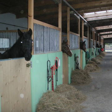
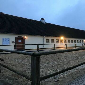
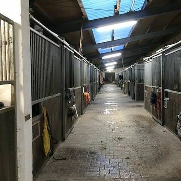
Pensionsstall, Reitunterricht, Beritt, Schulpferde
Ilmtal-Weinstraße
Rosshof Becker
@Rosshof-Becker1
FN-Mitglied
Freizeitstall
Vermieten
Krankenbox
Longierzirkel/Roundpen
Fohlenaufzucht möglich
Hengsthaltung möglich
23 weitere...
P
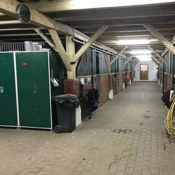
...lichtdurchfluteter Stall,grüne Wiesen...
Apolda
Reit-und-Fahrverein-Apolda-e-V
@Reit-und-Fahrverein-Apolda-e-V
Geländestrecke
Reitlehrer und -unterricht
Krankenbox
Longierzirkel/Roundpen
Bewegungsstall
Innenbox
Halbpension
Vollpension
15 weitere...
P
Deprecated: Creation of dynamic property Zend_View_Helper_Ads::$adLink is deprecated in /var/www/stall-frei/htdocs/staging.stall-frei.de/library/Psf/View/Helper/Ads.php on line 108

Futtersack HeuToy, Fressbremse in pink
Mechtersen
STALL-FREIde Marketing
@STALL-FREI-Marketing
Stundenlange Beschäftigung die
Koliken vorbeugt, geringe Staubinhalation mit
steuerbarer Futterentnahme

Pensionsstall, Beritt/ Korrekturberitt, Unterricht
Bad Sulza
Landwirtschaft-Zucht-u-Pensionsstall-Knauer
@Reitstallknauer
FN-Mitglied
Pferdeausbildung
Paddock
Parkplatz für Pferdeanhänger
Pferdezucht
Außenbox mit Paddock
11 weitere...
P
Leider kein Vorschaubild
Leider kein Vorschaubild
Reitanlage Linda
Mechelroda
Nils Burmeister Reitanlage Lin
@Reit- und Fahrverein Weimar-Li...
FN-Mitglied
Freizeitstall
Vermieten
Longierzirkel/Roundpen
Paddock
Gnadenbrothof
Hengsthaltung möglich
28 weitere...
B
Reitverein Heideland e.V.
Heideland OT Etzdorf
Reitverein-Heideland-e-V
@Reitverein-Heideland-e-V
Fahrstall, Kutschwagen
FN-Mitglied
Vermieten
Hunde willkommen
Krankenbox
Allergikerstall
Gnadenbrothof
34 weitere...
S

ganzj Weidestellplatz,Unterstand m matschfr. Zonen
Erfurt-Büßleben
janine lohbrandt
@JaLoh
Freizeitstall
Vermieten
Reitplatz (z.B. Dressur, Springen, Reining)
Sattelkammer/Sattelschränke
Offenstall
2 weitere...
P
Leider kein Vorschaubild
Leider kein Vorschaubild
Großzügige Boxen frei für Pferde, Ponys, Rentner...
Dornburg-Camburg
Diana Tigges
@PferdeundPonyfreundePosewitz
Freizeitstall
Vermieten
Hunde willkommen
Parkplatz für Pferdeanhänger
Innenbox
7 weitere...
B
Job gesucht?
Mechtersen
STALL-FREIde Marketing
@STALL-FREI-Marketing
Sie suchen einen Job und arbeiten gerne mit Pferden oder auf Reitanlagen?
Besuchen Sie jetzt unseren Stellenmarkt!
Leider kein Vorschaubild
Leider kein Vorschaubild
Vollpension, Box frei in Zöthen bei Jena
Dornburg-Camburg
Tina Unger
@ReitstallUnger
Freizeitstall
Pferdeausbildung
Vermieten
Hunde willkommen
Krankenbox
Fohlenaufzucht möglich
Gnadenbrothof
24 weitere...
B


Stellplatz für Wallach ab sofort
Hassleben
Manja Höhne
@Manja1980
Freizeitstall
Hunde willkommen
Longierzirkel/Roundpen
Innenbox
Halbpension
8 weitere...
P+
Leider kein Vorschaubild
Leider kein Vorschaubild
Paddocktrailhaltung, Kuraufenthalte mit Solekammer
Burkersroda
Hannas Pferdehof
@HannasPferdehof
Freizeitstall
Gastronomie
Vermieten
Hunde willkommen
Krankenbox
Hufrehe geeignet
Notfallboxen
30 weitere...
B
Deprecated: Creation of dynamic property Zend_View::$pageCount is deprecated in /var/www/stall-frei/htdocs/staging.stall-frei.de/library/vendor/shardj/zf1-future/library/Zend/View/Abstract.php on line 308
Deprecated: Creation of dynamic property Zend_View::$itemCountPerPage is deprecated in /var/www/stall-frei/htdocs/staging.stall-frei.de/library/vendor/shardj/zf1-future/library/Zend/View/Abstract.php on line 308
Deprecated: Creation of dynamic property Zend_View::$first is deprecated in /var/www/stall-frei/htdocs/staging.stall-frei.de/library/vendor/shardj/zf1-future/library/Zend/View/Abstract.php on line 308
Deprecated: Creation of dynamic property Zend_View::$current is deprecated in /var/www/stall-frei/htdocs/staging.stall-frei.de/library/vendor/shardj/zf1-future/library/Zend/View/Abstract.php on line 308
Deprecated: Creation of dynamic property Zend_View::$last is deprecated in /var/www/stall-frei/htdocs/staging.stall-frei.de/library/vendor/shardj/zf1-future/library/Zend/View/Abstract.php on line 308
Deprecated: Creation of dynamic property Zend_View::$next is deprecated in /var/www/stall-frei/htdocs/staging.stall-frei.de/library/vendor/shardj/zf1-future/library/Zend/View/Abstract.php on line 308
Deprecated: Creation of dynamic property Zend_View::$pagesInRange is deprecated in /var/www/stall-frei/htdocs/staging.stall-frei.de/library/vendor/shardj/zf1-future/library/Zend/View/Abstract.php on line 308
Deprecated: Creation of dynamic property Zend_View::$firstPageInRange is deprecated in /var/www/stall-frei/htdocs/staging.stall-frei.de/library/vendor/shardj/zf1-future/library/Zend/View/Abstract.php on line 308
Deprecated: Creation of dynamic property Zend_View::$lastPageInRange is deprecated in /var/www/stall-frei/htdocs/staging.stall-frei.de/library/vendor/shardj/zf1-future/library/Zend/View/Abstract.php on line 308
Deprecated: Creation of dynamic property Zend_View::$currentItemCount is deprecated in /var/www/stall-frei/htdocs/staging.stall-frei.de/library/vendor/shardj/zf1-future/library/Zend/View/Abstract.php on line 308
Deprecated: Creation of dynamic property Zend_View::$totalItemCount is deprecated in /var/www/stall-frei/htdocs/staging.stall-frei.de/library/vendor/shardj/zf1-future/library/Zend/View/Abstract.php on line 308
Deprecated: Creation of dynamic property Zend_View::$firstItemNumber is deprecated in /var/www/stall-frei/htdocs/staging.stall-frei.de/library/vendor/shardj/zf1-future/library/Zend/View/Abstract.php on line 308
Deprecated: Creation of dynamic property Zend_View::$lastItemNumber is deprecated in /var/www/stall-frei/htdocs/staging.stall-frei.de/library/vendor/shardj/zf1-future/library/Zend/View/Abstract.php on line 308
Deprecated: Creation of dynamic property Zend_View::$router is deprecated in /var/www/stall-frei/htdocs/staging.stall-frei.de/library/vendor/shardj/zf1-future/library/Zend/View/Abstract.php on line 308
Deprecated: Creation of dynamic property Zend_View::$urlParams is deprecated in /var/www/stall-frei/htdocs/staging.stall-frei.de/library/vendor/shardj/zf1-future/library/Zend/View/Abstract.php on line 308
Deprecated: Creation of dynamic property Zend_View::$showAds is deprecated in /var/www/stall-frei/htdocs/staging.stall-frei.de/library/vendor/shardj/zf1-future/library/Zend/View/Abstract.php on line 308
Deprecated: Creation of dynamic property Zend_View::$objectIds is deprecated in /var/www/stall-frei/htdocs/staging.stall-frei.de/library/vendor/shardj/zf1-future/library/Zend/View/Abstract.php on line 308
Deprecated: Creation of dynamic property Zend_View::$showNavbar is deprecated in /var/www/stall-frei/htdocs/staging.stall-frei.de/library/vendor/shardj/zf1-future/library/Zend/View/Abstract.php on line 308
Deprecated: Creation of dynamic property Zend_View::$showBreadcrumb is deprecated in /var/www/stall-frei/htdocs/staging.stall-frei.de/library/vendor/shardj/zf1-future/library/Zend/View/Abstract.php on line 308
Deprecated: Creation of dynamic property Zend_View::$showFooter is deprecated in /var/www/stall-frei/htdocs/staging.stall-frei.de/library/vendor/shardj/zf1-future/library/Zend/View/Abstract.php on line 308
Deprecated: Creation of dynamic property Zend_View::$showInternalAds is deprecated in /var/www/stall-frei/htdocs/staging.stall-frei.de/library/vendor/shardj/zf1-future/library/Zend/View/Abstract.php on line 308
Deprecated: Creation of dynamic property Zend_View::$blNoContent is deprecated in /var/www/stall-frei/htdocs/staging.stall-frei.de/library/vendor/shardj/zf1-future/library/Zend/View/Abstract.php on line 308
Deprecated: Creation of dynamic property Zend_View::$sMetaDesc is deprecated in /var/www/stall-frei/htdocs/staging.stall-frei.de/library/vendor/shardj/zf1-future/library/Zend/View/Abstract.php on line 308
Deprecated: Creation of dynamic property Zend_View::$useGmaps is deprecated in /var/www/stall-frei/htdocs/staging.stall-frei.de/library/vendor/shardj/zf1-future/library/Zend/View/Abstract.php on line 308
Deprecated: Creation of dynamic property Zend_View::$touches is deprecated in /var/www/stall-frei/htdocs/staging.stall-frei.de/library/vendor/shardj/zf1-future/library/Zend/View/Abstract.php on line 308
Deprecated: Creation of dynamic property Zend_View::$oProject is deprecated in /var/www/stall-frei/htdocs/staging.stall-frei.de/library/vendor/shardj/zf1-future/library/Zend/View/Abstract.php on line 308
Deprecated: Creation of dynamic property Zend_View::$pageHeadline is deprecated in /var/www/stall-frei/htdocs/staging.stall-frei.de/library/vendor/shardj/zf1-future/library/Zend/View/Abstract.php on line 308
Deprecated: Creation of dynamic property Zend_View::$disableLocationField is deprecated in /var/www/stall-frei/htdocs/staging.stall-frei.de/library/vendor/shardj/zf1-future/library/Zend/View/Abstract.php on line 308
Deprecated: Creation of dynamic property Zend_View::$isSearch is deprecated in /var/www/stall-frei/htdocs/staging.stall-frei.de/library/vendor/shardj/zf1-future/library/Zend/View/Abstract.php on line 308
Deprecated: Creation of dynamic property Zend_View::$pageTitle is deprecated in /var/www/stall-frei/htdocs/staging.stall-frei.de/library/vendor/shardj/zf1-future/library/Zend/View/Abstract.php on line 308
Deprecated: Creation of dynamic property Psf_Form_Element_Text::$class is deprecated in /var/www/stall-frei/htdocs/staging.stall-frei.de/library/vendor/shardj/zf1-future/library/Zend/Form/Element.php on line 874
Deprecated: Creation of dynamic property Psf_Form_Element_Text::$size is deprecated in /var/www/stall-frei/htdocs/staging.stall-frei.de/library/vendor/shardj/zf1-future/library/Zend/Form/Element.php on line 874
Deprecated: Creation of dynamic property Psf_Form_Element_Text::$placeholder is deprecated in /var/www/stall-frei/htdocs/staging.stall-frei.de/library/vendor/shardj/zf1-future/library/Zend/Form/Element.php on line 874
Deprecated: Creation of dynamic property Psf_Form_Element_Hidden::$class is deprecated in /var/www/stall-frei/htdocs/staging.stall-frei.de/library/vendor/shardj/zf1-future/library/Zend/Form/Element.php on line 874
Deprecated: Creation of dynamic property Psf_Form_Element_Hidden::$class is deprecated in /var/www/stall-frei/htdocs/staging.stall-frei.de/library/vendor/shardj/zf1-future/library/Zend/Form/Element.php on line 874
Deprecated: Creation of dynamic property Psf_Form_Element_Hidden::$class is deprecated in /var/www/stall-frei/htdocs/staging.stall-frei.de/library/vendor/shardj/zf1-future/library/Zend/Form/Element.php on line 874
Deprecated: Creation of dynamic property Psf_Form_Element_Hidden::$class is deprecated in /var/www/stall-frei/htdocs/staging.stall-frei.de/library/vendor/shardj/zf1-future/library/Zend/Form/Element.php on line 874
Deprecated: Creation of dynamic property Psf_Form_Element_Select::$class is deprecated in /var/www/stall-frei/htdocs/staging.stall-frei.de/library/vendor/shardj/zf1-future/library/Zend/Form/Element.php on line 874
Deprecated: Creation of dynamic property Psf_Form_Element_Select::$class is deprecated in /var/www/stall-frei/htdocs/staging.stall-frei.de/library/vendor/shardj/zf1-future/library/Zend/Form/Element.php on line 874
Deprecated: Creation of dynamic property Psf_Form_Element_Select::$class is deprecated in /var/www/stall-frei/htdocs/staging.stall-frei.de/library/vendor/shardj/zf1-future/library/Zend/Form/Element.php on line 874
Deprecated: Creation of dynamic property Psf_Form_Element_Select::$class is deprecated in /var/www/stall-frei/htdocs/staging.stall-frei.de/library/vendor/shardj/zf1-future/library/Zend/Form/Element.php on line 874
Deprecated: Creation of dynamic property Psf_Form_Element_Text::$class is deprecated in /var/www/stall-frei/htdocs/staging.stall-frei.de/library/vendor/shardj/zf1-future/library/Zend/Form/Element.php on line 874
Deprecated: Creation of dynamic property Psf_Form_Element_Checkbox::$label is deprecated in /var/www/stall-frei/htdocs/staging.stall-frei.de/library/vendor/shardj/zf1-future/library/Zend/Form/Element.php on line 874
Deprecated: Creation of dynamic property Zend_View::$sort is deprecated in /var/www/stall-frei/htdocs/staging.stall-frei.de/library/vendor/shardj/zf1-future/library/Zend/View/Abstract.php on line 308
Deprecated: Creation of dynamic property Zend_View::$searchLocation is deprecated in /var/www/stall-frei/htdocs/staging.stall-frei.de/library/vendor/shardj/zf1-future/library/Zend/View/Abstract.php on line 308
Deprecated: Creation of dynamic property Zend_View::$locationHint is deprecated in /var/www/stall-frei/htdocs/staging.stall-frei.de/library/vendor/shardj/zf1-future/library/Zend/View/Abstract.php on line 308
Psf_GeoCoder_Abstract::getLocation: Fränkendorf Get Location CachedOrLive
Psf_GeoCoder_Abstract::getCachedOrLive: Fränkendorf
Psf_GeoCoder_OpenCageData::makeApiRequest: response:
Array
(
[documentation] => https://opencagedata.com/api
[licenses] => Array
(
[0] => Array
(
[name] => see attribution guide
[url] => https://opencagedata.com/credits
)
)
[results] => Array
(
[0] => Array
(
[bounds] => Array
(
[northeast] => Array
(
[lat] => 50.9757393
[lng] => 11.4644075
)
[southwest] => Array
(
[lat] => 50.960051
[lng] => 11.4282656
)
)
[components] => Array
(
[ISO_3166-1_alpha-2] => DE
[ISO_3166-1_alpha-3] => DEU
[ISO_3166-2] => Array
(
[0] => DE-TH
)
[_category] => place
[_normalized_city] => Frankendorf
[_type] => village
[continent] => Europe
[country] => Deutschland
[country_code] => de
[county] => Landkreis Weimarer Land
[municipality] => Mellingen
[political_union] => European Union
[state] => Thüringen
[state_code] => TH
[village] => Frankendorf
)
[confidence] => 7
[formatted] => Frankendorf, Thüringen, Deutschland
[geometry] => Array
(
[lat] => 50.9680152
[lng] => 11.4502537
)
)
[1] => Array
(
[bounds] => Array
(
[northeast] => Array
(
[lat] => 51.8417809
[lng] => 13.780284
)
[southwest] => Array
(
[lat] => 51.822545
[lng] => 13.748083
)
)
[components] => Array
(
[ISO_3166-1_alpha-2] => DE
[ISO_3166-1_alpha-3] => DEU
[ISO_3166-2] => Array
(
[0] => DE-BB
)
[_category] => place
[_normalized_city] => Luckau
[_type] => neighbourhood
[city_district] => Görlsdorf
[continent] => Europe
[country] => Deutschland
[country_code] => de
[county] => Dahme-Spreewald
[political_union] => European Union
[state] => Brandenburg
[state_code] => BB
[town] => Luckau
)
[confidence] => 7
[formatted] => Görlsdorf, Luckau, Brandenburg, Deutschland
[geometry] => Array
(
[lat] => 51.8266616
[lng] => 13.7599182
)
)
[2] => Array
(
[bounds] => Array
(
[northeast] => Array
(
[lat] => 48.5591327
[lng] => 12.6845641
)
[southwest] => Array
(
[lat] => 48.5191327
[lng] => 12.6445641
)
)
[components] => Array
(
[ISO_3166-1_alpha-2] => DE
[ISO_3166-1_alpha-3] => DEU
[ISO_3166-2] => Array
(
[0] => DE-BY
)
[_category] => place
[_normalized_city] => Simbach
[_type] => village
[city] => Simbach
[continent] => Europe
[country] => Deutschland
[country_code] => de
[county] => Landkreis Dingolfing-Landau
[political_union] => European Union
[state] => Bayern
[state_code] => BY
[village] => Fränkendorf
)
[confidence] => 7
[formatted] => Fränkendorf, Bayern, Deutschland
[geometry] => Array
(
[lat] => 48.5391327
[lng] => 12.6645641
)
)
[3] => Array
(
[bounds] => Array
(
[northeast] => Array
(
[lat] => 48.3666123
[lng] => 11.998508
)
[southwest] => Array
(
[lat] => 48.3266123
[lng] => 11.958508
)
)
[components] => Array
(
[ISO_3166-1_alpha-2] => DE
[ISO_3166-1_alpha-3] => DEU
[ISO_3166-2] => Array
(
[0] => DE-BY
)
[_category] => place
[_normalized_city] => Fraunberg
[_type] => hamlet
[city] => Fraunberg
[continent] => Europe
[country] => Deutschland
[country_code] => de
[county] => Landkreis Erding
[hamlet] => Frankendorf
[political_union] => European Union
[postcode] => 85447
[state] => Bayern
[state_code] => BY
)
[confidence] => 7
[formatted] => Frankendorf, 85447 Fraunberg, Deutschland
[geometry] => Array
(
[lat] => 48.3466123
[lng] => 11.978508
)
)
[4] => Array
(
[bounds] => Array
(
[northeast] => Array
(
[lat] => 49.8521694
[lng] => 11.0968263
)
[southwest] => Array
(
[lat] => 49.8121694
[lng] => 11.0568263
)
)
[components] => Array
(
[ISO_3166-1_alpha-2] => DE
[ISO_3166-1_alpha-3] => DEU
[ISO_3166-2] => Array
(
[0] => DE-BY
)
[_category] => place
[_normalized_city] => Buttenheim
[_type] => city
[city] => Buttenheim
[continent] => Europe
[country] => Deutschland
[country_code] => de
[county] => Landkreis Bamberg
[political_union] => European Union
[postcode] => 96155
[state] => Bayern
[state_code] => BY
)
[confidence] => 7
[formatted] => Buttenheim, Bayern, Deutschland
[geometry] => Array
(
[lat] => 49.8321694
[lng] => 11.0768263
)
)
[5] => Array
(
[bounds] => Array
(
[northeast] => Array
(
[lat] => 50.5236882
[lng] => 11.8914365
)
[southwest] => Array
(
[lat] => 50.5011314
[lng] => 11.8353705
)
)
[components] => Array
(
[ISO_3166-1_alpha-2] => DE
[ISO_3166-1_alpha-3] => DEU
[ISO_3166-2] => Array
(
[0] => DE-TH
)
[_category] => place
[_normalized_city] => Tanna
[_type] => neighbourhood
[city_district] => Tanna
[continent] => Europe
[country] => Deutschland
[country_code] => de
[county] => Saale-Orla-Kreis
[municipality] => Tanna
[political_union] => European Union
[state] => Thüringen
[state_code] => TH
)
[confidence] => 7
[formatted] => Tanna, Thüringen, Deutschland
[geometry] => Array
(
[lat] => 50.503396
[lng] => 11.8589793
)
)
[6] => Array
(
[bounds] => Array
(
[northeast] => Array
(
[lat] => 53.0407843
[lng] => 12.7858509
)
[southwest] => Array
(
[lat] => 52.9640072
[lng] => 12.6743129
)
)
[components] => Array
(
[ISO_3166-1_alpha-2] => DE
[ISO_3166-1_alpha-3] => DEU
[ISO_3166-2] => Array
(
[0] => DE-BB
)
[_category] => place
[_normalized_city] => Frankendorf
[_type] => village
[continent] => Europe
[country] => Deutschland
[country_code] => de
[county] => Ostprignitz-Ruppin
[municipality] => Storbeck-Frankendorf
[political_union] => European Union
[state] => Brandenburg
[state_code] => BB
[village] => Frankendorf
)
[confidence] => 7
[formatted] => Frankendorf, Brandenburg, Deutschland
[geometry] => Array
(
[lat] => 53.0125926
[lng] => 12.7052638
)
)
[7] => Array
(
[bounds] => Array
(
[northeast] => Array
(
[lat] => 49.3642053
[lng] => 10.6838557
)
[southwest] => Array
(
[lat] => 49.3242053
[lng] => 10.6438557
)
)
[components] => Array
(
[ISO_3166-1_alpha-2] => DE
[ISO_3166-1_alpha-3] => DEU
[ISO_3166-2] => Array
(
[0] => DE-BY
)
[_category] => place
[_normalized_city] => Weihenzell
[_type] => city
[city] => Weihenzell
[continent] => Europe
[country] => Deutschland
[country_code] => de
[county] => Landkreis Ansbach
[municipality] => Weihenzell (VGem)
[political_union] => European Union
[postcode] => 91590
[state] => Bayern
[state_code] => BY
)
[confidence] => 7
[formatted] => Weihenzell, Bayern, Deutschland
[geometry] => Array
(
[lat] => 49.3442053
[lng] => 10.6638557
)
)
[8] => Array
(
[components] => Array
(
[ISO_3166-1_alpha-2] => FR
[ISO_3166-1_alpha-3] => FRA
[ISO_3166-2] => Array
(
[0] => FR-IDF
[1] => FR-92
)
[_category] => road
[_normalized_city] => Levallois-Perret
[_type] => road
[city] => Levallois-Perret
[continent] => Europe
[country] => France
[country_code] => fr
[county] => Hauts-de-Seine
[local_authority] => Métropole du Grand Paris
[political_union] => European Union
[postcode] => 92300
[road] => Rue Charles Deutschmann
[state] => Île-de-France
[state_code] => IDF
)
[confidence] => 2
[formatted] => Rue Charles Deutschmann, 92300 Levallois-Perret, France
[geometry] => Array
(
[lat] => 48.900049
[lng] => 2.2842
)
)
[9] => Array
(
[bounds] => Array
(
[northeast] => Array
(
[lat] => 55.055443
[lng] => 15.041211
)
[southwest] => Array
(
[lat] => 47.270056
[lng] => 5.866778
)
)
[components] => Array
(
[ISO_3166-1_alpha-2] => DE
[ISO_3166-1_alpha-3] => DEU
[_category] => place
[_type] => country
[continent] => Europe
[country] => Deutschland
[country_code] => de
[political_union] => European Union
)
[confidence] => 1
[formatted] => Deutschland
[geometry] => Array
(
[lat] => 51.5
[lng] => 10.5
)
)
)
[status] => Array
(
[code] => 200
[message] => OK
)
[stay_informed] => Array
(
[blog] => https://blog.opencagedata.com
[mastodon] => https://en.osm.town/@opencage
)
[thanks] => For using an OpenCage API
[timestamp] => Array
(
[created_http] => Sun, 08 Feb 2026 08:19:28 GMT
[created_unix] => 1770538768
)
[total_results] => 10
)
Psf_GeoCoder_Abstract::convertLocationResult
{"documentation":"https:\/\/opencagedata.com\/api","licenses":[{"name":"see attribution guide","url":"https:\/\/opencagedata.com\/credits"}],"results":[{"bounds":{"northeast":{"lat":50.9757393,"lng":11.4644075},"southwest":{"lat":50.960051,"lng":11.4282656}},"components":{"ISO_3166-1_alpha-2":"DE","ISO_3166-1_alpha-3":"DEU","ISO_3166-2":["DE-TH"],"_category":"place","_normalized_city":"Frankendorf","_type":"village","continent":"Europe","country":"Deutschland","country_code":"de","county":"Landkreis Weimarer Land","municipality":"Mellingen","political_union":"European Union","state":"Th\u00fcringen","state_code":"TH","village":"Frankendorf"},"confidence":7,"formatted":"Frankendorf, Th\u00fcringen, Deutschland","geometry":{"lat":50.9680152,"lng":11.4502537}},{"bounds":{"northeast":{"lat":51.8417809,"lng":13.780284},"southwest":{"lat":51.822545,"lng":13.748083}},"components":{"ISO_3166-1_alpha-2":"DE","ISO_3166-1_alpha-3":"DEU","ISO_3166-2":["DE-BB"],"_category":"place","_normalized_city":"Luckau","_type":"neighbourhood","city_district":"G\u00f6rlsdorf","continent":"Europe","country":"Deutschland","country_code":"de","county":"Dahme-Spreewald","political_union":"European Union","state":"Brandenburg","state_code":"BB","town":"Luckau"},"confidence":7,"formatted":"G\u00f6rlsdorf, Luckau, Brandenburg, Deutschland","geometry":{"lat":51.8266616,"lng":13.7599182}},{"bounds":{"northeast":{"lat":48.5591327,"lng":12.6845641},"southwest":{"lat":48.5191327,"lng":12.6445641}},"components":{"ISO_3166-1_alpha-2":"DE","ISO_3166-1_alpha-3":"DEU","ISO_3166-2":["DE-BY"],"_category":"place","_normalized_city":"Simbach","_type":"village","city":"Simbach","continent":"Europe","country":"Deutschland","country_code":"de","county":"Landkreis Dingolfing-Landau","political_union":"European Union","state":"Bayern","state_code":"BY","village":"Fr\u00e4nkendorf"},"confidence":7,"formatted":"Fr\u00e4nkendorf, Bayern, Deutschland","geometry":{"lat":48.5391327,"lng":12.6645641}},{"bounds":{"northeast":{"lat":48.3666123,"lng":11.998508},"southwest":{"lat":48.3266123,"lng":11.958508}},"components":{"ISO_3166-1_alpha-2":"DE","ISO_3166-1_alpha-3":"DEU","ISO_3166-2":["DE-BY"],"_category":"place","_normalized_city":"Fraunberg","_type":"hamlet","city":"Fraunberg","continent":"Europe","country":"Deutschland","country_code":"de","county":"Landkreis Erding","hamlet":"Frankendorf","political_union":"European Union","postcode":"85447","state":"Bayern","state_code":"BY"},"confidence":7,"formatted":"Frankendorf, 85447 Fraunberg, Deutschland","geometry":{"lat":48.3466123,"lng":11.978508}},{"bounds":{"northeast":{"lat":49.8521694,"lng":11.0968263},"southwest":{"lat":49.8121694,"lng":11.0568263}},"components":{"ISO_3166-1_alpha-2":"DE","ISO_3166-1_alpha-3":"DEU","ISO_3166-2":["DE-BY"],"_category":"place","_normalized_city":"Buttenheim","_type":"city","city":"Buttenheim","continent":"Europe","country":"Deutschland","country_code":"de","county":"Landkreis Bamberg","political_union":"European Union","postcode":"96155","state":"Bayern","state_code":"BY"},"confidence":7,"formatted":"Buttenheim, Bayern, Deutschland","geometry":{"lat":49.8321694,"lng":11.0768263}},{"bounds":{"northeast":{"lat":50.5236882,"lng":11.8914365},"southwest":{"lat":50.5011314,"lng":11.8353705}},"components":{"ISO_3166-1_alpha-2":"DE","ISO_3166-1_alpha-3":"DEU","ISO_3166-2":["DE-TH"],"_category":"place","_normalized_city":"Tanna","_type":"neighbourhood","city_district":"Tanna","continent":"Europe","country":"Deutschland","country_code":"de","county":"Saale-Orla-Kreis","municipality":"Tanna","political_union":"European Union","state":"Th\u00fcringen","state_code":"TH"},"confidence":7,"formatted":"Tanna, Th\u00fcringen, Deutschland","geometry":{"lat":50.503396,"lng":11.8589793}},{"bounds":{"northeast":{"lat":53.0407843,"lng":12.7858509},"southwest":{"lat":52.9640072,"lng":12.6743129}},"components":{"ISO_3166-1_alpha-2":"DE","ISO_3166-1_alpha-3":"DEU","ISO_3166-2":["DE-BB"],"_category":"place","_normalized_city":"Frankendorf","_type":"village","continent":"Europe","country":"Deutschland","country_code":"de","county":"Ostprignitz-Ruppin","municipality":"Storbeck-Frankendorf","political_union":"European Union","state":"Brandenburg","state_code":"BB","village":"Frankendorf"},"confidence":7,"formatted":"Frankendorf, Brandenburg, Deutschland","geometry":{"lat":53.0125926,"lng":12.7052638}},{"bounds":{"northeast":{"lat":49.3642053,"lng":10.6838557},"southwest":{"lat":49.3242053,"lng":10.6438557}},"components":{"ISO_3166-1_alpha-2":"DE","ISO_3166-1_alpha-3":"DEU","ISO_3166-2":["DE-BY"],"_category":"place","_normalized_city":"Weihenzell","_type":"city","city":"Weihenzell","continent":"Europe","country":"Deutschland","country_code":"de","county":"Landkreis Ansbach","municipality":"Weihenzell (VGem)","political_union":"European Union","postcode":"91590","state":"Bayern","state_code":"BY"},"confidence":7,"formatted":"Weihenzell, Bayern, Deutschland","geometry":{"lat":49.3442053,"lng":10.6638557}},{"components":{"ISO_3166-1_alpha-2":"FR","ISO_3166-1_alpha-3":"FRA","ISO_3166-2":["FR-IDF","FR-92"],"_category":"road","_normalized_city":"Levallois-Perret","_type":"road","city":"Levallois-Perret","continent":"Europe","country":"France","country_code":"fr","county":"Hauts-de-Seine","local_authority":"M\u00e9tropole du Grand Paris","political_union":"European Union","postcode":"92300","road":"Rue Charles Deutschmann","state":"\u00cele-de-France","state_code":"IDF"},"confidence":2,"formatted":"Rue Charles Deutschmann, 92300 Levallois-Perret, France","geometry":{"lat":48.900049,"lng":2.2842}},{"bounds":{"northeast":{"lat":55.055443,"lng":15.041211},"southwest":{"lat":47.270056,"lng":5.866778}},"components":{"ISO_3166-1_alpha-2":"DE","ISO_3166-1_alpha-3":"DEU","_category":"place","_type":"country","continent":"Europe","country":"Deutschland","country_code":"de","political_union":"European Union"},"confidence":1,"formatted":"Deutschland","geometry":{"lat":51.5,"lng":10.5}}],"status":{"code":200,"message":"OK"},"stay_informed":{"blog":"https:\/\/blog.opencagedata.com","mastodon":"https:\/\/en.osm.town\/@opencage"},"thanks":"For using an OpenCage API","timestamp":{"created_http":"Sun, 08 Feb 2026 08:19:28 GMT","created_unix":1770538768},"total_results":10}Array
(
[0] => stdClass Object
(
[bounds] => stdClass Object
(
[northeast] => stdClass Object
(
[lat] => 50.9757393
[lng] => 11.4644075
)
[southwest] => stdClass Object
(
[lat] => 50.960051
[lng] => 11.4282656
)
)
[components] => stdClass Object
(
[ISO_3166-1_alpha-2] => DE
[ISO_3166-1_alpha-3] => DEU
[ISO_3166-2] => Array
(
[0] => DE-TH
)
[_category] => place
[_normalized_city] => Frankendorf
[_type] => village
[continent] => Europe
[country] => Deutschland
[country_code] => de
[county] => Landkreis Weimarer Land
[municipality] => Mellingen
[political_union] => European Union
[state] => Thüringen
[state_code] => TH
[village] => Frankendorf
)
[confidence] => 7
[formatted] => Frankendorf, Thüringen, Deutschland
[geometry] => stdClass Object
(
[lat] => 50.9680152
[lng] => 11.4502537
)
)
[1] => stdClass Object
(
[bounds] => stdClass Object
(
[northeast] => stdClass Object
(
[lat] => 51.8417809
[lng] => 13.780284
)
[southwest] => stdClass Object
(
[lat] => 51.822545
[lng] => 13.748083
)
)
[components] => stdClass Object
(
[ISO_3166-1_alpha-2] => DE
[ISO_3166-1_alpha-3] => DEU
[ISO_3166-2] => Array
(
[0] => DE-BB
)
[_category] => place
[_normalized_city] => Luckau
[_type] => neighbourhood
[city_district] => Görlsdorf
[continent] => Europe
[country] => Deutschland
[country_code] => de
[county] => Dahme-Spreewald
[political_union] => European Union
[state] => Brandenburg
[state_code] => BB
[town] => Luckau
)
[confidence] => 7
[formatted] => Görlsdorf, Luckau, Brandenburg, Deutschland
[geometry] => stdClass Object
(
[lat] => 51.8266616
[lng] => 13.7599182
)
)
[2] => stdClass Object
(
[bounds] => stdClass Object
(
[northeast] => stdClass Object
(
[lat] => 48.5591327
[lng] => 12.6845641
)
[southwest] => stdClass Object
(
[lat] => 48.5191327
[lng] => 12.6445641
)
)
[components] => stdClass Object
(
[ISO_3166-1_alpha-2] => DE
[ISO_3166-1_alpha-3] => DEU
[ISO_3166-2] => Array
(
[0] => DE-BY
)
[_category] => place
[_normalized_city] => Simbach
[_type] => village
[city] => Simbach
[continent] => Europe
[country] => Deutschland
[country_code] => de
[county] => Landkreis Dingolfing-Landau
[political_union] => European Union
[state] => Bayern
[state_code] => BY
[village] => Fränkendorf
)
[confidence] => 7
[formatted] => Fränkendorf, Bayern, Deutschland
[geometry] => stdClass Object
(
[lat] => 48.5391327
[lng] => 12.6645641
)
)
[3] => stdClass Object
(
[bounds] => stdClass Object
(
[northeast] => stdClass Object
(
[lat] => 48.3666123
[lng] => 11.998508
)
[southwest] => stdClass Object
(
[lat] => 48.3266123
[lng] => 11.958508
)
)
[components] => stdClass Object
(
[ISO_3166-1_alpha-2] => DE
[ISO_3166-1_alpha-3] => DEU
[ISO_3166-2] => Array
(
[0] => DE-BY
)
[_category] => place
[_normalized_city] => Fraunberg
[_type] => hamlet
[city] => Fraunberg
[continent] => Europe
[country] => Deutschland
[country_code] => de
[county] => Landkreis Erding
[hamlet] => Frankendorf
[political_union] => European Union
[postcode] => 85447
[state] => Bayern
[state_code] => BY
)
[confidence] => 7
[formatted] => Frankendorf, 85447 Fraunberg, Deutschland
[geometry] => stdClass Object
(
[lat] => 48.3466123
[lng] => 11.978508
)
)
[4] => stdClass Object
(
[bounds] => stdClass Object
(
[northeast] => stdClass Object
(
[lat] => 49.8521694
[lng] => 11.0968263
)
[southwest] => stdClass Object
(
[lat] => 49.8121694
[lng] => 11.0568263
)
)
[components] => stdClass Object
(
[ISO_3166-1_alpha-2] => DE
[ISO_3166-1_alpha-3] => DEU
[ISO_3166-2] => Array
(
[0] => DE-BY
)
[_category] => place
[_normalized_city] => Buttenheim
[_type] => city
[city] => Buttenheim
[continent] => Europe
[country] => Deutschland
[country_code] => de
[county] => Landkreis Bamberg
[political_union] => European Union
[postcode] => 96155
[state] => Bayern
[state_code] => BY
)
[confidence] => 7
[formatted] => Buttenheim, Bayern, Deutschland
[geometry] => stdClass Object
(
[lat] => 49.8321694
[lng] => 11.0768263
)
)
[5] => stdClass Object
(
[bounds] => stdClass Object
(
[northeast] => stdClass Object
(
[lat] => 50.5236882
[lng] => 11.8914365
)
[southwest] => stdClass Object
(
[lat] => 50.5011314
[lng] => 11.8353705
)
)
[components] => stdClass Object
(
[ISO_3166-1_alpha-2] => DE
[ISO_3166-1_alpha-3] => DEU
[ISO_3166-2] => Array
(
[0] => DE-TH
)
[_category] => place
[_normalized_city] => Tanna
[_type] => neighbourhood
[city_district] => Tanna
[continent] => Europe
[country] => Deutschland
[country_code] => de
[county] => Saale-Orla-Kreis
[municipality] => Tanna
[political_union] => European Union
[state] => Thüringen
[state_code] => TH
)
[confidence] => 7
[formatted] => Tanna, Thüringen, Deutschland
[geometry] => stdClass Object
(
[lat] => 50.503396
[lng] => 11.8589793
)
)
[6] => stdClass Object
(
[bounds] => stdClass Object
(
[northeast] => stdClass Object
(
[lat] => 53.0407843
[lng] => 12.7858509
)
[southwest] => stdClass Object
(
[lat] => 52.9640072
[lng] => 12.6743129
)
)
[components] => stdClass Object
(
[ISO_3166-1_alpha-2] => DE
[ISO_3166-1_alpha-3] => DEU
[ISO_3166-2] => Array
(
[0] => DE-BB
)
[_category] => place
[_normalized_city] => Frankendorf
[_type] => village
[continent] => Europe
[country] => Deutschland
[country_code] => de
[county] => Ostprignitz-Ruppin
[municipality] => Storbeck-Frankendorf
[political_union] => European Union
[state] => Brandenburg
[state_code] => BB
[village] => Frankendorf
)
[confidence] => 7
[formatted] => Frankendorf, Brandenburg, Deutschland
[geometry] => stdClass Object
(
[lat] => 53.0125926
[lng] => 12.7052638
)
)
[7] => stdClass Object
(
[bounds] => stdClass Object
(
[northeast] => stdClass Object
(
[lat] => 49.3642053
[lng] => 10.6838557
)
[southwest] => stdClass Object
(
[lat] => 49.3242053
[lng] => 10.6438557
)
)
[components] => stdClass Object
(
[ISO_3166-1_alpha-2] => DE
[ISO_3166-1_alpha-3] => DEU
[ISO_3166-2] => Array
(
[0] => DE-BY
)
[_category] => place
[_normalized_city] => Weihenzell
[_type] => city
[city] => Weihenzell
[continent] => Europe
[country] => Deutschland
[country_code] => de
[county] => Landkreis Ansbach
[municipality] => Weihenzell (VGem)
[political_union] => European Union
[postcode] => 91590
[state] => Bayern
[state_code] => BY
)
[confidence] => 7
[formatted] => Weihenzell, Bayern, Deutschland
[geometry] => stdClass Object
(
[lat] => 49.3442053
[lng] => 10.6638557
)
)
[8] => stdClass Object
(
[components] => stdClass Object
(
[ISO_3166-1_alpha-2] => FR
[ISO_3166-1_alpha-3] => FRA
[ISO_3166-2] => Array
(
[0] => FR-IDF
[1] => FR-92
)
[_category] => road
[_normalized_city] => Levallois-Perret
[_type] => road
[city] => Levallois-Perret
[continent] => Europe
[country] => France
[country_code] => fr
[county] => Hauts-de-Seine
[local_authority] => Métropole du Grand Paris
[political_union] => European Union
[postcode] => 92300
[road] => Rue Charles Deutschmann
[state] => Île-de-France
[state_code] => IDF
)
[confidence] => 2
[formatted] => Rue Charles Deutschmann, 92300 Levallois-Perret, France
[geometry] => stdClass Object
(
[lat] => 48.900049
[lng] => 2.2842
)
)
[9] => stdClass Object
(
[bounds] => stdClass Object
(
[northeast] => stdClass Object
(
[lat] => 55.055443
[lng] => 15.041211
)
[southwest] => stdClass Object
(
[lat] => 47.270056
[lng] => 5.866778
)
)
[components] => stdClass Object
(
[ISO_3166-1_alpha-2] => DE
[ISO_3166-1_alpha-3] => DEU
[_category] => place
[_type] => country
[continent] => Europe
[country] => Deutschland
[country_code] => de
[political_union] => European Union
)
[confidence] => 1
[formatted] => Deutschland
[geometry] => stdClass Object
(
[lat] => 51.5
[lng] => 10.5
)
)
)
Psf_GeoCoder_OpenCageData::getKeyMap: 0
stdClass Object
(
    [bounds] => stdClass Object
        (
            [northeast] => stdClass Object
                (
                    [lat] => 50.9757393
                    [lng] => 11.4644075
                )

            [southwest] => stdClass Object
                (
                    [lat] => 50.960051
                    [lng] => 11.4282656
                )

        )

    [components] => stdClass Object
        (
            [ISO_3166-1_alpha-2] => DE
            [ISO_3166-1_alpha-3] => DEU
            [ISO_3166-2] => Array
                (
                    [0] => DE-TH
                )

            [_category] => place
            [_normalized_city] => Frankendorf
            [_type] => village
            [continent] => Europe
            [country] => Deutschland
            [country_code] => de
            [county] => Landkreis Weimarer Land
            [municipality] => Mellingen
            [political_union] => European Union
            [state] => Thüringen
            [state_code] => TH
            [village] => Frankendorf
        )

    [confidence] => 7
    [formatted] => Frankendorf, Thüringen, Deutschland
    [geometry] => stdClass Object
        (
            [lat] => 50.9680152
            [lng] => 11.4502537
        )

)
Psf_GeoCoder_OpenCageData::getCounty: Weimarer Land
Psf_GeoCoder_OpenCageData::addMissingData REFETCH!
Array
(
    [address] => Frankendorf, Thüringen, Deutschland
    [type] => village
    [street] =>
    [city] => Frankendorf
    [county] => Weimarer Land
    [state] => Thüringen
    [zip] =>
    [country] => Deutschland
    [suburb] =>
    [countrycode] => de
    [latitude] => 50.9680152
    [longitude] => 11.4502537
    [accuracy] => 1
    [confidence] => 7
    [bounds] => stdClass Object
        (
            [northeast] => stdClass Object
                (
                    [lat] => 50.9757393
                    [lng] => 11.4644075
                )

            [southwest] => stdClass Object
                (
                    [lat] => 50.960051
                    [lng] => 11.4282656
                )

        )

)
reformat!
Array
(
    [address] => Frankendorf, Thüringen, Deutschland
    [type] => village
    [street] =>
    [city] => Frankendorf
    [county] => Weimarer Land
    [state] => Thüringen
    [zip] =>
    [country] => Deutschland
    [suburb] =>
    [countrycode] => de
    [latitude] => 50.9680152
    [longitude] => 11.4502537
    [accuracy] => 1
    [confidence] => 7
    [bounds] => stdClass Object
        (
            [northeast] => stdClass Object
                (
                    [lat] => 50.9757393
                    [lng] => 11.4644075
                )

            [southwest] => stdClass Object
                (
                    [lat] => 50.960051
                    [lng] => 11.4282656
                )

        )

    [place] => Frankendorf, Thüringen
    [hash] => 7bb90146a069d42d09fd281b11bb2090
)
Psf_GeoCoder_OpenCageData::getKeyMap: 1
stdClass Object
(
    [bounds] => stdClass Object
        (
            [northeast] => stdClass Object
                (
                    [lat] => 51.8417809
                    [lng] => 13.780284
                )

            [southwest] => stdClass Object
                (
                    [lat] => 51.822545
                    [lng] => 13.748083
                )

        )

    [components] => stdClass Object
        (
            [ISO_3166-1_alpha-2] => DE
            [ISO_3166-1_alpha-3] => DEU
            [ISO_3166-2] => Array
                (
                    [0] => DE-BB
                )

            [_category] => place
            [_normalized_city] => Luckau
            [_type] => neighbourhood
            [city_district] => Görlsdorf
            [continent] => Europe
            [country] => Deutschland
            [country_code] => de
            [county] => Dahme-Spreewald
            [political_union] => European Union
            [state] => Brandenburg
            [state_code] => BB
            [town] => Luckau
        )

    [confidence] => 7
    [formatted] => Görlsdorf, Luckau, Brandenburg, Deutschland
    [geometry] => stdClass Object
        (
            [lat] => 51.8266616
            [lng] => 13.7599182
        )

)
Psf_GeoCoder_OpenCageData::getCounty: Dahme-Spreewald
Psf_GeoCoder_OpenCageData::addMissingData REFETCH!
Array
(
    [address] => Görlsdorf, Luckau, Brandenburg, Deutschland
    [type] => neighbourhood
    [street] =>
    [city] => Luckau
    [county] => Dahme-Spreewald
    [state] => Brandenburg
    [zip] =>
    [country] => Deutschland
    [suburb] =>
    [countrycode] => de
    [latitude] => 51.8266616
    [longitude] => 13.7599182
    [accuracy] => 1
    [confidence] => 7
    [bounds] => stdClass Object
        (
            [northeast] => stdClass Object
                (
                    [lat] => 51.8417809
                    [lng] => 13.780284
                )

            [southwest] => stdClass Object
                (
                    [lat] => 51.822545
                    [lng] => 13.748083
                )

        )

)
reformat!
Array
(
    [address] => Görlsdorf, Luckau, Brandenburg, Deutschland
    [type] => neighbourhood
    [street] =>
    [city] => Luckau
    [county] => Dahme-Spreewald
    [state] => Brandenburg
    [zip] =>
    [country] => Deutschland
    [suburb] =>
    [countrycode] => de
    [latitude] => 51.8266616
    [longitude] => 13.7599182
    [accuracy] => 1
    [confidence] => 7
    [bounds] => stdClass Object
        (
            [northeast] => stdClass Object
                (
                    [lat] => 51.8417809
                    [lng] => 13.780284
                )

            [southwest] => stdClass Object
                (
                    [lat] => 51.822545
                    [lng] => 13.748083
                )

        )

    [place] => Luckau, Brandenburg
    [hash] => 406e4eeae190207646e0d8d59deb37db
)
Psf_GeoCoder_OpenCageData::getKeyMap: 2
stdClass Object
(
    [bounds] => stdClass Object
        (
            [northeast] => stdClass Object
                (
                    [lat] => 48.5591327
                    [lng] => 12.6845641
                )

            [southwest] => stdClass Object
                (
                    [lat] => 48.5191327
                    [lng] => 12.6445641
                )

        )

    [components] => stdClass Object
        (
            [ISO_3166-1_alpha-2] => DE
            [ISO_3166-1_alpha-3] => DEU
            [ISO_3166-2] => Array
                (
                    [0] => DE-BY
                )

            [_category] => place
            [_normalized_city] => Simbach
            [_type] => village
            [city] => Simbach
            [continent] => Europe
            [country] => Deutschland
            [country_code] => de
            [county] => Landkreis Dingolfing-Landau
            [political_union] => European Union
            [state] => Bayern
            [state_code] => BY
            [village] => Fränkendorf
        )

    [confidence] => 7
    [formatted] => Fränkendorf, Bayern, Deutschland
    [geometry] => stdClass Object
        (
            [lat] => 48.5391327
            [lng] => 12.6645641
        )

)
Psf_GeoCoder_OpenCageData::getCounty: Dingolfing-Landau
Psf_GeoCoder_OpenCageData::addMissingData REFETCH!
Array
(
    [address] => Fränkendorf, Bayern, Deutschland
    [type] => village
    [street] =>
    [city] => Fränkendorf
    [county] => Dingolfing-Landau
    [state] => Bayern
    [zip] =>
    [country] => Deutschland
    [suburb] =>
    [countrycode] => de
    [latitude] => 48.5391327
    [longitude] => 12.6645641
    [accuracy] => 1
    [confidence] => 7
    [bounds] => stdClass Object
        (
            [northeast] => stdClass Object
                (
                    [lat] => 48.5591327
                    [lng] => 12.6845641
                )

            [southwest] => stdClass Object
                (
                    [lat] => 48.5191327
                    [lng] => 12.6445641
                )

        )

)
reformat!
Array
(
    [address] => Fränkendorf, Bayern, Deutschland
    [type] => village
    [street] =>
    [city] => Fränkendorf
    [county] => Dingolfing-Landau
    [state] => Bayern
    [zip] =>
    [country] => Deutschland
    [suburb] =>
    [countrycode] => de
    [latitude] => 48.5391327
    [longitude] => 12.6645641
    [accuracy] => 1
    [confidence] => 7
    [bounds] => stdClass Object
        (
            [northeast] => stdClass Object
                (
                    [lat] => 48.5591327
                    [lng] => 12.6845641
                )

            [southwest] => stdClass Object
                (
                    [lat] => 48.5191327
                    [lng] => 12.6445641
                )

        )

    [place] => Fränkendorf, Bayern
    [hash] => 7f06f81b8e02472f40d8b2b12a973284
)
Psf_GeoCoder_OpenCageData::getKeyMap: 3
stdClass Object
(
    [bounds] => stdClass Object
        (
            [northeast] => stdClass Object
                (
                    [lat] => 48.3666123
                    [lng] => 11.998508
                )

            [southwest] => stdClass Object
                (
                    [lat] => 48.3266123
                    [lng] => 11.958508
                )

        )

    [components] => stdClass Object
        (
            [ISO_3166-1_alpha-2] => DE
            [ISO_3166-1_alpha-3] => DEU
            [ISO_3166-2] => Array
                (
                    [0] => DE-BY
                )

            [_category] => place
            [_normalized_city] => Fraunberg
            [_type] => hamlet
            [city] => Fraunberg
            [continent] => Europe
            [country] => Deutschland
            [country_code] => de
            [county] => Landkreis Erding
            [hamlet] => Frankendorf
            [political_union] => European Union
            [postcode] => 85447
            [state] => Bayern
            [state_code] => BY
        )

    [confidence] => 7
    [formatted] => Frankendorf, 85447 Fraunberg, Deutschland
    [geometry] => stdClass Object
        (
            [lat] => 48.3466123
            [lng] => 11.978508
        )

)
Psf_GeoCoder_OpenCageData::getCounty: Erding
Psf_GeoCoder_OpenCageData::addMissingData REFETCH!
Array
(
    [address] => Frankendorf, 85447 Fraunberg, Deutschland
    [type] => hamlet
    [street] => Frankendorf
    [city] => Fraunberg
    [county] => Erding
    [state] => Bayern
    [zip] => 85447
    [country] => Deutschland
    [suburb] =>
    [countrycode] => de
    [latitude] => 48.3466123
    [longitude] => 11.978508
    [accuracy] => 1
    [confidence] => 7
    [bounds] => stdClass Object
        (
            [northeast] => stdClass Object
                (
                    [lat] => 48.3666123
                    [lng] => 11.998508
                )

            [southwest] => stdClass Object
                (
                    [lat] => 48.3266123
                    [lng] => 11.958508
                )

        )

)
reformat!
Array
(
    [address] => Frankendorf, 85447 Fraunberg, Deutschland
    [type] => hamlet
    [street] => Frankendorf
    [city] => Fraunberg
    [county] => Erding
    [state] => Bayern
    [zip] => 85447
    [country] => Deutschland
    [suburb] =>
    [countrycode] => de
    [latitude] => 48.3466123
    [longitude] => 11.978508
    [accuracy] => 1
    [confidence] => 7
    [bounds] => stdClass Object
        (
            [northeast] => stdClass Object
                (
                    [lat] => 48.3666123
                    [lng] => 11.998508
                )

            [southwest] => stdClass Object
                (
                    [lat] => 48.3266123
                    [lng] => 11.958508
                )

        )

    [place] => Frankendorf, 85447 Fraunberg, Bayern
    [hash] => 055920abcaf2630d5ab6ed2d52e6cf28
)
Psf_GeoCoder_OpenCageData::getKeyMap: 4
stdClass Object
(
    [bounds] => stdClass Object
        (
            [northeast] => stdClass Object
                (
                    [lat] => 49.8521694
                    [lng] => 11.0968263
                )

            [southwest] => stdClass Object
                (
                    [lat] => 49.8121694
                    [lng] => 11.0568263
                )

        )

    [components] => stdClass Object
        (
            [ISO_3166-1_alpha-2] => DE
            [ISO_3166-1_alpha-3] => DEU
            [ISO_3166-2] => Array
                (
                    [0] => DE-BY
                )

            [_category] => place
            [_normalized_city] => Buttenheim
            [_type] => city
            [city] => Buttenheim
            [continent] => Europe
            [country] => Deutschland
            [country_code] => de
            [county] => Landkreis Bamberg
            [political_union] => European Union
            [postcode] => 96155
            [state] => Bayern
            [state_code] => BY
        )

    [confidence] => 7
    [formatted] => Buttenheim, Bayern, Deutschland
    [geometry] => stdClass Object
        (
            [lat] => 49.8321694
            [lng] => 11.0768263
        )

)
Psf_GeoCoder_OpenCageData::getCounty: Bamberg
Psf_GeoCoder_OpenCageData::addMissingData REFETCH!
Array
(
    [address] => Buttenheim, Bayern, Deutschland
    [type] => city
    [street] =>
    [city] => Buttenheim
    [county] => Bamberg
    [state] => Bayern
    [zip] => 96155
    [country] => Deutschland
    [suburb] =>
    [countrycode] => de
    [latitude] => 49.8321694
    [longitude] => 11.0768263
    [accuracy] => 1
    [confidence] => 7
    [bounds] => stdClass Object
        (
            [northeast] => stdClass Object
                (
                    [lat] => 49.8521694
                    [lng] => 11.0968263
                )

            [southwest] => stdClass Object
                (
                    [lat] => 49.8121694
                    [lng] => 11.0568263
                )

        )

)
reformat!
Array
(
    [address] => Buttenheim, Bayern, Deutschland
    [type] => city
    [street] =>
    [city] => Buttenheim
    [county] => Bamberg
    [state] => Bayern
    [zip] => 96155
    [country] => Deutschland
    [suburb] =>
    [countrycode] => de
    [latitude] => 49.8321694
    [longitude] => 11.0768263
    [accuracy] => 1
    [confidence] => 7
    [bounds] => stdClass Object
        (
            [northeast] => stdClass Object
                (
                    [lat] => 49.8521694
                    [lng] => 11.0968263
                )

            [southwest] => stdClass Object
                (
                    [lat] => 49.8121694
                    [lng] => 11.0568263
                )

        )

    [place] => 96155 Buttenheim, Bayern
    [hash] => cc68075eb4b66b75145eeb46af4e35b9
)
Psf_GeoCoder_OpenCageData::getKeyMap: 5
stdClass Object
(
    [bounds] => stdClass Object
        (
            [northeast] => stdClass Object
                (
                    [lat] => 50.5236882
                    [lng] => 11.8914365
                )

            [southwest] => stdClass Object
                (
                    [lat] => 50.5011314
                    [lng] => 11.8353705
                )

        )

    [components] => stdClass Object
        (
            [ISO_3166-1_alpha-2] => DE
            [ISO_3166-1_alpha-3] => DEU
            [ISO_3166-2] => Array
                (
                    [0] => DE-TH
                )

            [_category] => place
            [_normalized_city] => Tanna
            [_type] => neighbourhood
            [city_district] => Tanna
            [continent] => Europe
            [country] => Deutschland
            [country_code] => de
            [county] => Saale-Orla-Kreis
            [municipality] => Tanna
            [political_union] => European Union
            [state] => Thüringen
            [state_code] => TH
        )

    [confidence] => 7
    [formatted] => Tanna, Thüringen, Deutschland
    [geometry] => stdClass Object
        (
            [lat] => 50.503396
            [lng] => 11.8589793
        )

)
Psf_GeoCoder_OpenCageData::getCounty: Saale-Orla-Kreis
Psf_GeoCoder_OpenCageData::addMissingData REFETCH!
Array
(
    [address] => Tanna, Thüringen, Deutschland
    [type] => neighbourhood
    [street] =>
    [city] => Tanna
    [county] => Saale-Orla-Kreis
    [state] => Thüringen
    [zip] =>
    [country] => Deutschland
    [suburb] =>
    [countrycode] => de
    [latitude] => 50.503396
    [longitude] => 11.8589793
    [accuracy] => 1
    [confidence] => 7
    [bounds] => stdClass Object
        (
            [northeast] => stdClass Object
                (
                    [lat] => 50.5236882
                    [lng] => 11.8914365
                )

            [southwest] => stdClass Object
                (
                    [lat] => 50.5011314
                    [lng] => 11.8353705
                )

        )

)
reformat!
Array
(
    [address] => Tanna, Thüringen, Deutschland
    [type] => neighbourhood
    [street] =>
    [city] => Tanna
    [county] => Saale-Orla-Kreis
    [state] => Thüringen
    [zip] =>
    [country] => Deutschland
    [suburb] =>
    [countrycode] => de
    [latitude] => 50.503396
    [longitude] => 11.8589793
    [accuracy] => 1
    [confidence] => 7
    [bounds] => stdClass Object
        (
            [northeast] => stdClass Object
                (
                    [lat] => 50.5236882
                    [lng] => 11.8914365
                )

            [southwest] => stdClass Object
                (
                    [lat] => 50.5011314
                    [lng] => 11.8353705
                )

        )

    [place] => Tanna, Thüringen
    [hash] => 1596220f8441db7a37cbf0d9765c5cb9
)
Psf_GeoCoder_OpenCageData::getKeyMap: 6
stdClass Object
(
    [bounds] => stdClass Object
        (
            [northeast] => stdClass Object
                (
                    [lat] => 53.0407843
                    [lng] => 12.7858509
                )

            [southwest] => stdClass Object
                (
                    [lat] => 52.9640072
                    [lng] => 12.6743129
                )

        )

    [components] => stdClass Object
        (
            [ISO_3166-1_alpha-2] => DE
            [ISO_3166-1_alpha-3] => DEU
            [ISO_3166-2] => Array
                (
                    [0] => DE-BB
                )

            [_category] => place
            [_normalized_city] => Frankendorf
            [_type] => village
            [continent] => Europe
            [country] => Deutschland
            [country_code] => de
            [county] => Ostprignitz-Ruppin
            [municipality] => Storbeck-Frankendorf
            [political_union] => European Union
            [state] => Brandenburg
            [state_code] => BB
            [village] => Frankendorf
        )

    [confidence] => 7
    [formatted] => Frankendorf, Brandenburg, Deutschland
    [geometry] => stdClass Object
        (
            [lat] => 53.0125926
            [lng] => 12.7052638
        )

)
Psf_GeoCoder_OpenCageData::getCounty: Ostprignitz-Ruppin
Psf_GeoCoder_OpenCageData::addMissingData REFETCH!
Array
(
    [address] => Frankendorf, Brandenburg, Deutschland
    [type] => village
    [street] =>
    [city] => Frankendorf
    [county] => Ostprignitz-Ruppin
    [state] => Brandenburg
    [zip] =>
    [country] => Deutschland
    [suburb] =>
    [countrycode] => de
    [latitude] => 53.0125926
    [longitude] => 12.7052638
    [accuracy] => 1
    [confidence] => 7
    [bounds] => stdClass Object
        (
            [northeast] => stdClass Object
                (
                    [lat] => 53.0407843
                    [lng] => 12.7858509
                )

            [southwest] => stdClass Object
                (
                    [lat] => 52.9640072
                    [lng] => 12.6743129
                )

        )

)
reformat!
Array
(
    [address] => Frankendorf, Brandenburg, Deutschland
    [type] => village
    [street] =>
    [city] => Frankendorf
    [county] => Ostprignitz-Ruppin
    [state] => Brandenburg
    [zip] =>
    [country] => Deutschland
    [suburb] =>
    [countrycode] => de
    [latitude] => 53.0125926
    [longitude] => 12.7052638
    [accuracy] => 1
    [confidence] => 7
    [bounds] => stdClass Object
        (
            [northeast] => stdClass Object
                (
                    [lat] => 53.0407843
                    [lng] => 12.7858509
                )

            [southwest] => stdClass Object
                (
                    [lat] => 52.9640072
                    [lng] => 12.6743129
                )

        )

    [place] => Frankendorf, Brandenburg
    [hash] => aa73669e9ac56d4259104eeb33fb4f3f
)
Psf_GeoCoder_OpenCageData::getKeyMap: 7
stdClass Object
(
    [bounds] => stdClass Object
        (
            [northeast] => stdClass Object
                (
                    [lat] => 49.3642053
                    [lng] => 10.6838557
                )

            [southwest] => stdClass Object
                (
                    [lat] => 49.3242053
                    [lng] => 10.6438557
                )

        )

    [components] => stdClass Object
        (
            [ISO_3166-1_alpha-2] => DE
            [ISO_3166-1_alpha-3] => DEU
            [ISO_3166-2] => Array
                (
                    [0] => DE-BY
                )

            [_category] => place
            [_normalized_city] => Weihenzell
            [_type] => city
            [city] => Weihenzell
            [continent] => Europe
            [country] => Deutschland
            [country_code] => de
            [county] => Landkreis Ansbach
            [municipality] => Weihenzell (VGem)
            [political_union] => European Union
            [postcode] => 91590
            [state] => Bayern
            [state_code] => BY
        )

    [confidence] => 7
    [formatted] => Weihenzell, Bayern, Deutschland
    [geometry] => stdClass Object
        (
            [lat] => 49.3442053
            [lng] => 10.6638557
        )

)
Psf_GeoCoder_OpenCageData::getCounty: Ansbach
Psf_GeoCoder_OpenCageData::addMissingData REFETCH!
Array
(
    [address] => Weihenzell, Bayern, Deutschland
    [type] => city
    [street] =>
    [city] => Weihenzell
    [county] => Ansbach
    [state] => Bayern
    [zip] => 91590
    [country] => Deutschland
    [suburb] =>
    [countrycode] => de
    [latitude] => 49.3442053
    [longitude] => 10.6638557
    [accuracy] => 1
    [confidence] => 7
    [bounds] => stdClass Object
        (
            [northeast] => stdClass Object
                (
                    [lat] => 49.3642053
                    [lng] => 10.6838557
                )

            [southwest] => stdClass Object
                (
                    [lat] => 49.3242053
                    [lng] => 10.6438557
                )

        )

)
reformat!
Array
(
    [address] => Weihenzell, Bayern, Deutschland
    [type] => city
    [street] =>
    [city] => Weihenzell
    [county] => Ansbach
    [state] => Bayern
    [zip] => 91590
    [country] => Deutschland
    [suburb] =>
    [countrycode] => de
    [latitude] => 49.3442053
    [longitude] => 10.6638557
    [accuracy] => 1
    [confidence] => 7
    [bounds] => stdClass Object
        (
            [northeast] => stdClass Object
                (
                    [lat] => 49.3642053
                    [lng] => 10.6838557
                )

            [southwest] => stdClass Object
                (
                    [lat] => 49.3242053
                    [lng] => 10.6438557
                )

        )

    [place] => 91590 Weihenzell, Bayern
    [hash] => 06b41a66e97fe669ee47c5e411f3cc81
)
Psf_GeoCoder_OpenCageData::getKeyMap: 8
stdClass Object
(
    [components] => stdClass Object
        (
            [ISO_3166-1_alpha-2] => FR
            [ISO_3166-1_alpha-3] => FRA
            [ISO_3166-2] => Array
                (
                    [0] => FR-IDF
                    [1] => FR-92
                )

            [_category] => road
            [_normalized_city] => Levallois-Perret
            [_type] => road
            [city] => Levallois-Perret
            [continent] => Europe
            [country] => France
            [country_code] => fr
            [county] => Hauts-de-Seine
            [local_authority] => Métropole du Grand Paris
            [political_union] => European Union
            [postcode] => 92300
            [road] => Rue Charles Deutschmann
            [state] => Île-de-France
            [state_code] => IDF
        )

    [confidence] => 2
    [formatted] => Rue Charles Deutschmann, 92300 Levallois-Perret, France
    [geometry] => stdClass Object
        (
            [lat] => 48.900049
            [lng] => 2.2842
        )

)
Psf_GeoCoder_OpenCageData::getCounty: Hauts-de-Seine
Psf_GeoCoder_OpenCageData::addMissingData REFETCH!
Array
(
    [address] => Rue Charles Deutschmann, 92300 Levallois-Perret, France
    [type] => road
    [street] => Rue Charles Deutschmann
    [city] => Levallois-Perret
    [county] => Hauts-de-Seine
    [state] => Île-de-France
    [zip] => 92300
    [country] => France
    [suburb] =>
    [countrycode] => fr
    [latitude] => 48.900049
    [longitude] => 2.2842
    [accuracy] => 1
    [confidence] => 2
    [bounds] =>
)
reformat!
Array
(
    [address] => Rue Charles Deutschmann, 92300 Levallois-Perret, France
    [type] => road
    [street] => Rue Charles Deutschmann
    [city] => Levallois-Perret
    [county] => Hauts-de-Seine
    [state] => Île-de-France
    [zip] => 92300
    [country] => France
    [suburb] =>
    [countrycode] => fr
    [latitude] => 48.900049
    [longitude] => 2.2842
    [accuracy] => 1
    [confidence] => 2
    [bounds] =>
    [place] => Rue Charles Deutschmann, 92300 Levallois-Perret, Île-de-France
    [hash] => b7dc44def3990e8a7eaf18e019eca466
)
Psf_GeoCoder_OpenCageData::getKeyMap: 9
stdClass Object
(
    [bounds] => stdClass Object
        (
            [northeast] => stdClass Object
                (
                    [lat] => 55.055443
                    [lng] => 15.041211
                )

            [southwest] => stdClass Object
                (
                    [lat] => 47.270056
                    [lng] => 5.866778
                )

        )

    [components] => stdClass Object
        (
            [ISO_3166-1_alpha-2] => DE
            [ISO_3166-1_alpha-3] => DEU
            [_category] => place
            [_type] => country
            [continent] => Europe
            [country] => Deutschland
            [country_code] => de
            [political_union] => European Union
        )

    [confidence] => 1
    [formatted] => Deutschland
    [geometry] => stdClass Object
        (
            [lat] => 51.5
            [lng] => 10.5
        )

)
Psf_GeoCoder_OpenCageData::getCounty:
Psf_GeoCoder_OpenCageData::addMissingData REFETCH!
Array
(
    [address] => Deutschland
    [type] => country
    [street] =>
    [city] =>
    [county] =>
    [state] =>
    [zip] =>
    [country] => Deutschland
    [suburb] =>
    [countrycode] => de
    [latitude] => 51.5
    [longitude] => 10.5
    [accuracy] => 1
    [confidence] => 1
    [bounds] => stdClass Object
        (
            [northeast] => stdClass Object
                (
                    [lat] => 55.055443
                    [lng] => 15.041211
                )

            [southwest] => stdClass Object
                (
                    [lat] => 47.270056
                    [lng] => 5.866778
                )

        )

)
reformat!
Array
(
    [address] => Deutschland
    [type] => country
    [street] =>
    [city] =>
    [county] =>
    [state] =>
    [zip] =>
    [country] => Deutschland
    [suburb] =>
    [countrycode] => de
    [latitude] => 51.5
    [longitude] => 10.5
    [accuracy] => 1
    [confidence] => 1
    [bounds] => stdClass Object
        (
            [northeast] => stdClass Object
                (
                    [lat] => 55.055443
                    [lng] => 15.041211
                )

            [southwest] => stdClass Object
                (
                    [lat] => 47.270056
                    [lng] => 5.866778
                )

        )

    [place] => Deutschland
    [hash] => 5869efb178cbefee33172ba03d331cb0
)
Deprecated: Creation of dynamic property Zend_View::$locationHintStyle is deprecated in /var/www/stall-frei/htdocs/staging.stall-frei.de/library/vendor/shardj/zf1-future/library/Zend/View/Abstract.php on line 308
Deprecated: Creation of dynamic property Zend_View::$adGeoLocation is deprecated in /var/www/stall-frei/htdocs/staging.stall-frei.de/library/vendor/shardj/zf1-future/library/Zend/View/Abstract.php on line 308
Deprecated: Creation of dynamic property Zend_View::$recordCount is deprecated in /var/www/stall-frei/htdocs/staging.stall-frei.de/library/vendor/shardj/zf1-future/library/Zend/View/Abstract.php on line 308
Deprecated: explode(): Passing null to parameter #2 ($string) of type string is deprecated in /var/www/stall-frei/htdocs/staging.stall-frei.de/application/models/SearchAgent.php on line 100
Deprecated: explode(): Passing null to parameter #2 ($string) of type string is deprecated in /var/www/stall-frei/htdocs/staging.stall-frei.de/application/models/SearchAgent.php on line 100
Deprecated: explode(): Passing null to parameter #2 ($string) of type string is deprecated in /var/www/stall-frei/htdocs/staging.stall-frei.de/application/models/SearchAgent.php on line 100
Deprecated: explode(): Passing null to parameter #2 ($string) of type string is deprecated in /var/www/stall-frei/htdocs/staging.stall-frei.de/application/models/SearchAgent.php on line 100
Deprecated: explode(): Passing null to parameter #2 ($string) of type string is deprecated in /var/www/stall-frei/htdocs/staging.stall-frei.de/application/models/SearchAgent.php on line 100
Deprecated: explode(): Passing null to parameter #2 ($string) of type string is deprecated in /var/www/stall-frei/htdocs/staging.stall-frei.de/application/models/SearchAgent.php on line 100
Deprecated: explode(): Passing null to parameter #2 ($string) of type string is deprecated in /var/www/stall-frei/htdocs/staging.stall-frei.de/application/models/SearchAgent.php on line 100
Deprecated: explode(): Passing null to parameter #2 ($string) of type string is deprecated in /var/www/stall-frei/htdocs/staging.stall-frei.de/application/models/SearchAgent.php on line 100
Deprecated: explode(): Passing null to parameter #2 ($string) of type string is deprecated in /var/www/stall-frei/htdocs/staging.stall-frei.de/application/models/SearchAgent.php on line 100
Deprecated: trim(): Passing null to parameter #1 ($string) of type string is deprecated in /var/www/stall-frei/htdocs/staging.stall-frei.de/application/models/Account/Search.php on line 82
Warning: Cannot modify header information - headers already sent by (output started at /var/www/stall-frei/htdocs/staging.stall-frei.de/library/vendor/shardj/zf1-future/library/Zend/View/Abstract.php:308) in /var/www/stall-frei/htdocs/staging.stall-frei.de/application/models/Account/Search.php on line 71
Deprecated: Creation of dynamic property Zend_View::$paginationParams is deprecated in /var/www/stall-frei/htdocs/staging.stall-frei.de/library/vendor/shardj/zf1-future/library/Zend/View/Abstract.php on line 308
Deprecated: Creation of dynamic property Zend_View::$objectPaginator is deprecated in /var/www/stall-frei/htdocs/staging.stall-frei.de/library/vendor/shardj/zf1-future/library/Zend/View/Abstract.php on line 308
Deprecated: Creation of dynamic property Zend_View::$featuredObjects is deprecated in /var/www/stall-frei/htdocs/staging.stall-frei.de/library/vendor/shardj/zf1-future/library/Zend/View/Abstract.php on line 308
Deprecated: Creation of dynamic property Zend_View::$hints is deprecated in /var/www/stall-frei/htdocs/staging.stall-frei.de/library/vendor/shardj/zf1-future/library/Zend/View/Abstract.php on line 308
Deprecated: Creation of dynamic property Zend_View::$attributeHints is deprecated in /var/www/stall-frei/htdocs/staging.stall-frei.de/library/vendor/shardj/zf1-future/library/Zend/View/Abstract.php on line 308
Deprecated: Creation of dynamic property Zend_View::$oSearchForm is deprecated in /var/www/stall-frei/htdocs/staging.stall-frei.de/library/vendor/shardj/zf1-future/library/Zend/View/Abstract.php on line 308