Deprecated: Creation of dynamic property Zend_View::$sMode is deprecated in /var/www/stall-frei/htdocs/staging.stall-frei.de/library/vendor/shardj/zf1-future/library/Zend/View/Abstract.php on line 308
Stallplatz oder Offenstall in Lüdenscheid
Gesucht wird in "Winkhausen, 58515 Lüdenscheid, Deutschland"
6.328 Einträge
Deprecated: Creation of dynamic property Zend_View::$listObjects is deprecated in /var/www/stall-frei/htdocs/staging.stall-frei.de/library/vendor/shardj/zf1-future/library/Zend/View/Abstract.php on line 308
Gesponsort


Deprecated: Creation of dynamic property Zend_View::$listMode is deprecated in /var/www/stall-frei/htdocs/staging.stall-frei.de/library/vendor/shardj/zf1-future/library/Zend/View/Abstract.php on line 308
Deprecated: Creation of dynamic property Zend_View::$renderedObjects is deprecated in /var/www/stall-frei/htdocs/staging.stall-frei.de/library/vendor/shardj/zf1-future/library/Zend/View/Abstract.php on line 308
Deprecated: Creation of dynamic property Zend_View::$index is deprecated in /var/www/stall-frei/htdocs/staging.stall-frei.de/library/vendor/shardj/zf1-future/library/Zend/View/Abstract.php on line 308
Deprecated: Creation of dynamic property Zend_View::$displayMode is deprecated in /var/www/stall-frei/htdocs/staging.stall-frei.de/library/vendor/shardj/zf1-future/library/Zend/View/Abstract.php on line 308
Deprecated: Creation of dynamic property Zend_View::$remarketingIds is deprecated in /var/www/stall-frei/htdocs/staging.stall-frei.de/library/vendor/shardj/zf1-future/library/Zend/View/Abstract.php on line 308
Deprecated: Creation of dynamic property Zend_View::$listItem is deprecated in /var/www/stall-frei/htdocs/staging.stall-frei.de/library/vendor/shardj/zf1-future/library/Zend/View/Abstract.php on line 308
Deprecated: Creation of dynamic property Zend_View::$object is deprecated in /var/www/stall-frei/htdocs/staging.stall-frei.de/library/vendor/shardj/zf1-future/library/Zend/View/Abstract.php on line 308
Deprecated: Creation of dynamic property Zend_View::$attributes is deprecated in /var/www/stall-frei/htdocs/staging.stall-frei.de/library/vendor/shardj/zf1-future/library/Zend/View/Abstract.php on line 308

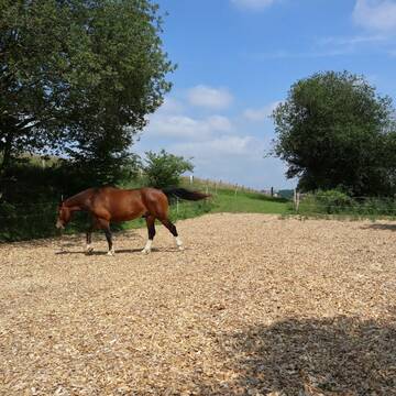
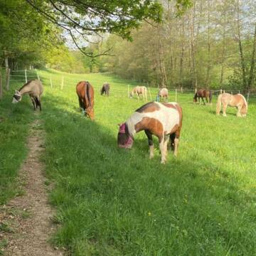
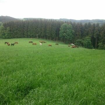
Herdenplätze für Islandpferde
Schalksmühle
Islandpferdehof Herberge
@Islandpferdehof
Freizeitstall
Gangpferdereiten
Hunde willkommen
Krankenbox
Notfallboxen
Laufstall
Offenstall
11 weitere...
P
3 Plätze im gepflegtem Offenstall/Paddocktrail
Nordrhein-Westfalen - Kierspe
Hof Krugmann
@Hof-Krugmann
Freizeitstall
Geländestrecke
Hunde willkommen
Krankenbox
Bewegungsstall
Laufstall
Halbpension
11 weitere...
P+
Deprecated: Creation of dynamic property Zend_View_Helper_Ads::$adLink is deprecated in /var/www/stall-frei/htdocs/staging.stall-frei.de/library/Psf/View/Helper/Ads.php on line 108

Futtersack HeuToy, Fressbremse in pink
Mechtersen
STALL-FREIde Marketing
@STALL-FREI-Marketing
Stundenlange Beschäftigung die
Koliken vorbeugt, geringe Staubinhalation mit
steuerbarer Futterentnahme

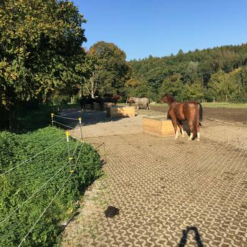
Shamrock Stables, LAG Offenstall
Kierspe
Shamrock Stables
@Shamrock-Stables
FN-Mitglied
Freizeitstall
Vermieten
Hunde willkommen
Krankenbox
Notfallboxen
zuckerreduziertes Heu
19 weitere...
P


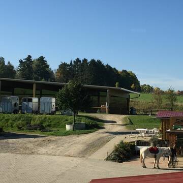
Offenstall Plätze auf Gut Krägeloh
Breckerfeld
Lisa Schlömer
@GutKraegeloh
Freizeitstall
Geländestrecke
Vermieten
Hunde willkommen
Paddock
Hufrehe geeignet
Notfallboxen
12 weitere...
P+


4 Sterne Aktivstall Gut Lieselühr
Schwerte
Gut Lieselühr
@Gut-Lieseluehr
FN-Mitglied
Freizeitstall
Hunde willkommen
Krankenbox
Notfallboxen
Zuchtstutenhaltung möglich
Außenbox mit Paddock
Bewegungsstall
24 weitere...
S
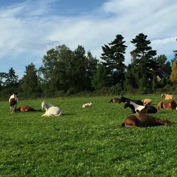
Boxen mit ganzjähriger+ganztägiger Herdenhaltung
Breckerfeld
Buettner4
@Buettner4
Geländestrecke
Pferdeausbildung
Vermieten
Führanlage
Hunde willkommen
Außenboxen
Innenbox
16 weitere...
P

Offenstallplatz, Einstellplatz, Weideplatz biete
Kierspe
Christian
@anLuk
Fahrstall, Kutschwagen
Sattelkammer/Sattelschränke
Sommerweide
Offenstall
1 weitere...
P

Heu und Heulage verkaufen
Mechtersen
STALL-FREIde Marketing
@STALL-FREI-Marketing
Verkaufen Sie Ihr Heu und Ihre Heulage direkt an Reiter, Pferdeställe und Reitanlagen

Offenstall mit Paddocktrail und Reithalle
Kierspe
Fjordlinger Hof
@Desiree906
Freizeitstall
Vermieten
Reithalle
Sattelkammer/Sattelschränke
Offenstall
Paddock Trail
6 weitere...
aktuell
P
Leider kein Vorschaubild
Leider kein Vorschaubild
Pferdebox/Einstellplatz Shetty - Kaltblut
Schalksmühle
Birgit Gräwe
@Auszeitaltenhorst
Freizeitstall
Geländestrecke
Vermieten
Hunde willkommen
Paddock
Innenbox
11 weitere...
B

Freigut Hückinghausen
Hagen
Nadine Funke-Gansterer
@Nadine-Gansterer
Pferdeausbildung
Vermieten
Hunde willkommen
Krankenbox
Notfallboxen
9 weitere...
P
Deprecated: Creation of dynamic property Zend_View::$pageCount is deprecated in /var/www/stall-frei/htdocs/staging.stall-frei.de/library/vendor/shardj/zf1-future/library/Zend/View/Abstract.php on line 308
Deprecated: Creation of dynamic property Zend_View::$itemCountPerPage is deprecated in /var/www/stall-frei/htdocs/staging.stall-frei.de/library/vendor/shardj/zf1-future/library/Zend/View/Abstract.php on line 308
Deprecated: Creation of dynamic property Zend_View::$first is deprecated in /var/www/stall-frei/htdocs/staging.stall-frei.de/library/vendor/shardj/zf1-future/library/Zend/View/Abstract.php on line 308
Deprecated: Creation of dynamic property Zend_View::$current is deprecated in /var/www/stall-frei/htdocs/staging.stall-frei.de/library/vendor/shardj/zf1-future/library/Zend/View/Abstract.php on line 308
Deprecated: Creation of dynamic property Zend_View::$last is deprecated in /var/www/stall-frei/htdocs/staging.stall-frei.de/library/vendor/shardj/zf1-future/library/Zend/View/Abstract.php on line 308
Deprecated: Creation of dynamic property Zend_View::$next is deprecated in /var/www/stall-frei/htdocs/staging.stall-frei.de/library/vendor/shardj/zf1-future/library/Zend/View/Abstract.php on line 308
Deprecated: Creation of dynamic property Zend_View::$pagesInRange is deprecated in /var/www/stall-frei/htdocs/staging.stall-frei.de/library/vendor/shardj/zf1-future/library/Zend/View/Abstract.php on line 308
Deprecated: Creation of dynamic property Zend_View::$firstPageInRange is deprecated in /var/www/stall-frei/htdocs/staging.stall-frei.de/library/vendor/shardj/zf1-future/library/Zend/View/Abstract.php on line 308
Deprecated: Creation of dynamic property Zend_View::$lastPageInRange is deprecated in /var/www/stall-frei/htdocs/staging.stall-frei.de/library/vendor/shardj/zf1-future/library/Zend/View/Abstract.php on line 308
Deprecated: Creation of dynamic property Zend_View::$currentItemCount is deprecated in /var/www/stall-frei/htdocs/staging.stall-frei.de/library/vendor/shardj/zf1-future/library/Zend/View/Abstract.php on line 308
Deprecated: Creation of dynamic property Zend_View::$totalItemCount is deprecated in /var/www/stall-frei/htdocs/staging.stall-frei.de/library/vendor/shardj/zf1-future/library/Zend/View/Abstract.php on line 308
Deprecated: Creation of dynamic property Zend_View::$firstItemNumber is deprecated in /var/www/stall-frei/htdocs/staging.stall-frei.de/library/vendor/shardj/zf1-future/library/Zend/View/Abstract.php on line 308
Deprecated: Creation of dynamic property Zend_View::$lastItemNumber is deprecated in /var/www/stall-frei/htdocs/staging.stall-frei.de/library/vendor/shardj/zf1-future/library/Zend/View/Abstract.php on line 308
Deprecated: Creation of dynamic property Zend_View::$router is deprecated in /var/www/stall-frei/htdocs/staging.stall-frei.de/library/vendor/shardj/zf1-future/library/Zend/View/Abstract.php on line 308
Deprecated: Creation of dynamic property Zend_View::$urlParams is deprecated in /var/www/stall-frei/htdocs/staging.stall-frei.de/library/vendor/shardj/zf1-future/library/Zend/View/Abstract.php on line 308
Deprecated: Creation of dynamic property Zend_View::$showAds is deprecated in /var/www/stall-frei/htdocs/staging.stall-frei.de/library/vendor/shardj/zf1-future/library/Zend/View/Abstract.php on line 308
Deprecated: Creation of dynamic property Zend_View::$objectIds is deprecated in /var/www/stall-frei/htdocs/staging.stall-frei.de/library/vendor/shardj/zf1-future/library/Zend/View/Abstract.php on line 308
Deprecated: Creation of dynamic property Zend_View::$showNavbar is deprecated in /var/www/stall-frei/htdocs/staging.stall-frei.de/library/vendor/shardj/zf1-future/library/Zend/View/Abstract.php on line 308
Deprecated: Creation of dynamic property Zend_View::$showBreadcrumb is deprecated in /var/www/stall-frei/htdocs/staging.stall-frei.de/library/vendor/shardj/zf1-future/library/Zend/View/Abstract.php on line 308
Deprecated: Creation of dynamic property Zend_View::$showFooter is deprecated in /var/www/stall-frei/htdocs/staging.stall-frei.de/library/vendor/shardj/zf1-future/library/Zend/View/Abstract.php on line 308
Deprecated: Creation of dynamic property Zend_View::$showInternalAds is deprecated in /var/www/stall-frei/htdocs/staging.stall-frei.de/library/vendor/shardj/zf1-future/library/Zend/View/Abstract.php on line 308
Deprecated: Creation of dynamic property Zend_View::$blNoContent is deprecated in /var/www/stall-frei/htdocs/staging.stall-frei.de/library/vendor/shardj/zf1-future/library/Zend/View/Abstract.php on line 308
Deprecated: Creation of dynamic property Zend_View::$sMetaDesc is deprecated in /var/www/stall-frei/htdocs/staging.stall-frei.de/library/vendor/shardj/zf1-future/library/Zend/View/Abstract.php on line 308
Deprecated: Creation of dynamic property Zend_View::$useGmaps is deprecated in /var/www/stall-frei/htdocs/staging.stall-frei.de/library/vendor/shardj/zf1-future/library/Zend/View/Abstract.php on line 308
Deprecated: Creation of dynamic property Zend_View::$touches is deprecated in /var/www/stall-frei/htdocs/staging.stall-frei.de/library/vendor/shardj/zf1-future/library/Zend/View/Abstract.php on line 308
Deprecated: Creation of dynamic property Zend_View::$oProject is deprecated in /var/www/stall-frei/htdocs/staging.stall-frei.de/library/vendor/shardj/zf1-future/library/Zend/View/Abstract.php on line 308
Deprecated: Creation of dynamic property Zend_View::$pageHeadline is deprecated in /var/www/stall-frei/htdocs/staging.stall-frei.de/library/vendor/shardj/zf1-future/library/Zend/View/Abstract.php on line 308
Deprecated: Creation of dynamic property Zend_View::$disableLocationField is deprecated in /var/www/stall-frei/htdocs/staging.stall-frei.de/library/vendor/shardj/zf1-future/library/Zend/View/Abstract.php on line 308
Deprecated: Creation of dynamic property Zend_View::$isSearch is deprecated in /var/www/stall-frei/htdocs/staging.stall-frei.de/library/vendor/shardj/zf1-future/library/Zend/View/Abstract.php on line 308
Deprecated: Creation of dynamic property Zend_View::$pageTitle is deprecated in /var/www/stall-frei/htdocs/staging.stall-frei.de/library/vendor/shardj/zf1-future/library/Zend/View/Abstract.php on line 308
Deprecated: Creation of dynamic property Psf_Form_Element_Text::$class is deprecated in /var/www/stall-frei/htdocs/staging.stall-frei.de/library/vendor/shardj/zf1-future/library/Zend/Form/Element.php on line 874
Deprecated: Creation of dynamic property Psf_Form_Element_Text::$size is deprecated in /var/www/stall-frei/htdocs/staging.stall-frei.de/library/vendor/shardj/zf1-future/library/Zend/Form/Element.php on line 874
Deprecated: Creation of dynamic property Psf_Form_Element_Text::$placeholder is deprecated in /var/www/stall-frei/htdocs/staging.stall-frei.de/library/vendor/shardj/zf1-future/library/Zend/Form/Element.php on line 874
Deprecated: Creation of dynamic property Psf_Form_Element_Hidden::$class is deprecated in /var/www/stall-frei/htdocs/staging.stall-frei.de/library/vendor/shardj/zf1-future/library/Zend/Form/Element.php on line 874
Deprecated: Creation of dynamic property Psf_Form_Element_Hidden::$class is deprecated in /var/www/stall-frei/htdocs/staging.stall-frei.de/library/vendor/shardj/zf1-future/library/Zend/Form/Element.php on line 874
Deprecated: Creation of dynamic property Psf_Form_Element_Hidden::$class is deprecated in /var/www/stall-frei/htdocs/staging.stall-frei.de/library/vendor/shardj/zf1-future/library/Zend/Form/Element.php on line 874
Deprecated: Creation of dynamic property Psf_Form_Element_Hidden::$class is deprecated in /var/www/stall-frei/htdocs/staging.stall-frei.de/library/vendor/shardj/zf1-future/library/Zend/Form/Element.php on line 874
Deprecated: Creation of dynamic property Psf_Form_Element_Select::$class is deprecated in /var/www/stall-frei/htdocs/staging.stall-frei.de/library/vendor/shardj/zf1-future/library/Zend/Form/Element.php on line 874
Deprecated: Creation of dynamic property Psf_Form_Element_Select::$class is deprecated in /var/www/stall-frei/htdocs/staging.stall-frei.de/library/vendor/shardj/zf1-future/library/Zend/Form/Element.php on line 874
Deprecated: Creation of dynamic property Psf_Form_Element_Select::$class is deprecated in /var/www/stall-frei/htdocs/staging.stall-frei.de/library/vendor/shardj/zf1-future/library/Zend/Form/Element.php on line 874
Deprecated: Creation of dynamic property Psf_Form_Element_Select::$class is deprecated in /var/www/stall-frei/htdocs/staging.stall-frei.de/library/vendor/shardj/zf1-future/library/Zend/Form/Element.php on line 874
Deprecated: Creation of dynamic property Psf_Form_Element_Text::$class is deprecated in /var/www/stall-frei/htdocs/staging.stall-frei.de/library/vendor/shardj/zf1-future/library/Zend/Form/Element.php on line 874
Deprecated: Creation of dynamic property Psf_Form_Element_Checkbox::$label is deprecated in /var/www/stall-frei/htdocs/staging.stall-frei.de/library/vendor/shardj/zf1-future/library/Zend/Form/Element.php on line 874
Deprecated: Creation of dynamic property Zend_View::$sort is deprecated in /var/www/stall-frei/htdocs/staging.stall-frei.de/library/vendor/shardj/zf1-future/library/Zend/View/Abstract.php on line 308
Deprecated: Creation of dynamic property Zend_View::$searchLocation is deprecated in /var/www/stall-frei/htdocs/staging.stall-frei.de/library/vendor/shardj/zf1-future/library/Zend/View/Abstract.php on line 308
Deprecated: Creation of dynamic property Zend_View::$locationHint is deprecated in /var/www/stall-frei/htdocs/staging.stall-frei.de/library/vendor/shardj/zf1-future/library/Zend/View/Abstract.php on line 308
Psf_GeoCoder_Abstract::getLocation: Ostendorf Get Location CachedOrLive
Psf_GeoCoder_Abstract::getCachedOrLive: Ostendorf
Psf_GeoCoder_OpenCageData::makeApiRequest: response:
Array
(
[documentation] => https://opencagedata.com/api
[licenses] => Array
(
[0] => Array
(
[name] => see attribution guide
[url] => https://opencagedata.com/credits
)
)
[results] => Array
(
[0] => Array
(
[bounds] => Array
(
[northeast] => Array
(
[lat] => 51.2108118
[lng] => 7.5601651
)
[southwest] => Array
(
[lat] => 51.2087538
[lng] => 7.5532675
)
)
[components] => Array
(
[ISO_3166-1_alpha-2] => DE
[ISO_3166-1_alpha-3] => DEU
[ISO_3166-2] => Array
(
[0] => DE-NW
)
[_category] => place
[_normalized_city] => Lüdenscheid
[_type] => hamlet
[continent] => Europe
[country] => Deutschland
[country_code] => de
[county] => Märkischer Kreis
[hamlet] => Winkhausen
[political_union] => European Union
[postcode] => 58515
[residential] => Ostendorf
[state] => Nordrhein-Westfalen
[state_code] => NW
[town] => Lüdenscheid
)
[confidence] => 9
[formatted] => Winkhausen, 58515 Lüdenscheid, Deutschland
[geometry] => Array
(
[lat] => 51.209791
[lng] => 7.5567065
)
)
[1] => Array
(
[bounds] => Array
(
[northeast] => Array
(
[lat] => 53.5938997
[lng] => 9.1615944
)
[southwest] => Array
(
[lat] => 53.5380255
[lng] => 9.1340611
)
)
[components] => Array
(
[ISO_3166-1_alpha-2] => DE
[ISO_3166-1_alpha-3] => DEU
[ISO_3166-2] => Array
(
[0] => DE-NI
)
[_category] => place
[_normalized_city] => Bremervörde
[_type] => neighbourhood
[city_district] => Ostendorf
[continent] => Europe
[country] => Deutschland
[country_code] => de
[county] => Landkreis Rotenburg (Wümme)
[political_union] => European Union
[state] => Niedersachsen
[state_code] => NI
[town] => Bremervörde
)
[confidence] => 7
[formatted] => Ostendorf, Bremervörde, Niedersachsen, Deutschland
[geometry] => Array
(
[lat] => 53.5651768
[lng] => 9.1497183
)
)
[2] => Array
(
[bounds] => Array
(
[northeast] => Array
(
[lat] => 48.5938489
[lng] => 10.8769914
)
[southwest] => Array
(
[lat] => 48.5538489
[lng] => 10.8369914
)
)
[components] => Array
(
[ISO_3166-1_alpha-2] => DE
[ISO_3166-1_alpha-3] => DEU
[ISO_3166-2] => Array
(
[0] => DE-BY
)
[_category] => place
[_normalized_city] => Meitingen
[_type] => village
[continent] => Europe
[country] => Deutschland
[country_code] => de
[county] => Landkreis Augsburg
[political_union] => European Union
[postcode] => 86405
[state] => Bayern
[state_code] => BY
[town] => Meitingen
[village] => Ostendorf
)
[confidence] => 7
[formatted] => 86405 Ostendorf, Deutschland
[geometry] => Array
(
[lat] => 48.5738489
[lng] => 10.8569914
)
)
[3] => Array
(
[bounds] => Array
(
[northeast] => Array
(
[lat] => 51.5092707
[lng] => 7.6729563
)
[southwest] => Array
(
[lat] => 51.4692707
[lng] => 7.6329563
)
)
[components] => Array
(
[ISO_3166-1_alpha-2] => DE
[ISO_3166-1_alpha-3] => DEU
[ISO_3166-2] => Array
(
[0] => DE-NW
)
[_category] => place
[_normalized_city] => Holzwickede
[_type] => village
[continent] => Europe
[country] => Deutschland
[country_code] => de
[county] => Kreis Unna
[political_union] => European Union
[postcode] => 59439
[state] => Nordrhein-Westfalen
[state_code] => NW
[town] => Holzwickede
[village] => Ostendorf
)
[confidence] => 7
[formatted] => 59439 Ostendorf, Deutschland
[geometry] => Array
(
[lat] => 51.4892707
[lng] => 7.6529563
)
)
[4] => Array
(
[bounds] => Array
(
[northeast] => Array
(
[lat] => 52.1640489
[lng] => 7.4400256
)
[southwest] => Array
(
[lat] => 52.1240489
[lng] => 7.4000256
)
)
[components] => Array
(
[ISO_3166-1_alpha-2] => DE
[ISO_3166-1_alpha-3] => DEU
[ISO_3166-2] => Array
(
[0] => DE-NW
)
[_category] => place
[_normalized_city] => Ostendorf
[_type] => village
[continent] => Europe
[country] => Deutschland
[country_code] => de
[county] => Kreis Steinfurt
[municipality] => Steinfurt
[political_union] => European Union
[state] => Nordrhein-Westfalen
[state_code] => NW
[village] => Ostendorf
)
[confidence] => 7
[formatted] => Ostendorf, Nordrhein-Westfalen, Deutschland
[geometry] => Array
(
[lat] => 52.1440489
[lng] => 7.4200256
)
)
[5] => Array
(
[bounds] => Array
(
[northeast] => Array
(
[lat] => 52.1803595
[lng] => 7.4556055
)
[southwest] => Array
(
[lat] => 52.1118286
[lng] => 7.4080033
)
)
[components] => Array
(
[ISO_3166-1_alpha-2] => DE
[ISO_3166-1_alpha-3] => DEU
[ISO_3166-2] => Array
(
[0] => DE-NW
)
[_category] => place
[_normalized_city] => Borghorst
[_type] => village
[continent] => Europe
[country] => Deutschland
[country_code] => de
[county] => Kreis Steinfurt
[municipality] => Steinfurt
[neighbourhood] => Ostendorf
[political_union] => European Union
[postcode] => 48565
[state] => Nordrhein-Westfalen
[state_code] => NW
[town] => Borghorst
[village] => Ostendorf
)
[confidence] => 7
[formatted] => 48565 Ostendorf, Deutschland
[geometry] => Array
(
[lat] => 52.1467585
[lng] => 7.4318266
)
)
[6] => Array
(
[bounds] => Array
(
[northeast] => Array
(
[lat] => 52.1248095
[lng] => 7.3357999
)
[southwest] => Array
(
[lat] => 52.0913491
[lng] => 7.2860398
)
)
[components] => Array
(
[ISO_3166-1_alpha-2] => DE
[ISO_3166-1_alpha-3] => DEU
[ISO_3166-2] => Array
(
[0] => DE-NW
)
[_category] => place
[_normalized_city] => Horstmar
[_type] => hamlet
[city_district] => Leer
[continent] => Europe
[country] => Deutschland
[country_code] => de
[county] => Kreis Steinfurt
[hamlet] => Ostendorf
[political_union] => European Union
[state] => Nordrhein-Westfalen
[state_code] => NW
[village] => Horstmar
)
[confidence] => 7
[formatted] => Ostendorf, Leer, Horstmar, Nordrhein-Westfalen, Deutschland
[geometry] => Array
(
[lat] => 52.1066378
[lng] => 7.3052525
)
)
[7] => Array
(
[bounds] => Array
(
[northeast] => Array
(
[lat] => 52.485098
[lng] => 7.5498907
)
[southwest] => Array
(
[lat] => 52.445098
[lng] => 7.5098907
)
)
[components] => Array
(
[ISO_3166-1_alpha-2] => DE
[ISO_3166-1_alpha-3] => DEU
[ISO_3166-2] => Array
(
[0] => DE-NI
)
[_category] => place
[_normalized_city] => Freren
[_type] => hamlet
[continent] => Europe
[country] => Deutschland
[country_code] => de
[county] => Landkreis Emsland
[hamlet] => Ostendorf
[municipality] => Samtgemeinde Freren
[political_union] => European Union
[postcode] => 49832
[state] => Niedersachsen
[state_code] => NI
[village] => Freren
)
[confidence] => 7
[formatted] => Ostendorf, 49832 Freren, Deutschland
[geometry] => Array
(
[lat] => 52.465098
[lng] => 7.5298907
)
)
[8] => Array
(
[bounds] => Array
(
[northeast] => Array
(
[lat] => 53.5784224
[lng] => 9.1706585
)
[southwest] => Array
(
[lat] => 53.5384224
[lng] => 9.1306585
)
)
[components] => Array
(
[ISO_3166-1_alpha-2] => DE
[ISO_3166-1_alpha-3] => DEU
[ISO_3166-2] => Array
(
[0] => DE-NI
)
[_category] => place
[_normalized_city] => Bremervörde
[_type] => hamlet
[city_district] => Ostendorf
[continent] => Europe
[country] => Deutschland
[country_code] => de
[county] => Landkreis Rotenburg (Wümme)
[hamlet] => Ostendorf
[political_union] => European Union
[state] => Niedersachsen
[state_code] => NI
[town] => Bremervörde
)
[confidence] => 7
[formatted] => Ostendorf, Bremervörde, Niedersachsen, Deutschland
[geometry] => Array
(
[lat] => 53.5584224
[lng] => 9.1506585
)
)
[9] => Array
(
[bounds] => Array
(
[northeast] => Array
(
[lat] => 53.2310959
[lng] => 8.9523461
)
[southwest] => Array
(
[lat] => 53.1910959
[lng] => 8.9123461
)
)
[components] => Array
(
[ISO_3166-1_alpha-2] => DE
[ISO_3166-1_alpha-3] => DEU
[ISO_3166-2] => Array
(
[0] => DE-NI
)
[_category] => place
[_normalized_city] => Worpswede
[_type] => hamlet
[continent] => Europe
[country] => Deutschland
[country_code] => de
[county] => Landkreis Osterholz
[hamlet] => Ostendorf
[political_union] => European Union
[postcode] => 27726
[state] => Niedersachsen
[state_code] => NI
[town] => Worpswede
)
[confidence] => 7
[formatted] => Ostendorf, 27726 Worpswede, Deutschland
[geometry] => Array
(
[lat] => 53.2110959
[lng] => 8.9323461
)
)
)
[status] => Array
(
[code] => 200
[message] => OK
)
[stay_informed] => Array
(
[blog] => https://blog.opencagedata.com
[mastodon] => https://en.osm.town/@opencage
)
[thanks] => For using an OpenCage API
[timestamp] => Array
(
[created_http] => Sun, 08 Feb 2026 07:31:37 GMT
[created_unix] => 1770535897
)
[total_results] => 10
)
Psf_GeoCoder_Abstract::convertLocationResult
{"documentation":"https:\/\/opencagedata.com\/api","licenses":[{"name":"see attribution guide","url":"https:\/\/opencagedata.com\/credits"}],"results":[{"bounds":{"northeast":{"lat":51.2108118,"lng":7.5601651},"southwest":{"lat":51.2087538,"lng":7.5532675}},"components":{"ISO_3166-1_alpha-2":"DE","ISO_3166-1_alpha-3":"DEU","ISO_3166-2":["DE-NW"],"_category":"place","_normalized_city":"L\u00fcdenscheid","_type":"hamlet","continent":"Europe","country":"Deutschland","country_code":"de","county":"M\u00e4rkischer Kreis","hamlet":"Winkhausen","political_union":"European Union","postcode":"58515","residential":"Ostendorf","state":"Nordrhein-Westfalen","state_code":"NW","town":"L\u00fcdenscheid"},"confidence":9,"formatted":"Winkhausen, 58515 L\u00fcdenscheid, Deutschland","geometry":{"lat":51.209791,"lng":7.5567065}},{"bounds":{"northeast":{"lat":53.5938997,"lng":9.1615944},"southwest":{"lat":53.5380255,"lng":9.1340611}},"components":{"ISO_3166-1_alpha-2":"DE","ISO_3166-1_alpha-3":"DEU","ISO_3166-2":["DE-NI"],"_category":"place","_normalized_city":"Bremerv\u00f6rde","_type":"neighbourhood","city_district":"Ostendorf","continent":"Europe","country":"Deutschland","country_code":"de","county":"Landkreis Rotenburg (W\u00fcmme)","political_union":"European Union","state":"Niedersachsen","state_code":"NI","town":"Bremerv\u00f6rde"},"confidence":7,"formatted":"Ostendorf, Bremerv\u00f6rde, Niedersachsen, Deutschland","geometry":{"lat":53.5651768,"lng":9.1497183}},{"bounds":{"northeast":{"lat":48.5938489,"lng":10.8769914},"southwest":{"lat":48.5538489,"lng":10.8369914}},"components":{"ISO_3166-1_alpha-2":"DE","ISO_3166-1_alpha-3":"DEU","ISO_3166-2":["DE-BY"],"_category":"place","_normalized_city":"Meitingen","_type":"village","continent":"Europe","country":"Deutschland","country_code":"de","county":"Landkreis Augsburg","political_union":"European Union","postcode":"86405","state":"Bayern","state_code":"BY","town":"Meitingen","village":"Ostendorf"},"confidence":7,"formatted":"86405 Ostendorf, Deutschland","geometry":{"lat":48.5738489,"lng":10.8569914}},{"bounds":{"northeast":{"lat":51.5092707,"lng":7.6729563},"southwest":{"lat":51.4692707,"lng":7.6329563}},"components":{"ISO_3166-1_alpha-2":"DE","ISO_3166-1_alpha-3":"DEU","ISO_3166-2":["DE-NW"],"_category":"place","_normalized_city":"Holzwickede","_type":"village","continent":"Europe","country":"Deutschland","country_code":"de","county":"Kreis Unna","political_union":"European Union","postcode":"59439","state":"Nordrhein-Westfalen","state_code":"NW","town":"Holzwickede","village":"Ostendorf"},"confidence":7,"formatted":"59439 Ostendorf, Deutschland","geometry":{"lat":51.4892707,"lng":7.6529563}},{"bounds":{"northeast":{"lat":52.1640489,"lng":7.4400256},"southwest":{"lat":52.1240489,"lng":7.4000256}},"components":{"ISO_3166-1_alpha-2":"DE","ISO_3166-1_alpha-3":"DEU","ISO_3166-2":["DE-NW"],"_category":"place","_normalized_city":"Ostendorf","_type":"village","continent":"Europe","country":"Deutschland","country_code":"de","county":"Kreis Steinfurt","municipality":"Steinfurt","political_union":"European Union","state":"Nordrhein-Westfalen","state_code":"NW","village":"Ostendorf"},"confidence":7,"formatted":"Ostendorf, Nordrhein-Westfalen, Deutschland","geometry":{"lat":52.1440489,"lng":7.4200256}},{"bounds":{"northeast":{"lat":52.1803595,"lng":7.4556055},"southwest":{"lat":52.1118286,"lng":7.4080033}},"components":{"ISO_3166-1_alpha-2":"DE","ISO_3166-1_alpha-3":"DEU","ISO_3166-2":["DE-NW"],"_category":"place","_normalized_city":"Borghorst","_type":"village","continent":"Europe","country":"Deutschland","country_code":"de","county":"Kreis Steinfurt","municipality":"Steinfurt","neighbourhood":"Ostendorf","political_union":"European Union","postcode":"48565","state":"Nordrhein-Westfalen","state_code":"NW","town":"Borghorst","village":"Ostendorf"},"confidence":7,"formatted":"48565 Ostendorf, Deutschland","geometry":{"lat":52.1467585,"lng":7.4318266}},{"bounds":{"northeast":{"lat":52.1248095,"lng":7.3357999},"southwest":{"lat":52.0913491,"lng":7.2860398}},"components":{"ISO_3166-1_alpha-2":"DE","ISO_3166-1_alpha-3":"DEU","ISO_3166-2":["DE-NW"],"_category":"place","_normalized_city":"Horstmar","_type":"hamlet","city_district":"Leer","continent":"Europe","country":"Deutschland","country_code":"de","county":"Kreis Steinfurt","hamlet":"Ostendorf","political_union":"European Union","state":"Nordrhein-Westfalen","state_code":"NW","village":"Horstmar"},"confidence":7,"formatted":"Ostendorf, Leer, Horstmar, Nordrhein-Westfalen, Deutschland","geometry":{"lat":52.1066378,"lng":7.3052525}},{"bounds":{"northeast":{"lat":52.485098,"lng":7.5498907},"southwest":{"lat":52.445098,"lng":7.5098907}},"components":{"ISO_3166-1_alpha-2":"DE","ISO_3166-1_alpha-3":"DEU","ISO_3166-2":["DE-NI"],"_category":"place","_normalized_city":"Freren","_type":"hamlet","continent":"Europe","country":"Deutschland","country_code":"de","county":"Landkreis Emsland","hamlet":"Ostendorf","municipality":"Samtgemeinde Freren","political_union":"European Union","postcode":"49832","state":"Niedersachsen","state_code":"NI","village":"Freren"},"confidence":7,"formatted":"Ostendorf, 49832 Freren, Deutschland","geometry":{"lat":52.465098,"lng":7.5298907}},{"bounds":{"northeast":{"lat":53.5784224,"lng":9.1706585},"southwest":{"lat":53.5384224,"lng":9.1306585}},"components":{"ISO_3166-1_alpha-2":"DE","ISO_3166-1_alpha-3":"DEU","ISO_3166-2":["DE-NI"],"_category":"place","_normalized_city":"Bremerv\u00f6rde","_type":"hamlet","city_district":"Ostendorf","continent":"Europe","country":"Deutschland","country_code":"de","county":"Landkreis Rotenburg (W\u00fcmme)","hamlet":"Ostendorf","political_union":"European Union","state":"Niedersachsen","state_code":"NI","town":"Bremerv\u00f6rde"},"confidence":7,"formatted":"Ostendorf, Bremerv\u00f6rde, Niedersachsen, Deutschland","geometry":{"lat":53.5584224,"lng":9.1506585}},{"bounds":{"northeast":{"lat":53.2310959,"lng":8.9523461},"southwest":{"lat":53.1910959,"lng":8.9123461}},"components":{"ISO_3166-1_alpha-2":"DE","ISO_3166-1_alpha-3":"DEU","ISO_3166-2":["DE-NI"],"_category":"place","_normalized_city":"Worpswede","_type":"hamlet","continent":"Europe","country":"Deutschland","country_code":"de","county":"Landkreis Osterholz","hamlet":"Ostendorf","political_union":"European Union","postcode":"27726","state":"Niedersachsen","state_code":"NI","town":"Worpswede"},"confidence":7,"formatted":"Ostendorf, 27726 Worpswede, Deutschland","geometry":{"lat":53.2110959,"lng":8.9323461}}],"status":{"code":200,"message":"OK"},"stay_informed":{"blog":"https:\/\/blog.opencagedata.com","mastodon":"https:\/\/en.osm.town\/@opencage"},"thanks":"For using an OpenCage API","timestamp":{"created_http":"Sun, 08 Feb 2026 07:31:37 GMT","created_unix":1770535897},"total_results":10}Array
(
[0] => stdClass Object
(
[bounds] => stdClass Object
(
[northeast] => stdClass Object
(
[lat] => 51.2108118
[lng] => 7.5601651
)
[southwest] => stdClass Object
(
[lat] => 51.2087538
[lng] => 7.5532675
)
)
[components] => stdClass Object
(
[ISO_3166-1_alpha-2] => DE
[ISO_3166-1_alpha-3] => DEU
[ISO_3166-2] => Array
(
[0] => DE-NW
)
[_category] => place
[_normalized_city] => Lüdenscheid
[_type] => hamlet
[continent] => Europe
[country] => Deutschland
[country_code] => de
[county] => Märkischer Kreis
[hamlet] => Winkhausen
[political_union] => European Union
[postcode] => 58515
[residential] => Ostendorf
[state] => Nordrhein-Westfalen
[state_code] => NW
[town] => Lüdenscheid
)
[confidence] => 9
[formatted] => Winkhausen, 58515 Lüdenscheid, Deutschland
[geometry] => stdClass Object
(
[lat] => 51.209791
[lng] => 7.5567065
)
)
[1] => stdClass Object
(
[bounds] => stdClass Object
(
[northeast] => stdClass Object
(
[lat] => 53.5938997
[lng] => 9.1615944
)
[southwest] => stdClass Object
(
[lat] => 53.5380255
[lng] => 9.1340611
)
)
[components] => stdClass Object
(
[ISO_3166-1_alpha-2] => DE
[ISO_3166-1_alpha-3] => DEU
[ISO_3166-2] => Array
(
[0] => DE-NI
)
[_category] => place
[_normalized_city] => Bremervörde
[_type] => neighbourhood
[city_district] => Ostendorf
[continent] => Europe
[country] => Deutschland
[country_code] => de
[county] => Landkreis Rotenburg (Wümme)
[political_union] => European Union
[state] => Niedersachsen
[state_code] => NI
[town] => Bremervörde
)
[confidence] => 7
[formatted] => Ostendorf, Bremervörde, Niedersachsen, Deutschland
[geometry] => stdClass Object
(
[lat] => 53.5651768
[lng] => 9.1497183
)
)
[2] => stdClass Object
(
[bounds] => stdClass Object
(
[northeast] => stdClass Object
(
[lat] => 48.5938489
[lng] => 10.8769914
)
[southwest] => stdClass Object
(
[lat] => 48.5538489
[lng] => 10.8369914
)
)
[components] => stdClass Object
(
[ISO_3166-1_alpha-2] => DE
[ISO_3166-1_alpha-3] => DEU
[ISO_3166-2] => Array
(
[0] => DE-BY
)
[_category] => place
[_normalized_city] => Meitingen
[_type] => village
[continent] => Europe
[country] => Deutschland
[country_code] => de
[county] => Landkreis Augsburg
[political_union] => European Union
[postcode] => 86405
[state] => Bayern
[state_code] => BY
[town] => Meitingen
[village] => Ostendorf
)
[confidence] => 7
[formatted] => 86405 Ostendorf, Deutschland
[geometry] => stdClass Object
(
[lat] => 48.5738489
[lng] => 10.8569914
)
)
[3] => stdClass Object
(
[bounds] => stdClass Object
(
[northeast] => stdClass Object
(
[lat] => 51.5092707
[lng] => 7.6729563
)
[southwest] => stdClass Object
(
[lat] => 51.4692707
[lng] => 7.6329563
)
)
[components] => stdClass Object
(
[ISO_3166-1_alpha-2] => DE
[ISO_3166-1_alpha-3] => DEU
[ISO_3166-2] => Array
(
[0] => DE-NW
)
[_category] => place
[_normalized_city] => Holzwickede
[_type] => village
[continent] => Europe
[country] => Deutschland
[country_code] => de
[county] => Kreis Unna
[political_union] => European Union
[postcode] => 59439
[state] => Nordrhein-Westfalen
[state_code] => NW
[town] => Holzwickede
[village] => Ostendorf
)
[confidence] => 7
[formatted] => 59439 Ostendorf, Deutschland
[geometry] => stdClass Object
(
[lat] => 51.4892707
[lng] => 7.6529563
)
)
[4] => stdClass Object
(
[bounds] => stdClass Object
(
[northeast] => stdClass Object
(
[lat] => 52.1640489
[lng] => 7.4400256
)
[southwest] => stdClass Object
(
[lat] => 52.1240489
[lng] => 7.4000256
)
)
[components] => stdClass Object
(
[ISO_3166-1_alpha-2] => DE
[ISO_3166-1_alpha-3] => DEU
[ISO_3166-2] => Array
(
[0] => DE-NW
)
[_category] => place
[_normalized_city] => Ostendorf
[_type] => village
[continent] => Europe
[country] => Deutschland
[country_code] => de
[county] => Kreis Steinfurt
[municipality] => Steinfurt
[political_union] => European Union
[state] => Nordrhein-Westfalen
[state_code] => NW
[village] => Ostendorf
)
[confidence] => 7
[formatted] => Ostendorf, Nordrhein-Westfalen, Deutschland
[geometry] => stdClass Object
(
[lat] => 52.1440489
[lng] => 7.4200256
)
)
[5] => stdClass Object
(
[bounds] => stdClass Object
(
[northeast] => stdClass Object
(
[lat] => 52.1803595
[lng] => 7.4556055
)
[southwest] => stdClass Object
(
[lat] => 52.1118286
[lng] => 7.4080033
)
)
[components] => stdClass Object
(
[ISO_3166-1_alpha-2] => DE
[ISO_3166-1_alpha-3] => DEU
[ISO_3166-2] => Array
(
[0] => DE-NW
)
[_category] => place
[_normalized_city] => Borghorst
[_type] => village
[continent] => Europe
[country] => Deutschland
[country_code] => de
[county] => Kreis Steinfurt
[municipality] => Steinfurt
[neighbourhood] => Ostendorf
[political_union] => European Union
[postcode] => 48565
[state] => Nordrhein-Westfalen
[state_code] => NW
[town] => Borghorst
[village] => Ostendorf
)
[confidence] => 7
[formatted] => 48565 Ostendorf, Deutschland
[geometry] => stdClass Object
(
[lat] => 52.1467585
[lng] => 7.4318266
)
)
[6] => stdClass Object
(
[bounds] => stdClass Object
(
[northeast] => stdClass Object
(
[lat] => 52.1248095
[lng] => 7.3357999
)
[southwest] => stdClass Object
(
[lat] => 52.0913491
[lng] => 7.2860398
)
)
[components] => stdClass Object
(
[ISO_3166-1_alpha-2] => DE
[ISO_3166-1_alpha-3] => DEU
[ISO_3166-2] => Array
(
[0] => DE-NW
)
[_category] => place
[_normalized_city] => Horstmar
[_type] => hamlet
[city_district] => Leer
[continent] => Europe
[country] => Deutschland
[country_code] => de
[county] => Kreis Steinfurt
[hamlet] => Ostendorf
[political_union] => European Union
[state] => Nordrhein-Westfalen
[state_code] => NW
[village] => Horstmar
)
[confidence] => 7
[formatted] => Ostendorf, Leer, Horstmar, Nordrhein-Westfalen, Deutschland
[geometry] => stdClass Object
(
[lat] => 52.1066378
[lng] => 7.3052525
)
)
[7] => stdClass Object
(
[bounds] => stdClass Object
(
[northeast] => stdClass Object
(
[lat] => 52.485098
[lng] => 7.5498907
)
[southwest] => stdClass Object
(
[lat] => 52.445098
[lng] => 7.5098907
)
)
[components] => stdClass Object
(
[ISO_3166-1_alpha-2] => DE
[ISO_3166-1_alpha-3] => DEU
[ISO_3166-2] => Array
(
[0] => DE-NI
)
[_category] => place
[_normalized_city] => Freren
[_type] => hamlet
[continent] => Europe
[country] => Deutschland
[country_code] => de
[county] => Landkreis Emsland
[hamlet] => Ostendorf
[municipality] => Samtgemeinde Freren
[political_union] => European Union
[postcode] => 49832
[state] => Niedersachsen
[state_code] => NI
[village] => Freren
)
[confidence] => 7
[formatted] => Ostendorf, 49832 Freren, Deutschland
[geometry] => stdClass Object
(
[lat] => 52.465098
[lng] => 7.5298907
)
)
[8] => stdClass Object
(
[bounds] => stdClass Object
(
[northeast] => stdClass Object
(
[lat] => 53.5784224
[lng] => 9.1706585
)
[southwest] => stdClass Object
(
[lat] => 53.5384224
[lng] => 9.1306585
)
)
[components] => stdClass Object
(
[ISO_3166-1_alpha-2] => DE
[ISO_3166-1_alpha-3] => DEU
[ISO_3166-2] => Array
(
[0] => DE-NI
)
[_category] => place
[_normalized_city] => Bremervörde
[_type] => hamlet
[city_district] => Ostendorf
[continent] => Europe
[country] => Deutschland
[country_code] => de
[county] => Landkreis Rotenburg (Wümme)
[hamlet] => Ostendorf
[political_union] => European Union
[state] => Niedersachsen
[state_code] => NI
[town] => Bremervörde
)
[confidence] => 7
[formatted] => Ostendorf, Bremervörde, Niedersachsen, Deutschland
[geometry] => stdClass Object
(
[lat] => 53.5584224
[lng] => 9.1506585
)
)
[9] => stdClass Object
(
[bounds] => stdClass Object
(
[northeast] => stdClass Object
(
[lat] => 53.2310959
[lng] => 8.9523461
)
[southwest] => stdClass Object
(
[lat] => 53.1910959
[lng] => 8.9123461
)
)
[components] => stdClass Object
(
[ISO_3166-1_alpha-2] => DE
[ISO_3166-1_alpha-3] => DEU
[ISO_3166-2] => Array
(
[0] => DE-NI
)
[_category] => place
[_normalized_city] => Worpswede
[_type] => hamlet
[continent] => Europe
[country] => Deutschland
[country_code] => de
[county] => Landkreis Osterholz
[hamlet] => Ostendorf
[political_union] => European Union
[postcode] => 27726
[state] => Niedersachsen
[state_code] => NI
[town] => Worpswede
)
[confidence] => 7
[formatted] => Ostendorf, 27726 Worpswede, Deutschland
[geometry] => stdClass Object
(
[lat] => 53.2110959
[lng] => 8.9323461
)
)
)
Psf_GeoCoder_OpenCageData::getKeyMap: 0
stdClass Object
(
    [bounds] => stdClass Object
        (
            [northeast] => stdClass Object
                (
                    [lat] => 51.2108118
                    [lng] => 7.5601651
                )

            [southwest] => stdClass Object
                (
                    [lat] => 51.2087538
                    [lng] => 7.5532675
                )

        )

    [components] => stdClass Object
        (
            [ISO_3166-1_alpha-2] => DE
            [ISO_3166-1_alpha-3] => DEU
            [ISO_3166-2] => Array
                (
                    [0] => DE-NW
                )

            [_category] => place
            [_normalized_city] => Lüdenscheid
            [_type] => hamlet
            [continent] => Europe
            [country] => Deutschland
            [country_code] => de
            [county] => Märkischer Kreis
            [hamlet] => Winkhausen
            [political_union] => European Union
            [postcode] => 58515
            [residential] => Ostendorf
            [state] => Nordrhein-Westfalen
            [state_code] => NW
            [town] => Lüdenscheid
        )

    [confidence] => 9
    [formatted] => Winkhausen, 58515 Lüdenscheid, Deutschland
    [geometry] => stdClass Object
        (
            [lat] => 51.209791
            [lng] => 7.5567065
        )

)
Psf_GeoCoder_OpenCageData::getCounty: Märkischer Kreis
Psf_GeoCoder_OpenCageData::addMissingData REFETCH!
Array
(
    [address] => Winkhausen, 58515 Lüdenscheid, Deutschland
    [type] => hamlet
    [street] => Winkhausen
    [city] => Lüdenscheid
    [county] => Märkischer Kreis
    [state] => Nordrhein-Westfalen
    [zip] => 58515
    [country] => Deutschland
    [suburb] =>
    [countrycode] => de
    [latitude] => 51.209791
    [longitude] => 7.5567065
    [accuracy] => 1
    [confidence] => 9
    [bounds] => stdClass Object
        (
            [northeast] => stdClass Object
                (
                    [lat] => 51.2108118
                    [lng] => 7.5601651
                )

            [southwest] => stdClass Object
                (
                    [lat] => 51.2087538
                    [lng] => 7.5532675
                )

        )

)
reformat!
Array
(
    [address] => Winkhausen, 58515 Lüdenscheid, Deutschland
    [type] => hamlet
    [street] => Winkhausen
    [city] => Lüdenscheid
    [county] => Märkischer Kreis
    [state] => Nordrhein-Westfalen
    [zip] => 58515
    [country] => Deutschland
    [suburb] =>
    [countrycode] => de
    [latitude] => 51.209791
    [longitude] => 7.5567065
    [accuracy] => 1
    [confidence] => 9
    [bounds] => stdClass Object
        (
            [northeast] => stdClass Object
                (
                    [lat] => 51.2108118
                    [lng] => 7.5601651
                )

            [southwest] => stdClass Object
                (
                    [lat] => 51.2087538
                    [lng] => 7.5532675
                )

        )

    [place] => Winkhausen, 58515 Lüdenscheid, Nordrhein-Westfalen
    [hash] => 6b79544d5af619129afa2381b8f7e2ac
)
Psf_GeoCoder_OpenCageData::getKeyMap: 1
stdClass Object
(
    [bounds] => stdClass Object
        (
            [northeast] => stdClass Object
                (
                    [lat] => 53.5938997
                    [lng] => 9.1615944
                )

            [southwest] => stdClass Object
                (
                    [lat] => 53.5380255
                    [lng] => 9.1340611
                )

        )

    [components] => stdClass Object
        (
            [ISO_3166-1_alpha-2] => DE
            [ISO_3166-1_alpha-3] => DEU
            [ISO_3166-2] => Array
                (
                    [0] => DE-NI
                )

            [_category] => place
            [_normalized_city] => Bremervörde
            [_type] => neighbourhood
            [city_district] => Ostendorf
            [continent] => Europe
            [country] => Deutschland
            [country_code] => de
            [county] => Landkreis Rotenburg (Wümme)
            [political_union] => European Union
            [state] => Niedersachsen
            [state_code] => NI
            [town] => Bremervörde
        )

    [confidence] => 7
    [formatted] => Ostendorf, Bremervörde, Niedersachsen, Deutschland
    [geometry] => stdClass Object
        (
            [lat] => 53.5651768
            [lng] => 9.1497183
        )

)
Psf_GeoCoder_OpenCageData::getCounty: Rotenburg (Wümme)
Psf_GeoCoder_OpenCageData::addMissingData REFETCH!
Array
(
    [address] => Ostendorf, Bremervörde, Niedersachsen, Deutschland
    [type] => neighbourhood
    [street] =>
    [city] => Bremervörde
    [county] => Rotenburg (Wümme)
    [state] => Niedersachsen
    [zip] =>
    [country] => Deutschland
    [suburb] =>
    [countrycode] => de
    [latitude] => 53.5651768
    [longitude] => 9.1497183
    [accuracy] => 1
    [confidence] => 7
    [bounds] => stdClass Object
        (
            [northeast] => stdClass Object
                (
                    [lat] => 53.5938997
                    [lng] => 9.1615944
                )

            [southwest] => stdClass Object
                (
                    [lat] => 53.5380255
                    [lng] => 9.1340611
                )

        )

)
reformat!
Array
(
    [address] => Ostendorf, Bremervörde, Niedersachsen, Deutschland
    [type] => neighbourhood
    [street] =>
    [city] => Bremervörde
    [county] => Rotenburg (Wümme)
    [state] => Niedersachsen
    [zip] =>
    [country] => Deutschland
    [suburb] =>
    [countrycode] => de
    [latitude] => 53.5651768
    [longitude] => 9.1497183
    [accuracy] => 1
    [confidence] => 7
    [bounds] => stdClass Object
        (
            [northeast] => stdClass Object
                (
                    [lat] => 53.5938997
                    [lng] => 9.1615944
                )

            [southwest] => stdClass Object
                (
                    [lat] => 53.5380255
                    [lng] => 9.1340611
                )

        )

    [place] => Bremervörde, Niedersachsen
    [hash] => 18c5f3aa2c884df02702a718caa10298
)
Psf_GeoCoder_OpenCageData::getKeyMap: 2
stdClass Object
(
    [bounds] => stdClass Object
        (
            [northeast] => stdClass Object
                (
                    [lat] => 48.5938489
                    [lng] => 10.8769914
                )

            [southwest] => stdClass Object
                (
                    [lat] => 48.5538489
                    [lng] => 10.8369914
                )

        )

    [components] => stdClass Object
        (
            [ISO_3166-1_alpha-2] => DE
            [ISO_3166-1_alpha-3] => DEU
            [ISO_3166-2] => Array
                (
                    [0] => DE-BY
                )

            [_category] => place
            [_normalized_city] => Meitingen
            [_type] => village
            [continent] => Europe
            [country] => Deutschland
            [country_code] => de
            [county] => Landkreis Augsburg
            [political_union] => European Union
            [postcode] => 86405
            [state] => Bayern
            [state_code] => BY
            [town] => Meitingen
            [village] => Ostendorf
        )

    [confidence] => 7
    [formatted] => 86405 Ostendorf, Deutschland
    [geometry] => stdClass Object
        (
            [lat] => 48.5738489
            [lng] => 10.8569914
        )

)
Psf_GeoCoder_OpenCageData::getCounty: Augsburg
Psf_GeoCoder_OpenCageData::addMissingData REFETCH!
Array
(
    [address] => 86405 Ostendorf, Deutschland
    [type] => village
    [street] =>
    [city] => Meitingen
    [county] => Augsburg
    [state] => Bayern
    [zip] => 86405
    [country] => Deutschland
    [suburb] =>
    [countrycode] => de
    [latitude] => 48.5738489
    [longitude] => 10.8569914
    [accuracy] => 1
    [confidence] => 7
    [bounds] => stdClass Object
        (
            [northeast] => stdClass Object
                (
                    [lat] => 48.5938489
                    [lng] => 10.8769914
                )

            [southwest] => stdClass Object
                (
                    [lat] => 48.5538489
                    [lng] => 10.8369914
                )

        )

)
reformat!
Array
(
    [address] => 86405 Meitingen
    [type] => village
    [street] =>
    [city] => Meitingen
    [county] => Augsburg
    [state] => Bayern
    [zip] => 86405
    [country] => Deutschland
    [suburb] =>
    [countrycode] => de
    [latitude] => 48.5738489
    [longitude] => 10.8569914
    [accuracy] => 1
    [confidence] => 7
    [bounds] => stdClass Object
        (
            [northeast] => stdClass Object
                (
                    [lat] => 48.5938489
                    [lng] => 10.8769914
                )

            [southwest] => stdClass Object
                (
                    [lat] => 48.5538489
                    [lng] => 10.8369914
                )

        )

    [place] => 86405 Meitingen, Bayern
    [hash] => 9b0256e34474844cc2d562b311cf9fba
)
Psf_GeoCoder_OpenCageData::getKeyMap: 3
stdClass Object
(
    [bounds] => stdClass Object
        (
            [northeast] => stdClass Object
                (
                    [lat] => 51.5092707
                    [lng] => 7.6729563
                )

            [southwest] => stdClass Object
                (
                    [lat] => 51.4692707
                    [lng] => 7.6329563
                )

        )

    [components] => stdClass Object
        (
            [ISO_3166-1_alpha-2] => DE
            [ISO_3166-1_alpha-3] => DEU
            [ISO_3166-2] => Array
                (
                    [0] => DE-NW
                )

            [_category] => place
            [_normalized_city] => Holzwickede
            [_type] => village
            [continent] => Europe
            [country] => Deutschland
            [country_code] => de
            [county] => Kreis Unna
            [political_union] => European Union
            [postcode] => 59439
            [state] => Nordrhein-Westfalen
            [state_code] => NW
            [town] => Holzwickede
            [village] => Ostendorf
        )

    [confidence] => 7
    [formatted] => 59439 Ostendorf, Deutschland
    [geometry] => stdClass Object
        (
            [lat] => 51.4892707
            [lng] => 7.6529563
        )

)
Psf_GeoCoder_OpenCageData::getCounty: Unna
Psf_GeoCoder_OpenCageData::addMissingData REFETCH!
Array
(
    [address] => 59439 Ostendorf, Deutschland
    [type] => village
    [street] =>
    [city] => Holzwickede
    [county] => Unna
    [state] => Nordrhein-Westfalen
    [zip] => 59439
    [country] => Deutschland
    [suburb] =>
    [countrycode] => de
    [latitude] => 51.4892707
    [longitude] => 7.6529563
    [accuracy] => 1
    [confidence] => 7
    [bounds] => stdClass Object
        (
            [northeast] => stdClass Object
                (
                    [lat] => 51.5092707
                    [lng] => 7.6729563
                )

            [southwest] => stdClass Object
                (
                    [lat] => 51.4692707
                    [lng] => 7.6329563
                )

        )

)
reformat!
Array
(
    [address] => 59439 Holzwickede
    [type] => village
    [street] =>
    [city] => Holzwickede
    [county] => Unna
    [state] => Nordrhein-Westfalen
    [zip] => 59439
    [country] => Deutschland
    [suburb] =>
    [countrycode] => de
    [latitude] => 51.4892707
    [longitude] => 7.6529563
    [accuracy] => 1
    [confidence] => 7
    [bounds] => stdClass Object
        (
            [northeast] => stdClass Object
                (
                    [lat] => 51.5092707
                    [lng] => 7.6729563
                )

            [southwest] => stdClass Object
                (
                    [lat] => 51.4692707
                    [lng] => 7.6329563
                )

        )

    [place] => 59439 Holzwickede, Nordrhein-Westfalen
    [hash] => 3b53513a3fc8d18ac8b9b956e6e248e9
)
Psf_GeoCoder_OpenCageData::getKeyMap: 4
stdClass Object
(
    [bounds] => stdClass Object
        (
            [northeast] => stdClass Object
                (
                    [lat] => 52.1640489
                    [lng] => 7.4400256
                )

            [southwest] => stdClass Object
                (
                    [lat] => 52.1240489
                    [lng] => 7.4000256
                )

        )

    [components] => stdClass Object
        (
            [ISO_3166-1_alpha-2] => DE
            [ISO_3166-1_alpha-3] => DEU
            [ISO_3166-2] => Array
                (
                    [0] => DE-NW
                )

            [_category] => place
            [_normalized_city] => Ostendorf
            [_type] => village
            [continent] => Europe
            [country] => Deutschland
            [country_code] => de
            [county] => Kreis Steinfurt
            [municipality] => Steinfurt
            [political_union] => European Union
            [state] => Nordrhein-Westfalen
            [state_code] => NW
            [village] => Ostendorf
        )

    [confidence] => 7
    [formatted] => Ostendorf, Nordrhein-Westfalen, Deutschland
    [geometry] => stdClass Object
        (
            [lat] => 52.1440489
            [lng] => 7.4200256
        )

)
Psf_GeoCoder_OpenCageData::getCounty: Steinfurt
Psf_GeoCoder_OpenCageData::addMissingData REFETCH!
Array
(
    [address] => Ostendorf, Nordrhein-Westfalen, Deutschland
    [type] => village
    [street] =>
    [city] => Ostendorf
    [county] => Steinfurt
    [state] => Nordrhein-Westfalen
    [zip] =>
    [country] => Deutschland
    [suburb] =>
    [countrycode] => de
    [latitude] => 52.1440489
    [longitude] => 7.4200256
    [accuracy] => 1
    [confidence] => 7
    [bounds] => stdClass Object
        (
            [northeast] => stdClass Object
                (
                    [lat] => 52.1640489
                    [lng] => 7.4400256
                )

            [southwest] => stdClass Object
                (
                    [lat] => 52.1240489
                    [lng] => 7.4000256
                )

        )

)
reformat!
Array
(
    [address] => Ostendorf, Nordrhein-Westfalen, Deutschland
    [type] => village
    [street] =>
    [city] => Ostendorf
    [county] => Steinfurt
    [state] => Nordrhein-Westfalen
    [zip] =>
    [country] => Deutschland
    [suburb] =>
    [countrycode] => de
    [latitude] => 52.1440489
    [longitude] => 7.4200256
    [accuracy] => 1
    [confidence] => 7
    [bounds] => stdClass Object
        (
            [northeast] => stdClass Object
                (
                    [lat] => 52.1640489
                    [lng] => 7.4400256
                )

            [southwest] => stdClass Object
                (
                    [lat] => 52.1240489
                    [lng] => 7.4000256
                )

        )

    [place] => Ostendorf, Nordrhein-Westfalen
    [hash] => 188ad6867164b9d0e9249030b255030b
)
Psf_GeoCoder_OpenCageData::getKeyMap: 5
stdClass Object
(
    [bounds] => stdClass Object
        (
            [northeast] => stdClass Object
                (
                    [lat] => 52.1803595
                    [lng] => 7.4556055
                )

            [southwest] => stdClass Object
                (
                    [lat] => 52.1118286
                    [lng] => 7.4080033
                )

        )

    [components] => stdClass Object
        (
            [ISO_3166-1_alpha-2] => DE
            [ISO_3166-1_alpha-3] => DEU
            [ISO_3166-2] => Array
                (
                    [0] => DE-NW
                )

            [_category] => place
            [_normalized_city] => Borghorst
            [_type] => village
            [continent] => Europe
            [country] => Deutschland
            [country_code] => de
            [county] => Kreis Steinfurt
            [municipality] => Steinfurt
            [neighbourhood] => Ostendorf
            [political_union] => European Union
            [postcode] => 48565
            [state] => Nordrhein-Westfalen
            [state_code] => NW
            [town] => Borghorst
            [village] => Ostendorf
        )

    [confidence] => 7
    [formatted] => 48565 Ostendorf, Deutschland
    [geometry] => stdClass Object
        (
            [lat] => 52.1467585
            [lng] => 7.4318266
        )

)
Psf_GeoCoder_OpenCageData::getCounty: Steinfurt
Psf_GeoCoder_OpenCageData::addMissingData REFETCH!
Array
(
    [address] => 48565 Ostendorf, Deutschland
    [type] => village
    [street] =>
    [city] => Borghorst
    [county] => Steinfurt
    [state] => Nordrhein-Westfalen
    [zip] => 48565
    [country] => Deutschland
    [suburb] =>
    [countrycode] => de
    [latitude] => 52.1467585
    [longitude] => 7.4318266
    [accuracy] => 1
    [confidence] => 7
    [bounds] => stdClass Object
        (
            [northeast] => stdClass Object
                (
                    [lat] => 52.1803595
                    [lng] => 7.4556055
                )

            [southwest] => stdClass Object
                (
                    [lat] => 52.1118286
                    [lng] => 7.4080033
                )

        )

)
reformat!
Array
(
    [address] => 48565 Borghorst
    [type] => village
    [street] =>
    [city] => Borghorst
    [county] => Steinfurt
    [state] => Nordrhein-Westfalen
    [zip] => 48565
    [country] => Deutschland
    [suburb] =>
    [countrycode] => de
    [latitude] => 52.1467585
    [longitude] => 7.4318266
    [accuracy] => 1
    [confidence] => 7
    [bounds] => stdClass Object
        (
            [northeast] => stdClass Object
                (
                    [lat] => 52.1803595
                    [lng] => 7.4556055
                )

            [southwest] => stdClass Object
                (
                    [lat] => 52.1118286
                    [lng] => 7.4080033
                )

        )

    [place] => 48565 Borghorst, Nordrhein-Westfalen
    [hash] => 55fd1a9be24acd58dfa9928508d8b858
)
Psf_GeoCoder_OpenCageData::getKeyMap: 6
stdClass Object
(
    [bounds] => stdClass Object
        (
            [northeast] => stdClass Object
                (
                    [lat] => 52.1248095
                    [lng] => 7.3357999
                )

            [southwest] => stdClass Object
                (
                    [lat] => 52.0913491
                    [lng] => 7.2860398
                )

        )

    [components] => stdClass Object
        (
            [ISO_3166-1_alpha-2] => DE
            [ISO_3166-1_alpha-3] => DEU
            [ISO_3166-2] => Array
                (
                    [0] => DE-NW
                )

            [_category] => place
            [_normalized_city] => Horstmar
            [_type] => hamlet
            [city_district] => Leer
            [continent] => Europe
            [country] => Deutschland
            [country_code] => de
            [county] => Kreis Steinfurt
            [hamlet] => Ostendorf
            [political_union] => European Union
            [state] => Nordrhein-Westfalen
            [state_code] => NW
            [village] => Horstmar
        )

    [confidence] => 7
    [formatted] => Ostendorf, Leer, Horstmar, Nordrhein-Westfalen, Deutschland
    [geometry] => stdClass Object
        (
            [lat] => 52.1066378
            [lng] => 7.3052525
        )

)
Psf_GeoCoder_OpenCageData::getCounty: Steinfurt
Psf_GeoCoder_OpenCageData::addMissingData REFETCH!
Array
(
    [address] => Ostendorf, Leer, Horstmar, Nordrhein-Westfalen, Deutschland
    [type] => hamlet
    [street] => Ostendorf
    [city] => Horstmar
    [county] => Steinfurt
    [state] => Nordrhein-Westfalen
    [zip] =>
    [country] => Deutschland
    [suburb] =>
    [countrycode] => de
    [latitude] => 52.1066378
    [longitude] => 7.3052525
    [accuracy] => 1
    [confidence] => 7
    [bounds] => stdClass Object
        (
            [northeast] => stdClass Object
                (
                    [lat] => 52.1248095
                    [lng] => 7.3357999
                )

            [southwest] => stdClass Object
                (
                    [lat] => 52.0913491
                    [lng] => 7.2860398
                )

        )

)
reformat!
Array
(
    [address] => Ostendorf, Leer, Horstmar, Nordrhein-Westfalen, Deutschland
    [type] => hamlet
    [street] => Ostendorf
    [city] => Horstmar
    [county] => Steinfurt
    [state] => Nordrhein-Westfalen
    [zip] =>
    [country] => Deutschland
    [suburb] =>
    [countrycode] => de
    [latitude] => 52.1066378
    [longitude] => 7.3052525
    [accuracy] => 1
    [confidence] => 7
    [bounds] => stdClass Object
        (
            [northeast] => stdClass Object
                (
                    [lat] => 52.1248095
                    [lng] => 7.3357999
                )

            [southwest] => stdClass Object
                (
                    [lat] => 52.0913491
                    [lng] => 7.2860398
                )

        )

    [place] => Ostendorf, Horstmar, Nordrhein-Westfalen
    [hash] => 9e0d6b8ed31747ac4012d318dad63c46
)
Psf_GeoCoder_OpenCageData::getKeyMap: 7
stdClass Object
(
    [bounds] => stdClass Object
        (
            [northeast] => stdClass Object
                (
                    [lat] => 52.485098
                    [lng] => 7.5498907
                )

            [southwest] => stdClass Object
                (
                    [lat] => 52.445098
                    [lng] => 7.5098907
                )

        )

    [components] => stdClass Object
        (
            [ISO_3166-1_alpha-2] => DE
            [ISO_3166-1_alpha-3] => DEU
            [ISO_3166-2] => Array
                (
                    [0] => DE-NI
                )

            [_category] => place
            [_normalized_city] => Freren
            [_type] => hamlet
            [continent] => Europe
            [country] => Deutschland
            [country_code] => de
            [county] => Landkreis Emsland
            [hamlet] => Ostendorf
            [municipality] => Samtgemeinde Freren
            [political_union] => European Union
            [postcode] => 49832
            [state] => Niedersachsen
            [state_code] => NI
            [village] => Freren
        )

    [confidence] => 7
    [formatted] => Ostendorf, 49832 Freren, Deutschland
    [geometry] => stdClass Object
        (
            [lat] => 52.465098
            [lng] => 7.5298907
        )

)
Psf_GeoCoder_OpenCageData::getCounty: Emsland
Psf_GeoCoder_OpenCageData::addMissingData REFETCH!
Array
(
    [address] => Ostendorf, 49832 Freren, Deutschland
    [type] => hamlet
    [street] => Ostendorf
    [city] => Freren
    [county] => Emsland
    [state] => Niedersachsen
    [zip] => 49832
    [country] => Deutschland
    [suburb] =>
    [countrycode] => de
    [latitude] => 52.465098
    [longitude] => 7.5298907
    [accuracy] => 1
    [confidence] => 7
    [bounds] => stdClass Object
        (
            [northeast] => stdClass Object
                (
                    [lat] => 52.485098
                    [lng] => 7.5498907
                )

            [southwest] => stdClass Object
                (
                    [lat] => 52.445098
                    [lng] => 7.5098907
                )

        )

)
reformat!
Array
(
    [address] => Ostendorf, 49832 Freren, Deutschland
    [type] => hamlet
    [street] => Ostendorf
    [city] => Freren
    [county] => Emsland
    [state] => Niedersachsen
    [zip] => 49832
    [country] => Deutschland
    [suburb] =>
    [countrycode] => de
    [latitude] => 52.465098
    [longitude] => 7.5298907
    [accuracy] => 1
    [confidence] => 7
    [bounds] => stdClass Object
        (
            [northeast] => stdClass Object
                (
                    [lat] => 52.485098
                    [lng] => 7.5498907
                )

            [southwest] => stdClass Object
                (
                    [lat] => 52.445098
                    [lng] => 7.5098907
                )

        )

    [place] => Ostendorf, 49832 Freren, Niedersachsen
    [hash] => 9f2c85ce9a2789a5dd6b4c5ebd305572
)
Psf_GeoCoder_OpenCageData::getKeyMap: 8
stdClass Object
(
    [bounds] => stdClass Object
        (
            [northeast] => stdClass Object
                (
                    [lat] => 53.5784224
                    [lng] => 9.1706585
                )

            [southwest] => stdClass Object
                (
                    [lat] => 53.5384224
                    [lng] => 9.1306585
                )

        )

    [components] => stdClass Object
        (
            [ISO_3166-1_alpha-2] => DE
            [ISO_3166-1_alpha-3] => DEU
            [ISO_3166-2] => Array
                (
                    [0] => DE-NI
                )

            [_category] => place
            [_normalized_city] => Bremervörde
            [_type] => hamlet
            [city_district] => Ostendorf
            [continent] => Europe
            [country] => Deutschland
            [country_code] => de
            [county] => Landkreis Rotenburg (Wümme)
            [hamlet] => Ostendorf
            [political_union] => European Union
            [state] => Niedersachsen
            [state_code] => NI
            [town] => Bremervörde
        )

    [confidence] => 7
    [formatted] => Ostendorf, Bremervörde, Niedersachsen, Deutschland
    [geometry] => stdClass Object
        (
            [lat] => 53.5584224
            [lng] => 9.1506585
        )

)
Psf_GeoCoder_OpenCageData::getCounty: Rotenburg (Wümme)
Psf_GeoCoder_OpenCageData::addMissingData REFETCH!
Array
(
    [address] => Ostendorf, Bremervörde, Niedersachsen, Deutschland
    [type] => hamlet
    [street] => Ostendorf
    [city] => Bremervörde
    [county] => Rotenburg (Wümme)
    [state] => Niedersachsen
    [zip] =>
    [country] => Deutschland
    [suburb] =>
    [countrycode] => de
    [latitude] => 53.5584224
    [longitude] => 9.1506585
    [accuracy] => 1
    [confidence] => 7
    [bounds] => stdClass Object
        (
            [northeast] => stdClass Object
                (
                    [lat] => 53.5784224
                    [lng] => 9.1706585
                )

            [southwest] => stdClass Object
                (
                    [lat] => 53.5384224
                    [lng] => 9.1306585
                )

        )

)
reformat!
Array
(
    [address] => Ostendorf, Bremervörde, Niedersachsen, Deutschland
    [type] => hamlet
    [street] => Ostendorf
    [city] => Bremervörde
    [county] => Rotenburg (Wümme)
    [state] => Niedersachsen
    [zip] =>
    [country] => Deutschland
    [suburb] =>
    [countrycode] => de
    [latitude] => 53.5584224
    [longitude] => 9.1506585
    [accuracy] => 1
    [confidence] => 7
    [bounds] => stdClass Object
        (
            [northeast] => stdClass Object
                (
                    [lat] => 53.5784224
                    [lng] => 9.1706585
                )

            [southwest] => stdClass Object
                (
                    [lat] => 53.5384224
                    [lng] => 9.1306585
                )

        )

    [place] => Ostendorf, Bremervörde, Niedersachsen
    [hash] => 0145a199133630a309d1c2f9addbb912
)
Psf_GeoCoder_OpenCageData::getKeyMap: 9
stdClass Object
(
    [bounds] => stdClass Object
        (
            [northeast] => stdClass Object
                (
                    [lat] => 53.2310959
                    [lng] => 8.9523461
                )

            [southwest] => stdClass Object
                (
                    [lat] => 53.1910959
                    [lng] => 8.9123461
                )

        )

    [components] => stdClass Object
        (
            [ISO_3166-1_alpha-2] => DE
            [ISO_3166-1_alpha-3] => DEU
            [ISO_3166-2] => Array
                (
                    [0] => DE-NI
                )

            [_category] => place
            [_normalized_city] => Worpswede
            [_type] => hamlet
            [continent] => Europe
            [country] => Deutschland
            [country_code] => de
            [county] => Landkreis Osterholz
            [hamlet] => Ostendorf
            [political_union] => European Union
            [postcode] => 27726
            [state] => Niedersachsen
            [state_code] => NI
            [town] => Worpswede
        )

    [confidence] => 7
    [formatted] => Ostendorf, 27726 Worpswede, Deutschland
    [geometry] => stdClass Object
        (
            [lat] => 53.2110959
            [lng] => 8.9323461
        )

)
Psf_GeoCoder_OpenCageData::getCounty: Osterholz
Psf_GeoCoder_OpenCageData::addMissingData REFETCH!
Array
(
    [address] => Ostendorf, 27726 Worpswede, Deutschland
    [type] => hamlet
    [street] => Ostendorf
    [city] => Worpswede
    [county] => Osterholz
    [state] => Niedersachsen
    [zip] => 27726
    [country] => Deutschland
    [suburb] =>
    [countrycode] => de
    [latitude] => 53.2110959
    [longitude] => 8.9323461
    [accuracy] => 1
    [confidence] => 7
    [bounds] => stdClass Object
        (
            [northeast] => stdClass Object
                (
                    [lat] => 53.2310959
                    [lng] => 8.9523461
                )

            [southwest] => stdClass Object
                (
                    [lat] => 53.1910959
                    [lng] => 8.9123461
                )

        )

)
reformat!
Array
(
    [address] => Ostendorf, 27726 Worpswede, Deutschland
    [type] => hamlet
    [street] => Ostendorf
    [city] => Worpswede
    [county] => Osterholz
    [state] => Niedersachsen
    [zip] => 27726
    [country] => Deutschland
    [suburb] =>
    [countrycode] => de
    [latitude] => 53.2110959
    [longitude] => 8.9323461
    [accuracy] => 1
    [confidence] => 7
    [bounds] => stdClass Object
        (
            [northeast] => stdClass Object
                (
                    [lat] => 53.2310959
                    [lng] => 8.9523461
                )

            [southwest] => stdClass Object
                (
                    [lat] => 53.1910959
                    [lng] => 8.9123461
                )

        )

    [place] => Ostendorf, 27726 Worpswede, Niedersachsen
    [hash] => 949b8e985d783bc3896c47792c82a863
)
Deprecated: Creation of dynamic property Zend_View::$locationHintStyle is deprecated in /var/www/stall-frei/htdocs/staging.stall-frei.de/library/vendor/shardj/zf1-future/library/Zend/View/Abstract.php on line 308
Deprecated: Creation of dynamic property Zend_View::$adGeoLocation is deprecated in /var/www/stall-frei/htdocs/staging.stall-frei.de/library/vendor/shardj/zf1-future/library/Zend/View/Abstract.php on line 308
Deprecated: Creation of dynamic property Zend_View::$recordCount is deprecated in /var/www/stall-frei/htdocs/staging.stall-frei.de/library/vendor/shardj/zf1-future/library/Zend/View/Abstract.php on line 308
Deprecated: explode(): Passing null to parameter #2 ($string) of type string is deprecated in /var/www/stall-frei/htdocs/staging.stall-frei.de/application/models/SearchAgent.php on line 100
Deprecated: explode(): Passing null to parameter #2 ($string) of type string is deprecated in /var/www/stall-frei/htdocs/staging.stall-frei.de/application/models/SearchAgent.php on line 100
Deprecated: explode(): Passing null to parameter #2 ($string) of type string is deprecated in /var/www/stall-frei/htdocs/staging.stall-frei.de/application/models/SearchAgent.php on line 100
Deprecated: explode(): Passing null to parameter #2 ($string) of type string is deprecated in /var/www/stall-frei/htdocs/staging.stall-frei.de/application/models/SearchAgent.php on line 100
Deprecated: explode(): Passing null to parameter #2 ($string) of type string is deprecated in /var/www/stall-frei/htdocs/staging.stall-frei.de/application/models/SearchAgent.php on line 100
Deprecated: explode(): Passing null to parameter #2 ($string) of type string is deprecated in /var/www/stall-frei/htdocs/staging.stall-frei.de/application/models/SearchAgent.php on line 100
Deprecated: explode(): Passing null to parameter #2 ($string) of type string is deprecated in /var/www/stall-frei/htdocs/staging.stall-frei.de/application/models/SearchAgent.php on line 100
Deprecated: explode(): Passing null to parameter #2 ($string) of type string is deprecated in /var/www/stall-frei/htdocs/staging.stall-frei.de/application/models/SearchAgent.php on line 100
Deprecated: explode(): Passing null to parameter #2 ($string) of type string is deprecated in /var/www/stall-frei/htdocs/staging.stall-frei.de/application/models/SearchAgent.php on line 100
Deprecated: trim(): Passing null to parameter #1 ($string) of type string is deprecated in /var/www/stall-frei/htdocs/staging.stall-frei.de/application/models/Account/Search.php on line 82
Warning: Cannot modify header information - headers already sent by (output started at /var/www/stall-frei/htdocs/staging.stall-frei.de/library/vendor/shardj/zf1-future/library/Zend/View/Abstract.php:308) in /var/www/stall-frei/htdocs/staging.stall-frei.de/application/models/Account/Search.php on line 71
Deprecated: Creation of dynamic property Zend_View::$paginationParams is deprecated in /var/www/stall-frei/htdocs/staging.stall-frei.de/library/vendor/shardj/zf1-future/library/Zend/View/Abstract.php on line 308
Deprecated: Creation of dynamic property Zend_View::$objectPaginator is deprecated in /var/www/stall-frei/htdocs/staging.stall-frei.de/library/vendor/shardj/zf1-future/library/Zend/View/Abstract.php on line 308
Deprecated: Creation of dynamic property Zend_View::$featuredObjects is deprecated in /var/www/stall-frei/htdocs/staging.stall-frei.de/library/vendor/shardj/zf1-future/library/Zend/View/Abstract.php on line 308
Deprecated: Creation of dynamic property Zend_View::$hints is deprecated in /var/www/stall-frei/htdocs/staging.stall-frei.de/library/vendor/shardj/zf1-future/library/Zend/View/Abstract.php on line 308
Deprecated: Creation of dynamic property Zend_View::$attributeHints is deprecated in /var/www/stall-frei/htdocs/staging.stall-frei.de/library/vendor/shardj/zf1-future/library/Zend/View/Abstract.php on line 308
Deprecated: Creation of dynamic property Zend_View::$oSearchForm is deprecated in /var/www/stall-frei/htdocs/staging.stall-frei.de/library/vendor/shardj/zf1-future/library/Zend/View/Abstract.php on line 308