Deprecated: Creation of dynamic property Zend_View::$sMode is deprecated in /var/www/stall-frei/htdocs/staging.stall-frei.de/library/vendor/shardj/zf1-future/library/Zend/View/Abstract.php on line 308
Stallplatz oder Offenstall in Hohengehren
Gesucht wird in "73666 Hohengehren, Deutschland"
6.332 Einträge
Deprecated: Creation of dynamic property Zend_View::$listObjects is deprecated in /var/www/stall-frei/htdocs/staging.stall-frei.de/library/vendor/shardj/zf1-future/library/Zend/View/Abstract.php on line 308
Gesponsort


Deprecated: Creation of dynamic property Zend_View::$listMode is deprecated in /var/www/stall-frei/htdocs/staging.stall-frei.de/library/vendor/shardj/zf1-future/library/Zend/View/Abstract.php on line 308
Deprecated: Creation of dynamic property Zend_View::$renderedObjects is deprecated in /var/www/stall-frei/htdocs/staging.stall-frei.de/library/vendor/shardj/zf1-future/library/Zend/View/Abstract.php on line 308
Deprecated: Creation of dynamic property Zend_View::$index is deprecated in /var/www/stall-frei/htdocs/staging.stall-frei.de/library/vendor/shardj/zf1-future/library/Zend/View/Abstract.php on line 308
Deprecated: Creation of dynamic property Zend_View::$displayMode is deprecated in /var/www/stall-frei/htdocs/staging.stall-frei.de/library/vendor/shardj/zf1-future/library/Zend/View/Abstract.php on line 308
Deprecated: Creation of dynamic property Zend_View::$remarketingIds is deprecated in /var/www/stall-frei/htdocs/staging.stall-frei.de/library/vendor/shardj/zf1-future/library/Zend/View/Abstract.php on line 308
Deprecated: Creation of dynamic property Zend_View::$listItem is deprecated in /var/www/stall-frei/htdocs/staging.stall-frei.de/library/vendor/shardj/zf1-future/library/Zend/View/Abstract.php on line 308
Deprecated: Creation of dynamic property Zend_View::$object is deprecated in /var/www/stall-frei/htdocs/staging.stall-frei.de/library/vendor/shardj/zf1-future/library/Zend/View/Abstract.php on line 308
Deprecated: Creation of dynamic property Zend_View::$attributes is deprecated in /var/www/stall-frei/htdocs/staging.stall-frei.de/library/vendor/shardj/zf1-future/library/Zend/View/Abstract.php on line 308


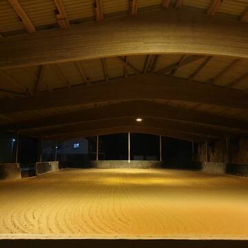
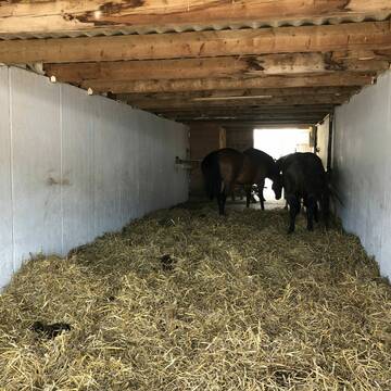
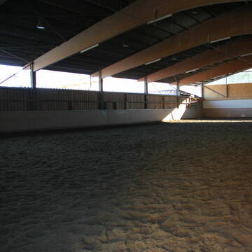
Reitstall Hofwiesen Familie Böhm
Baltmannsweiler
SABI82
@SABI82
FN-Mitglied
Freizeitstall
Vermieten
Hunde willkommen
Krankenbox
Gnadenbrothof
Hufrehe geeignet
23 weitere...
P+
Deprecated: Creation of dynamic property Zend_View_Helper_Ads::$adLink is deprecated in /var/www/stall-frei/htdocs/staging.stall-frei.de/library/Psf/View/Helper/Ads.php on line 108

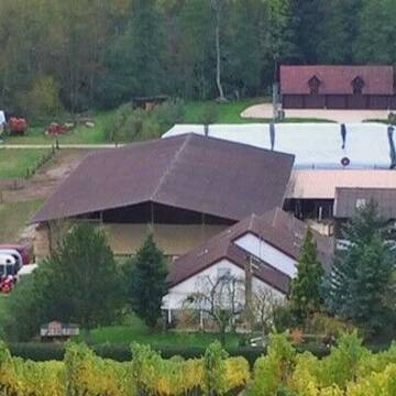
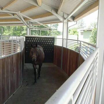
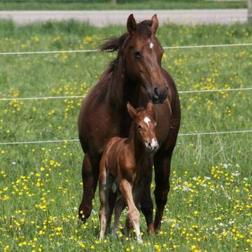
Pferdepension Hit Aktivstall Kürmerhof
Hohenkammer
Kuermerhof
@Kuermerhof
*******JETZT NEU MIT ENTSTAUBTEM BIOHEU*********
*******Demnächst mit einem Abenteuerspielplatz für Pferde ( Extrem Trail/Pa


Wohlfühloase für Pferd und Reiter in Kirchheim/T...
Kirchheim
Wohlfühlstall Asang
@melanie-arnold
Freizeitstall
Wanderreiten
Vermieten
Führanlage
Hunde willkommen
Außenbox mit Paddock
Außenboxen
10 weitere...
aktuell
S


Großzügige Boxen frei
Winterbach
Pferdestall Schmid
@Sarah-und-Max-Schmid
Freizeitstall
Vermieten
Hunde willkommen
Paddock
Außenbox mit Paddock
Innenbox
14 weitere...
P+
Pferdepension Auwiesenhof - Weinstadt-Schnait
Weinstadt
Pferdepension-Auwiesenhof
@Pferdepension-Auwiesenhof
Freizeitstall
Geländestrecke
Hunde willkommen
Krankenbox
Bewegungsstall
Laufstall
Biofutter
Vollpension
10 weitere...
P+

Große Paddockboxen freiwerdend!
Winterbach-Manolzweiler
Hinderer
@Hinderer
Vermieten
Führanlage
Longierzirkel/Roundpen
Außenbox mit Paddock
Halbpension
11 weitere...
P
Reitstall Berger
Lichtenwald
Reitstall Berger
@Gunthard-Berger
Freizeitstall
Rehabilitationsstall
Vermieten
Führanlage
Hunde willkommen
Allergikerstall
21 weitere...
P


Das perfekte zu Hause für dein Pferd
Köngen
Reitstall Gronbach
@Reitstall-Gronbach
Freizeitstall
Vermieten
Führanlage
Hunde willkommen
Allergikerstall
Hufrehe geeignet
16 weitere...
P+
Freie Boxen zu vermieten
Schorndorf
Reit-und Fahrverein Schorndorf
@Reit-und-Fahrverein-Schorndorf
FN-Mitglied
Reitlehrer und -unterricht
Vermieten
Hunde willkommen
Paddock
Außenbox mit Paddock
Innenbox
11 weitere...
P

Paddockbox in kleiner Stallgemeinschaft frei
Rutesheim
Carolin-Hoerning
@Carolin-Hoerning
Wir sind ein kleiner Stall mit nur 13 Boxen in Rutesheim.
Aktuell haben wir eine Paddockbox frei.
neu
R


Hofgut Bodelshofen - Anika Späth
Wendlingen
Anika Späth
@AnikaSpaeth
Reitlehrer und -unterricht
Vermieten
Hunde willkommen
Laufband
Hufrehe geeignet
15 weitere...
aktuell
P+
Reitanlage Lenglingen
Göppingen
Tina Wilk
@Tina Wilk
Freizeitstall
Reitlehrer und -unterricht
Führanlage
Longierzirkel/Roundpen
Außenbox mit Paddock
Halbpension
Selbstversorgung
10 weitere...
S
Deprecated: Creation of dynamic property Zend_View::$pageCount is deprecated in /var/www/stall-frei/htdocs/staging.stall-frei.de/library/vendor/shardj/zf1-future/library/Zend/View/Abstract.php on line 308
Deprecated: Creation of dynamic property Zend_View::$itemCountPerPage is deprecated in /var/www/stall-frei/htdocs/staging.stall-frei.de/library/vendor/shardj/zf1-future/library/Zend/View/Abstract.php on line 308
Deprecated: Creation of dynamic property Zend_View::$first is deprecated in /var/www/stall-frei/htdocs/staging.stall-frei.de/library/vendor/shardj/zf1-future/library/Zend/View/Abstract.php on line 308
Deprecated: Creation of dynamic property Zend_View::$current is deprecated in /var/www/stall-frei/htdocs/staging.stall-frei.de/library/vendor/shardj/zf1-future/library/Zend/View/Abstract.php on line 308
Deprecated: Creation of dynamic property Zend_View::$last is deprecated in /var/www/stall-frei/htdocs/staging.stall-frei.de/library/vendor/shardj/zf1-future/library/Zend/View/Abstract.php on line 308
Deprecated: Creation of dynamic property Zend_View::$next is deprecated in /var/www/stall-frei/htdocs/staging.stall-frei.de/library/vendor/shardj/zf1-future/library/Zend/View/Abstract.php on line 308
Deprecated: Creation of dynamic property Zend_View::$pagesInRange is deprecated in /var/www/stall-frei/htdocs/staging.stall-frei.de/library/vendor/shardj/zf1-future/library/Zend/View/Abstract.php on line 308
Deprecated: Creation of dynamic property Zend_View::$firstPageInRange is deprecated in /var/www/stall-frei/htdocs/staging.stall-frei.de/library/vendor/shardj/zf1-future/library/Zend/View/Abstract.php on line 308
Deprecated: Creation of dynamic property Zend_View::$lastPageInRange is deprecated in /var/www/stall-frei/htdocs/staging.stall-frei.de/library/vendor/shardj/zf1-future/library/Zend/View/Abstract.php on line 308
Deprecated: Creation of dynamic property Zend_View::$currentItemCount is deprecated in /var/www/stall-frei/htdocs/staging.stall-frei.de/library/vendor/shardj/zf1-future/library/Zend/View/Abstract.php on line 308
Deprecated: Creation of dynamic property Zend_View::$totalItemCount is deprecated in /var/www/stall-frei/htdocs/staging.stall-frei.de/library/vendor/shardj/zf1-future/library/Zend/View/Abstract.php on line 308
Deprecated: Creation of dynamic property Zend_View::$firstItemNumber is deprecated in /var/www/stall-frei/htdocs/staging.stall-frei.de/library/vendor/shardj/zf1-future/library/Zend/View/Abstract.php on line 308
Deprecated: Creation of dynamic property Zend_View::$lastItemNumber is deprecated in /var/www/stall-frei/htdocs/staging.stall-frei.de/library/vendor/shardj/zf1-future/library/Zend/View/Abstract.php on line 308
Deprecated: Creation of dynamic property Zend_View::$router is deprecated in /var/www/stall-frei/htdocs/staging.stall-frei.de/library/vendor/shardj/zf1-future/library/Zend/View/Abstract.php on line 308
Deprecated: Creation of dynamic property Zend_View::$urlParams is deprecated in /var/www/stall-frei/htdocs/staging.stall-frei.de/library/vendor/shardj/zf1-future/library/Zend/View/Abstract.php on line 308
Deprecated: Creation of dynamic property Zend_View::$showAds is deprecated in /var/www/stall-frei/htdocs/staging.stall-frei.de/library/vendor/shardj/zf1-future/library/Zend/View/Abstract.php on line 308
Deprecated: Creation of dynamic property Zend_View::$objectIds is deprecated in /var/www/stall-frei/htdocs/staging.stall-frei.de/library/vendor/shardj/zf1-future/library/Zend/View/Abstract.php on line 308
Deprecated: Creation of dynamic property Zend_View::$showNavbar is deprecated in /var/www/stall-frei/htdocs/staging.stall-frei.de/library/vendor/shardj/zf1-future/library/Zend/View/Abstract.php on line 308
Deprecated: Creation of dynamic property Zend_View::$showBreadcrumb is deprecated in /var/www/stall-frei/htdocs/staging.stall-frei.de/library/vendor/shardj/zf1-future/library/Zend/View/Abstract.php on line 308
Deprecated: Creation of dynamic property Zend_View::$showFooter is deprecated in /var/www/stall-frei/htdocs/staging.stall-frei.de/library/vendor/shardj/zf1-future/library/Zend/View/Abstract.php on line 308
Deprecated: Creation of dynamic property Zend_View::$showInternalAds is deprecated in /var/www/stall-frei/htdocs/staging.stall-frei.de/library/vendor/shardj/zf1-future/library/Zend/View/Abstract.php on line 308
Deprecated: Creation of dynamic property Zend_View::$blNoContent is deprecated in /var/www/stall-frei/htdocs/staging.stall-frei.de/library/vendor/shardj/zf1-future/library/Zend/View/Abstract.php on line 308
Deprecated: Creation of dynamic property Zend_View::$sMetaDesc is deprecated in /var/www/stall-frei/htdocs/staging.stall-frei.de/library/vendor/shardj/zf1-future/library/Zend/View/Abstract.php on line 308
Deprecated: Creation of dynamic property Zend_View::$useGmaps is deprecated in /var/www/stall-frei/htdocs/staging.stall-frei.de/library/vendor/shardj/zf1-future/library/Zend/View/Abstract.php on line 308
Deprecated: Creation of dynamic property Zend_View::$touches is deprecated in /var/www/stall-frei/htdocs/staging.stall-frei.de/library/vendor/shardj/zf1-future/library/Zend/View/Abstract.php on line 308
Deprecated: Creation of dynamic property Zend_View::$oProject is deprecated in /var/www/stall-frei/htdocs/staging.stall-frei.de/library/vendor/shardj/zf1-future/library/Zend/View/Abstract.php on line 308
Deprecated: Creation of dynamic property Zend_View::$pageHeadline is deprecated in /var/www/stall-frei/htdocs/staging.stall-frei.de/library/vendor/shardj/zf1-future/library/Zend/View/Abstract.php on line 308
Deprecated: Creation of dynamic property Zend_View::$disableLocationField is deprecated in /var/www/stall-frei/htdocs/staging.stall-frei.de/library/vendor/shardj/zf1-future/library/Zend/View/Abstract.php on line 308
Deprecated: Creation of dynamic property Zend_View::$isSearch is deprecated in /var/www/stall-frei/htdocs/staging.stall-frei.de/library/vendor/shardj/zf1-future/library/Zend/View/Abstract.php on line 308
Deprecated: Creation of dynamic property Zend_View::$pageTitle is deprecated in /var/www/stall-frei/htdocs/staging.stall-frei.de/library/vendor/shardj/zf1-future/library/Zend/View/Abstract.php on line 308
Deprecated: Creation of dynamic property Psf_Form_Element_Text::$class is deprecated in /var/www/stall-frei/htdocs/staging.stall-frei.de/library/vendor/shardj/zf1-future/library/Zend/Form/Element.php on line 874
Deprecated: Creation of dynamic property Psf_Form_Element_Text::$size is deprecated in /var/www/stall-frei/htdocs/staging.stall-frei.de/library/vendor/shardj/zf1-future/library/Zend/Form/Element.php on line 874
Deprecated: Creation of dynamic property Psf_Form_Element_Text::$placeholder is deprecated in /var/www/stall-frei/htdocs/staging.stall-frei.de/library/vendor/shardj/zf1-future/library/Zend/Form/Element.php on line 874
Deprecated: Creation of dynamic property Psf_Form_Element_Hidden::$class is deprecated in /var/www/stall-frei/htdocs/staging.stall-frei.de/library/vendor/shardj/zf1-future/library/Zend/Form/Element.php on line 874
Deprecated: Creation of dynamic property Psf_Form_Element_Hidden::$class is deprecated in /var/www/stall-frei/htdocs/staging.stall-frei.de/library/vendor/shardj/zf1-future/library/Zend/Form/Element.php on line 874
Deprecated: Creation of dynamic property Psf_Form_Element_Hidden::$class is deprecated in /var/www/stall-frei/htdocs/staging.stall-frei.de/library/vendor/shardj/zf1-future/library/Zend/Form/Element.php on line 874
Deprecated: Creation of dynamic property Psf_Form_Element_Hidden::$class is deprecated in /var/www/stall-frei/htdocs/staging.stall-frei.de/library/vendor/shardj/zf1-future/library/Zend/Form/Element.php on line 874
Deprecated: Creation of dynamic property Psf_Form_Element_Select::$class is deprecated in /var/www/stall-frei/htdocs/staging.stall-frei.de/library/vendor/shardj/zf1-future/library/Zend/Form/Element.php on line 874
Deprecated: Creation of dynamic property Psf_Form_Element_Select::$class is deprecated in /var/www/stall-frei/htdocs/staging.stall-frei.de/library/vendor/shardj/zf1-future/library/Zend/Form/Element.php on line 874
Deprecated: Creation of dynamic property Psf_Form_Element_Select::$class is deprecated in /var/www/stall-frei/htdocs/staging.stall-frei.de/library/vendor/shardj/zf1-future/library/Zend/Form/Element.php on line 874
Deprecated: Creation of dynamic property Psf_Form_Element_Select::$class is deprecated in /var/www/stall-frei/htdocs/staging.stall-frei.de/library/vendor/shardj/zf1-future/library/Zend/Form/Element.php on line 874
Deprecated: Creation of dynamic property Psf_Form_Element_Text::$class is deprecated in /var/www/stall-frei/htdocs/staging.stall-frei.de/library/vendor/shardj/zf1-future/library/Zend/Form/Element.php on line 874
Deprecated: Creation of dynamic property Psf_Form_Element_Checkbox::$label is deprecated in /var/www/stall-frei/htdocs/staging.stall-frei.de/library/vendor/shardj/zf1-future/library/Zend/Form/Element.php on line 874
Deprecated: Creation of dynamic property Zend_View::$sort is deprecated in /var/www/stall-frei/htdocs/staging.stall-frei.de/library/vendor/shardj/zf1-future/library/Zend/View/Abstract.php on line 308
Deprecated: Creation of dynamic property Zend_View::$searchLocation is deprecated in /var/www/stall-frei/htdocs/staging.stall-frei.de/library/vendor/shardj/zf1-future/library/Zend/View/Abstract.php on line 308
Deprecated: Creation of dynamic property Zend_View::$locationHint is deprecated in /var/www/stall-frei/htdocs/staging.stall-frei.de/library/vendor/shardj/zf1-future/library/Zend/View/Abstract.php on line 308
Psf_GeoCoder_Abstract::getLocation: Hohengehren Get Location CachedOrLive
Psf_GeoCoder_Abstract::getCachedOrLive: Hohengehren
Psf_GeoCoder_OpenCageData::makeApiRequest: response:
Array
(
[documentation] => https://opencagedata.com/api
[licenses] => Array
(
[0] => Array
(
[name] => see attribution guide
[url] => https://opencagedata.com/credits
)
)
[results] => Array
(
[0] => Array
(
[bounds] => Array
(
[northeast] => Array
(
[lat] => 48.7776356
[lng] => 9.4774195
)
[southwest] => Array
(
[lat] => 48.7425858
[lng] => 9.4125009
)
)
[components] => Array
(
[ISO_3166-1_alpha-2] => DE
[ISO_3166-1_alpha-3] => DEU
[ISO_3166-2] => Array
(
[0] => DE-BW
)
[_category] => place
[_normalized_city] => Baltmannsweiler
[_type] => village
[city] => Baltmannsweiler
[continent] => Europe
[country] => Deutschland
[country_code] => de
[county] => Landkreis Esslingen
[municipality] => GVV Reichenbach an der Fils
[political_union] => European Union
[postcode] => 73666
[state] => Baden-Württemberg
[state_code] => BW
[village] => Hohengehren
)
[confidence] => 7
[formatted] => 73666 Hohengehren, Deutschland
[geometry] => Array
(
[lat] => 48.7601985
[lng] => 9.4554452
)
)
[1] => Array
(
[bounds] => Array
(
[northeast] => Array
(
[lat] => 48.918777
[lng] => 9.4988447
)
[southwest] => Array
(
[lat] => 48.898777
[lng] => 9.4788447
)
)
[components] => Array
(
[ISO_3166-1_alpha-2] => DE
[ISO_3166-1_alpha-3] => DEU
[ISO_3166-2] => Array
(
[0] => DE-BW
)
[_category] => place
[_normalized_city] => Allmersbach im Tal
[_type] => neighbourhood
[city] => Allmersbach im Tal
[continent] => Europe
[country] => Deutschland
[country_code] => de
[county] => Rems-Murr-Kreis
[municipality] => VVG der Stadt Backnang
[neighbourhood] => Hohengehren
[political_union] => European Union
[postcode] => 71573
[state] => Baden-Württemberg
[state_code] => BW
)
[confidence] => 8
[formatted] => 71573 Allmersbach im Tal, Deutschland
[geometry] => Array
(
[lat] => 48.908777
[lng] => 9.4888447
)
)
[2] => Array
(
[bounds] => Array
(
[northeast] => Array
(
[lat] => 48.9211267
[lng] => 9.496601
)
[southwest] => Array
(
[lat] => 48.9011267
[lng] => 9.476601
)
)
[components] => Array
(
[ISO_3166-1_alpha-2] => DE
[ISO_3166-1_alpha-3] => DEU
[ISO_3166-2] => Array
(
[0] => DE-BW
)
[_category] => place
[_normalized_city] => Weissach im Tal
[_type] => hamlet
[continent] => Europe
[country] => Deutschland
[country_code] => de
[county] => Rems-Murr-Kreis
[locality] => Hohengehren
[municipality] => Weissach im Tal
[political_union] => European Union
[postcode] => 71554
[state] => Baden-Württemberg
[state_code] => BW
)
[confidence] => 8
[formatted] => Hohengehren, 71554 Weissach im Tal, Deutschland
[geometry] => Array
(
[lat] => 48.9111267
[lng] => 9.486601
)
)
[3] => Array
(
[bounds] => Array
(
[northeast] => Array
(
[lat] => 48.9083894
[lng] => 9.4900009
)
[southwest] => Array
(
[lat] => 48.9078506
[lng] => 9.488096
)
)
[components] => Array
(
[ISO_3166-1_alpha-2] => DE
[ISO_3166-1_alpha-3] => DEU
[ISO_3166-2] => Array
(
[0] => DE-BW
)
[_category] => road
[_normalized_city] => Allmersbach im Tal
[_type] => road
[city] => Allmersbach im Tal
[continent] => Europe
[country] => Deutschland
[country_code] => de
[county] => Rems-Murr-Kreis
[municipality] => VVG der Stadt Backnang
[neighbourhood] => Hohengehren
[political_union] => European Union
[postcode] => 71573
[road] => Hohengehren
[road_type] => residential
[state] => Baden-Württemberg
[state_code] => BW
)
[confidence] => 9
[formatted] => Hohengehren, 71573 Allmersbach im Tal, Deutschland
[geometry] => Array
(
[lat] => 48.908163
[lng] => 9.4890381
)
)
[4] => Array
(
[components] => Array
(
[ISO_3166-1_alpha-2] => FR
[ISO_3166-1_alpha-3] => FRA
[ISO_3166-2] => Array
(
[0] => FR-IDF
[1] => FR-92
)
[_category] => road
[_normalized_city] => Levallois-Perret
[_type] => road
[city] => Levallois-Perret
[continent] => Europe
[country] => France
[country_code] => fr
[county] => Hauts-de-Seine
[local_authority] => Métropole du Grand Paris
[political_union] => European Union
[postcode] => 92300
[road] => Rue Charles Deutschmann
[state] => Île-de-France
[state_code] => IDF
)
[confidence] => 2
[formatted] => Rue Charles Deutschmann, 92300 Levallois-Perret, France
[geometry] => Array
(
[lat] => 48.900049
[lng] => 2.2842
)
)
[5] => Array
(
[components] => Array
(
[ISO_3166-1_alpha-2] => FR
[ISO_3166-1_alpha-3] => FRA
[ISO_3166-2] => Array
(
[0] => FR-CVL
[1] => FR-37
)
[_category] => road
[_normalized_city] => Saint-Cyr-sur-Loire
[_type] => road
[city] => Saint-Cyr-sur-Loire
[continent] => Europe
[country] => France
[country_code] => fr
[county] => Indre-et-Loire
[local_authority] => Tours Métropole Val de Loire
[political_union] => European Union
[postcode] => 37540
[road] => Rue Roland Engerand
[state] => Centre-Val de Loire
[state_code] => CVL
)
[confidence] => 2
[formatted] => Rue Roland Engerand, 37540 Saint-Cyr-sur-Loire, France
[geometry] => Array
(
[lat] => 47.410551
[lng] => 0.672514
)
)
[6] => Array
(
[components] => Array
(
[ISO_3166-1_alpha-2] => FR
[ISO_3166-1_alpha-3] => FRA
[ISO_3166-2] => Array
(
[0] => FR-CVL
[1] => FR-37
)
[_category] => place
[_normalized_city] => Tours
[_type] => place
[city] => Tours
[continent] => Europe
[country] => France
[country_code] => fr
[county] => Indre-et-Loire
[local_authority] => Tours Métropole Val de Loire
[place] => Allée Roland Engérand
[political_union] => European Union
[postcode] => 37000
[state] => Centre-Val de Loire
[state_code] => CVL
)
[confidence] => 2
[formatted] => Allée Roland Engérand, 37000 Tours, France
[geometry] => Array
(
[lat] => 47.378605
[lng] => 0.697506
)
)
[7] => Array
(
[components] => Array
(
[ISO_3166-1_alpha-2] => FR
[ISO_3166-1_alpha-3] => FRA
[ISO_3166-2] => Array
(
[0] => FR-ARA
[1] => FR-03
)
[_category] => road
[_normalized_city] => Villebret
[_type] => road
[city] => Villebret
[continent] => Europe
[country] => France
[country_code] => fr
[county] => Allier
[local_authority] => Montluçon Communauté
[political_union] => European Union
[postcode] => 03310
[road] => Chemin des Enjerons
[state] => Auvergne-Rhône-Alpes
[state_code] => ARA
)
[confidence] => 10
[formatted] => Chemin des Enjerons, 03310 Villebret, France
[geometry] => Array
(
[lat] => 46.281633
[lng] => 2.616575
)
)
[8] => Array
(
[components] => Array
(
[ISO_3166-1_alpha-2] => FR
[ISO_3166-1_alpha-3] => FRA
[ISO_3166-2] => Array
(
[0] => FR-BFC
[1] => FR-90
)
[_category] => place
[_normalized_city] => Valdoie
[_type] => place
[city] => Valdoie
[continent] => Europe
[country] => France
[country_code] => fr
[county] => Territoire de Belfort
[local_authority] => Grand Belfort Communauté d'agglomération
[place] => Lieu-dit les Engerrins
[political_union] => European Union
[postcode] => 90300
[state] => Bourgogne-Franche-Comté
[state_code] => BFC
)
[confidence] => 10
[formatted] => Lieu-dit les Engerrins, 90300 Valdoie, France
[geometry] => Array
(
[lat] => 47.67968
[lng] => 6.853148
)
)
[9] => Array
(
[components] => Array
(
[ISO_3166-1_alpha-2] => FR
[ISO_3166-1_alpha-3] => FRA
[ISO_3166-2] => Array
(
[0] => FR-BRE
[1] => FR-56
)
[_category] => road
[_normalized_city] => Guidel
[_type] => road
[city] => Guidel
[continent] => Europe
[country] => France
[country_code] => fr
[county] => Morbihan
[local_authority] => Lorient Agglomération
[political_union] => European Union
[postcode] => 56520
[road] => Rue Brigitte Engerer
[state] => Bretagne
[state_code] => BRE
)
[confidence] => 10
[formatted] => Rue Brigitte Engerer, 56520 Guidel, France
[geometry] => Array
(
[lat] => 47.797268
[lng] => -3.497746
)
)
)
[status] => Array
(
[code] => 200
[message] => OK
)
[stay_informed] => Array
(
[blog] => https://blog.opencagedata.com
[mastodon] => https://en.osm.town/@opencage
)
[thanks] => For using an OpenCage API
[timestamp] => Array
(
[created_http] => Sun, 08 Feb 2026 12:49:45 GMT
[created_unix] => 1770554985
)
[total_results] => 10
)
Psf_GeoCoder_Abstract::convertLocationResult
{"documentation":"https:\/\/opencagedata.com\/api","licenses":[{"name":"see attribution guide","url":"https:\/\/opencagedata.com\/credits"}],"results":[{"bounds":{"northeast":{"lat":48.7776356,"lng":9.4774195},"southwest":{"lat":48.7425858,"lng":9.4125009}},"components":{"ISO_3166-1_alpha-2":"DE","ISO_3166-1_alpha-3":"DEU","ISO_3166-2":["DE-BW"],"_category":"place","_normalized_city":"Baltmannsweiler","_type":"village","city":"Baltmannsweiler","continent":"Europe","country":"Deutschland","country_code":"de","county":"Landkreis Esslingen","municipality":"GVV Reichenbach an der Fils","political_union":"European Union","postcode":"73666","state":"Baden-W\u00fcrttemberg","state_code":"BW","village":"Hohengehren"},"confidence":7,"formatted":"73666 Hohengehren, Deutschland","geometry":{"lat":48.7601985,"lng":9.4554452}},{"bounds":{"northeast":{"lat":48.918777,"lng":9.4988447},"southwest":{"lat":48.898777,"lng":9.4788447}},"components":{"ISO_3166-1_alpha-2":"DE","ISO_3166-1_alpha-3":"DEU","ISO_3166-2":["DE-BW"],"_category":"place","_normalized_city":"Allmersbach im Tal","_type":"neighbourhood","city":"Allmersbach im Tal","continent":"Europe","country":"Deutschland","country_code":"de","county":"Rems-Murr-Kreis","municipality":"VVG der Stadt Backnang","neighbourhood":"Hohengehren","political_union":"European Union","postcode":"71573","state":"Baden-W\u00fcrttemberg","state_code":"BW"},"confidence":8,"formatted":"71573 Allmersbach im Tal, Deutschland","geometry":{"lat":48.908777,"lng":9.4888447}},{"bounds":{"northeast":{"lat":48.9211267,"lng":9.496601},"southwest":{"lat":48.9011267,"lng":9.476601}},"components":{"ISO_3166-1_alpha-2":"DE","ISO_3166-1_alpha-3":"DEU","ISO_3166-2":["DE-BW"],"_category":"place","_normalized_city":"Weissach im Tal","_type":"hamlet","continent":"Europe","country":"Deutschland","country_code":"de","county":"Rems-Murr-Kreis","locality":"Hohengehren","municipality":"Weissach im Tal","political_union":"European Union","postcode":"71554","state":"Baden-W\u00fcrttemberg","state_code":"BW"},"confidence":8,"formatted":"Hohengehren, 71554 Weissach im Tal, Deutschland","geometry":{"lat":48.9111267,"lng":9.486601}},{"bounds":{"northeast":{"lat":48.9083894,"lng":9.4900009},"southwest":{"lat":48.9078506,"lng":9.488096}},"components":{"ISO_3166-1_alpha-2":"DE","ISO_3166-1_alpha-3":"DEU","ISO_3166-2":["DE-BW"],"_category":"road","_normalized_city":"Allmersbach im Tal","_type":"road","city":"Allmersbach im Tal","continent":"Europe","country":"Deutschland","country_code":"de","county":"Rems-Murr-Kreis","municipality":"VVG der Stadt Backnang","neighbourhood":"Hohengehren","political_union":"European Union","postcode":"71573","road":"Hohengehren","road_type":"residential","state":"Baden-W\u00fcrttemberg","state_code":"BW"},"confidence":9,"formatted":"Hohengehren, 71573 Allmersbach im Tal, Deutschland","geometry":{"lat":48.908163,"lng":9.4890381}},{"components":{"ISO_3166-1_alpha-2":"FR","ISO_3166-1_alpha-3":"FRA","ISO_3166-2":["FR-IDF","FR-92"],"_category":"road","_normalized_city":"Levallois-Perret","_type":"road","city":"Levallois-Perret","continent":"Europe","country":"France","country_code":"fr","county":"Hauts-de-Seine","local_authority":"M\u00e9tropole du Grand Paris","political_union":"European Union","postcode":"92300","road":"Rue Charles Deutschmann","state":"\u00cele-de-France","state_code":"IDF"},"confidence":2,"formatted":"Rue Charles Deutschmann, 92300 Levallois-Perret, France","geometry":{"lat":48.900049,"lng":2.2842}},{"components":{"ISO_3166-1_alpha-2":"FR","ISO_3166-1_alpha-3":"FRA","ISO_3166-2":["FR-CVL","FR-37"],"_category":"road","_normalized_city":"Saint-Cyr-sur-Loire","_type":"road","city":"Saint-Cyr-sur-Loire","continent":"Europe","country":"France","country_code":"fr","county":"Indre-et-Loire","local_authority":"Tours M\u00e9tropole Val de Loire","political_union":"European Union","postcode":"37540","road":"Rue Roland Engerand","state":"Centre-Val de Loire","state_code":"CVL"},"confidence":2,"formatted":"Rue Roland Engerand, 37540 Saint-Cyr-sur-Loire, France","geometry":{"lat":47.410551,"lng":0.672514}},{"components":{"ISO_3166-1_alpha-2":"FR","ISO_3166-1_alpha-3":"FRA","ISO_3166-2":["FR-CVL","FR-37"],"_category":"place","_normalized_city":"Tours","_type":"place","city":"Tours","continent":"Europe","country":"France","country_code":"fr","county":"Indre-et-Loire","local_authority":"Tours M\u00e9tropole Val de Loire","place":"All\u00e9e Roland Eng\u00e9rand","political_union":"European Union","postcode":"37000","state":"Centre-Val de Loire","state_code":"CVL"},"confidence":2,"formatted":"All\u00e9e Roland Eng\u00e9rand, 37000 Tours, France","geometry":{"lat":47.378605,"lng":0.697506}},{"components":{"ISO_3166-1_alpha-2":"FR","ISO_3166-1_alpha-3":"FRA","ISO_3166-2":["FR-ARA","FR-03"],"_category":"road","_normalized_city":"Villebret","_type":"road","city":"Villebret","continent":"Europe","country":"France","country_code":"fr","county":"Allier","local_authority":"Montlu\u00e7on Communaut\u00e9","political_union":"European Union","postcode":"03310","road":"Chemin des Enjerons","state":"Auvergne-Rh\u00f4ne-Alpes","state_code":"ARA"},"confidence":10,"formatted":"Chemin des Enjerons, 03310 Villebret, France","geometry":{"lat":46.281633,"lng":2.616575}},{"components":{"ISO_3166-1_alpha-2":"FR","ISO_3166-1_alpha-3":"FRA","ISO_3166-2":["FR-BFC","FR-90"],"_category":"place","_normalized_city":"Valdoie","_type":"place","city":"Valdoie","continent":"Europe","country":"France","country_code":"fr","county":"Territoire de Belfort","local_authority":"Grand Belfort Communaut\u00e9 d'agglom\u00e9ration","place":"Lieu-dit les Engerrins","political_union":"European Union","postcode":"90300","state":"Bourgogne-Franche-Comt\u00e9","state_code":"BFC"},"confidence":10,"formatted":"Lieu-dit les Engerrins, 90300 Valdoie, France","geometry":{"lat":47.67968,"lng":6.853148}},{"components":{"ISO_3166-1_alpha-2":"FR","ISO_3166-1_alpha-3":"FRA","ISO_3166-2":["FR-BRE","FR-56"],"_category":"road","_normalized_city":"Guidel","_type":"road","city":"Guidel","continent":"Europe","country":"France","country_code":"fr","county":"Morbihan","local_authority":"Lorient Agglom\u00e9ration","political_union":"European Union","postcode":"56520","road":"Rue Brigitte Engerer","state":"Bretagne","state_code":"BRE"},"confidence":10,"formatted":"Rue Brigitte Engerer, 56520 Guidel, France","geometry":{"lat":47.797268,"lng":-3.497746}}],"status":{"code":200,"message":"OK"},"stay_informed":{"blog":"https:\/\/blog.opencagedata.com","mastodon":"https:\/\/en.osm.town\/@opencage"},"thanks":"For using an OpenCage API","timestamp":{"created_http":"Sun, 08 Feb 2026 12:49:45 GMT","created_unix":1770554985},"total_results":10}Array
(
[0] => stdClass Object
(
[bounds] => stdClass Object
(
[northeast] => stdClass Object
(
[lat] => 48.7776356
[lng] => 9.4774195
)
[southwest] => stdClass Object
(
[lat] => 48.7425858
[lng] => 9.4125009
)
)
[components] => stdClass Object
(
[ISO_3166-1_alpha-2] => DE
[ISO_3166-1_alpha-3] => DEU
[ISO_3166-2] => Array
(
[0] => DE-BW
)
[_category] => place
[_normalized_city] => Baltmannsweiler
[_type] => village
[city] => Baltmannsweiler
[continent] => Europe
[country] => Deutschland
[country_code] => de
[county] => Landkreis Esslingen
[municipality] => GVV Reichenbach an der Fils
[political_union] => European Union
[postcode] => 73666
[state] => Baden-Württemberg
[state_code] => BW
[village] => Hohengehren
)
[confidence] => 7
[formatted] => 73666 Hohengehren, Deutschland
[geometry] => stdClass Object
(
[lat] => 48.7601985
[lng] => 9.4554452
)
)
[1] => stdClass Object
(
[bounds] => stdClass Object
(
[northeast] => stdClass Object
(
[lat] => 48.918777
[lng] => 9.4988447
)
[southwest] => stdClass Object
(
[lat] => 48.898777
[lng] => 9.4788447
)
)
[components] => stdClass Object
(
[ISO_3166-1_alpha-2] => DE
[ISO_3166-1_alpha-3] => DEU
[ISO_3166-2] => Array
(
[0] => DE-BW
)
[_category] => place
[_normalized_city] => Allmersbach im Tal
[_type] => neighbourhood
[city] => Allmersbach im Tal
[continent] => Europe
[country] => Deutschland
[country_code] => de
[county] => Rems-Murr-Kreis
[municipality] => VVG der Stadt Backnang
[neighbourhood] => Hohengehren
[political_union] => European Union
[postcode] => 71573
[state] => Baden-Württemberg
[state_code] => BW
)
[confidence] => 8
[formatted] => 71573 Allmersbach im Tal, Deutschland
[geometry] => stdClass Object
(
[lat] => 48.908777
[lng] => 9.4888447
)
)
[2] => stdClass Object
(
[bounds] => stdClass Object
(
[northeast] => stdClass Object
(
[lat] => 48.9211267
[lng] => 9.496601
)
[southwest] => stdClass Object
(
[lat] => 48.9011267
[lng] => 9.476601
)
)
[components] => stdClass Object
(
[ISO_3166-1_alpha-2] => DE
[ISO_3166-1_alpha-3] => DEU
[ISO_3166-2] => Array
(
[0] => DE-BW
)
[_category] => place
[_normalized_city] => Weissach im Tal
[_type] => hamlet
[continent] => Europe
[country] => Deutschland
[country_code] => de
[county] => Rems-Murr-Kreis
[locality] => Hohengehren
[municipality] => Weissach im Tal
[political_union] => European Union
[postcode] => 71554
[state] => Baden-Württemberg
[state_code] => BW
)
[confidence] => 8
[formatted] => Hohengehren, 71554 Weissach im Tal, Deutschland
[geometry] => stdClass Object
(
[lat] => 48.9111267
[lng] => 9.486601
)
)
[3] => stdClass Object
(
[bounds] => stdClass Object
(
[northeast] => stdClass Object
(
[lat] => 48.9083894
[lng] => 9.4900009
)
[southwest] => stdClass Object
(
[lat] => 48.9078506
[lng] => 9.488096
)
)
[components] => stdClass Object
(
[ISO_3166-1_alpha-2] => DE
[ISO_3166-1_alpha-3] => DEU
[ISO_3166-2] => Array
(
[0] => DE-BW
)
[_category] => road
[_normalized_city] => Allmersbach im Tal
[_type] => road
[city] => Allmersbach im Tal
[continent] => Europe
[country] => Deutschland
[country_code] => de
[county] => Rems-Murr-Kreis
[municipality] => VVG der Stadt Backnang
[neighbourhood] => Hohengehren
[political_union] => European Union
[postcode] => 71573
[road] => Hohengehren
[road_type] => residential
[state] => Baden-Württemberg
[state_code] => BW
)
[confidence] => 9
[formatted] => Hohengehren, 71573 Allmersbach im Tal, Deutschland
[geometry] => stdClass Object
(
[lat] => 48.908163
[lng] => 9.4890381
)
)
[4] => stdClass Object
(
[components] => stdClass Object
(
[ISO_3166-1_alpha-2] => FR
[ISO_3166-1_alpha-3] => FRA
[ISO_3166-2] => Array
(
[0] => FR-IDF
[1] => FR-92
)
[_category] => road
[_normalized_city] => Levallois-Perret
[_type] => road
[city] => Levallois-Perret
[continent] => Europe
[country] => France
[country_code] => fr
[county] => Hauts-de-Seine
[local_authority] => Métropole du Grand Paris
[political_union] => European Union
[postcode] => 92300
[road] => Rue Charles Deutschmann
[state] => Île-de-France
[state_code] => IDF
)
[confidence] => 2
[formatted] => Rue Charles Deutschmann, 92300 Levallois-Perret, France
[geometry] => stdClass Object
(
[lat] => 48.900049
[lng] => 2.2842
)
)
[5] => stdClass Object
(
[components] => stdClass Object
(
[ISO_3166-1_alpha-2] => FR
[ISO_3166-1_alpha-3] => FRA
[ISO_3166-2] => Array
(
[0] => FR-CVL
[1] => FR-37
)
[_category] => road
[_normalized_city] => Saint-Cyr-sur-Loire
[_type] => road
[city] => Saint-Cyr-sur-Loire
[continent] => Europe
[country] => France
[country_code] => fr
[county] => Indre-et-Loire
[local_authority] => Tours Métropole Val de Loire
[political_union] => European Union
[postcode] => 37540
[road] => Rue Roland Engerand
[state] => Centre-Val de Loire
[state_code] => CVL
)
[confidence] => 2
[formatted] => Rue Roland Engerand, 37540 Saint-Cyr-sur-Loire, France
[geometry] => stdClass Object
(
[lat] => 47.410551
[lng] => 0.672514
)
)
[6] => stdClass Object
(
[components] => stdClass Object
(
[ISO_3166-1_alpha-2] => FR
[ISO_3166-1_alpha-3] => FRA
[ISO_3166-2] => Array
(
[0] => FR-CVL
[1] => FR-37
)
[_category] => place
[_normalized_city] => Tours
[_type] => place
[city] => Tours
[continent] => Europe
[country] => France
[country_code] => fr
[county] => Indre-et-Loire
[local_authority] => Tours Métropole Val de Loire
[place] => Allée Roland Engérand
[political_union] => European Union
[postcode] => 37000
[state] => Centre-Val de Loire
[state_code] => CVL
)
[confidence] => 2
[formatted] => Allée Roland Engérand, 37000 Tours, France
[geometry] => stdClass Object
(
[lat] => 47.378605
[lng] => 0.697506
)
)
[7] => stdClass Object
(
[components] => stdClass Object
(
[ISO_3166-1_alpha-2] => FR
[ISO_3166-1_alpha-3] => FRA
[ISO_3166-2] => Array
(
[0] => FR-ARA
[1] => FR-03
)
[_category] => road
[_normalized_city] => Villebret
[_type] => road
[city] => Villebret
[continent] => Europe
[country] => France
[country_code] => fr
[county] => Allier
[local_authority] => Montluçon Communauté
[political_union] => European Union
[postcode] => 03310
[road] => Chemin des Enjerons
[state] => Auvergne-Rhône-Alpes
[state_code] => ARA
)
[confidence] => 10
[formatted] => Chemin des Enjerons, 03310 Villebret, France
[geometry] => stdClass Object
(
[lat] => 46.281633
[lng] => 2.616575
)
)
[8] => stdClass Object
(
[components] => stdClass Object
(
[ISO_3166-1_alpha-2] => FR
[ISO_3166-1_alpha-3] => FRA
[ISO_3166-2] => Array
(
[0] => FR-BFC
[1] => FR-90
)
[_category] => place
[_normalized_city] => Valdoie
[_type] => place
[city] => Valdoie
[continent] => Europe
[country] => France
[country_code] => fr
[county] => Territoire de Belfort
[local_authority] => Grand Belfort Communauté d'agglomération
[place] => Lieu-dit les Engerrins
[political_union] => European Union
[postcode] => 90300
[state] => Bourgogne-Franche-Comté
[state_code] => BFC
)
[confidence] => 10
[formatted] => Lieu-dit les Engerrins, 90300 Valdoie, France
[geometry] => stdClass Object
(
[lat] => 47.67968
[lng] => 6.853148
)
)
[9] => stdClass Object
(
[components] => stdClass Object
(
[ISO_3166-1_alpha-2] => FR
[ISO_3166-1_alpha-3] => FRA
[ISO_3166-2] => Array
(
[0] => FR-BRE
[1] => FR-56
)
[_category] => road
[_normalized_city] => Guidel
[_type] => road
[city] => Guidel
[continent] => Europe
[country] => France
[country_code] => fr
[county] => Morbihan
[local_authority] => Lorient Agglomération
[political_union] => European Union
[postcode] => 56520
[road] => Rue Brigitte Engerer
[state] => Bretagne
[state_code] => BRE
)
[confidence] => 10
[formatted] => Rue Brigitte Engerer, 56520 Guidel, France
[geometry] => stdClass Object
(
[lat] => 47.797268
[lng] => -3.497746
)
)
)
Psf_GeoCoder_OpenCageData::getKeyMap: 0
stdClass Object
(
    [bounds] => stdClass Object
        (
            [northeast] => stdClass Object
                (
                    [lat] => 48.7776356
                    [lng] => 9.4774195
                )

            [southwest] => stdClass Object
                (
                    [lat] => 48.7425858
                    [lng] => 9.4125009
                )

        )

    [components] => stdClass Object
        (
            [ISO_3166-1_alpha-2] => DE
            [ISO_3166-1_alpha-3] => DEU
            [ISO_3166-2] => Array
                (
                    [0] => DE-BW
                )

            [_category] => place
            [_normalized_city] => Baltmannsweiler
            [_type] => village
            [city] => Baltmannsweiler
            [continent] => Europe
            [country] => Deutschland
            [country_code] => de
            [county] => Landkreis Esslingen
            [municipality] => GVV Reichenbach an der Fils
            [political_union] => European Union
            [postcode] => 73666
            [state] => Baden-Württemberg
            [state_code] => BW
            [village] => Hohengehren
        )

    [confidence] => 7
    [formatted] => 73666 Hohengehren, Deutschland
    [geometry] => stdClass Object
        (
            [lat] => 48.7601985
            [lng] => 9.4554452
        )

)
Psf_GeoCoder_OpenCageData::getCounty: Esslingen
Psf_GeoCoder_OpenCageData::addMissingData REFETCH!
Array
(
    [address] => 73666 Hohengehren, Deutschland
    [type] => village
    [street] =>
    [city] => Hohengehren
    [county] => Esslingen
    [state] => Baden-Württemberg
    [zip] => 73666
    [country] => Deutschland
    [suburb] =>
    [countrycode] => de
    [latitude] => 48.7601985
    [longitude] => 9.4554452
    [accuracy] => 1
    [confidence] => 7
    [bounds] => stdClass Object
        (
            [northeast] => stdClass Object
                (
                    [lat] => 48.7776356
                    [lng] => 9.4774195
                )

            [southwest] => stdClass Object
                (
                    [lat] => 48.7425858
                    [lng] => 9.4125009
                )

        )

)
reformat!
Array
(
    [address] => 73666 Hohengehren, Deutschland
    [type] => village
    [street] =>
    [city] => Hohengehren
    [county] => Esslingen
    [state] => Baden-Württemberg
    [zip] => 73666
    [country] => Deutschland
    [suburb] =>
    [countrycode] => de
    [latitude] => 48.7601985
    [longitude] => 9.4554452
    [accuracy] => 1
    [confidence] => 7
    [bounds] => stdClass Object
        (
            [northeast] => stdClass Object
                (
                    [lat] => 48.7776356
                    [lng] => 9.4774195
                )

            [southwest] => stdClass Object
                (
                    [lat] => 48.7425858
                    [lng] => 9.4125009
                )

        )

    [place] => 73666 Hohengehren, Baden-Württemberg
    [hash] => e4c899adcd400f0f8b9336e541e0100c
)
Psf_GeoCoder_OpenCageData::getKeyMap: 1
stdClass Object
(
    [bounds] => stdClass Object
        (
            [northeast] => stdClass Object
                (
                    [lat] => 48.918777
                    [lng] => 9.4988447
                )

            [southwest] => stdClass Object
                (
                    [lat] => 48.898777
                    [lng] => 9.4788447
                )

        )

    [components] => stdClass Object
        (
            [ISO_3166-1_alpha-2] => DE
            [ISO_3166-1_alpha-3] => DEU
            [ISO_3166-2] => Array
                (
                    [0] => DE-BW
                )

            [_category] => place
            [_normalized_city] => Allmersbach im Tal
            [_type] => neighbourhood
            [city] => Allmersbach im Tal
            [continent] => Europe
            [country] => Deutschland
            [country_code] => de
            [county] => Rems-Murr-Kreis
            [municipality] => VVG der Stadt Backnang
            [neighbourhood] => Hohengehren
            [political_union] => European Union
            [postcode] => 71573
            [state] => Baden-Württemberg
            [state_code] => BW
        )

    [confidence] => 8
    [formatted] => 71573 Allmersbach im Tal, Deutschland
    [geometry] => stdClass Object
        (
            [lat] => 48.908777
            [lng] => 9.4888447
        )

)
Psf_GeoCoder_OpenCageData::getCounty: Rems-Murr-Kreis
Psf_GeoCoder_OpenCageData::addMissingData REFETCH!
Array
(
    [address] => 71573 Allmersbach im Tal, Deutschland
    [type] => neighbourhood
    [street] =>
    [city] => Allmersbach im Tal
    [county] => Rems-Murr-Kreis
    [state] => Baden-Württemberg
    [zip] => 71573
    [country] => Deutschland
    [suburb] =>
    [countrycode] => de
    [latitude] => 48.908777
    [longitude] => 9.4888447
    [accuracy] => 1
    [confidence] => 8
    [bounds] => stdClass Object
        (
            [northeast] => stdClass Object
                (
                    [lat] => 48.918777
                    [lng] => 9.4988447
                )

            [southwest] => stdClass Object
                (
                    [lat] => 48.898777
                    [lng] => 9.4788447
                )

        )

)
reformat!
Array
(
    [address] => 71573 Allmersbach im Tal, Deutschland
    [type] => neighbourhood
    [street] =>
    [city] => Allmersbach im Tal
    [county] => Rems-Murr-Kreis
    [state] => Baden-Württemberg
    [zip] => 71573
    [country] => Deutschland
    [suburb] =>
    [countrycode] => de
    [latitude] => 48.908777
    [longitude] => 9.4888447
    [accuracy] => 1
    [confidence] => 8
    [bounds] => stdClass Object
        (
            [northeast] => stdClass Object
                (
                    [lat] => 48.918777
                    [lng] => 9.4988447
                )

            [southwest] => stdClass Object
                (
                    [lat] => 48.898777
                    [lng] => 9.4788447
                )

        )

    [place] => 71573 Allmersbach im Tal, Baden-Württemberg
    [hash] => 21109ff15ad111646a2b7bb3ddaed72a
)
Psf_GeoCoder_OpenCageData::getKeyMap: 2
stdClass Object
(
    [bounds] => stdClass Object
        (
            [northeast] => stdClass Object
                (
                    [lat] => 48.9211267
                    [lng] => 9.496601
                )

            [southwest] => stdClass Object
                (
                    [lat] => 48.9011267
                    [lng] => 9.476601
                )

        )

    [components] => stdClass Object
        (
            [ISO_3166-1_alpha-2] => DE
            [ISO_3166-1_alpha-3] => DEU
            [ISO_3166-2] => Array
                (
                    [0] => DE-BW
                )

            [_category] => place
            [_normalized_city] => Weissach im Tal
            [_type] => hamlet
            [continent] => Europe
            [country] => Deutschland
            [country_code] => de
            [county] => Rems-Murr-Kreis
            [locality] => Hohengehren
            [municipality] => Weissach im Tal
            [political_union] => European Union
            [postcode] => 71554
            [state] => Baden-Württemberg
            [state_code] => BW
        )

    [confidence] => 8
    [formatted] => Hohengehren, 71554 Weissach im Tal, Deutschland
    [geometry] => stdClass Object
        (
            [lat] => 48.9111267
            [lng] => 9.486601
        )

)
Psf_GeoCoder_OpenCageData::getCounty: Rems-Murr-Kreis
Psf_GeoCoder_OpenCageData::addMissingData REFETCH!
Array
(
    [address] => Hohengehren, 71554 Weissach im Tal, Deutschland
    [type] => hamlet
    [street] =>
    [city] =>
    [county] => Rems-Murr-Kreis
    [state] => Baden-Württemberg
    [zip] => 71554
    [country] => Deutschland
    [suburb] =>
    [countrycode] => de
    [latitude] => 48.9111267
    [longitude] => 9.486601
    [accuracy] => 1
    [confidence] => 8
    [bounds] => stdClass Object
        (
            [northeast] => stdClass Object
                (
                    [lat] => 48.9211267
                    [lng] => 9.496601
                )

            [southwest] => stdClass Object
                (
                    [lat] => 48.9011267
                    [lng] => 9.476601
                )

        )

)
reformat!
Array
(
    [address] => Hohengehren, 71554 Weissach im Tal, Deutschland
    [type] => hamlet
    [street] =>
    [city] =>
    [county] => Rems-Murr-Kreis
    [state] => Baden-Württemberg
    [zip] => 71554
    [country] => Deutschland
    [suburb] =>
    [countrycode] => de
    [latitude] => 48.9111267
    [longitude] => 9.486601
    [accuracy] => 1
    [confidence] => 8
    [bounds] => stdClass Object
        (
            [northeast] => stdClass Object
                (
                    [lat] => 48.9211267
                    [lng] => 9.496601
                )

            [southwest] => stdClass Object
                (
                    [lat] => 48.9011267
                    [lng] => 9.476601
                )

        )

    [place] => 71554 , Baden-Württemberg
    [hash] => 61c9405d94573634f2596ae10c3b7a77
)
Psf_GeoCoder_OpenCageData::getKeyMap: 3
stdClass Object
(
    [bounds] => stdClass Object
        (
            [northeast] => stdClass Object
                (
                    [lat] => 48.9083894
                    [lng] => 9.4900009
                )

            [southwest] => stdClass Object
                (
                    [lat] => 48.9078506
                    [lng] => 9.488096
                )

        )

    [components] => stdClass Object
        (
            [ISO_3166-1_alpha-2] => DE
            [ISO_3166-1_alpha-3] => DEU
            [ISO_3166-2] => Array
                (
                    [0] => DE-BW
                )

            [_category] => road
            [_normalized_city] => Allmersbach im Tal
            [_type] => road
            [city] => Allmersbach im Tal
            [continent] => Europe
            [country] => Deutschland
            [country_code] => de
            [county] => Rems-Murr-Kreis
            [municipality] => VVG der Stadt Backnang
            [neighbourhood] => Hohengehren
            [political_union] => European Union
            [postcode] => 71573
            [road] => Hohengehren
            [road_type] => residential
            [state] => Baden-Württemberg
            [state_code] => BW
        )

    [confidence] => 9
    [formatted] => Hohengehren, 71573 Allmersbach im Tal, Deutschland
    [geometry] => stdClass Object
        (
            [lat] => 48.908163
            [lng] => 9.4890381
        )

)
Psf_GeoCoder_OpenCageData::getCounty: Rems-Murr-Kreis
Psf_GeoCoder_OpenCageData::addMissingData REFETCH!
Array
(
    [address] => Hohengehren, 71573 Allmersbach im Tal, Deutschland
    [type] => road
    [street] => Hohengehren
    [city] => Allmersbach im Tal
    [county] => Rems-Murr-Kreis
    [state] => Baden-Württemberg
    [zip] => 71573
    [country] => Deutschland
    [suburb] =>
    [countrycode] => de
    [latitude] => 48.908163
    [longitude] => 9.4890381
    [accuracy] => 1
    [confidence] => 9
    [bounds] => stdClass Object
        (
            [northeast] => stdClass Object
                (
                    [lat] => 48.9083894
                    [lng] => 9.4900009
                )

            [southwest] => stdClass Object
                (
                    [lat] => 48.9078506
                    [lng] => 9.488096
                )

        )

)
reformat!
Array
(
    [address] => Hohengehren, 71573 Allmersbach im Tal, Deutschland
    [type] => road
    [street] => Hohengehren
    [city] => Allmersbach im Tal
    [county] => Rems-Murr-Kreis
    [state] => Baden-Württemberg
    [zip] => 71573
    [country] => Deutschland
    [suburb] =>
    [countrycode] => de
    [latitude] => 48.908163
    [longitude] => 9.4890381
    [accuracy] => 1
    [confidence] => 9
    [bounds] => stdClass Object
        (
            [northeast] => stdClass Object
                (
                    [lat] => 48.9083894
                    [lng] => 9.4900009
                )

            [southwest] => stdClass Object
                (
                    [lat] => 48.9078506
                    [lng] => 9.488096
                )

        )

    [place] => Hohengehren, 71573 Allmersbach im Tal, Baden-Württemberg
    [hash] => e0daae835a08fbf47a0c6a04c8ca7646
)
Psf_GeoCoder_OpenCageData::getKeyMap: 4
stdClass Object
(
    [components] => stdClass Object
        (
            [ISO_3166-1_alpha-2] => FR
            [ISO_3166-1_alpha-3] => FRA
            [ISO_3166-2] => Array
                (
                    [0] => FR-IDF
                    [1] => FR-92
                )

            [_category] => road
            [_normalized_city] => Levallois-Perret
            [_type] => road
            [city] => Levallois-Perret
            [continent] => Europe
            [country] => France
            [country_code] => fr
            [county] => Hauts-de-Seine
            [local_authority] => Métropole du Grand Paris
            [political_union] => European Union
            [postcode] => 92300
            [road] => Rue Charles Deutschmann
            [state] => Île-de-France
            [state_code] => IDF
        )

    [confidence] => 2
    [formatted] => Rue Charles Deutschmann, 92300 Levallois-Perret, France
    [geometry] => stdClass Object
        (
            [lat] => 48.900049
            [lng] => 2.2842
        )

)
Psf_GeoCoder_OpenCageData::getCounty: Hauts-de-Seine
Psf_GeoCoder_OpenCageData::addMissingData REFETCH!
Array
(
    [address] => Rue Charles Deutschmann, 92300 Levallois-Perret, France
    [type] => road
    [street] => Rue Charles Deutschmann
    [city] => Levallois-Perret
    [county] => Hauts-de-Seine
    [state] => Île-de-France
    [zip] => 92300
    [country] => France
    [suburb] =>
    [countrycode] => fr
    [latitude] => 48.900049
    [longitude] => 2.2842
    [accuracy] => 1
    [confidence] => 2
    [bounds] =>
)
reformat!
Array
(
    [address] => Rue Charles Deutschmann, 92300 Levallois-Perret, France
    [type] => road
    [street] => Rue Charles Deutschmann
    [city] => Levallois-Perret
    [county] => Hauts-de-Seine
    [state] => Île-de-France
    [zip] => 92300
    [country] => France
    [suburb] =>
    [countrycode] => fr
    [latitude] => 48.900049
    [longitude] => 2.2842
    [accuracy] => 1
    [confidence] => 2
    [bounds] =>
    [place] => Rue Charles Deutschmann, 92300 Levallois-Perret, Île-de-France
    [hash] => b7dc44def3990e8a7eaf18e019eca466
)
Psf_GeoCoder_OpenCageData::getKeyMap: 5
stdClass Object
(
    [components] => stdClass Object
        (
            [ISO_3166-1_alpha-2] => FR
            [ISO_3166-1_alpha-3] => FRA
            [ISO_3166-2] => Array
                (
                    [0] => FR-CVL
                    [1] => FR-37
                )

            [_category] => road
            [_normalized_city] => Saint-Cyr-sur-Loire
            [_type] => road
            [city] => Saint-Cyr-sur-Loire
            [continent] => Europe
            [country] => France
            [country_code] => fr
            [county] => Indre-et-Loire
            [local_authority] => Tours Métropole Val de Loire
            [political_union] => European Union
            [postcode] => 37540
            [road] => Rue Roland Engerand
            [state] => Centre-Val de Loire
            [state_code] => CVL
        )

    [confidence] => 2
    [formatted] => Rue Roland Engerand, 37540 Saint-Cyr-sur-Loire, France
    [geometry] => stdClass Object
        (
            [lat] => 47.410551
            [lng] => 0.672514
        )

)
Psf_GeoCoder_OpenCageData::getCounty: Indre-et-Loire
Psf_GeoCoder_OpenCageData::addMissingData REFETCH!
Array
(
    [address] => Rue Roland Engerand, 37540 Saint-Cyr-sur-Loire, France
    [type] => road
    [street] => Rue Roland Engerand
    [city] => Saint-Cyr-sur-Loire
    [county] => Indre-et-Loire
    [state] => Centre-Val de Loire
    [zip] => 37540
    [country] => France
    [suburb] =>
    [countrycode] => fr
    [latitude] => 47.410551
    [longitude] => 0.672514
    [accuracy] => 1
    [confidence] => 2
    [bounds] =>
)
reformat!
Array
(
    [address] => Rue Roland Engerand, 37540 Saint-Cyr-sur-Loire, France
    [type] => road
    [street] => Rue Roland Engerand
    [city] => Saint-Cyr-sur-Loire
    [county] => Indre-et-Loire
    [state] => Centre-Val de Loire
    [zip] => 37540
    [country] => France
    [suburb] =>
    [countrycode] => fr
    [latitude] => 47.410551
    [longitude] => 0.672514
    [accuracy] => 1
    [confidence] => 2
    [bounds] =>
    [place] => Rue Roland Engerand, 37540 Saint-Cyr-sur-Loire, Centre-Val de Loire
    [hash] => 52aec916d8ef415839f4c96ca9c08451
)
Psf_GeoCoder_OpenCageData::getKeyMap: 6
stdClass Object
(
    [components] => stdClass Object
        (
            [ISO_3166-1_alpha-2] => FR
            [ISO_3166-1_alpha-3] => FRA
            [ISO_3166-2] => Array
                (
                    [0] => FR-CVL
                    [1] => FR-37
                )

            [_category] => place
            [_normalized_city] => Tours
            [_type] => place
            [city] => Tours
            [continent] => Europe
            [country] => France
            [country_code] => fr
            [county] => Indre-et-Loire
            [local_authority] => Tours Métropole Val de Loire
            [place] => Allée Roland Engérand
            [political_union] => European Union
            [postcode] => 37000
            [state] => Centre-Val de Loire
            [state_code] => CVL
        )

    [confidence] => 2
    [formatted] => Allée Roland Engérand, 37000 Tours, France
    [geometry] => stdClass Object
        (
            [lat] => 47.378605
            [lng] => 0.697506
        )

)
Psf_GeoCoder_OpenCageData::getCounty: Indre-et-Loire
Psf_GeoCoder_OpenCageData::addMissingData REFETCH!
Array
(
    [address] => Allée Roland Engérand, 37000 Tours, France
    [type] => place
    [street] =>
    [city] => Tours
    [county] => Indre-et-Loire
    [state] => Centre-Val de Loire
    [zip] => 37000
    [country] => France
    [suburb] =>
    [countrycode] => fr
    [latitude] => 47.378605
    [longitude] => 0.697506
    [accuracy] => 1
    [confidence] => 2
    [bounds] =>
)
reformat!
Array
(
    [address] => Allée Roland Engérand, 37000 Tours, France
    [type] => place
    [street] =>
    [city] => Tours
    [county] => Indre-et-Loire
    [state] => Centre-Val de Loire
    [zip] => 37000
    [country] => France
    [suburb] =>
    [countrycode] => fr
    [latitude] => 47.378605
    [longitude] => 0.697506
    [accuracy] => 1
    [confidence] => 2
    [bounds] =>
    [place] => 37000 Tours, Centre-Val de Loire
    [hash] => 1fb25328315fa147b875b27f42329301
)
Psf_GeoCoder_OpenCageData::getKeyMap: 7
stdClass Object
(
    [components] => stdClass Object
        (
            [ISO_3166-1_alpha-2] => FR
            [ISO_3166-1_alpha-3] => FRA
            [ISO_3166-2] => Array
                (
                    [0] => FR-ARA
                    [1] => FR-03
                )

            [_category] => road
            [_normalized_city] => Villebret
            [_type] => road
            [city] => Villebret
            [continent] => Europe
            [country] => France
            [country_code] => fr
            [county] => Allier
            [local_authority] => Montluçon Communauté
            [political_union] => European Union
            [postcode] => 03310
            [road] => Chemin des Enjerons
            [state] => Auvergne-Rhône-Alpes
            [state_code] => ARA
        )

    [confidence] => 10
    [formatted] => Chemin des Enjerons, 03310 Villebret, France
    [geometry] => stdClass Object
        (
            [lat] => 46.281633
            [lng] => 2.616575
        )

)
Psf_GeoCoder_OpenCageData::getCounty: Allier
Psf_GeoCoder_OpenCageData::addMissingData REFETCH!
Array
(
    [address] => Chemin des Enjerons, 03310 Villebret, France
    [type] => road
    [street] => Chemin des Enjerons
    [city] => Villebret
    [county] => Allier
    [state] => Auvergne-Rhône-Alpes
    [zip] => 03310
    [country] => France
    [suburb] =>
    [countrycode] => fr
    [latitude] => 46.281633
    [longitude] => 2.616575
    [accuracy] => 1
    [confidence] => 10
    [bounds] =>
)
reformat!
Array
(
    [address] => Chemin des Enjerons, 03310 Villebret, France
    [type] => road
    [street] => Chemin des Enjerons
    [city] => Villebret
    [county] => Allier
    [state] => Auvergne-Rhône-Alpes
    [zip] => 03310
    [country] => France
    [suburb] =>
    [countrycode] => fr
    [latitude] => 46.281633
    [longitude] => 2.616575
    [accuracy] => 1
    [confidence] => 10
    [bounds] =>
    [place] => Chemin des Enjerons, 03310 Villebret, Auvergne-Rhône-Alpes
    [hash] => fb5177eb1338c7ca69aa2d25d096f344
)
Psf_GeoCoder_OpenCageData::getKeyMap: 8
stdClass Object
(
    [components] => stdClass Object
        (
            [ISO_3166-1_alpha-2] => FR
            [ISO_3166-1_alpha-3] => FRA
            [ISO_3166-2] => Array
                (
                    [0] => FR-BFC
                    [1] => FR-90
                )

            [_category] => place
            [_normalized_city] => Valdoie
            [_type] => place
            [city] => Valdoie
            [continent] => Europe
            [country] => France
            [country_code] => fr
            [county] => Territoire de Belfort
            [local_authority] => Grand Belfort Communauté d'agglomération
            [place] => Lieu-dit les Engerrins
            [political_union] => European Union
            [postcode] => 90300
            [state] => Bourgogne-Franche-Comté
            [state_code] => BFC
        )

    [confidence] => 10
    [formatted] => Lieu-dit les Engerrins, 90300 Valdoie, France
    [geometry] => stdClass Object
        (
            [lat] => 47.67968
            [lng] => 6.853148
        )

)
Psf_GeoCoder_OpenCageData::getCounty: Territoire de Belfort
Psf_GeoCoder_OpenCageData::addMissingData REFETCH!
Array
(
    [address] => Lieu-dit les Engerrins, 90300 Valdoie, France
    [type] => place
    [street] =>
    [city] => Valdoie
    [county] => Territoire de Belfort
    [state] => Bourgogne-Franche-Comté
    [zip] => 90300
    [country] => France
    [suburb] =>
    [countrycode] => fr
    [latitude] => 47.67968
    [longitude] => 6.853148
    [accuracy] => 1
    [confidence] => 10
    [bounds] =>
)
reformat!
Array
(
    [address] => Lieu-dit les Engerrins, 90300 Valdoie, France
    [type] => place
    [street] =>
    [city] => Valdoie
    [county] => Territoire de Belfort
    [state] => Bourgogne-Franche-Comté
    [zip] => 90300
    [country] => France
    [suburb] =>
    [countrycode] => fr
    [latitude] => 47.67968
    [longitude] => 6.853148
    [accuracy] => 1
    [confidence] => 10
    [bounds] =>
    [place] => 90300 Valdoie, Bourgogne-Franche-Comté
    [hash] => 48daf80ce59cc2f3bbcef0c46b07d37f
)
Psf_GeoCoder_OpenCageData::getKeyMap: 9
stdClass Object
(
    [components] => stdClass Object
        (
            [ISO_3166-1_alpha-2] => FR
            [ISO_3166-1_alpha-3] => FRA
            [ISO_3166-2] => Array
                (
                    [0] => FR-BRE
                    [1] => FR-56
                )

            [_category] => road
            [_normalized_city] => Guidel
            [_type] => road
            [city] => Guidel
            [continent] => Europe
            [country] => France
            [country_code] => fr
            [county] => Morbihan
            [local_authority] => Lorient Agglomération
            [political_union] => European Union
            [postcode] => 56520
            [road] => Rue Brigitte Engerer
            [state] => Bretagne
            [state_code] => BRE
        )

    [confidence] => 10
    [formatted] => Rue Brigitte Engerer, 56520 Guidel, France
    [geometry] => stdClass Object
        (
            [lat] => 47.797268
            [lng] => -3.497746
        )

)
Psf_GeoCoder_OpenCageData::getCounty: Morbihan
Psf_GeoCoder_OpenCageData::addMissingData REFETCH!
Array
(
    [address] => Rue Brigitte Engerer, 56520 Guidel, France
    [type] => road
    [street] => Rue Brigitte Engerer
    [city] => Guidel
    [county] => Morbihan
    [state] => Bretagne
    [zip] => 56520
    [country] => France
    [suburb] =>
    [countrycode] => fr
    [latitude] => 47.797268
    [longitude] => -3.497746
    [accuracy] => 1
    [confidence] => 10
    [bounds] =>
)
reformat!
Array
(
    [address] => Rue Brigitte Engerer, 56520 Guidel, France
    [type] => road
    [street] => Rue Brigitte Engerer
    [city] => Guidel
    [county] => Morbihan
    [state] => Bretagne
    [zip] => 56520
    [country] => France
    [suburb] =>
    [countrycode] => fr
    [latitude] => 47.797268
    [longitude] => -3.497746
    [accuracy] => 1
    [confidence] => 10
    [bounds] =>
    [place] => Rue Brigitte Engerer, 56520 Guidel, Bretagne
    [hash] => ff38d5dc544fd2be4117525f17713e32
)
Deprecated: Creation of dynamic property Zend_View::$locationHintStyle is deprecated in /var/www/stall-frei/htdocs/staging.stall-frei.de/library/vendor/shardj/zf1-future/library/Zend/View/Abstract.php on line 308
Deprecated: Creation of dynamic property Zend_View::$adGeoLocation is deprecated in /var/www/stall-frei/htdocs/staging.stall-frei.de/library/vendor/shardj/zf1-future/library/Zend/View/Abstract.php on line 308
Deprecated: Creation of dynamic property Zend_View::$recordCount is deprecated in /var/www/stall-frei/htdocs/staging.stall-frei.de/library/vendor/shardj/zf1-future/library/Zend/View/Abstract.php on line 308
Deprecated: explode(): Passing null to parameter #2 ($string) of type string is deprecated in /var/www/stall-frei/htdocs/staging.stall-frei.de/application/models/SearchAgent.php on line 100
Deprecated: explode(): Passing null to parameter #2 ($string) of type string is deprecated in /var/www/stall-frei/htdocs/staging.stall-frei.de/application/models/SearchAgent.php on line 100
Deprecated: explode(): Passing null to parameter #2 ($string) of type string is deprecated in /var/www/stall-frei/htdocs/staging.stall-frei.de/application/models/SearchAgent.php on line 100
Deprecated: explode(): Passing null to parameter #2 ($string) of type string is deprecated in /var/www/stall-frei/htdocs/staging.stall-frei.de/application/models/SearchAgent.php on line 100
Deprecated: explode(): Passing null to parameter #2 ($string) of type string is deprecated in /var/www/stall-frei/htdocs/staging.stall-frei.de/application/models/SearchAgent.php on line 100
Deprecated: explode(): Passing null to parameter #2 ($string) of type string is deprecated in /var/www/stall-frei/htdocs/staging.stall-frei.de/application/models/SearchAgent.php on line 100
Deprecated: explode(): Passing null to parameter #2 ($string) of type string is deprecated in /var/www/stall-frei/htdocs/staging.stall-frei.de/application/models/SearchAgent.php on line 100
Deprecated: explode(): Passing null to parameter #2 ($string) of type string is deprecated in /var/www/stall-frei/htdocs/staging.stall-frei.de/application/models/SearchAgent.php on line 100
Deprecated: explode(): Passing null to parameter #2 ($string) of type string is deprecated in /var/www/stall-frei/htdocs/staging.stall-frei.de/application/models/SearchAgent.php on line 100
Deprecated: trim(): Passing null to parameter #1 ($string) of type string is deprecated in /var/www/stall-frei/htdocs/staging.stall-frei.de/application/models/Account/Search.php on line 82
Warning: Cannot modify header information - headers already sent by (output started at /var/www/stall-frei/htdocs/staging.stall-frei.de/library/vendor/shardj/zf1-future/library/Zend/View/Abstract.php:308) in /var/www/stall-frei/htdocs/staging.stall-frei.de/application/models/Account/Search.php on line 71
Deprecated: Creation of dynamic property Zend_View::$paginationParams is deprecated in /var/www/stall-frei/htdocs/staging.stall-frei.de/library/vendor/shardj/zf1-future/library/Zend/View/Abstract.php on line 308
Deprecated: Creation of dynamic property Zend_View::$objectPaginator is deprecated in /var/www/stall-frei/htdocs/staging.stall-frei.de/library/vendor/shardj/zf1-future/library/Zend/View/Abstract.php on line 308
Deprecated: Creation of dynamic property Zend_View::$featuredObjects is deprecated in /var/www/stall-frei/htdocs/staging.stall-frei.de/library/vendor/shardj/zf1-future/library/Zend/View/Abstract.php on line 308
Deprecated: Creation of dynamic property Zend_View::$hints is deprecated in /var/www/stall-frei/htdocs/staging.stall-frei.de/library/vendor/shardj/zf1-future/library/Zend/View/Abstract.php on line 308
Deprecated: Creation of dynamic property Zend_View::$attributeHints is deprecated in /var/www/stall-frei/htdocs/staging.stall-frei.de/library/vendor/shardj/zf1-future/library/Zend/View/Abstract.php on line 308
Deprecated: Creation of dynamic property Zend_View::$oSearchForm is deprecated in /var/www/stall-frei/htdocs/staging.stall-frei.de/library/vendor/shardj/zf1-future/library/Zend/View/Abstract.php on line 308