Deprecated: Creation of dynamic property Zend_View::$sMode is deprecated in /var/www/stall-frei/htdocs/staging.stall-frei.de/library/vendor/shardj/zf1-future/library/Zend/View/Abstract.php on line 308
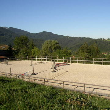
Stallplatz oder Offenstall in Bayerisch Gmain
Gesucht wird in "Mitterberg, 83457 Bayerisch Gmain, Deutschland"
6.334 Einträge
Deprecated: Creation of dynamic property Zend_View::$listObjects is deprecated in /var/www/stall-frei/htdocs/staging.stall-frei.de/library/vendor/shardj/zf1-future/library/Zend/View/Abstract.php on line 308
Gesponsort


Deprecated: Creation of dynamic property Zend_View::$listMode is deprecated in /var/www/stall-frei/htdocs/staging.stall-frei.de/library/vendor/shardj/zf1-future/library/Zend/View/Abstract.php on line 308
Deprecated: Creation of dynamic property Zend_View::$renderedObjects is deprecated in /var/www/stall-frei/htdocs/staging.stall-frei.de/library/vendor/shardj/zf1-future/library/Zend/View/Abstract.php on line 308
Deprecated: Creation of dynamic property Zend_View::$index is deprecated in /var/www/stall-frei/htdocs/staging.stall-frei.de/library/vendor/shardj/zf1-future/library/Zend/View/Abstract.php on line 308
Deprecated: Creation of dynamic property Zend_View::$displayMode is deprecated in /var/www/stall-frei/htdocs/staging.stall-frei.de/library/vendor/shardj/zf1-future/library/Zend/View/Abstract.php on line 308
Deprecated: Creation of dynamic property Zend_View::$remarketingIds is deprecated in /var/www/stall-frei/htdocs/staging.stall-frei.de/library/vendor/shardj/zf1-future/library/Zend/View/Abstract.php on line 308
Deprecated: Creation of dynamic property Zend_View::$listItem is deprecated in /var/www/stall-frei/htdocs/staging.stall-frei.de/library/vendor/shardj/zf1-future/library/Zend/View/Abstract.php on line 308
Deprecated: Creation of dynamic property Zend_View::$object is deprecated in /var/www/stall-frei/htdocs/staging.stall-frei.de/library/vendor/shardj/zf1-future/library/Zend/View/Abstract.php on line 308
Deprecated: Creation of dynamic property Zend_View::$attributes is deprecated in /var/www/stall-frei/htdocs/staging.stall-frei.de/library/vendor/shardj/zf1-future/library/Zend/View/Abstract.php on line 308

Offenstallplatz frei in Anger
Anger
Andrea Pils
@OffenstallGandja
Freizeitstall
Vermieten
Führanlage
Parkplatz für Pferdeanhänger
Offenstall
8 weitere...
P
Deprecated: Creation of dynamic property Zend_View_Helper_Ads::$adLink is deprecated in /var/www/stall-frei/htdocs/staging.stall-frei.de/library/Psf/View/Helper/Ads.php on line 108

Pferdepension Hit Aktivstall Kürmerhof
Hohenkammer
Kuermerhof
@Kuermerhof
*******JETZT NEU MIT ENTSTAUBTEM BIOHEU*********
*******Demnächst mit einem Abenteuerspielplatz für Pferde ( Extrem Trail/Pa
Leider kein Vorschaubild
Leider kein Vorschaubild
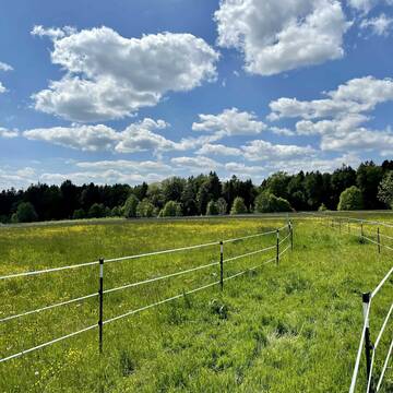
PFairD Aktivstall, Plätze frei ab 1.3.2026
Bischofswiesen
Elisabeth Weingarten
@andreas-weingarten
Reitlehrer und -unterricht
Hunde willkommen
Krankenbox
Allergikerstall
Notfallboxen
Bewegungsstall
12 weitere...
B


Offenstall mit großer Weide,Stallboxen und Paddo...
Fridolfing
Gramsamer Andreas
@Gramsi
Geländestrecke
Reitlehrer und -unterricht
Vermieten
Verpachten
Hunde willkommen
Krankenbox
Hufrehe geeignet
Notfallboxen
21 weitere...
S
Boxen zu vermieten
Siegsdorf
Siebert-Goebel
@Siebert-Goebel
FN-Mitglied
Pferdeausbildung
Vermieten
Hunde willkommen
Paddock
Außenbox mit Paddock
Außenboxen
12 weitere...
P
Leider kein Vorschaubild
Leider kein Vorschaubild
Offenstallplatz zu vergeben
Teisendorf
Celina Prange
@Runfree
Freizeitstall
Vermieten
Hunde willkommen
Krankenbox
Notfallboxen
17 weitere...
aktuell
B

Futtersack HeuToy, Fressbremse in pink
Mechtersen
STALL-FREIde Marketing
@STALL-FREI-Marketing
Stundenlange Beschäftigung die
Koliken vorbeugt, geringe Staubinhalation mit
steuerbarer Futterentnahme

Box
Laufen
Kroiss
@Kroiss
FN-Mitglied
Freizeitstall
Vermieten
Paddock
Reitplatz (z.B. Dressur, Springen, Reining)
bedampftes/gewaschenes Heu
Fohlenaufzucht möglich
16 weitere...
P

Einstellplatz für Wallache
Petting
Nadine
@Dini
Freizeitstall
Hunde willkommen
Reitplatz (z.B. Dressur, Springen, Reining)
Allergikerstall
bedampftes/gewaschenes Heu
Innenbox
Offenstall
4 weitere...
P

Offenstallplätze und Rentnerplätze FREI
Wonneberg
BioHofBerner
@BioHofBerner
Freizeitstall
Hunde willkommen
Krankenbox
Allergikerstall
bedampftes/gewaschenes Heu
Offenstall
Paddock Trail
17 weitere...
P
Pferdepension
Wonneberg
ReitstallWonneberg
@ReitstallWonneberg
Freizeitstall
Vermieten
Hunde willkommen
Paddock
Außenbox mit Paddock
10 weitere...
P


Reitanlage Dankl - Breitbrunn am Chiemsee
Breitbrunn
REITANLAGE DANKL
@REITANLAGE_DANKL
Pferdeausbildung
Reitlehrer und -unterricht
Vermieten
Führanlage
Hunde willkommen
Allergikerstall
bedampftes/gewaschenes Heu
21 weitere...
S
Deprecated: Creation of dynamic property Zend_View::$pageCount is deprecated in /var/www/stall-frei/htdocs/staging.stall-frei.de/library/vendor/shardj/zf1-future/library/Zend/View/Abstract.php on line 308
Deprecated: Creation of dynamic property Zend_View::$itemCountPerPage is deprecated in /var/www/stall-frei/htdocs/staging.stall-frei.de/library/vendor/shardj/zf1-future/library/Zend/View/Abstract.php on line 308
Deprecated: Creation of dynamic property Zend_View::$first is deprecated in /var/www/stall-frei/htdocs/staging.stall-frei.de/library/vendor/shardj/zf1-future/library/Zend/View/Abstract.php on line 308
Deprecated: Creation of dynamic property Zend_View::$current is deprecated in /var/www/stall-frei/htdocs/staging.stall-frei.de/library/vendor/shardj/zf1-future/library/Zend/View/Abstract.php on line 308
Deprecated: Creation of dynamic property Zend_View::$last is deprecated in /var/www/stall-frei/htdocs/staging.stall-frei.de/library/vendor/shardj/zf1-future/library/Zend/View/Abstract.php on line 308
Deprecated: Creation of dynamic property Zend_View::$next is deprecated in /var/www/stall-frei/htdocs/staging.stall-frei.de/library/vendor/shardj/zf1-future/library/Zend/View/Abstract.php on line 308
Deprecated: Creation of dynamic property Zend_View::$pagesInRange is deprecated in /var/www/stall-frei/htdocs/staging.stall-frei.de/library/vendor/shardj/zf1-future/library/Zend/View/Abstract.php on line 308
Deprecated: Creation of dynamic property Zend_View::$firstPageInRange is deprecated in /var/www/stall-frei/htdocs/staging.stall-frei.de/library/vendor/shardj/zf1-future/library/Zend/View/Abstract.php on line 308
Deprecated: Creation of dynamic property Zend_View::$lastPageInRange is deprecated in /var/www/stall-frei/htdocs/staging.stall-frei.de/library/vendor/shardj/zf1-future/library/Zend/View/Abstract.php on line 308
Deprecated: Creation of dynamic property Zend_View::$currentItemCount is deprecated in /var/www/stall-frei/htdocs/staging.stall-frei.de/library/vendor/shardj/zf1-future/library/Zend/View/Abstract.php on line 308
Deprecated: Creation of dynamic property Zend_View::$totalItemCount is deprecated in /var/www/stall-frei/htdocs/staging.stall-frei.de/library/vendor/shardj/zf1-future/library/Zend/View/Abstract.php on line 308
Deprecated: Creation of dynamic property Zend_View::$firstItemNumber is deprecated in /var/www/stall-frei/htdocs/staging.stall-frei.de/library/vendor/shardj/zf1-future/library/Zend/View/Abstract.php on line 308
Deprecated: Creation of dynamic property Zend_View::$lastItemNumber is deprecated in /var/www/stall-frei/htdocs/staging.stall-frei.de/library/vendor/shardj/zf1-future/library/Zend/View/Abstract.php on line 308
Deprecated: Creation of dynamic property Zend_View::$router is deprecated in /var/www/stall-frei/htdocs/staging.stall-frei.de/library/vendor/shardj/zf1-future/library/Zend/View/Abstract.php on line 308
Deprecated: Creation of dynamic property Zend_View::$urlParams is deprecated in /var/www/stall-frei/htdocs/staging.stall-frei.de/library/vendor/shardj/zf1-future/library/Zend/View/Abstract.php on line 308
Deprecated: Creation of dynamic property Zend_View::$showAds is deprecated in /var/www/stall-frei/htdocs/staging.stall-frei.de/library/vendor/shardj/zf1-future/library/Zend/View/Abstract.php on line 308
Deprecated: Creation of dynamic property Zend_View::$objectIds is deprecated in /var/www/stall-frei/htdocs/staging.stall-frei.de/library/vendor/shardj/zf1-future/library/Zend/View/Abstract.php on line 308
Deprecated: Creation of dynamic property Zend_View::$showNavbar is deprecated in /var/www/stall-frei/htdocs/staging.stall-frei.de/library/vendor/shardj/zf1-future/library/Zend/View/Abstract.php on line 308
Deprecated: Creation of dynamic property Zend_View::$showBreadcrumb is deprecated in /var/www/stall-frei/htdocs/staging.stall-frei.de/library/vendor/shardj/zf1-future/library/Zend/View/Abstract.php on line 308
Deprecated: Creation of dynamic property Zend_View::$showFooter is deprecated in /var/www/stall-frei/htdocs/staging.stall-frei.de/library/vendor/shardj/zf1-future/library/Zend/View/Abstract.php on line 308
Deprecated: Creation of dynamic property Zend_View::$showInternalAds is deprecated in /var/www/stall-frei/htdocs/staging.stall-frei.de/library/vendor/shardj/zf1-future/library/Zend/View/Abstract.php on line 308
Deprecated: Creation of dynamic property Zend_View::$blNoContent is deprecated in /var/www/stall-frei/htdocs/staging.stall-frei.de/library/vendor/shardj/zf1-future/library/Zend/View/Abstract.php on line 308
Deprecated: Creation of dynamic property Zend_View::$sMetaDesc is deprecated in /var/www/stall-frei/htdocs/staging.stall-frei.de/library/vendor/shardj/zf1-future/library/Zend/View/Abstract.php on line 308
Deprecated: Creation of dynamic property Zend_View::$useGmaps is deprecated in /var/www/stall-frei/htdocs/staging.stall-frei.de/library/vendor/shardj/zf1-future/library/Zend/View/Abstract.php on line 308
Deprecated: Creation of dynamic property Zend_View::$touches is deprecated in /var/www/stall-frei/htdocs/staging.stall-frei.de/library/vendor/shardj/zf1-future/library/Zend/View/Abstract.php on line 308
Deprecated: Creation of dynamic property Zend_View::$oProject is deprecated in /var/www/stall-frei/htdocs/staging.stall-frei.de/library/vendor/shardj/zf1-future/library/Zend/View/Abstract.php on line 308
Deprecated: Creation of dynamic property Zend_View::$pageHeadline is deprecated in /var/www/stall-frei/htdocs/staging.stall-frei.de/library/vendor/shardj/zf1-future/library/Zend/View/Abstract.php on line 308
Deprecated: Creation of dynamic property Zend_View::$disableLocationField is deprecated in /var/www/stall-frei/htdocs/staging.stall-frei.de/library/vendor/shardj/zf1-future/library/Zend/View/Abstract.php on line 308
Deprecated: Creation of dynamic property Zend_View::$isSearch is deprecated in /var/www/stall-frei/htdocs/staging.stall-frei.de/library/vendor/shardj/zf1-future/library/Zend/View/Abstract.php on line 308
Deprecated: Creation of dynamic property Zend_View::$pageTitle is deprecated in /var/www/stall-frei/htdocs/staging.stall-frei.de/library/vendor/shardj/zf1-future/library/Zend/View/Abstract.php on line 308
Deprecated: Creation of dynamic property Psf_Form_Element_Text::$class is deprecated in /var/www/stall-frei/htdocs/staging.stall-frei.de/library/vendor/shardj/zf1-future/library/Zend/Form/Element.php on line 874
Deprecated: Creation of dynamic property Psf_Form_Element_Text::$size is deprecated in /var/www/stall-frei/htdocs/staging.stall-frei.de/library/vendor/shardj/zf1-future/library/Zend/Form/Element.php on line 874
Deprecated: Creation of dynamic property Psf_Form_Element_Text::$placeholder is deprecated in /var/www/stall-frei/htdocs/staging.stall-frei.de/library/vendor/shardj/zf1-future/library/Zend/Form/Element.php on line 874
Deprecated: Creation of dynamic property Psf_Form_Element_Hidden::$class is deprecated in /var/www/stall-frei/htdocs/staging.stall-frei.de/library/vendor/shardj/zf1-future/library/Zend/Form/Element.php on line 874
Deprecated: Creation of dynamic property Psf_Form_Element_Hidden::$class is deprecated in /var/www/stall-frei/htdocs/staging.stall-frei.de/library/vendor/shardj/zf1-future/library/Zend/Form/Element.php on line 874
Deprecated: Creation of dynamic property Psf_Form_Element_Hidden::$class is deprecated in /var/www/stall-frei/htdocs/staging.stall-frei.de/library/vendor/shardj/zf1-future/library/Zend/Form/Element.php on line 874
Deprecated: Creation of dynamic property Psf_Form_Element_Hidden::$class is deprecated in /var/www/stall-frei/htdocs/staging.stall-frei.de/library/vendor/shardj/zf1-future/library/Zend/Form/Element.php on line 874
Deprecated: Creation of dynamic property Psf_Form_Element_Select::$class is deprecated in /var/www/stall-frei/htdocs/staging.stall-frei.de/library/vendor/shardj/zf1-future/library/Zend/Form/Element.php on line 874
Deprecated: Creation of dynamic property Psf_Form_Element_Select::$class is deprecated in /var/www/stall-frei/htdocs/staging.stall-frei.de/library/vendor/shardj/zf1-future/library/Zend/Form/Element.php on line 874
Deprecated: Creation of dynamic property Psf_Form_Element_Select::$class is deprecated in /var/www/stall-frei/htdocs/staging.stall-frei.de/library/vendor/shardj/zf1-future/library/Zend/Form/Element.php on line 874
Deprecated: Creation of dynamic property Psf_Form_Element_Select::$class is deprecated in /var/www/stall-frei/htdocs/staging.stall-frei.de/library/vendor/shardj/zf1-future/library/Zend/Form/Element.php on line 874
Deprecated: Creation of dynamic property Psf_Form_Element_Text::$class is deprecated in /var/www/stall-frei/htdocs/staging.stall-frei.de/library/vendor/shardj/zf1-future/library/Zend/Form/Element.php on line 874
Deprecated: Creation of dynamic property Psf_Form_Element_Checkbox::$label is deprecated in /var/www/stall-frei/htdocs/staging.stall-frei.de/library/vendor/shardj/zf1-future/library/Zend/Form/Element.php on line 874
Deprecated: Creation of dynamic property Zend_View::$sort is deprecated in /var/www/stall-frei/htdocs/staging.stall-frei.de/library/vendor/shardj/zf1-future/library/Zend/View/Abstract.php on line 308
Deprecated: Creation of dynamic property Zend_View::$searchLocation is deprecated in /var/www/stall-frei/htdocs/staging.stall-frei.de/library/vendor/shardj/zf1-future/library/Zend/View/Abstract.php on line 308
Deprecated: Creation of dynamic property Zend_View::$locationHint is deprecated in /var/www/stall-frei/htdocs/staging.stall-frei.de/library/vendor/shardj/zf1-future/library/Zend/View/Abstract.php on line 308
Psf_GeoCoder_Abstract::getLocation: Mitterberg Get Location CachedOrLive
Psf_GeoCoder_Abstract::getCachedOrLive: Mitterberg
Psf_GeoCoder_OpenCageData::makeApiRequest: response:
Array
(
[documentation] => https://opencagedata.com/api
[licenses] => Array
(
[0] => Array
(
[name] => see attribution guide
[url] => https://opencagedata.com/credits
)
)
[results] => Array
(
[0] => Array
(
[bounds] => Array
(
[northeast] => Array
(
[lat] => 47.6973634
[lng] => 12.8962463
)
[southwest] => Array
(
[lat] => 47.6972634
[lng] => 12.8961463
)
)
[components] => Array
(
[ISO_3166-1_alpha-2] => DE
[ISO_3166-1_alpha-3] => DEU
[ISO_3166-2] => Array
(
[0] => DE-BY
)
[_category] => natural/water
[_normalized_city] => Bayerisch Gmain
[_type] => peak
[continent] => Europe
[country] => Deutschland
[country_code] => de
[county] => Landkreis Berchtesgadener Land
[peak] => Mitterberg
[political_union] => European Union
[postcode] => 83457
[state] => Bayern
[state_code] => BY
[village] => Bayerisch Gmain
)
[confidence] => 9
[formatted] => Mitterberg, 83457 Bayerisch Gmain, Deutschland
[geometry] => Array
(
[lat] => 47.6973134
[lng] => 12.8961963
)
)
[1] => Array
(
[bounds] => Array
(
[northeast] => Array
(
[lat] => 47.6162898
[lng] => 11.3832185
)
[southwest] => Array
(
[lat] => 47.6161898
[lng] => 11.3831185
)
)
[components] => Array
(
[ISO_3166-1_alpha-2] => DE
[ISO_3166-1_alpha-3] => DEU
[ISO_3166-2] => Array
(
[0] => DE-BY
)
[_category] => natural/water
[_normalized_city] => Jachenau
[_type] => peak
[continent] => Europe
[country] => Deutschland
[country_code] => de
[county] => Landkreis Bad Tölz-Wolfratshausen
[peak] => Mitterberg
[political_union] => European Union
[postcode] => 83676
[state] => Bayern
[state_code] => BY
[village] => Jachenau
)
[confidence] => 9
[formatted] => Mitterberg, 83676 Jachenau, Deutschland
[geometry] => Array
(
[lat] => 47.6162398
[lng] => 11.3831685
)
)
[2] => Array
(
[bounds] => Array
(
[northeast] => Array
(
[lat] => 47.6898059
[lng] => 12.1220238
)
[southwest] => Array
(
[lat] => 47.6897059
[lng] => 12.1219238
)
)
[components] => Array
(
[ISO_3166-1_alpha-2] => DE
[ISO_3166-1_alpha-3] => DEU
[ISO_3166-2] => Array
(
[0] => DE-BY
)
[_category] => natural/water
[_normalized_city] => Oberaudorf
[_type] => peak
[continent] => Europe
[country] => Deutschland
[country_code] => de
[county] => Landkreis Rosenheim
[peak] => Mitterberg
[political_union] => European Union
[postcode] => 83126
[state] => Bayern
[state_code] => BY
[village] => Oberaudorf
)
[confidence] => 9
[formatted] => Mitterberg, 83126 Oberaudorf, Deutschland
[geometry] => Array
(
[lat] => 47.6897559
[lng] => 12.1219738
)
)
[3] => Array
(
[bounds] => Array
(
[northeast] => Array
(
[lat] => 47.6877611
[lng] => 12.0244076
)
[southwest] => Array
(
[lat] => 47.6876611
[lng] => 12.0243076
)
)
[components] => Array
(
[ISO_3166-1_alpha-2] => DE
[ISO_3166-1_alpha-3] => DEU
[ISO_3166-2] => Array
(
[0] => DE-BY
)
[_category] => natural/water
[_normalized_city] => Bayrischzell
[_type] => peak
[continent] => Europe
[country] => Deutschland
[country_code] => de
[county] => Landkreis Miesbach
[peak] => Mitterberg
[political_union] => European Union
[postcode] => 83735
[state] => Bayern
[state_code] => BY
[village] => Bayrischzell
)
[confidence] => 9
[formatted] => Mitterberg, 83735 Bayrischzell, Deutschland
[geometry] => Array
(
[lat] => 47.6877111
[lng] => 12.0243576
)
)
[4] => Array
(
[bounds] => Array
(
[northeast] => Array
(
[lat] => 47.7344786
[lng] => 12.042021
)
[southwest] => Array
(
[lat] => 47.7343786
[lng] => 12.041921
)
)
[components] => Array
(
[ISO_3166-1_alpha-2] => DE
[ISO_3166-1_alpha-3] => DEU
[ISO_3166-2] => Array
(
[0] => DE-BY
)
[_category] => natural/water
[_normalized_city] => Brannenburg
[_type] => peak
[continent] => Europe
[country] => Deutschland
[country_code] => de
[county] => Landkreis Rosenheim
[peak] => Mitterberg
[political_union] => European Union
[state] => Bayern
[state_code] => BY
[village] => Brannenburg
)
[confidence] => 9
[formatted] => Mitterberg, Brannenburg, Bayern, Deutschland
[geometry] => Array
(
[lat] => 47.7344286
[lng] => 12.041971
)
)
[5] => Array
(
[bounds] => Array
(
[northeast] => Array
(
[lat] => 47.7215492
[lng] => 11.6370416
)
[southwest] => Array
(
[lat] => 47.7214492
[lng] => 11.6369416
)
)
[components] => Array
(
[ISO_3166-1_alpha-2] => DE
[ISO_3166-1_alpha-3] => DEU
[ISO_3166-2] => Array
(
[0] => DE-BY
)
[_category] => natural/water
[_normalized_city] => Gaißach
[_type] => peak
[continent] => Europe
[country] => Deutschland
[country_code] => de
[county] => Landkreis Bad Tölz-Wolfratshausen
[peak] => Mitterberg
[political_union] => European Union
[postcode] => 83677
[state] => Bayern
[state_code] => BY
[village] => Gaißach
)
[confidence] => 9
[formatted] => Mitterberg, 83677 Gaißach, Deutschland
[geometry] => Array
(
[lat] => 47.7214992
[lng] => 11.6369916
)
)
[6] => Array
(
[bounds] => Array
(
[northeast] => Array
(
[lat] => 49.3570204
[lng] => 12.3107564
)
[southwest] => Array
(
[lat] => 49.3569204
[lng] => 12.3106564
)
)
[components] => Array
(
[ISO_3166-1_alpha-2] => DE
[ISO_3166-1_alpha-3] => DEU
[ISO_3166-2] => Array
(
[0] => DE-BY
)
[_category] => natural/water
[_normalized_city] => Schwarzhofen
[_type] => peak
[continent] => Europe
[country] => Deutschland
[country_code] => de
[county] => Landkreis Schwandorf
[municipality] => Neunburg vorm Wald (VGem)
[peak] => Mitterberg
[political_union] => European Union
[postcode] => 92447
[state] => Bayern
[state_code] => BY
[village] => Schwarzhofen
)
[confidence] => 9
[formatted] => Mitterberg, 92447 Schwarzhofen, Deutschland
[geometry] => Array
(
[lat] => 49.3569704
[lng] => 12.3107064
)
)
[7] => Array
(
[bounds] => Array
(
[northeast] => Array
(
[lat] => 49.6740082
[lng] => 12.4389599
)
[southwest] => Array
(
[lat] => 49.6739082
[lng] => 12.4388599
)
)
[components] => Array
(
[ISO_3166-1_alpha-2] => DE
[ISO_3166-1_alpha-3] => DEU
[ISO_3166-2] => Array
(
[0] => DE-BY
)
[_category] => natural/water
[_normalized_city] => Pleystein
[_type] => peak
[continent] => Europe
[country] => Deutschland
[country_code] => de
[county] => Landkreis Neustadt an der Waldnaab
[municipality] => Pleystein (VGem)
[peak] => Mitterberg
[political_union] => European Union
[postcode] => 92714
[state] => Bayern
[state_code] => BY
[town] => Pleystein
)
[confidence] => 9
[formatted] => Mitterberg, 92714 Pleystein, Deutschland
[geometry] => Array
(
[lat] => 49.6739582
[lng] => 12.4389099
)
)
[8] => Array
(
[bounds] => Array
(
[northeast] => Array
(
[lat] => 49.535342
[lng] => 12.3490373
)
[southwest] => Array
(
[lat] => 49.535242
[lng] => 12.3489373
)
)
[components] => Array
(
[ISO_3166-1_alpha-2] => DE
[ISO_3166-1_alpha-3] => DEU
[ISO_3166-2] => Array
(
[0] => DE-BY
)
[_category] => natural/water
[_normalized_city] => Tännesberg
[_type] => peak
[continent] => Europe
[country] => Deutschland
[country_code] => de
[county] => Landkreis Neustadt an der Waldnaab
[municipality] => Tännesberg (VGem)
[peak] => Mitterberg
[political_union] => European Union
[postcode] => 92723
[state] => Bayern
[state_code] => BY
[village] => Tännesberg
)
[confidence] => 9
[formatted] => Mitterberg, 92723 Tännesberg, Deutschland
[geometry] => Array
(
[lat] => 49.535292
[lng] => 12.3489873
)
)
[9] => Array
(
[bounds] => Array
(
[northeast] => Array
(
[lat] => 47.684617
[lng] => 12.7393642
)
[southwest] => Array
(
[lat] => 47.684517
[lng] => 12.7392642
)
)
[components] => Array
(
[ISO_3166-1_alpha-2] => DE
[ISO_3166-1_alpha-3] => DEU
[ISO_3166-2] => Array
(
[0] => DE-BY
)
[_category] => natural/water
[_normalized_city] => Schneizlreuth
[_type] => peak
[continent] => Europe
[country] => Deutschland
[country_code] => de
[county] => Landkreis Berchtesgadener Land
[peak] => Mitterberg
[political_union] => European Union
[postcode] => 83458
[state] => Bayern
[state_code] => BY
[village] => Schneizlreuth
)
[confidence] => 9
[formatted] => Mitterberg, 83458 Schneizlreuth, Deutschland
[geometry] => Array
(
[lat] => 47.684567
[lng] => 12.7393142
)
)
)
[status] => Array
(
[code] => 200
[message] => OK
)
[stay_informed] => Array
(
[blog] => https://blog.opencagedata.com
[mastodon] => https://en.osm.town/@opencage
)
[thanks] => For using an OpenCage API
[timestamp] => Array
(
[created_http] => Sun, 08 Feb 2026 14:58:41 GMT
[created_unix] => 1770562721
)
[total_results] => 10
)
Psf_GeoCoder_Abstract::convertLocationResult
{"documentation":"https:\/\/opencagedata.com\/api","licenses":[{"name":"see attribution guide","url":"https:\/\/opencagedata.com\/credits"}],"results":[{"bounds":{"northeast":{"lat":47.6973634,"lng":12.8962463},"southwest":{"lat":47.6972634,"lng":12.8961463}},"components":{"ISO_3166-1_alpha-2":"DE","ISO_3166-1_alpha-3":"DEU","ISO_3166-2":["DE-BY"],"_category":"natural\/water","_normalized_city":"Bayerisch Gmain","_type":"peak","continent":"Europe","country":"Deutschland","country_code":"de","county":"Landkreis Berchtesgadener Land","peak":"Mitterberg","political_union":"European Union","postcode":"83457","state":"Bayern","state_code":"BY","village":"Bayerisch Gmain"},"confidence":9,"formatted":"Mitterberg, 83457 Bayerisch Gmain, Deutschland","geometry":{"lat":47.6973134,"lng":12.8961963}},{"bounds":{"northeast":{"lat":47.6162898,"lng":11.3832185},"southwest":{"lat":47.6161898,"lng":11.3831185}},"components":{"ISO_3166-1_alpha-2":"DE","ISO_3166-1_alpha-3":"DEU","ISO_3166-2":["DE-BY"],"_category":"natural\/water","_normalized_city":"Jachenau","_type":"peak","continent":"Europe","country":"Deutschland","country_code":"de","county":"Landkreis Bad T\u00f6lz-Wolfratshausen","peak":"Mitterberg","political_union":"European Union","postcode":"83676","state":"Bayern","state_code":"BY","village":"Jachenau"},"confidence":9,"formatted":"Mitterberg, 83676 Jachenau, Deutschland","geometry":{"lat":47.6162398,"lng":11.3831685}},{"bounds":{"northeast":{"lat":47.6898059,"lng":12.1220238},"southwest":{"lat":47.6897059,"lng":12.1219238}},"components":{"ISO_3166-1_alpha-2":"DE","ISO_3166-1_alpha-3":"DEU","ISO_3166-2":["DE-BY"],"_category":"natural\/water","_normalized_city":"Oberaudorf","_type":"peak","continent":"Europe","country":"Deutschland","country_code":"de","county":"Landkreis Rosenheim","peak":"Mitterberg","political_union":"European Union","postcode":"83126","state":"Bayern","state_code":"BY","village":"Oberaudorf"},"confidence":9,"formatted":"Mitterberg, 83126 Oberaudorf, Deutschland","geometry":{"lat":47.6897559,"lng":12.1219738}},{"bounds":{"northeast":{"lat":47.6877611,"lng":12.0244076},"southwest":{"lat":47.6876611,"lng":12.0243076}},"components":{"ISO_3166-1_alpha-2":"DE","ISO_3166-1_alpha-3":"DEU","ISO_3166-2":["DE-BY"],"_category":"natural\/water","_normalized_city":"Bayrischzell","_type":"peak","continent":"Europe","country":"Deutschland","country_code":"de","county":"Landkreis Miesbach","peak":"Mitterberg","political_union":"European Union","postcode":"83735","state":"Bayern","state_code":"BY","village":"Bayrischzell"},"confidence":9,"formatted":"Mitterberg, 83735 Bayrischzell, Deutschland","geometry":{"lat":47.6877111,"lng":12.0243576}},{"bounds":{"northeast":{"lat":47.7344786,"lng":12.042021},"southwest":{"lat":47.7343786,"lng":12.041921}},"components":{"ISO_3166-1_alpha-2":"DE","ISO_3166-1_alpha-3":"DEU","ISO_3166-2":["DE-BY"],"_category":"natural\/water","_normalized_city":"Brannenburg","_type":"peak","continent":"Europe","country":"Deutschland","country_code":"de","county":"Landkreis Rosenheim","peak":"Mitterberg","political_union":"European Union","state":"Bayern","state_code":"BY","village":"Brannenburg"},"confidence":9,"formatted":"Mitterberg, Brannenburg, Bayern, Deutschland","geometry":{"lat":47.7344286,"lng":12.041971}},{"bounds":{"northeast":{"lat":47.7215492,"lng":11.6370416},"southwest":{"lat":47.7214492,"lng":11.6369416}},"components":{"ISO_3166-1_alpha-2":"DE","ISO_3166-1_alpha-3":"DEU","ISO_3166-2":["DE-BY"],"_category":"natural\/water","_normalized_city":"Gai\u00dfach","_type":"peak","continent":"Europe","country":"Deutschland","country_code":"de","county":"Landkreis Bad T\u00f6lz-Wolfratshausen","peak":"Mitterberg","political_union":"European Union","postcode":"83677","state":"Bayern","state_code":"BY","village":"Gai\u00dfach"},"confidence":9,"formatted":"Mitterberg, 83677 Gai\u00dfach, Deutschland","geometry":{"lat":47.7214992,"lng":11.6369916}},{"bounds":{"northeast":{"lat":49.3570204,"lng":12.3107564},"southwest":{"lat":49.3569204,"lng":12.3106564}},"components":{"ISO_3166-1_alpha-2":"DE","ISO_3166-1_alpha-3":"DEU","ISO_3166-2":["DE-BY"],"_category":"natural\/water","_normalized_city":"Schwarzhofen","_type":"peak","continent":"Europe","country":"Deutschland","country_code":"de","county":"Landkreis Schwandorf","municipality":"Neunburg vorm Wald (VGem)","peak":"Mitterberg","political_union":"European Union","postcode":"92447","state":"Bayern","state_code":"BY","village":"Schwarzhofen"},"confidence":9,"formatted":"Mitterberg, 92447 Schwarzhofen, Deutschland","geometry":{"lat":49.3569704,"lng":12.3107064}},{"bounds":{"northeast":{"lat":49.6740082,"lng":12.4389599},"southwest":{"lat":49.6739082,"lng":12.4388599}},"components":{"ISO_3166-1_alpha-2":"DE","ISO_3166-1_alpha-3":"DEU","ISO_3166-2":["DE-BY"],"_category":"natural\/water","_normalized_city":"Pleystein","_type":"peak","continent":"Europe","country":"Deutschland","country_code":"de","county":"Landkreis Neustadt an der Waldnaab","municipality":"Pleystein (VGem)","peak":"Mitterberg","political_union":"European Union","postcode":"92714","state":"Bayern","state_code":"BY","town":"Pleystein"},"confidence":9,"formatted":"Mitterberg, 92714 Pleystein, Deutschland","geometry":{"lat":49.6739582,"lng":12.4389099}},{"bounds":{"northeast":{"lat":49.535342,"lng":12.3490373},"southwest":{"lat":49.535242,"lng":12.3489373}},"components":{"ISO_3166-1_alpha-2":"DE","ISO_3166-1_alpha-3":"DEU","ISO_3166-2":["DE-BY"],"_category":"natural\/water","_normalized_city":"T\u00e4nnesberg","_type":"peak","continent":"Europe","country":"Deutschland","country_code":"de","county":"Landkreis Neustadt an der Waldnaab","municipality":"T\u00e4nnesberg (VGem)","peak":"Mitterberg","political_union":"European Union","postcode":"92723","state":"Bayern","state_code":"BY","village":"T\u00e4nnesberg"},"confidence":9,"formatted":"Mitterberg, 92723 T\u00e4nnesberg, Deutschland","geometry":{"lat":49.535292,"lng":12.3489873}},{"bounds":{"northeast":{"lat":47.684617,"lng":12.7393642},"southwest":{"lat":47.684517,"lng":12.7392642}},"components":{"ISO_3166-1_alpha-2":"DE","ISO_3166-1_alpha-3":"DEU","ISO_3166-2":["DE-BY"],"_category":"natural\/water","_normalized_city":"Schneizlreuth","_type":"peak","continent":"Europe","country":"Deutschland","country_code":"de","county":"Landkreis Berchtesgadener Land","peak":"Mitterberg","political_union":"European Union","postcode":"83458","state":"Bayern","state_code":"BY","village":"Schneizlreuth"},"confidence":9,"formatted":"Mitterberg, 83458 Schneizlreuth, Deutschland","geometry":{"lat":47.684567,"lng":12.7393142}}],"status":{"code":200,"message":"OK"},"stay_informed":{"blog":"https:\/\/blog.opencagedata.com","mastodon":"https:\/\/en.osm.town\/@opencage"},"thanks":"For using an OpenCage API","timestamp":{"created_http":"Sun, 08 Feb 2026 14:58:41 GMT","created_unix":1770562721},"total_results":10}Array
(
[0] => stdClass Object
(
[bounds] => stdClass Object
(
[northeast] => stdClass Object
(
[lat] => 47.6973634
[lng] => 12.8962463
)
[southwest] => stdClass Object
(
[lat] => 47.6972634
[lng] => 12.8961463
)
)
[components] => stdClass Object
(
[ISO_3166-1_alpha-2] => DE
[ISO_3166-1_alpha-3] => DEU
[ISO_3166-2] => Array
(
[0] => DE-BY
)
[_category] => natural/water
[_normalized_city] => Bayerisch Gmain
[_type] => peak
[continent] => Europe
[country] => Deutschland
[country_code] => de
[county] => Landkreis Berchtesgadener Land
[peak] => Mitterberg
[political_union] => European Union
[postcode] => 83457
[state] => Bayern
[state_code] => BY
[village] => Bayerisch Gmain
)
[confidence] => 9
[formatted] => Mitterberg, 83457 Bayerisch Gmain, Deutschland
[geometry] => stdClass Object
(
[lat] => 47.6973134
[lng] => 12.8961963
)
)
[1] => stdClass Object
(
[bounds] => stdClass Object
(
[northeast] => stdClass Object
(
[lat] => 47.6162898
[lng] => 11.3832185
)
[southwest] => stdClass Object
(
[lat] => 47.6161898
[lng] => 11.3831185
)
)
[components] => stdClass Object
(
[ISO_3166-1_alpha-2] => DE
[ISO_3166-1_alpha-3] => DEU
[ISO_3166-2] => Array
(
[0] => DE-BY
)
[_category] => natural/water
[_normalized_city] => Jachenau
[_type] => peak
[continent] => Europe
[country] => Deutschland
[country_code] => de
[county] => Landkreis Bad Tölz-Wolfratshausen
[peak] => Mitterberg
[political_union] => European Union
[postcode] => 83676
[state] => Bayern
[state_code] => BY
[village] => Jachenau
)
[confidence] => 9
[formatted] => Mitterberg, 83676 Jachenau, Deutschland
[geometry] => stdClass Object
(
[lat] => 47.6162398
[lng] => 11.3831685
)
)
[2] => stdClass Object
(
[bounds] => stdClass Object
(
[northeast] => stdClass Object
(
[lat] => 47.6898059
[lng] => 12.1220238
)
[southwest] => stdClass Object
(
[lat] => 47.6897059
[lng] => 12.1219238
)
)
[components] => stdClass Object
(
[ISO_3166-1_alpha-2] => DE
[ISO_3166-1_alpha-3] => DEU
[ISO_3166-2] => Array
(
[0] => DE-BY
)
[_category] => natural/water
[_normalized_city] => Oberaudorf
[_type] => peak
[continent] => Europe
[country] => Deutschland
[country_code] => de
[county] => Landkreis Rosenheim
[peak] => Mitterberg
[political_union] => European Union
[postcode] => 83126
[state] => Bayern
[state_code] => BY
[village] => Oberaudorf
)
[confidence] => 9
[formatted] => Mitterberg, 83126 Oberaudorf, Deutschland
[geometry] => stdClass Object
(
[lat] => 47.6897559
[lng] => 12.1219738
)
)
[3] => stdClass Object
(
[bounds] => stdClass Object
(
[northeast] => stdClass Object
(
[lat] => 47.6877611
[lng] => 12.0244076
)
[southwest] => stdClass Object
(
[lat] => 47.6876611
[lng] => 12.0243076
)
)
[components] => stdClass Object
(
[ISO_3166-1_alpha-2] => DE
[ISO_3166-1_alpha-3] => DEU
[ISO_3166-2] => Array
(
[0] => DE-BY
)
[_category] => natural/water
[_normalized_city] => Bayrischzell
[_type] => peak
[continent] => Europe
[country] => Deutschland
[country_code] => de
[county] => Landkreis Miesbach
[peak] => Mitterberg
[political_union] => European Union
[postcode] => 83735
[state] => Bayern
[state_code] => BY
[village] => Bayrischzell
)
[confidence] => 9
[formatted] => Mitterberg, 83735 Bayrischzell, Deutschland
[geometry] => stdClass Object
(
[lat] => 47.6877111
[lng] => 12.0243576
)
)
[4] => stdClass Object
(
[bounds] => stdClass Object
(
[northeast] => stdClass Object
(
[lat] => 47.7344786
[lng] => 12.042021
)
[southwest] => stdClass Object
(
[lat] => 47.7343786
[lng] => 12.041921
)
)
[components] => stdClass Object
(
[ISO_3166-1_alpha-2] => DE
[ISO_3166-1_alpha-3] => DEU
[ISO_3166-2] => Array
(
[0] => DE-BY
)
[_category] => natural/water
[_normalized_city] => Brannenburg
[_type] => peak
[continent] => Europe
[country] => Deutschland
[country_code] => de
[county] => Landkreis Rosenheim
[peak] => Mitterberg
[political_union] => European Union
[state] => Bayern
[state_code] => BY
[village] => Brannenburg
)
[confidence] => 9
[formatted] => Mitterberg, Brannenburg, Bayern, Deutschland
[geometry] => stdClass Object
(
[lat] => 47.7344286
[lng] => 12.041971
)
)
[5] => stdClass Object
(
[bounds] => stdClass Object
(
[northeast] => stdClass Object
(
[lat] => 47.7215492
[lng] => 11.6370416
)
[southwest] => stdClass Object
(
[lat] => 47.7214492
[lng] => 11.6369416
)
)
[components] => stdClass Object
(
[ISO_3166-1_alpha-2] => DE
[ISO_3166-1_alpha-3] => DEU
[ISO_3166-2] => Array
(
[0] => DE-BY
)
[_category] => natural/water
[_normalized_city] => Gaißach
[_type] => peak
[continent] => Europe
[country] => Deutschland
[country_code] => de
[county] => Landkreis Bad Tölz-Wolfratshausen
[peak] => Mitterberg
[political_union] => European Union
[postcode] => 83677
[state] => Bayern
[state_code] => BY
[village] => Gaißach
)
[confidence] => 9
[formatted] => Mitterberg, 83677 Gaißach, Deutschland
[geometry] => stdClass Object
(
[lat] => 47.7214992
[lng] => 11.6369916
)
)
[6] => stdClass Object
(
[bounds] => stdClass Object
(
[northeast] => stdClass Object
(
[lat] => 49.3570204
[lng] => 12.3107564
)
[southwest] => stdClass Object
(
[lat] => 49.3569204
[lng] => 12.3106564
)
)
[components] => stdClass Object
(
[ISO_3166-1_alpha-2] => DE
[ISO_3166-1_alpha-3] => DEU
[ISO_3166-2] => Array
(
[0] => DE-BY
)
[_category] => natural/water
[_normalized_city] => Schwarzhofen
[_type] => peak
[continent] => Europe
[country] => Deutschland
[country_code] => de
[county] => Landkreis Schwandorf
[municipality] => Neunburg vorm Wald (VGem)
[peak] => Mitterberg
[political_union] => European Union
[postcode] => 92447
[state] => Bayern
[state_code] => BY
[village] => Schwarzhofen
)
[confidence] => 9
[formatted] => Mitterberg, 92447 Schwarzhofen, Deutschland
[geometry] => stdClass Object
(
[lat] => 49.3569704
[lng] => 12.3107064
)
)
[7] => stdClass Object
(
[bounds] => stdClass Object
(
[northeast] => stdClass Object
(
[lat] => 49.6740082
[lng] => 12.4389599
)
[southwest] => stdClass Object
(
[lat] => 49.6739082
[lng] => 12.4388599
)
)
[components] => stdClass Object
(
[ISO_3166-1_alpha-2] => DE
[ISO_3166-1_alpha-3] => DEU
[ISO_3166-2] => Array
(
[0] => DE-BY
)
[_category] => natural/water
[_normalized_city] => Pleystein
[_type] => peak
[continent] => Europe
[country] => Deutschland
[country_code] => de
[county] => Landkreis Neustadt an der Waldnaab
[municipality] => Pleystein (VGem)
[peak] => Mitterberg
[political_union] => European Union
[postcode] => 92714
[state] => Bayern
[state_code] => BY
[town] => Pleystein
)
[confidence] => 9
[formatted] => Mitterberg, 92714 Pleystein, Deutschland
[geometry] => stdClass Object
(
[lat] => 49.6739582
[lng] => 12.4389099
)
)
[8] => stdClass Object
(
[bounds] => stdClass Object
(
[northeast] => stdClass Object
(
[lat] => 49.535342
[lng] => 12.3490373
)
[southwest] => stdClass Object
(
[lat] => 49.535242
[lng] => 12.3489373
)
)
[components] => stdClass Object
(
[ISO_3166-1_alpha-2] => DE
[ISO_3166-1_alpha-3] => DEU
[ISO_3166-2] => Array
(
[0] => DE-BY
)
[_category] => natural/water
[_normalized_city] => Tännesberg
[_type] => peak
[continent] => Europe
[country] => Deutschland
[country_code] => de
[county] => Landkreis Neustadt an der Waldnaab
[municipality] => Tännesberg (VGem)
[peak] => Mitterberg
[political_union] => European Union
[postcode] => 92723
[state] => Bayern
[state_code] => BY
[village] => Tännesberg
)
[confidence] => 9
[formatted] => Mitterberg, 92723 Tännesberg, Deutschland
[geometry] => stdClass Object
(
[lat] => 49.535292
[lng] => 12.3489873
)
)
[9] => stdClass Object
(
[bounds] => stdClass Object
(
[northeast] => stdClass Object
(
[lat] => 47.684617
[lng] => 12.7393642
)
[southwest] => stdClass Object
(
[lat] => 47.684517
[lng] => 12.7392642
)
)
[components] => stdClass Object
(
[ISO_3166-1_alpha-2] => DE
[ISO_3166-1_alpha-3] => DEU
[ISO_3166-2] => Array
(
[0] => DE-BY
)
[_category] => natural/water
[_normalized_city] => Schneizlreuth
[_type] => peak
[continent] => Europe
[country] => Deutschland
[country_code] => de
[county] => Landkreis Berchtesgadener Land
[peak] => Mitterberg
[political_union] => European Union
[postcode] => 83458
[state] => Bayern
[state_code] => BY
[village] => Schneizlreuth
)
[confidence] => 9
[formatted] => Mitterberg, 83458 Schneizlreuth, Deutschland
[geometry] => stdClass Object
(
[lat] => 47.684567
[lng] => 12.7393142
)
)
)
Psf_GeoCoder_OpenCageData::getKeyMap: 0
stdClass Object
(
    [bounds] => stdClass Object
        (
            [northeast] => stdClass Object
                (
                    [lat] => 47.6973634
                    [lng] => 12.8962463
                )

            [southwest] => stdClass Object
                (
                    [lat] => 47.6972634
                    [lng] => 12.8961463
                )

        )

    [components] => stdClass Object
        (
            [ISO_3166-1_alpha-2] => DE
            [ISO_3166-1_alpha-3] => DEU
            [ISO_3166-2] => Array
                (
                    [0] => DE-BY
                )

            [_category] => natural/water
            [_normalized_city] => Bayerisch Gmain
            [_type] => peak
            [continent] => Europe
            [country] => Deutschland
            [country_code] => de
            [county] => Landkreis Berchtesgadener Land
            [peak] => Mitterberg
            [political_union] => European Union
            [postcode] => 83457
            [state] => Bayern
            [state_code] => BY
            [village] => Bayerisch Gmain
        )

    [confidence] => 9
    [formatted] => Mitterberg, 83457 Bayerisch Gmain, Deutschland
    [geometry] => stdClass Object
        (
            [lat] => 47.6973134
            [lng] => 12.8961963
        )

)
Psf_GeoCoder_OpenCageData::getCounty: Berchtesgadener Land
Psf_GeoCoder_OpenCageData::addMissingData REFETCH!
Array
(
    [address] => Mitterberg, 83457 Bayerisch Gmain, Deutschland
    [type] => peak
    [street] =>
    [city] => Bayerisch Gmain
    [county] => Berchtesgadener Land
    [state] => Bayern
    [zip] => 83457
    [country] => Deutschland
    [suburb] =>
    [countrycode] => de
    [latitude] => 47.6973134
    [longitude] => 12.8961963
    [accuracy] => 1
    [confidence] => 9
    [bounds] => stdClass Object
        (
            [northeast] => stdClass Object
                (
                    [lat] => 47.6973634
                    [lng] => 12.8962463
                )

            [southwest] => stdClass Object
                (
                    [lat] => 47.6972634
                    [lng] => 12.8961463
                )

        )

)
reformat!
Array
(
    [address] => Mitterberg, 83457 Bayerisch Gmain, Deutschland
    [type] => peak
    [street] =>
    [city] => Bayerisch Gmain
    [county] => Berchtesgadener Land
    [state] => Bayern
    [zip] => 83457
    [country] => Deutschland
    [suburb] =>
    [countrycode] => de
    [latitude] => 47.6973134
    [longitude] => 12.8961963
    [accuracy] => 1
    [confidence] => 9
    [bounds] => stdClass Object
        (
            [northeast] => stdClass Object
                (
                    [lat] => 47.6973634
                    [lng] => 12.8962463
                )

            [southwest] => stdClass Object
                (
                    [lat] => 47.6972634
                    [lng] => 12.8961463
                )

        )

    [place] => 83457 Bayerisch Gmain, Bayern
    [hash] => 7ce8e8a1e76517ca6e83765bd89c6c0f
)
Psf_GeoCoder_OpenCageData::getKeyMap: 1
stdClass Object
(
    [bounds] => stdClass Object
        (
            [northeast] => stdClass Object
                (
                    [lat] => 47.6162898
                    [lng] => 11.3832185
                )

            [southwest] => stdClass Object
                (
                    [lat] => 47.6161898
                    [lng] => 11.3831185
                )

        )

    [components] => stdClass Object
        (
            [ISO_3166-1_alpha-2] => DE
            [ISO_3166-1_alpha-3] => DEU
            [ISO_3166-2] => Array
                (
                    [0] => DE-BY
                )

            [_category] => natural/water
            [_normalized_city] => Jachenau
            [_type] => peak
            [continent] => Europe
            [country] => Deutschland
            [country_code] => de
            [county] => Landkreis Bad Tölz-Wolfratshausen
            [peak] => Mitterberg
            [political_union] => European Union
            [postcode] => 83676
            [state] => Bayern
            [state_code] => BY
            [village] => Jachenau
        )

    [confidence] => 9
    [formatted] => Mitterberg, 83676 Jachenau, Deutschland
    [geometry] => stdClass Object
        (
            [lat] => 47.6162398
            [lng] => 11.3831685
        )

)
Psf_GeoCoder_OpenCageData::getCounty: Bad Tölz-Wolfratshausen
Psf_GeoCoder_OpenCageData::addMissingData REFETCH!
Array
(
    [address] => Mitterberg, 83676 Jachenau, Deutschland
    [type] => peak
    [street] =>
    [city] => Jachenau
    [county] => Bad Tölz-Wolfratshausen
    [state] => Bayern
    [zip] => 83676
    [country] => Deutschland
    [suburb] =>
    [countrycode] => de
    [latitude] => 47.6162398
    [longitude] => 11.3831685
    [accuracy] => 1
    [confidence] => 9
    [bounds] => stdClass Object
        (
            [northeast] => stdClass Object
                (
                    [lat] => 47.6162898
                    [lng] => 11.3832185
                )

            [southwest] => stdClass Object
                (
                    [lat] => 47.6161898
                    [lng] => 11.3831185
                )

        )

)
reformat!
Array
(
    [address] => Mitterberg, 83676 Jachenau, Deutschland
    [type] => peak
    [street] =>
    [city] => Jachenau
    [county] => Bad Tölz-Wolfratshausen
    [state] => Bayern
    [zip] => 83676
    [country] => Deutschland
    [suburb] =>
    [countrycode] => de
    [latitude] => 47.6162398
    [longitude] => 11.3831685
    [accuracy] => 1
    [confidence] => 9
    [bounds] => stdClass Object
        (
            [northeast] => stdClass Object
                (
                    [lat] => 47.6162898
                    [lng] => 11.3832185
                )

            [southwest] => stdClass Object
                (
                    [lat] => 47.6161898
                    [lng] => 11.3831185
                )

        )

    [place] => 83676 Jachenau, Bayern
    [hash] => a3d738aba88597ec7a60456539db1277
)
Psf_GeoCoder_OpenCageData::getKeyMap: 2
stdClass Object
(
    [bounds] => stdClass Object
        (
            [northeast] => stdClass Object
                (
                    [lat] => 47.6898059
                    [lng] => 12.1220238
                )

            [southwest] => stdClass Object
                (
                    [lat] => 47.6897059
                    [lng] => 12.1219238
                )

        )

    [components] => stdClass Object
        (
            [ISO_3166-1_alpha-2] => DE
            [ISO_3166-1_alpha-3] => DEU
            [ISO_3166-2] => Array
                (
                    [0] => DE-BY
                )

            [_category] => natural/water
            [_normalized_city] => Oberaudorf
            [_type] => peak
            [continent] => Europe
            [country] => Deutschland
            [country_code] => de
            [county] => Landkreis Rosenheim
            [peak] => Mitterberg
            [political_union] => European Union
            [postcode] => 83126
            [state] => Bayern
            [state_code] => BY
            [village] => Oberaudorf
        )

    [confidence] => 9
    [formatted] => Mitterberg, 83126 Oberaudorf, Deutschland
    [geometry] => stdClass Object
        (
            [lat] => 47.6897559
            [lng] => 12.1219738
        )

)
Psf_GeoCoder_OpenCageData::getCounty: Rosenheim
Psf_GeoCoder_OpenCageData::addMissingData REFETCH!
Array
(
    [address] => Mitterberg, 83126 Oberaudorf, Deutschland
    [type] => peak
    [street] =>
    [city] => Oberaudorf
    [county] => Rosenheim
    [state] => Bayern
    [zip] => 83126
    [country] => Deutschland
    [suburb] =>
    [countrycode] => de
    [latitude] => 47.6897559
    [longitude] => 12.1219738
    [accuracy] => 1
    [confidence] => 9
    [bounds] => stdClass Object
        (
            [northeast] => stdClass Object
                (
                    [lat] => 47.6898059
                    [lng] => 12.1220238
                )

            [southwest] => stdClass Object
                (
                    [lat] => 47.6897059
                    [lng] => 12.1219238
                )

        )

)
reformat!
Array
(
    [address] => Mitterberg, 83126 Oberaudorf, Deutschland
    [type] => peak
    [street] =>
    [city] => Oberaudorf
    [county] => Rosenheim
    [state] => Bayern
    [zip] => 83126
    [country] => Deutschland
    [suburb] =>
    [countrycode] => de
    [latitude] => 47.6897559
    [longitude] => 12.1219738
    [accuracy] => 1
    [confidence] => 9
    [bounds] => stdClass Object
        (
            [northeast] => stdClass Object
                (
                    [lat] => 47.6898059
                    [lng] => 12.1220238
                )

            [southwest] => stdClass Object
                (
                    [lat] => 47.6897059
                    [lng] => 12.1219238
                )

        )

    [place] => 83126 Oberaudorf, Bayern
    [hash] => 845503865091afc520e0c72001c0fe20
)
Psf_GeoCoder_OpenCageData::getKeyMap: 3
stdClass Object
(
    [bounds] => stdClass Object
        (
            [northeast] => stdClass Object
                (
                    [lat] => 47.6877611
                    [lng] => 12.0244076
                )

            [southwest] => stdClass Object
                (
                    [lat] => 47.6876611
                    [lng] => 12.0243076
                )

        )

    [components] => stdClass Object
        (
            [ISO_3166-1_alpha-2] => DE
            [ISO_3166-1_alpha-3] => DEU
            [ISO_3166-2] => Array
                (
                    [0] => DE-BY
                )

            [_category] => natural/water
            [_normalized_city] => Bayrischzell
            [_type] => peak
            [continent] => Europe
            [country] => Deutschland
            [country_code] => de
            [county] => Landkreis Miesbach
            [peak] => Mitterberg
            [political_union] => European Union
            [postcode] => 83735
            [state] => Bayern
            [state_code] => BY
            [village] => Bayrischzell
        )

    [confidence] => 9
    [formatted] => Mitterberg, 83735 Bayrischzell, Deutschland
    [geometry] => stdClass Object
        (
            [lat] => 47.6877111
            [lng] => 12.0243576
        )

)
Psf_GeoCoder_OpenCageData::getCounty: Miesbach
Psf_GeoCoder_OpenCageData::addMissingData REFETCH!
Array
(
    [address] => Mitterberg, 83735 Bayrischzell, Deutschland
    [type] => peak
    [street] =>
    [city] => Bayrischzell
    [county] => Miesbach
    [state] => Bayern
    [zip] => 83735
    [country] => Deutschland
    [suburb] =>
    [countrycode] => de
    [latitude] => 47.6877111
    [longitude] => 12.0243576
    [accuracy] => 1
    [confidence] => 9
    [bounds] => stdClass Object
        (
            [northeast] => stdClass Object
                (
                    [lat] => 47.6877611
                    [lng] => 12.0244076
                )

            [southwest] => stdClass Object
                (
                    [lat] => 47.6876611
                    [lng] => 12.0243076
                )

        )

)
reformat!
Array
(
    [address] => Mitterberg, 83735 Bayrischzell, Deutschland
    [type] => peak
    [street] =>
    [city] => Bayrischzell
    [county] => Miesbach
    [state] => Bayern
    [zip] => 83735
    [country] => Deutschland
    [suburb] =>
    [countrycode] => de
    [latitude] => 47.6877111
    [longitude] => 12.0243576
    [accuracy] => 1
    [confidence] => 9
    [bounds] => stdClass Object
        (
            [northeast] => stdClass Object
                (
                    [lat] => 47.6877611
                    [lng] => 12.0244076
                )

            [southwest] => stdClass Object
                (
                    [lat] => 47.6876611
                    [lng] => 12.0243076
                )

        )

    [place] => 83735 Bayrischzell, Bayern
    [hash] => b1faaff84f855c997f9e52c831348acf
)
Psf_GeoCoder_OpenCageData::getKeyMap: 4
stdClass Object
(
    [bounds] => stdClass Object
        (
            [northeast] => stdClass Object
                (
                    [lat] => 47.7344786
                    [lng] => 12.042021
                )

            [southwest] => stdClass Object
                (
                    [lat] => 47.7343786
                    [lng] => 12.041921
                )

        )

    [components] => stdClass Object
        (
            [ISO_3166-1_alpha-2] => DE
            [ISO_3166-1_alpha-3] => DEU
            [ISO_3166-2] => Array
                (
                    [0] => DE-BY
                )

            [_category] => natural/water
            [_normalized_city] => Brannenburg
            [_type] => peak
            [continent] => Europe
            [country] => Deutschland
            [country_code] => de
            [county] => Landkreis Rosenheim
            [peak] => Mitterberg
            [political_union] => European Union
            [state] => Bayern
            [state_code] => BY
            [village] => Brannenburg
        )

    [confidence] => 9
    [formatted] => Mitterberg, Brannenburg, Bayern, Deutschland
    [geometry] => stdClass Object
        (
            [lat] => 47.7344286
            [lng] => 12.041971
        )

)
Psf_GeoCoder_OpenCageData::getCounty: Rosenheim
Psf_GeoCoder_OpenCageData::addMissingData REFETCH!
Array
(
    [address] => Mitterberg, Brannenburg, Bayern, Deutschland
    [type] => peak
    [street] =>
    [city] => Brannenburg
    [county] => Rosenheim
    [state] => Bayern
    [zip] =>
    [country] => Deutschland
    [suburb] =>
    [countrycode] => de
    [latitude] => 47.7344286
    [longitude] => 12.041971
    [accuracy] => 1
    [confidence] => 9
    [bounds] => stdClass Object
        (
            [northeast] => stdClass Object
                (
                    [lat] => 47.7344786
                    [lng] => 12.042021
                )

            [southwest] => stdClass Object
                (
                    [lat] => 47.7343786
                    [lng] => 12.041921
                )

        )

)
reformat!
Array
(
    [address] => Mitterberg, Brannenburg, Bayern, Deutschland
    [type] => peak
    [street] =>
    [city] => Brannenburg
    [county] => Rosenheim
    [state] => Bayern
    [zip] =>
    [country] => Deutschland
    [suburb] =>
    [countrycode] => de
    [latitude] => 47.7344286
    [longitude] => 12.041971
    [accuracy] => 1
    [confidence] => 9
    [bounds] => stdClass Object
        (
            [northeast] => stdClass Object
                (
                    [lat] => 47.7344786
                    [lng] => 12.042021
                )

            [southwest] => stdClass Object
                (
                    [lat] => 47.7343786
                    [lng] => 12.041921
                )

        )

    [place] => Brannenburg, Bayern
    [hash] => 1ac5658163bf96b79bd9e409b52478e9
)
Psf_GeoCoder_OpenCageData::getKeyMap: 5
stdClass Object
(
    [bounds] => stdClass Object
        (
            [northeast] => stdClass Object
                (
                    [lat] => 47.7215492
                    [lng] => 11.6370416
                )

            [southwest] => stdClass Object
                (
                    [lat] => 47.7214492
                    [lng] => 11.6369416
                )

        )

    [components] => stdClass Object
        (
            [ISO_3166-1_alpha-2] => DE
            [ISO_3166-1_alpha-3] => DEU
            [ISO_3166-2] => Array
                (
                    [0] => DE-BY
                )

            [_category] => natural/water
            [_normalized_city] => Gaißach
            [_type] => peak
            [continent] => Europe
            [country] => Deutschland
            [country_code] => de
            [county] => Landkreis Bad Tölz-Wolfratshausen
            [peak] => Mitterberg
            [political_union] => European Union
            [postcode] => 83677
            [state] => Bayern
            [state_code] => BY
            [village] => Gaißach
        )

    [confidence] => 9
    [formatted] => Mitterberg, 83677 Gaißach, Deutschland
    [geometry] => stdClass Object
        (
            [lat] => 47.7214992
            [lng] => 11.6369916
        )

)
Psf_GeoCoder_OpenCageData::getCounty: Bad Tölz-Wolfratshausen
Psf_GeoCoder_OpenCageData::addMissingData REFETCH!
Array
(
    [address] => Mitterberg, 83677 Gaißach, Deutschland
    [type] => peak
    [street] =>
    [city] => Gaißach
    [county] => Bad Tölz-Wolfratshausen
    [state] => Bayern
    [zip] => 83677
    [country] => Deutschland
    [suburb] =>
    [countrycode] => de
    [latitude] => 47.7214992
    [longitude] => 11.6369916
    [accuracy] => 1
    [confidence] => 9
    [bounds] => stdClass Object
        (
            [northeast] => stdClass Object
                (
                    [lat] => 47.7215492
                    [lng] => 11.6370416
                )

            [southwest] => stdClass Object
                (
                    [lat] => 47.7214492
                    [lng] => 11.6369416
                )

        )

)
reformat!
Array
(
    [address] => Mitterberg, 83677 Gaißach, Deutschland
    [type] => peak
    [street] =>
    [city] => Gaißach
    [county] => Bad Tölz-Wolfratshausen
    [state] => Bayern
    [zip] => 83677
    [country] => Deutschland
    [suburb] =>
    [countrycode] => de
    [latitude] => 47.7214992
    [longitude] => 11.6369916
    [accuracy] => 1
    [confidence] => 9
    [bounds] => stdClass Object
        (
            [northeast] => stdClass Object
                (
                    [lat] => 47.7215492
                    [lng] => 11.6370416
                )

            [southwest] => stdClass Object
                (
                    [lat] => 47.7214492
                    [lng] => 11.6369416
                )

        )

    [place] => 83677 Gaißach, Bayern
    [hash] => f5b4860f565ee0afd35033f18aef9653
)
Psf_GeoCoder_OpenCageData::getKeyMap: 6
stdClass Object
(
    [bounds] => stdClass Object
        (
            [northeast] => stdClass Object
                (
                    [lat] => 49.3570204
                    [lng] => 12.3107564
                )

            [southwest] => stdClass Object
                (
                    [lat] => 49.3569204
                    [lng] => 12.3106564
                )

        )

    [components] => stdClass Object
        (
            [ISO_3166-1_alpha-2] => DE
            [ISO_3166-1_alpha-3] => DEU
            [ISO_3166-2] => Array
                (
                    [0] => DE-BY
                )

            [_category] => natural/water
            [_normalized_city] => Schwarzhofen
            [_type] => peak
            [continent] => Europe
            [country] => Deutschland
            [country_code] => de
            [county] => Landkreis Schwandorf
            [municipality] => Neunburg vorm Wald (VGem)
            [peak] => Mitterberg
            [political_union] => European Union
            [postcode] => 92447
            [state] => Bayern
            [state_code] => BY
            [village] => Schwarzhofen
        )

    [confidence] => 9
    [formatted] => Mitterberg, 92447 Schwarzhofen, Deutschland
    [geometry] => stdClass Object
        (
            [lat] => 49.3569704
            [lng] => 12.3107064
        )

)
Psf_GeoCoder_OpenCageData::getCounty: Schwandorf
Psf_GeoCoder_OpenCageData::addMissingData REFETCH!
Array
(
    [address] => Mitterberg, 92447 Schwarzhofen, Deutschland
    [type] => peak
    [street] =>
    [city] => Schwarzhofen
    [county] => Schwandorf
    [state] => Bayern
    [zip] => 92447
    [country] => Deutschland
    [suburb] =>
    [countrycode] => de
    [latitude] => 49.3569704
    [longitude] => 12.3107064
    [accuracy] => 1
    [confidence] => 9
    [bounds] => stdClass Object
        (
            [northeast] => stdClass Object
                (
                    [lat] => 49.3570204
                    [lng] => 12.3107564
                )

            [southwest] => stdClass Object
                (
                    [lat] => 49.3569204
                    [lng] => 12.3106564
                )

        )

)
reformat!
Array
(
    [address] => Mitterberg, 92447 Schwarzhofen, Deutschland
    [type] => peak
    [street] =>
    [city] => Schwarzhofen
    [county] => Schwandorf
    [state] => Bayern
    [zip] => 92447
    [country] => Deutschland
    [suburb] =>
    [countrycode] => de
    [latitude] => 49.3569704
    [longitude] => 12.3107064
    [accuracy] => 1
    [confidence] => 9
    [bounds] => stdClass Object
        (
            [northeast] => stdClass Object
                (
                    [lat] => 49.3570204
                    [lng] => 12.3107564
                )

            [southwest] => stdClass Object
                (
                    [lat] => 49.3569204
                    [lng] => 12.3106564
                )

        )

    [place] => 92447 Schwarzhofen, Bayern
    [hash] => 8c0c51d3d3a993a90b7008363a0d83d6
)
Psf_GeoCoder_OpenCageData::getKeyMap: 7
stdClass Object
(
    [bounds] => stdClass Object
        (
            [northeast] => stdClass Object
                (
                    [lat] => 49.6740082
                    [lng] => 12.4389599
                )

            [southwest] => stdClass Object
                (
                    [lat] => 49.6739082
                    [lng] => 12.4388599
                )

        )

    [components] => stdClass Object
        (
            [ISO_3166-1_alpha-2] => DE
            [ISO_3166-1_alpha-3] => DEU
            [ISO_3166-2] => Array
                (
                    [0] => DE-BY
                )

            [_category] => natural/water
            [_normalized_city] => Pleystein
            [_type] => peak
            [continent] => Europe
            [country] => Deutschland
            [country_code] => de
            [county] => Landkreis Neustadt an der Waldnaab
            [municipality] => Pleystein (VGem)
            [peak] => Mitterberg
            [political_union] => European Union
            [postcode] => 92714
            [state] => Bayern
            [state_code] => BY
            [town] => Pleystein
        )

    [confidence] => 9
    [formatted] => Mitterberg, 92714 Pleystein, Deutschland
    [geometry] => stdClass Object
        (
            [lat] => 49.6739582
            [lng] => 12.4389099
        )

)
Psf_GeoCoder_OpenCageData::getCounty: Neustadt an der Waldnaab
Psf_GeoCoder_OpenCageData::addMissingData REFETCH!
Array
(
    [address] => Mitterberg, 92714 Pleystein, Deutschland
    [type] => peak
    [street] =>
    [city] => Pleystein
    [county] => Neustadt an der Waldnaab
    [state] => Bayern
    [zip] => 92714
    [country] => Deutschland
    [suburb] =>
    [countrycode] => de
    [latitude] => 49.6739582
    [longitude] => 12.4389099
    [accuracy] => 1
    [confidence] => 9
    [bounds] => stdClass Object
        (
            [northeast] => stdClass Object
                (
                    [lat] => 49.6740082
                    [lng] => 12.4389599
                )

            [southwest] => stdClass Object
                (
                    [lat] => 49.6739082
                    [lng] => 12.4388599
                )

        )

)
reformat!
Array
(
    [address] => Mitterberg, 92714 Pleystein, Deutschland
    [type] => peak
    [street] =>
    [city] => Pleystein
    [county] => Neustadt an der Waldnaab
    [state] => Bayern
    [zip] => 92714
    [country] => Deutschland
    [suburb] =>
    [countrycode] => de
    [latitude] => 49.6739582
    [longitude] => 12.4389099
    [accuracy] => 1
    [confidence] => 9
    [bounds] => stdClass Object
        (
            [northeast] => stdClass Object
                (
                    [lat] => 49.6740082
                    [lng] => 12.4389599
                )

            [southwest] => stdClass Object
                (
                    [lat] => 49.6739082
                    [lng] => 12.4388599
                )

        )

    [place] => 92714 Pleystein, Bayern
    [hash] => 7b4bac3321c8392183c5ba16faa6c918
)
Psf_GeoCoder_OpenCageData::getKeyMap: 8
stdClass Object
(
    [bounds] => stdClass Object
        (
            [northeast] => stdClass Object
                (
                    [lat] => 49.535342
                    [lng] => 12.3490373
                )

            [southwest] => stdClass Object
                (
                    [lat] => 49.535242
                    [lng] => 12.3489373
                )

        )

    [components] => stdClass Object
        (
            [ISO_3166-1_alpha-2] => DE
            [ISO_3166-1_alpha-3] => DEU
            [ISO_3166-2] => Array
                (
                    [0] => DE-BY
                )

            [_category] => natural/water
            [_normalized_city] => Tännesberg
            [_type] => peak
            [continent] => Europe
            [country] => Deutschland
            [country_code] => de
            [county] => Landkreis Neustadt an der Waldnaab
            [municipality] => Tännesberg (VGem)
            [peak] => Mitterberg
            [political_union] => European Union
            [postcode] => 92723
            [state] => Bayern
            [state_code] => BY
            [village] => Tännesberg
        )

    [confidence] => 9
    [formatted] => Mitterberg, 92723 Tännesberg, Deutschland
    [geometry] => stdClass Object
        (
            [lat] => 49.535292
            [lng] => 12.3489873
        )

)
Psf_GeoCoder_OpenCageData::getCounty: Neustadt an der Waldnaab
Psf_GeoCoder_OpenCageData::addMissingData REFETCH!
Array
(
    [address] => Mitterberg, 92723 Tännesberg, Deutschland
    [type] => peak
    [street] =>
    [city] => Tännesberg
    [county] => Neustadt an der Waldnaab
    [state] => Bayern
    [zip] => 92723
    [country] => Deutschland
    [suburb] =>
    [countrycode] => de
    [latitude] => 49.535292
    [longitude] => 12.3489873
    [accuracy] => 1
    [confidence] => 9
    [bounds] => stdClass Object
        (
            [northeast] => stdClass Object
                (
                    [lat] => 49.535342
                    [lng] => 12.3490373
                )

            [southwest] => stdClass Object
                (
                    [lat] => 49.535242
                    [lng] => 12.3489373
                )

        )

)
reformat!
Array
(
    [address] => Mitterberg, 92723 Tännesberg, Deutschland
    [type] => peak
    [street] =>
    [city] => Tännesberg
    [county] => Neustadt an der Waldnaab
    [state] => Bayern
    [zip] => 92723
    [country] => Deutschland
    [suburb] =>
    [countrycode] => de
    [latitude] => 49.535292
    [longitude] => 12.3489873
    [accuracy] => 1
    [confidence] => 9
    [bounds] => stdClass Object
        (
            [northeast] => stdClass Object
                (
                    [lat] => 49.535342
                    [lng] => 12.3490373
                )

            [southwest] => stdClass Object
                (
                    [lat] => 49.535242
                    [lng] => 12.3489373
                )

        )

    [place] => 92723 Tännesberg, Bayern
    [hash] => 2dc8b2a80c5ea1770aa07653d3496467
)
Psf_GeoCoder_OpenCageData::getKeyMap: 9
stdClass Object
(
    [bounds] => stdClass Object
        (
            [northeast] => stdClass Object
                (
                    [lat] => 47.684617
                    [lng] => 12.7393642
                )

            [southwest] => stdClass Object
                (
                    [lat] => 47.684517
                    [lng] => 12.7392642
                )

        )

    [components] => stdClass Object
        (
            [ISO_3166-1_alpha-2] => DE
            [ISO_3166-1_alpha-3] => DEU
            [ISO_3166-2] => Array
                (
                    [0] => DE-BY
                )

            [_category] => natural/water
            [_normalized_city] => Schneizlreuth
            [_type] => peak
            [continent] => Europe
            [country] => Deutschland
            [country_code] => de
            [county] => Landkreis Berchtesgadener Land
            [peak] => Mitterberg
            [political_union] => European Union
            [postcode] => 83458
            [state] => Bayern
            [state_code] => BY
            [village] => Schneizlreuth
        )

    [confidence] => 9
    [formatted] => Mitterberg, 83458 Schneizlreuth, Deutschland
    [geometry] => stdClass Object
        (
            [lat] => 47.684567
            [lng] => 12.7393142
        )

)
Psf_GeoCoder_OpenCageData::getCounty: Berchtesgadener Land
Psf_GeoCoder_OpenCageData::addMissingData REFETCH!
Array
(
    [address] => Mitterberg, 83458 Schneizlreuth, Deutschland
    [type] => peak
    [street] =>
    [city] => Schneizlreuth
    [county] => Berchtesgadener Land
    [state] => Bayern
    [zip] => 83458
    [country] => Deutschland
    [suburb] =>
    [countrycode] => de
    [latitude] => 47.684567
    [longitude] => 12.7393142
    [accuracy] => 1
    [confidence] => 9
    [bounds] => stdClass Object
        (
            [northeast] => stdClass Object
                (
                    [lat] => 47.684617
                    [lng] => 12.7393642
                )

            [southwest] => stdClass Object
                (
                    [lat] => 47.684517
                    [lng] => 12.7392642
                )

        )

)
reformat!
Array
(
    [address] => Mitterberg, 83458 Schneizlreuth, Deutschland
    [type] => peak
    [street] =>
    [city] => Schneizlreuth
    [county] => Berchtesgadener Land
    [state] => Bayern
    [zip] => 83458
    [country] => Deutschland
    [suburb] =>
    [countrycode] => de
    [latitude] => 47.684567
    [longitude] => 12.7393142
    [accuracy] => 1
    [confidence] => 9
    [bounds] => stdClass Object
        (
            [northeast] => stdClass Object
                (
                    [lat] => 47.684617
                    [lng] => 12.7393642
                )

            [southwest] => stdClass Object
                (
                    [lat] => 47.684517
                    [lng] => 12.7392642
                )

        )

    [place] => 83458 Schneizlreuth, Bayern
    [hash] => fa87c72f5a2f52a46ada84861f97a8c9
)
Deprecated: Creation of dynamic property Zend_View::$locationHintStyle is deprecated in /var/www/stall-frei/htdocs/staging.stall-frei.de/library/vendor/shardj/zf1-future/library/Zend/View/Abstract.php on line 308
Deprecated: Creation of dynamic property Zend_View::$adGeoLocation is deprecated in /var/www/stall-frei/htdocs/staging.stall-frei.de/library/vendor/shardj/zf1-future/library/Zend/View/Abstract.php on line 308
Deprecated: Creation of dynamic property Zend_View::$recordCount is deprecated in /var/www/stall-frei/htdocs/staging.stall-frei.de/library/vendor/shardj/zf1-future/library/Zend/View/Abstract.php on line 308
Deprecated: explode(): Passing null to parameter #2 ($string) of type string is deprecated in /var/www/stall-frei/htdocs/staging.stall-frei.de/application/models/SearchAgent.php on line 100
Deprecated: explode(): Passing null to parameter #2 ($string) of type string is deprecated in /var/www/stall-frei/htdocs/staging.stall-frei.de/application/models/SearchAgent.php on line 100
Deprecated: explode(): Passing null to parameter #2 ($string) of type string is deprecated in /var/www/stall-frei/htdocs/staging.stall-frei.de/application/models/SearchAgent.php on line 100
Deprecated: explode(): Passing null to parameter #2 ($string) of type string is deprecated in /var/www/stall-frei/htdocs/staging.stall-frei.de/application/models/SearchAgent.php on line 100
Deprecated: explode(): Passing null to parameter #2 ($string) of type string is deprecated in /var/www/stall-frei/htdocs/staging.stall-frei.de/application/models/SearchAgent.php on line 100
Deprecated: explode(): Passing null to parameter #2 ($string) of type string is deprecated in /var/www/stall-frei/htdocs/staging.stall-frei.de/application/models/SearchAgent.php on line 100
Deprecated: explode(): Passing null to parameter #2 ($string) of type string is deprecated in /var/www/stall-frei/htdocs/staging.stall-frei.de/application/models/SearchAgent.php on line 100
Deprecated: explode(): Passing null to parameter #2 ($string) of type string is deprecated in /var/www/stall-frei/htdocs/staging.stall-frei.de/application/models/SearchAgent.php on line 100
Deprecated: explode(): Passing null to parameter #2 ($string) of type string is deprecated in /var/www/stall-frei/htdocs/staging.stall-frei.de/application/models/SearchAgent.php on line 100
Deprecated: trim(): Passing null to parameter #1 ($string) of type string is deprecated in /var/www/stall-frei/htdocs/staging.stall-frei.de/application/models/Account/Search.php on line 82
Warning: Cannot modify header information - headers already sent by (output started at /var/www/stall-frei/htdocs/staging.stall-frei.de/library/vendor/shardj/zf1-future/library/Zend/View/Abstract.php:308) in /var/www/stall-frei/htdocs/staging.stall-frei.de/application/models/Account/Search.php on line 71
Deprecated: Creation of dynamic property Zend_View::$paginationParams is deprecated in /var/www/stall-frei/htdocs/staging.stall-frei.de/library/vendor/shardj/zf1-future/library/Zend/View/Abstract.php on line 308
Deprecated: Creation of dynamic property Zend_View::$objectPaginator is deprecated in /var/www/stall-frei/htdocs/staging.stall-frei.de/library/vendor/shardj/zf1-future/library/Zend/View/Abstract.php on line 308
Deprecated: Creation of dynamic property Zend_View::$featuredObjects is deprecated in /var/www/stall-frei/htdocs/staging.stall-frei.de/library/vendor/shardj/zf1-future/library/Zend/View/Abstract.php on line 308
Deprecated: Creation of dynamic property Zend_View::$hints is deprecated in /var/www/stall-frei/htdocs/staging.stall-frei.de/library/vendor/shardj/zf1-future/library/Zend/View/Abstract.php on line 308
Deprecated: Creation of dynamic property Zend_View::$attributeHints is deprecated in /var/www/stall-frei/htdocs/staging.stall-frei.de/library/vendor/shardj/zf1-future/library/Zend/View/Abstract.php on line 308
Deprecated: Creation of dynamic property Zend_View::$oSearchForm is deprecated in /var/www/stall-frei/htdocs/staging.stall-frei.de/library/vendor/shardj/zf1-future/library/Zend/View/Abstract.php on line 308