Deprecated: Creation of dynamic property Zend_View::$sMode is deprecated in /var/www/stall-frei/htdocs/staging.stall-frei.de/library/vendor/shardj/zf1-future/library/Zend/View/Abstract.php on line 308
Stallplatz oder Offenstall in Simonsberg
Gesucht wird in "Salvator Kirche zu Simonsberg, Dorfstraße, 25813 Simonsberg, Deutschland"
6.331 Einträge
Deprecated: Creation of dynamic property Zend_View::$listObjects is deprecated in /var/www/stall-frei/htdocs/staging.stall-frei.de/library/vendor/shardj/zf1-future/library/Zend/View/Abstract.php on line 308
Gesponsort


Deprecated: Creation of dynamic property Zend_View::$listMode is deprecated in /var/www/stall-frei/htdocs/staging.stall-frei.de/library/vendor/shardj/zf1-future/library/Zend/View/Abstract.php on line 308
Deprecated: Creation of dynamic property Zend_View::$renderedObjects is deprecated in /var/www/stall-frei/htdocs/staging.stall-frei.de/library/vendor/shardj/zf1-future/library/Zend/View/Abstract.php on line 308
Deprecated: Creation of dynamic property Zend_View::$index is deprecated in /var/www/stall-frei/htdocs/staging.stall-frei.de/library/vendor/shardj/zf1-future/library/Zend/View/Abstract.php on line 308
Deprecated: Creation of dynamic property Zend_View::$displayMode is deprecated in /var/www/stall-frei/htdocs/staging.stall-frei.de/library/vendor/shardj/zf1-future/library/Zend/View/Abstract.php on line 308
Deprecated: Creation of dynamic property Zend_View::$remarketingIds is deprecated in /var/www/stall-frei/htdocs/staging.stall-frei.de/library/vendor/shardj/zf1-future/library/Zend/View/Abstract.php on line 308
Deprecated: Creation of dynamic property Zend_View::$listItem is deprecated in /var/www/stall-frei/htdocs/staging.stall-frei.de/library/vendor/shardj/zf1-future/library/Zend/View/Abstract.php on line 308
Deprecated: Creation of dynamic property Zend_View::$object is deprecated in /var/www/stall-frei/htdocs/staging.stall-frei.de/library/vendor/shardj/zf1-future/library/Zend/View/Abstract.php on line 308
Deprecated: Creation of dynamic property Zend_View::$attributes is deprecated in /var/www/stall-frei/htdocs/staging.stall-frei.de/library/vendor/shardj/zf1-future/library/Zend/View/Abstract.php on line 308


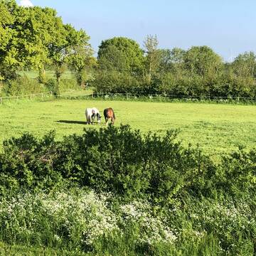
Neueröffnung!!!All Inklusive
Seeth
Bastian Beschorner
@EquiNord
Freizeitstall
Pflegepferd
Vermieten
Longierzirkel/Roundpen
Paddock
Allergikerstall
Fohlenaufzucht möglich
19 weitere...
P+
Deprecated: Creation of dynamic property Zend_View_Helper_Ads::$adLink is deprecated in /var/www/stall-frei/htdocs/staging.stall-frei.de/library/Psf/View/Helper/Ads.php on line 108

Persönlichkeitsentwicklung mit Pferden
Bad Salzuflen
Katja Dors
@Pferdezeiten
Begleite andere auf ihrem Entwicklungsweg und entdecke die transformative Kraft der pferdegestützten Persönlichkeitsentwicklung !
neu
R
Leider kein Vorschaubild
Leider kein Vorschaubild
reitstall-husum (Boxen ab 370€ möglich)
Husum
Reitstall-Nickelsen
@Reitstall-Nickelsen
Pferdeausbildung
Reitlehrer und -unterricht
Führanlage
Longierzirkel/Roundpen
Hengsthaltung möglich
Pferdezucht
Außenboxen
Innenbox
15 weitere...
B
Reit- und Pensionsstall Mißfeldt
Tensbüttel-Röst
Andrea Mißfeldt
@Missfeldt250477
FN-Mitglied
Freizeitstall
Vermieten
Hunde willkommen
Krankenbox
Allergikerstall
bedampftes/gewaschenes Heu
33 weitere...
S
Leider kein Vorschaubild
Leider kein Vorschaubild
LAG-Stall, große Koppeln
Haselund
Joe-Bender
@Joe-Bender
FN-Mitglied
Freizeitstall
Verkauf
Verpachten
Hunde willkommen
Krankenbox
Gnadenbrothof
26 weitere...
B

Vollpension im Offenstall-Kurpferde
Langenhorn
Peerhoff-Bahnsen GbR
@PeerhoffBahnsenGbR
Fahrstall, Kutschwagen
Freizeitstall
Krankenbox
Longierzirkel/Roundpen
Allergikerstall
Gnadenbrothof
Offenstall
12 weitere...
P

Das Beste für die Hufe
Mechtersen
STALL-FREIde Marketing
@STALL-FREI-Marketing
Hufschmiede und Hufpfleger in Ihrer Nähe

Wir führen aktuell eine Warteliste
Hemmingstedt
PensionsstallZeyns
@PensionsstallZeyns
Freizeitstall
Pferdeausbildung
Vermieten
Führanlage
Hunde willkommen
Allergikerstall
bedampftes/gewaschenes Heu
27 weitere...
P
Leider kein Vorschaubild
Leider kein Vorschaubild
Pferdeboxen frei - Birkenhof Süderholm - 410€ mt...
Heide/Süderholm
Pensionsstall Birkenhof
@Pensionsstall-Birkenhof
Freizeitstall
Reitlehrer und -unterricht
Vermieten
Hunde willkommen
Longierzirkel/Roundpen
Außenboxen
Innenbox
11 weitere...
B
Leider kein Vorschaubild
Leider kein Vorschaubild
2 Plätze im Offenstall frei / Heulage Fütterung
Gaushorn
Sylvia Hartmann
@S.Hartmann
Freizeitstall
Hunde willkommen
Krankenbox
Allergikerstall
Notfallboxen
Offenstall
12 weitere...
aktuell
B

Pferde Zuhause im Aktivstall bis Paddockbox
Schleswig
Louise Reinke
@Kristina-Hansen
Fahrstall, Kutschwagen
FN-Mitglied
Vermieten
Führanlage
Hunde willkommen
Allergikerstall
Hufrehe geeignet
36 weitere...
P+

Reitanlage Kolb Pferdeboxen ab 400,00 €
Sophienhamm
Herr-Kolb
@Herr-Kolb
FN-Mitglied
Freizeitstall
Vermieten
Longierzirkel/Roundpen
Paddock
Hufrehe geeignet
zuckerreduziertes Heu
24 weitere...
ganz aktuell
P
Deprecated: Creation of dynamic property Zend_View::$pageCount is deprecated in /var/www/stall-frei/htdocs/staging.stall-frei.de/library/vendor/shardj/zf1-future/library/Zend/View/Abstract.php on line 308
Deprecated: Creation of dynamic property Zend_View::$itemCountPerPage is deprecated in /var/www/stall-frei/htdocs/staging.stall-frei.de/library/vendor/shardj/zf1-future/library/Zend/View/Abstract.php on line 308
Deprecated: Creation of dynamic property Zend_View::$first is deprecated in /var/www/stall-frei/htdocs/staging.stall-frei.de/library/vendor/shardj/zf1-future/library/Zend/View/Abstract.php on line 308
Deprecated: Creation of dynamic property Zend_View::$current is deprecated in /var/www/stall-frei/htdocs/staging.stall-frei.de/library/vendor/shardj/zf1-future/library/Zend/View/Abstract.php on line 308
Deprecated: Creation of dynamic property Zend_View::$last is deprecated in /var/www/stall-frei/htdocs/staging.stall-frei.de/library/vendor/shardj/zf1-future/library/Zend/View/Abstract.php on line 308
Deprecated: Creation of dynamic property Zend_View::$next is deprecated in /var/www/stall-frei/htdocs/staging.stall-frei.de/library/vendor/shardj/zf1-future/library/Zend/View/Abstract.php on line 308
Deprecated: Creation of dynamic property Zend_View::$pagesInRange is deprecated in /var/www/stall-frei/htdocs/staging.stall-frei.de/library/vendor/shardj/zf1-future/library/Zend/View/Abstract.php on line 308
Deprecated: Creation of dynamic property Zend_View::$firstPageInRange is deprecated in /var/www/stall-frei/htdocs/staging.stall-frei.de/library/vendor/shardj/zf1-future/library/Zend/View/Abstract.php on line 308
Deprecated: Creation of dynamic property Zend_View::$lastPageInRange is deprecated in /var/www/stall-frei/htdocs/staging.stall-frei.de/library/vendor/shardj/zf1-future/library/Zend/View/Abstract.php on line 308
Deprecated: Creation of dynamic property Zend_View::$currentItemCount is deprecated in /var/www/stall-frei/htdocs/staging.stall-frei.de/library/vendor/shardj/zf1-future/library/Zend/View/Abstract.php on line 308
Deprecated: Creation of dynamic property Zend_View::$totalItemCount is deprecated in /var/www/stall-frei/htdocs/staging.stall-frei.de/library/vendor/shardj/zf1-future/library/Zend/View/Abstract.php on line 308
Deprecated: Creation of dynamic property Zend_View::$firstItemNumber is deprecated in /var/www/stall-frei/htdocs/staging.stall-frei.de/library/vendor/shardj/zf1-future/library/Zend/View/Abstract.php on line 308
Deprecated: Creation of dynamic property Zend_View::$lastItemNumber is deprecated in /var/www/stall-frei/htdocs/staging.stall-frei.de/library/vendor/shardj/zf1-future/library/Zend/View/Abstract.php on line 308
Deprecated: Creation of dynamic property Zend_View::$router is deprecated in /var/www/stall-frei/htdocs/staging.stall-frei.de/library/vendor/shardj/zf1-future/library/Zend/View/Abstract.php on line 308
Deprecated: Creation of dynamic property Zend_View::$urlParams is deprecated in /var/www/stall-frei/htdocs/staging.stall-frei.de/library/vendor/shardj/zf1-future/library/Zend/View/Abstract.php on line 308
Deprecated: Creation of dynamic property Zend_View::$showAds is deprecated in /var/www/stall-frei/htdocs/staging.stall-frei.de/library/vendor/shardj/zf1-future/library/Zend/View/Abstract.php on line 308
Deprecated: Creation of dynamic property Zend_View::$objectIds is deprecated in /var/www/stall-frei/htdocs/staging.stall-frei.de/library/vendor/shardj/zf1-future/library/Zend/View/Abstract.php on line 308
Deprecated: Creation of dynamic property Zend_View::$showNavbar is deprecated in /var/www/stall-frei/htdocs/staging.stall-frei.de/library/vendor/shardj/zf1-future/library/Zend/View/Abstract.php on line 308
Deprecated: Creation of dynamic property Zend_View::$showBreadcrumb is deprecated in /var/www/stall-frei/htdocs/staging.stall-frei.de/library/vendor/shardj/zf1-future/library/Zend/View/Abstract.php on line 308
Deprecated: Creation of dynamic property Zend_View::$showFooter is deprecated in /var/www/stall-frei/htdocs/staging.stall-frei.de/library/vendor/shardj/zf1-future/library/Zend/View/Abstract.php on line 308
Deprecated: Creation of dynamic property Zend_View::$showInternalAds is deprecated in /var/www/stall-frei/htdocs/staging.stall-frei.de/library/vendor/shardj/zf1-future/library/Zend/View/Abstract.php on line 308
Deprecated: Creation of dynamic property Zend_View::$blNoContent is deprecated in /var/www/stall-frei/htdocs/staging.stall-frei.de/library/vendor/shardj/zf1-future/library/Zend/View/Abstract.php on line 308
Deprecated: Creation of dynamic property Zend_View::$sMetaDesc is deprecated in /var/www/stall-frei/htdocs/staging.stall-frei.de/library/vendor/shardj/zf1-future/library/Zend/View/Abstract.php on line 308
Deprecated: Creation of dynamic property Zend_View::$useGmaps is deprecated in /var/www/stall-frei/htdocs/staging.stall-frei.de/library/vendor/shardj/zf1-future/library/Zend/View/Abstract.php on line 308
Deprecated: Creation of dynamic property Zend_View::$touches is deprecated in /var/www/stall-frei/htdocs/staging.stall-frei.de/library/vendor/shardj/zf1-future/library/Zend/View/Abstract.php on line 308
Deprecated: Creation of dynamic property Zend_View::$oProject is deprecated in /var/www/stall-frei/htdocs/staging.stall-frei.de/library/vendor/shardj/zf1-future/library/Zend/View/Abstract.php on line 308
Deprecated: Creation of dynamic property Zend_View::$pageHeadline is deprecated in /var/www/stall-frei/htdocs/staging.stall-frei.de/library/vendor/shardj/zf1-future/library/Zend/View/Abstract.php on line 308
Deprecated: Creation of dynamic property Zend_View::$disableLocationField is deprecated in /var/www/stall-frei/htdocs/staging.stall-frei.de/library/vendor/shardj/zf1-future/library/Zend/View/Abstract.php on line 308
Deprecated: Creation of dynamic property Zend_View::$isSearch is deprecated in /var/www/stall-frei/htdocs/staging.stall-frei.de/library/vendor/shardj/zf1-future/library/Zend/View/Abstract.php on line 308
Deprecated: Creation of dynamic property Zend_View::$pageTitle is deprecated in /var/www/stall-frei/htdocs/staging.stall-frei.de/library/vendor/shardj/zf1-future/library/Zend/View/Abstract.php on line 308
Deprecated: Creation of dynamic property Psf_Form_Element_Text::$class is deprecated in /var/www/stall-frei/htdocs/staging.stall-frei.de/library/vendor/shardj/zf1-future/library/Zend/Form/Element.php on line 874
Deprecated: Creation of dynamic property Psf_Form_Element_Text::$size is deprecated in /var/www/stall-frei/htdocs/staging.stall-frei.de/library/vendor/shardj/zf1-future/library/Zend/Form/Element.php on line 874
Deprecated: Creation of dynamic property Psf_Form_Element_Text::$placeholder is deprecated in /var/www/stall-frei/htdocs/staging.stall-frei.de/library/vendor/shardj/zf1-future/library/Zend/Form/Element.php on line 874
Deprecated: Creation of dynamic property Psf_Form_Element_Hidden::$class is deprecated in /var/www/stall-frei/htdocs/staging.stall-frei.de/library/vendor/shardj/zf1-future/library/Zend/Form/Element.php on line 874
Deprecated: Creation of dynamic property Psf_Form_Element_Hidden::$class is deprecated in /var/www/stall-frei/htdocs/staging.stall-frei.de/library/vendor/shardj/zf1-future/library/Zend/Form/Element.php on line 874
Deprecated: Creation of dynamic property Psf_Form_Element_Hidden::$class is deprecated in /var/www/stall-frei/htdocs/staging.stall-frei.de/library/vendor/shardj/zf1-future/library/Zend/Form/Element.php on line 874
Deprecated: Creation of dynamic property Psf_Form_Element_Hidden::$class is deprecated in /var/www/stall-frei/htdocs/staging.stall-frei.de/library/vendor/shardj/zf1-future/library/Zend/Form/Element.php on line 874
Deprecated: Creation of dynamic property Psf_Form_Element_Select::$class is deprecated in /var/www/stall-frei/htdocs/staging.stall-frei.de/library/vendor/shardj/zf1-future/library/Zend/Form/Element.php on line 874
Deprecated: Creation of dynamic property Psf_Form_Element_Select::$class is deprecated in /var/www/stall-frei/htdocs/staging.stall-frei.de/library/vendor/shardj/zf1-future/library/Zend/Form/Element.php on line 874
Deprecated: Creation of dynamic property Psf_Form_Element_Select::$class is deprecated in /var/www/stall-frei/htdocs/staging.stall-frei.de/library/vendor/shardj/zf1-future/library/Zend/Form/Element.php on line 874
Deprecated: Creation of dynamic property Psf_Form_Element_Select::$class is deprecated in /var/www/stall-frei/htdocs/staging.stall-frei.de/library/vendor/shardj/zf1-future/library/Zend/Form/Element.php on line 874
Deprecated: Creation of dynamic property Psf_Form_Element_Text::$class is deprecated in /var/www/stall-frei/htdocs/staging.stall-frei.de/library/vendor/shardj/zf1-future/library/Zend/Form/Element.php on line 874
Deprecated: Creation of dynamic property Psf_Form_Element_Checkbox::$label is deprecated in /var/www/stall-frei/htdocs/staging.stall-frei.de/library/vendor/shardj/zf1-future/library/Zend/Form/Element.php on line 874
Deprecated: Creation of dynamic property Zend_View::$sort is deprecated in /var/www/stall-frei/htdocs/staging.stall-frei.de/library/vendor/shardj/zf1-future/library/Zend/View/Abstract.php on line 308
Deprecated: Creation of dynamic property Zend_View::$searchLocation is deprecated in /var/www/stall-frei/htdocs/staging.stall-frei.de/library/vendor/shardj/zf1-future/library/Zend/View/Abstract.php on line 308
Deprecated: Creation of dynamic property Zend_View::$locationHint is deprecated in /var/www/stall-frei/htdocs/staging.stall-frei.de/library/vendor/shardj/zf1-future/library/Zend/View/Abstract.php on line 308
Psf_GeoCoder_Abstract::getLocation: Kirche Get Location CachedOrLive
Psf_GeoCoder_Abstract::getCachedOrLive: Kirche
Psf_GeoCoder_OpenCageData::makeApiRequest: response:
Array
(
[documentation] => https://opencagedata.com/api
[licenses] => Array
(
[0] => Array
(
[name] => see attribution guide
[url] => https://opencagedata.com/credits
)
)
[results] => Array
(
[0] => Array
(
[bounds] => Array
(
[northeast] => Array
(
[lat] => 54.4347839
[lng] => 8.9728859
)
[southwest] => Array
(
[lat] => 54.4346477
[lng] => 8.9725028
)
)
[components] => Array
(
[ISO_3166-1_alpha-2] => DE
[ISO_3166-1_alpha-3] => DEU
[ISO_3166-2] => Array
(
[0] => DE-SH
)
[_category] => building
[_normalized_city] => Simonsberg
[_type] => building
[building] => Salvator Kirche zu Simonsberg
[continent] => Europe
[country] => Deutschland
[country_code] => de
[county] => Kreis Nordfriesland
[municipality] => Nordsee-Treene
[political_union] => European Union
[postcode] => 25813
[road] => Dorfstraße
[state] => Schleswig-Holstein
[state_code] => SH
[village] => Simonsberg
)
[confidence] => 10
[formatted] => Salvator Kirche zu Simonsberg, Dorfstraße, 25813 Simonsberg, Deutschland
[geometry] => Array
(
[lat] => 54.4346968
[lng] => 8.9726943
)
)
[1] => Array
(
[bounds] => Array
(
[northeast] => Array
(
[lat] => 53.6872274
[lng] => 10.4966675
)
[southwest] => Array
(
[lat] => 53.6869768
[lng] => 10.4961586
)
)
[components] => Array
(
[ISO_3166-1_alpha-2] => DE
[ISO_3166-1_alpha-3] => DEU
[ISO_3166-2] => Array
(
[0] => DE-SH
)
[_category] => place_of_worship
[_normalized_city] => Sandesneben
[_type] => place_of_worship
[continent] => Europe
[country] => Deutschland
[country_code] => de
[county] => Kreis Herzogtum Lauenburg
[house_number] => 4
[municipality] => Sandesneben-Nusse
[place_of_worship] => St.-Marien-Kirche
[political_union] => European Union
[postcode] => 23898
[road] => Altes Dorf
[state] => Schleswig-Holstein
[state_code] => SH
[village] => Sandesneben
)
[confidence] => 9
[formatted] => St.-Marien-Kirche, Altes Dorf 4, 23898 Sandesneben, Deutschland
[geometry] => Array
(
[lat] => 53.687098
[lng] => 10.4963717
)
)
[2] => Array
(
[bounds] => Array
(
[northeast] => Array
(
[lat] => 53.8680493
[lng] => 10.6859232
)
[southwest] => Array
(
[lat] => 53.8675033
[lng] => 10.6843314
)
)
[components] => Array
(
[ISO_3166-1_alpha-2] => DE
[ISO_3166-1_alpha-3] => DEU
[ISO_3166-2] => Array
(
[0] => DE-SH
)
[_category] => place_of_worship
[_normalized_city] => Lübeck
[_type] => place_of_worship
[city] => Lübeck
[city_district] => Innenstadt
[continent] => Europe
[country] => Deutschland
[country_code] => de
[house_number] => 1
[place_of_worship] => St.-Marien-Kirche
[political_union] => European Union
[postcode] => 23552
[road] => Marienkirchhof
[state] => Schleswig-Holstein
[state_code] => SH
[suburb] => Innenstadt
)
[confidence] => 9
[formatted] => St.-Marien-Kirche, Marienkirchhof 1, 23552 Lübeck, Deutschland
[geometry] => Array
(
[lat] => 53.8677749
[lng] => 10.6850966
)
)
[3] => Array
(
[bounds] => Array
(
[northeast] => Array
(
[lat] => 52.5160284
[lng] => 13.3951958
)
[southwest] => Array
(
[lat] => 52.5154898
[lng] => 13.394489
)
)
[components] => Array
(
[ISO_3166-1_alpha-2] => DE
[ISO_3166-1_alpha-3] => DEU
[ISO_3166-2] => Array
(
[0] => DE-BE
)
[_category] => place_of_worship
[_normalized_city] => Berlin
[_type] => church
[borough] => Mitte
[church] => St. Hedwigs-Kathedrale Berlin
[city] => Berlin
[continent] => Europe
[country] => Deutschland
[country_code] => de
[house_number] => 3
[neighbourhood] => Friedrichswerder
[political_union] => European Union
[postcode] => 10117
[quarter] => Dorotheenstadt
[road] => Hinter der Katholischen Kirche
[state] => Berlin
[state_code] => BE
[suburb] => Mitte
)
[confidence] => 9
[formatted] => St. Hedwigs-Kathedrale Berlin, Hinter der Katholischen Kirche 3, 10117 Berlin, Deutschland
[geometry] => Array
(
[lat] => 52.5157525
[lng] => 13.3948457
)
)
[4] => Array
(
[bounds] => Array
(
[northeast] => Array
(
[lat] => 51.0521719
[lng] => 13.7419904
)
[southwest] => Array
(
[lat] => 51.0517344
[lng] => 13.7412378
)
)
[components] => Array
(
[ISO_3166-1_alpha-2] => DE
[ISO_3166-1_alpha-3] => DEU
[ISO_3166-2] => Array
(
[0] => DE-SN
)
[_category] => unknown
[_normalized_city] => Dresden
[_type] => fire_detection_system
[city] => Dresden
[city_district] => Altstadt
[continent] => Europe
[country] => Deutschland
[country_code] => de
[fire_detection_system] => Frauenkirche
[political_union] => European Union
[postcode] => 01067
[road] => Neumarkt
[state] => Sachsen
[state_code] => SN
[suburb] => Innere Altstadt
)
[confidence] => 9
[formatted] => Frauenkirche, Neumarkt, 01067 Dresden, Deutschland
[geometry] => Array
(
[lat] => 51.051957
[lng] => 13.7416198
)
)
[5] => Array
(
[bounds] => Array
(
[northeast] => Array
(
[lat] => 50.5625986
[lng] => 9.3483649
)
[southwest] => Array
(
[lat] => 50.5624844
[lng] => 9.3481317
)
)
[components] => Array
(
[ISO_3166-1_alpha-2] => DE
[ISO_3166-1_alpha-3] => DEU
[ISO_3166-2] => Array
(
[0] => DE-HE
)
[_category] => place_of_worship
[_normalized_city] => Herbstein
[_type] => place_of_worship
[continent] => Europe
[country] => Deutschland
[country_code] => de
[county] => Vogelsbergkreis
[municipality] => Herbstein
[place_of_worship] => Evangelische Kirche
[political_union] => European Union
[postcode] => 36358
[road] => Marktplatz
[state] => Hessen
[state_code] => HE
[village] => Herbstein
)
[confidence] => 9
[formatted] => Evangelische Kirche, Marktplatz, 36358 Herbstein, Deutschland
[geometry] => Array
(
[lat] => 50.5625409
[lng] => 9.3482612
)
)
[6] => Array
(
[bounds] => Array
(
[northeast] => Array
(
[lat] => 47.7505122
[lng] => 8.7583614
)
[southwest] => Array
(
[lat] => 47.7503904
[lng] => 8.7580452
)
)
[components] => Array
(
[ISO_3166-1_alpha-2] => DE
[ISO_3166-1_alpha-3] => DEU
[ISO_3166-2] => Array
(
[0] => DE-BW
)
[_category] => place_of_worship
[_normalized_city] => Gottmadingen
[_type] => place_of_worship
[city] => Gottmadingen
[continent] => Europe
[country] => Deutschland
[country_code] => de
[county] => Landkreis Konstanz
[house_number] => 12
[municipality] => VVG der Gemeinde Gottmadingen
[place_of_worship] => St. Johannes Kirche
[political_union] => European Union
[postcode] => 78244
[road] => Thaynger Straße
[state] => Baden-Württemberg
[state_code] => BW
)
[confidence] => 9
[formatted] => St. Johannes Kirche, Thaynger Straße 12, 78244 Gottmadingen, Deutschland
[geometry] => Array
(
[lat] => 47.7504405
[lng] => 8.7582033
)
)
[7] => Array
(
[bounds] => Array
(
[northeast] => Array
(
[lat] => 49.7538645
[lng] => 6.6437711
)
[southwest] => Array
(
[lat] => 49.7531668
[lng] => 6.6430598
)
)
[components] => Array
(
[ISO_3166-1_alpha-2] => DE
[ISO_3166-1_alpha-3] => DEU
[ISO_3166-2] => Array
(
[0] => DE-RP
)
[_category] => place_of_worship
[_normalized_city] => Trier
[_type] => place_of_worship
[city] => Trier
[city_district] => Mitte-Gartenfeld
[continent] => Europe
[country] => Deutschland
[country_code] => de
[house_number] => 1
[municipality] => Trierweiler
[place_of_worship] => Konstantinbasilika
[political_union] => European Union
[postcode] => 54290
[road] => Martin-Luther-Platz
[state] => Rheinland-Pfalz
[state_code] => RP
[suburb] => Altstadt
)
[confidence] => 9
[formatted] => Konstantinbasilika, Martin-Luther-Platz 1, 54290 Trier, Deutschland
[geometry] => Array
(
[lat] => 49.7534331
[lng] => 6.6433931
)
)
[8] => Array
(
[bounds] => Array
(
[northeast] => Array
(
[lat] => 52.5161717
[lng] => 13.3978071
)
[southwest] => Array
(
[lat] => 52.515597
[lng] => 13.3972374
)
)
[components] => Array
(
[ISO_3166-1_alpha-2] => DE
[ISO_3166-1_alpha-3] => DEU
[ISO_3166-2] => Array
(
[0] => DE-BE
)
[_category] => building
[_normalized_city] => Berlin
[_type] => building
[borough] => Mitte
[building] => Friedrichswerdersche Kirche
[city] => Berlin
[continent] => Europe
[country] => Deutschland
[country_code] => de
[house_number] => 1
[neighbourhood] => Friedrichswerder
[political_union] => European Union
[postcode] => 10117
[quarter] => Friedrichstadt
[road] => Werderscher Markt
[state] => Berlin
[state_code] => BE
[suburb] => Mitte
)
[confidence] => 10
[formatted] => Friedrichswerdersche Kirche, Werderscher Markt 1, 10117 Berlin, Deutschland
[geometry] => Array
(
[lat] => 52.5158852
[lng] => 13.3975006
)
)
[9] => Array
(
[bounds] => Array
(
[northeast] => Array
(
[lat] => 54.3103427
[lng] => 13.0888669
)
[southwest] => Array
(
[lat] => 54.3097482
[lng] => 13.0873136
)
)
[components] => Array
(
[ISO_3166-1_alpha-2] => DE
[ISO_3166-1_alpha-3] => DEU
[ISO_3166-2] => Array
(
[0] => DE-MV
)
[_category] => place_of_worship
[_normalized_city] => Stralsund
[_type] => place_of_worship
[continent] => Europe
[country] => Deutschland
[country_code] => de
[county] => Vorpommern-Rügen
[house_number] => 16
[neighbourhood] => Altstadt
[place_of_worship] => St. Marien-Kirche
[political_union] => European Union
[postcode] => 18439
[road] => Marienstraße
[state] => Mecklenburg-Vorpommern
[state_code] => MV
[suburb] => Altstadt
[town] => Stralsund
)
[confidence] => 9
[formatted] => St. Marien-Kirche, Marienstraße 16, 18439 Stralsund, Deutschland
[geometry] => Array
(
[lat] => 54.3100787
[lng] => 13.0880805
)
)
)
[status] => Array
(
[code] => 200
[message] => OK
)
[stay_informed] => Array
(
[blog] => https://blog.opencagedata.com
[mastodon] => https://en.osm.town/@opencage
)
[thanks] => For using an OpenCage API
[timestamp] => Array
(
[created_http] => Sat, 07 Feb 2026 18:01:14 GMT
[created_unix] => 1770487274
)
[total_results] => 10
)
Psf_GeoCoder_Abstract::convertLocationResult
{"documentation":"https:\/\/opencagedata.com\/api","licenses":[{"name":"see attribution guide","url":"https:\/\/opencagedata.com\/credits"}],"results":[{"bounds":{"northeast":{"lat":54.4347839,"lng":8.9728859},"southwest":{"lat":54.4346477,"lng":8.9725028}},"components":{"ISO_3166-1_alpha-2":"DE","ISO_3166-1_alpha-3":"DEU","ISO_3166-2":["DE-SH"],"_category":"building","_normalized_city":"Simonsberg","_type":"building","building":"Salvator Kirche zu Simonsberg","continent":"Europe","country":"Deutschland","country_code":"de","county":"Kreis Nordfriesland","municipality":"Nordsee-Treene","political_union":"European Union","postcode":"25813","road":"Dorfstra\u00dfe","state":"Schleswig-Holstein","state_code":"SH","village":"Simonsberg"},"confidence":10,"formatted":"Salvator Kirche zu Simonsberg, Dorfstra\u00dfe, 25813 Simonsberg, Deutschland","geometry":{"lat":54.4346968,"lng":8.9726943}},{"bounds":{"northeast":{"lat":53.6872274,"lng":10.4966675},"southwest":{"lat":53.6869768,"lng":10.4961586}},"components":{"ISO_3166-1_alpha-2":"DE","ISO_3166-1_alpha-3":"DEU","ISO_3166-2":["DE-SH"],"_category":"place_of_worship","_normalized_city":"Sandesneben","_type":"place_of_worship","continent":"Europe","country":"Deutschland","country_code":"de","county":"Kreis Herzogtum Lauenburg","house_number":"4","municipality":"Sandesneben-Nusse","place_of_worship":"St.-Marien-Kirche","political_union":"European Union","postcode":"23898","road":"Altes Dorf","state":"Schleswig-Holstein","state_code":"SH","village":"Sandesneben"},"confidence":9,"formatted":"St.-Marien-Kirche, Altes Dorf 4, 23898 Sandesneben, Deutschland","geometry":{"lat":53.687098,"lng":10.4963717}},{"bounds":{"northeast":{"lat":53.8680493,"lng":10.6859232},"southwest":{"lat":53.8675033,"lng":10.6843314}},"components":{"ISO_3166-1_alpha-2":"DE","ISO_3166-1_alpha-3":"DEU","ISO_3166-2":["DE-SH"],"_category":"place_of_worship","_normalized_city":"L\u00fcbeck","_type":"place_of_worship","city":"L\u00fcbeck","city_district":"Innenstadt","continent":"Europe","country":"Deutschland","country_code":"de","house_number":"1","place_of_worship":"St.-Marien-Kirche","political_union":"European Union","postcode":"23552","road":"Marienkirchhof","state":"Schleswig-Holstein","state_code":"SH","suburb":"Innenstadt"},"confidence":9,"formatted":"St.-Marien-Kirche, Marienkirchhof 1, 23552 L\u00fcbeck, Deutschland","geometry":{"lat":53.8677749,"lng":10.6850966}},{"bounds":{"northeast":{"lat":52.5160284,"lng":13.3951958},"southwest":{"lat":52.5154898,"lng":13.394489}},"components":{"ISO_3166-1_alpha-2":"DE","ISO_3166-1_alpha-3":"DEU","ISO_3166-2":["DE-BE"],"_category":"place_of_worship","_normalized_city":"Berlin","_type":"church","borough":"Mitte","church":"St. Hedwigs-Kathedrale Berlin","city":"Berlin","continent":"Europe","country":"Deutschland","country_code":"de","house_number":"3","neighbourhood":"Friedrichswerder","political_union":"European Union","postcode":"10117","quarter":"Dorotheenstadt","road":"Hinter der Katholischen Kirche","state":"Berlin","state_code":"BE","suburb":"Mitte"},"confidence":9,"formatted":"St. Hedwigs-Kathedrale Berlin, Hinter der Katholischen Kirche 3, 10117 Berlin, Deutschland","geometry":{"lat":52.5157525,"lng":13.3948457}},{"bounds":{"northeast":{"lat":51.0521719,"lng":13.7419904},"southwest":{"lat":51.0517344,"lng":13.7412378}},"components":{"ISO_3166-1_alpha-2":"DE","ISO_3166-1_alpha-3":"DEU","ISO_3166-2":["DE-SN"],"_category":"unknown","_normalized_city":"Dresden","_type":"fire_detection_system","city":"Dresden","city_district":"Altstadt","continent":"Europe","country":"Deutschland","country_code":"de","fire_detection_system":"Frauenkirche","political_union":"European Union","postcode":"01067","road":"Neumarkt","state":"Sachsen","state_code":"SN","suburb":"Innere Altstadt"},"confidence":9,"formatted":"Frauenkirche, Neumarkt, 01067 Dresden, Deutschland","geometry":{"lat":51.051957,"lng":13.7416198}},{"bounds":{"northeast":{"lat":50.5625986,"lng":9.3483649},"southwest":{"lat":50.5624844,"lng":9.3481317}},"components":{"ISO_3166-1_alpha-2":"DE","ISO_3166-1_alpha-3":"DEU","ISO_3166-2":["DE-HE"],"_category":"place_of_worship","_normalized_city":"Herbstein","_type":"place_of_worship","continent":"Europe","country":"Deutschland","country_code":"de","county":"Vogelsbergkreis","municipality":"Herbstein","place_of_worship":"Evangelische Kirche","political_union":"European Union","postcode":"36358","road":"Marktplatz","state":"Hessen","state_code":"HE","village":"Herbstein"},"confidence":9,"formatted":"Evangelische Kirche, Marktplatz, 36358 Herbstein, Deutschland","geometry":{"lat":50.5625409,"lng":9.3482612}},{"bounds":{"northeast":{"lat":47.7505122,"lng":8.7583614},"southwest":{"lat":47.7503904,"lng":8.7580452}},"components":{"ISO_3166-1_alpha-2":"DE","ISO_3166-1_alpha-3":"DEU","ISO_3166-2":["DE-BW"],"_category":"place_of_worship","_normalized_city":"Gottmadingen","_type":"place_of_worship","city":"Gottmadingen","continent":"Europe","country":"Deutschland","country_code":"de","county":"Landkreis Konstanz","house_number":"12","municipality":"VVG der Gemeinde Gottmadingen","place_of_worship":"St. Johannes Kirche","political_union":"European Union","postcode":"78244","road":"Thaynger Stra\u00dfe","state":"Baden-W\u00fcrttemberg","state_code":"BW"},"confidence":9,"formatted":"St. Johannes Kirche, Thaynger Stra\u00dfe 12, 78244 Gottmadingen, Deutschland","geometry":{"lat":47.7504405,"lng":8.7582033}},{"bounds":{"northeast":{"lat":49.7538645,"lng":6.6437711},"southwest":{"lat":49.7531668,"lng":6.6430598}},"components":{"ISO_3166-1_alpha-2":"DE","ISO_3166-1_alpha-3":"DEU","ISO_3166-2":["DE-RP"],"_category":"place_of_worship","_normalized_city":"Trier","_type":"place_of_worship","city":"Trier","city_district":"Mitte-Gartenfeld","continent":"Europe","country":"Deutschland","country_code":"de","house_number":"1","municipality":"Trierweiler","place_of_worship":"Konstantinbasilika","political_union":"European Union","postcode":"54290","road":"Martin-Luther-Platz","state":"Rheinland-Pfalz","state_code":"RP","suburb":"Altstadt"},"confidence":9,"formatted":"Konstantinbasilika, Martin-Luther-Platz 1, 54290 Trier, Deutschland","geometry":{"lat":49.7534331,"lng":6.6433931}},{"bounds":{"northeast":{"lat":52.5161717,"lng":13.3978071},"southwest":{"lat":52.515597,"lng":13.3972374}},"components":{"ISO_3166-1_alpha-2":"DE","ISO_3166-1_alpha-3":"DEU","ISO_3166-2":["DE-BE"],"_category":"building","_normalized_city":"Berlin","_type":"building","borough":"Mitte","building":"Friedrichswerdersche Kirche","city":"Berlin","continent":"Europe","country":"Deutschland","country_code":"de","house_number":"1","neighbourhood":"Friedrichswerder","political_union":"European Union","postcode":"10117","quarter":"Friedrichstadt","road":"Werderscher Markt","state":"Berlin","state_code":"BE","suburb":"Mitte"},"confidence":10,"formatted":"Friedrichswerdersche Kirche, Werderscher Markt 1, 10117 Berlin, Deutschland","geometry":{"lat":52.5158852,"lng":13.3975006}},{"bounds":{"northeast":{"lat":54.3103427,"lng":13.0888669},"southwest":{"lat":54.3097482,"lng":13.0873136}},"components":{"ISO_3166-1_alpha-2":"DE","ISO_3166-1_alpha-3":"DEU","ISO_3166-2":["DE-MV"],"_category":"place_of_worship","_normalized_city":"Stralsund","_type":"place_of_worship","continent":"Europe","country":"Deutschland","country_code":"de","county":"Vorpommern-R\u00fcgen","house_number":"16","neighbourhood":"Altstadt","place_of_worship":"St. Marien-Kirche","political_union":"European Union","postcode":"18439","road":"Marienstra\u00dfe","state":"Mecklenburg-Vorpommern","state_code":"MV","suburb":"Altstadt","town":"Stralsund"},"confidence":9,"formatted":"St. Marien-Kirche, Marienstra\u00dfe 16, 18439 Stralsund, Deutschland","geometry":{"lat":54.3100787,"lng":13.0880805}}],"status":{"code":200,"message":"OK"},"stay_informed":{"blog":"https:\/\/blog.opencagedata.com","mastodon":"https:\/\/en.osm.town\/@opencage"},"thanks":"For using an OpenCage API","timestamp":{"created_http":"Sat, 07 Feb 2026 18:01:14 GMT","created_unix":1770487274},"total_results":10}Array
(
[0] => stdClass Object
(
[bounds] => stdClass Object
(
[northeast] => stdClass Object
(
[lat] => 54.4347839
[lng] => 8.9728859
)
[southwest] => stdClass Object
(
[lat] => 54.4346477
[lng] => 8.9725028
)
)
[components] => stdClass Object
(
[ISO_3166-1_alpha-2] => DE
[ISO_3166-1_alpha-3] => DEU
[ISO_3166-2] => Array
(
[0] => DE-SH
)
[_category] => building
[_normalized_city] => Simonsberg
[_type] => building
[building] => Salvator Kirche zu Simonsberg
[continent] => Europe
[country] => Deutschland
[country_code] => de
[county] => Kreis Nordfriesland
[municipality] => Nordsee-Treene
[political_union] => European Union
[postcode] => 25813
[road] => Dorfstraße
[state] => Schleswig-Holstein
[state_code] => SH
[village] => Simonsberg
)
[confidence] => 10
[formatted] => Salvator Kirche zu Simonsberg, Dorfstraße, 25813 Simonsberg, Deutschland
[geometry] => stdClass Object
(
[lat] => 54.4346968
[lng] => 8.9726943
)
)
[1] => stdClass Object
(
[bounds] => stdClass Object
(
[northeast] => stdClass Object
(
[lat] => 53.6872274
[lng] => 10.4966675
)
[southwest] => stdClass Object
(
[lat] => 53.6869768
[lng] => 10.4961586
)
)
[components] => stdClass Object
(
[ISO_3166-1_alpha-2] => DE
[ISO_3166-1_alpha-3] => DEU
[ISO_3166-2] => Array
(
[0] => DE-SH
)
[_category] => place_of_worship
[_normalized_city] => Sandesneben
[_type] => place_of_worship
[continent] => Europe
[country] => Deutschland
[country_code] => de
[county] => Kreis Herzogtum Lauenburg
[house_number] => 4
[municipality] => Sandesneben-Nusse
[place_of_worship] => St.-Marien-Kirche
[political_union] => European Union
[postcode] => 23898
[road] => Altes Dorf
[state] => Schleswig-Holstein
[state_code] => SH
[village] => Sandesneben
)
[confidence] => 9
[formatted] => St.-Marien-Kirche, Altes Dorf 4, 23898 Sandesneben, Deutschland
[geometry] => stdClass Object
(
[lat] => 53.687098
[lng] => 10.4963717
)
)
[2] => stdClass Object
(
[bounds] => stdClass Object
(
[northeast] => stdClass Object
(
[lat] => 53.8680493
[lng] => 10.6859232
)
[southwest] => stdClass Object
(
[lat] => 53.8675033
[lng] => 10.6843314
)
)
[components] => stdClass Object
(
[ISO_3166-1_alpha-2] => DE
[ISO_3166-1_alpha-3] => DEU
[ISO_3166-2] => Array
(
[0] => DE-SH
)
[_category] => place_of_worship
[_normalized_city] => Lübeck
[_type] => place_of_worship
[city] => Lübeck
[city_district] => Innenstadt
[continent] => Europe
[country] => Deutschland
[country_code] => de
[house_number] => 1
[place_of_worship] => St.-Marien-Kirche
[political_union] => European Union
[postcode] => 23552
[road] => Marienkirchhof
[state] => Schleswig-Holstein
[state_code] => SH
[suburb] => Innenstadt
)
[confidence] => 9
[formatted] => St.-Marien-Kirche, Marienkirchhof 1, 23552 Lübeck, Deutschland
[geometry] => stdClass Object
(
[lat] => 53.8677749
[lng] => 10.6850966
)
)
[3] => stdClass Object
(
[bounds] => stdClass Object
(
[northeast] => stdClass Object
(
[lat] => 52.5160284
[lng] => 13.3951958
)
[southwest] => stdClass Object
(
[lat] => 52.5154898
[lng] => 13.394489
)
)
[components] => stdClass Object
(
[ISO_3166-1_alpha-2] => DE
[ISO_3166-1_alpha-3] => DEU
[ISO_3166-2] => Array
(
[0] => DE-BE
)
[_category] => place_of_worship
[_normalized_city] => Berlin
[_type] => church
[borough] => Mitte
[church] => St. Hedwigs-Kathedrale Berlin
[city] => Berlin
[continent] => Europe
[country] => Deutschland
[country_code] => de
[house_number] => 3
[neighbourhood] => Friedrichswerder
[political_union] => European Union
[postcode] => 10117
[quarter] => Dorotheenstadt
[road] => Hinter der Katholischen Kirche
[state] => Berlin
[state_code] => BE
[suburb] => Mitte
)
[confidence] => 9
[formatted] => St. Hedwigs-Kathedrale Berlin, Hinter der Katholischen Kirche 3, 10117 Berlin, Deutschland
[geometry] => stdClass Object
(
[lat] => 52.5157525
[lng] => 13.3948457
)
)
[4] => stdClass Object
(
[bounds] => stdClass Object
(
[northeast] => stdClass Object
(
[lat] => 51.0521719
[lng] => 13.7419904
)
[southwest] => stdClass Object
(
[lat] => 51.0517344
[lng] => 13.7412378
)
)
[components] => stdClass Object
(
[ISO_3166-1_alpha-2] => DE
[ISO_3166-1_alpha-3] => DEU
[ISO_3166-2] => Array
(
[0] => DE-SN
)
[_category] => unknown
[_normalized_city] => Dresden
[_type] => fire_detection_system
[city] => Dresden
[city_district] => Altstadt
[continent] => Europe
[country] => Deutschland
[country_code] => de
[fire_detection_system] => Frauenkirche
[political_union] => European Union
[postcode] => 01067
[road] => Neumarkt
[state] => Sachsen
[state_code] => SN
[suburb] => Innere Altstadt
)
[confidence] => 9
[formatted] => Frauenkirche, Neumarkt, 01067 Dresden, Deutschland
[geometry] => stdClass Object
(
[lat] => 51.051957
[lng] => 13.7416198
)
)
[5] => stdClass Object
(
[bounds] => stdClass Object
(
[northeast] => stdClass Object
(
[lat] => 50.5625986
[lng] => 9.3483649
)
[southwest] => stdClass Object
(
[lat] => 50.5624844
[lng] => 9.3481317
)
)
[components] => stdClass Object
(
[ISO_3166-1_alpha-2] => DE
[ISO_3166-1_alpha-3] => DEU
[ISO_3166-2] => Array
(
[0] => DE-HE
)
[_category] => place_of_worship
[_normalized_city] => Herbstein
[_type] => place_of_worship
[continent] => Europe
[country] => Deutschland
[country_code] => de
[county] => Vogelsbergkreis
[municipality] => Herbstein
[place_of_worship] => Evangelische Kirche
[political_union] => European Union
[postcode] => 36358
[road] => Marktplatz
[state] => Hessen
[state_code] => HE
[village] => Herbstein
)
[confidence] => 9
[formatted] => Evangelische Kirche, Marktplatz, 36358 Herbstein, Deutschland
[geometry] => stdClass Object
(
[lat] => 50.5625409
[lng] => 9.3482612
)
)
[6] => stdClass Object
(
[bounds] => stdClass Object
(
[northeast] => stdClass Object
(
[lat] => 47.7505122
[lng] => 8.7583614
)
[southwest] => stdClass Object
(
[lat] => 47.7503904
[lng] => 8.7580452
)
)
[components] => stdClass Object
(
[ISO_3166-1_alpha-2] => DE
[ISO_3166-1_alpha-3] => DEU
[ISO_3166-2] => Array
(
[0] => DE-BW
)
[_category] => place_of_worship
[_normalized_city] => Gottmadingen
[_type] => place_of_worship
[city] => Gottmadingen
[continent] => Europe
[country] => Deutschland
[country_code] => de
[county] => Landkreis Konstanz
[house_number] => 12
[municipality] => VVG der Gemeinde Gottmadingen
[place_of_worship] => St. Johannes Kirche
[political_union] => European Union
[postcode] => 78244
[road] => Thaynger Straße
[state] => Baden-Württemberg
[state_code] => BW
)
[confidence] => 9
[formatted] => St. Johannes Kirche, Thaynger Straße 12, 78244 Gottmadingen, Deutschland
[geometry] => stdClass Object
(
[lat] => 47.7504405
[lng] => 8.7582033
)
)
[7] => stdClass Object
(
[bounds] => stdClass Object
(
[northeast] => stdClass Object
(
[lat] => 49.7538645
[lng] => 6.6437711
)
[southwest] => stdClass Object
(
[lat] => 49.7531668
[lng] => 6.6430598
)
)
[components] => stdClass Object
(
[ISO_3166-1_alpha-2] => DE
[ISO_3166-1_alpha-3] => DEU
[ISO_3166-2] => Array
(
[0] => DE-RP
)
[_category] => place_of_worship
[_normalized_city] => Trier
[_type] => place_of_worship
[city] => Trier
[city_district] => Mitte-Gartenfeld
[continent] => Europe
[country] => Deutschland
[country_code] => de
[house_number] => 1
[municipality] => Trierweiler
[place_of_worship] => Konstantinbasilika
[political_union] => European Union
[postcode] => 54290
[road] => Martin-Luther-Platz
[state] => Rheinland-Pfalz
[state_code] => RP
[suburb] => Altstadt
)
[confidence] => 9
[formatted] => Konstantinbasilika, Martin-Luther-Platz 1, 54290 Trier, Deutschland
[geometry] => stdClass Object
(
[lat] => 49.7534331
[lng] => 6.6433931
)
)
[8] => stdClass Object
(
[bounds] => stdClass Object
(
[northeast] => stdClass Object
(
[lat] => 52.5161717
[lng] => 13.3978071
)
[southwest] => stdClass Object
(
[lat] => 52.515597
[lng] => 13.3972374
)
)
[components] => stdClass Object
(
[ISO_3166-1_alpha-2] => DE
[ISO_3166-1_alpha-3] => DEU
[ISO_3166-2] => Array
(
[0] => DE-BE
)
[_category] => building
[_normalized_city] => Berlin
[_type] => building
[borough] => Mitte
[building] => Friedrichswerdersche Kirche
[city] => Berlin
[continent] => Europe
[country] => Deutschland
[country_code] => de
[house_number] => 1
[neighbourhood] => Friedrichswerder
[political_union] => European Union
[postcode] => 10117
[quarter] => Friedrichstadt
[road] => Werderscher Markt
[state] => Berlin
[state_code] => BE
[suburb] => Mitte
)
[confidence] => 10
[formatted] => Friedrichswerdersche Kirche, Werderscher Markt 1, 10117 Berlin, Deutschland
[geometry] => stdClass Object
(
[lat] => 52.5158852
[lng] => 13.3975006
)
)
[9] => stdClass Object
(
[bounds] => stdClass Object
(
[northeast] => stdClass Object
(
[lat] => 54.3103427
[lng] => 13.0888669
)
[southwest] => stdClass Object
(
[lat] => 54.3097482
[lng] => 13.0873136
)
)
[components] => stdClass Object
(
[ISO_3166-1_alpha-2] => DE
[ISO_3166-1_alpha-3] => DEU
[ISO_3166-2] => Array
(
[0] => DE-MV
)
[_category] => place_of_worship
[_normalized_city] => Stralsund
[_type] => place_of_worship
[continent] => Europe
[country] => Deutschland
[country_code] => de
[county] => Vorpommern-Rügen
[house_number] => 16
[neighbourhood] => Altstadt
[place_of_worship] => St. Marien-Kirche
[political_union] => European Union
[postcode] => 18439
[road] => Marienstraße
[state] => Mecklenburg-Vorpommern
[state_code] => MV
[suburb] => Altstadt
[town] => Stralsund
)
[confidence] => 9
[formatted] => St. Marien-Kirche, Marienstraße 16, 18439 Stralsund, Deutschland
[geometry] => stdClass Object
(
[lat] => 54.3100787
[lng] => 13.0880805
)
)
)
Psf_GeoCoder_OpenCageData::getKeyMap: 0
stdClass Object
(
    [bounds] => stdClass Object
        (
            [northeast] => stdClass Object
                (
                    [lat] => 54.4347839
                    [lng] => 8.9728859
                )

            [southwest] => stdClass Object
                (
                    [lat] => 54.4346477
                    [lng] => 8.9725028
                )

        )

    [components] => stdClass Object
        (
            [ISO_3166-1_alpha-2] => DE
            [ISO_3166-1_alpha-3] => DEU
            [ISO_3166-2] => Array
                (
                    [0] => DE-SH
                )

            [_category] => building
            [_normalized_city] => Simonsberg
            [_type] => building
            [building] => Salvator Kirche zu Simonsberg
            [continent] => Europe
            [country] => Deutschland
            [country_code] => de
            [county] => Kreis Nordfriesland
            [municipality] => Nordsee-Treene
            [political_union] => European Union
            [postcode] => 25813
            [road] => Dorfstraße
            [state] => Schleswig-Holstein
            [state_code] => SH
            [village] => Simonsberg
        )

    [confidence] => 10
    [formatted] => Salvator Kirche zu Simonsberg, Dorfstraße, 25813 Simonsberg, Deutschland
    [geometry] => stdClass Object
        (
            [lat] => 54.4346968
            [lng] => 8.9726943
        )

)
Psf_GeoCoder_OpenCageData::getCounty: Nordfriesland
Psf_GeoCoder_OpenCageData::addMissingData REFETCH!
Array
(
    [address] => Salvator Kirche zu Simonsberg, Dorfstraße, 25813 Simonsberg, Deutschland
    [type] => building
    [street] => Dorfstraße
    [city] => Simonsberg
    [county] => Nordfriesland
    [state] => Schleswig-Holstein
    [zip] => 25813
    [country] => Deutschland
    [suburb] =>
    [countrycode] => de
    [latitude] => 54.4346968
    [longitude] => 8.9726943
    [accuracy] => 1
    [confidence] => 10
    [bounds] => stdClass Object
        (
            [northeast] => stdClass Object
                (
                    [lat] => 54.4347839
                    [lng] => 8.9728859
                )

            [southwest] => stdClass Object
                (
                    [lat] => 54.4346477
                    [lng] => 8.9725028
                )

        )

)
reformat!
Array
(
    [address] => Salvator Kirche zu Simonsberg, Dorfstraße, 25813 Simonsberg, Deutschland
    [type] => building
    [street] => Dorfstraße
    [city] => Simonsberg
    [county] => Nordfriesland
    [state] => Schleswig-Holstein
    [zip] => 25813
    [country] => Deutschland
    [suburb] =>
    [countrycode] => de
    [latitude] => 54.4346968
    [longitude] => 8.9726943
    [accuracy] => 1
    [confidence] => 10
    [bounds] => stdClass Object
        (
            [northeast] => stdClass Object
                (
                    [lat] => 54.4347839
                    [lng] => 8.9728859
                )

            [southwest] => stdClass Object
                (
                    [lat] => 54.4346477
                    [lng] => 8.9725028
                )

        )

    [place] => Dorfstraße, 25813 Simonsberg, Schleswig-Holstein
    [hash] => 1a82c6ef5a46693d193d3f6a68d15956
)
Psf_GeoCoder_OpenCageData::getKeyMap: 1
stdClass Object
(
    [bounds] => stdClass Object
        (
            [northeast] => stdClass Object
                (
                    [lat] => 53.6872274
                    [lng] => 10.4966675
                )

            [southwest] => stdClass Object
                (
                    [lat] => 53.6869768
                    [lng] => 10.4961586
                )

        )

    [components] => stdClass Object
        (
            [ISO_3166-1_alpha-2] => DE
            [ISO_3166-1_alpha-3] => DEU
            [ISO_3166-2] => Array
                (
                    [0] => DE-SH
                )

            [_category] => place_of_worship
            [_normalized_city] => Sandesneben
            [_type] => place_of_worship
            [continent] => Europe
            [country] => Deutschland
            [country_code] => de
            [county] => Kreis Herzogtum Lauenburg
            [house_number] => 4
            [municipality] => Sandesneben-Nusse
            [place_of_worship] => St.-Marien-Kirche
            [political_union] => European Union
            [postcode] => 23898
            [road] => Altes Dorf
            [state] => Schleswig-Holstein
            [state_code] => SH
            [village] => Sandesneben
        )

    [confidence] => 9
    [formatted] => St.-Marien-Kirche, Altes Dorf 4, 23898 Sandesneben, Deutschland
    [geometry] => stdClass Object
        (
            [lat] => 53.687098
            [lng] => 10.4963717
        )

)
Psf_GeoCoder_OpenCageData::getCounty: Herzogtum Lauenburg
Psf_GeoCoder_OpenCageData::addMissingData REFETCH!
Array
(
    [address] => St.-Marien-Kirche, Altes Dorf 4, 23898 Sandesneben, Deutschland
    [type] => place_of_worship
    [street] => Altes Dorf 4
    [city] => Sandesneben
    [county] => Herzogtum Lauenburg
    [state] => Schleswig-Holstein
    [zip] => 23898
    [country] => Deutschland
    [suburb] =>
    [countrycode] => de
    [latitude] => 53.687098
    [longitude] => 10.4963717
    [accuracy] => 1
    [confidence] => 9
    [bounds] => stdClass Object
        (
            [northeast] => stdClass Object
                (
                    [lat] => 53.6872274
                    [lng] => 10.4966675
                )

            [southwest] => stdClass Object
                (
                    [lat] => 53.6869768
                    [lng] => 10.4961586
                )

        )

)
reformat!
Array
(
    [address] => St.-Marien-Kirche, Altes Dorf 4, 23898 Sandesneben, Deutschland
    [type] => place_of_worship
    [street] => Altes Dorf 4
    [city] => Sandesneben
    [county] => Herzogtum Lauenburg
    [state] => Schleswig-Holstein
    [zip] => 23898
    [country] => Deutschland
    [suburb] =>
    [countrycode] => de
    [latitude] => 53.687098
    [longitude] => 10.4963717
    [accuracy] => 1
    [confidence] => 9
    [bounds] => stdClass Object
        (
            [northeast] => stdClass Object
                (
                    [lat] => 53.6872274
                    [lng] => 10.4966675
                )

            [southwest] => stdClass Object
                (
                    [lat] => 53.6869768
                    [lng] => 10.4961586
                )

        )

    [place] => Altes Dorf 4, 23898 Sandesneben, Schleswig-Holstein
    [hash] => acfd891ba93d65b011cf1cd5bc079308
)
Psf_GeoCoder_OpenCageData::getKeyMap: 2
stdClass Object
(
    [bounds] => stdClass Object
        (
            [northeast] => stdClass Object
                (
                    [lat] => 53.8680493
                    [lng] => 10.6859232
                )

            [southwest] => stdClass Object
                (
                    [lat] => 53.8675033
                    [lng] => 10.6843314
                )

        )

    [components] => stdClass Object
        (
            [ISO_3166-1_alpha-2] => DE
            [ISO_3166-1_alpha-3] => DEU
            [ISO_3166-2] => Array
                (
                    [0] => DE-SH
                )

            [_category] => place_of_worship
            [_normalized_city] => Lübeck
            [_type] => place_of_worship
            [city] => Lübeck
            [city_district] => Innenstadt
            [continent] => Europe
            [country] => Deutschland
            [country_code] => de
            [house_number] => 1
            [place_of_worship] => St.-Marien-Kirche
            [political_union] => European Union
            [postcode] => 23552
            [road] => Marienkirchhof
            [state] => Schleswig-Holstein
            [state_code] => SH
            [suburb] => Innenstadt
        )

    [confidence] => 9
    [formatted] => St.-Marien-Kirche, Marienkirchhof 1, 23552 Lübeck, Deutschland
    [geometry] => stdClass Object
        (
            [lat] => 53.8677749
            [lng] => 10.6850966
        )

)
Psf_GeoCoder_OpenCageData::getCounty: Lübeck
Psf_GeoCoder_OpenCageData::addMissingData REFETCH!
Array
(
    [address] => St.-Marien-Kirche, Marienkirchhof 1, 23552 Lübeck, Deutschland
    [type] => place_of_worship
    [street] => Marienkirchhof 1
    [city] => Innenstadt
    [county] => Lübeck
    [state] => Schleswig-Holstein
    [zip] => 23552
    [country] => Deutschland
    [suburb] => Innenstadt
    [countrycode] => de
    [latitude] => 53.8677749
    [longitude] => 10.6850966
    [accuracy] => 1
    [confidence] => 9
    [bounds] => stdClass Object
        (
            [northeast] => stdClass Object
                (
                    [lat] => 53.8680493
                    [lng] => 10.6859232
                )

            [southwest] => stdClass Object
                (
                    [lat] => 53.8675033
                    [lng] => 10.6843314
                )

        )

)
reformat!
Array
(
    [address] => Marienkirchhof 1, 23552 Innenstadt
    [type] => place_of_worship
    [street] => Marienkirchhof 1
    [city] => Innenstadt
    [county] => Lübeck
    [state] => Schleswig-Holstein
    [zip] => 23552
    [country] => Deutschland
    [suburb] => Innenstadt
    [countrycode] => de
    [latitude] => 53.8677749
    [longitude] => 10.6850966
    [accuracy] => 1
    [confidence] => 9
    [bounds] => stdClass Object
        (
            [northeast] => stdClass Object
                (
                    [lat] => 53.8680493
                    [lng] => 10.6859232
                )

            [southwest] => stdClass Object
                (
                    [lat] => 53.8675033
                    [lng] => 10.6843314
                )

        )

    [place] => Marienkirchhof 1, 23552 Innenstadt, Schleswig-Holstein
    [hash] => 6fd6a15b7985553849fff1375b896e5b
)
Psf_GeoCoder_OpenCageData::getKeyMap: 3
stdClass Object
(
    [bounds] => stdClass Object
        (
            [northeast] => stdClass Object
                (
                    [lat] => 52.5160284
                    [lng] => 13.3951958
                )

            [southwest] => stdClass Object
                (
                    [lat] => 52.5154898
                    [lng] => 13.394489
                )

        )

    [components] => stdClass Object
        (
            [ISO_3166-1_alpha-2] => DE
            [ISO_3166-1_alpha-3] => DEU
            [ISO_3166-2] => Array
                (
                    [0] => DE-BE
                )

            [_category] => place_of_worship
            [_normalized_city] => Berlin
            [_type] => church
            [borough] => Mitte
            [church] => St. Hedwigs-Kathedrale Berlin
            [city] => Berlin
            [continent] => Europe
            [country] => Deutschland
            [country_code] => de
            [house_number] => 3
            [neighbourhood] => Friedrichswerder
            [political_union] => European Union
            [postcode] => 10117
            [quarter] => Dorotheenstadt
            [road] => Hinter der Katholischen Kirche
            [state] => Berlin
            [state_code] => BE
            [suburb] => Mitte
        )

    [confidence] => 9
    [formatted] => St. Hedwigs-Kathedrale Berlin, Hinter der Katholischen Kirche 3, 10117 Berlin, Deutschland
    [geometry] => stdClass Object
        (
            [lat] => 52.5157525
            [lng] => 13.3948457
        )

)
Psf_GeoCoder_OpenCageData::getCounty: Berlin
Psf_GeoCoder_OpenCageData::addMissingData REFETCH!
Array
(
    [address] => St. Hedwigs-Kathedrale Berlin, Hinter der Katholischen Kirche 3, 10117 Berlin, Deutschland
    [type] => church
    [street] => Hinter der Katholischen Kirche 3
    [city] => Mitte
    [county] => Berlin
    [state] => Berlin
    [zip] => 10117
    [country] => Deutschland
    [suburb] => Mitte
    [countrycode] => de
    [latitude] => 52.5157525
    [longitude] => 13.3948457
    [accuracy] => 1
    [confidence] => 9
    [bounds] => stdClass Object
        (
            [northeast] => stdClass Object
                (
                    [lat] => 52.5160284
                    [lng] => 13.3951958
                )

            [southwest] => stdClass Object
                (
                    [lat] => 52.5154898
                    [lng] => 13.394489
                )

        )

)
reformat!
Array
(
    [address] => Hinter der Katholischen Kirche 3, 10117 Mitte
    [type] => church
    [street] => Hinter der Katholischen Kirche 3
    [city] => Mitte
    [county] => Berlin
    [state] => Berlin
    [zip] => 10117
    [country] => Deutschland
    [suburb] => Mitte
    [countrycode] => de
    [latitude] => 52.5157525
    [longitude] => 13.3948457
    [accuracy] => 1
    [confidence] => 9
    [bounds] => stdClass Object
        (
            [northeast] => stdClass Object
                (
                    [lat] => 52.5160284
                    [lng] => 13.3951958
                )

            [southwest] => stdClass Object
                (
                    [lat] => 52.5154898
                    [lng] => 13.394489
                )

        )

    [place] => Hinter der Katholischen Kirche 3, 10117 Mitte, Berlin
    [hash] => a0a79ba336b539be969d49edad0b0577
)
Psf_GeoCoder_OpenCageData::getKeyMap: 4
stdClass Object
(
    [bounds] => stdClass Object
        (
            [northeast] => stdClass Object
                (
                    [lat] => 51.0521719
                    [lng] => 13.7419904
                )

            [southwest] => stdClass Object
                (
                    [lat] => 51.0517344
                    [lng] => 13.7412378
                )

        )

    [components] => stdClass Object
        (
            [ISO_3166-1_alpha-2] => DE
            [ISO_3166-1_alpha-3] => DEU
            [ISO_3166-2] => Array
                (
                    [0] => DE-SN
                )

            [_category] => unknown
            [_normalized_city] => Dresden
            [_type] => fire_detection_system
            [city] => Dresden
            [city_district] => Altstadt
            [continent] => Europe
            [country] => Deutschland
            [country_code] => de
            [fire_detection_system] => Frauenkirche
            [political_union] => European Union
            [postcode] => 01067
            [road] => Neumarkt
            [state] => Sachsen
            [state_code] => SN
            [suburb] => Innere Altstadt
        )

    [confidence] => 9
    [formatted] => Frauenkirche, Neumarkt, 01067 Dresden, Deutschland
    [geometry] => stdClass Object
        (
            [lat] => 51.051957
            [lng] => 13.7416198
        )

)
Psf_GeoCoder_OpenCageData::getCounty: Dresden
Psf_GeoCoder_OpenCageData::addMissingData REFETCH!
Array
(
    [address] => Frauenkirche, Neumarkt, 01067 Dresden, Deutschland
    [type] => fire_detection_system
    [street] => Neumarkt
    [city] => Innere Altstadt
    [county] => Dresden
    [state] => Sachsen
    [zip] => 01067
    [country] => Deutschland
    [suburb] => Innere Altstadt
    [countrycode] => de
    [latitude] => 51.051957
    [longitude] => 13.7416198
    [accuracy] => 1
    [confidence] => 9
    [bounds] => stdClass Object
        (
            [northeast] => stdClass Object
                (
                    [lat] => 51.0521719
                    [lng] => 13.7419904
                )

            [southwest] => stdClass Object
                (
                    [lat] => 51.0517344
                    [lng] => 13.7412378
                )

        )

)
reformat!
Array
(
    [address] => Neumarkt, 01067 Innere Altstadt
    [type] => fire_detection_system
    [street] => Neumarkt
    [city] => Innere Altstadt
    [county] => Dresden
    [state] => Sachsen
    [zip] => 01067
    [country] => Deutschland
    [suburb] => Innere Altstadt
    [countrycode] => de
    [latitude] => 51.051957
    [longitude] => 13.7416198
    [accuracy] => 1
    [confidence] => 9
    [bounds] => stdClass Object
        (
            [northeast] => stdClass Object
                (
                    [lat] => 51.0521719
                    [lng] => 13.7419904
                )

            [southwest] => stdClass Object
                (
                    [lat] => 51.0517344
                    [lng] => 13.7412378
                )

        )

    [place] => Neumarkt, 01067 Innere Altstadt, Sachsen
    [hash] => a5a7bebab49f5c06dab0c9776bd5eca9
)
Psf_GeoCoder_OpenCageData::getKeyMap: 5
stdClass Object
(
    [bounds] => stdClass Object
        (
            [northeast] => stdClass Object
                (
                    [lat] => 50.5625986
                    [lng] => 9.3483649
                )

            [southwest] => stdClass Object
                (
                    [lat] => 50.5624844
                    [lng] => 9.3481317
                )

        )

    [components] => stdClass Object
        (
            [ISO_3166-1_alpha-2] => DE
            [ISO_3166-1_alpha-3] => DEU
            [ISO_3166-2] => Array
                (
                    [0] => DE-HE
                )

            [_category] => place_of_worship
            [_normalized_city] => Herbstein
            [_type] => place_of_worship
            [continent] => Europe
            [country] => Deutschland
            [country_code] => de
            [county] => Vogelsbergkreis
            [municipality] => Herbstein
            [place_of_worship] => Evangelische Kirche
            [political_union] => European Union
            [postcode] => 36358
            [road] => Marktplatz
            [state] => Hessen
            [state_code] => HE
            [village] => Herbstein
        )

    [confidence] => 9
    [formatted] => Evangelische Kirche, Marktplatz, 36358 Herbstein, Deutschland
    [geometry] => stdClass Object
        (
            [lat] => 50.5625409
            [lng] => 9.3482612
        )

)
Psf_GeoCoder_OpenCageData::getCounty: Vogelsbergkreis
Psf_GeoCoder_OpenCageData::addMissingData REFETCH!
Array
(
    [address] => Evangelische Kirche, Marktplatz, 36358 Herbstein, Deutschland
    [type] => place_of_worship
    [street] => Marktplatz
    [city] => Herbstein
    [county] => Vogelsbergkreis
    [state] => Hessen
    [zip] => 36358
    [country] => Deutschland
    [suburb] =>
    [countrycode] => de
    [latitude] => 50.5625409
    [longitude] => 9.3482612
    [accuracy] => 1
    [confidence] => 9
    [bounds] => stdClass Object
        (
            [northeast] => stdClass Object
                (
                    [lat] => 50.5625986
                    [lng] => 9.3483649
                )

            [southwest] => stdClass Object
                (
                    [lat] => 50.5624844
                    [lng] => 9.3481317
                )

        )

)
reformat!
Array
(
    [address] => Evangelische Kirche, Marktplatz, 36358 Herbstein, Deutschland
    [type] => place_of_worship
    [street] => Marktplatz
    [city] => Herbstein
    [county] => Vogelsbergkreis
    [state] => Hessen
    [zip] => 36358
    [country] => Deutschland
    [suburb] =>
    [countrycode] => de
    [latitude] => 50.5625409
    [longitude] => 9.3482612
    [accuracy] => 1
    [confidence] => 9
    [bounds] => stdClass Object
        (
            [northeast] => stdClass Object
                (
                    [lat] => 50.5625986
                    [lng] => 9.3483649
                )

            [southwest] => stdClass Object
                (
                    [lat] => 50.5624844
                    [lng] => 9.3481317
                )

        )

    [place] => Marktplatz, 36358 Herbstein, Hessen
    [hash] => 092377d899b1c1d0a6e603a5da16456f
)
Psf_GeoCoder_OpenCageData::getKeyMap: 6
stdClass Object
(
    [bounds] => stdClass Object
        (
            [northeast] => stdClass Object
                (
                    [lat] => 47.7505122
                    [lng] => 8.7583614
                )

            [southwest] => stdClass Object
                (
                    [lat] => 47.7503904
                    [lng] => 8.7580452
                )

        )

    [components] => stdClass Object
        (
            [ISO_3166-1_alpha-2] => DE
            [ISO_3166-1_alpha-3] => DEU
            [ISO_3166-2] => Array
                (
                    [0] => DE-BW
                )

            [_category] => place_of_worship
            [_normalized_city] => Gottmadingen
            [_type] => place_of_worship
            [city] => Gottmadingen
            [continent] => Europe
            [country] => Deutschland
            [country_code] => de
            [county] => Landkreis Konstanz
            [house_number] => 12
            [municipality] => VVG der Gemeinde Gottmadingen
            [place_of_worship] => St. Johannes Kirche
            [political_union] => European Union
            [postcode] => 78244
            [road] => Thaynger Straße
            [state] => Baden-Württemberg
            [state_code] => BW
        )

    [confidence] => 9
    [formatted] => St. Johannes Kirche, Thaynger Straße 12, 78244 Gottmadingen, Deutschland
    [geometry] => stdClass Object
        (
            [lat] => 47.7504405
            [lng] => 8.7582033
        )

)
Psf_GeoCoder_OpenCageData::getCounty: Konstanz
Psf_GeoCoder_OpenCageData::addMissingData REFETCH!
Array
(
    [address] => St. Johannes Kirche, Thaynger Straße 12, 78244 Gottmadingen, Deutschland
    [type] => place_of_worship
    [street] => Thaynger Straße 12
    [city] => Gottmadingen
    [county] => Konstanz
    [state] => Baden-Württemberg
    [zip] => 78244
    [country] => Deutschland
    [suburb] =>
    [countrycode] => de
    [latitude] => 47.7504405
    [longitude] => 8.7582033
    [accuracy] => 1
    [confidence] => 9
    [bounds] => stdClass Object
        (
            [northeast] => stdClass Object
                (
                    [lat] => 47.7505122
                    [lng] => 8.7583614
                )

            [southwest] => stdClass Object
                (
                    [lat] => 47.7503904
                    [lng] => 8.7580452
                )

        )

)
reformat!
Array
(
    [address] => St. Johannes Kirche, Thaynger Straße 12, 78244 Gottmadingen, Deutschland
    [type] => place_of_worship
    [street] => Thaynger Straße 12
    [city] => Gottmadingen
    [county] => Konstanz
    [state] => Baden-Württemberg
    [zip] => 78244
    [country] => Deutschland
    [suburb] =>
    [countrycode] => de
    [latitude] => 47.7504405
    [longitude] => 8.7582033
    [accuracy] => 1
    [confidence] => 9
    [bounds] => stdClass Object
        (
            [northeast] => stdClass Object
                (
                    [lat] => 47.7505122
                    [lng] => 8.7583614
                )

            [southwest] => stdClass Object
                (
                    [lat] => 47.7503904
                    [lng] => 8.7580452
                )

        )

    [place] => Thaynger Straße 12, 78244 Gottmadingen, Baden-Württemberg
    [hash] => 9734785231fd2136527a3e4ab1883712
)
Psf_GeoCoder_OpenCageData::getKeyMap: 7
stdClass Object
(
    [bounds] => stdClass Object
        (
            [northeast] => stdClass Object
                (
                    [lat] => 49.7538645
                    [lng] => 6.6437711
                )

            [southwest] => stdClass Object
                (
                    [lat] => 49.7531668
                    [lng] => 6.6430598
                )

        )

    [components] => stdClass Object
        (
            [ISO_3166-1_alpha-2] => DE
            [ISO_3166-1_alpha-3] => DEU
            [ISO_3166-2] => Array
                (
                    [0] => DE-RP
                )

            [_category] => place_of_worship
            [_normalized_city] => Trier
            [_type] => place_of_worship
            [city] => Trier
            [city_district] => Mitte-Gartenfeld
            [continent] => Europe
            [country] => Deutschland
            [country_code] => de
            [house_number] => 1
            [municipality] => Trierweiler
            [place_of_worship] => Konstantinbasilika
            [political_union] => European Union
            [postcode] => 54290
            [road] => Martin-Luther-Platz
            [state] => Rheinland-Pfalz
            [state_code] => RP
            [suburb] => Altstadt
        )

    [confidence] => 9
    [formatted] => Konstantinbasilika, Martin-Luther-Platz 1, 54290 Trier, Deutschland
    [geometry] => stdClass Object
        (
            [lat] => 49.7534331
            [lng] => 6.6433931
        )

)
Psf_GeoCoder_OpenCageData::getCounty: Trier
Psf_GeoCoder_OpenCageData::addMissingData REFETCH!
Array
(
    [address] => Konstantinbasilika, Martin-Luther-Platz 1, 54290 Trier, Deutschland
    [type] => place_of_worship
    [street] => Martin-Luther-Platz 1
    [city] => Altstadt
    [county] => Trier
    [state] => Rheinland-Pfalz
    [zip] => 54290
    [country] => Deutschland
    [suburb] => Altstadt
    [countrycode] => de
    [latitude] => 49.7534331
    [longitude] => 6.6433931
    [accuracy] => 1
    [confidence] => 9
    [bounds] => stdClass Object
        (
            [northeast] => stdClass Object
                (
                    [lat] => 49.7538645
                    [lng] => 6.6437711
                )

            [southwest] => stdClass Object
                (
                    [lat] => 49.7531668
                    [lng] => 6.6430598
                )

        )

)
reformat!
Array
(
    [address] => Martin-Luther-Platz 1, 54290 Altstadt
    [type] => place_of_worship
    [street] => Martin-Luther-Platz 1
    [city] => Altstadt
    [county] => Trier
    [state] => Rheinland-Pfalz
    [zip] => 54290
    [country] => Deutschland
    [suburb] => Altstadt
    [countrycode] => de
    [latitude] => 49.7534331
    [longitude] => 6.6433931
    [accuracy] => 1
    [confidence] => 9
    [bounds] => stdClass Object
        (
            [northeast] => stdClass Object
                (
                    [lat] => 49.7538645
                    [lng] => 6.6437711
                )

            [southwest] => stdClass Object
                (
                    [lat] => 49.7531668
                    [lng] => 6.6430598
                )

        )

    [place] => Martin-Luther-Platz 1, 54290 Altstadt, Rheinland-Pfalz
    [hash] => b035bfdc5f68490403f5339f034f31e5
)
Psf_GeoCoder_OpenCageData::getKeyMap: 8
stdClass Object
(
    [bounds] => stdClass Object
        (
            [northeast] => stdClass Object
                (
                    [lat] => 52.5161717
                    [lng] => 13.3978071
                )

            [southwest] => stdClass Object
                (
                    [lat] => 52.515597
                    [lng] => 13.3972374
                )

        )

    [components] => stdClass Object
        (
            [ISO_3166-1_alpha-2] => DE
            [ISO_3166-1_alpha-3] => DEU
            [ISO_3166-2] => Array
                (
                    [0] => DE-BE
                )

            [_category] => building
            [_normalized_city] => Berlin
            [_type] => building
            [borough] => Mitte
            [building] => Friedrichswerdersche Kirche
            [city] => Berlin
            [continent] => Europe
            [country] => Deutschland
            [country_code] => de
            [house_number] => 1
            [neighbourhood] => Friedrichswerder
            [political_union] => European Union
            [postcode] => 10117
            [quarter] => Friedrichstadt
            [road] => Werderscher Markt
            [state] => Berlin
            [state_code] => BE
            [suburb] => Mitte
        )

    [confidence] => 10
    [formatted] => Friedrichswerdersche Kirche, Werderscher Markt 1, 10117 Berlin, Deutschland
    [geometry] => stdClass Object
        (
            [lat] => 52.5158852
            [lng] => 13.3975006
        )

)
Psf_GeoCoder_OpenCageData::getCounty: Berlin
Psf_GeoCoder_OpenCageData::addMissingData REFETCH!
Array
(
    [address] => Friedrichswerdersche Kirche, Werderscher Markt 1, 10117 Berlin, Deutschland
    [type] => building
    [street] => Werderscher Markt 1
    [city] => Mitte
    [county] => Berlin
    [state] => Berlin
    [zip] => 10117
    [country] => Deutschland
    [suburb] => Mitte
    [countrycode] => de
    [latitude] => 52.5158852
    [longitude] => 13.3975006
    [accuracy] => 1
    [confidence] => 10
    [bounds] => stdClass Object
        (
            [northeast] => stdClass Object
                (
                    [lat] => 52.5161717
                    [lng] => 13.3978071
                )

            [southwest] => stdClass Object
                (
                    [lat] => 52.515597
                    [lng] => 13.3972374
                )

        )

)
reformat!
Array
(
    [address] => Werderscher Markt 1, 10117 Mitte
    [type] => building
    [street] => Werderscher Markt 1
    [city] => Mitte
    [county] => Berlin
    [state] => Berlin
    [zip] => 10117
    [country] => Deutschland
    [suburb] => Mitte
    [countrycode] => de
    [latitude] => 52.5158852
    [longitude] => 13.3975006
    [accuracy] => 1
    [confidence] => 10
    [bounds] => stdClass Object
        (
            [northeast] => stdClass Object
                (
                    [lat] => 52.5161717
                    [lng] => 13.3978071
                )

            [southwest] => stdClass Object
                (
                    [lat] => 52.515597
                    [lng] => 13.3972374
                )

        )

    [place] => Werderscher Markt 1, 10117 Mitte, Berlin
    [hash] => 9b4523a6d8ba33b73de2828f9f06ef23
)
Psf_GeoCoder_OpenCageData::getKeyMap: 9
stdClass Object
(
    [bounds] => stdClass Object
        (
            [northeast] => stdClass Object
                (
                    [lat] => 54.3103427
                    [lng] => 13.0888669
                )

            [southwest] => stdClass Object
                (
                    [lat] => 54.3097482
                    [lng] => 13.0873136
                )

        )

    [components] => stdClass Object
        (
            [ISO_3166-1_alpha-2] => DE
            [ISO_3166-1_alpha-3] => DEU
            [ISO_3166-2] => Array
                (
                    [0] => DE-MV
                )

            [_category] => place_of_worship
            [_normalized_city] => Stralsund
            [_type] => place_of_worship
            [continent] => Europe
            [country] => Deutschland
            [country_code] => de
            [county] => Vorpommern-Rügen
            [house_number] => 16
            [neighbourhood] => Altstadt
            [place_of_worship] => St. Marien-Kirche
            [political_union] => European Union
            [postcode] => 18439
            [road] => Marienstraße
            [state] => Mecklenburg-Vorpommern
            [state_code] => MV
            [suburb] => Altstadt
            [town] => Stralsund
        )

    [confidence] => 9
    [formatted] => St. Marien-Kirche, Marienstraße 16, 18439 Stralsund, Deutschland
    [geometry] => stdClass Object
        (
            [lat] => 54.3100787
            [lng] => 13.0880805
        )

)
Psf_GeoCoder_OpenCageData::getCounty: Vorpommern-Rügen
Psf_GeoCoder_OpenCageData::addMissingData REFETCH!
Array
(
    [address] => St. Marien-Kirche, Marienstraße 16, 18439 Stralsund, Deutschland
    [type] => place_of_worship
    [street] => Marienstraße 16
    [city] => Stralsund
    [county] => Vorpommern-Rügen
    [state] => Mecklenburg-Vorpommern
    [zip] => 18439
    [country] => Deutschland
    [suburb] => Altstadt
    [countrycode] => de
    [latitude] => 54.3100787
    [longitude] => 13.0880805
    [accuracy] => 1
    [confidence] => 9
    [bounds] => stdClass Object
        (
            [northeast] => stdClass Object
                (
                    [lat] => 54.3103427
                    [lng] => 13.0888669
                )

            [southwest] => stdClass Object
                (
                    [lat] => 54.3097482
                    [lng] => 13.0873136
                )

        )

)
reformat!
Array
(
    [address] => St. Marien-Kirche, Marienstraße 16, 18439 Stralsund, Deutschland
    [type] => place_of_worship
    [street] => Marienstraße 16
    [city] => Stralsund
    [county] => Vorpommern-Rügen
    [state] => Mecklenburg-Vorpommern
    [zip] => 18439
    [country] => Deutschland
    [suburb] => Altstadt
    [countrycode] => de
    [latitude] => 54.3100787
    [longitude] => 13.0880805
    [accuracy] => 1
    [confidence] => 9
    [bounds] => stdClass Object
        (
            [northeast] => stdClass Object
                (
                    [lat] => 54.3103427
                    [lng] => 13.0888669
                )

            [southwest] => stdClass Object
                (
                    [lat] => 54.3097482
                    [lng] => 13.0873136
                )

        )

    [place] => Marienstraße 16, 18439 Stralsund, Mecklenburg-Vorpommern
    [hash] => a1323afb48d746778f7357fbdef2a822
)
Deprecated: Creation of dynamic property Zend_View::$locationHintStyle is deprecated in /var/www/stall-frei/htdocs/staging.stall-frei.de/library/vendor/shardj/zf1-future/library/Zend/View/Abstract.php on line 308
Deprecated: Creation of dynamic property Zend_View::$adGeoLocation is deprecated in /var/www/stall-frei/htdocs/staging.stall-frei.de/library/vendor/shardj/zf1-future/library/Zend/View/Abstract.php on line 308
Deprecated: Creation of dynamic property Zend_View::$recordCount is deprecated in /var/www/stall-frei/htdocs/staging.stall-frei.de/library/vendor/shardj/zf1-future/library/Zend/View/Abstract.php on line 308
Deprecated: explode(): Passing null to parameter #2 ($string) of type string is deprecated in /var/www/stall-frei/htdocs/staging.stall-frei.de/application/models/SearchAgent.php on line 100
Deprecated: explode(): Passing null to parameter #2 ($string) of type string is deprecated in /var/www/stall-frei/htdocs/staging.stall-frei.de/application/models/SearchAgent.php on line 100
Deprecated: explode(): Passing null to parameter #2 ($string) of type string is deprecated in /var/www/stall-frei/htdocs/staging.stall-frei.de/application/models/SearchAgent.php on line 100
Deprecated: explode(): Passing null to parameter #2 ($string) of type string is deprecated in /var/www/stall-frei/htdocs/staging.stall-frei.de/application/models/SearchAgent.php on line 100
Deprecated: explode(): Passing null to parameter #2 ($string) of type string is deprecated in /var/www/stall-frei/htdocs/staging.stall-frei.de/application/models/SearchAgent.php on line 100
Deprecated: explode(): Passing null to parameter #2 ($string) of type string is deprecated in /var/www/stall-frei/htdocs/staging.stall-frei.de/application/models/SearchAgent.php on line 100
Deprecated: explode(): Passing null to parameter #2 ($string) of type string is deprecated in /var/www/stall-frei/htdocs/staging.stall-frei.de/application/models/SearchAgent.php on line 100
Deprecated: explode(): Passing null to parameter #2 ($string) of type string is deprecated in /var/www/stall-frei/htdocs/staging.stall-frei.de/application/models/SearchAgent.php on line 100
Deprecated: explode(): Passing null to parameter #2 ($string) of type string is deprecated in /var/www/stall-frei/htdocs/staging.stall-frei.de/application/models/SearchAgent.php on line 100
Deprecated: trim(): Passing null to parameter #1 ($string) of type string is deprecated in /var/www/stall-frei/htdocs/staging.stall-frei.de/application/models/Account/Search.php on line 82
Warning: Cannot modify header information - headers already sent by (output started at /var/www/stall-frei/htdocs/staging.stall-frei.de/library/vendor/shardj/zf1-future/library/Zend/View/Abstract.php:308) in /var/www/stall-frei/htdocs/staging.stall-frei.de/application/models/Account/Search.php on line 71
Deprecated: Creation of dynamic property Zend_View::$paginationParams is deprecated in /var/www/stall-frei/htdocs/staging.stall-frei.de/library/vendor/shardj/zf1-future/library/Zend/View/Abstract.php on line 308
Deprecated: Creation of dynamic property Zend_View::$objectPaginator is deprecated in /var/www/stall-frei/htdocs/staging.stall-frei.de/library/vendor/shardj/zf1-future/library/Zend/View/Abstract.php on line 308
Deprecated: Creation of dynamic property Zend_View::$featuredObjects is deprecated in /var/www/stall-frei/htdocs/staging.stall-frei.de/library/vendor/shardj/zf1-future/library/Zend/View/Abstract.php on line 308
Deprecated: Creation of dynamic property Zend_View::$hints is deprecated in /var/www/stall-frei/htdocs/staging.stall-frei.de/library/vendor/shardj/zf1-future/library/Zend/View/Abstract.php on line 308
Deprecated: Creation of dynamic property Zend_View::$attributeHints is deprecated in /var/www/stall-frei/htdocs/staging.stall-frei.de/library/vendor/shardj/zf1-future/library/Zend/View/Abstract.php on line 308
Deprecated: Creation of dynamic property Zend_View::$oSearchForm is deprecated in /var/www/stall-frei/htdocs/staging.stall-frei.de/library/vendor/shardj/zf1-future/library/Zend/View/Abstract.php on line 308