Deprecated: Creation of dynamic property Zend_View::$sMode is deprecated in /var/www/stall-frei/htdocs/staging.stall-frei.de/library/vendor/shardj/zf1-future/library/Zend/View/Abstract.php on line 308
Stallplatz oder Offenstall in Zaberfeld
Gesucht wird in "Boden, Im Boden, 74374 Zaberfeld, Deutschland"
6.331 Einträge
Deprecated: Creation of dynamic property Zend_View::$listObjects is deprecated in /var/www/stall-frei/htdocs/staging.stall-frei.de/library/vendor/shardj/zf1-future/library/Zend/View/Abstract.php on line 308
Gesponsort


Deprecated: Creation of dynamic property Zend_View::$listMode is deprecated in /var/www/stall-frei/htdocs/staging.stall-frei.de/library/vendor/shardj/zf1-future/library/Zend/View/Abstract.php on line 308
Deprecated: Creation of dynamic property Zend_View::$renderedObjects is deprecated in /var/www/stall-frei/htdocs/staging.stall-frei.de/library/vendor/shardj/zf1-future/library/Zend/View/Abstract.php on line 308
Deprecated: Creation of dynamic property Zend_View::$index is deprecated in /var/www/stall-frei/htdocs/staging.stall-frei.de/library/vendor/shardj/zf1-future/library/Zend/View/Abstract.php on line 308
Deprecated: Creation of dynamic property Zend_View::$displayMode is deprecated in /var/www/stall-frei/htdocs/staging.stall-frei.de/library/vendor/shardj/zf1-future/library/Zend/View/Abstract.php on line 308
Deprecated: Creation of dynamic property Zend_View::$remarketingIds is deprecated in /var/www/stall-frei/htdocs/staging.stall-frei.de/library/vendor/shardj/zf1-future/library/Zend/View/Abstract.php on line 308
Deprecated: Creation of dynamic property Zend_View::$listItem is deprecated in /var/www/stall-frei/htdocs/staging.stall-frei.de/library/vendor/shardj/zf1-future/library/Zend/View/Abstract.php on line 308
Deprecated: Creation of dynamic property Zend_View::$object is deprecated in /var/www/stall-frei/htdocs/staging.stall-frei.de/library/vendor/shardj/zf1-future/library/Zend/View/Abstract.php on line 308
Deprecated: Creation of dynamic property Zend_View::$attributes is deprecated in /var/www/stall-frei/htdocs/staging.stall-frei.de/library/vendor/shardj/zf1-future/library/Zend/View/Abstract.php on line 308


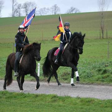
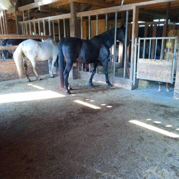
Longhorn Ranch
Gemmingen - Stebbach
Longhorn Ranch
@Kai-Koelle
Freizeitstall
Westernreiten
Hunde willkommen
Longierzirkel/Roundpen
Vollpension
Einzelne Boxen oder Stallplätze
9 weitere...
S


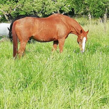
Reitstall Seehof Familie Feinauer
Pfaffenhofen
Simon Feinauer
@Simon-Feinauer
Fahrstall, Kutschwagen
Freizeitstall
Vermieten
Hunde willkommen
Longierzirkel/Roundpen
Allergikerstall
Gnadenbrothof
20 weitere...
P+
Deprecated: Creation of dynamic property Zend_View_Helper_Ads::$adLink is deprecated in /var/www/stall-frei/htdocs/staging.stall-frei.de/library/Psf/View/Helper/Ads.php on line 108

Paddockbox in kleiner Stallgemeinschaft frei
Rutesheim
Carolin-Hoerning
@Carolin-Hoerning
Wir sind ein kleiner Stall mit nur 13 Boxen in Rutesheim.
Aktuell haben wir eine Paddockbox frei.
neu
R

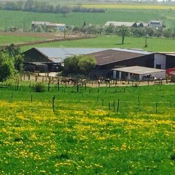
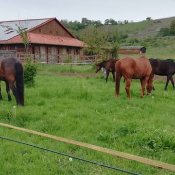
Bausch Ranch
Zaberfeld
Bausch Ranch
@BauschRanch
Freizeitstall
Pferdeausbildung
Vermieten
Hunde willkommen
Paddock
Innenbox
Offenstall
13 weitere...
P


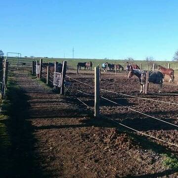
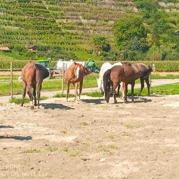
Aktiv und Offenstall mit direktem Weidezugang
Illingen / Schützingen
Familie Weigel
@Pferdehof-Weigel
Fahrstall, Kutschwagen
Freizeitstall
Vermieten
Verpachten
Hunde willkommen
Krankenbox
Allergikerstall
Fohlenaufzucht möglich
35 weitere...
P+

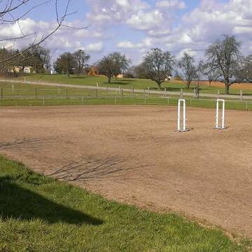
Großzügige Reitanlage für Sport und Freizeitreit...
Wiernsheim
Reitanlage-Hohes-Kreuz
@ReitanlageHohesKreuz
Freizeitstall
Pferdeausbildung
Vermieten
Führanlage
Paddock
Hufrehe geeignet
18 weitere...
aktuell
S


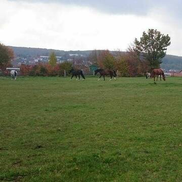
Bonartshäuserhof, artgerechte Offenstallhaltung
Gondelsheim
Gut Bonartshäuserhof
@Bonartshaeuserhof
FN-Mitglied
Freizeitstall
Vermieten
Krankenbox
Longierzirkel/Roundpen
Gnadenbrothof
Hengsthaltung möglich
27 weitere...
S


Martinushof
Zeutern
Georg Staudt
@Martinushof-Zeutern
FN-Mitglied
Freizeitstall
Vermieten
Führanlage
Hunde willkommen
Hengsthaltung möglich
Pferdezucht
19 weitere...
S

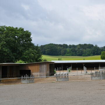
Pferdepension Hit Aktivstall Kürmerhof
Hohenkammer
Kuermerhof
@Kuermerhof
*******JETZT NEU MIT ENTSTAUBTEM BIOHEU*********
*******Demnächst mit einem Abenteuerspielplatz für Pferde ( Extrem Trail/Pa

Große Box mit Paddock und direktem Koppelzugang
Sternenfels
Kleiner Privatstall
@gina-naranjo124
Freizeitstall
Vermieten
Hunde willkommen
Sattelkammer/Sattelschränke
Außenbox mit Paddock
5 weitere...
P


Paddocktrail, 24/7 bed. Heu, Wallach-&Stuten...
Sersheim
Vitalzentrum Authenrieb
@Vitalzentrum.Authenrieb
Freizeitstall
Vermieten
Hunde willkommen
Krankenbox
Allergikerstall
bedampftes/gewaschenes Heu
13 weitere...
aktuell
P+
Pferdepension in der Aue
Mühlacker
Pferdepension-in-der-Aue
@Pferdepension-in-der-Aue
Freizeitstall
Geländestrecke
Vermieten
Krankenbox
Paddock
Notfallboxen
16 weitere...
P+
Deprecated: Creation of dynamic property Zend_View::$pageCount is deprecated in /var/www/stall-frei/htdocs/staging.stall-frei.de/library/vendor/shardj/zf1-future/library/Zend/View/Abstract.php on line 308
Deprecated: Creation of dynamic property Zend_View::$itemCountPerPage is deprecated in /var/www/stall-frei/htdocs/staging.stall-frei.de/library/vendor/shardj/zf1-future/library/Zend/View/Abstract.php on line 308
Deprecated: Creation of dynamic property Zend_View::$first is deprecated in /var/www/stall-frei/htdocs/staging.stall-frei.de/library/vendor/shardj/zf1-future/library/Zend/View/Abstract.php on line 308
Deprecated: Creation of dynamic property Zend_View::$current is deprecated in /var/www/stall-frei/htdocs/staging.stall-frei.de/library/vendor/shardj/zf1-future/library/Zend/View/Abstract.php on line 308
Deprecated: Creation of dynamic property Zend_View::$last is deprecated in /var/www/stall-frei/htdocs/staging.stall-frei.de/library/vendor/shardj/zf1-future/library/Zend/View/Abstract.php on line 308
Deprecated: Creation of dynamic property Zend_View::$next is deprecated in /var/www/stall-frei/htdocs/staging.stall-frei.de/library/vendor/shardj/zf1-future/library/Zend/View/Abstract.php on line 308
Deprecated: Creation of dynamic property Zend_View::$pagesInRange is deprecated in /var/www/stall-frei/htdocs/staging.stall-frei.de/library/vendor/shardj/zf1-future/library/Zend/View/Abstract.php on line 308
Deprecated: Creation of dynamic property Zend_View::$firstPageInRange is deprecated in /var/www/stall-frei/htdocs/staging.stall-frei.de/library/vendor/shardj/zf1-future/library/Zend/View/Abstract.php on line 308
Deprecated: Creation of dynamic property Zend_View::$lastPageInRange is deprecated in /var/www/stall-frei/htdocs/staging.stall-frei.de/library/vendor/shardj/zf1-future/library/Zend/View/Abstract.php on line 308
Deprecated: Creation of dynamic property Zend_View::$currentItemCount is deprecated in /var/www/stall-frei/htdocs/staging.stall-frei.de/library/vendor/shardj/zf1-future/library/Zend/View/Abstract.php on line 308
Deprecated: Creation of dynamic property Zend_View::$totalItemCount is deprecated in /var/www/stall-frei/htdocs/staging.stall-frei.de/library/vendor/shardj/zf1-future/library/Zend/View/Abstract.php on line 308
Deprecated: Creation of dynamic property Zend_View::$firstItemNumber is deprecated in /var/www/stall-frei/htdocs/staging.stall-frei.de/library/vendor/shardj/zf1-future/library/Zend/View/Abstract.php on line 308
Deprecated: Creation of dynamic property Zend_View::$lastItemNumber is deprecated in /var/www/stall-frei/htdocs/staging.stall-frei.de/library/vendor/shardj/zf1-future/library/Zend/View/Abstract.php on line 308
Deprecated: Creation of dynamic property Zend_View::$router is deprecated in /var/www/stall-frei/htdocs/staging.stall-frei.de/library/vendor/shardj/zf1-future/library/Zend/View/Abstract.php on line 308
Deprecated: Creation of dynamic property Zend_View::$urlParams is deprecated in /var/www/stall-frei/htdocs/staging.stall-frei.de/library/vendor/shardj/zf1-future/library/Zend/View/Abstract.php on line 308
Deprecated: Creation of dynamic property Zend_View::$showAds is deprecated in /var/www/stall-frei/htdocs/staging.stall-frei.de/library/vendor/shardj/zf1-future/library/Zend/View/Abstract.php on line 308
Deprecated: Creation of dynamic property Zend_View::$objectIds is deprecated in /var/www/stall-frei/htdocs/staging.stall-frei.de/library/vendor/shardj/zf1-future/library/Zend/View/Abstract.php on line 308
Deprecated: Creation of dynamic property Zend_View::$showNavbar is deprecated in /var/www/stall-frei/htdocs/staging.stall-frei.de/library/vendor/shardj/zf1-future/library/Zend/View/Abstract.php on line 308
Deprecated: Creation of dynamic property Zend_View::$showBreadcrumb is deprecated in /var/www/stall-frei/htdocs/staging.stall-frei.de/library/vendor/shardj/zf1-future/library/Zend/View/Abstract.php on line 308
Deprecated: Creation of dynamic property Zend_View::$showFooter is deprecated in /var/www/stall-frei/htdocs/staging.stall-frei.de/library/vendor/shardj/zf1-future/library/Zend/View/Abstract.php on line 308
Deprecated: Creation of dynamic property Zend_View::$showInternalAds is deprecated in /var/www/stall-frei/htdocs/staging.stall-frei.de/library/vendor/shardj/zf1-future/library/Zend/View/Abstract.php on line 308
Deprecated: Creation of dynamic property Zend_View::$blNoContent is deprecated in /var/www/stall-frei/htdocs/staging.stall-frei.de/library/vendor/shardj/zf1-future/library/Zend/View/Abstract.php on line 308
Deprecated: Creation of dynamic property Zend_View::$sMetaDesc is deprecated in /var/www/stall-frei/htdocs/staging.stall-frei.de/library/vendor/shardj/zf1-future/library/Zend/View/Abstract.php on line 308
Deprecated: Creation of dynamic property Zend_View::$useGmaps is deprecated in /var/www/stall-frei/htdocs/staging.stall-frei.de/library/vendor/shardj/zf1-future/library/Zend/View/Abstract.php on line 308
Deprecated: Creation of dynamic property Zend_View::$touches is deprecated in /var/www/stall-frei/htdocs/staging.stall-frei.de/library/vendor/shardj/zf1-future/library/Zend/View/Abstract.php on line 308
Deprecated: Creation of dynamic property Zend_View::$oProject is deprecated in /var/www/stall-frei/htdocs/staging.stall-frei.de/library/vendor/shardj/zf1-future/library/Zend/View/Abstract.php on line 308
Deprecated: Creation of dynamic property Zend_View::$pageHeadline is deprecated in /var/www/stall-frei/htdocs/staging.stall-frei.de/library/vendor/shardj/zf1-future/library/Zend/View/Abstract.php on line 308
Deprecated: Creation of dynamic property Zend_View::$disableLocationField is deprecated in /var/www/stall-frei/htdocs/staging.stall-frei.de/library/vendor/shardj/zf1-future/library/Zend/View/Abstract.php on line 308
Deprecated: Creation of dynamic property Zend_View::$isSearch is deprecated in /var/www/stall-frei/htdocs/staging.stall-frei.de/library/vendor/shardj/zf1-future/library/Zend/View/Abstract.php on line 308
Deprecated: Creation of dynamic property Zend_View::$pageTitle is deprecated in /var/www/stall-frei/htdocs/staging.stall-frei.de/library/vendor/shardj/zf1-future/library/Zend/View/Abstract.php on line 308
Deprecated: Creation of dynamic property Psf_Form_Element_Text::$class is deprecated in /var/www/stall-frei/htdocs/staging.stall-frei.de/library/vendor/shardj/zf1-future/library/Zend/Form/Element.php on line 874
Deprecated: Creation of dynamic property Psf_Form_Element_Text::$size is deprecated in /var/www/stall-frei/htdocs/staging.stall-frei.de/library/vendor/shardj/zf1-future/library/Zend/Form/Element.php on line 874
Deprecated: Creation of dynamic property Psf_Form_Element_Text::$placeholder is deprecated in /var/www/stall-frei/htdocs/staging.stall-frei.de/library/vendor/shardj/zf1-future/library/Zend/Form/Element.php on line 874
Deprecated: Creation of dynamic property Psf_Form_Element_Hidden::$class is deprecated in /var/www/stall-frei/htdocs/staging.stall-frei.de/library/vendor/shardj/zf1-future/library/Zend/Form/Element.php on line 874
Deprecated: Creation of dynamic property Psf_Form_Element_Hidden::$class is deprecated in /var/www/stall-frei/htdocs/staging.stall-frei.de/library/vendor/shardj/zf1-future/library/Zend/Form/Element.php on line 874
Deprecated: Creation of dynamic property Psf_Form_Element_Hidden::$class is deprecated in /var/www/stall-frei/htdocs/staging.stall-frei.de/library/vendor/shardj/zf1-future/library/Zend/Form/Element.php on line 874
Deprecated: Creation of dynamic property Psf_Form_Element_Hidden::$class is deprecated in /var/www/stall-frei/htdocs/staging.stall-frei.de/library/vendor/shardj/zf1-future/library/Zend/Form/Element.php on line 874
Deprecated: Creation of dynamic property Psf_Form_Element_Select::$class is deprecated in /var/www/stall-frei/htdocs/staging.stall-frei.de/library/vendor/shardj/zf1-future/library/Zend/Form/Element.php on line 874
Deprecated: Creation of dynamic property Psf_Form_Element_Select::$class is deprecated in /var/www/stall-frei/htdocs/staging.stall-frei.de/library/vendor/shardj/zf1-future/library/Zend/Form/Element.php on line 874
Deprecated: Creation of dynamic property Psf_Form_Element_Select::$class is deprecated in /var/www/stall-frei/htdocs/staging.stall-frei.de/library/vendor/shardj/zf1-future/library/Zend/Form/Element.php on line 874
Deprecated: Creation of dynamic property Psf_Form_Element_Select::$class is deprecated in /var/www/stall-frei/htdocs/staging.stall-frei.de/library/vendor/shardj/zf1-future/library/Zend/Form/Element.php on line 874
Deprecated: Creation of dynamic property Psf_Form_Element_Text::$class is deprecated in /var/www/stall-frei/htdocs/staging.stall-frei.de/library/vendor/shardj/zf1-future/library/Zend/Form/Element.php on line 874
Deprecated: Creation of dynamic property Psf_Form_Element_Checkbox::$label is deprecated in /var/www/stall-frei/htdocs/staging.stall-frei.de/library/vendor/shardj/zf1-future/library/Zend/Form/Element.php on line 874
Deprecated: Creation of dynamic property Zend_View::$sort is deprecated in /var/www/stall-frei/htdocs/staging.stall-frei.de/library/vendor/shardj/zf1-future/library/Zend/View/Abstract.php on line 308
Deprecated: Creation of dynamic property Zend_View::$searchLocation is deprecated in /var/www/stall-frei/htdocs/staging.stall-frei.de/library/vendor/shardj/zf1-future/library/Zend/View/Abstract.php on line 308
Deprecated: Creation of dynamic property Zend_View::$locationHint is deprecated in /var/www/stall-frei/htdocs/staging.stall-frei.de/library/vendor/shardj/zf1-future/library/Zend/View/Abstract.php on line 308
Psf_GeoCoder_Abstract::getLocation: Im Boden Get Location CachedOrLive
Psf_GeoCoder_Abstract::getCachedOrLive: Im Boden
Psf_GeoCoder_OpenCageData::makeApiRequest: response:
Array
(
[documentation] => https://opencagedata.com/api
[licenses] => Array
(
[0] => Array
(
[name] => see attribution guide
[url] => https://opencagedata.com/credits
)
)
[results] => Array
(
[0] => Array
(
[bounds] => Array
(
[northeast] => Array
(
[lat] => 49.0635085
[lng] => 8.9238798
)
[southwest] => Array
(
[lat] => 49.0634085
[lng] => 8.9237798
)
)
[components] => Array
(
[ISO_3166-1_alpha-2] => DE
[ISO_3166-1_alpha-3] => DEU
[ISO_3166-2] => Array
(
[0] => DE-BW
)
[_category] => agriculture
[_normalized_city] => Zaberfeld
[_type] => farmyard
[continent] => Europe
[country] => Deutschland
[country_code] => de
[county] => Landkreis Heilbronn
[farmyard] => Boden
[isolated_dwelling] => Im Boden
[municipality] => GVV Oberes Zabergäu
[political_union] => European Union
[postcode] => 74374
[state] => Baden-Württemberg
[state_code] => BW
[village] => Zaberfeld
)
[confidence] => 9
[formatted] => Boden, Im Boden, 74374 Zaberfeld, Deutschland
[geometry] => Array
(
[lat] => 49.0634585
[lng] => 8.9238298
)
)
[1] => Array
(
[bounds] => Array
(
[northeast] => Array
(
[lat] => 47.528765
[lng] => 8.6092449
)
[southwest] => Array
(
[lat] => 47.528665
[lng] => 8.6091449
)
)
[components] => Array
(
[ISO_3166-1_alpha-2] => CH
[ISO_3166-1_alpha-3] => CHE
[ISO_3166-2] => Array
(
[0] => CH-ZH
)
[_category] => building
[_normalized_city] => Dättlikon
[_type] => building
[continent] => Europe
[country] => Schweiz
[country_code] => ch
[county] => Bezirk Winterthur
[hamlet] => Berghof
[isolated_dwelling] => Im Boden
[local_administrative_area] => Dättlikon
[postcode] => 8421
[state] => Zürich
[state_code] => ZH
[village] => Dättlikon
)
[confidence] => 10
[formatted] => Im Boden, 8421 Dättlikon, Schweiz
[geometry] => Array
(
[lat] => 47.528715
[lng] => 8.6091949
)
)
[2] => Array
(
[bounds] => Array
(
[northeast] => Array
(
[lat] => 50.5869354
[lng] => 11.6835932
)
[southwest] => Array
(
[lat] => 50.5806338
[lng] => 11.6751325
)
)
[components] => Array
(
[ISO_3166-1_alpha-2] => DE
[ISO_3166-1_alpha-3] => DEU
[ISO_3166-2] => Array
(
[0] => DE-TH
)
[_category] => natural/water
[_normalized_city] => Eßbach
[_type] => meadow
[continent] => Europe
[country] => Deutschland
[country_code] => de
[county] => Saale-Orla-Kreis
[meadow] => Im Boden
[municipality] => Ranis-Ziegenrück
[political_union] => European Union
[postcode] => 07924
[state] => Thüringen
[state_code] => TH
[town] => Eßbach
[village] => Eßbach
)
[confidence] => 9
[formatted] => Im Boden, 07924 Eßbach, Deutschland
[geometry] => Array
(
[lat] => 50.5837853
[lng] => 11.6813464
)
)
[3] => Array
(
[bounds] => Array
(
[northeast] => Array
(
[lat] => 48.6026702
[lng] => 9.6396043
)
[southwest] => Array
(
[lat] => 48.5987978
[lng] => 9.63617
)
)
[components] => Array
(
[ISO_3166-1_alpha-2] => DE
[ISO_3166-1_alpha-3] => DEU
[ISO_3166-2] => Array
(
[0] => DE-BW
)
[_category] => place
[_normalized_city] => Gruibingen
[_type] => village
[continent] => Europe
[country] => Deutschland
[country_code] => de
[county] => Landkreis Göppingen
[industrial] => Im Boden
[municipality] => GVV Oberes Filstal
[political_union] => European Union
[postcode] => 73344
[state] => Baden-Württemberg
[state_code] => BW
[village] => Gruibingen
)
[confidence] => 9
[formatted] => 73344 Gruibingen, Deutschland
[geometry] => Array
(
[lat] => 48.6007405
[lng] => 9.6380044
)
)
[4] => Array
(
[bounds] => Array
(
[northeast] => Array
(
[lat] => 51.1284309
[lng] => 9.3275668
)
[southwest] => Array
(
[lat] => 51.1265978
[lng] => 9.3224854
)
)
[components] => Array
(
[ISO_3166-1_alpha-2] => DE
[ISO_3166-1_alpha-3] => DEU
[ISO_3166-2] => Array
(
[0] => DE-HE
)
[_category] => agriculture
[_normalized_city] => Obermöllrich
[_type] => farmland
[continent] => Europe
[country] => Deutschland
[country_code] => de
[county] => Schwalm-Eder-Kreis
[farmland] => Im Boden
[municipality] => Fritzlar
[political_union] => European Union
[postcode] => 34560
[state] => Hessen
[state_code] => HE
[village] => Obermöllrich
)
[confidence] => 9
[formatted] => Im Boden, 34560 Obermöllrich, Deutschland
[geometry] => Array
(
[lat] => 51.1274366
[lng] => 9.3250213
)
)
[5] => Array
(
[bounds] => Array
(
[northeast] => Array
(
[lat] => 47.0514188
[lng] => 13.895967
)
[southwest] => Array
(
[lat] => 47.0486044
[lng] => 13.8929629
)
)
[components] => Array
(
[ISO_3166-1_alpha-2] => AT
[ISO_3166-1_alpha-3] => AUT
[ISO_3166-2] => Array
(
[0] => AT-6
)
[_category] => natural/water
[_normalized_city] => Stadl-Predlitz
[_type] => meadow
[city] => Stadl-Predlitz
[continent] => Europe
[country] => Österreich
[country_code] => at
[county] => Bezirk Murau
[meadow] => Im Boden
[political_union] => European Union
[postcode] => 8862
[state] => Steiermark
[state_code] => 6
)
[confidence] => 9
[formatted] => Im Boden, 8862 Stadl-Predlitz, Österreich
[geometry] => Array
(
[lat] => 47.0500225
[lng] => 13.8939203
)
)
[6] => Array
(
[bounds] => Array
(
[northeast] => Array
(
[lat] => 51.3581788
[lng] => 9.5906619
)
[southwest] => Array
(
[lat] => 51.3555408
[lng] => 9.5878241
)
)
[components] => Array
(
[ISO_3166-1_alpha-2] => DE
[ISO_3166-1_alpha-3] => DEU
[ISO_3166-2] => Array
(
[0] => DE-NI
)
[_category] => agriculture
[_normalized_city] => Staufenberg
[_type] => farmland
[continent] => Europe
[country] => Deutschland
[country_code] => de
[county] => Landkreis Göttingen
[farmland] => Im Boden
[municipality] => Staufenberg
[political_union] => European Union
[postcode] => 34355
[state] => Niedersachsen
[state_code] => NI
)
[confidence] => 9
[formatted] => Im Boden, 34355 Staufenberg, Deutschland
[geometry] => Array
(
[lat] => 51.3564462
[lng] => 9.5890209
)
)
[7] => Array
(
[bounds] => Array
(
[northeast] => Array
(
[lat] => 50.710268
[lng] => 8.699669
)
[southwest] => Array
(
[lat] => 50.7087344
[lng] => 8.6953325
)
)
[components] => Array
(
[ISO_3166-1_alpha-2] => DE
[ISO_3166-1_alpha-3] => DEU
[ISO_3166-2] => Array
(
[0] => DE-HE
)
[_category] => commerce
[_normalized_city] => Fronhausen
[_type] => retail
[continent] => Europe
[country] => Deutschland
[country_code] => de
[county] => Landkreis Marburg-Biedenkopf
[municipality] => Fronhausen
[political_union] => European Union
[postcode] => 35112
[retail] => Im Boden
[state] => Hessen
[state_code] => HE
[village] => Fronhausen
)
[confidence] => 9
[formatted] => Im Boden, 35112 Fronhausen, Deutschland
[geometry] => Array
(
[lat] => 50.7094187
[lng] => 8.6975223
)
)
[8] => Array
(
[bounds] => Array
(
[northeast] => Array
(
[lat] => 50.6319791
[lng] => 7.7380918
)
[southwest] => Array
(
[lat] => 50.6286021
[lng] => 7.7363223
)
)
[components] => Array
(
[ISO_3166-1_alpha-2] => DE
[ISO_3166-1_alpha-3] => DEU
[ISO_3166-2] => Array
(
[0] => DE-RP
)
[_category] => place
[_normalized_city] => Höchstenbach
[_type] => village
[commercial] => Im Boden
[continent] => Europe
[country] => Deutschland
[country_code] => de
[county] => Westerwaldkreis
[municipality] => Hachenburg
[political_union] => European Union
[postcode] => 57629
[state] => Rheinland-Pfalz
[state_code] => RP
[village] => Höchstenbach
)
[confidence] => 9
[formatted] => 57629 Höchstenbach, Deutschland
[geometry] => Array
(
[lat] => 50.6298823
[lng] => 7.7375274
)
)
[9] => Array
(
[bounds] => Array
(
[northeast] => Array
(
[lat] => 51.3566454
[lng] => 9.5918246
)
[southwest] => Array
(
[lat] => 51.3553596
[lng] => 9.5896968
)
)
[components] => Array
(
[ISO_3166-1_alpha-2] => DE
[ISO_3166-1_alpha-3] => DEU
[ISO_3166-2] => Array
(
[0] => DE-NI
)
[_category] => natural/water
[_normalized_city] => Staufenberg
[_type] => meadow
[continent] => Europe
[country] => Deutschland
[country_code] => de
[county] => Landkreis Göttingen
[meadow] => Im Boden
[municipality] => Staufenberg
[political_union] => European Union
[postcode] => 34355
[state] => Niedersachsen
[state_code] => NI
)
[confidence] => 9
[formatted] => Im Boden, 34355 Staufenberg, Deutschland
[geometry] => Array
(
[lat] => 51.355916
[lng] => 9.5905683
)
)
)
[status] => Array
(
[code] => 200
[message] => OK
)
[stay_informed] => Array
(
[blog] => https://blog.opencagedata.com
[mastodon] => https://en.osm.town/@opencage
)
[thanks] => For using an OpenCage API
[timestamp] => Array
(
[created_http] => Sun, 08 Feb 2026 14:19:29 GMT
[created_unix] => 1770560369
)
[total_results] => 10
)
Psf_GeoCoder_Abstract::convertLocationResult
{"documentation":"https:\/\/opencagedata.com\/api","licenses":[{"name":"see attribution guide","url":"https:\/\/opencagedata.com\/credits"}],"results":[{"bounds":{"northeast":{"lat":49.0635085,"lng":8.9238798},"southwest":{"lat":49.0634085,"lng":8.9237798}},"components":{"ISO_3166-1_alpha-2":"DE","ISO_3166-1_alpha-3":"DEU","ISO_3166-2":["DE-BW"],"_category":"agriculture","_normalized_city":"Zaberfeld","_type":"farmyard","continent":"Europe","country":"Deutschland","country_code":"de","county":"Landkreis Heilbronn","farmyard":"Boden","isolated_dwelling":"Im Boden","municipality":"GVV Oberes Zaberg\u00e4u","political_union":"European Union","postcode":"74374","state":"Baden-W\u00fcrttemberg","state_code":"BW","village":"Zaberfeld"},"confidence":9,"formatted":"Boden, Im Boden, 74374 Zaberfeld, Deutschland","geometry":{"lat":49.0634585,"lng":8.9238298}},{"bounds":{"northeast":{"lat":47.528765,"lng":8.6092449},"southwest":{"lat":47.528665,"lng":8.6091449}},"components":{"ISO_3166-1_alpha-2":"CH","ISO_3166-1_alpha-3":"CHE","ISO_3166-2":["CH-ZH"],"_category":"building","_normalized_city":"D\u00e4ttlikon","_type":"building","continent":"Europe","country":"Schweiz","country_code":"ch","county":"Bezirk Winterthur","hamlet":"Berghof","isolated_dwelling":"Im Boden","local_administrative_area":"D\u00e4ttlikon","postcode":"8421","state":"Z\u00fcrich","state_code":"ZH","village":"D\u00e4ttlikon"},"confidence":10,"formatted":"Im Boden, 8421 D\u00e4ttlikon, Schweiz","geometry":{"lat":47.528715,"lng":8.6091949}},{"bounds":{"northeast":{"lat":50.5869354,"lng":11.6835932},"southwest":{"lat":50.5806338,"lng":11.6751325}},"components":{"ISO_3166-1_alpha-2":"DE","ISO_3166-1_alpha-3":"DEU","ISO_3166-2":["DE-TH"],"_category":"natural\/water","_normalized_city":"E\u00dfbach","_type":"meadow","continent":"Europe","country":"Deutschland","country_code":"de","county":"Saale-Orla-Kreis","meadow":"Im Boden","municipality":"Ranis-Ziegenr\u00fcck","political_union":"European Union","postcode":"07924","state":"Th\u00fcringen","state_code":"TH","town":"E\u00dfbach","village":"E\u00dfbach"},"confidence":9,"formatted":"Im Boden, 07924 E\u00dfbach, Deutschland","geometry":{"lat":50.5837853,"lng":11.6813464}},{"bounds":{"northeast":{"lat":48.6026702,"lng":9.6396043},"southwest":{"lat":48.5987978,"lng":9.63617}},"components":{"ISO_3166-1_alpha-2":"DE","ISO_3166-1_alpha-3":"DEU","ISO_3166-2":["DE-BW"],"_category":"place","_normalized_city":"Gruibingen","_type":"village","continent":"Europe","country":"Deutschland","country_code":"de","county":"Landkreis G\u00f6ppingen","industrial":"Im Boden","municipality":"GVV Oberes Filstal","political_union":"European Union","postcode":"73344","state":"Baden-W\u00fcrttemberg","state_code":"BW","village":"Gruibingen"},"confidence":9,"formatted":"73344 Gruibingen, Deutschland","geometry":{"lat":48.6007405,"lng":9.6380044}},{"bounds":{"northeast":{"lat":51.1284309,"lng":9.3275668},"southwest":{"lat":51.1265978,"lng":9.3224854}},"components":{"ISO_3166-1_alpha-2":"DE","ISO_3166-1_alpha-3":"DEU","ISO_3166-2":["DE-HE"],"_category":"agriculture","_normalized_city":"Oberm\u00f6llrich","_type":"farmland","continent":"Europe","country":"Deutschland","country_code":"de","county":"Schwalm-Eder-Kreis","farmland":"Im Boden","municipality":"Fritzlar","political_union":"European Union","postcode":"34560","state":"Hessen","state_code":"HE","village":"Oberm\u00f6llrich"},"confidence":9,"formatted":"Im Boden, 34560 Oberm\u00f6llrich, Deutschland","geometry":{"lat":51.1274366,"lng":9.3250213}},{"bounds":{"northeast":{"lat":47.0514188,"lng":13.895967},"southwest":{"lat":47.0486044,"lng":13.8929629}},"components":{"ISO_3166-1_alpha-2":"AT","ISO_3166-1_alpha-3":"AUT","ISO_3166-2":["AT-6"],"_category":"natural\/water","_normalized_city":"Stadl-Predlitz","_type":"meadow","city":"Stadl-Predlitz","continent":"Europe","country":"\u00d6sterreich","country_code":"at","county":"Bezirk Murau","meadow":"Im Boden","political_union":"European Union","postcode":"8862","state":"Steiermark","state_code":"6"},"confidence":9,"formatted":"Im Boden, 8862 Stadl-Predlitz, \u00d6sterreich","geometry":{"lat":47.0500225,"lng":13.8939203}},{"bounds":{"northeast":{"lat":51.3581788,"lng":9.5906619},"southwest":{"lat":51.3555408,"lng":9.5878241}},"components":{"ISO_3166-1_alpha-2":"DE","ISO_3166-1_alpha-3":"DEU","ISO_3166-2":["DE-NI"],"_category":"agriculture","_normalized_city":"Staufenberg","_type":"farmland","continent":"Europe","country":"Deutschland","country_code":"de","county":"Landkreis G\u00f6ttingen","farmland":"Im Boden","municipality":"Staufenberg","political_union":"European Union","postcode":"34355","state":"Niedersachsen","state_code":"NI"},"confidence":9,"formatted":"Im Boden, 34355 Staufenberg, Deutschland","geometry":{"lat":51.3564462,"lng":9.5890209}},{"bounds":{"northeast":{"lat":50.710268,"lng":8.699669},"southwest":{"lat":50.7087344,"lng":8.6953325}},"components":{"ISO_3166-1_alpha-2":"DE","ISO_3166-1_alpha-3":"DEU","ISO_3166-2":["DE-HE"],"_category":"commerce","_normalized_city":"Fronhausen","_type":"retail","continent":"Europe","country":"Deutschland","country_code":"de","county":"Landkreis Marburg-Biedenkopf","municipality":"Fronhausen","political_union":"European Union","postcode":"35112","retail":"Im Boden","state":"Hessen","state_code":"HE","village":"Fronhausen"},"confidence":9,"formatted":"Im Boden, 35112 Fronhausen, Deutschland","geometry":{"lat":50.7094187,"lng":8.6975223}},{"bounds":{"northeast":{"lat":50.6319791,"lng":7.7380918},"southwest":{"lat":50.6286021,"lng":7.7363223}},"components":{"ISO_3166-1_alpha-2":"DE","ISO_3166-1_alpha-3":"DEU","ISO_3166-2":["DE-RP"],"_category":"place","_normalized_city":"H\u00f6chstenbach","_type":"village","commercial":"Im Boden","continent":"Europe","country":"Deutschland","country_code":"de","county":"Westerwaldkreis","municipality":"Hachenburg","political_union":"European Union","postcode":"57629","state":"Rheinland-Pfalz","state_code":"RP","village":"H\u00f6chstenbach"},"confidence":9,"formatted":"57629 H\u00f6chstenbach, Deutschland","geometry":{"lat":50.6298823,"lng":7.7375274}},{"bounds":{"northeast":{"lat":51.3566454,"lng":9.5918246},"southwest":{"lat":51.3553596,"lng":9.5896968}},"components":{"ISO_3166-1_alpha-2":"DE","ISO_3166-1_alpha-3":"DEU","ISO_3166-2":["DE-NI"],"_category":"natural\/water","_normalized_city":"Staufenberg","_type":"meadow","continent":"Europe","country":"Deutschland","country_code":"de","county":"Landkreis G\u00f6ttingen","meadow":"Im Boden","municipality":"Staufenberg","political_union":"European Union","postcode":"34355","state":"Niedersachsen","state_code":"NI"},"confidence":9,"formatted":"Im Boden, 34355 Staufenberg, Deutschland","geometry":{"lat":51.355916,"lng":9.5905683}}],"status":{"code":200,"message":"OK"},"stay_informed":{"blog":"https:\/\/blog.opencagedata.com","mastodon":"https:\/\/en.osm.town\/@opencage"},"thanks":"For using an OpenCage API","timestamp":{"created_http":"Sun, 08 Feb 2026 14:19:29 GMT","created_unix":1770560369},"total_results":10}Array
(
[0] => stdClass Object
(
[bounds] => stdClass Object
(
[northeast] => stdClass Object
(
[lat] => 49.0635085
[lng] => 8.9238798
)
[southwest] => stdClass Object
(
[lat] => 49.0634085
[lng] => 8.9237798
)
)
[components] => stdClass Object
(
[ISO_3166-1_alpha-2] => DE
[ISO_3166-1_alpha-3] => DEU
[ISO_3166-2] => Array
(
[0] => DE-BW
)
[_category] => agriculture
[_normalized_city] => Zaberfeld
[_type] => farmyard
[continent] => Europe
[country] => Deutschland
[country_code] => de
[county] => Landkreis Heilbronn
[farmyard] => Boden
[isolated_dwelling] => Im Boden
[municipality] => GVV Oberes Zabergäu
[political_union] => European Union
[postcode] => 74374
[state] => Baden-Württemberg
[state_code] => BW
[village] => Zaberfeld
)
[confidence] => 9
[formatted] => Boden, Im Boden, 74374 Zaberfeld, Deutschland
[geometry] => stdClass Object
(
[lat] => 49.0634585
[lng] => 8.9238298
)
)
[1] => stdClass Object
(
[bounds] => stdClass Object
(
[northeast] => stdClass Object
(
[lat] => 47.528765
[lng] => 8.6092449
)
[southwest] => stdClass Object
(
[lat] => 47.528665
[lng] => 8.6091449
)
)
[components] => stdClass Object
(
[ISO_3166-1_alpha-2] => CH
[ISO_3166-1_alpha-3] => CHE
[ISO_3166-2] => Array
(
[0] => CH-ZH
)
[_category] => building
[_normalized_city] => Dättlikon
[_type] => building
[continent] => Europe
[country] => Schweiz
[country_code] => ch
[county] => Bezirk Winterthur
[hamlet] => Berghof
[isolated_dwelling] => Im Boden
[local_administrative_area] => Dättlikon
[postcode] => 8421
[state] => Zürich
[state_code] => ZH
[village] => Dättlikon
)
[confidence] => 10
[formatted] => Im Boden, 8421 Dättlikon, Schweiz
[geometry] => stdClass Object
(
[lat] => 47.528715
[lng] => 8.6091949
)
)
[2] => stdClass Object
(
[bounds] => stdClass Object
(
[northeast] => stdClass Object
(
[lat] => 50.5869354
[lng] => 11.6835932
)
[southwest] => stdClass Object
(
[lat] => 50.5806338
[lng] => 11.6751325
)
)
[components] => stdClass Object
(
[ISO_3166-1_alpha-2] => DE
[ISO_3166-1_alpha-3] => DEU
[ISO_3166-2] => Array
(
[0] => DE-TH
)
[_category] => natural/water
[_normalized_city] => Eßbach
[_type] => meadow
[continent] => Europe
[country] => Deutschland
[country_code] => de
[county] => Saale-Orla-Kreis
[meadow] => Im Boden
[municipality] => Ranis-Ziegenrück
[political_union] => European Union
[postcode] => 07924
[state] => Thüringen
[state_code] => TH
[town] => Eßbach
[village] => Eßbach
)
[confidence] => 9
[formatted] => Im Boden, 07924 Eßbach, Deutschland
[geometry] => stdClass Object
(
[lat] => 50.5837853
[lng] => 11.6813464
)
)
[3] => stdClass Object
(
[bounds] => stdClass Object
(
[northeast] => stdClass Object
(
[lat] => 48.6026702
[lng] => 9.6396043
)
[southwest] => stdClass Object
(
[lat] => 48.5987978
[lng] => 9.63617
)
)
[components] => stdClass Object
(
[ISO_3166-1_alpha-2] => DE
[ISO_3166-1_alpha-3] => DEU
[ISO_3166-2] => Array
(
[0] => DE-BW
)
[_category] => place
[_normalized_city] => Gruibingen
[_type] => village
[continent] => Europe
[country] => Deutschland
[country_code] => de
[county] => Landkreis Göppingen
[industrial] => Im Boden
[municipality] => GVV Oberes Filstal
[political_union] => European Union
[postcode] => 73344
[state] => Baden-Württemberg
[state_code] => BW
[village] => Gruibingen
)
[confidence] => 9
[formatted] => 73344 Gruibingen, Deutschland
[geometry] => stdClass Object
(
[lat] => 48.6007405
[lng] => 9.6380044
)
)
[4] => stdClass Object
(
[bounds] => stdClass Object
(
[northeast] => stdClass Object
(
[lat] => 51.1284309
[lng] => 9.3275668
)
[southwest] => stdClass Object
(
[lat] => 51.1265978
[lng] => 9.3224854
)
)
[components] => stdClass Object
(
[ISO_3166-1_alpha-2] => DE
[ISO_3166-1_alpha-3] => DEU
[ISO_3166-2] => Array
(
[0] => DE-HE
)
[_category] => agriculture
[_normalized_city] => Obermöllrich
[_type] => farmland
[continent] => Europe
[country] => Deutschland
[country_code] => de
[county] => Schwalm-Eder-Kreis
[farmland] => Im Boden
[municipality] => Fritzlar
[political_union] => European Union
[postcode] => 34560
[state] => Hessen
[state_code] => HE
[village] => Obermöllrich
)
[confidence] => 9
[formatted] => Im Boden, 34560 Obermöllrich, Deutschland
[geometry] => stdClass Object
(
[lat] => 51.1274366
[lng] => 9.3250213
)
)
[5] => stdClass Object
(
[bounds] => stdClass Object
(
[northeast] => stdClass Object
(
[lat] => 47.0514188
[lng] => 13.895967
)
[southwest] => stdClass Object
(
[lat] => 47.0486044
[lng] => 13.8929629
)
)
[components] => stdClass Object
(
[ISO_3166-1_alpha-2] => AT
[ISO_3166-1_alpha-3] => AUT
[ISO_3166-2] => Array
(
[0] => AT-6
)
[_category] => natural/water
[_normalized_city] => Stadl-Predlitz
[_type] => meadow
[city] => Stadl-Predlitz
[continent] => Europe
[country] => Österreich
[country_code] => at
[county] => Bezirk Murau
[meadow] => Im Boden
[political_union] => European Union
[postcode] => 8862
[state] => Steiermark
[state_code] => 6
)
[confidence] => 9
[formatted] => Im Boden, 8862 Stadl-Predlitz, Österreich
[geometry] => stdClass Object
(
[lat] => 47.0500225
[lng] => 13.8939203
)
)
[6] => stdClass Object
(
[bounds] => stdClass Object
(
[northeast] => stdClass Object
(
[lat] => 51.3581788
[lng] => 9.5906619
)
[southwest] => stdClass Object
(
[lat] => 51.3555408
[lng] => 9.5878241
)
)
[components] => stdClass Object
(
[ISO_3166-1_alpha-2] => DE
[ISO_3166-1_alpha-3] => DEU
[ISO_3166-2] => Array
(
[0] => DE-NI
)
[_category] => agriculture
[_normalized_city] => Staufenberg
[_type] => farmland
[continent] => Europe
[country] => Deutschland
[country_code] => de
[county] => Landkreis Göttingen
[farmland] => Im Boden
[municipality] => Staufenberg
[political_union] => European Union
[postcode] => 34355
[state] => Niedersachsen
[state_code] => NI
)
[confidence] => 9
[formatted] => Im Boden, 34355 Staufenberg, Deutschland
[geometry] => stdClass Object
(
[lat] => 51.3564462
[lng] => 9.5890209
)
)
[7] => stdClass Object
(
[bounds] => stdClass Object
(
[northeast] => stdClass Object
(
[lat] => 50.710268
[lng] => 8.699669
)
[southwest] => stdClass Object
(
[lat] => 50.7087344
[lng] => 8.6953325
)
)
[components] => stdClass Object
(
[ISO_3166-1_alpha-2] => DE
[ISO_3166-1_alpha-3] => DEU
[ISO_3166-2] => Array
(
[0] => DE-HE
)
[_category] => commerce
[_normalized_city] => Fronhausen
[_type] => retail
[continent] => Europe
[country] => Deutschland
[country_code] => de
[county] => Landkreis Marburg-Biedenkopf
[municipality] => Fronhausen
[political_union] => European Union
[postcode] => 35112
[retail] => Im Boden
[state] => Hessen
[state_code] => HE
[village] => Fronhausen
)
[confidence] => 9
[formatted] => Im Boden, 35112 Fronhausen, Deutschland
[geometry] => stdClass Object
(
[lat] => 50.7094187
[lng] => 8.6975223
)
)
[8] => stdClass Object
(
[bounds] => stdClass Object
(
[northeast] => stdClass Object
(
[lat] => 50.6319791
[lng] => 7.7380918
)
[southwest] => stdClass Object
(
[lat] => 50.6286021
[lng] => 7.7363223
)
)
[components] => stdClass Object
(
[ISO_3166-1_alpha-2] => DE
[ISO_3166-1_alpha-3] => DEU
[ISO_3166-2] => Array
(
[0] => DE-RP
)
[_category] => place
[_normalized_city] => Höchstenbach
[_type] => village
[commercial] => Im Boden
[continent] => Europe
[country] => Deutschland
[country_code] => de
[county] => Westerwaldkreis
[municipality] => Hachenburg
[political_union] => European Union
[postcode] => 57629
[state] => Rheinland-Pfalz
[state_code] => RP
[village] => Höchstenbach
)
[confidence] => 9
[formatted] => 57629 Höchstenbach, Deutschland
[geometry] => stdClass Object
(
[lat] => 50.6298823
[lng] => 7.7375274
)
)
[9] => stdClass Object
(
[bounds] => stdClass Object
(
[northeast] => stdClass Object
(
[lat] => 51.3566454
[lng] => 9.5918246
)
[southwest] => stdClass Object
(
[lat] => 51.3553596
[lng] => 9.5896968
)
)
[components] => stdClass Object
(
[ISO_3166-1_alpha-2] => DE
[ISO_3166-1_alpha-3] => DEU
[ISO_3166-2] => Array
(
[0] => DE-NI
)
[_category] => natural/water
[_normalized_city] => Staufenberg
[_type] => meadow
[continent] => Europe
[country] => Deutschland
[country_code] => de
[county] => Landkreis Göttingen
[meadow] => Im Boden
[municipality] => Staufenberg
[political_union] => European Union
[postcode] => 34355
[state] => Niedersachsen
[state_code] => NI
)
[confidence] => 9
[formatted] => Im Boden, 34355 Staufenberg, Deutschland
[geometry] => stdClass Object
(
[lat] => 51.355916
[lng] => 9.5905683
)
)
)
Psf_GeoCoder_OpenCageData::getKeyMap: 0
stdClass Object
(
    [bounds] => stdClass Object
        (
            [northeast] => stdClass Object
                (
                    [lat] => 49.0635085
                    [lng] => 8.9238798
                )

            [southwest] => stdClass Object
                (
                    [lat] => 49.0634085
                    [lng] => 8.9237798
                )

        )

    [components] => stdClass Object
        (
            [ISO_3166-1_alpha-2] => DE
            [ISO_3166-1_alpha-3] => DEU
            [ISO_3166-2] => Array
                (
                    [0] => DE-BW
                )

            [_category] => agriculture
            [_normalized_city] => Zaberfeld
            [_type] => farmyard
            [continent] => Europe
            [country] => Deutschland
            [country_code] => de
            [county] => Landkreis Heilbronn
            [farmyard] => Boden
            [isolated_dwelling] => Im Boden
            [municipality] => GVV Oberes Zabergäu
            [political_union] => European Union
            [postcode] => 74374
            [state] => Baden-Württemberg
            [state_code] => BW
            [village] => Zaberfeld
        )

    [confidence] => 9
    [formatted] => Boden, Im Boden, 74374 Zaberfeld, Deutschland
    [geometry] => stdClass Object
        (
            [lat] => 49.0634585
            [lng] => 8.9238298
        )

)
Psf_GeoCoder_OpenCageData::getCounty: Heilbronn
Psf_GeoCoder_OpenCageData::addMissingData REFETCH!
Array
(
    [address] => Boden, Im Boden, 74374 Zaberfeld, Deutschland
    [type] => farmyard
    [street] =>
    [city] => Zaberfeld
    [county] => Heilbronn
    [state] => Baden-Württemberg
    [zip] => 74374
    [country] => Deutschland
    [suburb] =>
    [countrycode] => de
    [latitude] => 49.0634585
    [longitude] => 8.9238298
    [accuracy] => 1
    [confidence] => 9
    [bounds] => stdClass Object
        (
            [northeast] => stdClass Object
                (
                    [lat] => 49.0635085
                    [lng] => 8.9238798
                )

            [southwest] => stdClass Object
                (
                    [lat] => 49.0634085
                    [lng] => 8.9237798
                )

        )

)
reformat!
Array
(
    [address] => Boden, Im Boden, 74374 Zaberfeld, Deutschland
    [type] => farmyard
    [street] =>
    [city] => Zaberfeld
    [county] => Heilbronn
    [state] => Baden-Württemberg
    [zip] => 74374
    [country] => Deutschland
    [suburb] =>
    [countrycode] => de
    [latitude] => 49.0634585
    [longitude] => 8.9238298
    [accuracy] => 1
    [confidence] => 9
    [bounds] => stdClass Object
        (
            [northeast] => stdClass Object
                (
                    [lat] => 49.0635085
                    [lng] => 8.9238798
                )

            [southwest] => stdClass Object
                (
                    [lat] => 49.0634085
                    [lng] => 8.9237798
                )

        )

    [place] => 74374 Zaberfeld, Baden-Württemberg
    [hash] => 5437618533e606a1db7d5e5229b0db45
)
Psf_GeoCoder_OpenCageData::getKeyMap: 1
stdClass Object
(
    [bounds] => stdClass Object
        (
            [northeast] => stdClass Object
                (
                    [lat] => 47.528765
                    [lng] => 8.6092449
                )

            [southwest] => stdClass Object
                (
                    [lat] => 47.528665
                    [lng] => 8.6091449
                )

        )

    [components] => stdClass Object
        (
            [ISO_3166-1_alpha-2] => CH
            [ISO_3166-1_alpha-3] => CHE
            [ISO_3166-2] => Array
                (
                    [0] => CH-ZH
                )

            [_category] => building
            [_normalized_city] => Dättlikon
            [_type] => building
            [continent] => Europe
            [country] => Schweiz
            [country_code] => ch
            [county] => Bezirk Winterthur
            [hamlet] => Berghof
            [isolated_dwelling] => Im Boden
            [local_administrative_area] => Dättlikon
            [postcode] => 8421
            [state] => Zürich
            [state_code] => ZH
            [village] => Dättlikon
        )

    [confidence] => 10
    [formatted] => Im Boden, 8421 Dättlikon, Schweiz
    [geometry] => stdClass Object
        (
            [lat] => 47.528715
            [lng] => 8.6091949
        )

)
Psf_GeoCoder_OpenCageData::getCounty: Bezirk Winterthur
Psf_GeoCoder_OpenCageData::addMissingData REFETCH!
Array
(
    [address] => Im Boden, 8421 Dättlikon, Schweiz
    [type] => building
    [street] => Berghof
    [city] => Dättlikon
    [county] => Bezirk Winterthur
    [state] => Zürich
    [zip] => 8421
    [country] => Schweiz
    [suburb] =>
    [countrycode] => ch
    [latitude] => 47.528715
    [longitude] => 8.6091949
    [accuracy] => 1
    [confidence] => 10
    [bounds] => stdClass Object
        (
            [northeast] => stdClass Object
                (
                    [lat] => 47.528765
                    [lng] => 8.6092449
                )

            [southwest] => stdClass Object
                (
                    [lat] => 47.528665
                    [lng] => 8.6091449
                )

        )

)
reformat!
Array
(
    [address] => Im Boden, 8421 Dättlikon, Schweiz
    [type] => building
    [street] => Berghof
    [city] => Dättlikon
    [county] => Bezirk Winterthur
    [state] => Zürich
    [zip] => 8421
    [country] => Schweiz
    [suburb] =>
    [countrycode] => ch
    [latitude] => 47.528715
    [longitude] => 8.6091949
    [accuracy] => 1
    [confidence] => 10
    [bounds] => stdClass Object
        (
            [northeast] => stdClass Object
                (
                    [lat] => 47.528765
                    [lng] => 8.6092449
                )

            [southwest] => stdClass Object
                (
                    [lat] => 47.528665
                    [lng] => 8.6091449
                )

        )

    [place] => Berghof, 8421 Dättlikon, Zürich
    [hash] => a49ad7e5cab18cc9fb1ee7771025a71d
)
Psf_GeoCoder_OpenCageData::getKeyMap: 2
stdClass Object
(
    [bounds] => stdClass Object
        (
            [northeast] => stdClass Object
                (
                    [lat] => 50.5869354
                    [lng] => 11.6835932
                )

            [southwest] => stdClass Object
                (
                    [lat] => 50.5806338
                    [lng] => 11.6751325
                )

        )

    [components] => stdClass Object
        (
            [ISO_3166-1_alpha-2] => DE
            [ISO_3166-1_alpha-3] => DEU
            [ISO_3166-2] => Array
                (
                    [0] => DE-TH
                )

            [_category] => natural/water
            [_normalized_city] => Eßbach
            [_type] => meadow
            [continent] => Europe
            [country] => Deutschland
            [country_code] => de
            [county] => Saale-Orla-Kreis
            [meadow] => Im Boden
            [municipality] => Ranis-Ziegenrück
            [political_union] => European Union
            [postcode] => 07924
            [state] => Thüringen
            [state_code] => TH
            [town] => Eßbach
            [village] => Eßbach
        )

    [confidence] => 9
    [formatted] => Im Boden, 07924 Eßbach, Deutschland
    [geometry] => stdClass Object
        (
            [lat] => 50.5837853
            [lng] => 11.6813464
        )

)
Psf_GeoCoder_OpenCageData::getCounty: Saale-Orla-Kreis
Psf_GeoCoder_OpenCageData::addMissingData REFETCH!
Array
(
    [address] => Im Boden, 07924 Eßbach, Deutschland
    [type] => meadow
    [street] =>
    [city] => Eßbach
    [county] => Saale-Orla-Kreis
    [state] => Thüringen
    [zip] => 07924
    [country] => Deutschland
    [suburb] =>
    [countrycode] => de
    [latitude] => 50.5837853
    [longitude] => 11.6813464
    [accuracy] => 1
    [confidence] => 9
    [bounds] => stdClass Object
        (
            [northeast] => stdClass Object
                (
                    [lat] => 50.5869354
                    [lng] => 11.6835932
                )

            [southwest] => stdClass Object
                (
                    [lat] => 50.5806338
                    [lng] => 11.6751325
                )

        )

)
reformat!
Array
(
    [address] => Im Boden, 07924 Eßbach, Deutschland
    [type] => meadow
    [street] =>
    [city] => Eßbach
    [county] => Saale-Orla-Kreis
    [state] => Thüringen
    [zip] => 07924
    [country] => Deutschland
    [suburb] =>
    [countrycode] => de
    [latitude] => 50.5837853
    [longitude] => 11.6813464
    [accuracy] => 1
    [confidence] => 9
    [bounds] => stdClass Object
        (
            [northeast] => stdClass Object
                (
                    [lat] => 50.5869354
                    [lng] => 11.6835932
                )

            [southwest] => stdClass Object
                (
                    [lat] => 50.5806338
                    [lng] => 11.6751325
                )

        )

    [place] => 07924 Eßbach, Thüringen
    [hash] => f2e218f3c9a4ed72ac978dd4b6cd4652
)
Psf_GeoCoder_OpenCageData::getKeyMap: 3
stdClass Object
(
    [bounds] => stdClass Object
        (
            [northeast] => stdClass Object
                (
                    [lat] => 48.6026702
                    [lng] => 9.6396043
                )

            [southwest] => stdClass Object
                (
                    [lat] => 48.5987978
                    [lng] => 9.63617
                )

        )

    [components] => stdClass Object
        (
            [ISO_3166-1_alpha-2] => DE
            [ISO_3166-1_alpha-3] => DEU
            [ISO_3166-2] => Array
                (
                    [0] => DE-BW
                )

            [_category] => place
            [_normalized_city] => Gruibingen
            [_type] => village
            [continent] => Europe
            [country] => Deutschland
            [country_code] => de
            [county] => Landkreis Göppingen
            [industrial] => Im Boden
            [municipality] => GVV Oberes Filstal
            [political_union] => European Union
            [postcode] => 73344
            [state] => Baden-Württemberg
            [state_code] => BW
            [village] => Gruibingen
        )

    [confidence] => 9
    [formatted] => 73344 Gruibingen, Deutschland
    [geometry] => stdClass Object
        (
            [lat] => 48.6007405
            [lng] => 9.6380044
        )

)
Psf_GeoCoder_OpenCageData::getCounty: Göppingen
Psf_GeoCoder_OpenCageData::addMissingData REFETCH!
Array
(
    [address] => 73344 Gruibingen, Deutschland
    [type] => village
    [street] =>
    [city] => Gruibingen
    [county] => Göppingen
    [state] => Baden-Württemberg
    [zip] => 73344
    [country] => Deutschland
    [suburb] =>
    [countrycode] => de
    [latitude] => 48.6007405
    [longitude] => 9.6380044
    [accuracy] => 1
    [confidence] => 9
    [bounds] => stdClass Object
        (
            [northeast] => stdClass Object
                (
                    [lat] => 48.6026702
                    [lng] => 9.6396043
                )

            [southwest] => stdClass Object
                (
                    [lat] => 48.5987978
                    [lng] => 9.63617
                )

        )

)
reformat!
Array
(
    [address] => 73344 Gruibingen, Deutschland
    [type] => village
    [street] =>
    [city] => Gruibingen
    [county] => Göppingen
    [state] => Baden-Württemberg
    [zip] => 73344
    [country] => Deutschland
    [suburb] =>
    [countrycode] => de
    [latitude] => 48.6007405
    [longitude] => 9.6380044
    [accuracy] => 1
    [confidence] => 9
    [bounds] => stdClass Object
        (
            [northeast] => stdClass Object
                (
                    [lat] => 48.6026702
                    [lng] => 9.6396043
                )

            [southwest] => stdClass Object
                (
                    [lat] => 48.5987978
                    [lng] => 9.63617
                )

        )

    [place] => 73344 Gruibingen, Baden-Württemberg
    [hash] => c4f936df0d39070237d5feb5f119f8e5
)
Psf_GeoCoder_OpenCageData::getKeyMap: 4
stdClass Object
(
    [bounds] => stdClass Object
        (
            [northeast] => stdClass Object
                (
                    [lat] => 51.1284309
                    [lng] => 9.3275668
                )

            [southwest] => stdClass Object
                (
                    [lat] => 51.1265978
                    [lng] => 9.3224854
                )

        )

    [components] => stdClass Object
        (
            [ISO_3166-1_alpha-2] => DE
            [ISO_3166-1_alpha-3] => DEU
            [ISO_3166-2] => Array
                (
                    [0] => DE-HE
                )

            [_category] => agriculture
            [_normalized_city] => Obermöllrich
            [_type] => farmland
            [continent] => Europe
            [country] => Deutschland
            [country_code] => de
            [county] => Schwalm-Eder-Kreis
            [farmland] => Im Boden
            [municipality] => Fritzlar
            [political_union] => European Union
            [postcode] => 34560
            [state] => Hessen
            [state_code] => HE
            [village] => Obermöllrich
        )

    [confidence] => 9
    [formatted] => Im Boden, 34560 Obermöllrich, Deutschland
    [geometry] => stdClass Object
        (
            [lat] => 51.1274366
            [lng] => 9.3250213
        )

)
Psf_GeoCoder_OpenCageData::getCounty: Schwalm-Eder-Kreis
Psf_GeoCoder_OpenCageData::addMissingData REFETCH!
Array
(
    [address] => Im Boden, 34560 Obermöllrich, Deutschland
    [type] => farmland
    [street] =>
    [city] => Obermöllrich
    [county] => Schwalm-Eder-Kreis
    [state] => Hessen
    [zip] => 34560
    [country] => Deutschland
    [suburb] =>
    [countrycode] => de
    [latitude] => 51.1274366
    [longitude] => 9.3250213
    [accuracy] => 1
    [confidence] => 9
    [bounds] => stdClass Object
        (
            [northeast] => stdClass Object
                (
                    [lat] => 51.1284309
                    [lng] => 9.3275668
                )

            [southwest] => stdClass Object
                (
                    [lat] => 51.1265978
                    [lng] => 9.3224854
                )

        )

)
reformat!
Array
(
    [address] => Im Boden, 34560 Obermöllrich, Deutschland
    [type] => farmland
    [street] =>
    [city] => Obermöllrich
    [county] => Schwalm-Eder-Kreis
    [state] => Hessen
    [zip] => 34560
    [country] => Deutschland
    [suburb] =>
    [countrycode] => de
    [latitude] => 51.1274366
    [longitude] => 9.3250213
    [accuracy] => 1
    [confidence] => 9
    [bounds] => stdClass Object
        (
            [northeast] => stdClass Object
                (
                    [lat] => 51.1284309
                    [lng] => 9.3275668
                )

            [southwest] => stdClass Object
                (
                    [lat] => 51.1265978
                    [lng] => 9.3224854
                )

        )

    [place] => 34560 Obermöllrich, Hessen
    [hash] => 92bb4938974d596507756f4b90e56889
)
Psf_GeoCoder_OpenCageData::getKeyMap: 5
stdClass Object
(
    [bounds] => stdClass Object
        (
            [northeast] => stdClass Object
                (
                    [lat] => 47.0514188
                    [lng] => 13.895967
                )

            [southwest] => stdClass Object
                (
                    [lat] => 47.0486044
                    [lng] => 13.8929629
                )

        )

    [components] => stdClass Object
        (
            [ISO_3166-1_alpha-2] => AT
            [ISO_3166-1_alpha-3] => AUT
            [ISO_3166-2] => Array
                (
                    [0] => AT-6
                )

            [_category] => natural/water
            [_normalized_city] => Stadl-Predlitz
            [_type] => meadow
            [city] => Stadl-Predlitz
            [continent] => Europe
            [country] => Österreich
            [country_code] => at
            [county] => Bezirk Murau
            [meadow] => Im Boden
            [political_union] => European Union
            [postcode] => 8862
            [state] => Steiermark
            [state_code] => 6
        )

    [confidence] => 9
    [formatted] => Im Boden, 8862 Stadl-Predlitz, Österreich
    [geometry] => stdClass Object
        (
            [lat] => 47.0500225
            [lng] => 13.8939203
        )

)
Psf_GeoCoder_OpenCageData::getCounty: Bezirk Murau
Psf_GeoCoder_OpenCageData::addMissingData REFETCH!
Array
(
    [address] => Im Boden, 8862 Stadl-Predlitz, Österreich
    [type] => meadow
    [street] =>
    [city] => Stadl-Predlitz
    [county] => Bezirk Murau
    [state] => Steiermark
    [zip] => 8862
    [country] => Österreich
    [suburb] =>
    [countrycode] => at
    [latitude] => 47.0500225
    [longitude] => 13.8939203
    [accuracy] => 1
    [confidence] => 9
    [bounds] => stdClass Object
        (
            [northeast] => stdClass Object
                (
                    [lat] => 47.0514188
                    [lng] => 13.895967
                )

            [southwest] => stdClass Object
                (
                    [lat] => 47.0486044
                    [lng] => 13.8929629
                )

        )

)
reformat!
Array
(
    [address] => Im Boden, 8862 Stadl-Predlitz, Österreich
    [type] => meadow
    [street] =>
    [city] => Stadl-Predlitz
    [county] => Bezirk Murau
    [state] => Steiermark
    [zip] => 8862
    [country] => Österreich
    [suburb] =>
    [countrycode] => at
    [latitude] => 47.0500225
    [longitude] => 13.8939203
    [accuracy] => 1
    [confidence] => 9
    [bounds] => stdClass Object
        (
            [northeast] => stdClass Object
                (
                    [lat] => 47.0514188
                    [lng] => 13.895967
                )

            [southwest] => stdClass Object
                (
                    [lat] => 47.0486044
                    [lng] => 13.8929629
                )

        )

    [place] => 8862 Stadl-Predlitz, Steiermark
    [hash] => 3768875c04e8d0e0b0ead9c829c4e0bb
)
Psf_GeoCoder_OpenCageData::getKeyMap: 6
stdClass Object
(
    [bounds] => stdClass Object
        (
            [northeast] => stdClass Object
                (
                    [lat] => 51.3581788
                    [lng] => 9.5906619
                )

            [southwest] => stdClass Object
                (
                    [lat] => 51.3555408
                    [lng] => 9.5878241
                )

        )

    [components] => stdClass Object
        (
            [ISO_3166-1_alpha-2] => DE
            [ISO_3166-1_alpha-3] => DEU
            [ISO_3166-2] => Array
                (
                    [0] => DE-NI
                )

            [_category] => agriculture
            [_normalized_city] => Staufenberg
            [_type] => farmland
            [continent] => Europe
            [country] => Deutschland
            [country_code] => de
            [county] => Landkreis Göttingen
            [farmland] => Im Boden
            [municipality] => Staufenberg
            [political_union] => European Union
            [postcode] => 34355
            [state] => Niedersachsen
            [state_code] => NI
        )

    [confidence] => 9
    [formatted] => Im Boden, 34355 Staufenberg, Deutschland
    [geometry] => stdClass Object
        (
            [lat] => 51.3564462
            [lng] => 9.5890209
        )

)
Psf_GeoCoder_OpenCageData::getCounty: Göttingen
Psf_GeoCoder_OpenCageData::addMissingData REFETCH!
Array
(
    [address] => Im Boden, 34355 Staufenberg, Deutschland
    [type] => farmland
    [street] =>
    [city] =>
    [county] => Göttingen
    [state] => Niedersachsen
    [zip] => 34355
    [country] => Deutschland
    [suburb] =>
    [countrycode] => de
    [latitude] => 51.3564462
    [longitude] => 9.5890209
    [accuracy] => 1
    [confidence] => 9
    [bounds] => stdClass Object
        (
            [northeast] => stdClass Object
                (
                    [lat] => 51.3581788
                    [lng] => 9.5906619
                )

            [southwest] => stdClass Object
                (
                    [lat] => 51.3555408
                    [lng] => 9.5878241
                )

        )

)
reformat!
Array
(
    [address] => Im Boden, 34355 Staufenberg, Deutschland
    [type] => farmland
    [street] =>
    [city] =>
    [county] => Göttingen
    [state] => Niedersachsen
    [zip] => 34355
    [country] => Deutschland
    [suburb] =>
    [countrycode] => de
    [latitude] => 51.3564462
    [longitude] => 9.5890209
    [accuracy] => 1
    [confidence] => 9
    [bounds] => stdClass Object
        (
            [northeast] => stdClass Object
                (
                    [lat] => 51.3581788
                    [lng] => 9.5906619
                )

            [southwest] => stdClass Object
                (
                    [lat] => 51.3555408
                    [lng] => 9.5878241
                )

        )

    [place] => 34355 , Niedersachsen
    [hash] => 9d8fd088e073f55b8c50b283d5c6a186
)
Psf_GeoCoder_OpenCageData::getKeyMap: 7
stdClass Object
(
    [bounds] => stdClass Object
        (
            [northeast] => stdClass Object
                (
                    [lat] => 50.710268
                    [lng] => 8.699669
                )

            [southwest] => stdClass Object
                (
                    [lat] => 50.7087344
                    [lng] => 8.6953325
                )

        )

    [components] => stdClass Object
        (
            [ISO_3166-1_alpha-2] => DE
            [ISO_3166-1_alpha-3] => DEU
            [ISO_3166-2] => Array
                (
                    [0] => DE-HE
                )

            [_category] => commerce
            [_normalized_city] => Fronhausen
            [_type] => retail
            [continent] => Europe
            [country] => Deutschland
            [country_code] => de
            [county] => Landkreis Marburg-Biedenkopf
            [municipality] => Fronhausen
            [political_union] => European Union
            [postcode] => 35112
            [retail] => Im Boden
            [state] => Hessen
            [state_code] => HE
            [village] => Fronhausen
        )

    [confidence] => 9
    [formatted] => Im Boden, 35112 Fronhausen, Deutschland
    [geometry] => stdClass Object
        (
            [lat] => 50.7094187
            [lng] => 8.6975223
        )

)
Psf_GeoCoder_OpenCageData::getCounty: Marburg-Biedenkopf
Psf_GeoCoder_OpenCageData::addMissingData REFETCH!
Array
(
    [address] => Im Boden, 35112 Fronhausen, Deutschland
    [type] => retail
    [street] =>
    [city] => Fronhausen
    [county] => Marburg-Biedenkopf
    [state] => Hessen
    [zip] => 35112
    [country] => Deutschland
    [suburb] =>
    [countrycode] => de
    [latitude] => 50.7094187
    [longitude] => 8.6975223
    [accuracy] => 1
    [confidence] => 9
    [bounds] => stdClass Object
        (
            [northeast] => stdClass Object
                (
                    [lat] => 50.710268
                    [lng] => 8.699669
                )

            [southwest] => stdClass Object
                (
                    [lat] => 50.7087344
                    [lng] => 8.6953325
                )

        )

)
reformat!
Array
(
    [address] => Im Boden, 35112 Fronhausen, Deutschland
    [type] => retail
    [street] =>
    [city] => Fronhausen
    [county] => Marburg-Biedenkopf
    [state] => Hessen
    [zip] => 35112
    [country] => Deutschland
    [suburb] =>
    [countrycode] => de
    [latitude] => 50.7094187
    [longitude] => 8.6975223
    [accuracy] => 1
    [confidence] => 9
    [bounds] => stdClass Object
        (
            [northeast] => stdClass Object
                (
                    [lat] => 50.710268
                    [lng] => 8.699669
                )

            [southwest] => stdClass Object
                (
                    [lat] => 50.7087344
                    [lng] => 8.6953325
                )

        )

    [place] => 35112 Fronhausen, Hessen
    [hash] => bf95868ec962ab4e74b10cb10e1a6e18
)
Psf_GeoCoder_OpenCageData::getKeyMap: 8
stdClass Object
(
    [bounds] => stdClass Object
        (
            [northeast] => stdClass Object
                (
                    [lat] => 50.6319791
                    [lng] => 7.7380918
                )

            [southwest] => stdClass Object
                (
                    [lat] => 50.6286021
                    [lng] => 7.7363223
                )

        )

    [components] => stdClass Object
        (
            [ISO_3166-1_alpha-2] => DE
            [ISO_3166-1_alpha-3] => DEU
            [ISO_3166-2] => Array
                (
                    [0] => DE-RP
                )

            [_category] => place
            [_normalized_city] => Höchstenbach
            [_type] => village
            [commercial] => Im Boden
            [continent] => Europe
            [country] => Deutschland
            [country_code] => de
            [county] => Westerwaldkreis
            [municipality] => Hachenburg
            [political_union] => European Union
            [postcode] => 57629
            [state] => Rheinland-Pfalz
            [state_code] => RP
            [village] => Höchstenbach
        )

    [confidence] => 9
    [formatted] => 57629 Höchstenbach, Deutschland
    [geometry] => stdClass Object
        (
            [lat] => 50.6298823
            [lng] => 7.7375274
        )

)
Psf_GeoCoder_OpenCageData::getCounty: Westerwaldkreis
Psf_GeoCoder_OpenCageData::addMissingData REFETCH!
Array
(
    [address] => 57629 Höchstenbach, Deutschland
    [type] => village
    [street] =>
    [city] => Höchstenbach
    [county] => Westerwaldkreis
    [state] => Rheinland-Pfalz
    [zip] => 57629
    [country] => Deutschland
    [suburb] =>
    [countrycode] => de
    [latitude] => 50.6298823
    [longitude] => 7.7375274
    [accuracy] => 1
    [confidence] => 9
    [bounds] => stdClass Object
        (
            [northeast] => stdClass Object
                (
                    [lat] => 50.6319791
                    [lng] => 7.7380918
                )

            [southwest] => stdClass Object
                (
                    [lat] => 50.6286021
                    [lng] => 7.7363223
                )

        )

)
reformat!
Array
(
    [address] => 57629 Höchstenbach, Deutschland
    [type] => village
    [street] =>
    [city] => Höchstenbach
    [county] => Westerwaldkreis
    [state] => Rheinland-Pfalz
    [zip] => 57629
    [country] => Deutschland
    [suburb] =>
    [countrycode] => de
    [latitude] => 50.6298823
    [longitude] => 7.7375274
    [accuracy] => 1
    [confidence] => 9
    [bounds] => stdClass Object
        (
            [northeast] => stdClass Object
                (
                    [lat] => 50.6319791
                    [lng] => 7.7380918
                )

            [southwest] => stdClass Object
                (
                    [lat] => 50.6286021
                    [lng] => 7.7363223
                )

        )

    [place] => 57629 Höchstenbach, Rheinland-Pfalz
    [hash] => 5165a09302b61e1ee0480921b4490acd
)
Psf_GeoCoder_OpenCageData::getKeyMap: 9
stdClass Object
(
    [bounds] => stdClass Object
        (
            [northeast] => stdClass Object
                (
                    [lat] => 51.3566454
                    [lng] => 9.5918246
                )

            [southwest] => stdClass Object
                (
                    [lat] => 51.3553596
                    [lng] => 9.5896968
                )

        )

    [components] => stdClass Object
        (
            [ISO_3166-1_alpha-2] => DE
            [ISO_3166-1_alpha-3] => DEU
            [ISO_3166-2] => Array
                (
                    [0] => DE-NI
                )

            [_category] => natural/water
            [_normalized_city] => Staufenberg
            [_type] => meadow
            [continent] => Europe
            [country] => Deutschland
            [country_code] => de
            [county] => Landkreis Göttingen
            [meadow] => Im Boden
            [municipality] => Staufenberg
            [political_union] => European Union
            [postcode] => 34355
            [state] => Niedersachsen
            [state_code] => NI
        )

    [confidence] => 9
    [formatted] => Im Boden, 34355 Staufenberg, Deutschland
    [geometry] => stdClass Object
        (
            [lat] => 51.355916
            [lng] => 9.5905683
        )

)
Psf_GeoCoder_OpenCageData::getCounty: Göttingen
Psf_GeoCoder_OpenCageData::addMissingData REFETCH!
Array
(
    [address] => Im Boden, 34355 Staufenberg, Deutschland
    [type] => meadow
    [street] =>
    [city] =>
    [county] => Göttingen
    [state] => Niedersachsen
    [zip] => 34355
    [country] => Deutschland
    [suburb] =>
    [countrycode] => de
    [latitude] => 51.355916
    [longitude] => 9.5905683
    [accuracy] => 1
    [confidence] => 9
    [bounds] => stdClass Object
        (
            [northeast] => stdClass Object
                (
                    [lat] => 51.3566454
                    [lng] => 9.5918246
                )

            [southwest] => stdClass Object
                (
                    [lat] => 51.3553596
                    [lng] => 9.5896968
                )

        )

)
reformat!
Array
(
    [address] => Im Boden, 34355 Staufenberg, Deutschland
    [type] => meadow
    [street] =>
    [city] =>
    [county] => Göttingen
    [state] => Niedersachsen
    [zip] => 34355
    [country] => Deutschland
    [suburb] =>
    [countrycode] => de
    [latitude] => 51.355916
    [longitude] => 9.5905683
    [accuracy] => 1
    [confidence] => 9
    [bounds] => stdClass Object
        (
            [northeast] => stdClass Object
                (
                    [lat] => 51.3566454
                    [lng] => 9.5918246
                )

            [southwest] => stdClass Object
                (
                    [lat] => 51.3553596
                    [lng] => 9.5896968
                )

        )

    [place] => 34355 , Niedersachsen
    [hash] => 9d8fd088e073f55b8c50b283d5c6a186
)
Deprecated: Creation of dynamic property Zend_View::$locationHintStyle is deprecated in /var/www/stall-frei/htdocs/staging.stall-frei.de/library/vendor/shardj/zf1-future/library/Zend/View/Abstract.php on line 308
Deprecated: Creation of dynamic property Zend_View::$adGeoLocation is deprecated in /var/www/stall-frei/htdocs/staging.stall-frei.de/library/vendor/shardj/zf1-future/library/Zend/View/Abstract.php on line 308
Deprecated: Creation of dynamic property Zend_View::$recordCount is deprecated in /var/www/stall-frei/htdocs/staging.stall-frei.de/library/vendor/shardj/zf1-future/library/Zend/View/Abstract.php on line 308
Deprecated: explode(): Passing null to parameter #2 ($string) of type string is deprecated in /var/www/stall-frei/htdocs/staging.stall-frei.de/application/models/SearchAgent.php on line 100
Deprecated: explode(): Passing null to parameter #2 ($string) of type string is deprecated in /var/www/stall-frei/htdocs/staging.stall-frei.de/application/models/SearchAgent.php on line 100
Deprecated: explode(): Passing null to parameter #2 ($string) of type string is deprecated in /var/www/stall-frei/htdocs/staging.stall-frei.de/application/models/SearchAgent.php on line 100
Deprecated: explode(): Passing null to parameter #2 ($string) of type string is deprecated in /var/www/stall-frei/htdocs/staging.stall-frei.de/application/models/SearchAgent.php on line 100
Deprecated: explode(): Passing null to parameter #2 ($string) of type string is deprecated in /var/www/stall-frei/htdocs/staging.stall-frei.de/application/models/SearchAgent.php on line 100
Deprecated: explode(): Passing null to parameter #2 ($string) of type string is deprecated in /var/www/stall-frei/htdocs/staging.stall-frei.de/application/models/SearchAgent.php on line 100
Deprecated: explode(): Passing null to parameter #2 ($string) of type string is deprecated in /var/www/stall-frei/htdocs/staging.stall-frei.de/application/models/SearchAgent.php on line 100
Deprecated: explode(): Passing null to parameter #2 ($string) of type string is deprecated in /var/www/stall-frei/htdocs/staging.stall-frei.de/application/models/SearchAgent.php on line 100
Deprecated: explode(): Passing null to parameter #2 ($string) of type string is deprecated in /var/www/stall-frei/htdocs/staging.stall-frei.de/application/models/SearchAgent.php on line 100
Deprecated: trim(): Passing null to parameter #1 ($string) of type string is deprecated in /var/www/stall-frei/htdocs/staging.stall-frei.de/application/models/Account/Search.php on line 82
Warning: Cannot modify header information - headers already sent by (output started at /var/www/stall-frei/htdocs/staging.stall-frei.de/library/vendor/shardj/zf1-future/library/Zend/View/Abstract.php:308) in /var/www/stall-frei/htdocs/staging.stall-frei.de/application/models/Account/Search.php on line 71
Deprecated: Creation of dynamic property Zend_View::$paginationParams is deprecated in /var/www/stall-frei/htdocs/staging.stall-frei.de/library/vendor/shardj/zf1-future/library/Zend/View/Abstract.php on line 308
Deprecated: Creation of dynamic property Zend_View::$objectPaginator is deprecated in /var/www/stall-frei/htdocs/staging.stall-frei.de/library/vendor/shardj/zf1-future/library/Zend/View/Abstract.php on line 308
Deprecated: Creation of dynamic property Zend_View::$featuredObjects is deprecated in /var/www/stall-frei/htdocs/staging.stall-frei.de/library/vendor/shardj/zf1-future/library/Zend/View/Abstract.php on line 308
Deprecated: Creation of dynamic property Zend_View::$hints is deprecated in /var/www/stall-frei/htdocs/staging.stall-frei.de/library/vendor/shardj/zf1-future/library/Zend/View/Abstract.php on line 308
Deprecated: Creation of dynamic property Zend_View::$attributeHints is deprecated in /var/www/stall-frei/htdocs/staging.stall-frei.de/library/vendor/shardj/zf1-future/library/Zend/View/Abstract.php on line 308
Deprecated: Creation of dynamic property Zend_View::$oSearchForm is deprecated in /var/www/stall-frei/htdocs/staging.stall-frei.de/library/vendor/shardj/zf1-future/library/Zend/View/Abstract.php on line 308