Deprecated: Creation of dynamic property Zend_View::$sMode is deprecated in /var/www/stall-frei/htdocs/staging.stall-frei.de/library/vendor/shardj/zf1-future/library/Zend/View/Abstract.php on line 308
Stallplatz oder Offenstall in Haundorf
Gesucht wird in "Mönchsberg, 91734 Haundorf, Deutschland"
6.332 Einträge
Deprecated: Creation of dynamic property Zend_View::$listObjects is deprecated in /var/www/stall-frei/htdocs/staging.stall-frei.de/library/vendor/shardj/zf1-future/library/Zend/View/Abstract.php on line 308
Gesponsort


Deprecated: Creation of dynamic property Zend_View::$listMode is deprecated in /var/www/stall-frei/htdocs/staging.stall-frei.de/library/vendor/shardj/zf1-future/library/Zend/View/Abstract.php on line 308
Deprecated: Creation of dynamic property Zend_View::$renderedObjects is deprecated in /var/www/stall-frei/htdocs/staging.stall-frei.de/library/vendor/shardj/zf1-future/library/Zend/View/Abstract.php on line 308
Deprecated: Creation of dynamic property Zend_View::$index is deprecated in /var/www/stall-frei/htdocs/staging.stall-frei.de/library/vendor/shardj/zf1-future/library/Zend/View/Abstract.php on line 308
Deprecated: Creation of dynamic property Zend_View::$displayMode is deprecated in /var/www/stall-frei/htdocs/staging.stall-frei.de/library/vendor/shardj/zf1-future/library/Zend/View/Abstract.php on line 308
Deprecated: Creation of dynamic property Zend_View::$remarketingIds is deprecated in /var/www/stall-frei/htdocs/staging.stall-frei.de/library/vendor/shardj/zf1-future/library/Zend/View/Abstract.php on line 308
Deprecated: Creation of dynamic property Zend_View::$listItem is deprecated in /var/www/stall-frei/htdocs/staging.stall-frei.de/library/vendor/shardj/zf1-future/library/Zend/View/Abstract.php on line 308
Deprecated: Creation of dynamic property Zend_View::$object is deprecated in /var/www/stall-frei/htdocs/staging.stall-frei.de/library/vendor/shardj/zf1-future/library/Zend/View/Abstract.php on line 308
Deprecated: Creation of dynamic property Zend_View::$attributes is deprecated in /var/www/stall-frei/htdocs/staging.stall-frei.de/library/vendor/shardj/zf1-future/library/Zend/View/Abstract.php on line 308

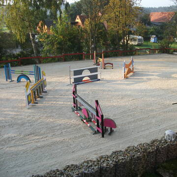
Offenstallplatz mit Reithalle
Lichtenau
Petra-Treiber
@Petra-Treiber
Freizeitstall
Vermieten
Longierzirkel/Roundpen
Reithalle
Offenstall
6 weitere...
P

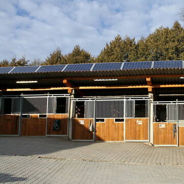
Reitanlage Rank, Pensionsstall, Offenstall
Ornbau
Puderrosa Ranch
@laurahorrolt
Freizeitstall
Vermieten
Führanlage
Hunde willkommen
Außenbox mit Paddock
Außenboxen
17 weitere...
P
Deprecated: Creation of dynamic property Zend_View_Helper_Ads::$adLink is deprecated in /var/www/stall-frei/htdocs/staging.stall-frei.de/library/Psf/View/Helper/Ads.php on line 108

Job gesucht?
Mechtersen
STALL-FREIde Marketing
@STALL-FREI-Marketing
Sie suchen einen Job und arbeiten gerne mit Pferden oder auf Reitanlagen?
Besuchen Sie jetzt unseren Stellenmarkt!

Enserhof
Weidenbach
Daniela Nick
@Daniela9
Freizeitstall
Pferdeausbildung
Vermieten
Hunde willkommen
Krankenbox
bedampftes/gewaschenes Heu
Hufrehe geeignet
13 weitere...
aktuell
P

Offenstall-Plätze in Gruppen oder eigene Gruppe
Lichtenau
PSG Rosenhof
@PSG_Rosenhof
Fahrstall, Kutschwagen
Freizeitstall
Verpachten
Hunde willkommen
Parkplatz für Pferdeanhänger
Hufrehe geeignet
Notfallboxen
12 weitere...
aktuell
P


Horses oasis of Well being❤️Liebe zu den Pferden...
Ellingen
Team TJ
@Horsesoasisofwellbeing
Freizeitstall
Geländestrecke
Vermieten
Hunde willkommen
Krankenbox
Allergikerstall
bedampftes/gewaschenes Heu
24 weitere...
P+
ab 1.3.26 1 Box frei !
Abenberg
Alexander-Urmoneit
@Alexander-Urmoneit
FN-Mitglied
Freizeitstall
Führanlage
Longierzirkel/Roundpen
Außenboxen
Offenstall
Vollpension
12 weitere...
ganz aktuell
P
Leider kein Vorschaubild
Leider kein Vorschaubild
Offenstallplatz frei
Abenberg
Alexa Braun
@Alexa-Braun
FN-Mitglied
Freizeitstall
Vermieten
Hunde willkommen
Krankenbox
Notfallboxen
18 weitere...
B
Pferdehof Arnold
Abenberg
Landwirtschaft-Arnold
@Landwirtschaft-Arnold
Hunde willkommen
Longierzirkel/Roundpen
Außenboxen
Innenbox
Vollpension
Einzelne Boxen oder Stallplätze
11 weitere...
P

Pferdepension Hit Aktivstall Kürmerhof
Hohenkammer
Kuermerhof
@Kuermerhof
*******JETZT NEU MIT ENTSTAUBTEM BIOHEU*********
*******Demnächst mit einem Abenteuerspielplatz für Pferde ( Extrem Trail/Pa
Leider kein Vorschaubild
Leider kein Vorschaubild
Offenstall sucht neuen Liebhber
Burgoberbach
Martin Dennhöfer
@Martin90
Freizeitstall
Verpachten
Hunde willkommen
Krankenbox
Allergikerstall
Fohlenaufzucht möglich
20 weitere...
B


Offenstallplatz in Vollpension
Weihenzell
Marie Popp
@MarieP
Freizeitstall
Hunde willkommen
Krankenbox
Hufrehe geeignet
Notfallboxen
Bewegungsstall
Laufstall
9 weitere...
P+
Deprecated: Creation of dynamic property Zend_View::$pageCount is deprecated in /var/www/stall-frei/htdocs/staging.stall-frei.de/library/vendor/shardj/zf1-future/library/Zend/View/Abstract.php on line 308
Deprecated: Creation of dynamic property Zend_View::$itemCountPerPage is deprecated in /var/www/stall-frei/htdocs/staging.stall-frei.de/library/vendor/shardj/zf1-future/library/Zend/View/Abstract.php on line 308
Deprecated: Creation of dynamic property Zend_View::$first is deprecated in /var/www/stall-frei/htdocs/staging.stall-frei.de/library/vendor/shardj/zf1-future/library/Zend/View/Abstract.php on line 308
Deprecated: Creation of dynamic property Zend_View::$current is deprecated in /var/www/stall-frei/htdocs/staging.stall-frei.de/library/vendor/shardj/zf1-future/library/Zend/View/Abstract.php on line 308
Deprecated: Creation of dynamic property Zend_View::$last is deprecated in /var/www/stall-frei/htdocs/staging.stall-frei.de/library/vendor/shardj/zf1-future/library/Zend/View/Abstract.php on line 308
Deprecated: Creation of dynamic property Zend_View::$next is deprecated in /var/www/stall-frei/htdocs/staging.stall-frei.de/library/vendor/shardj/zf1-future/library/Zend/View/Abstract.php on line 308
Deprecated: Creation of dynamic property Zend_View::$pagesInRange is deprecated in /var/www/stall-frei/htdocs/staging.stall-frei.de/library/vendor/shardj/zf1-future/library/Zend/View/Abstract.php on line 308
Deprecated: Creation of dynamic property Zend_View::$firstPageInRange is deprecated in /var/www/stall-frei/htdocs/staging.stall-frei.de/library/vendor/shardj/zf1-future/library/Zend/View/Abstract.php on line 308
Deprecated: Creation of dynamic property Zend_View::$lastPageInRange is deprecated in /var/www/stall-frei/htdocs/staging.stall-frei.de/library/vendor/shardj/zf1-future/library/Zend/View/Abstract.php on line 308
Deprecated: Creation of dynamic property Zend_View::$currentItemCount is deprecated in /var/www/stall-frei/htdocs/staging.stall-frei.de/library/vendor/shardj/zf1-future/library/Zend/View/Abstract.php on line 308
Deprecated: Creation of dynamic property Zend_View::$totalItemCount is deprecated in /var/www/stall-frei/htdocs/staging.stall-frei.de/library/vendor/shardj/zf1-future/library/Zend/View/Abstract.php on line 308
Deprecated: Creation of dynamic property Zend_View::$firstItemNumber is deprecated in /var/www/stall-frei/htdocs/staging.stall-frei.de/library/vendor/shardj/zf1-future/library/Zend/View/Abstract.php on line 308
Deprecated: Creation of dynamic property Zend_View::$lastItemNumber is deprecated in /var/www/stall-frei/htdocs/staging.stall-frei.de/library/vendor/shardj/zf1-future/library/Zend/View/Abstract.php on line 308
Deprecated: Creation of dynamic property Zend_View::$router is deprecated in /var/www/stall-frei/htdocs/staging.stall-frei.de/library/vendor/shardj/zf1-future/library/Zend/View/Abstract.php on line 308
Deprecated: Creation of dynamic property Zend_View::$urlParams is deprecated in /var/www/stall-frei/htdocs/staging.stall-frei.de/library/vendor/shardj/zf1-future/library/Zend/View/Abstract.php on line 308
Deprecated: Creation of dynamic property Zend_View::$showAds is deprecated in /var/www/stall-frei/htdocs/staging.stall-frei.de/library/vendor/shardj/zf1-future/library/Zend/View/Abstract.php on line 308
Deprecated: Creation of dynamic property Zend_View::$objectIds is deprecated in /var/www/stall-frei/htdocs/staging.stall-frei.de/library/vendor/shardj/zf1-future/library/Zend/View/Abstract.php on line 308
Deprecated: Creation of dynamic property Zend_View::$showNavbar is deprecated in /var/www/stall-frei/htdocs/staging.stall-frei.de/library/vendor/shardj/zf1-future/library/Zend/View/Abstract.php on line 308
Deprecated: Creation of dynamic property Zend_View::$showBreadcrumb is deprecated in /var/www/stall-frei/htdocs/staging.stall-frei.de/library/vendor/shardj/zf1-future/library/Zend/View/Abstract.php on line 308
Deprecated: Creation of dynamic property Zend_View::$showFooter is deprecated in /var/www/stall-frei/htdocs/staging.stall-frei.de/library/vendor/shardj/zf1-future/library/Zend/View/Abstract.php on line 308
Deprecated: Creation of dynamic property Zend_View::$showInternalAds is deprecated in /var/www/stall-frei/htdocs/staging.stall-frei.de/library/vendor/shardj/zf1-future/library/Zend/View/Abstract.php on line 308
Deprecated: Creation of dynamic property Zend_View::$blNoContent is deprecated in /var/www/stall-frei/htdocs/staging.stall-frei.de/library/vendor/shardj/zf1-future/library/Zend/View/Abstract.php on line 308
Deprecated: Creation of dynamic property Zend_View::$sMetaDesc is deprecated in /var/www/stall-frei/htdocs/staging.stall-frei.de/library/vendor/shardj/zf1-future/library/Zend/View/Abstract.php on line 308
Deprecated: Creation of dynamic property Zend_View::$useGmaps is deprecated in /var/www/stall-frei/htdocs/staging.stall-frei.de/library/vendor/shardj/zf1-future/library/Zend/View/Abstract.php on line 308
Deprecated: Creation of dynamic property Zend_View::$touches is deprecated in /var/www/stall-frei/htdocs/staging.stall-frei.de/library/vendor/shardj/zf1-future/library/Zend/View/Abstract.php on line 308
Deprecated: Creation of dynamic property Zend_View::$oProject is deprecated in /var/www/stall-frei/htdocs/staging.stall-frei.de/library/vendor/shardj/zf1-future/library/Zend/View/Abstract.php on line 308
Deprecated: Creation of dynamic property Zend_View::$pageHeadline is deprecated in /var/www/stall-frei/htdocs/staging.stall-frei.de/library/vendor/shardj/zf1-future/library/Zend/View/Abstract.php on line 308
Deprecated: Creation of dynamic property Zend_View::$disableLocationField is deprecated in /var/www/stall-frei/htdocs/staging.stall-frei.de/library/vendor/shardj/zf1-future/library/Zend/View/Abstract.php on line 308
Deprecated: Creation of dynamic property Zend_View::$isSearch is deprecated in /var/www/stall-frei/htdocs/staging.stall-frei.de/library/vendor/shardj/zf1-future/library/Zend/View/Abstract.php on line 308
Deprecated: Creation of dynamic property Zend_View::$pageTitle is deprecated in /var/www/stall-frei/htdocs/staging.stall-frei.de/library/vendor/shardj/zf1-future/library/Zend/View/Abstract.php on line 308
Deprecated: Creation of dynamic property Psf_Form_Element_Text::$class is deprecated in /var/www/stall-frei/htdocs/staging.stall-frei.de/library/vendor/shardj/zf1-future/library/Zend/Form/Element.php on line 874
Deprecated: Creation of dynamic property Psf_Form_Element_Text::$size is deprecated in /var/www/stall-frei/htdocs/staging.stall-frei.de/library/vendor/shardj/zf1-future/library/Zend/Form/Element.php on line 874
Deprecated: Creation of dynamic property Psf_Form_Element_Text::$placeholder is deprecated in /var/www/stall-frei/htdocs/staging.stall-frei.de/library/vendor/shardj/zf1-future/library/Zend/Form/Element.php on line 874
Deprecated: Creation of dynamic property Psf_Form_Element_Hidden::$class is deprecated in /var/www/stall-frei/htdocs/staging.stall-frei.de/library/vendor/shardj/zf1-future/library/Zend/Form/Element.php on line 874
Deprecated: Creation of dynamic property Psf_Form_Element_Hidden::$class is deprecated in /var/www/stall-frei/htdocs/staging.stall-frei.de/library/vendor/shardj/zf1-future/library/Zend/Form/Element.php on line 874
Deprecated: Creation of dynamic property Psf_Form_Element_Hidden::$class is deprecated in /var/www/stall-frei/htdocs/staging.stall-frei.de/library/vendor/shardj/zf1-future/library/Zend/Form/Element.php on line 874
Deprecated: Creation of dynamic property Psf_Form_Element_Hidden::$class is deprecated in /var/www/stall-frei/htdocs/staging.stall-frei.de/library/vendor/shardj/zf1-future/library/Zend/Form/Element.php on line 874
Deprecated: Creation of dynamic property Psf_Form_Element_Select::$class is deprecated in /var/www/stall-frei/htdocs/staging.stall-frei.de/library/vendor/shardj/zf1-future/library/Zend/Form/Element.php on line 874
Deprecated: Creation of dynamic property Psf_Form_Element_Select::$class is deprecated in /var/www/stall-frei/htdocs/staging.stall-frei.de/library/vendor/shardj/zf1-future/library/Zend/Form/Element.php on line 874
Deprecated: Creation of dynamic property Psf_Form_Element_Select::$class is deprecated in /var/www/stall-frei/htdocs/staging.stall-frei.de/library/vendor/shardj/zf1-future/library/Zend/Form/Element.php on line 874
Deprecated: Creation of dynamic property Psf_Form_Element_Select::$class is deprecated in /var/www/stall-frei/htdocs/staging.stall-frei.de/library/vendor/shardj/zf1-future/library/Zend/Form/Element.php on line 874
Deprecated: Creation of dynamic property Psf_Form_Element_Text::$class is deprecated in /var/www/stall-frei/htdocs/staging.stall-frei.de/library/vendor/shardj/zf1-future/library/Zend/Form/Element.php on line 874
Deprecated: Creation of dynamic property Psf_Form_Element_Checkbox::$label is deprecated in /var/www/stall-frei/htdocs/staging.stall-frei.de/library/vendor/shardj/zf1-future/library/Zend/Form/Element.php on line 874
Deprecated: Creation of dynamic property Zend_View::$sort is deprecated in /var/www/stall-frei/htdocs/staging.stall-frei.de/library/vendor/shardj/zf1-future/library/Zend/View/Abstract.php on line 308
Deprecated: Creation of dynamic property Zend_View::$searchLocation is deprecated in /var/www/stall-frei/htdocs/staging.stall-frei.de/library/vendor/shardj/zf1-future/library/Zend/View/Abstract.php on line 308
Deprecated: Creation of dynamic property Zend_View::$locationHint is deprecated in /var/www/stall-frei/htdocs/staging.stall-frei.de/library/vendor/shardj/zf1-future/library/Zend/View/Abstract.php on line 308
Psf_GeoCoder_Abstract::getLocation: Mönchsberg Get Location CachedOrLive
Psf_GeoCoder_Abstract::getCachedOrLive: Mönchsberg
Psf_GeoCoder_OpenCageData::makeApiRequest: response:
Array
(
[documentation] => https://opencagedata.com/api
[licenses] => Array
(
[0] => Array
(
[name] => see attribution guide
[url] => https://opencagedata.com/credits
)
)
[results] => Array
(
[0] => Array
(
[bounds] => Array
(
[northeast] => Array
(
[lat] => 49.1953446
[lng] => 10.7645129
)
[southwest] => Array
(
[lat] => 49.1952446
[lng] => 10.7644129
)
)
[components] => Array
(
[ISO_3166-1_alpha-2] => DE
[ISO_3166-1_alpha-3] => DEU
[ISO_3166-2] => Array
(
[0] => DE-BY
)
[_category] => natural/water
[_normalized_city] => Haundorf
[_type] => peak
[continent] => Europe
[country] => Deutschland
[country_code] => de
[county] => Landkreis Weißenburg-Gunzenhausen
[municipality] => Gunzenhausen (VGem)
[peak] => Mönchsberg
[political_union] => European Union
[postcode] => 91734
[state] => Bayern
[state_code] => BY
[village] => Haundorf
)
[confidence] => 9
[formatted] => Mönchsberg, 91734 Haundorf, Deutschland
[geometry] => Array
(
[lat] => 49.1952946
[lng] => 10.7644629
)
)
[1] => Array
(
[bounds] => Array
(
[northeast] => Array
(
[lat] => 50.3789099
[lng] => 11.2608716
)
[southwest] => Array
(
[lat] => 50.3389099
[lng] => 11.2208716
)
)
[components] => Array
(
[ISO_3166-1_alpha-2] => DE
[ISO_3166-1_alpha-3] => DEU
[ISO_3166-2] => Array
(
[0] => DE-TH
)
[_category] => place
[_normalized_city] => Föritztal
[_type] => village
[city] => Föritztal
[continent] => Europe
[country] => Deutschland
[country_code] => de
[county] => Landkreis Sonneberg
[political_union] => European Union
[postcode] => 96524
[state] => Thüringen
[state_code] => TH
[village] => Mönchsberg
)
[confidence] => 7
[formatted] => 96524 Mönchsberg, Deutschland
[geometry] => Array
(
[lat] => 50.3589099
[lng] => 11.2408716
)
)
[2] => Array
(
[bounds] => Array
(
[northeast] => Array
(
[lat] => 49.6690507
[lng] => 10.5850579
)
[southwest] => Array
(
[lat] => 49.6290507
[lng] => 10.5450579
)
)
[components] => Array
(
[ISO_3166-1_alpha-2] => DE
[ISO_3166-1_alpha-3] => DEU
[ISO_3166-2] => Array
(
[0] => DE-BY
)
[_category] => place
[_normalized_city] => Baudenbach
[_type] => village
[city] => Baudenbach
[continent] => Europe
[country] => Deutschland
[country_code] => de
[county] => Landkreis Neustadt an der Aisch-Bad Windsheim
[municipality] => Diespeck (VGem)
[political_union] => European Union
[postcode] => 91481
[state] => Bayern
[state_code] => BY
[village] => Mönchsberg
)
[confidence] => 7
[formatted] => 91481 Mönchsberg, Deutschland
[geometry] => Array
(
[lat] => 49.6490507
[lng] => 10.5650579
)
)
[3] => Array
(
[bounds] => Array
(
[northeast] => Array
(
[lat] => 50.18305
[lng] => 11.06276
)
[southwest] => Array
(
[lat] => 50.18295
[lng] => 11.06266
)
)
[components] => Array
(
[ISO_3166-1_alpha-2] => DE
[ISO_3166-1_alpha-3] => DEU
[ISO_3166-2] => Array
(
[0] => DE-BY
)
[_category] => natural/water
[_normalized_city] => Lichtenfels
[_type] => peak
[continent] => Europe
[country] => Deutschland
[country_code] => de
[county] => Landkreis Lichtenfels
[peak] => Mönchsberg
[political_union] => European Union
[postcode] => 96215
[state] => Bayern
[state_code] => BY
[town] => Lichtenfels
)
[confidence] => 9
[formatted] => Mönchsberg, 96215 Lichtenfels, Deutschland
[geometry] => Array
(
[lat] => 50.183
[lng] => 11.06271
)
)
[4] => Array
(
[bounds] => Array
(
[northeast] => Array
(
[lat] => 50.28579
[lng] => 10.21784
)
[southwest] => Array
(
[lat] => 50.28569
[lng] => 10.21774
)
)
[components] => Array
(
[ISO_3166-1_alpha-2] => DE
[ISO_3166-1_alpha-3] => DEU
[ISO_3166-2] => Array
(
[0] => DE-BY
)
[_category] => natural/water
[_normalized_city] => Strahlungen
[_type] => peak
[continent] => Europe
[country] => Deutschland
[country_code] => de
[county] => Landkreis Rhön-Grabfeld
[municipality] => Bad Neustadt an der Saale (VGem)
[peak] => Mönchsberg
[political_union] => European Union
[postcode] => 97702
[state] => Bayern
[state_code] => BY
[village] => Strahlungen
)
[confidence] => 9
[formatted] => Mönchsberg, 97702 Strahlungen, Deutschland
[geometry] => Array
(
[lat] => 50.28574
[lng] => 10.21779
)
)
[5] => Array
(
[bounds] => Array
(
[northeast] => Array
(
[lat] => 51.8496338
[lng] => 9.3196948
)
[southwest] => Array
(
[lat] => 51.8495338
[lng] => 9.3195948
)
)
[components] => Array
(
[ISO_3166-1_alpha-2] => DE
[ISO_3166-1_alpha-3] => DEU
[ISO_3166-2] => Array
(
[0] => DE-NW
)
[_category] => natural/water
[_normalized_city] => Höxter
[_type] => peak
[continent] => Europe
[country] => Deutschland
[country_code] => de
[county] => Kreis Höxter
[municipality] => Höxter
[peak] => Mönchsberg
[political_union] => European Union
[state] => Nordrhein-Westfalen
[state_code] => NW
)
[confidence] => 9
[formatted] => Mönchsberg, Höxter, Nordrhein-Westfalen, Deutschland
[geometry] => Array
(
[lat] => 51.8495838
[lng] => 9.3196448
)
)
[6] => Array
(
[bounds] => Array
(
[northeast] => Array
(
[lat] => 51.5784802
[lng] => 11.2936991
)
[southwest] => Array
(
[lat] => 51.5783802
[lng] => 11.2935991
)
)
[components] => Array
(
[ISO_3166-1_alpha-2] => DE
[ISO_3166-1_alpha-3] => DEU
[ISO_3166-2] => Array
(
[0] => DE-ST
)
[_category] => natural/water
[_normalized_city] => Mansfeld
[_type] => peak
[continent] => Europe
[country] => Deutschland
[country_code] => de
[county] => Mansfeld-Südharz
[peak] => Mönchsberg
[political_union] => European Union
[state] => Sachsen-Anhalt
[state_code] => ST
[town] => Mansfeld
)
[confidence] => 9
[formatted] => Mönchsberg, Mansfeld, Sachsen-Anhalt, Deutschland
[geometry] => Array
(
[lat] => 51.5784302
[lng] => 11.2936491
)
)
[7] => Array
(
[bounds] => Array
(
[northeast] => Array
(
[lat] => 49.6411605
[lng] => 10.1518594
)
[southwest] => Array
(
[lat] => 49.6410605
[lng] => 10.1517594
)
)
[components] => Array
(
[ISO_3166-1_alpha-2] => DE
[ISO_3166-1_alpha-3] => DEU
[ISO_3166-2] => Array
(
[0] => DE-BY
)
[_category] => natural/water
[_normalized_city] => Martinsheim
[_type] => peak
[continent] => Europe
[country] => Deutschland
[country_code] => de
[county] => Landkreis Kitzingen
[municipality] => Marktbreit (VGem)
[peak] => Mönchsberg
[political_union] => European Union
[postcode] => 97340
[state] => Bayern
[state_code] => BY
[village] => Martinsheim
)
[confidence] => 9
[formatted] => Mönchsberg, 97340 Martinsheim, Deutschland
[geometry] => Array
(
[lat] => 49.6411105
[lng] => 10.1518094
)
)
[8] => Array
(
[bounds] => Array
(
[northeast] => Array
(
[lat] => 51.1014446
[lng] => 10.2722713
)
[southwest] => Array
(
[lat] => 51.1013446
[lng] => 10.2721713
)
)
[components] => Array
(
[ISO_3166-1_alpha-2] => DE
[ISO_3166-1_alpha-3] => DEU
[ISO_3166-2] => Array
(
[0] => DE-TH
)
[_category] => natural/water
[_normalized_city] => Amt Creuzburg
[_type] => peak
[continent] => Europe
[country] => Deutschland
[country_code] => de
[county] => Wartburgkreis
[municipality] => Amt Creuzburg
[peak] => Mönchsberg
[political_union] => European Union
[postcode] => 99831
[state] => Thüringen
[state_code] => TH
)
[confidence] => 9
[formatted] => Mönchsberg, 99831 Amt Creuzburg, Deutschland
[geometry] => Array
(
[lat] => 51.1013946
[lng] => 10.2722213
)
)
[9] => Array
(
[bounds] => Array
(
[northeast] => Array
(
[lat] => 50.3615052
[lng] => 11.2373925
)
[southwest] => Array
(
[lat] => 50.3614052
[lng] => 11.2372925
)
)
[components] => Array
(
[ISO_3166-1_alpha-2] => DE
[ISO_3166-1_alpha-3] => DEU
[ISO_3166-2] => Array
(
[0] => DE-TH
)
[_category] => natural/water
[_normalized_city] => Föritztal
[_type] => peak
[city] => Föritztal
[continent] => Europe
[country] => Deutschland
[country_code] => de
[county] => Landkreis Sonneberg
[peak] => Mönchsberg
[political_union] => European Union
[postcode] => 96524
[state] => Thüringen
[state_code] => TH
)
[confidence] => 9
[formatted] => Mönchsberg, 96524 Föritztal, Deutschland
[geometry] => Array
(
[lat] => 50.3614552
[lng] => 11.2373425
)
)
)
[status] => Array
(
[code] => 200
[message] => OK
)
[stay_informed] => Array
(
[blog] => https://blog.opencagedata.com
[mastodon] => https://en.osm.town/@opencage
)
[thanks] => For using an OpenCage API
[timestamp] => Array
(
[created_http] => Sun, 08 Feb 2026 15:34:44 GMT
[created_unix] => 1770564884
)
[total_results] => 10
)
Psf_GeoCoder_Abstract::convertLocationResult
{"documentation":"https:\/\/opencagedata.com\/api","licenses":[{"name":"see attribution guide","url":"https:\/\/opencagedata.com\/credits"}],"results":[{"bounds":{"northeast":{"lat":49.1953446,"lng":10.7645129},"southwest":{"lat":49.1952446,"lng":10.7644129}},"components":{"ISO_3166-1_alpha-2":"DE","ISO_3166-1_alpha-3":"DEU","ISO_3166-2":["DE-BY"],"_category":"natural\/water","_normalized_city":"Haundorf","_type":"peak","continent":"Europe","country":"Deutschland","country_code":"de","county":"Landkreis Wei\u00dfenburg-Gunzenhausen","municipality":"Gunzenhausen (VGem)","peak":"M\u00f6nchsberg","political_union":"European Union","postcode":"91734","state":"Bayern","state_code":"BY","village":"Haundorf"},"confidence":9,"formatted":"M\u00f6nchsberg, 91734 Haundorf, Deutschland","geometry":{"lat":49.1952946,"lng":10.7644629}},{"bounds":{"northeast":{"lat":50.3789099,"lng":11.2608716},"southwest":{"lat":50.3389099,"lng":11.2208716}},"components":{"ISO_3166-1_alpha-2":"DE","ISO_3166-1_alpha-3":"DEU","ISO_3166-2":["DE-TH"],"_category":"place","_normalized_city":"F\u00f6ritztal","_type":"village","city":"F\u00f6ritztal","continent":"Europe","country":"Deutschland","country_code":"de","county":"Landkreis Sonneberg","political_union":"European Union","postcode":"96524","state":"Th\u00fcringen","state_code":"TH","village":"M\u00f6nchsberg"},"confidence":7,"formatted":"96524 M\u00f6nchsberg, Deutschland","geometry":{"lat":50.3589099,"lng":11.2408716}},{"bounds":{"northeast":{"lat":49.6690507,"lng":10.5850579},"southwest":{"lat":49.6290507,"lng":10.5450579}},"components":{"ISO_3166-1_alpha-2":"DE","ISO_3166-1_alpha-3":"DEU","ISO_3166-2":["DE-BY"],"_category":"place","_normalized_city":"Baudenbach","_type":"village","city":"Baudenbach","continent":"Europe","country":"Deutschland","country_code":"de","county":"Landkreis Neustadt an der Aisch-Bad Windsheim","municipality":"Diespeck (VGem)","political_union":"European Union","postcode":"91481","state":"Bayern","state_code":"BY","village":"M\u00f6nchsberg"},"confidence":7,"formatted":"91481 M\u00f6nchsberg, Deutschland","geometry":{"lat":49.6490507,"lng":10.5650579}},{"bounds":{"northeast":{"lat":50.18305,"lng":11.06276},"southwest":{"lat":50.18295,"lng":11.06266}},"components":{"ISO_3166-1_alpha-2":"DE","ISO_3166-1_alpha-3":"DEU","ISO_3166-2":["DE-BY"],"_category":"natural\/water","_normalized_city":"Lichtenfels","_type":"peak","continent":"Europe","country":"Deutschland","country_code":"de","county":"Landkreis Lichtenfels","peak":"M\u00f6nchsberg","political_union":"European Union","postcode":"96215","state":"Bayern","state_code":"BY","town":"Lichtenfels"},"confidence":9,"formatted":"M\u00f6nchsberg, 96215 Lichtenfels, Deutschland","geometry":{"lat":50.183,"lng":11.06271}},{"bounds":{"northeast":{"lat":50.28579,"lng":10.21784},"southwest":{"lat":50.28569,"lng":10.21774}},"components":{"ISO_3166-1_alpha-2":"DE","ISO_3166-1_alpha-3":"DEU","ISO_3166-2":["DE-BY"],"_category":"natural\/water","_normalized_city":"Strahlungen","_type":"peak","continent":"Europe","country":"Deutschland","country_code":"de","county":"Landkreis Rh\u00f6n-Grabfeld","municipality":"Bad Neustadt an der Saale (VGem)","peak":"M\u00f6nchsberg","political_union":"European Union","postcode":"97702","state":"Bayern","state_code":"BY","village":"Strahlungen"},"confidence":9,"formatted":"M\u00f6nchsberg, 97702 Strahlungen, Deutschland","geometry":{"lat":50.28574,"lng":10.21779}},{"bounds":{"northeast":{"lat":51.8496338,"lng":9.3196948},"southwest":{"lat":51.8495338,"lng":9.3195948}},"components":{"ISO_3166-1_alpha-2":"DE","ISO_3166-1_alpha-3":"DEU","ISO_3166-2":["DE-NW"],"_category":"natural\/water","_normalized_city":"H\u00f6xter","_type":"peak","continent":"Europe","country":"Deutschland","country_code":"de","county":"Kreis H\u00f6xter","municipality":"H\u00f6xter","peak":"M\u00f6nchsberg","political_union":"European Union","state":"Nordrhein-Westfalen","state_code":"NW"},"confidence":9,"formatted":"M\u00f6nchsberg, H\u00f6xter, Nordrhein-Westfalen, Deutschland","geometry":{"lat":51.8495838,"lng":9.3196448}},{"bounds":{"northeast":{"lat":51.5784802,"lng":11.2936991},"southwest":{"lat":51.5783802,"lng":11.2935991}},"components":{"ISO_3166-1_alpha-2":"DE","ISO_3166-1_alpha-3":"DEU","ISO_3166-2":["DE-ST"],"_category":"natural\/water","_normalized_city":"Mansfeld","_type":"peak","continent":"Europe","country":"Deutschland","country_code":"de","county":"Mansfeld-S\u00fcdharz","peak":"M\u00f6nchsberg","political_union":"European Union","state":"Sachsen-Anhalt","state_code":"ST","town":"Mansfeld"},"confidence":9,"formatted":"M\u00f6nchsberg, Mansfeld, Sachsen-Anhalt, Deutschland","geometry":{"lat":51.5784302,"lng":11.2936491}},{"bounds":{"northeast":{"lat":49.6411605,"lng":10.1518594},"southwest":{"lat":49.6410605,"lng":10.1517594}},"components":{"ISO_3166-1_alpha-2":"DE","ISO_3166-1_alpha-3":"DEU","ISO_3166-2":["DE-BY"],"_category":"natural\/water","_normalized_city":"Martinsheim","_type":"peak","continent":"Europe","country":"Deutschland","country_code":"de","county":"Landkreis Kitzingen","municipality":"Marktbreit (VGem)","peak":"M\u00f6nchsberg","political_union":"European Union","postcode":"97340","state":"Bayern","state_code":"BY","village":"Martinsheim"},"confidence":9,"formatted":"M\u00f6nchsberg, 97340 Martinsheim, Deutschland","geometry":{"lat":49.6411105,"lng":10.1518094}},{"bounds":{"northeast":{"lat":51.1014446,"lng":10.2722713},"southwest":{"lat":51.1013446,"lng":10.2721713}},"components":{"ISO_3166-1_alpha-2":"DE","ISO_3166-1_alpha-3":"DEU","ISO_3166-2":["DE-TH"],"_category":"natural\/water","_normalized_city":"Amt Creuzburg","_type":"peak","continent":"Europe","country":"Deutschland","country_code":"de","county":"Wartburgkreis","municipality":"Amt Creuzburg","peak":"M\u00f6nchsberg","political_union":"European Union","postcode":"99831","state":"Th\u00fcringen","state_code":"TH"},"confidence":9,"formatted":"M\u00f6nchsberg, 99831 Amt Creuzburg, Deutschland","geometry":{"lat":51.1013946,"lng":10.2722213}},{"bounds":{"northeast":{"lat":50.3615052,"lng":11.2373925},"southwest":{"lat":50.3614052,"lng":11.2372925}},"components":{"ISO_3166-1_alpha-2":"DE","ISO_3166-1_alpha-3":"DEU","ISO_3166-2":["DE-TH"],"_category":"natural\/water","_normalized_city":"F\u00f6ritztal","_type":"peak","city":"F\u00f6ritztal","continent":"Europe","country":"Deutschland","country_code":"de","county":"Landkreis Sonneberg","peak":"M\u00f6nchsberg","political_union":"European Union","postcode":"96524","state":"Th\u00fcringen","state_code":"TH"},"confidence":9,"formatted":"M\u00f6nchsberg, 96524 F\u00f6ritztal, Deutschland","geometry":{"lat":50.3614552,"lng":11.2373425}}],"status":{"code":200,"message":"OK"},"stay_informed":{"blog":"https:\/\/blog.opencagedata.com","mastodon":"https:\/\/en.osm.town\/@opencage"},"thanks":"For using an OpenCage API","timestamp":{"created_http":"Sun, 08 Feb 2026 15:34:44 GMT","created_unix":1770564884},"total_results":10}Array
(
[0] => stdClass Object
(
[bounds] => stdClass Object
(
[northeast] => stdClass Object
(
[lat] => 49.1953446
[lng] => 10.7645129
)
[southwest] => stdClass Object
(
[lat] => 49.1952446
[lng] => 10.7644129
)
)
[components] => stdClass Object
(
[ISO_3166-1_alpha-2] => DE
[ISO_3166-1_alpha-3] => DEU
[ISO_3166-2] => Array
(
[0] => DE-BY
)
[_category] => natural/water
[_normalized_city] => Haundorf
[_type] => peak
[continent] => Europe
[country] => Deutschland
[country_code] => de
[county] => Landkreis Weißenburg-Gunzenhausen
[municipality] => Gunzenhausen (VGem)
[peak] => Mönchsberg
[political_union] => European Union
[postcode] => 91734
[state] => Bayern
[state_code] => BY
[village] => Haundorf
)
[confidence] => 9
[formatted] => Mönchsberg, 91734 Haundorf, Deutschland
[geometry] => stdClass Object
(
[lat] => 49.1952946
[lng] => 10.7644629
)
)
[1] => stdClass Object
(
[bounds] => stdClass Object
(
[northeast] => stdClass Object
(
[lat] => 50.3789099
[lng] => 11.2608716
)
[southwest] => stdClass Object
(
[lat] => 50.3389099
[lng] => 11.2208716
)
)
[components] => stdClass Object
(
[ISO_3166-1_alpha-2] => DE
[ISO_3166-1_alpha-3] => DEU
[ISO_3166-2] => Array
(
[0] => DE-TH
)
[_category] => place
[_normalized_city] => Föritztal
[_type] => village
[city] => Föritztal
[continent] => Europe
[country] => Deutschland
[country_code] => de
[county] => Landkreis Sonneberg
[political_union] => European Union
[postcode] => 96524
[state] => Thüringen
[state_code] => TH
[village] => Mönchsberg
)
[confidence] => 7
[formatted] => 96524 Mönchsberg, Deutschland
[geometry] => stdClass Object
(
[lat] => 50.3589099
[lng] => 11.2408716
)
)
[2] => stdClass Object
(
[bounds] => stdClass Object
(
[northeast] => stdClass Object
(
[lat] => 49.6690507
[lng] => 10.5850579
)
[southwest] => stdClass Object
(
[lat] => 49.6290507
[lng] => 10.5450579
)
)
[components] => stdClass Object
(
[ISO_3166-1_alpha-2] => DE
[ISO_3166-1_alpha-3] => DEU
[ISO_3166-2] => Array
(
[0] => DE-BY
)
[_category] => place
[_normalized_city] => Baudenbach
[_type] => village
[city] => Baudenbach
[continent] => Europe
[country] => Deutschland
[country_code] => de
[county] => Landkreis Neustadt an der Aisch-Bad Windsheim
[municipality] => Diespeck (VGem)
[political_union] => European Union
[postcode] => 91481
[state] => Bayern
[state_code] => BY
[village] => Mönchsberg
)
[confidence] => 7
[formatted] => 91481 Mönchsberg, Deutschland
[geometry] => stdClass Object
(
[lat] => 49.6490507
[lng] => 10.5650579
)
)
[3] => stdClass Object
(
[bounds] => stdClass Object
(
[northeast] => stdClass Object
(
[lat] => 50.18305
[lng] => 11.06276
)
[southwest] => stdClass Object
(
[lat] => 50.18295
[lng] => 11.06266
)
)
[components] => stdClass Object
(
[ISO_3166-1_alpha-2] => DE
[ISO_3166-1_alpha-3] => DEU
[ISO_3166-2] => Array
(
[0] => DE-BY
)
[_category] => natural/water
[_normalized_city] => Lichtenfels
[_type] => peak
[continent] => Europe
[country] => Deutschland
[country_code] => de
[county] => Landkreis Lichtenfels
[peak] => Mönchsberg
[political_union] => European Union
[postcode] => 96215
[state] => Bayern
[state_code] => BY
[town] => Lichtenfels
)
[confidence] => 9
[formatted] => Mönchsberg, 96215 Lichtenfels, Deutschland
[geometry] => stdClass Object
(
[lat] => 50.183
[lng] => 11.06271
)
)
[4] => stdClass Object
(
[bounds] => stdClass Object
(
[northeast] => stdClass Object
(
[lat] => 50.28579
[lng] => 10.21784
)
[southwest] => stdClass Object
(
[lat] => 50.28569
[lng] => 10.21774
)
)
[components] => stdClass Object
(
[ISO_3166-1_alpha-2] => DE
[ISO_3166-1_alpha-3] => DEU
[ISO_3166-2] => Array
(
[0] => DE-BY
)
[_category] => natural/water
[_normalized_city] => Strahlungen
[_type] => peak
[continent] => Europe
[country] => Deutschland
[country_code] => de
[county] => Landkreis Rhön-Grabfeld
[municipality] => Bad Neustadt an der Saale (VGem)
[peak] => Mönchsberg
[political_union] => European Union
[postcode] => 97702
[state] => Bayern
[state_code] => BY
[village] => Strahlungen
)
[confidence] => 9
[formatted] => Mönchsberg, 97702 Strahlungen, Deutschland
[geometry] => stdClass Object
(
[lat] => 50.28574
[lng] => 10.21779
)
)
[5] => stdClass Object
(
[bounds] => stdClass Object
(
[northeast] => stdClass Object
(
[lat] => 51.8496338
[lng] => 9.3196948
)
[southwest] => stdClass Object
(
[lat] => 51.8495338
[lng] => 9.3195948
)
)
[components] => stdClass Object
(
[ISO_3166-1_alpha-2] => DE
[ISO_3166-1_alpha-3] => DEU
[ISO_3166-2] => Array
(
[0] => DE-NW
)
[_category] => natural/water
[_normalized_city] => Höxter
[_type] => peak
[continent] => Europe
[country] => Deutschland
[country_code] => de
[county] => Kreis Höxter
[municipality] => Höxter
[peak] => Mönchsberg
[political_union] => European Union
[state] => Nordrhein-Westfalen
[state_code] => NW
)
[confidence] => 9
[formatted] => Mönchsberg, Höxter, Nordrhein-Westfalen, Deutschland
[geometry] => stdClass Object
(
[lat] => 51.8495838
[lng] => 9.3196448
)
)
[6] => stdClass Object
(
[bounds] => stdClass Object
(
[northeast] => stdClass Object
(
[lat] => 51.5784802
[lng] => 11.2936991
)
[southwest] => stdClass Object
(
[lat] => 51.5783802
[lng] => 11.2935991
)
)
[components] => stdClass Object
(
[ISO_3166-1_alpha-2] => DE
[ISO_3166-1_alpha-3] => DEU
[ISO_3166-2] => Array
(
[0] => DE-ST
)
[_category] => natural/water
[_normalized_city] => Mansfeld
[_type] => peak
[continent] => Europe
[country] => Deutschland
[country_code] => de
[county] => Mansfeld-Südharz
[peak] => Mönchsberg
[political_union] => European Union
[state] => Sachsen-Anhalt
[state_code] => ST
[town] => Mansfeld
)
[confidence] => 9
[formatted] => Mönchsberg, Mansfeld, Sachsen-Anhalt, Deutschland
[geometry] => stdClass Object
(
[lat] => 51.5784302
[lng] => 11.2936491
)
)
[7] => stdClass Object
(
[bounds] => stdClass Object
(
[northeast] => stdClass Object
(
[lat] => 49.6411605
[lng] => 10.1518594
)
[southwest] => stdClass Object
(
[lat] => 49.6410605
[lng] => 10.1517594
)
)
[components] => stdClass Object
(
[ISO_3166-1_alpha-2] => DE
[ISO_3166-1_alpha-3] => DEU
[ISO_3166-2] => Array
(
[0] => DE-BY
)
[_category] => natural/water
[_normalized_city] => Martinsheim
[_type] => peak
[continent] => Europe
[country] => Deutschland
[country_code] => de
[county] => Landkreis Kitzingen
[municipality] => Marktbreit (VGem)
[peak] => Mönchsberg
[political_union] => European Union
[postcode] => 97340
[state] => Bayern
[state_code] => BY
[village] => Martinsheim
)
[confidence] => 9
[formatted] => Mönchsberg, 97340 Martinsheim, Deutschland
[geometry] => stdClass Object
(
[lat] => 49.6411105
[lng] => 10.1518094
)
)
[8] => stdClass Object
(
[bounds] => stdClass Object
(
[northeast] => stdClass Object
(
[lat] => 51.1014446
[lng] => 10.2722713
)
[southwest] => stdClass Object
(
[lat] => 51.1013446
[lng] => 10.2721713
)
)
[components] => stdClass Object
(
[ISO_3166-1_alpha-2] => DE
[ISO_3166-1_alpha-3] => DEU
[ISO_3166-2] => Array
(
[0] => DE-TH
)
[_category] => natural/water
[_normalized_city] => Amt Creuzburg
[_type] => peak
[continent] => Europe
[country] => Deutschland
[country_code] => de
[county] => Wartburgkreis
[municipality] => Amt Creuzburg
[peak] => Mönchsberg
[political_union] => European Union
[postcode] => 99831
[state] => Thüringen
[state_code] => TH
)
[confidence] => 9
[formatted] => Mönchsberg, 99831 Amt Creuzburg, Deutschland
[geometry] => stdClass Object
(
[lat] => 51.1013946
[lng] => 10.2722213
)
)
[9] => stdClass Object
(
[bounds] => stdClass Object
(
[northeast] => stdClass Object
(
[lat] => 50.3615052
[lng] => 11.2373925
)
[southwest] => stdClass Object
(
[lat] => 50.3614052
[lng] => 11.2372925
)
)
[components] => stdClass Object
(
[ISO_3166-1_alpha-2] => DE
[ISO_3166-1_alpha-3] => DEU
[ISO_3166-2] => Array
(
[0] => DE-TH
)
[_category] => natural/water
[_normalized_city] => Föritztal
[_type] => peak
[city] => Föritztal
[continent] => Europe
[country] => Deutschland
[country_code] => de
[county] => Landkreis Sonneberg
[peak] => Mönchsberg
[political_union] => European Union
[postcode] => 96524
[state] => Thüringen
[state_code] => TH
)
[confidence] => 9
[formatted] => Mönchsberg, 96524 Föritztal, Deutschland
[geometry] => stdClass Object
(
[lat] => 50.3614552
[lng] => 11.2373425
)
)
)
Psf_GeoCoder_OpenCageData::getKeyMap: 0
stdClass Object
(
    [bounds] => stdClass Object
        (
            [northeast] => stdClass Object
                (
                    [lat] => 49.1953446
                    [lng] => 10.7645129
                )

            [southwest] => stdClass Object
                (
                    [lat] => 49.1952446
                    [lng] => 10.7644129
                )

        )

    [components] => stdClass Object
        (
            [ISO_3166-1_alpha-2] => DE
            [ISO_3166-1_alpha-3] => DEU
            [ISO_3166-2] => Array
                (
                    [0] => DE-BY
                )

            [_category] => natural/water
            [_normalized_city] => Haundorf
            [_type] => peak
            [continent] => Europe
            [country] => Deutschland
            [country_code] => de
            [county] => Landkreis Weißenburg-Gunzenhausen
            [municipality] => Gunzenhausen (VGem)
            [peak] => Mönchsberg
            [political_union] => European Union
            [postcode] => 91734
            [state] => Bayern
            [state_code] => BY
            [village] => Haundorf
        )

    [confidence] => 9
    [formatted] => Mönchsberg, 91734 Haundorf, Deutschland
    [geometry] => stdClass Object
        (
            [lat] => 49.1952946
            [lng] => 10.7644629
        )

)
Psf_GeoCoder_OpenCageData::getCounty: Weißenburg-Gunzenhausen
Psf_GeoCoder_OpenCageData::addMissingData REFETCH!
Array
(
    [address] => Mönchsberg, 91734 Haundorf, Deutschland
    [type] => peak
    [street] =>
    [city] => Haundorf
    [county] => Weißenburg-Gunzenhausen
    [state] => Bayern
    [zip] => 91734
    [country] => Deutschland
    [suburb] =>
    [countrycode] => de
    [latitude] => 49.1952946
    [longitude] => 10.7644629
    [accuracy] => 1
    [confidence] => 9
    [bounds] => stdClass Object
        (
            [northeast] => stdClass Object
                (
                    [lat] => 49.1953446
                    [lng] => 10.7645129
                )

            [southwest] => stdClass Object
                (
                    [lat] => 49.1952446
                    [lng] => 10.7644129
                )

        )

)
reformat!
Array
(
    [address] => Mönchsberg, 91734 Haundorf, Deutschland
    [type] => peak
    [street] =>
    [city] => Haundorf
    [county] => Weißenburg-Gunzenhausen
    [state] => Bayern
    [zip] => 91734
    [country] => Deutschland
    [suburb] =>
    [countrycode] => de
    [latitude] => 49.1952946
    [longitude] => 10.7644629
    [accuracy] => 1
    [confidence] => 9
    [bounds] => stdClass Object
        (
            [northeast] => stdClass Object
                (
                    [lat] => 49.1953446
                    [lng] => 10.7645129
                )

            [southwest] => stdClass Object
                (
                    [lat] => 49.1952446
                    [lng] => 10.7644129
                )

        )

    [place] => 91734 Haundorf, Bayern
    [hash] => cc993c09f08a297ecaef11041e4f7383
)
Psf_GeoCoder_OpenCageData::getKeyMap: 1
stdClass Object
(
    [bounds] => stdClass Object
        (
            [northeast] => stdClass Object
                (
                    [lat] => 50.3789099
                    [lng] => 11.2608716
                )

            [southwest] => stdClass Object
                (
                    [lat] => 50.3389099
                    [lng] => 11.2208716
                )

        )

    [components] => stdClass Object
        (
            [ISO_3166-1_alpha-2] => DE
            [ISO_3166-1_alpha-3] => DEU
            [ISO_3166-2] => Array
                (
                    [0] => DE-TH
                )

            [_category] => place
            [_normalized_city] => Föritztal
            [_type] => village
            [city] => Föritztal
            [continent] => Europe
            [country] => Deutschland
            [country_code] => de
            [county] => Landkreis Sonneberg
            [political_union] => European Union
            [postcode] => 96524
            [state] => Thüringen
            [state_code] => TH
            [village] => Mönchsberg
        )

    [confidence] => 7
    [formatted] => 96524 Mönchsberg, Deutschland
    [geometry] => stdClass Object
        (
            [lat] => 50.3589099
            [lng] => 11.2408716
        )

)
Psf_GeoCoder_OpenCageData::getCounty: Sonneberg
Psf_GeoCoder_OpenCageData::addMissingData REFETCH!
Array
(
    [address] => 96524 Mönchsberg, Deutschland
    [type] => village
    [street] =>
    [city] => Mönchsberg
    [county] => Sonneberg
    [state] => Thüringen
    [zip] => 96524
    [country] => Deutschland
    [suburb] =>
    [countrycode] => de
    [latitude] => 50.3589099
    [longitude] => 11.2408716
    [accuracy] => 1
    [confidence] => 7
    [bounds] => stdClass Object
        (
            [northeast] => stdClass Object
                (
                    [lat] => 50.3789099
                    [lng] => 11.2608716
                )

            [southwest] => stdClass Object
                (
                    [lat] => 50.3389099
                    [lng] => 11.2208716
                )

        )

)
reformat!
Array
(
    [address] => 96524 Mönchsberg, Deutschland
    [type] => village
    [street] =>
    [city] => Mönchsberg
    [county] => Sonneberg
    [state] => Thüringen
    [zip] => 96524
    [country] => Deutschland
    [suburb] =>
    [countrycode] => de
    [latitude] => 50.3589099
    [longitude] => 11.2408716
    [accuracy] => 1
    [confidence] => 7
    [bounds] => stdClass Object
        (
            [northeast] => stdClass Object
                (
                    [lat] => 50.3789099
                    [lng] => 11.2608716
                )

            [southwest] => stdClass Object
                (
                    [lat] => 50.3389099
                    [lng] => 11.2208716
                )

        )

    [place] => 96524 Mönchsberg, Thüringen
    [hash] => 52993682d643c5b8204b880900bb3f48
)
Psf_GeoCoder_OpenCageData::getKeyMap: 2
stdClass Object
(
    [bounds] => stdClass Object
        (
            [northeast] => stdClass Object
                (
                    [lat] => 49.6690507
                    [lng] => 10.5850579
                )

            [southwest] => stdClass Object
                (
                    [lat] => 49.6290507
                    [lng] => 10.5450579
                )

        )

    [components] => stdClass Object
        (
            [ISO_3166-1_alpha-2] => DE
            [ISO_3166-1_alpha-3] => DEU
            [ISO_3166-2] => Array
                (
                    [0] => DE-BY
                )

            [_category] => place
            [_normalized_city] => Baudenbach
            [_type] => village
            [city] => Baudenbach
            [continent] => Europe
            [country] => Deutschland
            [country_code] => de
            [county] => Landkreis Neustadt an der Aisch-Bad Windsheim
            [municipality] => Diespeck (VGem)
            [political_union] => European Union
            [postcode] => 91481
            [state] => Bayern
            [state_code] => BY
            [village] => Mönchsberg
        )

    [confidence] => 7
    [formatted] => 91481 Mönchsberg, Deutschland
    [geometry] => stdClass Object
        (
            [lat] => 49.6490507
            [lng] => 10.5650579
        )

)
Psf_GeoCoder_OpenCageData::getCounty: Neustadt an der Aisch-Bad Windsheim
Psf_GeoCoder_OpenCageData::addMissingData REFETCH!
Array
(
    [address] => 91481 Mönchsberg, Deutschland
    [type] => village
    [street] =>
    [city] => Mönchsberg
    [county] => Neustadt an der Aisch-Bad Windsheim
    [state] => Bayern
    [zip] => 91481
    [country] => Deutschland
    [suburb] =>
    [countrycode] => de
    [latitude] => 49.6490507
    [longitude] => 10.5650579
    [accuracy] => 1
    [confidence] => 7
    [bounds] => stdClass Object
        (
            [northeast] => stdClass Object
                (
                    [lat] => 49.6690507
                    [lng] => 10.5850579
                )

            [southwest] => stdClass Object
                (
                    [lat] => 49.6290507
                    [lng] => 10.5450579
                )

        )

)
reformat!
Array
(
    [address] => 91481 Mönchsberg, Deutschland
    [type] => village
    [street] =>
    [city] => Mönchsberg
    [county] => Neustadt an der Aisch-Bad Windsheim
    [state] => Bayern
    [zip] => 91481
    [country] => Deutschland
    [suburb] =>
    [countrycode] => de
    [latitude] => 49.6490507
    [longitude] => 10.5650579
    [accuracy] => 1
    [confidence] => 7
    [bounds] => stdClass Object
        (
            [northeast] => stdClass Object
                (
                    [lat] => 49.6690507
                    [lng] => 10.5850579
                )

            [southwest] => stdClass Object
                (
                    [lat] => 49.6290507
                    [lng] => 10.5450579
                )

        )

    [place] => 91481 Mönchsberg, Bayern
    [hash] => f3727979797d6b215c25f1a2b875e40b
)
Psf_GeoCoder_OpenCageData::getKeyMap: 3
stdClass Object
(
    [bounds] => stdClass Object
        (
            [northeast] => stdClass Object
                (
                    [lat] => 50.18305
                    [lng] => 11.06276
                )

            [southwest] => stdClass Object
                (
                    [lat] => 50.18295
                    [lng] => 11.06266
                )

        )

    [components] => stdClass Object
        (
            [ISO_3166-1_alpha-2] => DE
            [ISO_3166-1_alpha-3] => DEU
            [ISO_3166-2] => Array
                (
                    [0] => DE-BY
                )

            [_category] => natural/water
            [_normalized_city] => Lichtenfels
            [_type] => peak
            [continent] => Europe
            [country] => Deutschland
            [country_code] => de
            [county] => Landkreis Lichtenfels
            [peak] => Mönchsberg
            [political_union] => European Union
            [postcode] => 96215
            [state] => Bayern
            [state_code] => BY
            [town] => Lichtenfels
        )

    [confidence] => 9
    [formatted] => Mönchsberg, 96215 Lichtenfels, Deutschland
    [geometry] => stdClass Object
        (
            [lat] => 50.183
            [lng] => 11.06271
        )

)
Psf_GeoCoder_OpenCageData::getCounty: Lichtenfels
Psf_GeoCoder_OpenCageData::addMissingData REFETCH!
Array
(
    [address] => Mönchsberg, 96215 Lichtenfels, Deutschland
    [type] => peak
    [street] =>
    [city] => Lichtenfels
    [county] => Lichtenfels
    [state] => Bayern
    [zip] => 96215
    [country] => Deutschland
    [suburb] =>
    [countrycode] => de
    [latitude] => 50.183
    [longitude] => 11.06271
    [accuracy] => 1
    [confidence] => 9
    [bounds] => stdClass Object
        (
            [northeast] => stdClass Object
                (
                    [lat] => 50.18305
                    [lng] => 11.06276
                )

            [southwest] => stdClass Object
                (
                    [lat] => 50.18295
                    [lng] => 11.06266
                )

        )

)
reformat!
Array
(
    [address] => Mönchsberg, 96215 Lichtenfels, Deutschland
    [type] => peak
    [street] =>
    [city] => Lichtenfels
    [county] => Lichtenfels
    [state] => Bayern
    [zip] => 96215
    [country] => Deutschland
    [suburb] =>
    [countrycode] => de
    [latitude] => 50.183
    [longitude] => 11.06271
    [accuracy] => 1
    [confidence] => 9
    [bounds] => stdClass Object
        (
            [northeast] => stdClass Object
                (
                    [lat] => 50.18305
                    [lng] => 11.06276
                )

            [southwest] => stdClass Object
                (
                    [lat] => 50.18295
                    [lng] => 11.06266
                )

        )

    [place] => 96215 Lichtenfels, Bayern
    [hash] => a3c2ce37faa73be70208c2d9336de768
)
Psf_GeoCoder_OpenCageData::getKeyMap: 4
stdClass Object
(
    [bounds] => stdClass Object
        (
            [northeast] => stdClass Object
                (
                    [lat] => 50.28579
                    [lng] => 10.21784
                )

            [southwest] => stdClass Object
                (
                    [lat] => 50.28569
                    [lng] => 10.21774
                )

        )

    [components] => stdClass Object
        (
            [ISO_3166-1_alpha-2] => DE
            [ISO_3166-1_alpha-3] => DEU
            [ISO_3166-2] => Array
                (
                    [0] => DE-BY
                )

            [_category] => natural/water
            [_normalized_city] => Strahlungen
            [_type] => peak
            [continent] => Europe
            [country] => Deutschland
            [country_code] => de
            [county] => Landkreis Rhön-Grabfeld
            [municipality] => Bad Neustadt an der Saale (VGem)
            [peak] => Mönchsberg
            [political_union] => European Union
            [postcode] => 97702
            [state] => Bayern
            [state_code] => BY
            [village] => Strahlungen
        )

    [confidence] => 9
    [formatted] => Mönchsberg, 97702 Strahlungen, Deutschland
    [geometry] => stdClass Object
        (
            [lat] => 50.28574
            [lng] => 10.21779
        )

)
Psf_GeoCoder_OpenCageData::getCounty: Rhön-Grabfeld
Psf_GeoCoder_OpenCageData::addMissingData REFETCH!
Array
(
    [address] => Mönchsberg, 97702 Strahlungen, Deutschland
    [type] => peak
    [street] =>
    [city] => Strahlungen
    [county] => Rhön-Grabfeld
    [state] => Bayern
    [zip] => 97702
    [country] => Deutschland
    [suburb] =>
    [countrycode] => de
    [latitude] => 50.28574
    [longitude] => 10.21779
    [accuracy] => 1
    [confidence] => 9
    [bounds] => stdClass Object
        (
            [northeast] => stdClass Object
                (
                    [lat] => 50.28579
                    [lng] => 10.21784
                )

            [southwest] => stdClass Object
                (
                    [lat] => 50.28569
                    [lng] => 10.21774
                )

        )

)
reformat!
Array
(
    [address] => Mönchsberg, 97702 Strahlungen, Deutschland
    [type] => peak
    [street] =>
    [city] => Strahlungen
    [county] => Rhön-Grabfeld
    [state] => Bayern
    [zip] => 97702
    [country] => Deutschland
    [suburb] =>
    [countrycode] => de
    [latitude] => 50.28574
    [longitude] => 10.21779
    [accuracy] => 1
    [confidence] => 9
    [bounds] => stdClass Object
        (
            [northeast] => stdClass Object
                (
                    [lat] => 50.28579
                    [lng] => 10.21784
                )

            [southwest] => stdClass Object
                (
                    [lat] => 50.28569
                    [lng] => 10.21774
                )

        )

    [place] => 97702 Strahlungen, Bayern
    [hash] => 3a28d746eb49896bf17d52f4c7df8401
)
Psf_GeoCoder_OpenCageData::getKeyMap: 5
stdClass Object
(
    [bounds] => stdClass Object
        (
            [northeast] => stdClass Object
                (
                    [lat] => 51.8496338
                    [lng] => 9.3196948
                )

            [southwest] => stdClass Object
                (
                    [lat] => 51.8495338
                    [lng] => 9.3195948
                )

        )

    [components] => stdClass Object
        (
            [ISO_3166-1_alpha-2] => DE
            [ISO_3166-1_alpha-3] => DEU
            [ISO_3166-2] => Array
                (
                    [0] => DE-NW
                )

            [_category] => natural/water
            [_normalized_city] => Höxter
            [_type] => peak
            [continent] => Europe
            [country] => Deutschland
            [country_code] => de
            [county] => Kreis Höxter
            [municipality] => Höxter
            [peak] => Mönchsberg
            [political_union] => European Union
            [state] => Nordrhein-Westfalen
            [state_code] => NW
        )

    [confidence] => 9
    [formatted] => Mönchsberg, Höxter, Nordrhein-Westfalen, Deutschland
    [geometry] => stdClass Object
        (
            [lat] => 51.8495838
            [lng] => 9.3196448
        )

)
Psf_GeoCoder_OpenCageData::getCounty: Höxter
Psf_GeoCoder_OpenCageData::addMissingData REFETCH!
Array
(
    [address] => Mönchsberg, Höxter, Nordrhein-Westfalen, Deutschland
    [type] => peak
    [street] =>
    [city] =>
    [county] => Höxter
    [state] => Nordrhein-Westfalen
    [zip] =>
    [country] => Deutschland
    [suburb] =>
    [countrycode] => de
    [latitude] => 51.8495838
    [longitude] => 9.3196448
    [accuracy] => 1
    [confidence] => 9
    [bounds] => stdClass Object
        (
            [northeast] => stdClass Object
                (
                    [lat] => 51.8496338
                    [lng] => 9.3196948
                )

            [southwest] => stdClass Object
                (
                    [lat] => 51.8495338
                    [lng] => 9.3195948
                )

        )

)
reformat!
Array
(
    [address] => Mönchsberg, Höxter, Nordrhein-Westfalen, Deutschland
    [type] => peak
    [street] =>
    [city] =>
    [county] => Höxter
    [state] => Nordrhein-Westfalen
    [zip] =>
    [country] => Deutschland
    [suburb] =>
    [countrycode] => de
    [latitude] => 51.8495838
    [longitude] => 9.3196448
    [accuracy] => 1
    [confidence] => 9
    [bounds] => stdClass Object
        (
            [northeast] => stdClass Object
                (
                    [lat] => 51.8496338
                    [lng] => 9.3196948
                )

            [southwest] => stdClass Object
                (
                    [lat] => 51.8495338
                    [lng] => 9.3195948
                )

        )

    [place] => , Nordrhein-Westfalen
    [hash] => 644b8c15c8948e95434516b8ef8d7312
)
Psf_GeoCoder_OpenCageData::getKeyMap: 6
stdClass Object
(
    [bounds] => stdClass Object
        (
            [northeast] => stdClass Object
                (
                    [lat] => 51.5784802
                    [lng] => 11.2936991
                )

            [southwest] => stdClass Object
                (
                    [lat] => 51.5783802
                    [lng] => 11.2935991
                )

        )

    [components] => stdClass Object
        (
            [ISO_3166-1_alpha-2] => DE
            [ISO_3166-1_alpha-3] => DEU
            [ISO_3166-2] => Array
                (
                    [0] => DE-ST
                )

            [_category] => natural/water
            [_normalized_city] => Mansfeld
            [_type] => peak
            [continent] => Europe
            [country] => Deutschland
            [country_code] => de
            [county] => Mansfeld-Südharz
            [peak] => Mönchsberg
            [political_union] => European Union
            [state] => Sachsen-Anhalt
            [state_code] => ST
            [town] => Mansfeld
        )

    [confidence] => 9
    [formatted] => Mönchsberg, Mansfeld, Sachsen-Anhalt, Deutschland
    [geometry] => stdClass Object
        (
            [lat] => 51.5784302
            [lng] => 11.2936491
        )

)
Psf_GeoCoder_OpenCageData::getCounty: Mansfeld-Südharz
Psf_GeoCoder_OpenCageData::addMissingData REFETCH!
Array
(
    [address] => Mönchsberg, Mansfeld, Sachsen-Anhalt, Deutschland
    [type] => peak
    [street] =>
    [city] => Mansfeld
    [county] => Mansfeld-Südharz
    [state] => Sachsen-Anhalt
    [zip] =>
    [country] => Deutschland
    [suburb] =>
    [countrycode] => de
    [latitude] => 51.5784302
    [longitude] => 11.2936491
    [accuracy] => 1
    [confidence] => 9
    [bounds] => stdClass Object
        (
            [northeast] => stdClass Object
                (
                    [lat] => 51.5784802
                    [lng] => 11.2936991
                )

            [southwest] => stdClass Object
                (
                    [lat] => 51.5783802
                    [lng] => 11.2935991
                )

        )

)
reformat!
Array
(
    [address] => Mönchsberg, Mansfeld, Sachsen-Anhalt, Deutschland
    [type] => peak
    [street] =>
    [city] => Mansfeld
    [county] => Mansfeld-Südharz
    [state] => Sachsen-Anhalt
    [zip] =>
    [country] => Deutschland
    [suburb] =>
    [countrycode] => de
    [latitude] => 51.5784302
    [longitude] => 11.2936491
    [accuracy] => 1
    [confidence] => 9
    [bounds] => stdClass Object
        (
            [northeast] => stdClass Object
                (
                    [lat] => 51.5784802
                    [lng] => 11.2936991
                )

            [southwest] => stdClass Object
                (
                    [lat] => 51.5783802
                    [lng] => 11.2935991
                )

        )

    [place] => Mansfeld, Sachsen-Anhalt
    [hash] => be4f84ec69cc579911567df273d6bb54
)
Psf_GeoCoder_OpenCageData::getKeyMap: 7
stdClass Object
(
    [bounds] => stdClass Object
        (
            [northeast] => stdClass Object
                (
                    [lat] => 49.6411605
                    [lng] => 10.1518594
                )

            [southwest] => stdClass Object
                (
                    [lat] => 49.6410605
                    [lng] => 10.1517594
                )

        )

    [components] => stdClass Object
        (
            [ISO_3166-1_alpha-2] => DE
            [ISO_3166-1_alpha-3] => DEU
            [ISO_3166-2] => Array
                (
                    [0] => DE-BY
                )

            [_category] => natural/water
            [_normalized_city] => Martinsheim
            [_type] => peak
            [continent] => Europe
            [country] => Deutschland
            [country_code] => de
            [county] => Landkreis Kitzingen
            [municipality] => Marktbreit (VGem)
            [peak] => Mönchsberg
            [political_union] => European Union
            [postcode] => 97340
            [state] => Bayern
            [state_code] => BY
            [village] => Martinsheim
        )

    [confidence] => 9
    [formatted] => Mönchsberg, 97340 Martinsheim, Deutschland
    [geometry] => stdClass Object
        (
            [lat] => 49.6411105
            [lng] => 10.1518094
        )

)
Psf_GeoCoder_OpenCageData::getCounty: Kitzingen
Psf_GeoCoder_OpenCageData::addMissingData REFETCH!
Array
(
    [address] => Mönchsberg, 97340 Martinsheim, Deutschland
    [type] => peak
    [street] =>
    [city] => Martinsheim
    [county] => Kitzingen
    [state] => Bayern
    [zip] => 97340
    [country] => Deutschland
    [suburb] =>
    [countrycode] => de
    [latitude] => 49.6411105
    [longitude] => 10.1518094
    [accuracy] => 1
    [confidence] => 9
    [bounds] => stdClass Object
        (
            [northeast] => stdClass Object
                (
                    [lat] => 49.6411605
                    [lng] => 10.1518594
                )

            [southwest] => stdClass Object
                (
                    [lat] => 49.6410605
                    [lng] => 10.1517594
                )

        )

)
reformat!
Array
(
    [address] => Mönchsberg, 97340 Martinsheim, Deutschland
    [type] => peak
    [street] =>
    [city] => Martinsheim
    [county] => Kitzingen
    [state] => Bayern
    [zip] => 97340
    [country] => Deutschland
    [suburb] =>
    [countrycode] => de
    [latitude] => 49.6411105
    [longitude] => 10.1518094
    [accuracy] => 1
    [confidence] => 9
    [bounds] => stdClass Object
        (
            [northeast] => stdClass Object
                (
                    [lat] => 49.6411605
                    [lng] => 10.1518594
                )

            [southwest] => stdClass Object
                (
                    [lat] => 49.6410605
                    [lng] => 10.1517594
                )

        )

    [place] => 97340 Martinsheim, Bayern
    [hash] => 9388009e1d7b5f5ca50a46e24e6fe745
)
Psf_GeoCoder_OpenCageData::getKeyMap: 8
stdClass Object
(
    [bounds] => stdClass Object
        (
            [northeast] => stdClass Object
                (
                    [lat] => 51.1014446
                    [lng] => 10.2722713
                )

            [southwest] => stdClass Object
                (
                    [lat] => 51.1013446
                    [lng] => 10.2721713
                )

        )

    [components] => stdClass Object
        (
            [ISO_3166-1_alpha-2] => DE
            [ISO_3166-1_alpha-3] => DEU
            [ISO_3166-2] => Array
                (
                    [0] => DE-TH
                )

            [_category] => natural/water
            [_normalized_city] => Amt Creuzburg
            [_type] => peak
            [continent] => Europe
            [country] => Deutschland
            [country_code] => de
            [county] => Wartburgkreis
            [municipality] => Amt Creuzburg
            [peak] => Mönchsberg
            [political_union] => European Union
            [postcode] => 99831
            [state] => Thüringen
            [state_code] => TH
        )

    [confidence] => 9
    [formatted] => Mönchsberg, 99831 Amt Creuzburg, Deutschland
    [geometry] => stdClass Object
        (
            [lat] => 51.1013946
            [lng] => 10.2722213
        )

)
Psf_GeoCoder_OpenCageData::getCounty: Wartburgkreis
Psf_GeoCoder_OpenCageData::addMissingData REFETCH!
Array
(
    [address] => Mönchsberg, 99831 Amt Creuzburg, Deutschland
    [type] => peak
    [street] =>
    [city] =>
    [county] => Wartburgkreis
    [state] => Thüringen
    [zip] => 99831
    [country] => Deutschland
    [suburb] =>
    [countrycode] => de
    [latitude] => 51.1013946
    [longitude] => 10.2722213
    [accuracy] => 1
    [confidence] => 9
    [bounds] => stdClass Object
        (
            [northeast] => stdClass Object
                (
                    [lat] => 51.1014446
                    [lng] => 10.2722713
                )

            [southwest] => stdClass Object
                (
                    [lat] => 51.1013446
                    [lng] => 10.2721713
                )

        )

)
reformat!
Array
(
    [address] => Mönchsberg, 99831 Amt Creuzburg, Deutschland
    [type] => peak
    [street] =>
    [city] =>
    [county] => Wartburgkreis
    [state] => Thüringen
    [zip] => 99831
    [country] => Deutschland
    [suburb] =>
    [countrycode] => de
    [latitude] => 51.1013946
    [longitude] => 10.2722213
    [accuracy] => 1
    [confidence] => 9
    [bounds] => stdClass Object
        (
            [northeast] => stdClass Object
                (
                    [lat] => 51.1014446
                    [lng] => 10.2722713
                )

            [southwest] => stdClass Object
                (
                    [lat] => 51.1013446
                    [lng] => 10.2721713
                )

        )

    [place] => 99831 , Thüringen
    [hash] => c4c0317ed9719e86b640713d7c7d2d5f
)
Psf_GeoCoder_OpenCageData::getKeyMap: 9
stdClass Object
(
    [bounds] => stdClass Object
        (
            [northeast] => stdClass Object
                (
                    [lat] => 50.3615052
                    [lng] => 11.2373925
                )

            [southwest] => stdClass Object
                (
                    [lat] => 50.3614052
                    [lng] => 11.2372925
                )

        )

    [components] => stdClass Object
        (
            [ISO_3166-1_alpha-2] => DE
            [ISO_3166-1_alpha-3] => DEU
            [ISO_3166-2] => Array
                (
                    [0] => DE-TH
                )

            [_category] => natural/water
            [_normalized_city] => Föritztal
            [_type] => peak
            [city] => Föritztal
            [continent] => Europe
            [country] => Deutschland
            [country_code] => de
            [county] => Landkreis Sonneberg
            [peak] => Mönchsberg
            [political_union] => European Union
            [postcode] => 96524
            [state] => Thüringen
            [state_code] => TH
        )

    [confidence] => 9
    [formatted] => Mönchsberg, 96524 Föritztal, Deutschland
    [geometry] => stdClass Object
        (
            [lat] => 50.3614552
            [lng] => 11.2373425
        )

)
Psf_GeoCoder_OpenCageData::getCounty: Sonneberg
Psf_GeoCoder_OpenCageData::addMissingData REFETCH!
Array
(
    [address] => Mönchsberg, 96524 Föritztal, Deutschland
    [type] => peak
    [street] =>
    [city] => Föritztal
    [county] => Sonneberg
    [state] => Thüringen
    [zip] => 96524
    [country] => Deutschland
    [suburb] =>
    [countrycode] => de
    [latitude] => 50.3614552
    [longitude] => 11.2373425
    [accuracy] => 1
    [confidence] => 9
    [bounds] => stdClass Object
        (
            [northeast] => stdClass Object
                (
                    [lat] => 50.3615052
                    [lng] => 11.2373925
                )

            [southwest] => stdClass Object
                (
                    [lat] => 50.3614052
                    [lng] => 11.2372925
                )

        )

)
reformat!
Array
(
    [address] => Mönchsberg, 96524 Föritztal, Deutschland
    [type] => peak
    [street] =>
    [city] => Föritztal
    [county] => Sonneberg
    [state] => Thüringen
    [zip] => 96524
    [country] => Deutschland
    [suburb] =>
    [countrycode] => de
    [latitude] => 50.3614552
    [longitude] => 11.2373425
    [accuracy] => 1
    [confidence] => 9
    [bounds] => stdClass Object
        (
            [northeast] => stdClass Object
                (
                    [lat] => 50.3615052
                    [lng] => 11.2373925
                )

            [southwest] => stdClass Object
                (
                    [lat] => 50.3614052
                    [lng] => 11.2372925
                )

        )

    [place] => 96524 Föritztal, Thüringen
    [hash] => e8c987cf3b83b20fea8fc682db4ebae6
)
Deprecated: Creation of dynamic property Zend_View::$locationHintStyle is deprecated in /var/www/stall-frei/htdocs/staging.stall-frei.de/library/vendor/shardj/zf1-future/library/Zend/View/Abstract.php on line 308
Deprecated: Creation of dynamic property Zend_View::$adGeoLocation is deprecated in /var/www/stall-frei/htdocs/staging.stall-frei.de/library/vendor/shardj/zf1-future/library/Zend/View/Abstract.php on line 308
Deprecated: Creation of dynamic property Zend_View::$recordCount is deprecated in /var/www/stall-frei/htdocs/staging.stall-frei.de/library/vendor/shardj/zf1-future/library/Zend/View/Abstract.php on line 308
Deprecated: explode(): Passing null to parameter #2 ($string) of type string is deprecated in /var/www/stall-frei/htdocs/staging.stall-frei.de/application/models/SearchAgent.php on line 100
Deprecated: explode(): Passing null to parameter #2 ($string) of type string is deprecated in /var/www/stall-frei/htdocs/staging.stall-frei.de/application/models/SearchAgent.php on line 100
Deprecated: explode(): Passing null to parameter #2 ($string) of type string is deprecated in /var/www/stall-frei/htdocs/staging.stall-frei.de/application/models/SearchAgent.php on line 100
Deprecated: explode(): Passing null to parameter #2 ($string) of type string is deprecated in /var/www/stall-frei/htdocs/staging.stall-frei.de/application/models/SearchAgent.php on line 100
Deprecated: explode(): Passing null to parameter #2 ($string) of type string is deprecated in /var/www/stall-frei/htdocs/staging.stall-frei.de/application/models/SearchAgent.php on line 100
Deprecated: explode(): Passing null to parameter #2 ($string) of type string is deprecated in /var/www/stall-frei/htdocs/staging.stall-frei.de/application/models/SearchAgent.php on line 100
Deprecated: explode(): Passing null to parameter #2 ($string) of type string is deprecated in /var/www/stall-frei/htdocs/staging.stall-frei.de/application/models/SearchAgent.php on line 100
Deprecated: explode(): Passing null to parameter #2 ($string) of type string is deprecated in /var/www/stall-frei/htdocs/staging.stall-frei.de/application/models/SearchAgent.php on line 100
Deprecated: explode(): Passing null to parameter #2 ($string) of type string is deprecated in /var/www/stall-frei/htdocs/staging.stall-frei.de/application/models/SearchAgent.php on line 100
Deprecated: trim(): Passing null to parameter #1 ($string) of type string is deprecated in /var/www/stall-frei/htdocs/staging.stall-frei.de/application/models/Account/Search.php on line 82
Warning: Cannot modify header information - headers already sent by (output started at /var/www/stall-frei/htdocs/staging.stall-frei.de/library/vendor/shardj/zf1-future/library/Zend/View/Abstract.php:308) in /var/www/stall-frei/htdocs/staging.stall-frei.de/application/models/Account/Search.php on line 71
Deprecated: Creation of dynamic property Zend_View::$paginationParams is deprecated in /var/www/stall-frei/htdocs/staging.stall-frei.de/library/vendor/shardj/zf1-future/library/Zend/View/Abstract.php on line 308
Deprecated: Creation of dynamic property Zend_View::$objectPaginator is deprecated in /var/www/stall-frei/htdocs/staging.stall-frei.de/library/vendor/shardj/zf1-future/library/Zend/View/Abstract.php on line 308
Deprecated: Creation of dynamic property Zend_View::$featuredObjects is deprecated in /var/www/stall-frei/htdocs/staging.stall-frei.de/library/vendor/shardj/zf1-future/library/Zend/View/Abstract.php on line 308
Deprecated: Creation of dynamic property Zend_View::$hints is deprecated in /var/www/stall-frei/htdocs/staging.stall-frei.de/library/vendor/shardj/zf1-future/library/Zend/View/Abstract.php on line 308
Deprecated: Creation of dynamic property Zend_View::$attributeHints is deprecated in /var/www/stall-frei/htdocs/staging.stall-frei.de/library/vendor/shardj/zf1-future/library/Zend/View/Abstract.php on line 308
Deprecated: Creation of dynamic property Zend_View::$oSearchForm is deprecated in /var/www/stall-frei/htdocs/staging.stall-frei.de/library/vendor/shardj/zf1-future/library/Zend/View/Abstract.php on line 308