Deprecated: Creation of dynamic property Zend_View::$sMode is deprecated in /var/www/stall-frei/htdocs/staging.stall-frei.de/library/vendor/shardj/zf1-future/library/Zend/View/Abstract.php on line 308
Stallplatz oder Offenstall in Büdingen
Gesucht wird in "Wolfgang-Ernst-Gymnasium, Wilhelm-Lückert-Straße 4, 63654 Büdingen, Deutschland"
6.334 Einträge
Deprecated: Creation of dynamic property Zend_View::$listObjects is deprecated in /var/www/stall-frei/htdocs/staging.stall-frei.de/library/vendor/shardj/zf1-future/library/Zend/View/Abstract.php on line 308
Gesponsort


Deprecated: Creation of dynamic property Zend_View::$listMode is deprecated in /var/www/stall-frei/htdocs/staging.stall-frei.de/library/vendor/shardj/zf1-future/library/Zend/View/Abstract.php on line 308
Deprecated: Creation of dynamic property Zend_View::$renderedObjects is deprecated in /var/www/stall-frei/htdocs/staging.stall-frei.de/library/vendor/shardj/zf1-future/library/Zend/View/Abstract.php on line 308
Deprecated: Creation of dynamic property Zend_View::$index is deprecated in /var/www/stall-frei/htdocs/staging.stall-frei.de/library/vendor/shardj/zf1-future/library/Zend/View/Abstract.php on line 308
Deprecated: Creation of dynamic property Zend_View::$displayMode is deprecated in /var/www/stall-frei/htdocs/staging.stall-frei.de/library/vendor/shardj/zf1-future/library/Zend/View/Abstract.php on line 308
Deprecated: Creation of dynamic property Zend_View::$remarketingIds is deprecated in /var/www/stall-frei/htdocs/staging.stall-frei.de/library/vendor/shardj/zf1-future/library/Zend/View/Abstract.php on line 308
Deprecated: Creation of dynamic property Zend_View::$listItem is deprecated in /var/www/stall-frei/htdocs/staging.stall-frei.de/library/vendor/shardj/zf1-future/library/Zend/View/Abstract.php on line 308
Deprecated: Creation of dynamic property Zend_View::$object is deprecated in /var/www/stall-frei/htdocs/staging.stall-frei.de/library/vendor/shardj/zf1-future/library/Zend/View/Abstract.php on line 308
Deprecated: Creation of dynamic property Zend_View::$attributes is deprecated in /var/www/stall-frei/htdocs/staging.stall-frei.de/library/vendor/shardj/zf1-future/library/Zend/View/Abstract.php on line 308


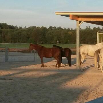
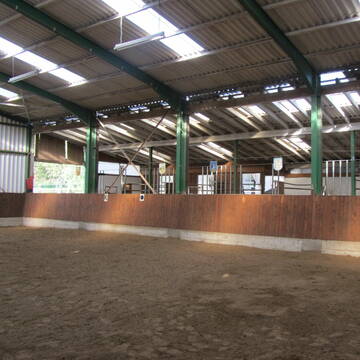
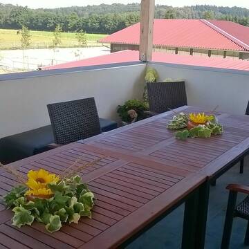
Reitsportanlage Lindenhof
Florstadt Leidhecken
Reitsportanlage Lindenhof
@ReitsportanlageLindenhof1
Freizeitstall
Reitschule
Vermieten
Führanlage
Hunde willkommen
Allergikerstall
bedampftes/gewaschenes Heu
22 weitere...
S

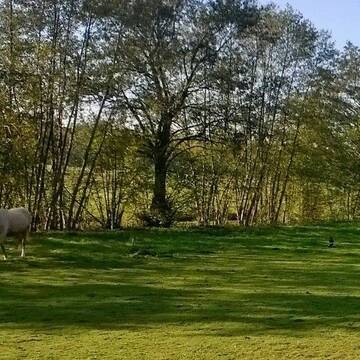
Offenstall Platz für eine Stute frei ab sofort
Büdingen
Sandhof
@StephanieSchmueck
Freizeitstall
Führanlage
Hunde willkommen
Offenstall
9 weitere...
P
Deprecated: Creation of dynamic property Zend_View_Helper_Ads::$adLink is deprecated in /var/www/stall-frei/htdocs/staging.stall-frei.de/library/Psf/View/Helper/Ads.php on line 108

Offenstall/Paddockbox für Pony oder Kleinpferd
Glashütten
Tatjana Bommersheim
@TatjanaBommersheim
Wir haben ab dem 1.04.26 eine Platz in einem unsere Offenställe (Wallach oder Stute)und eine unserer Paddockboxen (Wallach oder S
neu
R

Biete einen Einstellplatz für ein Reheshetty/Pony
Büdingen
Jenny Jüngling
@JennyJuengling
Vermieten
Hunde willkommen
Krankenbox
Hufrehe geeignet
Notfallboxen
Offenstall
8 weitere...
P

Paddockboxen zu vermieten, Offenstallplatz frei
Büdingen
Christinenhof
@Reitanlage_am_Christinenhof
Freizeitstall
Geländestrecke
Vermieten
Hunde willkommen
Paddock
Allergikerstall
Hengsthaltung möglich
20 weitere...
P
Hofgut Geisberg
Hammersbach
Hannah Uslu
@Hannah-Uslu
Fahrstall, Kutschwagen
FN-Mitglied
Hunde willkommen
Krankenbox
Hufrehe geeignet
Außenbox mit Paddock
Außenboxen
29 weitere...
P+


Wallach - HIT-Aktivstall
Altenstadt
Aktivstall Messerschmidt
@LaraZimmermann
FN-Mitglied
Freizeitstall
Vermieten
Hunde willkommen
Krankenbox
Allergikerstall
Notfallboxen
22 weitere...
P+

Lohrberg Ranch - Western/Freizeit-Stall in Hessen
Büdingen-Eckartshausen
Lohrberg Ranch
@LohrbergRanch
Freizeitstall
Reitlehrer und -unterricht
Vermieten
Hunde willkommen
Krankenbox
Fohlenaufzucht möglich
Hufrehe geeignet
19 weitere...
P
Heinrichshof, Offenstall, Bewegungsstall
Gründau
Heinrichshof-J-K-Ost-GbR
@Heinrichshof-J-K-Ost-GbR
FN-Mitglied
Freizeitstall
Vermieten
Hunde willkommen
Krankenbox
Allergikerstall
bedampftes/gewaschenes Heu
24 weitere...
P

Heu und Heulage verkaufen
Mechtersen
STALL-FREIde Marketing
@STALL-FREI-Marketing
Verkaufen Sie Ihr Heu und Ihre Heulage direkt an Reiter, Pferdeställe und Reitanlagen

Boxen auf familiärer Anlage frei
Ortenberg
Hofgut-Breitenhaide
@Hofgut-Breitenhaide
FN-Mitglied
Freizeitstall
Vermieten
Hunde willkommen
Paddock
Allergikerstall
bedampftes/gewaschenes Heu
19 weitere...
P


Schöner Offenstall hat Plätze frei Offenstallpla...
Florstadt Stammheim
Simone Stamm
@Simone-
Freizeitstall
Vermieten
Hunde willkommen
Krankenbox
Allergikerstall
Notfallboxen
8 weitere...
P+
Deprecated: Creation of dynamic property Zend_View::$pageCount is deprecated in /var/www/stall-frei/htdocs/staging.stall-frei.de/library/vendor/shardj/zf1-future/library/Zend/View/Abstract.php on line 308
Deprecated: Creation of dynamic property Zend_View::$itemCountPerPage is deprecated in /var/www/stall-frei/htdocs/staging.stall-frei.de/library/vendor/shardj/zf1-future/library/Zend/View/Abstract.php on line 308
Deprecated: Creation of dynamic property Zend_View::$first is deprecated in /var/www/stall-frei/htdocs/staging.stall-frei.de/library/vendor/shardj/zf1-future/library/Zend/View/Abstract.php on line 308
Deprecated: Creation of dynamic property Zend_View::$current is deprecated in /var/www/stall-frei/htdocs/staging.stall-frei.de/library/vendor/shardj/zf1-future/library/Zend/View/Abstract.php on line 308
Deprecated: Creation of dynamic property Zend_View::$last is deprecated in /var/www/stall-frei/htdocs/staging.stall-frei.de/library/vendor/shardj/zf1-future/library/Zend/View/Abstract.php on line 308
Deprecated: Creation of dynamic property Zend_View::$next is deprecated in /var/www/stall-frei/htdocs/staging.stall-frei.de/library/vendor/shardj/zf1-future/library/Zend/View/Abstract.php on line 308
Deprecated: Creation of dynamic property Zend_View::$pagesInRange is deprecated in /var/www/stall-frei/htdocs/staging.stall-frei.de/library/vendor/shardj/zf1-future/library/Zend/View/Abstract.php on line 308
Deprecated: Creation of dynamic property Zend_View::$firstPageInRange is deprecated in /var/www/stall-frei/htdocs/staging.stall-frei.de/library/vendor/shardj/zf1-future/library/Zend/View/Abstract.php on line 308
Deprecated: Creation of dynamic property Zend_View::$lastPageInRange is deprecated in /var/www/stall-frei/htdocs/staging.stall-frei.de/library/vendor/shardj/zf1-future/library/Zend/View/Abstract.php on line 308
Deprecated: Creation of dynamic property Zend_View::$currentItemCount is deprecated in /var/www/stall-frei/htdocs/staging.stall-frei.de/library/vendor/shardj/zf1-future/library/Zend/View/Abstract.php on line 308
Deprecated: Creation of dynamic property Zend_View::$totalItemCount is deprecated in /var/www/stall-frei/htdocs/staging.stall-frei.de/library/vendor/shardj/zf1-future/library/Zend/View/Abstract.php on line 308
Deprecated: Creation of dynamic property Zend_View::$firstItemNumber is deprecated in /var/www/stall-frei/htdocs/staging.stall-frei.de/library/vendor/shardj/zf1-future/library/Zend/View/Abstract.php on line 308
Deprecated: Creation of dynamic property Zend_View::$lastItemNumber is deprecated in /var/www/stall-frei/htdocs/staging.stall-frei.de/library/vendor/shardj/zf1-future/library/Zend/View/Abstract.php on line 308
Deprecated: Creation of dynamic property Zend_View::$router is deprecated in /var/www/stall-frei/htdocs/staging.stall-frei.de/library/vendor/shardj/zf1-future/library/Zend/View/Abstract.php on line 308
Deprecated: Creation of dynamic property Zend_View::$urlParams is deprecated in /var/www/stall-frei/htdocs/staging.stall-frei.de/library/vendor/shardj/zf1-future/library/Zend/View/Abstract.php on line 308
Deprecated: Creation of dynamic property Zend_View::$showAds is deprecated in /var/www/stall-frei/htdocs/staging.stall-frei.de/library/vendor/shardj/zf1-future/library/Zend/View/Abstract.php on line 308
Deprecated: Creation of dynamic property Zend_View::$objectIds is deprecated in /var/www/stall-frei/htdocs/staging.stall-frei.de/library/vendor/shardj/zf1-future/library/Zend/View/Abstract.php on line 308
Deprecated: Creation of dynamic property Zend_View::$showNavbar is deprecated in /var/www/stall-frei/htdocs/staging.stall-frei.de/library/vendor/shardj/zf1-future/library/Zend/View/Abstract.php on line 308
Deprecated: Creation of dynamic property Zend_View::$showBreadcrumb is deprecated in /var/www/stall-frei/htdocs/staging.stall-frei.de/library/vendor/shardj/zf1-future/library/Zend/View/Abstract.php on line 308
Deprecated: Creation of dynamic property Zend_View::$showFooter is deprecated in /var/www/stall-frei/htdocs/staging.stall-frei.de/library/vendor/shardj/zf1-future/library/Zend/View/Abstract.php on line 308
Deprecated: Creation of dynamic property Zend_View::$showInternalAds is deprecated in /var/www/stall-frei/htdocs/staging.stall-frei.de/library/vendor/shardj/zf1-future/library/Zend/View/Abstract.php on line 308
Deprecated: Creation of dynamic property Zend_View::$blNoContent is deprecated in /var/www/stall-frei/htdocs/staging.stall-frei.de/library/vendor/shardj/zf1-future/library/Zend/View/Abstract.php on line 308
Deprecated: Creation of dynamic property Zend_View::$sMetaDesc is deprecated in /var/www/stall-frei/htdocs/staging.stall-frei.de/library/vendor/shardj/zf1-future/library/Zend/View/Abstract.php on line 308
Deprecated: Creation of dynamic property Zend_View::$useGmaps is deprecated in /var/www/stall-frei/htdocs/staging.stall-frei.de/library/vendor/shardj/zf1-future/library/Zend/View/Abstract.php on line 308
Deprecated: Creation of dynamic property Zend_View::$touches is deprecated in /var/www/stall-frei/htdocs/staging.stall-frei.de/library/vendor/shardj/zf1-future/library/Zend/View/Abstract.php on line 308
Deprecated: Creation of dynamic property Zend_View::$oProject is deprecated in /var/www/stall-frei/htdocs/staging.stall-frei.de/library/vendor/shardj/zf1-future/library/Zend/View/Abstract.php on line 308
Deprecated: Creation of dynamic property Zend_View::$pageHeadline is deprecated in /var/www/stall-frei/htdocs/staging.stall-frei.de/library/vendor/shardj/zf1-future/library/Zend/View/Abstract.php on line 308
Deprecated: Creation of dynamic property Zend_View::$disableLocationField is deprecated in /var/www/stall-frei/htdocs/staging.stall-frei.de/library/vendor/shardj/zf1-future/library/Zend/View/Abstract.php on line 308
Deprecated: Creation of dynamic property Zend_View::$isSearch is deprecated in /var/www/stall-frei/htdocs/staging.stall-frei.de/library/vendor/shardj/zf1-future/library/Zend/View/Abstract.php on line 308
Deprecated: Creation of dynamic property Zend_View::$pageTitle is deprecated in /var/www/stall-frei/htdocs/staging.stall-frei.de/library/vendor/shardj/zf1-future/library/Zend/View/Abstract.php on line 308
Deprecated: Creation of dynamic property Psf_Form_Element_Text::$class is deprecated in /var/www/stall-frei/htdocs/staging.stall-frei.de/library/vendor/shardj/zf1-future/library/Zend/Form/Element.php on line 874
Deprecated: Creation of dynamic property Psf_Form_Element_Text::$size is deprecated in /var/www/stall-frei/htdocs/staging.stall-frei.de/library/vendor/shardj/zf1-future/library/Zend/Form/Element.php on line 874
Deprecated: Creation of dynamic property Psf_Form_Element_Text::$placeholder is deprecated in /var/www/stall-frei/htdocs/staging.stall-frei.de/library/vendor/shardj/zf1-future/library/Zend/Form/Element.php on line 874
Deprecated: Creation of dynamic property Psf_Form_Element_Hidden::$class is deprecated in /var/www/stall-frei/htdocs/staging.stall-frei.de/library/vendor/shardj/zf1-future/library/Zend/Form/Element.php on line 874
Deprecated: Creation of dynamic property Psf_Form_Element_Hidden::$class is deprecated in /var/www/stall-frei/htdocs/staging.stall-frei.de/library/vendor/shardj/zf1-future/library/Zend/Form/Element.php on line 874
Deprecated: Creation of dynamic property Psf_Form_Element_Hidden::$class is deprecated in /var/www/stall-frei/htdocs/staging.stall-frei.de/library/vendor/shardj/zf1-future/library/Zend/Form/Element.php on line 874
Deprecated: Creation of dynamic property Psf_Form_Element_Hidden::$class is deprecated in /var/www/stall-frei/htdocs/staging.stall-frei.de/library/vendor/shardj/zf1-future/library/Zend/Form/Element.php on line 874
Deprecated: Creation of dynamic property Psf_Form_Element_Select::$class is deprecated in /var/www/stall-frei/htdocs/staging.stall-frei.de/library/vendor/shardj/zf1-future/library/Zend/Form/Element.php on line 874
Deprecated: Creation of dynamic property Psf_Form_Element_Select::$class is deprecated in /var/www/stall-frei/htdocs/staging.stall-frei.de/library/vendor/shardj/zf1-future/library/Zend/Form/Element.php on line 874
Deprecated: Creation of dynamic property Psf_Form_Element_Select::$class is deprecated in /var/www/stall-frei/htdocs/staging.stall-frei.de/library/vendor/shardj/zf1-future/library/Zend/Form/Element.php on line 874
Deprecated: Creation of dynamic property Psf_Form_Element_Select::$class is deprecated in /var/www/stall-frei/htdocs/staging.stall-frei.de/library/vendor/shardj/zf1-future/library/Zend/Form/Element.php on line 874
Deprecated: Creation of dynamic property Psf_Form_Element_Text::$class is deprecated in /var/www/stall-frei/htdocs/staging.stall-frei.de/library/vendor/shardj/zf1-future/library/Zend/Form/Element.php on line 874
Deprecated: Creation of dynamic property Psf_Form_Element_Checkbox::$label is deprecated in /var/www/stall-frei/htdocs/staging.stall-frei.de/library/vendor/shardj/zf1-future/library/Zend/Form/Element.php on line 874
Deprecated: Creation of dynamic property Zend_View::$sort is deprecated in /var/www/stall-frei/htdocs/staging.stall-frei.de/library/vendor/shardj/zf1-future/library/Zend/View/Abstract.php on line 308
Deprecated: Creation of dynamic property Zend_View::$searchLocation is deprecated in /var/www/stall-frei/htdocs/staging.stall-frei.de/library/vendor/shardj/zf1-future/library/Zend/View/Abstract.php on line 308
Deprecated: Creation of dynamic property Zend_View::$locationHint is deprecated in /var/www/stall-frei/htdocs/staging.stall-frei.de/library/vendor/shardj/zf1-future/library/Zend/View/Abstract.php on line 308
Psf_GeoCoder_Abstract::getLocation: Weg Get Location CachedOrLive
Psf_GeoCoder_Abstract::getCachedOrLive: Weg
Psf_GeoCoder_OpenCageData::makeApiRequest: response:
Array
(
[documentation] => https://opencagedata.com/api
[licenses] => Array
(
[0] => Array
(
[name] => see attribution guide
[url] => https://opencagedata.com/credits
)
)
[results] => Array
(
[0] => Array
(
[bounds] => Array
(
[northeast] => Array
(
[lat] => 50.283366
[lng] => 9.1190088
)
[southwest] => Array
(
[lat] => 50.280428
[lng] => 9.1142894
)
)
[components] => Array
(
[ISO_3166-1_alpha-2] => DE
[ISO_3166-1_alpha-3] => DEU
[ISO_3166-2] => Array
(
[0] => DE-HE
)
[_category] => education
[_normalized_city] => Büdingen
[_type] => school
[continent] => Europe
[country] => Deutschland
[country_code] => de
[county] => Wetteraukreis
[house_number] => 4
[municipality] => Büdingen
[political_union] => European Union
[postcode] => 63654
[road] => Wilhelm-Lückert-Straße
[school] => Wolfgang-Ernst-Gymnasium
[state] => Hessen
[state_code] => HE
[town] => Büdingen
)
[confidence] => 9
[formatted] => Wolfgang-Ernst-Gymnasium, Wilhelm-Lückert-Straße 4, 63654 Büdingen, Deutschland
[geometry] => Array
(
[lat] => 50.2817897
[lng] => 9.1168814
)
)
[1] => Array
(
[bounds] => Array
(
[northeast] => Array
(
[lat] => 48.7111428
[lng] => 13.4469506
)
[southwest] => Array
(
[lat] => 48.6711428
[lng] => 13.4069506
)
)
[components] => Array
(
[ISO_3166-1_alpha-2] => DE
[ISO_3166-1_alpha-3] => DEU
[ISO_3166-2] => Array
(
[0] => DE-BY
)
[_category] => place
[_normalized_city] => Neukirchen vorm Wald
[_type] => hamlet
[continent] => Europe
[country] => Deutschland
[country_code] => de
[county] => Landkreis Passau
[hamlet] => Weg
[political_union] => European Union
[postcode] => 94154
[state] => Bayern
[state_code] => BY
[village] => Neukirchen vorm Wald
)
[confidence] => 7
[formatted] => Weg, 94154 Neukirchen vorm Wald, Deutschland
[geometry] => Array
(
[lat] => 48.6911428
[lng] => 13.4269506
)
)
[2] => Array
(
[bounds] => Array
(
[northeast] => Array
(
[lat] => 47.7122604
[lng] => 10.6193086
)
[southwest] => Array
(
[lat] => 47.6722604
[lng] => 10.5793086
)
)
[components] => Array
(
[ISO_3166-1_alpha-2] => DE
[ISO_3166-1_alpha-3] => DEU
[ISO_3166-2] => Array
(
[0] => DE-BY
)
[_category] => place
[_normalized_city] => Lengenwang
[_type] => hamlet
[continent] => Europe
[country] => Deutschland
[country_code] => de
[county] => Landkreis Ostallgäu
[hamlet] => Weg
[municipality] => Seeg (VGem)
[political_union] => European Union
[postcode] => 87663
[state] => Bayern
[state_code] => BY
[village] => Lengenwang
)
[confidence] => 7
[formatted] => Weg, 87663 Lengenwang, Deutschland
[geometry] => Array
(
[lat] => 47.6922604
[lng] => 10.5993086
)
)
[3] => Array
(
[bounds] => Array
(
[northeast] => Array
(
[lat] => 48.382166
[lng] => 13.262924
)
[southwest] => Array
(
[lat] => 48.342166
[lng] => 13.222924
)
)
[components] => Array
(
[ISO_3166-1_alpha-2] => DE
[ISO_3166-1_alpha-3] => DEU
[ISO_3166-2] => Array
(
[0] => DE-BY
)
[_category] => place
[_normalized_city] => Rotthalmünster
[_type] => hamlet
[continent] => Europe
[country] => Deutschland
[country_code] => de
[county] => Landkreis Passau
[hamlet] => Weg
[municipality] => Rotthalmünster (VGem)
[political_union] => European Union
[postcode] => 94148
[state] => Bayern
[state_code] => BY
[village] => Rotthalmünster
)
[confidence] => 7
[formatted] => Weg, 94148 Rotthalmünster, Deutschland
[geometry] => Array
(
[lat] => 48.362166
[lng] => 13.242924
)
)
[4] => Array
(
[bounds] => Array
(
[northeast] => Array
(
[lat] => 48.3623668
[lng] => 12.1292965
)
[southwest] => Array
(
[lat] => 48.3223668
[lng] => 12.0892965
)
)
[components] => Array
(
[ISO_3166-1_alpha-2] => DE
[ISO_3166-1_alpha-3] => DEU
[ISO_3166-2] => Array
(
[0] => DE-BY
)
[_category] => place
[_normalized_city] => Taufkirchen
[_type] => hamlet
[continent] => Europe
[country] => Deutschland
[country_code] => de
[county] => Landkreis Erding
[hamlet] => Weg
[political_union] => European Union
[postcode] => 84416
[state] => Bayern
[state_code] => BY
[town] => Taufkirchen
)
[confidence] => 7
[formatted] => Weg, 84416 Taufkirchen, Deutschland
[geometry] => Array
(
[lat] => 48.3423668
[lng] => 12.1092965
)
)
[5] => Array
(
[bounds] => Array
(
[northeast] => Array
(
[lat] => 48.3170439
[lng] => 12.2106606
)
[southwest] => Array
(
[lat] => 48.2770439
[lng] => 12.1706606
)
)
[components] => Array
(
[ISO_3166-1_alpha-2] => DE
[ISO_3166-1_alpha-3] => DEU
[ISO_3166-2] => Array
(
[0] => DE-BY
)
[_category] => place
[_normalized_city] => Dorfen
[_type] => hamlet
[continent] => Europe
[country] => Deutschland
[country_code] => de
[county] => Landkreis Erding
[hamlet] => Weg
[political_union] => European Union
[postcode] => 84405
[state] => Bayern
[state_code] => BY
[town] => Dorfen
)
[confidence] => 7
[formatted] => Weg, 84405 Dorfen, Deutschland
[geometry] => Array
(
[lat] => 48.2970439
[lng] => 12.1906606
)
)
[6] => Array
(
[bounds] => Array
(
[northeast] => Array
(
[lat] => 48.4383797
[lng] => 12.7728181
)
[southwest] => Array
(
[lat] => 48.3983797
[lng] => 12.7328181
)
)
[components] => Array
(
[ISO_3166-1_alpha-2] => DE
[ISO_3166-1_alpha-3] => DEU
[ISO_3166-2] => Array
(
[0] => DE-BY
)
[_category] => place
[_normalized_city] => Eggenfelden
[_type] => hamlet
[continent] => Europe
[country] => Deutschland
[country_code] => de
[county] => Landkreis Rottal-Inn
[hamlet] => Weg
[political_union] => European Union
[postcode] => 84307
[state] => Bayern
[state_code] => BY
[town] => Eggenfelden
)
[confidence] => 7
[formatted] => Weg, 84307 Eggenfelden, Deutschland
[geometry] => Array
(
[lat] => 48.4183797
[lng] => 12.7528181
)
)
[7] => Array
(
[bounds] => Array
(
[northeast] => Array
(
[lat] => 48.355499
[lng] => 13.112356
)
[southwest] => Array
(
[lat] => 48.315499
[lng] => 13.072356
)
)
[components] => Array
(
[ISO_3166-1_alpha-2] => DE
[ISO_3166-1_alpha-3] => DEU
[ISO_3166-2] => Array
(
[0] => DE-BY
)
[_category] => place
[_normalized_city] => Ering
[_type] => hamlet
[continent] => Europe
[country] => Deutschland
[country_code] => de
[county] => Landkreis Rottal-Inn
[hamlet] => Weg
[municipality] => Ering (VGem)
[political_union] => European Union
[postcode] => 94166
[state] => Bayern
[state_code] => BY
[village] => Ering
)
[confidence] => 7
[formatted] => Weg, 94166 Ering, Deutschland
[geometry] => Array
(
[lat] => 48.335499
[lng] => 13.092356
)
)
[8] => Array
(
[bounds] => Array
(
[northeast] => Array
(
[lat] => 47.7749849
[lng] => 8.0093411
)
[southwest] => Array
(
[lat] => 47.7349849
[lng] => 7.9693411
)
)
[components] => Array
(
[ISO_3166-1_alpha-2] => DE
[ISO_3166-1_alpha-3] => DEU
[ISO_3166-2] => Array
(
[0] => DE-BW
)
[_category] => place
[_normalized_city] => Todtmoos
[_type] => hamlet
[continent] => Europe
[country] => Deutschland
[country_code] => de
[county] => Landkreis Waldshut
[hamlet] => Weg
[municipality] => GVV St. Blasien
[political_union] => European Union
[postcode] => 79682
[state] => Baden-Württemberg
[state_code] => BW
[village] => Todtmoos
)
[confidence] => 7
[formatted] => Weg, 79682 Todtmoos, Deutschland
[geometry] => Array
(
[lat] => 47.7549849
[lng] => 7.9893411
)
)
[9] => Array
(
[bounds] => Array
(
[northeast] => Array
(
[lat] => 48.6032758
[lng] => 13.1591692
)
[southwest] => Array
(
[lat] => 48.5632758
[lng] => 13.1191692
)
)
[components] => Array
(
[ISO_3166-1_alpha-2] => DE
[ISO_3166-1_alpha-3] => DEU
[ISO_3166-2] => Array
(
[0] => DE-BY
)
[_category] => place
[_normalized_city] => Vilshofen an der Donau
[_type] => hamlet
[continent] => Europe
[country] => Deutschland
[country_code] => de
[county] => Landkreis Passau
[hamlet] => Weg
[political_union] => European Union
[state] => Bayern
[state_code] => BY
[town] => Vilshofen an der Donau
)
[confidence] => 7
[formatted] => Weg, Vilshofen an der Donau, Bayern, Deutschland
[geometry] => Array
(
[lat] => 48.5832758
[lng] => 13.1391692
)
)
)
[status] => Array
(
[code] => 200
[message] => OK
)
[stay_informed] => Array
(
[blog] => https://blog.opencagedata.com
[mastodon] => https://en.osm.town/@opencage
)
[thanks] => For using an OpenCage API
[timestamp] => Array
(
[created_http] => Sat, 07 Feb 2026 14:26:36 GMT
[created_unix] => 1770474396
)
[total_results] => 10
)
Psf_GeoCoder_Abstract::convertLocationResult
{"documentation":"https:\/\/opencagedata.com\/api","licenses":[{"name":"see attribution guide","url":"https:\/\/opencagedata.com\/credits"}],"results":[{"bounds":{"northeast":{"lat":50.283366,"lng":9.1190088},"southwest":{"lat":50.280428,"lng":9.1142894}},"components":{"ISO_3166-1_alpha-2":"DE","ISO_3166-1_alpha-3":"DEU","ISO_3166-2":["DE-HE"],"_category":"education","_normalized_city":"B\u00fcdingen","_type":"school","continent":"Europe","country":"Deutschland","country_code":"de","county":"Wetteraukreis","house_number":"4","municipality":"B\u00fcdingen","political_union":"European Union","postcode":"63654","road":"Wilhelm-L\u00fcckert-Stra\u00dfe","school":"Wolfgang-Ernst-Gymnasium","state":"Hessen","state_code":"HE","town":"B\u00fcdingen"},"confidence":9,"formatted":"Wolfgang-Ernst-Gymnasium, Wilhelm-L\u00fcckert-Stra\u00dfe 4, 63654 B\u00fcdingen, Deutschland","geometry":{"lat":50.2817897,"lng":9.1168814}},{"bounds":{"northeast":{"lat":48.7111428,"lng":13.4469506},"southwest":{"lat":48.6711428,"lng":13.4069506}},"components":{"ISO_3166-1_alpha-2":"DE","ISO_3166-1_alpha-3":"DEU","ISO_3166-2":["DE-BY"],"_category":"place","_normalized_city":"Neukirchen vorm Wald","_type":"hamlet","continent":"Europe","country":"Deutschland","country_code":"de","county":"Landkreis Passau","hamlet":"Weg","political_union":"European Union","postcode":"94154","state":"Bayern","state_code":"BY","village":"Neukirchen vorm Wald"},"confidence":7,"formatted":"Weg, 94154 Neukirchen vorm Wald, Deutschland","geometry":{"lat":48.6911428,"lng":13.4269506}},{"bounds":{"northeast":{"lat":47.7122604,"lng":10.6193086},"southwest":{"lat":47.6722604,"lng":10.5793086}},"components":{"ISO_3166-1_alpha-2":"DE","ISO_3166-1_alpha-3":"DEU","ISO_3166-2":["DE-BY"],"_category":"place","_normalized_city":"Lengenwang","_type":"hamlet","continent":"Europe","country":"Deutschland","country_code":"de","county":"Landkreis Ostallg\u00e4u","hamlet":"Weg","municipality":"Seeg (VGem)","political_union":"European Union","postcode":"87663","state":"Bayern","state_code":"BY","village":"Lengenwang"},"confidence":7,"formatted":"Weg, 87663 Lengenwang, Deutschland","geometry":{"lat":47.6922604,"lng":10.5993086}},{"bounds":{"northeast":{"lat":48.382166,"lng":13.262924},"southwest":{"lat":48.342166,"lng":13.222924}},"components":{"ISO_3166-1_alpha-2":"DE","ISO_3166-1_alpha-3":"DEU","ISO_3166-2":["DE-BY"],"_category":"place","_normalized_city":"Rotthalm\u00fcnster","_type":"hamlet","continent":"Europe","country":"Deutschland","country_code":"de","county":"Landkreis Passau","hamlet":"Weg","municipality":"Rotthalm\u00fcnster (VGem)","political_union":"European Union","postcode":"94148","state":"Bayern","state_code":"BY","village":"Rotthalm\u00fcnster"},"confidence":7,"formatted":"Weg, 94148 Rotthalm\u00fcnster, Deutschland","geometry":{"lat":48.362166,"lng":13.242924}},{"bounds":{"northeast":{"lat":48.3623668,"lng":12.1292965},"southwest":{"lat":48.3223668,"lng":12.0892965}},"components":{"ISO_3166-1_alpha-2":"DE","ISO_3166-1_alpha-3":"DEU","ISO_3166-2":["DE-BY"],"_category":"place","_normalized_city":"Taufkirchen","_type":"hamlet","continent":"Europe","country":"Deutschland","country_code":"de","county":"Landkreis Erding","hamlet":"Weg","political_union":"European Union","postcode":"84416","state":"Bayern","state_code":"BY","town":"Taufkirchen"},"confidence":7,"formatted":"Weg, 84416 Taufkirchen, Deutschland","geometry":{"lat":48.3423668,"lng":12.1092965}},{"bounds":{"northeast":{"lat":48.3170439,"lng":12.2106606},"southwest":{"lat":48.2770439,"lng":12.1706606}},"components":{"ISO_3166-1_alpha-2":"DE","ISO_3166-1_alpha-3":"DEU","ISO_3166-2":["DE-BY"],"_category":"place","_normalized_city":"Dorfen","_type":"hamlet","continent":"Europe","country":"Deutschland","country_code":"de","county":"Landkreis Erding","hamlet":"Weg","political_union":"European Union","postcode":"84405","state":"Bayern","state_code":"BY","town":"Dorfen"},"confidence":7,"formatted":"Weg, 84405 Dorfen, Deutschland","geometry":{"lat":48.2970439,"lng":12.1906606}},{"bounds":{"northeast":{"lat":48.4383797,"lng":12.7728181},"southwest":{"lat":48.3983797,"lng":12.7328181}},"components":{"ISO_3166-1_alpha-2":"DE","ISO_3166-1_alpha-3":"DEU","ISO_3166-2":["DE-BY"],"_category":"place","_normalized_city":"Eggenfelden","_type":"hamlet","continent":"Europe","country":"Deutschland","country_code":"de","county":"Landkreis Rottal-Inn","hamlet":"Weg","political_union":"European Union","postcode":"84307","state":"Bayern","state_code":"BY","town":"Eggenfelden"},"confidence":7,"formatted":"Weg, 84307 Eggenfelden, Deutschland","geometry":{"lat":48.4183797,"lng":12.7528181}},{"bounds":{"northeast":{"lat":48.355499,"lng":13.112356},"southwest":{"lat":48.315499,"lng":13.072356}},"components":{"ISO_3166-1_alpha-2":"DE","ISO_3166-1_alpha-3":"DEU","ISO_3166-2":["DE-BY"],"_category":"place","_normalized_city":"Ering","_type":"hamlet","continent":"Europe","country":"Deutschland","country_code":"de","county":"Landkreis Rottal-Inn","hamlet":"Weg","municipality":"Ering (VGem)","political_union":"European Union","postcode":"94166","state":"Bayern","state_code":"BY","village":"Ering"},"confidence":7,"formatted":"Weg, 94166 Ering, Deutschland","geometry":{"lat":48.335499,"lng":13.092356}},{"bounds":{"northeast":{"lat":47.7749849,"lng":8.0093411},"southwest":{"lat":47.7349849,"lng":7.9693411}},"components":{"ISO_3166-1_alpha-2":"DE","ISO_3166-1_alpha-3":"DEU","ISO_3166-2":["DE-BW"],"_category":"place","_normalized_city":"Todtmoos","_type":"hamlet","continent":"Europe","country":"Deutschland","country_code":"de","county":"Landkreis Waldshut","hamlet":"Weg","municipality":"GVV St. Blasien","political_union":"European Union","postcode":"79682","state":"Baden-W\u00fcrttemberg","state_code":"BW","village":"Todtmoos"},"confidence":7,"formatted":"Weg, 79682 Todtmoos, Deutschland","geometry":{"lat":47.7549849,"lng":7.9893411}},{"bounds":{"northeast":{"lat":48.6032758,"lng":13.1591692},"southwest":{"lat":48.5632758,"lng":13.1191692}},"components":{"ISO_3166-1_alpha-2":"DE","ISO_3166-1_alpha-3":"DEU","ISO_3166-2":["DE-BY"],"_category":"place","_normalized_city":"Vilshofen an der Donau","_type":"hamlet","continent":"Europe","country":"Deutschland","country_code":"de","county":"Landkreis Passau","hamlet":"Weg","political_union":"European Union","state":"Bayern","state_code":"BY","town":"Vilshofen an der Donau"},"confidence":7,"formatted":"Weg, Vilshofen an der Donau, Bayern, Deutschland","geometry":{"lat":48.5832758,"lng":13.1391692}}],"status":{"code":200,"message":"OK"},"stay_informed":{"blog":"https:\/\/blog.opencagedata.com","mastodon":"https:\/\/en.osm.town\/@opencage"},"thanks":"For using an OpenCage API","timestamp":{"created_http":"Sat, 07 Feb 2026 14:26:36 GMT","created_unix":1770474396},"total_results":10}Array
(
[0] => stdClass Object
(
[bounds] => stdClass Object
(
[northeast] => stdClass Object
(
[lat] => 50.283366
[lng] => 9.1190088
)
[southwest] => stdClass Object
(
[lat] => 50.280428
[lng] => 9.1142894
)
)
[components] => stdClass Object
(
[ISO_3166-1_alpha-2] => DE
[ISO_3166-1_alpha-3] => DEU
[ISO_3166-2] => Array
(
[0] => DE-HE
)
[_category] => education
[_normalized_city] => Büdingen
[_type] => school
[continent] => Europe
[country] => Deutschland
[country_code] => de
[county] => Wetteraukreis
[house_number] => 4
[municipality] => Büdingen
[political_union] => European Union
[postcode] => 63654
[road] => Wilhelm-Lückert-Straße
[school] => Wolfgang-Ernst-Gymnasium
[state] => Hessen
[state_code] => HE
[town] => Büdingen
)
[confidence] => 9
[formatted] => Wolfgang-Ernst-Gymnasium, Wilhelm-Lückert-Straße 4, 63654 Büdingen, Deutschland
[geometry] => stdClass Object
(
[lat] => 50.2817897
[lng] => 9.1168814
)
)
[1] => stdClass Object
(
[bounds] => stdClass Object
(
[northeast] => stdClass Object
(
[lat] => 48.7111428
[lng] => 13.4469506
)
[southwest] => stdClass Object
(
[lat] => 48.6711428
[lng] => 13.4069506
)
)
[components] => stdClass Object
(
[ISO_3166-1_alpha-2] => DE
[ISO_3166-1_alpha-3] => DEU
[ISO_3166-2] => Array
(
[0] => DE-BY
)
[_category] => place
[_normalized_city] => Neukirchen vorm Wald
[_type] => hamlet
[continent] => Europe
[country] => Deutschland
[country_code] => de
[county] => Landkreis Passau
[hamlet] => Weg
[political_union] => European Union
[postcode] => 94154
[state] => Bayern
[state_code] => BY
[village] => Neukirchen vorm Wald
)
[confidence] => 7
[formatted] => Weg, 94154 Neukirchen vorm Wald, Deutschland
[geometry] => stdClass Object
(
[lat] => 48.6911428
[lng] => 13.4269506
)
)
[2] => stdClass Object
(
[bounds] => stdClass Object
(
[northeast] => stdClass Object
(
[lat] => 47.7122604
[lng] => 10.6193086
)
[southwest] => stdClass Object
(
[lat] => 47.6722604
[lng] => 10.5793086
)
)
[components] => stdClass Object
(
[ISO_3166-1_alpha-2] => DE
[ISO_3166-1_alpha-3] => DEU
[ISO_3166-2] => Array
(
[0] => DE-BY
)
[_category] => place
[_normalized_city] => Lengenwang
[_type] => hamlet
[continent] => Europe
[country] => Deutschland
[country_code] => de
[county] => Landkreis Ostallgäu
[hamlet] => Weg
[municipality] => Seeg (VGem)
[political_union] => European Union
[postcode] => 87663
[state] => Bayern
[state_code] => BY
[village] => Lengenwang
)
[confidence] => 7
[formatted] => Weg, 87663 Lengenwang, Deutschland
[geometry] => stdClass Object
(
[lat] => 47.6922604
[lng] => 10.5993086
)
)
[3] => stdClass Object
(
[bounds] => stdClass Object
(
[northeast] => stdClass Object
(
[lat] => 48.382166
[lng] => 13.262924
)
[southwest] => stdClass Object
(
[lat] => 48.342166
[lng] => 13.222924
)
)
[components] => stdClass Object
(
[ISO_3166-1_alpha-2] => DE
[ISO_3166-1_alpha-3] => DEU
[ISO_3166-2] => Array
(
[0] => DE-BY
)
[_category] => place
[_normalized_city] => Rotthalmünster
[_type] => hamlet
[continent] => Europe
[country] => Deutschland
[country_code] => de
[county] => Landkreis Passau
[hamlet] => Weg
[municipality] => Rotthalmünster (VGem)
[political_union] => European Union
[postcode] => 94148
[state] => Bayern
[state_code] => BY
[village] => Rotthalmünster
)
[confidence] => 7
[formatted] => Weg, 94148 Rotthalmünster, Deutschland
[geometry] => stdClass Object
(
[lat] => 48.362166
[lng] => 13.242924
)
)
[4] => stdClass Object
(
[bounds] => stdClass Object
(
[northeast] => stdClass Object
(
[lat] => 48.3623668
[lng] => 12.1292965
)
[southwest] => stdClass Object
(
[lat] => 48.3223668
[lng] => 12.0892965
)
)
[components] => stdClass Object
(
[ISO_3166-1_alpha-2] => DE
[ISO_3166-1_alpha-3] => DEU
[ISO_3166-2] => Array
(
[0] => DE-BY
)
[_category] => place
[_normalized_city] => Taufkirchen
[_type] => hamlet
[continent] => Europe
[country] => Deutschland
[country_code] => de
[county] => Landkreis Erding
[hamlet] => Weg
[political_union] => European Union
[postcode] => 84416
[state] => Bayern
[state_code] => BY
[town] => Taufkirchen
)
[confidence] => 7
[formatted] => Weg, 84416 Taufkirchen, Deutschland
[geometry] => stdClass Object
(
[lat] => 48.3423668
[lng] => 12.1092965
)
)
[5] => stdClass Object
(
[bounds] => stdClass Object
(
[northeast] => stdClass Object
(
[lat] => 48.3170439
[lng] => 12.2106606
)
[southwest] => stdClass Object
(
[lat] => 48.2770439
[lng] => 12.1706606
)
)
[components] => stdClass Object
(
[ISO_3166-1_alpha-2] => DE
[ISO_3166-1_alpha-3] => DEU
[ISO_3166-2] => Array
(
[0] => DE-BY
)
[_category] => place
[_normalized_city] => Dorfen
[_type] => hamlet
[continent] => Europe
[country] => Deutschland
[country_code] => de
[county] => Landkreis Erding
[hamlet] => Weg
[political_union] => European Union
[postcode] => 84405
[state] => Bayern
[state_code] => BY
[town] => Dorfen
)
[confidence] => 7
[formatted] => Weg, 84405 Dorfen, Deutschland
[geometry] => stdClass Object
(
[lat] => 48.2970439
[lng] => 12.1906606
)
)
[6] => stdClass Object
(
[bounds] => stdClass Object
(
[northeast] => stdClass Object
(
[lat] => 48.4383797
[lng] => 12.7728181
)
[southwest] => stdClass Object
(
[lat] => 48.3983797
[lng] => 12.7328181
)
)
[components] => stdClass Object
(
[ISO_3166-1_alpha-2] => DE
[ISO_3166-1_alpha-3] => DEU
[ISO_3166-2] => Array
(
[0] => DE-BY
)
[_category] => place
[_normalized_city] => Eggenfelden
[_type] => hamlet
[continent] => Europe
[country] => Deutschland
[country_code] => de
[county] => Landkreis Rottal-Inn
[hamlet] => Weg
[political_union] => European Union
[postcode] => 84307
[state] => Bayern
[state_code] => BY
[town] => Eggenfelden
)
[confidence] => 7
[formatted] => Weg, 84307 Eggenfelden, Deutschland
[geometry] => stdClass Object
(
[lat] => 48.4183797
[lng] => 12.7528181
)
)
[7] => stdClass Object
(
[bounds] => stdClass Object
(
[northeast] => stdClass Object
(
[lat] => 48.355499
[lng] => 13.112356
)
[southwest] => stdClass Object
(
[lat] => 48.315499
[lng] => 13.072356
)
)
[components] => stdClass Object
(
[ISO_3166-1_alpha-2] => DE
[ISO_3166-1_alpha-3] => DEU
[ISO_3166-2] => Array
(
[0] => DE-BY
)
[_category] => place
[_normalized_city] => Ering
[_type] => hamlet
[continent] => Europe
[country] => Deutschland
[country_code] => de
[county] => Landkreis Rottal-Inn
[hamlet] => Weg
[municipality] => Ering (VGem)
[political_union] => European Union
[postcode] => 94166
[state] => Bayern
[state_code] => BY
[village] => Ering
)
[confidence] => 7
[formatted] => Weg, 94166 Ering, Deutschland
[geometry] => stdClass Object
(
[lat] => 48.335499
[lng] => 13.092356
)
)
[8] => stdClass Object
(
[bounds] => stdClass Object
(
[northeast] => stdClass Object
(
[lat] => 47.7749849
[lng] => 8.0093411
)
[southwest] => stdClass Object
(
[lat] => 47.7349849
[lng] => 7.9693411
)
)
[components] => stdClass Object
(
[ISO_3166-1_alpha-2] => DE
[ISO_3166-1_alpha-3] => DEU
[ISO_3166-2] => Array
(
[0] => DE-BW
)
[_category] => place
[_normalized_city] => Todtmoos
[_type] => hamlet
[continent] => Europe
[country] => Deutschland
[country_code] => de
[county] => Landkreis Waldshut
[hamlet] => Weg
[municipality] => GVV St. Blasien
[political_union] => European Union
[postcode] => 79682
[state] => Baden-Württemberg
[state_code] => BW
[village] => Todtmoos
)
[confidence] => 7
[formatted] => Weg, 79682 Todtmoos, Deutschland
[geometry] => stdClass Object
(
[lat] => 47.7549849
[lng] => 7.9893411
)
)
[9] => stdClass Object
(
[bounds] => stdClass Object
(
[northeast] => stdClass Object
(
[lat] => 48.6032758
[lng] => 13.1591692
)
[southwest] => stdClass Object
(
[lat] => 48.5632758
[lng] => 13.1191692
)
)
[components] => stdClass Object
(
[ISO_3166-1_alpha-2] => DE
[ISO_3166-1_alpha-3] => DEU
[ISO_3166-2] => Array
(
[0] => DE-BY
)
[_category] => place
[_normalized_city] => Vilshofen an der Donau
[_type] => hamlet
[continent] => Europe
[country] => Deutschland
[country_code] => de
[county] => Landkreis Passau
[hamlet] => Weg
[political_union] => European Union
[state] => Bayern
[state_code] => BY
[town] => Vilshofen an der Donau
)
[confidence] => 7
[formatted] => Weg, Vilshofen an der Donau, Bayern, Deutschland
[geometry] => stdClass Object
(
[lat] => 48.5832758
[lng] => 13.1391692
)
)
)
Psf_GeoCoder_OpenCageData::getKeyMap: 0
stdClass Object
(
    [bounds] => stdClass Object
        (
            [northeast] => stdClass Object
                (
                    [lat] => 50.283366
                    [lng] => 9.1190088
                )

            [southwest] => stdClass Object
                (
                    [lat] => 50.280428
                    [lng] => 9.1142894
                )

        )

    [components] => stdClass Object
        (
            [ISO_3166-1_alpha-2] => DE
            [ISO_3166-1_alpha-3] => DEU
            [ISO_3166-2] => Array
                (
                    [0] => DE-HE
                )

            [_category] => education
            [_normalized_city] => Büdingen
            [_type] => school
            [continent] => Europe
            [country] => Deutschland
            [country_code] => de
            [county] => Wetteraukreis
            [house_number] => 4
            [municipality] => Büdingen
            [political_union] => European Union
            [postcode] => 63654
            [road] => Wilhelm-Lückert-Straße
            [school] => Wolfgang-Ernst-Gymnasium
            [state] => Hessen
            [state_code] => HE
            [town] => Büdingen
        )

    [confidence] => 9
    [formatted] => Wolfgang-Ernst-Gymnasium, Wilhelm-Lückert-Straße 4, 63654 Büdingen, Deutschland
    [geometry] => stdClass Object
        (
            [lat] => 50.2817897
            [lng] => 9.1168814
        )

)
Psf_GeoCoder_OpenCageData::getCounty: Wetteraukreis
Psf_GeoCoder_OpenCageData::addMissingData REFETCH!
Array
(
    [address] => Wolfgang-Ernst-Gymnasium, Wilhelm-Lückert-Straße 4, 63654 Büdingen, Deutschland
    [type] => school
    [street] => Wilhelm-Lückert-Straße 4
    [city] => Büdingen
    [county] => Wetteraukreis
    [state] => Hessen
    [zip] => 63654
    [country] => Deutschland
    [suburb] =>
    [countrycode] => de
    [latitude] => 50.2817897
    [longitude] => 9.1168814
    [accuracy] => 1
    [confidence] => 9
    [bounds] => stdClass Object
        (
            [northeast] => stdClass Object
                (
                    [lat] => 50.283366
                    [lng] => 9.1190088
                )

            [southwest] => stdClass Object
                (
                    [lat] => 50.280428
                    [lng] => 9.1142894
                )

        )

)
reformat!
Array
(
    [address] => Wolfgang-Ernst-Gymnasium, Wilhelm-Lückert-Straße 4, 63654 Büdingen, Deutschland
    [type] => school
    [street] => Wilhelm-Lückert-Straße 4
    [city] => Büdingen
    [county] => Wetteraukreis
    [state] => Hessen
    [zip] => 63654
    [country] => Deutschland
    [suburb] =>
    [countrycode] => de
    [latitude] => 50.2817897
    [longitude] => 9.1168814
    [accuracy] => 1
    [confidence] => 9
    [bounds] => stdClass Object
        (
            [northeast] => stdClass Object
                (
                    [lat] => 50.283366
                    [lng] => 9.1190088
                )

            [southwest] => stdClass Object
                (
                    [lat] => 50.280428
                    [lng] => 9.1142894
                )

        )

    [place] => Wilhelm-Lückert-Straße 4, 63654 Büdingen, Hessen
    [hash] => 4fe9e2a9ef708add5f7d08d41345481f
)
Psf_GeoCoder_OpenCageData::getKeyMap: 1
stdClass Object
(
    [bounds] => stdClass Object
        (
            [northeast] => stdClass Object
                (
                    [lat] => 48.7111428
                    [lng] => 13.4469506
                )

            [southwest] => stdClass Object
                (
                    [lat] => 48.6711428
                    [lng] => 13.4069506
                )

        )

    [components] => stdClass Object
        (
            [ISO_3166-1_alpha-2] => DE
            [ISO_3166-1_alpha-3] => DEU
            [ISO_3166-2] => Array
                (
                    [0] => DE-BY
                )

            [_category] => place
            [_normalized_city] => Neukirchen vorm Wald
            [_type] => hamlet
            [continent] => Europe
            [country] => Deutschland
            [country_code] => de
            [county] => Landkreis Passau
            [hamlet] => Weg
            [political_union] => European Union
            [postcode] => 94154
            [state] => Bayern
            [state_code] => BY
            [village] => Neukirchen vorm Wald
        )

    [confidence] => 7
    [formatted] => Weg, 94154 Neukirchen vorm Wald, Deutschland
    [geometry] => stdClass Object
        (
            [lat] => 48.6911428
            [lng] => 13.4269506
        )

)
Psf_GeoCoder_OpenCageData::getCounty: Passau
Psf_GeoCoder_OpenCageData::addMissingData REFETCH!
Array
(
    [address] => Weg, 94154 Neukirchen vorm Wald, Deutschland
    [type] => hamlet
    [street] => Weg
    [city] => Neukirchen vorm Wald
    [county] => Passau
    [state] => Bayern
    [zip] => 94154
    [country] => Deutschland
    [suburb] =>
    [countrycode] => de
    [latitude] => 48.6911428
    [longitude] => 13.4269506
    [accuracy] => 1
    [confidence] => 7
    [bounds] => stdClass Object
        (
            [northeast] => stdClass Object
                (
                    [lat] => 48.7111428
                    [lng] => 13.4469506
                )

            [southwest] => stdClass Object
                (
                    [lat] => 48.6711428
                    [lng] => 13.4069506
                )

        )

)
reformat!
Array
(
    [address] => Weg, 94154 Neukirchen vorm Wald, Deutschland
    [type] => hamlet
    [street] => Weg
    [city] => Neukirchen vorm Wald
    [county] => Passau
    [state] => Bayern
    [zip] => 94154
    [country] => Deutschland
    [suburb] =>
    [countrycode] => de
    [latitude] => 48.6911428
    [longitude] => 13.4269506
    [accuracy] => 1
    [confidence] => 7
    [bounds] => stdClass Object
        (
            [northeast] => stdClass Object
                (
                    [lat] => 48.7111428
                    [lng] => 13.4469506
                )

            [southwest] => stdClass Object
                (
                    [lat] => 48.6711428
                    [lng] => 13.4069506
                )

        )

    [place] => Weg, 94154 Neukirchen vorm Wald, Bayern
    [hash] => 0375a60f716ce42e97987f970206ac9b
)
Psf_GeoCoder_OpenCageData::getKeyMap: 2
stdClass Object
(
    [bounds] => stdClass Object
        (
            [northeast] => stdClass Object
                (
                    [lat] => 47.7122604
                    [lng] => 10.6193086
                )

            [southwest] => stdClass Object
                (
                    [lat] => 47.6722604
                    [lng] => 10.5793086
                )

        )

    [components] => stdClass Object
        (
            [ISO_3166-1_alpha-2] => DE
            [ISO_3166-1_alpha-3] => DEU
            [ISO_3166-2] => Array
                (
                    [0] => DE-BY
                )

            [_category] => place
            [_normalized_city] => Lengenwang
            [_type] => hamlet
            [continent] => Europe
            [country] => Deutschland
            [country_code] => de
            [county] => Landkreis Ostallgäu
            [hamlet] => Weg
            [municipality] => Seeg (VGem)
            [political_union] => European Union
            [postcode] => 87663
            [state] => Bayern
            [state_code] => BY
            [village] => Lengenwang
        )

    [confidence] => 7
    [formatted] => Weg, 87663 Lengenwang, Deutschland
    [geometry] => stdClass Object
        (
            [lat] => 47.6922604
            [lng] => 10.5993086
        )

)
Psf_GeoCoder_OpenCageData::getCounty: Ostallgäu
Psf_GeoCoder_OpenCageData::addMissingData REFETCH!
Array
(
    [address] => Weg, 87663 Lengenwang, Deutschland
    [type] => hamlet
    [street] => Weg
    [city] => Lengenwang
    [county] => Ostallgäu
    [state] => Bayern
    [zip] => 87663
    [country] => Deutschland
    [suburb] =>
    [countrycode] => de
    [latitude] => 47.6922604
    [longitude] => 10.5993086
    [accuracy] => 1
    [confidence] => 7
    [bounds] => stdClass Object
        (
            [northeast] => stdClass Object
                (
                    [lat] => 47.7122604
                    [lng] => 10.6193086
                )

            [southwest] => stdClass Object
                (
                    [lat] => 47.6722604
                    [lng] => 10.5793086
                )

        )

)
reformat!
Array
(
    [address] => Weg, 87663 Lengenwang, Deutschland
    [type] => hamlet
    [street] => Weg
    [city] => Lengenwang
    [county] => Ostallgäu
    [state] => Bayern
    [zip] => 87663
    [country] => Deutschland
    [suburb] =>
    [countrycode] => de
    [latitude] => 47.6922604
    [longitude] => 10.5993086
    [accuracy] => 1
    [confidence] => 7
    [bounds] => stdClass Object
        (
            [northeast] => stdClass Object
                (
                    [lat] => 47.7122604
                    [lng] => 10.6193086
                )

            [southwest] => stdClass Object
                (
                    [lat] => 47.6722604
                    [lng] => 10.5793086
                )

        )

    [place] => Weg, 87663 Lengenwang, Bayern
    [hash] => e17428495e608b372f2511f8f324a0a1
)
Psf_GeoCoder_OpenCageData::getKeyMap: 3
stdClass Object
(
    [bounds] => stdClass Object
        (
            [northeast] => stdClass Object
                (
                    [lat] => 48.382166
                    [lng] => 13.262924
                )

            [southwest] => stdClass Object
                (
                    [lat] => 48.342166
                    [lng] => 13.222924
                )

        )

    [components] => stdClass Object
        (
            [ISO_3166-1_alpha-2] => DE
            [ISO_3166-1_alpha-3] => DEU
            [ISO_3166-2] => Array
                (
                    [0] => DE-BY
                )

            [_category] => place
            [_normalized_city] => Rotthalmünster
            [_type] => hamlet
            [continent] => Europe
            [country] => Deutschland
            [country_code] => de
            [county] => Landkreis Passau
            [hamlet] => Weg
            [municipality] => Rotthalmünster (VGem)
            [political_union] => European Union
            [postcode] => 94148
            [state] => Bayern
            [state_code] => BY
            [village] => Rotthalmünster
        )

    [confidence] => 7
    [formatted] => Weg, 94148 Rotthalmünster, Deutschland
    [geometry] => stdClass Object
        (
            [lat] => 48.362166
            [lng] => 13.242924
        )

)
Psf_GeoCoder_OpenCageData::getCounty: Passau
Psf_GeoCoder_OpenCageData::addMissingData REFETCH!
Array
(
    [address] => Weg, 94148 Rotthalmünster, Deutschland
    [type] => hamlet
    [street] => Weg
    [city] => Rotthalmünster
    [county] => Passau
    [state] => Bayern
    [zip] => 94148
    [country] => Deutschland
    [suburb] =>
    [countrycode] => de
    [latitude] => 48.362166
    [longitude] => 13.242924
    [accuracy] => 1
    [confidence] => 7
    [bounds] => stdClass Object
        (
            [northeast] => stdClass Object
                (
                    [lat] => 48.382166
                    [lng] => 13.262924
                )

            [southwest] => stdClass Object
                (
                    [lat] => 48.342166
                    [lng] => 13.222924
                )

        )

)
reformat!
Array
(
    [address] => Weg, 94148 Rotthalmünster, Deutschland
    [type] => hamlet
    [street] => Weg
    [city] => Rotthalmünster
    [county] => Passau
    [state] => Bayern
    [zip] => 94148
    [country] => Deutschland
    [suburb] =>
    [countrycode] => de
    [latitude] => 48.362166
    [longitude] => 13.242924
    [accuracy] => 1
    [confidence] => 7
    [bounds] => stdClass Object
        (
            [northeast] => stdClass Object
                (
                    [lat] => 48.382166
                    [lng] => 13.262924
                )

            [southwest] => stdClass Object
                (
                    [lat] => 48.342166
                    [lng] => 13.222924
                )

        )

    [place] => Weg, 94148 Rotthalmünster, Bayern
    [hash] => 9e2f29607d2a3b3abc0bc896d469a138
)
Psf_GeoCoder_OpenCageData::getKeyMap: 4
stdClass Object
(
    [bounds] => stdClass Object
        (
            [northeast] => stdClass Object
                (
                    [lat] => 48.3623668
                    [lng] => 12.1292965
                )

            [southwest] => stdClass Object
                (
                    [lat] => 48.3223668
                    [lng] => 12.0892965
                )

        )

    [components] => stdClass Object
        (
            [ISO_3166-1_alpha-2] => DE
            [ISO_3166-1_alpha-3] => DEU
            [ISO_3166-2] => Array
                (
                    [0] => DE-BY
                )

            [_category] => place
            [_normalized_city] => Taufkirchen
            [_type] => hamlet
            [continent] => Europe
            [country] => Deutschland
            [country_code] => de
            [county] => Landkreis Erding
            [hamlet] => Weg
            [political_union] => European Union
            [postcode] => 84416
            [state] => Bayern
            [state_code] => BY
            [town] => Taufkirchen
        )

    [confidence] => 7
    [formatted] => Weg, 84416 Taufkirchen, Deutschland
    [geometry] => stdClass Object
        (
            [lat] => 48.3423668
            [lng] => 12.1092965
        )

)
Psf_GeoCoder_OpenCageData::getCounty: Erding
Psf_GeoCoder_OpenCageData::addMissingData REFETCH!
Array
(
    [address] => Weg, 84416 Taufkirchen, Deutschland
    [type] => hamlet
    [street] => Weg
    [city] => Taufkirchen
    [county] => Erding
    [state] => Bayern
    [zip] => 84416
    [country] => Deutschland
    [suburb] =>
    [countrycode] => de
    [latitude] => 48.3423668
    [longitude] => 12.1092965
    [accuracy] => 1
    [confidence] => 7
    [bounds] => stdClass Object
        (
            [northeast] => stdClass Object
                (
                    [lat] => 48.3623668
                    [lng] => 12.1292965
                )

            [southwest] => stdClass Object
                (
                    [lat] => 48.3223668
                    [lng] => 12.0892965
                )

        )

)
reformat!
Array
(
    [address] => Weg, 84416 Taufkirchen, Deutschland
    [type] => hamlet
    [street] => Weg
    [city] => Taufkirchen
    [county] => Erding
    [state] => Bayern
    [zip] => 84416
    [country] => Deutschland
    [suburb] =>
    [countrycode] => de
    [latitude] => 48.3423668
    [longitude] => 12.1092965
    [accuracy] => 1
    [confidence] => 7
    [bounds] => stdClass Object
        (
            [northeast] => stdClass Object
                (
                    [lat] => 48.3623668
                    [lng] => 12.1292965
                )

            [southwest] => stdClass Object
                (
                    [lat] => 48.3223668
                    [lng] => 12.0892965
                )

        )

    [place] => Weg, 84416 Taufkirchen, Bayern
    [hash] => 3587dbf25fa62c53d8a685ab80648ddb
)
Psf_GeoCoder_OpenCageData::getKeyMap: 5
stdClass Object
(
    [bounds] => stdClass Object
        (
            [northeast] => stdClass Object
                (
                    [lat] => 48.3170439
                    [lng] => 12.2106606
                )

            [southwest] => stdClass Object
                (
                    [lat] => 48.2770439
                    [lng] => 12.1706606
                )

        )

    [components] => stdClass Object
        (
            [ISO_3166-1_alpha-2] => DE
            [ISO_3166-1_alpha-3] => DEU
            [ISO_3166-2] => Array
                (
                    [0] => DE-BY
                )

            [_category] => place
            [_normalized_city] => Dorfen
            [_type] => hamlet
            [continent] => Europe
            [country] => Deutschland
            [country_code] => de
            [county] => Landkreis Erding
            [hamlet] => Weg
            [political_union] => European Union
            [postcode] => 84405
            [state] => Bayern
            [state_code] => BY
            [town] => Dorfen
        )

    [confidence] => 7
    [formatted] => Weg, 84405 Dorfen, Deutschland
    [geometry] => stdClass Object
        (
            [lat] => 48.2970439
            [lng] => 12.1906606
        )

)
Psf_GeoCoder_OpenCageData::getCounty: Erding
Psf_GeoCoder_OpenCageData::addMissingData REFETCH!
Array
(
    [address] => Weg, 84405 Dorfen, Deutschland
    [type] => hamlet
    [street] => Weg
    [city] => Dorfen
    [county] => Erding
    [state] => Bayern
    [zip] => 84405
    [country] => Deutschland
    [suburb] =>
    [countrycode] => de
    [latitude] => 48.2970439
    [longitude] => 12.1906606
    [accuracy] => 1
    [confidence] => 7
    [bounds] => stdClass Object
        (
            [northeast] => stdClass Object
                (
                    [lat] => 48.3170439
                    [lng] => 12.2106606
                )

            [southwest] => stdClass Object
                (
                    [lat] => 48.2770439
                    [lng] => 12.1706606
                )

        )

)
reformat!
Array
(
    [address] => Weg, 84405 Dorfen, Deutschland
    [type] => hamlet
    [street] => Weg
    [city] => Dorfen
    [county] => Erding
    [state] => Bayern
    [zip] => 84405
    [country] => Deutschland
    [suburb] =>
    [countrycode] => de
    [latitude] => 48.2970439
    [longitude] => 12.1906606
    [accuracy] => 1
    [confidence] => 7
    [bounds] => stdClass Object
        (
            [northeast] => stdClass Object
                (
                    [lat] => 48.3170439
                    [lng] => 12.2106606
                )

            [southwest] => stdClass Object
                (
                    [lat] => 48.2770439
                    [lng] => 12.1706606
                )

        )

    [place] => Weg, 84405 Dorfen, Bayern
    [hash] => 45ee74be09abbad6a8bc320cd2c69762
)
Psf_GeoCoder_OpenCageData::getKeyMap: 6
stdClass Object
(
    [bounds] => stdClass Object
        (
            [northeast] => stdClass Object
                (
                    [lat] => 48.4383797
                    [lng] => 12.7728181
                )

            [southwest] => stdClass Object
                (
                    [lat] => 48.3983797
                    [lng] => 12.7328181
                )

        )

    [components] => stdClass Object
        (
            [ISO_3166-1_alpha-2] => DE
            [ISO_3166-1_alpha-3] => DEU
            [ISO_3166-2] => Array
                (
                    [0] => DE-BY
                )

            [_category] => place
            [_normalized_city] => Eggenfelden
            [_type] => hamlet
            [continent] => Europe
            [country] => Deutschland
            [country_code] => de
            [county] => Landkreis Rottal-Inn
            [hamlet] => Weg
            [political_union] => European Union
            [postcode] => 84307
            [state] => Bayern
            [state_code] => BY
            [town] => Eggenfelden
        )

    [confidence] => 7
    [formatted] => Weg, 84307 Eggenfelden, Deutschland
    [geometry] => stdClass Object
        (
            [lat] => 48.4183797
            [lng] => 12.7528181
        )

)
Psf_GeoCoder_OpenCageData::getCounty: Rottal-Inn
Psf_GeoCoder_OpenCageData::addMissingData REFETCH!
Array
(
    [address] => Weg, 84307 Eggenfelden, Deutschland
    [type] => hamlet
    [street] => Weg
    [city] => Eggenfelden
    [county] => Rottal-Inn
    [state] => Bayern
    [zip] => 84307
    [country] => Deutschland
    [suburb] =>
    [countrycode] => de
    [latitude] => 48.4183797
    [longitude] => 12.7528181
    [accuracy] => 1
    [confidence] => 7
    [bounds] => stdClass Object
        (
            [northeast] => stdClass Object
                (
                    [lat] => 48.4383797
                    [lng] => 12.7728181
                )

            [southwest] => stdClass Object
                (
                    [lat] => 48.3983797
                    [lng] => 12.7328181
                )

        )

)
reformat!
Array
(
    [address] => Weg, 84307 Eggenfelden, Deutschland
    [type] => hamlet
    [street] => Weg
    [city] => Eggenfelden
    [county] => Rottal-Inn
    [state] => Bayern
    [zip] => 84307
    [country] => Deutschland
    [suburb] =>
    [countrycode] => de
    [latitude] => 48.4183797
    [longitude] => 12.7528181
    [accuracy] => 1
    [confidence] => 7
    [bounds] => stdClass Object
        (
            [northeast] => stdClass Object
                (
                    [lat] => 48.4383797
                    [lng] => 12.7728181
                )

            [southwest] => stdClass Object
                (
                    [lat] => 48.3983797
                    [lng] => 12.7328181
                )

        )

    [place] => Weg, 84307 Eggenfelden, Bayern
    [hash] => 952e9dad43f8e027d27f2b654efa8db5
)
Psf_GeoCoder_OpenCageData::getKeyMap: 7
stdClass Object
(
    [bounds] => stdClass Object
        (
            [northeast] => stdClass Object
                (
                    [lat] => 48.355499
                    [lng] => 13.112356
                )

            [southwest] => stdClass Object
                (
                    [lat] => 48.315499
                    [lng] => 13.072356
                )

        )

    [components] => stdClass Object
        (
            [ISO_3166-1_alpha-2] => DE
            [ISO_3166-1_alpha-3] => DEU
            [ISO_3166-2] => Array
                (
                    [0] => DE-BY
                )

            [_category] => place
            [_normalized_city] => Ering
            [_type] => hamlet
            [continent] => Europe
            [country] => Deutschland
            [country_code] => de
            [county] => Landkreis Rottal-Inn
            [hamlet] => Weg
            [municipality] => Ering (VGem)
            [political_union] => European Union
            [postcode] => 94166
            [state] => Bayern
            [state_code] => BY
            [village] => Ering
        )

    [confidence] => 7
    [formatted] => Weg, 94166 Ering, Deutschland
    [geometry] => stdClass Object
        (
            [lat] => 48.335499
            [lng] => 13.092356
        )

)
Psf_GeoCoder_OpenCageData::getCounty: Rottal-Inn
Psf_GeoCoder_OpenCageData::addMissingData REFETCH!
Array
(
    [address] => Weg, 94166 Ering, Deutschland
    [type] => hamlet
    [street] => Weg
    [city] => Ering
    [county] => Rottal-Inn
    [state] => Bayern
    [zip] => 94166
    [country] => Deutschland
    [suburb] =>
    [countrycode] => de
    [latitude] => 48.335499
    [longitude] => 13.092356
    [accuracy] => 1
    [confidence] => 7
    [bounds] => stdClass Object
        (
            [northeast] => stdClass Object
                (
                    [lat] => 48.355499
                    [lng] => 13.112356
                )

            [southwest] => stdClass Object
                (
                    [lat] => 48.315499
                    [lng] => 13.072356
                )

        )

)
reformat!
Array
(
    [address] => Weg, 94166 Ering, Deutschland
    [type] => hamlet
    [street] => Weg
    [city] => Ering
    [county] => Rottal-Inn
    [state] => Bayern
    [zip] => 94166
    [country] => Deutschland
    [suburb] =>
    [countrycode] => de
    [latitude] => 48.335499
    [longitude] => 13.092356
    [accuracy] => 1
    [confidence] => 7
    [bounds] => stdClass Object
        (
            [northeast] => stdClass Object
                (
                    [lat] => 48.355499
                    [lng] => 13.112356
                )

            [southwest] => stdClass Object
                (
                    [lat] => 48.315499
                    [lng] => 13.072356
                )

        )

    [place] => Weg, 94166 Ering, Bayern
    [hash] => 37dcc2d9e668a22d66134145f4e2f5e8
)
Psf_GeoCoder_OpenCageData::getKeyMap: 8
stdClass Object
(
    [bounds] => stdClass Object
        (
            [northeast] => stdClass Object
                (
                    [lat] => 47.7749849
                    [lng] => 8.0093411
                )

            [southwest] => stdClass Object
                (
                    [lat] => 47.7349849
                    [lng] => 7.9693411
                )

        )

    [components] => stdClass Object
        (
            [ISO_3166-1_alpha-2] => DE
            [ISO_3166-1_alpha-3] => DEU
            [ISO_3166-2] => Array
                (
                    [0] => DE-BW
                )

            [_category] => place
            [_normalized_city] => Todtmoos
            [_type] => hamlet
            [continent] => Europe
            [country] => Deutschland
            [country_code] => de
            [county] => Landkreis Waldshut
            [hamlet] => Weg
            [municipality] => GVV St. Blasien
            [political_union] => European Union
            [postcode] => 79682
            [state] => Baden-Württemberg
            [state_code] => BW
            [village] => Todtmoos
        )

    [confidence] => 7
    [formatted] => Weg, 79682 Todtmoos, Deutschland
    [geometry] => stdClass Object
        (
            [lat] => 47.7549849
            [lng] => 7.9893411
        )

)
Psf_GeoCoder_OpenCageData::getCounty: Waldshut
Psf_GeoCoder_OpenCageData::addMissingData REFETCH!
Array
(
    [address] => Weg, 79682 Todtmoos, Deutschland
    [type] => hamlet
    [street] => Weg
    [city] => Todtmoos
    [county] => Waldshut
    [state] => Baden-Württemberg
    [zip] => 79682
    [country] => Deutschland
    [suburb] =>
    [countrycode] => de
    [latitude] => 47.7549849
    [longitude] => 7.9893411
    [accuracy] => 1
    [confidence] => 7
    [bounds] => stdClass Object
        (
            [northeast] => stdClass Object
                (
                    [lat] => 47.7749849
                    [lng] => 8.0093411
                )

            [southwest] => stdClass Object
                (
                    [lat] => 47.7349849
                    [lng] => 7.9693411
                )

        )

)
reformat!
Array
(
    [address] => Weg, 79682 Todtmoos, Deutschland
    [type] => hamlet
    [street] => Weg
    [city] => Todtmoos
    [county] => Waldshut
    [state] => Baden-Württemberg
    [zip] => 79682
    [country] => Deutschland
    [suburb] =>
    [countrycode] => de
    [latitude] => 47.7549849
    [longitude] => 7.9893411
    [accuracy] => 1
    [confidence] => 7
    [bounds] => stdClass Object
        (
            [northeast] => stdClass Object
                (
                    [lat] => 47.7749849
                    [lng] => 8.0093411
                )

            [southwest] => stdClass Object
                (
                    [lat] => 47.7349849
                    [lng] => 7.9693411
                )

        )

    [place] => Weg, 79682 Todtmoos, Baden-Württemberg
    [hash] => 5d735bc7cb7d6fd79c3913efba32b0a3
)
Psf_GeoCoder_OpenCageData::getKeyMap: 9
stdClass Object
(
    [bounds] => stdClass Object
        (
            [northeast] => stdClass Object
                (
                    [lat] => 48.6032758
                    [lng] => 13.1591692
                )

            [southwest] => stdClass Object
                (
                    [lat] => 48.5632758
                    [lng] => 13.1191692
                )

        )

    [components] => stdClass Object
        (
            [ISO_3166-1_alpha-2] => DE
            [ISO_3166-1_alpha-3] => DEU
            [ISO_3166-2] => Array
                (
                    [0] => DE-BY
                )

            [_category] => place
            [_normalized_city] => Vilshofen an der Donau
            [_type] => hamlet
            [continent] => Europe
            [country] => Deutschland
            [country_code] => de
            [county] => Landkreis Passau
            [hamlet] => Weg
            [political_union] => European Union
            [state] => Bayern
            [state_code] => BY
            [town] => Vilshofen an der Donau
        )

    [confidence] => 7
    [formatted] => Weg, Vilshofen an der Donau, Bayern, Deutschland
    [geometry] => stdClass Object
        (
            [lat] => 48.5832758
            [lng] => 13.1391692
        )

)
Psf_GeoCoder_OpenCageData::getCounty: Passau
Psf_GeoCoder_OpenCageData::addMissingData REFETCH!
Array
(
    [address] => Weg, Vilshofen an der Donau, Bayern, Deutschland
    [type] => hamlet
    [street] => Weg
    [city] => Vilshofen an der Donau
    [county] => Passau
    [state] => Bayern
    [zip] =>
    [country] => Deutschland
    [suburb] =>
    [countrycode] => de
    [latitude] => 48.5832758
    [longitude] => 13.1391692
    [accuracy] => 1
    [confidence] => 7
    [bounds] => stdClass Object
        (
            [northeast] => stdClass Object
                (
                    [lat] => 48.6032758
                    [lng] => 13.1591692
                )

            [southwest] => stdClass Object
                (
                    [lat] => 48.5632758
                    [lng] => 13.1191692
                )

        )

)
reformat!
Array
(
    [address] => Weg, Vilshofen an der Donau, Bayern, Deutschland
    [type] => hamlet
    [street] => Weg
    [city] => Vilshofen an der Donau
    [county] => Passau
    [state] => Bayern
    [zip] =>
    [country] => Deutschland
    [suburb] =>
    [countrycode] => de
    [latitude] => 48.5832758
    [longitude] => 13.1391692
    [accuracy] => 1
    [confidence] => 7
    [bounds] => stdClass Object
        (
            [northeast] => stdClass Object
                (
                    [lat] => 48.6032758
                    [lng] => 13.1591692
                )

            [southwest] => stdClass Object
                (
                    [lat] => 48.5632758
                    [lng] => 13.1191692
                )

        )

    [place] => Weg, Vilshofen an der Donau, Bayern
    [hash] => ae8d33a7a136fee7679d3890d61043bd
)
Deprecated: Creation of dynamic property Zend_View::$locationHintStyle is deprecated in /var/www/stall-frei/htdocs/staging.stall-frei.de/library/vendor/shardj/zf1-future/library/Zend/View/Abstract.php on line 308
Deprecated: Creation of dynamic property Zend_View::$adGeoLocation is deprecated in /var/www/stall-frei/htdocs/staging.stall-frei.de/library/vendor/shardj/zf1-future/library/Zend/View/Abstract.php on line 308
Deprecated: Creation of dynamic property Zend_View::$recordCount is deprecated in /var/www/stall-frei/htdocs/staging.stall-frei.de/library/vendor/shardj/zf1-future/library/Zend/View/Abstract.php on line 308
Deprecated: explode(): Passing null to parameter #2 ($string) of type string is deprecated in /var/www/stall-frei/htdocs/staging.stall-frei.de/application/models/SearchAgent.php on line 100
Deprecated: explode(): Passing null to parameter #2 ($string) of type string is deprecated in /var/www/stall-frei/htdocs/staging.stall-frei.de/application/models/SearchAgent.php on line 100
Deprecated: explode(): Passing null to parameter #2 ($string) of type string is deprecated in /var/www/stall-frei/htdocs/staging.stall-frei.de/application/models/SearchAgent.php on line 100
Deprecated: explode(): Passing null to parameter #2 ($string) of type string is deprecated in /var/www/stall-frei/htdocs/staging.stall-frei.de/application/models/SearchAgent.php on line 100
Deprecated: explode(): Passing null to parameter #2 ($string) of type string is deprecated in /var/www/stall-frei/htdocs/staging.stall-frei.de/application/models/SearchAgent.php on line 100
Deprecated: explode(): Passing null to parameter #2 ($string) of type string is deprecated in /var/www/stall-frei/htdocs/staging.stall-frei.de/application/models/SearchAgent.php on line 100
Deprecated: explode(): Passing null to parameter #2 ($string) of type string is deprecated in /var/www/stall-frei/htdocs/staging.stall-frei.de/application/models/SearchAgent.php on line 100
Deprecated: explode(): Passing null to parameter #2 ($string) of type string is deprecated in /var/www/stall-frei/htdocs/staging.stall-frei.de/application/models/SearchAgent.php on line 100
Deprecated: explode(): Passing null to parameter #2 ($string) of type string is deprecated in /var/www/stall-frei/htdocs/staging.stall-frei.de/application/models/SearchAgent.php on line 100
Deprecated: trim(): Passing null to parameter #1 ($string) of type string is deprecated in /var/www/stall-frei/htdocs/staging.stall-frei.de/application/models/Account/Search.php on line 82
Warning: Cannot modify header information - headers already sent by (output started at /var/www/stall-frei/htdocs/staging.stall-frei.de/library/vendor/shardj/zf1-future/library/Zend/View/Abstract.php:308) in /var/www/stall-frei/htdocs/staging.stall-frei.de/application/models/Account/Search.php on line 71
Deprecated: Creation of dynamic property Zend_View::$paginationParams is deprecated in /var/www/stall-frei/htdocs/staging.stall-frei.de/library/vendor/shardj/zf1-future/library/Zend/View/Abstract.php on line 308
Deprecated: Creation of dynamic property Zend_View::$objectPaginator is deprecated in /var/www/stall-frei/htdocs/staging.stall-frei.de/library/vendor/shardj/zf1-future/library/Zend/View/Abstract.php on line 308
Deprecated: Creation of dynamic property Zend_View::$featuredObjects is deprecated in /var/www/stall-frei/htdocs/staging.stall-frei.de/library/vendor/shardj/zf1-future/library/Zend/View/Abstract.php on line 308
Deprecated: Creation of dynamic property Zend_View::$hints is deprecated in /var/www/stall-frei/htdocs/staging.stall-frei.de/library/vendor/shardj/zf1-future/library/Zend/View/Abstract.php on line 308
Deprecated: Creation of dynamic property Zend_View::$attributeHints is deprecated in /var/www/stall-frei/htdocs/staging.stall-frei.de/library/vendor/shardj/zf1-future/library/Zend/View/Abstract.php on line 308
Deprecated: Creation of dynamic property Zend_View::$oSearchForm is deprecated in /var/www/stall-frei/htdocs/staging.stall-frei.de/library/vendor/shardj/zf1-future/library/Zend/View/Abstract.php on line 308