Deprecated: Creation of dynamic property Zend_View::$sMode is deprecated in /var/www/stall-frei/htdocs/staging.stall-frei.de/library/vendor/shardj/zf1-future/library/Zend/View/Abstract.php on line 308
Stallplatz oder Offenstall in Rauenberg
Gesucht wird in "69231 Rauenberg, Deutschland"
6.348 Einträge
Deprecated: Creation of dynamic property Zend_View::$listObjects is deprecated in /var/www/stall-frei/htdocs/staging.stall-frei.de/library/vendor/shardj/zf1-future/library/Zend/View/Abstract.php on line 308
Gesponsort


Deprecated: Creation of dynamic property Zend_View::$listMode is deprecated in /var/www/stall-frei/htdocs/staging.stall-frei.de/library/vendor/shardj/zf1-future/library/Zend/View/Abstract.php on line 308
Deprecated: Creation of dynamic property Zend_View::$renderedObjects is deprecated in /var/www/stall-frei/htdocs/staging.stall-frei.de/library/vendor/shardj/zf1-future/library/Zend/View/Abstract.php on line 308
Deprecated: Creation of dynamic property Zend_View::$index is deprecated in /var/www/stall-frei/htdocs/staging.stall-frei.de/library/vendor/shardj/zf1-future/library/Zend/View/Abstract.php on line 308
Deprecated: Creation of dynamic property Zend_View::$displayMode is deprecated in /var/www/stall-frei/htdocs/staging.stall-frei.de/library/vendor/shardj/zf1-future/library/Zend/View/Abstract.php on line 308
Deprecated: Creation of dynamic property Zend_View::$remarketingIds is deprecated in /var/www/stall-frei/htdocs/staging.stall-frei.de/library/vendor/shardj/zf1-future/library/Zend/View/Abstract.php on line 308
Deprecated: Creation of dynamic property Zend_View::$listItem is deprecated in /var/www/stall-frei/htdocs/staging.stall-frei.de/library/vendor/shardj/zf1-future/library/Zend/View/Abstract.php on line 308
Deprecated: Creation of dynamic property Zend_View::$object is deprecated in /var/www/stall-frei/htdocs/staging.stall-frei.de/library/vendor/shardj/zf1-future/library/Zend/View/Abstract.php on line 308
Deprecated: Creation of dynamic property Zend_View::$attributes is deprecated in /var/www/stall-frei/htdocs/staging.stall-frei.de/library/vendor/shardj/zf1-future/library/Zend/View/Abstract.php on line 308


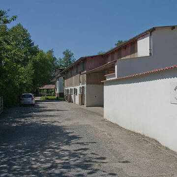
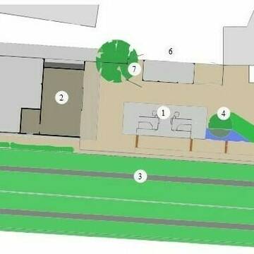
Paddockboxen frei
St.Leon-Rot
J-Becker
@J-Becker
FN-Mitglied
Freizeitstall
Longierzirkel/Roundpen
Paddock
Hufrehe geeignet
Außenbox mit Paddock
Laufstall
11 weitere...
S
Deprecated: Creation of dynamic property Zend_View_Helper_Ads::$adLink is deprecated in /var/www/stall-frei/htdocs/staging.stall-frei.de/library/Psf/View/Helper/Ads.php on line 108


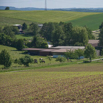
Martinushof
Zeutern
Georg Staudt
@Martinushof-Zeutern
FN-Mitglied
Freizeitstall
Vermieten
Führanlage
Hunde willkommen
Hengsthaltung möglich
Pferdezucht
19 weitere...
S
Birkenhof Gauangelloch
Leimen-Gauangelloch
Friedwalt-Treiber
@Friedwalt-Treiber
FN-Mitglied
Freizeitstall
Longierzirkel/Roundpen
Pensions- und Gastboxen
Außenboxen
Innenbox
Vollpension
11 weitere...
S


Reitanlage Römerhof
Wiesloch
Reitanlage-Roemerhof
@Reitanlage-Roemerhof1
Pferdeausbildung
Reitlehrer und -unterricht
Vermieten
Führanlage
Hunde willkommen
Außenbox mit Paddock
Innenbox
16 weitere...
P+


KRONENHOF KETSCH | Wagner
Ketsch
Kronenhof Ketsch | Wagner
@Kronenhof-Ketsch
FN-Mitglied
Freizeitstall
Vermieten
Führanlage
Paddock
Allergikerstall
Hengsthaltung möglich
16 weitere...
aktuell
S
Ausbildungs- und Pensionsstall Engelberth
Wiesloch
Harald-Engelberth
@Harald-Engelberth
Freizeitstall
Pferdeausbildung
Vermieten
Führanlage
Hunde willkommen
Allergikerstall
27 weitere...
P
Neubau Aktivstall für Allergiker
Sinsheim
Reiterhof-Schmitt
@Reiterhof-Schmitt
Freizeitstall
Vermieten
Hunde willkommen
Krankenbox
Allergikerstall
Hufrehe geeignet
21 weitere...
P+

Frisches Stroh zu verkaufen!
Mechtersen
STALL-FREIde Marketing
@STALL-FREI-Marketing
Kaufe frisches Stroh für dein Pferd!

Freizeitstall Feurer
Nußloch
Julian Feurer
@JulianFeurer
Reitplatz (z.B. Dressur, Springen, Reining)
Außenbox mit Paddock
Offenstall
Biofutter
Halbpension
P


Reitanlage Moser in Sandhausen-Bruchhausen
Sandhausen
Reitanlage Moser
@Reitanlage-Moser
Fahrstall, Kutschwagen
FN-Mitglied
Vermieten
Führanlage
Paddock
Hengsthaltung möglich
Zuchtstutenhaltung möglich
21 weitere...
P+
Leider kein Vorschaubild
Leider kein Vorschaubild
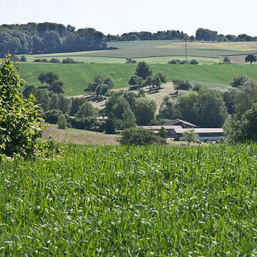
Boxen zur Selbstversorgung 220€
Rauenberg
Clemens Bellemann
@Little-C-Ranch
Vermieten
Paddock
Reitplatz (z.B. Dressur, Springen, Reining)
Außenbox mit Paddock
Offenstall
Selbstversorgung
6 weitere...
B
Deprecated: Creation of dynamic property Zend_View::$pageCount is deprecated in /var/www/stall-frei/htdocs/staging.stall-frei.de/library/vendor/shardj/zf1-future/library/Zend/View/Abstract.php on line 308
Deprecated: Creation of dynamic property Zend_View::$itemCountPerPage is deprecated in /var/www/stall-frei/htdocs/staging.stall-frei.de/library/vendor/shardj/zf1-future/library/Zend/View/Abstract.php on line 308
Deprecated: Creation of dynamic property Zend_View::$first is deprecated in /var/www/stall-frei/htdocs/staging.stall-frei.de/library/vendor/shardj/zf1-future/library/Zend/View/Abstract.php on line 308
Deprecated: Creation of dynamic property Zend_View::$current is deprecated in /var/www/stall-frei/htdocs/staging.stall-frei.de/library/vendor/shardj/zf1-future/library/Zend/View/Abstract.php on line 308
Deprecated: Creation of dynamic property Zend_View::$last is deprecated in /var/www/stall-frei/htdocs/staging.stall-frei.de/library/vendor/shardj/zf1-future/library/Zend/View/Abstract.php on line 308
Deprecated: Creation of dynamic property Zend_View::$next is deprecated in /var/www/stall-frei/htdocs/staging.stall-frei.de/library/vendor/shardj/zf1-future/library/Zend/View/Abstract.php on line 308
Deprecated: Creation of dynamic property Zend_View::$pagesInRange is deprecated in /var/www/stall-frei/htdocs/staging.stall-frei.de/library/vendor/shardj/zf1-future/library/Zend/View/Abstract.php on line 308
Deprecated: Creation of dynamic property Zend_View::$firstPageInRange is deprecated in /var/www/stall-frei/htdocs/staging.stall-frei.de/library/vendor/shardj/zf1-future/library/Zend/View/Abstract.php on line 308
Deprecated: Creation of dynamic property Zend_View::$lastPageInRange is deprecated in /var/www/stall-frei/htdocs/staging.stall-frei.de/library/vendor/shardj/zf1-future/library/Zend/View/Abstract.php on line 308
Deprecated: Creation of dynamic property Zend_View::$currentItemCount is deprecated in /var/www/stall-frei/htdocs/staging.stall-frei.de/library/vendor/shardj/zf1-future/library/Zend/View/Abstract.php on line 308
Deprecated: Creation of dynamic property Zend_View::$totalItemCount is deprecated in /var/www/stall-frei/htdocs/staging.stall-frei.de/library/vendor/shardj/zf1-future/library/Zend/View/Abstract.php on line 308
Deprecated: Creation of dynamic property Zend_View::$firstItemNumber is deprecated in /var/www/stall-frei/htdocs/staging.stall-frei.de/library/vendor/shardj/zf1-future/library/Zend/View/Abstract.php on line 308
Deprecated: Creation of dynamic property Zend_View::$lastItemNumber is deprecated in /var/www/stall-frei/htdocs/staging.stall-frei.de/library/vendor/shardj/zf1-future/library/Zend/View/Abstract.php on line 308
Deprecated: Creation of dynamic property Zend_View::$router is deprecated in /var/www/stall-frei/htdocs/staging.stall-frei.de/library/vendor/shardj/zf1-future/library/Zend/View/Abstract.php on line 308
Deprecated: Creation of dynamic property Zend_View::$urlParams is deprecated in /var/www/stall-frei/htdocs/staging.stall-frei.de/library/vendor/shardj/zf1-future/library/Zend/View/Abstract.php on line 308
Deprecated: Creation of dynamic property Zend_View::$showAds is deprecated in /var/www/stall-frei/htdocs/staging.stall-frei.de/library/vendor/shardj/zf1-future/library/Zend/View/Abstract.php on line 308
Deprecated: Creation of dynamic property Zend_View::$objectIds is deprecated in /var/www/stall-frei/htdocs/staging.stall-frei.de/library/vendor/shardj/zf1-future/library/Zend/View/Abstract.php on line 308
Deprecated: Creation of dynamic property Zend_View::$showNavbar is deprecated in /var/www/stall-frei/htdocs/staging.stall-frei.de/library/vendor/shardj/zf1-future/library/Zend/View/Abstract.php on line 308
Deprecated: Creation of dynamic property Zend_View::$showBreadcrumb is deprecated in /var/www/stall-frei/htdocs/staging.stall-frei.de/library/vendor/shardj/zf1-future/library/Zend/View/Abstract.php on line 308
Deprecated: Creation of dynamic property Zend_View::$showFooter is deprecated in /var/www/stall-frei/htdocs/staging.stall-frei.de/library/vendor/shardj/zf1-future/library/Zend/View/Abstract.php on line 308
Deprecated: Creation of dynamic property Zend_View::$showInternalAds is deprecated in /var/www/stall-frei/htdocs/staging.stall-frei.de/library/vendor/shardj/zf1-future/library/Zend/View/Abstract.php on line 308
Deprecated: Creation of dynamic property Zend_View::$blNoContent is deprecated in /var/www/stall-frei/htdocs/staging.stall-frei.de/library/vendor/shardj/zf1-future/library/Zend/View/Abstract.php on line 308
Deprecated: Creation of dynamic property Zend_View::$sMetaDesc is deprecated in /var/www/stall-frei/htdocs/staging.stall-frei.de/library/vendor/shardj/zf1-future/library/Zend/View/Abstract.php on line 308
Deprecated: Creation of dynamic property Zend_View::$useGmaps is deprecated in /var/www/stall-frei/htdocs/staging.stall-frei.de/library/vendor/shardj/zf1-future/library/Zend/View/Abstract.php on line 308
Deprecated: Creation of dynamic property Zend_View::$touches is deprecated in /var/www/stall-frei/htdocs/staging.stall-frei.de/library/vendor/shardj/zf1-future/library/Zend/View/Abstract.php on line 308
Deprecated: Creation of dynamic property Zend_View::$oProject is deprecated in /var/www/stall-frei/htdocs/staging.stall-frei.de/library/vendor/shardj/zf1-future/library/Zend/View/Abstract.php on line 308
Deprecated: Creation of dynamic property Zend_View::$pageHeadline is deprecated in /var/www/stall-frei/htdocs/staging.stall-frei.de/library/vendor/shardj/zf1-future/library/Zend/View/Abstract.php on line 308
Deprecated: Creation of dynamic property Zend_View::$disableLocationField is deprecated in /var/www/stall-frei/htdocs/staging.stall-frei.de/library/vendor/shardj/zf1-future/library/Zend/View/Abstract.php on line 308
Deprecated: Creation of dynamic property Zend_View::$isSearch is deprecated in /var/www/stall-frei/htdocs/staging.stall-frei.de/library/vendor/shardj/zf1-future/library/Zend/View/Abstract.php on line 308
Deprecated: Creation of dynamic property Zend_View::$pageTitle is deprecated in /var/www/stall-frei/htdocs/staging.stall-frei.de/library/vendor/shardj/zf1-future/library/Zend/View/Abstract.php on line 308
Deprecated: Creation of dynamic property Psf_Form_Element_Text::$class is deprecated in /var/www/stall-frei/htdocs/staging.stall-frei.de/library/vendor/shardj/zf1-future/library/Zend/Form/Element.php on line 874
Deprecated: Creation of dynamic property Psf_Form_Element_Text::$size is deprecated in /var/www/stall-frei/htdocs/staging.stall-frei.de/library/vendor/shardj/zf1-future/library/Zend/Form/Element.php on line 874
Deprecated: Creation of dynamic property Psf_Form_Element_Text::$placeholder is deprecated in /var/www/stall-frei/htdocs/staging.stall-frei.de/library/vendor/shardj/zf1-future/library/Zend/Form/Element.php on line 874
Deprecated: Creation of dynamic property Psf_Form_Element_Hidden::$class is deprecated in /var/www/stall-frei/htdocs/staging.stall-frei.de/library/vendor/shardj/zf1-future/library/Zend/Form/Element.php on line 874
Deprecated: Creation of dynamic property Psf_Form_Element_Hidden::$class is deprecated in /var/www/stall-frei/htdocs/staging.stall-frei.de/library/vendor/shardj/zf1-future/library/Zend/Form/Element.php on line 874
Deprecated: Creation of dynamic property Psf_Form_Element_Hidden::$class is deprecated in /var/www/stall-frei/htdocs/staging.stall-frei.de/library/vendor/shardj/zf1-future/library/Zend/Form/Element.php on line 874
Deprecated: Creation of dynamic property Psf_Form_Element_Hidden::$class is deprecated in /var/www/stall-frei/htdocs/staging.stall-frei.de/library/vendor/shardj/zf1-future/library/Zend/Form/Element.php on line 874
Deprecated: Creation of dynamic property Psf_Form_Element_Select::$class is deprecated in /var/www/stall-frei/htdocs/staging.stall-frei.de/library/vendor/shardj/zf1-future/library/Zend/Form/Element.php on line 874
Deprecated: Creation of dynamic property Psf_Form_Element_Select::$class is deprecated in /var/www/stall-frei/htdocs/staging.stall-frei.de/library/vendor/shardj/zf1-future/library/Zend/Form/Element.php on line 874
Deprecated: Creation of dynamic property Psf_Form_Element_Select::$class is deprecated in /var/www/stall-frei/htdocs/staging.stall-frei.de/library/vendor/shardj/zf1-future/library/Zend/Form/Element.php on line 874
Deprecated: Creation of dynamic property Psf_Form_Element_Select::$class is deprecated in /var/www/stall-frei/htdocs/staging.stall-frei.de/library/vendor/shardj/zf1-future/library/Zend/Form/Element.php on line 874
Deprecated: Creation of dynamic property Psf_Form_Element_Text::$class is deprecated in /var/www/stall-frei/htdocs/staging.stall-frei.de/library/vendor/shardj/zf1-future/library/Zend/Form/Element.php on line 874
Deprecated: Creation of dynamic property Psf_Form_Element_Checkbox::$label is deprecated in /var/www/stall-frei/htdocs/staging.stall-frei.de/library/vendor/shardj/zf1-future/library/Zend/Form/Element.php on line 874
Deprecated: Creation of dynamic property Zend_View::$sort is deprecated in /var/www/stall-frei/htdocs/staging.stall-frei.de/library/vendor/shardj/zf1-future/library/Zend/View/Abstract.php on line 308
Deprecated: Creation of dynamic property Zend_View::$searchLocation is deprecated in /var/www/stall-frei/htdocs/staging.stall-frei.de/library/vendor/shardj/zf1-future/library/Zend/View/Abstract.php on line 308
Deprecated: Creation of dynamic property Zend_View::$locationHint is deprecated in /var/www/stall-frei/htdocs/staging.stall-frei.de/library/vendor/shardj/zf1-future/library/Zend/View/Abstract.php on line 308
Psf_GeoCoder_Abstract::getLocation: Rauenberg Get Location CachedOrLive
Psf_GeoCoder_Abstract::getCachedOrLive: Rauenberg
Psf_GeoCoder_OpenCageData::makeApiRequest: response:
Array
(
[documentation] => https://opencagedata.com/api
[licenses] => Array
(
[0] => Array
(
[name] => see attribution guide
[url] => https://opencagedata.com/credits
)
)
[results] => Array
(
[0] => Array
(
[bounds] => Array
(
[northeast] => Array
(
[lat] => 49.2804299
[lng] => 8.7264492
)
[southwest] => Array
(
[lat] => 49.2499869
[lng] => 8.651274
)
)
[components] => Array
(
[ISO_3166-1_alpha-2] => DE
[ISO_3166-1_alpha-3] => DEU
[ISO_3166-2] => Array
(
[0] => DE-BW
)
[_category] => place
[_normalized_city] => Rauenberg
[_type] => city
[continent] => Europe
[country] => Deutschland
[country_code] => de
[county] => Rhein-Neckar-Kreis
[municipality] => GVV Rauenberg
[political_union] => European Union
[postcode] => 69231
[state] => Baden-Württemberg
[state_code] => BW
[town] => Rauenberg
)
[confidence] => 7
[formatted] => 69231 Rauenberg, Deutschland
[geometry] => Array
(
[lat] => 49.2672457
[lng] => 8.7036146
)
)
[1] => Array
(
[bounds] => Array
(
[northeast] => Array
(
[lat] => 49.7608634
[lng] => 9.4023901
)
[southwest] => Array
(
[lat] => 49.7259591
[lng] => 9.3508213
)
)
[components] => Array
(
[ISO_3166-1_alpha-2] => DE
[ISO_3166-1_alpha-3] => DEU
[ISO_3166-2] => Array
(
[0] => DE-BW
)
[_category] => place
[_normalized_city] => Freudenberg
[_type] => village
[continent] => Europe
[country] => Deutschland
[country_code] => de
[county] => Main-Tauber-Kreis
[political_union] => European Union
[postcode] => 97896
[state] => Baden-Württemberg
[state_code] => BW
[town] => Freudenberg
[village] => Rauenberg
)
[confidence] => 7
[formatted] => 97896 Rauenberg, Deutschland
[geometry] => Array
(
[lat] => 49.7410617
[lng] => 9.383644
)
)
[2] => Array
(
[bounds] => Array
(
[northeast] => Array
(
[lat] => 49.2891794
[lng] => 10.4362314
)
[southwest] => Array
(
[lat] => 49.2890794
[lng] => 10.4361314
)
)
[components] => Array
(
[ISO_3166-1_alpha-2] => DE
[ISO_3166-1_alpha-3] => DEU
[ISO_3166-2] => Array
(
[0] => DE-BY
)
[_category] => natural/water
[_normalized_city] => Leutershausen
[_type] => peak
[continent] => Europe
[country] => Deutschland
[country_code] => de
[county] => Landkreis Ansbach
[peak] => Rauenberg
[political_union] => European Union
[postcode] => 91578
[state] => Bayern
[state_code] => BY
[town] => Leutershausen
)
[confidence] => 9
[formatted] => Rauenberg, 91578 Leutershausen, Deutschland
[geometry] => Array
(
[lat] => 49.2891294
[lng] => 10.4361814
)
)
[3] => Array
(
[bounds] => Array
(
[northeast] => Array
(
[lat] => 50.2311973
[lng] => 9.2318914
)
[southwest] => Array
(
[lat] => 50.2310973
[lng] => 9.2317914
)
)
[components] => Array
(
[ISO_3166-1_alpha-2] => DE
[ISO_3166-1_alpha-3] => DEU
[ISO_3166-2] => Array
(
[0] => DE-HE
)
[_category] => natural/water
[_normalized_city] => Gelnhausen
[_type] => peak
[continent] => Europe
[country] => Deutschland
[country_code] => de
[county] => Main-Kinzig-Kreis
[peak] => Rauenberg
[political_union] => European Union
[state] => Hessen
[state_code] => HE
[town] => Gelnhausen
)
[confidence] => 9
[formatted] => Rauenberg, Gelnhausen, Hessen, Deutschland
[geometry] => Array
(
[lat] => 50.2311473
[lng] => 9.2318414
)
)
[4] => Array
(
[bounds] => Array
(
[northeast] => Array
(
[lat] => 50.171674
[lng] => 9.1600028
)
[southwest] => Array
(
[lat] => 50.171574
[lng] => 9.1599028
)
)
[components] => Array
(
[ISO_3166-1_alpha-2] => DE
[ISO_3166-1_alpha-3] => DEU
[ISO_3166-2] => Array
(
[0] => DE-HE
)
[_category] => natural/water
[_normalized_city] => Gelnhausen
[_type] => peak
[continent] => Europe
[country] => Deutschland
[country_code] => de
[county] => Main-Kinzig-Kreis
[peak] => Rauenberg
[political_union] => European Union
[postcode] => 63571
[state] => Hessen
[state_code] => HE
[town] => Gelnhausen
)
[confidence] => 9
[formatted] => Rauenberg, 63571 Gelnhausen, Deutschland
[geometry] => Array
(
[lat] => 50.171624
[lng] => 9.1599528
)
)
[5] => Array
(
[components] => Array
(
[ISO_3166-1_alpha-2] => FR
[ISO_3166-1_alpha-3] => FRA
[ISO_3166-2] => Array
(
[0] => FR-GES
[1] => FR-57
)
[_category] => place
[_normalized_city] => Frauenberg
[_type] => city
[city] => Frauenberg
[continent] => Europe
[country] => France
[country_code] => fr
[county] => Moselle
[local_authority] => Communauté d'agglomération Sarreguemines Confluences
[political_union] => European Union
[postcode] => 57200
[state] => Grand Est
[state_code] => GES
)
[confidence] => 3
[formatted] => Frauenberg, Moselle, France
[geometry] => Array
(
[lat] => 49.135244
[lng] => 7.123413
)
)
[6] => Array
(
[components] => Array
(
[ISO_3166-1_alpha-2] => FR
[ISO_3166-1_alpha-3] => FRA
[ISO_3166-2] => Array
(
[0] => FR-GES
[1] => FR-6AE
[2] => FR-67
)
[_category] => road
[_normalized_city] => Dambach-la-Ville
[_type] => road
[city] => Dambach-la-Ville
[continent] => Europe
[country] => France
[country_code] => fr
[county] => Bas-Rhin
[local_authority] => Communauté de communes du Pays de Barr
[political_union] => European Union
[postcode] => 67650
[road] => Rue du Rauenberg
[state] => Grand Est
[state_code] => GES
)
[confidence] => 3
[formatted] => Rue du Rauenberg, 67650 Dambach-la-Ville, France
[geometry] => Array
(
[lat] => 48.324437
[lng] => 7.431272
)
)
[7] => Array
(
[components] => Array
(
[ISO_3166-1_alpha-2] => FR
[ISO_3166-1_alpha-3] => FRA
[ISO_3166-2] => Array
(
[0] => FR-GES
[1] => FR-57
)
[_category] => place
[_normalized_city] => Frauenberg
[_type] => place
[city] => Frauenberg
[continent] => Europe
[country] => France
[country_code] => fr
[county] => Moselle
[local_authority] => Communauté d'agglomération Sarreguemines Confluences
[place] => Rue de Deux Ponts
[political_union] => European Union
[postcode] => 57200
[state] => Grand Est
[state_code] => GES
)
[confidence] => 3
[formatted] => Rue de Deux Ponts, 57200 Frauenberg, France
[geometry] => Array
(
[lat] => 49.131039
[lng] => 7.111551
)
)
[8] => Array
(
[components] => Array
(
[ISO_3166-1_alpha-2] => FR
[ISO_3166-1_alpha-3] => FRA
[ISO_3166-2] => Array
(
[0] => FR-GES
[1] => FR-57
)
[_category] => road
[_normalized_city] => Frauenberg
[_type] => road
[city] => Frauenberg
[continent] => Europe
[country] => France
[country_code] => fr
[county] => Moselle
[local_authority] => Communauté d'agglomération Sarreguemines Confluences
[political_union] => European Union
[postcode] => 57200
[road] => Rue des Mésanges
[state] => Grand Est
[state_code] => GES
)
[confidence] => 3
[formatted] => Rue des Mésanges, 57200 Frauenberg, France
[geometry] => Array
(
[lat] => 49.134067
[lng] => 7.124849
)
)
[9] => Array
(
[components] => Array
(
[ISO_3166-1_alpha-2] => FR
[ISO_3166-1_alpha-3] => FRA
[ISO_3166-2] => Array
(
[0] => FR-GES
[1] => FR-57
)
[_category] => road
[_normalized_city] => Frauenberg
[_type] => road
[city] => Frauenberg
[continent] => Europe
[country] => France
[country_code] => fr
[county] => Moselle
[local_authority] => Communauté d'agglomération Sarreguemines Confluences
[political_union] => European Union
[postcode] => 57200
[road] => Rue des Bosquets
[state] => Grand Est
[state_code] => GES
)
[confidence] => 3
[formatted] => Rue des Bosquets, 57200 Frauenberg, France
[geometry] => Array
(
[lat] => 49.135573
[lng] => 7.125062
)
)
)
[status] => Array
(
[code] => 200
[message] => OK
)
[stay_informed] => Array
(
[blog] => https://blog.opencagedata.com
[mastodon] => https://en.osm.town/@opencage
)
[thanks] => For using an OpenCage API
[timestamp] => Array
(
[created_http] => Fri, 06 Feb 2026 17:09:39 GMT
[created_unix] => 1770397779
)
[total_results] => 10
)
Psf_GeoCoder_Abstract::convertLocationResult
{"documentation":"https:\/\/opencagedata.com\/api","licenses":[{"name":"see attribution guide","url":"https:\/\/opencagedata.com\/credits"}],"results":[{"bounds":{"northeast":{"lat":49.2804299,"lng":8.7264492},"southwest":{"lat":49.2499869,"lng":8.651274}},"components":{"ISO_3166-1_alpha-2":"DE","ISO_3166-1_alpha-3":"DEU","ISO_3166-2":["DE-BW"],"_category":"place","_normalized_city":"Rauenberg","_type":"city","continent":"Europe","country":"Deutschland","country_code":"de","county":"Rhein-Neckar-Kreis","municipality":"GVV Rauenberg","political_union":"European Union","postcode":"69231","state":"Baden-W\u00fcrttemberg","state_code":"BW","town":"Rauenberg"},"confidence":7,"formatted":"69231 Rauenberg, Deutschland","geometry":{"lat":49.2672457,"lng":8.7036146}},{"bounds":{"northeast":{"lat":49.7608634,"lng":9.4023901},"southwest":{"lat":49.7259591,"lng":9.3508213}},"components":{"ISO_3166-1_alpha-2":"DE","ISO_3166-1_alpha-3":"DEU","ISO_3166-2":["DE-BW"],"_category":"place","_normalized_city":"Freudenberg","_type":"village","continent":"Europe","country":"Deutschland","country_code":"de","county":"Main-Tauber-Kreis","political_union":"European Union","postcode":"97896","state":"Baden-W\u00fcrttemberg","state_code":"BW","town":"Freudenberg","village":"Rauenberg"},"confidence":7,"formatted":"97896 Rauenberg, Deutschland","geometry":{"lat":49.7410617,"lng":9.383644}},{"bounds":{"northeast":{"lat":49.2891794,"lng":10.4362314},"southwest":{"lat":49.2890794,"lng":10.4361314}},"components":{"ISO_3166-1_alpha-2":"DE","ISO_3166-1_alpha-3":"DEU","ISO_3166-2":["DE-BY"],"_category":"natural\/water","_normalized_city":"Leutershausen","_type":"peak","continent":"Europe","country":"Deutschland","country_code":"de","county":"Landkreis Ansbach","peak":"Rauenberg","political_union":"European Union","postcode":"91578","state":"Bayern","state_code":"BY","town":"Leutershausen"},"confidence":9,"formatted":"Rauenberg, 91578 Leutershausen, Deutschland","geometry":{"lat":49.2891294,"lng":10.4361814}},{"bounds":{"northeast":{"lat":50.2311973,"lng":9.2318914},"southwest":{"lat":50.2310973,"lng":9.2317914}},"components":{"ISO_3166-1_alpha-2":"DE","ISO_3166-1_alpha-3":"DEU","ISO_3166-2":["DE-HE"],"_category":"natural\/water","_normalized_city":"Gelnhausen","_type":"peak","continent":"Europe","country":"Deutschland","country_code":"de","county":"Main-Kinzig-Kreis","peak":"Rauenberg","political_union":"European Union","state":"Hessen","state_code":"HE","town":"Gelnhausen"},"confidence":9,"formatted":"Rauenberg, Gelnhausen, Hessen, Deutschland","geometry":{"lat":50.2311473,"lng":9.2318414}},{"bounds":{"northeast":{"lat":50.171674,"lng":9.1600028},"southwest":{"lat":50.171574,"lng":9.1599028}},"components":{"ISO_3166-1_alpha-2":"DE","ISO_3166-1_alpha-3":"DEU","ISO_3166-2":["DE-HE"],"_category":"natural\/water","_normalized_city":"Gelnhausen","_type":"peak","continent":"Europe","country":"Deutschland","country_code":"de","county":"Main-Kinzig-Kreis","peak":"Rauenberg","political_union":"European Union","postcode":"63571","state":"Hessen","state_code":"HE","town":"Gelnhausen"},"confidence":9,"formatted":"Rauenberg, 63571 Gelnhausen, Deutschland","geometry":{"lat":50.171624,"lng":9.1599528}},{"components":{"ISO_3166-1_alpha-2":"FR","ISO_3166-1_alpha-3":"FRA","ISO_3166-2":["FR-GES","FR-57"],"_category":"place","_normalized_city":"Frauenberg","_type":"city","city":"Frauenberg","continent":"Europe","country":"France","country_code":"fr","county":"Moselle","local_authority":"Communaut\u00e9 d'agglom\u00e9ration Sarreguemines Confluences","political_union":"European Union","postcode":"57200","state":"Grand Est","state_code":"GES"},"confidence":3,"formatted":"Frauenberg, Moselle, France","geometry":{"lat":49.135244,"lng":7.123413}},{"components":{"ISO_3166-1_alpha-2":"FR","ISO_3166-1_alpha-3":"FRA","ISO_3166-2":["FR-GES","FR-6AE","FR-67"],"_category":"road","_normalized_city":"Dambach-la-Ville","_type":"road","city":"Dambach-la-Ville","continent":"Europe","country":"France","country_code":"fr","county":"Bas-Rhin","local_authority":"Communaut\u00e9 de communes du Pays de Barr","political_union":"European Union","postcode":"67650","road":"Rue du Rauenberg","state":"Grand Est","state_code":"GES"},"confidence":3,"formatted":"Rue du Rauenberg, 67650 Dambach-la-Ville, France","geometry":{"lat":48.324437,"lng":7.431272}},{"components":{"ISO_3166-1_alpha-2":"FR","ISO_3166-1_alpha-3":"FRA","ISO_3166-2":["FR-GES","FR-57"],"_category":"place","_normalized_city":"Frauenberg","_type":"place","city":"Frauenberg","continent":"Europe","country":"France","country_code":"fr","county":"Moselle","local_authority":"Communaut\u00e9 d'agglom\u00e9ration Sarreguemines Confluences","place":"Rue de Deux Ponts","political_union":"European Union","postcode":"57200","state":"Grand Est","state_code":"GES"},"confidence":3,"formatted":"Rue de Deux Ponts, 57200 Frauenberg, France","geometry":{"lat":49.131039,"lng":7.111551}},{"components":{"ISO_3166-1_alpha-2":"FR","ISO_3166-1_alpha-3":"FRA","ISO_3166-2":["FR-GES","FR-57"],"_category":"road","_normalized_city":"Frauenberg","_type":"road","city":"Frauenberg","continent":"Europe","country":"France","country_code":"fr","county":"Moselle","local_authority":"Communaut\u00e9 d'agglom\u00e9ration Sarreguemines Confluences","political_union":"European Union","postcode":"57200","road":"Rue des M\u00e9sanges","state":"Grand Est","state_code":"GES"},"confidence":3,"formatted":"Rue des M\u00e9sanges, 57200 Frauenberg, France","geometry":{"lat":49.134067,"lng":7.124849}},{"components":{"ISO_3166-1_alpha-2":"FR","ISO_3166-1_alpha-3":"FRA","ISO_3166-2":["FR-GES","FR-57"],"_category":"road","_normalized_city":"Frauenberg","_type":"road","city":"Frauenberg","continent":"Europe","country":"France","country_code":"fr","county":"Moselle","local_authority":"Communaut\u00e9 d'agglom\u00e9ration Sarreguemines Confluences","political_union":"European Union","postcode":"57200","road":"Rue des Bosquets","state":"Grand Est","state_code":"GES"},"confidence":3,"formatted":"Rue des Bosquets, 57200 Frauenberg, France","geometry":{"lat":49.135573,"lng":7.125062}}],"status":{"code":200,"message":"OK"},"stay_informed":{"blog":"https:\/\/blog.opencagedata.com","mastodon":"https:\/\/en.osm.town\/@opencage"},"thanks":"For using an OpenCage API","timestamp":{"created_http":"Fri, 06 Feb 2026 17:09:39 GMT","created_unix":1770397779},"total_results":10}Array
(
[0] => stdClass Object
(
[bounds] => stdClass Object
(
[northeast] => stdClass Object
(
[lat] => 49.2804299
[lng] => 8.7264492
)
[southwest] => stdClass Object
(
[lat] => 49.2499869
[lng] => 8.651274
)
)
[components] => stdClass Object
(
[ISO_3166-1_alpha-2] => DE
[ISO_3166-1_alpha-3] => DEU
[ISO_3166-2] => Array
(
[0] => DE-BW
)
[_category] => place
[_normalized_city] => Rauenberg
[_type] => city
[continent] => Europe
[country] => Deutschland
[country_code] => de
[county] => Rhein-Neckar-Kreis
[municipality] => GVV Rauenberg
[political_union] => European Union
[postcode] => 69231
[state] => Baden-Württemberg
[state_code] => BW
[town] => Rauenberg
)
[confidence] => 7
[formatted] => 69231 Rauenberg, Deutschland
[geometry] => stdClass Object
(
[lat] => 49.2672457
[lng] => 8.7036146
)
)
[1] => stdClass Object
(
[bounds] => stdClass Object
(
[northeast] => stdClass Object
(
[lat] => 49.7608634
[lng] => 9.4023901
)
[southwest] => stdClass Object
(
[lat] => 49.7259591
[lng] => 9.3508213
)
)
[components] => stdClass Object
(
[ISO_3166-1_alpha-2] => DE
[ISO_3166-1_alpha-3] => DEU
[ISO_3166-2] => Array
(
[0] => DE-BW
)
[_category] => place
[_normalized_city] => Freudenberg
[_type] => village
[continent] => Europe
[country] => Deutschland
[country_code] => de
[county] => Main-Tauber-Kreis
[political_union] => European Union
[postcode] => 97896
[state] => Baden-Württemberg
[state_code] => BW
[town] => Freudenberg
[village] => Rauenberg
)
[confidence] => 7
[formatted] => 97896 Rauenberg, Deutschland
[geometry] => stdClass Object
(
[lat] => 49.7410617
[lng] => 9.383644
)
)
[2] => stdClass Object
(
[bounds] => stdClass Object
(
[northeast] => stdClass Object
(
[lat] => 49.2891794
[lng] => 10.4362314
)
[southwest] => stdClass Object
(
[lat] => 49.2890794
[lng] => 10.4361314
)
)
[components] => stdClass Object
(
[ISO_3166-1_alpha-2] => DE
[ISO_3166-1_alpha-3] => DEU
[ISO_3166-2] => Array
(
[0] => DE-BY
)
[_category] => natural/water
[_normalized_city] => Leutershausen
[_type] => peak
[continent] => Europe
[country] => Deutschland
[country_code] => de
[county] => Landkreis Ansbach
[peak] => Rauenberg
[political_union] => European Union
[postcode] => 91578
[state] => Bayern
[state_code] => BY
[town] => Leutershausen
)
[confidence] => 9
[formatted] => Rauenberg, 91578 Leutershausen, Deutschland
[geometry] => stdClass Object
(
[lat] => 49.2891294
[lng] => 10.4361814
)
)
[3] => stdClass Object
(
[bounds] => stdClass Object
(
[northeast] => stdClass Object
(
[lat] => 50.2311973
[lng] => 9.2318914
)
[southwest] => stdClass Object
(
[lat] => 50.2310973
[lng] => 9.2317914
)
)
[components] => stdClass Object
(
[ISO_3166-1_alpha-2] => DE
[ISO_3166-1_alpha-3] => DEU
[ISO_3166-2] => Array
(
[0] => DE-HE
)
[_category] => natural/water
[_normalized_city] => Gelnhausen
[_type] => peak
[continent] => Europe
[country] => Deutschland
[country_code] => de
[county] => Main-Kinzig-Kreis
[peak] => Rauenberg
[political_union] => European Union
[state] => Hessen
[state_code] => HE
[town] => Gelnhausen
)
[confidence] => 9
[formatted] => Rauenberg, Gelnhausen, Hessen, Deutschland
[geometry] => stdClass Object
(
[lat] => 50.2311473
[lng] => 9.2318414
)
)
[4] => stdClass Object
(
[bounds] => stdClass Object
(
[northeast] => stdClass Object
(
[lat] => 50.171674
[lng] => 9.1600028
)
[southwest] => stdClass Object
(
[lat] => 50.171574
[lng] => 9.1599028
)
)
[components] => stdClass Object
(
[ISO_3166-1_alpha-2] => DE
[ISO_3166-1_alpha-3] => DEU
[ISO_3166-2] => Array
(
[0] => DE-HE
)
[_category] => natural/water
[_normalized_city] => Gelnhausen
[_type] => peak
[continent] => Europe
[country] => Deutschland
[country_code] => de
[county] => Main-Kinzig-Kreis
[peak] => Rauenberg
[political_union] => European Union
[postcode] => 63571
[state] => Hessen
[state_code] => HE
[town] => Gelnhausen
)
[confidence] => 9
[formatted] => Rauenberg, 63571 Gelnhausen, Deutschland
[geometry] => stdClass Object
(
[lat] => 50.171624
[lng] => 9.1599528
)
)
[5] => stdClass Object
(
[components] => stdClass Object
(
[ISO_3166-1_alpha-2] => FR
[ISO_3166-1_alpha-3] => FRA
[ISO_3166-2] => Array
(
[0] => FR-GES
[1] => FR-57
)
[_category] => place
[_normalized_city] => Frauenberg
[_type] => city
[city] => Frauenberg
[continent] => Europe
[country] => France
[country_code] => fr
[county] => Moselle
[local_authority] => Communauté d'agglomération Sarreguemines Confluences
[political_union] => European Union
[postcode] => 57200
[state] => Grand Est
[state_code] => GES
)
[confidence] => 3
[formatted] => Frauenberg, Moselle, France
[geometry] => stdClass Object
(
[lat] => 49.135244
[lng] => 7.123413
)
)
[6] => stdClass Object
(
[components] => stdClass Object
(
[ISO_3166-1_alpha-2] => FR
[ISO_3166-1_alpha-3] => FRA
[ISO_3166-2] => Array
(
[0] => FR-GES
[1] => FR-6AE
[2] => FR-67
)
[_category] => road
[_normalized_city] => Dambach-la-Ville
[_type] => road
[city] => Dambach-la-Ville
[continent] => Europe
[country] => France
[country_code] => fr
[county] => Bas-Rhin
[local_authority] => Communauté de communes du Pays de Barr
[political_union] => European Union
[postcode] => 67650
[road] => Rue du Rauenberg
[state] => Grand Est
[state_code] => GES
)
[confidence] => 3
[formatted] => Rue du Rauenberg, 67650 Dambach-la-Ville, France
[geometry] => stdClass Object
(
[lat] => 48.324437
[lng] => 7.431272
)
)
[7] => stdClass Object
(
[components] => stdClass Object
(
[ISO_3166-1_alpha-2] => FR
[ISO_3166-1_alpha-3] => FRA
[ISO_3166-2] => Array
(
[0] => FR-GES
[1] => FR-57
)
[_category] => place
[_normalized_city] => Frauenberg
[_type] => place
[city] => Frauenberg
[continent] => Europe
[country] => France
[country_code] => fr
[county] => Moselle
[local_authority] => Communauté d'agglomération Sarreguemines Confluences
[place] => Rue de Deux Ponts
[political_union] => European Union
[postcode] => 57200
[state] => Grand Est
[state_code] => GES
)
[confidence] => 3
[formatted] => Rue de Deux Ponts, 57200 Frauenberg, France
[geometry] => stdClass Object
(
[lat] => 49.131039
[lng] => 7.111551
)
)
[8] => stdClass Object
(
[components] => stdClass Object
(
[ISO_3166-1_alpha-2] => FR
[ISO_3166-1_alpha-3] => FRA
[ISO_3166-2] => Array
(
[0] => FR-GES
[1] => FR-57
)
[_category] => road
[_normalized_city] => Frauenberg
[_type] => road
[city] => Frauenberg
[continent] => Europe
[country] => France
[country_code] => fr
[county] => Moselle
[local_authority] => Communauté d'agglomération Sarreguemines Confluences
[political_union] => European Union
[postcode] => 57200
[road] => Rue des Mésanges
[state] => Grand Est
[state_code] => GES
)
[confidence] => 3
[formatted] => Rue des Mésanges, 57200 Frauenberg, France
[geometry] => stdClass Object
(
[lat] => 49.134067
[lng] => 7.124849
)
)
[9] => stdClass Object
(
[components] => stdClass Object
(
[ISO_3166-1_alpha-2] => FR
[ISO_3166-1_alpha-3] => FRA
[ISO_3166-2] => Array
(
[0] => FR-GES
[1] => FR-57
)
[_category] => road
[_normalized_city] => Frauenberg
[_type] => road
[city] => Frauenberg
[continent] => Europe
[country] => France
[country_code] => fr
[county] => Moselle
[local_authority] => Communauté d'agglomération Sarreguemines Confluences
[political_union] => European Union
[postcode] => 57200
[road] => Rue des Bosquets
[state] => Grand Est
[state_code] => GES
)
[confidence] => 3
[formatted] => Rue des Bosquets, 57200 Frauenberg, France
[geometry] => stdClass Object
(
[lat] => 49.135573
[lng] => 7.125062
)
)
)
Psf_GeoCoder_OpenCageData::getKeyMap: 0
stdClass Object
(
    [bounds] => stdClass Object
        (
            [northeast] => stdClass Object
                (
                    [lat] => 49.2804299
                    [lng] => 8.7264492
                )

            [southwest] => stdClass Object
                (
                    [lat] => 49.2499869
                    [lng] => 8.651274
                )

        )

    [components] => stdClass Object
        (
            [ISO_3166-1_alpha-2] => DE
            [ISO_3166-1_alpha-3] => DEU
            [ISO_3166-2] => Array
                (
                    [0] => DE-BW
                )

            [_category] => place
            [_normalized_city] => Rauenberg
            [_type] => city
            [continent] => Europe
            [country] => Deutschland
            [country_code] => de
            [county] => Rhein-Neckar-Kreis
            [municipality] => GVV Rauenberg
            [political_union] => European Union
            [postcode] => 69231
            [state] => Baden-Württemberg
            [state_code] => BW
            [town] => Rauenberg
        )

    [confidence] => 7
    [formatted] => 69231 Rauenberg, Deutschland
    [geometry] => stdClass Object
        (
            [lat] => 49.2672457
            [lng] => 8.7036146
        )

)
Psf_GeoCoder_OpenCageData::getCounty: Rhein-Neckar-Kreis
Psf_GeoCoder_OpenCageData::addMissingData REFETCH!
Array
(
    [address] => 69231 Rauenberg, Deutschland
    [type] => city
    [street] =>
    [city] => Rauenberg
    [county] => Rhein-Neckar-Kreis
    [state] => Baden-Württemberg
    [zip] => 69231
    [country] => Deutschland
    [suburb] =>
    [countrycode] => de
    [latitude] => 49.2672457
    [longitude] => 8.7036146
    [accuracy] => 1
    [confidence] => 7
    [bounds] => stdClass Object
        (
            [northeast] => stdClass Object
                (
                    [lat] => 49.2804299
                    [lng] => 8.7264492
                )

            [southwest] => stdClass Object
                (
                    [lat] => 49.2499869
                    [lng] => 8.651274
                )

        )

)
reformat!
Array
(
    [address] => 69231 Rauenberg, Deutschland
    [type] => city
    [street] =>
    [city] => Rauenberg
    [county] => Rhein-Neckar-Kreis
    [state] => Baden-Württemberg
    [zip] => 69231
    [country] => Deutschland
    [suburb] =>
    [countrycode] => de
    [latitude] => 49.2672457
    [longitude] => 8.7036146
    [accuracy] => 1
    [confidence] => 7
    [bounds] => stdClass Object
        (
            [northeast] => stdClass Object
                (
                    [lat] => 49.2804299
                    [lng] => 8.7264492
                )

            [southwest] => stdClass Object
                (
                    [lat] => 49.2499869
                    [lng] => 8.651274
                )

        )

    [place] => 69231 Rauenberg, Baden-Württemberg
    [hash] => ad59a15ea3fb45242633167356dc4d06
)
Psf_GeoCoder_OpenCageData::getKeyMap: 1
stdClass Object
(
    [bounds] => stdClass Object
        (
            [northeast] => stdClass Object
                (
                    [lat] => 49.7608634
                    [lng] => 9.4023901
                )

            [southwest] => stdClass Object
                (
                    [lat] => 49.7259591
                    [lng] => 9.3508213
                )

        )

    [components] => stdClass Object
        (
            [ISO_3166-1_alpha-2] => DE
            [ISO_3166-1_alpha-3] => DEU
            [ISO_3166-2] => Array
                (
                    [0] => DE-BW
                )

            [_category] => place
            [_normalized_city] => Freudenberg
            [_type] => village
            [continent] => Europe
            [country] => Deutschland
            [country_code] => de
            [county] => Main-Tauber-Kreis
            [political_union] => European Union
            [postcode] => 97896
            [state] => Baden-Württemberg
            [state_code] => BW
            [town] => Freudenberg
            [village] => Rauenberg
        )

    [confidence] => 7
    [formatted] => 97896 Rauenberg, Deutschland
    [geometry] => stdClass Object
        (
            [lat] => 49.7410617
            [lng] => 9.383644
        )

)
Psf_GeoCoder_OpenCageData::getCounty: Main-Tauber-Kreis
Psf_GeoCoder_OpenCageData::addMissingData REFETCH!
Array
(
    [address] => 97896 Rauenberg, Deutschland
    [type] => village
    [street] =>
    [city] => Freudenberg
    [county] => Main-Tauber-Kreis
    [state] => Baden-Württemberg
    [zip] => 97896
    [country] => Deutschland
    [suburb] =>
    [countrycode] => de
    [latitude] => 49.7410617
    [longitude] => 9.383644
    [accuracy] => 1
    [confidence] => 7
    [bounds] => stdClass Object
        (
            [northeast] => stdClass Object
                (
                    [lat] => 49.7608634
                    [lng] => 9.4023901
                )

            [southwest] => stdClass Object
                (
                    [lat] => 49.7259591
                    [lng] => 9.3508213
                )

        )

)
reformat!
Array
(
    [address] => 97896 Freudenberg
    [type] => village
    [street] =>
    [city] => Freudenberg
    [county] => Main-Tauber-Kreis
    [state] => Baden-Württemberg
    [zip] => 97896
    [country] => Deutschland
    [suburb] =>
    [countrycode] => de
    [latitude] => 49.7410617
    [longitude] => 9.383644
    [accuracy] => 1
    [confidence] => 7
    [bounds] => stdClass Object
        (
            [northeast] => stdClass Object
                (
                    [lat] => 49.7608634
                    [lng] => 9.4023901
                )

            [southwest] => stdClass Object
                (
                    [lat] => 49.7259591
                    [lng] => 9.3508213
                )

        )

    [place] => 97896 Freudenberg, Baden-Württemberg
    [hash] => 21bfe3cedc4df30d3594575452853734
)
Psf_GeoCoder_OpenCageData::getKeyMap: 2
stdClass Object
(
    [bounds] => stdClass Object
        (
            [northeast] => stdClass Object
                (
                    [lat] => 49.2891794
                    [lng] => 10.4362314
                )

            [southwest] => stdClass Object
                (
                    [lat] => 49.2890794
                    [lng] => 10.4361314
                )

        )

    [components] => stdClass Object
        (
            [ISO_3166-1_alpha-2] => DE
            [ISO_3166-1_alpha-3] => DEU
            [ISO_3166-2] => Array
                (
                    [0] => DE-BY
                )

            [_category] => natural/water
            [_normalized_city] => Leutershausen
            [_type] => peak
            [continent] => Europe
            [country] => Deutschland
            [country_code] => de
            [county] => Landkreis Ansbach
            [peak] => Rauenberg
            [political_union] => European Union
            [postcode] => 91578
            [state] => Bayern
            [state_code] => BY
            [town] => Leutershausen
        )

    [confidence] => 9
    [formatted] => Rauenberg, 91578 Leutershausen, Deutschland
    [geometry] => stdClass Object
        (
            [lat] => 49.2891294
            [lng] => 10.4361814
        )

)
Psf_GeoCoder_OpenCageData::getCounty: Ansbach
Psf_GeoCoder_OpenCageData::addMissingData REFETCH!
Array
(
    [address] => Rauenberg, 91578 Leutershausen, Deutschland
    [type] => peak
    [street] =>
    [city] => Leutershausen
    [county] => Ansbach
    [state] => Bayern
    [zip] => 91578
    [country] => Deutschland
    [suburb] =>
    [countrycode] => de
    [latitude] => 49.2891294
    [longitude] => 10.4361814
    [accuracy] => 1
    [confidence] => 9
    [bounds] => stdClass Object
        (
            [northeast] => stdClass Object
                (
                    [lat] => 49.2891794
                    [lng] => 10.4362314
                )

            [southwest] => stdClass Object
                (
                    [lat] => 49.2890794
                    [lng] => 10.4361314
                )

        )

)
reformat!
Array
(
    [address] => Rauenberg, 91578 Leutershausen, Deutschland
    [type] => peak
    [street] =>
    [city] => Leutershausen
    [county] => Ansbach
    [state] => Bayern
    [zip] => 91578
    [country] => Deutschland
    [suburb] =>
    [countrycode] => de
    [latitude] => 49.2891294
    [longitude] => 10.4361814
    [accuracy] => 1
    [confidence] => 9
    [bounds] => stdClass Object
        (
            [northeast] => stdClass Object
                (
                    [lat] => 49.2891794
                    [lng] => 10.4362314
                )

            [southwest] => stdClass Object
                (
                    [lat] => 49.2890794
                    [lng] => 10.4361314
                )

        )

    [place] => 91578 Leutershausen, Bayern
    [hash] => 2232c1a8664cd1f976ca3b0d1fec9b87
)
Psf_GeoCoder_OpenCageData::getKeyMap: 3
stdClass Object
(
    [bounds] => stdClass Object
        (
            [northeast] => stdClass Object
                (
                    [lat] => 50.2311973
                    [lng] => 9.2318914
                )

            [southwest] => stdClass Object
                (
                    [lat] => 50.2310973
                    [lng] => 9.2317914
                )

        )

    [components] => stdClass Object
        (
            [ISO_3166-1_alpha-2] => DE
            [ISO_3166-1_alpha-3] => DEU
            [ISO_3166-2] => Array
                (
                    [0] => DE-HE
                )

            [_category] => natural/water
            [_normalized_city] => Gelnhausen
            [_type] => peak
            [continent] => Europe
            [country] => Deutschland
            [country_code] => de
            [county] => Main-Kinzig-Kreis
            [peak] => Rauenberg
            [political_union] => European Union
            [state] => Hessen
            [state_code] => HE
            [town] => Gelnhausen
        )

    [confidence] => 9
    [formatted] => Rauenberg, Gelnhausen, Hessen, Deutschland
    [geometry] => stdClass Object
        (
            [lat] => 50.2311473
            [lng] => 9.2318414
        )

)
Psf_GeoCoder_OpenCageData::getCounty: Main-Kinzig-Kreis
Psf_GeoCoder_OpenCageData::addMissingData REFETCH!
Array
(
    [address] => Rauenberg, Gelnhausen, Hessen, Deutschland
    [type] => peak
    [street] =>
    [city] => Gelnhausen
    [county] => Main-Kinzig-Kreis
    [state] => Hessen
    [zip] =>
    [country] => Deutschland
    [suburb] =>
    [countrycode] => de
    [latitude] => 50.2311473
    [longitude] => 9.2318414
    [accuracy] => 1
    [confidence] => 9
    [bounds] => stdClass Object
        (
            [northeast] => stdClass Object
                (
                    [lat] => 50.2311973
                    [lng] => 9.2318914
                )

            [southwest] => stdClass Object
                (
                    [lat] => 50.2310973
                    [lng] => 9.2317914
                )

        )

)
reformat!
Array
(
    [address] => Rauenberg, Gelnhausen, Hessen, Deutschland
    [type] => peak
    [street] =>
    [city] => Gelnhausen
    [county] => Main-Kinzig-Kreis
    [state] => Hessen
    [zip] =>
    [country] => Deutschland
    [suburb] =>
    [countrycode] => de
    [latitude] => 50.2311473
    [longitude] => 9.2318414
    [accuracy] => 1
    [confidence] => 9
    [bounds] => stdClass Object
        (
            [northeast] => stdClass Object
                (
                    [lat] => 50.2311973
                    [lng] => 9.2318914
                )

            [southwest] => stdClass Object
                (
                    [lat] => 50.2310973
                    [lng] => 9.2317914
                )

        )

    [place] => Gelnhausen, Hessen
    [hash] => 6c9832b41917759247ffbdff5216be4c
)
Psf_GeoCoder_OpenCageData::getKeyMap: 4
stdClass Object
(
    [bounds] => stdClass Object
        (
            [northeast] => stdClass Object
                (
                    [lat] => 50.171674
                    [lng] => 9.1600028
                )

            [southwest] => stdClass Object
                (
                    [lat] => 50.171574
                    [lng] => 9.1599028
                )

        )

    [components] => stdClass Object
        (
            [ISO_3166-1_alpha-2] => DE
            [ISO_3166-1_alpha-3] => DEU
            [ISO_3166-2] => Array
                (
                    [0] => DE-HE
                )

            [_category] => natural/water
            [_normalized_city] => Gelnhausen
            [_type] => peak
            [continent] => Europe
            [country] => Deutschland
            [country_code] => de
            [county] => Main-Kinzig-Kreis
            [peak] => Rauenberg
            [political_union] => European Union
            [postcode] => 63571
            [state] => Hessen
            [state_code] => HE
            [town] => Gelnhausen
        )

    [confidence] => 9
    [formatted] => Rauenberg, 63571 Gelnhausen, Deutschland
    [geometry] => stdClass Object
        (
            [lat] => 50.171624
            [lng] => 9.1599528
        )

)
Psf_GeoCoder_OpenCageData::getCounty: Main-Kinzig-Kreis
Psf_GeoCoder_OpenCageData::addMissingData REFETCH!
Array
(
    [address] => Rauenberg, 63571 Gelnhausen, Deutschland
    [type] => peak
    [street] =>
    [city] => Gelnhausen
    [county] => Main-Kinzig-Kreis
    [state] => Hessen
    [zip] => 63571
    [country] => Deutschland
    [suburb] =>
    [countrycode] => de
    [latitude] => 50.171624
    [longitude] => 9.1599528
    [accuracy] => 1
    [confidence] => 9
    [bounds] => stdClass Object
        (
            [northeast] => stdClass Object
                (
                    [lat] => 50.171674
                    [lng] => 9.1600028
                )

            [southwest] => stdClass Object
                (
                    [lat] => 50.171574
                    [lng] => 9.1599028
                )

        )

)
reformat!
Array
(
    [address] => Rauenberg, 63571 Gelnhausen, Deutschland
    [type] => peak
    [street] =>
    [city] => Gelnhausen
    [county] => Main-Kinzig-Kreis
    [state] => Hessen
    [zip] => 63571
    [country] => Deutschland
    [suburb] =>
    [countrycode] => de
    [latitude] => 50.171624
    [longitude] => 9.1599528
    [accuracy] => 1
    [confidence] => 9
    [bounds] => stdClass Object
        (
            [northeast] => stdClass Object
                (
                    [lat] => 50.171674
                    [lng] => 9.1600028
                )

            [southwest] => stdClass Object
                (
                    [lat] => 50.171574
                    [lng] => 9.1599028
                )

        )

    [place] => 63571 Gelnhausen, Hessen
    [hash] => d0bcec46a3f03b7f1b409cee2134d175
)
Psf_GeoCoder_OpenCageData::getKeyMap: 5
stdClass Object
(
    [components] => stdClass Object
        (
            [ISO_3166-1_alpha-2] => FR
            [ISO_3166-1_alpha-3] => FRA
            [ISO_3166-2] => Array
                (
                    [0] => FR-GES
                    [1] => FR-57
                )

            [_category] => place
            [_normalized_city] => Frauenberg
            [_type] => city
            [city] => Frauenberg
            [continent] => Europe
            [country] => France
            [country_code] => fr
            [county] => Moselle
            [local_authority] => Communauté d'agglomération Sarreguemines Confluences
            [political_union] => European Union
            [postcode] => 57200
            [state] => Grand Est
            [state_code] => GES
        )

    [confidence] => 3
    [formatted] => Frauenberg, Moselle, France
    [geometry] => stdClass Object
        (
            [lat] => 49.135244
            [lng] => 7.123413
        )

)
Psf_GeoCoder_OpenCageData::getCounty: Moselle
Psf_GeoCoder_OpenCageData::addMissingData REFETCH!
Array
(
    [address] => Frauenberg, Moselle, France
    [type] => city
    [street] =>
    [city] => Frauenberg
    [county] => Moselle
    [state] => Grand Est
    [zip] => 57200
    [country] => France
    [suburb] =>
    [countrycode] => fr
    [latitude] => 49.135244
    [longitude] => 7.123413
    [accuracy] => 1
    [confidence] => 3
    [bounds] =>
)
reformat!
Array
(
    [address] => Frauenberg, Moselle, France
    [type] => city
    [street] =>
    [city] => Frauenberg
    [county] => Moselle
    [state] => Grand Est
    [zip] => 57200
    [country] => France
    [suburb] =>
    [countrycode] => fr
    [latitude] => 49.135244
    [longitude] => 7.123413
    [accuracy] => 1
    [confidence] => 3
    [bounds] =>
    [place] => 57200 Frauenberg, Grand Est
    [hash] => dd83709eef8cba9f3a7961057d826983
)
Psf_GeoCoder_OpenCageData::getKeyMap: 6
stdClass Object
(
    [components] => stdClass Object
        (
            [ISO_3166-1_alpha-2] => FR
            [ISO_3166-1_alpha-3] => FRA
            [ISO_3166-2] => Array
                (
                    [0] => FR-GES
                    [1] => FR-6AE
                    [2] => FR-67
                )

            [_category] => road
            [_normalized_city] => Dambach-la-Ville
            [_type] => road
            [city] => Dambach-la-Ville
            [continent] => Europe
            [country] => France
            [country_code] => fr
            [county] => Bas-Rhin
            [local_authority] => Communauté de communes du Pays de Barr
            [political_union] => European Union
            [postcode] => 67650
            [road] => Rue du Rauenberg
            [state] => Grand Est
            [state_code] => GES
        )

    [confidence] => 3
    [formatted] => Rue du Rauenberg, 67650 Dambach-la-Ville, France
    [geometry] => stdClass Object
        (
            [lat] => 48.324437
            [lng] => 7.431272
        )

)
Psf_GeoCoder_OpenCageData::getCounty: Bas-Rhin
Psf_GeoCoder_OpenCageData::addMissingData REFETCH!
Array
(
    [address] => Rue du Rauenberg, 67650 Dambach-la-Ville, France
    [type] => road
    [street] => Rue du Rauenberg
    [city] => Dambach-la-Ville
    [county] => Bas-Rhin
    [state] => Grand Est
    [zip] => 67650
    [country] => France
    [suburb] =>
    [countrycode] => fr
    [latitude] => 48.324437
    [longitude] => 7.431272
    [accuracy] => 1
    [confidence] => 3
    [bounds] =>
)
reformat!
Array
(
    [address] => Rue du Rauenberg, 67650 Dambach-la-Ville, France
    [type] => road
    [street] => Rue du Rauenberg
    [city] => Dambach-la-Ville
    [county] => Bas-Rhin
    [state] => Grand Est
    [zip] => 67650
    [country] => France
    [suburb] =>
    [countrycode] => fr
    [latitude] => 48.324437
    [longitude] => 7.431272
    [accuracy] => 1
    [confidence] => 3
    [bounds] =>
    [place] => Rue du Rauenberg, 67650 Dambach-la-Ville, Grand Est
    [hash] => 980d2580b3e99ff0a58f1cc1c932f428
)
Psf_GeoCoder_OpenCageData::getKeyMap: 7
stdClass Object
(
    [components] => stdClass Object
        (
            [ISO_3166-1_alpha-2] => FR
            [ISO_3166-1_alpha-3] => FRA
            [ISO_3166-2] => Array
                (
                    [0] => FR-GES
                    [1] => FR-57
                )

            [_category] => place
            [_normalized_city] => Frauenberg
            [_type] => place
            [city] => Frauenberg
            [continent] => Europe
            [country] => France
            [country_code] => fr
            [county] => Moselle
            [local_authority] => Communauté d'agglomération Sarreguemines Confluences
            [place] => Rue de Deux Ponts
            [political_union] => European Union
            [postcode] => 57200
            [state] => Grand Est
            [state_code] => GES
        )

    [confidence] => 3
    [formatted] => Rue de Deux Ponts, 57200 Frauenberg, France
    [geometry] => stdClass Object
        (
            [lat] => 49.131039
            [lng] => 7.111551
        )

)
Psf_GeoCoder_OpenCageData::getCounty: Moselle
Psf_GeoCoder_OpenCageData::addMissingData REFETCH!
Array
(
    [address] => Rue de Deux Ponts, 57200 Frauenberg, France
    [type] => place
    [street] =>
    [city] => Frauenberg
    [county] => Moselle
    [state] => Grand Est
    [zip] => 57200
    [country] => France
    [suburb] =>
    [countrycode] => fr
    [latitude] => 49.131039
    [longitude] => 7.111551
    [accuracy] => 1
    [confidence] => 3
    [bounds] =>
)
reformat!
Array
(
    [address] => Rue de Deux Ponts, 57200 Frauenberg, France
    [type] => place
    [street] =>
    [city] => Frauenberg
    [county] => Moselle
    [state] => Grand Est
    [zip] => 57200
    [country] => France
    [suburb] =>
    [countrycode] => fr
    [latitude] => 49.131039
    [longitude] => 7.111551
    [accuracy] => 1
    [confidence] => 3
    [bounds] =>
    [place] => 57200 Frauenberg, Grand Est
    [hash] => dd83709eef8cba9f3a7961057d826983
)
Psf_GeoCoder_OpenCageData::getKeyMap: 8
stdClass Object
(
    [components] => stdClass Object
        (
            [ISO_3166-1_alpha-2] => FR
            [ISO_3166-1_alpha-3] => FRA
            [ISO_3166-2] => Array
                (
                    [0] => FR-GES
                    [1] => FR-57
                )

            [_category] => road
            [_normalized_city] => Frauenberg
            [_type] => road
            [city] => Frauenberg
            [continent] => Europe
            [country] => France
            [country_code] => fr
            [county] => Moselle
            [local_authority] => Communauté d'agglomération Sarreguemines Confluences
            [political_union] => European Union
            [postcode] => 57200
            [road] => Rue des Mésanges
            [state] => Grand Est
            [state_code] => GES
        )

    [confidence] => 3
    [formatted] => Rue des Mésanges, 57200 Frauenberg, France
    [geometry] => stdClass Object
        (
            [lat] => 49.134067
            [lng] => 7.124849
        )

)
Psf_GeoCoder_OpenCageData::getCounty: Moselle
Psf_GeoCoder_OpenCageData::addMissingData REFETCH!
Array
(
    [address] => Rue des Mésanges, 57200 Frauenberg, France
    [type] => road
    [street] => Rue des Mésanges
    [city] => Frauenberg
    [county] => Moselle
    [state] => Grand Est
    [zip] => 57200
    [country] => France
    [suburb] =>
    [countrycode] => fr
    [latitude] => 49.134067
    [longitude] => 7.124849
    [accuracy] => 1
    [confidence] => 3
    [bounds] =>
)
reformat!
Array
(
    [address] => Rue des Mésanges, 57200 Frauenberg, France
    [type] => road
    [street] => Rue des Mésanges
    [city] => Frauenberg
    [county] => Moselle
    [state] => Grand Est
    [zip] => 57200
    [country] => France
    [suburb] =>
    [countrycode] => fr
    [latitude] => 49.134067
    [longitude] => 7.124849
    [accuracy] => 1
    [confidence] => 3
    [bounds] =>
    [place] => Rue des Mésanges, 57200 Frauenberg, Grand Est
    [hash] => 9ddb8ae6ed3c0ab51b968f210087b955
)
Psf_GeoCoder_OpenCageData::getKeyMap: 9
stdClass Object
(
    [components] => stdClass Object
        (
            [ISO_3166-1_alpha-2] => FR
            [ISO_3166-1_alpha-3] => FRA
            [ISO_3166-2] => Array
                (
                    [0] => FR-GES
                    [1] => FR-57
                )

            [_category] => road
            [_normalized_city] => Frauenberg
            [_type] => road
            [city] => Frauenberg
            [continent] => Europe
            [country] => France
            [country_code] => fr
            [county] => Moselle
            [local_authority] => Communauté d'agglomération Sarreguemines Confluences
            [political_union] => European Union
            [postcode] => 57200
            [road] => Rue des Bosquets
            [state] => Grand Est
            [state_code] => GES
        )

    [confidence] => 3
    [formatted] => Rue des Bosquets, 57200 Frauenberg, France
    [geometry] => stdClass Object
        (
            [lat] => 49.135573
            [lng] => 7.125062
        )

)
Psf_GeoCoder_OpenCageData::getCounty: Moselle
Psf_GeoCoder_OpenCageData::addMissingData REFETCH!
Array
(
    [address] => Rue des Bosquets, 57200 Frauenberg, France
    [type] => road
    [street] => Rue des Bosquets
    [city] => Frauenberg
    [county] => Moselle
    [state] => Grand Est
    [zip] => 57200
    [country] => France
    [suburb] =>
    [countrycode] => fr
    [latitude] => 49.135573
    [longitude] => 7.125062
    [accuracy] => 1
    [confidence] => 3
    [bounds] =>
)
reformat!
Array
(
    [address] => Rue des Bosquets, 57200 Frauenberg, France
    [type] => road
    [street] => Rue des Bosquets
    [city] => Frauenberg
    [county] => Moselle
    [state] => Grand Est
    [zip] => 57200
    [country] => France
    [suburb] =>
    [countrycode] => fr
    [latitude] => 49.135573
    [longitude] => 7.125062
    [accuracy] => 1
    [confidence] => 3
    [bounds] =>
    [place] => Rue des Bosquets, 57200 Frauenberg, Grand Est
    [hash] => 18e20adae4937fa2108e6394cb752da0
)
Deprecated: Creation of dynamic property Zend_View::$locationHintStyle is deprecated in /var/www/stall-frei/htdocs/staging.stall-frei.de/library/vendor/shardj/zf1-future/library/Zend/View/Abstract.php on line 308
Deprecated: Creation of dynamic property Zend_View::$adGeoLocation is deprecated in /var/www/stall-frei/htdocs/staging.stall-frei.de/library/vendor/shardj/zf1-future/library/Zend/View/Abstract.php on line 308
Deprecated: Creation of dynamic property Zend_View::$recordCount is deprecated in /var/www/stall-frei/htdocs/staging.stall-frei.de/library/vendor/shardj/zf1-future/library/Zend/View/Abstract.php on line 308
Deprecated: explode(): Passing null to parameter #2 ($string) of type string is deprecated in /var/www/stall-frei/htdocs/staging.stall-frei.de/application/models/SearchAgent.php on line 100
Deprecated: explode(): Passing null to parameter #2 ($string) of type string is deprecated in /var/www/stall-frei/htdocs/staging.stall-frei.de/application/models/SearchAgent.php on line 100
Deprecated: explode(): Passing null to parameter #2 ($string) of type string is deprecated in /var/www/stall-frei/htdocs/staging.stall-frei.de/application/models/SearchAgent.php on line 100
Deprecated: explode(): Passing null to parameter #2 ($string) of type string is deprecated in /var/www/stall-frei/htdocs/staging.stall-frei.de/application/models/SearchAgent.php on line 100
Deprecated: explode(): Passing null to parameter #2 ($string) of type string is deprecated in /var/www/stall-frei/htdocs/staging.stall-frei.de/application/models/SearchAgent.php on line 100
Deprecated: explode(): Passing null to parameter #2 ($string) of type string is deprecated in /var/www/stall-frei/htdocs/staging.stall-frei.de/application/models/SearchAgent.php on line 100
Deprecated: explode(): Passing null to parameter #2 ($string) of type string is deprecated in /var/www/stall-frei/htdocs/staging.stall-frei.de/application/models/SearchAgent.php on line 100
Deprecated: explode(): Passing null to parameter #2 ($string) of type string is deprecated in /var/www/stall-frei/htdocs/staging.stall-frei.de/application/models/SearchAgent.php on line 100
Deprecated: explode(): Passing null to parameter #2 ($string) of type string is deprecated in /var/www/stall-frei/htdocs/staging.stall-frei.de/application/models/SearchAgent.php on line 100
Deprecated: trim(): Passing null to parameter #1 ($string) of type string is deprecated in /var/www/stall-frei/htdocs/staging.stall-frei.de/application/models/Account/Search.php on line 82
Warning: Cannot modify header information - headers already sent by (output started at /var/www/stall-frei/htdocs/staging.stall-frei.de/library/vendor/shardj/zf1-future/library/Zend/View/Abstract.php:308) in /var/www/stall-frei/htdocs/staging.stall-frei.de/application/models/Account/Search.php on line 71
Deprecated: Creation of dynamic property Zend_View::$paginationParams is deprecated in /var/www/stall-frei/htdocs/staging.stall-frei.de/library/vendor/shardj/zf1-future/library/Zend/View/Abstract.php on line 308
Deprecated: Creation of dynamic property Zend_View::$objectPaginator is deprecated in /var/www/stall-frei/htdocs/staging.stall-frei.de/library/vendor/shardj/zf1-future/library/Zend/View/Abstract.php on line 308
Deprecated: Creation of dynamic property Zend_View::$featuredObjects is deprecated in /var/www/stall-frei/htdocs/staging.stall-frei.de/library/vendor/shardj/zf1-future/library/Zend/View/Abstract.php on line 308
Deprecated: Creation of dynamic property Zend_View::$hints is deprecated in /var/www/stall-frei/htdocs/staging.stall-frei.de/library/vendor/shardj/zf1-future/library/Zend/View/Abstract.php on line 308
Deprecated: Creation of dynamic property Zend_View::$attributeHints is deprecated in /var/www/stall-frei/htdocs/staging.stall-frei.de/library/vendor/shardj/zf1-future/library/Zend/View/Abstract.php on line 308
Deprecated: Creation of dynamic property Zend_View::$oSearchForm is deprecated in /var/www/stall-frei/htdocs/staging.stall-frei.de/library/vendor/shardj/zf1-future/library/Zend/View/Abstract.php on line 308