Deprecated: Creation of dynamic property Zend_View::$sMode is deprecated in /var/www/stall-frei/htdocs/staging.stall-frei.de/library/vendor/shardj/zf1-future/library/Zend/View/Abstract.php on line 308
Stallplatz oder Offenstall in Radeburg
Gesucht wird in "01109 Radeburg"
6.333 Einträge
Deprecated: Creation of dynamic property Zend_View::$listObjects is deprecated in /var/www/stall-frei/htdocs/staging.stall-frei.de/library/vendor/shardj/zf1-future/library/Zend/View/Abstract.php on line 308
Gesponsort


Deprecated: Creation of dynamic property Zend_View::$listMode is deprecated in /var/www/stall-frei/htdocs/staging.stall-frei.de/library/vendor/shardj/zf1-future/library/Zend/View/Abstract.php on line 308
Deprecated: Creation of dynamic property Zend_View::$renderedObjects is deprecated in /var/www/stall-frei/htdocs/staging.stall-frei.de/library/vendor/shardj/zf1-future/library/Zend/View/Abstract.php on line 308
Deprecated: Creation of dynamic property Zend_View::$index is deprecated in /var/www/stall-frei/htdocs/staging.stall-frei.de/library/vendor/shardj/zf1-future/library/Zend/View/Abstract.php on line 308
Deprecated: Creation of dynamic property Zend_View::$displayMode is deprecated in /var/www/stall-frei/htdocs/staging.stall-frei.de/library/vendor/shardj/zf1-future/library/Zend/View/Abstract.php on line 308
Deprecated: Creation of dynamic property Zend_View::$remarketingIds is deprecated in /var/www/stall-frei/htdocs/staging.stall-frei.de/library/vendor/shardj/zf1-future/library/Zend/View/Abstract.php on line 308
Deprecated: Creation of dynamic property Zend_View::$listItem is deprecated in /var/www/stall-frei/htdocs/staging.stall-frei.de/library/vendor/shardj/zf1-future/library/Zend/View/Abstract.php on line 308
Deprecated: Creation of dynamic property Zend_View::$object is deprecated in /var/www/stall-frei/htdocs/staging.stall-frei.de/library/vendor/shardj/zf1-future/library/Zend/View/Abstract.php on line 308
Deprecated: Creation of dynamic property Zend_View::$attributes is deprecated in /var/www/stall-frei/htdocs/staging.stall-frei.de/library/vendor/shardj/zf1-future/library/Zend/View/Abstract.php on line 308

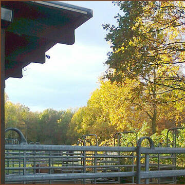
Reitanlage und Pensionsstall in Dresden-Schönborn
Dresden OT Schönborn
NAMED GbR
@Reitanlage_Heideweg
Freizeitstall
Pferdeausbildung
Vermieten
Hunde willkommen
Krankenbox
Notfallboxen
Pferdezucht
17 weitere...
P
Westerntraining Volker Walther
Radebeul
Westerntraining-Volker-Walther
@Westerntraining-Volker-Walther
FN-Mitglied
Freizeitstall
Vermieten
Krankenbox
Longierzirkel/Roundpen
Außenbox mit Paddock
Außenboxen
21 weitere...
P
Deprecated: Creation of dynamic property Zend_View_Helper_Ads::$adLink is deprecated in /var/www/stall-frei/htdocs/staging.stall-frei.de/library/Psf/View/Helper/Ads.php on line 108

Das Beste für die Hufe
Mechtersen
STALL-FREIde Marketing
@STALL-FREI-Marketing
Hufschmiede und Hufpfleger in Ihrer Nähe

STONERANCH-Pferdeparadies am Stadtrand von Dresden
Dresden
Stoneranch
@StoneranchJelleGust
Freizeitstall
Geländestrecke
Hunde willkommen
Krankenbox
Hengsthaltung möglich
Hufrehe geeignet
Offenstall
19 weitere...
P
Leider kein Vorschaubild
Leider kein Vorschaubild
B

Offenstallanlage am Rande Coswigs
Coswig
Gunther Joiko
@G.Joiko
Fahrstall, Kutschwagen
Hunde willkommen
Krankenbox
Hufrehe geeignet
Notfallboxen
Offenstall
15 weitere...
P
Freie Plätze im Offenstall
Coswig
Pahlig
@Pahlig
Freizeitstall
Geländestrecke
Vermieten
Hunde willkommen
Krankenbox
Hufrehe geeignet
11 weitere...
aktuell
P

Persönlichkeitsentwicklung mit Pferden
Bad Salzuflen
Katja Dors
@Pferdezeiten
Begleite andere auf ihrem Entwicklungsweg und entdecke die transformative Kraft der pferdegestützten Persönlichkeitsentwicklung !
neu
R
Freie Plätze im Offenstall
Coswig
tonipahlig25
@tonipahlig25
Freizeitstall
Geländestrecke
Vermieten
Hunde willkommen
Krankenbox
Offenstall
11 weitere...
P
Leider kein Vorschaubild
Leider kein Vorschaubild
Reitanlage im Dresdner Norden
Ottendorf-Okrilla
Pferdepensionsbetrieb
@Pferdepensionsbetrieb
Pferdeausbildung
Reitlehrer und -unterricht
Pensions- und Gastboxen
Reithalle
Außenboxen
Innenbox
Vollpension
7 weitere...
B
Leider kein Vorschaubild
Leider kein Vorschaubild
Luisenhof-Radeberg
Liegau-Augustusbad
Steffi-Gertenbach
@Steffi-Gertenbach
Freizeitstall
Pferdeausbildung
Vermieten
Longierzirkel/Roundpen
Reitplatz (z.B. Dressur, Springen, Reining)
Pferdezucht
Zuchtstutenhaltung möglich
9 weitere...
B
Leider kein Vorschaubild
Leider kein Vorschaubild
2 Plätze frei im Offenstall - Selbstversorger
Radeberg
Jana Engelmann
@JanaE.
Freizeitstall
Paddock
Sattelkammer/Sattelschränke
Hufrehe geeignet
Offenstall
Paddock Trail
5 weitere...
B
Deprecated: Creation of dynamic property Zend_View::$pageCount is deprecated in /var/www/stall-frei/htdocs/staging.stall-frei.de/library/vendor/shardj/zf1-future/library/Zend/View/Abstract.php on line 308
Deprecated: Creation of dynamic property Zend_View::$itemCountPerPage is deprecated in /var/www/stall-frei/htdocs/staging.stall-frei.de/library/vendor/shardj/zf1-future/library/Zend/View/Abstract.php on line 308
Deprecated: Creation of dynamic property Zend_View::$first is deprecated in /var/www/stall-frei/htdocs/staging.stall-frei.de/library/vendor/shardj/zf1-future/library/Zend/View/Abstract.php on line 308
Deprecated: Creation of dynamic property Zend_View::$current is deprecated in /var/www/stall-frei/htdocs/staging.stall-frei.de/library/vendor/shardj/zf1-future/library/Zend/View/Abstract.php on line 308
Deprecated: Creation of dynamic property Zend_View::$last is deprecated in /var/www/stall-frei/htdocs/staging.stall-frei.de/library/vendor/shardj/zf1-future/library/Zend/View/Abstract.php on line 308
Deprecated: Creation of dynamic property Zend_View::$next is deprecated in /var/www/stall-frei/htdocs/staging.stall-frei.de/library/vendor/shardj/zf1-future/library/Zend/View/Abstract.php on line 308
Deprecated: Creation of dynamic property Zend_View::$pagesInRange is deprecated in /var/www/stall-frei/htdocs/staging.stall-frei.de/library/vendor/shardj/zf1-future/library/Zend/View/Abstract.php on line 308
Deprecated: Creation of dynamic property Zend_View::$firstPageInRange is deprecated in /var/www/stall-frei/htdocs/staging.stall-frei.de/library/vendor/shardj/zf1-future/library/Zend/View/Abstract.php on line 308
Deprecated: Creation of dynamic property Zend_View::$lastPageInRange is deprecated in /var/www/stall-frei/htdocs/staging.stall-frei.de/library/vendor/shardj/zf1-future/library/Zend/View/Abstract.php on line 308
Deprecated: Creation of dynamic property Zend_View::$currentItemCount is deprecated in /var/www/stall-frei/htdocs/staging.stall-frei.de/library/vendor/shardj/zf1-future/library/Zend/View/Abstract.php on line 308
Deprecated: Creation of dynamic property Zend_View::$totalItemCount is deprecated in /var/www/stall-frei/htdocs/staging.stall-frei.de/library/vendor/shardj/zf1-future/library/Zend/View/Abstract.php on line 308
Deprecated: Creation of dynamic property Zend_View::$firstItemNumber is deprecated in /var/www/stall-frei/htdocs/staging.stall-frei.de/library/vendor/shardj/zf1-future/library/Zend/View/Abstract.php on line 308
Deprecated: Creation of dynamic property Zend_View::$lastItemNumber is deprecated in /var/www/stall-frei/htdocs/staging.stall-frei.de/library/vendor/shardj/zf1-future/library/Zend/View/Abstract.php on line 308
Deprecated: Creation of dynamic property Zend_View::$router is deprecated in /var/www/stall-frei/htdocs/staging.stall-frei.de/library/vendor/shardj/zf1-future/library/Zend/View/Abstract.php on line 308
Deprecated: Creation of dynamic property Zend_View::$urlParams is deprecated in /var/www/stall-frei/htdocs/staging.stall-frei.de/library/vendor/shardj/zf1-future/library/Zend/View/Abstract.php on line 308
Deprecated: Creation of dynamic property Zend_View::$showAds is deprecated in /var/www/stall-frei/htdocs/staging.stall-frei.de/library/vendor/shardj/zf1-future/library/Zend/View/Abstract.php on line 308
Deprecated: Creation of dynamic property Zend_View::$objectIds is deprecated in /var/www/stall-frei/htdocs/staging.stall-frei.de/library/vendor/shardj/zf1-future/library/Zend/View/Abstract.php on line 308
Deprecated: Creation of dynamic property Zend_View::$showNavbar is deprecated in /var/www/stall-frei/htdocs/staging.stall-frei.de/library/vendor/shardj/zf1-future/library/Zend/View/Abstract.php on line 308
Deprecated: Creation of dynamic property Zend_View::$showBreadcrumb is deprecated in /var/www/stall-frei/htdocs/staging.stall-frei.de/library/vendor/shardj/zf1-future/library/Zend/View/Abstract.php on line 308
Deprecated: Creation of dynamic property Zend_View::$showFooter is deprecated in /var/www/stall-frei/htdocs/staging.stall-frei.de/library/vendor/shardj/zf1-future/library/Zend/View/Abstract.php on line 308
Deprecated: Creation of dynamic property Zend_View::$showInternalAds is deprecated in /var/www/stall-frei/htdocs/staging.stall-frei.de/library/vendor/shardj/zf1-future/library/Zend/View/Abstract.php on line 308
Deprecated: Creation of dynamic property Zend_View::$blNoContent is deprecated in /var/www/stall-frei/htdocs/staging.stall-frei.de/library/vendor/shardj/zf1-future/library/Zend/View/Abstract.php on line 308
Deprecated: Creation of dynamic property Zend_View::$sMetaDesc is deprecated in /var/www/stall-frei/htdocs/staging.stall-frei.de/library/vendor/shardj/zf1-future/library/Zend/View/Abstract.php on line 308
Deprecated: Creation of dynamic property Zend_View::$useGmaps is deprecated in /var/www/stall-frei/htdocs/staging.stall-frei.de/library/vendor/shardj/zf1-future/library/Zend/View/Abstract.php on line 308
Deprecated: Creation of dynamic property Zend_View::$touches is deprecated in /var/www/stall-frei/htdocs/staging.stall-frei.de/library/vendor/shardj/zf1-future/library/Zend/View/Abstract.php on line 308
Deprecated: Creation of dynamic property Zend_View::$oProject is deprecated in /var/www/stall-frei/htdocs/staging.stall-frei.de/library/vendor/shardj/zf1-future/library/Zend/View/Abstract.php on line 308
Deprecated: Creation of dynamic property Zend_View::$pageHeadline is deprecated in /var/www/stall-frei/htdocs/staging.stall-frei.de/library/vendor/shardj/zf1-future/library/Zend/View/Abstract.php on line 308
Deprecated: Creation of dynamic property Zend_View::$disableLocationField is deprecated in /var/www/stall-frei/htdocs/staging.stall-frei.de/library/vendor/shardj/zf1-future/library/Zend/View/Abstract.php on line 308
Deprecated: Creation of dynamic property Zend_View::$isSearch is deprecated in /var/www/stall-frei/htdocs/staging.stall-frei.de/library/vendor/shardj/zf1-future/library/Zend/View/Abstract.php on line 308
Deprecated: Creation of dynamic property Zend_View::$pageTitle is deprecated in /var/www/stall-frei/htdocs/staging.stall-frei.de/library/vendor/shardj/zf1-future/library/Zend/View/Abstract.php on line 308
Deprecated: Creation of dynamic property Psf_Form_Element_Text::$class is deprecated in /var/www/stall-frei/htdocs/staging.stall-frei.de/library/vendor/shardj/zf1-future/library/Zend/Form/Element.php on line 874
Deprecated: Creation of dynamic property Psf_Form_Element_Text::$size is deprecated in /var/www/stall-frei/htdocs/staging.stall-frei.de/library/vendor/shardj/zf1-future/library/Zend/Form/Element.php on line 874
Deprecated: Creation of dynamic property Psf_Form_Element_Text::$placeholder is deprecated in /var/www/stall-frei/htdocs/staging.stall-frei.de/library/vendor/shardj/zf1-future/library/Zend/Form/Element.php on line 874
Deprecated: Creation of dynamic property Psf_Form_Element_Hidden::$class is deprecated in /var/www/stall-frei/htdocs/staging.stall-frei.de/library/vendor/shardj/zf1-future/library/Zend/Form/Element.php on line 874
Deprecated: Creation of dynamic property Psf_Form_Element_Hidden::$class is deprecated in /var/www/stall-frei/htdocs/staging.stall-frei.de/library/vendor/shardj/zf1-future/library/Zend/Form/Element.php on line 874
Deprecated: Creation of dynamic property Psf_Form_Element_Hidden::$class is deprecated in /var/www/stall-frei/htdocs/staging.stall-frei.de/library/vendor/shardj/zf1-future/library/Zend/Form/Element.php on line 874
Deprecated: Creation of dynamic property Psf_Form_Element_Hidden::$class is deprecated in /var/www/stall-frei/htdocs/staging.stall-frei.de/library/vendor/shardj/zf1-future/library/Zend/Form/Element.php on line 874
Deprecated: Creation of dynamic property Psf_Form_Element_Select::$class is deprecated in /var/www/stall-frei/htdocs/staging.stall-frei.de/library/vendor/shardj/zf1-future/library/Zend/Form/Element.php on line 874
Deprecated: Creation of dynamic property Psf_Form_Element_Select::$class is deprecated in /var/www/stall-frei/htdocs/staging.stall-frei.de/library/vendor/shardj/zf1-future/library/Zend/Form/Element.php on line 874
Deprecated: Creation of dynamic property Psf_Form_Element_Select::$class is deprecated in /var/www/stall-frei/htdocs/staging.stall-frei.de/library/vendor/shardj/zf1-future/library/Zend/Form/Element.php on line 874
Deprecated: Creation of dynamic property Psf_Form_Element_Select::$class is deprecated in /var/www/stall-frei/htdocs/staging.stall-frei.de/library/vendor/shardj/zf1-future/library/Zend/Form/Element.php on line 874
Deprecated: Creation of dynamic property Psf_Form_Element_Text::$class is deprecated in /var/www/stall-frei/htdocs/staging.stall-frei.de/library/vendor/shardj/zf1-future/library/Zend/Form/Element.php on line 874
Deprecated: Creation of dynamic property Psf_Form_Element_Checkbox::$label is deprecated in /var/www/stall-frei/htdocs/staging.stall-frei.de/library/vendor/shardj/zf1-future/library/Zend/Form/Element.php on line 874
Deprecated: Creation of dynamic property Zend_View::$sort is deprecated in /var/www/stall-frei/htdocs/staging.stall-frei.de/library/vendor/shardj/zf1-future/library/Zend/View/Abstract.php on line 308
Deprecated: Creation of dynamic property Zend_View::$searchLocation is deprecated in /var/www/stall-frei/htdocs/staging.stall-frei.de/library/vendor/shardj/zf1-future/library/Zend/View/Abstract.php on line 308
Deprecated: Creation of dynamic property Zend_View::$locationHint is deprecated in /var/www/stall-frei/htdocs/staging.stall-frei.de/library/vendor/shardj/zf1-future/library/Zend/View/Abstract.php on line 308
Psf_GeoCoder_Abstract::getLocation: Volkersdorf Get Location CachedOrLive
Psf_GeoCoder_Abstract::getCachedOrLive: Volkersdorf
Psf_GeoCoder_OpenCageData::makeApiRequest: response:
Array
(
[documentation] => https://opencagedata.com/api
[licenses] => Array
(
[0] => Array
(
[name] => see attribution guide
[url] => https://opencagedata.com/credits
)
)
[results] => Array
(
[0] => Array
(
[bounds] => Array
(
[northeast] => Array
(
[lat] => 51.1668973
[lng] => 13.7603568
)
[southwest] => Array
(
[lat] => 51.1268973
[lng] => 13.7203568
)
)
[components] => Array
(
[ISO_3166-1_alpha-2] => DE
[ISO_3166-1_alpha-3] => DEU
[ISO_3166-2] => Array
(
[0] => DE-SN
)
[_category] => place
[_normalized_city] => Radeburg
[_type] => village
[continent] => Europe
[country] => Deutschland
[country_code] => de
[county] => Meißen
[political_union] => European Union
[postcode] => 01109
[state] => Sachsen
[state_code] => SN
[town] => Radeburg
[village] => Volkersdorf
)
[confidence] => 7
[formatted] => 01109 Volkersdorf, Deutschland
[geometry] => Array
(
[lat] => 51.1468973
[lng] => 13.7403568
)
)
[1] => Array
(
[bounds] => Array
(
[northeast] => Array
(
[lat] => 48.4551837
[lng] => 11.4177789
)
[southwest] => Array
(
[lat] => 48.4151837
[lng] => 11.3777789
)
)
[components] => Array
(
[ISO_3166-1_alpha-2] => DE
[ISO_3166-1_alpha-3] => DEU
[ISO_3166-2] => Array
(
[0] => DE-BY
)
[_category] => place
[_normalized_city] => Jetzendorf
[_type] => village
[city] => Jetzendorf
[continent] => Europe
[country] => Deutschland
[country_code] => de
[county] => Landkreis Pfaffenhofen an der Ilm
[political_union] => European Union
[postcode] => 85305
[state] => Bayern
[state_code] => BY
[village] => Volkersdorf
)
[confidence] => 7
[formatted] => 85305 Volkersdorf, Deutschland
[geometry] => Array
(
[lat] => 48.4351837
[lng] => 11.3977789
)
)
[2] => Array
(
[bounds] => Array
(
[northeast] => Array
(
[lat] => 49.7703158
[lng] => 10.7245049
)
[southwest] => Array
(
[lat] => 49.7303158
[lng] => 10.6845049
)
)
[components] => Array
(
[ISO_3166-1_alpha-2] => DE
[ISO_3166-1_alpha-3] => DEU
[ISO_3166-2] => Array
(
[0] => DE-BY
)
[_category] => place
[_normalized_city] => Wachenroth
[_type] => hamlet
[city] => Wachenroth
[continent] => Europe
[country] => Deutschland
[country_code] => de
[county] => Landkreis Erlangen-Höchstadt
[hamlet] => Volkersdorf
[political_union] => European Union
[postcode] => 96193
[state] => Bayern
[state_code] => BY
)
[confidence] => 7
[formatted] => Volkersdorf, 96193 Wachenroth, Deutschland
[geometry] => Array
(
[lat] => 49.7503158
[lng] => 10.7045049
)
)
[3] => Array
(
[bounds] => Array
(
[northeast] => Array
(
[lat] => 49.305114
[lng] => 10.6890317
)
[southwest] => Array
(
[lat] => 49.265114
[lng] => 10.6490317
)
)
[components] => Array
(
[ISO_3166-1_alpha-2] => DE
[ISO_3166-1_alpha-3] => DEU
[ISO_3166-2] => Array
(
[0] => DE-BY
)
[_category] => place
[_normalized_city] => Sachsen bei Ansbach
[_type] => village
[city] => Sachsen bei Ansbach
[continent] => Europe
[country] => Deutschland
[country_code] => de
[county] => Landkreis Ansbach
[political_union] => European Union
[postcode] => 91623
[state] => Bayern
[state_code] => BY
[village] => Volkersdorf
)
[confidence] => 7
[formatted] => 91623 Volkersdorf, Deutschland
[geometry] => Array
(
[lat] => 49.285114
[lng] => 10.6690317
)
)
[4] => Array
(
[bounds] => Array
(
[northeast] => Array
(
[lat] => 50.6672767
[lng] => 11.2455775
)
[southwest] => Array
(
[lat] => 50.6472767
[lng] => 11.2255775
)
)
[components] => Array
(
[ISO_3166-1_alpha-2] => DE
[ISO_3166-1_alpha-3] => DEU
[ISO_3166-2] => Array
(
[0] => DE-TH
)
[_category] => place
[_normalized_city] => Saalfeld/Saale
[_type] => hamlet
[continent] => Europe
[country] => Deutschland
[country_code] => de
[county] => Landkreis Saalfeld-Rudolstadt
[locality] => Völkersdorf
[political_union] => European Union
[postcode] => 07318
[state] => Thüringen
[state_code] => TH
[town] => Saalfeld/Saale
)
[confidence] => 8
[formatted] => Völkersdorf, 07318 Saalfeld/Saale, Deutschland
[geometry] => Array
(
[lat] => 50.6572767
[lng] => 11.2355775
)
)
[5] => Array
(
[components] => Array
(
[ISO_3166-1_alpha-2] => FR
[ISO_3166-1_alpha-3] => FRA
[ISO_3166-2] => Array
(
[0] => FR-GES
[1] => FR-6AE
[2] => FR-68
)
[_category] => road
[_normalized_city] => Wolfersdorf
[_type] => road
[city] => Wolfersdorf
[continent] => Europe
[country] => France
[country_code] => fr
[county] => Haut-Rhin
[local_authority] => Communauté de communes Sud Alsace Largue
[political_union] => European Union
[postcode] => 68210
[road] => Rue du Lavoir
[state] => Grand Est
[state_code] => GES
)
[confidence] => 2
[formatted] => Rue du Lavoir, 68210 Wolfersdorf, France
[geometry] => Array
(
[lat] => 47.639259
[lng] => 7.113667
)
)
[6] => Array
(
[components] => Array
(
[ISO_3166-1_alpha-2] => FR
[ISO_3166-1_alpha-3] => FRA
[ISO_3166-2] => Array
(
[0] => FR-GES
[1] => FR-6AE
[2] => FR-68
)
[_category] => place
[_normalized_city] => Wolfersdorf
[_type] => city
[city] => Wolfersdorf
[continent] => Europe
[country] => France
[country_code] => fr
[county] => Haut-Rhin
[local_authority] => Communauté de communes Sud Alsace Largue
[political_union] => European Union
[postcode] => 68210
[state] => Grand Est
[state_code] => GES
)
[confidence] => 2
[formatted] => Wolfersdorf, Haut-Rhin, France
[geometry] => Array
(
[lat] => 47.637704
[lng] => 7.110948
)
)
[7] => Array
(
[components] => Array
(
[ISO_3166-1_alpha-2] => FR
[ISO_3166-1_alpha-3] => FRA
[ISO_3166-2] => Array
(
[0] => FR-GES
[1] => FR-6AE
[2] => FR-68
)
[_category] => road
[_normalized_city] => Wolfersdorf
[_type] => road
[city] => Wolfersdorf
[continent] => Europe
[country] => France
[country_code] => fr
[county] => Haut-Rhin
[local_authority] => Communauté de communes Sud Alsace Largue
[political_union] => European Union
[postcode] => 68210
[road] => Rue de la Largue
[state] => Grand Est
[state_code] => GES
)
[confidence] => 2
[formatted] => Rue de la Largue, 68210 Wolfersdorf, France
[geometry] => Array
(
[lat] => 47.63736
[lng] => 7.11436
)
)
[8] => Array
(
[components] => Array
(
[ISO_3166-1_alpha-2] => FR
[ISO_3166-1_alpha-3] => FRA
[ISO_3166-2] => Array
(
[0] => FR-GES
[1] => FR-6AE
[2] => FR-68
)
[_category] => road
[_normalized_city] => Wolfersdorf
[_type] => road
[city] => Wolfersdorf
[continent] => Europe
[country] => France
[country_code] => fr
[county] => Haut-Rhin
[local_authority] => Communauté de communes Sud Alsace Largue
[political_union] => European Union
[postcode] => 68210
[road] => Impasse de la Grange
[state] => Grand Est
[state_code] => GES
)
[confidence] => 2
[formatted] => Impasse de la Grange, 68210 Wolfersdorf, France
[geometry] => Array
(
[lat] => 47.637648
[lng] => 7.110364
)
)
[9] => Array
(
[components] => Array
(
[ISO_3166-1_alpha-2] => FR
[ISO_3166-1_alpha-3] => FRA
[ISO_3166-2] => Array
(
[0] => FR-GES
[1] => FR-6AE
[2] => FR-68
)
[_category] => road
[_normalized_city] => Wolfersdorf
[_type] => road
[city] => Wolfersdorf
[continent] => Europe
[country] => France
[country_code] => fr
[county] => Haut-Rhin
[local_authority] => Communauté de communes Sud Alsace Largue
[political_union] => European Union
[postcode] => 68210
[road] => Rue du Canal
[state] => Grand Est
[state_code] => GES
)
[confidence] => 2
[formatted] => Rue du Canal, 68210 Wolfersdorf, France
[geometry] => Array
(
[lat] => 47.636243
[lng] => 7.109848
)
)
)
[status] => Array
(
[code] => 200
[message] => OK
)
[stay_informed] => Array
(
[blog] => https://blog.opencagedata.com
[mastodon] => https://en.osm.town/@opencage
)
[thanks] => For using an OpenCage API
[timestamp] => Array
(
[created_http] => Sat, 07 Feb 2026 15:17:25 GMT
[created_unix] => 1770477445
)
[total_results] => 10
)
Psf_GeoCoder_Abstract::convertLocationResult
{"documentation":"https:\/\/opencagedata.com\/api","licenses":[{"name":"see attribution guide","url":"https:\/\/opencagedata.com\/credits"}],"results":[{"bounds":{"northeast":{"lat":51.1668973,"lng":13.7603568},"southwest":{"lat":51.1268973,"lng":13.7203568}},"components":{"ISO_3166-1_alpha-2":"DE","ISO_3166-1_alpha-3":"DEU","ISO_3166-2":["DE-SN"],"_category":"place","_normalized_city":"Radeburg","_type":"village","continent":"Europe","country":"Deutschland","country_code":"de","county":"Mei\u00dfen","political_union":"European Union","postcode":"01109","state":"Sachsen","state_code":"SN","town":"Radeburg","village":"Volkersdorf"},"confidence":7,"formatted":"01109 Volkersdorf, Deutschland","geometry":{"lat":51.1468973,"lng":13.7403568}},{"bounds":{"northeast":{"lat":48.4551837,"lng":11.4177789},"southwest":{"lat":48.4151837,"lng":11.3777789}},"components":{"ISO_3166-1_alpha-2":"DE","ISO_3166-1_alpha-3":"DEU","ISO_3166-2":["DE-BY"],"_category":"place","_normalized_city":"Jetzendorf","_type":"village","city":"Jetzendorf","continent":"Europe","country":"Deutschland","country_code":"de","county":"Landkreis Pfaffenhofen an der Ilm","political_union":"European Union","postcode":"85305","state":"Bayern","state_code":"BY","village":"Volkersdorf"},"confidence":7,"formatted":"85305 Volkersdorf, Deutschland","geometry":{"lat":48.4351837,"lng":11.3977789}},{"bounds":{"northeast":{"lat":49.7703158,"lng":10.7245049},"southwest":{"lat":49.7303158,"lng":10.6845049}},"components":{"ISO_3166-1_alpha-2":"DE","ISO_3166-1_alpha-3":"DEU","ISO_3166-2":["DE-BY"],"_category":"place","_normalized_city":"Wachenroth","_type":"hamlet","city":"Wachenroth","continent":"Europe","country":"Deutschland","country_code":"de","county":"Landkreis Erlangen-H\u00f6chstadt","hamlet":"Volkersdorf","political_union":"European Union","postcode":"96193","state":"Bayern","state_code":"BY"},"confidence":7,"formatted":"Volkersdorf, 96193 Wachenroth, Deutschland","geometry":{"lat":49.7503158,"lng":10.7045049}},{"bounds":{"northeast":{"lat":49.305114,"lng":10.6890317},"southwest":{"lat":49.265114,"lng":10.6490317}},"components":{"ISO_3166-1_alpha-2":"DE","ISO_3166-1_alpha-3":"DEU","ISO_3166-2":["DE-BY"],"_category":"place","_normalized_city":"Sachsen bei Ansbach","_type":"village","city":"Sachsen bei Ansbach","continent":"Europe","country":"Deutschland","country_code":"de","county":"Landkreis Ansbach","political_union":"European Union","postcode":"91623","state":"Bayern","state_code":"BY","village":"Volkersdorf"},"confidence":7,"formatted":"91623 Volkersdorf, Deutschland","geometry":{"lat":49.285114,"lng":10.6690317}},{"bounds":{"northeast":{"lat":50.6672767,"lng":11.2455775},"southwest":{"lat":50.6472767,"lng":11.2255775}},"components":{"ISO_3166-1_alpha-2":"DE","ISO_3166-1_alpha-3":"DEU","ISO_3166-2":["DE-TH"],"_category":"place","_normalized_city":"Saalfeld\/Saale","_type":"hamlet","continent":"Europe","country":"Deutschland","country_code":"de","county":"Landkreis Saalfeld-Rudolstadt","locality":"V\u00f6lkersdorf","political_union":"European Union","postcode":"07318","state":"Th\u00fcringen","state_code":"TH","town":"Saalfeld\/Saale"},"confidence":8,"formatted":"V\u00f6lkersdorf, 07318 Saalfeld\/Saale, Deutschland","geometry":{"lat":50.6572767,"lng":11.2355775}},{"components":{"ISO_3166-1_alpha-2":"FR","ISO_3166-1_alpha-3":"FRA","ISO_3166-2":["FR-GES","FR-6AE","FR-68"],"_category":"road","_normalized_city":"Wolfersdorf","_type":"road","city":"Wolfersdorf","continent":"Europe","country":"France","country_code":"fr","county":"Haut-Rhin","local_authority":"Communaut\u00e9 de communes Sud Alsace Largue","political_union":"European Union","postcode":"68210","road":"Rue du Lavoir","state":"Grand Est","state_code":"GES"},"confidence":2,"formatted":"Rue du Lavoir, 68210 Wolfersdorf, France","geometry":{"lat":47.639259,"lng":7.113667}},{"components":{"ISO_3166-1_alpha-2":"FR","ISO_3166-1_alpha-3":"FRA","ISO_3166-2":["FR-GES","FR-6AE","FR-68"],"_category":"place","_normalized_city":"Wolfersdorf","_type":"city","city":"Wolfersdorf","continent":"Europe","country":"France","country_code":"fr","county":"Haut-Rhin","local_authority":"Communaut\u00e9 de communes Sud Alsace Largue","political_union":"European Union","postcode":"68210","state":"Grand Est","state_code":"GES"},"confidence":2,"formatted":"Wolfersdorf, Haut-Rhin, France","geometry":{"lat":47.637704,"lng":7.110948}},{"components":{"ISO_3166-1_alpha-2":"FR","ISO_3166-1_alpha-3":"FRA","ISO_3166-2":["FR-GES","FR-6AE","FR-68"],"_category":"road","_normalized_city":"Wolfersdorf","_type":"road","city":"Wolfersdorf","continent":"Europe","country":"France","country_code":"fr","county":"Haut-Rhin","local_authority":"Communaut\u00e9 de communes Sud Alsace Largue","political_union":"European Union","postcode":"68210","road":"Rue de la Largue","state":"Grand Est","state_code":"GES"},"confidence":2,"formatted":"Rue de la Largue, 68210 Wolfersdorf, France","geometry":{"lat":47.63736,"lng":7.11436}},{"components":{"ISO_3166-1_alpha-2":"FR","ISO_3166-1_alpha-3":"FRA","ISO_3166-2":["FR-GES","FR-6AE","FR-68"],"_category":"road","_normalized_city":"Wolfersdorf","_type":"road","city":"Wolfersdorf","continent":"Europe","country":"France","country_code":"fr","county":"Haut-Rhin","local_authority":"Communaut\u00e9 de communes Sud Alsace Largue","political_union":"European Union","postcode":"68210","road":"Impasse de la Grange","state":"Grand Est","state_code":"GES"},"confidence":2,"formatted":"Impasse de la Grange, 68210 Wolfersdorf, France","geometry":{"lat":47.637648,"lng":7.110364}},{"components":{"ISO_3166-1_alpha-2":"FR","ISO_3166-1_alpha-3":"FRA","ISO_3166-2":["FR-GES","FR-6AE","FR-68"],"_category":"road","_normalized_city":"Wolfersdorf","_type":"road","city":"Wolfersdorf","continent":"Europe","country":"France","country_code":"fr","county":"Haut-Rhin","local_authority":"Communaut\u00e9 de communes Sud Alsace Largue","political_union":"European Union","postcode":"68210","road":"Rue du Canal","state":"Grand Est","state_code":"GES"},"confidence":2,"formatted":"Rue du Canal, 68210 Wolfersdorf, France","geometry":{"lat":47.636243,"lng":7.109848}}],"status":{"code":200,"message":"OK"},"stay_informed":{"blog":"https:\/\/blog.opencagedata.com","mastodon":"https:\/\/en.osm.town\/@opencage"},"thanks":"For using an OpenCage API","timestamp":{"created_http":"Sat, 07 Feb 2026 15:17:25 GMT","created_unix":1770477445},"total_results":10}Array
(
[0] => stdClass Object
(
[bounds] => stdClass Object
(
[northeast] => stdClass Object
(
[lat] => 51.1668973
[lng] => 13.7603568
)
[southwest] => stdClass Object
(
[lat] => 51.1268973
[lng] => 13.7203568
)
)
[components] => stdClass Object
(
[ISO_3166-1_alpha-2] => DE
[ISO_3166-1_alpha-3] => DEU
[ISO_3166-2] => Array
(
[0] => DE-SN
)
[_category] => place
[_normalized_city] => Radeburg
[_type] => village
[continent] => Europe
[country] => Deutschland
[country_code] => de
[county] => Meißen
[political_union] => European Union
[postcode] => 01109
[state] => Sachsen
[state_code] => SN
[town] => Radeburg
[village] => Volkersdorf
)
[confidence] => 7
[formatted] => 01109 Volkersdorf, Deutschland
[geometry] => stdClass Object
(
[lat] => 51.1468973
[lng] => 13.7403568
)
)
[1] => stdClass Object
(
[bounds] => stdClass Object
(
[northeast] => stdClass Object
(
[lat] => 48.4551837
[lng] => 11.4177789
)
[southwest] => stdClass Object
(
[lat] => 48.4151837
[lng] => 11.3777789
)
)
[components] => stdClass Object
(
[ISO_3166-1_alpha-2] => DE
[ISO_3166-1_alpha-3] => DEU
[ISO_3166-2] => Array
(
[0] => DE-BY
)
[_category] => place
[_normalized_city] => Jetzendorf
[_type] => village
[city] => Jetzendorf
[continent] => Europe
[country] => Deutschland
[country_code] => de
[county] => Landkreis Pfaffenhofen an der Ilm
[political_union] => European Union
[postcode] => 85305
[state] => Bayern
[state_code] => BY
[village] => Volkersdorf
)
[confidence] => 7
[formatted] => 85305 Volkersdorf, Deutschland
[geometry] => stdClass Object
(
[lat] => 48.4351837
[lng] => 11.3977789
)
)
[2] => stdClass Object
(
[bounds] => stdClass Object
(
[northeast] => stdClass Object
(
[lat] => 49.7703158
[lng] => 10.7245049
)
[southwest] => stdClass Object
(
[lat] => 49.7303158
[lng] => 10.6845049
)
)
[components] => stdClass Object
(
[ISO_3166-1_alpha-2] => DE
[ISO_3166-1_alpha-3] => DEU
[ISO_3166-2] => Array
(
[0] => DE-BY
)
[_category] => place
[_normalized_city] => Wachenroth
[_type] => hamlet
[city] => Wachenroth
[continent] => Europe
[country] => Deutschland
[country_code] => de
[county] => Landkreis Erlangen-Höchstadt
[hamlet] => Volkersdorf
[political_union] => European Union
[postcode] => 96193
[state] => Bayern
[state_code] => BY
)
[confidence] => 7
[formatted] => Volkersdorf, 96193 Wachenroth, Deutschland
[geometry] => stdClass Object
(
[lat] => 49.7503158
[lng] => 10.7045049
)
)
[3] => stdClass Object
(
[bounds] => stdClass Object
(
[northeast] => stdClass Object
(
[lat] => 49.305114
[lng] => 10.6890317
)
[southwest] => stdClass Object
(
[lat] => 49.265114
[lng] => 10.6490317
)
)
[components] => stdClass Object
(
[ISO_3166-1_alpha-2] => DE
[ISO_3166-1_alpha-3] => DEU
[ISO_3166-2] => Array
(
[0] => DE-BY
)
[_category] => place
[_normalized_city] => Sachsen bei Ansbach
[_type] => village
[city] => Sachsen bei Ansbach
[continent] => Europe
[country] => Deutschland
[country_code] => de
[county] => Landkreis Ansbach
[political_union] => European Union
[postcode] => 91623
[state] => Bayern
[state_code] => BY
[village] => Volkersdorf
)
[confidence] => 7
[formatted] => 91623 Volkersdorf, Deutschland
[geometry] => stdClass Object
(
[lat] => 49.285114
[lng] => 10.6690317
)
)
[4] => stdClass Object
(
[bounds] => stdClass Object
(
[northeast] => stdClass Object
(
[lat] => 50.6672767
[lng] => 11.2455775
)
[southwest] => stdClass Object
(
[lat] => 50.6472767
[lng] => 11.2255775
)
)
[components] => stdClass Object
(
[ISO_3166-1_alpha-2] => DE
[ISO_3166-1_alpha-3] => DEU
[ISO_3166-2] => Array
(
[0] => DE-TH
)
[_category] => place
[_normalized_city] => Saalfeld/Saale
[_type] => hamlet
[continent] => Europe
[country] => Deutschland
[country_code] => de
[county] => Landkreis Saalfeld-Rudolstadt
[locality] => Völkersdorf
[political_union] => European Union
[postcode] => 07318
[state] => Thüringen
[state_code] => TH
[town] => Saalfeld/Saale
)
[confidence] => 8
[formatted] => Völkersdorf, 07318 Saalfeld/Saale, Deutschland
[geometry] => stdClass Object
(
[lat] => 50.6572767
[lng] => 11.2355775
)
)
[5] => stdClass Object
(
[components] => stdClass Object
(
[ISO_3166-1_alpha-2] => FR
[ISO_3166-1_alpha-3] => FRA
[ISO_3166-2] => Array
(
[0] => FR-GES
[1] => FR-6AE
[2] => FR-68
)
[_category] => road
[_normalized_city] => Wolfersdorf
[_type] => road
[city] => Wolfersdorf
[continent] => Europe
[country] => France
[country_code] => fr
[county] => Haut-Rhin
[local_authority] => Communauté de communes Sud Alsace Largue
[political_union] => European Union
[postcode] => 68210
[road] => Rue du Lavoir
[state] => Grand Est
[state_code] => GES
)
[confidence] => 2
[formatted] => Rue du Lavoir, 68210 Wolfersdorf, France
[geometry] => stdClass Object
(
[lat] => 47.639259
[lng] => 7.113667
)
)
[6] => stdClass Object
(
[components] => stdClass Object
(
[ISO_3166-1_alpha-2] => FR
[ISO_3166-1_alpha-3] => FRA
[ISO_3166-2] => Array
(
[0] => FR-GES
[1] => FR-6AE
[2] => FR-68
)
[_category] => place
[_normalized_city] => Wolfersdorf
[_type] => city
[city] => Wolfersdorf
[continent] => Europe
[country] => France
[country_code] => fr
[county] => Haut-Rhin
[local_authority] => Communauté de communes Sud Alsace Largue
[political_union] => European Union
[postcode] => 68210
[state] => Grand Est
[state_code] => GES
)
[confidence] => 2
[formatted] => Wolfersdorf, Haut-Rhin, France
[geometry] => stdClass Object
(
[lat] => 47.637704
[lng] => 7.110948
)
)
[7] => stdClass Object
(
[components] => stdClass Object
(
[ISO_3166-1_alpha-2] => FR
[ISO_3166-1_alpha-3] => FRA
[ISO_3166-2] => Array
(
[0] => FR-GES
[1] => FR-6AE
[2] => FR-68
)
[_category] => road
[_normalized_city] => Wolfersdorf
[_type] => road
[city] => Wolfersdorf
[continent] => Europe
[country] => France
[country_code] => fr
[county] => Haut-Rhin
[local_authority] => Communauté de communes Sud Alsace Largue
[political_union] => European Union
[postcode] => 68210
[road] => Rue de la Largue
[state] => Grand Est
[state_code] => GES
)
[confidence] => 2
[formatted] => Rue de la Largue, 68210 Wolfersdorf, France
[geometry] => stdClass Object
(
[lat] => 47.63736
[lng] => 7.11436
)
)
[8] => stdClass Object
(
[components] => stdClass Object
(
[ISO_3166-1_alpha-2] => FR
[ISO_3166-1_alpha-3] => FRA
[ISO_3166-2] => Array
(
[0] => FR-GES
[1] => FR-6AE
[2] => FR-68
)
[_category] => road
[_normalized_city] => Wolfersdorf
[_type] => road
[city] => Wolfersdorf
[continent] => Europe
[country] => France
[country_code] => fr
[county] => Haut-Rhin
[local_authority] => Communauté de communes Sud Alsace Largue
[political_union] => European Union
[postcode] => 68210
[road] => Impasse de la Grange
[state] => Grand Est
[state_code] => GES
)
[confidence] => 2
[formatted] => Impasse de la Grange, 68210 Wolfersdorf, France
[geometry] => stdClass Object
(
[lat] => 47.637648
[lng] => 7.110364
)
)
[9] => stdClass Object
(
[components] => stdClass Object
(
[ISO_3166-1_alpha-2] => FR
[ISO_3166-1_alpha-3] => FRA
[ISO_3166-2] => Array
(
[0] => FR-GES
[1] => FR-6AE
[2] => FR-68
)
[_category] => road
[_normalized_city] => Wolfersdorf
[_type] => road
[city] => Wolfersdorf
[continent] => Europe
[country] => France
[country_code] => fr
[county] => Haut-Rhin
[local_authority] => Communauté de communes Sud Alsace Largue
[political_union] => European Union
[postcode] => 68210
[road] => Rue du Canal
[state] => Grand Est
[state_code] => GES
)
[confidence] => 2
[formatted] => Rue du Canal, 68210 Wolfersdorf, France
[geometry] => stdClass Object
(
[lat] => 47.636243
[lng] => 7.109848
)
)
)
Psf_GeoCoder_OpenCageData::getKeyMap: 0
stdClass Object
(
    [bounds] => stdClass Object
        (
            [northeast] => stdClass Object
                (
                    [lat] => 51.1668973
                    [lng] => 13.7603568
                )

            [southwest] => stdClass Object
                (
                    [lat] => 51.1268973
                    [lng] => 13.7203568
                )

        )

    [components] => stdClass Object
        (
            [ISO_3166-1_alpha-2] => DE
            [ISO_3166-1_alpha-3] => DEU
            [ISO_3166-2] => Array
                (
                    [0] => DE-SN
                )

            [_category] => place
            [_normalized_city] => Radeburg
            [_type] => village
            [continent] => Europe
            [country] => Deutschland
            [country_code] => de
            [county] => Meißen
            [political_union] => European Union
            [postcode] => 01109
            [state] => Sachsen
            [state_code] => SN
            [town] => Radeburg
            [village] => Volkersdorf
        )

    [confidence] => 7
    [formatted] => 01109 Volkersdorf, Deutschland
    [geometry] => stdClass Object
        (
            [lat] => 51.1468973
            [lng] => 13.7403568
        )

)
Psf_GeoCoder_OpenCageData::getCounty: Meißen
Psf_GeoCoder_OpenCageData::addMissingData REFETCH!
Array
(
    [address] => 01109 Volkersdorf, Deutschland
    [type] => village
    [street] =>
    [city] => Radeburg
    [county] => Meißen
    [state] => Sachsen
    [zip] => 01109
    [country] => Deutschland
    [suburb] =>
    [countrycode] => de
    [latitude] => 51.1468973
    [longitude] => 13.7403568
    [accuracy] => 1
    [confidence] => 7
    [bounds] => stdClass Object
        (
            [northeast] => stdClass Object
                (
                    [lat] => 51.1668973
                    [lng] => 13.7603568
                )

            [southwest] => stdClass Object
                (
                    [lat] => 51.1268973
                    [lng] => 13.7203568
                )

        )

)
reformat!
Array
(
    [address] => 01109 Radeburg
    [type] => village
    [street] =>
    [city] => Radeburg
    [county] => Meißen
    [state] => Sachsen
    [zip] => 01109
    [country] => Deutschland
    [suburb] =>
    [countrycode] => de
    [latitude] => 51.1468973
    [longitude] => 13.7403568
    [accuracy] => 1
    [confidence] => 7
    [bounds] => stdClass Object
        (
            [northeast] => stdClass Object
                (
                    [lat] => 51.1668973
                    [lng] => 13.7603568
                )

            [southwest] => stdClass Object
                (
                    [lat] => 51.1268973
                    [lng] => 13.7203568
                )

        )

    [place] => 01109 Radeburg, Sachsen
    [hash] => 3ef2f7dcf7063513cc0459442920a7ab
)
Psf_GeoCoder_OpenCageData::getKeyMap: 1
stdClass Object
(
    [bounds] => stdClass Object
        (
            [northeast] => stdClass Object
                (
                    [lat] => 48.4551837
                    [lng] => 11.4177789
                )

            [southwest] => stdClass Object
                (
                    [lat] => 48.4151837
                    [lng] => 11.3777789
                )

        )

    [components] => stdClass Object
        (
            [ISO_3166-1_alpha-2] => DE
            [ISO_3166-1_alpha-3] => DEU
            [ISO_3166-2] => Array
                (
                    [0] => DE-BY
                )

            [_category] => place
            [_normalized_city] => Jetzendorf
            [_type] => village
            [city] => Jetzendorf
            [continent] => Europe
            [country] => Deutschland
            [country_code] => de
            [county] => Landkreis Pfaffenhofen an der Ilm
            [political_union] => European Union
            [postcode] => 85305
            [state] => Bayern
            [state_code] => BY
            [village] => Volkersdorf
        )

    [confidence] => 7
    [formatted] => 85305 Volkersdorf, Deutschland
    [geometry] => stdClass Object
        (
            [lat] => 48.4351837
            [lng] => 11.3977789
        )

)
Psf_GeoCoder_OpenCageData::getCounty: Pfaffenhofen an der Ilm
Psf_GeoCoder_OpenCageData::addMissingData REFETCH!
Array
(
    [address] => 85305 Volkersdorf, Deutschland
    [type] => village
    [street] =>
    [city] => Volkersdorf
    [county] => Pfaffenhofen an der Ilm
    [state] => Bayern
    [zip] => 85305
    [country] => Deutschland
    [suburb] =>
    [countrycode] => de
    [latitude] => 48.4351837
    [longitude] => 11.3977789
    [accuracy] => 1
    [confidence] => 7
    [bounds] => stdClass Object
        (
            [northeast] => stdClass Object
                (
                    [lat] => 48.4551837
                    [lng] => 11.4177789
                )

            [southwest] => stdClass Object
                (
                    [lat] => 48.4151837
                    [lng] => 11.3777789
                )

        )

)
reformat!
Array
(
    [address] => 85305 Volkersdorf, Deutschland
    [type] => village
    [street] =>
    [city] => Volkersdorf
    [county] => Pfaffenhofen an der Ilm
    [state] => Bayern
    [zip] => 85305
    [country] => Deutschland
    [suburb] =>
    [countrycode] => de
    [latitude] => 48.4351837
    [longitude] => 11.3977789
    [accuracy] => 1
    [confidence] => 7
    [bounds] => stdClass Object
        (
            [northeast] => stdClass Object
                (
                    [lat] => 48.4551837
                    [lng] => 11.4177789
                )

            [southwest] => stdClass Object
                (
                    [lat] => 48.4151837
                    [lng] => 11.3777789
                )

        )

    [place] => 85305 Volkersdorf, Bayern
    [hash] => e88c0d760157efa3c9e9f21ac562356b
)
Psf_GeoCoder_OpenCageData::getKeyMap: 2
stdClass Object
(
    [bounds] => stdClass Object
        (
            [northeast] => stdClass Object
                (
                    [lat] => 49.7703158
                    [lng] => 10.7245049
                )

            [southwest] => stdClass Object
                (
                    [lat] => 49.7303158
                    [lng] => 10.6845049
                )

        )

    [components] => stdClass Object
        (
            [ISO_3166-1_alpha-2] => DE
            [ISO_3166-1_alpha-3] => DEU
            [ISO_3166-2] => Array
                (
                    [0] => DE-BY
                )

            [_category] => place
            [_normalized_city] => Wachenroth
            [_type] => hamlet
            [city] => Wachenroth
            [continent] => Europe
            [country] => Deutschland
            [country_code] => de
            [county] => Landkreis Erlangen-Höchstadt
            [hamlet] => Volkersdorf
            [political_union] => European Union
            [postcode] => 96193
            [state] => Bayern
            [state_code] => BY
        )

    [confidence] => 7
    [formatted] => Volkersdorf, 96193 Wachenroth, Deutschland
    [geometry] => stdClass Object
        (
            [lat] => 49.7503158
            [lng] => 10.7045049
        )

)
Psf_GeoCoder_OpenCageData::getCounty: Erlangen-Höchstadt
Psf_GeoCoder_OpenCageData::addMissingData REFETCH!
Array
(
    [address] => Volkersdorf, 96193 Wachenroth, Deutschland
    [type] => hamlet
    [street] => Volkersdorf
    [city] => Wachenroth
    [county] => Erlangen-Höchstadt
    [state] => Bayern
    [zip] => 96193
    [country] => Deutschland
    [suburb] =>
    [countrycode] => de
    [latitude] => 49.7503158
    [longitude] => 10.7045049
    [accuracy] => 1
    [confidence] => 7
    [bounds] => stdClass Object
        (
            [northeast] => stdClass Object
                (
                    [lat] => 49.7703158
                    [lng] => 10.7245049
                )

            [southwest] => stdClass Object
                (
                    [lat] => 49.7303158
                    [lng] => 10.6845049
                )

        )

)
reformat!
Array
(
    [address] => Volkersdorf, 96193 Wachenroth, Deutschland
    [type] => hamlet
    [street] => Volkersdorf
    [city] => Wachenroth
    [county] => Erlangen-Höchstadt
    [state] => Bayern
    [zip] => 96193
    [country] => Deutschland
    [suburb] =>
    [countrycode] => de
    [latitude] => 49.7503158
    [longitude] => 10.7045049
    [accuracy] => 1
    [confidence] => 7
    [bounds] => stdClass Object
        (
            [northeast] => stdClass Object
                (
                    [lat] => 49.7703158
                    [lng] => 10.7245049
                )

            [southwest] => stdClass Object
                (
                    [lat] => 49.7303158
                    [lng] => 10.6845049
                )

        )

    [place] => Volkersdorf, 96193 Wachenroth, Bayern
    [hash] => 54519cfa38a31ccad5e2eda59d89eff7
)
Psf_GeoCoder_OpenCageData::getKeyMap: 3
stdClass Object
(
    [bounds] => stdClass Object
        (
            [northeast] => stdClass Object
                (
                    [lat] => 49.305114
                    [lng] => 10.6890317
                )

            [southwest] => stdClass Object
                (
                    [lat] => 49.265114
                    [lng] => 10.6490317
                )

        )

    [components] => stdClass Object
        (
            [ISO_3166-1_alpha-2] => DE
            [ISO_3166-1_alpha-3] => DEU
            [ISO_3166-2] => Array
                (
                    [0] => DE-BY
                )

            [_category] => place
            [_normalized_city] => Sachsen bei Ansbach
            [_type] => village
            [city] => Sachsen bei Ansbach
            [continent] => Europe
            [country] => Deutschland
            [country_code] => de
            [county] => Landkreis Ansbach
            [political_union] => European Union
            [postcode] => 91623
            [state] => Bayern
            [state_code] => BY
            [village] => Volkersdorf
        )

    [confidence] => 7
    [formatted] => 91623 Volkersdorf, Deutschland
    [geometry] => stdClass Object
        (
            [lat] => 49.285114
            [lng] => 10.6690317
        )

)
Psf_GeoCoder_OpenCageData::getCounty: Ansbach
Psf_GeoCoder_OpenCageData::addMissingData REFETCH!
Array
(
    [address] => 91623 Volkersdorf, Deutschland
    [type] => village
    [street] =>
    [city] => Volkersdorf
    [county] => Ansbach
    [state] => Bayern
    [zip] => 91623
    [country] => Deutschland
    [suburb] =>
    [countrycode] => de
    [latitude] => 49.285114
    [longitude] => 10.6690317
    [accuracy] => 1
    [confidence] => 7
    [bounds] => stdClass Object
        (
            [northeast] => stdClass Object
                (
                    [lat] => 49.305114
                    [lng] => 10.6890317
                )

            [southwest] => stdClass Object
                (
                    [lat] => 49.265114
                    [lng] => 10.6490317
                )

        )

)
reformat!
Array
(
    [address] => 91623 Volkersdorf, Deutschland
    [type] => village
    [street] =>
    [city] => Volkersdorf
    [county] => Ansbach
    [state] => Bayern
    [zip] => 91623
    [country] => Deutschland
    [suburb] =>
    [countrycode] => de
    [latitude] => 49.285114
    [longitude] => 10.6690317
    [accuracy] => 1
    [confidence] => 7
    [bounds] => stdClass Object
        (
            [northeast] => stdClass Object
                (
                    [lat] => 49.305114
                    [lng] => 10.6890317
                )

            [southwest] => stdClass Object
                (
                    [lat] => 49.265114
                    [lng] => 10.6490317
                )

        )

    [place] => 91623 Volkersdorf, Bayern
    [hash] => 527850f2110ab665f692714c7cf254ce
)
Psf_GeoCoder_OpenCageData::getKeyMap: 4
stdClass Object
(
    [bounds] => stdClass Object
        (
            [northeast] => stdClass Object
                (
                    [lat] => 50.6672767
                    [lng] => 11.2455775
                )

            [southwest] => stdClass Object
                (
                    [lat] => 50.6472767
                    [lng] => 11.2255775
                )

        )

    [components] => stdClass Object
        (
            [ISO_3166-1_alpha-2] => DE
            [ISO_3166-1_alpha-3] => DEU
            [ISO_3166-2] => Array
                (
                    [0] => DE-TH
                )

            [_category] => place
            [_normalized_city] => Saalfeld/Saale
            [_type] => hamlet
            [continent] => Europe
            [country] => Deutschland
            [country_code] => de
            [county] => Landkreis Saalfeld-Rudolstadt
            [locality] => Völkersdorf
            [political_union] => European Union
            [postcode] => 07318
            [state] => Thüringen
            [state_code] => TH
            [town] => Saalfeld/Saale
        )

    [confidence] => 8
    [formatted] => Völkersdorf, 07318 Saalfeld/Saale, Deutschland
    [geometry] => stdClass Object
        (
            [lat] => 50.6572767
            [lng] => 11.2355775
        )

)
Psf_GeoCoder_OpenCageData::getCounty: Saalfeld-Rudolstadt
Psf_GeoCoder_OpenCageData::addMissingData REFETCH!
Array
(
    [address] => Völkersdorf, 07318 Saalfeld/Saale, Deutschland
    [type] => hamlet
    [street] =>
    [city] => Saalfeld/Saale
    [county] => Saalfeld-Rudolstadt
    [state] => Thüringen
    [zip] => 07318
    [country] => Deutschland
    [suburb] =>
    [countrycode] => de
    [latitude] => 50.6572767
    [longitude] => 11.2355775
    [accuracy] => 1
    [confidence] => 8
    [bounds] => stdClass Object
        (
            [northeast] => stdClass Object
                (
                    [lat] => 50.6672767
                    [lng] => 11.2455775
                )

            [southwest] => stdClass Object
                (
                    [lat] => 50.6472767
                    [lng] => 11.2255775
                )

        )

)
reformat!
Array
(
    [address] => Völkersdorf, 07318 Saalfeld/Saale, Deutschland
    [type] => hamlet
    [street] =>
    [city] => Saalfeld/Saale
    [county] => Saalfeld-Rudolstadt
    [state] => Thüringen
    [zip] => 07318
    [country] => Deutschland
    [suburb] =>
    [countrycode] => de
    [latitude] => 50.6572767
    [longitude] => 11.2355775
    [accuracy] => 1
    [confidence] => 8
    [bounds] => stdClass Object
        (
            [northeast] => stdClass Object
                (
                    [lat] => 50.6672767
                    [lng] => 11.2455775
                )

            [southwest] => stdClass Object
                (
                    [lat] => 50.6472767
                    [lng] => 11.2255775
                )

        )

    [place] => 07318 Saalfeld/Saale, Thüringen
    [hash] => 3a21c2d062447e060731a4bba346d2e0
)
Psf_GeoCoder_OpenCageData::getKeyMap: 5
stdClass Object
(
    [components] => stdClass Object
        (
            [ISO_3166-1_alpha-2] => FR
            [ISO_3166-1_alpha-3] => FRA
            [ISO_3166-2] => Array
                (
                    [0] => FR-GES
                    [1] => FR-6AE
                    [2] => FR-68
                )

            [_category] => road
            [_normalized_city] => Wolfersdorf
            [_type] => road
            [city] => Wolfersdorf
            [continent] => Europe
            [country] => France
            [country_code] => fr
            [county] => Haut-Rhin
            [local_authority] => Communauté de communes Sud Alsace Largue
            [political_union] => European Union
            [postcode] => 68210
            [road] => Rue du Lavoir
            [state] => Grand Est
            [state_code] => GES
        )

    [confidence] => 2
    [formatted] => Rue du Lavoir, 68210 Wolfersdorf, France
    [geometry] => stdClass Object
        (
            [lat] => 47.639259
            [lng] => 7.113667
        )

)
Psf_GeoCoder_OpenCageData::getCounty: Haut-Rhin
Psf_GeoCoder_OpenCageData::addMissingData REFETCH!
Array
(
    [address] => Rue du Lavoir, 68210 Wolfersdorf, France
    [type] => road
    [street] => Rue du Lavoir
    [city] => Wolfersdorf
    [county] => Haut-Rhin
    [state] => Grand Est
    [zip] => 68210
    [country] => France
    [suburb] =>
    [countrycode] => fr
    [latitude] => 47.639259
    [longitude] => 7.113667
    [accuracy] => 1
    [confidence] => 2
    [bounds] =>
)
reformat!
Array
(
    [address] => Rue du Lavoir, 68210 Wolfersdorf, France
    [type] => road
    [street] => Rue du Lavoir
    [city] => Wolfersdorf
    [county] => Haut-Rhin
    [state] => Grand Est
    [zip] => 68210
    [country] => France
    [suburb] =>
    [countrycode] => fr
    [latitude] => 47.639259
    [longitude] => 7.113667
    [accuracy] => 1
    [confidence] => 2
    [bounds] =>
    [place] => Rue du Lavoir, 68210 Wolfersdorf, Grand Est
    [hash] => 2abdf3b09652532eb85669c6ddde2b72
)
Psf_GeoCoder_OpenCageData::getKeyMap: 6
stdClass Object
(
    [components] => stdClass Object
        (
            [ISO_3166-1_alpha-2] => FR
            [ISO_3166-1_alpha-3] => FRA
            [ISO_3166-2] => Array
                (
                    [0] => FR-GES
                    [1] => FR-6AE
                    [2] => FR-68
                )

            [_category] => place
            [_normalized_city] => Wolfersdorf
            [_type] => city
            [city] => Wolfersdorf
            [continent] => Europe
            [country] => France
            [country_code] => fr
            [county] => Haut-Rhin
            [local_authority] => Communauté de communes Sud Alsace Largue
            [political_union] => European Union
            [postcode] => 68210
            [state] => Grand Est
            [state_code] => GES
        )

    [confidence] => 2
    [formatted] => Wolfersdorf, Haut-Rhin, France
    [geometry] => stdClass Object
        (
            [lat] => 47.637704
            [lng] => 7.110948
        )

)
Psf_GeoCoder_OpenCageData::getCounty: Haut-Rhin
Psf_GeoCoder_OpenCageData::addMissingData REFETCH!
Array
(
    [address] => Wolfersdorf, Haut-Rhin, France
    [type] => city
    [street] =>
    [city] => Wolfersdorf
    [county] => Haut-Rhin
    [state] => Grand Est
    [zip] => 68210
    [country] => France
    [suburb] =>
    [countrycode] => fr
    [latitude] => 47.637704
    [longitude] => 7.110948
    [accuracy] => 1
    [confidence] => 2
    [bounds] =>
)
reformat!
Array
(
    [address] => Wolfersdorf, Haut-Rhin, France
    [type] => city
    [street] =>
    [city] => Wolfersdorf
    [county] => Haut-Rhin
    [state] => Grand Est
    [zip] => 68210
    [country] => France
    [suburb] =>
    [countrycode] => fr
    [latitude] => 47.637704
    [longitude] => 7.110948
    [accuracy] => 1
    [confidence] => 2
    [bounds] =>
    [place] => 68210 Wolfersdorf, Grand Est
    [hash] => 69f3ead6c8a0f51966eb92e7da28ec30
)
Psf_GeoCoder_OpenCageData::getKeyMap: 7
stdClass Object
(
    [components] => stdClass Object
        (
            [ISO_3166-1_alpha-2] => FR
            [ISO_3166-1_alpha-3] => FRA
            [ISO_3166-2] => Array
                (
                    [0] => FR-GES
                    [1] => FR-6AE
                    [2] => FR-68
                )

            [_category] => road
            [_normalized_city] => Wolfersdorf
            [_type] => road
            [city] => Wolfersdorf
            [continent] => Europe
            [country] => France
            [country_code] => fr
            [county] => Haut-Rhin
            [local_authority] => Communauté de communes Sud Alsace Largue
            [political_union] => European Union
            [postcode] => 68210
            [road] => Rue de la Largue
            [state] => Grand Est
            [state_code] => GES
        )

    [confidence] => 2
    [formatted] => Rue de la Largue, 68210 Wolfersdorf, France
    [geometry] => stdClass Object
        (
            [lat] => 47.63736
            [lng] => 7.11436
        )

)
Psf_GeoCoder_OpenCageData::getCounty: Haut-Rhin
Psf_GeoCoder_OpenCageData::addMissingData REFETCH!
Array
(
    [address] => Rue de la Largue, 68210 Wolfersdorf, France
    [type] => road
    [street] => Rue de la Largue
    [city] => Wolfersdorf
    [county] => Haut-Rhin
    [state] => Grand Est
    [zip] => 68210
    [country] => France
    [suburb] =>
    [countrycode] => fr
    [latitude] => 47.63736
    [longitude] => 7.11436
    [accuracy] => 1
    [confidence] => 2
    [bounds] =>
)
reformat!
Array
(
    [address] => Rue de la Largue, 68210 Wolfersdorf, France
    [type] => road
    [street] => Rue de la Largue
    [city] => Wolfersdorf
    [county] => Haut-Rhin
    [state] => Grand Est
    [zip] => 68210
    [country] => France
    [suburb] =>
    [countrycode] => fr
    [latitude] => 47.63736
    [longitude] => 7.11436
    [accuracy] => 1
    [confidence] => 2
    [bounds] =>
    [place] => Rue de la Largue, 68210 Wolfersdorf, Grand Est
    [hash] => bcc7574cd7d93efe5185c746b7f166ef
)
Psf_GeoCoder_OpenCageData::getKeyMap: 8
stdClass Object
(
    [components] => stdClass Object
        (
            [ISO_3166-1_alpha-2] => FR
            [ISO_3166-1_alpha-3] => FRA
            [ISO_3166-2] => Array
                (
                    [0] => FR-GES
                    [1] => FR-6AE
                    [2] => FR-68
                )

            [_category] => road
            [_normalized_city] => Wolfersdorf
            [_type] => road
            [city] => Wolfersdorf
            [continent] => Europe
            [country] => France
            [country_code] => fr
            [county] => Haut-Rhin
            [local_authority] => Communauté de communes Sud Alsace Largue
            [political_union] => European Union
            [postcode] => 68210
            [road] => Impasse de la Grange
            [state] => Grand Est
            [state_code] => GES
        )

    [confidence] => 2
    [formatted] => Impasse de la Grange, 68210 Wolfersdorf, France
    [geometry] => stdClass Object
        (
            [lat] => 47.637648
            [lng] => 7.110364
        )

)
Psf_GeoCoder_OpenCageData::getCounty: Haut-Rhin
Psf_GeoCoder_OpenCageData::addMissingData REFETCH!
Array
(
    [address] => Impasse de la Grange, 68210 Wolfersdorf, France
    [type] => road
    [street] => Impasse de la Grange
    [city] => Wolfersdorf
    [county] => Haut-Rhin
    [state] => Grand Est
    [zip] => 68210
    [country] => France
    [suburb] =>
    [countrycode] => fr
    [latitude] => 47.637648
    [longitude] => 7.110364
    [accuracy] => 1
    [confidence] => 2
    [bounds] =>
)
reformat!
Array
(
    [address] => Impasse de la Grange, 68210 Wolfersdorf, France
    [type] => road
    [street] => Impasse de la Grange
    [city] => Wolfersdorf
    [county] => Haut-Rhin
    [state] => Grand Est
    [zip] => 68210
    [country] => France
    [suburb] =>
    [countrycode] => fr
    [latitude] => 47.637648
    [longitude] => 7.110364
    [accuracy] => 1
    [confidence] => 2
    [bounds] =>
    [place] => Impasse de la Grange, 68210 Wolfersdorf, Grand Est
    [hash] => e16ae1eb070dc67373c3ff5cfd310203
)
Psf_GeoCoder_OpenCageData::getKeyMap: 9
stdClass Object
(
    [components] => stdClass Object
        (
            [ISO_3166-1_alpha-2] => FR
            [ISO_3166-1_alpha-3] => FRA
            [ISO_3166-2] => Array
                (
                    [0] => FR-GES
                    [1] => FR-6AE
                    [2] => FR-68
                )

            [_category] => road
            [_normalized_city] => Wolfersdorf
            [_type] => road
            [city] => Wolfersdorf
            [continent] => Europe
            [country] => France
            [country_code] => fr
            [county] => Haut-Rhin
            [local_authority] => Communauté de communes Sud Alsace Largue
            [political_union] => European Union
            [postcode] => 68210
            [road] => Rue du Canal
            [state] => Grand Est
            [state_code] => GES
        )

    [confidence] => 2
    [formatted] => Rue du Canal, 68210 Wolfersdorf, France
    [geometry] => stdClass Object
        (
            [lat] => 47.636243
            [lng] => 7.109848
        )

)
Psf_GeoCoder_OpenCageData::getCounty: Haut-Rhin
Psf_GeoCoder_OpenCageData::addMissingData REFETCH!
Array
(
    [address] => Rue du Canal, 68210 Wolfersdorf, France
    [type] => road
    [street] => Rue du Canal
    [city] => Wolfersdorf
    [county] => Haut-Rhin
    [state] => Grand Est
    [zip] => 68210
    [country] => France
    [suburb] =>
    [countrycode] => fr
    [latitude] => 47.636243
    [longitude] => 7.109848
    [accuracy] => 1
    [confidence] => 2
    [bounds] =>
)
reformat!
Array
(
    [address] => Rue du Canal, 68210 Wolfersdorf, France
    [type] => road
    [street] => Rue du Canal
    [city] => Wolfersdorf
    [county] => Haut-Rhin
    [state] => Grand Est
    [zip] => 68210
    [country] => France
    [suburb] =>
    [countrycode] => fr
    [latitude] => 47.636243
    [longitude] => 7.109848
    [accuracy] => 1
    [confidence] => 2
    [bounds] =>
    [place] => Rue du Canal, 68210 Wolfersdorf, Grand Est
    [hash] => a02ab7203009b2f7c933423d75ecf8f3
)
Deprecated: Creation of dynamic property Zend_View::$locationHintStyle is deprecated in /var/www/stall-frei/htdocs/staging.stall-frei.de/library/vendor/shardj/zf1-future/library/Zend/View/Abstract.php on line 308
Deprecated: Creation of dynamic property Zend_View::$adGeoLocation is deprecated in /var/www/stall-frei/htdocs/staging.stall-frei.de/library/vendor/shardj/zf1-future/library/Zend/View/Abstract.php on line 308
Deprecated: Creation of dynamic property Zend_View::$recordCount is deprecated in /var/www/stall-frei/htdocs/staging.stall-frei.de/library/vendor/shardj/zf1-future/library/Zend/View/Abstract.php on line 308
Deprecated: explode(): Passing null to parameter #2 ($string) of type string is deprecated in /var/www/stall-frei/htdocs/staging.stall-frei.de/application/models/SearchAgent.php on line 100
Deprecated: explode(): Passing null to parameter #2 ($string) of type string is deprecated in /var/www/stall-frei/htdocs/staging.stall-frei.de/application/models/SearchAgent.php on line 100
Deprecated: explode(): Passing null to parameter #2 ($string) of type string is deprecated in /var/www/stall-frei/htdocs/staging.stall-frei.de/application/models/SearchAgent.php on line 100
Deprecated: explode(): Passing null to parameter #2 ($string) of type string is deprecated in /var/www/stall-frei/htdocs/staging.stall-frei.de/application/models/SearchAgent.php on line 100
Deprecated: explode(): Passing null to parameter #2 ($string) of type string is deprecated in /var/www/stall-frei/htdocs/staging.stall-frei.de/application/models/SearchAgent.php on line 100
Deprecated: explode(): Passing null to parameter #2 ($string) of type string is deprecated in /var/www/stall-frei/htdocs/staging.stall-frei.de/application/models/SearchAgent.php on line 100
Deprecated: explode(): Passing null to parameter #2 ($string) of type string is deprecated in /var/www/stall-frei/htdocs/staging.stall-frei.de/application/models/SearchAgent.php on line 100
Deprecated: explode(): Passing null to parameter #2 ($string) of type string is deprecated in /var/www/stall-frei/htdocs/staging.stall-frei.de/application/models/SearchAgent.php on line 100
Deprecated: explode(): Passing null to parameter #2 ($string) of type string is deprecated in /var/www/stall-frei/htdocs/staging.stall-frei.de/application/models/SearchAgent.php on line 100
Deprecated: trim(): Passing null to parameter #1 ($string) of type string is deprecated in /var/www/stall-frei/htdocs/staging.stall-frei.de/application/models/Account/Search.php on line 82
Warning: Cannot modify header information - headers already sent by (output started at /var/www/stall-frei/htdocs/staging.stall-frei.de/library/vendor/shardj/zf1-future/library/Zend/View/Abstract.php:308) in /var/www/stall-frei/htdocs/staging.stall-frei.de/application/models/Account/Search.php on line 71
Deprecated: Creation of dynamic property Zend_View::$paginationParams is deprecated in /var/www/stall-frei/htdocs/staging.stall-frei.de/library/vendor/shardj/zf1-future/library/Zend/View/Abstract.php on line 308
Deprecated: Creation of dynamic property Zend_View::$objectPaginator is deprecated in /var/www/stall-frei/htdocs/staging.stall-frei.de/library/vendor/shardj/zf1-future/library/Zend/View/Abstract.php on line 308
Deprecated: Creation of dynamic property Zend_View::$featuredObjects is deprecated in /var/www/stall-frei/htdocs/staging.stall-frei.de/library/vendor/shardj/zf1-future/library/Zend/View/Abstract.php on line 308
Deprecated: Creation of dynamic property Zend_View::$hints is deprecated in /var/www/stall-frei/htdocs/staging.stall-frei.de/library/vendor/shardj/zf1-future/library/Zend/View/Abstract.php on line 308
Deprecated: Creation of dynamic property Zend_View::$attributeHints is deprecated in /var/www/stall-frei/htdocs/staging.stall-frei.de/library/vendor/shardj/zf1-future/library/Zend/View/Abstract.php on line 308
Deprecated: Creation of dynamic property Zend_View::$oSearchForm is deprecated in /var/www/stall-frei/htdocs/staging.stall-frei.de/library/vendor/shardj/zf1-future/library/Zend/View/Abstract.php on line 308