Deprecated: Creation of dynamic property Zend_View::$sMode is deprecated in /var/www/stall-frei/htdocs/staging.stall-frei.de/library/vendor/shardj/zf1-future/library/Zend/View/Abstract.php on line 308
Stallplatz oder Offenstall in Treuchtlingen
Gesucht wird in "Untermühle, 91801 Treuchtlingen, Deutschland"
6.334 Einträge
Deprecated: Creation of dynamic property Zend_View::$listObjects is deprecated in /var/www/stall-frei/htdocs/staging.stall-frei.de/library/vendor/shardj/zf1-future/library/Zend/View/Abstract.php on line 308
Gesponsort


Deprecated: Creation of dynamic property Zend_View::$listMode is deprecated in /var/www/stall-frei/htdocs/staging.stall-frei.de/library/vendor/shardj/zf1-future/library/Zend/View/Abstract.php on line 308
Deprecated: Creation of dynamic property Zend_View::$renderedObjects is deprecated in /var/www/stall-frei/htdocs/staging.stall-frei.de/library/vendor/shardj/zf1-future/library/Zend/View/Abstract.php on line 308
Deprecated: Creation of dynamic property Zend_View::$index is deprecated in /var/www/stall-frei/htdocs/staging.stall-frei.de/library/vendor/shardj/zf1-future/library/Zend/View/Abstract.php on line 308
Deprecated: Creation of dynamic property Zend_View::$displayMode is deprecated in /var/www/stall-frei/htdocs/staging.stall-frei.de/library/vendor/shardj/zf1-future/library/Zend/View/Abstract.php on line 308
Deprecated: Creation of dynamic property Zend_View::$remarketingIds is deprecated in /var/www/stall-frei/htdocs/staging.stall-frei.de/library/vendor/shardj/zf1-future/library/Zend/View/Abstract.php on line 308
Deprecated: Creation of dynamic property Zend_View::$listItem is deprecated in /var/www/stall-frei/htdocs/staging.stall-frei.de/library/vendor/shardj/zf1-future/library/Zend/View/Abstract.php on line 308
Deprecated: Creation of dynamic property Zend_View::$object is deprecated in /var/www/stall-frei/htdocs/staging.stall-frei.de/library/vendor/shardj/zf1-future/library/Zend/View/Abstract.php on line 308
Deprecated: Creation of dynamic property Zend_View::$attributes is deprecated in /var/www/stall-frei/htdocs/staging.stall-frei.de/library/vendor/shardj/zf1-future/library/Zend/View/Abstract.php on line 308
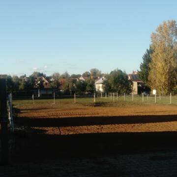
Offenstall Plätze frei f. liebe Wallache/Stute
Markt Berolzheim
Offenstall-Berolzheim
@Offenstall-Berolzheim
Hunde willkommen
Krankenbox
Offenstall
Selbstversorgung
6 weitere...
P
Boxen frei
Treuchtlingen
Reitverein-Treuchtlingen
@Reitverein-Treuchtlingen
FN-Mitglied
Freizeitstall
Vermieten
Longierzirkel/Roundpen
Paddock
Außenbox mit Paddock
Außenboxen
17 weitere...
P
Deprecated: Creation of dynamic property Zend_View_Helper_Ads::$adLink is deprecated in /var/www/stall-frei/htdocs/staging.stall-frei.de/library/Psf/View/Helper/Ads.php on line 108

Futtersack HeuToy, Fressbremse in pink
Mechtersen
STALL-FREIde Marketing
@STALL-FREI-Marketing
Stundenlange Beschäftigung die
Koliken vorbeugt, geringe Staubinhalation mit
steuerbarer Futterentnahme
Leider kein Vorschaubild
Leider kein Vorschaubild
Offenstall mit Nachtbox
Treuchtlingen
Thomas Franke
@CrazyHorseRanch
Freizeitstall
Vermieten
Hunde willkommen
Paddock
Gnadenbrothof
Hufrehe geeignet
9 weitere...
B


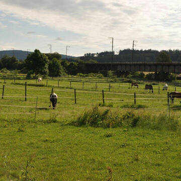
Horses oasis of Well being❤️Liebe zu den Pferden...
Ellingen
Team TJ
@Horsesoasisofwellbeing
Freizeitstall
Geländestrecke
Vermieten
Hunde willkommen
Krankenbox
Allergikerstall
bedampftes/gewaschenes Heu
24 weitere...
P+

freie Paddockboxen - Pensionsstall
Wemding
Reitsportzentrum Bader
@Denise-Bader
Freizeitstall
Gangpferdereiten
Vermieten
Führanlage
Krankenbox
Allergikerstall
Fohlenaufzucht möglich
33 weitere...
P
Leider kein Vorschaubild
Leider kein Vorschaubild
Offenstall Vollpension 270€
Wolferstadt
Tobias Wiedenmann
@TobiasWiedenmann
Freizeitstall
Hunde willkommen
Krankenbox
Notfallboxen
Offenstall
8 weitere...
B
Leider kein Vorschaubild
Leider kein Vorschaubild
Ganzer Offenstall 6-14 Pferde (+24h Weide) ab 11...
Wolferstadt
Tobias Wiedenmann
@TobiasWiedenmann
Hunde willkommen
Krankenbox
Allergikerstall
bedampftes/gewaschenes Heu
Außenbox mit Paddock
Außenboxen
Halbpension
Selbstversorgung
19 weitere...
B

Mitarbeiter gesucht?
Mechtersen
STALL-FREIde Marketing
@STALL-FREI-Marketing
Stellenangebote kostenlos veröffentlichen!
Leider kein Vorschaubild
Leider kein Vorschaubild
Helle Innenbox auf schöner Reitanlage (Verein)
Wemding
Reit- und Fahrverein Wemding
@RV_Wemding
FN-Mitglied
Pferdeausbildung
Vermieten
Hunde willkommen
Laufband
Außenbox mit Paddock
Innenbox
15 weitere...
B
Leider kein Vorschaubild
Leider kein Vorschaubild
Selbstversorger Offenstall
Ellingen
Offenstall am Limes
@Julia-M
Freizeitstall
Wanderreiten
Krankenbox
Longierzirkel/Roundpen
Hufrehe geeignet
Offenstall
9 weitere...
B
Leider kein Vorschaubild
Leider kein Vorschaubild
Großer Offenstall wird neu gebaut ab Anfang 2026
Ellingen
Team TJ
@Horsesoasisofwellbeing
Freizeitstall
Geländestrecke
Vermieten
Hunde willkommen
Longierzirkel/Roundpen
Fohlenaufzucht möglich
zuckerreduziertes Heu
16 weitere...
B
Deprecated: Creation of dynamic property Zend_View::$pageCount is deprecated in /var/www/stall-frei/htdocs/staging.stall-frei.de/library/vendor/shardj/zf1-future/library/Zend/View/Abstract.php on line 308
Deprecated: Creation of dynamic property Zend_View::$itemCountPerPage is deprecated in /var/www/stall-frei/htdocs/staging.stall-frei.de/library/vendor/shardj/zf1-future/library/Zend/View/Abstract.php on line 308
Deprecated: Creation of dynamic property Zend_View::$first is deprecated in /var/www/stall-frei/htdocs/staging.stall-frei.de/library/vendor/shardj/zf1-future/library/Zend/View/Abstract.php on line 308
Deprecated: Creation of dynamic property Zend_View::$current is deprecated in /var/www/stall-frei/htdocs/staging.stall-frei.de/library/vendor/shardj/zf1-future/library/Zend/View/Abstract.php on line 308
Deprecated: Creation of dynamic property Zend_View::$last is deprecated in /var/www/stall-frei/htdocs/staging.stall-frei.de/library/vendor/shardj/zf1-future/library/Zend/View/Abstract.php on line 308
Deprecated: Creation of dynamic property Zend_View::$next is deprecated in /var/www/stall-frei/htdocs/staging.stall-frei.de/library/vendor/shardj/zf1-future/library/Zend/View/Abstract.php on line 308
Deprecated: Creation of dynamic property Zend_View::$pagesInRange is deprecated in /var/www/stall-frei/htdocs/staging.stall-frei.de/library/vendor/shardj/zf1-future/library/Zend/View/Abstract.php on line 308
Deprecated: Creation of dynamic property Zend_View::$firstPageInRange is deprecated in /var/www/stall-frei/htdocs/staging.stall-frei.de/library/vendor/shardj/zf1-future/library/Zend/View/Abstract.php on line 308
Deprecated: Creation of dynamic property Zend_View::$lastPageInRange is deprecated in /var/www/stall-frei/htdocs/staging.stall-frei.de/library/vendor/shardj/zf1-future/library/Zend/View/Abstract.php on line 308
Deprecated: Creation of dynamic property Zend_View::$currentItemCount is deprecated in /var/www/stall-frei/htdocs/staging.stall-frei.de/library/vendor/shardj/zf1-future/library/Zend/View/Abstract.php on line 308
Deprecated: Creation of dynamic property Zend_View::$totalItemCount is deprecated in /var/www/stall-frei/htdocs/staging.stall-frei.de/library/vendor/shardj/zf1-future/library/Zend/View/Abstract.php on line 308
Deprecated: Creation of dynamic property Zend_View::$firstItemNumber is deprecated in /var/www/stall-frei/htdocs/staging.stall-frei.de/library/vendor/shardj/zf1-future/library/Zend/View/Abstract.php on line 308
Deprecated: Creation of dynamic property Zend_View::$lastItemNumber is deprecated in /var/www/stall-frei/htdocs/staging.stall-frei.de/library/vendor/shardj/zf1-future/library/Zend/View/Abstract.php on line 308
Deprecated: Creation of dynamic property Zend_View::$router is deprecated in /var/www/stall-frei/htdocs/staging.stall-frei.de/library/vendor/shardj/zf1-future/library/Zend/View/Abstract.php on line 308
Deprecated: Creation of dynamic property Zend_View::$urlParams is deprecated in /var/www/stall-frei/htdocs/staging.stall-frei.de/library/vendor/shardj/zf1-future/library/Zend/View/Abstract.php on line 308
Deprecated: Creation of dynamic property Zend_View::$showAds is deprecated in /var/www/stall-frei/htdocs/staging.stall-frei.de/library/vendor/shardj/zf1-future/library/Zend/View/Abstract.php on line 308
Deprecated: Creation of dynamic property Zend_View::$objectIds is deprecated in /var/www/stall-frei/htdocs/staging.stall-frei.de/library/vendor/shardj/zf1-future/library/Zend/View/Abstract.php on line 308
Deprecated: Creation of dynamic property Zend_View::$showNavbar is deprecated in /var/www/stall-frei/htdocs/staging.stall-frei.de/library/vendor/shardj/zf1-future/library/Zend/View/Abstract.php on line 308
Deprecated: Creation of dynamic property Zend_View::$showBreadcrumb is deprecated in /var/www/stall-frei/htdocs/staging.stall-frei.de/library/vendor/shardj/zf1-future/library/Zend/View/Abstract.php on line 308
Deprecated: Creation of dynamic property Zend_View::$showFooter is deprecated in /var/www/stall-frei/htdocs/staging.stall-frei.de/library/vendor/shardj/zf1-future/library/Zend/View/Abstract.php on line 308
Deprecated: Creation of dynamic property Zend_View::$showInternalAds is deprecated in /var/www/stall-frei/htdocs/staging.stall-frei.de/library/vendor/shardj/zf1-future/library/Zend/View/Abstract.php on line 308
Deprecated: Creation of dynamic property Zend_View::$blNoContent is deprecated in /var/www/stall-frei/htdocs/staging.stall-frei.de/library/vendor/shardj/zf1-future/library/Zend/View/Abstract.php on line 308
Deprecated: Creation of dynamic property Zend_View::$sMetaDesc is deprecated in /var/www/stall-frei/htdocs/staging.stall-frei.de/library/vendor/shardj/zf1-future/library/Zend/View/Abstract.php on line 308
Deprecated: Creation of dynamic property Zend_View::$useGmaps is deprecated in /var/www/stall-frei/htdocs/staging.stall-frei.de/library/vendor/shardj/zf1-future/library/Zend/View/Abstract.php on line 308
Deprecated: Creation of dynamic property Zend_View::$touches is deprecated in /var/www/stall-frei/htdocs/staging.stall-frei.de/library/vendor/shardj/zf1-future/library/Zend/View/Abstract.php on line 308
Deprecated: Creation of dynamic property Zend_View::$oProject is deprecated in /var/www/stall-frei/htdocs/staging.stall-frei.de/library/vendor/shardj/zf1-future/library/Zend/View/Abstract.php on line 308
Deprecated: Creation of dynamic property Zend_View::$pageHeadline is deprecated in /var/www/stall-frei/htdocs/staging.stall-frei.de/library/vendor/shardj/zf1-future/library/Zend/View/Abstract.php on line 308
Deprecated: Creation of dynamic property Zend_View::$disableLocationField is deprecated in /var/www/stall-frei/htdocs/staging.stall-frei.de/library/vendor/shardj/zf1-future/library/Zend/View/Abstract.php on line 308
Deprecated: Creation of dynamic property Zend_View::$isSearch is deprecated in /var/www/stall-frei/htdocs/staging.stall-frei.de/library/vendor/shardj/zf1-future/library/Zend/View/Abstract.php on line 308
Deprecated: Creation of dynamic property Zend_View::$pageTitle is deprecated in /var/www/stall-frei/htdocs/staging.stall-frei.de/library/vendor/shardj/zf1-future/library/Zend/View/Abstract.php on line 308
Deprecated: Creation of dynamic property Psf_Form_Element_Text::$class is deprecated in /var/www/stall-frei/htdocs/staging.stall-frei.de/library/vendor/shardj/zf1-future/library/Zend/Form/Element.php on line 874
Deprecated: Creation of dynamic property Psf_Form_Element_Text::$size is deprecated in /var/www/stall-frei/htdocs/staging.stall-frei.de/library/vendor/shardj/zf1-future/library/Zend/Form/Element.php on line 874
Deprecated: Creation of dynamic property Psf_Form_Element_Text::$placeholder is deprecated in /var/www/stall-frei/htdocs/staging.stall-frei.de/library/vendor/shardj/zf1-future/library/Zend/Form/Element.php on line 874
Deprecated: Creation of dynamic property Psf_Form_Element_Hidden::$class is deprecated in /var/www/stall-frei/htdocs/staging.stall-frei.de/library/vendor/shardj/zf1-future/library/Zend/Form/Element.php on line 874
Deprecated: Creation of dynamic property Psf_Form_Element_Hidden::$class is deprecated in /var/www/stall-frei/htdocs/staging.stall-frei.de/library/vendor/shardj/zf1-future/library/Zend/Form/Element.php on line 874
Deprecated: Creation of dynamic property Psf_Form_Element_Hidden::$class is deprecated in /var/www/stall-frei/htdocs/staging.stall-frei.de/library/vendor/shardj/zf1-future/library/Zend/Form/Element.php on line 874
Deprecated: Creation of dynamic property Psf_Form_Element_Hidden::$class is deprecated in /var/www/stall-frei/htdocs/staging.stall-frei.de/library/vendor/shardj/zf1-future/library/Zend/Form/Element.php on line 874
Deprecated: Creation of dynamic property Psf_Form_Element_Select::$class is deprecated in /var/www/stall-frei/htdocs/staging.stall-frei.de/library/vendor/shardj/zf1-future/library/Zend/Form/Element.php on line 874
Deprecated: Creation of dynamic property Psf_Form_Element_Select::$class is deprecated in /var/www/stall-frei/htdocs/staging.stall-frei.de/library/vendor/shardj/zf1-future/library/Zend/Form/Element.php on line 874
Deprecated: Creation of dynamic property Psf_Form_Element_Select::$class is deprecated in /var/www/stall-frei/htdocs/staging.stall-frei.de/library/vendor/shardj/zf1-future/library/Zend/Form/Element.php on line 874
Deprecated: Creation of dynamic property Psf_Form_Element_Select::$class is deprecated in /var/www/stall-frei/htdocs/staging.stall-frei.de/library/vendor/shardj/zf1-future/library/Zend/Form/Element.php on line 874
Deprecated: Creation of dynamic property Psf_Form_Element_Text::$class is deprecated in /var/www/stall-frei/htdocs/staging.stall-frei.de/library/vendor/shardj/zf1-future/library/Zend/Form/Element.php on line 874
Deprecated: Creation of dynamic property Psf_Form_Element_Checkbox::$label is deprecated in /var/www/stall-frei/htdocs/staging.stall-frei.de/library/vendor/shardj/zf1-future/library/Zend/Form/Element.php on line 874
Deprecated: Creation of dynamic property Zend_View::$sort is deprecated in /var/www/stall-frei/htdocs/staging.stall-frei.de/library/vendor/shardj/zf1-future/library/Zend/View/Abstract.php on line 308
Deprecated: Creation of dynamic property Zend_View::$searchLocation is deprecated in /var/www/stall-frei/htdocs/staging.stall-frei.de/library/vendor/shardj/zf1-future/library/Zend/View/Abstract.php on line 308
Deprecated: Creation of dynamic property Zend_View::$locationHint is deprecated in /var/www/stall-frei/htdocs/staging.stall-frei.de/library/vendor/shardj/zf1-future/library/Zend/View/Abstract.php on line 308
Psf_GeoCoder_Abstract::getLocation: Untermühle Get Location CachedOrLive
Psf_GeoCoder_Abstract::getCachedOrLive: Untermühle
Psf_GeoCoder_OpenCageData::makeApiRequest: response:
Array
(
[documentation] => https://opencagedata.com/api
[licenses] => Array
(
[0] => Array
(
[name] => see attribution guide
[url] => https://opencagedata.com/credits
)
)
[results] => Array
(
[0] => Array
(
[bounds] => Array
(
[northeast] => Array
(
[lat] => 48.9871145
[lng] => 10.8636086
)
[southwest] => Array
(
[lat] => 48.9471145
[lng] => 10.8236086
)
)
[components] => Array
(
[ISO_3166-1_alpha-2] => DE
[ISO_3166-1_alpha-3] => DEU
[ISO_3166-2] => Array
(
[0] => DE-BY
)
[_category] => place
[_normalized_city] => Treuchtlingen
[_type] => hamlet
[continent] => Europe
[country] => Deutschland
[country_code] => de
[county] => Landkreis Weißenburg-Gunzenhausen
[hamlet] => Untermühle
[political_union] => European Union
[postcode] => 91801
[state] => Bayern
[state_code] => BY
[town] => Treuchtlingen
)
[confidence] => 7
[formatted] => Untermühle, 91801 Treuchtlingen, Deutschland
[geometry] => Array
(
[lat] => 48.9671145
[lng] => 10.8436086
)
)
[1] => Array
(
[bounds] => Array
(
[northeast] => Array
(
[lat] => 50.8544571
[lng] => 6.0563159
)
[southwest] => Array
(
[lat] => 50.8542964
[lng] => 6.0561394
)
)
[components] => Array
(
[ISO_3166-1_alpha-2] => DE
[ISO_3166-1_alpha-3] => DEU
[ISO_3166-2] => Array
(
[0] => DE-NW
)
[_category] => unknown
[_normalized_city] => Aachen
[_type] => watermill
[city] => Aachen
[continent] => Europe
[country] => Deutschland
[country_code] => de
[county] => Städteregion Aachen
[house_number] => 110
[political_union] => European Union
[postcode] => 52072
[road] => Heyder Feldweg
[state] => Nordrhein-Westfalen
[state_code] => NW
[suburb] => Richterich
[watermill] => Untermühle
)
[confidence] => 9
[formatted] => Untermühle, Heyder Feldweg 110, 52072 Aachen, Deutschland
[geometry] => Array
(
[lat] => 50.8543755
[lng] => 6.0562267
)
)
[2] => Array
(
[bounds] => Array
(
[northeast] => Array
(
[lat] => 51.6641069
[lng] => 9.0650927
)
[southwest] => Array
(
[lat] => 51.6602261
[lng] => 9.0584567
)
)
[components] => Array
(
[ISO_3166-1_alpha-2] => DE
[ISO_3166-1_alpha-3] => DEU
[ISO_3166-2] => Array
(
[0] => DE-NW
)
[_category] => natural/water
[_normalized_city] => Bad Driburg
[_type] => canal
[canal] => Untermühle
[continent] => Europe
[country] => Deutschland
[country_code] => de
[county] => Kreis Höxter
[political_union] => European Union
[postcode] => 33014
[state] => Nordrhein-Westfalen
[state_code] => NW
[suburb] => Dringenberg
[town] => Bad Driburg
)
[confidence] => 9
[formatted] => Untermühle, 33014 Bad Driburg, Deutschland
[geometry] => Array
(
[lat] => 51.6624858
[lng] => 9.062161
)
)
[3] => Array
(
[bounds] => Array
(
[northeast] => Array
(
[lat] => 49.6891282
[lng] => 7.8639294
)
[southwest] => Array
(
[lat] => 49.6883506
[lng] => 7.8622747
)
)
[components] => Array
(
[ISO_3166-1_alpha-2] => DE
[ISO_3166-1_alpha-3] => DEU
[ISO_3166-2] => Array
(
[0] => DE-RP
)
[_category] => place
[_normalized_city] => Sankt Alban
[_type] => hamlet
[continent] => Europe
[country] => Deutschland
[country_code] => de
[county] => Donnersbergkreis
[hamlet] => Untermühle
[municipality] => Nordpfälzer Land
[political_union] => European Union
[state] => Rheinland-Pfalz
[state_code] => RP
[village] => Sankt Alban
)
[confidence] => 9
[formatted] => Untermühle, Sankt Alban, Rheinland-Pfalz, Deutschland
[geometry] => Array
(
[lat] => 49.6885972
[lng] => 7.863092
)
)
[4] => Array
(
[bounds] => Array
(
[northeast] => Array
(
[lat] => 47.9875471
[lng] => 12.1797838
)
[southwest] => Array
(
[lat] => 47.9475471
[lng] => 12.1397838
)
)
[components] => Array
(
[ISO_3166-1_alpha-2] => DE
[ISO_3166-1_alpha-3] => DEU
[ISO_3166-2] => Array
(
[0] => DE-BY
)
[_category] => place
[_normalized_city] => Griesstätt
[_type] => hamlet
[continent] => Europe
[country] => Deutschland
[country_code] => de
[county] => Landkreis Rosenheim
[hamlet] => Untermühle
[political_union] => European Union
[postcode] => 83556
[state] => Bayern
[state_code] => BY
[village] => Griesstätt
)
[confidence] => 7
[formatted] => Untermühle, 83556 Griesstätt, Deutschland
[geometry] => Array
(
[lat] => 47.9675471
[lng] => 12.1597838
)
)
[5] => Array
(
[bounds] => Array
(
[northeast] => Array
(
[lat] => 51.4058465
[lng] => 13.1771098
)
[southwest] => Array
(
[lat] => 51.3658465
[lng] => 13.1371098
)
)
[components] => Array
(
[ISO_3166-1_alpha-2] => DE
[ISO_3166-1_alpha-3] => DEU
[ISO_3166-2] => Array
(
[0] => DE-SN
)
[_category] => place
[_normalized_city] => Cavertitz
[_type] => hamlet
[city] => Cavertitz
[continent] => Europe
[country] => Deutschland
[country_code] => de
[county] => Nordsachsen
[hamlet] => Untermühle
[political_union] => European Union
[postcode] => 04758
[state] => Sachsen
[state_code] => SN
)
[confidence] => 7
[formatted] => Untermühle, 04758 Cavertitz, Deutschland
[geometry] => Array
(
[lat] => 51.3858465
[lng] => 13.1571098
)
)
[6] => Array
(
[bounds] => Array
(
[northeast] => Array
(
[lat] => 47.685677
[lng] => 11.0899357
)
[southwest] => Array
(
[lat] => 47.645677
[lng] => 11.0499357
)
)
[components] => Array
(
[ISO_3166-1_alpha-2] => DE
[ISO_3166-1_alpha-3] => DEU
[ISO_3166-2] => Array
(
[0] => DE-BY
)
[_category] => place
[_normalized_city] => Bad Kohlgrub
[_type] => hamlet
[continent] => Europe
[country] => Deutschland
[country_code] => de
[county] => Landkreis Garmisch-Partenkirchen
[hamlet] => Untermühle
[political_union] => European Union
[postcode] => 82433
[state] => Bayern
[state_code] => BY
[town] => Bad Kohlgrub
)
[confidence] => 7
[formatted] => Untermühle, 82433 Bad Kohlgrub, Deutschland
[geometry] => Array
(
[lat] => 47.665677
[lng] => 11.0699357
)
)
[7] => Array
(
[bounds] => Array
(
[northeast] => Array
(
[lat] => 51.6411633
[lng] => 12.4954615
)
[southwest] => Array
(
[lat] => 51.6011633
[lng] => 12.4554615
)
)
[components] => Array
(
[ISO_3166-1_alpha-2] => DE
[ISO_3166-1_alpha-3] => DEU
[ISO_3166-2] => Array
(
[0] => DE-ST
)
[_category] => place
[_normalized_city] => Rösa
[_type] => hamlet
[city_district] => Rösa
[continent] => Europe
[country] => Deutschland
[country_code] => de
[county] => Anhalt-Bitterfeld
[hamlet] => Untermühle
[municipality] => Muldestausee
[political_union] => European Union
[postcode] => 06774
[state] => Sachsen-Anhalt
[state_code] => ST
[town] => Rösa
[village] => Rösa
)
[confidence] => 7
[formatted] => Untermühle, 06774 Rösa, Deutschland
[geometry] => Array
(
[lat] => 51.6211633
[lng] => 12.4754615
)
)
[8] => Array
(
[bounds] => Array
(
[northeast] => Array
(
[lat] => 52.3368196
[lng] => 14.5718598
)
[southwest] => Array
(
[lat] => 52.2968196
[lng] => 14.5318598
)
)
[components] => Array
(
[ISO_3166-1_alpha-2] => DE
[ISO_3166-1_alpha-3] => DEU
[ISO_3166-2] => Array
(
[0] => DE-BB
)
[_category] => place
[_normalized_city] => Frankfurt (Oder)
[_type] => hamlet
[continent] => Europe
[country] => Deutschland
[country_code] => de
[hamlet] => Untermühle
[political_union] => European Union
[postcode] => 15236
[state] => Brandenburg
[state_code] => BB
[suburb] => Beresinchen
[town] => Frankfurt (Oder)
[village] => Güldendorf
)
[confidence] => 7
[formatted] => Untermühle, 15236 Güldendorf, Deutschland
[geometry] => Array
(
[lat] => 52.3168196
[lng] => 14.5518598
)
)
[9] => Array
(
[bounds] => Array
(
[northeast] => Array
(
[lat] => 51.6129849
[lng] => 11.2088859
)
[southwest] => Array
(
[lat] => 51.5729849
[lng] => 11.1688859
)
)
[components] => Array
(
[ISO_3166-1_alpha-2] => DE
[ISO_3166-1_alpha-3] => DEU
[ISO_3166-2] => Array
(
[0] => DE-ST
)
[_category] => place
[_normalized_city] => Harzgerode
[_type] => hamlet
[continent] => Europe
[country] => Deutschland
[country_code] => de
[county] => Landkreis Harz
[hamlet] => Untermühle
[political_union] => European Union
[state] => Sachsen-Anhalt
[state_code] => ST
[town] => Harzgerode
[village] => Königerode
)
[confidence] => 7
[formatted] => Untermühle, Königerode, Sachsen-Anhalt, Deutschland
[geometry] => Array
(
[lat] => 51.5929849
[lng] => 11.1888859
)
)
)
[status] => Array
(
[code] => 200
[message] => OK
)
[stay_informed] => Array
(
[blog] => https://blog.opencagedata.com
[mastodon] => https://en.osm.town/@opencage
)
[thanks] => For using an OpenCage API
[timestamp] => Array
(
[created_http] => Sat, 07 Feb 2026 15:31:55 GMT
[created_unix] => 1770478315
)
[total_results] => 10
)
Psf_GeoCoder_Abstract::convertLocationResult
{"documentation":"https:\/\/opencagedata.com\/api","licenses":[{"name":"see attribution guide","url":"https:\/\/opencagedata.com\/credits"}],"results":[{"bounds":{"northeast":{"lat":48.9871145,"lng":10.8636086},"southwest":{"lat":48.9471145,"lng":10.8236086}},"components":{"ISO_3166-1_alpha-2":"DE","ISO_3166-1_alpha-3":"DEU","ISO_3166-2":["DE-BY"],"_category":"place","_normalized_city":"Treuchtlingen","_type":"hamlet","continent":"Europe","country":"Deutschland","country_code":"de","county":"Landkreis Wei\u00dfenburg-Gunzenhausen","hamlet":"Unterm\u00fchle","political_union":"European Union","postcode":"91801","state":"Bayern","state_code":"BY","town":"Treuchtlingen"},"confidence":7,"formatted":"Unterm\u00fchle, 91801 Treuchtlingen, Deutschland","geometry":{"lat":48.9671145,"lng":10.8436086}},{"bounds":{"northeast":{"lat":50.8544571,"lng":6.0563159},"southwest":{"lat":50.8542964,"lng":6.0561394}},"components":{"ISO_3166-1_alpha-2":"DE","ISO_3166-1_alpha-3":"DEU","ISO_3166-2":["DE-NW"],"_category":"unknown","_normalized_city":"Aachen","_type":"watermill","city":"Aachen","continent":"Europe","country":"Deutschland","country_code":"de","county":"St\u00e4dteregion Aachen","house_number":"110","political_union":"European Union","postcode":"52072","road":"Heyder Feldweg","state":"Nordrhein-Westfalen","state_code":"NW","suburb":"Richterich","watermill":"Unterm\u00fchle"},"confidence":9,"formatted":"Unterm\u00fchle, Heyder Feldweg 110, 52072 Aachen, Deutschland","geometry":{"lat":50.8543755,"lng":6.0562267}},{"bounds":{"northeast":{"lat":51.6641069,"lng":9.0650927},"southwest":{"lat":51.6602261,"lng":9.0584567}},"components":{"ISO_3166-1_alpha-2":"DE","ISO_3166-1_alpha-3":"DEU","ISO_3166-2":["DE-NW"],"_category":"natural\/water","_normalized_city":"Bad Driburg","_type":"canal","canal":"Unterm\u00fchle","continent":"Europe","country":"Deutschland","country_code":"de","county":"Kreis H\u00f6xter","political_union":"European Union","postcode":"33014","state":"Nordrhein-Westfalen","state_code":"NW","suburb":"Dringenberg","town":"Bad Driburg"},"confidence":9,"formatted":"Unterm\u00fchle, 33014 Bad Driburg, Deutschland","geometry":{"lat":51.6624858,"lng":9.062161}},{"bounds":{"northeast":{"lat":49.6891282,"lng":7.8639294},"southwest":{"lat":49.6883506,"lng":7.8622747}},"components":{"ISO_3166-1_alpha-2":"DE","ISO_3166-1_alpha-3":"DEU","ISO_3166-2":["DE-RP"],"_category":"place","_normalized_city":"Sankt Alban","_type":"hamlet","continent":"Europe","country":"Deutschland","country_code":"de","county":"Donnersbergkreis","hamlet":"Unterm\u00fchle","municipality":"Nordpf\u00e4lzer Land","political_union":"European Union","state":"Rheinland-Pfalz","state_code":"RP","village":"Sankt Alban"},"confidence":9,"formatted":"Unterm\u00fchle, Sankt Alban, Rheinland-Pfalz, Deutschland","geometry":{"lat":49.6885972,"lng":7.863092}},{"bounds":{"northeast":{"lat":47.9875471,"lng":12.1797838},"southwest":{"lat":47.9475471,"lng":12.1397838}},"components":{"ISO_3166-1_alpha-2":"DE","ISO_3166-1_alpha-3":"DEU","ISO_3166-2":["DE-BY"],"_category":"place","_normalized_city":"Griesst\u00e4tt","_type":"hamlet","continent":"Europe","country":"Deutschland","country_code":"de","county":"Landkreis Rosenheim","hamlet":"Unterm\u00fchle","political_union":"European Union","postcode":"83556","state":"Bayern","state_code":"BY","village":"Griesst\u00e4tt"},"confidence":7,"formatted":"Unterm\u00fchle, 83556 Griesst\u00e4tt, Deutschland","geometry":{"lat":47.9675471,"lng":12.1597838}},{"bounds":{"northeast":{"lat":51.4058465,"lng":13.1771098},"southwest":{"lat":51.3658465,"lng":13.1371098}},"components":{"ISO_3166-1_alpha-2":"DE","ISO_3166-1_alpha-3":"DEU","ISO_3166-2":["DE-SN"],"_category":"place","_normalized_city":"Cavertitz","_type":"hamlet","city":"Cavertitz","continent":"Europe","country":"Deutschland","country_code":"de","county":"Nordsachsen","hamlet":"Unterm\u00fchle","political_union":"European Union","postcode":"04758","state":"Sachsen","state_code":"SN"},"confidence":7,"formatted":"Unterm\u00fchle, 04758 Cavertitz, Deutschland","geometry":{"lat":51.3858465,"lng":13.1571098}},{"bounds":{"northeast":{"lat":47.685677,"lng":11.0899357},"southwest":{"lat":47.645677,"lng":11.0499357}},"components":{"ISO_3166-1_alpha-2":"DE","ISO_3166-1_alpha-3":"DEU","ISO_3166-2":["DE-BY"],"_category":"place","_normalized_city":"Bad Kohlgrub","_type":"hamlet","continent":"Europe","country":"Deutschland","country_code":"de","county":"Landkreis Garmisch-Partenkirchen","hamlet":"Unterm\u00fchle","political_union":"European Union","postcode":"82433","state":"Bayern","state_code":"BY","town":"Bad Kohlgrub"},"confidence":7,"formatted":"Unterm\u00fchle, 82433 Bad Kohlgrub, Deutschland","geometry":{"lat":47.665677,"lng":11.0699357}},{"bounds":{"northeast":{"lat":51.6411633,"lng":12.4954615},"southwest":{"lat":51.6011633,"lng":12.4554615}},"components":{"ISO_3166-1_alpha-2":"DE","ISO_3166-1_alpha-3":"DEU","ISO_3166-2":["DE-ST"],"_category":"place","_normalized_city":"R\u00f6sa","_type":"hamlet","city_district":"R\u00f6sa","continent":"Europe","country":"Deutschland","country_code":"de","county":"Anhalt-Bitterfeld","hamlet":"Unterm\u00fchle","municipality":"Muldestausee","political_union":"European Union","postcode":"06774","state":"Sachsen-Anhalt","state_code":"ST","town":"R\u00f6sa","village":"R\u00f6sa"},"confidence":7,"formatted":"Unterm\u00fchle, 06774 R\u00f6sa, Deutschland","geometry":{"lat":51.6211633,"lng":12.4754615}},{"bounds":{"northeast":{"lat":52.3368196,"lng":14.5718598},"southwest":{"lat":52.2968196,"lng":14.5318598}},"components":{"ISO_3166-1_alpha-2":"DE","ISO_3166-1_alpha-3":"DEU","ISO_3166-2":["DE-BB"],"_category":"place","_normalized_city":"Frankfurt (Oder)","_type":"hamlet","continent":"Europe","country":"Deutschland","country_code":"de","hamlet":"Unterm\u00fchle","political_union":"European Union","postcode":"15236","state":"Brandenburg","state_code":"BB","suburb":"Beresinchen","town":"Frankfurt (Oder)","village":"G\u00fcldendorf"},"confidence":7,"formatted":"Unterm\u00fchle, 15236 G\u00fcldendorf, Deutschland","geometry":{"lat":52.3168196,"lng":14.5518598}},{"bounds":{"northeast":{"lat":51.6129849,"lng":11.2088859},"southwest":{"lat":51.5729849,"lng":11.1688859}},"components":{"ISO_3166-1_alpha-2":"DE","ISO_3166-1_alpha-3":"DEU","ISO_3166-2":["DE-ST"],"_category":"place","_normalized_city":"Harzgerode","_type":"hamlet","continent":"Europe","country":"Deutschland","country_code":"de","county":"Landkreis Harz","hamlet":"Unterm\u00fchle","political_union":"European Union","state":"Sachsen-Anhalt","state_code":"ST","town":"Harzgerode","village":"K\u00f6nigerode"},"confidence":7,"formatted":"Unterm\u00fchle, K\u00f6nigerode, Sachsen-Anhalt, Deutschland","geometry":{"lat":51.5929849,"lng":11.1888859}}],"status":{"code":200,"message":"OK"},"stay_informed":{"blog":"https:\/\/blog.opencagedata.com","mastodon":"https:\/\/en.osm.town\/@opencage"},"thanks":"For using an OpenCage API","timestamp":{"created_http":"Sat, 07 Feb 2026 15:31:55 GMT","created_unix":1770478315},"total_results":10}Array
(
[0] => stdClass Object
(
[bounds] => stdClass Object
(
[northeast] => stdClass Object
(
[lat] => 48.9871145
[lng] => 10.8636086
)
[southwest] => stdClass Object
(
[lat] => 48.9471145
[lng] => 10.8236086
)
)
[components] => stdClass Object
(
[ISO_3166-1_alpha-2] => DE
[ISO_3166-1_alpha-3] => DEU
[ISO_3166-2] => Array
(
[0] => DE-BY
)
[_category] => place
[_normalized_city] => Treuchtlingen
[_type] => hamlet
[continent] => Europe
[country] => Deutschland
[country_code] => de
[county] => Landkreis Weißenburg-Gunzenhausen
[hamlet] => Untermühle
[political_union] => European Union
[postcode] => 91801
[state] => Bayern
[state_code] => BY
[town] => Treuchtlingen
)
[confidence] => 7
[formatted] => Untermühle, 91801 Treuchtlingen, Deutschland
[geometry] => stdClass Object
(
[lat] => 48.9671145
[lng] => 10.8436086
)
)
[1] => stdClass Object
(
[bounds] => stdClass Object
(
[northeast] => stdClass Object
(
[lat] => 50.8544571
[lng] => 6.0563159
)
[southwest] => stdClass Object
(
[lat] => 50.8542964
[lng] => 6.0561394
)
)
[components] => stdClass Object
(
[ISO_3166-1_alpha-2] => DE
[ISO_3166-1_alpha-3] => DEU
[ISO_3166-2] => Array
(
[0] => DE-NW
)
[_category] => unknown
[_normalized_city] => Aachen
[_type] => watermill
[city] => Aachen
[continent] => Europe
[country] => Deutschland
[country_code] => de
[county] => Städteregion Aachen
[house_number] => 110
[political_union] => European Union
[postcode] => 52072
[road] => Heyder Feldweg
[state] => Nordrhein-Westfalen
[state_code] => NW
[suburb] => Richterich
[watermill] => Untermühle
)
[confidence] => 9
[formatted] => Untermühle, Heyder Feldweg 110, 52072 Aachen, Deutschland
[geometry] => stdClass Object
(
[lat] => 50.8543755
[lng] => 6.0562267
)
)
[2] => stdClass Object
(
[bounds] => stdClass Object
(
[northeast] => stdClass Object
(
[lat] => 51.6641069
[lng] => 9.0650927
)
[southwest] => stdClass Object
(
[lat] => 51.6602261
[lng] => 9.0584567
)
)
[components] => stdClass Object
(
[ISO_3166-1_alpha-2] => DE
[ISO_3166-1_alpha-3] => DEU
[ISO_3166-2] => Array
(
[0] => DE-NW
)
[_category] => natural/water
[_normalized_city] => Bad Driburg
[_type] => canal
[canal] => Untermühle
[continent] => Europe
[country] => Deutschland
[country_code] => de
[county] => Kreis Höxter
[political_union] => European Union
[postcode] => 33014
[state] => Nordrhein-Westfalen
[state_code] => NW
[suburb] => Dringenberg
[town] => Bad Driburg
)
[confidence] => 9
[formatted] => Untermühle, 33014 Bad Driburg, Deutschland
[geometry] => stdClass Object
(
[lat] => 51.6624858
[lng] => 9.062161
)
)
[3] => stdClass Object
(
[bounds] => stdClass Object
(
[northeast] => stdClass Object
(
[lat] => 49.6891282
[lng] => 7.8639294
)
[southwest] => stdClass Object
(
[lat] => 49.6883506
[lng] => 7.8622747
)
)
[components] => stdClass Object
(
[ISO_3166-1_alpha-2] => DE
[ISO_3166-1_alpha-3] => DEU
[ISO_3166-2] => Array
(
[0] => DE-RP
)
[_category] => place
[_normalized_city] => Sankt Alban
[_type] => hamlet
[continent] => Europe
[country] => Deutschland
[country_code] => de
[county] => Donnersbergkreis
[hamlet] => Untermühle
[municipality] => Nordpfälzer Land
[political_union] => European Union
[state] => Rheinland-Pfalz
[state_code] => RP
[village] => Sankt Alban
)
[confidence] => 9
[formatted] => Untermühle, Sankt Alban, Rheinland-Pfalz, Deutschland
[geometry] => stdClass Object
(
[lat] => 49.6885972
[lng] => 7.863092
)
)
[4] => stdClass Object
(
[bounds] => stdClass Object
(
[northeast] => stdClass Object
(
[lat] => 47.9875471
[lng] => 12.1797838
)
[southwest] => stdClass Object
(
[lat] => 47.9475471
[lng] => 12.1397838
)
)
[components] => stdClass Object
(
[ISO_3166-1_alpha-2] => DE
[ISO_3166-1_alpha-3] => DEU
[ISO_3166-2] => Array
(
[0] => DE-BY
)
[_category] => place
[_normalized_city] => Griesstätt
[_type] => hamlet
[continent] => Europe
[country] => Deutschland
[country_code] => de
[county] => Landkreis Rosenheim
[hamlet] => Untermühle
[political_union] => European Union
[postcode] => 83556
[state] => Bayern
[state_code] => BY
[village] => Griesstätt
)
[confidence] => 7
[formatted] => Untermühle, 83556 Griesstätt, Deutschland
[geometry] => stdClass Object
(
[lat] => 47.9675471
[lng] => 12.1597838
)
)
[5] => stdClass Object
(
[bounds] => stdClass Object
(
[northeast] => stdClass Object
(
[lat] => 51.4058465
[lng] => 13.1771098
)
[southwest] => stdClass Object
(
[lat] => 51.3658465
[lng] => 13.1371098
)
)
[components] => stdClass Object
(
[ISO_3166-1_alpha-2] => DE
[ISO_3166-1_alpha-3] => DEU
[ISO_3166-2] => Array
(
[0] => DE-SN
)
[_category] => place
[_normalized_city] => Cavertitz
[_type] => hamlet
[city] => Cavertitz
[continent] => Europe
[country] => Deutschland
[country_code] => de
[county] => Nordsachsen
[hamlet] => Untermühle
[political_union] => European Union
[postcode] => 04758
[state] => Sachsen
[state_code] => SN
)
[confidence] => 7
[formatted] => Untermühle, 04758 Cavertitz, Deutschland
[geometry] => stdClass Object
(
[lat] => 51.3858465
[lng] => 13.1571098
)
)
[6] => stdClass Object
(
[bounds] => stdClass Object
(
[northeast] => stdClass Object
(
[lat] => 47.685677
[lng] => 11.0899357
)
[southwest] => stdClass Object
(
[lat] => 47.645677
[lng] => 11.0499357
)
)
[components] => stdClass Object
(
[ISO_3166-1_alpha-2] => DE
[ISO_3166-1_alpha-3] => DEU
[ISO_3166-2] => Array
(
[0] => DE-BY
)
[_category] => place
[_normalized_city] => Bad Kohlgrub
[_type] => hamlet
[continent] => Europe
[country] => Deutschland
[country_code] => de
[county] => Landkreis Garmisch-Partenkirchen
[hamlet] => Untermühle
[political_union] => European Union
[postcode] => 82433
[state] => Bayern
[state_code] => BY
[town] => Bad Kohlgrub
)
[confidence] => 7
[formatted] => Untermühle, 82433 Bad Kohlgrub, Deutschland
[geometry] => stdClass Object
(
[lat] => 47.665677
[lng] => 11.0699357
)
)
[7] => stdClass Object
(
[bounds] => stdClass Object
(
[northeast] => stdClass Object
(
[lat] => 51.6411633
[lng] => 12.4954615
)
[southwest] => stdClass Object
(
[lat] => 51.6011633
[lng] => 12.4554615
)
)
[components] => stdClass Object
(
[ISO_3166-1_alpha-2] => DE
[ISO_3166-1_alpha-3] => DEU
[ISO_3166-2] => Array
(
[0] => DE-ST
)
[_category] => place
[_normalized_city] => Rösa
[_type] => hamlet
[city_district] => Rösa
[continent] => Europe
[country] => Deutschland
[country_code] => de
[county] => Anhalt-Bitterfeld
[hamlet] => Untermühle
[municipality] => Muldestausee
[political_union] => European Union
[postcode] => 06774
[state] => Sachsen-Anhalt
[state_code] => ST
[town] => Rösa
[village] => Rösa
)
[confidence] => 7
[formatted] => Untermühle, 06774 Rösa, Deutschland
[geometry] => stdClass Object
(
[lat] => 51.6211633
[lng] => 12.4754615
)
)
[8] => stdClass Object
(
[bounds] => stdClass Object
(
[northeast] => stdClass Object
(
[lat] => 52.3368196
[lng] => 14.5718598
)
[southwest] => stdClass Object
(
[lat] => 52.2968196
[lng] => 14.5318598
)
)
[components] => stdClass Object
(
[ISO_3166-1_alpha-2] => DE
[ISO_3166-1_alpha-3] => DEU
[ISO_3166-2] => Array
(
[0] => DE-BB
)
[_category] => place
[_normalized_city] => Frankfurt (Oder)
[_type] => hamlet
[continent] => Europe
[country] => Deutschland
[country_code] => de
[hamlet] => Untermühle
[political_union] => European Union
[postcode] => 15236
[state] => Brandenburg
[state_code] => BB
[suburb] => Beresinchen
[town] => Frankfurt (Oder)
[village] => Güldendorf
)
[confidence] => 7
[formatted] => Untermühle, 15236 Güldendorf, Deutschland
[geometry] => stdClass Object
(
[lat] => 52.3168196
[lng] => 14.5518598
)
)
[9] => stdClass Object
(
[bounds] => stdClass Object
(
[northeast] => stdClass Object
(
[lat] => 51.6129849
[lng] => 11.2088859
)
[southwest] => stdClass Object
(
[lat] => 51.5729849
[lng] => 11.1688859
)
)
[components] => stdClass Object
(
[ISO_3166-1_alpha-2] => DE
[ISO_3166-1_alpha-3] => DEU
[ISO_3166-2] => Array
(
[0] => DE-ST
)
[_category] => place
[_normalized_city] => Harzgerode
[_type] => hamlet
[continent] => Europe
[country] => Deutschland
[country_code] => de
[county] => Landkreis Harz
[hamlet] => Untermühle
[political_union] => European Union
[state] => Sachsen-Anhalt
[state_code] => ST
[town] => Harzgerode
[village] => Königerode
)
[confidence] => 7
[formatted] => Untermühle, Königerode, Sachsen-Anhalt, Deutschland
[geometry] => stdClass Object
(
[lat] => 51.5929849
[lng] => 11.1888859
)
)
)
Psf_GeoCoder_OpenCageData::getKeyMap: 0
stdClass Object
(
    [bounds] => stdClass Object
        (
            [northeast] => stdClass Object
                (
                    [lat] => 48.9871145
                    [lng] => 10.8636086
                )

            [southwest] => stdClass Object
                (
                    [lat] => 48.9471145
                    [lng] => 10.8236086
                )

        )

    [components] => stdClass Object
        (
            [ISO_3166-1_alpha-2] => DE
            [ISO_3166-1_alpha-3] => DEU
            [ISO_3166-2] => Array
                (
                    [0] => DE-BY
                )

            [_category] => place
            [_normalized_city] => Treuchtlingen
            [_type] => hamlet
            [continent] => Europe
            [country] => Deutschland
            [country_code] => de
            [county] => Landkreis Weißenburg-Gunzenhausen
            [hamlet] => Untermühle
            [political_union] => European Union
            [postcode] => 91801
            [state] => Bayern
            [state_code] => BY
            [town] => Treuchtlingen
        )

    [confidence] => 7
    [formatted] => Untermühle, 91801 Treuchtlingen, Deutschland
    [geometry] => stdClass Object
        (
            [lat] => 48.9671145
            [lng] => 10.8436086
        )

)
Psf_GeoCoder_OpenCageData::getCounty: Weißenburg-Gunzenhausen
Psf_GeoCoder_OpenCageData::addMissingData REFETCH!
Array
(
    [address] => Untermühle, 91801 Treuchtlingen, Deutschland
    [type] => hamlet
    [street] => Untermühle
    [city] => Treuchtlingen
    [county] => Weißenburg-Gunzenhausen
    [state] => Bayern
    [zip] => 91801
    [country] => Deutschland
    [suburb] =>
    [countrycode] => de
    [latitude] => 48.9671145
    [longitude] => 10.8436086
    [accuracy] => 1
    [confidence] => 7
    [bounds] => stdClass Object
        (
            [northeast] => stdClass Object
                (
                    [lat] => 48.9871145
                    [lng] => 10.8636086
                )

            [southwest] => stdClass Object
                (
                    [lat] => 48.9471145
                    [lng] => 10.8236086
                )

        )

)
reformat!
Array
(
    [address] => Untermühle, 91801 Treuchtlingen, Deutschland
    [type] => hamlet
    [street] => Untermühle
    [city] => Treuchtlingen
    [county] => Weißenburg-Gunzenhausen
    [state] => Bayern
    [zip] => 91801
    [country] => Deutschland
    [suburb] =>
    [countrycode] => de
    [latitude] => 48.9671145
    [longitude] => 10.8436086
    [accuracy] => 1
    [confidence] => 7
    [bounds] => stdClass Object
        (
            [northeast] => stdClass Object
                (
                    [lat] => 48.9871145
                    [lng] => 10.8636086
                )

            [southwest] => stdClass Object
                (
                    [lat] => 48.9471145
                    [lng] => 10.8236086
                )

        )

    [place] => Untermühle, 91801 Treuchtlingen, Bayern
    [hash] => 386e251b06750068eab3816e595ee87c
)
Psf_GeoCoder_OpenCageData::getKeyMap: 1
stdClass Object
(
    [bounds] => stdClass Object
        (
            [northeast] => stdClass Object
                (
                    [lat] => 50.8544571
                    [lng] => 6.0563159
                )

            [southwest] => stdClass Object
                (
                    [lat] => 50.8542964
                    [lng] => 6.0561394
                )

        )

    [components] => stdClass Object
        (
            [ISO_3166-1_alpha-2] => DE
            [ISO_3166-1_alpha-3] => DEU
            [ISO_3166-2] => Array
                (
                    [0] => DE-NW
                )

            [_category] => unknown
            [_normalized_city] => Aachen
            [_type] => watermill
            [city] => Aachen
            [continent] => Europe
            [country] => Deutschland
            [country_code] => de
            [county] => Städteregion Aachen
            [house_number] => 110
            [political_union] => European Union
            [postcode] => 52072
            [road] => Heyder Feldweg
            [state] => Nordrhein-Westfalen
            [state_code] => NW
            [suburb] => Richterich
            [watermill] => Untermühle
        )

    [confidence] => 9
    [formatted] => Untermühle, Heyder Feldweg 110, 52072 Aachen, Deutschland
    [geometry] => stdClass Object
        (
            [lat] => 50.8543755
            [lng] => 6.0562267
        )

)
Psf_GeoCoder_OpenCageData::getCounty: Städteregion Aachen
Psf_GeoCoder_OpenCageData::addMissingData REFETCH!
Array
(
    [address] => Untermühle, Heyder Feldweg 110, 52072 Aachen, Deutschland
    [type] => watermill
    [street] => Heyder Feldweg 110
    [city] => Richterich
    [county] => Städteregion Aachen
    [state] => Nordrhein-Westfalen
    [zip] => 52072
    [country] => Deutschland
    [suburb] => Richterich
    [countrycode] => de
    [latitude] => 50.8543755
    [longitude] => 6.0562267
    [accuracy] => 1
    [confidence] => 9
    [bounds] => stdClass Object
        (
            [northeast] => stdClass Object
                (
                    [lat] => 50.8544571
                    [lng] => 6.0563159
                )

            [southwest] => stdClass Object
                (
                    [lat] => 50.8542964
                    [lng] => 6.0561394
                )

        )

)
reformat!
Array
(
    [address] => Heyder Feldweg 110, 52072 Richterich
    [type] => watermill
    [street] => Heyder Feldweg 110
    [city] => Richterich
    [county] => Städteregion Aachen
    [state] => Nordrhein-Westfalen
    [zip] => 52072
    [country] => Deutschland
    [suburb] => Richterich
    [countrycode] => de
    [latitude] => 50.8543755
    [longitude] => 6.0562267
    [accuracy] => 1
    [confidence] => 9
    [bounds] => stdClass Object
        (
            [northeast] => stdClass Object
                (
                    [lat] => 50.8544571
                    [lng] => 6.0563159
                )

            [southwest] => stdClass Object
                (
                    [lat] => 50.8542964
                    [lng] => 6.0561394
                )

        )

    [place] => Heyder Feldweg 110, 52072 Richterich, Nordrhein-Westfalen
    [hash] => eb46364c80be1994d84f776c13d9a12b
)
Psf_GeoCoder_OpenCageData::getKeyMap: 2
stdClass Object
(
    [bounds] => stdClass Object
        (
            [northeast] => stdClass Object
                (
                    [lat] => 51.6641069
                    [lng] => 9.0650927
                )

            [southwest] => stdClass Object
                (
                    [lat] => 51.6602261
                    [lng] => 9.0584567
                )

        )

    [components] => stdClass Object
        (
            [ISO_3166-1_alpha-2] => DE
            [ISO_3166-1_alpha-3] => DEU
            [ISO_3166-2] => Array
                (
                    [0] => DE-NW
                )

            [_category] => natural/water
            [_normalized_city] => Bad Driburg
            [_type] => canal
            [canal] => Untermühle
            [continent] => Europe
            [country] => Deutschland
            [country_code] => de
            [county] => Kreis Höxter
            [political_union] => European Union
            [postcode] => 33014
            [state] => Nordrhein-Westfalen
            [state_code] => NW
            [suburb] => Dringenberg
            [town] => Bad Driburg
        )

    [confidence] => 9
    [formatted] => Untermühle, 33014 Bad Driburg, Deutschland
    [geometry] => stdClass Object
        (
            [lat] => 51.6624858
            [lng] => 9.062161
        )

)
Psf_GeoCoder_OpenCageData::getCounty: Höxter
Psf_GeoCoder_OpenCageData::addMissingData REFETCH!
Array
(
    [address] => Untermühle, 33014 Bad Driburg, Deutschland
    [type] => canal
    [street] =>
    [city] => Bad Driburg
    [county] => Höxter
    [state] => Nordrhein-Westfalen
    [zip] => 33014
    [country] => Deutschland
    [suburb] => Dringenberg
    [countrycode] => de
    [latitude] => 51.6624858
    [longitude] => 9.062161
    [accuracy] => 1
    [confidence] => 9
    [bounds] => stdClass Object
        (
            [northeast] => stdClass Object
                (
                    [lat] => 51.6641069
                    [lng] => 9.0650927
                )

            [southwest] => stdClass Object
                (
                    [lat] => 51.6602261
                    [lng] => 9.0584567
                )

        )

)
reformat!
Array
(
    [address] => Untermühle, 33014 Bad Driburg, Deutschland
    [type] => canal
    [street] =>
    [city] => Bad Driburg
    [county] => Höxter
    [state] => Nordrhein-Westfalen
    [zip] => 33014
    [country] => Deutschland
    [suburb] => Dringenberg
    [countrycode] => de
    [latitude] => 51.6624858
    [longitude] => 9.062161
    [accuracy] => 1
    [confidence] => 9
    [bounds] => stdClass Object
        (
            [northeast] => stdClass Object
                (
                    [lat] => 51.6641069
                    [lng] => 9.0650927
                )

            [southwest] => stdClass Object
                (
                    [lat] => 51.6602261
                    [lng] => 9.0584567
                )

        )

    [place] => 33014 Bad Driburg, Nordrhein-Westfalen
    [hash] => bf5413fc83bc6e337b7e0c131f9428af
)
Psf_GeoCoder_OpenCageData::getKeyMap: 3
stdClass Object
(
    [bounds] => stdClass Object
        (
            [northeast] => stdClass Object
                (
                    [lat] => 49.6891282
                    [lng] => 7.8639294
                )

            [southwest] => stdClass Object
                (
                    [lat] => 49.6883506
                    [lng] => 7.8622747
                )

        )

    [components] => stdClass Object
        (
            [ISO_3166-1_alpha-2] => DE
            [ISO_3166-1_alpha-3] => DEU
            [ISO_3166-2] => Array
                (
                    [0] => DE-RP
                )

            [_category] => place
            [_normalized_city] => Sankt Alban
            [_type] => hamlet
            [continent] => Europe
            [country] => Deutschland
            [country_code] => de
            [county] => Donnersbergkreis
            [hamlet] => Untermühle
            [municipality] => Nordpfälzer Land
            [political_union] => European Union
            [state] => Rheinland-Pfalz
            [state_code] => RP
            [village] => Sankt Alban
        )

    [confidence] => 9
    [formatted] => Untermühle, Sankt Alban, Rheinland-Pfalz, Deutschland
    [geometry] => stdClass Object
        (
            [lat] => 49.6885972
            [lng] => 7.863092
        )

)
Psf_GeoCoder_OpenCageData::getCounty: Donnersbergkreis
Psf_GeoCoder_OpenCageData::addMissingData REFETCH!
Array
(
    [address] => Untermühle, Sankt Alban, Rheinland-Pfalz, Deutschland
    [type] => hamlet
    [street] => Untermühle
    [city] => Sankt Alban
    [county] => Donnersbergkreis
    [state] => Rheinland-Pfalz
    [zip] =>
    [country] => Deutschland
    [suburb] =>
    [countrycode] => de
    [latitude] => 49.6885972
    [longitude] => 7.863092
    [accuracy] => 1
    [confidence] => 9
    [bounds] => stdClass Object
        (
            [northeast] => stdClass Object
                (
                    [lat] => 49.6891282
                    [lng] => 7.8639294
                )

            [southwest] => stdClass Object
                (
                    [lat] => 49.6883506
                    [lng] => 7.8622747
                )

        )

)
reformat!
Array
(
    [address] => Untermühle, Sankt Alban, Rheinland-Pfalz, Deutschland
    [type] => hamlet
    [street] => Untermühle
    [city] => Sankt Alban
    [county] => Donnersbergkreis
    [state] => Rheinland-Pfalz
    [zip] =>
    [country] => Deutschland
    [suburb] =>
    [countrycode] => de
    [latitude] => 49.6885972
    [longitude] => 7.863092
    [accuracy] => 1
    [confidence] => 9
    [bounds] => stdClass Object
        (
            [northeast] => stdClass Object
                (
                    [lat] => 49.6891282
                    [lng] => 7.8639294
                )

            [southwest] => stdClass Object
                (
                    [lat] => 49.6883506
                    [lng] => 7.8622747
                )

        )

    [place] => Untermühle, Sankt Alban, Rheinland-Pfalz
    [hash] => c1403b0e01eae6a86dacd0d11507879b
)
Psf_GeoCoder_OpenCageData::getKeyMap: 4
stdClass Object
(
    [bounds] => stdClass Object
        (
            [northeast] => stdClass Object
                (
                    [lat] => 47.9875471
                    [lng] => 12.1797838
                )

            [southwest] => stdClass Object
                (
                    [lat] => 47.9475471
                    [lng] => 12.1397838
                )

        )

    [components] => stdClass Object
        (
            [ISO_3166-1_alpha-2] => DE
            [ISO_3166-1_alpha-3] => DEU
            [ISO_3166-2] => Array
                (
                    [0] => DE-BY
                )

            [_category] => place
            [_normalized_city] => Griesstätt
            [_type] => hamlet
            [continent] => Europe
            [country] => Deutschland
            [country_code] => de
            [county] => Landkreis Rosenheim
            [hamlet] => Untermühle
            [political_union] => European Union
            [postcode] => 83556
            [state] => Bayern
            [state_code] => BY
            [village] => Griesstätt
        )

    [confidence] => 7
    [formatted] => Untermühle, 83556 Griesstätt, Deutschland
    [geometry] => stdClass Object
        (
            [lat] => 47.9675471
            [lng] => 12.1597838
        )

)
Psf_GeoCoder_OpenCageData::getCounty: Rosenheim
Psf_GeoCoder_OpenCageData::addMissingData REFETCH!
Array
(
    [address] => Untermühle, 83556 Griesstätt, Deutschland
    [type] => hamlet
    [street] => Untermühle
    [city] => Griesstätt
    [county] => Rosenheim
    [state] => Bayern
    [zip] => 83556
    [country] => Deutschland
    [suburb] =>
    [countrycode] => de
    [latitude] => 47.9675471
    [longitude] => 12.1597838
    [accuracy] => 1
    [confidence] => 7
    [bounds] => stdClass Object
        (
            [northeast] => stdClass Object
                (
                    [lat] => 47.9875471
                    [lng] => 12.1797838
                )

            [southwest] => stdClass Object
                (
                    [lat] => 47.9475471
                    [lng] => 12.1397838
                )

        )

)
reformat!
Array
(
    [address] => Untermühle, 83556 Griesstätt, Deutschland
    [type] => hamlet
    [street] => Untermühle
    [city] => Griesstätt
    [county] => Rosenheim
    [state] => Bayern
    [zip] => 83556
    [country] => Deutschland
    [suburb] =>
    [countrycode] => de
    [latitude] => 47.9675471
    [longitude] => 12.1597838
    [accuracy] => 1
    [confidence] => 7
    [bounds] => stdClass Object
        (
            [northeast] => stdClass Object
                (
                    [lat] => 47.9875471
                    [lng] => 12.1797838
                )

            [southwest] => stdClass Object
                (
                    [lat] => 47.9475471
                    [lng] => 12.1397838
                )

        )

    [place] => Untermühle, 83556 Griesstätt, Bayern
    [hash] => 734302fa7e5350fafcada1d2a0ac3381
)
Psf_GeoCoder_OpenCageData::getKeyMap: 5
stdClass Object
(
    [bounds] => stdClass Object
        (
            [northeast] => stdClass Object
                (
                    [lat] => 51.4058465
                    [lng] => 13.1771098
                )

            [southwest] => stdClass Object
                (
                    [lat] => 51.3658465
                    [lng] => 13.1371098
                )

        )

    [components] => stdClass Object
        (
            [ISO_3166-1_alpha-2] => DE
            [ISO_3166-1_alpha-3] => DEU
            [ISO_3166-2] => Array
                (
                    [0] => DE-SN
                )

            [_category] => place
            [_normalized_city] => Cavertitz
            [_type] => hamlet
            [city] => Cavertitz
            [continent] => Europe
            [country] => Deutschland
            [country_code] => de
            [county] => Nordsachsen
            [hamlet] => Untermühle
            [political_union] => European Union
            [postcode] => 04758
            [state] => Sachsen
            [state_code] => SN
        )

    [confidence] => 7
    [formatted] => Untermühle, 04758 Cavertitz, Deutschland
    [geometry] => stdClass Object
        (
            [lat] => 51.3858465
            [lng] => 13.1571098
        )

)
Psf_GeoCoder_OpenCageData::getCounty: Nordsachsen
Psf_GeoCoder_OpenCageData::addMissingData REFETCH!
Array
(
    [address] => Untermühle, 04758 Cavertitz, Deutschland
    [type] => hamlet
    [street] => Untermühle
    [city] => Cavertitz
    [county] => Nordsachsen
    [state] => Sachsen
    [zip] => 04758
    [country] => Deutschland
    [suburb] =>
    [countrycode] => de
    [latitude] => 51.3858465
    [longitude] => 13.1571098
    [accuracy] => 1
    [confidence] => 7
    [bounds] => stdClass Object
        (
            [northeast] => stdClass Object
                (
                    [lat] => 51.4058465
                    [lng] => 13.1771098
                )

            [southwest] => stdClass Object
                (
                    [lat] => 51.3658465
                    [lng] => 13.1371098
                )

        )

)
reformat!
Array
(
    [address] => Untermühle, 04758 Cavertitz, Deutschland
    [type] => hamlet
    [street] => Untermühle
    [city] => Cavertitz
    [county] => Nordsachsen
    [state] => Sachsen
    [zip] => 04758
    [country] => Deutschland
    [suburb] =>
    [countrycode] => de
    [latitude] => 51.3858465
    [longitude] => 13.1571098
    [accuracy] => 1
    [confidence] => 7
    [bounds] => stdClass Object
        (
            [northeast] => stdClass Object
                (
                    [lat] => 51.4058465
                    [lng] => 13.1771098
                )

            [southwest] => stdClass Object
                (
                    [lat] => 51.3658465
                    [lng] => 13.1371098
                )

        )

    [place] => Untermühle, 04758 Cavertitz, Sachsen
    [hash] => a47f720cbe86a68140bbf3f12016bf18
)
Psf_GeoCoder_OpenCageData::getKeyMap: 6
stdClass Object
(
    [bounds] => stdClass Object
        (
            [northeast] => stdClass Object
                (
                    [lat] => 47.685677
                    [lng] => 11.0899357
                )

            [southwest] => stdClass Object
                (
                    [lat] => 47.645677
                    [lng] => 11.0499357
                )

        )

    [components] => stdClass Object
        (
            [ISO_3166-1_alpha-2] => DE
            [ISO_3166-1_alpha-3] => DEU
            [ISO_3166-2] => Array
                (
                    [0] => DE-BY
                )

            [_category] => place
            [_normalized_city] => Bad Kohlgrub
            [_type] => hamlet
            [continent] => Europe
            [country] => Deutschland
            [country_code] => de
            [county] => Landkreis Garmisch-Partenkirchen
            [hamlet] => Untermühle
            [political_union] => European Union
            [postcode] => 82433
            [state] => Bayern
            [state_code] => BY
            [town] => Bad Kohlgrub
        )

    [confidence] => 7
    [formatted] => Untermühle, 82433 Bad Kohlgrub, Deutschland
    [geometry] => stdClass Object
        (
            [lat] => 47.665677
            [lng] => 11.0699357
        )

)
Psf_GeoCoder_OpenCageData::getCounty: Garmisch-Partenkirchen
Psf_GeoCoder_OpenCageData::addMissingData REFETCH!
Array
(
    [address] => Untermühle, 82433 Bad Kohlgrub, Deutschland
    [type] => hamlet
    [street] => Untermühle
    [city] => Bad Kohlgrub
    [county] => Garmisch-Partenkirchen
    [state] => Bayern
    [zip] => 82433
    [country] => Deutschland
    [suburb] =>
    [countrycode] => de
    [latitude] => 47.665677
    [longitude] => 11.0699357
    [accuracy] => 1
    [confidence] => 7
    [bounds] => stdClass Object
        (
            [northeast] => stdClass Object
                (
                    [lat] => 47.685677
                    [lng] => 11.0899357
                )

            [southwest] => stdClass Object
                (
                    [lat] => 47.645677
                    [lng] => 11.0499357
                )

        )

)
reformat!
Array
(
    [address] => Untermühle, 82433 Bad Kohlgrub, Deutschland
    [type] => hamlet
    [street] => Untermühle
    [city] => Bad Kohlgrub
    [county] => Garmisch-Partenkirchen
    [state] => Bayern
    [zip] => 82433
    [country] => Deutschland
    [suburb] =>
    [countrycode] => de
    [latitude] => 47.665677
    [longitude] => 11.0699357
    [accuracy] => 1
    [confidence] => 7
    [bounds] => stdClass Object
        (
            [northeast] => stdClass Object
                (
                    [lat] => 47.685677
                    [lng] => 11.0899357
                )

            [southwest] => stdClass Object
                (
                    [lat] => 47.645677
                    [lng] => 11.0499357
                )

        )

    [place] => Untermühle, 82433 Bad Kohlgrub, Bayern
    [hash] => d8ee8f146839d6d0c31f561f2c8d8dbf
)
Psf_GeoCoder_OpenCageData::getKeyMap: 7
stdClass Object
(
    [bounds] => stdClass Object
        (
            [northeast] => stdClass Object
                (
                    [lat] => 51.6411633
                    [lng] => 12.4954615
                )

            [southwest] => stdClass Object
                (
                    [lat] => 51.6011633
                    [lng] => 12.4554615
                )

        )

    [components] => stdClass Object
        (
            [ISO_3166-1_alpha-2] => DE
            [ISO_3166-1_alpha-3] => DEU
            [ISO_3166-2] => Array
                (
                    [0] => DE-ST
                )

            [_category] => place
            [_normalized_city] => Rösa
            [_type] => hamlet
            [city_district] => Rösa
            [continent] => Europe
            [country] => Deutschland
            [country_code] => de
            [county] => Anhalt-Bitterfeld
            [hamlet] => Untermühle
            [municipality] => Muldestausee
            [political_union] => European Union
            [postcode] => 06774
            [state] => Sachsen-Anhalt
            [state_code] => ST
            [town] => Rösa
            [village] => Rösa
        )

    [confidence] => 7
    [formatted] => Untermühle, 06774 Rösa, Deutschland
    [geometry] => stdClass Object
        (
            [lat] => 51.6211633
            [lng] => 12.4754615
        )

)
Psf_GeoCoder_OpenCageData::getCounty: Anhalt-Bitterfeld
Psf_GeoCoder_OpenCageData::addMissingData REFETCH!
Array
(
    [address] => Untermühle, 06774 Rösa, Deutschland
    [type] => hamlet
    [street] => Untermühle
    [city] => Rösa
    [county] => Anhalt-Bitterfeld
    [state] => Sachsen-Anhalt
    [zip] => 06774
    [country] => Deutschland
    [suburb] =>
    [countrycode] => de
    [latitude] => 51.6211633
    [longitude] => 12.4754615
    [accuracy] => 1
    [confidence] => 7
    [bounds] => stdClass Object
        (
            [northeast] => stdClass Object
                (
                    [lat] => 51.6411633
                    [lng] => 12.4954615
                )

            [southwest] => stdClass Object
                (
                    [lat] => 51.6011633
                    [lng] => 12.4554615
                )

        )

)
reformat!
Array
(
    [address] => Untermühle, 06774 Rösa, Deutschland
    [type] => hamlet
    [street] => Untermühle
    [city] => Rösa
    [county] => Anhalt-Bitterfeld
    [state] => Sachsen-Anhalt
    [zip] => 06774
    [country] => Deutschland
    [suburb] =>
    [countrycode] => de
    [latitude] => 51.6211633
    [longitude] => 12.4754615
    [accuracy] => 1
    [confidence] => 7
    [bounds] => stdClass Object
        (
            [northeast] => stdClass Object
                (
                    [lat] => 51.6411633
                    [lng] => 12.4954615
                )

            [southwest] => stdClass Object
                (
                    [lat] => 51.6011633
                    [lng] => 12.4554615
                )

        )

    [place] => Untermühle, 06774 Rösa, Sachsen-Anhalt
    [hash] => 08efe60b53f1844c679b531eb8aa6984
)
Psf_GeoCoder_OpenCageData::getKeyMap: 8
stdClass Object
(
    [bounds] => stdClass Object
        (
            [northeast] => stdClass Object
                (
                    [lat] => 52.3368196
                    [lng] => 14.5718598
                )

            [southwest] => stdClass Object
                (
                    [lat] => 52.2968196
                    [lng] => 14.5318598
                )

        )

    [components] => stdClass Object
        (
            [ISO_3166-1_alpha-2] => DE
            [ISO_3166-1_alpha-3] => DEU
            [ISO_3166-2] => Array
                (
                    [0] => DE-BB
                )

            [_category] => place
            [_normalized_city] => Frankfurt (Oder)
            [_type] => hamlet
            [continent] => Europe
            [country] => Deutschland
            [country_code] => de
            [hamlet] => Untermühle
            [political_union] => European Union
            [postcode] => 15236
            [state] => Brandenburg
            [state_code] => BB
            [suburb] => Beresinchen
            [town] => Frankfurt (Oder)
            [village] => Güldendorf
        )

    [confidence] => 7
    [formatted] => Untermühle, 15236 Güldendorf, Deutschland
    [geometry] => stdClass Object
        (
            [lat] => 52.3168196
            [lng] => 14.5518598
        )

)
Psf_GeoCoder_OpenCageData::getCounty:
Psf_GeoCoder_OpenCageData::addMissingData REFETCH!
Array
(
    [address] => Untermühle, 15236 Güldendorf, Deutschland
    [type] => hamlet
    [street] => Untermühle
    [city] => Frankfurt (Oder)
    [county] =>
    [state] => Brandenburg
    [zip] => 15236
    [country] => Deutschland
    [suburb] => Beresinchen
    [countrycode] => de
    [latitude] => 52.3168196
    [longitude] => 14.5518598
    [accuracy] => 1
    [confidence] => 7
    [bounds] => stdClass Object
        (
            [northeast] => stdClass Object
                (
                    [lat] => 52.3368196
                    [lng] => 14.5718598
                )

            [southwest] => stdClass Object
                (
                    [lat] => 52.2968196
                    [lng] => 14.5318598
                )

        )

)
reformat!
Array
(
    [address] => Untermühle, 15236 Frankfurt (Oder)
    [type] => hamlet
    [street] => Untermühle
    [city] => Frankfurt (Oder)
    [county] =>
    [state] => Brandenburg
    [zip] => 15236
    [country] => Deutschland
    [suburb] => Beresinchen
    [countrycode] => de
    [latitude] => 52.3168196
    [longitude] => 14.5518598
    [accuracy] => 1
    [confidence] => 7
    [bounds] => stdClass Object
        (
            [northeast] => stdClass Object
                (
                    [lat] => 52.3368196
                    [lng] => 14.5718598
                )

            [southwest] => stdClass Object
                (
                    [lat] => 52.2968196
                    [lng] => 14.5318598
                )

        )

    [place] => Untermühle, 15236 Frankfurt (Oder), Brandenburg
    [hash] => 76be6787eb6b91a27e0f0cc8a22876c2
)
Psf_GeoCoder_OpenCageData::getKeyMap: 9
stdClass Object
(
    [bounds] => stdClass Object
        (
            [northeast] => stdClass Object
                (
                    [lat] => 51.6129849
                    [lng] => 11.2088859
                )

            [southwest] => stdClass Object
                (
                    [lat] => 51.5729849
                    [lng] => 11.1688859
                )

        )

    [components] => stdClass Object
        (
            [ISO_3166-1_alpha-2] => DE
            [ISO_3166-1_alpha-3] => DEU
            [ISO_3166-2] => Array
                (
                    [0] => DE-ST
                )

            [_category] => place
            [_normalized_city] => Harzgerode
            [_type] => hamlet
            [continent] => Europe
            [country] => Deutschland
            [country_code] => de
            [county] => Landkreis Harz
            [hamlet] => Untermühle
            [political_union] => European Union
            [state] => Sachsen-Anhalt
            [state_code] => ST
            [town] => Harzgerode
            [village] => Königerode
        )

    [confidence] => 7
    [formatted] => Untermühle, Königerode, Sachsen-Anhalt, Deutschland
    [geometry] => stdClass Object
        (
            [lat] => 51.5929849
            [lng] => 11.1888859
        )

)
Psf_GeoCoder_OpenCageData::getCounty: Harz
Psf_GeoCoder_OpenCageData::addMissingData REFETCH!
Array
(
    [address] => Untermühle, Königerode, Sachsen-Anhalt, Deutschland
    [type] => hamlet
    [street] => Untermühle
    [city] => Harzgerode
    [county] => Harz
    [state] => Sachsen-Anhalt
    [zip] =>
    [country] => Deutschland
    [suburb] =>
    [countrycode] => de
    [latitude] => 51.5929849
    [longitude] => 11.1888859
    [accuracy] => 1
    [confidence] => 7
    [bounds] => stdClass Object
        (
            [northeast] => stdClass Object
                (
                    [lat] => 51.6129849
                    [lng] => 11.2088859
                )

            [southwest] => stdClass Object
                (
                    [lat] => 51.5729849
                    [lng] => 11.1688859
                )

        )

)
reformat!
Array
(
    [address] => Untermühle, Harzgerode
    [type] => hamlet
    [street] => Untermühle
    [city] => Harzgerode
    [county] => Harz
    [state] => Sachsen-Anhalt
    [zip] =>
    [country] => Deutschland
    [suburb] =>
    [countrycode] => de
    [latitude] => 51.5929849
    [longitude] => 11.1888859
    [accuracy] => 1
    [confidence] => 7
    [bounds] => stdClass Object
        (
            [northeast] => stdClass Object
                (
                    [lat] => 51.6129849
                    [lng] => 11.2088859
                )

            [southwest] => stdClass Object
                (
                    [lat] => 51.5729849
                    [lng] => 11.1688859
                )

        )

    [place] => Untermühle, Harzgerode, Sachsen-Anhalt
    [hash] => 224c10770b079db3f83712b97ddcfe9d
)
Deprecated: Creation of dynamic property Zend_View::$locationHintStyle is deprecated in /var/www/stall-frei/htdocs/staging.stall-frei.de/library/vendor/shardj/zf1-future/library/Zend/View/Abstract.php on line 308
Deprecated: Creation of dynamic property Zend_View::$adGeoLocation is deprecated in /var/www/stall-frei/htdocs/staging.stall-frei.de/library/vendor/shardj/zf1-future/library/Zend/View/Abstract.php on line 308
Deprecated: Creation of dynamic property Zend_View::$recordCount is deprecated in /var/www/stall-frei/htdocs/staging.stall-frei.de/library/vendor/shardj/zf1-future/library/Zend/View/Abstract.php on line 308
Deprecated: explode(): Passing null to parameter #2 ($string) of type string is deprecated in /var/www/stall-frei/htdocs/staging.stall-frei.de/application/models/SearchAgent.php on line 100
Deprecated: explode(): Passing null to parameter #2 ($string) of type string is deprecated in /var/www/stall-frei/htdocs/staging.stall-frei.de/application/models/SearchAgent.php on line 100
Deprecated: explode(): Passing null to parameter #2 ($string) of type string is deprecated in /var/www/stall-frei/htdocs/staging.stall-frei.de/application/models/SearchAgent.php on line 100
Deprecated: explode(): Passing null to parameter #2 ($string) of type string is deprecated in /var/www/stall-frei/htdocs/staging.stall-frei.de/application/models/SearchAgent.php on line 100
Deprecated: explode(): Passing null to parameter #2 ($string) of type string is deprecated in /var/www/stall-frei/htdocs/staging.stall-frei.de/application/models/SearchAgent.php on line 100
Deprecated: explode(): Passing null to parameter #2 ($string) of type string is deprecated in /var/www/stall-frei/htdocs/staging.stall-frei.de/application/models/SearchAgent.php on line 100
Deprecated: explode(): Passing null to parameter #2 ($string) of type string is deprecated in /var/www/stall-frei/htdocs/staging.stall-frei.de/application/models/SearchAgent.php on line 100
Deprecated: explode(): Passing null to parameter #2 ($string) of type string is deprecated in /var/www/stall-frei/htdocs/staging.stall-frei.de/application/models/SearchAgent.php on line 100
Deprecated: explode(): Passing null to parameter #2 ($string) of type string is deprecated in /var/www/stall-frei/htdocs/staging.stall-frei.de/application/models/SearchAgent.php on line 100
Deprecated: trim(): Passing null to parameter #1 ($string) of type string is deprecated in /var/www/stall-frei/htdocs/staging.stall-frei.de/application/models/Account/Search.php on line 82
Warning: Cannot modify header information - headers already sent by (output started at /var/www/stall-frei/htdocs/staging.stall-frei.de/library/vendor/shardj/zf1-future/library/Zend/View/Abstract.php:308) in /var/www/stall-frei/htdocs/staging.stall-frei.de/application/models/Account/Search.php on line 71
Deprecated: Creation of dynamic property Zend_View::$paginationParams is deprecated in /var/www/stall-frei/htdocs/staging.stall-frei.de/library/vendor/shardj/zf1-future/library/Zend/View/Abstract.php on line 308
Deprecated: Creation of dynamic property Zend_View::$objectPaginator is deprecated in /var/www/stall-frei/htdocs/staging.stall-frei.de/library/vendor/shardj/zf1-future/library/Zend/View/Abstract.php on line 308
Deprecated: Creation of dynamic property Zend_View::$featuredObjects is deprecated in /var/www/stall-frei/htdocs/staging.stall-frei.de/library/vendor/shardj/zf1-future/library/Zend/View/Abstract.php on line 308
Deprecated: Creation of dynamic property Zend_View::$hints is deprecated in /var/www/stall-frei/htdocs/staging.stall-frei.de/library/vendor/shardj/zf1-future/library/Zend/View/Abstract.php on line 308
Deprecated: Creation of dynamic property Zend_View::$attributeHints is deprecated in /var/www/stall-frei/htdocs/staging.stall-frei.de/library/vendor/shardj/zf1-future/library/Zend/View/Abstract.php on line 308
Deprecated: Creation of dynamic property Zend_View::$oSearchForm is deprecated in /var/www/stall-frei/htdocs/staging.stall-frei.de/library/vendor/shardj/zf1-future/library/Zend/View/Abstract.php on line 308