Deprecated: Creation of dynamic property Zend_View::$sMode is deprecated in /var/www/stall-frei/htdocs/staging.stall-frei.de/library/vendor/shardj/zf1-future/library/Zend/View/Abstract.php on line 308
Stallplatz oder Offenstall in Antdorf
Gesucht wird in "Kirnberg, 82387 Antdorf, Deutschland"
6.351 Einträge
Deprecated: Creation of dynamic property Zend_View::$listObjects is deprecated in /var/www/stall-frei/htdocs/staging.stall-frei.de/library/vendor/shardj/zf1-future/library/Zend/View/Abstract.php on line 308
Gesponsort


Deprecated: Creation of dynamic property Zend_View::$listMode is deprecated in /var/www/stall-frei/htdocs/staging.stall-frei.de/library/vendor/shardj/zf1-future/library/Zend/View/Abstract.php on line 308
Deprecated: Creation of dynamic property Zend_View::$renderedObjects is deprecated in /var/www/stall-frei/htdocs/staging.stall-frei.de/library/vendor/shardj/zf1-future/library/Zend/View/Abstract.php on line 308
Deprecated: Creation of dynamic property Zend_View::$index is deprecated in /var/www/stall-frei/htdocs/staging.stall-frei.de/library/vendor/shardj/zf1-future/library/Zend/View/Abstract.php on line 308
Deprecated: Creation of dynamic property Zend_View::$displayMode is deprecated in /var/www/stall-frei/htdocs/staging.stall-frei.de/library/vendor/shardj/zf1-future/library/Zend/View/Abstract.php on line 308
Deprecated: Creation of dynamic property Zend_View::$remarketingIds is deprecated in /var/www/stall-frei/htdocs/staging.stall-frei.de/library/vendor/shardj/zf1-future/library/Zend/View/Abstract.php on line 308
Deprecated: Creation of dynamic property Zend_View::$listItem is deprecated in /var/www/stall-frei/htdocs/staging.stall-frei.de/library/vendor/shardj/zf1-future/library/Zend/View/Abstract.php on line 308
Deprecated: Creation of dynamic property Zend_View::$object is deprecated in /var/www/stall-frei/htdocs/staging.stall-frei.de/library/vendor/shardj/zf1-future/library/Zend/View/Abstract.php on line 308
Deprecated: Creation of dynamic property Zend_View::$attributes is deprecated in /var/www/stall-frei/htdocs/staging.stall-frei.de/library/vendor/shardj/zf1-future/library/Zend/View/Abstract.php on line 308


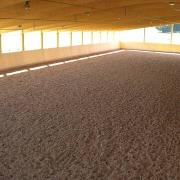
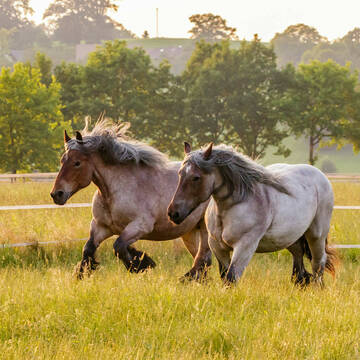
Vollpensionsplatz in Offenstall oder Paddockbox
Obersöchering
Ludwig
@Offenstall21
Hunde willkommen
Paddock
Allergikerstall
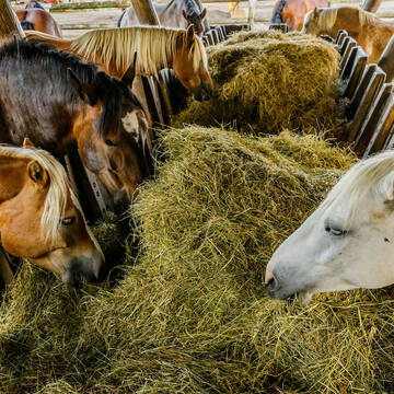
bedampftes/gewaschenes Heu
Außenbox mit Paddock
Offenstall
Vollpension
9 weitere...
S
Deprecated: Creation of dynamic property Zend_View_Helper_Ads::$adLink is deprecated in /var/www/stall-frei/htdocs/staging.stall-frei.de/library/Psf/View/Helper/Ads.php on line 108

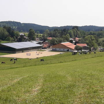
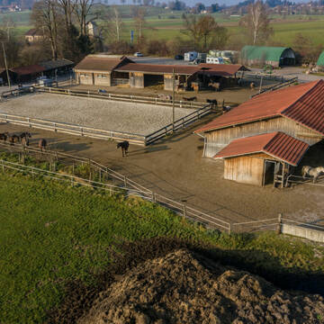
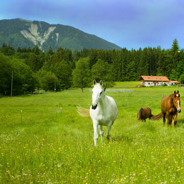
Aktivstall Blaslhof , der Weg lohnt sich!!
Uffing am Staffelsee
Blaslhof Aktivstall
@Blaslhof
Unser HIT Aktivstall ist 2008 mit 5 Stallsternen, der höchstmöglichen Auszeichnung für Artgerechte Pferdehaltung belohnt worde
Aktivstall Blaslhof , der Weg lohnt sich!!
Uffing am Staffelsee
Blaslhof Aktivstall
@Blaslhof
Freizeitstall
Gangpferdereiten
Hunde willkommen
Krankenbox
Notfallboxen
Außenbox mit Paddock
Bewegungsstall
22 weitere...
aktuell
S


Schilcherhof Eurasburg
Eurasburg
Kathi Meindl
@Schilcherhof_Eurasburg
Freizeitstall
Gangpferdereiten
Hunde willkommen
Krankenbox
bedampftes/gewaschenes Heu
Hengsthaltung möglich
Außenbox mit Paddock
Außenboxen
24 weitere...
S
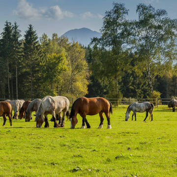
Traumhafte Offenstallanlage mit 6500m² Paddock
Sindelsdorf
Urthalerhof
@Urthalerhof_Sindelsdorf
Freizeitstall
Gastronomie
Vermieten
Krankenbox
Paddock
Bewegungsstall
Offenstall
16 weitere...
P+


Neuer HIT Aktivstall - Gut Moosrain
Murnau am Staffelsee
Markus-Simson
@Markus-Simson
Freizeitstall
Reitlehrer und -unterricht
Vermieten
Hunde willkommen
Krankenbox
Allergikerstall
Hufrehe geeignet
22 weitere...
ganz aktuell
S


Offenstallplatz in Stutenherde
Großweil
Offenstall-Angerhof
@Offenstall-Angerhof
Freizeitstall
Vermieten
Krankenbox
Longierzirkel/Roundpen
Notfallboxen
5 weitere...
P+


Kleiner Ausbildungsstall individuelle Betreuung
Eberfing
Marten-Jeschke-Pferdeservice
@Marten-Jeschke-Pferdeservice
Freizeitstall
Geländestrecke
Vermieten
Longierzirkel/Roundpen
Paddock
bedampftes/gewaschenes Heu
Hufrehe geeignet
18 weitere...
P+


HIT-Aktivstall Kastenmüller Reine Wallachgruppe
Ascholding
Matthias Kastenmüller
@Houcht
Freizeitstall
Krankenbox
Longierzirkel/Roundpen
bedampftes/gewaschenes Heu
Bewegungsstall
Laufstall
14 weitere...
S

Neuer HIT Aktivstall - Gut Moosrain
Murnau am Staffelsee
Markus-Simson
@Markus-Simson
Wir bieten Ihnen das HIT Aktivstall Konzept auf dem neuesten Stand in einzigartiger Lage und in einer geschlossenen Anlage:
- Fut
brandneu
R

Paddockplätze frei
Seeshaupt
Stemmer Peter
@PferdepensionStemmer
Freizeitstall
Longierzirkel/Roundpen
Paddock
Hufrehe geeignet
Außenbox mit Paddock
Innenbox
9 weitere...
P
Leider kein Vorschaubild
Leider kein Vorschaubild
Offenstall Platz
Iffeldorf
Angela Korpan
@SUNHILL-RANCH
Freizeitstall
Paddock
Sattelkammer/Sattelschränke
Offenstall
Selbstversorgung
2 weitere...
aktuell
B
Deprecated: Creation of dynamic property Zend_View::$pageCount is deprecated in /var/www/stall-frei/htdocs/staging.stall-frei.de/library/vendor/shardj/zf1-future/library/Zend/View/Abstract.php on line 308
Deprecated: Creation of dynamic property Zend_View::$itemCountPerPage is deprecated in /var/www/stall-frei/htdocs/staging.stall-frei.de/library/vendor/shardj/zf1-future/library/Zend/View/Abstract.php on line 308
Deprecated: Creation of dynamic property Zend_View::$first is deprecated in /var/www/stall-frei/htdocs/staging.stall-frei.de/library/vendor/shardj/zf1-future/library/Zend/View/Abstract.php on line 308
Deprecated: Creation of dynamic property Zend_View::$current is deprecated in /var/www/stall-frei/htdocs/staging.stall-frei.de/library/vendor/shardj/zf1-future/library/Zend/View/Abstract.php on line 308
Deprecated: Creation of dynamic property Zend_View::$last is deprecated in /var/www/stall-frei/htdocs/staging.stall-frei.de/library/vendor/shardj/zf1-future/library/Zend/View/Abstract.php on line 308
Deprecated: Creation of dynamic property Zend_View::$next is deprecated in /var/www/stall-frei/htdocs/staging.stall-frei.de/library/vendor/shardj/zf1-future/library/Zend/View/Abstract.php on line 308
Deprecated: Creation of dynamic property Zend_View::$pagesInRange is deprecated in /var/www/stall-frei/htdocs/staging.stall-frei.de/library/vendor/shardj/zf1-future/library/Zend/View/Abstract.php on line 308
Deprecated: Creation of dynamic property Zend_View::$firstPageInRange is deprecated in /var/www/stall-frei/htdocs/staging.stall-frei.de/library/vendor/shardj/zf1-future/library/Zend/View/Abstract.php on line 308
Deprecated: Creation of dynamic property Zend_View::$lastPageInRange is deprecated in /var/www/stall-frei/htdocs/staging.stall-frei.de/library/vendor/shardj/zf1-future/library/Zend/View/Abstract.php on line 308
Deprecated: Creation of dynamic property Zend_View::$currentItemCount is deprecated in /var/www/stall-frei/htdocs/staging.stall-frei.de/library/vendor/shardj/zf1-future/library/Zend/View/Abstract.php on line 308
Deprecated: Creation of dynamic property Zend_View::$totalItemCount is deprecated in /var/www/stall-frei/htdocs/staging.stall-frei.de/library/vendor/shardj/zf1-future/library/Zend/View/Abstract.php on line 308
Deprecated: Creation of dynamic property Zend_View::$firstItemNumber is deprecated in /var/www/stall-frei/htdocs/staging.stall-frei.de/library/vendor/shardj/zf1-future/library/Zend/View/Abstract.php on line 308
Deprecated: Creation of dynamic property Zend_View::$lastItemNumber is deprecated in /var/www/stall-frei/htdocs/staging.stall-frei.de/library/vendor/shardj/zf1-future/library/Zend/View/Abstract.php on line 308
Deprecated: Creation of dynamic property Zend_View::$router is deprecated in /var/www/stall-frei/htdocs/staging.stall-frei.de/library/vendor/shardj/zf1-future/library/Zend/View/Abstract.php on line 308
Deprecated: Creation of dynamic property Zend_View::$urlParams is deprecated in /var/www/stall-frei/htdocs/staging.stall-frei.de/library/vendor/shardj/zf1-future/library/Zend/View/Abstract.php on line 308
Deprecated: Creation of dynamic property Zend_View::$showAds is deprecated in /var/www/stall-frei/htdocs/staging.stall-frei.de/library/vendor/shardj/zf1-future/library/Zend/View/Abstract.php on line 308
Deprecated: Creation of dynamic property Zend_View::$objectIds is deprecated in /var/www/stall-frei/htdocs/staging.stall-frei.de/library/vendor/shardj/zf1-future/library/Zend/View/Abstract.php on line 308
Deprecated: Creation of dynamic property Zend_View::$showNavbar is deprecated in /var/www/stall-frei/htdocs/staging.stall-frei.de/library/vendor/shardj/zf1-future/library/Zend/View/Abstract.php on line 308
Deprecated: Creation of dynamic property Zend_View::$showBreadcrumb is deprecated in /var/www/stall-frei/htdocs/staging.stall-frei.de/library/vendor/shardj/zf1-future/library/Zend/View/Abstract.php on line 308
Deprecated: Creation of dynamic property Zend_View::$showFooter is deprecated in /var/www/stall-frei/htdocs/staging.stall-frei.de/library/vendor/shardj/zf1-future/library/Zend/View/Abstract.php on line 308
Deprecated: Creation of dynamic property Zend_View::$showInternalAds is deprecated in /var/www/stall-frei/htdocs/staging.stall-frei.de/library/vendor/shardj/zf1-future/library/Zend/View/Abstract.php on line 308
Deprecated: Creation of dynamic property Zend_View::$blNoContent is deprecated in /var/www/stall-frei/htdocs/staging.stall-frei.de/library/vendor/shardj/zf1-future/library/Zend/View/Abstract.php on line 308
Deprecated: Creation of dynamic property Zend_View::$sMetaDesc is deprecated in /var/www/stall-frei/htdocs/staging.stall-frei.de/library/vendor/shardj/zf1-future/library/Zend/View/Abstract.php on line 308
Deprecated: Creation of dynamic property Zend_View::$useGmaps is deprecated in /var/www/stall-frei/htdocs/staging.stall-frei.de/library/vendor/shardj/zf1-future/library/Zend/View/Abstract.php on line 308
Deprecated: Creation of dynamic property Zend_View::$touches is deprecated in /var/www/stall-frei/htdocs/staging.stall-frei.de/library/vendor/shardj/zf1-future/library/Zend/View/Abstract.php on line 308
Deprecated: Creation of dynamic property Zend_View::$oProject is deprecated in /var/www/stall-frei/htdocs/staging.stall-frei.de/library/vendor/shardj/zf1-future/library/Zend/View/Abstract.php on line 308
Deprecated: Creation of dynamic property Zend_View::$pageHeadline is deprecated in /var/www/stall-frei/htdocs/staging.stall-frei.de/library/vendor/shardj/zf1-future/library/Zend/View/Abstract.php on line 308
Deprecated: Creation of dynamic property Zend_View::$disableLocationField is deprecated in /var/www/stall-frei/htdocs/staging.stall-frei.de/library/vendor/shardj/zf1-future/library/Zend/View/Abstract.php on line 308
Deprecated: Creation of dynamic property Zend_View::$isSearch is deprecated in /var/www/stall-frei/htdocs/staging.stall-frei.de/library/vendor/shardj/zf1-future/library/Zend/View/Abstract.php on line 308
Deprecated: Creation of dynamic property Zend_View::$pageTitle is deprecated in /var/www/stall-frei/htdocs/staging.stall-frei.de/library/vendor/shardj/zf1-future/library/Zend/View/Abstract.php on line 308
Deprecated: Creation of dynamic property Psf_Form_Element_Text::$class is deprecated in /var/www/stall-frei/htdocs/staging.stall-frei.de/library/vendor/shardj/zf1-future/library/Zend/Form/Element.php on line 874
Deprecated: Creation of dynamic property Psf_Form_Element_Text::$size is deprecated in /var/www/stall-frei/htdocs/staging.stall-frei.de/library/vendor/shardj/zf1-future/library/Zend/Form/Element.php on line 874
Deprecated: Creation of dynamic property Psf_Form_Element_Text::$placeholder is deprecated in /var/www/stall-frei/htdocs/staging.stall-frei.de/library/vendor/shardj/zf1-future/library/Zend/Form/Element.php on line 874
Deprecated: Creation of dynamic property Psf_Form_Element_Hidden::$class is deprecated in /var/www/stall-frei/htdocs/staging.stall-frei.de/library/vendor/shardj/zf1-future/library/Zend/Form/Element.php on line 874
Deprecated: Creation of dynamic property Psf_Form_Element_Hidden::$class is deprecated in /var/www/stall-frei/htdocs/staging.stall-frei.de/library/vendor/shardj/zf1-future/library/Zend/Form/Element.php on line 874
Deprecated: Creation of dynamic property Psf_Form_Element_Hidden::$class is deprecated in /var/www/stall-frei/htdocs/staging.stall-frei.de/library/vendor/shardj/zf1-future/library/Zend/Form/Element.php on line 874
Deprecated: Creation of dynamic property Psf_Form_Element_Hidden::$class is deprecated in /var/www/stall-frei/htdocs/staging.stall-frei.de/library/vendor/shardj/zf1-future/library/Zend/Form/Element.php on line 874
Deprecated: Creation of dynamic property Psf_Form_Element_Select::$class is deprecated in /var/www/stall-frei/htdocs/staging.stall-frei.de/library/vendor/shardj/zf1-future/library/Zend/Form/Element.php on line 874
Deprecated: Creation of dynamic property Psf_Form_Element_Select::$class is deprecated in /var/www/stall-frei/htdocs/staging.stall-frei.de/library/vendor/shardj/zf1-future/library/Zend/Form/Element.php on line 874
Deprecated: Creation of dynamic property Psf_Form_Element_Select::$class is deprecated in /var/www/stall-frei/htdocs/staging.stall-frei.de/library/vendor/shardj/zf1-future/library/Zend/Form/Element.php on line 874
Deprecated: Creation of dynamic property Psf_Form_Element_Select::$class is deprecated in /var/www/stall-frei/htdocs/staging.stall-frei.de/library/vendor/shardj/zf1-future/library/Zend/Form/Element.php on line 874
Deprecated: Creation of dynamic property Psf_Form_Element_Text::$class is deprecated in /var/www/stall-frei/htdocs/staging.stall-frei.de/library/vendor/shardj/zf1-future/library/Zend/Form/Element.php on line 874
Deprecated: Creation of dynamic property Psf_Form_Element_Checkbox::$label is deprecated in /var/www/stall-frei/htdocs/staging.stall-frei.de/library/vendor/shardj/zf1-future/library/Zend/Form/Element.php on line 874
Deprecated: Creation of dynamic property Zend_View::$sort is deprecated in /var/www/stall-frei/htdocs/staging.stall-frei.de/library/vendor/shardj/zf1-future/library/Zend/View/Abstract.php on line 308
Deprecated: Creation of dynamic property Zend_View::$searchLocation is deprecated in /var/www/stall-frei/htdocs/staging.stall-frei.de/library/vendor/shardj/zf1-future/library/Zend/View/Abstract.php on line 308
Deprecated: Creation of dynamic property Zend_View::$locationHint is deprecated in /var/www/stall-frei/htdocs/staging.stall-frei.de/library/vendor/shardj/zf1-future/library/Zend/View/Abstract.php on line 308
Psf_GeoCoder_Abstract::getLocation: Kirnberg Get Location CachedOrLive
Psf_GeoCoder_Abstract::getCachedOrLive: Kirnberg
Psf_GeoCoder_OpenCageData::makeApiRequest: response:
Array
(
[documentation] => https://opencagedata.com/api
[licenses] => Array
(
[0] => Array
(
[name] => see attribution guide
[url] => https://opencagedata.com/credits
)
)
[results] => Array
(
[0] => Array
(
[bounds] => Array
(
[northeast] => Array
(
[lat] => 47.746469
[lng] => 11.3058833
)
[southwest] => Array
(
[lat] => 47.746369
[lng] => 11.3057833
)
)
[components] => Array
(
[ISO_3166-1_alpha-2] => DE
[ISO_3166-1_alpha-3] => DEU
[ISO_3166-2] => Array
(
[0] => DE-BY
)
[_category] => natural/water
[_normalized_city] => Antdorf
[_type] => peak
[continent] => Europe
[country] => Deutschland
[country_code] => de
[county] => Landkreis Weilheim-Schongau
[municipality] => Habach (VGem)
[peak] => Kirnberg
[political_union] => European Union
[postcode] => 82387
[state] => Bayern
[state_code] => BY
[village] => Antdorf
)
[confidence] => 9
[formatted] => Kirnberg, 82387 Antdorf, Deutschland
[geometry] => Array
(
[lat] => 47.746419
[lng] => 11.3058333
)
)
[1] => Array
(
[bounds] => Array
(
[northeast] => Array
(
[lat] => 50.5818028
[lng] => 8.0454688
)
[southwest] => Array
(
[lat] => 50.5817028
[lng] => 8.0453688
)
)
[components] => Array
(
[ISO_3166-1_alpha-2] => DE
[ISO_3166-1_alpha-3] => DEU
[ISO_3166-2] => Array
(
[0] => DE-RP
)
[_category] => natural/water
[_normalized_city] => Seck
[_type] => peak
[continent] => Europe
[country] => Deutschland
[country_code] => de
[county] => Westerwaldkreis
[municipality] => Rennerod
[peak] => Kirnberg
[political_union] => European Union
[postcode] => 56479
[state] => Rheinland-Pfalz
[state_code] => RP
[village] => Seck
)
[confidence] => 9
[formatted] => Kirnberg, 56479 Seck, Deutschland
[geometry] => Array
(
[lat] => 50.5817528
[lng] => 8.0454188
)
)
[2] => Array
(
[bounds] => Array
(
[northeast] => Array
(
[lat] => 47.8187555
[lng] => 8.939057
)
[southwest] => Array
(
[lat] => 47.8186555
[lng] => 8.938957
)
)
[components] => Array
(
[ISO_3166-1_alpha-2] => DE
[ISO_3166-1_alpha-3] => DEU
[ISO_3166-2] => Array
(
[0] => DE-BW
)
[_category] => natural/water
[_normalized_city] => Steißlingen
[_type] => peak
[continent] => Europe
[country] => Deutschland
[country_code] => de
[county] => Landkreis Konstanz
[municipality] => VVG der Stadt Singen (Hohentwiel)
[peak] => Kirnberg
[political_union] => European Union
[postcode] => 78359
[state] => Baden-Württemberg
[state_code] => BW
[village] => Steißlingen
)
[confidence] => 9
[formatted] => Kirnberg, 78359 Steißlingen, Deutschland
[geometry] => Array
(
[lat] => 47.8187055
[lng] => 8.939007
)
)
[3] => Array
(
[bounds] => Array
(
[northeast] => Array
(
[lat] => 48.6458003
[lng] => 10.2509392
)
[southwest] => Array
(
[lat] => 48.6457003
[lng] => 10.2508392
)
)
[components] => Array
(
[ISO_3166-1_alpha-2] => DE
[ISO_3166-1_alpha-3] => DEU
[ISO_3166-2] => Array
(
[0] => DE-BW
)
[_category] => natural/water
[_normalized_city] => Giengen an der Brenz
[_type] => peak
[continent] => Europe
[country] => Deutschland
[country_code] => de
[county] => Landkreis Heidenheim
[municipality] => VVG der Stadt Giengen an der Brenz
[peak] => Kirnberg
[political_union] => European Union
[postcode] => 89537
[state] => Baden-Württemberg
[state_code] => BW
[town] => Giengen an der Brenz
)
[confidence] => 9
[formatted] => Kirnberg, 89537 Giengen an der Brenz, Deutschland
[geometry] => Array
(
[lat] => 48.6457503
[lng] => 10.2508892
)
)
[4] => Array
(
[bounds] => Array
(
[northeast] => Array
(
[lat] => 47.778116
[lng] => 11.3399298
)
[southwest] => Array
(
[lat] => 47.778016
[lng] => 11.3398298
)
)
[components] => Array
(
[ISO_3166-1_alpha-2] => DE
[ISO_3166-1_alpha-3] => DEU
[ISO_3166-2] => Array
(
[0] => DE-BY
)
[_category] => natural/water
[_normalized_city] => Iffeldorf
[_type] => peak
[continent] => Europe
[country] => Deutschland
[country_code] => de
[county] => Landkreis Weilheim-Schongau
[municipality] => Seeshaupt (VGem)
[peak] => Kirnberg
[political_union] => European Union
[postcode] => 82393
[state] => Bayern
[state_code] => BY
[village] => Iffeldorf
)
[confidence] => 9
[formatted] => Kirnberg, 82393 Iffeldorf, Deutschland
[geometry] => Array
(
[lat] => 47.778066
[lng] => 11.3398798
)
)
[5] => Array
(
[bounds] => Array
(
[northeast] => Array
(
[lat] => 48.5581508
[lng] => 9.0739489
)
[southwest] => Array
(
[lat] => 48.5580508
[lng] => 9.0738489
)
)
[components] => Array
(
[ISO_3166-1_alpha-2] => DE
[ISO_3166-1_alpha-3] => DEU
[ISO_3166-2] => Array
(
[0] => DE-BW
)
[_category] => natural/water
[_normalized_city] => Tübingen
[_type] => peak
[continent] => Europe
[country] => Deutschland
[country_code] => de
[county] => Landkreis Tübingen
[peak] => Kirnberg
[political_union] => European Union
[postcode] => 72074
[state] => Baden-Württemberg
[state_code] => BW
[town] => Tübingen
)
[confidence] => 9
[formatted] => Kirnberg, 72074 Tübingen, Deutschland
[geometry] => Array
(
[lat] => 48.5581008
[lng] => 9.0738989
)
)
[6] => Array
(
[bounds] => Array
(
[northeast] => Array
(
[lat] => 47.7721584
[lng] => 11.3576249
)
[southwest] => Array
(
[lat] => 47.7669341
[lng] => 11.3492668
)
)
[components] => Array
(
[ISO_3166-1_alpha-2] => DE
[ISO_3166-1_alpha-3] => DEU
[ISO_3166-2] => Array
(
[0] => DE-BY
)
[_category] => place
[_normalized_city] => Penzberg
[_type] => neighbourhood
[continent] => Europe
[country] => Deutschland
[country_code] => de
[county] => Landkreis Weilheim-Schongau
[political_union] => European Union
[state] => Bayern
[state_code] => BY
[suburb] => Kirnberg
[town] => Penzberg
)
[confidence] => 9
[formatted] => Kirnberg, Penzberg, Bayern, Deutschland
[geometry] => Array
(
[lat] => 47.7694983
[lng] => 11.3523825
)
)
[7] => Array
(
[bounds] => Array
(
[northeast] => Array
(
[lat] => 49.3665682
[lng] => 10.2566282
)
[southwest] => Array
(
[lat] => 49.3265682
[lng] => 10.2166282
)
)
[components] => Array
(
[ISO_3166-1_alpha-2] => DE
[ISO_3166-1_alpha-3] => DEU
[ISO_3166-2] => Array
(
[0] => DE-BY
)
[_category] => place
[_normalized_city] => Gebsattel
[_type] => village
[city] => Gebsattel
[continent] => Europe
[country] => Deutschland
[country_code] => de
[county] => Landkreis Ansbach
[municipality] => Rothenburg ob der Tauber (VGem)
[political_union] => European Union
[postcode] => 91616
[state] => Bayern
[state_code] => BY
[village] => Kirnberg
)
[confidence] => 7
[formatted] => 91616 Kirnberg, Deutschland
[geometry] => Array
(
[lat] => 49.3465682
[lng] => 10.2366282
)
)
[8] => Array
(
[bounds] => Array
(
[northeast] => Array
(
[lat] => 49.0642088
[lng] => 12.4344719
)
[southwest] => Array
(
[lat] => 49.0242088
[lng] => 12.3944719
)
)
[components] => Array
(
[ISO_3166-1_alpha-2] => DE
[ISO_3166-1_alpha-3] => DEU
[ISO_3166-2] => Array
(
[0] => DE-BY
)
[_category] => place
[_normalized_city] => Wiesent
[_type] => hamlet
[continent] => Europe
[country] => Deutschland
[country_code] => de
[county] => Landkreis Regensburg
[hamlet] => Kirnberg
[political_union] => European Union
[postcode] => 93179
[state] => Bayern
[state_code] => BY
[village] => Wiesent
)
[confidence] => 7
[formatted] => Kirnberg, 93179 Wiesent, Deutschland
[geometry] => Array
(
[lat] => 49.0442088
[lng] => 12.4144719
)
)
[9] => Array
(
[bounds] => Array
(
[northeast] => Array
(
[lat] => 49.104408
[lng] => 12.3594907
)
[southwest] => Array
(
[lat] => 49.064408
[lng] => 12.3194907
)
)
[components] => Array
(
[ISO_3166-1_alpha-2] => DE
[ISO_3166-1_alpha-3] => DEU
[ISO_3166-2] => Array
(
[0] => DE-BY
)
[_category] => place
[_normalized_city] => Brennberg
[_type] => hamlet
[city] => Brennberg
[continent] => Europe
[country] => Deutschland
[country_code] => de
[county] => Landkreis Regensburg
[hamlet] => Kirnberg
[municipality] => Wörth an der Donau (VGem)
[political_union] => European Union
[postcode] => 93177
[state] => Bayern
[state_code] => BY
)
[confidence] => 7
[formatted] => Kirnberg, 93177 Brennberg, Deutschland
[geometry] => Array
(
[lat] => 49.084408
[lng] => 12.3394907
)
)
)
[status] => Array
(
[code] => 200
[message] => OK
)
[stay_informed] => Array
(
[blog] => https://blog.opencagedata.com
[mastodon] => https://en.osm.town/@opencage
)
[thanks] => For using an OpenCage API
[timestamp] => Array
(
[created_http] => Fri, 06 Feb 2026 19:42:41 GMT
[created_unix] => 1770406961
)
[total_results] => 10
)
Psf_GeoCoder_Abstract::convertLocationResult
{"documentation":"https:\/\/opencagedata.com\/api","licenses":[{"name":"see attribution guide","url":"https:\/\/opencagedata.com\/credits"}],"results":[{"bounds":{"northeast":{"lat":47.746469,"lng":11.3058833},"southwest":{"lat":47.746369,"lng":11.3057833}},"components":{"ISO_3166-1_alpha-2":"DE","ISO_3166-1_alpha-3":"DEU","ISO_3166-2":["DE-BY"],"_category":"natural\/water","_normalized_city":"Antdorf","_type":"peak","continent":"Europe","country":"Deutschland","country_code":"de","county":"Landkreis Weilheim-Schongau","municipality":"Habach (VGem)","peak":"Kirnberg","political_union":"European Union","postcode":"82387","state":"Bayern","state_code":"BY","village":"Antdorf"},"confidence":9,"formatted":"Kirnberg, 82387 Antdorf, Deutschland","geometry":{"lat":47.746419,"lng":11.3058333}},{"bounds":{"northeast":{"lat":50.5818028,"lng":8.0454688},"southwest":{"lat":50.5817028,"lng":8.0453688}},"components":{"ISO_3166-1_alpha-2":"DE","ISO_3166-1_alpha-3":"DEU","ISO_3166-2":["DE-RP"],"_category":"natural\/water","_normalized_city":"Seck","_type":"peak","continent":"Europe","country":"Deutschland","country_code":"de","county":"Westerwaldkreis","municipality":"Rennerod","peak":"Kirnberg","political_union":"European Union","postcode":"56479","state":"Rheinland-Pfalz","state_code":"RP","village":"Seck"},"confidence":9,"formatted":"Kirnberg, 56479 Seck, Deutschland","geometry":{"lat":50.5817528,"lng":8.0454188}},{"bounds":{"northeast":{"lat":47.8187555,"lng":8.939057},"southwest":{"lat":47.8186555,"lng":8.938957}},"components":{"ISO_3166-1_alpha-2":"DE","ISO_3166-1_alpha-3":"DEU","ISO_3166-2":["DE-BW"],"_category":"natural\/water","_normalized_city":"Stei\u00dflingen","_type":"peak","continent":"Europe","country":"Deutschland","country_code":"de","county":"Landkreis Konstanz","municipality":"VVG der Stadt Singen (Hohentwiel)","peak":"Kirnberg","political_union":"European Union","postcode":"78359","state":"Baden-W\u00fcrttemberg","state_code":"BW","village":"Stei\u00dflingen"},"confidence":9,"formatted":"Kirnberg, 78359 Stei\u00dflingen, Deutschland","geometry":{"lat":47.8187055,"lng":8.939007}},{"bounds":{"northeast":{"lat":48.6458003,"lng":10.2509392},"southwest":{"lat":48.6457003,"lng":10.2508392}},"components":{"ISO_3166-1_alpha-2":"DE","ISO_3166-1_alpha-3":"DEU","ISO_3166-2":["DE-BW"],"_category":"natural\/water","_normalized_city":"Giengen an der Brenz","_type":"peak","continent":"Europe","country":"Deutschland","country_code":"de","county":"Landkreis Heidenheim","municipality":"VVG der Stadt Giengen an der Brenz","peak":"Kirnberg","political_union":"European Union","postcode":"89537","state":"Baden-W\u00fcrttemberg","state_code":"BW","town":"Giengen an der Brenz"},"confidence":9,"formatted":"Kirnberg, 89537 Giengen an der Brenz, Deutschland","geometry":{"lat":48.6457503,"lng":10.2508892}},{"bounds":{"northeast":{"lat":47.778116,"lng":11.3399298},"southwest":{"lat":47.778016,"lng":11.3398298}},"components":{"ISO_3166-1_alpha-2":"DE","ISO_3166-1_alpha-3":"DEU","ISO_3166-2":["DE-BY"],"_category":"natural\/water","_normalized_city":"Iffeldorf","_type":"peak","continent":"Europe","country":"Deutschland","country_code":"de","county":"Landkreis Weilheim-Schongau","municipality":"Seeshaupt (VGem)","peak":"Kirnberg","political_union":"European Union","postcode":"82393","state":"Bayern","state_code":"BY","village":"Iffeldorf"},"confidence":9,"formatted":"Kirnberg, 82393 Iffeldorf, Deutschland","geometry":{"lat":47.778066,"lng":11.3398798}},{"bounds":{"northeast":{"lat":48.5581508,"lng":9.0739489},"southwest":{"lat":48.5580508,"lng":9.0738489}},"components":{"ISO_3166-1_alpha-2":"DE","ISO_3166-1_alpha-3":"DEU","ISO_3166-2":["DE-BW"],"_category":"natural\/water","_normalized_city":"T\u00fcbingen","_type":"peak","continent":"Europe","country":"Deutschland","country_code":"de","county":"Landkreis T\u00fcbingen","peak":"Kirnberg","political_union":"European Union","postcode":"72074","state":"Baden-W\u00fcrttemberg","state_code":"BW","town":"T\u00fcbingen"},"confidence":9,"formatted":"Kirnberg, 72074 T\u00fcbingen, Deutschland","geometry":{"lat":48.5581008,"lng":9.0738989}},{"bounds":{"northeast":{"lat":47.7721584,"lng":11.3576249},"southwest":{"lat":47.7669341,"lng":11.3492668}},"components":{"ISO_3166-1_alpha-2":"DE","ISO_3166-1_alpha-3":"DEU","ISO_3166-2":["DE-BY"],"_category":"place","_normalized_city":"Penzberg","_type":"neighbourhood","continent":"Europe","country":"Deutschland","country_code":"de","county":"Landkreis Weilheim-Schongau","political_union":"European Union","state":"Bayern","state_code":"BY","suburb":"Kirnberg","town":"Penzberg"},"confidence":9,"formatted":"Kirnberg, Penzberg, Bayern, Deutschland","geometry":{"lat":47.7694983,"lng":11.3523825}},{"bounds":{"northeast":{"lat":49.3665682,"lng":10.2566282},"southwest":{"lat":49.3265682,"lng":10.2166282}},"components":{"ISO_3166-1_alpha-2":"DE","ISO_3166-1_alpha-3":"DEU","ISO_3166-2":["DE-BY"],"_category":"place","_normalized_city":"Gebsattel","_type":"village","city":"Gebsattel","continent":"Europe","country":"Deutschland","country_code":"de","county":"Landkreis Ansbach","municipality":"Rothenburg ob der Tauber (VGem)","political_union":"European Union","postcode":"91616","state":"Bayern","state_code":"BY","village":"Kirnberg"},"confidence":7,"formatted":"91616 Kirnberg, Deutschland","geometry":{"lat":49.3465682,"lng":10.2366282}},{"bounds":{"northeast":{"lat":49.0642088,"lng":12.4344719},"southwest":{"lat":49.0242088,"lng":12.3944719}},"components":{"ISO_3166-1_alpha-2":"DE","ISO_3166-1_alpha-3":"DEU","ISO_3166-2":["DE-BY"],"_category":"place","_normalized_city":"Wiesent","_type":"hamlet","continent":"Europe","country":"Deutschland","country_code":"de","county":"Landkreis Regensburg","hamlet":"Kirnberg","political_union":"European Union","postcode":"93179","state":"Bayern","state_code":"BY","village":"Wiesent"},"confidence":7,"formatted":"Kirnberg, 93179 Wiesent, Deutschland","geometry":{"lat":49.0442088,"lng":12.4144719}},{"bounds":{"northeast":{"lat":49.104408,"lng":12.3594907},"southwest":{"lat":49.064408,"lng":12.3194907}},"components":{"ISO_3166-1_alpha-2":"DE","ISO_3166-1_alpha-3":"DEU","ISO_3166-2":["DE-BY"],"_category":"place","_normalized_city":"Brennberg","_type":"hamlet","city":"Brennberg","continent":"Europe","country":"Deutschland","country_code":"de","county":"Landkreis Regensburg","hamlet":"Kirnberg","municipality":"W\u00f6rth an der Donau (VGem)","political_union":"European Union","postcode":"93177","state":"Bayern","state_code":"BY"},"confidence":7,"formatted":"Kirnberg, 93177 Brennberg, Deutschland","geometry":{"lat":49.084408,"lng":12.3394907}}],"status":{"code":200,"message":"OK"},"stay_informed":{"blog":"https:\/\/blog.opencagedata.com","mastodon":"https:\/\/en.osm.town\/@opencage"},"thanks":"For using an OpenCage API","timestamp":{"created_http":"Fri, 06 Feb 2026 19:42:41 GMT","created_unix":1770406961},"total_results":10}Array
(
[0] => stdClass Object
(
[bounds] => stdClass Object
(
[northeast] => stdClass Object
(
[lat] => 47.746469
[lng] => 11.3058833
)
[southwest] => stdClass Object
(
[lat] => 47.746369
[lng] => 11.3057833
)
)
[components] => stdClass Object
(
[ISO_3166-1_alpha-2] => DE
[ISO_3166-1_alpha-3] => DEU
[ISO_3166-2] => Array
(
[0] => DE-BY
)
[_category] => natural/water
[_normalized_city] => Antdorf
[_type] => peak
[continent] => Europe
[country] => Deutschland
[country_code] => de
[county] => Landkreis Weilheim-Schongau
[municipality] => Habach (VGem)
[peak] => Kirnberg
[political_union] => European Union
[postcode] => 82387
[state] => Bayern
[state_code] => BY
[village] => Antdorf
)
[confidence] => 9
[formatted] => Kirnberg, 82387 Antdorf, Deutschland
[geometry] => stdClass Object
(
[lat] => 47.746419
[lng] => 11.3058333
)
)
[1] => stdClass Object
(
[bounds] => stdClass Object
(
[northeast] => stdClass Object
(
[lat] => 50.5818028
[lng] => 8.0454688
)
[southwest] => stdClass Object
(
[lat] => 50.5817028
[lng] => 8.0453688
)
)
[components] => stdClass Object
(
[ISO_3166-1_alpha-2] => DE
[ISO_3166-1_alpha-3] => DEU
[ISO_3166-2] => Array
(
[0] => DE-RP
)
[_category] => natural/water
[_normalized_city] => Seck
[_type] => peak
[continent] => Europe
[country] => Deutschland
[country_code] => de
[county] => Westerwaldkreis
[municipality] => Rennerod
[peak] => Kirnberg
[political_union] => European Union
[postcode] => 56479
[state] => Rheinland-Pfalz
[state_code] => RP
[village] => Seck
)
[confidence] => 9
[formatted] => Kirnberg, 56479 Seck, Deutschland
[geometry] => stdClass Object
(
[lat] => 50.5817528
[lng] => 8.0454188
)
)
[2] => stdClass Object
(
[bounds] => stdClass Object
(
[northeast] => stdClass Object
(
[lat] => 47.8187555
[lng] => 8.939057
)
[southwest] => stdClass Object
(
[lat] => 47.8186555
[lng] => 8.938957
)
)
[components] => stdClass Object
(
[ISO_3166-1_alpha-2] => DE
[ISO_3166-1_alpha-3] => DEU
[ISO_3166-2] => Array
(
[0] => DE-BW
)
[_category] => natural/water
[_normalized_city] => Steißlingen
[_type] => peak
[continent] => Europe
[country] => Deutschland
[country_code] => de
[county] => Landkreis Konstanz
[municipality] => VVG der Stadt Singen (Hohentwiel)
[peak] => Kirnberg
[political_union] => European Union
[postcode] => 78359
[state] => Baden-Württemberg
[state_code] => BW
[village] => Steißlingen
)
[confidence] => 9
[formatted] => Kirnberg, 78359 Steißlingen, Deutschland
[geometry] => stdClass Object
(
[lat] => 47.8187055
[lng] => 8.939007
)
)
[3] => stdClass Object
(
[bounds] => stdClass Object
(
[northeast] => stdClass Object
(
[lat] => 48.6458003
[lng] => 10.2509392
)
[southwest] => stdClass Object
(
[lat] => 48.6457003
[lng] => 10.2508392
)
)
[components] => stdClass Object
(
[ISO_3166-1_alpha-2] => DE
[ISO_3166-1_alpha-3] => DEU
[ISO_3166-2] => Array
(
[0] => DE-BW
)
[_category] => natural/water
[_normalized_city] => Giengen an der Brenz
[_type] => peak
[continent] => Europe
[country] => Deutschland
[country_code] => de
[county] => Landkreis Heidenheim
[municipality] => VVG der Stadt Giengen an der Brenz
[peak] => Kirnberg
[political_union] => European Union
[postcode] => 89537
[state] => Baden-Württemberg
[state_code] => BW
[town] => Giengen an der Brenz
)
[confidence] => 9
[formatted] => Kirnberg, 89537 Giengen an der Brenz, Deutschland
[geometry] => stdClass Object
(
[lat] => 48.6457503
[lng] => 10.2508892
)
)
[4] => stdClass Object
(
[bounds] => stdClass Object
(
[northeast] => stdClass Object
(
[lat] => 47.778116
[lng] => 11.3399298
)
[southwest] => stdClass Object
(
[lat] => 47.778016
[lng] => 11.3398298
)
)
[components] => stdClass Object
(
[ISO_3166-1_alpha-2] => DE
[ISO_3166-1_alpha-3] => DEU
[ISO_3166-2] => Array
(
[0] => DE-BY
)
[_category] => natural/water
[_normalized_city] => Iffeldorf
[_type] => peak
[continent] => Europe
[country] => Deutschland
[country_code] => de
[county] => Landkreis Weilheim-Schongau
[municipality] => Seeshaupt (VGem)
[peak] => Kirnberg
[political_union] => European Union
[postcode] => 82393
[state] => Bayern
[state_code] => BY
[village] => Iffeldorf
)
[confidence] => 9
[formatted] => Kirnberg, 82393 Iffeldorf, Deutschland
[geometry] => stdClass Object
(
[lat] => 47.778066
[lng] => 11.3398798
)
)
[5] => stdClass Object
(
[bounds] => stdClass Object
(
[northeast] => stdClass Object
(
[lat] => 48.5581508
[lng] => 9.0739489
)
[southwest] => stdClass Object
(
[lat] => 48.5580508
[lng] => 9.0738489
)
)
[components] => stdClass Object
(
[ISO_3166-1_alpha-2] => DE
[ISO_3166-1_alpha-3] => DEU
[ISO_3166-2] => Array
(
[0] => DE-BW
)
[_category] => natural/water
[_normalized_city] => Tübingen
[_type] => peak
[continent] => Europe
[country] => Deutschland
[country_code] => de
[county] => Landkreis Tübingen
[peak] => Kirnberg
[political_union] => European Union
[postcode] => 72074
[state] => Baden-Württemberg
[state_code] => BW
[town] => Tübingen
)
[confidence] => 9
[formatted] => Kirnberg, 72074 Tübingen, Deutschland
[geometry] => stdClass Object
(
[lat] => 48.5581008
[lng] => 9.0738989
)
)
[6] => stdClass Object
(
[bounds] => stdClass Object
(
[northeast] => stdClass Object
(
[lat] => 47.7721584
[lng] => 11.3576249
)
[southwest] => stdClass Object
(
[lat] => 47.7669341
[lng] => 11.3492668
)
)
[components] => stdClass Object
(
[ISO_3166-1_alpha-2] => DE
[ISO_3166-1_alpha-3] => DEU
[ISO_3166-2] => Array
(
[0] => DE-BY
)
[_category] => place
[_normalized_city] => Penzberg
[_type] => neighbourhood
[continent] => Europe
[country] => Deutschland
[country_code] => de
[county] => Landkreis Weilheim-Schongau
[political_union] => European Union
[state] => Bayern
[state_code] => BY
[suburb] => Kirnberg
[town] => Penzberg
)
[confidence] => 9
[formatted] => Kirnberg, Penzberg, Bayern, Deutschland
[geometry] => stdClass Object
(
[lat] => 47.7694983
[lng] => 11.3523825
)
)
[7] => stdClass Object
(
[bounds] => stdClass Object
(
[northeast] => stdClass Object
(
[lat] => 49.3665682
[lng] => 10.2566282
)
[southwest] => stdClass Object
(
[lat] => 49.3265682
[lng] => 10.2166282
)
)
[components] => stdClass Object
(
[ISO_3166-1_alpha-2] => DE
[ISO_3166-1_alpha-3] => DEU
[ISO_3166-2] => Array
(
[0] => DE-BY
)
[_category] => place
[_normalized_city] => Gebsattel
[_type] => village
[city] => Gebsattel
[continent] => Europe
[country] => Deutschland
[country_code] => de
[county] => Landkreis Ansbach
[municipality] => Rothenburg ob der Tauber (VGem)
[political_union] => European Union
[postcode] => 91616
[state] => Bayern
[state_code] => BY
[village] => Kirnberg
)
[confidence] => 7
[formatted] => 91616 Kirnberg, Deutschland
[geometry] => stdClass Object
(
[lat] => 49.3465682
[lng] => 10.2366282
)
)
[8] => stdClass Object
(
[bounds] => stdClass Object
(
[northeast] => stdClass Object
(
[lat] => 49.0642088
[lng] => 12.4344719
)
[southwest] => stdClass Object
(
[lat] => 49.0242088
[lng] => 12.3944719
)
)
[components] => stdClass Object
(
[ISO_3166-1_alpha-2] => DE
[ISO_3166-1_alpha-3] => DEU
[ISO_3166-2] => Array
(
[0] => DE-BY
)
[_category] => place
[_normalized_city] => Wiesent
[_type] => hamlet
[continent] => Europe
[country] => Deutschland
[country_code] => de
[county] => Landkreis Regensburg
[hamlet] => Kirnberg
[political_union] => European Union
[postcode] => 93179
[state] => Bayern
[state_code] => BY
[village] => Wiesent
)
[confidence] => 7
[formatted] => Kirnberg, 93179 Wiesent, Deutschland
[geometry] => stdClass Object
(
[lat] => 49.0442088
[lng] => 12.4144719
)
)
[9] => stdClass Object
(
[bounds] => stdClass Object
(
[northeast] => stdClass Object
(
[lat] => 49.104408
[lng] => 12.3594907
)
[southwest] => stdClass Object
(
[lat] => 49.064408
[lng] => 12.3194907
)
)
[components] => stdClass Object
(
[ISO_3166-1_alpha-2] => DE
[ISO_3166-1_alpha-3] => DEU
[ISO_3166-2] => Array
(
[0] => DE-BY
)
[_category] => place
[_normalized_city] => Brennberg
[_type] => hamlet
[city] => Brennberg
[continent] => Europe
[country] => Deutschland
[country_code] => de
[county] => Landkreis Regensburg
[hamlet] => Kirnberg
[municipality] => Wörth an der Donau (VGem)
[political_union] => European Union
[postcode] => 93177
[state] => Bayern
[state_code] => BY
)
[confidence] => 7
[formatted] => Kirnberg, 93177 Brennberg, Deutschland
[geometry] => stdClass Object
(
[lat] => 49.084408
[lng] => 12.3394907
)
)
)
Psf_GeoCoder_OpenCageData::getKeyMap: 0
stdClass Object
(
    [bounds] => stdClass Object
        (
            [northeast] => stdClass Object
                (
                    [lat] => 47.746469
                    [lng] => 11.3058833
                )

            [southwest] => stdClass Object
                (
                    [lat] => 47.746369
                    [lng] => 11.3057833
                )

        )

    [components] => stdClass Object
        (
            [ISO_3166-1_alpha-2] => DE
            [ISO_3166-1_alpha-3] => DEU
            [ISO_3166-2] => Array
                (
                    [0] => DE-BY
                )

            [_category] => natural/water
            [_normalized_city] => Antdorf
            [_type] => peak
            [continent] => Europe
            [country] => Deutschland
            [country_code] => de
            [county] => Landkreis Weilheim-Schongau
            [municipality] => Habach (VGem)
            [peak] => Kirnberg
            [political_union] => European Union
            [postcode] => 82387
            [state] => Bayern
            [state_code] => BY
            [village] => Antdorf
        )

    [confidence] => 9
    [formatted] => Kirnberg, 82387 Antdorf, Deutschland
    [geometry] => stdClass Object
        (
            [lat] => 47.746419
            [lng] => 11.3058333
        )

)
Psf_GeoCoder_OpenCageData::getCounty: Weilheim-Schongau
Psf_GeoCoder_OpenCageData::addMissingData REFETCH!
Array
(
    [address] => Kirnberg, 82387 Antdorf, Deutschland
    [type] => peak
    [street] =>
    [city] => Antdorf
    [county] => Weilheim-Schongau
    [state] => Bayern
    [zip] => 82387
    [country] => Deutschland
    [suburb] =>
    [countrycode] => de
    [latitude] => 47.746419
    [longitude] => 11.3058333
    [accuracy] => 1
    [confidence] => 9
    [bounds] => stdClass Object
        (
            [northeast] => stdClass Object
                (
                    [lat] => 47.746469
                    [lng] => 11.3058833
                )

            [southwest] => stdClass Object
                (
                    [lat] => 47.746369
                    [lng] => 11.3057833
                )

        )

)
reformat!
Array
(
    [address] => Kirnberg, 82387 Antdorf, Deutschland
    [type] => peak
    [street] =>
    [city] => Antdorf
    [county] => Weilheim-Schongau
    [state] => Bayern
    [zip] => 82387
    [country] => Deutschland
    [suburb] =>
    [countrycode] => de
    [latitude] => 47.746419
    [longitude] => 11.3058333
    [accuracy] => 1
    [confidence] => 9
    [bounds] => stdClass Object
        (
            [northeast] => stdClass Object
                (
                    [lat] => 47.746469
                    [lng] => 11.3058833
                )

            [southwest] => stdClass Object
                (
                    [lat] => 47.746369
                    [lng] => 11.3057833
                )

        )

    [place] => 82387 Antdorf, Bayern
    [hash] => 00015ef2a5750e922841ada353ce1407
)
Psf_GeoCoder_OpenCageData::getKeyMap: 1
stdClass Object
(
    [bounds] => stdClass Object
        (
            [northeast] => stdClass Object
                (
                    [lat] => 50.5818028
                    [lng] => 8.0454688
                )

            [southwest] => stdClass Object
                (
                    [lat] => 50.5817028
                    [lng] => 8.0453688
                )

        )

    [components] => stdClass Object
        (
            [ISO_3166-1_alpha-2] => DE
            [ISO_3166-1_alpha-3] => DEU
            [ISO_3166-2] => Array
                (
                    [0] => DE-RP
                )

            [_category] => natural/water
            [_normalized_city] => Seck
            [_type] => peak
            [continent] => Europe
            [country] => Deutschland
            [country_code] => de
            [county] => Westerwaldkreis
            [municipality] => Rennerod
            [peak] => Kirnberg
            [political_union] => European Union
            [postcode] => 56479
            [state] => Rheinland-Pfalz
            [state_code] => RP
            [village] => Seck
        )

    [confidence] => 9
    [formatted] => Kirnberg, 56479 Seck, Deutschland
    [geometry] => stdClass Object
        (
            [lat] => 50.5817528
            [lng] => 8.0454188
        )

)
Psf_GeoCoder_OpenCageData::getCounty: Westerwaldkreis
Psf_GeoCoder_OpenCageData::addMissingData REFETCH!
Array
(
    [address] => Kirnberg, 56479 Seck, Deutschland
    [type] => peak
    [street] =>
    [city] => Seck
    [county] => Westerwaldkreis
    [state] => Rheinland-Pfalz
    [zip] => 56479
    [country] => Deutschland
    [suburb] =>
    [countrycode] => de
    [latitude] => 50.5817528
    [longitude] => 8.0454188
    [accuracy] => 1
    [confidence] => 9
    [bounds] => stdClass Object
        (
            [northeast] => stdClass Object
                (
                    [lat] => 50.5818028
                    [lng] => 8.0454688
                )

            [southwest] => stdClass Object
                (
                    [lat] => 50.5817028
                    [lng] => 8.0453688
                )

        )

)
reformat!
Array
(
    [address] => Kirnberg, 56479 Seck, Deutschland
    [type] => peak
    [street] =>
    [city] => Seck
    [county] => Westerwaldkreis
    [state] => Rheinland-Pfalz
    [zip] => 56479
    [country] => Deutschland
    [suburb] =>
    [countrycode] => de
    [latitude] => 50.5817528
    [longitude] => 8.0454188
    [accuracy] => 1
    [confidence] => 9
    [bounds] => stdClass Object
        (
            [northeast] => stdClass Object
                (
                    [lat] => 50.5818028
                    [lng] => 8.0454688
                )

            [southwest] => stdClass Object
                (
                    [lat] => 50.5817028
                    [lng] => 8.0453688
                )

        )

    [place] => 56479 Seck, Rheinland-Pfalz
    [hash] => 70c5fa295ff665fd83c76066939ad925
)
Psf_GeoCoder_OpenCageData::getKeyMap: 2
stdClass Object
(
    [bounds] => stdClass Object
        (
            [northeast] => stdClass Object
                (
                    [lat] => 47.8187555
                    [lng] => 8.939057
                )

            [southwest] => stdClass Object
                (
                    [lat] => 47.8186555
                    [lng] => 8.938957
                )

        )

    [components] => stdClass Object
        (
            [ISO_3166-1_alpha-2] => DE
            [ISO_3166-1_alpha-3] => DEU
            [ISO_3166-2] => Array
                (
                    [0] => DE-BW
                )

            [_category] => natural/water
            [_normalized_city] => Steißlingen
            [_type] => peak
            [continent] => Europe
            [country] => Deutschland
            [country_code] => de
            [county] => Landkreis Konstanz
            [municipality] => VVG der Stadt Singen (Hohentwiel)
            [peak] => Kirnberg
            [political_union] => European Union
            [postcode] => 78359
            [state] => Baden-Württemberg
            [state_code] => BW
            [village] => Steißlingen
        )

    [confidence] => 9
    [formatted] => Kirnberg, 78359 Steißlingen, Deutschland
    [geometry] => stdClass Object
        (
            [lat] => 47.8187055
            [lng] => 8.939007
        )

)
Psf_GeoCoder_OpenCageData::getCounty: Konstanz
Psf_GeoCoder_OpenCageData::addMissingData REFETCH!
Array
(
    [address] => Kirnberg, 78359 Steißlingen, Deutschland
    [type] => peak
    [street] =>
    [city] => Steißlingen
    [county] => Konstanz
    [state] => Baden-Württemberg
    [zip] => 78359
    [country] => Deutschland
    [suburb] =>
    [countrycode] => de
    [latitude] => 47.8187055
    [longitude] => 8.939007
    [accuracy] => 1
    [confidence] => 9
    [bounds] => stdClass Object
        (
            [northeast] => stdClass Object
                (
                    [lat] => 47.8187555
                    [lng] => 8.939057
                )

            [southwest] => stdClass Object
                (
                    [lat] => 47.8186555
                    [lng] => 8.938957
                )

        )

)
reformat!
Array
(
    [address] => Kirnberg, 78359 Steißlingen, Deutschland
    [type] => peak
    [street] =>
    [city] => Steißlingen
    [county] => Konstanz
    [state] => Baden-Württemberg
    [zip] => 78359
    [country] => Deutschland
    [suburb] =>
    [countrycode] => de
    [latitude] => 47.8187055
    [longitude] => 8.939007
    [accuracy] => 1
    [confidence] => 9
    [bounds] => stdClass Object
        (
            [northeast] => stdClass Object
                (
                    [lat] => 47.8187555
                    [lng] => 8.939057
                )

            [southwest] => stdClass Object
                (
                    [lat] => 47.8186555
                    [lng] => 8.938957
                )

        )

    [place] => 78359 Steißlingen, Baden-Württemberg
    [hash] => 7d10a991aef10a5cf2eca79585e54d65
)
Psf_GeoCoder_OpenCageData::getKeyMap: 3
stdClass Object
(
    [bounds] => stdClass Object
        (
            [northeast] => stdClass Object
                (
                    [lat] => 48.6458003
                    [lng] => 10.2509392
                )

            [southwest] => stdClass Object
                (
                    [lat] => 48.6457003
                    [lng] => 10.2508392
                )

        )

    [components] => stdClass Object
        (
            [ISO_3166-1_alpha-2] => DE
            [ISO_3166-1_alpha-3] => DEU
            [ISO_3166-2] => Array
                (
                    [0] => DE-BW
                )

            [_category] => natural/water
            [_normalized_city] => Giengen an der Brenz
            [_type] => peak
            [continent] => Europe
            [country] => Deutschland
            [country_code] => de
            [county] => Landkreis Heidenheim
            [municipality] => VVG der Stadt Giengen an der Brenz
            [peak] => Kirnberg
            [political_union] => European Union
            [postcode] => 89537
            [state] => Baden-Württemberg
            [state_code] => BW
            [town] => Giengen an der Brenz
        )

    [confidence] => 9
    [formatted] => Kirnberg, 89537 Giengen an der Brenz, Deutschland
    [geometry] => stdClass Object
        (
            [lat] => 48.6457503
            [lng] => 10.2508892
        )

)
Psf_GeoCoder_OpenCageData::getCounty: Heidenheim
Psf_GeoCoder_OpenCageData::addMissingData REFETCH!
Array
(
    [address] => Kirnberg, 89537 Giengen an der Brenz, Deutschland
    [type] => peak
    [street] =>
    [city] => Giengen an der Brenz
    [county] => Heidenheim
    [state] => Baden-Württemberg
    [zip] => 89537
    [country] => Deutschland
    [suburb] =>
    [countrycode] => de
    [latitude] => 48.6457503
    [longitude] => 10.2508892
    [accuracy] => 1
    [confidence] => 9
    [bounds] => stdClass Object
        (
            [northeast] => stdClass Object
                (
                    [lat] => 48.6458003
                    [lng] => 10.2509392
                )

            [southwest] => stdClass Object
                (
                    [lat] => 48.6457003
                    [lng] => 10.2508392
                )

        )

)
reformat!
Array
(
    [address] => Kirnberg, 89537 Giengen an der Brenz, Deutschland
    [type] => peak
    [street] =>
    [city] => Giengen an der Brenz
    [county] => Heidenheim
    [state] => Baden-Württemberg
    [zip] => 89537
    [country] => Deutschland
    [suburb] =>
    [countrycode] => de
    [latitude] => 48.6457503
    [longitude] => 10.2508892
    [accuracy] => 1
    [confidence] => 9
    [bounds] => stdClass Object
        (
            [northeast] => stdClass Object
                (
                    [lat] => 48.6458003
                    [lng] => 10.2509392
                )

            [southwest] => stdClass Object
                (
                    [lat] => 48.6457003
                    [lng] => 10.2508392
                )

        )

    [place] => 89537 Giengen an der Brenz, Baden-Württemberg
    [hash] => e58c8e4c4f07872e3e7d30b4dece7ff7
)
Psf_GeoCoder_OpenCageData::getKeyMap: 4
stdClass Object
(
    [bounds] => stdClass Object
        (
            [northeast] => stdClass Object
                (
                    [lat] => 47.778116
                    [lng] => 11.3399298
                )

            [southwest] => stdClass Object
                (
                    [lat] => 47.778016
                    [lng] => 11.3398298
                )

        )

    [components] => stdClass Object
        (
            [ISO_3166-1_alpha-2] => DE
            [ISO_3166-1_alpha-3] => DEU
            [ISO_3166-2] => Array
                (
                    [0] => DE-BY
                )

            [_category] => natural/water
            [_normalized_city] => Iffeldorf
            [_type] => peak
            [continent] => Europe
            [country] => Deutschland
            [country_code] => de
            [county] => Landkreis Weilheim-Schongau
            [municipality] => Seeshaupt (VGem)
            [peak] => Kirnberg
            [political_union] => European Union
            [postcode] => 82393
            [state] => Bayern
            [state_code] => BY
            [village] => Iffeldorf
        )

    [confidence] => 9
    [formatted] => Kirnberg, 82393 Iffeldorf, Deutschland
    [geometry] => stdClass Object
        (
            [lat] => 47.778066
            [lng] => 11.3398798
        )

)
Psf_GeoCoder_OpenCageData::getCounty: Weilheim-Schongau
Psf_GeoCoder_OpenCageData::addMissingData REFETCH!
Array
(
    [address] => Kirnberg, 82393 Iffeldorf, Deutschland
    [type] => peak
    [street] =>
    [city] => Iffeldorf
    [county] => Weilheim-Schongau
    [state] => Bayern
    [zip] => 82393
    [country] => Deutschland
    [suburb] =>
    [countrycode] => de
    [latitude] => 47.778066
    [longitude] => 11.3398798
    [accuracy] => 1
    [confidence] => 9
    [bounds] => stdClass Object
        (
            [northeast] => stdClass Object
                (
                    [lat] => 47.778116
                    [lng] => 11.3399298
                )

            [southwest] => stdClass Object
                (
                    [lat] => 47.778016
                    [lng] => 11.3398298
                )

        )

)
reformat!
Array
(
    [address] => Kirnberg, 82393 Iffeldorf, Deutschland
    [type] => peak
    [street] =>
    [city] => Iffeldorf
    [county] => Weilheim-Schongau
    [state] => Bayern
    [zip] => 82393
    [country] => Deutschland
    [suburb] =>
    [countrycode] => de
    [latitude] => 47.778066
    [longitude] => 11.3398798
    [accuracy] => 1
    [confidence] => 9
    [bounds] => stdClass Object
        (
            [northeast] => stdClass Object
                (
                    [lat] => 47.778116
                    [lng] => 11.3399298
                )

            [southwest] => stdClass Object
                (
                    [lat] => 47.778016
                    [lng] => 11.3398298
                )

        )

    [place] => 82393 Iffeldorf, Bayern
    [hash] => f1f2d53184fbae12c84fe8d5c2fd8ea1
)
Psf_GeoCoder_OpenCageData::getKeyMap: 5
stdClass Object
(
    [bounds] => stdClass Object
        (
            [northeast] => stdClass Object
                (
                    [lat] => 48.5581508
                    [lng] => 9.0739489
                )

            [southwest] => stdClass Object
                (
                    [lat] => 48.5580508
                    [lng] => 9.0738489
                )

        )

    [components] => stdClass Object
        (
            [ISO_3166-1_alpha-2] => DE
            [ISO_3166-1_alpha-3] => DEU
            [ISO_3166-2] => Array
                (
                    [0] => DE-BW
                )

            [_category] => natural/water
            [_normalized_city] => Tübingen
            [_type] => peak
            [continent] => Europe
            [country] => Deutschland
            [country_code] => de
            [county] => Landkreis Tübingen
            [peak] => Kirnberg
            [political_union] => European Union
            [postcode] => 72074
            [state] => Baden-Württemberg
            [state_code] => BW
            [town] => Tübingen
        )

    [confidence] => 9
    [formatted] => Kirnberg, 72074 Tübingen, Deutschland
    [geometry] => stdClass Object
        (
            [lat] => 48.5581008
            [lng] => 9.0738989
        )

)
Psf_GeoCoder_OpenCageData::getCounty: Tübingen
Psf_GeoCoder_OpenCageData::addMissingData REFETCH!
Array
(
    [address] => Kirnberg, 72074 Tübingen, Deutschland
    [type] => peak
    [street] =>
    [city] => Tübingen
    [county] => Tübingen
    [state] => Baden-Württemberg
    [zip] => 72074
    [country] => Deutschland
    [suburb] =>
    [countrycode] => de
    [latitude] => 48.5581008
    [longitude] => 9.0738989
    [accuracy] => 1
    [confidence] => 9
    [bounds] => stdClass Object
        (
            [northeast] => stdClass Object
                (
                    [lat] => 48.5581508
                    [lng] => 9.0739489
                )

            [southwest] => stdClass Object
                (
                    [lat] => 48.5580508
                    [lng] => 9.0738489
                )

        )

)
reformat!
Array
(
    [address] => Kirnberg, 72074 Tübingen, Deutschland
    [type] => peak
    [street] =>
    [city] => Tübingen
    [county] => Tübingen
    [state] => Baden-Württemberg
    [zip] => 72074
    [country] => Deutschland
    [suburb] =>
    [countrycode] => de
    [latitude] => 48.5581008
    [longitude] => 9.0738989
    [accuracy] => 1
    [confidence] => 9
    [bounds] => stdClass Object
        (
            [northeast] => stdClass Object
                (
                    [lat] => 48.5581508
                    [lng] => 9.0739489
                )

            [southwest] => stdClass Object
                (
                    [lat] => 48.5580508
                    [lng] => 9.0738489
                )

        )

    [place] => 72074 Tübingen, Baden-Württemberg
    [hash] => 841ad4584745375e21b9c5d01f1469ae
)
Psf_GeoCoder_OpenCageData::getKeyMap: 6
stdClass Object
(
    [bounds] => stdClass Object
        (
            [northeast] => stdClass Object
                (
                    [lat] => 47.7721584
                    [lng] => 11.3576249
                )

            [southwest] => stdClass Object
                (
                    [lat] => 47.7669341
                    [lng] => 11.3492668
                )

        )

    [components] => stdClass Object
        (
            [ISO_3166-1_alpha-2] => DE
            [ISO_3166-1_alpha-3] => DEU
            [ISO_3166-2] => Array
                (
                    [0] => DE-BY
                )

            [_category] => place
            [_normalized_city] => Penzberg
            [_type] => neighbourhood
            [continent] => Europe
            [country] => Deutschland
            [country_code] => de
            [county] => Landkreis Weilheim-Schongau
            [political_union] => European Union
            [state] => Bayern
            [state_code] => BY
            [suburb] => Kirnberg
            [town] => Penzberg
        )

    [confidence] => 9
    [formatted] => Kirnberg, Penzberg, Bayern, Deutschland
    [geometry] => stdClass Object
        (
            [lat] => 47.7694983
            [lng] => 11.3523825
        )

)
Psf_GeoCoder_OpenCageData::getCounty: Weilheim-Schongau
Psf_GeoCoder_OpenCageData::addMissingData REFETCH!
Array
(
    [address] => Kirnberg, Penzberg, Bayern, Deutschland
    [type] => neighbourhood
    [street] =>
    [city] => Penzberg
    [county] => Weilheim-Schongau
    [state] => Bayern
    [zip] =>
    [country] => Deutschland
    [suburb] => Kirnberg
    [countrycode] => de
    [latitude] => 47.7694983
    [longitude] => 11.3523825
    [accuracy] => 1
    [confidence] => 9
    [bounds] => stdClass Object
        (
            [northeast] => stdClass Object
                (
                    [lat] => 47.7721584
                    [lng] => 11.3576249
                )

            [southwest] => stdClass Object
                (
                    [lat] => 47.7669341
                    [lng] => 11.3492668
                )

        )

)
reformat!
Array
(
    [address] => Kirnberg, Penzberg, Bayern, Deutschland
    [type] => neighbourhood
    [street] =>
    [city] => Penzberg
    [county] => Weilheim-Schongau
    [state] => Bayern
    [zip] =>
    [country] => Deutschland
    [suburb] => Kirnberg
    [countrycode] => de
    [latitude] => 47.7694983
    [longitude] => 11.3523825
    [accuracy] => 1
    [confidence] => 9
    [bounds] => stdClass Object
        (
            [northeast] => stdClass Object
                (
                    [lat] => 47.7721584
                    [lng] => 11.3576249
                )

            [southwest] => stdClass Object
                (
                    [lat] => 47.7669341
                    [lng] => 11.3492668
                )

        )

    [place] => Penzberg, Bayern
    [hash] => a49ecddea93a4154512862d8c7d8da32
)
Psf_GeoCoder_OpenCageData::getKeyMap: 7
stdClass Object
(
    [bounds] => stdClass Object
        (
            [northeast] => stdClass Object
                (
                    [lat] => 49.3665682
                    [lng] => 10.2566282
                )

            [southwest] => stdClass Object
                (
                    [lat] => 49.3265682
                    [lng] => 10.2166282
                )

        )

    [components] => stdClass Object
        (
            [ISO_3166-1_alpha-2] => DE
            [ISO_3166-1_alpha-3] => DEU
            [ISO_3166-2] => Array
                (
                    [0] => DE-BY
                )

            [_category] => place
            [_normalized_city] => Gebsattel
            [_type] => village
            [city] => Gebsattel
            [continent] => Europe
            [country] => Deutschland
            [country_code] => de
            [county] => Landkreis Ansbach
            [municipality] => Rothenburg ob der Tauber (VGem)
            [political_union] => European Union
            [postcode] => 91616
            [state] => Bayern
            [state_code] => BY
            [village] => Kirnberg
        )

    [confidence] => 7
    [formatted] => 91616 Kirnberg, Deutschland
    [geometry] => stdClass Object
        (
            [lat] => 49.3465682
            [lng] => 10.2366282
        )

)
Psf_GeoCoder_OpenCageData::getCounty: Ansbach
Psf_GeoCoder_OpenCageData::addMissingData REFETCH!
Array
(
    [address] => 91616 Kirnberg, Deutschland
    [type] => village
    [street] =>
    [city] => Kirnberg
    [county] => Ansbach
    [state] => Bayern
    [zip] => 91616
    [country] => Deutschland
    [suburb] =>
    [countrycode] => de
    [latitude] => 49.3465682
    [longitude] => 10.2366282
    [accuracy] => 1
    [confidence] => 7
    [bounds] => stdClass Object
        (
            [northeast] => stdClass Object
                (
                    [lat] => 49.3665682
                    [lng] => 10.2566282
                )

            [southwest] => stdClass Object
                (
                    [lat] => 49.3265682
                    [lng] => 10.2166282
                )

        )

)
reformat!
Array
(
    [address] => 91616 Kirnberg, Deutschland
    [type] => village
    [street] =>
    [city] => Kirnberg
    [county] => Ansbach
    [state] => Bayern
    [zip] => 91616
    [country] => Deutschland
    [suburb] =>
    [countrycode] => de
    [latitude] => 49.3465682
    [longitude] => 10.2366282
    [accuracy] => 1
    [confidence] => 7
    [bounds] => stdClass Object
        (
            [northeast] => stdClass Object
                (
                    [lat] => 49.3665682
                    [lng] => 10.2566282
                )

            [southwest] => stdClass Object
                (
                    [lat] => 49.3265682
                    [lng] => 10.2166282
                )

        )

    [place] => 91616 Kirnberg, Bayern
    [hash] => 043e558832045fb9d8d790dfe75dd137
)
Psf_GeoCoder_OpenCageData::getKeyMap: 8
stdClass Object
(
    [bounds] => stdClass Object
        (
            [northeast] => stdClass Object
                (
                    [lat] => 49.0642088
                    [lng] => 12.4344719
                )

            [southwest] => stdClass Object
                (
                    [lat] => 49.0242088
                    [lng] => 12.3944719
                )

        )

    [components] => stdClass Object
        (
            [ISO_3166-1_alpha-2] => DE
            [ISO_3166-1_alpha-3] => DEU
            [ISO_3166-2] => Array
                (
                    [0] => DE-BY
                )

            [_category] => place
            [_normalized_city] => Wiesent
            [_type] => hamlet
            [continent] => Europe
            [country] => Deutschland
            [country_code] => de
            [county] => Landkreis Regensburg
            [hamlet] => Kirnberg
            [political_union] => European Union
            [postcode] => 93179
            [state] => Bayern
            [state_code] => BY
            [village] => Wiesent
        )

    [confidence] => 7
    [formatted] => Kirnberg, 93179 Wiesent, Deutschland
    [geometry] => stdClass Object
        (
            [lat] => 49.0442088
            [lng] => 12.4144719
        )

)
Psf_GeoCoder_OpenCageData::getCounty: Regensburg
Psf_GeoCoder_OpenCageData::addMissingData REFETCH!
Array
(
    [address] => Kirnberg, 93179 Wiesent, Deutschland
    [type] => hamlet
    [street] => Kirnberg
    [city] => Wiesent
    [county] => Regensburg
    [state] => Bayern
    [zip] => 93179
    [country] => Deutschland
    [suburb] =>
    [countrycode] => de
    [latitude] => 49.0442088
    [longitude] => 12.4144719
    [accuracy] => 1
    [confidence] => 7
    [bounds] => stdClass Object
        (
            [northeast] => stdClass Object
                (
                    [lat] => 49.0642088
                    [lng] => 12.4344719
                )

            [southwest] => stdClass Object
                (
                    [lat] => 49.0242088
                    [lng] => 12.3944719
                )

        )

)
reformat!
Array
(
    [address] => Kirnberg, 93179 Wiesent, Deutschland
    [type] => hamlet
    [street] => Kirnberg
    [city] => Wiesent
    [county] => Regensburg
    [state] => Bayern
    [zip] => 93179
    [country] => Deutschland
    [suburb] =>
    [countrycode] => de
    [latitude] => 49.0442088
    [longitude] => 12.4144719
    [accuracy] => 1
    [confidence] => 7
    [bounds] => stdClass Object
        (
            [northeast] => stdClass Object
                (
                    [lat] => 49.0642088
                    [lng] => 12.4344719
                )

            [southwest] => stdClass Object
                (
                    [lat] => 49.0242088
                    [lng] => 12.3944719
                )

        )

    [place] => Kirnberg, 93179 Wiesent, Bayern
    [hash] => 59aa741751f8cdf4405d9f9e07877417
)
Psf_GeoCoder_OpenCageData::getKeyMap: 9
stdClass Object
(
    [bounds] => stdClass Object
        (
            [northeast] => stdClass Object
                (
                    [lat] => 49.104408
                    [lng] => 12.3594907
                )

            [southwest] => stdClass Object
                (
                    [lat] => 49.064408
                    [lng] => 12.3194907
                )

        )

    [components] => stdClass Object
        (
            [ISO_3166-1_alpha-2] => DE
            [ISO_3166-1_alpha-3] => DEU
            [ISO_3166-2] => Array
                (
                    [0] => DE-BY
                )

            [_category] => place
            [_normalized_city] => Brennberg
            [_type] => hamlet
            [city] => Brennberg
            [continent] => Europe
            [country] => Deutschland
            [country_code] => de
            [county] => Landkreis Regensburg
            [hamlet] => Kirnberg
            [municipality] => Wörth an der Donau (VGem)
            [political_union] => European Union
            [postcode] => 93177
            [state] => Bayern
            [state_code] => BY
        )

    [confidence] => 7
    [formatted] => Kirnberg, 93177 Brennberg, Deutschland
    [geometry] => stdClass Object
        (
            [lat] => 49.084408
            [lng] => 12.3394907
        )

)
Psf_GeoCoder_OpenCageData::getCounty: Regensburg
Psf_GeoCoder_OpenCageData::addMissingData REFETCH!
Array
(
    [address] => Kirnberg, 93177 Brennberg, Deutschland
    [type] => hamlet
    [street] => Kirnberg
    [city] => Brennberg
    [county] => Regensburg
    [state] => Bayern
    [zip] => 93177
    [country] => Deutschland
    [suburb] =>
    [countrycode] => de
    [latitude] => 49.084408
    [longitude] => 12.3394907
    [accuracy] => 1
    [confidence] => 7
    [bounds] => stdClass Object
        (
            [northeast] => stdClass Object
                (
                    [lat] => 49.104408
                    [lng] => 12.3594907
                )

            [southwest] => stdClass Object
                (
                    [lat] => 49.064408
                    [lng] => 12.3194907
                )

        )

)
reformat!
Array
(
    [address] => Kirnberg, 93177 Brennberg, Deutschland
    [type] => hamlet
    [street] => Kirnberg
    [city] => Brennberg
    [county] => Regensburg
    [state] => Bayern
    [zip] => 93177
    [country] => Deutschland
    [suburb] =>
    [countrycode] => de
    [latitude] => 49.084408
    [longitude] => 12.3394907
    [accuracy] => 1
    [confidence] => 7
    [bounds] => stdClass Object
        (
            [northeast] => stdClass Object
                (
                    [lat] => 49.104408
                    [lng] => 12.3594907
                )

            [southwest] => stdClass Object
                (
                    [lat] => 49.064408
                    [lng] => 12.3194907
                )

        )

    [place] => Kirnberg, 93177 Brennberg, Bayern
    [hash] => adfe7569764fd1046a74e82c4548eedc
)
Deprecated: Creation of dynamic property Zend_View::$locationHintStyle is deprecated in /var/www/stall-frei/htdocs/staging.stall-frei.de/library/vendor/shardj/zf1-future/library/Zend/View/Abstract.php on line 308
Deprecated: Creation of dynamic property Zend_View::$adGeoLocation is deprecated in /var/www/stall-frei/htdocs/staging.stall-frei.de/library/vendor/shardj/zf1-future/library/Zend/View/Abstract.php on line 308
Deprecated: Creation of dynamic property Zend_View::$recordCount is deprecated in /var/www/stall-frei/htdocs/staging.stall-frei.de/library/vendor/shardj/zf1-future/library/Zend/View/Abstract.php on line 308
Deprecated: explode(): Passing null to parameter #2 ($string) of type string is deprecated in /var/www/stall-frei/htdocs/staging.stall-frei.de/application/models/SearchAgent.php on line 100
Deprecated: explode(): Passing null to parameter #2 ($string) of type string is deprecated in /var/www/stall-frei/htdocs/staging.stall-frei.de/application/models/SearchAgent.php on line 100
Deprecated: explode(): Passing null to parameter #2 ($string) of type string is deprecated in /var/www/stall-frei/htdocs/staging.stall-frei.de/application/models/SearchAgent.php on line 100
Deprecated: explode(): Passing null to parameter #2 ($string) of type string is deprecated in /var/www/stall-frei/htdocs/staging.stall-frei.de/application/models/SearchAgent.php on line 100
Deprecated: explode(): Passing null to parameter #2 ($string) of type string is deprecated in /var/www/stall-frei/htdocs/staging.stall-frei.de/application/models/SearchAgent.php on line 100
Deprecated: explode(): Passing null to parameter #2 ($string) of type string is deprecated in /var/www/stall-frei/htdocs/staging.stall-frei.de/application/models/SearchAgent.php on line 100
Deprecated: explode(): Passing null to parameter #2 ($string) of type string is deprecated in /var/www/stall-frei/htdocs/staging.stall-frei.de/application/models/SearchAgent.php on line 100
Deprecated: explode(): Passing null to parameter #2 ($string) of type string is deprecated in /var/www/stall-frei/htdocs/staging.stall-frei.de/application/models/SearchAgent.php on line 100
Deprecated: explode(): Passing null to parameter #2 ($string) of type string is deprecated in /var/www/stall-frei/htdocs/staging.stall-frei.de/application/models/SearchAgent.php on line 100
Deprecated: trim(): Passing null to parameter #1 ($string) of type string is deprecated in /var/www/stall-frei/htdocs/staging.stall-frei.de/application/models/Account/Search.php on line 82
Warning: Cannot modify header information - headers already sent by (output started at /var/www/stall-frei/htdocs/staging.stall-frei.de/library/vendor/shardj/zf1-future/library/Zend/View/Abstract.php:308) in /var/www/stall-frei/htdocs/staging.stall-frei.de/application/models/Account/Search.php on line 71
Deprecated: Creation of dynamic property Zend_View::$paginationParams is deprecated in /var/www/stall-frei/htdocs/staging.stall-frei.de/library/vendor/shardj/zf1-future/library/Zend/View/Abstract.php on line 308
Deprecated: Creation of dynamic property Zend_View::$objectPaginator is deprecated in /var/www/stall-frei/htdocs/staging.stall-frei.de/library/vendor/shardj/zf1-future/library/Zend/View/Abstract.php on line 308
Deprecated: Creation of dynamic property Zend_View::$featuredObjects is deprecated in /var/www/stall-frei/htdocs/staging.stall-frei.de/library/vendor/shardj/zf1-future/library/Zend/View/Abstract.php on line 308
Deprecated: Creation of dynamic property Zend_View::$hints is deprecated in /var/www/stall-frei/htdocs/staging.stall-frei.de/library/vendor/shardj/zf1-future/library/Zend/View/Abstract.php on line 308
Deprecated: Creation of dynamic property Zend_View::$attributeHints is deprecated in /var/www/stall-frei/htdocs/staging.stall-frei.de/library/vendor/shardj/zf1-future/library/Zend/View/Abstract.php on line 308
Deprecated: Creation of dynamic property Zend_View::$oSearchForm is deprecated in /var/www/stall-frei/htdocs/staging.stall-frei.de/library/vendor/shardj/zf1-future/library/Zend/View/Abstract.php on line 308