Deprecated: Creation of dynamic property Zend_View::$sMode is deprecated in /var/www/stall-frei/htdocs/staging.stall-frei.de/library/vendor/shardj/zf1-future/library/Zend/View/Abstract.php on line 308
Stallplatz oder Offenstall in Kettelersiedlung
Gesucht wird in "90469 Kettelersiedlung"
6.328 Einträge
Deprecated: Creation of dynamic property Zend_View::$listObjects is deprecated in /var/www/stall-frei/htdocs/staging.stall-frei.de/library/vendor/shardj/zf1-future/library/Zend/View/Abstract.php on line 308
Gesponsort


Deprecated: Creation of dynamic property Zend_View::$listMode is deprecated in /var/www/stall-frei/htdocs/staging.stall-frei.de/library/vendor/shardj/zf1-future/library/Zend/View/Abstract.php on line 308
Deprecated: Creation of dynamic property Zend_View::$renderedObjects is deprecated in /var/www/stall-frei/htdocs/staging.stall-frei.de/library/vendor/shardj/zf1-future/library/Zend/View/Abstract.php on line 308
Deprecated: Creation of dynamic property Zend_View::$index is deprecated in /var/www/stall-frei/htdocs/staging.stall-frei.de/library/vendor/shardj/zf1-future/library/Zend/View/Abstract.php on line 308
Deprecated: Creation of dynamic property Zend_View::$displayMode is deprecated in /var/www/stall-frei/htdocs/staging.stall-frei.de/library/vendor/shardj/zf1-future/library/Zend/View/Abstract.php on line 308
Deprecated: Creation of dynamic property Zend_View::$remarketingIds is deprecated in /var/www/stall-frei/htdocs/staging.stall-frei.de/library/vendor/shardj/zf1-future/library/Zend/View/Abstract.php on line 308
Deprecated: Creation of dynamic property Zend_View::$listItem is deprecated in /var/www/stall-frei/htdocs/staging.stall-frei.de/library/vendor/shardj/zf1-future/library/Zend/View/Abstract.php on line 308
Deprecated: Creation of dynamic property Zend_View::$object is deprecated in /var/www/stall-frei/htdocs/staging.stall-frei.de/library/vendor/shardj/zf1-future/library/Zend/View/Abstract.php on line 308
Deprecated: Creation of dynamic property Zend_View::$attributes is deprecated in /var/www/stall-frei/htdocs/staging.stall-frei.de/library/vendor/shardj/zf1-future/library/Zend/View/Abstract.php on line 308
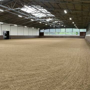
Reitanlage Erlenstegen
Nürnberg
Reitstall-Erlenstegen
@Reitstall-Erlenstegen
Pferdeausbildung
Reitlehrer und -unterricht
Vermieten
Führanlage
Krankenbox
Einhornhaltung möglich
Hengsthaltung möglich
16 weitere...
P+


Pferde am Kretschmannshof
Oberasbach
Sebastian Weißkopf
@Pferde-am-Kretschmannshof
Vermieten
Hunde willkommen
Paddock
Offenstall
Halbpension
10 weitere...
P+
Deprecated: Creation of dynamic property Zend_View_Helper_Ads::$adLink is deprecated in /var/www/stall-frei/htdocs/staging.stall-frei.de/library/Psf/View/Helper/Ads.php on line 108

Pferdepension Hit Aktivstall Kürmerhof
Hohenkammer
Kuermerhof
@Kuermerhof
*******JETZT NEU MIT ENTSTAUBTEM BIOHEU*********
*******Demnächst mit einem Abenteuerspielplatz für Pferde ( Extrem Trail/Pa
Reitstall Vogel
Nürnberg
Familie-Vogel
@Familie-Vogel
FN-Mitglied
Freizeitstall
Vermieten
Hunde willkommen
Krankenbox
Allergikerstall
Gnadenbrothof
18 weitere...
P
Reitsportzentrum Wendelstein
Wendelstein
Johan-Huber
@Johan-Huber
Pferdeausbildung
Reitlehrer und -unterricht
Longierzirkel/Roundpen
Paddock
Hengsthaltung möglich
Außenbox mit Paddock
Außenboxen
14 weitere...
aktuell
P

Pferdepension Zimmermann
Schwabach
Dieter Zimmermann
@Dieter_Zimmermann
Freizeitstall
Vermieten
Reitplatz (z.B. Dressur, Springen, Reining)
Sattelkammer/Sattelschränke
Innenbox
4 weitere...
P
Reitstall Fink Neunhof
Nürnberg Neunhof
Marcus-Fink
@Marcus-Fink
Freizeitstall
Hunde willkommen
Paddock
Außenbox mit Paddock
Innenbox
Vollpension
10 weitere...
P+

Heu aus neuer Ernte
Mechtersen
STALL-FREIde Marketing
@STALL-FREI-Marketing
Heulage und Pferdeheu aus der neuen Ernte findest du in unserem Futtermarkt

Aussenboxen frei
Schwabach
Margot Witt
@WittMargot
Freizeitstall
Vermieten
Verpachten
Longierzirkel/Roundpen
Reitplatz (z.B. Dressur, Springen, Reining)
Außenboxen
Innenbox
7 weitere...
P


Reitanlage Hundsmühle
Heroldsberg
Reitanlage Hundsmühle
@Hundsmuehle_Heroldsberg
FN-Mitglied
Freizeitstall
Vermieten
Hunde willkommen
Krankenbox
Allergikerstall
bedampftes/gewaschenes Heu
26 weitere...
aktuell
P+

Außenboxen und Offenstall
Schwanstetten
Jasmin Nitsche
@Jassi1211
Pflegepferd
Reitschule
Vermieten
Hunde willkommen
Paddock
Hufrehe geeignet
13 weitere...
P

Teilversorger Boxen unter neuer Leitung Update
Oberasbach
Sabrina48
@Sabrina48
Reitlehrer und -unterricht
Reitschule
Vermieten
Hunde willkommen
Krankenbox
Außenboxen
Innenbox
13 weitere...
aktuell
P
Deprecated: Creation of dynamic property Zend_View::$pageCount is deprecated in /var/www/stall-frei/htdocs/staging.stall-frei.de/library/vendor/shardj/zf1-future/library/Zend/View/Abstract.php on line 308
Deprecated: Creation of dynamic property Zend_View::$itemCountPerPage is deprecated in /var/www/stall-frei/htdocs/staging.stall-frei.de/library/vendor/shardj/zf1-future/library/Zend/View/Abstract.php on line 308
Deprecated: Creation of dynamic property Zend_View::$first is deprecated in /var/www/stall-frei/htdocs/staging.stall-frei.de/library/vendor/shardj/zf1-future/library/Zend/View/Abstract.php on line 308
Deprecated: Creation of dynamic property Zend_View::$current is deprecated in /var/www/stall-frei/htdocs/staging.stall-frei.de/library/vendor/shardj/zf1-future/library/Zend/View/Abstract.php on line 308
Deprecated: Creation of dynamic property Zend_View::$last is deprecated in /var/www/stall-frei/htdocs/staging.stall-frei.de/library/vendor/shardj/zf1-future/library/Zend/View/Abstract.php on line 308
Deprecated: Creation of dynamic property Zend_View::$next is deprecated in /var/www/stall-frei/htdocs/staging.stall-frei.de/library/vendor/shardj/zf1-future/library/Zend/View/Abstract.php on line 308
Deprecated: Creation of dynamic property Zend_View::$pagesInRange is deprecated in /var/www/stall-frei/htdocs/staging.stall-frei.de/library/vendor/shardj/zf1-future/library/Zend/View/Abstract.php on line 308
Deprecated: Creation of dynamic property Zend_View::$firstPageInRange is deprecated in /var/www/stall-frei/htdocs/staging.stall-frei.de/library/vendor/shardj/zf1-future/library/Zend/View/Abstract.php on line 308
Deprecated: Creation of dynamic property Zend_View::$lastPageInRange is deprecated in /var/www/stall-frei/htdocs/staging.stall-frei.de/library/vendor/shardj/zf1-future/library/Zend/View/Abstract.php on line 308
Deprecated: Creation of dynamic property Zend_View::$currentItemCount is deprecated in /var/www/stall-frei/htdocs/staging.stall-frei.de/library/vendor/shardj/zf1-future/library/Zend/View/Abstract.php on line 308
Deprecated: Creation of dynamic property Zend_View::$totalItemCount is deprecated in /var/www/stall-frei/htdocs/staging.stall-frei.de/library/vendor/shardj/zf1-future/library/Zend/View/Abstract.php on line 308
Deprecated: Creation of dynamic property Zend_View::$firstItemNumber is deprecated in /var/www/stall-frei/htdocs/staging.stall-frei.de/library/vendor/shardj/zf1-future/library/Zend/View/Abstract.php on line 308
Deprecated: Creation of dynamic property Zend_View::$lastItemNumber is deprecated in /var/www/stall-frei/htdocs/staging.stall-frei.de/library/vendor/shardj/zf1-future/library/Zend/View/Abstract.php on line 308
Deprecated: Creation of dynamic property Zend_View::$router is deprecated in /var/www/stall-frei/htdocs/staging.stall-frei.de/library/vendor/shardj/zf1-future/library/Zend/View/Abstract.php on line 308
Deprecated: Creation of dynamic property Zend_View::$urlParams is deprecated in /var/www/stall-frei/htdocs/staging.stall-frei.de/library/vendor/shardj/zf1-future/library/Zend/View/Abstract.php on line 308
Deprecated: Creation of dynamic property Zend_View::$showAds is deprecated in /var/www/stall-frei/htdocs/staging.stall-frei.de/library/vendor/shardj/zf1-future/library/Zend/View/Abstract.php on line 308
Deprecated: Creation of dynamic property Zend_View::$objectIds is deprecated in /var/www/stall-frei/htdocs/staging.stall-frei.de/library/vendor/shardj/zf1-future/library/Zend/View/Abstract.php on line 308
Deprecated: Creation of dynamic property Zend_View::$showNavbar is deprecated in /var/www/stall-frei/htdocs/staging.stall-frei.de/library/vendor/shardj/zf1-future/library/Zend/View/Abstract.php on line 308
Deprecated: Creation of dynamic property Zend_View::$showBreadcrumb is deprecated in /var/www/stall-frei/htdocs/staging.stall-frei.de/library/vendor/shardj/zf1-future/library/Zend/View/Abstract.php on line 308
Deprecated: Creation of dynamic property Zend_View::$showFooter is deprecated in /var/www/stall-frei/htdocs/staging.stall-frei.de/library/vendor/shardj/zf1-future/library/Zend/View/Abstract.php on line 308
Deprecated: Creation of dynamic property Zend_View::$showInternalAds is deprecated in /var/www/stall-frei/htdocs/staging.stall-frei.de/library/vendor/shardj/zf1-future/library/Zend/View/Abstract.php on line 308
Deprecated: Creation of dynamic property Zend_View::$blNoContent is deprecated in /var/www/stall-frei/htdocs/staging.stall-frei.de/library/vendor/shardj/zf1-future/library/Zend/View/Abstract.php on line 308
Deprecated: Creation of dynamic property Zend_View::$sMetaDesc is deprecated in /var/www/stall-frei/htdocs/staging.stall-frei.de/library/vendor/shardj/zf1-future/library/Zend/View/Abstract.php on line 308
Deprecated: Creation of dynamic property Zend_View::$useGmaps is deprecated in /var/www/stall-frei/htdocs/staging.stall-frei.de/library/vendor/shardj/zf1-future/library/Zend/View/Abstract.php on line 308
Deprecated: Creation of dynamic property Zend_View::$touches is deprecated in /var/www/stall-frei/htdocs/staging.stall-frei.de/library/vendor/shardj/zf1-future/library/Zend/View/Abstract.php on line 308
Deprecated: Creation of dynamic property Zend_View::$oProject is deprecated in /var/www/stall-frei/htdocs/staging.stall-frei.de/library/vendor/shardj/zf1-future/library/Zend/View/Abstract.php on line 308
Deprecated: Creation of dynamic property Zend_View::$pageHeadline is deprecated in /var/www/stall-frei/htdocs/staging.stall-frei.de/library/vendor/shardj/zf1-future/library/Zend/View/Abstract.php on line 308
Deprecated: Creation of dynamic property Zend_View::$disableLocationField is deprecated in /var/www/stall-frei/htdocs/staging.stall-frei.de/library/vendor/shardj/zf1-future/library/Zend/View/Abstract.php on line 308
Deprecated: Creation of dynamic property Zend_View::$isSearch is deprecated in /var/www/stall-frei/htdocs/staging.stall-frei.de/library/vendor/shardj/zf1-future/library/Zend/View/Abstract.php on line 308
Deprecated: Creation of dynamic property Zend_View::$pageTitle is deprecated in /var/www/stall-frei/htdocs/staging.stall-frei.de/library/vendor/shardj/zf1-future/library/Zend/View/Abstract.php on line 308
Deprecated: Creation of dynamic property Psf_Form_Element_Text::$class is deprecated in /var/www/stall-frei/htdocs/staging.stall-frei.de/library/vendor/shardj/zf1-future/library/Zend/Form/Element.php on line 874
Deprecated: Creation of dynamic property Psf_Form_Element_Text::$size is deprecated in /var/www/stall-frei/htdocs/staging.stall-frei.de/library/vendor/shardj/zf1-future/library/Zend/Form/Element.php on line 874
Deprecated: Creation of dynamic property Psf_Form_Element_Text::$placeholder is deprecated in /var/www/stall-frei/htdocs/staging.stall-frei.de/library/vendor/shardj/zf1-future/library/Zend/Form/Element.php on line 874
Deprecated: Creation of dynamic property Psf_Form_Element_Hidden::$class is deprecated in /var/www/stall-frei/htdocs/staging.stall-frei.de/library/vendor/shardj/zf1-future/library/Zend/Form/Element.php on line 874
Deprecated: Creation of dynamic property Psf_Form_Element_Hidden::$class is deprecated in /var/www/stall-frei/htdocs/staging.stall-frei.de/library/vendor/shardj/zf1-future/library/Zend/Form/Element.php on line 874
Deprecated: Creation of dynamic property Psf_Form_Element_Hidden::$class is deprecated in /var/www/stall-frei/htdocs/staging.stall-frei.de/library/vendor/shardj/zf1-future/library/Zend/Form/Element.php on line 874
Deprecated: Creation of dynamic property Psf_Form_Element_Hidden::$class is deprecated in /var/www/stall-frei/htdocs/staging.stall-frei.de/library/vendor/shardj/zf1-future/library/Zend/Form/Element.php on line 874
Deprecated: Creation of dynamic property Psf_Form_Element_Select::$class is deprecated in /var/www/stall-frei/htdocs/staging.stall-frei.de/library/vendor/shardj/zf1-future/library/Zend/Form/Element.php on line 874
Deprecated: Creation of dynamic property Psf_Form_Element_Select::$class is deprecated in /var/www/stall-frei/htdocs/staging.stall-frei.de/library/vendor/shardj/zf1-future/library/Zend/Form/Element.php on line 874
Deprecated: Creation of dynamic property Psf_Form_Element_Select::$class is deprecated in /var/www/stall-frei/htdocs/staging.stall-frei.de/library/vendor/shardj/zf1-future/library/Zend/Form/Element.php on line 874
Deprecated: Creation of dynamic property Psf_Form_Element_Select::$class is deprecated in /var/www/stall-frei/htdocs/staging.stall-frei.de/library/vendor/shardj/zf1-future/library/Zend/Form/Element.php on line 874
Deprecated: Creation of dynamic property Psf_Form_Element_Text::$class is deprecated in /var/www/stall-frei/htdocs/staging.stall-frei.de/library/vendor/shardj/zf1-future/library/Zend/Form/Element.php on line 874
Deprecated: Creation of dynamic property Psf_Form_Element_Checkbox::$label is deprecated in /var/www/stall-frei/htdocs/staging.stall-frei.de/library/vendor/shardj/zf1-future/library/Zend/Form/Element.php on line 874
Deprecated: Creation of dynamic property Zend_View::$sort is deprecated in /var/www/stall-frei/htdocs/staging.stall-frei.de/library/vendor/shardj/zf1-future/library/Zend/View/Abstract.php on line 308
Deprecated: Creation of dynamic property Zend_View::$searchLocation is deprecated in /var/www/stall-frei/htdocs/staging.stall-frei.de/library/vendor/shardj/zf1-future/library/Zend/View/Abstract.php on line 308
Deprecated: Creation of dynamic property Zend_View::$locationHint is deprecated in /var/www/stall-frei/htdocs/staging.stall-frei.de/library/vendor/shardj/zf1-future/library/Zend/View/Abstract.php on line 308
Psf_GeoCoder_Abstract::getLocation: Kettelersiedlung Get Location CachedOrLive
Psf_GeoCoder_Abstract::getCachedOrLive: Kettelersiedlung
Psf_GeoCoder_OpenCageData::makeApiRequest: response:
Array
(
[documentation] => https://opencagedata.com/api
[licenses] => Array
(
[0] => Array
(
[name] => see attribution guide
[url] => https://opencagedata.com/credits
)
)
[results] => Array
(
[0] => Array
(
[bounds] => Array
(
[northeast] => Array
(
[lat] => 49.4239803
[lng] => 11.1242309
)
[southwest] => Array
(
[lat] => 49.3839803
[lng] => 11.0842309
)
)
[components] => Array
(
[ISO_3166-1_alpha-2] => DE
[ISO_3166-1_alpha-3] => DEU
[ISO_3166-2] => Array
(
[0] => DE-BY
)
[_category] => place
[_normalized_city] => Nürnberg
[_type] => neighbourhood
[city] => Nürnberg
[continent] => Europe
[country] => Deutschland
[country_code] => de
[political_union] => European Union
[postcode] => 90469
[state] => Bayern
[state_code] => BY
[suburb] => Kettelersiedlung
)
[confidence] => 7
[formatted] => 90469 Nürnberg, Deutschland
[geometry] => Array
(
[lat] => 49.4039803
[lng] => 11.1042309
)
)
[1] => Array
(
[bounds] => Array
(
[northeast] => Array
(
[lat] => 51.6174048
[lng] => 7.4139102
)
[southwest] => Array
(
[lat] => 51.6087083
[lng] => 7.4052037
)
)
[components] => Array
(
[ISO_3166-1_alpha-2] => DE
[ISO_3166-1_alpha-3] => DEU
[ISO_3166-2] => Array
(
[0] => DE-NW
)
[_category] => place
[_normalized_city] => Waltrop
[_type] => neighbourhood
[continent] => Europe
[country] => Deutschland
[country_code] => de
[county] => Kreis Recklinghausen
[political_union] => European Union
[state] => Nordrhein-Westfalen
[state_code] => NW
[suburb] => Kettelersiedlung
[town] => Waltrop
)
[confidence] => 9
[formatted] => Kettelersiedlung, Waltrop, Nordrhein-Westfalen, Deutschland
[geometry] => Array
(
[lat] => 51.612823
[lng] => 7.4098986
)
)
[2] => Array
(
[bounds] => Array
(
[northeast] => Array
(
[lat] => 49.9950117
[lng] => 8.2980925
)
[southwest] => Array
(
[lat] => 49.9750117
[lng] => 8.2780925
)
)
[components] => Array
(
[ISO_3166-1_alpha-2] => DE
[ISO_3166-1_alpha-3] => DEU
[ISO_3166-2] => Array
(
[0] => DE-RP
)
[_category] => place
[_normalized_city] => Mainz
[_type] => neighbourhood
[city] => Mainz
[continent] => Europe
[country] => Deutschland
[country_code] => de
[neighbourhood] => Kettelersiedlung
[political_union] => European Union
[postcode] => 55131
[state] => Rheinland-Pfalz
[state_code] => RP
[suburb] => Oberstadt
)
[confidence] => 8
[formatted] => 55131 Mainz, Deutschland
[geometry] => Array
(
[lat] => 49.9850117
[lng] => 8.2880925
)
)
[3] => Array
(
[bounds] => Array
(
[northeast] => Array
(
[lat] => 51.8797715
[lng] => 6.1609873
)
[southwest] => Array
(
[lat] => 51.8779662
[lng] => 6.1582921
)
)
[components] => Array
(
[ISO_3166-1_alpha-2] => DE
[ISO_3166-1_alpha-3] => DEU
[ISO_3166-2] => Array
(
[0] => DE-NW
)
[_category] => place
[_normalized_city] => Emmerich am Rhein
[_type] => neighbourhood
[continent] => Europe
[country] => Deutschland
[country_code] => de
[county] => Kreis Kleve
[political_union] => European Union
[postcode] => 46446
[residential] => Ketteler-Siedlung
[state] => Nordrhein-Westfalen
[state_code] => NW
[town] => Emmerich am Rhein
)
[confidence] => 9
[formatted] => 46446 Emmerich am Rhein, Deutschland
[geometry] => Array
(
[lat] => 51.8790446
[lng] => 6.1595846
)
)
[4] => Array
(
[bounds] => Array
(
[northeast] => Array
(
[lat] => 49.3349444
[lng] => 7.0955099
)
[southwest] => Array
(
[lat] => 49.3149444
[lng] => 7.0755099
)
)
[components] => Array
(
[ISO_3166-1_alpha-2] => DE
[ISO_3166-1_alpha-3] => DEU
[ISO_3166-2] => Array
(
[0] => DE-SL
)
[_category] => place
[_normalized_city] => Friedrichsthal
[_type] => hamlet
[city_district] => Friedrichsthal
[continent] => Europe
[country] => Deutschland
[country_code] => de
[county] => Regionalverband Saarbrücken
[locality] => Ketteler-Siedlung
[political_union] => European Union
[postcode] => 66299
[state] => Saarland
[state_code] => SL
[town] => Friedrichsthal
)
[confidence] => 8
[formatted] => Ketteler-Siedlung, 66299 Friedrichsthal, Deutschland
[geometry] => Array
(
[lat] => 49.3249444
[lng] => 7.0855099
)
)
[5] => Array
(
[bounds] => Array
(
[northeast] => Array
(
[lat] => 49.3826235
[lng] => 7.2595626
)
[southwest] => Array
(
[lat] => 49.3813207
[lng] => 7.2581166
)
)
[components] => Array
(
[ISO_3166-1_alpha-2] => DE
[ISO_3166-1_alpha-3] => DEU
[ISO_3166-2] => Array
(
[0] => DE-SL
)
[_category] => road
[_normalized_city] => Bexbach
[_type] => road
[continent] => Europe
[country] => Deutschland
[country_code] => de
[county] => Saarpfalz-Kreis
[political_union] => European Union
[postcode] => 66450
[road] => Kettelersiedlung
[road_type] => residential
[state] => Saarland
[state_code] => SL
[town] => Bexbach
[village] => Frankenholz
)
[confidence] => 9
[formatted] => Kettelersiedlung, 66450 Frankenholz, Deutschland
[geometry] => Array
(
[lat] => 49.3818711
[lng] => 7.2592145
)
)
[6] => Array
(
[bounds] => Array
(
[northeast] => Array
(
[lat] => 51.6415566
[lng] => 7.6670219
)
[southwest] => Array
(
[lat] => 51.6411901
[lng] => 7.661907
)
)
[components] => Array
(
[ISO_3166-1_alpha-2] => DE
[ISO_3166-1_alpha-3] => DEU
[ISO_3166-2] => Array
(
[0] => DE-NW
)
[_category] => road
[_normalized_city] => Bergkamen
[_type] => road
[continent] => Europe
[country] => Deutschland
[country_code] => de
[county] => Kreis Unna
[political_union] => European Union
[postcode] => 59192
[road] => Kettelersiedlung
[road_type] => residential
[state] => Nordrhein-Westfalen
[state_code] => NW
[suburb] => Rünthe
[town] => Bergkamen
)
[confidence] => 9
[formatted] => Kettelersiedlung, 59192 Bergkamen, Deutschland
[geometry] => Array
(
[lat] => 51.6412204
[lng] => 7.6644515
)
)
[7] => Array
(
[bounds] => Array
(
[northeast] => Array
(
[lat] => 50.2379678
[lng] => 11.3467375
)
[southwest] => Array
(
[lat] => 50.2373747
[lng] => 11.3447771
)
)
[components] => Array
(
[ISO_3166-1_alpha-2] => DE
[ISO_3166-1_alpha-3] => DEU
[ISO_3166-2] => Array
(
[0] => DE-BY
)
[_category] => road
[_normalized_city] => Kronach
[_type] => road
[continent] => Europe
[country] => Deutschland
[country_code] => de
[county] => Landkreis Kronach
[political_union] => European Union
[postcode] => 96317
[road] => Kettelersiedlung
[road_type] => residential
[state] => Bayern
[state_code] => BY
[town] => Kronach
)
[confidence] => 9
[formatted] => Kettelersiedlung, 96317 Kronach, Deutschland
[geometry] => Array
(
[lat] => 50.2376416
[lng] => 11.3457662
)
)
[8] => Array
(
[bounds] => Array
(
[northeast] => Array
(
[lat] => 50.7028385
[lng] => 6.65574
)
[southwest] => Array
(
[lat] => 50.7014445
[lng] => 6.6531876
)
)
[components] => Array
(
[ISO_3166-1_alpha-2] => DE
[ISO_3166-1_alpha-3] => DEU
[ISO_3166-2] => Array
(
[0] => DE-NW
)
[_category] => road
[_normalized_city] => Zülpich
[_type] => road
[continent] => Europe
[country] => Deutschland
[country_code] => de
[county] => Kreis Euskirchen
[political_union] => European Union
[postcode] => 53909
[road] => Ketteler Siedlung
[road_type] => residential
[state] => Nordrhein-Westfalen
[state_code] => NW
[town] => Zülpich
)
[confidence] => 9
[formatted] => Ketteler Siedlung, 53909 Zülpich, Deutschland
[geometry] => Array
(
[lat] => 50.7022988
[lng] => 6.6545048
)
)
[9] => Array
(
[components] => Array
(
[ISO_3166-1_alpha-2] => FR
[ISO_3166-1_alpha-3] => FRA
[ISO_3166-2] => Array
(
[0] => FR-IDF
[1] => FR-92
)
[_category] => road
[_normalized_city] => Levallois-Perret
[_type] => road
[city] => Levallois-Perret
[continent] => Europe
[country] => France
[country_code] => fr
[county] => Hauts-de-Seine
[local_authority] => Métropole du Grand Paris
[political_union] => European Union
[postcode] => 92300
[road] => Rue Charles Deutschmann
[state] => Île-de-France
[state_code] => IDF
)
[confidence] => 2
[formatted] => Rue Charles Deutschmann, 92300 Levallois-Perret, France
[geometry] => Array
(
[lat] => 48.900049
[lng] => 2.2842
)
)
)
[status] => Array
(
[code] => 200
[message] => OK
)
[stay_informed] => Array
(
[blog] => https://blog.opencagedata.com
[mastodon] => https://en.osm.town/@opencage
)
[thanks] => For using an OpenCage API
[timestamp] => Array
(
[created_http] => Mon, 09 Feb 2026 08:34:37 GMT
[created_unix] => 1770626077
)
[total_results] => 10
)
Psf_GeoCoder_Abstract::convertLocationResult
{"documentation":"https:\/\/opencagedata.com\/api","licenses":[{"name":"see attribution guide","url":"https:\/\/opencagedata.com\/credits"}],"results":[{"bounds":{"northeast":{"lat":49.4239803,"lng":11.1242309},"southwest":{"lat":49.3839803,"lng":11.0842309}},"components":{"ISO_3166-1_alpha-2":"DE","ISO_3166-1_alpha-3":"DEU","ISO_3166-2":["DE-BY"],"_category":"place","_normalized_city":"N\u00fcrnberg","_type":"neighbourhood","city":"N\u00fcrnberg","continent":"Europe","country":"Deutschland","country_code":"de","political_union":"European Union","postcode":"90469","state":"Bayern","state_code":"BY","suburb":"Kettelersiedlung"},"confidence":7,"formatted":"90469 N\u00fcrnberg, Deutschland","geometry":{"lat":49.4039803,"lng":11.1042309}},{"bounds":{"northeast":{"lat":51.6174048,"lng":7.4139102},"southwest":{"lat":51.6087083,"lng":7.4052037}},"components":{"ISO_3166-1_alpha-2":"DE","ISO_3166-1_alpha-3":"DEU","ISO_3166-2":["DE-NW"],"_category":"place","_normalized_city":"Waltrop","_type":"neighbourhood","continent":"Europe","country":"Deutschland","country_code":"de","county":"Kreis Recklinghausen","political_union":"European Union","state":"Nordrhein-Westfalen","state_code":"NW","suburb":"Kettelersiedlung","town":"Waltrop"},"confidence":9,"formatted":"Kettelersiedlung, Waltrop, Nordrhein-Westfalen, Deutschland","geometry":{"lat":51.612823,"lng":7.4098986}},{"bounds":{"northeast":{"lat":49.9950117,"lng":8.2980925},"southwest":{"lat":49.9750117,"lng":8.2780925}},"components":{"ISO_3166-1_alpha-2":"DE","ISO_3166-1_alpha-3":"DEU","ISO_3166-2":["DE-RP"],"_category":"place","_normalized_city":"Mainz","_type":"neighbourhood","city":"Mainz","continent":"Europe","country":"Deutschland","country_code":"de","neighbourhood":"Kettelersiedlung","political_union":"European Union","postcode":"55131","state":"Rheinland-Pfalz","state_code":"RP","suburb":"Oberstadt"},"confidence":8,"formatted":"55131 Mainz, Deutschland","geometry":{"lat":49.9850117,"lng":8.2880925}},{"bounds":{"northeast":{"lat":51.8797715,"lng":6.1609873},"southwest":{"lat":51.8779662,"lng":6.1582921}},"components":{"ISO_3166-1_alpha-2":"DE","ISO_3166-1_alpha-3":"DEU","ISO_3166-2":["DE-NW"],"_category":"place","_normalized_city":"Emmerich am Rhein","_type":"neighbourhood","continent":"Europe","country":"Deutschland","country_code":"de","county":"Kreis Kleve","political_union":"European Union","postcode":"46446","residential":"Ketteler-Siedlung","state":"Nordrhein-Westfalen","state_code":"NW","town":"Emmerich am Rhein"},"confidence":9,"formatted":"46446 Emmerich am Rhein, Deutschland","geometry":{"lat":51.8790446,"lng":6.1595846}},{"bounds":{"northeast":{"lat":49.3349444,"lng":7.0955099},"southwest":{"lat":49.3149444,"lng":7.0755099}},"components":{"ISO_3166-1_alpha-2":"DE","ISO_3166-1_alpha-3":"DEU","ISO_3166-2":["DE-SL"],"_category":"place","_normalized_city":"Friedrichsthal","_type":"hamlet","city_district":"Friedrichsthal","continent":"Europe","country":"Deutschland","country_code":"de","county":"Regionalverband Saarbr\u00fccken","locality":"Ketteler-Siedlung","political_union":"European Union","postcode":"66299","state":"Saarland","state_code":"SL","town":"Friedrichsthal"},"confidence":8,"formatted":"Ketteler-Siedlung, 66299 Friedrichsthal, Deutschland","geometry":{"lat":49.3249444,"lng":7.0855099}},{"bounds":{"northeast":{"lat":49.3826235,"lng":7.2595626},"southwest":{"lat":49.3813207,"lng":7.2581166}},"components":{"ISO_3166-1_alpha-2":"DE","ISO_3166-1_alpha-3":"DEU","ISO_3166-2":["DE-SL"],"_category":"road","_normalized_city":"Bexbach","_type":"road","continent":"Europe","country":"Deutschland","country_code":"de","county":"Saarpfalz-Kreis","political_union":"European Union","postcode":"66450","road":"Kettelersiedlung","road_type":"residential","state":"Saarland","state_code":"SL","town":"Bexbach","village":"Frankenholz"},"confidence":9,"formatted":"Kettelersiedlung, 66450 Frankenholz, Deutschland","geometry":{"lat":49.3818711,"lng":7.2592145}},{"bounds":{"northeast":{"lat":51.6415566,"lng":7.6670219},"southwest":{"lat":51.6411901,"lng":7.661907}},"components":{"ISO_3166-1_alpha-2":"DE","ISO_3166-1_alpha-3":"DEU","ISO_3166-2":["DE-NW"],"_category":"road","_normalized_city":"Bergkamen","_type":"road","continent":"Europe","country":"Deutschland","country_code":"de","county":"Kreis Unna","political_union":"European Union","postcode":"59192","road":"Kettelersiedlung","road_type":"residential","state":"Nordrhein-Westfalen","state_code":"NW","suburb":"R\u00fcnthe","town":"Bergkamen"},"confidence":9,"formatted":"Kettelersiedlung, 59192 Bergkamen, Deutschland","geometry":{"lat":51.6412204,"lng":7.6644515}},{"bounds":{"northeast":{"lat":50.2379678,"lng":11.3467375},"southwest":{"lat":50.2373747,"lng":11.3447771}},"components":{"ISO_3166-1_alpha-2":"DE","ISO_3166-1_alpha-3":"DEU","ISO_3166-2":["DE-BY"],"_category":"road","_normalized_city":"Kronach","_type":"road","continent":"Europe","country":"Deutschland","country_code":"de","county":"Landkreis Kronach","political_union":"European Union","postcode":"96317","road":"Kettelersiedlung","road_type":"residential","state":"Bayern","state_code":"BY","town":"Kronach"},"confidence":9,"formatted":"Kettelersiedlung, 96317 Kronach, Deutschland","geometry":{"lat":50.2376416,"lng":11.3457662}},{"bounds":{"northeast":{"lat":50.7028385,"lng":6.65574},"southwest":{"lat":50.7014445,"lng":6.6531876}},"components":{"ISO_3166-1_alpha-2":"DE","ISO_3166-1_alpha-3":"DEU","ISO_3166-2":["DE-NW"],"_category":"road","_normalized_city":"Z\u00fclpich","_type":"road","continent":"Europe","country":"Deutschland","country_code":"de","county":"Kreis Euskirchen","political_union":"European Union","postcode":"53909","road":"Ketteler Siedlung","road_type":"residential","state":"Nordrhein-Westfalen","state_code":"NW","town":"Z\u00fclpich"},"confidence":9,"formatted":"Ketteler Siedlung, 53909 Z\u00fclpich, Deutschland","geometry":{"lat":50.7022988,"lng":6.6545048}},{"components":{"ISO_3166-1_alpha-2":"FR","ISO_3166-1_alpha-3":"FRA","ISO_3166-2":["FR-IDF","FR-92"],"_category":"road","_normalized_city":"Levallois-Perret","_type":"road","city":"Levallois-Perret","continent":"Europe","country":"France","country_code":"fr","county":"Hauts-de-Seine","local_authority":"M\u00e9tropole du Grand Paris","political_union":"European Union","postcode":"92300","road":"Rue Charles Deutschmann","state":"\u00cele-de-France","state_code":"IDF"},"confidence":2,"formatted":"Rue Charles Deutschmann, 92300 Levallois-Perret, France","geometry":{"lat":48.900049,"lng":2.2842}}],"status":{"code":200,"message":"OK"},"stay_informed":{"blog":"https:\/\/blog.opencagedata.com","mastodon":"https:\/\/en.osm.town\/@opencage"},"thanks":"For using an OpenCage API","timestamp":{"created_http":"Mon, 09 Feb 2026 08:34:37 GMT","created_unix":1770626077},"total_results":10}Array
(
[0] => stdClass Object
(
[bounds] => stdClass Object
(
[northeast] => stdClass Object
(
[lat] => 49.4239803
[lng] => 11.1242309
)
[southwest] => stdClass Object
(
[lat] => 49.3839803
[lng] => 11.0842309
)
)
[components] => stdClass Object
(
[ISO_3166-1_alpha-2] => DE
[ISO_3166-1_alpha-3] => DEU
[ISO_3166-2] => Array
(
[0] => DE-BY
)
[_category] => place
[_normalized_city] => Nürnberg
[_type] => neighbourhood
[city] => Nürnberg
[continent] => Europe
[country] => Deutschland
[country_code] => de
[political_union] => European Union
[postcode] => 90469
[state] => Bayern
[state_code] => BY
[suburb] => Kettelersiedlung
)
[confidence] => 7
[formatted] => 90469 Nürnberg, Deutschland
[geometry] => stdClass Object
(
[lat] => 49.4039803
[lng] => 11.1042309
)
)
[1] => stdClass Object
(
[bounds] => stdClass Object
(
[northeast] => stdClass Object
(
[lat] => 51.6174048
[lng] => 7.4139102
)
[southwest] => stdClass Object
(
[lat] => 51.6087083
[lng] => 7.4052037
)
)
[components] => stdClass Object
(
[ISO_3166-1_alpha-2] => DE
[ISO_3166-1_alpha-3] => DEU
[ISO_3166-2] => Array
(
[0] => DE-NW
)
[_category] => place
[_normalized_city] => Waltrop
[_type] => neighbourhood
[continent] => Europe
[country] => Deutschland
[country_code] => de
[county] => Kreis Recklinghausen
[political_union] => European Union
[state] => Nordrhein-Westfalen
[state_code] => NW
[suburb] => Kettelersiedlung
[town] => Waltrop
)
[confidence] => 9
[formatted] => Kettelersiedlung, Waltrop, Nordrhein-Westfalen, Deutschland
[geometry] => stdClass Object
(
[lat] => 51.612823
[lng] => 7.4098986
)
)
[2] => stdClass Object
(
[bounds] => stdClass Object
(
[northeast] => stdClass Object
(
[lat] => 49.9950117
[lng] => 8.2980925
)
[southwest] => stdClass Object
(
[lat] => 49.9750117
[lng] => 8.2780925
)
)
[components] => stdClass Object
(
[ISO_3166-1_alpha-2] => DE
[ISO_3166-1_alpha-3] => DEU
[ISO_3166-2] => Array
(
[0] => DE-RP
)
[_category] => place
[_normalized_city] => Mainz
[_type] => neighbourhood
[city] => Mainz
[continent] => Europe
[country] => Deutschland
[country_code] => de
[neighbourhood] => Kettelersiedlung
[political_union] => European Union
[postcode] => 55131
[state] => Rheinland-Pfalz
[state_code] => RP
[suburb] => Oberstadt
)
[confidence] => 8
[formatted] => 55131 Mainz, Deutschland
[geometry] => stdClass Object
(
[lat] => 49.9850117
[lng] => 8.2880925
)
)
[3] => stdClass Object
(
[bounds] => stdClass Object
(
[northeast] => stdClass Object
(
[lat] => 51.8797715
[lng] => 6.1609873
)
[southwest] => stdClass Object
(
[lat] => 51.8779662
[lng] => 6.1582921
)
)
[components] => stdClass Object
(
[ISO_3166-1_alpha-2] => DE
[ISO_3166-1_alpha-3] => DEU
[ISO_3166-2] => Array
(
[0] => DE-NW
)
[_category] => place
[_normalized_city] => Emmerich am Rhein
[_type] => neighbourhood
[continent] => Europe
[country] => Deutschland
[country_code] => de
[county] => Kreis Kleve
[political_union] => European Union
[postcode] => 46446
[residential] => Ketteler-Siedlung
[state] => Nordrhein-Westfalen
[state_code] => NW
[town] => Emmerich am Rhein
)
[confidence] => 9
[formatted] => 46446 Emmerich am Rhein, Deutschland
[geometry] => stdClass Object
(
[lat] => 51.8790446
[lng] => 6.1595846
)
)
[4] => stdClass Object
(
[bounds] => stdClass Object
(
[northeast] => stdClass Object
(
[lat] => 49.3349444
[lng] => 7.0955099
)
[southwest] => stdClass Object
(
[lat] => 49.3149444
[lng] => 7.0755099
)
)
[components] => stdClass Object
(
[ISO_3166-1_alpha-2] => DE
[ISO_3166-1_alpha-3] => DEU
[ISO_3166-2] => Array
(
[0] => DE-SL
)
[_category] => place
[_normalized_city] => Friedrichsthal
[_type] => hamlet
[city_district] => Friedrichsthal
[continent] => Europe
[country] => Deutschland
[country_code] => de
[county] => Regionalverband Saarbrücken
[locality] => Ketteler-Siedlung
[political_union] => European Union
[postcode] => 66299
[state] => Saarland
[state_code] => SL
[town] => Friedrichsthal
)
[confidence] => 8
[formatted] => Ketteler-Siedlung, 66299 Friedrichsthal, Deutschland
[geometry] => stdClass Object
(
[lat] => 49.3249444
[lng] => 7.0855099
)
)
[5] => stdClass Object
(
[bounds] => stdClass Object
(
[northeast] => stdClass Object
(
[lat] => 49.3826235
[lng] => 7.2595626
)
[southwest] => stdClass Object
(
[lat] => 49.3813207
[lng] => 7.2581166
)
)
[components] => stdClass Object
(
[ISO_3166-1_alpha-2] => DE
[ISO_3166-1_alpha-3] => DEU
[ISO_3166-2] => Array
(
[0] => DE-SL
)
[_category] => road
[_normalized_city] => Bexbach
[_type] => road
[continent] => Europe
[country] => Deutschland
[country_code] => de
[county] => Saarpfalz-Kreis
[political_union] => European Union
[postcode] => 66450
[road] => Kettelersiedlung
[road_type] => residential
[state] => Saarland
[state_code] => SL
[town] => Bexbach
[village] => Frankenholz
)
[confidence] => 9
[formatted] => Kettelersiedlung, 66450 Frankenholz, Deutschland
[geometry] => stdClass Object
(
[lat] => 49.3818711
[lng] => 7.2592145
)
)
[6] => stdClass Object
(
[bounds] => stdClass Object
(
[northeast] => stdClass Object
(
[lat] => 51.6415566
[lng] => 7.6670219
)
[southwest] => stdClass Object
(
[lat] => 51.6411901
[lng] => 7.661907
)
)
[components] => stdClass Object
(
[ISO_3166-1_alpha-2] => DE
[ISO_3166-1_alpha-3] => DEU
[ISO_3166-2] => Array
(
[0] => DE-NW
)
[_category] => road
[_normalized_city] => Bergkamen
[_type] => road
[continent] => Europe
[country] => Deutschland
[country_code] => de
[county] => Kreis Unna
[political_union] => European Union
[postcode] => 59192
[road] => Kettelersiedlung
[road_type] => residential
[state] => Nordrhein-Westfalen
[state_code] => NW
[suburb] => Rünthe
[town] => Bergkamen
)
[confidence] => 9
[formatted] => Kettelersiedlung, 59192 Bergkamen, Deutschland
[geometry] => stdClass Object
(
[lat] => 51.6412204
[lng] => 7.6644515
)
)
[7] => stdClass Object
(
[bounds] => stdClass Object
(
[northeast] => stdClass Object
(
[lat] => 50.2379678
[lng] => 11.3467375
)
[southwest] => stdClass Object
(
[lat] => 50.2373747
[lng] => 11.3447771
)
)
[components] => stdClass Object
(
[ISO_3166-1_alpha-2] => DE
[ISO_3166-1_alpha-3] => DEU
[ISO_3166-2] => Array
(
[0] => DE-BY
)
[_category] => road
[_normalized_city] => Kronach
[_type] => road
[continent] => Europe
[country] => Deutschland
[country_code] => de
[county] => Landkreis Kronach
[political_union] => European Union
[postcode] => 96317
[road] => Kettelersiedlung
[road_type] => residential
[state] => Bayern
[state_code] => BY
[town] => Kronach
)
[confidence] => 9
[formatted] => Kettelersiedlung, 96317 Kronach, Deutschland
[geometry] => stdClass Object
(
[lat] => 50.2376416
[lng] => 11.3457662
)
)
[8] => stdClass Object
(
[bounds] => stdClass Object
(
[northeast] => stdClass Object
(
[lat] => 50.7028385
[lng] => 6.65574
)
[southwest] => stdClass Object
(
[lat] => 50.7014445
[lng] => 6.6531876
)
)
[components] => stdClass Object
(
[ISO_3166-1_alpha-2] => DE
[ISO_3166-1_alpha-3] => DEU
[ISO_3166-2] => Array
(
[0] => DE-NW
)
[_category] => road
[_normalized_city] => Zülpich
[_type] => road
[continent] => Europe
[country] => Deutschland
[country_code] => de
[county] => Kreis Euskirchen
[political_union] => European Union
[postcode] => 53909
[road] => Ketteler Siedlung
[road_type] => residential
[state] => Nordrhein-Westfalen
[state_code] => NW
[town] => Zülpich
)
[confidence] => 9
[formatted] => Ketteler Siedlung, 53909 Zülpich, Deutschland
[geometry] => stdClass Object
(
[lat] => 50.7022988
[lng] => 6.6545048
)
)
[9] => stdClass Object
(
[components] => stdClass Object
(
[ISO_3166-1_alpha-2] => FR
[ISO_3166-1_alpha-3] => FRA
[ISO_3166-2] => Array
(
[0] => FR-IDF
[1] => FR-92
)
[_category] => road
[_normalized_city] => Levallois-Perret
[_type] => road
[city] => Levallois-Perret
[continent] => Europe
[country] => France
[country_code] => fr
[county] => Hauts-de-Seine
[local_authority] => Métropole du Grand Paris
[political_union] => European Union
[postcode] => 92300
[road] => Rue Charles Deutschmann
[state] => Île-de-France
[state_code] => IDF
)
[confidence] => 2
[formatted] => Rue Charles Deutschmann, 92300 Levallois-Perret, France
[geometry] => stdClass Object
(
[lat] => 48.900049
[lng] => 2.2842
)
)
)
Psf_GeoCoder_OpenCageData::getKeyMap: 0
stdClass Object
(
    [bounds] => stdClass Object
        (
            [northeast] => stdClass Object
                (
                    [lat] => 49.4239803
                    [lng] => 11.1242309
                )

            [southwest] => stdClass Object
                (
                    [lat] => 49.3839803
                    [lng] => 11.0842309
                )

        )

    [components] => stdClass Object
        (
            [ISO_3166-1_alpha-2] => DE
            [ISO_3166-1_alpha-3] => DEU
            [ISO_3166-2] => Array
                (
                    [0] => DE-BY
                )

            [_category] => place
            [_normalized_city] => Nürnberg
            [_type] => neighbourhood
            [city] => Nürnberg
            [continent] => Europe
            [country] => Deutschland
            [country_code] => de
            [political_union] => European Union
            [postcode] => 90469
            [state] => Bayern
            [state_code] => BY
            [suburb] => Kettelersiedlung
        )

    [confidence] => 7
    [formatted] => 90469 Nürnberg, Deutschland
    [geometry] => stdClass Object
        (
            [lat] => 49.4039803
            [lng] => 11.1042309
        )

)
Psf_GeoCoder_OpenCageData::getCounty: Nürnberg
Psf_GeoCoder_OpenCageData::addMissingData REFETCH!
Array
(
    [address] => 90469 Nürnberg, Deutschland
    [type] => neighbourhood
    [street] =>
    [city] => Kettelersiedlung
    [county] => Nürnberg
    [state] => Bayern
    [zip] => 90469
    [country] => Deutschland
    [suburb] => Kettelersiedlung
    [countrycode] => de
    [latitude] => 49.4039803
    [longitude] => 11.1042309
    [accuracy] => 1
    [confidence] => 7
    [bounds] => stdClass Object
        (
            [northeast] => stdClass Object
                (
                    [lat] => 49.4239803
                    [lng] => 11.1242309
                )

            [southwest] => stdClass Object
                (
                    [lat] => 49.3839803
                    [lng] => 11.0842309
                )

        )

)
reformat!
Array
(
    [address] => 90469 Kettelersiedlung
    [type] => neighbourhood
    [street] =>
    [city] => Kettelersiedlung
    [county] => Nürnberg
    [state] => Bayern
    [zip] => 90469
    [country] => Deutschland
    [suburb] => Kettelersiedlung
    [countrycode] => de
    [latitude] => 49.4039803
    [longitude] => 11.1042309
    [accuracy] => 1
    [confidence] => 7
    [bounds] => stdClass Object
        (
            [northeast] => stdClass Object
                (
                    [lat] => 49.4239803
                    [lng] => 11.1242309
                )

            [southwest] => stdClass Object
                (
                    [lat] => 49.3839803
                    [lng] => 11.0842309
                )

        )

    [place] => 90469 Kettelersiedlung, Bayern
    [hash] => b36c3fbb8676b8ecd7eab038e37bc1e3
)
Psf_GeoCoder_OpenCageData::getKeyMap: 1
stdClass Object
(
    [bounds] => stdClass Object
        (
            [northeast] => stdClass Object
                (
                    [lat] => 51.6174048
                    [lng] => 7.4139102
                )

            [southwest] => stdClass Object
                (
                    [lat] => 51.6087083
                    [lng] => 7.4052037
                )

        )

    [components] => stdClass Object
        (
            [ISO_3166-1_alpha-2] => DE
            [ISO_3166-1_alpha-3] => DEU
            [ISO_3166-2] => Array
                (
                    [0] => DE-NW
                )

            [_category] => place
            [_normalized_city] => Waltrop
            [_type] => neighbourhood
            [continent] => Europe
            [country] => Deutschland
            [country_code] => de
            [county] => Kreis Recklinghausen
            [political_union] => European Union
            [state] => Nordrhein-Westfalen
            [state_code] => NW
            [suburb] => Kettelersiedlung
            [town] => Waltrop
        )

    [confidence] => 9
    [formatted] => Kettelersiedlung, Waltrop, Nordrhein-Westfalen, Deutschland
    [geometry] => stdClass Object
        (
            [lat] => 51.612823
            [lng] => 7.4098986
        )

)
Psf_GeoCoder_OpenCageData::getCounty: Recklinghausen
Psf_GeoCoder_OpenCageData::addMissingData REFETCH!
Array
(
    [address] => Kettelersiedlung, Waltrop, Nordrhein-Westfalen, Deutschland
    [type] => neighbourhood
    [street] =>
    [city] => Waltrop
    [county] => Recklinghausen
    [state] => Nordrhein-Westfalen
    [zip] =>
    [country] => Deutschland
    [suburb] => Kettelersiedlung
    [countrycode] => de
    [latitude] => 51.612823
    [longitude] => 7.4098986
    [accuracy] => 1
    [confidence] => 9
    [bounds] => stdClass Object
        (
            [northeast] => stdClass Object
                (
                    [lat] => 51.6174048
                    [lng] => 7.4139102
                )

            [southwest] => stdClass Object
                (
                    [lat] => 51.6087083
                    [lng] => 7.4052037
                )

        )

)
reformat!
Array
(
    [address] => Kettelersiedlung, Waltrop, Nordrhein-Westfalen, Deutschland
    [type] => neighbourhood
    [street] =>
    [city] => Waltrop
    [county] => Recklinghausen
    [state] => Nordrhein-Westfalen
    [zip] =>
    [country] => Deutschland
    [suburb] => Kettelersiedlung
    [countrycode] => de
    [latitude] => 51.612823
    [longitude] => 7.4098986
    [accuracy] => 1
    [confidence] => 9
    [bounds] => stdClass Object
        (
            [northeast] => stdClass Object
                (
                    [lat] => 51.6174048
                    [lng] => 7.4139102
                )

            [southwest] => stdClass Object
                (
                    [lat] => 51.6087083
                    [lng] => 7.4052037
                )

        )

    [place] => Waltrop, Nordrhein-Westfalen
    [hash] => d850d0a31f70896eb52e8b437e5ea2ac
)
Psf_GeoCoder_OpenCageData::getKeyMap: 2
stdClass Object
(
    [bounds] => stdClass Object
        (
            [northeast] => stdClass Object
                (
                    [lat] => 49.9950117
                    [lng] => 8.2980925
                )

            [southwest] => stdClass Object
                (
                    [lat] => 49.9750117
                    [lng] => 8.2780925
                )

        )

    [components] => stdClass Object
        (
            [ISO_3166-1_alpha-2] => DE
            [ISO_3166-1_alpha-3] => DEU
            [ISO_3166-2] => Array
                (
                    [0] => DE-RP
                )

            [_category] => place
            [_normalized_city] => Mainz
            [_type] => neighbourhood
            [city] => Mainz
            [continent] => Europe
            [country] => Deutschland
            [country_code] => de
            [neighbourhood] => Kettelersiedlung
            [political_union] => European Union
            [postcode] => 55131
            [state] => Rheinland-Pfalz
            [state_code] => RP
            [suburb] => Oberstadt
        )

    [confidence] => 8
    [formatted] => 55131 Mainz, Deutschland
    [geometry] => stdClass Object
        (
            [lat] => 49.9850117
            [lng] => 8.2880925
        )

)
Psf_GeoCoder_OpenCageData::getCounty: Mainz
Psf_GeoCoder_OpenCageData::addMissingData REFETCH!
Array
(
    [address] => 55131 Mainz, Deutschland
    [type] => neighbourhood
    [street] =>
    [city] => Oberstadt
    [county] => Mainz
    [state] => Rheinland-Pfalz
    [zip] => 55131
    [country] => Deutschland
    [suburb] => Oberstadt
    [countrycode] => de
    [latitude] => 49.9850117
    [longitude] => 8.2880925
    [accuracy] => 1
    [confidence] => 8
    [bounds] => stdClass Object
        (
            [northeast] => stdClass Object
                (
                    [lat] => 49.9950117
                    [lng] => 8.2980925
                )

            [southwest] => stdClass Object
                (
                    [lat] => 49.9750117
                    [lng] => 8.2780925
                )

        )

)
reformat!
Array
(
    [address] => 55131 Oberstadt
    [type] => neighbourhood
    [street] =>
    [city] => Oberstadt
    [county] => Mainz
    [state] => Rheinland-Pfalz
    [zip] => 55131
    [country] => Deutschland
    [suburb] => Oberstadt
    [countrycode] => de
    [latitude] => 49.9850117
    [longitude] => 8.2880925
    [accuracy] => 1
    [confidence] => 8
    [bounds] => stdClass Object
        (
            [northeast] => stdClass Object
                (
                    [lat] => 49.9950117
                    [lng] => 8.2980925
                )

            [southwest] => stdClass Object
                (
                    [lat] => 49.9750117
                    [lng] => 8.2780925
                )

        )

    [place] => 55131 Oberstadt, Rheinland-Pfalz
    [hash] => b37139a1191e081faa000ebc201e9c0d
)
Psf_GeoCoder_OpenCageData::getKeyMap: 3
stdClass Object
(
    [bounds] => stdClass Object
        (
            [northeast] => stdClass Object
                (
                    [lat] => 51.8797715
                    [lng] => 6.1609873
                )

            [southwest] => stdClass Object
                (
                    [lat] => 51.8779662
                    [lng] => 6.1582921
                )

        )

    [components] => stdClass Object
        (
            [ISO_3166-1_alpha-2] => DE
            [ISO_3166-1_alpha-3] => DEU
            [ISO_3166-2] => Array
                (
                    [0] => DE-NW
                )

            [_category] => place
            [_normalized_city] => Emmerich am Rhein
            [_type] => neighbourhood
            [continent] => Europe
            [country] => Deutschland
            [country_code] => de
            [county] => Kreis Kleve
            [political_union] => European Union
            [postcode] => 46446
            [residential] => Ketteler-Siedlung
            [state] => Nordrhein-Westfalen
            [state_code] => NW
            [town] => Emmerich am Rhein
        )

    [confidence] => 9
    [formatted] => 46446 Emmerich am Rhein, Deutschland
    [geometry] => stdClass Object
        (
            [lat] => 51.8790446
            [lng] => 6.1595846
        )

)
Psf_GeoCoder_OpenCageData::getCounty: Kleve
Psf_GeoCoder_OpenCageData::addMissingData REFETCH!
Array
(
    [address] => 46446 Emmerich am Rhein, Deutschland
    [type] => neighbourhood
    [street] =>
    [city] => Emmerich am Rhein
    [county] => Kleve
    [state] => Nordrhein-Westfalen
    [zip] => 46446
    [country] => Deutschland
    [suburb] =>
    [countrycode] => de
    [latitude] => 51.8790446
    [longitude] => 6.1595846
    [accuracy] => 1
    [confidence] => 9
    [bounds] => stdClass Object
        (
            [northeast] => stdClass Object
                (
                    [lat] => 51.8797715
                    [lng] => 6.1609873
                )

            [southwest] => stdClass Object
                (
                    [lat] => 51.8779662
                    [lng] => 6.1582921
                )

        )

)
reformat!
Array
(
    [address] => 46446 Emmerich am Rhein, Deutschland
    [type] => neighbourhood
    [street] =>
    [city] => Emmerich am Rhein
    [county] => Kleve
    [state] => Nordrhein-Westfalen
    [zip] => 46446
    [country] => Deutschland
    [suburb] =>
    [countrycode] => de
    [latitude] => 51.8790446
    [longitude] => 6.1595846
    [accuracy] => 1
    [confidence] => 9
    [bounds] => stdClass Object
        (
            [northeast] => stdClass Object
                (
                    [lat] => 51.8797715
                    [lng] => 6.1609873
                )

            [southwest] => stdClass Object
                (
                    [lat] => 51.8779662
                    [lng] => 6.1582921
                )

        )

    [place] => 46446 Emmerich am Rhein, Nordrhein-Westfalen
    [hash] => 1cf07e1ba2a13f454a2f0dd0ffcd8144
)
Psf_GeoCoder_OpenCageData::getKeyMap: 4
stdClass Object
(
    [bounds] => stdClass Object
        (
            [northeast] => stdClass Object
                (
                    [lat] => 49.3349444
                    [lng] => 7.0955099
                )

            [southwest] => stdClass Object
                (
                    [lat] => 49.3149444
                    [lng] => 7.0755099
                )

        )

    [components] => stdClass Object
        (
            [ISO_3166-1_alpha-2] => DE
            [ISO_3166-1_alpha-3] => DEU
            [ISO_3166-2] => Array
                (
                    [0] => DE-SL
                )

            [_category] => place
            [_normalized_city] => Friedrichsthal
            [_type] => hamlet
            [city_district] => Friedrichsthal
            [continent] => Europe
            [country] => Deutschland
            [country_code] => de
            [county] => Regionalverband Saarbrücken
            [locality] => Ketteler-Siedlung
            [political_union] => European Union
            [postcode] => 66299
            [state] => Saarland
            [state_code] => SL
            [town] => Friedrichsthal
        )

    [confidence] => 8
    [formatted] => Ketteler-Siedlung, 66299 Friedrichsthal, Deutschland
    [geometry] => stdClass Object
        (
            [lat] => 49.3249444
            [lng] => 7.0855099
        )

)
Psf_GeoCoder_OpenCageData::getCounty: alverband Saarbrücken
Psf_GeoCoder_OpenCageData::addMissingData REFETCH!
Array
(
    [address] => Ketteler-Siedlung, 66299 Friedrichsthal, Deutschland
    [type] => hamlet
    [street] =>
    [city] => Friedrichsthal
    [county] => alverband Saarbrücken
    [state] => Saarland
    [zip] => 66299
    [country] => Deutschland
    [suburb] =>
    [countrycode] => de
    [latitude] => 49.3249444
    [longitude] => 7.0855099
    [accuracy] => 1
    [confidence] => 8
    [bounds] => stdClass Object
        (
            [northeast] => stdClass Object
                (
                    [lat] => 49.3349444
                    [lng] => 7.0955099
                )

            [southwest] => stdClass Object
                (
                    [lat] => 49.3149444
                    [lng] => 7.0755099
                )

        )

)
reformat!
Array
(
    [address] => Ketteler-Siedlung, 66299 Friedrichsthal, Deutschland
    [type] => hamlet
    [street] =>
    [city] => Friedrichsthal
    [county] => alverband Saarbrücken
    [state] => Saarland
    [zip] => 66299
    [country] => Deutschland
    [suburb] =>
    [countrycode] => de
    [latitude] => 49.3249444
    [longitude] => 7.0855099
    [accuracy] => 1
    [confidence] => 8
    [bounds] => stdClass Object
        (
            [northeast] => stdClass Object
                (
                    [lat] => 49.3349444
                    [lng] => 7.0955099
                )

            [southwest] => stdClass Object
                (
                    [lat] => 49.3149444
                    [lng] => 7.0755099
                )

        )

    [place] => 66299 Friedrichsthal, Saarland
    [hash] => bc598c41fe9e963a687030e0342516a2
)
Psf_GeoCoder_OpenCageData::getKeyMap: 5
stdClass Object
(
    [bounds] => stdClass Object
        (
            [northeast] => stdClass Object
                (
                    [lat] => 49.3826235
                    [lng] => 7.2595626
                )

            [southwest] => stdClass Object
                (
                    [lat] => 49.3813207
                    [lng] => 7.2581166
                )

        )

    [components] => stdClass Object
        (
            [ISO_3166-1_alpha-2] => DE
            [ISO_3166-1_alpha-3] => DEU
            [ISO_3166-2] => Array
                (
                    [0] => DE-SL
                )

            [_category] => road
            [_normalized_city] => Bexbach
            [_type] => road
            [continent] => Europe
            [country] => Deutschland
            [country_code] => de
            [county] => Saarpfalz-Kreis
            [political_union] => European Union
            [postcode] => 66450
            [road] => Kettelersiedlung
            [road_type] => residential
            [state] => Saarland
            [state_code] => SL
            [town] => Bexbach
            [village] => Frankenholz
        )

    [confidence] => 9
    [formatted] => Kettelersiedlung, 66450 Frankenholz, Deutschland
    [geometry] => stdClass Object
        (
            [lat] => 49.3818711
            [lng] => 7.2592145
        )

)
Psf_GeoCoder_OpenCageData::getCounty: Saarpfalz-Kreis
Psf_GeoCoder_OpenCageData::addMissingData REFETCH!
Array
(
    [address] => Kettelersiedlung, 66450 Frankenholz, Deutschland
    [type] => road
    [street] => Kettelersiedlung
    [city] => Bexbach
    [county] => Saarpfalz-Kreis
    [state] => Saarland
    [zip] => 66450
    [country] => Deutschland
    [suburb] =>
    [countrycode] => de
    [latitude] => 49.3818711
    [longitude] => 7.2592145
    [accuracy] => 1
    [confidence] => 9
    [bounds] => stdClass Object
        (
            [northeast] => stdClass Object
                (
                    [lat] => 49.3826235
                    [lng] => 7.2595626
                )

            [southwest] => stdClass Object
                (
                    [lat] => 49.3813207
                    [lng] => 7.2581166
                )

        )

)
reformat!
Array
(
    [address] => Kettelersiedlung, 66450 Bexbach
    [type] => road
    [street] => Kettelersiedlung
    [city] => Bexbach
    [county] => Saarpfalz-Kreis
    [state] => Saarland
    [zip] => 66450
    [country] => Deutschland
    [suburb] =>
    [countrycode] => de
    [latitude] => 49.3818711
    [longitude] => 7.2592145
    [accuracy] => 1
    [confidence] => 9
    [bounds] => stdClass Object
        (
            [northeast] => stdClass Object
                (
                    [lat] => 49.3826235
                    [lng] => 7.2595626
                )

            [southwest] => stdClass Object
                (
                    [lat] => 49.3813207
                    [lng] => 7.2581166
                )

        )

    [place] => Kettelersiedlung, 66450 Bexbach, Saarland
    [hash] => 498b776d9f1a6f9ae5b40d80aa4fd069
)
Psf_GeoCoder_OpenCageData::getKeyMap: 6
stdClass Object
(
    [bounds] => stdClass Object
        (
            [northeast] => stdClass Object
                (
                    [lat] => 51.6415566
                    [lng] => 7.6670219
                )

            [southwest] => stdClass Object
                (
                    [lat] => 51.6411901
                    [lng] => 7.661907
                )

        )

    [components] => stdClass Object
        (
            [ISO_3166-1_alpha-2] => DE
            [ISO_3166-1_alpha-3] => DEU
            [ISO_3166-2] => Array
                (
                    [0] => DE-NW
                )

            [_category] => road
            [_normalized_city] => Bergkamen
            [_type] => road
            [continent] => Europe
            [country] => Deutschland
            [country_code] => de
            [county] => Kreis Unna
            [political_union] => European Union
            [postcode] => 59192
            [road] => Kettelersiedlung
            [road_type] => residential
            [state] => Nordrhein-Westfalen
            [state_code] => NW
            [suburb] => Rünthe
            [town] => Bergkamen
        )

    [confidence] => 9
    [formatted] => Kettelersiedlung, 59192 Bergkamen, Deutschland
    [geometry] => stdClass Object
        (
            [lat] => 51.6412204
            [lng] => 7.6644515
        )

)
Psf_GeoCoder_OpenCageData::getCounty: Unna
Psf_GeoCoder_OpenCageData::addMissingData REFETCH!
Array
(
    [address] => Kettelersiedlung, 59192 Bergkamen, Deutschland
    [type] => road
    [street] => Kettelersiedlung
    [city] => Bergkamen
    [county] => Unna
    [state] => Nordrhein-Westfalen
    [zip] => 59192
    [country] => Deutschland
    [suburb] => Rünthe
    [countrycode] => de
    [latitude] => 51.6412204
    [longitude] => 7.6644515
    [accuracy] => 1
    [confidence] => 9
    [bounds] => stdClass Object
        (
            [northeast] => stdClass Object
                (
                    [lat] => 51.6415566
                    [lng] => 7.6670219
                )

            [southwest] => stdClass Object
                (
                    [lat] => 51.6411901
                    [lng] => 7.661907
                )

        )

)
reformat!
Array
(
    [address] => Kettelersiedlung, 59192 Bergkamen, Deutschland
    [type] => road
    [street] => Kettelersiedlung
    [city] => Bergkamen
    [county] => Unna
    [state] => Nordrhein-Westfalen
    [zip] => 59192
    [country] => Deutschland
    [suburb] => Rünthe
    [countrycode] => de
    [latitude] => 51.6412204
    [longitude] => 7.6644515
    [accuracy] => 1
    [confidence] => 9
    [bounds] => stdClass Object
        (
            [northeast] => stdClass Object
                (
                    [lat] => 51.6415566
                    [lng] => 7.6670219
                )

            [southwest] => stdClass Object
                (
                    [lat] => 51.6411901
                    [lng] => 7.661907
                )

        )

    [place] => Kettelersiedlung, 59192 Bergkamen, Nordrhein-Westfalen
    [hash] => 621ae5de1b0bdfb04bbe314c8a03b3de
)
Psf_GeoCoder_OpenCageData::getKeyMap: 7
stdClass Object
(
    [bounds] => stdClass Object
        (
            [northeast] => stdClass Object
                (
                    [lat] => 50.2379678
                    [lng] => 11.3467375
                )

            [southwest] => stdClass Object
                (
                    [lat] => 50.2373747
                    [lng] => 11.3447771
                )

        )

    [components] => stdClass Object
        (
            [ISO_3166-1_alpha-2] => DE
            [ISO_3166-1_alpha-3] => DEU
            [ISO_3166-2] => Array
                (
                    [0] => DE-BY
                )

            [_category] => road
            [_normalized_city] => Kronach
            [_type] => road
            [continent] => Europe
            [country] => Deutschland
            [country_code] => de
            [county] => Landkreis Kronach
            [political_union] => European Union
            [postcode] => 96317
            [road] => Kettelersiedlung
            [road_type] => residential
            [state] => Bayern
            [state_code] => BY
            [town] => Kronach
        )

    [confidence] => 9
    [formatted] => Kettelersiedlung, 96317 Kronach, Deutschland
    [geometry] => stdClass Object
        (
            [lat] => 50.2376416
            [lng] => 11.3457662
        )

)
Psf_GeoCoder_OpenCageData::getCounty: Kronach
Psf_GeoCoder_OpenCageData::addMissingData REFETCH!
Array
(
    [address] => Kettelersiedlung, 96317 Kronach, Deutschland
    [type] => road
    [street] => Kettelersiedlung
    [city] => Kronach
    [county] => Kronach
    [state] => Bayern
    [zip] => 96317
    [country] => Deutschland
    [suburb] =>
    [countrycode] => de
    [latitude] => 50.2376416
    [longitude] => 11.3457662
    [accuracy] => 1
    [confidence] => 9
    [bounds] => stdClass Object
        (
            [northeast] => stdClass Object
                (
                    [lat] => 50.2379678
                    [lng] => 11.3467375
                )

            [southwest] => stdClass Object
                (
                    [lat] => 50.2373747
                    [lng] => 11.3447771
                )

        )

)
reformat!
Array
(
    [address] => Kettelersiedlung, 96317 Kronach, Deutschland
    [type] => road
    [street] => Kettelersiedlung
    [city] => Kronach
    [county] => Kronach
    [state] => Bayern
    [zip] => 96317
    [country] => Deutschland
    [suburb] =>
    [countrycode] => de
    [latitude] => 50.2376416
    [longitude] => 11.3457662
    [accuracy] => 1
    [confidence] => 9
    [bounds] => stdClass Object
        (
            [northeast] => stdClass Object
                (
                    [lat] => 50.2379678
                    [lng] => 11.3467375
                )

            [southwest] => stdClass Object
                (
                    [lat] => 50.2373747
                    [lng] => 11.3447771
                )

        )

    [place] => Kettelersiedlung, 96317 Kronach, Bayern
    [hash] => 96d4f0db9e9fbb8289d78760ea849ef9
)
Psf_GeoCoder_OpenCageData::getKeyMap: 8
stdClass Object
(
    [bounds] => stdClass Object
        (
            [northeast] => stdClass Object
                (
                    [lat] => 50.7028385
                    [lng] => 6.65574
                )

            [southwest] => stdClass Object
                (
                    [lat] => 50.7014445
                    [lng] => 6.6531876
                )

        )

    [components] => stdClass Object
        (
            [ISO_3166-1_alpha-2] => DE
            [ISO_3166-1_alpha-3] => DEU
            [ISO_3166-2] => Array
                (
                    [0] => DE-NW
                )

            [_category] => road
            [_normalized_city] => Zülpich
            [_type] => road
            [continent] => Europe
            [country] => Deutschland
            [country_code] => de
            [county] => Kreis Euskirchen
            [political_union] => European Union
            [postcode] => 53909
            [road] => Ketteler Siedlung
            [road_type] => residential
            [state] => Nordrhein-Westfalen
            [state_code] => NW
            [town] => Zülpich
        )

    [confidence] => 9
    [formatted] => Ketteler Siedlung, 53909 Zülpich, Deutschland
    [geometry] => stdClass Object
        (
            [lat] => 50.7022988
            [lng] => 6.6545048
        )

)
Psf_GeoCoder_OpenCageData::getCounty: Euskirchen
Psf_GeoCoder_OpenCageData::addMissingData REFETCH!
Array
(
    [address] => Ketteler Siedlung, 53909 Zülpich, Deutschland
    [type] => road
    [street] => Ketteler Siedlung
    [city] => Zülpich
    [county] => Euskirchen
    [state] => Nordrhein-Westfalen
    [zip] => 53909
    [country] => Deutschland
    [suburb] =>
    [countrycode] => de
    [latitude] => 50.7022988
    [longitude] => 6.6545048
    [accuracy] => 1
    [confidence] => 9
    [bounds] => stdClass Object
        (
            [northeast] => stdClass Object
                (
                    [lat] => 50.7028385
                    [lng] => 6.65574
                )

            [southwest] => stdClass Object
                (
                    [lat] => 50.7014445
                    [lng] => 6.6531876
                )

        )

)
reformat!
Array
(
    [address] => Ketteler Siedlung, 53909 Zülpich, Deutschland
    [type] => road
    [street] => Ketteler Siedlung
    [city] => Zülpich
    [county] => Euskirchen
    [state] => Nordrhein-Westfalen
    [zip] => 53909
    [country] => Deutschland
    [suburb] =>
    [countrycode] => de
    [latitude] => 50.7022988
    [longitude] => 6.6545048
    [accuracy] => 1
    [confidence] => 9
    [bounds] => stdClass Object
        (
            [northeast] => stdClass Object
                (
                    [lat] => 50.7028385
                    [lng] => 6.65574
                )

            [southwest] => stdClass Object
                (
                    [lat] => 50.7014445
                    [lng] => 6.6531876
                )

        )

    [place] => Ketteler Siedlung, 53909 Zülpich, Nordrhein-Westfalen
    [hash] => 9dbda371b7c7719321294681e4bbccb1
)
Psf_GeoCoder_OpenCageData::getKeyMap: 9
stdClass Object
(
    [components] => stdClass Object
        (
            [ISO_3166-1_alpha-2] => FR
            [ISO_3166-1_alpha-3] => FRA
            [ISO_3166-2] => Array
                (
                    [0] => FR-IDF
                    [1] => FR-92
                )

            [_category] => road
            [_normalized_city] => Levallois-Perret
            [_type] => road
            [city] => Levallois-Perret
            [continent] => Europe
            [country] => France
            [country_code] => fr
            [county] => Hauts-de-Seine
            [local_authority] => Métropole du Grand Paris
            [political_union] => European Union
            [postcode] => 92300
            [road] => Rue Charles Deutschmann
            [state] => Île-de-France
            [state_code] => IDF
        )

    [confidence] => 2
    [formatted] => Rue Charles Deutschmann, 92300 Levallois-Perret, France
    [geometry] => stdClass Object
        (
            [lat] => 48.900049
            [lng] => 2.2842
        )

)
Psf_GeoCoder_OpenCageData::getCounty: Hauts-de-Seine
Psf_GeoCoder_OpenCageData::addMissingData REFETCH!
Array
(
    [address] => Rue Charles Deutschmann, 92300 Levallois-Perret, France
    [type] => road
    [street] => Rue Charles Deutschmann
    [city] => Levallois-Perret
    [county] => Hauts-de-Seine
    [state] => Île-de-France
    [zip] => 92300
    [country] => France
    [suburb] =>
    [countrycode] => fr
    [latitude] => 48.900049
    [longitude] => 2.2842
    [accuracy] => 1
    [confidence] => 2
    [bounds] =>
)
reformat!
Array
(
    [address] => Rue Charles Deutschmann, 92300 Levallois-Perret, France
    [type] => road
    [street] => Rue Charles Deutschmann
    [city] => Levallois-Perret
    [county] => Hauts-de-Seine
    [state] => Île-de-France
    [zip] => 92300
    [country] => France
    [suburb] =>
    [countrycode] => fr
    [latitude] => 48.900049
    [longitude] => 2.2842
    [accuracy] => 1
    [confidence] => 2
    [bounds] =>
    [place] => Rue Charles Deutschmann, 92300 Levallois-Perret, Île-de-France
    [hash] => b7dc44def3990e8a7eaf18e019eca466
)
Deprecated: Creation of dynamic property Zend_View::$locationHintStyle is deprecated in /var/www/stall-frei/htdocs/staging.stall-frei.de/library/vendor/shardj/zf1-future/library/Zend/View/Abstract.php on line 308
Deprecated: Creation of dynamic property Zend_View::$adGeoLocation is deprecated in /var/www/stall-frei/htdocs/staging.stall-frei.de/library/vendor/shardj/zf1-future/library/Zend/View/Abstract.php on line 308
Deprecated: Creation of dynamic property Zend_View::$recordCount is deprecated in /var/www/stall-frei/htdocs/staging.stall-frei.de/library/vendor/shardj/zf1-future/library/Zend/View/Abstract.php on line 308
Deprecated: explode(): Passing null to parameter #2 ($string) of type string is deprecated in /var/www/stall-frei/htdocs/staging.stall-frei.de/application/models/SearchAgent.php on line 100
Deprecated: explode(): Passing null to parameter #2 ($string) of type string is deprecated in /var/www/stall-frei/htdocs/staging.stall-frei.de/application/models/SearchAgent.php on line 100
Deprecated: explode(): Passing null to parameter #2 ($string) of type string is deprecated in /var/www/stall-frei/htdocs/staging.stall-frei.de/application/models/SearchAgent.php on line 100
Deprecated: explode(): Passing null to parameter #2 ($string) of type string is deprecated in /var/www/stall-frei/htdocs/staging.stall-frei.de/application/models/SearchAgent.php on line 100
Deprecated: explode(): Passing null to parameter #2 ($string) of type string is deprecated in /var/www/stall-frei/htdocs/staging.stall-frei.de/application/models/SearchAgent.php on line 100
Deprecated: explode(): Passing null to parameter #2 ($string) of type string is deprecated in /var/www/stall-frei/htdocs/staging.stall-frei.de/application/models/SearchAgent.php on line 100
Deprecated: explode(): Passing null to parameter #2 ($string) of type string is deprecated in /var/www/stall-frei/htdocs/staging.stall-frei.de/application/models/SearchAgent.php on line 100
Deprecated: explode(): Passing null to parameter #2 ($string) of type string is deprecated in /var/www/stall-frei/htdocs/staging.stall-frei.de/application/models/SearchAgent.php on line 100
Deprecated: explode(): Passing null to parameter #2 ($string) of type string is deprecated in /var/www/stall-frei/htdocs/staging.stall-frei.de/application/models/SearchAgent.php on line 100
Deprecated: trim(): Passing null to parameter #1 ($string) of type string is deprecated in /var/www/stall-frei/htdocs/staging.stall-frei.de/application/models/Account/Search.php on line 82
Warning: Cannot modify header information - headers already sent by (output started at /var/www/stall-frei/htdocs/staging.stall-frei.de/library/vendor/shardj/zf1-future/library/Zend/View/Abstract.php:308) in /var/www/stall-frei/htdocs/staging.stall-frei.de/application/models/Account/Search.php on line 71
Deprecated: Creation of dynamic property Zend_View::$paginationParams is deprecated in /var/www/stall-frei/htdocs/staging.stall-frei.de/library/vendor/shardj/zf1-future/library/Zend/View/Abstract.php on line 308
Deprecated: Creation of dynamic property Zend_View::$objectPaginator is deprecated in /var/www/stall-frei/htdocs/staging.stall-frei.de/library/vendor/shardj/zf1-future/library/Zend/View/Abstract.php on line 308
Deprecated: Creation of dynamic property Zend_View::$featuredObjects is deprecated in /var/www/stall-frei/htdocs/staging.stall-frei.de/library/vendor/shardj/zf1-future/library/Zend/View/Abstract.php on line 308
Deprecated: Creation of dynamic property Zend_View::$hints is deprecated in /var/www/stall-frei/htdocs/staging.stall-frei.de/library/vendor/shardj/zf1-future/library/Zend/View/Abstract.php on line 308
Deprecated: Creation of dynamic property Zend_View::$attributeHints is deprecated in /var/www/stall-frei/htdocs/staging.stall-frei.de/library/vendor/shardj/zf1-future/library/Zend/View/Abstract.php on line 308
Deprecated: Creation of dynamic property Zend_View::$oSearchForm is deprecated in /var/www/stall-frei/htdocs/staging.stall-frei.de/library/vendor/shardj/zf1-future/library/Zend/View/Abstract.php on line 308