Deprecated: Creation of dynamic property Zend_View::$sMode is deprecated in /var/www/stall-frei/htdocs/staging.stall-frei.de/library/vendor/shardj/zf1-future/library/Zend/View/Abstract.php on line 308
Stallplatz oder Offenstall in Happurg
Gesucht wird in "91230 Happurg, Deutschland"
6.329 Einträge
Deprecated: Creation of dynamic property Zend_View::$listObjects is deprecated in /var/www/stall-frei/htdocs/staging.stall-frei.de/library/vendor/shardj/zf1-future/library/Zend/View/Abstract.php on line 308
Gesponsort


Deprecated: Creation of dynamic property Zend_View::$listMode is deprecated in /var/www/stall-frei/htdocs/staging.stall-frei.de/library/vendor/shardj/zf1-future/library/Zend/View/Abstract.php on line 308
Deprecated: Creation of dynamic property Zend_View::$renderedObjects is deprecated in /var/www/stall-frei/htdocs/staging.stall-frei.de/library/vendor/shardj/zf1-future/library/Zend/View/Abstract.php on line 308
Deprecated: Creation of dynamic property Zend_View::$index is deprecated in /var/www/stall-frei/htdocs/staging.stall-frei.de/library/vendor/shardj/zf1-future/library/Zend/View/Abstract.php on line 308
Deprecated: Creation of dynamic property Zend_View::$displayMode is deprecated in /var/www/stall-frei/htdocs/staging.stall-frei.de/library/vendor/shardj/zf1-future/library/Zend/View/Abstract.php on line 308
Deprecated: Creation of dynamic property Zend_View::$remarketingIds is deprecated in /var/www/stall-frei/htdocs/staging.stall-frei.de/library/vendor/shardj/zf1-future/library/Zend/View/Abstract.php on line 308
Deprecated: Creation of dynamic property Zend_View::$listItem is deprecated in /var/www/stall-frei/htdocs/staging.stall-frei.de/library/vendor/shardj/zf1-future/library/Zend/View/Abstract.php on line 308
Deprecated: Creation of dynamic property Zend_View::$object is deprecated in /var/www/stall-frei/htdocs/staging.stall-frei.de/library/vendor/shardj/zf1-future/library/Zend/View/Abstract.php on line 308
Deprecated: Creation of dynamic property Zend_View::$attributes is deprecated in /var/www/stall-frei/htdocs/staging.stall-frei.de/library/vendor/shardj/zf1-future/library/Zend/View/Abstract.php on line 308

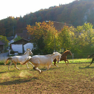


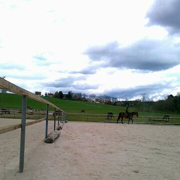
Reitsportanlage Frank / Schmidt
Etzelwang
Reitsportanlage Frank /Schmidt
@Reitstall-Frank
Pferdeausbildung
Reitlehrer und -unterricht
Vermieten
Paddock
Pensions- und Gastboxen
Hengsthaltung möglich
16 weitere...
S
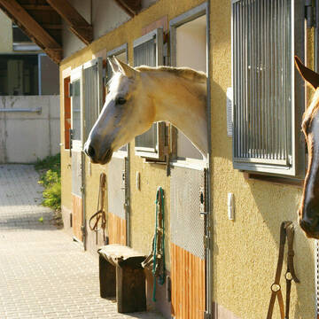
Pensionsstall Radandt
Edelsfeld
Susanne Ladig (Radandt)
@Susanne-Radandt
FN-Mitglied
Freizeitstall
Vermieten
Verpachten
Hunde willkommen
Krankenbox
Allergikerstall
bedampftes/gewaschenes Heu
28 weitere...
S
Deprecated: Creation of dynamic property Zend_View_Helper_Ads::$adLink is deprecated in /var/www/stall-frei/htdocs/staging.stall-frei.de/library/Psf/View/Helper/Ads.php on line 108

Persönlichkeitsentwicklung mit Pferden
Bad Salzuflen
Katja Dors
@Pferdezeiten
Begleite andere auf ihrem Entwicklungsweg und entdecke die transformative Kraft der pferdegestützten Persönlichkeitsentwicklung !
neu
R
Leider kein Vorschaubild
Leider kein Vorschaubild
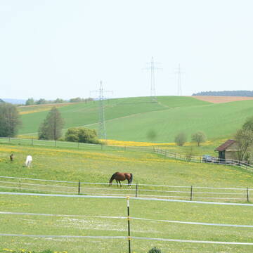
Zwei Paddockboxen frei Vollpension
Happurg
Jenny-Maul
@Jenny-Maul
FN-Mitglied
Freizeitstall
Vermieten
Hunde willkommen
Paddock
Allergikerstall
Hufrehe geeignet
26 weitere...
B
Leider kein Vorschaubild
Leider kein Vorschaubild
Offenstallplatz/Trail f.Seniorin max.1,55m
Reichenschwand
Anette-Porzler
@Anette-Porzler
Freizeitstall
Vermieten
Hunde willkommen
Krankenbox
Notfallboxen
13 weitere...
aktuell
B
Pferdepension
Schnaittach
Weisel
@Weisel
Freizeitstall
Vermieten
Longierzirkel/Roundpen
Paddock
Gnadenbrothof
Hufrehe geeignet
12 weitere...
P+

Reitanlage am Moritzberg
Diepersdorf
Reitanlage am Moritzberg
@Oesterle
FN-Mitglied
Freizeitstall
Führanlage
Longierzirkel/Roundpen
Allergikerstall
Hufrehe geeignet
Außenbox mit Paddock
Innenbox
15 weitere...
aktuell
P

Pferdepension Hit Aktivstall Kürmerhof
Hohenkammer
Kuermerhof
@Kuermerhof
*******JETZT NEU MIT ENTSTAUBTEM BIOHEU*********
*******Demnächst mit einem Abenteuerspielplatz für Pferde ( Extrem Trail/Pa
Leider kein Vorschaubild
Leider kein Vorschaubild
Winterfester Offenstall für 2 Stuten bis max.155...
Kirchensittenbach
CW K
@Cornelia5
Freizeitstall
Hunde willkommen
Krankenbox
Allergikerstall
bedampftes/gewaschenes Heu
Bewegungsstall
Laufstall
12 weitere...
ganz aktuell
B
STALL LINDENHOF
Röthenbach-Haimendorf
Helmut-Peter-HECKEL
@Helmut-Peter-HECKEL
Freizeitstall
Geländestrecke
Vermieten
Krankenbox
Longierzirkel/Roundpen
Außenbox mit Paddock
Außenboxen
15 weitere...
P

Momentan nur Warteliste möglich!!
Kirchensittenbach
Claudia Beck
@Claudia14
FN-Mitglied
Freizeitstall
Vermieten
Paddock
Pensions- und Gastboxen
Gnadenbrothof
Hufrehe geeignet
16 weitere...
P

Kleinpferdestall mit befestigten Paddocks
Altdorf
Blue Moon Ranch
@Monika-Quickert-Reitstall
Freizeitstall
Gangpferdereiten
Vermieten
Longierzirkel/Roundpen
Paddock
Hufrehe geeignet
zuckerreduziertes Heu
12 weitere...
neu
P
Deprecated: Creation of dynamic property Zend_View::$pageCount is deprecated in /var/www/stall-frei/htdocs/staging.stall-frei.de/library/vendor/shardj/zf1-future/library/Zend/View/Abstract.php on line 308
Deprecated: Creation of dynamic property Zend_View::$itemCountPerPage is deprecated in /var/www/stall-frei/htdocs/staging.stall-frei.de/library/vendor/shardj/zf1-future/library/Zend/View/Abstract.php on line 308
Deprecated: Creation of dynamic property Zend_View::$first is deprecated in /var/www/stall-frei/htdocs/staging.stall-frei.de/library/vendor/shardj/zf1-future/library/Zend/View/Abstract.php on line 308
Deprecated: Creation of dynamic property Zend_View::$current is deprecated in /var/www/stall-frei/htdocs/staging.stall-frei.de/library/vendor/shardj/zf1-future/library/Zend/View/Abstract.php on line 308
Deprecated: Creation of dynamic property Zend_View::$last is deprecated in /var/www/stall-frei/htdocs/staging.stall-frei.de/library/vendor/shardj/zf1-future/library/Zend/View/Abstract.php on line 308
Deprecated: Creation of dynamic property Zend_View::$next is deprecated in /var/www/stall-frei/htdocs/staging.stall-frei.de/library/vendor/shardj/zf1-future/library/Zend/View/Abstract.php on line 308
Deprecated: Creation of dynamic property Zend_View::$pagesInRange is deprecated in /var/www/stall-frei/htdocs/staging.stall-frei.de/library/vendor/shardj/zf1-future/library/Zend/View/Abstract.php on line 308
Deprecated: Creation of dynamic property Zend_View::$firstPageInRange is deprecated in /var/www/stall-frei/htdocs/staging.stall-frei.de/library/vendor/shardj/zf1-future/library/Zend/View/Abstract.php on line 308
Deprecated: Creation of dynamic property Zend_View::$lastPageInRange is deprecated in /var/www/stall-frei/htdocs/staging.stall-frei.de/library/vendor/shardj/zf1-future/library/Zend/View/Abstract.php on line 308
Deprecated: Creation of dynamic property Zend_View::$currentItemCount is deprecated in /var/www/stall-frei/htdocs/staging.stall-frei.de/library/vendor/shardj/zf1-future/library/Zend/View/Abstract.php on line 308
Deprecated: Creation of dynamic property Zend_View::$totalItemCount is deprecated in /var/www/stall-frei/htdocs/staging.stall-frei.de/library/vendor/shardj/zf1-future/library/Zend/View/Abstract.php on line 308
Deprecated: Creation of dynamic property Zend_View::$firstItemNumber is deprecated in /var/www/stall-frei/htdocs/staging.stall-frei.de/library/vendor/shardj/zf1-future/library/Zend/View/Abstract.php on line 308
Deprecated: Creation of dynamic property Zend_View::$lastItemNumber is deprecated in /var/www/stall-frei/htdocs/staging.stall-frei.de/library/vendor/shardj/zf1-future/library/Zend/View/Abstract.php on line 308
Deprecated: Creation of dynamic property Zend_View::$router is deprecated in /var/www/stall-frei/htdocs/staging.stall-frei.de/library/vendor/shardj/zf1-future/library/Zend/View/Abstract.php on line 308
Deprecated: Creation of dynamic property Zend_View::$urlParams is deprecated in /var/www/stall-frei/htdocs/staging.stall-frei.de/library/vendor/shardj/zf1-future/library/Zend/View/Abstract.php on line 308
Deprecated: Creation of dynamic property Zend_View::$showAds is deprecated in /var/www/stall-frei/htdocs/staging.stall-frei.de/library/vendor/shardj/zf1-future/library/Zend/View/Abstract.php on line 308
Deprecated: Creation of dynamic property Zend_View::$objectIds is deprecated in /var/www/stall-frei/htdocs/staging.stall-frei.de/library/vendor/shardj/zf1-future/library/Zend/View/Abstract.php on line 308
Deprecated: Creation of dynamic property Zend_View::$showNavbar is deprecated in /var/www/stall-frei/htdocs/staging.stall-frei.de/library/vendor/shardj/zf1-future/library/Zend/View/Abstract.php on line 308
Deprecated: Creation of dynamic property Zend_View::$showBreadcrumb is deprecated in /var/www/stall-frei/htdocs/staging.stall-frei.de/library/vendor/shardj/zf1-future/library/Zend/View/Abstract.php on line 308
Deprecated: Creation of dynamic property Zend_View::$showFooter is deprecated in /var/www/stall-frei/htdocs/staging.stall-frei.de/library/vendor/shardj/zf1-future/library/Zend/View/Abstract.php on line 308
Deprecated: Creation of dynamic property Zend_View::$showInternalAds is deprecated in /var/www/stall-frei/htdocs/staging.stall-frei.de/library/vendor/shardj/zf1-future/library/Zend/View/Abstract.php on line 308
Deprecated: Creation of dynamic property Zend_View::$blNoContent is deprecated in /var/www/stall-frei/htdocs/staging.stall-frei.de/library/vendor/shardj/zf1-future/library/Zend/View/Abstract.php on line 308
Deprecated: Creation of dynamic property Zend_View::$sMetaDesc is deprecated in /var/www/stall-frei/htdocs/staging.stall-frei.de/library/vendor/shardj/zf1-future/library/Zend/View/Abstract.php on line 308
Deprecated: Creation of dynamic property Zend_View::$useGmaps is deprecated in /var/www/stall-frei/htdocs/staging.stall-frei.de/library/vendor/shardj/zf1-future/library/Zend/View/Abstract.php on line 308
Deprecated: Creation of dynamic property Zend_View::$touches is deprecated in /var/www/stall-frei/htdocs/staging.stall-frei.de/library/vendor/shardj/zf1-future/library/Zend/View/Abstract.php on line 308
Deprecated: Creation of dynamic property Zend_View::$oProject is deprecated in /var/www/stall-frei/htdocs/staging.stall-frei.de/library/vendor/shardj/zf1-future/library/Zend/View/Abstract.php on line 308
Deprecated: Creation of dynamic property Zend_View::$pageHeadline is deprecated in /var/www/stall-frei/htdocs/staging.stall-frei.de/library/vendor/shardj/zf1-future/library/Zend/View/Abstract.php on line 308
Deprecated: Creation of dynamic property Zend_View::$disableLocationField is deprecated in /var/www/stall-frei/htdocs/staging.stall-frei.de/library/vendor/shardj/zf1-future/library/Zend/View/Abstract.php on line 308
Deprecated: Creation of dynamic property Zend_View::$isSearch is deprecated in /var/www/stall-frei/htdocs/staging.stall-frei.de/library/vendor/shardj/zf1-future/library/Zend/View/Abstract.php on line 308
Deprecated: Creation of dynamic property Zend_View::$pageTitle is deprecated in /var/www/stall-frei/htdocs/staging.stall-frei.de/library/vendor/shardj/zf1-future/library/Zend/View/Abstract.php on line 308
Deprecated: Creation of dynamic property Psf_Form_Element_Text::$class is deprecated in /var/www/stall-frei/htdocs/staging.stall-frei.de/library/vendor/shardj/zf1-future/library/Zend/Form/Element.php on line 874
Deprecated: Creation of dynamic property Psf_Form_Element_Text::$size is deprecated in /var/www/stall-frei/htdocs/staging.stall-frei.de/library/vendor/shardj/zf1-future/library/Zend/Form/Element.php on line 874
Deprecated: Creation of dynamic property Psf_Form_Element_Text::$placeholder is deprecated in /var/www/stall-frei/htdocs/staging.stall-frei.de/library/vendor/shardj/zf1-future/library/Zend/Form/Element.php on line 874
Deprecated: Creation of dynamic property Psf_Form_Element_Hidden::$class is deprecated in /var/www/stall-frei/htdocs/staging.stall-frei.de/library/vendor/shardj/zf1-future/library/Zend/Form/Element.php on line 874
Deprecated: Creation of dynamic property Psf_Form_Element_Hidden::$class is deprecated in /var/www/stall-frei/htdocs/staging.stall-frei.de/library/vendor/shardj/zf1-future/library/Zend/Form/Element.php on line 874
Deprecated: Creation of dynamic property Psf_Form_Element_Hidden::$class is deprecated in /var/www/stall-frei/htdocs/staging.stall-frei.de/library/vendor/shardj/zf1-future/library/Zend/Form/Element.php on line 874
Deprecated: Creation of dynamic property Psf_Form_Element_Hidden::$class is deprecated in /var/www/stall-frei/htdocs/staging.stall-frei.de/library/vendor/shardj/zf1-future/library/Zend/Form/Element.php on line 874
Deprecated: Creation of dynamic property Psf_Form_Element_Select::$class is deprecated in /var/www/stall-frei/htdocs/staging.stall-frei.de/library/vendor/shardj/zf1-future/library/Zend/Form/Element.php on line 874
Deprecated: Creation of dynamic property Psf_Form_Element_Select::$class is deprecated in /var/www/stall-frei/htdocs/staging.stall-frei.de/library/vendor/shardj/zf1-future/library/Zend/Form/Element.php on line 874
Deprecated: Creation of dynamic property Psf_Form_Element_Select::$class is deprecated in /var/www/stall-frei/htdocs/staging.stall-frei.de/library/vendor/shardj/zf1-future/library/Zend/Form/Element.php on line 874
Deprecated: Creation of dynamic property Psf_Form_Element_Select::$class is deprecated in /var/www/stall-frei/htdocs/staging.stall-frei.de/library/vendor/shardj/zf1-future/library/Zend/Form/Element.php on line 874
Deprecated: Creation of dynamic property Psf_Form_Element_Text::$class is deprecated in /var/www/stall-frei/htdocs/staging.stall-frei.de/library/vendor/shardj/zf1-future/library/Zend/Form/Element.php on line 874
Deprecated: Creation of dynamic property Psf_Form_Element_Checkbox::$label is deprecated in /var/www/stall-frei/htdocs/staging.stall-frei.de/library/vendor/shardj/zf1-future/library/Zend/Form/Element.php on line 874
Deprecated: Creation of dynamic property Zend_View::$sort is deprecated in /var/www/stall-frei/htdocs/staging.stall-frei.de/library/vendor/shardj/zf1-future/library/Zend/View/Abstract.php on line 308
Deprecated: Creation of dynamic property Zend_View::$searchLocation is deprecated in /var/www/stall-frei/htdocs/staging.stall-frei.de/library/vendor/shardj/zf1-future/library/Zend/View/Abstract.php on line 308
Deprecated: Creation of dynamic property Zend_View::$locationHint is deprecated in /var/www/stall-frei/htdocs/staging.stall-frei.de/library/vendor/shardj/zf1-future/library/Zend/View/Abstract.php on line 308
Psf_GeoCoder_Abstract::getLocation: Happurg Get Location CachedOrLive
Psf_GeoCoder_Abstract::getCachedOrLive: Happurg
Psf_GeoCoder_OpenCageData::makeApiRequest: response:
Array
(
[documentation] => https://opencagedata.com/api
[licenses] => Array
(
[0] => Array
(
[name] => see attribution guide
[url] => https://opencagedata.com/credits
)
)
[results] => Array
(
[0] => Array
(
[bounds] => Array
(
[northeast] => Array
(
[lat] => 49.5095488
[lng] => 11.5573752
)
[southwest] => Array
(
[lat] => 49.42188
[lng] => 11.4355911
)
)
[components] => Array
(
[ISO_3166-1_alpha-2] => DE
[ISO_3166-1_alpha-3] => DEU
[ISO_3166-2] => Array
(
[0] => DE-BY
)
[_category] => place
[_normalized_city] => Happurg
[_type] => village
[continent] => Europe
[country] => Deutschland
[country_code] => de
[county] => Landkreis Nürnberger Land
[municipality] => Happurg (VGem)
[political_union] => European Union
[postcode] => 91230
[state] => Bayern
[state_code] => BY
[village] => Happurg
)
[confidence] => 7
[formatted] => 91230 Happurg, Deutschland
[geometry] => Array
(
[lat] => 49.4927749
[lng] => 11.4715236
)
)
[1] => Array
(
[bounds] => Array
(
[northeast] => Array
(
[lat] => 49.5095488
[lng] => 11.5778551
)
[southwest] => Array
(
[lat] => 49.4089526
[lng] => 11.4355911
)
)
[components] => Array
(
[ISO_3166-1_alpha-2] => DE
[ISO_3166-1_alpha-3] => DEU
[ISO_3166-2] => Array
(
[0] => DE-BY
)
[_category] => place
[_normalized_city] => Happurg (VGem)
[_type] => municipality
[continent] => Europe
[country] => Deutschland
[country_code] => de
[county] => Landkreis Nürnberger Land
[municipality] => Happurg (VGem)
[political_union] => European Union
[state] => Bayern
[state_code] => BY
)
[confidence] => 6
[formatted] => Happurg (VGem), Bayern, Deutschland
[geometry] => Array
(
[lat] => 49.4589845
[lng] => 11.4986479
)
)
[2] => Array
(
[components] => Array
(
[ISO_3166-1_alpha-2] => FR
[ISO_3166-1_alpha-3] => FRA
[ISO_3166-2] => Array
(
[0] => FR-IDF
[1] => FR-92
)
[_category] => road
[_normalized_city] => Levallois-Perret
[_type] => road
[city] => Levallois-Perret
[continent] => Europe
[country] => France
[country_code] => fr
[county] => Hauts-de-Seine
[local_authority] => Métropole du Grand Paris
[political_union] => European Union
[postcode] => 92300
[road] => Rue Charles Deutschmann
[state] => Île-de-France
[state_code] => IDF
)
[confidence] => 3
[formatted] => Rue Charles Deutschmann, 92300 Levallois-Perret, France
[geometry] => Array
(
[lat] => 48.900049
[lng] => 2.2842
)
)
[3] => Array
(
[components] => Array
(
[ISO_3166-1_alpha-2] => FR
[ISO_3166-1_alpha-3] => FRA
[ISO_3166-2] => Array
(
[0] => FR-ARA
[1] => FR-38
)
[_category] => road
[_normalized_city] => Saint-Aupre
[_type] => road
[city] => Saint-Aupre
[continent] => Europe
[country] => France
[country_code] => fr
[county] => Isère
[local_authority] => Communauté d'agglomération du Pays Voironnais
[political_union] => European Union
[postcode] => 38960
[road] => Chemin du Haut Roland
[state] => Auvergne-Rhône-Alpes
[state_code] => ARA
)
[confidence] => 2
[formatted] => Chemin du Haut Roland, 38960 Saint-Aupre, France
[geometry] => Array
(
[lat] => 45.393834
[lng] => 5.654148
)
)
[4] => Array
(
[components] => Array
(
[ISO_3166-1_alpha-2] => FR
[ISO_3166-1_alpha-3] => FRA
[ISO_3166-2] => Array
(
[0] => FR-ARA
[1] => FR-38
)
[_category] => road
[_normalized_city] => Saint-Aupre
[_type] => road
[city] => Saint-Aupre
[continent] => Europe
[country] => France
[country_code] => fr
[county] => Isère
[local_authority] => Communauté d'agglomération du Pays Voironnais
[political_union] => European Union
[postcode] => 38960
[road] => Chemin du Roland
[state] => Auvergne-Rhône-Alpes
[state_code] => ARA
)
[confidence] => 2
[formatted] => Chemin du Roland, 38960 Saint-Aupre, France
[geometry] => Array
(
[lat] => 45.392998
[lng] => 5.653001
)
)
[5] => Array
(
[components] => Array
(
[ISO_3166-1_alpha-2] => FR
[ISO_3166-1_alpha-3] => FRA
[ISO_3166-2] => Array
(
[0] => FR-OCC
[1] => FR-34
)
[_category] => road
[_normalized_city] => Saint-Jean-de-Fos
[_type] => road
[city] => Saint-Jean-de-Fos
[continent] => Europe
[country] => France
[country_code] => fr
[county] => Hérault
[local_authority] => Communauté de communes Vallée de l'Hérault
[political_union] => European Union
[postcode] => 34150
[road] => Chemin de Las Paures
[state] => Occitanie
[state_code] => OCC
)
[confidence] => 10
[formatted] => Chemin de Las Paures, 34150 Saint-Jean-de-Fos, France
[geometry] => Array
(
[lat] => 43.704813
[lng] => 3.553661
)
)
[6] => Array
(
[components] => Array
(
[ISO_3166-1_alpha-2] => FR
[ISO_3166-1_alpha-3] => FRA
[ISO_3166-2] => Array
(
[0] => FR-ARA
[1] => FR-38
)
[_category] => road
[_normalized_city] => Saint-Aupre
[_type] => road
[city] => Saint-Aupre
[continent] => Europe
[country] => France
[country_code] => fr
[county] => Isère
[local_authority] => Communauté d'agglomération du Pays Voironnais
[political_union] => European Union
[postcode] => 38960
[road] => Route de Ture
[state] => Auvergne-Rhône-Alpes
[state_code] => ARA
)
[confidence] => 10
[formatted] => Route de Ture, 38960 Saint-Aupre, France
[geometry] => Array
(
[lat] => 45.41313
[lng] => 5.671991
)
)
[7] => Array
(
[components] => Array
(
[ISO_3166-1_alpha-2] => FR
[ISO_3166-1_alpha-3] => FRA
[ISO_3166-2] => Array
(
[0] => FR-BRE
[1] => FR-35
)
[_category] => road
[_normalized_city] => Châteaubourg
[_type] => road
[city] => Châteaubourg
[continent] => Europe
[country] => France
[country_code] => fr
[county] => Ille-et-Vilaine
[local_authority] => Vitré Communauté
[political_union] => European Union
[postcode] => 35220
[road] => Residence du Haupré
[state] => Bretagne
[state_code] => BRE
)
[confidence] => 10
[formatted] => Residence du Haupré, 35220 Châteaubourg, France
[geometry] => Array
(
[lat] => 48.109946
[lng] => -1.390863
)
)
[8] => Array
(
[components] => Array
(
[ISO_3166-1_alpha-2] => FR
[ISO_3166-1_alpha-3] => FRA
[ISO_3166-2] => Array
(
[0] => FR-ARA
[1] => FR-38
)
[_category] => road
[_normalized_city] => Saint-Aupre
[_type] => road
[city] => Saint-Aupre
[continent] => Europe
[country] => France
[country_code] => fr
[county] => Isère
[local_authority] => Communauté d'agglomération du Pays Voironnais
[political_union] => European Union
[postcode] => 38960
[road] => Chemin des Chambures
[state] => Auvergne-Rhône-Alpes
[state_code] => ARA
)
[confidence] => 10
[formatted] => Chemin des Chambures, 38960 Saint-Aupre, France
[geometry] => Array
(
[lat] => 45.412252
[lng] => 5.659349
)
)
[9] => Array
(
[components] => Array
(
[ISO_3166-1_alpha-2] => FR
[ISO_3166-1_alpha-3] => FRA
[ISO_3166-2] => Array
(
[0] => FR-ARA
[1] => FR-38
)
[_category] => road
[_normalized_city] => Saint-Aupre
[_type] => road
[city] => Saint-Aupre
[continent] => Europe
[country] => France
[country_code] => fr
[county] => Isère
[local_authority] => Communauté d'agglomération du Pays Voironnais
[political_union] => European Union
[postcode] => 38960
[road] => Chemin du Bourg
[state] => Auvergne-Rhône-Alpes
[state_code] => ARA
)
[confidence] => 10
[formatted] => Chemin du Bourg, 38960 Saint-Aupre, France
[geometry] => Array
(
[lat] => 45.399294
[lng] => 5.670152
)
)
)
[status] => Array
(
[code] => 200
[message] => OK
)
[stay_informed] => Array
(
[blog] => https://blog.opencagedata.com
[mastodon] => https://en.osm.town/@opencage
)
[thanks] => For using an OpenCage API
[timestamp] => Array
(
[created_http] => Sun, 08 Feb 2026 06:48:55 GMT
[created_unix] => 1770533335
)
[total_results] => 10
)
Psf_GeoCoder_Abstract::convertLocationResult
{"documentation":"https:\/\/opencagedata.com\/api","licenses":[{"name":"see attribution guide","url":"https:\/\/opencagedata.com\/credits"}],"results":[{"bounds":{"northeast":{"lat":49.5095488,"lng":11.5573752},"southwest":{"lat":49.42188,"lng":11.4355911}},"components":{"ISO_3166-1_alpha-2":"DE","ISO_3166-1_alpha-3":"DEU","ISO_3166-2":["DE-BY"],"_category":"place","_normalized_city":"Happurg","_type":"village","continent":"Europe","country":"Deutschland","country_code":"de","county":"Landkreis N\u00fcrnberger Land","municipality":"Happurg (VGem)","political_union":"European Union","postcode":"91230","state":"Bayern","state_code":"BY","village":"Happurg"},"confidence":7,"formatted":"91230 Happurg, Deutschland","geometry":{"lat":49.4927749,"lng":11.4715236}},{"bounds":{"northeast":{"lat":49.5095488,"lng":11.5778551},"southwest":{"lat":49.4089526,"lng":11.4355911}},"components":{"ISO_3166-1_alpha-2":"DE","ISO_3166-1_alpha-3":"DEU","ISO_3166-2":["DE-BY"],"_category":"place","_normalized_city":"Happurg (VGem)","_type":"municipality","continent":"Europe","country":"Deutschland","country_code":"de","county":"Landkreis N\u00fcrnberger Land","municipality":"Happurg (VGem)","political_union":"European Union","state":"Bayern","state_code":"BY"},"confidence":6,"formatted":"Happurg (VGem), Bayern, Deutschland","geometry":{"lat":49.4589845,"lng":11.4986479}},{"components":{"ISO_3166-1_alpha-2":"FR","ISO_3166-1_alpha-3":"FRA","ISO_3166-2":["FR-IDF","FR-92"],"_category":"road","_normalized_city":"Levallois-Perret","_type":"road","city":"Levallois-Perret","continent":"Europe","country":"France","country_code":"fr","county":"Hauts-de-Seine","local_authority":"M\u00e9tropole du Grand Paris","political_union":"European Union","postcode":"92300","road":"Rue Charles Deutschmann","state":"\u00cele-de-France","state_code":"IDF"},"confidence":3,"formatted":"Rue Charles Deutschmann, 92300 Levallois-Perret, France","geometry":{"lat":48.900049,"lng":2.2842}},{"components":{"ISO_3166-1_alpha-2":"FR","ISO_3166-1_alpha-3":"FRA","ISO_3166-2":["FR-ARA","FR-38"],"_category":"road","_normalized_city":"Saint-Aupre","_type":"road","city":"Saint-Aupre","continent":"Europe","country":"France","country_code":"fr","county":"Is\u00e8re","local_authority":"Communaut\u00e9 d'agglom\u00e9ration du Pays Voironnais","political_union":"European Union","postcode":"38960","road":"Chemin du Haut Roland","state":"Auvergne-Rh\u00f4ne-Alpes","state_code":"ARA"},"confidence":2,"formatted":"Chemin du Haut Roland, 38960 Saint-Aupre, France","geometry":{"lat":45.393834,"lng":5.654148}},{"components":{"ISO_3166-1_alpha-2":"FR","ISO_3166-1_alpha-3":"FRA","ISO_3166-2":["FR-ARA","FR-38"],"_category":"road","_normalized_city":"Saint-Aupre","_type":"road","city":"Saint-Aupre","continent":"Europe","country":"France","country_code":"fr","county":"Is\u00e8re","local_authority":"Communaut\u00e9 d'agglom\u00e9ration du Pays Voironnais","political_union":"European Union","postcode":"38960","road":"Chemin du Roland","state":"Auvergne-Rh\u00f4ne-Alpes","state_code":"ARA"},"confidence":2,"formatted":"Chemin du Roland, 38960 Saint-Aupre, France","geometry":{"lat":45.392998,"lng":5.653001}},{"components":{"ISO_3166-1_alpha-2":"FR","ISO_3166-1_alpha-3":"FRA","ISO_3166-2":["FR-OCC","FR-34"],"_category":"road","_normalized_city":"Saint-Jean-de-Fos","_type":"road","city":"Saint-Jean-de-Fos","continent":"Europe","country":"France","country_code":"fr","county":"H\u00e9rault","local_authority":"Communaut\u00e9 de communes Vall\u00e9e de l'H\u00e9rault","political_union":"European Union","postcode":"34150","road":"Chemin de Las Paures","state":"Occitanie","state_code":"OCC"},"confidence":10,"formatted":"Chemin de Las Paures, 34150 Saint-Jean-de-Fos, France","geometry":{"lat":43.704813,"lng":3.553661}},{"components":{"ISO_3166-1_alpha-2":"FR","ISO_3166-1_alpha-3":"FRA","ISO_3166-2":["FR-ARA","FR-38"],"_category":"road","_normalized_city":"Saint-Aupre","_type":"road","city":"Saint-Aupre","continent":"Europe","country":"France","country_code":"fr","county":"Is\u00e8re","local_authority":"Communaut\u00e9 d'agglom\u00e9ration du Pays Voironnais","political_union":"European Union","postcode":"38960","road":"Route de Ture","state":"Auvergne-Rh\u00f4ne-Alpes","state_code":"ARA"},"confidence":10,"formatted":"Route de Ture, 38960 Saint-Aupre, France","geometry":{"lat":45.41313,"lng":5.671991}},{"components":{"ISO_3166-1_alpha-2":"FR","ISO_3166-1_alpha-3":"FRA","ISO_3166-2":["FR-BRE","FR-35"],"_category":"road","_normalized_city":"Ch\u00e2teaubourg","_type":"road","city":"Ch\u00e2teaubourg","continent":"Europe","country":"France","country_code":"fr","county":"Ille-et-Vilaine","local_authority":"Vitr\u00e9 Communaut\u00e9","political_union":"European Union","postcode":"35220","road":"Residence du Haupr\u00e9","state":"Bretagne","state_code":"BRE"},"confidence":10,"formatted":"Residence du Haupr\u00e9, 35220 Ch\u00e2teaubourg, France","geometry":{"lat":48.109946,"lng":-1.390863}},{"components":{"ISO_3166-1_alpha-2":"FR","ISO_3166-1_alpha-3":"FRA","ISO_3166-2":["FR-ARA","FR-38"],"_category":"road","_normalized_city":"Saint-Aupre","_type":"road","city":"Saint-Aupre","continent":"Europe","country":"France","country_code":"fr","county":"Is\u00e8re","local_authority":"Communaut\u00e9 d'agglom\u00e9ration du Pays Voironnais","political_union":"European Union","postcode":"38960","road":"Chemin des Chambures","state":"Auvergne-Rh\u00f4ne-Alpes","state_code":"ARA"},"confidence":10,"formatted":"Chemin des Chambures, 38960 Saint-Aupre, France","geometry":{"lat":45.412252,"lng":5.659349}},{"components":{"ISO_3166-1_alpha-2":"FR","ISO_3166-1_alpha-3":"FRA","ISO_3166-2":["FR-ARA","FR-38"],"_category":"road","_normalized_city":"Saint-Aupre","_type":"road","city":"Saint-Aupre","continent":"Europe","country":"France","country_code":"fr","county":"Is\u00e8re","local_authority":"Communaut\u00e9 d'agglom\u00e9ration du Pays Voironnais","political_union":"European Union","postcode":"38960","road":"Chemin du Bourg","state":"Auvergne-Rh\u00f4ne-Alpes","state_code":"ARA"},"confidence":10,"formatted":"Chemin du Bourg, 38960 Saint-Aupre, France","geometry":{"lat":45.399294,"lng":5.670152}}],"status":{"code":200,"message":"OK"},"stay_informed":{"blog":"https:\/\/blog.opencagedata.com","mastodon":"https:\/\/en.osm.town\/@opencage"},"thanks":"For using an OpenCage API","timestamp":{"created_http":"Sun, 08 Feb 2026 06:48:55 GMT","created_unix":1770533335},"total_results":10}Array
(
[0] => stdClass Object
(
[bounds] => stdClass Object
(
[northeast] => stdClass Object
(
[lat] => 49.5095488
[lng] => 11.5573752
)
[southwest] => stdClass Object
(
[lat] => 49.42188
[lng] => 11.4355911
)
)
[components] => stdClass Object
(
[ISO_3166-1_alpha-2] => DE
[ISO_3166-1_alpha-3] => DEU
[ISO_3166-2] => Array
(
[0] => DE-BY
)
[_category] => place
[_normalized_city] => Happurg
[_type] => village
[continent] => Europe
[country] => Deutschland
[country_code] => de
[county] => Landkreis Nürnberger Land
[municipality] => Happurg (VGem)
[political_union] => European Union
[postcode] => 91230
[state] => Bayern
[state_code] => BY
[village] => Happurg
)
[confidence] => 7
[formatted] => 91230 Happurg, Deutschland
[geometry] => stdClass Object
(
[lat] => 49.4927749
[lng] => 11.4715236
)
)
[1] => stdClass Object
(
[bounds] => stdClass Object
(
[northeast] => stdClass Object
(
[lat] => 49.5095488
[lng] => 11.5778551
)
[southwest] => stdClass Object
(
[lat] => 49.4089526
[lng] => 11.4355911
)
)
[components] => stdClass Object
(
[ISO_3166-1_alpha-2] => DE
[ISO_3166-1_alpha-3] => DEU
[ISO_3166-2] => Array
(
[0] => DE-BY
)
[_category] => place
[_normalized_city] => Happurg (VGem)
[_type] => municipality
[continent] => Europe
[country] => Deutschland
[country_code] => de
[county] => Landkreis Nürnberger Land
[municipality] => Happurg (VGem)
[political_union] => European Union
[state] => Bayern
[state_code] => BY
)
[confidence] => 6
[formatted] => Happurg (VGem), Bayern, Deutschland
[geometry] => stdClass Object
(
[lat] => 49.4589845
[lng] => 11.4986479
)
)
[2] => stdClass Object
(
[components] => stdClass Object
(
[ISO_3166-1_alpha-2] => FR
[ISO_3166-1_alpha-3] => FRA
[ISO_3166-2] => Array
(
[0] => FR-IDF
[1] => FR-92
)
[_category] => road
[_normalized_city] => Levallois-Perret
[_type] => road
[city] => Levallois-Perret
[continent] => Europe
[country] => France
[country_code] => fr
[county] => Hauts-de-Seine
[local_authority] => Métropole du Grand Paris
[political_union] => European Union
[postcode] => 92300
[road] => Rue Charles Deutschmann
[state] => Île-de-France
[state_code] => IDF
)
[confidence] => 3
[formatted] => Rue Charles Deutschmann, 92300 Levallois-Perret, France
[geometry] => stdClass Object
(
[lat] => 48.900049
[lng] => 2.2842
)
)
[3] => stdClass Object
(
[components] => stdClass Object
(
[ISO_3166-1_alpha-2] => FR
[ISO_3166-1_alpha-3] => FRA
[ISO_3166-2] => Array
(
[0] => FR-ARA
[1] => FR-38
)
[_category] => road
[_normalized_city] => Saint-Aupre
[_type] => road
[city] => Saint-Aupre
[continent] => Europe
[country] => France
[country_code] => fr
[county] => Isère
[local_authority] => Communauté d'agglomération du Pays Voironnais
[political_union] => European Union
[postcode] => 38960
[road] => Chemin du Haut Roland
[state] => Auvergne-Rhône-Alpes
[state_code] => ARA
)
[confidence] => 2
[formatted] => Chemin du Haut Roland, 38960 Saint-Aupre, France
[geometry] => stdClass Object
(
[lat] => 45.393834
[lng] => 5.654148
)
)
[4] => stdClass Object
(
[components] => stdClass Object
(
[ISO_3166-1_alpha-2] => FR
[ISO_3166-1_alpha-3] => FRA
[ISO_3166-2] => Array
(
[0] => FR-ARA
[1] => FR-38
)
[_category] => road
[_normalized_city] => Saint-Aupre
[_type] => road
[city] => Saint-Aupre
[continent] => Europe
[country] => France
[country_code] => fr
[county] => Isère
[local_authority] => Communauté d'agglomération du Pays Voironnais
[political_union] => European Union
[postcode] => 38960
[road] => Chemin du Roland
[state] => Auvergne-Rhône-Alpes
[state_code] => ARA
)
[confidence] => 2
[formatted] => Chemin du Roland, 38960 Saint-Aupre, France
[geometry] => stdClass Object
(
[lat] => 45.392998
[lng] => 5.653001
)
)
[5] => stdClass Object
(
[components] => stdClass Object
(
[ISO_3166-1_alpha-2] => FR
[ISO_3166-1_alpha-3] => FRA
[ISO_3166-2] => Array
(
[0] => FR-OCC
[1] => FR-34
)
[_category] => road
[_normalized_city] => Saint-Jean-de-Fos
[_type] => road
[city] => Saint-Jean-de-Fos
[continent] => Europe
[country] => France
[country_code] => fr
[county] => Hérault
[local_authority] => Communauté de communes Vallée de l'Hérault
[political_union] => European Union
[postcode] => 34150
[road] => Chemin de Las Paures
[state] => Occitanie
[state_code] => OCC
)
[confidence] => 10
[formatted] => Chemin de Las Paures, 34150 Saint-Jean-de-Fos, France
[geometry] => stdClass Object
(
[lat] => 43.704813
[lng] => 3.553661
)
)
[6] => stdClass Object
(
[components] => stdClass Object
(
[ISO_3166-1_alpha-2] => FR
[ISO_3166-1_alpha-3] => FRA
[ISO_3166-2] => Array
(
[0] => FR-ARA
[1] => FR-38
)
[_category] => road
[_normalized_city] => Saint-Aupre
[_type] => road
[city] => Saint-Aupre
[continent] => Europe
[country] => France
[country_code] => fr
[county] => Isère
[local_authority] => Communauté d'agglomération du Pays Voironnais
[political_union] => European Union
[postcode] => 38960
[road] => Route de Ture
[state] => Auvergne-Rhône-Alpes
[state_code] => ARA
)
[confidence] => 10
[formatted] => Route de Ture, 38960 Saint-Aupre, France
[geometry] => stdClass Object
(
[lat] => 45.41313
[lng] => 5.671991
)
)
[7] => stdClass Object
(
[components] => stdClass Object
(
[ISO_3166-1_alpha-2] => FR
[ISO_3166-1_alpha-3] => FRA
[ISO_3166-2] => Array
(
[0] => FR-BRE
[1] => FR-35
)
[_category] => road
[_normalized_city] => Châteaubourg
[_type] => road
[city] => Châteaubourg
[continent] => Europe
[country] => France
[country_code] => fr
[county] => Ille-et-Vilaine
[local_authority] => Vitré Communauté
[political_union] => European Union
[postcode] => 35220
[road] => Residence du Haupré
[state] => Bretagne
[state_code] => BRE
)
[confidence] => 10
[formatted] => Residence du Haupré, 35220 Châteaubourg, France
[geometry] => stdClass Object
(
[lat] => 48.109946
[lng] => -1.390863
)
)
[8] => stdClass Object
(
[components] => stdClass Object
(
[ISO_3166-1_alpha-2] => FR
[ISO_3166-1_alpha-3] => FRA
[ISO_3166-2] => Array
(
[0] => FR-ARA
[1] => FR-38
)
[_category] => road
[_normalized_city] => Saint-Aupre
[_type] => road
[city] => Saint-Aupre
[continent] => Europe
[country] => France
[country_code] => fr
[county] => Isère
[local_authority] => Communauté d'agglomération du Pays Voironnais
[political_union] => European Union
[postcode] => 38960
[road] => Chemin des Chambures
[state] => Auvergne-Rhône-Alpes
[state_code] => ARA
)
[confidence] => 10
[formatted] => Chemin des Chambures, 38960 Saint-Aupre, France
[geometry] => stdClass Object
(
[lat] => 45.412252
[lng] => 5.659349
)
)
[9] => stdClass Object
(
[components] => stdClass Object
(
[ISO_3166-1_alpha-2] => FR
[ISO_3166-1_alpha-3] => FRA
[ISO_3166-2] => Array
(
[0] => FR-ARA
[1] => FR-38
)
[_category] => road
[_normalized_city] => Saint-Aupre
[_type] => road
[city] => Saint-Aupre
[continent] => Europe
[country] => France
[country_code] => fr
[county] => Isère
[local_authority] => Communauté d'agglomération du Pays Voironnais
[political_union] => European Union
[postcode] => 38960
[road] => Chemin du Bourg
[state] => Auvergne-Rhône-Alpes
[state_code] => ARA
)
[confidence] => 10
[formatted] => Chemin du Bourg, 38960 Saint-Aupre, France
[geometry] => stdClass Object
(
[lat] => 45.399294
[lng] => 5.670152
)
)
)
Psf_GeoCoder_OpenCageData::getKeyMap: 0
stdClass Object
(
    [bounds] => stdClass Object
        (
            [northeast] => stdClass Object
                (
                    [lat] => 49.5095488
                    [lng] => 11.5573752
                )

            [southwest] => stdClass Object
                (
                    [lat] => 49.42188
                    [lng] => 11.4355911
                )

        )

    [components] => stdClass Object
        (
            [ISO_3166-1_alpha-2] => DE
            [ISO_3166-1_alpha-3] => DEU
            [ISO_3166-2] => Array
                (
                    [0] => DE-BY
                )

            [_category] => place
            [_normalized_city] => Happurg
            [_type] => village
            [continent] => Europe
            [country] => Deutschland
            [country_code] => de
            [county] => Landkreis Nürnberger Land
            [municipality] => Happurg (VGem)
            [political_union] => European Union
            [postcode] => 91230
            [state] => Bayern
            [state_code] => BY
            [village] => Happurg
        )

    [confidence] => 7
    [formatted] => 91230 Happurg, Deutschland
    [geometry] => stdClass Object
        (
            [lat] => 49.4927749
            [lng] => 11.4715236
        )

)
Psf_GeoCoder_OpenCageData::getCounty: Nürnberger Land
Psf_GeoCoder_OpenCageData::addMissingData REFETCH!
Array
(
    [address] => 91230 Happurg, Deutschland
    [type] => village
    [street] =>
    [city] => Happurg
    [county] => Nürnberger Land
    [state] => Bayern
    [zip] => 91230
    [country] => Deutschland
    [suburb] =>
    [countrycode] => de
    [latitude] => 49.4927749
    [longitude] => 11.4715236
    [accuracy] => 1
    [confidence] => 7
    [bounds] => stdClass Object
        (
            [northeast] => stdClass Object
                (
                    [lat] => 49.5095488
                    [lng] => 11.5573752
                )

            [southwest] => stdClass Object
                (
                    [lat] => 49.42188
                    [lng] => 11.4355911
                )

        )

)
reformat!
Array
(
    [address] => 91230 Happurg, Deutschland
    [type] => village
    [street] =>
    [city] => Happurg
    [county] => Nürnberger Land
    [state] => Bayern
    [zip] => 91230
    [country] => Deutschland
    [suburb] =>
    [countrycode] => de
    [latitude] => 49.4927749
    [longitude] => 11.4715236
    [accuracy] => 1
    [confidence] => 7
    [bounds] => stdClass Object
        (
            [northeast] => stdClass Object
                (
                    [lat] => 49.5095488
                    [lng] => 11.5573752
                )

            [southwest] => stdClass Object
                (
                    [lat] => 49.42188
                    [lng] => 11.4355911
                )

        )

    [place] => 91230 Happurg, Bayern
    [hash] => 659171e998e0d76843d28715024d65e8
)
Psf_GeoCoder_OpenCageData::getKeyMap: 1
stdClass Object
(
    [bounds] => stdClass Object
        (
            [northeast] => stdClass Object
                (
                    [lat] => 49.5095488
                    [lng] => 11.5778551
                )

            [southwest] => stdClass Object
                (
                    [lat] => 49.4089526
                    [lng] => 11.4355911
                )

        )

    [components] => stdClass Object
        (
            [ISO_3166-1_alpha-2] => DE
            [ISO_3166-1_alpha-3] => DEU
            [ISO_3166-2] => Array
                (
                    [0] => DE-BY
                )

            [_category] => place
            [_normalized_city] => Happurg (VGem)
            [_type] => municipality
            [continent] => Europe
            [country] => Deutschland
            [country_code] => de
            [county] => Landkreis Nürnberger Land
            [municipality] => Happurg (VGem)
            [political_union] => European Union
            [state] => Bayern
            [state_code] => BY
        )

    [confidence] => 6
    [formatted] => Happurg (VGem), Bayern, Deutschland
    [geometry] => stdClass Object
        (
            [lat] => 49.4589845
            [lng] => 11.4986479
        )

)
Psf_GeoCoder_OpenCageData::getCounty: Nürnberger Land
Psf_GeoCoder_OpenCageData::addMissingData REFETCH!
Array
(
    [address] => Happurg (VGem), Bayern, Deutschland
    [type] => municipality
    [street] =>
    [city] =>
    [county] => Nürnberger Land
    [state] => Bayern
    [zip] =>
    [country] => Deutschland
    [suburb] =>
    [countrycode] => de
    [latitude] => 49.4589845
    [longitude] => 11.4986479
    [accuracy] => 1
    [confidence] => 6
    [bounds] => stdClass Object
        (
            [northeast] => stdClass Object
                (
                    [lat] => 49.5095488
                    [lng] => 11.5778551
                )

            [southwest] => stdClass Object
                (
                    [lat] => 49.4089526
                    [lng] => 11.4355911
                )

        )

)
reformat!
Array
(
    [address] => Happurg (VGem), Bayern, Deutschland
    [type] => municipality
    [street] =>
    [city] =>
    [county] => Nürnberger Land
    [state] => Bayern
    [zip] =>
    [country] => Deutschland
    [suburb] =>
    [countrycode] => de
    [latitude] => 49.4589845
    [longitude] => 11.4986479
    [accuracy] => 1
    [confidence] => 6
    [bounds] => stdClass Object
        (
            [northeast] => stdClass Object
                (
                    [lat] => 49.5095488
                    [lng] => 11.5778551
                )

            [southwest] => stdClass Object
                (
                    [lat] => 49.4089526
                    [lng] => 11.4355911
                )

        )

    [place] => , Bayern
    [hash] => 665b3ba80c07f525effa36eea15d58d9
)
Psf_GeoCoder_OpenCageData::getKeyMap: 2
stdClass Object
(
    [components] => stdClass Object
        (
            [ISO_3166-1_alpha-2] => FR
            [ISO_3166-1_alpha-3] => FRA
            [ISO_3166-2] => Array
                (
                    [0] => FR-IDF
                    [1] => FR-92
                )

            [_category] => road
            [_normalized_city] => Levallois-Perret
            [_type] => road
            [city] => Levallois-Perret
            [continent] => Europe
            [country] => France
            [country_code] => fr
            [county] => Hauts-de-Seine
            [local_authority] => Métropole du Grand Paris
            [political_union] => European Union
            [postcode] => 92300
            [road] => Rue Charles Deutschmann
            [state] => Île-de-France
            [state_code] => IDF
        )

    [confidence] => 3
    [formatted] => Rue Charles Deutschmann, 92300 Levallois-Perret, France
    [geometry] => stdClass Object
        (
            [lat] => 48.900049
            [lng] => 2.2842
        )

)
Psf_GeoCoder_OpenCageData::getCounty: Hauts-de-Seine
Psf_GeoCoder_OpenCageData::addMissingData REFETCH!
Array
(
    [address] => Rue Charles Deutschmann, 92300 Levallois-Perret, France
    [type] => road
    [street] => Rue Charles Deutschmann
    [city] => Levallois-Perret
    [county] => Hauts-de-Seine
    [state] => Île-de-France
    [zip] => 92300
    [country] => France
    [suburb] =>
    [countrycode] => fr
    [latitude] => 48.900049
    [longitude] => 2.2842
    [accuracy] => 1
    [confidence] => 3
    [bounds] =>
)
reformat!
Array
(
    [address] => Rue Charles Deutschmann, 92300 Levallois-Perret, France
    [type] => road
    [street] => Rue Charles Deutschmann
    [city] => Levallois-Perret
    [county] => Hauts-de-Seine
    [state] => Île-de-France
    [zip] => 92300
    [country] => France
    [suburb] =>
    [countrycode] => fr
    [latitude] => 48.900049
    [longitude] => 2.2842
    [accuracy] => 1
    [confidence] => 3
    [bounds] =>
    [place] => Rue Charles Deutschmann, 92300 Levallois-Perret, Île-de-France
    [hash] => b7dc44def3990e8a7eaf18e019eca466
)
Psf_GeoCoder_OpenCageData::getKeyMap: 3
stdClass Object
(
    [components] => stdClass Object
        (
            [ISO_3166-1_alpha-2] => FR
            [ISO_3166-1_alpha-3] => FRA
            [ISO_3166-2] => Array
                (
                    [0] => FR-ARA
                    [1] => FR-38
                )

            [_category] => road
            [_normalized_city] => Saint-Aupre
            [_type] => road
            [city] => Saint-Aupre
            [continent] => Europe
            [country] => France
            [country_code] => fr
            [county] => Isère
            [local_authority] => Communauté d'agglomération du Pays Voironnais
            [political_union] => European Union
            [postcode] => 38960
            [road] => Chemin du Haut Roland
            [state] => Auvergne-Rhône-Alpes
            [state_code] => ARA
        )

    [confidence] => 2
    [formatted] => Chemin du Haut Roland, 38960 Saint-Aupre, France
    [geometry] => stdClass Object
        (
            [lat] => 45.393834
            [lng] => 5.654148
        )

)
Psf_GeoCoder_OpenCageData::getCounty: Isère
Psf_GeoCoder_OpenCageData::addMissingData REFETCH!
Array
(
    [address] => Chemin du Haut Roland, 38960 Saint-Aupre, France
    [type] => road
    [street] => Chemin du Haut Roland
    [city] => Saint-Aupre
    [county] => Isère
    [state] => Auvergne-Rhône-Alpes
    [zip] => 38960
    [country] => France
    [suburb] =>
    [countrycode] => fr
    [latitude] => 45.393834
    [longitude] => 5.654148
    [accuracy] => 1
    [confidence] => 2
    [bounds] =>
)
reformat!
Array
(
    [address] => Chemin du Haut Roland, 38960 Saint-Aupre, France
    [type] => road
    [street] => Chemin du Haut Roland
    [city] => Saint-Aupre
    [county] => Isère
    [state] => Auvergne-Rhône-Alpes
    [zip] => 38960
    [country] => France
    [suburb] =>
    [countrycode] => fr
    [latitude] => 45.393834
    [longitude] => 5.654148
    [accuracy] => 1
    [confidence] => 2
    [bounds] =>
    [place] => Chemin du Haut Roland, 38960 Saint-Aupre, Auvergne-Rhône-Alpes
    [hash] => 7a23d45c948f56585c383adf78e3c361
)
Psf_GeoCoder_OpenCageData::getKeyMap: 4
stdClass Object
(
    [components] => stdClass Object
        (
            [ISO_3166-1_alpha-2] => FR
            [ISO_3166-1_alpha-3] => FRA
            [ISO_3166-2] => Array
                (
                    [0] => FR-ARA
                    [1] => FR-38
                )

            [_category] => road
            [_normalized_city] => Saint-Aupre
            [_type] => road
            [city] => Saint-Aupre
            [continent] => Europe
            [country] => France
            [country_code] => fr
            [county] => Isère
            [local_authority] => Communauté d'agglomération du Pays Voironnais
            [political_union] => European Union
            [postcode] => 38960
            [road] => Chemin du Roland
            [state] => Auvergne-Rhône-Alpes
            [state_code] => ARA
        )

    [confidence] => 2
    [formatted] => Chemin du Roland, 38960 Saint-Aupre, France
    [geometry] => stdClass Object
        (
            [lat] => 45.392998
            [lng] => 5.653001
        )

)
Psf_GeoCoder_OpenCageData::getCounty: Isère
Psf_GeoCoder_OpenCageData::addMissingData REFETCH!
Array
(
    [address] => Chemin du Roland, 38960 Saint-Aupre, France
    [type] => road
    [street] => Chemin du Roland
    [city] => Saint-Aupre
    [county] => Isère
    [state] => Auvergne-Rhône-Alpes
    [zip] => 38960
    [country] => France
    [suburb] =>
    [countrycode] => fr
    [latitude] => 45.392998
    [longitude] => 5.653001
    [accuracy] => 1
    [confidence] => 2
    [bounds] =>
)
reformat!
Array
(
    [address] => Chemin du Roland, 38960 Saint-Aupre, France
    [type] => road
    [street] => Chemin du Roland
    [city] => Saint-Aupre
    [county] => Isère
    [state] => Auvergne-Rhône-Alpes
    [zip] => 38960
    [country] => France
    [suburb] =>
    [countrycode] => fr
    [latitude] => 45.392998
    [longitude] => 5.653001
    [accuracy] => 1
    [confidence] => 2
    [bounds] =>
    [place] => Chemin du Roland, 38960 Saint-Aupre, Auvergne-Rhône-Alpes
    [hash] => acc733a186722353e7b3b335259400c4
)
Psf_GeoCoder_OpenCageData::getKeyMap: 5
stdClass Object
(
    [components] => stdClass Object
        (
            [ISO_3166-1_alpha-2] => FR
            [ISO_3166-1_alpha-3] => FRA
            [ISO_3166-2] => Array
                (
                    [0] => FR-OCC
                    [1] => FR-34
                )

            [_category] => road
            [_normalized_city] => Saint-Jean-de-Fos
            [_type] => road
            [city] => Saint-Jean-de-Fos
            [continent] => Europe
            [country] => France
            [country_code] => fr
            [county] => Hérault
            [local_authority] => Communauté de communes Vallée de l'Hérault
            [political_union] => European Union
            [postcode] => 34150
            [road] => Chemin de Las Paures
            [state] => Occitanie
            [state_code] => OCC
        )

    [confidence] => 10
    [formatted] => Chemin de Las Paures, 34150 Saint-Jean-de-Fos, France
    [geometry] => stdClass Object
        (
            [lat] => 43.704813
            [lng] => 3.553661
        )

)
Psf_GeoCoder_OpenCageData::getCounty: Hérault
Psf_GeoCoder_OpenCageData::addMissingData REFETCH!
Array
(
    [address] => Chemin de Las Paures, 34150 Saint-Jean-de-Fos, France
    [type] => road
    [street] => Chemin de Las Paures
    [city] => Saint-Jean-de-Fos
    [county] => Hérault
    [state] => Occitanie
    [zip] => 34150
    [country] => France
    [suburb] =>
    [countrycode] => fr
    [latitude] => 43.704813
    [longitude] => 3.553661
    [accuracy] => 1
    [confidence] => 10
    [bounds] =>
)
reformat!
Array
(
    [address] => Chemin de Las Paures, 34150 Saint-Jean-de-Fos, France
    [type] => road
    [street] => Chemin de Las Paures
    [city] => Saint-Jean-de-Fos
    [county] => Hérault
    [state] => Occitanie
    [zip] => 34150
    [country] => France
    [suburb] =>
    [countrycode] => fr
    [latitude] => 43.704813
    [longitude] => 3.553661
    [accuracy] => 1
    [confidence] => 10
    [bounds] =>
    [place] => Chemin de Las Paures, 34150 Saint-Jean-de-Fos, Occitanie
    [hash] => 0a807bb51bc190facc8566b91095c4c0
)
Psf_GeoCoder_OpenCageData::getKeyMap: 6
stdClass Object
(
    [components] => stdClass Object
        (
            [ISO_3166-1_alpha-2] => FR
            [ISO_3166-1_alpha-3] => FRA
            [ISO_3166-2] => Array
                (
                    [0] => FR-ARA
                    [1] => FR-38
                )

            [_category] => road
            [_normalized_city] => Saint-Aupre
            [_type] => road
            [city] => Saint-Aupre
            [continent] => Europe
            [country] => France
            [country_code] => fr
            [county] => Isère
            [local_authority] => Communauté d'agglomération du Pays Voironnais
            [political_union] => European Union
            [postcode] => 38960
            [road] => Route de Ture
            [state] => Auvergne-Rhône-Alpes
            [state_code] => ARA
        )

    [confidence] => 10
    [formatted] => Route de Ture, 38960 Saint-Aupre, France
    [geometry] => stdClass Object
        (
            [lat] => 45.41313
            [lng] => 5.671991
        )

)
Psf_GeoCoder_OpenCageData::getCounty: Isère
Psf_GeoCoder_OpenCageData::addMissingData REFETCH!
Array
(
    [address] => Route de Ture, 38960 Saint-Aupre, France
    [type] => road
    [street] => Route de Ture
    [city] => Saint-Aupre
    [county] => Isère
    [state] => Auvergne-Rhône-Alpes
    [zip] => 38960
    [country] => France
    [suburb] =>
    [countrycode] => fr
    [latitude] => 45.41313
    [longitude] => 5.671991
    [accuracy] => 1
    [confidence] => 10
    [bounds] =>
)
reformat!
Array
(
    [address] => Route de Ture, 38960 Saint-Aupre, France
    [type] => road
    [street] => Route de Ture
    [city] => Saint-Aupre
    [county] => Isère
    [state] => Auvergne-Rhône-Alpes
    [zip] => 38960
    [country] => France
    [suburb] =>
    [countrycode] => fr
    [latitude] => 45.41313
    [longitude] => 5.671991
    [accuracy] => 1
    [confidence] => 10
    [bounds] =>
    [place] => Route de Ture, 38960 Saint-Aupre, Auvergne-Rhône-Alpes
    [hash] => e2e206b8f0d442bb9a1a79087320100f
)
Psf_GeoCoder_OpenCageData::getKeyMap: 7
stdClass Object
(
    [components] => stdClass Object
        (
            [ISO_3166-1_alpha-2] => FR
            [ISO_3166-1_alpha-3] => FRA
            [ISO_3166-2] => Array
                (
                    [0] => FR-BRE
                    [1] => FR-35
                )

            [_category] => road
            [_normalized_city] => Châteaubourg
            [_type] => road
            [city] => Châteaubourg
            [continent] => Europe
            [country] => France
            [country_code] => fr
            [county] => Ille-et-Vilaine
            [local_authority] => Vitré Communauté
            [political_union] => European Union
            [postcode] => 35220
            [road] => Residence du Haupré
            [state] => Bretagne
            [state_code] => BRE
        )

    [confidence] => 10
    [formatted] => Residence du Haupré, 35220 Châteaubourg, France
    [geometry] => stdClass Object
        (
            [lat] => 48.109946
            [lng] => -1.390863
        )

)
Psf_GeoCoder_OpenCageData::getCounty: Ille-et-Vilaine
Psf_GeoCoder_OpenCageData::addMissingData REFETCH!
Array
(
    [address] => Residence du Haupré, 35220 Châteaubourg, France
    [type] => road
    [street] => Residence du Haupré
    [city] => Châteaubourg
    [county] => Ille-et-Vilaine
    [state] => Bretagne
    [zip] => 35220
    [country] => France
    [suburb] =>
    [countrycode] => fr
    [latitude] => 48.109946
    [longitude] => -1.390863
    [accuracy] => 1
    [confidence] => 10
    [bounds] =>
)
reformat!
Array
(
    [address] => Residence du Haupré, 35220 Châteaubourg, France
    [type] => road
    [street] => Residence du Haupré
    [city] => Châteaubourg
    [county] => Ille-et-Vilaine
    [state] => Bretagne
    [zip] => 35220
    [country] => France
    [suburb] =>
    [countrycode] => fr
    [latitude] => 48.109946
    [longitude] => -1.390863
    [accuracy] => 1
    [confidence] => 10
    [bounds] =>
    [place] => Residence du Haupré, 35220 Châteaubourg, Bretagne
    [hash] => d467be7866ca79c31d60e01c691c1a30
)
Psf_GeoCoder_OpenCageData::getKeyMap: 8
stdClass Object
(
    [components] => stdClass Object
        (
            [ISO_3166-1_alpha-2] => FR
            [ISO_3166-1_alpha-3] => FRA
            [ISO_3166-2] => Array
                (
                    [0] => FR-ARA
                    [1] => FR-38
                )

            [_category] => road
            [_normalized_city] => Saint-Aupre
            [_type] => road
            [city] => Saint-Aupre
            [continent] => Europe
            [country] => France
            [country_code] => fr
            [county] => Isère
            [local_authority] => Communauté d'agglomération du Pays Voironnais
            [political_union] => European Union
            [postcode] => 38960
            [road] => Chemin des Chambures
            [state] => Auvergne-Rhône-Alpes
            [state_code] => ARA
        )

    [confidence] => 10
    [formatted] => Chemin des Chambures, 38960 Saint-Aupre, France
    [geometry] => stdClass Object
        (
            [lat] => 45.412252
            [lng] => 5.659349
        )

)
Psf_GeoCoder_OpenCageData::getCounty: Isère
Psf_GeoCoder_OpenCageData::addMissingData REFETCH!
Array
(
    [address] => Chemin des Chambures, 38960 Saint-Aupre, France
    [type] => road
    [street] => Chemin des Chambures
    [city] => Saint-Aupre
    [county] => Isère
    [state] => Auvergne-Rhône-Alpes
    [zip] => 38960
    [country] => France
    [suburb] =>
    [countrycode] => fr
    [latitude] => 45.412252
    [longitude] => 5.659349
    [accuracy] => 1
    [confidence] => 10
    [bounds] =>
)
reformat!
Array
(
    [address] => Chemin des Chambures, 38960 Saint-Aupre, France
    [type] => road
    [street] => Chemin des Chambures
    [city] => Saint-Aupre
    [county] => Isère
    [state] => Auvergne-Rhône-Alpes
    [zip] => 38960
    [country] => France
    [suburb] =>
    [countrycode] => fr
    [latitude] => 45.412252
    [longitude] => 5.659349
    [accuracy] => 1
    [confidence] => 10
    [bounds] =>
    [place] => Chemin des Chambures, 38960 Saint-Aupre, Auvergne-Rhône-Alpes
    [hash] => 5d83a628a194ff315e5d2db596ca1b30
)
Psf_GeoCoder_OpenCageData::getKeyMap: 9
stdClass Object
(
    [components] => stdClass Object
        (
            [ISO_3166-1_alpha-2] => FR
            [ISO_3166-1_alpha-3] => FRA
            [ISO_3166-2] => Array
                (
                    [0] => FR-ARA
                    [1] => FR-38
                )

            [_category] => road
            [_normalized_city] => Saint-Aupre
            [_type] => road
            [city] => Saint-Aupre
            [continent] => Europe
            [country] => France
            [country_code] => fr
            [county] => Isère
            [local_authority] => Communauté d'agglomération du Pays Voironnais
            [political_union] => European Union
            [postcode] => 38960
            [road] => Chemin du Bourg
            [state] => Auvergne-Rhône-Alpes
            [state_code] => ARA
        )

    [confidence] => 10
    [formatted] => Chemin du Bourg, 38960 Saint-Aupre, France
    [geometry] => stdClass Object
        (
            [lat] => 45.399294
            [lng] => 5.670152
        )

)
Psf_GeoCoder_OpenCageData::getCounty: Isère
Psf_GeoCoder_OpenCageData::addMissingData REFETCH!
Array
(
    [address] => Chemin du Bourg, 38960 Saint-Aupre, France
    [type] => road
    [street] => Chemin du Bourg
    [city] => Saint-Aupre
    [county] => Isère
    [state] => Auvergne-Rhône-Alpes
    [zip] => 38960
    [country] => France
    [suburb] =>
    [countrycode] => fr
    [latitude] => 45.399294
    [longitude] => 5.670152
    [accuracy] => 1
    [confidence] => 10
    [bounds] =>
)
reformat!
Array
(
    [address] => Chemin du Bourg, 38960 Saint-Aupre, France
    [type] => road
    [street] => Chemin du Bourg
    [city] => Saint-Aupre
    [county] => Isère
    [state] => Auvergne-Rhône-Alpes
    [zip] => 38960
    [country] => France
    [suburb] =>
    [countrycode] => fr
    [latitude] => 45.399294
    [longitude] => 5.670152
    [accuracy] => 1
    [confidence] => 10
    [bounds] =>
    [place] => Chemin du Bourg, 38960 Saint-Aupre, Auvergne-Rhône-Alpes
    [hash] => 2d994f80fab4525e2585c76976559b85
)
Deprecated: Creation of dynamic property Zend_View::$locationHintStyle is deprecated in /var/www/stall-frei/htdocs/staging.stall-frei.de/library/vendor/shardj/zf1-future/library/Zend/View/Abstract.php on line 308
Deprecated: Creation of dynamic property Zend_View::$adGeoLocation is deprecated in /var/www/stall-frei/htdocs/staging.stall-frei.de/library/vendor/shardj/zf1-future/library/Zend/View/Abstract.php on line 308
Deprecated: Creation of dynamic property Zend_View::$recordCount is deprecated in /var/www/stall-frei/htdocs/staging.stall-frei.de/library/vendor/shardj/zf1-future/library/Zend/View/Abstract.php on line 308
Deprecated: explode(): Passing null to parameter #2 ($string) of type string is deprecated in /var/www/stall-frei/htdocs/staging.stall-frei.de/application/models/SearchAgent.php on line 100
Deprecated: explode(): Passing null to parameter #2 ($string) of type string is deprecated in /var/www/stall-frei/htdocs/staging.stall-frei.de/application/models/SearchAgent.php on line 100
Deprecated: explode(): Passing null to parameter #2 ($string) of type string is deprecated in /var/www/stall-frei/htdocs/staging.stall-frei.de/application/models/SearchAgent.php on line 100
Deprecated: explode(): Passing null to parameter #2 ($string) of type string is deprecated in /var/www/stall-frei/htdocs/staging.stall-frei.de/application/models/SearchAgent.php on line 100
Deprecated: explode(): Passing null to parameter #2 ($string) of type string is deprecated in /var/www/stall-frei/htdocs/staging.stall-frei.de/application/models/SearchAgent.php on line 100
Deprecated: explode(): Passing null to parameter #2 ($string) of type string is deprecated in /var/www/stall-frei/htdocs/staging.stall-frei.de/application/models/SearchAgent.php on line 100
Deprecated: explode(): Passing null to parameter #2 ($string) of type string is deprecated in /var/www/stall-frei/htdocs/staging.stall-frei.de/application/models/SearchAgent.php on line 100
Deprecated: explode(): Passing null to parameter #2 ($string) of type string is deprecated in /var/www/stall-frei/htdocs/staging.stall-frei.de/application/models/SearchAgent.php on line 100
Deprecated: explode(): Passing null to parameter #2 ($string) of type string is deprecated in /var/www/stall-frei/htdocs/staging.stall-frei.de/application/models/SearchAgent.php on line 100
Deprecated: trim(): Passing null to parameter #1 ($string) of type string is deprecated in /var/www/stall-frei/htdocs/staging.stall-frei.de/application/models/Account/Search.php on line 82
Warning: Cannot modify header information - headers already sent by (output started at /var/www/stall-frei/htdocs/staging.stall-frei.de/library/vendor/shardj/zf1-future/library/Zend/View/Abstract.php:308) in /var/www/stall-frei/htdocs/staging.stall-frei.de/application/models/Account/Search.php on line 71
Deprecated: Creation of dynamic property Zend_View::$paginationParams is deprecated in /var/www/stall-frei/htdocs/staging.stall-frei.de/library/vendor/shardj/zf1-future/library/Zend/View/Abstract.php on line 308
Deprecated: Creation of dynamic property Zend_View::$objectPaginator is deprecated in /var/www/stall-frei/htdocs/staging.stall-frei.de/library/vendor/shardj/zf1-future/library/Zend/View/Abstract.php on line 308
Deprecated: Creation of dynamic property Zend_View::$featuredObjects is deprecated in /var/www/stall-frei/htdocs/staging.stall-frei.de/library/vendor/shardj/zf1-future/library/Zend/View/Abstract.php on line 308
Deprecated: Creation of dynamic property Zend_View::$hints is deprecated in /var/www/stall-frei/htdocs/staging.stall-frei.de/library/vendor/shardj/zf1-future/library/Zend/View/Abstract.php on line 308
Deprecated: Creation of dynamic property Zend_View::$attributeHints is deprecated in /var/www/stall-frei/htdocs/staging.stall-frei.de/library/vendor/shardj/zf1-future/library/Zend/View/Abstract.php on line 308
Deprecated: Creation of dynamic property Zend_View::$oSearchForm is deprecated in /var/www/stall-frei/htdocs/staging.stall-frei.de/library/vendor/shardj/zf1-future/library/Zend/View/Abstract.php on line 308