Deprecated: Creation of dynamic property Zend_View::$sMode is deprecated in /var/www/stall-frei/htdocs/staging.stall-frei.de/library/vendor/shardj/zf1-future/library/Zend/View/Abstract.php on line 308
Stallplatz oder Offenstall in Otterberg
Gesucht wird in "67697 Otterberg, Deutschland"
6.347 Einträge
Deprecated: Creation of dynamic property Zend_View::$listObjects is deprecated in /var/www/stall-frei/htdocs/staging.stall-frei.de/library/vendor/shardj/zf1-future/library/Zend/View/Abstract.php on line 308
Gesponsort


Deprecated: Creation of dynamic property Zend_View::$listMode is deprecated in /var/www/stall-frei/htdocs/staging.stall-frei.de/library/vendor/shardj/zf1-future/library/Zend/View/Abstract.php on line 308
Deprecated: Creation of dynamic property Zend_View::$renderedObjects is deprecated in /var/www/stall-frei/htdocs/staging.stall-frei.de/library/vendor/shardj/zf1-future/library/Zend/View/Abstract.php on line 308
Deprecated: Creation of dynamic property Zend_View::$index is deprecated in /var/www/stall-frei/htdocs/staging.stall-frei.de/library/vendor/shardj/zf1-future/library/Zend/View/Abstract.php on line 308
Deprecated: Creation of dynamic property Zend_View::$displayMode is deprecated in /var/www/stall-frei/htdocs/staging.stall-frei.de/library/vendor/shardj/zf1-future/library/Zend/View/Abstract.php on line 308
Deprecated: Creation of dynamic property Zend_View::$remarketingIds is deprecated in /var/www/stall-frei/htdocs/staging.stall-frei.de/library/vendor/shardj/zf1-future/library/Zend/View/Abstract.php on line 308
Deprecated: Creation of dynamic property Zend_View::$listItem is deprecated in /var/www/stall-frei/htdocs/staging.stall-frei.de/library/vendor/shardj/zf1-future/library/Zend/View/Abstract.php on line 308
Deprecated: Creation of dynamic property Zend_View::$object is deprecated in /var/www/stall-frei/htdocs/staging.stall-frei.de/library/vendor/shardj/zf1-future/library/Zend/View/Abstract.php on line 308
Deprecated: Creation of dynamic property Zend_View::$attributes is deprecated in /var/www/stall-frei/htdocs/staging.stall-frei.de/library/vendor/shardj/zf1-future/library/Zend/View/Abstract.php on line 308
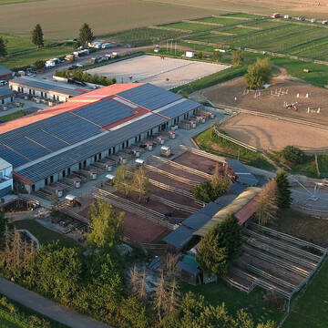
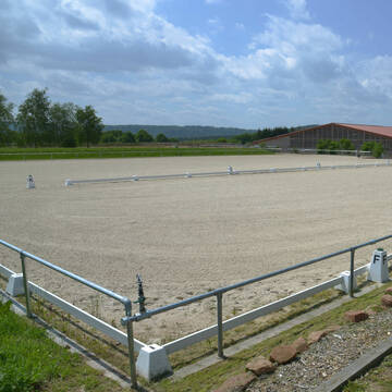
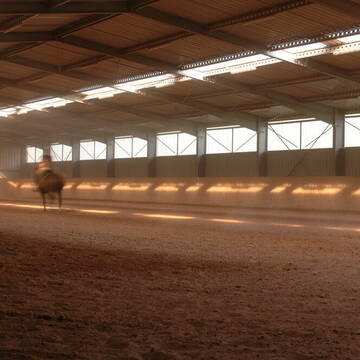
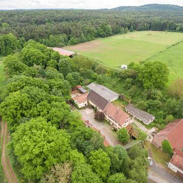
Reitanlage Fröhnerhof
Mehlingen
Reitanlage-Froehnerhof
@Reitanlage-Froehnerhof
Gastronomie
Geländestrecke
Vermieten
Führanlage
Laufband
Hengsthaltung möglich
21 weitere...
P+
Deprecated: Creation of dynamic property Zend_View_Helper_Ads::$adLink is deprecated in /var/www/stall-frei/htdocs/staging.stall-frei.de/library/Psf/View/Helper/Ads.php on line 108

Futtersack HeuToy, Fressbremse in pink
Mechtersen
STALL-FREIde Marketing
@STALL-FREI-Marketing
Stundenlange Beschäftigung die
Koliken vorbeugt, geringe Staubinhalation mit
steuerbarer Futterentnahme


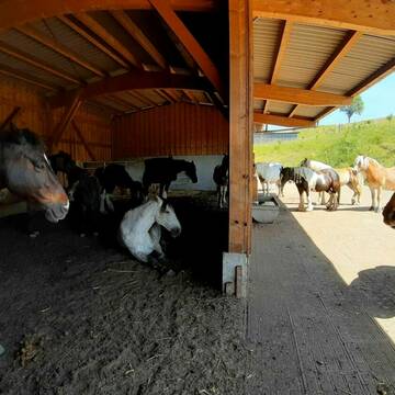

Die Pferdemeisterei moderner HIT-Aktivstall
Wartenberg-Rohrbach
Anna-Buhrmann
@Anna-Buhrmann
Freizeitstall
Geländestrecke
Vermieten
Hunde willkommen
Krankenbox
Allergikerstall
23 weitere...
P+


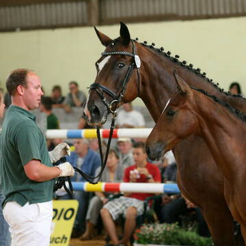
Boxen im Pferdezentrum Standenbühl zu Vermieten ...
Standenbühl
Mischa Stolze
@PferdezentrumStandenbuehl
Vermieten
Führanlage
Paddock
Allergikerstall
Hengsthaltung möglich
Außenboxen
Innenbox
13 weitere...
S


Heuberg Ranch - Weidehaltung die Natur zum Vorbild
Münchweiler an der Alsenz
Heuberg-Ranch
@Heuberg-Ranch
FN-Mitglied
Freizeitstall
Vermieten
Hunde willkommen
Krankenbox
Gnadenbrothof
Notfallboxen
20 weitere...
P+
Pferdepension Kühhof
Katzweiler
Dieter & Anne Kunz
@Kunz
Westernreiten
Pensions- und Gastboxen
Reithalle
Gnadenbrothof
Pferdezucht
Außenboxen
Offenstall
11 weitere...
P

Das Beste für die Hufe
Mechtersen
STALL-FREIde Marketing
@STALL-FREI-Marketing
Hufschmiede und Hufpfleger in Ihrer Nähe
Reitanlage Daubenborner Hof
Enkenbach - Alsenborn
Dr-med-Christine-Keller
@Dr-med-Christine-Keller
Freizeitstall
Geländestrecke
Vermieten
Longierzirkel/Roundpen
Parkplatz für Pferdeanhänger
Außenboxen
Innenbox
16 weitere...
P


Reitanlage Bischoff in 67806 Dörrmoschel
Dörrmoschel
Reitanlage Bischoff
@Reitanlage_bischoff
FN-Mitglied
Freizeitstall
Vermieten
Führanlage
Krankenbox
Allergikerstall
Fohlenaufzucht möglich
26 weitere...
P+
Reitanlage Gloede/ Guckenbiehl, Berghof/ Rodenbach
Rodenbach
Reitanlage Gloede/ Guckenbiehl
@Gloede
FN-Mitglied
Freizeitstall
Longierzirkel/Roundpen
Paddock
Gnadenbrothof
Pferdezucht
Außenboxen
Bewegungsstall
18 weitere...
P
Leider kein Vorschaubild
Leider kein Vorschaubild
FREIE BOXEN!!
Mehlbach
irena-zinssmeister
@irena-zinssmeister
Reithalle
Sattelkammer/Sattelschränke
Außenboxen
Innenbox
Biofutter
Vollpension
5 weitere...
aktuell
B


Stall Steinalb Pferdepension
Bann
Lisa Mayer
@StallSteinalb
Freizeitstall
Geländestrecke
Vermieten
Krankenbox
Longierzirkel/Roundpen
Gnadenbrothof
Zuchtstutenhaltung möglich
11 weitere...
P+
Deprecated: Creation of dynamic property Zend_View::$pageCount is deprecated in /var/www/stall-frei/htdocs/staging.stall-frei.de/library/vendor/shardj/zf1-future/library/Zend/View/Abstract.php on line 308
Deprecated: Creation of dynamic property Zend_View::$itemCountPerPage is deprecated in /var/www/stall-frei/htdocs/staging.stall-frei.de/library/vendor/shardj/zf1-future/library/Zend/View/Abstract.php on line 308
Deprecated: Creation of dynamic property Zend_View::$first is deprecated in /var/www/stall-frei/htdocs/staging.stall-frei.de/library/vendor/shardj/zf1-future/library/Zend/View/Abstract.php on line 308
Deprecated: Creation of dynamic property Zend_View::$current is deprecated in /var/www/stall-frei/htdocs/staging.stall-frei.de/library/vendor/shardj/zf1-future/library/Zend/View/Abstract.php on line 308
Deprecated: Creation of dynamic property Zend_View::$last is deprecated in /var/www/stall-frei/htdocs/staging.stall-frei.de/library/vendor/shardj/zf1-future/library/Zend/View/Abstract.php on line 308
Deprecated: Creation of dynamic property Zend_View::$next is deprecated in /var/www/stall-frei/htdocs/staging.stall-frei.de/library/vendor/shardj/zf1-future/library/Zend/View/Abstract.php on line 308
Deprecated: Creation of dynamic property Zend_View::$pagesInRange is deprecated in /var/www/stall-frei/htdocs/staging.stall-frei.de/library/vendor/shardj/zf1-future/library/Zend/View/Abstract.php on line 308
Deprecated: Creation of dynamic property Zend_View::$firstPageInRange is deprecated in /var/www/stall-frei/htdocs/staging.stall-frei.de/library/vendor/shardj/zf1-future/library/Zend/View/Abstract.php on line 308
Deprecated: Creation of dynamic property Zend_View::$lastPageInRange is deprecated in /var/www/stall-frei/htdocs/staging.stall-frei.de/library/vendor/shardj/zf1-future/library/Zend/View/Abstract.php on line 308
Deprecated: Creation of dynamic property Zend_View::$currentItemCount is deprecated in /var/www/stall-frei/htdocs/staging.stall-frei.de/library/vendor/shardj/zf1-future/library/Zend/View/Abstract.php on line 308
Deprecated: Creation of dynamic property Zend_View::$totalItemCount is deprecated in /var/www/stall-frei/htdocs/staging.stall-frei.de/library/vendor/shardj/zf1-future/library/Zend/View/Abstract.php on line 308
Deprecated: Creation of dynamic property Zend_View::$firstItemNumber is deprecated in /var/www/stall-frei/htdocs/staging.stall-frei.de/library/vendor/shardj/zf1-future/library/Zend/View/Abstract.php on line 308
Deprecated: Creation of dynamic property Zend_View::$lastItemNumber is deprecated in /var/www/stall-frei/htdocs/staging.stall-frei.de/library/vendor/shardj/zf1-future/library/Zend/View/Abstract.php on line 308
Deprecated: Creation of dynamic property Zend_View::$router is deprecated in /var/www/stall-frei/htdocs/staging.stall-frei.de/library/vendor/shardj/zf1-future/library/Zend/View/Abstract.php on line 308
Deprecated: Creation of dynamic property Zend_View::$urlParams is deprecated in /var/www/stall-frei/htdocs/staging.stall-frei.de/library/vendor/shardj/zf1-future/library/Zend/View/Abstract.php on line 308
Deprecated: Creation of dynamic property Zend_View::$showAds is deprecated in /var/www/stall-frei/htdocs/staging.stall-frei.de/library/vendor/shardj/zf1-future/library/Zend/View/Abstract.php on line 308
Deprecated: Creation of dynamic property Zend_View::$objectIds is deprecated in /var/www/stall-frei/htdocs/staging.stall-frei.de/library/vendor/shardj/zf1-future/library/Zend/View/Abstract.php on line 308
Deprecated: Creation of dynamic property Zend_View::$showNavbar is deprecated in /var/www/stall-frei/htdocs/staging.stall-frei.de/library/vendor/shardj/zf1-future/library/Zend/View/Abstract.php on line 308
Deprecated: Creation of dynamic property Zend_View::$showBreadcrumb is deprecated in /var/www/stall-frei/htdocs/staging.stall-frei.de/library/vendor/shardj/zf1-future/library/Zend/View/Abstract.php on line 308
Deprecated: Creation of dynamic property Zend_View::$showFooter is deprecated in /var/www/stall-frei/htdocs/staging.stall-frei.de/library/vendor/shardj/zf1-future/library/Zend/View/Abstract.php on line 308
Deprecated: Creation of dynamic property Zend_View::$showInternalAds is deprecated in /var/www/stall-frei/htdocs/staging.stall-frei.de/library/vendor/shardj/zf1-future/library/Zend/View/Abstract.php on line 308
Deprecated: Creation of dynamic property Zend_View::$blNoContent is deprecated in /var/www/stall-frei/htdocs/staging.stall-frei.de/library/vendor/shardj/zf1-future/library/Zend/View/Abstract.php on line 308
Deprecated: Creation of dynamic property Zend_View::$sMetaDesc is deprecated in /var/www/stall-frei/htdocs/staging.stall-frei.de/library/vendor/shardj/zf1-future/library/Zend/View/Abstract.php on line 308
Deprecated: Creation of dynamic property Zend_View::$useGmaps is deprecated in /var/www/stall-frei/htdocs/staging.stall-frei.de/library/vendor/shardj/zf1-future/library/Zend/View/Abstract.php on line 308
Deprecated: Creation of dynamic property Zend_View::$touches is deprecated in /var/www/stall-frei/htdocs/staging.stall-frei.de/library/vendor/shardj/zf1-future/library/Zend/View/Abstract.php on line 308
Deprecated: Creation of dynamic property Zend_View::$oProject is deprecated in /var/www/stall-frei/htdocs/staging.stall-frei.de/library/vendor/shardj/zf1-future/library/Zend/View/Abstract.php on line 308
Deprecated: Creation of dynamic property Zend_View::$pageHeadline is deprecated in /var/www/stall-frei/htdocs/staging.stall-frei.de/library/vendor/shardj/zf1-future/library/Zend/View/Abstract.php on line 308
Deprecated: Creation of dynamic property Zend_View::$disableLocationField is deprecated in /var/www/stall-frei/htdocs/staging.stall-frei.de/library/vendor/shardj/zf1-future/library/Zend/View/Abstract.php on line 308
Deprecated: Creation of dynamic property Zend_View::$isSearch is deprecated in /var/www/stall-frei/htdocs/staging.stall-frei.de/library/vendor/shardj/zf1-future/library/Zend/View/Abstract.php on line 308
Deprecated: Creation of dynamic property Zend_View::$pageTitle is deprecated in /var/www/stall-frei/htdocs/staging.stall-frei.de/library/vendor/shardj/zf1-future/library/Zend/View/Abstract.php on line 308
Deprecated: Creation of dynamic property Psf_Form_Element_Text::$class is deprecated in /var/www/stall-frei/htdocs/staging.stall-frei.de/library/vendor/shardj/zf1-future/library/Zend/Form/Element.php on line 874
Deprecated: Creation of dynamic property Psf_Form_Element_Text::$size is deprecated in /var/www/stall-frei/htdocs/staging.stall-frei.de/library/vendor/shardj/zf1-future/library/Zend/Form/Element.php on line 874
Deprecated: Creation of dynamic property Psf_Form_Element_Text::$placeholder is deprecated in /var/www/stall-frei/htdocs/staging.stall-frei.de/library/vendor/shardj/zf1-future/library/Zend/Form/Element.php on line 874
Deprecated: Creation of dynamic property Psf_Form_Element_Hidden::$class is deprecated in /var/www/stall-frei/htdocs/staging.stall-frei.de/library/vendor/shardj/zf1-future/library/Zend/Form/Element.php on line 874
Deprecated: Creation of dynamic property Psf_Form_Element_Hidden::$class is deprecated in /var/www/stall-frei/htdocs/staging.stall-frei.de/library/vendor/shardj/zf1-future/library/Zend/Form/Element.php on line 874
Deprecated: Creation of dynamic property Psf_Form_Element_Hidden::$class is deprecated in /var/www/stall-frei/htdocs/staging.stall-frei.de/library/vendor/shardj/zf1-future/library/Zend/Form/Element.php on line 874
Deprecated: Creation of dynamic property Psf_Form_Element_Hidden::$class is deprecated in /var/www/stall-frei/htdocs/staging.stall-frei.de/library/vendor/shardj/zf1-future/library/Zend/Form/Element.php on line 874
Deprecated: Creation of dynamic property Psf_Form_Element_Select::$class is deprecated in /var/www/stall-frei/htdocs/staging.stall-frei.de/library/vendor/shardj/zf1-future/library/Zend/Form/Element.php on line 874
Deprecated: Creation of dynamic property Psf_Form_Element_Select::$class is deprecated in /var/www/stall-frei/htdocs/staging.stall-frei.de/library/vendor/shardj/zf1-future/library/Zend/Form/Element.php on line 874
Deprecated: Creation of dynamic property Psf_Form_Element_Select::$class is deprecated in /var/www/stall-frei/htdocs/staging.stall-frei.de/library/vendor/shardj/zf1-future/library/Zend/Form/Element.php on line 874
Deprecated: Creation of dynamic property Psf_Form_Element_Select::$class is deprecated in /var/www/stall-frei/htdocs/staging.stall-frei.de/library/vendor/shardj/zf1-future/library/Zend/Form/Element.php on line 874
Deprecated: Creation of dynamic property Psf_Form_Element_Text::$class is deprecated in /var/www/stall-frei/htdocs/staging.stall-frei.de/library/vendor/shardj/zf1-future/library/Zend/Form/Element.php on line 874
Deprecated: Creation of dynamic property Psf_Form_Element_Checkbox::$label is deprecated in /var/www/stall-frei/htdocs/staging.stall-frei.de/library/vendor/shardj/zf1-future/library/Zend/Form/Element.php on line 874
Deprecated: Creation of dynamic property Zend_View::$sort is deprecated in /var/www/stall-frei/htdocs/staging.stall-frei.de/library/vendor/shardj/zf1-future/library/Zend/View/Abstract.php on line 308
Deprecated: Creation of dynamic property Zend_View::$searchLocation is deprecated in /var/www/stall-frei/htdocs/staging.stall-frei.de/library/vendor/shardj/zf1-future/library/Zend/View/Abstract.php on line 308
Deprecated: Creation of dynamic property Zend_View::$locationHint is deprecated in /var/www/stall-frei/htdocs/staging.stall-frei.de/library/vendor/shardj/zf1-future/library/Zend/View/Abstract.php on line 308
Psf_GeoCoder_Abstract::getLocation: Otterberg Get Location CachedOrLive
Psf_GeoCoder_Abstract::getCachedOrLive: Otterberg
Psf_GeoCoder_OpenCageData::makeApiRequest: response:
Array
(
[documentation] => https://opencagedata.com/api
[licenses] => Array
(
[0] => Array
(
[name] => see attribution guide
[url] => https://opencagedata.com/credits
)
)
[results] => Array
(
[0] => Array
(
[bounds] => Array
(
[northeast] => Array
(
[lat] => 49.5383884
[lng] => 7.8421197
)
[southwest] => Array
(
[lat] => 49.4818159
[lng] => 7.7249837
)
)
[components] => Array
(
[ISO_3166-1_alpha-2] => DE
[ISO_3166-1_alpha-3] => DEU
[ISO_3166-2] => Array
(
[0] => DE-RP
)
[_category] => place
[_normalized_city] => Otterberg
[_type] => city
[continent] => Europe
[country] => Deutschland
[country_code] => de
[county] => Landkreis Kaiserslautern
[municipality] => Otterbach-Otterberg
[political_union] => European Union
[postcode] => 67697
[state] => Rheinland-Pfalz
[state_code] => RP
[town] => Otterberg
)
[confidence] => 7
[formatted] => 67697 Otterberg, Deutschland
[geometry] => Array
(
[lat] => 49.5008961
[lng] => 7.7723649
)
)
[1] => Array
(
[bounds] => Array
(
[northeast] => Array
(
[lat] => 51.1383797
[lng] => 13.9845619
)
[southwest] => Array
(
[lat] => 51.1382797
[lng] => 13.9844619
)
)
[components] => Array
(
[ISO_3166-1_alpha-2] => DE
[ISO_3166-1_alpha-3] => DEU
[ISO_3166-2] => Array
(
[0] => DE-SN
)
[_category] => natural/water
[_normalized_city] => Großröhrsdorf
[_type] => peak
[continent] => Europe
[country] => Deutschland
[country_code] => de
[county] => Bautzen
[peak] => Otterberg
[political_union] => European Union
[postcode] => 01477
[state] => Sachsen
[state_code] => SN
[town] => Großröhrsdorf
)
[confidence] => 9
[formatted] => Otterberg, 01477 Großröhrsdorf, Deutschland
[geometry] => Array
(
[lat] => 51.1383297
[lng] => 13.9845119
)
)
[2] => Array
(
[bounds] => Array
(
[northeast] => Array
(
[lat] => 51.0125933
[lng] => 13.1548634
)
[southwest] => Array
(
[lat] => 51.0124933
[lng] => 13.1547634
)
)
[components] => Array
(
[ISO_3166-1_alpha-2] => DE
[ISO_3166-1_alpha-3] => DEU
[ISO_3166-2] => Array
(
[0] => DE-SN
)
[_category] => natural/water
[_normalized_city] => Striegistal
[_type] => peak
[city] => Striegistal
[continent] => Europe
[country] => Deutschland
[country_code] => de
[county] => Mittelsachsen
[peak] => Otterberg
[political_union] => European Union
[postcode] => 09661
[state] => Sachsen
[state_code] => SN
)
[confidence] => 9
[formatted] => Otterberg, 09661 Striegistal, Deutschland
[geometry] => Array
(
[lat] => 51.0125433
[lng] => 13.1548134
)
)
[3] => Array
(
[bounds] => Array
(
[northeast] => Array
(
[lat] => 53.2427888
[lng] => 9.7176398
)
[southwest] => Array
(
[lat] => 53.2426888
[lng] => 9.7175398
)
)
[components] => Array
(
[ISO_3166-1_alpha-2] => DE
[ISO_3166-1_alpha-3] => DEU
[ISO_3166-2] => Array
(
[0] => DE-NI
)
[_category] => natural/water
[_normalized_city] => Otter
[_type] => peak
[continent] => Europe
[country] => Deutschland
[country_code] => de
[county] => Landkreis Harburg
[municipality] => Samtgemeinde Tostedt
[peak] => Otterberg
[political_union] => European Union
[postcode] => 21259
[state] => Niedersachsen
[state_code] => NI
[village] => Otter
)
[confidence] => 9
[formatted] => Otterberg, 21259 Otter, Deutschland
[geometry] => Array
(
[lat] => 53.2427388
[lng] => 9.7175898
)
)
[4] => Array
(
[bounds] => Array
(
[northeast] => Array
(
[lat] => 49.7867527
[lng] => 7.8836694
)
[southwest] => Array
(
[lat] => 49.7866527
[lng] => 7.8835694
)
)
[components] => Array
(
[ISO_3166-1_alpha-2] => DE
[ISO_3166-1_alpha-3] => DEU
[ISO_3166-2] => Array
(
[0] => DE-RP
)
[_category] => natural/water
[_normalized_city] => Fürfeld
[_type] => peak
[continent] => Europe
[country] => Deutschland
[country_code] => de
[county] => Bad Kreuznach
[peak] => Otterberg
[political_union] => European Union
[postcode] => 55583
[state] => Rheinland-Pfalz
[state_code] => RP
[village] => Fürfeld
)
[confidence] => 9
[formatted] => Otterberg, 55583 Fürfeld, Deutschland
[geometry] => Array
(
[lat] => 49.7867027
[lng] => 7.8836194
)
)
[5] => Array
(
[bounds] => Array
(
[northeast] => Array
(
[lat] => 50.4246281
[lng] => 12.6028114
)
[southwest] => Array
(
[lat] => 50.4245281
[lng] => 12.6027114
)
)
[components] => Array
(
[ISO_3166-1_alpha-2] => DE
[ISO_3166-1_alpha-3] => DEU
[ISO_3166-2] => Array
(
[0] => DE-SN
)
[_category] => natural/water
[_normalized_city] => Eibenstock
[_type] => peak
[continent] => Europe
[country] => Deutschland
[country_code] => de
[county] => Erzgebirgskreis
[peak] => Otterberg
[political_union] => European Union
[state] => Sachsen
[state_code] => SN
[town] => Eibenstock
)
[confidence] => 9
[formatted] => Otterberg, Eibenstock, Sachsen, Deutschland
[geometry] => Array
(
[lat] => 50.4245781
[lng] => 12.6027614
)
)
[6] => Array
(
[bounds] => Array
(
[northeast] => Array
(
[lat] => 50.319421
[lng] => 11.9462688
)
[southwest] => Array
(
[lat] => 50.279421
[lng] => 11.9062688
)
)
[components] => Array
(
[ISO_3166-1_alpha-2] => DE
[ISO_3166-1_alpha-3] => DEU
[ISO_3166-2] => Array
(
[0] => DE-BY
)
[_category] => place
[_normalized_city] => Hof
[_type] => neighbourhood
[continent] => Europe
[country] => Deutschland
[country_code] => de
[political_union] => European Union
[postcode] => 95032
[state] => Bayern
[state_code] => BY
[suburb] => Otterberg
[town] => Hof
)
[confidence] => 7
[formatted] => 95032 Hof, Deutschland
[geometry] => Array
(
[lat] => 50.299421
[lng] => 11.9262688
)
)
[7] => Array
(
[components] => Array
(
[ISO_3166-1_alpha-2] => FR
[ISO_3166-1_alpha-3] => FRA
[ISO_3166-2] => Array
(
[0] => FR-GES
[1] => FR-6AE
[2] => FR-67
)
[_category] => road
[_normalized_city] => Landersheim
[_type] => road
[city] => Landersheim
[continent] => Europe
[country] => France
[country_code] => fr
[county] => Bas-Rhin
[local_authority] => Communauté de communes du Pays de Saverne
[political_union] => European Union
[postcode] => 67700
[road] => Rue de l’Osterberg
[state] => Grand Est
[state_code] => GES
)
[confidence] => 3
[formatted] => Rue de l’Osterberg, 67700 Landersheim, France
[geometry] => Array
(
[lat] => 48.689417
[lng] => 7.490751
)
)
[8] => Array
(
[components] => Array
(
[ISO_3166-1_alpha-2] => FR
[ISO_3166-1_alpha-3] => FRA
[ISO_3166-2] => Array
(
[0] => FR-GES
[1] => FR-6AE
[2] => FR-68
)
[_category] => road
[_normalized_city] => Bettendorf
[_type] => road
[city] => Bettendorf
[continent] => Europe
[country] => France
[country_code] => fr
[county] => Haut-Rhin
[local_authority] => Communauté de communes Sundgau
[political_union] => European Union
[postcode] => 68560
[road] => Rue de l'Oberberg
[state] => Grand Est
[state_code] => GES
)
[confidence] => 3
[formatted] => Rue de l'Oberberg, 68560 Bettendorf, France
[geometry] => Array
(
[lat] => 47.589073
[lng] => 7.275689
)
)
[9] => Array
(
[components] => Array
(
[ISO_3166-1_alpha-2] => FR
[ISO_3166-1_alpha-3] => FRA
[ISO_3166-2] => Array
(
[0] => FR-GES
[1] => FR-6AE
[2] => FR-67
)
[_category] => road
[_normalized_city] => Barr
[_type] => road
[city] => Barr
[continent] => Europe
[country] => France
[country_code] => fr
[county] => Bas-Rhin
[local_authority] => Communauté de communes du Pays de Barr
[political_union] => European Union
[postcode] => 67140
[road] => Chemin de l’Oberberg
[state] => Grand Est
[state_code] => GES
)
[confidence] => 2
[formatted] => Chemin de l’Oberberg, 67140 Barr, France
[geometry] => Array
(
[lat] => 48.402013
[lng] => 7.447941
)
)
)
[status] => Array
(
[code] => 200
[message] => OK
)
[stay_informed] => Array
(
[blog] => https://blog.opencagedata.com
[mastodon] => https://en.osm.town/@opencage
)
[thanks] => For using an OpenCage API
[timestamp] => Array
(
[created_http] => Fri, 06 Feb 2026 14:08:36 GMT
[created_unix] => 1770386916
)
[total_results] => 10
)
Psf_GeoCoder_Abstract::convertLocationResult
{"documentation":"https:\/\/opencagedata.com\/api","licenses":[{"name":"see attribution guide","url":"https:\/\/opencagedata.com\/credits"}],"results":[{"bounds":{"northeast":{"lat":49.5383884,"lng":7.8421197},"southwest":{"lat":49.4818159,"lng":7.7249837}},"components":{"ISO_3166-1_alpha-2":"DE","ISO_3166-1_alpha-3":"DEU","ISO_3166-2":["DE-RP"],"_category":"place","_normalized_city":"Otterberg","_type":"city","continent":"Europe","country":"Deutschland","country_code":"de","county":"Landkreis Kaiserslautern","municipality":"Otterbach-Otterberg","political_union":"European Union","postcode":"67697","state":"Rheinland-Pfalz","state_code":"RP","town":"Otterberg"},"confidence":7,"formatted":"67697 Otterberg, Deutschland","geometry":{"lat":49.5008961,"lng":7.7723649}},{"bounds":{"northeast":{"lat":51.1383797,"lng":13.9845619},"southwest":{"lat":51.1382797,"lng":13.9844619}},"components":{"ISO_3166-1_alpha-2":"DE","ISO_3166-1_alpha-3":"DEU","ISO_3166-2":["DE-SN"],"_category":"natural\/water","_normalized_city":"Gro\u00dfr\u00f6hrsdorf","_type":"peak","continent":"Europe","country":"Deutschland","country_code":"de","county":"Bautzen","peak":"Otterberg","political_union":"European Union","postcode":"01477","state":"Sachsen","state_code":"SN","town":"Gro\u00dfr\u00f6hrsdorf"},"confidence":9,"formatted":"Otterberg, 01477 Gro\u00dfr\u00f6hrsdorf, Deutschland","geometry":{"lat":51.1383297,"lng":13.9845119}},{"bounds":{"northeast":{"lat":51.0125933,"lng":13.1548634},"southwest":{"lat":51.0124933,"lng":13.1547634}},"components":{"ISO_3166-1_alpha-2":"DE","ISO_3166-1_alpha-3":"DEU","ISO_3166-2":["DE-SN"],"_category":"natural\/water","_normalized_city":"Striegistal","_type":"peak","city":"Striegistal","continent":"Europe","country":"Deutschland","country_code":"de","county":"Mittelsachsen","peak":"Otterberg","political_union":"European Union","postcode":"09661","state":"Sachsen","state_code":"SN"},"confidence":9,"formatted":"Otterberg, 09661 Striegistal, Deutschland","geometry":{"lat":51.0125433,"lng":13.1548134}},{"bounds":{"northeast":{"lat":53.2427888,"lng":9.7176398},"southwest":{"lat":53.2426888,"lng":9.7175398}},"components":{"ISO_3166-1_alpha-2":"DE","ISO_3166-1_alpha-3":"DEU","ISO_3166-2":["DE-NI"],"_category":"natural\/water","_normalized_city":"Otter","_type":"peak","continent":"Europe","country":"Deutschland","country_code":"de","county":"Landkreis Harburg","municipality":"Samtgemeinde Tostedt","peak":"Otterberg","political_union":"European Union","postcode":"21259","state":"Niedersachsen","state_code":"NI","village":"Otter"},"confidence":9,"formatted":"Otterberg, 21259 Otter, Deutschland","geometry":{"lat":53.2427388,"lng":9.7175898}},{"bounds":{"northeast":{"lat":49.7867527,"lng":7.8836694},"southwest":{"lat":49.7866527,"lng":7.8835694}},"components":{"ISO_3166-1_alpha-2":"DE","ISO_3166-1_alpha-3":"DEU","ISO_3166-2":["DE-RP"],"_category":"natural\/water","_normalized_city":"F\u00fcrfeld","_type":"peak","continent":"Europe","country":"Deutschland","country_code":"de","county":"Bad Kreuznach","peak":"Otterberg","political_union":"European Union","postcode":"55583","state":"Rheinland-Pfalz","state_code":"RP","village":"F\u00fcrfeld"},"confidence":9,"formatted":"Otterberg, 55583 F\u00fcrfeld, Deutschland","geometry":{"lat":49.7867027,"lng":7.8836194}},{"bounds":{"northeast":{"lat":50.4246281,"lng":12.6028114},"southwest":{"lat":50.4245281,"lng":12.6027114}},"components":{"ISO_3166-1_alpha-2":"DE","ISO_3166-1_alpha-3":"DEU","ISO_3166-2":["DE-SN"],"_category":"natural\/water","_normalized_city":"Eibenstock","_type":"peak","continent":"Europe","country":"Deutschland","country_code":"de","county":"Erzgebirgskreis","peak":"Otterberg","political_union":"European Union","state":"Sachsen","state_code":"SN","town":"Eibenstock"},"confidence":9,"formatted":"Otterberg, Eibenstock, Sachsen, Deutschland","geometry":{"lat":50.4245781,"lng":12.6027614}},{"bounds":{"northeast":{"lat":50.319421,"lng":11.9462688},"southwest":{"lat":50.279421,"lng":11.9062688}},"components":{"ISO_3166-1_alpha-2":"DE","ISO_3166-1_alpha-3":"DEU","ISO_3166-2":["DE-BY"],"_category":"place","_normalized_city":"Hof","_type":"neighbourhood","continent":"Europe","country":"Deutschland","country_code":"de","political_union":"European Union","postcode":"95032","state":"Bayern","state_code":"BY","suburb":"Otterberg","town":"Hof"},"confidence":7,"formatted":"95032 Hof, Deutschland","geometry":{"lat":50.299421,"lng":11.9262688}},{"components":{"ISO_3166-1_alpha-2":"FR","ISO_3166-1_alpha-3":"FRA","ISO_3166-2":["FR-GES","FR-6AE","FR-67"],"_category":"road","_normalized_city":"Landersheim","_type":"road","city":"Landersheim","continent":"Europe","country":"France","country_code":"fr","county":"Bas-Rhin","local_authority":"Communaut\u00e9 de communes du Pays de Saverne","political_union":"European Union","postcode":"67700","road":"Rue de l\u2019Osterberg","state":"Grand Est","state_code":"GES"},"confidence":3,"formatted":"Rue de l\u2019Osterberg, 67700 Landersheim, France","geometry":{"lat":48.689417,"lng":7.490751}},{"components":{"ISO_3166-1_alpha-2":"FR","ISO_3166-1_alpha-3":"FRA","ISO_3166-2":["FR-GES","FR-6AE","FR-68"],"_category":"road","_normalized_city":"Bettendorf","_type":"road","city":"Bettendorf","continent":"Europe","country":"France","country_code":"fr","county":"Haut-Rhin","local_authority":"Communaut\u00e9 de communes Sundgau","political_union":"European Union","postcode":"68560","road":"Rue de l'Oberberg","state":"Grand Est","state_code":"GES"},"confidence":3,"formatted":"Rue de l'Oberberg, 68560 Bettendorf, France","geometry":{"lat":47.589073,"lng":7.275689}},{"components":{"ISO_3166-1_alpha-2":"FR","ISO_3166-1_alpha-3":"FRA","ISO_3166-2":["FR-GES","FR-6AE","FR-67"],"_category":"road","_normalized_city":"Barr","_type":"road","city":"Barr","continent":"Europe","country":"France","country_code":"fr","county":"Bas-Rhin","local_authority":"Communaut\u00e9 de communes du Pays de Barr","political_union":"European Union","postcode":"67140","road":"Chemin de l\u2019Oberberg","state":"Grand Est","state_code":"GES"},"confidence":2,"formatted":"Chemin de l\u2019Oberberg, 67140 Barr, France","geometry":{"lat":48.402013,"lng":7.447941}}],"status":{"code":200,"message":"OK"},"stay_informed":{"blog":"https:\/\/blog.opencagedata.com","mastodon":"https:\/\/en.osm.town\/@opencage"},"thanks":"For using an OpenCage API","timestamp":{"created_http":"Fri, 06 Feb 2026 14:08:36 GMT","created_unix":1770386916},"total_results":10}Array
(
[0] => stdClass Object
(
[bounds] => stdClass Object
(
[northeast] => stdClass Object
(
[lat] => 49.5383884
[lng] => 7.8421197
)
[southwest] => stdClass Object
(
[lat] => 49.4818159
[lng] => 7.7249837
)
)
[components] => stdClass Object
(
[ISO_3166-1_alpha-2] => DE
[ISO_3166-1_alpha-3] => DEU
[ISO_3166-2] => Array
(
[0] => DE-RP
)
[_category] => place
[_normalized_city] => Otterberg
[_type] => city
[continent] => Europe
[country] => Deutschland
[country_code] => de
[county] => Landkreis Kaiserslautern
[municipality] => Otterbach-Otterberg
[political_union] => European Union
[postcode] => 67697
[state] => Rheinland-Pfalz
[state_code] => RP
[town] => Otterberg
)
[confidence] => 7
[formatted] => 67697 Otterberg, Deutschland
[geometry] => stdClass Object
(
[lat] => 49.5008961
[lng] => 7.7723649
)
)
[1] => stdClass Object
(
[bounds] => stdClass Object
(
[northeast] => stdClass Object
(
[lat] => 51.1383797
[lng] => 13.9845619
)
[southwest] => stdClass Object
(
[lat] => 51.1382797
[lng] => 13.9844619
)
)
[components] => stdClass Object
(
[ISO_3166-1_alpha-2] => DE
[ISO_3166-1_alpha-3] => DEU
[ISO_3166-2] => Array
(
[0] => DE-SN
)
[_category] => natural/water
[_normalized_city] => Großröhrsdorf
[_type] => peak
[continent] => Europe
[country] => Deutschland
[country_code] => de
[county] => Bautzen
[peak] => Otterberg
[political_union] => European Union
[postcode] => 01477
[state] => Sachsen
[state_code] => SN
[town] => Großröhrsdorf
)
[confidence] => 9
[formatted] => Otterberg, 01477 Großröhrsdorf, Deutschland
[geometry] => stdClass Object
(
[lat] => 51.1383297
[lng] => 13.9845119
)
)
[2] => stdClass Object
(
[bounds] => stdClass Object
(
[northeast] => stdClass Object
(
[lat] => 51.0125933
[lng] => 13.1548634
)
[southwest] => stdClass Object
(
[lat] => 51.0124933
[lng] => 13.1547634
)
)
[components] => stdClass Object
(
[ISO_3166-1_alpha-2] => DE
[ISO_3166-1_alpha-3] => DEU
[ISO_3166-2] => Array
(
[0] => DE-SN
)
[_category] => natural/water
[_normalized_city] => Striegistal
[_type] => peak
[city] => Striegistal
[continent] => Europe
[country] => Deutschland
[country_code] => de
[county] => Mittelsachsen
[peak] => Otterberg
[political_union] => European Union
[postcode] => 09661
[state] => Sachsen
[state_code] => SN
)
[confidence] => 9
[formatted] => Otterberg, 09661 Striegistal, Deutschland
[geometry] => stdClass Object
(
[lat] => 51.0125433
[lng] => 13.1548134
)
)
[3] => stdClass Object
(
[bounds] => stdClass Object
(
[northeast] => stdClass Object
(
[lat] => 53.2427888
[lng] => 9.7176398
)
[southwest] => stdClass Object
(
[lat] => 53.2426888
[lng] => 9.7175398
)
)
[components] => stdClass Object
(
[ISO_3166-1_alpha-2] => DE
[ISO_3166-1_alpha-3] => DEU
[ISO_3166-2] => Array
(
[0] => DE-NI
)
[_category] => natural/water
[_normalized_city] => Otter
[_type] => peak
[continent] => Europe
[country] => Deutschland
[country_code] => de
[county] => Landkreis Harburg
[municipality] => Samtgemeinde Tostedt
[peak] => Otterberg
[political_union] => European Union
[postcode] => 21259
[state] => Niedersachsen
[state_code] => NI
[village] => Otter
)
[confidence] => 9
[formatted] => Otterberg, 21259 Otter, Deutschland
[geometry] => stdClass Object
(
[lat] => 53.2427388
[lng] => 9.7175898
)
)
[4] => stdClass Object
(
[bounds] => stdClass Object
(
[northeast] => stdClass Object
(
[lat] => 49.7867527
[lng] => 7.8836694
)
[southwest] => stdClass Object
(
[lat] => 49.7866527
[lng] => 7.8835694
)
)
[components] => stdClass Object
(
[ISO_3166-1_alpha-2] => DE
[ISO_3166-1_alpha-3] => DEU
[ISO_3166-2] => Array
(
[0] => DE-RP
)
[_category] => natural/water
[_normalized_city] => Fürfeld
[_type] => peak
[continent] => Europe
[country] => Deutschland
[country_code] => de
[county] => Bad Kreuznach
[peak] => Otterberg
[political_union] => European Union
[postcode] => 55583
[state] => Rheinland-Pfalz
[state_code] => RP
[village] => Fürfeld
)
[confidence] => 9
[formatted] => Otterberg, 55583 Fürfeld, Deutschland
[geometry] => stdClass Object
(
[lat] => 49.7867027
[lng] => 7.8836194
)
)
[5] => stdClass Object
(
[bounds] => stdClass Object
(
[northeast] => stdClass Object
(
[lat] => 50.4246281
[lng] => 12.6028114
)
[southwest] => stdClass Object
(
[lat] => 50.4245281
[lng] => 12.6027114
)
)
[components] => stdClass Object
(
[ISO_3166-1_alpha-2] => DE
[ISO_3166-1_alpha-3] => DEU
[ISO_3166-2] => Array
(
[0] => DE-SN
)
[_category] => natural/water
[_normalized_city] => Eibenstock
[_type] => peak
[continent] => Europe
[country] => Deutschland
[country_code] => de
[county] => Erzgebirgskreis
[peak] => Otterberg
[political_union] => European Union
[state] => Sachsen
[state_code] => SN
[town] => Eibenstock
)
[confidence] => 9
[formatted] => Otterberg, Eibenstock, Sachsen, Deutschland
[geometry] => stdClass Object
(
[lat] => 50.4245781
[lng] => 12.6027614
)
)
[6] => stdClass Object
(
[bounds] => stdClass Object
(
[northeast] => stdClass Object
(
[lat] => 50.319421
[lng] => 11.9462688
)
[southwest] => stdClass Object
(
[lat] => 50.279421
[lng] => 11.9062688
)
)
[components] => stdClass Object
(
[ISO_3166-1_alpha-2] => DE
[ISO_3166-1_alpha-3] => DEU
[ISO_3166-2] => Array
(
[0] => DE-BY
)
[_category] => place
[_normalized_city] => Hof
[_type] => neighbourhood
[continent] => Europe
[country] => Deutschland
[country_code] => de
[political_union] => European Union
[postcode] => 95032
[state] => Bayern
[state_code] => BY
[suburb] => Otterberg
[town] => Hof
)
[confidence] => 7
[formatted] => 95032 Hof, Deutschland
[geometry] => stdClass Object
(
[lat] => 50.299421
[lng] => 11.9262688
)
)
[7] => stdClass Object
(
[components] => stdClass Object
(
[ISO_3166-1_alpha-2] => FR
[ISO_3166-1_alpha-3] => FRA
[ISO_3166-2] => Array
(
[0] => FR-GES
[1] => FR-6AE
[2] => FR-67
)
[_category] => road
[_normalized_city] => Landersheim
[_type] => road
[city] => Landersheim
[continent] => Europe
[country] => France
[country_code] => fr
[county] => Bas-Rhin
[local_authority] => Communauté de communes du Pays de Saverne
[political_union] => European Union
[postcode] => 67700
[road] => Rue de l’Osterberg
[state] => Grand Est
[state_code] => GES
)
[confidence] => 3
[formatted] => Rue de l’Osterberg, 67700 Landersheim, France
[geometry] => stdClass Object
(
[lat] => 48.689417
[lng] => 7.490751
)
)
[8] => stdClass Object
(
[components] => stdClass Object
(
[ISO_3166-1_alpha-2] => FR
[ISO_3166-1_alpha-3] => FRA
[ISO_3166-2] => Array
(
[0] => FR-GES
[1] => FR-6AE
[2] => FR-68
)
[_category] => road
[_normalized_city] => Bettendorf
[_type] => road
[city] => Bettendorf
[continent] => Europe
[country] => France
[country_code] => fr
[county] => Haut-Rhin
[local_authority] => Communauté de communes Sundgau
[political_union] => European Union
[postcode] => 68560
[road] => Rue de l'Oberberg
[state] => Grand Est
[state_code] => GES
)
[confidence] => 3
[formatted] => Rue de l'Oberberg, 68560 Bettendorf, France
[geometry] => stdClass Object
(
[lat] => 47.589073
[lng] => 7.275689
)
)
[9] => stdClass Object
(
[components] => stdClass Object
(
[ISO_3166-1_alpha-2] => FR
[ISO_3166-1_alpha-3] => FRA
[ISO_3166-2] => Array
(
[0] => FR-GES
[1] => FR-6AE
[2] => FR-67
)
[_category] => road
[_normalized_city] => Barr
[_type] => road
[city] => Barr
[continent] => Europe
[country] => France
[country_code] => fr
[county] => Bas-Rhin
[local_authority] => Communauté de communes du Pays de Barr
[political_union] => European Union
[postcode] => 67140
[road] => Chemin de l’Oberberg
[state] => Grand Est
[state_code] => GES
)
[confidence] => 2
[formatted] => Chemin de l’Oberberg, 67140 Barr, France
[geometry] => stdClass Object
(
[lat] => 48.402013
[lng] => 7.447941
)
)
)
Psf_GeoCoder_OpenCageData::getKeyMap: 0
stdClass Object
(
    [bounds] => stdClass Object
        (
            [northeast] => stdClass Object
                (
                    [lat] => 49.5383884
                    [lng] => 7.8421197
                )

            [southwest] => stdClass Object
                (
                    [lat] => 49.4818159
                    [lng] => 7.7249837
                )

        )

    [components] => stdClass Object
        (
            [ISO_3166-1_alpha-2] => DE
            [ISO_3166-1_alpha-3] => DEU
            [ISO_3166-2] => Array
                (
                    [0] => DE-RP
                )

            [_category] => place
            [_normalized_city] => Otterberg
            [_type] => city
            [continent] => Europe
            [country] => Deutschland
            [country_code] => de
            [county] => Landkreis Kaiserslautern
            [municipality] => Otterbach-Otterberg
            [political_union] => European Union
            [postcode] => 67697
            [state] => Rheinland-Pfalz
            [state_code] => RP
            [town] => Otterberg
        )

    [confidence] => 7
    [formatted] => 67697 Otterberg, Deutschland
    [geometry] => stdClass Object
        (
            [lat] => 49.5008961
            [lng] => 7.7723649
        )

)
Psf_GeoCoder_OpenCageData::getCounty: Kaiserslautern
Psf_GeoCoder_OpenCageData::addMissingData REFETCH!
Array
(
    [address] => 67697 Otterberg, Deutschland
    [type] => city
    [street] =>
    [city] => Otterberg
    [county] => Kaiserslautern
    [state] => Rheinland-Pfalz
    [zip] => 67697
    [country] => Deutschland
    [suburb] =>
    [countrycode] => de
    [latitude] => 49.5008961
    [longitude] => 7.7723649
    [accuracy] => 1
    [confidence] => 7
    [bounds] => stdClass Object
        (
            [northeast] => stdClass Object
                (
                    [lat] => 49.5383884
                    [lng] => 7.8421197
                )

            [southwest] => stdClass Object
                (
                    [lat] => 49.4818159
                    [lng] => 7.7249837
                )

        )

)
reformat!
Array
(
    [address] => 67697 Otterberg, Deutschland
    [type] => city
    [street] =>
    [city] => Otterberg
    [county] => Kaiserslautern
    [state] => Rheinland-Pfalz
    [zip] => 67697
    [country] => Deutschland
    [suburb] =>
    [countrycode] => de
    [latitude] => 49.5008961
    [longitude] => 7.7723649
    [accuracy] => 1
    [confidence] => 7
    [bounds] => stdClass Object
        (
            [northeast] => stdClass Object
                (
                    [lat] => 49.5383884
                    [lng] => 7.8421197
                )

            [southwest] => stdClass Object
                (
                    [lat] => 49.4818159
                    [lng] => 7.7249837
                )

        )

    [place] => 67697 Otterberg, Rheinland-Pfalz
    [hash] => 8dbd14f0db8442daf436b3c240fe4e5f
)
Psf_GeoCoder_OpenCageData::getKeyMap: 1
stdClass Object
(
    [bounds] => stdClass Object
        (
            [northeast] => stdClass Object
                (
                    [lat] => 51.1383797
                    [lng] => 13.9845619
                )

            [southwest] => stdClass Object
                (
                    [lat] => 51.1382797
                    [lng] => 13.9844619
                )

        )

    [components] => stdClass Object
        (
            [ISO_3166-1_alpha-2] => DE
            [ISO_3166-1_alpha-3] => DEU
            [ISO_3166-2] => Array
                (
                    [0] => DE-SN
                )

            [_category] => natural/water
            [_normalized_city] => Großröhrsdorf
            [_type] => peak
            [continent] => Europe
            [country] => Deutschland
            [country_code] => de
            [county] => Bautzen
            [peak] => Otterberg
            [political_union] => European Union
            [postcode] => 01477
            [state] => Sachsen
            [state_code] => SN
            [town] => Großröhrsdorf
        )

    [confidence] => 9
    [formatted] => Otterberg, 01477 Großröhrsdorf, Deutschland
    [geometry] => stdClass Object
        (
            [lat] => 51.1383297
            [lng] => 13.9845119
        )

)
Psf_GeoCoder_OpenCageData::getCounty: Bautzen
Psf_GeoCoder_OpenCageData::addMissingData REFETCH!
Array
(
    [address] => Otterberg, 01477 Großröhrsdorf, Deutschland
    [type] => peak
    [street] =>
    [city] => Großröhrsdorf
    [county] => Bautzen
    [state] => Sachsen
    [zip] => 01477
    [country] => Deutschland
    [suburb] =>
    [countrycode] => de
    [latitude] => 51.1383297
    [longitude] => 13.9845119
    [accuracy] => 1
    [confidence] => 9
    [bounds] => stdClass Object
        (
            [northeast] => stdClass Object
                (
                    [lat] => 51.1383797
                    [lng] => 13.9845619
                )

            [southwest] => stdClass Object
                (
                    [lat] => 51.1382797
                    [lng] => 13.9844619
                )

        )

)
reformat!
Array
(
    [address] => Otterberg, 01477 Großröhrsdorf, Deutschland
    [type] => peak
    [street] =>
    [city] => Großröhrsdorf
    [county] => Bautzen
    [state] => Sachsen
    [zip] => 01477
    [country] => Deutschland
    [suburb] =>
    [countrycode] => de
    [latitude] => 51.1383297
    [longitude] => 13.9845119
    [accuracy] => 1
    [confidence] => 9
    [bounds] => stdClass Object
        (
            [northeast] => stdClass Object
                (
                    [lat] => 51.1383797
                    [lng] => 13.9845619
                )

            [southwest] => stdClass Object
                (
                    [lat] => 51.1382797
                    [lng] => 13.9844619
                )

        )

    [place] => 01477 Großröhrsdorf, Sachsen
    [hash] => fd6798ae457cbb5c87262aad2d21ec55
)
Psf_GeoCoder_OpenCageData::getKeyMap: 2
stdClass Object
(
    [bounds] => stdClass Object
        (
            [northeast] => stdClass Object
                (
                    [lat] => 51.0125933
                    [lng] => 13.1548634
                )

            [southwest] => stdClass Object
                (
                    [lat] => 51.0124933
                    [lng] => 13.1547634
                )

        )

    [components] => stdClass Object
        (
            [ISO_3166-1_alpha-2] => DE
            [ISO_3166-1_alpha-3] => DEU
            [ISO_3166-2] => Array
                (
                    [0] => DE-SN
                )

            [_category] => natural/water
            [_normalized_city] => Striegistal
            [_type] => peak
            [city] => Striegistal
            [continent] => Europe
            [country] => Deutschland
            [country_code] => de
            [county] => Mittelsachsen
            [peak] => Otterberg
            [political_union] => European Union
            [postcode] => 09661
            [state] => Sachsen
            [state_code] => SN
        )

    [confidence] => 9
    [formatted] => Otterberg, 09661 Striegistal, Deutschland
    [geometry] => stdClass Object
        (
            [lat] => 51.0125433
            [lng] => 13.1548134
        )

)
Psf_GeoCoder_OpenCageData::getCounty: Mittelsachsen
Psf_GeoCoder_OpenCageData::addMissingData REFETCH!
Array
(
    [address] => Otterberg, 09661 Striegistal, Deutschland
    [type] => peak
    [street] =>
    [city] => Striegistal
    [county] => Mittelsachsen
    [state] => Sachsen
    [zip] => 09661
    [country] => Deutschland
    [suburb] =>
    [countrycode] => de
    [latitude] => 51.0125433
    [longitude] => 13.1548134
    [accuracy] => 1
    [confidence] => 9
    [bounds] => stdClass Object
        (
            [northeast] => stdClass Object
                (
                    [lat] => 51.0125933
                    [lng] => 13.1548634
                )

            [southwest] => stdClass Object
                (
                    [lat] => 51.0124933
                    [lng] => 13.1547634
                )

        )

)
reformat!
Array
(
    [address] => Otterberg, 09661 Striegistal, Deutschland
    [type] => peak
    [street] =>
    [city] => Striegistal
    [county] => Mittelsachsen
    [state] => Sachsen
    [zip] => 09661
    [country] => Deutschland
    [suburb] =>
    [countrycode] => de
    [latitude] => 51.0125433
    [longitude] => 13.1548134
    [accuracy] => 1
    [confidence] => 9
    [bounds] => stdClass Object
        (
            [northeast] => stdClass Object
                (
                    [lat] => 51.0125933
                    [lng] => 13.1548634
                )

            [southwest] => stdClass Object
                (
                    [lat] => 51.0124933
                    [lng] => 13.1547634
                )

        )

    [place] => 09661 Striegistal, Sachsen
    [hash] => af1e396fa4e96371f48c78f92b15a59f
)
Psf_GeoCoder_OpenCageData::getKeyMap: 3
stdClass Object
(
    [bounds] => stdClass Object
        (
            [northeast] => stdClass Object
                (
                    [lat] => 53.2427888
                    [lng] => 9.7176398
                )

            [southwest] => stdClass Object
                (
                    [lat] => 53.2426888
                    [lng] => 9.7175398
                )

        )

    [components] => stdClass Object
        (
            [ISO_3166-1_alpha-2] => DE
            [ISO_3166-1_alpha-3] => DEU
            [ISO_3166-2] => Array
                (
                    [0] => DE-NI
                )

            [_category] => natural/water
            [_normalized_city] => Otter
            [_type] => peak
            [continent] => Europe
            [country] => Deutschland
            [country_code] => de
            [county] => Landkreis Harburg
            [municipality] => Samtgemeinde Tostedt
            [peak] => Otterberg
            [political_union] => European Union
            [postcode] => 21259
            [state] => Niedersachsen
            [state_code] => NI
            [village] => Otter
        )

    [confidence] => 9
    [formatted] => Otterberg, 21259 Otter, Deutschland
    [geometry] => stdClass Object
        (
            [lat] => 53.2427388
            [lng] => 9.7175898
        )

)
Psf_GeoCoder_OpenCageData::getCounty: Harburg
Psf_GeoCoder_OpenCageData::addMissingData REFETCH!
Array
(
    [address] => Otterberg, 21259 Otter, Deutschland
    [type] => peak
    [street] =>
    [city] => Otter
    [county] => Harburg
    [state] => Niedersachsen
    [zip] => 21259
    [country] => Deutschland
    [suburb] =>
    [countrycode] => de
    [latitude] => 53.2427388
    [longitude] => 9.7175898
    [accuracy] => 1
    [confidence] => 9
    [bounds] => stdClass Object
        (
            [northeast] => stdClass Object
                (
                    [lat] => 53.2427888
                    [lng] => 9.7176398
                )

            [southwest] => stdClass Object
                (
                    [lat] => 53.2426888
                    [lng] => 9.7175398
                )

        )

)
reformat!
Array
(
    [address] => Otterberg, 21259 Otter, Deutschland
    [type] => peak
    [street] =>
    [city] => Otter
    [county] => Harburg
    [state] => Niedersachsen
    [zip] => 21259
    [country] => Deutschland
    [suburb] =>
    [countrycode] => de
    [latitude] => 53.2427388
    [longitude] => 9.7175898
    [accuracy] => 1
    [confidence] => 9
    [bounds] => stdClass Object
        (
            [northeast] => stdClass Object
                (
                    [lat] => 53.2427888
                    [lng] => 9.7176398
                )

            [southwest] => stdClass Object
                (
                    [lat] => 53.2426888
                    [lng] => 9.7175398
                )

        )

    [place] => 21259 Otter, Niedersachsen
    [hash] => 82a9fa2653731e24442456e260d510e2
)
Psf_GeoCoder_OpenCageData::getKeyMap: 4
stdClass Object
(
    [bounds] => stdClass Object
        (
            [northeast] => stdClass Object
                (
                    [lat] => 49.7867527
                    [lng] => 7.8836694
                )

            [southwest] => stdClass Object
                (
                    [lat] => 49.7866527
                    [lng] => 7.8835694
                )

        )

    [components] => stdClass Object
        (
            [ISO_3166-1_alpha-2] => DE
            [ISO_3166-1_alpha-3] => DEU
            [ISO_3166-2] => Array
                (
                    [0] => DE-RP
                )

            [_category] => natural/water
            [_normalized_city] => Fürfeld
            [_type] => peak
            [continent] => Europe
            [country] => Deutschland
            [country_code] => de
            [county] => Bad Kreuznach
            [peak] => Otterberg
            [political_union] => European Union
            [postcode] => 55583
            [state] => Rheinland-Pfalz
            [state_code] => RP
            [village] => Fürfeld
        )

    [confidence] => 9
    [formatted] => Otterberg, 55583 Fürfeld, Deutschland
    [geometry] => stdClass Object
        (
            [lat] => 49.7867027
            [lng] => 7.8836194
        )

)
Psf_GeoCoder_OpenCageData::getCounty: Bad Kreuznach
Psf_GeoCoder_OpenCageData::addMissingData REFETCH!
Array
(
    [address] => Otterberg, 55583 Fürfeld, Deutschland
    [type] => peak
    [street] =>
    [city] => Fürfeld
    [county] => Bad Kreuznach
    [state] => Rheinland-Pfalz
    [zip] => 55583
    [country] => Deutschland
    [suburb] =>
    [countrycode] => de
    [latitude] => 49.7867027
    [longitude] => 7.8836194
    [accuracy] => 1
    [confidence] => 9
    [bounds] => stdClass Object
        (
            [northeast] => stdClass Object
                (
                    [lat] => 49.7867527
                    [lng] => 7.8836694
                )

            [southwest] => stdClass Object
                (
                    [lat] => 49.7866527
                    [lng] => 7.8835694
                )

        )

)
reformat!
Array
(
    [address] => Otterberg, 55583 Fürfeld, Deutschland
    [type] => peak
    [street] =>
    [city] => Fürfeld
    [county] => Bad Kreuznach
    [state] => Rheinland-Pfalz
    [zip] => 55583
    [country] => Deutschland
    [suburb] =>
    [countrycode] => de
    [latitude] => 49.7867027
    [longitude] => 7.8836194
    [accuracy] => 1
    [confidence] => 9
    [bounds] => stdClass Object
        (
            [northeast] => stdClass Object
                (
                    [lat] => 49.7867527
                    [lng] => 7.8836694
                )

            [southwest] => stdClass Object
                (
                    [lat] => 49.7866527
                    [lng] => 7.8835694
                )

        )

    [place] => 55583 Fürfeld, Rheinland-Pfalz
    [hash] => 9ed5560ab5d0214e6fd8ddcee69a6181
)
Psf_GeoCoder_OpenCageData::getKeyMap: 5
stdClass Object
(
    [bounds] => stdClass Object
        (
            [northeast] => stdClass Object
                (
                    [lat] => 50.4246281
                    [lng] => 12.6028114
                )

            [southwest] => stdClass Object
                (
                    [lat] => 50.4245281
                    [lng] => 12.6027114
                )

        )

    [components] => stdClass Object
        (
            [ISO_3166-1_alpha-2] => DE
            [ISO_3166-1_alpha-3] => DEU
            [ISO_3166-2] => Array
                (
                    [0] => DE-SN
                )

            [_category] => natural/water
            [_normalized_city] => Eibenstock
            [_type] => peak
            [continent] => Europe
            [country] => Deutschland
            [country_code] => de
            [county] => Erzgebirgskreis
            [peak] => Otterberg
            [political_union] => European Union
            [state] => Sachsen
            [state_code] => SN
            [town] => Eibenstock
        )

    [confidence] => 9
    [formatted] => Otterberg, Eibenstock, Sachsen, Deutschland
    [geometry] => stdClass Object
        (
            [lat] => 50.4245781
            [lng] => 12.6027614
        )

)
Psf_GeoCoder_OpenCageData::getCounty: Erzgebirgskreis
Psf_GeoCoder_OpenCageData::addMissingData REFETCH!
Array
(
    [address] => Otterberg, Eibenstock, Sachsen, Deutschland
    [type] => peak
    [street] =>
    [city] => Eibenstock
    [county] => Erzgebirgskreis
    [state] => Sachsen
    [zip] =>
    [country] => Deutschland
    [suburb] =>
    [countrycode] => de
    [latitude] => 50.4245781
    [longitude] => 12.6027614
    [accuracy] => 1
    [confidence] => 9
    [bounds] => stdClass Object
        (
            [northeast] => stdClass Object
                (
                    [lat] => 50.4246281
                    [lng] => 12.6028114
                )

            [southwest] => stdClass Object
                (
                    [lat] => 50.4245281
                    [lng] => 12.6027114
                )

        )

)
reformat!
Array
(
    [address] => Otterberg, Eibenstock, Sachsen, Deutschland
    [type] => peak
    [street] =>
    [city] => Eibenstock
    [county] => Erzgebirgskreis
    [state] => Sachsen
    [zip] =>
    [country] => Deutschland
    [suburb] =>
    [countrycode] => de
    [latitude] => 50.4245781
    [longitude] => 12.6027614
    [accuracy] => 1
    [confidence] => 9
    [bounds] => stdClass Object
        (
            [northeast] => stdClass Object
                (
                    [lat] => 50.4246281
                    [lng] => 12.6028114
                )

            [southwest] => stdClass Object
                (
                    [lat] => 50.4245281
                    [lng] => 12.6027114
                )

        )

    [place] => Eibenstock, Sachsen
    [hash] => b96e4feff8225a510ab3ed8c87f24642
)
Psf_GeoCoder_OpenCageData::getKeyMap: 6
stdClass Object
(
    [bounds] => stdClass Object
        (
            [northeast] => stdClass Object
                (
                    [lat] => 50.319421
                    [lng] => 11.9462688
                )

            [southwest] => stdClass Object
                (
                    [lat] => 50.279421
                    [lng] => 11.9062688
                )

        )

    [components] => stdClass Object
        (
            [ISO_3166-1_alpha-2] => DE
            [ISO_3166-1_alpha-3] => DEU
            [ISO_3166-2] => Array
                (
                    [0] => DE-BY
                )

            [_category] => place
            [_normalized_city] => Hof
            [_type] => neighbourhood
            [continent] => Europe
            [country] => Deutschland
            [country_code] => de
            [political_union] => European Union
            [postcode] => 95032
            [state] => Bayern
            [state_code] => BY
            [suburb] => Otterberg
            [town] => Hof
        )

    [confidence] => 7
    [formatted] => 95032 Hof, Deutschland
    [geometry] => stdClass Object
        (
            [lat] => 50.299421
            [lng] => 11.9262688
        )

)
Psf_GeoCoder_OpenCageData::getCounty:
Psf_GeoCoder_OpenCageData::addMissingData REFETCH!
Array
(
    [address] => 95032 Hof, Deutschland
    [type] => neighbourhood
    [street] =>
    [city] => Hof
    [county] =>
    [state] => Bayern
    [zip] => 95032
    [country] => Deutschland
    [suburb] => Otterberg
    [countrycode] => de
    [latitude] => 50.299421
    [longitude] => 11.9262688
    [accuracy] => 1
    [confidence] => 7
    [bounds] => stdClass Object
        (
            [northeast] => stdClass Object
                (
                    [lat] => 50.319421
                    [lng] => 11.9462688
                )

            [southwest] => stdClass Object
                (
                    [lat] => 50.279421
                    [lng] => 11.9062688
                )

        )

)
reformat!
Array
(
    [address] => 95032 Hof, Deutschland
    [type] => neighbourhood
    [street] =>
    [city] => Hof
    [county] =>
    [state] => Bayern
    [zip] => 95032
    [country] => Deutschland
    [suburb] => Otterberg
    [countrycode] => de
    [latitude] => 50.299421
    [longitude] => 11.9262688
    [accuracy] => 1
    [confidence] => 7
    [bounds] => stdClass Object
        (
            [northeast] => stdClass Object
                (
                    [lat] => 50.319421
                    [lng] => 11.9462688
                )

            [southwest] => stdClass Object
                (
                    [lat] => 50.279421
                    [lng] => 11.9062688
                )

        )

    [place] => 95032 Hof, Bayern
    [hash] => 4fe8556509f45fc9002b31fc42353949
)
Psf_GeoCoder_OpenCageData::getKeyMap: 7
stdClass Object
(
    [components] => stdClass Object
        (
            [ISO_3166-1_alpha-2] => FR
            [ISO_3166-1_alpha-3] => FRA
            [ISO_3166-2] => Array
                (
                    [0] => FR-GES
                    [1] => FR-6AE
                    [2] => FR-67
                )

            [_category] => road
            [_normalized_city] => Landersheim
            [_type] => road
            [city] => Landersheim
            [continent] => Europe
            [country] => France
            [country_code] => fr
            [county] => Bas-Rhin
            [local_authority] => Communauté de communes du Pays de Saverne
            [political_union] => European Union
            [postcode] => 67700
            [road] => Rue de l’Osterberg
            [state] => Grand Est
            [state_code] => GES
        )

    [confidence] => 3
    [formatted] => Rue de l’Osterberg, 67700 Landersheim, France
    [geometry] => stdClass Object
        (
            [lat] => 48.689417
            [lng] => 7.490751
        )

)
Psf_GeoCoder_OpenCageData::getCounty: Bas-Rhin
Psf_GeoCoder_OpenCageData::addMissingData REFETCH!
Array
(
    [address] => Rue de l’Osterberg, 67700 Landersheim, France
    [type] => road
    [street] => Rue de l’Osterberg
    [city] => Landersheim
    [county] => Bas-Rhin
    [state] => Grand Est
    [zip] => 67700
    [country] => France
    [suburb] =>
    [countrycode] => fr
    [latitude] => 48.689417
    [longitude] => 7.490751
    [accuracy] => 1
    [confidence] => 3
    [bounds] =>
)
reformat!
Array
(
    [address] => Rue de l’Osterberg, 67700 Landersheim, France
    [type] => road
    [street] => Rue de l’Osterberg
    [city] => Landersheim
    [county] => Bas-Rhin
    [state] => Grand Est
    [zip] => 67700
    [country] => France
    [suburb] =>
    [countrycode] => fr
    [latitude] => 48.689417
    [longitude] => 7.490751
    [accuracy] => 1
    [confidence] => 3
    [bounds] =>
    [place] => Rue de l’Osterberg, 67700 Landersheim, Grand Est
    [hash] => 1f8db4d1ff70ea20993beb20adb92aa1
)
Psf_GeoCoder_OpenCageData::getKeyMap: 8
stdClass Object
(
    [components] => stdClass Object
        (
            [ISO_3166-1_alpha-2] => FR
            [ISO_3166-1_alpha-3] => FRA
            [ISO_3166-2] => Array
                (
                    [0] => FR-GES
                    [1] => FR-6AE
                    [2] => FR-68
                )

            [_category] => road
            [_normalized_city] => Bettendorf
            [_type] => road
            [city] => Bettendorf
            [continent] => Europe
            [country] => France
            [country_code] => fr
            [county] => Haut-Rhin
            [local_authority] => Communauté de communes Sundgau
            [political_union] => European Union
            [postcode] => 68560
            [road] => Rue de l'Oberberg
            [state] => Grand Est
            [state_code] => GES
        )

    [confidence] => 3
    [formatted] => Rue de l'Oberberg, 68560 Bettendorf, France
    [geometry] => stdClass Object
        (
            [lat] => 47.589073
            [lng] => 7.275689
        )

)
Psf_GeoCoder_OpenCageData::getCounty: Haut-Rhin
Psf_GeoCoder_OpenCageData::addMissingData REFETCH!
Array
(
    [address] => Rue de l'Oberberg, 68560 Bettendorf, France
    [type] => road
    [street] => Rue de l'Oberberg
    [city] => Bettendorf
    [county] => Haut-Rhin
    [state] => Grand Est
    [zip] => 68560
    [country] => France
    [suburb] =>
    [countrycode] => fr
    [latitude] => 47.589073
    [longitude] => 7.275689
    [accuracy] => 1
    [confidence] => 3
    [bounds] =>
)
reformat!
Array
(
    [address] => Rue de l'Oberberg, 68560 Bettendorf, France
    [type] => road
    [street] => Rue de l'Oberberg
    [city] => Bettendorf
    [county] => Haut-Rhin
    [state] => Grand Est
    [zip] => 68560
    [country] => France
    [suburb] =>
    [countrycode] => fr
    [latitude] => 47.589073
    [longitude] => 7.275689
    [accuracy] => 1
    [confidence] => 3
    [bounds] =>
    [place] => Rue de l'Oberberg, 68560 Bettendorf, Grand Est
    [hash] => 2d196bd89e5b791ccc89ea0c437a2324
)
Psf_GeoCoder_OpenCageData::getKeyMap: 9
stdClass Object
(
    [components] => stdClass Object
        (
            [ISO_3166-1_alpha-2] => FR
            [ISO_3166-1_alpha-3] => FRA
            [ISO_3166-2] => Array
                (
                    [0] => FR-GES
                    [1] => FR-6AE
                    [2] => FR-67
                )

            [_category] => road
            [_normalized_city] => Barr
            [_type] => road
            [city] => Barr
            [continent] => Europe
            [country] => France
            [country_code] => fr
            [county] => Bas-Rhin
            [local_authority] => Communauté de communes du Pays de Barr
            [political_union] => European Union
            [postcode] => 67140
            [road] => Chemin de l’Oberberg
            [state] => Grand Est
            [state_code] => GES
        )

    [confidence] => 2
    [formatted] => Chemin de l’Oberberg, 67140 Barr, France
    [geometry] => stdClass Object
        (
            [lat] => 48.402013
            [lng] => 7.447941
        )

)
Psf_GeoCoder_OpenCageData::getCounty: Bas-Rhin
Psf_GeoCoder_OpenCageData::addMissingData REFETCH!
Array
(
    [address] => Chemin de l’Oberberg, 67140 Barr, France
    [type] => road
    [street] => Chemin de l’Oberberg
    [city] => Barr
    [county] => Bas-Rhin
    [state] => Grand Est
    [zip] => 67140
    [country] => France
    [suburb] =>
    [countrycode] => fr
    [latitude] => 48.402013
    [longitude] => 7.447941
    [accuracy] => 1
    [confidence] => 2
    [bounds] =>
)
reformat!
Array
(
    [address] => Chemin de l’Oberberg, 67140 Barr, France
    [type] => road
    [street] => Chemin de l’Oberberg
    [city] => Barr
    [county] => Bas-Rhin
    [state] => Grand Est
    [zip] => 67140
    [country] => France
    [suburb] =>
    [countrycode] => fr
    [latitude] => 48.402013
    [longitude] => 7.447941
    [accuracy] => 1
    [confidence] => 2
    [bounds] =>
    [place] => Chemin de l’Oberberg, 67140 Barr, Grand Est
    [hash] => 784cacf1d7e36f2b6d8f3e0690d9bfde
)
Deprecated: Creation of dynamic property Zend_View::$locationHintStyle is deprecated in /var/www/stall-frei/htdocs/staging.stall-frei.de/library/vendor/shardj/zf1-future/library/Zend/View/Abstract.php on line 308
Deprecated: Creation of dynamic property Zend_View::$adGeoLocation is deprecated in /var/www/stall-frei/htdocs/staging.stall-frei.de/library/vendor/shardj/zf1-future/library/Zend/View/Abstract.php on line 308
Deprecated: Creation of dynamic property Zend_View::$recordCount is deprecated in /var/www/stall-frei/htdocs/staging.stall-frei.de/library/vendor/shardj/zf1-future/library/Zend/View/Abstract.php on line 308
Deprecated: explode(): Passing null to parameter #2 ($string) of type string is deprecated in /var/www/stall-frei/htdocs/staging.stall-frei.de/application/models/SearchAgent.php on line 100
Deprecated: explode(): Passing null to parameter #2 ($string) of type string is deprecated in /var/www/stall-frei/htdocs/staging.stall-frei.de/application/models/SearchAgent.php on line 100
Deprecated: explode(): Passing null to parameter #2 ($string) of type string is deprecated in /var/www/stall-frei/htdocs/staging.stall-frei.de/application/models/SearchAgent.php on line 100
Deprecated: explode(): Passing null to parameter #2 ($string) of type string is deprecated in /var/www/stall-frei/htdocs/staging.stall-frei.de/application/models/SearchAgent.php on line 100
Deprecated: explode(): Passing null to parameter #2 ($string) of type string is deprecated in /var/www/stall-frei/htdocs/staging.stall-frei.de/application/models/SearchAgent.php on line 100
Deprecated: explode(): Passing null to parameter #2 ($string) of type string is deprecated in /var/www/stall-frei/htdocs/staging.stall-frei.de/application/models/SearchAgent.php on line 100
Deprecated: explode(): Passing null to parameter #2 ($string) of type string is deprecated in /var/www/stall-frei/htdocs/staging.stall-frei.de/application/models/SearchAgent.php on line 100
Deprecated: explode(): Passing null to parameter #2 ($string) of type string is deprecated in /var/www/stall-frei/htdocs/staging.stall-frei.de/application/models/SearchAgent.php on line 100
Deprecated: explode(): Passing null to parameter #2 ($string) of type string is deprecated in /var/www/stall-frei/htdocs/staging.stall-frei.de/application/models/SearchAgent.php on line 100
Deprecated: trim(): Passing null to parameter #1 ($string) of type string is deprecated in /var/www/stall-frei/htdocs/staging.stall-frei.de/application/models/Account/Search.php on line 82
Warning: Cannot modify header information - headers already sent by (output started at /var/www/stall-frei/htdocs/staging.stall-frei.de/library/vendor/shardj/zf1-future/library/Zend/View/Abstract.php:308) in /var/www/stall-frei/htdocs/staging.stall-frei.de/application/models/Account/Search.php on line 71
Deprecated: Creation of dynamic property Zend_View::$paginationParams is deprecated in /var/www/stall-frei/htdocs/staging.stall-frei.de/library/vendor/shardj/zf1-future/library/Zend/View/Abstract.php on line 308
Deprecated: Creation of dynamic property Zend_View::$objectPaginator is deprecated in /var/www/stall-frei/htdocs/staging.stall-frei.de/library/vendor/shardj/zf1-future/library/Zend/View/Abstract.php on line 308
Deprecated: Creation of dynamic property Zend_View::$featuredObjects is deprecated in /var/www/stall-frei/htdocs/staging.stall-frei.de/library/vendor/shardj/zf1-future/library/Zend/View/Abstract.php on line 308
Deprecated: Creation of dynamic property Zend_View::$hints is deprecated in /var/www/stall-frei/htdocs/staging.stall-frei.de/library/vendor/shardj/zf1-future/library/Zend/View/Abstract.php on line 308
Deprecated: Creation of dynamic property Zend_View::$attributeHints is deprecated in /var/www/stall-frei/htdocs/staging.stall-frei.de/library/vendor/shardj/zf1-future/library/Zend/View/Abstract.php on line 308
Deprecated: Creation of dynamic property Zend_View::$oSearchForm is deprecated in /var/www/stall-frei/htdocs/staging.stall-frei.de/library/vendor/shardj/zf1-future/library/Zend/View/Abstract.php on line 308