Deprecated: Creation of dynamic property Zend_View::$sMode is deprecated in /var/www/stall-frei/htdocs/staging.stall-frei.de/library/vendor/shardj/zf1-future/library/Zend/View/Abstract.php on line 308
Stallplatz oder Offenstall in Löhrbach
Gesucht wird in "69518 Löhrbach, Deutschland"
6.333 Einträge
Deprecated: Creation of dynamic property Zend_View::$listObjects is deprecated in /var/www/stall-frei/htdocs/staging.stall-frei.de/library/vendor/shardj/zf1-future/library/Zend/View/Abstract.php on line 308
Gesponsort


Deprecated: Creation of dynamic property Zend_View::$listMode is deprecated in /var/www/stall-frei/htdocs/staging.stall-frei.de/library/vendor/shardj/zf1-future/library/Zend/View/Abstract.php on line 308
Deprecated: Creation of dynamic property Zend_View::$renderedObjects is deprecated in /var/www/stall-frei/htdocs/staging.stall-frei.de/library/vendor/shardj/zf1-future/library/Zend/View/Abstract.php on line 308
Deprecated: Creation of dynamic property Zend_View::$index is deprecated in /var/www/stall-frei/htdocs/staging.stall-frei.de/library/vendor/shardj/zf1-future/library/Zend/View/Abstract.php on line 308
Deprecated: Creation of dynamic property Zend_View::$displayMode is deprecated in /var/www/stall-frei/htdocs/staging.stall-frei.de/library/vendor/shardj/zf1-future/library/Zend/View/Abstract.php on line 308
Deprecated: Creation of dynamic property Zend_View::$remarketingIds is deprecated in /var/www/stall-frei/htdocs/staging.stall-frei.de/library/vendor/shardj/zf1-future/library/Zend/View/Abstract.php on line 308
Deprecated: Creation of dynamic property Zend_View::$listItem is deprecated in /var/www/stall-frei/htdocs/staging.stall-frei.de/library/vendor/shardj/zf1-future/library/Zend/View/Abstract.php on line 308
Deprecated: Creation of dynamic property Zend_View::$object is deprecated in /var/www/stall-frei/htdocs/staging.stall-frei.de/library/vendor/shardj/zf1-future/library/Zend/View/Abstract.php on line 308
Deprecated: Creation of dynamic property Zend_View::$attributes is deprecated in /var/www/stall-frei/htdocs/staging.stall-frei.de/library/vendor/shardj/zf1-future/library/Zend/View/Abstract.php on line 308


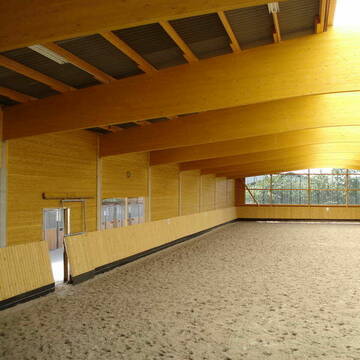
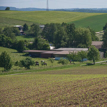
64668 Boxen Frei auf Privater Reitanlage
Rimbach
Stall Gillen
@StallGillen
Freizeitstall
Vermieten
Verpachten
Führanlage
Krankenbox
Hufrehe geeignet
Notfallboxen
18 weitere...
P+
Deprecated: Creation of dynamic property Zend_View_Helper_Ads::$adLink is deprecated in /var/www/stall-frei/htdocs/staging.stall-frei.de/library/Psf/View/Helper/Ads.php on line 108

Heu und Heulage verkaufen
Mechtersen
STALL-FREIde Marketing
@STALL-FREI-Marketing
Verkaufen Sie Ihr Heu und Ihre Heulage direkt an Reiter, Pferdeställe und Reitanlagen

Reiterhof Steinmann
Birkenau
Horst Steinmann
@Horst-Steinmann
Freizeitstall
Geländestrecke
Pensions- und Gastboxen
Reithalle
Pferdezucht
Außenboxen
Innenbox
7 weitere...
P


Paddockboxen ab Januar 2026 - Aktivstall ab 04/26
Hirschberg an der Bergstr
Isabell Bachhuber
@Isabell_Bachhuber
Freizeitstall
Reitlehrer und -unterricht
Vermieten
Hunde willkommen
Longierzirkel/Roundpen
Außenbox mit Paddock
Außenboxen
21 weitere...
P+

Birkenhof Oberflockenbach
Oberflockenbach
Birkenhof
@Birkenhof-Oberflockenbach
Freizeitstall
Pferdeausbildung
Vermieten
Hunde willkommen
Krankenbox
Notfallboxen
14 weitere...
P


Pferdeboxen in Vollpension frei
Hemsbach
Reitverein Hemsbach
@RVHemsbach
FN-Mitglied
Reitlehrer und -unterricht
Vermieten
Paddock
Parkplatz für Pferdeanhänger
Außenbox mit Paddock
Innenbox
10 weitere...
P+


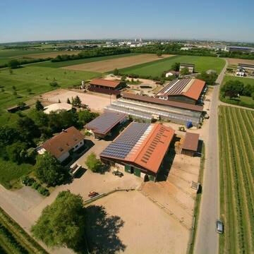
REITSPORTANLAGE ADLERHOF - 24/7 HEU
Viernheim
Adlerhof Viernheim
@AdlerhofViernheim
Geländestrecke
Pferdeausbildung
Führanlage
Hunde willkommen
Außenbox mit Paddock
Bewegungsstall
Vollpension
16 weitere...
P+

Pferdehof Wolfsgarten Mörlenbach
Mörlenbach
Bernd Wiegand
@Pferdehof-Wolfsgarten
Freizeitstall
Reitlehrer und -unterricht
Vermieten
Hunde willkommen
Paddock
Allergikerstall
Gnadenbrothof
13 weitere...
P

***Reitstall Birkenhof*** Pferdegerechte Haltung
Köln
Daniele-Fazzi
@Daniele-Fazzi
Herzlich Willkommen
auf dem Reitstall Birkenhof
Jetzt neu ‼️ auf dem Birkenhof:
Private Geländestrecke rund um unser
Leider kein Vorschaubild
Leider kein Vorschaubild
Platz für Wallach im Offenstall frei!
Mörlenbach
Ines-Klein1
@InesKlein
Freizeitstall
Pferdeausbildung
Vermieten
Hunde willkommen
Longierzirkel/Roundpen
Hengsthaltung möglich
7 weitere...
B

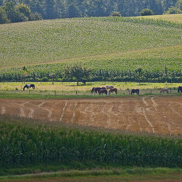
Platz für 1 Stute in unserem schönen Offenstall
Mörlenbach
Offenstall
@Lini23
Freizeitstall
Offenstall
P
Birkenhof Gauangelloch
Leimen-Gauangelloch
Friedwalt-Treiber
@Friedwalt-Treiber
FN-Mitglied
Freizeitstall
Longierzirkel/Roundpen
Pensions- und Gastboxen
Außenboxen
Innenbox
Vollpension
11 weitere...
S
Deprecated: Creation of dynamic property Zend_View::$pageCount is deprecated in /var/www/stall-frei/htdocs/staging.stall-frei.de/library/vendor/shardj/zf1-future/library/Zend/View/Abstract.php on line 308
Deprecated: Creation of dynamic property Zend_View::$itemCountPerPage is deprecated in /var/www/stall-frei/htdocs/staging.stall-frei.de/library/vendor/shardj/zf1-future/library/Zend/View/Abstract.php on line 308
Deprecated: Creation of dynamic property Zend_View::$first is deprecated in /var/www/stall-frei/htdocs/staging.stall-frei.de/library/vendor/shardj/zf1-future/library/Zend/View/Abstract.php on line 308
Deprecated: Creation of dynamic property Zend_View::$current is deprecated in /var/www/stall-frei/htdocs/staging.stall-frei.de/library/vendor/shardj/zf1-future/library/Zend/View/Abstract.php on line 308
Deprecated: Creation of dynamic property Zend_View::$last is deprecated in /var/www/stall-frei/htdocs/staging.stall-frei.de/library/vendor/shardj/zf1-future/library/Zend/View/Abstract.php on line 308
Deprecated: Creation of dynamic property Zend_View::$next is deprecated in /var/www/stall-frei/htdocs/staging.stall-frei.de/library/vendor/shardj/zf1-future/library/Zend/View/Abstract.php on line 308
Deprecated: Creation of dynamic property Zend_View::$pagesInRange is deprecated in /var/www/stall-frei/htdocs/staging.stall-frei.de/library/vendor/shardj/zf1-future/library/Zend/View/Abstract.php on line 308
Deprecated: Creation of dynamic property Zend_View::$firstPageInRange is deprecated in /var/www/stall-frei/htdocs/staging.stall-frei.de/library/vendor/shardj/zf1-future/library/Zend/View/Abstract.php on line 308
Deprecated: Creation of dynamic property Zend_View::$lastPageInRange is deprecated in /var/www/stall-frei/htdocs/staging.stall-frei.de/library/vendor/shardj/zf1-future/library/Zend/View/Abstract.php on line 308
Deprecated: Creation of dynamic property Zend_View::$currentItemCount is deprecated in /var/www/stall-frei/htdocs/staging.stall-frei.de/library/vendor/shardj/zf1-future/library/Zend/View/Abstract.php on line 308
Deprecated: Creation of dynamic property Zend_View::$totalItemCount is deprecated in /var/www/stall-frei/htdocs/staging.stall-frei.de/library/vendor/shardj/zf1-future/library/Zend/View/Abstract.php on line 308
Deprecated: Creation of dynamic property Zend_View::$firstItemNumber is deprecated in /var/www/stall-frei/htdocs/staging.stall-frei.de/library/vendor/shardj/zf1-future/library/Zend/View/Abstract.php on line 308
Deprecated: Creation of dynamic property Zend_View::$lastItemNumber is deprecated in /var/www/stall-frei/htdocs/staging.stall-frei.de/library/vendor/shardj/zf1-future/library/Zend/View/Abstract.php on line 308
Deprecated: Creation of dynamic property Zend_View::$router is deprecated in /var/www/stall-frei/htdocs/staging.stall-frei.de/library/vendor/shardj/zf1-future/library/Zend/View/Abstract.php on line 308
Deprecated: Creation of dynamic property Zend_View::$urlParams is deprecated in /var/www/stall-frei/htdocs/staging.stall-frei.de/library/vendor/shardj/zf1-future/library/Zend/View/Abstract.php on line 308
Deprecated: Creation of dynamic property Zend_View::$showAds is deprecated in /var/www/stall-frei/htdocs/staging.stall-frei.de/library/vendor/shardj/zf1-future/library/Zend/View/Abstract.php on line 308
Deprecated: Creation of dynamic property Zend_View::$objectIds is deprecated in /var/www/stall-frei/htdocs/staging.stall-frei.de/library/vendor/shardj/zf1-future/library/Zend/View/Abstract.php on line 308
Deprecated: Creation of dynamic property Zend_View::$showNavbar is deprecated in /var/www/stall-frei/htdocs/staging.stall-frei.de/library/vendor/shardj/zf1-future/library/Zend/View/Abstract.php on line 308
Deprecated: Creation of dynamic property Zend_View::$showBreadcrumb is deprecated in /var/www/stall-frei/htdocs/staging.stall-frei.de/library/vendor/shardj/zf1-future/library/Zend/View/Abstract.php on line 308
Deprecated: Creation of dynamic property Zend_View::$showFooter is deprecated in /var/www/stall-frei/htdocs/staging.stall-frei.de/library/vendor/shardj/zf1-future/library/Zend/View/Abstract.php on line 308
Deprecated: Creation of dynamic property Zend_View::$showInternalAds is deprecated in /var/www/stall-frei/htdocs/staging.stall-frei.de/library/vendor/shardj/zf1-future/library/Zend/View/Abstract.php on line 308
Deprecated: Creation of dynamic property Zend_View::$blNoContent is deprecated in /var/www/stall-frei/htdocs/staging.stall-frei.de/library/vendor/shardj/zf1-future/library/Zend/View/Abstract.php on line 308
Deprecated: Creation of dynamic property Zend_View::$sMetaDesc is deprecated in /var/www/stall-frei/htdocs/staging.stall-frei.de/library/vendor/shardj/zf1-future/library/Zend/View/Abstract.php on line 308
Deprecated: Creation of dynamic property Zend_View::$useGmaps is deprecated in /var/www/stall-frei/htdocs/staging.stall-frei.de/library/vendor/shardj/zf1-future/library/Zend/View/Abstract.php on line 308
Deprecated: Creation of dynamic property Zend_View::$touches is deprecated in /var/www/stall-frei/htdocs/staging.stall-frei.de/library/vendor/shardj/zf1-future/library/Zend/View/Abstract.php on line 308
Deprecated: Creation of dynamic property Zend_View::$oProject is deprecated in /var/www/stall-frei/htdocs/staging.stall-frei.de/library/vendor/shardj/zf1-future/library/Zend/View/Abstract.php on line 308
Deprecated: Creation of dynamic property Zend_View::$pageHeadline is deprecated in /var/www/stall-frei/htdocs/staging.stall-frei.de/library/vendor/shardj/zf1-future/library/Zend/View/Abstract.php on line 308
Deprecated: Creation of dynamic property Zend_View::$disableLocationField is deprecated in /var/www/stall-frei/htdocs/staging.stall-frei.de/library/vendor/shardj/zf1-future/library/Zend/View/Abstract.php on line 308
Deprecated: Creation of dynamic property Zend_View::$isSearch is deprecated in /var/www/stall-frei/htdocs/staging.stall-frei.de/library/vendor/shardj/zf1-future/library/Zend/View/Abstract.php on line 308
Deprecated: Creation of dynamic property Zend_View::$pageTitle is deprecated in /var/www/stall-frei/htdocs/staging.stall-frei.de/library/vendor/shardj/zf1-future/library/Zend/View/Abstract.php on line 308
Deprecated: Creation of dynamic property Psf_Form_Element_Text::$class is deprecated in /var/www/stall-frei/htdocs/staging.stall-frei.de/library/vendor/shardj/zf1-future/library/Zend/Form/Element.php on line 874
Deprecated: Creation of dynamic property Psf_Form_Element_Text::$size is deprecated in /var/www/stall-frei/htdocs/staging.stall-frei.de/library/vendor/shardj/zf1-future/library/Zend/Form/Element.php on line 874
Deprecated: Creation of dynamic property Psf_Form_Element_Text::$placeholder is deprecated in /var/www/stall-frei/htdocs/staging.stall-frei.de/library/vendor/shardj/zf1-future/library/Zend/Form/Element.php on line 874
Deprecated: Creation of dynamic property Psf_Form_Element_Hidden::$class is deprecated in /var/www/stall-frei/htdocs/staging.stall-frei.de/library/vendor/shardj/zf1-future/library/Zend/Form/Element.php on line 874
Deprecated: Creation of dynamic property Psf_Form_Element_Hidden::$class is deprecated in /var/www/stall-frei/htdocs/staging.stall-frei.de/library/vendor/shardj/zf1-future/library/Zend/Form/Element.php on line 874
Deprecated: Creation of dynamic property Psf_Form_Element_Hidden::$class is deprecated in /var/www/stall-frei/htdocs/staging.stall-frei.de/library/vendor/shardj/zf1-future/library/Zend/Form/Element.php on line 874
Deprecated: Creation of dynamic property Psf_Form_Element_Hidden::$class is deprecated in /var/www/stall-frei/htdocs/staging.stall-frei.de/library/vendor/shardj/zf1-future/library/Zend/Form/Element.php on line 874
Deprecated: Creation of dynamic property Psf_Form_Element_Select::$class is deprecated in /var/www/stall-frei/htdocs/staging.stall-frei.de/library/vendor/shardj/zf1-future/library/Zend/Form/Element.php on line 874
Deprecated: Creation of dynamic property Psf_Form_Element_Select::$class is deprecated in /var/www/stall-frei/htdocs/staging.stall-frei.de/library/vendor/shardj/zf1-future/library/Zend/Form/Element.php on line 874
Deprecated: Creation of dynamic property Psf_Form_Element_Select::$class is deprecated in /var/www/stall-frei/htdocs/staging.stall-frei.de/library/vendor/shardj/zf1-future/library/Zend/Form/Element.php on line 874
Deprecated: Creation of dynamic property Psf_Form_Element_Select::$class is deprecated in /var/www/stall-frei/htdocs/staging.stall-frei.de/library/vendor/shardj/zf1-future/library/Zend/Form/Element.php on line 874
Deprecated: Creation of dynamic property Psf_Form_Element_Text::$class is deprecated in /var/www/stall-frei/htdocs/staging.stall-frei.de/library/vendor/shardj/zf1-future/library/Zend/Form/Element.php on line 874
Deprecated: Creation of dynamic property Psf_Form_Element_Checkbox::$label is deprecated in /var/www/stall-frei/htdocs/staging.stall-frei.de/library/vendor/shardj/zf1-future/library/Zend/Form/Element.php on line 874
Deprecated: Creation of dynamic property Zend_View::$sort is deprecated in /var/www/stall-frei/htdocs/staging.stall-frei.de/library/vendor/shardj/zf1-future/library/Zend/View/Abstract.php on line 308
Deprecated: Creation of dynamic property Zend_View::$searchLocation is deprecated in /var/www/stall-frei/htdocs/staging.stall-frei.de/library/vendor/shardj/zf1-future/library/Zend/View/Abstract.php on line 308
Deprecated: Creation of dynamic property Zend_View::$locationHint is deprecated in /var/www/stall-frei/htdocs/staging.stall-frei.de/library/vendor/shardj/zf1-future/library/Zend/View/Abstract.php on line 308
Psf_GeoCoder_Abstract::getLocation: Löhrbach Get Location CachedOrLive
Psf_GeoCoder_Abstract::getCachedOrLive: Löhrbach
Psf_GeoCoder_OpenCageData::makeApiRequest: response:
Array
(
[documentation] => https://opencagedata.com/api
[licenses] => Array
(
[0] => Array
(
[name] => see attribution guide
[url] => https://opencagedata.com/credits
)
)
[results] => Array
(
[0] => Array
(
[bounds] => Array
(
[northeast] => Array
(
[lat] => 49.5663698
[lng] => 8.7846095
)
[southwest] => Array
(
[lat] => 49.5263698
[lng] => 8.7446095
)
)
[components] => Array
(
[ISO_3166-1_alpha-2] => DE
[ISO_3166-1_alpha-3] => DEU
[ISO_3166-2] => Array
(
[0] => DE-HE
)
[_category] => place
[_normalized_city] => Löhrbach
[_type] => neighbourhood
[city_district] => Löhrbach
[continent] => Europe
[country] => Deutschland
[country_code] => de
[county] => Kreis Bergstraße
[municipality] => Birkenau
[political_union] => European Union
[postcode] => 69518
[state] => Hessen
[state_code] => HE
[town] => Löhrbach
)
[confidence] => 7
[formatted] => 69518 Löhrbach, Deutschland
[geometry] => Array
(
[lat] => 49.5463698
[lng] => 8.7646095
)
)
[1] => Array
(
[bounds] => Array
(
[northeast] => Array
(
[lat] => 49.5618321
[lng] => 8.7762379
)
[southwest] => Array
(
[lat] => 49.5350531
[lng] => 8.7238434
)
)
[components] => Array
(
[ISO_3166-1_alpha-2] => DE
[ISO_3166-1_alpha-3] => DEU
[ISO_3166-2] => Array
(
[0] => DE-HE
)
[_category] => place
[_normalized_city] => Birkenau
[_type] => neighbourhood
[city_district] => Löhrbach
[continent] => Europe
[country] => Deutschland
[country_code] => de
[county] => Kreis Bergstraße
[municipality] => Birkenau
[political_union] => European Union
[state] => Hessen
[state_code] => HE
)
[confidence] => 7
[formatted] => Löhrbach, Birkenau, Hessen, Deutschland
[geometry] => Array
(
[lat] => 49.5484429
[lng] => 8.7521537
)
)
[2] => Array
(
[bounds] => Array
(
[northeast] => Array
(
[lat] => 49.4256165
[lng] => 9.1584668
)
[southwest] => Array
(
[lat] => 49.3823534
[lng] => 9.103808
)
)
[components] => Array
(
[ISO_3166-1_alpha-2] => DE
[ISO_3166-1_alpha-3] => DEU
[ISO_3166-2] => Array
(
[0] => DE-BW
)
[_category] => place
[_normalized_city] => Mosbach
[_type] => village
[continent] => Europe
[country] => Deutschland
[country_code] => de
[county] => Neckar-Odenwald-Kreis
[municipality] => VVG der Stadt Mosbach
[political_union] => European Union
[state] => Baden-Württemberg
[state_code] => BW
[town] => Mosbach
[village] => Lohrbach
)
[confidence] => 7
[formatted] => Lohrbach, Baden-Württemberg, Deutschland
[geometry] => Array
(
[lat] => 49.4002624
[lng] => 9.1389267
)
)
[3] => Array
(
[bounds] => Array
(
[northeast] => Array
(
[lat] => 50.7414154
[lng] => 8.6599879
)
[southwest] => Array
(
[lat] => 50.7404567
[lng] => 8.6536017
)
)
[components] => Array
(
[ISO_3166-1_alpha-2] => DE
[ISO_3166-1_alpha-3] => DEU
[ISO_3166-2] => Array
(
[0] => DE-HE
)
[_category] => natural/water
[_normalized_city] => Weimar (Lahn)
[_type] => stream
[continent] => Europe
[country] => Deutschland
[country_code] => de
[county] => Landkreis Marburg-Biedenkopf
[hamlet] => Kehna
[municipality] => Weimar (Lahn)
[political_union] => European Union
[postcode] => 35096
[state] => Hessen
[state_code] => HE
[stream] => Löhrbach
)
[confidence] => 9
[formatted] => Löhrbach, Kehna, 35096 Weimar (Lahn), Deutschland
[geometry] => Array
(
[lat] => 50.7405964
[lng] => 8.6567963
)
)
[4] => Array
(
[bounds] => Array
(
[northeast] => Array
(
[lat] => 51.4208591
[lng] => 7.9171953
)
[southwest] => Array
(
[lat] => 51.4193895
[lng] => 7.9165297
)
)
[components] => Array
(
[ISO_3166-1_alpha-2] => DE
[ISO_3166-1_alpha-3] => DEU
[ISO_3166-2] => Array
(
[0] => DE-NW
)
[_category] => natural/water
[_normalized_city] => Arnsberg
[_type] => stream
[continent] => Europe
[country] => Deutschland
[country_code] => de
[county] => Hochsauerlandkreis
[political_union] => European Union
[postcode] => 59757
[state] => Nordrhein-Westfalen
[state_code] => NW
[stream] => Löhrbach
[town] => Arnsberg
)
[confidence] => 9
[formatted] => Löhrbach, 59757 Arnsberg, Deutschland
[geometry] => Array
(
[lat] => 51.4202498
[lng] => 7.9171445
)
)
[5] => Array
(
[bounds] => Array
(
[northeast] => Array
(
[lat] => 50.0665532
[lng] => 9.4404986
)
[southwest] => Array
(
[lat] => 50.0107023
[lng] => 9.3366393
)
)
[components] => Array
(
[ISO_3166-1_alpha-2] => DE
[ISO_3166-1_alpha-3] => DEU
[ISO_3166-2] => Array
(
[0] => DE-BY
)
[_category] => natural/water
[_normalized_city] => Heigenbrücken
[_type] => stream
[continent] => Europe
[country] => Deutschland
[country_code] => de
[county] => Landkreis Aschaffenburg
[municipality] => Heigenbrücken (VGem)
[political_union] => European Union
[state] => Bayern
[state_code] => BY
[stream] => Lohrbach
[village] => Heigenbrücken
)
[confidence] => 7
[formatted] => Lohrbach, Heigenbrücken, Bayern, Deutschland
[geometry] => Array
(
[lat] => 50.0271082
[lng] => 9.3753019
)
)
[6] => Array
(
[components] => Array
(
[ISO_3166-1_alpha-2] => FR
[ISO_3166-1_alpha-3] => FRA
[ISO_3166-2] => Array
(
[0] => FR-IDF
[1] => FR-92
)
[_category] => road
[_normalized_city] => Levallois-Perret
[_type] => road
[city] => Levallois-Perret
[continent] => Europe
[country] => France
[country_code] => fr
[county] => Hauts-de-Seine
[local_authority] => Métropole du Grand Paris
[political_union] => European Union
[postcode] => 92300
[road] => Rue Charles Deutschmann
[state] => Île-de-France
[state_code] => IDF
)
[confidence] => 3
[formatted] => Rue Charles Deutschmann, 92300 Levallois-Perret, France
[geometry] => Array
(
[lat] => 48.900049
[lng] => 2.2842
)
)
[7] => Array
(
[components] => Array
(
[ISO_3166-1_alpha-2] => FR
[ISO_3166-1_alpha-3] => FRA
[ISO_3166-2] => Array
(
[0] => FR-GES
[1] => FR-57
)
[_category] => road
[_normalized_city] => Creutzwald
[_type] => road
[city] => Creutzwald
[continent] => Europe
[country] => France
[country_code] => fr
[county] => Moselle
[local_authority] => Communauté de communes du Warndt
[political_union] => European Union
[postcode] => 57150
[road] => Rue de Forbach
[state] => Grand Est
[state_code] => GES
)
[confidence] => 2
[formatted] => Rue de Forbach, 57150 Creutzwald, France
[geometry] => Array
(
[lat] => 49.197084
[lng] => 6.681879
)
)
[8] => Array
(
[components] => Array
(
[ISO_3166-1_alpha-2] => FR
[ISO_3166-1_alpha-3] => FRA
[ISO_3166-2] => Array
(
[0] => FR-GES
[1] => FR-57
)
[_category] => road
[_normalized_city] => Schœneck
[_type] => road
[city] => Schœneck
[continent] => Europe
[country] => France
[country_code] => fr
[county] => Moselle
[local_authority] => Communauté d'agglomération de Forbach Porte de France
[political_union] => European Union
[postcode] => 57350
[road] => Rue de Forbach
[state] => Grand Est
[state_code] => GES
)
[confidence] => 2
[formatted] => Rue de Forbach, 57350 Schœneck, France
[geometry] => Array
(
[lat] => 49.220042
[lng] => 6.922797
)
)
[9] => Array
(
[components] => Array
(
[ISO_3166-1_alpha-2] => FR
[ISO_3166-1_alpha-3] => FRA
[ISO_3166-2] => Array
(
[0] => FR-GES
[1] => FR-57
)
[_category] => road
[_normalized_city] => Théding
[_type] => road
[city] => Théding
[continent] => Europe
[country] => France
[country_code] => fr
[county] => Moselle
[local_authority] => Communauté d'agglomération de Forbach Porte de France
[political_union] => European Union
[postcode] => 57450
[road] => Route de Forbach
[state] => Grand Est
[state_code] => GES
)
[confidence] => 2
[formatted] => Route de Forbach, 57450 Théding, France
[geometry] => Array
(
[lat] => 49.143958
[lng] => 6.887181
)
)
)
[status] => Array
(
[code] => 200
[message] => OK
)
[stay_informed] => Array
(
[blog] => https://blog.opencagedata.com
[mastodon] => https://en.osm.town/@opencage
)
[thanks] => For using an OpenCage API
[timestamp] => Array
(
[created_http] => Sun, 08 Feb 2026 20:28:11 GMT
[created_unix] => 1770582491
)
[total_results] => 10
)
Psf_GeoCoder_Abstract::convertLocationResult
{"documentation":"https:\/\/opencagedata.com\/api","licenses":[{"name":"see attribution guide","url":"https:\/\/opencagedata.com\/credits"}],"results":[{"bounds":{"northeast":{"lat":49.5663698,"lng":8.7846095},"southwest":{"lat":49.5263698,"lng":8.7446095}},"components":{"ISO_3166-1_alpha-2":"DE","ISO_3166-1_alpha-3":"DEU","ISO_3166-2":["DE-HE"],"_category":"place","_normalized_city":"L\u00f6hrbach","_type":"neighbourhood","city_district":"L\u00f6hrbach","continent":"Europe","country":"Deutschland","country_code":"de","county":"Kreis Bergstra\u00dfe","municipality":"Birkenau","political_union":"European Union","postcode":"69518","state":"Hessen","state_code":"HE","town":"L\u00f6hrbach"},"confidence":7,"formatted":"69518 L\u00f6hrbach, Deutschland","geometry":{"lat":49.5463698,"lng":8.7646095}},{"bounds":{"northeast":{"lat":49.5618321,"lng":8.7762379},"southwest":{"lat":49.5350531,"lng":8.7238434}},"components":{"ISO_3166-1_alpha-2":"DE","ISO_3166-1_alpha-3":"DEU","ISO_3166-2":["DE-HE"],"_category":"place","_normalized_city":"Birkenau","_type":"neighbourhood","city_district":"L\u00f6hrbach","continent":"Europe","country":"Deutschland","country_code":"de","county":"Kreis Bergstra\u00dfe","municipality":"Birkenau","political_union":"European Union","state":"Hessen","state_code":"HE"},"confidence":7,"formatted":"L\u00f6hrbach, Birkenau, Hessen, Deutschland","geometry":{"lat":49.5484429,"lng":8.7521537}},{"bounds":{"northeast":{"lat":49.4256165,"lng":9.1584668},"southwest":{"lat":49.3823534,"lng":9.103808}},"components":{"ISO_3166-1_alpha-2":"DE","ISO_3166-1_alpha-3":"DEU","ISO_3166-2":["DE-BW"],"_category":"place","_normalized_city":"Mosbach","_type":"village","continent":"Europe","country":"Deutschland","country_code":"de","county":"Neckar-Odenwald-Kreis","municipality":"VVG der Stadt Mosbach","political_union":"European Union","state":"Baden-W\u00fcrttemberg","state_code":"BW","town":"Mosbach","village":"Lohrbach"},"confidence":7,"formatted":"Lohrbach, Baden-W\u00fcrttemberg, Deutschland","geometry":{"lat":49.4002624,"lng":9.1389267}},{"bounds":{"northeast":{"lat":50.7414154,"lng":8.6599879},"southwest":{"lat":50.7404567,"lng":8.6536017}},"components":{"ISO_3166-1_alpha-2":"DE","ISO_3166-1_alpha-3":"DEU","ISO_3166-2":["DE-HE"],"_category":"natural\/water","_normalized_city":"Weimar (Lahn)","_type":"stream","continent":"Europe","country":"Deutschland","country_code":"de","county":"Landkreis Marburg-Biedenkopf","hamlet":"Kehna","municipality":"Weimar (Lahn)","political_union":"European Union","postcode":"35096","state":"Hessen","state_code":"HE","stream":"L\u00f6hrbach"},"confidence":9,"formatted":"L\u00f6hrbach, Kehna, 35096 Weimar (Lahn), Deutschland","geometry":{"lat":50.7405964,"lng":8.6567963}},{"bounds":{"northeast":{"lat":51.4208591,"lng":7.9171953},"southwest":{"lat":51.4193895,"lng":7.9165297}},"components":{"ISO_3166-1_alpha-2":"DE","ISO_3166-1_alpha-3":"DEU","ISO_3166-2":["DE-NW"],"_category":"natural\/water","_normalized_city":"Arnsberg","_type":"stream","continent":"Europe","country":"Deutschland","country_code":"de","county":"Hochsauerlandkreis","political_union":"European Union","postcode":"59757","state":"Nordrhein-Westfalen","state_code":"NW","stream":"L\u00f6hrbach","town":"Arnsberg"},"confidence":9,"formatted":"L\u00f6hrbach, 59757 Arnsberg, Deutschland","geometry":{"lat":51.4202498,"lng":7.9171445}},{"bounds":{"northeast":{"lat":50.0665532,"lng":9.4404986},"southwest":{"lat":50.0107023,"lng":9.3366393}},"components":{"ISO_3166-1_alpha-2":"DE","ISO_3166-1_alpha-3":"DEU","ISO_3166-2":["DE-BY"],"_category":"natural\/water","_normalized_city":"Heigenbr\u00fccken","_type":"stream","continent":"Europe","country":"Deutschland","country_code":"de","county":"Landkreis Aschaffenburg","municipality":"Heigenbr\u00fccken (VGem)","political_union":"European Union","state":"Bayern","state_code":"BY","stream":"Lohrbach","village":"Heigenbr\u00fccken"},"confidence":7,"formatted":"Lohrbach, Heigenbr\u00fccken, Bayern, Deutschland","geometry":{"lat":50.0271082,"lng":9.3753019}},{"components":{"ISO_3166-1_alpha-2":"FR","ISO_3166-1_alpha-3":"FRA","ISO_3166-2":["FR-IDF","FR-92"],"_category":"road","_normalized_city":"Levallois-Perret","_type":"road","city":"Levallois-Perret","continent":"Europe","country":"France","country_code":"fr","county":"Hauts-de-Seine","local_authority":"M\u00e9tropole du Grand Paris","political_union":"European Union","postcode":"92300","road":"Rue Charles Deutschmann","state":"\u00cele-de-France","state_code":"IDF"},"confidence":3,"formatted":"Rue Charles Deutschmann, 92300 Levallois-Perret, France","geometry":{"lat":48.900049,"lng":2.2842}},{"components":{"ISO_3166-1_alpha-2":"FR","ISO_3166-1_alpha-3":"FRA","ISO_3166-2":["FR-GES","FR-57"],"_category":"road","_normalized_city":"Creutzwald","_type":"road","city":"Creutzwald","continent":"Europe","country":"France","country_code":"fr","county":"Moselle","local_authority":"Communaut\u00e9 de communes du Warndt","political_union":"European Union","postcode":"57150","road":"Rue de Forbach","state":"Grand Est","state_code":"GES"},"confidence":2,"formatted":"Rue de Forbach, 57150 Creutzwald, France","geometry":{"lat":49.197084,"lng":6.681879}},{"components":{"ISO_3166-1_alpha-2":"FR","ISO_3166-1_alpha-3":"FRA","ISO_3166-2":["FR-GES","FR-57"],"_category":"road","_normalized_city":"Sch\u0153neck","_type":"road","city":"Sch\u0153neck","continent":"Europe","country":"France","country_code":"fr","county":"Moselle","local_authority":"Communaut\u00e9 d'agglom\u00e9ration de Forbach Porte de France","political_union":"European Union","postcode":"57350","road":"Rue de Forbach","state":"Grand Est","state_code":"GES"},"confidence":2,"formatted":"Rue de Forbach, 57350 Sch\u0153neck, France","geometry":{"lat":49.220042,"lng":6.922797}},{"components":{"ISO_3166-1_alpha-2":"FR","ISO_3166-1_alpha-3":"FRA","ISO_3166-2":["FR-GES","FR-57"],"_category":"road","_normalized_city":"Th\u00e9ding","_type":"road","city":"Th\u00e9ding","continent":"Europe","country":"France","country_code":"fr","county":"Moselle","local_authority":"Communaut\u00e9 d'agglom\u00e9ration de Forbach Porte de France","political_union":"European Union","postcode":"57450","road":"Route de Forbach","state":"Grand Est","state_code":"GES"},"confidence":2,"formatted":"Route de Forbach, 57450 Th\u00e9ding, France","geometry":{"lat":49.143958,"lng":6.887181}}],"status":{"code":200,"message":"OK"},"stay_informed":{"blog":"https:\/\/blog.opencagedata.com","mastodon":"https:\/\/en.osm.town\/@opencage"},"thanks":"For using an OpenCage API","timestamp":{"created_http":"Sun, 08 Feb 2026 20:28:11 GMT","created_unix":1770582491},"total_results":10}Array
(
[0] => stdClass Object
(
[bounds] => stdClass Object
(
[northeast] => stdClass Object
(
[lat] => 49.5663698
[lng] => 8.7846095
)
[southwest] => stdClass Object
(
[lat] => 49.5263698
[lng] => 8.7446095
)
)
[components] => stdClass Object
(
[ISO_3166-1_alpha-2] => DE
[ISO_3166-1_alpha-3] => DEU
[ISO_3166-2] => Array
(
[0] => DE-HE
)
[_category] => place
[_normalized_city] => Löhrbach
[_type] => neighbourhood
[city_district] => Löhrbach
[continent] => Europe
[country] => Deutschland
[country_code] => de
[county] => Kreis Bergstraße
[municipality] => Birkenau
[political_union] => European Union
[postcode] => 69518
[state] => Hessen
[state_code] => HE
[town] => Löhrbach
)
[confidence] => 7
[formatted] => 69518 Löhrbach, Deutschland
[geometry] => stdClass Object
(
[lat] => 49.5463698
[lng] => 8.7646095
)
)
[1] => stdClass Object
(
[bounds] => stdClass Object
(
[northeast] => stdClass Object
(
[lat] => 49.5618321
[lng] => 8.7762379
)
[southwest] => stdClass Object
(
[lat] => 49.5350531
[lng] => 8.7238434
)
)
[components] => stdClass Object
(
[ISO_3166-1_alpha-2] => DE
[ISO_3166-1_alpha-3] => DEU
[ISO_3166-2] => Array
(
[0] => DE-HE
)
[_category] => place
[_normalized_city] => Birkenau
[_type] => neighbourhood
[city_district] => Löhrbach
[continent] => Europe
[country] => Deutschland
[country_code] => de
[county] => Kreis Bergstraße
[municipality] => Birkenau
[political_union] => European Union
[state] => Hessen
[state_code] => HE
)
[confidence] => 7
[formatted] => Löhrbach, Birkenau, Hessen, Deutschland
[geometry] => stdClass Object
(
[lat] => 49.5484429
[lng] => 8.7521537
)
)
[2] => stdClass Object
(
[bounds] => stdClass Object
(
[northeast] => stdClass Object
(
[lat] => 49.4256165
[lng] => 9.1584668
)
[southwest] => stdClass Object
(
[lat] => 49.3823534
[lng] => 9.103808
)
)
[components] => stdClass Object
(
[ISO_3166-1_alpha-2] => DE
[ISO_3166-1_alpha-3] => DEU
[ISO_3166-2] => Array
(
[0] => DE-BW
)
[_category] => place
[_normalized_city] => Mosbach
[_type] => village
[continent] => Europe
[country] => Deutschland
[country_code] => de
[county] => Neckar-Odenwald-Kreis
[municipality] => VVG der Stadt Mosbach
[political_union] => European Union
[state] => Baden-Württemberg
[state_code] => BW
[town] => Mosbach
[village] => Lohrbach
)
[confidence] => 7
[formatted] => Lohrbach, Baden-Württemberg, Deutschland
[geometry] => stdClass Object
(
[lat] => 49.4002624
[lng] => 9.1389267
)
)
[3] => stdClass Object
(
[bounds] => stdClass Object
(
[northeast] => stdClass Object
(
[lat] => 50.7414154
[lng] => 8.6599879
)
[southwest] => stdClass Object
(
[lat] => 50.7404567
[lng] => 8.6536017
)
)
[components] => stdClass Object
(
[ISO_3166-1_alpha-2] => DE
[ISO_3166-1_alpha-3] => DEU
[ISO_3166-2] => Array
(
[0] => DE-HE
)
[_category] => natural/water
[_normalized_city] => Weimar (Lahn)
[_type] => stream
[continent] => Europe
[country] => Deutschland
[country_code] => de
[county] => Landkreis Marburg-Biedenkopf
[hamlet] => Kehna
[municipality] => Weimar (Lahn)
[political_union] => European Union
[postcode] => 35096
[state] => Hessen
[state_code] => HE
[stream] => Löhrbach
)
[confidence] => 9
[formatted] => Löhrbach, Kehna, 35096 Weimar (Lahn), Deutschland
[geometry] => stdClass Object
(
[lat] => 50.7405964
[lng] => 8.6567963
)
)
[4] => stdClass Object
(
[bounds] => stdClass Object
(
[northeast] => stdClass Object
(
[lat] => 51.4208591
[lng] => 7.9171953
)
[southwest] => stdClass Object
(
[lat] => 51.4193895
[lng] => 7.9165297
)
)
[components] => stdClass Object
(
[ISO_3166-1_alpha-2] => DE
[ISO_3166-1_alpha-3] => DEU
[ISO_3166-2] => Array
(
[0] => DE-NW
)
[_category] => natural/water
[_normalized_city] => Arnsberg
[_type] => stream
[continent] => Europe
[country] => Deutschland
[country_code] => de
[county] => Hochsauerlandkreis
[political_union] => European Union
[postcode] => 59757
[state] => Nordrhein-Westfalen
[state_code] => NW
[stream] => Löhrbach
[town] => Arnsberg
)
[confidence] => 9
[formatted] => Löhrbach, 59757 Arnsberg, Deutschland
[geometry] => stdClass Object
(
[lat] => 51.4202498
[lng] => 7.9171445
)
)
[5] => stdClass Object
(
[bounds] => stdClass Object
(
[northeast] => stdClass Object
(
[lat] => 50.0665532
[lng] => 9.4404986
)
[southwest] => stdClass Object
(
[lat] => 50.0107023
[lng] => 9.3366393
)
)
[components] => stdClass Object
(
[ISO_3166-1_alpha-2] => DE
[ISO_3166-1_alpha-3] => DEU
[ISO_3166-2] => Array
(
[0] => DE-BY
)
[_category] => natural/water
[_normalized_city] => Heigenbrücken
[_type] => stream
[continent] => Europe
[country] => Deutschland
[country_code] => de
[county] => Landkreis Aschaffenburg
[municipality] => Heigenbrücken (VGem)
[political_union] => European Union
[state] => Bayern
[state_code] => BY
[stream] => Lohrbach
[village] => Heigenbrücken
)
[confidence] => 7
[formatted] => Lohrbach, Heigenbrücken, Bayern, Deutschland
[geometry] => stdClass Object
(
[lat] => 50.0271082
[lng] => 9.3753019
)
)
[6] => stdClass Object
(
[components] => stdClass Object
(
[ISO_3166-1_alpha-2] => FR
[ISO_3166-1_alpha-3] => FRA
[ISO_3166-2] => Array
(
[0] => FR-IDF
[1] => FR-92
)
[_category] => road
[_normalized_city] => Levallois-Perret
[_type] => road
[city] => Levallois-Perret
[continent] => Europe
[country] => France
[country_code] => fr
[county] => Hauts-de-Seine
[local_authority] => Métropole du Grand Paris
[political_union] => European Union
[postcode] => 92300
[road] => Rue Charles Deutschmann
[state] => Île-de-France
[state_code] => IDF
)
[confidence] => 3
[formatted] => Rue Charles Deutschmann, 92300 Levallois-Perret, France
[geometry] => stdClass Object
(
[lat] => 48.900049
[lng] => 2.2842
)
)
[7] => stdClass Object
(
[components] => stdClass Object
(
[ISO_3166-1_alpha-2] => FR
[ISO_3166-1_alpha-3] => FRA
[ISO_3166-2] => Array
(
[0] => FR-GES
[1] => FR-57
)
[_category] => road
[_normalized_city] => Creutzwald
[_type] => road
[city] => Creutzwald
[continent] => Europe
[country] => France
[country_code] => fr
[county] => Moselle
[local_authority] => Communauté de communes du Warndt
[political_union] => European Union
[postcode] => 57150
[road] => Rue de Forbach
[state] => Grand Est
[state_code] => GES
)
[confidence] => 2
[formatted] => Rue de Forbach, 57150 Creutzwald, France
[geometry] => stdClass Object
(
[lat] => 49.197084
[lng] => 6.681879
)
)
[8] => stdClass Object
(
[components] => stdClass Object
(
[ISO_3166-1_alpha-2] => FR
[ISO_3166-1_alpha-3] => FRA
[ISO_3166-2] => Array
(
[0] => FR-GES
[1] => FR-57
)
[_category] => road
[_normalized_city] => Schœneck
[_type] => road
[city] => Schœneck
[continent] => Europe
[country] => France
[country_code] => fr
[county] => Moselle
[local_authority] => Communauté d'agglomération de Forbach Porte de France
[political_union] => European Union
[postcode] => 57350
[road] => Rue de Forbach
[state] => Grand Est
[state_code] => GES
)
[confidence] => 2
[formatted] => Rue de Forbach, 57350 Schœneck, France
[geometry] => stdClass Object
(
[lat] => 49.220042
[lng] => 6.922797
)
)
[9] => stdClass Object
(
[components] => stdClass Object
(
[ISO_3166-1_alpha-2] => FR
[ISO_3166-1_alpha-3] => FRA
[ISO_3166-2] => Array
(
[0] => FR-GES
[1] => FR-57
)
[_category] => road
[_normalized_city] => Théding
[_type] => road
[city] => Théding
[continent] => Europe
[country] => France
[country_code] => fr
[county] => Moselle
[local_authority] => Communauté d'agglomération de Forbach Porte de France
[political_union] => European Union
[postcode] => 57450
[road] => Route de Forbach
[state] => Grand Est
[state_code] => GES
)
[confidence] => 2
[formatted] => Route de Forbach, 57450 Théding, France
[geometry] => stdClass Object
(
[lat] => 49.143958
[lng] => 6.887181
)
)
)
Psf_GeoCoder_OpenCageData::getKeyMap: 0
stdClass Object
(
    [bounds] => stdClass Object
        (
            [northeast] => stdClass Object
                (
                    [lat] => 49.5663698
                    [lng] => 8.7846095
                )

            [southwest] => stdClass Object
                (
                    [lat] => 49.5263698
                    [lng] => 8.7446095
                )

        )

    [components] => stdClass Object
        (
            [ISO_3166-1_alpha-2] => DE
            [ISO_3166-1_alpha-3] => DEU
            [ISO_3166-2] => Array
                (
                    [0] => DE-HE
                )

            [_category] => place
            [_normalized_city] => Löhrbach
            [_type] => neighbourhood
            [city_district] => Löhrbach
            [continent] => Europe
            [country] => Deutschland
            [country_code] => de
            [county] => Kreis Bergstraße
            [municipality] => Birkenau
            [political_union] => European Union
            [postcode] => 69518
            [state] => Hessen
            [state_code] => HE
            [town] => Löhrbach
        )

    [confidence] => 7
    [formatted] => 69518 Löhrbach, Deutschland
    [geometry] => stdClass Object
        (
            [lat] => 49.5463698
            [lng] => 8.7646095
        )

)
Psf_GeoCoder_OpenCageData::getCounty: Bergstraße
Psf_GeoCoder_OpenCageData::addMissingData REFETCH!
Array
(
    [address] => 69518 Löhrbach, Deutschland
    [type] => neighbourhood
    [street] =>
    [city] => Löhrbach
    [county] => Bergstraße
    [state] => Hessen
    [zip] => 69518
    [country] => Deutschland
    [suburb] =>
    [countrycode] => de
    [latitude] => 49.5463698
    [longitude] => 8.7646095
    [accuracy] => 1
    [confidence] => 7
    [bounds] => stdClass Object
        (
            [northeast] => stdClass Object
                (
                    [lat] => 49.5663698
                    [lng] => 8.7846095
                )

            [southwest] => stdClass Object
                (
                    [lat] => 49.5263698
                    [lng] => 8.7446095
                )

        )

)
reformat!
Array
(
    [address] => 69518 Löhrbach, Deutschland
    [type] => neighbourhood
    [street] =>
    [city] => Löhrbach
    [county] => Bergstraße
    [state] => Hessen
    [zip] => 69518
    [country] => Deutschland
    [suburb] =>
    [countrycode] => de
    [latitude] => 49.5463698
    [longitude] => 8.7646095
    [accuracy] => 1
    [confidence] => 7
    [bounds] => stdClass Object
        (
            [northeast] => stdClass Object
                (
                    [lat] => 49.5663698
                    [lng] => 8.7846095
                )

            [southwest] => stdClass Object
                (
                    [lat] => 49.5263698
                    [lng] => 8.7446095
                )

        )

    [place] => 69518 Löhrbach, Hessen
    [hash] => 85e70fab5d5b45d18fa1a5cace4cb4f6
)
Psf_GeoCoder_OpenCageData::getKeyMap: 1
stdClass Object
(
    [bounds] => stdClass Object
        (
            [northeast] => stdClass Object
                (
                    [lat] => 49.5618321
                    [lng] => 8.7762379
                )

            [southwest] => stdClass Object
                (
                    [lat] => 49.5350531
                    [lng] => 8.7238434
                )

        )

    [components] => stdClass Object
        (
            [ISO_3166-1_alpha-2] => DE
            [ISO_3166-1_alpha-3] => DEU
            [ISO_3166-2] => Array
                (
                    [0] => DE-HE
                )

            [_category] => place
            [_normalized_city] => Birkenau
            [_type] => neighbourhood
            [city_district] => Löhrbach
            [continent] => Europe
            [country] => Deutschland
            [country_code] => de
            [county] => Kreis Bergstraße
            [municipality] => Birkenau
            [political_union] => European Union
            [state] => Hessen
            [state_code] => HE
        )

    [confidence] => 7
    [formatted] => Löhrbach, Birkenau, Hessen, Deutschland
    [geometry] => stdClass Object
        (
            [lat] => 49.5484429
            [lng] => 8.7521537
        )

)
Psf_GeoCoder_OpenCageData::getCounty: Bergstraße
Psf_GeoCoder_OpenCageData::addMissingData REFETCH!
Array
(
    [address] => Löhrbach, Birkenau, Hessen, Deutschland
    [type] => neighbourhood
    [street] =>
    [city] => Löhrbach
    [county] => Bergstraße
    [state] => Hessen
    [zip] =>
    [country] => Deutschland
    [suburb] =>
    [countrycode] => de
    [latitude] => 49.5484429
    [longitude] => 8.7521537
    [accuracy] => 1
    [confidence] => 7
    [bounds] => stdClass Object
        (
            [northeast] => stdClass Object
                (
                    [lat] => 49.5618321
                    [lng] => 8.7762379
                )

            [southwest] => stdClass Object
                (
                    [lat] => 49.5350531
                    [lng] => 8.7238434
                )

        )

)
reformat!
Array
(
    [address] => Löhrbach, Birkenau, Hessen, Deutschland
    [type] => neighbourhood
    [street] =>
    [city] => Löhrbach
    [county] => Bergstraße
    [state] => Hessen
    [zip] =>
    [country] => Deutschland
    [suburb] =>
    [countrycode] => de
    [latitude] => 49.5484429
    [longitude] => 8.7521537
    [accuracy] => 1
    [confidence] => 7
    [bounds] => stdClass Object
        (
            [northeast] => stdClass Object
                (
                    [lat] => 49.5618321
                    [lng] => 8.7762379
                )

            [southwest] => stdClass Object
                (
                    [lat] => 49.5350531
                    [lng] => 8.7238434
                )

        )

    [place] => Löhrbach, Hessen
    [hash] => 8e20b98ee1accfb99d9ac87094bd1bb7
)
Psf_GeoCoder_OpenCageData::getKeyMap: 2
stdClass Object
(
    [bounds] => stdClass Object
        (
            [northeast] => stdClass Object
                (
                    [lat] => 49.4256165
                    [lng] => 9.1584668
                )

            [southwest] => stdClass Object
                (
                    [lat] => 49.3823534
                    [lng] => 9.103808
                )

        )

    [components] => stdClass Object
        (
            [ISO_3166-1_alpha-2] => DE
            [ISO_3166-1_alpha-3] => DEU
            [ISO_3166-2] => Array
                (
                    [0] => DE-BW
                )

            [_category] => place
            [_normalized_city] => Mosbach
            [_type] => village
            [continent] => Europe
            [country] => Deutschland
            [country_code] => de
            [county] => Neckar-Odenwald-Kreis
            [municipality] => VVG der Stadt Mosbach
            [political_union] => European Union
            [state] => Baden-Württemberg
            [state_code] => BW
            [town] => Mosbach
            [village] => Lohrbach
        )

    [confidence] => 7
    [formatted] => Lohrbach, Baden-Württemberg, Deutschland
    [geometry] => stdClass Object
        (
            [lat] => 49.4002624
            [lng] => 9.1389267
        )

)
Psf_GeoCoder_OpenCageData::getCounty: Neckar-Odenwald-Kreis
Psf_GeoCoder_OpenCageData::addMissingData REFETCH!
Array
(
    [address] => Lohrbach, Baden-Württemberg, Deutschland
    [type] => village
    [street] =>
    [city] => Mosbach
    [county] => Neckar-Odenwald-Kreis
    [state] => Baden-Württemberg
    [zip] =>
    [country] => Deutschland
    [suburb] =>
    [countrycode] => de
    [latitude] => 49.4002624
    [longitude] => 9.1389267
    [accuracy] => 1
    [confidence] => 7
    [bounds] => stdClass Object
        (
            [northeast] => stdClass Object
                (
                    [lat] => 49.4256165
                    [lng] => 9.1584668
                )

            [southwest] => stdClass Object
                (
                    [lat] => 49.3823534
                    [lng] => 9.103808
                )

        )

)
reformat!
Array
(
    [address] => Mosbach
    [type] => village
    [street] =>
    [city] => Mosbach
    [county] => Neckar-Odenwald-Kreis
    [state] => Baden-Württemberg
    [zip] =>
    [country] => Deutschland
    [suburb] =>
    [countrycode] => de
    [latitude] => 49.4002624
    [longitude] => 9.1389267
    [accuracy] => 1
    [confidence] => 7
    [bounds] => stdClass Object
        (
            [northeast] => stdClass Object
                (
                    [lat] => 49.4256165
                    [lng] => 9.1584668
                )

            [southwest] => stdClass Object
                (
                    [lat] => 49.3823534
                    [lng] => 9.103808
                )

        )

    [place] => Mosbach, Baden-Württemberg
    [hash] => ca0d73b2996c7d0fd9c513ff90b3706f
)
Psf_GeoCoder_OpenCageData::getKeyMap: 3
stdClass Object
(
    [bounds] => stdClass Object
        (
            [northeast] => stdClass Object
                (
                    [lat] => 50.7414154
                    [lng] => 8.6599879
                )

            [southwest] => stdClass Object
                (
                    [lat] => 50.7404567
                    [lng] => 8.6536017
                )

        )

    [components] => stdClass Object
        (
            [ISO_3166-1_alpha-2] => DE
            [ISO_3166-1_alpha-3] => DEU
            [ISO_3166-2] => Array
                (
                    [0] => DE-HE
                )

            [_category] => natural/water
            [_normalized_city] => Weimar (Lahn)
            [_type] => stream
            [continent] => Europe
            [country] => Deutschland
            [country_code] => de
            [county] => Landkreis Marburg-Biedenkopf
            [hamlet] => Kehna
            [municipality] => Weimar (Lahn)
            [political_union] => European Union
            [postcode] => 35096
            [state] => Hessen
            [state_code] => HE
            [stream] => Löhrbach
        )

    [confidence] => 9
    [formatted] => Löhrbach, Kehna, 35096 Weimar (Lahn), Deutschland
    [geometry] => stdClass Object
        (
            [lat] => 50.7405964
            [lng] => 8.6567963
        )

)
Psf_GeoCoder_OpenCageData::getCounty: Marburg-Biedenkopf
Psf_GeoCoder_OpenCageData::addMissingData REFETCH!
Array
(
    [address] => Löhrbach, Kehna, 35096 Weimar (Lahn), Deutschland
    [type] => stream
    [street] => Kehna
    [city] =>
    [county] => Marburg-Biedenkopf
    [state] => Hessen
    [zip] => 35096
    [country] => Deutschland
    [suburb] =>
    [countrycode] => de
    [latitude] => 50.7405964
    [longitude] => 8.6567963
    [accuracy] => 1
    [confidence] => 9
    [bounds] => stdClass Object
        (
            [northeast] => stdClass Object
                (
                    [lat] => 50.7414154
                    [lng] => 8.6599879
                )

            [southwest] => stdClass Object
                (
                    [lat] => 50.7404567
                    [lng] => 8.6536017
                )

        )

)
reformat!
Array
(
    [address] => Löhrbach, Kehna, 35096 Weimar (Lahn), Deutschland
    [type] => stream
    [street] => Kehna
    [city] =>
    [county] => Marburg-Biedenkopf
    [state] => Hessen
    [zip] => 35096
    [country] => Deutschland
    [suburb] =>
    [countrycode] => de
    [latitude] => 50.7405964
    [longitude] => 8.6567963
    [accuracy] => 1
    [confidence] => 9
    [bounds] => stdClass Object
        (
            [northeast] => stdClass Object
                (
                    [lat] => 50.7414154
                    [lng] => 8.6599879
                )

            [southwest] => stdClass Object
                (
                    [lat] => 50.7404567
                    [lng] => 8.6536017
                )

        )

    [place] => Kehna, 35096 , Hessen
    [hash] => 24c03a1c1964fd69a04df617551d056e
)
Psf_GeoCoder_OpenCageData::getKeyMap: 4
stdClass Object
(
    [bounds] => stdClass Object
        (
            [northeast] => stdClass Object
                (
                    [lat] => 51.4208591
                    [lng] => 7.9171953
                )

            [southwest] => stdClass Object
                (
                    [lat] => 51.4193895
                    [lng] => 7.9165297
                )

        )

    [components] => stdClass Object
        (
            [ISO_3166-1_alpha-2] => DE
            [ISO_3166-1_alpha-3] => DEU
            [ISO_3166-2] => Array
                (
                    [0] => DE-NW
                )

            [_category] => natural/water
            [_normalized_city] => Arnsberg
            [_type] => stream
            [continent] => Europe
            [country] => Deutschland
            [country_code] => de
            [county] => Hochsauerlandkreis
            [political_union] => European Union
            [postcode] => 59757
            [state] => Nordrhein-Westfalen
            [state_code] => NW
            [stream] => Löhrbach
            [town] => Arnsberg
        )

    [confidence] => 9
    [formatted] => Löhrbach, 59757 Arnsberg, Deutschland
    [geometry] => stdClass Object
        (
            [lat] => 51.4202498
            [lng] => 7.9171445
        )

)
Psf_GeoCoder_OpenCageData::getCounty: Hochsauerlandkreis
Psf_GeoCoder_OpenCageData::addMissingData REFETCH!
Array
(
    [address] => Löhrbach, 59757 Arnsberg, Deutschland
    [type] => stream
    [street] =>
    [city] => Arnsberg
    [county] => Hochsauerlandkreis
    [state] => Nordrhein-Westfalen
    [zip] => 59757
    [country] => Deutschland
    [suburb] =>
    [countrycode] => de
    [latitude] => 51.4202498
    [longitude] => 7.9171445
    [accuracy] => 1
    [confidence] => 9
    [bounds] => stdClass Object
        (
            [northeast] => stdClass Object
                (
                    [lat] => 51.4208591
                    [lng] => 7.9171953
                )

            [southwest] => stdClass Object
                (
                    [lat] => 51.4193895
                    [lng] => 7.9165297
                )

        )

)
reformat!
Array
(
    [address] => Löhrbach, 59757 Arnsberg, Deutschland
    [type] => stream
    [street] =>
    [city] => Arnsberg
    [county] => Hochsauerlandkreis
    [state] => Nordrhein-Westfalen
    [zip] => 59757
    [country] => Deutschland
    [suburb] =>
    [countrycode] => de
    [latitude] => 51.4202498
    [longitude] => 7.9171445
    [accuracy] => 1
    [confidence] => 9
    [bounds] => stdClass Object
        (
            [northeast] => stdClass Object
                (
                    [lat] => 51.4208591
                    [lng] => 7.9171953
                )

            [southwest] => stdClass Object
                (
                    [lat] => 51.4193895
                    [lng] => 7.9165297
                )

        )

    [place] => 59757 Arnsberg, Nordrhein-Westfalen
    [hash] => 9711bc133e0e7cd8670c9f3a98b09968
)
Psf_GeoCoder_OpenCageData::getKeyMap: 5
stdClass Object
(
    [bounds] => stdClass Object
        (
            [northeast] => stdClass Object
                (
                    [lat] => 50.0665532
                    [lng] => 9.4404986
                )

            [southwest] => stdClass Object
                (
                    [lat] => 50.0107023
                    [lng] => 9.3366393
                )

        )

    [components] => stdClass Object
        (
            [ISO_3166-1_alpha-2] => DE
            [ISO_3166-1_alpha-3] => DEU
            [ISO_3166-2] => Array
                (
                    [0] => DE-BY
                )

            [_category] => natural/water
            [_normalized_city] => Heigenbrücken
            [_type] => stream
            [continent] => Europe
            [country] => Deutschland
            [country_code] => de
            [county] => Landkreis Aschaffenburg
            [municipality] => Heigenbrücken (VGem)
            [political_union] => European Union
            [state] => Bayern
            [state_code] => BY
            [stream] => Lohrbach
            [village] => Heigenbrücken
        )

    [confidence] => 7
    [formatted] => Lohrbach, Heigenbrücken, Bayern, Deutschland
    [geometry] => stdClass Object
        (
            [lat] => 50.0271082
            [lng] => 9.3753019
        )

)
Psf_GeoCoder_OpenCageData::getCounty: Aschaffenburg
Psf_GeoCoder_OpenCageData::addMissingData REFETCH!
Array
(
    [address] => Lohrbach, Heigenbrücken, Bayern, Deutschland
    [type] => stream
    [street] =>
    [city] => Heigenbrücken
    [county] => Aschaffenburg
    [state] => Bayern
    [zip] =>
    [country] => Deutschland
    [suburb] =>
    [countrycode] => de
    [latitude] => 50.0271082
    [longitude] => 9.3753019
    [accuracy] => 1
    [confidence] => 7
    [bounds] => stdClass Object
        (
            [northeast] => stdClass Object
                (
                    [lat] => 50.0665532
                    [lng] => 9.4404986
                )

            [southwest] => stdClass Object
                (
                    [lat] => 50.0107023
                    [lng] => 9.3366393
                )

        )

)
reformat!
Array
(
    [address] => Lohrbach, Heigenbrücken, Bayern, Deutschland
    [type] => stream
    [street] =>
    [city] => Heigenbrücken
    [county] => Aschaffenburg
    [state] => Bayern
    [zip] =>
    [country] => Deutschland
    [suburb] =>
    [countrycode] => de
    [latitude] => 50.0271082
    [longitude] => 9.3753019
    [accuracy] => 1
    [confidence] => 7
    [bounds] => stdClass Object
        (
            [northeast] => stdClass Object
                (
                    [lat] => 50.0665532
                    [lng] => 9.4404986
                )

            [southwest] => stdClass Object
                (
                    [lat] => 50.0107023
                    [lng] => 9.3366393
                )

        )

    [place] => Heigenbrücken, Bayern
    [hash] => ee40a72bcb44db4787d014bb5c144722
)
Psf_GeoCoder_OpenCageData::getKeyMap: 6
stdClass Object
(
    [components] => stdClass Object
        (
            [ISO_3166-1_alpha-2] => FR
            [ISO_3166-1_alpha-3] => FRA
            [ISO_3166-2] => Array
                (
                    [0] => FR-IDF
                    [1] => FR-92
                )

            [_category] => road
            [_normalized_city] => Levallois-Perret
            [_type] => road
            [city] => Levallois-Perret
            [continent] => Europe
            [country] => France
            [country_code] => fr
            [county] => Hauts-de-Seine
            [local_authority] => Métropole du Grand Paris
            [political_union] => European Union
            [postcode] => 92300
            [road] => Rue Charles Deutschmann
            [state] => Île-de-France
            [state_code] => IDF
        )

    [confidence] => 3
    [formatted] => Rue Charles Deutschmann, 92300 Levallois-Perret, France
    [geometry] => stdClass Object
        (
            [lat] => 48.900049
            [lng] => 2.2842
        )

)
Psf_GeoCoder_OpenCageData::getCounty: Hauts-de-Seine
Psf_GeoCoder_OpenCageData::addMissingData REFETCH!
Array
(
    [address] => Rue Charles Deutschmann, 92300 Levallois-Perret, France
    [type] => road
    [street] => Rue Charles Deutschmann
    [city] => Levallois-Perret
    [county] => Hauts-de-Seine
    [state] => Île-de-France
    [zip] => 92300
    [country] => France
    [suburb] =>
    [countrycode] => fr
    [latitude] => 48.900049
    [longitude] => 2.2842
    [accuracy] => 1
    [confidence] => 3
    [bounds] =>
)
reformat!
Array
(
    [address] => Rue Charles Deutschmann, 92300 Levallois-Perret, France
    [type] => road
    [street] => Rue Charles Deutschmann
    [city] => Levallois-Perret
    [county] => Hauts-de-Seine
    [state] => Île-de-France
    [zip] => 92300
    [country] => France
    [suburb] =>
    [countrycode] => fr
    [latitude] => 48.900049
    [longitude] => 2.2842
    [accuracy] => 1
    [confidence] => 3
    [bounds] =>
    [place] => Rue Charles Deutschmann, 92300 Levallois-Perret, Île-de-France
    [hash] => b7dc44def3990e8a7eaf18e019eca466
)
Psf_GeoCoder_OpenCageData::getKeyMap: 7
stdClass Object
(
    [components] => stdClass Object
        (
            [ISO_3166-1_alpha-2] => FR
            [ISO_3166-1_alpha-3] => FRA
            [ISO_3166-2] => Array
                (
                    [0] => FR-GES
                    [1] => FR-57
                )

            [_category] => road
            [_normalized_city] => Creutzwald
            [_type] => road
            [city] => Creutzwald
            [continent] => Europe
            [country] => France
            [country_code] => fr
            [county] => Moselle
            [local_authority] => Communauté de communes du Warndt
            [political_union] => European Union
            [postcode] => 57150
            [road] => Rue de Forbach
            [state] => Grand Est
            [state_code] => GES
        )

    [confidence] => 2
    [formatted] => Rue de Forbach, 57150 Creutzwald, France
    [geometry] => stdClass Object
        (
            [lat] => 49.197084
            [lng] => 6.681879
        )

)
Psf_GeoCoder_OpenCageData::getCounty: Moselle
Psf_GeoCoder_OpenCageData::addMissingData REFETCH!
Array
(
    [address] => Rue de Forbach, 57150 Creutzwald, France
    [type] => road
    [street] => Rue de Forbach
    [city] => Creutzwald
    [county] => Moselle
    [state] => Grand Est
    [zip] => 57150
    [country] => France
    [suburb] =>
    [countrycode] => fr
    [latitude] => 49.197084
    [longitude] => 6.681879
    [accuracy] => 1
    [confidence] => 2
    [bounds] =>
)
reformat!
Array
(
    [address] => Rue de Forbach, 57150 Creutzwald, France
    [type] => road
    [street] => Rue de Forbach
    [city] => Creutzwald
    [county] => Moselle
    [state] => Grand Est
    [zip] => 57150
    [country] => France
    [suburb] =>
    [countrycode] => fr
    [latitude] => 49.197084
    [longitude] => 6.681879
    [accuracy] => 1
    [confidence] => 2
    [bounds] =>
    [place] => Rue de Forbach, 57150 Creutzwald, Grand Est
    [hash] => e0c28ddbd18bf3755d3e6d67eb8c400d
)
Psf_GeoCoder_OpenCageData::getKeyMap: 8
stdClass Object
(
    [components] => stdClass Object
        (
            [ISO_3166-1_alpha-2] => FR
            [ISO_3166-1_alpha-3] => FRA
            [ISO_3166-2] => Array
                (
                    [0] => FR-GES
                    [1] => FR-57
                )

            [_category] => road
            [_normalized_city] => Schœneck
            [_type] => road
            [city] => Schœneck
            [continent] => Europe
            [country] => France
            [country_code] => fr
            [county] => Moselle
            [local_authority] => Communauté d'agglomération de Forbach Porte de France
            [political_union] => European Union
            [postcode] => 57350
            [road] => Rue de Forbach
            [state] => Grand Est
            [state_code] => GES
        )

    [confidence] => 2
    [formatted] => Rue de Forbach, 57350 Schœneck, France
    [geometry] => stdClass Object
        (
            [lat] => 49.220042
            [lng] => 6.922797
        )

)
Psf_GeoCoder_OpenCageData::getCounty: Moselle
Psf_GeoCoder_OpenCageData::addMissingData REFETCH!
Array
(
    [address] => Rue de Forbach, 57350 Schœneck, France
    [type] => road
    [street] => Rue de Forbach
    [city] => Schœneck
    [county] => Moselle
    [state] => Grand Est
    [zip] => 57350
    [country] => France
    [suburb] =>
    [countrycode] => fr
    [latitude] => 49.220042
    [longitude] => 6.922797
    [accuracy] => 1
    [confidence] => 2
    [bounds] =>
)
reformat!
Array
(
    [address] => Rue de Forbach, 57350 Schœneck, France
    [type] => road
    [street] => Rue de Forbach
    [city] => Schœneck
    [county] => Moselle
    [state] => Grand Est
    [zip] => 57350
    [country] => France
    [suburb] =>
    [countrycode] => fr
    [latitude] => 49.220042
    [longitude] => 6.922797
    [accuracy] => 1
    [confidence] => 2
    [bounds] =>
    [place] => Rue de Forbach, 57350 Schœneck, Grand Est
    [hash] => 9d3c4c0f7f70f0a636d75b61fec8b57d
)
Psf_GeoCoder_OpenCageData::getKeyMap: 9
stdClass Object
(
    [components] => stdClass Object
        (
            [ISO_3166-1_alpha-2] => FR
            [ISO_3166-1_alpha-3] => FRA
            [ISO_3166-2] => Array
                (
                    [0] => FR-GES
                    [1] => FR-57
                )

            [_category] => road
            [_normalized_city] => Théding
            [_type] => road
            [city] => Théding
            [continent] => Europe
            [country] => France
            [country_code] => fr
            [county] => Moselle
            [local_authority] => Communauté d'agglomération de Forbach Porte de France
            [political_union] => European Union
            [postcode] => 57450
            [road] => Route de Forbach
            [state] => Grand Est
            [state_code] => GES
        )

    [confidence] => 2
    [formatted] => Route de Forbach, 57450 Théding, France
    [geometry] => stdClass Object
        (
            [lat] => 49.143958
            [lng] => 6.887181
        )

)
Psf_GeoCoder_OpenCageData::getCounty: Moselle
Psf_GeoCoder_OpenCageData::addMissingData REFETCH!
Array
(
    [address] => Route de Forbach, 57450 Théding, France
    [type] => road
    [street] => Route de Forbach
    [city] => Théding
    [county] => Moselle
    [state] => Grand Est
    [zip] => 57450
    [country] => France
    [suburb] =>
    [countrycode] => fr
    [latitude] => 49.143958
    [longitude] => 6.887181
    [accuracy] => 1
    [confidence] => 2
    [bounds] =>
)
reformat!
Array
(
    [address] => Route de Forbach, 57450 Théding, France
    [type] => road
    [street] => Route de Forbach
    [city] => Théding
    [county] => Moselle
    [state] => Grand Est
    [zip] => 57450
    [country] => France
    [suburb] =>
    [countrycode] => fr
    [latitude] => 49.143958
    [longitude] => 6.887181
    [accuracy] => 1
    [confidence] => 2
    [bounds] =>
    [place] => Route de Forbach, 57450 Théding, Grand Est
    [hash] => edf4a5e6c2717040551753cd20c49c1a
)
Deprecated: Creation of dynamic property Zend_View::$locationHintStyle is deprecated in /var/www/stall-frei/htdocs/staging.stall-frei.de/library/vendor/shardj/zf1-future/library/Zend/View/Abstract.php on line 308
Deprecated: Creation of dynamic property Zend_View::$adGeoLocation is deprecated in /var/www/stall-frei/htdocs/staging.stall-frei.de/library/vendor/shardj/zf1-future/library/Zend/View/Abstract.php on line 308
Deprecated: Creation of dynamic property Zend_View::$recordCount is deprecated in /var/www/stall-frei/htdocs/staging.stall-frei.de/library/vendor/shardj/zf1-future/library/Zend/View/Abstract.php on line 308
Deprecated: explode(): Passing null to parameter #2 ($string) of type string is deprecated in /var/www/stall-frei/htdocs/staging.stall-frei.de/application/models/SearchAgent.php on line 100
Deprecated: explode(): Passing null to parameter #2 ($string) of type string is deprecated in /var/www/stall-frei/htdocs/staging.stall-frei.de/application/models/SearchAgent.php on line 100
Deprecated: explode(): Passing null to parameter #2 ($string) of type string is deprecated in /var/www/stall-frei/htdocs/staging.stall-frei.de/application/models/SearchAgent.php on line 100
Deprecated: explode(): Passing null to parameter #2 ($string) of type string is deprecated in /var/www/stall-frei/htdocs/staging.stall-frei.de/application/models/SearchAgent.php on line 100
Deprecated: explode(): Passing null to parameter #2 ($string) of type string is deprecated in /var/www/stall-frei/htdocs/staging.stall-frei.de/application/models/SearchAgent.php on line 100
Deprecated: explode(): Passing null to parameter #2 ($string) of type string is deprecated in /var/www/stall-frei/htdocs/staging.stall-frei.de/application/models/SearchAgent.php on line 100
Deprecated: explode(): Passing null to parameter #2 ($string) of type string is deprecated in /var/www/stall-frei/htdocs/staging.stall-frei.de/application/models/SearchAgent.php on line 100
Deprecated: explode(): Passing null to parameter #2 ($string) of type string is deprecated in /var/www/stall-frei/htdocs/staging.stall-frei.de/application/models/SearchAgent.php on line 100
Deprecated: explode(): Passing null to parameter #2 ($string) of type string is deprecated in /var/www/stall-frei/htdocs/staging.stall-frei.de/application/models/SearchAgent.php on line 100
Deprecated: trim(): Passing null to parameter #1 ($string) of type string is deprecated in /var/www/stall-frei/htdocs/staging.stall-frei.de/application/models/Account/Search.php on line 82
Warning: Cannot modify header information - headers already sent by (output started at /var/www/stall-frei/htdocs/staging.stall-frei.de/library/vendor/shardj/zf1-future/library/Zend/View/Abstract.php:308) in /var/www/stall-frei/htdocs/staging.stall-frei.de/application/models/Account/Search.php on line 71
Deprecated: Creation of dynamic property Zend_View::$paginationParams is deprecated in /var/www/stall-frei/htdocs/staging.stall-frei.de/library/vendor/shardj/zf1-future/library/Zend/View/Abstract.php on line 308
Deprecated: Creation of dynamic property Zend_View::$objectPaginator is deprecated in /var/www/stall-frei/htdocs/staging.stall-frei.de/library/vendor/shardj/zf1-future/library/Zend/View/Abstract.php on line 308
Deprecated: Creation of dynamic property Zend_View::$featuredObjects is deprecated in /var/www/stall-frei/htdocs/staging.stall-frei.de/library/vendor/shardj/zf1-future/library/Zend/View/Abstract.php on line 308
Deprecated: Creation of dynamic property Zend_View::$hints is deprecated in /var/www/stall-frei/htdocs/staging.stall-frei.de/library/vendor/shardj/zf1-future/library/Zend/View/Abstract.php on line 308
Deprecated: Creation of dynamic property Zend_View::$attributeHints is deprecated in /var/www/stall-frei/htdocs/staging.stall-frei.de/library/vendor/shardj/zf1-future/library/Zend/View/Abstract.php on line 308
Deprecated: Creation of dynamic property Zend_View::$oSearchForm is deprecated in /var/www/stall-frei/htdocs/staging.stall-frei.de/library/vendor/shardj/zf1-future/library/Zend/View/Abstract.php on line 308