Deprecated: Creation of dynamic property Zend_View::$sMode is deprecated in /var/www/stall-frei/htdocs/staging.stall-frei.de/library/vendor/shardj/zf1-future/library/Zend/View/Abstract.php on line 308
Stallplatz oder Offenstall in Gräfenberg
Gesucht wird in "91322 Gräfenberg, Deutschland"
6.332 Einträge
Deprecated: Creation of dynamic property Zend_View::$listObjects is deprecated in /var/www/stall-frei/htdocs/staging.stall-frei.de/library/vendor/shardj/zf1-future/library/Zend/View/Abstract.php on line 308
Gesponsort


Deprecated: Creation of dynamic property Zend_View::$listMode is deprecated in /var/www/stall-frei/htdocs/staging.stall-frei.de/library/vendor/shardj/zf1-future/library/Zend/View/Abstract.php on line 308
Deprecated: Creation of dynamic property Zend_View::$renderedObjects is deprecated in /var/www/stall-frei/htdocs/staging.stall-frei.de/library/vendor/shardj/zf1-future/library/Zend/View/Abstract.php on line 308
Deprecated: Creation of dynamic property Zend_View::$index is deprecated in /var/www/stall-frei/htdocs/staging.stall-frei.de/library/vendor/shardj/zf1-future/library/Zend/View/Abstract.php on line 308
Deprecated: Creation of dynamic property Zend_View::$displayMode is deprecated in /var/www/stall-frei/htdocs/staging.stall-frei.de/library/vendor/shardj/zf1-future/library/Zend/View/Abstract.php on line 308
Deprecated: Creation of dynamic property Zend_View::$remarketingIds is deprecated in /var/www/stall-frei/htdocs/staging.stall-frei.de/library/vendor/shardj/zf1-future/library/Zend/View/Abstract.php on line 308
Deprecated: Creation of dynamic property Zend_View::$listItem is deprecated in /var/www/stall-frei/htdocs/staging.stall-frei.de/library/vendor/shardj/zf1-future/library/Zend/View/Abstract.php on line 308
Deprecated: Creation of dynamic property Zend_View::$object is deprecated in /var/www/stall-frei/htdocs/staging.stall-frei.de/library/vendor/shardj/zf1-future/library/Zend/View/Abstract.php on line 308
Deprecated: Creation of dynamic property Zend_View::$attributes is deprecated in /var/www/stall-frei/htdocs/staging.stall-frei.de/library/vendor/shardj/zf1-future/library/Zend/View/Abstract.php on line 308
Pferdepension
Schnaittach
Weisel
@Weisel
Freizeitstall
Vermieten
Longierzirkel/Roundpen
Paddock
Gnadenbrothof
Hufrehe geeignet
12 weitere...
P+

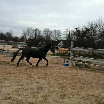
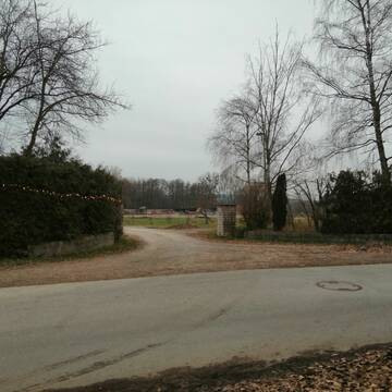
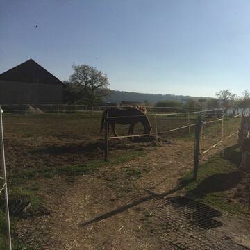
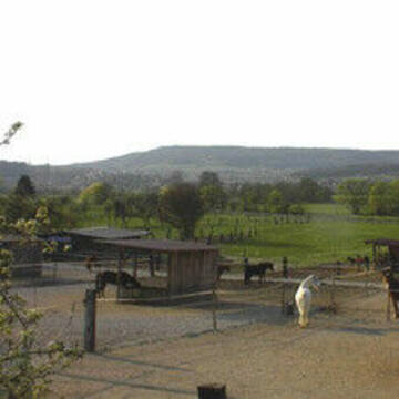
Pferdestall - Offenstall frei
Gräfenberg
Schoenhoefer
@Schoenhoefer
Freizeitstall
Vermieten
Hunde willkommen
Longierzirkel/Roundpen
Allergikerstall
Gnadenbrothof
14 weitere...
P
Deprecated: Creation of dynamic property Zend_View_Helper_Ads::$adLink is deprecated in /var/www/stall-frei/htdocs/staging.stall-frei.de/library/Psf/View/Helper/Ads.php on line 108

Frisches Stroh zu verkaufen!
Mechtersen
STALL-FREIde Marketing
@STALL-FREI-Marketing
Kaufe frisches Stroh für dein Pferd!

Pensionsstall Stein
Kunreuth
Pensionsstall Stein
@Pensionsstall-Stein-GbR
Freizeitstall
Geländestrecke
Vermieten
Longierzirkel/Roundpen
Paddock
Allergikerstall
Gnadenbrothof
23 weitere...
P+
Bio vom Sattelbachhof
Eckental
Reitstall-Sattelbach
@Reitstall-Sattelbach
FN-Mitglied
Vermieten
Hunde willkommen
Longierzirkel/Roundpen
Innenbox
Offenstall
16 weitere...
P
4 Boxen und ein Offenstall Abteil
Eckental
Schenkl
@Schenkl
Freizeitstall
Reitlehrer und -unterricht
Vermieten
Paddock
Reithalle
Innenbox
7 weitere...
P

Boxen und Offenstallplätze Frei
Kirchehrenbach
Reithof Gebhard
@bernd-Reithof-Gebhard
Freizeitstall
Geländestrecke
Longierzirkel/Roundpen
Paddock
Fohlenaufzucht möglich
Hengsthaltung möglich
Außenbox mit Paddock
Außenboxen
21 weitere...
P+

Pferdepension Hit Aktivstall Kürmerhof
Hohenkammer
Kuermerhof
@Kuermerhof
*******JETZT NEU MIT ENTSTAUBTEM BIOHEU*********
*******Demnächst mit einem Abenteuerspielplatz für Pferde ( Extrem Trail/Pa
Leider kein Vorschaubild
Leider kein Vorschaubild
Offenstallplatz in netter Wallach Gruppe frei 😊
Gräfenberg
Galster
@galster
Freizeitstall
Geländestrecke
Vermieten
Krankenbox
Longierzirkel/Roundpen
Notfallboxen
12 weitere...
B

Offenstall hat 2 Plätze frei
Eckental
Harald Wagner
@Harald-Wagner
Freizeitstall
Hunde willkommen
Reitplatz (z.B. Dressur, Springen, Reining)
Offenstall
Vollpension
3 weitere...
P

Paddockboxen und Offenstallplätze
LEUTENBACH
Max Sponsel
@DietzhoferMuehle
Freizeitstall
Pferdeausbildung
Vermieten
Hunde willkommen
Krankenbox
Gnadenbrothof
Hufrehe geeignet
22 weitere...
aktuell
P


Reitanlage Hundsmühle
Heroldsberg
Reitanlage Hundsmühle
@Hundsmuehle_Heroldsberg
FN-Mitglied
Freizeitstall
Vermieten
Hunde willkommen
Krankenbox
Allergikerstall
bedampftes/gewaschenes Heu
26 weitere...
aktuell
P+
Deprecated: Creation of dynamic property Zend_View::$pageCount is deprecated in /var/www/stall-frei/htdocs/staging.stall-frei.de/library/vendor/shardj/zf1-future/library/Zend/View/Abstract.php on line 308
Deprecated: Creation of dynamic property Zend_View::$itemCountPerPage is deprecated in /var/www/stall-frei/htdocs/staging.stall-frei.de/library/vendor/shardj/zf1-future/library/Zend/View/Abstract.php on line 308
Deprecated: Creation of dynamic property Zend_View::$first is deprecated in /var/www/stall-frei/htdocs/staging.stall-frei.de/library/vendor/shardj/zf1-future/library/Zend/View/Abstract.php on line 308
Deprecated: Creation of dynamic property Zend_View::$current is deprecated in /var/www/stall-frei/htdocs/staging.stall-frei.de/library/vendor/shardj/zf1-future/library/Zend/View/Abstract.php on line 308
Deprecated: Creation of dynamic property Zend_View::$last is deprecated in /var/www/stall-frei/htdocs/staging.stall-frei.de/library/vendor/shardj/zf1-future/library/Zend/View/Abstract.php on line 308
Deprecated: Creation of dynamic property Zend_View::$next is deprecated in /var/www/stall-frei/htdocs/staging.stall-frei.de/library/vendor/shardj/zf1-future/library/Zend/View/Abstract.php on line 308
Deprecated: Creation of dynamic property Zend_View::$pagesInRange is deprecated in /var/www/stall-frei/htdocs/staging.stall-frei.de/library/vendor/shardj/zf1-future/library/Zend/View/Abstract.php on line 308
Deprecated: Creation of dynamic property Zend_View::$firstPageInRange is deprecated in /var/www/stall-frei/htdocs/staging.stall-frei.de/library/vendor/shardj/zf1-future/library/Zend/View/Abstract.php on line 308
Deprecated: Creation of dynamic property Zend_View::$lastPageInRange is deprecated in /var/www/stall-frei/htdocs/staging.stall-frei.de/library/vendor/shardj/zf1-future/library/Zend/View/Abstract.php on line 308
Deprecated: Creation of dynamic property Zend_View::$currentItemCount is deprecated in /var/www/stall-frei/htdocs/staging.stall-frei.de/library/vendor/shardj/zf1-future/library/Zend/View/Abstract.php on line 308
Deprecated: Creation of dynamic property Zend_View::$totalItemCount is deprecated in /var/www/stall-frei/htdocs/staging.stall-frei.de/library/vendor/shardj/zf1-future/library/Zend/View/Abstract.php on line 308
Deprecated: Creation of dynamic property Zend_View::$firstItemNumber is deprecated in /var/www/stall-frei/htdocs/staging.stall-frei.de/library/vendor/shardj/zf1-future/library/Zend/View/Abstract.php on line 308
Deprecated: Creation of dynamic property Zend_View::$lastItemNumber is deprecated in /var/www/stall-frei/htdocs/staging.stall-frei.de/library/vendor/shardj/zf1-future/library/Zend/View/Abstract.php on line 308
Deprecated: Creation of dynamic property Zend_View::$router is deprecated in /var/www/stall-frei/htdocs/staging.stall-frei.de/library/vendor/shardj/zf1-future/library/Zend/View/Abstract.php on line 308
Deprecated: Creation of dynamic property Zend_View::$urlParams is deprecated in /var/www/stall-frei/htdocs/staging.stall-frei.de/library/vendor/shardj/zf1-future/library/Zend/View/Abstract.php on line 308
Deprecated: Creation of dynamic property Zend_View::$showAds is deprecated in /var/www/stall-frei/htdocs/staging.stall-frei.de/library/vendor/shardj/zf1-future/library/Zend/View/Abstract.php on line 308
Deprecated: Creation of dynamic property Zend_View::$objectIds is deprecated in /var/www/stall-frei/htdocs/staging.stall-frei.de/library/vendor/shardj/zf1-future/library/Zend/View/Abstract.php on line 308
Deprecated: Creation of dynamic property Zend_View::$showNavbar is deprecated in /var/www/stall-frei/htdocs/staging.stall-frei.de/library/vendor/shardj/zf1-future/library/Zend/View/Abstract.php on line 308
Deprecated: Creation of dynamic property Zend_View::$showBreadcrumb is deprecated in /var/www/stall-frei/htdocs/staging.stall-frei.de/library/vendor/shardj/zf1-future/library/Zend/View/Abstract.php on line 308
Deprecated: Creation of dynamic property Zend_View::$showFooter is deprecated in /var/www/stall-frei/htdocs/staging.stall-frei.de/library/vendor/shardj/zf1-future/library/Zend/View/Abstract.php on line 308
Deprecated: Creation of dynamic property Zend_View::$showInternalAds is deprecated in /var/www/stall-frei/htdocs/staging.stall-frei.de/library/vendor/shardj/zf1-future/library/Zend/View/Abstract.php on line 308
Deprecated: Creation of dynamic property Zend_View::$blNoContent is deprecated in /var/www/stall-frei/htdocs/staging.stall-frei.de/library/vendor/shardj/zf1-future/library/Zend/View/Abstract.php on line 308
Deprecated: Creation of dynamic property Zend_View::$sMetaDesc is deprecated in /var/www/stall-frei/htdocs/staging.stall-frei.de/library/vendor/shardj/zf1-future/library/Zend/View/Abstract.php on line 308
Deprecated: Creation of dynamic property Zend_View::$useGmaps is deprecated in /var/www/stall-frei/htdocs/staging.stall-frei.de/library/vendor/shardj/zf1-future/library/Zend/View/Abstract.php on line 308
Deprecated: Creation of dynamic property Zend_View::$touches is deprecated in /var/www/stall-frei/htdocs/staging.stall-frei.de/library/vendor/shardj/zf1-future/library/Zend/View/Abstract.php on line 308
Deprecated: Creation of dynamic property Zend_View::$oProject is deprecated in /var/www/stall-frei/htdocs/staging.stall-frei.de/library/vendor/shardj/zf1-future/library/Zend/View/Abstract.php on line 308
Deprecated: Creation of dynamic property Zend_View::$pageHeadline is deprecated in /var/www/stall-frei/htdocs/staging.stall-frei.de/library/vendor/shardj/zf1-future/library/Zend/View/Abstract.php on line 308
Deprecated: Creation of dynamic property Zend_View::$disableLocationField is deprecated in /var/www/stall-frei/htdocs/staging.stall-frei.de/library/vendor/shardj/zf1-future/library/Zend/View/Abstract.php on line 308
Deprecated: Creation of dynamic property Zend_View::$isSearch is deprecated in /var/www/stall-frei/htdocs/staging.stall-frei.de/library/vendor/shardj/zf1-future/library/Zend/View/Abstract.php on line 308
Deprecated: Creation of dynamic property Zend_View::$pageTitle is deprecated in /var/www/stall-frei/htdocs/staging.stall-frei.de/library/vendor/shardj/zf1-future/library/Zend/View/Abstract.php on line 308
Deprecated: Creation of dynamic property Psf_Form_Element_Text::$class is deprecated in /var/www/stall-frei/htdocs/staging.stall-frei.de/library/vendor/shardj/zf1-future/library/Zend/Form/Element.php on line 874
Deprecated: Creation of dynamic property Psf_Form_Element_Text::$size is deprecated in /var/www/stall-frei/htdocs/staging.stall-frei.de/library/vendor/shardj/zf1-future/library/Zend/Form/Element.php on line 874
Deprecated: Creation of dynamic property Psf_Form_Element_Text::$placeholder is deprecated in /var/www/stall-frei/htdocs/staging.stall-frei.de/library/vendor/shardj/zf1-future/library/Zend/Form/Element.php on line 874
Deprecated: Creation of dynamic property Psf_Form_Element_Hidden::$class is deprecated in /var/www/stall-frei/htdocs/staging.stall-frei.de/library/vendor/shardj/zf1-future/library/Zend/Form/Element.php on line 874
Deprecated: Creation of dynamic property Psf_Form_Element_Hidden::$class is deprecated in /var/www/stall-frei/htdocs/staging.stall-frei.de/library/vendor/shardj/zf1-future/library/Zend/Form/Element.php on line 874
Deprecated: Creation of dynamic property Psf_Form_Element_Hidden::$class is deprecated in /var/www/stall-frei/htdocs/staging.stall-frei.de/library/vendor/shardj/zf1-future/library/Zend/Form/Element.php on line 874
Deprecated: Creation of dynamic property Psf_Form_Element_Hidden::$class is deprecated in /var/www/stall-frei/htdocs/staging.stall-frei.de/library/vendor/shardj/zf1-future/library/Zend/Form/Element.php on line 874
Deprecated: Creation of dynamic property Psf_Form_Element_Select::$class is deprecated in /var/www/stall-frei/htdocs/staging.stall-frei.de/library/vendor/shardj/zf1-future/library/Zend/Form/Element.php on line 874
Deprecated: Creation of dynamic property Psf_Form_Element_Select::$class is deprecated in /var/www/stall-frei/htdocs/staging.stall-frei.de/library/vendor/shardj/zf1-future/library/Zend/Form/Element.php on line 874
Deprecated: Creation of dynamic property Psf_Form_Element_Select::$class is deprecated in /var/www/stall-frei/htdocs/staging.stall-frei.de/library/vendor/shardj/zf1-future/library/Zend/Form/Element.php on line 874
Deprecated: Creation of dynamic property Psf_Form_Element_Select::$class is deprecated in /var/www/stall-frei/htdocs/staging.stall-frei.de/library/vendor/shardj/zf1-future/library/Zend/Form/Element.php on line 874
Deprecated: Creation of dynamic property Psf_Form_Element_Text::$class is deprecated in /var/www/stall-frei/htdocs/staging.stall-frei.de/library/vendor/shardj/zf1-future/library/Zend/Form/Element.php on line 874
Deprecated: Creation of dynamic property Psf_Form_Element_Checkbox::$label is deprecated in /var/www/stall-frei/htdocs/staging.stall-frei.de/library/vendor/shardj/zf1-future/library/Zend/Form/Element.php on line 874
Deprecated: Creation of dynamic property Zend_View::$sort is deprecated in /var/www/stall-frei/htdocs/staging.stall-frei.de/library/vendor/shardj/zf1-future/library/Zend/View/Abstract.php on line 308
Deprecated: Creation of dynamic property Zend_View::$searchLocation is deprecated in /var/www/stall-frei/htdocs/staging.stall-frei.de/library/vendor/shardj/zf1-future/library/Zend/View/Abstract.php on line 308
Deprecated: Creation of dynamic property Zend_View::$locationHint is deprecated in /var/www/stall-frei/htdocs/staging.stall-frei.de/library/vendor/shardj/zf1-future/library/Zend/View/Abstract.php on line 308
Psf_GeoCoder_Abstract::getLocation: Gräfenberg Get Location CachedOrLive
Psf_GeoCoder_Abstract::getCachedOrLive: Gräfenberg
Psf_GeoCoder_OpenCageData::makeApiRequest: response:
Array
(
[documentation] => https://opencagedata.com/api
[licenses] => Array
(
[0] => Array
(
[name] => see attribution guide
[url] => https://opencagedata.com/credits
)
)
[results] => Array
(
[0] => Array
(
[bounds] => Array
(
[northeast] => Array
(
[lat] => 49.7020486
[lng] => 11.3082628
)
[southwest] => Array
(
[lat] => 49.6255077
[lng] => 11.1694653
)
)
[components] => Array
(
[ISO_3166-1_alpha-2] => DE
[ISO_3166-1_alpha-3] => DEU
[ISO_3166-2] => Array
(
[0] => DE-BY
)
[_category] => place
[_normalized_city] => Gräfenberg
[_type] => city
[continent] => Europe
[country] => Deutschland
[country_code] => de
[county] => Landkreis Forchheim
[municipality] => Gräfenberg (VGem)
[political_union] => European Union
[postcode] => 91322
[state] => Bayern
[state_code] => BY
[town] => Gräfenberg
)
[confidence] => 7
[formatted] => 91322 Gräfenberg, Deutschland
[geometry] => Array
(
[lat] => 49.6448945
[lng] => 11.2495348
)
)
[1] => Array
(
[bounds] => Array
(
[northeast] => Array
(
[lat] => 48.5811623
[lng] => 9.3229206
)
[southwest] => Array
(
[lat] => 48.5583523
[lng] => 9.2868208
)
)
[components] => Array
(
[ISO_3166-1_alpha-2] => DE
[ISO_3166-1_alpha-3] => DEU
[ISO_3166-2] => Array
(
[0] => DE-BW
)
[_category] => place
[_normalized_city] => Grafenberg
[_type] => village
[continent] => Europe
[country] => Deutschland
[country_code] => de
[county] => Landkreis Reutlingen
[municipality] => VVG der Stadt Metzingen
[political_union] => European Union
[postcode] => 72661
[state] => Baden-Württemberg
[state_code] => BW
[village] => Grafenberg
)
[confidence] => 7
[formatted] => 72661 Grafenberg, Deutschland
[geometry] => Array
(
[lat] => 48.5662208
[lng] => 9.3052976
)
)
[2] => Array
(
[bounds] => Array
(
[northeast] => Array
(
[lat] => 51.3079407
[lng] => 8.0119957
)
[southwest] => Array
(
[lat] => 51.3029224
[lng] => 8.0029128
)
)
[components] => Array
(
[ISO_3166-1_alpha-2] => DE
[ISO_3166-1_alpha-3] => DEU
[ISO_3166-2] => Array
(
[0] => DE-NW
)
[_category] => natural/water
[_normalized_city] => Sundern
[_type] => nature_reserve
[continent] => Europe
[country] => Deutschland
[country_code] => de
[county] => Hochsauerlandkreis
[nature_reserve] => Gräfenberg
[political_union] => European Union
[postcode] => 59846
[state] => Nordrhein-Westfalen
[state_code] => NW
[suburb] => Seidfeld (Sauerland)
[town] => Sundern
)
[confidence] => 9
[formatted] => Gräfenberg, 59846 Sundern, Deutschland
[geometry] => Array
(
[lat] => 51.3054432
[lng] => 8.006723
)
)
[3] => Array
(
[bounds] => Array
(
[northeast] => Array
(
[lat] => 51.2514289
[lng] => 6.8394225
)
[southwest] => Array
(
[lat] => 51.2344542
[lng] => 6.8213874
)
)
[components] => Array
(
[ISO_3166-1_alpha-2] => DE
[ISO_3166-1_alpha-3] => DEU
[ISO_3166-2] => Array
(
[0] => DE-NW
)
[_category] => place
[_normalized_city] => Düsseldorf
[_type] => neighbourhood
[city] => Düsseldorf
[city_district] => Stadtbezirk 7
[continent] => Europe
[country] => Deutschland
[country_code] => de
[political_union] => European Union
[state] => Nordrhein-Westfalen
[state_code] => NW
[suburb] => Grafenberg
)
[confidence] => 8
[formatted] => Grafenberg, Düsseldorf, Nordrhein-Westfalen, Deutschland
[geometry] => Array
(
[lat] => 51.2429286
[lng] => 6.8263025
)
)
[4] => Array
(
[bounds] => Array
(
[northeast] => Array
(
[lat] => 51.2610926
[lng] => 6.8529492
)
[southwest] => Array
(
[lat] => 51.2210926
[lng] => 6.8129492
)
)
[components] => Array
(
[ISO_3166-1_alpha-2] => DE
[ISO_3166-1_alpha-3] => DEU
[ISO_3166-2] => Array
(
[0] => DE-NW
)
[_category] => place
[_normalized_city] => Düsseldorf
[_type] => neighbourhood
[city] => Düsseldorf
[city_district] => Stadtbezirk 7
[continent] => Europe
[country] => Deutschland
[country_code] => de
[political_union] => European Union
[postcode] => 40629
[state] => Nordrhein-Westfalen
[state_code] => NW
[suburb] => Grafenberg
)
[confidence] => 7
[formatted] => 40629 Düsseldorf, Deutschland
[geometry] => Array
(
[lat] => 51.2410926
[lng] => 6.8329492
)
)
[5] => Array
(
[bounds] => Array
(
[northeast] => Array
(
[lat] => 49.7020486
[lng] => 11.3694376
)
[southwest] => Array
(
[lat] => 49.6160515
[lng] => 11.1694653
)
)
[components] => Array
(
[ISO_3166-1_alpha-2] => DE
[ISO_3166-1_alpha-3] => DEU
[ISO_3166-2] => Array
(
[0] => DE-BY
)
[_category] => place
[_normalized_city] => Gräfenberg (VGem)
[_type] => municipality
[continent] => Europe
[country] => Deutschland
[country_code] => de
[county] => Landkreis Forchheim
[municipality] => Gräfenberg (VGem)
[political_union] => European Union
[state] => Bayern
[state_code] => BY
)
[confidence] => 6
[formatted] => Gräfenberg (VGem), Bayern, Deutschland
[geometry] => Array
(
[lat] => 49.6590449
[lng] => 11.2659167
)
)
[6] => Array
(
[bounds] => Array
(
[northeast] => Array
(
[lat] => 50.0322983
[lng] => 9.2304271
)
[southwest] => Array
(
[lat] => 50.0321983
[lng] => 9.2303271
)
)
[components] => Array
(
[ISO_3166-1_alpha-2] => DE
[ISO_3166-1_alpha-3] => DEU
[ISO_3166-2] => Array
(
[0] => DE-BY
)
[_category] => natural/water
[_normalized_city] => Hösbach
[_type] => peak
[continent] => Europe
[country] => Deutschland
[country_code] => de
[county] => Landkreis Aschaffenburg
[peak] => Gräfenberg
[political_union] => European Union
[postcode] => 63768
[state] => Bayern
[state_code] => BY
[town] => Hösbach
)
[confidence] => 9
[formatted] => Gräfenberg, 63768 Hösbach, Deutschland
[geometry] => Array
(
[lat] => 50.0322483
[lng] => 9.2303771
)
)
[7] => Array
(
[bounds] => Array
(
[northeast] => Array
(
[lat] => 51.4944734
[lng] => 10.4944802
)
[southwest] => Array
(
[lat] => 51.4943734
[lng] => 10.4943802
)
)
[components] => Array
(
[ISO_3166-1_alpha-2] => DE
[ISO_3166-1_alpha-3] => DEU
[ISO_3166-2] => Array
(
[0] => DE-TH
)
[_category] => natural/water
[_normalized_city] => Sonnenstein
[_type] => peak
[city] => Sonnenstein
[continent] => Europe
[country] => Deutschland
[country_code] => de
[county] => Landkreis Eichsfeld
[peak] => Gräfenberg
[political_union] => European Union
[state] => Thüringen
[state_code] => TH
)
[confidence] => 9
[formatted] => Gräfenberg, Sonnenstein, Thüringen, Deutschland
[geometry] => Array
(
[lat] => 51.4944234
[lng] => 10.4944302
)
)
[8] => Array
(
[bounds] => Array
(
[northeast] => Array
(
[lat] => 50.229596
[lng] => 7.96222
)
[southwest] => Array
(
[lat] => 50.229496
[lng] => 7.96212
)
)
[components] => Array
(
[ISO_3166-1_alpha-2] => DE
[ISO_3166-1_alpha-3] => DEU
[ISO_3166-2] => Array
(
[0] => DE-RP
)
[_category] => natural/water
[_normalized_city] => Berndroth
[_type] => peak
[continent] => Europe
[country] => Deutschland
[country_code] => de
[county] => Rhein-Lahn-Kreis
[municipality] => Aar-Einrich
[peak] => Gräfenberg
[political_union] => European Union
[state] => Rheinland-Pfalz
[state_code] => RP
[village] => Berndroth
)
[confidence] => 9
[formatted] => Gräfenberg, Berndroth, Rheinland-Pfalz, Deutschland
[geometry] => Array
(
[lat] => 50.229546
[lng] => 7.96217
)
)
[9] => Array
(
[bounds] => Array
(
[northeast] => Array
(
[lat] => 50.4398769
[lng] => 9.5229938
)
[southwest] => Array
(
[lat] => 50.4397769
[lng] => 9.5228938
)
)
[components] => Array
(
[ISO_3166-1_alpha-2] => DE
[ISO_3166-1_alpha-3] => DEU
[ISO_3166-2] => Array
(
[0] => DE-HE
)
[_category] => natural/water
[_normalized_city] => Magdlos
[_type] => peak
[continent] => Europe
[country] => Deutschland
[country_code] => de
[county] => Landkreis Fulda
[municipality] => Flieden
[peak] => Gräfenberg
[political_union] => European Union
[postcode] => 36103
[state] => Hessen
[state_code] => HE
[village] => Magdlos
)
[confidence] => 9
[formatted] => Gräfenberg, 36103 Magdlos, Deutschland
[geometry] => Array
(
[lat] => 50.4398269
[lng] => 9.5229438
)
)
)
[status] => Array
(
[code] => 200
[message] => OK
)
[stay_informed] => Array
(
[blog] => https://blog.opencagedata.com
[mastodon] => https://en.osm.town/@opencage
)
[thanks] => For using an OpenCage API
[timestamp] => Array
(
[created_http] => Sun, 08 Feb 2026 12:45:08 GMT
[created_unix] => 1770554708
)
[total_results] => 10
)
Psf_GeoCoder_Abstract::convertLocationResult
{"documentation":"https:\/\/opencagedata.com\/api","licenses":[{"name":"see attribution guide","url":"https:\/\/opencagedata.com\/credits"}],"results":[{"bounds":{"northeast":{"lat":49.7020486,"lng":11.3082628},"southwest":{"lat":49.6255077,"lng":11.1694653}},"components":{"ISO_3166-1_alpha-2":"DE","ISO_3166-1_alpha-3":"DEU","ISO_3166-2":["DE-BY"],"_category":"place","_normalized_city":"Gr\u00e4fenberg","_type":"city","continent":"Europe","country":"Deutschland","country_code":"de","county":"Landkreis Forchheim","municipality":"Gr\u00e4fenberg (VGem)","political_union":"European Union","postcode":"91322","state":"Bayern","state_code":"BY","town":"Gr\u00e4fenberg"},"confidence":7,"formatted":"91322 Gr\u00e4fenberg, Deutschland","geometry":{"lat":49.6448945,"lng":11.2495348}},{"bounds":{"northeast":{"lat":48.5811623,"lng":9.3229206},"southwest":{"lat":48.5583523,"lng":9.2868208}},"components":{"ISO_3166-1_alpha-2":"DE","ISO_3166-1_alpha-3":"DEU","ISO_3166-2":["DE-BW"],"_category":"place","_normalized_city":"Grafenberg","_type":"village","continent":"Europe","country":"Deutschland","country_code":"de","county":"Landkreis Reutlingen","municipality":"VVG der Stadt Metzingen","political_union":"European Union","postcode":"72661","state":"Baden-W\u00fcrttemberg","state_code":"BW","village":"Grafenberg"},"confidence":7,"formatted":"72661 Grafenberg, Deutschland","geometry":{"lat":48.5662208,"lng":9.3052976}},{"bounds":{"northeast":{"lat":51.3079407,"lng":8.0119957},"southwest":{"lat":51.3029224,"lng":8.0029128}},"components":{"ISO_3166-1_alpha-2":"DE","ISO_3166-1_alpha-3":"DEU","ISO_3166-2":["DE-NW"],"_category":"natural\/water","_normalized_city":"Sundern","_type":"nature_reserve","continent":"Europe","country":"Deutschland","country_code":"de","county":"Hochsauerlandkreis","nature_reserve":"Gr\u00e4fenberg","political_union":"European Union","postcode":"59846","state":"Nordrhein-Westfalen","state_code":"NW","suburb":"Seidfeld (Sauerland)","town":"Sundern"},"confidence":9,"formatted":"Gr\u00e4fenberg, 59846 Sundern, Deutschland","geometry":{"lat":51.3054432,"lng":8.006723}},{"bounds":{"northeast":{"lat":51.2514289,"lng":6.8394225},"southwest":{"lat":51.2344542,"lng":6.8213874}},"components":{"ISO_3166-1_alpha-2":"DE","ISO_3166-1_alpha-3":"DEU","ISO_3166-2":["DE-NW"],"_category":"place","_normalized_city":"D\u00fcsseldorf","_type":"neighbourhood","city":"D\u00fcsseldorf","city_district":"Stadtbezirk 7","continent":"Europe","country":"Deutschland","country_code":"de","political_union":"European Union","state":"Nordrhein-Westfalen","state_code":"NW","suburb":"Grafenberg"},"confidence":8,"formatted":"Grafenberg, D\u00fcsseldorf, Nordrhein-Westfalen, Deutschland","geometry":{"lat":51.2429286,"lng":6.8263025}},{"bounds":{"northeast":{"lat":51.2610926,"lng":6.8529492},"southwest":{"lat":51.2210926,"lng":6.8129492}},"components":{"ISO_3166-1_alpha-2":"DE","ISO_3166-1_alpha-3":"DEU","ISO_3166-2":["DE-NW"],"_category":"place","_normalized_city":"D\u00fcsseldorf","_type":"neighbourhood","city":"D\u00fcsseldorf","city_district":"Stadtbezirk 7","continent":"Europe","country":"Deutschland","country_code":"de","political_union":"European Union","postcode":"40629","state":"Nordrhein-Westfalen","state_code":"NW","suburb":"Grafenberg"},"confidence":7,"formatted":"40629 D\u00fcsseldorf, Deutschland","geometry":{"lat":51.2410926,"lng":6.8329492}},{"bounds":{"northeast":{"lat":49.7020486,"lng":11.3694376},"southwest":{"lat":49.6160515,"lng":11.1694653}},"components":{"ISO_3166-1_alpha-2":"DE","ISO_3166-1_alpha-3":"DEU","ISO_3166-2":["DE-BY"],"_category":"place","_normalized_city":"Gr\u00e4fenberg (VGem)","_type":"municipality","continent":"Europe","country":"Deutschland","country_code":"de","county":"Landkreis Forchheim","municipality":"Gr\u00e4fenberg (VGem)","political_union":"European Union","state":"Bayern","state_code":"BY"},"confidence":6,"formatted":"Gr\u00e4fenberg (VGem), Bayern, Deutschland","geometry":{"lat":49.6590449,"lng":11.2659167}},{"bounds":{"northeast":{"lat":50.0322983,"lng":9.2304271},"southwest":{"lat":50.0321983,"lng":9.2303271}},"components":{"ISO_3166-1_alpha-2":"DE","ISO_3166-1_alpha-3":"DEU","ISO_3166-2":["DE-BY"],"_category":"natural\/water","_normalized_city":"H\u00f6sbach","_type":"peak","continent":"Europe","country":"Deutschland","country_code":"de","county":"Landkreis Aschaffenburg","peak":"Gr\u00e4fenberg","political_union":"European Union","postcode":"63768","state":"Bayern","state_code":"BY","town":"H\u00f6sbach"},"confidence":9,"formatted":"Gr\u00e4fenberg, 63768 H\u00f6sbach, Deutschland","geometry":{"lat":50.0322483,"lng":9.2303771}},{"bounds":{"northeast":{"lat":51.4944734,"lng":10.4944802},"southwest":{"lat":51.4943734,"lng":10.4943802}},"components":{"ISO_3166-1_alpha-2":"DE","ISO_3166-1_alpha-3":"DEU","ISO_3166-2":["DE-TH"],"_category":"natural\/water","_normalized_city":"Sonnenstein","_type":"peak","city":"Sonnenstein","continent":"Europe","country":"Deutschland","country_code":"de","county":"Landkreis Eichsfeld","peak":"Gr\u00e4fenberg","political_union":"European Union","state":"Th\u00fcringen","state_code":"TH"},"confidence":9,"formatted":"Gr\u00e4fenberg, Sonnenstein, Th\u00fcringen, Deutschland","geometry":{"lat":51.4944234,"lng":10.4944302}},{"bounds":{"northeast":{"lat":50.229596,"lng":7.96222},"southwest":{"lat":50.229496,"lng":7.96212}},"components":{"ISO_3166-1_alpha-2":"DE","ISO_3166-1_alpha-3":"DEU","ISO_3166-2":["DE-RP"],"_category":"natural\/water","_normalized_city":"Berndroth","_type":"peak","continent":"Europe","country":"Deutschland","country_code":"de","county":"Rhein-Lahn-Kreis","municipality":"Aar-Einrich","peak":"Gr\u00e4fenberg","political_union":"European Union","state":"Rheinland-Pfalz","state_code":"RP","village":"Berndroth"},"confidence":9,"formatted":"Gr\u00e4fenberg, Berndroth, Rheinland-Pfalz, Deutschland","geometry":{"lat":50.229546,"lng":7.96217}},{"bounds":{"northeast":{"lat":50.4398769,"lng":9.5229938},"southwest":{"lat":50.4397769,"lng":9.5228938}},"components":{"ISO_3166-1_alpha-2":"DE","ISO_3166-1_alpha-3":"DEU","ISO_3166-2":["DE-HE"],"_category":"natural\/water","_normalized_city":"Magdlos","_type":"peak","continent":"Europe","country":"Deutschland","country_code":"de","county":"Landkreis Fulda","municipality":"Flieden","peak":"Gr\u00e4fenberg","political_union":"European Union","postcode":"36103","state":"Hessen","state_code":"HE","village":"Magdlos"},"confidence":9,"formatted":"Gr\u00e4fenberg, 36103 Magdlos, Deutschland","geometry":{"lat":50.4398269,"lng":9.5229438}}],"status":{"code":200,"message":"OK"},"stay_informed":{"blog":"https:\/\/blog.opencagedata.com","mastodon":"https:\/\/en.osm.town\/@opencage"},"thanks":"For using an OpenCage API","timestamp":{"created_http":"Sun, 08 Feb 2026 12:45:08 GMT","created_unix":1770554708},"total_results":10}Array
(
[0] => stdClass Object
(
[bounds] => stdClass Object
(
[northeast] => stdClass Object
(
[lat] => 49.7020486
[lng] => 11.3082628
)
[southwest] => stdClass Object
(
[lat] => 49.6255077
[lng] => 11.1694653
)
)
[components] => stdClass Object
(
[ISO_3166-1_alpha-2] => DE
[ISO_3166-1_alpha-3] => DEU
[ISO_3166-2] => Array
(
[0] => DE-BY
)
[_category] => place
[_normalized_city] => Gräfenberg
[_type] => city
[continent] => Europe
[country] => Deutschland
[country_code] => de
[county] => Landkreis Forchheim
[municipality] => Gräfenberg (VGem)
[political_union] => European Union
[postcode] => 91322
[state] => Bayern
[state_code] => BY
[town] => Gräfenberg
)
[confidence] => 7
[formatted] => 91322 Gräfenberg, Deutschland
[geometry] => stdClass Object
(
[lat] => 49.6448945
[lng] => 11.2495348
)
)
[1] => stdClass Object
(
[bounds] => stdClass Object
(
[northeast] => stdClass Object
(
[lat] => 48.5811623
[lng] => 9.3229206
)
[southwest] => stdClass Object
(
[lat] => 48.5583523
[lng] => 9.2868208
)
)
[components] => stdClass Object
(
[ISO_3166-1_alpha-2] => DE
[ISO_3166-1_alpha-3] => DEU
[ISO_3166-2] => Array
(
[0] => DE-BW
)
[_category] => place
[_normalized_city] => Grafenberg
[_type] => village
[continent] => Europe
[country] => Deutschland
[country_code] => de
[county] => Landkreis Reutlingen
[municipality] => VVG der Stadt Metzingen
[political_union] => European Union
[postcode] => 72661
[state] => Baden-Württemberg
[state_code] => BW
[village] => Grafenberg
)
[confidence] => 7
[formatted] => 72661 Grafenberg, Deutschland
[geometry] => stdClass Object
(
[lat] => 48.5662208
[lng] => 9.3052976
)
)
[2] => stdClass Object
(
[bounds] => stdClass Object
(
[northeast] => stdClass Object
(
[lat] => 51.3079407
[lng] => 8.0119957
)
[southwest] => stdClass Object
(
[lat] => 51.3029224
[lng] => 8.0029128
)
)
[components] => stdClass Object
(
[ISO_3166-1_alpha-2] => DE
[ISO_3166-1_alpha-3] => DEU
[ISO_3166-2] => Array
(
[0] => DE-NW
)
[_category] => natural/water
[_normalized_city] => Sundern
[_type] => nature_reserve
[continent] => Europe
[country] => Deutschland
[country_code] => de
[county] => Hochsauerlandkreis
[nature_reserve] => Gräfenberg
[political_union] => European Union
[postcode] => 59846
[state] => Nordrhein-Westfalen
[state_code] => NW
[suburb] => Seidfeld (Sauerland)
[town] => Sundern
)
[confidence] => 9
[formatted] => Gräfenberg, 59846 Sundern, Deutschland
[geometry] => stdClass Object
(
[lat] => 51.3054432
[lng] => 8.006723
)
)
[3] => stdClass Object
(
[bounds] => stdClass Object
(
[northeast] => stdClass Object
(
[lat] => 51.2514289
[lng] => 6.8394225
)
[southwest] => stdClass Object
(
[lat] => 51.2344542
[lng] => 6.8213874
)
)
[components] => stdClass Object
(
[ISO_3166-1_alpha-2] => DE
[ISO_3166-1_alpha-3] => DEU
[ISO_3166-2] => Array
(
[0] => DE-NW
)
[_category] => place
[_normalized_city] => Düsseldorf
[_type] => neighbourhood
[city] => Düsseldorf
[city_district] => Stadtbezirk 7
[continent] => Europe
[country] => Deutschland
[country_code] => de
[political_union] => European Union
[state] => Nordrhein-Westfalen
[state_code] => NW
[suburb] => Grafenberg
)
[confidence] => 8
[formatted] => Grafenberg, Düsseldorf, Nordrhein-Westfalen, Deutschland
[geometry] => stdClass Object
(
[lat] => 51.2429286
[lng] => 6.8263025
)
)
[4] => stdClass Object
(
[bounds] => stdClass Object
(
[northeast] => stdClass Object
(
[lat] => 51.2610926
[lng] => 6.8529492
)
[southwest] => stdClass Object
(
[lat] => 51.2210926
[lng] => 6.8129492
)
)
[components] => stdClass Object
(
[ISO_3166-1_alpha-2] => DE
[ISO_3166-1_alpha-3] => DEU
[ISO_3166-2] => Array
(
[0] => DE-NW
)
[_category] => place
[_normalized_city] => Düsseldorf
[_type] => neighbourhood
[city] => Düsseldorf
[city_district] => Stadtbezirk 7
[continent] => Europe
[country] => Deutschland
[country_code] => de
[political_union] => European Union
[postcode] => 40629
[state] => Nordrhein-Westfalen
[state_code] => NW
[suburb] => Grafenberg
)
[confidence] => 7
[formatted] => 40629 Düsseldorf, Deutschland
[geometry] => stdClass Object
(
[lat] => 51.2410926
[lng] => 6.8329492
)
)
[5] => stdClass Object
(
[bounds] => stdClass Object
(
[northeast] => stdClass Object
(
[lat] => 49.7020486
[lng] => 11.3694376
)
[southwest] => stdClass Object
(
[lat] => 49.6160515
[lng] => 11.1694653
)
)
[components] => stdClass Object
(
[ISO_3166-1_alpha-2] => DE
[ISO_3166-1_alpha-3] => DEU
[ISO_3166-2] => Array
(
[0] => DE-BY
)
[_category] => place
[_normalized_city] => Gräfenberg (VGem)
[_type] => municipality
[continent] => Europe
[country] => Deutschland
[country_code] => de
[county] => Landkreis Forchheim
[municipality] => Gräfenberg (VGem)
[political_union] => European Union
[state] => Bayern
[state_code] => BY
)
[confidence] => 6
[formatted] => Gräfenberg (VGem), Bayern, Deutschland
[geometry] => stdClass Object
(
[lat] => 49.6590449
[lng] => 11.2659167
)
)
[6] => stdClass Object
(
[bounds] => stdClass Object
(
[northeast] => stdClass Object
(
[lat] => 50.0322983
[lng] => 9.2304271
)
[southwest] => stdClass Object
(
[lat] => 50.0321983
[lng] => 9.2303271
)
)
[components] => stdClass Object
(
[ISO_3166-1_alpha-2] => DE
[ISO_3166-1_alpha-3] => DEU
[ISO_3166-2] => Array
(
[0] => DE-BY
)
[_category] => natural/water
[_normalized_city] => Hösbach
[_type] => peak
[continent] => Europe
[country] => Deutschland
[country_code] => de
[county] => Landkreis Aschaffenburg
[peak] => Gräfenberg
[political_union] => European Union
[postcode] => 63768
[state] => Bayern
[state_code] => BY
[town] => Hösbach
)
[confidence] => 9
[formatted] => Gräfenberg, 63768 Hösbach, Deutschland
[geometry] => stdClass Object
(
[lat] => 50.0322483
[lng] => 9.2303771
)
)
[7] => stdClass Object
(
[bounds] => stdClass Object
(
[northeast] => stdClass Object
(
[lat] => 51.4944734
[lng] => 10.4944802
)
[southwest] => stdClass Object
(
[lat] => 51.4943734
[lng] => 10.4943802
)
)
[components] => stdClass Object
(
[ISO_3166-1_alpha-2] => DE
[ISO_3166-1_alpha-3] => DEU
[ISO_3166-2] => Array
(
[0] => DE-TH
)
[_category] => natural/water
[_normalized_city] => Sonnenstein
[_type] => peak
[city] => Sonnenstein
[continent] => Europe
[country] => Deutschland
[country_code] => de
[county] => Landkreis Eichsfeld
[peak] => Gräfenberg
[political_union] => European Union
[state] => Thüringen
[state_code] => TH
)
[confidence] => 9
[formatted] => Gräfenberg, Sonnenstein, Thüringen, Deutschland
[geometry] => stdClass Object
(
[lat] => 51.4944234
[lng] => 10.4944302
)
)
[8] => stdClass Object
(
[bounds] => stdClass Object
(
[northeast] => stdClass Object
(
[lat] => 50.229596
[lng] => 7.96222
)
[southwest] => stdClass Object
(
[lat] => 50.229496
[lng] => 7.96212
)
)
[components] => stdClass Object
(
[ISO_3166-1_alpha-2] => DE
[ISO_3166-1_alpha-3] => DEU
[ISO_3166-2] => Array
(
[0] => DE-RP
)
[_category] => natural/water
[_normalized_city] => Berndroth
[_type] => peak
[continent] => Europe
[country] => Deutschland
[country_code] => de
[county] => Rhein-Lahn-Kreis
[municipality] => Aar-Einrich
[peak] => Gräfenberg
[political_union] => European Union
[state] => Rheinland-Pfalz
[state_code] => RP
[village] => Berndroth
)
[confidence] => 9
[formatted] => Gräfenberg, Berndroth, Rheinland-Pfalz, Deutschland
[geometry] => stdClass Object
(
[lat] => 50.229546
[lng] => 7.96217
)
)
[9] => stdClass Object
(
[bounds] => stdClass Object
(
[northeast] => stdClass Object
(
[lat] => 50.4398769
[lng] => 9.5229938
)
[southwest] => stdClass Object
(
[lat] => 50.4397769
[lng] => 9.5228938
)
)
[components] => stdClass Object
(
[ISO_3166-1_alpha-2] => DE
[ISO_3166-1_alpha-3] => DEU
[ISO_3166-2] => Array
(
[0] => DE-HE
)
[_category] => natural/water
[_normalized_city] => Magdlos
[_type] => peak
[continent] => Europe
[country] => Deutschland
[country_code] => de
[county] => Landkreis Fulda
[municipality] => Flieden
[peak] => Gräfenberg
[political_union] => European Union
[postcode] => 36103
[state] => Hessen
[state_code] => HE
[village] => Magdlos
)
[confidence] => 9
[formatted] => Gräfenberg, 36103 Magdlos, Deutschland
[geometry] => stdClass Object
(
[lat] => 50.4398269
[lng] => 9.5229438
)
)
)
Psf_GeoCoder_OpenCageData::getKeyMap: 0
stdClass Object
(
    [bounds] => stdClass Object
        (
            [northeast] => stdClass Object
                (
                    [lat] => 49.7020486
                    [lng] => 11.3082628
                )

            [southwest] => stdClass Object
                (
                    [lat] => 49.6255077
                    [lng] => 11.1694653
                )

        )

    [components] => stdClass Object
        (
            [ISO_3166-1_alpha-2] => DE
            [ISO_3166-1_alpha-3] => DEU
            [ISO_3166-2] => Array
                (
                    [0] => DE-BY
                )

            [_category] => place
            [_normalized_city] => Gräfenberg
            [_type] => city
            [continent] => Europe
            [country] => Deutschland
            [country_code] => de
            [county] => Landkreis Forchheim
            [municipality] => Gräfenberg (VGem)
            [political_union] => European Union
            [postcode] => 91322
            [state] => Bayern
            [state_code] => BY
            [town] => Gräfenberg
        )

    [confidence] => 7
    [formatted] => 91322 Gräfenberg, Deutschland
    [geometry] => stdClass Object
        (
            [lat] => 49.6448945
            [lng] => 11.2495348
        )

)
Psf_GeoCoder_OpenCageData::getCounty: Forchheim
Psf_GeoCoder_OpenCageData::addMissingData REFETCH!
Array
(
    [address] => 91322 Gräfenberg, Deutschland
    [type] => city
    [street] =>
    [city] => Gräfenberg
    [county] => Forchheim
    [state] => Bayern
    [zip] => 91322
    [country] => Deutschland
    [suburb] =>
    [countrycode] => de
    [latitude] => 49.6448945
    [longitude] => 11.2495348
    [accuracy] => 1
    [confidence] => 7
    [bounds] => stdClass Object
        (
            [northeast] => stdClass Object
                (
                    [lat] => 49.7020486
                    [lng] => 11.3082628
                )

            [southwest] => stdClass Object
                (
                    [lat] => 49.6255077
                    [lng] => 11.1694653
                )

        )

)
reformat!
Array
(
    [address] => 91322 Gräfenberg, Deutschland
    [type] => city
    [street] =>
    [city] => Gräfenberg
    [county] => Forchheim
    [state] => Bayern
    [zip] => 91322
    [country] => Deutschland
    [suburb] =>
    [countrycode] => de
    [latitude] => 49.6448945
    [longitude] => 11.2495348
    [accuracy] => 1
    [confidence] => 7
    [bounds] => stdClass Object
        (
            [northeast] => stdClass Object
                (
                    [lat] => 49.7020486
                    [lng] => 11.3082628
                )

            [southwest] => stdClass Object
                (
                    [lat] => 49.6255077
                    [lng] => 11.1694653
                )

        )

    [place] => 91322 Gräfenberg, Bayern
    [hash] => f63d5d75ea69dcc2049639993fa4221f
)
Psf_GeoCoder_OpenCageData::getKeyMap: 1
stdClass Object
(
    [bounds] => stdClass Object
        (
            [northeast] => stdClass Object
                (
                    [lat] => 48.5811623
                    [lng] => 9.3229206
                )

            [southwest] => stdClass Object
                (
                    [lat] => 48.5583523
                    [lng] => 9.2868208
                )

        )

    [components] => stdClass Object
        (
            [ISO_3166-1_alpha-2] => DE
            [ISO_3166-1_alpha-3] => DEU
            [ISO_3166-2] => Array
                (
                    [0] => DE-BW
                )

            [_category] => place
            [_normalized_city] => Grafenberg
            [_type] => village
            [continent] => Europe
            [country] => Deutschland
            [country_code] => de
            [county] => Landkreis Reutlingen
            [municipality] => VVG der Stadt Metzingen
            [political_union] => European Union
            [postcode] => 72661
            [state] => Baden-Württemberg
            [state_code] => BW
            [village] => Grafenberg
        )

    [confidence] => 7
    [formatted] => 72661 Grafenberg, Deutschland
    [geometry] => stdClass Object
        (
            [lat] => 48.5662208
            [lng] => 9.3052976
        )

)
Psf_GeoCoder_OpenCageData::getCounty: Reutlingen
Psf_GeoCoder_OpenCageData::addMissingData REFETCH!
Array
(
    [address] => 72661 Grafenberg, Deutschland
    [type] => village
    [street] =>
    [city] => Grafenberg
    [county] => Reutlingen
    [state] => Baden-Württemberg
    [zip] => 72661
    [country] => Deutschland
    [suburb] =>
    [countrycode] => de
    [latitude] => 48.5662208
    [longitude] => 9.3052976
    [accuracy] => 1
    [confidence] => 7
    [bounds] => stdClass Object
        (
            [northeast] => stdClass Object
                (
                    [lat] => 48.5811623
                    [lng] => 9.3229206
                )

            [southwest] => stdClass Object
                (
                    [lat] => 48.5583523
                    [lng] => 9.2868208
                )

        )

)
reformat!
Array
(
    [address] => 72661 Grafenberg, Deutschland
    [type] => village
    [street] =>
    [city] => Grafenberg
    [county] => Reutlingen
    [state] => Baden-Württemberg
    [zip] => 72661
    [country] => Deutschland
    [suburb] =>
    [countrycode] => de
    [latitude] => 48.5662208
    [longitude] => 9.3052976
    [accuracy] => 1
    [confidence] => 7
    [bounds] => stdClass Object
        (
            [northeast] => stdClass Object
                (
                    [lat] => 48.5811623
                    [lng] => 9.3229206
                )

            [southwest] => stdClass Object
                (
                    [lat] => 48.5583523
                    [lng] => 9.2868208
                )

        )

    [place] => 72661 Grafenberg, Baden-Württemberg
    [hash] => a37a68e910727281ce6877fbdf3b5cee
)
Psf_GeoCoder_OpenCageData::getKeyMap: 2
stdClass Object
(
    [bounds] => stdClass Object
        (
            [northeast] => stdClass Object
                (
                    [lat] => 51.3079407
                    [lng] => 8.0119957
                )

            [southwest] => stdClass Object
                (
                    [lat] => 51.3029224
                    [lng] => 8.0029128
                )

        )

    [components] => stdClass Object
        (
            [ISO_3166-1_alpha-2] => DE
            [ISO_3166-1_alpha-3] => DEU
            [ISO_3166-2] => Array
                (
                    [0] => DE-NW
                )

            [_category] => natural/water
            [_normalized_city] => Sundern
            [_type] => nature_reserve
            [continent] => Europe
            [country] => Deutschland
            [country_code] => de
            [county] => Hochsauerlandkreis
            [nature_reserve] => Gräfenberg
            [political_union] => European Union
            [postcode] => 59846
            [state] => Nordrhein-Westfalen
            [state_code] => NW
            [suburb] => Seidfeld (Sauerland)
            [town] => Sundern
        )

    [confidence] => 9
    [formatted] => Gräfenberg, 59846 Sundern, Deutschland
    [geometry] => stdClass Object
        (
            [lat] => 51.3054432
            [lng] => 8.006723
        )

)
Psf_GeoCoder_OpenCageData::getCounty: Hochsauerlandkreis
Psf_GeoCoder_OpenCageData::addMissingData REFETCH!
Array
(
    [address] => Gräfenberg, 59846 Sundern, Deutschland
    [type] => nature_reserve
    [street] =>
    [city] => Sundern
    [county] => Hochsauerlandkreis
    [state] => Nordrhein-Westfalen
    [zip] => 59846
    [country] => Deutschland
    [suburb] => Seidfeld (Sauerland)
    [countrycode] => de
    [latitude] => 51.3054432
    [longitude] => 8.006723
    [accuracy] => 1
    [confidence] => 9
    [bounds] => stdClass Object
        (
            [northeast] => stdClass Object
                (
                    [lat] => 51.3079407
                    [lng] => 8.0119957
                )

            [southwest] => stdClass Object
                (
                    [lat] => 51.3029224
                    [lng] => 8.0029128
                )

        )

)
reformat!
Array
(
    [address] => Gräfenberg, 59846 Sundern, Deutschland
    [type] => nature_reserve
    [street] =>
    [city] => Sundern
    [county] => Hochsauerlandkreis
    [state] => Nordrhein-Westfalen
    [zip] => 59846
    [country] => Deutschland
    [suburb] => Seidfeld (Sauerland)
    [countrycode] => de
    [latitude] => 51.3054432
    [longitude] => 8.006723
    [accuracy] => 1
    [confidence] => 9
    [bounds] => stdClass Object
        (
            [northeast] => stdClass Object
                (
                    [lat] => 51.3079407
                    [lng] => 8.0119957
                )

            [southwest] => stdClass Object
                (
                    [lat] => 51.3029224
                    [lng] => 8.0029128
                )

        )

    [place] => 59846 Sundern, Nordrhein-Westfalen
    [hash] => 84570fcf7278b7f88ba349157f937bd0
)
Psf_GeoCoder_OpenCageData::getKeyMap: 3
stdClass Object
(
    [bounds] => stdClass Object
        (
            [northeast] => stdClass Object
                (
                    [lat] => 51.2514289
                    [lng] => 6.8394225
                )

            [southwest] => stdClass Object
                (
                    [lat] => 51.2344542
                    [lng] => 6.8213874
                )

        )

    [components] => stdClass Object
        (
            [ISO_3166-1_alpha-2] => DE
            [ISO_3166-1_alpha-3] => DEU
            [ISO_3166-2] => Array
                (
                    [0] => DE-NW
                )

            [_category] => place
            [_normalized_city] => Düsseldorf
            [_type] => neighbourhood
            [city] => Düsseldorf
            [city_district] => Stadtbezirk 7
            [continent] => Europe
            [country] => Deutschland
            [country_code] => de
            [political_union] => European Union
            [state] => Nordrhein-Westfalen
            [state_code] => NW
            [suburb] => Grafenberg
        )

    [confidence] => 8
    [formatted] => Grafenberg, Düsseldorf, Nordrhein-Westfalen, Deutschland
    [geometry] => stdClass Object
        (
            [lat] => 51.2429286
            [lng] => 6.8263025
        )

)
Psf_GeoCoder_OpenCageData::getCounty: Düsseldorf
Psf_GeoCoder_OpenCageData::addMissingData REFETCH!
Array
(
    [address] => Grafenberg, Düsseldorf, Nordrhein-Westfalen, Deutschland
    [type] => neighbourhood
    [street] =>
    [city] => Grafenberg
    [county] => Düsseldorf
    [state] => Nordrhein-Westfalen
    [zip] =>
    [country] => Deutschland
    [suburb] => Grafenberg
    [countrycode] => de
    [latitude] => 51.2429286
    [longitude] => 6.8263025
    [accuracy] => 1
    [confidence] => 8
    [bounds] => stdClass Object
        (
            [northeast] => stdClass Object
                (
                    [lat] => 51.2514289
                    [lng] => 6.8394225
                )

            [southwest] => stdClass Object
                (
                    [lat] => 51.2344542
                    [lng] => 6.8213874
                )

        )

)
reformat!
Array
(
    [address] => Grafenberg, Düsseldorf, Nordrhein-Westfalen, Deutschland
    [type] => neighbourhood
    [street] =>
    [city] => Grafenberg
    [county] => Düsseldorf
    [state] => Nordrhein-Westfalen
    [zip] =>
    [country] => Deutschland
    [suburb] => Grafenberg
    [countrycode] => de
    [latitude] => 51.2429286
    [longitude] => 6.8263025
    [accuracy] => 1
    [confidence] => 8
    [bounds] => stdClass Object
        (
            [northeast] => stdClass Object
                (
                    [lat] => 51.2514289
                    [lng] => 6.8394225
                )

            [southwest] => stdClass Object
                (
                    [lat] => 51.2344542
                    [lng] => 6.8213874
                )

        )

    [place] => Grafenberg, Nordrhein-Westfalen
    [hash] => 0ef1a2904a04cf903c258932f37f7fd7
)
Psf_GeoCoder_OpenCageData::getKeyMap: 4
stdClass Object
(
    [bounds] => stdClass Object
        (
            [northeast] => stdClass Object
                (
                    [lat] => 51.2610926
                    [lng] => 6.8529492
                )

            [southwest] => stdClass Object
                (
                    [lat] => 51.2210926
                    [lng] => 6.8129492
                )

        )

    [components] => stdClass Object
        (
            [ISO_3166-1_alpha-2] => DE
            [ISO_3166-1_alpha-3] => DEU
            [ISO_3166-2] => Array
                (
                    [0] => DE-NW
                )

            [_category] => place
            [_normalized_city] => Düsseldorf
            [_type] => neighbourhood
            [city] => Düsseldorf
            [city_district] => Stadtbezirk 7
            [continent] => Europe
            [country] => Deutschland
            [country_code] => de
            [political_union] => European Union
            [postcode] => 40629
            [state] => Nordrhein-Westfalen
            [state_code] => NW
            [suburb] => Grafenberg
        )

    [confidence] => 7
    [formatted] => 40629 Düsseldorf, Deutschland
    [geometry] => stdClass Object
        (
            [lat] => 51.2410926
            [lng] => 6.8329492
        )

)
Psf_GeoCoder_OpenCageData::getCounty: Düsseldorf
Psf_GeoCoder_OpenCageData::addMissingData REFETCH!
Array
(
    [address] => 40629 Düsseldorf, Deutschland
    [type] => neighbourhood
    [street] =>
    [city] => Grafenberg
    [county] => Düsseldorf
    [state] => Nordrhein-Westfalen
    [zip] => 40629
    [country] => Deutschland
    [suburb] => Grafenberg
    [countrycode] => de
    [latitude] => 51.2410926
    [longitude] => 6.8329492
    [accuracy] => 1
    [confidence] => 7
    [bounds] => stdClass Object
        (
            [northeast] => stdClass Object
                (
                    [lat] => 51.2610926
                    [lng] => 6.8529492
                )

            [southwest] => stdClass Object
                (
                    [lat] => 51.2210926
                    [lng] => 6.8129492
                )

        )

)
reformat!
Array
(
    [address] => 40629 Grafenberg
    [type] => neighbourhood
    [street] =>
    [city] => Grafenberg
    [county] => Düsseldorf
    [state] => Nordrhein-Westfalen
    [zip] => 40629
    [country] => Deutschland
    [suburb] => Grafenberg
    [countrycode] => de
    [latitude] => 51.2410926
    [longitude] => 6.8329492
    [accuracy] => 1
    [confidence] => 7
    [bounds] => stdClass Object
        (
            [northeast] => stdClass Object
                (
                    [lat] => 51.2610926
                    [lng] => 6.8529492
                )

            [southwest] => stdClass Object
                (
                    [lat] => 51.2210926
                    [lng] => 6.8129492
                )

        )

    [place] => 40629 Grafenberg, Nordrhein-Westfalen
    [hash] => a40b45978cda5e18f4f6acf2f17c8dab
)
Psf_GeoCoder_OpenCageData::getKeyMap: 5
stdClass Object
(
    [bounds] => stdClass Object
        (
            [northeast] => stdClass Object
                (
                    [lat] => 49.7020486
                    [lng] => 11.3694376
                )

            [southwest] => stdClass Object
                (
                    [lat] => 49.6160515
                    [lng] => 11.1694653
                )

        )

    [components] => stdClass Object
        (
            [ISO_3166-1_alpha-2] => DE
            [ISO_3166-1_alpha-3] => DEU
            [ISO_3166-2] => Array
                (
                    [0] => DE-BY
                )

            [_category] => place
            [_normalized_city] => Gräfenberg (VGem)
            [_type] => municipality
            [continent] => Europe
            [country] => Deutschland
            [country_code] => de
            [county] => Landkreis Forchheim
            [municipality] => Gräfenberg (VGem)
            [political_union] => European Union
            [state] => Bayern
            [state_code] => BY
        )

    [confidence] => 6
    [formatted] => Gräfenberg (VGem), Bayern, Deutschland
    [geometry] => stdClass Object
        (
            [lat] => 49.6590449
            [lng] => 11.2659167
        )

)
Psf_GeoCoder_OpenCageData::getCounty: Forchheim
Psf_GeoCoder_OpenCageData::addMissingData REFETCH!
Array
(
    [address] => Gräfenberg (VGem), Bayern, Deutschland
    [type] => municipality
    [street] =>
    [city] =>
    [county] => Forchheim
    [state] => Bayern
    [zip] =>
    [country] => Deutschland
    [suburb] =>
    [countrycode] => de
    [latitude] => 49.6590449
    [longitude] => 11.2659167
    [accuracy] => 1
    [confidence] => 6
    [bounds] => stdClass Object
        (
            [northeast] => stdClass Object
                (
                    [lat] => 49.7020486
                    [lng] => 11.3694376
                )

            [southwest] => stdClass Object
                (
                    [lat] => 49.6160515
                    [lng] => 11.1694653
                )

        )

)
reformat!
Array
(
    [address] => Gräfenberg (VGem), Bayern, Deutschland
    [type] => municipality
    [street] =>
    [city] =>
    [county] => Forchheim
    [state] => Bayern
    [zip] =>
    [country] => Deutschland
    [suburb] =>
    [countrycode] => de
    [latitude] => 49.6590449
    [longitude] => 11.2659167
    [accuracy] => 1
    [confidence] => 6
    [bounds] => stdClass Object
        (
            [northeast] => stdClass Object
                (
                    [lat] => 49.7020486
                    [lng] => 11.3694376
                )

            [southwest] => stdClass Object
                (
                    [lat] => 49.6160515
                    [lng] => 11.1694653
                )

        )

    [place] => , Bayern
    [hash] => 665b3ba80c07f525effa36eea15d58d9
)
Psf_GeoCoder_OpenCageData::getKeyMap: 6
stdClass Object
(
    [bounds] => stdClass Object
        (
            [northeast] => stdClass Object
                (
                    [lat] => 50.0322983
                    [lng] => 9.2304271
                )

            [southwest] => stdClass Object
                (
                    [lat] => 50.0321983
                    [lng] => 9.2303271
                )

        )

    [components] => stdClass Object
        (
            [ISO_3166-1_alpha-2] => DE
            [ISO_3166-1_alpha-3] => DEU
            [ISO_3166-2] => Array
                (
                    [0] => DE-BY
                )

            [_category] => natural/water
            [_normalized_city] => Hösbach
            [_type] => peak
            [continent] => Europe
            [country] => Deutschland
            [country_code] => de
            [county] => Landkreis Aschaffenburg
            [peak] => Gräfenberg
            [political_union] => European Union
            [postcode] => 63768
            [state] => Bayern
            [state_code] => BY
            [town] => Hösbach
        )

    [confidence] => 9
    [formatted] => Gräfenberg, 63768 Hösbach, Deutschland
    [geometry] => stdClass Object
        (
            [lat] => 50.0322483
            [lng] => 9.2303771
        )

)
Psf_GeoCoder_OpenCageData::getCounty: Aschaffenburg
Psf_GeoCoder_OpenCageData::addMissingData REFETCH!
Array
(
    [address] => Gräfenberg, 63768 Hösbach, Deutschland
    [type] => peak
    [street] =>
    [city] => Hösbach
    [county] => Aschaffenburg
    [state] => Bayern
    [zip] => 63768
    [country] => Deutschland
    [suburb] =>
    [countrycode] => de
    [latitude] => 50.0322483
    [longitude] => 9.2303771
    [accuracy] => 1
    [confidence] => 9
    [bounds] => stdClass Object
        (
            [northeast] => stdClass Object
                (
                    [lat] => 50.0322983
                    [lng] => 9.2304271
                )

            [southwest] => stdClass Object
                (
                    [lat] => 50.0321983
                    [lng] => 9.2303271
                )

        )

)
reformat!
Array
(
    [address] => Gräfenberg, 63768 Hösbach, Deutschland
    [type] => peak
    [street] =>
    [city] => Hösbach
    [county] => Aschaffenburg
    [state] => Bayern
    [zip] => 63768
    [country] => Deutschland
    [suburb] =>
    [countrycode] => de
    [latitude] => 50.0322483
    [longitude] => 9.2303771
    [accuracy] => 1
    [confidence] => 9
    [bounds] => stdClass Object
        (
            [northeast] => stdClass Object
                (
                    [lat] => 50.0322983
                    [lng] => 9.2304271
                )

            [southwest] => stdClass Object
                (
                    [lat] => 50.0321983
                    [lng] => 9.2303271
                )

        )

    [place] => 63768 Hösbach, Bayern
    [hash] => 573488508b8f19cbd29a36a4add5641b
)
Psf_GeoCoder_OpenCageData::getKeyMap: 7
stdClass Object
(
    [bounds] => stdClass Object
        (
            [northeast] => stdClass Object
                (
                    [lat] => 51.4944734
                    [lng] => 10.4944802
                )

            [southwest] => stdClass Object
                (
                    [lat] => 51.4943734
                    [lng] => 10.4943802
                )

        )

    [components] => stdClass Object
        (
            [ISO_3166-1_alpha-2] => DE
            [ISO_3166-1_alpha-3] => DEU
            [ISO_3166-2] => Array
                (
                    [0] => DE-TH
                )

            [_category] => natural/water
            [_normalized_city] => Sonnenstein
            [_type] => peak
            [city] => Sonnenstein
            [continent] => Europe
            [country] => Deutschland
            [country_code] => de
            [county] => Landkreis Eichsfeld
            [peak] => Gräfenberg
            [political_union] => European Union
            [state] => Thüringen
            [state_code] => TH
        )

    [confidence] => 9
    [formatted] => Gräfenberg, Sonnenstein, Thüringen, Deutschland
    [geometry] => stdClass Object
        (
            [lat] => 51.4944234
            [lng] => 10.4944302
        )

)
Psf_GeoCoder_OpenCageData::getCounty: Eichsfeld
Psf_GeoCoder_OpenCageData::addMissingData REFETCH!
Array
(
    [address] => Gräfenberg, Sonnenstein, Thüringen, Deutschland
    [type] => peak
    [street] =>
    [city] => Sonnenstein
    [county] => Eichsfeld
    [state] => Thüringen
    [zip] =>
    [country] => Deutschland
    [suburb] =>
    [countrycode] => de
    [latitude] => 51.4944234
    [longitude] => 10.4944302
    [accuracy] => 1
    [confidence] => 9
    [bounds] => stdClass Object
        (
            [northeast] => stdClass Object
                (
                    [lat] => 51.4944734
                    [lng] => 10.4944802
                )

            [southwest] => stdClass Object
                (
                    [lat] => 51.4943734
                    [lng] => 10.4943802
                )

        )

)
reformat!
Array
(
    [address] => Gräfenberg, Sonnenstein, Thüringen, Deutschland
    [type] => peak
    [street] =>
    [city] => Sonnenstein
    [county] => Eichsfeld
    [state] => Thüringen
    [zip] =>
    [country] => Deutschland
    [suburb] =>
    [countrycode] => de
    [latitude] => 51.4944234
    [longitude] => 10.4944302
    [accuracy] => 1
    [confidence] => 9
    [bounds] => stdClass Object
        (
            [northeast] => stdClass Object
                (
                    [lat] => 51.4944734
                    [lng] => 10.4944802
                )

            [southwest] => stdClass Object
                (
                    [lat] => 51.4943734
                    [lng] => 10.4943802
                )

        )

    [place] => Sonnenstein, Thüringen
    [hash] => 6fdf8457c5d16f08dbe8bddfb653b8b7
)
Psf_GeoCoder_OpenCageData::getKeyMap: 8
stdClass Object
(
    [bounds] => stdClass Object
        (
            [northeast] => stdClass Object
                (
                    [lat] => 50.229596
                    [lng] => 7.96222
                )

            [southwest] => stdClass Object
                (
                    [lat] => 50.229496
                    [lng] => 7.96212
                )

        )

    [components] => stdClass Object
        (
            [ISO_3166-1_alpha-2] => DE
            [ISO_3166-1_alpha-3] => DEU
            [ISO_3166-2] => Array
                (
                    [0] => DE-RP
                )

            [_category] => natural/water
            [_normalized_city] => Berndroth
            [_type] => peak
            [continent] => Europe
            [country] => Deutschland
            [country_code] => de
            [county] => Rhein-Lahn-Kreis
            [municipality] => Aar-Einrich
            [peak] => Gräfenberg
            [political_union] => European Union
            [state] => Rheinland-Pfalz
            [state_code] => RP
            [village] => Berndroth
        )

    [confidence] => 9
    [formatted] => Gräfenberg, Berndroth, Rheinland-Pfalz, Deutschland
    [geometry] => stdClass Object
        (
            [lat] => 50.229546
            [lng] => 7.96217
        )

)
Psf_GeoCoder_OpenCageData::getCounty: Rhein-Lahn-Kreis
Psf_GeoCoder_OpenCageData::addMissingData REFETCH!
Array
(
    [address] => Gräfenberg, Berndroth, Rheinland-Pfalz, Deutschland
    [type] => peak
    [street] =>
    [city] => Berndroth
    [county] => Rhein-Lahn-Kreis
    [state] => Rheinland-Pfalz
    [zip] =>
    [country] => Deutschland
    [suburb] =>
    [countrycode] => de
    [latitude] => 50.229546
    [longitude] => 7.96217
    [accuracy] => 1
    [confidence] => 9
    [bounds] => stdClass Object
        (
            [northeast] => stdClass Object
                (
                    [lat] => 50.229596
                    [lng] => 7.96222
                )

            [southwest] => stdClass Object
                (
                    [lat] => 50.229496
                    [lng] => 7.96212
                )

        )

)
reformat!
Array
(
    [address] => Gräfenberg, Berndroth, Rheinland-Pfalz, Deutschland
    [type] => peak
    [street] =>
    [city] => Berndroth
    [county] => Rhein-Lahn-Kreis
    [state] => Rheinland-Pfalz
    [zip] =>
    [country] => Deutschland
    [suburb] =>
    [countrycode] => de
    [latitude] => 50.229546
    [longitude] => 7.96217
    [accuracy] => 1
    [confidence] => 9
    [bounds] => stdClass Object
        (
            [northeast] => stdClass Object
                (
                    [lat] => 50.229596
                    [lng] => 7.96222
                )

            [southwest] => stdClass Object
                (
                    [lat] => 50.229496
                    [lng] => 7.96212
                )

        )

    [place] => Berndroth, Rheinland-Pfalz
    [hash] => 48afbc22ba297a6d046c7f0537bf081c
)
Psf_GeoCoder_OpenCageData::getKeyMap: 9
stdClass Object
(
    [bounds] => stdClass Object
        (
            [northeast] => stdClass Object
                (
                    [lat] => 50.4398769
                    [lng] => 9.5229938
                )

            [southwest] => stdClass Object
                (
                    [lat] => 50.4397769
                    [lng] => 9.5228938
                )

        )

    [components] => stdClass Object
        (
            [ISO_3166-1_alpha-2] => DE
            [ISO_3166-1_alpha-3] => DEU
            [ISO_3166-2] => Array
                (
                    [0] => DE-HE
                )

            [_category] => natural/water
            [_normalized_city] => Magdlos
            [_type] => peak
            [continent] => Europe
            [country] => Deutschland
            [country_code] => de
            [county] => Landkreis Fulda
            [municipality] => Flieden
            [peak] => Gräfenberg
            [political_union] => European Union
            [postcode] => 36103
            [state] => Hessen
            [state_code] => HE
            [village] => Magdlos
        )

    [confidence] => 9
    [formatted] => Gräfenberg, 36103 Magdlos, Deutschland
    [geometry] => stdClass Object
        (
            [lat] => 50.4398269
            [lng] => 9.5229438
        )

)
Psf_GeoCoder_OpenCageData::getCounty: Fulda
Psf_GeoCoder_OpenCageData::addMissingData REFETCH!
Array
(
    [address] => Gräfenberg, 36103 Magdlos, Deutschland
    [type] => peak
    [street] =>
    [city] => Magdlos
    [county] => Fulda
    [state] => Hessen
    [zip] => 36103
    [country] => Deutschland
    [suburb] =>
    [countrycode] => de
    [latitude] => 50.4398269
    [longitude] => 9.5229438
    [accuracy] => 1
    [confidence] => 9
    [bounds] => stdClass Object
        (
            [northeast] => stdClass Object
                (
                    [lat] => 50.4398769
                    [lng] => 9.5229938
                )

            [southwest] => stdClass Object
                (
                    [lat] => 50.4397769
                    [lng] => 9.5228938
                )

        )

)
reformat!
Array
(
    [address] => Gräfenberg, 36103 Magdlos, Deutschland
    [type] => peak
    [street] =>
    [city] => Magdlos
    [county] => Fulda
    [state] => Hessen
    [zip] => 36103
    [country] => Deutschland
    [suburb] =>
    [countrycode] => de
    [latitude] => 50.4398269
    [longitude] => 9.5229438
    [accuracy] => 1
    [confidence] => 9
    [bounds] => stdClass Object
        (
            [northeast] => stdClass Object
                (
                    [lat] => 50.4398769
                    [lng] => 9.5229938
                )

            [southwest] => stdClass Object
                (
                    [lat] => 50.4397769
                    [lng] => 9.5228938
                )

        )

    [place] => 36103 Magdlos, Hessen
    [hash] => d07696acef1bf23a55fb41e2ba81c1f5
)
Deprecated: Creation of dynamic property Zend_View::$locationHintStyle is deprecated in /var/www/stall-frei/htdocs/staging.stall-frei.de/library/vendor/shardj/zf1-future/library/Zend/View/Abstract.php on line 308
Deprecated: Creation of dynamic property Zend_View::$adGeoLocation is deprecated in /var/www/stall-frei/htdocs/staging.stall-frei.de/library/vendor/shardj/zf1-future/library/Zend/View/Abstract.php on line 308
Deprecated: Creation of dynamic property Zend_View::$recordCount is deprecated in /var/www/stall-frei/htdocs/staging.stall-frei.de/library/vendor/shardj/zf1-future/library/Zend/View/Abstract.php on line 308
Deprecated: explode(): Passing null to parameter #2 ($string) of type string is deprecated in /var/www/stall-frei/htdocs/staging.stall-frei.de/application/models/SearchAgent.php on line 100
Deprecated: explode(): Passing null to parameter #2 ($string) of type string is deprecated in /var/www/stall-frei/htdocs/staging.stall-frei.de/application/models/SearchAgent.php on line 100
Deprecated: explode(): Passing null to parameter #2 ($string) of type string is deprecated in /var/www/stall-frei/htdocs/staging.stall-frei.de/application/models/SearchAgent.php on line 100
Deprecated: explode(): Passing null to parameter #2 ($string) of type string is deprecated in /var/www/stall-frei/htdocs/staging.stall-frei.de/application/models/SearchAgent.php on line 100
Deprecated: explode(): Passing null to parameter #2 ($string) of type string is deprecated in /var/www/stall-frei/htdocs/staging.stall-frei.de/application/models/SearchAgent.php on line 100
Deprecated: explode(): Passing null to parameter #2 ($string) of type string is deprecated in /var/www/stall-frei/htdocs/staging.stall-frei.de/application/models/SearchAgent.php on line 100
Deprecated: explode(): Passing null to parameter #2 ($string) of type string is deprecated in /var/www/stall-frei/htdocs/staging.stall-frei.de/application/models/SearchAgent.php on line 100
Deprecated: explode(): Passing null to parameter #2 ($string) of type string is deprecated in /var/www/stall-frei/htdocs/staging.stall-frei.de/application/models/SearchAgent.php on line 100
Deprecated: explode(): Passing null to parameter #2 ($string) of type string is deprecated in /var/www/stall-frei/htdocs/staging.stall-frei.de/application/models/SearchAgent.php on line 100
Deprecated: trim(): Passing null to parameter #1 ($string) of type string is deprecated in /var/www/stall-frei/htdocs/staging.stall-frei.de/application/models/Account/Search.php on line 82
Warning: Cannot modify header information - headers already sent by (output started at /var/www/stall-frei/htdocs/staging.stall-frei.de/library/vendor/shardj/zf1-future/library/Zend/View/Abstract.php:308) in /var/www/stall-frei/htdocs/staging.stall-frei.de/application/models/Account/Search.php on line 71
Deprecated: Creation of dynamic property Zend_View::$paginationParams is deprecated in /var/www/stall-frei/htdocs/staging.stall-frei.de/library/vendor/shardj/zf1-future/library/Zend/View/Abstract.php on line 308
Deprecated: Creation of dynamic property Zend_View::$objectPaginator is deprecated in /var/www/stall-frei/htdocs/staging.stall-frei.de/library/vendor/shardj/zf1-future/library/Zend/View/Abstract.php on line 308
Deprecated: Creation of dynamic property Zend_View::$featuredObjects is deprecated in /var/www/stall-frei/htdocs/staging.stall-frei.de/library/vendor/shardj/zf1-future/library/Zend/View/Abstract.php on line 308
Deprecated: Creation of dynamic property Zend_View::$hints is deprecated in /var/www/stall-frei/htdocs/staging.stall-frei.de/library/vendor/shardj/zf1-future/library/Zend/View/Abstract.php on line 308
Deprecated: Creation of dynamic property Zend_View::$attributeHints is deprecated in /var/www/stall-frei/htdocs/staging.stall-frei.de/library/vendor/shardj/zf1-future/library/Zend/View/Abstract.php on line 308
Deprecated: Creation of dynamic property Zend_View::$oSearchForm is deprecated in /var/www/stall-frei/htdocs/staging.stall-frei.de/library/vendor/shardj/zf1-future/library/Zend/View/Abstract.php on line 308