Deprecated: Creation of dynamic property Zend_View::$sMode is deprecated in /var/www/stall-frei/htdocs/staging.stall-frei.de/library/vendor/shardj/zf1-future/library/Zend/View/Abstract.php on line 308
Stallplatz oder Offenstall
Gesucht wird in "65239 Hochheim, Deutschland"
6.347 Einträge
Deprecated: Creation of dynamic property Zend_View::$listObjects is deprecated in /var/www/stall-frei/htdocs/staging.stall-frei.de/library/vendor/shardj/zf1-future/library/Zend/View/Abstract.php on line 308
Gesponsort


Deprecated: Creation of dynamic property Zend_View::$listMode is deprecated in /var/www/stall-frei/htdocs/staging.stall-frei.de/library/vendor/shardj/zf1-future/library/Zend/View/Abstract.php on line 308
Deprecated: Creation of dynamic property Zend_View::$renderedObjects is deprecated in /var/www/stall-frei/htdocs/staging.stall-frei.de/library/vendor/shardj/zf1-future/library/Zend/View/Abstract.php on line 308
Deprecated: Creation of dynamic property Zend_View::$index is deprecated in /var/www/stall-frei/htdocs/staging.stall-frei.de/library/vendor/shardj/zf1-future/library/Zend/View/Abstract.php on line 308
Deprecated: Creation of dynamic property Zend_View::$displayMode is deprecated in /var/www/stall-frei/htdocs/staging.stall-frei.de/library/vendor/shardj/zf1-future/library/Zend/View/Abstract.php on line 308
Deprecated: Creation of dynamic property Zend_View::$remarketingIds is deprecated in /var/www/stall-frei/htdocs/staging.stall-frei.de/library/vendor/shardj/zf1-future/library/Zend/View/Abstract.php on line 308
Deprecated: Creation of dynamic property Zend_View::$listItem is deprecated in /var/www/stall-frei/htdocs/staging.stall-frei.de/library/vendor/shardj/zf1-future/library/Zend/View/Abstract.php on line 308
Deprecated: Creation of dynamic property Zend_View::$object is deprecated in /var/www/stall-frei/htdocs/staging.stall-frei.de/library/vendor/shardj/zf1-future/library/Zend/View/Abstract.php on line 308
Deprecated: Creation of dynamic property Zend_View::$attributes is deprecated in /var/www/stall-frei/htdocs/staging.stall-frei.de/library/vendor/shardj/zf1-future/library/Zend/View/Abstract.php on line 308
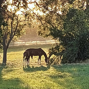

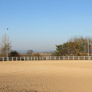
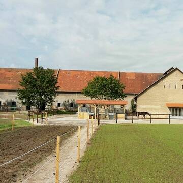
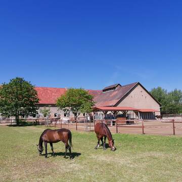
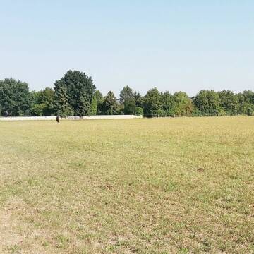
Gestüt bietet artgerechte Haltung
Hochheim am Main
Gestüt-Am-Schlossgarten
@Gestuet-Am-Schlossgarten
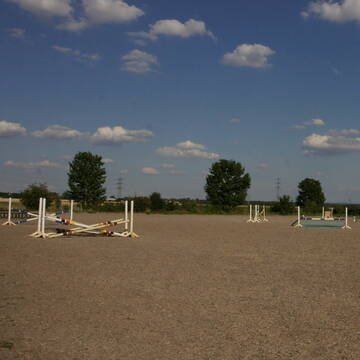
Geländestrecke
Rehabilitationsstall
Vermieten
Führanlage
Longierzirkel/Roundpen
Allergikerstall
Gnadenbrothof
19 weitere...
S


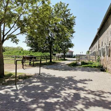
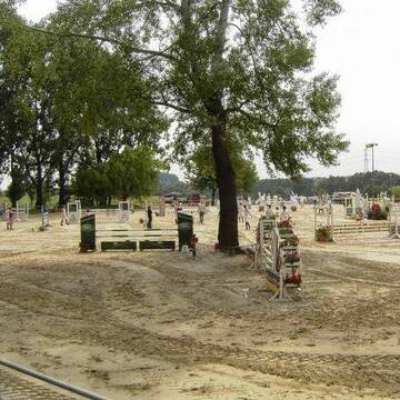
Oberfeldhof
Hochheim
Oberfeldhof
@MTK-EXTREME-TRAIL
Freizeitstall
Vermieten
Hunde willkommen
Longierzirkel/Roundpen
Allergikerstall
bedampftes/gewaschenes Heu
24 weitere...
P+
Deprecated: Creation of dynamic property Zend_View_Helper_Ads::$adLink is deprecated in /var/www/stall-frei/htdocs/staging.stall-frei.de/library/Psf/View/Helper/Ads.php on line 108

Futtersack HeuToy, Fressbremse in pink
Mechtersen
STALL-FREIde Marketing
@STALL-FREI-Marketing
Stundenlange Beschäftigung die
Koliken vorbeugt, geringe Staubinhalation mit
steuerbarer Futterentnahme


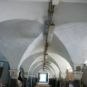
Hof zum Wandersmann
Hochheim am Main
Oberfeldhof
@MTK-EXTREME-TRAIL
Freizeitstall
Hunde willkommen
Longierzirkel/Roundpen
Allergikerstall
bedampftes/gewaschenes Heu
Außenbox mit Paddock
Laufbox
18 weitere...
P+
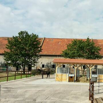
Reitanlage bei Familie Senckenberg
Groß-Gerau
Senckenberg
@Senckenberg
FN-Mitglied
Freizeitstall
Vermieten
Longierzirkel/Roundpen
Paddock
Pferdezucht
Zuchtstutenhaltung möglich
21 weitere...
S


HIT Aktiv-Stall (Wallache) bei Fam. Senckenberg
Groß-Gerau
Senckenberg
@Senckenberg
FN-Mitglied
Freizeitstall
Vermieten
Longierzirkel/Roundpen
Paddock
Pferdezucht
Zuchtstutenhaltung möglich
16 weitere...
S

Reitanlage bei Familie Senckenberg
Groß-Gerau
Senckenberg
@Senckenberg
Freie Pferdeboxen auf dem Idyllischen Rheinfelderhof in Groß-Gerau


🐴 Reiten mitten in Frankfurt – und doch im Grüne...
Frankfurt
Frankfurter Polo Club
@Georgshof-FPC
Freizeitstall
Gangpferdereiten
Vermieten
Hunde willkommen
Krankenbox
Gnadenbrothof
Hengsthaltung möglich
34 weitere...
S


Freie Pferdeboxen in gewachsener Stallgemeinschaft
Mainz Laubenheim
Storchenhof Reitbetrieb Rigl
@Riglreit
FN-Mitglied
Freizeitstall
Vermieten
Führanlage
Hunde willkommen
Außenbox mit Paddock
Außenboxen
18 weitere...
P+


Reitanlage Eddersheim Hit Aktivstall/Paddockboxen
Hattersheim
Horsement GmbH
@ReitanlageEddersheim
FN-Mitglied
Pferdeausbildung
Vermieten
Führanlage
Hunde willkommen
Außenbox mit Paddock
Laufstall
22 weitere...
P+

Falkenberg Ein Stall der keine Wünsche offen läs...
Flörsheim
Reitsportzentrum Falkenberg
@Falkenberg
Führanlage
Parkplatz für Pferdeanhänger
Außenbox mit Paddock
Außenboxen
Vollpension
9 weitere...
P
Pensions, Zucht / Verkauf und Aufzucht Rosshof
Hofheim
Born-Manfred
@Born-Manfred
FN-Mitglied
Freizeitstall
Verkauf
Vermieten
Laufband
Longierzirkel/Roundpen
Gnadenbrothof
Pferdezucht
20 weitere...
P
Deprecated: Creation of dynamic property Zend_View::$pageCount is deprecated in /var/www/stall-frei/htdocs/staging.stall-frei.de/library/vendor/shardj/zf1-future/library/Zend/View/Abstract.php on line 308
Deprecated: Creation of dynamic property Zend_View::$itemCountPerPage is deprecated in /var/www/stall-frei/htdocs/staging.stall-frei.de/library/vendor/shardj/zf1-future/library/Zend/View/Abstract.php on line 308
Deprecated: Creation of dynamic property Zend_View::$first is deprecated in /var/www/stall-frei/htdocs/staging.stall-frei.de/library/vendor/shardj/zf1-future/library/Zend/View/Abstract.php on line 308
Deprecated: Creation of dynamic property Zend_View::$current is deprecated in /var/www/stall-frei/htdocs/staging.stall-frei.de/library/vendor/shardj/zf1-future/library/Zend/View/Abstract.php on line 308
Deprecated: Creation of dynamic property Zend_View::$last is deprecated in /var/www/stall-frei/htdocs/staging.stall-frei.de/library/vendor/shardj/zf1-future/library/Zend/View/Abstract.php on line 308
Deprecated: Creation of dynamic property Zend_View::$next is deprecated in /var/www/stall-frei/htdocs/staging.stall-frei.de/library/vendor/shardj/zf1-future/library/Zend/View/Abstract.php on line 308
Deprecated: Creation of dynamic property Zend_View::$pagesInRange is deprecated in /var/www/stall-frei/htdocs/staging.stall-frei.de/library/vendor/shardj/zf1-future/library/Zend/View/Abstract.php on line 308
Deprecated: Creation of dynamic property Zend_View::$firstPageInRange is deprecated in /var/www/stall-frei/htdocs/staging.stall-frei.de/library/vendor/shardj/zf1-future/library/Zend/View/Abstract.php on line 308
Deprecated: Creation of dynamic property Zend_View::$lastPageInRange is deprecated in /var/www/stall-frei/htdocs/staging.stall-frei.de/library/vendor/shardj/zf1-future/library/Zend/View/Abstract.php on line 308
Deprecated: Creation of dynamic property Zend_View::$currentItemCount is deprecated in /var/www/stall-frei/htdocs/staging.stall-frei.de/library/vendor/shardj/zf1-future/library/Zend/View/Abstract.php on line 308
Deprecated: Creation of dynamic property Zend_View::$totalItemCount is deprecated in /var/www/stall-frei/htdocs/staging.stall-frei.de/library/vendor/shardj/zf1-future/library/Zend/View/Abstract.php on line 308
Deprecated: Creation of dynamic property Zend_View::$firstItemNumber is deprecated in /var/www/stall-frei/htdocs/staging.stall-frei.de/library/vendor/shardj/zf1-future/library/Zend/View/Abstract.php on line 308
Deprecated: Creation of dynamic property Zend_View::$lastItemNumber is deprecated in /var/www/stall-frei/htdocs/staging.stall-frei.de/library/vendor/shardj/zf1-future/library/Zend/View/Abstract.php on line 308
Deprecated: Creation of dynamic property Zend_View::$router is deprecated in /var/www/stall-frei/htdocs/staging.stall-frei.de/library/vendor/shardj/zf1-future/library/Zend/View/Abstract.php on line 308
Deprecated: Creation of dynamic property Zend_View::$urlParams is deprecated in /var/www/stall-frei/htdocs/staging.stall-frei.de/library/vendor/shardj/zf1-future/library/Zend/View/Abstract.php on line 308
Deprecated: Creation of dynamic property Zend_View::$showAds is deprecated in /var/www/stall-frei/htdocs/staging.stall-frei.de/library/vendor/shardj/zf1-future/library/Zend/View/Abstract.php on line 308
Deprecated: Creation of dynamic property Zend_View::$objectIds is deprecated in /var/www/stall-frei/htdocs/staging.stall-frei.de/library/vendor/shardj/zf1-future/library/Zend/View/Abstract.php on line 308
Deprecated: Creation of dynamic property Zend_View::$showNavbar is deprecated in /var/www/stall-frei/htdocs/staging.stall-frei.de/library/vendor/shardj/zf1-future/library/Zend/View/Abstract.php on line 308
Deprecated: Creation of dynamic property Zend_View::$showBreadcrumb is deprecated in /var/www/stall-frei/htdocs/staging.stall-frei.de/library/vendor/shardj/zf1-future/library/Zend/View/Abstract.php on line 308
Deprecated: Creation of dynamic property Zend_View::$showFooter is deprecated in /var/www/stall-frei/htdocs/staging.stall-frei.de/library/vendor/shardj/zf1-future/library/Zend/View/Abstract.php on line 308
Deprecated: Creation of dynamic property Zend_View::$showInternalAds is deprecated in /var/www/stall-frei/htdocs/staging.stall-frei.de/library/vendor/shardj/zf1-future/library/Zend/View/Abstract.php on line 308
Deprecated: Creation of dynamic property Zend_View::$blNoContent is deprecated in /var/www/stall-frei/htdocs/staging.stall-frei.de/library/vendor/shardj/zf1-future/library/Zend/View/Abstract.php on line 308
Deprecated: Creation of dynamic property Zend_View::$sMetaDesc is deprecated in /var/www/stall-frei/htdocs/staging.stall-frei.de/library/vendor/shardj/zf1-future/library/Zend/View/Abstract.php on line 308
Deprecated: Creation of dynamic property Zend_View::$useGmaps is deprecated in /var/www/stall-frei/htdocs/staging.stall-frei.de/library/vendor/shardj/zf1-future/library/Zend/View/Abstract.php on line 308
Deprecated: Creation of dynamic property Zend_View::$touches is deprecated in /var/www/stall-frei/htdocs/staging.stall-frei.de/library/vendor/shardj/zf1-future/library/Zend/View/Abstract.php on line 308
Deprecated: Creation of dynamic property Zend_View::$oProject is deprecated in /var/www/stall-frei/htdocs/staging.stall-frei.de/library/vendor/shardj/zf1-future/library/Zend/View/Abstract.php on line 308
Deprecated: Creation of dynamic property Zend_View::$pageHeadline is deprecated in /var/www/stall-frei/htdocs/staging.stall-frei.de/library/vendor/shardj/zf1-future/library/Zend/View/Abstract.php on line 308
Deprecated: Creation of dynamic property Zend_View::$disableLocationField is deprecated in /var/www/stall-frei/htdocs/staging.stall-frei.de/library/vendor/shardj/zf1-future/library/Zend/View/Abstract.php on line 308
Deprecated: Creation of dynamic property Zend_View::$isSearch is deprecated in /var/www/stall-frei/htdocs/staging.stall-frei.de/library/vendor/shardj/zf1-future/library/Zend/View/Abstract.php on line 308
Deprecated: Creation of dynamic property Zend_View::$pageTitle is deprecated in /var/www/stall-frei/htdocs/staging.stall-frei.de/library/vendor/shardj/zf1-future/library/Zend/View/Abstract.php on line 308
Deprecated: Creation of dynamic property Psf_Form_Element_Text::$class is deprecated in /var/www/stall-frei/htdocs/staging.stall-frei.de/library/vendor/shardj/zf1-future/library/Zend/Form/Element.php on line 874
Deprecated: Creation of dynamic property Psf_Form_Element_Text::$size is deprecated in /var/www/stall-frei/htdocs/staging.stall-frei.de/library/vendor/shardj/zf1-future/library/Zend/Form/Element.php on line 874
Deprecated: Creation of dynamic property Psf_Form_Element_Text::$placeholder is deprecated in /var/www/stall-frei/htdocs/staging.stall-frei.de/library/vendor/shardj/zf1-future/library/Zend/Form/Element.php on line 874
Deprecated: Creation of dynamic property Psf_Form_Element_Hidden::$class is deprecated in /var/www/stall-frei/htdocs/staging.stall-frei.de/library/vendor/shardj/zf1-future/library/Zend/Form/Element.php on line 874
Deprecated: Creation of dynamic property Psf_Form_Element_Hidden::$class is deprecated in /var/www/stall-frei/htdocs/staging.stall-frei.de/library/vendor/shardj/zf1-future/library/Zend/Form/Element.php on line 874
Deprecated: Creation of dynamic property Psf_Form_Element_Hidden::$class is deprecated in /var/www/stall-frei/htdocs/staging.stall-frei.de/library/vendor/shardj/zf1-future/library/Zend/Form/Element.php on line 874
Deprecated: Creation of dynamic property Psf_Form_Element_Hidden::$class is deprecated in /var/www/stall-frei/htdocs/staging.stall-frei.de/library/vendor/shardj/zf1-future/library/Zend/Form/Element.php on line 874
Deprecated: Creation of dynamic property Psf_Form_Element_Select::$class is deprecated in /var/www/stall-frei/htdocs/staging.stall-frei.de/library/vendor/shardj/zf1-future/library/Zend/Form/Element.php on line 874
Deprecated: Creation of dynamic property Psf_Form_Element_Select::$class is deprecated in /var/www/stall-frei/htdocs/staging.stall-frei.de/library/vendor/shardj/zf1-future/library/Zend/Form/Element.php on line 874
Deprecated: Creation of dynamic property Psf_Form_Element_Select::$class is deprecated in /var/www/stall-frei/htdocs/staging.stall-frei.de/library/vendor/shardj/zf1-future/library/Zend/Form/Element.php on line 874
Deprecated: Creation of dynamic property Psf_Form_Element_Select::$class is deprecated in /var/www/stall-frei/htdocs/staging.stall-frei.de/library/vendor/shardj/zf1-future/library/Zend/Form/Element.php on line 874
Deprecated: Creation of dynamic property Psf_Form_Element_Text::$class is deprecated in /var/www/stall-frei/htdocs/staging.stall-frei.de/library/vendor/shardj/zf1-future/library/Zend/Form/Element.php on line 874
Deprecated: Creation of dynamic property Psf_Form_Element_Checkbox::$label is deprecated in /var/www/stall-frei/htdocs/staging.stall-frei.de/library/vendor/shardj/zf1-future/library/Zend/Form/Element.php on line 874
Deprecated: Creation of dynamic property Zend_View::$sort is deprecated in /var/www/stall-frei/htdocs/staging.stall-frei.de/library/vendor/shardj/zf1-future/library/Zend/View/Abstract.php on line 308
Deprecated: Creation of dynamic property Zend_View::$searchLocation is deprecated in /var/www/stall-frei/htdocs/staging.stall-frei.de/library/vendor/shardj/zf1-future/library/Zend/View/Abstract.php on line 308
Deprecated: Creation of dynamic property Zend_View::$locationHint is deprecated in /var/www/stall-frei/htdocs/staging.stall-frei.de/library/vendor/shardj/zf1-future/library/Zend/View/Abstract.php on line 308
Psf_GeoCoder_Abstract::getLocation: Hochheim Get Location CachedOrLive
Psf_GeoCoder_Abstract::getCachedOrLive: Hochheim
Psf_GeoCoder_OpenCageData::makeApiRequest: response:
Array
(
[documentation] => https://opencagedata.com/api
[licenses] => Array
(
[0] => Array
(
[name] => see attribution guide
[url] => https://opencagedata.com/credits
)
)
[results] => Array
(
[0] => Array
(
[bounds] => Array
(
[northeast] => Array
(
[lat] => 50.0581309
[lng] => 8.4127571
)
[southwest] => Array
(
[lat] => 49.997058
[lng] => 8.3301923
)
)
[components] => Array
(
[ISO_3166-1_alpha-2] => DE
[ISO_3166-1_alpha-3] => DEU
[ISO_3166-2] => Array
(
[0] => DE-HE
)
[_category] => place
[_normalized_city] => Hochheim
[_type] => municipality
[continent] => Europe
[country] => Deutschland
[country_code] => de
[county] => Main-Taunus-Kreis
[municipality] => Hochheim
[political_union] => European Union
[postcode] => 65239
[state] => Hessen
[state_code] => HE
)
[confidence] => 7
[formatted] => 65239 Hochheim, Deutschland
[geometry] => Array
(
[lat] => 50.0277
[lng] => 8.3587
)
)
[1] => Array
(
[bounds] => Array
(
[northeast] => Array
(
[lat] => 51.0426126
[lng] => 10.6794307
)
[southwest] => Array
(
[lat] => 51.0056982
[lng] => 10.6385644
)
)
[components] => Array
(
[ISO_3166-1_alpha-2] => DE
[ISO_3166-1_alpha-3] => DEU
[ISO_3166-2] => Array
(
[0] => DE-TH
)
[_category] => place
[_normalized_city] => Hochheim
[_type] => village
[continent] => Europe
[country] => Deutschland
[country_code] => de
[county] => Landkreis Gotha
[municipality] => Nessetal
[political_union] => European Union
[state] => Thüringen
[state_code] => TH
[village] => Hochheim
)
[confidence] => 7
[formatted] => Hochheim, Thüringen, Deutschland
[geometry] => Array
(
[lat] => 51.0165804
[lng] => 10.6596646
)
)
[2] => Array
(
[bounds] => Array
(
[northeast] => Array
(
[lat] => 50.9666749
[lng] => 11.0102153
)
[southwest] => Array
(
[lat] => 50.9455463
[lng] => 10.9823902
)
)
[components] => Array
(
[ISO_3166-1_alpha-2] => DE
[ISO_3166-1_alpha-3] => DEU
[ISO_3166-2] => Array
(
[0] => DE-TH
)
[_category] => place
[_normalized_city] => Erfurt
[_type] => neighbourhood
[city] => Erfurt
[continent] => Europe
[country] => Deutschland
[country_code] => de
[political_union] => European Union
[postcode] => 99094
[state] => Thüringen
[state_code] => TH
[suburb] => Hochheim
)
[confidence] => 7
[formatted] => 99094 Erfurt, Deutschland
[geometry] => Array
(
[lat] => 50.9566022
[lng] => 11.0004781
)
)
[3] => Array
(
[bounds] => Array
(
[northeast] => Array
(
[lat] => 49.6503789
[lng] => 8.3481958
)
[southwest] => Array
(
[lat] => 49.6359319
[lng] => 8.3132556
)
)
[components] => Array
(
[ISO_3166-1_alpha-2] => DE
[ISO_3166-1_alpha-3] => DEU
[ISO_3166-2] => Array
(
[0] => DE-RP
)
[_category] => place
[_normalized_city] => Worms
[_type] => neighbourhood
[city_district] => Westliche Vororte
[continent] => Europe
[country] => Deutschland
[country_code] => de
[political_union] => European Union
[postcode] => 67549
[state] => Rheinland-Pfalz
[state_code] => RP
[suburb] => Hochheim
[town] => Worms
)
[confidence] => 7
[formatted] => 67549 Worms, Deutschland
[geometry] => Array
(
[lat] => 49.6408868
[lng] => 8.3334539
)
)
[4] => Array
(
[bounds] => Array
(
[northeast] => Array
(
[lat] => 50.4030838
[lng] => 10.5155724
)
[southwest] => Array
(
[lat] => 50.345737
[lng] => 10.3918515
)
)
[components] => Array
(
[ISO_3166-1_alpha-2] => DE
[ISO_3166-1_alpha-3] => DEU
[ISO_3166-2] => Array
(
[0] => DE-BY
)
[_category] => place
[_normalized_city] => Höchheim
[_type] => village
[continent] => Europe
[country] => Deutschland
[country_code] => de
[county] => Landkreis Rhön-Grabfeld
[municipality] => Bad Königshofen i. Grabfeld (VGem)
[political_union] => European Union
[state] => Bayern
[state_code] => BY
[village] => Höchheim
)
[confidence] => 7
[formatted] => Höchheim, Bayern, Deutschland
[geometry] => Array
(
[lat] => 50.3636932
[lng] => 10.4514092
)
)
[5] => Array
(
[bounds] => Array
(
[northeast] => Array
(
[lat] => 50.0353825
[lng] => 8.3975762
)
[southwest] => Array
(
[lat] => 49.997058
[lng] => 8.3301923
)
)
[components] => Array
(
[ISO_3166-1_alpha-2] => DE
[ISO_3166-1_alpha-3] => DEU
[ISO_3166-2] => Array
(
[0] => DE-HE
)
[_category] => place
[_normalized_city] => Hochheim
[_type] => city
[continent] => Europe
[country] => Deutschland
[country_code] => de
[county] => Main-Taunus-Kreis
[municipality] => Hochheim
[political_union] => European Union
[postcode] => 65239
[state] => Hessen
[state_code] => HE
[town] => Hochheim
)
[confidence] => 7
[formatted] => 65239 Hochheim, Deutschland
[geometry] => Array
(
[lat] => 50.0165391
[lng] => 8.3506848
)
)
[6] => Array
(
[bounds] => Array
(
[northeast] => Array
(
[lat] => 53.2366103
[lng] => 12.063773
)
[southwest] => Array
(
[lat] => 53.2365103
[lng] => 12.063673
)
)
[components] => Array
(
[ISO_3166-1_alpha-2] => DE
[ISO_3166-1_alpha-3] => DEU
[ISO_3166-2] => Array
(
[0] => DE-BB
)
[_category] => building
[_normalized_city] => Putlitz
[_type] => building
[continent] => Europe
[country] => Deutschland
[country_code] => de
[county] => Prignitz
[isolated_dwelling] => Hochheim
[municipality] => Putlitz-Berge
[political_union] => European Union
[postcode] => 16949
[state] => Brandenburg
[state_code] => BB
[town] => Putlitz
[village] => Putlitz
)
[confidence] => 10
[formatted] => Hochheim, 16949 Putlitz, Deutschland
[geometry] => Array
(
[lat] => 53.2365603
[lng] => 12.063723
)
)
[7] => Array
(
[components] => Array
(
[ISO_3166-1_alpha-2] => FR
[ISO_3166-1_alpha-3] => FRA
[ISO_3166-2] => Array
(
[0] => FR-GES
[1] => FR-6AE
[2] => FR-67
)
[_category] => road
[_normalized_city] => Rosheim
[_type] => road
[city] => Rosheim
[continent] => Europe
[country] => France
[country_code] => fr
[county] => Bas-Rhin
[local_authority] => Communauté de communes des Portes de Rosheim
[political_union] => European Union
[postcode] => 67560
[road] => Chemin de la Fischhutte
[state] => Grand Est
[state_code] => GES
)
[confidence] => 3
[formatted] => Chemin de la Fischhutte, 67560 Rosheim, France
[geometry] => Array
(
[lat] => 48.492058
[lng] => 7.34431
)
)
[8] => Array
(
[components] => Array
(
[ISO_3166-1_alpha-2] => FR
[ISO_3166-1_alpha-3] => FRA
[ISO_3166-2] => Array
(
[0] => FR-IDF
[1] => FR-92
)
[_category] => road
[_normalized_city] => Levallois-Perret
[_type] => road
[city] => Levallois-Perret
[continent] => Europe
[country] => France
[country_code] => fr
[county] => Hauts-de-Seine
[local_authority] => Métropole du Grand Paris
[political_union] => European Union
[postcode] => 92300
[road] => Rue Charles Deutschmann
[state] => Île-de-France
[state_code] => IDF
)
[confidence] => 3
[formatted] => Rue Charles Deutschmann, 92300 Levallois-Perret, France
[geometry] => Array
(
[lat] => 48.900049
[lng] => 2.2842
)
)
[9] => Array
(
[components] => Array
(
[ISO_3166-1_alpha-2] => FR
[ISO_3166-1_alpha-3] => FRA
[ISO_3166-2] => Array
(
[0] => FR-GES
[1] => FR-6AE
[2] => FR-67
)
[_category] => road
[_normalized_city] => Bœrsch
[_type] => road
[city] => Bœrsch
[continent] => Europe
[country] => France
[country_code] => fr
[county] => Bas-Rhin
[local_authority] => Communauté de communes des Portes de Rosheim
[political_union] => European Union
[postcode] => 67530
[road] => Route de Rosheim
[state] => Grand Est
[state_code] => GES
)
[confidence] => 2
[formatted] => Route de Rosheim, 67530 Bœrsch, France
[geometry] => Array
(
[lat] => 48.477533
[lng] => 7.446165
)
)
)
[status] => Array
(
[code] => 200
[message] => OK
)
[stay_informed] => Array
(
[blog] => https://blog.opencagedata.com
[mastodon] => https://en.osm.town/@opencage
)
[thanks] => For using an OpenCage API
[timestamp] => Array
(
[created_http] => Fri, 06 Feb 2026 10:20:42 GMT
[created_unix] => 1770373242
)
[total_results] => 10
)
Psf_GeoCoder_Abstract::convertLocationResult
{"documentation":"https:\/\/opencagedata.com\/api","licenses":[{"name":"see attribution guide","url":"https:\/\/opencagedata.com\/credits"}],"results":[{"bounds":{"northeast":{"lat":50.0581309,"lng":8.4127571},"southwest":{"lat":49.997058,"lng":8.3301923}},"components":{"ISO_3166-1_alpha-2":"DE","ISO_3166-1_alpha-3":"DEU","ISO_3166-2":["DE-HE"],"_category":"place","_normalized_city":"Hochheim","_type":"municipality","continent":"Europe","country":"Deutschland","country_code":"de","county":"Main-Taunus-Kreis","municipality":"Hochheim","political_union":"European Union","postcode":"65239","state":"Hessen","state_code":"HE"},"confidence":7,"formatted":"65239 Hochheim, Deutschland","geometry":{"lat":50.0277,"lng":8.3587}},{"bounds":{"northeast":{"lat":51.0426126,"lng":10.6794307},"southwest":{"lat":51.0056982,"lng":10.6385644}},"components":{"ISO_3166-1_alpha-2":"DE","ISO_3166-1_alpha-3":"DEU","ISO_3166-2":["DE-TH"],"_category":"place","_normalized_city":"Hochheim","_type":"village","continent":"Europe","country":"Deutschland","country_code":"de","county":"Landkreis Gotha","municipality":"Nessetal","political_union":"European Union","state":"Th\u00fcringen","state_code":"TH","village":"Hochheim"},"confidence":7,"formatted":"Hochheim, Th\u00fcringen, Deutschland","geometry":{"lat":51.0165804,"lng":10.6596646}},{"bounds":{"northeast":{"lat":50.9666749,"lng":11.0102153},"southwest":{"lat":50.9455463,"lng":10.9823902}},"components":{"ISO_3166-1_alpha-2":"DE","ISO_3166-1_alpha-3":"DEU","ISO_3166-2":["DE-TH"],"_category":"place","_normalized_city":"Erfurt","_type":"neighbourhood","city":"Erfurt","continent":"Europe","country":"Deutschland","country_code":"de","political_union":"European Union","postcode":"99094","state":"Th\u00fcringen","state_code":"TH","suburb":"Hochheim"},"confidence":7,"formatted":"99094 Erfurt, Deutschland","geometry":{"lat":50.9566022,"lng":11.0004781}},{"bounds":{"northeast":{"lat":49.6503789,"lng":8.3481958},"southwest":{"lat":49.6359319,"lng":8.3132556}},"components":{"ISO_3166-1_alpha-2":"DE","ISO_3166-1_alpha-3":"DEU","ISO_3166-2":["DE-RP"],"_category":"place","_normalized_city":"Worms","_type":"neighbourhood","city_district":"Westliche Vororte","continent":"Europe","country":"Deutschland","country_code":"de","political_union":"European Union","postcode":"67549","state":"Rheinland-Pfalz","state_code":"RP","suburb":"Hochheim","town":"Worms"},"confidence":7,"formatted":"67549 Worms, Deutschland","geometry":{"lat":49.6408868,"lng":8.3334539}},{"bounds":{"northeast":{"lat":50.4030838,"lng":10.5155724},"southwest":{"lat":50.345737,"lng":10.3918515}},"components":{"ISO_3166-1_alpha-2":"DE","ISO_3166-1_alpha-3":"DEU","ISO_3166-2":["DE-BY"],"_category":"place","_normalized_city":"H\u00f6chheim","_type":"village","continent":"Europe","country":"Deutschland","country_code":"de","county":"Landkreis Rh\u00f6n-Grabfeld","municipality":"Bad K\u00f6nigshofen i. Grabfeld (VGem)","political_union":"European Union","state":"Bayern","state_code":"BY","village":"H\u00f6chheim"},"confidence":7,"formatted":"H\u00f6chheim, Bayern, Deutschland","geometry":{"lat":50.3636932,"lng":10.4514092}},{"bounds":{"northeast":{"lat":50.0353825,"lng":8.3975762},"southwest":{"lat":49.997058,"lng":8.3301923}},"components":{"ISO_3166-1_alpha-2":"DE","ISO_3166-1_alpha-3":"DEU","ISO_3166-2":["DE-HE"],"_category":"place","_normalized_city":"Hochheim","_type":"city","continent":"Europe","country":"Deutschland","country_code":"de","county":"Main-Taunus-Kreis","municipality":"Hochheim","political_union":"European Union","postcode":"65239","state":"Hessen","state_code":"HE","town":"Hochheim"},"confidence":7,"formatted":"65239 Hochheim, Deutschland","geometry":{"lat":50.0165391,"lng":8.3506848}},{"bounds":{"northeast":{"lat":53.2366103,"lng":12.063773},"southwest":{"lat":53.2365103,"lng":12.063673}},"components":{"ISO_3166-1_alpha-2":"DE","ISO_3166-1_alpha-3":"DEU","ISO_3166-2":["DE-BB"],"_category":"building","_normalized_city":"Putlitz","_type":"building","continent":"Europe","country":"Deutschland","country_code":"de","county":"Prignitz","isolated_dwelling":"Hochheim","municipality":"Putlitz-Berge","political_union":"European Union","postcode":"16949","state":"Brandenburg","state_code":"BB","town":"Putlitz","village":"Putlitz"},"confidence":10,"formatted":"Hochheim, 16949 Putlitz, Deutschland","geometry":{"lat":53.2365603,"lng":12.063723}},{"components":{"ISO_3166-1_alpha-2":"FR","ISO_3166-1_alpha-3":"FRA","ISO_3166-2":["FR-GES","FR-6AE","FR-67"],"_category":"road","_normalized_city":"Rosheim","_type":"road","city":"Rosheim","continent":"Europe","country":"France","country_code":"fr","county":"Bas-Rhin","local_authority":"Communaut\u00e9 de communes des Portes de Rosheim","political_union":"European Union","postcode":"67560","road":"Chemin de la Fischhutte","state":"Grand Est","state_code":"GES"},"confidence":3,"formatted":"Chemin de la Fischhutte, 67560 Rosheim, France","geometry":{"lat":48.492058,"lng":7.34431}},{"components":{"ISO_3166-1_alpha-2":"FR","ISO_3166-1_alpha-3":"FRA","ISO_3166-2":["FR-IDF","FR-92"],"_category":"road","_normalized_city":"Levallois-Perret","_type":"road","city":"Levallois-Perret","continent":"Europe","country":"France","country_code":"fr","county":"Hauts-de-Seine","local_authority":"M\u00e9tropole du Grand Paris","political_union":"European Union","postcode":"92300","road":"Rue Charles Deutschmann","state":"\u00cele-de-France","state_code":"IDF"},"confidence":3,"formatted":"Rue Charles Deutschmann, 92300 Levallois-Perret, France","geometry":{"lat":48.900049,"lng":2.2842}},{"components":{"ISO_3166-1_alpha-2":"FR","ISO_3166-1_alpha-3":"FRA","ISO_3166-2":["FR-GES","FR-6AE","FR-67"],"_category":"road","_normalized_city":"B\u0153rsch","_type":"road","city":"B\u0153rsch","continent":"Europe","country":"France","country_code":"fr","county":"Bas-Rhin","local_authority":"Communaut\u00e9 de communes des Portes de Rosheim","political_union":"European Union","postcode":"67530","road":"Route de Rosheim","state":"Grand Est","state_code":"GES"},"confidence":2,"formatted":"Route de Rosheim, 67530 B\u0153rsch, France","geometry":{"lat":48.477533,"lng":7.446165}}],"status":{"code":200,"message":"OK"},"stay_informed":{"blog":"https:\/\/blog.opencagedata.com","mastodon":"https:\/\/en.osm.town\/@opencage"},"thanks":"For using an OpenCage API","timestamp":{"created_http":"Fri, 06 Feb 2026 10:20:42 GMT","created_unix":1770373242},"total_results":10}Array
(
[0] => stdClass Object
(
[bounds] => stdClass Object
(
[northeast] => stdClass Object
(
[lat] => 50.0581309
[lng] => 8.4127571
)
[southwest] => stdClass Object
(
[lat] => 49.997058
[lng] => 8.3301923
)
)
[components] => stdClass Object
(
[ISO_3166-1_alpha-2] => DE
[ISO_3166-1_alpha-3] => DEU
[ISO_3166-2] => Array
(
[0] => DE-HE
)
[_category] => place
[_normalized_city] => Hochheim
[_type] => municipality
[continent] => Europe
[country] => Deutschland
[country_code] => de
[county] => Main-Taunus-Kreis
[municipality] => Hochheim
[political_union] => European Union
[postcode] => 65239
[state] => Hessen
[state_code] => HE
)
[confidence] => 7
[formatted] => 65239 Hochheim, Deutschland
[geometry] => stdClass Object
(
[lat] => 50.0277
[lng] => 8.3587
)
)
[1] => stdClass Object
(
[bounds] => stdClass Object
(
[northeast] => stdClass Object
(
[lat] => 51.0426126
[lng] => 10.6794307
)
[southwest] => stdClass Object
(
[lat] => 51.0056982
[lng] => 10.6385644
)
)
[components] => stdClass Object
(
[ISO_3166-1_alpha-2] => DE
[ISO_3166-1_alpha-3] => DEU
[ISO_3166-2] => Array
(
[0] => DE-TH
)
[_category] => place
[_normalized_city] => Hochheim
[_type] => village
[continent] => Europe
[country] => Deutschland
[country_code] => de
[county] => Landkreis Gotha
[municipality] => Nessetal
[political_union] => European Union
[state] => Thüringen
[state_code] => TH
[village] => Hochheim
)
[confidence] => 7
[formatted] => Hochheim, Thüringen, Deutschland
[geometry] => stdClass Object
(
[lat] => 51.0165804
[lng] => 10.6596646
)
)
[2] => stdClass Object
(
[bounds] => stdClass Object
(
[northeast] => stdClass Object
(
[lat] => 50.9666749
[lng] => 11.0102153
)
[southwest] => stdClass Object
(
[lat] => 50.9455463
[lng] => 10.9823902
)
)
[components] => stdClass Object
(
[ISO_3166-1_alpha-2] => DE
[ISO_3166-1_alpha-3] => DEU
[ISO_3166-2] => Array
(
[0] => DE-TH
)
[_category] => place
[_normalized_city] => Erfurt
[_type] => neighbourhood
[city] => Erfurt
[continent] => Europe
[country] => Deutschland
[country_code] => de
[political_union] => European Union
[postcode] => 99094
[state] => Thüringen
[state_code] => TH
[suburb] => Hochheim
)
[confidence] => 7
[formatted] => 99094 Erfurt, Deutschland
[geometry] => stdClass Object
(
[lat] => 50.9566022
[lng] => 11.0004781
)
)
[3] => stdClass Object
(
[bounds] => stdClass Object
(
[northeast] => stdClass Object
(
[lat] => 49.6503789
[lng] => 8.3481958
)
[southwest] => stdClass Object
(
[lat] => 49.6359319
[lng] => 8.3132556
)
)
[components] => stdClass Object
(
[ISO_3166-1_alpha-2] => DE
[ISO_3166-1_alpha-3] => DEU
[ISO_3166-2] => Array
(
[0] => DE-RP
)
[_category] => place
[_normalized_city] => Worms
[_type] => neighbourhood
[city_district] => Westliche Vororte
[continent] => Europe
[country] => Deutschland
[country_code] => de
[political_union] => European Union
[postcode] => 67549
[state] => Rheinland-Pfalz
[state_code] => RP
[suburb] => Hochheim
[town] => Worms
)
[confidence] => 7
[formatted] => 67549 Worms, Deutschland
[geometry] => stdClass Object
(
[lat] => 49.6408868
[lng] => 8.3334539
)
)
[4] => stdClass Object
(
[bounds] => stdClass Object
(
[northeast] => stdClass Object
(
[lat] => 50.4030838
[lng] => 10.5155724
)
[southwest] => stdClass Object
(
[lat] => 50.345737
[lng] => 10.3918515
)
)
[components] => stdClass Object
(
[ISO_3166-1_alpha-2] => DE
[ISO_3166-1_alpha-3] => DEU
[ISO_3166-2] => Array
(
[0] => DE-BY
)
[_category] => place
[_normalized_city] => Höchheim
[_type] => village
[continent] => Europe
[country] => Deutschland
[country_code] => de
[county] => Landkreis Rhön-Grabfeld
[municipality] => Bad Königshofen i. Grabfeld (VGem)
[political_union] => European Union
[state] => Bayern
[state_code] => BY
[village] => Höchheim
)
[confidence] => 7
[formatted] => Höchheim, Bayern, Deutschland
[geometry] => stdClass Object
(
[lat] => 50.3636932
[lng] => 10.4514092
)
)
[5] => stdClass Object
(
[bounds] => stdClass Object
(
[northeast] => stdClass Object
(
[lat] => 50.0353825
[lng] => 8.3975762
)
[southwest] => stdClass Object
(
[lat] => 49.997058
[lng] => 8.3301923
)
)
[components] => stdClass Object
(
[ISO_3166-1_alpha-2] => DE
[ISO_3166-1_alpha-3] => DEU
[ISO_3166-2] => Array
(
[0] => DE-HE
)
[_category] => place
[_normalized_city] => Hochheim
[_type] => city
[continent] => Europe
[country] => Deutschland
[country_code] => de
[county] => Main-Taunus-Kreis
[municipality] => Hochheim
[political_union] => European Union
[postcode] => 65239
[state] => Hessen
[state_code] => HE
[town] => Hochheim
)
[confidence] => 7
[formatted] => 65239 Hochheim, Deutschland
[geometry] => stdClass Object
(
[lat] => 50.0165391
[lng] => 8.3506848
)
)
[6] => stdClass Object
(
[bounds] => stdClass Object
(
[northeast] => stdClass Object
(
[lat] => 53.2366103
[lng] => 12.063773
)
[southwest] => stdClass Object
(
[lat] => 53.2365103
[lng] => 12.063673
)
)
[components] => stdClass Object
(
[ISO_3166-1_alpha-2] => DE
[ISO_3166-1_alpha-3] => DEU
[ISO_3166-2] => Array
(
[0] => DE-BB
)
[_category] => building
[_normalized_city] => Putlitz
[_type] => building
[continent] => Europe
[country] => Deutschland
[country_code] => de
[county] => Prignitz
[isolated_dwelling] => Hochheim
[municipality] => Putlitz-Berge
[political_union] => European Union
[postcode] => 16949
[state] => Brandenburg
[state_code] => BB
[town] => Putlitz
[village] => Putlitz
)
[confidence] => 10
[formatted] => Hochheim, 16949 Putlitz, Deutschland
[geometry] => stdClass Object
(
[lat] => 53.2365603
[lng] => 12.063723
)
)
[7] => stdClass Object
(
[components] => stdClass Object
(
[ISO_3166-1_alpha-2] => FR
[ISO_3166-1_alpha-3] => FRA
[ISO_3166-2] => Array
(
[0] => FR-GES
[1] => FR-6AE
[2] => FR-67
)
[_category] => road
[_normalized_city] => Rosheim
[_type] => road
[city] => Rosheim
[continent] => Europe
[country] => France
[country_code] => fr
[county] => Bas-Rhin
[local_authority] => Communauté de communes des Portes de Rosheim
[political_union] => European Union
[postcode] => 67560
[road] => Chemin de la Fischhutte
[state] => Grand Est
[state_code] => GES
)
[confidence] => 3
[formatted] => Chemin de la Fischhutte, 67560 Rosheim, France
[geometry] => stdClass Object
(
[lat] => 48.492058
[lng] => 7.34431
)
)
[8] => stdClass Object
(
[components] => stdClass Object
(
[ISO_3166-1_alpha-2] => FR
[ISO_3166-1_alpha-3] => FRA
[ISO_3166-2] => Array
(
[0] => FR-IDF
[1] => FR-92
)
[_category] => road
[_normalized_city] => Levallois-Perret
[_type] => road
[city] => Levallois-Perret
[continent] => Europe
[country] => France
[country_code] => fr
[county] => Hauts-de-Seine
[local_authority] => Métropole du Grand Paris
[political_union] => European Union
[postcode] => 92300
[road] => Rue Charles Deutschmann
[state] => Île-de-France
[state_code] => IDF
)
[confidence] => 3
[formatted] => Rue Charles Deutschmann, 92300 Levallois-Perret, France
[geometry] => stdClass Object
(
[lat] => 48.900049
[lng] => 2.2842
)
)
[9] => stdClass Object
(
[components] => stdClass Object
(
[ISO_3166-1_alpha-2] => FR
[ISO_3166-1_alpha-3] => FRA
[ISO_3166-2] => Array
(
[0] => FR-GES
[1] => FR-6AE
[2] => FR-67
)
[_category] => road
[_normalized_city] => Bœrsch
[_type] => road
[city] => Bœrsch
[continent] => Europe
[country] => France
[country_code] => fr
[county] => Bas-Rhin
[local_authority] => Communauté de communes des Portes de Rosheim
[political_union] => European Union
[postcode] => 67530
[road] => Route de Rosheim
[state] => Grand Est
[state_code] => GES
)
[confidence] => 2
[formatted] => Route de Rosheim, 67530 Bœrsch, France
[geometry] => stdClass Object
(
[lat] => 48.477533
[lng] => 7.446165
)
)
)
Psf_GeoCoder_OpenCageData::getKeyMap: 0
stdClass Object
(
    [bounds] => stdClass Object
        (
            [northeast] => stdClass Object
                (
                    [lat] => 50.0581309
                    [lng] => 8.4127571
                )

            [southwest] => stdClass Object
                (
                    [lat] => 49.997058
                    [lng] => 8.3301923
                )

        )

    [components] => stdClass Object
        (
            [ISO_3166-1_alpha-2] => DE
            [ISO_3166-1_alpha-3] => DEU
            [ISO_3166-2] => Array
                (
                    [0] => DE-HE
                )

            [_category] => place
            [_normalized_city] => Hochheim
            [_type] => municipality
            [continent] => Europe
            [country] => Deutschland
            [country_code] => de
            [county] => Main-Taunus-Kreis
            [municipality] => Hochheim
            [political_union] => European Union
            [postcode] => 65239
            [state] => Hessen
            [state_code] => HE
        )

    [confidence] => 7
    [formatted] => 65239 Hochheim, Deutschland
    [geometry] => stdClass Object
        (
            [lat] => 50.0277
            [lng] => 8.3587
        )

)
Psf_GeoCoder_OpenCageData::getCounty: Main-Taunus-Kreis
Psf_GeoCoder_OpenCageData::addMissingData REFETCH!
Array
(
    [address] => 65239 Hochheim, Deutschland
    [type] => municipality
    [street] =>
    [city] =>
    [county] => Main-Taunus-Kreis
    [state] => Hessen
    [zip] => 65239
    [country] => Deutschland
    [suburb] =>
    [countrycode] => de
    [latitude] => 50.0277
    [longitude] => 8.3587
    [accuracy] => 1
    [confidence] => 7
    [bounds] => stdClass Object
        (
            [northeast] => stdClass Object
                (
                    [lat] => 50.0581309
                    [lng] => 8.4127571
                )

            [southwest] => stdClass Object
                (
                    [lat] => 49.997058
                    [lng] => 8.3301923
                )

        )

)
reformat!
Array
(
    [address] => 65239 Hochheim, Deutschland
    [type] => municipality
    [street] =>
    [city] =>
    [county] => Main-Taunus-Kreis
    [state] => Hessen
    [zip] => 65239
    [country] => Deutschland
    [suburb] =>
    [countrycode] => de
    [latitude] => 50.0277
    [longitude] => 8.3587
    [accuracy] => 1
    [confidence] => 7
    [bounds] => stdClass Object
        (
            [northeast] => stdClass Object
                (
                    [lat] => 50.0581309
                    [lng] => 8.4127571
                )

            [southwest] => stdClass Object
                (
                    [lat] => 49.997058
                    [lng] => 8.3301923
                )

        )

    [place] => 65239 , Hessen
    [hash] => 8d7cb272e09573cac0fdc46b3683d447
)
Psf_GeoCoder_OpenCageData::getKeyMap: 1
stdClass Object
(
    [bounds] => stdClass Object
        (
            [northeast] => stdClass Object
                (
                    [lat] => 51.0426126
                    [lng] => 10.6794307
                )

            [southwest] => stdClass Object
                (
                    [lat] => 51.0056982
                    [lng] => 10.6385644
                )

        )

    [components] => stdClass Object
        (
            [ISO_3166-1_alpha-2] => DE
            [ISO_3166-1_alpha-3] => DEU
            [ISO_3166-2] => Array
                (
                    [0] => DE-TH
                )

            [_category] => place
            [_normalized_city] => Hochheim
            [_type] => village
            [continent] => Europe
            [country] => Deutschland
            [country_code] => de
            [county] => Landkreis Gotha
            [municipality] => Nessetal
            [political_union] => European Union
            [state] => Thüringen
            [state_code] => TH
            [village] => Hochheim
        )

    [confidence] => 7
    [formatted] => Hochheim, Thüringen, Deutschland
    [geometry] => stdClass Object
        (
            [lat] => 51.0165804
            [lng] => 10.6596646
        )

)
Psf_GeoCoder_OpenCageData::getCounty: Gotha
Psf_GeoCoder_OpenCageData::addMissingData REFETCH!
Array
(
    [address] => Hochheim, Thüringen, Deutschland
    [type] => village
    [street] =>
    [city] => Hochheim
    [county] => Gotha
    [state] => Thüringen
    [zip] =>
    [country] => Deutschland
    [suburb] =>
    [countrycode] => de
    [latitude] => 51.0165804
    [longitude] => 10.6596646
    [accuracy] => 1
    [confidence] => 7
    [bounds] => stdClass Object
        (
            [northeast] => stdClass Object
                (
                    [lat] => 51.0426126
                    [lng] => 10.6794307
                )

            [southwest] => stdClass Object
                (
                    [lat] => 51.0056982
                    [lng] => 10.6385644
                )

        )

)
reformat!
Array
(
    [address] => Hochheim, Thüringen, Deutschland
    [type] => village
    [street] =>
    [city] => Hochheim
    [county] => Gotha
    [state] => Thüringen
    [zip] =>
    [country] => Deutschland
    [suburb] =>
    [countrycode] => de
    [latitude] => 51.0165804
    [longitude] => 10.6596646
    [accuracy] => 1
    [confidence] => 7
    [bounds] => stdClass Object
        (
            [northeast] => stdClass Object
                (
                    [lat] => 51.0426126
                    [lng] => 10.6794307
                )

            [southwest] => stdClass Object
                (
                    [lat] => 51.0056982
                    [lng] => 10.6385644
                )

        )

    [place] => Hochheim, Thüringen
    [hash] => c56b40bd87300da4821b9c51cc829581
)
Psf_GeoCoder_OpenCageData::getKeyMap: 2
stdClass Object
(
    [bounds] => stdClass Object
        (
            [northeast] => stdClass Object
                (
                    [lat] => 50.9666749
                    [lng] => 11.0102153
                )

            [southwest] => stdClass Object
                (
                    [lat] => 50.9455463
                    [lng] => 10.9823902
                )

        )

    [components] => stdClass Object
        (
            [ISO_3166-1_alpha-2] => DE
            [ISO_3166-1_alpha-3] => DEU
            [ISO_3166-2] => Array
                (
                    [0] => DE-TH
                )

            [_category] => place
            [_normalized_city] => Erfurt
            [_type] => neighbourhood
            [city] => Erfurt
            [continent] => Europe
            [country] => Deutschland
            [country_code] => de
            [political_union] => European Union
            [postcode] => 99094
            [state] => Thüringen
            [state_code] => TH
            [suburb] => Hochheim
        )

    [confidence] => 7
    [formatted] => 99094 Erfurt, Deutschland
    [geometry] => stdClass Object
        (
            [lat] => 50.9566022
            [lng] => 11.0004781
        )

)
Psf_GeoCoder_OpenCageData::getCounty: Erfurt
Psf_GeoCoder_OpenCageData::addMissingData REFETCH!
Array
(
    [address] => 99094 Erfurt, Deutschland
    [type] => neighbourhood
    [street] =>
    [city] => Hochheim
    [county] => Erfurt
    [state] => Thüringen
    [zip] => 99094
    [country] => Deutschland
    [suburb] => Hochheim
    [countrycode] => de
    [latitude] => 50.9566022
    [longitude] => 11.0004781
    [accuracy] => 1
    [confidence] => 7
    [bounds] => stdClass Object
        (
            [northeast] => stdClass Object
                (
                    [lat] => 50.9666749
                    [lng] => 11.0102153
                )

            [southwest] => stdClass Object
                (
                    [lat] => 50.9455463
                    [lng] => 10.9823902
                )

        )

)
reformat!
Array
(
    [address] => 99094 Hochheim
    [type] => neighbourhood
    [street] =>
    [city] => Hochheim
    [county] => Erfurt
    [state] => Thüringen
    [zip] => 99094
    [country] => Deutschland
    [suburb] => Hochheim
    [countrycode] => de
    [latitude] => 50.9566022
    [longitude] => 11.0004781
    [accuracy] => 1
    [confidence] => 7
    [bounds] => stdClass Object
        (
            [northeast] => stdClass Object
                (
                    [lat] => 50.9666749
                    [lng] => 11.0102153
                )

            [southwest] => stdClass Object
                (
                    [lat] => 50.9455463
                    [lng] => 10.9823902
                )

        )

    [place] => 99094 Hochheim, Thüringen
    [hash] => 006498d7d9a74f5670c51a7f7f2f1c36
)
Psf_GeoCoder_OpenCageData::getKeyMap: 3
stdClass Object
(
    [bounds] => stdClass Object
        (
            [northeast] => stdClass Object
                (
                    [lat] => 49.6503789
                    [lng] => 8.3481958
                )

            [southwest] => stdClass Object
                (
                    [lat] => 49.6359319
                    [lng] => 8.3132556
                )

        )

    [components] => stdClass Object
        (
            [ISO_3166-1_alpha-2] => DE
            [ISO_3166-1_alpha-3] => DEU
            [ISO_3166-2] => Array
                (
                    [0] => DE-RP
                )

            [_category] => place
            [_normalized_city] => Worms
            [_type] => neighbourhood
            [city_district] => Westliche Vororte
            [continent] => Europe
            [country] => Deutschland
            [country_code] => de
            [political_union] => European Union
            [postcode] => 67549
            [state] => Rheinland-Pfalz
            [state_code] => RP
            [suburb] => Hochheim
            [town] => Worms
        )

    [confidence] => 7
    [formatted] => 67549 Worms, Deutschland
    [geometry] => stdClass Object
        (
            [lat] => 49.6408868
            [lng] => 8.3334539
        )

)
Psf_GeoCoder_OpenCageData::getCounty:
Psf_GeoCoder_OpenCageData::addMissingData REFETCH!
Array
(
    [address] => 67549 Worms, Deutschland
    [type] => neighbourhood
    [street] =>
    [city] => Worms
    [county] =>
    [state] => Rheinland-Pfalz
    [zip] => 67549
    [country] => Deutschland
    [suburb] => Hochheim
    [countrycode] => de
    [latitude] => 49.6408868
    [longitude] => 8.3334539
    [accuracy] => 1
    [confidence] => 7
    [bounds] => stdClass Object
        (
            [northeast] => stdClass Object
                (
                    [lat] => 49.6503789
                    [lng] => 8.3481958
                )

            [southwest] => stdClass Object
                (
                    [lat] => 49.6359319
                    [lng] => 8.3132556
                )

        )

)
reformat!
Array
(
    [address] => 67549 Worms, Deutschland
    [type] => neighbourhood
    [street] =>
    [city] => Worms
    [county] =>
    [state] => Rheinland-Pfalz
    [zip] => 67549
    [country] => Deutschland
    [suburb] => Hochheim
    [countrycode] => de
    [latitude] => 49.6408868
    [longitude] => 8.3334539
    [accuracy] => 1
    [confidence] => 7
    [bounds] => stdClass Object
        (
            [northeast] => stdClass Object
                (
                    [lat] => 49.6503789
                    [lng] => 8.3481958
                )

            [southwest] => stdClass Object
                (
                    [lat] => 49.6359319
                    [lng] => 8.3132556
                )

        )

    [place] => 67549 Worms, Rheinland-Pfalz
    [hash] => 9841359312f5b530ba32845046248504
)
Psf_GeoCoder_OpenCageData::getKeyMap: 4
stdClass Object
(
    [bounds] => stdClass Object
        (
            [northeast] => stdClass Object
                (
                    [lat] => 50.4030838
                    [lng] => 10.5155724
                )

            [southwest] => stdClass Object
                (
                    [lat] => 50.345737
                    [lng] => 10.3918515
                )

        )

    [components] => stdClass Object
        (
            [ISO_3166-1_alpha-2] => DE
            [ISO_3166-1_alpha-3] => DEU
            [ISO_3166-2] => Array
                (
                    [0] => DE-BY
                )

            [_category] => place
            [_normalized_city] => Höchheim
            [_type] => village
            [continent] => Europe
            [country] => Deutschland
            [country_code] => de
            [county] => Landkreis Rhön-Grabfeld
            [municipality] => Bad Königshofen i. Grabfeld (VGem)
            [political_union] => European Union
            [state] => Bayern
            [state_code] => BY
            [village] => Höchheim
        )

    [confidence] => 7
    [formatted] => Höchheim, Bayern, Deutschland
    [geometry] => stdClass Object
        (
            [lat] => 50.3636932
            [lng] => 10.4514092
        )

)
Psf_GeoCoder_OpenCageData::getCounty: Rhön-Grabfeld
Psf_GeoCoder_OpenCageData::addMissingData REFETCH!
Array
(
    [address] => Höchheim, Bayern, Deutschland
    [type] => village
    [street] =>
    [city] => Höchheim
    [county] => Rhön-Grabfeld
    [state] => Bayern
    [zip] =>
    [country] => Deutschland
    [suburb] =>
    [countrycode] => de
    [latitude] => 50.3636932
    [longitude] => 10.4514092
    [accuracy] => 1
    [confidence] => 7
    [bounds] => stdClass Object
        (
            [northeast] => stdClass Object
                (
                    [lat] => 50.4030838
                    [lng] => 10.5155724
                )

            [southwest] => stdClass Object
                (
                    [lat] => 50.345737
                    [lng] => 10.3918515
                )

        )

)
reformat!
Array
(
    [address] => Höchheim, Bayern, Deutschland
    [type] => village
    [street] =>
    [city] => Höchheim
    [county] => Rhön-Grabfeld
    [state] => Bayern
    [zip] =>
    [country] => Deutschland
    [suburb] =>
    [countrycode] => de
    [latitude] => 50.3636932
    [longitude] => 10.4514092
    [accuracy] => 1
    [confidence] => 7
    [bounds] => stdClass Object
        (
            [northeast] => stdClass Object
                (
                    [lat] => 50.4030838
                    [lng] => 10.5155724
                )

            [southwest] => stdClass Object
                (
                    [lat] => 50.345737
                    [lng] => 10.3918515
                )

        )

    [place] => Höchheim, Bayern
    [hash] => 7cc927d0e3080752b2158a9d87ad4c6e
)
Psf_GeoCoder_OpenCageData::getKeyMap: 5
stdClass Object
(
    [bounds] => stdClass Object
        (
            [northeast] => stdClass Object
                (
                    [lat] => 50.0353825
                    [lng] => 8.3975762
                )

            [southwest] => stdClass Object
                (
                    [lat] => 49.997058
                    [lng] => 8.3301923
                )

        )

    [components] => stdClass Object
        (
            [ISO_3166-1_alpha-2] => DE
            [ISO_3166-1_alpha-3] => DEU
            [ISO_3166-2] => Array
                (
                    [0] => DE-HE
                )

            [_category] => place
            [_normalized_city] => Hochheim
            [_type] => city
            [continent] => Europe
            [country] => Deutschland
            [country_code] => de
            [county] => Main-Taunus-Kreis
            [municipality] => Hochheim
            [political_union] => European Union
            [postcode] => 65239
            [state] => Hessen
            [state_code] => HE
            [town] => Hochheim
        )

    [confidence] => 7
    [formatted] => 65239 Hochheim, Deutschland
    [geometry] => stdClass Object
        (
            [lat] => 50.0165391
            [lng] => 8.3506848
        )

)
Psf_GeoCoder_OpenCageData::getCounty: Main-Taunus-Kreis
Psf_GeoCoder_OpenCageData::addMissingData REFETCH!
Array
(
    [address] => 65239 Hochheim, Deutschland
    [type] => city
    [street] =>
    [city] => Hochheim
    [county] => Main-Taunus-Kreis
    [state] => Hessen
    [zip] => 65239
    [country] => Deutschland
    [suburb] =>
    [countrycode] => de
    [latitude] => 50.0165391
    [longitude] => 8.3506848
    [accuracy] => 1
    [confidence] => 7
    [bounds] => stdClass Object
        (
            [northeast] => stdClass Object
                (
                    [lat] => 50.0353825
                    [lng] => 8.3975762
                )

            [southwest] => stdClass Object
                (
                    [lat] => 49.997058
                    [lng] => 8.3301923
                )

        )

)
reformat!
Array
(
    [address] => 65239 Hochheim, Deutschland
    [type] => city
    [street] =>
    [city] => Hochheim
    [county] => Main-Taunus-Kreis
    [state] => Hessen
    [zip] => 65239
    [country] => Deutschland
    [suburb] =>
    [countrycode] => de
    [latitude] => 50.0165391
    [longitude] => 8.3506848
    [accuracy] => 1
    [confidence] => 7
    [bounds] => stdClass Object
        (
            [northeast] => stdClass Object
                (
                    [lat] => 50.0353825
                    [lng] => 8.3975762
                )

            [southwest] => stdClass Object
                (
                    [lat] => 49.997058
                    [lng] => 8.3301923
                )

        )

    [place] => 65239 Hochheim, Hessen
    [hash] => 3c28c07b97e93bba62c838a304bc834a
)
Psf_GeoCoder_OpenCageData::getKeyMap: 6
stdClass Object
(
    [bounds] => stdClass Object
        (
            [northeast] => stdClass Object
                (
                    [lat] => 53.2366103
                    [lng] => 12.063773
                )

            [southwest] => stdClass Object
                (
                    [lat] => 53.2365103
                    [lng] => 12.063673
                )

        )

    [components] => stdClass Object
        (
            [ISO_3166-1_alpha-2] => DE
            [ISO_3166-1_alpha-3] => DEU
            [ISO_3166-2] => Array
                (
                    [0] => DE-BB
                )

            [_category] => building
            [_normalized_city] => Putlitz
            [_type] => building
            [continent] => Europe
            [country] => Deutschland
            [country_code] => de
            [county] => Prignitz
            [isolated_dwelling] => Hochheim
            [municipality] => Putlitz-Berge
            [political_union] => European Union
            [postcode] => 16949
            [state] => Brandenburg
            [state_code] => BB
            [town] => Putlitz
            [village] => Putlitz
        )

    [confidence] => 10
    [formatted] => Hochheim, 16949 Putlitz, Deutschland
    [geometry] => stdClass Object
        (
            [lat] => 53.2365603
            [lng] => 12.063723
        )

)
Psf_GeoCoder_OpenCageData::getCounty: Prignitz
Psf_GeoCoder_OpenCageData::addMissingData REFETCH!
Array
(
    [address] => Hochheim, 16949 Putlitz, Deutschland
    [type] => building
    [street] =>
    [city] => Putlitz
    [county] => Prignitz
    [state] => Brandenburg
    [zip] => 16949
    [country] => Deutschland
    [suburb] =>
    [countrycode] => de
    [latitude] => 53.2365603
    [longitude] => 12.063723
    [accuracy] => 1
    [confidence] => 10
    [bounds] => stdClass Object
        (
            [northeast] => stdClass Object
                (
                    [lat] => 53.2366103
                    [lng] => 12.063773
                )

            [southwest] => stdClass Object
                (
                    [lat] => 53.2365103
                    [lng] => 12.063673
                )

        )

)
reformat!
Array
(
    [address] => Hochheim, 16949 Putlitz, Deutschland
    [type] => building
    [street] =>
    [city] => Putlitz
    [county] => Prignitz
    [state] => Brandenburg
    [zip] => 16949
    [country] => Deutschland
    [suburb] =>
    [countrycode] => de
    [latitude] => 53.2365603
    [longitude] => 12.063723
    [accuracy] => 1
    [confidence] => 10
    [bounds] => stdClass Object
        (
            [northeast] => stdClass Object
                (
                    [lat] => 53.2366103
                    [lng] => 12.063773
                )

            [southwest] => stdClass Object
                (
                    [lat] => 53.2365103
                    [lng] => 12.063673
                )

        )

    [place] => 16949 Putlitz, Brandenburg
    [hash] => a15920de554460b3e4f33e6e32a50cc1
)
Psf_GeoCoder_OpenCageData::getKeyMap: 7
stdClass Object
(
    [components] => stdClass Object
        (
            [ISO_3166-1_alpha-2] => FR
            [ISO_3166-1_alpha-3] => FRA
            [ISO_3166-2] => Array
                (
                    [0] => FR-GES
                    [1] => FR-6AE
                    [2] => FR-67
                )

            [_category] => road
            [_normalized_city] => Rosheim
            [_type] => road
            [city] => Rosheim
            [continent] => Europe
            [country] => France
            [country_code] => fr
            [county] => Bas-Rhin
            [local_authority] => Communauté de communes des Portes de Rosheim
            [political_union] => European Union
            [postcode] => 67560
            [road] => Chemin de la Fischhutte
            [state] => Grand Est
            [state_code] => GES
        )

    [confidence] => 3
    [formatted] => Chemin de la Fischhutte, 67560 Rosheim, France
    [geometry] => stdClass Object
        (
            [lat] => 48.492058
            [lng] => 7.34431
        )

)
Psf_GeoCoder_OpenCageData::getCounty: Bas-Rhin
Psf_GeoCoder_OpenCageData::addMissingData REFETCH!
Array
(
    [address] => Chemin de la Fischhutte, 67560 Rosheim, France
    [type] => road
    [street] => Chemin de la Fischhutte
    [city] => Rosheim
    [county] => Bas-Rhin
    [state] => Grand Est
    [zip] => 67560
    [country] => France
    [suburb] =>
    [countrycode] => fr
    [latitude] => 48.492058
    [longitude] => 7.34431
    [accuracy] => 1
    [confidence] => 3
    [bounds] =>
)
reformat!
Array
(
    [address] => Chemin de la Fischhutte, 67560 Rosheim, France
    [type] => road
    [street] => Chemin de la Fischhutte
    [city] => Rosheim
    [county] => Bas-Rhin
    [state] => Grand Est
    [zip] => 67560
    [country] => France
    [suburb] =>
    [countrycode] => fr
    [latitude] => 48.492058
    [longitude] => 7.34431
    [accuracy] => 1
    [confidence] => 3
    [bounds] =>
    [place] => Chemin de la Fischhutte, 67560 Rosheim, Grand Est
    [hash] => a9ea088c4ea89622bd2c163210a76450
)
Psf_GeoCoder_OpenCageData::getKeyMap: 8
stdClass Object
(
    [components] => stdClass Object
        (
            [ISO_3166-1_alpha-2] => FR
            [ISO_3166-1_alpha-3] => FRA
            [ISO_3166-2] => Array
                (
                    [0] => FR-IDF
                    [1] => FR-92
                )

            [_category] => road
            [_normalized_city] => Levallois-Perret
            [_type] => road
            [city] => Levallois-Perret
            [continent] => Europe
            [country] => France
            [country_code] => fr
            [county] => Hauts-de-Seine
            [local_authority] => Métropole du Grand Paris
            [political_union] => European Union
            [postcode] => 92300
            [road] => Rue Charles Deutschmann
            [state] => Île-de-France
            [state_code] => IDF
        )

    [confidence] => 3
    [formatted] => Rue Charles Deutschmann, 92300 Levallois-Perret, France
    [geometry] => stdClass Object
        (
            [lat] => 48.900049
            [lng] => 2.2842
        )

)
Psf_GeoCoder_OpenCageData::getCounty: Hauts-de-Seine
Psf_GeoCoder_OpenCageData::addMissingData REFETCH!
Array
(
    [address] => Rue Charles Deutschmann, 92300 Levallois-Perret, France
    [type] => road
    [street] => Rue Charles Deutschmann
    [city] => Levallois-Perret
    [county] => Hauts-de-Seine
    [state] => Île-de-France
    [zip] => 92300
    [country] => France
    [suburb] =>
    [countrycode] => fr
    [latitude] => 48.900049
    [longitude] => 2.2842
    [accuracy] => 1
    [confidence] => 3
    [bounds] =>
)
reformat!
Array
(
    [address] => Rue Charles Deutschmann, 92300 Levallois-Perret, France
    [type] => road
    [street] => Rue Charles Deutschmann
    [city] => Levallois-Perret
    [county] => Hauts-de-Seine
    [state] => Île-de-France
    [zip] => 92300
    [country] => France
    [suburb] =>
    [countrycode] => fr
    [latitude] => 48.900049
    [longitude] => 2.2842
    [accuracy] => 1
    [confidence] => 3
    [bounds] =>
    [place] => Rue Charles Deutschmann, 92300 Levallois-Perret, Île-de-France
    [hash] => b7dc44def3990e8a7eaf18e019eca466
)
Psf_GeoCoder_OpenCageData::getKeyMap: 9
stdClass Object
(
    [components] => stdClass Object
        (
            [ISO_3166-1_alpha-2] => FR
            [ISO_3166-1_alpha-3] => FRA
            [ISO_3166-2] => Array
                (
                    [0] => FR-GES
                    [1] => FR-6AE
                    [2] => FR-67
                )

            [_category] => road
            [_normalized_city] => Bœrsch
            [_type] => road
            [city] => Bœrsch
            [continent] => Europe
            [country] => France
            [country_code] => fr
            [county] => Bas-Rhin
            [local_authority] => Communauté de communes des Portes de Rosheim
            [political_union] => European Union
            [postcode] => 67530
            [road] => Route de Rosheim
            [state] => Grand Est
            [state_code] => GES
        )

    [confidence] => 2
    [formatted] => Route de Rosheim, 67530 Bœrsch, France
    [geometry] => stdClass Object
        (
            [lat] => 48.477533
            [lng] => 7.446165
        )

)
Psf_GeoCoder_OpenCageData::getCounty: Bas-Rhin
Psf_GeoCoder_OpenCageData::addMissingData REFETCH!
Array
(
    [address] => Route de Rosheim, 67530 Bœrsch, France
    [type] => road
    [street] => Route de Rosheim
    [city] => Bœrsch
    [county] => Bas-Rhin
    [state] => Grand Est
    [zip] => 67530
    [country] => France
    [suburb] =>
    [countrycode] => fr
    [latitude] => 48.477533
    [longitude] => 7.446165
    [accuracy] => 1
    [confidence] => 2
    [bounds] =>
)
reformat!
Array
(
    [address] => Route de Rosheim, 67530 Bœrsch, France
    [type] => road
    [street] => Route de Rosheim
    [city] => Bœrsch
    [county] => Bas-Rhin
    [state] => Grand Est
    [zip] => 67530
    [country] => France
    [suburb] =>
    [countrycode] => fr
    [latitude] => 48.477533
    [longitude] => 7.446165
    [accuracy] => 1
    [confidence] => 2
    [bounds] =>
    [place] => Route de Rosheim, 67530 Bœrsch, Grand Est
    [hash] => 317a03ff3923f1efbcffbd50ac56dd04
)
Deprecated: Creation of dynamic property Zend_View::$locationHintStyle is deprecated in /var/www/stall-frei/htdocs/staging.stall-frei.de/library/vendor/shardj/zf1-future/library/Zend/View/Abstract.php on line 308
Deprecated: Creation of dynamic property Zend_View::$adGeoLocation is deprecated in /var/www/stall-frei/htdocs/staging.stall-frei.de/library/vendor/shardj/zf1-future/library/Zend/View/Abstract.php on line 308
Deprecated: Creation of dynamic property Zend_View::$recordCount is deprecated in /var/www/stall-frei/htdocs/staging.stall-frei.de/library/vendor/shardj/zf1-future/library/Zend/View/Abstract.php on line 308
Deprecated: explode(): Passing null to parameter #2 ($string) of type string is deprecated in /var/www/stall-frei/htdocs/staging.stall-frei.de/application/models/SearchAgent.php on line 100
Deprecated: explode(): Passing null to parameter #2 ($string) of type string is deprecated in /var/www/stall-frei/htdocs/staging.stall-frei.de/application/models/SearchAgent.php on line 100
Deprecated: explode(): Passing null to parameter #2 ($string) of type string is deprecated in /var/www/stall-frei/htdocs/staging.stall-frei.de/application/models/SearchAgent.php on line 100
Deprecated: explode(): Passing null to parameter #2 ($string) of type string is deprecated in /var/www/stall-frei/htdocs/staging.stall-frei.de/application/models/SearchAgent.php on line 100
Deprecated: explode(): Passing null to parameter #2 ($string) of type string is deprecated in /var/www/stall-frei/htdocs/staging.stall-frei.de/application/models/SearchAgent.php on line 100
Deprecated: explode(): Passing null to parameter #2 ($string) of type string is deprecated in /var/www/stall-frei/htdocs/staging.stall-frei.de/application/models/SearchAgent.php on line 100
Deprecated: explode(): Passing null to parameter #2 ($string) of type string is deprecated in /var/www/stall-frei/htdocs/staging.stall-frei.de/application/models/SearchAgent.php on line 100
Deprecated: explode(): Passing null to parameter #2 ($string) of type string is deprecated in /var/www/stall-frei/htdocs/staging.stall-frei.de/application/models/SearchAgent.php on line 100
Deprecated: explode(): Passing null to parameter #2 ($string) of type string is deprecated in /var/www/stall-frei/htdocs/staging.stall-frei.de/application/models/SearchAgent.php on line 100
Deprecated: trim(): Passing null to parameter #1 ($string) of type string is deprecated in /var/www/stall-frei/htdocs/staging.stall-frei.de/application/models/Account/Search.php on line 82
Warning: Cannot modify header information - headers already sent by (output started at /var/www/stall-frei/htdocs/staging.stall-frei.de/library/vendor/shardj/zf1-future/library/Zend/View/Abstract.php:308) in /var/www/stall-frei/htdocs/staging.stall-frei.de/application/models/Account/Search.php on line 71
Deprecated: Creation of dynamic property Zend_View::$paginationParams is deprecated in /var/www/stall-frei/htdocs/staging.stall-frei.de/library/vendor/shardj/zf1-future/library/Zend/View/Abstract.php on line 308
Deprecated: Creation of dynamic property Zend_View::$objectPaginator is deprecated in /var/www/stall-frei/htdocs/staging.stall-frei.de/library/vendor/shardj/zf1-future/library/Zend/View/Abstract.php on line 308
Deprecated: Creation of dynamic property Zend_View::$featuredObjects is deprecated in /var/www/stall-frei/htdocs/staging.stall-frei.de/library/vendor/shardj/zf1-future/library/Zend/View/Abstract.php on line 308
Deprecated: Creation of dynamic property Zend_View::$hints is deprecated in /var/www/stall-frei/htdocs/staging.stall-frei.de/library/vendor/shardj/zf1-future/library/Zend/View/Abstract.php on line 308
Deprecated: Creation of dynamic property Zend_View::$attributeHints is deprecated in /var/www/stall-frei/htdocs/staging.stall-frei.de/library/vendor/shardj/zf1-future/library/Zend/View/Abstract.php on line 308
Deprecated: Creation of dynamic property Zend_View::$oSearchForm is deprecated in /var/www/stall-frei/htdocs/staging.stall-frei.de/library/vendor/shardj/zf1-future/library/Zend/View/Abstract.php on line 308