Deprecated: Creation of dynamic property Zend_View::$sMode is deprecated in /var/www/stall-frei/htdocs/staging.stall-frei.de/library/vendor/shardj/zf1-future/library/Zend/View/Abstract.php on line 308
Stallplatz oder Offenstall in Kitzingen
Gesucht wird in "97318 Kitzingen, Deutschland"
6.328 Einträge
Deprecated: Creation of dynamic property Zend_View::$listObjects is deprecated in /var/www/stall-frei/htdocs/staging.stall-frei.de/library/vendor/shardj/zf1-future/library/Zend/View/Abstract.php on line 308
Gesponsort


Deprecated: Creation of dynamic property Zend_View::$listMode is deprecated in /var/www/stall-frei/htdocs/staging.stall-frei.de/library/vendor/shardj/zf1-future/library/Zend/View/Abstract.php on line 308
Deprecated: Creation of dynamic property Zend_View::$renderedObjects is deprecated in /var/www/stall-frei/htdocs/staging.stall-frei.de/library/vendor/shardj/zf1-future/library/Zend/View/Abstract.php on line 308
Deprecated: Creation of dynamic property Zend_View::$index is deprecated in /var/www/stall-frei/htdocs/staging.stall-frei.de/library/vendor/shardj/zf1-future/library/Zend/View/Abstract.php on line 308
Deprecated: Creation of dynamic property Zend_View::$displayMode is deprecated in /var/www/stall-frei/htdocs/staging.stall-frei.de/library/vendor/shardj/zf1-future/library/Zend/View/Abstract.php on line 308
Deprecated: Creation of dynamic property Zend_View::$remarketingIds is deprecated in /var/www/stall-frei/htdocs/staging.stall-frei.de/library/vendor/shardj/zf1-future/library/Zend/View/Abstract.php on line 308
Deprecated: Creation of dynamic property Zend_View::$listItem is deprecated in /var/www/stall-frei/htdocs/staging.stall-frei.de/library/vendor/shardj/zf1-future/library/Zend/View/Abstract.php on line 308
Deprecated: Creation of dynamic property Zend_View::$object is deprecated in /var/www/stall-frei/htdocs/staging.stall-frei.de/library/vendor/shardj/zf1-future/library/Zend/View/Abstract.php on line 308
Deprecated: Creation of dynamic property Zend_View::$attributes is deprecated in /var/www/stall-frei/htdocs/staging.stall-frei.de/library/vendor/shardj/zf1-future/library/Zend/View/Abstract.php on line 308


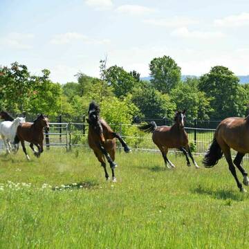
Gut von Esbach - Bullenheim
Ippesheim
Merkel
@K.Merkel
Freizeitstall
Rehabilitationsstall
Vermieten
Hunde willkommen
Paddock
Allergikerstall
14 weitere...
S
Deprecated: Creation of dynamic property Zend_View_Helper_Ads::$adLink is deprecated in /var/www/stall-frei/htdocs/staging.stall-frei.de/library/Psf/View/Helper/Ads.php on line 108

Frisches Stroh zu verkaufen!
Mechtersen
STALL-FREIde Marketing
@STALL-FREI-Marketing
Kaufe frisches Stroh für dein Pferd!
Pferdedorf Richthofen Circle - 100% Herdenhaltung
Kitzingen
Pferdedorf Richthofen-Circle
@Pferdedorf-im-RichthofenCircle
FN-Mitglied
Freizeitstall
Vermieten
Hunde willkommen
Krankenbox
Allergikerstall
Hufrehe geeignet
20 weitere...
P

Paddockbox frei… Allergiker geeignet
Frickenhausen
Emmerling
@Emmerling
FN-Mitglied
Freizeitstall
Vermieten
Hunde willkommen
Krankenbox
Allergikerstall
Gnadenbrothof
25 weitere...
P

Pferdestall im Grünen zw. Würzburg u. Kitzingen
Biebelried-Kaltensondheim
Familie Hesselbach
@Familie-Hesselbach
Freizeitstall
Reitlehrer und -unterricht
Vermieten
Führanlage
Longierzirkel/Roundpen
Außenbox mit Paddock
12 weitere...
P

Paddock-Trail-Anlage hat Plätze frei
Mainbernheim
Zykloopenhof
@Zykloopenhof
Freizeitstall
Gangpferdereiten
Vermieten
Hunde willkommen
Krankenbox
Allergikerstall
bedampftes/gewaschenes Heu
29 weitere...
P
Kleiner Reiterhof mit Halle und Reitplatz
Ochsenfurt
Michael-Knaus
@Michael-Knaus
Freizeitstall
Verpachten
Paddock
Reithalle
Außenboxen
Offenstall
5 weitere...
P

Platz frei auf dem Mainwiesenhof
Ochsenfurt
Mainwiesenhof
@Mainwiesenhof
FN-Mitglied
Freizeitstall
Vermieten
Hunde willkommen
Paddock
Hufrehe geeignet
Notfallboxen
15 weitere...
P

1 Außenbox und 1 Innenbox
Dettelbach
LRFV Dettelbach
@LrfvDettelbach
FN-Mitglied
Reitlehrer und -unterricht
Vermieten
Hunde willkommen
Paddock
Außenbox mit Paddock
Außenboxen
12 weitere...
P

Persönlichkeitsentwicklung mit Pferden
Bad Salzuflen
Katja Dors
@Pferdezeiten
Begleite andere auf ihrem Entwicklungsweg und entdecke die transformative Kraft der pferdegestützten Persönlichkeitsentwicklung !
neu
R
Leider kein Vorschaubild
Leider kein Vorschaubild
Pferdepension Steigmühle
Dettelbach
Pferdepension Steigmühle
@Pferdepension Steigmühle
Freizeitstall
Vermieten
Verpachten
Paddock
Parkplatz für Pferdeanhänger
Gnadenbrothof
Hengsthaltung möglich
11 weitere...
P
Kirschberghof
Sommerhausen
Manuela Blechschmidt
@ManuelaBlechschmidt
FN-Mitglied
Freizeitstall
Krankenbox
Longierzirkel/Roundpen
Gnadenbrothof
Außenbox mit Paddock
Außenboxen
17 weitere...
P
Deprecated: Creation of dynamic property Zend_View::$pageCount is deprecated in /var/www/stall-frei/htdocs/staging.stall-frei.de/library/vendor/shardj/zf1-future/library/Zend/View/Abstract.php on line 308
Deprecated: Creation of dynamic property Zend_View::$itemCountPerPage is deprecated in /var/www/stall-frei/htdocs/staging.stall-frei.de/library/vendor/shardj/zf1-future/library/Zend/View/Abstract.php on line 308
Deprecated: Creation of dynamic property Zend_View::$first is deprecated in /var/www/stall-frei/htdocs/staging.stall-frei.de/library/vendor/shardj/zf1-future/library/Zend/View/Abstract.php on line 308
Deprecated: Creation of dynamic property Zend_View::$current is deprecated in /var/www/stall-frei/htdocs/staging.stall-frei.de/library/vendor/shardj/zf1-future/library/Zend/View/Abstract.php on line 308
Deprecated: Creation of dynamic property Zend_View::$last is deprecated in /var/www/stall-frei/htdocs/staging.stall-frei.de/library/vendor/shardj/zf1-future/library/Zend/View/Abstract.php on line 308
Deprecated: Creation of dynamic property Zend_View::$next is deprecated in /var/www/stall-frei/htdocs/staging.stall-frei.de/library/vendor/shardj/zf1-future/library/Zend/View/Abstract.php on line 308
Deprecated: Creation of dynamic property Zend_View::$pagesInRange is deprecated in /var/www/stall-frei/htdocs/staging.stall-frei.de/library/vendor/shardj/zf1-future/library/Zend/View/Abstract.php on line 308
Deprecated: Creation of dynamic property Zend_View::$firstPageInRange is deprecated in /var/www/stall-frei/htdocs/staging.stall-frei.de/library/vendor/shardj/zf1-future/library/Zend/View/Abstract.php on line 308
Deprecated: Creation of dynamic property Zend_View::$lastPageInRange is deprecated in /var/www/stall-frei/htdocs/staging.stall-frei.de/library/vendor/shardj/zf1-future/library/Zend/View/Abstract.php on line 308
Deprecated: Creation of dynamic property Zend_View::$currentItemCount is deprecated in /var/www/stall-frei/htdocs/staging.stall-frei.de/library/vendor/shardj/zf1-future/library/Zend/View/Abstract.php on line 308
Deprecated: Creation of dynamic property Zend_View::$totalItemCount is deprecated in /var/www/stall-frei/htdocs/staging.stall-frei.de/library/vendor/shardj/zf1-future/library/Zend/View/Abstract.php on line 308
Deprecated: Creation of dynamic property Zend_View::$firstItemNumber is deprecated in /var/www/stall-frei/htdocs/staging.stall-frei.de/library/vendor/shardj/zf1-future/library/Zend/View/Abstract.php on line 308
Deprecated: Creation of dynamic property Zend_View::$lastItemNumber is deprecated in /var/www/stall-frei/htdocs/staging.stall-frei.de/library/vendor/shardj/zf1-future/library/Zend/View/Abstract.php on line 308
Deprecated: Creation of dynamic property Zend_View::$router is deprecated in /var/www/stall-frei/htdocs/staging.stall-frei.de/library/vendor/shardj/zf1-future/library/Zend/View/Abstract.php on line 308
Deprecated: Creation of dynamic property Zend_View::$urlParams is deprecated in /var/www/stall-frei/htdocs/staging.stall-frei.de/library/vendor/shardj/zf1-future/library/Zend/View/Abstract.php on line 308
Deprecated: Creation of dynamic property Zend_View::$showAds is deprecated in /var/www/stall-frei/htdocs/staging.stall-frei.de/library/vendor/shardj/zf1-future/library/Zend/View/Abstract.php on line 308
Deprecated: Creation of dynamic property Zend_View::$objectIds is deprecated in /var/www/stall-frei/htdocs/staging.stall-frei.de/library/vendor/shardj/zf1-future/library/Zend/View/Abstract.php on line 308
Deprecated: Creation of dynamic property Zend_View::$showNavbar is deprecated in /var/www/stall-frei/htdocs/staging.stall-frei.de/library/vendor/shardj/zf1-future/library/Zend/View/Abstract.php on line 308
Deprecated: Creation of dynamic property Zend_View::$showBreadcrumb is deprecated in /var/www/stall-frei/htdocs/staging.stall-frei.de/library/vendor/shardj/zf1-future/library/Zend/View/Abstract.php on line 308
Deprecated: Creation of dynamic property Zend_View::$showFooter is deprecated in /var/www/stall-frei/htdocs/staging.stall-frei.de/library/vendor/shardj/zf1-future/library/Zend/View/Abstract.php on line 308
Deprecated: Creation of dynamic property Zend_View::$showInternalAds is deprecated in /var/www/stall-frei/htdocs/staging.stall-frei.de/library/vendor/shardj/zf1-future/library/Zend/View/Abstract.php on line 308
Deprecated: Creation of dynamic property Zend_View::$blNoContent is deprecated in /var/www/stall-frei/htdocs/staging.stall-frei.de/library/vendor/shardj/zf1-future/library/Zend/View/Abstract.php on line 308
Deprecated: Creation of dynamic property Zend_View::$sMetaDesc is deprecated in /var/www/stall-frei/htdocs/staging.stall-frei.de/library/vendor/shardj/zf1-future/library/Zend/View/Abstract.php on line 308
Deprecated: Creation of dynamic property Zend_View::$useGmaps is deprecated in /var/www/stall-frei/htdocs/staging.stall-frei.de/library/vendor/shardj/zf1-future/library/Zend/View/Abstract.php on line 308
Deprecated: Creation of dynamic property Zend_View::$touches is deprecated in /var/www/stall-frei/htdocs/staging.stall-frei.de/library/vendor/shardj/zf1-future/library/Zend/View/Abstract.php on line 308
Deprecated: Creation of dynamic property Zend_View::$oProject is deprecated in /var/www/stall-frei/htdocs/staging.stall-frei.de/library/vendor/shardj/zf1-future/library/Zend/View/Abstract.php on line 308
Deprecated: Creation of dynamic property Zend_View::$pageHeadline is deprecated in /var/www/stall-frei/htdocs/staging.stall-frei.de/library/vendor/shardj/zf1-future/library/Zend/View/Abstract.php on line 308
Deprecated: Creation of dynamic property Zend_View::$disableLocationField is deprecated in /var/www/stall-frei/htdocs/staging.stall-frei.de/library/vendor/shardj/zf1-future/library/Zend/View/Abstract.php on line 308
Deprecated: Creation of dynamic property Zend_View::$isSearch is deprecated in /var/www/stall-frei/htdocs/staging.stall-frei.de/library/vendor/shardj/zf1-future/library/Zend/View/Abstract.php on line 308
Deprecated: Creation of dynamic property Zend_View::$pageTitle is deprecated in /var/www/stall-frei/htdocs/staging.stall-frei.de/library/vendor/shardj/zf1-future/library/Zend/View/Abstract.php on line 308
Deprecated: Creation of dynamic property Psf_Form_Element_Text::$class is deprecated in /var/www/stall-frei/htdocs/staging.stall-frei.de/library/vendor/shardj/zf1-future/library/Zend/Form/Element.php on line 874
Deprecated: Creation of dynamic property Psf_Form_Element_Text::$size is deprecated in /var/www/stall-frei/htdocs/staging.stall-frei.de/library/vendor/shardj/zf1-future/library/Zend/Form/Element.php on line 874
Deprecated: Creation of dynamic property Psf_Form_Element_Text::$placeholder is deprecated in /var/www/stall-frei/htdocs/staging.stall-frei.de/library/vendor/shardj/zf1-future/library/Zend/Form/Element.php on line 874
Deprecated: Creation of dynamic property Psf_Form_Element_Hidden::$class is deprecated in /var/www/stall-frei/htdocs/staging.stall-frei.de/library/vendor/shardj/zf1-future/library/Zend/Form/Element.php on line 874
Deprecated: Creation of dynamic property Psf_Form_Element_Hidden::$class is deprecated in /var/www/stall-frei/htdocs/staging.stall-frei.de/library/vendor/shardj/zf1-future/library/Zend/Form/Element.php on line 874
Deprecated: Creation of dynamic property Psf_Form_Element_Hidden::$class is deprecated in /var/www/stall-frei/htdocs/staging.stall-frei.de/library/vendor/shardj/zf1-future/library/Zend/Form/Element.php on line 874
Deprecated: Creation of dynamic property Psf_Form_Element_Hidden::$class is deprecated in /var/www/stall-frei/htdocs/staging.stall-frei.de/library/vendor/shardj/zf1-future/library/Zend/Form/Element.php on line 874
Deprecated: Creation of dynamic property Psf_Form_Element_Select::$class is deprecated in /var/www/stall-frei/htdocs/staging.stall-frei.de/library/vendor/shardj/zf1-future/library/Zend/Form/Element.php on line 874
Deprecated: Creation of dynamic property Psf_Form_Element_Select::$class is deprecated in /var/www/stall-frei/htdocs/staging.stall-frei.de/library/vendor/shardj/zf1-future/library/Zend/Form/Element.php on line 874
Deprecated: Creation of dynamic property Psf_Form_Element_Select::$class is deprecated in /var/www/stall-frei/htdocs/staging.stall-frei.de/library/vendor/shardj/zf1-future/library/Zend/Form/Element.php on line 874
Deprecated: Creation of dynamic property Psf_Form_Element_Select::$class is deprecated in /var/www/stall-frei/htdocs/staging.stall-frei.de/library/vendor/shardj/zf1-future/library/Zend/Form/Element.php on line 874
Deprecated: Creation of dynamic property Psf_Form_Element_Text::$class is deprecated in /var/www/stall-frei/htdocs/staging.stall-frei.de/library/vendor/shardj/zf1-future/library/Zend/Form/Element.php on line 874
Deprecated: Creation of dynamic property Psf_Form_Element_Checkbox::$label is deprecated in /var/www/stall-frei/htdocs/staging.stall-frei.de/library/vendor/shardj/zf1-future/library/Zend/Form/Element.php on line 874
Deprecated: Creation of dynamic property Zend_View::$sort is deprecated in /var/www/stall-frei/htdocs/staging.stall-frei.de/library/vendor/shardj/zf1-future/library/Zend/View/Abstract.php on line 308
Deprecated: Creation of dynamic property Zend_View::$searchLocation is deprecated in /var/www/stall-frei/htdocs/staging.stall-frei.de/library/vendor/shardj/zf1-future/library/Zend/View/Abstract.php on line 308
Deprecated: Creation of dynamic property Zend_View::$locationHint is deprecated in /var/www/stall-frei/htdocs/staging.stall-frei.de/library/vendor/shardj/zf1-future/library/Zend/View/Abstract.php on line 308
Psf_GeoCoder_Abstract::getLocation: Hohenfeld Get Location CachedOrLive
Psf_GeoCoder_Abstract::getCachedOrLive: Hohenfeld
Psf_GeoCoder_OpenCageData::makeApiRequest: response:
Array
(
[documentation] => https://opencagedata.com/api
[licenses] => Array
(
[0] => Array
(
[name] => see attribution guide
[url] => https://opencagedata.com/credits
)
)
[results] => Array
(
[0] => Array
(
[bounds] => Array
(
[northeast] => Array
(
[lat] => 49.7381862
[lng] => 10.1772125
)
[southwest] => Array
(
[lat] => 49.6981862
[lng] => 10.1372125
)
)
[components] => Array
(
[ISO_3166-1_alpha-2] => DE
[ISO_3166-1_alpha-3] => DEU
[ISO_3166-2] => Array
(
[0] => DE-BY
)
[_category] => place
[_normalized_city] => Kitzingen
[_type] => neighbourhood
[continent] => Europe
[country] => Deutschland
[country_code] => de
[county] => Landkreis Kitzingen
[political_union] => European Union
[postcode] => 97318
[state] => Bayern
[state_code] => BY
[suburb] => Hohenfeld
[town] => Kitzingen
)
[confidence] => 7
[formatted] => 97318 Kitzingen, Deutschland
[geometry] => Array
(
[lat] => 49.7181862
[lng] => 10.1572125
)
)
[1] => Array
(
[bounds] => Array
(
[northeast] => Array
(
[lat] => 51.0394372
[lng] => 7.1613991
)
[southwest] => Array
(
[lat] => 50.9994372
[lng] => 7.1213991
)
)
[components] => Array
(
[ISO_3166-1_alpha-2] => DE
[ISO_3166-1_alpha-3] => DEU
[ISO_3166-2] => Array
(
[0] => DE-NW
)
[_category] => place
[_normalized_city] => Odenthal
[_type] => hamlet
[continent] => Europe
[country] => Deutschland
[country_code] => de
[county] => Rheinisch-Bergischer Kreis
[hamlet] => Hohenfeld
[political_union] => European Union
[postcode] => 51519
[state] => Nordrhein-Westfalen
[state_code] => NW
[town] => Odenthal
)
[confidence] => 7
[formatted] => Hohenfeld, 51519 Odenthal, Deutschland
[geometry] => Array
(
[lat] => 51.0194372
[lng] => 7.1413991
)
)
[2] => Array
(
[bounds] => Array
(
[northeast] => Array
(
[lat] => 51.0195887
[lng] => 7.1417557
)
[southwest] => Array
(
[lat] => 51.0187466
[lng] => 7.138641
)
)
[components] => Array
(
[ISO_3166-1_alpha-2] => DE
[ISO_3166-1_alpha-3] => DEU
[ISO_3166-2] => Array
(
[0] => DE-NW
)
[_category] => road
[_normalized_city] => Odenthal
[_type] => road
[continent] => Europe
[country] => Deutschland
[country_code] => de
[county] => Rheinisch-Bergischer Kreis
[hamlet] => Hohenfeld
[political_union] => European Union
[postcode] => 51519
[road] => Hohenfeld
[road_type] => residential
[state] => Nordrhein-Westfalen
[state_code] => NW
[town] => Odenthal
)
[confidence] => 9
[formatted] => Hohenfeld, 51519 Odenthal, Deutschland
[geometry] => Array
(
[lat] => 51.0193325
[lng] => 7.1401387
)
)
[3] => Array
(
[bounds] => Array
(
[northeast] => Array
(
[lat] => 51.0187466
[lng] => 7.1389516
)
[southwest] => Array
(
[lat] => 51.0163667
[lng] => 7.1379501
)
)
[components] => Array
(
[ISO_3166-1_alpha-2] => DE
[ISO_3166-1_alpha-3] => DEU
[ISO_3166-2] => Array
(
[0] => DE-NW
)
[_category] => road
[_normalized_city] => Odenthal
[_type] => road
[continent] => Europe
[country] => Deutschland
[country_code] => de
[county] => Rheinisch-Bergischer Kreis
[hamlet] => Oberborsbach
[political_union] => European Union
[postcode] => 51519
[road] => Hohenfelder Weg
[road_type] => residential
[state] => Nordrhein-Westfalen
[state_code] => NW
[town] => Odenthal
)
[confidence] => 9
[formatted] => Hohenfelder Weg, 51519 Odenthal, Deutschland
[geometry] => Array
(
[lat] => 51.0177098
[lng] => 7.1381562
)
)
[4] => Array
(
[components] => Array
(
[ISO_3166-1_alpha-2] => FR
[ISO_3166-1_alpha-3] => FRA
[ISO_3166-2] => Array
(
[0] => FR-GES
[1] => FR-6AE
[2] => FR-67
)
[_category] => road
[_normalized_city] => Dambach
[_type] => road
[city] => Dambach
[continent] => Europe
[country] => France
[country_code] => fr
[county] => Bas-Rhin
[local_authority] => Communauté de communes du Pays de Niederbronn-les-Bains
[political_union] => European Union
[postcode] => 67110
[road] => Rue du Hohenfels
[state] => Grand Est
[state_code] => GES
)
[confidence] => 3
[formatted] => Rue du Hohenfels, 67110 Dambach, France
[geometry] => Array
(
[lat] => 49.002205
[lng] => 7.627522
)
)
[5] => Array
(
[components] => Array
(
[ISO_3166-1_alpha-2] => FR
[ISO_3166-1_alpha-3] => FRA
[ISO_3166-2] => Array
(
[0] => FR-GES
[1] => FR-6AE
[2] => FR-67
)
[_category] => road
[_normalized_city] => Dambach
[_type] => road
[city] => Dambach
[continent] => Europe
[country] => France
[country_code] => fr
[county] => Bas-Rhin
[local_authority] => Communauté de communes du Pays de Niederbronn-les-Bains
[political_union] => European Union
[postcode] => 67110
[road] => Mf Hohenfels
[state] => Grand Est
[state_code] => GES
)
[confidence] => 3
[formatted] => Mf Hohenfels, 67110 Dambach, France
[geometry] => Array
(
[lat] => 49.00724
[lng] => 7.622908
)
)
[6] => Array
(
[components] => Array
(
[ISO_3166-1_alpha-2] => FR
[ISO_3166-1_alpha-3] => FRA
[ISO_3166-2] => Array
(
[0] => FR-GES
[1] => FR-57
)
[_category] => road
[_normalized_city] => Pontpierre
[_type] => road
[city] => Pontpierre
[continent] => Europe
[country] => France
[country_code] => fr
[county] => Moselle
[local_authority] => Communauté de communes du District urbain de Faulquemont
[political_union] => European Union
[postcode] => 57380
[road] => rue de la Hanffeld
[state] => Grand Est
[state_code] => GES
)
[confidence] => 2
[formatted] => rue de la Hanffeld, 57380 Pontpierre, France
[geometry] => Array
(
[lat] => 49.042846
[lng] => 6.637738
)
)
[7] => Array
(
[components] => Array
(
[ISO_3166-1_alpha-2] => FR
[ISO_3166-1_alpha-3] => FRA
[ISO_3166-2] => Array
(
[0] => FR-HDF
[1] => FR-59
)
[_category] => road
[_normalized_city] => Denain
[_type] => road
[city] => Denain
[continent] => Europe
[country] => France
[country_code] => fr
[county] => Nord
[local_authority] => Communauté d'agglomération de la Porte du Hainaut
[political_union] => European Union
[postcode] => 59220
[road] => Allee Eiffel
[state] => Hauts-de-France
[state_code] => HDF
)
[confidence] => 10
[formatted] => Allee Eiffel, 59220 Denain, France
[geometry] => Array
(
[lat] => 50.334438
[lng] => 3.394833
)
)
[8] => Array
(
[components] => Array
(
[ISO_3166-1_alpha-2] => FR
[ISO_3166-1_alpha-3] => FRA
[ISO_3166-2] => Array
(
[0] => FR-IDF
[1] => FR-92
)
[_category] => road
[_normalized_city] => Courbevoie
[_type] => road
[city] => Courbevoie
[continent] => Europe
[country] => France
[country_code] => fr
[county] => Hauts-de-Seine
[local_authority] => Métropole du Grand Paris
[political_union] => European Union
[postcode] => 92400
[road] => Place Des 3 Frères Enghels
[state] => Île-de-France
[state_code] => IDF
)
[confidence] => 10
[formatted] => Place Des 3 Frères Enghels, 92400 Courbevoie, France
[geometry] => Array
(
[lat] => 48.891067
[lng] => 2.255755
)
)
[9] => Array
(
[components] => Array
(
[ISO_3166-1_alpha-2] => FR
[ISO_3166-1_alpha-3] => FRA
[ISO_3166-2] => Array
(
[0] => FR-NAQ
[1] => FR-33
)
[_category] => road
[_normalized_city] => La Teste-de-Buch
[_type] => road
[city] => La Teste-de-Buch
[continent] => Europe
[country] => France
[country_code] => fr
[county] => Gironde
[local_authority] => Communauté d'agglomération Bassin d'Arcachon Sud
[political_union] => European Union
[postcode] => 33260
[road] => Avenue Gustave Eiffel
[state] => Nouvelle-Aquitaine
[state_code] => NAQ
)
[confidence] => 10
[formatted] => Avenue Gustave Eiffel, 33260 La Teste-de-Buch, France
[geometry] => Array
(
[lat] => 44.610657
[lng] => -1.126997
)
)
)
[status] => Array
(
[code] => 200
[message] => OK
)
[stay_informed] => Array
(
[blog] => https://blog.opencagedata.com
[mastodon] => https://en.osm.town/@opencage
)
[thanks] => For using an OpenCage API
[timestamp] => Array
(
[created_http] => Sun, 08 Feb 2026 01:17:07 GMT
[created_unix] => 1770513427
)
[total_results] => 10
)
Psf_GeoCoder_Abstract::convertLocationResult
{"documentation":"https:\/\/opencagedata.com\/api","licenses":[{"name":"see attribution guide","url":"https:\/\/opencagedata.com\/credits"}],"results":[{"bounds":{"northeast":{"lat":49.7381862,"lng":10.1772125},"southwest":{"lat":49.6981862,"lng":10.1372125}},"components":{"ISO_3166-1_alpha-2":"DE","ISO_3166-1_alpha-3":"DEU","ISO_3166-2":["DE-BY"],"_category":"place","_normalized_city":"Kitzingen","_type":"neighbourhood","continent":"Europe","country":"Deutschland","country_code":"de","county":"Landkreis Kitzingen","political_union":"European Union","postcode":"97318","state":"Bayern","state_code":"BY","suburb":"Hohenfeld","town":"Kitzingen"},"confidence":7,"formatted":"97318 Kitzingen, Deutschland","geometry":{"lat":49.7181862,"lng":10.1572125}},{"bounds":{"northeast":{"lat":51.0394372,"lng":7.1613991},"southwest":{"lat":50.9994372,"lng":7.1213991}},"components":{"ISO_3166-1_alpha-2":"DE","ISO_3166-1_alpha-3":"DEU","ISO_3166-2":["DE-NW"],"_category":"place","_normalized_city":"Odenthal","_type":"hamlet","continent":"Europe","country":"Deutschland","country_code":"de","county":"Rheinisch-Bergischer Kreis","hamlet":"Hohenfeld","political_union":"European Union","postcode":"51519","state":"Nordrhein-Westfalen","state_code":"NW","town":"Odenthal"},"confidence":7,"formatted":"Hohenfeld, 51519 Odenthal, Deutschland","geometry":{"lat":51.0194372,"lng":7.1413991}},{"bounds":{"northeast":{"lat":51.0195887,"lng":7.1417557},"southwest":{"lat":51.0187466,"lng":7.138641}},"components":{"ISO_3166-1_alpha-2":"DE","ISO_3166-1_alpha-3":"DEU","ISO_3166-2":["DE-NW"],"_category":"road","_normalized_city":"Odenthal","_type":"road","continent":"Europe","country":"Deutschland","country_code":"de","county":"Rheinisch-Bergischer Kreis","hamlet":"Hohenfeld","political_union":"European Union","postcode":"51519","road":"Hohenfeld","road_type":"residential","state":"Nordrhein-Westfalen","state_code":"NW","town":"Odenthal"},"confidence":9,"formatted":"Hohenfeld, 51519 Odenthal, Deutschland","geometry":{"lat":51.0193325,"lng":7.1401387}},{"bounds":{"northeast":{"lat":51.0187466,"lng":7.1389516},"southwest":{"lat":51.0163667,"lng":7.1379501}},"components":{"ISO_3166-1_alpha-2":"DE","ISO_3166-1_alpha-3":"DEU","ISO_3166-2":["DE-NW"],"_category":"road","_normalized_city":"Odenthal","_type":"road","continent":"Europe","country":"Deutschland","country_code":"de","county":"Rheinisch-Bergischer Kreis","hamlet":"Oberborsbach","political_union":"European Union","postcode":"51519","road":"Hohenfelder Weg","road_type":"residential","state":"Nordrhein-Westfalen","state_code":"NW","town":"Odenthal"},"confidence":9,"formatted":"Hohenfelder Weg, 51519 Odenthal, Deutschland","geometry":{"lat":51.0177098,"lng":7.1381562}},{"components":{"ISO_3166-1_alpha-2":"FR","ISO_3166-1_alpha-3":"FRA","ISO_3166-2":["FR-GES","FR-6AE","FR-67"],"_category":"road","_normalized_city":"Dambach","_type":"road","city":"Dambach","continent":"Europe","country":"France","country_code":"fr","county":"Bas-Rhin","local_authority":"Communaut\u00e9 de communes du Pays de Niederbronn-les-Bains","political_union":"European Union","postcode":"67110","road":"Rue du Hohenfels","state":"Grand Est","state_code":"GES"},"confidence":3,"formatted":"Rue du Hohenfels, 67110 Dambach, France","geometry":{"lat":49.002205,"lng":7.627522}},{"components":{"ISO_3166-1_alpha-2":"FR","ISO_3166-1_alpha-3":"FRA","ISO_3166-2":["FR-GES","FR-6AE","FR-67"],"_category":"road","_normalized_city":"Dambach","_type":"road","city":"Dambach","continent":"Europe","country":"France","country_code":"fr","county":"Bas-Rhin","local_authority":"Communaut\u00e9 de communes du Pays de Niederbronn-les-Bains","political_union":"European Union","postcode":"67110","road":"Mf Hohenfels","state":"Grand Est","state_code":"GES"},"confidence":3,"formatted":"Mf Hohenfels, 67110 Dambach, France","geometry":{"lat":49.00724,"lng":7.622908}},{"components":{"ISO_3166-1_alpha-2":"FR","ISO_3166-1_alpha-3":"FRA","ISO_3166-2":["FR-GES","FR-57"],"_category":"road","_normalized_city":"Pontpierre","_type":"road","city":"Pontpierre","continent":"Europe","country":"France","country_code":"fr","county":"Moselle","local_authority":"Communaut\u00e9 de communes du District urbain de Faulquemont","political_union":"European Union","postcode":"57380","road":"rue de la Hanffeld","state":"Grand Est","state_code":"GES"},"confidence":2,"formatted":"rue de la Hanffeld, 57380 Pontpierre, France","geometry":{"lat":49.042846,"lng":6.637738}},{"components":{"ISO_3166-1_alpha-2":"FR","ISO_3166-1_alpha-3":"FRA","ISO_3166-2":["FR-HDF","FR-59"],"_category":"road","_normalized_city":"Denain","_type":"road","city":"Denain","continent":"Europe","country":"France","country_code":"fr","county":"Nord","local_authority":"Communaut\u00e9 d'agglom\u00e9ration de la Porte du Hainaut","political_union":"European Union","postcode":"59220","road":"Allee Eiffel","state":"Hauts-de-France","state_code":"HDF"},"confidence":10,"formatted":"Allee Eiffel, 59220 Denain, France","geometry":{"lat":50.334438,"lng":3.394833}},{"components":{"ISO_3166-1_alpha-2":"FR","ISO_3166-1_alpha-3":"FRA","ISO_3166-2":["FR-IDF","FR-92"],"_category":"road","_normalized_city":"Courbevoie","_type":"road","city":"Courbevoie","continent":"Europe","country":"France","country_code":"fr","county":"Hauts-de-Seine","local_authority":"M\u00e9tropole du Grand Paris","political_union":"European Union","postcode":"92400","road":"Place Des 3 Fr\u00e8res Enghels","state":"\u00cele-de-France","state_code":"IDF"},"confidence":10,"formatted":"Place Des 3 Fr\u00e8res Enghels, 92400 Courbevoie, France","geometry":{"lat":48.891067,"lng":2.255755}},{"components":{"ISO_3166-1_alpha-2":"FR","ISO_3166-1_alpha-3":"FRA","ISO_3166-2":["FR-NAQ","FR-33"],"_category":"road","_normalized_city":"La Teste-de-Buch","_type":"road","city":"La Teste-de-Buch","continent":"Europe","country":"France","country_code":"fr","county":"Gironde","local_authority":"Communaut\u00e9 d'agglom\u00e9ration Bassin d'Arcachon Sud","political_union":"European Union","postcode":"33260","road":"Avenue Gustave Eiffel","state":"Nouvelle-Aquitaine","state_code":"NAQ"},"confidence":10,"formatted":"Avenue Gustave Eiffel, 33260 La Teste-de-Buch, France","geometry":{"lat":44.610657,"lng":-1.126997}}],"status":{"code":200,"message":"OK"},"stay_informed":{"blog":"https:\/\/blog.opencagedata.com","mastodon":"https:\/\/en.osm.town\/@opencage"},"thanks":"For using an OpenCage API","timestamp":{"created_http":"Sun, 08 Feb 2026 01:17:07 GMT","created_unix":1770513427},"total_results":10}Array
(
[0] => stdClass Object
(
[bounds] => stdClass Object
(
[northeast] => stdClass Object
(
[lat] => 49.7381862
[lng] => 10.1772125
)
[southwest] => stdClass Object
(
[lat] => 49.6981862
[lng] => 10.1372125
)
)
[components] => stdClass Object
(
[ISO_3166-1_alpha-2] => DE
[ISO_3166-1_alpha-3] => DEU
[ISO_3166-2] => Array
(
[0] => DE-BY
)
[_category] => place
[_normalized_city] => Kitzingen
[_type] => neighbourhood
[continent] => Europe
[country] => Deutschland
[country_code] => de
[county] => Landkreis Kitzingen
[political_union] => European Union
[postcode] => 97318
[state] => Bayern
[state_code] => BY
[suburb] => Hohenfeld
[town] => Kitzingen
)
[confidence] => 7
[formatted] => 97318 Kitzingen, Deutschland
[geometry] => stdClass Object
(
[lat] => 49.7181862
[lng] => 10.1572125
)
)
[1] => stdClass Object
(
[bounds] => stdClass Object
(
[northeast] => stdClass Object
(
[lat] => 51.0394372
[lng] => 7.1613991
)
[southwest] => stdClass Object
(
[lat] => 50.9994372
[lng] => 7.1213991
)
)
[components] => stdClass Object
(
[ISO_3166-1_alpha-2] => DE
[ISO_3166-1_alpha-3] => DEU
[ISO_3166-2] => Array
(
[0] => DE-NW
)
[_category] => place
[_normalized_city] => Odenthal
[_type] => hamlet
[continent] => Europe
[country] => Deutschland
[country_code] => de
[county] => Rheinisch-Bergischer Kreis
[hamlet] => Hohenfeld
[political_union] => European Union
[postcode] => 51519
[state] => Nordrhein-Westfalen
[state_code] => NW
[town] => Odenthal
)
[confidence] => 7
[formatted] => Hohenfeld, 51519 Odenthal, Deutschland
[geometry] => stdClass Object
(
[lat] => 51.0194372
[lng] => 7.1413991
)
)
[2] => stdClass Object
(
[bounds] => stdClass Object
(
[northeast] => stdClass Object
(
[lat] => 51.0195887
[lng] => 7.1417557
)
[southwest] => stdClass Object
(
[lat] => 51.0187466
[lng] => 7.138641
)
)
[components] => stdClass Object
(
[ISO_3166-1_alpha-2] => DE
[ISO_3166-1_alpha-3] => DEU
[ISO_3166-2] => Array
(
[0] => DE-NW
)
[_category] => road
[_normalized_city] => Odenthal
[_type] => road
[continent] => Europe
[country] => Deutschland
[country_code] => de
[county] => Rheinisch-Bergischer Kreis
[hamlet] => Hohenfeld
[political_union] => European Union
[postcode] => 51519
[road] => Hohenfeld
[road_type] => residential
[state] => Nordrhein-Westfalen
[state_code] => NW
[town] => Odenthal
)
[confidence] => 9
[formatted] => Hohenfeld, 51519 Odenthal, Deutschland
[geometry] => stdClass Object
(
[lat] => 51.0193325
[lng] => 7.1401387
)
)
[3] => stdClass Object
(
[bounds] => stdClass Object
(
[northeast] => stdClass Object
(
[lat] => 51.0187466
[lng] => 7.1389516
)
[southwest] => stdClass Object
(
[lat] => 51.0163667
[lng] => 7.1379501
)
)
[components] => stdClass Object
(
[ISO_3166-1_alpha-2] => DE
[ISO_3166-1_alpha-3] => DEU
[ISO_3166-2] => Array
(
[0] => DE-NW
)
[_category] => road
[_normalized_city] => Odenthal
[_type] => road
[continent] => Europe
[country] => Deutschland
[country_code] => de
[county] => Rheinisch-Bergischer Kreis
[hamlet] => Oberborsbach
[political_union] => European Union
[postcode] => 51519
[road] => Hohenfelder Weg
[road_type] => residential
[state] => Nordrhein-Westfalen
[state_code] => NW
[town] => Odenthal
)
[confidence] => 9
[formatted] => Hohenfelder Weg, 51519 Odenthal, Deutschland
[geometry] => stdClass Object
(
[lat] => 51.0177098
[lng] => 7.1381562
)
)
[4] => stdClass Object
(
[components] => stdClass Object
(
[ISO_3166-1_alpha-2] => FR
[ISO_3166-1_alpha-3] => FRA
[ISO_3166-2] => Array
(
[0] => FR-GES
[1] => FR-6AE
[2] => FR-67
)
[_category] => road
[_normalized_city] => Dambach
[_type] => road
[city] => Dambach
[continent] => Europe
[country] => France
[country_code] => fr
[county] => Bas-Rhin
[local_authority] => Communauté de communes du Pays de Niederbronn-les-Bains
[political_union] => European Union
[postcode] => 67110
[road] => Rue du Hohenfels
[state] => Grand Est
[state_code] => GES
)
[confidence] => 3
[formatted] => Rue du Hohenfels, 67110 Dambach, France
[geometry] => stdClass Object
(
[lat] => 49.002205
[lng] => 7.627522
)
)
[5] => stdClass Object
(
[components] => stdClass Object
(
[ISO_3166-1_alpha-2] => FR
[ISO_3166-1_alpha-3] => FRA
[ISO_3166-2] => Array
(
[0] => FR-GES
[1] => FR-6AE
[2] => FR-67
)
[_category] => road
[_normalized_city] => Dambach
[_type] => road
[city] => Dambach
[continent] => Europe
[country] => France
[country_code] => fr
[county] => Bas-Rhin
[local_authority] => Communauté de communes du Pays de Niederbronn-les-Bains
[political_union] => European Union
[postcode] => 67110
[road] => Mf Hohenfels
[state] => Grand Est
[state_code] => GES
)
[confidence] => 3
[formatted] => Mf Hohenfels, 67110 Dambach, France
[geometry] => stdClass Object
(
[lat] => 49.00724
[lng] => 7.622908
)
)
[6] => stdClass Object
(
[components] => stdClass Object
(
[ISO_3166-1_alpha-2] => FR
[ISO_3166-1_alpha-3] => FRA
[ISO_3166-2] => Array
(
[0] => FR-GES
[1] => FR-57
)
[_category] => road
[_normalized_city] => Pontpierre
[_type] => road
[city] => Pontpierre
[continent] => Europe
[country] => France
[country_code] => fr
[county] => Moselle
[local_authority] => Communauté de communes du District urbain de Faulquemont
[political_union] => European Union
[postcode] => 57380
[road] => rue de la Hanffeld
[state] => Grand Est
[state_code] => GES
)
[confidence] => 2
[formatted] => rue de la Hanffeld, 57380 Pontpierre, France
[geometry] => stdClass Object
(
[lat] => 49.042846
[lng] => 6.637738
)
)
[7] => stdClass Object
(
[components] => stdClass Object
(
[ISO_3166-1_alpha-2] => FR
[ISO_3166-1_alpha-3] => FRA
[ISO_3166-2] => Array
(
[0] => FR-HDF
[1] => FR-59
)
[_category] => road
[_normalized_city] => Denain
[_type] => road
[city] => Denain
[continent] => Europe
[country] => France
[country_code] => fr
[county] => Nord
[local_authority] => Communauté d'agglomération de la Porte du Hainaut
[political_union] => European Union
[postcode] => 59220
[road] => Allee Eiffel
[state] => Hauts-de-France
[state_code] => HDF
)
[confidence] => 10
[formatted] => Allee Eiffel, 59220 Denain, France
[geometry] => stdClass Object
(
[lat] => 50.334438
[lng] => 3.394833
)
)
[8] => stdClass Object
(
[components] => stdClass Object
(
[ISO_3166-1_alpha-2] => FR
[ISO_3166-1_alpha-3] => FRA
[ISO_3166-2] => Array
(
[0] => FR-IDF
[1] => FR-92
)
[_category] => road
[_normalized_city] => Courbevoie
[_type] => road
[city] => Courbevoie
[continent] => Europe
[country] => France
[country_code] => fr
[county] => Hauts-de-Seine
[local_authority] => Métropole du Grand Paris
[political_union] => European Union
[postcode] => 92400
[road] => Place Des 3 Frères Enghels
[state] => Île-de-France
[state_code] => IDF
)
[confidence] => 10
[formatted] => Place Des 3 Frères Enghels, 92400 Courbevoie, France
[geometry] => stdClass Object
(
[lat] => 48.891067
[lng] => 2.255755
)
)
[9] => stdClass Object
(
[components] => stdClass Object
(
[ISO_3166-1_alpha-2] => FR
[ISO_3166-1_alpha-3] => FRA
[ISO_3166-2] => Array
(
[0] => FR-NAQ
[1] => FR-33
)
[_category] => road
[_normalized_city] => La Teste-de-Buch
[_type] => road
[city] => La Teste-de-Buch
[continent] => Europe
[country] => France
[country_code] => fr
[county] => Gironde
[local_authority] => Communauté d'agglomération Bassin d'Arcachon Sud
[political_union] => European Union
[postcode] => 33260
[road] => Avenue Gustave Eiffel
[state] => Nouvelle-Aquitaine
[state_code] => NAQ
)
[confidence] => 10
[formatted] => Avenue Gustave Eiffel, 33260 La Teste-de-Buch, France
[geometry] => stdClass Object
(
[lat] => 44.610657
[lng] => -1.126997
)
)
)
Psf_GeoCoder_OpenCageData::getKeyMap: 0
stdClass Object
(
    [bounds] => stdClass Object
        (
            [northeast] => stdClass Object
                (
                    [lat] => 49.7381862
                    [lng] => 10.1772125
                )

            [southwest] => stdClass Object
                (
                    [lat] => 49.6981862
                    [lng] => 10.1372125
                )

        )

    [components] => stdClass Object
        (
            [ISO_3166-1_alpha-2] => DE
            [ISO_3166-1_alpha-3] => DEU
            [ISO_3166-2] => Array
                (
                    [0] => DE-BY
                )

            [_category] => place
            [_normalized_city] => Kitzingen
            [_type] => neighbourhood
            [continent] => Europe
            [country] => Deutschland
            [country_code] => de
            [county] => Landkreis Kitzingen
            [political_union] => European Union
            [postcode] => 97318
            [state] => Bayern
            [state_code] => BY
            [suburb] => Hohenfeld
            [town] => Kitzingen
        )

    [confidence] => 7
    [formatted] => 97318 Kitzingen, Deutschland
    [geometry] => stdClass Object
        (
            [lat] => 49.7181862
            [lng] => 10.1572125
        )

)
Psf_GeoCoder_OpenCageData::getCounty: Kitzingen
Psf_GeoCoder_OpenCageData::addMissingData REFETCH!
Array
(
    [address] => 97318 Kitzingen, Deutschland
    [type] => neighbourhood
    [street] =>
    [city] => Kitzingen
    [county] => Kitzingen
    [state] => Bayern
    [zip] => 97318
    [country] => Deutschland
    [suburb] => Hohenfeld
    [countrycode] => de
    [latitude] => 49.7181862
    [longitude] => 10.1572125
    [accuracy] => 1
    [confidence] => 7
    [bounds] => stdClass Object
        (
            [northeast] => stdClass Object
                (
                    [lat] => 49.7381862
                    [lng] => 10.1772125
                )

            [southwest] => stdClass Object
                (
                    [lat] => 49.6981862
                    [lng] => 10.1372125
                )

        )

)
reformat!
Array
(
    [address] => 97318 Kitzingen, Deutschland
    [type] => neighbourhood
    [street] =>
    [city] => Kitzingen
    [county] => Kitzingen
    [state] => Bayern
    [zip] => 97318
    [country] => Deutschland
    [suburb] => Hohenfeld
    [countrycode] => de
    [latitude] => 49.7181862
    [longitude] => 10.1572125
    [accuracy] => 1
    [confidence] => 7
    [bounds] => stdClass Object
        (
            [northeast] => stdClass Object
                (
                    [lat] => 49.7381862
                    [lng] => 10.1772125
                )

            [southwest] => stdClass Object
                (
                    [lat] => 49.6981862
                    [lng] => 10.1372125
                )

        )

    [place] => 97318 Kitzingen, Bayern
    [hash] => 57d1bb2eb1bad05c5f0c324808b5d9fd
)
Psf_GeoCoder_OpenCageData::getKeyMap: 1
stdClass Object
(
    [bounds] => stdClass Object
        (
            [northeast] => stdClass Object
                (
                    [lat] => 51.0394372
                    [lng] => 7.1613991
                )

            [southwest] => stdClass Object
                (
                    [lat] => 50.9994372
                    [lng] => 7.1213991
                )

        )

    [components] => stdClass Object
        (
            [ISO_3166-1_alpha-2] => DE
            [ISO_3166-1_alpha-3] => DEU
            [ISO_3166-2] => Array
                (
                    [0] => DE-NW
                )

            [_category] => place
            [_normalized_city] => Odenthal
            [_type] => hamlet
            [continent] => Europe
            [country] => Deutschland
            [country_code] => de
            [county] => Rheinisch-Bergischer Kreis
            [hamlet] => Hohenfeld
            [political_union] => European Union
            [postcode] => 51519
            [state] => Nordrhein-Westfalen
            [state_code] => NW
            [town] => Odenthal
        )

    [confidence] => 7
    [formatted] => Hohenfeld, 51519 Odenthal, Deutschland
    [geometry] => stdClass Object
        (
            [lat] => 51.0194372
            [lng] => 7.1413991
        )

)
Psf_GeoCoder_OpenCageData::getCounty: Rheinisch-Bergischer Kreis
Psf_GeoCoder_OpenCageData::addMissingData REFETCH!
Array
(
    [address] => Hohenfeld, 51519 Odenthal, Deutschland
    [type] => hamlet
    [street] => Hohenfeld
    [city] => Odenthal
    [county] => Rheinisch-Bergischer Kreis
    [state] => Nordrhein-Westfalen
    [zip] => 51519
    [country] => Deutschland
    [suburb] =>
    [countrycode] => de
    [latitude] => 51.0194372
    [longitude] => 7.1413991
    [accuracy] => 1
    [confidence] => 7
    [bounds] => stdClass Object
        (
            [northeast] => stdClass Object
                (
                    [lat] => 51.0394372
                    [lng] => 7.1613991
                )

            [southwest] => stdClass Object
                (
                    [lat] => 50.9994372
                    [lng] => 7.1213991
                )

        )

)
reformat!
Array
(
    [address] => Hohenfeld, 51519 Odenthal, Deutschland
    [type] => hamlet
    [street] => Hohenfeld
    [city] => Odenthal
    [county] => Rheinisch-Bergischer Kreis
    [state] => Nordrhein-Westfalen
    [zip] => 51519
    [country] => Deutschland
    [suburb] =>
    [countrycode] => de
    [latitude] => 51.0194372
    [longitude] => 7.1413991
    [accuracy] => 1
    [confidence] => 7
    [bounds] => stdClass Object
        (
            [northeast] => stdClass Object
                (
                    [lat] => 51.0394372
                    [lng] => 7.1613991
                )

            [southwest] => stdClass Object
                (
                    [lat] => 50.9994372
                    [lng] => 7.1213991
                )

        )

    [place] => Hohenfeld, 51519 Odenthal, Nordrhein-Westfalen
    [hash] => ee9aa082cbbd913500be33ce385b3635
)
Psf_GeoCoder_OpenCageData::getKeyMap: 2
stdClass Object
(
    [bounds] => stdClass Object
        (
            [northeast] => stdClass Object
                (
                    [lat] => 51.0195887
                    [lng] => 7.1417557
                )

            [southwest] => stdClass Object
                (
                    [lat] => 51.0187466
                    [lng] => 7.138641
                )

        )

    [components] => stdClass Object
        (
            [ISO_3166-1_alpha-2] => DE
            [ISO_3166-1_alpha-3] => DEU
            [ISO_3166-2] => Array
                (
                    [0] => DE-NW
                )

            [_category] => road
            [_normalized_city] => Odenthal
            [_type] => road
            [continent] => Europe
            [country] => Deutschland
            [country_code] => de
            [county] => Rheinisch-Bergischer Kreis
            [hamlet] => Hohenfeld
            [political_union] => European Union
            [postcode] => 51519
            [road] => Hohenfeld
            [road_type] => residential
            [state] => Nordrhein-Westfalen
            [state_code] => NW
            [town] => Odenthal
        )

    [confidence] => 9
    [formatted] => Hohenfeld, 51519 Odenthal, Deutschland
    [geometry] => stdClass Object
        (
            [lat] => 51.0193325
            [lng] => 7.1401387
        )

)
Psf_GeoCoder_OpenCageData::getCounty: Rheinisch-Bergischer Kreis
Psf_GeoCoder_OpenCageData::addMissingData REFETCH!
Array
(
    [address] => Hohenfeld, 51519 Odenthal, Deutschland
    [type] => road
    [street] => Hohenfeld
    [city] => Odenthal
    [county] => Rheinisch-Bergischer Kreis
    [state] => Nordrhein-Westfalen
    [zip] => 51519
    [country] => Deutschland
    [suburb] =>
    [countrycode] => de
    [latitude] => 51.0193325
    [longitude] => 7.1401387
    [accuracy] => 1
    [confidence] => 9
    [bounds] => stdClass Object
        (
            [northeast] => stdClass Object
                (
                    [lat] => 51.0195887
                    [lng] => 7.1417557
                )

            [southwest] => stdClass Object
                (
                    [lat] => 51.0187466
                    [lng] => 7.138641
                )

        )

)
reformat!
Array
(
    [address] => Hohenfeld, 51519 Odenthal, Deutschland
    [type] => road
    [street] => Hohenfeld
    [city] => Odenthal
    [county] => Rheinisch-Bergischer Kreis
    [state] => Nordrhein-Westfalen
    [zip] => 51519
    [country] => Deutschland
    [suburb] =>
    [countrycode] => de
    [latitude] => 51.0193325
    [longitude] => 7.1401387
    [accuracy] => 1
    [confidence] => 9
    [bounds] => stdClass Object
        (
            [northeast] => stdClass Object
                (
                    [lat] => 51.0195887
                    [lng] => 7.1417557
                )

            [southwest] => stdClass Object
                (
                    [lat] => 51.0187466
                    [lng] => 7.138641
                )

        )

    [place] => Hohenfeld, 51519 Odenthal, Nordrhein-Westfalen
    [hash] => ee9aa082cbbd913500be33ce385b3635
)
Psf_GeoCoder_OpenCageData::getKeyMap: 3
stdClass Object
(
    [bounds] => stdClass Object
        (
            [northeast] => stdClass Object
                (
                    [lat] => 51.0187466
                    [lng] => 7.1389516
                )

            [southwest] => stdClass Object
                (
                    [lat] => 51.0163667
                    [lng] => 7.1379501
                )

        )

    [components] => stdClass Object
        (
            [ISO_3166-1_alpha-2] => DE
            [ISO_3166-1_alpha-3] => DEU
            [ISO_3166-2] => Array
                (
                    [0] => DE-NW
                )

            [_category] => road
            [_normalized_city] => Odenthal
            [_type] => road
            [continent] => Europe
            [country] => Deutschland
            [country_code] => de
            [county] => Rheinisch-Bergischer Kreis
            [hamlet] => Oberborsbach
            [political_union] => European Union
            [postcode] => 51519
            [road] => Hohenfelder Weg
            [road_type] => residential
            [state] => Nordrhein-Westfalen
            [state_code] => NW
            [town] => Odenthal
        )

    [confidence] => 9
    [formatted] => Hohenfelder Weg, 51519 Odenthal, Deutschland
    [geometry] => stdClass Object
        (
            [lat] => 51.0177098
            [lng] => 7.1381562
        )

)
Psf_GeoCoder_OpenCageData::getCounty: Rheinisch-Bergischer Kreis
Psf_GeoCoder_OpenCageData::addMissingData REFETCH!
Array
(
    [address] => Hohenfelder Weg, 51519 Odenthal, Deutschland
    [type] => road
    [street] => Hohenfelder Weg
    [city] => Odenthal
    [county] => Rheinisch-Bergischer Kreis
    [state] => Nordrhein-Westfalen
    [zip] => 51519
    [country] => Deutschland
    [suburb] =>
    [countrycode] => de
    [latitude] => 51.0177098
    [longitude] => 7.1381562
    [accuracy] => 1
    [confidence] => 9
    [bounds] => stdClass Object
        (
            [northeast] => stdClass Object
                (
                    [lat] => 51.0187466
                    [lng] => 7.1389516
                )

            [southwest] => stdClass Object
                (
                    [lat] => 51.0163667
                    [lng] => 7.1379501
                )

        )

)
reformat!
Array
(
    [address] => Hohenfelder Weg, 51519 Odenthal, Deutschland
    [type] => road
    [street] => Hohenfelder Weg
    [city] => Odenthal
    [county] => Rheinisch-Bergischer Kreis
    [state] => Nordrhein-Westfalen
    [zip] => 51519
    [country] => Deutschland
    [suburb] =>
    [countrycode] => de
    [latitude] => 51.0177098
    [longitude] => 7.1381562
    [accuracy] => 1
    [confidence] => 9
    [bounds] => stdClass Object
        (
            [northeast] => stdClass Object
                (
                    [lat] => 51.0187466
                    [lng] => 7.1389516
                )

            [southwest] => stdClass Object
                (
                    [lat] => 51.0163667
                    [lng] => 7.1379501
                )

        )

    [place] => Hohenfelder Weg, 51519 Odenthal, Nordrhein-Westfalen
    [hash] => e5e808ab1f66d0b580ef8d9fd98d5945
)
Psf_GeoCoder_OpenCageData::getKeyMap: 4
stdClass Object
(
    [components] => stdClass Object
        (
            [ISO_3166-1_alpha-2] => FR
            [ISO_3166-1_alpha-3] => FRA
            [ISO_3166-2] => Array
                (
                    [0] => FR-GES
                    [1] => FR-6AE
                    [2] => FR-67
                )

            [_category] => road
            [_normalized_city] => Dambach
            [_type] => road
            [city] => Dambach
            [continent] => Europe
            [country] => France
            [country_code] => fr
            [county] => Bas-Rhin
            [local_authority] => Communauté de communes du Pays de Niederbronn-les-Bains
            [political_union] => European Union
            [postcode] => 67110
            [road] => Rue du Hohenfels
            [state] => Grand Est
            [state_code] => GES
        )

    [confidence] => 3
    [formatted] => Rue du Hohenfels, 67110 Dambach, France
    [geometry] => stdClass Object
        (
            [lat] => 49.002205
            [lng] => 7.627522
        )

)
Psf_GeoCoder_OpenCageData::getCounty: Bas-Rhin
Psf_GeoCoder_OpenCageData::addMissingData REFETCH!
Array
(
    [address] => Rue du Hohenfels, 67110 Dambach, France
    [type] => road
    [street] => Rue du Hohenfels
    [city] => Dambach
    [county] => Bas-Rhin
    [state] => Grand Est
    [zip] => 67110
    [country] => France
    [suburb] =>
    [countrycode] => fr
    [latitude] => 49.002205
    [longitude] => 7.627522
    [accuracy] => 1
    [confidence] => 3
    [bounds] =>
)
reformat!
Array
(
    [address] => Rue du Hohenfels, 67110 Dambach, France
    [type] => road
    [street] => Rue du Hohenfels
    [city] => Dambach
    [county] => Bas-Rhin
    [state] => Grand Est
    [zip] => 67110
    [country] => France
    [suburb] =>
    [countrycode] => fr
    [latitude] => 49.002205
    [longitude] => 7.627522
    [accuracy] => 1
    [confidence] => 3
    [bounds] =>
    [place] => Rue du Hohenfels, 67110 Dambach, Grand Est
    [hash] => b2f3e725caa7c864982644712fe38ac4
)
Psf_GeoCoder_OpenCageData::getKeyMap: 5
stdClass Object
(
    [components] => stdClass Object
        (
            [ISO_3166-1_alpha-2] => FR
            [ISO_3166-1_alpha-3] => FRA
            [ISO_3166-2] => Array
                (
                    [0] => FR-GES
                    [1] => FR-6AE
                    [2] => FR-67
                )

            [_category] => road
            [_normalized_city] => Dambach
            [_type] => road
            [city] => Dambach
            [continent] => Europe
            [country] => France
            [country_code] => fr
            [county] => Bas-Rhin
            [local_authority] => Communauté de communes du Pays de Niederbronn-les-Bains
            [political_union] => European Union
            [postcode] => 67110
            [road] => Mf Hohenfels
            [state] => Grand Est
            [state_code] => GES
        )

    [confidence] => 3
    [formatted] => Mf Hohenfels, 67110 Dambach, France
    [geometry] => stdClass Object
        (
            [lat] => 49.00724
            [lng] => 7.622908
        )

)
Psf_GeoCoder_OpenCageData::getCounty: Bas-Rhin
Psf_GeoCoder_OpenCageData::addMissingData REFETCH!
Array
(
    [address] => Mf Hohenfels, 67110 Dambach, France
    [type] => road
    [street] => Mf Hohenfels
    [city] => Dambach
    [county] => Bas-Rhin
    [state] => Grand Est
    [zip] => 67110
    [country] => France
    [suburb] =>
    [countrycode] => fr
    [latitude] => 49.00724
    [longitude] => 7.622908
    [accuracy] => 1
    [confidence] => 3
    [bounds] =>
)
reformat!
Array
(
    [address] => Mf Hohenfels, 67110 Dambach, France
    [type] => road
    [street] => Mf Hohenfels
    [city] => Dambach
    [county] => Bas-Rhin
    [state] => Grand Est
    [zip] => 67110
    [country] => France
    [suburb] =>
    [countrycode] => fr
    [latitude] => 49.00724
    [longitude] => 7.622908
    [accuracy] => 1
    [confidence] => 3
    [bounds] =>
    [place] => Mf Hohenfels, 67110 Dambach, Grand Est
    [hash] => ce635fa5b303d4db68ea07b19afeaebf
)
Psf_GeoCoder_OpenCageData::getKeyMap: 6
stdClass Object
(
    [components] => stdClass Object
        (
            [ISO_3166-1_alpha-2] => FR
            [ISO_3166-1_alpha-3] => FRA
            [ISO_3166-2] => Array
                (
                    [0] => FR-GES
                    [1] => FR-57
                )

            [_category] => road
            [_normalized_city] => Pontpierre
            [_type] => road
            [city] => Pontpierre
            [continent] => Europe
            [country] => France
            [country_code] => fr
            [county] => Moselle
            [local_authority] => Communauté de communes du District urbain de Faulquemont
            [political_union] => European Union
            [postcode] => 57380
            [road] => rue de la Hanffeld
            [state] => Grand Est
            [state_code] => GES
        )

    [confidence] => 2
    [formatted] => rue de la Hanffeld, 57380 Pontpierre, France
    [geometry] => stdClass Object
        (
            [lat] => 49.042846
            [lng] => 6.637738
        )

)
Psf_GeoCoder_OpenCageData::getCounty: Moselle
Psf_GeoCoder_OpenCageData::addMissingData REFETCH!
Array
(
    [address] => rue de la Hanffeld, 57380 Pontpierre, France
    [type] => road
    [street] => rue de la Hanffeld
    [city] => Pontpierre
    [county] => Moselle
    [state] => Grand Est
    [zip] => 57380
    [country] => France
    [suburb] =>
    [countrycode] => fr
    [latitude] => 49.042846
    [longitude] => 6.637738
    [accuracy] => 1
    [confidence] => 2
    [bounds] =>
)
reformat!
Array
(
    [address] => rue de la Hanffeld, 57380 Pontpierre, France
    [type] => road
    [street] => rue de la Hanffeld
    [city] => Pontpierre
    [county] => Moselle
    [state] => Grand Est
    [zip] => 57380
    [country] => France
    [suburb] =>
    [countrycode] => fr
    [latitude] => 49.042846
    [longitude] => 6.637738
    [accuracy] => 1
    [confidence] => 2
    [bounds] =>
    [place] => rue de la Hanffeld, 57380 Pontpierre, Grand Est
    [hash] => baece94779d72da424ccacb441d3b268
)
Psf_GeoCoder_OpenCageData::getKeyMap: 7
stdClass Object
(
    [components] => stdClass Object
        (
            [ISO_3166-1_alpha-2] => FR
            [ISO_3166-1_alpha-3] => FRA
            [ISO_3166-2] => Array
                (
                    [0] => FR-HDF
                    [1] => FR-59
                )

            [_category] => road
            [_normalized_city] => Denain
            [_type] => road
            [city] => Denain
            [continent] => Europe
            [country] => France
            [country_code] => fr
            [county] => Nord
            [local_authority] => Communauté d'agglomération de la Porte du Hainaut
            [political_union] => European Union
            [postcode] => 59220
            [road] => Allee Eiffel
            [state] => Hauts-de-France
            [state_code] => HDF
        )

    [confidence] => 10
    [formatted] => Allee Eiffel, 59220 Denain, France
    [geometry] => stdClass Object
        (
            [lat] => 50.334438
            [lng] => 3.394833
        )

)
Psf_GeoCoder_OpenCageData::getCounty: Nord
Psf_GeoCoder_OpenCageData::addMissingData REFETCH!
Array
(
    [address] => Allee Eiffel, 59220 Denain, France
    [type] => road
    [street] => Allee Eiffel
    [city] => Denain
    [county] => Nord
    [state] => Hauts-de-France
    [zip] => 59220
    [country] => France
    [suburb] =>
    [countrycode] => fr
    [latitude] => 50.334438
    [longitude] => 3.394833
    [accuracy] => 1
    [confidence] => 10
    [bounds] =>
)
reformat!
Array
(
    [address] => Allee Eiffel, 59220 Denain, France
    [type] => road
    [street] => Allee Eiffel
    [city] => Denain
    [county] => Nord
    [state] => Hauts-de-France
    [zip] => 59220
    [country] => France
    [suburb] =>
    [countrycode] => fr
    [latitude] => 50.334438
    [longitude] => 3.394833
    [accuracy] => 1
    [confidence] => 10
    [bounds] =>
    [place] => Allee Eiffel, 59220 Denain, Hauts-de-France
    [hash] => 93187356c3746125f9e107ce03a3e86e
)
Psf_GeoCoder_OpenCageData::getKeyMap: 8
stdClass Object
(
    [components] => stdClass Object
        (
            [ISO_3166-1_alpha-2] => FR
            [ISO_3166-1_alpha-3] => FRA
            [ISO_3166-2] => Array
                (
                    [0] => FR-IDF
                    [1] => FR-92
                )

            [_category] => road
            [_normalized_city] => Courbevoie
            [_type] => road
            [city] => Courbevoie
            [continent] => Europe
            [country] => France
            [country_code] => fr
            [county] => Hauts-de-Seine
            [local_authority] => Métropole du Grand Paris
            [political_union] => European Union
            [postcode] => 92400
            [road] => Place Des 3 Frères Enghels
            [state] => Île-de-France
            [state_code] => IDF
        )

    [confidence] => 10
    [formatted] => Place Des 3 Frères Enghels, 92400 Courbevoie, France
    [geometry] => stdClass Object
        (
            [lat] => 48.891067
            [lng] => 2.255755
        )

)
Psf_GeoCoder_OpenCageData::getCounty: Hauts-de-Seine
Psf_GeoCoder_OpenCageData::addMissingData REFETCH!
Array
(
    [address] => Place Des 3 Frères Enghels, 92400 Courbevoie, France
    [type] => road
    [street] => Place Des 3 Frères Enghels
    [city] => Courbevoie
    [county] => Hauts-de-Seine
    [state] => Île-de-France
    [zip] => 92400
    [country] => France
    [suburb] =>
    [countrycode] => fr
    [latitude] => 48.891067
    [longitude] => 2.255755
    [accuracy] => 1
    [confidence] => 10
    [bounds] =>
)
reformat!
Array
(
    [address] => Place Des 3 Frères Enghels, 92400 Courbevoie, France
    [type] => road
    [street] => Place Des 3 Frères Enghels
    [city] => Courbevoie
    [county] => Hauts-de-Seine
    [state] => Île-de-France
    [zip] => 92400
    [country] => France
    [suburb] =>
    [countrycode] => fr
    [latitude] => 48.891067
    [longitude] => 2.255755
    [accuracy] => 1
    [confidence] => 10
    [bounds] =>
    [place] => Place Des 3 Frères Enghels, 92400 Courbevoie, Île-de-France
    [hash] => af75af585bc588fea7bf719b6567d221
)
Psf_GeoCoder_OpenCageData::getKeyMap: 9
stdClass Object
(
    [components] => stdClass Object
        (
            [ISO_3166-1_alpha-2] => FR
            [ISO_3166-1_alpha-3] => FRA
            [ISO_3166-2] => Array
                (
                    [0] => FR-NAQ
                    [1] => FR-33
                )

            [_category] => road
            [_normalized_city] => La Teste-de-Buch
            [_type] => road
            [city] => La Teste-de-Buch
            [continent] => Europe
            [country] => France
            [country_code] => fr
            [county] => Gironde
            [local_authority] => Communauté d'agglomération Bassin d'Arcachon Sud
            [political_union] => European Union
            [postcode] => 33260
            [road] => Avenue Gustave Eiffel
            [state] => Nouvelle-Aquitaine
            [state_code] => NAQ
        )

    [confidence] => 10
    [formatted] => Avenue Gustave Eiffel, 33260 La Teste-de-Buch, France
    [geometry] => stdClass Object
        (
            [lat] => 44.610657
            [lng] => -1.126997
        )

)
Psf_GeoCoder_OpenCageData::getCounty: Gironde
Psf_GeoCoder_OpenCageData::addMissingData REFETCH!
Array
(
    [address] => Avenue Gustave Eiffel, 33260 La Teste-de-Buch, France
    [type] => road
    [street] => Avenue Gustave Eiffel
    [city] => La Teste-de-Buch
    [county] => Gironde
    [state] => Nouvelle-Aquitaine
    [zip] => 33260
    [country] => France
    [suburb] =>
    [countrycode] => fr
    [latitude] => 44.610657
    [longitude] => -1.126997
    [accuracy] => 1
    [confidence] => 10
    [bounds] =>
)
reformat!
Array
(
    [address] => Avenue Gustave Eiffel, 33260 La Teste-de-Buch, France
    [type] => road
    [street] => Avenue Gustave Eiffel
    [city] => La Teste-de-Buch
    [county] => Gironde
    [state] => Nouvelle-Aquitaine
    [zip] => 33260
    [country] => France
    [suburb] =>
    [countrycode] => fr
    [latitude] => 44.610657
    [longitude] => -1.126997
    [accuracy] => 1
    [confidence] => 10
    [bounds] =>
    [place] => Avenue Gustave Eiffel, 33260 La Teste-de-Buch, Nouvelle-Aquitaine
    [hash] => 7236aa892c34855ef0e270f17468d94e
)
Deprecated: Creation of dynamic property Zend_View::$locationHintStyle is deprecated in /var/www/stall-frei/htdocs/staging.stall-frei.de/library/vendor/shardj/zf1-future/library/Zend/View/Abstract.php on line 308
Deprecated: Creation of dynamic property Zend_View::$adGeoLocation is deprecated in /var/www/stall-frei/htdocs/staging.stall-frei.de/library/vendor/shardj/zf1-future/library/Zend/View/Abstract.php on line 308
Deprecated: Creation of dynamic property Zend_View::$recordCount is deprecated in /var/www/stall-frei/htdocs/staging.stall-frei.de/library/vendor/shardj/zf1-future/library/Zend/View/Abstract.php on line 308
Deprecated: explode(): Passing null to parameter #2 ($string) of type string is deprecated in /var/www/stall-frei/htdocs/staging.stall-frei.de/application/models/SearchAgent.php on line 100
Deprecated: explode(): Passing null to parameter #2 ($string) of type string is deprecated in /var/www/stall-frei/htdocs/staging.stall-frei.de/application/models/SearchAgent.php on line 100
Deprecated: explode(): Passing null to parameter #2 ($string) of type string is deprecated in /var/www/stall-frei/htdocs/staging.stall-frei.de/application/models/SearchAgent.php on line 100
Deprecated: explode(): Passing null to parameter #2 ($string) of type string is deprecated in /var/www/stall-frei/htdocs/staging.stall-frei.de/application/models/SearchAgent.php on line 100
Deprecated: explode(): Passing null to parameter #2 ($string) of type string is deprecated in /var/www/stall-frei/htdocs/staging.stall-frei.de/application/models/SearchAgent.php on line 100
Deprecated: explode(): Passing null to parameter #2 ($string) of type string is deprecated in /var/www/stall-frei/htdocs/staging.stall-frei.de/application/models/SearchAgent.php on line 100
Deprecated: explode(): Passing null to parameter #2 ($string) of type string is deprecated in /var/www/stall-frei/htdocs/staging.stall-frei.de/application/models/SearchAgent.php on line 100
Deprecated: explode(): Passing null to parameter #2 ($string) of type string is deprecated in /var/www/stall-frei/htdocs/staging.stall-frei.de/application/models/SearchAgent.php on line 100
Deprecated: explode(): Passing null to parameter #2 ($string) of type string is deprecated in /var/www/stall-frei/htdocs/staging.stall-frei.de/application/models/SearchAgent.php on line 100
Deprecated: trim(): Passing null to parameter #1 ($string) of type string is deprecated in /var/www/stall-frei/htdocs/staging.stall-frei.de/application/models/Account/Search.php on line 82
Warning: Cannot modify header information - headers already sent by (output started at /var/www/stall-frei/htdocs/staging.stall-frei.de/library/vendor/shardj/zf1-future/library/Zend/View/Abstract.php:308) in /var/www/stall-frei/htdocs/staging.stall-frei.de/application/models/Account/Search.php on line 71
Deprecated: Creation of dynamic property Zend_View::$paginationParams is deprecated in /var/www/stall-frei/htdocs/staging.stall-frei.de/library/vendor/shardj/zf1-future/library/Zend/View/Abstract.php on line 308
Deprecated: Creation of dynamic property Zend_View::$objectPaginator is deprecated in /var/www/stall-frei/htdocs/staging.stall-frei.de/library/vendor/shardj/zf1-future/library/Zend/View/Abstract.php on line 308
Deprecated: Creation of dynamic property Zend_View::$featuredObjects is deprecated in /var/www/stall-frei/htdocs/staging.stall-frei.de/library/vendor/shardj/zf1-future/library/Zend/View/Abstract.php on line 308
Deprecated: Creation of dynamic property Zend_View::$hints is deprecated in /var/www/stall-frei/htdocs/staging.stall-frei.de/library/vendor/shardj/zf1-future/library/Zend/View/Abstract.php on line 308
Deprecated: Creation of dynamic property Zend_View::$attributeHints is deprecated in /var/www/stall-frei/htdocs/staging.stall-frei.de/library/vendor/shardj/zf1-future/library/Zend/View/Abstract.php on line 308
Deprecated: Creation of dynamic property Zend_View::$oSearchForm is deprecated in /var/www/stall-frei/htdocs/staging.stall-frei.de/library/vendor/shardj/zf1-future/library/Zend/View/Abstract.php on line 308