Deprecated: Creation of dynamic property Zend_View::$sMode is deprecated in /var/www/stall-frei/htdocs/staging.stall-frei.de/library/vendor/shardj/zf1-future/library/Zend/View/Abstract.php on line 308
Stallplatz oder Offenstall in Gau-Heppenheim
Gesucht wird in "Gau-Heppenheim, Rheinland-Pfalz, Deutschland"
6.338 Einträge
Deprecated: Creation of dynamic property Zend_View::$listObjects is deprecated in /var/www/stall-frei/htdocs/staging.stall-frei.de/library/vendor/shardj/zf1-future/library/Zend/View/Abstract.php on line 308
Gesponsort


Deprecated: Creation of dynamic property Zend_View::$listMode is deprecated in /var/www/stall-frei/htdocs/staging.stall-frei.de/library/vendor/shardj/zf1-future/library/Zend/View/Abstract.php on line 308
Deprecated: Creation of dynamic property Zend_View::$renderedObjects is deprecated in /var/www/stall-frei/htdocs/staging.stall-frei.de/library/vendor/shardj/zf1-future/library/Zend/View/Abstract.php on line 308
Deprecated: Creation of dynamic property Zend_View::$index is deprecated in /var/www/stall-frei/htdocs/staging.stall-frei.de/library/vendor/shardj/zf1-future/library/Zend/View/Abstract.php on line 308
Deprecated: Creation of dynamic property Zend_View::$displayMode is deprecated in /var/www/stall-frei/htdocs/staging.stall-frei.de/library/vendor/shardj/zf1-future/library/Zend/View/Abstract.php on line 308
Deprecated: Creation of dynamic property Zend_View::$remarketingIds is deprecated in /var/www/stall-frei/htdocs/staging.stall-frei.de/library/vendor/shardj/zf1-future/library/Zend/View/Abstract.php on line 308
Deprecated: Creation of dynamic property Zend_View::$listItem is deprecated in /var/www/stall-frei/htdocs/staging.stall-frei.de/library/vendor/shardj/zf1-future/library/Zend/View/Abstract.php on line 308
Deprecated: Creation of dynamic property Zend_View::$object is deprecated in /var/www/stall-frei/htdocs/staging.stall-frei.de/library/vendor/shardj/zf1-future/library/Zend/View/Abstract.php on line 308
Deprecated: Creation of dynamic property Zend_View::$attributes is deprecated in /var/www/stall-frei/htdocs/staging.stall-frei.de/library/vendor/shardj/zf1-future/library/Zend/View/Abstract.php on line 308

Service ganz individuell für Ihre Bedürfnisse
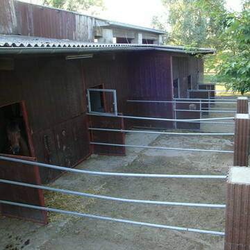
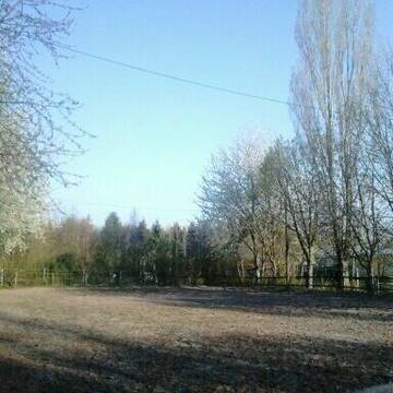
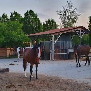
Erbes-Büdesheim
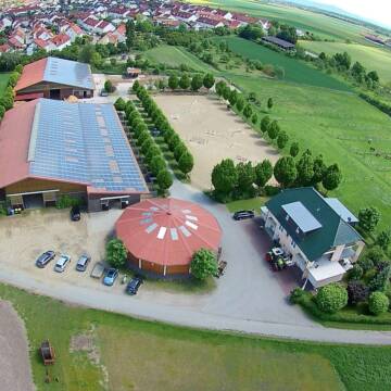
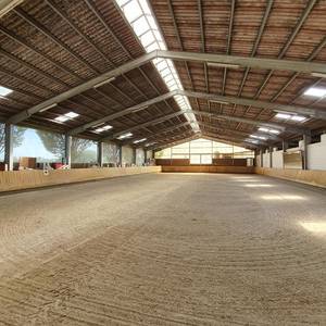
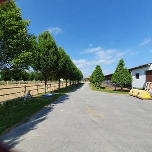
Reitsportanlage-Eidam-Partner
@Reitsportanlage-Eidam-Partner
FN-Mitglied
Pferdeausbildung
Vermieten
Führanlage
Paddock
Hengsthaltung möglich
17 weitere...
S
Deprecated: Creation of dynamic property Zend_View_Helper_Ads::$adLink is deprecated in /var/www/stall-frei/htdocs/staging.stall-frei.de/library/Psf/View/Helper/Ads.php on line 108

Futtersack HeuToy, Fressbremse in pink
Mechtersen
STALL-FREIde Marketing
@STALL-FREI-Marketing
Stundenlange Beschäftigung die
Koliken vorbeugt, geringe Staubinhalation mit
steuerbarer Futterentnahme


Boxen mit Paddock
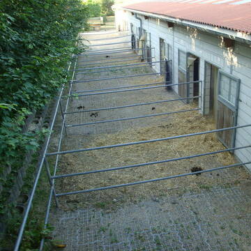
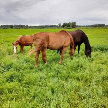
Biebelnheim
Weidenhof Eppard
@Eppard
Freizeitstall
Geländestrecke
Vermieten
Führanlage
Krankenbox
Notfallboxen
Zuchtstutenhaltung möglich
15 weitere...
P+
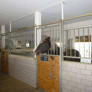
Offenställe, Paddockboxen, ganztägiger Auslauf
Stadecken-Elsheim
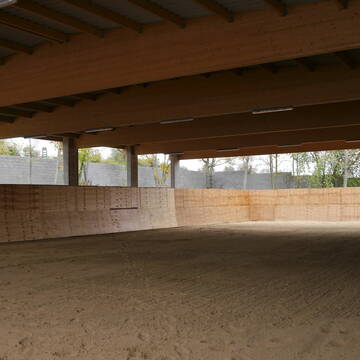
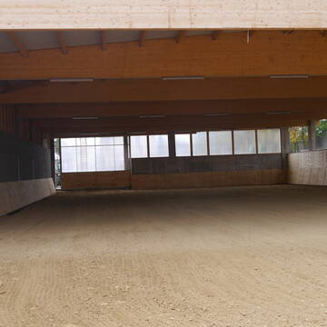
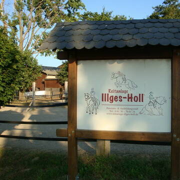
Reitanlage-Illges-Holl
@Reitanlage-Illges-Holl
FN-Mitglied
Freizeitstall
Vermieten
Führanlage
Hunde willkommen
Allergikerstall
Notfallboxen
26 weitere...
S
Paddockboxen frei
Alzey
Kluebers-Pferdeparadies
@Kluebers-Pferdeparadies
Freizeitstall
Geländestrecke
Vermieten
Hunde willkommen
Paddock
Hufrehe geeignet
11 weitere...
ganz aktuell
P


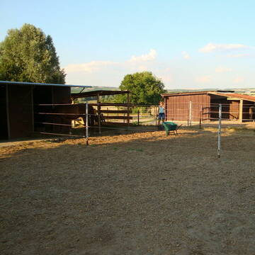
Offenstall Bayer
Biebesheim/ Hessen
Julia-Bayer
@Julia-Bayer
Freizeitstall
Paddock
Sommerweide
Offenstall
Halbpension
Vollpension
aktuell
S


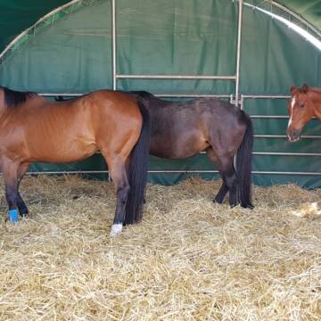
Boxen im Pferdezentrum Standenbühl zu Vermieten ...
Standenbühl
Mischa Stolze
@PferdezentrumStandenbuehl
Vermieten
Führanlage
Paddock
Allergikerstall
Hengsthaltung möglich
Außenboxen
Innenbox
13 weitere...
S
Reitstall Immel
Westhofen
Reitstall-Immel
@Reitstall-Immel
Freizeitstall
Geländestrecke
Vermieten
Hunde willkommen
Longierzirkel/Roundpen
Innenbox
Offenstall
13 weitere...
P

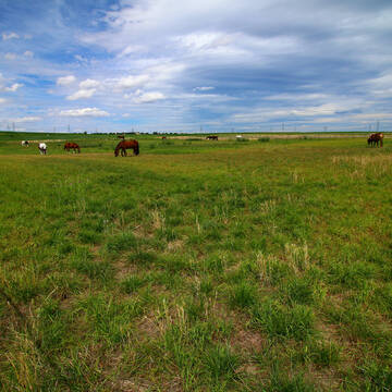
Reitanlage Bonn Riedstadt-Leeheim
Riedstadt
Kirsten Bonn
@Reitanlage-Bonn-Riedstadt
FN-Mitglied
Reitlehrer und -unterricht
Vermieten
Führanlage
Hunde willkommen
Allergikerstall
22 weitere...
S

Offenstall/Paddockbox für Pony oder Kleinpferd
Glashütten
Tatjana Bommersheim
@TatjanaBommersheim
Wir haben ab dem 1.04.26 eine Platz in einem unsere Offenställe (Wallach oder Stute)und eine unserer Paddockboxen (Wallach oder S
neu
R


Hit-Aktivstall für Stuten in Riedstadt-Leeheim
Riedstadt
Kirsten Bonn
@Reitanlage-Bonn-Riedstadt
FN-Mitglied
Freizeitstall
Vermieten
Führanlage
Hunde willkommen
Notfallboxen
20 weitere...
ganz aktuell
S


Pferdeboxen in Bad-Kreuznach- Ippesheim
Bad Kreuznach - Ippesheim
Pferdehof Ippesheim
@Pferdehof-Ippesheim
Reitlehrer und -unterricht
Vermieten
Paddock
Parkplatz für Pferdeanhänger
Innenbox
9 weitere...
S
Deprecated: Creation of dynamic property Zend_View::$pageCount is deprecated in /var/www/stall-frei/htdocs/staging.stall-frei.de/library/vendor/shardj/zf1-future/library/Zend/View/Abstract.php on line 308
Deprecated: Creation of dynamic property Zend_View::$itemCountPerPage is deprecated in /var/www/stall-frei/htdocs/staging.stall-frei.de/library/vendor/shardj/zf1-future/library/Zend/View/Abstract.php on line 308
Deprecated: Creation of dynamic property Zend_View::$first is deprecated in /var/www/stall-frei/htdocs/staging.stall-frei.de/library/vendor/shardj/zf1-future/library/Zend/View/Abstract.php on line 308
Deprecated: Creation of dynamic property Zend_View::$current is deprecated in /var/www/stall-frei/htdocs/staging.stall-frei.de/library/vendor/shardj/zf1-future/library/Zend/View/Abstract.php on line 308
Deprecated: Creation of dynamic property Zend_View::$last is deprecated in /var/www/stall-frei/htdocs/staging.stall-frei.de/library/vendor/shardj/zf1-future/library/Zend/View/Abstract.php on line 308
Deprecated: Creation of dynamic property Zend_View::$next is deprecated in /var/www/stall-frei/htdocs/staging.stall-frei.de/library/vendor/shardj/zf1-future/library/Zend/View/Abstract.php on line 308
Deprecated: Creation of dynamic property Zend_View::$pagesInRange is deprecated in /var/www/stall-frei/htdocs/staging.stall-frei.de/library/vendor/shardj/zf1-future/library/Zend/View/Abstract.php on line 308
Deprecated: Creation of dynamic property Zend_View::$firstPageInRange is deprecated in /var/www/stall-frei/htdocs/staging.stall-frei.de/library/vendor/shardj/zf1-future/library/Zend/View/Abstract.php on line 308
Deprecated: Creation of dynamic property Zend_View::$lastPageInRange is deprecated in /var/www/stall-frei/htdocs/staging.stall-frei.de/library/vendor/shardj/zf1-future/library/Zend/View/Abstract.php on line 308
Deprecated: Creation of dynamic property Zend_View::$currentItemCount is deprecated in /var/www/stall-frei/htdocs/staging.stall-frei.de/library/vendor/shardj/zf1-future/library/Zend/View/Abstract.php on line 308
Deprecated: Creation of dynamic property Zend_View::$totalItemCount is deprecated in /var/www/stall-frei/htdocs/staging.stall-frei.de/library/vendor/shardj/zf1-future/library/Zend/View/Abstract.php on line 308
Deprecated: Creation of dynamic property Zend_View::$firstItemNumber is deprecated in /var/www/stall-frei/htdocs/staging.stall-frei.de/library/vendor/shardj/zf1-future/library/Zend/View/Abstract.php on line 308
Deprecated: Creation of dynamic property Zend_View::$lastItemNumber is deprecated in /var/www/stall-frei/htdocs/staging.stall-frei.de/library/vendor/shardj/zf1-future/library/Zend/View/Abstract.php on line 308
Deprecated: Creation of dynamic property Zend_View::$router is deprecated in /var/www/stall-frei/htdocs/staging.stall-frei.de/library/vendor/shardj/zf1-future/library/Zend/View/Abstract.php on line 308
Deprecated: Creation of dynamic property Zend_View::$urlParams is deprecated in /var/www/stall-frei/htdocs/staging.stall-frei.de/library/vendor/shardj/zf1-future/library/Zend/View/Abstract.php on line 308
Deprecated: Creation of dynamic property Zend_View::$showAds is deprecated in /var/www/stall-frei/htdocs/staging.stall-frei.de/library/vendor/shardj/zf1-future/library/Zend/View/Abstract.php on line 308
Deprecated: Creation of dynamic property Zend_View::$objectIds is deprecated in /var/www/stall-frei/htdocs/staging.stall-frei.de/library/vendor/shardj/zf1-future/library/Zend/View/Abstract.php on line 308
Deprecated: Creation of dynamic property Zend_View::$showNavbar is deprecated in /var/www/stall-frei/htdocs/staging.stall-frei.de/library/vendor/shardj/zf1-future/library/Zend/View/Abstract.php on line 308
Deprecated: Creation of dynamic property Zend_View::$showBreadcrumb is deprecated in /var/www/stall-frei/htdocs/staging.stall-frei.de/library/vendor/shardj/zf1-future/library/Zend/View/Abstract.php on line 308
Deprecated: Creation of dynamic property Zend_View::$showFooter is deprecated in /var/www/stall-frei/htdocs/staging.stall-frei.de/library/vendor/shardj/zf1-future/library/Zend/View/Abstract.php on line 308
Deprecated: Creation of dynamic property Zend_View::$showInternalAds is deprecated in /var/www/stall-frei/htdocs/staging.stall-frei.de/library/vendor/shardj/zf1-future/library/Zend/View/Abstract.php on line 308
Deprecated: Creation of dynamic property Zend_View::$blNoContent is deprecated in /var/www/stall-frei/htdocs/staging.stall-frei.de/library/vendor/shardj/zf1-future/library/Zend/View/Abstract.php on line 308
Deprecated: Creation of dynamic property Zend_View::$sMetaDesc is deprecated in /var/www/stall-frei/htdocs/staging.stall-frei.de/library/vendor/shardj/zf1-future/library/Zend/View/Abstract.php on line 308
Deprecated: Creation of dynamic property Zend_View::$useGmaps is deprecated in /var/www/stall-frei/htdocs/staging.stall-frei.de/library/vendor/shardj/zf1-future/library/Zend/View/Abstract.php on line 308
Deprecated: Creation of dynamic property Zend_View::$touches is deprecated in /var/www/stall-frei/htdocs/staging.stall-frei.de/library/vendor/shardj/zf1-future/library/Zend/View/Abstract.php on line 308
Deprecated: Creation of dynamic property Zend_View::$oProject is deprecated in /var/www/stall-frei/htdocs/staging.stall-frei.de/library/vendor/shardj/zf1-future/library/Zend/View/Abstract.php on line 308
Deprecated: Creation of dynamic property Zend_View::$pageHeadline is deprecated in /var/www/stall-frei/htdocs/staging.stall-frei.de/library/vendor/shardj/zf1-future/library/Zend/View/Abstract.php on line 308
Deprecated: Creation of dynamic property Zend_View::$disableLocationField is deprecated in /var/www/stall-frei/htdocs/staging.stall-frei.de/library/vendor/shardj/zf1-future/library/Zend/View/Abstract.php on line 308
Deprecated: Creation of dynamic property Zend_View::$isSearch is deprecated in /var/www/stall-frei/htdocs/staging.stall-frei.de/library/vendor/shardj/zf1-future/library/Zend/View/Abstract.php on line 308
Deprecated: Creation of dynamic property Zend_View::$pageTitle is deprecated in /var/www/stall-frei/htdocs/staging.stall-frei.de/library/vendor/shardj/zf1-future/library/Zend/View/Abstract.php on line 308
Deprecated: Creation of dynamic property Psf_Form_Element_Text::$class is deprecated in /var/www/stall-frei/htdocs/staging.stall-frei.de/library/vendor/shardj/zf1-future/library/Zend/Form/Element.php on line 874
Deprecated: Creation of dynamic property Psf_Form_Element_Text::$size is deprecated in /var/www/stall-frei/htdocs/staging.stall-frei.de/library/vendor/shardj/zf1-future/library/Zend/Form/Element.php on line 874
Deprecated: Creation of dynamic property Psf_Form_Element_Text::$placeholder is deprecated in /var/www/stall-frei/htdocs/staging.stall-frei.de/library/vendor/shardj/zf1-future/library/Zend/Form/Element.php on line 874
Deprecated: Creation of dynamic property Psf_Form_Element_Hidden::$class is deprecated in /var/www/stall-frei/htdocs/staging.stall-frei.de/library/vendor/shardj/zf1-future/library/Zend/Form/Element.php on line 874
Deprecated: Creation of dynamic property Psf_Form_Element_Hidden::$class is deprecated in /var/www/stall-frei/htdocs/staging.stall-frei.de/library/vendor/shardj/zf1-future/library/Zend/Form/Element.php on line 874
Deprecated: Creation of dynamic property Psf_Form_Element_Hidden::$class is deprecated in /var/www/stall-frei/htdocs/staging.stall-frei.de/library/vendor/shardj/zf1-future/library/Zend/Form/Element.php on line 874
Deprecated: Creation of dynamic property Psf_Form_Element_Hidden::$class is deprecated in /var/www/stall-frei/htdocs/staging.stall-frei.de/library/vendor/shardj/zf1-future/library/Zend/Form/Element.php on line 874
Deprecated: Creation of dynamic property Psf_Form_Element_Select::$class is deprecated in /var/www/stall-frei/htdocs/staging.stall-frei.de/library/vendor/shardj/zf1-future/library/Zend/Form/Element.php on line 874
Deprecated: Creation of dynamic property Psf_Form_Element_Select::$class is deprecated in /var/www/stall-frei/htdocs/staging.stall-frei.de/library/vendor/shardj/zf1-future/library/Zend/Form/Element.php on line 874
Deprecated: Creation of dynamic property Psf_Form_Element_Select::$class is deprecated in /var/www/stall-frei/htdocs/staging.stall-frei.de/library/vendor/shardj/zf1-future/library/Zend/Form/Element.php on line 874
Deprecated: Creation of dynamic property Psf_Form_Element_Select::$class is deprecated in /var/www/stall-frei/htdocs/staging.stall-frei.de/library/vendor/shardj/zf1-future/library/Zend/Form/Element.php on line 874
Deprecated: Creation of dynamic property Psf_Form_Element_Text::$class is deprecated in /var/www/stall-frei/htdocs/staging.stall-frei.de/library/vendor/shardj/zf1-future/library/Zend/Form/Element.php on line 874
Deprecated: Creation of dynamic property Psf_Form_Element_Checkbox::$label is deprecated in /var/www/stall-frei/htdocs/staging.stall-frei.de/library/vendor/shardj/zf1-future/library/Zend/Form/Element.php on line 874
Deprecated: Creation of dynamic property Zend_View::$sort is deprecated in /var/www/stall-frei/htdocs/staging.stall-frei.de/library/vendor/shardj/zf1-future/library/Zend/View/Abstract.php on line 308
Deprecated: Creation of dynamic property Zend_View::$searchLocation is deprecated in /var/www/stall-frei/htdocs/staging.stall-frei.de/library/vendor/shardj/zf1-future/library/Zend/View/Abstract.php on line 308
Deprecated: Creation of dynamic property Zend_View::$locationHint is deprecated in /var/www/stall-frei/htdocs/staging.stall-frei.de/library/vendor/shardj/zf1-future/library/Zend/View/Abstract.php on line 308
Psf_GeoCoder_Abstract::getLocation: Gau-Heppenheim Get Location CachedOrLive
Psf_GeoCoder_Abstract::getCachedOrLive: Gau-Heppenheim
Psf_GeoCoder_OpenCageData::makeApiRequest: response:
Array
(
[documentation] => https://opencagedata.com/api
[licenses] => Array
(
[0] => Array
(
[name] => see attribution guide
[url] => https://opencagedata.com/credits
)
)
[results] => Array
(
[0] => Array
(
[bounds] => Array
(
[northeast] => Array
(
[lat] => 49.7531983
[lng] => 8.2078867
)
[southwest] => Array
(
[lat] => 49.7266073
[lng] => 8.1529688
)
)
[components] => Array
(
[ISO_3166-1_alpha-2] => DE
[ISO_3166-1_alpha-3] => DEU
[ISO_3166-2] => Array
(
[0] => DE-RP
)
[_category] => place
[_normalized_city] => Gau-Heppenheim
[_type] => village
[continent] => Europe
[country] => Deutschland
[country_code] => de
[county] => Landkreis Alzey-Worms
[municipality] => Alzey-Land
[political_union] => European Union
[state] => Rheinland-Pfalz
[state_code] => RP
[village] => Gau-Heppenheim
)
[confidence] => 7
[formatted] => Gau-Heppenheim, Rheinland-Pfalz, Deutschland
[geometry] => Array
(
[lat] => 49.7419507
[lng] => 8.1733901
)
)
[1] => Array
(
[components] => Array
(
[ISO_3166-1_alpha-2] => FR
[ISO_3166-1_alpha-3] => FRA
[ISO_3166-2] => Array
(
[0] => FR-ARA
[1] => FR-26
)
[_category] => road
[_normalized_city] => Bourdeaux
[_type] => road
[city] => Bourdeaux
[continent] => Europe
[country] => France
[country_code] => fr
[county] => Drôme
[local_authority] => Communauté de communes Dieulefit-Bourdeaux
[political_union] => European Union
[postcode] => 26460
[road] => Chemin des Gauts
[state] => Auvergne-Rhône-Alpes
[state_code] => ARA
)
[confidence] => 2
[formatted] => Chemin des Gauts, 26460 Bourdeaux, France
[geometry] => Array
(
[lat] => 44.569904
[lng] => 5.147284
)
)
[2] => Array
(
[components] => Array
(
[ISO_3166-1_alpha-2] => FR
[ISO_3166-1_alpha-3] => FRA
[ISO_3166-2] => Array
(
[0] => FR-NAQ
[1] => FR-87
)
[_category] => road
[_normalized_city] => Saint-Brice-sur-Vienne
[_type] => road
[city] => Saint-Brice-sur-Vienne
[continent] => Europe
[country] => France
[country_code] => fr
[county] => Haute-Vienne
[local_authority] => Communauté de communes Porte Océane du Limousin
[political_union] => European Union
[postcode] => 87200
[road] => Chemin du Gaut
[state] => Nouvelle-Aquitaine
[state_code] => NAQ
)
[confidence] => 2
[formatted] => Chemin du Gaut, 87200 Saint-Brice-sur-Vienne, France
[geometry] => Array
(
[lat] => 45.875972
[lng] => 0.956125
)
)
[3] => Array
(
[components] => Array
(
[ISO_3166-1_alpha-2] => FR
[ISO_3166-1_alpha-3] => FRA
[ISO_3166-2] => Array
(
[0] => FR-ARA
[1] => FR-38
)
[_category] => road
[_normalized_city] => Lans-en-Vercors
[_type] => road
[city] => Lans-en-Vercors
[continent] => Europe
[country] => France
[country_code] => fr
[county] => Isère
[local_authority] => Communauté de communes du Massif du Vercors
[political_union] => European Union
[postcode] => 38250
[road] => Chemin du Gau
[state] => Auvergne-Rhône-Alpes
[state_code] => ARA
)
[confidence] => 2
[formatted] => Chemin du Gau, 38250 Lans-en-Vercors, France
[geometry] => Array
(
[lat] => 45.101393
[lng] => 5.5858
)
)
[4] => Array
(
[components] => Array
(
[ISO_3166-1_alpha-2] => RE
[ISO_3166-1_alpha-3] => REU
[ISO_3166-2] => Array
(
[0] => FR-974
)
[_category] => road
[_normalized_city] => Saint-Denis
[_type] => road
[city] => Saint-Denis
[continent] => Africa
[country] => France
[country_code] => fr
[county] => La Réunion
[local_authority] => Communauté intercommunale du Nord de la Réunion
[political_union] => European Union
[postcode] => 97417
[road] => Chemin Gaud
[state] =>
)
[confidence] => 2
[formatted] => Chemin Gaud, 97417 Saint-Denis, France
[geometry] => Array
(
[lat] => -20.888425
[lng] => 55.415482
)
)
[5] => Array
(
[components] => Array
(
[ISO_3166-1_alpha-2] => FR
[ISO_3166-1_alpha-3] => FRA
[ISO_3166-2] => Array
(
[0] => FR-NAQ
[1] => FR-47
)
[_category] => road
[_normalized_city] => Fumel
[_type] => road
[city] => Fumel
[continent] => Europe
[country] => France
[country_code] => fr
[county] => Lot-et-Garonne
[local_authority] => Communauté de communes Fumel Vallée du Lot
[political_union] => European Union
[postcode] => 47500
[road] => Chemin de Gau
[state] => Nouvelle-Aquitaine
[state_code] => NAQ
)
[confidence] => 2
[formatted] => Chemin de Gau, 47500 Fumel, France
[geometry] => Array
(
[lat] => 44.501532
[lng] => 0.972427
)
)
[6] => Array
(
[components] => Array
(
[ISO_3166-1_alpha-2] => FR
[ISO_3166-1_alpha-3] => FRA
[ISO_3166-2] => Array
(
[0] => FR-CVL
[1] => FR-45
)
[_category] => road
[_normalized_city] => Coullons
[_type] => road
[city] => Coullons
[continent] => Europe
[country] => France
[country_code] => fr
[county] => Loiret
[local_authority] => Communauté de communes Giennoises
[political_union] => European Union
[postcode] => 45720
[road] => Chemin des Gaults
[state] => Centre-Val de Loire
[state_code] => CVL
)
[confidence] => 2
[formatted] => Chemin des Gaults, 45720 Coullons, France
[geometry] => Array
(
[lat] => 47.589487
[lng] => 2.556116
)
)
[7] => Array
(
[components] => Array
(
[ISO_3166-1_alpha-2] => FR
[ISO_3166-1_alpha-3] => FRA
[ISO_3166-2] => Array
(
[0] => FR-OCC
[1] => FR-81
)
[_category] => road
[_normalized_city] => Montredon-Labessonnié
[_type] => road
[city] => Montredon-Labessonnié
[continent] => Europe
[country] => France
[country_code] => fr
[county] => Tarn
[local_authority] => Communauté de communes du Centre Tarn
[political_union] => European Union
[postcode] => 81360
[road] => Chemin de Gau
[state] => Occitanie
[state_code] => OCC
)
[confidence] => 2
[formatted] => Chemin de Gau, 81360 Montredon-Labessonnié, France
[geometry] => Array
(
[lat] => 43.725436
[lng] => 2.236378
)
)
[8] => Array
(
[components] => Array
(
[ISO_3166-1_alpha-2] => FR
[ISO_3166-1_alpha-3] => FRA
[ISO_3166-2] => Array
(
[0] => FR-ARA
[1] => FR-69
)
[_category] => road
[_normalized_city] => Brignais
[_type] => road
[city] => Brignais
[continent] => Europe
[country] => France
[country_code] => fr
[county] => Rhône
[local_authority] => Communauté de communes de la Vallée du Garon
[political_union] => European Union
[postcode] => 69530
[road] => Chemin du Gaud
[state] => Auvergne-Rhône-Alpes
[state_code] => ARA
)
[confidence] => 2
[formatted] => Chemin du Gaud, 69530 Brignais, France
[geometry] => Array
(
[lat] => 45.664739
[lng] => 4.757389
)
)
[9] => Array
(
[components] => Array
(
[ISO_3166-1_alpha-2] => FR
[ISO_3166-1_alpha-3] => FRA
[ISO_3166-2] => Array
(
[0] => FR-ARA
[1] => FR-07
)
[_category] => road
[_normalized_city] => Saint-Remèze
[_type] => road
[city] => Saint-Remèze
[continent] => Europe
[country] => France
[country_code] => fr
[county] => Ardèche
[local_authority] => Communauté de communes des Gorges de l'Ardèche
[political_union] => European Union
[postcode] => 07700
[road] => Chemin de Gaud
[state] => Auvergne-Rhône-Alpes
[state_code] => ARA
)
[confidence] => 2
[formatted] => Chemin de Gaud, 07700 Saint-Remèze, France
[geometry] => Array
(
[lat] => 44.387169
[lng] => 4.491567
)
)
)
[status] => Array
(
[code] => 200
[message] => OK
)
[stay_informed] => Array
(
[blog] => https://blog.opencagedata.com
[mastodon] => https://en.osm.town/@opencage
)
[thanks] => For using an OpenCage API
[timestamp] => Array
(
[created_http] => Mon, 09 Feb 2026 12:41:21 GMT
[created_unix] => 1770640881
)
[total_results] => 10
)
Psf_GeoCoder_Abstract::convertLocationResult
{"documentation":"https:\/\/opencagedata.com\/api","licenses":[{"name":"see attribution guide","url":"https:\/\/opencagedata.com\/credits"}],"results":[{"bounds":{"northeast":{"lat":49.7531983,"lng":8.2078867},"southwest":{"lat":49.7266073,"lng":8.1529688}},"components":{"ISO_3166-1_alpha-2":"DE","ISO_3166-1_alpha-3":"DEU","ISO_3166-2":["DE-RP"],"_category":"place","_normalized_city":"Gau-Heppenheim","_type":"village","continent":"Europe","country":"Deutschland","country_code":"de","county":"Landkreis Alzey-Worms","municipality":"Alzey-Land","political_union":"European Union","state":"Rheinland-Pfalz","state_code":"RP","village":"Gau-Heppenheim"},"confidence":7,"formatted":"Gau-Heppenheim, Rheinland-Pfalz, Deutschland","geometry":{"lat":49.7419507,"lng":8.1733901}},{"components":{"ISO_3166-1_alpha-2":"FR","ISO_3166-1_alpha-3":"FRA","ISO_3166-2":["FR-ARA","FR-26"],"_category":"road","_normalized_city":"Bourdeaux","_type":"road","city":"Bourdeaux","continent":"Europe","country":"France","country_code":"fr","county":"Dr\u00f4me","local_authority":"Communaut\u00e9 de communes Dieulefit-Bourdeaux","political_union":"European Union","postcode":"26460","road":"Chemin des Gauts","state":"Auvergne-Rh\u00f4ne-Alpes","state_code":"ARA"},"confidence":2,"formatted":"Chemin des Gauts, 26460 Bourdeaux, France","geometry":{"lat":44.569904,"lng":5.147284}},{"components":{"ISO_3166-1_alpha-2":"FR","ISO_3166-1_alpha-3":"FRA","ISO_3166-2":["FR-NAQ","FR-87"],"_category":"road","_normalized_city":"Saint-Brice-sur-Vienne","_type":"road","city":"Saint-Brice-sur-Vienne","continent":"Europe","country":"France","country_code":"fr","county":"Haute-Vienne","local_authority":"Communaut\u00e9 de communes Porte Oc\u00e9ane du Limousin","political_union":"European Union","postcode":"87200","road":"Chemin du Gaut","state":"Nouvelle-Aquitaine","state_code":"NAQ"},"confidence":2,"formatted":"Chemin du Gaut, 87200 Saint-Brice-sur-Vienne, France","geometry":{"lat":45.875972,"lng":0.956125}},{"components":{"ISO_3166-1_alpha-2":"FR","ISO_3166-1_alpha-3":"FRA","ISO_3166-2":["FR-ARA","FR-38"],"_category":"road","_normalized_city":"Lans-en-Vercors","_type":"road","city":"Lans-en-Vercors","continent":"Europe","country":"France","country_code":"fr","county":"Is\u00e8re","local_authority":"Communaut\u00e9 de communes du Massif du Vercors","political_union":"European Union","postcode":"38250","road":"Chemin du Gau","state":"Auvergne-Rh\u00f4ne-Alpes","state_code":"ARA"},"confidence":2,"formatted":"Chemin du Gau, 38250 Lans-en-Vercors, France","geometry":{"lat":45.101393,"lng":5.5858}},{"components":{"ISO_3166-1_alpha-2":"RE","ISO_3166-1_alpha-3":"REU","ISO_3166-2":["FR-974"],"_category":"road","_normalized_city":"Saint-Denis","_type":"road","city":"Saint-Denis","continent":"Africa","country":"France","country_code":"fr","county":"La R\u00e9union","local_authority":"Communaut\u00e9 intercommunale du Nord de la R\u00e9union","political_union":"European Union","postcode":"97417","road":"Chemin Gaud","state":null},"confidence":2,"formatted":"Chemin Gaud, 97417 Saint-Denis, France","geometry":{"lat":-20.888425,"lng":55.415482}},{"components":{"ISO_3166-1_alpha-2":"FR","ISO_3166-1_alpha-3":"FRA","ISO_3166-2":["FR-NAQ","FR-47"],"_category":"road","_normalized_city":"Fumel","_type":"road","city":"Fumel","continent":"Europe","country":"France","country_code":"fr","county":"Lot-et-Garonne","local_authority":"Communaut\u00e9 de communes Fumel Vall\u00e9e du Lot","political_union":"European Union","postcode":"47500","road":"Chemin de Gau","state":"Nouvelle-Aquitaine","state_code":"NAQ"},"confidence":2,"formatted":"Chemin de Gau, 47500 Fumel, France","geometry":{"lat":44.501532,"lng":0.972427}},{"components":{"ISO_3166-1_alpha-2":"FR","ISO_3166-1_alpha-3":"FRA","ISO_3166-2":["FR-CVL","FR-45"],"_category":"road","_normalized_city":"Coullons","_type":"road","city":"Coullons","continent":"Europe","country":"France","country_code":"fr","county":"Loiret","local_authority":"Communaut\u00e9 de communes Giennoises","political_union":"European Union","postcode":"45720","road":"Chemin des Gaults","state":"Centre-Val de Loire","state_code":"CVL"},"confidence":2,"formatted":"Chemin des Gaults, 45720 Coullons, France","geometry":{"lat":47.589487,"lng":2.556116}},{"components":{"ISO_3166-1_alpha-2":"FR","ISO_3166-1_alpha-3":"FRA","ISO_3166-2":["FR-OCC","FR-81"],"_category":"road","_normalized_city":"Montredon-Labessonni\u00e9","_type":"road","city":"Montredon-Labessonni\u00e9","continent":"Europe","country":"France","country_code":"fr","county":"Tarn","local_authority":"Communaut\u00e9 de communes du Centre Tarn","political_union":"European Union","postcode":"81360","road":"Chemin de Gau","state":"Occitanie","state_code":"OCC"},"confidence":2,"formatted":"Chemin de Gau, 81360 Montredon-Labessonni\u00e9, France","geometry":{"lat":43.725436,"lng":2.236378}},{"components":{"ISO_3166-1_alpha-2":"FR","ISO_3166-1_alpha-3":"FRA","ISO_3166-2":["FR-ARA","FR-69"],"_category":"road","_normalized_city":"Brignais","_type":"road","city":"Brignais","continent":"Europe","country":"France","country_code":"fr","county":"Rh\u00f4ne","local_authority":"Communaut\u00e9 de communes de la Vall\u00e9e du Garon","political_union":"European Union","postcode":"69530","road":"Chemin du Gaud","state":"Auvergne-Rh\u00f4ne-Alpes","state_code":"ARA"},"confidence":2,"formatted":"Chemin du Gaud, 69530 Brignais, France","geometry":{"lat":45.664739,"lng":4.757389}},{"components":{"ISO_3166-1_alpha-2":"FR","ISO_3166-1_alpha-3":"FRA","ISO_3166-2":["FR-ARA","FR-07"],"_category":"road","_normalized_city":"Saint-Rem\u00e8ze","_type":"road","city":"Saint-Rem\u00e8ze","continent":"Europe","country":"France","country_code":"fr","county":"Ard\u00e8che","local_authority":"Communaut\u00e9 de communes des Gorges de l'Ard\u00e8che","political_union":"European Union","postcode":"07700","road":"Chemin de Gaud","state":"Auvergne-Rh\u00f4ne-Alpes","state_code":"ARA"},"confidence":2,"formatted":"Chemin de Gaud, 07700 Saint-Rem\u00e8ze, France","geometry":{"lat":44.387169,"lng":4.491567}}],"status":{"code":200,"message":"OK"},"stay_informed":{"blog":"https:\/\/blog.opencagedata.com","mastodon":"https:\/\/en.osm.town\/@opencage"},"thanks":"For using an OpenCage API","timestamp":{"created_http":"Mon, 09 Feb 2026 12:41:21 GMT","created_unix":1770640881},"total_results":10}Array
(
[0] => stdClass Object
(
[bounds] => stdClass Object
(
[northeast] => stdClass Object
(
[lat] => 49.7531983
[lng] => 8.2078867
)
[southwest] => stdClass Object
(
[lat] => 49.7266073
[lng] => 8.1529688
)
)
[components] => stdClass Object
(
[ISO_3166-1_alpha-2] => DE
[ISO_3166-1_alpha-3] => DEU
[ISO_3166-2] => Array
(
[0] => DE-RP
)
[_category] => place
[_normalized_city] => Gau-Heppenheim
[_type] => village
[continent] => Europe
[country] => Deutschland
[country_code] => de
[county] => Landkreis Alzey-Worms
[municipality] => Alzey-Land
[political_union] => European Union
[state] => Rheinland-Pfalz
[state_code] => RP
[village] => Gau-Heppenheim
)
[confidence] => 7
[formatted] => Gau-Heppenheim, Rheinland-Pfalz, Deutschland
[geometry] => stdClass Object
(
[lat] => 49.7419507
[lng] => 8.1733901
)
)
[1] => stdClass Object
(
[components] => stdClass Object
(
[ISO_3166-1_alpha-2] => FR
[ISO_3166-1_alpha-3] => FRA
[ISO_3166-2] => Array
(
[0] => FR-ARA
[1] => FR-26
)
[_category] => road
[_normalized_city] => Bourdeaux
[_type] => road
[city] => Bourdeaux
[continent] => Europe
[country] => France
[country_code] => fr
[county] => Drôme
[local_authority] => Communauté de communes Dieulefit-Bourdeaux
[political_union] => European Union
[postcode] => 26460
[road] => Chemin des Gauts
[state] => Auvergne-Rhône-Alpes
[state_code] => ARA
)
[confidence] => 2
[formatted] => Chemin des Gauts, 26460 Bourdeaux, France
[geometry] => stdClass Object
(
[lat] => 44.569904
[lng] => 5.147284
)
)
[2] => stdClass Object
(
[components] => stdClass Object
(
[ISO_3166-1_alpha-2] => FR
[ISO_3166-1_alpha-3] => FRA
[ISO_3166-2] => Array
(
[0] => FR-NAQ
[1] => FR-87
)
[_category] => road
[_normalized_city] => Saint-Brice-sur-Vienne
[_type] => road
[city] => Saint-Brice-sur-Vienne
[continent] => Europe
[country] => France
[country_code] => fr
[county] => Haute-Vienne
[local_authority] => Communauté de communes Porte Océane du Limousin
[political_union] => European Union
[postcode] => 87200
[road] => Chemin du Gaut
[state] => Nouvelle-Aquitaine
[state_code] => NAQ
)
[confidence] => 2
[formatted] => Chemin du Gaut, 87200 Saint-Brice-sur-Vienne, France
[geometry] => stdClass Object
(
[lat] => 45.875972
[lng] => 0.956125
)
)
[3] => stdClass Object
(
[components] => stdClass Object
(
[ISO_3166-1_alpha-2] => FR
[ISO_3166-1_alpha-3] => FRA
[ISO_3166-2] => Array
(
[0] => FR-ARA
[1] => FR-38
)
[_category] => road
[_normalized_city] => Lans-en-Vercors
[_type] => road
[city] => Lans-en-Vercors
[continent] => Europe
[country] => France
[country_code] => fr
[county] => Isère
[local_authority] => Communauté de communes du Massif du Vercors
[political_union] => European Union
[postcode] => 38250
[road] => Chemin du Gau
[state] => Auvergne-Rhône-Alpes
[state_code] => ARA
)
[confidence] => 2
[formatted] => Chemin du Gau, 38250 Lans-en-Vercors, France
[geometry] => stdClass Object
(
[lat] => 45.101393
[lng] => 5.5858
)
)
[4] => stdClass Object
(
[components] => stdClass Object
(
[ISO_3166-1_alpha-2] => RE
[ISO_3166-1_alpha-3] => REU
[ISO_3166-2] => Array
(
[0] => FR-974
)
[_category] => road
[_normalized_city] => Saint-Denis
[_type] => road
[city] => Saint-Denis
[continent] => Africa
[country] => France
[country_code] => fr
[county] => La Réunion
[local_authority] => Communauté intercommunale du Nord de la Réunion
[political_union] => European Union
[postcode] => 97417
[road] => Chemin Gaud
[state] =>
)
[confidence] => 2
[formatted] => Chemin Gaud, 97417 Saint-Denis, France
[geometry] => stdClass Object
(
[lat] => -20.888425
[lng] => 55.415482
)
)
[5] => stdClass Object
(
[components] => stdClass Object
(
[ISO_3166-1_alpha-2] => FR
[ISO_3166-1_alpha-3] => FRA
[ISO_3166-2] => Array
(
[0] => FR-NAQ
[1] => FR-47
)
[_category] => road
[_normalized_city] => Fumel
[_type] => road
[city] => Fumel
[continent] => Europe
[country] => France
[country_code] => fr
[county] => Lot-et-Garonne
[local_authority] => Communauté de communes Fumel Vallée du Lot
[political_union] => European Union
[postcode] => 47500
[road] => Chemin de Gau
[state] => Nouvelle-Aquitaine
[state_code] => NAQ
)
[confidence] => 2
[formatted] => Chemin de Gau, 47500 Fumel, France
[geometry] => stdClass Object
(
[lat] => 44.501532
[lng] => 0.972427
)
)
[6] => stdClass Object
(
[components] => stdClass Object
(
[ISO_3166-1_alpha-2] => FR
[ISO_3166-1_alpha-3] => FRA
[ISO_3166-2] => Array
(
[0] => FR-CVL
[1] => FR-45
)
[_category] => road
[_normalized_city] => Coullons
[_type] => road
[city] => Coullons
[continent] => Europe
[country] => France
[country_code] => fr
[county] => Loiret
[local_authority] => Communauté de communes Giennoises
[political_union] => European Union
[postcode] => 45720
[road] => Chemin des Gaults
[state] => Centre-Val de Loire
[state_code] => CVL
)
[confidence] => 2
[formatted] => Chemin des Gaults, 45720 Coullons, France
[geometry] => stdClass Object
(
[lat] => 47.589487
[lng] => 2.556116
)
)
[7] => stdClass Object
(
[components] => stdClass Object
(
[ISO_3166-1_alpha-2] => FR
[ISO_3166-1_alpha-3] => FRA
[ISO_3166-2] => Array
(
[0] => FR-OCC
[1] => FR-81
)
[_category] => road
[_normalized_city] => Montredon-Labessonnié
[_type] => road
[city] => Montredon-Labessonnié
[continent] => Europe
[country] => France
[country_code] => fr
[county] => Tarn
[local_authority] => Communauté de communes du Centre Tarn
[political_union] => European Union
[postcode] => 81360
[road] => Chemin de Gau
[state] => Occitanie
[state_code] => OCC
)
[confidence] => 2
[formatted] => Chemin de Gau, 81360 Montredon-Labessonnié, France
[geometry] => stdClass Object
(
[lat] => 43.725436
[lng] => 2.236378
)
)
[8] => stdClass Object
(
[components] => stdClass Object
(
[ISO_3166-1_alpha-2] => FR
[ISO_3166-1_alpha-3] => FRA
[ISO_3166-2] => Array
(
[0] => FR-ARA
[1] => FR-69
)
[_category] => road
[_normalized_city] => Brignais
[_type] => road
[city] => Brignais
[continent] => Europe
[country] => France
[country_code] => fr
[county] => Rhône
[local_authority] => Communauté de communes de la Vallée du Garon
[political_union] => European Union
[postcode] => 69530
[road] => Chemin du Gaud
[state] => Auvergne-Rhône-Alpes
[state_code] => ARA
)
[confidence] => 2
[formatted] => Chemin du Gaud, 69530 Brignais, France
[geometry] => stdClass Object
(
[lat] => 45.664739
[lng] => 4.757389
)
)
[9] => stdClass Object
(
[components] => stdClass Object
(
[ISO_3166-1_alpha-2] => FR
[ISO_3166-1_alpha-3] => FRA
[ISO_3166-2] => Array
(
[0] => FR-ARA
[1] => FR-07
)
[_category] => road
[_normalized_city] => Saint-Remèze
[_type] => road
[city] => Saint-Remèze
[continent] => Europe
[country] => France
[country_code] => fr
[county] => Ardèche
[local_authority] => Communauté de communes des Gorges de l'Ardèche
[political_union] => European Union
[postcode] => 07700
[road] => Chemin de Gaud
[state] => Auvergne-Rhône-Alpes
[state_code] => ARA
)
[confidence] => 2
[formatted] => Chemin de Gaud, 07700 Saint-Remèze, France
[geometry] => stdClass Object
(
[lat] => 44.387169
[lng] => 4.491567
)
)
)
Psf_GeoCoder_OpenCageData::getKeyMap: 0
stdClass Object
(
    [bounds] => stdClass Object
        (
            [northeast] => stdClass Object
                (
                    [lat] => 49.7531983
                    [lng] => 8.2078867
                )

            [southwest] => stdClass Object
                (
                    [lat] => 49.7266073
                    [lng] => 8.1529688
                )

        )

    [components] => stdClass Object
        (
            [ISO_3166-1_alpha-2] => DE
            [ISO_3166-1_alpha-3] => DEU
            [ISO_3166-2] => Array
                (
                    [0] => DE-RP
                )

            [_category] => place
            [_normalized_city] => Gau-Heppenheim
            [_type] => village
            [continent] => Europe
            [country] => Deutschland
            [country_code] => de
            [county] => Landkreis Alzey-Worms
            [municipality] => Alzey-Land
            [political_union] => European Union
            [state] => Rheinland-Pfalz
            [state_code] => RP
            [village] => Gau-Heppenheim
        )

    [confidence] => 7
    [formatted] => Gau-Heppenheim, Rheinland-Pfalz, Deutschland
    [geometry] => stdClass Object
        (
            [lat] => 49.7419507
            [lng] => 8.1733901
        )

)
Psf_GeoCoder_OpenCageData::getCounty: Alzey-Worms
Psf_GeoCoder_OpenCageData::addMissingData REFETCH!
Array
(
    [address] => Gau-Heppenheim, Rheinland-Pfalz, Deutschland
    [type] => village
    [street] =>
    [city] => Gau-Heppenheim
    [county] => Alzey-Worms
    [state] => Rheinland-Pfalz
    [zip] =>
    [country] => Deutschland
    [suburb] =>
    [countrycode] => de
    [latitude] => 49.7419507
    [longitude] => 8.1733901
    [accuracy] => 1
    [confidence] => 7
    [bounds] => stdClass Object
        (
            [northeast] => stdClass Object
                (
                    [lat] => 49.7531983
                    [lng] => 8.2078867
                )

            [southwest] => stdClass Object
                (
                    [lat] => 49.7266073
                    [lng] => 8.1529688
                )

        )

)
reformat!
Array
(
    [address] => Gau-Heppenheim, Rheinland-Pfalz, Deutschland
    [type] => village
    [street] =>
    [city] => Gau-Heppenheim
    [county] => Alzey-Worms
    [state] => Rheinland-Pfalz
    [zip] =>
    [country] => Deutschland
    [suburb] =>
    [countrycode] => de
    [latitude] => 49.7419507
    [longitude] => 8.1733901
    [accuracy] => 1
    [confidence] => 7
    [bounds] => stdClass Object
        (
            [northeast] => stdClass Object
                (
                    [lat] => 49.7531983
                    [lng] => 8.2078867
                )

            [southwest] => stdClass Object
                (
                    [lat] => 49.7266073
                    [lng] => 8.1529688
                )

        )

    [place] => Gau-Heppenheim, Rheinland-Pfalz
    [hash] => d371244c97bc05a9f19d121455caed09
)
Psf_GeoCoder_OpenCageData::getKeyMap: 1
stdClass Object
(
    [components] => stdClass Object
        (
            [ISO_3166-1_alpha-2] => FR
            [ISO_3166-1_alpha-3] => FRA
            [ISO_3166-2] => Array
                (
                    [0] => FR-ARA
                    [1] => FR-26
                )

            [_category] => road
            [_normalized_city] => Bourdeaux
            [_type] => road
            [city] => Bourdeaux
            [continent] => Europe
            [country] => France
            [country_code] => fr
            [county] => Drôme
            [local_authority] => Communauté de communes Dieulefit-Bourdeaux
            [political_union] => European Union
            [postcode] => 26460
            [road] => Chemin des Gauts
            [state] => Auvergne-Rhône-Alpes
            [state_code] => ARA
        )

    [confidence] => 2
    [formatted] => Chemin des Gauts, 26460 Bourdeaux, France
    [geometry] => stdClass Object
        (
            [lat] => 44.569904
            [lng] => 5.147284
        )

)
Psf_GeoCoder_OpenCageData::getCounty: Drôme
Psf_GeoCoder_OpenCageData::addMissingData REFETCH!
Array
(
    [address] => Chemin des Gauts, 26460 Bourdeaux, France
    [type] => road
    [street] => Chemin des Gauts
    [city] => Bourdeaux
    [county] => Drôme
    [state] => Auvergne-Rhône-Alpes
    [zip] => 26460
    [country] => France
    [suburb] =>
    [countrycode] => fr
    [latitude] => 44.569904
    [longitude] => 5.147284
    [accuracy] => 1
    [confidence] => 2
    [bounds] =>
)
reformat!
Array
(
    [address] => Chemin des Gauts, 26460 Bourdeaux, France
    [type] => road
    [street] => Chemin des Gauts
    [city] => Bourdeaux
    [county] => Drôme
    [state] => Auvergne-Rhône-Alpes
    [zip] => 26460
    [country] => France
    [suburb] =>
    [countrycode] => fr
    [latitude] => 44.569904
    [longitude] => 5.147284
    [accuracy] => 1
    [confidence] => 2
    [bounds] =>
    [place] => Chemin des Gauts, 26460 Bourdeaux, Auvergne-Rhône-Alpes
    [hash] => 200eaecaa0f184e2c5eefa46654db62e
)
Psf_GeoCoder_OpenCageData::getKeyMap: 2
stdClass Object
(
    [components] => stdClass Object
        (
            [ISO_3166-1_alpha-2] => FR
            [ISO_3166-1_alpha-3] => FRA
            [ISO_3166-2] => Array
                (
                    [0] => FR-NAQ
                    [1] => FR-87
                )

            [_category] => road
            [_normalized_city] => Saint-Brice-sur-Vienne
            [_type] => road
            [city] => Saint-Brice-sur-Vienne
            [continent] => Europe
            [country] => France
            [country_code] => fr
            [county] => Haute-Vienne
            [local_authority] => Communauté de communes Porte Océane du Limousin
            [political_union] => European Union
            [postcode] => 87200
            [road] => Chemin du Gaut
            [state] => Nouvelle-Aquitaine
            [state_code] => NAQ
        )

    [confidence] => 2
    [formatted] => Chemin du Gaut, 87200 Saint-Brice-sur-Vienne, France
    [geometry] => stdClass Object
        (
            [lat] => 45.875972
            [lng] => 0.956125
        )

)
Psf_GeoCoder_OpenCageData::getCounty: Haute-Vienne
Psf_GeoCoder_OpenCageData::addMissingData REFETCH!
Array
(
    [address] => Chemin du Gaut, 87200 Saint-Brice-sur-Vienne, France
    [type] => road
    [street] => Chemin du Gaut
    [city] => Saint-Brice-sur-Vienne
    [county] => Haute-Vienne
    [state] => Nouvelle-Aquitaine
    [zip] => 87200
    [country] => France
    [suburb] =>
    [countrycode] => fr
    [latitude] => 45.875972
    [longitude] => 0.956125
    [accuracy] => 1
    [confidence] => 2
    [bounds] =>
)
reformat!
Array
(
    [address] => Chemin du Gaut, 87200 Saint-Brice-sur-Vienne, France
    [type] => road
    [street] => Chemin du Gaut
    [city] => Saint-Brice-sur-Vienne
    [county] => Haute-Vienne
    [state] => Nouvelle-Aquitaine
    [zip] => 87200
    [country] => France
    [suburb] =>
    [countrycode] => fr
    [latitude] => 45.875972
    [longitude] => 0.956125
    [accuracy] => 1
    [confidence] => 2
    [bounds] =>
    [place] => Chemin du Gaut, 87200 Saint-Brice-sur-Vienne, Nouvelle-Aquitaine
    [hash] => da1b575fc78bf57288ba3de105bfc4d3
)
Psf_GeoCoder_OpenCageData::getKeyMap: 3
stdClass Object
(
    [components] => stdClass Object
        (
            [ISO_3166-1_alpha-2] => FR
            [ISO_3166-1_alpha-3] => FRA
            [ISO_3166-2] => Array
                (
                    [0] => FR-ARA
                    [1] => FR-38
                )

            [_category] => road
            [_normalized_city] => Lans-en-Vercors
            [_type] => road
            [city] => Lans-en-Vercors
            [continent] => Europe
            [country] => France
            [country_code] => fr
            [county] => Isère
            [local_authority] => Communauté de communes du Massif du Vercors
            [political_union] => European Union
            [postcode] => 38250
            [road] => Chemin du Gau
            [state] => Auvergne-Rhône-Alpes
            [state_code] => ARA
        )

    [confidence] => 2
    [formatted] => Chemin du Gau, 38250 Lans-en-Vercors, France
    [geometry] => stdClass Object
        (
            [lat] => 45.101393
            [lng] => 5.5858
        )

)
Psf_GeoCoder_OpenCageData::getCounty: Isère
Psf_GeoCoder_OpenCageData::addMissingData REFETCH!
Array
(
    [address] => Chemin du Gau, 38250 Lans-en-Vercors, France
    [type] => road
    [street] => Chemin du Gau
    [city] => Lans-en-Vercors
    [county] => Isère
    [state] => Auvergne-Rhône-Alpes
    [zip] => 38250
    [country] => France
    [suburb] =>
    [countrycode] => fr
    [latitude] => 45.101393
    [longitude] => 5.5858
    [accuracy] => 1
    [confidence] => 2
    [bounds] =>
)
reformat!
Array
(
    [address] => Chemin du Gau, 38250 Lans-en-Vercors, France
    [type] => road
    [street] => Chemin du Gau
    [city] => Lans-en-Vercors
    [county] => Isère
    [state] => Auvergne-Rhône-Alpes
    [zip] => 38250
    [country] => France
    [suburb] =>
    [countrycode] => fr
    [latitude] => 45.101393
    [longitude] => 5.5858
    [accuracy] => 1
    [confidence] => 2
    [bounds] =>
    [place] => Chemin du Gau, 38250 Lans-en-Vercors, Auvergne-Rhône-Alpes
    [hash] => fca365d6a58a7e8f900ee4e34b991d7d
)
Psf_GeoCoder_OpenCageData::getKeyMap: 4
stdClass Object
(
    [components] => stdClass Object
        (
            [ISO_3166-1_alpha-2] => RE
            [ISO_3166-1_alpha-3] => REU
            [ISO_3166-2] => Array
                (
                    [0] => FR-974
                )

            [_category] => road
            [_normalized_city] => Saint-Denis
            [_type] => road
            [city] => Saint-Denis
            [continent] => Africa
            [country] => France
            [country_code] => fr
            [county] => La Réunion
            [local_authority] => Communauté intercommunale du Nord de la Réunion
            [political_union] => European Union
            [postcode] => 97417
            [road] => Chemin Gaud
            [state] =>
        )

    [confidence] => 2
    [formatted] => Chemin Gaud, 97417 Saint-Denis, France
    [geometry] => stdClass Object
        (
            [lat] => -20.888425
            [lng] => 55.415482
        )

)
Psf_GeoCoder_OpenCageData::getCounty: La Réunion
Psf_GeoCoder_OpenCageData::addMissingData REFETCH!
Array
(
    [address] => Chemin Gaud, 97417 Saint-Denis, France
    [type] => road
    [street] => Chemin Gaud
    [city] => Saint-Denis
    [county] => La Réunion
    [state] =>
    [zip] => 97417
    [country] => France
    [suburb] =>
    [countrycode] => fr
    [latitude] => -20.888425
    [longitude] => 55.415482
    [accuracy] => 1
    [confidence] => 2
    [bounds] =>
)
reformat!
Array
(
    [address] => Chemin Gaud, 97417 Saint-Denis, France
    [type] => road
    [street] => Chemin Gaud
    [city] => Saint-Denis
    [county] => La Réunion
    [state] =>
    [zip] => 97417
    [country] => France
    [suburb] =>
    [countrycode] => fr
    [latitude] => -20.888425
    [longitude] => 55.415482
    [accuracy] => 1
    [confidence] => 2
    [bounds] =>
    [place] => Chemin Gaud, 97417 Saint-Denis, France
    [hash] => d2ccbe710fc75299d16a0e409465b781
)
Psf_GeoCoder_OpenCageData::getKeyMap: 5
stdClass Object
(
    [components] => stdClass Object
        (
            [ISO_3166-1_alpha-2] => FR
            [ISO_3166-1_alpha-3] => FRA
            [ISO_3166-2] => Array
                (
                    [0] => FR-NAQ
                    [1] => FR-47
                )

            [_category] => road
            [_normalized_city] => Fumel
            [_type] => road
            [city] => Fumel
            [continent] => Europe
            [country] => France
            [country_code] => fr
            [county] => Lot-et-Garonne
            [local_authority] => Communauté de communes Fumel Vallée du Lot
            [political_union] => European Union
            [postcode] => 47500
            [road] => Chemin de Gau
            [state] => Nouvelle-Aquitaine
            [state_code] => NAQ
        )

    [confidence] => 2
    [formatted] => Chemin de Gau, 47500 Fumel, France
    [geometry] => stdClass Object
        (
            [lat] => 44.501532
            [lng] => 0.972427
        )

)
Psf_GeoCoder_OpenCageData::getCounty: Lot-et-Garonne
Psf_GeoCoder_OpenCageData::addMissingData REFETCH!
Array
(
    [address] => Chemin de Gau, 47500 Fumel, France
    [type] => road
    [street] => Chemin de Gau
    [city] => Fumel
    [county] => Lot-et-Garonne
    [state] => Nouvelle-Aquitaine
    [zip] => 47500
    [country] => France
    [suburb] =>
    [countrycode] => fr
    [latitude] => 44.501532
    [longitude] => 0.972427
    [accuracy] => 1
    [confidence] => 2
    [bounds] =>
)
reformat!
Array
(
    [address] => Chemin de Gau, 47500 Fumel, France
    [type] => road
    [street] => Chemin de Gau
    [city] => Fumel
    [county] => Lot-et-Garonne
    [state] => Nouvelle-Aquitaine
    [zip] => 47500
    [country] => France
    [suburb] =>
    [countrycode] => fr
    [latitude] => 44.501532
    [longitude] => 0.972427
    [accuracy] => 1
    [confidence] => 2
    [bounds] =>
    [place] => Chemin de Gau, 47500 Fumel, Nouvelle-Aquitaine
    [hash] => d863f4239fa8967898e654f24ec3d060
)
Psf_GeoCoder_OpenCageData::getKeyMap: 6
stdClass Object
(
    [components] => stdClass Object
        (
            [ISO_3166-1_alpha-2] => FR
            [ISO_3166-1_alpha-3] => FRA
            [ISO_3166-2] => Array
                (
                    [0] => FR-CVL
                    [1] => FR-45
                )

            [_category] => road
            [_normalized_city] => Coullons
            [_type] => road
            [city] => Coullons
            [continent] => Europe
            [country] => France
            [country_code] => fr
            [county] => Loiret
            [local_authority] => Communauté de communes Giennoises
            [political_union] => European Union
            [postcode] => 45720
            [road] => Chemin des Gaults
            [state] => Centre-Val de Loire
            [state_code] => CVL
        )

    [confidence] => 2
    [formatted] => Chemin des Gaults, 45720 Coullons, France
    [geometry] => stdClass Object
        (
            [lat] => 47.589487
            [lng] => 2.556116
        )

)
Psf_GeoCoder_OpenCageData::getCounty: Loiret
Psf_GeoCoder_OpenCageData::addMissingData REFETCH!
Array
(
    [address] => Chemin des Gaults, 45720 Coullons, France
    [type] => road
    [street] => Chemin des Gaults
    [city] => Coullons
    [county] => Loiret
    [state] => Centre-Val de Loire
    [zip] => 45720
    [country] => France
    [suburb] =>
    [countrycode] => fr
    [latitude] => 47.589487
    [longitude] => 2.556116
    [accuracy] => 1
    [confidence] => 2
    [bounds] =>
)
reformat!
Array
(
    [address] => Chemin des Gaults, 45720 Coullons, France
    [type] => road
    [street] => Chemin des Gaults
    [city] => Coullons
    [county] => Loiret
    [state] => Centre-Val de Loire
    [zip] => 45720
    [country] => France
    [suburb] =>
    [countrycode] => fr
    [latitude] => 47.589487
    [longitude] => 2.556116
    [accuracy] => 1
    [confidence] => 2
    [bounds] =>
    [place] => Chemin des Gaults, 45720 Coullons, Centre-Val de Loire
    [hash] => ba2c0c24fcbf2a301c83e0c28507d17a
)
Psf_GeoCoder_OpenCageData::getKeyMap: 7
stdClass Object
(
    [components] => stdClass Object
        (
            [ISO_3166-1_alpha-2] => FR
            [ISO_3166-1_alpha-3] => FRA
            [ISO_3166-2] => Array
                (
                    [0] => FR-OCC
                    [1] => FR-81
                )

            [_category] => road
            [_normalized_city] => Montredon-Labessonnié
            [_type] => road
            [city] => Montredon-Labessonnié
            [continent] => Europe
            [country] => France
            [country_code] => fr
            [county] => Tarn
            [local_authority] => Communauté de communes du Centre Tarn
            [political_union] => European Union
            [postcode] => 81360
            [road] => Chemin de Gau
            [state] => Occitanie
            [state_code] => OCC
        )

    [confidence] => 2
    [formatted] => Chemin de Gau, 81360 Montredon-Labessonnié, France
    [geometry] => stdClass Object
        (
            [lat] => 43.725436
            [lng] => 2.236378
        )

)
Psf_GeoCoder_OpenCageData::getCounty: Tarn
Psf_GeoCoder_OpenCageData::addMissingData REFETCH!
Array
(
    [address] => Chemin de Gau, 81360 Montredon-Labessonnié, France
    [type] => road
    [street] => Chemin de Gau
    [city] => Montredon-Labessonnié
    [county] => Tarn
    [state] => Occitanie
    [zip] => 81360
    [country] => France
    [suburb] =>
    [countrycode] => fr
    [latitude] => 43.725436
    [longitude] => 2.236378
    [accuracy] => 1
    [confidence] => 2
    [bounds] =>
)
reformat!
Array
(
    [address] => Chemin de Gau, 81360 Montredon-Labessonnié, France
    [type] => road
    [street] => Chemin de Gau
    [city] => Montredon-Labessonnié
    [county] => Tarn
    [state] => Occitanie
    [zip] => 81360
    [country] => France
    [suburb] =>
    [countrycode] => fr
    [latitude] => 43.725436
    [longitude] => 2.236378
    [accuracy] => 1
    [confidence] => 2
    [bounds] =>
    [place] => Chemin de Gau, 81360 Montredon-Labessonnié, Occitanie
    [hash] => 6517371bcd3ff6bece74f7a4e88759f2
)
Psf_GeoCoder_OpenCageData::getKeyMap: 8
stdClass Object
(
    [components] => stdClass Object
        (
            [ISO_3166-1_alpha-2] => FR
            [ISO_3166-1_alpha-3] => FRA
            [ISO_3166-2] => Array
                (
                    [0] => FR-ARA
                    [1] => FR-69
                )

            [_category] => road
            [_normalized_city] => Brignais
            [_type] => road
            [city] => Brignais
            [continent] => Europe
            [country] => France
            [country_code] => fr
            [county] => Rhône
            [local_authority] => Communauté de communes de la Vallée du Garon
            [political_union] => European Union
            [postcode] => 69530
            [road] => Chemin du Gaud
            [state] => Auvergne-Rhône-Alpes
            [state_code] => ARA
        )

    [confidence] => 2
    [formatted] => Chemin du Gaud, 69530 Brignais, France
    [geometry] => stdClass Object
        (
            [lat] => 45.664739
            [lng] => 4.757389
        )

)
Psf_GeoCoder_OpenCageData::getCounty: Rhône
Psf_GeoCoder_OpenCageData::addMissingData REFETCH!
Array
(
    [address] => Chemin du Gaud, 69530 Brignais, France
    [type] => road
    [street] => Chemin du Gaud
    [city] => Brignais
    [county] => Rhône
    [state] => Auvergne-Rhône-Alpes
    [zip] => 69530
    [country] => France
    [suburb] =>
    [countrycode] => fr
    [latitude] => 45.664739
    [longitude] => 4.757389
    [accuracy] => 1
    [confidence] => 2
    [bounds] =>
)
reformat!
Array
(
    [address] => Chemin du Gaud, 69530 Brignais, France
    [type] => road
    [street] => Chemin du Gaud
    [city] => Brignais
    [county] => Rhône
    [state] => Auvergne-Rhône-Alpes
    [zip] => 69530
    [country] => France
    [suburb] =>
    [countrycode] => fr
    [latitude] => 45.664739
    [longitude] => 4.757389
    [accuracy] => 1
    [confidence] => 2
    [bounds] =>
    [place] => Chemin du Gaud, 69530 Brignais, Auvergne-Rhône-Alpes
    [hash] => c1ea9d7ee0cf3e8cf8295b7ff78a0656
)
Psf_GeoCoder_OpenCageData::getKeyMap: 9
stdClass Object
(
    [components] => stdClass Object
        (
            [ISO_3166-1_alpha-2] => FR
            [ISO_3166-1_alpha-3] => FRA
            [ISO_3166-2] => Array
                (
                    [0] => FR-ARA
                    [1] => FR-07
                )

            [_category] => road
            [_normalized_city] => Saint-Remèze
            [_type] => road
            [city] => Saint-Remèze
            [continent] => Europe
            [country] => France
            [country_code] => fr
            [county] => Ardèche
            [local_authority] => Communauté de communes des Gorges de l'Ardèche
            [political_union] => European Union
            [postcode] => 07700
            [road] => Chemin de Gaud
            [state] => Auvergne-Rhône-Alpes
            [state_code] => ARA
        )

    [confidence] => 2
    [formatted] => Chemin de Gaud, 07700 Saint-Remèze, France
    [geometry] => stdClass Object
        (
            [lat] => 44.387169
            [lng] => 4.491567
        )

)
Psf_GeoCoder_OpenCageData::getCounty: Ardèche
Psf_GeoCoder_OpenCageData::addMissingData REFETCH!
Array
(
    [address] => Chemin de Gaud, 07700 Saint-Remèze, France
    [type] => road
    [street] => Chemin de Gaud
    [city] => Saint-Remèze
    [county] => Ardèche
    [state] => Auvergne-Rhône-Alpes
    [zip] => 07700
    [country] => France
    [suburb] =>
    [countrycode] => fr
    [latitude] => 44.387169
    [longitude] => 4.491567
    [accuracy] => 1
    [confidence] => 2
    [bounds] =>
)
reformat!
Array
(
    [address] => Chemin de Gaud, 07700 Saint-Remèze, France
    [type] => road
    [street] => Chemin de Gaud
    [city] => Saint-Remèze
    [county] => Ardèche
    [state] => Auvergne-Rhône-Alpes
    [zip] => 07700
    [country] => France
    [suburb] =>
    [countrycode] => fr
    [latitude] => 44.387169
    [longitude] => 4.491567
    [accuracy] => 1
    [confidence] => 2
    [bounds] =>
    [place] => Chemin de Gaud, 07700 Saint-Remèze, Auvergne-Rhône-Alpes
    [hash] => 3fedf4e9eae19131ddee4903eb6add96
)
Deprecated: Creation of dynamic property Zend_View::$locationHintStyle is deprecated in /var/www/stall-frei/htdocs/staging.stall-frei.de/library/vendor/shardj/zf1-future/library/Zend/View/Abstract.php on line 308
Deprecated: Creation of dynamic property Zend_View::$adGeoLocation is deprecated in /var/www/stall-frei/htdocs/staging.stall-frei.de/library/vendor/shardj/zf1-future/library/Zend/View/Abstract.php on line 308
Deprecated: Creation of dynamic property Zend_View::$recordCount is deprecated in /var/www/stall-frei/htdocs/staging.stall-frei.de/library/vendor/shardj/zf1-future/library/Zend/View/Abstract.php on line 308
Deprecated: explode(): Passing null to parameter #2 ($string) of type string is deprecated in /var/www/stall-frei/htdocs/staging.stall-frei.de/application/models/SearchAgent.php on line 100
Deprecated: explode(): Passing null to parameter #2 ($string) of type string is deprecated in /var/www/stall-frei/htdocs/staging.stall-frei.de/application/models/SearchAgent.php on line 100
Deprecated: explode(): Passing null to parameter #2 ($string) of type string is deprecated in /var/www/stall-frei/htdocs/staging.stall-frei.de/application/models/SearchAgent.php on line 100
Deprecated: explode(): Passing null to parameter #2 ($string) of type string is deprecated in /var/www/stall-frei/htdocs/staging.stall-frei.de/application/models/SearchAgent.php on line 100
Deprecated: explode(): Passing null to parameter #2 ($string) of type string is deprecated in /var/www/stall-frei/htdocs/staging.stall-frei.de/application/models/SearchAgent.php on line 100
Deprecated: explode(): Passing null to parameter #2 ($string) of type string is deprecated in /var/www/stall-frei/htdocs/staging.stall-frei.de/application/models/SearchAgent.php on line 100
Deprecated: explode(): Passing null to parameter #2 ($string) of type string is deprecated in /var/www/stall-frei/htdocs/staging.stall-frei.de/application/models/SearchAgent.php on line 100
Deprecated: explode(): Passing null to parameter #2 ($string) of type string is deprecated in /var/www/stall-frei/htdocs/staging.stall-frei.de/application/models/SearchAgent.php on line 100
Deprecated: explode(): Passing null to parameter #2 ($string) of type string is deprecated in /var/www/stall-frei/htdocs/staging.stall-frei.de/application/models/SearchAgent.php on line 100
Deprecated: trim(): Passing null to parameter #1 ($string) of type string is deprecated in /var/www/stall-frei/htdocs/staging.stall-frei.de/application/models/Account/Search.php on line 82
Warning: Cannot modify header information - headers already sent by (output started at /var/www/stall-frei/htdocs/staging.stall-frei.de/library/vendor/shardj/zf1-future/library/Zend/View/Abstract.php:308) in /var/www/stall-frei/htdocs/staging.stall-frei.de/application/models/Account/Search.php on line 71
Deprecated: Creation of dynamic property Zend_View::$paginationParams is deprecated in /var/www/stall-frei/htdocs/staging.stall-frei.de/library/vendor/shardj/zf1-future/library/Zend/View/Abstract.php on line 308
Deprecated: Creation of dynamic property Zend_View::$objectPaginator is deprecated in /var/www/stall-frei/htdocs/staging.stall-frei.de/library/vendor/shardj/zf1-future/library/Zend/View/Abstract.php on line 308
Deprecated: Creation of dynamic property Zend_View::$featuredObjects is deprecated in /var/www/stall-frei/htdocs/staging.stall-frei.de/library/vendor/shardj/zf1-future/library/Zend/View/Abstract.php on line 308
Deprecated: Creation of dynamic property Zend_View::$hints is deprecated in /var/www/stall-frei/htdocs/staging.stall-frei.de/library/vendor/shardj/zf1-future/library/Zend/View/Abstract.php on line 308
Deprecated: Creation of dynamic property Zend_View::$attributeHints is deprecated in /var/www/stall-frei/htdocs/staging.stall-frei.de/library/vendor/shardj/zf1-future/library/Zend/View/Abstract.php on line 308
Deprecated: Creation of dynamic property Zend_View::$oSearchForm is deprecated in /var/www/stall-frei/htdocs/staging.stall-frei.de/library/vendor/shardj/zf1-future/library/Zend/View/Abstract.php on line 308