Deprecated: Creation of dynamic property Zend_View::$sMode is deprecated in /var/www/stall-frei/htdocs/staging.stall-frei.de/library/vendor/shardj/zf1-future/library/Zend/View/Abstract.php on line 308
Stallplatz oder Offenstall in Immert
Gesucht wird in "Immert, Rheinland-Pfalz, Deutschland"
6.335 Einträge
Deprecated: Creation of dynamic property Zend_View::$listObjects is deprecated in /var/www/stall-frei/htdocs/staging.stall-frei.de/library/vendor/shardj/zf1-future/library/Zend/View/Abstract.php on line 308
Gesponsort


Deprecated: Creation of dynamic property Zend_View::$listMode is deprecated in /var/www/stall-frei/htdocs/staging.stall-frei.de/library/vendor/shardj/zf1-future/library/Zend/View/Abstract.php on line 308
Deprecated: Creation of dynamic property Zend_View::$renderedObjects is deprecated in /var/www/stall-frei/htdocs/staging.stall-frei.de/library/vendor/shardj/zf1-future/library/Zend/View/Abstract.php on line 308
Deprecated: Creation of dynamic property Zend_View::$index is deprecated in /var/www/stall-frei/htdocs/staging.stall-frei.de/library/vendor/shardj/zf1-future/library/Zend/View/Abstract.php on line 308
Deprecated: Creation of dynamic property Zend_View::$displayMode is deprecated in /var/www/stall-frei/htdocs/staging.stall-frei.de/library/vendor/shardj/zf1-future/library/Zend/View/Abstract.php on line 308
Deprecated: Creation of dynamic property Zend_View::$remarketingIds is deprecated in /var/www/stall-frei/htdocs/staging.stall-frei.de/library/vendor/shardj/zf1-future/library/Zend/View/Abstract.php on line 308
Deprecated: Creation of dynamic property Zend_View::$listItem is deprecated in /var/www/stall-frei/htdocs/staging.stall-frei.de/library/vendor/shardj/zf1-future/library/Zend/View/Abstract.php on line 308
Deprecated: Creation of dynamic property Zend_View::$object is deprecated in /var/www/stall-frei/htdocs/staging.stall-frei.de/library/vendor/shardj/zf1-future/library/Zend/View/Abstract.php on line 308
Deprecated: Creation of dynamic property Zend_View::$attributes is deprecated in /var/www/stall-frei/htdocs/staging.stall-frei.de/library/vendor/shardj/zf1-future/library/Zend/View/Abstract.php on line 308


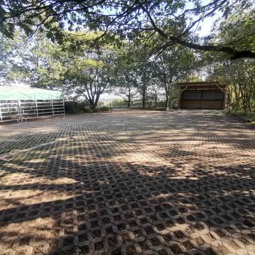
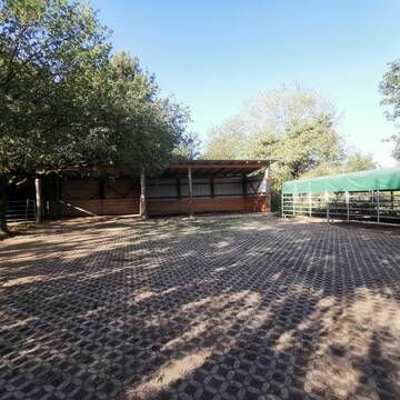
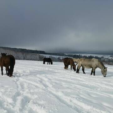
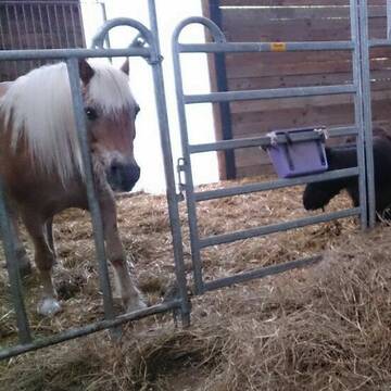
Großzügige Boxen und Weiden mit Rundumservice
Schönberg
Rosenhof-Ranch
@Rosenhof-Ranch
Freizeitstall
Geländestrecke
Vermieten
Führanlage
Hunde willkommen
Allergikerstall
bedampftes/gewaschenes Heu
28 weitere...
P+
Allergikerstall, 2 Plätze frei
Bescheid
Manuela-Lohse
@Manuela-Lohse
Freizeitstall
Pflegepferd
Krankenbox
Longierzirkel/Roundpen
Allergikerstall
Notfallboxen
Bewegungsstall
9 weitere...
P+
Deprecated: Creation of dynamic property Zend_View_Helper_Ads::$adLink is deprecated in /var/www/stall-frei/htdocs/staging.stall-frei.de/library/Psf/View/Helper/Ads.php on line 108


Willkommen auf der Silver Moonlight Ranch
Malborn
Silver Moonlight Ranch
@silvermoonlightranch
Freizeitstall
Gangpferdereiten
Vermieten
Hunde willkommen
Krankenbox
Notfallboxen
Pferdezucht
13 weitere...
P
Leider kein Vorschaubild
Leider kein Vorschaubild
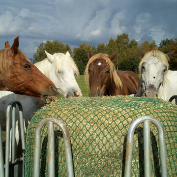
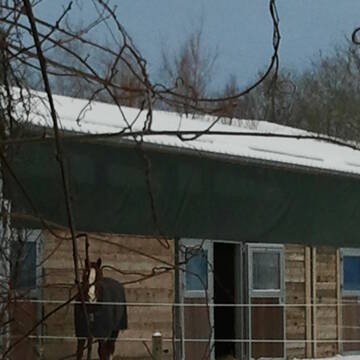
Offenstall frei in unserer kleinen Stutenherde
Gielert
Sunrise Ranch
@JeanetteReuter
Freizeitstall
Krankenbox
Paddock
Allergikerstall
Notfallboxen
Offenstall
11 weitere...
B

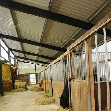
Feller Hof - Paddock Boxen und Offenstallplätze
Fell
Henriette-Portz
@Henriette-Portz
FN-Mitglied
Freizeitstall
Vermieten
Verpachten
Longierzirkel/Roundpen
Paddock
Pferdezucht
23 weitere...
P+

Futtersack HeuToy, Fressbremse in pink
Mechtersen
STALL-FREIde Marketing
@STALL-FREI-Marketing
Stundenlange Beschäftigung die
Koliken vorbeugt, geringe Staubinhalation mit
steuerbarer Futterentnahme
Leider kein Vorschaubild
Leider kein Vorschaubild
Reithof Dhroom an der Dhron
Dhronecken
Dhroom an der Dhron
@Dhroom-an-der-Dhron
Freizeitstall
Gastronomie
Krankenbox
Longierzirkel/Roundpen
Allergikerstall
Hufrehe geeignet
Außenbox mit Paddock
Innenbox
33 weitere...
B
Pferdepension Römerhof
Hermeskeil
Roemerhof-Hermeskeil
@Roemerhof-Hermeskeil
Freizeitstall
Reitlehrer und -unterricht
Longierzirkel/Roundpen
Parkplatz für Pferdeanhänger
bedampftes/gewaschenes Heu
Gnadenbrothof
Innenbox
12 weitere...
P

Einstellplätze für Pferde aller Rassen& Reit...
Bruchweiler
Gestüt Hochlandhof GbR
@Anselm-Anna-Dorn
FN-Mitglied
Gangpferdereiten
Vermieten
Führanlage
Krankenbox
Fohlenaufzucht möglich
Hengsthaltung möglich
29 weitere...
P

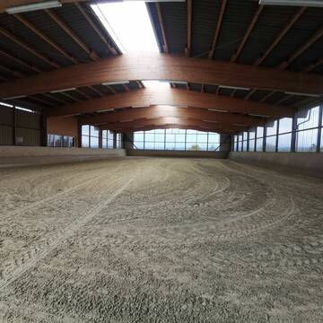
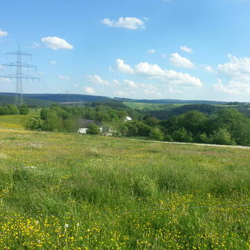
Sichere Jungpferdeaufzucht im Paddocktrail
Rimsberg
Kleewiesenhof
@Kleewiesenhof
Pferdeausbildung
Reitlehrer und -unterricht
Vermieten
Hunde willkommen
Longierzirkel/Roundpen
Fohlenaufzucht möglich
Zuchtstutenhaltung möglich
9 weitere...
P

Allergikerplätze im naturnahen Paddocktrail
Rimsberg
Kleewiesenhof
@Kleewiesenhof
Freizeitstall
Pferdeausbildung
Vermieten
Hunde willkommen
Longierzirkel/Roundpen
Allergikerstall
bedampftes/gewaschenes Heu
9 weitere...
P
Deprecated: Creation of dynamic property Zend_View::$pageCount is deprecated in /var/www/stall-frei/htdocs/staging.stall-frei.de/library/vendor/shardj/zf1-future/library/Zend/View/Abstract.php on line 308
Deprecated: Creation of dynamic property Zend_View::$itemCountPerPage is deprecated in /var/www/stall-frei/htdocs/staging.stall-frei.de/library/vendor/shardj/zf1-future/library/Zend/View/Abstract.php on line 308
Deprecated: Creation of dynamic property Zend_View::$first is deprecated in /var/www/stall-frei/htdocs/staging.stall-frei.de/library/vendor/shardj/zf1-future/library/Zend/View/Abstract.php on line 308
Deprecated: Creation of dynamic property Zend_View::$current is deprecated in /var/www/stall-frei/htdocs/staging.stall-frei.de/library/vendor/shardj/zf1-future/library/Zend/View/Abstract.php on line 308
Deprecated: Creation of dynamic property Zend_View::$last is deprecated in /var/www/stall-frei/htdocs/staging.stall-frei.de/library/vendor/shardj/zf1-future/library/Zend/View/Abstract.php on line 308
Deprecated: Creation of dynamic property Zend_View::$next is deprecated in /var/www/stall-frei/htdocs/staging.stall-frei.de/library/vendor/shardj/zf1-future/library/Zend/View/Abstract.php on line 308
Deprecated: Creation of dynamic property Zend_View::$pagesInRange is deprecated in /var/www/stall-frei/htdocs/staging.stall-frei.de/library/vendor/shardj/zf1-future/library/Zend/View/Abstract.php on line 308
Deprecated: Creation of dynamic property Zend_View::$firstPageInRange is deprecated in /var/www/stall-frei/htdocs/staging.stall-frei.de/library/vendor/shardj/zf1-future/library/Zend/View/Abstract.php on line 308
Deprecated: Creation of dynamic property Zend_View::$lastPageInRange is deprecated in /var/www/stall-frei/htdocs/staging.stall-frei.de/library/vendor/shardj/zf1-future/library/Zend/View/Abstract.php on line 308
Deprecated: Creation of dynamic property Zend_View::$currentItemCount is deprecated in /var/www/stall-frei/htdocs/staging.stall-frei.de/library/vendor/shardj/zf1-future/library/Zend/View/Abstract.php on line 308
Deprecated: Creation of dynamic property Zend_View::$totalItemCount is deprecated in /var/www/stall-frei/htdocs/staging.stall-frei.de/library/vendor/shardj/zf1-future/library/Zend/View/Abstract.php on line 308
Deprecated: Creation of dynamic property Zend_View::$firstItemNumber is deprecated in /var/www/stall-frei/htdocs/staging.stall-frei.de/library/vendor/shardj/zf1-future/library/Zend/View/Abstract.php on line 308
Deprecated: Creation of dynamic property Zend_View::$lastItemNumber is deprecated in /var/www/stall-frei/htdocs/staging.stall-frei.de/library/vendor/shardj/zf1-future/library/Zend/View/Abstract.php on line 308
Deprecated: Creation of dynamic property Zend_View::$router is deprecated in /var/www/stall-frei/htdocs/staging.stall-frei.de/library/vendor/shardj/zf1-future/library/Zend/View/Abstract.php on line 308
Deprecated: Creation of dynamic property Zend_View::$urlParams is deprecated in /var/www/stall-frei/htdocs/staging.stall-frei.de/library/vendor/shardj/zf1-future/library/Zend/View/Abstract.php on line 308
Deprecated: Creation of dynamic property Zend_View::$showAds is deprecated in /var/www/stall-frei/htdocs/staging.stall-frei.de/library/vendor/shardj/zf1-future/library/Zend/View/Abstract.php on line 308
Deprecated: Creation of dynamic property Zend_View::$objectIds is deprecated in /var/www/stall-frei/htdocs/staging.stall-frei.de/library/vendor/shardj/zf1-future/library/Zend/View/Abstract.php on line 308
Deprecated: Creation of dynamic property Zend_View::$showNavbar is deprecated in /var/www/stall-frei/htdocs/staging.stall-frei.de/library/vendor/shardj/zf1-future/library/Zend/View/Abstract.php on line 308
Deprecated: Creation of dynamic property Zend_View::$showBreadcrumb is deprecated in /var/www/stall-frei/htdocs/staging.stall-frei.de/library/vendor/shardj/zf1-future/library/Zend/View/Abstract.php on line 308
Deprecated: Creation of dynamic property Zend_View::$showFooter is deprecated in /var/www/stall-frei/htdocs/staging.stall-frei.de/library/vendor/shardj/zf1-future/library/Zend/View/Abstract.php on line 308
Deprecated: Creation of dynamic property Zend_View::$showInternalAds is deprecated in /var/www/stall-frei/htdocs/staging.stall-frei.de/library/vendor/shardj/zf1-future/library/Zend/View/Abstract.php on line 308
Deprecated: Creation of dynamic property Zend_View::$blNoContent is deprecated in /var/www/stall-frei/htdocs/staging.stall-frei.de/library/vendor/shardj/zf1-future/library/Zend/View/Abstract.php on line 308
Deprecated: Creation of dynamic property Zend_View::$sMetaDesc is deprecated in /var/www/stall-frei/htdocs/staging.stall-frei.de/library/vendor/shardj/zf1-future/library/Zend/View/Abstract.php on line 308
Deprecated: Creation of dynamic property Zend_View::$useGmaps is deprecated in /var/www/stall-frei/htdocs/staging.stall-frei.de/library/vendor/shardj/zf1-future/library/Zend/View/Abstract.php on line 308
Deprecated: Creation of dynamic property Zend_View::$touches is deprecated in /var/www/stall-frei/htdocs/staging.stall-frei.de/library/vendor/shardj/zf1-future/library/Zend/View/Abstract.php on line 308
Deprecated: Creation of dynamic property Zend_View::$oProject is deprecated in /var/www/stall-frei/htdocs/staging.stall-frei.de/library/vendor/shardj/zf1-future/library/Zend/View/Abstract.php on line 308
Deprecated: Creation of dynamic property Zend_View::$pageHeadline is deprecated in /var/www/stall-frei/htdocs/staging.stall-frei.de/library/vendor/shardj/zf1-future/library/Zend/View/Abstract.php on line 308
Deprecated: Creation of dynamic property Zend_View::$disableLocationField is deprecated in /var/www/stall-frei/htdocs/staging.stall-frei.de/library/vendor/shardj/zf1-future/library/Zend/View/Abstract.php on line 308
Deprecated: Creation of dynamic property Zend_View::$isSearch is deprecated in /var/www/stall-frei/htdocs/staging.stall-frei.de/library/vendor/shardj/zf1-future/library/Zend/View/Abstract.php on line 308
Deprecated: Creation of dynamic property Zend_View::$pageTitle is deprecated in /var/www/stall-frei/htdocs/staging.stall-frei.de/library/vendor/shardj/zf1-future/library/Zend/View/Abstract.php on line 308
Deprecated: Creation of dynamic property Psf_Form_Element_Text::$class is deprecated in /var/www/stall-frei/htdocs/staging.stall-frei.de/library/vendor/shardj/zf1-future/library/Zend/Form/Element.php on line 874
Deprecated: Creation of dynamic property Psf_Form_Element_Text::$size is deprecated in /var/www/stall-frei/htdocs/staging.stall-frei.de/library/vendor/shardj/zf1-future/library/Zend/Form/Element.php on line 874
Deprecated: Creation of dynamic property Psf_Form_Element_Text::$placeholder is deprecated in /var/www/stall-frei/htdocs/staging.stall-frei.de/library/vendor/shardj/zf1-future/library/Zend/Form/Element.php on line 874
Deprecated: Creation of dynamic property Psf_Form_Element_Hidden::$class is deprecated in /var/www/stall-frei/htdocs/staging.stall-frei.de/library/vendor/shardj/zf1-future/library/Zend/Form/Element.php on line 874
Deprecated: Creation of dynamic property Psf_Form_Element_Hidden::$class is deprecated in /var/www/stall-frei/htdocs/staging.stall-frei.de/library/vendor/shardj/zf1-future/library/Zend/Form/Element.php on line 874
Deprecated: Creation of dynamic property Psf_Form_Element_Hidden::$class is deprecated in /var/www/stall-frei/htdocs/staging.stall-frei.de/library/vendor/shardj/zf1-future/library/Zend/Form/Element.php on line 874
Deprecated: Creation of dynamic property Psf_Form_Element_Hidden::$class is deprecated in /var/www/stall-frei/htdocs/staging.stall-frei.de/library/vendor/shardj/zf1-future/library/Zend/Form/Element.php on line 874
Deprecated: Creation of dynamic property Psf_Form_Element_Select::$class is deprecated in /var/www/stall-frei/htdocs/staging.stall-frei.de/library/vendor/shardj/zf1-future/library/Zend/Form/Element.php on line 874
Deprecated: Creation of dynamic property Psf_Form_Element_Select::$class is deprecated in /var/www/stall-frei/htdocs/staging.stall-frei.de/library/vendor/shardj/zf1-future/library/Zend/Form/Element.php on line 874
Deprecated: Creation of dynamic property Psf_Form_Element_Select::$class is deprecated in /var/www/stall-frei/htdocs/staging.stall-frei.de/library/vendor/shardj/zf1-future/library/Zend/Form/Element.php on line 874
Deprecated: Creation of dynamic property Psf_Form_Element_Select::$class is deprecated in /var/www/stall-frei/htdocs/staging.stall-frei.de/library/vendor/shardj/zf1-future/library/Zend/Form/Element.php on line 874
Deprecated: Creation of dynamic property Psf_Form_Element_Text::$class is deprecated in /var/www/stall-frei/htdocs/staging.stall-frei.de/library/vendor/shardj/zf1-future/library/Zend/Form/Element.php on line 874
Deprecated: Creation of dynamic property Psf_Form_Element_Checkbox::$label is deprecated in /var/www/stall-frei/htdocs/staging.stall-frei.de/library/vendor/shardj/zf1-future/library/Zend/Form/Element.php on line 874
Deprecated: Creation of dynamic property Zend_View::$sort is deprecated in /var/www/stall-frei/htdocs/staging.stall-frei.de/library/vendor/shardj/zf1-future/library/Zend/View/Abstract.php on line 308
Deprecated: Creation of dynamic property Zend_View::$searchLocation is deprecated in /var/www/stall-frei/htdocs/staging.stall-frei.de/library/vendor/shardj/zf1-future/library/Zend/View/Abstract.php on line 308
Deprecated: Creation of dynamic property Zend_View::$locationHint is deprecated in /var/www/stall-frei/htdocs/staging.stall-frei.de/library/vendor/shardj/zf1-future/library/Zend/View/Abstract.php on line 308
Psf_GeoCoder_Abstract::getLocation: Immert Get Location CachedOrLive
Psf_GeoCoder_Abstract::getCachedOrLive: Immert
Psf_GeoCoder_OpenCageData::makeApiRequest: response:
Array
(
[documentation] => https://opencagedata.com/api
[licenses] => Array
(
[0] => Array
(
[name] => see attribution guide
[url] => https://opencagedata.com/credits
)
)
[results] => Array
(
[0] => Array
(
[bounds] => Array
(
[northeast] => Array
(
[lat] => 49.7831177
[lng] => 7.039517
)
[southwest] => Array
(
[lat] => 49.756153
[lng] => 7.007068
)
)
[components] => Array
(
[ISO_3166-1_alpha-2] => DE
[ISO_3166-1_alpha-3] => DEU
[ISO_3166-2] => Array
(
[0] => DE-RP
)
[_category] => place
[_normalized_city] => Immert
[_type] => village
[continent] => Europe
[country] => Deutschland
[country_code] => de
[county] => Landkreis Bernkastel-Wittlich
[municipality] => Thalfang am Erbeskopf
[political_union] => European Union
[state] => Rheinland-Pfalz
[state_code] => RP
[village] => Immert
)
[confidence] => 7
[formatted] => Immert, Rheinland-Pfalz, Deutschland
[geometry] => Array
(
[lat] => 49.7655972
[lng] => 7.0206888
)
)
[1] => Array
(
[components] => Array
(
[ISO_3166-1_alpha-2] => FR
[ISO_3166-1_alpha-3] => FRA
[ISO_3166-2] => Array
(
[0] => FR-OCC
[1] => FR-46
)
[_category] => road
[_normalized_city] => Miers
[_type] => road
[city] => Miers
[continent] => Europe
[country] => France
[country_code] => fr
[county] => Lot
[local_authority] => Communauté de communes Causses et Vallée de la Dordogne
[political_union] => European Union
[postcode] => 46500
[road] => Route de la Pimpe
[state] => Occitanie
[state_code] => OCC
)
[confidence] => 10
[formatted] => Route de la Pimpe, 46500 Miers, France
[geometry] => Array
(
[lat] => 44.84966
[lng] => 1.707126
)
)
[2] => Array
(
[components] => Array
(
[ISO_3166-1_alpha-2] => YT
[ISO_3166-1_alpha-3] => MYT
[ISO_3166-2] => Array
(
[0] => FR-976
)
[_category] => place
[_normalized_city] => Sada
[_type] => place
[city] => Sada
[continent] => Africa
[country] => France
[country_code] => fr
[county] => Mayotte
[local_authority] => Communauté de communes du Centre-Ouest
[place] => Iméré
[political_union] => European Union
[postcode] => 97640
[state] =>
)
[confidence] => 10
[formatted] => Iméré, 97640 Sada, France
[geometry] => Array
(
[lat] => -12.868715
[lng] => 45.11607
)
)
[3] => Array
(
[components] => Array
(
[ISO_3166-1_alpha-2] => FR
[ISO_3166-1_alpha-3] => FRA
[ISO_3166-2] => Array
(
[0] => FR-OCC
[1] => FR-46
)
[_category] => road
[_normalized_city] => Miers
[_type] => road
[city] => Miers
[continent] => Europe
[country] => France
[country_code] => fr
[county] => Lot
[local_authority] => Communauté de communes Causses et Vallée de la Dordogne
[political_union] => European Union
[postcode] => 46500
[road] => Route de la Croix Blanche
[state] => Occitanie
[state_code] => OCC
)
[confidence] => 10
[formatted] => Route de la Croix Blanche, 46500 Miers, France
[geometry] => Array
(
[lat] => 44.852601
[lng] => 1.703448
)
)
[4] => Array
(
[components] => Array
(
[ISO_3166-1_alpha-2] => FR
[ISO_3166-1_alpha-3] => FRA
[ISO_3166-2] => Array
(
[0] => FR-OCC
[1] => FR-46
)
[_category] => road
[_normalized_city] => Miers
[_type] => road
[city] => Miers
[continent] => Europe
[country] => France
[country_code] => fr
[county] => Lot
[local_authority] => Communauté de communes Causses et Vallée de la Dordogne
[political_union] => European Union
[postcode] => 46500
[road] => Route de Cantemieule
[state] => Occitanie
[state_code] => OCC
)
[confidence] => 10
[formatted] => Route de Cantemieule, 46500 Miers, France
[geometry] => Array
(
[lat] => 44.848213
[lng] => 1.685384
)
)
[5] => Array
(
[components] => Array
(
[ISO_3166-1_alpha-2] => FR
[ISO_3166-1_alpha-3] => FRA
[ISO_3166-2] => Array
(
[0] => FR-OCC
[1] => FR-46
)
[_category] => road
[_normalized_city] => Miers
[_type] => road
[city] => Miers
[continent] => Europe
[country] => France
[country_code] => fr
[county] => Lot
[local_authority] => Communauté de communes Causses et Vallée de la Dordogne
[political_union] => European Union
[postcode] => 46500
[road] => Rue de la Menuiserie
[state] => Occitanie
[state_code] => OCC
)
[confidence] => 10
[formatted] => Rue de la Menuiserie, 46500 Miers, France
[geometry] => Array
(
[lat] => 44.853317
[lng] => 1.706981
)
)
[6] => Array
(
[components] => Array
(
[ISO_3166-1_alpha-2] => FR
[ISO_3166-1_alpha-3] => FRA
[ISO_3166-2] => Array
(
[0] => FR-NAQ
[1] => FR-19
)
[_category] => road
[_normalized_city] => Condat-sur-Ganaveix
[_type] => road
[city] => Condat-sur-Ganaveix
[continent] => Europe
[country] => France
[country_code] => fr
[county] => Corrèze
[local_authority] => Communauté de communes du Pays d'Uzerche
[political_union] => European Union
[postcode] => 19140
[road] => chemin de miers
[state] => Nouvelle-Aquitaine
[state_code] => NAQ
)
[confidence] => 10
[formatted] => chemin de miers, 19140 Condat-sur-Ganaveix, France
[geometry] => Array
(
[lat] => 45.460059
[lng] => 1.611581
)
)
[7] => Array
(
[components] => Array
(
[ISO_3166-1_alpha-2] => FR
[ISO_3166-1_alpha-3] => FRA
[ISO_3166-2] => Array
(
[0] => FR-OCC
[1] => FR-46
)
[_category] => road
[_normalized_city] => Thégra
[_type] => road
[city] => Thégra
[continent] => Europe
[country] => France
[country_code] => fr
[county] => Lot
[local_authority] => Communauté de communes Causses et Vallée de la Dordogne
[political_union] => European Union
[postcode] => 46500
[road] => Route de Miers
[state] => Occitanie
[state_code] => OCC
)
[confidence] => 10
[formatted] => Route de Miers, 46500 Thégra, France
[geometry] => Array
(
[lat] => 44.822993
[lng] => 1.750886
)
)
[8] => Array
(
[components] => Array
(
[ISO_3166-1_alpha-2] => FR
[ISO_3166-1_alpha-3] => FRA
[ISO_3166-2] => Array
(
[0] => FR-PAC
[1] => FR-83
)
[_category] => road
[_normalized_city] => Fréjus
[_type] => road
[city] => Fréjus
[continent] => Europe
[country] => France
[country_code] => fr
[county] => Var
[local_authority] => Estérel Côte d'Azur Agglomération
[political_union] => European Union
[postcode] => 83370
[road] => Avenue IMER
[state] => Provence-Alpes-Côte d'Azur
[state_code] => PAC
)
[confidence] => 10
[formatted] => Avenue IMER, 83370 Fréjus, France
[geometry] => Array
(
[lat] => 43.386926
[lng] => 6.714433
)
)
[9] => Array
(
[components] => Array
(
[ISO_3166-1_alpha-2] => FR
[ISO_3166-1_alpha-3] => FRA
[ISO_3166-2] => Array
(
[0] => FR-OCC
[1] => FR-46
)
[_category] => road
[_normalized_city] => Montvalent
[_type] => road
[city] => Montvalent
[continent] => Europe
[country] => France
[country_code] => fr
[county] => Lot
[local_authority] => Communauté de communes Causses et Vallée de la Dordogne
[political_union] => European Union
[postcode] => 46600
[road] => Route de Miers
[state] => Occitanie
[state_code] => OCC
)
[confidence] => 10
[formatted] => Route de Miers, 46600 Montvalent, France
[geometry] => Array
(
[lat] => 44.871161
[lng] => 1.638436
)
)
)
[status] => Array
(
[code] => 200
[message] => OK
)
[stay_informed] => Array
(
[blog] => https://blog.opencagedata.com
[mastodon] => https://en.osm.town/@opencage
)
[thanks] => For using an OpenCage API
[timestamp] => Array
(
[created_http] => Sun, 08 Feb 2026 13:51:29 GMT
[created_unix] => 1770558689
)
[total_results] => 10
)
Psf_GeoCoder_Abstract::convertLocationResult
{"documentation":"https:\/\/opencagedata.com\/api","licenses":[{"name":"see attribution guide","url":"https:\/\/opencagedata.com\/credits"}],"results":[{"bounds":{"northeast":{"lat":49.7831177,"lng":7.039517},"southwest":{"lat":49.756153,"lng":7.007068}},"components":{"ISO_3166-1_alpha-2":"DE","ISO_3166-1_alpha-3":"DEU","ISO_3166-2":["DE-RP"],"_category":"place","_normalized_city":"Immert","_type":"village","continent":"Europe","country":"Deutschland","country_code":"de","county":"Landkreis Bernkastel-Wittlich","municipality":"Thalfang am Erbeskopf","political_union":"European Union","state":"Rheinland-Pfalz","state_code":"RP","village":"Immert"},"confidence":7,"formatted":"Immert, Rheinland-Pfalz, Deutschland","geometry":{"lat":49.7655972,"lng":7.0206888}},{"components":{"ISO_3166-1_alpha-2":"FR","ISO_3166-1_alpha-3":"FRA","ISO_3166-2":["FR-OCC","FR-46"],"_category":"road","_normalized_city":"Miers","_type":"road","city":"Miers","continent":"Europe","country":"France","country_code":"fr","county":"Lot","local_authority":"Communaut\u00e9 de communes Causses et Vall\u00e9e de la Dordogne","political_union":"European Union","postcode":"46500","road":"Route de la Pimpe","state":"Occitanie","state_code":"OCC"},"confidence":10,"formatted":"Route de la Pimpe, 46500 Miers, France","geometry":{"lat":44.84966,"lng":1.707126}},{"components":{"ISO_3166-1_alpha-2":"YT","ISO_3166-1_alpha-3":"MYT","ISO_3166-2":["FR-976"],"_category":"place","_normalized_city":"Sada","_type":"place","city":"Sada","continent":"Africa","country":"France","country_code":"fr","county":"Mayotte","local_authority":"Communaut\u00e9 de communes du Centre-Ouest","place":"Im\u00e9r\u00e9","political_union":"European Union","postcode":"97640","state":null},"confidence":10,"formatted":"Im\u00e9r\u00e9, 97640 Sada, France","geometry":{"lat":-12.868715,"lng":45.11607}},{"components":{"ISO_3166-1_alpha-2":"FR","ISO_3166-1_alpha-3":"FRA","ISO_3166-2":["FR-OCC","FR-46"],"_category":"road","_normalized_city":"Miers","_type":"road","city":"Miers","continent":"Europe","country":"France","country_code":"fr","county":"Lot","local_authority":"Communaut\u00e9 de communes Causses et Vall\u00e9e de la Dordogne","political_union":"European Union","postcode":"46500","road":"Route de la Croix Blanche","state":"Occitanie","state_code":"OCC"},"confidence":10,"formatted":"Route de la Croix Blanche, 46500 Miers, France","geometry":{"lat":44.852601,"lng":1.703448}},{"components":{"ISO_3166-1_alpha-2":"FR","ISO_3166-1_alpha-3":"FRA","ISO_3166-2":["FR-OCC","FR-46"],"_category":"road","_normalized_city":"Miers","_type":"road","city":"Miers","continent":"Europe","country":"France","country_code":"fr","county":"Lot","local_authority":"Communaut\u00e9 de communes Causses et Vall\u00e9e de la Dordogne","political_union":"European Union","postcode":"46500","road":"Route de Cantemieule","state":"Occitanie","state_code":"OCC"},"confidence":10,"formatted":"Route de Cantemieule, 46500 Miers, France","geometry":{"lat":44.848213,"lng":1.685384}},{"components":{"ISO_3166-1_alpha-2":"FR","ISO_3166-1_alpha-3":"FRA","ISO_3166-2":["FR-OCC","FR-46"],"_category":"road","_normalized_city":"Miers","_type":"road","city":"Miers","continent":"Europe","country":"France","country_code":"fr","county":"Lot","local_authority":"Communaut\u00e9 de communes Causses et Vall\u00e9e de la Dordogne","political_union":"European Union","postcode":"46500","road":"Rue de la Menuiserie","state":"Occitanie","state_code":"OCC"},"confidence":10,"formatted":"Rue de la Menuiserie, 46500 Miers, France","geometry":{"lat":44.853317,"lng":1.706981}},{"components":{"ISO_3166-1_alpha-2":"FR","ISO_3166-1_alpha-3":"FRA","ISO_3166-2":["FR-NAQ","FR-19"],"_category":"road","_normalized_city":"Condat-sur-Ganaveix","_type":"road","city":"Condat-sur-Ganaveix","continent":"Europe","country":"France","country_code":"fr","county":"Corr\u00e8ze","local_authority":"Communaut\u00e9 de communes du Pays d'Uzerche","political_union":"European Union","postcode":"19140","road":"chemin de miers","state":"Nouvelle-Aquitaine","state_code":"NAQ"},"confidence":10,"formatted":"chemin de miers, 19140 Condat-sur-Ganaveix, France","geometry":{"lat":45.460059,"lng":1.611581}},{"components":{"ISO_3166-1_alpha-2":"FR","ISO_3166-1_alpha-3":"FRA","ISO_3166-2":["FR-OCC","FR-46"],"_category":"road","_normalized_city":"Th\u00e9gra","_type":"road","city":"Th\u00e9gra","continent":"Europe","country":"France","country_code":"fr","county":"Lot","local_authority":"Communaut\u00e9 de communes Causses et Vall\u00e9e de la Dordogne","political_union":"European Union","postcode":"46500","road":"Route de Miers","state":"Occitanie","state_code":"OCC"},"confidence":10,"formatted":"Route de Miers, 46500 Th\u00e9gra, France","geometry":{"lat":44.822993,"lng":1.750886}},{"components":{"ISO_3166-1_alpha-2":"FR","ISO_3166-1_alpha-3":"FRA","ISO_3166-2":["FR-PAC","FR-83"],"_category":"road","_normalized_city":"Fr\u00e9jus","_type":"road","city":"Fr\u00e9jus","continent":"Europe","country":"France","country_code":"fr","county":"Var","local_authority":"Est\u00e9rel C\u00f4te d'Azur Agglom\u00e9ration","political_union":"European Union","postcode":"83370","road":"Avenue IMER","state":"Provence-Alpes-C\u00f4te d'Azur","state_code":"PAC"},"confidence":10,"formatted":"Avenue IMER, 83370 Fr\u00e9jus, France","geometry":{"lat":43.386926,"lng":6.714433}},{"components":{"ISO_3166-1_alpha-2":"FR","ISO_3166-1_alpha-3":"FRA","ISO_3166-2":["FR-OCC","FR-46"],"_category":"road","_normalized_city":"Montvalent","_type":"road","city":"Montvalent","continent":"Europe","country":"France","country_code":"fr","county":"Lot","local_authority":"Communaut\u00e9 de communes Causses et Vall\u00e9e de la Dordogne","political_union":"European Union","postcode":"46600","road":"Route de Miers","state":"Occitanie","state_code":"OCC"},"confidence":10,"formatted":"Route de Miers, 46600 Montvalent, France","geometry":{"lat":44.871161,"lng":1.638436}}],"status":{"code":200,"message":"OK"},"stay_informed":{"blog":"https:\/\/blog.opencagedata.com","mastodon":"https:\/\/en.osm.town\/@opencage"},"thanks":"For using an OpenCage API","timestamp":{"created_http":"Sun, 08 Feb 2026 13:51:29 GMT","created_unix":1770558689},"total_results":10}Array
(
[0] => stdClass Object
(
[bounds] => stdClass Object
(
[northeast] => stdClass Object
(
[lat] => 49.7831177
[lng] => 7.039517
)
[southwest] => stdClass Object
(
[lat] => 49.756153
[lng] => 7.007068
)
)
[components] => stdClass Object
(
[ISO_3166-1_alpha-2] => DE
[ISO_3166-1_alpha-3] => DEU
[ISO_3166-2] => Array
(
[0] => DE-RP
)
[_category] => place
[_normalized_city] => Immert
[_type] => village
[continent] => Europe
[country] => Deutschland
[country_code] => de
[county] => Landkreis Bernkastel-Wittlich
[municipality] => Thalfang am Erbeskopf
[political_union] => European Union
[state] => Rheinland-Pfalz
[state_code] => RP
[village] => Immert
)
[confidence] => 7
[formatted] => Immert, Rheinland-Pfalz, Deutschland
[geometry] => stdClass Object
(
[lat] => 49.7655972
[lng] => 7.0206888
)
)
[1] => stdClass Object
(
[components] => stdClass Object
(
[ISO_3166-1_alpha-2] => FR
[ISO_3166-1_alpha-3] => FRA
[ISO_3166-2] => Array
(
[0] => FR-OCC
[1] => FR-46
)
[_category] => road
[_normalized_city] => Miers
[_type] => road
[city] => Miers
[continent] => Europe
[country] => France
[country_code] => fr
[county] => Lot
[local_authority] => Communauté de communes Causses et Vallée de la Dordogne
[political_union] => European Union
[postcode] => 46500
[road] => Route de la Pimpe
[state] => Occitanie
[state_code] => OCC
)
[confidence] => 10
[formatted] => Route de la Pimpe, 46500 Miers, France
[geometry] => stdClass Object
(
[lat] => 44.84966
[lng] => 1.707126
)
)
[2] => stdClass Object
(
[components] => stdClass Object
(
[ISO_3166-1_alpha-2] => YT
[ISO_3166-1_alpha-3] => MYT
[ISO_3166-2] => Array
(
[0] => FR-976
)
[_category] => place
[_normalized_city] => Sada
[_type] => place
[city] => Sada
[continent] => Africa
[country] => France
[country_code] => fr
[county] => Mayotte
[local_authority] => Communauté de communes du Centre-Ouest
[place] => Iméré
[political_union] => European Union
[postcode] => 97640
[state] =>
)
[confidence] => 10
[formatted] => Iméré, 97640 Sada, France
[geometry] => stdClass Object
(
[lat] => -12.868715
[lng] => 45.11607
)
)
[3] => stdClass Object
(
[components] => stdClass Object
(
[ISO_3166-1_alpha-2] => FR
[ISO_3166-1_alpha-3] => FRA
[ISO_3166-2] => Array
(
[0] => FR-OCC
[1] => FR-46
)
[_category] => road
[_normalized_city] => Miers
[_type] => road
[city] => Miers
[continent] => Europe
[country] => France
[country_code] => fr
[county] => Lot
[local_authority] => Communauté de communes Causses et Vallée de la Dordogne
[political_union] => European Union
[postcode] => 46500
[road] => Route de la Croix Blanche
[state] => Occitanie
[state_code] => OCC
)
[confidence] => 10
[formatted] => Route de la Croix Blanche, 46500 Miers, France
[geometry] => stdClass Object
(
[lat] => 44.852601
[lng] => 1.703448
)
)
[4] => stdClass Object
(
[components] => stdClass Object
(
[ISO_3166-1_alpha-2] => FR
[ISO_3166-1_alpha-3] => FRA
[ISO_3166-2] => Array
(
[0] => FR-OCC
[1] => FR-46
)
[_category] => road
[_normalized_city] => Miers
[_type] => road
[city] => Miers
[continent] => Europe
[country] => France
[country_code] => fr
[county] => Lot
[local_authority] => Communauté de communes Causses et Vallée de la Dordogne
[political_union] => European Union
[postcode] => 46500
[road] => Route de Cantemieule
[state] => Occitanie
[state_code] => OCC
)
[confidence] => 10
[formatted] => Route de Cantemieule, 46500 Miers, France
[geometry] => stdClass Object
(
[lat] => 44.848213
[lng] => 1.685384
)
)
[5] => stdClass Object
(
[components] => stdClass Object
(
[ISO_3166-1_alpha-2] => FR
[ISO_3166-1_alpha-3] => FRA
[ISO_3166-2] => Array
(
[0] => FR-OCC
[1] => FR-46
)
[_category] => road
[_normalized_city] => Miers
[_type] => road
[city] => Miers
[continent] => Europe
[country] => France
[country_code] => fr
[county] => Lot
[local_authority] => Communauté de communes Causses et Vallée de la Dordogne
[political_union] => European Union
[postcode] => 46500
[road] => Rue de la Menuiserie
[state] => Occitanie
[state_code] => OCC
)
[confidence] => 10
[formatted] => Rue de la Menuiserie, 46500 Miers, France
[geometry] => stdClass Object
(
[lat] => 44.853317
[lng] => 1.706981
)
)
[6] => stdClass Object
(
[components] => stdClass Object
(
[ISO_3166-1_alpha-2] => FR
[ISO_3166-1_alpha-3] => FRA
[ISO_3166-2] => Array
(
[0] => FR-NAQ
[1] => FR-19
)
[_category] => road
[_normalized_city] => Condat-sur-Ganaveix
[_type] => road
[city] => Condat-sur-Ganaveix
[continent] => Europe
[country] => France
[country_code] => fr
[county] => Corrèze
[local_authority] => Communauté de communes du Pays d'Uzerche
[political_union] => European Union
[postcode] => 19140
[road] => chemin de miers
[state] => Nouvelle-Aquitaine
[state_code] => NAQ
)
[confidence] => 10
[formatted] => chemin de miers, 19140 Condat-sur-Ganaveix, France
[geometry] => stdClass Object
(
[lat] => 45.460059
[lng] => 1.611581
)
)
[7] => stdClass Object
(
[components] => stdClass Object
(
[ISO_3166-1_alpha-2] => FR
[ISO_3166-1_alpha-3] => FRA
[ISO_3166-2] => Array
(
[0] => FR-OCC
[1] => FR-46
)
[_category] => road
[_normalized_city] => Thégra
[_type] => road
[city] => Thégra
[continent] => Europe
[country] => France
[country_code] => fr
[county] => Lot
[local_authority] => Communauté de communes Causses et Vallée de la Dordogne
[political_union] => European Union
[postcode] => 46500
[road] => Route de Miers
[state] => Occitanie
[state_code] => OCC
)
[confidence] => 10
[formatted] => Route de Miers, 46500 Thégra, France
[geometry] => stdClass Object
(
[lat] => 44.822993
[lng] => 1.750886
)
)
[8] => stdClass Object
(
[components] => stdClass Object
(
[ISO_3166-1_alpha-2] => FR
[ISO_3166-1_alpha-3] => FRA
[ISO_3166-2] => Array
(
[0] => FR-PAC
[1] => FR-83
)
[_category] => road
[_normalized_city] => Fréjus
[_type] => road
[city] => Fréjus
[continent] => Europe
[country] => France
[country_code] => fr
[county] => Var
[local_authority] => Estérel Côte d'Azur Agglomération
[political_union] => European Union
[postcode] => 83370
[road] => Avenue IMER
[state] => Provence-Alpes-Côte d'Azur
[state_code] => PAC
)
[confidence] => 10
[formatted] => Avenue IMER, 83370 Fréjus, France
[geometry] => stdClass Object
(
[lat] => 43.386926
[lng] => 6.714433
)
)
[9] => stdClass Object
(
[components] => stdClass Object
(
[ISO_3166-1_alpha-2] => FR
[ISO_3166-1_alpha-3] => FRA
[ISO_3166-2] => Array
(
[0] => FR-OCC
[1] => FR-46
)
[_category] => road
[_normalized_city] => Montvalent
[_type] => road
[city] => Montvalent
[continent] => Europe
[country] => France
[country_code] => fr
[county] => Lot
[local_authority] => Communauté de communes Causses et Vallée de la Dordogne
[political_union] => European Union
[postcode] => 46600
[road] => Route de Miers
[state] => Occitanie
[state_code] => OCC
)
[confidence] => 10
[formatted] => Route de Miers, 46600 Montvalent, France
[geometry] => stdClass Object
(
[lat] => 44.871161
[lng] => 1.638436
)
)
)
Psf_GeoCoder_OpenCageData::getKeyMap: 0
stdClass Object
(
    [bounds] => stdClass Object
        (
            [northeast] => stdClass Object
                (
                    [lat] => 49.7831177
                    [lng] => 7.039517
                )

            [southwest] => stdClass Object
                (
                    [lat] => 49.756153
                    [lng] => 7.007068
                )

        )

    [components] => stdClass Object
        (
            [ISO_3166-1_alpha-2] => DE
            [ISO_3166-1_alpha-3] => DEU
            [ISO_3166-2] => Array
                (
                    [0] => DE-RP
                )

            [_category] => place
            [_normalized_city] => Immert
            [_type] => village
            [continent] => Europe
            [country] => Deutschland
            [country_code] => de
            [county] => Landkreis Bernkastel-Wittlich
            [municipality] => Thalfang am Erbeskopf
            [political_union] => European Union
            [state] => Rheinland-Pfalz
            [state_code] => RP
            [village] => Immert
        )

    [confidence] => 7
    [formatted] => Immert, Rheinland-Pfalz, Deutschland
    [geometry] => stdClass Object
        (
            [lat] => 49.7655972
            [lng] => 7.0206888
        )

)
Psf_GeoCoder_OpenCageData::getCounty: Bernkastel-Wittlich
Psf_GeoCoder_OpenCageData::addMissingData REFETCH!
Array
(
    [address] => Immert, Rheinland-Pfalz, Deutschland
    [type] => village
    [street] =>
    [city] => Immert
    [county] => Bernkastel-Wittlich
    [state] => Rheinland-Pfalz
    [zip] =>
    [country] => Deutschland
    [suburb] =>
    [countrycode] => de
    [latitude] => 49.7655972
    [longitude] => 7.0206888
    [accuracy] => 1
    [confidence] => 7
    [bounds] => stdClass Object
        (
            [northeast] => stdClass Object
                (
                    [lat] => 49.7831177
                    [lng] => 7.039517
                )

            [southwest] => stdClass Object
                (
                    [lat] => 49.756153
                    [lng] => 7.007068
                )

        )

)
reformat!
Array
(
    [address] => Immert, Rheinland-Pfalz, Deutschland
    [type] => village
    [street] =>
    [city] => Immert
    [county] => Bernkastel-Wittlich
    [state] => Rheinland-Pfalz
    [zip] =>
    [country] => Deutschland
    [suburb] =>
    [countrycode] => de
    [latitude] => 49.7655972
    [longitude] => 7.0206888
    [accuracy] => 1
    [confidence] => 7
    [bounds] => stdClass Object
        (
            [northeast] => stdClass Object
                (
                    [lat] => 49.7831177
                    [lng] => 7.039517
                )

            [southwest] => stdClass Object
                (
                    [lat] => 49.756153
                    [lng] => 7.007068
                )

        )

    [place] => Immert, Rheinland-Pfalz
    [hash] => feb2a81b14675964edc4a37a1f2e6b4c
)
Psf_GeoCoder_OpenCageData::getKeyMap: 1
stdClass Object
(
    [components] => stdClass Object
        (
            [ISO_3166-1_alpha-2] => FR
            [ISO_3166-1_alpha-3] => FRA
            [ISO_3166-2] => Array
                (
                    [0] => FR-OCC
                    [1] => FR-46
                )

            [_category] => road
            [_normalized_city] => Miers
            [_type] => road
            [city] => Miers
            [continent] => Europe
            [country] => France
            [country_code] => fr
            [county] => Lot
            [local_authority] => Communauté de communes Causses et Vallée de la Dordogne
            [political_union] => European Union
            [postcode] => 46500
            [road] => Route de la Pimpe
            [state] => Occitanie
            [state_code] => OCC
        )

    [confidence] => 10
    [formatted] => Route de la Pimpe, 46500 Miers, France
    [geometry] => stdClass Object
        (
            [lat] => 44.84966
            [lng] => 1.707126
        )

)
Psf_GeoCoder_OpenCageData::getCounty: Lot
Psf_GeoCoder_OpenCageData::addMissingData REFETCH!
Array
(
    [address] => Route de la Pimpe, 46500 Miers, France
    [type] => road
    [street] => Route de la Pimpe
    [city] => Miers
    [county] => Lot
    [state] => Occitanie
    [zip] => 46500
    [country] => France
    [suburb] =>
    [countrycode] => fr
    [latitude] => 44.84966
    [longitude] => 1.707126
    [accuracy] => 1
    [confidence] => 10
    [bounds] =>
)
reformat!
Array
(
    [address] => Route de la Pimpe, 46500 Miers, France
    [type] => road
    [street] => Route de la Pimpe
    [city] => Miers
    [county] => Lot
    [state] => Occitanie
    [zip] => 46500
    [country] => France
    [suburb] =>
    [countrycode] => fr
    [latitude] => 44.84966
    [longitude] => 1.707126
    [accuracy] => 1
    [confidence] => 10
    [bounds] =>
    [place] => Route de la Pimpe, 46500 Miers, Occitanie
    [hash] => d1222f96a01a2089deba858bbbe31aa2
)
Psf_GeoCoder_OpenCageData::getKeyMap: 2
stdClass Object
(
    [components] => stdClass Object
        (
            [ISO_3166-1_alpha-2] => YT
            [ISO_3166-1_alpha-3] => MYT
            [ISO_3166-2] => Array
                (
                    [0] => FR-976
                )

            [_category] => place
            [_normalized_city] => Sada
            [_type] => place
            [city] => Sada
            [continent] => Africa
            [country] => France
            [country_code] => fr
            [county] => Mayotte
            [local_authority] => Communauté de communes du Centre-Ouest
            [place] => Iméré
            [political_union] => European Union
            [postcode] => 97640
            [state] =>
        )

    [confidence] => 10
    [formatted] => Iméré, 97640 Sada, France
    [geometry] => stdClass Object
        (
            [lat] => -12.868715
            [lng] => 45.11607
        )

)
Psf_GeoCoder_OpenCageData::getCounty: Mayotte
Psf_GeoCoder_OpenCageData::addMissingData REFETCH!
Array
(
    [address] => Iméré, 97640 Sada, France
    [type] => place
    [street] =>
    [city] => Sada
    [county] => Mayotte
    [state] =>
    [zip] => 97640
    [country] => France
    [suburb] =>
    [countrycode] => fr
    [latitude] => -12.868715
    [longitude] => 45.11607
    [accuracy] => 1
    [confidence] => 10
    [bounds] =>
)
reformat!
Array
(
    [address] => Iméré, 97640 Sada, France
    [type] => place
    [street] =>
    [city] => Sada
    [county] => Mayotte
    [state] =>
    [zip] => 97640
    [country] => France
    [suburb] =>
    [countrycode] => fr
    [latitude] => -12.868715
    [longitude] => 45.11607
    [accuracy] => 1
    [confidence] => 10
    [bounds] =>
    [place] => Iméré, 97640 Sada, France
    [hash] => 1515397d12061c48a776ff41978f4758
)
Psf_GeoCoder_OpenCageData::getKeyMap: 3
stdClass Object
(
    [components] => stdClass Object
        (
            [ISO_3166-1_alpha-2] => FR
            [ISO_3166-1_alpha-3] => FRA
            [ISO_3166-2] => Array
                (
                    [0] => FR-OCC
                    [1] => FR-46
                )

            [_category] => road
            [_normalized_city] => Miers
            [_type] => road
            [city] => Miers
            [continent] => Europe
            [country] => France
            [country_code] => fr
            [county] => Lot
            [local_authority] => Communauté de communes Causses et Vallée de la Dordogne
            [political_union] => European Union
            [postcode] => 46500
            [road] => Route de la Croix Blanche
            [state] => Occitanie
            [state_code] => OCC
        )

    [confidence] => 10
    [formatted] => Route de la Croix Blanche, 46500 Miers, France
    [geometry] => stdClass Object
        (
            [lat] => 44.852601
            [lng] => 1.703448
        )

)
Psf_GeoCoder_OpenCageData::getCounty: Lot
Psf_GeoCoder_OpenCageData::addMissingData REFETCH!
Array
(
    [address] => Route de la Croix Blanche, 46500 Miers, France
    [type] => road
    [street] => Route de la Croix Blanche
    [city] => Miers
    [county] => Lot
    [state] => Occitanie
    [zip] => 46500
    [country] => France
    [suburb] =>
    [countrycode] => fr
    [latitude] => 44.852601
    [longitude] => 1.703448
    [accuracy] => 1
    [confidence] => 10
    [bounds] =>
)
reformat!
Array
(
    [address] => Route de la Croix Blanche, 46500 Miers, France
    [type] => road
    [street] => Route de la Croix Blanche
    [city] => Miers
    [county] => Lot
    [state] => Occitanie
    [zip] => 46500
    [country] => France
    [suburb] =>
    [countrycode] => fr
    [latitude] => 44.852601
    [longitude] => 1.703448
    [accuracy] => 1
    [confidence] => 10
    [bounds] =>
    [place] => Route de la Croix Blanche, 46500 Miers, Occitanie
    [hash] => 2866eb9a099e44e1e0a110bc2c8a33f2
)
Psf_GeoCoder_OpenCageData::getKeyMap: 4
stdClass Object
(
    [components] => stdClass Object
        (
            [ISO_3166-1_alpha-2] => FR
            [ISO_3166-1_alpha-3] => FRA
            [ISO_3166-2] => Array
                (
                    [0] => FR-OCC
                    [1] => FR-46
                )

            [_category] => road
            [_normalized_city] => Miers
            [_type] => road
            [city] => Miers
            [continent] => Europe
            [country] => France
            [country_code] => fr
            [county] => Lot
            [local_authority] => Communauté de communes Causses et Vallée de la Dordogne
            [political_union] => European Union
            [postcode] => 46500
            [road] => Route de Cantemieule
            [state] => Occitanie
            [state_code] => OCC
        )

    [confidence] => 10
    [formatted] => Route de Cantemieule, 46500 Miers, France
    [geometry] => stdClass Object
        (
            [lat] => 44.848213
            [lng] => 1.685384
        )

)
Psf_GeoCoder_OpenCageData::getCounty: Lot
Psf_GeoCoder_OpenCageData::addMissingData REFETCH!
Array
(
    [address] => Route de Cantemieule, 46500 Miers, France
    [type] => road
    [street] => Route de Cantemieule
    [city] => Miers
    [county] => Lot
    [state] => Occitanie
    [zip] => 46500
    [country] => France
    [suburb] =>
    [countrycode] => fr
    [latitude] => 44.848213
    [longitude] => 1.685384
    [accuracy] => 1
    [confidence] => 10
    [bounds] =>
)
reformat!
Array
(
    [address] => Route de Cantemieule, 46500 Miers, France
    [type] => road
    [street] => Route de Cantemieule
    [city] => Miers
    [county] => Lot
    [state] => Occitanie
    [zip] => 46500
    [country] => France
    [suburb] =>
    [countrycode] => fr
    [latitude] => 44.848213
    [longitude] => 1.685384
    [accuracy] => 1
    [confidence] => 10
    [bounds] =>
    [place] => Route de Cantemieule, 46500 Miers, Occitanie
    [hash] => 77af0ef5aaa006b55721627f7367874b
)
Psf_GeoCoder_OpenCageData::getKeyMap: 5
stdClass Object
(
    [components] => stdClass Object
        (
            [ISO_3166-1_alpha-2] => FR
            [ISO_3166-1_alpha-3] => FRA
            [ISO_3166-2] => Array
                (
                    [0] => FR-OCC
                    [1] => FR-46
                )

            [_category] => road
            [_normalized_city] => Miers
            [_type] => road
            [city] => Miers
            [continent] => Europe
            [country] => France
            [country_code] => fr
            [county] => Lot
            [local_authority] => Communauté de communes Causses et Vallée de la Dordogne
            [political_union] => European Union
            [postcode] => 46500
            [road] => Rue de la Menuiserie
            [state] => Occitanie
            [state_code] => OCC
        )

    [confidence] => 10
    [formatted] => Rue de la Menuiserie, 46500 Miers, France
    [geometry] => stdClass Object
        (
            [lat] => 44.853317
            [lng] => 1.706981
        )

)
Psf_GeoCoder_OpenCageData::getCounty: Lot
Psf_GeoCoder_OpenCageData::addMissingData REFETCH!
Array
(
    [address] => Rue de la Menuiserie, 46500 Miers, France
    [type] => road
    [street] => Rue de la Menuiserie
    [city] => Miers
    [county] => Lot
    [state] => Occitanie
    [zip] => 46500
    [country] => France
    [suburb] =>
    [countrycode] => fr
    [latitude] => 44.853317
    [longitude] => 1.706981
    [accuracy] => 1
    [confidence] => 10
    [bounds] =>
)
reformat!
Array
(
    [address] => Rue de la Menuiserie, 46500 Miers, France
    [type] => road
    [street] => Rue de la Menuiserie
    [city] => Miers
    [county] => Lot
    [state] => Occitanie
    [zip] => 46500
    [country] => France
    [suburb] =>
    [countrycode] => fr
    [latitude] => 44.853317
    [longitude] => 1.706981
    [accuracy] => 1
    [confidence] => 10
    [bounds] =>
    [place] => Rue de la Menuiserie, 46500 Miers, Occitanie
    [hash] => 8d9ec4285a7442d76c01ef981b1d215d
)
Psf_GeoCoder_OpenCageData::getKeyMap: 6
stdClass Object
(
    [components] => stdClass Object
        (
            [ISO_3166-1_alpha-2] => FR
            [ISO_3166-1_alpha-3] => FRA
            [ISO_3166-2] => Array
                (
                    [0] => FR-NAQ
                    [1] => FR-19
                )

            [_category] => road
            [_normalized_city] => Condat-sur-Ganaveix
            [_type] => road
            [city] => Condat-sur-Ganaveix
            [continent] => Europe
            [country] => France
            [country_code] => fr
            [county] => Corrèze
            [local_authority] => Communauté de communes du Pays d'Uzerche
            [political_union] => European Union
            [postcode] => 19140
            [road] => chemin de miers
            [state] => Nouvelle-Aquitaine
            [state_code] => NAQ
        )

    [confidence] => 10
    [formatted] => chemin de miers, 19140 Condat-sur-Ganaveix, France
    [geometry] => stdClass Object
        (
            [lat] => 45.460059
            [lng] => 1.611581
        )

)
Psf_GeoCoder_OpenCageData::getCounty: Corrèze
Psf_GeoCoder_OpenCageData::addMissingData REFETCH!
Array
(
    [address] => chemin de miers, 19140 Condat-sur-Ganaveix, France
    [type] => road
    [street] => chemin de miers
    [city] => Condat-sur-Ganaveix
    [county] => Corrèze
    [state] => Nouvelle-Aquitaine
    [zip] => 19140
    [country] => France
    [suburb] =>
    [countrycode] => fr
    [latitude] => 45.460059
    [longitude] => 1.611581
    [accuracy] => 1
    [confidence] => 10
    [bounds] =>
)
reformat!
Array
(
    [address] => chemin de miers, 19140 Condat-sur-Ganaveix, France
    [type] => road
    [street] => chemin de miers
    [city] => Condat-sur-Ganaveix
    [county] => Corrèze
    [state] => Nouvelle-Aquitaine
    [zip] => 19140
    [country] => France
    [suburb] =>
    [countrycode] => fr
    [latitude] => 45.460059
    [longitude] => 1.611581
    [accuracy] => 1
    [confidence] => 10
    [bounds] =>
    [place] => chemin de miers, 19140 Condat-sur-Ganaveix, Nouvelle-Aquitaine
    [hash] => 078b900df86cb32b76930f8786135b1c
)
Psf_GeoCoder_OpenCageData::getKeyMap: 7
stdClass Object
(
    [components] => stdClass Object
        (
            [ISO_3166-1_alpha-2] => FR
            [ISO_3166-1_alpha-3] => FRA
            [ISO_3166-2] => Array
                (
                    [0] => FR-OCC
                    [1] => FR-46
                )

            [_category] => road
            [_normalized_city] => Thégra
            [_type] => road
            [city] => Thégra
            [continent] => Europe
            [country] => France
            [country_code] => fr
            [county] => Lot
            [local_authority] => Communauté de communes Causses et Vallée de la Dordogne
            [political_union] => European Union
            [postcode] => 46500
            [road] => Route de Miers
            [state] => Occitanie
            [state_code] => OCC
        )

    [confidence] => 10
    [formatted] => Route de Miers, 46500 Thégra, France
    [geometry] => stdClass Object
        (
            [lat] => 44.822993
            [lng] => 1.750886
        )

)
Psf_GeoCoder_OpenCageData::getCounty: Lot
Psf_GeoCoder_OpenCageData::addMissingData REFETCH!
Array
(
    [address] => Route de Miers, 46500 Thégra, France
    [type] => road
    [street] => Route de Miers
    [city] => Thégra
    [county] => Lot
    [state] => Occitanie
    [zip] => 46500
    [country] => France
    [suburb] =>
    [countrycode] => fr
    [latitude] => 44.822993
    [longitude] => 1.750886
    [accuracy] => 1
    [confidence] => 10
    [bounds] =>
)
reformat!
Array
(
    [address] => Route de Miers, 46500 Thégra, France
    [type] => road
    [street] => Route de Miers
    [city] => Thégra
    [county] => Lot
    [state] => Occitanie
    [zip] => 46500
    [country] => France
    [suburb] =>
    [countrycode] => fr
    [latitude] => 44.822993
    [longitude] => 1.750886
    [accuracy] => 1
    [confidence] => 10
    [bounds] =>
    [place] => Route de Miers, 46500 Thégra, Occitanie
    [hash] => 2bddc041bc7e7bb22a0e51dfe318d40a
)
Psf_GeoCoder_OpenCageData::getKeyMap: 8
stdClass Object
(
    [components] => stdClass Object
        (
            [ISO_3166-1_alpha-2] => FR
            [ISO_3166-1_alpha-3] => FRA
            [ISO_3166-2] => Array
                (
                    [0] => FR-PAC
                    [1] => FR-83
                )

            [_category] => road
            [_normalized_city] => Fréjus
            [_type] => road
            [city] => Fréjus
            [continent] => Europe
            [country] => France
            [country_code] => fr
            [county] => Var
            [local_authority] => Estérel Côte d'Azur Agglomération
            [political_union] => European Union
            [postcode] => 83370
            [road] => Avenue IMER
            [state] => Provence-Alpes-Côte d'Azur
            [state_code] => PAC
        )

    [confidence] => 10
    [formatted] => Avenue IMER, 83370 Fréjus, France
    [geometry] => stdClass Object
        (
            [lat] => 43.386926
            [lng] => 6.714433
        )

)
Psf_GeoCoder_OpenCageData::getCounty: Var
Psf_GeoCoder_OpenCageData::addMissingData REFETCH!
Array
(
    [address] => Avenue IMER, 83370 Fréjus, France
    [type] => road
    [street] => Avenue IMER
    [city] => Fréjus
    [county] => Var
    [state] => Provence-Alpes-Côte d'Azur
    [zip] => 83370
    [country] => France
    [suburb] =>
    [countrycode] => fr
    [latitude] => 43.386926
    [longitude] => 6.714433
    [accuracy] => 1
    [confidence] => 10
    [bounds] =>
)
reformat!
Array
(
    [address] => Avenue IMER, 83370 Fréjus, France
    [type] => road
    [street] => Avenue IMER
    [city] => Fréjus
    [county] => Var
    [state] => Provence-Alpes-Côte d'Azur
    [zip] => 83370
    [country] => France
    [suburb] =>
    [countrycode] => fr
    [latitude] => 43.386926
    [longitude] => 6.714433
    [accuracy] => 1
    [confidence] => 10
    [bounds] =>
    [place] => Avenue IMER, 83370 Fréjus, Provence-Alpes-Côte d'Azur
    [hash] => e4af0f41110d4d09bab55e3f9410b066
)
Psf_GeoCoder_OpenCageData::getKeyMap: 9
stdClass Object
(
    [components] => stdClass Object
        (
            [ISO_3166-1_alpha-2] => FR
            [ISO_3166-1_alpha-3] => FRA
            [ISO_3166-2] => Array
                (
                    [0] => FR-OCC
                    [1] => FR-46
                )

            [_category] => road
            [_normalized_city] => Montvalent
            [_type] => road
            [city] => Montvalent
            [continent] => Europe
            [country] => France
            [country_code] => fr
            [county] => Lot
            [local_authority] => Communauté de communes Causses et Vallée de la Dordogne
            [political_union] => European Union
            [postcode] => 46600
            [road] => Route de Miers
            [state] => Occitanie
            [state_code] => OCC
        )

    [confidence] => 10
    [formatted] => Route de Miers, 46600 Montvalent, France
    [geometry] => stdClass Object
        (
            [lat] => 44.871161
            [lng] => 1.638436
        )

)
Psf_GeoCoder_OpenCageData::getCounty: Lot
Psf_GeoCoder_OpenCageData::addMissingData REFETCH!
Array
(
    [address] => Route de Miers, 46600 Montvalent, France
    [type] => road
    [street] => Route de Miers
    [city] => Montvalent
    [county] => Lot
    [state] => Occitanie
    [zip] => 46600
    [country] => France
    [suburb] =>
    [countrycode] => fr
    [latitude] => 44.871161
    [longitude] => 1.638436
    [accuracy] => 1
    [confidence] => 10
    [bounds] =>
)
reformat!
Array
(
    [address] => Route de Miers, 46600 Montvalent, France
    [type] => road
    [street] => Route de Miers
    [city] => Montvalent
    [county] => Lot
    [state] => Occitanie
    [zip] => 46600
    [country] => France
    [suburb] =>
    [countrycode] => fr
    [latitude] => 44.871161
    [longitude] => 1.638436
    [accuracy] => 1
    [confidence] => 10
    [bounds] =>
    [place] => Route de Miers, 46600 Montvalent, Occitanie
    [hash] => 7b0efa967b38049cb6b54e697b467026
)
Deprecated: Creation of dynamic property Zend_View::$locationHintStyle is deprecated in /var/www/stall-frei/htdocs/staging.stall-frei.de/library/vendor/shardj/zf1-future/library/Zend/View/Abstract.php on line 308
Deprecated: Creation of dynamic property Zend_View::$adGeoLocation is deprecated in /var/www/stall-frei/htdocs/staging.stall-frei.de/library/vendor/shardj/zf1-future/library/Zend/View/Abstract.php on line 308
Deprecated: Creation of dynamic property Zend_View::$recordCount is deprecated in /var/www/stall-frei/htdocs/staging.stall-frei.de/library/vendor/shardj/zf1-future/library/Zend/View/Abstract.php on line 308
Deprecated: explode(): Passing null to parameter #2 ($string) of type string is deprecated in /var/www/stall-frei/htdocs/staging.stall-frei.de/application/models/SearchAgent.php on line 100
Deprecated: explode(): Passing null to parameter #2 ($string) of type string is deprecated in /var/www/stall-frei/htdocs/staging.stall-frei.de/application/models/SearchAgent.php on line 100
Deprecated: explode(): Passing null to parameter #2 ($string) of type string is deprecated in /var/www/stall-frei/htdocs/staging.stall-frei.de/application/models/SearchAgent.php on line 100
Deprecated: explode(): Passing null to parameter #2 ($string) of type string is deprecated in /var/www/stall-frei/htdocs/staging.stall-frei.de/application/models/SearchAgent.php on line 100
Deprecated: explode(): Passing null to parameter #2 ($string) of type string is deprecated in /var/www/stall-frei/htdocs/staging.stall-frei.de/application/models/SearchAgent.php on line 100
Deprecated: explode(): Passing null to parameter #2 ($string) of type string is deprecated in /var/www/stall-frei/htdocs/staging.stall-frei.de/application/models/SearchAgent.php on line 100
Deprecated: explode(): Passing null to parameter #2 ($string) of type string is deprecated in /var/www/stall-frei/htdocs/staging.stall-frei.de/application/models/SearchAgent.php on line 100
Deprecated: explode(): Passing null to parameter #2 ($string) of type string is deprecated in /var/www/stall-frei/htdocs/staging.stall-frei.de/application/models/SearchAgent.php on line 100
Deprecated: explode(): Passing null to parameter #2 ($string) of type string is deprecated in /var/www/stall-frei/htdocs/staging.stall-frei.de/application/models/SearchAgent.php on line 100
Deprecated: trim(): Passing null to parameter #1 ($string) of type string is deprecated in /var/www/stall-frei/htdocs/staging.stall-frei.de/application/models/Account/Search.php on line 82
Warning: Cannot modify header information - headers already sent by (output started at /var/www/stall-frei/htdocs/staging.stall-frei.de/library/vendor/shardj/zf1-future/library/Zend/View/Abstract.php:308) in /var/www/stall-frei/htdocs/staging.stall-frei.de/application/models/Account/Search.php on line 71
Deprecated: Creation of dynamic property Zend_View::$paginationParams is deprecated in /var/www/stall-frei/htdocs/staging.stall-frei.de/library/vendor/shardj/zf1-future/library/Zend/View/Abstract.php on line 308
Deprecated: Creation of dynamic property Zend_View::$objectPaginator is deprecated in /var/www/stall-frei/htdocs/staging.stall-frei.de/library/vendor/shardj/zf1-future/library/Zend/View/Abstract.php on line 308
Deprecated: Creation of dynamic property Zend_View::$featuredObjects is deprecated in /var/www/stall-frei/htdocs/staging.stall-frei.de/library/vendor/shardj/zf1-future/library/Zend/View/Abstract.php on line 308
Deprecated: Creation of dynamic property Zend_View::$hints is deprecated in /var/www/stall-frei/htdocs/staging.stall-frei.de/library/vendor/shardj/zf1-future/library/Zend/View/Abstract.php on line 308
Deprecated: Creation of dynamic property Zend_View::$attributeHints is deprecated in /var/www/stall-frei/htdocs/staging.stall-frei.de/library/vendor/shardj/zf1-future/library/Zend/View/Abstract.php on line 308
Deprecated: Creation of dynamic property Zend_View::$oSearchForm is deprecated in /var/www/stall-frei/htdocs/staging.stall-frei.de/library/vendor/shardj/zf1-future/library/Zend/View/Abstract.php on line 308