Deprecated: Creation of dynamic property Zend_View::$sMode is deprecated in /var/www/stall-frei/htdocs/staging.stall-frei.de/library/vendor/shardj/zf1-future/library/Zend/View/Abstract.php on line 308
Stallplatz oder Offenstall in Hannover
Gesucht wird in "30167 Hannover, Deutschland"
6.334 Einträge
Deprecated: Creation of dynamic property Zend_View::$listObjects is deprecated in /var/www/stall-frei/htdocs/staging.stall-frei.de/library/vendor/shardj/zf1-future/library/Zend/View/Abstract.php on line 308
Gesponsort


Deprecated: Creation of dynamic property Zend_View::$listMode is deprecated in /var/www/stall-frei/htdocs/staging.stall-frei.de/library/vendor/shardj/zf1-future/library/Zend/View/Abstract.php on line 308
Deprecated: Creation of dynamic property Zend_View::$renderedObjects is deprecated in /var/www/stall-frei/htdocs/staging.stall-frei.de/library/vendor/shardj/zf1-future/library/Zend/View/Abstract.php on line 308
Deprecated: Creation of dynamic property Zend_View::$index is deprecated in /var/www/stall-frei/htdocs/staging.stall-frei.de/library/vendor/shardj/zf1-future/library/Zend/View/Abstract.php on line 308
Deprecated: Creation of dynamic property Zend_View::$displayMode is deprecated in /var/www/stall-frei/htdocs/staging.stall-frei.de/library/vendor/shardj/zf1-future/library/Zend/View/Abstract.php on line 308
Deprecated: Creation of dynamic property Zend_View::$remarketingIds is deprecated in /var/www/stall-frei/htdocs/staging.stall-frei.de/library/vendor/shardj/zf1-future/library/Zend/View/Abstract.php on line 308
Deprecated: Creation of dynamic property Zend_View::$listItem is deprecated in /var/www/stall-frei/htdocs/staging.stall-frei.de/library/vendor/shardj/zf1-future/library/Zend/View/Abstract.php on line 308
Deprecated: Creation of dynamic property Zend_View::$object is deprecated in /var/www/stall-frei/htdocs/staging.stall-frei.de/library/vendor/shardj/zf1-future/library/Zend/View/Abstract.php on line 308
Deprecated: Creation of dynamic property Zend_View::$attributes is deprecated in /var/www/stall-frei/htdocs/staging.stall-frei.de/library/vendor/shardj/zf1-future/library/Zend/View/Abstract.php on line 308


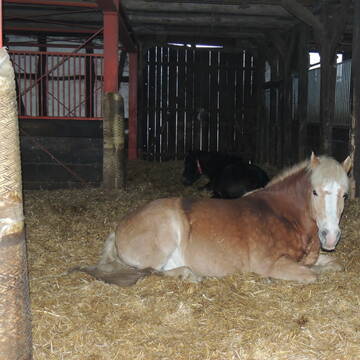
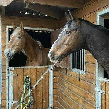
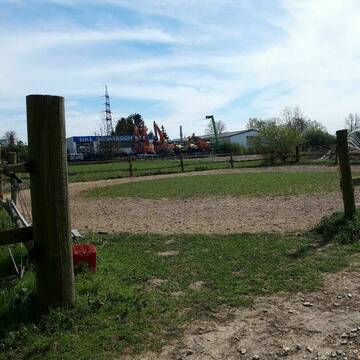
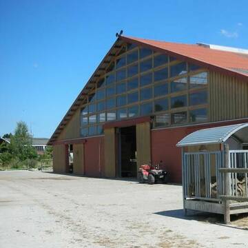
Reitstall Bremer - Ein Besuch lohnt sich!
Barsinghausen
Familie Wiedemann
@Familie_Wiedemann
Pferdeausbildung
Reitlehrer und -unterricht
Vermieten
Hunde willkommen
Krankenbox
Fohlenaufzucht möglich
Hengsthaltung möglich
20 weitere...
S
Deprecated: Creation of dynamic property Zend_View_Helper_Ads::$adLink is deprecated in /var/www/stall-frei/htdocs/staging.stall-frei.de/library/Psf/View/Helper/Ads.php on line 108


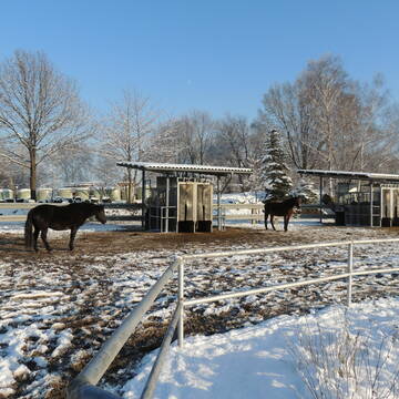
Mountain Trail, großer Paddocktrail für Wallache
Hannover
Nina_Mountaintrail-Hannover
@Nina_Paddocktrail-Hannover
VFD-Mitglied
Paddock
Videoüberwachung
Hufrehe geeignet
Notfallboxen
Paddock Trail
3 weitere...
P+

Innen - und Außenboxen frei
Hannover-Vahrenheide
Reiterverein Hannover e.V.
@ReitervereinHannover
FN-Mitglied
Freizeitstall
Vermieten
Longierzirkel/Roundpen
Paddock
Außenboxen
Innenbox
14 weitere...
P
Aktiv- u. Bewegungsstall mit Gastboxen
Garbsen / Stelingen
Rust-Heinfried
@Rust-Heinfried
FN-Mitglied
Freizeitstall
Krankenbox
Longierzirkel/Roundpen
Notfallboxen
Bewegungsstall
13 weitere...
P+
Pensionspferdebetrieb Less ?
Stelingen
Pensionspferdebetrieb-Less
@Pensionspferdebetrieb-Less
FN-Mitglied
Freizeitstall
Vermieten
Führanlage
Krankenbox
Außenbox mit Paddock
Außenboxen
24 weitere...
aktuell
P+
Freizeitstall zentral gelegen und dennoch Naturnah
Ronnenberg
Nicole-Hueper1
@Nicole-Hueper1
Freizeitstall
Reitlehrer und -unterricht
Vermieten
Longierzirkel/Roundpen
Paddock
Allergikerstall
13 weitere...
P+

Pferdebox, aktuell auch für Rehepferde
Langenhagen
Frank-S
@Frank-S
Freizeitstall
Vermieten
Hunde willkommen
Paddock
Hufrehe geeignet
8 weitere...
P
Reitanlage Brennecke zum 01.01.2026 eine Box frei
Hannover
Matthias-Brennecke
@Matthias-Brennecke
FN-Mitglied
Freizeitstall
Vermieten
Führanlage
Longierzirkel/Roundpen
Außenbox mit Paddock
16 weitere...
P+

Heu aus neuer Ernte
Mechtersen
STALL-FREIde Marketing
@STALL-FREI-Marketing
Heulage und Pferdeheu aus der neuen Ernte findest du in unserem Futtermarkt


STALL - NEUBAU- REITHALLE 2023
Garbsen
Ebbecke Pferdepension
@Ebbecke
Pflegepferd
Vermieten
Longierzirkel/Roundpen
Paddock
Hufrehe geeignet
Pferdezucht
16 weitere...
P+


Offenstallplatz für Islandpferd, Pony, Shetty fr...
Ronnenberg OT Benthe
Nico
@Nico-K
Freizeitstall
Gangpferdereiten
Vermieten
Paddock
Reitplatz (z.B. Dressur, Springen, Reining)
Hufrehe geeignet
7 weitere...
aktuell
P+
Deprecated: Creation of dynamic property Zend_View::$pageCount is deprecated in /var/www/stall-frei/htdocs/staging.stall-frei.de/library/vendor/shardj/zf1-future/library/Zend/View/Abstract.php on line 308
Deprecated: Creation of dynamic property Zend_View::$itemCountPerPage is deprecated in /var/www/stall-frei/htdocs/staging.stall-frei.de/library/vendor/shardj/zf1-future/library/Zend/View/Abstract.php on line 308
Deprecated: Creation of dynamic property Zend_View::$first is deprecated in /var/www/stall-frei/htdocs/staging.stall-frei.de/library/vendor/shardj/zf1-future/library/Zend/View/Abstract.php on line 308
Deprecated: Creation of dynamic property Zend_View::$current is deprecated in /var/www/stall-frei/htdocs/staging.stall-frei.de/library/vendor/shardj/zf1-future/library/Zend/View/Abstract.php on line 308
Deprecated: Creation of dynamic property Zend_View::$last is deprecated in /var/www/stall-frei/htdocs/staging.stall-frei.de/library/vendor/shardj/zf1-future/library/Zend/View/Abstract.php on line 308
Deprecated: Creation of dynamic property Zend_View::$next is deprecated in /var/www/stall-frei/htdocs/staging.stall-frei.de/library/vendor/shardj/zf1-future/library/Zend/View/Abstract.php on line 308
Deprecated: Creation of dynamic property Zend_View::$pagesInRange is deprecated in /var/www/stall-frei/htdocs/staging.stall-frei.de/library/vendor/shardj/zf1-future/library/Zend/View/Abstract.php on line 308
Deprecated: Creation of dynamic property Zend_View::$firstPageInRange is deprecated in /var/www/stall-frei/htdocs/staging.stall-frei.de/library/vendor/shardj/zf1-future/library/Zend/View/Abstract.php on line 308
Deprecated: Creation of dynamic property Zend_View::$lastPageInRange is deprecated in /var/www/stall-frei/htdocs/staging.stall-frei.de/library/vendor/shardj/zf1-future/library/Zend/View/Abstract.php on line 308
Deprecated: Creation of dynamic property Zend_View::$currentItemCount is deprecated in /var/www/stall-frei/htdocs/staging.stall-frei.de/library/vendor/shardj/zf1-future/library/Zend/View/Abstract.php on line 308
Deprecated: Creation of dynamic property Zend_View::$totalItemCount is deprecated in /var/www/stall-frei/htdocs/staging.stall-frei.de/library/vendor/shardj/zf1-future/library/Zend/View/Abstract.php on line 308
Deprecated: Creation of dynamic property Zend_View::$firstItemNumber is deprecated in /var/www/stall-frei/htdocs/staging.stall-frei.de/library/vendor/shardj/zf1-future/library/Zend/View/Abstract.php on line 308
Deprecated: Creation of dynamic property Zend_View::$lastItemNumber is deprecated in /var/www/stall-frei/htdocs/staging.stall-frei.de/library/vendor/shardj/zf1-future/library/Zend/View/Abstract.php on line 308
Deprecated: Creation of dynamic property Zend_View::$router is deprecated in /var/www/stall-frei/htdocs/staging.stall-frei.de/library/vendor/shardj/zf1-future/library/Zend/View/Abstract.php on line 308
Deprecated: Creation of dynamic property Zend_View::$urlParams is deprecated in /var/www/stall-frei/htdocs/staging.stall-frei.de/library/vendor/shardj/zf1-future/library/Zend/View/Abstract.php on line 308
Deprecated: Creation of dynamic property Zend_View::$showAds is deprecated in /var/www/stall-frei/htdocs/staging.stall-frei.de/library/vendor/shardj/zf1-future/library/Zend/View/Abstract.php on line 308
Deprecated: Creation of dynamic property Zend_View::$objectIds is deprecated in /var/www/stall-frei/htdocs/staging.stall-frei.de/library/vendor/shardj/zf1-future/library/Zend/View/Abstract.php on line 308
Deprecated: Creation of dynamic property Zend_View::$showNavbar is deprecated in /var/www/stall-frei/htdocs/staging.stall-frei.de/library/vendor/shardj/zf1-future/library/Zend/View/Abstract.php on line 308
Deprecated: Creation of dynamic property Zend_View::$showBreadcrumb is deprecated in /var/www/stall-frei/htdocs/staging.stall-frei.de/library/vendor/shardj/zf1-future/library/Zend/View/Abstract.php on line 308
Deprecated: Creation of dynamic property Zend_View::$showFooter is deprecated in /var/www/stall-frei/htdocs/staging.stall-frei.de/library/vendor/shardj/zf1-future/library/Zend/View/Abstract.php on line 308
Deprecated: Creation of dynamic property Zend_View::$showInternalAds is deprecated in /var/www/stall-frei/htdocs/staging.stall-frei.de/library/vendor/shardj/zf1-future/library/Zend/View/Abstract.php on line 308
Deprecated: Creation of dynamic property Zend_View::$blNoContent is deprecated in /var/www/stall-frei/htdocs/staging.stall-frei.de/library/vendor/shardj/zf1-future/library/Zend/View/Abstract.php on line 308
Deprecated: Creation of dynamic property Zend_View::$sMetaDesc is deprecated in /var/www/stall-frei/htdocs/staging.stall-frei.de/library/vendor/shardj/zf1-future/library/Zend/View/Abstract.php on line 308
Deprecated: Creation of dynamic property Zend_View::$useGmaps is deprecated in /var/www/stall-frei/htdocs/staging.stall-frei.de/library/vendor/shardj/zf1-future/library/Zend/View/Abstract.php on line 308
Deprecated: Creation of dynamic property Zend_View::$touches is deprecated in /var/www/stall-frei/htdocs/staging.stall-frei.de/library/vendor/shardj/zf1-future/library/Zend/View/Abstract.php on line 308
Deprecated: Creation of dynamic property Zend_View::$oProject is deprecated in /var/www/stall-frei/htdocs/staging.stall-frei.de/library/vendor/shardj/zf1-future/library/Zend/View/Abstract.php on line 308
Deprecated: Creation of dynamic property Zend_View::$pageHeadline is deprecated in /var/www/stall-frei/htdocs/staging.stall-frei.de/library/vendor/shardj/zf1-future/library/Zend/View/Abstract.php on line 308
Deprecated: Creation of dynamic property Zend_View::$disableLocationField is deprecated in /var/www/stall-frei/htdocs/staging.stall-frei.de/library/vendor/shardj/zf1-future/library/Zend/View/Abstract.php on line 308
Deprecated: Creation of dynamic property Zend_View::$isSearch is deprecated in /var/www/stall-frei/htdocs/staging.stall-frei.de/library/vendor/shardj/zf1-future/library/Zend/View/Abstract.php on line 308
Deprecated: Creation of dynamic property Zend_View::$pageTitle is deprecated in /var/www/stall-frei/htdocs/staging.stall-frei.de/library/vendor/shardj/zf1-future/library/Zend/View/Abstract.php on line 308
Deprecated: Creation of dynamic property Psf_Form_Element_Text::$class is deprecated in /var/www/stall-frei/htdocs/staging.stall-frei.de/library/vendor/shardj/zf1-future/library/Zend/Form/Element.php on line 874
Deprecated: Creation of dynamic property Psf_Form_Element_Text::$size is deprecated in /var/www/stall-frei/htdocs/staging.stall-frei.de/library/vendor/shardj/zf1-future/library/Zend/Form/Element.php on line 874
Deprecated: Creation of dynamic property Psf_Form_Element_Text::$placeholder is deprecated in /var/www/stall-frei/htdocs/staging.stall-frei.de/library/vendor/shardj/zf1-future/library/Zend/Form/Element.php on line 874
Deprecated: Creation of dynamic property Psf_Form_Element_Hidden::$class is deprecated in /var/www/stall-frei/htdocs/staging.stall-frei.de/library/vendor/shardj/zf1-future/library/Zend/Form/Element.php on line 874
Deprecated: Creation of dynamic property Psf_Form_Element_Hidden::$class is deprecated in /var/www/stall-frei/htdocs/staging.stall-frei.de/library/vendor/shardj/zf1-future/library/Zend/Form/Element.php on line 874
Deprecated: Creation of dynamic property Psf_Form_Element_Hidden::$class is deprecated in /var/www/stall-frei/htdocs/staging.stall-frei.de/library/vendor/shardj/zf1-future/library/Zend/Form/Element.php on line 874
Deprecated: Creation of dynamic property Psf_Form_Element_Hidden::$class is deprecated in /var/www/stall-frei/htdocs/staging.stall-frei.de/library/vendor/shardj/zf1-future/library/Zend/Form/Element.php on line 874
Deprecated: Creation of dynamic property Psf_Form_Element_Select::$class is deprecated in /var/www/stall-frei/htdocs/staging.stall-frei.de/library/vendor/shardj/zf1-future/library/Zend/Form/Element.php on line 874
Deprecated: Creation of dynamic property Psf_Form_Element_Select::$class is deprecated in /var/www/stall-frei/htdocs/staging.stall-frei.de/library/vendor/shardj/zf1-future/library/Zend/Form/Element.php on line 874
Deprecated: Creation of dynamic property Psf_Form_Element_Select::$class is deprecated in /var/www/stall-frei/htdocs/staging.stall-frei.de/library/vendor/shardj/zf1-future/library/Zend/Form/Element.php on line 874
Deprecated: Creation of dynamic property Psf_Form_Element_Select::$class is deprecated in /var/www/stall-frei/htdocs/staging.stall-frei.de/library/vendor/shardj/zf1-future/library/Zend/Form/Element.php on line 874
Deprecated: Creation of dynamic property Psf_Form_Element_Text::$class is deprecated in /var/www/stall-frei/htdocs/staging.stall-frei.de/library/vendor/shardj/zf1-future/library/Zend/Form/Element.php on line 874
Deprecated: Creation of dynamic property Psf_Form_Element_Checkbox::$label is deprecated in /var/www/stall-frei/htdocs/staging.stall-frei.de/library/vendor/shardj/zf1-future/library/Zend/Form/Element.php on line 874
Deprecated: Creation of dynamic property Zend_View::$sort is deprecated in /var/www/stall-frei/htdocs/staging.stall-frei.de/library/vendor/shardj/zf1-future/library/Zend/View/Abstract.php on line 308
Deprecated: Creation of dynamic property Zend_View::$searchLocation is deprecated in /var/www/stall-frei/htdocs/staging.stall-frei.de/library/vendor/shardj/zf1-future/library/Zend/View/Abstract.php on line 308
Deprecated: Creation of dynamic property Zend_View::$locationHint is deprecated in /var/www/stall-frei/htdocs/staging.stall-frei.de/library/vendor/shardj/zf1-future/library/Zend/View/Abstract.php on line 308
Psf_GeoCoder_Abstract::getLocation: Nord Get Location CachedOrLive
Psf_GeoCoder_Abstract::getCachedOrLive: Nord
Psf_GeoCoder_OpenCageData::makeApiRequest: response:
Array
(
[documentation] => https://opencagedata.com/api
[licenses] => Array
(
[0] => Array
(
[name] => see attribution guide
[url] => https://opencagedata.com/credits
)
)
[results] => Array
(
[0] => Array
(
[bounds] => Array
(
[northeast] => Array
(
[lat] => 52.4314659
[lng] => 9.734764
)
[southwest] => Array
(
[lat] => 52.3774343
[lng] => 9.6826613
)
)
[components] => Array
(
[ISO_3166-1_alpha-2] => DE
[ISO_3166-1_alpha-3] => DEU
[ISO_3166-2] => Array
(
[0] => DE-NI
)
[_category] => place
[_normalized_city] => Hannover
[_type] => neighbourhood
[city] => Hannover
[city_district] => Nord
[continent] => Europe
[country] => Deutschland
[country_code] => de
[county] => Region Hannover
[political_union] => European Union
[postcode] => 30167
[state] => Niedersachsen
[state_code] => NI
)
[confidence] => 7
[formatted] => 30167 Hannover, Deutschland
[geometry] => Array
(
[lat] => 52.404887
[lng] => 9.7123728
)
)
[1] => Array
(
[bounds] => Array
(
[northeast] => Array
(
[lat] => 51.3463055
[lng] => 9.5083582
)
[southwest] => Array
(
[lat] => 51.318051
[lng] => 9.4732635
)
)
[components] => Array
(
[ISO_3166-1_alpha-2] => DE
[ISO_3166-1_alpha-3] => DEU
[ISO_3166-2] => Array
(
[0] => DE-HE
)
[_category] => place
[_normalized_city] => Kassel
[_type] => neighbourhood
[city] => Kassel
[continent] => Europe
[country] => Deutschland
[country_code] => de
[political_union] => European Union
[state] => Hessen
[state_code] => HE
[suburb] => Nord (Holland)
)
[confidence] => 7
[formatted] => Nord (Holland), Kassel, Hessen, Deutschland
[geometry] => Array
(
[lat] => 51.3305624
[lng] => 9.4997836
)
)
[2] => Array
(
[bounds] => Array
(
[northeast] => Array
(
[lat] => 49.7775726
[lng] => 6.6843021
)
[southwest] => Array
(
[lat] => 49.7571965
[lng] => 6.6326149
)
)
[components] => Array
(
[ISO_3166-1_alpha-2] => DE
[ISO_3166-1_alpha-3] => DEU
[ISO_3166-2] => Array
(
[0] => DE-RP
)
[_category] => place
[_normalized_city] => Trier
[_type] => neighbourhood
[city] => Trier
[city_district] => Nord
[continent] => Europe
[country] => Deutschland
[country_code] => de
[political_union] => European Union
[postcode] => 54292
[state] => Rheinland-Pfalz
[state_code] => RP
)
[confidence] => 7
[formatted] => 54292 Trier, Deutschland
[geometry] => Array
(
[lat] => 49.7673956
[lng] => 6.653458
)
)
[3] => Array
(
[bounds] => Array
(
[northeast] => Array
(
[lat] => 50.1085183
[lng] => 8.7182345
)
[southwest] => Array
(
[lat] => 50.0885172
[lng] => 8.6538978
)
)
[components] => Array
(
[ISO_3166-1_alpha-2] => DE
[ISO_3166-1_alpha-3] => DEU
[ISO_3166-2] => Array
(
[0] => DE-HE
)
[_category] => place
[_normalized_city] => Frankfurt am Main
[_type] => neighbourhood
[city] => Frankfurt am Main
[city_district] => Süd
[continent] => Europe
[country] => Deutschland
[country_code] => de
[political_union] => European Union
[quarter] => Sachsenhausen Nord
[state] => Hessen
[state_code] => HE
)
[confidence] => 7
[formatted] => Süd, Frankfurt am Main, Hessen, Deutschland
[geometry] => Array
(
[lat] => 50.1019086
[lng] => 8.6806686
)
)
[4] => Array
(
[bounds] => Array
(
[northeast] => Array
(
[lat] => 51.2291292
[lng] => 6.4637315
)
[southwest] => Array
(
[lat] => 51.1729546
[lng] => 6.3128775
)
)
[components] => Array
(
[ISO_3166-1_alpha-2] => DE
[ISO_3166-1_alpha-3] => DEU
[ISO_3166-2] => Array
(
[0] => DE-NW
)
[_category] => place
[_normalized_city] => Mönchengladbach
[_type] => neighbourhood
[city] => Mönchengladbach
[city_district] => Nord
[continent] => Europe
[country] => Deutschland
[country_code] => de
[political_union] => European Union
[state] => Nordrhein-Westfalen
[state_code] => NW
)
[confidence] => 7
[formatted] => Nord, Mönchengladbach, Nordrhein-Westfalen, Deutschland
[geometry] => Array
(
[lat] => 51.2009772
[lng] => 6.3865136
)
)
[5] => Array
(
[bounds] => Array
(
[northeast] => Array
(
[lat] => 50.0021087
[lng] => 8.0447049
)
[southwest] => Array
(
[lat] => 49.9784805
[lng] => 7.9834481
)
)
[components] => Array
(
[ISO_3166-1_alpha-2] => DE
[ISO_3166-1_alpha-3] => DEU
[ISO_3166-2] => Array
(
[0] => DE-RP
)
[_category] => place
[_normalized_city] => Ingelheim am Rhein
[_type] => city
[continent] => Europe
[country] => Deutschland
[country_code] => de
[county] => Landkreis Mainz-Bingen
[political_union] => European Union
[state] => Rheinland-Pfalz
[state_code] => RP
[town] => Ingelheim am Rhein
)
[confidence] => 7
[formatted] => Ingelheim am Rhein, Rheinland-Pfalz, Deutschland
[geometry] => Array
(
[lat] => 49.9888624
[lng] => 8.0256585
)
)
[6] => Array
(
[bounds] => Array
(
[northeast] => Array
(
[lat] => 51.4481145
[lng] => 12.4941179
)
[southwest] => Array
(
[lat] => 51.3520371
[lng] => 12.3408073
)
)
[components] => Array
(
[ISO_3166-1_alpha-2] => DE
[ISO_3166-1_alpha-3] => DEU
[ISO_3166-2] => Array
(
[0] => DE-SN
)
[_category] => place
[_normalized_city] => Leipzig
[_type] => neighbourhood
[city] => Leipzig
[city_district] => Nord
[continent] => Europe
[country] => Deutschland
[country_code] => de
[political_union] => European Union
[state] => Sachsen
[state_code] => SN
)
[confidence] => 6
[formatted] => Nord, Leipzig, Sachsen, Deutschland
[geometry] => Array
(
[lat] => 51.4002248
[lng] => 12.383976
)
)
[7] => Array
(
[bounds] => Array
(
[northeast] => Array
(
[lat] => 51.0190211
[lng] => 12.4437556
)
[southwest] => Array
(
[lat] => 50.9790211
[lng] => 12.4037556
)
)
[components] => Array
(
[ISO_3166-1_alpha-2] => DE
[ISO_3166-1_alpha-3] => DEU
[ISO_3166-2] => Array
(
[0] => DE-TH
)
[_category] => place
[_normalized_city] => Altenburg
[_type] => neighbourhood
[city_district] => Altenburg
[continent] => Europe
[country] => Deutschland
[country_code] => de
[county] => Altenburger Land
[political_union] => European Union
[postcode] => 04600
[state] => Thüringen
[state_code] => TH
[suburb] => Nord
[town] => Altenburg
)
[confidence] => 7
[formatted] => 04600 Altenburg, Deutschland
[geometry] => Array
(
[lat] => 50.9990211
[lng] => 12.4237556
)
)
[8] => Array
(
[bounds] => Array
(
[northeast] => Array
(
[lat] => 52.4418439
[lng] => 12.5663415
)
[southwest] => Array
(
[lat] => 52.4018439
[lng] => 12.5263415
)
)
[components] => Array
(
[ISO_3166-1_alpha-2] => DE
[ISO_3166-1_alpha-3] => DEU
[ISO_3166-2] => Array
(
[0] => DE-BB
)
[_category] => place
[_normalized_city] => Brandenburg an der Havel
[_type] => neighbourhood
[continent] => Europe
[country] => Deutschland
[country_code] => de
[political_union] => European Union
[postcode] => 14770
[state] => Brandenburg
[state_code] => BB
[suburb] => Nord
[town] => Brandenburg an der Havel
)
[confidence] => 7
[formatted] => 14770 Brandenburg an der Havel, Deutschland
[geometry] => Array
(
[lat] => 52.4218439
[lng] => 12.5463415
)
)
[9] => Array
(
[bounds] => Array
(
[northeast] => Array
(
[lat] => 52.3916818
[lng] => 14.0870115
)
[southwest] => Array
(
[lat] => 52.3516818
[lng] => 14.0470115
)
)
[components] => Array
(
[ISO_3166-1_alpha-2] => DE
[ISO_3166-1_alpha-3] => DEU
[ISO_3166-2] => Array
(
[0] => DE-BB
)
[_category] => place
[_normalized_city] => Fürstenwalde/Spree
[_type] => neighbourhood
[continent] => Europe
[country] => Deutschland
[country_code] => de
[county] => Oder-Spree
[political_union] => European Union
[postcode] => 15517
[state] => Brandenburg
[state_code] => BB
[suburb] => Nord
[town] => Fürstenwalde/Spree
)
[confidence] => 7
[formatted] => 15517 Fürstenwalde/Spree, Deutschland
[geometry] => Array
(
[lat] => 52.3716818
[lng] => 14.0670115
)
)
)
[status] => Array
(
[code] => 200
[message] => OK
)
[stay_informed] => Array
(
[blog] => https://blog.opencagedata.com
[mastodon] => https://en.osm.town/@opencage
)
[thanks] => For using an OpenCage API
[timestamp] => Array
(
[created_http] => Sun, 08 Feb 2026 14:52:03 GMT
[created_unix] => 1770562323
)
[total_results] => 10
)
Psf_GeoCoder_Abstract::convertLocationResult
{"documentation":"https:\/\/opencagedata.com\/api","licenses":[{"name":"see attribution guide","url":"https:\/\/opencagedata.com\/credits"}],"results":[{"bounds":{"northeast":{"lat":52.4314659,"lng":9.734764},"southwest":{"lat":52.3774343,"lng":9.6826613}},"components":{"ISO_3166-1_alpha-2":"DE","ISO_3166-1_alpha-3":"DEU","ISO_3166-2":["DE-NI"],"_category":"place","_normalized_city":"Hannover","_type":"neighbourhood","city":"Hannover","city_district":"Nord","continent":"Europe","country":"Deutschland","country_code":"de","county":"Region Hannover","political_union":"European Union","postcode":"30167","state":"Niedersachsen","state_code":"NI"},"confidence":7,"formatted":"30167 Hannover, Deutschland","geometry":{"lat":52.404887,"lng":9.7123728}},{"bounds":{"northeast":{"lat":51.3463055,"lng":9.5083582},"southwest":{"lat":51.318051,"lng":9.4732635}},"components":{"ISO_3166-1_alpha-2":"DE","ISO_3166-1_alpha-3":"DEU","ISO_3166-2":["DE-HE"],"_category":"place","_normalized_city":"Kassel","_type":"neighbourhood","city":"Kassel","continent":"Europe","country":"Deutschland","country_code":"de","political_union":"European Union","state":"Hessen","state_code":"HE","suburb":"Nord (Holland)"},"confidence":7,"formatted":"Nord (Holland), Kassel, Hessen, Deutschland","geometry":{"lat":51.3305624,"lng":9.4997836}},{"bounds":{"northeast":{"lat":49.7775726,"lng":6.6843021},"southwest":{"lat":49.7571965,"lng":6.6326149}},"components":{"ISO_3166-1_alpha-2":"DE","ISO_3166-1_alpha-3":"DEU","ISO_3166-2":["DE-RP"],"_category":"place","_normalized_city":"Trier","_type":"neighbourhood","city":"Trier","city_district":"Nord","continent":"Europe","country":"Deutschland","country_code":"de","political_union":"European Union","postcode":"54292","state":"Rheinland-Pfalz","state_code":"RP"},"confidence":7,"formatted":"54292 Trier, Deutschland","geometry":{"lat":49.7673956,"lng":6.653458}},{"bounds":{"northeast":{"lat":50.1085183,"lng":8.7182345},"southwest":{"lat":50.0885172,"lng":8.6538978}},"components":{"ISO_3166-1_alpha-2":"DE","ISO_3166-1_alpha-3":"DEU","ISO_3166-2":["DE-HE"],"_category":"place","_normalized_city":"Frankfurt am Main","_type":"neighbourhood","city":"Frankfurt am Main","city_district":"S\u00fcd","continent":"Europe","country":"Deutschland","country_code":"de","political_union":"European Union","quarter":"Sachsenhausen Nord","state":"Hessen","state_code":"HE"},"confidence":7,"formatted":"S\u00fcd, Frankfurt am Main, Hessen, Deutschland","geometry":{"lat":50.1019086,"lng":8.6806686}},{"bounds":{"northeast":{"lat":51.2291292,"lng":6.4637315},"southwest":{"lat":51.1729546,"lng":6.3128775}},"components":{"ISO_3166-1_alpha-2":"DE","ISO_3166-1_alpha-3":"DEU","ISO_3166-2":["DE-NW"],"_category":"place","_normalized_city":"M\u00f6nchengladbach","_type":"neighbourhood","city":"M\u00f6nchengladbach","city_district":"Nord","continent":"Europe","country":"Deutschland","country_code":"de","political_union":"European Union","state":"Nordrhein-Westfalen","state_code":"NW"},"confidence":7,"formatted":"Nord, M\u00f6nchengladbach, Nordrhein-Westfalen, Deutschland","geometry":{"lat":51.2009772,"lng":6.3865136}},{"bounds":{"northeast":{"lat":50.0021087,"lng":8.0447049},"southwest":{"lat":49.9784805,"lng":7.9834481}},"components":{"ISO_3166-1_alpha-2":"DE","ISO_3166-1_alpha-3":"DEU","ISO_3166-2":["DE-RP"],"_category":"place","_normalized_city":"Ingelheim am Rhein","_type":"city","continent":"Europe","country":"Deutschland","country_code":"de","county":"Landkreis Mainz-Bingen","political_union":"European Union","state":"Rheinland-Pfalz","state_code":"RP","town":"Ingelheim am Rhein"},"confidence":7,"formatted":"Ingelheim am Rhein, Rheinland-Pfalz, Deutschland","geometry":{"lat":49.9888624,"lng":8.0256585}},{"bounds":{"northeast":{"lat":51.4481145,"lng":12.4941179},"southwest":{"lat":51.3520371,"lng":12.3408073}},"components":{"ISO_3166-1_alpha-2":"DE","ISO_3166-1_alpha-3":"DEU","ISO_3166-2":["DE-SN"],"_category":"place","_normalized_city":"Leipzig","_type":"neighbourhood","city":"Leipzig","city_district":"Nord","continent":"Europe","country":"Deutschland","country_code":"de","political_union":"European Union","state":"Sachsen","state_code":"SN"},"confidence":6,"formatted":"Nord, Leipzig, Sachsen, Deutschland","geometry":{"lat":51.4002248,"lng":12.383976}},{"bounds":{"northeast":{"lat":51.0190211,"lng":12.4437556},"southwest":{"lat":50.9790211,"lng":12.4037556}},"components":{"ISO_3166-1_alpha-2":"DE","ISO_3166-1_alpha-3":"DEU","ISO_3166-2":["DE-TH"],"_category":"place","_normalized_city":"Altenburg","_type":"neighbourhood","city_district":"Altenburg","continent":"Europe","country":"Deutschland","country_code":"de","county":"Altenburger Land","political_union":"European Union","postcode":"04600","state":"Th\u00fcringen","state_code":"TH","suburb":"Nord","town":"Altenburg"},"confidence":7,"formatted":"04600 Altenburg, Deutschland","geometry":{"lat":50.9990211,"lng":12.4237556}},{"bounds":{"northeast":{"lat":52.4418439,"lng":12.5663415},"southwest":{"lat":52.4018439,"lng":12.5263415}},"components":{"ISO_3166-1_alpha-2":"DE","ISO_3166-1_alpha-3":"DEU","ISO_3166-2":["DE-BB"],"_category":"place","_normalized_city":"Brandenburg an der Havel","_type":"neighbourhood","continent":"Europe","country":"Deutschland","country_code":"de","political_union":"European Union","postcode":"14770","state":"Brandenburg","state_code":"BB","suburb":"Nord","town":"Brandenburg an der Havel"},"confidence":7,"formatted":"14770 Brandenburg an der Havel, Deutschland","geometry":{"lat":52.4218439,"lng":12.5463415}},{"bounds":{"northeast":{"lat":52.3916818,"lng":14.0870115},"southwest":{"lat":52.3516818,"lng":14.0470115}},"components":{"ISO_3166-1_alpha-2":"DE","ISO_3166-1_alpha-3":"DEU","ISO_3166-2":["DE-BB"],"_category":"place","_normalized_city":"F\u00fcrstenwalde\/Spree","_type":"neighbourhood","continent":"Europe","country":"Deutschland","country_code":"de","county":"Oder-Spree","political_union":"European Union","postcode":"15517","state":"Brandenburg","state_code":"BB","suburb":"Nord","town":"F\u00fcrstenwalde\/Spree"},"confidence":7,"formatted":"15517 F\u00fcrstenwalde\/Spree, Deutschland","geometry":{"lat":52.3716818,"lng":14.0670115}}],"status":{"code":200,"message":"OK"},"stay_informed":{"blog":"https:\/\/blog.opencagedata.com","mastodon":"https:\/\/en.osm.town\/@opencage"},"thanks":"For using an OpenCage API","timestamp":{"created_http":"Sun, 08 Feb 2026 14:52:03 GMT","created_unix":1770562323},"total_results":10}Array
(
[0] => stdClass Object
(
[bounds] => stdClass Object
(
[northeast] => stdClass Object
(
[lat] => 52.4314659
[lng] => 9.734764
)
[southwest] => stdClass Object
(
[lat] => 52.3774343
[lng] => 9.6826613
)
)
[components] => stdClass Object
(
[ISO_3166-1_alpha-2] => DE
[ISO_3166-1_alpha-3] => DEU
[ISO_3166-2] => Array
(
[0] => DE-NI
)
[_category] => place
[_normalized_city] => Hannover
[_type] => neighbourhood
[city] => Hannover
[city_district] => Nord
[continent] => Europe
[country] => Deutschland
[country_code] => de
[county] => Region Hannover
[political_union] => European Union
[postcode] => 30167
[state] => Niedersachsen
[state_code] => NI
)
[confidence] => 7
[formatted] => 30167 Hannover, Deutschland
[geometry] => stdClass Object
(
[lat] => 52.404887
[lng] => 9.7123728
)
)
[1] => stdClass Object
(
[bounds] => stdClass Object
(
[northeast] => stdClass Object
(
[lat] => 51.3463055
[lng] => 9.5083582
)
[southwest] => stdClass Object
(
[lat] => 51.318051
[lng] => 9.4732635
)
)
[components] => stdClass Object
(
[ISO_3166-1_alpha-2] => DE
[ISO_3166-1_alpha-3] => DEU
[ISO_3166-2] => Array
(
[0] => DE-HE
)
[_category] => place
[_normalized_city] => Kassel
[_type] => neighbourhood
[city] => Kassel
[continent] => Europe
[country] => Deutschland
[country_code] => de
[political_union] => European Union
[state] => Hessen
[state_code] => HE
[suburb] => Nord (Holland)
)
[confidence] => 7
[formatted] => Nord (Holland), Kassel, Hessen, Deutschland
[geometry] => stdClass Object
(
[lat] => 51.3305624
[lng] => 9.4997836
)
)
[2] => stdClass Object
(
[bounds] => stdClass Object
(
[northeast] => stdClass Object
(
[lat] => 49.7775726
[lng] => 6.6843021
)
[southwest] => stdClass Object
(
[lat] => 49.7571965
[lng] => 6.6326149
)
)
[components] => stdClass Object
(
[ISO_3166-1_alpha-2] => DE
[ISO_3166-1_alpha-3] => DEU
[ISO_3166-2] => Array
(
[0] => DE-RP
)
[_category] => place
[_normalized_city] => Trier
[_type] => neighbourhood
[city] => Trier
[city_district] => Nord
[continent] => Europe
[country] => Deutschland
[country_code] => de
[political_union] => European Union
[postcode] => 54292
[state] => Rheinland-Pfalz
[state_code] => RP
)
[confidence] => 7
[formatted] => 54292 Trier, Deutschland
[geometry] => stdClass Object
(
[lat] => 49.7673956
[lng] => 6.653458
)
)
[3] => stdClass Object
(
[bounds] => stdClass Object
(
[northeast] => stdClass Object
(
[lat] => 50.1085183
[lng] => 8.7182345
)
[southwest] => stdClass Object
(
[lat] => 50.0885172
[lng] => 8.6538978
)
)
[components] => stdClass Object
(
[ISO_3166-1_alpha-2] => DE
[ISO_3166-1_alpha-3] => DEU
[ISO_3166-2] => Array
(
[0] => DE-HE
)
[_category] => place
[_normalized_city] => Frankfurt am Main
[_type] => neighbourhood
[city] => Frankfurt am Main
[city_district] => Süd
[continent] => Europe
[country] => Deutschland
[country_code] => de
[political_union] => European Union
[quarter] => Sachsenhausen Nord
[state] => Hessen
[state_code] => HE
)
[confidence] => 7
[formatted] => Süd, Frankfurt am Main, Hessen, Deutschland
[geometry] => stdClass Object
(
[lat] => 50.1019086
[lng] => 8.6806686
)
)
[4] => stdClass Object
(
[bounds] => stdClass Object
(
[northeast] => stdClass Object
(
[lat] => 51.2291292
[lng] => 6.4637315
)
[southwest] => stdClass Object
(
[lat] => 51.1729546
[lng] => 6.3128775
)
)
[components] => stdClass Object
(
[ISO_3166-1_alpha-2] => DE
[ISO_3166-1_alpha-3] => DEU
[ISO_3166-2] => Array
(
[0] => DE-NW
)
[_category] => place
[_normalized_city] => Mönchengladbach
[_type] => neighbourhood
[city] => Mönchengladbach
[city_district] => Nord
[continent] => Europe
[country] => Deutschland
[country_code] => de
[political_union] => European Union
[state] => Nordrhein-Westfalen
[state_code] => NW
)
[confidence] => 7
[formatted] => Nord, Mönchengladbach, Nordrhein-Westfalen, Deutschland
[geometry] => stdClass Object
(
[lat] => 51.2009772
[lng] => 6.3865136
)
)
[5] => stdClass Object
(
[bounds] => stdClass Object
(
[northeast] => stdClass Object
(
[lat] => 50.0021087
[lng] => 8.0447049
)
[southwest] => stdClass Object
(
[lat] => 49.9784805
[lng] => 7.9834481
)
)
[components] => stdClass Object
(
[ISO_3166-1_alpha-2] => DE
[ISO_3166-1_alpha-3] => DEU
[ISO_3166-2] => Array
(
[0] => DE-RP
)
[_category] => place
[_normalized_city] => Ingelheim am Rhein
[_type] => city
[continent] => Europe
[country] => Deutschland
[country_code] => de
[county] => Landkreis Mainz-Bingen
[political_union] => European Union
[state] => Rheinland-Pfalz
[state_code] => RP
[town] => Ingelheim am Rhein
)
[confidence] => 7
[formatted] => Ingelheim am Rhein, Rheinland-Pfalz, Deutschland
[geometry] => stdClass Object
(
[lat] => 49.9888624
[lng] => 8.0256585
)
)
[6] => stdClass Object
(
[bounds] => stdClass Object
(
[northeast] => stdClass Object
(
[lat] => 51.4481145
[lng] => 12.4941179
)
[southwest] => stdClass Object
(
[lat] => 51.3520371
[lng] => 12.3408073
)
)
[components] => stdClass Object
(
[ISO_3166-1_alpha-2] => DE
[ISO_3166-1_alpha-3] => DEU
[ISO_3166-2] => Array
(
[0] => DE-SN
)
[_category] => place
[_normalized_city] => Leipzig
[_type] => neighbourhood
[city] => Leipzig
[city_district] => Nord
[continent] => Europe
[country] => Deutschland
[country_code] => de
[political_union] => European Union
[state] => Sachsen
[state_code] => SN
)
[confidence] => 6
[formatted] => Nord, Leipzig, Sachsen, Deutschland
[geometry] => stdClass Object
(
[lat] => 51.4002248
[lng] => 12.383976
)
)
[7] => stdClass Object
(
[bounds] => stdClass Object
(
[northeast] => stdClass Object
(
[lat] => 51.0190211
[lng] => 12.4437556
)
[southwest] => stdClass Object
(
[lat] => 50.9790211
[lng] => 12.4037556
)
)
[components] => stdClass Object
(
[ISO_3166-1_alpha-2] => DE
[ISO_3166-1_alpha-3] => DEU
[ISO_3166-2] => Array
(
[0] => DE-TH
)
[_category] => place
[_normalized_city] => Altenburg
[_type] => neighbourhood
[city_district] => Altenburg
[continent] => Europe
[country] => Deutschland
[country_code] => de
[county] => Altenburger Land
[political_union] => European Union
[postcode] => 04600
[state] => Thüringen
[state_code] => TH
[suburb] => Nord
[town] => Altenburg
)
[confidence] => 7
[formatted] => 04600 Altenburg, Deutschland
[geometry] => stdClass Object
(
[lat] => 50.9990211
[lng] => 12.4237556
)
)
[8] => stdClass Object
(
[bounds] => stdClass Object
(
[northeast] => stdClass Object
(
[lat] => 52.4418439
[lng] => 12.5663415
)
[southwest] => stdClass Object
(
[lat] => 52.4018439
[lng] => 12.5263415
)
)
[components] => stdClass Object
(
[ISO_3166-1_alpha-2] => DE
[ISO_3166-1_alpha-3] => DEU
[ISO_3166-2] => Array
(
[0] => DE-BB
)
[_category] => place
[_normalized_city] => Brandenburg an der Havel
[_type] => neighbourhood
[continent] => Europe
[country] => Deutschland
[country_code] => de
[political_union] => European Union
[postcode] => 14770
[state] => Brandenburg
[state_code] => BB
[suburb] => Nord
[town] => Brandenburg an der Havel
)
[confidence] => 7
[formatted] => 14770 Brandenburg an der Havel, Deutschland
[geometry] => stdClass Object
(
[lat] => 52.4218439
[lng] => 12.5463415
)
)
[9] => stdClass Object
(
[bounds] => stdClass Object
(
[northeast] => stdClass Object
(
[lat] => 52.3916818
[lng] => 14.0870115
)
[southwest] => stdClass Object
(
[lat] => 52.3516818
[lng] => 14.0470115
)
)
[components] => stdClass Object
(
[ISO_3166-1_alpha-2] => DE
[ISO_3166-1_alpha-3] => DEU
[ISO_3166-2] => Array
(
[0] => DE-BB
)
[_category] => place
[_normalized_city] => Fürstenwalde/Spree
[_type] => neighbourhood
[continent] => Europe
[country] => Deutschland
[country_code] => de
[county] => Oder-Spree
[political_union] => European Union
[postcode] => 15517
[state] => Brandenburg
[state_code] => BB
[suburb] => Nord
[town] => Fürstenwalde/Spree
)
[confidence] => 7
[formatted] => 15517 Fürstenwalde/Spree, Deutschland
[geometry] => stdClass Object
(
[lat] => 52.3716818
[lng] => 14.0670115
)
)
)
Psf_GeoCoder_OpenCageData::getKeyMap: 0
stdClass Object
(
    [bounds] => stdClass Object
        (
            [northeast] => stdClass Object
                (
                    [lat] => 52.4314659
                    [lng] => 9.734764
                )

            [southwest] => stdClass Object
                (
                    [lat] => 52.3774343
                    [lng] => 9.6826613
                )

        )

    [components] => stdClass Object
        (
            [ISO_3166-1_alpha-2] => DE
            [ISO_3166-1_alpha-3] => DEU
            [ISO_3166-2] => Array
                (
                    [0] => DE-NI
                )

            [_category] => place
            [_normalized_city] => Hannover
            [_type] => neighbourhood
            [city] => Hannover
            [city_district] => Nord
            [continent] => Europe
            [country] => Deutschland
            [country_code] => de
            [county] => Region Hannover
            [political_union] => European Union
            [postcode] => 30167
            [state] => Niedersachsen
            [state_code] => NI
        )

    [confidence] => 7
    [formatted] => 30167 Hannover, Deutschland
    [geometry] => stdClass Object
        (
            [lat] => 52.404887
            [lng] => 9.7123728
        )

)
Psf_GeoCoder_OpenCageData::getCounty: Hannover
Psf_GeoCoder_OpenCageData::addMissingData REFETCH!
Array
(
    [address] => 30167 Hannover, Deutschland
    [type] => neighbourhood
    [street] =>
    [city] => Hannover
    [county] => Hannover
    [state] => Niedersachsen
    [zip] => 30167
    [country] => Deutschland
    [suburb] =>
    [countrycode] => de
    [latitude] => 52.404887
    [longitude] => 9.7123728
    [accuracy] => 1
    [confidence] => 7
    [bounds] => stdClass Object
        (
            [northeast] => stdClass Object
                (
                    [lat] => 52.4314659
                    [lng] => 9.734764
                )

            [southwest] => stdClass Object
                (
                    [lat] => 52.3774343
                    [lng] => 9.6826613
                )

        )

)
reformat!
Array
(
    [address] => 30167 Hannover, Deutschland
    [type] => neighbourhood
    [street] =>
    [city] => Hannover
    [county] => Hannover
    [state] => Niedersachsen
    [zip] => 30167
    [country] => Deutschland
    [suburb] =>
    [countrycode] => de
    [latitude] => 52.404887
    [longitude] => 9.7123728
    [accuracy] => 1
    [confidence] => 7
    [bounds] => stdClass Object
        (
            [northeast] => stdClass Object
                (
                    [lat] => 52.4314659
                    [lng] => 9.734764
                )

            [southwest] => stdClass Object
                (
                    [lat] => 52.3774343
                    [lng] => 9.6826613
                )

        )

    [place] => 30167 Hannover, Niedersachsen
    [hash] => fec15c95b6dee103409804f1cc27a781
)
Psf_GeoCoder_OpenCageData::getKeyMap: 1
stdClass Object
(
    [bounds] => stdClass Object
        (
            [northeast] => stdClass Object
                (
                    [lat] => 51.3463055
                    [lng] => 9.5083582
                )

            [southwest] => stdClass Object
                (
                    [lat] => 51.318051
                    [lng] => 9.4732635
                )

        )

    [components] => stdClass Object
        (
            [ISO_3166-1_alpha-2] => DE
            [ISO_3166-1_alpha-3] => DEU
            [ISO_3166-2] => Array
                (
                    [0] => DE-HE
                )

            [_category] => place
            [_normalized_city] => Kassel
            [_type] => neighbourhood
            [city] => Kassel
            [continent] => Europe
            [country] => Deutschland
            [country_code] => de
            [political_union] => European Union
            [state] => Hessen
            [state_code] => HE
            [suburb] => Nord (Holland)
        )

    [confidence] => 7
    [formatted] => Nord (Holland), Kassel, Hessen, Deutschland
    [geometry] => stdClass Object
        (
            [lat] => 51.3305624
            [lng] => 9.4997836
        )

)
Psf_GeoCoder_OpenCageData::getCounty: Kassel
Psf_GeoCoder_OpenCageData::addMissingData REFETCH!
Array
(
    [address] => Nord (Holland), Kassel, Hessen, Deutschland
    [type] => neighbourhood
    [street] =>
    [city] => Nord (Holland)
    [county] => Kassel
    [state] => Hessen
    [zip] =>
    [country] => Deutschland
    [suburb] => Nord (Holland)
    [countrycode] => de
    [latitude] => 51.3305624
    [longitude] => 9.4997836
    [accuracy] => 1
    [confidence] => 7
    [bounds] => stdClass Object
        (
            [northeast] => stdClass Object
                (
                    [lat] => 51.3463055
                    [lng] => 9.5083582
                )

            [southwest] => stdClass Object
                (
                    [lat] => 51.318051
                    [lng] => 9.4732635
                )

        )

)
reformat!
Array
(
    [address] => Nord (Holland), Kassel, Hessen, Deutschland
    [type] => neighbourhood
    [street] =>
    [city] => Nord (Holland)
    [county] => Kassel
    [state] => Hessen
    [zip] =>
    [country] => Deutschland
    [suburb] => Nord (Holland)
    [countrycode] => de
    [latitude] => 51.3305624
    [longitude] => 9.4997836
    [accuracy] => 1
    [confidence] => 7
    [bounds] => stdClass Object
        (
            [northeast] => stdClass Object
                (
                    [lat] => 51.3463055
                    [lng] => 9.5083582
                )

            [southwest] => stdClass Object
                (
                    [lat] => 51.318051
                    [lng] => 9.4732635
                )

        )

    [place] => Nord (Holland), Hessen
    [hash] => 26ca370b29a136fefb723a2c0e934a03
)
Psf_GeoCoder_OpenCageData::getKeyMap: 2
stdClass Object
(
    [bounds] => stdClass Object
        (
            [northeast] => stdClass Object
                (
                    [lat] => 49.7775726
                    [lng] => 6.6843021
                )

            [southwest] => stdClass Object
                (
                    [lat] => 49.7571965
                    [lng] => 6.6326149
                )

        )

    [components] => stdClass Object
        (
            [ISO_3166-1_alpha-2] => DE
            [ISO_3166-1_alpha-3] => DEU
            [ISO_3166-2] => Array
                (
                    [0] => DE-RP
                )

            [_category] => place
            [_normalized_city] => Trier
            [_type] => neighbourhood
            [city] => Trier
            [city_district] => Nord
            [continent] => Europe
            [country] => Deutschland
            [country_code] => de
            [political_union] => European Union
            [postcode] => 54292
            [state] => Rheinland-Pfalz
            [state_code] => RP
        )

    [confidence] => 7
    [formatted] => 54292 Trier, Deutschland
    [geometry] => stdClass Object
        (
            [lat] => 49.7673956
            [lng] => 6.653458
        )

)
Psf_GeoCoder_OpenCageData::getCounty: Trier
Psf_GeoCoder_OpenCageData::addMissingData REFETCH!
Array
(
    [address] => 54292 Trier, Deutschland
    [type] => neighbourhood
    [street] =>
    [city] => Trier
    [county] => Trier
    [state] => Rheinland-Pfalz
    [zip] => 54292
    [country] => Deutschland
    [suburb] =>
    [countrycode] => de
    [latitude] => 49.7673956
    [longitude] => 6.653458
    [accuracy] => 1
    [confidence] => 7
    [bounds] => stdClass Object
        (
            [northeast] => stdClass Object
                (
                    [lat] => 49.7775726
                    [lng] => 6.6843021
                )

            [southwest] => stdClass Object
                (
                    [lat] => 49.7571965
                    [lng] => 6.6326149
                )

        )

)
reformat!
Array
(
    [address] => 54292 Trier, Deutschland
    [type] => neighbourhood
    [street] =>
    [city] => Trier
    [county] => Trier
    [state] => Rheinland-Pfalz
    [zip] => 54292
    [country] => Deutschland
    [suburb] =>
    [countrycode] => de
    [latitude] => 49.7673956
    [longitude] => 6.653458
    [accuracy] => 1
    [confidence] => 7
    [bounds] => stdClass Object
        (
            [northeast] => stdClass Object
                (
                    [lat] => 49.7775726
                    [lng] => 6.6843021
                )

            [southwest] => stdClass Object
                (
                    [lat] => 49.7571965
                    [lng] => 6.6326149
                )

        )

    [place] => 54292 Trier, Rheinland-Pfalz
    [hash] => c9595088709f3fd11f70a345b07650df
)
Psf_GeoCoder_OpenCageData::getKeyMap: 3
stdClass Object
(
    [bounds] => stdClass Object
        (
            [northeast] => stdClass Object
                (
                    [lat] => 50.1085183
                    [lng] => 8.7182345
                )

            [southwest] => stdClass Object
                (
                    [lat] => 50.0885172
                    [lng] => 8.6538978
                )

        )

    [components] => stdClass Object
        (
            [ISO_3166-1_alpha-2] => DE
            [ISO_3166-1_alpha-3] => DEU
            [ISO_3166-2] => Array
                (
                    [0] => DE-HE
                )

            [_category] => place
            [_normalized_city] => Frankfurt am Main
            [_type] => neighbourhood
            [city] => Frankfurt am Main
            [city_district] => Süd
            [continent] => Europe
            [country] => Deutschland
            [country_code] => de
            [political_union] => European Union
            [quarter] => Sachsenhausen Nord
            [state] => Hessen
            [state_code] => HE
        )

    [confidence] => 7
    [formatted] => Süd, Frankfurt am Main, Hessen, Deutschland
    [geometry] => stdClass Object
        (
            [lat] => 50.1019086
            [lng] => 8.6806686
        )

)
Psf_GeoCoder_OpenCageData::getCounty: Frankfurt am Main
Psf_GeoCoder_OpenCageData::addMissingData REFETCH!
Array
(
    [address] => Süd, Frankfurt am Main, Hessen, Deutschland
    [type] => neighbourhood
    [street] =>
    [city] => Frankfurt am Main
    [county] => Frankfurt am Main
    [state] => Hessen
    [zip] =>
    [country] => Deutschland
    [suburb] =>
    [countrycode] => de
    [latitude] => 50.1019086
    [longitude] => 8.6806686
    [accuracy] => 1
    [confidence] => 7
    [bounds] => stdClass Object
        (
            [northeast] => stdClass Object
                (
                    [lat] => 50.1085183
                    [lng] => 8.7182345
                )

            [southwest] => stdClass Object
                (
                    [lat] => 50.0885172
                    [lng] => 8.6538978
                )

        )

)
reformat!
Array
(
    [address] => Süd, Frankfurt am Main, Hessen, Deutschland
    [type] => neighbourhood
    [street] =>
    [city] => Frankfurt am Main
    [county] => Frankfurt am Main
    [state] => Hessen
    [zip] =>
    [country] => Deutschland
    [suburb] =>
    [countrycode] => de
    [latitude] => 50.1019086
    [longitude] => 8.6806686
    [accuracy] => 1
    [confidence] => 7
    [bounds] => stdClass Object
        (
            [northeast] => stdClass Object
                (
                    [lat] => 50.1085183
                    [lng] => 8.7182345
                )

            [southwest] => stdClass Object
                (
                    [lat] => 50.0885172
                    [lng] => 8.6538978
                )

        )

    [place] => Frankfurt am Main, Hessen
    [hash] => 1fe225cd6036768c87c660c5436a5b4b
)
Psf_GeoCoder_OpenCageData::getKeyMap: 4
stdClass Object
(
    [bounds] => stdClass Object
        (
            [northeast] => stdClass Object
                (
                    [lat] => 51.2291292
                    [lng] => 6.4637315
                )

            [southwest] => stdClass Object
                (
                    [lat] => 51.1729546
                    [lng] => 6.3128775
                )

        )

    [components] => stdClass Object
        (
            [ISO_3166-1_alpha-2] => DE
            [ISO_3166-1_alpha-3] => DEU
            [ISO_3166-2] => Array
                (
                    [0] => DE-NW
                )

            [_category] => place
            [_normalized_city] => Mönchengladbach
            [_type] => neighbourhood
            [city] => Mönchengladbach
            [city_district] => Nord
            [continent] => Europe
            [country] => Deutschland
            [country_code] => de
            [political_union] => European Union
            [state] => Nordrhein-Westfalen
            [state_code] => NW
        )

    [confidence] => 7
    [formatted] => Nord, Mönchengladbach, Nordrhein-Westfalen, Deutschland
    [geometry] => stdClass Object
        (
            [lat] => 51.2009772
            [lng] => 6.3865136
        )

)
Psf_GeoCoder_OpenCageData::getCounty: Mönchengladbach
Psf_GeoCoder_OpenCageData::addMissingData REFETCH!
Array
(
    [address] => Nord, Mönchengladbach, Nordrhein-Westfalen, Deutschland
    [type] => neighbourhood
    [street] =>
    [city] => Mönchengladbach
    [county] => Mönchengladbach
    [state] => Nordrhein-Westfalen
    [zip] =>
    [country] => Deutschland
    [suburb] =>
    [countrycode] => de
    [latitude] => 51.2009772
    [longitude] => 6.3865136
    [accuracy] => 1
    [confidence] => 7
    [bounds] => stdClass Object
        (
            [northeast] => stdClass Object
                (
                    [lat] => 51.2291292
                    [lng] => 6.4637315
                )

            [southwest] => stdClass Object
                (
                    [lat] => 51.1729546
                    [lng] => 6.3128775
                )

        )

)
reformat!
Array
(
    [address] => Nord, Mönchengladbach, Nordrhein-Westfalen, Deutschland
    [type] => neighbourhood
    [street] =>
    [city] => Mönchengladbach
    [county] => Mönchengladbach
    [state] => Nordrhein-Westfalen
    [zip] =>
    [country] => Deutschland
    [suburb] =>
    [countrycode] => de
    [latitude] => 51.2009772
    [longitude] => 6.3865136
    [accuracy] => 1
    [confidence] => 7
    [bounds] => stdClass Object
        (
            [northeast] => stdClass Object
                (
                    [lat] => 51.2291292
                    [lng] => 6.4637315
                )

            [southwest] => stdClass Object
                (
                    [lat] => 51.1729546
                    [lng] => 6.3128775
                )

        )

    [place] => Mönchengladbach, Nordrhein-Westfalen
    [hash] => 11fd2bc4bef18c52c187dc6dcd5da1c8
)
Psf_GeoCoder_OpenCageData::getKeyMap: 5
stdClass Object
(
    [bounds] => stdClass Object
        (
            [northeast] => stdClass Object
                (
                    [lat] => 50.0021087
                    [lng] => 8.0447049
                )

            [southwest] => stdClass Object
                (
                    [lat] => 49.9784805
                    [lng] => 7.9834481
                )

        )

    [components] => stdClass Object
        (
            [ISO_3166-1_alpha-2] => DE
            [ISO_3166-1_alpha-3] => DEU
            [ISO_3166-2] => Array
                (
                    [0] => DE-RP
                )

            [_category] => place
            [_normalized_city] => Ingelheim am Rhein
            [_type] => city
            [continent] => Europe
            [country] => Deutschland
            [country_code] => de
            [county] => Landkreis Mainz-Bingen
            [political_union] => European Union
            [state] => Rheinland-Pfalz
            [state_code] => RP
            [town] => Ingelheim am Rhein
        )

    [confidence] => 7
    [formatted] => Ingelheim am Rhein, Rheinland-Pfalz, Deutschland
    [geometry] => stdClass Object
        (
            [lat] => 49.9888624
            [lng] => 8.0256585
        )

)
Psf_GeoCoder_OpenCageData::getCounty: Mainz-Bingen
Psf_GeoCoder_OpenCageData::addMissingData REFETCH!
Array
(
    [address] => Ingelheim am Rhein, Rheinland-Pfalz, Deutschland
    [type] => city
    [street] =>
    [city] => Ingelheim am Rhein
    [county] => Mainz-Bingen
    [state] => Rheinland-Pfalz
    [zip] =>
    [country] => Deutschland
    [suburb] =>
    [countrycode] => de
    [latitude] => 49.9888624
    [longitude] => 8.0256585
    [accuracy] => 1
    [confidence] => 7
    [bounds] => stdClass Object
        (
            [northeast] => stdClass Object
                (
                    [lat] => 50.0021087
                    [lng] => 8.0447049
                )

            [southwest] => stdClass Object
                (
                    [lat] => 49.9784805
                    [lng] => 7.9834481
                )

        )

)
reformat!
Array
(
    [address] => Ingelheim am Rhein, Rheinland-Pfalz, Deutschland
    [type] => city
    [street] =>
    [city] => Ingelheim am Rhein
    [county] => Mainz-Bingen
    [state] => Rheinland-Pfalz
    [zip] =>
    [country] => Deutschland
    [suburb] =>
    [countrycode] => de
    [latitude] => 49.9888624
    [longitude] => 8.0256585
    [accuracy] => 1
    [confidence] => 7
    [bounds] => stdClass Object
        (
            [northeast] => stdClass Object
                (
                    [lat] => 50.0021087
                    [lng] => 8.0447049
                )

            [southwest] => stdClass Object
                (
                    [lat] => 49.9784805
                    [lng] => 7.9834481
                )

        )

    [place] => Ingelheim am Rhein, Rheinland-Pfalz
    [hash] => 50c71d385046104cf5f30b896a5e57c1
)
Psf_GeoCoder_OpenCageData::getKeyMap: 6
stdClass Object
(
    [bounds] => stdClass Object
        (
            [northeast] => stdClass Object
                (
                    [lat] => 51.4481145
                    [lng] => 12.4941179
                )

            [southwest] => stdClass Object
                (
                    [lat] => 51.3520371
                    [lng] => 12.3408073
                )

        )

    [components] => stdClass Object
        (
            [ISO_3166-1_alpha-2] => DE
            [ISO_3166-1_alpha-3] => DEU
            [ISO_3166-2] => Array
                (
                    [0] => DE-SN
                )

            [_category] => place
            [_normalized_city] => Leipzig
            [_type] => neighbourhood
            [city] => Leipzig
            [city_district] => Nord
            [continent] => Europe
            [country] => Deutschland
            [country_code] => de
            [political_union] => European Union
            [state] => Sachsen
            [state_code] => SN
        )

    [confidence] => 6
    [formatted] => Nord, Leipzig, Sachsen, Deutschland
    [geometry] => stdClass Object
        (
            [lat] => 51.4002248
            [lng] => 12.383976
        )

)
Psf_GeoCoder_OpenCageData::getCounty: Leipzig
Psf_GeoCoder_OpenCageData::addMissingData REFETCH!
Array
(
    [address] => Nord, Leipzig, Sachsen, Deutschland
    [type] => neighbourhood
    [street] =>
    [city] => Leipzig
    [county] => Leipzig
    [state] => Sachsen
    [zip] =>
    [country] => Deutschland
    [suburb] =>
    [countrycode] => de
    [latitude] => 51.4002248
    [longitude] => 12.383976
    [accuracy] => 1
    [confidence] => 6
    [bounds] => stdClass Object
        (
            [northeast] => stdClass Object
                (
                    [lat] => 51.4481145
                    [lng] => 12.4941179
                )

            [southwest] => stdClass Object
                (
                    [lat] => 51.3520371
                    [lng] => 12.3408073
                )

        )

)
reformat!
Array
(
    [address] => Nord, Leipzig, Sachsen, Deutschland
    [type] => neighbourhood
    [street] =>
    [city] => Leipzig
    [county] => Leipzig
    [state] => Sachsen
    [zip] =>
    [country] => Deutschland
    [suburb] =>
    [countrycode] => de
    [latitude] => 51.4002248
    [longitude] => 12.383976
    [accuracy] => 1
    [confidence] => 6
    [bounds] => stdClass Object
        (
            [northeast] => stdClass Object
                (
                    [lat] => 51.4481145
                    [lng] => 12.4941179
                )

            [southwest] => stdClass Object
                (
                    [lat] => 51.3520371
                    [lng] => 12.3408073
                )

        )

    [place] => Leipzig, Sachsen
    [hash] => d255bfedcddce4bdb4aff8f8656410c6
)
Psf_GeoCoder_OpenCageData::getKeyMap: 7
stdClass Object
(
    [bounds] => stdClass Object
        (
            [northeast] => stdClass Object
                (
                    [lat] => 51.0190211
                    [lng] => 12.4437556
                )

            [southwest] => stdClass Object
                (
                    [lat] => 50.9790211
                    [lng] => 12.4037556
                )

        )

    [components] => stdClass Object
        (
            [ISO_3166-1_alpha-2] => DE
            [ISO_3166-1_alpha-3] => DEU
            [ISO_3166-2] => Array
                (
                    [0] => DE-TH
                )

            [_category] => place
            [_normalized_city] => Altenburg
            [_type] => neighbourhood
            [city_district] => Altenburg
            [continent] => Europe
            [country] => Deutschland
            [country_code] => de
            [county] => Altenburger Land
            [political_union] => European Union
            [postcode] => 04600
            [state] => Thüringen
            [state_code] => TH
            [suburb] => Nord
            [town] => Altenburg
        )

    [confidence] => 7
    [formatted] => 04600 Altenburg, Deutschland
    [geometry] => stdClass Object
        (
            [lat] => 50.9990211
            [lng] => 12.4237556
        )

)
Psf_GeoCoder_OpenCageData::getCounty: Altenburger Land
Psf_GeoCoder_OpenCageData::addMissingData REFETCH!
Array
(
    [address] => 04600 Altenburg, Deutschland
    [type] => neighbourhood
    [street] =>
    [city] => Altenburg
    [county] => Altenburger Land
    [state] => Thüringen
    [zip] => 04600
    [country] => Deutschland
    [suburb] => Nord
    [countrycode] => de
    [latitude] => 50.9990211
    [longitude] => 12.4237556
    [accuracy] => 1
    [confidence] => 7
    [bounds] => stdClass Object
        (
            [northeast] => stdClass Object
                (
                    [lat] => 51.0190211
                    [lng] => 12.4437556
                )

            [southwest] => stdClass Object
                (
                    [lat] => 50.9790211
                    [lng] => 12.4037556
                )

        )

)
reformat!
Array
(
    [address] => 04600 Altenburg, Deutschland
    [type] => neighbourhood
    [street] =>
    [city] => Altenburg
    [county] => Altenburger Land
    [state] => Thüringen
    [zip] => 04600
    [country] => Deutschland
    [suburb] => Nord
    [countrycode] => de
    [latitude] => 50.9990211
    [longitude] => 12.4237556
    [accuracy] => 1
    [confidence] => 7
    [bounds] => stdClass Object
        (
            [northeast] => stdClass Object
                (
                    [lat] => 51.0190211
                    [lng] => 12.4437556
                )

            [southwest] => stdClass Object
                (
                    [lat] => 50.9790211
                    [lng] => 12.4037556
                )

        )

    [place] => 04600 Altenburg, Thüringen
    [hash] => d990a9ce2be8994258c024c9565caae7
)
Psf_GeoCoder_OpenCageData::getKeyMap: 8
stdClass Object
(
    [bounds] => stdClass Object
        (
            [northeast] => stdClass Object
                (
                    [lat] => 52.4418439
                    [lng] => 12.5663415
                )

            [southwest] => stdClass Object
                (
                    [lat] => 52.4018439
                    [lng] => 12.5263415
                )

        )

    [components] => stdClass Object
        (
            [ISO_3166-1_alpha-2] => DE
            [ISO_3166-1_alpha-3] => DEU
            [ISO_3166-2] => Array
                (
                    [0] => DE-BB
                )

            [_category] => place
            [_normalized_city] => Brandenburg an der Havel
            [_type] => neighbourhood
            [continent] => Europe
            [country] => Deutschland
            [country_code] => de
            [political_union] => European Union
            [postcode] => 14770
            [state] => Brandenburg
            [state_code] => BB
            [suburb] => Nord
            [town] => Brandenburg an der Havel
        )

    [confidence] => 7
    [formatted] => 14770 Brandenburg an der Havel, Deutschland
    [geometry] => stdClass Object
        (
            [lat] => 52.4218439
            [lng] => 12.5463415
        )

)
Psf_GeoCoder_OpenCageData::getCounty:
Psf_GeoCoder_OpenCageData::addMissingData REFETCH!
Array
(
    [address] => 14770 Brandenburg an der Havel, Deutschland
    [type] => neighbourhood
    [street] =>
    [city] => Brandenburg an der Havel
    [county] =>
    [state] => Brandenburg
    [zip] => 14770
    [country] => Deutschland
    [suburb] => Nord
    [countrycode] => de
    [latitude] => 52.4218439
    [longitude] => 12.5463415
    [accuracy] => 1
    [confidence] => 7
    [bounds] => stdClass Object
        (
            [northeast] => stdClass Object
                (
                    [lat] => 52.4418439
                    [lng] => 12.5663415
                )

            [southwest] => stdClass Object
                (
                    [lat] => 52.4018439
                    [lng] => 12.5263415
                )

        )

)
reformat!
Array
(
    [address] => 14770 Brandenburg an der Havel, Deutschland
    [type] => neighbourhood
    [street] =>
    [city] => Brandenburg an der Havel
    [county] =>
    [state] => Brandenburg
    [zip] => 14770
    [country] => Deutschland
    [suburb] => Nord
    [countrycode] => de
    [latitude] => 52.4218439
    [longitude] => 12.5463415
    [accuracy] => 1
    [confidence] => 7
    [bounds] => stdClass Object
        (
            [northeast] => stdClass Object
                (
                    [lat] => 52.4418439
                    [lng] => 12.5663415
                )

            [southwest] => stdClass Object
                (
                    [lat] => 52.4018439
                    [lng] => 12.5263415
                )

        )

    [place] => 14770 Brandenburg an der Havel, Brandenburg
    [hash] => 1f3ccbb2d6eb1079cbb5db1426e71cf1
)
Psf_GeoCoder_OpenCageData::getKeyMap: 9
stdClass Object
(
    [bounds] => stdClass Object
        (
            [northeast] => stdClass Object
                (
                    [lat] => 52.3916818
                    [lng] => 14.0870115
                )

            [southwest] => stdClass Object
                (
                    [lat] => 52.3516818
                    [lng] => 14.0470115
                )

        )

    [components] => stdClass Object
        (
            [ISO_3166-1_alpha-2] => DE
            [ISO_3166-1_alpha-3] => DEU
            [ISO_3166-2] => Array
                (
                    [0] => DE-BB
                )

            [_category] => place
            [_normalized_city] => Fürstenwalde/Spree
            [_type] => neighbourhood
            [continent] => Europe
            [country] => Deutschland
            [country_code] => de
            [county] => Oder-Spree
            [political_union] => European Union
            [postcode] => 15517
            [state] => Brandenburg
            [state_code] => BB
            [suburb] => Nord
            [town] => Fürstenwalde/Spree
        )

    [confidence] => 7
    [formatted] => 15517 Fürstenwalde/Spree, Deutschland
    [geometry] => stdClass Object
        (
            [lat] => 52.3716818
            [lng] => 14.0670115
        )

)
Psf_GeoCoder_OpenCageData::getCounty: Oder-Spree
Psf_GeoCoder_OpenCageData::addMissingData REFETCH!
Array
(
    [address] => 15517 Fürstenwalde/Spree, Deutschland
    [type] => neighbourhood
    [street] =>
    [city] => Fürstenwalde/Spree
    [county] => Oder-Spree
    [state] => Brandenburg
    [zip] => 15517
    [country] => Deutschland
    [suburb] => Nord
    [countrycode] => de
    [latitude] => 52.3716818
    [longitude] => 14.0670115
    [accuracy] => 1
    [confidence] => 7
    [bounds] => stdClass Object
        (
            [northeast] => stdClass Object
                (
                    [lat] => 52.3916818
                    [lng] => 14.0870115
                )

            [southwest] => stdClass Object
                (
                    [lat] => 52.3516818
                    [lng] => 14.0470115
                )

        )

)
reformat!
Array
(
    [address] => 15517 Fürstenwalde/Spree, Deutschland
    [type] => neighbourhood
    [street] =>
    [city] => Fürstenwalde/Spree
    [county] => Oder-Spree
    [state] => Brandenburg
    [zip] => 15517
    [country] => Deutschland
    [suburb] => Nord
    [countrycode] => de
    [latitude] => 52.3716818
    [longitude] => 14.0670115
    [accuracy] => 1
    [confidence] => 7
    [bounds] => stdClass Object
        (
            [northeast] => stdClass Object
                (
                    [lat] => 52.3916818
                    [lng] => 14.0870115
                )

            [southwest] => stdClass Object
                (
                    [lat] => 52.3516818
                    [lng] => 14.0470115
                )

        )

    [place] => 15517 Fürstenwalde/Spree, Brandenburg
    [hash] => 558119504e6fdd802fb003d239d41190
)
Deprecated: Creation of dynamic property Zend_View::$locationHintStyle is deprecated in /var/www/stall-frei/htdocs/staging.stall-frei.de/library/vendor/shardj/zf1-future/library/Zend/View/Abstract.php on line 308
Deprecated: Creation of dynamic property Zend_View::$adGeoLocation is deprecated in /var/www/stall-frei/htdocs/staging.stall-frei.de/library/vendor/shardj/zf1-future/library/Zend/View/Abstract.php on line 308
Deprecated: Creation of dynamic property Zend_View::$recordCount is deprecated in /var/www/stall-frei/htdocs/staging.stall-frei.de/library/vendor/shardj/zf1-future/library/Zend/View/Abstract.php on line 308
Deprecated: explode(): Passing null to parameter #2 ($string) of type string is deprecated in /var/www/stall-frei/htdocs/staging.stall-frei.de/application/models/SearchAgent.php on line 100
Deprecated: explode(): Passing null to parameter #2 ($string) of type string is deprecated in /var/www/stall-frei/htdocs/staging.stall-frei.de/application/models/SearchAgent.php on line 100
Deprecated: explode(): Passing null to parameter #2 ($string) of type string is deprecated in /var/www/stall-frei/htdocs/staging.stall-frei.de/application/models/SearchAgent.php on line 100
Deprecated: explode(): Passing null to parameter #2 ($string) of type string is deprecated in /var/www/stall-frei/htdocs/staging.stall-frei.de/application/models/SearchAgent.php on line 100
Deprecated: explode(): Passing null to parameter #2 ($string) of type string is deprecated in /var/www/stall-frei/htdocs/staging.stall-frei.de/application/models/SearchAgent.php on line 100
Deprecated: explode(): Passing null to parameter #2 ($string) of type string is deprecated in /var/www/stall-frei/htdocs/staging.stall-frei.de/application/models/SearchAgent.php on line 100
Deprecated: explode(): Passing null to parameter #2 ($string) of type string is deprecated in /var/www/stall-frei/htdocs/staging.stall-frei.de/application/models/SearchAgent.php on line 100
Deprecated: explode(): Passing null to parameter #2 ($string) of type string is deprecated in /var/www/stall-frei/htdocs/staging.stall-frei.de/application/models/SearchAgent.php on line 100
Deprecated: explode(): Passing null to parameter #2 ($string) of type string is deprecated in /var/www/stall-frei/htdocs/staging.stall-frei.de/application/models/SearchAgent.php on line 100
Deprecated: trim(): Passing null to parameter #1 ($string) of type string is deprecated in /var/www/stall-frei/htdocs/staging.stall-frei.de/application/models/Account/Search.php on line 82
Warning: Cannot modify header information - headers already sent by (output started at /var/www/stall-frei/htdocs/staging.stall-frei.de/library/vendor/shardj/zf1-future/library/Zend/View/Abstract.php:308) in /var/www/stall-frei/htdocs/staging.stall-frei.de/application/models/Account/Search.php on line 71
Deprecated: Creation of dynamic property Zend_View::$paginationParams is deprecated in /var/www/stall-frei/htdocs/staging.stall-frei.de/library/vendor/shardj/zf1-future/library/Zend/View/Abstract.php on line 308
Deprecated: Creation of dynamic property Zend_View::$objectPaginator is deprecated in /var/www/stall-frei/htdocs/staging.stall-frei.de/library/vendor/shardj/zf1-future/library/Zend/View/Abstract.php on line 308
Deprecated: Creation of dynamic property Zend_View::$featuredObjects is deprecated in /var/www/stall-frei/htdocs/staging.stall-frei.de/library/vendor/shardj/zf1-future/library/Zend/View/Abstract.php on line 308
Deprecated: Creation of dynamic property Zend_View::$hints is deprecated in /var/www/stall-frei/htdocs/staging.stall-frei.de/library/vendor/shardj/zf1-future/library/Zend/View/Abstract.php on line 308
Deprecated: Creation of dynamic property Zend_View::$attributeHints is deprecated in /var/www/stall-frei/htdocs/staging.stall-frei.de/library/vendor/shardj/zf1-future/library/Zend/View/Abstract.php on line 308
Deprecated: Creation of dynamic property Zend_View::$oSearchForm is deprecated in /var/www/stall-frei/htdocs/staging.stall-frei.de/library/vendor/shardj/zf1-future/library/Zend/View/Abstract.php on line 308