Deprecated: Creation of dynamic property Zend_View::$sMode is deprecated in /var/www/stall-frei/htdocs/staging.stall-frei.de/library/vendor/shardj/zf1-future/library/Zend/View/Abstract.php on line 308
Stallplatz oder Offenstall in Wind
Gesucht wird in "96178 Wind, Deutschland"
6.328 Einträge
Deprecated: Creation of dynamic property Zend_View::$listObjects is deprecated in /var/www/stall-frei/htdocs/staging.stall-frei.de/library/vendor/shardj/zf1-future/library/Zend/View/Abstract.php on line 308
Gesponsort


Deprecated: Creation of dynamic property Zend_View::$listMode is deprecated in /var/www/stall-frei/htdocs/staging.stall-frei.de/library/vendor/shardj/zf1-future/library/Zend/View/Abstract.php on line 308
Deprecated: Creation of dynamic property Zend_View::$renderedObjects is deprecated in /var/www/stall-frei/htdocs/staging.stall-frei.de/library/vendor/shardj/zf1-future/library/Zend/View/Abstract.php on line 308
Deprecated: Creation of dynamic property Zend_View::$index is deprecated in /var/www/stall-frei/htdocs/staging.stall-frei.de/library/vendor/shardj/zf1-future/library/Zend/View/Abstract.php on line 308
Deprecated: Creation of dynamic property Zend_View::$displayMode is deprecated in /var/www/stall-frei/htdocs/staging.stall-frei.de/library/vendor/shardj/zf1-future/library/Zend/View/Abstract.php on line 308
Deprecated: Creation of dynamic property Zend_View::$remarketingIds is deprecated in /var/www/stall-frei/htdocs/staging.stall-frei.de/library/vendor/shardj/zf1-future/library/Zend/View/Abstract.php on line 308
Deprecated: Creation of dynamic property Zend_View::$listItem is deprecated in /var/www/stall-frei/htdocs/staging.stall-frei.de/library/vendor/shardj/zf1-future/library/Zend/View/Abstract.php on line 308
Deprecated: Creation of dynamic property Zend_View::$object is deprecated in /var/www/stall-frei/htdocs/staging.stall-frei.de/library/vendor/shardj/zf1-future/library/Zend/View/Abstract.php on line 308
Deprecated: Creation of dynamic property Zend_View::$attributes is deprecated in /var/www/stall-frei/htdocs/staging.stall-frei.de/library/vendor/shardj/zf1-future/library/Zend/View/Abstract.php on line 308
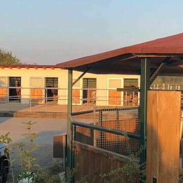

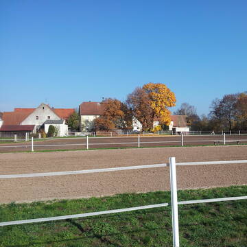
Seahorse
Weisendorf
Seahorse
@Seahorse
Pferdeausbildung
Pflegepferd
Vermieten
Führanlage
Hunde willkommen
Hengsthaltung möglich
Notfallboxen
23 weitere...
S


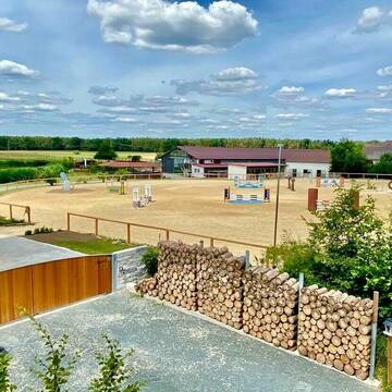
Green Valley Ranch - Pferdehof Wellein
Höchstadt
Green Valley Ranch
@RebeccaDellermann
Freizeitstall
Krankenbox
Reitplatz (z.B. Dressur, Springen, Reining)
Offenstall
5 weitere...
aktuell
P+
Deprecated: Creation of dynamic property Zend_View_Helper_Ads::$adLink is deprecated in /var/www/stall-frei/htdocs/staging.stall-frei.de/library/Psf/View/Helper/Ads.php on line 108

Heu aus neuer Ernte
Mechtersen
STALL-FREIde Marketing
@STALL-FREI-Marketing
Heulage und Pferdeheu aus der neuen Ernte findest du in unserem Futtermarkt

Reitstall Decheldorf
Mühlhausen
Tessa Schlund
@Tessa07
Freizeitstall
Vermieten
Krankenbox
Longierzirkel/Roundpen
Allergikerstall
Hufrehe geeignet
20 weitere...
P

Reitanlage Mühlhausen /Franken
Mühlhausen
Miriam Ullmann
@MiriamUllmann
Vermieten
Krankenbox
Longierzirkel/Roundpen
Hengsthaltung möglich
Hufrehe geeignet
Außenbox mit Paddock
Innenbox
11 weitere...
P

Reitanlage Wiesenblick GbR - "All inclusive...
Mühlhausen
Reitanlage Wiesenblick
@Reitanlage-Wiesenblick
FN-Mitglied
Pferdeausbildung
Vermieten
Longierzirkel/Roundpen
Paddock
Außenbox mit Paddock
Außenboxen
14 weitere...
P


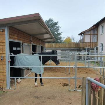
HIT Aktivstall Bergfeldhof
Heroldsbach / Oesdorf
Bergfeldhof Schleicher
@Bergfeldhof-Schleicher
Freizeitstall
Hunde willkommen
Krankenbox
Allergikerstall
Notfallboxen
Bewegungsstall
15 weitere...
P+

Futtersack HeuToy, Fressbremse in pink
Mechtersen
STALL-FREIde Marketing
@STALL-FREI-Marketing
Stundenlange Beschäftigung die
Koliken vorbeugt, geringe Staubinhalation mit
steuerbarer Futterentnahme

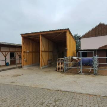
Außenboxen und Paddockboxen in Top Anlage frei
Uehlfeld
Reiterstall Hein - Aischgrund
@Reiterzentrum-Aischgrund
Freizeitstall
Pferdeausbildung
Vermieten
Führanlage
Krankenbox
Hufrehe geeignet
30 weitere...
P+
Paddockbox frei ab sofort
Höchstadt
Der Kaiserhof
@Der-Kaiserhof
Reitlehrer und -unterricht
Reitschule
Vermieten
Longierzirkel/Roundpen
Paddock
Außenbox mit Paddock
13 weitere...
P
Leider kein Vorschaubild
Leider kein Vorschaubild
Schöner kleiner Privatstall mit drei Boxen
Adelsdorf
Tobias Walther
@Gonzo1974
Freizeitstall
Vermieten
Hunde willkommen
Paddock
Gnadenbrothof
Hufrehe geeignet
9 weitere...
B

Aktivstall Kupfer Oesdorf
Oesdorf
Sabine Kupfer
@Aktivstall_Kupfer
Freizeitstall
Vermieten
Hunde willkommen
Krankenbox
Allergikerstall
Hufrehe geeignet
15 weitere...
P
Deprecated: Creation of dynamic property Zend_View::$pageCount is deprecated in /var/www/stall-frei/htdocs/staging.stall-frei.de/library/vendor/shardj/zf1-future/library/Zend/View/Abstract.php on line 308
Deprecated: Creation of dynamic property Zend_View::$itemCountPerPage is deprecated in /var/www/stall-frei/htdocs/staging.stall-frei.de/library/vendor/shardj/zf1-future/library/Zend/View/Abstract.php on line 308
Deprecated: Creation of dynamic property Zend_View::$first is deprecated in /var/www/stall-frei/htdocs/staging.stall-frei.de/library/vendor/shardj/zf1-future/library/Zend/View/Abstract.php on line 308
Deprecated: Creation of dynamic property Zend_View::$current is deprecated in /var/www/stall-frei/htdocs/staging.stall-frei.de/library/vendor/shardj/zf1-future/library/Zend/View/Abstract.php on line 308
Deprecated: Creation of dynamic property Zend_View::$last is deprecated in /var/www/stall-frei/htdocs/staging.stall-frei.de/library/vendor/shardj/zf1-future/library/Zend/View/Abstract.php on line 308
Deprecated: Creation of dynamic property Zend_View::$next is deprecated in /var/www/stall-frei/htdocs/staging.stall-frei.de/library/vendor/shardj/zf1-future/library/Zend/View/Abstract.php on line 308
Deprecated: Creation of dynamic property Zend_View::$pagesInRange is deprecated in /var/www/stall-frei/htdocs/staging.stall-frei.de/library/vendor/shardj/zf1-future/library/Zend/View/Abstract.php on line 308
Deprecated: Creation of dynamic property Zend_View::$firstPageInRange is deprecated in /var/www/stall-frei/htdocs/staging.stall-frei.de/library/vendor/shardj/zf1-future/library/Zend/View/Abstract.php on line 308
Deprecated: Creation of dynamic property Zend_View::$lastPageInRange is deprecated in /var/www/stall-frei/htdocs/staging.stall-frei.de/library/vendor/shardj/zf1-future/library/Zend/View/Abstract.php on line 308
Deprecated: Creation of dynamic property Zend_View::$currentItemCount is deprecated in /var/www/stall-frei/htdocs/staging.stall-frei.de/library/vendor/shardj/zf1-future/library/Zend/View/Abstract.php on line 308
Deprecated: Creation of dynamic property Zend_View::$totalItemCount is deprecated in /var/www/stall-frei/htdocs/staging.stall-frei.de/library/vendor/shardj/zf1-future/library/Zend/View/Abstract.php on line 308
Deprecated: Creation of dynamic property Zend_View::$firstItemNumber is deprecated in /var/www/stall-frei/htdocs/staging.stall-frei.de/library/vendor/shardj/zf1-future/library/Zend/View/Abstract.php on line 308
Deprecated: Creation of dynamic property Zend_View::$lastItemNumber is deprecated in /var/www/stall-frei/htdocs/staging.stall-frei.de/library/vendor/shardj/zf1-future/library/Zend/View/Abstract.php on line 308
Deprecated: Creation of dynamic property Zend_View::$router is deprecated in /var/www/stall-frei/htdocs/staging.stall-frei.de/library/vendor/shardj/zf1-future/library/Zend/View/Abstract.php on line 308
Deprecated: Creation of dynamic property Zend_View::$urlParams is deprecated in /var/www/stall-frei/htdocs/staging.stall-frei.de/library/vendor/shardj/zf1-future/library/Zend/View/Abstract.php on line 308
Deprecated: Creation of dynamic property Zend_View::$showAds is deprecated in /var/www/stall-frei/htdocs/staging.stall-frei.de/library/vendor/shardj/zf1-future/library/Zend/View/Abstract.php on line 308
Deprecated: Creation of dynamic property Zend_View::$objectIds is deprecated in /var/www/stall-frei/htdocs/staging.stall-frei.de/library/vendor/shardj/zf1-future/library/Zend/View/Abstract.php on line 308
Deprecated: Creation of dynamic property Zend_View::$showNavbar is deprecated in /var/www/stall-frei/htdocs/staging.stall-frei.de/library/vendor/shardj/zf1-future/library/Zend/View/Abstract.php on line 308
Deprecated: Creation of dynamic property Zend_View::$showBreadcrumb is deprecated in /var/www/stall-frei/htdocs/staging.stall-frei.de/library/vendor/shardj/zf1-future/library/Zend/View/Abstract.php on line 308
Deprecated: Creation of dynamic property Zend_View::$showFooter is deprecated in /var/www/stall-frei/htdocs/staging.stall-frei.de/library/vendor/shardj/zf1-future/library/Zend/View/Abstract.php on line 308
Deprecated: Creation of dynamic property Zend_View::$showInternalAds is deprecated in /var/www/stall-frei/htdocs/staging.stall-frei.de/library/vendor/shardj/zf1-future/library/Zend/View/Abstract.php on line 308
Deprecated: Creation of dynamic property Zend_View::$blNoContent is deprecated in /var/www/stall-frei/htdocs/staging.stall-frei.de/library/vendor/shardj/zf1-future/library/Zend/View/Abstract.php on line 308
Deprecated: Creation of dynamic property Zend_View::$sMetaDesc is deprecated in /var/www/stall-frei/htdocs/staging.stall-frei.de/library/vendor/shardj/zf1-future/library/Zend/View/Abstract.php on line 308
Deprecated: Creation of dynamic property Zend_View::$useGmaps is deprecated in /var/www/stall-frei/htdocs/staging.stall-frei.de/library/vendor/shardj/zf1-future/library/Zend/View/Abstract.php on line 308
Deprecated: Creation of dynamic property Zend_View::$touches is deprecated in /var/www/stall-frei/htdocs/staging.stall-frei.de/library/vendor/shardj/zf1-future/library/Zend/View/Abstract.php on line 308
Deprecated: Creation of dynamic property Zend_View::$oProject is deprecated in /var/www/stall-frei/htdocs/staging.stall-frei.de/library/vendor/shardj/zf1-future/library/Zend/View/Abstract.php on line 308
Deprecated: Creation of dynamic property Zend_View::$pageHeadline is deprecated in /var/www/stall-frei/htdocs/staging.stall-frei.de/library/vendor/shardj/zf1-future/library/Zend/View/Abstract.php on line 308
Deprecated: Creation of dynamic property Zend_View::$disableLocationField is deprecated in /var/www/stall-frei/htdocs/staging.stall-frei.de/library/vendor/shardj/zf1-future/library/Zend/View/Abstract.php on line 308
Deprecated: Creation of dynamic property Zend_View::$isSearch is deprecated in /var/www/stall-frei/htdocs/staging.stall-frei.de/library/vendor/shardj/zf1-future/library/Zend/View/Abstract.php on line 308
Deprecated: Creation of dynamic property Zend_View::$pageTitle is deprecated in /var/www/stall-frei/htdocs/staging.stall-frei.de/library/vendor/shardj/zf1-future/library/Zend/View/Abstract.php on line 308
Deprecated: Creation of dynamic property Psf_Form_Element_Text::$class is deprecated in /var/www/stall-frei/htdocs/staging.stall-frei.de/library/vendor/shardj/zf1-future/library/Zend/Form/Element.php on line 874
Deprecated: Creation of dynamic property Psf_Form_Element_Text::$size is deprecated in /var/www/stall-frei/htdocs/staging.stall-frei.de/library/vendor/shardj/zf1-future/library/Zend/Form/Element.php on line 874
Deprecated: Creation of dynamic property Psf_Form_Element_Text::$placeholder is deprecated in /var/www/stall-frei/htdocs/staging.stall-frei.de/library/vendor/shardj/zf1-future/library/Zend/Form/Element.php on line 874
Deprecated: Creation of dynamic property Psf_Form_Element_Hidden::$class is deprecated in /var/www/stall-frei/htdocs/staging.stall-frei.de/library/vendor/shardj/zf1-future/library/Zend/Form/Element.php on line 874
Deprecated: Creation of dynamic property Psf_Form_Element_Hidden::$class is deprecated in /var/www/stall-frei/htdocs/staging.stall-frei.de/library/vendor/shardj/zf1-future/library/Zend/Form/Element.php on line 874
Deprecated: Creation of dynamic property Psf_Form_Element_Hidden::$class is deprecated in /var/www/stall-frei/htdocs/staging.stall-frei.de/library/vendor/shardj/zf1-future/library/Zend/Form/Element.php on line 874
Deprecated: Creation of dynamic property Psf_Form_Element_Hidden::$class is deprecated in /var/www/stall-frei/htdocs/staging.stall-frei.de/library/vendor/shardj/zf1-future/library/Zend/Form/Element.php on line 874
Deprecated: Creation of dynamic property Psf_Form_Element_Select::$class is deprecated in /var/www/stall-frei/htdocs/staging.stall-frei.de/library/vendor/shardj/zf1-future/library/Zend/Form/Element.php on line 874
Deprecated: Creation of dynamic property Psf_Form_Element_Select::$class is deprecated in /var/www/stall-frei/htdocs/staging.stall-frei.de/library/vendor/shardj/zf1-future/library/Zend/Form/Element.php on line 874
Deprecated: Creation of dynamic property Psf_Form_Element_Select::$class is deprecated in /var/www/stall-frei/htdocs/staging.stall-frei.de/library/vendor/shardj/zf1-future/library/Zend/Form/Element.php on line 874
Deprecated: Creation of dynamic property Psf_Form_Element_Select::$class is deprecated in /var/www/stall-frei/htdocs/staging.stall-frei.de/library/vendor/shardj/zf1-future/library/Zend/Form/Element.php on line 874
Deprecated: Creation of dynamic property Psf_Form_Element_Text::$class is deprecated in /var/www/stall-frei/htdocs/staging.stall-frei.de/library/vendor/shardj/zf1-future/library/Zend/Form/Element.php on line 874
Deprecated: Creation of dynamic property Psf_Form_Element_Checkbox::$label is deprecated in /var/www/stall-frei/htdocs/staging.stall-frei.de/library/vendor/shardj/zf1-future/library/Zend/Form/Element.php on line 874
Deprecated: Creation of dynamic property Zend_View::$sort is deprecated in /var/www/stall-frei/htdocs/staging.stall-frei.de/library/vendor/shardj/zf1-future/library/Zend/View/Abstract.php on line 308
Deprecated: Creation of dynamic property Zend_View::$searchLocation is deprecated in /var/www/stall-frei/htdocs/staging.stall-frei.de/library/vendor/shardj/zf1-future/library/Zend/View/Abstract.php on line 308
Deprecated: Creation of dynamic property Zend_View::$locationHint is deprecated in /var/www/stall-frei/htdocs/staging.stall-frei.de/library/vendor/shardj/zf1-future/library/Zend/View/Abstract.php on line 308
Psf_GeoCoder_Abstract::getLocation: Wind Get Location CachedOrLive
Psf_GeoCoder_Abstract::getCachedOrLive: Wind
Psf_GeoCoder_OpenCageData::makeApiRequest: response:
Array
(
[documentation] => https://opencagedata.com/api
[licenses] => Array
(
[0] => Array
(
[name] => see attribution guide
[url] => https://opencagedata.com/credits
)
)
[results] => Array
(
[0] => Array
(
[bounds] => Array
(
[northeast] => Array
(
[lat] => 49.7970116
[lng] => 10.8683819
)
[southwest] => Array
(
[lat] => 49.7570116
[lng] => 10.8283819
)
)
[components] => Array
(
[ISO_3166-1_alpha-2] => DE
[ISO_3166-1_alpha-3] => DEU
[ISO_3166-2] => Array
(
[0] => DE-BY
)
[_category] => place
[_normalized_city] => Pommersfelden
[_type] => village
[city] => Pommersfelden
[continent] => Europe
[country] => Deutschland
[country_code] => de
[county] => Landkreis Bamberg
[political_union] => European Union
[postcode] => 96178
[state] => Bayern
[state_code] => BY
[village] => Wind
)
[confidence] => 7
[formatted] => 96178 Wind, Deutschland
[geometry] => Array
(
[lat] => 49.7770116
[lng] => 10.8483819
)
)
[1] => Array
(
[bounds] => Array
(
[northeast] => Array
(
[lat] => 48.2133761
[lng] => 11.9208069
)
[southwest] => Array
(
[lat] => 48.1733761
[lng] => 11.8808069
)
)
[components] => Array
(
[ISO_3166-1_alpha-2] => DE
[ISO_3166-1_alpha-3] => DEU
[ISO_3166-2] => Array
(
[0] => DE-BY
)
[_category] => place
[_normalized_city] => Forstinning
[_type] => hamlet
[continent] => Europe
[country] => Deutschland
[country_code] => de
[county] => Landkreis Ebersberg
[hamlet] => Wind
[political_union] => European Union
[postcode] => 85661
[state] => Bayern
[state_code] => BY
[village] => Forstinning
)
[confidence] => 7
[formatted] => Wind, 85661 Forstinning, Deutschland
[geometry] => Array
(
[lat] => 48.1933761
[lng] => 11.9008069
)
)
[2] => Array
(
[bounds] => Array
(
[northeast] => Array
(
[lat] => 51.9667726
[lng] => 7.0892487
)
[southwest] => Array
(
[lat] => 51.966552
[lng] => 7.0883355
)
)
[components] => Array
(
[ISO_3166-1_alpha-2] => DE
[ISO_3166-1_alpha-3] => DEU
[ISO_3166-2] => Array
(
[0] => DE-NW
)
[_category] => place
[_normalized_city] => Coesfeld
[_type] => neighbourhood
[commercial] => Wind
[continent] => Europe
[country] => Deutschland
[country_code] => de
[county] => Kreis Coesfeld
[political_union] => European Union
[postcode] => 48653
[state] => Nordrhein-Westfalen
[state_code] => NW
[town] => Coesfeld
)
[confidence] => 9
[formatted] => 48653 Coesfeld, Deutschland
[geometry] => Array
(
[lat] => 51.9666665
[lng] => 7.0887962
)
)
[3] => Array
(
[bounds] => Array
(
[northeast] => Array
(
[lat] => 48.1940506
[lng] => 11.9015661
)
[southwest] => Array
(
[lat] => 48.1915735
[lng] => 11.8978957
)
)
[components] => Array
(
[ISO_3166-1_alpha-2] => DE
[ISO_3166-1_alpha-3] => DEU
[ISO_3166-2] => Array
(
[0] => DE-BY
)
[_category] => road
[_normalized_city] => Forstinning
[_type] => road
[continent] => Europe
[country] => Deutschland
[country_code] => de
[county] => Landkreis Ebersberg
[hamlet] => Wind
[political_union] => European Union
[postcode] => 85661
[road] => Wind
[road_type] => residential
[state] => Bayern
[state_code] => BY
[village] => Forstinning
)
[confidence] => 9
[formatted] => Wind, 85661 Forstinning, Deutschland
[geometry] => Array
(
[lat] => 48.1930879
[lng] => 11.8995835
)
)
[4] => Array
(
[bounds] => Array
(
[northeast] => Array
(
[lat] => 50.8157668
[lng] => 12.7320607
)
[southwest] => Array
(
[lat] => 50.8140401
[lng] => 12.7291158
)
)
[components] => Array
(
[ISO_3166-1_alpha-2] => DE
[ISO_3166-1_alpha-3] => DEU
[ISO_3166-2] => Array
(
[0] => DE-SN
)
[_category] => road
[_normalized_city] => Hohenstein-Ernstthal
[_type] => road
[city_district] => Wüstenbrand
[continent] => Europe
[country] => Deutschland
[country_code] => de
[county] => Zwickau
[political_union] => European Union
[postcode] => 09337
[road] => Wind
[road_type] => residential
[state] => Sachsen
[state_code] => SN
[town] => Hohenstein-Ernstthal
)
[confidence] => 9
[formatted] => Wind, 09337 Hohenstein-Ernstthal, Deutschland
[geometry] => Array
(
[lat] => 50.8147881
[lng] => 12.7306547
)
)
[5] => Array
(
[components] => Array
(
[ISO_3166-1_alpha-2] => FR
[ISO_3166-1_alpha-3] => FRA
[ISO_3166-2] => Array
(
[0] => FR-HDF
[1] => FR-62
)
[_category] => road
[_normalized_city] => Wizernes
[_type] => road
[city] => Wizernes
[continent] => Europe
[country] => France
[country_code] => fr
[county] => Pas-de-Calais
[local_authority] => Communauté d'agglomération du Pays de Saint-Omer
[political_union] => European Union
[postcode] => 62570
[road] => Chemin de Wins
[state] => Hauts-de-France
[state_code] => HDF
)
[confidence] => 2
[formatted] => Chemin de Wins, 62570 Wizernes, France
[geometry] => Array
(
[lat] => 50.714723
[lng] => 2.252985
)
)
[6] => Array
(
[components] => Array
(
[ISO_3166-1_alpha-2] => FR
[ISO_3166-1_alpha-3] => FRA
[ISO_3166-2] => Array
(
[0] => FR-GES
[1] => FR-6AE
[2] => FR-67
)
[_category] => road
[_normalized_city] => Blienschwiller
[_type] => road
[city] => Blienschwiller
[continent] => Europe
[country] => France
[country_code] => fr
[county] => Bas-Rhin
[local_authority] => Communauté de communes du Pays de Barr
[political_union] => European Union
[postcode] => 67650
[road] => Route des Vins
[state] => Grand Est
[state_code] => GES
)
[confidence] => 2
[formatted] => Route des Vins, 67650 Blienschwiller, France
[geometry] => Array
(
[lat] => 48.34174
[lng] => 7.42037
)
)
[7] => Array
(
[components] => Array
(
[ISO_3166-1_alpha-2] => FR
[ISO_3166-1_alpha-3] => FRA
[ISO_3166-2] => Array
(
[0] => FR-GES
[1] => FR-6AE
[2] => FR-68
)
[_category] => road
[_normalized_city] => Rorschwihr
[_type] => road
[city] => Rorschwihr
[continent] => Europe
[country] => France
[country_code] => fr
[county] => Haut-Rhin
[local_authority] => Communauté de communes du Pays de Ribeauvillé
[political_union] => European Union
[postcode] => 68590
[road] => Route du Vin
[state] => Grand Est
[state_code] => GES
)
[confidence] => 2
[formatted] => Route du Vin, 68590 Rorschwihr, France
[geometry] => Array
(
[lat] => 48.216657
[lng] => 7.36264
)
)
[8] => Array
(
[components] => Array
(
[ISO_3166-1_alpha-2] => FR
[ISO_3166-1_alpha-3] => FRA
[ISO_3166-2] => Array
(
[0] => FR-PAC
[1] => FR-83
)
[_category] => road
[_normalized_city] => Le Val
[_type] => road
[city] => Le Val
[continent] => Europe
[country] => France
[country_code] => fr
[county] => Var
[local_authority] => Communauté d'agglomération de la Provence Verte
[political_union] => European Union
[postcode] => 83143
[road] => Route de Vins
[state] => Provence-Alpes-Côte d'Azur
[state_code] => PAC
)
[confidence] => 2
[formatted] => Route de Vins, 83143 Le Val, France
[geometry] => Array
(
[lat] => 43.436213
[lng] => 6.090037
)
)
[9] => Array
(
[components] => Array
(
[ISO_3166-1_alpha-2] => FR
[ISO_3166-1_alpha-3] => FRA
[ISO_3166-2] => Array
(
[0] => FR-GES
[1] => FR-6AE
[2] => FR-67
)
[_category] => road
[_normalized_city] => Orschwiller
[_type] => road
[city] => Orschwiller
[continent] => Europe
[country] => France
[country_code] => fr
[county] => Bas-Rhin
[local_authority] => Communauté de communes de Sélestat
[political_union] => European Union
[postcode] => 67600
[road] => Route du Vin
[state] => Grand Est
[state_code] => GES
)
[confidence] => 2
[formatted] => Route du Vin, 67600 Orschwiller, France
[geometry] => Array
(
[lat] => 48.240997
[lng] => 7.384665
)
)
)
[status] => Array
(
[code] => 200
[message] => OK
)
[stay_informed] => Array
(
[blog] => https://blog.opencagedata.com
[mastodon] => https://en.osm.town/@opencage
)
[thanks] => For using an OpenCage API
[timestamp] => Array
(
[created_http] => Sun, 08 Feb 2026 00:00:09 GMT
[created_unix] => 1770508809
)
[total_results] => 10
)
Psf_GeoCoder_Abstract::convertLocationResult
{"documentation":"https:\/\/opencagedata.com\/api","licenses":[{"name":"see attribution guide","url":"https:\/\/opencagedata.com\/credits"}],"results":[{"bounds":{"northeast":{"lat":49.7970116,"lng":10.8683819},"southwest":{"lat":49.7570116,"lng":10.8283819}},"components":{"ISO_3166-1_alpha-2":"DE","ISO_3166-1_alpha-3":"DEU","ISO_3166-2":["DE-BY"],"_category":"place","_normalized_city":"Pommersfelden","_type":"village","city":"Pommersfelden","continent":"Europe","country":"Deutschland","country_code":"de","county":"Landkreis Bamberg","political_union":"European Union","postcode":"96178","state":"Bayern","state_code":"BY","village":"Wind"},"confidence":7,"formatted":"96178 Wind, Deutschland","geometry":{"lat":49.7770116,"lng":10.8483819}},{"bounds":{"northeast":{"lat":48.2133761,"lng":11.9208069},"southwest":{"lat":48.1733761,"lng":11.8808069}},"components":{"ISO_3166-1_alpha-2":"DE","ISO_3166-1_alpha-3":"DEU","ISO_3166-2":["DE-BY"],"_category":"place","_normalized_city":"Forstinning","_type":"hamlet","continent":"Europe","country":"Deutschland","country_code":"de","county":"Landkreis Ebersberg","hamlet":"Wind","political_union":"European Union","postcode":"85661","state":"Bayern","state_code":"BY","village":"Forstinning"},"confidence":7,"formatted":"Wind, 85661 Forstinning, Deutschland","geometry":{"lat":48.1933761,"lng":11.9008069}},{"bounds":{"northeast":{"lat":51.9667726,"lng":7.0892487},"southwest":{"lat":51.966552,"lng":7.0883355}},"components":{"ISO_3166-1_alpha-2":"DE","ISO_3166-1_alpha-3":"DEU","ISO_3166-2":["DE-NW"],"_category":"place","_normalized_city":"Coesfeld","_type":"neighbourhood","commercial":"Wind","continent":"Europe","country":"Deutschland","country_code":"de","county":"Kreis Coesfeld","political_union":"European Union","postcode":"48653","state":"Nordrhein-Westfalen","state_code":"NW","town":"Coesfeld"},"confidence":9,"formatted":"48653 Coesfeld, Deutschland","geometry":{"lat":51.9666665,"lng":7.0887962}},{"bounds":{"northeast":{"lat":48.1940506,"lng":11.9015661},"southwest":{"lat":48.1915735,"lng":11.8978957}},"components":{"ISO_3166-1_alpha-2":"DE","ISO_3166-1_alpha-3":"DEU","ISO_3166-2":["DE-BY"],"_category":"road","_normalized_city":"Forstinning","_type":"road","continent":"Europe","country":"Deutschland","country_code":"de","county":"Landkreis Ebersberg","hamlet":"Wind","political_union":"European Union","postcode":"85661","road":"Wind","road_type":"residential","state":"Bayern","state_code":"BY","village":"Forstinning"},"confidence":9,"formatted":"Wind, 85661 Forstinning, Deutschland","geometry":{"lat":48.1930879,"lng":11.8995835}},{"bounds":{"northeast":{"lat":50.8157668,"lng":12.7320607},"southwest":{"lat":50.8140401,"lng":12.7291158}},"components":{"ISO_3166-1_alpha-2":"DE","ISO_3166-1_alpha-3":"DEU","ISO_3166-2":["DE-SN"],"_category":"road","_normalized_city":"Hohenstein-Ernstthal","_type":"road","city_district":"W\u00fcstenbrand","continent":"Europe","country":"Deutschland","country_code":"de","county":"Zwickau","political_union":"European Union","postcode":"09337","road":"Wind","road_type":"residential","state":"Sachsen","state_code":"SN","town":"Hohenstein-Ernstthal"},"confidence":9,"formatted":"Wind, 09337 Hohenstein-Ernstthal, Deutschland","geometry":{"lat":50.8147881,"lng":12.7306547}},{"components":{"ISO_3166-1_alpha-2":"FR","ISO_3166-1_alpha-3":"FRA","ISO_3166-2":["FR-HDF","FR-62"],"_category":"road","_normalized_city":"Wizernes","_type":"road","city":"Wizernes","continent":"Europe","country":"France","country_code":"fr","county":"Pas-de-Calais","local_authority":"Communaut\u00e9 d'agglom\u00e9ration du Pays de Saint-Omer","political_union":"European Union","postcode":"62570","road":"Chemin de Wins","state":"Hauts-de-France","state_code":"HDF"},"confidence":2,"formatted":"Chemin de Wins, 62570 Wizernes, France","geometry":{"lat":50.714723,"lng":2.252985}},{"components":{"ISO_3166-1_alpha-2":"FR","ISO_3166-1_alpha-3":"FRA","ISO_3166-2":["FR-GES","FR-6AE","FR-67"],"_category":"road","_normalized_city":"Blienschwiller","_type":"road","city":"Blienschwiller","continent":"Europe","country":"France","country_code":"fr","county":"Bas-Rhin","local_authority":"Communaut\u00e9 de communes du Pays de Barr","political_union":"European Union","postcode":"67650","road":"Route des Vins","state":"Grand Est","state_code":"GES"},"confidence":2,"formatted":"Route des Vins, 67650 Blienschwiller, France","geometry":{"lat":48.34174,"lng":7.42037}},{"components":{"ISO_3166-1_alpha-2":"FR","ISO_3166-1_alpha-3":"FRA","ISO_3166-2":["FR-GES","FR-6AE","FR-68"],"_category":"road","_normalized_city":"Rorschwihr","_type":"road","city":"Rorschwihr","continent":"Europe","country":"France","country_code":"fr","county":"Haut-Rhin","local_authority":"Communaut\u00e9 de communes du Pays de Ribeauvill\u00e9","political_union":"European Union","postcode":"68590","road":"Route du Vin","state":"Grand Est","state_code":"GES"},"confidence":2,"formatted":"Route du Vin, 68590 Rorschwihr, France","geometry":{"lat":48.216657,"lng":7.36264}},{"components":{"ISO_3166-1_alpha-2":"FR","ISO_3166-1_alpha-3":"FRA","ISO_3166-2":["FR-PAC","FR-83"],"_category":"road","_normalized_city":"Le Val","_type":"road","city":"Le Val","continent":"Europe","country":"France","country_code":"fr","county":"Var","local_authority":"Communaut\u00e9 d'agglom\u00e9ration de la Provence Verte","political_union":"European Union","postcode":"83143","road":"Route de Vins","state":"Provence-Alpes-C\u00f4te d'Azur","state_code":"PAC"},"confidence":2,"formatted":"Route de Vins, 83143 Le Val, France","geometry":{"lat":43.436213,"lng":6.090037}},{"components":{"ISO_3166-1_alpha-2":"FR","ISO_3166-1_alpha-3":"FRA","ISO_3166-2":["FR-GES","FR-6AE","FR-67"],"_category":"road","_normalized_city":"Orschwiller","_type":"road","city":"Orschwiller","continent":"Europe","country":"France","country_code":"fr","county":"Bas-Rhin","local_authority":"Communaut\u00e9 de communes de S\u00e9lestat","political_union":"European Union","postcode":"67600","road":"Route du Vin","state":"Grand Est","state_code":"GES"},"confidence":2,"formatted":"Route du Vin, 67600 Orschwiller, France","geometry":{"lat":48.240997,"lng":7.384665}}],"status":{"code":200,"message":"OK"},"stay_informed":{"blog":"https:\/\/blog.opencagedata.com","mastodon":"https:\/\/en.osm.town\/@opencage"},"thanks":"For using an OpenCage API","timestamp":{"created_http":"Sun, 08 Feb 2026 00:00:09 GMT","created_unix":1770508809},"total_results":10}Array
(
[0] => stdClass Object
(
[bounds] => stdClass Object
(
[northeast] => stdClass Object
(
[lat] => 49.7970116
[lng] => 10.8683819
)
[southwest] => stdClass Object
(
[lat] => 49.7570116
[lng] => 10.8283819
)
)
[components] => stdClass Object
(
[ISO_3166-1_alpha-2] => DE
[ISO_3166-1_alpha-3] => DEU
[ISO_3166-2] => Array
(
[0] => DE-BY
)
[_category] => place
[_normalized_city] => Pommersfelden
[_type] => village
[city] => Pommersfelden
[continent] => Europe
[country] => Deutschland
[country_code] => de
[county] => Landkreis Bamberg
[political_union] => European Union
[postcode] => 96178
[state] => Bayern
[state_code] => BY
[village] => Wind
)
[confidence] => 7
[formatted] => 96178 Wind, Deutschland
[geometry] => stdClass Object
(
[lat] => 49.7770116
[lng] => 10.8483819
)
)
[1] => stdClass Object
(
[bounds] => stdClass Object
(
[northeast] => stdClass Object
(
[lat] => 48.2133761
[lng] => 11.9208069
)
[southwest] => stdClass Object
(
[lat] => 48.1733761
[lng] => 11.8808069
)
)
[components] => stdClass Object
(
[ISO_3166-1_alpha-2] => DE
[ISO_3166-1_alpha-3] => DEU
[ISO_3166-2] => Array
(
[0] => DE-BY
)
[_category] => place
[_normalized_city] => Forstinning
[_type] => hamlet
[continent] => Europe
[country] => Deutschland
[country_code] => de
[county] => Landkreis Ebersberg
[hamlet] => Wind
[political_union] => European Union
[postcode] => 85661
[state] => Bayern
[state_code] => BY
[village] => Forstinning
)
[confidence] => 7
[formatted] => Wind, 85661 Forstinning, Deutschland
[geometry] => stdClass Object
(
[lat] => 48.1933761
[lng] => 11.9008069
)
)
[2] => stdClass Object
(
[bounds] => stdClass Object
(
[northeast] => stdClass Object
(
[lat] => 51.9667726
[lng] => 7.0892487
)
[southwest] => stdClass Object
(
[lat] => 51.966552
[lng] => 7.0883355
)
)
[components] => stdClass Object
(
[ISO_3166-1_alpha-2] => DE
[ISO_3166-1_alpha-3] => DEU
[ISO_3166-2] => Array
(
[0] => DE-NW
)
[_category] => place
[_normalized_city] => Coesfeld
[_type] => neighbourhood
[commercial] => Wind
[continent] => Europe
[country] => Deutschland
[country_code] => de
[county] => Kreis Coesfeld
[political_union] => European Union
[postcode] => 48653
[state] => Nordrhein-Westfalen
[state_code] => NW
[town] => Coesfeld
)
[confidence] => 9
[formatted] => 48653 Coesfeld, Deutschland
[geometry] => stdClass Object
(
[lat] => 51.9666665
[lng] => 7.0887962
)
)
[3] => stdClass Object
(
[bounds] => stdClass Object
(
[northeast] => stdClass Object
(
[lat] => 48.1940506
[lng] => 11.9015661
)
[southwest] => stdClass Object
(
[lat] => 48.1915735
[lng] => 11.8978957
)
)
[components] => stdClass Object
(
[ISO_3166-1_alpha-2] => DE
[ISO_3166-1_alpha-3] => DEU
[ISO_3166-2] => Array
(
[0] => DE-BY
)
[_category] => road
[_normalized_city] => Forstinning
[_type] => road
[continent] => Europe
[country] => Deutschland
[country_code] => de
[county] => Landkreis Ebersberg
[hamlet] => Wind
[political_union] => European Union
[postcode] => 85661
[road] => Wind
[road_type] => residential
[state] => Bayern
[state_code] => BY
[village] => Forstinning
)
[confidence] => 9
[formatted] => Wind, 85661 Forstinning, Deutschland
[geometry] => stdClass Object
(
[lat] => 48.1930879
[lng] => 11.8995835
)
)
[4] => stdClass Object
(
[bounds] => stdClass Object
(
[northeast] => stdClass Object
(
[lat] => 50.8157668
[lng] => 12.7320607
)
[southwest] => stdClass Object
(
[lat] => 50.8140401
[lng] => 12.7291158
)
)
[components] => stdClass Object
(
[ISO_3166-1_alpha-2] => DE
[ISO_3166-1_alpha-3] => DEU
[ISO_3166-2] => Array
(
[0] => DE-SN
)
[_category] => road
[_normalized_city] => Hohenstein-Ernstthal
[_type] => road
[city_district] => Wüstenbrand
[continent] => Europe
[country] => Deutschland
[country_code] => de
[county] => Zwickau
[political_union] => European Union
[postcode] => 09337
[road] => Wind
[road_type] => residential
[state] => Sachsen
[state_code] => SN
[town] => Hohenstein-Ernstthal
)
[confidence] => 9
[formatted] => Wind, 09337 Hohenstein-Ernstthal, Deutschland
[geometry] => stdClass Object
(
[lat] => 50.8147881
[lng] => 12.7306547
)
)
[5] => stdClass Object
(
[components] => stdClass Object
(
[ISO_3166-1_alpha-2] => FR
[ISO_3166-1_alpha-3] => FRA
[ISO_3166-2] => Array
(
[0] => FR-HDF
[1] => FR-62
)
[_category] => road
[_normalized_city] => Wizernes
[_type] => road
[city] => Wizernes
[continent] => Europe
[country] => France
[country_code] => fr
[county] => Pas-de-Calais
[local_authority] => Communauté d'agglomération du Pays de Saint-Omer
[political_union] => European Union
[postcode] => 62570
[road] => Chemin de Wins
[state] => Hauts-de-France
[state_code] => HDF
)
[confidence] => 2
[formatted] => Chemin de Wins, 62570 Wizernes, France
[geometry] => stdClass Object
(
[lat] => 50.714723
[lng] => 2.252985
)
)
[6] => stdClass Object
(
[components] => stdClass Object
(
[ISO_3166-1_alpha-2] => FR
[ISO_3166-1_alpha-3] => FRA
[ISO_3166-2] => Array
(
[0] => FR-GES
[1] => FR-6AE
[2] => FR-67
)
[_category] => road
[_normalized_city] => Blienschwiller
[_type] => road
[city] => Blienschwiller
[continent] => Europe
[country] => France
[country_code] => fr
[county] => Bas-Rhin
[local_authority] => Communauté de communes du Pays de Barr
[political_union] => European Union
[postcode] => 67650
[road] => Route des Vins
[state] => Grand Est
[state_code] => GES
)
[confidence] => 2
[formatted] => Route des Vins, 67650 Blienschwiller, France
[geometry] => stdClass Object
(
[lat] => 48.34174
[lng] => 7.42037
)
)
[7] => stdClass Object
(
[components] => stdClass Object
(
[ISO_3166-1_alpha-2] => FR
[ISO_3166-1_alpha-3] => FRA
[ISO_3166-2] => Array
(
[0] => FR-GES
[1] => FR-6AE
[2] => FR-68
)
[_category] => road
[_normalized_city] => Rorschwihr
[_type] => road
[city] => Rorschwihr
[continent] => Europe
[country] => France
[country_code] => fr
[county] => Haut-Rhin
[local_authority] => Communauté de communes du Pays de Ribeauvillé
[political_union] => European Union
[postcode] => 68590
[road] => Route du Vin
[state] => Grand Est
[state_code] => GES
)
[confidence] => 2
[formatted] => Route du Vin, 68590 Rorschwihr, France
[geometry] => stdClass Object
(
[lat] => 48.216657
[lng] => 7.36264
)
)
[8] => stdClass Object
(
[components] => stdClass Object
(
[ISO_3166-1_alpha-2] => FR
[ISO_3166-1_alpha-3] => FRA
[ISO_3166-2] => Array
(
[0] => FR-PAC
[1] => FR-83
)
[_category] => road
[_normalized_city] => Le Val
[_type] => road
[city] => Le Val
[continent] => Europe
[country] => France
[country_code] => fr
[county] => Var
[local_authority] => Communauté d'agglomération de la Provence Verte
[political_union] => European Union
[postcode] => 83143
[road] => Route de Vins
[state] => Provence-Alpes-Côte d'Azur
[state_code] => PAC
)
[confidence] => 2
[formatted] => Route de Vins, 83143 Le Val, France
[geometry] => stdClass Object
(
[lat] => 43.436213
[lng] => 6.090037
)
)
[9] => stdClass Object
(
[components] => stdClass Object
(
[ISO_3166-1_alpha-2] => FR
[ISO_3166-1_alpha-3] => FRA
[ISO_3166-2] => Array
(
[0] => FR-GES
[1] => FR-6AE
[2] => FR-67
)
[_category] => road
[_normalized_city] => Orschwiller
[_type] => road
[city] => Orschwiller
[continent] => Europe
[country] => France
[country_code] => fr
[county] => Bas-Rhin
[local_authority] => Communauté de communes de Sélestat
[political_union] => European Union
[postcode] => 67600
[road] => Route du Vin
[state] => Grand Est
[state_code] => GES
)
[confidence] => 2
[formatted] => Route du Vin, 67600 Orschwiller, France
[geometry] => stdClass Object
(
[lat] => 48.240997
[lng] => 7.384665
)
)
)
Psf_GeoCoder_OpenCageData::getKeyMap: 0
stdClass Object
(
    [bounds] => stdClass Object
        (
            [northeast] => stdClass Object
                (
                    [lat] => 49.7970116
                    [lng] => 10.8683819
                )

            [southwest] => stdClass Object
                (
                    [lat] => 49.7570116
                    [lng] => 10.8283819
                )

        )

    [components] => stdClass Object
        (
            [ISO_3166-1_alpha-2] => DE
            [ISO_3166-1_alpha-3] => DEU
            [ISO_3166-2] => Array
                (
                    [0] => DE-BY
                )

            [_category] => place
            [_normalized_city] => Pommersfelden
            [_type] => village
            [city] => Pommersfelden
            [continent] => Europe
            [country] => Deutschland
            [country_code] => de
            [county] => Landkreis Bamberg
            [political_union] => European Union
            [postcode] => 96178
            [state] => Bayern
            [state_code] => BY
            [village] => Wind
        )

    [confidence] => 7
    [formatted] => 96178 Wind, Deutschland
    [geometry] => stdClass Object
        (
            [lat] => 49.7770116
            [lng] => 10.8483819
        )

)
Psf_GeoCoder_OpenCageData::getCounty: Bamberg
Psf_GeoCoder_OpenCageData::addMissingData REFETCH!
Array
(
    [address] => 96178 Wind, Deutschland
    [type] => village
    [street] =>
    [city] => Wind
    [county] => Bamberg
    [state] => Bayern
    [zip] => 96178
    [country] => Deutschland
    [suburb] =>
    [countrycode] => de
    [latitude] => 49.7770116
    [longitude] => 10.8483819
    [accuracy] => 1
    [confidence] => 7
    [bounds] => stdClass Object
        (
            [northeast] => stdClass Object
                (
                    [lat] => 49.7970116
                    [lng] => 10.8683819
                )

            [southwest] => stdClass Object
                (
                    [lat] => 49.7570116
                    [lng] => 10.8283819
                )

        )

)
reformat!
Array
(
    [address] => 96178 Wind, Deutschland
    [type] => village
    [street] =>
    [city] => Wind
    [county] => Bamberg
    [state] => Bayern
    [zip] => 96178
    [country] => Deutschland
    [suburb] =>
    [countrycode] => de
    [latitude] => 49.7770116
    [longitude] => 10.8483819
    [accuracy] => 1
    [confidence] => 7
    [bounds] => stdClass Object
        (
            [northeast] => stdClass Object
                (
                    [lat] => 49.7970116
                    [lng] => 10.8683819
                )

            [southwest] => stdClass Object
                (
                    [lat] => 49.7570116
                    [lng] => 10.8283819
                )

        )

    [place] => 96178 Wind, Bayern
    [hash] => 7e686aa66533b48d690b71a2ad1d1df2
)
Psf_GeoCoder_OpenCageData::getKeyMap: 1
stdClass Object
(
    [bounds] => stdClass Object
        (
            [northeast] => stdClass Object
                (
                    [lat] => 48.2133761
                    [lng] => 11.9208069
                )

            [southwest] => stdClass Object
                (
                    [lat] => 48.1733761
                    [lng] => 11.8808069
                )

        )

    [components] => stdClass Object
        (
            [ISO_3166-1_alpha-2] => DE
            [ISO_3166-1_alpha-3] => DEU
            [ISO_3166-2] => Array
                (
                    [0] => DE-BY
                )

            [_category] => place
            [_normalized_city] => Forstinning
            [_type] => hamlet
            [continent] => Europe
            [country] => Deutschland
            [country_code] => de
            [county] => Landkreis Ebersberg
            [hamlet] => Wind
            [political_union] => European Union
            [postcode] => 85661
            [state] => Bayern
            [state_code] => BY
            [village] => Forstinning
        )

    [confidence] => 7
    [formatted] => Wind, 85661 Forstinning, Deutschland
    [geometry] => stdClass Object
        (
            [lat] => 48.1933761
            [lng] => 11.9008069
        )

)
Psf_GeoCoder_OpenCageData::getCounty: Ebersberg
Psf_GeoCoder_OpenCageData::addMissingData REFETCH!
Array
(
    [address] => Wind, 85661 Forstinning, Deutschland
    [type] => hamlet
    [street] => Wind
    [city] => Forstinning
    [county] => Ebersberg
    [state] => Bayern
    [zip] => 85661
    [country] => Deutschland
    [suburb] =>
    [countrycode] => de
    [latitude] => 48.1933761
    [longitude] => 11.9008069
    [accuracy] => 1
    [confidence] => 7
    [bounds] => stdClass Object
        (
            [northeast] => stdClass Object
                (
                    [lat] => 48.2133761
                    [lng] => 11.9208069
                )

            [southwest] => stdClass Object
                (
                    [lat] => 48.1733761
                    [lng] => 11.8808069
                )

        )

)
reformat!
Array
(
    [address] => Wind, 85661 Forstinning, Deutschland
    [type] => hamlet
    [street] => Wind
    [city] => Forstinning
    [county] => Ebersberg
    [state] => Bayern
    [zip] => 85661
    [country] => Deutschland
    [suburb] =>
    [countrycode] => de
    [latitude] => 48.1933761
    [longitude] => 11.9008069
    [accuracy] => 1
    [confidence] => 7
    [bounds] => stdClass Object
        (
            [northeast] => stdClass Object
                (
                    [lat] => 48.2133761
                    [lng] => 11.9208069
                )

            [southwest] => stdClass Object
                (
                    [lat] => 48.1733761
                    [lng] => 11.8808069
                )

        )

    [place] => Wind, 85661 Forstinning, Bayern
    [hash] => 064125735000bb533d4dd8fbfac022da
)
Psf_GeoCoder_OpenCageData::getKeyMap: 2
stdClass Object
(
    [bounds] => stdClass Object
        (
            [northeast] => stdClass Object
                (
                    [lat] => 51.9667726
                    [lng] => 7.0892487
                )

            [southwest] => stdClass Object
                (
                    [lat] => 51.966552
                    [lng] => 7.0883355
                )

        )

    [components] => stdClass Object
        (
            [ISO_3166-1_alpha-2] => DE
            [ISO_3166-1_alpha-3] => DEU
            [ISO_3166-2] => Array
                (
                    [0] => DE-NW
                )

            [_category] => place
            [_normalized_city] => Coesfeld
            [_type] => neighbourhood
            [commercial] => Wind
            [continent] => Europe
            [country] => Deutschland
            [country_code] => de
            [county] => Kreis Coesfeld
            [political_union] => European Union
            [postcode] => 48653
            [state] => Nordrhein-Westfalen
            [state_code] => NW
            [town] => Coesfeld
        )

    [confidence] => 9
    [formatted] => 48653 Coesfeld, Deutschland
    [geometry] => stdClass Object
        (
            [lat] => 51.9666665
            [lng] => 7.0887962
        )

)
Psf_GeoCoder_OpenCageData::getCounty: Coesfeld
Psf_GeoCoder_OpenCageData::addMissingData REFETCH!
Array
(
    [address] => 48653 Coesfeld, Deutschland
    [type] => neighbourhood
    [street] =>
    [city] => Coesfeld
    [county] => Coesfeld
    [state] => Nordrhein-Westfalen
    [zip] => 48653
    [country] => Deutschland
    [suburb] =>
    [countrycode] => de
    [latitude] => 51.9666665
    [longitude] => 7.0887962
    [accuracy] => 1
    [confidence] => 9
    [bounds] => stdClass Object
        (
            [northeast] => stdClass Object
                (
                    [lat] => 51.9667726
                    [lng] => 7.0892487
                )

            [southwest] => stdClass Object
                (
                    [lat] => 51.966552
                    [lng] => 7.0883355
                )

        )

)
reformat!
Array
(
    [address] => 48653 Coesfeld, Deutschland
    [type] => neighbourhood
    [street] =>
    [city] => Coesfeld
    [county] => Coesfeld
    [state] => Nordrhein-Westfalen
    [zip] => 48653
    [country] => Deutschland
    [suburb] =>
    [countrycode] => de
    [latitude] => 51.9666665
    [longitude] => 7.0887962
    [accuracy] => 1
    [confidence] => 9
    [bounds] => stdClass Object
        (
            [northeast] => stdClass Object
                (
                    [lat] => 51.9667726
                    [lng] => 7.0892487
                )

            [southwest] => stdClass Object
                (
                    [lat] => 51.966552
                    [lng] => 7.0883355
                )

        )

    [place] => 48653 Coesfeld, Nordrhein-Westfalen
    [hash] => 033388b2926f0931410ac4c62c28c25e
)
Psf_GeoCoder_OpenCageData::getKeyMap: 3
stdClass Object
(
    [bounds] => stdClass Object
        (
            [northeast] => stdClass Object
                (
                    [lat] => 48.1940506
                    [lng] => 11.9015661
                )

            [southwest] => stdClass Object
                (
                    [lat] => 48.1915735
                    [lng] => 11.8978957
                )

        )

    [components] => stdClass Object
        (
            [ISO_3166-1_alpha-2] => DE
            [ISO_3166-1_alpha-3] => DEU
            [ISO_3166-2] => Array
                (
                    [0] => DE-BY
                )

            [_category] => road
            [_normalized_city] => Forstinning
            [_type] => road
            [continent] => Europe
            [country] => Deutschland
            [country_code] => de
            [county] => Landkreis Ebersberg
            [hamlet] => Wind
            [political_union] => European Union
            [postcode] => 85661
            [road] => Wind
            [road_type] => residential
            [state] => Bayern
            [state_code] => BY
            [village] => Forstinning
        )

    [confidence] => 9
    [formatted] => Wind, 85661 Forstinning, Deutschland
    [geometry] => stdClass Object
        (
            [lat] => 48.1930879
            [lng] => 11.8995835
        )

)
Psf_GeoCoder_OpenCageData::getCounty: Ebersberg
Psf_GeoCoder_OpenCageData::addMissingData REFETCH!
Array
(
    [address] => Wind, 85661 Forstinning, Deutschland
    [type] => road
    [street] => Wind
    [city] => Forstinning
    [county] => Ebersberg
    [state] => Bayern
    [zip] => 85661
    [country] => Deutschland
    [suburb] =>
    [countrycode] => de
    [latitude] => 48.1930879
    [longitude] => 11.8995835
    [accuracy] => 1
    [confidence] => 9
    [bounds] => stdClass Object
        (
            [northeast] => stdClass Object
                (
                    [lat] => 48.1940506
                    [lng] => 11.9015661
                )

            [southwest] => stdClass Object
                (
                    [lat] => 48.1915735
                    [lng] => 11.8978957
                )

        )

)
reformat!
Array
(
    [address] => Wind, 85661 Forstinning, Deutschland
    [type] => road
    [street] => Wind
    [city] => Forstinning
    [county] => Ebersberg
    [state] => Bayern
    [zip] => 85661
    [country] => Deutschland
    [suburb] =>
    [countrycode] => de
    [latitude] => 48.1930879
    [longitude] => 11.8995835
    [accuracy] => 1
    [confidence] => 9
    [bounds] => stdClass Object
        (
            [northeast] => stdClass Object
                (
                    [lat] => 48.1940506
                    [lng] => 11.9015661
                )

            [southwest] => stdClass Object
                (
                    [lat] => 48.1915735
                    [lng] => 11.8978957
                )

        )

    [place] => Wind, 85661 Forstinning, Bayern
    [hash] => 064125735000bb533d4dd8fbfac022da
)
Psf_GeoCoder_OpenCageData::getKeyMap: 4
stdClass Object
(
    [bounds] => stdClass Object
        (
            [northeast] => stdClass Object
                (
                    [lat] => 50.8157668
                    [lng] => 12.7320607
                )

            [southwest] => stdClass Object
                (
                    [lat] => 50.8140401
                    [lng] => 12.7291158
                )

        )

    [components] => stdClass Object
        (
            [ISO_3166-1_alpha-2] => DE
            [ISO_3166-1_alpha-3] => DEU
            [ISO_3166-2] => Array
                (
                    [0] => DE-SN
                )

            [_category] => road
            [_normalized_city] => Hohenstein-Ernstthal
            [_type] => road
            [city_district] => Wüstenbrand
            [continent] => Europe
            [country] => Deutschland
            [country_code] => de
            [county] => Zwickau
            [political_union] => European Union
            [postcode] => 09337
            [road] => Wind
            [road_type] => residential
            [state] => Sachsen
            [state_code] => SN
            [town] => Hohenstein-Ernstthal
        )

    [confidence] => 9
    [formatted] => Wind, 09337 Hohenstein-Ernstthal, Deutschland
    [geometry] => stdClass Object
        (
            [lat] => 50.8147881
            [lng] => 12.7306547
        )

)
Psf_GeoCoder_OpenCageData::getCounty: Zwickau
Psf_GeoCoder_OpenCageData::addMissingData REFETCH!
Array
(
    [address] => Wind, 09337 Hohenstein-Ernstthal, Deutschland
    [type] => road
    [street] => Wind
    [city] => Hohenstein-Ernstthal
    [county] => Zwickau
    [state] => Sachsen
    [zip] => 09337
    [country] => Deutschland
    [suburb] =>
    [countrycode] => de
    [latitude] => 50.8147881
    [longitude] => 12.7306547
    [accuracy] => 1
    [confidence] => 9
    [bounds] => stdClass Object
        (
            [northeast] => stdClass Object
                (
                    [lat] => 50.8157668
                    [lng] => 12.7320607
                )

            [southwest] => stdClass Object
                (
                    [lat] => 50.8140401
                    [lng] => 12.7291158
                )

        )

)
reformat!
Array
(
    [address] => Wind, 09337 Hohenstein-Ernstthal, Deutschland
    [type] => road
    [street] => Wind
    [city] => Hohenstein-Ernstthal
    [county] => Zwickau
    [state] => Sachsen
    [zip] => 09337
    [country] => Deutschland
    [suburb] =>
    [countrycode] => de
    [latitude] => 50.8147881
    [longitude] => 12.7306547
    [accuracy] => 1
    [confidence] => 9
    [bounds] => stdClass Object
        (
            [northeast] => stdClass Object
                (
                    [lat] => 50.8157668
                    [lng] => 12.7320607
                )

            [southwest] => stdClass Object
                (
                    [lat] => 50.8140401
                    [lng] => 12.7291158
                )

        )

    [place] => Wind, 09337 Hohenstein-Ernstthal, Sachsen
    [hash] => 1aff987edc31e4eeb66f22bcba5bedbe
)
Psf_GeoCoder_OpenCageData::getKeyMap: 5
stdClass Object
(
    [components] => stdClass Object
        (
            [ISO_3166-1_alpha-2] => FR
            [ISO_3166-1_alpha-3] => FRA
            [ISO_3166-2] => Array
                (
                    [0] => FR-HDF
                    [1] => FR-62
                )

            [_category] => road
            [_normalized_city] => Wizernes
            [_type] => road
            [city] => Wizernes
            [continent] => Europe
            [country] => France
            [country_code] => fr
            [county] => Pas-de-Calais
            [local_authority] => Communauté d'agglomération du Pays de Saint-Omer
            [political_union] => European Union
            [postcode] => 62570
            [road] => Chemin de Wins
            [state] => Hauts-de-France
            [state_code] => HDF
        )

    [confidence] => 2
    [formatted] => Chemin de Wins, 62570 Wizernes, France
    [geometry] => stdClass Object
        (
            [lat] => 50.714723
            [lng] => 2.252985
        )

)
Psf_GeoCoder_OpenCageData::getCounty: Pas-de-Calais
Psf_GeoCoder_OpenCageData::addMissingData REFETCH!
Array
(
    [address] => Chemin de Wins, 62570 Wizernes, France
    [type] => road
    [street] => Chemin de Wins
    [city] => Wizernes
    [county] => Pas-de-Calais
    [state] => Hauts-de-France
    [zip] => 62570
    [country] => France
    [suburb] =>
    [countrycode] => fr
    [latitude] => 50.714723
    [longitude] => 2.252985
    [accuracy] => 1
    [confidence] => 2
    [bounds] =>
)
reformat!
Array
(
    [address] => Chemin de Wins, 62570 Wizernes, France
    [type] => road
    [street] => Chemin de Wins
    [city] => Wizernes
    [county] => Pas-de-Calais
    [state] => Hauts-de-France
    [zip] => 62570
    [country] => France
    [suburb] =>
    [countrycode] => fr
    [latitude] => 50.714723
    [longitude] => 2.252985
    [accuracy] => 1
    [confidence] => 2
    [bounds] =>
    [place] => Chemin de Wins, 62570 Wizernes, Hauts-de-France
    [hash] => 1ba7c9146da564c78117c82e1f181ee9
)
Psf_GeoCoder_OpenCageData::getKeyMap: 6
stdClass Object
(
    [components] => stdClass Object
        (
            [ISO_3166-1_alpha-2] => FR
            [ISO_3166-1_alpha-3] => FRA
            [ISO_3166-2] => Array
                (
                    [0] => FR-GES
                    [1] => FR-6AE
                    [2] => FR-67
                )

            [_category] => road
            [_normalized_city] => Blienschwiller
            [_type] => road
            [city] => Blienschwiller
            [continent] => Europe
            [country] => France
            [country_code] => fr
            [county] => Bas-Rhin
            [local_authority] => Communauté de communes du Pays de Barr
            [political_union] => European Union
            [postcode] => 67650
            [road] => Route des Vins
            [state] => Grand Est
            [state_code] => GES
        )

    [confidence] => 2
    [formatted] => Route des Vins, 67650 Blienschwiller, France
    [geometry] => stdClass Object
        (
            [lat] => 48.34174
            [lng] => 7.42037
        )

)
Psf_GeoCoder_OpenCageData::getCounty: Bas-Rhin
Psf_GeoCoder_OpenCageData::addMissingData REFETCH!
Array
(
    [address] => Route des Vins, 67650 Blienschwiller, France
    [type] => road
    [street] => Route des Vins
    [city] => Blienschwiller
    [county] => Bas-Rhin
    [state] => Grand Est
    [zip] => 67650
    [country] => France
    [suburb] =>
    [countrycode] => fr
    [latitude] => 48.34174
    [longitude] => 7.42037
    [accuracy] => 1
    [confidence] => 2
    [bounds] =>
)
reformat!
Array
(
    [address] => Route des Vins, 67650 Blienschwiller, France
    [type] => road
    [street] => Route des Vins
    [city] => Blienschwiller
    [county] => Bas-Rhin
    [state] => Grand Est
    [zip] => 67650
    [country] => France
    [suburb] =>
    [countrycode] => fr
    [latitude] => 48.34174
    [longitude] => 7.42037
    [accuracy] => 1
    [confidence] => 2
    [bounds] =>
    [place] => Route des Vins, 67650 Blienschwiller, Grand Est
    [hash] => 83bbcd9c2da4f57033cbe078b5671e7f
)
Psf_GeoCoder_OpenCageData::getKeyMap: 7
stdClass Object
(
    [components] => stdClass Object
        (
            [ISO_3166-1_alpha-2] => FR
            [ISO_3166-1_alpha-3] => FRA
            [ISO_3166-2] => Array
                (
                    [0] => FR-GES
                    [1] => FR-6AE
                    [2] => FR-68
                )

            [_category] => road
            [_normalized_city] => Rorschwihr
            [_type] => road
            [city] => Rorschwihr
            [continent] => Europe
            [country] => France
            [country_code] => fr
            [county] => Haut-Rhin
            [local_authority] => Communauté de communes du Pays de Ribeauvillé
            [political_union] => European Union
            [postcode] => 68590
            [road] => Route du Vin
            [state] => Grand Est
            [state_code] => GES
        )

    [confidence] => 2
    [formatted] => Route du Vin, 68590 Rorschwihr, France
    [geometry] => stdClass Object
        (
            [lat] => 48.216657
            [lng] => 7.36264
        )

)
Psf_GeoCoder_OpenCageData::getCounty: Haut-Rhin
Psf_GeoCoder_OpenCageData::addMissingData REFETCH!
Array
(
    [address] => Route du Vin, 68590 Rorschwihr, France
    [type] => road
    [street] => Route du Vin
    [city] => Rorschwihr
    [county] => Haut-Rhin
    [state] => Grand Est
    [zip] => 68590
    [country] => France
    [suburb] =>
    [countrycode] => fr
    [latitude] => 48.216657
    [longitude] => 7.36264
    [accuracy] => 1
    [confidence] => 2
    [bounds] =>
)
reformat!
Array
(
    [address] => Route du Vin, 68590 Rorschwihr, France
    [type] => road
    [street] => Route du Vin
    [city] => Rorschwihr
    [county] => Haut-Rhin
    [state] => Grand Est
    [zip] => 68590
    [country] => France
    [suburb] =>
    [countrycode] => fr
    [latitude] => 48.216657
    [longitude] => 7.36264
    [accuracy] => 1
    [confidence] => 2
    [bounds] =>
    [place] => Route du Vin, 68590 Rorschwihr, Grand Est
    [hash] => de9e7f395e785d8118f0246da6a7e4d2
)
Psf_GeoCoder_OpenCageData::getKeyMap: 8
stdClass Object
(
    [components] => stdClass Object
        (
            [ISO_3166-1_alpha-2] => FR
            [ISO_3166-1_alpha-3] => FRA
            [ISO_3166-2] => Array
                (
                    [0] => FR-PAC
                    [1] => FR-83
                )

            [_category] => road
            [_normalized_city] => Le Val
            [_type] => road
            [city] => Le Val
            [continent] => Europe
            [country] => France
            [country_code] => fr
            [county] => Var
            [local_authority] => Communauté d'agglomération de la Provence Verte
            [political_union] => European Union
            [postcode] => 83143
            [road] => Route de Vins
            [state] => Provence-Alpes-Côte d'Azur
            [state_code] => PAC
        )

    [confidence] => 2
    [formatted] => Route de Vins, 83143 Le Val, France
    [geometry] => stdClass Object
        (
            [lat] => 43.436213
            [lng] => 6.090037
        )

)
Psf_GeoCoder_OpenCageData::getCounty: Var
Psf_GeoCoder_OpenCageData::addMissingData REFETCH!
Array
(
    [address] => Route de Vins, 83143 Le Val, France
    [type] => road
    [street] => Route de Vins
    [city] => Le Val
    [county] => Var
    [state] => Provence-Alpes-Côte d'Azur
    [zip] => 83143
    [country] => France
    [suburb] =>
    [countrycode] => fr
    [latitude] => 43.436213
    [longitude] => 6.090037
    [accuracy] => 1
    [confidence] => 2
    [bounds] =>
)
reformat!
Array
(
    [address] => Route de Vins, 83143 Le Val, France
    [type] => road
    [street] => Route de Vins
    [city] => Le Val
    [county] => Var
    [state] => Provence-Alpes-Côte d'Azur
    [zip] => 83143
    [country] => France
    [suburb] =>
    [countrycode] => fr
    [latitude] => 43.436213
    [longitude] => 6.090037
    [accuracy] => 1
    [confidence] => 2
    [bounds] =>
    [place] => Route de Vins, 83143 Le Val, Provence-Alpes-Côte d'Azur
    [hash] => 8ac3316e9384e641997342f0be5085a2
)
Psf_GeoCoder_OpenCageData::getKeyMap: 9
stdClass Object
(
    [components] => stdClass Object
        (
            [ISO_3166-1_alpha-2] => FR
            [ISO_3166-1_alpha-3] => FRA
            [ISO_3166-2] => Array
                (
                    [0] => FR-GES
                    [1] => FR-6AE
                    [2] => FR-67
                )

            [_category] => road
            [_normalized_city] => Orschwiller
            [_type] => road
            [city] => Orschwiller
            [continent] => Europe
            [country] => France
            [country_code] => fr
            [county] => Bas-Rhin
            [local_authority] => Communauté de communes de Sélestat
            [political_union] => European Union
            [postcode] => 67600
            [road] => Route du Vin
            [state] => Grand Est
            [state_code] => GES
        )

    [confidence] => 2
    [formatted] => Route du Vin, 67600 Orschwiller, France
    [geometry] => stdClass Object
        (
            [lat] => 48.240997
            [lng] => 7.384665
        )

)
Psf_GeoCoder_OpenCageData::getCounty: Bas-Rhin
Psf_GeoCoder_OpenCageData::addMissingData REFETCH!
Array
(
    [address] => Route du Vin, 67600 Orschwiller, France
    [type] => road
    [street] => Route du Vin
    [city] => Orschwiller
    [county] => Bas-Rhin
    [state] => Grand Est
    [zip] => 67600
    [country] => France
    [suburb] =>
    [countrycode] => fr
    [latitude] => 48.240997
    [longitude] => 7.384665
    [accuracy] => 1
    [confidence] => 2
    [bounds] =>
)
reformat!
Array
(
    [address] => Route du Vin, 67600 Orschwiller, France
    [type] => road
    [street] => Route du Vin
    [city] => Orschwiller
    [county] => Bas-Rhin
    [state] => Grand Est
    [zip] => 67600
    [country] => France
    [suburb] =>
    [countrycode] => fr
    [latitude] => 48.240997
    [longitude] => 7.384665
    [accuracy] => 1
    [confidence] => 2
    [bounds] =>
    [place] => Route du Vin, 67600 Orschwiller, Grand Est
    [hash] => d67e5e75be59684ecce2947f66ffef68
)
Deprecated: Creation of dynamic property Zend_View::$locationHintStyle is deprecated in /var/www/stall-frei/htdocs/staging.stall-frei.de/library/vendor/shardj/zf1-future/library/Zend/View/Abstract.php on line 308
Deprecated: Creation of dynamic property Zend_View::$adGeoLocation is deprecated in /var/www/stall-frei/htdocs/staging.stall-frei.de/library/vendor/shardj/zf1-future/library/Zend/View/Abstract.php on line 308
Deprecated: Creation of dynamic property Zend_View::$recordCount is deprecated in /var/www/stall-frei/htdocs/staging.stall-frei.de/library/vendor/shardj/zf1-future/library/Zend/View/Abstract.php on line 308
Deprecated: explode(): Passing null to parameter #2 ($string) of type string is deprecated in /var/www/stall-frei/htdocs/staging.stall-frei.de/application/models/SearchAgent.php on line 100
Deprecated: explode(): Passing null to parameter #2 ($string) of type string is deprecated in /var/www/stall-frei/htdocs/staging.stall-frei.de/application/models/SearchAgent.php on line 100
Deprecated: explode(): Passing null to parameter #2 ($string) of type string is deprecated in /var/www/stall-frei/htdocs/staging.stall-frei.de/application/models/SearchAgent.php on line 100
Deprecated: explode(): Passing null to parameter #2 ($string) of type string is deprecated in /var/www/stall-frei/htdocs/staging.stall-frei.de/application/models/SearchAgent.php on line 100
Deprecated: explode(): Passing null to parameter #2 ($string) of type string is deprecated in /var/www/stall-frei/htdocs/staging.stall-frei.de/application/models/SearchAgent.php on line 100
Deprecated: explode(): Passing null to parameter #2 ($string) of type string is deprecated in /var/www/stall-frei/htdocs/staging.stall-frei.de/application/models/SearchAgent.php on line 100
Deprecated: explode(): Passing null to parameter #2 ($string) of type string is deprecated in /var/www/stall-frei/htdocs/staging.stall-frei.de/application/models/SearchAgent.php on line 100
Deprecated: explode(): Passing null to parameter #2 ($string) of type string is deprecated in /var/www/stall-frei/htdocs/staging.stall-frei.de/application/models/SearchAgent.php on line 100
Deprecated: explode(): Passing null to parameter #2 ($string) of type string is deprecated in /var/www/stall-frei/htdocs/staging.stall-frei.de/application/models/SearchAgent.php on line 100
Deprecated: trim(): Passing null to parameter #1 ($string) of type string is deprecated in /var/www/stall-frei/htdocs/staging.stall-frei.de/application/models/Account/Search.php on line 82
Warning: Cannot modify header information - headers already sent by (output started at /var/www/stall-frei/htdocs/staging.stall-frei.de/library/vendor/shardj/zf1-future/library/Zend/View/Abstract.php:308) in /var/www/stall-frei/htdocs/staging.stall-frei.de/application/models/Account/Search.php on line 71
Deprecated: Creation of dynamic property Zend_View::$paginationParams is deprecated in /var/www/stall-frei/htdocs/staging.stall-frei.de/library/vendor/shardj/zf1-future/library/Zend/View/Abstract.php on line 308
Deprecated: Creation of dynamic property Zend_View::$objectPaginator is deprecated in /var/www/stall-frei/htdocs/staging.stall-frei.de/library/vendor/shardj/zf1-future/library/Zend/View/Abstract.php on line 308
Deprecated: Creation of dynamic property Zend_View::$featuredObjects is deprecated in /var/www/stall-frei/htdocs/staging.stall-frei.de/library/vendor/shardj/zf1-future/library/Zend/View/Abstract.php on line 308
Deprecated: Creation of dynamic property Zend_View::$hints is deprecated in /var/www/stall-frei/htdocs/staging.stall-frei.de/library/vendor/shardj/zf1-future/library/Zend/View/Abstract.php on line 308
Deprecated: Creation of dynamic property Zend_View::$attributeHints is deprecated in /var/www/stall-frei/htdocs/staging.stall-frei.de/library/vendor/shardj/zf1-future/library/Zend/View/Abstract.php on line 308
Deprecated: Creation of dynamic property Zend_View::$oSearchForm is deprecated in /var/www/stall-frei/htdocs/staging.stall-frei.de/library/vendor/shardj/zf1-future/library/Zend/View/Abstract.php on line 308