Deprecated: Creation of dynamic property Zend_View::$sMode is deprecated in /var/www/stall-frei/htdocs/staging.stall-frei.de/library/vendor/shardj/zf1-future/library/Zend/View/Abstract.php on line 308
Stallplatz oder Offenstall
Gesucht wird in "Ruwer, Trier-Saarburg, Rheinland-Pfalz, Deutschland"
6.334 Einträge
Deprecated: Creation of dynamic property Zend_View::$listObjects is deprecated in /var/www/stall-frei/htdocs/staging.stall-frei.de/library/vendor/shardj/zf1-future/library/Zend/View/Abstract.php on line 308
Gesponsort


Deprecated: Creation of dynamic property Zend_View::$listMode is deprecated in /var/www/stall-frei/htdocs/staging.stall-frei.de/library/vendor/shardj/zf1-future/library/Zend/View/Abstract.php on line 308
Deprecated: Creation of dynamic property Zend_View::$renderedObjects is deprecated in /var/www/stall-frei/htdocs/staging.stall-frei.de/library/vendor/shardj/zf1-future/library/Zend/View/Abstract.php on line 308
Deprecated: Creation of dynamic property Zend_View::$index is deprecated in /var/www/stall-frei/htdocs/staging.stall-frei.de/library/vendor/shardj/zf1-future/library/Zend/View/Abstract.php on line 308
Deprecated: Creation of dynamic property Zend_View::$displayMode is deprecated in /var/www/stall-frei/htdocs/staging.stall-frei.de/library/vendor/shardj/zf1-future/library/Zend/View/Abstract.php on line 308
Deprecated: Creation of dynamic property Zend_View::$remarketingIds is deprecated in /var/www/stall-frei/htdocs/staging.stall-frei.de/library/vendor/shardj/zf1-future/library/Zend/View/Abstract.php on line 308
Deprecated: Creation of dynamic property Zend_View::$listItem is deprecated in /var/www/stall-frei/htdocs/staging.stall-frei.de/library/vendor/shardj/zf1-future/library/Zend/View/Abstract.php on line 308
Deprecated: Creation of dynamic property Zend_View::$object is deprecated in /var/www/stall-frei/htdocs/staging.stall-frei.de/library/vendor/shardj/zf1-future/library/Zend/View/Abstract.php on line 308
Deprecated: Creation of dynamic property Zend_View::$attributes is deprecated in /var/www/stall-frei/htdocs/staging.stall-frei.de/library/vendor/shardj/zf1-future/library/Zend/View/Abstract.php on line 308
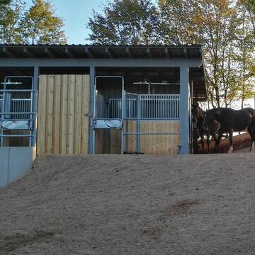
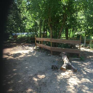
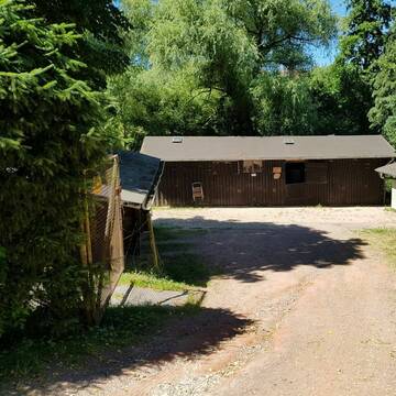
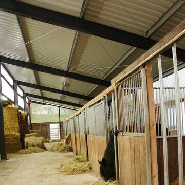
HIT-Aktivstall Dreischwesternhof
Trier
Dreischwesternhof
@Dreischwesternhof
Freizeitstall
Pferdeausbildung
Vermieten
Krankenbox
Parkplatz für Pferdeanhänger
Notfallboxen
20 weitere...
P+
Deprecated: Creation of dynamic property Zend_View_Helper_Ads::$adLink is deprecated in /var/www/stall-frei/htdocs/staging.stall-frei.de/library/Psf/View/Helper/Ads.php on line 108

Das Beste für die Hufe
Mechtersen
STALL-FREIde Marketing
@STALL-FREI-Marketing
Hufschmiede und Hufpfleger in Ihrer Nähe
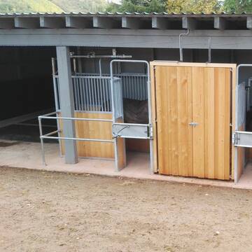
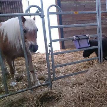
Offenstall mit Reitplatz in Pellingen
Pellingen
ragneroek
@Doris1
Freizeitstall
Geländestrecke
Vermieten
Longierzirkel/Roundpen
Paddock
Notfallboxen
11 weitere...
P
Leider kein Vorschaubild
Leider kein Vorschaubild
Freier Platz im Offenstall
Pluwig
Sarah
@SarahIsa_5
Hunde willkommen
Krankenbox
Offenstall
Halbpension
Selbstversorgung
8 weitere...
B

Feller Hof - Paddock Boxen und Offenstallplätze
Fell
Henriette-Portz
@Henriette-Portz
FN-Mitglied
Freizeitstall
Vermieten
Verpachten
Longierzirkel/Roundpen
Paddock
Pferdezucht
23 weitere...
P+

Pferdepension Emmler Mühle
Konz-Oberemmel
Pferdepension-Emmler-Muehle
@Pferdepension-Emmler-Muehle
Freizeitstall
Geländestrecke
Vermieten
Hunde willkommen
Krankenbox
Notfallboxen
17 weitere...
P

Ihr Pensionsstall bei Trier, ganzjährig Koppelga...
Morscheid
Alwin-Naumes
@Alwin-Naumes
FN-Mitglied
Freizeitstall
Longierzirkel/Roundpen
Ovalbahn
Außenboxen
Innenbox
Halbpension
Vollpension
17 weitere...
P
Leider kein Vorschaubild
Leider kein Vorschaubild
Boxen ab 1.November 25 frei
Zerf
ReitanlageKalfertshaus
@ReitanlageKalfertshaus
Freizeitstall
Gangpferdereiten
Vermieten
Verpachten
Hunde willkommen
Longierzirkel/Roundpen
Hengsthaltung möglich
Notfallboxen
16 weitere...
B
Leider kein Vorschaubild
Leider kein Vorschaubild
Blómatún Islandpferde
Bonerath
Blomatun
@Blomatun
FN-Mitglied
Freizeitstall
Vermieten
Führanlage
Hunde willkommen
Allergikerstall
Hengsthaltung möglich
41 weitere...
B

Frisches Stroh zu verkaufen!
Mechtersen
STALL-FREIde Marketing
@STALL-FREI-Marketing
Kaufe frisches Stroh für dein Pferd!


Goldbergerhof - Pferde artgerecht halten
Schmelz
Markus Herrmann
@Markus-Herrmann
Fahrstall, Kutschwagen
FN-Mitglied
Vermieten
Hunde willkommen
Laufband
Allergikerstall
bedampftes/gewaschenes Heu
35 weitere...
S

Reitverein Trier e.V.
Trier
Reitverein Trier e.V.
@Maria7
FN-Mitglied
Pferdeausbildung
Vermieten
Hunde willkommen
Paddock
bedampftes/gewaschenes Heu
Hufrehe geeignet
19 weitere...
P
Deprecated: Creation of dynamic property Zend_View::$pageCount is deprecated in /var/www/stall-frei/htdocs/staging.stall-frei.de/library/vendor/shardj/zf1-future/library/Zend/View/Abstract.php on line 308
Deprecated: Creation of dynamic property Zend_View::$itemCountPerPage is deprecated in /var/www/stall-frei/htdocs/staging.stall-frei.de/library/vendor/shardj/zf1-future/library/Zend/View/Abstract.php on line 308
Deprecated: Creation of dynamic property Zend_View::$first is deprecated in /var/www/stall-frei/htdocs/staging.stall-frei.de/library/vendor/shardj/zf1-future/library/Zend/View/Abstract.php on line 308
Deprecated: Creation of dynamic property Zend_View::$current is deprecated in /var/www/stall-frei/htdocs/staging.stall-frei.de/library/vendor/shardj/zf1-future/library/Zend/View/Abstract.php on line 308
Deprecated: Creation of dynamic property Zend_View::$last is deprecated in /var/www/stall-frei/htdocs/staging.stall-frei.de/library/vendor/shardj/zf1-future/library/Zend/View/Abstract.php on line 308
Deprecated: Creation of dynamic property Zend_View::$next is deprecated in /var/www/stall-frei/htdocs/staging.stall-frei.de/library/vendor/shardj/zf1-future/library/Zend/View/Abstract.php on line 308
Deprecated: Creation of dynamic property Zend_View::$pagesInRange is deprecated in /var/www/stall-frei/htdocs/staging.stall-frei.de/library/vendor/shardj/zf1-future/library/Zend/View/Abstract.php on line 308
Deprecated: Creation of dynamic property Zend_View::$firstPageInRange is deprecated in /var/www/stall-frei/htdocs/staging.stall-frei.de/library/vendor/shardj/zf1-future/library/Zend/View/Abstract.php on line 308
Deprecated: Creation of dynamic property Zend_View::$lastPageInRange is deprecated in /var/www/stall-frei/htdocs/staging.stall-frei.de/library/vendor/shardj/zf1-future/library/Zend/View/Abstract.php on line 308
Deprecated: Creation of dynamic property Zend_View::$currentItemCount is deprecated in /var/www/stall-frei/htdocs/staging.stall-frei.de/library/vendor/shardj/zf1-future/library/Zend/View/Abstract.php on line 308
Deprecated: Creation of dynamic property Zend_View::$totalItemCount is deprecated in /var/www/stall-frei/htdocs/staging.stall-frei.de/library/vendor/shardj/zf1-future/library/Zend/View/Abstract.php on line 308
Deprecated: Creation of dynamic property Zend_View::$firstItemNumber is deprecated in /var/www/stall-frei/htdocs/staging.stall-frei.de/library/vendor/shardj/zf1-future/library/Zend/View/Abstract.php on line 308
Deprecated: Creation of dynamic property Zend_View::$lastItemNumber is deprecated in /var/www/stall-frei/htdocs/staging.stall-frei.de/library/vendor/shardj/zf1-future/library/Zend/View/Abstract.php on line 308
Deprecated: Creation of dynamic property Zend_View::$router is deprecated in /var/www/stall-frei/htdocs/staging.stall-frei.de/library/vendor/shardj/zf1-future/library/Zend/View/Abstract.php on line 308
Deprecated: Creation of dynamic property Zend_View::$urlParams is deprecated in /var/www/stall-frei/htdocs/staging.stall-frei.de/library/vendor/shardj/zf1-future/library/Zend/View/Abstract.php on line 308
Deprecated: Creation of dynamic property Zend_View::$showAds is deprecated in /var/www/stall-frei/htdocs/staging.stall-frei.de/library/vendor/shardj/zf1-future/library/Zend/View/Abstract.php on line 308
Deprecated: Creation of dynamic property Zend_View::$objectIds is deprecated in /var/www/stall-frei/htdocs/staging.stall-frei.de/library/vendor/shardj/zf1-future/library/Zend/View/Abstract.php on line 308
Deprecated: Creation of dynamic property Zend_View::$showNavbar is deprecated in /var/www/stall-frei/htdocs/staging.stall-frei.de/library/vendor/shardj/zf1-future/library/Zend/View/Abstract.php on line 308
Deprecated: Creation of dynamic property Zend_View::$showBreadcrumb is deprecated in /var/www/stall-frei/htdocs/staging.stall-frei.de/library/vendor/shardj/zf1-future/library/Zend/View/Abstract.php on line 308
Deprecated: Creation of dynamic property Zend_View::$showFooter is deprecated in /var/www/stall-frei/htdocs/staging.stall-frei.de/library/vendor/shardj/zf1-future/library/Zend/View/Abstract.php on line 308
Deprecated: Creation of dynamic property Zend_View::$showInternalAds is deprecated in /var/www/stall-frei/htdocs/staging.stall-frei.de/library/vendor/shardj/zf1-future/library/Zend/View/Abstract.php on line 308
Deprecated: Creation of dynamic property Zend_View::$blNoContent is deprecated in /var/www/stall-frei/htdocs/staging.stall-frei.de/library/vendor/shardj/zf1-future/library/Zend/View/Abstract.php on line 308
Deprecated: Creation of dynamic property Zend_View::$sMetaDesc is deprecated in /var/www/stall-frei/htdocs/staging.stall-frei.de/library/vendor/shardj/zf1-future/library/Zend/View/Abstract.php on line 308
Deprecated: Creation of dynamic property Zend_View::$useGmaps is deprecated in /var/www/stall-frei/htdocs/staging.stall-frei.de/library/vendor/shardj/zf1-future/library/Zend/View/Abstract.php on line 308
Deprecated: Creation of dynamic property Zend_View::$touches is deprecated in /var/www/stall-frei/htdocs/staging.stall-frei.de/library/vendor/shardj/zf1-future/library/Zend/View/Abstract.php on line 308
Deprecated: Creation of dynamic property Zend_View::$oProject is deprecated in /var/www/stall-frei/htdocs/staging.stall-frei.de/library/vendor/shardj/zf1-future/library/Zend/View/Abstract.php on line 308
Deprecated: Creation of dynamic property Zend_View::$pageHeadline is deprecated in /var/www/stall-frei/htdocs/staging.stall-frei.de/library/vendor/shardj/zf1-future/library/Zend/View/Abstract.php on line 308
Deprecated: Creation of dynamic property Zend_View::$disableLocationField is deprecated in /var/www/stall-frei/htdocs/staging.stall-frei.de/library/vendor/shardj/zf1-future/library/Zend/View/Abstract.php on line 308
Deprecated: Creation of dynamic property Zend_View::$isSearch is deprecated in /var/www/stall-frei/htdocs/staging.stall-frei.de/library/vendor/shardj/zf1-future/library/Zend/View/Abstract.php on line 308
Deprecated: Creation of dynamic property Zend_View::$pageTitle is deprecated in /var/www/stall-frei/htdocs/staging.stall-frei.de/library/vendor/shardj/zf1-future/library/Zend/View/Abstract.php on line 308
Deprecated: Creation of dynamic property Psf_Form_Element_Text::$class is deprecated in /var/www/stall-frei/htdocs/staging.stall-frei.de/library/vendor/shardj/zf1-future/library/Zend/Form/Element.php on line 874
Deprecated: Creation of dynamic property Psf_Form_Element_Text::$size is deprecated in /var/www/stall-frei/htdocs/staging.stall-frei.de/library/vendor/shardj/zf1-future/library/Zend/Form/Element.php on line 874
Deprecated: Creation of dynamic property Psf_Form_Element_Text::$placeholder is deprecated in /var/www/stall-frei/htdocs/staging.stall-frei.de/library/vendor/shardj/zf1-future/library/Zend/Form/Element.php on line 874
Deprecated: Creation of dynamic property Psf_Form_Element_Hidden::$class is deprecated in /var/www/stall-frei/htdocs/staging.stall-frei.de/library/vendor/shardj/zf1-future/library/Zend/Form/Element.php on line 874
Deprecated: Creation of dynamic property Psf_Form_Element_Hidden::$class is deprecated in /var/www/stall-frei/htdocs/staging.stall-frei.de/library/vendor/shardj/zf1-future/library/Zend/Form/Element.php on line 874
Deprecated: Creation of dynamic property Psf_Form_Element_Hidden::$class is deprecated in /var/www/stall-frei/htdocs/staging.stall-frei.de/library/vendor/shardj/zf1-future/library/Zend/Form/Element.php on line 874
Deprecated: Creation of dynamic property Psf_Form_Element_Hidden::$class is deprecated in /var/www/stall-frei/htdocs/staging.stall-frei.de/library/vendor/shardj/zf1-future/library/Zend/Form/Element.php on line 874
Deprecated: Creation of dynamic property Psf_Form_Element_Select::$class is deprecated in /var/www/stall-frei/htdocs/staging.stall-frei.de/library/vendor/shardj/zf1-future/library/Zend/Form/Element.php on line 874
Deprecated: Creation of dynamic property Psf_Form_Element_Select::$class is deprecated in /var/www/stall-frei/htdocs/staging.stall-frei.de/library/vendor/shardj/zf1-future/library/Zend/Form/Element.php on line 874
Deprecated: Creation of dynamic property Psf_Form_Element_Select::$class is deprecated in /var/www/stall-frei/htdocs/staging.stall-frei.de/library/vendor/shardj/zf1-future/library/Zend/Form/Element.php on line 874
Deprecated: Creation of dynamic property Psf_Form_Element_Select::$class is deprecated in /var/www/stall-frei/htdocs/staging.stall-frei.de/library/vendor/shardj/zf1-future/library/Zend/Form/Element.php on line 874
Deprecated: Creation of dynamic property Psf_Form_Element_Text::$class is deprecated in /var/www/stall-frei/htdocs/staging.stall-frei.de/library/vendor/shardj/zf1-future/library/Zend/Form/Element.php on line 874
Deprecated: Creation of dynamic property Psf_Form_Element_Checkbox::$label is deprecated in /var/www/stall-frei/htdocs/staging.stall-frei.de/library/vendor/shardj/zf1-future/library/Zend/Form/Element.php on line 874
Deprecated: Creation of dynamic property Zend_View::$sort is deprecated in /var/www/stall-frei/htdocs/staging.stall-frei.de/library/vendor/shardj/zf1-future/library/Zend/View/Abstract.php on line 308
Deprecated: Creation of dynamic property Zend_View::$searchLocation is deprecated in /var/www/stall-frei/htdocs/staging.stall-frei.de/library/vendor/shardj/zf1-future/library/Zend/View/Abstract.php on line 308
Deprecated: Creation of dynamic property Zend_View::$locationHint is deprecated in /var/www/stall-frei/htdocs/staging.stall-frei.de/library/vendor/shardj/zf1-future/library/Zend/View/Abstract.php on line 308
Psf_GeoCoder_Abstract::getLocation: Ruwer Get Location CachedOrLive
Psf_GeoCoder_Abstract::getCachedOrLive: Ruwer
Psf_GeoCoder_OpenCageData::makeApiRequest: response:
Array
(
[documentation] => https://opencagedata.com/api
[licenses] => Array
(
[0] => Array
(
[name] => see attribution guide
[url] => https://opencagedata.com/credits
)
)
[results] => Array
(
[0] => Array
(
[bounds] => Array
(
[northeast] => Array
(
[lat] => 49.7857974
[lng] => 6.8359466
)
[southwest] => Array
(
[lat] => 49.6009735
[lng] => 6.6874189
)
)
[components] => Array
(
[ISO_3166-1_alpha-2] => DE
[ISO_3166-1_alpha-3] => DEU
[ISO_3166-2] => Array
(
[0] => DE-RP
)
[_category] => natural/water
[_type] => river
[continent] => Europe
[country] => Deutschland
[country_code] => de
[county] => Landkreis Trier-Saarburg
[political_union] => European Union
[river] => Ruwer
[state] => Rheinland-Pfalz
[state_code] => RP
)
[confidence] => 5
[formatted] => Ruwer, Trier-Saarburg, Rheinland-Pfalz, Deutschland
[geometry] => Array
(
[lat] => 49.6545278
[lng] => 6.7285304
)
)
[1] => Array
(
[bounds] => Array
(
[northeast] => Array
(
[lat] => 49.821894
[lng] => 6.7471503
)
[southwest] => Array
(
[lat] => 49.7706459
[lng] => 6.6827899
)
)
[components] => Array
(
[ISO_3166-1_alpha-2] => DE
[ISO_3166-1_alpha-3] => DEU
[ISO_3166-2] => Array
(
[0] => DE-RP
)
[_category] => place
[_normalized_city] => Trier
[_type] => neighbourhood
[city] => Trier
[continent] => Europe
[country] => Deutschland
[country_code] => de
[political_union] => European Union
[state] => Rheinland-Pfalz
[state_code] => RP
[suburb] => Ruwer-Eitelsbach
)
[confidence] => 7
[formatted] => Ruwer-Eitelsbach, Trier, Rheinland-Pfalz, Deutschland
[geometry] => Array
(
[lat] => 49.7852716
[lng] => 6.7101648
)
)
[2] => Array
(
[bounds] => Array
(
[northeast] => Array
(
[lat] => 49.7832532
[lng] => 6.8702618
)
[southwest] => Array
(
[lat] => 49.6507702
[lng] => 6.6861365
)
)
[components] => Array
(
[ISO_3166-1_alpha-2] => DE
[ISO_3166-1_alpha-3] => DEU
[ISO_3166-2] => Array
(
[0] => DE-RP
)
[_category] => place
[_normalized_city] => Ruwer
[_type] => municipality
[continent] => Europe
[country] => Deutschland
[country_code] => de
[county] => Landkreis Trier-Saarburg
[municipality] => Ruwer
[political_union] => European Union
[state] => Rheinland-Pfalz
[state_code] => RP
)
[confidence] => 6
[formatted] => Ruwer, Rheinland-Pfalz, Deutschland
[geometry] => Array
(
[lat] => 49.7169062
[lng] => 6.7811515
)
)
[3] => Array
(
[components] => Array
(
[ISO_3166-1_alpha-2] => FR
[ISO_3166-1_alpha-3] => FRA
[ISO_3166-2] => Array
(
[0] => FR-NOR
[1] => FR-50
)
[_category] => road
[_normalized_city] => Auvers
[_type] => road
[city] => Auvers
[continent] => Europe
[country] => France
[country_code] => fr
[county] => Manche
[local_authority] => Communauté de communes de la Baie du Cotentin
[political_union] => European Union
[postcode] => 50500
[road] => Route de la Bruyere
[state] => Normandie
[state_code] => NOR
)
[confidence] => 2
[formatted] => Route de la Bruyere, 50500 Auvers, France
[geometry] => Array
(
[lat] => 49.281597
[lng] => -1.329663
)
)
[4] => Array
(
[components] => Array
(
[ISO_3166-1_alpha-2] => FR
[ISO_3166-1_alpha-3] => FRA
[ISO_3166-2] => Array
(
[0] => FR-NOR
[1] => FR-50
)
[_category] => road
[_normalized_city] => Auvers
[_type] => road
[city] => Auvers
[continent] => Europe
[country] => France
[country_code] => fr
[county] => Manche
[local_authority] => Communauté de communes de la Baie du Cotentin
[political_union] => European Union
[postcode] => 50500
[road] => Route du Grand Chemin
[state] => Normandie
[state_code] => NOR
)
[confidence] => 10
[formatted] => Route du Grand Chemin, 50500 Auvers, France
[geometry] => Array
(
[lat] => 49.291745
[lng] => -1.322011
)
)
[5] => Array
(
[components] => Array
(
[ISO_3166-1_alpha-2] => FR
[ISO_3166-1_alpha-3] => FRA
[ISO_3166-2] => Array
(
[0] => FR-PDL
[1] => FR-53
)
[_category] => road
[_normalized_city] => Saint-Pierre-sur-Erve
[_type] => road
[city] => Saint-Pierre-sur-Erve
[continent] => Europe
[country] => France
[country_code] => fr
[county] => Mayenne
[local_authority] => Communauté de communes des Coëvrons
[political_union] => European Union
[postcode] => 53270
[road] => Chemin des Grands Auvers
[state] => Pays de la Loire
[state_code] => PDL
)
[confidence] => 10
[formatted] => Chemin des Grands Auvers, 53270 Saint-Pierre-sur-Erve, France
[geometry] => Array
(
[lat] => 48.006191
[lng] => -0.416865
)
)
[6] => Array
(
[components] => Array
(
[ISO_3166-1_alpha-2] => FR
[ISO_3166-1_alpha-3] => FRA
[ISO_3166-2] => Array
(
[0] => FR-BRE
[1] => FR-22
)
[_category] => road
[_normalized_city] => Châtelaudren-Plouagat
[_type] => road
[city] => Châtelaudren-Plouagat
[continent] => Europe
[country] => France
[country_code] => fr
[county] => Côtes-d'Armor
[local_authority] => Leff Armor Communauté
[political_union] => European Union
[postcode] => 22170
[road] => Rue de Ruvere
[state] => Bretagne
[state_code] => BRE
)
[confidence] => 10
[formatted] => Rue de Ruvere, 22170 Châtelaudren-Plouagat, France
[geometry] => Array
(
[lat] => 48.539358
[lng] => -2.97447
)
)
[7] => Array
(
[components] => Array
(
[ISO_3166-1_alpha-2] => FR
[ISO_3166-1_alpha-3] => FRA
[ISO_3166-2] => Array
(
[0] => FR-IDF
[1] => FR-91
)
[_category] => road
[_normalized_city] => Ballancourt-sur-Essonne
[_type] => road
[city] => Ballancourt-sur-Essonne
[continent] => Europe
[country] => France
[country_code] => fr
[county] => Essonne
[local_authority] => Communauté de communes du Val d'Essonne
[political_union] => European Union
[postcode] => 91610
[road] => Rue de la Croix Auvert
[state] => Île-de-France
[state_code] => IDF
)
[confidence] => 10
[formatted] => Rue de la Croix Auvert, 91610 Ballancourt-sur-Essonne, France
[geometry] => Array
(
[lat] => 48.533758
[lng] => 2.37615
)
)
[8] => Array
(
[components] => Array
(
[ISO_3166-1_alpha-2] => FR
[ISO_3166-1_alpha-3] => FRA
[ISO_3166-2] => Array
(
[0] => FR-IDF
[1] => FR-95
)
[_category] => road
[_normalized_city] => Auvers-sur-Oise
[_type] => road
[city] => Auvers-sur-Oise
[continent] => Europe
[country] => France
[country_code] => fr
[county] => Val-d'Oise
[local_authority] => Communauté de communes Sausseron Impressionnistes
[political_union] => European Union
[postcode] => 95430
[road] => Les Perruchets d’Auvers
[state] => Île-de-France
[state_code] => IDF
)
[confidence] => 10
[formatted] => Les Perruchets d’Auvers, 95430 Auvers-sur-Oise, France
[geometry] => Array
(
[lat] => 49.074175
[lng] => 2.162396
)
)
[9] => Array
(
[components] => Array
(
[ISO_3166-1_alpha-2] => FR
[ISO_3166-1_alpha-3] => FRA
[ISO_3166-2] => Array
(
[0] => FR-NOR
[1] => FR-50
)
[_category] => road
[_normalized_city] => Auvers
[_type] => road
[city] => Auvers
[continent] => Europe
[country] => France
[country_code] => fr
[county] => Manche
[local_authority] => Communauté de communes de la Baie du Cotentin
[political_union] => European Union
[postcode] => 50500
[road] => Route de la Godillerie
[state] => Normandie
[state_code] => NOR
)
[confidence] => 10
[formatted] => Route de la Godillerie, 50500 Auvers, France
[geometry] => Array
(
[lat] => 49.289644
[lng] => -1.329033
)
)
)
[status] => Array
(
[code] => 200
[message] => OK
)
[stay_informed] => Array
(
[blog] => https://blog.opencagedata.com
[mastodon] => https://en.osm.town/@opencage
)
[thanks] => For using an OpenCage API
[timestamp] => Array
(
[created_http] => Sun, 08 Feb 2026 14:50:54 GMT
[created_unix] => 1770562254
)
[total_results] => 10
)
Psf_GeoCoder_Abstract::convertLocationResult
{"documentation":"https:\/\/opencagedata.com\/api","licenses":[{"name":"see attribution guide","url":"https:\/\/opencagedata.com\/credits"}],"results":[{"bounds":{"northeast":{"lat":49.7857974,"lng":6.8359466},"southwest":{"lat":49.6009735,"lng":6.6874189}},"components":{"ISO_3166-1_alpha-2":"DE","ISO_3166-1_alpha-3":"DEU","ISO_3166-2":["DE-RP"],"_category":"natural\/water","_type":"river","continent":"Europe","country":"Deutschland","country_code":"de","county":"Landkreis Trier-Saarburg","political_union":"European Union","river":"Ruwer","state":"Rheinland-Pfalz","state_code":"RP"},"confidence":5,"formatted":"Ruwer, Trier-Saarburg, Rheinland-Pfalz, Deutschland","geometry":{"lat":49.6545278,"lng":6.7285304}},{"bounds":{"northeast":{"lat":49.821894,"lng":6.7471503},"southwest":{"lat":49.7706459,"lng":6.6827899}},"components":{"ISO_3166-1_alpha-2":"DE","ISO_3166-1_alpha-3":"DEU","ISO_3166-2":["DE-RP"],"_category":"place","_normalized_city":"Trier","_type":"neighbourhood","city":"Trier","continent":"Europe","country":"Deutschland","country_code":"de","political_union":"European Union","state":"Rheinland-Pfalz","state_code":"RP","suburb":"Ruwer-Eitelsbach"},"confidence":7,"formatted":"Ruwer-Eitelsbach, Trier, Rheinland-Pfalz, Deutschland","geometry":{"lat":49.7852716,"lng":6.7101648}},{"bounds":{"northeast":{"lat":49.7832532,"lng":6.8702618},"southwest":{"lat":49.6507702,"lng":6.6861365}},"components":{"ISO_3166-1_alpha-2":"DE","ISO_3166-1_alpha-3":"DEU","ISO_3166-2":["DE-RP"],"_category":"place","_normalized_city":"Ruwer","_type":"municipality","continent":"Europe","country":"Deutschland","country_code":"de","county":"Landkreis Trier-Saarburg","municipality":"Ruwer","political_union":"European Union","state":"Rheinland-Pfalz","state_code":"RP"},"confidence":6,"formatted":"Ruwer, Rheinland-Pfalz, Deutschland","geometry":{"lat":49.7169062,"lng":6.7811515}},{"components":{"ISO_3166-1_alpha-2":"FR","ISO_3166-1_alpha-3":"FRA","ISO_3166-2":["FR-NOR","FR-50"],"_category":"road","_normalized_city":"Auvers","_type":"road","city":"Auvers","continent":"Europe","country":"France","country_code":"fr","county":"Manche","local_authority":"Communaut\u00e9 de communes de la Baie du Cotentin","political_union":"European Union","postcode":"50500","road":"Route de la Bruyere","state":"Normandie","state_code":"NOR"},"confidence":2,"formatted":"Route de la Bruyere, 50500 Auvers, France","geometry":{"lat":49.281597,"lng":-1.329663}},{"components":{"ISO_3166-1_alpha-2":"FR","ISO_3166-1_alpha-3":"FRA","ISO_3166-2":["FR-NOR","FR-50"],"_category":"road","_normalized_city":"Auvers","_type":"road","city":"Auvers","continent":"Europe","country":"France","country_code":"fr","county":"Manche","local_authority":"Communaut\u00e9 de communes de la Baie du Cotentin","political_union":"European Union","postcode":"50500","road":"Route du Grand Chemin","state":"Normandie","state_code":"NOR"},"confidence":10,"formatted":"Route du Grand Chemin, 50500 Auvers, France","geometry":{"lat":49.291745,"lng":-1.322011}},{"components":{"ISO_3166-1_alpha-2":"FR","ISO_3166-1_alpha-3":"FRA","ISO_3166-2":["FR-PDL","FR-53"],"_category":"road","_normalized_city":"Saint-Pierre-sur-Erve","_type":"road","city":"Saint-Pierre-sur-Erve","continent":"Europe","country":"France","country_code":"fr","county":"Mayenne","local_authority":"Communaut\u00e9 de communes des Co\u00ebvrons","political_union":"European Union","postcode":"53270","road":"Chemin des Grands Auvers","state":"Pays de la Loire","state_code":"PDL"},"confidence":10,"formatted":"Chemin des Grands Auvers, 53270 Saint-Pierre-sur-Erve, France","geometry":{"lat":48.006191,"lng":-0.416865}},{"components":{"ISO_3166-1_alpha-2":"FR","ISO_3166-1_alpha-3":"FRA","ISO_3166-2":["FR-BRE","FR-22"],"_category":"road","_normalized_city":"Ch\u00e2telaudren-Plouagat","_type":"road","city":"Ch\u00e2telaudren-Plouagat","continent":"Europe","country":"France","country_code":"fr","county":"C\u00f4tes-d'Armor","local_authority":"Leff Armor Communaut\u00e9","political_union":"European Union","postcode":"22170","road":"Rue de Ruvere","state":"Bretagne","state_code":"BRE"},"confidence":10,"formatted":"Rue de Ruvere, 22170 Ch\u00e2telaudren-Plouagat, France","geometry":{"lat":48.539358,"lng":-2.97447}},{"components":{"ISO_3166-1_alpha-2":"FR","ISO_3166-1_alpha-3":"FRA","ISO_3166-2":["FR-IDF","FR-91"],"_category":"road","_normalized_city":"Ballancourt-sur-Essonne","_type":"road","city":"Ballancourt-sur-Essonne","continent":"Europe","country":"France","country_code":"fr","county":"Essonne","local_authority":"Communaut\u00e9 de communes du Val d'Essonne","political_union":"European Union","postcode":"91610","road":"Rue de la Croix Auvert","state":"\u00cele-de-France","state_code":"IDF"},"confidence":10,"formatted":"Rue de la Croix Auvert, 91610 Ballancourt-sur-Essonne, France","geometry":{"lat":48.533758,"lng":2.37615}},{"components":{"ISO_3166-1_alpha-2":"FR","ISO_3166-1_alpha-3":"FRA","ISO_3166-2":["FR-IDF","FR-95"],"_category":"road","_normalized_city":"Auvers-sur-Oise","_type":"road","city":"Auvers-sur-Oise","continent":"Europe","country":"France","country_code":"fr","county":"Val-d'Oise","local_authority":"Communaut\u00e9 de communes Sausseron Impressionnistes","political_union":"European Union","postcode":"95430","road":"Les Perruchets d\u2019Auvers","state":"\u00cele-de-France","state_code":"IDF"},"confidence":10,"formatted":"Les Perruchets d\u2019Auvers, 95430 Auvers-sur-Oise, France","geometry":{"lat":49.074175,"lng":2.162396}},{"components":{"ISO_3166-1_alpha-2":"FR","ISO_3166-1_alpha-3":"FRA","ISO_3166-2":["FR-NOR","FR-50"],"_category":"road","_normalized_city":"Auvers","_type":"road","city":"Auvers","continent":"Europe","country":"France","country_code":"fr","county":"Manche","local_authority":"Communaut\u00e9 de communes de la Baie du Cotentin","political_union":"European Union","postcode":"50500","road":"Route de la Godillerie","state":"Normandie","state_code":"NOR"},"confidence":10,"formatted":"Route de la Godillerie, 50500 Auvers, France","geometry":{"lat":49.289644,"lng":-1.329033}}],"status":{"code":200,"message":"OK"},"stay_informed":{"blog":"https:\/\/blog.opencagedata.com","mastodon":"https:\/\/en.osm.town\/@opencage"},"thanks":"For using an OpenCage API","timestamp":{"created_http":"Sun, 08 Feb 2026 14:50:54 GMT","created_unix":1770562254},"total_results":10}Array
(
[0] => stdClass Object
(
[bounds] => stdClass Object
(
[northeast] => stdClass Object
(
[lat] => 49.7857974
[lng] => 6.8359466
)
[southwest] => stdClass Object
(
[lat] => 49.6009735
[lng] => 6.6874189
)
)
[components] => stdClass Object
(
[ISO_3166-1_alpha-2] => DE
[ISO_3166-1_alpha-3] => DEU
[ISO_3166-2] => Array
(
[0] => DE-RP
)
[_category] => natural/water
[_type] => river
[continent] => Europe
[country] => Deutschland
[country_code] => de
[county] => Landkreis Trier-Saarburg
[political_union] => European Union
[river] => Ruwer
[state] => Rheinland-Pfalz
[state_code] => RP
)
[confidence] => 5
[formatted] => Ruwer, Trier-Saarburg, Rheinland-Pfalz, Deutschland
[geometry] => stdClass Object
(
[lat] => 49.6545278
[lng] => 6.7285304
)
)
[1] => stdClass Object
(
[bounds] => stdClass Object
(
[northeast] => stdClass Object
(
[lat] => 49.821894
[lng] => 6.7471503
)
[southwest] => stdClass Object
(
[lat] => 49.7706459
[lng] => 6.6827899
)
)
[components] => stdClass Object
(
[ISO_3166-1_alpha-2] => DE
[ISO_3166-1_alpha-3] => DEU
[ISO_3166-2] => Array
(
[0] => DE-RP
)
[_category] => place
[_normalized_city] => Trier
[_type] => neighbourhood
[city] => Trier
[continent] => Europe
[country] => Deutschland
[country_code] => de
[political_union] => European Union
[state] => Rheinland-Pfalz
[state_code] => RP
[suburb] => Ruwer-Eitelsbach
)
[confidence] => 7
[formatted] => Ruwer-Eitelsbach, Trier, Rheinland-Pfalz, Deutschland
[geometry] => stdClass Object
(
[lat] => 49.7852716
[lng] => 6.7101648
)
)
[2] => stdClass Object
(
[bounds] => stdClass Object
(
[northeast] => stdClass Object
(
[lat] => 49.7832532
[lng] => 6.8702618
)
[southwest] => stdClass Object
(
[lat] => 49.6507702
[lng] => 6.6861365
)
)
[components] => stdClass Object
(
[ISO_3166-1_alpha-2] => DE
[ISO_3166-1_alpha-3] => DEU
[ISO_3166-2] => Array
(
[0] => DE-RP
)
[_category] => place
[_normalized_city] => Ruwer
[_type] => municipality
[continent] => Europe
[country] => Deutschland
[country_code] => de
[county] => Landkreis Trier-Saarburg
[municipality] => Ruwer
[political_union] => European Union
[state] => Rheinland-Pfalz
[state_code] => RP
)
[confidence] => 6
[formatted] => Ruwer, Rheinland-Pfalz, Deutschland
[geometry] => stdClass Object
(
[lat] => 49.7169062
[lng] => 6.7811515
)
)
[3] => stdClass Object
(
[components] => stdClass Object
(
[ISO_3166-1_alpha-2] => FR
[ISO_3166-1_alpha-3] => FRA
[ISO_3166-2] => Array
(
[0] => FR-NOR
[1] => FR-50
)
[_category] => road
[_normalized_city] => Auvers
[_type] => road
[city] => Auvers
[continent] => Europe
[country] => France
[country_code] => fr
[county] => Manche
[local_authority] => Communauté de communes de la Baie du Cotentin
[political_union] => European Union
[postcode] => 50500
[road] => Route de la Bruyere
[state] => Normandie
[state_code] => NOR
)
[confidence] => 2
[formatted] => Route de la Bruyere, 50500 Auvers, France
[geometry] => stdClass Object
(
[lat] => 49.281597
[lng] => -1.329663
)
)
[4] => stdClass Object
(
[components] => stdClass Object
(
[ISO_3166-1_alpha-2] => FR
[ISO_3166-1_alpha-3] => FRA
[ISO_3166-2] => Array
(
[0] => FR-NOR
[1] => FR-50
)
[_category] => road
[_normalized_city] => Auvers
[_type] => road
[city] => Auvers
[continent] => Europe
[country] => France
[country_code] => fr
[county] => Manche
[local_authority] => Communauté de communes de la Baie du Cotentin
[political_union] => European Union
[postcode] => 50500
[road] => Route du Grand Chemin
[state] => Normandie
[state_code] => NOR
)
[confidence] => 10
[formatted] => Route du Grand Chemin, 50500 Auvers, France
[geometry] => stdClass Object
(
[lat] => 49.291745
[lng] => -1.322011
)
)
[5] => stdClass Object
(
[components] => stdClass Object
(
[ISO_3166-1_alpha-2] => FR
[ISO_3166-1_alpha-3] => FRA
[ISO_3166-2] => Array
(
[0] => FR-PDL
[1] => FR-53
)
[_category] => road
[_normalized_city] => Saint-Pierre-sur-Erve
[_type] => road
[city] => Saint-Pierre-sur-Erve
[continent] => Europe
[country] => France
[country_code] => fr
[county] => Mayenne
[local_authority] => Communauté de communes des Coëvrons
[political_union] => European Union
[postcode] => 53270
[road] => Chemin des Grands Auvers
[state] => Pays de la Loire
[state_code] => PDL
)
[confidence] => 10
[formatted] => Chemin des Grands Auvers, 53270 Saint-Pierre-sur-Erve, France
[geometry] => stdClass Object
(
[lat] => 48.006191
[lng] => -0.416865
)
)
[6] => stdClass Object
(
[components] => stdClass Object
(
[ISO_3166-1_alpha-2] => FR
[ISO_3166-1_alpha-3] => FRA
[ISO_3166-2] => Array
(
[0] => FR-BRE
[1] => FR-22
)
[_category] => road
[_normalized_city] => Châtelaudren-Plouagat
[_type] => road
[city] => Châtelaudren-Plouagat
[continent] => Europe
[country] => France
[country_code] => fr
[county] => Côtes-d'Armor
[local_authority] => Leff Armor Communauté
[political_union] => European Union
[postcode] => 22170
[road] => Rue de Ruvere
[state] => Bretagne
[state_code] => BRE
)
[confidence] => 10
[formatted] => Rue de Ruvere, 22170 Châtelaudren-Plouagat, France
[geometry] => stdClass Object
(
[lat] => 48.539358
[lng] => -2.97447
)
)
[7] => stdClass Object
(
[components] => stdClass Object
(
[ISO_3166-1_alpha-2] => FR
[ISO_3166-1_alpha-3] => FRA
[ISO_3166-2] => Array
(
[0] => FR-IDF
[1] => FR-91
)
[_category] => road
[_normalized_city] => Ballancourt-sur-Essonne
[_type] => road
[city] => Ballancourt-sur-Essonne
[continent] => Europe
[country] => France
[country_code] => fr
[county] => Essonne
[local_authority] => Communauté de communes du Val d'Essonne
[political_union] => European Union
[postcode] => 91610
[road] => Rue de la Croix Auvert
[state] => Île-de-France
[state_code] => IDF
)
[confidence] => 10
[formatted] => Rue de la Croix Auvert, 91610 Ballancourt-sur-Essonne, France
[geometry] => stdClass Object
(
[lat] => 48.533758
[lng] => 2.37615
)
)
[8] => stdClass Object
(
[components] => stdClass Object
(
[ISO_3166-1_alpha-2] => FR
[ISO_3166-1_alpha-3] => FRA
[ISO_3166-2] => Array
(
[0] => FR-IDF
[1] => FR-95
)
[_category] => road
[_normalized_city] => Auvers-sur-Oise
[_type] => road
[city] => Auvers-sur-Oise
[continent] => Europe
[country] => France
[country_code] => fr
[county] => Val-d'Oise
[local_authority] => Communauté de communes Sausseron Impressionnistes
[political_union] => European Union
[postcode] => 95430
[road] => Les Perruchets d’Auvers
[state] => Île-de-France
[state_code] => IDF
)
[confidence] => 10
[formatted] => Les Perruchets d’Auvers, 95430 Auvers-sur-Oise, France
[geometry] => stdClass Object
(
[lat] => 49.074175
[lng] => 2.162396
)
)
[9] => stdClass Object
(
[components] => stdClass Object
(
[ISO_3166-1_alpha-2] => FR
[ISO_3166-1_alpha-3] => FRA
[ISO_3166-2] => Array
(
[0] => FR-NOR
[1] => FR-50
)
[_category] => road
[_normalized_city] => Auvers
[_type] => road
[city] => Auvers
[continent] => Europe
[country] => France
[country_code] => fr
[county] => Manche
[local_authority] => Communauté de communes de la Baie du Cotentin
[political_union] => European Union
[postcode] => 50500
[road] => Route de la Godillerie
[state] => Normandie
[state_code] => NOR
)
[confidence] => 10
[formatted] => Route de la Godillerie, 50500 Auvers, France
[geometry] => stdClass Object
(
[lat] => 49.289644
[lng] => -1.329033
)
)
)
Psf_GeoCoder_OpenCageData::getKeyMap: 0
stdClass Object
(
    [bounds] => stdClass Object
        (
            [northeast] => stdClass Object
                (
                    [lat] => 49.7857974
                    [lng] => 6.8359466
                )

            [southwest] => stdClass Object
                (
                    [lat] => 49.6009735
                    [lng] => 6.6874189
                )

        )

    [components] => stdClass Object
        (
            [ISO_3166-1_alpha-2] => DE
            [ISO_3166-1_alpha-3] => DEU
            [ISO_3166-2] => Array
                (
                    [0] => DE-RP
                )

            [_category] => natural/water
            [_type] => river
            [continent] => Europe
            [country] => Deutschland
            [country_code] => de
            [county] => Landkreis Trier-Saarburg
            [political_union] => European Union
            [river] => Ruwer
            [state] => Rheinland-Pfalz
            [state_code] => RP
        )

    [confidence] => 5
    [formatted] => Ruwer, Trier-Saarburg, Rheinland-Pfalz, Deutschland
    [geometry] => stdClass Object
        (
            [lat] => 49.6545278
            [lng] => 6.7285304
        )

)
Psf_GeoCoder_OpenCageData::getCounty: Trier-Saarburg
Psf_GeoCoder_OpenCageData::addMissingData REFETCH!
Array
(
    [address] => Ruwer, Trier-Saarburg, Rheinland-Pfalz, Deutschland
    [type] => river
    [street] =>
    [city] =>
    [county] => Trier-Saarburg
    [state] => Rheinland-Pfalz
    [zip] =>
    [country] => Deutschland
    [suburb] =>
    [countrycode] => de
    [latitude] => 49.6545278
    [longitude] => 6.7285304
    [accuracy] => 1
    [confidence] => 5
    [bounds] => stdClass Object
        (
            [northeast] => stdClass Object
                (
                    [lat] => 49.7857974
                    [lng] => 6.8359466
                )

            [southwest] => stdClass Object
                (
                    [lat] => 49.6009735
                    [lng] => 6.6874189
                )

        )

)
reformat!
Array
(
    [address] => Ruwer, Trier-Saarburg, Rheinland-Pfalz, Deutschland
    [type] => river
    [street] =>
    [city] =>
    [county] => Trier-Saarburg
    [state] => Rheinland-Pfalz
    [zip] =>
    [country] => Deutschland
    [suburb] =>
    [countrycode] => de
    [latitude] => 49.6545278
    [longitude] => 6.7285304
    [accuracy] => 1
    [confidence] => 5
    [bounds] => stdClass Object
        (
            [northeast] => stdClass Object
                (
                    [lat] => 49.7857974
                    [lng] => 6.8359466
                )

            [southwest] => stdClass Object
                (
                    [lat] => 49.6009735
                    [lng] => 6.6874189
                )

        )

    [place] => , Rheinland-Pfalz
    [hash] => 502d767202480e9387995f7818794e6b
)
Psf_GeoCoder_OpenCageData::getKeyMap: 1
stdClass Object
(
    [bounds] => stdClass Object
        (
            [northeast] => stdClass Object
                (
                    [lat] => 49.821894
                    [lng] => 6.7471503
                )

            [southwest] => stdClass Object
                (
                    [lat] => 49.7706459
                    [lng] => 6.6827899
                )

        )

    [components] => stdClass Object
        (
            [ISO_3166-1_alpha-2] => DE
            [ISO_3166-1_alpha-3] => DEU
            [ISO_3166-2] => Array
                (
                    [0] => DE-RP
                )

            [_category] => place
            [_normalized_city] => Trier
            [_type] => neighbourhood
            [city] => Trier
            [continent] => Europe
            [country] => Deutschland
            [country_code] => de
            [political_union] => European Union
            [state] => Rheinland-Pfalz
            [state_code] => RP
            [suburb] => Ruwer-Eitelsbach
        )

    [confidence] => 7
    [formatted] => Ruwer-Eitelsbach, Trier, Rheinland-Pfalz, Deutschland
    [geometry] => stdClass Object
        (
            [lat] => 49.7852716
            [lng] => 6.7101648
        )

)
Psf_GeoCoder_OpenCageData::getCounty: Trier
Psf_GeoCoder_OpenCageData::addMissingData REFETCH!
Array
(
    [address] => Ruwer-Eitelsbach, Trier, Rheinland-Pfalz, Deutschland
    [type] => neighbourhood
    [street] =>
    [city] => Ruwer-Eitelsbach
    [county] => Trier
    [state] => Rheinland-Pfalz
    [zip] =>
    [country] => Deutschland
    [suburb] => Ruwer-Eitelsbach
    [countrycode] => de
    [latitude] => 49.7852716
    [longitude] => 6.7101648
    [accuracy] => 1
    [confidence] => 7
    [bounds] => stdClass Object
        (
            [northeast] => stdClass Object
                (
                    [lat] => 49.821894
                    [lng] => 6.7471503
                )

            [southwest] => stdClass Object
                (
                    [lat] => 49.7706459
                    [lng] => 6.6827899
                )

        )

)
reformat!
Array
(
    [address] => Ruwer-Eitelsbach, Trier, Rheinland-Pfalz, Deutschland
    [type] => neighbourhood
    [street] =>
    [city] => Ruwer-Eitelsbach
    [county] => Trier
    [state] => Rheinland-Pfalz
    [zip] =>
    [country] => Deutschland
    [suburb] => Ruwer-Eitelsbach
    [countrycode] => de
    [latitude] => 49.7852716
    [longitude] => 6.7101648
    [accuracy] => 1
    [confidence] => 7
    [bounds] => stdClass Object
        (
            [northeast] => stdClass Object
                (
                    [lat] => 49.821894
                    [lng] => 6.7471503
                )

            [southwest] => stdClass Object
                (
                    [lat] => 49.7706459
                    [lng] => 6.6827899
                )

        )

    [place] => Ruwer-Eitelsbach, Rheinland-Pfalz
    [hash] => 9f2aaa4241f0e001d37cea79f98b8e6e
)
Psf_GeoCoder_OpenCageData::getKeyMap: 2
stdClass Object
(
    [bounds] => stdClass Object
        (
            [northeast] => stdClass Object
                (
                    [lat] => 49.7832532
                    [lng] => 6.8702618
                )

            [southwest] => stdClass Object
                (
                    [lat] => 49.6507702
                    [lng] => 6.6861365
                )

        )

    [components] => stdClass Object
        (
            [ISO_3166-1_alpha-2] => DE
            [ISO_3166-1_alpha-3] => DEU
            [ISO_3166-2] => Array
                (
                    [0] => DE-RP
                )

            [_category] => place
            [_normalized_city] => Ruwer
            [_type] => municipality
            [continent] => Europe
            [country] => Deutschland
            [country_code] => de
            [county] => Landkreis Trier-Saarburg
            [municipality] => Ruwer
            [political_union] => European Union
            [state] => Rheinland-Pfalz
            [state_code] => RP
        )

    [confidence] => 6
    [formatted] => Ruwer, Rheinland-Pfalz, Deutschland
    [geometry] => stdClass Object
        (
            [lat] => 49.7169062
            [lng] => 6.7811515
        )

)
Psf_GeoCoder_OpenCageData::getCounty: Trier-Saarburg
Psf_GeoCoder_OpenCageData::addMissingData REFETCH!
Array
(
    [address] => Ruwer, Rheinland-Pfalz, Deutschland
    [type] => municipality
    [street] =>
    [city] =>
    [county] => Trier-Saarburg
    [state] => Rheinland-Pfalz
    [zip] =>
    [country] => Deutschland
    [suburb] =>
    [countrycode] => de
    [latitude] => 49.7169062
    [longitude] => 6.7811515
    [accuracy] => 1
    [confidence] => 6
    [bounds] => stdClass Object
        (
            [northeast] => stdClass Object
                (
                    [lat] => 49.7832532
                    [lng] => 6.8702618
                )

            [southwest] => stdClass Object
                (
                    [lat] => 49.6507702
                    [lng] => 6.6861365
                )

        )

)
reformat!
Array
(
    [address] => Ruwer, Rheinland-Pfalz, Deutschland
    [type] => municipality
    [street] =>
    [city] =>
    [county] => Trier-Saarburg
    [state] => Rheinland-Pfalz
    [zip] =>
    [country] => Deutschland
    [suburb] =>
    [countrycode] => de
    [latitude] => 49.7169062
    [longitude] => 6.7811515
    [accuracy] => 1
    [confidence] => 6
    [bounds] => stdClass Object
        (
            [northeast] => stdClass Object
                (
                    [lat] => 49.7832532
                    [lng] => 6.8702618
                )

            [southwest] => stdClass Object
                (
                    [lat] => 49.6507702
                    [lng] => 6.6861365
                )

        )

    [place] => , Rheinland-Pfalz
    [hash] => 502d767202480e9387995f7818794e6b
)
Psf_GeoCoder_OpenCageData::getKeyMap: 3
stdClass Object
(
    [components] => stdClass Object
        (
            [ISO_3166-1_alpha-2] => FR
            [ISO_3166-1_alpha-3] => FRA
            [ISO_3166-2] => Array
                (
                    [0] => FR-NOR
                    [1] => FR-50
                )

            [_category] => road
            [_normalized_city] => Auvers
            [_type] => road
            [city] => Auvers
            [continent] => Europe
            [country] => France
            [country_code] => fr
            [county] => Manche
            [local_authority] => Communauté de communes de la Baie du Cotentin
            [political_union] => European Union
            [postcode] => 50500
            [road] => Route de la Bruyere
            [state] => Normandie
            [state_code] => NOR
        )

    [confidence] => 2
    [formatted] => Route de la Bruyere, 50500 Auvers, France
    [geometry] => stdClass Object
        (
            [lat] => 49.281597
            [lng] => -1.329663
        )

)
Psf_GeoCoder_OpenCageData::getCounty: Manche
Psf_GeoCoder_OpenCageData::addMissingData REFETCH!
Array
(
    [address] => Route de la Bruyere, 50500 Auvers, France
    [type] => road
    [street] => Route de la Bruyere
    [city] => Auvers
    [county] => Manche
    [state] => Normandie
    [zip] => 50500
    [country] => France
    [suburb] =>
    [countrycode] => fr
    [latitude] => 49.281597
    [longitude] => -1.329663
    [accuracy] => 1
    [confidence] => 2
    [bounds] =>
)
reformat!
Array
(
    [address] => Route de la Bruyere, 50500 Auvers, France
    [type] => road
    [street] => Route de la Bruyere
    [city] => Auvers
    [county] => Manche
    [state] => Normandie
    [zip] => 50500
    [country] => France
    [suburb] =>
    [countrycode] => fr
    [latitude] => 49.281597
    [longitude] => -1.329663
    [accuracy] => 1
    [confidence] => 2
    [bounds] =>
    [place] => Route de la Bruyere, 50500 Auvers, Normandie
    [hash] => 34e5c005b1303d46e5fdce2d070ad570
)
Psf_GeoCoder_OpenCageData::getKeyMap: 4
stdClass Object
(
    [components] => stdClass Object
        (
            [ISO_3166-1_alpha-2] => FR
            [ISO_3166-1_alpha-3] => FRA
            [ISO_3166-2] => Array
                (
                    [0] => FR-NOR
                    [1] => FR-50
                )

            [_category] => road
            [_normalized_city] => Auvers
            [_type] => road
            [city] => Auvers
            [continent] => Europe
            [country] => France
            [country_code] => fr
            [county] => Manche
            [local_authority] => Communauté de communes de la Baie du Cotentin
            [political_union] => European Union
            [postcode] => 50500
            [road] => Route du Grand Chemin
            [state] => Normandie
            [state_code] => NOR
        )

    [confidence] => 10
    [formatted] => Route du Grand Chemin, 50500 Auvers, France
    [geometry] => stdClass Object
        (
            [lat] => 49.291745
            [lng] => -1.322011
        )

)
Psf_GeoCoder_OpenCageData::getCounty: Manche
Psf_GeoCoder_OpenCageData::addMissingData REFETCH!
Array
(
    [address] => Route du Grand Chemin, 50500 Auvers, France
    [type] => road
    [street] => Route du Grand Chemin
    [city] => Auvers
    [county] => Manche
    [state] => Normandie
    [zip] => 50500
    [country] => France
    [suburb] =>
    [countrycode] => fr
    [latitude] => 49.291745
    [longitude] => -1.322011
    [accuracy] => 1
    [confidence] => 10
    [bounds] =>
)
reformat!
Array
(
    [address] => Route du Grand Chemin, 50500 Auvers, France
    [type] => road
    [street] => Route du Grand Chemin
    [city] => Auvers
    [county] => Manche
    [state] => Normandie
    [zip] => 50500
    [country] => France
    [suburb] =>
    [countrycode] => fr
    [latitude] => 49.291745
    [longitude] => -1.322011
    [accuracy] => 1
    [confidence] => 10
    [bounds] =>
    [place] => Route du Grand Chemin, 50500 Auvers, Normandie
    [hash] => a2615d451ca69653df6ee1d3b8e0f162
)
Psf_GeoCoder_OpenCageData::getKeyMap: 5
stdClass Object
(
    [components] => stdClass Object
        (
            [ISO_3166-1_alpha-2] => FR
            [ISO_3166-1_alpha-3] => FRA
            [ISO_3166-2] => Array
                (
                    [0] => FR-PDL
                    [1] => FR-53
                )

            [_category] => road
            [_normalized_city] => Saint-Pierre-sur-Erve
            [_type] => road
            [city] => Saint-Pierre-sur-Erve
            [continent] => Europe
            [country] => France
            [country_code] => fr
            [county] => Mayenne
            [local_authority] => Communauté de communes des Coëvrons
            [political_union] => European Union
            [postcode] => 53270
            [road] => Chemin des Grands Auvers
            [state] => Pays de la Loire
            [state_code] => PDL
        )

    [confidence] => 10
    [formatted] => Chemin des Grands Auvers, 53270 Saint-Pierre-sur-Erve, France
    [geometry] => stdClass Object
        (
            [lat] => 48.006191
            [lng] => -0.416865
        )

)
Psf_GeoCoder_OpenCageData::getCounty: Mayenne
Psf_GeoCoder_OpenCageData::addMissingData REFETCH!
Array
(
    [address] => Chemin des Grands Auvers, 53270 Saint-Pierre-sur-Erve, France
    [type] => road
    [street] => Chemin des Grands Auvers
    [city] => Saint-Pierre-sur-Erve
    [county] => Mayenne
    [state] => Pays de la Loire
    [zip] => 53270
    [country] => France
    [suburb] =>
    [countrycode] => fr
    [latitude] => 48.006191
    [longitude] => -0.416865
    [accuracy] => 1
    [confidence] => 10
    [bounds] =>
)
reformat!
Array
(
    [address] => Chemin des Grands Auvers, 53270 Saint-Pierre-sur-Erve, France
    [type] => road
    [street] => Chemin des Grands Auvers
    [city] => Saint-Pierre-sur-Erve
    [county] => Mayenne
    [state] => Pays de la Loire
    [zip] => 53270
    [country] => France
    [suburb] =>
    [countrycode] => fr
    [latitude] => 48.006191
    [longitude] => -0.416865
    [accuracy] => 1
    [confidence] => 10
    [bounds] =>
    [place] => Chemin des Grands Auvers, 53270 Saint-Pierre-sur-Erve, Pays de la Loire
    [hash] => 9a3148b8150eccbfb0a743f95bbe7718
)
Psf_GeoCoder_OpenCageData::getKeyMap: 6
stdClass Object
(
    [components] => stdClass Object
        (
            [ISO_3166-1_alpha-2] => FR
            [ISO_3166-1_alpha-3] => FRA
            [ISO_3166-2] => Array
                (
                    [0] => FR-BRE
                    [1] => FR-22
                )

            [_category] => road
            [_normalized_city] => Châtelaudren-Plouagat
            [_type] => road
            [city] => Châtelaudren-Plouagat
            [continent] => Europe
            [country] => France
            [country_code] => fr
            [county] => Côtes-d'Armor
            [local_authority] => Leff Armor Communauté
            [political_union] => European Union
            [postcode] => 22170
            [road] => Rue de Ruvere
            [state] => Bretagne
            [state_code] => BRE
        )

    [confidence] => 10
    [formatted] => Rue de Ruvere, 22170 Châtelaudren-Plouagat, France
    [geometry] => stdClass Object
        (
            [lat] => 48.539358
            [lng] => -2.97447
        )

)
Psf_GeoCoder_OpenCageData::getCounty: Côtes-d'Armor
Psf_GeoCoder_OpenCageData::addMissingData REFETCH!
Array
(
    [address] => Rue de Ruvere, 22170 Châtelaudren-Plouagat, France
    [type] => road
    [street] => Rue de Ruvere
    [city] => Châtelaudren-Plouagat
    [county] => Côtes-d'Armor
    [state] => Bretagne
    [zip] => 22170
    [country] => France
    [suburb] =>
    [countrycode] => fr
    [latitude] => 48.539358
    [longitude] => -2.97447
    [accuracy] => 1
    [confidence] => 10
    [bounds] =>
)
reformat!
Array
(
    [address] => Rue de Ruvere, 22170 Châtelaudren-Plouagat, France
    [type] => road
    [street] => Rue de Ruvere
    [city] => Châtelaudren-Plouagat
    [county] => Côtes-d'Armor
    [state] => Bretagne
    [zip] => 22170
    [country] => France
    [suburb] =>
    [countrycode] => fr
    [latitude] => 48.539358
    [longitude] => -2.97447
    [accuracy] => 1
    [confidence] => 10
    [bounds] =>
    [place] => Rue de Ruvere, 22170 Châtelaudren-Plouagat, Bretagne
    [hash] => ef72ba6092ce3fb82195675ad01d005c
)
Psf_GeoCoder_OpenCageData::getKeyMap: 7
stdClass Object
(
    [components] => stdClass Object
        (
            [ISO_3166-1_alpha-2] => FR
            [ISO_3166-1_alpha-3] => FRA
            [ISO_3166-2] => Array
                (
                    [0] => FR-IDF
                    [1] => FR-91
                )

            [_category] => road
            [_normalized_city] => Ballancourt-sur-Essonne
            [_type] => road
            [city] => Ballancourt-sur-Essonne
            [continent] => Europe
            [country] => France
            [country_code] => fr
            [county] => Essonne
            [local_authority] => Communauté de communes du Val d'Essonne
            [political_union] => European Union
            [postcode] => 91610
            [road] => Rue de la Croix Auvert
            [state] => Île-de-France
            [state_code] => IDF
        )

    [confidence] => 10
    [formatted] => Rue de la Croix Auvert, 91610 Ballancourt-sur-Essonne, France
    [geometry] => stdClass Object
        (
            [lat] => 48.533758
            [lng] => 2.37615
        )

)
Psf_GeoCoder_OpenCageData::getCounty: Essonne
Psf_GeoCoder_OpenCageData::addMissingData REFETCH!
Array
(
    [address] => Rue de la Croix Auvert, 91610 Ballancourt-sur-Essonne, France
    [type] => road
    [street] => Rue de la Croix Auvert
    [city] => Ballancourt-sur-Essonne
    [county] => Essonne
    [state] => Île-de-France
    [zip] => 91610
    [country] => France
    [suburb] =>
    [countrycode] => fr
    [latitude] => 48.533758
    [longitude] => 2.37615
    [accuracy] => 1
    [confidence] => 10
    [bounds] =>
)
reformat!
Array
(
    [address] => Rue de la Croix Auvert, 91610 Ballancourt-sur-Essonne, France
    [type] => road
    [street] => Rue de la Croix Auvert
    [city] => Ballancourt-sur-Essonne
    [county] => Essonne
    [state] => Île-de-France
    [zip] => 91610
    [country] => France
    [suburb] =>
    [countrycode] => fr
    [latitude] => 48.533758
    [longitude] => 2.37615
    [accuracy] => 1
    [confidence] => 10
    [bounds] =>
    [place] => Rue de la Croix Auvert, 91610 Ballancourt-sur-Essonne, Île-de-France
    [hash] => 6c06215209521d6c58aa9a2106b87fba
)
Psf_GeoCoder_OpenCageData::getKeyMap: 8
stdClass Object
(
    [components] => stdClass Object
        (
            [ISO_3166-1_alpha-2] => FR
            [ISO_3166-1_alpha-3] => FRA
            [ISO_3166-2] => Array
                (
                    [0] => FR-IDF
                    [1] => FR-95
                )

            [_category] => road
            [_normalized_city] => Auvers-sur-Oise
            [_type] => road
            [city] => Auvers-sur-Oise
            [continent] => Europe
            [country] => France
            [country_code] => fr
            [county] => Val-d'Oise
            [local_authority] => Communauté de communes Sausseron Impressionnistes
            [political_union] => European Union
            [postcode] => 95430
            [road] => Les Perruchets d’Auvers
            [state] => Île-de-France
            [state_code] => IDF
        )

    [confidence] => 10
    [formatted] => Les Perruchets d’Auvers, 95430 Auvers-sur-Oise, France
    [geometry] => stdClass Object
        (
            [lat] => 49.074175
            [lng] => 2.162396
        )

)
Psf_GeoCoder_OpenCageData::getCounty: Val-d'Oise
Psf_GeoCoder_OpenCageData::addMissingData REFETCH!
Array
(
    [address] => Les Perruchets d’Auvers, 95430 Auvers-sur-Oise, France
    [type] => road
    [street] => Les Perruchets d’Auvers
    [city] => Auvers-sur-Oise
    [county] => Val-d'Oise
    [state] => Île-de-France
    [zip] => 95430
    [country] => France
    [suburb] =>
    [countrycode] => fr
    [latitude] => 49.074175
    [longitude] => 2.162396
    [accuracy] => 1
    [confidence] => 10
    [bounds] =>
)
reformat!
Array
(
    [address] => Les Perruchets d’Auvers, 95430 Auvers-sur-Oise, France
    [type] => road
    [street] => Les Perruchets d’Auvers
    [city] => Auvers-sur-Oise
    [county] => Val-d'Oise
    [state] => Île-de-France
    [zip] => 95430
    [country] => France
    [suburb] =>
    [countrycode] => fr
    [latitude] => 49.074175
    [longitude] => 2.162396
    [accuracy] => 1
    [confidence] => 10
    [bounds] =>
    [place] => Les Perruchets d’Auvers, 95430 Auvers-sur-Oise, Île-de-France
    [hash] => d45afdd87219c2842dce16241fe77dbd
)
Psf_GeoCoder_OpenCageData::getKeyMap: 9
stdClass Object
(
    [components] => stdClass Object
        (
            [ISO_3166-1_alpha-2] => FR
            [ISO_3166-1_alpha-3] => FRA
            [ISO_3166-2] => Array
                (
                    [0] => FR-NOR
                    [1] => FR-50
                )

            [_category] => road
            [_normalized_city] => Auvers
            [_type] => road
            [city] => Auvers
            [continent] => Europe
            [country] => France
            [country_code] => fr
            [county] => Manche
            [local_authority] => Communauté de communes de la Baie du Cotentin
            [political_union] => European Union
            [postcode] => 50500
            [road] => Route de la Godillerie
            [state] => Normandie
            [state_code] => NOR
        )

    [confidence] => 10
    [formatted] => Route de la Godillerie, 50500 Auvers, France
    [geometry] => stdClass Object
        (
            [lat] => 49.289644
            [lng] => -1.329033
        )

)
Psf_GeoCoder_OpenCageData::getCounty: Manche
Psf_GeoCoder_OpenCageData::addMissingData REFETCH!
Array
(
    [address] => Route de la Godillerie, 50500 Auvers, France
    [type] => road
    [street] => Route de la Godillerie
    [city] => Auvers
    [county] => Manche
    [state] => Normandie
    [zip] => 50500
    [country] => France
    [suburb] =>
    [countrycode] => fr
    [latitude] => 49.289644
    [longitude] => -1.329033
    [accuracy] => 1
    [confidence] => 10
    [bounds] =>
)
reformat!
Array
(
    [address] => Route de la Godillerie, 50500 Auvers, France
    [type] => road
    [street] => Route de la Godillerie
    [city] => Auvers
    [county] => Manche
    [state] => Normandie
    [zip] => 50500
    [country] => France
    [suburb] =>
    [countrycode] => fr
    [latitude] => 49.289644
    [longitude] => -1.329033
    [accuracy] => 1
    [confidence] => 10
    [bounds] =>
    [place] => Route de la Godillerie, 50500 Auvers, Normandie
    [hash] => 468350dbb824fc393f72ebd8c86995d1
)
Deprecated: Creation of dynamic property Zend_View::$locationHintStyle is deprecated in /var/www/stall-frei/htdocs/staging.stall-frei.de/library/vendor/shardj/zf1-future/library/Zend/View/Abstract.php on line 308
Deprecated: Creation of dynamic property Zend_View::$adGeoLocation is deprecated in /var/www/stall-frei/htdocs/staging.stall-frei.de/library/vendor/shardj/zf1-future/library/Zend/View/Abstract.php on line 308
Deprecated: Creation of dynamic property Zend_View::$recordCount is deprecated in /var/www/stall-frei/htdocs/staging.stall-frei.de/library/vendor/shardj/zf1-future/library/Zend/View/Abstract.php on line 308
Deprecated: explode(): Passing null to parameter #2 ($string) of type string is deprecated in /var/www/stall-frei/htdocs/staging.stall-frei.de/application/models/SearchAgent.php on line 100
Deprecated: explode(): Passing null to parameter #2 ($string) of type string is deprecated in /var/www/stall-frei/htdocs/staging.stall-frei.de/application/models/SearchAgent.php on line 100
Deprecated: explode(): Passing null to parameter #2 ($string) of type string is deprecated in /var/www/stall-frei/htdocs/staging.stall-frei.de/application/models/SearchAgent.php on line 100
Deprecated: explode(): Passing null to parameter #2 ($string) of type string is deprecated in /var/www/stall-frei/htdocs/staging.stall-frei.de/application/models/SearchAgent.php on line 100
Deprecated: explode(): Passing null to parameter #2 ($string) of type string is deprecated in /var/www/stall-frei/htdocs/staging.stall-frei.de/application/models/SearchAgent.php on line 100
Deprecated: explode(): Passing null to parameter #2 ($string) of type string is deprecated in /var/www/stall-frei/htdocs/staging.stall-frei.de/application/models/SearchAgent.php on line 100
Deprecated: explode(): Passing null to parameter #2 ($string) of type string is deprecated in /var/www/stall-frei/htdocs/staging.stall-frei.de/application/models/SearchAgent.php on line 100
Deprecated: explode(): Passing null to parameter #2 ($string) of type string is deprecated in /var/www/stall-frei/htdocs/staging.stall-frei.de/application/models/SearchAgent.php on line 100
Deprecated: explode(): Passing null to parameter #2 ($string) of type string is deprecated in /var/www/stall-frei/htdocs/staging.stall-frei.de/application/models/SearchAgent.php on line 100
Deprecated: trim(): Passing null to parameter #1 ($string) of type string is deprecated in /var/www/stall-frei/htdocs/staging.stall-frei.de/application/models/Account/Search.php on line 82
Warning: Cannot modify header information - headers already sent by (output started at /var/www/stall-frei/htdocs/staging.stall-frei.de/library/vendor/shardj/zf1-future/library/Zend/View/Abstract.php:308) in /var/www/stall-frei/htdocs/staging.stall-frei.de/application/models/Account/Search.php on line 71
Deprecated: Creation of dynamic property Zend_View::$paginationParams is deprecated in /var/www/stall-frei/htdocs/staging.stall-frei.de/library/vendor/shardj/zf1-future/library/Zend/View/Abstract.php on line 308
Deprecated: Creation of dynamic property Zend_View::$objectPaginator is deprecated in /var/www/stall-frei/htdocs/staging.stall-frei.de/library/vendor/shardj/zf1-future/library/Zend/View/Abstract.php on line 308
Deprecated: Creation of dynamic property Zend_View::$featuredObjects is deprecated in /var/www/stall-frei/htdocs/staging.stall-frei.de/library/vendor/shardj/zf1-future/library/Zend/View/Abstract.php on line 308
Deprecated: Creation of dynamic property Zend_View::$hints is deprecated in /var/www/stall-frei/htdocs/staging.stall-frei.de/library/vendor/shardj/zf1-future/library/Zend/View/Abstract.php on line 308
Deprecated: Creation of dynamic property Zend_View::$attributeHints is deprecated in /var/www/stall-frei/htdocs/staging.stall-frei.de/library/vendor/shardj/zf1-future/library/Zend/View/Abstract.php on line 308
Deprecated: Creation of dynamic property Zend_View::$oSearchForm is deprecated in /var/www/stall-frei/htdocs/staging.stall-frei.de/library/vendor/shardj/zf1-future/library/Zend/View/Abstract.php on line 308