Deprecated: Creation of dynamic property Zend_View::$sMode is deprecated in /var/www/stall-frei/htdocs/staging.stall-frei.de/library/vendor/shardj/zf1-future/library/Zend/View/Abstract.php on line 308
Stallplatz oder Offenstall in Dörnberg
Gesucht wird in "56379 Dörnberg, Deutschland"
6.331 Einträge
Deprecated: Creation of dynamic property Zend_View::$listObjects is deprecated in /var/www/stall-frei/htdocs/staging.stall-frei.de/library/vendor/shardj/zf1-future/library/Zend/View/Abstract.php on line 308
Gesponsort


Deprecated: Creation of dynamic property Zend_View::$listMode is deprecated in /var/www/stall-frei/htdocs/staging.stall-frei.de/library/vendor/shardj/zf1-future/library/Zend/View/Abstract.php on line 308
Deprecated: Creation of dynamic property Zend_View::$renderedObjects is deprecated in /var/www/stall-frei/htdocs/staging.stall-frei.de/library/vendor/shardj/zf1-future/library/Zend/View/Abstract.php on line 308
Deprecated: Creation of dynamic property Zend_View::$index is deprecated in /var/www/stall-frei/htdocs/staging.stall-frei.de/library/vendor/shardj/zf1-future/library/Zend/View/Abstract.php on line 308
Deprecated: Creation of dynamic property Zend_View::$displayMode is deprecated in /var/www/stall-frei/htdocs/staging.stall-frei.de/library/vendor/shardj/zf1-future/library/Zend/View/Abstract.php on line 308
Deprecated: Creation of dynamic property Zend_View::$remarketingIds is deprecated in /var/www/stall-frei/htdocs/staging.stall-frei.de/library/vendor/shardj/zf1-future/library/Zend/View/Abstract.php on line 308
Deprecated: Creation of dynamic property Zend_View::$listItem is deprecated in /var/www/stall-frei/htdocs/staging.stall-frei.de/library/vendor/shardj/zf1-future/library/Zend/View/Abstract.php on line 308
Deprecated: Creation of dynamic property Zend_View::$object is deprecated in /var/www/stall-frei/htdocs/staging.stall-frei.de/library/vendor/shardj/zf1-future/library/Zend/View/Abstract.php on line 308
Deprecated: Creation of dynamic property Zend_View::$attributes is deprecated in /var/www/stall-frei/htdocs/staging.stall-frei.de/library/vendor/shardj/zf1-future/library/Zend/View/Abstract.php on line 308
Pferdepension in wunderschöner Lage
Hübingen
Westwood-Quarters
@Westwood-Quarters
Freizeitstall
Geländestrecke
Hunde willkommen
Krankenbox
Pferdezucht
Außenbox mit Paddock
Außenboxen
21 weitere...
ganz aktuell
P

Das Horsemanship-Zentrum im Westerwald!
Gackenbach
Der Lindenhof - Elena Bader
@Der-Lindenhof1
Freizeitstall
Gangpferdereiten
Vermieten
Hunde willkommen
Krankenbox
Allergikerstall
Hufrehe geeignet
33 weitere...
aktuell
P
Deprecated: Creation of dynamic property Zend_View_Helper_Ads::$adLink is deprecated in /var/www/stall-frei/htdocs/staging.stall-frei.de/library/Psf/View/Helper/Ads.php on line 108

Frisches Stroh zu verkaufen!
Mechtersen
STALL-FREIde Marketing
@STALL-FREI-Marketing
Kaufe frisches Stroh für dein Pferd!
Leider kein Vorschaubild
Leider kein Vorschaubild
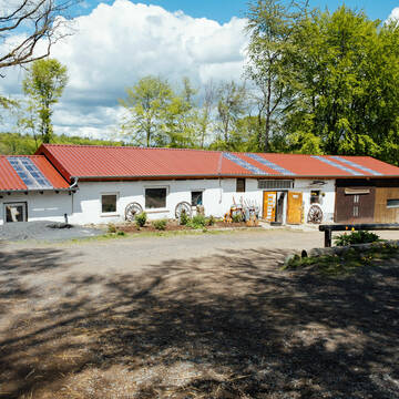
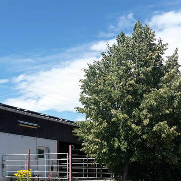
Pensionsstall Birkenhof Dörnberg
Dörnberg
Kim Theuerkauf
@BirkenhofDoernberg
Freizeitstall
Westernreiten
Reithalle
Reitplatz (z.B. Dressur, Springen, Reining)
Fohlenaufzucht möglich
Hufrehe geeignet
Offenstall
7 weitere...
B
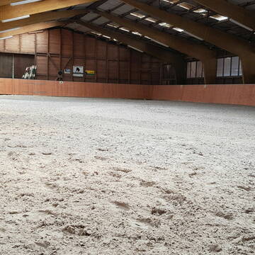
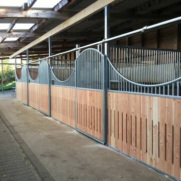
Reitanlage Welschneudorf mit Reithalle
Welschneudorf
Leiendecker
@Leiendecker
Fahrstall, Kutschwagen
FN-Mitglied
Hunde willkommen
Krankenbox
Allergikerstall
Gnadenbrothof
Außenbox mit Paddock
Außenboxen
30 weitere...
P
Offenstallplatz / Weideplatz
Welschneudorf
K-Billaudelle
@K-Billaudelle
Freizeitstall
Krankenbox
Longierzirkel/Roundpen
Offenstall
Biofutter
Halbpension
6 weitere...
P

Islandpferde vom Koben
Eppenrod
Islandpferde.vom.Koben
@Islandpferde.vom.Koben
Freizeitstall
Gangpferdereiten
Krankenbox
Longierzirkel/Roundpen
Allergikerstall
Notfallboxen
Laufstall
9 weitere...
P

Großzügige Paddocks auf gepflegter Reitanlage
Birlenbach
Pferdehof Birlenbach
@Birlenbach
FN-Mitglied
Freizeitstall
Vermieten
Hunde willkommen
Krankenbox
Hufrehe geeignet
Notfallboxen
16 weitere...
P

Job gesucht?
Mechtersen
STALL-FREIde Marketing
@STALL-FREI-Marketing
Sie suchen einen Job und arbeiten gerne mit Pferden oder auf Reitanlagen?
Besuchen Sie jetzt unseren Stellenmarkt!
Einstellplätze für Isländer, +Rentner+ Jungpferd...
Katzenelnbogen
Moorenmuehle
@Moorenmuehle
Freizeitstall
Gangpferdereiten
Paddock
Reitplatz (z.B. Dressur, Springen, Reining)
Hengsthaltung möglich
Pferdezucht
Laufstall
Offenstall
8 weitere...
P
Offenstall
Heistenbach
Pferdepension-Stein
@Pferdepension-Stein
Freizeitstall
Geländestrecke
Vermieten
Krankenbox
Longierzirkel/Roundpen
Notfallboxen
8 weitere...
P


Pferdehof Wiesenblick
Hünfelden
Hof-Wiesenblick-GbR
@Hof-Wiesenblick-GbR
Freizeitstall
Pferdeausbildung
Longierzirkel/Roundpen
Paddock
Allergikerstall
Gnadenbrothof
Außenbox mit Paddock
Außenboxen
18 weitere...
P+
Deprecated: Creation of dynamic property Zend_View::$pageCount is deprecated in /var/www/stall-frei/htdocs/staging.stall-frei.de/library/vendor/shardj/zf1-future/library/Zend/View/Abstract.php on line 308
Deprecated: Creation of dynamic property Zend_View::$itemCountPerPage is deprecated in /var/www/stall-frei/htdocs/staging.stall-frei.de/library/vendor/shardj/zf1-future/library/Zend/View/Abstract.php on line 308
Deprecated: Creation of dynamic property Zend_View::$first is deprecated in /var/www/stall-frei/htdocs/staging.stall-frei.de/library/vendor/shardj/zf1-future/library/Zend/View/Abstract.php on line 308
Deprecated: Creation of dynamic property Zend_View::$current is deprecated in /var/www/stall-frei/htdocs/staging.stall-frei.de/library/vendor/shardj/zf1-future/library/Zend/View/Abstract.php on line 308
Deprecated: Creation of dynamic property Zend_View::$last is deprecated in /var/www/stall-frei/htdocs/staging.stall-frei.de/library/vendor/shardj/zf1-future/library/Zend/View/Abstract.php on line 308
Deprecated: Creation of dynamic property Zend_View::$next is deprecated in /var/www/stall-frei/htdocs/staging.stall-frei.de/library/vendor/shardj/zf1-future/library/Zend/View/Abstract.php on line 308
Deprecated: Creation of dynamic property Zend_View::$pagesInRange is deprecated in /var/www/stall-frei/htdocs/staging.stall-frei.de/library/vendor/shardj/zf1-future/library/Zend/View/Abstract.php on line 308
Deprecated: Creation of dynamic property Zend_View::$firstPageInRange is deprecated in /var/www/stall-frei/htdocs/staging.stall-frei.de/library/vendor/shardj/zf1-future/library/Zend/View/Abstract.php on line 308
Deprecated: Creation of dynamic property Zend_View::$lastPageInRange is deprecated in /var/www/stall-frei/htdocs/staging.stall-frei.de/library/vendor/shardj/zf1-future/library/Zend/View/Abstract.php on line 308
Deprecated: Creation of dynamic property Zend_View::$currentItemCount is deprecated in /var/www/stall-frei/htdocs/staging.stall-frei.de/library/vendor/shardj/zf1-future/library/Zend/View/Abstract.php on line 308
Deprecated: Creation of dynamic property Zend_View::$totalItemCount is deprecated in /var/www/stall-frei/htdocs/staging.stall-frei.de/library/vendor/shardj/zf1-future/library/Zend/View/Abstract.php on line 308
Deprecated: Creation of dynamic property Zend_View::$firstItemNumber is deprecated in /var/www/stall-frei/htdocs/staging.stall-frei.de/library/vendor/shardj/zf1-future/library/Zend/View/Abstract.php on line 308
Deprecated: Creation of dynamic property Zend_View::$lastItemNumber is deprecated in /var/www/stall-frei/htdocs/staging.stall-frei.de/library/vendor/shardj/zf1-future/library/Zend/View/Abstract.php on line 308
Deprecated: Creation of dynamic property Zend_View::$router is deprecated in /var/www/stall-frei/htdocs/staging.stall-frei.de/library/vendor/shardj/zf1-future/library/Zend/View/Abstract.php on line 308
Deprecated: Creation of dynamic property Zend_View::$urlParams is deprecated in /var/www/stall-frei/htdocs/staging.stall-frei.de/library/vendor/shardj/zf1-future/library/Zend/View/Abstract.php on line 308
Deprecated: Creation of dynamic property Zend_View::$showAds is deprecated in /var/www/stall-frei/htdocs/staging.stall-frei.de/library/vendor/shardj/zf1-future/library/Zend/View/Abstract.php on line 308
Deprecated: Creation of dynamic property Zend_View::$objectIds is deprecated in /var/www/stall-frei/htdocs/staging.stall-frei.de/library/vendor/shardj/zf1-future/library/Zend/View/Abstract.php on line 308
Deprecated: Creation of dynamic property Zend_View::$showNavbar is deprecated in /var/www/stall-frei/htdocs/staging.stall-frei.de/library/vendor/shardj/zf1-future/library/Zend/View/Abstract.php on line 308
Deprecated: Creation of dynamic property Zend_View::$showBreadcrumb is deprecated in /var/www/stall-frei/htdocs/staging.stall-frei.de/library/vendor/shardj/zf1-future/library/Zend/View/Abstract.php on line 308
Deprecated: Creation of dynamic property Zend_View::$showFooter is deprecated in /var/www/stall-frei/htdocs/staging.stall-frei.de/library/vendor/shardj/zf1-future/library/Zend/View/Abstract.php on line 308
Deprecated: Creation of dynamic property Zend_View::$showInternalAds is deprecated in /var/www/stall-frei/htdocs/staging.stall-frei.de/library/vendor/shardj/zf1-future/library/Zend/View/Abstract.php on line 308
Deprecated: Creation of dynamic property Zend_View::$blNoContent is deprecated in /var/www/stall-frei/htdocs/staging.stall-frei.de/library/vendor/shardj/zf1-future/library/Zend/View/Abstract.php on line 308
Deprecated: Creation of dynamic property Zend_View::$sMetaDesc is deprecated in /var/www/stall-frei/htdocs/staging.stall-frei.de/library/vendor/shardj/zf1-future/library/Zend/View/Abstract.php on line 308
Deprecated: Creation of dynamic property Zend_View::$useGmaps is deprecated in /var/www/stall-frei/htdocs/staging.stall-frei.de/library/vendor/shardj/zf1-future/library/Zend/View/Abstract.php on line 308
Deprecated: Creation of dynamic property Zend_View::$touches is deprecated in /var/www/stall-frei/htdocs/staging.stall-frei.de/library/vendor/shardj/zf1-future/library/Zend/View/Abstract.php on line 308
Deprecated: Creation of dynamic property Zend_View::$oProject is deprecated in /var/www/stall-frei/htdocs/staging.stall-frei.de/library/vendor/shardj/zf1-future/library/Zend/View/Abstract.php on line 308
Deprecated: Creation of dynamic property Zend_View::$pageHeadline is deprecated in /var/www/stall-frei/htdocs/staging.stall-frei.de/library/vendor/shardj/zf1-future/library/Zend/View/Abstract.php on line 308
Deprecated: Creation of dynamic property Zend_View::$disableLocationField is deprecated in /var/www/stall-frei/htdocs/staging.stall-frei.de/library/vendor/shardj/zf1-future/library/Zend/View/Abstract.php on line 308
Deprecated: Creation of dynamic property Zend_View::$isSearch is deprecated in /var/www/stall-frei/htdocs/staging.stall-frei.de/library/vendor/shardj/zf1-future/library/Zend/View/Abstract.php on line 308
Deprecated: Creation of dynamic property Zend_View::$pageTitle is deprecated in /var/www/stall-frei/htdocs/staging.stall-frei.de/library/vendor/shardj/zf1-future/library/Zend/View/Abstract.php on line 308
Deprecated: Creation of dynamic property Psf_Form_Element_Text::$class is deprecated in /var/www/stall-frei/htdocs/staging.stall-frei.de/library/vendor/shardj/zf1-future/library/Zend/Form/Element.php on line 874
Deprecated: Creation of dynamic property Psf_Form_Element_Text::$size is deprecated in /var/www/stall-frei/htdocs/staging.stall-frei.de/library/vendor/shardj/zf1-future/library/Zend/Form/Element.php on line 874
Deprecated: Creation of dynamic property Psf_Form_Element_Text::$placeholder is deprecated in /var/www/stall-frei/htdocs/staging.stall-frei.de/library/vendor/shardj/zf1-future/library/Zend/Form/Element.php on line 874
Deprecated: Creation of dynamic property Psf_Form_Element_Hidden::$class is deprecated in /var/www/stall-frei/htdocs/staging.stall-frei.de/library/vendor/shardj/zf1-future/library/Zend/Form/Element.php on line 874
Deprecated: Creation of dynamic property Psf_Form_Element_Hidden::$class is deprecated in /var/www/stall-frei/htdocs/staging.stall-frei.de/library/vendor/shardj/zf1-future/library/Zend/Form/Element.php on line 874
Deprecated: Creation of dynamic property Psf_Form_Element_Hidden::$class is deprecated in /var/www/stall-frei/htdocs/staging.stall-frei.de/library/vendor/shardj/zf1-future/library/Zend/Form/Element.php on line 874
Deprecated: Creation of dynamic property Psf_Form_Element_Hidden::$class is deprecated in /var/www/stall-frei/htdocs/staging.stall-frei.de/library/vendor/shardj/zf1-future/library/Zend/Form/Element.php on line 874
Deprecated: Creation of dynamic property Psf_Form_Element_Select::$class is deprecated in /var/www/stall-frei/htdocs/staging.stall-frei.de/library/vendor/shardj/zf1-future/library/Zend/Form/Element.php on line 874
Deprecated: Creation of dynamic property Psf_Form_Element_Select::$class is deprecated in /var/www/stall-frei/htdocs/staging.stall-frei.de/library/vendor/shardj/zf1-future/library/Zend/Form/Element.php on line 874
Deprecated: Creation of dynamic property Psf_Form_Element_Select::$class is deprecated in /var/www/stall-frei/htdocs/staging.stall-frei.de/library/vendor/shardj/zf1-future/library/Zend/Form/Element.php on line 874
Deprecated: Creation of dynamic property Psf_Form_Element_Select::$class is deprecated in /var/www/stall-frei/htdocs/staging.stall-frei.de/library/vendor/shardj/zf1-future/library/Zend/Form/Element.php on line 874
Deprecated: Creation of dynamic property Psf_Form_Element_Text::$class is deprecated in /var/www/stall-frei/htdocs/staging.stall-frei.de/library/vendor/shardj/zf1-future/library/Zend/Form/Element.php on line 874
Deprecated: Creation of dynamic property Psf_Form_Element_Checkbox::$label is deprecated in /var/www/stall-frei/htdocs/staging.stall-frei.de/library/vendor/shardj/zf1-future/library/Zend/Form/Element.php on line 874
Deprecated: Creation of dynamic property Zend_View::$sort is deprecated in /var/www/stall-frei/htdocs/staging.stall-frei.de/library/vendor/shardj/zf1-future/library/Zend/View/Abstract.php on line 308
Deprecated: Creation of dynamic property Zend_View::$searchLocation is deprecated in /var/www/stall-frei/htdocs/staging.stall-frei.de/library/vendor/shardj/zf1-future/library/Zend/View/Abstract.php on line 308
Deprecated: Creation of dynamic property Zend_View::$locationHint is deprecated in /var/www/stall-frei/htdocs/staging.stall-frei.de/library/vendor/shardj/zf1-future/library/Zend/View/Abstract.php on line 308
Psf_GeoCoder_Abstract::getLocation: Dornberg Get Location CachedOrLive
Psf_GeoCoder_Abstract::getCachedOrLive: Dornberg
Psf_GeoCoder_OpenCageData::makeApiRequest: response:
Array
(
[documentation] => https://opencagedata.com/api
[licenses] => Array
(
[0] => Array
(
[name] => see attribution guide
[url] => https://opencagedata.com/credits
)
)
[results] => Array
(
[0] => Array
(
[bounds] => Array
(
[northeast] => Array
(
[lat] => 50.3435132
[lng] => 7.9068843
)
[southwest] => Array
(
[lat] => 50.3109083
[lng] => 7.8689305
)
)
[components] => Array
(
[ISO_3166-1_alpha-2] => DE
[ISO_3166-1_alpha-3] => DEU
[ISO_3166-2] => Array
(
[0] => DE-RP
)
[_category] => place
[_normalized_city] => Dörnberg
[_type] => village
[continent] => Europe
[country] => Deutschland
[country_code] => de
[county] => Rhein-Lahn-Kreis
[municipality] => Diez
[political_union] => European Union
[postcode] => 56379
[state] => Rheinland-Pfalz
[state_code] => RP
[village] => Dörnberg
)
[confidence] => 7
[formatted] => 56379 Dörnberg, Deutschland
[geometry] => Array
(
[lat] => 50.3256326
[lng] => 7.8833914
)
)
[1] => Array
(
[bounds] => Array
(
[northeast] => Array
(
[lat] => 52.0905014
[lng] => 8.5151765
)
[southwest] => Array
(
[lat] => 52.0142691
[lng] => 8.420952
)
)
[components] => Array
(
[ISO_3166-1_alpha-2] => DE
[ISO_3166-1_alpha-3] => DEU
[ISO_3166-2] => Array
(
[0] => DE-NW
)
[_category] => place
[_normalized_city] => Bielefeld
[_type] => neighbourhood
[city] => Bielefeld
[continent] => Europe
[country] => Deutschland
[country_code] => de
[political_union] => European Union
[postcode] => 33619
[quarter] => Dornberg
[state] => Nordrhein-Westfalen
[state_code] => NW
)
[confidence] => 7
[formatted] => 33619 Bielefeld, Deutschland
[geometry] => Array
(
[lat] => 52.0471898
[lng] => 8.4540006
)
)
[2] => Array
(
[bounds] => Array
(
[northeast] => Array
(
[lat] => 49.6394698
[lng] => 9.4450688
)
[southwest] => Array
(
[lat] => 49.6121092
[lng] => 9.4007088
)
)
[components] => Array
(
[ISO_3166-1_alpha-2] => DE
[ISO_3166-1_alpha-3] => DEU
[ISO_3166-2] => Array
(
[0] => DE-BW
)
[_category] => place
[_normalized_city] => Dornberg-Rütschdorf-Vollmersdorf
[_type] => hamlet
[continent] => Europe
[country] => Deutschland
[country_code] => de
[county] => Neckar-Odenwald-Kreis
[hamlet] => Dornberg
[municipality] => GVV Hardheim-Walldürn
[political_union] => European Union
[state] => Baden-Württemberg
[state_code] => BW
[village] => Dornberg-Rütschdorf-Vollmersdorf
)
[confidence] => 7
[formatted] => Dornberg, Dornberg-Rütschdorf-Vollmersdorf, Baden-Württemberg, Deutschland
[geometry] => Array
(
[lat] => 49.6255283
[lng] => 9.4284973
)
)
[3] => Array
(
[bounds] => Array
(
[northeast] => Array
(
[lat] => 51.8384515
[lng] => 10.9535801
)
[southwest] => Array
(
[lat] => 51.8383515
[lng] => 10.9534801
)
)
[components] => Array
(
[ISO_3166-1_alpha-2] => DE
[ISO_3166-1_alpha-3] => DEU
[ISO_3166-2] => Array
(
[0] => DE-ST
)
[_category] => natural/water
[_normalized_city] => Blankenburg
[_type] => peak
[continent] => Europe
[country] => Deutschland
[country_code] => de
[county] => Landkreis Harz
[peak] => Dornberg
[political_union] => European Union
[postcode] => 38895
[state] => Sachsen-Anhalt
[state_code] => ST
[town] => Blankenburg
)
[confidence] => 9
[formatted] => Dornberg, 38895 Blankenburg, Deutschland
[geometry] => Array
(
[lat] => 51.8384015
[lng] => 10.9535301
)
)
[4] => Array
(
[bounds] => Array
(
[northeast] => Array
(
[lat] => 52.2718399
[lng] => 11.3184014
)
[southwest] => Array
(
[lat] => 52.2717399
[lng] => 11.3183014
)
)
[components] => Array
(
[ISO_3166-1_alpha-2] => DE
[ISO_3166-1_alpha-3] => DEU
[ISO_3166-2] => Array
(
[0] => DE-ST
)
[_category] => natural/water
[_normalized_city] => Haldensleben
[_type] => peak
[continent] => Europe
[country] => Deutschland
[country_code] => de
[county] => Börde
[peak] => Dornberg
[political_union] => European Union
[postcode] => 39343
[state] => Sachsen-Anhalt
[state_code] => ST
[town] => Haldensleben
)
[confidence] => 9
[formatted] => Dornberg, 39343 Haldensleben, Deutschland
[geometry] => Array
(
[lat] => 52.2717899
[lng] => 11.3183514
)
)
[5] => Array
(
[bounds] => Array
(
[northeast] => Array
(
[lat] => 51.395061
[lng] => 10.6728625
)
[southwest] => Array
(
[lat] => 51.394961
[lng] => 10.6727625
)
)
[components] => Array
(
[ISO_3166-1_alpha-2] => DE
[ISO_3166-1_alpha-3] => DEU
[ISO_3166-2] => Array
(
[0] => DE-TH
)
[_category] => natural/water
[_normalized_city] => Bleicherode
[_type] => peak
[continent] => Europe
[country] => Deutschland
[country_code] => de
[county] => Landkreis Nordhausen
[municipality] => Bleicherode
[peak] => Dornberg
[political_union] => European Union
[state] => Thüringen
[state_code] => TH
[town] => Bleicherode
)
[confidence] => 9
[formatted] => Dornberg, Bleicherode, Thüringen, Deutschland
[geometry] => Array
(
[lat] => 51.395011
[lng] => 10.6728125
)
)
[6] => Array
(
[bounds] => Array
(
[northeast] => Array
(
[lat] => 49.1082287
[lng] => 9.278367
)
[southwest] => Array
(
[lat] => 49.1081287
[lng] => 9.278267
)
)
[components] => Array
(
[ISO_3166-1_alpha-2] => DE
[ISO_3166-1_alpha-3] => DEU
[ISO_3166-2] => Array
(
[0] => DE-BW
)
[_category] => natural/water
[_normalized_city] => Untergruppenbach
[_type] => peak
[continent] => Europe
[country] => Deutschland
[country_code] => de
[county] => Landkreis Heilbronn
[municipality] => GVV Schozach-Bottwartal
[peak] => Dornberg
[political_union] => European Union
[postcode] => 74199
[state] => Baden-Württemberg
[state_code] => BW
[village] => Untergruppenbach
)
[confidence] => 9
[formatted] => Dornberg, 74199 Untergruppenbach, Deutschland
[geometry] => Array
(
[lat] => 49.1081787
[lng] => 9.278317
)
)
[7] => Array
(
[bounds] => Array
(
[northeast] => Array
(
[lat] => 49.5137651
[lng] => 6.9196198
)
[southwest] => Array
(
[lat] => 49.5136651
[lng] => 6.9195198
)
)
[components] => Array
(
[ISO_3166-1_alpha-2] => DE
[ISO_3166-1_alpha-3] => DEU
[ISO_3166-2] => Array
(
[0] => DE-SL
)
[_category] => natural/water
[_normalized_city] => Wadern
[_type] => peak
[continent] => Europe
[country] => Deutschland
[country_code] => de
[county] => Landkreis Merzig-Wadern
[peak] => Dornberg
[political_union] => European Union
[postcode] => 66687
[state] => Saarland
[state_code] => SL
[town] => Wadern
)
[confidence] => 9
[formatted] => Dornberg, 66687 Wadern, Deutschland
[geometry] => Array
(
[lat] => 49.5137151
[lng] => 6.9195698
)
)
[8] => Array
(
[bounds] => Array
(
[northeast] => Array
(
[lat] => 50.207946
[lng] => 7.8336059
)
[southwest] => Array
(
[lat] => 50.207846
[lng] => 7.8335059
)
)
[components] => Array
(
[ISO_3166-1_alpha-2] => DE
[ISO_3166-1_alpha-3] => DEU
[ISO_3166-2] => Array
(
[0] => DE-RP
)
[_category] => natural/water
[_normalized_city] => Oelsberg
[_type] => peak
[continent] => Europe
[country] => Deutschland
[country_code] => de
[county] => Rhein-Lahn-Kreis
[municipality] => Nastätten
[peak] => Dornberg
[political_union] => European Union
[postcode] => 56357
[state] => Rheinland-Pfalz
[state_code] => RP
[village] => Oelsberg
)
[confidence] => 9
[formatted] => Dornberg, 56357 Oelsberg, Deutschland
[geometry] => Array
(
[lat] => 50.207896
[lng] => 7.8335559
)
)
[9] => Array
(
[components] => Array
(
[ISO_3166-1_alpha-2] => FR
[ISO_3166-1_alpha-3] => FRA
[ISO_3166-2] => Array
(
[0] => FR-NAQ
[1] => FR-16
)
[_category] => road
[_normalized_city] => Nanteuil-en-Vallée
[_type] => road
[city] => Nanteuil-en-Vallée
[continent] => Europe
[country] => France
[country_code] => fr
[county] => Charente
[local_authority] => Communauté de communes Val-de-Charente
[political_union] => European Union
[postcode] => 16700
[road] => La Dornière
[state] => Nouvelle-Aquitaine
[state_code] => NAQ
)
[confidence] => 2
[formatted] => La Dornière, 16700 Nanteuil-en-Vallée, France
[geometry] => Array
(
[lat] => 45.980343
[lng] => 0.359367
)
)
)
[status] => Array
(
[code] => 200
[message] => OK
)
[stay_informed] => Array
(
[blog] => https://blog.opencagedata.com
[mastodon] => https://en.osm.town/@opencage
)
[thanks] => For using an OpenCage API
[timestamp] => Array
(
[created_http] => Mon, 09 Feb 2026 09:04:51 GMT
[created_unix] => 1770627891
)
[total_results] => 10
)
Psf_GeoCoder_Abstract::convertLocationResult
{"documentation":"https:\/\/opencagedata.com\/api","licenses":[{"name":"see attribution guide","url":"https:\/\/opencagedata.com\/credits"}],"results":[{"bounds":{"northeast":{"lat":50.3435132,"lng":7.9068843},"southwest":{"lat":50.3109083,"lng":7.8689305}},"components":{"ISO_3166-1_alpha-2":"DE","ISO_3166-1_alpha-3":"DEU","ISO_3166-2":["DE-RP"],"_category":"place","_normalized_city":"D\u00f6rnberg","_type":"village","continent":"Europe","country":"Deutschland","country_code":"de","county":"Rhein-Lahn-Kreis","municipality":"Diez","political_union":"European Union","postcode":"56379","state":"Rheinland-Pfalz","state_code":"RP","village":"D\u00f6rnberg"},"confidence":7,"formatted":"56379 D\u00f6rnberg, Deutschland","geometry":{"lat":50.3256326,"lng":7.8833914}},{"bounds":{"northeast":{"lat":52.0905014,"lng":8.5151765},"southwest":{"lat":52.0142691,"lng":8.420952}},"components":{"ISO_3166-1_alpha-2":"DE","ISO_3166-1_alpha-3":"DEU","ISO_3166-2":["DE-NW"],"_category":"place","_normalized_city":"Bielefeld","_type":"neighbourhood","city":"Bielefeld","continent":"Europe","country":"Deutschland","country_code":"de","political_union":"European Union","postcode":"33619","quarter":"Dornberg","state":"Nordrhein-Westfalen","state_code":"NW"},"confidence":7,"formatted":"33619 Bielefeld, Deutschland","geometry":{"lat":52.0471898,"lng":8.4540006}},{"bounds":{"northeast":{"lat":49.6394698,"lng":9.4450688},"southwest":{"lat":49.6121092,"lng":9.4007088}},"components":{"ISO_3166-1_alpha-2":"DE","ISO_3166-1_alpha-3":"DEU","ISO_3166-2":["DE-BW"],"_category":"place","_normalized_city":"Dornberg-R\u00fctschdorf-Vollmersdorf","_type":"hamlet","continent":"Europe","country":"Deutschland","country_code":"de","county":"Neckar-Odenwald-Kreis","hamlet":"Dornberg","municipality":"GVV Hardheim-Walld\u00fcrn","political_union":"European Union","state":"Baden-W\u00fcrttemberg","state_code":"BW","village":"Dornberg-R\u00fctschdorf-Vollmersdorf"},"confidence":7,"formatted":"Dornberg, Dornberg-R\u00fctschdorf-Vollmersdorf, Baden-W\u00fcrttemberg, Deutschland","geometry":{"lat":49.6255283,"lng":9.4284973}},{"bounds":{"northeast":{"lat":51.8384515,"lng":10.9535801},"southwest":{"lat":51.8383515,"lng":10.9534801}},"components":{"ISO_3166-1_alpha-2":"DE","ISO_3166-1_alpha-3":"DEU","ISO_3166-2":["DE-ST"],"_category":"natural\/water","_normalized_city":"Blankenburg","_type":"peak","continent":"Europe","country":"Deutschland","country_code":"de","county":"Landkreis Harz","peak":"Dornberg","political_union":"European Union","postcode":"38895","state":"Sachsen-Anhalt","state_code":"ST","town":"Blankenburg"},"confidence":9,"formatted":"Dornberg, 38895 Blankenburg, Deutschland","geometry":{"lat":51.8384015,"lng":10.9535301}},{"bounds":{"northeast":{"lat":52.2718399,"lng":11.3184014},"southwest":{"lat":52.2717399,"lng":11.3183014}},"components":{"ISO_3166-1_alpha-2":"DE","ISO_3166-1_alpha-3":"DEU","ISO_3166-2":["DE-ST"],"_category":"natural\/water","_normalized_city":"Haldensleben","_type":"peak","continent":"Europe","country":"Deutschland","country_code":"de","county":"B\u00f6rde","peak":"Dornberg","political_union":"European Union","postcode":"39343","state":"Sachsen-Anhalt","state_code":"ST","town":"Haldensleben"},"confidence":9,"formatted":"Dornberg, 39343 Haldensleben, Deutschland","geometry":{"lat":52.2717899,"lng":11.3183514}},{"bounds":{"northeast":{"lat":51.395061,"lng":10.6728625},"southwest":{"lat":51.394961,"lng":10.6727625}},"components":{"ISO_3166-1_alpha-2":"DE","ISO_3166-1_alpha-3":"DEU","ISO_3166-2":["DE-TH"],"_category":"natural\/water","_normalized_city":"Bleicherode","_type":"peak","continent":"Europe","country":"Deutschland","country_code":"de","county":"Landkreis Nordhausen","municipality":"Bleicherode","peak":"Dornberg","political_union":"European Union","state":"Th\u00fcringen","state_code":"TH","town":"Bleicherode"},"confidence":9,"formatted":"Dornberg, Bleicherode, Th\u00fcringen, Deutschland","geometry":{"lat":51.395011,"lng":10.6728125}},{"bounds":{"northeast":{"lat":49.1082287,"lng":9.278367},"southwest":{"lat":49.1081287,"lng":9.278267}},"components":{"ISO_3166-1_alpha-2":"DE","ISO_3166-1_alpha-3":"DEU","ISO_3166-2":["DE-BW"],"_category":"natural\/water","_normalized_city":"Untergruppenbach","_type":"peak","continent":"Europe","country":"Deutschland","country_code":"de","county":"Landkreis Heilbronn","municipality":"GVV Schozach-Bottwartal","peak":"Dornberg","political_union":"European Union","postcode":"74199","state":"Baden-W\u00fcrttemberg","state_code":"BW","village":"Untergruppenbach"},"confidence":9,"formatted":"Dornberg, 74199 Untergruppenbach, Deutschland","geometry":{"lat":49.1081787,"lng":9.278317}},{"bounds":{"northeast":{"lat":49.5137651,"lng":6.9196198},"southwest":{"lat":49.5136651,"lng":6.9195198}},"components":{"ISO_3166-1_alpha-2":"DE","ISO_3166-1_alpha-3":"DEU","ISO_3166-2":["DE-SL"],"_category":"natural\/water","_normalized_city":"Wadern","_type":"peak","continent":"Europe","country":"Deutschland","country_code":"de","county":"Landkreis Merzig-Wadern","peak":"Dornberg","political_union":"European Union","postcode":"66687","state":"Saarland","state_code":"SL","town":"Wadern"},"confidence":9,"formatted":"Dornberg, 66687 Wadern, Deutschland","geometry":{"lat":49.5137151,"lng":6.9195698}},{"bounds":{"northeast":{"lat":50.207946,"lng":7.8336059},"southwest":{"lat":50.207846,"lng":7.8335059}},"components":{"ISO_3166-1_alpha-2":"DE","ISO_3166-1_alpha-3":"DEU","ISO_3166-2":["DE-RP"],"_category":"natural\/water","_normalized_city":"Oelsberg","_type":"peak","continent":"Europe","country":"Deutschland","country_code":"de","county":"Rhein-Lahn-Kreis","municipality":"Nast\u00e4tten","peak":"Dornberg","political_union":"European Union","postcode":"56357","state":"Rheinland-Pfalz","state_code":"RP","village":"Oelsberg"},"confidence":9,"formatted":"Dornberg, 56357 Oelsberg, Deutschland","geometry":{"lat":50.207896,"lng":7.8335559}},{"components":{"ISO_3166-1_alpha-2":"FR","ISO_3166-1_alpha-3":"FRA","ISO_3166-2":["FR-NAQ","FR-16"],"_category":"road","_normalized_city":"Nanteuil-en-Vall\u00e9e","_type":"road","city":"Nanteuil-en-Vall\u00e9e","continent":"Europe","country":"France","country_code":"fr","county":"Charente","local_authority":"Communaut\u00e9 de communes Val-de-Charente","political_union":"European Union","postcode":"16700","road":"La Dorni\u00e8re","state":"Nouvelle-Aquitaine","state_code":"NAQ"},"confidence":2,"formatted":"La Dorni\u00e8re, 16700 Nanteuil-en-Vall\u00e9e, France","geometry":{"lat":45.980343,"lng":0.359367}}],"status":{"code":200,"message":"OK"},"stay_informed":{"blog":"https:\/\/blog.opencagedata.com","mastodon":"https:\/\/en.osm.town\/@opencage"},"thanks":"For using an OpenCage API","timestamp":{"created_http":"Mon, 09 Feb 2026 09:04:51 GMT","created_unix":1770627891},"total_results":10}Array
(
[0] => stdClass Object
(
[bounds] => stdClass Object
(
[northeast] => stdClass Object
(
[lat] => 50.3435132
[lng] => 7.9068843
)
[southwest] => stdClass Object
(
[lat] => 50.3109083
[lng] => 7.8689305
)
)
[components] => stdClass Object
(
[ISO_3166-1_alpha-2] => DE
[ISO_3166-1_alpha-3] => DEU
[ISO_3166-2] => Array
(
[0] => DE-RP
)
[_category] => place
[_normalized_city] => Dörnberg
[_type] => village
[continent] => Europe
[country] => Deutschland
[country_code] => de
[county] => Rhein-Lahn-Kreis
[municipality] => Diez
[political_union] => European Union
[postcode] => 56379
[state] => Rheinland-Pfalz
[state_code] => RP
[village] => Dörnberg
)
[confidence] => 7
[formatted] => 56379 Dörnberg, Deutschland
[geometry] => stdClass Object
(
[lat] => 50.3256326
[lng] => 7.8833914
)
)
[1] => stdClass Object
(
[bounds] => stdClass Object
(
[northeast] => stdClass Object
(
[lat] => 52.0905014
[lng] => 8.5151765
)
[southwest] => stdClass Object
(
[lat] => 52.0142691
[lng] => 8.420952
)
)
[components] => stdClass Object
(
[ISO_3166-1_alpha-2] => DE
[ISO_3166-1_alpha-3] => DEU
[ISO_3166-2] => Array
(
[0] => DE-NW
)
[_category] => place
[_normalized_city] => Bielefeld
[_type] => neighbourhood
[city] => Bielefeld
[continent] => Europe
[country] => Deutschland
[country_code] => de
[political_union] => European Union
[postcode] => 33619
[quarter] => Dornberg
[state] => Nordrhein-Westfalen
[state_code] => NW
)
[confidence] => 7
[formatted] => 33619 Bielefeld, Deutschland
[geometry] => stdClass Object
(
[lat] => 52.0471898
[lng] => 8.4540006
)
)
[2] => stdClass Object
(
[bounds] => stdClass Object
(
[northeast] => stdClass Object
(
[lat] => 49.6394698
[lng] => 9.4450688
)
[southwest] => stdClass Object
(
[lat] => 49.6121092
[lng] => 9.4007088
)
)
[components] => stdClass Object
(
[ISO_3166-1_alpha-2] => DE
[ISO_3166-1_alpha-3] => DEU
[ISO_3166-2] => Array
(
[0] => DE-BW
)
[_category] => place
[_normalized_city] => Dornberg-Rütschdorf-Vollmersdorf
[_type] => hamlet
[continent] => Europe
[country] => Deutschland
[country_code] => de
[county] => Neckar-Odenwald-Kreis
[hamlet] => Dornberg
[municipality] => GVV Hardheim-Walldürn
[political_union] => European Union
[state] => Baden-Württemberg
[state_code] => BW
[village] => Dornberg-Rütschdorf-Vollmersdorf
)
[confidence] => 7
[formatted] => Dornberg, Dornberg-Rütschdorf-Vollmersdorf, Baden-Württemberg, Deutschland
[geometry] => stdClass Object
(
[lat] => 49.6255283
[lng] => 9.4284973
)
)
[3] => stdClass Object
(
[bounds] => stdClass Object
(
[northeast] => stdClass Object
(
[lat] => 51.8384515
[lng] => 10.9535801
)
[southwest] => stdClass Object
(
[lat] => 51.8383515
[lng] => 10.9534801
)
)
[components] => stdClass Object
(
[ISO_3166-1_alpha-2] => DE
[ISO_3166-1_alpha-3] => DEU
[ISO_3166-2] => Array
(
[0] => DE-ST
)
[_category] => natural/water
[_normalized_city] => Blankenburg
[_type] => peak
[continent] => Europe
[country] => Deutschland
[country_code] => de
[county] => Landkreis Harz
[peak] => Dornberg
[political_union] => European Union
[postcode] => 38895
[state] => Sachsen-Anhalt
[state_code] => ST
[town] => Blankenburg
)
[confidence] => 9
[formatted] => Dornberg, 38895 Blankenburg, Deutschland
[geometry] => stdClass Object
(
[lat] => 51.8384015
[lng] => 10.9535301
)
)
[4] => stdClass Object
(
[bounds] => stdClass Object
(
[northeast] => stdClass Object
(
[lat] => 52.2718399
[lng] => 11.3184014
)
[southwest] => stdClass Object
(
[lat] => 52.2717399
[lng] => 11.3183014
)
)
[components] => stdClass Object
(
[ISO_3166-1_alpha-2] => DE
[ISO_3166-1_alpha-3] => DEU
[ISO_3166-2] => Array
(
[0] => DE-ST
)
[_category] => natural/water
[_normalized_city] => Haldensleben
[_type] => peak
[continent] => Europe
[country] => Deutschland
[country_code] => de
[county] => Börde
[peak] => Dornberg
[political_union] => European Union
[postcode] => 39343
[state] => Sachsen-Anhalt
[state_code] => ST
[town] => Haldensleben
)
[confidence] => 9
[formatted] => Dornberg, 39343 Haldensleben, Deutschland
[geometry] => stdClass Object
(
[lat] => 52.2717899
[lng] => 11.3183514
)
)
[5] => stdClass Object
(
[bounds] => stdClass Object
(
[northeast] => stdClass Object
(
[lat] => 51.395061
[lng] => 10.6728625
)
[southwest] => stdClass Object
(
[lat] => 51.394961
[lng] => 10.6727625
)
)
[components] => stdClass Object
(
[ISO_3166-1_alpha-2] => DE
[ISO_3166-1_alpha-3] => DEU
[ISO_3166-2] => Array
(
[0] => DE-TH
)
[_category] => natural/water
[_normalized_city] => Bleicherode
[_type] => peak
[continent] => Europe
[country] => Deutschland
[country_code] => de
[county] => Landkreis Nordhausen
[municipality] => Bleicherode
[peak] => Dornberg
[political_union] => European Union
[state] => Thüringen
[state_code] => TH
[town] => Bleicherode
)
[confidence] => 9
[formatted] => Dornberg, Bleicherode, Thüringen, Deutschland
[geometry] => stdClass Object
(
[lat] => 51.395011
[lng] => 10.6728125
)
)
[6] => stdClass Object
(
[bounds] => stdClass Object
(
[northeast] => stdClass Object
(
[lat] => 49.1082287
[lng] => 9.278367
)
[southwest] => stdClass Object
(
[lat] => 49.1081287
[lng] => 9.278267
)
)
[components] => stdClass Object
(
[ISO_3166-1_alpha-2] => DE
[ISO_3166-1_alpha-3] => DEU
[ISO_3166-2] => Array
(
[0] => DE-BW
)
[_category] => natural/water
[_normalized_city] => Untergruppenbach
[_type] => peak
[continent] => Europe
[country] => Deutschland
[country_code] => de
[county] => Landkreis Heilbronn
[municipality] => GVV Schozach-Bottwartal
[peak] => Dornberg
[political_union] => European Union
[postcode] => 74199
[state] => Baden-Württemberg
[state_code] => BW
[village] => Untergruppenbach
)
[confidence] => 9
[formatted] => Dornberg, 74199 Untergruppenbach, Deutschland
[geometry] => stdClass Object
(
[lat] => 49.1081787
[lng] => 9.278317
)
)
[7] => stdClass Object
(
[bounds] => stdClass Object
(
[northeast] => stdClass Object
(
[lat] => 49.5137651
[lng] => 6.9196198
)
[southwest] => stdClass Object
(
[lat] => 49.5136651
[lng] => 6.9195198
)
)
[components] => stdClass Object
(
[ISO_3166-1_alpha-2] => DE
[ISO_3166-1_alpha-3] => DEU
[ISO_3166-2] => Array
(
[0] => DE-SL
)
[_category] => natural/water
[_normalized_city] => Wadern
[_type] => peak
[continent] => Europe
[country] => Deutschland
[country_code] => de
[county] => Landkreis Merzig-Wadern
[peak] => Dornberg
[political_union] => European Union
[postcode] => 66687
[state] => Saarland
[state_code] => SL
[town] => Wadern
)
[confidence] => 9
[formatted] => Dornberg, 66687 Wadern, Deutschland
[geometry] => stdClass Object
(
[lat] => 49.5137151
[lng] => 6.9195698
)
)
[8] => stdClass Object
(
[bounds] => stdClass Object
(
[northeast] => stdClass Object
(
[lat] => 50.207946
[lng] => 7.8336059
)
[southwest] => stdClass Object
(
[lat] => 50.207846
[lng] => 7.8335059
)
)
[components] => stdClass Object
(
[ISO_3166-1_alpha-2] => DE
[ISO_3166-1_alpha-3] => DEU
[ISO_3166-2] => Array
(
[0] => DE-RP
)
[_category] => natural/water
[_normalized_city] => Oelsberg
[_type] => peak
[continent] => Europe
[country] => Deutschland
[country_code] => de
[county] => Rhein-Lahn-Kreis
[municipality] => Nastätten
[peak] => Dornberg
[political_union] => European Union
[postcode] => 56357
[state] => Rheinland-Pfalz
[state_code] => RP
[village] => Oelsberg
)
[confidence] => 9
[formatted] => Dornberg, 56357 Oelsberg, Deutschland
[geometry] => stdClass Object
(
[lat] => 50.207896
[lng] => 7.8335559
)
)
[9] => stdClass Object
(
[components] => stdClass Object
(
[ISO_3166-1_alpha-2] => FR
[ISO_3166-1_alpha-3] => FRA
[ISO_3166-2] => Array
(
[0] => FR-NAQ
[1] => FR-16
)
[_category] => road
[_normalized_city] => Nanteuil-en-Vallée
[_type] => road
[city] => Nanteuil-en-Vallée
[continent] => Europe
[country] => France
[country_code] => fr
[county] => Charente
[local_authority] => Communauté de communes Val-de-Charente
[political_union] => European Union
[postcode] => 16700
[road] => La Dornière
[state] => Nouvelle-Aquitaine
[state_code] => NAQ
)
[confidence] => 2
[formatted] => La Dornière, 16700 Nanteuil-en-Vallée, France
[geometry] => stdClass Object
(
[lat] => 45.980343
[lng] => 0.359367
)
)
)
Psf_GeoCoder_OpenCageData::getKeyMap: 0
stdClass Object
(
    [bounds] => stdClass Object
        (
            [northeast] => stdClass Object
                (
                    [lat] => 50.3435132
                    [lng] => 7.9068843
                )

            [southwest] => stdClass Object
                (
                    [lat] => 50.3109083
                    [lng] => 7.8689305
                )

        )

    [components] => stdClass Object
        (
            [ISO_3166-1_alpha-2] => DE
            [ISO_3166-1_alpha-3] => DEU
            [ISO_3166-2] => Array
                (
                    [0] => DE-RP
                )

            [_category] => place
            [_normalized_city] => Dörnberg
            [_type] => village
            [continent] => Europe
            [country] => Deutschland
            [country_code] => de
            [county] => Rhein-Lahn-Kreis
            [municipality] => Diez
            [political_union] => European Union
            [postcode] => 56379
            [state] => Rheinland-Pfalz
            [state_code] => RP
            [village] => Dörnberg
        )

    [confidence] => 7
    [formatted] => 56379 Dörnberg, Deutschland
    [geometry] => stdClass Object
        (
            [lat] => 50.3256326
            [lng] => 7.8833914
        )

)
Psf_GeoCoder_OpenCageData::getCounty: Rhein-Lahn-Kreis
Psf_GeoCoder_OpenCageData::addMissingData REFETCH!
Array
(
    [address] => 56379 Dörnberg, Deutschland
    [type] => village
    [street] =>
    [city] => Dörnberg
    [county] => Rhein-Lahn-Kreis
    [state] => Rheinland-Pfalz
    [zip] => 56379
    [country] => Deutschland
    [suburb] =>
    [countrycode] => de
    [latitude] => 50.3256326
    [longitude] => 7.8833914
    [accuracy] => 1
    [confidence] => 7
    [bounds] => stdClass Object
        (
            [northeast] => stdClass Object
                (
                    [lat] => 50.3435132
                    [lng] => 7.9068843
                )

            [southwest] => stdClass Object
                (
                    [lat] => 50.3109083
                    [lng] => 7.8689305
                )

        )

)
reformat!
Array
(
    [address] => 56379 Dörnberg, Deutschland
    [type] => village
    [street] =>
    [city] => Dörnberg
    [county] => Rhein-Lahn-Kreis
    [state] => Rheinland-Pfalz
    [zip] => 56379
    [country] => Deutschland
    [suburb] =>
    [countrycode] => de
    [latitude] => 50.3256326
    [longitude] => 7.8833914
    [accuracy] => 1
    [confidence] => 7
    [bounds] => stdClass Object
        (
            [northeast] => stdClass Object
                (
                    [lat] => 50.3435132
                    [lng] => 7.9068843
                )

            [southwest] => stdClass Object
                (
                    [lat] => 50.3109083
                    [lng] => 7.8689305
                )

        )

    [place] => 56379 Dörnberg, Rheinland-Pfalz
    [hash] => 52088618ce7e278529435a0bf97ec738
)
Psf_GeoCoder_OpenCageData::getKeyMap: 1
stdClass Object
(
    [bounds] => stdClass Object
        (
            [northeast] => stdClass Object
                (
                    [lat] => 52.0905014
                    [lng] => 8.5151765
                )

            [southwest] => stdClass Object
                (
                    [lat] => 52.0142691
                    [lng] => 8.420952
                )

        )

    [components] => stdClass Object
        (
            [ISO_3166-1_alpha-2] => DE
            [ISO_3166-1_alpha-3] => DEU
            [ISO_3166-2] => Array
                (
                    [0] => DE-NW
                )

            [_category] => place
            [_normalized_city] => Bielefeld
            [_type] => neighbourhood
            [city] => Bielefeld
            [continent] => Europe
            [country] => Deutschland
            [country_code] => de
            [political_union] => European Union
            [postcode] => 33619
            [quarter] => Dornberg
            [state] => Nordrhein-Westfalen
            [state_code] => NW
        )

    [confidence] => 7
    [formatted] => 33619 Bielefeld, Deutschland
    [geometry] => stdClass Object
        (
            [lat] => 52.0471898
            [lng] => 8.4540006
        )

)
Psf_GeoCoder_OpenCageData::getCounty: Bielefeld
Psf_GeoCoder_OpenCageData::addMissingData REFETCH!
Array
(
    [address] => 33619 Bielefeld, Deutschland
    [type] => neighbourhood
    [street] =>
    [city] => Bielefeld
    [county] => Bielefeld
    [state] => Nordrhein-Westfalen
    [zip] => 33619
    [country] => Deutschland
    [suburb] =>
    [countrycode] => de
    [latitude] => 52.0471898
    [longitude] => 8.4540006
    [accuracy] => 1
    [confidence] => 7
    [bounds] => stdClass Object
        (
            [northeast] => stdClass Object
                (
                    [lat] => 52.0905014
                    [lng] => 8.5151765
                )

            [southwest] => stdClass Object
                (
                    [lat] => 52.0142691
                    [lng] => 8.420952
                )

        )

)
reformat!
Array
(
    [address] => 33619 Bielefeld, Deutschland
    [type] => neighbourhood
    [street] =>
    [city] => Bielefeld
    [county] => Bielefeld
    [state] => Nordrhein-Westfalen
    [zip] => 33619
    [country] => Deutschland
    [suburb] =>
    [countrycode] => de
    [latitude] => 52.0471898
    [longitude] => 8.4540006
    [accuracy] => 1
    [confidence] => 7
    [bounds] => stdClass Object
        (
            [northeast] => stdClass Object
                (
                    [lat] => 52.0905014
                    [lng] => 8.5151765
                )

            [southwest] => stdClass Object
                (
                    [lat] => 52.0142691
                    [lng] => 8.420952
                )

        )

    [place] => 33619 Bielefeld, Nordrhein-Westfalen
    [hash] => a9c5c4f93e35dc08c7873dc64d058a23
)
Psf_GeoCoder_OpenCageData::getKeyMap: 2
stdClass Object
(
    [bounds] => stdClass Object
        (
            [northeast] => stdClass Object
                (
                    [lat] => 49.6394698
                    [lng] => 9.4450688
                )

            [southwest] => stdClass Object
                (
                    [lat] => 49.6121092
                    [lng] => 9.4007088
                )

        )

    [components] => stdClass Object
        (
            [ISO_3166-1_alpha-2] => DE
            [ISO_3166-1_alpha-3] => DEU
            [ISO_3166-2] => Array
                (
                    [0] => DE-BW
                )

            [_category] => place
            [_normalized_city] => Dornberg-Rütschdorf-Vollmersdorf
            [_type] => hamlet
            [continent] => Europe
            [country] => Deutschland
            [country_code] => de
            [county] => Neckar-Odenwald-Kreis
            [hamlet] => Dornberg
            [municipality] => GVV Hardheim-Walldürn
            [political_union] => European Union
            [state] => Baden-Württemberg
            [state_code] => BW
            [village] => Dornberg-Rütschdorf-Vollmersdorf
        )

    [confidence] => 7
    [formatted] => Dornberg, Dornberg-Rütschdorf-Vollmersdorf, Baden-Württemberg, Deutschland
    [geometry] => stdClass Object
        (
            [lat] => 49.6255283
            [lng] => 9.4284973
        )

)
Psf_GeoCoder_OpenCageData::getCounty: Neckar-Odenwald-Kreis
Psf_GeoCoder_OpenCageData::addMissingData REFETCH!
Array
(
    [address] => Dornberg, Dornberg-Rütschdorf-Vollmersdorf, Baden-Württemberg, Deutschland
    [type] => hamlet
    [street] => Dornberg
    [city] => Dornberg-Rütschdorf-Vollmersdorf
    [county] => Neckar-Odenwald-Kreis
    [state] => Baden-Württemberg
    [zip] =>
    [country] => Deutschland
    [suburb] =>
    [countrycode] => de
    [latitude] => 49.6255283
    [longitude] => 9.4284973
    [accuracy] => 1
    [confidence] => 7
    [bounds] => stdClass Object
        (
            [northeast] => stdClass Object
                (
                    [lat] => 49.6394698
                    [lng] => 9.4450688
                )

            [southwest] => stdClass Object
                (
                    [lat] => 49.6121092
                    [lng] => 9.4007088
                )

        )

)
reformat!
Array
(
    [address] => Dornberg, Dornberg-Rütschdorf-Vollmersdorf, Baden-Württemberg, Deutschland
    [type] => hamlet
    [street] => Dornberg
    [city] => Dornberg-Rütschdorf-Vollmersdorf
    [county] => Neckar-Odenwald-Kreis
    [state] => Baden-Württemberg
    [zip] =>
    [country] => Deutschland
    [suburb] =>
    [countrycode] => de
    [latitude] => 49.6255283
    [longitude] => 9.4284973
    [accuracy] => 1
    [confidence] => 7
    [bounds] => stdClass Object
        (
            [northeast] => stdClass Object
                (
                    [lat] => 49.6394698
                    [lng] => 9.4450688
                )

            [southwest] => stdClass Object
                (
                    [lat] => 49.6121092
                    [lng] => 9.4007088
                )

        )

    [place] => Dornberg, Dornberg-Rütschdorf-Vollmersdorf, Baden-Württemberg
    [hash] => 2c2b0bab60f6233db087e6bac69f6c83
)
Psf_GeoCoder_OpenCageData::getKeyMap: 3
stdClass Object
(
    [bounds] => stdClass Object
        (
            [northeast] => stdClass Object
                (
                    [lat] => 51.8384515
                    [lng] => 10.9535801
                )

            [southwest] => stdClass Object
                (
                    [lat] => 51.8383515
                    [lng] => 10.9534801
                )

        )

    [components] => stdClass Object
        (
            [ISO_3166-1_alpha-2] => DE
            [ISO_3166-1_alpha-3] => DEU
            [ISO_3166-2] => Array
                (
                    [0] => DE-ST
                )

            [_category] => natural/water
            [_normalized_city] => Blankenburg
            [_type] => peak
            [continent] => Europe
            [country] => Deutschland
            [country_code] => de
            [county] => Landkreis Harz
            [peak] => Dornberg
            [political_union] => European Union
            [postcode] => 38895
            [state] => Sachsen-Anhalt
            [state_code] => ST
            [town] => Blankenburg
        )

    [confidence] => 9
    [formatted] => Dornberg, 38895 Blankenburg, Deutschland
    [geometry] => stdClass Object
        (
            [lat] => 51.8384015
            [lng] => 10.9535301
        )

)
Psf_GeoCoder_OpenCageData::getCounty: Harz
Psf_GeoCoder_OpenCageData::addMissingData REFETCH!
Array
(
    [address] => Dornberg, 38895 Blankenburg, Deutschland
    [type] => peak
    [street] =>
    [city] => Blankenburg
    [county] => Harz
    [state] => Sachsen-Anhalt
    [zip] => 38895
    [country] => Deutschland
    [suburb] =>
    [countrycode] => de
    [latitude] => 51.8384015
    [longitude] => 10.9535301
    [accuracy] => 1
    [confidence] => 9
    [bounds] => stdClass Object
        (
            [northeast] => stdClass Object
                (
                    [lat] => 51.8384515
                    [lng] => 10.9535801
                )

            [southwest] => stdClass Object
                (
                    [lat] => 51.8383515
                    [lng] => 10.9534801
                )

        )

)
reformat!
Array
(
    [address] => Dornberg, 38895 Blankenburg, Deutschland
    [type] => peak
    [street] =>
    [city] => Blankenburg
    [county] => Harz
    [state] => Sachsen-Anhalt
    [zip] => 38895
    [country] => Deutschland
    [suburb] =>
    [countrycode] => de
    [latitude] => 51.8384015
    [longitude] => 10.9535301
    [accuracy] => 1
    [confidence] => 9
    [bounds] => stdClass Object
        (
            [northeast] => stdClass Object
                (
                    [lat] => 51.8384515
                    [lng] => 10.9535801
                )

            [southwest] => stdClass Object
                (
                    [lat] => 51.8383515
                    [lng] => 10.9534801
                )

        )

    [place] => 38895 Blankenburg, Sachsen-Anhalt
    [hash] => d74350fb5151bc48254ff6f6581709f9
)
Psf_GeoCoder_OpenCageData::getKeyMap: 4
stdClass Object
(
    [bounds] => stdClass Object
        (
            [northeast] => stdClass Object
                (
                    [lat] => 52.2718399
                    [lng] => 11.3184014
                )

            [southwest] => stdClass Object
                (
                    [lat] => 52.2717399
                    [lng] => 11.3183014
                )

        )

    [components] => stdClass Object
        (
            [ISO_3166-1_alpha-2] => DE
            [ISO_3166-1_alpha-3] => DEU
            [ISO_3166-2] => Array
                (
                    [0] => DE-ST
                )

            [_category] => natural/water
            [_normalized_city] => Haldensleben
            [_type] => peak
            [continent] => Europe
            [country] => Deutschland
            [country_code] => de
            [county] => Börde
            [peak] => Dornberg
            [political_union] => European Union
            [postcode] => 39343
            [state] => Sachsen-Anhalt
            [state_code] => ST
            [town] => Haldensleben
        )

    [confidence] => 9
    [formatted] => Dornberg, 39343 Haldensleben, Deutschland
    [geometry] => stdClass Object
        (
            [lat] => 52.2717899
            [lng] => 11.3183514
        )

)
Psf_GeoCoder_OpenCageData::getCounty: Börde
Psf_GeoCoder_OpenCageData::addMissingData REFETCH!
Array
(
    [address] => Dornberg, 39343 Haldensleben, Deutschland
    [type] => peak
    [street] =>
    [city] => Haldensleben
    [county] => Börde
    [state] => Sachsen-Anhalt
    [zip] => 39343
    [country] => Deutschland
    [suburb] =>
    [countrycode] => de
    [latitude] => 52.2717899
    [longitude] => 11.3183514
    [accuracy] => 1
    [confidence] => 9
    [bounds] => stdClass Object
        (
            [northeast] => stdClass Object
                (
                    [lat] => 52.2718399
                    [lng] => 11.3184014
                )

            [southwest] => stdClass Object
                (
                    [lat] => 52.2717399
                    [lng] => 11.3183014
                )

        )

)
reformat!
Array
(
    [address] => Dornberg, 39343 Haldensleben, Deutschland
    [type] => peak
    [street] =>
    [city] => Haldensleben
    [county] => Börde
    [state] => Sachsen-Anhalt
    [zip] => 39343
    [country] => Deutschland
    [suburb] =>
    [countrycode] => de
    [latitude] => 52.2717899
    [longitude] => 11.3183514
    [accuracy] => 1
    [confidence] => 9
    [bounds] => stdClass Object
        (
            [northeast] => stdClass Object
                (
                    [lat] => 52.2718399
                    [lng] => 11.3184014
                )

            [southwest] => stdClass Object
                (
                    [lat] => 52.2717399
                    [lng] => 11.3183014
                )

        )

    [place] => 39343 Haldensleben, Sachsen-Anhalt
    [hash] => 919355198260d19338fceb80263f222b
)
Psf_GeoCoder_OpenCageData::getKeyMap: 5
stdClass Object
(
    [bounds] => stdClass Object
        (
            [northeast] => stdClass Object
                (
                    [lat] => 51.395061
                    [lng] => 10.6728625
                )

            [southwest] => stdClass Object
                (
                    [lat] => 51.394961
                    [lng] => 10.6727625
                )

        )

    [components] => stdClass Object
        (
            [ISO_3166-1_alpha-2] => DE
            [ISO_3166-1_alpha-3] => DEU
            [ISO_3166-2] => Array
                (
                    [0] => DE-TH
                )

            [_category] => natural/water
            [_normalized_city] => Bleicherode
            [_type] => peak
            [continent] => Europe
            [country] => Deutschland
            [country_code] => de
            [county] => Landkreis Nordhausen
            [municipality] => Bleicherode
            [peak] => Dornberg
            [political_union] => European Union
            [state] => Thüringen
            [state_code] => TH
            [town] => Bleicherode
        )

    [confidence] => 9
    [formatted] => Dornberg, Bleicherode, Thüringen, Deutschland
    [geometry] => stdClass Object
        (
            [lat] => 51.395011
            [lng] => 10.6728125
        )

)
Psf_GeoCoder_OpenCageData::getCounty: Nordhausen
Psf_GeoCoder_OpenCageData::addMissingData REFETCH!
Array
(
    [address] => Dornberg, Bleicherode, Thüringen, Deutschland
    [type] => peak
    [street] =>
    [city] => Bleicherode
    [county] => Nordhausen
    [state] => Thüringen
    [zip] =>
    [country] => Deutschland
    [suburb] =>
    [countrycode] => de
    [latitude] => 51.395011
    [longitude] => 10.6728125
    [accuracy] => 1
    [confidence] => 9
    [bounds] => stdClass Object
        (
            [northeast] => stdClass Object
                (
                    [lat] => 51.395061
                    [lng] => 10.6728625
                )

            [southwest] => stdClass Object
                (
                    [lat] => 51.394961
                    [lng] => 10.6727625
                )

        )

)
reformat!
Array
(
    [address] => Dornberg, Bleicherode, Thüringen, Deutschland
    [type] => peak
    [street] =>
    [city] => Bleicherode
    [county] => Nordhausen
    [state] => Thüringen
    [zip] =>
    [country] => Deutschland
    [suburb] =>
    [countrycode] => de
    [latitude] => 51.395011
    [longitude] => 10.6728125
    [accuracy] => 1
    [confidence] => 9
    [bounds] => stdClass Object
        (
            [northeast] => stdClass Object
                (
                    [lat] => 51.395061
                    [lng] => 10.6728625
                )

            [southwest] => stdClass Object
                (
                    [lat] => 51.394961
                    [lng] => 10.6727625
                )

        )

    [place] => Bleicherode, Thüringen
    [hash] => cbcb6135779e3c7c206b03085f562501
)
Psf_GeoCoder_OpenCageData::getKeyMap: 6
stdClass Object
(
    [bounds] => stdClass Object
        (
            [northeast] => stdClass Object
                (
                    [lat] => 49.1082287
                    [lng] => 9.278367
                )

            [southwest] => stdClass Object
                (
                    [lat] => 49.1081287
                    [lng] => 9.278267
                )

        )

    [components] => stdClass Object
        (
            [ISO_3166-1_alpha-2] => DE
            [ISO_3166-1_alpha-3] => DEU
            [ISO_3166-2] => Array
                (
                    [0] => DE-BW
                )

            [_category] => natural/water
            [_normalized_city] => Untergruppenbach
            [_type] => peak
            [continent] => Europe
            [country] => Deutschland
            [country_code] => de
            [county] => Landkreis Heilbronn
            [municipality] => GVV Schozach-Bottwartal
            [peak] => Dornberg
            [political_union] => European Union
            [postcode] => 74199
            [state] => Baden-Württemberg
            [state_code] => BW
            [village] => Untergruppenbach
        )

    [confidence] => 9
    [formatted] => Dornberg, 74199 Untergruppenbach, Deutschland
    [geometry] => stdClass Object
        (
            [lat] => 49.1081787
            [lng] => 9.278317
        )

)
Psf_GeoCoder_OpenCageData::getCounty: Heilbronn
Psf_GeoCoder_OpenCageData::addMissingData REFETCH!
Array
(
    [address] => Dornberg, 74199 Untergruppenbach, Deutschland
    [type] => peak
    [street] =>
    [city] => Untergruppenbach
    [county] => Heilbronn
    [state] => Baden-Württemberg
    [zip] => 74199
    [country] => Deutschland
    [suburb] =>
    [countrycode] => de
    [latitude] => 49.1081787
    [longitude] => 9.278317
    [accuracy] => 1
    [confidence] => 9
    [bounds] => stdClass Object
        (
            [northeast] => stdClass Object
                (
                    [lat] => 49.1082287
                    [lng] => 9.278367
                )

            [southwest] => stdClass Object
                (
                    [lat] => 49.1081287
                    [lng] => 9.278267
                )

        )

)
reformat!
Array
(
    [address] => Dornberg, 74199 Untergruppenbach, Deutschland
    [type] => peak
    [street] =>
    [city] => Untergruppenbach
    [county] => Heilbronn
    [state] => Baden-Württemberg
    [zip] => 74199
    [country] => Deutschland
    [suburb] =>
    [countrycode] => de
    [latitude] => 49.1081787
    [longitude] => 9.278317
    [accuracy] => 1
    [confidence] => 9
    [bounds] => stdClass Object
        (
            [northeast] => stdClass Object
                (
                    [lat] => 49.1082287
                    [lng] => 9.278367
                )

            [southwest] => stdClass Object
                (
                    [lat] => 49.1081287
                    [lng] => 9.278267
                )

        )

    [place] => 74199 Untergruppenbach, Baden-Württemberg
    [hash] => 426256c40015a358239b4165f211d5f2
)
Psf_GeoCoder_OpenCageData::getKeyMap: 7
stdClass Object
(
    [bounds] => stdClass Object
        (
            [northeast] => stdClass Object
                (
                    [lat] => 49.5137651
                    [lng] => 6.9196198
                )

            [southwest] => stdClass Object
                (
                    [lat] => 49.5136651
                    [lng] => 6.9195198
                )

        )

    [components] => stdClass Object
        (
            [ISO_3166-1_alpha-2] => DE
            [ISO_3166-1_alpha-3] => DEU
            [ISO_3166-2] => Array
                (
                    [0] => DE-SL
                )

            [_category] => natural/water
            [_normalized_city] => Wadern
            [_type] => peak
            [continent] => Europe
            [country] => Deutschland
            [country_code] => de
            [county] => Landkreis Merzig-Wadern
            [peak] => Dornberg
            [political_union] => European Union
            [postcode] => 66687
            [state] => Saarland
            [state_code] => SL
            [town] => Wadern
        )

    [confidence] => 9
    [formatted] => Dornberg, 66687 Wadern, Deutschland
    [geometry] => stdClass Object
        (
            [lat] => 49.5137151
            [lng] => 6.9195698
        )

)
Psf_GeoCoder_OpenCageData::getCounty: Merzig-Wadern
Psf_GeoCoder_OpenCageData::addMissingData REFETCH!
Array
(
    [address] => Dornberg, 66687 Wadern, Deutschland
    [type] => peak
    [street] =>
    [city] => Wadern
    [county] => Merzig-Wadern
    [state] => Saarland
    [zip] => 66687
    [country] => Deutschland
    [suburb] =>
    [countrycode] => de
    [latitude] => 49.5137151
    [longitude] => 6.9195698
    [accuracy] => 1
    [confidence] => 9
    [bounds] => stdClass Object
        (
            [northeast] => stdClass Object
                (
                    [lat] => 49.5137651
                    [lng] => 6.9196198
                )

            [southwest] => stdClass Object
                (
                    [lat] => 49.5136651
                    [lng] => 6.9195198
                )

        )

)
reformat!
Array
(
    [address] => Dornberg, 66687 Wadern, Deutschland
    [type] => peak
    [street] =>
    [city] => Wadern
    [county] => Merzig-Wadern
    [state] => Saarland
    [zip] => 66687
    [country] => Deutschland
    [suburb] =>
    [countrycode] => de
    [latitude] => 49.5137151
    [longitude] => 6.9195698
    [accuracy] => 1
    [confidence] => 9
    [bounds] => stdClass Object
        (
            [northeast] => stdClass Object
                (
                    [lat] => 49.5137651
                    [lng] => 6.9196198
                )

            [southwest] => stdClass Object
                (
                    [lat] => 49.5136651
                    [lng] => 6.9195198
                )

        )

    [place] => 66687 Wadern, Saarland
    [hash] => 6200fb30dfcf96c3459cfb870b6ba941
)
Psf_GeoCoder_OpenCageData::getKeyMap: 8
stdClass Object
(
    [bounds] => stdClass Object
        (
            [northeast] => stdClass Object
                (
                    [lat] => 50.207946
                    [lng] => 7.8336059
                )

            [southwest] => stdClass Object
                (
                    [lat] => 50.207846
                    [lng] => 7.8335059
                )

        )

    [components] => stdClass Object
        (
            [ISO_3166-1_alpha-2] => DE
            [ISO_3166-1_alpha-3] => DEU
            [ISO_3166-2] => Array
                (
                    [0] => DE-RP
                )

            [_category] => natural/water
            [_normalized_city] => Oelsberg
            [_type] => peak
            [continent] => Europe
            [country] => Deutschland
            [country_code] => de
            [county] => Rhein-Lahn-Kreis
            [municipality] => Nastätten
            [peak] => Dornberg
            [political_union] => European Union
            [postcode] => 56357
            [state] => Rheinland-Pfalz
            [state_code] => RP
            [village] => Oelsberg
        )

    [confidence] => 9
    [formatted] => Dornberg, 56357 Oelsberg, Deutschland
    [geometry] => stdClass Object
        (
            [lat] => 50.207896
            [lng] => 7.8335559
        )

)
Psf_GeoCoder_OpenCageData::getCounty: Rhein-Lahn-Kreis
Psf_GeoCoder_OpenCageData::addMissingData REFETCH!
Array
(
    [address] => Dornberg, 56357 Oelsberg, Deutschland
    [type] => peak
    [street] =>
    [city] => Oelsberg
    [county] => Rhein-Lahn-Kreis
    [state] => Rheinland-Pfalz
    [zip] => 56357
    [country] => Deutschland
    [suburb] =>
    [countrycode] => de
    [latitude] => 50.207896
    [longitude] => 7.8335559
    [accuracy] => 1
    [confidence] => 9
    [bounds] => stdClass Object
        (
            [northeast] => stdClass Object
                (
                    [lat] => 50.207946
                    [lng] => 7.8336059
                )

            [southwest] => stdClass Object
                (
                    [lat] => 50.207846
                    [lng] => 7.8335059
                )

        )

)
reformat!
Array
(
    [address] => Dornberg, 56357 Oelsberg, Deutschland
    [type] => peak
    [street] =>
    [city] => Oelsberg
    [county] => Rhein-Lahn-Kreis
    [state] => Rheinland-Pfalz
    [zip] => 56357
    [country] => Deutschland
    [suburb] =>
    [countrycode] => de
    [latitude] => 50.207896
    [longitude] => 7.8335559
    [accuracy] => 1
    [confidence] => 9
    [bounds] => stdClass Object
        (
            [northeast] => stdClass Object
                (
                    [lat] => 50.207946
                    [lng] => 7.8336059
                )

            [southwest] => stdClass Object
                (
                    [lat] => 50.207846
                    [lng] => 7.8335059
                )

        )

    [place] => 56357 Oelsberg, Rheinland-Pfalz
    [hash] => 848d1ffc3a4f513b23f1c73759510adf
)
Psf_GeoCoder_OpenCageData::getKeyMap: 9
stdClass Object
(
    [components] => stdClass Object
        (
            [ISO_3166-1_alpha-2] => FR
            [ISO_3166-1_alpha-3] => FRA
            [ISO_3166-2] => Array
                (
                    [0] => FR-NAQ
                    [1] => FR-16
                )

            [_category] => road
            [_normalized_city] => Nanteuil-en-Vallée
            [_type] => road
            [city] => Nanteuil-en-Vallée
            [continent] => Europe
            [country] => France
            [country_code] => fr
            [county] => Charente
            [local_authority] => Communauté de communes Val-de-Charente
            [political_union] => European Union
            [postcode] => 16700
            [road] => La Dornière
            [state] => Nouvelle-Aquitaine
            [state_code] => NAQ
        )

    [confidence] => 2
    [formatted] => La Dornière, 16700 Nanteuil-en-Vallée, France
    [geometry] => stdClass Object
        (
            [lat] => 45.980343
            [lng] => 0.359367
        )

)
Psf_GeoCoder_OpenCageData::getCounty: Charente
Psf_GeoCoder_OpenCageData::addMissingData REFETCH!
Array
(
    [address] => La Dornière, 16700 Nanteuil-en-Vallée, France
    [type] => road
    [street] => La Dornière
    [city] => Nanteuil-en-Vallée
    [county] => Charente
    [state] => Nouvelle-Aquitaine
    [zip] => 16700
    [country] => France
    [suburb] =>
    [countrycode] => fr
    [latitude] => 45.980343
    [longitude] => 0.359367
    [accuracy] => 1
    [confidence] => 2
    [bounds] =>
)
reformat!
Array
(
    [address] => La Dornière, 16700 Nanteuil-en-Vallée, France
    [type] => road
    [street] => La Dornière
    [city] => Nanteuil-en-Vallée
    [county] => Charente
    [state] => Nouvelle-Aquitaine
    [zip] => 16700
    [country] => France
    [suburb] =>
    [countrycode] => fr
    [latitude] => 45.980343
    [longitude] => 0.359367
    [accuracy] => 1
    [confidence] => 2
    [bounds] =>
    [place] => La Dornière, 16700 Nanteuil-en-Vallée, Nouvelle-Aquitaine
    [hash] => 37146a7832c515c3696ce0912b75c2f9
)
Deprecated: Creation of dynamic property Zend_View::$locationHintStyle is deprecated in /var/www/stall-frei/htdocs/staging.stall-frei.de/library/vendor/shardj/zf1-future/library/Zend/View/Abstract.php on line 308
Deprecated: Creation of dynamic property Zend_View::$adGeoLocation is deprecated in /var/www/stall-frei/htdocs/staging.stall-frei.de/library/vendor/shardj/zf1-future/library/Zend/View/Abstract.php on line 308
Deprecated: Creation of dynamic property Zend_View::$recordCount is deprecated in /var/www/stall-frei/htdocs/staging.stall-frei.de/library/vendor/shardj/zf1-future/library/Zend/View/Abstract.php on line 308
Deprecated: explode(): Passing null to parameter #2 ($string) of type string is deprecated in /var/www/stall-frei/htdocs/staging.stall-frei.de/application/models/SearchAgent.php on line 100
Deprecated: explode(): Passing null to parameter #2 ($string) of type string is deprecated in /var/www/stall-frei/htdocs/staging.stall-frei.de/application/models/SearchAgent.php on line 100
Deprecated: explode(): Passing null to parameter #2 ($string) of type string is deprecated in /var/www/stall-frei/htdocs/staging.stall-frei.de/application/models/SearchAgent.php on line 100
Deprecated: explode(): Passing null to parameter #2 ($string) of type string is deprecated in /var/www/stall-frei/htdocs/staging.stall-frei.de/application/models/SearchAgent.php on line 100
Deprecated: explode(): Passing null to parameter #2 ($string) of type string is deprecated in /var/www/stall-frei/htdocs/staging.stall-frei.de/application/models/SearchAgent.php on line 100
Deprecated: explode(): Passing null to parameter #2 ($string) of type string is deprecated in /var/www/stall-frei/htdocs/staging.stall-frei.de/application/models/SearchAgent.php on line 100
Deprecated: explode(): Passing null to parameter #2 ($string) of type string is deprecated in /var/www/stall-frei/htdocs/staging.stall-frei.de/application/models/SearchAgent.php on line 100
Deprecated: explode(): Passing null to parameter #2 ($string) of type string is deprecated in /var/www/stall-frei/htdocs/staging.stall-frei.de/application/models/SearchAgent.php on line 100
Deprecated: explode(): Passing null to parameter #2 ($string) of type string is deprecated in /var/www/stall-frei/htdocs/staging.stall-frei.de/application/models/SearchAgent.php on line 100
Deprecated: trim(): Passing null to parameter #1 ($string) of type string is deprecated in /var/www/stall-frei/htdocs/staging.stall-frei.de/application/models/Account/Search.php on line 82
Warning: Cannot modify header information - headers already sent by (output started at /var/www/stall-frei/htdocs/staging.stall-frei.de/library/vendor/shardj/zf1-future/library/Zend/View/Abstract.php:308) in /var/www/stall-frei/htdocs/staging.stall-frei.de/application/models/Account/Search.php on line 71
Deprecated: Creation of dynamic property Zend_View::$paginationParams is deprecated in /var/www/stall-frei/htdocs/staging.stall-frei.de/library/vendor/shardj/zf1-future/library/Zend/View/Abstract.php on line 308
Deprecated: Creation of dynamic property Zend_View::$objectPaginator is deprecated in /var/www/stall-frei/htdocs/staging.stall-frei.de/library/vendor/shardj/zf1-future/library/Zend/View/Abstract.php on line 308
Deprecated: Creation of dynamic property Zend_View::$featuredObjects is deprecated in /var/www/stall-frei/htdocs/staging.stall-frei.de/library/vendor/shardj/zf1-future/library/Zend/View/Abstract.php on line 308
Deprecated: Creation of dynamic property Zend_View::$hints is deprecated in /var/www/stall-frei/htdocs/staging.stall-frei.de/library/vendor/shardj/zf1-future/library/Zend/View/Abstract.php on line 308
Deprecated: Creation of dynamic property Zend_View::$attributeHints is deprecated in /var/www/stall-frei/htdocs/staging.stall-frei.de/library/vendor/shardj/zf1-future/library/Zend/View/Abstract.php on line 308
Deprecated: Creation of dynamic property Zend_View::$oSearchForm is deprecated in /var/www/stall-frei/htdocs/staging.stall-frei.de/library/vendor/shardj/zf1-future/library/Zend/View/Abstract.php on line 308