Deprecated: Creation of dynamic property Zend_View::$sMode is deprecated in /var/www/stall-frei/htdocs/staging.stall-frei.de/library/vendor/shardj/zf1-future/library/Zend/View/Abstract.php on line 308
Stallplatz oder Offenstall in Lahm
Gesucht wird in "96352 Lahm, Deutschland"
6.334 Einträge
Deprecated: Creation of dynamic property Zend_View::$listObjects is deprecated in /var/www/stall-frei/htdocs/staging.stall-frei.de/library/vendor/shardj/zf1-future/library/Zend/View/Abstract.php on line 308
Gesponsort


Deprecated: Creation of dynamic property Zend_View::$listMode is deprecated in /var/www/stall-frei/htdocs/staging.stall-frei.de/library/vendor/shardj/zf1-future/library/Zend/View/Abstract.php on line 308
Deprecated: Creation of dynamic property Zend_View::$renderedObjects is deprecated in /var/www/stall-frei/htdocs/staging.stall-frei.de/library/vendor/shardj/zf1-future/library/Zend/View/Abstract.php on line 308
Deprecated: Creation of dynamic property Zend_View::$index is deprecated in /var/www/stall-frei/htdocs/staging.stall-frei.de/library/vendor/shardj/zf1-future/library/Zend/View/Abstract.php on line 308
Deprecated: Creation of dynamic property Zend_View::$displayMode is deprecated in /var/www/stall-frei/htdocs/staging.stall-frei.de/library/vendor/shardj/zf1-future/library/Zend/View/Abstract.php on line 308
Deprecated: Creation of dynamic property Zend_View::$remarketingIds is deprecated in /var/www/stall-frei/htdocs/staging.stall-frei.de/library/vendor/shardj/zf1-future/library/Zend/View/Abstract.php on line 308
Deprecated: Creation of dynamic property Zend_View::$listItem is deprecated in /var/www/stall-frei/htdocs/staging.stall-frei.de/library/vendor/shardj/zf1-future/library/Zend/View/Abstract.php on line 308
Deprecated: Creation of dynamic property Zend_View::$object is deprecated in /var/www/stall-frei/htdocs/staging.stall-frei.de/library/vendor/shardj/zf1-future/library/Zend/View/Abstract.php on line 308
Deprecated: Creation of dynamic property Zend_View::$attributes is deprecated in /var/www/stall-frei/htdocs/staging.stall-frei.de/library/vendor/shardj/zf1-future/library/Zend/View/Abstract.php on line 308
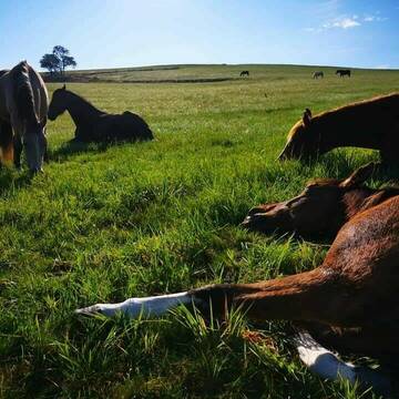


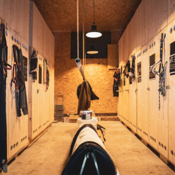
Offenstall/Laufstall/Paddocktrail FREI
Wurzbach
Sarah-Kreuter
@Sarah-Kreuter
Freizeitstall
Gangpferdereiten
Vermieten
Hunde willkommen
Krankenbox
Allergikerstall
Fohlenaufzucht möglich
39 weitere...
P+
Deprecated: Creation of dynamic property Zend_View_Helper_Ads::$adLink is deprecated in /var/www/stall-frei/htdocs/staging.stall-frei.de/library/Psf/View/Helper/Ads.php on line 108

Leider kein Vorschaubild
Leider kein Vorschaubild
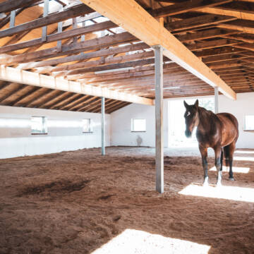
Selbstversorger Boxen oder Laufstallplatz frei
Kronach
Horse Power
@Horse-Power
FN-Mitglied
Vermieten
Parkplatz für Pferdeanhänger
Reithalle
Bewegungsstall
Innenbox
6 weitere...
B

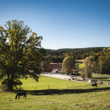
PENSIONSPFERDESTALL in Stadtsteinach
Stadtsteinach
Der Pferdehof
@Der-Pferdehof
Freizeitstall
Geländestrecke
Vermieten
Paddock
Pensions- und Gastboxen
Innenbox
11 weitere...
aktuell
P

Pferdehof hat Paddockboxen frei
Schwarzenbach am Wald
Manuela Geisser
@ManuelaGeisser
Freizeitstall
Vermieten
Hunde willkommen
Longierzirkel/Roundpen
Hufrehe geeignet
Notfallboxen
10 weitere...
P


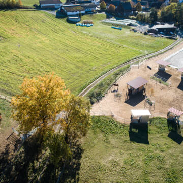
Reit- und Therapiezentrum Obermain
Altenkunstadt
Frau Limmer S.
@ReitundTherapiezentrum
Freizeitstall
Pferdeausbildung
Hunde willkommen
Krankenbox
Notfallboxen
Bewegungsstall
Offenstall
11 weitere...
P+
HIT-Aktivstall Ochsenhof Wüstenbuchau
Mainleus
Ochsenhof-GbR
@Ochsenhof-GbR
FN-Mitglied
Freizeitstall
Vermieten
Hunde willkommen
Krankenbox
Hufrehe geeignet
Notfallboxen
18 weitere...
P+

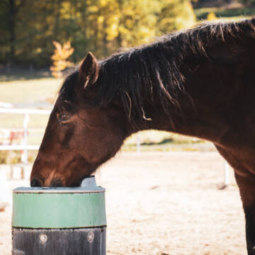
Das Beste für die Hufe
Mechtersen
STALL-FREIde Marketing
@STALL-FREI-Marketing
Hufschmiede und Hufpfleger in Ihrer Nähe
Leider kein Vorschaubild
Leider kein Vorschaubild
Paddockbox
Lichtenberg
reiterhof-doerflas
@reiterhof-doerflas
Freizeitstall
Vermieten
Hunde willkommen
Paddock
Außenbox mit Paddock
12 weitere...
B
Leider kein Vorschaubild
Leider kein Vorschaubild
Offenstall
Lichtenberg
reiterhof-doerflas
@reiterhof-doerflas
Freizeitstall
Vermieten
Hunde willkommen
Krankenbox
Notfallboxen
15 weitere...
B

Stall zu vermieten 4 Pferdeboxen
Altenkunstadt
Gropp
@Gropp
Freizeitstall
Vermieten
Verpachten
Longierzirkel/Roundpen
Paddock
Allergikerstall
Einhornhaltung möglich
10 weitere...
P
Leider kein Vorschaubild
Leider kein Vorschaubild
Offenställe und Paddockboxen frei
Burgkunstadt
Appi
@Appi
Fahrstall, Kutschwagen
Freizeitstall
Vermieten
Hunde willkommen
Krankenbox
Allergikerstall
Gnadenbrothof
27 weitere...
B
Deprecated: Creation of dynamic property Zend_View::$pageCount is deprecated in /var/www/stall-frei/htdocs/staging.stall-frei.de/library/vendor/shardj/zf1-future/library/Zend/View/Abstract.php on line 308
Deprecated: Creation of dynamic property Zend_View::$itemCountPerPage is deprecated in /var/www/stall-frei/htdocs/staging.stall-frei.de/library/vendor/shardj/zf1-future/library/Zend/View/Abstract.php on line 308
Deprecated: Creation of dynamic property Zend_View::$first is deprecated in /var/www/stall-frei/htdocs/staging.stall-frei.de/library/vendor/shardj/zf1-future/library/Zend/View/Abstract.php on line 308
Deprecated: Creation of dynamic property Zend_View::$current is deprecated in /var/www/stall-frei/htdocs/staging.stall-frei.de/library/vendor/shardj/zf1-future/library/Zend/View/Abstract.php on line 308
Deprecated: Creation of dynamic property Zend_View::$last is deprecated in /var/www/stall-frei/htdocs/staging.stall-frei.de/library/vendor/shardj/zf1-future/library/Zend/View/Abstract.php on line 308
Deprecated: Creation of dynamic property Zend_View::$next is deprecated in /var/www/stall-frei/htdocs/staging.stall-frei.de/library/vendor/shardj/zf1-future/library/Zend/View/Abstract.php on line 308
Deprecated: Creation of dynamic property Zend_View::$pagesInRange is deprecated in /var/www/stall-frei/htdocs/staging.stall-frei.de/library/vendor/shardj/zf1-future/library/Zend/View/Abstract.php on line 308
Deprecated: Creation of dynamic property Zend_View::$firstPageInRange is deprecated in /var/www/stall-frei/htdocs/staging.stall-frei.de/library/vendor/shardj/zf1-future/library/Zend/View/Abstract.php on line 308
Deprecated: Creation of dynamic property Zend_View::$lastPageInRange is deprecated in /var/www/stall-frei/htdocs/staging.stall-frei.de/library/vendor/shardj/zf1-future/library/Zend/View/Abstract.php on line 308
Deprecated: Creation of dynamic property Zend_View::$currentItemCount is deprecated in /var/www/stall-frei/htdocs/staging.stall-frei.de/library/vendor/shardj/zf1-future/library/Zend/View/Abstract.php on line 308
Deprecated: Creation of dynamic property Zend_View::$totalItemCount is deprecated in /var/www/stall-frei/htdocs/staging.stall-frei.de/library/vendor/shardj/zf1-future/library/Zend/View/Abstract.php on line 308
Deprecated: Creation of dynamic property Zend_View::$firstItemNumber is deprecated in /var/www/stall-frei/htdocs/staging.stall-frei.de/library/vendor/shardj/zf1-future/library/Zend/View/Abstract.php on line 308
Deprecated: Creation of dynamic property Zend_View::$lastItemNumber is deprecated in /var/www/stall-frei/htdocs/staging.stall-frei.de/library/vendor/shardj/zf1-future/library/Zend/View/Abstract.php on line 308
Deprecated: Creation of dynamic property Zend_View::$router is deprecated in /var/www/stall-frei/htdocs/staging.stall-frei.de/library/vendor/shardj/zf1-future/library/Zend/View/Abstract.php on line 308
Deprecated: Creation of dynamic property Zend_View::$urlParams is deprecated in /var/www/stall-frei/htdocs/staging.stall-frei.de/library/vendor/shardj/zf1-future/library/Zend/View/Abstract.php on line 308
Deprecated: Creation of dynamic property Zend_View::$showAds is deprecated in /var/www/stall-frei/htdocs/staging.stall-frei.de/library/vendor/shardj/zf1-future/library/Zend/View/Abstract.php on line 308
Deprecated: Creation of dynamic property Zend_View::$objectIds is deprecated in /var/www/stall-frei/htdocs/staging.stall-frei.de/library/vendor/shardj/zf1-future/library/Zend/View/Abstract.php on line 308
Deprecated: Creation of dynamic property Zend_View::$showNavbar is deprecated in /var/www/stall-frei/htdocs/staging.stall-frei.de/library/vendor/shardj/zf1-future/library/Zend/View/Abstract.php on line 308
Deprecated: Creation of dynamic property Zend_View::$showBreadcrumb is deprecated in /var/www/stall-frei/htdocs/staging.stall-frei.de/library/vendor/shardj/zf1-future/library/Zend/View/Abstract.php on line 308
Deprecated: Creation of dynamic property Zend_View::$showFooter is deprecated in /var/www/stall-frei/htdocs/staging.stall-frei.de/library/vendor/shardj/zf1-future/library/Zend/View/Abstract.php on line 308
Deprecated: Creation of dynamic property Zend_View::$showInternalAds is deprecated in /var/www/stall-frei/htdocs/staging.stall-frei.de/library/vendor/shardj/zf1-future/library/Zend/View/Abstract.php on line 308
Deprecated: Creation of dynamic property Zend_View::$blNoContent is deprecated in /var/www/stall-frei/htdocs/staging.stall-frei.de/library/vendor/shardj/zf1-future/library/Zend/View/Abstract.php on line 308
Deprecated: Creation of dynamic property Zend_View::$sMetaDesc is deprecated in /var/www/stall-frei/htdocs/staging.stall-frei.de/library/vendor/shardj/zf1-future/library/Zend/View/Abstract.php on line 308
Deprecated: Creation of dynamic property Zend_View::$useGmaps is deprecated in /var/www/stall-frei/htdocs/staging.stall-frei.de/library/vendor/shardj/zf1-future/library/Zend/View/Abstract.php on line 308
Deprecated: Creation of dynamic property Zend_View::$touches is deprecated in /var/www/stall-frei/htdocs/staging.stall-frei.de/library/vendor/shardj/zf1-future/library/Zend/View/Abstract.php on line 308
Deprecated: Creation of dynamic property Zend_View::$oProject is deprecated in /var/www/stall-frei/htdocs/staging.stall-frei.de/library/vendor/shardj/zf1-future/library/Zend/View/Abstract.php on line 308
Deprecated: Creation of dynamic property Zend_View::$pageHeadline is deprecated in /var/www/stall-frei/htdocs/staging.stall-frei.de/library/vendor/shardj/zf1-future/library/Zend/View/Abstract.php on line 308
Deprecated: Creation of dynamic property Zend_View::$disableLocationField is deprecated in /var/www/stall-frei/htdocs/staging.stall-frei.de/library/vendor/shardj/zf1-future/library/Zend/View/Abstract.php on line 308
Deprecated: Creation of dynamic property Zend_View::$isSearch is deprecated in /var/www/stall-frei/htdocs/staging.stall-frei.de/library/vendor/shardj/zf1-future/library/Zend/View/Abstract.php on line 308
Deprecated: Creation of dynamic property Zend_View::$pageTitle is deprecated in /var/www/stall-frei/htdocs/staging.stall-frei.de/library/vendor/shardj/zf1-future/library/Zend/View/Abstract.php on line 308
Deprecated: Creation of dynamic property Psf_Form_Element_Text::$class is deprecated in /var/www/stall-frei/htdocs/staging.stall-frei.de/library/vendor/shardj/zf1-future/library/Zend/Form/Element.php on line 874
Deprecated: Creation of dynamic property Psf_Form_Element_Text::$size is deprecated in /var/www/stall-frei/htdocs/staging.stall-frei.de/library/vendor/shardj/zf1-future/library/Zend/Form/Element.php on line 874
Deprecated: Creation of dynamic property Psf_Form_Element_Text::$placeholder is deprecated in /var/www/stall-frei/htdocs/staging.stall-frei.de/library/vendor/shardj/zf1-future/library/Zend/Form/Element.php on line 874
Deprecated: Creation of dynamic property Psf_Form_Element_Hidden::$class is deprecated in /var/www/stall-frei/htdocs/staging.stall-frei.de/library/vendor/shardj/zf1-future/library/Zend/Form/Element.php on line 874
Deprecated: Creation of dynamic property Psf_Form_Element_Hidden::$class is deprecated in /var/www/stall-frei/htdocs/staging.stall-frei.de/library/vendor/shardj/zf1-future/library/Zend/Form/Element.php on line 874
Deprecated: Creation of dynamic property Psf_Form_Element_Hidden::$class is deprecated in /var/www/stall-frei/htdocs/staging.stall-frei.de/library/vendor/shardj/zf1-future/library/Zend/Form/Element.php on line 874
Deprecated: Creation of dynamic property Psf_Form_Element_Hidden::$class is deprecated in /var/www/stall-frei/htdocs/staging.stall-frei.de/library/vendor/shardj/zf1-future/library/Zend/Form/Element.php on line 874
Deprecated: Creation of dynamic property Psf_Form_Element_Select::$class is deprecated in /var/www/stall-frei/htdocs/staging.stall-frei.de/library/vendor/shardj/zf1-future/library/Zend/Form/Element.php on line 874
Deprecated: Creation of dynamic property Psf_Form_Element_Select::$class is deprecated in /var/www/stall-frei/htdocs/staging.stall-frei.de/library/vendor/shardj/zf1-future/library/Zend/Form/Element.php on line 874
Deprecated: Creation of dynamic property Psf_Form_Element_Select::$class is deprecated in /var/www/stall-frei/htdocs/staging.stall-frei.de/library/vendor/shardj/zf1-future/library/Zend/Form/Element.php on line 874
Deprecated: Creation of dynamic property Psf_Form_Element_Select::$class is deprecated in /var/www/stall-frei/htdocs/staging.stall-frei.de/library/vendor/shardj/zf1-future/library/Zend/Form/Element.php on line 874
Deprecated: Creation of dynamic property Psf_Form_Element_Text::$class is deprecated in /var/www/stall-frei/htdocs/staging.stall-frei.de/library/vendor/shardj/zf1-future/library/Zend/Form/Element.php on line 874
Deprecated: Creation of dynamic property Psf_Form_Element_Checkbox::$label is deprecated in /var/www/stall-frei/htdocs/staging.stall-frei.de/library/vendor/shardj/zf1-future/library/Zend/Form/Element.php on line 874
Deprecated: Creation of dynamic property Zend_View::$sort is deprecated in /var/www/stall-frei/htdocs/staging.stall-frei.de/library/vendor/shardj/zf1-future/library/Zend/View/Abstract.php on line 308
Deprecated: Creation of dynamic property Zend_View::$searchLocation is deprecated in /var/www/stall-frei/htdocs/staging.stall-frei.de/library/vendor/shardj/zf1-future/library/Zend/View/Abstract.php on line 308
Deprecated: Creation of dynamic property Zend_View::$locationHint is deprecated in /var/www/stall-frei/htdocs/staging.stall-frei.de/library/vendor/shardj/zf1-future/library/Zend/View/Abstract.php on line 308
Psf_GeoCoder_Abstract::getLocation: Lahm Get Location CachedOrLive
Psf_GeoCoder_Abstract::getCachedOrLive: Lahm
Psf_GeoCoder_OpenCageData::makeApiRequest: response:
Array
(
[documentation] => https://opencagedata.com/api
[licenses] => Array
(
[0] => Array
(
[name] => see attribution guide
[url] => https://opencagedata.com/credits
)
)
[results] => Array
(
[0] => Array
(
[bounds] => Array
(
[northeast] => Array
(
[lat] => 50.3566742
[lng] => 11.4100234
)
[southwest] => Array
(
[lat] => 50.3166742
[lng] => 11.3700234
)
)
[components] => Array
(
[ISO_3166-1_alpha-2] => DE
[ISO_3166-1_alpha-3] => DEU
[ISO_3166-2] => Array
(
[0] => DE-BY
)
[_category] => place
[_normalized_city] => Wilhelmsthal
[_type] => village
[city] => Wilhelmsthal
[continent] => Europe
[country] => Deutschland
[country_code] => de
[county] => Landkreis Kronach
[political_union] => European Union
[postcode] => 96352
[state] => Bayern
[state_code] => BY
[village] => Lahm
)
[confidence] => 7
[formatted] => 96352 Lahm, Deutschland
[geometry] => Array
(
[lat] => 50.3366742
[lng] => 11.3900234
)
)
[1] => Array
(
[bounds] => Array
(
[northeast] => Array
(
[lat] => 50.1206552
[lng] => 10.8885145
)
[southwest] => Array
(
[lat] => 50.0806552
[lng] => 10.8485145
)
)
[components] => Array
(
[ISO_3166-1_alpha-2] => DE
[ISO_3166-1_alpha-3] => DEU
[ISO_3166-2] => Array
(
[0] => DE-BY
)
[_category] => place
[_normalized_city] => Lahm
[_type] => village
[continent] => Europe
[country] => Deutschland
[country_code] => de
[county] => Landkreis Coburg
[municipality] => Itzgrund
[political_union] => European Union
[postcode] => 96190
[state] => Bayern
[state_code] => BY
[village] => Lahm
)
[confidence] => 7
[formatted] => 96190 Lahm, Deutschland
[geometry] => Array
(
[lat] => 50.1006552
[lng] => 10.8685145
)
)
[2] => Array
(
[bounds] => Array
(
[northeast] => Array
(
[lat] => 50.1005562
[lng] => 11.1554021
)
[southwest] => Array
(
[lat] => 50.0605562
[lng] => 11.1154021
)
)
[components] => Array
(
[ISO_3166-1_alpha-2] => DE
[ISO_3166-1_alpha-3] => DEU
[ISO_3166-2] => Array
(
[0] => DE-BY
)
[_category] => place
[_normalized_city] => Lichtenfels
[_type] => village
[continent] => Europe
[country] => Deutschland
[country_code] => de
[county] => Landkreis Lichtenfels
[political_union] => European Union
[state] => Bayern
[state_code] => BY
[town] => Lichtenfels
[village] => Lahm
)
[confidence] => 7
[formatted] => Lahm, Bayern, Deutschland
[geometry] => Array
(
[lat] => 50.0805562
[lng] => 11.1354021
)
)
[3] => Array
(
[bounds] => Array
(
[northeast] => Array
(
[lat] => 49.9733354
[lng] => 11.4620785
)
[southwest] => Array
(
[lat] => 49.9333354
[lng] => 11.4220785
)
)
[components] => Array
(
[ISO_3166-1_alpha-2] => DE
[ISO_3166-1_alpha-3] => DEU
[ISO_3166-2] => Array
(
[0] => DE-BY
)
[_category] => place
[_normalized_city] => Eckersdorf
[_type] => village
[city] => Eckersdorf
[continent] => Europe
[country] => Deutschland
[country_code] => de
[county] => Landkreis Bayreuth
[political_union] => European Union
[postcode] => 95490
[state] => Bayern
[state_code] => BY
[village] => Lahm
)
[confidence] => 7
[formatted] => 95490 Lahm, Deutschland
[geometry] => Array
(
[lat] => 49.9533354
[lng] => 11.4420785
)
)
[4] => Array
(
[bounds] => Array
(
[northeast] => Array
(
[lat] => 50.2565559
[lng] => 11.0396995
)
[southwest] => Array
(
[lat] => 50.2564559
[lng] => 11.0395995
)
)
[components] => Array
(
[ISO_3166-1_alpha-2] => DE
[ISO_3166-1_alpha-3] => DEU
[ISO_3166-2] => Array
(
[0] => DE-BY
)
[_category] => natural/water
[_normalized_city] => Ebersdorf b.Coburg
[_type] => peak
[continent] => Europe
[country] => Deutschland
[country_code] => de
[county] => Landkreis Coburg
[peak] => Lahm
[political_union] => European Union
[postcode] => 96271
[state] => Bayern
[state_code] => BY
[village] => Ebersdorf b.Coburg
)
[confidence] => 9
[formatted] => Lahm, 96271 Ebersdorf b.Coburg, Deutschland
[geometry] => Array
(
[lat] => 50.2565059
[lng] => 11.0396495
)
)
[5] => Array
(
[components] => Array
(
[ISO_3166-1_alpha-2] => FR
[ISO_3166-1_alpha-3] => FRA
[ISO_3166-2] => Array
(
[0] => FR-GES
[1] => FR-55
)
[_category] => road
[_normalized_city] => Aubréville
[_type] => road
[city] => Aubréville
[continent] => Europe
[country] => France
[country_code] => fr
[county] => Meuse
[local_authority] => Communauté de communes Argonne-Meuse
[political_union] => European Union
[postcode] => 55120
[road] => Chemin de la Lame
[state] => Grand Est
[state_code] => GES
)
[confidence] => 2
[formatted] => Chemin de la Lame, 55120 Aubréville, France
[geometry] => Array
(
[lat] => 49.138749
[lng] => 5.082573
)
)
[6] => Array
(
[components] => Array
(
[ISO_3166-1_alpha-2] => FR
[ISO_3166-1_alpha-3] => FRA
[ISO_3166-2] => Array
(
[0] => FR-BRE
[1] => FR-29
)
[_category] => road
[_normalized_city] => Ploudaniel
[_type] => road
[city] => Ploudaniel
[continent] => Europe
[country] => France
[country_code] => fr
[county] => Finistère
[local_authority] => Communauté Lesneven Côte des Légendes
[political_union] => European Union
[postcode] => 29260
[road] => Allée de Lam ar Zant
[state] => Bretagne
[state_code] => BRE
)
[confidence] => 2
[formatted] => Allée de Lam ar Zant, 29260 Ploudaniel, France
[geometry] => Array
(
[lat] => 48.532645
[lng] => -4.310228
)
)
[7] => Array
(
[components] => Array
(
[ISO_3166-1_alpha-2] => FR
[ISO_3166-1_alpha-3] => FRA
[ISO_3166-2] => Array
(
[0] => FR-GES
[1] => FR-10
)
[_category] => road
[_normalized_city] => Vanlay
[_type] => road
[city] => Vanlay
[continent] => Europe
[country] => France
[country_code] => fr
[county] => Aube
[local_authority] => Communauté de communes du Chaourçois et du Val d'Armance
[political_union] => European Union
[postcode] => 10210
[road] => Chemin des Lames
[state] => Grand Est
[state_code] => GES
)
[confidence] => 10
[formatted] => Chemin des Lames, 10210 Vanlay, France
[geometry] => Array
(
[lat] => 48.03135
[lng] => 4.017873
)
)
[8] => Array
(
[components] => Array
(
[ISO_3166-1_alpha-2] => FR
[ISO_3166-1_alpha-3] => FRA
[ISO_3166-2] => Array
(
[0] => FR-BFC
[1] => FR-89
)
[_category] => road
[_normalized_city] => Ancy-le-Franc
[_type] => road
[city] => Ancy-le-Franc
[continent] => Europe
[country] => France
[country_code] => fr
[county] => Yonne
[local_authority] => Communauté de communes Le Tonnerrois en Bourgogne
[political_union] => European Union
[postcode] => 89160
[road] => Le Champ de la Lame
[state] => Bourgogne-Franche-Comté
[state_code] => BFC
)
[confidence] => 10
[formatted] => Le Champ de la Lame, 89160 Ancy-le-Franc, France
[geometry] => Array
(
[lat] => 47.769976
[lng] => 4.172362
)
)
[9] => Array
(
[components] => Array
(
[ISO_3166-1_alpha-2] => FR
[ISO_3166-1_alpha-3] => FRA
[ISO_3166-2] => Array
(
[0] => FR-BRE
[1] => FR-29
)
[_category] => road
[_normalized_city] => Ploudaniel
[_type] => road
[city] => Ploudaniel
[continent] => Europe
[country] => France
[country_code] => fr
[county] => Finistère
[local_authority] => Communauté Lesneven Côte des Légendes
[political_union] => European Union
[postcode] => 29260
[road] => Hameau de Lam ar Zant
[state] => Bretagne
[state_code] => BRE
)
[confidence] => 10
[formatted] => Hameau de Lam ar Zant, 29260 Ploudaniel, France
[geometry] => Array
(
[lat] => 48.53347
[lng] => -4.311708
)
)
)
[status] => Array
(
[code] => 200
[message] => OK
)
[stay_informed] => Array
(
[blog] => https://blog.opencagedata.com
[mastodon] => https://en.osm.town/@opencage
)
[thanks] => For using an OpenCage API
[timestamp] => Array
(
[created_http] => Sat, 07 Feb 2026 15:32:27 GMT
[created_unix] => 1770478347
)
[total_results] => 10
)
Psf_GeoCoder_Abstract::convertLocationResult
{"documentation":"https:\/\/opencagedata.com\/api","licenses":[{"name":"see attribution guide","url":"https:\/\/opencagedata.com\/credits"}],"results":[{"bounds":{"northeast":{"lat":50.3566742,"lng":11.4100234},"southwest":{"lat":50.3166742,"lng":11.3700234}},"components":{"ISO_3166-1_alpha-2":"DE","ISO_3166-1_alpha-3":"DEU","ISO_3166-2":["DE-BY"],"_category":"place","_normalized_city":"Wilhelmsthal","_type":"village","city":"Wilhelmsthal","continent":"Europe","country":"Deutschland","country_code":"de","county":"Landkreis Kronach","political_union":"European Union","postcode":"96352","state":"Bayern","state_code":"BY","village":"Lahm"},"confidence":7,"formatted":"96352 Lahm, Deutschland","geometry":{"lat":50.3366742,"lng":11.3900234}},{"bounds":{"northeast":{"lat":50.1206552,"lng":10.8885145},"southwest":{"lat":50.0806552,"lng":10.8485145}},"components":{"ISO_3166-1_alpha-2":"DE","ISO_3166-1_alpha-3":"DEU","ISO_3166-2":["DE-BY"],"_category":"place","_normalized_city":"Lahm","_type":"village","continent":"Europe","country":"Deutschland","country_code":"de","county":"Landkreis Coburg","municipality":"Itzgrund","political_union":"European Union","postcode":"96190","state":"Bayern","state_code":"BY","village":"Lahm"},"confidence":7,"formatted":"96190 Lahm, Deutschland","geometry":{"lat":50.1006552,"lng":10.8685145}},{"bounds":{"northeast":{"lat":50.1005562,"lng":11.1554021},"southwest":{"lat":50.0605562,"lng":11.1154021}},"components":{"ISO_3166-1_alpha-2":"DE","ISO_3166-1_alpha-3":"DEU","ISO_3166-2":["DE-BY"],"_category":"place","_normalized_city":"Lichtenfels","_type":"village","continent":"Europe","country":"Deutschland","country_code":"de","county":"Landkreis Lichtenfels","political_union":"European Union","state":"Bayern","state_code":"BY","town":"Lichtenfels","village":"Lahm"},"confidence":7,"formatted":"Lahm, Bayern, Deutschland","geometry":{"lat":50.0805562,"lng":11.1354021}},{"bounds":{"northeast":{"lat":49.9733354,"lng":11.4620785},"southwest":{"lat":49.9333354,"lng":11.4220785}},"components":{"ISO_3166-1_alpha-2":"DE","ISO_3166-1_alpha-3":"DEU","ISO_3166-2":["DE-BY"],"_category":"place","_normalized_city":"Eckersdorf","_type":"village","city":"Eckersdorf","continent":"Europe","country":"Deutschland","country_code":"de","county":"Landkreis Bayreuth","political_union":"European Union","postcode":"95490","state":"Bayern","state_code":"BY","village":"Lahm"},"confidence":7,"formatted":"95490 Lahm, Deutschland","geometry":{"lat":49.9533354,"lng":11.4420785}},{"bounds":{"northeast":{"lat":50.2565559,"lng":11.0396995},"southwest":{"lat":50.2564559,"lng":11.0395995}},"components":{"ISO_3166-1_alpha-2":"DE","ISO_3166-1_alpha-3":"DEU","ISO_3166-2":["DE-BY"],"_category":"natural\/water","_normalized_city":"Ebersdorf b.Coburg","_type":"peak","continent":"Europe","country":"Deutschland","country_code":"de","county":"Landkreis Coburg","peak":"Lahm","political_union":"European Union","postcode":"96271","state":"Bayern","state_code":"BY","village":"Ebersdorf b.Coburg"},"confidence":9,"formatted":"Lahm, 96271 Ebersdorf b.Coburg, Deutschland","geometry":{"lat":50.2565059,"lng":11.0396495}},{"components":{"ISO_3166-1_alpha-2":"FR","ISO_3166-1_alpha-3":"FRA","ISO_3166-2":["FR-GES","FR-55"],"_category":"road","_normalized_city":"Aubr\u00e9ville","_type":"road","city":"Aubr\u00e9ville","continent":"Europe","country":"France","country_code":"fr","county":"Meuse","local_authority":"Communaut\u00e9 de communes Argonne-Meuse","political_union":"European Union","postcode":"55120","road":"Chemin de la Lame","state":"Grand Est","state_code":"GES"},"confidence":2,"formatted":"Chemin de la Lame, 55120 Aubr\u00e9ville, France","geometry":{"lat":49.138749,"lng":5.082573}},{"components":{"ISO_3166-1_alpha-2":"FR","ISO_3166-1_alpha-3":"FRA","ISO_3166-2":["FR-BRE","FR-29"],"_category":"road","_normalized_city":"Ploudaniel","_type":"road","city":"Ploudaniel","continent":"Europe","country":"France","country_code":"fr","county":"Finist\u00e8re","local_authority":"Communaut\u00e9 Lesneven C\u00f4te des L\u00e9gendes","political_union":"European Union","postcode":"29260","road":"All\u00e9e de Lam ar Zant","state":"Bretagne","state_code":"BRE"},"confidence":2,"formatted":"All\u00e9e de Lam ar Zant, 29260 Ploudaniel, France","geometry":{"lat":48.532645,"lng":-4.310228}},{"components":{"ISO_3166-1_alpha-2":"FR","ISO_3166-1_alpha-3":"FRA","ISO_3166-2":["FR-GES","FR-10"],"_category":"road","_normalized_city":"Vanlay","_type":"road","city":"Vanlay","continent":"Europe","country":"France","country_code":"fr","county":"Aube","local_authority":"Communaut\u00e9 de communes du Chaour\u00e7ois et du Val d'Armance","political_union":"European Union","postcode":"10210","road":"Chemin des Lames","state":"Grand Est","state_code":"GES"},"confidence":10,"formatted":"Chemin des Lames, 10210 Vanlay, France","geometry":{"lat":48.03135,"lng":4.017873}},{"components":{"ISO_3166-1_alpha-2":"FR","ISO_3166-1_alpha-3":"FRA","ISO_3166-2":["FR-BFC","FR-89"],"_category":"road","_normalized_city":"Ancy-le-Franc","_type":"road","city":"Ancy-le-Franc","continent":"Europe","country":"France","country_code":"fr","county":"Yonne","local_authority":"Communaut\u00e9 de communes Le Tonnerrois en Bourgogne","political_union":"European Union","postcode":"89160","road":"Le Champ de la Lame","state":"Bourgogne-Franche-Comt\u00e9","state_code":"BFC"},"confidence":10,"formatted":"Le Champ de la Lame, 89160 Ancy-le-Franc, France","geometry":{"lat":47.769976,"lng":4.172362}},{"components":{"ISO_3166-1_alpha-2":"FR","ISO_3166-1_alpha-3":"FRA","ISO_3166-2":["FR-BRE","FR-29"],"_category":"road","_normalized_city":"Ploudaniel","_type":"road","city":"Ploudaniel","continent":"Europe","country":"France","country_code":"fr","county":"Finist\u00e8re","local_authority":"Communaut\u00e9 Lesneven C\u00f4te des L\u00e9gendes","political_union":"European Union","postcode":"29260","road":"Hameau de Lam ar Zant","state":"Bretagne","state_code":"BRE"},"confidence":10,"formatted":"Hameau de Lam ar Zant, 29260 Ploudaniel, France","geometry":{"lat":48.53347,"lng":-4.311708}}],"status":{"code":200,"message":"OK"},"stay_informed":{"blog":"https:\/\/blog.opencagedata.com","mastodon":"https:\/\/en.osm.town\/@opencage"},"thanks":"For using an OpenCage API","timestamp":{"created_http":"Sat, 07 Feb 2026 15:32:27 GMT","created_unix":1770478347},"total_results":10}Array
(
[0] => stdClass Object
(
[bounds] => stdClass Object
(
[northeast] => stdClass Object
(
[lat] => 50.3566742
[lng] => 11.4100234
)
[southwest] => stdClass Object
(
[lat] => 50.3166742
[lng] => 11.3700234
)
)
[components] => stdClass Object
(
[ISO_3166-1_alpha-2] => DE
[ISO_3166-1_alpha-3] => DEU
[ISO_3166-2] => Array
(
[0] => DE-BY
)
[_category] => place
[_normalized_city] => Wilhelmsthal
[_type] => village
[city] => Wilhelmsthal
[continent] => Europe
[country] => Deutschland
[country_code] => de
[county] => Landkreis Kronach
[political_union] => European Union
[postcode] => 96352
[state] => Bayern
[state_code] => BY
[village] => Lahm
)
[confidence] => 7
[formatted] => 96352 Lahm, Deutschland
[geometry] => stdClass Object
(
[lat] => 50.3366742
[lng] => 11.3900234
)
)
[1] => stdClass Object
(
[bounds] => stdClass Object
(
[northeast] => stdClass Object
(
[lat] => 50.1206552
[lng] => 10.8885145
)
[southwest] => stdClass Object
(
[lat] => 50.0806552
[lng] => 10.8485145
)
)
[components] => stdClass Object
(
[ISO_3166-1_alpha-2] => DE
[ISO_3166-1_alpha-3] => DEU
[ISO_3166-2] => Array
(
[0] => DE-BY
)
[_category] => place
[_normalized_city] => Lahm
[_type] => village
[continent] => Europe
[country] => Deutschland
[country_code] => de
[county] => Landkreis Coburg
[municipality] => Itzgrund
[political_union] => European Union
[postcode] => 96190
[state] => Bayern
[state_code] => BY
[village] => Lahm
)
[confidence] => 7
[formatted] => 96190 Lahm, Deutschland
[geometry] => stdClass Object
(
[lat] => 50.1006552
[lng] => 10.8685145
)
)
[2] => stdClass Object
(
[bounds] => stdClass Object
(
[northeast] => stdClass Object
(
[lat] => 50.1005562
[lng] => 11.1554021
)
[southwest] => stdClass Object
(
[lat] => 50.0605562
[lng] => 11.1154021
)
)
[components] => stdClass Object
(
[ISO_3166-1_alpha-2] => DE
[ISO_3166-1_alpha-3] => DEU
[ISO_3166-2] => Array
(
[0] => DE-BY
)
[_category] => place
[_normalized_city] => Lichtenfels
[_type] => village
[continent] => Europe
[country] => Deutschland
[country_code] => de
[county] => Landkreis Lichtenfels
[political_union] => European Union
[state] => Bayern
[state_code] => BY
[town] => Lichtenfels
[village] => Lahm
)
[confidence] => 7
[formatted] => Lahm, Bayern, Deutschland
[geometry] => stdClass Object
(
[lat] => 50.0805562
[lng] => 11.1354021
)
)
[3] => stdClass Object
(
[bounds] => stdClass Object
(
[northeast] => stdClass Object
(
[lat] => 49.9733354
[lng] => 11.4620785
)
[southwest] => stdClass Object
(
[lat] => 49.9333354
[lng] => 11.4220785
)
)
[components] => stdClass Object
(
[ISO_3166-1_alpha-2] => DE
[ISO_3166-1_alpha-3] => DEU
[ISO_3166-2] => Array
(
[0] => DE-BY
)
[_category] => place
[_normalized_city] => Eckersdorf
[_type] => village
[city] => Eckersdorf
[continent] => Europe
[country] => Deutschland
[country_code] => de
[county] => Landkreis Bayreuth
[political_union] => European Union
[postcode] => 95490
[state] => Bayern
[state_code] => BY
[village] => Lahm
)
[confidence] => 7
[formatted] => 95490 Lahm, Deutschland
[geometry] => stdClass Object
(
[lat] => 49.9533354
[lng] => 11.4420785
)
)
[4] => stdClass Object
(
[bounds] => stdClass Object
(
[northeast] => stdClass Object
(
[lat] => 50.2565559
[lng] => 11.0396995
)
[southwest] => stdClass Object
(
[lat] => 50.2564559
[lng] => 11.0395995
)
)
[components] => stdClass Object
(
[ISO_3166-1_alpha-2] => DE
[ISO_3166-1_alpha-3] => DEU
[ISO_3166-2] => Array
(
[0] => DE-BY
)
[_category] => natural/water
[_normalized_city] => Ebersdorf b.Coburg
[_type] => peak
[continent] => Europe
[country] => Deutschland
[country_code] => de
[county] => Landkreis Coburg
[peak] => Lahm
[political_union] => European Union
[postcode] => 96271
[state] => Bayern
[state_code] => BY
[village] => Ebersdorf b.Coburg
)
[confidence] => 9
[formatted] => Lahm, 96271 Ebersdorf b.Coburg, Deutschland
[geometry] => stdClass Object
(
[lat] => 50.2565059
[lng] => 11.0396495
)
)
[5] => stdClass Object
(
[components] => stdClass Object
(
[ISO_3166-1_alpha-2] => FR
[ISO_3166-1_alpha-3] => FRA
[ISO_3166-2] => Array
(
[0] => FR-GES
[1] => FR-55
)
[_category] => road
[_normalized_city] => Aubréville
[_type] => road
[city] => Aubréville
[continent] => Europe
[country] => France
[country_code] => fr
[county] => Meuse
[local_authority] => Communauté de communes Argonne-Meuse
[political_union] => European Union
[postcode] => 55120
[road] => Chemin de la Lame
[state] => Grand Est
[state_code] => GES
)
[confidence] => 2
[formatted] => Chemin de la Lame, 55120 Aubréville, France
[geometry] => stdClass Object
(
[lat] => 49.138749
[lng] => 5.082573
)
)
[6] => stdClass Object
(
[components] => stdClass Object
(
[ISO_3166-1_alpha-2] => FR
[ISO_3166-1_alpha-3] => FRA
[ISO_3166-2] => Array
(
[0] => FR-BRE
[1] => FR-29
)
[_category] => road
[_normalized_city] => Ploudaniel
[_type] => road
[city] => Ploudaniel
[continent] => Europe
[country] => France
[country_code] => fr
[county] => Finistère
[local_authority] => Communauté Lesneven Côte des Légendes
[political_union] => European Union
[postcode] => 29260
[road] => Allée de Lam ar Zant
[state] => Bretagne
[state_code] => BRE
)
[confidence] => 2
[formatted] => Allée de Lam ar Zant, 29260 Ploudaniel, France
[geometry] => stdClass Object
(
[lat] => 48.532645
[lng] => -4.310228
)
)
[7] => stdClass Object
(
[components] => stdClass Object
(
[ISO_3166-1_alpha-2] => FR
[ISO_3166-1_alpha-3] => FRA
[ISO_3166-2] => Array
(
[0] => FR-GES
[1] => FR-10
)
[_category] => road
[_normalized_city] => Vanlay
[_type] => road
[city] => Vanlay
[continent] => Europe
[country] => France
[country_code] => fr
[county] => Aube
[local_authority] => Communauté de communes du Chaourçois et du Val d'Armance
[political_union] => European Union
[postcode] => 10210
[road] => Chemin des Lames
[state] => Grand Est
[state_code] => GES
)
[confidence] => 10
[formatted] => Chemin des Lames, 10210 Vanlay, France
[geometry] => stdClass Object
(
[lat] => 48.03135
[lng] => 4.017873
)
)
[8] => stdClass Object
(
[components] => stdClass Object
(
[ISO_3166-1_alpha-2] => FR
[ISO_3166-1_alpha-3] => FRA
[ISO_3166-2] => Array
(
[0] => FR-BFC
[1] => FR-89
)
[_category] => road
[_normalized_city] => Ancy-le-Franc
[_type] => road
[city] => Ancy-le-Franc
[continent] => Europe
[country] => France
[country_code] => fr
[county] => Yonne
[local_authority] => Communauté de communes Le Tonnerrois en Bourgogne
[political_union] => European Union
[postcode] => 89160
[road] => Le Champ de la Lame
[state] => Bourgogne-Franche-Comté
[state_code] => BFC
)
[confidence] => 10
[formatted] => Le Champ de la Lame, 89160 Ancy-le-Franc, France
[geometry] => stdClass Object
(
[lat] => 47.769976
[lng] => 4.172362
)
)
[9] => stdClass Object
(
[components] => stdClass Object
(
[ISO_3166-1_alpha-2] => FR
[ISO_3166-1_alpha-3] => FRA
[ISO_3166-2] => Array
(
[0] => FR-BRE
[1] => FR-29
)
[_category] => road
[_normalized_city] => Ploudaniel
[_type] => road
[city] => Ploudaniel
[continent] => Europe
[country] => France
[country_code] => fr
[county] => Finistère
[local_authority] => Communauté Lesneven Côte des Légendes
[political_union] => European Union
[postcode] => 29260
[road] => Hameau de Lam ar Zant
[state] => Bretagne
[state_code] => BRE
)
[confidence] => 10
[formatted] => Hameau de Lam ar Zant, 29260 Ploudaniel, France
[geometry] => stdClass Object
(
[lat] => 48.53347
[lng] => -4.311708
)
)
)
Psf_GeoCoder_OpenCageData::getKeyMap: 0
stdClass Object
(
    [bounds] => stdClass Object
        (
            [northeast] => stdClass Object
                (
                    [lat] => 50.3566742
                    [lng] => 11.4100234
                )

            [southwest] => stdClass Object
                (
                    [lat] => 50.3166742
                    [lng] => 11.3700234
                )

        )

    [components] => stdClass Object
        (
            [ISO_3166-1_alpha-2] => DE
            [ISO_3166-1_alpha-3] => DEU
            [ISO_3166-2] => Array
                (
                    [0] => DE-BY
                )

            [_category] => place
            [_normalized_city] => Wilhelmsthal
            [_type] => village
            [city] => Wilhelmsthal
            [continent] => Europe
            [country] => Deutschland
            [country_code] => de
            [county] => Landkreis Kronach
            [political_union] => European Union
            [postcode] => 96352
            [state] => Bayern
            [state_code] => BY
            [village] => Lahm
        )

    [confidence] => 7
    [formatted] => 96352 Lahm, Deutschland
    [geometry] => stdClass Object
        (
            [lat] => 50.3366742
            [lng] => 11.3900234
        )

)
Psf_GeoCoder_OpenCageData::getCounty: Kronach
Psf_GeoCoder_OpenCageData::addMissingData REFETCH!
Array
(
    [address] => 96352 Lahm, Deutschland
    [type] => village
    [street] =>
    [city] => Lahm
    [county] => Kronach
    [state] => Bayern
    [zip] => 96352
    [country] => Deutschland
    [suburb] =>
    [countrycode] => de
    [latitude] => 50.3366742
    [longitude] => 11.3900234
    [accuracy] => 1
    [confidence] => 7
    [bounds] => stdClass Object
        (
            [northeast] => stdClass Object
                (
                    [lat] => 50.3566742
                    [lng] => 11.4100234
                )

            [southwest] => stdClass Object
                (
                    [lat] => 50.3166742
                    [lng] => 11.3700234
                )

        )

)
reformat!
Array
(
    [address] => 96352 Lahm, Deutschland
    [type] => village
    [street] =>
    [city] => Lahm
    [county] => Kronach
    [state] => Bayern
    [zip] => 96352
    [country] => Deutschland
    [suburb] =>
    [countrycode] => de
    [latitude] => 50.3366742
    [longitude] => 11.3900234
    [accuracy] => 1
    [confidence] => 7
    [bounds] => stdClass Object
        (
            [northeast] => stdClass Object
                (
                    [lat] => 50.3566742
                    [lng] => 11.4100234
                )

            [southwest] => stdClass Object
                (
                    [lat] => 50.3166742
                    [lng] => 11.3700234
                )

        )

    [place] => 96352 Lahm, Bayern
    [hash] => ee259a4d42acf7fda57334e288864c45
)
Psf_GeoCoder_OpenCageData::getKeyMap: 1
stdClass Object
(
    [bounds] => stdClass Object
        (
            [northeast] => stdClass Object
                (
                    [lat] => 50.1206552
                    [lng] => 10.8885145
                )

            [southwest] => stdClass Object
                (
                    [lat] => 50.0806552
                    [lng] => 10.8485145
                )

        )

    [components] => stdClass Object
        (
            [ISO_3166-1_alpha-2] => DE
            [ISO_3166-1_alpha-3] => DEU
            [ISO_3166-2] => Array
                (
                    [0] => DE-BY
                )

            [_category] => place
            [_normalized_city] => Lahm
            [_type] => village
            [continent] => Europe
            [country] => Deutschland
            [country_code] => de
            [county] => Landkreis Coburg
            [municipality] => Itzgrund
            [political_union] => European Union
            [postcode] => 96190
            [state] => Bayern
            [state_code] => BY
            [village] => Lahm
        )

    [confidence] => 7
    [formatted] => 96190 Lahm, Deutschland
    [geometry] => stdClass Object
        (
            [lat] => 50.1006552
            [lng] => 10.8685145
        )

)
Psf_GeoCoder_OpenCageData::getCounty: Coburg
Psf_GeoCoder_OpenCageData::addMissingData REFETCH!
Array
(
    [address] => 96190 Lahm, Deutschland
    [type] => village
    [street] =>
    [city] => Lahm
    [county] => Coburg
    [state] => Bayern
    [zip] => 96190
    [country] => Deutschland
    [suburb] =>
    [countrycode] => de
    [latitude] => 50.1006552
    [longitude] => 10.8685145
    [accuracy] => 1
    [confidence] => 7
    [bounds] => stdClass Object
        (
            [northeast] => stdClass Object
                (
                    [lat] => 50.1206552
                    [lng] => 10.8885145
                )

            [southwest] => stdClass Object
                (
                    [lat] => 50.0806552
                    [lng] => 10.8485145
                )

        )

)
reformat!
Array
(
    [address] => 96190 Lahm, Deutschland
    [type] => village
    [street] =>
    [city] => Lahm
    [county] => Coburg
    [state] => Bayern
    [zip] => 96190
    [country] => Deutschland
    [suburb] =>
    [countrycode] => de
    [latitude] => 50.1006552
    [longitude] => 10.8685145
    [accuracy] => 1
    [confidence] => 7
    [bounds] => stdClass Object
        (
            [northeast] => stdClass Object
                (
                    [lat] => 50.1206552
                    [lng] => 10.8885145
                )

            [southwest] => stdClass Object
                (
                    [lat] => 50.0806552
                    [lng] => 10.8485145
                )

        )

    [place] => 96190 Lahm, Bayern
    [hash] => a64f622c022a058d41a8b384201b9e0d
)
Psf_GeoCoder_OpenCageData::getKeyMap: 2
stdClass Object
(
    [bounds] => stdClass Object
        (
            [northeast] => stdClass Object
                (
                    [lat] => 50.1005562
                    [lng] => 11.1554021
                )

            [southwest] => stdClass Object
                (
                    [lat] => 50.0605562
                    [lng] => 11.1154021
                )

        )

    [components] => stdClass Object
        (
            [ISO_3166-1_alpha-2] => DE
            [ISO_3166-1_alpha-3] => DEU
            [ISO_3166-2] => Array
                (
                    [0] => DE-BY
                )

            [_category] => place
            [_normalized_city] => Lichtenfels
            [_type] => village
            [continent] => Europe
            [country] => Deutschland
            [country_code] => de
            [county] => Landkreis Lichtenfels
            [political_union] => European Union
            [state] => Bayern
            [state_code] => BY
            [town] => Lichtenfels
            [village] => Lahm
        )

    [confidence] => 7
    [formatted] => Lahm, Bayern, Deutschland
    [geometry] => stdClass Object
        (
            [lat] => 50.0805562
            [lng] => 11.1354021
        )

)
Psf_GeoCoder_OpenCageData::getCounty: Lichtenfels
Psf_GeoCoder_OpenCageData::addMissingData REFETCH!
Array
(
    [address] => Lahm, Bayern, Deutschland
    [type] => village
    [street] =>
    [city] => Lichtenfels
    [county] => Lichtenfels
    [state] => Bayern
    [zip] =>
    [country] => Deutschland
    [suburb] =>
    [countrycode] => de
    [latitude] => 50.0805562
    [longitude] => 11.1354021
    [accuracy] => 1
    [confidence] => 7
    [bounds] => stdClass Object
        (
            [northeast] => stdClass Object
                (
                    [lat] => 50.1005562
                    [lng] => 11.1554021
                )

            [southwest] => stdClass Object
                (
                    [lat] => 50.0605562
                    [lng] => 11.1154021
                )

        )

)
reformat!
Array
(
    [address] => Lichtenfels
    [type] => village
    [street] =>
    [city] => Lichtenfels
    [county] => Lichtenfels
    [state] => Bayern
    [zip] =>
    [country] => Deutschland
    [suburb] =>
    [countrycode] => de
    [latitude] => 50.0805562
    [longitude] => 11.1354021
    [accuracy] => 1
    [confidence] => 7
    [bounds] => stdClass Object
        (
            [northeast] => stdClass Object
                (
                    [lat] => 50.1005562
                    [lng] => 11.1554021
                )

            [southwest] => stdClass Object
                (
                    [lat] => 50.0605562
                    [lng] => 11.1154021
                )

        )

    [place] => Lichtenfels, Bayern
    [hash] => 6a7c3eb2a89584a2279939101d460771
)
Psf_GeoCoder_OpenCageData::getKeyMap: 3
stdClass Object
(
    [bounds] => stdClass Object
        (
            [northeast] => stdClass Object
                (
                    [lat] => 49.9733354
                    [lng] => 11.4620785
                )

            [southwest] => stdClass Object
                (
                    [lat] => 49.9333354
                    [lng] => 11.4220785
                )

        )

    [components] => stdClass Object
        (
            [ISO_3166-1_alpha-2] => DE
            [ISO_3166-1_alpha-3] => DEU
            [ISO_3166-2] => Array
                (
                    [0] => DE-BY
                )

            [_category] => place
            [_normalized_city] => Eckersdorf
            [_type] => village
            [city] => Eckersdorf
            [continent] => Europe
            [country] => Deutschland
            [country_code] => de
            [county] => Landkreis Bayreuth
            [political_union] => European Union
            [postcode] => 95490
            [state] => Bayern
            [state_code] => BY
            [village] => Lahm
        )

    [confidence] => 7
    [formatted] => 95490 Lahm, Deutschland
    [geometry] => stdClass Object
        (
            [lat] => 49.9533354
            [lng] => 11.4420785
        )

)
Psf_GeoCoder_OpenCageData::getCounty: Bayreuth
Psf_GeoCoder_OpenCageData::addMissingData REFETCH!
Array
(
    [address] => 95490 Lahm, Deutschland
    [type] => village
    [street] =>
    [city] => Lahm
    [county] => Bayreuth
    [state] => Bayern
    [zip] => 95490
    [country] => Deutschland
    [suburb] =>
    [countrycode] => de
    [latitude] => 49.9533354
    [longitude] => 11.4420785
    [accuracy] => 1
    [confidence] => 7
    [bounds] => stdClass Object
        (
            [northeast] => stdClass Object
                (
                    [lat] => 49.9733354
                    [lng] => 11.4620785
                )

            [southwest] => stdClass Object
                (
                    [lat] => 49.9333354
                    [lng] => 11.4220785
                )

        )

)
reformat!
Array
(
    [address] => 95490 Lahm, Deutschland
    [type] => village
    [street] =>
    [city] => Lahm
    [county] => Bayreuth
    [state] => Bayern
    [zip] => 95490
    [country] => Deutschland
    [suburb] =>
    [countrycode] => de
    [latitude] => 49.9533354
    [longitude] => 11.4420785
    [accuracy] => 1
    [confidence] => 7
    [bounds] => stdClass Object
        (
            [northeast] => stdClass Object
                (
                    [lat] => 49.9733354
                    [lng] => 11.4620785
                )

            [southwest] => stdClass Object
                (
                    [lat] => 49.9333354
                    [lng] => 11.4220785
                )

        )

    [place] => 95490 Lahm, Bayern
    [hash] => 678c1e03f4d5eef2de132428d0b1ab03
)
Psf_GeoCoder_OpenCageData::getKeyMap: 4
stdClass Object
(
    [bounds] => stdClass Object
        (
            [northeast] => stdClass Object
                (
                    [lat] => 50.2565559
                    [lng] => 11.0396995
                )

            [southwest] => stdClass Object
                (
                    [lat] => 50.2564559
                    [lng] => 11.0395995
                )

        )

    [components] => stdClass Object
        (
            [ISO_3166-1_alpha-2] => DE
            [ISO_3166-1_alpha-3] => DEU
            [ISO_3166-2] => Array
                (
                    [0] => DE-BY
                )

            [_category] => natural/water
            [_normalized_city] => Ebersdorf b.Coburg
            [_type] => peak
            [continent] => Europe
            [country] => Deutschland
            [country_code] => de
            [county] => Landkreis Coburg
            [peak] => Lahm
            [political_union] => European Union
            [postcode] => 96271
            [state] => Bayern
            [state_code] => BY
            [village] => Ebersdorf b.Coburg
        )

    [confidence] => 9
    [formatted] => Lahm, 96271 Ebersdorf b.Coburg, Deutschland
    [geometry] => stdClass Object
        (
            [lat] => 50.2565059
            [lng] => 11.0396495
        )

)
Psf_GeoCoder_OpenCageData::getCounty: Coburg
Psf_GeoCoder_OpenCageData::addMissingData REFETCH!
Array
(
    [address] => Lahm, 96271 Ebersdorf b.Coburg, Deutschland
    [type] => peak
    [street] =>
    [city] => Ebersdorf b.Coburg
    [county] => Coburg
    [state] => Bayern
    [zip] => 96271
    [country] => Deutschland
    [suburb] =>
    [countrycode] => de
    [latitude] => 50.2565059
    [longitude] => 11.0396495
    [accuracy] => 1
    [confidence] => 9
    [bounds] => stdClass Object
        (
            [northeast] => stdClass Object
                (
                    [lat] => 50.2565559
                    [lng] => 11.0396995
                )

            [southwest] => stdClass Object
                (
                    [lat] => 50.2564559
                    [lng] => 11.0395995
                )

        )

)
reformat!
Array
(
    [address] => Lahm, 96271 Ebersdorf b.Coburg, Deutschland
    [type] => peak
    [street] =>
    [city] => Ebersdorf b.Coburg
    [county] => Coburg
    [state] => Bayern
    [zip] => 96271
    [country] => Deutschland
    [suburb] =>
    [countrycode] => de
    [latitude] => 50.2565059
    [longitude] => 11.0396495
    [accuracy] => 1
    [confidence] => 9
    [bounds] => stdClass Object
        (
            [northeast] => stdClass Object
                (
                    [lat] => 50.2565559
                    [lng] => 11.0396995
                )

            [southwest] => stdClass Object
                (
                    [lat] => 50.2564559
                    [lng] => 11.0395995
                )

        )

    [place] => 96271 Ebersdorf b.Coburg, Bayern
    [hash] => 3a860c7f97c14fdf51f2e488c104858a
)
Psf_GeoCoder_OpenCageData::getKeyMap: 5
stdClass Object
(
    [components] => stdClass Object
        (
            [ISO_3166-1_alpha-2] => FR
            [ISO_3166-1_alpha-3] => FRA
            [ISO_3166-2] => Array
                (
                    [0] => FR-GES
                    [1] => FR-55
                )

            [_category] => road
            [_normalized_city] => Aubréville
            [_type] => road
            [city] => Aubréville
            [continent] => Europe
            [country] => France
            [country_code] => fr
            [county] => Meuse
            [local_authority] => Communauté de communes Argonne-Meuse
            [political_union] => European Union
            [postcode] => 55120
            [road] => Chemin de la Lame
            [state] => Grand Est
            [state_code] => GES
        )

    [confidence] => 2
    [formatted] => Chemin de la Lame, 55120 Aubréville, France
    [geometry] => stdClass Object
        (
            [lat] => 49.138749
            [lng] => 5.082573
        )

)
Psf_GeoCoder_OpenCageData::getCounty: Meuse
Psf_GeoCoder_OpenCageData::addMissingData REFETCH!
Array
(
    [address] => Chemin de la Lame, 55120 Aubréville, France
    [type] => road
    [street] => Chemin de la Lame
    [city] => Aubréville
    [county] => Meuse
    [state] => Grand Est
    [zip] => 55120
    [country] => France
    [suburb] =>
    [countrycode] => fr
    [latitude] => 49.138749
    [longitude] => 5.082573
    [accuracy] => 1
    [confidence] => 2
    [bounds] =>
)
reformat!
Array
(
    [address] => Chemin de la Lame, 55120 Aubréville, France
    [type] => road
    [street] => Chemin de la Lame
    [city] => Aubréville
    [county] => Meuse
    [state] => Grand Est
    [zip] => 55120
    [country] => France
    [suburb] =>
    [countrycode] => fr
    [latitude] => 49.138749
    [longitude] => 5.082573
    [accuracy] => 1
    [confidence] => 2
    [bounds] =>
    [place] => Chemin de la Lame, 55120 Aubréville, Grand Est
    [hash] => 1019ca923cb7e4089d22f2d3d5c785f5
)
Psf_GeoCoder_OpenCageData::getKeyMap: 6
stdClass Object
(
    [components] => stdClass Object
        (
            [ISO_3166-1_alpha-2] => FR
            [ISO_3166-1_alpha-3] => FRA
            [ISO_3166-2] => Array
                (
                    [0] => FR-BRE
                    [1] => FR-29
                )

            [_category] => road
            [_normalized_city] => Ploudaniel
            [_type] => road
            [city] => Ploudaniel
            [continent] => Europe
            [country] => France
            [country_code] => fr
            [county] => Finistère
            [local_authority] => Communauté Lesneven Côte des Légendes
            [political_union] => European Union
            [postcode] => 29260
            [road] => Allée de Lam ar Zant
            [state] => Bretagne
            [state_code] => BRE
        )

    [confidence] => 2
    [formatted] => Allée de Lam ar Zant, 29260 Ploudaniel, France
    [geometry] => stdClass Object
        (
            [lat] => 48.532645
            [lng] => -4.310228
        )

)
Psf_GeoCoder_OpenCageData::getCounty: Finistère
Psf_GeoCoder_OpenCageData::addMissingData REFETCH!
Array
(
    [address] => Allée de Lam ar Zant, 29260 Ploudaniel, France
    [type] => road
    [street] => Allée de Lam ar Zant
    [city] => Ploudaniel
    [county] => Finistère
    [state] => Bretagne
    [zip] => 29260
    [country] => France
    [suburb] =>
    [countrycode] => fr
    [latitude] => 48.532645
    [longitude] => -4.310228
    [accuracy] => 1
    [confidence] => 2
    [bounds] =>
)
reformat!
Array
(
    [address] => Allée de Lam ar Zant, 29260 Ploudaniel, France
    [type] => road
    [street] => Allée de Lam ar Zant
    [city] => Ploudaniel
    [county] => Finistère
    [state] => Bretagne
    [zip] => 29260
    [country] => France
    [suburb] =>
    [countrycode] => fr
    [latitude] => 48.532645
    [longitude] => -4.310228
    [accuracy] => 1
    [confidence] => 2
    [bounds] =>
    [place] => Allée de Lam ar Zant, 29260 Ploudaniel, Bretagne
    [hash] => d1d04f149da2d5cbbea6f3b7ea42439a
)
Psf_GeoCoder_OpenCageData::getKeyMap: 7
stdClass Object
(
    [components] => stdClass Object
        (
            [ISO_3166-1_alpha-2] => FR
            [ISO_3166-1_alpha-3] => FRA
            [ISO_3166-2] => Array
                (
                    [0] => FR-GES
                    [1] => FR-10
                )

            [_category] => road
            [_normalized_city] => Vanlay
            [_type] => road
            [city] => Vanlay
            [continent] => Europe
            [country] => France
            [country_code] => fr
            [county] => Aube
            [local_authority] => Communauté de communes du Chaourçois et du Val d'Armance
            [political_union] => European Union
            [postcode] => 10210
            [road] => Chemin des Lames
            [state] => Grand Est
            [state_code] => GES
        )

    [confidence] => 10
    [formatted] => Chemin des Lames, 10210 Vanlay, France
    [geometry] => stdClass Object
        (
            [lat] => 48.03135
            [lng] => 4.017873
        )

)
Psf_GeoCoder_OpenCageData::getCounty: Aube
Psf_GeoCoder_OpenCageData::addMissingData REFETCH!
Array
(
    [address] => Chemin des Lames, 10210 Vanlay, France
    [type] => road
    [street] => Chemin des Lames
    [city] => Vanlay
    [county] => Aube
    [state] => Grand Est
    [zip] => 10210
    [country] => France
    [suburb] =>
    [countrycode] => fr
    [latitude] => 48.03135
    [longitude] => 4.017873
    [accuracy] => 1
    [confidence] => 10
    [bounds] =>
)
reformat!
Array
(
    [address] => Chemin des Lames, 10210 Vanlay, France
    [type] => road
    [street] => Chemin des Lames
    [city] => Vanlay
    [county] => Aube
    [state] => Grand Est
    [zip] => 10210
    [country] => France
    [suburb] =>
    [countrycode] => fr
    [latitude] => 48.03135
    [longitude] => 4.017873
    [accuracy] => 1
    [confidence] => 10
    [bounds] =>
    [place] => Chemin des Lames, 10210 Vanlay, Grand Est
    [hash] => f0a0a9b5413aa94710a30fe92a5aeab9
)
Psf_GeoCoder_OpenCageData::getKeyMap: 8
stdClass Object
(
    [components] => stdClass Object
        (
            [ISO_3166-1_alpha-2] => FR
            [ISO_3166-1_alpha-3] => FRA
            [ISO_3166-2] => Array
                (
                    [0] => FR-BFC
                    [1] => FR-89
                )

            [_category] => road
            [_normalized_city] => Ancy-le-Franc
            [_type] => road
            [city] => Ancy-le-Franc
            [continent] => Europe
            [country] => France
            [country_code] => fr
            [county] => Yonne
            [local_authority] => Communauté de communes Le Tonnerrois en Bourgogne
            [political_union] => European Union
            [postcode] => 89160
            [road] => Le Champ de la Lame
            [state] => Bourgogne-Franche-Comté
            [state_code] => BFC
        )

    [confidence] => 10
    [formatted] => Le Champ de la Lame, 89160 Ancy-le-Franc, France
    [geometry] => stdClass Object
        (
            [lat] => 47.769976
            [lng] => 4.172362
        )

)
Psf_GeoCoder_OpenCageData::getCounty: Yonne
Psf_GeoCoder_OpenCageData::addMissingData REFETCH!
Array
(
    [address] => Le Champ de la Lame, 89160 Ancy-le-Franc, France
    [type] => road
    [street] => Le Champ de la Lame
    [city] => Ancy-le-Franc
    [county] => Yonne
    [state] => Bourgogne-Franche-Comté
    [zip] => 89160
    [country] => France
    [suburb] =>
    [countrycode] => fr
    [latitude] => 47.769976
    [longitude] => 4.172362
    [accuracy] => 1
    [confidence] => 10
    [bounds] =>
)
reformat!
Array
(
    [address] => Le Champ de la Lame, 89160 Ancy-le-Franc, France
    [type] => road
    [street] => Le Champ de la Lame
    [city] => Ancy-le-Franc
    [county] => Yonne
    [state] => Bourgogne-Franche-Comté
    [zip] => 89160
    [country] => France
    [suburb] =>
    [countrycode] => fr
    [latitude] => 47.769976
    [longitude] => 4.172362
    [accuracy] => 1
    [confidence] => 10
    [bounds] =>
    [place] => Le Champ de la Lame, 89160 Ancy-le-Franc, Bourgogne-Franche-Comté
    [hash] => 9855ae1da938c695a4ca2d4222d6ac82
)
Psf_GeoCoder_OpenCageData::getKeyMap: 9
stdClass Object
(
    [components] => stdClass Object
        (
            [ISO_3166-1_alpha-2] => FR
            [ISO_3166-1_alpha-3] => FRA
            [ISO_3166-2] => Array
                (
                    [0] => FR-BRE
                    [1] => FR-29
                )

            [_category] => road
            [_normalized_city] => Ploudaniel
            [_type] => road
            [city] => Ploudaniel
            [continent] => Europe
            [country] => France
            [country_code] => fr
            [county] => Finistère
            [local_authority] => Communauté Lesneven Côte des Légendes
            [political_union] => European Union
            [postcode] => 29260
            [road] => Hameau de Lam ar Zant
            [state] => Bretagne
            [state_code] => BRE
        )

    [confidence] => 10
    [formatted] => Hameau de Lam ar Zant, 29260 Ploudaniel, France
    [geometry] => stdClass Object
        (
            [lat] => 48.53347
            [lng] => -4.311708
        )

)
Psf_GeoCoder_OpenCageData::getCounty: Finistère
Psf_GeoCoder_OpenCageData::addMissingData REFETCH!
Array
(
    [address] => Hameau de Lam ar Zant, 29260 Ploudaniel, France
    [type] => road
    [street] => Hameau de Lam ar Zant
    [city] => Ploudaniel
    [county] => Finistère
    [state] => Bretagne
    [zip] => 29260
    [country] => France
    [suburb] =>
    [countrycode] => fr
    [latitude] => 48.53347
    [longitude] => -4.311708
    [accuracy] => 1
    [confidence] => 10
    [bounds] =>
)
reformat!
Array
(
    [address] => Hameau de Lam ar Zant, 29260 Ploudaniel, France
    [type] => road
    [street] => Hameau de Lam ar Zant
    [city] => Ploudaniel
    [county] => Finistère
    [state] => Bretagne
    [zip] => 29260
    [country] => France
    [suburb] =>
    [countrycode] => fr
    [latitude] => 48.53347
    [longitude] => -4.311708
    [accuracy] => 1
    [confidence] => 10
    [bounds] =>
    [place] => Hameau de Lam ar Zant, 29260 Ploudaniel, Bretagne
    [hash] => dae4f874e4a524f124999a0076654f36
)
Deprecated: Creation of dynamic property Zend_View::$locationHintStyle is deprecated in /var/www/stall-frei/htdocs/staging.stall-frei.de/library/vendor/shardj/zf1-future/library/Zend/View/Abstract.php on line 308
Deprecated: Creation of dynamic property Zend_View::$adGeoLocation is deprecated in /var/www/stall-frei/htdocs/staging.stall-frei.de/library/vendor/shardj/zf1-future/library/Zend/View/Abstract.php on line 308
Deprecated: Creation of dynamic property Zend_View::$recordCount is deprecated in /var/www/stall-frei/htdocs/staging.stall-frei.de/library/vendor/shardj/zf1-future/library/Zend/View/Abstract.php on line 308
Deprecated: explode(): Passing null to parameter #2 ($string) of type string is deprecated in /var/www/stall-frei/htdocs/staging.stall-frei.de/application/models/SearchAgent.php on line 100
Deprecated: explode(): Passing null to parameter #2 ($string) of type string is deprecated in /var/www/stall-frei/htdocs/staging.stall-frei.de/application/models/SearchAgent.php on line 100
Deprecated: explode(): Passing null to parameter #2 ($string) of type string is deprecated in /var/www/stall-frei/htdocs/staging.stall-frei.de/application/models/SearchAgent.php on line 100
Deprecated: explode(): Passing null to parameter #2 ($string) of type string is deprecated in /var/www/stall-frei/htdocs/staging.stall-frei.de/application/models/SearchAgent.php on line 100
Deprecated: explode(): Passing null to parameter #2 ($string) of type string is deprecated in /var/www/stall-frei/htdocs/staging.stall-frei.de/application/models/SearchAgent.php on line 100
Deprecated: explode(): Passing null to parameter #2 ($string) of type string is deprecated in /var/www/stall-frei/htdocs/staging.stall-frei.de/application/models/SearchAgent.php on line 100
Deprecated: explode(): Passing null to parameter #2 ($string) of type string is deprecated in /var/www/stall-frei/htdocs/staging.stall-frei.de/application/models/SearchAgent.php on line 100
Deprecated: explode(): Passing null to parameter #2 ($string) of type string is deprecated in /var/www/stall-frei/htdocs/staging.stall-frei.de/application/models/SearchAgent.php on line 100
Deprecated: explode(): Passing null to parameter #2 ($string) of type string is deprecated in /var/www/stall-frei/htdocs/staging.stall-frei.de/application/models/SearchAgent.php on line 100
Deprecated: trim(): Passing null to parameter #1 ($string) of type string is deprecated in /var/www/stall-frei/htdocs/staging.stall-frei.de/application/models/Account/Search.php on line 82
Warning: Cannot modify header information - headers already sent by (output started at /var/www/stall-frei/htdocs/staging.stall-frei.de/library/vendor/shardj/zf1-future/library/Zend/View/Abstract.php:308) in /var/www/stall-frei/htdocs/staging.stall-frei.de/application/models/Account/Search.php on line 71
Deprecated: Creation of dynamic property Zend_View::$paginationParams is deprecated in /var/www/stall-frei/htdocs/staging.stall-frei.de/library/vendor/shardj/zf1-future/library/Zend/View/Abstract.php on line 308
Deprecated: Creation of dynamic property Zend_View::$objectPaginator is deprecated in /var/www/stall-frei/htdocs/staging.stall-frei.de/library/vendor/shardj/zf1-future/library/Zend/View/Abstract.php on line 308
Deprecated: Creation of dynamic property Zend_View::$featuredObjects is deprecated in /var/www/stall-frei/htdocs/staging.stall-frei.de/library/vendor/shardj/zf1-future/library/Zend/View/Abstract.php on line 308
Deprecated: Creation of dynamic property Zend_View::$hints is deprecated in /var/www/stall-frei/htdocs/staging.stall-frei.de/library/vendor/shardj/zf1-future/library/Zend/View/Abstract.php on line 308
Deprecated: Creation of dynamic property Zend_View::$attributeHints is deprecated in /var/www/stall-frei/htdocs/staging.stall-frei.de/library/vendor/shardj/zf1-future/library/Zend/View/Abstract.php on line 308
Deprecated: Creation of dynamic property Zend_View::$oSearchForm is deprecated in /var/www/stall-frei/htdocs/staging.stall-frei.de/library/vendor/shardj/zf1-future/library/Zend/View/Abstract.php on line 308