Deprecated: Creation of dynamic property Zend_View::$sMode is deprecated in /var/www/stall-frei/htdocs/staging.stall-frei.de/library/vendor/shardj/zf1-future/library/Zend/View/Abstract.php on line 308
Stallplatz oder Offenstall in Höchst
Gesucht wird in "Höchst, Frankfurt am Main, Hessen, Deutschland"
6.331 Einträge
Deprecated: Creation of dynamic property Zend_View::$listObjects is deprecated in /var/www/stall-frei/htdocs/staging.stall-frei.de/library/vendor/shardj/zf1-future/library/Zend/View/Abstract.php on line 308
Gesponsort


Deprecated: Creation of dynamic property Zend_View::$listMode is deprecated in /var/www/stall-frei/htdocs/staging.stall-frei.de/library/vendor/shardj/zf1-future/library/Zend/View/Abstract.php on line 308
Deprecated: Creation of dynamic property Zend_View::$renderedObjects is deprecated in /var/www/stall-frei/htdocs/staging.stall-frei.de/library/vendor/shardj/zf1-future/library/Zend/View/Abstract.php on line 308
Deprecated: Creation of dynamic property Zend_View::$index is deprecated in /var/www/stall-frei/htdocs/staging.stall-frei.de/library/vendor/shardj/zf1-future/library/Zend/View/Abstract.php on line 308
Deprecated: Creation of dynamic property Zend_View::$displayMode is deprecated in /var/www/stall-frei/htdocs/staging.stall-frei.de/library/vendor/shardj/zf1-future/library/Zend/View/Abstract.php on line 308
Deprecated: Creation of dynamic property Zend_View::$remarketingIds is deprecated in /var/www/stall-frei/htdocs/staging.stall-frei.de/library/vendor/shardj/zf1-future/library/Zend/View/Abstract.php on line 308
Deprecated: Creation of dynamic property Zend_View::$listItem is deprecated in /var/www/stall-frei/htdocs/staging.stall-frei.de/library/vendor/shardj/zf1-future/library/Zend/View/Abstract.php on line 308
Deprecated: Creation of dynamic property Zend_View::$object is deprecated in /var/www/stall-frei/htdocs/staging.stall-frei.de/library/vendor/shardj/zf1-future/library/Zend/View/Abstract.php on line 308
Deprecated: Creation of dynamic property Zend_View::$attributes is deprecated in /var/www/stall-frei/htdocs/staging.stall-frei.de/library/vendor/shardj/zf1-future/library/Zend/View/Abstract.php on line 308


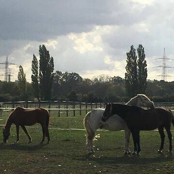
🐴 Reiten mitten in Frankfurt – und doch im Grüne...
Frankfurt
Frankfurter Polo Club
@Georgshof-FPC
Freizeitstall
Gangpferdereiten
Vermieten
Hunde willkommen
Krankenbox
Gnadenbrothof
Hengsthaltung möglich
34 weitere...
S

Gestüt bietet artgerechte Haltung
Hochheim am Main
Gestüt-Am-Schlossgarten
@Gestuet-Am-Schlossgarten
Geländestrecke
Rehabilitationsstall
Vermieten
Führanlage
Longierzirkel/Roundpen
Allergikerstall
Gnadenbrothof
19 weitere...
S
Deprecated: Creation of dynamic property Zend_View_Helper_Ads::$adLink is deprecated in /var/www/stall-frei/htdocs/staging.stall-frei.de/library/Psf/View/Helper/Ads.php on line 108

Reitanlage bei Familie Senckenberg
Groß-Gerau
Senckenberg
@Senckenberg
Freie Pferdeboxen auf dem Idyllischen Rheinfelderhof in Groß-Gerau


Hofgut am Main Qualität - Service - Kompetenz
Hattersheim
Hofgut am Main
@Hofgut-am-Main
Pferdeausbildung
Reitlehrer und -unterricht
Vermieten
Hunde willkommen
Laufband
Außenbox mit Paddock
14 weitere...
P+


Moderne Reitanlage hat noch Boxen frei
Neu-Isenburg
Veronique Breidert
@Hofgut-Gravenbruch
FN-Mitglied
Freizeitstall
Vermieten
Führanlage
Hunde willkommen
Allergikerstall
bedampftes/gewaschenes Heu
29 weitere...
S

Paddockboxen
Sulzbach
Michael Kranz
@Kranz-Sulzbach
FN-Mitglied
Freizeitstall
Hunde willkommen
Longierzirkel/Roundpen
Allergikerstall
Außenbox mit Paddock
Außenboxen
20 weitere...
P


Reitanlage Eddersheim Hit Aktivstall/Paddockboxen
Hattersheim
Horsement GmbH
@ReitanlageEddersheim
FN-Mitglied
Pferdeausbildung
Vermieten
Führanlage
Hunde willkommen
Außenbox mit Paddock
Laufstall
22 weitere...
P+


Kurzfristig 1 moderne Box frei
Kelkheim
Elvis P Reitanlage Rettershof
@Rettershof
Freizeitstall
Gastronomie
Vermieten
Hunde willkommen
Longierzirkel/Roundpen
bedampftes/gewaschenes Heu
zuckerreduziertes Heu
20 weitere...
P+
Birkenhof neben Pferdeklinik
Hattersheim
Birkenhof (neben Pferdeklinik)
@Birkenhof-Hattersheim
Freizeitstall
Longierzirkel/Roundpen
Paddock
Außenboxen
Innenbox
Vollpension
10 weitere...
P

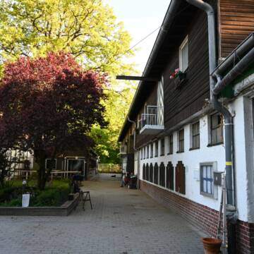
***Reitstall Birkenhof*** Pferdegerechte Haltung
Köln
Daniele-Fazzi
@Daniele-Fazzi
Herzlich Willkommen
auf dem Reitstall Birkenhof
Jetzt neu ‼️ auf dem Birkenhof:
Private Geländestrecke rund um unser
Reiten mitten in Frankfurt – direkt am Wald!
Frankfurt am Main
Frankfurter-Reit-und-Fahr-Club
@Frankfurter-Reit-und-Fahr-Club
FN-Mitglied
Freizeitstall
Vermieten
Führanlage
Hunde willkommen
Außenbox mit Paddock
Außenboxen
18 weitere...
P

Pferdepensinosstall Fohlenhof Steinbach
Steinbach
Familie Jäger
@Jaeger1
Freizeitstall
Reitlehrer und -unterricht
Vermieten
Hunde willkommen
Longierzirkel/Roundpen
Hufrehe geeignet
20 weitere...
P
Deprecated: Creation of dynamic property Zend_View::$pageCount is deprecated in /var/www/stall-frei/htdocs/staging.stall-frei.de/library/vendor/shardj/zf1-future/library/Zend/View/Abstract.php on line 308
Deprecated: Creation of dynamic property Zend_View::$itemCountPerPage is deprecated in /var/www/stall-frei/htdocs/staging.stall-frei.de/library/vendor/shardj/zf1-future/library/Zend/View/Abstract.php on line 308
Deprecated: Creation of dynamic property Zend_View::$first is deprecated in /var/www/stall-frei/htdocs/staging.stall-frei.de/library/vendor/shardj/zf1-future/library/Zend/View/Abstract.php on line 308
Deprecated: Creation of dynamic property Zend_View::$current is deprecated in /var/www/stall-frei/htdocs/staging.stall-frei.de/library/vendor/shardj/zf1-future/library/Zend/View/Abstract.php on line 308
Deprecated: Creation of dynamic property Zend_View::$last is deprecated in /var/www/stall-frei/htdocs/staging.stall-frei.de/library/vendor/shardj/zf1-future/library/Zend/View/Abstract.php on line 308
Deprecated: Creation of dynamic property Zend_View::$next is deprecated in /var/www/stall-frei/htdocs/staging.stall-frei.de/library/vendor/shardj/zf1-future/library/Zend/View/Abstract.php on line 308
Deprecated: Creation of dynamic property Zend_View::$pagesInRange is deprecated in /var/www/stall-frei/htdocs/staging.stall-frei.de/library/vendor/shardj/zf1-future/library/Zend/View/Abstract.php on line 308
Deprecated: Creation of dynamic property Zend_View::$firstPageInRange is deprecated in /var/www/stall-frei/htdocs/staging.stall-frei.de/library/vendor/shardj/zf1-future/library/Zend/View/Abstract.php on line 308
Deprecated: Creation of dynamic property Zend_View::$lastPageInRange is deprecated in /var/www/stall-frei/htdocs/staging.stall-frei.de/library/vendor/shardj/zf1-future/library/Zend/View/Abstract.php on line 308
Deprecated: Creation of dynamic property Zend_View::$currentItemCount is deprecated in /var/www/stall-frei/htdocs/staging.stall-frei.de/library/vendor/shardj/zf1-future/library/Zend/View/Abstract.php on line 308
Deprecated: Creation of dynamic property Zend_View::$totalItemCount is deprecated in /var/www/stall-frei/htdocs/staging.stall-frei.de/library/vendor/shardj/zf1-future/library/Zend/View/Abstract.php on line 308
Deprecated: Creation of dynamic property Zend_View::$firstItemNumber is deprecated in /var/www/stall-frei/htdocs/staging.stall-frei.de/library/vendor/shardj/zf1-future/library/Zend/View/Abstract.php on line 308
Deprecated: Creation of dynamic property Zend_View::$lastItemNumber is deprecated in /var/www/stall-frei/htdocs/staging.stall-frei.de/library/vendor/shardj/zf1-future/library/Zend/View/Abstract.php on line 308
Deprecated: Creation of dynamic property Zend_View::$router is deprecated in /var/www/stall-frei/htdocs/staging.stall-frei.de/library/vendor/shardj/zf1-future/library/Zend/View/Abstract.php on line 308
Deprecated: Creation of dynamic property Zend_View::$urlParams is deprecated in /var/www/stall-frei/htdocs/staging.stall-frei.de/library/vendor/shardj/zf1-future/library/Zend/View/Abstract.php on line 308
Deprecated: Creation of dynamic property Zend_View::$showAds is deprecated in /var/www/stall-frei/htdocs/staging.stall-frei.de/library/vendor/shardj/zf1-future/library/Zend/View/Abstract.php on line 308
Deprecated: Creation of dynamic property Zend_View::$objectIds is deprecated in /var/www/stall-frei/htdocs/staging.stall-frei.de/library/vendor/shardj/zf1-future/library/Zend/View/Abstract.php on line 308
Deprecated: Creation of dynamic property Zend_View::$showNavbar is deprecated in /var/www/stall-frei/htdocs/staging.stall-frei.de/library/vendor/shardj/zf1-future/library/Zend/View/Abstract.php on line 308
Deprecated: Creation of dynamic property Zend_View::$showBreadcrumb is deprecated in /var/www/stall-frei/htdocs/staging.stall-frei.de/library/vendor/shardj/zf1-future/library/Zend/View/Abstract.php on line 308
Deprecated: Creation of dynamic property Zend_View::$showFooter is deprecated in /var/www/stall-frei/htdocs/staging.stall-frei.de/library/vendor/shardj/zf1-future/library/Zend/View/Abstract.php on line 308
Deprecated: Creation of dynamic property Zend_View::$showInternalAds is deprecated in /var/www/stall-frei/htdocs/staging.stall-frei.de/library/vendor/shardj/zf1-future/library/Zend/View/Abstract.php on line 308
Deprecated: Creation of dynamic property Zend_View::$blNoContent is deprecated in /var/www/stall-frei/htdocs/staging.stall-frei.de/library/vendor/shardj/zf1-future/library/Zend/View/Abstract.php on line 308
Deprecated: Creation of dynamic property Zend_View::$sMetaDesc is deprecated in /var/www/stall-frei/htdocs/staging.stall-frei.de/library/vendor/shardj/zf1-future/library/Zend/View/Abstract.php on line 308
Deprecated: Creation of dynamic property Zend_View::$useGmaps is deprecated in /var/www/stall-frei/htdocs/staging.stall-frei.de/library/vendor/shardj/zf1-future/library/Zend/View/Abstract.php on line 308
Deprecated: Creation of dynamic property Zend_View::$touches is deprecated in /var/www/stall-frei/htdocs/staging.stall-frei.de/library/vendor/shardj/zf1-future/library/Zend/View/Abstract.php on line 308
Deprecated: Creation of dynamic property Zend_View::$oProject is deprecated in /var/www/stall-frei/htdocs/staging.stall-frei.de/library/vendor/shardj/zf1-future/library/Zend/View/Abstract.php on line 308
Deprecated: Creation of dynamic property Zend_View::$pageHeadline is deprecated in /var/www/stall-frei/htdocs/staging.stall-frei.de/library/vendor/shardj/zf1-future/library/Zend/View/Abstract.php on line 308
Deprecated: Creation of dynamic property Zend_View::$disableLocationField is deprecated in /var/www/stall-frei/htdocs/staging.stall-frei.de/library/vendor/shardj/zf1-future/library/Zend/View/Abstract.php on line 308
Deprecated: Creation of dynamic property Zend_View::$isSearch is deprecated in /var/www/stall-frei/htdocs/staging.stall-frei.de/library/vendor/shardj/zf1-future/library/Zend/View/Abstract.php on line 308
Deprecated: Creation of dynamic property Zend_View::$pageTitle is deprecated in /var/www/stall-frei/htdocs/staging.stall-frei.de/library/vendor/shardj/zf1-future/library/Zend/View/Abstract.php on line 308
Deprecated: Creation of dynamic property Psf_Form_Element_Text::$class is deprecated in /var/www/stall-frei/htdocs/staging.stall-frei.de/library/vendor/shardj/zf1-future/library/Zend/Form/Element.php on line 874
Deprecated: Creation of dynamic property Psf_Form_Element_Text::$size is deprecated in /var/www/stall-frei/htdocs/staging.stall-frei.de/library/vendor/shardj/zf1-future/library/Zend/Form/Element.php on line 874
Deprecated: Creation of dynamic property Psf_Form_Element_Text::$placeholder is deprecated in /var/www/stall-frei/htdocs/staging.stall-frei.de/library/vendor/shardj/zf1-future/library/Zend/Form/Element.php on line 874
Deprecated: Creation of dynamic property Psf_Form_Element_Hidden::$class is deprecated in /var/www/stall-frei/htdocs/staging.stall-frei.de/library/vendor/shardj/zf1-future/library/Zend/Form/Element.php on line 874
Deprecated: Creation of dynamic property Psf_Form_Element_Hidden::$class is deprecated in /var/www/stall-frei/htdocs/staging.stall-frei.de/library/vendor/shardj/zf1-future/library/Zend/Form/Element.php on line 874
Deprecated: Creation of dynamic property Psf_Form_Element_Hidden::$class is deprecated in /var/www/stall-frei/htdocs/staging.stall-frei.de/library/vendor/shardj/zf1-future/library/Zend/Form/Element.php on line 874
Deprecated: Creation of dynamic property Psf_Form_Element_Hidden::$class is deprecated in /var/www/stall-frei/htdocs/staging.stall-frei.de/library/vendor/shardj/zf1-future/library/Zend/Form/Element.php on line 874
Deprecated: Creation of dynamic property Psf_Form_Element_Select::$class is deprecated in /var/www/stall-frei/htdocs/staging.stall-frei.de/library/vendor/shardj/zf1-future/library/Zend/Form/Element.php on line 874
Deprecated: Creation of dynamic property Psf_Form_Element_Select::$class is deprecated in /var/www/stall-frei/htdocs/staging.stall-frei.de/library/vendor/shardj/zf1-future/library/Zend/Form/Element.php on line 874
Deprecated: Creation of dynamic property Psf_Form_Element_Select::$class is deprecated in /var/www/stall-frei/htdocs/staging.stall-frei.de/library/vendor/shardj/zf1-future/library/Zend/Form/Element.php on line 874
Deprecated: Creation of dynamic property Psf_Form_Element_Select::$class is deprecated in /var/www/stall-frei/htdocs/staging.stall-frei.de/library/vendor/shardj/zf1-future/library/Zend/Form/Element.php on line 874
Deprecated: Creation of dynamic property Psf_Form_Element_Text::$class is deprecated in /var/www/stall-frei/htdocs/staging.stall-frei.de/library/vendor/shardj/zf1-future/library/Zend/Form/Element.php on line 874
Deprecated: Creation of dynamic property Psf_Form_Element_Checkbox::$label is deprecated in /var/www/stall-frei/htdocs/staging.stall-frei.de/library/vendor/shardj/zf1-future/library/Zend/Form/Element.php on line 874
Deprecated: Creation of dynamic property Zend_View::$sort is deprecated in /var/www/stall-frei/htdocs/staging.stall-frei.de/library/vendor/shardj/zf1-future/library/Zend/View/Abstract.php on line 308
Deprecated: Creation of dynamic property Zend_View::$searchLocation is deprecated in /var/www/stall-frei/htdocs/staging.stall-frei.de/library/vendor/shardj/zf1-future/library/Zend/View/Abstract.php on line 308
Deprecated: Creation of dynamic property Zend_View::$locationHint is deprecated in /var/www/stall-frei/htdocs/staging.stall-frei.de/library/vendor/shardj/zf1-future/library/Zend/View/Abstract.php on line 308
Psf_GeoCoder_Abstract::getLocation: Höchst Get Location CachedOrLive
Psf_GeoCoder_Abstract::getCachedOrLive: Höchst
Psf_GeoCoder_OpenCageData::makeApiRequest: response:
Array
(
[documentation] => https://opencagedata.com/api
[licenses] => Array
(
[0] => Array
(
[name] => see attribution guide
[url] => https://opencagedata.com/credits
)
)
[results] => Array
(
[0] => Array
(
[bounds] => Array
(
[northeast] => Array
(
[lat] => 50.1152628
[lng] => 8.5667087
)
[southwest] => Array
(
[lat] => 50.0807425
[lng] => 8.5137552
)
)
[components] => Array
(
[ISO_3166-1_alpha-2] => DE
[ISO_3166-1_alpha-3] => DEU
[ISO_3166-2] => Array
(
[0] => DE-HE
)
[_category] => place
[_normalized_city] => Frankfurt am Main
[_type] => neighbourhood
[city] => Frankfurt am Main
[city_district] => West
[continent] => Europe
[country] => Deutschland
[country_code] => de
[political_union] => European Union
[state] => Hessen
[state_code] => HE
[suburb] => Höchst
)
[confidence] => 7
[formatted] => Höchst, Frankfurt am Main, Hessen, Deutschland
[geometry] => Array
(
[lat] => 50.099466
[lng] => 8.5452563
)
)
[1] => Array
(
[bounds] => Array
(
[northeast] => Array
(
[lat] => 49.8204217
[lng] => 9.0253545
)
[southwest] => Array
(
[lat] => 49.7583639
[lng] => 8.9153721
)
)
[components] => Array
(
[ISO_3166-1_alpha-2] => DE
[ISO_3166-1_alpha-3] => DEU
[ISO_3166-2] => Array
(
[0] => DE-HE
)
[_category] => place
[_normalized_city] => Höchst im Odenwald
[_type] => municipality
[continent] => Europe
[country] => Deutschland
[country_code] => de
[county] => Odenwaldkreis
[municipality] => Höchst im Odenwald
[political_union] => European Union
[postcode] => 64739
[state] => Hessen
[state_code] => HE
)
[confidence] => 7
[formatted] => 64739 Höchst im Odenwald, Deutschland
[geometry] => Array
(
[lat] => 49.7891138
[lng] => 8.9789625
)
)
[2] => Array
(
[bounds] => Array
(
[northeast] => Array
(
[lat] => 50.2823694
[lng] => 8.9648931
)
[southwest] => Array
(
[lat] => 50.2535309
[lng] => 8.9133339
)
)
[components] => Array
(
[ISO_3166-1_alpha-2] => DE
[ISO_3166-1_alpha-3] => DEU
[ISO_3166-2] => Array
(
[0] => DE-HE
)
[_category] => place
[_normalized_city] => Höchst
[_type] => village
[continent] => Europe
[country] => Deutschland
[country_code] => de
[county] => Wetteraukreis
[municipality] => Altenstadt
[political_union] => European Union
[state] => Hessen
[state_code] => HE
[village] => Höchst
)
[confidence] => 7
[formatted] => Höchst, Hessen, Deutschland
[geometry] => Array
(
[lat] => 50.2698123
[lng] => 8.9276378
)
)
[3] => Array
(
[bounds] => Array
(
[northeast] => Array
(
[lat] => 50.2226262
[lng] => 9.2719986
)
[southwest] => Array
(
[lat] => 50.1904654
[lng] => 9.2092957
)
)
[components] => Array
(
[ISO_3166-1_alpha-2] => DE
[ISO_3166-1_alpha-3] => DEU
[ISO_3166-2] => Array
(
[0] => DE-HE
)
[_category] => place
[_normalized_city] => Gelnhausen
[_type] => village
[continent] => Europe
[country] => Deutschland
[country_code] => de
[county] => Main-Kinzig-Kreis
[political_union] => European Union
[state] => Hessen
[state_code] => HE
[town] => Gelnhausen
[village] => Höchst
)
[confidence] => 7
[formatted] => Höchst, Hessen, Deutschland
[geometry] => Array
(
[lat] => 50.2046172
[lng] => 9.2349882
)
)
[4] => Array
(
[bounds] => Array
(
[northeast] => Array
(
[lat] => 49.8139938
[lng] => 9.0253545
)
[southwest] => Array
(
[lat] => 49.7696766
[lng] => 8.9667342
)
)
[components] => Array
(
[ISO_3166-1_alpha-2] => DE
[ISO_3166-1_alpha-3] => DEU
[ISO_3166-2] => Array
(
[0] => DE-HE
)
[_category] => place
[_normalized_city] => Höchst im Odenwald
[_type] => city
[continent] => Europe
[country] => Deutschland
[country_code] => de
[county] => Odenwaldkreis
[municipality] => Höchst im Odenwald
[political_union] => European Union
[postcode] => 64739
[state] => Hessen
[state_code] => HE
[town] => Höchst im Odenwald
)
[confidence] => 7
[formatted] => 64739 Höchst im Odenwald, Deutschland
[geometry] => Array
(
[lat] => 49.801331
[lng] => 8.9936445
)
)
[5] => Array
(
[bounds] => Array
(
[northeast] => Array
(
[lat] => 48.7781503
[lng] => 9.268588
)
[southwest] => Array
(
[lat] => 48.7780503
[lng] => 9.268488
)
)
[components] => Array
(
[ISO_3166-1_alpha-2] => DE
[ISO_3166-1_alpha-3] => DEU
[ISO_3166-2] => Array
(
[0] => DE-BW
)
[_category] => natural/water
[_normalized_city] => Stuttgart
[_type] => peak
[city] => Stuttgart
[continent] => Europe
[country] => Deutschland
[country_code] => de
[peak] => Höchst
[political_union] => European Union
[postcode] => 70327
[state] => Baden-Württemberg
[state_code] => BW
)
[confidence] => 9
[formatted] => Höchst, 70327 Stuttgart, Deutschland
[geometry] => Array
(
[lat] => 48.7781003
[lng] => 9.268538
)
)
[6] => Array
(
[bounds] => Array
(
[northeast] => Array
(
[lat] => 50.3762733
[lng] => 7.9062116
)
[southwest] => Array
(
[lat] => 50.3761733
[lng] => 7.9061116
)
)
[components] => Array
(
[ISO_3166-1_alpha-2] => DE
[ISO_3166-1_alpha-3] => DEU
[ISO_3166-2] => Array
(
[0] => DE-RP
)
[_category] => natural/water
[_normalized_city] => Isselbach
[_type] => peak
[continent] => Europe
[country] => Deutschland
[country_code] => de
[county] => Rhein-Lahn-Kreis
[municipality] => Diez
[peak] => Höchst
[political_union] => European Union
[state] => Rheinland-Pfalz
[state_code] => RP
[village] => Isselbach
)
[confidence] => 9
[formatted] => Höchst, Isselbach, Rheinland-Pfalz, Deutschland
[geometry] => Array
(
[lat] => 50.3762233
[lng] => 7.9061616
)
)
[7] => Array
(
[bounds] => Array
(
[northeast] => Array
(
[lat] => 48.2614089
[lng] => 8.9024459
)
[southwest] => Array
(
[lat] => 48.2613089
[lng] => 8.9023459
)
)
[components] => Array
(
[ISO_3166-1_alpha-2] => DE
[ISO_3166-1_alpha-3] => DEU
[ISO_3166-2] => Array
(
[0] => DE-BW
)
[_category] => natural/water
[_normalized_city] => Balingen
[_type] => peak
[continent] => Europe
[country] => Deutschland
[country_code] => de
[county] => Zollernalbkreis
[municipality] => VVG der Stadt Balingen
[peak] => Höchst
[political_union] => European Union
[postcode] => 72336
[state] => Baden-Württemberg
[state_code] => BW
[town] => Balingen
)
[confidence] => 9
[formatted] => Höchst, 72336 Balingen, Deutschland
[geometry] => Array
(
[lat] => 48.2613589
[lng] => 8.9023959
)
)
[8] => Array
(
[bounds] => Array
(
[northeast] => Array
(
[lat] => 51.0194375
[lng] => 7.5450763
)
[southwest] => Array
(
[lat] => 51.0193375
[lng] => 7.5449763
)
)
[components] => Array
(
[ISO_3166-1_alpha-2] => DE
[ISO_3166-1_alpha-3] => DEU
[ISO_3166-2] => Array
(
[0] => DE-NW
)
[_category] => natural/water
[_normalized_city] => Gummersbach
[_type] => peak
[continent] => Europe
[country] => Deutschland
[country_code] => de
[county] => Oberbergischer Kreis
[peak] => Höchst
[political_union] => European Union
[postcode] => 51643
[state] => Nordrhein-Westfalen
[state_code] => NW
[town] => Gummersbach
)
[confidence] => 9
[formatted] => Höchst, 51643 Gummersbach, Deutschland
[geometry] => Array
(
[lat] => 51.0193875
[lng] => 7.5450263
)
)
[9] => Array
(
[components] => Array
(
[ISO_3166-1_alpha-2] => FR
[ISO_3166-1_alpha-3] => FRA
[ISO_3166-2] => Array
(
[0] => FR-IDF
[1] => FR-92
)
[_category] => road
[_normalized_city] => Levallois-Perret
[_type] => road
[city] => Levallois-Perret
[continent] => Europe
[country] => France
[country_code] => fr
[county] => Hauts-de-Seine
[local_authority] => Métropole du Grand Paris
[political_union] => European Union
[postcode] => 92300
[road] => Rue Charles Deutschmann
[state] => Île-de-France
[state_code] => IDF
)
[confidence] => 3
[formatted] => Rue Charles Deutschmann, 92300 Levallois-Perret, France
[geometry] => Array
(
[lat] => 48.900049
[lng] => 2.2842
)
)
)
[status] => Array
(
[code] => 200
[message] => OK
)
[stay_informed] => Array
(
[blog] => https://blog.opencagedata.com
[mastodon] => https://en.osm.town/@opencage
)
[thanks] => For using an OpenCage API
[timestamp] => Array
(
[created_http] => Sun, 08 Feb 2026 10:35:16 GMT
[created_unix] => 1770546916
)
[total_results] => 10
)
Psf_GeoCoder_Abstract::convertLocationResult
{"documentation":"https:\/\/opencagedata.com\/api","licenses":[{"name":"see attribution guide","url":"https:\/\/opencagedata.com\/credits"}],"results":[{"bounds":{"northeast":{"lat":50.1152628,"lng":8.5667087},"southwest":{"lat":50.0807425,"lng":8.5137552}},"components":{"ISO_3166-1_alpha-2":"DE","ISO_3166-1_alpha-3":"DEU","ISO_3166-2":["DE-HE"],"_category":"place","_normalized_city":"Frankfurt am Main","_type":"neighbourhood","city":"Frankfurt am Main","city_district":"West","continent":"Europe","country":"Deutschland","country_code":"de","political_union":"European Union","state":"Hessen","state_code":"HE","suburb":"H\u00f6chst"},"confidence":7,"formatted":"H\u00f6chst, Frankfurt am Main, Hessen, Deutschland","geometry":{"lat":50.099466,"lng":8.5452563}},{"bounds":{"northeast":{"lat":49.8204217,"lng":9.0253545},"southwest":{"lat":49.7583639,"lng":8.9153721}},"components":{"ISO_3166-1_alpha-2":"DE","ISO_3166-1_alpha-3":"DEU","ISO_3166-2":["DE-HE"],"_category":"place","_normalized_city":"H\u00f6chst im Odenwald","_type":"municipality","continent":"Europe","country":"Deutschland","country_code":"de","county":"Odenwaldkreis","municipality":"H\u00f6chst im Odenwald","political_union":"European Union","postcode":"64739","state":"Hessen","state_code":"HE"},"confidence":7,"formatted":"64739 H\u00f6chst im Odenwald, Deutschland","geometry":{"lat":49.7891138,"lng":8.9789625}},{"bounds":{"northeast":{"lat":50.2823694,"lng":8.9648931},"southwest":{"lat":50.2535309,"lng":8.9133339}},"components":{"ISO_3166-1_alpha-2":"DE","ISO_3166-1_alpha-3":"DEU","ISO_3166-2":["DE-HE"],"_category":"place","_normalized_city":"H\u00f6chst","_type":"village","continent":"Europe","country":"Deutschland","country_code":"de","county":"Wetteraukreis","municipality":"Altenstadt","political_union":"European Union","state":"Hessen","state_code":"HE","village":"H\u00f6chst"},"confidence":7,"formatted":"H\u00f6chst, Hessen, Deutschland","geometry":{"lat":50.2698123,"lng":8.9276378}},{"bounds":{"northeast":{"lat":50.2226262,"lng":9.2719986},"southwest":{"lat":50.1904654,"lng":9.2092957}},"components":{"ISO_3166-1_alpha-2":"DE","ISO_3166-1_alpha-3":"DEU","ISO_3166-2":["DE-HE"],"_category":"place","_normalized_city":"Gelnhausen","_type":"village","continent":"Europe","country":"Deutschland","country_code":"de","county":"Main-Kinzig-Kreis","political_union":"European Union","state":"Hessen","state_code":"HE","town":"Gelnhausen","village":"H\u00f6chst"},"confidence":7,"formatted":"H\u00f6chst, Hessen, Deutschland","geometry":{"lat":50.2046172,"lng":9.2349882}},{"bounds":{"northeast":{"lat":49.8139938,"lng":9.0253545},"southwest":{"lat":49.7696766,"lng":8.9667342}},"components":{"ISO_3166-1_alpha-2":"DE","ISO_3166-1_alpha-3":"DEU","ISO_3166-2":["DE-HE"],"_category":"place","_normalized_city":"H\u00f6chst im Odenwald","_type":"city","continent":"Europe","country":"Deutschland","country_code":"de","county":"Odenwaldkreis","municipality":"H\u00f6chst im Odenwald","political_union":"European Union","postcode":"64739","state":"Hessen","state_code":"HE","town":"H\u00f6chst im Odenwald"},"confidence":7,"formatted":"64739 H\u00f6chst im Odenwald, Deutschland","geometry":{"lat":49.801331,"lng":8.9936445}},{"bounds":{"northeast":{"lat":48.7781503,"lng":9.268588},"southwest":{"lat":48.7780503,"lng":9.268488}},"components":{"ISO_3166-1_alpha-2":"DE","ISO_3166-1_alpha-3":"DEU","ISO_3166-2":["DE-BW"],"_category":"natural\/water","_normalized_city":"Stuttgart","_type":"peak","city":"Stuttgart","continent":"Europe","country":"Deutschland","country_code":"de","peak":"H\u00f6chst","political_union":"European Union","postcode":"70327","state":"Baden-W\u00fcrttemberg","state_code":"BW"},"confidence":9,"formatted":"H\u00f6chst, 70327 Stuttgart, Deutschland","geometry":{"lat":48.7781003,"lng":9.268538}},{"bounds":{"northeast":{"lat":50.3762733,"lng":7.9062116},"southwest":{"lat":50.3761733,"lng":7.9061116}},"components":{"ISO_3166-1_alpha-2":"DE","ISO_3166-1_alpha-3":"DEU","ISO_3166-2":["DE-RP"],"_category":"natural\/water","_normalized_city":"Isselbach","_type":"peak","continent":"Europe","country":"Deutschland","country_code":"de","county":"Rhein-Lahn-Kreis","municipality":"Diez","peak":"H\u00f6chst","political_union":"European Union","state":"Rheinland-Pfalz","state_code":"RP","village":"Isselbach"},"confidence":9,"formatted":"H\u00f6chst, Isselbach, Rheinland-Pfalz, Deutschland","geometry":{"lat":50.3762233,"lng":7.9061616}},{"bounds":{"northeast":{"lat":48.2614089,"lng":8.9024459},"southwest":{"lat":48.2613089,"lng":8.9023459}},"components":{"ISO_3166-1_alpha-2":"DE","ISO_3166-1_alpha-3":"DEU","ISO_3166-2":["DE-BW"],"_category":"natural\/water","_normalized_city":"Balingen","_type":"peak","continent":"Europe","country":"Deutschland","country_code":"de","county":"Zollernalbkreis","municipality":"VVG der Stadt Balingen","peak":"H\u00f6chst","political_union":"European Union","postcode":"72336","state":"Baden-W\u00fcrttemberg","state_code":"BW","town":"Balingen"},"confidence":9,"formatted":"H\u00f6chst, 72336 Balingen, Deutschland","geometry":{"lat":48.2613589,"lng":8.9023959}},{"bounds":{"northeast":{"lat":51.0194375,"lng":7.5450763},"southwest":{"lat":51.0193375,"lng":7.5449763}},"components":{"ISO_3166-1_alpha-2":"DE","ISO_3166-1_alpha-3":"DEU","ISO_3166-2":["DE-NW"],"_category":"natural\/water","_normalized_city":"Gummersbach","_type":"peak","continent":"Europe","country":"Deutschland","country_code":"de","county":"Oberbergischer Kreis","peak":"H\u00f6chst","political_union":"European Union","postcode":"51643","state":"Nordrhein-Westfalen","state_code":"NW","town":"Gummersbach"},"confidence":9,"formatted":"H\u00f6chst, 51643 Gummersbach, Deutschland","geometry":{"lat":51.0193875,"lng":7.5450263}},{"components":{"ISO_3166-1_alpha-2":"FR","ISO_3166-1_alpha-3":"FRA","ISO_3166-2":["FR-IDF","FR-92"],"_category":"road","_normalized_city":"Levallois-Perret","_type":"road","city":"Levallois-Perret","continent":"Europe","country":"France","country_code":"fr","county":"Hauts-de-Seine","local_authority":"M\u00e9tropole du Grand Paris","political_union":"European Union","postcode":"92300","road":"Rue Charles Deutschmann","state":"\u00cele-de-France","state_code":"IDF"},"confidence":3,"formatted":"Rue Charles Deutschmann, 92300 Levallois-Perret, France","geometry":{"lat":48.900049,"lng":2.2842}}],"status":{"code":200,"message":"OK"},"stay_informed":{"blog":"https:\/\/blog.opencagedata.com","mastodon":"https:\/\/en.osm.town\/@opencage"},"thanks":"For using an OpenCage API","timestamp":{"created_http":"Sun, 08 Feb 2026 10:35:16 GMT","created_unix":1770546916},"total_results":10}Array
(
[0] => stdClass Object
(
[bounds] => stdClass Object
(
[northeast] => stdClass Object
(
[lat] => 50.1152628
[lng] => 8.5667087
)
[southwest] => stdClass Object
(
[lat] => 50.0807425
[lng] => 8.5137552
)
)
[components] => stdClass Object
(
[ISO_3166-1_alpha-2] => DE
[ISO_3166-1_alpha-3] => DEU
[ISO_3166-2] => Array
(
[0] => DE-HE
)
[_category] => place
[_normalized_city] => Frankfurt am Main
[_type] => neighbourhood
[city] => Frankfurt am Main
[city_district] => West
[continent] => Europe
[country] => Deutschland
[country_code] => de
[political_union] => European Union
[state] => Hessen
[state_code] => HE
[suburb] => Höchst
)
[confidence] => 7
[formatted] => Höchst, Frankfurt am Main, Hessen, Deutschland
[geometry] => stdClass Object
(
[lat] => 50.099466
[lng] => 8.5452563
)
)
[1] => stdClass Object
(
[bounds] => stdClass Object
(
[northeast] => stdClass Object
(
[lat] => 49.8204217
[lng] => 9.0253545
)
[southwest] => stdClass Object
(
[lat] => 49.7583639
[lng] => 8.9153721
)
)
[components] => stdClass Object
(
[ISO_3166-1_alpha-2] => DE
[ISO_3166-1_alpha-3] => DEU
[ISO_3166-2] => Array
(
[0] => DE-HE
)
[_category] => place
[_normalized_city] => Höchst im Odenwald
[_type] => municipality
[continent] => Europe
[country] => Deutschland
[country_code] => de
[county] => Odenwaldkreis
[municipality] => Höchst im Odenwald
[political_union] => European Union
[postcode] => 64739
[state] => Hessen
[state_code] => HE
)
[confidence] => 7
[formatted] => 64739 Höchst im Odenwald, Deutschland
[geometry] => stdClass Object
(
[lat] => 49.7891138
[lng] => 8.9789625
)
)
[2] => stdClass Object
(
[bounds] => stdClass Object
(
[northeast] => stdClass Object
(
[lat] => 50.2823694
[lng] => 8.9648931
)
[southwest] => stdClass Object
(
[lat] => 50.2535309
[lng] => 8.9133339
)
)
[components] => stdClass Object
(
[ISO_3166-1_alpha-2] => DE
[ISO_3166-1_alpha-3] => DEU
[ISO_3166-2] => Array
(
[0] => DE-HE
)
[_category] => place
[_normalized_city] => Höchst
[_type] => village
[continent] => Europe
[country] => Deutschland
[country_code] => de
[county] => Wetteraukreis
[municipality] => Altenstadt
[political_union] => European Union
[state] => Hessen
[state_code] => HE
[village] => Höchst
)
[confidence] => 7
[formatted] => Höchst, Hessen, Deutschland
[geometry] => stdClass Object
(
[lat] => 50.2698123
[lng] => 8.9276378
)
)
[3] => stdClass Object
(
[bounds] => stdClass Object
(
[northeast] => stdClass Object
(
[lat] => 50.2226262
[lng] => 9.2719986
)
[southwest] => stdClass Object
(
[lat] => 50.1904654
[lng] => 9.2092957
)
)
[components] => stdClass Object
(
[ISO_3166-1_alpha-2] => DE
[ISO_3166-1_alpha-3] => DEU
[ISO_3166-2] => Array
(
[0] => DE-HE
)
[_category] => place
[_normalized_city] => Gelnhausen
[_type] => village
[continent] => Europe
[country] => Deutschland
[country_code] => de
[county] => Main-Kinzig-Kreis
[political_union] => European Union
[state] => Hessen
[state_code] => HE
[town] => Gelnhausen
[village] => Höchst
)
[confidence] => 7
[formatted] => Höchst, Hessen, Deutschland
[geometry] => stdClass Object
(
[lat] => 50.2046172
[lng] => 9.2349882
)
)
[4] => stdClass Object
(
[bounds] => stdClass Object
(
[northeast] => stdClass Object
(
[lat] => 49.8139938
[lng] => 9.0253545
)
[southwest] => stdClass Object
(
[lat] => 49.7696766
[lng] => 8.9667342
)
)
[components] => stdClass Object
(
[ISO_3166-1_alpha-2] => DE
[ISO_3166-1_alpha-3] => DEU
[ISO_3166-2] => Array
(
[0] => DE-HE
)
[_category] => place
[_normalized_city] => Höchst im Odenwald
[_type] => city
[continent] => Europe
[country] => Deutschland
[country_code] => de
[county] => Odenwaldkreis
[municipality] => Höchst im Odenwald
[political_union] => European Union
[postcode] => 64739
[state] => Hessen
[state_code] => HE
[town] => Höchst im Odenwald
)
[confidence] => 7
[formatted] => 64739 Höchst im Odenwald, Deutschland
[geometry] => stdClass Object
(
[lat] => 49.801331
[lng] => 8.9936445
)
)
[5] => stdClass Object
(
[bounds] => stdClass Object
(
[northeast] => stdClass Object
(
[lat] => 48.7781503
[lng] => 9.268588
)
[southwest] => stdClass Object
(
[lat] => 48.7780503
[lng] => 9.268488
)
)
[components] => stdClass Object
(
[ISO_3166-1_alpha-2] => DE
[ISO_3166-1_alpha-3] => DEU
[ISO_3166-2] => Array
(
[0] => DE-BW
)
[_category] => natural/water
[_normalized_city] => Stuttgart
[_type] => peak
[city] => Stuttgart
[continent] => Europe
[country] => Deutschland
[country_code] => de
[peak] => Höchst
[political_union] => European Union
[postcode] => 70327
[state] => Baden-Württemberg
[state_code] => BW
)
[confidence] => 9
[formatted] => Höchst, 70327 Stuttgart, Deutschland
[geometry] => stdClass Object
(
[lat] => 48.7781003
[lng] => 9.268538
)
)
[6] => stdClass Object
(
[bounds] => stdClass Object
(
[northeast] => stdClass Object
(
[lat] => 50.3762733
[lng] => 7.9062116
)
[southwest] => stdClass Object
(
[lat] => 50.3761733
[lng] => 7.9061116
)
)
[components] => stdClass Object
(
[ISO_3166-1_alpha-2] => DE
[ISO_3166-1_alpha-3] => DEU
[ISO_3166-2] => Array
(
[0] => DE-RP
)
[_category] => natural/water
[_normalized_city] => Isselbach
[_type] => peak
[continent] => Europe
[country] => Deutschland
[country_code] => de
[county] => Rhein-Lahn-Kreis
[municipality] => Diez
[peak] => Höchst
[political_union] => European Union
[state] => Rheinland-Pfalz
[state_code] => RP
[village] => Isselbach
)
[confidence] => 9
[formatted] => Höchst, Isselbach, Rheinland-Pfalz, Deutschland
[geometry] => stdClass Object
(
[lat] => 50.3762233
[lng] => 7.9061616
)
)
[7] => stdClass Object
(
[bounds] => stdClass Object
(
[northeast] => stdClass Object
(
[lat] => 48.2614089
[lng] => 8.9024459
)
[southwest] => stdClass Object
(
[lat] => 48.2613089
[lng] => 8.9023459
)
)
[components] => stdClass Object
(
[ISO_3166-1_alpha-2] => DE
[ISO_3166-1_alpha-3] => DEU
[ISO_3166-2] => Array
(
[0] => DE-BW
)
[_category] => natural/water
[_normalized_city] => Balingen
[_type] => peak
[continent] => Europe
[country] => Deutschland
[country_code] => de
[county] => Zollernalbkreis
[municipality] => VVG der Stadt Balingen
[peak] => Höchst
[political_union] => European Union
[postcode] => 72336
[state] => Baden-Württemberg
[state_code] => BW
[town] => Balingen
)
[confidence] => 9
[formatted] => Höchst, 72336 Balingen, Deutschland
[geometry] => stdClass Object
(
[lat] => 48.2613589
[lng] => 8.9023959
)
)
[8] => stdClass Object
(
[bounds] => stdClass Object
(
[northeast] => stdClass Object
(
[lat] => 51.0194375
[lng] => 7.5450763
)
[southwest] => stdClass Object
(
[lat] => 51.0193375
[lng] => 7.5449763
)
)
[components] => stdClass Object
(
[ISO_3166-1_alpha-2] => DE
[ISO_3166-1_alpha-3] => DEU
[ISO_3166-2] => Array
(
[0] => DE-NW
)
[_category] => natural/water
[_normalized_city] => Gummersbach
[_type] => peak
[continent] => Europe
[country] => Deutschland
[country_code] => de
[county] => Oberbergischer Kreis
[peak] => Höchst
[political_union] => European Union
[postcode] => 51643
[state] => Nordrhein-Westfalen
[state_code] => NW
[town] => Gummersbach
)
[confidence] => 9
[formatted] => Höchst, 51643 Gummersbach, Deutschland
[geometry] => stdClass Object
(
[lat] => 51.0193875
[lng] => 7.5450263
)
)
[9] => stdClass Object
(
[components] => stdClass Object
(
[ISO_3166-1_alpha-2] => FR
[ISO_3166-1_alpha-3] => FRA
[ISO_3166-2] => Array
(
[0] => FR-IDF
[1] => FR-92
)
[_category] => road
[_normalized_city] => Levallois-Perret
[_type] => road
[city] => Levallois-Perret
[continent] => Europe
[country] => France
[country_code] => fr
[county] => Hauts-de-Seine
[local_authority] => Métropole du Grand Paris
[political_union] => European Union
[postcode] => 92300
[road] => Rue Charles Deutschmann
[state] => Île-de-France
[state_code] => IDF
)
[confidence] => 3
[formatted] => Rue Charles Deutschmann, 92300 Levallois-Perret, France
[geometry] => stdClass Object
(
[lat] => 48.900049
[lng] => 2.2842
)
)
)
Psf_GeoCoder_OpenCageData::getKeyMap: 0
stdClass Object
(
    [bounds] => stdClass Object
        (
            [northeast] => stdClass Object
                (
                    [lat] => 50.1152628
                    [lng] => 8.5667087
                )

            [southwest] => stdClass Object
                (
                    [lat] => 50.0807425
                    [lng] => 8.5137552
                )

        )

    [components] => stdClass Object
        (
            [ISO_3166-1_alpha-2] => DE
            [ISO_3166-1_alpha-3] => DEU
            [ISO_3166-2] => Array
                (
                    [0] => DE-HE
                )

            [_category] => place
            [_normalized_city] => Frankfurt am Main
            [_type] => neighbourhood
            [city] => Frankfurt am Main
            [city_district] => West
            [continent] => Europe
            [country] => Deutschland
            [country_code] => de
            [political_union] => European Union
            [state] => Hessen
            [state_code] => HE
            [suburb] => Höchst
        )

    [confidence] => 7
    [formatted] => Höchst, Frankfurt am Main, Hessen, Deutschland
    [geometry] => stdClass Object
        (
            [lat] => 50.099466
            [lng] => 8.5452563
        )

)
Psf_GeoCoder_OpenCageData::getCounty: Frankfurt am Main
Psf_GeoCoder_OpenCageData::addMissingData REFETCH!
Array
(
    [address] => Höchst, Frankfurt am Main, Hessen, Deutschland
    [type] => neighbourhood
    [street] =>
    [city] => Höchst
    [county] => Frankfurt am Main
    [state] => Hessen
    [zip] =>
    [country] => Deutschland
    [suburb] => Höchst
    [countrycode] => de
    [latitude] => 50.099466
    [longitude] => 8.5452563
    [accuracy] => 1
    [confidence] => 7
    [bounds] => stdClass Object
        (
            [northeast] => stdClass Object
                (
                    [lat] => 50.1152628
                    [lng] => 8.5667087
                )

            [southwest] => stdClass Object
                (
                    [lat] => 50.0807425
                    [lng] => 8.5137552
                )

        )

)
reformat!
Array
(
    [address] => Höchst, Frankfurt am Main, Hessen, Deutschland
    [type] => neighbourhood
    [street] =>
    [city] => Höchst
    [county] => Frankfurt am Main
    [state] => Hessen
    [zip] =>
    [country] => Deutschland
    [suburb] => Höchst
    [countrycode] => de
    [latitude] => 50.099466
    [longitude] => 8.5452563
    [accuracy] => 1
    [confidence] => 7
    [bounds] => stdClass Object
        (
            [northeast] => stdClass Object
                (
                    [lat] => 50.1152628
                    [lng] => 8.5667087
                )

            [southwest] => stdClass Object
                (
                    [lat] => 50.0807425
                    [lng] => 8.5137552
                )

        )

    [place] => Höchst, Hessen
    [hash] => 997fee0f20f4f400da6418eae040a722
)
Psf_GeoCoder_OpenCageData::getKeyMap: 1
stdClass Object
(
    [bounds] => stdClass Object
        (
            [northeast] => stdClass Object
                (
                    [lat] => 49.8204217
                    [lng] => 9.0253545
                )

            [southwest] => stdClass Object
                (
                    [lat] => 49.7583639
                    [lng] => 8.9153721
                )

        )

    [components] => stdClass Object
        (
            [ISO_3166-1_alpha-2] => DE
            [ISO_3166-1_alpha-3] => DEU
            [ISO_3166-2] => Array
                (
                    [0] => DE-HE
                )

            [_category] => place
            [_normalized_city] => Höchst im Odenwald
            [_type] => municipality
            [continent] => Europe
            [country] => Deutschland
            [country_code] => de
            [county] => Odenwaldkreis
            [municipality] => Höchst im Odenwald
            [political_union] => European Union
            [postcode] => 64739
            [state] => Hessen
            [state_code] => HE
        )

    [confidence] => 7
    [formatted] => 64739 Höchst im Odenwald, Deutschland
    [geometry] => stdClass Object
        (
            [lat] => 49.7891138
            [lng] => 8.9789625
        )

)
Psf_GeoCoder_OpenCageData::getCounty: Odenwaldkreis
Psf_GeoCoder_OpenCageData::addMissingData REFETCH!
Array
(
    [address] => 64739 Höchst im Odenwald, Deutschland
    [type] => municipality
    [street] =>
    [city] =>
    [county] => Odenwaldkreis
    [state] => Hessen
    [zip] => 64739
    [country] => Deutschland
    [suburb] =>
    [countrycode] => de
    [latitude] => 49.7891138
    [longitude] => 8.9789625
    [accuracy] => 1
    [confidence] => 7
    [bounds] => stdClass Object
        (
            [northeast] => stdClass Object
                (
                    [lat] => 49.8204217
                    [lng] => 9.0253545
                )

            [southwest] => stdClass Object
                (
                    [lat] => 49.7583639
                    [lng] => 8.9153721
                )

        )

)
reformat!
Array
(
    [address] => 64739 Höchst im Odenwald, Deutschland
    [type] => municipality
    [street] =>
    [city] =>
    [county] => Odenwaldkreis
    [state] => Hessen
    [zip] => 64739
    [country] => Deutschland
    [suburb] =>
    [countrycode] => de
    [latitude] => 49.7891138
    [longitude] => 8.9789625
    [accuracy] => 1
    [confidence] => 7
    [bounds] => stdClass Object
        (
            [northeast] => stdClass Object
                (
                    [lat] => 49.8204217
                    [lng] => 9.0253545
                )

            [southwest] => stdClass Object
                (
                    [lat] => 49.7583639
                    [lng] => 8.9153721
                )

        )

    [place] => 64739 , Hessen
    [hash] => 5d6b2c6521eddf33a4784c6f6437df82
)
Psf_GeoCoder_OpenCageData::getKeyMap: 2
stdClass Object
(
    [bounds] => stdClass Object
        (
            [northeast] => stdClass Object
                (
                    [lat] => 50.2823694
                    [lng] => 8.9648931
                )

            [southwest] => stdClass Object
                (
                    [lat] => 50.2535309
                    [lng] => 8.9133339
                )

        )

    [components] => stdClass Object
        (
            [ISO_3166-1_alpha-2] => DE
            [ISO_3166-1_alpha-3] => DEU
            [ISO_3166-2] => Array
                (
                    [0] => DE-HE
                )

            [_category] => place
            [_normalized_city] => Höchst
            [_type] => village
            [continent] => Europe
            [country] => Deutschland
            [country_code] => de
            [county] => Wetteraukreis
            [municipality] => Altenstadt
            [political_union] => European Union
            [state] => Hessen
            [state_code] => HE
            [village] => Höchst
        )

    [confidence] => 7
    [formatted] => Höchst, Hessen, Deutschland
    [geometry] => stdClass Object
        (
            [lat] => 50.2698123
            [lng] => 8.9276378
        )

)
Psf_GeoCoder_OpenCageData::getCounty: Wetteraukreis
Psf_GeoCoder_OpenCageData::addMissingData REFETCH!
Array
(
    [address] => Höchst, Hessen, Deutschland
    [type] => village
    [street] =>
    [city] => Höchst
    [county] => Wetteraukreis
    [state] => Hessen
    [zip] =>
    [country] => Deutschland
    [suburb] =>
    [countrycode] => de
    [latitude] => 50.2698123
    [longitude] => 8.9276378
    [accuracy] => 1
    [confidence] => 7
    [bounds] => stdClass Object
        (
            [northeast] => stdClass Object
                (
                    [lat] => 50.2823694
                    [lng] => 8.9648931
                )

            [southwest] => stdClass Object
                (
                    [lat] => 50.2535309
                    [lng] => 8.9133339
                )

        )

)
reformat!
Array
(
    [address] => Höchst, Hessen, Deutschland
    [type] => village
    [street] =>
    [city] => Höchst
    [county] => Wetteraukreis
    [state] => Hessen
    [zip] =>
    [country] => Deutschland
    [suburb] =>
    [countrycode] => de
    [latitude] => 50.2698123
    [longitude] => 8.9276378
    [accuracy] => 1
    [confidence] => 7
    [bounds] => stdClass Object
        (
            [northeast] => stdClass Object
                (
                    [lat] => 50.2823694
                    [lng] => 8.9648931
                )

            [southwest] => stdClass Object
                (
                    [lat] => 50.2535309
                    [lng] => 8.9133339
                )

        )

    [place] => Höchst, Hessen
    [hash] => 997fee0f20f4f400da6418eae040a722
)
Psf_GeoCoder_OpenCageData::getKeyMap: 3
stdClass Object
(
    [bounds] => stdClass Object
        (
            [northeast] => stdClass Object
                (
                    [lat] => 50.2226262
                    [lng] => 9.2719986
                )

            [southwest] => stdClass Object
                (
                    [lat] => 50.1904654
                    [lng] => 9.2092957
                )

        )

    [components] => stdClass Object
        (
            [ISO_3166-1_alpha-2] => DE
            [ISO_3166-1_alpha-3] => DEU
            [ISO_3166-2] => Array
                (
                    [0] => DE-HE
                )

            [_category] => place
            [_normalized_city] => Gelnhausen
            [_type] => village
            [continent] => Europe
            [country] => Deutschland
            [country_code] => de
            [county] => Main-Kinzig-Kreis
            [political_union] => European Union
            [state] => Hessen
            [state_code] => HE
            [town] => Gelnhausen
            [village] => Höchst
        )

    [confidence] => 7
    [formatted] => Höchst, Hessen, Deutschland
    [geometry] => stdClass Object
        (
            [lat] => 50.2046172
            [lng] => 9.2349882
        )

)
Psf_GeoCoder_OpenCageData::getCounty: Main-Kinzig-Kreis
Psf_GeoCoder_OpenCageData::addMissingData REFETCH!
Array
(
    [address] => Höchst, Hessen, Deutschland
    [type] => village
    [street] =>
    [city] => Gelnhausen
    [county] => Main-Kinzig-Kreis
    [state] => Hessen
    [zip] =>
    [country] => Deutschland
    [suburb] =>
    [countrycode] => de
    [latitude] => 50.2046172
    [longitude] => 9.2349882
    [accuracy] => 1
    [confidence] => 7
    [bounds] => stdClass Object
        (
            [northeast] => stdClass Object
                (
                    [lat] => 50.2226262
                    [lng] => 9.2719986
                )

            [southwest] => stdClass Object
                (
                    [lat] => 50.1904654
                    [lng] => 9.2092957
                )

        )

)
reformat!
Array
(
    [address] => Gelnhausen
    [type] => village
    [street] =>
    [city] => Gelnhausen
    [county] => Main-Kinzig-Kreis
    [state] => Hessen
    [zip] =>
    [country] => Deutschland
    [suburb] =>
    [countrycode] => de
    [latitude] => 50.2046172
    [longitude] => 9.2349882
    [accuracy] => 1
    [confidence] => 7
    [bounds] => stdClass Object
        (
            [northeast] => stdClass Object
                (
                    [lat] => 50.2226262
                    [lng] => 9.2719986
                )

            [southwest] => stdClass Object
                (
                    [lat] => 50.1904654
                    [lng] => 9.2092957
                )

        )

    [place] => Gelnhausen, Hessen
    [hash] => 6c9832b41917759247ffbdff5216be4c
)
Psf_GeoCoder_OpenCageData::getKeyMap: 4
stdClass Object
(
    [bounds] => stdClass Object
        (
            [northeast] => stdClass Object
                (
                    [lat] => 49.8139938
                    [lng] => 9.0253545
                )

            [southwest] => stdClass Object
                (
                    [lat] => 49.7696766
                    [lng] => 8.9667342
                )

        )

    [components] => stdClass Object
        (
            [ISO_3166-1_alpha-2] => DE
            [ISO_3166-1_alpha-3] => DEU
            [ISO_3166-2] => Array
                (
                    [0] => DE-HE
                )

            [_category] => place
            [_normalized_city] => Höchst im Odenwald
            [_type] => city
            [continent] => Europe
            [country] => Deutschland
            [country_code] => de
            [county] => Odenwaldkreis
            [municipality] => Höchst im Odenwald
            [political_union] => European Union
            [postcode] => 64739
            [state] => Hessen
            [state_code] => HE
            [town] => Höchst im Odenwald
        )

    [confidence] => 7
    [formatted] => 64739 Höchst im Odenwald, Deutschland
    [geometry] => stdClass Object
        (
            [lat] => 49.801331
            [lng] => 8.9936445
        )

)
Psf_GeoCoder_OpenCageData::getCounty: Odenwaldkreis
Psf_GeoCoder_OpenCageData::addMissingData REFETCH!
Array
(
    [address] => 64739 Höchst im Odenwald, Deutschland
    [type] => city
    [street] =>
    [city] => Höchst im Odenwald
    [county] => Odenwaldkreis
    [state] => Hessen
    [zip] => 64739
    [country] => Deutschland
    [suburb] =>
    [countrycode] => de
    [latitude] => 49.801331
    [longitude] => 8.9936445
    [accuracy] => 1
    [confidence] => 7
    [bounds] => stdClass Object
        (
            [northeast] => stdClass Object
                (
                    [lat] => 49.8139938
                    [lng] => 9.0253545
                )

            [southwest] => stdClass Object
                (
                    [lat] => 49.7696766
                    [lng] => 8.9667342
                )

        )

)
reformat!
Array
(
    [address] => 64739 Höchst im Odenwald, Deutschland
    [type] => city
    [street] =>
    [city] => Höchst im Odenwald
    [county] => Odenwaldkreis
    [state] => Hessen
    [zip] => 64739
    [country] => Deutschland
    [suburb] =>
    [countrycode] => de
    [latitude] => 49.801331
    [longitude] => 8.9936445
    [accuracy] => 1
    [confidence] => 7
    [bounds] => stdClass Object
        (
            [northeast] => stdClass Object
                (
                    [lat] => 49.8139938
                    [lng] => 9.0253545
                )

            [southwest] => stdClass Object
                (
                    [lat] => 49.7696766
                    [lng] => 8.9667342
                )

        )

    [place] => 64739 Höchst im Odenwald, Hessen
    [hash] => 25bbd49b0668083d4c8ed20491d1ec84
)
Psf_GeoCoder_OpenCageData::getKeyMap: 5
stdClass Object
(
    [bounds] => stdClass Object
        (
            [northeast] => stdClass Object
                (
                    [lat] => 48.7781503
                    [lng] => 9.268588
                )

            [southwest] => stdClass Object
                (
                    [lat] => 48.7780503
                    [lng] => 9.268488
                )

        )

    [components] => stdClass Object
        (
            [ISO_3166-1_alpha-2] => DE
            [ISO_3166-1_alpha-3] => DEU
            [ISO_3166-2] => Array
                (
                    [0] => DE-BW
                )

            [_category] => natural/water
            [_normalized_city] => Stuttgart
            [_type] => peak
            [city] => Stuttgart
            [continent] => Europe
            [country] => Deutschland
            [country_code] => de
            [peak] => Höchst
            [political_union] => European Union
            [postcode] => 70327
            [state] => Baden-Württemberg
            [state_code] => BW
        )

    [confidence] => 9
    [formatted] => Höchst, 70327 Stuttgart, Deutschland
    [geometry] => stdClass Object
        (
            [lat] => 48.7781003
            [lng] => 9.268538
        )

)
Psf_GeoCoder_OpenCageData::getCounty: Stuttgart
Psf_GeoCoder_OpenCageData::addMissingData REFETCH!
Array
(
    [address] => Höchst, 70327 Stuttgart, Deutschland
    [type] => peak
    [street] =>
    [city] => Stuttgart
    [county] => Stuttgart
    [state] => Baden-Württemberg
    [zip] => 70327
    [country] => Deutschland
    [suburb] =>
    [countrycode] => de
    [latitude] => 48.7781003
    [longitude] => 9.268538
    [accuracy] => 1
    [confidence] => 9
    [bounds] => stdClass Object
        (
            [northeast] => stdClass Object
                (
                    [lat] => 48.7781503
                    [lng] => 9.268588
                )

            [southwest] => stdClass Object
                (
                    [lat] => 48.7780503
                    [lng] => 9.268488
                )

        )

)
reformat!
Array
(
    [address] => Höchst, 70327 Stuttgart, Deutschland
    [type] => peak
    [street] =>
    [city] => Stuttgart
    [county] => Stuttgart
    [state] => Baden-Württemberg
    [zip] => 70327
    [country] => Deutschland
    [suburb] =>
    [countrycode] => de
    [latitude] => 48.7781003
    [longitude] => 9.268538
    [accuracy] => 1
    [confidence] => 9
    [bounds] => stdClass Object
        (
            [northeast] => stdClass Object
                (
                    [lat] => 48.7781503
                    [lng] => 9.268588
                )

            [southwest] => stdClass Object
                (
                    [lat] => 48.7780503
                    [lng] => 9.268488
                )

        )

    [place] => 70327 Stuttgart, Baden-Württemberg
    [hash] => 50b6f1949a6d9cbbb6ad959f5af8f3b6
)
Psf_GeoCoder_OpenCageData::getKeyMap: 6
stdClass Object
(
    [bounds] => stdClass Object
        (
            [northeast] => stdClass Object
                (
                    [lat] => 50.3762733
                    [lng] => 7.9062116
                )

            [southwest] => stdClass Object
                (
                    [lat] => 50.3761733
                    [lng] => 7.9061116
                )

        )

    [components] => stdClass Object
        (
            [ISO_3166-1_alpha-2] => DE
            [ISO_3166-1_alpha-3] => DEU
            [ISO_3166-2] => Array
                (
                    [0] => DE-RP
                )

            [_category] => natural/water
            [_normalized_city] => Isselbach
            [_type] => peak
            [continent] => Europe
            [country] => Deutschland
            [country_code] => de
            [county] => Rhein-Lahn-Kreis
            [municipality] => Diez
            [peak] => Höchst
            [political_union] => European Union
            [state] => Rheinland-Pfalz
            [state_code] => RP
            [village] => Isselbach
        )

    [confidence] => 9
    [formatted] => Höchst, Isselbach, Rheinland-Pfalz, Deutschland
    [geometry] => stdClass Object
        (
            [lat] => 50.3762233
            [lng] => 7.9061616
        )

)
Psf_GeoCoder_OpenCageData::getCounty: Rhein-Lahn-Kreis
Psf_GeoCoder_OpenCageData::addMissingData REFETCH!
Array
(
    [address] => Höchst, Isselbach, Rheinland-Pfalz, Deutschland
    [type] => peak
    [street] =>
    [city] => Isselbach
    [county] => Rhein-Lahn-Kreis
    [state] => Rheinland-Pfalz
    [zip] =>
    [country] => Deutschland
    [suburb] =>
    [countrycode] => de
    [latitude] => 50.3762233
    [longitude] => 7.9061616
    [accuracy] => 1
    [confidence] => 9
    [bounds] => stdClass Object
        (
            [northeast] => stdClass Object
                (
                    [lat] => 50.3762733
                    [lng] => 7.9062116
                )

            [southwest] => stdClass Object
                (
                    [lat] => 50.3761733
                    [lng] => 7.9061116
                )

        )

)
reformat!
Array
(
    [address] => Höchst, Isselbach, Rheinland-Pfalz, Deutschland
    [type] => peak
    [street] =>
    [city] => Isselbach
    [county] => Rhein-Lahn-Kreis
    [state] => Rheinland-Pfalz
    [zip] =>
    [country] => Deutschland
    [suburb] =>
    [countrycode] => de
    [latitude] => 50.3762233
    [longitude] => 7.9061616
    [accuracy] => 1
    [confidence] => 9
    [bounds] => stdClass Object
        (
            [northeast] => stdClass Object
                (
                    [lat] => 50.3762733
                    [lng] => 7.9062116
                )

            [southwest] => stdClass Object
                (
                    [lat] => 50.3761733
                    [lng] => 7.9061116
                )

        )

    [place] => Isselbach, Rheinland-Pfalz
    [hash] => 2924e77f1de90337dc5cb8e0b4fc45ad
)
Psf_GeoCoder_OpenCageData::getKeyMap: 7
stdClass Object
(
    [bounds] => stdClass Object
        (
            [northeast] => stdClass Object
                (
                    [lat] => 48.2614089
                    [lng] => 8.9024459
                )

            [southwest] => stdClass Object
                (
                    [lat] => 48.2613089
                    [lng] => 8.9023459
                )

        )

    [components] => stdClass Object
        (
            [ISO_3166-1_alpha-2] => DE
            [ISO_3166-1_alpha-3] => DEU
            [ISO_3166-2] => Array
                (
                    [0] => DE-BW
                )

            [_category] => natural/water
            [_normalized_city] => Balingen
            [_type] => peak
            [continent] => Europe
            [country] => Deutschland
            [country_code] => de
            [county] => Zollernalbkreis
            [municipality] => VVG der Stadt Balingen
            [peak] => Höchst
            [political_union] => European Union
            [postcode] => 72336
            [state] => Baden-Württemberg
            [state_code] => BW
            [town] => Balingen
        )

    [confidence] => 9
    [formatted] => Höchst, 72336 Balingen, Deutschland
    [geometry] => stdClass Object
        (
            [lat] => 48.2613589
            [lng] => 8.9023959
        )

)
Psf_GeoCoder_OpenCageData::getCounty: Zollernalbkreis
Psf_GeoCoder_OpenCageData::addMissingData REFETCH!
Array
(
    [address] => Höchst, 72336 Balingen, Deutschland
    [type] => peak
    [street] =>
    [city] => Balingen
    [county] => Zollernalbkreis
    [state] => Baden-Württemberg
    [zip] => 72336
    [country] => Deutschland
    [suburb] =>
    [countrycode] => de
    [latitude] => 48.2613589
    [longitude] => 8.9023959
    [accuracy] => 1
    [confidence] => 9
    [bounds] => stdClass Object
        (
            [northeast] => stdClass Object
                (
                    [lat] => 48.2614089
                    [lng] => 8.9024459
                )

            [southwest] => stdClass Object
                (
                    [lat] => 48.2613089
                    [lng] => 8.9023459
                )

        )

)
reformat!
Array
(
    [address] => Höchst, 72336 Balingen, Deutschland
    [type] => peak
    [street] =>
    [city] => Balingen
    [county] => Zollernalbkreis
    [state] => Baden-Württemberg
    [zip] => 72336
    [country] => Deutschland
    [suburb] =>
    [countrycode] => de
    [latitude] => 48.2613589
    [longitude] => 8.9023959
    [accuracy] => 1
    [confidence] => 9
    [bounds] => stdClass Object
        (
            [northeast] => stdClass Object
                (
                    [lat] => 48.2614089
                    [lng] => 8.9024459
                )

            [southwest] => stdClass Object
                (
                    [lat] => 48.2613089
                    [lng] => 8.9023459
                )

        )

    [place] => 72336 Balingen, Baden-Württemberg
    [hash] => 2758b80637dd1a1ab066b4391dea9ea9
)
Psf_GeoCoder_OpenCageData::getKeyMap: 8
stdClass Object
(
    [bounds] => stdClass Object
        (
            [northeast] => stdClass Object
                (
                    [lat] => 51.0194375
                    [lng] => 7.5450763
                )

            [southwest] => stdClass Object
                (
                    [lat] => 51.0193375
                    [lng] => 7.5449763
                )

        )

    [components] => stdClass Object
        (
            [ISO_3166-1_alpha-2] => DE
            [ISO_3166-1_alpha-3] => DEU
            [ISO_3166-2] => Array
                (
                    [0] => DE-NW
                )

            [_category] => natural/water
            [_normalized_city] => Gummersbach
            [_type] => peak
            [continent] => Europe
            [country] => Deutschland
            [country_code] => de
            [county] => Oberbergischer Kreis
            [peak] => Höchst
            [political_union] => European Union
            [postcode] => 51643
            [state] => Nordrhein-Westfalen
            [state_code] => NW
            [town] => Gummersbach
        )

    [confidence] => 9
    [formatted] => Höchst, 51643 Gummersbach, Deutschland
    [geometry] => stdClass Object
        (
            [lat] => 51.0193875
            [lng] => 7.5450263
        )

)
Psf_GeoCoder_OpenCageData::getCounty: Oberbergischer Kreis
Psf_GeoCoder_OpenCageData::addMissingData REFETCH!
Array
(
    [address] => Höchst, 51643 Gummersbach, Deutschland
    [type] => peak
    [street] =>
    [city] => Gummersbach
    [county] => Oberbergischer Kreis
    [state] => Nordrhein-Westfalen
    [zip] => 51643
    [country] => Deutschland
    [suburb] =>
    [countrycode] => de
    [latitude] => 51.0193875
    [longitude] => 7.5450263
    [accuracy] => 1
    [confidence] => 9
    [bounds] => stdClass Object
        (
            [northeast] => stdClass Object
                (
                    [lat] => 51.0194375
                    [lng] => 7.5450763
                )

            [southwest] => stdClass Object
                (
                    [lat] => 51.0193375
                    [lng] => 7.5449763
                )

        )

)
reformat!
Array
(
    [address] => Höchst, 51643 Gummersbach, Deutschland
    [type] => peak
    [street] =>
    [city] => Gummersbach
    [county] => Oberbergischer Kreis
    [state] => Nordrhein-Westfalen
    [zip] => 51643
    [country] => Deutschland
    [suburb] =>
    [countrycode] => de
    [latitude] => 51.0193875
    [longitude] => 7.5450263
    [accuracy] => 1
    [confidence] => 9
    [bounds] => stdClass Object
        (
            [northeast] => stdClass Object
                (
                    [lat] => 51.0194375
                    [lng] => 7.5450763
                )

            [southwest] => stdClass Object
                (
                    [lat] => 51.0193375
                    [lng] => 7.5449763
                )

        )

    [place] => 51643 Gummersbach, Nordrhein-Westfalen
    [hash] => cd09b39a99a15c9fd412f7fc676d6c50
)
Psf_GeoCoder_OpenCageData::getKeyMap: 9
stdClass Object
(
    [components] => stdClass Object
        (
            [ISO_3166-1_alpha-2] => FR
            [ISO_3166-1_alpha-3] => FRA
            [ISO_3166-2] => Array
                (
                    [0] => FR-IDF
                    [1] => FR-92
                )

            [_category] => road
            [_normalized_city] => Levallois-Perret
            [_type] => road
            [city] => Levallois-Perret
            [continent] => Europe
            [country] => France
            [country_code] => fr
            [county] => Hauts-de-Seine
            [local_authority] => Métropole du Grand Paris
            [political_union] => European Union
            [postcode] => 92300
            [road] => Rue Charles Deutschmann
            [state] => Île-de-France
            [state_code] => IDF
        )

    [confidence] => 3
    [formatted] => Rue Charles Deutschmann, 92300 Levallois-Perret, France
    [geometry] => stdClass Object
        (
            [lat] => 48.900049
            [lng] => 2.2842
        )

)
Psf_GeoCoder_OpenCageData::getCounty: Hauts-de-Seine
Psf_GeoCoder_OpenCageData::addMissingData REFETCH!
Array
(
    [address] => Rue Charles Deutschmann, 92300 Levallois-Perret, France
    [type] => road
    [street] => Rue Charles Deutschmann
    [city] => Levallois-Perret
    [county] => Hauts-de-Seine
    [state] => Île-de-France
    [zip] => 92300
    [country] => France
    [suburb] =>
    [countrycode] => fr
    [latitude] => 48.900049
    [longitude] => 2.2842
    [accuracy] => 1
    [confidence] => 3
    [bounds] =>
)
reformat!
Array
(
    [address] => Rue Charles Deutschmann, 92300 Levallois-Perret, France
    [type] => road
    [street] => Rue Charles Deutschmann
    [city] => Levallois-Perret
    [county] => Hauts-de-Seine
    [state] => Île-de-France
    [zip] => 92300
    [country] => France
    [suburb] =>
    [countrycode] => fr
    [latitude] => 48.900049
    [longitude] => 2.2842
    [accuracy] => 1
    [confidence] => 3
    [bounds] =>
    [place] => Rue Charles Deutschmann, 92300 Levallois-Perret, Île-de-France
    [hash] => b7dc44def3990e8a7eaf18e019eca466
)
Deprecated: Creation of dynamic property Zend_View::$locationHintStyle is deprecated in /var/www/stall-frei/htdocs/staging.stall-frei.de/library/vendor/shardj/zf1-future/library/Zend/View/Abstract.php on line 308
Deprecated: Creation of dynamic property Zend_View::$adGeoLocation is deprecated in /var/www/stall-frei/htdocs/staging.stall-frei.de/library/vendor/shardj/zf1-future/library/Zend/View/Abstract.php on line 308
Deprecated: Creation of dynamic property Zend_View::$recordCount is deprecated in /var/www/stall-frei/htdocs/staging.stall-frei.de/library/vendor/shardj/zf1-future/library/Zend/View/Abstract.php on line 308
Deprecated: explode(): Passing null to parameter #2 ($string) of type string is deprecated in /var/www/stall-frei/htdocs/staging.stall-frei.de/application/models/SearchAgent.php on line 100
Deprecated: explode(): Passing null to parameter #2 ($string) of type string is deprecated in /var/www/stall-frei/htdocs/staging.stall-frei.de/application/models/SearchAgent.php on line 100
Deprecated: explode(): Passing null to parameter #2 ($string) of type string is deprecated in /var/www/stall-frei/htdocs/staging.stall-frei.de/application/models/SearchAgent.php on line 100
Deprecated: explode(): Passing null to parameter #2 ($string) of type string is deprecated in /var/www/stall-frei/htdocs/staging.stall-frei.de/application/models/SearchAgent.php on line 100
Deprecated: explode(): Passing null to parameter #2 ($string) of type string is deprecated in /var/www/stall-frei/htdocs/staging.stall-frei.de/application/models/SearchAgent.php on line 100
Deprecated: explode(): Passing null to parameter #2 ($string) of type string is deprecated in /var/www/stall-frei/htdocs/staging.stall-frei.de/application/models/SearchAgent.php on line 100
Deprecated: explode(): Passing null to parameter #2 ($string) of type string is deprecated in /var/www/stall-frei/htdocs/staging.stall-frei.de/application/models/SearchAgent.php on line 100
Deprecated: explode(): Passing null to parameter #2 ($string) of type string is deprecated in /var/www/stall-frei/htdocs/staging.stall-frei.de/application/models/SearchAgent.php on line 100
Deprecated: explode(): Passing null to parameter #2 ($string) of type string is deprecated in /var/www/stall-frei/htdocs/staging.stall-frei.de/application/models/SearchAgent.php on line 100
Deprecated: trim(): Passing null to parameter #1 ($string) of type string is deprecated in /var/www/stall-frei/htdocs/staging.stall-frei.de/application/models/Account/Search.php on line 82
Warning: Cannot modify header information - headers already sent by (output started at /var/www/stall-frei/htdocs/staging.stall-frei.de/library/vendor/shardj/zf1-future/library/Zend/View/Abstract.php:308) in /var/www/stall-frei/htdocs/staging.stall-frei.de/application/models/Account/Search.php on line 71
Deprecated: Creation of dynamic property Zend_View::$paginationParams is deprecated in /var/www/stall-frei/htdocs/staging.stall-frei.de/library/vendor/shardj/zf1-future/library/Zend/View/Abstract.php on line 308
Deprecated: Creation of dynamic property Zend_View::$objectPaginator is deprecated in /var/www/stall-frei/htdocs/staging.stall-frei.de/library/vendor/shardj/zf1-future/library/Zend/View/Abstract.php on line 308
Deprecated: Creation of dynamic property Zend_View::$featuredObjects is deprecated in /var/www/stall-frei/htdocs/staging.stall-frei.de/library/vendor/shardj/zf1-future/library/Zend/View/Abstract.php on line 308
Deprecated: Creation of dynamic property Zend_View::$hints is deprecated in /var/www/stall-frei/htdocs/staging.stall-frei.de/library/vendor/shardj/zf1-future/library/Zend/View/Abstract.php on line 308
Deprecated: Creation of dynamic property Zend_View::$attributeHints is deprecated in /var/www/stall-frei/htdocs/staging.stall-frei.de/library/vendor/shardj/zf1-future/library/Zend/View/Abstract.php on line 308
Deprecated: Creation of dynamic property Zend_View::$oSearchForm is deprecated in /var/www/stall-frei/htdocs/staging.stall-frei.de/library/vendor/shardj/zf1-future/library/Zend/View/Abstract.php on line 308