Deprecated: Creation of dynamic property Zend_View::$sMode is deprecated in /var/www/stall-frei/htdocs/staging.stall-frei.de/library/vendor/shardj/zf1-future/library/Zend/View/Abstract.php on line 308
Stallplatz oder Offenstall in Münchberg
Gesucht wird in "95213 Münchberg, Deutschland"
6.333 Einträge
Deprecated: Creation of dynamic property Zend_View::$listObjects is deprecated in /var/www/stall-frei/htdocs/staging.stall-frei.de/library/vendor/shardj/zf1-future/library/Zend/View/Abstract.php on line 308
Gesponsort


Deprecated: Creation of dynamic property Zend_View::$listMode is deprecated in /var/www/stall-frei/htdocs/staging.stall-frei.de/library/vendor/shardj/zf1-future/library/Zend/View/Abstract.php on line 308
Deprecated: Creation of dynamic property Zend_View::$renderedObjects is deprecated in /var/www/stall-frei/htdocs/staging.stall-frei.de/library/vendor/shardj/zf1-future/library/Zend/View/Abstract.php on line 308
Deprecated: Creation of dynamic property Zend_View::$index is deprecated in /var/www/stall-frei/htdocs/staging.stall-frei.de/library/vendor/shardj/zf1-future/library/Zend/View/Abstract.php on line 308
Deprecated: Creation of dynamic property Zend_View::$displayMode is deprecated in /var/www/stall-frei/htdocs/staging.stall-frei.de/library/vendor/shardj/zf1-future/library/Zend/View/Abstract.php on line 308
Deprecated: Creation of dynamic property Zend_View::$remarketingIds is deprecated in /var/www/stall-frei/htdocs/staging.stall-frei.de/library/vendor/shardj/zf1-future/library/Zend/View/Abstract.php on line 308
Deprecated: Creation of dynamic property Zend_View::$listItem is deprecated in /var/www/stall-frei/htdocs/staging.stall-frei.de/library/vendor/shardj/zf1-future/library/Zend/View/Abstract.php on line 308
Deprecated: Creation of dynamic property Zend_View::$object is deprecated in /var/www/stall-frei/htdocs/staging.stall-frei.de/library/vendor/shardj/zf1-future/library/Zend/View/Abstract.php on line 308
Deprecated: Creation of dynamic property Zend_View::$attributes is deprecated in /var/www/stall-frei/htdocs/staging.stall-frei.de/library/vendor/shardj/zf1-future/library/Zend/View/Abstract.php on line 308
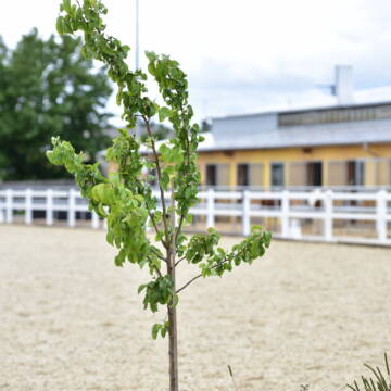
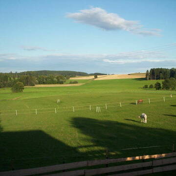
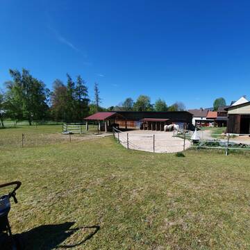
REITSTALL MECHLENREUTH - PENSIONSPFERDESTALL
Bayern - Münchberg
Reitstall_Mechlenreuth
@Reitstall_Mechlenreuth
Freizeitstall
Pferdeausbildung
Vermieten
Hunde willkommen
Laufband
Allergikerstall
17 weitere...
P
Deprecated: Creation of dynamic property Zend_View_Helper_Ads::$adLink is deprecated in /var/www/stall-frei/htdocs/staging.stall-frei.de/library/Psf/View/Helper/Ads.php on line 108

Persönlichkeitsentwicklung mit Pferden
Bad Salzuflen
Katja Dors
@Pferdezeiten
Begleite andere auf ihrem Entwicklungsweg und entdecke die transformative Kraft der pferdegestützten Persönlichkeitsentwicklung !
neu
R
Leider kein Vorschaubild
Leider kein Vorschaubild
Stallplatz/ Box mit Koppelgang frei für Wallach
Weißdorf
Stall-Schallersgruen
@Stall-Schallersgruen
Freizeitstall
Geländestrecke
Vermieten
Krankenbox
Sattelkammer/Sattelschränke
Innenbox
Laufstall
7 weitere...
B
Pensionsstall Schallersreuth
Konradsreuth
Daniela-Caspar
@Daniela-Caspar
Freizeitstall
Geländestrecke
Paddock
Pensions- und Gastboxen
Innenbox
Einzelne Boxen oder Stallplätze
9 weitere...
P
Offenstall Martinlamitz
Schwarzenbach a.d. Saale
Carolin-Voigt
@Carolin-Voigt
Geländestrecke
Paddock
Reitplatz (z.B. Dressur, Springen, Reining)
Allergikerstall
Bewegungsstall
Laufstall
9 weitere...
P
Leider kein Vorschaubild
Leider kein Vorschaubild
Boxen frei
Helmbrechts
Privatstall Kleinschwarzenbach
@Privatstall-Kleinschwarzenbach
FN-Mitglied
VFD-Mitglied
Vermieten
Hunde willkommen
Parkplatz für Pferdeanhänger
Innenbox
Offenstall
6 weitere...
B

Mitarbeiter gesucht?
Mechtersen
STALL-FREIde Marketing
@STALL-FREI-Marketing
Stellenangebote kostenlos veröffentlichen!

Pferdehof hat Paddockboxen frei
Schwarzenbach am Wald
Manuela Geisser
@ManuelaGeisser
Freizeitstall
Vermieten
Hunde willkommen
Longierzirkel/Roundpen
Hufrehe geeignet
Notfallboxen
10 weitere...
P
Leider kein Vorschaubild
Leider kein Vorschaubild
Ziegelhof Oberkotzau
Oberkotzau
Ziegelhof Oberkotzau
@Ziegelhof_Oberkotzau
Freizeitstall
Hunde willkommen
Longierzirkel/Roundpen
Allergikerstall
Hufrehe geeignet
Außenbox mit Paddock
Innenbox
9 weitere...
B
Leider kein Vorschaubild
Leider kein Vorschaubild
Finca-Haideck Offenstall
Oberkotzau
Reitsport-Guhs
@Reitsport-Guhs
Freizeitstall
Pflegepferd
Vermieten
Krankenbox
Paddock
Hufrehe geeignet
19 weitere...
B

Freizeitreiter-Hof
Bayern - Hof
Janett
@Janett
FN-Mitglied
Freizeitstall
Vermieten
Hunde willkommen
Longierzirkel/Roundpen
Außenbox mit Paddock
Außenboxen
20 weitere...
P

PENSIONSPFERDESTALL in Stadtsteinach
Stadtsteinach
Der Pferdehof
@Der-Pferdehof
Freizeitstall
Geländestrecke
Vermieten
Paddock
Pensions- und Gastboxen
Innenbox
11 weitere...
aktuell
P
Deprecated: Creation of dynamic property Zend_View::$pageCount is deprecated in /var/www/stall-frei/htdocs/staging.stall-frei.de/library/vendor/shardj/zf1-future/library/Zend/View/Abstract.php on line 308
Deprecated: Creation of dynamic property Zend_View::$itemCountPerPage is deprecated in /var/www/stall-frei/htdocs/staging.stall-frei.de/library/vendor/shardj/zf1-future/library/Zend/View/Abstract.php on line 308
Deprecated: Creation of dynamic property Zend_View::$first is deprecated in /var/www/stall-frei/htdocs/staging.stall-frei.de/library/vendor/shardj/zf1-future/library/Zend/View/Abstract.php on line 308
Deprecated: Creation of dynamic property Zend_View::$current is deprecated in /var/www/stall-frei/htdocs/staging.stall-frei.de/library/vendor/shardj/zf1-future/library/Zend/View/Abstract.php on line 308
Deprecated: Creation of dynamic property Zend_View::$last is deprecated in /var/www/stall-frei/htdocs/staging.stall-frei.de/library/vendor/shardj/zf1-future/library/Zend/View/Abstract.php on line 308
Deprecated: Creation of dynamic property Zend_View::$next is deprecated in /var/www/stall-frei/htdocs/staging.stall-frei.de/library/vendor/shardj/zf1-future/library/Zend/View/Abstract.php on line 308
Deprecated: Creation of dynamic property Zend_View::$pagesInRange is deprecated in /var/www/stall-frei/htdocs/staging.stall-frei.de/library/vendor/shardj/zf1-future/library/Zend/View/Abstract.php on line 308
Deprecated: Creation of dynamic property Zend_View::$firstPageInRange is deprecated in /var/www/stall-frei/htdocs/staging.stall-frei.de/library/vendor/shardj/zf1-future/library/Zend/View/Abstract.php on line 308
Deprecated: Creation of dynamic property Zend_View::$lastPageInRange is deprecated in /var/www/stall-frei/htdocs/staging.stall-frei.de/library/vendor/shardj/zf1-future/library/Zend/View/Abstract.php on line 308
Deprecated: Creation of dynamic property Zend_View::$currentItemCount is deprecated in /var/www/stall-frei/htdocs/staging.stall-frei.de/library/vendor/shardj/zf1-future/library/Zend/View/Abstract.php on line 308
Deprecated: Creation of dynamic property Zend_View::$totalItemCount is deprecated in /var/www/stall-frei/htdocs/staging.stall-frei.de/library/vendor/shardj/zf1-future/library/Zend/View/Abstract.php on line 308
Deprecated: Creation of dynamic property Zend_View::$firstItemNumber is deprecated in /var/www/stall-frei/htdocs/staging.stall-frei.de/library/vendor/shardj/zf1-future/library/Zend/View/Abstract.php on line 308
Deprecated: Creation of dynamic property Zend_View::$lastItemNumber is deprecated in /var/www/stall-frei/htdocs/staging.stall-frei.de/library/vendor/shardj/zf1-future/library/Zend/View/Abstract.php on line 308
Deprecated: Creation of dynamic property Zend_View::$router is deprecated in /var/www/stall-frei/htdocs/staging.stall-frei.de/library/vendor/shardj/zf1-future/library/Zend/View/Abstract.php on line 308
Deprecated: Creation of dynamic property Zend_View::$urlParams is deprecated in /var/www/stall-frei/htdocs/staging.stall-frei.de/library/vendor/shardj/zf1-future/library/Zend/View/Abstract.php on line 308
Deprecated: Creation of dynamic property Zend_View::$showAds is deprecated in /var/www/stall-frei/htdocs/staging.stall-frei.de/library/vendor/shardj/zf1-future/library/Zend/View/Abstract.php on line 308
Deprecated: Creation of dynamic property Zend_View::$objectIds is deprecated in /var/www/stall-frei/htdocs/staging.stall-frei.de/library/vendor/shardj/zf1-future/library/Zend/View/Abstract.php on line 308
Deprecated: Creation of dynamic property Zend_View::$showNavbar is deprecated in /var/www/stall-frei/htdocs/staging.stall-frei.de/library/vendor/shardj/zf1-future/library/Zend/View/Abstract.php on line 308
Deprecated: Creation of dynamic property Zend_View::$showBreadcrumb is deprecated in /var/www/stall-frei/htdocs/staging.stall-frei.de/library/vendor/shardj/zf1-future/library/Zend/View/Abstract.php on line 308
Deprecated: Creation of dynamic property Zend_View::$showFooter is deprecated in /var/www/stall-frei/htdocs/staging.stall-frei.de/library/vendor/shardj/zf1-future/library/Zend/View/Abstract.php on line 308
Deprecated: Creation of dynamic property Zend_View::$showInternalAds is deprecated in /var/www/stall-frei/htdocs/staging.stall-frei.de/library/vendor/shardj/zf1-future/library/Zend/View/Abstract.php on line 308
Deprecated: Creation of dynamic property Zend_View::$blNoContent is deprecated in /var/www/stall-frei/htdocs/staging.stall-frei.de/library/vendor/shardj/zf1-future/library/Zend/View/Abstract.php on line 308
Deprecated: Creation of dynamic property Zend_View::$sMetaDesc is deprecated in /var/www/stall-frei/htdocs/staging.stall-frei.de/library/vendor/shardj/zf1-future/library/Zend/View/Abstract.php on line 308
Deprecated: Creation of dynamic property Zend_View::$useGmaps is deprecated in /var/www/stall-frei/htdocs/staging.stall-frei.de/library/vendor/shardj/zf1-future/library/Zend/View/Abstract.php on line 308
Deprecated: Creation of dynamic property Zend_View::$touches is deprecated in /var/www/stall-frei/htdocs/staging.stall-frei.de/library/vendor/shardj/zf1-future/library/Zend/View/Abstract.php on line 308
Deprecated: Creation of dynamic property Zend_View::$oProject is deprecated in /var/www/stall-frei/htdocs/staging.stall-frei.de/library/vendor/shardj/zf1-future/library/Zend/View/Abstract.php on line 308
Deprecated: Creation of dynamic property Zend_View::$pageHeadline is deprecated in /var/www/stall-frei/htdocs/staging.stall-frei.de/library/vendor/shardj/zf1-future/library/Zend/View/Abstract.php on line 308
Deprecated: Creation of dynamic property Zend_View::$disableLocationField is deprecated in /var/www/stall-frei/htdocs/staging.stall-frei.de/library/vendor/shardj/zf1-future/library/Zend/View/Abstract.php on line 308
Deprecated: Creation of dynamic property Zend_View::$isSearch is deprecated in /var/www/stall-frei/htdocs/staging.stall-frei.de/library/vendor/shardj/zf1-future/library/Zend/View/Abstract.php on line 308
Deprecated: Creation of dynamic property Zend_View::$pageTitle is deprecated in /var/www/stall-frei/htdocs/staging.stall-frei.de/library/vendor/shardj/zf1-future/library/Zend/View/Abstract.php on line 308
Deprecated: Creation of dynamic property Psf_Form_Element_Text::$class is deprecated in /var/www/stall-frei/htdocs/staging.stall-frei.de/library/vendor/shardj/zf1-future/library/Zend/Form/Element.php on line 874
Deprecated: Creation of dynamic property Psf_Form_Element_Text::$size is deprecated in /var/www/stall-frei/htdocs/staging.stall-frei.de/library/vendor/shardj/zf1-future/library/Zend/Form/Element.php on line 874
Deprecated: Creation of dynamic property Psf_Form_Element_Text::$placeholder is deprecated in /var/www/stall-frei/htdocs/staging.stall-frei.de/library/vendor/shardj/zf1-future/library/Zend/Form/Element.php on line 874
Deprecated: Creation of dynamic property Psf_Form_Element_Hidden::$class is deprecated in /var/www/stall-frei/htdocs/staging.stall-frei.de/library/vendor/shardj/zf1-future/library/Zend/Form/Element.php on line 874
Deprecated: Creation of dynamic property Psf_Form_Element_Hidden::$class is deprecated in /var/www/stall-frei/htdocs/staging.stall-frei.de/library/vendor/shardj/zf1-future/library/Zend/Form/Element.php on line 874
Deprecated: Creation of dynamic property Psf_Form_Element_Hidden::$class is deprecated in /var/www/stall-frei/htdocs/staging.stall-frei.de/library/vendor/shardj/zf1-future/library/Zend/Form/Element.php on line 874
Deprecated: Creation of dynamic property Psf_Form_Element_Hidden::$class is deprecated in /var/www/stall-frei/htdocs/staging.stall-frei.de/library/vendor/shardj/zf1-future/library/Zend/Form/Element.php on line 874
Deprecated: Creation of dynamic property Psf_Form_Element_Select::$class is deprecated in /var/www/stall-frei/htdocs/staging.stall-frei.de/library/vendor/shardj/zf1-future/library/Zend/Form/Element.php on line 874
Deprecated: Creation of dynamic property Psf_Form_Element_Select::$class is deprecated in /var/www/stall-frei/htdocs/staging.stall-frei.de/library/vendor/shardj/zf1-future/library/Zend/Form/Element.php on line 874
Deprecated: Creation of dynamic property Psf_Form_Element_Select::$class is deprecated in /var/www/stall-frei/htdocs/staging.stall-frei.de/library/vendor/shardj/zf1-future/library/Zend/Form/Element.php on line 874
Deprecated: Creation of dynamic property Psf_Form_Element_Select::$class is deprecated in /var/www/stall-frei/htdocs/staging.stall-frei.de/library/vendor/shardj/zf1-future/library/Zend/Form/Element.php on line 874
Deprecated: Creation of dynamic property Psf_Form_Element_Text::$class is deprecated in /var/www/stall-frei/htdocs/staging.stall-frei.de/library/vendor/shardj/zf1-future/library/Zend/Form/Element.php on line 874
Deprecated: Creation of dynamic property Psf_Form_Element_Checkbox::$label is deprecated in /var/www/stall-frei/htdocs/staging.stall-frei.de/library/vendor/shardj/zf1-future/library/Zend/Form/Element.php on line 874
Deprecated: Creation of dynamic property Zend_View::$sort is deprecated in /var/www/stall-frei/htdocs/staging.stall-frei.de/library/vendor/shardj/zf1-future/library/Zend/View/Abstract.php on line 308
Deprecated: Creation of dynamic property Zend_View::$searchLocation is deprecated in /var/www/stall-frei/htdocs/staging.stall-frei.de/library/vendor/shardj/zf1-future/library/Zend/View/Abstract.php on line 308
Deprecated: Creation of dynamic property Zend_View::$locationHint is deprecated in /var/www/stall-frei/htdocs/staging.stall-frei.de/library/vendor/shardj/zf1-future/library/Zend/View/Abstract.php on line 308
Psf_GeoCoder_Abstract::getLocation: Münchberg Get Location CachedOrLive
Psf_GeoCoder_Abstract::getCachedOrLive: Münchberg
Psf_GeoCoder_OpenCageData::makeApiRequest: response:
Array
(
[documentation] => https://opencagedata.com/api
[licenses] => Array
(
[0] => Array
(
[name] => see attribution guide
[url] => https://opencagedata.com/credits
)
)
[results] => Array
(
[0] => Array
(
[bounds] => Array
(
[northeast] => Array
(
[lat] => 50.2411296
[lng] => 11.8471663
)
[southwest] => Array
(
[lat] => 50.1476035
[lng] => 11.6683501
)
)
[components] => Array
(
[ISO_3166-1_alpha-2] => DE
[ISO_3166-1_alpha-3] => DEU
[ISO_3166-2] => Array
(
[0] => DE-BY
)
[_category] => place
[_normalized_city] => Münchberg
[_type] => city
[continent] => Europe
[country] => Deutschland
[country_code] => de
[county] => Landkreis Hof
[political_union] => European Union
[postcode] => 95213
[state] => Bayern
[state_code] => BY
[town] => Münchberg
)
[confidence] => 6
[formatted] => 95213 Münchberg, Deutschland
[geometry] => Array
(
[lat] => 50.1911369
[lng] => 11.7913908
)
)
[1] => Array
(
[bounds] => Array
(
[northeast] => Array
(
[lat] => 50.0274846
[lng] => 9.2060138
)
[southwest] => Array
(
[lat] => 50.0273846
[lng] => 9.2059138
)
)
[components] => Array
(
[ISO_3166-1_alpha-2] => DE
[ISO_3166-1_alpha-3] => DEU
[ISO_3166-2] => Array
(
[0] => DE-BY
)
[_category] => natural/water
[_normalized_city] => Hösbach
[_type] => peak
[continent] => Europe
[country] => Deutschland
[country_code] => de
[county] => Landkreis Aschaffenburg
[peak] => Münchberg
[political_union] => European Union
[postcode] => 63768
[state] => Bayern
[state_code] => BY
[town] => Hösbach
)
[confidence] => 9
[formatted] => Münchberg, 63768 Hösbach, Deutschland
[geometry] => Array
(
[lat] => 50.0274346
[lng] => 9.2059638
)
)
[2] => Array
(
[bounds] => Array
(
[northeast] => Array
(
[lat] => 49.2904529
[lng] => 12.6203569
)
[southwest] => Array
(
[lat] => 49.2903529
[lng] => 12.6202569
)
)
[components] => Array
(
[ISO_3166-1_alpha-2] => DE
[ISO_3166-1_alpha-3] => DEU
[ISO_3166-2] => Array
(
[0] => DE-BY
)
[_category] => natural/water
[_normalized_city] => Pemfling
[_type] => peak
[continent] => Europe
[country] => Deutschland
[country_code] => de
[county] => Landkreis Cham
[peak] => Münchberg
[political_union] => European Union
[postcode] => 93482
[state] => Bayern
[state_code] => BY
[village] => Pemfling
)
[confidence] => 9
[formatted] => Münchberg, 93482 Pemfling, Deutschland
[geometry] => Array
(
[lat] => 49.2904029
[lng] => 12.6203069
)
)
[3] => Array
(
[bounds] => Array
(
[northeast] => Array
(
[lat] => 49.5171849
[lng] => 7.7251258
)
[southwest] => Array
(
[lat] => 49.5170849
[lng] => 7.7250258
)
)
[components] => Array
(
[ISO_3166-1_alpha-2] => DE
[ISO_3166-1_alpha-3] => DEU
[ISO_3166-2] => Array
(
[0] => DE-RP
)
[_category] => natural/water
[_normalized_city] => Mehlbach
[_type] => peak
[continent] => Europe
[country] => Deutschland
[country_code] => de
[county] => Landkreis Kaiserslautern
[municipality] => Otterbach-Otterberg
[peak] => Münchberg
[political_union] => European Union
[postcode] => 67735
[state] => Rheinland-Pfalz
[state_code] => RP
[village] => Mehlbach
)
[confidence] => 9
[formatted] => Münchberg, 67735 Mehlbach, Deutschland
[geometry] => Array
(
[lat] => 49.5171349
[lng] => 7.7250758
)
)
[4] => Array
(
[bounds] => Array
(
[northeast] => Array
(
[lat] => 48.2095492
[lng] => 12.5787858
)
[southwest] => Array
(
[lat] => 48.1695492
[lng] => 12.5387858
)
)
[components] => Array
(
[ISO_3166-1_alpha-2] => DE
[ISO_3166-1_alpha-3] => DEU
[ISO_3166-2] => Array
(
[0] => DE-BY
)
[_category] => place
[_normalized_city] => Polling
[_type] => hamlet
[continent] => Europe
[country] => Deutschland
[country_code] => de
[county] => Landkreis Mühldorf am Inn
[hamlet] => Münchberg
[municipality] => Polling (VGem)
[political_union] => European Union
[postcode] => 84570
[state] => Bayern
[state_code] => BY
[village] => Polling
)
[confidence] => 7
[formatted] => Münchberg, 84570 Polling, Deutschland
[geometry] => Array
(
[lat] => 48.1895492
[lng] => 12.5587858
)
)
[5] => Array
(
[components] => Array
(
[ISO_3166-1_alpha-2] => FR
[ISO_3166-1_alpha-3] => FRA
[ISO_3166-2] => Array
(
[0] => FR-GES
[1] => FR-6AE
[2] => FR-68
)
[_category] => road
[_normalized_city] => Munster
[_type] => road
[city] => Munster
[continent] => Europe
[country] => France
[country_code] => fr
[county] => Haut-Rhin
[local_authority] => Communauté de communes de la Vallée de Munster
[political_union] => European Union
[postcode] => 68140
[road] => Chemin du Moenchberg
[state] => Grand Est
[state_code] => GES
)
[confidence] => 3
[formatted] => Chemin du Moenchberg, 68140 Munster, France
[geometry] => Array
(
[lat] => 48.040053
[lng] => 7.124046
)
)
[6] => Array
(
[components] => Array
(
[ISO_3166-1_alpha-2] => FR
[ISO_3166-1_alpha-3] => FRA
[ISO_3166-2] => Array
(
[0] => FR-IDF
[1] => FR-92
)
[_category] => road
[_normalized_city] => Levallois-Perret
[_type] => road
[city] => Levallois-Perret
[continent] => Europe
[country] => France
[country_code] => fr
[county] => Hauts-de-Seine
[local_authority] => Métropole du Grand Paris
[political_union] => European Union
[postcode] => 92300
[road] => Rue Charles Deutschmann
[state] => Île-de-France
[state_code] => IDF
)
[confidence] => 2
[formatted] => Rue Charles Deutschmann, 92300 Levallois-Perret, France
[geometry] => Array
(
[lat] => 48.900049
[lng] => 2.2842
)
)
[7] => Array
(
[components] => Array
(
[ISO_3166-1_alpha-2] => FR
[ISO_3166-1_alpha-3] => FRA
[ISO_3166-2] => Array
(
[0] => FR-GES
[1] => FR-6AE
[2] => FR-68
)
[_category] => road
[_normalized_city] => Munster
[_type] => road
[city] => Munster
[continent] => Europe
[country] => France
[country_code] => fr
[county] => Haut-Rhin
[local_authority] => Communauté de communes de la Vallée de Munster
[political_union] => European Union
[postcode] => 68140
[road] => Chemin du Ober Moenchberg
[state] => Grand Est
[state_code] => GES
)
[confidence] => 2
[formatted] => Chemin du Ober Moenchberg, 68140 Munster, France
[geometry] => Array
(
[lat] => 48.039279
[lng] => 7.121846
)
)
[8] => Array
(
[components] => Array
(
[ISO_3166-1_alpha-2] => FR
[ISO_3166-1_alpha-3] => FRA
[ISO_3166-2] => Array
(
[0] => FR-GES
[1] => FR-6AE
[2] => FR-68
)
[_category] => road
[_normalized_city] => Munster
[_type] => road
[city] => Munster
[continent] => Europe
[country] => France
[country_code] => fr
[county] => Haut-Rhin
[local_authority] => Communauté de communes de la Vallée de Munster
[political_union] => European Union
[postcode] => 68140
[road] => Chemin du Unter Moenchberg
[state] => Grand Est
[state_code] => GES
)
[confidence] => 2
[formatted] => Chemin du Unter Moenchberg, 68140 Munster, France
[geometry] => Array
(
[lat] => 48.039478
[lng] => 7.125025
)
)
)
[status] => Array
(
[code] => 200
[message] => OK
)
[stay_informed] => Array
(
[blog] => https://blog.opencagedata.com
[mastodon] => https://en.osm.town/@opencage
)
[thanks] => For using an OpenCage API
[timestamp] => Array
(
[created_http] => Sun, 08 Feb 2026 20:05:32 GMT
[created_unix] => 1770581132
)
[total_results] => 9
)
Psf_GeoCoder_Abstract::convertLocationResult
{"documentation":"https:\/\/opencagedata.com\/api","licenses":[{"name":"see attribution guide","url":"https:\/\/opencagedata.com\/credits"}],"results":[{"bounds":{"northeast":{"lat":50.2411296,"lng":11.8471663},"southwest":{"lat":50.1476035,"lng":11.6683501}},"components":{"ISO_3166-1_alpha-2":"DE","ISO_3166-1_alpha-3":"DEU","ISO_3166-2":["DE-BY"],"_category":"place","_normalized_city":"M\u00fcnchberg","_type":"city","continent":"Europe","country":"Deutschland","country_code":"de","county":"Landkreis Hof","political_union":"European Union","postcode":"95213","state":"Bayern","state_code":"BY","town":"M\u00fcnchberg"},"confidence":6,"formatted":"95213 M\u00fcnchberg, Deutschland","geometry":{"lat":50.1911369,"lng":11.7913908}},{"bounds":{"northeast":{"lat":50.0274846,"lng":9.2060138},"southwest":{"lat":50.0273846,"lng":9.2059138}},"components":{"ISO_3166-1_alpha-2":"DE","ISO_3166-1_alpha-3":"DEU","ISO_3166-2":["DE-BY"],"_category":"natural\/water","_normalized_city":"H\u00f6sbach","_type":"peak","continent":"Europe","country":"Deutschland","country_code":"de","county":"Landkreis Aschaffenburg","peak":"M\u00fcnchberg","political_union":"European Union","postcode":"63768","state":"Bayern","state_code":"BY","town":"H\u00f6sbach"},"confidence":9,"formatted":"M\u00fcnchberg, 63768 H\u00f6sbach, Deutschland","geometry":{"lat":50.0274346,"lng":9.2059638}},{"bounds":{"northeast":{"lat":49.2904529,"lng":12.6203569},"southwest":{"lat":49.2903529,"lng":12.6202569}},"components":{"ISO_3166-1_alpha-2":"DE","ISO_3166-1_alpha-3":"DEU","ISO_3166-2":["DE-BY"],"_category":"natural\/water","_normalized_city":"Pemfling","_type":"peak","continent":"Europe","country":"Deutschland","country_code":"de","county":"Landkreis Cham","peak":"M\u00fcnchberg","political_union":"European Union","postcode":"93482","state":"Bayern","state_code":"BY","village":"Pemfling"},"confidence":9,"formatted":"M\u00fcnchberg, 93482 Pemfling, Deutschland","geometry":{"lat":49.2904029,"lng":12.6203069}},{"bounds":{"northeast":{"lat":49.5171849,"lng":7.7251258},"southwest":{"lat":49.5170849,"lng":7.7250258}},"components":{"ISO_3166-1_alpha-2":"DE","ISO_3166-1_alpha-3":"DEU","ISO_3166-2":["DE-RP"],"_category":"natural\/water","_normalized_city":"Mehlbach","_type":"peak","continent":"Europe","country":"Deutschland","country_code":"de","county":"Landkreis Kaiserslautern","municipality":"Otterbach-Otterberg","peak":"M\u00fcnchberg","political_union":"European Union","postcode":"67735","state":"Rheinland-Pfalz","state_code":"RP","village":"Mehlbach"},"confidence":9,"formatted":"M\u00fcnchberg, 67735 Mehlbach, Deutschland","geometry":{"lat":49.5171349,"lng":7.7250758}},{"bounds":{"northeast":{"lat":48.2095492,"lng":12.5787858},"southwest":{"lat":48.1695492,"lng":12.5387858}},"components":{"ISO_3166-1_alpha-2":"DE","ISO_3166-1_alpha-3":"DEU","ISO_3166-2":["DE-BY"],"_category":"place","_normalized_city":"Polling","_type":"hamlet","continent":"Europe","country":"Deutschland","country_code":"de","county":"Landkreis M\u00fchldorf am Inn","hamlet":"M\u00fcnchberg","municipality":"Polling (VGem)","political_union":"European Union","postcode":"84570","state":"Bayern","state_code":"BY","village":"Polling"},"confidence":7,"formatted":"M\u00fcnchberg, 84570 Polling, Deutschland","geometry":{"lat":48.1895492,"lng":12.5587858}},{"components":{"ISO_3166-1_alpha-2":"FR","ISO_3166-1_alpha-3":"FRA","ISO_3166-2":["FR-GES","FR-6AE","FR-68"],"_category":"road","_normalized_city":"Munster","_type":"road","city":"Munster","continent":"Europe","country":"France","country_code":"fr","county":"Haut-Rhin","local_authority":"Communaut\u00e9 de communes de la Vall\u00e9e de Munster","political_union":"European Union","postcode":"68140","road":"Chemin du Moenchberg","state":"Grand Est","state_code":"GES"},"confidence":3,"formatted":"Chemin du Moenchberg, 68140 Munster, France","geometry":{"lat":48.040053,"lng":7.124046}},{"components":{"ISO_3166-1_alpha-2":"FR","ISO_3166-1_alpha-3":"FRA","ISO_3166-2":["FR-IDF","FR-92"],"_category":"road","_normalized_city":"Levallois-Perret","_type":"road","city":"Levallois-Perret","continent":"Europe","country":"France","country_code":"fr","county":"Hauts-de-Seine","local_authority":"M\u00e9tropole du Grand Paris","political_union":"European Union","postcode":"92300","road":"Rue Charles Deutschmann","state":"\u00cele-de-France","state_code":"IDF"},"confidence":2,"formatted":"Rue Charles Deutschmann, 92300 Levallois-Perret, France","geometry":{"lat":48.900049,"lng":2.2842}},{"components":{"ISO_3166-1_alpha-2":"FR","ISO_3166-1_alpha-3":"FRA","ISO_3166-2":["FR-GES","FR-6AE","FR-68"],"_category":"road","_normalized_city":"Munster","_type":"road","city":"Munster","continent":"Europe","country":"France","country_code":"fr","county":"Haut-Rhin","local_authority":"Communaut\u00e9 de communes de la Vall\u00e9e de Munster","political_union":"European Union","postcode":"68140","road":"Chemin du Ober Moenchberg","state":"Grand Est","state_code":"GES"},"confidence":2,"formatted":"Chemin du Ober Moenchberg, 68140 Munster, France","geometry":{"lat":48.039279,"lng":7.121846}},{"components":{"ISO_3166-1_alpha-2":"FR","ISO_3166-1_alpha-3":"FRA","ISO_3166-2":["FR-GES","FR-6AE","FR-68"],"_category":"road","_normalized_city":"Munster","_type":"road","city":"Munster","continent":"Europe","country":"France","country_code":"fr","county":"Haut-Rhin","local_authority":"Communaut\u00e9 de communes de la Vall\u00e9e de Munster","political_union":"European Union","postcode":"68140","road":"Chemin du Unter Moenchberg","state":"Grand Est","state_code":"GES"},"confidence":2,"formatted":"Chemin du Unter Moenchberg, 68140 Munster, France","geometry":{"lat":48.039478,"lng":7.125025}}],"status":{"code":200,"message":"OK"},"stay_informed":{"blog":"https:\/\/blog.opencagedata.com","mastodon":"https:\/\/en.osm.town\/@opencage"},"thanks":"For using an OpenCage API","timestamp":{"created_http":"Sun, 08 Feb 2026 20:05:32 GMT","created_unix":1770581132},"total_results":9}Array
(
[0] => stdClass Object
(
[bounds] => stdClass Object
(
[northeast] => stdClass Object
(
[lat] => 50.2411296
[lng] => 11.8471663
)
[southwest] => stdClass Object
(
[lat] => 50.1476035
[lng] => 11.6683501
)
)
[components] => stdClass Object
(
[ISO_3166-1_alpha-2] => DE
[ISO_3166-1_alpha-3] => DEU
[ISO_3166-2] => Array
(
[0] => DE-BY
)
[_category] => place
[_normalized_city] => Münchberg
[_type] => city
[continent] => Europe
[country] => Deutschland
[country_code] => de
[county] => Landkreis Hof
[political_union] => European Union
[postcode] => 95213
[state] => Bayern
[state_code] => BY
[town] => Münchberg
)
[confidence] => 6
[formatted] => 95213 Münchberg, Deutschland
[geometry] => stdClass Object
(
[lat] => 50.1911369
[lng] => 11.7913908
)
)
[1] => stdClass Object
(
[bounds] => stdClass Object
(
[northeast] => stdClass Object
(
[lat] => 50.0274846
[lng] => 9.2060138
)
[southwest] => stdClass Object
(
[lat] => 50.0273846
[lng] => 9.2059138
)
)
[components] => stdClass Object
(
[ISO_3166-1_alpha-2] => DE
[ISO_3166-1_alpha-3] => DEU
[ISO_3166-2] => Array
(
[0] => DE-BY
)
[_category] => natural/water
[_normalized_city] => Hösbach
[_type] => peak
[continent] => Europe
[country] => Deutschland
[country_code] => de
[county] => Landkreis Aschaffenburg
[peak] => Münchberg
[political_union] => European Union
[postcode] => 63768
[state] => Bayern
[state_code] => BY
[town] => Hösbach
)
[confidence] => 9
[formatted] => Münchberg, 63768 Hösbach, Deutschland
[geometry] => stdClass Object
(
[lat] => 50.0274346
[lng] => 9.2059638
)
)
[2] => stdClass Object
(
[bounds] => stdClass Object
(
[northeast] => stdClass Object
(
[lat] => 49.2904529
[lng] => 12.6203569
)
[southwest] => stdClass Object
(
[lat] => 49.2903529
[lng] => 12.6202569
)
)
[components] => stdClass Object
(
[ISO_3166-1_alpha-2] => DE
[ISO_3166-1_alpha-3] => DEU
[ISO_3166-2] => Array
(
[0] => DE-BY
)
[_category] => natural/water
[_normalized_city] => Pemfling
[_type] => peak
[continent] => Europe
[country] => Deutschland
[country_code] => de
[county] => Landkreis Cham
[peak] => Münchberg
[political_union] => European Union
[postcode] => 93482
[state] => Bayern
[state_code] => BY
[village] => Pemfling
)
[confidence] => 9
[formatted] => Münchberg, 93482 Pemfling, Deutschland
[geometry] => stdClass Object
(
[lat] => 49.2904029
[lng] => 12.6203069
)
)
[3] => stdClass Object
(
[bounds] => stdClass Object
(
[northeast] => stdClass Object
(
[lat] => 49.5171849
[lng] => 7.7251258
)
[southwest] => stdClass Object
(
[lat] => 49.5170849
[lng] => 7.7250258
)
)
[components] => stdClass Object
(
[ISO_3166-1_alpha-2] => DE
[ISO_3166-1_alpha-3] => DEU
[ISO_3166-2] => Array
(
[0] => DE-RP
)
[_category] => natural/water
[_normalized_city] => Mehlbach
[_type] => peak
[continent] => Europe
[country] => Deutschland
[country_code] => de
[county] => Landkreis Kaiserslautern
[municipality] => Otterbach-Otterberg
[peak] => Münchberg
[political_union] => European Union
[postcode] => 67735
[state] => Rheinland-Pfalz
[state_code] => RP
[village] => Mehlbach
)
[confidence] => 9
[formatted] => Münchberg, 67735 Mehlbach, Deutschland
[geometry] => stdClass Object
(
[lat] => 49.5171349
[lng] => 7.7250758
)
)
[4] => stdClass Object
(
[bounds] => stdClass Object
(
[northeast] => stdClass Object
(
[lat] => 48.2095492
[lng] => 12.5787858
)
[southwest] => stdClass Object
(
[lat] => 48.1695492
[lng] => 12.5387858
)
)
[components] => stdClass Object
(
[ISO_3166-1_alpha-2] => DE
[ISO_3166-1_alpha-3] => DEU
[ISO_3166-2] => Array
(
[0] => DE-BY
)
[_category] => place
[_normalized_city] => Polling
[_type] => hamlet
[continent] => Europe
[country] => Deutschland
[country_code] => de
[county] => Landkreis Mühldorf am Inn
[hamlet] => Münchberg
[municipality] => Polling (VGem)
[political_union] => European Union
[postcode] => 84570
[state] => Bayern
[state_code] => BY
[village] => Polling
)
[confidence] => 7
[formatted] => Münchberg, 84570 Polling, Deutschland
[geometry] => stdClass Object
(
[lat] => 48.1895492
[lng] => 12.5587858
)
)
[5] => stdClass Object
(
[components] => stdClass Object
(
[ISO_3166-1_alpha-2] => FR
[ISO_3166-1_alpha-3] => FRA
[ISO_3166-2] => Array
(
[0] => FR-GES
[1] => FR-6AE
[2] => FR-68
)
[_category] => road
[_normalized_city] => Munster
[_type] => road
[city] => Munster
[continent] => Europe
[country] => France
[country_code] => fr
[county] => Haut-Rhin
[local_authority] => Communauté de communes de la Vallée de Munster
[political_union] => European Union
[postcode] => 68140
[road] => Chemin du Moenchberg
[state] => Grand Est
[state_code] => GES
)
[confidence] => 3
[formatted] => Chemin du Moenchberg, 68140 Munster, France
[geometry] => stdClass Object
(
[lat] => 48.040053
[lng] => 7.124046
)
)
[6] => stdClass Object
(
[components] => stdClass Object
(
[ISO_3166-1_alpha-2] => FR
[ISO_3166-1_alpha-3] => FRA
[ISO_3166-2] => Array
(
[0] => FR-IDF
[1] => FR-92
)
[_category] => road
[_normalized_city] => Levallois-Perret
[_type] => road
[city] => Levallois-Perret
[continent] => Europe
[country] => France
[country_code] => fr
[county] => Hauts-de-Seine
[local_authority] => Métropole du Grand Paris
[political_union] => European Union
[postcode] => 92300
[road] => Rue Charles Deutschmann
[state] => Île-de-France
[state_code] => IDF
)
[confidence] => 2
[formatted] => Rue Charles Deutschmann, 92300 Levallois-Perret, France
[geometry] => stdClass Object
(
[lat] => 48.900049
[lng] => 2.2842
)
)
[7] => stdClass Object
(
[components] => stdClass Object
(
[ISO_3166-1_alpha-2] => FR
[ISO_3166-1_alpha-3] => FRA
[ISO_3166-2] => Array
(
[0] => FR-GES
[1] => FR-6AE
[2] => FR-68
)
[_category] => road
[_normalized_city] => Munster
[_type] => road
[city] => Munster
[continent] => Europe
[country] => France
[country_code] => fr
[county] => Haut-Rhin
[local_authority] => Communauté de communes de la Vallée de Munster
[political_union] => European Union
[postcode] => 68140
[road] => Chemin du Ober Moenchberg
[state] => Grand Est
[state_code] => GES
)
[confidence] => 2
[formatted] => Chemin du Ober Moenchberg, 68140 Munster, France
[geometry] => stdClass Object
(
[lat] => 48.039279
[lng] => 7.121846
)
)
[8] => stdClass Object
(
[components] => stdClass Object
(
[ISO_3166-1_alpha-2] => FR
[ISO_3166-1_alpha-3] => FRA
[ISO_3166-2] => Array
(
[0] => FR-GES
[1] => FR-6AE
[2] => FR-68
)
[_category] => road
[_normalized_city] => Munster
[_type] => road
[city] => Munster
[continent] => Europe
[country] => France
[country_code] => fr
[county] => Haut-Rhin
[local_authority] => Communauté de communes de la Vallée de Munster
[political_union] => European Union
[postcode] => 68140
[road] => Chemin du Unter Moenchberg
[state] => Grand Est
[state_code] => GES
)
[confidence] => 2
[formatted] => Chemin du Unter Moenchberg, 68140 Munster, France
[geometry] => stdClass Object
(
[lat] => 48.039478
[lng] => 7.125025
)
)
)
Psf_GeoCoder_OpenCageData::getKeyMap: 0
stdClass Object
(
    [bounds] => stdClass Object
        (
            [northeast] => stdClass Object
                (
                    [lat] => 50.2411296
                    [lng] => 11.8471663
                )

            [southwest] => stdClass Object
                (
                    [lat] => 50.1476035
                    [lng] => 11.6683501
                )

        )

    [components] => stdClass Object
        (
            [ISO_3166-1_alpha-2] => DE
            [ISO_3166-1_alpha-3] => DEU
            [ISO_3166-2] => Array
                (
                    [0] => DE-BY
                )

            [_category] => place
            [_normalized_city] => Münchberg
            [_type] => city
            [continent] => Europe
            [country] => Deutschland
            [country_code] => de
            [county] => Landkreis Hof
            [political_union] => European Union
            [postcode] => 95213
            [state] => Bayern
            [state_code] => BY
            [town] => Münchberg
        )

    [confidence] => 6
    [formatted] => 95213 Münchberg, Deutschland
    [geometry] => stdClass Object
        (
            [lat] => 50.1911369
            [lng] => 11.7913908
        )

)
Psf_GeoCoder_OpenCageData::getCounty: Hof
Psf_GeoCoder_OpenCageData::addMissingData REFETCH!
Array
(
    [address] => 95213 Münchberg, Deutschland
    [type] => city
    [street] =>
    [city] => Münchberg
    [county] => Hof
    [state] => Bayern
    [zip] => 95213
    [country] => Deutschland
    [suburb] =>
    [countrycode] => de
    [latitude] => 50.1911369
    [longitude] => 11.7913908
    [accuracy] => 1
    [confidence] => 6
    [bounds] => stdClass Object
        (
            [northeast] => stdClass Object
                (
                    [lat] => 50.2411296
                    [lng] => 11.8471663
                )

            [southwest] => stdClass Object
                (
                    [lat] => 50.1476035
                    [lng] => 11.6683501
                )

        )

)
reformat!
Array
(
    [address] => 95213 Münchberg, Deutschland
    [type] => city
    [street] =>
    [city] => Münchberg
    [county] => Hof
    [state] => Bayern
    [zip] => 95213
    [country] => Deutschland
    [suburb] =>
    [countrycode] => de
    [latitude] => 50.1911369
    [longitude] => 11.7913908
    [accuracy] => 1
    [confidence] => 6
    [bounds] => stdClass Object
        (
            [northeast] => stdClass Object
                (
                    [lat] => 50.2411296
                    [lng] => 11.8471663
                )

            [southwest] => stdClass Object
                (
                    [lat] => 50.1476035
                    [lng] => 11.6683501
                )

        )

    [place] => 95213 Münchberg, Bayern
    [hash] => 0d88050131b7732671f7f925576135ea
)
Psf_GeoCoder_OpenCageData::getKeyMap: 1
stdClass Object
(
    [bounds] => stdClass Object
        (
            [northeast] => stdClass Object
                (
                    [lat] => 50.0274846
                    [lng] => 9.2060138
                )

            [southwest] => stdClass Object
                (
                    [lat] => 50.0273846
                    [lng] => 9.2059138
                )

        )

    [components] => stdClass Object
        (
            [ISO_3166-1_alpha-2] => DE
            [ISO_3166-1_alpha-3] => DEU
            [ISO_3166-2] => Array
                (
                    [0] => DE-BY
                )

            [_category] => natural/water
            [_normalized_city] => Hösbach
            [_type] => peak
            [continent] => Europe
            [country] => Deutschland
            [country_code] => de
            [county] => Landkreis Aschaffenburg
            [peak] => Münchberg
            [political_union] => European Union
            [postcode] => 63768
            [state] => Bayern
            [state_code] => BY
            [town] => Hösbach
        )

    [confidence] => 9
    [formatted] => Münchberg, 63768 Hösbach, Deutschland
    [geometry] => stdClass Object
        (
            [lat] => 50.0274346
            [lng] => 9.2059638
        )

)
Psf_GeoCoder_OpenCageData::getCounty: Aschaffenburg
Psf_GeoCoder_OpenCageData::addMissingData REFETCH!
Array
(
    [address] => Münchberg, 63768 Hösbach, Deutschland
    [type] => peak
    [street] =>
    [city] => Hösbach
    [county] => Aschaffenburg
    [state] => Bayern
    [zip] => 63768
    [country] => Deutschland
    [suburb] =>
    [countrycode] => de
    [latitude] => 50.0274346
    [longitude] => 9.2059638
    [accuracy] => 1
    [confidence] => 9
    [bounds] => stdClass Object
        (
            [northeast] => stdClass Object
                (
                    [lat] => 50.0274846
                    [lng] => 9.2060138
                )

            [southwest] => stdClass Object
                (
                    [lat] => 50.0273846
                    [lng] => 9.2059138
                )

        )

)
reformat!
Array
(
    [address] => Münchberg, 63768 Hösbach, Deutschland
    [type] => peak
    [street] =>
    [city] => Hösbach
    [county] => Aschaffenburg
    [state] => Bayern
    [zip] => 63768
    [country] => Deutschland
    [suburb] =>
    [countrycode] => de
    [latitude] => 50.0274346
    [longitude] => 9.2059638
    [accuracy] => 1
    [confidence] => 9
    [bounds] => stdClass Object
        (
            [northeast] => stdClass Object
                (
                    [lat] => 50.0274846
                    [lng] => 9.2060138
                )

            [southwest] => stdClass Object
                (
                    [lat] => 50.0273846
                    [lng] => 9.2059138
                )

        )

    [place] => 63768 Hösbach, Bayern
    [hash] => 573488508b8f19cbd29a36a4add5641b
)
Psf_GeoCoder_OpenCageData::getKeyMap: 2
stdClass Object
(
    [bounds] => stdClass Object
        (
            [northeast] => stdClass Object
                (
                    [lat] => 49.2904529
                    [lng] => 12.6203569
                )

            [southwest] => stdClass Object
                (
                    [lat] => 49.2903529
                    [lng] => 12.6202569
                )

        )

    [components] => stdClass Object
        (
            [ISO_3166-1_alpha-2] => DE
            [ISO_3166-1_alpha-3] => DEU
            [ISO_3166-2] => Array
                (
                    [0] => DE-BY
                )

            [_category] => natural/water
            [_normalized_city] => Pemfling
            [_type] => peak
            [continent] => Europe
            [country] => Deutschland
            [country_code] => de
            [county] => Landkreis Cham
            [peak] => Münchberg
            [political_union] => European Union
            [postcode] => 93482
            [state] => Bayern
            [state_code] => BY
            [village] => Pemfling
        )

    [confidence] => 9
    [formatted] => Münchberg, 93482 Pemfling, Deutschland
    [geometry] => stdClass Object
        (
            [lat] => 49.2904029
            [lng] => 12.6203069
        )

)
Psf_GeoCoder_OpenCageData::getCounty: Cham
Psf_GeoCoder_OpenCageData::addMissingData REFETCH!
Array
(
    [address] => Münchberg, 93482 Pemfling, Deutschland
    [type] => peak
    [street] =>
    [city] => Pemfling
    [county] => Cham
    [state] => Bayern
    [zip] => 93482
    [country] => Deutschland
    [suburb] =>
    [countrycode] => de
    [latitude] => 49.2904029
    [longitude] => 12.6203069
    [accuracy] => 1
    [confidence] => 9
    [bounds] => stdClass Object
        (
            [northeast] => stdClass Object
                (
                    [lat] => 49.2904529
                    [lng] => 12.6203569
                )

            [southwest] => stdClass Object
                (
                    [lat] => 49.2903529
                    [lng] => 12.6202569
                )

        )

)
reformat!
Array
(
    [address] => Münchberg, 93482 Pemfling, Deutschland
    [type] => peak
    [street] =>
    [city] => Pemfling
    [county] => Cham
    [state] => Bayern
    [zip] => 93482
    [country] => Deutschland
    [suburb] =>
    [countrycode] => de
    [latitude] => 49.2904029
    [longitude] => 12.6203069
    [accuracy] => 1
    [confidence] => 9
    [bounds] => stdClass Object
        (
            [northeast] => stdClass Object
                (
                    [lat] => 49.2904529
                    [lng] => 12.6203569
                )

            [southwest] => stdClass Object
                (
                    [lat] => 49.2903529
                    [lng] => 12.6202569
                )

        )

    [place] => 93482 Pemfling, Bayern
    [hash] => e67761c2b07634803c48da1a77e96855
)
Psf_GeoCoder_OpenCageData::getKeyMap: 3
stdClass Object
(
    [bounds] => stdClass Object
        (
            [northeast] => stdClass Object
                (
                    [lat] => 49.5171849
                    [lng] => 7.7251258
                )

            [southwest] => stdClass Object
                (
                    [lat] => 49.5170849
                    [lng] => 7.7250258
                )

        )

    [components] => stdClass Object
        (
            [ISO_3166-1_alpha-2] => DE
            [ISO_3166-1_alpha-3] => DEU
            [ISO_3166-2] => Array
                (
                    [0] => DE-RP
                )

            [_category] => natural/water
            [_normalized_city] => Mehlbach
            [_type] => peak
            [continent] => Europe
            [country] => Deutschland
            [country_code] => de
            [county] => Landkreis Kaiserslautern
            [municipality] => Otterbach-Otterberg
            [peak] => Münchberg
            [political_union] => European Union
            [postcode] => 67735
            [state] => Rheinland-Pfalz
            [state_code] => RP
            [village] => Mehlbach
        )

    [confidence] => 9
    [formatted] => Münchberg, 67735 Mehlbach, Deutschland
    [geometry] => stdClass Object
        (
            [lat] => 49.5171349
            [lng] => 7.7250758
        )

)
Psf_GeoCoder_OpenCageData::getCounty: Kaiserslautern
Psf_GeoCoder_OpenCageData::addMissingData REFETCH!
Array
(
    [address] => Münchberg, 67735 Mehlbach, Deutschland
    [type] => peak
    [street] =>
    [city] => Mehlbach
    [county] => Kaiserslautern
    [state] => Rheinland-Pfalz
    [zip] => 67735
    [country] => Deutschland
    [suburb] =>
    [countrycode] => de
    [latitude] => 49.5171349
    [longitude] => 7.7250758
    [accuracy] => 1
    [confidence] => 9
    [bounds] => stdClass Object
        (
            [northeast] => stdClass Object
                (
                    [lat] => 49.5171849
                    [lng] => 7.7251258
                )

            [southwest] => stdClass Object
                (
                    [lat] => 49.5170849
                    [lng] => 7.7250258
                )

        )

)
reformat!
Array
(
    [address] => Münchberg, 67735 Mehlbach, Deutschland
    [type] => peak
    [street] =>
    [city] => Mehlbach
    [county] => Kaiserslautern
    [state] => Rheinland-Pfalz
    [zip] => 67735
    [country] => Deutschland
    [suburb] =>
    [countrycode] => de
    [latitude] => 49.5171349
    [longitude] => 7.7250758
    [accuracy] => 1
    [confidence] => 9
    [bounds] => stdClass Object
        (
            [northeast] => stdClass Object
                (
                    [lat] => 49.5171849
                    [lng] => 7.7251258
                )

            [southwest] => stdClass Object
                (
                    [lat] => 49.5170849
                    [lng] => 7.7250258
                )

        )

    [place] => 67735 Mehlbach, Rheinland-Pfalz
    [hash] => f31072ae2bee03aef9772c5a64ec2879
)
Psf_GeoCoder_OpenCageData::getKeyMap: 4
stdClass Object
(
    [bounds] => stdClass Object
        (
            [northeast] => stdClass Object
                (
                    [lat] => 48.2095492
                    [lng] => 12.5787858
                )

            [southwest] => stdClass Object
                (
                    [lat] => 48.1695492
                    [lng] => 12.5387858
                )

        )

    [components] => stdClass Object
        (
            [ISO_3166-1_alpha-2] => DE
            [ISO_3166-1_alpha-3] => DEU
            [ISO_3166-2] => Array
                (
                    [0] => DE-BY
                )

            [_category] => place
            [_normalized_city] => Polling
            [_type] => hamlet
            [continent] => Europe
            [country] => Deutschland
            [country_code] => de
            [county] => Landkreis Mühldorf am Inn
            [hamlet] => Münchberg
            [municipality] => Polling (VGem)
            [political_union] => European Union
            [postcode] => 84570
            [state] => Bayern
            [state_code] => BY
            [village] => Polling
        )

    [confidence] => 7
    [formatted] => Münchberg, 84570 Polling, Deutschland
    [geometry] => stdClass Object
        (
            [lat] => 48.1895492
            [lng] => 12.5587858
        )

)
Psf_GeoCoder_OpenCageData::getCounty: Mühldorf am Inn
Psf_GeoCoder_OpenCageData::addMissingData REFETCH!
Array
(
    [address] => Münchberg, 84570 Polling, Deutschland
    [type] => hamlet
    [street] => Münchberg
    [city] => Polling
    [county] => Mühldorf am Inn
    [state] => Bayern
    [zip] => 84570
    [country] => Deutschland
    [suburb] =>
    [countrycode] => de
    [latitude] => 48.1895492
    [longitude] => 12.5587858
    [accuracy] => 1
    [confidence] => 7
    [bounds] => stdClass Object
        (
            [northeast] => stdClass Object
                (
                    [lat] => 48.2095492
                    [lng] => 12.5787858
                )

            [southwest] => stdClass Object
                (
                    [lat] => 48.1695492
                    [lng] => 12.5387858
                )

        )

)
reformat!
Array
(
    [address] => Münchberg, 84570 Polling, Deutschland
    [type] => hamlet
    [street] => Münchberg
    [city] => Polling
    [county] => Mühldorf am Inn
    [state] => Bayern
    [zip] => 84570
    [country] => Deutschland
    [suburb] =>
    [countrycode] => de
    [latitude] => 48.1895492
    [longitude] => 12.5587858
    [accuracy] => 1
    [confidence] => 7
    [bounds] => stdClass Object
        (
            [northeast] => stdClass Object
                (
                    [lat] => 48.2095492
                    [lng] => 12.5787858
                )

            [southwest] => stdClass Object
                (
                    [lat] => 48.1695492
                    [lng] => 12.5387858
                )

        )

    [place] => Münchberg, 84570 Polling, Bayern
    [hash] => 7baee144d49d554ce4f987f4c503d7aa
)
Psf_GeoCoder_OpenCageData::getKeyMap: 5
stdClass Object
(
    [components] => stdClass Object
        (
            [ISO_3166-1_alpha-2] => FR
            [ISO_3166-1_alpha-3] => FRA
            [ISO_3166-2] => Array
                (
                    [0] => FR-GES
                    [1] => FR-6AE
                    [2] => FR-68
                )

            [_category] => road
            [_normalized_city] => Munster
            [_type] => road
            [city] => Munster
            [continent] => Europe
            [country] => France
            [country_code] => fr
            [county] => Haut-Rhin
            [local_authority] => Communauté de communes de la Vallée de Munster
            [political_union] => European Union
            [postcode] => 68140
            [road] => Chemin du Moenchberg
            [state] => Grand Est
            [state_code] => GES
        )

    [confidence] => 3
    [formatted] => Chemin du Moenchberg, 68140 Munster, France
    [geometry] => stdClass Object
        (
            [lat] => 48.040053
            [lng] => 7.124046
        )

)
Psf_GeoCoder_OpenCageData::getCounty: Haut-Rhin
Psf_GeoCoder_OpenCageData::addMissingData REFETCH!
Array
(
    [address] => Chemin du Moenchberg, 68140 Munster, France
    [type] => road
    [street] => Chemin du Moenchberg
    [city] => Munster
    [county] => Haut-Rhin
    [state] => Grand Est
    [zip] => 68140
    [country] => France
    [suburb] =>
    [countrycode] => fr
    [latitude] => 48.040053
    [longitude] => 7.124046
    [accuracy] => 1
    [confidence] => 3
    [bounds] =>
)
reformat!
Array
(
    [address] => Chemin du Moenchberg, 68140 Munster, France
    [type] => road
    [street] => Chemin du Moenchberg
    [city] => Munster
    [county] => Haut-Rhin
    [state] => Grand Est
    [zip] => 68140
    [country] => France
    [suburb] =>
    [countrycode] => fr
    [latitude] => 48.040053
    [longitude] => 7.124046
    [accuracy] => 1
    [confidence] => 3
    [bounds] =>
    [place] => Chemin du Moenchberg, 68140 Munster, Grand Est
    [hash] => 14aaece0d1aae92fcf45295adb8eb88c
)
Psf_GeoCoder_OpenCageData::getKeyMap: 6
stdClass Object
(
    [components] => stdClass Object
        (
            [ISO_3166-1_alpha-2] => FR
            [ISO_3166-1_alpha-3] => FRA
            [ISO_3166-2] => Array
                (
                    [0] => FR-IDF
                    [1] => FR-92
                )

            [_category] => road
            [_normalized_city] => Levallois-Perret
            [_type] => road
            [city] => Levallois-Perret
            [continent] => Europe
            [country] => France
            [country_code] => fr
            [county] => Hauts-de-Seine
            [local_authority] => Métropole du Grand Paris
            [political_union] => European Union
            [postcode] => 92300
            [road] => Rue Charles Deutschmann
            [state] => Île-de-France
            [state_code] => IDF
        )

    [confidence] => 2
    [formatted] => Rue Charles Deutschmann, 92300 Levallois-Perret, France
    [geometry] => stdClass Object
        (
            [lat] => 48.900049
            [lng] => 2.2842
        )

)
Psf_GeoCoder_OpenCageData::getCounty: Hauts-de-Seine
Psf_GeoCoder_OpenCageData::addMissingData REFETCH!
Array
(
    [address] => Rue Charles Deutschmann, 92300 Levallois-Perret, France
    [type] => road
    [street] => Rue Charles Deutschmann
    [city] => Levallois-Perret
    [county] => Hauts-de-Seine
    [state] => Île-de-France
    [zip] => 92300
    [country] => France
    [suburb] =>
    [countrycode] => fr
    [latitude] => 48.900049
    [longitude] => 2.2842
    [accuracy] => 1
    [confidence] => 2
    [bounds] =>
)
reformat!
Array
(
    [address] => Rue Charles Deutschmann, 92300 Levallois-Perret, France
    [type] => road
    [street] => Rue Charles Deutschmann
    [city] => Levallois-Perret
    [county] => Hauts-de-Seine
    [state] => Île-de-France
    [zip] => 92300
    [country] => France
    [suburb] =>
    [countrycode] => fr
    [latitude] => 48.900049
    [longitude] => 2.2842
    [accuracy] => 1
    [confidence] => 2
    [bounds] =>
    [place] => Rue Charles Deutschmann, 92300 Levallois-Perret, Île-de-France
    [hash] => b7dc44def3990e8a7eaf18e019eca466
)
Psf_GeoCoder_OpenCageData::getKeyMap: 7
stdClass Object
(
    [components] => stdClass Object
        (
            [ISO_3166-1_alpha-2] => FR
            [ISO_3166-1_alpha-3] => FRA
            [ISO_3166-2] => Array
                (
                    [0] => FR-GES
                    [1] => FR-6AE
                    [2] => FR-68
                )

            [_category] => road
            [_normalized_city] => Munster
            [_type] => road
            [city] => Munster
            [continent] => Europe
            [country] => France
            [country_code] => fr
            [county] => Haut-Rhin
            [local_authority] => Communauté de communes de la Vallée de Munster
            [political_union] => European Union
            [postcode] => 68140
            [road] => Chemin du Ober Moenchberg
            [state] => Grand Est
            [state_code] => GES
        )

    [confidence] => 2
    [formatted] => Chemin du Ober Moenchberg, 68140 Munster, France
    [geometry] => stdClass Object
        (
            [lat] => 48.039279
            [lng] => 7.121846
        )

)
Psf_GeoCoder_OpenCageData::getCounty: Haut-Rhin
Psf_GeoCoder_OpenCageData::addMissingData REFETCH!
Array
(
    [address] => Chemin du Ober Moenchberg, 68140 Munster, France
    [type] => road
    [street] => Chemin du Ober Moenchberg
    [city] => Munster
    [county] => Haut-Rhin
    [state] => Grand Est
    [zip] => 68140
    [country] => France
    [suburb] =>
    [countrycode] => fr
    [latitude] => 48.039279
    [longitude] => 7.121846
    [accuracy] => 1
    [confidence] => 2
    [bounds] =>
)
reformat!
Array
(
    [address] => Chemin du Ober Moenchberg, 68140 Munster, France
    [type] => road
    [street] => Chemin du Ober Moenchberg
    [city] => Munster
    [county] => Haut-Rhin
    [state] => Grand Est
    [zip] => 68140
    [country] => France
    [suburb] =>
    [countrycode] => fr
    [latitude] => 48.039279
    [longitude] => 7.121846
    [accuracy] => 1
    [confidence] => 2
    [bounds] =>
    [place] => Chemin du Ober Moenchberg, 68140 Munster, Grand Est
    [hash] => 3b6441475fda51022af713a8c273a941
)
Psf_GeoCoder_OpenCageData::getKeyMap: 8
stdClass Object
(
    [components] => stdClass Object
        (
            [ISO_3166-1_alpha-2] => FR
            [ISO_3166-1_alpha-3] => FRA
            [ISO_3166-2] => Array
                (
                    [0] => FR-GES
                    [1] => FR-6AE
                    [2] => FR-68
                )

            [_category] => road
            [_normalized_city] => Munster
            [_type] => road
            [city] => Munster
            [continent] => Europe
            [country] => France
            [country_code] => fr
            [county] => Haut-Rhin
            [local_authority] => Communauté de communes de la Vallée de Munster
            [political_union] => European Union
            [postcode] => 68140
            [road] => Chemin du Unter Moenchberg
            [state] => Grand Est
            [state_code] => GES
        )

    [confidence] => 2
    [formatted] => Chemin du Unter Moenchberg, 68140 Munster, France
    [geometry] => stdClass Object
        (
            [lat] => 48.039478
            [lng] => 7.125025
        )

)
Psf_GeoCoder_OpenCageData::getCounty: Haut-Rhin
Psf_GeoCoder_OpenCageData::addMissingData REFETCH!
Array
(
    [address] => Chemin du Unter Moenchberg, 68140 Munster, France
    [type] => road
    [street] => Chemin du Unter Moenchberg
    [city] => Munster
    [county] => Haut-Rhin
    [state] => Grand Est
    [zip] => 68140
    [country] => France
    [suburb] =>
    [countrycode] => fr
    [latitude] => 48.039478
    [longitude] => 7.125025
    [accuracy] => 1
    [confidence] => 2
    [bounds] =>
)
reformat!
Array
(
    [address] => Chemin du Unter Moenchberg, 68140 Munster, France
    [type] => road
    [street] => Chemin du Unter Moenchberg
    [city] => Munster
    [county] => Haut-Rhin
    [state] => Grand Est
    [zip] => 68140
    [country] => France
    [suburb] =>
    [countrycode] => fr
    [latitude] => 48.039478
    [longitude] => 7.125025
    [accuracy] => 1
    [confidence] => 2
    [bounds] =>
    [place] => Chemin du Unter Moenchberg, 68140 Munster, Grand Est
    [hash] => db64de1554d3e7f3f8739e44cbe4bcb5
)
Deprecated: Creation of dynamic property Zend_View::$locationHintStyle is deprecated in /var/www/stall-frei/htdocs/staging.stall-frei.de/library/vendor/shardj/zf1-future/library/Zend/View/Abstract.php on line 308
Deprecated: Creation of dynamic property Zend_View::$adGeoLocation is deprecated in /var/www/stall-frei/htdocs/staging.stall-frei.de/library/vendor/shardj/zf1-future/library/Zend/View/Abstract.php on line 308
Deprecated: Creation of dynamic property Zend_View::$recordCount is deprecated in /var/www/stall-frei/htdocs/staging.stall-frei.de/library/vendor/shardj/zf1-future/library/Zend/View/Abstract.php on line 308
Deprecated: explode(): Passing null to parameter #2 ($string) of type string is deprecated in /var/www/stall-frei/htdocs/staging.stall-frei.de/application/models/SearchAgent.php on line 100
Deprecated: explode(): Passing null to parameter #2 ($string) of type string is deprecated in /var/www/stall-frei/htdocs/staging.stall-frei.de/application/models/SearchAgent.php on line 100
Deprecated: explode(): Passing null to parameter #2 ($string) of type string is deprecated in /var/www/stall-frei/htdocs/staging.stall-frei.de/application/models/SearchAgent.php on line 100
Deprecated: explode(): Passing null to parameter #2 ($string) of type string is deprecated in /var/www/stall-frei/htdocs/staging.stall-frei.de/application/models/SearchAgent.php on line 100
Deprecated: explode(): Passing null to parameter #2 ($string) of type string is deprecated in /var/www/stall-frei/htdocs/staging.stall-frei.de/application/models/SearchAgent.php on line 100
Deprecated: explode(): Passing null to parameter #2 ($string) of type string is deprecated in /var/www/stall-frei/htdocs/staging.stall-frei.de/application/models/SearchAgent.php on line 100
Deprecated: explode(): Passing null to parameter #2 ($string) of type string is deprecated in /var/www/stall-frei/htdocs/staging.stall-frei.de/application/models/SearchAgent.php on line 100
Deprecated: explode(): Passing null to parameter #2 ($string) of type string is deprecated in /var/www/stall-frei/htdocs/staging.stall-frei.de/application/models/SearchAgent.php on line 100
Deprecated: explode(): Passing null to parameter #2 ($string) of type string is deprecated in /var/www/stall-frei/htdocs/staging.stall-frei.de/application/models/SearchAgent.php on line 100
Deprecated: trim(): Passing null to parameter #1 ($string) of type string is deprecated in /var/www/stall-frei/htdocs/staging.stall-frei.de/application/models/Account/Search.php on line 82
Warning: Cannot modify header information - headers already sent by (output started at /var/www/stall-frei/htdocs/staging.stall-frei.de/library/vendor/shardj/zf1-future/library/Zend/View/Abstract.php:308) in /var/www/stall-frei/htdocs/staging.stall-frei.de/application/models/Account/Search.php on line 71
Deprecated: Creation of dynamic property Zend_View::$paginationParams is deprecated in /var/www/stall-frei/htdocs/staging.stall-frei.de/library/vendor/shardj/zf1-future/library/Zend/View/Abstract.php on line 308
Deprecated: Creation of dynamic property Zend_View::$objectPaginator is deprecated in /var/www/stall-frei/htdocs/staging.stall-frei.de/library/vendor/shardj/zf1-future/library/Zend/View/Abstract.php on line 308
Deprecated: Creation of dynamic property Zend_View::$featuredObjects is deprecated in /var/www/stall-frei/htdocs/staging.stall-frei.de/library/vendor/shardj/zf1-future/library/Zend/View/Abstract.php on line 308
Deprecated: Creation of dynamic property Zend_View::$hints is deprecated in /var/www/stall-frei/htdocs/staging.stall-frei.de/library/vendor/shardj/zf1-future/library/Zend/View/Abstract.php on line 308
Deprecated: Creation of dynamic property Zend_View::$attributeHints is deprecated in /var/www/stall-frei/htdocs/staging.stall-frei.de/library/vendor/shardj/zf1-future/library/Zend/View/Abstract.php on line 308
Deprecated: Creation of dynamic property Zend_View::$oSearchForm is deprecated in /var/www/stall-frei/htdocs/staging.stall-frei.de/library/vendor/shardj/zf1-future/library/Zend/View/Abstract.php on line 308