Deprecated: Creation of dynamic property Zend_View::$sMode is deprecated in /var/www/stall-frei/htdocs/staging.stall-frei.de/library/vendor/shardj/zf1-future/library/Zend/View/Abstract.php on line 308
Stallplatz oder Offenstall in Ober-Wöllstadt
Gesucht wird in "Ober-Wöllstadt, Hessen, Deutschland"
6.328 Einträge
Deprecated: Creation of dynamic property Zend_View::$listObjects is deprecated in /var/www/stall-frei/htdocs/staging.stall-frei.de/library/vendor/shardj/zf1-future/library/Zend/View/Abstract.php on line 308
Gesponsort


Deprecated: Creation of dynamic property Zend_View::$listMode is deprecated in /var/www/stall-frei/htdocs/staging.stall-frei.de/library/vendor/shardj/zf1-future/library/Zend/View/Abstract.php on line 308
Deprecated: Creation of dynamic property Zend_View::$renderedObjects is deprecated in /var/www/stall-frei/htdocs/staging.stall-frei.de/library/vendor/shardj/zf1-future/library/Zend/View/Abstract.php on line 308
Deprecated: Creation of dynamic property Zend_View::$index is deprecated in /var/www/stall-frei/htdocs/staging.stall-frei.de/library/vendor/shardj/zf1-future/library/Zend/View/Abstract.php on line 308
Deprecated: Creation of dynamic property Zend_View::$displayMode is deprecated in /var/www/stall-frei/htdocs/staging.stall-frei.de/library/vendor/shardj/zf1-future/library/Zend/View/Abstract.php on line 308
Deprecated: Creation of dynamic property Zend_View::$remarketingIds is deprecated in /var/www/stall-frei/htdocs/staging.stall-frei.de/library/vendor/shardj/zf1-future/library/Zend/View/Abstract.php on line 308
Deprecated: Creation of dynamic property Zend_View::$listItem is deprecated in /var/www/stall-frei/htdocs/staging.stall-frei.de/library/vendor/shardj/zf1-future/library/Zend/View/Abstract.php on line 308
Deprecated: Creation of dynamic property Zend_View::$object is deprecated in /var/www/stall-frei/htdocs/staging.stall-frei.de/library/vendor/shardj/zf1-future/library/Zend/View/Abstract.php on line 308
Deprecated: Creation of dynamic property Zend_View::$attributes is deprecated in /var/www/stall-frei/htdocs/staging.stall-frei.de/library/vendor/shardj/zf1-future/library/Zend/View/Abstract.php on line 308


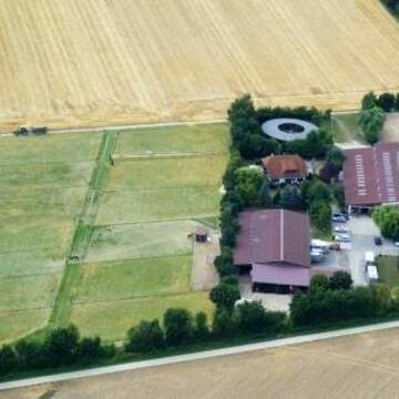
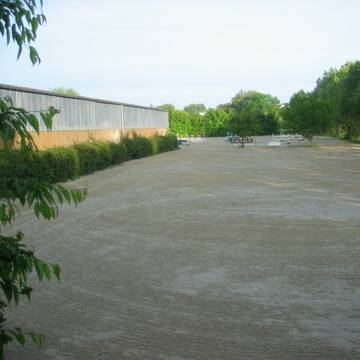
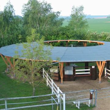
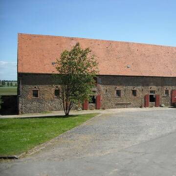
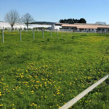
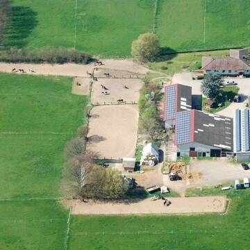
Reitsportanlage Lindenhof
Florstadt Leidhecken
Reitsportanlage Lindenhof
@ReitsportanlageLindenhof1
Freizeitstall
Reitschule
Vermieten
Führanlage
Hunde willkommen
Allergikerstall
bedampftes/gewaschenes Heu
22 weitere...
S


Stall Lindenhof
Wöllstadt
Stall Lindenhof
@Lindenhof1963
FN-Mitglied
Freizeitstall
Vermieten
Führanlage
Laufband
Hengsthaltung möglich
Pferdezucht
20 weitere...
P+
Deprecated: Creation of dynamic property Zend_View_Helper_Ads::$adLink is deprecated in /var/www/stall-frei/htdocs/staging.stall-frei.de/library/Psf/View/Helper/Ads.php on line 108

Frisches Stroh zu verkaufen!
Mechtersen
STALL-FREIde Marketing
@STALL-FREI-Marketing
Kaufe frisches Stroh für dein Pferd!


Box Paddock Stall Pferd Solekammer
Butzbach
Alexander Studt
@Alexander-Studt-Pferdepension-
FN-Mitglied
Freizeitstall
Vermieten
Führanlage
Hunde willkommen
Außenbox mit Paddock
Außenboxen
21 weitere...
S
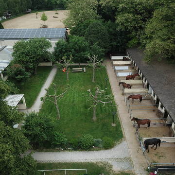
Domäne Nonnenhof
Niddatal-Ilbenstadt
Nonnenhof
@Nonnenhof
Paddock
Parkplatz für Pferdeanhänger
Außenbox mit Paddock
Innenbox
Vollpension
5 weitere...
P+
Reitstall Rahn
Karben
Guido-Rahn-Reistall-Rahn
@Guido-Rahn-Reistall-Rahn
FN-Mitglied
Freizeitstall
Longierzirkel/Roundpen
Paddock
Außenbox mit Paddock
Außenboxen
Halbpension
Vollpension
13 weitere...
P+

Offenstall/Paddockbox für Pony oder Kleinpferd
Glashütten
Tatjana Bommersheim
@TatjanaBommersheim
Wir haben ab dem 1.04.26 eine Platz in einem unsere Offenställe (Wallach oder Stute)und eine unserer Paddockboxen (Wallach oder S
neu
R


Offenstall/Pferdeboxen mit Reithalle und Reitplatz
Bad Nauheim
Pferdebetrieb-Hartmann
@Pferdebetrieb-Hartmann
Vermieten
Hunde willkommen
Krankenbox
Außenbox mit Paddock
Außenboxen
Halbpension
Vollpension
14 weitere...
P+
Boxen zu vermieten.
Friedberg
Pferdehof-Mueller
@Pferdehof-Mueller
Freizeitstall
Vermieten
Hunde willkommen
Paddock
Hufrehe geeignet
13 weitere...
P

Offenstallplätze Reiterhof Waechter in Rosbach
Rosbach
Reiterhof-Waechter
@Reiterhof-Waechter
Freizeitstall
Reitlehrer und -unterricht
Vermieten
Hunde willkommen
Krankenbox
Allergikerstall
bedampftes/gewaschenes Heu
17 weitere...
P
Reitanlage Windhof - H. Schwachheim & T. Fau...
Niddatal
Windhof
@Windhof
Freizeitstall
Pferdeausbildung
Führanlage
Longierzirkel/Roundpen
Außenbox mit Paddock
Außenboxen
Vollpension
11 weitere...
P
Paddockboxen im Grünen - Im Norden von Frankfurt...
Karben
Thomas-Wamser
@Thomas-Wamser
FN-Mitglied
Pferdeausbildung
Vermieten
Führanlage
Hunde willkommen
Allergikerstall
bedampftes/gewaschenes Heu
17 weitere...
P
Deprecated: Creation of dynamic property Zend_View::$pageCount is deprecated in /var/www/stall-frei/htdocs/staging.stall-frei.de/library/vendor/shardj/zf1-future/library/Zend/View/Abstract.php on line 308
Deprecated: Creation of dynamic property Zend_View::$itemCountPerPage is deprecated in /var/www/stall-frei/htdocs/staging.stall-frei.de/library/vendor/shardj/zf1-future/library/Zend/View/Abstract.php on line 308
Deprecated: Creation of dynamic property Zend_View::$first is deprecated in /var/www/stall-frei/htdocs/staging.stall-frei.de/library/vendor/shardj/zf1-future/library/Zend/View/Abstract.php on line 308
Deprecated: Creation of dynamic property Zend_View::$current is deprecated in /var/www/stall-frei/htdocs/staging.stall-frei.de/library/vendor/shardj/zf1-future/library/Zend/View/Abstract.php on line 308
Deprecated: Creation of dynamic property Zend_View::$last is deprecated in /var/www/stall-frei/htdocs/staging.stall-frei.de/library/vendor/shardj/zf1-future/library/Zend/View/Abstract.php on line 308
Deprecated: Creation of dynamic property Zend_View::$next is deprecated in /var/www/stall-frei/htdocs/staging.stall-frei.de/library/vendor/shardj/zf1-future/library/Zend/View/Abstract.php on line 308
Deprecated: Creation of dynamic property Zend_View::$pagesInRange is deprecated in /var/www/stall-frei/htdocs/staging.stall-frei.de/library/vendor/shardj/zf1-future/library/Zend/View/Abstract.php on line 308
Deprecated: Creation of dynamic property Zend_View::$firstPageInRange is deprecated in /var/www/stall-frei/htdocs/staging.stall-frei.de/library/vendor/shardj/zf1-future/library/Zend/View/Abstract.php on line 308
Deprecated: Creation of dynamic property Zend_View::$lastPageInRange is deprecated in /var/www/stall-frei/htdocs/staging.stall-frei.de/library/vendor/shardj/zf1-future/library/Zend/View/Abstract.php on line 308
Deprecated: Creation of dynamic property Zend_View::$currentItemCount is deprecated in /var/www/stall-frei/htdocs/staging.stall-frei.de/library/vendor/shardj/zf1-future/library/Zend/View/Abstract.php on line 308
Deprecated: Creation of dynamic property Zend_View::$totalItemCount is deprecated in /var/www/stall-frei/htdocs/staging.stall-frei.de/library/vendor/shardj/zf1-future/library/Zend/View/Abstract.php on line 308
Deprecated: Creation of dynamic property Zend_View::$firstItemNumber is deprecated in /var/www/stall-frei/htdocs/staging.stall-frei.de/library/vendor/shardj/zf1-future/library/Zend/View/Abstract.php on line 308
Deprecated: Creation of dynamic property Zend_View::$lastItemNumber is deprecated in /var/www/stall-frei/htdocs/staging.stall-frei.de/library/vendor/shardj/zf1-future/library/Zend/View/Abstract.php on line 308
Deprecated: Creation of dynamic property Zend_View::$router is deprecated in /var/www/stall-frei/htdocs/staging.stall-frei.de/library/vendor/shardj/zf1-future/library/Zend/View/Abstract.php on line 308
Deprecated: Creation of dynamic property Zend_View::$urlParams is deprecated in /var/www/stall-frei/htdocs/staging.stall-frei.de/library/vendor/shardj/zf1-future/library/Zend/View/Abstract.php on line 308
Deprecated: Creation of dynamic property Zend_View::$showAds is deprecated in /var/www/stall-frei/htdocs/staging.stall-frei.de/library/vendor/shardj/zf1-future/library/Zend/View/Abstract.php on line 308
Deprecated: Creation of dynamic property Zend_View::$objectIds is deprecated in /var/www/stall-frei/htdocs/staging.stall-frei.de/library/vendor/shardj/zf1-future/library/Zend/View/Abstract.php on line 308
Deprecated: Creation of dynamic property Zend_View::$showNavbar is deprecated in /var/www/stall-frei/htdocs/staging.stall-frei.de/library/vendor/shardj/zf1-future/library/Zend/View/Abstract.php on line 308
Deprecated: Creation of dynamic property Zend_View::$showBreadcrumb is deprecated in /var/www/stall-frei/htdocs/staging.stall-frei.de/library/vendor/shardj/zf1-future/library/Zend/View/Abstract.php on line 308
Deprecated: Creation of dynamic property Zend_View::$showFooter is deprecated in /var/www/stall-frei/htdocs/staging.stall-frei.de/library/vendor/shardj/zf1-future/library/Zend/View/Abstract.php on line 308
Deprecated: Creation of dynamic property Zend_View::$showInternalAds is deprecated in /var/www/stall-frei/htdocs/staging.stall-frei.de/library/vendor/shardj/zf1-future/library/Zend/View/Abstract.php on line 308
Deprecated: Creation of dynamic property Zend_View::$blNoContent is deprecated in /var/www/stall-frei/htdocs/staging.stall-frei.de/library/vendor/shardj/zf1-future/library/Zend/View/Abstract.php on line 308
Deprecated: Creation of dynamic property Zend_View::$sMetaDesc is deprecated in /var/www/stall-frei/htdocs/staging.stall-frei.de/library/vendor/shardj/zf1-future/library/Zend/View/Abstract.php on line 308
Deprecated: Creation of dynamic property Zend_View::$useGmaps is deprecated in /var/www/stall-frei/htdocs/staging.stall-frei.de/library/vendor/shardj/zf1-future/library/Zend/View/Abstract.php on line 308
Deprecated: Creation of dynamic property Zend_View::$touches is deprecated in /var/www/stall-frei/htdocs/staging.stall-frei.de/library/vendor/shardj/zf1-future/library/Zend/View/Abstract.php on line 308
Deprecated: Creation of dynamic property Zend_View::$oProject is deprecated in /var/www/stall-frei/htdocs/staging.stall-frei.de/library/vendor/shardj/zf1-future/library/Zend/View/Abstract.php on line 308
Deprecated: Creation of dynamic property Zend_View::$pageHeadline is deprecated in /var/www/stall-frei/htdocs/staging.stall-frei.de/library/vendor/shardj/zf1-future/library/Zend/View/Abstract.php on line 308
Deprecated: Creation of dynamic property Zend_View::$disableLocationField is deprecated in /var/www/stall-frei/htdocs/staging.stall-frei.de/library/vendor/shardj/zf1-future/library/Zend/View/Abstract.php on line 308
Deprecated: Creation of dynamic property Zend_View::$isSearch is deprecated in /var/www/stall-frei/htdocs/staging.stall-frei.de/library/vendor/shardj/zf1-future/library/Zend/View/Abstract.php on line 308
Deprecated: Creation of dynamic property Zend_View::$pageTitle is deprecated in /var/www/stall-frei/htdocs/staging.stall-frei.de/library/vendor/shardj/zf1-future/library/Zend/View/Abstract.php on line 308
Deprecated: Creation of dynamic property Psf_Form_Element_Text::$class is deprecated in /var/www/stall-frei/htdocs/staging.stall-frei.de/library/vendor/shardj/zf1-future/library/Zend/Form/Element.php on line 874
Deprecated: Creation of dynamic property Psf_Form_Element_Text::$size is deprecated in /var/www/stall-frei/htdocs/staging.stall-frei.de/library/vendor/shardj/zf1-future/library/Zend/Form/Element.php on line 874
Deprecated: Creation of dynamic property Psf_Form_Element_Text::$placeholder is deprecated in /var/www/stall-frei/htdocs/staging.stall-frei.de/library/vendor/shardj/zf1-future/library/Zend/Form/Element.php on line 874
Deprecated: Creation of dynamic property Psf_Form_Element_Hidden::$class is deprecated in /var/www/stall-frei/htdocs/staging.stall-frei.de/library/vendor/shardj/zf1-future/library/Zend/Form/Element.php on line 874
Deprecated: Creation of dynamic property Psf_Form_Element_Hidden::$class is deprecated in /var/www/stall-frei/htdocs/staging.stall-frei.de/library/vendor/shardj/zf1-future/library/Zend/Form/Element.php on line 874
Deprecated: Creation of dynamic property Psf_Form_Element_Hidden::$class is deprecated in /var/www/stall-frei/htdocs/staging.stall-frei.de/library/vendor/shardj/zf1-future/library/Zend/Form/Element.php on line 874
Deprecated: Creation of dynamic property Psf_Form_Element_Hidden::$class is deprecated in /var/www/stall-frei/htdocs/staging.stall-frei.de/library/vendor/shardj/zf1-future/library/Zend/Form/Element.php on line 874
Deprecated: Creation of dynamic property Psf_Form_Element_Select::$class is deprecated in /var/www/stall-frei/htdocs/staging.stall-frei.de/library/vendor/shardj/zf1-future/library/Zend/Form/Element.php on line 874
Deprecated: Creation of dynamic property Psf_Form_Element_Select::$class is deprecated in /var/www/stall-frei/htdocs/staging.stall-frei.de/library/vendor/shardj/zf1-future/library/Zend/Form/Element.php on line 874
Deprecated: Creation of dynamic property Psf_Form_Element_Select::$class is deprecated in /var/www/stall-frei/htdocs/staging.stall-frei.de/library/vendor/shardj/zf1-future/library/Zend/Form/Element.php on line 874
Deprecated: Creation of dynamic property Psf_Form_Element_Select::$class is deprecated in /var/www/stall-frei/htdocs/staging.stall-frei.de/library/vendor/shardj/zf1-future/library/Zend/Form/Element.php on line 874
Deprecated: Creation of dynamic property Psf_Form_Element_Text::$class is deprecated in /var/www/stall-frei/htdocs/staging.stall-frei.de/library/vendor/shardj/zf1-future/library/Zend/Form/Element.php on line 874
Deprecated: Creation of dynamic property Psf_Form_Element_Checkbox::$label is deprecated in /var/www/stall-frei/htdocs/staging.stall-frei.de/library/vendor/shardj/zf1-future/library/Zend/Form/Element.php on line 874
Deprecated: Creation of dynamic property Zend_View::$sort is deprecated in /var/www/stall-frei/htdocs/staging.stall-frei.de/library/vendor/shardj/zf1-future/library/Zend/View/Abstract.php on line 308
Deprecated: Creation of dynamic property Zend_View::$searchLocation is deprecated in /var/www/stall-frei/htdocs/staging.stall-frei.de/library/vendor/shardj/zf1-future/library/Zend/View/Abstract.php on line 308
Deprecated: Creation of dynamic property Zend_View::$locationHint is deprecated in /var/www/stall-frei/htdocs/staging.stall-frei.de/library/vendor/shardj/zf1-future/library/Zend/View/Abstract.php on line 308
Psf_GeoCoder_Abstract::getLocation: Ober-Wöllstadt Get Location CachedOrLive
Psf_GeoCoder_Abstract::getCachedOrLive: Ober-Wöllstadt
Psf_GeoCoder_OpenCageData::makeApiRequest: response:
Array
(
[documentation] => https://opencagedata.com/api
[licenses] => Array
(
[0] => Array
(
[name] => see attribution guide
[url] => https://opencagedata.com/credits
)
)
[results] => Array
(
[0] => Array
(
[bounds] => Array
(
[northeast] => Array
(
[lat] => 50.3103422
[lng] => 8.7701038
)
[southwest] => Array
(
[lat] => 50.2786717
[lng] => 8.7282385
)
)
[components] => Array
(
[ISO_3166-1_alpha-2] => DE
[ISO_3166-1_alpha-3] => DEU
[ISO_3166-2] => Array
(
[0] => DE-HE
)
[_category] => place
[_normalized_city] => Ober-Wöllstadt
[_type] => village
[continent] => Europe
[country] => Deutschland
[country_code] => de
[county] => Wetteraukreis
[municipality] => Wöllstadt
[political_union] => European Union
[state] => Hessen
[state_code] => HE
[village] => Ober-Wöllstadt
)
[confidence] => 7
[formatted] => Ober-Wöllstadt, Hessen, Deutschland
[geometry] => Array
(
[lat] => 50.2986821
[lng] => 8.7510404
)
)
[1] => Array
(
[components] => Array
(
[ISO_3166-1_alpha-2] => FR
[ISO_3166-1_alpha-3] => FRA
[ISO_3166-2] => Array
(
[0] => FR-GES
[1] => FR-10
)
[_category] => road
[_normalized_city] => Saint-André-les-Vergers
[_type] => road
[city] => Saint-André-les-Vergers
[continent] => Europe
[country] => France
[country_code] => fr
[county] => Aube
[local_authority] => Troyes Champagne Métropole
[political_union] => European Union
[postcode] => 10120
[road] => Rue Ober Ramstadt
[state] => Grand Est
[state_code] => GES
)
[confidence] => 2
[formatted] => Rue Ober Ramstadt, 10120 Saint-André-les-Vergers, France
[geometry] => Array
(
[lat] => 48.280437
[lng] => 4.052425
)
)
[2] => Array
(
[components] => Array
(
[ISO_3166-1_alpha-2] => FR
[ISO_3166-1_alpha-3] => FRA
[ISO_3166-2] => Array
(
[0] => FR-GES
[1] => FR-6AE
[2] => FR-68
)
[_category] => place
[_normalized_city] => Hirsingue
[_type] => place
[city] => Hirsingue
[continent] => Europe
[country] => France
[country_code] => fr
[county] => Haut-Rhin
[local_authority] => Communauté de communes Sundgau
[place] => Ober Dem Brandwinkel
[political_union] => European Union
[postcode] => 68560
[state] => Grand Est
[state_code] => GES
)
[confidence] => 2
[formatted] => Ober Dem Brandwinkel, 68560 Hirsingue, France
[geometry] => Array
(
[lat] => 47.595541
[lng] => 7.244854
)
)
[3] => Array
(
[components] => Array
(
[ISO_3166-1_alpha-2] => FR
[ISO_3166-1_alpha-3] => FRA
[ISO_3166-2] => Array
(
[0] => FR-GES
[1] => FR-6AE
[2] => FR-67
)
[_category] => place
[_normalized_city] => Weyer
[_type] => place
[city] => Weyer
[continent] => Europe
[country] => France
[country_code] => fr
[county] => Bas-Rhin
[local_authority] => Communauté de communes de l'Alsace Bossue
[place] => Ober Stritaht
[political_union] => European Union
[postcode] => 67320
[state] => Grand Est
[state_code] => GES
)
[confidence] => 2
[formatted] => Ober Stritaht, 67320 Weyer, France
[geometry] => Array
(
[lat] => 48.869279
[lng] => 7.150046
)
)
[4] => Array
(
[components] => Array
(
[ISO_3166-1_alpha-2] => FR
[ISO_3166-1_alpha-3] => FRA
[ISO_3166-2] => Array
(
[0] => FR-GES
[1] => FR-57
)
[_category] => place
[_normalized_city] => Hanviller
[_type] => place
[city] => Hanviller
[continent] => Europe
[country] => France
[country_code] => fr
[county] => Moselle
[local_authority] => Communauté de communes du Pays de Bitche
[place] => Ober Diedenbach
[political_union] => European Union
[postcode] => 57230
[state] => Grand Est
[state_code] => GES
)
[confidence] => 2
[formatted] => Ober Diedenbach, 57230 Hanviller, France
[geometry] => Array
(
[lat] => 49.094878
[lng] => 7.453496
)
)
[5] => Array
(
[components] => Array
(
[ISO_3166-1_alpha-2] => FR
[ISO_3166-1_alpha-3] => FRA
[ISO_3166-2] => Array
(
[0] => FR-GES
[1] => FR-6AE
[2] => FR-67
)
[_category] => road
[_normalized_city] => Fort-Louis
[_type] => road
[city] => Fort-Louis
[continent] => Europe
[country] => France
[country_code] => fr
[county] => Bas-Rhin
[local_authority] => Communauté de communes du Pays Rhénan
[political_union] => European Union
[postcode] => 67480
[road] => Suryscher Ober Woerth
[state] => Grand Est
[state_code] => GES
)
[confidence] => 2
[formatted] => Suryscher Ober Woerth, 67480 Fort-Louis, France
[geometry] => Array
(
[lat] => 48.784884
[lng] => 8.022354
)
)
[6] => Array
(
[components] => Array
(
[ISO_3166-1_alpha-2] => FR
[ISO_3166-1_alpha-3] => FRA
[ISO_3166-2] => Array
(
[0] => FR-GES
[1] => FR-6AE
[2] => FR-68
)
[_category] => road
[_normalized_city] => Soultzeren
[_type] => road
[city] => Soultzeren
[continent] => Europe
[country] => France
[country_code] => fr
[county] => Haut-Rhin
[local_authority] => Communauté de communes de la Vallée de Munster
[political_union] => European Union
[postcode] => 68140
[road] => Chemin du Ober Langeren
[state] => Grand Est
[state_code] => GES
)
[confidence] => 2
[formatted] => Chemin du Ober Langeren, 68140 Soultzeren, France
[geometry] => Array
(
[lat] => 48.074083
[lng] => 7.103864
)
)
[7] => Array
(
[components] => Array
(
[ISO_3166-1_alpha-2] => FR
[ISO_3166-1_alpha-3] => FRA
[ISO_3166-2] => Array
(
[0] => FR-GES
[1] => FR-88
)
[_category] => road
[_normalized_city] => Ramonchamp
[_type] => road
[city] => Ramonchamp
[continent] => Europe
[country] => France
[country_code] => fr
[county] => Vosges
[local_authority] => Communauté de communes des Ballons des Hautes-Vosges
[political_union] => European Union
[postcode] => 88160
[road] => Rue d’Ober Olm
[state] => Grand Est
[state_code] => GES
)
[confidence] => 2
[formatted] => Rue d’Ober Olm, 88160 Ramonchamp, France
[geometry] => Array
(
[lat] => 47.891504
[lng] => 6.738155
)
)
[8] => Array
(
[components] => Array
(
[ISO_3166-1_alpha-2] => FR
[ISO_3166-1_alpha-3] => FRA
[ISO_3166-2] => Array
(
[0] => FR-GES
[1] => FR-6AE
[2] => FR-68
)
[_category] => place
[_normalized_city] => Soultz-Haut-Rhin
[_type] => place
[city] => Soultz-Haut-Rhin
[continent] => Europe
[country] => France
[country_code] => fr
[county] => Haut-Rhin
[local_authority] => Communauté de communes de la Région de Guebwiller
[place] => Obere Ruetschmatt
[political_union] => European Union
[postcode] => 68360
[state] => Grand Est
[state_code] => GES
)
[confidence] => 10
[formatted] => Obere Ruetschmatt, 68360 Soultz-Haut-Rhin, France
[geometry] => Array
(
[lat] => 47.889506
[lng] => 7.215989
)
)
[9] => Array
(
[components] => Array
(
[ISO_3166-1_alpha-2] => FR
[ISO_3166-1_alpha-3] => FRA
[ISO_3166-2] => Array
(
[0] => FR-HDF
[1] => FR-59
)
[_category] => road
[_normalized_city] => Wambrechies
[_type] => road
[city] => Wambrechies
[continent] => Europe
[country] => France
[country_code] => fr
[county] => Nord
[local_authority] => Métropole Européenne de Lille
[political_union] => European Union
[postcode] => 59118
[road] => Rue Obert
[state] => Hauts-de-France
[state_code] => HDF
)
[confidence] => 10
[formatted] => Rue Obert, 59118 Wambrechies, France
[geometry] => Array
(
[lat] => 50.683744
[lng] => 3.053743
)
)
)
[status] => Array
(
[code] => 200
[message] => OK
)
[stay_informed] => Array
(
[blog] => https://blog.opencagedata.com
[mastodon] => https://en.osm.town/@opencage
)
[thanks] => For using an OpenCage API
[timestamp] => Array
(
[created_http] => Sun, 08 Feb 2026 02:18:33 GMT
[created_unix] => 1770517113
)
[total_results] => 10
)
Psf_GeoCoder_Abstract::convertLocationResult
{"documentation":"https:\/\/opencagedata.com\/api","licenses":[{"name":"see attribution guide","url":"https:\/\/opencagedata.com\/credits"}],"results":[{"bounds":{"northeast":{"lat":50.3103422,"lng":8.7701038},"southwest":{"lat":50.2786717,"lng":8.7282385}},"components":{"ISO_3166-1_alpha-2":"DE","ISO_3166-1_alpha-3":"DEU","ISO_3166-2":["DE-HE"],"_category":"place","_normalized_city":"Ober-W\u00f6llstadt","_type":"village","continent":"Europe","country":"Deutschland","country_code":"de","county":"Wetteraukreis","municipality":"W\u00f6llstadt","political_union":"European Union","state":"Hessen","state_code":"HE","village":"Ober-W\u00f6llstadt"},"confidence":7,"formatted":"Ober-W\u00f6llstadt, Hessen, Deutschland","geometry":{"lat":50.2986821,"lng":8.7510404}},{"components":{"ISO_3166-1_alpha-2":"FR","ISO_3166-1_alpha-3":"FRA","ISO_3166-2":["FR-GES","FR-10"],"_category":"road","_normalized_city":"Saint-Andr\u00e9-les-Vergers","_type":"road","city":"Saint-Andr\u00e9-les-Vergers","continent":"Europe","country":"France","country_code":"fr","county":"Aube","local_authority":"Troyes Champagne M\u00e9tropole","political_union":"European Union","postcode":"10120","road":"Rue Ober Ramstadt","state":"Grand Est","state_code":"GES"},"confidence":2,"formatted":"Rue Ober Ramstadt, 10120 Saint-Andr\u00e9-les-Vergers, France","geometry":{"lat":48.280437,"lng":4.052425}},{"components":{"ISO_3166-1_alpha-2":"FR","ISO_3166-1_alpha-3":"FRA","ISO_3166-2":["FR-GES","FR-6AE","FR-68"],"_category":"place","_normalized_city":"Hirsingue","_type":"place","city":"Hirsingue","continent":"Europe","country":"France","country_code":"fr","county":"Haut-Rhin","local_authority":"Communaut\u00e9 de communes Sundgau","place":"Ober Dem Brandwinkel","political_union":"European Union","postcode":"68560","state":"Grand Est","state_code":"GES"},"confidence":2,"formatted":"Ober Dem Brandwinkel, 68560 Hirsingue, France","geometry":{"lat":47.595541,"lng":7.244854}},{"components":{"ISO_3166-1_alpha-2":"FR","ISO_3166-1_alpha-3":"FRA","ISO_3166-2":["FR-GES","FR-6AE","FR-67"],"_category":"place","_normalized_city":"Weyer","_type":"place","city":"Weyer","continent":"Europe","country":"France","country_code":"fr","county":"Bas-Rhin","local_authority":"Communaut\u00e9 de communes de l'Alsace Bossue","place":"Ober Stritaht","political_union":"European Union","postcode":"67320","state":"Grand Est","state_code":"GES"},"confidence":2,"formatted":"Ober Stritaht, 67320 Weyer, France","geometry":{"lat":48.869279,"lng":7.150046}},{"components":{"ISO_3166-1_alpha-2":"FR","ISO_3166-1_alpha-3":"FRA","ISO_3166-2":["FR-GES","FR-57"],"_category":"place","_normalized_city":"Hanviller","_type":"place","city":"Hanviller","continent":"Europe","country":"France","country_code":"fr","county":"Moselle","local_authority":"Communaut\u00e9 de communes du Pays de Bitche","place":"Ober Diedenbach","political_union":"European Union","postcode":"57230","state":"Grand Est","state_code":"GES"},"confidence":2,"formatted":"Ober Diedenbach, 57230 Hanviller, France","geometry":{"lat":49.094878,"lng":7.453496}},{"components":{"ISO_3166-1_alpha-2":"FR","ISO_3166-1_alpha-3":"FRA","ISO_3166-2":["FR-GES","FR-6AE","FR-67"],"_category":"road","_normalized_city":"Fort-Louis","_type":"road","city":"Fort-Louis","continent":"Europe","country":"France","country_code":"fr","county":"Bas-Rhin","local_authority":"Communaut\u00e9 de communes du Pays Rh\u00e9nan","political_union":"European Union","postcode":"67480","road":"Suryscher Ober Woerth","state":"Grand Est","state_code":"GES"},"confidence":2,"formatted":"Suryscher Ober Woerth, 67480 Fort-Louis, France","geometry":{"lat":48.784884,"lng":8.022354}},{"components":{"ISO_3166-1_alpha-2":"FR","ISO_3166-1_alpha-3":"FRA","ISO_3166-2":["FR-GES","FR-6AE","FR-68"],"_category":"road","_normalized_city":"Soultzeren","_type":"road","city":"Soultzeren","continent":"Europe","country":"France","country_code":"fr","county":"Haut-Rhin","local_authority":"Communaut\u00e9 de communes de la Vall\u00e9e de Munster","political_union":"European Union","postcode":"68140","road":"Chemin du Ober Langeren","state":"Grand Est","state_code":"GES"},"confidence":2,"formatted":"Chemin du Ober Langeren, 68140 Soultzeren, France","geometry":{"lat":48.074083,"lng":7.103864}},{"components":{"ISO_3166-1_alpha-2":"FR","ISO_3166-1_alpha-3":"FRA","ISO_3166-2":["FR-GES","FR-88"],"_category":"road","_normalized_city":"Ramonchamp","_type":"road","city":"Ramonchamp","continent":"Europe","country":"France","country_code":"fr","county":"Vosges","local_authority":"Communaut\u00e9 de communes des Ballons des Hautes-Vosges","political_union":"European Union","postcode":"88160","road":"Rue d\u2019Ober Olm","state":"Grand Est","state_code":"GES"},"confidence":2,"formatted":"Rue d\u2019Ober Olm, 88160 Ramonchamp, France","geometry":{"lat":47.891504,"lng":6.738155}},{"components":{"ISO_3166-1_alpha-2":"FR","ISO_3166-1_alpha-3":"FRA","ISO_3166-2":["FR-GES","FR-6AE","FR-68"],"_category":"place","_normalized_city":"Soultz-Haut-Rhin","_type":"place","city":"Soultz-Haut-Rhin","continent":"Europe","country":"France","country_code":"fr","county":"Haut-Rhin","local_authority":"Communaut\u00e9 de communes de la R\u00e9gion de Guebwiller","place":"Obere Ruetschmatt","political_union":"European Union","postcode":"68360","state":"Grand Est","state_code":"GES"},"confidence":10,"formatted":"Obere Ruetschmatt, 68360 Soultz-Haut-Rhin, France","geometry":{"lat":47.889506,"lng":7.215989}},{"components":{"ISO_3166-1_alpha-2":"FR","ISO_3166-1_alpha-3":"FRA","ISO_3166-2":["FR-HDF","FR-59"],"_category":"road","_normalized_city":"Wambrechies","_type":"road","city":"Wambrechies","continent":"Europe","country":"France","country_code":"fr","county":"Nord","local_authority":"M\u00e9tropole Europ\u00e9enne de Lille","political_union":"European Union","postcode":"59118","road":"Rue Obert","state":"Hauts-de-France","state_code":"HDF"},"confidence":10,"formatted":"Rue Obert, 59118 Wambrechies, France","geometry":{"lat":50.683744,"lng":3.053743}}],"status":{"code":200,"message":"OK"},"stay_informed":{"blog":"https:\/\/blog.opencagedata.com","mastodon":"https:\/\/en.osm.town\/@opencage"},"thanks":"For using an OpenCage API","timestamp":{"created_http":"Sun, 08 Feb 2026 02:18:33 GMT","created_unix":1770517113},"total_results":10}Array
(
[0] => stdClass Object
(
[bounds] => stdClass Object
(
[northeast] => stdClass Object
(
[lat] => 50.3103422
[lng] => 8.7701038
)
[southwest] => stdClass Object
(
[lat] => 50.2786717
[lng] => 8.7282385
)
)
[components] => stdClass Object
(
[ISO_3166-1_alpha-2] => DE
[ISO_3166-1_alpha-3] => DEU
[ISO_3166-2] => Array
(
[0] => DE-HE
)
[_category] => place
[_normalized_city] => Ober-Wöllstadt
[_type] => village
[continent] => Europe
[country] => Deutschland
[country_code] => de
[county] => Wetteraukreis
[municipality] => Wöllstadt
[political_union] => European Union
[state] => Hessen
[state_code] => HE
[village] => Ober-Wöllstadt
)
[confidence] => 7
[formatted] => Ober-Wöllstadt, Hessen, Deutschland
[geometry] => stdClass Object
(
[lat] => 50.2986821
[lng] => 8.7510404
)
)
[1] => stdClass Object
(
[components] => stdClass Object
(
[ISO_3166-1_alpha-2] => FR
[ISO_3166-1_alpha-3] => FRA
[ISO_3166-2] => Array
(
[0] => FR-GES
[1] => FR-10
)
[_category] => road
[_normalized_city] => Saint-André-les-Vergers
[_type] => road
[city] => Saint-André-les-Vergers
[continent] => Europe
[country] => France
[country_code] => fr
[county] => Aube
[local_authority] => Troyes Champagne Métropole
[political_union] => European Union
[postcode] => 10120
[road] => Rue Ober Ramstadt
[state] => Grand Est
[state_code] => GES
)
[confidence] => 2
[formatted] => Rue Ober Ramstadt, 10120 Saint-André-les-Vergers, France
[geometry] => stdClass Object
(
[lat] => 48.280437
[lng] => 4.052425
)
)
[2] => stdClass Object
(
[components] => stdClass Object
(
[ISO_3166-1_alpha-2] => FR
[ISO_3166-1_alpha-3] => FRA
[ISO_3166-2] => Array
(
[0] => FR-GES
[1] => FR-6AE
[2] => FR-68
)
[_category] => place
[_normalized_city] => Hirsingue
[_type] => place
[city] => Hirsingue
[continent] => Europe
[country] => France
[country_code] => fr
[county] => Haut-Rhin
[local_authority] => Communauté de communes Sundgau
[place] => Ober Dem Brandwinkel
[political_union] => European Union
[postcode] => 68560
[state] => Grand Est
[state_code] => GES
)
[confidence] => 2
[formatted] => Ober Dem Brandwinkel, 68560 Hirsingue, France
[geometry] => stdClass Object
(
[lat] => 47.595541
[lng] => 7.244854
)
)
[3] => stdClass Object
(
[components] => stdClass Object
(
[ISO_3166-1_alpha-2] => FR
[ISO_3166-1_alpha-3] => FRA
[ISO_3166-2] => Array
(
[0] => FR-GES
[1] => FR-6AE
[2] => FR-67
)
[_category] => place
[_normalized_city] => Weyer
[_type] => place
[city] => Weyer
[continent] => Europe
[country] => France
[country_code] => fr
[county] => Bas-Rhin
[local_authority] => Communauté de communes de l'Alsace Bossue
[place] => Ober Stritaht
[political_union] => European Union
[postcode] => 67320
[state] => Grand Est
[state_code] => GES
)
[confidence] => 2
[formatted] => Ober Stritaht, 67320 Weyer, France
[geometry] => stdClass Object
(
[lat] => 48.869279
[lng] => 7.150046
)
)
[4] => stdClass Object
(
[components] => stdClass Object
(
[ISO_3166-1_alpha-2] => FR
[ISO_3166-1_alpha-3] => FRA
[ISO_3166-2] => Array
(
[0] => FR-GES
[1] => FR-57
)
[_category] => place
[_normalized_city] => Hanviller
[_type] => place
[city] => Hanviller
[continent] => Europe
[country] => France
[country_code] => fr
[county] => Moselle
[local_authority] => Communauté de communes du Pays de Bitche
[place] => Ober Diedenbach
[political_union] => European Union
[postcode] => 57230
[state] => Grand Est
[state_code] => GES
)
[confidence] => 2
[formatted] => Ober Diedenbach, 57230 Hanviller, France
[geometry] => stdClass Object
(
[lat] => 49.094878
[lng] => 7.453496
)
)
[5] => stdClass Object
(
[components] => stdClass Object
(
[ISO_3166-1_alpha-2] => FR
[ISO_3166-1_alpha-3] => FRA
[ISO_3166-2] => Array
(
[0] => FR-GES
[1] => FR-6AE
[2] => FR-67
)
[_category] => road
[_normalized_city] => Fort-Louis
[_type] => road
[city] => Fort-Louis
[continent] => Europe
[country] => France
[country_code] => fr
[county] => Bas-Rhin
[local_authority] => Communauté de communes du Pays Rhénan
[political_union] => European Union
[postcode] => 67480
[road] => Suryscher Ober Woerth
[state] => Grand Est
[state_code] => GES
)
[confidence] => 2
[formatted] => Suryscher Ober Woerth, 67480 Fort-Louis, France
[geometry] => stdClass Object
(
[lat] => 48.784884
[lng] => 8.022354
)
)
[6] => stdClass Object
(
[components] => stdClass Object
(
[ISO_3166-1_alpha-2] => FR
[ISO_3166-1_alpha-3] => FRA
[ISO_3166-2] => Array
(
[0] => FR-GES
[1] => FR-6AE
[2] => FR-68
)
[_category] => road
[_normalized_city] => Soultzeren
[_type] => road
[city] => Soultzeren
[continent] => Europe
[country] => France
[country_code] => fr
[county] => Haut-Rhin
[local_authority] => Communauté de communes de la Vallée de Munster
[political_union] => European Union
[postcode] => 68140
[road] => Chemin du Ober Langeren
[state] => Grand Est
[state_code] => GES
)
[confidence] => 2
[formatted] => Chemin du Ober Langeren, 68140 Soultzeren, France
[geometry] => stdClass Object
(
[lat] => 48.074083
[lng] => 7.103864
)
)
[7] => stdClass Object
(
[components] => stdClass Object
(
[ISO_3166-1_alpha-2] => FR
[ISO_3166-1_alpha-3] => FRA
[ISO_3166-2] => Array
(
[0] => FR-GES
[1] => FR-88
)
[_category] => road
[_normalized_city] => Ramonchamp
[_type] => road
[city] => Ramonchamp
[continent] => Europe
[country] => France
[country_code] => fr
[county] => Vosges
[local_authority] => Communauté de communes des Ballons des Hautes-Vosges
[political_union] => European Union
[postcode] => 88160
[road] => Rue d’Ober Olm
[state] => Grand Est
[state_code] => GES
)
[confidence] => 2
[formatted] => Rue d’Ober Olm, 88160 Ramonchamp, France
[geometry] => stdClass Object
(
[lat] => 47.891504
[lng] => 6.738155
)
)
[8] => stdClass Object
(
[components] => stdClass Object
(
[ISO_3166-1_alpha-2] => FR
[ISO_3166-1_alpha-3] => FRA
[ISO_3166-2] => Array
(
[0] => FR-GES
[1] => FR-6AE
[2] => FR-68
)
[_category] => place
[_normalized_city] => Soultz-Haut-Rhin
[_type] => place
[city] => Soultz-Haut-Rhin
[continent] => Europe
[country] => France
[country_code] => fr
[county] => Haut-Rhin
[local_authority] => Communauté de communes de la Région de Guebwiller
[place] => Obere Ruetschmatt
[political_union] => European Union
[postcode] => 68360
[state] => Grand Est
[state_code] => GES
)
[confidence] => 10
[formatted] => Obere Ruetschmatt, 68360 Soultz-Haut-Rhin, France
[geometry] => stdClass Object
(
[lat] => 47.889506
[lng] => 7.215989
)
)
[9] => stdClass Object
(
[components] => stdClass Object
(
[ISO_3166-1_alpha-2] => FR
[ISO_3166-1_alpha-3] => FRA
[ISO_3166-2] => Array
(
[0] => FR-HDF
[1] => FR-59
)
[_category] => road
[_normalized_city] => Wambrechies
[_type] => road
[city] => Wambrechies
[continent] => Europe
[country] => France
[country_code] => fr
[county] => Nord
[local_authority] => Métropole Européenne de Lille
[political_union] => European Union
[postcode] => 59118
[road] => Rue Obert
[state] => Hauts-de-France
[state_code] => HDF
)
[confidence] => 10
[formatted] => Rue Obert, 59118 Wambrechies, France
[geometry] => stdClass Object
(
[lat] => 50.683744
[lng] => 3.053743
)
)
)
Psf_GeoCoder_OpenCageData::getKeyMap: 0
stdClass Object
(
    [bounds] => stdClass Object
        (
            [northeast] => stdClass Object
                (
                    [lat] => 50.3103422
                    [lng] => 8.7701038
                )

            [southwest] => stdClass Object
                (
                    [lat] => 50.2786717
                    [lng] => 8.7282385
                )

        )

    [components] => stdClass Object
        (
            [ISO_3166-1_alpha-2] => DE
            [ISO_3166-1_alpha-3] => DEU
            [ISO_3166-2] => Array
                (
                    [0] => DE-HE
                )

            [_category] => place
            [_normalized_city] => Ober-Wöllstadt
            [_type] => village
            [continent] => Europe
            [country] => Deutschland
            [country_code] => de
            [county] => Wetteraukreis
            [municipality] => Wöllstadt
            [political_union] => European Union
            [state] => Hessen
            [state_code] => HE
            [village] => Ober-Wöllstadt
        )

    [confidence] => 7
    [formatted] => Ober-Wöllstadt, Hessen, Deutschland
    [geometry] => stdClass Object
        (
            [lat] => 50.2986821
            [lng] => 8.7510404
        )

)
Psf_GeoCoder_OpenCageData::getCounty: Wetteraukreis
Psf_GeoCoder_OpenCageData::addMissingData REFETCH!
Array
(
    [address] => Ober-Wöllstadt, Hessen, Deutschland
    [type] => village
    [street] =>
    [city] => Ober-Wöllstadt
    [county] => Wetteraukreis
    [state] => Hessen
    [zip] =>
    [country] => Deutschland
    [suburb] =>
    [countrycode] => de
    [latitude] => 50.2986821
    [longitude] => 8.7510404
    [accuracy] => 1
    [confidence] => 7
    [bounds] => stdClass Object
        (
            [northeast] => stdClass Object
                (
                    [lat] => 50.3103422
                    [lng] => 8.7701038
                )

            [southwest] => stdClass Object
                (
                    [lat] => 50.2786717
                    [lng] => 8.7282385
                )

        )

)
reformat!
Array
(
    [address] => Ober-Wöllstadt, Hessen, Deutschland
    [type] => village
    [street] =>
    [city] => Ober-Wöllstadt
    [county] => Wetteraukreis
    [state] => Hessen
    [zip] =>
    [country] => Deutschland
    [suburb] =>
    [countrycode] => de
    [latitude] => 50.2986821
    [longitude] => 8.7510404
    [accuracy] => 1
    [confidence] => 7
    [bounds] => stdClass Object
        (
            [northeast] => stdClass Object
                (
                    [lat] => 50.3103422
                    [lng] => 8.7701038
                )

            [southwest] => stdClass Object
                (
                    [lat] => 50.2786717
                    [lng] => 8.7282385
                )

        )

    [place] => Ober-Wöllstadt, Hessen
    [hash] => 013e9dba36ddae497ffe6d150bdb3b78
)
Psf_GeoCoder_OpenCageData::getKeyMap: 1
stdClass Object
(
    [components] => stdClass Object
        (
            [ISO_3166-1_alpha-2] => FR
            [ISO_3166-1_alpha-3] => FRA
            [ISO_3166-2] => Array
                (
                    [0] => FR-GES
                    [1] => FR-10
                )

            [_category] => road
            [_normalized_city] => Saint-André-les-Vergers
            [_type] => road
            [city] => Saint-André-les-Vergers
            [continent] => Europe
            [country] => France
            [country_code] => fr
            [county] => Aube
            [local_authority] => Troyes Champagne Métropole
            [political_union] => European Union
            [postcode] => 10120
            [road] => Rue Ober Ramstadt
            [state] => Grand Est
            [state_code] => GES
        )

    [confidence] => 2
    [formatted] => Rue Ober Ramstadt, 10120 Saint-André-les-Vergers, France
    [geometry] => stdClass Object
        (
            [lat] => 48.280437
            [lng] => 4.052425
        )

)
Psf_GeoCoder_OpenCageData::getCounty: Aube
Psf_GeoCoder_OpenCageData::addMissingData REFETCH!
Array
(
    [address] => Rue Ober Ramstadt, 10120 Saint-André-les-Vergers, France
    [type] => road
    [street] => Rue Ober Ramstadt
    [city] => Saint-André-les-Vergers
    [county] => Aube
    [state] => Grand Est
    [zip] => 10120
    [country] => France
    [suburb] =>
    [countrycode] => fr
    [latitude] => 48.280437
    [longitude] => 4.052425
    [accuracy] => 1
    [confidence] => 2
    [bounds] =>
)
reformat!
Array
(
    [address] => Rue Ober Ramstadt, 10120 Saint-André-les-Vergers, France
    [type] => road
    [street] => Rue Ober Ramstadt
    [city] => Saint-André-les-Vergers
    [county] => Aube
    [state] => Grand Est
    [zip] => 10120
    [country] => France
    [suburb] =>
    [countrycode] => fr
    [latitude] => 48.280437
    [longitude] => 4.052425
    [accuracy] => 1
    [confidence] => 2
    [bounds] =>
    [place] => Rue Ober Ramstadt, 10120 Saint-André-les-Vergers, Grand Est
    [hash] => 19f2f2f148738ee556ebe3b1e019e130
)
Psf_GeoCoder_OpenCageData::getKeyMap: 2
stdClass Object
(
    [components] => stdClass Object
        (
            [ISO_3166-1_alpha-2] => FR
            [ISO_3166-1_alpha-3] => FRA
            [ISO_3166-2] => Array
                (
                    [0] => FR-GES
                    [1] => FR-6AE
                    [2] => FR-68
                )

            [_category] => place
            [_normalized_city] => Hirsingue
            [_type] => place
            [city] => Hirsingue
            [continent] => Europe
            [country] => France
            [country_code] => fr
            [county] => Haut-Rhin
            [local_authority] => Communauté de communes Sundgau
            [place] => Ober Dem Brandwinkel
            [political_union] => European Union
            [postcode] => 68560
            [state] => Grand Est
            [state_code] => GES
        )

    [confidence] => 2
    [formatted] => Ober Dem Brandwinkel, 68560 Hirsingue, France
    [geometry] => stdClass Object
        (
            [lat] => 47.595541
            [lng] => 7.244854
        )

)
Psf_GeoCoder_OpenCageData::getCounty: Haut-Rhin
Psf_GeoCoder_OpenCageData::addMissingData REFETCH!
Array
(
    [address] => Ober Dem Brandwinkel, 68560 Hirsingue, France
    [type] => place
    [street] =>
    [city] => Hirsingue
    [county] => Haut-Rhin
    [state] => Grand Est
    [zip] => 68560
    [country] => France
    [suburb] =>
    [countrycode] => fr
    [latitude] => 47.595541
    [longitude] => 7.244854
    [accuracy] => 1
    [confidence] => 2
    [bounds] =>
)
reformat!
Array
(
    [address] => Ober Dem Brandwinkel, 68560 Hirsingue, France
    [type] => place
    [street] =>
    [city] => Hirsingue
    [county] => Haut-Rhin
    [state] => Grand Est
    [zip] => 68560
    [country] => France
    [suburb] =>
    [countrycode] => fr
    [latitude] => 47.595541
    [longitude] => 7.244854
    [accuracy] => 1
    [confidence] => 2
    [bounds] =>
    [place] => 68560 Hirsingue, Grand Est
    [hash] => da5852c38a81eedbb6d470fa23db60ce
)
Psf_GeoCoder_OpenCageData::getKeyMap: 3
stdClass Object
(
    [components] => stdClass Object
        (
            [ISO_3166-1_alpha-2] => FR
            [ISO_3166-1_alpha-3] => FRA
            [ISO_3166-2] => Array
                (
                    [0] => FR-GES
                    [1] => FR-6AE
                    [2] => FR-67
                )

            [_category] => place
            [_normalized_city] => Weyer
            [_type] => place
            [city] => Weyer
            [continent] => Europe
            [country] => France
            [country_code] => fr
            [county] => Bas-Rhin
            [local_authority] => Communauté de communes de l'Alsace Bossue
            [place] => Ober Stritaht
            [political_union] => European Union
            [postcode] => 67320
            [state] => Grand Est
            [state_code] => GES
        )

    [confidence] => 2
    [formatted] => Ober Stritaht, 67320 Weyer, France
    [geometry] => stdClass Object
        (
            [lat] => 48.869279
            [lng] => 7.150046
        )

)
Psf_GeoCoder_OpenCageData::getCounty: Bas-Rhin
Psf_GeoCoder_OpenCageData::addMissingData REFETCH!
Array
(
    [address] => Ober Stritaht, 67320 Weyer, France
    [type] => place
    [street] =>
    [city] => Weyer
    [county] => Bas-Rhin
    [state] => Grand Est
    [zip] => 67320
    [country] => France
    [suburb] =>
    [countrycode] => fr
    [latitude] => 48.869279
    [longitude] => 7.150046
    [accuracy] => 1
    [confidence] => 2
    [bounds] =>
)
reformat!
Array
(
    [address] => Ober Stritaht, 67320 Weyer, France
    [type] => place
    [street] =>
    [city] => Weyer
    [county] => Bas-Rhin
    [state] => Grand Est
    [zip] => 67320
    [country] => France
    [suburb] =>
    [countrycode] => fr
    [latitude] => 48.869279
    [longitude] => 7.150046
    [accuracy] => 1
    [confidence] => 2
    [bounds] =>
    [place] => 67320 Weyer, Grand Est
    [hash] => 9db1de47fb66b05e5e8c82682d9a6af0
)
Psf_GeoCoder_OpenCageData::getKeyMap: 4
stdClass Object
(
    [components] => stdClass Object
        (
            [ISO_3166-1_alpha-2] => FR
            [ISO_3166-1_alpha-3] => FRA
            [ISO_3166-2] => Array
                (
                    [0] => FR-GES
                    [1] => FR-57
                )

            [_category] => place
            [_normalized_city] => Hanviller
            [_type] => place
            [city] => Hanviller
            [continent] => Europe
            [country] => France
            [country_code] => fr
            [county] => Moselle
            [local_authority] => Communauté de communes du Pays de Bitche
            [place] => Ober Diedenbach
            [political_union] => European Union
            [postcode] => 57230
            [state] => Grand Est
            [state_code] => GES
        )

    [confidence] => 2
    [formatted] => Ober Diedenbach, 57230 Hanviller, France
    [geometry] => stdClass Object
        (
            [lat] => 49.094878
            [lng] => 7.453496
        )

)
Psf_GeoCoder_OpenCageData::getCounty: Moselle
Psf_GeoCoder_OpenCageData::addMissingData REFETCH!
Array
(
    [address] => Ober Diedenbach, 57230 Hanviller, France
    [type] => place
    [street] =>
    [city] => Hanviller
    [county] => Moselle
    [state] => Grand Est
    [zip] => 57230
    [country] => France
    [suburb] =>
    [countrycode] => fr
    [latitude] => 49.094878
    [longitude] => 7.453496
    [accuracy] => 1
    [confidence] => 2
    [bounds] =>
)
reformat!
Array
(
    [address] => Ober Diedenbach, 57230 Hanviller, France
    [type] => place
    [street] =>
    [city] => Hanviller
    [county] => Moselle
    [state] => Grand Est
    [zip] => 57230
    [country] => France
    [suburb] =>
    [countrycode] => fr
    [latitude] => 49.094878
    [longitude] => 7.453496
    [accuracy] => 1
    [confidence] => 2
    [bounds] =>
    [place] => 57230 Hanviller, Grand Est
    [hash] => 29afb2992d4a5667339eba778ce01d74
)
Psf_GeoCoder_OpenCageData::getKeyMap: 5
stdClass Object
(
    [components] => stdClass Object
        (
            [ISO_3166-1_alpha-2] => FR
            [ISO_3166-1_alpha-3] => FRA
            [ISO_3166-2] => Array
                (
                    [0] => FR-GES
                    [1] => FR-6AE
                    [2] => FR-67
                )

            [_category] => road
            [_normalized_city] => Fort-Louis
            [_type] => road
            [city] => Fort-Louis
            [continent] => Europe
            [country] => France
            [country_code] => fr
            [county] => Bas-Rhin
            [local_authority] => Communauté de communes du Pays Rhénan
            [political_union] => European Union
            [postcode] => 67480
            [road] => Suryscher Ober Woerth
            [state] => Grand Est
            [state_code] => GES
        )

    [confidence] => 2
    [formatted] => Suryscher Ober Woerth, 67480 Fort-Louis, France
    [geometry] => stdClass Object
        (
            [lat] => 48.784884
            [lng] => 8.022354
        )

)
Psf_GeoCoder_OpenCageData::getCounty: Bas-Rhin
Psf_GeoCoder_OpenCageData::addMissingData REFETCH!
Array
(
    [address] => Suryscher Ober Woerth, 67480 Fort-Louis, France
    [type] => road
    [street] => Suryscher Ober Woerth
    [city] => Fort-Louis
    [county] => Bas-Rhin
    [state] => Grand Est
    [zip] => 67480
    [country] => France
    [suburb] =>
    [countrycode] => fr
    [latitude] => 48.784884
    [longitude] => 8.022354
    [accuracy] => 1
    [confidence] => 2
    [bounds] =>
)
reformat!
Array
(
    [address] => Suryscher Ober Woerth, 67480 Fort-Louis, France
    [type] => road
    [street] => Suryscher Ober Woerth
    [city] => Fort-Louis
    [county] => Bas-Rhin
    [state] => Grand Est
    [zip] => 67480
    [country] => France
    [suburb] =>
    [countrycode] => fr
    [latitude] => 48.784884
    [longitude] => 8.022354
    [accuracy] => 1
    [confidence] => 2
    [bounds] =>
    [place] => Suryscher Ober Woerth, 67480 Fort-Louis, Grand Est
    [hash] => aabe9e099b423b898aacfe7a550239e8
)
Psf_GeoCoder_OpenCageData::getKeyMap: 6
stdClass Object
(
    [components] => stdClass Object
        (
            [ISO_3166-1_alpha-2] => FR
            [ISO_3166-1_alpha-3] => FRA
            [ISO_3166-2] => Array
                (
                    [0] => FR-GES
                    [1] => FR-6AE
                    [2] => FR-68
                )

            [_category] => road
            [_normalized_city] => Soultzeren
            [_type] => road
            [city] => Soultzeren
            [continent] => Europe
            [country] => France
            [country_code] => fr
            [county] => Haut-Rhin
            [local_authority] => Communauté de communes de la Vallée de Munster
            [political_union] => European Union
            [postcode] => 68140
            [road] => Chemin du Ober Langeren
            [state] => Grand Est
            [state_code] => GES
        )

    [confidence] => 2
    [formatted] => Chemin du Ober Langeren, 68140 Soultzeren, France
    [geometry] => stdClass Object
        (
            [lat] => 48.074083
            [lng] => 7.103864
        )

)
Psf_GeoCoder_OpenCageData::getCounty: Haut-Rhin
Psf_GeoCoder_OpenCageData::addMissingData REFETCH!
Array
(
    [address] => Chemin du Ober Langeren, 68140 Soultzeren, France
    [type] => road
    [street] => Chemin du Ober Langeren
    [city] => Soultzeren
    [county] => Haut-Rhin
    [state] => Grand Est
    [zip] => 68140
    [country] => France
    [suburb] =>
    [countrycode] => fr
    [latitude] => 48.074083
    [longitude] => 7.103864
    [accuracy] => 1
    [confidence] => 2
    [bounds] =>
)
reformat!
Array
(
    [address] => Chemin du Ober Langeren, 68140 Soultzeren, France
    [type] => road
    [street] => Chemin du Ober Langeren
    [city] => Soultzeren
    [county] => Haut-Rhin
    [state] => Grand Est
    [zip] => 68140
    [country] => France
    [suburb] =>
    [countrycode] => fr
    [latitude] => 48.074083
    [longitude] => 7.103864
    [accuracy] => 1
    [confidence] => 2
    [bounds] =>
    [place] => Chemin du Ober Langeren, 68140 Soultzeren, Grand Est
    [hash] => 419838b1680f81ceccfa69e4360d8735
)
Psf_GeoCoder_OpenCageData::getKeyMap: 7
stdClass Object
(
    [components] => stdClass Object
        (
            [ISO_3166-1_alpha-2] => FR
            [ISO_3166-1_alpha-3] => FRA
            [ISO_3166-2] => Array
                (
                    [0] => FR-GES
                    [1] => FR-88
                )

            [_category] => road
            [_normalized_city] => Ramonchamp
            [_type] => road
            [city] => Ramonchamp
            [continent] => Europe
            [country] => France
            [country_code] => fr
            [county] => Vosges
            [local_authority] => Communauté de communes des Ballons des Hautes-Vosges
            [political_union] => European Union
            [postcode] => 88160
            [road] => Rue d’Ober Olm
            [state] => Grand Est
            [state_code] => GES
        )

    [confidence] => 2
    [formatted] => Rue d’Ober Olm, 88160 Ramonchamp, France
    [geometry] => stdClass Object
        (
            [lat] => 47.891504
            [lng] => 6.738155
        )

)
Psf_GeoCoder_OpenCageData::getCounty: Vosges
Psf_GeoCoder_OpenCageData::addMissingData REFETCH!
Array
(
    [address] => Rue d’Ober Olm, 88160 Ramonchamp, France
    [type] => road
    [street] => Rue d’Ober Olm
    [city] => Ramonchamp
    [county] => Vosges
    [state] => Grand Est
    [zip] => 88160
    [country] => France
    [suburb] =>
    [countrycode] => fr
    [latitude] => 47.891504
    [longitude] => 6.738155
    [accuracy] => 1
    [confidence] => 2
    [bounds] =>
)
reformat!
Array
(
    [address] => Rue d’Ober Olm, 88160 Ramonchamp, France
    [type] => road
    [street] => Rue d’Ober Olm
    [city] => Ramonchamp
    [county] => Vosges
    [state] => Grand Est
    [zip] => 88160
    [country] => France
    [suburb] =>
    [countrycode] => fr
    [latitude] => 47.891504
    [longitude] => 6.738155
    [accuracy] => 1
    [confidence] => 2
    [bounds] =>
    [place] => Rue d’Ober Olm, 88160 Ramonchamp, Grand Est
    [hash] => 832673c109034182c33a1bb1bb07813b
)
Psf_GeoCoder_OpenCageData::getKeyMap: 8
stdClass Object
(
    [components] => stdClass Object
        (
            [ISO_3166-1_alpha-2] => FR
            [ISO_3166-1_alpha-3] => FRA
            [ISO_3166-2] => Array
                (
                    [0] => FR-GES
                    [1] => FR-6AE
                    [2] => FR-68
                )

            [_category] => place
            [_normalized_city] => Soultz-Haut-Rhin
            [_type] => place
            [city] => Soultz-Haut-Rhin
            [continent] => Europe
            [country] => France
            [country_code] => fr
            [county] => Haut-Rhin
            [local_authority] => Communauté de communes de la Région de Guebwiller
            [place] => Obere Ruetschmatt
            [political_union] => European Union
            [postcode] => 68360
            [state] => Grand Est
            [state_code] => GES
        )

    [confidence] => 10
    [formatted] => Obere Ruetschmatt, 68360 Soultz-Haut-Rhin, France
    [geometry] => stdClass Object
        (
            [lat] => 47.889506
            [lng] => 7.215989
        )

)
Psf_GeoCoder_OpenCageData::getCounty: Haut-Rhin
Psf_GeoCoder_OpenCageData::addMissingData REFETCH!
Array
(
    [address] => Obere Ruetschmatt, 68360 Soultz-Haut-Rhin, France
    [type] => place
    [street] =>
    [city] => Soultz-Haut-Rhin
    [county] => Haut-Rhin
    [state] => Grand Est
    [zip] => 68360
    [country] => France
    [suburb] =>
    [countrycode] => fr
    [latitude] => 47.889506
    [longitude] => 7.215989
    [accuracy] => 1
    [confidence] => 10
    [bounds] =>
)
reformat!
Array
(
    [address] => Obere Ruetschmatt, 68360 Soultz-Haut-Rhin, France
    [type] => place
    [street] =>
    [city] => Soultz-Haut-Rhin
    [county] => Haut-Rhin
    [state] => Grand Est
    [zip] => 68360
    [country] => France
    [suburb] =>
    [countrycode] => fr
    [latitude] => 47.889506
    [longitude] => 7.215989
    [accuracy] => 1
    [confidence] => 10
    [bounds] =>
    [place] => 68360 Soultz-Haut-Rhin, Grand Est
    [hash] => 989c5797ae3c85d80e4a88c248b0dd4c
)
Psf_GeoCoder_OpenCageData::getKeyMap: 9
stdClass Object
(
    [components] => stdClass Object
        (
            [ISO_3166-1_alpha-2] => FR
            [ISO_3166-1_alpha-3] => FRA
            [ISO_3166-2] => Array
                (
                    [0] => FR-HDF
                    [1] => FR-59
                )

            [_category] => road
            [_normalized_city] => Wambrechies
            [_type] => road
            [city] => Wambrechies
            [continent] => Europe
            [country] => France
            [country_code] => fr
            [county] => Nord
            [local_authority] => Métropole Européenne de Lille
            [political_union] => European Union
            [postcode] => 59118
            [road] => Rue Obert
            [state] => Hauts-de-France
            [state_code] => HDF
        )

    [confidence] => 10
    [formatted] => Rue Obert, 59118 Wambrechies, France
    [geometry] => stdClass Object
        (
            [lat] => 50.683744
            [lng] => 3.053743
        )

)
Psf_GeoCoder_OpenCageData::getCounty: Nord
Psf_GeoCoder_OpenCageData::addMissingData REFETCH!
Array
(
    [address] => Rue Obert, 59118 Wambrechies, France
    [type] => road
    [street] => Rue Obert
    [city] => Wambrechies
    [county] => Nord
    [state] => Hauts-de-France
    [zip] => 59118
    [country] => France
    [suburb] =>
    [countrycode] => fr
    [latitude] => 50.683744
    [longitude] => 3.053743
    [accuracy] => 1
    [confidence] => 10
    [bounds] =>
)
reformat!
Array
(
    [address] => Rue Obert, 59118 Wambrechies, France
    [type] => road
    [street] => Rue Obert
    [city] => Wambrechies
    [county] => Nord
    [state] => Hauts-de-France
    [zip] => 59118
    [country] => France
    [suburb] =>
    [countrycode] => fr
    [latitude] => 50.683744
    [longitude] => 3.053743
    [accuracy] => 1
    [confidence] => 10
    [bounds] =>
    [place] => Rue Obert, 59118 Wambrechies, Hauts-de-France
    [hash] => 7e734f1e225d325c990b1f6ea8e9dc8a
)
Deprecated: Creation of dynamic property Zend_View::$locationHintStyle is deprecated in /var/www/stall-frei/htdocs/staging.stall-frei.de/library/vendor/shardj/zf1-future/library/Zend/View/Abstract.php on line 308
Deprecated: Creation of dynamic property Zend_View::$adGeoLocation is deprecated in /var/www/stall-frei/htdocs/staging.stall-frei.de/library/vendor/shardj/zf1-future/library/Zend/View/Abstract.php on line 308
Deprecated: Creation of dynamic property Zend_View::$recordCount is deprecated in /var/www/stall-frei/htdocs/staging.stall-frei.de/library/vendor/shardj/zf1-future/library/Zend/View/Abstract.php on line 308
Deprecated: explode(): Passing null to parameter #2 ($string) of type string is deprecated in /var/www/stall-frei/htdocs/staging.stall-frei.de/application/models/SearchAgent.php on line 100
Deprecated: explode(): Passing null to parameter #2 ($string) of type string is deprecated in /var/www/stall-frei/htdocs/staging.stall-frei.de/application/models/SearchAgent.php on line 100
Deprecated: explode(): Passing null to parameter #2 ($string) of type string is deprecated in /var/www/stall-frei/htdocs/staging.stall-frei.de/application/models/SearchAgent.php on line 100
Deprecated: explode(): Passing null to parameter #2 ($string) of type string is deprecated in /var/www/stall-frei/htdocs/staging.stall-frei.de/application/models/SearchAgent.php on line 100
Deprecated: explode(): Passing null to parameter #2 ($string) of type string is deprecated in /var/www/stall-frei/htdocs/staging.stall-frei.de/application/models/SearchAgent.php on line 100
Deprecated: explode(): Passing null to parameter #2 ($string) of type string is deprecated in /var/www/stall-frei/htdocs/staging.stall-frei.de/application/models/SearchAgent.php on line 100
Deprecated: explode(): Passing null to parameter #2 ($string) of type string is deprecated in /var/www/stall-frei/htdocs/staging.stall-frei.de/application/models/SearchAgent.php on line 100
Deprecated: explode(): Passing null to parameter #2 ($string) of type string is deprecated in /var/www/stall-frei/htdocs/staging.stall-frei.de/application/models/SearchAgent.php on line 100
Deprecated: explode(): Passing null to parameter #2 ($string) of type string is deprecated in /var/www/stall-frei/htdocs/staging.stall-frei.de/application/models/SearchAgent.php on line 100
Deprecated: trim(): Passing null to parameter #1 ($string) of type string is deprecated in /var/www/stall-frei/htdocs/staging.stall-frei.de/application/models/Account/Search.php on line 82
Warning: Cannot modify header information - headers already sent by (output started at /var/www/stall-frei/htdocs/staging.stall-frei.de/library/vendor/shardj/zf1-future/library/Zend/View/Abstract.php:308) in /var/www/stall-frei/htdocs/staging.stall-frei.de/application/models/Account/Search.php on line 71
Deprecated: Creation of dynamic property Zend_View::$paginationParams is deprecated in /var/www/stall-frei/htdocs/staging.stall-frei.de/library/vendor/shardj/zf1-future/library/Zend/View/Abstract.php on line 308
Deprecated: Creation of dynamic property Zend_View::$objectPaginator is deprecated in /var/www/stall-frei/htdocs/staging.stall-frei.de/library/vendor/shardj/zf1-future/library/Zend/View/Abstract.php on line 308
Deprecated: Creation of dynamic property Zend_View::$featuredObjects is deprecated in /var/www/stall-frei/htdocs/staging.stall-frei.de/library/vendor/shardj/zf1-future/library/Zend/View/Abstract.php on line 308
Deprecated: Creation of dynamic property Zend_View::$hints is deprecated in /var/www/stall-frei/htdocs/staging.stall-frei.de/library/vendor/shardj/zf1-future/library/Zend/View/Abstract.php on line 308
Deprecated: Creation of dynamic property Zend_View::$attributeHints is deprecated in /var/www/stall-frei/htdocs/staging.stall-frei.de/library/vendor/shardj/zf1-future/library/Zend/View/Abstract.php on line 308
Deprecated: Creation of dynamic property Zend_View::$oSearchForm is deprecated in /var/www/stall-frei/htdocs/staging.stall-frei.de/library/vendor/shardj/zf1-future/library/Zend/View/Abstract.php on line 308