Deprecated: Creation of dynamic property Zend_View::$sMode is deprecated in /var/www/stall-frei/htdocs/staging.stall-frei.de/library/vendor/shardj/zf1-future/library/Zend/View/Abstract.php on line 308
Stallplatz oder Offenstall in Ormont
Gesucht wird in "Ormont, Rheinland-Pfalz, Deutschland"
6.328 Einträge
Deprecated: Creation of dynamic property Zend_View::$listObjects is deprecated in /var/www/stall-frei/htdocs/staging.stall-frei.de/library/vendor/shardj/zf1-future/library/Zend/View/Abstract.php on line 308
Gesponsort


Deprecated: Creation of dynamic property Zend_View::$listMode is deprecated in /var/www/stall-frei/htdocs/staging.stall-frei.de/library/vendor/shardj/zf1-future/library/Zend/View/Abstract.php on line 308
Deprecated: Creation of dynamic property Zend_View::$renderedObjects is deprecated in /var/www/stall-frei/htdocs/staging.stall-frei.de/library/vendor/shardj/zf1-future/library/Zend/View/Abstract.php on line 308
Deprecated: Creation of dynamic property Zend_View::$index is deprecated in /var/www/stall-frei/htdocs/staging.stall-frei.de/library/vendor/shardj/zf1-future/library/Zend/View/Abstract.php on line 308
Deprecated: Creation of dynamic property Zend_View::$displayMode is deprecated in /var/www/stall-frei/htdocs/staging.stall-frei.de/library/vendor/shardj/zf1-future/library/Zend/View/Abstract.php on line 308
Deprecated: Creation of dynamic property Zend_View::$remarketingIds is deprecated in /var/www/stall-frei/htdocs/staging.stall-frei.de/library/vendor/shardj/zf1-future/library/Zend/View/Abstract.php on line 308
Deprecated: Creation of dynamic property Zend_View::$listItem is deprecated in /var/www/stall-frei/htdocs/staging.stall-frei.de/library/vendor/shardj/zf1-future/library/Zend/View/Abstract.php on line 308
Deprecated: Creation of dynamic property Zend_View::$object is deprecated in /var/www/stall-frei/htdocs/staging.stall-frei.de/library/vendor/shardj/zf1-future/library/Zend/View/Abstract.php on line 308
Deprecated: Creation of dynamic property Zend_View::$attributes is deprecated in /var/www/stall-frei/htdocs/staging.stall-frei.de/library/vendor/shardj/zf1-future/library/Zend/View/Abstract.php on line 308


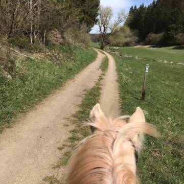
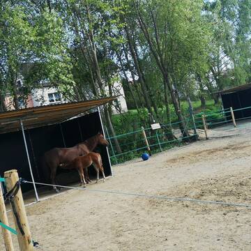
Hof Klein
Dahlem
Hof-Klein
@Hof-Klein
FN-Mitglied
Freizeitstall
Vermieten
Hunde willkommen
Krankenbox
Allergikerstall
Hufrehe geeignet
29 weitere...
P+
Deprecated: Creation of dynamic property Zend_View_Helper_Ads::$adLink is deprecated in /var/www/stall-frei/htdocs/staging.stall-frei.de/library/Psf/View/Helper/Ads.php on line 108

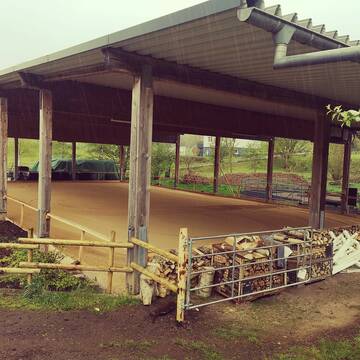
Gestüt Quarter-B51 / Offenstallreitanlage
Dahlem
Christina-Schneider
@Christina-Schneider
Freizeitstall
Pferdeausbildung
Vermieten
Krankenbox
Longierzirkel/Roundpen
Gnadenbrothof
Zuchtstutenhaltung möglich
18 weitere...
P


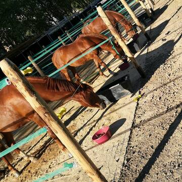
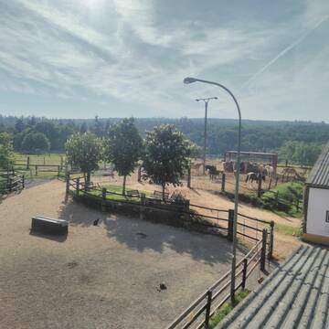
Pferdepension, Rentnerpferde willkommen
Blankenheim/Waldorf
Itzbacher-Hof
@Itzbacher-Hof
FN-Mitglied
Freizeitstall
Vermieten
Krankenbox
Paddock
Allergikerstall
Gnadenbrothof
24 weitere...
P+

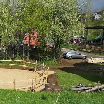
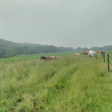
Reha-Zentrum für Pferde
Dreis-Brück
BRÜCKER MÜHLE Pferdereha
@BrueckerMuehle
FN-Mitglied
Freizeitstall
Vermieten
Führanlage
Hunde willkommen
Allergikerstall
bedampftes/gewaschenes Heu
36 weitere...
S

Offenstall für Pferde
Hellenthal, Ramscheid
Beate-Roemer
@Beate-Roemer
VFD-Mitglied
Wanderreiten
Vermieten
Longierzirkel/Roundpen
Paddock
Außenbox mit Paddock
Außenboxen
14 weitere...
P
Offenstall
Ripsdorf
Carmen-Naeve
@Carmen-Naeve
Freizeitstall
Hunde willkommen
Krankenbox
Notfallboxen
Offenstall
Paddock Trail
12 weitere...
ganz aktuell
P

Boxen frei
Blankenheim
Heinrichshof Blankenheim
@HeinrichshofBlankenheim
FN-Mitglied
Freizeitstall
Vermieten
Hunde willkommen
Krankenbox
bedampftes/gewaschenes Heu
28 weitere...
P

Job gesucht?
Mechtersen
STALL-FREIde Marketing
@STALL-FREI-Marketing
Sie suchen einen Job und arbeiten gerne mit Pferden oder auf Reitanlagen?
Besuchen Sie jetzt unseren Stellenmarkt!

HIT Aktivstall Rosenhof
Mechernich
Aktivstall-Rosenhof
@Aktivstall-Rosenhof
Fahrstall, Kutschwagen
Freizeitstall
Vermieten
Hunde willkommen
Krankenbox
Allergikerstall
bedampftes/gewaschenes Heu
30 weitere...
S
25 Jahre Pferdepension-St.-Rochus
Üxheim- Flesten
Liebenow-Angelika
@Liebenow-Angelika
Freizeitstall
Reitplatz (z.B. Dressur, Springen, Reining)
Sattelkammer/Sattelschränke
Gnadenbrothof
Innenbox
Offenstall
3 weitere...
P
Reitanlage Hubertushof
Kall-Keldenich
Reitanlage-Hubertushof
@Reitanlage-Hubertushof
FN-Mitglied
Freizeitstall
Hunde willkommen
Longierzirkel/Roundpen
Hengsthaltung möglich
Außenbox mit Paddock
Innenbox
22 weitere...
P
Deprecated: Creation of dynamic property Zend_View::$pageCount is deprecated in /var/www/stall-frei/htdocs/staging.stall-frei.de/library/vendor/shardj/zf1-future/library/Zend/View/Abstract.php on line 308
Deprecated: Creation of dynamic property Zend_View::$itemCountPerPage is deprecated in /var/www/stall-frei/htdocs/staging.stall-frei.de/library/vendor/shardj/zf1-future/library/Zend/View/Abstract.php on line 308
Deprecated: Creation of dynamic property Zend_View::$first is deprecated in /var/www/stall-frei/htdocs/staging.stall-frei.de/library/vendor/shardj/zf1-future/library/Zend/View/Abstract.php on line 308
Deprecated: Creation of dynamic property Zend_View::$current is deprecated in /var/www/stall-frei/htdocs/staging.stall-frei.de/library/vendor/shardj/zf1-future/library/Zend/View/Abstract.php on line 308
Deprecated: Creation of dynamic property Zend_View::$last is deprecated in /var/www/stall-frei/htdocs/staging.stall-frei.de/library/vendor/shardj/zf1-future/library/Zend/View/Abstract.php on line 308
Deprecated: Creation of dynamic property Zend_View::$next is deprecated in /var/www/stall-frei/htdocs/staging.stall-frei.de/library/vendor/shardj/zf1-future/library/Zend/View/Abstract.php on line 308
Deprecated: Creation of dynamic property Zend_View::$pagesInRange is deprecated in /var/www/stall-frei/htdocs/staging.stall-frei.de/library/vendor/shardj/zf1-future/library/Zend/View/Abstract.php on line 308
Deprecated: Creation of dynamic property Zend_View::$firstPageInRange is deprecated in /var/www/stall-frei/htdocs/staging.stall-frei.de/library/vendor/shardj/zf1-future/library/Zend/View/Abstract.php on line 308
Deprecated: Creation of dynamic property Zend_View::$lastPageInRange is deprecated in /var/www/stall-frei/htdocs/staging.stall-frei.de/library/vendor/shardj/zf1-future/library/Zend/View/Abstract.php on line 308
Deprecated: Creation of dynamic property Zend_View::$currentItemCount is deprecated in /var/www/stall-frei/htdocs/staging.stall-frei.de/library/vendor/shardj/zf1-future/library/Zend/View/Abstract.php on line 308
Deprecated: Creation of dynamic property Zend_View::$totalItemCount is deprecated in /var/www/stall-frei/htdocs/staging.stall-frei.de/library/vendor/shardj/zf1-future/library/Zend/View/Abstract.php on line 308
Deprecated: Creation of dynamic property Zend_View::$firstItemNumber is deprecated in /var/www/stall-frei/htdocs/staging.stall-frei.de/library/vendor/shardj/zf1-future/library/Zend/View/Abstract.php on line 308
Deprecated: Creation of dynamic property Zend_View::$lastItemNumber is deprecated in /var/www/stall-frei/htdocs/staging.stall-frei.de/library/vendor/shardj/zf1-future/library/Zend/View/Abstract.php on line 308
Deprecated: Creation of dynamic property Zend_View::$router is deprecated in /var/www/stall-frei/htdocs/staging.stall-frei.de/library/vendor/shardj/zf1-future/library/Zend/View/Abstract.php on line 308
Deprecated: Creation of dynamic property Zend_View::$urlParams is deprecated in /var/www/stall-frei/htdocs/staging.stall-frei.de/library/vendor/shardj/zf1-future/library/Zend/View/Abstract.php on line 308
Deprecated: Creation of dynamic property Zend_View::$showAds is deprecated in /var/www/stall-frei/htdocs/staging.stall-frei.de/library/vendor/shardj/zf1-future/library/Zend/View/Abstract.php on line 308
Deprecated: Creation of dynamic property Zend_View::$objectIds is deprecated in /var/www/stall-frei/htdocs/staging.stall-frei.de/library/vendor/shardj/zf1-future/library/Zend/View/Abstract.php on line 308
Deprecated: Creation of dynamic property Zend_View::$showNavbar is deprecated in /var/www/stall-frei/htdocs/staging.stall-frei.de/library/vendor/shardj/zf1-future/library/Zend/View/Abstract.php on line 308
Deprecated: Creation of dynamic property Zend_View::$showBreadcrumb is deprecated in /var/www/stall-frei/htdocs/staging.stall-frei.de/library/vendor/shardj/zf1-future/library/Zend/View/Abstract.php on line 308
Deprecated: Creation of dynamic property Zend_View::$showFooter is deprecated in /var/www/stall-frei/htdocs/staging.stall-frei.de/library/vendor/shardj/zf1-future/library/Zend/View/Abstract.php on line 308
Deprecated: Creation of dynamic property Zend_View::$showInternalAds is deprecated in /var/www/stall-frei/htdocs/staging.stall-frei.de/library/vendor/shardj/zf1-future/library/Zend/View/Abstract.php on line 308
Deprecated: Creation of dynamic property Zend_View::$blNoContent is deprecated in /var/www/stall-frei/htdocs/staging.stall-frei.de/library/vendor/shardj/zf1-future/library/Zend/View/Abstract.php on line 308
Deprecated: Creation of dynamic property Zend_View::$sMetaDesc is deprecated in /var/www/stall-frei/htdocs/staging.stall-frei.de/library/vendor/shardj/zf1-future/library/Zend/View/Abstract.php on line 308
Deprecated: Creation of dynamic property Zend_View::$useGmaps is deprecated in /var/www/stall-frei/htdocs/staging.stall-frei.de/library/vendor/shardj/zf1-future/library/Zend/View/Abstract.php on line 308
Deprecated: Creation of dynamic property Zend_View::$touches is deprecated in /var/www/stall-frei/htdocs/staging.stall-frei.de/library/vendor/shardj/zf1-future/library/Zend/View/Abstract.php on line 308
Deprecated: Creation of dynamic property Zend_View::$oProject is deprecated in /var/www/stall-frei/htdocs/staging.stall-frei.de/library/vendor/shardj/zf1-future/library/Zend/View/Abstract.php on line 308
Deprecated: Creation of dynamic property Zend_View::$pageHeadline is deprecated in /var/www/stall-frei/htdocs/staging.stall-frei.de/library/vendor/shardj/zf1-future/library/Zend/View/Abstract.php on line 308
Deprecated: Creation of dynamic property Zend_View::$disableLocationField is deprecated in /var/www/stall-frei/htdocs/staging.stall-frei.de/library/vendor/shardj/zf1-future/library/Zend/View/Abstract.php on line 308
Deprecated: Creation of dynamic property Zend_View::$isSearch is deprecated in /var/www/stall-frei/htdocs/staging.stall-frei.de/library/vendor/shardj/zf1-future/library/Zend/View/Abstract.php on line 308
Deprecated: Creation of dynamic property Zend_View::$pageTitle is deprecated in /var/www/stall-frei/htdocs/staging.stall-frei.de/library/vendor/shardj/zf1-future/library/Zend/View/Abstract.php on line 308
Deprecated: Creation of dynamic property Psf_Form_Element_Text::$class is deprecated in /var/www/stall-frei/htdocs/staging.stall-frei.de/library/vendor/shardj/zf1-future/library/Zend/Form/Element.php on line 874
Deprecated: Creation of dynamic property Psf_Form_Element_Text::$size is deprecated in /var/www/stall-frei/htdocs/staging.stall-frei.de/library/vendor/shardj/zf1-future/library/Zend/Form/Element.php on line 874
Deprecated: Creation of dynamic property Psf_Form_Element_Text::$placeholder is deprecated in /var/www/stall-frei/htdocs/staging.stall-frei.de/library/vendor/shardj/zf1-future/library/Zend/Form/Element.php on line 874
Deprecated: Creation of dynamic property Psf_Form_Element_Hidden::$class is deprecated in /var/www/stall-frei/htdocs/staging.stall-frei.de/library/vendor/shardj/zf1-future/library/Zend/Form/Element.php on line 874
Deprecated: Creation of dynamic property Psf_Form_Element_Hidden::$class is deprecated in /var/www/stall-frei/htdocs/staging.stall-frei.de/library/vendor/shardj/zf1-future/library/Zend/Form/Element.php on line 874
Deprecated: Creation of dynamic property Psf_Form_Element_Hidden::$class is deprecated in /var/www/stall-frei/htdocs/staging.stall-frei.de/library/vendor/shardj/zf1-future/library/Zend/Form/Element.php on line 874
Deprecated: Creation of dynamic property Psf_Form_Element_Hidden::$class is deprecated in /var/www/stall-frei/htdocs/staging.stall-frei.de/library/vendor/shardj/zf1-future/library/Zend/Form/Element.php on line 874
Deprecated: Creation of dynamic property Psf_Form_Element_Select::$class is deprecated in /var/www/stall-frei/htdocs/staging.stall-frei.de/library/vendor/shardj/zf1-future/library/Zend/Form/Element.php on line 874
Deprecated: Creation of dynamic property Psf_Form_Element_Select::$class is deprecated in /var/www/stall-frei/htdocs/staging.stall-frei.de/library/vendor/shardj/zf1-future/library/Zend/Form/Element.php on line 874
Deprecated: Creation of dynamic property Psf_Form_Element_Select::$class is deprecated in /var/www/stall-frei/htdocs/staging.stall-frei.de/library/vendor/shardj/zf1-future/library/Zend/Form/Element.php on line 874
Deprecated: Creation of dynamic property Psf_Form_Element_Select::$class is deprecated in /var/www/stall-frei/htdocs/staging.stall-frei.de/library/vendor/shardj/zf1-future/library/Zend/Form/Element.php on line 874
Deprecated: Creation of dynamic property Psf_Form_Element_Text::$class is deprecated in /var/www/stall-frei/htdocs/staging.stall-frei.de/library/vendor/shardj/zf1-future/library/Zend/Form/Element.php on line 874
Deprecated: Creation of dynamic property Psf_Form_Element_Checkbox::$label is deprecated in /var/www/stall-frei/htdocs/staging.stall-frei.de/library/vendor/shardj/zf1-future/library/Zend/Form/Element.php on line 874
Deprecated: Creation of dynamic property Zend_View::$sort is deprecated in /var/www/stall-frei/htdocs/staging.stall-frei.de/library/vendor/shardj/zf1-future/library/Zend/View/Abstract.php on line 308
Deprecated: Creation of dynamic property Zend_View::$searchLocation is deprecated in /var/www/stall-frei/htdocs/staging.stall-frei.de/library/vendor/shardj/zf1-future/library/Zend/View/Abstract.php on line 308
Deprecated: Creation of dynamic property Zend_View::$locationHint is deprecated in /var/www/stall-frei/htdocs/staging.stall-frei.de/library/vendor/shardj/zf1-future/library/Zend/View/Abstract.php on line 308
Psf_GeoCoder_Abstract::getLocation: Ormont Get Location CachedOrLive
Psf_GeoCoder_Abstract::getCachedOrLive: Ormont
Psf_GeoCoder_OpenCageData::makeApiRequest: response:
Array
(
[documentation] => https://opencagedata.com/api
[licenses] => Array
(
[0] => Array
(
[name] => see attribution guide
[url] => https://opencagedata.com/credits
)
)
[results] => Array
(
[0] => Array
(
[bounds] => Array
(
[northeast] => Array
(
[lat] => 50.3426172
[lng] => 6.4849811
)
[southwest] => Array
(
[lat] => 50.2945401
[lng] => 6.4192848
)
)
[components] => Array
(
[ISO_3166-1_alpha-2] => DE
[ISO_3166-1_alpha-3] => DEU
[ISO_3166-2] => Array
(
[0] => DE-RP
)
[_category] => place
[_normalized_city] => Ormont
[_type] => village
[continent] => Europe
[country] => Deutschland
[country_code] => de
[county] => Landkreis Vulkaneifel
[municipality] => Gerolstein
[political_union] => European Union
[state] => Rheinland-Pfalz
[state_code] => RP
[village] => Ormont
)
[confidence] => 7
[formatted] => Ormont, Rheinland-Pfalz, Deutschland
[geometry] => Array
(
[lat] => 50.3297896
[lng] => 6.4435199
)
)
[1] => Array
(
[components] => Array
(
[ISO_3166-1_alpha-2] => FR
[ISO_3166-1_alpha-3] => FRA
[ISO_3166-2] => Array
(
[0] => FR-GES
[1] => FR-54
)
[_category] => place
[_normalized_city] => Gerbéviller
[_type] => place
[city] => Gerbéviller
[continent] => Europe
[country] => France
[country_code] => fr
[county] => Meurthe-et-Moselle
[local_authority] => Communauté de communes Meurthe, Mortagne, Moselle
[place] => Haut d'Ormont
[political_union] => European Union
[postcode] => 54830
[state] => Grand Est
[state_code] => GES
)
[confidence] => 3
[formatted] => Haut d'Ormont, 54830 Gerbéviller, France
[geometry] => Array
(
[lat] => 48.496342
[lng] => 6.524169
)
)
[2] => Array
(
[components] => Array
(
[ISO_3166-1_alpha-2] => FR
[ISO_3166-1_alpha-3] => FRA
[ISO_3166-2] => Array
(
[0] => FR-CVL
[1] => FR-37
)
[_category] => road
[_normalized_city] => Descartes
[_type] => road
[city] => Descartes
[continent] => Europe
[country] => France
[country_code] => fr
[county] => Indre-et-Loire
[local_authority] => Communauté de communes Loches Sud Touraine
[political_union] => European Union
[postcode] => 37160
[road] => L'Ormont
[state] => Centre-Val de Loire
[state_code] => CVL
)
[confidence] => 3
[formatted] => L'Ormont, 37160 Descartes, France
[geometry] => Array
(
[lat] => 46.973892
[lng] => 0.717467
)
)
[3] => Array
(
[components] => Array
(
[ISO_3166-1_alpha-2] => FR
[ISO_3166-1_alpha-3] => FRA
[ISO_3166-2] => Array
(
[0] => FR-GES
[1] => FR-88
)
[_category] => road
[_normalized_city] => Nayemont-les-Fosses
[_type] => road
[city] => Nayemont-les-Fosses
[continent] => Europe
[country] => France
[country_code] => fr
[county] => Vosges
[local_authority] => Communauté d'agglomération de Saint-Dié-des-Vosges
[political_union] => European Union
[postcode] => 88100
[road] => Route de l'Ormont
[state] => Grand Est
[state_code] => GES
)
[confidence] => 3
[formatted] => Route de l'Ormont, 88100 Nayemont-les-Fosses, France
[geometry] => Array
(
[lat] => 48.294072
[lng] => 6.984116
)
)
[4] => Array
(
[components] => Array
(
[ISO_3166-1_alpha-2] => FR
[ISO_3166-1_alpha-3] => FRA
[ISO_3166-2] => Array
(
[0] => FR-GES
[1] => FR-88
)
[_category] => road
[_normalized_city] => Tendon
[_type] => road
[city] => Tendon
[continent] => Europe
[country] => France
[country_code] => fr
[county] => Vosges
[local_authority] => Communauté de communes des Hautes-Vosges
[political_union] => European Union
[postcode] => 88460
[road] => Chemin de l’Ormont
[state] => Grand Est
[state_code] => GES
)
[confidence] => 3
[formatted] => Chemin de l’Ormont, 88460 Tendon, France
[geometry] => Array
(
[lat] => 48.12725
[lng] => 6.692827
)
)
[5] => Array
(
[components] => Array
(
[ISO_3166-1_alpha-2] => FR
[ISO_3166-1_alpha-3] => FRA
[ISO_3166-2] => Array
(
[0] => FR-BFC
[1] => FR-25
)
[_category] => road
[_normalized_city] => Laviron
[_type] => road
[city] => Laviron
[continent] => Europe
[country] => France
[country_code] => fr
[county] => Doubs
[local_authority] => Communauté de communes des Portes du Haut-Doubs
[political_union] => European Union
[postcode] => 25510
[road] => Route d’Ormont
[state] => Bourgogne-Franche-Comté
[state_code] => BFC
)
[confidence] => 3
[formatted] => Route d’Ormont, 25510 Laviron, France
[geometry] => Array
(
[lat] => 47.259227
[lng] => 6.529638
)
)
[6] => Array
(
[components] => Array
(
[ISO_3166-1_alpha-2] => FR
[ISO_3166-1_alpha-3] => FRA
[ISO_3166-2] => Array
(
[0] => FR-GES
[1] => FR-88
)
[_category] => road
[_normalized_city] => Saint-Dié-des-Vosges
[_type] => road
[city] => Saint-Dié-des-Vosges
[continent] => Europe
[country] => France
[country_code] => fr
[county] => Vosges
[local_authority] => Communauté d'agglomération de Saint-Dié-des-Vosges
[political_union] => European Union
[postcode] => 88100
[road] => Rue d'Ormont
[state] => Grand Est
[state_code] => GES
)
[confidence] => 3
[formatted] => Rue d'Ormont, 88100 Saint-Dié-des-Vosges, France
[geometry] => Array
(
[lat] => 48.289329
[lng] => 6.959041
)
)
[7] => Array
(
[components] => Array
(
[ISO_3166-1_alpha-2] => FR
[ISO_3166-1_alpha-3] => FRA
[ISO_3166-2] => Array
(
[0] => FR-GES
[1] => FR-88
)
[_category] => road
[_normalized_city] => Ban-de-Sapt
[_type] => road
[city] => Ban-de-Sapt
[continent] => Europe
[country] => France
[country_code] => fr
[county] => Vosges
[local_authority] => Communauté d'agglomération de Saint-Dié-des-Vosges
[political_union] => European Union
[postcode] => 88210
[road] => Route de Saint-jean-d'Ormont
[state] => Grand Est
[state_code] => GES
)
[confidence] => 3
[formatted] => Route de Saint-jean-d'Ormont, 88210 Ban-de-Sapt, France
[geometry] => Array
(
[lat] => 48.341627
[lng] => 7.011918
)
)
[8] => Array
(
[components] => Array
(
[ISO_3166-1_alpha-2] => FR
[ISO_3166-1_alpha-3] => FRA
[ISO_3166-2] => Array
(
[0] => FR-GES
[1] => FR-88
)
[_category] => road
[_normalized_city] => Denipaire
[_type] => road
[city] => Denipaire
[continent] => Europe
[country] => France
[country_code] => fr
[county] => Vosges
[local_authority] => Communauté d'agglomération de Saint-Dié-des-Vosges
[political_union] => European Union
[postcode] => 88210
[road] => Route de Saint-jean d'Ormont
[state] => Grand Est
[state_code] => GES
)
[confidence] => 2
[formatted] => Route de Saint-jean d'Ormont, 88210 Denipaire, France
[geometry] => Array
(
[lat] => 48.343703
[lng] => 6.968416
)
)
[9] => Array
(
[components] => Array
(
[ISO_3166-1_alpha-2] => FR
[ISO_3166-1_alpha-3] => FRA
[ISO_3166-2] => Array
(
[0] => FR-GES
[1] => FR-54
)
[_category] => road
[_normalized_city] => Gerbéviller
[_type] => road
[city] => Gerbéviller
[continent] => Europe
[country] => France
[country_code] => fr
[county] => Meurthe-et-Moselle
[local_authority] => Communauté de communes Meurthe, Mortagne, Moselle
[political_union] => European Union
[postcode] => 54830
[road] => Chemin d'Ormont
[state] => Grand Est
[state_code] => GES
)
[confidence] => 2
[formatted] => Chemin d'Ormont, 54830 Gerbéviller, France
[geometry] => Array
(
[lat] => 48.496285
[lng] => 6.524106
)
)
)
[status] => Array
(
[code] => 200
[message] => OK
)
[stay_informed] => Array
(
[blog] => https://blog.opencagedata.com
[mastodon] => https://en.osm.town/@opencage
)
[thanks] => For using an OpenCage API
[timestamp] => Array
(
[created_http] => Sun, 08 Feb 2026 05:15:38 GMT
[created_unix] => 1770527738
)
[total_results] => 10
)
Psf_GeoCoder_Abstract::convertLocationResult
{"documentation":"https:\/\/opencagedata.com\/api","licenses":[{"name":"see attribution guide","url":"https:\/\/opencagedata.com\/credits"}],"results":[{"bounds":{"northeast":{"lat":50.3426172,"lng":6.4849811},"southwest":{"lat":50.2945401,"lng":6.4192848}},"components":{"ISO_3166-1_alpha-2":"DE","ISO_3166-1_alpha-3":"DEU","ISO_3166-2":["DE-RP"],"_category":"place","_normalized_city":"Ormont","_type":"village","continent":"Europe","country":"Deutschland","country_code":"de","county":"Landkreis Vulkaneifel","municipality":"Gerolstein","political_union":"European Union","state":"Rheinland-Pfalz","state_code":"RP","village":"Ormont"},"confidence":7,"formatted":"Ormont, Rheinland-Pfalz, Deutschland","geometry":{"lat":50.3297896,"lng":6.4435199}},{"components":{"ISO_3166-1_alpha-2":"FR","ISO_3166-1_alpha-3":"FRA","ISO_3166-2":["FR-GES","FR-54"],"_category":"place","_normalized_city":"Gerb\u00e9viller","_type":"place","city":"Gerb\u00e9viller","continent":"Europe","country":"France","country_code":"fr","county":"Meurthe-et-Moselle","local_authority":"Communaut\u00e9 de communes Meurthe, Mortagne, Moselle","place":"Haut d'Ormont","political_union":"European Union","postcode":"54830","state":"Grand Est","state_code":"GES"},"confidence":3,"formatted":"Haut d'Ormont, 54830 Gerb\u00e9viller, France","geometry":{"lat":48.496342,"lng":6.524169}},{"components":{"ISO_3166-1_alpha-2":"FR","ISO_3166-1_alpha-3":"FRA","ISO_3166-2":["FR-CVL","FR-37"],"_category":"road","_normalized_city":"Descartes","_type":"road","city":"Descartes","continent":"Europe","country":"France","country_code":"fr","county":"Indre-et-Loire","local_authority":"Communaut\u00e9 de communes Loches Sud Touraine","political_union":"European Union","postcode":"37160","road":"L'Ormont","state":"Centre-Val de Loire","state_code":"CVL"},"confidence":3,"formatted":"L'Ormont, 37160 Descartes, France","geometry":{"lat":46.973892,"lng":0.717467}},{"components":{"ISO_3166-1_alpha-2":"FR","ISO_3166-1_alpha-3":"FRA","ISO_3166-2":["FR-GES","FR-88"],"_category":"road","_normalized_city":"Nayemont-les-Fosses","_type":"road","city":"Nayemont-les-Fosses","continent":"Europe","country":"France","country_code":"fr","county":"Vosges","local_authority":"Communaut\u00e9 d'agglom\u00e9ration de Saint-Di\u00e9-des-Vosges","political_union":"European Union","postcode":"88100","road":"Route de l'Ormont","state":"Grand Est","state_code":"GES"},"confidence":3,"formatted":"Route de l'Ormont, 88100 Nayemont-les-Fosses, France","geometry":{"lat":48.294072,"lng":6.984116}},{"components":{"ISO_3166-1_alpha-2":"FR","ISO_3166-1_alpha-3":"FRA","ISO_3166-2":["FR-GES","FR-88"],"_category":"road","_normalized_city":"Tendon","_type":"road","city":"Tendon","continent":"Europe","country":"France","country_code":"fr","county":"Vosges","local_authority":"Communaut\u00e9 de communes des Hautes-Vosges","political_union":"European Union","postcode":"88460","road":"Chemin de l\u2019Ormont","state":"Grand Est","state_code":"GES"},"confidence":3,"formatted":"Chemin de l\u2019Ormont, 88460 Tendon, France","geometry":{"lat":48.12725,"lng":6.692827}},{"components":{"ISO_3166-1_alpha-2":"FR","ISO_3166-1_alpha-3":"FRA","ISO_3166-2":["FR-BFC","FR-25"],"_category":"road","_normalized_city":"Laviron","_type":"road","city":"Laviron","continent":"Europe","country":"France","country_code":"fr","county":"Doubs","local_authority":"Communaut\u00e9 de communes des Portes du Haut-Doubs","political_union":"European Union","postcode":"25510","road":"Route d\u2019Ormont","state":"Bourgogne-Franche-Comt\u00e9","state_code":"BFC"},"confidence":3,"formatted":"Route d\u2019Ormont, 25510 Laviron, France","geometry":{"lat":47.259227,"lng":6.529638}},{"components":{"ISO_3166-1_alpha-2":"FR","ISO_3166-1_alpha-3":"FRA","ISO_3166-2":["FR-GES","FR-88"],"_category":"road","_normalized_city":"Saint-Di\u00e9-des-Vosges","_type":"road","city":"Saint-Di\u00e9-des-Vosges","continent":"Europe","country":"France","country_code":"fr","county":"Vosges","local_authority":"Communaut\u00e9 d'agglom\u00e9ration de Saint-Di\u00e9-des-Vosges","political_union":"European Union","postcode":"88100","road":"Rue d'Ormont","state":"Grand Est","state_code":"GES"},"confidence":3,"formatted":"Rue d'Ormont, 88100 Saint-Di\u00e9-des-Vosges, France","geometry":{"lat":48.289329,"lng":6.959041}},{"components":{"ISO_3166-1_alpha-2":"FR","ISO_3166-1_alpha-3":"FRA","ISO_3166-2":["FR-GES","FR-88"],"_category":"road","_normalized_city":"Ban-de-Sapt","_type":"road","city":"Ban-de-Sapt","continent":"Europe","country":"France","country_code":"fr","county":"Vosges","local_authority":"Communaut\u00e9 d'agglom\u00e9ration de Saint-Di\u00e9-des-Vosges","political_union":"European Union","postcode":"88210","road":"Route de Saint-jean-d'Ormont","state":"Grand Est","state_code":"GES"},"confidence":3,"formatted":"Route de Saint-jean-d'Ormont, 88210 Ban-de-Sapt, France","geometry":{"lat":48.341627,"lng":7.011918}},{"components":{"ISO_3166-1_alpha-2":"FR","ISO_3166-1_alpha-3":"FRA","ISO_3166-2":["FR-GES","FR-88"],"_category":"road","_normalized_city":"Denipaire","_type":"road","city":"Denipaire","continent":"Europe","country":"France","country_code":"fr","county":"Vosges","local_authority":"Communaut\u00e9 d'agglom\u00e9ration de Saint-Di\u00e9-des-Vosges","political_union":"European Union","postcode":"88210","road":"Route de Saint-jean d'Ormont","state":"Grand Est","state_code":"GES"},"confidence":2,"formatted":"Route de Saint-jean d'Ormont, 88210 Denipaire, France","geometry":{"lat":48.343703,"lng":6.968416}},{"components":{"ISO_3166-1_alpha-2":"FR","ISO_3166-1_alpha-3":"FRA","ISO_3166-2":["FR-GES","FR-54"],"_category":"road","_normalized_city":"Gerb\u00e9viller","_type":"road","city":"Gerb\u00e9viller","continent":"Europe","country":"France","country_code":"fr","county":"Meurthe-et-Moselle","local_authority":"Communaut\u00e9 de communes Meurthe, Mortagne, Moselle","political_union":"European Union","postcode":"54830","road":"Chemin d'Ormont","state":"Grand Est","state_code":"GES"},"confidence":2,"formatted":"Chemin d'Ormont, 54830 Gerb\u00e9viller, France","geometry":{"lat":48.496285,"lng":6.524106}}],"status":{"code":200,"message":"OK"},"stay_informed":{"blog":"https:\/\/blog.opencagedata.com","mastodon":"https:\/\/en.osm.town\/@opencage"},"thanks":"For using an OpenCage API","timestamp":{"created_http":"Sun, 08 Feb 2026 05:15:38 GMT","created_unix":1770527738},"total_results":10}Array
(
[0] => stdClass Object
(
[bounds] => stdClass Object
(
[northeast] => stdClass Object
(
[lat] => 50.3426172
[lng] => 6.4849811
)
[southwest] => stdClass Object
(
[lat] => 50.2945401
[lng] => 6.4192848
)
)
[components] => stdClass Object
(
[ISO_3166-1_alpha-2] => DE
[ISO_3166-1_alpha-3] => DEU
[ISO_3166-2] => Array
(
[0] => DE-RP
)
[_category] => place
[_normalized_city] => Ormont
[_type] => village
[continent] => Europe
[country] => Deutschland
[country_code] => de
[county] => Landkreis Vulkaneifel
[municipality] => Gerolstein
[political_union] => European Union
[state] => Rheinland-Pfalz
[state_code] => RP
[village] => Ormont
)
[confidence] => 7
[formatted] => Ormont, Rheinland-Pfalz, Deutschland
[geometry] => stdClass Object
(
[lat] => 50.3297896
[lng] => 6.4435199
)
)
[1] => stdClass Object
(
[components] => stdClass Object
(
[ISO_3166-1_alpha-2] => FR
[ISO_3166-1_alpha-3] => FRA
[ISO_3166-2] => Array
(
[0] => FR-GES
[1] => FR-54
)
[_category] => place
[_normalized_city] => Gerbéviller
[_type] => place
[city] => Gerbéviller
[continent] => Europe
[country] => France
[country_code] => fr
[county] => Meurthe-et-Moselle
[local_authority] => Communauté de communes Meurthe, Mortagne, Moselle
[place] => Haut d'Ormont
[political_union] => European Union
[postcode] => 54830
[state] => Grand Est
[state_code] => GES
)
[confidence] => 3
[formatted] => Haut d'Ormont, 54830 Gerbéviller, France
[geometry] => stdClass Object
(
[lat] => 48.496342
[lng] => 6.524169
)
)
[2] => stdClass Object
(
[components] => stdClass Object
(
[ISO_3166-1_alpha-2] => FR
[ISO_3166-1_alpha-3] => FRA
[ISO_3166-2] => Array
(
[0] => FR-CVL
[1] => FR-37
)
[_category] => road
[_normalized_city] => Descartes
[_type] => road
[city] => Descartes
[continent] => Europe
[country] => France
[country_code] => fr
[county] => Indre-et-Loire
[local_authority] => Communauté de communes Loches Sud Touraine
[political_union] => European Union
[postcode] => 37160
[road] => L'Ormont
[state] => Centre-Val de Loire
[state_code] => CVL
)
[confidence] => 3
[formatted] => L'Ormont, 37160 Descartes, France
[geometry] => stdClass Object
(
[lat] => 46.973892
[lng] => 0.717467
)
)
[3] => stdClass Object
(
[components] => stdClass Object
(
[ISO_3166-1_alpha-2] => FR
[ISO_3166-1_alpha-3] => FRA
[ISO_3166-2] => Array
(
[0] => FR-GES
[1] => FR-88
)
[_category] => road
[_normalized_city] => Nayemont-les-Fosses
[_type] => road
[city] => Nayemont-les-Fosses
[continent] => Europe
[country] => France
[country_code] => fr
[county] => Vosges
[local_authority] => Communauté d'agglomération de Saint-Dié-des-Vosges
[political_union] => European Union
[postcode] => 88100
[road] => Route de l'Ormont
[state] => Grand Est
[state_code] => GES
)
[confidence] => 3
[formatted] => Route de l'Ormont, 88100 Nayemont-les-Fosses, France
[geometry] => stdClass Object
(
[lat] => 48.294072
[lng] => 6.984116
)
)
[4] => stdClass Object
(
[components] => stdClass Object
(
[ISO_3166-1_alpha-2] => FR
[ISO_3166-1_alpha-3] => FRA
[ISO_3166-2] => Array
(
[0] => FR-GES
[1] => FR-88
)
[_category] => road
[_normalized_city] => Tendon
[_type] => road
[city] => Tendon
[continent] => Europe
[country] => France
[country_code] => fr
[county] => Vosges
[local_authority] => Communauté de communes des Hautes-Vosges
[political_union] => European Union
[postcode] => 88460
[road] => Chemin de l’Ormont
[state] => Grand Est
[state_code] => GES
)
[confidence] => 3
[formatted] => Chemin de l’Ormont, 88460 Tendon, France
[geometry] => stdClass Object
(
[lat] => 48.12725
[lng] => 6.692827
)
)
[5] => stdClass Object
(
[components] => stdClass Object
(
[ISO_3166-1_alpha-2] => FR
[ISO_3166-1_alpha-3] => FRA
[ISO_3166-2] => Array
(
[0] => FR-BFC
[1] => FR-25
)
[_category] => road
[_normalized_city] => Laviron
[_type] => road
[city] => Laviron
[continent] => Europe
[country] => France
[country_code] => fr
[county] => Doubs
[local_authority] => Communauté de communes des Portes du Haut-Doubs
[political_union] => European Union
[postcode] => 25510
[road] => Route d’Ormont
[state] => Bourgogne-Franche-Comté
[state_code] => BFC
)
[confidence] => 3
[formatted] => Route d’Ormont, 25510 Laviron, France
[geometry] => stdClass Object
(
[lat] => 47.259227
[lng] => 6.529638
)
)
[6] => stdClass Object
(
[components] => stdClass Object
(
[ISO_3166-1_alpha-2] => FR
[ISO_3166-1_alpha-3] => FRA
[ISO_3166-2] => Array
(
[0] => FR-GES
[1] => FR-88
)
[_category] => road
[_normalized_city] => Saint-Dié-des-Vosges
[_type] => road
[city] => Saint-Dié-des-Vosges
[continent] => Europe
[country] => France
[country_code] => fr
[county] => Vosges
[local_authority] => Communauté d'agglomération de Saint-Dié-des-Vosges
[political_union] => European Union
[postcode] => 88100
[road] => Rue d'Ormont
[state] => Grand Est
[state_code] => GES
)
[confidence] => 3
[formatted] => Rue d'Ormont, 88100 Saint-Dié-des-Vosges, France
[geometry] => stdClass Object
(
[lat] => 48.289329
[lng] => 6.959041
)
)
[7] => stdClass Object
(
[components] => stdClass Object
(
[ISO_3166-1_alpha-2] => FR
[ISO_3166-1_alpha-3] => FRA
[ISO_3166-2] => Array
(
[0] => FR-GES
[1] => FR-88
)
[_category] => road
[_normalized_city] => Ban-de-Sapt
[_type] => road
[city] => Ban-de-Sapt
[continent] => Europe
[country] => France
[country_code] => fr
[county] => Vosges
[local_authority] => Communauté d'agglomération de Saint-Dié-des-Vosges
[political_union] => European Union
[postcode] => 88210
[road] => Route de Saint-jean-d'Ormont
[state] => Grand Est
[state_code] => GES
)
[confidence] => 3
[formatted] => Route de Saint-jean-d'Ormont, 88210 Ban-de-Sapt, France
[geometry] => stdClass Object
(
[lat] => 48.341627
[lng] => 7.011918
)
)
[8] => stdClass Object
(
[components] => stdClass Object
(
[ISO_3166-1_alpha-2] => FR
[ISO_3166-1_alpha-3] => FRA
[ISO_3166-2] => Array
(
[0] => FR-GES
[1] => FR-88
)
[_category] => road
[_normalized_city] => Denipaire
[_type] => road
[city] => Denipaire
[continent] => Europe
[country] => France
[country_code] => fr
[county] => Vosges
[local_authority] => Communauté d'agglomération de Saint-Dié-des-Vosges
[political_union] => European Union
[postcode] => 88210
[road] => Route de Saint-jean d'Ormont
[state] => Grand Est
[state_code] => GES
)
[confidence] => 2
[formatted] => Route de Saint-jean d'Ormont, 88210 Denipaire, France
[geometry] => stdClass Object
(
[lat] => 48.343703
[lng] => 6.968416
)
)
[9] => stdClass Object
(
[components] => stdClass Object
(
[ISO_3166-1_alpha-2] => FR
[ISO_3166-1_alpha-3] => FRA
[ISO_3166-2] => Array
(
[0] => FR-GES
[1] => FR-54
)
[_category] => road
[_normalized_city] => Gerbéviller
[_type] => road
[city] => Gerbéviller
[continent] => Europe
[country] => France
[country_code] => fr
[county] => Meurthe-et-Moselle
[local_authority] => Communauté de communes Meurthe, Mortagne, Moselle
[political_union] => European Union
[postcode] => 54830
[road] => Chemin d'Ormont
[state] => Grand Est
[state_code] => GES
)
[confidence] => 2
[formatted] => Chemin d'Ormont, 54830 Gerbéviller, France
[geometry] => stdClass Object
(
[lat] => 48.496285
[lng] => 6.524106
)
)
)
Psf_GeoCoder_OpenCageData::getKeyMap: 0
stdClass Object
(
    [bounds] => stdClass Object
        (
            [northeast] => stdClass Object
                (
                    [lat] => 50.3426172
                    [lng] => 6.4849811
                )

            [southwest] => stdClass Object
                (
                    [lat] => 50.2945401
                    [lng] => 6.4192848
                )

        )

    [components] => stdClass Object
        (
            [ISO_3166-1_alpha-2] => DE
            [ISO_3166-1_alpha-3] => DEU
            [ISO_3166-2] => Array
                (
                    [0] => DE-RP
                )

            [_category] => place
            [_normalized_city] => Ormont
            [_type] => village
            [continent] => Europe
            [country] => Deutschland
            [country_code] => de
            [county] => Landkreis Vulkaneifel
            [municipality] => Gerolstein
            [political_union] => European Union
            [state] => Rheinland-Pfalz
            [state_code] => RP
            [village] => Ormont
        )

    [confidence] => 7
    [formatted] => Ormont, Rheinland-Pfalz, Deutschland
    [geometry] => stdClass Object
        (
            [lat] => 50.3297896
            [lng] => 6.4435199
        )

)
Psf_GeoCoder_OpenCageData::getCounty: Vulkaneifel
Psf_GeoCoder_OpenCageData::addMissingData REFETCH!
Array
(
    [address] => Ormont, Rheinland-Pfalz, Deutschland
    [type] => village
    [street] =>
    [city] => Ormont
    [county] => Vulkaneifel
    [state] => Rheinland-Pfalz
    [zip] =>
    [country] => Deutschland
    [suburb] =>
    [countrycode] => de
    [latitude] => 50.3297896
    [longitude] => 6.4435199
    [accuracy] => 1
    [confidence] => 7
    [bounds] => stdClass Object
        (
            [northeast] => stdClass Object
                (
                    [lat] => 50.3426172
                    [lng] => 6.4849811
                )

            [southwest] => stdClass Object
                (
                    [lat] => 50.2945401
                    [lng] => 6.4192848
                )

        )

)
reformat!
Array
(
    [address] => Ormont, Rheinland-Pfalz, Deutschland
    [type] => village
    [street] =>
    [city] => Ormont
    [county] => Vulkaneifel
    [state] => Rheinland-Pfalz
    [zip] =>
    [country] => Deutschland
    [suburb] =>
    [countrycode] => de
    [latitude] => 50.3297896
    [longitude] => 6.4435199
    [accuracy] => 1
    [confidence] => 7
    [bounds] => stdClass Object
        (
            [northeast] => stdClass Object
                (
                    [lat] => 50.3426172
                    [lng] => 6.4849811
                )

            [southwest] => stdClass Object
                (
                    [lat] => 50.2945401
                    [lng] => 6.4192848
                )

        )

    [place] => Ormont, Rheinland-Pfalz
    [hash] => df1f36a10a1b14176d5cbeea83e4e516
)
Psf_GeoCoder_OpenCageData::getKeyMap: 1
stdClass Object
(
    [components] => stdClass Object
        (
            [ISO_3166-1_alpha-2] => FR
            [ISO_3166-1_alpha-3] => FRA
            [ISO_3166-2] => Array
                (
                    [0] => FR-GES
                    [1] => FR-54
                )

            [_category] => place
            [_normalized_city] => Gerbéviller
            [_type] => place
            [city] => Gerbéviller
            [continent] => Europe
            [country] => France
            [country_code] => fr
            [county] => Meurthe-et-Moselle
            [local_authority] => Communauté de communes Meurthe, Mortagne, Moselle
            [place] => Haut d'Ormont
            [political_union] => European Union
            [postcode] => 54830
            [state] => Grand Est
            [state_code] => GES
        )

    [confidence] => 3
    [formatted] => Haut d'Ormont, 54830 Gerbéviller, France
    [geometry] => stdClass Object
        (
            [lat] => 48.496342
            [lng] => 6.524169
        )

)
Psf_GeoCoder_OpenCageData::getCounty: Meurthe-et-Moselle
Psf_GeoCoder_OpenCageData::addMissingData REFETCH!
Array
(
    [address] => Haut d'Ormont, 54830 Gerbéviller, France
    [type] => place
    [street] =>
    [city] => Gerbéviller
    [county] => Meurthe-et-Moselle
    [state] => Grand Est
    [zip] => 54830
    [country] => France
    [suburb] =>
    [countrycode] => fr
    [latitude] => 48.496342
    [longitude] => 6.524169
    [accuracy] => 1
    [confidence] => 3
    [bounds] =>
)
reformat!
Array
(
    [address] => Haut d'Ormont, 54830 Gerbéviller, France
    [type] => place
    [street] =>
    [city] => Gerbéviller
    [county] => Meurthe-et-Moselle
    [state] => Grand Est
    [zip] => 54830
    [country] => France
    [suburb] =>
    [countrycode] => fr
    [latitude] => 48.496342
    [longitude] => 6.524169
    [accuracy] => 1
    [confidence] => 3
    [bounds] =>
    [place] => 54830 Gerbéviller, Grand Est
    [hash] => de6e35027d1eef51662ee15d8671407f
)
Psf_GeoCoder_OpenCageData::getKeyMap: 2
stdClass Object
(
    [components] => stdClass Object
        (
            [ISO_3166-1_alpha-2] => FR
            [ISO_3166-1_alpha-3] => FRA
            [ISO_3166-2] => Array
                (
                    [0] => FR-CVL
                    [1] => FR-37
                )

            [_category] => road
            [_normalized_city] => Descartes
            [_type] => road
            [city] => Descartes
            [continent] => Europe
            [country] => France
            [country_code] => fr
            [county] => Indre-et-Loire
            [local_authority] => Communauté de communes Loches Sud Touraine
            [political_union] => European Union
            [postcode] => 37160
            [road] => L'Ormont
            [state] => Centre-Val de Loire
            [state_code] => CVL
        )

    [confidence] => 3
    [formatted] => L'Ormont, 37160 Descartes, France
    [geometry] => stdClass Object
        (
            [lat] => 46.973892
            [lng] => 0.717467
        )

)
Psf_GeoCoder_OpenCageData::getCounty: Indre-et-Loire
Psf_GeoCoder_OpenCageData::addMissingData REFETCH!
Array
(
    [address] => L'Ormont, 37160 Descartes, France
    [type] => road
    [street] => L'Ormont
    [city] => Descartes
    [county] => Indre-et-Loire
    [state] => Centre-Val de Loire
    [zip] => 37160
    [country] => France
    [suburb] =>
    [countrycode] => fr
    [latitude] => 46.973892
    [longitude] => 0.717467
    [accuracy] => 1
    [confidence] => 3
    [bounds] =>
)
reformat!
Array
(
    [address] => L'Ormont, 37160 Descartes, France
    [type] => road
    [street] => L'Ormont
    [city] => Descartes
    [county] => Indre-et-Loire
    [state] => Centre-Val de Loire
    [zip] => 37160
    [country] => France
    [suburb] =>
    [countrycode] => fr
    [latitude] => 46.973892
    [longitude] => 0.717467
    [accuracy] => 1
    [confidence] => 3
    [bounds] =>
    [place] => L'Ormont, 37160 Descartes, Centre-Val de Loire
    [hash] => d5407a9b9719adcac27f1f520faae0c5
)
Psf_GeoCoder_OpenCageData::getKeyMap: 3
stdClass Object
(
    [components] => stdClass Object
        (
            [ISO_3166-1_alpha-2] => FR
            [ISO_3166-1_alpha-3] => FRA
            [ISO_3166-2] => Array
                (
                    [0] => FR-GES
                    [1] => FR-88
                )

            [_category] => road
            [_normalized_city] => Nayemont-les-Fosses
            [_type] => road
            [city] => Nayemont-les-Fosses
            [continent] => Europe
            [country] => France
            [country_code] => fr
            [county] => Vosges
            [local_authority] => Communauté d'agglomération de Saint-Dié-des-Vosges
            [political_union] => European Union
            [postcode] => 88100
            [road] => Route de l'Ormont
            [state] => Grand Est
            [state_code] => GES
        )

    [confidence] => 3
    [formatted] => Route de l'Ormont, 88100 Nayemont-les-Fosses, France
    [geometry] => stdClass Object
        (
            [lat] => 48.294072
            [lng] => 6.984116
        )

)
Psf_GeoCoder_OpenCageData::getCounty: Vosges
Psf_GeoCoder_OpenCageData::addMissingData REFETCH!
Array
(
    [address] => Route de l'Ormont, 88100 Nayemont-les-Fosses, France
    [type] => road
    [street] => Route de l'Ormont
    [city] => Nayemont-les-Fosses
    [county] => Vosges
    [state] => Grand Est
    [zip] => 88100
    [country] => France
    [suburb] =>
    [countrycode] => fr
    [latitude] => 48.294072
    [longitude] => 6.984116
    [accuracy] => 1
    [confidence] => 3
    [bounds] =>
)
reformat!
Array
(
    [address] => Route de l'Ormont, 88100 Nayemont-les-Fosses, France
    [type] => road
    [street] => Route de l'Ormont
    [city] => Nayemont-les-Fosses
    [county] => Vosges
    [state] => Grand Est
    [zip] => 88100
    [country] => France
    [suburb] =>
    [countrycode] => fr
    [latitude] => 48.294072
    [longitude] => 6.984116
    [accuracy] => 1
    [confidence] => 3
    [bounds] =>
    [place] => Route de l'Ormont, 88100 Nayemont-les-Fosses, Grand Est
    [hash] => c91bd40a6eee7e2c67bbbf29406871a6
)
Psf_GeoCoder_OpenCageData::getKeyMap: 4
stdClass Object
(
    [components] => stdClass Object
        (
            [ISO_3166-1_alpha-2] => FR
            [ISO_3166-1_alpha-3] => FRA
            [ISO_3166-2] => Array
                (
                    [0] => FR-GES
                    [1] => FR-88
                )

            [_category] => road
            [_normalized_city] => Tendon
            [_type] => road
            [city] => Tendon
            [continent] => Europe
            [country] => France
            [country_code] => fr
            [county] => Vosges
            [local_authority] => Communauté de communes des Hautes-Vosges
            [political_union] => European Union
            [postcode] => 88460
            [road] => Chemin de l’Ormont
            [state] => Grand Est
            [state_code] => GES
        )

    [confidence] => 3
    [formatted] => Chemin de l’Ormont, 88460 Tendon, France
    [geometry] => stdClass Object
        (
            [lat] => 48.12725
            [lng] => 6.692827
        )

)
Psf_GeoCoder_OpenCageData::getCounty: Vosges
Psf_GeoCoder_OpenCageData::addMissingData REFETCH!
Array
(
    [address] => Chemin de l’Ormont, 88460 Tendon, France
    [type] => road
    [street] => Chemin de l’Ormont
    [city] => Tendon
    [county] => Vosges
    [state] => Grand Est
    [zip] => 88460
    [country] => France
    [suburb] =>
    [countrycode] => fr
    [latitude] => 48.12725
    [longitude] => 6.692827
    [accuracy] => 1
    [confidence] => 3
    [bounds] =>
)
reformat!
Array
(
    [address] => Chemin de l’Ormont, 88460 Tendon, France
    [type] => road
    [street] => Chemin de l’Ormont
    [city] => Tendon
    [county] => Vosges
    [state] => Grand Est
    [zip] => 88460
    [country] => France
    [suburb] =>
    [countrycode] => fr
    [latitude] => 48.12725
    [longitude] => 6.692827
    [accuracy] => 1
    [confidence] => 3
    [bounds] =>
    [place] => Chemin de l’Ormont, 88460 Tendon, Grand Est
    [hash] => ea6c271e9a74c53341ffb91d796229ca
)
Psf_GeoCoder_OpenCageData::getKeyMap: 5
stdClass Object
(
    [components] => stdClass Object
        (
            [ISO_3166-1_alpha-2] => FR
            [ISO_3166-1_alpha-3] => FRA
            [ISO_3166-2] => Array
                (
                    [0] => FR-BFC
                    [1] => FR-25
                )

            [_category] => road
            [_normalized_city] => Laviron
            [_type] => road
            [city] => Laviron
            [continent] => Europe
            [country] => France
            [country_code] => fr
            [county] => Doubs
            [local_authority] => Communauté de communes des Portes du Haut-Doubs
            [political_union] => European Union
            [postcode] => 25510
            [road] => Route d’Ormont
            [state] => Bourgogne-Franche-Comté
            [state_code] => BFC
        )

    [confidence] => 3
    [formatted] => Route d’Ormont, 25510 Laviron, France
    [geometry] => stdClass Object
        (
            [lat] => 47.259227
            [lng] => 6.529638
        )

)
Psf_GeoCoder_OpenCageData::getCounty: Doubs
Psf_GeoCoder_OpenCageData::addMissingData REFETCH!
Array
(
    [address] => Route d’Ormont, 25510 Laviron, France
    [type] => road
    [street] => Route d’Ormont
    [city] => Laviron
    [county] => Doubs
    [state] => Bourgogne-Franche-Comté
    [zip] => 25510
    [country] => France
    [suburb] =>
    [countrycode] => fr
    [latitude] => 47.259227
    [longitude] => 6.529638
    [accuracy] => 1
    [confidence] => 3
    [bounds] =>
)
reformat!
Array
(
    [address] => Route d’Ormont, 25510 Laviron, France
    [type] => road
    [street] => Route d’Ormont
    [city] => Laviron
    [county] => Doubs
    [state] => Bourgogne-Franche-Comté
    [zip] => 25510
    [country] => France
    [suburb] =>
    [countrycode] => fr
    [latitude] => 47.259227
    [longitude] => 6.529638
    [accuracy] => 1
    [confidence] => 3
    [bounds] =>
    [place] => Route d’Ormont, 25510 Laviron, Bourgogne-Franche-Comté
    [hash] => bf9487b6e7559244bf7e17fa1a4ccc9f
)
Psf_GeoCoder_OpenCageData::getKeyMap: 6
stdClass Object
(
    [components] => stdClass Object
        (
            [ISO_3166-1_alpha-2] => FR
            [ISO_3166-1_alpha-3] => FRA
            [ISO_3166-2] => Array
                (
                    [0] => FR-GES
                    [1] => FR-88
                )

            [_category] => road
            [_normalized_city] => Saint-Dié-des-Vosges
            [_type] => road
            [city] => Saint-Dié-des-Vosges
            [continent] => Europe
            [country] => France
            [country_code] => fr
            [county] => Vosges
            [local_authority] => Communauté d'agglomération de Saint-Dié-des-Vosges
            [political_union] => European Union
            [postcode] => 88100
            [road] => Rue d'Ormont
            [state] => Grand Est
            [state_code] => GES
        )

    [confidence] => 3
    [formatted] => Rue d'Ormont, 88100 Saint-Dié-des-Vosges, France
    [geometry] => stdClass Object
        (
            [lat] => 48.289329
            [lng] => 6.959041
        )

)
Psf_GeoCoder_OpenCageData::getCounty: Vosges
Psf_GeoCoder_OpenCageData::addMissingData REFETCH!
Array
(
    [address] => Rue d'Ormont, 88100 Saint-Dié-des-Vosges, France
    [type] => road
    [street] => Rue d'Ormont
    [city] => Saint-Dié-des-Vosges
    [county] => Vosges
    [state] => Grand Est
    [zip] => 88100
    [country] => France
    [suburb] =>
    [countrycode] => fr
    [latitude] => 48.289329
    [longitude] => 6.959041
    [accuracy] => 1
    [confidence] => 3
    [bounds] =>
)
reformat!
Array
(
    [address] => Rue d'Ormont, 88100 Saint-Dié-des-Vosges, France
    [type] => road
    [street] => Rue d'Ormont
    [city] => Saint-Dié-des-Vosges
    [county] => Vosges
    [state] => Grand Est
    [zip] => 88100
    [country] => France
    [suburb] =>
    [countrycode] => fr
    [latitude] => 48.289329
    [longitude] => 6.959041
    [accuracy] => 1
    [confidence] => 3
    [bounds] =>
    [place] => Rue d'Ormont, 88100 Saint-Dié-des-Vosges, Grand Est
    [hash] => d86e52d294113c65635d457869b56a86
)
Psf_GeoCoder_OpenCageData::getKeyMap: 7
stdClass Object
(
    [components] => stdClass Object
        (
            [ISO_3166-1_alpha-2] => FR
            [ISO_3166-1_alpha-3] => FRA
            [ISO_3166-2] => Array
                (
                    [0] => FR-GES
                    [1] => FR-88
                )

            [_category] => road
            [_normalized_city] => Ban-de-Sapt
            [_type] => road
            [city] => Ban-de-Sapt
            [continent] => Europe
            [country] => France
            [country_code] => fr
            [county] => Vosges
            [local_authority] => Communauté d'agglomération de Saint-Dié-des-Vosges
            [political_union] => European Union
            [postcode] => 88210
            [road] => Route de Saint-jean-d'Ormont
            [state] => Grand Est
            [state_code] => GES
        )

    [confidence] => 3
    [formatted] => Route de Saint-jean-d'Ormont, 88210 Ban-de-Sapt, France
    [geometry] => stdClass Object
        (
            [lat] => 48.341627
            [lng] => 7.011918
        )

)
Psf_GeoCoder_OpenCageData::getCounty: Vosges
Psf_GeoCoder_OpenCageData::addMissingData REFETCH!
Array
(
    [address] => Route de Saint-jean-d'Ormont, 88210 Ban-de-Sapt, France
    [type] => road
    [street] => Route de Saint-jean-d'Ormont
    [city] => Ban-de-Sapt
    [county] => Vosges
    [state] => Grand Est
    [zip] => 88210
    [country] => France
    [suburb] =>
    [countrycode] => fr
    [latitude] => 48.341627
    [longitude] => 7.011918
    [accuracy] => 1
    [confidence] => 3
    [bounds] =>
)
reformat!
Array
(
    [address] => Route de Saint-jean-d'Ormont, 88210 Ban-de-Sapt, France
    [type] => road
    [street] => Route de Saint-jean-d'Ormont
    [city] => Ban-de-Sapt
    [county] => Vosges
    [state] => Grand Est
    [zip] => 88210
    [country] => France
    [suburb] =>
    [countrycode] => fr
    [latitude] => 48.341627
    [longitude] => 7.011918
    [accuracy] => 1
    [confidence] => 3
    [bounds] =>
    [place] => Route de Saint-jean-d'Ormont, 88210 Ban-de-Sapt, Grand Est
    [hash] => a7b410a635c03c623e53ae156d312863
)
Psf_GeoCoder_OpenCageData::getKeyMap: 8
stdClass Object
(
    [components] => stdClass Object
        (
            [ISO_3166-1_alpha-2] => FR
            [ISO_3166-1_alpha-3] => FRA
            [ISO_3166-2] => Array
                (
                    [0] => FR-GES
                    [1] => FR-88
                )

            [_category] => road
            [_normalized_city] => Denipaire
            [_type] => road
            [city] => Denipaire
            [continent] => Europe
            [country] => France
            [country_code] => fr
            [county] => Vosges
            [local_authority] => Communauté d'agglomération de Saint-Dié-des-Vosges
            [political_union] => European Union
            [postcode] => 88210
            [road] => Route de Saint-jean d'Ormont
            [state] => Grand Est
            [state_code] => GES
        )

    [confidence] => 2
    [formatted] => Route de Saint-jean d'Ormont, 88210 Denipaire, France
    [geometry] => stdClass Object
        (
            [lat] => 48.343703
            [lng] => 6.968416
        )

)
Psf_GeoCoder_OpenCageData::getCounty: Vosges
Psf_GeoCoder_OpenCageData::addMissingData REFETCH!
Array
(
    [address] => Route de Saint-jean d'Ormont, 88210 Denipaire, France
    [type] => road
    [street] => Route de Saint-jean d'Ormont
    [city] => Denipaire
    [county] => Vosges
    [state] => Grand Est
    [zip] => 88210
    [country] => France
    [suburb] =>
    [countrycode] => fr
    [latitude] => 48.343703
    [longitude] => 6.968416
    [accuracy] => 1
    [confidence] => 2
    [bounds] =>
)
reformat!
Array
(
    [address] => Route de Saint-jean d'Ormont, 88210 Denipaire, France
    [type] => road
    [street] => Route de Saint-jean d'Ormont
    [city] => Denipaire
    [county] => Vosges
    [state] => Grand Est
    [zip] => 88210
    [country] => France
    [suburb] =>
    [countrycode] => fr
    [latitude] => 48.343703
    [longitude] => 6.968416
    [accuracy] => 1
    [confidence] => 2
    [bounds] =>
    [place] => Route de Saint-jean d'Ormont, 88210 Denipaire, Grand Est
    [hash] => 777184d18aee0269ca72f7fa6ccf59f5
)
Psf_GeoCoder_OpenCageData::getKeyMap: 9
stdClass Object
(
    [components] => stdClass Object
        (
            [ISO_3166-1_alpha-2] => FR
            [ISO_3166-1_alpha-3] => FRA
            [ISO_3166-2] => Array
                (
                    [0] => FR-GES
                    [1] => FR-54
                )

            [_category] => road
            [_normalized_city] => Gerbéviller
            [_type] => road
            [city] => Gerbéviller
            [continent] => Europe
            [country] => France
            [country_code] => fr
            [county] => Meurthe-et-Moselle
            [local_authority] => Communauté de communes Meurthe, Mortagne, Moselle
            [political_union] => European Union
            [postcode] => 54830
            [road] => Chemin d'Ormont
            [state] => Grand Est
            [state_code] => GES
        )

    [confidence] => 2
    [formatted] => Chemin d'Ormont, 54830 Gerbéviller, France
    [geometry] => stdClass Object
        (
            [lat] => 48.496285
            [lng] => 6.524106
        )

)
Psf_GeoCoder_OpenCageData::getCounty: Meurthe-et-Moselle
Psf_GeoCoder_OpenCageData::addMissingData REFETCH!
Array
(
    [address] => Chemin d'Ormont, 54830 Gerbéviller, France
    [type] => road
    [street] => Chemin d'Ormont
    [city] => Gerbéviller
    [county] => Meurthe-et-Moselle
    [state] => Grand Est
    [zip] => 54830
    [country] => France
    [suburb] =>
    [countrycode] => fr
    [latitude] => 48.496285
    [longitude] => 6.524106
    [accuracy] => 1
    [confidence] => 2
    [bounds] =>
)
reformat!
Array
(
    [address] => Chemin d'Ormont, 54830 Gerbéviller, France
    [type] => road
    [street] => Chemin d'Ormont
    [city] => Gerbéviller
    [county] => Meurthe-et-Moselle
    [state] => Grand Est
    [zip] => 54830
    [country] => France
    [suburb] =>
    [countrycode] => fr
    [latitude] => 48.496285
    [longitude] => 6.524106
    [accuracy] => 1
    [confidence] => 2
    [bounds] =>
    [place] => Chemin d'Ormont, 54830 Gerbéviller, Grand Est
    [hash] => 7e630170731e77585589dd37730f26df
)
Deprecated: Creation of dynamic property Zend_View::$locationHintStyle is deprecated in /var/www/stall-frei/htdocs/staging.stall-frei.de/library/vendor/shardj/zf1-future/library/Zend/View/Abstract.php on line 308
Deprecated: Creation of dynamic property Zend_View::$adGeoLocation is deprecated in /var/www/stall-frei/htdocs/staging.stall-frei.de/library/vendor/shardj/zf1-future/library/Zend/View/Abstract.php on line 308
Deprecated: Creation of dynamic property Zend_View::$recordCount is deprecated in /var/www/stall-frei/htdocs/staging.stall-frei.de/library/vendor/shardj/zf1-future/library/Zend/View/Abstract.php on line 308
Deprecated: explode(): Passing null to parameter #2 ($string) of type string is deprecated in /var/www/stall-frei/htdocs/staging.stall-frei.de/application/models/SearchAgent.php on line 100
Deprecated: explode(): Passing null to parameter #2 ($string) of type string is deprecated in /var/www/stall-frei/htdocs/staging.stall-frei.de/application/models/SearchAgent.php on line 100
Deprecated: explode(): Passing null to parameter #2 ($string) of type string is deprecated in /var/www/stall-frei/htdocs/staging.stall-frei.de/application/models/SearchAgent.php on line 100
Deprecated: explode(): Passing null to parameter #2 ($string) of type string is deprecated in /var/www/stall-frei/htdocs/staging.stall-frei.de/application/models/SearchAgent.php on line 100
Deprecated: explode(): Passing null to parameter #2 ($string) of type string is deprecated in /var/www/stall-frei/htdocs/staging.stall-frei.de/application/models/SearchAgent.php on line 100
Deprecated: explode(): Passing null to parameter #2 ($string) of type string is deprecated in /var/www/stall-frei/htdocs/staging.stall-frei.de/application/models/SearchAgent.php on line 100
Deprecated: explode(): Passing null to parameter #2 ($string) of type string is deprecated in /var/www/stall-frei/htdocs/staging.stall-frei.de/application/models/SearchAgent.php on line 100
Deprecated: explode(): Passing null to parameter #2 ($string) of type string is deprecated in /var/www/stall-frei/htdocs/staging.stall-frei.de/application/models/SearchAgent.php on line 100
Deprecated: explode(): Passing null to parameter #2 ($string) of type string is deprecated in /var/www/stall-frei/htdocs/staging.stall-frei.de/application/models/SearchAgent.php on line 100
Deprecated: trim(): Passing null to parameter #1 ($string) of type string is deprecated in /var/www/stall-frei/htdocs/staging.stall-frei.de/application/models/Account/Search.php on line 82
Warning: Cannot modify header information - headers already sent by (output started at /var/www/stall-frei/htdocs/staging.stall-frei.de/library/vendor/shardj/zf1-future/library/Zend/View/Abstract.php:308) in /var/www/stall-frei/htdocs/staging.stall-frei.de/application/models/Account/Search.php on line 71
Deprecated: Creation of dynamic property Zend_View::$paginationParams is deprecated in /var/www/stall-frei/htdocs/staging.stall-frei.de/library/vendor/shardj/zf1-future/library/Zend/View/Abstract.php on line 308
Deprecated: Creation of dynamic property Zend_View::$objectPaginator is deprecated in /var/www/stall-frei/htdocs/staging.stall-frei.de/library/vendor/shardj/zf1-future/library/Zend/View/Abstract.php on line 308
Deprecated: Creation of dynamic property Zend_View::$featuredObjects is deprecated in /var/www/stall-frei/htdocs/staging.stall-frei.de/library/vendor/shardj/zf1-future/library/Zend/View/Abstract.php on line 308
Deprecated: Creation of dynamic property Zend_View::$hints is deprecated in /var/www/stall-frei/htdocs/staging.stall-frei.de/library/vendor/shardj/zf1-future/library/Zend/View/Abstract.php on line 308
Deprecated: Creation of dynamic property Zend_View::$attributeHints is deprecated in /var/www/stall-frei/htdocs/staging.stall-frei.de/library/vendor/shardj/zf1-future/library/Zend/View/Abstract.php on line 308
Deprecated: Creation of dynamic property Zend_View::$oSearchForm is deprecated in /var/www/stall-frei/htdocs/staging.stall-frei.de/library/vendor/shardj/zf1-future/library/Zend/View/Abstract.php on line 308