Deprecated: Creation of dynamic property Zend_View::$sMode is deprecated in /var/www/stall-frei/htdocs/staging.stall-frei.de/library/vendor/shardj/zf1-future/library/Zend/View/Abstract.php on line 308
Stallplatz oder Offenstall in Winterspelt
Gesucht wird in "Steinebrück, 54616 Winterspelt, Deutschland"
6.328 Einträge
Deprecated: Creation of dynamic property Zend_View::$listObjects is deprecated in /var/www/stall-frei/htdocs/staging.stall-frei.de/library/vendor/shardj/zf1-future/library/Zend/View/Abstract.php on line 308
Gesponsort


Deprecated: Creation of dynamic property Zend_View::$listMode is deprecated in /var/www/stall-frei/htdocs/staging.stall-frei.de/library/vendor/shardj/zf1-future/library/Zend/View/Abstract.php on line 308
Deprecated: Creation of dynamic property Zend_View::$renderedObjects is deprecated in /var/www/stall-frei/htdocs/staging.stall-frei.de/library/vendor/shardj/zf1-future/library/Zend/View/Abstract.php on line 308
Deprecated: Creation of dynamic property Zend_View::$index is deprecated in /var/www/stall-frei/htdocs/staging.stall-frei.de/library/vendor/shardj/zf1-future/library/Zend/View/Abstract.php on line 308
Deprecated: Creation of dynamic property Zend_View::$displayMode is deprecated in /var/www/stall-frei/htdocs/staging.stall-frei.de/library/vendor/shardj/zf1-future/library/Zend/View/Abstract.php on line 308
Deprecated: Creation of dynamic property Zend_View::$remarketingIds is deprecated in /var/www/stall-frei/htdocs/staging.stall-frei.de/library/vendor/shardj/zf1-future/library/Zend/View/Abstract.php on line 308
Deprecated: Creation of dynamic property Zend_View::$listItem is deprecated in /var/www/stall-frei/htdocs/staging.stall-frei.de/library/vendor/shardj/zf1-future/library/Zend/View/Abstract.php on line 308
Deprecated: Creation of dynamic property Zend_View::$object is deprecated in /var/www/stall-frei/htdocs/staging.stall-frei.de/library/vendor/shardj/zf1-future/library/Zend/View/Abstract.php on line 308
Deprecated: Creation of dynamic property Zend_View::$attributes is deprecated in /var/www/stall-frei/htdocs/staging.stall-frei.de/library/vendor/shardj/zf1-future/library/Zend/View/Abstract.php on line 308


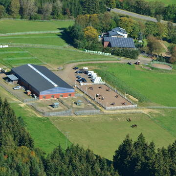
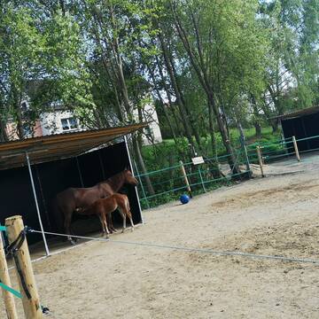
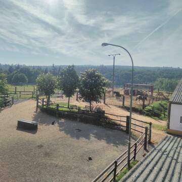
Hof Klein
Dahlem
Hof-Klein
@Hof-Klein
FN-Mitglied
Freizeitstall
Vermieten
Hunde willkommen
Krankenbox
Allergikerstall
Hufrehe geeignet
29 weitere...
P+
Deprecated: Creation of dynamic property Zend_View_Helper_Ads::$adLink is deprecated in /var/www/stall-frei/htdocs/staging.stall-frei.de/library/Psf/View/Helper/Ads.php on line 108

Das Beste für die Hufe
Mechtersen
STALL-FREIde Marketing
@STALL-FREI-Marketing
Hufschmiede und Hufpfleger in Ihrer Nähe


Reitanlage Boxenstopp Philippshof
Bitburg Masholder
Boeer
@Boeer
Freizeitstall
Geländestrecke
Hunde willkommen
Krankenbox
Allergikerstall
Hufrehe geeignet
Außenbox mit Paddock
Außenboxen
28 weitere...
S
Gestüt Quarter-B51 / Offenstallreitanlage
Dahlem
Christina-Schneider
@Christina-Schneider
Freizeitstall
Pferdeausbildung
Vermieten
Krankenbox
Longierzirkel/Roundpen
Gnadenbrothof
Zuchtstutenhaltung möglich
18 weitere...
P

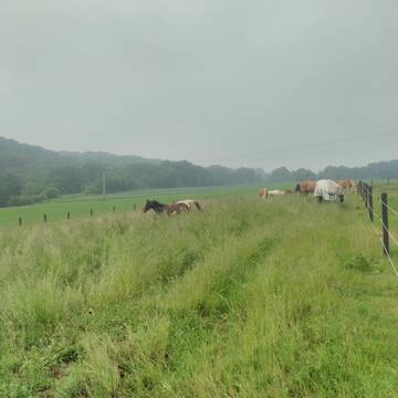
Offenstall für Pferde
Hellenthal, Ramscheid
Beate-Roemer
@Beate-Roemer
VFD-Mitglied
Wanderreiten
Vermieten
Longierzirkel/Roundpen
Paddock
Außenbox mit Paddock
Außenboxen
14 weitere...
P

Reha-Zentrum für Pferde
Dreis-Brück
BRÜCKER MÜHLE Pferdereha
@BrueckerMuehle
FN-Mitglied
Freizeitstall
Vermieten
Führanlage
Hunde willkommen
Allergikerstall
bedampftes/gewaschenes Heu
36 weitere...
S


Pferdepension, Rentnerpferde willkommen
Blankenheim/Waldorf
Itzbacher-Hof
@Itzbacher-Hof
FN-Mitglied
Freizeitstall
Vermieten
Krankenbox
Paddock
Allergikerstall
Gnadenbrothof
24 weitere...
P+

Heu aus neuer Ernte
Mechtersen
STALL-FREIde Marketing
@STALL-FREI-Marketing
Heulage und Pferdeheu aus der neuen Ernte findest du in unserem Futtermarkt

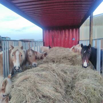
HIT Aktivstall Rosenhof
Mechernich
Aktivstall-Rosenhof
@Aktivstall-Rosenhof
Fahrstall, Kutschwagen
Freizeitstall
Vermieten
Hunde willkommen
Krankenbox
Allergikerstall
bedampftes/gewaschenes Heu
30 weitere...
S
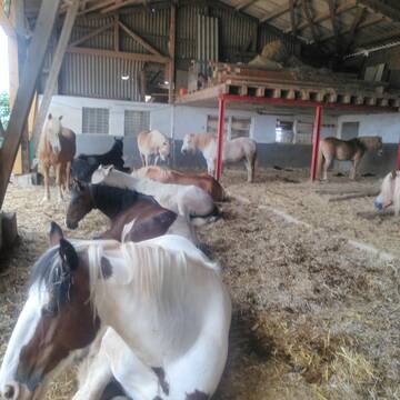
Offenstall
Ripsdorf
Carmen-Naeve
@Carmen-Naeve
Freizeitstall
Hunde willkommen
Krankenbox
Notfallboxen
Offenstall
Paddock Trail
12 weitere...
ganz aktuell
P

Boxen frei
Blankenheim
Heinrichshof Blankenheim
@HeinrichshofBlankenheim
FN-Mitglied
Freizeitstall
Vermieten
Hunde willkommen
Krankenbox
bedampftes/gewaschenes Heu
28 weitere...
P
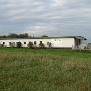
25 Jahre Pferdepension-St.-Rochus
Üxheim- Flesten
Liebenow-Angelika
@Liebenow-Angelika
Freizeitstall
Reitplatz (z.B. Dressur, Springen, Reining)
Sattelkammer/Sattelschränke
Gnadenbrothof
Innenbox
Offenstall
3 weitere...
P
Deprecated: Creation of dynamic property Zend_View::$pageCount is deprecated in /var/www/stall-frei/htdocs/staging.stall-frei.de/library/vendor/shardj/zf1-future/library/Zend/View/Abstract.php on line 308
Deprecated: Creation of dynamic property Zend_View::$itemCountPerPage is deprecated in /var/www/stall-frei/htdocs/staging.stall-frei.de/library/vendor/shardj/zf1-future/library/Zend/View/Abstract.php on line 308
Deprecated: Creation of dynamic property Zend_View::$first is deprecated in /var/www/stall-frei/htdocs/staging.stall-frei.de/library/vendor/shardj/zf1-future/library/Zend/View/Abstract.php on line 308
Deprecated: Creation of dynamic property Zend_View::$current is deprecated in /var/www/stall-frei/htdocs/staging.stall-frei.de/library/vendor/shardj/zf1-future/library/Zend/View/Abstract.php on line 308
Deprecated: Creation of dynamic property Zend_View::$last is deprecated in /var/www/stall-frei/htdocs/staging.stall-frei.de/library/vendor/shardj/zf1-future/library/Zend/View/Abstract.php on line 308
Deprecated: Creation of dynamic property Zend_View::$next is deprecated in /var/www/stall-frei/htdocs/staging.stall-frei.de/library/vendor/shardj/zf1-future/library/Zend/View/Abstract.php on line 308
Deprecated: Creation of dynamic property Zend_View::$pagesInRange is deprecated in /var/www/stall-frei/htdocs/staging.stall-frei.de/library/vendor/shardj/zf1-future/library/Zend/View/Abstract.php on line 308
Deprecated: Creation of dynamic property Zend_View::$firstPageInRange is deprecated in /var/www/stall-frei/htdocs/staging.stall-frei.de/library/vendor/shardj/zf1-future/library/Zend/View/Abstract.php on line 308
Deprecated: Creation of dynamic property Zend_View::$lastPageInRange is deprecated in /var/www/stall-frei/htdocs/staging.stall-frei.de/library/vendor/shardj/zf1-future/library/Zend/View/Abstract.php on line 308
Deprecated: Creation of dynamic property Zend_View::$currentItemCount is deprecated in /var/www/stall-frei/htdocs/staging.stall-frei.de/library/vendor/shardj/zf1-future/library/Zend/View/Abstract.php on line 308
Deprecated: Creation of dynamic property Zend_View::$totalItemCount is deprecated in /var/www/stall-frei/htdocs/staging.stall-frei.de/library/vendor/shardj/zf1-future/library/Zend/View/Abstract.php on line 308
Deprecated: Creation of dynamic property Zend_View::$firstItemNumber is deprecated in /var/www/stall-frei/htdocs/staging.stall-frei.de/library/vendor/shardj/zf1-future/library/Zend/View/Abstract.php on line 308
Deprecated: Creation of dynamic property Zend_View::$lastItemNumber is deprecated in /var/www/stall-frei/htdocs/staging.stall-frei.de/library/vendor/shardj/zf1-future/library/Zend/View/Abstract.php on line 308
Deprecated: Creation of dynamic property Zend_View::$router is deprecated in /var/www/stall-frei/htdocs/staging.stall-frei.de/library/vendor/shardj/zf1-future/library/Zend/View/Abstract.php on line 308
Deprecated: Creation of dynamic property Zend_View::$urlParams is deprecated in /var/www/stall-frei/htdocs/staging.stall-frei.de/library/vendor/shardj/zf1-future/library/Zend/View/Abstract.php on line 308
Deprecated: Creation of dynamic property Zend_View::$showAds is deprecated in /var/www/stall-frei/htdocs/staging.stall-frei.de/library/vendor/shardj/zf1-future/library/Zend/View/Abstract.php on line 308
Deprecated: Creation of dynamic property Zend_View::$objectIds is deprecated in /var/www/stall-frei/htdocs/staging.stall-frei.de/library/vendor/shardj/zf1-future/library/Zend/View/Abstract.php on line 308
Deprecated: Creation of dynamic property Zend_View::$showNavbar is deprecated in /var/www/stall-frei/htdocs/staging.stall-frei.de/library/vendor/shardj/zf1-future/library/Zend/View/Abstract.php on line 308
Deprecated: Creation of dynamic property Zend_View::$showBreadcrumb is deprecated in /var/www/stall-frei/htdocs/staging.stall-frei.de/library/vendor/shardj/zf1-future/library/Zend/View/Abstract.php on line 308
Deprecated: Creation of dynamic property Zend_View::$showFooter is deprecated in /var/www/stall-frei/htdocs/staging.stall-frei.de/library/vendor/shardj/zf1-future/library/Zend/View/Abstract.php on line 308
Deprecated: Creation of dynamic property Zend_View::$showInternalAds is deprecated in /var/www/stall-frei/htdocs/staging.stall-frei.de/library/vendor/shardj/zf1-future/library/Zend/View/Abstract.php on line 308
Deprecated: Creation of dynamic property Zend_View::$blNoContent is deprecated in /var/www/stall-frei/htdocs/staging.stall-frei.de/library/vendor/shardj/zf1-future/library/Zend/View/Abstract.php on line 308
Deprecated: Creation of dynamic property Zend_View::$sMetaDesc is deprecated in /var/www/stall-frei/htdocs/staging.stall-frei.de/library/vendor/shardj/zf1-future/library/Zend/View/Abstract.php on line 308
Deprecated: Creation of dynamic property Zend_View::$useGmaps is deprecated in /var/www/stall-frei/htdocs/staging.stall-frei.de/library/vendor/shardj/zf1-future/library/Zend/View/Abstract.php on line 308
Deprecated: Creation of dynamic property Zend_View::$touches is deprecated in /var/www/stall-frei/htdocs/staging.stall-frei.de/library/vendor/shardj/zf1-future/library/Zend/View/Abstract.php on line 308
Deprecated: Creation of dynamic property Zend_View::$oProject is deprecated in /var/www/stall-frei/htdocs/staging.stall-frei.de/library/vendor/shardj/zf1-future/library/Zend/View/Abstract.php on line 308
Deprecated: Creation of dynamic property Zend_View::$pageHeadline is deprecated in /var/www/stall-frei/htdocs/staging.stall-frei.de/library/vendor/shardj/zf1-future/library/Zend/View/Abstract.php on line 308
Deprecated: Creation of dynamic property Zend_View::$disableLocationField is deprecated in /var/www/stall-frei/htdocs/staging.stall-frei.de/library/vendor/shardj/zf1-future/library/Zend/View/Abstract.php on line 308
Deprecated: Creation of dynamic property Zend_View::$isSearch is deprecated in /var/www/stall-frei/htdocs/staging.stall-frei.de/library/vendor/shardj/zf1-future/library/Zend/View/Abstract.php on line 308
Deprecated: Creation of dynamic property Zend_View::$pageTitle is deprecated in /var/www/stall-frei/htdocs/staging.stall-frei.de/library/vendor/shardj/zf1-future/library/Zend/View/Abstract.php on line 308
Deprecated: Creation of dynamic property Psf_Form_Element_Text::$class is deprecated in /var/www/stall-frei/htdocs/staging.stall-frei.de/library/vendor/shardj/zf1-future/library/Zend/Form/Element.php on line 874
Deprecated: Creation of dynamic property Psf_Form_Element_Text::$size is deprecated in /var/www/stall-frei/htdocs/staging.stall-frei.de/library/vendor/shardj/zf1-future/library/Zend/Form/Element.php on line 874
Deprecated: Creation of dynamic property Psf_Form_Element_Text::$placeholder is deprecated in /var/www/stall-frei/htdocs/staging.stall-frei.de/library/vendor/shardj/zf1-future/library/Zend/Form/Element.php on line 874
Deprecated: Creation of dynamic property Psf_Form_Element_Hidden::$class is deprecated in /var/www/stall-frei/htdocs/staging.stall-frei.de/library/vendor/shardj/zf1-future/library/Zend/Form/Element.php on line 874
Deprecated: Creation of dynamic property Psf_Form_Element_Hidden::$class is deprecated in /var/www/stall-frei/htdocs/staging.stall-frei.de/library/vendor/shardj/zf1-future/library/Zend/Form/Element.php on line 874
Deprecated: Creation of dynamic property Psf_Form_Element_Hidden::$class is deprecated in /var/www/stall-frei/htdocs/staging.stall-frei.de/library/vendor/shardj/zf1-future/library/Zend/Form/Element.php on line 874
Deprecated: Creation of dynamic property Psf_Form_Element_Hidden::$class is deprecated in /var/www/stall-frei/htdocs/staging.stall-frei.de/library/vendor/shardj/zf1-future/library/Zend/Form/Element.php on line 874
Deprecated: Creation of dynamic property Psf_Form_Element_Select::$class is deprecated in /var/www/stall-frei/htdocs/staging.stall-frei.de/library/vendor/shardj/zf1-future/library/Zend/Form/Element.php on line 874
Deprecated: Creation of dynamic property Psf_Form_Element_Select::$class is deprecated in /var/www/stall-frei/htdocs/staging.stall-frei.de/library/vendor/shardj/zf1-future/library/Zend/Form/Element.php on line 874
Deprecated: Creation of dynamic property Psf_Form_Element_Select::$class is deprecated in /var/www/stall-frei/htdocs/staging.stall-frei.de/library/vendor/shardj/zf1-future/library/Zend/Form/Element.php on line 874
Deprecated: Creation of dynamic property Psf_Form_Element_Select::$class is deprecated in /var/www/stall-frei/htdocs/staging.stall-frei.de/library/vendor/shardj/zf1-future/library/Zend/Form/Element.php on line 874
Deprecated: Creation of dynamic property Psf_Form_Element_Text::$class is deprecated in /var/www/stall-frei/htdocs/staging.stall-frei.de/library/vendor/shardj/zf1-future/library/Zend/Form/Element.php on line 874
Deprecated: Creation of dynamic property Psf_Form_Element_Checkbox::$label is deprecated in /var/www/stall-frei/htdocs/staging.stall-frei.de/library/vendor/shardj/zf1-future/library/Zend/Form/Element.php on line 874
Deprecated: Creation of dynamic property Zend_View::$sort is deprecated in /var/www/stall-frei/htdocs/staging.stall-frei.de/library/vendor/shardj/zf1-future/library/Zend/View/Abstract.php on line 308
Deprecated: Creation of dynamic property Zend_View::$searchLocation is deprecated in /var/www/stall-frei/htdocs/staging.stall-frei.de/library/vendor/shardj/zf1-future/library/Zend/View/Abstract.php on line 308
Deprecated: Creation of dynamic property Zend_View::$locationHint is deprecated in /var/www/stall-frei/htdocs/staging.stall-frei.de/library/vendor/shardj/zf1-future/library/Zend/View/Abstract.php on line 308
Psf_GeoCoder_Abstract::getLocation: Steinebrück Get Location CachedOrLive
Psf_GeoCoder_Abstract::getCachedOrLive: Steinebrück
Psf_GeoCoder_OpenCageData::makeApiRequest: response:
Array
(
[documentation] => https://opencagedata.com/api
[licenses] => Array
(
[0] => Array
(
[name] => see attribution guide
[url] => https://opencagedata.com/credits
)
)
[results] => Array
(
[0] => Array
(
[bounds] => Array
(
[northeast] => Array
(
[lat] => 50.2558704
[lng] => 6.207579
)
[southwest] => Array
(
[lat] => 50.2158704
[lng] => 6.167579
)
)
[components] => Array
(
[ISO_3166-1_alpha-2] => DE
[ISO_3166-1_alpha-3] => DEU
[ISO_3166-2] => Array
(
[0] => DE-RP
)
[_category] => place
[_normalized_city] => Winterspelt
[_type] => hamlet
[city] => Winterspelt
[continent] => Europe
[country] => Deutschland
[country_code] => de
[county] => Eifelkreis Bitburg-Prüm
[hamlet] => Steinebrück
[municipality] => Prüm
[political_union] => European Union
[postcode] => 54616
[state] => Rheinland-Pfalz
[state_code] => RP
)
[confidence] => 7
[formatted] => Steinebrück, 54616 Winterspelt, Deutschland
[geometry] => Array
(
[lat] => 50.2358704
[lng] => 6.187579
)
)
[1] => Array
(
[bounds] => Array
(
[northeast] => Array
(
[lat] => 50.7603976
[lng] => 6.0964867
)
[southwest] => Array
(
[lat] => 50.7403976
[lng] => 6.0764867
)
)
[components] => Array
(
[ISO_3166-1_alpha-2] => DE
[ISO_3166-1_alpha-3] => DEU
[ISO_3166-2] => Array
(
[0] => DE-NW
)
[_category] => place
[_normalized_city] => Aachen
[_type] => neighbourhood
[city] => Aachen
[city_district] => Aachen-Mitte
[continent] => Europe
[country] => Deutschland
[country_code] => de
[county] => Städteregion Aachen
[political_union] => European Union
[postcode] => 52066
[quarter] => Steinebrück
[state] => Nordrhein-Westfalen
[state_code] => NW
)
[confidence] => 8
[formatted] => 52066 Aachen, Deutschland
[geometry] => Array
(
[lat] => 50.7503976
[lng] => 6.0864867
)
)
[2] => Array
(
[bounds] => Array
(
[northeast] => Array
(
[lat] => 50.3682479
[lng] => 6.4466026
)
[southwest] => Array
(
[lat] => 50.3681479
[lng] => 6.4465026
)
)
[components] => Array
(
[ISO_3166-1_alpha-2] => DE
[ISO_3166-1_alpha-3] => DEU
[ISO_3166-2] => Array
(
[0] => DE-RP
)
[_category] => building
[_normalized_city] => Hallschlag
[_type] => building
[continent] => Europe
[country] => Deutschland
[country_code] => de
[county] => Landkreis Vulkaneifel
[isolated_dwelling] => Steinebrück
[municipality] => Gerolstein
[political_union] => European Union
[postcode] => 54611
[state] => Rheinland-Pfalz
[state_code] => RP
[village] => Hallschlag
)
[confidence] => 10
[formatted] => Steinebrück, 54611 Hallschlag, Deutschland
[geometry] => Array
(
[lat] => 50.3681979
[lng] => 6.4465526
)
)
[3] => Array
(
[bounds] => Array
(
[northeast] => Array
(
[lat] => 49.9760327
[lng] => 6.5056927
)
[southwest] => Array
(
[lat] => 49.9741267
[lng] => 6.5036804
)
)
[components] => Array
(
[ISO_3166-1_alpha-2] => DE
[ISO_3166-1_alpha-3] => DEU
[ISO_3166-2] => Array
(
[0] => DE-RP
)
[_category] => place
[_normalized_city] => Bitburg
[_type] => neighbourhood
[continent] => Europe
[country] => Deutschland
[country_code] => de
[county] => Eifelkreis Bitburg-Prüm
[neighbourhood] => Steinebrück
[political_union] => European Union
[postcode] => 54634
[state] => Rheinland-Pfalz
[state_code] => RP
[town] => Bitburg
)
[confidence] => 9
[formatted] => 54634 Bitburg, Deutschland
[geometry] => Array
(
[lat] => 49.974987
[lng] => 6.5049963
)
)
[4] => Array
(
[bounds] => Array
(
[northeast] => Array
(
[lat] => 49.975124
[lng] => 6.504461
)
[southwest] => Array
(
[lat] => 49.9749357
[lng] => 6.5037329
)
)
[components] => Array
(
[ISO_3166-1_alpha-2] => DE
[ISO_3166-1_alpha-3] => DEU
[ISO_3166-2] => Array
(
[0] => DE-RP
)
[_category] => road
[_normalized_city] => Bitburg
[_type] => road
[continent] => Europe
[country] => Deutschland
[country_code] => de
[county] => Eifelkreis Bitburg-Prüm
[neighbourhood] => Steinebrück
[political_union] => European Union
[postcode] => 54634
[road] => Steinebrück
[road_type] => primary
[state] => Rheinland-Pfalz
[state_code] => RP
[town] => Bitburg
)
[confidence] => 9
[formatted] => Steinebrück, 54634 Bitburg, Deutschland
[geometry] => Array
(
[lat] => 49.9750389
[lng] => 6.5040995
)
)
[5] => Array
(
[bounds] => Array
(
[northeast] => Array
(
[lat] => 50.4425985
[lng] => 7.6273092
)
[southwest] => Array
(
[lat] => 50.4425041
[lng] => 7.6272665
)
)
[components] => Array
(
[ISO_3166-1_alpha-2] => DE
[ISO_3166-1_alpha-3] => DEU
[ISO_3166-2] => Array
(
[0] => DE-RP
)
[_category] => road
[_normalized_city] => Bendorf
[_type] => road
[continent] => Europe
[country] => Deutschland
[country_code] => de
[county] => Landkreis Mayen-Koblenz
[political_union] => European Union
[postcode] => 56170
[road] => Steinebrück
[road_type] => track
[state] => Rheinland-Pfalz
[state_code] => RP
[town] => Bendorf
)
[confidence] => 9
[formatted] => Steinebrück, 56170 Bendorf, Deutschland
[geometry] => Array
(
[lat] => 50.4425513
[lng] => 7.6272879
)
)
[6] => Array
(
[bounds] => Array
(
[northeast] => Array
(
[lat] => 50.7427169
[lng] => 6.1740274
)
[southwest] => Array
(
[lat] => 50.7426169
[lng] => 6.1739274
)
)
[components] => Array
(
[ISO_3166-1_alpha-2] => DE
[ISO_3166-1_alpha-3] => DEU
[ISO_3166-2] => Array
(
[0] => DE-NW
)
[_category] => transportation
[_normalized_city] => Aachen
[_type] => bus_stop
[city] => Aachen
[continent] => Europe
[country] => Deutschland
[country_code] => de
[county] => Städteregion Aachen
[highway] => Steinebrück
[political_union] => European Union
[postcode] => 52078
[road] => Trierer Straße
[state] => Nordrhein-Westfalen
[state_code] => NW
[suburb] => Freund
)
[confidence] => 9
[formatted] => Steinebrück, Trierer Straße, 52078 Aachen, Deutschland
[geometry] => Array
(
[lat] => 50.7426669
[lng] => 6.1739774
)
)
[7] => Array
(
[bounds] => Array
(
[northeast] => Array
(
[lat] => 50.3631605
[lng] => 6.4487129
)
[southwest] => Array
(
[lat] => 50.3630605
[lng] => 6.4486129
)
)
[components] => Array
(
[ISO_3166-1_alpha-2] => DE
[ISO_3166-1_alpha-3] => DEU
[ISO_3166-2] => Array
(
[0] => DE-RP
)
[_category] => transportation
[_normalized_city] => Hallschlag
[_type] => bus_stop
[continent] => Europe
[country] => Deutschland
[country_code] => de
[county] => Landkreis Vulkaneifel
[highway] => Steinebrück
[municipality] => Gerolstein
[political_union] => European Union
[postcode] => 54611
[road] => L 22
[state] => Rheinland-Pfalz
[state_code] => RP
[village] => Hallschlag
)
[confidence] => 9
[formatted] => Steinebrück, L 22, 54611 Hallschlag, Deutschland
[geometry] => Array
(
[lat] => 50.3631105
[lng] => 6.4486629
)
)
[8] => Array
(
[components] => Array
(
[ISO_3166-1_alpha-2] => FR
[ISO_3166-1_alpha-3] => FRA
[ISO_3166-2] => Array
(
[0] => FR-GES
[1] => FR-57
)
[_category] => place
[_normalized_city] => Walschbronn
[_type] => place
[city] => Walschbronn
[continent] => Europe
[country] => France
[country_code] => fr
[county] => Moselle
[local_authority] => Communauté de communes du Pays de Bitche
[place] => Am Steinbruch
[political_union] => European Union
[postcode] => 57720
[state] => Grand Est
[state_code] => GES
)
[confidence] => 3
[formatted] => Am Steinbruch, 57720 Walschbronn, France
[geometry] => Array
(
[lat] => 49.159085
[lng] => 7.475288
)
)
[9] => Array
(
[components] => Array
(
[ISO_3166-1_alpha-2] => FR
[ISO_3166-1_alpha-3] => FRA
[ISO_3166-2] => Array
(
[0] => FR-IDF
[1] => FR-92
)
[_category] => road
[_normalized_city] => Levallois-Perret
[_type] => road
[city] => Levallois-Perret
[continent] => Europe
[country] => France
[country_code] => fr
[county] => Hauts-de-Seine
[local_authority] => Métropole du Grand Paris
[political_union] => European Union
[postcode] => 92300
[road] => Rue Charles Deutschmann
[state] => Île-de-France
[state_code] => IDF
)
[confidence] => 2
[formatted] => Rue Charles Deutschmann, 92300 Levallois-Perret, France
[geometry] => Array
(
[lat] => 48.900049
[lng] => 2.2842
)
)
)
[status] => Array
(
[code] => 200
[message] => OK
)
[stay_informed] => Array
(
[blog] => https://blog.opencagedata.com
[mastodon] => https://en.osm.town/@opencage
)
[thanks] => For using an OpenCage API
[timestamp] => Array
(
[created_http] => Sun, 08 Feb 2026 08:53:58 GMT
[created_unix] => 1770540838
)
[total_results] => 10
)
Psf_GeoCoder_Abstract::convertLocationResult
{"documentation":"https:\/\/opencagedata.com\/api","licenses":[{"name":"see attribution guide","url":"https:\/\/opencagedata.com\/credits"}],"results":[{"bounds":{"northeast":{"lat":50.2558704,"lng":6.207579},"southwest":{"lat":50.2158704,"lng":6.167579}},"components":{"ISO_3166-1_alpha-2":"DE","ISO_3166-1_alpha-3":"DEU","ISO_3166-2":["DE-RP"],"_category":"place","_normalized_city":"Winterspelt","_type":"hamlet","city":"Winterspelt","continent":"Europe","country":"Deutschland","country_code":"de","county":"Eifelkreis Bitburg-Pr\u00fcm","hamlet":"Steinebr\u00fcck","municipality":"Pr\u00fcm","political_union":"European Union","postcode":"54616","state":"Rheinland-Pfalz","state_code":"RP"},"confidence":7,"formatted":"Steinebr\u00fcck, 54616 Winterspelt, Deutschland","geometry":{"lat":50.2358704,"lng":6.187579}},{"bounds":{"northeast":{"lat":50.7603976,"lng":6.0964867},"southwest":{"lat":50.7403976,"lng":6.0764867}},"components":{"ISO_3166-1_alpha-2":"DE","ISO_3166-1_alpha-3":"DEU","ISO_3166-2":["DE-NW"],"_category":"place","_normalized_city":"Aachen","_type":"neighbourhood","city":"Aachen","city_district":"Aachen-Mitte","continent":"Europe","country":"Deutschland","country_code":"de","county":"St\u00e4dteregion Aachen","political_union":"European Union","postcode":"52066","quarter":"Steinebr\u00fcck","state":"Nordrhein-Westfalen","state_code":"NW"},"confidence":8,"formatted":"52066 Aachen, Deutschland","geometry":{"lat":50.7503976,"lng":6.0864867}},{"bounds":{"northeast":{"lat":50.3682479,"lng":6.4466026},"southwest":{"lat":50.3681479,"lng":6.4465026}},"components":{"ISO_3166-1_alpha-2":"DE","ISO_3166-1_alpha-3":"DEU","ISO_3166-2":["DE-RP"],"_category":"building","_normalized_city":"Hallschlag","_type":"building","continent":"Europe","country":"Deutschland","country_code":"de","county":"Landkreis Vulkaneifel","isolated_dwelling":"Steinebr\u00fcck","municipality":"Gerolstein","political_union":"European Union","postcode":"54611","state":"Rheinland-Pfalz","state_code":"RP","village":"Hallschlag"},"confidence":10,"formatted":"Steinebr\u00fcck, 54611 Hallschlag, Deutschland","geometry":{"lat":50.3681979,"lng":6.4465526}},{"bounds":{"northeast":{"lat":49.9760327,"lng":6.5056927},"southwest":{"lat":49.9741267,"lng":6.5036804}},"components":{"ISO_3166-1_alpha-2":"DE","ISO_3166-1_alpha-3":"DEU","ISO_3166-2":["DE-RP"],"_category":"place","_normalized_city":"Bitburg","_type":"neighbourhood","continent":"Europe","country":"Deutschland","country_code":"de","county":"Eifelkreis Bitburg-Pr\u00fcm","neighbourhood":"Steinebr\u00fcck","political_union":"European Union","postcode":"54634","state":"Rheinland-Pfalz","state_code":"RP","town":"Bitburg"},"confidence":9,"formatted":"54634 Bitburg, Deutschland","geometry":{"lat":49.974987,"lng":6.5049963}},{"bounds":{"northeast":{"lat":49.975124,"lng":6.504461},"southwest":{"lat":49.9749357,"lng":6.5037329}},"components":{"ISO_3166-1_alpha-2":"DE","ISO_3166-1_alpha-3":"DEU","ISO_3166-2":["DE-RP"],"_category":"road","_normalized_city":"Bitburg","_type":"road","continent":"Europe","country":"Deutschland","country_code":"de","county":"Eifelkreis Bitburg-Pr\u00fcm","neighbourhood":"Steinebr\u00fcck","political_union":"European Union","postcode":"54634","road":"Steinebr\u00fcck","road_type":"primary","state":"Rheinland-Pfalz","state_code":"RP","town":"Bitburg"},"confidence":9,"formatted":"Steinebr\u00fcck, 54634 Bitburg, Deutschland","geometry":{"lat":49.9750389,"lng":6.5040995}},{"bounds":{"northeast":{"lat":50.4425985,"lng":7.6273092},"southwest":{"lat":50.4425041,"lng":7.6272665}},"components":{"ISO_3166-1_alpha-2":"DE","ISO_3166-1_alpha-3":"DEU","ISO_3166-2":["DE-RP"],"_category":"road","_normalized_city":"Bendorf","_type":"road","continent":"Europe","country":"Deutschland","country_code":"de","county":"Landkreis Mayen-Koblenz","political_union":"European Union","postcode":"56170","road":"Steinebr\u00fcck","road_type":"track","state":"Rheinland-Pfalz","state_code":"RP","town":"Bendorf"},"confidence":9,"formatted":"Steinebr\u00fcck, 56170 Bendorf, Deutschland","geometry":{"lat":50.4425513,"lng":7.6272879}},{"bounds":{"northeast":{"lat":50.7427169,"lng":6.1740274},"southwest":{"lat":50.7426169,"lng":6.1739274}},"components":{"ISO_3166-1_alpha-2":"DE","ISO_3166-1_alpha-3":"DEU","ISO_3166-2":["DE-NW"],"_category":"transportation","_normalized_city":"Aachen","_type":"bus_stop","city":"Aachen","continent":"Europe","country":"Deutschland","country_code":"de","county":"St\u00e4dteregion Aachen","highway":"Steinebr\u00fcck","political_union":"European Union","postcode":"52078","road":"Trierer Stra\u00dfe","state":"Nordrhein-Westfalen","state_code":"NW","suburb":"Freund"},"confidence":9,"formatted":"Steinebr\u00fcck, Trierer Stra\u00dfe, 52078 Aachen, Deutschland","geometry":{"lat":50.7426669,"lng":6.1739774}},{"bounds":{"northeast":{"lat":50.3631605,"lng":6.4487129},"southwest":{"lat":50.3630605,"lng":6.4486129}},"components":{"ISO_3166-1_alpha-2":"DE","ISO_3166-1_alpha-3":"DEU","ISO_3166-2":["DE-RP"],"_category":"transportation","_normalized_city":"Hallschlag","_type":"bus_stop","continent":"Europe","country":"Deutschland","country_code":"de","county":"Landkreis Vulkaneifel","highway":"Steinebr\u00fcck","municipality":"Gerolstein","political_union":"European Union","postcode":"54611","road":"L 22","state":"Rheinland-Pfalz","state_code":"RP","village":"Hallschlag"},"confidence":9,"formatted":"Steinebr\u00fcck, L 22, 54611 Hallschlag, Deutschland","geometry":{"lat":50.3631105,"lng":6.4486629}},{"components":{"ISO_3166-1_alpha-2":"FR","ISO_3166-1_alpha-3":"FRA","ISO_3166-2":["FR-GES","FR-57"],"_category":"place","_normalized_city":"Walschbronn","_type":"place","city":"Walschbronn","continent":"Europe","country":"France","country_code":"fr","county":"Moselle","local_authority":"Communaut\u00e9 de communes du Pays de Bitche","place":"Am Steinbruch","political_union":"European Union","postcode":"57720","state":"Grand Est","state_code":"GES"},"confidence":3,"formatted":"Am Steinbruch, 57720 Walschbronn, France","geometry":{"lat":49.159085,"lng":7.475288}},{"components":{"ISO_3166-1_alpha-2":"FR","ISO_3166-1_alpha-3":"FRA","ISO_3166-2":["FR-IDF","FR-92"],"_category":"road","_normalized_city":"Levallois-Perret","_type":"road","city":"Levallois-Perret","continent":"Europe","country":"France","country_code":"fr","county":"Hauts-de-Seine","local_authority":"M\u00e9tropole du Grand Paris","political_union":"European Union","postcode":"92300","road":"Rue Charles Deutschmann","state":"\u00cele-de-France","state_code":"IDF"},"confidence":2,"formatted":"Rue Charles Deutschmann, 92300 Levallois-Perret, France","geometry":{"lat":48.900049,"lng":2.2842}}],"status":{"code":200,"message":"OK"},"stay_informed":{"blog":"https:\/\/blog.opencagedata.com","mastodon":"https:\/\/en.osm.town\/@opencage"},"thanks":"For using an OpenCage API","timestamp":{"created_http":"Sun, 08 Feb 2026 08:53:58 GMT","created_unix":1770540838},"total_results":10}Array
(
[0] => stdClass Object
(
[bounds] => stdClass Object
(
[northeast] => stdClass Object
(
[lat] => 50.2558704
[lng] => 6.207579
)
[southwest] => stdClass Object
(
[lat] => 50.2158704
[lng] => 6.167579
)
)
[components] => stdClass Object
(
[ISO_3166-1_alpha-2] => DE
[ISO_3166-1_alpha-3] => DEU
[ISO_3166-2] => Array
(
[0] => DE-RP
)
[_category] => place
[_normalized_city] => Winterspelt
[_type] => hamlet
[city] => Winterspelt
[continent] => Europe
[country] => Deutschland
[country_code] => de
[county] => Eifelkreis Bitburg-Prüm
[hamlet] => Steinebrück
[municipality] => Prüm
[political_union] => European Union
[postcode] => 54616
[state] => Rheinland-Pfalz
[state_code] => RP
)
[confidence] => 7
[formatted] => Steinebrück, 54616 Winterspelt, Deutschland
[geometry] => stdClass Object
(
[lat] => 50.2358704
[lng] => 6.187579
)
)
[1] => stdClass Object
(
[bounds] => stdClass Object
(
[northeast] => stdClass Object
(
[lat] => 50.7603976
[lng] => 6.0964867
)
[southwest] => stdClass Object
(
[lat] => 50.7403976
[lng] => 6.0764867
)
)
[components] => stdClass Object
(
[ISO_3166-1_alpha-2] => DE
[ISO_3166-1_alpha-3] => DEU
[ISO_3166-2] => Array
(
[0] => DE-NW
)
[_category] => place
[_normalized_city] => Aachen
[_type] => neighbourhood
[city] => Aachen
[city_district] => Aachen-Mitte
[continent] => Europe
[country] => Deutschland
[country_code] => de
[county] => Städteregion Aachen
[political_union] => European Union
[postcode] => 52066
[quarter] => Steinebrück
[state] => Nordrhein-Westfalen
[state_code] => NW
)
[confidence] => 8
[formatted] => 52066 Aachen, Deutschland
[geometry] => stdClass Object
(
[lat] => 50.7503976
[lng] => 6.0864867
)
)
[2] => stdClass Object
(
[bounds] => stdClass Object
(
[northeast] => stdClass Object
(
[lat] => 50.3682479
[lng] => 6.4466026
)
[southwest] => stdClass Object
(
[lat] => 50.3681479
[lng] => 6.4465026
)
)
[components] => stdClass Object
(
[ISO_3166-1_alpha-2] => DE
[ISO_3166-1_alpha-3] => DEU
[ISO_3166-2] => Array
(
[0] => DE-RP
)
[_category] => building
[_normalized_city] => Hallschlag
[_type] => building
[continent] => Europe
[country] => Deutschland
[country_code] => de
[county] => Landkreis Vulkaneifel
[isolated_dwelling] => Steinebrück
[municipality] => Gerolstein
[political_union] => European Union
[postcode] => 54611
[state] => Rheinland-Pfalz
[state_code] => RP
[village] => Hallschlag
)
[confidence] => 10
[formatted] => Steinebrück, 54611 Hallschlag, Deutschland
[geometry] => stdClass Object
(
[lat] => 50.3681979
[lng] => 6.4465526
)
)
[3] => stdClass Object
(
[bounds] => stdClass Object
(
[northeast] => stdClass Object
(
[lat] => 49.9760327
[lng] => 6.5056927
)
[southwest] => stdClass Object
(
[lat] => 49.9741267
[lng] => 6.5036804
)
)
[components] => stdClass Object
(
[ISO_3166-1_alpha-2] => DE
[ISO_3166-1_alpha-3] => DEU
[ISO_3166-2] => Array
(
[0] => DE-RP
)
[_category] => place
[_normalized_city] => Bitburg
[_type] => neighbourhood
[continent] => Europe
[country] => Deutschland
[country_code] => de
[county] => Eifelkreis Bitburg-Prüm
[neighbourhood] => Steinebrück
[political_union] => European Union
[postcode] => 54634
[state] => Rheinland-Pfalz
[state_code] => RP
[town] => Bitburg
)
[confidence] => 9
[formatted] => 54634 Bitburg, Deutschland
[geometry] => stdClass Object
(
[lat] => 49.974987
[lng] => 6.5049963
)
)
[4] => stdClass Object
(
[bounds] => stdClass Object
(
[northeast] => stdClass Object
(
[lat] => 49.975124
[lng] => 6.504461
)
[southwest] => stdClass Object
(
[lat] => 49.9749357
[lng] => 6.5037329
)
)
[components] => stdClass Object
(
[ISO_3166-1_alpha-2] => DE
[ISO_3166-1_alpha-3] => DEU
[ISO_3166-2] => Array
(
[0] => DE-RP
)
[_category] => road
[_normalized_city] => Bitburg
[_type] => road
[continent] => Europe
[country] => Deutschland
[country_code] => de
[county] => Eifelkreis Bitburg-Prüm
[neighbourhood] => Steinebrück
[political_union] => European Union
[postcode] => 54634
[road] => Steinebrück
[road_type] => primary
[state] => Rheinland-Pfalz
[state_code] => RP
[town] => Bitburg
)
[confidence] => 9
[formatted] => Steinebrück, 54634 Bitburg, Deutschland
[geometry] => stdClass Object
(
[lat] => 49.9750389
[lng] => 6.5040995
)
)
[5] => stdClass Object
(
[bounds] => stdClass Object
(
[northeast] => stdClass Object
(
[lat] => 50.4425985
[lng] => 7.6273092
)
[southwest] => stdClass Object
(
[lat] => 50.4425041
[lng] => 7.6272665
)
)
[components] => stdClass Object
(
[ISO_3166-1_alpha-2] => DE
[ISO_3166-1_alpha-3] => DEU
[ISO_3166-2] => Array
(
[0] => DE-RP
)
[_category] => road
[_normalized_city] => Bendorf
[_type] => road
[continent] => Europe
[country] => Deutschland
[country_code] => de
[county] => Landkreis Mayen-Koblenz
[political_union] => European Union
[postcode] => 56170
[road] => Steinebrück
[road_type] => track
[state] => Rheinland-Pfalz
[state_code] => RP
[town] => Bendorf
)
[confidence] => 9
[formatted] => Steinebrück, 56170 Bendorf, Deutschland
[geometry] => stdClass Object
(
[lat] => 50.4425513
[lng] => 7.6272879
)
)
[6] => stdClass Object
(
[bounds] => stdClass Object
(
[northeast] => stdClass Object
(
[lat] => 50.7427169
[lng] => 6.1740274
)
[southwest] => stdClass Object
(
[lat] => 50.7426169
[lng] => 6.1739274
)
)
[components] => stdClass Object
(
[ISO_3166-1_alpha-2] => DE
[ISO_3166-1_alpha-3] => DEU
[ISO_3166-2] => Array
(
[0] => DE-NW
)
[_category] => transportation
[_normalized_city] => Aachen
[_type] => bus_stop
[city] => Aachen
[continent] => Europe
[country] => Deutschland
[country_code] => de
[county] => Städteregion Aachen
[highway] => Steinebrück
[political_union] => European Union
[postcode] => 52078
[road] => Trierer Straße
[state] => Nordrhein-Westfalen
[state_code] => NW
[suburb] => Freund
)
[confidence] => 9
[formatted] => Steinebrück, Trierer Straße, 52078 Aachen, Deutschland
[geometry] => stdClass Object
(
[lat] => 50.7426669
[lng] => 6.1739774
)
)
[7] => stdClass Object
(
[bounds] => stdClass Object
(
[northeast] => stdClass Object
(
[lat] => 50.3631605
[lng] => 6.4487129
)
[southwest] => stdClass Object
(
[lat] => 50.3630605
[lng] => 6.4486129
)
)
[components] => stdClass Object
(
[ISO_3166-1_alpha-2] => DE
[ISO_3166-1_alpha-3] => DEU
[ISO_3166-2] => Array
(
[0] => DE-RP
)
[_category] => transportation
[_normalized_city] => Hallschlag
[_type] => bus_stop
[continent] => Europe
[country] => Deutschland
[country_code] => de
[county] => Landkreis Vulkaneifel
[highway] => Steinebrück
[municipality] => Gerolstein
[political_union] => European Union
[postcode] => 54611
[road] => L 22
[state] => Rheinland-Pfalz
[state_code] => RP
[village] => Hallschlag
)
[confidence] => 9
[formatted] => Steinebrück, L 22, 54611 Hallschlag, Deutschland
[geometry] => stdClass Object
(
[lat] => 50.3631105
[lng] => 6.4486629
)
)
[8] => stdClass Object
(
[components] => stdClass Object
(
[ISO_3166-1_alpha-2] => FR
[ISO_3166-1_alpha-3] => FRA
[ISO_3166-2] => Array
(
[0] => FR-GES
[1] => FR-57
)
[_category] => place
[_normalized_city] => Walschbronn
[_type] => place
[city] => Walschbronn
[continent] => Europe
[country] => France
[country_code] => fr
[county] => Moselle
[local_authority] => Communauté de communes du Pays de Bitche
[place] => Am Steinbruch
[political_union] => European Union
[postcode] => 57720
[state] => Grand Est
[state_code] => GES
)
[confidence] => 3
[formatted] => Am Steinbruch, 57720 Walschbronn, France
[geometry] => stdClass Object
(
[lat] => 49.159085
[lng] => 7.475288
)
)
[9] => stdClass Object
(
[components] => stdClass Object
(
[ISO_3166-1_alpha-2] => FR
[ISO_3166-1_alpha-3] => FRA
[ISO_3166-2] => Array
(
[0] => FR-IDF
[1] => FR-92
)
[_category] => road
[_normalized_city] => Levallois-Perret
[_type] => road
[city] => Levallois-Perret
[continent] => Europe
[country] => France
[country_code] => fr
[county] => Hauts-de-Seine
[local_authority] => Métropole du Grand Paris
[political_union] => European Union
[postcode] => 92300
[road] => Rue Charles Deutschmann
[state] => Île-de-France
[state_code] => IDF
)
[confidence] => 2
[formatted] => Rue Charles Deutschmann, 92300 Levallois-Perret, France
[geometry] => stdClass Object
(
[lat] => 48.900049
[lng] => 2.2842
)
)
)
Psf_GeoCoder_OpenCageData::getKeyMap: 0
stdClass Object
(
    [bounds] => stdClass Object
        (
            [northeast] => stdClass Object
                (
                    [lat] => 50.2558704
                    [lng] => 6.207579
                )

            [southwest] => stdClass Object
                (
                    [lat] => 50.2158704
                    [lng] => 6.167579
                )

        )

    [components] => stdClass Object
        (
            [ISO_3166-1_alpha-2] => DE
            [ISO_3166-1_alpha-3] => DEU
            [ISO_3166-2] => Array
                (
                    [0] => DE-RP
                )

            [_category] => place
            [_normalized_city] => Winterspelt
            [_type] => hamlet
            [city] => Winterspelt
            [continent] => Europe
            [country] => Deutschland
            [country_code] => de
            [county] => Eifelkreis Bitburg-Prüm
            [hamlet] => Steinebrück
            [municipality] => Prüm
            [political_union] => European Union
            [postcode] => 54616
            [state] => Rheinland-Pfalz
            [state_code] => RP
        )

    [confidence] => 7
    [formatted] => Steinebrück, 54616 Winterspelt, Deutschland
    [geometry] => stdClass Object
        (
            [lat] => 50.2358704
            [lng] => 6.187579
        )

)
Psf_GeoCoder_OpenCageData::getCounty: Eifelkreis Bitburg-Prüm
Psf_GeoCoder_OpenCageData::addMissingData REFETCH!
Array
(
    [address] => Steinebrück, 54616 Winterspelt, Deutschland
    [type] => hamlet
    [street] => Steinebrück
    [city] => Winterspelt
    [county] => Eifelkreis Bitburg-Prüm
    [state] => Rheinland-Pfalz
    [zip] => 54616
    [country] => Deutschland
    [suburb] =>
    [countrycode] => de
    [latitude] => 50.2358704
    [longitude] => 6.187579
    [accuracy] => 1
    [confidence] => 7
    [bounds] => stdClass Object
        (
            [northeast] => stdClass Object
                (
                    [lat] => 50.2558704
                    [lng] => 6.207579
                )

            [southwest] => stdClass Object
                (
                    [lat] => 50.2158704
                    [lng] => 6.167579
                )

        )

)
reformat!
Array
(
    [address] => Steinebrück, 54616 Winterspelt, Deutschland
    [type] => hamlet
    [street] => Steinebrück
    [city] => Winterspelt
    [county] => Eifelkreis Bitburg-Prüm
    [state] => Rheinland-Pfalz
    [zip] => 54616
    [country] => Deutschland
    [suburb] =>
    [countrycode] => de
    [latitude] => 50.2358704
    [longitude] => 6.187579
    [accuracy] => 1
    [confidence] => 7
    [bounds] => stdClass Object
        (
            [northeast] => stdClass Object
                (
                    [lat] => 50.2558704
                    [lng] => 6.207579
                )

            [southwest] => stdClass Object
                (
                    [lat] => 50.2158704
                    [lng] => 6.167579
                )

        )

    [place] => Steinebrück, 54616 Winterspelt, Rheinland-Pfalz
    [hash] => 905236ec912d08e5d11ff454c821321c
)
Psf_GeoCoder_OpenCageData::getKeyMap: 1
stdClass Object
(
    [bounds] => stdClass Object
        (
            [northeast] => stdClass Object
                (
                    [lat] => 50.7603976
                    [lng] => 6.0964867
                )

            [southwest] => stdClass Object
                (
                    [lat] => 50.7403976
                    [lng] => 6.0764867
                )

        )

    [components] => stdClass Object
        (
            [ISO_3166-1_alpha-2] => DE
            [ISO_3166-1_alpha-3] => DEU
            [ISO_3166-2] => Array
                (
                    [0] => DE-NW
                )

            [_category] => place
            [_normalized_city] => Aachen
            [_type] => neighbourhood
            [city] => Aachen
            [city_district] => Aachen-Mitte
            [continent] => Europe
            [country] => Deutschland
            [country_code] => de
            [county] => Städteregion Aachen
            [political_union] => European Union
            [postcode] => 52066
            [quarter] => Steinebrück
            [state] => Nordrhein-Westfalen
            [state_code] => NW
        )

    [confidence] => 8
    [formatted] => 52066 Aachen, Deutschland
    [geometry] => stdClass Object
        (
            [lat] => 50.7503976
            [lng] => 6.0864867
        )

)
Psf_GeoCoder_OpenCageData::getCounty: Städteregion Aachen
Psf_GeoCoder_OpenCageData::addMissingData REFETCH!
Array
(
    [address] => 52066 Aachen, Deutschland
    [type] => neighbourhood
    [street] =>
    [city] => Aachen
    [county] => Städteregion Aachen
    [state] => Nordrhein-Westfalen
    [zip] => 52066
    [country] => Deutschland
    [suburb] =>
    [countrycode] => de
    [latitude] => 50.7503976
    [longitude] => 6.0864867
    [accuracy] => 1
    [confidence] => 8
    [bounds] => stdClass Object
        (
            [northeast] => stdClass Object
                (
                    [lat] => 50.7603976
                    [lng] => 6.0964867
                )

            [southwest] => stdClass Object
                (
                    [lat] => 50.7403976
                    [lng] => 6.0764867
                )

        )

)
reformat!
Array
(
    [address] => 52066 Aachen, Deutschland
    [type] => neighbourhood
    [street] =>
    [city] => Aachen
    [county] => Städteregion Aachen
    [state] => Nordrhein-Westfalen
    [zip] => 52066
    [country] => Deutschland
    [suburb] =>
    [countrycode] => de
    [latitude] => 50.7503976
    [longitude] => 6.0864867
    [accuracy] => 1
    [confidence] => 8
    [bounds] => stdClass Object
        (
            [northeast] => stdClass Object
                (
                    [lat] => 50.7603976
                    [lng] => 6.0964867
                )

            [southwest] => stdClass Object
                (
                    [lat] => 50.7403976
                    [lng] => 6.0764867
                )

        )

    [place] => 52066 Aachen, Nordrhein-Westfalen
    [hash] => c9a66fabfddb30c734061bf505274639
)
Psf_GeoCoder_OpenCageData::getKeyMap: 2
stdClass Object
(
    [bounds] => stdClass Object
        (
            [northeast] => stdClass Object
                (
                    [lat] => 50.3682479
                    [lng] => 6.4466026
                )

            [southwest] => stdClass Object
                (
                    [lat] => 50.3681479
                    [lng] => 6.4465026
                )

        )

    [components] => stdClass Object
        (
            [ISO_3166-1_alpha-2] => DE
            [ISO_3166-1_alpha-3] => DEU
            [ISO_3166-2] => Array
                (
                    [0] => DE-RP
                )

            [_category] => building
            [_normalized_city] => Hallschlag
            [_type] => building
            [continent] => Europe
            [country] => Deutschland
            [country_code] => de
            [county] => Landkreis Vulkaneifel
            [isolated_dwelling] => Steinebrück
            [municipality] => Gerolstein
            [political_union] => European Union
            [postcode] => 54611
            [state] => Rheinland-Pfalz
            [state_code] => RP
            [village] => Hallschlag
        )

    [confidence] => 10
    [formatted] => Steinebrück, 54611 Hallschlag, Deutschland
    [geometry] => stdClass Object
        (
            [lat] => 50.3681979
            [lng] => 6.4465526
        )

)
Psf_GeoCoder_OpenCageData::getCounty: Vulkaneifel
Psf_GeoCoder_OpenCageData::addMissingData REFETCH!
Array
(
    [address] => Steinebrück, 54611 Hallschlag, Deutschland
    [type] => building
    [street] =>
    [city] => Hallschlag
    [county] => Vulkaneifel
    [state] => Rheinland-Pfalz
    [zip] => 54611
    [country] => Deutschland
    [suburb] =>
    [countrycode] => de
    [latitude] => 50.3681979
    [longitude] => 6.4465526
    [accuracy] => 1
    [confidence] => 10
    [bounds] => stdClass Object
        (
            [northeast] => stdClass Object
                (
                    [lat] => 50.3682479
                    [lng] => 6.4466026
                )

            [southwest] => stdClass Object
                (
                    [lat] => 50.3681479
                    [lng] => 6.4465026
                )

        )

)
reformat!
Array
(
    [address] => Steinebrück, 54611 Hallschlag, Deutschland
    [type] => building
    [street] =>
    [city] => Hallschlag
    [county] => Vulkaneifel
    [state] => Rheinland-Pfalz
    [zip] => 54611
    [country] => Deutschland
    [suburb] =>
    [countrycode] => de
    [latitude] => 50.3681979
    [longitude] => 6.4465526
    [accuracy] => 1
    [confidence] => 10
    [bounds] => stdClass Object
        (
            [northeast] => stdClass Object
                (
                    [lat] => 50.3682479
                    [lng] => 6.4466026
                )

            [southwest] => stdClass Object
                (
                    [lat] => 50.3681479
                    [lng] => 6.4465026
                )

        )

    [place] => 54611 Hallschlag, Rheinland-Pfalz
    [hash] => 6b1dfad2ab759c0928d176ddaa7bfaff
)
Psf_GeoCoder_OpenCageData::getKeyMap: 3
stdClass Object
(
    [bounds] => stdClass Object
        (
            [northeast] => stdClass Object
                (
                    [lat] => 49.9760327
                    [lng] => 6.5056927
                )

            [southwest] => stdClass Object
                (
                    [lat] => 49.9741267
                    [lng] => 6.5036804
                )

        )

    [components] => stdClass Object
        (
            [ISO_3166-1_alpha-2] => DE
            [ISO_3166-1_alpha-3] => DEU
            [ISO_3166-2] => Array
                (
                    [0] => DE-RP
                )

            [_category] => place
            [_normalized_city] => Bitburg
            [_type] => neighbourhood
            [continent] => Europe
            [country] => Deutschland
            [country_code] => de
            [county] => Eifelkreis Bitburg-Prüm
            [neighbourhood] => Steinebrück
            [political_union] => European Union
            [postcode] => 54634
            [state] => Rheinland-Pfalz
            [state_code] => RP
            [town] => Bitburg
        )

    [confidence] => 9
    [formatted] => 54634 Bitburg, Deutschland
    [geometry] => stdClass Object
        (
            [lat] => 49.974987
            [lng] => 6.5049963
        )

)
Psf_GeoCoder_OpenCageData::getCounty: Eifelkreis Bitburg-Prüm
Psf_GeoCoder_OpenCageData::addMissingData REFETCH!
Array
(
    [address] => 54634 Bitburg, Deutschland
    [type] => neighbourhood
    [street] =>
    [city] => Bitburg
    [county] => Eifelkreis Bitburg-Prüm
    [state] => Rheinland-Pfalz
    [zip] => 54634
    [country] => Deutschland
    [suburb] =>
    [countrycode] => de
    [latitude] => 49.974987
    [longitude] => 6.5049963
    [accuracy] => 1
    [confidence] => 9
    [bounds] => stdClass Object
        (
            [northeast] => stdClass Object
                (
                    [lat] => 49.9760327
                    [lng] => 6.5056927
                )

            [southwest] => stdClass Object
                (
                    [lat] => 49.9741267
                    [lng] => 6.5036804
                )

        )

)
reformat!
Array
(
    [address] => 54634 Bitburg, Deutschland
    [type] => neighbourhood
    [street] =>
    [city] => Bitburg
    [county] => Eifelkreis Bitburg-Prüm
    [state] => Rheinland-Pfalz
    [zip] => 54634
    [country] => Deutschland
    [suburb] =>
    [countrycode] => de
    [latitude] => 49.974987
    [longitude] => 6.5049963
    [accuracy] => 1
    [confidence] => 9
    [bounds] => stdClass Object
        (
            [northeast] => stdClass Object
                (
                    [lat] => 49.9760327
                    [lng] => 6.5056927
                )

            [southwest] => stdClass Object
                (
                    [lat] => 49.9741267
                    [lng] => 6.5036804
                )

        )

    [place] => 54634 Bitburg, Rheinland-Pfalz
    [hash] => 73b903983bad7d08e1b4bc0138dfc330
)
Psf_GeoCoder_OpenCageData::getKeyMap: 4
stdClass Object
(
    [bounds] => stdClass Object
        (
            [northeast] => stdClass Object
                (
                    [lat] => 49.975124
                    [lng] => 6.504461
                )

            [southwest] => stdClass Object
                (
                    [lat] => 49.9749357
                    [lng] => 6.5037329
                )

        )

    [components] => stdClass Object
        (
            [ISO_3166-1_alpha-2] => DE
            [ISO_3166-1_alpha-3] => DEU
            [ISO_3166-2] => Array
                (
                    [0] => DE-RP
                )

            [_category] => road
            [_normalized_city] => Bitburg
            [_type] => road
            [continent] => Europe
            [country] => Deutschland
            [country_code] => de
            [county] => Eifelkreis Bitburg-Prüm
            [neighbourhood] => Steinebrück
            [political_union] => European Union
            [postcode] => 54634
            [road] => Steinebrück
            [road_type] => primary
            [state] => Rheinland-Pfalz
            [state_code] => RP
            [town] => Bitburg
        )

    [confidence] => 9
    [formatted] => Steinebrück, 54634 Bitburg, Deutschland
    [geometry] => stdClass Object
        (
            [lat] => 49.9750389
            [lng] => 6.5040995
        )

)
Psf_GeoCoder_OpenCageData::getCounty: Eifelkreis Bitburg-Prüm
Psf_GeoCoder_OpenCageData::addMissingData REFETCH!
Array
(
    [address] => Steinebrück, 54634 Bitburg, Deutschland
    [type] => road
    [street] => Steinebrück
    [city] => Bitburg
    [county] => Eifelkreis Bitburg-Prüm
    [state] => Rheinland-Pfalz
    [zip] => 54634
    [country] => Deutschland
    [suburb] =>
    [countrycode] => de
    [latitude] => 49.9750389
    [longitude] => 6.5040995
    [accuracy] => 1
    [confidence] => 9
    [bounds] => stdClass Object
        (
            [northeast] => stdClass Object
                (
                    [lat] => 49.975124
                    [lng] => 6.504461
                )

            [southwest] => stdClass Object
                (
                    [lat] => 49.9749357
                    [lng] => 6.5037329
                )

        )

)
reformat!
Array
(
    [address] => Steinebrück, 54634 Bitburg, Deutschland
    [type] => road
    [street] => Steinebrück
    [city] => Bitburg
    [county] => Eifelkreis Bitburg-Prüm
    [state] => Rheinland-Pfalz
    [zip] => 54634
    [country] => Deutschland
    [suburb] =>
    [countrycode] => de
    [latitude] => 49.9750389
    [longitude] => 6.5040995
    [accuracy] => 1
    [confidence] => 9
    [bounds] => stdClass Object
        (
            [northeast] => stdClass Object
                (
                    [lat] => 49.975124
                    [lng] => 6.504461
                )

            [southwest] => stdClass Object
                (
                    [lat] => 49.9749357
                    [lng] => 6.5037329
                )

        )

    [place] => Steinebrück, 54634 Bitburg, Rheinland-Pfalz
    [hash] => 3ec3011e97f52baeb4b379da7fc7155f
)
Psf_GeoCoder_OpenCageData::getKeyMap: 5
stdClass Object
(
    [bounds] => stdClass Object
        (
            [northeast] => stdClass Object
                (
                    [lat] => 50.4425985
                    [lng] => 7.6273092
                )

            [southwest] => stdClass Object
                (
                    [lat] => 50.4425041
                    [lng] => 7.6272665
                )

        )

    [components] => stdClass Object
        (
            [ISO_3166-1_alpha-2] => DE
            [ISO_3166-1_alpha-3] => DEU
            [ISO_3166-2] => Array
                (
                    [0] => DE-RP
                )

            [_category] => road
            [_normalized_city] => Bendorf
            [_type] => road
            [continent] => Europe
            [country] => Deutschland
            [country_code] => de
            [county] => Landkreis Mayen-Koblenz
            [political_union] => European Union
            [postcode] => 56170
            [road] => Steinebrück
            [road_type] => track
            [state] => Rheinland-Pfalz
            [state_code] => RP
            [town] => Bendorf
        )

    [confidence] => 9
    [formatted] => Steinebrück, 56170 Bendorf, Deutschland
    [geometry] => stdClass Object
        (
            [lat] => 50.4425513
            [lng] => 7.6272879
        )

)
Psf_GeoCoder_OpenCageData::getCounty: Mayen-Koblenz
Psf_GeoCoder_OpenCageData::addMissingData REFETCH!
Array
(
    [address] => Steinebrück, 56170 Bendorf, Deutschland
    [type] => road
    [street] => Steinebrück
    [city] => Bendorf
    [county] => Mayen-Koblenz
    [state] => Rheinland-Pfalz
    [zip] => 56170
    [country] => Deutschland
    [suburb] =>
    [countrycode] => de
    [latitude] => 50.4425513
    [longitude] => 7.6272879
    [accuracy] => 1
    [confidence] => 9
    [bounds] => stdClass Object
        (
            [northeast] => stdClass Object
                (
                    [lat] => 50.4425985
                    [lng] => 7.6273092
                )

            [southwest] => stdClass Object
                (
                    [lat] => 50.4425041
                    [lng] => 7.6272665
                )

        )

)
reformat!
Array
(
    [address] => Steinebrück, 56170 Bendorf, Deutschland
    [type] => road
    [street] => Steinebrück
    [city] => Bendorf
    [county] => Mayen-Koblenz
    [state] => Rheinland-Pfalz
    [zip] => 56170
    [country] => Deutschland
    [suburb] =>
    [countrycode] => de
    [latitude] => 50.4425513
    [longitude] => 7.6272879
    [accuracy] => 1
    [confidence] => 9
    [bounds] => stdClass Object
        (
            [northeast] => stdClass Object
                (
                    [lat] => 50.4425985
                    [lng] => 7.6273092
                )

            [southwest] => stdClass Object
                (
                    [lat] => 50.4425041
                    [lng] => 7.6272665
                )

        )

    [place] => Steinebrück, 56170 Bendorf, Rheinland-Pfalz
    [hash] => f7e3a55141c3f3f391c44e3c372e6880
)
Psf_GeoCoder_OpenCageData::getKeyMap: 6
stdClass Object
(
    [bounds] => stdClass Object
        (
            [northeast] => stdClass Object
                (
                    [lat] => 50.7427169
                    [lng] => 6.1740274
                )

            [southwest] => stdClass Object
                (
                    [lat] => 50.7426169
                    [lng] => 6.1739274
                )

        )

    [components] => stdClass Object
        (
            [ISO_3166-1_alpha-2] => DE
            [ISO_3166-1_alpha-3] => DEU
            [ISO_3166-2] => Array
                (
                    [0] => DE-NW
                )

            [_category] => transportation
            [_normalized_city] => Aachen
            [_type] => bus_stop
            [city] => Aachen
            [continent] => Europe
            [country] => Deutschland
            [country_code] => de
            [county] => Städteregion Aachen
            [highway] => Steinebrück
            [political_union] => European Union
            [postcode] => 52078
            [road] => Trierer Straße
            [state] => Nordrhein-Westfalen
            [state_code] => NW
            [suburb] => Freund
        )

    [confidence] => 9
    [formatted] => Steinebrück, Trierer Straße, 52078 Aachen, Deutschland
    [geometry] => stdClass Object
        (
            [lat] => 50.7426669
            [lng] => 6.1739774
        )

)
Psf_GeoCoder_OpenCageData::getCounty: Städteregion Aachen
Psf_GeoCoder_OpenCageData::addMissingData REFETCH!
Array
(
    [address] => Steinebrück, Trierer Straße, 52078 Aachen, Deutschland
    [type] => bus_stop
    [street] => Trierer Straße
    [city] => Freund
    [county] => Städteregion Aachen
    [state] => Nordrhein-Westfalen
    [zip] => 52078
    [country] => Deutschland
    [suburb] => Freund
    [countrycode] => de
    [latitude] => 50.7426669
    [longitude] => 6.1739774
    [accuracy] => 1
    [confidence] => 9
    [bounds] => stdClass Object
        (
            [northeast] => stdClass Object
                (
                    [lat] => 50.7427169
                    [lng] => 6.1740274
                )

            [southwest] => stdClass Object
                (
                    [lat] => 50.7426169
                    [lng] => 6.1739274
                )

        )

)
reformat!
Array
(
    [address] => Trierer Straße, 52078 Freund
    [type] => bus_stop
    [street] => Trierer Straße
    [city] => Freund
    [county] => Städteregion Aachen
    [state] => Nordrhein-Westfalen
    [zip] => 52078
    [country] => Deutschland
    [suburb] => Freund
    [countrycode] => de
    [latitude] => 50.7426669
    [longitude] => 6.1739774
    [accuracy] => 1
    [confidence] => 9
    [bounds] => stdClass Object
        (
            [northeast] => stdClass Object
                (
                    [lat] => 50.7427169
                    [lng] => 6.1740274
                )

            [southwest] => stdClass Object
                (
                    [lat] => 50.7426169
                    [lng] => 6.1739274
                )

        )

    [place] => Trierer Straße, 52078 Freund, Nordrhein-Westfalen
    [hash] => 0d99bc77a1ff32526d3ad06c87217789
)
Psf_GeoCoder_OpenCageData::getKeyMap: 7
stdClass Object
(
    [bounds] => stdClass Object
        (
            [northeast] => stdClass Object
                (
                    [lat] => 50.3631605
                    [lng] => 6.4487129
                )

            [southwest] => stdClass Object
                (
                    [lat] => 50.3630605
                    [lng] => 6.4486129
                )

        )

    [components] => stdClass Object
        (
            [ISO_3166-1_alpha-2] => DE
            [ISO_3166-1_alpha-3] => DEU
            [ISO_3166-2] => Array
                (
                    [0] => DE-RP
                )

            [_category] => transportation
            [_normalized_city] => Hallschlag
            [_type] => bus_stop
            [continent] => Europe
            [country] => Deutschland
            [country_code] => de
            [county] => Landkreis Vulkaneifel
            [highway] => Steinebrück
            [municipality] => Gerolstein
            [political_union] => European Union
            [postcode] => 54611
            [road] => L 22
            [state] => Rheinland-Pfalz
            [state_code] => RP
            [village] => Hallschlag
        )

    [confidence] => 9
    [formatted] => Steinebrück, L 22, 54611 Hallschlag, Deutschland
    [geometry] => stdClass Object
        (
            [lat] => 50.3631105
            [lng] => 6.4486629
        )

)
Psf_GeoCoder_OpenCageData::getCounty: Vulkaneifel
Psf_GeoCoder_OpenCageData::addMissingData REFETCH!
Array
(
    [address] => Steinebrück, L 22, 54611 Hallschlag, Deutschland
    [type] => bus_stop
    [street] => L 22
    [city] => Hallschlag
    [county] => Vulkaneifel
    [state] => Rheinland-Pfalz
    [zip] => 54611
    [country] => Deutschland
    [suburb] =>
    [countrycode] => de
    [latitude] => 50.3631105
    [longitude] => 6.4486629
    [accuracy] => 1
    [confidence] => 9
    [bounds] => stdClass Object
        (
            [northeast] => stdClass Object
                (
                    [lat] => 50.3631605
                    [lng] => 6.4487129
                )

            [southwest] => stdClass Object
                (
                    [lat] => 50.3630605
                    [lng] => 6.4486129
                )

        )

)
reformat!
Array
(
    [address] => Steinebrück, L 22, 54611 Hallschlag, Deutschland
    [type] => bus_stop
    [street] => L 22
    [city] => Hallschlag
    [county] => Vulkaneifel
    [state] => Rheinland-Pfalz
    [zip] => 54611
    [country] => Deutschland
    [suburb] =>
    [countrycode] => de
    [latitude] => 50.3631105
    [longitude] => 6.4486629
    [accuracy] => 1
    [confidence] => 9
    [bounds] => stdClass Object
        (
            [northeast] => stdClass Object
                (
                    [lat] => 50.3631605
                    [lng] => 6.4487129
                )

            [southwest] => stdClass Object
                (
                    [lat] => 50.3630605
                    [lng] => 6.4486129
                )

        )

    [place] => L 22, 54611 Hallschlag, Rheinland-Pfalz
    [hash] => 342bf13cb35939ce54d71c1611c3b08b
)
Psf_GeoCoder_OpenCageData::getKeyMap: 8
stdClass Object
(
    [components] => stdClass Object
        (
            [ISO_3166-1_alpha-2] => FR
            [ISO_3166-1_alpha-3] => FRA
            [ISO_3166-2] => Array
                (
                    [0] => FR-GES
                    [1] => FR-57
                )

            [_category] => place
            [_normalized_city] => Walschbronn
            [_type] => place
            [city] => Walschbronn
            [continent] => Europe
            [country] => France
            [country_code] => fr
            [county] => Moselle
            [local_authority] => Communauté de communes du Pays de Bitche
            [place] => Am Steinbruch
            [political_union] => European Union
            [postcode] => 57720
            [state] => Grand Est
            [state_code] => GES
        )

    [confidence] => 3
    [formatted] => Am Steinbruch, 57720 Walschbronn, France
    [geometry] => stdClass Object
        (
            [lat] => 49.159085
            [lng] => 7.475288
        )

)
Psf_GeoCoder_OpenCageData::getCounty: Moselle
Psf_GeoCoder_OpenCageData::addMissingData REFETCH!
Array
(
    [address] => Am Steinbruch, 57720 Walschbronn, France
    [type] => place
    [street] =>
    [city] => Walschbronn
    [county] => Moselle
    [state] => Grand Est
    [zip] => 57720
    [country] => France
    [suburb] =>
    [countrycode] => fr
    [latitude] => 49.159085
    [longitude] => 7.475288
    [accuracy] => 1
    [confidence] => 3
    [bounds] =>
)
reformat!
Array
(
    [address] => Am Steinbruch, 57720 Walschbronn, France
    [type] => place
    [street] =>
    [city] => Walschbronn
    [county] => Moselle
    [state] => Grand Est
    [zip] => 57720
    [country] => France
    [suburb] =>
    [countrycode] => fr
    [latitude] => 49.159085
    [longitude] => 7.475288
    [accuracy] => 1
    [confidence] => 3
    [bounds] =>
    [place] => 57720 Walschbronn, Grand Est
    [hash] => 3b9bc31f992fffa1ad7891fc81b439ec
)
Psf_GeoCoder_OpenCageData::getKeyMap: 9
stdClass Object
(
    [components] => stdClass Object
        (
            [ISO_3166-1_alpha-2] => FR
            [ISO_3166-1_alpha-3] => FRA
            [ISO_3166-2] => Array
                (
                    [0] => FR-IDF
                    [1] => FR-92
                )

            [_category] => road
            [_normalized_city] => Levallois-Perret
            [_type] => road
            [city] => Levallois-Perret
            [continent] => Europe
            [country] => France
            [country_code] => fr
            [county] => Hauts-de-Seine
            [local_authority] => Métropole du Grand Paris
            [political_union] => European Union
            [postcode] => 92300
            [road] => Rue Charles Deutschmann
            [state] => Île-de-France
            [state_code] => IDF
        )

    [confidence] => 2
    [formatted] => Rue Charles Deutschmann, 92300 Levallois-Perret, France
    [geometry] => stdClass Object
        (
            [lat] => 48.900049
            [lng] => 2.2842
        )

)
Psf_GeoCoder_OpenCageData::getCounty: Hauts-de-Seine
Psf_GeoCoder_OpenCageData::addMissingData REFETCH!
Array
(
    [address] => Rue Charles Deutschmann, 92300 Levallois-Perret, France
    [type] => road
    [street] => Rue Charles Deutschmann
    [city] => Levallois-Perret
    [county] => Hauts-de-Seine
    [state] => Île-de-France
    [zip] => 92300
    [country] => France
    [suburb] =>
    [countrycode] => fr
    [latitude] => 48.900049
    [longitude] => 2.2842
    [accuracy] => 1
    [confidence] => 2
    [bounds] =>
)
reformat!
Array
(
    [address] => Rue Charles Deutschmann, 92300 Levallois-Perret, France
    [type] => road
    [street] => Rue Charles Deutschmann
    [city] => Levallois-Perret
    [county] => Hauts-de-Seine
    [state] => Île-de-France
    [zip] => 92300
    [country] => France
    [suburb] =>
    [countrycode] => fr
    [latitude] => 48.900049
    [longitude] => 2.2842
    [accuracy] => 1
    [confidence] => 2
    [bounds] =>
    [place] => Rue Charles Deutschmann, 92300 Levallois-Perret, Île-de-France
    [hash] => b7dc44def3990e8a7eaf18e019eca466
)
Deprecated: Creation of dynamic property Zend_View::$locationHintStyle is deprecated in /var/www/stall-frei/htdocs/staging.stall-frei.de/library/vendor/shardj/zf1-future/library/Zend/View/Abstract.php on line 308
Deprecated: Creation of dynamic property Zend_View::$adGeoLocation is deprecated in /var/www/stall-frei/htdocs/staging.stall-frei.de/library/vendor/shardj/zf1-future/library/Zend/View/Abstract.php on line 308
Deprecated: Creation of dynamic property Zend_View::$recordCount is deprecated in /var/www/stall-frei/htdocs/staging.stall-frei.de/library/vendor/shardj/zf1-future/library/Zend/View/Abstract.php on line 308
Deprecated: explode(): Passing null to parameter #2 ($string) of type string is deprecated in /var/www/stall-frei/htdocs/staging.stall-frei.de/application/models/SearchAgent.php on line 100
Deprecated: explode(): Passing null to parameter #2 ($string) of type string is deprecated in /var/www/stall-frei/htdocs/staging.stall-frei.de/application/models/SearchAgent.php on line 100
Deprecated: explode(): Passing null to parameter #2 ($string) of type string is deprecated in /var/www/stall-frei/htdocs/staging.stall-frei.de/application/models/SearchAgent.php on line 100
Deprecated: explode(): Passing null to parameter #2 ($string) of type string is deprecated in /var/www/stall-frei/htdocs/staging.stall-frei.de/application/models/SearchAgent.php on line 100
Deprecated: explode(): Passing null to parameter #2 ($string) of type string is deprecated in /var/www/stall-frei/htdocs/staging.stall-frei.de/application/models/SearchAgent.php on line 100
Deprecated: explode(): Passing null to parameter #2 ($string) of type string is deprecated in /var/www/stall-frei/htdocs/staging.stall-frei.de/application/models/SearchAgent.php on line 100
Deprecated: explode(): Passing null to parameter #2 ($string) of type string is deprecated in /var/www/stall-frei/htdocs/staging.stall-frei.de/application/models/SearchAgent.php on line 100
Deprecated: explode(): Passing null to parameter #2 ($string) of type string is deprecated in /var/www/stall-frei/htdocs/staging.stall-frei.de/application/models/SearchAgent.php on line 100
Deprecated: explode(): Passing null to parameter #2 ($string) of type string is deprecated in /var/www/stall-frei/htdocs/staging.stall-frei.de/application/models/SearchAgent.php on line 100
Deprecated: trim(): Passing null to parameter #1 ($string) of type string is deprecated in /var/www/stall-frei/htdocs/staging.stall-frei.de/application/models/Account/Search.php on line 82
Warning: Cannot modify header information - headers already sent by (output started at /var/www/stall-frei/htdocs/staging.stall-frei.de/library/vendor/shardj/zf1-future/library/Zend/View/Abstract.php:308) in /var/www/stall-frei/htdocs/staging.stall-frei.de/application/models/Account/Search.php on line 71
Deprecated: Creation of dynamic property Zend_View::$paginationParams is deprecated in /var/www/stall-frei/htdocs/staging.stall-frei.de/library/vendor/shardj/zf1-future/library/Zend/View/Abstract.php on line 308
Deprecated: Creation of dynamic property Zend_View::$objectPaginator is deprecated in /var/www/stall-frei/htdocs/staging.stall-frei.de/library/vendor/shardj/zf1-future/library/Zend/View/Abstract.php on line 308
Deprecated: Creation of dynamic property Zend_View::$featuredObjects is deprecated in /var/www/stall-frei/htdocs/staging.stall-frei.de/library/vendor/shardj/zf1-future/library/Zend/View/Abstract.php on line 308
Deprecated: Creation of dynamic property Zend_View::$hints is deprecated in /var/www/stall-frei/htdocs/staging.stall-frei.de/library/vendor/shardj/zf1-future/library/Zend/View/Abstract.php on line 308
Deprecated: Creation of dynamic property Zend_View::$attributeHints is deprecated in /var/www/stall-frei/htdocs/staging.stall-frei.de/library/vendor/shardj/zf1-future/library/Zend/View/Abstract.php on line 308
Deprecated: Creation of dynamic property Zend_View::$oSearchForm is deprecated in /var/www/stall-frei/htdocs/staging.stall-frei.de/library/vendor/shardj/zf1-future/library/Zend/View/Abstract.php on line 308