Deprecated: Creation of dynamic property Zend_View::$sMode is deprecated in /var/www/stall-frei/htdocs/staging.stall-frei.de/library/vendor/shardj/zf1-future/library/Zend/View/Abstract.php on line 308
Stallplatz oder Offenstall
Gesucht wird in "61239 Ober-Mörlen, Deutschland"
6.334 Einträge
Deprecated: Creation of dynamic property Zend_View::$listObjects is deprecated in /var/www/stall-frei/htdocs/staging.stall-frei.de/library/vendor/shardj/zf1-future/library/Zend/View/Abstract.php on line 308
Gesponsort


Deprecated: Creation of dynamic property Zend_View::$listMode is deprecated in /var/www/stall-frei/htdocs/staging.stall-frei.de/library/vendor/shardj/zf1-future/library/Zend/View/Abstract.php on line 308
Deprecated: Creation of dynamic property Zend_View::$renderedObjects is deprecated in /var/www/stall-frei/htdocs/staging.stall-frei.de/library/vendor/shardj/zf1-future/library/Zend/View/Abstract.php on line 308
Deprecated: Creation of dynamic property Zend_View::$index is deprecated in /var/www/stall-frei/htdocs/staging.stall-frei.de/library/vendor/shardj/zf1-future/library/Zend/View/Abstract.php on line 308
Deprecated: Creation of dynamic property Zend_View::$displayMode is deprecated in /var/www/stall-frei/htdocs/staging.stall-frei.de/library/vendor/shardj/zf1-future/library/Zend/View/Abstract.php on line 308
Deprecated: Creation of dynamic property Zend_View::$remarketingIds is deprecated in /var/www/stall-frei/htdocs/staging.stall-frei.de/library/vendor/shardj/zf1-future/library/Zend/View/Abstract.php on line 308
Deprecated: Creation of dynamic property Zend_View::$listItem is deprecated in /var/www/stall-frei/htdocs/staging.stall-frei.de/library/vendor/shardj/zf1-future/library/Zend/View/Abstract.php on line 308
Deprecated: Creation of dynamic property Zend_View::$object is deprecated in /var/www/stall-frei/htdocs/staging.stall-frei.de/library/vendor/shardj/zf1-future/library/Zend/View/Abstract.php on line 308
Deprecated: Creation of dynamic property Zend_View::$attributes is deprecated in /var/www/stall-frei/htdocs/staging.stall-frei.de/library/vendor/shardj/zf1-future/library/Zend/View/Abstract.php on line 308


Box Paddock Stall Pferd Solekammer
Butzbach
Alexander Studt
@Alexander-Studt-Pferdepension-
FN-Mitglied
Freizeitstall
Vermieten
Führanlage
Hunde willkommen
Außenbox mit Paddock
Außenboxen
21 weitere...
S
Deprecated: Creation of dynamic property Zend_View_Helper_Ads::$adLink is deprecated in /var/www/stall-frei/htdocs/staging.stall-frei.de/library/Psf/View/Helper/Ads.php on line 108


Offenstall/Pferdeboxen mit Reithalle und Reitplatz
Bad Nauheim
Pferdebetrieb-Hartmann
@Pferdebetrieb-Hartmann
Vermieten
Hunde willkommen
Krankenbox
Außenbox mit Paddock
Außenboxen
Halbpension
Vollpension
14 weitere...
P+


Reitsportanlage Lindenhof
Florstadt Leidhecken
Reitsportanlage Lindenhof
@ReitsportanlageLindenhof1
Freizeitstall
Reitschule
Vermieten
Führanlage
Hunde willkommen
Allergikerstall
bedampftes/gewaschenes Heu
22 weitere...
S
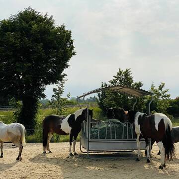
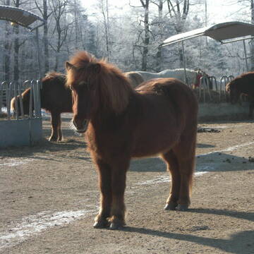
Offenstallplätze und Hengstboxen für Islandpferd...
Ober-Mörlen
Thomas-Terhaar
@Thomas-Terhaar
Freizeitstall
Gangpferdereiten
Hunde willkommen
Krankenbox
Allergikerstall
Hengsthaltung möglich
Außenbox mit Paddock
Innenbox
18 weitere...
P
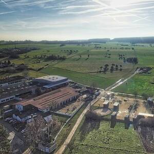
Gestüt Hasselheck - Diverse Einstellplätze frei
Ober-Mörlen
Gestuet-Hasselheck-Renz
@Gestuet-Hasselheck-Renz
Fahrstall, Kutschwagen
FN-Mitglied
Vermieten
Hunde willkommen
Krankenbox
Allergikerstall
Hengsthaltung möglich
31 weitere...
aktuell
P

Persönlichkeitsentwicklung mit Pferden
Bad Salzuflen
Katja Dors
@Pferdezeiten
Begleite andere auf ihrem Entwicklungsweg und entdecke die transformative Kraft der pferdegestützten Persönlichkeitsentwicklung !
neu
R


Glockenhof
Usingen-Eschbach
Glockenhof-Eschbach-GmbH
@Glockenhof-Eschbach-GmbH
Freizeitstall
Pferdeausbildung
Vermieten
Hunde willkommen
Longierzirkel/Roundpen
Gnadenbrothof
Hufrehe geeignet
18 weitere...
P+

Offenstallplatz
Butzbach
H.Wissig
@Jenny-Rohlaender
Vermieten
Reitplatz (z.B. Dressur, Springen, Reining)
Sommerweide
Offenstall
Biofutter
Vollpension
3 weitere...
P

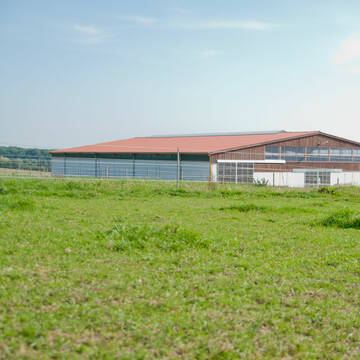
Pferdesportzentrum Pfingsthof
Usingen
Reitanlage-Pfingsthof
@Reitanlage-Pfingsthof
FN-Mitglied
Pferdeausbildung
Vermieten
Führanlage
Hunde willkommen
bedampftes/gewaschenes Heu
Zuchtstutenhaltung möglich
21 weitere...
aktuell
P
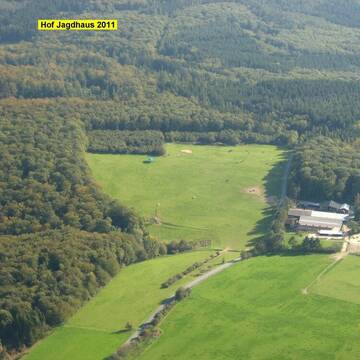
Artgerechte Pferdehaltung / Offenstallhaltung
Langgöns - Cleeberg
Pferdepension-Hof-Jagdhaus
@Pferdepension-Hof-Jagdhaus
Fahrstall, Kutschwagen
FN-Mitglied
Hunde willkommen
Krankenbox
Außenbox mit Paddock
Außenboxen
Vollpension
27 weitere...
P+


Stall Lindenhof
Wöllstadt
Stall Lindenhof
@Lindenhof1963
FN-Mitglied
Freizeitstall
Vermieten
Führanlage
Laufband
Hengsthaltung möglich
Pferdezucht
20 weitere...
P+
Deprecated: Creation of dynamic property Zend_View::$pageCount is deprecated in /var/www/stall-frei/htdocs/staging.stall-frei.de/library/vendor/shardj/zf1-future/library/Zend/View/Abstract.php on line 308
Deprecated: Creation of dynamic property Zend_View::$itemCountPerPage is deprecated in /var/www/stall-frei/htdocs/staging.stall-frei.de/library/vendor/shardj/zf1-future/library/Zend/View/Abstract.php on line 308
Deprecated: Creation of dynamic property Zend_View::$first is deprecated in /var/www/stall-frei/htdocs/staging.stall-frei.de/library/vendor/shardj/zf1-future/library/Zend/View/Abstract.php on line 308
Deprecated: Creation of dynamic property Zend_View::$current is deprecated in /var/www/stall-frei/htdocs/staging.stall-frei.de/library/vendor/shardj/zf1-future/library/Zend/View/Abstract.php on line 308
Deprecated: Creation of dynamic property Zend_View::$last is deprecated in /var/www/stall-frei/htdocs/staging.stall-frei.de/library/vendor/shardj/zf1-future/library/Zend/View/Abstract.php on line 308
Deprecated: Creation of dynamic property Zend_View::$next is deprecated in /var/www/stall-frei/htdocs/staging.stall-frei.de/library/vendor/shardj/zf1-future/library/Zend/View/Abstract.php on line 308
Deprecated: Creation of dynamic property Zend_View::$pagesInRange is deprecated in /var/www/stall-frei/htdocs/staging.stall-frei.de/library/vendor/shardj/zf1-future/library/Zend/View/Abstract.php on line 308
Deprecated: Creation of dynamic property Zend_View::$firstPageInRange is deprecated in /var/www/stall-frei/htdocs/staging.stall-frei.de/library/vendor/shardj/zf1-future/library/Zend/View/Abstract.php on line 308
Deprecated: Creation of dynamic property Zend_View::$lastPageInRange is deprecated in /var/www/stall-frei/htdocs/staging.stall-frei.de/library/vendor/shardj/zf1-future/library/Zend/View/Abstract.php on line 308
Deprecated: Creation of dynamic property Zend_View::$currentItemCount is deprecated in /var/www/stall-frei/htdocs/staging.stall-frei.de/library/vendor/shardj/zf1-future/library/Zend/View/Abstract.php on line 308
Deprecated: Creation of dynamic property Zend_View::$totalItemCount is deprecated in /var/www/stall-frei/htdocs/staging.stall-frei.de/library/vendor/shardj/zf1-future/library/Zend/View/Abstract.php on line 308
Deprecated: Creation of dynamic property Zend_View::$firstItemNumber is deprecated in /var/www/stall-frei/htdocs/staging.stall-frei.de/library/vendor/shardj/zf1-future/library/Zend/View/Abstract.php on line 308
Deprecated: Creation of dynamic property Zend_View::$lastItemNumber is deprecated in /var/www/stall-frei/htdocs/staging.stall-frei.de/library/vendor/shardj/zf1-future/library/Zend/View/Abstract.php on line 308
Deprecated: Creation of dynamic property Zend_View::$router is deprecated in /var/www/stall-frei/htdocs/staging.stall-frei.de/library/vendor/shardj/zf1-future/library/Zend/View/Abstract.php on line 308
Deprecated: Creation of dynamic property Zend_View::$urlParams is deprecated in /var/www/stall-frei/htdocs/staging.stall-frei.de/library/vendor/shardj/zf1-future/library/Zend/View/Abstract.php on line 308
Deprecated: Creation of dynamic property Zend_View::$showAds is deprecated in /var/www/stall-frei/htdocs/staging.stall-frei.de/library/vendor/shardj/zf1-future/library/Zend/View/Abstract.php on line 308
Deprecated: Creation of dynamic property Zend_View::$objectIds is deprecated in /var/www/stall-frei/htdocs/staging.stall-frei.de/library/vendor/shardj/zf1-future/library/Zend/View/Abstract.php on line 308
Deprecated: Creation of dynamic property Zend_View::$showNavbar is deprecated in /var/www/stall-frei/htdocs/staging.stall-frei.de/library/vendor/shardj/zf1-future/library/Zend/View/Abstract.php on line 308
Deprecated: Creation of dynamic property Zend_View::$showBreadcrumb is deprecated in /var/www/stall-frei/htdocs/staging.stall-frei.de/library/vendor/shardj/zf1-future/library/Zend/View/Abstract.php on line 308
Deprecated: Creation of dynamic property Zend_View::$showFooter is deprecated in /var/www/stall-frei/htdocs/staging.stall-frei.de/library/vendor/shardj/zf1-future/library/Zend/View/Abstract.php on line 308
Deprecated: Creation of dynamic property Zend_View::$showInternalAds is deprecated in /var/www/stall-frei/htdocs/staging.stall-frei.de/library/vendor/shardj/zf1-future/library/Zend/View/Abstract.php on line 308
Deprecated: Creation of dynamic property Zend_View::$blNoContent is deprecated in /var/www/stall-frei/htdocs/staging.stall-frei.de/library/vendor/shardj/zf1-future/library/Zend/View/Abstract.php on line 308
Deprecated: Creation of dynamic property Zend_View::$sMetaDesc is deprecated in /var/www/stall-frei/htdocs/staging.stall-frei.de/library/vendor/shardj/zf1-future/library/Zend/View/Abstract.php on line 308
Deprecated: Creation of dynamic property Zend_View::$useGmaps is deprecated in /var/www/stall-frei/htdocs/staging.stall-frei.de/library/vendor/shardj/zf1-future/library/Zend/View/Abstract.php on line 308
Deprecated: Creation of dynamic property Zend_View::$touches is deprecated in /var/www/stall-frei/htdocs/staging.stall-frei.de/library/vendor/shardj/zf1-future/library/Zend/View/Abstract.php on line 308
Deprecated: Creation of dynamic property Zend_View::$oProject is deprecated in /var/www/stall-frei/htdocs/staging.stall-frei.de/library/vendor/shardj/zf1-future/library/Zend/View/Abstract.php on line 308
Deprecated: Creation of dynamic property Zend_View::$pageHeadline is deprecated in /var/www/stall-frei/htdocs/staging.stall-frei.de/library/vendor/shardj/zf1-future/library/Zend/View/Abstract.php on line 308
Deprecated: Creation of dynamic property Zend_View::$disableLocationField is deprecated in /var/www/stall-frei/htdocs/staging.stall-frei.de/library/vendor/shardj/zf1-future/library/Zend/View/Abstract.php on line 308
Deprecated: Creation of dynamic property Zend_View::$isSearch is deprecated in /var/www/stall-frei/htdocs/staging.stall-frei.de/library/vendor/shardj/zf1-future/library/Zend/View/Abstract.php on line 308
Deprecated: Creation of dynamic property Zend_View::$pageTitle is deprecated in /var/www/stall-frei/htdocs/staging.stall-frei.de/library/vendor/shardj/zf1-future/library/Zend/View/Abstract.php on line 308
Deprecated: Creation of dynamic property Psf_Form_Element_Text::$class is deprecated in /var/www/stall-frei/htdocs/staging.stall-frei.de/library/vendor/shardj/zf1-future/library/Zend/Form/Element.php on line 874
Deprecated: Creation of dynamic property Psf_Form_Element_Text::$size is deprecated in /var/www/stall-frei/htdocs/staging.stall-frei.de/library/vendor/shardj/zf1-future/library/Zend/Form/Element.php on line 874
Deprecated: Creation of dynamic property Psf_Form_Element_Text::$placeholder is deprecated in /var/www/stall-frei/htdocs/staging.stall-frei.de/library/vendor/shardj/zf1-future/library/Zend/Form/Element.php on line 874
Deprecated: Creation of dynamic property Psf_Form_Element_Hidden::$class is deprecated in /var/www/stall-frei/htdocs/staging.stall-frei.de/library/vendor/shardj/zf1-future/library/Zend/Form/Element.php on line 874
Deprecated: Creation of dynamic property Psf_Form_Element_Hidden::$class is deprecated in /var/www/stall-frei/htdocs/staging.stall-frei.de/library/vendor/shardj/zf1-future/library/Zend/Form/Element.php on line 874
Deprecated: Creation of dynamic property Psf_Form_Element_Hidden::$class is deprecated in /var/www/stall-frei/htdocs/staging.stall-frei.de/library/vendor/shardj/zf1-future/library/Zend/Form/Element.php on line 874
Deprecated: Creation of dynamic property Psf_Form_Element_Hidden::$class is deprecated in /var/www/stall-frei/htdocs/staging.stall-frei.de/library/vendor/shardj/zf1-future/library/Zend/Form/Element.php on line 874
Deprecated: Creation of dynamic property Psf_Form_Element_Select::$class is deprecated in /var/www/stall-frei/htdocs/staging.stall-frei.de/library/vendor/shardj/zf1-future/library/Zend/Form/Element.php on line 874
Deprecated: Creation of dynamic property Psf_Form_Element_Select::$class is deprecated in /var/www/stall-frei/htdocs/staging.stall-frei.de/library/vendor/shardj/zf1-future/library/Zend/Form/Element.php on line 874
Deprecated: Creation of dynamic property Psf_Form_Element_Select::$class is deprecated in /var/www/stall-frei/htdocs/staging.stall-frei.de/library/vendor/shardj/zf1-future/library/Zend/Form/Element.php on line 874
Deprecated: Creation of dynamic property Psf_Form_Element_Select::$class is deprecated in /var/www/stall-frei/htdocs/staging.stall-frei.de/library/vendor/shardj/zf1-future/library/Zend/Form/Element.php on line 874
Deprecated: Creation of dynamic property Psf_Form_Element_Text::$class is deprecated in /var/www/stall-frei/htdocs/staging.stall-frei.de/library/vendor/shardj/zf1-future/library/Zend/Form/Element.php on line 874
Deprecated: Creation of dynamic property Psf_Form_Element_Checkbox::$label is deprecated in /var/www/stall-frei/htdocs/staging.stall-frei.de/library/vendor/shardj/zf1-future/library/Zend/Form/Element.php on line 874
Deprecated: Creation of dynamic property Zend_View::$sort is deprecated in /var/www/stall-frei/htdocs/staging.stall-frei.de/library/vendor/shardj/zf1-future/library/Zend/View/Abstract.php on line 308
Deprecated: Creation of dynamic property Zend_View::$searchLocation is deprecated in /var/www/stall-frei/htdocs/staging.stall-frei.de/library/vendor/shardj/zf1-future/library/Zend/View/Abstract.php on line 308
Deprecated: Creation of dynamic property Zend_View::$locationHint is deprecated in /var/www/stall-frei/htdocs/staging.stall-frei.de/library/vendor/shardj/zf1-future/library/Zend/View/Abstract.php on line 308
Psf_GeoCoder_Abstract::getLocation: Ober-Mörlen Get Location CachedOrLive
Psf_GeoCoder_Abstract::getCachedOrLive: Ober-Mörlen
Psf_GeoCoder_OpenCageData::makeApiRequest: response:
Array
(
[documentation] => https://opencagedata.com/api
[licenses] => Array
(
[0] => Array
(
[name] => see attribution guide
[url] => https://opencagedata.com/credits
)
)
[results] => Array
(
[0] => Array
(
[bounds] => Array
(
[northeast] => Array
(
[lat] => 50.4075778
[lng] => 8.7196736
)
[southwest] => Array
(
[lat] => 50.3243175
[lng] => 8.6001865
)
)
[components] => Array
(
[ISO_3166-1_alpha-2] => DE
[ISO_3166-1_alpha-3] => DEU
[ISO_3166-2] => Array
(
[0] => DE-HE
)
[_category] => place
[_normalized_city] => Ober-Mörlen
[_type] => municipality
[continent] => Europe
[country] => Deutschland
[country_code] => de
[county] => Wetteraukreis
[municipality] => Ober-Mörlen
[political_union] => European Union
[postcode] => 61239
[state] => Hessen
[state_code] => HE
)
[confidence] => 7
[formatted] => 61239 Ober-Mörlen, Deutschland
[geometry] => Array
(
[lat] => 50.3582661
[lng] => 8.6747014
)
)
[1] => Array
(
[bounds] => Array
(
[northeast] => Array
(
[lat] => 50.4075778
[lng] => 8.7196736
)
[southwest] => Array
(
[lat] => 50.3243175
[lng] => 8.6257047
)
)
[components] => Array
(
[ISO_3166-1_alpha-2] => DE
[ISO_3166-1_alpha-3] => DEU
[ISO_3166-2] => Array
(
[0] => DE-HE
)
[_category] => place
[_normalized_city] => Ober-Mörlen
[_type] => village
[continent] => Europe
[country] => Deutschland
[country_code] => de
[county] => Wetteraukreis
[municipality] => Ober-Mörlen
[political_union] => European Union
[postcode] => 61239
[state] => Hessen
[state_code] => HE
[village] => Ober-Mörlen
)
[confidence] => 7
[formatted] => 61239 Ober-Mörlen, Deutschland
[geometry] => Array
(
[lat] => 50.3726927
[lng] => 8.6925312
)
)
[2] => Array
(
[components] => Array
(
[ISO_3166-1_alpha-2] => FR
[ISO_3166-1_alpha-3] => FRA
[ISO_3166-2] => Array
(
[0] => FR-GES
[1] => FR-6AE
[2] => FR-68
)
[_category] => road
[_normalized_city] => Soultzeren
[_type] => road
[city] => Soultzeren
[continent] => Europe
[country] => France
[country_code] => fr
[county] => Haut-Rhin
[local_authority] => Communauté de communes de la Vallée de Munster
[political_union] => European Union
[postcode] => 68140
[road] => Chemin du Ober Langeren
[state] => Grand Est
[state_code] => GES
)
[confidence] => 2
[formatted] => Chemin du Ober Langeren, 68140 Soultzeren, France
[geometry] => Array
(
[lat] => 48.074083
[lng] => 7.103864
)
)
[3] => Array
(
[components] => Array
(
[ISO_3166-1_alpha-2] => FR
[ISO_3166-1_alpha-3] => FRA
[ISO_3166-2] => Array
(
[0] => FR-GES
[1] => FR-6AE
[2] => FR-68
)
[_category] => road
[_normalized_city] => Munster
[_type] => road
[city] => Munster
[continent] => Europe
[country] => France
[country_code] => fr
[county] => Haut-Rhin
[local_authority] => Communauté de communes de la Vallée de Munster
[political_union] => European Union
[postcode] => 68140
[road] => Chemin du Ober Moenchberg
[state] => Grand Est
[state_code] => GES
)
[confidence] => 2
[formatted] => Chemin du Ober Moenchberg, 68140 Munster, France
[geometry] => Array
(
[lat] => 48.039279
[lng] => 7.121846
)
)
[4] => Array
(
[components] => Array
(
[ISO_3166-1_alpha-2] => FR
[ISO_3166-1_alpha-3] => FRA
[ISO_3166-2] => Array
(
[0] => FR-GES
[1] => FR-57
)
[_category] => place
[_normalized_city] => Hanviller
[_type] => place
[city] => Hanviller
[continent] => Europe
[country] => France
[country_code] => fr
[county] => Moselle
[local_authority] => Communauté de communes du Pays de Bitche
[place] => Ober Diedenbach
[political_union] => European Union
[postcode] => 57230
[state] => Grand Est
[state_code] => GES
)
[confidence] => 2
[formatted] => Ober Diedenbach, 57230 Hanviller, France
[geometry] => Array
(
[lat] => 49.094878
[lng] => 7.453496
)
)
[5] => Array
(
[components] => Array
(
[ISO_3166-1_alpha-2] => FR
[ISO_3166-1_alpha-3] => FRA
[ISO_3166-2] => Array
(
[0] => FR-GES
[1] => FR-6AE
[2] => FR-68
)
[_category] => place
[_normalized_city] => Hirsingue
[_type] => place
[city] => Hirsingue
[continent] => Europe
[country] => France
[country_code] => fr
[county] => Haut-Rhin
[local_authority] => Communauté de communes Sundgau
[place] => Ober Dem Brandwinkel
[political_union] => European Union
[postcode] => 68560
[state] => Grand Est
[state_code] => GES
)
[confidence] => 2
[formatted] => Ober Dem Brandwinkel, 68560 Hirsingue, France
[geometry] => Array
(
[lat] => 47.595541
[lng] => 7.244854
)
)
[6] => Array
(
[components] => Array
(
[ISO_3166-1_alpha-2] => FR
[ISO_3166-1_alpha-3] => FRA
[ISO_3166-2] => Array
(
[0] => FR-BRE
[1] => FR-56
)
[_category] => road
[_normalized_city] => Malguénac
[_type] => road
[city] => Malguénac
[continent] => Europe
[country] => France
[country_code] => fr
[county] => Morbihan
[local_authority] => Pontivy Communauté
[political_union] => European Union
[postcode] => 56300
[road] => Morlen
[state] => Bretagne
[state_code] => BRE
)
[confidence] => 2
[formatted] => Morlen, 56300 Malguénac, France
[geometry] => Array
(
[lat] => 48.061342
[lng] => -3.012727
)
)
[7] => Array
(
[components] => Array
(
[ISO_3166-1_alpha-2] => FR
[ISO_3166-1_alpha-3] => FRA
[ISO_3166-2] => Array
(
[0] => FR-GES
[1] => FR-6AE
[2] => FR-68
)
[_category] => place
[_normalized_city] => Illtal
[_type] => place
[city] => Illtal
[continent] => Europe
[country] => France
[country_code] => fr
[county] => Haut-Rhin
[local_authority] => Communauté de communes Sundgau
[place] => Obere Erlen (Oberdorf)
[political_union] => European Union
[postcode] => 68960
[state] => Grand Est
[state_code] => GES
)
[confidence] => 2
[formatted] => Obere Erlen (Oberdorf), 68960 Illtal, France
[geometry] => Array
(
[lat] => 47.544728
[lng] => 7.300277
)
)
[8] => Array
(
[components] => Array
(
[ISO_3166-1_alpha-2] => FR
[ISO_3166-1_alpha-3] => FRA
[ISO_3166-2] => Array
(
[0] => FR-GES
[1] => FR-6AE
[2] => FR-68
)
[_category] => road
[_normalized_city] => Sondernach
[_type] => road
[city] => Sondernach
[continent] => Europe
[country] => France
[country_code] => fr
[county] => Haut-Rhin
[local_authority] => Communauté de communes de la Vallée de Munster
[political_union] => European Union
[postcode] => 68380
[road] => chemin Ober Lengenbach
[state] => Grand Est
[state_code] => GES
)
[confidence] => 2
[formatted] => chemin Ober Lengenbach, 68380 Sondernach, France
[geometry] => Array
(
[lat] => 47.990676
[lng] => 7.101859
)
)
[9] => Array
(
[components] => Array
(
[ISO_3166-1_alpha-2] => FR
[ISO_3166-1_alpha-3] => FRA
[ISO_3166-2] => Array
(
[0] => FR-NOR
[1] => FR-76
)
[_category] => road
[_normalized_city] => Le Havre
[_type] => road
[city] => Le Havre
[continent] => Europe
[country] => France
[country_code] => fr
[county] => Seine-Maritime
[local_authority] => Le Havre Seine Métropole
[political_union] => European Union
[postcode] => 76600
[road] => Rue Joseph Morlent
[state] => Normandie
[state_code] => NOR
)
[confidence] => 2
[formatted] => Rue Joseph Morlent, 76600 Le Havre, France
[geometry] => Array
(
[lat] => 49.497239
[lng] => 0.095523
)
)
)
[status] => Array
(
[code] => 200
[message] => OK
)
[stay_informed] => Array
(
[blog] => https://blog.opencagedata.com
[mastodon] => https://en.osm.town/@opencage
)
[thanks] => For using an OpenCage API
[timestamp] => Array
(
[created_http] => Sun, 08 Feb 2026 15:06:30 GMT
[created_unix] => 1770563190
)
[total_results] => 10
)
Psf_GeoCoder_Abstract::convertLocationResult
{"documentation":"https:\/\/opencagedata.com\/api","licenses":[{"name":"see attribution guide","url":"https:\/\/opencagedata.com\/credits"}],"results":[{"bounds":{"northeast":{"lat":50.4075778,"lng":8.7196736},"southwest":{"lat":50.3243175,"lng":8.6001865}},"components":{"ISO_3166-1_alpha-2":"DE","ISO_3166-1_alpha-3":"DEU","ISO_3166-2":["DE-HE"],"_category":"place","_normalized_city":"Ober-M\u00f6rlen","_type":"municipality","continent":"Europe","country":"Deutschland","country_code":"de","county":"Wetteraukreis","municipality":"Ober-M\u00f6rlen","political_union":"European Union","postcode":"61239","state":"Hessen","state_code":"HE"},"confidence":7,"formatted":"61239 Ober-M\u00f6rlen, Deutschland","geometry":{"lat":50.3582661,"lng":8.6747014}},{"bounds":{"northeast":{"lat":50.4075778,"lng":8.7196736},"southwest":{"lat":50.3243175,"lng":8.6257047}},"components":{"ISO_3166-1_alpha-2":"DE","ISO_3166-1_alpha-3":"DEU","ISO_3166-2":["DE-HE"],"_category":"place","_normalized_city":"Ober-M\u00f6rlen","_type":"village","continent":"Europe","country":"Deutschland","country_code":"de","county":"Wetteraukreis","municipality":"Ober-M\u00f6rlen","political_union":"European Union","postcode":"61239","state":"Hessen","state_code":"HE","village":"Ober-M\u00f6rlen"},"confidence":7,"formatted":"61239 Ober-M\u00f6rlen, Deutschland","geometry":{"lat":50.3726927,"lng":8.6925312}},{"components":{"ISO_3166-1_alpha-2":"FR","ISO_3166-1_alpha-3":"FRA","ISO_3166-2":["FR-GES","FR-6AE","FR-68"],"_category":"road","_normalized_city":"Soultzeren","_type":"road","city":"Soultzeren","continent":"Europe","country":"France","country_code":"fr","county":"Haut-Rhin","local_authority":"Communaut\u00e9 de communes de la Vall\u00e9e de Munster","political_union":"European Union","postcode":"68140","road":"Chemin du Ober Langeren","state":"Grand Est","state_code":"GES"},"confidence":2,"formatted":"Chemin du Ober Langeren, 68140 Soultzeren, France","geometry":{"lat":48.074083,"lng":7.103864}},{"components":{"ISO_3166-1_alpha-2":"FR","ISO_3166-1_alpha-3":"FRA","ISO_3166-2":["FR-GES","FR-6AE","FR-68"],"_category":"road","_normalized_city":"Munster","_type":"road","city":"Munster","continent":"Europe","country":"France","country_code":"fr","county":"Haut-Rhin","local_authority":"Communaut\u00e9 de communes de la Vall\u00e9e de Munster","political_union":"European Union","postcode":"68140","road":"Chemin du Ober Moenchberg","state":"Grand Est","state_code":"GES"},"confidence":2,"formatted":"Chemin du Ober Moenchberg, 68140 Munster, France","geometry":{"lat":48.039279,"lng":7.121846}},{"components":{"ISO_3166-1_alpha-2":"FR","ISO_3166-1_alpha-3":"FRA","ISO_3166-2":["FR-GES","FR-57"],"_category":"place","_normalized_city":"Hanviller","_type":"place","city":"Hanviller","continent":"Europe","country":"France","country_code":"fr","county":"Moselle","local_authority":"Communaut\u00e9 de communes du Pays de Bitche","place":"Ober Diedenbach","political_union":"European Union","postcode":"57230","state":"Grand Est","state_code":"GES"},"confidence":2,"formatted":"Ober Diedenbach, 57230 Hanviller, France","geometry":{"lat":49.094878,"lng":7.453496}},{"components":{"ISO_3166-1_alpha-2":"FR","ISO_3166-1_alpha-3":"FRA","ISO_3166-2":["FR-GES","FR-6AE","FR-68"],"_category":"place","_normalized_city":"Hirsingue","_type":"place","city":"Hirsingue","continent":"Europe","country":"France","country_code":"fr","county":"Haut-Rhin","local_authority":"Communaut\u00e9 de communes Sundgau","place":"Ober Dem Brandwinkel","political_union":"European Union","postcode":"68560","state":"Grand Est","state_code":"GES"},"confidence":2,"formatted":"Ober Dem Brandwinkel, 68560 Hirsingue, France","geometry":{"lat":47.595541,"lng":7.244854}},{"components":{"ISO_3166-1_alpha-2":"FR","ISO_3166-1_alpha-3":"FRA","ISO_3166-2":["FR-BRE","FR-56"],"_category":"road","_normalized_city":"Malgu\u00e9nac","_type":"road","city":"Malgu\u00e9nac","continent":"Europe","country":"France","country_code":"fr","county":"Morbihan","local_authority":"Pontivy Communaut\u00e9","political_union":"European Union","postcode":"56300","road":"Morlen","state":"Bretagne","state_code":"BRE"},"confidence":2,"formatted":"Morlen, 56300 Malgu\u00e9nac, France","geometry":{"lat":48.061342,"lng":-3.012727}},{"components":{"ISO_3166-1_alpha-2":"FR","ISO_3166-1_alpha-3":"FRA","ISO_3166-2":["FR-GES","FR-6AE","FR-68"],"_category":"place","_normalized_city":"Illtal","_type":"place","city":"Illtal","continent":"Europe","country":"France","country_code":"fr","county":"Haut-Rhin","local_authority":"Communaut\u00e9 de communes Sundgau","place":"Obere Erlen (Oberdorf)","political_union":"European Union","postcode":"68960","state":"Grand Est","state_code":"GES"},"confidence":2,"formatted":"Obere Erlen (Oberdorf), 68960 Illtal, France","geometry":{"lat":47.544728,"lng":7.300277}},{"components":{"ISO_3166-1_alpha-2":"FR","ISO_3166-1_alpha-3":"FRA","ISO_3166-2":["FR-GES","FR-6AE","FR-68"],"_category":"road","_normalized_city":"Sondernach","_type":"road","city":"Sondernach","continent":"Europe","country":"France","country_code":"fr","county":"Haut-Rhin","local_authority":"Communaut\u00e9 de communes de la Vall\u00e9e de Munster","political_union":"European Union","postcode":"68380","road":"chemin Ober Lengenbach","state":"Grand Est","state_code":"GES"},"confidence":2,"formatted":"chemin Ober Lengenbach, 68380 Sondernach, France","geometry":{"lat":47.990676,"lng":7.101859}},{"components":{"ISO_3166-1_alpha-2":"FR","ISO_3166-1_alpha-3":"FRA","ISO_3166-2":["FR-NOR","FR-76"],"_category":"road","_normalized_city":"Le Havre","_type":"road","city":"Le Havre","continent":"Europe","country":"France","country_code":"fr","county":"Seine-Maritime","local_authority":"Le Havre Seine M\u00e9tropole","political_union":"European Union","postcode":"76600","road":"Rue Joseph Morlent","state":"Normandie","state_code":"NOR"},"confidence":2,"formatted":"Rue Joseph Morlent, 76600 Le Havre, France","geometry":{"lat":49.497239,"lng":0.095523}}],"status":{"code":200,"message":"OK"},"stay_informed":{"blog":"https:\/\/blog.opencagedata.com","mastodon":"https:\/\/en.osm.town\/@opencage"},"thanks":"For using an OpenCage API","timestamp":{"created_http":"Sun, 08 Feb 2026 15:06:30 GMT","created_unix":1770563190},"total_results":10}Array
(
[0] => stdClass Object
(
[bounds] => stdClass Object
(
[northeast] => stdClass Object
(
[lat] => 50.4075778
[lng] => 8.7196736
)
[southwest] => stdClass Object
(
[lat] => 50.3243175
[lng] => 8.6001865
)
)
[components] => stdClass Object
(
[ISO_3166-1_alpha-2] => DE
[ISO_3166-1_alpha-3] => DEU
[ISO_3166-2] => Array
(
[0] => DE-HE
)
[_category] => place
[_normalized_city] => Ober-Mörlen
[_type] => municipality
[continent] => Europe
[country] => Deutschland
[country_code] => de
[county] => Wetteraukreis
[municipality] => Ober-Mörlen
[political_union] => European Union
[postcode] => 61239
[state] => Hessen
[state_code] => HE
)
[confidence] => 7
[formatted] => 61239 Ober-Mörlen, Deutschland
[geometry] => stdClass Object
(
[lat] => 50.3582661
[lng] => 8.6747014
)
)
[1] => stdClass Object
(
[bounds] => stdClass Object
(
[northeast] => stdClass Object
(
[lat] => 50.4075778
[lng] => 8.7196736
)
[southwest] => stdClass Object
(
[lat] => 50.3243175
[lng] => 8.6257047
)
)
[components] => stdClass Object
(
[ISO_3166-1_alpha-2] => DE
[ISO_3166-1_alpha-3] => DEU
[ISO_3166-2] => Array
(
[0] => DE-HE
)
[_category] => place
[_normalized_city] => Ober-Mörlen
[_type] => village
[continent] => Europe
[country] => Deutschland
[country_code] => de
[county] => Wetteraukreis
[municipality] => Ober-Mörlen
[political_union] => European Union
[postcode] => 61239
[state] => Hessen
[state_code] => HE
[village] => Ober-Mörlen
)
[confidence] => 7
[formatted] => 61239 Ober-Mörlen, Deutschland
[geometry] => stdClass Object
(
[lat] => 50.3726927
[lng] => 8.6925312
)
)
[2] => stdClass Object
(
[components] => stdClass Object
(
[ISO_3166-1_alpha-2] => FR
[ISO_3166-1_alpha-3] => FRA
[ISO_3166-2] => Array
(
[0] => FR-GES
[1] => FR-6AE
[2] => FR-68
)
[_category] => road
[_normalized_city] => Soultzeren
[_type] => road
[city] => Soultzeren
[continent] => Europe
[country] => France
[country_code] => fr
[county] => Haut-Rhin
[local_authority] => Communauté de communes de la Vallée de Munster
[political_union] => European Union
[postcode] => 68140
[road] => Chemin du Ober Langeren
[state] => Grand Est
[state_code] => GES
)
[confidence] => 2
[formatted] => Chemin du Ober Langeren, 68140 Soultzeren, France
[geometry] => stdClass Object
(
[lat] => 48.074083
[lng] => 7.103864
)
)
[3] => stdClass Object
(
[components] => stdClass Object
(
[ISO_3166-1_alpha-2] => FR
[ISO_3166-1_alpha-3] => FRA
[ISO_3166-2] => Array
(
[0] => FR-GES
[1] => FR-6AE
[2] => FR-68
)
[_category] => road
[_normalized_city] => Munster
[_type] => road
[city] => Munster
[continent] => Europe
[country] => France
[country_code] => fr
[county] => Haut-Rhin
[local_authority] => Communauté de communes de la Vallée de Munster
[political_union] => European Union
[postcode] => 68140
[road] => Chemin du Ober Moenchberg
[state] => Grand Est
[state_code] => GES
)
[confidence] => 2
[formatted] => Chemin du Ober Moenchberg, 68140 Munster, France
[geometry] => stdClass Object
(
[lat] => 48.039279
[lng] => 7.121846
)
)
[4] => stdClass Object
(
[components] => stdClass Object
(
[ISO_3166-1_alpha-2] => FR
[ISO_3166-1_alpha-3] => FRA
[ISO_3166-2] => Array
(
[0] => FR-GES
[1] => FR-57
)
[_category] => place
[_normalized_city] => Hanviller
[_type] => place
[city] => Hanviller
[continent] => Europe
[country] => France
[country_code] => fr
[county] => Moselle
[local_authority] => Communauté de communes du Pays de Bitche
[place] => Ober Diedenbach
[political_union] => European Union
[postcode] => 57230
[state] => Grand Est
[state_code] => GES
)
[confidence] => 2
[formatted] => Ober Diedenbach, 57230 Hanviller, France
[geometry] => stdClass Object
(
[lat] => 49.094878
[lng] => 7.453496
)
)
[5] => stdClass Object
(
[components] => stdClass Object
(
[ISO_3166-1_alpha-2] => FR
[ISO_3166-1_alpha-3] => FRA
[ISO_3166-2] => Array
(
[0] => FR-GES
[1] => FR-6AE
[2] => FR-68
)
[_category] => place
[_normalized_city] => Hirsingue
[_type] => place
[city] => Hirsingue
[continent] => Europe
[country] => France
[country_code] => fr
[county] => Haut-Rhin
[local_authority] => Communauté de communes Sundgau
[place] => Ober Dem Brandwinkel
[political_union] => European Union
[postcode] => 68560
[state] => Grand Est
[state_code] => GES
)
[confidence] => 2
[formatted] => Ober Dem Brandwinkel, 68560 Hirsingue, France
[geometry] => stdClass Object
(
[lat] => 47.595541
[lng] => 7.244854
)
)
[6] => stdClass Object
(
[components] => stdClass Object
(
[ISO_3166-1_alpha-2] => FR
[ISO_3166-1_alpha-3] => FRA
[ISO_3166-2] => Array
(
[0] => FR-BRE
[1] => FR-56
)
[_category] => road
[_normalized_city] => Malguénac
[_type] => road
[city] => Malguénac
[continent] => Europe
[country] => France
[country_code] => fr
[county] => Morbihan
[local_authority] => Pontivy Communauté
[political_union] => European Union
[postcode] => 56300
[road] => Morlen
[state] => Bretagne
[state_code] => BRE
)
[confidence] => 2
[formatted] => Morlen, 56300 Malguénac, France
[geometry] => stdClass Object
(
[lat] => 48.061342
[lng] => -3.012727
)
)
[7] => stdClass Object
(
[components] => stdClass Object
(
[ISO_3166-1_alpha-2] => FR
[ISO_3166-1_alpha-3] => FRA
[ISO_3166-2] => Array
(
[0] => FR-GES
[1] => FR-6AE
[2] => FR-68
)
[_category] => place
[_normalized_city] => Illtal
[_type] => place
[city] => Illtal
[continent] => Europe
[country] => France
[country_code] => fr
[county] => Haut-Rhin
[local_authority] => Communauté de communes Sundgau
[place] => Obere Erlen (Oberdorf)
[political_union] => European Union
[postcode] => 68960
[state] => Grand Est
[state_code] => GES
)
[confidence] => 2
[formatted] => Obere Erlen (Oberdorf), 68960 Illtal, France
[geometry] => stdClass Object
(
[lat] => 47.544728
[lng] => 7.300277
)
)
[8] => stdClass Object
(
[components] => stdClass Object
(
[ISO_3166-1_alpha-2] => FR
[ISO_3166-1_alpha-3] => FRA
[ISO_3166-2] => Array
(
[0] => FR-GES
[1] => FR-6AE
[2] => FR-68
)
[_category] => road
[_normalized_city] => Sondernach
[_type] => road
[city] => Sondernach
[continent] => Europe
[country] => France
[country_code] => fr
[county] => Haut-Rhin
[local_authority] => Communauté de communes de la Vallée de Munster
[political_union] => European Union
[postcode] => 68380
[road] => chemin Ober Lengenbach
[state] => Grand Est
[state_code] => GES
)
[confidence] => 2
[formatted] => chemin Ober Lengenbach, 68380 Sondernach, France
[geometry] => stdClass Object
(
[lat] => 47.990676
[lng] => 7.101859
)
)
[9] => stdClass Object
(
[components] => stdClass Object
(
[ISO_3166-1_alpha-2] => FR
[ISO_3166-1_alpha-3] => FRA
[ISO_3166-2] => Array
(
[0] => FR-NOR
[1] => FR-76
)
[_category] => road
[_normalized_city] => Le Havre
[_type] => road
[city] => Le Havre
[continent] => Europe
[country] => France
[country_code] => fr
[county] => Seine-Maritime
[local_authority] => Le Havre Seine Métropole
[political_union] => European Union
[postcode] => 76600
[road] => Rue Joseph Morlent
[state] => Normandie
[state_code] => NOR
)
[confidence] => 2
[formatted] => Rue Joseph Morlent, 76600 Le Havre, France
[geometry] => stdClass Object
(
[lat] => 49.497239
[lng] => 0.095523
)
)
)
Psf_GeoCoder_OpenCageData::getKeyMap: 0
stdClass Object
(
    [bounds] => stdClass Object
        (
            [northeast] => stdClass Object
                (
                    [lat] => 50.4075778
                    [lng] => 8.7196736
                )

            [southwest] => stdClass Object
                (
                    [lat] => 50.3243175
                    [lng] => 8.6001865
                )

        )

    [components] => stdClass Object
        (
            [ISO_3166-1_alpha-2] => DE
            [ISO_3166-1_alpha-3] => DEU
            [ISO_3166-2] => Array
                (
                    [0] => DE-HE
                )

            [_category] => place
            [_normalized_city] => Ober-Mörlen
            [_type] => municipality
            [continent] => Europe
            [country] => Deutschland
            [country_code] => de
            [county] => Wetteraukreis
            [municipality] => Ober-Mörlen
            [political_union] => European Union
            [postcode] => 61239
            [state] => Hessen
            [state_code] => HE
        )

    [confidence] => 7
    [formatted] => 61239 Ober-Mörlen, Deutschland
    [geometry] => stdClass Object
        (
            [lat] => 50.3582661
            [lng] => 8.6747014
        )

)
Psf_GeoCoder_OpenCageData::getCounty: Wetteraukreis
Psf_GeoCoder_OpenCageData::addMissingData REFETCH!
Array
(
    [address] => 61239 Ober-Mörlen, Deutschland
    [type] => municipality
    [street] =>
    [city] =>
    [county] => Wetteraukreis
    [state] => Hessen
    [zip] => 61239
    [country] => Deutschland
    [suburb] =>
    [countrycode] => de
    [latitude] => 50.3582661
    [longitude] => 8.6747014
    [accuracy] => 1
    [confidence] => 7
    [bounds] => stdClass Object
        (
            [northeast] => stdClass Object
                (
                    [lat] => 50.4075778
                    [lng] => 8.7196736
                )

            [southwest] => stdClass Object
                (
                    [lat] => 50.3243175
                    [lng] => 8.6001865
                )

        )

)
reformat!
Array
(
    [address] => 61239 Ober-Mörlen, Deutschland
    [type] => municipality
    [street] =>
    [city] =>
    [county] => Wetteraukreis
    [state] => Hessen
    [zip] => 61239
    [country] => Deutschland
    [suburb] =>
    [countrycode] => de
    [latitude] => 50.3582661
    [longitude] => 8.6747014
    [accuracy] => 1
    [confidence] => 7
    [bounds] => stdClass Object
        (
            [northeast] => stdClass Object
                (
                    [lat] => 50.4075778
                    [lng] => 8.7196736
                )

            [southwest] => stdClass Object
                (
                    [lat] => 50.3243175
                    [lng] => 8.6001865
                )

        )

    [place] => 61239 , Hessen
    [hash] => 0cfb899ffc2e3e2a5cceadae5b85d852
)
Psf_GeoCoder_OpenCageData::getKeyMap: 1
stdClass Object
(
    [bounds] => stdClass Object
        (
            [northeast] => stdClass Object
                (
                    [lat] => 50.4075778
                    [lng] => 8.7196736
                )

            [southwest] => stdClass Object
                (
                    [lat] => 50.3243175
                    [lng] => 8.6257047
                )

        )

    [components] => stdClass Object
        (
            [ISO_3166-1_alpha-2] => DE
            [ISO_3166-1_alpha-3] => DEU
            [ISO_3166-2] => Array
                (
                    [0] => DE-HE
                )

            [_category] => place
            [_normalized_city] => Ober-Mörlen
            [_type] => village
            [continent] => Europe
            [country] => Deutschland
            [country_code] => de
            [county] => Wetteraukreis
            [municipality] => Ober-Mörlen
            [political_union] => European Union
            [postcode] => 61239
            [state] => Hessen
            [state_code] => HE
            [village] => Ober-Mörlen
        )

    [confidence] => 7
    [formatted] => 61239 Ober-Mörlen, Deutschland
    [geometry] => stdClass Object
        (
            [lat] => 50.3726927
            [lng] => 8.6925312
        )

)
Psf_GeoCoder_OpenCageData::getCounty: Wetteraukreis
Psf_GeoCoder_OpenCageData::addMissingData REFETCH!
Array
(
    [address] => 61239 Ober-Mörlen, Deutschland
    [type] => village
    [street] =>
    [city] => Ober-Mörlen
    [county] => Wetteraukreis
    [state] => Hessen
    [zip] => 61239
    [country] => Deutschland
    [suburb] =>
    [countrycode] => de
    [latitude] => 50.3726927
    [longitude] => 8.6925312
    [accuracy] => 1
    [confidence] => 7
    [bounds] => stdClass Object
        (
            [northeast] => stdClass Object
                (
                    [lat] => 50.4075778
                    [lng] => 8.7196736
                )

            [southwest] => stdClass Object
                (
                    [lat] => 50.3243175
                    [lng] => 8.6257047
                )

        )

)
reformat!
Array
(
    [address] => 61239 Ober-Mörlen, Deutschland
    [type] => village
    [street] =>
    [city] => Ober-Mörlen
    [county] => Wetteraukreis
    [state] => Hessen
    [zip] => 61239
    [country] => Deutschland
    [suburb] =>
    [countrycode] => de
    [latitude] => 50.3726927
    [longitude] => 8.6925312
    [accuracy] => 1
    [confidence] => 7
    [bounds] => stdClass Object
        (
            [northeast] => stdClass Object
                (
                    [lat] => 50.4075778
                    [lng] => 8.7196736
                )

            [southwest] => stdClass Object
                (
                    [lat] => 50.3243175
                    [lng] => 8.6257047
                )

        )

    [place] => 61239 Ober-Mörlen, Hessen
    [hash] => 8195018be3de4e12f4fc61f4f3a6663a
)
Psf_GeoCoder_OpenCageData::getKeyMap: 2
stdClass Object
(
    [components] => stdClass Object
        (
            [ISO_3166-1_alpha-2] => FR
            [ISO_3166-1_alpha-3] => FRA
            [ISO_3166-2] => Array
                (
                    [0] => FR-GES
                    [1] => FR-6AE
                    [2] => FR-68
                )

            [_category] => road
            [_normalized_city] => Soultzeren
            [_type] => road
            [city] => Soultzeren
            [continent] => Europe
            [country] => France
            [country_code] => fr
            [county] => Haut-Rhin
            [local_authority] => Communauté de communes de la Vallée de Munster
            [political_union] => European Union
            [postcode] => 68140
            [road] => Chemin du Ober Langeren
            [state] => Grand Est
            [state_code] => GES
        )

    [confidence] => 2
    [formatted] => Chemin du Ober Langeren, 68140 Soultzeren, France
    [geometry] => stdClass Object
        (
            [lat] => 48.074083
            [lng] => 7.103864
        )

)
Psf_GeoCoder_OpenCageData::getCounty: Haut-Rhin
Psf_GeoCoder_OpenCageData::addMissingData REFETCH!
Array
(
    [address] => Chemin du Ober Langeren, 68140 Soultzeren, France
    [type] => road
    [street] => Chemin du Ober Langeren
    [city] => Soultzeren
    [county] => Haut-Rhin
    [state] => Grand Est
    [zip] => 68140
    [country] => France
    [suburb] =>
    [countrycode] => fr
    [latitude] => 48.074083
    [longitude] => 7.103864
    [accuracy] => 1
    [confidence] => 2
    [bounds] =>
)
reformat!
Array
(
    [address] => Chemin du Ober Langeren, 68140 Soultzeren, France
    [type] => road
    [street] => Chemin du Ober Langeren
    [city] => Soultzeren
    [county] => Haut-Rhin
    [state] => Grand Est
    [zip] => 68140
    [country] => France
    [suburb] =>
    [countrycode] => fr
    [latitude] => 48.074083
    [longitude] => 7.103864
    [accuracy] => 1
    [confidence] => 2
    [bounds] =>
    [place] => Chemin du Ober Langeren, 68140 Soultzeren, Grand Est
    [hash] => 419838b1680f81ceccfa69e4360d8735
)
Psf_GeoCoder_OpenCageData::getKeyMap: 3
stdClass Object
(
    [components] => stdClass Object
        (
            [ISO_3166-1_alpha-2] => FR
            [ISO_3166-1_alpha-3] => FRA
            [ISO_3166-2] => Array
                (
                    [0] => FR-GES
                    [1] => FR-6AE
                    [2] => FR-68
                )

            [_category] => road
            [_normalized_city] => Munster
            [_type] => road
            [city] => Munster
            [continent] => Europe
            [country] => France
            [country_code] => fr
            [county] => Haut-Rhin
            [local_authority] => Communauté de communes de la Vallée de Munster
            [political_union] => European Union
            [postcode] => 68140
            [road] => Chemin du Ober Moenchberg
            [state] => Grand Est
            [state_code] => GES
        )

    [confidence] => 2
    [formatted] => Chemin du Ober Moenchberg, 68140 Munster, France
    [geometry] => stdClass Object
        (
            [lat] => 48.039279
            [lng] => 7.121846
        )

)
Psf_GeoCoder_OpenCageData::getCounty: Haut-Rhin
Psf_GeoCoder_OpenCageData::addMissingData REFETCH!
Array
(
    [address] => Chemin du Ober Moenchberg, 68140 Munster, France
    [type] => road
    [street] => Chemin du Ober Moenchberg
    [city] => Munster
    [county] => Haut-Rhin
    [state] => Grand Est
    [zip] => 68140
    [country] => France
    [suburb] =>
    [countrycode] => fr
    [latitude] => 48.039279
    [longitude] => 7.121846
    [accuracy] => 1
    [confidence] => 2
    [bounds] =>
)
reformat!
Array
(
    [address] => Chemin du Ober Moenchberg, 68140 Munster, France
    [type] => road
    [street] => Chemin du Ober Moenchberg
    [city] => Munster
    [county] => Haut-Rhin
    [state] => Grand Est
    [zip] => 68140
    [country] => France
    [suburb] =>
    [countrycode] => fr
    [latitude] => 48.039279
    [longitude] => 7.121846
    [accuracy] => 1
    [confidence] => 2
    [bounds] =>
    [place] => Chemin du Ober Moenchberg, 68140 Munster, Grand Est
    [hash] => 3b6441475fda51022af713a8c273a941
)
Psf_GeoCoder_OpenCageData::getKeyMap: 4
stdClass Object
(
    [components] => stdClass Object
        (
            [ISO_3166-1_alpha-2] => FR
            [ISO_3166-1_alpha-3] => FRA
            [ISO_3166-2] => Array
                (
                    [0] => FR-GES
                    [1] => FR-57
                )

            [_category] => place
            [_normalized_city] => Hanviller
            [_type] => place
            [city] => Hanviller
            [continent] => Europe
            [country] => France
            [country_code] => fr
            [county] => Moselle
            [local_authority] => Communauté de communes du Pays de Bitche
            [place] => Ober Diedenbach
            [political_union] => European Union
            [postcode] => 57230
            [state] => Grand Est
            [state_code] => GES
        )

    [confidence] => 2
    [formatted] => Ober Diedenbach, 57230 Hanviller, France
    [geometry] => stdClass Object
        (
            [lat] => 49.094878
            [lng] => 7.453496
        )

)
Psf_GeoCoder_OpenCageData::getCounty: Moselle
Psf_GeoCoder_OpenCageData::addMissingData REFETCH!
Array
(
    [address] => Ober Diedenbach, 57230 Hanviller, France
    [type] => place
    [street] =>
    [city] => Hanviller
    [county] => Moselle
    [state] => Grand Est
    [zip] => 57230
    [country] => France
    [suburb] =>
    [countrycode] => fr
    [latitude] => 49.094878
    [longitude] => 7.453496
    [accuracy] => 1
    [confidence] => 2
    [bounds] =>
)
reformat!
Array
(
    [address] => Ober Diedenbach, 57230 Hanviller, France
    [type] => place
    [street] =>
    [city] => Hanviller
    [county] => Moselle
    [state] => Grand Est
    [zip] => 57230
    [country] => France
    [suburb] =>
    [countrycode] => fr
    [latitude] => 49.094878
    [longitude] => 7.453496
    [accuracy] => 1
    [confidence] => 2
    [bounds] =>
    [place] => 57230 Hanviller, Grand Est
    [hash] => 29afb2992d4a5667339eba778ce01d74
)
Psf_GeoCoder_OpenCageData::getKeyMap: 5
stdClass Object
(
    [components] => stdClass Object
        (
            [ISO_3166-1_alpha-2] => FR
            [ISO_3166-1_alpha-3] => FRA
            [ISO_3166-2] => Array
                (
                    [0] => FR-GES
                    [1] => FR-6AE
                    [2] => FR-68
                )

            [_category] => place
            [_normalized_city] => Hirsingue
            [_type] => place
            [city] => Hirsingue
            [continent] => Europe
            [country] => France
            [country_code] => fr
            [county] => Haut-Rhin
            [local_authority] => Communauté de communes Sundgau
            [place] => Ober Dem Brandwinkel
            [political_union] => European Union
            [postcode] => 68560
            [state] => Grand Est
            [state_code] => GES
        )

    [confidence] => 2
    [formatted] => Ober Dem Brandwinkel, 68560 Hirsingue, France
    [geometry] => stdClass Object
        (
            [lat] => 47.595541
            [lng] => 7.244854
        )

)
Psf_GeoCoder_OpenCageData::getCounty: Haut-Rhin
Psf_GeoCoder_OpenCageData::addMissingData REFETCH!
Array
(
    [address] => Ober Dem Brandwinkel, 68560 Hirsingue, France
    [type] => place
    [street] =>
    [city] => Hirsingue
    [county] => Haut-Rhin
    [state] => Grand Est
    [zip] => 68560
    [country] => France
    [suburb] =>
    [countrycode] => fr
    [latitude] => 47.595541
    [longitude] => 7.244854
    [accuracy] => 1
    [confidence] => 2
    [bounds] =>
)
reformat!
Array
(
    [address] => Ober Dem Brandwinkel, 68560 Hirsingue, France
    [type] => place
    [street] =>
    [city] => Hirsingue
    [county] => Haut-Rhin
    [state] => Grand Est
    [zip] => 68560
    [country] => France
    [suburb] =>
    [countrycode] => fr
    [latitude] => 47.595541
    [longitude] => 7.244854
    [accuracy] => 1
    [confidence] => 2
    [bounds] =>
    [place] => 68560 Hirsingue, Grand Est
    [hash] => da5852c38a81eedbb6d470fa23db60ce
)
Psf_GeoCoder_OpenCageData::getKeyMap: 6
stdClass Object
(
    [components] => stdClass Object
        (
            [ISO_3166-1_alpha-2] => FR
            [ISO_3166-1_alpha-3] => FRA
            [ISO_3166-2] => Array
                (
                    [0] => FR-BRE
                    [1] => FR-56
                )

            [_category] => road
            [_normalized_city] => Malguénac
            [_type] => road
            [city] => Malguénac
            [continent] => Europe
            [country] => France
            [country_code] => fr
            [county] => Morbihan
            [local_authority] => Pontivy Communauté
            [political_union] => European Union
            [postcode] => 56300
            [road] => Morlen
            [state] => Bretagne
            [state_code] => BRE
        )

    [confidence] => 2
    [formatted] => Morlen, 56300 Malguénac, France
    [geometry] => stdClass Object
        (
            [lat] => 48.061342
            [lng] => -3.012727
        )

)
Psf_GeoCoder_OpenCageData::getCounty: Morbihan
Psf_GeoCoder_OpenCageData::addMissingData REFETCH!
Array
(
    [address] => Morlen, 56300 Malguénac, France
    [type] => road
    [street] => Morlen
    [city] => Malguénac
    [county] => Morbihan
    [state] => Bretagne
    [zip] => 56300
    [country] => France
    [suburb] =>
    [countrycode] => fr
    [latitude] => 48.061342
    [longitude] => -3.012727
    [accuracy] => 1
    [confidence] => 2
    [bounds] =>
)
reformat!
Array
(
    [address] => Morlen, 56300 Malguénac, France
    [type] => road
    [street] => Morlen
    [city] => Malguénac
    [county] => Morbihan
    [state] => Bretagne
    [zip] => 56300
    [country] => France
    [suburb] =>
    [countrycode] => fr
    [latitude] => 48.061342
    [longitude] => -3.012727
    [accuracy] => 1
    [confidence] => 2
    [bounds] =>
    [place] => Morlen, 56300 Malguénac, Bretagne
    [hash] => ff17853ae6d2f7ccdeed8f2f68ba49ad
)
Psf_GeoCoder_OpenCageData::getKeyMap: 7
stdClass Object
(
    [components] => stdClass Object
        (
            [ISO_3166-1_alpha-2] => FR
            [ISO_3166-1_alpha-3] => FRA
            [ISO_3166-2] => Array
                (
                    [0] => FR-GES
                    [1] => FR-6AE
                    [2] => FR-68
                )

            [_category] => place
            [_normalized_city] => Illtal
            [_type] => place
            [city] => Illtal
            [continent] => Europe
            [country] => France
            [country_code] => fr
            [county] => Haut-Rhin
            [local_authority] => Communauté de communes Sundgau
            [place] => Obere Erlen (Oberdorf)
            [political_union] => European Union
            [postcode] => 68960
            [state] => Grand Est
            [state_code] => GES
        )

    [confidence] => 2
    [formatted] => Obere Erlen (Oberdorf), 68960 Illtal, France
    [geometry] => stdClass Object
        (
            [lat] => 47.544728
            [lng] => 7.300277
        )

)
Psf_GeoCoder_OpenCageData::getCounty: Haut-Rhin
Psf_GeoCoder_OpenCageData::addMissingData REFETCH!
Array
(
    [address] => Obere Erlen (Oberdorf), 68960 Illtal, France
    [type] => place
    [street] =>
    [city] => Illtal
    [county] => Haut-Rhin
    [state] => Grand Est
    [zip] => 68960
    [country] => France
    [suburb] =>
    [countrycode] => fr
    [latitude] => 47.544728
    [longitude] => 7.300277
    [accuracy] => 1
    [confidence] => 2
    [bounds] =>
)
reformat!
Array
(
    [address] => Obere Erlen (Oberdorf), 68960 Illtal, France
    [type] => place
    [street] =>
    [city] => Illtal
    [county] => Haut-Rhin
    [state] => Grand Est
    [zip] => 68960
    [country] => France
    [suburb] =>
    [countrycode] => fr
    [latitude] => 47.544728
    [longitude] => 7.300277
    [accuracy] => 1
    [confidence] => 2
    [bounds] =>
    [place] => 68960 Illtal, Grand Est
    [hash] => dcedbd6a41a796294873ccec4a99252b
)
Psf_GeoCoder_OpenCageData::getKeyMap: 8
stdClass Object
(
    [components] => stdClass Object
        (
            [ISO_3166-1_alpha-2] => FR
            [ISO_3166-1_alpha-3] => FRA
            [ISO_3166-2] => Array
                (
                    [0] => FR-GES
                    [1] => FR-6AE
                    [2] => FR-68
                )

            [_category] => road
            [_normalized_city] => Sondernach
            [_type] => road
            [city] => Sondernach
            [continent] => Europe
            [country] => France
            [country_code] => fr
            [county] => Haut-Rhin
            [local_authority] => Communauté de communes de la Vallée de Munster
            [political_union] => European Union
            [postcode] => 68380
            [road] => chemin Ober Lengenbach
            [state] => Grand Est
            [state_code] => GES
        )

    [confidence] => 2
    [formatted] => chemin Ober Lengenbach, 68380 Sondernach, France
    [geometry] => stdClass Object
        (
            [lat] => 47.990676
            [lng] => 7.101859
        )

)
Psf_GeoCoder_OpenCageData::getCounty: Haut-Rhin
Psf_GeoCoder_OpenCageData::addMissingData REFETCH!
Array
(
    [address] => chemin Ober Lengenbach, 68380 Sondernach, France
    [type] => road
    [street] => chemin Ober Lengenbach
    [city] => Sondernach
    [county] => Haut-Rhin
    [state] => Grand Est
    [zip] => 68380
    [country] => France
    [suburb] =>
    [countrycode] => fr
    [latitude] => 47.990676
    [longitude] => 7.101859
    [accuracy] => 1
    [confidence] => 2
    [bounds] =>
)
reformat!
Array
(
    [address] => chemin Ober Lengenbach, 68380 Sondernach, France
    [type] => road
    [street] => chemin Ober Lengenbach
    [city] => Sondernach
    [county] => Haut-Rhin
    [state] => Grand Est
    [zip] => 68380
    [country] => France
    [suburb] =>
    [countrycode] => fr
    [latitude] => 47.990676
    [longitude] => 7.101859
    [accuracy] => 1
    [confidence] => 2
    [bounds] =>
    [place] => chemin Ober Lengenbach, 68380 Sondernach, Grand Est
    [hash] => 93704661307c5d6bd5ca34e8be5f4b99
)
Psf_GeoCoder_OpenCageData::getKeyMap: 9
stdClass Object
(
    [components] => stdClass Object
        (
            [ISO_3166-1_alpha-2] => FR
            [ISO_3166-1_alpha-3] => FRA
            [ISO_3166-2] => Array
                (
                    [0] => FR-NOR
                    [1] => FR-76
                )

            [_category] => road
            [_normalized_city] => Le Havre
            [_type] => road
            [city] => Le Havre
            [continent] => Europe
            [country] => France
            [country_code] => fr
            [county] => Seine-Maritime
            [local_authority] => Le Havre Seine Métropole
            [political_union] => European Union
            [postcode] => 76600
            [road] => Rue Joseph Morlent
            [state] => Normandie
            [state_code] => NOR
        )

    [confidence] => 2
    [formatted] => Rue Joseph Morlent, 76600 Le Havre, France
    [geometry] => stdClass Object
        (
            [lat] => 49.497239
            [lng] => 0.095523
        )

)
Psf_GeoCoder_OpenCageData::getCounty: Seine-Maritime
Psf_GeoCoder_OpenCageData::addMissingData REFETCH!
Array
(
    [address] => Rue Joseph Morlent, 76600 Le Havre, France
    [type] => road
    [street] => Rue Joseph Morlent
    [city] => Le Havre
    [county] => Seine-Maritime
    [state] => Normandie
    [zip] => 76600
    [country] => France
    [suburb] =>
    [countrycode] => fr
    [latitude] => 49.497239
    [longitude] => 0.095523
    [accuracy] => 1
    [confidence] => 2
    [bounds] =>
)
reformat!
Array
(
    [address] => Rue Joseph Morlent, 76600 Le Havre, France
    [type] => road
    [street] => Rue Joseph Morlent
    [city] => Le Havre
    [county] => Seine-Maritime
    [state] => Normandie
    [zip] => 76600
    [country] => France
    [suburb] =>
    [countrycode] => fr
    [latitude] => 49.497239
    [longitude] => 0.095523
    [accuracy] => 1
    [confidence] => 2
    [bounds] =>
    [place] => Rue Joseph Morlent, 76600 Le Havre, Normandie
    [hash] => c015eed475ffd744d8f09c0268ce6244
)
Deprecated: Creation of dynamic property Zend_View::$locationHintStyle is deprecated in /var/www/stall-frei/htdocs/staging.stall-frei.de/library/vendor/shardj/zf1-future/library/Zend/View/Abstract.php on line 308
Deprecated: Creation of dynamic property Zend_View::$adGeoLocation is deprecated in /var/www/stall-frei/htdocs/staging.stall-frei.de/library/vendor/shardj/zf1-future/library/Zend/View/Abstract.php on line 308
Deprecated: Creation of dynamic property Zend_View::$recordCount is deprecated in /var/www/stall-frei/htdocs/staging.stall-frei.de/library/vendor/shardj/zf1-future/library/Zend/View/Abstract.php on line 308
Deprecated: explode(): Passing null to parameter #2 ($string) of type string is deprecated in /var/www/stall-frei/htdocs/staging.stall-frei.de/application/models/SearchAgent.php on line 100
Deprecated: explode(): Passing null to parameter #2 ($string) of type string is deprecated in /var/www/stall-frei/htdocs/staging.stall-frei.de/application/models/SearchAgent.php on line 100
Deprecated: explode(): Passing null to parameter #2 ($string) of type string is deprecated in /var/www/stall-frei/htdocs/staging.stall-frei.de/application/models/SearchAgent.php on line 100
Deprecated: explode(): Passing null to parameter #2 ($string) of type string is deprecated in /var/www/stall-frei/htdocs/staging.stall-frei.de/application/models/SearchAgent.php on line 100
Deprecated: explode(): Passing null to parameter #2 ($string) of type string is deprecated in /var/www/stall-frei/htdocs/staging.stall-frei.de/application/models/SearchAgent.php on line 100
Deprecated: explode(): Passing null to parameter #2 ($string) of type string is deprecated in /var/www/stall-frei/htdocs/staging.stall-frei.de/application/models/SearchAgent.php on line 100
Deprecated: explode(): Passing null to parameter #2 ($string) of type string is deprecated in /var/www/stall-frei/htdocs/staging.stall-frei.de/application/models/SearchAgent.php on line 100
Deprecated: explode(): Passing null to parameter #2 ($string) of type string is deprecated in /var/www/stall-frei/htdocs/staging.stall-frei.de/application/models/SearchAgent.php on line 100
Deprecated: explode(): Passing null to parameter #2 ($string) of type string is deprecated in /var/www/stall-frei/htdocs/staging.stall-frei.de/application/models/SearchAgent.php on line 100
Deprecated: trim(): Passing null to parameter #1 ($string) of type string is deprecated in /var/www/stall-frei/htdocs/staging.stall-frei.de/application/models/Account/Search.php on line 82
Warning: Cannot modify header information - headers already sent by (output started at /var/www/stall-frei/htdocs/staging.stall-frei.de/library/vendor/shardj/zf1-future/library/Zend/View/Abstract.php:308) in /var/www/stall-frei/htdocs/staging.stall-frei.de/application/models/Account/Search.php on line 71
Deprecated: Creation of dynamic property Zend_View::$paginationParams is deprecated in /var/www/stall-frei/htdocs/staging.stall-frei.de/library/vendor/shardj/zf1-future/library/Zend/View/Abstract.php on line 308
Deprecated: Creation of dynamic property Zend_View::$objectPaginator is deprecated in /var/www/stall-frei/htdocs/staging.stall-frei.de/library/vendor/shardj/zf1-future/library/Zend/View/Abstract.php on line 308
Deprecated: Creation of dynamic property Zend_View::$featuredObjects is deprecated in /var/www/stall-frei/htdocs/staging.stall-frei.de/library/vendor/shardj/zf1-future/library/Zend/View/Abstract.php on line 308
Deprecated: Creation of dynamic property Zend_View::$hints is deprecated in /var/www/stall-frei/htdocs/staging.stall-frei.de/library/vendor/shardj/zf1-future/library/Zend/View/Abstract.php on line 308
Deprecated: Creation of dynamic property Zend_View::$attributeHints is deprecated in /var/www/stall-frei/htdocs/staging.stall-frei.de/library/vendor/shardj/zf1-future/library/Zend/View/Abstract.php on line 308
Deprecated: Creation of dynamic property Zend_View::$oSearchForm is deprecated in /var/www/stall-frei/htdocs/staging.stall-frei.de/library/vendor/shardj/zf1-future/library/Zend/View/Abstract.php on line 308