Deprecated: Creation of dynamic property Zend_View::$sMode is deprecated in /var/www/stall-frei/htdocs/staging.stall-frei.de/library/vendor/shardj/zf1-future/library/Zend/View/Abstract.php on line 308
Stallplatz oder Offenstall in Kaltenborn
Gesucht wird in "Kaltenborn, Rheinland-Pfalz, Deutschland"
6.328 Einträge
Deprecated: Creation of dynamic property Zend_View::$listObjects is deprecated in /var/www/stall-frei/htdocs/staging.stall-frei.de/library/vendor/shardj/zf1-future/library/Zend/View/Abstract.php on line 308
Gesponsort


Deprecated: Creation of dynamic property Zend_View::$listMode is deprecated in /var/www/stall-frei/htdocs/staging.stall-frei.de/library/vendor/shardj/zf1-future/library/Zend/View/Abstract.php on line 308
Deprecated: Creation of dynamic property Zend_View::$renderedObjects is deprecated in /var/www/stall-frei/htdocs/staging.stall-frei.de/library/vendor/shardj/zf1-future/library/Zend/View/Abstract.php on line 308
Deprecated: Creation of dynamic property Zend_View::$index is deprecated in /var/www/stall-frei/htdocs/staging.stall-frei.de/library/vendor/shardj/zf1-future/library/Zend/View/Abstract.php on line 308
Deprecated: Creation of dynamic property Zend_View::$displayMode is deprecated in /var/www/stall-frei/htdocs/staging.stall-frei.de/library/vendor/shardj/zf1-future/library/Zend/View/Abstract.php on line 308
Deprecated: Creation of dynamic property Zend_View::$remarketingIds is deprecated in /var/www/stall-frei/htdocs/staging.stall-frei.de/library/vendor/shardj/zf1-future/library/Zend/View/Abstract.php on line 308
Deprecated: Creation of dynamic property Zend_View::$listItem is deprecated in /var/www/stall-frei/htdocs/staging.stall-frei.de/library/vendor/shardj/zf1-future/library/Zend/View/Abstract.php on line 308
Deprecated: Creation of dynamic property Zend_View::$object is deprecated in /var/www/stall-frei/htdocs/staging.stall-frei.de/library/vendor/shardj/zf1-future/library/Zend/View/Abstract.php on line 308
Deprecated: Creation of dynamic property Zend_View::$attributes is deprecated in /var/www/stall-frei/htdocs/staging.stall-frei.de/library/vendor/shardj/zf1-future/library/Zend/View/Abstract.php on line 308
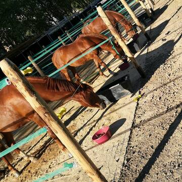
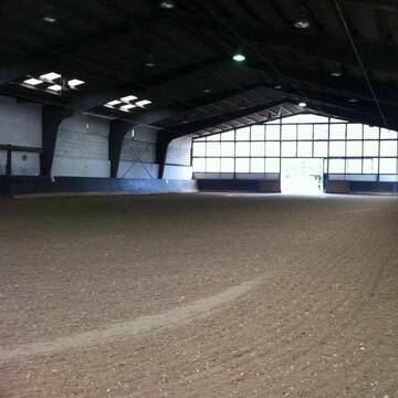
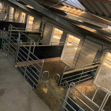
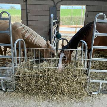
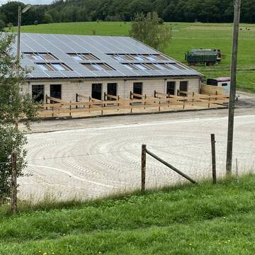
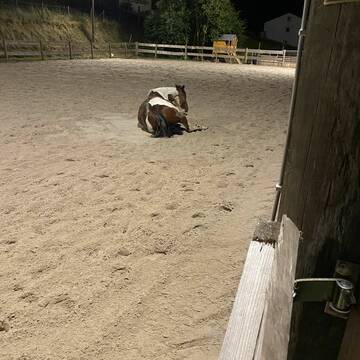
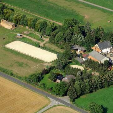
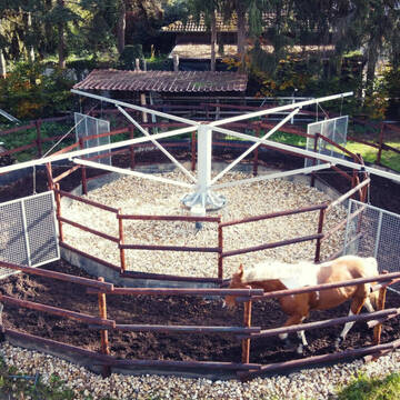
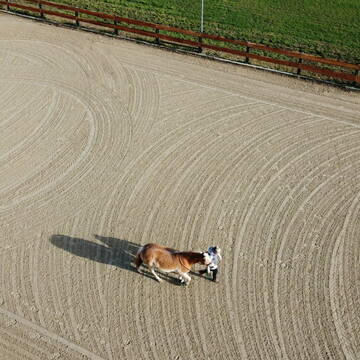
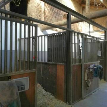
Aktivstall Kuhnigks Ranch Neu mit Heubedampfer
Hohenleimbach
Bernd-Kuhnigk
@Bernd-Kuhnigk
Freizeitstall
Rehabilitationsstall
Hunde willkommen
Krankenbox
Allergikerstall
bedampftes/gewaschenes Heu
Bewegungsstall
Laufstall
25 weitere...
P
Mühlenhof Acht
Acht
Mühlenhof Acht
@Mühlenhof Acht
Fahrstall, Kutschwagen
Freizeitstall
Paddock
Parkplatz für Pferdeanhänger
Gnadenbrothof
Pferdezucht
Außenbox mit Paddock
Außenboxen
16 weitere...
P
Deprecated: Creation of dynamic property Zend_View_Helper_Ads::$adLink is deprecated in /var/www/stall-frei/htdocs/staging.stall-frei.de/library/Psf/View/Helper/Ads.php on line 108

Das Beste für die Hufe
Mechtersen
STALL-FREIde Marketing
@STALL-FREI-Marketing
Hufschmiede und Hufpfleger in Ihrer Nähe
Reiterhof Adenau
Adenau
Reiterhof-Adenau
@Reiterhof-Adenau
FN-Mitglied
Freizeitstall
Vermieten
Paddock
Reithalle
Außenbox mit Paddock
Außenboxen
17 weitere...
P

Reha-Zentrum für Pferde
Dreis-Brück
BRÜCKER MÜHLE Pferdereha
@BrueckerMuehle
FN-Mitglied
Freizeitstall
Vermieten
Führanlage
Hunde willkommen
Allergikerstall
bedampftes/gewaschenes Heu
36 weitere...
S


Reitanlage in traumhafter Lage
Leienkaul
Reitanlage_Maria-Schacht
@Reitanlage_Maria-Schacht
Pferdeausbildung
Reitschule
Hunde willkommen
Longierzirkel/Roundpen
Notfallboxen
Außenbox mit Paddock
Innenbox
15 weitere...
S

Mitarbeiter gesucht?
Mechtersen
STALL-FREIde Marketing
@STALL-FREI-Marketing
Stellenangebote kostenlos veröffentlichen!
Reitsportzentrum PILANTHO
Oberzissen
PILANTHO
@PILANTHO
Freizeitstall
Gastronomie
Vermieten
Hunde willkommen
Krankenbox
Allergikerstall
Hufrehe geeignet
31 weitere...
P+
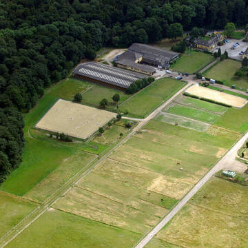
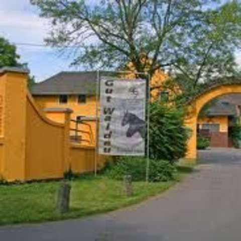
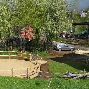
Gut Waldau - Die Reitanlage in Region Köln/Bonn
Rheinbach
Horseconcept Gut Waldau GmbH
@Horseconcept-Gut-Waldau-GmbH
FN-Mitglied
Freizeitstall
Vermieten
Verpachten
Führanlage
Hunde willkommen
Allergikerstall
Fohlenaufzucht möglich
34 weitere...
aktuell
S
Orchard Ranch
Bad Münstereifel-Scheuren
Orchard Ranch
@Orchard-Ranch
Freizeitstall
Westernreiten
Vermieten
Verpachten
Longierzirkel/Roundpen
Paddock
bedampftes/gewaschenes Heu
18 weitere...
P+
Burtscheider Hof
Altenahr
Burtscheider-Hof1
@Burtscheider-Hof1
FN-Mitglied
Freizeitstall
Hunde willkommen
Krankenbox
bedampftes/gewaschenes Heu
Fohlenaufzucht möglich
Außenbox mit Paddock
Außenboxen
24 weitere...
P
Reitstall Schlaeger - Tomberger Mühle
Euskirchen
Reitstall-Schlaeger
@Reitstall-Schlaeger
FN-Mitglied
Freizeitstall
Vermieten
Führanlage
Hunde willkommen
Außenboxen
Innenbox
20 weitere...
S
Deprecated: Creation of dynamic property Zend_View::$pageCount is deprecated in /var/www/stall-frei/htdocs/staging.stall-frei.de/library/vendor/shardj/zf1-future/library/Zend/View/Abstract.php on line 308
Deprecated: Creation of dynamic property Zend_View::$itemCountPerPage is deprecated in /var/www/stall-frei/htdocs/staging.stall-frei.de/library/vendor/shardj/zf1-future/library/Zend/View/Abstract.php on line 308
Deprecated: Creation of dynamic property Zend_View::$first is deprecated in /var/www/stall-frei/htdocs/staging.stall-frei.de/library/vendor/shardj/zf1-future/library/Zend/View/Abstract.php on line 308
Deprecated: Creation of dynamic property Zend_View::$current is deprecated in /var/www/stall-frei/htdocs/staging.stall-frei.de/library/vendor/shardj/zf1-future/library/Zend/View/Abstract.php on line 308
Deprecated: Creation of dynamic property Zend_View::$last is deprecated in /var/www/stall-frei/htdocs/staging.stall-frei.de/library/vendor/shardj/zf1-future/library/Zend/View/Abstract.php on line 308
Deprecated: Creation of dynamic property Zend_View::$next is deprecated in /var/www/stall-frei/htdocs/staging.stall-frei.de/library/vendor/shardj/zf1-future/library/Zend/View/Abstract.php on line 308
Deprecated: Creation of dynamic property Zend_View::$pagesInRange is deprecated in /var/www/stall-frei/htdocs/staging.stall-frei.de/library/vendor/shardj/zf1-future/library/Zend/View/Abstract.php on line 308
Deprecated: Creation of dynamic property Zend_View::$firstPageInRange is deprecated in /var/www/stall-frei/htdocs/staging.stall-frei.de/library/vendor/shardj/zf1-future/library/Zend/View/Abstract.php on line 308
Deprecated: Creation of dynamic property Zend_View::$lastPageInRange is deprecated in /var/www/stall-frei/htdocs/staging.stall-frei.de/library/vendor/shardj/zf1-future/library/Zend/View/Abstract.php on line 308
Deprecated: Creation of dynamic property Zend_View::$currentItemCount is deprecated in /var/www/stall-frei/htdocs/staging.stall-frei.de/library/vendor/shardj/zf1-future/library/Zend/View/Abstract.php on line 308
Deprecated: Creation of dynamic property Zend_View::$totalItemCount is deprecated in /var/www/stall-frei/htdocs/staging.stall-frei.de/library/vendor/shardj/zf1-future/library/Zend/View/Abstract.php on line 308
Deprecated: Creation of dynamic property Zend_View::$firstItemNumber is deprecated in /var/www/stall-frei/htdocs/staging.stall-frei.de/library/vendor/shardj/zf1-future/library/Zend/View/Abstract.php on line 308
Deprecated: Creation of dynamic property Zend_View::$lastItemNumber is deprecated in /var/www/stall-frei/htdocs/staging.stall-frei.de/library/vendor/shardj/zf1-future/library/Zend/View/Abstract.php on line 308
Deprecated: Creation of dynamic property Zend_View::$router is deprecated in /var/www/stall-frei/htdocs/staging.stall-frei.de/library/vendor/shardj/zf1-future/library/Zend/View/Abstract.php on line 308
Deprecated: Creation of dynamic property Zend_View::$urlParams is deprecated in /var/www/stall-frei/htdocs/staging.stall-frei.de/library/vendor/shardj/zf1-future/library/Zend/View/Abstract.php on line 308
Deprecated: Creation of dynamic property Zend_View::$showAds is deprecated in /var/www/stall-frei/htdocs/staging.stall-frei.de/library/vendor/shardj/zf1-future/library/Zend/View/Abstract.php on line 308
Deprecated: Creation of dynamic property Zend_View::$objectIds is deprecated in /var/www/stall-frei/htdocs/staging.stall-frei.de/library/vendor/shardj/zf1-future/library/Zend/View/Abstract.php on line 308
Deprecated: Creation of dynamic property Zend_View::$showNavbar is deprecated in /var/www/stall-frei/htdocs/staging.stall-frei.de/library/vendor/shardj/zf1-future/library/Zend/View/Abstract.php on line 308
Deprecated: Creation of dynamic property Zend_View::$showBreadcrumb is deprecated in /var/www/stall-frei/htdocs/staging.stall-frei.de/library/vendor/shardj/zf1-future/library/Zend/View/Abstract.php on line 308
Deprecated: Creation of dynamic property Zend_View::$showFooter is deprecated in /var/www/stall-frei/htdocs/staging.stall-frei.de/library/vendor/shardj/zf1-future/library/Zend/View/Abstract.php on line 308
Deprecated: Creation of dynamic property Zend_View::$showInternalAds is deprecated in /var/www/stall-frei/htdocs/staging.stall-frei.de/library/vendor/shardj/zf1-future/library/Zend/View/Abstract.php on line 308
Deprecated: Creation of dynamic property Zend_View::$blNoContent is deprecated in /var/www/stall-frei/htdocs/staging.stall-frei.de/library/vendor/shardj/zf1-future/library/Zend/View/Abstract.php on line 308
Deprecated: Creation of dynamic property Zend_View::$sMetaDesc is deprecated in /var/www/stall-frei/htdocs/staging.stall-frei.de/library/vendor/shardj/zf1-future/library/Zend/View/Abstract.php on line 308
Deprecated: Creation of dynamic property Zend_View::$useGmaps is deprecated in /var/www/stall-frei/htdocs/staging.stall-frei.de/library/vendor/shardj/zf1-future/library/Zend/View/Abstract.php on line 308
Deprecated: Creation of dynamic property Zend_View::$touches is deprecated in /var/www/stall-frei/htdocs/staging.stall-frei.de/library/vendor/shardj/zf1-future/library/Zend/View/Abstract.php on line 308
Deprecated: Creation of dynamic property Zend_View::$oProject is deprecated in /var/www/stall-frei/htdocs/staging.stall-frei.de/library/vendor/shardj/zf1-future/library/Zend/View/Abstract.php on line 308
Deprecated: Creation of dynamic property Zend_View::$pageHeadline is deprecated in /var/www/stall-frei/htdocs/staging.stall-frei.de/library/vendor/shardj/zf1-future/library/Zend/View/Abstract.php on line 308
Deprecated: Creation of dynamic property Zend_View::$disableLocationField is deprecated in /var/www/stall-frei/htdocs/staging.stall-frei.de/library/vendor/shardj/zf1-future/library/Zend/View/Abstract.php on line 308
Deprecated: Creation of dynamic property Zend_View::$isSearch is deprecated in /var/www/stall-frei/htdocs/staging.stall-frei.de/library/vendor/shardj/zf1-future/library/Zend/View/Abstract.php on line 308
Deprecated: Creation of dynamic property Zend_View::$pageTitle is deprecated in /var/www/stall-frei/htdocs/staging.stall-frei.de/library/vendor/shardj/zf1-future/library/Zend/View/Abstract.php on line 308
Deprecated: Creation of dynamic property Psf_Form_Element_Text::$class is deprecated in /var/www/stall-frei/htdocs/staging.stall-frei.de/library/vendor/shardj/zf1-future/library/Zend/Form/Element.php on line 874
Deprecated: Creation of dynamic property Psf_Form_Element_Text::$size is deprecated in /var/www/stall-frei/htdocs/staging.stall-frei.de/library/vendor/shardj/zf1-future/library/Zend/Form/Element.php on line 874
Deprecated: Creation of dynamic property Psf_Form_Element_Text::$placeholder is deprecated in /var/www/stall-frei/htdocs/staging.stall-frei.de/library/vendor/shardj/zf1-future/library/Zend/Form/Element.php on line 874
Deprecated: Creation of dynamic property Psf_Form_Element_Hidden::$class is deprecated in /var/www/stall-frei/htdocs/staging.stall-frei.de/library/vendor/shardj/zf1-future/library/Zend/Form/Element.php on line 874
Deprecated: Creation of dynamic property Psf_Form_Element_Hidden::$class is deprecated in /var/www/stall-frei/htdocs/staging.stall-frei.de/library/vendor/shardj/zf1-future/library/Zend/Form/Element.php on line 874
Deprecated: Creation of dynamic property Psf_Form_Element_Hidden::$class is deprecated in /var/www/stall-frei/htdocs/staging.stall-frei.de/library/vendor/shardj/zf1-future/library/Zend/Form/Element.php on line 874
Deprecated: Creation of dynamic property Psf_Form_Element_Hidden::$class is deprecated in /var/www/stall-frei/htdocs/staging.stall-frei.de/library/vendor/shardj/zf1-future/library/Zend/Form/Element.php on line 874
Deprecated: Creation of dynamic property Psf_Form_Element_Select::$class is deprecated in /var/www/stall-frei/htdocs/staging.stall-frei.de/library/vendor/shardj/zf1-future/library/Zend/Form/Element.php on line 874
Deprecated: Creation of dynamic property Psf_Form_Element_Select::$class is deprecated in /var/www/stall-frei/htdocs/staging.stall-frei.de/library/vendor/shardj/zf1-future/library/Zend/Form/Element.php on line 874
Deprecated: Creation of dynamic property Psf_Form_Element_Select::$class is deprecated in /var/www/stall-frei/htdocs/staging.stall-frei.de/library/vendor/shardj/zf1-future/library/Zend/Form/Element.php on line 874
Deprecated: Creation of dynamic property Psf_Form_Element_Select::$class is deprecated in /var/www/stall-frei/htdocs/staging.stall-frei.de/library/vendor/shardj/zf1-future/library/Zend/Form/Element.php on line 874
Deprecated: Creation of dynamic property Psf_Form_Element_Text::$class is deprecated in /var/www/stall-frei/htdocs/staging.stall-frei.de/library/vendor/shardj/zf1-future/library/Zend/Form/Element.php on line 874
Deprecated: Creation of dynamic property Psf_Form_Element_Checkbox::$label is deprecated in /var/www/stall-frei/htdocs/staging.stall-frei.de/library/vendor/shardj/zf1-future/library/Zend/Form/Element.php on line 874
Deprecated: Creation of dynamic property Zend_View::$sort is deprecated in /var/www/stall-frei/htdocs/staging.stall-frei.de/library/vendor/shardj/zf1-future/library/Zend/View/Abstract.php on line 308
Deprecated: Creation of dynamic property Zend_View::$searchLocation is deprecated in /var/www/stall-frei/htdocs/staging.stall-frei.de/library/vendor/shardj/zf1-future/library/Zend/View/Abstract.php on line 308
Deprecated: Creation of dynamic property Zend_View::$locationHint is deprecated in /var/www/stall-frei/htdocs/staging.stall-frei.de/library/vendor/shardj/zf1-future/library/Zend/View/Abstract.php on line 308
Psf_GeoCoder_Abstract::getLocation: Kaltenborn Get Location CachedOrLive
Psf_GeoCoder_Abstract::getCachedOrLive: Kaltenborn
Psf_GeoCoder_OpenCageData::makeApiRequest: response:
Array
(
[documentation] => https://opencagedata.com/api
[licenses] => Array
(
[0] => Array
(
[name] => see attribution guide
[url] => https://opencagedata.com/credits
)
)
[results] => Array
(
[0] => Array
(
[bounds] => Array
(
[northeast] => Array
(
[lat] => 50.4446892
[lng] => 7.0464548
)
[southwest] => Array
(
[lat] => 50.3804318
[lng] => 6.9736625
)
)
[components] => Array
(
[ISO_3166-1_alpha-2] => DE
[ISO_3166-1_alpha-3] => DEU
[ISO_3166-2] => Array
(
[0] => DE-RP
)
[_category] => place
[_normalized_city] => Kaltenborn
[_type] => village
[continent] => Europe
[country] => Deutschland
[country_code] => de
[county] => Landkreis Ahrweiler
[municipality] => Adenau
[political_union] => European Union
[state] => Rheinland-Pfalz
[state_code] => RP
[village] => Kaltenborn
)
[confidence] => 7
[formatted] => Kaltenborn, Rheinland-Pfalz, Deutschland
[geometry] => Array
(
[lat] => 50.405824
[lng] => 7.0167806
)
)
[1] => Array
(
[bounds] => Array
(
[northeast] => Array
(
[lat] => 50.9461671
[lng] => 7.3659607
)
[southwest] => Array
(
[lat] => 50.9447272
[lng] => 7.363063
)
)
[components] => Array
(
[ISO_3166-1_alpha-2] => DE
[ISO_3166-1_alpha-3] => DEU
[ISO_3166-2] => Array
(
[0] => DE-NW
)
[_category] => place
[_normalized_city] => Overath
[_type] => hamlet
[continent] => Europe
[country] => Deutschland
[country_code] => de
[county] => Rheinisch-Bergischer Kreis
[hamlet] => Kaltenborn
[political_union] => European Union
[state] => Nordrhein-Westfalen
[state_code] => NW
[town] => Overath
)
[confidence] => 9
[formatted] => Kaltenborn, Overath, Nordrhein-Westfalen, Deutschland
[geometry] => Array
(
[lat] => 50.9451654
[lng] => 7.3652229
)
)
[2] => Array
(
[bounds] => Array
(
[northeast] => Array
(
[lat] => 51.024137
[lng] => 7.2886359
)
[southwest] => Array
(
[lat] => 51.024037
[lng] => 7.2885359
)
)
[components] => Array
(
[ISO_3166-1_alpha-2] => DE
[ISO_3166-1_alpha-3] => DEU
[ISO_3166-2] => Array
(
[0] => DE-NW
)
[_category] => building
[_normalized_city] => Lindlar
[_type] => building
[continent] => Europe
[country] => Deutschland
[country_code] => de
[county] => Oberbergischer Kreis
[hamlet] => Reudenbach
[isolated_dwelling] => Kaltenborn
[political_union] => European Union
[postcode] => 51789
[state] => Nordrhein-Westfalen
[state_code] => NW
[town] => Lindlar
)
[confidence] => 10
[formatted] => Kaltenborn, Reudenbach, 51789 Lindlar, Deutschland
[geometry] => Array
(
[lat] => 51.024087
[lng] => 7.2885859
)
)
[3] => Array
(
[bounds] => Array
(
[northeast] => Array
(
[lat] => 50.8060744
[lng] => 10.2523075
)
[southwest] => Array
(
[lat] => 50.7660744
[lng] => 10.2123075
)
)
[components] => Array
(
[ISO_3166-1_alpha-2] => DE
[ISO_3166-1_alpha-3] => DEU
[ISO_3166-2] => Array
(
[0] => DE-TH
)
[_category] => place
[_normalized_city] => Bad Salzungen
[_type] => village
[continent] => Europe
[country] => Deutschland
[country_code] => de
[county] => Wartburgkreis
[political_union] => European Union
[postcode] => 36433
[state] => Thüringen
[state_code] => TH
[town] => Bad Salzungen
[village] => Kaltenborn
)
[confidence] => 7
[formatted] => 36433 Kaltenborn, Deutschland
[geometry] => Array
(
[lat] => 50.7860744
[lng] => 10.2323075
)
)
[4] => Array
(
[bounds] => Array
(
[northeast] => Array
(
[lat] => 51.9967971
[lng] => 12.963273
)
[southwest] => Array
(
[lat] => 51.9726154
[lng] => 12.9317242
)
)
[components] => Array
(
[ISO_3166-1_alpha-2] => DE
[ISO_3166-1_alpha-3] => DEU
[ISO_3166-2] => Array
(
[0] => DE-BB
)
[_category] => place
[_normalized_city] => Niedergörsdorf
[_type] => hamlet
[continent] => Europe
[country] => Deutschland
[country_code] => de
[county] => Teltow-Fläming
[hamlet] => Kaltenborn
[political_union] => European Union
[state] => Brandenburg
[state_code] => BB
[village] => Niedergörsdorf
)
[confidence] => 7
[formatted] => Kaltenborn, Niedergörsdorf, Brandenburg, Deutschland
[geometry] => Array
(
[lat] => 51.9851067
[lng] => 12.9471683
)
)
[5] => Array
(
[bounds] => Array
(
[northeast] => Array
(
[lat] => 50.8898047
[lng] => 11.9807179
)
[southwest] => Array
(
[lat] => 50.8498047
[lng] => 11.9407179
)
)
[components] => Array
(
[ISO_3166-1_alpha-2] => DE
[ISO_3166-1_alpha-3] => DEU
[ISO_3166-2] => Array
(
[0] => DE-TH
)
[_category] => place
[_normalized_city] => Kraftsdorf
[_type] => village
[city] => Kraftsdorf
[continent] => Europe
[country] => Deutschland
[country_code] => de
[county] => Greiz
[political_union] => European Union
[postcode] => 07586
[state] => Thüringen
[state_code] => TH
[village] => Kaltenborn
)
[confidence] => 7
[formatted] => 07586 Kaltenborn, Deutschland
[geometry] => Array
(
[lat] => 50.8698047
[lng] => 11.9607179
)
)
[6] => Array
(
[bounds] => Array
(
[northeast] => Array
(
[lat] => 51.9538511
[lng] => 14.694388
)
[southwest] => Array
(
[lat] => 51.9138511
[lng] => 14.654388
)
)
[components] => Array
(
[ISO_3166-1_alpha-2] => DE
[ISO_3166-1_alpha-3] => DEU
[ISO_3166-2] => Array
(
[0] => DE-BB
)
[_category] => place
[_normalized_city] => Guben
[_type] => neighbourhood
[city_district] => Kaltenborn
[continent] => Europe
[country] => Deutschland
[country_code] => de
[county] => Spree-Neiße
[political_union] => European Union
[postcode] => 03172
[state] => Brandenburg
[state_code] => BB
[suburb] => Kaltenborn
[town] => Guben
)
[confidence] => 7
[formatted] => 03172 Guben, Deutschland
[geometry] => Array
(
[lat] => 51.9338511
[lng] => 14.674388
)
)
[7] => Array
(
[bounds] => Array
(
[northeast] => Array
(
[lat] => 51.9431422
[lng] => 14.6938882
)
[southwest] => Array
(
[lat] => 51.9192281
[lng] => 14.6552132
)
)
[components] => Array
(
[ISO_3166-1_alpha-2] => DE
[ISO_3166-1_alpha-3] => DEU
[ISO_3166-2] => Array
(
[0] => DE-BB
)
[_category] => place
[_normalized_city] => Guben
[_type] => neighbourhood
[city_district] => Kaltenborn
[continent] => Europe
[country] => Deutschland
[country_code] => de
[county] => Spree-Neiße
[political_union] => European Union
[state] => Brandenburg
[state_code] => BB
[town] => Guben
)
[confidence] => 7
[formatted] => Kaltenborn, Guben, Brandenburg, Deutschland
[geometry] => Array
(
[lat] => 51.9310507
[lng] => 14.6758841
)
)
[8] => Array
(
[bounds] => Array
(
[northeast] => Array
(
[lat] => 51.1558155
[lng] => 7.2928345
)
[southwest] => Array
(
[lat] => 51.1557155
[lng] => 7.2927345
)
)
[components] => Array
(
[ISO_3166-1_alpha-2] => DE
[ISO_3166-1_alpha-3] => DEU
[ISO_3166-2] => Array
(
[0] => DE-NW
)
[_category] => building
[_normalized_city] => Remscheid
[_type] => building
[city] => Remscheid
[continent] => Europe
[country] => Deutschland
[country_code] => de
[isolated_dwelling] => Kaltenborn
[political_union] => European Union
[postcode] => 42897
[state] => Nordrhein-Westfalen
[state_code] => NW
[suburb] => Lennep
)
[confidence] => 10
[formatted] => Kaltenborn, 42897 Remscheid, Deutschland
[geometry] => Array
(
[lat] => 51.1557655
[lng] => 7.2927845
)
)
[9] => Array
(
[bounds] => Array
(
[northeast] => Array
(
[lat] => 51.1464206
[lng] => 12.867169
)
[southwest] => Array
(
[lat] => 51.1064206
[lng] => 12.827169
)
)
[components] => Array
(
[ISO_3166-1_alpha-2] => DE
[ISO_3166-1_alpha-3] => DEU
[ISO_3166-2] => Array
(
[0] => DE-SN
)
[_category] => place
[_normalized_city] => Colditz
[_type] => hamlet
[city_district] => Zschadraß
[continent] => Europe
[country] => Deutschland
[country_code] => de
[county] => Landkreis Leipzig
[hamlet] => Kaltenborn
[political_union] => European Union
[postcode] => 04680
[state] => Sachsen
[state_code] => SN
[town] => Colditz
)
[confidence] => 7
[formatted] => Kaltenborn, 04680 Colditz, Deutschland
[geometry] => Array
(
[lat] => 51.1264206
[lng] => 12.847169
)
)
)
[status] => Array
(
[code] => 200
[message] => OK
)
[stay_informed] => Array
(
[blog] => https://blog.opencagedata.com
[mastodon] => https://en.osm.town/@opencage
)
[thanks] => For using an OpenCage API
[timestamp] => Array
(
[created_http] => Sun, 08 Feb 2026 08:27:13 GMT
[created_unix] => 1770539233
)
[total_results] => 10
)
Psf_GeoCoder_Abstract::convertLocationResult
{"documentation":"https:\/\/opencagedata.com\/api","licenses":[{"name":"see attribution guide","url":"https:\/\/opencagedata.com\/credits"}],"results":[{"bounds":{"northeast":{"lat":50.4446892,"lng":7.0464548},"southwest":{"lat":50.3804318,"lng":6.9736625}},"components":{"ISO_3166-1_alpha-2":"DE","ISO_3166-1_alpha-3":"DEU","ISO_3166-2":["DE-RP"],"_category":"place","_normalized_city":"Kaltenborn","_type":"village","continent":"Europe","country":"Deutschland","country_code":"de","county":"Landkreis Ahrweiler","municipality":"Adenau","political_union":"European Union","state":"Rheinland-Pfalz","state_code":"RP","village":"Kaltenborn"},"confidence":7,"formatted":"Kaltenborn, Rheinland-Pfalz, Deutschland","geometry":{"lat":50.405824,"lng":7.0167806}},{"bounds":{"northeast":{"lat":50.9461671,"lng":7.3659607},"southwest":{"lat":50.9447272,"lng":7.363063}},"components":{"ISO_3166-1_alpha-2":"DE","ISO_3166-1_alpha-3":"DEU","ISO_3166-2":["DE-NW"],"_category":"place","_normalized_city":"Overath","_type":"hamlet","continent":"Europe","country":"Deutschland","country_code":"de","county":"Rheinisch-Bergischer Kreis","hamlet":"Kaltenborn","political_union":"European Union","state":"Nordrhein-Westfalen","state_code":"NW","town":"Overath"},"confidence":9,"formatted":"Kaltenborn, Overath, Nordrhein-Westfalen, Deutschland","geometry":{"lat":50.9451654,"lng":7.3652229}},{"bounds":{"northeast":{"lat":51.024137,"lng":7.2886359},"southwest":{"lat":51.024037,"lng":7.2885359}},"components":{"ISO_3166-1_alpha-2":"DE","ISO_3166-1_alpha-3":"DEU","ISO_3166-2":["DE-NW"],"_category":"building","_normalized_city":"Lindlar","_type":"building","continent":"Europe","country":"Deutschland","country_code":"de","county":"Oberbergischer Kreis","hamlet":"Reudenbach","isolated_dwelling":"Kaltenborn","political_union":"European Union","postcode":"51789","state":"Nordrhein-Westfalen","state_code":"NW","town":"Lindlar"},"confidence":10,"formatted":"Kaltenborn, Reudenbach, 51789 Lindlar, Deutschland","geometry":{"lat":51.024087,"lng":7.2885859}},{"bounds":{"northeast":{"lat":50.8060744,"lng":10.2523075},"southwest":{"lat":50.7660744,"lng":10.2123075}},"components":{"ISO_3166-1_alpha-2":"DE","ISO_3166-1_alpha-3":"DEU","ISO_3166-2":["DE-TH"],"_category":"place","_normalized_city":"Bad Salzungen","_type":"village","continent":"Europe","country":"Deutschland","country_code":"de","county":"Wartburgkreis","political_union":"European Union","postcode":"36433","state":"Th\u00fcringen","state_code":"TH","town":"Bad Salzungen","village":"Kaltenborn"},"confidence":7,"formatted":"36433 Kaltenborn, Deutschland","geometry":{"lat":50.7860744,"lng":10.2323075}},{"bounds":{"northeast":{"lat":51.9967971,"lng":12.963273},"southwest":{"lat":51.9726154,"lng":12.9317242}},"components":{"ISO_3166-1_alpha-2":"DE","ISO_3166-1_alpha-3":"DEU","ISO_3166-2":["DE-BB"],"_category":"place","_normalized_city":"Niederg\u00f6rsdorf","_type":"hamlet","continent":"Europe","country":"Deutschland","country_code":"de","county":"Teltow-Fl\u00e4ming","hamlet":"Kaltenborn","political_union":"European Union","state":"Brandenburg","state_code":"BB","village":"Niederg\u00f6rsdorf"},"confidence":7,"formatted":"Kaltenborn, Niederg\u00f6rsdorf, Brandenburg, Deutschland","geometry":{"lat":51.9851067,"lng":12.9471683}},{"bounds":{"northeast":{"lat":50.8898047,"lng":11.9807179},"southwest":{"lat":50.8498047,"lng":11.9407179}},"components":{"ISO_3166-1_alpha-2":"DE","ISO_3166-1_alpha-3":"DEU","ISO_3166-2":["DE-TH"],"_category":"place","_normalized_city":"Kraftsdorf","_type":"village","city":"Kraftsdorf","continent":"Europe","country":"Deutschland","country_code":"de","county":"Greiz","political_union":"European Union","postcode":"07586","state":"Th\u00fcringen","state_code":"TH","village":"Kaltenborn"},"confidence":7,"formatted":"07586 Kaltenborn, Deutschland","geometry":{"lat":50.8698047,"lng":11.9607179}},{"bounds":{"northeast":{"lat":51.9538511,"lng":14.694388},"southwest":{"lat":51.9138511,"lng":14.654388}},"components":{"ISO_3166-1_alpha-2":"DE","ISO_3166-1_alpha-3":"DEU","ISO_3166-2":["DE-BB"],"_category":"place","_normalized_city":"Guben","_type":"neighbourhood","city_district":"Kaltenborn","continent":"Europe","country":"Deutschland","country_code":"de","county":"Spree-Nei\u00dfe","political_union":"European Union","postcode":"03172","state":"Brandenburg","state_code":"BB","suburb":"Kaltenborn","town":"Guben"},"confidence":7,"formatted":"03172 Guben, Deutschland","geometry":{"lat":51.9338511,"lng":14.674388}},{"bounds":{"northeast":{"lat":51.9431422,"lng":14.6938882},"southwest":{"lat":51.9192281,"lng":14.6552132}},"components":{"ISO_3166-1_alpha-2":"DE","ISO_3166-1_alpha-3":"DEU","ISO_3166-2":["DE-BB"],"_category":"place","_normalized_city":"Guben","_type":"neighbourhood","city_district":"Kaltenborn","continent":"Europe","country":"Deutschland","country_code":"de","county":"Spree-Nei\u00dfe","political_union":"European Union","state":"Brandenburg","state_code":"BB","town":"Guben"},"confidence":7,"formatted":"Kaltenborn, Guben, Brandenburg, Deutschland","geometry":{"lat":51.9310507,"lng":14.6758841}},{"bounds":{"northeast":{"lat":51.1558155,"lng":7.2928345},"southwest":{"lat":51.1557155,"lng":7.2927345}},"components":{"ISO_3166-1_alpha-2":"DE","ISO_3166-1_alpha-3":"DEU","ISO_3166-2":["DE-NW"],"_category":"building","_normalized_city":"Remscheid","_type":"building","city":"Remscheid","continent":"Europe","country":"Deutschland","country_code":"de","isolated_dwelling":"Kaltenborn","political_union":"European Union","postcode":"42897","state":"Nordrhein-Westfalen","state_code":"NW","suburb":"Lennep"},"confidence":10,"formatted":"Kaltenborn, 42897 Remscheid, Deutschland","geometry":{"lat":51.1557655,"lng":7.2927845}},{"bounds":{"northeast":{"lat":51.1464206,"lng":12.867169},"southwest":{"lat":51.1064206,"lng":12.827169}},"components":{"ISO_3166-1_alpha-2":"DE","ISO_3166-1_alpha-3":"DEU","ISO_3166-2":["DE-SN"],"_category":"place","_normalized_city":"Colditz","_type":"hamlet","city_district":"Zschadra\u00df","continent":"Europe","country":"Deutschland","country_code":"de","county":"Landkreis Leipzig","hamlet":"Kaltenborn","political_union":"European Union","postcode":"04680","state":"Sachsen","state_code":"SN","town":"Colditz"},"confidence":7,"formatted":"Kaltenborn, 04680 Colditz, Deutschland","geometry":{"lat":51.1264206,"lng":12.847169}}],"status":{"code":200,"message":"OK"},"stay_informed":{"blog":"https:\/\/blog.opencagedata.com","mastodon":"https:\/\/en.osm.town\/@opencage"},"thanks":"For using an OpenCage API","timestamp":{"created_http":"Sun, 08 Feb 2026 08:27:13 GMT","created_unix":1770539233},"total_results":10}Array
(
[0] => stdClass Object
(
[bounds] => stdClass Object
(
[northeast] => stdClass Object
(
[lat] => 50.4446892
[lng] => 7.0464548
)
[southwest] => stdClass Object
(
[lat] => 50.3804318
[lng] => 6.9736625
)
)
[components] => stdClass Object
(
[ISO_3166-1_alpha-2] => DE
[ISO_3166-1_alpha-3] => DEU
[ISO_3166-2] => Array
(
[0] => DE-RP
)
[_category] => place
[_normalized_city] => Kaltenborn
[_type] => village
[continent] => Europe
[country] => Deutschland
[country_code] => de
[county] => Landkreis Ahrweiler
[municipality] => Adenau
[political_union] => European Union
[state] => Rheinland-Pfalz
[state_code] => RP
[village] => Kaltenborn
)
[confidence] => 7
[formatted] => Kaltenborn, Rheinland-Pfalz, Deutschland
[geometry] => stdClass Object
(
[lat] => 50.405824
[lng] => 7.0167806
)
)
[1] => stdClass Object
(
[bounds] => stdClass Object
(
[northeast] => stdClass Object
(
[lat] => 50.9461671
[lng] => 7.3659607
)
[southwest] => stdClass Object
(
[lat] => 50.9447272
[lng] => 7.363063
)
)
[components] => stdClass Object
(
[ISO_3166-1_alpha-2] => DE
[ISO_3166-1_alpha-3] => DEU
[ISO_3166-2] => Array
(
[0] => DE-NW
)
[_category] => place
[_normalized_city] => Overath
[_type] => hamlet
[continent] => Europe
[country] => Deutschland
[country_code] => de
[county] => Rheinisch-Bergischer Kreis
[hamlet] => Kaltenborn
[political_union] => European Union
[state] => Nordrhein-Westfalen
[state_code] => NW
[town] => Overath
)
[confidence] => 9
[formatted] => Kaltenborn, Overath, Nordrhein-Westfalen, Deutschland
[geometry] => stdClass Object
(
[lat] => 50.9451654
[lng] => 7.3652229
)
)
[2] => stdClass Object
(
[bounds] => stdClass Object
(
[northeast] => stdClass Object
(
[lat] => 51.024137
[lng] => 7.2886359
)
[southwest] => stdClass Object
(
[lat] => 51.024037
[lng] => 7.2885359
)
)
[components] => stdClass Object
(
[ISO_3166-1_alpha-2] => DE
[ISO_3166-1_alpha-3] => DEU
[ISO_3166-2] => Array
(
[0] => DE-NW
)
[_category] => building
[_normalized_city] => Lindlar
[_type] => building
[continent] => Europe
[country] => Deutschland
[country_code] => de
[county] => Oberbergischer Kreis
[hamlet] => Reudenbach
[isolated_dwelling] => Kaltenborn
[political_union] => European Union
[postcode] => 51789
[state] => Nordrhein-Westfalen
[state_code] => NW
[town] => Lindlar
)
[confidence] => 10
[formatted] => Kaltenborn, Reudenbach, 51789 Lindlar, Deutschland
[geometry] => stdClass Object
(
[lat] => 51.024087
[lng] => 7.2885859
)
)
[3] => stdClass Object
(
[bounds] => stdClass Object
(
[northeast] => stdClass Object
(
[lat] => 50.8060744
[lng] => 10.2523075
)
[southwest] => stdClass Object
(
[lat] => 50.7660744
[lng] => 10.2123075
)
)
[components] => stdClass Object
(
[ISO_3166-1_alpha-2] => DE
[ISO_3166-1_alpha-3] => DEU
[ISO_3166-2] => Array
(
[0] => DE-TH
)
[_category] => place
[_normalized_city] => Bad Salzungen
[_type] => village
[continent] => Europe
[country] => Deutschland
[country_code] => de
[county] => Wartburgkreis
[political_union] => European Union
[postcode] => 36433
[state] => Thüringen
[state_code] => TH
[town] => Bad Salzungen
[village] => Kaltenborn
)
[confidence] => 7
[formatted] => 36433 Kaltenborn, Deutschland
[geometry] => stdClass Object
(
[lat] => 50.7860744
[lng] => 10.2323075
)
)
[4] => stdClass Object
(
[bounds] => stdClass Object
(
[northeast] => stdClass Object
(
[lat] => 51.9967971
[lng] => 12.963273
)
[southwest] => stdClass Object
(
[lat] => 51.9726154
[lng] => 12.9317242
)
)
[components] => stdClass Object
(
[ISO_3166-1_alpha-2] => DE
[ISO_3166-1_alpha-3] => DEU
[ISO_3166-2] => Array
(
[0] => DE-BB
)
[_category] => place
[_normalized_city] => Niedergörsdorf
[_type] => hamlet
[continent] => Europe
[country] => Deutschland
[country_code] => de
[county] => Teltow-Fläming
[hamlet] => Kaltenborn
[political_union] => European Union
[state] => Brandenburg
[state_code] => BB
[village] => Niedergörsdorf
)
[confidence] => 7
[formatted] => Kaltenborn, Niedergörsdorf, Brandenburg, Deutschland
[geometry] => stdClass Object
(
[lat] => 51.9851067
[lng] => 12.9471683
)
)
[5] => stdClass Object
(
[bounds] => stdClass Object
(
[northeast] => stdClass Object
(
[lat] => 50.8898047
[lng] => 11.9807179
)
[southwest] => stdClass Object
(
[lat] => 50.8498047
[lng] => 11.9407179
)
)
[components] => stdClass Object
(
[ISO_3166-1_alpha-2] => DE
[ISO_3166-1_alpha-3] => DEU
[ISO_3166-2] => Array
(
[0] => DE-TH
)
[_category] => place
[_normalized_city] => Kraftsdorf
[_type] => village
[city] => Kraftsdorf
[continent] => Europe
[country] => Deutschland
[country_code] => de
[county] => Greiz
[political_union] => European Union
[postcode] => 07586
[state] => Thüringen
[state_code] => TH
[village] => Kaltenborn
)
[confidence] => 7
[formatted] => 07586 Kaltenborn, Deutschland
[geometry] => stdClass Object
(
[lat] => 50.8698047
[lng] => 11.9607179
)
)
[6] => stdClass Object
(
[bounds] => stdClass Object
(
[northeast] => stdClass Object
(
[lat] => 51.9538511
[lng] => 14.694388
)
[southwest] => stdClass Object
(
[lat] => 51.9138511
[lng] => 14.654388
)
)
[components] => stdClass Object
(
[ISO_3166-1_alpha-2] => DE
[ISO_3166-1_alpha-3] => DEU
[ISO_3166-2] => Array
(
[0] => DE-BB
)
[_category] => place
[_normalized_city] => Guben
[_type] => neighbourhood
[city_district] => Kaltenborn
[continent] => Europe
[country] => Deutschland
[country_code] => de
[county] => Spree-Neiße
[political_union] => European Union
[postcode] => 03172
[state] => Brandenburg
[state_code] => BB
[suburb] => Kaltenborn
[town] => Guben
)
[confidence] => 7
[formatted] => 03172 Guben, Deutschland
[geometry] => stdClass Object
(
[lat] => 51.9338511
[lng] => 14.674388
)
)
[7] => stdClass Object
(
[bounds] => stdClass Object
(
[northeast] => stdClass Object
(
[lat] => 51.9431422
[lng] => 14.6938882
)
[southwest] => stdClass Object
(
[lat] => 51.9192281
[lng] => 14.6552132
)
)
[components] => stdClass Object
(
[ISO_3166-1_alpha-2] => DE
[ISO_3166-1_alpha-3] => DEU
[ISO_3166-2] => Array
(
[0] => DE-BB
)
[_category] => place
[_normalized_city] => Guben
[_type] => neighbourhood
[city_district] => Kaltenborn
[continent] => Europe
[country] => Deutschland
[country_code] => de
[county] => Spree-Neiße
[political_union] => European Union
[state] => Brandenburg
[state_code] => BB
[town] => Guben
)
[confidence] => 7
[formatted] => Kaltenborn, Guben, Brandenburg, Deutschland
[geometry] => stdClass Object
(
[lat] => 51.9310507
[lng] => 14.6758841
)
)
[8] => stdClass Object
(
[bounds] => stdClass Object
(
[northeast] => stdClass Object
(
[lat] => 51.1558155
[lng] => 7.2928345
)
[southwest] => stdClass Object
(
[lat] => 51.1557155
[lng] => 7.2927345
)
)
[components] => stdClass Object
(
[ISO_3166-1_alpha-2] => DE
[ISO_3166-1_alpha-3] => DEU
[ISO_3166-2] => Array
(
[0] => DE-NW
)
[_category] => building
[_normalized_city] => Remscheid
[_type] => building
[city] => Remscheid
[continent] => Europe
[country] => Deutschland
[country_code] => de
[isolated_dwelling] => Kaltenborn
[political_union] => European Union
[postcode] => 42897
[state] => Nordrhein-Westfalen
[state_code] => NW
[suburb] => Lennep
)
[confidence] => 10
[formatted] => Kaltenborn, 42897 Remscheid, Deutschland
[geometry] => stdClass Object
(
[lat] => 51.1557655
[lng] => 7.2927845
)
)
[9] => stdClass Object
(
[bounds] => stdClass Object
(
[northeast] => stdClass Object
(
[lat] => 51.1464206
[lng] => 12.867169
)
[southwest] => stdClass Object
(
[lat] => 51.1064206
[lng] => 12.827169
)
)
[components] => stdClass Object
(
[ISO_3166-1_alpha-2] => DE
[ISO_3166-1_alpha-3] => DEU
[ISO_3166-2] => Array
(
[0] => DE-SN
)
[_category] => place
[_normalized_city] => Colditz
[_type] => hamlet
[city_district] => Zschadraß
[continent] => Europe
[country] => Deutschland
[country_code] => de
[county] => Landkreis Leipzig
[hamlet] => Kaltenborn
[political_union] => European Union
[postcode] => 04680
[state] => Sachsen
[state_code] => SN
[town] => Colditz
)
[confidence] => 7
[formatted] => Kaltenborn, 04680 Colditz, Deutschland
[geometry] => stdClass Object
(
[lat] => 51.1264206
[lng] => 12.847169
)
)
)
Psf_GeoCoder_OpenCageData::getKeyMap: 0
stdClass Object
(
    [bounds] => stdClass Object
        (
            [northeast] => stdClass Object
                (
                    [lat] => 50.4446892
                    [lng] => 7.0464548
                )

            [southwest] => stdClass Object
                (
                    [lat] => 50.3804318
                    [lng] => 6.9736625
                )

        )

    [components] => stdClass Object
        (
            [ISO_3166-1_alpha-2] => DE
            [ISO_3166-1_alpha-3] => DEU
            [ISO_3166-2] => Array
                (
                    [0] => DE-RP
                )

            [_category] => place
            [_normalized_city] => Kaltenborn
            [_type] => village
            [continent] => Europe
            [country] => Deutschland
            [country_code] => de
            [county] => Landkreis Ahrweiler
            [municipality] => Adenau
            [political_union] => European Union
            [state] => Rheinland-Pfalz
            [state_code] => RP
            [village] => Kaltenborn
        )

    [confidence] => 7
    [formatted] => Kaltenborn, Rheinland-Pfalz, Deutschland
    [geometry] => stdClass Object
        (
            [lat] => 50.405824
            [lng] => 7.0167806
        )

)
Psf_GeoCoder_OpenCageData::getCounty: Ahrweiler
Psf_GeoCoder_OpenCageData::addMissingData REFETCH!
Array
(
    [address] => Kaltenborn, Rheinland-Pfalz, Deutschland
    [type] => village
    [street] =>
    [city] => Kaltenborn
    [county] => Ahrweiler
    [state] => Rheinland-Pfalz
    [zip] =>
    [country] => Deutschland
    [suburb] =>
    [countrycode] => de
    [latitude] => 50.405824
    [longitude] => 7.0167806
    [accuracy] => 1
    [confidence] => 7
    [bounds] => stdClass Object
        (
            [northeast] => stdClass Object
                (
                    [lat] => 50.4446892
                    [lng] => 7.0464548
                )

            [southwest] => stdClass Object
                (
                    [lat] => 50.3804318
                    [lng] => 6.9736625
                )

        )

)
reformat!
Array
(
    [address] => Kaltenborn, Rheinland-Pfalz, Deutschland
    [type] => village
    [street] =>
    [city] => Kaltenborn
    [county] => Ahrweiler
    [state] => Rheinland-Pfalz
    [zip] =>
    [country] => Deutschland
    [suburb] =>
    [countrycode] => de
    [latitude] => 50.405824
    [longitude] => 7.0167806
    [accuracy] => 1
    [confidence] => 7
    [bounds] => stdClass Object
        (
            [northeast] => stdClass Object
                (
                    [lat] => 50.4446892
                    [lng] => 7.0464548
                )

            [southwest] => stdClass Object
                (
                    [lat] => 50.3804318
                    [lng] => 6.9736625
                )

        )

    [place] => Kaltenborn, Rheinland-Pfalz
    [hash] => 4befc9ae91e33d9cd3f90b96016ec8e6
)
Psf_GeoCoder_OpenCageData::getKeyMap: 1
stdClass Object
(
    [bounds] => stdClass Object
        (
            [northeast] => stdClass Object
                (
                    [lat] => 50.9461671
                    [lng] => 7.3659607
                )

            [southwest] => stdClass Object
                (
                    [lat] => 50.9447272
                    [lng] => 7.363063
                )

        )

    [components] => stdClass Object
        (
            [ISO_3166-1_alpha-2] => DE
            [ISO_3166-1_alpha-3] => DEU
            [ISO_3166-2] => Array
                (
                    [0] => DE-NW
                )

            [_category] => place
            [_normalized_city] => Overath
            [_type] => hamlet
            [continent] => Europe
            [country] => Deutschland
            [country_code] => de
            [county] => Rheinisch-Bergischer Kreis
            [hamlet] => Kaltenborn
            [political_union] => European Union
            [state] => Nordrhein-Westfalen
            [state_code] => NW
            [town] => Overath
        )

    [confidence] => 9
    [formatted] => Kaltenborn, Overath, Nordrhein-Westfalen, Deutschland
    [geometry] => stdClass Object
        (
            [lat] => 50.9451654
            [lng] => 7.3652229
        )

)
Psf_GeoCoder_OpenCageData::getCounty: Rheinisch-Bergischer Kreis
Psf_GeoCoder_OpenCageData::addMissingData REFETCH!
Array
(
    [address] => Kaltenborn, Overath, Nordrhein-Westfalen, Deutschland
    [type] => hamlet
    [street] => Kaltenborn
    [city] => Overath
    [county] => Rheinisch-Bergischer Kreis
    [state] => Nordrhein-Westfalen
    [zip] =>
    [country] => Deutschland
    [suburb] =>
    [countrycode] => de
    [latitude] => 50.9451654
    [longitude] => 7.3652229
    [accuracy] => 1
    [confidence] => 9
    [bounds] => stdClass Object
        (
            [northeast] => stdClass Object
                (
                    [lat] => 50.9461671
                    [lng] => 7.3659607
                )

            [southwest] => stdClass Object
                (
                    [lat] => 50.9447272
                    [lng] => 7.363063
                )

        )

)
reformat!
Array
(
    [address] => Kaltenborn, Overath, Nordrhein-Westfalen, Deutschland
    [type] => hamlet
    [street] => Kaltenborn
    [city] => Overath
    [county] => Rheinisch-Bergischer Kreis
    [state] => Nordrhein-Westfalen
    [zip] =>
    [country] => Deutschland
    [suburb] =>
    [countrycode] => de
    [latitude] => 50.9451654
    [longitude] => 7.3652229
    [accuracy] => 1
    [confidence] => 9
    [bounds] => stdClass Object
        (
            [northeast] => stdClass Object
                (
                    [lat] => 50.9461671
                    [lng] => 7.3659607
                )

            [southwest] => stdClass Object
                (
                    [lat] => 50.9447272
                    [lng] => 7.363063
                )

        )

    [place] => Kaltenborn, Overath, Nordrhein-Westfalen
    [hash] => d19794a5ce146877f80aa473f0e4d1a2
)
Psf_GeoCoder_OpenCageData::getKeyMap: 2
stdClass Object
(
    [bounds] => stdClass Object
        (
            [northeast] => stdClass Object
                (
                    [lat] => 51.024137
                    [lng] => 7.2886359
                )

            [southwest] => stdClass Object
                (
                    [lat] => 51.024037
                    [lng] => 7.2885359
                )

        )

    [components] => stdClass Object
        (
            [ISO_3166-1_alpha-2] => DE
            [ISO_3166-1_alpha-3] => DEU
            [ISO_3166-2] => Array
                (
                    [0] => DE-NW
                )

            [_category] => building
            [_normalized_city] => Lindlar
            [_type] => building
            [continent] => Europe
            [country] => Deutschland
            [country_code] => de
            [county] => Oberbergischer Kreis
            [hamlet] => Reudenbach
            [isolated_dwelling] => Kaltenborn
            [political_union] => European Union
            [postcode] => 51789
            [state] => Nordrhein-Westfalen
            [state_code] => NW
            [town] => Lindlar
        )

    [confidence] => 10
    [formatted] => Kaltenborn, Reudenbach, 51789 Lindlar, Deutschland
    [geometry] => stdClass Object
        (
            [lat] => 51.024087
            [lng] => 7.2885859
        )

)
Psf_GeoCoder_OpenCageData::getCounty: Oberbergischer Kreis
Psf_GeoCoder_OpenCageData::addMissingData REFETCH!
Array
(
    [address] => Kaltenborn, Reudenbach, 51789 Lindlar, Deutschland
    [type] => building
    [street] => Reudenbach
    [city] => Lindlar
    [county] => Oberbergischer Kreis
    [state] => Nordrhein-Westfalen
    [zip] => 51789
    [country] => Deutschland
    [suburb] =>
    [countrycode] => de
    [latitude] => 51.024087
    [longitude] => 7.2885859
    [accuracy] => 1
    [confidence] => 10
    [bounds] => stdClass Object
        (
            [northeast] => stdClass Object
                (
                    [lat] => 51.024137
                    [lng] => 7.2886359
                )

            [southwest] => stdClass Object
                (
                    [lat] => 51.024037
                    [lng] => 7.2885359
                )

        )

)
reformat!
Array
(
    [address] => Kaltenborn, Reudenbach, 51789 Lindlar, Deutschland
    [type] => building
    [street] => Reudenbach
    [city] => Lindlar
    [county] => Oberbergischer Kreis
    [state] => Nordrhein-Westfalen
    [zip] => 51789
    [country] => Deutschland
    [suburb] =>
    [countrycode] => de
    [latitude] => 51.024087
    [longitude] => 7.2885859
    [accuracy] => 1
    [confidence] => 10
    [bounds] => stdClass Object
        (
            [northeast] => stdClass Object
                (
                    [lat] => 51.024137
                    [lng] => 7.2886359
                )

            [southwest] => stdClass Object
                (
                    [lat] => 51.024037
                    [lng] => 7.2885359
                )

        )

    [place] => Reudenbach, 51789 Lindlar, Nordrhein-Westfalen
    [hash] => 0ba8a5009d7834bb74ca418c3dd8c23a
)
Psf_GeoCoder_OpenCageData::getKeyMap: 3
stdClass Object
(
    [bounds] => stdClass Object
        (
            [northeast] => stdClass Object
                (
                    [lat] => 50.8060744
                    [lng] => 10.2523075
                )

            [southwest] => stdClass Object
                (
                    [lat] => 50.7660744
                    [lng] => 10.2123075
                )

        )

    [components] => stdClass Object
        (
            [ISO_3166-1_alpha-2] => DE
            [ISO_3166-1_alpha-3] => DEU
            [ISO_3166-2] => Array
                (
                    [0] => DE-TH
                )

            [_category] => place
            [_normalized_city] => Bad Salzungen
            [_type] => village
            [continent] => Europe
            [country] => Deutschland
            [country_code] => de
            [county] => Wartburgkreis
            [political_union] => European Union
            [postcode] => 36433
            [state] => Thüringen
            [state_code] => TH
            [town] => Bad Salzungen
            [village] => Kaltenborn
        )

    [confidence] => 7
    [formatted] => 36433 Kaltenborn, Deutschland
    [geometry] => stdClass Object
        (
            [lat] => 50.7860744
            [lng] => 10.2323075
        )

)
Psf_GeoCoder_OpenCageData::getCounty: Wartburgkreis
Psf_GeoCoder_OpenCageData::addMissingData REFETCH!
Array
(
    [address] => 36433 Kaltenborn, Deutschland
    [type] => village
    [street] =>
    [city] => Bad Salzungen
    [county] => Wartburgkreis
    [state] => Thüringen
    [zip] => 36433
    [country] => Deutschland
    [suburb] =>
    [countrycode] => de
    [latitude] => 50.7860744
    [longitude] => 10.2323075
    [accuracy] => 1
    [confidence] => 7
    [bounds] => stdClass Object
        (
            [northeast] => stdClass Object
                (
                    [lat] => 50.8060744
                    [lng] => 10.2523075
                )

            [southwest] => stdClass Object
                (
                    [lat] => 50.7660744
                    [lng] => 10.2123075
                )

        )

)
reformat!
Array
(
    [address] => 36433 Bad Salzungen
    [type] => village
    [street] =>
    [city] => Bad Salzungen
    [county] => Wartburgkreis
    [state] => Thüringen
    [zip] => 36433
    [country] => Deutschland
    [suburb] =>
    [countrycode] => de
    [latitude] => 50.7860744
    [longitude] => 10.2323075
    [accuracy] => 1
    [confidence] => 7
    [bounds] => stdClass Object
        (
            [northeast] => stdClass Object
                (
                    [lat] => 50.8060744
                    [lng] => 10.2523075
                )

            [southwest] => stdClass Object
                (
                    [lat] => 50.7660744
                    [lng] => 10.2123075
                )

        )

    [place] => 36433 Bad Salzungen, Thüringen
    [hash] => d2545342308a34f2533082ada11007a8
)
Psf_GeoCoder_OpenCageData::getKeyMap: 4
stdClass Object
(
    [bounds] => stdClass Object
        (
            [northeast] => stdClass Object
                (
                    [lat] => 51.9967971
                    [lng] => 12.963273
                )

            [southwest] => stdClass Object
                (
                    [lat] => 51.9726154
                    [lng] => 12.9317242
                )

        )

    [components] => stdClass Object
        (
            [ISO_3166-1_alpha-2] => DE
            [ISO_3166-1_alpha-3] => DEU
            [ISO_3166-2] => Array
                (
                    [0] => DE-BB
                )

            [_category] => place
            [_normalized_city] => Niedergörsdorf
            [_type] => hamlet
            [continent] => Europe
            [country] => Deutschland
            [country_code] => de
            [county] => Teltow-Fläming
            [hamlet] => Kaltenborn
            [political_union] => European Union
            [state] => Brandenburg
            [state_code] => BB
            [village] => Niedergörsdorf
        )

    [confidence] => 7
    [formatted] => Kaltenborn, Niedergörsdorf, Brandenburg, Deutschland
    [geometry] => stdClass Object
        (
            [lat] => 51.9851067
            [lng] => 12.9471683
        )

)
Psf_GeoCoder_OpenCageData::getCounty: Teltow-Fläming
Psf_GeoCoder_OpenCageData::addMissingData REFETCH!
Array
(
    [address] => Kaltenborn, Niedergörsdorf, Brandenburg, Deutschland
    [type] => hamlet
    [street] => Kaltenborn
    [city] => Niedergörsdorf
    [county] => Teltow-Fläming
    [state] => Brandenburg
    [zip] =>
    [country] => Deutschland
    [suburb] =>
    [countrycode] => de
    [latitude] => 51.9851067
    [longitude] => 12.9471683
    [accuracy] => 1
    [confidence] => 7
    [bounds] => stdClass Object
        (
            [northeast] => stdClass Object
                (
                    [lat] => 51.9967971
                    [lng] => 12.963273
                )

            [southwest] => stdClass Object
                (
                    [lat] => 51.9726154
                    [lng] => 12.9317242
                )

        )

)
reformat!
Array
(
    [address] => Kaltenborn, Niedergörsdorf, Brandenburg, Deutschland
    [type] => hamlet
    [street] => Kaltenborn
    [city] => Niedergörsdorf
    [county] => Teltow-Fläming
    [state] => Brandenburg
    [zip] =>
    [country] => Deutschland
    [suburb] =>
    [countrycode] => de
    [latitude] => 51.9851067
    [longitude] => 12.9471683
    [accuracy] => 1
    [confidence] => 7
    [bounds] => stdClass Object
        (
            [northeast] => stdClass Object
                (
                    [lat] => 51.9967971
                    [lng] => 12.963273
                )

            [southwest] => stdClass Object
                (
                    [lat] => 51.9726154
                    [lng] => 12.9317242
                )

        )

    [place] => Kaltenborn, Niedergörsdorf, Brandenburg
    [hash] => acd76e092ad1538b49e4b720d727283f
)
Psf_GeoCoder_OpenCageData::getKeyMap: 5
stdClass Object
(
    [bounds] => stdClass Object
        (
            [northeast] => stdClass Object
                (
                    [lat] => 50.8898047
                    [lng] => 11.9807179
                )

            [southwest] => stdClass Object
                (
                    [lat] => 50.8498047
                    [lng] => 11.9407179
                )

        )

    [components] => stdClass Object
        (
            [ISO_3166-1_alpha-2] => DE
            [ISO_3166-1_alpha-3] => DEU
            [ISO_3166-2] => Array
                (
                    [0] => DE-TH
                )

            [_category] => place
            [_normalized_city] => Kraftsdorf
            [_type] => village
            [city] => Kraftsdorf
            [continent] => Europe
            [country] => Deutschland
            [country_code] => de
            [county] => Greiz
            [political_union] => European Union
            [postcode] => 07586
            [state] => Thüringen
            [state_code] => TH
            [village] => Kaltenborn
        )

    [confidence] => 7
    [formatted] => 07586 Kaltenborn, Deutschland
    [geometry] => stdClass Object
        (
            [lat] => 50.8698047
            [lng] => 11.9607179
        )

)
Psf_GeoCoder_OpenCageData::getCounty: Greiz
Psf_GeoCoder_OpenCageData::addMissingData REFETCH!
Array
(
    [address] => 07586 Kaltenborn, Deutschland
    [type] => village
    [street] =>
    [city] => Kaltenborn
    [county] => Greiz
    [state] => Thüringen
    [zip] => 07586
    [country] => Deutschland
    [suburb] =>
    [countrycode] => de
    [latitude] => 50.8698047
    [longitude] => 11.9607179
    [accuracy] => 1
    [confidence] => 7
    [bounds] => stdClass Object
        (
            [northeast] => stdClass Object
                (
                    [lat] => 50.8898047
                    [lng] => 11.9807179
                )

            [southwest] => stdClass Object
                (
                    [lat] => 50.8498047
                    [lng] => 11.9407179
                )

        )

)
reformat!
Array
(
    [address] => 07586 Kaltenborn, Deutschland
    [type] => village
    [street] =>
    [city] => Kaltenborn
    [county] => Greiz
    [state] => Thüringen
    [zip] => 07586
    [country] => Deutschland
    [suburb] =>
    [countrycode] => de
    [latitude] => 50.8698047
    [longitude] => 11.9607179
    [accuracy] => 1
    [confidence] => 7
    [bounds] => stdClass Object
        (
            [northeast] => stdClass Object
                (
                    [lat] => 50.8898047
                    [lng] => 11.9807179
                )

            [southwest] => stdClass Object
                (
                    [lat] => 50.8498047
                    [lng] => 11.9407179
                )

        )

    [place] => 07586 Kaltenborn, Thüringen
    [hash] => 7f794869513101549934f130ce806d20
)
Psf_GeoCoder_OpenCageData::getKeyMap: 6
stdClass Object
(
    [bounds] => stdClass Object
        (
            [northeast] => stdClass Object
                (
                    [lat] => 51.9538511
                    [lng] => 14.694388
                )

            [southwest] => stdClass Object
                (
                    [lat] => 51.9138511
                    [lng] => 14.654388
                )

        )

    [components] => stdClass Object
        (
            [ISO_3166-1_alpha-2] => DE
            [ISO_3166-1_alpha-3] => DEU
            [ISO_3166-2] => Array
                (
                    [0] => DE-BB
                )

            [_category] => place
            [_normalized_city] => Guben
            [_type] => neighbourhood
            [city_district] => Kaltenborn
            [continent] => Europe
            [country] => Deutschland
            [country_code] => de
            [county] => Spree-Neiße
            [political_union] => European Union
            [postcode] => 03172
            [state] => Brandenburg
            [state_code] => BB
            [suburb] => Kaltenborn
            [town] => Guben
        )

    [confidence] => 7
    [formatted] => 03172 Guben, Deutschland
    [geometry] => stdClass Object
        (
            [lat] => 51.9338511
            [lng] => 14.674388
        )

)
Psf_GeoCoder_OpenCageData::getCounty: Spree-Neiße
Psf_GeoCoder_OpenCageData::addMissingData REFETCH!
Array
(
    [address] => 03172 Guben, Deutschland
    [type] => neighbourhood
    [street] =>
    [city] => Guben
    [county] => Spree-Neiße
    [state] => Brandenburg
    [zip] => 03172
    [country] => Deutschland
    [suburb] => Kaltenborn
    [countrycode] => de
    [latitude] => 51.9338511
    [longitude] => 14.674388
    [accuracy] => 1
    [confidence] => 7
    [bounds] => stdClass Object
        (
            [northeast] => stdClass Object
                (
                    [lat] => 51.9538511
                    [lng] => 14.694388
                )

            [southwest] => stdClass Object
                (
                    [lat] => 51.9138511
                    [lng] => 14.654388
                )

        )

)
reformat!
Array
(
    [address] => 03172 Guben, Deutschland
    [type] => neighbourhood
    [street] =>
    [city] => Guben
    [county] => Spree-Neiße
    [state] => Brandenburg
    [zip] => 03172
    [country] => Deutschland
    [suburb] => Kaltenborn
    [countrycode] => de
    [latitude] => 51.9338511
    [longitude] => 14.674388
    [accuracy] => 1
    [confidence] => 7
    [bounds] => stdClass Object
        (
            [northeast] => stdClass Object
                (
                    [lat] => 51.9538511
                    [lng] => 14.694388
                )

            [southwest] => stdClass Object
                (
                    [lat] => 51.9138511
                    [lng] => 14.654388
                )

        )

    [place] => 03172 Guben, Brandenburg
    [hash] => 958d2a62e14ff6d546ddcec9936e8243
)
Psf_GeoCoder_OpenCageData::getKeyMap: 7
stdClass Object
(
    [bounds] => stdClass Object
        (
            [northeast] => stdClass Object
                (
                    [lat] => 51.9431422
                    [lng] => 14.6938882
                )

            [southwest] => stdClass Object
                (
                    [lat] => 51.9192281
                    [lng] => 14.6552132
                )

        )

    [components] => stdClass Object
        (
            [ISO_3166-1_alpha-2] => DE
            [ISO_3166-1_alpha-3] => DEU
            [ISO_3166-2] => Array
                (
                    [0] => DE-BB
                )

            [_category] => place
            [_normalized_city] => Guben
            [_type] => neighbourhood
            [city_district] => Kaltenborn
            [continent] => Europe
            [country] => Deutschland
            [country_code] => de
            [county] => Spree-Neiße
            [political_union] => European Union
            [state] => Brandenburg
            [state_code] => BB
            [town] => Guben
        )

    [confidence] => 7
    [formatted] => Kaltenborn, Guben, Brandenburg, Deutschland
    [geometry] => stdClass Object
        (
            [lat] => 51.9310507
            [lng] => 14.6758841
        )

)
Psf_GeoCoder_OpenCageData::getCounty: Spree-Neiße
Psf_GeoCoder_OpenCageData::addMissingData REFETCH!
Array
(
    [address] => Kaltenborn, Guben, Brandenburg, Deutschland
    [type] => neighbourhood
    [street] =>
    [city] => Guben
    [county] => Spree-Neiße
    [state] => Brandenburg
    [zip] =>
    [country] => Deutschland
    [suburb] =>
    [countrycode] => de
    [latitude] => 51.9310507
    [longitude] => 14.6758841
    [accuracy] => 1
    [confidence] => 7
    [bounds] => stdClass Object
        (
            [northeast] => stdClass Object
                (
                    [lat] => 51.9431422
                    [lng] => 14.6938882
                )

            [southwest] => stdClass Object
                (
                    [lat] => 51.9192281
                    [lng] => 14.6552132
                )

        )

)
reformat!
Array
(
    [address] => Kaltenborn, Guben, Brandenburg, Deutschland
    [type] => neighbourhood
    [street] =>
    [city] => Guben
    [county] => Spree-Neiße
    [state] => Brandenburg
    [zip] =>
    [country] => Deutschland
    [suburb] =>
    [countrycode] => de
    [latitude] => 51.9310507
    [longitude] => 14.6758841
    [accuracy] => 1
    [confidence] => 7
    [bounds] => stdClass Object
        (
            [northeast] => stdClass Object
                (
                    [lat] => 51.9431422
                    [lng] => 14.6938882
                )

            [southwest] => stdClass Object
                (
                    [lat] => 51.9192281
                    [lng] => 14.6552132
                )

        )

    [place] => Guben, Brandenburg
    [hash] => c50425d9099bd59e597ebb0b2057ef8b
)
Psf_GeoCoder_OpenCageData::getKeyMap: 8
stdClass Object
(
    [bounds] => stdClass Object
        (
            [northeast] => stdClass Object
                (
                    [lat] => 51.1558155
                    [lng] => 7.2928345
                )

            [southwest] => stdClass Object
                (
                    [lat] => 51.1557155
                    [lng] => 7.2927345
                )

        )

    [components] => stdClass Object
        (
            [ISO_3166-1_alpha-2] => DE
            [ISO_3166-1_alpha-3] => DEU
            [ISO_3166-2] => Array
                (
                    [0] => DE-NW
                )

            [_category] => building
            [_normalized_city] => Remscheid
            [_type] => building
            [city] => Remscheid
            [continent] => Europe
            [country] => Deutschland
            [country_code] => de
            [isolated_dwelling] => Kaltenborn
            [political_union] => European Union
            [postcode] => 42897
            [state] => Nordrhein-Westfalen
            [state_code] => NW
            [suburb] => Lennep
        )

    [confidence] => 10
    [formatted] => Kaltenborn, 42897 Remscheid, Deutschland
    [geometry] => stdClass Object
        (
            [lat] => 51.1557655
            [lng] => 7.2927845
        )

)
Psf_GeoCoder_OpenCageData::getCounty: Remscheid
Psf_GeoCoder_OpenCageData::addMissingData REFETCH!
Array
(
    [address] => Kaltenborn, 42897 Remscheid, Deutschland
    [type] => building
    [street] =>
    [city] => Lennep
    [county] => Remscheid
    [state] => Nordrhein-Westfalen
    [zip] => 42897
    [country] => Deutschland
    [suburb] => Lennep
    [countrycode] => de
    [latitude] => 51.1557655
    [longitude] => 7.2927845
    [accuracy] => 1
    [confidence] => 10
    [bounds] => stdClass Object
        (
            [northeast] => stdClass Object
                (
                    [lat] => 51.1558155
                    [lng] => 7.2928345
                )

            [southwest] => stdClass Object
                (
                    [lat] => 51.1557155
                    [lng] => 7.2927345
                )

        )

)
reformat!
Array
(
    [address] => 42897 Lennep
    [type] => building
    [street] =>
    [city] => Lennep
    [county] => Remscheid
    [state] => Nordrhein-Westfalen
    [zip] => 42897
    [country] => Deutschland
    [suburb] => Lennep
    [countrycode] => de
    [latitude] => 51.1557655
    [longitude] => 7.2927845
    [accuracy] => 1
    [confidence] => 10
    [bounds] => stdClass Object
        (
            [northeast] => stdClass Object
                (
                    [lat] => 51.1558155
                    [lng] => 7.2928345
                )

            [southwest] => stdClass Object
                (
                    [lat] => 51.1557155
                    [lng] => 7.2927345
                )

        )

    [place] => 42897 Lennep, Nordrhein-Westfalen
    [hash] => 7bbced57d1b6439fe315ef39be3b1784
)
Psf_GeoCoder_OpenCageData::getKeyMap: 9
stdClass Object
(
    [bounds] => stdClass Object
        (
            [northeast] => stdClass Object
                (
                    [lat] => 51.1464206
                    [lng] => 12.867169
                )

            [southwest] => stdClass Object
                (
                    [lat] => 51.1064206
                    [lng] => 12.827169
                )

        )

    [components] => stdClass Object
        (
            [ISO_3166-1_alpha-2] => DE
            [ISO_3166-1_alpha-3] => DEU
            [ISO_3166-2] => Array
                (
                    [0] => DE-SN
                )

            [_category] => place
            [_normalized_city] => Colditz
            [_type] => hamlet
            [city_district] => Zschadraß
            [continent] => Europe
            [country] => Deutschland
            [country_code] => de
            [county] => Landkreis Leipzig
            [hamlet] => Kaltenborn
            [political_union] => European Union
            [postcode] => 04680
            [state] => Sachsen
            [state_code] => SN
            [town] => Colditz
        )

    [confidence] => 7
    [formatted] => Kaltenborn, 04680 Colditz, Deutschland
    [geometry] => stdClass Object
        (
            [lat] => 51.1264206
            [lng] => 12.847169
        )

)
Psf_GeoCoder_OpenCageData::getCounty: Leipzig
Psf_GeoCoder_OpenCageData::addMissingData REFETCH!
Array
(
    [address] => Kaltenborn, 04680 Colditz, Deutschland
    [type] => hamlet
    [street] => Kaltenborn
    [city] => Colditz
    [county] => Leipzig
    [state] => Sachsen
    [zip] => 04680
    [country] => Deutschland
    [suburb] =>
    [countrycode] => de
    [latitude] => 51.1264206
    [longitude] => 12.847169
    [accuracy] => 1
    [confidence] => 7
    [bounds] => stdClass Object
        (
            [northeast] => stdClass Object
                (
                    [lat] => 51.1464206
                    [lng] => 12.867169
                )

            [southwest] => stdClass Object
                (
                    [lat] => 51.1064206
                    [lng] => 12.827169
                )

        )

)
reformat!
Array
(
    [address] => Kaltenborn, 04680 Colditz, Deutschland
    [type] => hamlet
    [street] => Kaltenborn
    [city] => Colditz
    [county] => Leipzig
    [state] => Sachsen
    [zip] => 04680
    [country] => Deutschland
    [suburb] =>
    [countrycode] => de
    [latitude] => 51.1264206
    [longitude] => 12.847169
    [accuracy] => 1
    [confidence] => 7
    [bounds] => stdClass Object
        (
            [northeast] => stdClass Object
                (
                    [lat] => 51.1464206
                    [lng] => 12.867169
                )

            [southwest] => stdClass Object
                (
                    [lat] => 51.1064206
                    [lng] => 12.827169
                )

        )

    [place] => Kaltenborn, 04680 Colditz, Sachsen
    [hash] => 48c1df4be3ffb4bbbb975195ca37379f
)
Deprecated: Creation of dynamic property Zend_View::$locationHintStyle is deprecated in /var/www/stall-frei/htdocs/staging.stall-frei.de/library/vendor/shardj/zf1-future/library/Zend/View/Abstract.php on line 308
Deprecated: Creation of dynamic property Zend_View::$adGeoLocation is deprecated in /var/www/stall-frei/htdocs/staging.stall-frei.de/library/vendor/shardj/zf1-future/library/Zend/View/Abstract.php on line 308
Deprecated: Creation of dynamic property Zend_View::$recordCount is deprecated in /var/www/stall-frei/htdocs/staging.stall-frei.de/library/vendor/shardj/zf1-future/library/Zend/View/Abstract.php on line 308
Deprecated: explode(): Passing null to parameter #2 ($string) of type string is deprecated in /var/www/stall-frei/htdocs/staging.stall-frei.de/application/models/SearchAgent.php on line 100
Deprecated: explode(): Passing null to parameter #2 ($string) of type string is deprecated in /var/www/stall-frei/htdocs/staging.stall-frei.de/application/models/SearchAgent.php on line 100
Deprecated: explode(): Passing null to parameter #2 ($string) of type string is deprecated in /var/www/stall-frei/htdocs/staging.stall-frei.de/application/models/SearchAgent.php on line 100
Deprecated: explode(): Passing null to parameter #2 ($string) of type string is deprecated in /var/www/stall-frei/htdocs/staging.stall-frei.de/application/models/SearchAgent.php on line 100
Deprecated: explode(): Passing null to parameter #2 ($string) of type string is deprecated in /var/www/stall-frei/htdocs/staging.stall-frei.de/application/models/SearchAgent.php on line 100
Deprecated: explode(): Passing null to parameter #2 ($string) of type string is deprecated in /var/www/stall-frei/htdocs/staging.stall-frei.de/application/models/SearchAgent.php on line 100
Deprecated: explode(): Passing null to parameter #2 ($string) of type string is deprecated in /var/www/stall-frei/htdocs/staging.stall-frei.de/application/models/SearchAgent.php on line 100
Deprecated: explode(): Passing null to parameter #2 ($string) of type string is deprecated in /var/www/stall-frei/htdocs/staging.stall-frei.de/application/models/SearchAgent.php on line 100
Deprecated: explode(): Passing null to parameter #2 ($string) of type string is deprecated in /var/www/stall-frei/htdocs/staging.stall-frei.de/application/models/SearchAgent.php on line 100
Deprecated: trim(): Passing null to parameter #1 ($string) of type string is deprecated in /var/www/stall-frei/htdocs/staging.stall-frei.de/application/models/Account/Search.php on line 82
Warning: Cannot modify header information - headers already sent by (output started at /var/www/stall-frei/htdocs/staging.stall-frei.de/library/vendor/shardj/zf1-future/library/Zend/View/Abstract.php:308) in /var/www/stall-frei/htdocs/staging.stall-frei.de/application/models/Account/Search.php on line 71
Deprecated: Creation of dynamic property Zend_View::$paginationParams is deprecated in /var/www/stall-frei/htdocs/staging.stall-frei.de/library/vendor/shardj/zf1-future/library/Zend/View/Abstract.php on line 308
Deprecated: Creation of dynamic property Zend_View::$objectPaginator is deprecated in /var/www/stall-frei/htdocs/staging.stall-frei.de/library/vendor/shardj/zf1-future/library/Zend/View/Abstract.php on line 308
Deprecated: Creation of dynamic property Zend_View::$featuredObjects is deprecated in /var/www/stall-frei/htdocs/staging.stall-frei.de/library/vendor/shardj/zf1-future/library/Zend/View/Abstract.php on line 308
Deprecated: Creation of dynamic property Zend_View::$hints is deprecated in /var/www/stall-frei/htdocs/staging.stall-frei.de/library/vendor/shardj/zf1-future/library/Zend/View/Abstract.php on line 308
Deprecated: Creation of dynamic property Zend_View::$attributeHints is deprecated in /var/www/stall-frei/htdocs/staging.stall-frei.de/library/vendor/shardj/zf1-future/library/Zend/View/Abstract.php on line 308
Deprecated: Creation of dynamic property Zend_View::$oSearchForm is deprecated in /var/www/stall-frei/htdocs/staging.stall-frei.de/library/vendor/shardj/zf1-future/library/Zend/View/Abstract.php on line 308