Deprecated: Creation of dynamic property Zend_View::$sMode is deprecated in /var/www/stall-frei/htdocs/staging.stall-frei.de/library/vendor/shardj/zf1-future/library/Zend/View/Abstract.php on line 308
Stallplatz oder Offenstall in Gleima
Gesucht wird in "Gahma, Gleima, Thüringen, Deutschland"
6.334 Einträge
Deprecated: Creation of dynamic property Zend_View::$listObjects is deprecated in /var/www/stall-frei/htdocs/staging.stall-frei.de/library/vendor/shardj/zf1-future/library/Zend/View/Abstract.php on line 308
Gesponsort


Deprecated: Creation of dynamic property Zend_View::$listMode is deprecated in /var/www/stall-frei/htdocs/staging.stall-frei.de/library/vendor/shardj/zf1-future/library/Zend/View/Abstract.php on line 308
Deprecated: Creation of dynamic property Zend_View::$renderedObjects is deprecated in /var/www/stall-frei/htdocs/staging.stall-frei.de/library/vendor/shardj/zf1-future/library/Zend/View/Abstract.php on line 308
Deprecated: Creation of dynamic property Zend_View::$index is deprecated in /var/www/stall-frei/htdocs/staging.stall-frei.de/library/vendor/shardj/zf1-future/library/Zend/View/Abstract.php on line 308
Deprecated: Creation of dynamic property Zend_View::$displayMode is deprecated in /var/www/stall-frei/htdocs/staging.stall-frei.de/library/vendor/shardj/zf1-future/library/Zend/View/Abstract.php on line 308
Deprecated: Creation of dynamic property Zend_View::$remarketingIds is deprecated in /var/www/stall-frei/htdocs/staging.stall-frei.de/library/vendor/shardj/zf1-future/library/Zend/View/Abstract.php on line 308
Deprecated: Creation of dynamic property Zend_View::$listItem is deprecated in /var/www/stall-frei/htdocs/staging.stall-frei.de/library/vendor/shardj/zf1-future/library/Zend/View/Abstract.php on line 308
Deprecated: Creation of dynamic property Zend_View::$object is deprecated in /var/www/stall-frei/htdocs/staging.stall-frei.de/library/vendor/shardj/zf1-future/library/Zend/View/Abstract.php on line 308
Deprecated: Creation of dynamic property Zend_View::$attributes is deprecated in /var/www/stall-frei/htdocs/staging.stall-frei.de/library/vendor/shardj/zf1-future/library/Zend/View/Abstract.php on line 308
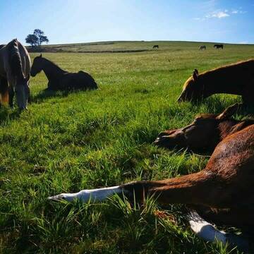


Offenstall/Laufstall/Paddocktrail FREI
Wurzbach
Sarah-Kreuter
@Sarah-Kreuter
Freizeitstall
Gangpferdereiten
Vermieten
Hunde willkommen
Krankenbox
Allergikerstall
Fohlenaufzucht möglich
39 weitere...
P+

Einstellplatz frei – familiär, sportlich & p...
Remptendorf
Natur Erlebnisstall
@Natur-Erlebnisstall
Freizeitstall
Pferdeausbildung
Vermieten
Hunde willkommen
Krankenbox
Allergikerstall
Fohlenaufzucht möglich
27 weitere...
P
Deprecated: Creation of dynamic property Zend_View_Helper_Ads::$adLink is deprecated in /var/www/stall-frei/htdocs/staging.stall-frei.de/library/Psf/View/Helper/Ads.php on line 108

Pferdepension Hit Aktivstall Kürmerhof
Hohenkammer
Kuermerhof
@Kuermerhof
*******JETZT NEU MIT ENTSTAUBTEM BIOHEU*********
*******Demnächst mit einem Abenteuerspielplatz für Pferde ( Extrem Trail/Pa
Leider kein Vorschaubild
Leider kein Vorschaubild
Paddockbox
Lichtenberg
reiterhof-doerflas
@reiterhof-doerflas
Freizeitstall
Vermieten
Hunde willkommen
Paddock
Außenbox mit Paddock
12 weitere...
B
Leider kein Vorschaubild
Leider kein Vorschaubild
Offenstall
Lichtenberg
reiterhof-doerflas
@reiterhof-doerflas
Freizeitstall
Vermieten
Hunde willkommen
Krankenbox
Notfallboxen
15 weitere...
B

Pferdehof hat Paddockboxen frei
Schwarzenbach am Wald
Manuela Geisser
@ManuelaGeisser
Freizeitstall
Vermieten
Hunde willkommen
Longierzirkel/Roundpen
Hufrehe geeignet
Notfallboxen
10 weitere...
P

Persönlichkeitsentwicklung mit Pferden
Bad Salzuflen
Katja Dors
@Pferdezeiten
Begleite andere auf ihrem Entwicklungsweg und entdecke die transformative Kraft der pferdegestützten Persönlichkeitsentwicklung !
neu
R
Leider kein Vorschaubild
Leider kein Vorschaubild
1 Offenstallplatz frei 24/7 Heu, Reitplatz
Berg
Bettina Hofmann
@BettinaHofmann
Vermieten
Longierzirkel/Roundpen
Paddock
Hufrehe geeignet
Innenbox
Offenstall
9 weitere...
B
Leider kein Vorschaubild
Leider kein Vorschaubild
Offenstallplätze frei / auch Rehepferd
Berg
Bettina Hofmann
@BettinaHofmann
Freizeitstall
Reitlehrer und -unterricht
Vermieten
Longierzirkel/Roundpen
Paddock
Hufrehe geeignet
Notfallboxen
11 weitere...
B

Freizeitreiter-Hof
Bayern - Hof
Janett
@Janett
FN-Mitglied
Freizeitstall
Vermieten
Hunde willkommen
Longierzirkel/Roundpen
Außenbox mit Paddock
Außenboxen
20 weitere...
P
Pensionsstall Schallersreuth
Konradsreuth
Daniela-Caspar
@Daniela-Caspar
Freizeitstall
Geländestrecke
Paddock
Pensions- und Gastboxen
Innenbox
Einzelne Boxen oder Stallplätze
9 weitere...
P
Leider kein Vorschaubild
Leider kein Vorschaubild
Boxen frei
Helmbrechts
Privatstall Kleinschwarzenbach
@Privatstall-Kleinschwarzenbach
FN-Mitglied
VFD-Mitglied
Vermieten
Hunde willkommen
Parkplatz für Pferdeanhänger
Innenbox
Offenstall
6 weitere...
B
Deprecated: Creation of dynamic property Zend_View::$pageCount is deprecated in /var/www/stall-frei/htdocs/staging.stall-frei.de/library/vendor/shardj/zf1-future/library/Zend/View/Abstract.php on line 308
Deprecated: Creation of dynamic property Zend_View::$itemCountPerPage is deprecated in /var/www/stall-frei/htdocs/staging.stall-frei.de/library/vendor/shardj/zf1-future/library/Zend/View/Abstract.php on line 308
Deprecated: Creation of dynamic property Zend_View::$first is deprecated in /var/www/stall-frei/htdocs/staging.stall-frei.de/library/vendor/shardj/zf1-future/library/Zend/View/Abstract.php on line 308
Deprecated: Creation of dynamic property Zend_View::$current is deprecated in /var/www/stall-frei/htdocs/staging.stall-frei.de/library/vendor/shardj/zf1-future/library/Zend/View/Abstract.php on line 308
Deprecated: Creation of dynamic property Zend_View::$last is deprecated in /var/www/stall-frei/htdocs/staging.stall-frei.de/library/vendor/shardj/zf1-future/library/Zend/View/Abstract.php on line 308
Deprecated: Creation of dynamic property Zend_View::$next is deprecated in /var/www/stall-frei/htdocs/staging.stall-frei.de/library/vendor/shardj/zf1-future/library/Zend/View/Abstract.php on line 308
Deprecated: Creation of dynamic property Zend_View::$pagesInRange is deprecated in /var/www/stall-frei/htdocs/staging.stall-frei.de/library/vendor/shardj/zf1-future/library/Zend/View/Abstract.php on line 308
Deprecated: Creation of dynamic property Zend_View::$firstPageInRange is deprecated in /var/www/stall-frei/htdocs/staging.stall-frei.de/library/vendor/shardj/zf1-future/library/Zend/View/Abstract.php on line 308
Deprecated: Creation of dynamic property Zend_View::$lastPageInRange is deprecated in /var/www/stall-frei/htdocs/staging.stall-frei.de/library/vendor/shardj/zf1-future/library/Zend/View/Abstract.php on line 308
Deprecated: Creation of dynamic property Zend_View::$currentItemCount is deprecated in /var/www/stall-frei/htdocs/staging.stall-frei.de/library/vendor/shardj/zf1-future/library/Zend/View/Abstract.php on line 308
Deprecated: Creation of dynamic property Zend_View::$totalItemCount is deprecated in /var/www/stall-frei/htdocs/staging.stall-frei.de/library/vendor/shardj/zf1-future/library/Zend/View/Abstract.php on line 308
Deprecated: Creation of dynamic property Zend_View::$firstItemNumber is deprecated in /var/www/stall-frei/htdocs/staging.stall-frei.de/library/vendor/shardj/zf1-future/library/Zend/View/Abstract.php on line 308
Deprecated: Creation of dynamic property Zend_View::$lastItemNumber is deprecated in /var/www/stall-frei/htdocs/staging.stall-frei.de/library/vendor/shardj/zf1-future/library/Zend/View/Abstract.php on line 308
Deprecated: Creation of dynamic property Zend_View::$router is deprecated in /var/www/stall-frei/htdocs/staging.stall-frei.de/library/vendor/shardj/zf1-future/library/Zend/View/Abstract.php on line 308
Deprecated: Creation of dynamic property Zend_View::$urlParams is deprecated in /var/www/stall-frei/htdocs/staging.stall-frei.de/library/vendor/shardj/zf1-future/library/Zend/View/Abstract.php on line 308
Deprecated: Creation of dynamic property Zend_View::$showAds is deprecated in /var/www/stall-frei/htdocs/staging.stall-frei.de/library/vendor/shardj/zf1-future/library/Zend/View/Abstract.php on line 308
Deprecated: Creation of dynamic property Zend_View::$objectIds is deprecated in /var/www/stall-frei/htdocs/staging.stall-frei.de/library/vendor/shardj/zf1-future/library/Zend/View/Abstract.php on line 308
Deprecated: Creation of dynamic property Zend_View::$showNavbar is deprecated in /var/www/stall-frei/htdocs/staging.stall-frei.de/library/vendor/shardj/zf1-future/library/Zend/View/Abstract.php on line 308
Deprecated: Creation of dynamic property Zend_View::$showBreadcrumb is deprecated in /var/www/stall-frei/htdocs/staging.stall-frei.de/library/vendor/shardj/zf1-future/library/Zend/View/Abstract.php on line 308
Deprecated: Creation of dynamic property Zend_View::$showFooter is deprecated in /var/www/stall-frei/htdocs/staging.stall-frei.de/library/vendor/shardj/zf1-future/library/Zend/View/Abstract.php on line 308
Deprecated: Creation of dynamic property Zend_View::$showInternalAds is deprecated in /var/www/stall-frei/htdocs/staging.stall-frei.de/library/vendor/shardj/zf1-future/library/Zend/View/Abstract.php on line 308
Deprecated: Creation of dynamic property Zend_View::$blNoContent is deprecated in /var/www/stall-frei/htdocs/staging.stall-frei.de/library/vendor/shardj/zf1-future/library/Zend/View/Abstract.php on line 308
Deprecated: Creation of dynamic property Zend_View::$sMetaDesc is deprecated in /var/www/stall-frei/htdocs/staging.stall-frei.de/library/vendor/shardj/zf1-future/library/Zend/View/Abstract.php on line 308
Deprecated: Creation of dynamic property Zend_View::$useGmaps is deprecated in /var/www/stall-frei/htdocs/staging.stall-frei.de/library/vendor/shardj/zf1-future/library/Zend/View/Abstract.php on line 308
Deprecated: Creation of dynamic property Zend_View::$touches is deprecated in /var/www/stall-frei/htdocs/staging.stall-frei.de/library/vendor/shardj/zf1-future/library/Zend/View/Abstract.php on line 308
Deprecated: Creation of dynamic property Zend_View::$oProject is deprecated in /var/www/stall-frei/htdocs/staging.stall-frei.de/library/vendor/shardj/zf1-future/library/Zend/View/Abstract.php on line 308
Deprecated: Creation of dynamic property Zend_View::$pageHeadline is deprecated in /var/www/stall-frei/htdocs/staging.stall-frei.de/library/vendor/shardj/zf1-future/library/Zend/View/Abstract.php on line 308
Deprecated: Creation of dynamic property Zend_View::$disableLocationField is deprecated in /var/www/stall-frei/htdocs/staging.stall-frei.de/library/vendor/shardj/zf1-future/library/Zend/View/Abstract.php on line 308
Deprecated: Creation of dynamic property Zend_View::$isSearch is deprecated in /var/www/stall-frei/htdocs/staging.stall-frei.de/library/vendor/shardj/zf1-future/library/Zend/View/Abstract.php on line 308
Deprecated: Creation of dynamic property Zend_View::$pageTitle is deprecated in /var/www/stall-frei/htdocs/staging.stall-frei.de/library/vendor/shardj/zf1-future/library/Zend/View/Abstract.php on line 308
Deprecated: Creation of dynamic property Psf_Form_Element_Text::$class is deprecated in /var/www/stall-frei/htdocs/staging.stall-frei.de/library/vendor/shardj/zf1-future/library/Zend/Form/Element.php on line 874
Deprecated: Creation of dynamic property Psf_Form_Element_Text::$size is deprecated in /var/www/stall-frei/htdocs/staging.stall-frei.de/library/vendor/shardj/zf1-future/library/Zend/Form/Element.php on line 874
Deprecated: Creation of dynamic property Psf_Form_Element_Text::$placeholder is deprecated in /var/www/stall-frei/htdocs/staging.stall-frei.de/library/vendor/shardj/zf1-future/library/Zend/Form/Element.php on line 874
Deprecated: Creation of dynamic property Psf_Form_Element_Hidden::$class is deprecated in /var/www/stall-frei/htdocs/staging.stall-frei.de/library/vendor/shardj/zf1-future/library/Zend/Form/Element.php on line 874
Deprecated: Creation of dynamic property Psf_Form_Element_Hidden::$class is deprecated in /var/www/stall-frei/htdocs/staging.stall-frei.de/library/vendor/shardj/zf1-future/library/Zend/Form/Element.php on line 874
Deprecated: Creation of dynamic property Psf_Form_Element_Hidden::$class is deprecated in /var/www/stall-frei/htdocs/staging.stall-frei.de/library/vendor/shardj/zf1-future/library/Zend/Form/Element.php on line 874
Deprecated: Creation of dynamic property Psf_Form_Element_Hidden::$class is deprecated in /var/www/stall-frei/htdocs/staging.stall-frei.de/library/vendor/shardj/zf1-future/library/Zend/Form/Element.php on line 874
Deprecated: Creation of dynamic property Psf_Form_Element_Select::$class is deprecated in /var/www/stall-frei/htdocs/staging.stall-frei.de/library/vendor/shardj/zf1-future/library/Zend/Form/Element.php on line 874
Deprecated: Creation of dynamic property Psf_Form_Element_Select::$class is deprecated in /var/www/stall-frei/htdocs/staging.stall-frei.de/library/vendor/shardj/zf1-future/library/Zend/Form/Element.php on line 874
Deprecated: Creation of dynamic property Psf_Form_Element_Select::$class is deprecated in /var/www/stall-frei/htdocs/staging.stall-frei.de/library/vendor/shardj/zf1-future/library/Zend/Form/Element.php on line 874
Deprecated: Creation of dynamic property Psf_Form_Element_Select::$class is deprecated in /var/www/stall-frei/htdocs/staging.stall-frei.de/library/vendor/shardj/zf1-future/library/Zend/Form/Element.php on line 874
Deprecated: Creation of dynamic property Psf_Form_Element_Text::$class is deprecated in /var/www/stall-frei/htdocs/staging.stall-frei.de/library/vendor/shardj/zf1-future/library/Zend/Form/Element.php on line 874
Deprecated: Creation of dynamic property Psf_Form_Element_Checkbox::$label is deprecated in /var/www/stall-frei/htdocs/staging.stall-frei.de/library/vendor/shardj/zf1-future/library/Zend/Form/Element.php on line 874
Deprecated: Creation of dynamic property Zend_View::$sort is deprecated in /var/www/stall-frei/htdocs/staging.stall-frei.de/library/vendor/shardj/zf1-future/library/Zend/View/Abstract.php on line 308
Deprecated: Creation of dynamic property Zend_View::$searchLocation is deprecated in /var/www/stall-frei/htdocs/staging.stall-frei.de/library/vendor/shardj/zf1-future/library/Zend/View/Abstract.php on line 308
Deprecated: Creation of dynamic property Zend_View::$locationHint is deprecated in /var/www/stall-frei/htdocs/staging.stall-frei.de/library/vendor/shardj/zf1-future/library/Zend/View/Abstract.php on line 308
Psf_GeoCoder_Abstract::getLocation: Gleima Get Location CachedOrLive
Psf_GeoCoder_Abstract::getCachedOrLive: Gleima
Psf_GeoCoder_OpenCageData::makeApiRequest: response:
Array
(
[documentation] => https://opencagedata.com/api
[licenses] => Array
(
[0] => Array
(
[name] => see attribution guide
[url] => https://opencagedata.com/credits
)
)
[results] => Array
(
[0] => Array
(
[bounds] => Array
(
[northeast] => Array
(
[lat] => 50.5449932
[lng] => 11.5453857
)
[southwest] => Array
(
[lat] => 50.5248236
[lng] => 11.514973
)
)
[components] => Array
(
[ISO_3166-1_alpha-2] => DE
[ISO_3166-1_alpha-3] => DEU
[ISO_3166-2] => Array
(
[0] => DE-TH
)
[_category] => place
[_normalized_city] => Remptendorf
[_type] => village
[city] => Remptendorf
[city_district] => Gahma
[continent] => Europe
[country] => Deutschland
[country_code] => de
[county] => Saale-Orla-Kreis
[political_union] => European Union
[state] => Thüringen
[state_code] => TH
[village] => Gleima
)
[confidence] => 7
[formatted] => Gahma, Gleima, Thüringen, Deutschland
[geometry] => Array
(
[lat] => 50.5281026
[lng] => 11.5295585
)
)
[1] => Array
(
[bounds] => Array
(
[northeast] => Array
(
[lat] => 50.5276862
[lng] => 11.5318298
)
[southwest] => Array
(
[lat] => 50.5259856
[lng] => 11.5291955
)
)
[components] => Array
(
[ISO_3166-1_alpha-2] => DE
[ISO_3166-1_alpha-3] => DEU
[ISO_3166-2] => Array
(
[0] => DE-TH
)
[_category] => road
[_normalized_city] => Remptendorf
[_type] => road
[city] => Remptendorf
[city_district] => Gahma
[continent] => Europe
[country] => Deutschland
[country_code] => de
[county] => Saale-Orla-Kreis
[political_union] => European Union
[postcode] => 07368
[road] => Gleima
[road_type] => residential
[state] => Thüringen
[state_code] => TH
[village] => Gleima
)
[confidence] => 9
[formatted] => Gleima, 07368 Gleima, Deutschland
[geometry] => Array
(
[lat] => 50.5267266
[lng] => 11.5304057
)
)
[2] => Array
(
[components] => Array
(
[ISO_3166-1_alpha-2] => FR
[ISO_3166-1_alpha-3] => FRA
[ISO_3166-2] => Array
(
[0] => FR-IDF
[1] => FR-92
)
[_category] => road
[_normalized_city] => Levallois-Perret
[_type] => road
[city] => Levallois-Perret
[continent] => Europe
[country] => France
[country_code] => fr
[county] => Hauts-de-Seine
[local_authority] => Métropole du Grand Paris
[political_union] => European Union
[postcode] => 92300
[road] => Rue Charles Deutschmann
[state] => Île-de-France
[state_code] => IDF
)
[confidence] => 3
[formatted] => Rue Charles Deutschmann, 92300 Levallois-Perret, France
[geometry] => Array
(
[lat] => 48.900049
[lng] => 2.2842
)
)
[3] => Array
(
[components] => Array
(
[ISO_3166-1_alpha-2] => FR
[ISO_3166-1_alpha-3] => FRA
[ISO_3166-2] => Array
(
[0] => FR-OCC
[1] => FR-65
)
[_category] => road
[_normalized_city] => Visker
[_type] => road
[city] => Visker
[continent] => Europe
[country] => France
[country_code] => fr
[county] => Hautes-Pyrénées
[local_authority] => Communauté d'agglomération Tarbes-Lourdes-Pyrénées
[political_union] => European Union
[postcode] => 65200
[road] => Cant Dera Gleisa
[state] => Occitanie
[state_code] => OCC
)
[confidence] => 2
[formatted] => Cant Dera Gleisa, 65200 Visker, France
[geometry] => Array
(
[lat] => 43.133393
[lng] => 0.077859
)
)
[4] => Array
(
[components] => Array
(
[ISO_3166-1_alpha-2] => FR
[ISO_3166-1_alpha-3] => FRA
[ISO_3166-2] => Array
(
[0] => FR-NAQ
[1] => FR-64
)
[_category] => road
[_normalized_city] => Montaner
[_type] => road
[city] => Montaner
[continent] => Europe
[country] => France
[country_code] => fr
[county] => Pyrénées-Atlantiques
[local_authority] => Communauté de communes Adour-Madiran
[political_union] => European Union
[postcode] => 64460
[road] => Camin de la Gleisa
[state] => Nouvelle-Aquitaine
[state_code] => NAQ
)
[confidence] => 2
[formatted] => Camin de la Gleisa, 64460 Montaner, France
[geometry] => Array
(
[lat] => 43.34663
[lng] => -0.00973
)
)
[5] => Array
(
[components] => Array
(
[ISO_3166-1_alpha-2] => FR
[ISO_3166-1_alpha-3] => FRA
[ISO_3166-2] => Array
(
[0] => FR-OCC
[1] => FR-11
)
[_category] => road
[_normalized_city] => Palairac
[_type] => road
[city] => Palairac
[continent] => Europe
[country] => France
[country_code] => fr
[county] => Aude
[local_authority] => Communauté de communes Région Lézignanaise, Corbières et Minervois
[political_union] => European Union
[postcode] => 11330
[road] => Camin de la Gleisa
[state] => Occitanie
[state_code] => OCC
)
[confidence] => 2
[formatted] => Camin de la Gleisa, 11330 Palairac, France
[geometry] => Array
(
[lat] => 42.956123
[lng] => 2.661116
)
)
[6] => Array
(
[components] => Array
(
[ISO_3166-1_alpha-2] => FR
[ISO_3166-1_alpha-3] => FRA
[ISO_3166-2] => Array
(
[0] => FR-OCC
[1] => FR-11
)
[_category] => road
[_normalized_city] => Comus
[_type] => road
[city] => Comus
[continent] => Europe
[country] => France
[country_code] => fr
[county] => Aude
[local_authority] => Communauté de communes des Pyrénées Audoises
[political_union] => European Union
[postcode] => 11340
[road] => Carrier de la Gleisa
[state] => Occitanie
[state_code] => OCC
)
[confidence] => 2
[formatted] => Carrier de la Gleisa, 11340 Comus, France
[geometry] => Array
(
[lat] => 42.813503
[lng] => 1.890401
)
)
[7] => Array
(
[components] => Array
(
[ISO_3166-1_alpha-2] => FR
[ISO_3166-1_alpha-3] => FRA
[ISO_3166-2] => Array
(
[0] => FR-OCC
[1] => FR-11
)
[_category] => road
[_normalized_city] => Termes
[_type] => road
[city] => Termes
[continent] => Europe
[country] => France
[country_code] => fr
[county] => Aude
[local_authority] => Communauté de communes Région Lézignanaise, Corbières et Minervois
[political_union] => European Union
[postcode] => 11330
[road] => Carrièra de la Gleisa
[state] => Occitanie
[state_code] => OCC
)
[confidence] => 2
[formatted] => Carrièra de la Gleisa, 11330 Termes, France
[geometry] => Array
(
[lat] => 43.000388
[lng] => 2.562591
)
)
[8] => Array
(
[components] => Array
(
[ISO_3166-1_alpha-2] => FR
[ISO_3166-1_alpha-3] => FRA
[ISO_3166-2] => Array
(
[0] => FR-OCC
[1] => FR-65
)
[_category] => road
[_normalized_city] => Saint-Lézer
[_type] => road
[city] => Saint-Lézer
[continent] => Europe
[country] => France
[country_code] => fr
[county] => Hautes-Pyrénées
[local_authority] => Communauté de communes Adour-Madiran
[political_union] => European Union
[postcode] => 65500
[road] => Cami de la Gleysa
[state] => Occitanie
[state_code] => OCC
)
[confidence] => 2
[formatted] => Cami de la Gleysa, 65500 Saint-Lézer, France
[geometry] => Array
(
[lat] => 43.371026
[lng] => 0.030794
)
)
[9] => Array
(
[components] => Array
(
[ISO_3166-1_alpha-2] => FR
[ISO_3166-1_alpha-3] => FRA
[ISO_3166-2] => Array
(
[0] => FR-OCC
[1] => FR-65
)
[_category] => road
[_normalized_city] => Oueilloux
[_type] => road
[city] => Oueilloux
[continent] => Europe
[country] => France
[country_code] => fr
[county] => Hautes-Pyrénées
[local_authority] => Communauté de communes des Coteaux du Val-d'Arros
[political_union] => European Union
[postcode] => 65190
[road] => Cami Dera Gleisa
[state] => Occitanie
[state_code] => OCC
)
[confidence] => 2
[formatted] => Cami Dera Gleisa, 65190 Oueilloux, France
[geometry] => Array
(
[lat] => 43.169835
[lng] => 0.178073
)
)
)
[status] => Array
(
[code] => 200
[message] => OK
)
[stay_informed] => Array
(
[blog] => https://blog.opencagedata.com
[mastodon] => https://en.osm.town/@opencage
)
[thanks] => For using an OpenCage API
[timestamp] => Array
(
[created_http] => Mon, 09 Feb 2026 11:06:37 GMT
[created_unix] => 1770635197
)
[total_results] => 10
)
Psf_GeoCoder_Abstract::convertLocationResult
{"documentation":"https:\/\/opencagedata.com\/api","licenses":[{"name":"see attribution guide","url":"https:\/\/opencagedata.com\/credits"}],"results":[{"bounds":{"northeast":{"lat":50.5449932,"lng":11.5453857},"southwest":{"lat":50.5248236,"lng":11.514973}},"components":{"ISO_3166-1_alpha-2":"DE","ISO_3166-1_alpha-3":"DEU","ISO_3166-2":["DE-TH"],"_category":"place","_normalized_city":"Remptendorf","_type":"village","city":"Remptendorf","city_district":"Gahma","continent":"Europe","country":"Deutschland","country_code":"de","county":"Saale-Orla-Kreis","political_union":"European Union","state":"Th\u00fcringen","state_code":"TH","village":"Gleima"},"confidence":7,"formatted":"Gahma, Gleima, Th\u00fcringen, Deutschland","geometry":{"lat":50.5281026,"lng":11.5295585}},{"bounds":{"northeast":{"lat":50.5276862,"lng":11.5318298},"southwest":{"lat":50.5259856,"lng":11.5291955}},"components":{"ISO_3166-1_alpha-2":"DE","ISO_3166-1_alpha-3":"DEU","ISO_3166-2":["DE-TH"],"_category":"road","_normalized_city":"Remptendorf","_type":"road","city":"Remptendorf","city_district":"Gahma","continent":"Europe","country":"Deutschland","country_code":"de","county":"Saale-Orla-Kreis","political_union":"European Union","postcode":"07368","road":"Gleima","road_type":"residential","state":"Th\u00fcringen","state_code":"TH","village":"Gleima"},"confidence":9,"formatted":"Gleima, 07368 Gleima, Deutschland","geometry":{"lat":50.5267266,"lng":11.5304057}},{"components":{"ISO_3166-1_alpha-2":"FR","ISO_3166-1_alpha-3":"FRA","ISO_3166-2":["FR-IDF","FR-92"],"_category":"road","_normalized_city":"Levallois-Perret","_type":"road","city":"Levallois-Perret","continent":"Europe","country":"France","country_code":"fr","county":"Hauts-de-Seine","local_authority":"M\u00e9tropole du Grand Paris","political_union":"European Union","postcode":"92300","road":"Rue Charles Deutschmann","state":"\u00cele-de-France","state_code":"IDF"},"confidence":3,"formatted":"Rue Charles Deutschmann, 92300 Levallois-Perret, France","geometry":{"lat":48.900049,"lng":2.2842}},{"components":{"ISO_3166-1_alpha-2":"FR","ISO_3166-1_alpha-3":"FRA","ISO_3166-2":["FR-OCC","FR-65"],"_category":"road","_normalized_city":"Visker","_type":"road","city":"Visker","continent":"Europe","country":"France","country_code":"fr","county":"Hautes-Pyr\u00e9n\u00e9es","local_authority":"Communaut\u00e9 d'agglom\u00e9ration Tarbes-Lourdes-Pyr\u00e9n\u00e9es","political_union":"European Union","postcode":"65200","road":"Cant Dera Gleisa","state":"Occitanie","state_code":"OCC"},"confidence":2,"formatted":"Cant Dera Gleisa, 65200 Visker, France","geometry":{"lat":43.133393,"lng":0.077859}},{"components":{"ISO_3166-1_alpha-2":"FR","ISO_3166-1_alpha-3":"FRA","ISO_3166-2":["FR-NAQ","FR-64"],"_category":"road","_normalized_city":"Montaner","_type":"road","city":"Montaner","continent":"Europe","country":"France","country_code":"fr","county":"Pyr\u00e9n\u00e9es-Atlantiques","local_authority":"Communaut\u00e9 de communes Adour-Madiran","political_union":"European Union","postcode":"64460","road":"Camin de la Gleisa","state":"Nouvelle-Aquitaine","state_code":"NAQ"},"confidence":2,"formatted":"Camin de la Gleisa, 64460 Montaner, France","geometry":{"lat":43.34663,"lng":-0.00973}},{"components":{"ISO_3166-1_alpha-2":"FR","ISO_3166-1_alpha-3":"FRA","ISO_3166-2":["FR-OCC","FR-11"],"_category":"road","_normalized_city":"Palairac","_type":"road","city":"Palairac","continent":"Europe","country":"France","country_code":"fr","county":"Aude","local_authority":"Communaut\u00e9 de communes R\u00e9gion L\u00e9zignanaise, Corbi\u00e8res et Minervois","political_union":"European Union","postcode":"11330","road":"Camin de la Gleisa","state":"Occitanie","state_code":"OCC"},"confidence":2,"formatted":"Camin de la Gleisa, 11330 Palairac, France","geometry":{"lat":42.956123,"lng":2.661116}},{"components":{"ISO_3166-1_alpha-2":"FR","ISO_3166-1_alpha-3":"FRA","ISO_3166-2":["FR-OCC","FR-11"],"_category":"road","_normalized_city":"Comus","_type":"road","city":"Comus","continent":"Europe","country":"France","country_code":"fr","county":"Aude","local_authority":"Communaut\u00e9 de communes des Pyr\u00e9n\u00e9es Audoises","political_union":"European Union","postcode":"11340","road":"Carrier de la Gleisa","state":"Occitanie","state_code":"OCC"},"confidence":2,"formatted":"Carrier de la Gleisa, 11340 Comus, France","geometry":{"lat":42.813503,"lng":1.890401}},{"components":{"ISO_3166-1_alpha-2":"FR","ISO_3166-1_alpha-3":"FRA","ISO_3166-2":["FR-OCC","FR-11"],"_category":"road","_normalized_city":"Termes","_type":"road","city":"Termes","continent":"Europe","country":"France","country_code":"fr","county":"Aude","local_authority":"Communaut\u00e9 de communes R\u00e9gion L\u00e9zignanaise, Corbi\u00e8res et Minervois","political_union":"European Union","postcode":"11330","road":"Carri\u00e8ra de la Gleisa","state":"Occitanie","state_code":"OCC"},"confidence":2,"formatted":"Carri\u00e8ra de la Gleisa, 11330 Termes, France","geometry":{"lat":43.000388,"lng":2.562591}},{"components":{"ISO_3166-1_alpha-2":"FR","ISO_3166-1_alpha-3":"FRA","ISO_3166-2":["FR-OCC","FR-65"],"_category":"road","_normalized_city":"Saint-L\u00e9zer","_type":"road","city":"Saint-L\u00e9zer","continent":"Europe","country":"France","country_code":"fr","county":"Hautes-Pyr\u00e9n\u00e9es","local_authority":"Communaut\u00e9 de communes Adour-Madiran","political_union":"European Union","postcode":"65500","road":"Cami de la Gleysa","state":"Occitanie","state_code":"OCC"},"confidence":2,"formatted":"Cami de la Gleysa, 65500 Saint-L\u00e9zer, France","geometry":{"lat":43.371026,"lng":0.030794}},{"components":{"ISO_3166-1_alpha-2":"FR","ISO_3166-1_alpha-3":"FRA","ISO_3166-2":["FR-OCC","FR-65"],"_category":"road","_normalized_city":"Oueilloux","_type":"road","city":"Oueilloux","continent":"Europe","country":"France","country_code":"fr","county":"Hautes-Pyr\u00e9n\u00e9es","local_authority":"Communaut\u00e9 de communes des Coteaux du Val-d'Arros","political_union":"European Union","postcode":"65190","road":"Cami Dera Gleisa","state":"Occitanie","state_code":"OCC"},"confidence":2,"formatted":"Cami Dera Gleisa, 65190 Oueilloux, France","geometry":{"lat":43.169835,"lng":0.178073}}],"status":{"code":200,"message":"OK"},"stay_informed":{"blog":"https:\/\/blog.opencagedata.com","mastodon":"https:\/\/en.osm.town\/@opencage"},"thanks":"For using an OpenCage API","timestamp":{"created_http":"Mon, 09 Feb 2026 11:06:37 GMT","created_unix":1770635197},"total_results":10}Array
(
[0] => stdClass Object
(
[bounds] => stdClass Object
(
[northeast] => stdClass Object
(
[lat] => 50.5449932
[lng] => 11.5453857
)
[southwest] => stdClass Object
(
[lat] => 50.5248236
[lng] => 11.514973
)
)
[components] => stdClass Object
(
[ISO_3166-1_alpha-2] => DE
[ISO_3166-1_alpha-3] => DEU
[ISO_3166-2] => Array
(
[0] => DE-TH
)
[_category] => place
[_normalized_city] => Remptendorf
[_type] => village
[city] => Remptendorf
[city_district] => Gahma
[continent] => Europe
[country] => Deutschland
[country_code] => de
[county] => Saale-Orla-Kreis
[political_union] => European Union
[state] => Thüringen
[state_code] => TH
[village] => Gleima
)
[confidence] => 7
[formatted] => Gahma, Gleima, Thüringen, Deutschland
[geometry] => stdClass Object
(
[lat] => 50.5281026
[lng] => 11.5295585
)
)
[1] => stdClass Object
(
[bounds] => stdClass Object
(
[northeast] => stdClass Object
(
[lat] => 50.5276862
[lng] => 11.5318298
)
[southwest] => stdClass Object
(
[lat] => 50.5259856
[lng] => 11.5291955
)
)
[components] => stdClass Object
(
[ISO_3166-1_alpha-2] => DE
[ISO_3166-1_alpha-3] => DEU
[ISO_3166-2] => Array
(
[0] => DE-TH
)
[_category] => road
[_normalized_city] => Remptendorf
[_type] => road
[city] => Remptendorf
[city_district] => Gahma
[continent] => Europe
[country] => Deutschland
[country_code] => de
[county] => Saale-Orla-Kreis
[political_union] => European Union
[postcode] => 07368
[road] => Gleima
[road_type] => residential
[state] => Thüringen
[state_code] => TH
[village] => Gleima
)
[confidence] => 9
[formatted] => Gleima, 07368 Gleima, Deutschland
[geometry] => stdClass Object
(
[lat] => 50.5267266
[lng] => 11.5304057
)
)
[2] => stdClass Object
(
[components] => stdClass Object
(
[ISO_3166-1_alpha-2] => FR
[ISO_3166-1_alpha-3] => FRA
[ISO_3166-2] => Array
(
[0] => FR-IDF
[1] => FR-92
)
[_category] => road
[_normalized_city] => Levallois-Perret
[_type] => road
[city] => Levallois-Perret
[continent] => Europe
[country] => France
[country_code] => fr
[county] => Hauts-de-Seine
[local_authority] => Métropole du Grand Paris
[political_union] => European Union
[postcode] => 92300
[road] => Rue Charles Deutschmann
[state] => Île-de-France
[state_code] => IDF
)
[confidence] => 3
[formatted] => Rue Charles Deutschmann, 92300 Levallois-Perret, France
[geometry] => stdClass Object
(
[lat] => 48.900049
[lng] => 2.2842
)
)
[3] => stdClass Object
(
[components] => stdClass Object
(
[ISO_3166-1_alpha-2] => FR
[ISO_3166-1_alpha-3] => FRA
[ISO_3166-2] => Array
(
[0] => FR-OCC
[1] => FR-65
)
[_category] => road
[_normalized_city] => Visker
[_type] => road
[city] => Visker
[continent] => Europe
[country] => France
[country_code] => fr
[county] => Hautes-Pyrénées
[local_authority] => Communauté d'agglomération Tarbes-Lourdes-Pyrénées
[political_union] => European Union
[postcode] => 65200
[road] => Cant Dera Gleisa
[state] => Occitanie
[state_code] => OCC
)
[confidence] => 2
[formatted] => Cant Dera Gleisa, 65200 Visker, France
[geometry] => stdClass Object
(
[lat] => 43.133393
[lng] => 0.077859
)
)
[4] => stdClass Object
(
[components] => stdClass Object
(
[ISO_3166-1_alpha-2] => FR
[ISO_3166-1_alpha-3] => FRA
[ISO_3166-2] => Array
(
[0] => FR-NAQ
[1] => FR-64
)
[_category] => road
[_normalized_city] => Montaner
[_type] => road
[city] => Montaner
[continent] => Europe
[country] => France
[country_code] => fr
[county] => Pyrénées-Atlantiques
[local_authority] => Communauté de communes Adour-Madiran
[political_union] => European Union
[postcode] => 64460
[road] => Camin de la Gleisa
[state] => Nouvelle-Aquitaine
[state_code] => NAQ
)
[confidence] => 2
[formatted] => Camin de la Gleisa, 64460 Montaner, France
[geometry] => stdClass Object
(
[lat] => 43.34663
[lng] => -0.00973
)
)
[5] => stdClass Object
(
[components] => stdClass Object
(
[ISO_3166-1_alpha-2] => FR
[ISO_3166-1_alpha-3] => FRA
[ISO_3166-2] => Array
(
[0] => FR-OCC
[1] => FR-11
)
[_category] => road
[_normalized_city] => Palairac
[_type] => road
[city] => Palairac
[continent] => Europe
[country] => France
[country_code] => fr
[county] => Aude
[local_authority] => Communauté de communes Région Lézignanaise, Corbières et Minervois
[political_union] => European Union
[postcode] => 11330
[road] => Camin de la Gleisa
[state] => Occitanie
[state_code] => OCC
)
[confidence] => 2
[formatted] => Camin de la Gleisa, 11330 Palairac, France
[geometry] => stdClass Object
(
[lat] => 42.956123
[lng] => 2.661116
)
)
[6] => stdClass Object
(
[components] => stdClass Object
(
[ISO_3166-1_alpha-2] => FR
[ISO_3166-1_alpha-3] => FRA
[ISO_3166-2] => Array
(
[0] => FR-OCC
[1] => FR-11
)
[_category] => road
[_normalized_city] => Comus
[_type] => road
[city] => Comus
[continent] => Europe
[country] => France
[country_code] => fr
[county] => Aude
[local_authority] => Communauté de communes des Pyrénées Audoises
[political_union] => European Union
[postcode] => 11340
[road] => Carrier de la Gleisa
[state] => Occitanie
[state_code] => OCC
)
[confidence] => 2
[formatted] => Carrier de la Gleisa, 11340 Comus, France
[geometry] => stdClass Object
(
[lat] => 42.813503
[lng] => 1.890401
)
)
[7] => stdClass Object
(
[components] => stdClass Object
(
[ISO_3166-1_alpha-2] => FR
[ISO_3166-1_alpha-3] => FRA
[ISO_3166-2] => Array
(
[0] => FR-OCC
[1] => FR-11
)
[_category] => road
[_normalized_city] => Termes
[_type] => road
[city] => Termes
[continent] => Europe
[country] => France
[country_code] => fr
[county] => Aude
[local_authority] => Communauté de communes Région Lézignanaise, Corbières et Minervois
[political_union] => European Union
[postcode] => 11330
[road] => Carrièra de la Gleisa
[state] => Occitanie
[state_code] => OCC
)
[confidence] => 2
[formatted] => Carrièra de la Gleisa, 11330 Termes, France
[geometry] => stdClass Object
(
[lat] => 43.000388
[lng] => 2.562591
)
)
[8] => stdClass Object
(
[components] => stdClass Object
(
[ISO_3166-1_alpha-2] => FR
[ISO_3166-1_alpha-3] => FRA
[ISO_3166-2] => Array
(
[0] => FR-OCC
[1] => FR-65
)
[_category] => road
[_normalized_city] => Saint-Lézer
[_type] => road
[city] => Saint-Lézer
[continent] => Europe
[country] => France
[country_code] => fr
[county] => Hautes-Pyrénées
[local_authority] => Communauté de communes Adour-Madiran
[political_union] => European Union
[postcode] => 65500
[road] => Cami de la Gleysa
[state] => Occitanie
[state_code] => OCC
)
[confidence] => 2
[formatted] => Cami de la Gleysa, 65500 Saint-Lézer, France
[geometry] => stdClass Object
(
[lat] => 43.371026
[lng] => 0.030794
)
)
[9] => stdClass Object
(
[components] => stdClass Object
(
[ISO_3166-1_alpha-2] => FR
[ISO_3166-1_alpha-3] => FRA
[ISO_3166-2] => Array
(
[0] => FR-OCC
[1] => FR-65
)
[_category] => road
[_normalized_city] => Oueilloux
[_type] => road
[city] => Oueilloux
[continent] => Europe
[country] => France
[country_code] => fr
[county] => Hautes-Pyrénées
[local_authority] => Communauté de communes des Coteaux du Val-d'Arros
[political_union] => European Union
[postcode] => 65190
[road] => Cami Dera Gleisa
[state] => Occitanie
[state_code] => OCC
)
[confidence] => 2
[formatted] => Cami Dera Gleisa, 65190 Oueilloux, France
[geometry] => stdClass Object
(
[lat] => 43.169835
[lng] => 0.178073
)
)
)
Psf_GeoCoder_OpenCageData::getKeyMap: 0
stdClass Object
(
    [bounds] => stdClass Object
        (
            [northeast] => stdClass Object
                (
                    [lat] => 50.5449932
                    [lng] => 11.5453857
                )

            [southwest] => stdClass Object
                (
                    [lat] => 50.5248236
                    [lng] => 11.514973
                )

        )

    [components] => stdClass Object
        (
            [ISO_3166-1_alpha-2] => DE
            [ISO_3166-1_alpha-3] => DEU
            [ISO_3166-2] => Array
                (
                    [0] => DE-TH
                )

            [_category] => place
            [_normalized_city] => Remptendorf
            [_type] => village
            [city] => Remptendorf
            [city_district] => Gahma
            [continent] => Europe
            [country] => Deutschland
            [country_code] => de
            [county] => Saale-Orla-Kreis
            [political_union] => European Union
            [state] => Thüringen
            [state_code] => TH
            [village] => Gleima
        )

    [confidence] => 7
    [formatted] => Gahma, Gleima, Thüringen, Deutschland
    [geometry] => stdClass Object
        (
            [lat] => 50.5281026
            [lng] => 11.5295585
        )

)
Psf_GeoCoder_OpenCageData::getCounty: Saale-Orla-Kreis
Psf_GeoCoder_OpenCageData::addMissingData REFETCH!
Array
(
    [address] => Gahma, Gleima, Thüringen, Deutschland
    [type] => village
    [street] =>
    [city] => Gleima
    [county] => Saale-Orla-Kreis
    [state] => Thüringen
    [zip] =>
    [country] => Deutschland
    [suburb] =>
    [countrycode] => de
    [latitude] => 50.5281026
    [longitude] => 11.5295585
    [accuracy] => 1
    [confidence] => 7
    [bounds] => stdClass Object
        (
            [northeast] => stdClass Object
                (
                    [lat] => 50.5449932
                    [lng] => 11.5453857
                )

            [southwest] => stdClass Object
                (
                    [lat] => 50.5248236
                    [lng] => 11.514973
                )

        )

)
reformat!
Array
(
    [address] => Gahma, Gleima, Thüringen, Deutschland
    [type] => village
    [street] =>
    [city] => Gleima
    [county] => Saale-Orla-Kreis
    [state] => Thüringen
    [zip] =>
    [country] => Deutschland
    [suburb] =>
    [countrycode] => de
    [latitude] => 50.5281026
    [longitude] => 11.5295585
    [accuracy] => 1
    [confidence] => 7
    [bounds] => stdClass Object
        (
            [northeast] => stdClass Object
                (
                    [lat] => 50.5449932
                    [lng] => 11.5453857
                )

            [southwest] => stdClass Object
                (
                    [lat] => 50.5248236
                    [lng] => 11.514973
                )

        )

    [place] => Gleima, Thüringen
    [hash] => 9462690c713026d60b7ed3b17dd38530
)
Psf_GeoCoder_OpenCageData::getKeyMap: 1
stdClass Object
(
    [bounds] => stdClass Object
        (
            [northeast] => stdClass Object
                (
                    [lat] => 50.5276862
                    [lng] => 11.5318298
                )

            [southwest] => stdClass Object
                (
                    [lat] => 50.5259856
                    [lng] => 11.5291955
                )

        )

    [components] => stdClass Object
        (
            [ISO_3166-1_alpha-2] => DE
            [ISO_3166-1_alpha-3] => DEU
            [ISO_3166-2] => Array
                (
                    [0] => DE-TH
                )

            [_category] => road
            [_normalized_city] => Remptendorf
            [_type] => road
            [city] => Remptendorf
            [city_district] => Gahma
            [continent] => Europe
            [country] => Deutschland
            [country_code] => de
            [county] => Saale-Orla-Kreis
            [political_union] => European Union
            [postcode] => 07368
            [road] => Gleima
            [road_type] => residential
            [state] => Thüringen
            [state_code] => TH
            [village] => Gleima
        )

    [confidence] => 9
    [formatted] => Gleima, 07368 Gleima, Deutschland
    [geometry] => stdClass Object
        (
            [lat] => 50.5267266
            [lng] => 11.5304057
        )

)
Psf_GeoCoder_OpenCageData::getCounty: Saale-Orla-Kreis
Psf_GeoCoder_OpenCageData::addMissingData REFETCH!
Array
(
    [address] => Gleima, 07368 Gleima, Deutschland
    [type] => road
    [street] => Gleima
    [city] => Gleima
    [county] => Saale-Orla-Kreis
    [state] => Thüringen
    [zip] => 07368
    [country] => Deutschland
    [suburb] =>
    [countrycode] => de
    [latitude] => 50.5267266
    [longitude] => 11.5304057
    [accuracy] => 1
    [confidence] => 9
    [bounds] => stdClass Object
        (
            [northeast] => stdClass Object
                (
                    [lat] => 50.5276862
                    [lng] => 11.5318298
                )

            [southwest] => stdClass Object
                (
                    [lat] => 50.5259856
                    [lng] => 11.5291955
                )

        )

)
reformat!
Array
(
    [address] => Gleima, 07368 Gleima, Deutschland
    [type] => road
    [street] => Gleima
    [city] => Gleima
    [county] => Saale-Orla-Kreis
    [state] => Thüringen
    [zip] => 07368
    [country] => Deutschland
    [suburb] =>
    [countrycode] => de
    [latitude] => 50.5267266
    [longitude] => 11.5304057
    [accuracy] => 1
    [confidence] => 9
    [bounds] => stdClass Object
        (
            [northeast] => stdClass Object
                (
                    [lat] => 50.5276862
                    [lng] => 11.5318298
                )

            [southwest] => stdClass Object
                (
                    [lat] => 50.5259856
                    [lng] => 11.5291955
                )

        )

    [place] => Gleima, 07368 Gleima, Thüringen
    [hash] => dc515f60c903b328cc79e6f7351f7f11
)
Psf_GeoCoder_OpenCageData::getKeyMap: 2
stdClass Object
(
    [components] => stdClass Object
        (
            [ISO_3166-1_alpha-2] => FR
            [ISO_3166-1_alpha-3] => FRA
            [ISO_3166-2] => Array
                (
                    [0] => FR-IDF
                    [1] => FR-92
                )

            [_category] => road
            [_normalized_city] => Levallois-Perret
            [_type] => road
            [city] => Levallois-Perret
            [continent] => Europe
            [country] => France
            [country_code] => fr
            [county] => Hauts-de-Seine
            [local_authority] => Métropole du Grand Paris
            [political_union] => European Union
            [postcode] => 92300
            [road] => Rue Charles Deutschmann
            [state] => Île-de-France
            [state_code] => IDF
        )

    [confidence] => 3
    [formatted] => Rue Charles Deutschmann, 92300 Levallois-Perret, France
    [geometry] => stdClass Object
        (
            [lat] => 48.900049
            [lng] => 2.2842
        )

)
Psf_GeoCoder_OpenCageData::getCounty: Hauts-de-Seine
Psf_GeoCoder_OpenCageData::addMissingData REFETCH!
Array
(
    [address] => Rue Charles Deutschmann, 92300 Levallois-Perret, France
    [type] => road
    [street] => Rue Charles Deutschmann
    [city] => Levallois-Perret
    [county] => Hauts-de-Seine
    [state] => Île-de-France
    [zip] => 92300
    [country] => France
    [suburb] =>
    [countrycode] => fr
    [latitude] => 48.900049
    [longitude] => 2.2842
    [accuracy] => 1
    [confidence] => 3
    [bounds] =>
)
reformat!
Array
(
    [address] => Rue Charles Deutschmann, 92300 Levallois-Perret, France
    [type] => road
    [street] => Rue Charles Deutschmann
    [city] => Levallois-Perret
    [county] => Hauts-de-Seine
    [state] => Île-de-France
    [zip] => 92300
    [country] => France
    [suburb] =>
    [countrycode] => fr
    [latitude] => 48.900049
    [longitude] => 2.2842
    [accuracy] => 1
    [confidence] => 3
    [bounds] =>
    [place] => Rue Charles Deutschmann, 92300 Levallois-Perret, Île-de-France
    [hash] => b7dc44def3990e8a7eaf18e019eca466
)
Psf_GeoCoder_OpenCageData::getKeyMap: 3
stdClass Object
(
    [components] => stdClass Object
        (
            [ISO_3166-1_alpha-2] => FR
            [ISO_3166-1_alpha-3] => FRA
            [ISO_3166-2] => Array
                (
                    [0] => FR-OCC
                    [1] => FR-65
                )

            [_category] => road
            [_normalized_city] => Visker
            [_type] => road
            [city] => Visker
            [continent] => Europe
            [country] => France
            [country_code] => fr
            [county] => Hautes-Pyrénées
            [local_authority] => Communauté d'agglomération Tarbes-Lourdes-Pyrénées
            [political_union] => European Union
            [postcode] => 65200
            [road] => Cant Dera Gleisa
            [state] => Occitanie
            [state_code] => OCC
        )

    [confidence] => 2
    [formatted] => Cant Dera Gleisa, 65200 Visker, France
    [geometry] => stdClass Object
        (
            [lat] => 43.133393
            [lng] => 0.077859
        )

)
Psf_GeoCoder_OpenCageData::getCounty: Hautes-Pyrénées
Psf_GeoCoder_OpenCageData::addMissingData REFETCH!
Array
(
    [address] => Cant Dera Gleisa, 65200 Visker, France
    [type] => road
    [street] => Cant Dera Gleisa
    [city] => Visker
    [county] => Hautes-Pyrénées
    [state] => Occitanie
    [zip] => 65200
    [country] => France
    [suburb] =>
    [countrycode] => fr
    [latitude] => 43.133393
    [longitude] => 0.077859
    [accuracy] => 1
    [confidence] => 2
    [bounds] =>
)
reformat!
Array
(
    [address] => Cant Dera Gleisa, 65200 Visker, France
    [type] => road
    [street] => Cant Dera Gleisa
    [city] => Visker
    [county] => Hautes-Pyrénées
    [state] => Occitanie
    [zip] => 65200
    [country] => France
    [suburb] =>
    [countrycode] => fr
    [latitude] => 43.133393
    [longitude] => 0.077859
    [accuracy] => 1
    [confidence] => 2
    [bounds] =>
    [place] => Cant Dera Gleisa, 65200 Visker, Occitanie
    [hash] => c9e08ce2bf35c21097bce39728e25da1
)
Psf_GeoCoder_OpenCageData::getKeyMap: 4
stdClass Object
(
    [components] => stdClass Object
        (
            [ISO_3166-1_alpha-2] => FR
            [ISO_3166-1_alpha-3] => FRA
            [ISO_3166-2] => Array
                (
                    [0] => FR-NAQ
                    [1] => FR-64
                )

            [_category] => road
            [_normalized_city] => Montaner
            [_type] => road
            [city] => Montaner
            [continent] => Europe
            [country] => France
            [country_code] => fr
            [county] => Pyrénées-Atlantiques
            [local_authority] => Communauté de communes Adour-Madiran
            [political_union] => European Union
            [postcode] => 64460
            [road] => Camin de la Gleisa
            [state] => Nouvelle-Aquitaine
            [state_code] => NAQ
        )

    [confidence] => 2
    [formatted] => Camin de la Gleisa, 64460 Montaner, France
    [geometry] => stdClass Object
        (
            [lat] => 43.34663
            [lng] => -0.00973
        )

)
Psf_GeoCoder_OpenCageData::getCounty: Pyrénées-Atlantiques
Psf_GeoCoder_OpenCageData::addMissingData REFETCH!
Array
(
    [address] => Camin de la Gleisa, 64460 Montaner, France
    [type] => road
    [street] => Camin de la Gleisa
    [city] => Montaner
    [county] => Pyrénées-Atlantiques
    [state] => Nouvelle-Aquitaine
    [zip] => 64460
    [country] => France
    [suburb] =>
    [countrycode] => fr
    [latitude] => 43.34663
    [longitude] => -0.00973
    [accuracy] => 1
    [confidence] => 2
    [bounds] =>
)
reformat!
Array
(
    [address] => Camin de la Gleisa, 64460 Montaner, France
    [type] => road
    [street] => Camin de la Gleisa
    [city] => Montaner
    [county] => Pyrénées-Atlantiques
    [state] => Nouvelle-Aquitaine
    [zip] => 64460
    [country] => France
    [suburb] =>
    [countrycode] => fr
    [latitude] => 43.34663
    [longitude] => -0.00973
    [accuracy] => 1
    [confidence] => 2
    [bounds] =>
    [place] => Camin de la Gleisa, 64460 Montaner, Nouvelle-Aquitaine
    [hash] => 4ec56be177e50f724065c8bb249ccc5d
)
Psf_GeoCoder_OpenCageData::getKeyMap: 5
stdClass Object
(
    [components] => stdClass Object
        (
            [ISO_3166-1_alpha-2] => FR
            [ISO_3166-1_alpha-3] => FRA
            [ISO_3166-2] => Array
                (
                    [0] => FR-OCC
                    [1] => FR-11
                )

            [_category] => road
            [_normalized_city] => Palairac
            [_type] => road
            [city] => Palairac
            [continent] => Europe
            [country] => France
            [country_code] => fr
            [county] => Aude
            [local_authority] => Communauté de communes Région Lézignanaise, Corbières et Minervois
            [political_union] => European Union
            [postcode] => 11330
            [road] => Camin de la Gleisa
            [state] => Occitanie
            [state_code] => OCC
        )

    [confidence] => 2
    [formatted] => Camin de la Gleisa, 11330 Palairac, France
    [geometry] => stdClass Object
        (
            [lat] => 42.956123
            [lng] => 2.661116
        )

)
Psf_GeoCoder_OpenCageData::getCounty: Aude
Psf_GeoCoder_OpenCageData::addMissingData REFETCH!
Array
(
    [address] => Camin de la Gleisa, 11330 Palairac, France
    [type] => road
    [street] => Camin de la Gleisa
    [city] => Palairac
    [county] => Aude
    [state] => Occitanie
    [zip] => 11330
    [country] => France
    [suburb] =>
    [countrycode] => fr
    [latitude] => 42.956123
    [longitude] => 2.661116
    [accuracy] => 1
    [confidence] => 2
    [bounds] =>
)
reformat!
Array
(
    [address] => Camin de la Gleisa, 11330 Palairac, France
    [type] => road
    [street] => Camin de la Gleisa
    [city] => Palairac
    [county] => Aude
    [state] => Occitanie
    [zip] => 11330
    [country] => France
    [suburb] =>
    [countrycode] => fr
    [latitude] => 42.956123
    [longitude] => 2.661116
    [accuracy] => 1
    [confidence] => 2
    [bounds] =>
    [place] => Camin de la Gleisa, 11330 Palairac, Occitanie
    [hash] => d4dad5a538d75fbd43b552c270cf070b
)
Psf_GeoCoder_OpenCageData::getKeyMap: 6
stdClass Object
(
    [components] => stdClass Object
        (
            [ISO_3166-1_alpha-2] => FR
            [ISO_3166-1_alpha-3] => FRA
            [ISO_3166-2] => Array
                (
                    [0] => FR-OCC
                    [1] => FR-11
                )

            [_category] => road
            [_normalized_city] => Comus
            [_type] => road
            [city] => Comus
            [continent] => Europe
            [country] => France
            [country_code] => fr
            [county] => Aude
            [local_authority] => Communauté de communes des Pyrénées Audoises
            [political_union] => European Union
            [postcode] => 11340
            [road] => Carrier de la Gleisa
            [state] => Occitanie
            [state_code] => OCC
        )

    [confidence] => 2
    [formatted] => Carrier de la Gleisa, 11340 Comus, France
    [geometry] => stdClass Object
        (
            [lat] => 42.813503
            [lng] => 1.890401
        )

)
Psf_GeoCoder_OpenCageData::getCounty: Aude
Psf_GeoCoder_OpenCageData::addMissingData REFETCH!
Array
(
    [address] => Carrier de la Gleisa, 11340 Comus, France
    [type] => road
    [street] => Carrier de la Gleisa
    [city] => Comus
    [county] => Aude
    [state] => Occitanie
    [zip] => 11340
    [country] => France
    [suburb] =>
    [countrycode] => fr
    [latitude] => 42.813503
    [longitude] => 1.890401
    [accuracy] => 1
    [confidence] => 2
    [bounds] =>
)
reformat!
Array
(
    [address] => Carrier de la Gleisa, 11340 Comus, France
    [type] => road
    [street] => Carrier de la Gleisa
    [city] => Comus
    [county] => Aude
    [state] => Occitanie
    [zip] => 11340
    [country] => France
    [suburb] =>
    [countrycode] => fr
    [latitude] => 42.813503
    [longitude] => 1.890401
    [accuracy] => 1
    [confidence] => 2
    [bounds] =>
    [place] => Carrier de la Gleisa, 11340 Comus, Occitanie
    [hash] => 7a3b2da7d433d667f876f239e927e34a
)
Psf_GeoCoder_OpenCageData::getKeyMap: 7
stdClass Object
(
    [components] => stdClass Object
        (
            [ISO_3166-1_alpha-2] => FR
            [ISO_3166-1_alpha-3] => FRA
            [ISO_3166-2] => Array
                (
                    [0] => FR-OCC
                    [1] => FR-11
                )

            [_category] => road
            [_normalized_city] => Termes
            [_type] => road
            [city] => Termes
            [continent] => Europe
            [country] => France
            [country_code] => fr
            [county] => Aude
            [local_authority] => Communauté de communes Région Lézignanaise, Corbières et Minervois
            [political_union] => European Union
            [postcode] => 11330
            [road] => Carrièra de la Gleisa
            [state] => Occitanie
            [state_code] => OCC
        )

    [confidence] => 2
    [formatted] => Carrièra de la Gleisa, 11330 Termes, France
    [geometry] => stdClass Object
        (
            [lat] => 43.000388
            [lng] => 2.562591
        )

)
Psf_GeoCoder_OpenCageData::getCounty: Aude
Psf_GeoCoder_OpenCageData::addMissingData REFETCH!
Array
(
    [address] => Carrièra de la Gleisa, 11330 Termes, France
    [type] => road
    [street] => Carrièra de la Gleisa
    [city] => Termes
    [county] => Aude
    [state] => Occitanie
    [zip] => 11330
    [country] => France
    [suburb] =>
    [countrycode] => fr
    [latitude] => 43.000388
    [longitude] => 2.562591
    [accuracy] => 1
    [confidence] => 2
    [bounds] =>
)
reformat!
Array
(
    [address] => Carrièra de la Gleisa, 11330 Termes, France
    [type] => road
    [street] => Carrièra de la Gleisa
    [city] => Termes
    [county] => Aude
    [state] => Occitanie
    [zip] => 11330
    [country] => France
    [suburb] =>
    [countrycode] => fr
    [latitude] => 43.000388
    [longitude] => 2.562591
    [accuracy] => 1
    [confidence] => 2
    [bounds] =>
    [place] => Carrièra de la Gleisa, 11330 Termes, Occitanie
    [hash] => 9169ba4e69b9e3f36b4b64b3e73a0108
)
Psf_GeoCoder_OpenCageData::getKeyMap: 8
stdClass Object
(
    [components] => stdClass Object
        (
            [ISO_3166-1_alpha-2] => FR
            [ISO_3166-1_alpha-3] => FRA
            [ISO_3166-2] => Array
                (
                    [0] => FR-OCC
                    [1] => FR-65
                )

            [_category] => road
            [_normalized_city] => Saint-Lézer
            [_type] => road
            [city] => Saint-Lézer
            [continent] => Europe
            [country] => France
            [country_code] => fr
            [county] => Hautes-Pyrénées
            [local_authority] => Communauté de communes Adour-Madiran
            [political_union] => European Union
            [postcode] => 65500
            [road] => Cami de la Gleysa
            [state] => Occitanie
            [state_code] => OCC
        )

    [confidence] => 2
    [formatted] => Cami de la Gleysa, 65500 Saint-Lézer, France
    [geometry] => stdClass Object
        (
            [lat] => 43.371026
            [lng] => 0.030794
        )

)
Psf_GeoCoder_OpenCageData::getCounty: Hautes-Pyrénées
Psf_GeoCoder_OpenCageData::addMissingData REFETCH!
Array
(
    [address] => Cami de la Gleysa, 65500 Saint-Lézer, France
    [type] => road
    [street] => Cami de la Gleysa
    [city] => Saint-Lézer
    [county] => Hautes-Pyrénées
    [state] => Occitanie
    [zip] => 65500
    [country] => France
    [suburb] =>
    [countrycode] => fr
    [latitude] => 43.371026
    [longitude] => 0.030794
    [accuracy] => 1
    [confidence] => 2
    [bounds] =>
)
reformat!
Array
(
    [address] => Cami de la Gleysa, 65500 Saint-Lézer, France
    [type] => road
    [street] => Cami de la Gleysa
    [city] => Saint-Lézer
    [county] => Hautes-Pyrénées
    [state] => Occitanie
    [zip] => 65500
    [country] => France
    [suburb] =>
    [countrycode] => fr
    [latitude] => 43.371026
    [longitude] => 0.030794
    [accuracy] => 1
    [confidence] => 2
    [bounds] =>
    [place] => Cami de la Gleysa, 65500 Saint-Lézer, Occitanie
    [hash] => fba83937bfcf8aecbf08662d7b80b4b6
)
Psf_GeoCoder_OpenCageData::getKeyMap: 9
stdClass Object
(
    [components] => stdClass Object
        (
            [ISO_3166-1_alpha-2] => FR
            [ISO_3166-1_alpha-3] => FRA
            [ISO_3166-2] => Array
                (
                    [0] => FR-OCC
                    [1] => FR-65
                )

            [_category] => road
            [_normalized_city] => Oueilloux
            [_type] => road
            [city] => Oueilloux
            [continent] => Europe
            [country] => France
            [country_code] => fr
            [county] => Hautes-Pyrénées
            [local_authority] => Communauté de communes des Coteaux du Val-d'Arros
            [political_union] => European Union
            [postcode] => 65190
            [road] => Cami Dera Gleisa
            [state] => Occitanie
            [state_code] => OCC
        )

    [confidence] => 2
    [formatted] => Cami Dera Gleisa, 65190 Oueilloux, France
    [geometry] => stdClass Object
        (
            [lat] => 43.169835
            [lng] => 0.178073
        )

)
Psf_GeoCoder_OpenCageData::getCounty: Hautes-Pyrénées
Psf_GeoCoder_OpenCageData::addMissingData REFETCH!
Array
(
    [address] => Cami Dera Gleisa, 65190 Oueilloux, France
    [type] => road
    [street] => Cami Dera Gleisa
    [city] => Oueilloux
    [county] => Hautes-Pyrénées
    [state] => Occitanie
    [zip] => 65190
    [country] => France
    [suburb] =>
    [countrycode] => fr
    [latitude] => 43.169835
    [longitude] => 0.178073
    [accuracy] => 1
    [confidence] => 2
    [bounds] =>
)
reformat!
Array
(
    [address] => Cami Dera Gleisa, 65190 Oueilloux, France
    [type] => road
    [street] => Cami Dera Gleisa
    [city] => Oueilloux
    [county] => Hautes-Pyrénées
    [state] => Occitanie
    [zip] => 65190
    [country] => France
    [suburb] =>
    [countrycode] => fr
    [latitude] => 43.169835
    [longitude] => 0.178073
    [accuracy] => 1
    [confidence] => 2
    [bounds] =>
    [place] => Cami Dera Gleisa, 65190 Oueilloux, Occitanie
    [hash] => cfcba86e4355b1cd881545942bc89a0e
)
Deprecated: Creation of dynamic property Zend_View::$locationHintStyle is deprecated in /var/www/stall-frei/htdocs/staging.stall-frei.de/library/vendor/shardj/zf1-future/library/Zend/View/Abstract.php on line 308
Deprecated: Creation of dynamic property Zend_View::$adGeoLocation is deprecated in /var/www/stall-frei/htdocs/staging.stall-frei.de/library/vendor/shardj/zf1-future/library/Zend/View/Abstract.php on line 308
Deprecated: Creation of dynamic property Zend_View::$recordCount is deprecated in /var/www/stall-frei/htdocs/staging.stall-frei.de/library/vendor/shardj/zf1-future/library/Zend/View/Abstract.php on line 308
Deprecated: explode(): Passing null to parameter #2 ($string) of type string is deprecated in /var/www/stall-frei/htdocs/staging.stall-frei.de/application/models/SearchAgent.php on line 100
Deprecated: explode(): Passing null to parameter #2 ($string) of type string is deprecated in /var/www/stall-frei/htdocs/staging.stall-frei.de/application/models/SearchAgent.php on line 100
Deprecated: explode(): Passing null to parameter #2 ($string) of type string is deprecated in /var/www/stall-frei/htdocs/staging.stall-frei.de/application/models/SearchAgent.php on line 100
Deprecated: explode(): Passing null to parameter #2 ($string) of type string is deprecated in /var/www/stall-frei/htdocs/staging.stall-frei.de/application/models/SearchAgent.php on line 100
Deprecated: explode(): Passing null to parameter #2 ($string) of type string is deprecated in /var/www/stall-frei/htdocs/staging.stall-frei.de/application/models/SearchAgent.php on line 100
Deprecated: explode(): Passing null to parameter #2 ($string) of type string is deprecated in /var/www/stall-frei/htdocs/staging.stall-frei.de/application/models/SearchAgent.php on line 100
Deprecated: explode(): Passing null to parameter #2 ($string) of type string is deprecated in /var/www/stall-frei/htdocs/staging.stall-frei.de/application/models/SearchAgent.php on line 100
Deprecated: explode(): Passing null to parameter #2 ($string) of type string is deprecated in /var/www/stall-frei/htdocs/staging.stall-frei.de/application/models/SearchAgent.php on line 100
Deprecated: explode(): Passing null to parameter #2 ($string) of type string is deprecated in /var/www/stall-frei/htdocs/staging.stall-frei.de/application/models/SearchAgent.php on line 100
Deprecated: trim(): Passing null to parameter #1 ($string) of type string is deprecated in /var/www/stall-frei/htdocs/staging.stall-frei.de/application/models/Account/Search.php on line 82
Warning: Cannot modify header information - headers already sent by (output started at /var/www/stall-frei/htdocs/staging.stall-frei.de/library/vendor/shardj/zf1-future/library/Zend/View/Abstract.php:308) in /var/www/stall-frei/htdocs/staging.stall-frei.de/application/models/Account/Search.php on line 71
Deprecated: Creation of dynamic property Zend_View::$paginationParams is deprecated in /var/www/stall-frei/htdocs/staging.stall-frei.de/library/vendor/shardj/zf1-future/library/Zend/View/Abstract.php on line 308
Deprecated: Creation of dynamic property Zend_View::$objectPaginator is deprecated in /var/www/stall-frei/htdocs/staging.stall-frei.de/library/vendor/shardj/zf1-future/library/Zend/View/Abstract.php on line 308
Deprecated: Creation of dynamic property Zend_View::$featuredObjects is deprecated in /var/www/stall-frei/htdocs/staging.stall-frei.de/library/vendor/shardj/zf1-future/library/Zend/View/Abstract.php on line 308
Deprecated: Creation of dynamic property Zend_View::$hints is deprecated in /var/www/stall-frei/htdocs/staging.stall-frei.de/library/vendor/shardj/zf1-future/library/Zend/View/Abstract.php on line 308
Deprecated: Creation of dynamic property Zend_View::$attributeHints is deprecated in /var/www/stall-frei/htdocs/staging.stall-frei.de/library/vendor/shardj/zf1-future/library/Zend/View/Abstract.php on line 308
Deprecated: Creation of dynamic property Zend_View::$oSearchForm is deprecated in /var/www/stall-frei/htdocs/staging.stall-frei.de/library/vendor/shardj/zf1-future/library/Zend/View/Abstract.php on line 308