Deprecated: Creation of dynamic property Zend_View::$sMode is deprecated in /var/www/stall-frei/htdocs/staging.stall-frei.de/library/vendor/shardj/zf1-future/library/Zend/View/Abstract.php on line 308
Stallplatz oder Offenstall in Aerzen
Gesucht wird in "Todtenberg, 31855 Aerzen, Deutschland"
6.329 Einträge
Deprecated: Creation of dynamic property Zend_View::$listObjects is deprecated in /var/www/stall-frei/htdocs/staging.stall-frei.de/library/vendor/shardj/zf1-future/library/Zend/View/Abstract.php on line 308
Gesponsort


Deprecated: Creation of dynamic property Zend_View::$listMode is deprecated in /var/www/stall-frei/htdocs/staging.stall-frei.de/library/vendor/shardj/zf1-future/library/Zend/View/Abstract.php on line 308
Deprecated: Creation of dynamic property Zend_View::$renderedObjects is deprecated in /var/www/stall-frei/htdocs/staging.stall-frei.de/library/vendor/shardj/zf1-future/library/Zend/View/Abstract.php on line 308
Deprecated: Creation of dynamic property Zend_View::$index is deprecated in /var/www/stall-frei/htdocs/staging.stall-frei.de/library/vendor/shardj/zf1-future/library/Zend/View/Abstract.php on line 308
Deprecated: Creation of dynamic property Zend_View::$displayMode is deprecated in /var/www/stall-frei/htdocs/staging.stall-frei.de/library/vendor/shardj/zf1-future/library/Zend/View/Abstract.php on line 308
Deprecated: Creation of dynamic property Zend_View::$remarketingIds is deprecated in /var/www/stall-frei/htdocs/staging.stall-frei.de/library/vendor/shardj/zf1-future/library/Zend/View/Abstract.php on line 308
Deprecated: Creation of dynamic property Zend_View::$listItem is deprecated in /var/www/stall-frei/htdocs/staging.stall-frei.de/library/vendor/shardj/zf1-future/library/Zend/View/Abstract.php on line 308
Deprecated: Creation of dynamic property Zend_View::$object is deprecated in /var/www/stall-frei/htdocs/staging.stall-frei.de/library/vendor/shardj/zf1-future/library/Zend/View/Abstract.php on line 308
Deprecated: Creation of dynamic property Zend_View::$attributes is deprecated in /var/www/stall-frei/htdocs/staging.stall-frei.de/library/vendor/shardj/zf1-future/library/Zend/View/Abstract.php on line 308
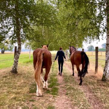
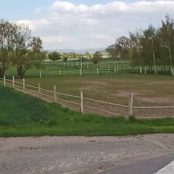
Reitlanlage Schäferhof Grohnde
Emmerthal/ Grohnde
Bettina Crome
@Schaeferhof_Grohnde
Freizeitstall
Pferdeausbildung
Vermieten
Hunde willkommen
Paddock
Hengsthaltung möglich
13 weitere...
P+
Deprecated: Creation of dynamic property Zend_View_Helper_Ads::$adLink is deprecated in /var/www/stall-frei/htdocs/staging.stall-frei.de/library/Psf/View/Helper/Ads.php on line 108

Futtersack HeuToy, Fressbremse in pink
Mechtersen
STALL-FREIde Marketing
@STALL-FREI-Marketing
Stundenlange Beschäftigung die
Koliken vorbeugt, geringe Staubinhalation mit
steuerbarer Futterentnahme


kleingruppenhaltung in ruhigem Selbstversorgerstal
Blomberg-Großenmarpe
Svenja Meyer
@Hof_Meyer-Nordloh
Vermieten
Paddock
Sattelkammer/Sattelschränke
Außenbox mit Paddock
Halbpension
Selbstversorgung
3 weitere...
S

Pferdeaußenbox
Hameln
Sabine Fasshauer
@SabineFasshauer
FN-Mitglied
Freizeitstall
Vermieten
Paddock
Pensions- und Gastboxen
Außenboxen
Innenbox
17 weitere...
P
Leider kein Vorschaubild
Leider kein Vorschaubild
Offenstall Platz für Wallach Allergiker
Aerzen
Annabell Bartels
@Annabells-Pferdeparadies
Freizeitstall
Reitlehrer und -unterricht
Vermieten
Krankenbox
Reitplatz (z.B. Dressur, Springen, Reining)
Allergikerstall
bedampftes/gewaschenes Heu
14 weitere...
B
Leider kein Vorschaubild
Leider kein Vorschaubild
Hof Miserre
Aerzen
Hof Miserre
@Hof Miserre
Freizeitstall
Longierzirkel/Roundpen
Parkplatz für Pferdeanhänger
Bewegungsstall
Laufstall
Vollpension
3 weitere...
B
Leider kein Vorschaubild
Leider kein Vorschaubild
Offenstall mit Paddocktrail
Emmerthal
Sarah-Catharina-Bittner
@Sarah-Catharina-Bittner
Freizeitstall
Vermieten
Hunde willkommen
Krankenbox
Bewegungsstall
Offenstall
12 weitere...
B
Pferdepension Ellernhof
Springe
Floerke-Staats
@Floerke-Staats
Freizeitstall
Reitlehrer und -unterricht
Vermieten
Longierzirkel/Roundpen
Paddock
Außenbox mit Paddock
11 weitere...
P
Leider kein Vorschaubild
Leider kein Vorschaubild
Pensionspferdebox frei
Aerzen
Rosenhof Pferdehaltung
@Rosenhof-Pferde
Geländestrecke
Vermieten
Hunde willkommen
Longierzirkel/Roundpen
Innenbox
13 weitere...
B

Mitarbeiter gesucht?
Mechtersen
STALL-FREIde Marketing
@STALL-FREI-Marketing
Stellenangebote kostenlos veröffentlichen!
Leider kein Vorschaubild
Leider kein Vorschaubild
Reitanlage mit neuem Offenstall und Paddock- Boxen
Aerzen
nina-rekate
@nina-rekate
FN-Mitglied
Freizeitstall
Vermieten
Hunde willkommen
Krankenbox
Allergikerstall
Hufrehe geeignet
20 weitere...
B
Reitstall Horst Söffker
Kleinenwieden
Horst-Soeffker
@Horst-Soeffker
Freizeitstall
Pferdeausbildung
Vermieten
Longierzirkel/Roundpen
Paddock
Pferdezucht
Zuchtstutenhaltung möglich
13 weitere...
P
Deprecated: Creation of dynamic property Zend_View::$pageCount is deprecated in /var/www/stall-frei/htdocs/staging.stall-frei.de/library/vendor/shardj/zf1-future/library/Zend/View/Abstract.php on line 308
Deprecated: Creation of dynamic property Zend_View::$itemCountPerPage is deprecated in /var/www/stall-frei/htdocs/staging.stall-frei.de/library/vendor/shardj/zf1-future/library/Zend/View/Abstract.php on line 308
Deprecated: Creation of dynamic property Zend_View::$first is deprecated in /var/www/stall-frei/htdocs/staging.stall-frei.de/library/vendor/shardj/zf1-future/library/Zend/View/Abstract.php on line 308
Deprecated: Creation of dynamic property Zend_View::$current is deprecated in /var/www/stall-frei/htdocs/staging.stall-frei.de/library/vendor/shardj/zf1-future/library/Zend/View/Abstract.php on line 308
Deprecated: Creation of dynamic property Zend_View::$last is deprecated in /var/www/stall-frei/htdocs/staging.stall-frei.de/library/vendor/shardj/zf1-future/library/Zend/View/Abstract.php on line 308
Deprecated: Creation of dynamic property Zend_View::$next is deprecated in /var/www/stall-frei/htdocs/staging.stall-frei.de/library/vendor/shardj/zf1-future/library/Zend/View/Abstract.php on line 308
Deprecated: Creation of dynamic property Zend_View::$pagesInRange is deprecated in /var/www/stall-frei/htdocs/staging.stall-frei.de/library/vendor/shardj/zf1-future/library/Zend/View/Abstract.php on line 308
Deprecated: Creation of dynamic property Zend_View::$firstPageInRange is deprecated in /var/www/stall-frei/htdocs/staging.stall-frei.de/library/vendor/shardj/zf1-future/library/Zend/View/Abstract.php on line 308
Deprecated: Creation of dynamic property Zend_View::$lastPageInRange is deprecated in /var/www/stall-frei/htdocs/staging.stall-frei.de/library/vendor/shardj/zf1-future/library/Zend/View/Abstract.php on line 308
Deprecated: Creation of dynamic property Zend_View::$currentItemCount is deprecated in /var/www/stall-frei/htdocs/staging.stall-frei.de/library/vendor/shardj/zf1-future/library/Zend/View/Abstract.php on line 308
Deprecated: Creation of dynamic property Zend_View::$totalItemCount is deprecated in /var/www/stall-frei/htdocs/staging.stall-frei.de/library/vendor/shardj/zf1-future/library/Zend/View/Abstract.php on line 308
Deprecated: Creation of dynamic property Zend_View::$firstItemNumber is deprecated in /var/www/stall-frei/htdocs/staging.stall-frei.de/library/vendor/shardj/zf1-future/library/Zend/View/Abstract.php on line 308
Deprecated: Creation of dynamic property Zend_View::$lastItemNumber is deprecated in /var/www/stall-frei/htdocs/staging.stall-frei.de/library/vendor/shardj/zf1-future/library/Zend/View/Abstract.php on line 308
Deprecated: Creation of dynamic property Zend_View::$router is deprecated in /var/www/stall-frei/htdocs/staging.stall-frei.de/library/vendor/shardj/zf1-future/library/Zend/View/Abstract.php on line 308
Deprecated: Creation of dynamic property Zend_View::$urlParams is deprecated in /var/www/stall-frei/htdocs/staging.stall-frei.de/library/vendor/shardj/zf1-future/library/Zend/View/Abstract.php on line 308
Deprecated: Creation of dynamic property Zend_View::$showAds is deprecated in /var/www/stall-frei/htdocs/staging.stall-frei.de/library/vendor/shardj/zf1-future/library/Zend/View/Abstract.php on line 308
Deprecated: Creation of dynamic property Zend_View::$objectIds is deprecated in /var/www/stall-frei/htdocs/staging.stall-frei.de/library/vendor/shardj/zf1-future/library/Zend/View/Abstract.php on line 308
Deprecated: Creation of dynamic property Zend_View::$showNavbar is deprecated in /var/www/stall-frei/htdocs/staging.stall-frei.de/library/vendor/shardj/zf1-future/library/Zend/View/Abstract.php on line 308
Deprecated: Creation of dynamic property Zend_View::$showBreadcrumb is deprecated in /var/www/stall-frei/htdocs/staging.stall-frei.de/library/vendor/shardj/zf1-future/library/Zend/View/Abstract.php on line 308
Deprecated: Creation of dynamic property Zend_View::$showFooter is deprecated in /var/www/stall-frei/htdocs/staging.stall-frei.de/library/vendor/shardj/zf1-future/library/Zend/View/Abstract.php on line 308
Deprecated: Creation of dynamic property Zend_View::$showInternalAds is deprecated in /var/www/stall-frei/htdocs/staging.stall-frei.de/library/vendor/shardj/zf1-future/library/Zend/View/Abstract.php on line 308
Deprecated: Creation of dynamic property Zend_View::$blNoContent is deprecated in /var/www/stall-frei/htdocs/staging.stall-frei.de/library/vendor/shardj/zf1-future/library/Zend/View/Abstract.php on line 308
Deprecated: Creation of dynamic property Zend_View::$sMetaDesc is deprecated in /var/www/stall-frei/htdocs/staging.stall-frei.de/library/vendor/shardj/zf1-future/library/Zend/View/Abstract.php on line 308
Deprecated: Creation of dynamic property Zend_View::$useGmaps is deprecated in /var/www/stall-frei/htdocs/staging.stall-frei.de/library/vendor/shardj/zf1-future/library/Zend/View/Abstract.php on line 308
Deprecated: Creation of dynamic property Zend_View::$touches is deprecated in /var/www/stall-frei/htdocs/staging.stall-frei.de/library/vendor/shardj/zf1-future/library/Zend/View/Abstract.php on line 308
Deprecated: Creation of dynamic property Zend_View::$oProject is deprecated in /var/www/stall-frei/htdocs/staging.stall-frei.de/library/vendor/shardj/zf1-future/library/Zend/View/Abstract.php on line 308
Deprecated: Creation of dynamic property Zend_View::$pageHeadline is deprecated in /var/www/stall-frei/htdocs/staging.stall-frei.de/library/vendor/shardj/zf1-future/library/Zend/View/Abstract.php on line 308
Deprecated: Creation of dynamic property Zend_View::$disableLocationField is deprecated in /var/www/stall-frei/htdocs/staging.stall-frei.de/library/vendor/shardj/zf1-future/library/Zend/View/Abstract.php on line 308
Deprecated: Creation of dynamic property Zend_View::$isSearch is deprecated in /var/www/stall-frei/htdocs/staging.stall-frei.de/library/vendor/shardj/zf1-future/library/Zend/View/Abstract.php on line 308
Deprecated: Creation of dynamic property Zend_View::$pageTitle is deprecated in /var/www/stall-frei/htdocs/staging.stall-frei.de/library/vendor/shardj/zf1-future/library/Zend/View/Abstract.php on line 308
Deprecated: Creation of dynamic property Psf_Form_Element_Text::$class is deprecated in /var/www/stall-frei/htdocs/staging.stall-frei.de/library/vendor/shardj/zf1-future/library/Zend/Form/Element.php on line 874
Deprecated: Creation of dynamic property Psf_Form_Element_Text::$size is deprecated in /var/www/stall-frei/htdocs/staging.stall-frei.de/library/vendor/shardj/zf1-future/library/Zend/Form/Element.php on line 874
Deprecated: Creation of dynamic property Psf_Form_Element_Text::$placeholder is deprecated in /var/www/stall-frei/htdocs/staging.stall-frei.de/library/vendor/shardj/zf1-future/library/Zend/Form/Element.php on line 874
Deprecated: Creation of dynamic property Psf_Form_Element_Hidden::$class is deprecated in /var/www/stall-frei/htdocs/staging.stall-frei.de/library/vendor/shardj/zf1-future/library/Zend/Form/Element.php on line 874
Deprecated: Creation of dynamic property Psf_Form_Element_Hidden::$class is deprecated in /var/www/stall-frei/htdocs/staging.stall-frei.de/library/vendor/shardj/zf1-future/library/Zend/Form/Element.php on line 874
Deprecated: Creation of dynamic property Psf_Form_Element_Hidden::$class is deprecated in /var/www/stall-frei/htdocs/staging.stall-frei.de/library/vendor/shardj/zf1-future/library/Zend/Form/Element.php on line 874
Deprecated: Creation of dynamic property Psf_Form_Element_Hidden::$class is deprecated in /var/www/stall-frei/htdocs/staging.stall-frei.de/library/vendor/shardj/zf1-future/library/Zend/Form/Element.php on line 874
Deprecated: Creation of dynamic property Psf_Form_Element_Select::$class is deprecated in /var/www/stall-frei/htdocs/staging.stall-frei.de/library/vendor/shardj/zf1-future/library/Zend/Form/Element.php on line 874
Deprecated: Creation of dynamic property Psf_Form_Element_Select::$class is deprecated in /var/www/stall-frei/htdocs/staging.stall-frei.de/library/vendor/shardj/zf1-future/library/Zend/Form/Element.php on line 874
Deprecated: Creation of dynamic property Psf_Form_Element_Select::$class is deprecated in /var/www/stall-frei/htdocs/staging.stall-frei.de/library/vendor/shardj/zf1-future/library/Zend/Form/Element.php on line 874
Deprecated: Creation of dynamic property Psf_Form_Element_Select::$class is deprecated in /var/www/stall-frei/htdocs/staging.stall-frei.de/library/vendor/shardj/zf1-future/library/Zend/Form/Element.php on line 874
Deprecated: Creation of dynamic property Psf_Form_Element_Text::$class is deprecated in /var/www/stall-frei/htdocs/staging.stall-frei.de/library/vendor/shardj/zf1-future/library/Zend/Form/Element.php on line 874
Deprecated: Creation of dynamic property Psf_Form_Element_Checkbox::$label is deprecated in /var/www/stall-frei/htdocs/staging.stall-frei.de/library/vendor/shardj/zf1-future/library/Zend/Form/Element.php on line 874
Deprecated: Creation of dynamic property Zend_View::$sort is deprecated in /var/www/stall-frei/htdocs/staging.stall-frei.de/library/vendor/shardj/zf1-future/library/Zend/View/Abstract.php on line 308
Deprecated: Creation of dynamic property Zend_View::$searchLocation is deprecated in /var/www/stall-frei/htdocs/staging.stall-frei.de/library/vendor/shardj/zf1-future/library/Zend/View/Abstract.php on line 308
Deprecated: Creation of dynamic property Zend_View::$locationHint is deprecated in /var/www/stall-frei/htdocs/staging.stall-frei.de/library/vendor/shardj/zf1-future/library/Zend/View/Abstract.php on line 308
Psf_GeoCoder_Abstract::getLocation: Todtenberg Get Location CachedOrLive
Psf_GeoCoder_Abstract::getCachedOrLive: Todtenberg
Psf_GeoCoder_OpenCageData::makeApiRequest: response:
Array
(
[documentation] => https://opencagedata.com/api
[licenses] => Array
(
[0] => Array
(
[name] => see attribution guide
[url] => https://opencagedata.com/credits
)
)
[results] => Array
(
[0] => Array
(
[bounds] => Array
(
[northeast] => Array
(
[lat] => 52.0600269
[lng] => 9.3015958
)
[southwest] => Array
(
[lat] => 52.0599269
[lng] => 9.3014958
)
)
[components] => Array
(
[ISO_3166-1_alpha-2] => DE
[ISO_3166-1_alpha-3] => DEU
[ISO_3166-2] => Array
(
[0] => DE-NI
)
[_category] => natural/water
[_normalized_city] => Aerzen
[_type] => peak
[continent] => Europe
[country] => Deutschland
[country_code] => de
[county] => Landkreis Hameln-Pyrmont
[peak] => Todtenberg
[political_union] => European Union
[postcode] => 31855
[state] => Niedersachsen
[state_code] => NI
[town] => Aerzen
)
[confidence] => 9
[formatted] => Todtenberg, 31855 Aerzen, Deutschland
[geometry] => Array
(
[lat] => 52.0599769
[lng] => 9.3015458
)
)
[1] => Array
(
[bounds] => Array
(
[northeast] => Array
(
[lat] => 53.7106054
[lng] => 12.4612034
)
[southwest] => Array
(
[lat] => 53.7105054
[lng] => 12.4611034
)
)
[components] => Array
(
[ISO_3166-1_alpha-2] => DE
[ISO_3166-1_alpha-3] => DEU
[ISO_3166-2] => Array
(
[0] => DE-MV
)
[_category] => natural/water
[_normalized_city] => Lalendorf
[_type] => peak
[continent] => Europe
[country] => Deutschland
[country_code] => de
[county] => Landkreis Rostock
[municipality] => Krakow am See
[peak] => Todtenberg
[political_union] => European Union
[state] => Mecklenburg-Vorpommern
[state_code] => MV
[village] => Lalendorf
)
[confidence] => 9
[formatted] => Todtenberg, Lalendorf, Mecklenburg-Vorpommern, Deutschland
[geometry] => Array
(
[lat] => 53.7105554
[lng] => 12.4611534
)
)
[2] => Array
(
[bounds] => Array
(
[northeast] => Array
(
[lat] => 50.6287835
[lng] => 7.9007722
)
[southwest] => Array
(
[lat] => 50.5887835
[lng] => 7.8607722
)
)
[components] => Array
(
[ISO_3166-1_alpha-2] => DE
[ISO_3166-1_alpha-3] => DEU
[ISO_3166-2] => Array
(
[0] => DE-RP
)
[_category] => place
[_normalized_city] => Rotenhain
[_type] => village
[city] => Rotenhain
[continent] => Europe
[country] => Deutschland
[country_code] => de
[county] => Westerwaldkreis
[municipality] => Westerburg
[political_union] => European Union
[postcode] => 57647
[state] => Rheinland-Pfalz
[state_code] => RP
[village] => Todtenberg
)
[confidence] => 7
[formatted] => 57647 Todtenberg, Deutschland
[geometry] => Array
(
[lat] => 50.6087835
[lng] => 7.8807722
)
)
[3] => Array
(
[bounds] => Array
(
[northeast] => Array
(
[lat] => 47.8490896
[lng] => 10.358922
)
[southwest] => Array
(
[lat] => 47.8090896
[lng] => 10.318922
)
)
[components] => Array
(
[ISO_3166-1_alpha-2] => DE
[ISO_3166-1_alpha-3] => DEU
[ISO_3166-2] => Array
(
[0] => DE-BY
)
[_category] => place
[_normalized_city] => Dietmannsried
[_type] => hamlet
[city] => Dietmannsried
[continent] => Europe
[country] => Deutschland
[country_code] => de
[county] => Landkreis Oberallgäu
[hamlet] => Todtenberg
[political_union] => European Union
[postcode] => 87496
[state] => Bayern
[state_code] => BY
)
[confidence] => 7
[formatted] => Todtenberg, 87496 Dietmannsried, Deutschland
[geometry] => Array
(
[lat] => 47.8290896
[lng] => 10.338922
)
)
[4] => Array
(
[bounds] => Array
(
[northeast] => Array
(
[lat] => 51.3153153
[lng] => 11.3137103
)
[southwest] => Array
(
[lat] => 51.2953153
[lng] => 11.2937103
)
)
[components] => Array
(
[ISO_3166-1_alpha-2] => DE
[ISO_3166-1_alpha-3] => DEU
[ISO_3166-2] => Array
(
[0] => DE-TH
)
[_category] => place
[_normalized_city] => Gehofen
[_type] => hamlet
[continent] => Europe
[country] => Deutschland
[country_code] => de
[county] => Kyffhäuserkreis
[locality] => Todtenberg
[municipality] => Artern
[political_union] => European Union
[postcode] => 06571
[state] => Thüringen
[state_code] => TH
[village] => Gehofen
)
[confidence] => 8
[formatted] => Todtenberg, 06571 Gehofen, Deutschland
[geometry] => Array
(
[lat] => 51.3053153
[lng] => 11.3037103
)
)
[5] => Array
(
[bounds] => Array
(
[northeast] => Array
(
[lat] => 47.8300873
[lng] => 10.343505
)
[southwest] => Array
(
[lat] => 47.8284796
[lng] => 10.3399227
)
)
[components] => Array
(
[ISO_3166-1_alpha-2] => DE
[ISO_3166-1_alpha-3] => DEU
[ISO_3166-2] => Array
(
[0] => DE-BY
)
[_category] => road
[_normalized_city] => Dietmannsried
[_type] => road
[city] => Dietmannsried
[continent] => Europe
[country] => Deutschland
[country_code] => de
[county] => Landkreis Oberallgäu
[hamlet] => Todtenberg
[political_union] => European Union
[postcode] => 87463
[road] => Todtenberg
[state] => Bayern
[state_code] => BY
)
[confidence] => 9
[formatted] => Todtenberg, 87463 Dietmannsried, Deutschland
[geometry] => Array
(
[lat] => 47.829204
[lng] => 10.3419733
)
)
[6] => Array
(
[bounds] => Array
(
[northeast] => Array
(
[lat] => 47.9494076
[lng] => 12.201836
)
[southwest] => Array
(
[lat] => 47.9094076
[lng] => 12.161836
)
)
[components] => Array
(
[ISO_3166-1_alpha-2] => DE
[ISO_3166-1_alpha-3] => DEU
[ISO_3166-2] => Array
(
[0] => DE-BY
)
[_category] => place
[_normalized_city] => Vogtareuth
[_type] => hamlet
[continent] => Europe
[country] => Deutschland
[country_code] => de
[county] => Landkreis Rosenheim
[hamlet] => Tödtenberg
[political_union] => European Union
[postcode] => 83569
[state] => Bayern
[state_code] => BY
[village] => Vogtareuth
)
[confidence] => 7
[formatted] => Tödtenberg, 83569 Vogtareuth, Deutschland
[geometry] => Array
(
[lat] => 47.9294076
[lng] => 12.181836
)
)
[7] => Array
(
[bounds] => Array
(
[northeast] => Array
(
[lat] => 48.2166794
[lng] => 12.3557629
)
[southwest] => Array
(
[lat] => 48.1766794
[lng] => 12.3157629
)
)
[components] => Array
(
[ISO_3166-1_alpha-2] => DE
[ISO_3166-1_alpha-3] => DEU
[ISO_3166-2] => Array
(
[0] => DE-BY
)
[_category] => place
[_normalized_city] => Aschau am Inn
[_type] => hamlet
[continent] => Europe
[country] => Deutschland
[country_code] => de
[county] => Landkreis Mühldorf am Inn
[hamlet] => Tödtenberg
[political_union] => European Union
[postcode] => 84544
[state] => Bayern
[state_code] => BY
[village] => Aschau am Inn
)
[confidence] => 7
[formatted] => Tödtenberg, 84544 Aschau am Inn, Deutschland
[geometry] => Array
(
[lat] => 48.1966794
[lng] => 12.3357629
)
)
[8] => Array
(
[bounds] => Array
(
[northeast] => Array
(
[lat] => 47.9294248
[lng] => 12.18388
)
[southwest] => Array
(
[lat] => 47.9286605
[lng] => 12.180719
)
)
[components] => Array
(
[ISO_3166-1_alpha-2] => DE
[ISO_3166-1_alpha-3] => DEU
[ISO_3166-2] => Array
(
[0] => DE-BY
)
[_category] => road
[_normalized_city] => Vogtareuth
[_type] => road
[continent] => Europe
[country] => Deutschland
[country_code] => de
[county] => Landkreis Rosenheim
[hamlet] => Tödtenberg
[political_union] => European Union
[postcode] => 83569
[road] => Tödtenberg
[road_type] => residential
[state] => Bayern
[state_code] => BY
[village] => Vogtareuth
)
[confidence] => 9
[formatted] => Tödtenberg, 83569 Vogtareuth, Deutschland
[geometry] => Array
(
[lat] => 47.9292552
[lng] => 12.1821173
)
)
[9] => Array
(
[components] => Array
(
[ISO_3166-1_alpha-2] => FR
[ISO_3166-1_alpha-3] => FRA
[ISO_3166-2] => Array
(
[0] => FR-GES
[1] => FR-6AE
[2] => FR-67
)
[_category] => road
[_normalized_city] => Adamswiller
[_type] => road
[city] => Adamswiller
[continent] => Europe
[country] => France
[country_code] => fr
[county] => Bas-Rhin
[local_authority] => Communauté de communes de l'Alsace Bossue
[political_union] => European Union
[postcode] => 67320
[road] => Totenberg
[state] => Grand Est
[state_code] => GES
)
[confidence] => 3
[formatted] => Totenberg, 67320 Adamswiller, France
[geometry] => Array
(
[lat] => 48.913277
[lng] => 7.183763
)
)
)
[status] => Array
(
[code] => 200
[message] => OK
)
[stay_informed] => Array
(
[blog] => https://blog.opencagedata.com
[mastodon] => https://en.osm.town/@opencage
)
[thanks] => For using an OpenCage API
[timestamp] => Array
(
[created_http] => Sat, 07 Feb 2026 22:43:30 GMT
[created_unix] => 1770504210
)
[total_results] => 10
)
Psf_GeoCoder_Abstract::convertLocationResult
{"documentation":"https:\/\/opencagedata.com\/api","licenses":[{"name":"see attribution guide","url":"https:\/\/opencagedata.com\/credits"}],"results":[{"bounds":{"northeast":{"lat":52.0600269,"lng":9.3015958},"southwest":{"lat":52.0599269,"lng":9.3014958}},"components":{"ISO_3166-1_alpha-2":"DE","ISO_3166-1_alpha-3":"DEU","ISO_3166-2":["DE-NI"],"_category":"natural\/water","_normalized_city":"Aerzen","_type":"peak","continent":"Europe","country":"Deutschland","country_code":"de","county":"Landkreis Hameln-Pyrmont","peak":"Todtenberg","political_union":"European Union","postcode":"31855","state":"Niedersachsen","state_code":"NI","town":"Aerzen"},"confidence":9,"formatted":"Todtenberg, 31855 Aerzen, Deutschland","geometry":{"lat":52.0599769,"lng":9.3015458}},{"bounds":{"northeast":{"lat":53.7106054,"lng":12.4612034},"southwest":{"lat":53.7105054,"lng":12.4611034}},"components":{"ISO_3166-1_alpha-2":"DE","ISO_3166-1_alpha-3":"DEU","ISO_3166-2":["DE-MV"],"_category":"natural\/water","_normalized_city":"Lalendorf","_type":"peak","continent":"Europe","country":"Deutschland","country_code":"de","county":"Landkreis Rostock","municipality":"Krakow am See","peak":"Todtenberg","political_union":"European Union","state":"Mecklenburg-Vorpommern","state_code":"MV","village":"Lalendorf"},"confidence":9,"formatted":"Todtenberg, Lalendorf, Mecklenburg-Vorpommern, Deutschland","geometry":{"lat":53.7105554,"lng":12.4611534}},{"bounds":{"northeast":{"lat":50.6287835,"lng":7.9007722},"southwest":{"lat":50.5887835,"lng":7.8607722}},"components":{"ISO_3166-1_alpha-2":"DE","ISO_3166-1_alpha-3":"DEU","ISO_3166-2":["DE-RP"],"_category":"place","_normalized_city":"Rotenhain","_type":"village","city":"Rotenhain","continent":"Europe","country":"Deutschland","country_code":"de","county":"Westerwaldkreis","municipality":"Westerburg","political_union":"European Union","postcode":"57647","state":"Rheinland-Pfalz","state_code":"RP","village":"Todtenberg"},"confidence":7,"formatted":"57647 Todtenberg, Deutschland","geometry":{"lat":50.6087835,"lng":7.8807722}},{"bounds":{"northeast":{"lat":47.8490896,"lng":10.358922},"southwest":{"lat":47.8090896,"lng":10.318922}},"components":{"ISO_3166-1_alpha-2":"DE","ISO_3166-1_alpha-3":"DEU","ISO_3166-2":["DE-BY"],"_category":"place","_normalized_city":"Dietmannsried","_type":"hamlet","city":"Dietmannsried","continent":"Europe","country":"Deutschland","country_code":"de","county":"Landkreis Oberallg\u00e4u","hamlet":"Todtenberg","political_union":"European Union","postcode":"87496","state":"Bayern","state_code":"BY"},"confidence":7,"formatted":"Todtenberg, 87496 Dietmannsried, Deutschland","geometry":{"lat":47.8290896,"lng":10.338922}},{"bounds":{"northeast":{"lat":51.3153153,"lng":11.3137103},"southwest":{"lat":51.2953153,"lng":11.2937103}},"components":{"ISO_3166-1_alpha-2":"DE","ISO_3166-1_alpha-3":"DEU","ISO_3166-2":["DE-TH"],"_category":"place","_normalized_city":"Gehofen","_type":"hamlet","continent":"Europe","country":"Deutschland","country_code":"de","county":"Kyffh\u00e4userkreis","locality":"Todtenberg","municipality":"Artern","political_union":"European Union","postcode":"06571","state":"Th\u00fcringen","state_code":"TH","village":"Gehofen"},"confidence":8,"formatted":"Todtenberg, 06571 Gehofen, Deutschland","geometry":{"lat":51.3053153,"lng":11.3037103}},{"bounds":{"northeast":{"lat":47.8300873,"lng":10.343505},"southwest":{"lat":47.8284796,"lng":10.3399227}},"components":{"ISO_3166-1_alpha-2":"DE","ISO_3166-1_alpha-3":"DEU","ISO_3166-2":["DE-BY"],"_category":"road","_normalized_city":"Dietmannsried","_type":"road","city":"Dietmannsried","continent":"Europe","country":"Deutschland","country_code":"de","county":"Landkreis Oberallg\u00e4u","hamlet":"Todtenberg","political_union":"European Union","postcode":"87463","road":"Todtenberg","state":"Bayern","state_code":"BY"},"confidence":9,"formatted":"Todtenberg, 87463 Dietmannsried, Deutschland","geometry":{"lat":47.829204,"lng":10.3419733}},{"bounds":{"northeast":{"lat":47.9494076,"lng":12.201836},"southwest":{"lat":47.9094076,"lng":12.161836}},"components":{"ISO_3166-1_alpha-2":"DE","ISO_3166-1_alpha-3":"DEU","ISO_3166-2":["DE-BY"],"_category":"place","_normalized_city":"Vogtareuth","_type":"hamlet","continent":"Europe","country":"Deutschland","country_code":"de","county":"Landkreis Rosenheim","hamlet":"T\u00f6dtenberg","political_union":"European Union","postcode":"83569","state":"Bayern","state_code":"BY","village":"Vogtareuth"},"confidence":7,"formatted":"T\u00f6dtenberg, 83569 Vogtareuth, Deutschland","geometry":{"lat":47.9294076,"lng":12.181836}},{"bounds":{"northeast":{"lat":48.2166794,"lng":12.3557629},"southwest":{"lat":48.1766794,"lng":12.3157629}},"components":{"ISO_3166-1_alpha-2":"DE","ISO_3166-1_alpha-3":"DEU","ISO_3166-2":["DE-BY"],"_category":"place","_normalized_city":"Aschau am Inn","_type":"hamlet","continent":"Europe","country":"Deutschland","country_code":"de","county":"Landkreis M\u00fchldorf am Inn","hamlet":"T\u00f6dtenberg","political_union":"European Union","postcode":"84544","state":"Bayern","state_code":"BY","village":"Aschau am Inn"},"confidence":7,"formatted":"T\u00f6dtenberg, 84544 Aschau am Inn, Deutschland","geometry":{"lat":48.1966794,"lng":12.3357629}},{"bounds":{"northeast":{"lat":47.9294248,"lng":12.18388},"southwest":{"lat":47.9286605,"lng":12.180719}},"components":{"ISO_3166-1_alpha-2":"DE","ISO_3166-1_alpha-3":"DEU","ISO_3166-2":["DE-BY"],"_category":"road","_normalized_city":"Vogtareuth","_type":"road","continent":"Europe","country":"Deutschland","country_code":"de","county":"Landkreis Rosenheim","hamlet":"T\u00f6dtenberg","political_union":"European Union","postcode":"83569","road":"T\u00f6dtenberg","road_type":"residential","state":"Bayern","state_code":"BY","village":"Vogtareuth"},"confidence":9,"formatted":"T\u00f6dtenberg, 83569 Vogtareuth, Deutschland","geometry":{"lat":47.9292552,"lng":12.1821173}},{"components":{"ISO_3166-1_alpha-2":"FR","ISO_3166-1_alpha-3":"FRA","ISO_3166-2":["FR-GES","FR-6AE","FR-67"],"_category":"road","_normalized_city":"Adamswiller","_type":"road","city":"Adamswiller","continent":"Europe","country":"France","country_code":"fr","county":"Bas-Rhin","local_authority":"Communaut\u00e9 de communes de l'Alsace Bossue","political_union":"European Union","postcode":"67320","road":"Totenberg","state":"Grand Est","state_code":"GES"},"confidence":3,"formatted":"Totenberg, 67320 Adamswiller, France","geometry":{"lat":48.913277,"lng":7.183763}}],"status":{"code":200,"message":"OK"},"stay_informed":{"blog":"https:\/\/blog.opencagedata.com","mastodon":"https:\/\/en.osm.town\/@opencage"},"thanks":"For using an OpenCage API","timestamp":{"created_http":"Sat, 07 Feb 2026 22:43:30 GMT","created_unix":1770504210},"total_results":10}Array
(
[0] => stdClass Object
(
[bounds] => stdClass Object
(
[northeast] => stdClass Object
(
[lat] => 52.0600269
[lng] => 9.3015958
)
[southwest] => stdClass Object
(
[lat] => 52.0599269
[lng] => 9.3014958
)
)
[components] => stdClass Object
(
[ISO_3166-1_alpha-2] => DE
[ISO_3166-1_alpha-3] => DEU
[ISO_3166-2] => Array
(
[0] => DE-NI
)
[_category] => natural/water
[_normalized_city] => Aerzen
[_type] => peak
[continent] => Europe
[country] => Deutschland
[country_code] => de
[county] => Landkreis Hameln-Pyrmont
[peak] => Todtenberg
[political_union] => European Union
[postcode] => 31855
[state] => Niedersachsen
[state_code] => NI
[town] => Aerzen
)
[confidence] => 9
[formatted] => Todtenberg, 31855 Aerzen, Deutschland
[geometry] => stdClass Object
(
[lat] => 52.0599769
[lng] => 9.3015458
)
)
[1] => stdClass Object
(
[bounds] => stdClass Object
(
[northeast] => stdClass Object
(
[lat] => 53.7106054
[lng] => 12.4612034
)
[southwest] => stdClass Object
(
[lat] => 53.7105054
[lng] => 12.4611034
)
)
[components] => stdClass Object
(
[ISO_3166-1_alpha-2] => DE
[ISO_3166-1_alpha-3] => DEU
[ISO_3166-2] => Array
(
[0] => DE-MV
)
[_category] => natural/water
[_normalized_city] => Lalendorf
[_type] => peak
[continent] => Europe
[country] => Deutschland
[country_code] => de
[county] => Landkreis Rostock
[municipality] => Krakow am See
[peak] => Todtenberg
[political_union] => European Union
[state] => Mecklenburg-Vorpommern
[state_code] => MV
[village] => Lalendorf
)
[confidence] => 9
[formatted] => Todtenberg, Lalendorf, Mecklenburg-Vorpommern, Deutschland
[geometry] => stdClass Object
(
[lat] => 53.7105554
[lng] => 12.4611534
)
)
[2] => stdClass Object
(
[bounds] => stdClass Object
(
[northeast] => stdClass Object
(
[lat] => 50.6287835
[lng] => 7.9007722
)
[southwest] => stdClass Object
(
[lat] => 50.5887835
[lng] => 7.8607722
)
)
[components] => stdClass Object
(
[ISO_3166-1_alpha-2] => DE
[ISO_3166-1_alpha-3] => DEU
[ISO_3166-2] => Array
(
[0] => DE-RP
)
[_category] => place
[_normalized_city] => Rotenhain
[_type] => village
[city] => Rotenhain
[continent] => Europe
[country] => Deutschland
[country_code] => de
[county] => Westerwaldkreis
[municipality] => Westerburg
[political_union] => European Union
[postcode] => 57647
[state] => Rheinland-Pfalz
[state_code] => RP
[village] => Todtenberg
)
[confidence] => 7
[formatted] => 57647 Todtenberg, Deutschland
[geometry] => stdClass Object
(
[lat] => 50.6087835
[lng] => 7.8807722
)
)
[3] => stdClass Object
(
[bounds] => stdClass Object
(
[northeast] => stdClass Object
(
[lat] => 47.8490896
[lng] => 10.358922
)
[southwest] => stdClass Object
(
[lat] => 47.8090896
[lng] => 10.318922
)
)
[components] => stdClass Object
(
[ISO_3166-1_alpha-2] => DE
[ISO_3166-1_alpha-3] => DEU
[ISO_3166-2] => Array
(
[0] => DE-BY
)
[_category] => place
[_normalized_city] => Dietmannsried
[_type] => hamlet
[city] => Dietmannsried
[continent] => Europe
[country] => Deutschland
[country_code] => de
[county] => Landkreis Oberallgäu
[hamlet] => Todtenberg
[political_union] => European Union
[postcode] => 87496
[state] => Bayern
[state_code] => BY
)
[confidence] => 7
[formatted] => Todtenberg, 87496 Dietmannsried, Deutschland
[geometry] => stdClass Object
(
[lat] => 47.8290896
[lng] => 10.338922
)
)
[4] => stdClass Object
(
[bounds] => stdClass Object
(
[northeast] => stdClass Object
(
[lat] => 51.3153153
[lng] => 11.3137103
)
[southwest] => stdClass Object
(
[lat] => 51.2953153
[lng] => 11.2937103
)
)
[components] => stdClass Object
(
[ISO_3166-1_alpha-2] => DE
[ISO_3166-1_alpha-3] => DEU
[ISO_3166-2] => Array
(
[0] => DE-TH
)
[_category] => place
[_normalized_city] => Gehofen
[_type] => hamlet
[continent] => Europe
[country] => Deutschland
[country_code] => de
[county] => Kyffhäuserkreis
[locality] => Todtenberg
[municipality] => Artern
[political_union] => European Union
[postcode] => 06571
[state] => Thüringen
[state_code] => TH
[village] => Gehofen
)
[confidence] => 8
[formatted] => Todtenberg, 06571 Gehofen, Deutschland
[geometry] => stdClass Object
(
[lat] => 51.3053153
[lng] => 11.3037103
)
)
[5] => stdClass Object
(
[bounds] => stdClass Object
(
[northeast] => stdClass Object
(
[lat] => 47.8300873
[lng] => 10.343505
)
[southwest] => stdClass Object
(
[lat] => 47.8284796
[lng] => 10.3399227
)
)
[components] => stdClass Object
(
[ISO_3166-1_alpha-2] => DE
[ISO_3166-1_alpha-3] => DEU
[ISO_3166-2] => Array
(
[0] => DE-BY
)
[_category] => road
[_normalized_city] => Dietmannsried
[_type] => road
[city] => Dietmannsried
[continent] => Europe
[country] => Deutschland
[country_code] => de
[county] => Landkreis Oberallgäu
[hamlet] => Todtenberg
[political_union] => European Union
[postcode] => 87463
[road] => Todtenberg
[state] => Bayern
[state_code] => BY
)
[confidence] => 9
[formatted] => Todtenberg, 87463 Dietmannsried, Deutschland
[geometry] => stdClass Object
(
[lat] => 47.829204
[lng] => 10.3419733
)
)
[6] => stdClass Object
(
[bounds] => stdClass Object
(
[northeast] => stdClass Object
(
[lat] => 47.9494076
[lng] => 12.201836
)
[southwest] => stdClass Object
(
[lat] => 47.9094076
[lng] => 12.161836
)
)
[components] => stdClass Object
(
[ISO_3166-1_alpha-2] => DE
[ISO_3166-1_alpha-3] => DEU
[ISO_3166-2] => Array
(
[0] => DE-BY
)
[_category] => place
[_normalized_city] => Vogtareuth
[_type] => hamlet
[continent] => Europe
[country] => Deutschland
[country_code] => de
[county] => Landkreis Rosenheim
[hamlet] => Tödtenberg
[political_union] => European Union
[postcode] => 83569
[state] => Bayern
[state_code] => BY
[village] => Vogtareuth
)
[confidence] => 7
[formatted] => Tödtenberg, 83569 Vogtareuth, Deutschland
[geometry] => stdClass Object
(
[lat] => 47.9294076
[lng] => 12.181836
)
)
[7] => stdClass Object
(
[bounds] => stdClass Object
(
[northeast] => stdClass Object
(
[lat] => 48.2166794
[lng] => 12.3557629
)
[southwest] => stdClass Object
(
[lat] => 48.1766794
[lng] => 12.3157629
)
)
[components] => stdClass Object
(
[ISO_3166-1_alpha-2] => DE
[ISO_3166-1_alpha-3] => DEU
[ISO_3166-2] => Array
(
[0] => DE-BY
)
[_category] => place
[_normalized_city] => Aschau am Inn
[_type] => hamlet
[continent] => Europe
[country] => Deutschland
[country_code] => de
[county] => Landkreis Mühldorf am Inn
[hamlet] => Tödtenberg
[political_union] => European Union
[postcode] => 84544
[state] => Bayern
[state_code] => BY
[village] => Aschau am Inn
)
[confidence] => 7
[formatted] => Tödtenberg, 84544 Aschau am Inn, Deutschland
[geometry] => stdClass Object
(
[lat] => 48.1966794
[lng] => 12.3357629
)
)
[8] => stdClass Object
(
[bounds] => stdClass Object
(
[northeast] => stdClass Object
(
[lat] => 47.9294248
[lng] => 12.18388
)
[southwest] => stdClass Object
(
[lat] => 47.9286605
[lng] => 12.180719
)
)
[components] => stdClass Object
(
[ISO_3166-1_alpha-2] => DE
[ISO_3166-1_alpha-3] => DEU
[ISO_3166-2] => Array
(
[0] => DE-BY
)
[_category] => road
[_normalized_city] => Vogtareuth
[_type] => road
[continent] => Europe
[country] => Deutschland
[country_code] => de
[county] => Landkreis Rosenheim
[hamlet] => Tödtenberg
[political_union] => European Union
[postcode] => 83569
[road] => Tödtenberg
[road_type] => residential
[state] => Bayern
[state_code] => BY
[village] => Vogtareuth
)
[confidence] => 9
[formatted] => Tödtenberg, 83569 Vogtareuth, Deutschland
[geometry] => stdClass Object
(
[lat] => 47.9292552
[lng] => 12.1821173
)
)
[9] => stdClass Object
(
[components] => stdClass Object
(
[ISO_3166-1_alpha-2] => FR
[ISO_3166-1_alpha-3] => FRA
[ISO_3166-2] => Array
(
[0] => FR-GES
[1] => FR-6AE
[2] => FR-67
)
[_category] => road
[_normalized_city] => Adamswiller
[_type] => road
[city] => Adamswiller
[continent] => Europe
[country] => France
[country_code] => fr
[county] => Bas-Rhin
[local_authority] => Communauté de communes de l'Alsace Bossue
[political_union] => European Union
[postcode] => 67320
[road] => Totenberg
[state] => Grand Est
[state_code] => GES
)
[confidence] => 3
[formatted] => Totenberg, 67320 Adamswiller, France
[geometry] => stdClass Object
(
[lat] => 48.913277
[lng] => 7.183763
)
)
)
Psf_GeoCoder_OpenCageData::getKeyMap: 0
stdClass Object
(
    [bounds] => stdClass Object
        (
            [northeast] => stdClass Object
                (
                    [lat] => 52.0600269
                    [lng] => 9.3015958
                )

            [southwest] => stdClass Object
                (
                    [lat] => 52.0599269
                    [lng] => 9.3014958
                )

        )

    [components] => stdClass Object
        (
            [ISO_3166-1_alpha-2] => DE
            [ISO_3166-1_alpha-3] => DEU
            [ISO_3166-2] => Array
                (
                    [0] => DE-NI
                )

            [_category] => natural/water
            [_normalized_city] => Aerzen
            [_type] => peak
            [continent] => Europe
            [country] => Deutschland
            [country_code] => de
            [county] => Landkreis Hameln-Pyrmont
            [peak] => Todtenberg
            [political_union] => European Union
            [postcode] => 31855
            [state] => Niedersachsen
            [state_code] => NI
            [town] => Aerzen
        )

    [confidence] => 9
    [formatted] => Todtenberg, 31855 Aerzen, Deutschland
    [geometry] => stdClass Object
        (
            [lat] => 52.0599769
            [lng] => 9.3015458
        )

)
Psf_GeoCoder_OpenCageData::getCounty: Hameln-Pyrmont
Psf_GeoCoder_OpenCageData::addMissingData REFETCH!
Array
(
    [address] => Todtenberg, 31855 Aerzen, Deutschland
    [type] => peak
    [street] =>
    [city] => Aerzen
    [county] => Hameln-Pyrmont
    [state] => Niedersachsen
    [zip] => 31855
    [country] => Deutschland
    [suburb] =>
    [countrycode] => de
    [latitude] => 52.0599769
    [longitude] => 9.3015458
    [accuracy] => 1
    [confidence] => 9
    [bounds] => stdClass Object
        (
            [northeast] => stdClass Object
                (
                    [lat] => 52.0600269
                    [lng] => 9.3015958
                )

            [southwest] => stdClass Object
                (
                    [lat] => 52.0599269
                    [lng] => 9.3014958
                )

        )

)
reformat!
Array
(
    [address] => Todtenberg, 31855 Aerzen, Deutschland
    [type] => peak
    [street] =>
    [city] => Aerzen
    [county] => Hameln-Pyrmont
    [state] => Niedersachsen
    [zip] => 31855
    [country] => Deutschland
    [suburb] =>
    [countrycode] => de
    [latitude] => 52.0599769
    [longitude] => 9.3015458
    [accuracy] => 1
    [confidence] => 9
    [bounds] => stdClass Object
        (
            [northeast] => stdClass Object
                (
                    [lat] => 52.0600269
                    [lng] => 9.3015958
                )

            [southwest] => stdClass Object
                (
                    [lat] => 52.0599269
                    [lng] => 9.3014958
                )

        )

    [place] => 31855 Aerzen, Niedersachsen
    [hash] => c65e0dab7f4dc5b32371b78d385fabd7
)
Psf_GeoCoder_OpenCageData::getKeyMap: 1
stdClass Object
(
    [bounds] => stdClass Object
        (
            [northeast] => stdClass Object
                (
                    [lat] => 53.7106054
                    [lng] => 12.4612034
                )

            [southwest] => stdClass Object
                (
                    [lat] => 53.7105054
                    [lng] => 12.4611034
                )

        )

    [components] => stdClass Object
        (
            [ISO_3166-1_alpha-2] => DE
            [ISO_3166-1_alpha-3] => DEU
            [ISO_3166-2] => Array
                (
                    [0] => DE-MV
                )

            [_category] => natural/water
            [_normalized_city] => Lalendorf
            [_type] => peak
            [continent] => Europe
            [country] => Deutschland
            [country_code] => de
            [county] => Landkreis Rostock
            [municipality] => Krakow am See
            [peak] => Todtenberg
            [political_union] => European Union
            [state] => Mecklenburg-Vorpommern
            [state_code] => MV
            [village] => Lalendorf
        )

    [confidence] => 9
    [formatted] => Todtenberg, Lalendorf, Mecklenburg-Vorpommern, Deutschland
    [geometry] => stdClass Object
        (
            [lat] => 53.7105554
            [lng] => 12.4611534
        )

)
Psf_GeoCoder_OpenCageData::getCounty: Rostock
Psf_GeoCoder_OpenCageData::addMissingData REFETCH!
Array
(
    [address] => Todtenberg, Lalendorf, Mecklenburg-Vorpommern, Deutschland
    [type] => peak
    [street] =>
    [city] => Lalendorf
    [county] => Rostock
    [state] => Mecklenburg-Vorpommern
    [zip] =>
    [country] => Deutschland
    [suburb] =>
    [countrycode] => de
    [latitude] => 53.7105554
    [longitude] => 12.4611534
    [accuracy] => 1
    [confidence] => 9
    [bounds] => stdClass Object
        (
            [northeast] => stdClass Object
                (
                    [lat] => 53.7106054
                    [lng] => 12.4612034
                )

            [southwest] => stdClass Object
                (
                    [lat] => 53.7105054
                    [lng] => 12.4611034
                )

        )

)
reformat!
Array
(
    [address] => Todtenberg, Lalendorf, Mecklenburg-Vorpommern, Deutschland
    [type] => peak
    [street] =>
    [city] => Lalendorf
    [county] => Rostock
    [state] => Mecklenburg-Vorpommern
    [zip] =>
    [country] => Deutschland
    [suburb] =>
    [countrycode] => de
    [latitude] => 53.7105554
    [longitude] => 12.4611534
    [accuracy] => 1
    [confidence] => 9
    [bounds] => stdClass Object
        (
            [northeast] => stdClass Object
                (
                    [lat] => 53.7106054
                    [lng] => 12.4612034
                )

            [southwest] => stdClass Object
                (
                    [lat] => 53.7105054
                    [lng] => 12.4611034
                )

        )

    [place] => Lalendorf, Mecklenburg-Vorpommern
    [hash] => 0a80e003f635ab4284ac80a699cf92c1
)
Psf_GeoCoder_OpenCageData::getKeyMap: 2
stdClass Object
(
    [bounds] => stdClass Object
        (
            [northeast] => stdClass Object
                (
                    [lat] => 50.6287835
                    [lng] => 7.9007722
                )

            [southwest] => stdClass Object
                (
                    [lat] => 50.5887835
                    [lng] => 7.8607722
                )

        )

    [components] => stdClass Object
        (
            [ISO_3166-1_alpha-2] => DE
            [ISO_3166-1_alpha-3] => DEU
            [ISO_3166-2] => Array
                (
                    [0] => DE-RP
                )

            [_category] => place
            [_normalized_city] => Rotenhain
            [_type] => village
            [city] => Rotenhain
            [continent] => Europe
            [country] => Deutschland
            [country_code] => de
            [county] => Westerwaldkreis
            [municipality] => Westerburg
            [political_union] => European Union
            [postcode] => 57647
            [state] => Rheinland-Pfalz
            [state_code] => RP
            [village] => Todtenberg
        )

    [confidence] => 7
    [formatted] => 57647 Todtenberg, Deutschland
    [geometry] => stdClass Object
        (
            [lat] => 50.6087835
            [lng] => 7.8807722
        )

)
Psf_GeoCoder_OpenCageData::getCounty: Westerwaldkreis
Psf_GeoCoder_OpenCageData::addMissingData REFETCH!
Array
(
    [address] => 57647 Todtenberg, Deutschland
    [type] => village
    [street] =>
    [city] => Todtenberg
    [county] => Westerwaldkreis
    [state] => Rheinland-Pfalz
    [zip] => 57647
    [country] => Deutschland
    [suburb] =>
    [countrycode] => de
    [latitude] => 50.6087835
    [longitude] => 7.8807722
    [accuracy] => 1
    [confidence] => 7
    [bounds] => stdClass Object
        (
            [northeast] => stdClass Object
                (
                    [lat] => 50.6287835
                    [lng] => 7.9007722
                )

            [southwest] => stdClass Object
                (
                    [lat] => 50.5887835
                    [lng] => 7.8607722
                )

        )

)
reformat!
Array
(
    [address] => 57647 Todtenberg, Deutschland
    [type] => village
    [street] =>
    [city] => Todtenberg
    [county] => Westerwaldkreis
    [state] => Rheinland-Pfalz
    [zip] => 57647
    [country] => Deutschland
    [suburb] =>
    [countrycode] => de
    [latitude] => 50.6087835
    [longitude] => 7.8807722
    [accuracy] => 1
    [confidence] => 7
    [bounds] => stdClass Object
        (
            [northeast] => stdClass Object
                (
                    [lat] => 50.6287835
                    [lng] => 7.9007722
                )

            [southwest] => stdClass Object
                (
                    [lat] => 50.5887835
                    [lng] => 7.8607722
                )

        )

    [place] => 57647 Todtenberg, Rheinland-Pfalz
    [hash] => 774da975242bc6cbccdefb69ac5ae18a
)
Psf_GeoCoder_OpenCageData::getKeyMap: 3
stdClass Object
(
    [bounds] => stdClass Object
        (
            [northeast] => stdClass Object
                (
                    [lat] => 47.8490896
                    [lng] => 10.358922
                )

            [southwest] => stdClass Object
                (
                    [lat] => 47.8090896
                    [lng] => 10.318922
                )

        )

    [components] => stdClass Object
        (
            [ISO_3166-1_alpha-2] => DE
            [ISO_3166-1_alpha-3] => DEU
            [ISO_3166-2] => Array
                (
                    [0] => DE-BY
                )

            [_category] => place
            [_normalized_city] => Dietmannsried
            [_type] => hamlet
            [city] => Dietmannsried
            [continent] => Europe
            [country] => Deutschland
            [country_code] => de
            [county] => Landkreis Oberallgäu
            [hamlet] => Todtenberg
            [political_union] => European Union
            [postcode] => 87496
            [state] => Bayern
            [state_code] => BY
        )

    [confidence] => 7
    [formatted] => Todtenberg, 87496 Dietmannsried, Deutschland
    [geometry] => stdClass Object
        (
            [lat] => 47.8290896
            [lng] => 10.338922
        )

)
Psf_GeoCoder_OpenCageData::getCounty: Oberallgäu
Psf_GeoCoder_OpenCageData::addMissingData REFETCH!
Array
(
    [address] => Todtenberg, 87496 Dietmannsried, Deutschland
    [type] => hamlet
    [street] => Todtenberg
    [city] => Dietmannsried
    [county] => Oberallgäu
    [state] => Bayern
    [zip] => 87496
    [country] => Deutschland
    [suburb] =>
    [countrycode] => de
    [latitude] => 47.8290896
    [longitude] => 10.338922
    [accuracy] => 1
    [confidence] => 7
    [bounds] => stdClass Object
        (
            [northeast] => stdClass Object
                (
                    [lat] => 47.8490896
                    [lng] => 10.358922
                )

            [southwest] => stdClass Object
                (
                    [lat] => 47.8090896
                    [lng] => 10.318922
                )

        )

)
reformat!
Array
(
    [address] => Todtenberg, 87496 Dietmannsried, Deutschland
    [type] => hamlet
    [street] => Todtenberg
    [city] => Dietmannsried
    [county] => Oberallgäu
    [state] => Bayern
    [zip] => 87496
    [country] => Deutschland
    [suburb] =>
    [countrycode] => de
    [latitude] => 47.8290896
    [longitude] => 10.338922
    [accuracy] => 1
    [confidence] => 7
    [bounds] => stdClass Object
        (
            [northeast] => stdClass Object
                (
                    [lat] => 47.8490896
                    [lng] => 10.358922
                )

            [southwest] => stdClass Object
                (
                    [lat] => 47.8090896
                    [lng] => 10.318922
                )

        )

    [place] => Todtenberg, 87496 Dietmannsried, Bayern
    [hash] => c320351419ec04925ab06194e401293a
)
Psf_GeoCoder_OpenCageData::getKeyMap: 4
stdClass Object
(
    [bounds] => stdClass Object
        (
            [northeast] => stdClass Object
                (
                    [lat] => 51.3153153
                    [lng] => 11.3137103
                )

            [southwest] => stdClass Object
                (
                    [lat] => 51.2953153
                    [lng] => 11.2937103
                )

        )

    [components] => stdClass Object
        (
            [ISO_3166-1_alpha-2] => DE
            [ISO_3166-1_alpha-3] => DEU
            [ISO_3166-2] => Array
                (
                    [0] => DE-TH
                )

            [_category] => place
            [_normalized_city] => Gehofen
            [_type] => hamlet
            [continent] => Europe
            [country] => Deutschland
            [country_code] => de
            [county] => Kyffhäuserkreis
            [locality] => Todtenberg
            [municipality] => Artern
            [political_union] => European Union
            [postcode] => 06571
            [state] => Thüringen
            [state_code] => TH
            [village] => Gehofen
        )

    [confidence] => 8
    [formatted] => Todtenberg, 06571 Gehofen, Deutschland
    [geometry] => stdClass Object
        (
            [lat] => 51.3053153
            [lng] => 11.3037103
        )

)
Psf_GeoCoder_OpenCageData::getCounty: Kyffhäuserkreis
Psf_GeoCoder_OpenCageData::addMissingData REFETCH!
Array
(
    [address] => Todtenberg, 06571 Gehofen, Deutschland
    [type] => hamlet
    [street] =>
    [city] => Gehofen
    [county] => Kyffhäuserkreis
    [state] => Thüringen
    [zip] => 06571
    [country] => Deutschland
    [suburb] =>
    [countrycode] => de
    [latitude] => 51.3053153
    [longitude] => 11.3037103
    [accuracy] => 1
    [confidence] => 8
    [bounds] => stdClass Object
        (
            [northeast] => stdClass Object
                (
                    [lat] => 51.3153153
                    [lng] => 11.3137103
                )

            [southwest] => stdClass Object
                (
                    [lat] => 51.2953153
                    [lng] => 11.2937103
                )

        )

)
reformat!
Array
(
    [address] => Todtenberg, 06571 Gehofen, Deutschland
    [type] => hamlet
    [street] =>
    [city] => Gehofen
    [county] => Kyffhäuserkreis
    [state] => Thüringen
    [zip] => 06571
    [country] => Deutschland
    [suburb] =>
    [countrycode] => de
    [latitude] => 51.3053153
    [longitude] => 11.3037103
    [accuracy] => 1
    [confidence] => 8
    [bounds] => stdClass Object
        (
            [northeast] => stdClass Object
                (
                    [lat] => 51.3153153
                    [lng] => 11.3137103
                )

            [southwest] => stdClass Object
                (
                    [lat] => 51.2953153
                    [lng] => 11.2937103
                )

        )

    [place] => 06571 Gehofen, Thüringen
    [hash] => 20835f615712c39ffec7f356c618387d
)
Psf_GeoCoder_OpenCageData::getKeyMap: 5
stdClass Object
(
    [bounds] => stdClass Object
        (
            [northeast] => stdClass Object
                (
                    [lat] => 47.8300873
                    [lng] => 10.343505
                )

            [southwest] => stdClass Object
                (
                    [lat] => 47.8284796
                    [lng] => 10.3399227
                )

        )

    [components] => stdClass Object
        (
            [ISO_3166-1_alpha-2] => DE
            [ISO_3166-1_alpha-3] => DEU
            [ISO_3166-2] => Array
                (
                    [0] => DE-BY
                )

            [_category] => road
            [_normalized_city] => Dietmannsried
            [_type] => road
            [city] => Dietmannsried
            [continent] => Europe
            [country] => Deutschland
            [country_code] => de
            [county] => Landkreis Oberallgäu
            [hamlet] => Todtenberg
            [political_union] => European Union
            [postcode] => 87463
            [road] => Todtenberg
            [state] => Bayern
            [state_code] => BY
        )

    [confidence] => 9
    [formatted] => Todtenberg, 87463 Dietmannsried, Deutschland
    [geometry] => stdClass Object
        (
            [lat] => 47.829204
            [lng] => 10.3419733
        )

)
Psf_GeoCoder_OpenCageData::getCounty: Oberallgäu
Psf_GeoCoder_OpenCageData::addMissingData REFETCH!
Array
(
    [address] => Todtenberg, 87463 Dietmannsried, Deutschland
    [type] => road
    [street] => Todtenberg
    [city] => Dietmannsried
    [county] => Oberallgäu
    [state] => Bayern
    [zip] => 87463
    [country] => Deutschland
    [suburb] =>
    [countrycode] => de
    [latitude] => 47.829204
    [longitude] => 10.3419733
    [accuracy] => 1
    [confidence] => 9
    [bounds] => stdClass Object
        (
            [northeast] => stdClass Object
                (
                    [lat] => 47.8300873
                    [lng] => 10.343505
                )

            [southwest] => stdClass Object
                (
                    [lat] => 47.8284796
                    [lng] => 10.3399227
                )

        )

)
reformat!
Array
(
    [address] => Todtenberg, 87463 Dietmannsried, Deutschland
    [type] => road
    [street] => Todtenberg
    [city] => Dietmannsried
    [county] => Oberallgäu
    [state] => Bayern
    [zip] => 87463
    [country] => Deutschland
    [suburb] =>
    [countrycode] => de
    [latitude] => 47.829204
    [longitude] => 10.3419733
    [accuracy] => 1
    [confidence] => 9
    [bounds] => stdClass Object
        (
            [northeast] => stdClass Object
                (
                    [lat] => 47.8300873
                    [lng] => 10.343505
                )

            [southwest] => stdClass Object
                (
                    [lat] => 47.8284796
                    [lng] => 10.3399227
                )

        )

    [place] => Todtenberg, 87463 Dietmannsried, Bayern
    [hash] => ed1bc2078f4930cf4bebecca5cbb2395
)
Psf_GeoCoder_OpenCageData::getKeyMap: 6
stdClass Object
(
    [bounds] => stdClass Object
        (
            [northeast] => stdClass Object
                (
                    [lat] => 47.9494076
                    [lng] => 12.201836
                )

            [southwest] => stdClass Object
                (
                    [lat] => 47.9094076
                    [lng] => 12.161836
                )

        )

    [components] => stdClass Object
        (
            [ISO_3166-1_alpha-2] => DE
            [ISO_3166-1_alpha-3] => DEU
            [ISO_3166-2] => Array
                (
                    [0] => DE-BY
                )

            [_category] => place
            [_normalized_city] => Vogtareuth
            [_type] => hamlet
            [continent] => Europe
            [country] => Deutschland
            [country_code] => de
            [county] => Landkreis Rosenheim
            [hamlet] => Tödtenberg
            [political_union] => European Union
            [postcode] => 83569
            [state] => Bayern
            [state_code] => BY
            [village] => Vogtareuth
        )

    [confidence] => 7
    [formatted] => Tödtenberg, 83569 Vogtareuth, Deutschland
    [geometry] => stdClass Object
        (
            [lat] => 47.9294076
            [lng] => 12.181836
        )

)
Psf_GeoCoder_OpenCageData::getCounty: Rosenheim
Psf_GeoCoder_OpenCageData::addMissingData REFETCH!
Array
(
    [address] => Tödtenberg, 83569 Vogtareuth, Deutschland
    [type] => hamlet
    [street] => Tödtenberg
    [city] => Vogtareuth
    [county] => Rosenheim
    [state] => Bayern
    [zip] => 83569
    [country] => Deutschland
    [suburb] =>
    [countrycode] => de
    [latitude] => 47.9294076
    [longitude] => 12.181836
    [accuracy] => 1
    [confidence] => 7
    [bounds] => stdClass Object
        (
            [northeast] => stdClass Object
                (
                    [lat] => 47.9494076
                    [lng] => 12.201836
                )

            [southwest] => stdClass Object
                (
                    [lat] => 47.9094076
                    [lng] => 12.161836
                )

        )

)
reformat!
Array
(
    [address] => Tödtenberg, 83569 Vogtareuth, Deutschland
    [type] => hamlet
    [street] => Tödtenberg
    [city] => Vogtareuth
    [county] => Rosenheim
    [state] => Bayern
    [zip] => 83569
    [country] => Deutschland
    [suburb] =>
    [countrycode] => de
    [latitude] => 47.9294076
    [longitude] => 12.181836
    [accuracy] => 1
    [confidence] => 7
    [bounds] => stdClass Object
        (
            [northeast] => stdClass Object
                (
                    [lat] => 47.9494076
                    [lng] => 12.201836
                )

            [southwest] => stdClass Object
                (
                    [lat] => 47.9094076
                    [lng] => 12.161836
                )

        )

    [place] => Tödtenberg, 83569 Vogtareuth, Bayern
    [hash] => eb8733c1a169bf061b7892785ab0a858
)
Psf_GeoCoder_OpenCageData::getKeyMap: 7
stdClass Object
(
    [bounds] => stdClass Object
        (
            [northeast] => stdClass Object
                (
                    [lat] => 48.2166794
                    [lng] => 12.3557629
                )

            [southwest] => stdClass Object
                (
                    [lat] => 48.1766794
                    [lng] => 12.3157629
                )

        )

    [components] => stdClass Object
        (
            [ISO_3166-1_alpha-2] => DE
            [ISO_3166-1_alpha-3] => DEU
            [ISO_3166-2] => Array
                (
                    [0] => DE-BY
                )

            [_category] => place
            [_normalized_city] => Aschau am Inn
            [_type] => hamlet
            [continent] => Europe
            [country] => Deutschland
            [country_code] => de
            [county] => Landkreis Mühldorf am Inn
            [hamlet] => Tödtenberg
            [political_union] => European Union
            [postcode] => 84544
            [state] => Bayern
            [state_code] => BY
            [village] => Aschau am Inn
        )

    [confidence] => 7
    [formatted] => Tödtenberg, 84544 Aschau am Inn, Deutschland
    [geometry] => stdClass Object
        (
            [lat] => 48.1966794
            [lng] => 12.3357629
        )

)
Psf_GeoCoder_OpenCageData::getCounty: Mühldorf am Inn
Psf_GeoCoder_OpenCageData::addMissingData REFETCH!
Array
(
    [address] => Tödtenberg, 84544 Aschau am Inn, Deutschland
    [type] => hamlet
    [street] => Tödtenberg
    [city] => Aschau am Inn
    [county] => Mühldorf am Inn
    [state] => Bayern
    [zip] => 84544
    [country] => Deutschland
    [suburb] =>
    [countrycode] => de
    [latitude] => 48.1966794
    [longitude] => 12.3357629
    [accuracy] => 1
    [confidence] => 7
    [bounds] => stdClass Object
        (
            [northeast] => stdClass Object
                (
                    [lat] => 48.2166794
                    [lng] => 12.3557629
                )

            [southwest] => stdClass Object
                (
                    [lat] => 48.1766794
                    [lng] => 12.3157629
                )

        )

)
reformat!
Array
(
    [address] => Tödtenberg, 84544 Aschau am Inn, Deutschland
    [type] => hamlet
    [street] => Tödtenberg
    [city] => Aschau am Inn
    [county] => Mühldorf am Inn
    [state] => Bayern
    [zip] => 84544
    [country] => Deutschland
    [suburb] =>
    [countrycode] => de
    [latitude] => 48.1966794
    [longitude] => 12.3357629
    [accuracy] => 1
    [confidence] => 7
    [bounds] => stdClass Object
        (
            [northeast] => stdClass Object
                (
                    [lat] => 48.2166794
                    [lng] => 12.3557629
                )

            [southwest] => stdClass Object
                (
                    [lat] => 48.1766794
                    [lng] => 12.3157629
                )

        )

    [place] => Tödtenberg, 84544 Aschau am Inn, Bayern
    [hash] => 527de81c6974489831aa6114b2bde059
)
Psf_GeoCoder_OpenCageData::getKeyMap: 8
stdClass Object
(
    [bounds] => stdClass Object
        (
            [northeast] => stdClass Object
                (
                    [lat] => 47.9294248
                    [lng] => 12.18388
                )

            [southwest] => stdClass Object
                (
                    [lat] => 47.9286605
                    [lng] => 12.180719
                )

        )

    [components] => stdClass Object
        (
            [ISO_3166-1_alpha-2] => DE
            [ISO_3166-1_alpha-3] => DEU
            [ISO_3166-2] => Array
                (
                    [0] => DE-BY
                )

            [_category] => road
            [_normalized_city] => Vogtareuth
            [_type] => road
            [continent] => Europe
            [country] => Deutschland
            [country_code] => de
            [county] => Landkreis Rosenheim
            [hamlet] => Tödtenberg
            [political_union] => European Union
            [postcode] => 83569
            [road] => Tödtenberg
            [road_type] => residential
            [state] => Bayern
            [state_code] => BY
            [village] => Vogtareuth
        )

    [confidence] => 9
    [formatted] => Tödtenberg, 83569 Vogtareuth, Deutschland
    [geometry] => stdClass Object
        (
            [lat] => 47.9292552
            [lng] => 12.1821173
        )

)
Psf_GeoCoder_OpenCageData::getCounty: Rosenheim
Psf_GeoCoder_OpenCageData::addMissingData REFETCH!
Array
(
    [address] => Tödtenberg, 83569 Vogtareuth, Deutschland
    [type] => road
    [street] => Tödtenberg
    [city] => Vogtareuth
    [county] => Rosenheim
    [state] => Bayern
    [zip] => 83569
    [country] => Deutschland
    [suburb] =>
    [countrycode] => de
    [latitude] => 47.9292552
    [longitude] => 12.1821173
    [accuracy] => 1
    [confidence] => 9
    [bounds] => stdClass Object
        (
            [northeast] => stdClass Object
                (
                    [lat] => 47.9294248
                    [lng] => 12.18388
                )

            [southwest] => stdClass Object
                (
                    [lat] => 47.9286605
                    [lng] => 12.180719
                )

        )

)
reformat!
Array
(
    [address] => Tödtenberg, 83569 Vogtareuth, Deutschland
    [type] => road
    [street] => Tödtenberg
    [city] => Vogtareuth
    [county] => Rosenheim
    [state] => Bayern
    [zip] => 83569
    [country] => Deutschland
    [suburb] =>
    [countrycode] => de
    [latitude] => 47.9292552
    [longitude] => 12.1821173
    [accuracy] => 1
    [confidence] => 9
    [bounds] => stdClass Object
        (
            [northeast] => stdClass Object
                (
                    [lat] => 47.9294248
                    [lng] => 12.18388
                )

            [southwest] => stdClass Object
                (
                    [lat] => 47.9286605
                    [lng] => 12.180719
                )

        )

    [place] => Tödtenberg, 83569 Vogtareuth, Bayern
    [hash] => eb8733c1a169bf061b7892785ab0a858
)
Psf_GeoCoder_OpenCageData::getKeyMap: 9
stdClass Object
(
    [components] => stdClass Object
        (
            [ISO_3166-1_alpha-2] => FR
            [ISO_3166-1_alpha-3] => FRA
            [ISO_3166-2] => Array
                (
                    [0] => FR-GES
                    [1] => FR-6AE
                    [2] => FR-67
                )

            [_category] => road
            [_normalized_city] => Adamswiller
            [_type] => road
            [city] => Adamswiller
            [continent] => Europe
            [country] => France
            [country_code] => fr
            [county] => Bas-Rhin
            [local_authority] => Communauté de communes de l'Alsace Bossue
            [political_union] => European Union
            [postcode] => 67320
            [road] => Totenberg
            [state] => Grand Est
            [state_code] => GES
        )

    [confidence] => 3
    [formatted] => Totenberg, 67320 Adamswiller, France
    [geometry] => stdClass Object
        (
            [lat] => 48.913277
            [lng] => 7.183763
        )

)
Psf_GeoCoder_OpenCageData::getCounty: Bas-Rhin
Psf_GeoCoder_OpenCageData::addMissingData REFETCH!
Array
(
    [address] => Totenberg, 67320 Adamswiller, France
    [type] => road
    [street] => Totenberg
    [city] => Adamswiller
    [county] => Bas-Rhin
    [state] => Grand Est
    [zip] => 67320
    [country] => France
    [suburb] =>
    [countrycode] => fr
    [latitude] => 48.913277
    [longitude] => 7.183763
    [accuracy] => 1
    [confidence] => 3
    [bounds] =>
)
reformat!
Array
(
    [address] => Totenberg, 67320 Adamswiller, France
    [type] => road
    [street] => Totenberg
    [city] => Adamswiller
    [county] => Bas-Rhin
    [state] => Grand Est
    [zip] => 67320
    [country] => France
    [suburb] =>
    [countrycode] => fr
    [latitude] => 48.913277
    [longitude] => 7.183763
    [accuracy] => 1
    [confidence] => 3
    [bounds] =>
    [place] => Totenberg, 67320 Adamswiller, Grand Est
    [hash] => 723856d0ea410d4293d769130dba9eaa
)
Deprecated: Creation of dynamic property Zend_View::$locationHintStyle is deprecated in /var/www/stall-frei/htdocs/staging.stall-frei.de/library/vendor/shardj/zf1-future/library/Zend/View/Abstract.php on line 308
Deprecated: Creation of dynamic property Zend_View::$adGeoLocation is deprecated in /var/www/stall-frei/htdocs/staging.stall-frei.de/library/vendor/shardj/zf1-future/library/Zend/View/Abstract.php on line 308
Deprecated: Creation of dynamic property Zend_View::$recordCount is deprecated in /var/www/stall-frei/htdocs/staging.stall-frei.de/library/vendor/shardj/zf1-future/library/Zend/View/Abstract.php on line 308
Deprecated: explode(): Passing null to parameter #2 ($string) of type string is deprecated in /var/www/stall-frei/htdocs/staging.stall-frei.de/application/models/SearchAgent.php on line 100
Deprecated: explode(): Passing null to parameter #2 ($string) of type string is deprecated in /var/www/stall-frei/htdocs/staging.stall-frei.de/application/models/SearchAgent.php on line 100
Deprecated: explode(): Passing null to parameter #2 ($string) of type string is deprecated in /var/www/stall-frei/htdocs/staging.stall-frei.de/application/models/SearchAgent.php on line 100
Deprecated: explode(): Passing null to parameter #2 ($string) of type string is deprecated in /var/www/stall-frei/htdocs/staging.stall-frei.de/application/models/SearchAgent.php on line 100
Deprecated: explode(): Passing null to parameter #2 ($string) of type string is deprecated in /var/www/stall-frei/htdocs/staging.stall-frei.de/application/models/SearchAgent.php on line 100
Deprecated: explode(): Passing null to parameter #2 ($string) of type string is deprecated in /var/www/stall-frei/htdocs/staging.stall-frei.de/application/models/SearchAgent.php on line 100
Deprecated: explode(): Passing null to parameter #2 ($string) of type string is deprecated in /var/www/stall-frei/htdocs/staging.stall-frei.de/application/models/SearchAgent.php on line 100
Deprecated: explode(): Passing null to parameter #2 ($string) of type string is deprecated in /var/www/stall-frei/htdocs/staging.stall-frei.de/application/models/SearchAgent.php on line 100
Deprecated: explode(): Passing null to parameter #2 ($string) of type string is deprecated in /var/www/stall-frei/htdocs/staging.stall-frei.de/application/models/SearchAgent.php on line 100
Deprecated: trim(): Passing null to parameter #1 ($string) of type string is deprecated in /var/www/stall-frei/htdocs/staging.stall-frei.de/application/models/Account/Search.php on line 82
Warning: Cannot modify header information - headers already sent by (output started at /var/www/stall-frei/htdocs/staging.stall-frei.de/library/vendor/shardj/zf1-future/library/Zend/View/Abstract.php:308) in /var/www/stall-frei/htdocs/staging.stall-frei.de/application/models/Account/Search.php on line 71
Deprecated: Creation of dynamic property Zend_View::$paginationParams is deprecated in /var/www/stall-frei/htdocs/staging.stall-frei.de/library/vendor/shardj/zf1-future/library/Zend/View/Abstract.php on line 308
Deprecated: Creation of dynamic property Zend_View::$objectPaginator is deprecated in /var/www/stall-frei/htdocs/staging.stall-frei.de/library/vendor/shardj/zf1-future/library/Zend/View/Abstract.php on line 308
Deprecated: Creation of dynamic property Zend_View::$featuredObjects is deprecated in /var/www/stall-frei/htdocs/staging.stall-frei.de/library/vendor/shardj/zf1-future/library/Zend/View/Abstract.php on line 308
Deprecated: Creation of dynamic property Zend_View::$hints is deprecated in /var/www/stall-frei/htdocs/staging.stall-frei.de/library/vendor/shardj/zf1-future/library/Zend/View/Abstract.php on line 308
Deprecated: Creation of dynamic property Zend_View::$attributeHints is deprecated in /var/www/stall-frei/htdocs/staging.stall-frei.de/library/vendor/shardj/zf1-future/library/Zend/View/Abstract.php on line 308
Deprecated: Creation of dynamic property Zend_View::$oSearchForm is deprecated in /var/www/stall-frei/htdocs/staging.stall-frei.de/library/vendor/shardj/zf1-future/library/Zend/View/Abstract.php on line 308