Deprecated: Creation of dynamic property Zend_View::$sMode is deprecated in /var/www/stall-frei/htdocs/staging.stall-frei.de/library/vendor/shardj/zf1-future/library/Zend/View/Abstract.php on line 308
Stallplatz oder Offenstall in Wachtberg
Gesucht wird in "53343 Wachtberg, Deutschland"
6.351 Einträge
Deprecated: Creation of dynamic property Zend_View::$listObjects is deprecated in /var/www/stall-frei/htdocs/staging.stall-frei.de/library/vendor/shardj/zf1-future/library/Zend/View/Abstract.php on line 308
Gesponsort


Deprecated: Creation of dynamic property Zend_View::$listMode is deprecated in /var/www/stall-frei/htdocs/staging.stall-frei.de/library/vendor/shardj/zf1-future/library/Zend/View/Abstract.php on line 308
Deprecated: Creation of dynamic property Zend_View::$renderedObjects is deprecated in /var/www/stall-frei/htdocs/staging.stall-frei.de/library/vendor/shardj/zf1-future/library/Zend/View/Abstract.php on line 308
Deprecated: Creation of dynamic property Zend_View::$index is deprecated in /var/www/stall-frei/htdocs/staging.stall-frei.de/library/vendor/shardj/zf1-future/library/Zend/View/Abstract.php on line 308
Deprecated: Creation of dynamic property Zend_View::$displayMode is deprecated in /var/www/stall-frei/htdocs/staging.stall-frei.de/library/vendor/shardj/zf1-future/library/Zend/View/Abstract.php on line 308
Deprecated: Creation of dynamic property Zend_View::$remarketingIds is deprecated in /var/www/stall-frei/htdocs/staging.stall-frei.de/library/vendor/shardj/zf1-future/library/Zend/View/Abstract.php on line 308
Deprecated: Creation of dynamic property Zend_View::$listItem is deprecated in /var/www/stall-frei/htdocs/staging.stall-frei.de/library/vendor/shardj/zf1-future/library/Zend/View/Abstract.php on line 308
Deprecated: Creation of dynamic property Zend_View::$object is deprecated in /var/www/stall-frei/htdocs/staging.stall-frei.de/library/vendor/shardj/zf1-future/library/Zend/View/Abstract.php on line 308
Deprecated: Creation of dynamic property Zend_View::$attributes is deprecated in /var/www/stall-frei/htdocs/staging.stall-frei.de/library/vendor/shardj/zf1-future/library/Zend/View/Abstract.php on line 308
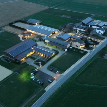
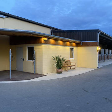
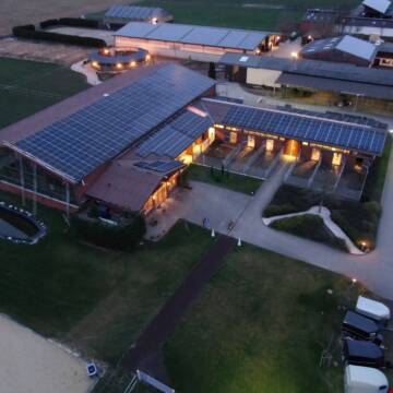
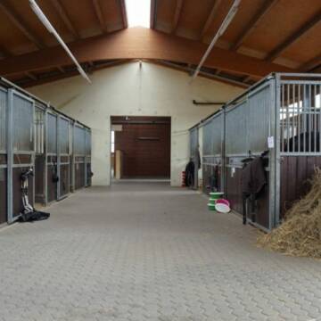
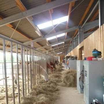
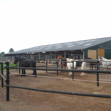
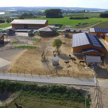
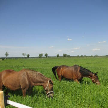
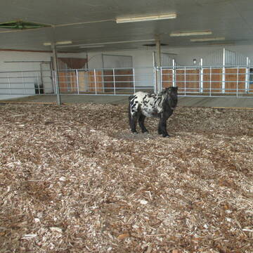
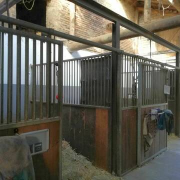
Reitanlage Margarethenhof
Swisttal Miel
Reitanlage-Margarethenhof
@Reitanlage-Margarethenhof
Freizeitstall
Pferdeausbildung
Vermieten
Verpachten
Führanlage
Hunde willkommen
Einhornhaltung möglich
22 weitere...
S
Deprecated: Creation of dynamic property Zend_View_Helper_Ads::$adLink is deprecated in /var/www/stall-frei/htdocs/staging.stall-frei.de/library/Psf/View/Helper/Ads.php on line 108

Futtersack HeuToy, Fressbremse in pink
Mechtersen
STALL-FREIde Marketing
@STALL-FREI-Marketing
Stundenlange Beschäftigung die
Koliken vorbeugt, geringe Staubinhalation mit
steuerbarer Futterentnahme
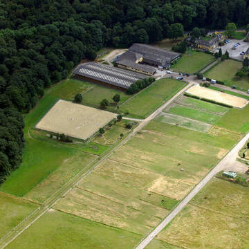
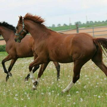
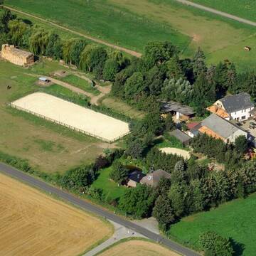
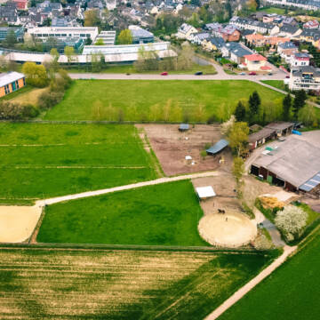
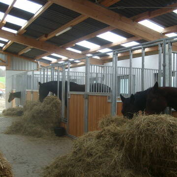
Gut Waldau - Die Reitanlage in Region Köln/Bonn
Rheinbach
Horseconcept Gut Waldau GmbH
@Horseconcept-Gut-Waldau-GmbH
FN-Mitglied
Freizeitstall
Vermieten
Verpachten
Führanlage
Hunde willkommen
Allergikerstall
Fohlenaufzucht möglich
34 weitere...
ganz aktuell
S
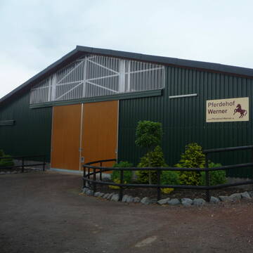
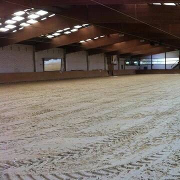
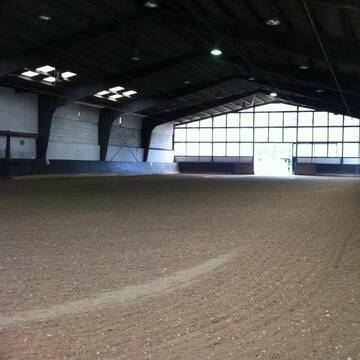
Pferdehof WERNER
Rheinbach-Flerzheim
Hubert-Werner
@Hubert-Werner
Freizeitstall
Longierzirkel/Roundpen
Paddock
Notfallboxen
Außenbox mit Paddock
Laufstall
7 weitere...
P+

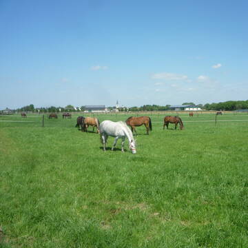
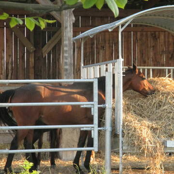
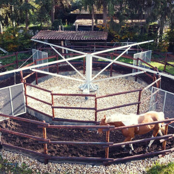
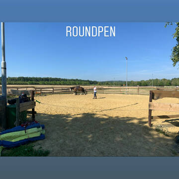
Gut Bentgerhof
Grafschaft
Oliver Heinen
@Oliver-Heinen1
Freizeitstall
Krankenbox
Longierzirkel/Roundpen
Allergikerstall
Hufrehe geeignet
Bewegungsstall
Offenstall
14 weitere...
P+
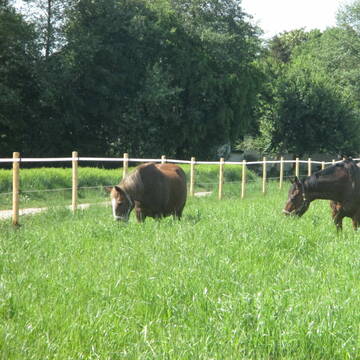
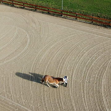
Pferdeboxen in toller Stallgemeinschaft, Wachtberg
Wachtberg
A. Strang
@Stallgemeinschaft_Wiesenau
Freizeitstall
Vermieten
Longierzirkel/Roundpen
Paddock
bedampftes/gewaschenes Heu
Hufrehe geeignet
11 weitere...
P
Pferdepension Bahners
Rheinbach- Ramershoven
Andreas-Bahners
@Andreas-Bahners
Freizeitstall
Krankenbox
Longierzirkel/Roundpen
Allergikerstall
Fohlenaufzucht möglich
Laufstall
Offenstall
13 weitere...
P+
Reitstall Schlaeger - Tomberger Mühle
Euskirchen
Reitstall-Schlaeger
@Reitstall-Schlaeger
FN-Mitglied
Freizeitstall
Vermieten
Führanlage
Hunde willkommen
Außenboxen
Innenbox
20 weitere...
S

Heu aus neuer Ernte
Mechtersen
STALL-FREIde Marketing
@STALL-FREI-Marketing
Heulage und Pferdeheu aus der neuen Ernte findest du in unserem Futtermarkt

Petershof - Rheinbach
Rheinbach
Petershof-Rheinbach
@Petershof-Rheinbach
Freizeitstall
Reitlehrer und -unterricht
Vermieten
Hunde willkommen
Krankenbox
Allergikerstall
bedampftes/gewaschenes Heu
18 weitere...
P+

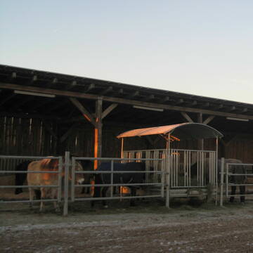
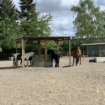
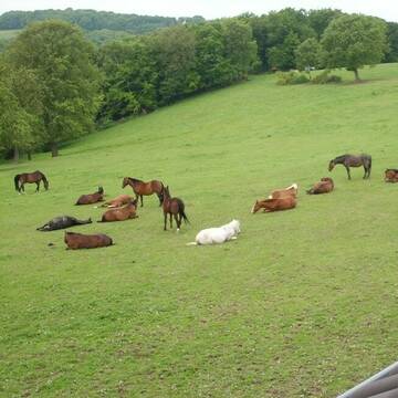
Aktivlaufstall für Pferde in Wachtberg
Wachtberg
Reit- und Aktivstall Lammerich
@Lisa-Lammerich
FN-Mitglied
Freizeitstall
Vermieten
Hunde willkommen
Krankenbox
Allergikerstall
Notfallboxen
19 weitere...
P


Mayerhof in Hennef Lichtenberg
Hennef Lichtenberg
Ursula Mayer
@Markus-Ursula-und-Marius-Mayer
FN-Mitglied
Freizeitstall
Führanlage
Krankenbox
Notfallboxen
Außenbox mit Paddock
Außenboxen
23 weitere...
S
Deprecated: Creation of dynamic property Zend_View::$pageCount is deprecated in /var/www/stall-frei/htdocs/staging.stall-frei.de/library/vendor/shardj/zf1-future/library/Zend/View/Abstract.php on line 308
Deprecated: Creation of dynamic property Zend_View::$itemCountPerPage is deprecated in /var/www/stall-frei/htdocs/staging.stall-frei.de/library/vendor/shardj/zf1-future/library/Zend/View/Abstract.php on line 308
Deprecated: Creation of dynamic property Zend_View::$first is deprecated in /var/www/stall-frei/htdocs/staging.stall-frei.de/library/vendor/shardj/zf1-future/library/Zend/View/Abstract.php on line 308
Deprecated: Creation of dynamic property Zend_View::$current is deprecated in /var/www/stall-frei/htdocs/staging.stall-frei.de/library/vendor/shardj/zf1-future/library/Zend/View/Abstract.php on line 308
Deprecated: Creation of dynamic property Zend_View::$last is deprecated in /var/www/stall-frei/htdocs/staging.stall-frei.de/library/vendor/shardj/zf1-future/library/Zend/View/Abstract.php on line 308
Deprecated: Creation of dynamic property Zend_View::$next is deprecated in /var/www/stall-frei/htdocs/staging.stall-frei.de/library/vendor/shardj/zf1-future/library/Zend/View/Abstract.php on line 308
Deprecated: Creation of dynamic property Zend_View::$pagesInRange is deprecated in /var/www/stall-frei/htdocs/staging.stall-frei.de/library/vendor/shardj/zf1-future/library/Zend/View/Abstract.php on line 308
Deprecated: Creation of dynamic property Zend_View::$firstPageInRange is deprecated in /var/www/stall-frei/htdocs/staging.stall-frei.de/library/vendor/shardj/zf1-future/library/Zend/View/Abstract.php on line 308
Deprecated: Creation of dynamic property Zend_View::$lastPageInRange is deprecated in /var/www/stall-frei/htdocs/staging.stall-frei.de/library/vendor/shardj/zf1-future/library/Zend/View/Abstract.php on line 308
Deprecated: Creation of dynamic property Zend_View::$currentItemCount is deprecated in /var/www/stall-frei/htdocs/staging.stall-frei.de/library/vendor/shardj/zf1-future/library/Zend/View/Abstract.php on line 308
Deprecated: Creation of dynamic property Zend_View::$totalItemCount is deprecated in /var/www/stall-frei/htdocs/staging.stall-frei.de/library/vendor/shardj/zf1-future/library/Zend/View/Abstract.php on line 308
Deprecated: Creation of dynamic property Zend_View::$firstItemNumber is deprecated in /var/www/stall-frei/htdocs/staging.stall-frei.de/library/vendor/shardj/zf1-future/library/Zend/View/Abstract.php on line 308
Deprecated: Creation of dynamic property Zend_View::$lastItemNumber is deprecated in /var/www/stall-frei/htdocs/staging.stall-frei.de/library/vendor/shardj/zf1-future/library/Zend/View/Abstract.php on line 308
Deprecated: Creation of dynamic property Zend_View::$router is deprecated in /var/www/stall-frei/htdocs/staging.stall-frei.de/library/vendor/shardj/zf1-future/library/Zend/View/Abstract.php on line 308
Deprecated: Creation of dynamic property Zend_View::$urlParams is deprecated in /var/www/stall-frei/htdocs/staging.stall-frei.de/library/vendor/shardj/zf1-future/library/Zend/View/Abstract.php on line 308
Deprecated: Creation of dynamic property Zend_View::$showAds is deprecated in /var/www/stall-frei/htdocs/staging.stall-frei.de/library/vendor/shardj/zf1-future/library/Zend/View/Abstract.php on line 308
Deprecated: Creation of dynamic property Zend_View::$objectIds is deprecated in /var/www/stall-frei/htdocs/staging.stall-frei.de/library/vendor/shardj/zf1-future/library/Zend/View/Abstract.php on line 308
Deprecated: Creation of dynamic property Zend_View::$showNavbar is deprecated in /var/www/stall-frei/htdocs/staging.stall-frei.de/library/vendor/shardj/zf1-future/library/Zend/View/Abstract.php on line 308
Deprecated: Creation of dynamic property Zend_View::$showBreadcrumb is deprecated in /var/www/stall-frei/htdocs/staging.stall-frei.de/library/vendor/shardj/zf1-future/library/Zend/View/Abstract.php on line 308
Deprecated: Creation of dynamic property Zend_View::$showFooter is deprecated in /var/www/stall-frei/htdocs/staging.stall-frei.de/library/vendor/shardj/zf1-future/library/Zend/View/Abstract.php on line 308
Deprecated: Creation of dynamic property Zend_View::$showInternalAds is deprecated in /var/www/stall-frei/htdocs/staging.stall-frei.de/library/vendor/shardj/zf1-future/library/Zend/View/Abstract.php on line 308
Deprecated: Creation of dynamic property Zend_View::$blNoContent is deprecated in /var/www/stall-frei/htdocs/staging.stall-frei.de/library/vendor/shardj/zf1-future/library/Zend/View/Abstract.php on line 308
Deprecated: Creation of dynamic property Zend_View::$sMetaDesc is deprecated in /var/www/stall-frei/htdocs/staging.stall-frei.de/library/vendor/shardj/zf1-future/library/Zend/View/Abstract.php on line 308
Deprecated: Creation of dynamic property Zend_View::$useGmaps is deprecated in /var/www/stall-frei/htdocs/staging.stall-frei.de/library/vendor/shardj/zf1-future/library/Zend/View/Abstract.php on line 308
Deprecated: Creation of dynamic property Zend_View::$touches is deprecated in /var/www/stall-frei/htdocs/staging.stall-frei.de/library/vendor/shardj/zf1-future/library/Zend/View/Abstract.php on line 308
Deprecated: Creation of dynamic property Zend_View::$oProject is deprecated in /var/www/stall-frei/htdocs/staging.stall-frei.de/library/vendor/shardj/zf1-future/library/Zend/View/Abstract.php on line 308
Deprecated: Creation of dynamic property Zend_View::$pageHeadline is deprecated in /var/www/stall-frei/htdocs/staging.stall-frei.de/library/vendor/shardj/zf1-future/library/Zend/View/Abstract.php on line 308
Deprecated: Creation of dynamic property Zend_View::$disableLocationField is deprecated in /var/www/stall-frei/htdocs/staging.stall-frei.de/library/vendor/shardj/zf1-future/library/Zend/View/Abstract.php on line 308
Deprecated: Creation of dynamic property Zend_View::$isSearch is deprecated in /var/www/stall-frei/htdocs/staging.stall-frei.de/library/vendor/shardj/zf1-future/library/Zend/View/Abstract.php on line 308
Deprecated: Creation of dynamic property Zend_View::$pageTitle is deprecated in /var/www/stall-frei/htdocs/staging.stall-frei.de/library/vendor/shardj/zf1-future/library/Zend/View/Abstract.php on line 308
Deprecated: Creation of dynamic property Psf_Form_Element_Text::$class is deprecated in /var/www/stall-frei/htdocs/staging.stall-frei.de/library/vendor/shardj/zf1-future/library/Zend/Form/Element.php on line 874
Deprecated: Creation of dynamic property Psf_Form_Element_Text::$size is deprecated in /var/www/stall-frei/htdocs/staging.stall-frei.de/library/vendor/shardj/zf1-future/library/Zend/Form/Element.php on line 874
Deprecated: Creation of dynamic property Psf_Form_Element_Text::$placeholder is deprecated in /var/www/stall-frei/htdocs/staging.stall-frei.de/library/vendor/shardj/zf1-future/library/Zend/Form/Element.php on line 874
Deprecated: Creation of dynamic property Psf_Form_Element_Hidden::$class is deprecated in /var/www/stall-frei/htdocs/staging.stall-frei.de/library/vendor/shardj/zf1-future/library/Zend/Form/Element.php on line 874
Deprecated: Creation of dynamic property Psf_Form_Element_Hidden::$class is deprecated in /var/www/stall-frei/htdocs/staging.stall-frei.de/library/vendor/shardj/zf1-future/library/Zend/Form/Element.php on line 874
Deprecated: Creation of dynamic property Psf_Form_Element_Hidden::$class is deprecated in /var/www/stall-frei/htdocs/staging.stall-frei.de/library/vendor/shardj/zf1-future/library/Zend/Form/Element.php on line 874
Deprecated: Creation of dynamic property Psf_Form_Element_Hidden::$class is deprecated in /var/www/stall-frei/htdocs/staging.stall-frei.de/library/vendor/shardj/zf1-future/library/Zend/Form/Element.php on line 874
Deprecated: Creation of dynamic property Psf_Form_Element_Select::$class is deprecated in /var/www/stall-frei/htdocs/staging.stall-frei.de/library/vendor/shardj/zf1-future/library/Zend/Form/Element.php on line 874
Deprecated: Creation of dynamic property Psf_Form_Element_Select::$class is deprecated in /var/www/stall-frei/htdocs/staging.stall-frei.de/library/vendor/shardj/zf1-future/library/Zend/Form/Element.php on line 874
Deprecated: Creation of dynamic property Psf_Form_Element_Select::$class is deprecated in /var/www/stall-frei/htdocs/staging.stall-frei.de/library/vendor/shardj/zf1-future/library/Zend/Form/Element.php on line 874
Deprecated: Creation of dynamic property Psf_Form_Element_Select::$class is deprecated in /var/www/stall-frei/htdocs/staging.stall-frei.de/library/vendor/shardj/zf1-future/library/Zend/Form/Element.php on line 874
Deprecated: Creation of dynamic property Psf_Form_Element_Text::$class is deprecated in /var/www/stall-frei/htdocs/staging.stall-frei.de/library/vendor/shardj/zf1-future/library/Zend/Form/Element.php on line 874
Deprecated: Creation of dynamic property Psf_Form_Element_Checkbox::$label is deprecated in /var/www/stall-frei/htdocs/staging.stall-frei.de/library/vendor/shardj/zf1-future/library/Zend/Form/Element.php on line 874
Deprecated: Creation of dynamic property Zend_View::$sort is deprecated in /var/www/stall-frei/htdocs/staging.stall-frei.de/library/vendor/shardj/zf1-future/library/Zend/View/Abstract.php on line 308
Deprecated: Creation of dynamic property Zend_View::$searchLocation is deprecated in /var/www/stall-frei/htdocs/staging.stall-frei.de/library/vendor/shardj/zf1-future/library/Zend/View/Abstract.php on line 308
Deprecated: Creation of dynamic property Zend_View::$locationHint is deprecated in /var/www/stall-frei/htdocs/staging.stall-frei.de/library/vendor/shardj/zf1-future/library/Zend/View/Abstract.php on line 308
Psf_GeoCoder_Abstract::getLocation: Wachtberg Get Location CachedOrLive
Psf_GeoCoder_Abstract::getCachedOrLive: Wachtberg
Psf_GeoCoder_OpenCageData::makeApiRequest: response:
Array
(
[documentation] => https://opencagedata.com/api
[licenses] => Array
(
[0] => Array
(
[name] => see attribution guide
[url] => https://opencagedata.com/credits
)
)
[results] => Array
(
[0] => Array
(
[bounds] => Array
(
[northeast] => Array
(
[lat] => 50.6595385
[lng] => 7.1951484
)
[southwest] => Array
(
[lat] => 50.5859149
[lng] => 7.0398084
)
)
[components] => Array
(
[ISO_3166-1_alpha-2] => DE
[ISO_3166-1_alpha-3] => DEU
[ISO_3166-2] => Array
(
[0] => DE-NW
)
[_category] => place
[_normalized_city] => Wachtberg
[_type] => village
[continent] => Europe
[country] => Deutschland
[country_code] => de
[county] => Rhein-Sieg-Kreis
[political_union] => European Union
[postcode] => 53343
[state] => Nordrhein-Westfalen
[state_code] => NW
[village] => Wachtberg
)
[confidence] => 7
[formatted] => 53343 Wachtberg, Deutschland
[geometry] => Array
(
[lat] => 50.6435631
[lng] => 7.0882889
)
)
[1] => Array
(
[bounds] => Array
(
[northeast] => Array
(
[lat] => 49.9962973
[lng] => 11.6857169
)
[southwest] => Array
(
[lat] => 49.9961973
[lng] => 11.6856169
)
)
[components] => Array
(
[ISO_3166-1_alpha-2] => DE
[ISO_3166-1_alpha-3] => DEU
[ISO_3166-2] => Array
(
[0] => DE-BY
)
[_category] => natural/water
[_normalized_city] => Goldkronach
[_type] => peak
[continent] => Europe
[country] => Deutschland
[country_code] => de
[county] => Landkreis Bayreuth
[peak] => Wachtberg
[political_union] => European Union
[postcode] => 95497
[state] => Bayern
[state_code] => BY
[town] => Goldkronach
)
[confidence] => 9
[formatted] => Wachtberg, 95497 Goldkronach, Deutschland
[geometry] => Array
(
[lat] => 49.9962473
[lng] => 11.6856669
)
)
[2] => Array
(
[bounds] => Array
(
[northeast] => Array
(
[lat] => 50.9485085
[lng] => 11.7116549
)
[southwest] => Array
(
[lat] => 50.9484085
[lng] => 11.7115549
)
)
[components] => Array
(
[ISO_3166-1_alpha-2] => DE
[ISO_3166-1_alpha-3] => DEU
[ISO_3166-2] => Array
(
[0] => DE-TH
)
[_category] => natural/water
[_normalized_city] => Bürgel
[_type] => peak
[continent] => Europe
[country] => Deutschland
[country_code] => de
[county] => Saale-Holzland-Kreis
[municipality] => Bürgel
[peak] => Wachtberg
[political_union] => European Union
[state] => Thüringen
[state_code] => TH
[town] => Bürgel
)
[confidence] => 9
[formatted] => Wachtberg, Bürgel, Thüringen, Deutschland
[geometry] => Array
(
[lat] => 50.9484585
[lng] => 11.7116049
)
)
[3] => Array
(
[bounds] => Array
(
[northeast] => Array
(
[lat] => 51.0554852
[lng] => 11.7161941
)
[southwest] => Array
(
[lat] => 51.0553852
[lng] => 11.7160941
)
)
[components] => Array
(
[ISO_3166-1_alpha-2] => DE
[ISO_3166-1_alpha-3] => DEU
[ISO_3166-2] => Array
(
[0] => DE-TH
)
[_category] => natural/water
[_normalized_city] => Dornburg-Camburg
[_type] => peak
[continent] => Europe
[country] => Deutschland
[country_code] => de
[county] => Saale-Holzland-Kreis
[municipality] => Dornburg-Camburg
[peak] => Wachtberg
[political_union] => European Union
[postcode] => 07774
[state] => Thüringen
[state_code] => TH
)
[confidence] => 9
[formatted] => Wachtberg, 07774 Dornburg-Camburg, Deutschland
[geometry] => Array
(
[lat] => 51.0554352
[lng] => 11.7161441
)
)
[4] => Array
(
[bounds] => Array
(
[northeast] => Array
(
[lat] => 51.3703569
[lng] => 13.736844
)
[southwest] => Array
(
[lat] => 51.3702569
[lng] => 13.736744
)
)
[components] => Array
(
[ISO_3166-1_alpha-2] => DE
[ISO_3166-1_alpha-3] => DEU
[ISO_3166-2] => Array
(
[0] => DE-BB
)
[_category] => natural/water
[_normalized_city] => Großkmehlen
[_type] => peak
[continent] => Europe
[country] => Deutschland
[country_code] => de
[county] => Oberspreewald-Lausitz
[municipality] => Ortrand
[peak] => Wachtberg
[political_union] => European Union
[postcode] => 01990
[state] => Brandenburg
[state_code] => BB
[village] => Großkmehlen
)
[confidence] => 9
[formatted] => Wachtberg, 01990 Großkmehlen, Deutschland
[geometry] => Array
(
[lat] => 51.3703069
[lng] => 13.736794
)
)
[5] => Array
(
[bounds] => Array
(
[northeast] => Array
(
[lat] => 50.6276229
[lng] => 7.1154884
)
[southwest] => Array
(
[lat] => 50.6275229
[lng] => 7.1153884
)
)
[components] => Array
(
[ISO_3166-1_alpha-2] => DE
[ISO_3166-1_alpha-3] => DEU
[ISO_3166-2] => Array
(
[0] => DE-NW
)
[_category] => natural/water
[_normalized_city] => Wachtberg
[_type] => peak
[continent] => Europe
[country] => Deutschland
[country_code] => de
[county] => Rhein-Sieg-Kreis
[peak] => Wachtberg
[political_union] => European Union
[postcode] => 53343
[state] => Nordrhein-Westfalen
[state_code] => NW
[village] => Wachtberg
)
[confidence] => 9
[formatted] => Wachtberg, 53343 Wachtberg, Deutschland
[geometry] => Array
(
[lat] => 50.6275729
[lng] => 7.1154384
)
)
[6] => Array
(
[bounds] => Array
(
[northeast] => Array
(
[lat] => 51.3995929
[lng] => 12.516313
)
[southwest] => Array
(
[lat] => 51.3994929
[lng] => 12.516213
)
)
[components] => Array
(
[ISO_3166-1_alpha-2] => DE
[ISO_3166-1_alpha-3] => DEU
[ISO_3166-2] => Array
(
[0] => DE-SN
)
[_category] => natural/water
[_normalized_city] => Taucha
[_type] => peak
[continent] => Europe
[country] => Deutschland
[country_code] => de
[county] => Nordsachsen
[peak] => Wachtberg
[political_union] => European Union
[postcode] => 04425
[state] => Sachsen
[state_code] => SN
[town] => Taucha
)
[confidence] => 9
[formatted] => Wachtberg, 04425 Taucha, Deutschland
[geometry] => Array
(
[lat] => 51.3995429
[lng] => 12.516263
)
)
[7] => Array
(
[bounds] => Array
(
[northeast] => Array
(
[lat] => 52.0562365
[lng] => 11.647238
)
[southwest] => Array
(
[lat] => 52.0561365
[lng] => 11.647138
)
)
[components] => Array
(
[ISO_3166-1_alpha-2] => DE
[ISO_3166-1_alpha-3] => DEU
[ISO_3166-2] => Array
(
[0] => DE-ST
)
[_category] => natural/water
[_normalized_city] => Magdeburg
[_type] => peak
[city] => Magdeburg
[continent] => Europe
[country] => Deutschland
[country_code] => de
[peak] => Wachtberg
[political_union] => European Union
[postcode] => 39122
[state] => Sachsen-Anhalt
[state_code] => ST
)
[confidence] => 9
[formatted] => Wachtberg, 39122 Magdeburg, Deutschland
[geometry] => Array
(
[lat] => 52.0561865
[lng] => 11.647188
)
)
[8] => Array
(
[bounds] => Array
(
[northeast] => Array
(
[lat] => 49.6128701
[lng] => 11.4999053
)
[southwest] => Array
(
[lat] => 49.6127701
[lng] => 11.4998053
)
)
[components] => Array
(
[ISO_3166-1_alpha-2] => DE
[ISO_3166-1_alpha-3] => DEU
[ISO_3166-2] => Array
(
[0] => DE-BY
)
[_category] => natural/water
[_normalized_city] => Velden
[_type] => peak
[continent] => Europe
[country] => Deutschland
[country_code] => de
[county] => Landkreis Nürnberger Land
[municipality] => Velden (VGem)
[peak] => Wachtberg
[political_union] => European Union
[postcode] => 91235
[state] => Bayern
[state_code] => BY
[village] => Velden
)
[confidence] => 9
[formatted] => Wachtberg, 91235 Velden, Deutschland
[geometry] => Array
(
[lat] => 49.6128201
[lng] => 11.4998553
)
)
[9] => Array
(
[bounds] => Array
(
[northeast] => Array
(
[lat] => 53.0540478
[lng] => 10.655007
)
[southwest] => Array
(
[lat] => 53.0539478
[lng] => 10.654907
)
)
[components] => Array
(
[ISO_3166-1_alpha-2] => DE
[ISO_3166-1_alpha-3] => DEU
[ISO_3166-2] => Array
(
[0] => DE-NI
)
[_category] => natural/water
[_normalized_city] => Weste
[_type] => peak
[continent] => Europe
[country] => Deutschland
[country_code] => de
[county] => Landkreis Uelzen
[municipality] => Samtgemeinde Bevensen-Ebstorf
[peak] => Wachtberg
[political_union] => European Union
[postcode] => 29591
[state] => Niedersachsen
[state_code] => NI
[village] => Weste
)
[confidence] => 9
[formatted] => Wachtberg, 29591 Weste, Deutschland
[geometry] => Array
(
[lat] => 53.0539978
[lng] => 10.654957
)
)
)
[status] => Array
(
[code] => 200
[message] => OK
)
[stay_informed] => Array
(
[blog] => https://blog.opencagedata.com
[mastodon] => https://en.osm.town/@opencage
)
[thanks] => For using an OpenCage API
[timestamp] => Array
(
[created_http] => Fri, 06 Feb 2026 19:17:06 GMT
[created_unix] => 1770405426
)
[total_results] => 10
)
Psf_GeoCoder_Abstract::convertLocationResult
{"documentation":"https:\/\/opencagedata.com\/api","licenses":[{"name":"see attribution guide","url":"https:\/\/opencagedata.com\/credits"}],"results":[{"bounds":{"northeast":{"lat":50.6595385,"lng":7.1951484},"southwest":{"lat":50.5859149,"lng":7.0398084}},"components":{"ISO_3166-1_alpha-2":"DE","ISO_3166-1_alpha-3":"DEU","ISO_3166-2":["DE-NW"],"_category":"place","_normalized_city":"Wachtberg","_type":"village","continent":"Europe","country":"Deutschland","country_code":"de","county":"Rhein-Sieg-Kreis","political_union":"European Union","postcode":"53343","state":"Nordrhein-Westfalen","state_code":"NW","village":"Wachtberg"},"confidence":7,"formatted":"53343 Wachtberg, Deutschland","geometry":{"lat":50.6435631,"lng":7.0882889}},{"bounds":{"northeast":{"lat":49.9962973,"lng":11.6857169},"southwest":{"lat":49.9961973,"lng":11.6856169}},"components":{"ISO_3166-1_alpha-2":"DE","ISO_3166-1_alpha-3":"DEU","ISO_3166-2":["DE-BY"],"_category":"natural\/water","_normalized_city":"Goldkronach","_type":"peak","continent":"Europe","country":"Deutschland","country_code":"de","county":"Landkreis Bayreuth","peak":"Wachtberg","political_union":"European Union","postcode":"95497","state":"Bayern","state_code":"BY","town":"Goldkronach"},"confidence":9,"formatted":"Wachtberg, 95497 Goldkronach, Deutschland","geometry":{"lat":49.9962473,"lng":11.6856669}},{"bounds":{"northeast":{"lat":50.9485085,"lng":11.7116549},"southwest":{"lat":50.9484085,"lng":11.7115549}},"components":{"ISO_3166-1_alpha-2":"DE","ISO_3166-1_alpha-3":"DEU","ISO_3166-2":["DE-TH"],"_category":"natural\/water","_normalized_city":"B\u00fcrgel","_type":"peak","continent":"Europe","country":"Deutschland","country_code":"de","county":"Saale-Holzland-Kreis","municipality":"B\u00fcrgel","peak":"Wachtberg","political_union":"European Union","state":"Th\u00fcringen","state_code":"TH","town":"B\u00fcrgel"},"confidence":9,"formatted":"Wachtberg, B\u00fcrgel, Th\u00fcringen, Deutschland","geometry":{"lat":50.9484585,"lng":11.7116049}},{"bounds":{"northeast":{"lat":51.0554852,"lng":11.7161941},"southwest":{"lat":51.0553852,"lng":11.7160941}},"components":{"ISO_3166-1_alpha-2":"DE","ISO_3166-1_alpha-3":"DEU","ISO_3166-2":["DE-TH"],"_category":"natural\/water","_normalized_city":"Dornburg-Camburg","_type":"peak","continent":"Europe","country":"Deutschland","country_code":"de","county":"Saale-Holzland-Kreis","municipality":"Dornburg-Camburg","peak":"Wachtberg","political_union":"European Union","postcode":"07774","state":"Th\u00fcringen","state_code":"TH"},"confidence":9,"formatted":"Wachtberg, 07774 Dornburg-Camburg, Deutschland","geometry":{"lat":51.0554352,"lng":11.7161441}},{"bounds":{"northeast":{"lat":51.3703569,"lng":13.736844},"southwest":{"lat":51.3702569,"lng":13.736744}},"components":{"ISO_3166-1_alpha-2":"DE","ISO_3166-1_alpha-3":"DEU","ISO_3166-2":["DE-BB"],"_category":"natural\/water","_normalized_city":"Gro\u00dfkmehlen","_type":"peak","continent":"Europe","country":"Deutschland","country_code":"de","county":"Oberspreewald-Lausitz","municipality":"Ortrand","peak":"Wachtberg","political_union":"European Union","postcode":"01990","state":"Brandenburg","state_code":"BB","village":"Gro\u00dfkmehlen"},"confidence":9,"formatted":"Wachtberg, 01990 Gro\u00dfkmehlen, Deutschland","geometry":{"lat":51.3703069,"lng":13.736794}},{"bounds":{"northeast":{"lat":50.6276229,"lng":7.1154884},"southwest":{"lat":50.6275229,"lng":7.1153884}},"components":{"ISO_3166-1_alpha-2":"DE","ISO_3166-1_alpha-3":"DEU","ISO_3166-2":["DE-NW"],"_category":"natural\/water","_normalized_city":"Wachtberg","_type":"peak","continent":"Europe","country":"Deutschland","country_code":"de","county":"Rhein-Sieg-Kreis","peak":"Wachtberg","political_union":"European Union","postcode":"53343","state":"Nordrhein-Westfalen","state_code":"NW","village":"Wachtberg"},"confidence":9,"formatted":"Wachtberg, 53343 Wachtberg, Deutschland","geometry":{"lat":50.6275729,"lng":7.1154384}},{"bounds":{"northeast":{"lat":51.3995929,"lng":12.516313},"southwest":{"lat":51.3994929,"lng":12.516213}},"components":{"ISO_3166-1_alpha-2":"DE","ISO_3166-1_alpha-3":"DEU","ISO_3166-2":["DE-SN"],"_category":"natural\/water","_normalized_city":"Taucha","_type":"peak","continent":"Europe","country":"Deutschland","country_code":"de","county":"Nordsachsen","peak":"Wachtberg","political_union":"European Union","postcode":"04425","state":"Sachsen","state_code":"SN","town":"Taucha"},"confidence":9,"formatted":"Wachtberg, 04425 Taucha, Deutschland","geometry":{"lat":51.3995429,"lng":12.516263}},{"bounds":{"northeast":{"lat":52.0562365,"lng":11.647238},"southwest":{"lat":52.0561365,"lng":11.647138}},"components":{"ISO_3166-1_alpha-2":"DE","ISO_3166-1_alpha-3":"DEU","ISO_3166-2":["DE-ST"],"_category":"natural\/water","_normalized_city":"Magdeburg","_type":"peak","city":"Magdeburg","continent":"Europe","country":"Deutschland","country_code":"de","peak":"Wachtberg","political_union":"European Union","postcode":"39122","state":"Sachsen-Anhalt","state_code":"ST"},"confidence":9,"formatted":"Wachtberg, 39122 Magdeburg, Deutschland","geometry":{"lat":52.0561865,"lng":11.647188}},{"bounds":{"northeast":{"lat":49.6128701,"lng":11.4999053},"southwest":{"lat":49.6127701,"lng":11.4998053}},"components":{"ISO_3166-1_alpha-2":"DE","ISO_3166-1_alpha-3":"DEU","ISO_3166-2":["DE-BY"],"_category":"natural\/water","_normalized_city":"Velden","_type":"peak","continent":"Europe","country":"Deutschland","country_code":"de","county":"Landkreis N\u00fcrnberger Land","municipality":"Velden (VGem)","peak":"Wachtberg","political_union":"European Union","postcode":"91235","state":"Bayern","state_code":"BY","village":"Velden"},"confidence":9,"formatted":"Wachtberg, 91235 Velden, Deutschland","geometry":{"lat":49.6128201,"lng":11.4998553}},{"bounds":{"northeast":{"lat":53.0540478,"lng":10.655007},"southwest":{"lat":53.0539478,"lng":10.654907}},"components":{"ISO_3166-1_alpha-2":"DE","ISO_3166-1_alpha-3":"DEU","ISO_3166-2":["DE-NI"],"_category":"natural\/water","_normalized_city":"Weste","_type":"peak","continent":"Europe","country":"Deutschland","country_code":"de","county":"Landkreis Uelzen","municipality":"Samtgemeinde Bevensen-Ebstorf","peak":"Wachtberg","political_union":"European Union","postcode":"29591","state":"Niedersachsen","state_code":"NI","village":"Weste"},"confidence":9,"formatted":"Wachtberg, 29591 Weste, Deutschland","geometry":{"lat":53.0539978,"lng":10.654957}}],"status":{"code":200,"message":"OK"},"stay_informed":{"blog":"https:\/\/blog.opencagedata.com","mastodon":"https:\/\/en.osm.town\/@opencage"},"thanks":"For using an OpenCage API","timestamp":{"created_http":"Fri, 06 Feb 2026 19:17:06 GMT","created_unix":1770405426},"total_results":10}Array
(
[0] => stdClass Object
(
[bounds] => stdClass Object
(
[northeast] => stdClass Object
(
[lat] => 50.6595385
[lng] => 7.1951484
)
[southwest] => stdClass Object
(
[lat] => 50.5859149
[lng] => 7.0398084
)
)
[components] => stdClass Object
(
[ISO_3166-1_alpha-2] => DE
[ISO_3166-1_alpha-3] => DEU
[ISO_3166-2] => Array
(
[0] => DE-NW
)
[_category] => place
[_normalized_city] => Wachtberg
[_type] => village
[continent] => Europe
[country] => Deutschland
[country_code] => de
[county] => Rhein-Sieg-Kreis
[political_union] => European Union
[postcode] => 53343
[state] => Nordrhein-Westfalen
[state_code] => NW
[village] => Wachtberg
)
[confidence] => 7
[formatted] => 53343 Wachtberg, Deutschland
[geometry] => stdClass Object
(
[lat] => 50.6435631
[lng] => 7.0882889
)
)
[1] => stdClass Object
(
[bounds] => stdClass Object
(
[northeast] => stdClass Object
(
[lat] => 49.9962973
[lng] => 11.6857169
)
[southwest] => stdClass Object
(
[lat] => 49.9961973
[lng] => 11.6856169
)
)
[components] => stdClass Object
(
[ISO_3166-1_alpha-2] => DE
[ISO_3166-1_alpha-3] => DEU
[ISO_3166-2] => Array
(
[0] => DE-BY
)
[_category] => natural/water
[_normalized_city] => Goldkronach
[_type] => peak
[continent] => Europe
[country] => Deutschland
[country_code] => de
[county] => Landkreis Bayreuth
[peak] => Wachtberg
[political_union] => European Union
[postcode] => 95497
[state] => Bayern
[state_code] => BY
[town] => Goldkronach
)
[confidence] => 9
[formatted] => Wachtberg, 95497 Goldkronach, Deutschland
[geometry] => stdClass Object
(
[lat] => 49.9962473
[lng] => 11.6856669
)
)
[2] => stdClass Object
(
[bounds] => stdClass Object
(
[northeast] => stdClass Object
(
[lat] => 50.9485085
[lng] => 11.7116549
)
[southwest] => stdClass Object
(
[lat] => 50.9484085
[lng] => 11.7115549
)
)
[components] => stdClass Object
(
[ISO_3166-1_alpha-2] => DE
[ISO_3166-1_alpha-3] => DEU
[ISO_3166-2] => Array
(
[0] => DE-TH
)
[_category] => natural/water
[_normalized_city] => Bürgel
[_type] => peak
[continent] => Europe
[country] => Deutschland
[country_code] => de
[county] => Saale-Holzland-Kreis
[municipality] => Bürgel
[peak] => Wachtberg
[political_union] => European Union
[state] => Thüringen
[state_code] => TH
[town] => Bürgel
)
[confidence] => 9
[formatted] => Wachtberg, Bürgel, Thüringen, Deutschland
[geometry] => stdClass Object
(
[lat] => 50.9484585
[lng] => 11.7116049
)
)
[3] => stdClass Object
(
[bounds] => stdClass Object
(
[northeast] => stdClass Object
(
[lat] => 51.0554852
[lng] => 11.7161941
)
[southwest] => stdClass Object
(
[lat] => 51.0553852
[lng] => 11.7160941
)
)
[components] => stdClass Object
(
[ISO_3166-1_alpha-2] => DE
[ISO_3166-1_alpha-3] => DEU
[ISO_3166-2] => Array
(
[0] => DE-TH
)
[_category] => natural/water
[_normalized_city] => Dornburg-Camburg
[_type] => peak
[continent] => Europe
[country] => Deutschland
[country_code] => de
[county] => Saale-Holzland-Kreis
[municipality] => Dornburg-Camburg
[peak] => Wachtberg
[political_union] => European Union
[postcode] => 07774
[state] => Thüringen
[state_code] => TH
)
[confidence] => 9
[formatted] => Wachtberg, 07774 Dornburg-Camburg, Deutschland
[geometry] => stdClass Object
(
[lat] => 51.0554352
[lng] => 11.7161441
)
)
[4] => stdClass Object
(
[bounds] => stdClass Object
(
[northeast] => stdClass Object
(
[lat] => 51.3703569
[lng] => 13.736844
)
[southwest] => stdClass Object
(
[lat] => 51.3702569
[lng] => 13.736744
)
)
[components] => stdClass Object
(
[ISO_3166-1_alpha-2] => DE
[ISO_3166-1_alpha-3] => DEU
[ISO_3166-2] => Array
(
[0] => DE-BB
)
[_category] => natural/water
[_normalized_city] => Großkmehlen
[_type] => peak
[continent] => Europe
[country] => Deutschland
[country_code] => de
[county] => Oberspreewald-Lausitz
[municipality] => Ortrand
[peak] => Wachtberg
[political_union] => European Union
[postcode] => 01990
[state] => Brandenburg
[state_code] => BB
[village] => Großkmehlen
)
[confidence] => 9
[formatted] => Wachtberg, 01990 Großkmehlen, Deutschland
[geometry] => stdClass Object
(
[lat] => 51.3703069
[lng] => 13.736794
)
)
[5] => stdClass Object
(
[bounds] => stdClass Object
(
[northeast] => stdClass Object
(
[lat] => 50.6276229
[lng] => 7.1154884
)
[southwest] => stdClass Object
(
[lat] => 50.6275229
[lng] => 7.1153884
)
)
[components] => stdClass Object
(
[ISO_3166-1_alpha-2] => DE
[ISO_3166-1_alpha-3] => DEU
[ISO_3166-2] => Array
(
[0] => DE-NW
)
[_category] => natural/water
[_normalized_city] => Wachtberg
[_type] => peak
[continent] => Europe
[country] => Deutschland
[country_code] => de
[county] => Rhein-Sieg-Kreis
[peak] => Wachtberg
[political_union] => European Union
[postcode] => 53343
[state] => Nordrhein-Westfalen
[state_code] => NW
[village] => Wachtberg
)
[confidence] => 9
[formatted] => Wachtberg, 53343 Wachtberg, Deutschland
[geometry] => stdClass Object
(
[lat] => 50.6275729
[lng] => 7.1154384
)
)
[6] => stdClass Object
(
[bounds] => stdClass Object
(
[northeast] => stdClass Object
(
[lat] => 51.3995929
[lng] => 12.516313
)
[southwest] => stdClass Object
(
[lat] => 51.3994929
[lng] => 12.516213
)
)
[components] => stdClass Object
(
[ISO_3166-1_alpha-2] => DE
[ISO_3166-1_alpha-3] => DEU
[ISO_3166-2] => Array
(
[0] => DE-SN
)
[_category] => natural/water
[_normalized_city] => Taucha
[_type] => peak
[continent] => Europe
[country] => Deutschland
[country_code] => de
[county] => Nordsachsen
[peak] => Wachtberg
[political_union] => European Union
[postcode] => 04425
[state] => Sachsen
[state_code] => SN
[town] => Taucha
)
[confidence] => 9
[formatted] => Wachtberg, 04425 Taucha, Deutschland
[geometry] => stdClass Object
(
[lat] => 51.3995429
[lng] => 12.516263
)
)
[7] => stdClass Object
(
[bounds] => stdClass Object
(
[northeast] => stdClass Object
(
[lat] => 52.0562365
[lng] => 11.647238
)
[southwest] => stdClass Object
(
[lat] => 52.0561365
[lng] => 11.647138
)
)
[components] => stdClass Object
(
[ISO_3166-1_alpha-2] => DE
[ISO_3166-1_alpha-3] => DEU
[ISO_3166-2] => Array
(
[0] => DE-ST
)
[_category] => natural/water
[_normalized_city] => Magdeburg
[_type] => peak
[city] => Magdeburg
[continent] => Europe
[country] => Deutschland
[country_code] => de
[peak] => Wachtberg
[political_union] => European Union
[postcode] => 39122
[state] => Sachsen-Anhalt
[state_code] => ST
)
[confidence] => 9
[formatted] => Wachtberg, 39122 Magdeburg, Deutschland
[geometry] => stdClass Object
(
[lat] => 52.0561865
[lng] => 11.647188
)
)
[8] => stdClass Object
(
[bounds] => stdClass Object
(
[northeast] => stdClass Object
(
[lat] => 49.6128701
[lng] => 11.4999053
)
[southwest] => stdClass Object
(
[lat] => 49.6127701
[lng] => 11.4998053
)
)
[components] => stdClass Object
(
[ISO_3166-1_alpha-2] => DE
[ISO_3166-1_alpha-3] => DEU
[ISO_3166-2] => Array
(
[0] => DE-BY
)
[_category] => natural/water
[_normalized_city] => Velden
[_type] => peak
[continent] => Europe
[country] => Deutschland
[country_code] => de
[county] => Landkreis Nürnberger Land
[municipality] => Velden (VGem)
[peak] => Wachtberg
[political_union] => European Union
[postcode] => 91235
[state] => Bayern
[state_code] => BY
[village] => Velden
)
[confidence] => 9
[formatted] => Wachtberg, 91235 Velden, Deutschland
[geometry] => stdClass Object
(
[lat] => 49.6128201
[lng] => 11.4998553
)
)
[9] => stdClass Object
(
[bounds] => stdClass Object
(
[northeast] => stdClass Object
(
[lat] => 53.0540478
[lng] => 10.655007
)
[southwest] => stdClass Object
(
[lat] => 53.0539478
[lng] => 10.654907
)
)
[components] => stdClass Object
(
[ISO_3166-1_alpha-2] => DE
[ISO_3166-1_alpha-3] => DEU
[ISO_3166-2] => Array
(
[0] => DE-NI
)
[_category] => natural/water
[_normalized_city] => Weste
[_type] => peak
[continent] => Europe
[country] => Deutschland
[country_code] => de
[county] => Landkreis Uelzen
[municipality] => Samtgemeinde Bevensen-Ebstorf
[peak] => Wachtberg
[political_union] => European Union
[postcode] => 29591
[state] => Niedersachsen
[state_code] => NI
[village] => Weste
)
[confidence] => 9
[formatted] => Wachtberg, 29591 Weste, Deutschland
[geometry] => stdClass Object
(
[lat] => 53.0539978
[lng] => 10.654957
)
)
)
Psf_GeoCoder_OpenCageData::getKeyMap: 0
stdClass Object
(
    [bounds] => stdClass Object
        (
            [northeast] => stdClass Object
                (
                    [lat] => 50.6595385
                    [lng] => 7.1951484
                )

            [southwest] => stdClass Object
                (
                    [lat] => 50.5859149
                    [lng] => 7.0398084
                )

        )

    [components] => stdClass Object
        (
            [ISO_3166-1_alpha-2] => DE
            [ISO_3166-1_alpha-3] => DEU
            [ISO_3166-2] => Array
                (
                    [0] => DE-NW
                )

            [_category] => place
            [_normalized_city] => Wachtberg
            [_type] => village
            [continent] => Europe
            [country] => Deutschland
            [country_code] => de
            [county] => Rhein-Sieg-Kreis
            [political_union] => European Union
            [postcode] => 53343
            [state] => Nordrhein-Westfalen
            [state_code] => NW
            [village] => Wachtberg
        )

    [confidence] => 7
    [formatted] => 53343 Wachtberg, Deutschland
    [geometry] => stdClass Object
        (
            [lat] => 50.6435631
            [lng] => 7.0882889
        )

)
Psf_GeoCoder_OpenCageData::getCounty: Rhein-Sieg-Kreis
Psf_GeoCoder_OpenCageData::addMissingData REFETCH!
Array
(
    [address] => 53343 Wachtberg, Deutschland
    [type] => village
    [street] =>
    [city] => Wachtberg
    [county] => Rhein-Sieg-Kreis
    [state] => Nordrhein-Westfalen
    [zip] => 53343
    [country] => Deutschland
    [suburb] =>
    [countrycode] => de
    [latitude] => 50.6435631
    [longitude] => 7.0882889
    [accuracy] => 1
    [confidence] => 7
    [bounds] => stdClass Object
        (
            [northeast] => stdClass Object
                (
                    [lat] => 50.6595385
                    [lng] => 7.1951484
                )

            [southwest] => stdClass Object
                (
                    [lat] => 50.5859149
                    [lng] => 7.0398084
                )

        )

)
reformat!
Array
(
    [address] => 53343 Wachtberg, Deutschland
    [type] => village
    [street] =>
    [city] => Wachtberg
    [county] => Rhein-Sieg-Kreis
    [state] => Nordrhein-Westfalen
    [zip] => 53343
    [country] => Deutschland
    [suburb] =>
    [countrycode] => de
    [latitude] => 50.6435631
    [longitude] => 7.0882889
    [accuracy] => 1
    [confidence] => 7
    [bounds] => stdClass Object
        (
            [northeast] => stdClass Object
                (
                    [lat] => 50.6595385
                    [lng] => 7.1951484
                )

            [southwest] => stdClass Object
                (
                    [lat] => 50.5859149
                    [lng] => 7.0398084
                )

        )

    [place] => 53343 Wachtberg, Nordrhein-Westfalen
    [hash] => ac0d41457a8729a0e86768247b975321
)
Psf_GeoCoder_OpenCageData::getKeyMap: 1
stdClass Object
(
    [bounds] => stdClass Object
        (
            [northeast] => stdClass Object
                (
                    [lat] => 49.9962973
                    [lng] => 11.6857169
                )

            [southwest] => stdClass Object
                (
                    [lat] => 49.9961973
                    [lng] => 11.6856169
                )

        )

    [components] => stdClass Object
        (
            [ISO_3166-1_alpha-2] => DE
            [ISO_3166-1_alpha-3] => DEU
            [ISO_3166-2] => Array
                (
                    [0] => DE-BY
                )

            [_category] => natural/water
            [_normalized_city] => Goldkronach
            [_type] => peak
            [continent] => Europe
            [country] => Deutschland
            [country_code] => de
            [county] => Landkreis Bayreuth
            [peak] => Wachtberg
            [political_union] => European Union
            [postcode] => 95497
            [state] => Bayern
            [state_code] => BY
            [town] => Goldkronach
        )

    [confidence] => 9
    [formatted] => Wachtberg, 95497 Goldkronach, Deutschland
    [geometry] => stdClass Object
        (
            [lat] => 49.9962473
            [lng] => 11.6856669
        )

)
Psf_GeoCoder_OpenCageData::getCounty: Bayreuth
Psf_GeoCoder_OpenCageData::addMissingData REFETCH!
Array
(
    [address] => Wachtberg, 95497 Goldkronach, Deutschland
    [type] => peak
    [street] =>
    [city] => Goldkronach
    [county] => Bayreuth
    [state] => Bayern
    [zip] => 95497
    [country] => Deutschland
    [suburb] =>
    [countrycode] => de
    [latitude] => 49.9962473
    [longitude] => 11.6856669
    [accuracy] => 1
    [confidence] => 9
    [bounds] => stdClass Object
        (
            [northeast] => stdClass Object
                (
                    [lat] => 49.9962973
                    [lng] => 11.6857169
                )

            [southwest] => stdClass Object
                (
                    [lat] => 49.9961973
                    [lng] => 11.6856169
                )

        )

)
reformat!
Array
(
    [address] => Wachtberg, 95497 Goldkronach, Deutschland
    [type] => peak
    [street] =>
    [city] => Goldkronach
    [county] => Bayreuth
    [state] => Bayern
    [zip] => 95497
    [country] => Deutschland
    [suburb] =>
    [countrycode] => de
    [latitude] => 49.9962473
    [longitude] => 11.6856669
    [accuracy] => 1
    [confidence] => 9
    [bounds] => stdClass Object
        (
            [northeast] => stdClass Object
                (
                    [lat] => 49.9962973
                    [lng] => 11.6857169
                )

            [southwest] => stdClass Object
                (
                    [lat] => 49.9961973
                    [lng] => 11.6856169
                )

        )

    [place] => 95497 Goldkronach, Bayern
    [hash] => 820381a9347db2993f5f32c0fd2d2e45
)
Psf_GeoCoder_OpenCageData::getKeyMap: 2
stdClass Object
(
    [bounds] => stdClass Object
        (
            [northeast] => stdClass Object
                (
                    [lat] => 50.9485085
                    [lng] => 11.7116549
                )

            [southwest] => stdClass Object
                (
                    [lat] => 50.9484085
                    [lng] => 11.7115549
                )

        )

    [components] => stdClass Object
        (
            [ISO_3166-1_alpha-2] => DE
            [ISO_3166-1_alpha-3] => DEU
            [ISO_3166-2] => Array
                (
                    [0] => DE-TH
                )

            [_category] => natural/water
            [_normalized_city] => Bürgel
            [_type] => peak
            [continent] => Europe
            [country] => Deutschland
            [country_code] => de
            [county] => Saale-Holzland-Kreis
            [municipality] => Bürgel
            [peak] => Wachtberg
            [political_union] => European Union
            [state] => Thüringen
            [state_code] => TH
            [town] => Bürgel
        )

    [confidence] => 9
    [formatted] => Wachtberg, Bürgel, Thüringen, Deutschland
    [geometry] => stdClass Object
        (
            [lat] => 50.9484585
            [lng] => 11.7116049
        )

)
Psf_GeoCoder_OpenCageData::getCounty: Saale-Holzland-Kreis
Psf_GeoCoder_OpenCageData::addMissingData REFETCH!
Array
(
    [address] => Wachtberg, Bürgel, Thüringen, Deutschland
    [type] => peak
    [street] =>
    [city] => Bürgel
    [county] => Saale-Holzland-Kreis
    [state] => Thüringen
    [zip] =>
    [country] => Deutschland
    [suburb] =>
    [countrycode] => de
    [latitude] => 50.9484585
    [longitude] => 11.7116049
    [accuracy] => 1
    [confidence] => 9
    [bounds] => stdClass Object
        (
            [northeast] => stdClass Object
                (
                    [lat] => 50.9485085
                    [lng] => 11.7116549
                )

            [southwest] => stdClass Object
                (
                    [lat] => 50.9484085
                    [lng] => 11.7115549
                )

        )

)
reformat!
Array
(
    [address] => Wachtberg, Bürgel, Thüringen, Deutschland
    [type] => peak
    [street] =>
    [city] => Bürgel
    [county] => Saale-Holzland-Kreis
    [state] => Thüringen
    [zip] =>
    [country] => Deutschland
    [suburb] =>
    [countrycode] => de
    [latitude] => 50.9484585
    [longitude] => 11.7116049
    [accuracy] => 1
    [confidence] => 9
    [bounds] => stdClass Object
        (
            [northeast] => stdClass Object
                (
                    [lat] => 50.9485085
                    [lng] => 11.7116549
                )

            [southwest] => stdClass Object
                (
                    [lat] => 50.9484085
                    [lng] => 11.7115549
                )

        )

    [place] => Bürgel, Thüringen
    [hash] => 39a7efe1c305a43d4aa05486b6153bbf
)
Psf_GeoCoder_OpenCageData::getKeyMap: 3
stdClass Object
(
    [bounds] => stdClass Object
        (
            [northeast] => stdClass Object
                (
                    [lat] => 51.0554852
                    [lng] => 11.7161941
                )

            [southwest] => stdClass Object
                (
                    [lat] => 51.0553852
                    [lng] => 11.7160941
                )

        )

    [components] => stdClass Object
        (
            [ISO_3166-1_alpha-2] => DE
            [ISO_3166-1_alpha-3] => DEU
            [ISO_3166-2] => Array
                (
                    [0] => DE-TH
                )

            [_category] => natural/water
            [_normalized_city] => Dornburg-Camburg
            [_type] => peak
            [continent] => Europe
            [country] => Deutschland
            [country_code] => de
            [county] => Saale-Holzland-Kreis
            [municipality] => Dornburg-Camburg
            [peak] => Wachtberg
            [political_union] => European Union
            [postcode] => 07774
            [state] => Thüringen
            [state_code] => TH
        )

    [confidence] => 9
    [formatted] => Wachtberg, 07774 Dornburg-Camburg, Deutschland
    [geometry] => stdClass Object
        (
            [lat] => 51.0554352
            [lng] => 11.7161441
        )

)
Psf_GeoCoder_OpenCageData::getCounty: Saale-Holzland-Kreis
Psf_GeoCoder_OpenCageData::addMissingData REFETCH!
Array
(
    [address] => Wachtberg, 07774 Dornburg-Camburg, Deutschland
    [type] => peak
    [street] =>
    [city] =>
    [county] => Saale-Holzland-Kreis
    [state] => Thüringen
    [zip] => 07774
    [country] => Deutschland
    [suburb] =>
    [countrycode] => de
    [latitude] => 51.0554352
    [longitude] => 11.7161441
    [accuracy] => 1
    [confidence] => 9
    [bounds] => stdClass Object
        (
            [northeast] => stdClass Object
                (
                    [lat] => 51.0554852
                    [lng] => 11.7161941
                )

            [southwest] => stdClass Object
                (
                    [lat] => 51.0553852
                    [lng] => 11.7160941
                )

        )

)
reformat!
Array
(
    [address] => Wachtberg, 07774 Dornburg-Camburg, Deutschland
    [type] => peak
    [street] =>
    [city] =>
    [county] => Saale-Holzland-Kreis
    [state] => Thüringen
    [zip] => 07774
    [country] => Deutschland
    [suburb] =>
    [countrycode] => de
    [latitude] => 51.0554352
    [longitude] => 11.7161441
    [accuracy] => 1
    [confidence] => 9
    [bounds] => stdClass Object
        (
            [northeast] => stdClass Object
                (
                    [lat] => 51.0554852
                    [lng] => 11.7161941
                )

            [southwest] => stdClass Object
                (
                    [lat] => 51.0553852
                    [lng] => 11.7160941
                )

        )

    [place] => 07774 , Thüringen
    [hash] => 6e6e85a3c1e488a0bff5d8481b74f734
)
Psf_GeoCoder_OpenCageData::getKeyMap: 4
stdClass Object
(
    [bounds] => stdClass Object
        (
            [northeast] => stdClass Object
                (
                    [lat] => 51.3703569
                    [lng] => 13.736844
                )

            [southwest] => stdClass Object
                (
                    [lat] => 51.3702569
                    [lng] => 13.736744
                )

        )

    [components] => stdClass Object
        (
            [ISO_3166-1_alpha-2] => DE
            [ISO_3166-1_alpha-3] => DEU
            [ISO_3166-2] => Array
                (
                    [0] => DE-BB
                )

            [_category] => natural/water
            [_normalized_city] => Großkmehlen
            [_type] => peak
            [continent] => Europe
            [country] => Deutschland
            [country_code] => de
            [county] => Oberspreewald-Lausitz
            [municipality] => Ortrand
            [peak] => Wachtberg
            [political_union] => European Union
            [postcode] => 01990
            [state] => Brandenburg
            [state_code] => BB
            [village] => Großkmehlen
        )

    [confidence] => 9
    [formatted] => Wachtberg, 01990 Großkmehlen, Deutschland
    [geometry] => stdClass Object
        (
            [lat] => 51.3703069
            [lng] => 13.736794
        )

)
Psf_GeoCoder_OpenCageData::getCounty: Oberspreewald-Lausitz
Psf_GeoCoder_OpenCageData::addMissingData REFETCH!
Array
(
    [address] => Wachtberg, 01990 Großkmehlen, Deutschland
    [type] => peak
    [street] =>
    [city] => Großkmehlen
    [county] => Oberspreewald-Lausitz
    [state] => Brandenburg
    [zip] => 01990
    [country] => Deutschland
    [suburb] =>
    [countrycode] => de
    [latitude] => 51.3703069
    [longitude] => 13.736794
    [accuracy] => 1
    [confidence] => 9
    [bounds] => stdClass Object
        (
            [northeast] => stdClass Object
                (
                    [lat] => 51.3703569
                    [lng] => 13.736844
                )

            [southwest] => stdClass Object
                (
                    [lat] => 51.3702569
                    [lng] => 13.736744
                )

        )

)
reformat!
Array
(
    [address] => Wachtberg, 01990 Großkmehlen, Deutschland
    [type] => peak
    [street] =>
    [city] => Großkmehlen
    [county] => Oberspreewald-Lausitz
    [state] => Brandenburg
    [zip] => 01990
    [country] => Deutschland
    [suburb] =>
    [countrycode] => de
    [latitude] => 51.3703069
    [longitude] => 13.736794
    [accuracy] => 1
    [confidence] => 9
    [bounds] => stdClass Object
        (
            [northeast] => stdClass Object
                (
                    [lat] => 51.3703569
                    [lng] => 13.736844
                )

            [southwest] => stdClass Object
                (
                    [lat] => 51.3702569
                    [lng] => 13.736744
                )

        )

    [place] => 01990 Großkmehlen, Brandenburg
    [hash] => ff2f5244c1b4e88f97725255a59467ba
)
Psf_GeoCoder_OpenCageData::getKeyMap: 5
stdClass Object
(
    [bounds] => stdClass Object
        (
            [northeast] => stdClass Object
                (
                    [lat] => 50.6276229
                    [lng] => 7.1154884
                )

            [southwest] => stdClass Object
                (
                    [lat] => 50.6275229
                    [lng] => 7.1153884
                )

        )

    [components] => stdClass Object
        (
            [ISO_3166-1_alpha-2] => DE
            [ISO_3166-1_alpha-3] => DEU
            [ISO_3166-2] => Array
                (
                    [0] => DE-NW
                )

            [_category] => natural/water
            [_normalized_city] => Wachtberg
            [_type] => peak
            [continent] => Europe
            [country] => Deutschland
            [country_code] => de
            [county] => Rhein-Sieg-Kreis
            [peak] => Wachtberg
            [political_union] => European Union
            [postcode] => 53343
            [state] => Nordrhein-Westfalen
            [state_code] => NW
            [village] => Wachtberg
        )

    [confidence] => 9
    [formatted] => Wachtberg, 53343 Wachtberg, Deutschland
    [geometry] => stdClass Object
        (
            [lat] => 50.6275729
            [lng] => 7.1154384
        )

)
Psf_GeoCoder_OpenCageData::getCounty: Rhein-Sieg-Kreis
Psf_GeoCoder_OpenCageData::addMissingData REFETCH!
Array
(
    [address] => Wachtberg, 53343 Wachtberg, Deutschland
    [type] => peak
    [street] =>
    [city] => Wachtberg
    [county] => Rhein-Sieg-Kreis
    [state] => Nordrhein-Westfalen
    [zip] => 53343
    [country] => Deutschland
    [suburb] =>
    [countrycode] => de
    [latitude] => 50.6275729
    [longitude] => 7.1154384
    [accuracy] => 1
    [confidence] => 9
    [bounds] => stdClass Object
        (
            [northeast] => stdClass Object
                (
                    [lat] => 50.6276229
                    [lng] => 7.1154884
                )

            [southwest] => stdClass Object
                (
                    [lat] => 50.6275229
                    [lng] => 7.1153884
                )

        )

)
reformat!
Array
(
    [address] => Wachtberg, 53343 Wachtberg, Deutschland
    [type] => peak
    [street] =>
    [city] => Wachtberg
    [county] => Rhein-Sieg-Kreis
    [state] => Nordrhein-Westfalen
    [zip] => 53343
    [country] => Deutschland
    [suburb] =>
    [countrycode] => de
    [latitude] => 50.6275729
    [longitude] => 7.1154384
    [accuracy] => 1
    [confidence] => 9
    [bounds] => stdClass Object
        (
            [northeast] => stdClass Object
                (
                    [lat] => 50.6276229
                    [lng] => 7.1154884
                )

            [southwest] => stdClass Object
                (
                    [lat] => 50.6275229
                    [lng] => 7.1153884
                )

        )

    [place] => 53343 Wachtberg, Nordrhein-Westfalen
    [hash] => ac0d41457a8729a0e86768247b975321
)
Psf_GeoCoder_OpenCageData::getKeyMap: 6
stdClass Object
(
    [bounds] => stdClass Object
        (
            [northeast] => stdClass Object
                (
                    [lat] => 51.3995929
                    [lng] => 12.516313
                )

            [southwest] => stdClass Object
                (
                    [lat] => 51.3994929
                    [lng] => 12.516213
                )

        )

    [components] => stdClass Object
        (
            [ISO_3166-1_alpha-2] => DE
            [ISO_3166-1_alpha-3] => DEU
            [ISO_3166-2] => Array
                (
                    [0] => DE-SN
                )

            [_category] => natural/water
            [_normalized_city] => Taucha
            [_type] => peak
            [continent] => Europe
            [country] => Deutschland
            [country_code] => de
            [county] => Nordsachsen
            [peak] => Wachtberg
            [political_union] => European Union
            [postcode] => 04425
            [state] => Sachsen
            [state_code] => SN
            [town] => Taucha
        )

    [confidence] => 9
    [formatted] => Wachtberg, 04425 Taucha, Deutschland
    [geometry] => stdClass Object
        (
            [lat] => 51.3995429
            [lng] => 12.516263
        )

)
Psf_GeoCoder_OpenCageData::getCounty: Nordsachsen
Psf_GeoCoder_OpenCageData::addMissingData REFETCH!
Array
(
    [address] => Wachtberg, 04425 Taucha, Deutschland
    [type] => peak
    [street] =>
    [city] => Taucha
    [county] => Nordsachsen
    [state] => Sachsen
    [zip] => 04425
    [country] => Deutschland
    [suburb] =>
    [countrycode] => de
    [latitude] => 51.3995429
    [longitude] => 12.516263
    [accuracy] => 1
    [confidence] => 9
    [bounds] => stdClass Object
        (
            [northeast] => stdClass Object
                (
                    [lat] => 51.3995929
                    [lng] => 12.516313
                )

            [southwest] => stdClass Object
                (
                    [lat] => 51.3994929
                    [lng] => 12.516213
                )

        )

)
reformat!
Array
(
    [address] => Wachtberg, 04425 Taucha, Deutschland
    [type] => peak
    [street] =>
    [city] => Taucha
    [county] => Nordsachsen
    [state] => Sachsen
    [zip] => 04425
    [country] => Deutschland
    [suburb] =>
    [countrycode] => de
    [latitude] => 51.3995429
    [longitude] => 12.516263
    [accuracy] => 1
    [confidence] => 9
    [bounds] => stdClass Object
        (
            [northeast] => stdClass Object
                (
                    [lat] => 51.3995929
                    [lng] => 12.516313
                )

            [southwest] => stdClass Object
                (
                    [lat] => 51.3994929
                    [lng] => 12.516213
                )

        )

    [place] => 04425 Taucha, Sachsen
    [hash] => 5401de48c3d59abbfc2d90e24e97835a
)
Psf_GeoCoder_OpenCageData::getKeyMap: 7
stdClass Object
(
    [bounds] => stdClass Object
        (
            [northeast] => stdClass Object
                (
                    [lat] => 52.0562365
                    [lng] => 11.647238
                )

            [southwest] => stdClass Object
                (
                    [lat] => 52.0561365
                    [lng] => 11.647138
                )

        )

    [components] => stdClass Object
        (
            [ISO_3166-1_alpha-2] => DE
            [ISO_3166-1_alpha-3] => DEU
            [ISO_3166-2] => Array
                (
                    [0] => DE-ST
                )

            [_category] => natural/water
            [_normalized_city] => Magdeburg
            [_type] => peak
            [city] => Magdeburg
            [continent] => Europe
            [country] => Deutschland
            [country_code] => de
            [peak] => Wachtberg
            [political_union] => European Union
            [postcode] => 39122
            [state] => Sachsen-Anhalt
            [state_code] => ST
        )

    [confidence] => 9
    [formatted] => Wachtberg, 39122 Magdeburg, Deutschland
    [geometry] => stdClass Object
        (
            [lat] => 52.0561865
            [lng] => 11.647188
        )

)
Psf_GeoCoder_OpenCageData::getCounty: Magdeburg
Psf_GeoCoder_OpenCageData::addMissingData REFETCH!
Array
(
    [address] => Wachtberg, 39122 Magdeburg, Deutschland
    [type] => peak
    [street] =>
    [city] => Magdeburg
    [county] => Magdeburg
    [state] => Sachsen-Anhalt
    [zip] => 39122
    [country] => Deutschland
    [suburb] =>
    [countrycode] => de
    [latitude] => 52.0561865
    [longitude] => 11.647188
    [accuracy] => 1
    [confidence] => 9
    [bounds] => stdClass Object
        (
            [northeast] => stdClass Object
                (
                    [lat] => 52.0562365
                    [lng] => 11.647238
                )

            [southwest] => stdClass Object
                (
                    [lat] => 52.0561365
                    [lng] => 11.647138
                )

        )

)
reformat!
Array
(
    [address] => Wachtberg, 39122 Magdeburg, Deutschland
    [type] => peak
    [street] =>
    [city] => Magdeburg
    [county] => Magdeburg
    [state] => Sachsen-Anhalt
    [zip] => 39122
    [country] => Deutschland
    [suburb] =>
    [countrycode] => de
    [latitude] => 52.0561865
    [longitude] => 11.647188
    [accuracy] => 1
    [confidence] => 9
    [bounds] => stdClass Object
        (
            [northeast] => stdClass Object
                (
                    [lat] => 52.0562365
                    [lng] => 11.647238
                )

            [southwest] => stdClass Object
                (
                    [lat] => 52.0561365
                    [lng] => 11.647138
                )

        )

    [place] => 39122 Magdeburg, Sachsen-Anhalt
    [hash] => afb21d40bca0fce3a71e895e80e83775
)
Psf_GeoCoder_OpenCageData::getKeyMap: 8
stdClass Object
(
    [bounds] => stdClass Object
        (
            [northeast] => stdClass Object
                (
                    [lat] => 49.6128701
                    [lng] => 11.4999053
                )

            [southwest] => stdClass Object
                (
                    [lat] => 49.6127701
                    [lng] => 11.4998053
                )

        )

    [components] => stdClass Object
        (
            [ISO_3166-1_alpha-2] => DE
            [ISO_3166-1_alpha-3] => DEU
            [ISO_3166-2] => Array
                (
                    [0] => DE-BY
                )

            [_category] => natural/water
            [_normalized_city] => Velden
            [_type] => peak
            [continent] => Europe
            [country] => Deutschland
            [country_code] => de
            [county] => Landkreis Nürnberger Land
            [municipality] => Velden (VGem)
            [peak] => Wachtberg
            [political_union] => European Union
            [postcode] => 91235
            [state] => Bayern
            [state_code] => BY
            [village] => Velden
        )

    [confidence] => 9
    [formatted] => Wachtberg, 91235 Velden, Deutschland
    [geometry] => stdClass Object
        (
            [lat] => 49.6128201
            [lng] => 11.4998553
        )

)
Psf_GeoCoder_OpenCageData::getCounty: Nürnberger Land
Psf_GeoCoder_OpenCageData::addMissingData REFETCH!
Array
(
    [address] => Wachtberg, 91235 Velden, Deutschland
    [type] => peak
    [street] =>
    [city] => Velden
    [county] => Nürnberger Land
    [state] => Bayern
    [zip] => 91235
    [country] => Deutschland
    [suburb] =>
    [countrycode] => de
    [latitude] => 49.6128201
    [longitude] => 11.4998553
    [accuracy] => 1
    [confidence] => 9
    [bounds] => stdClass Object
        (
            [northeast] => stdClass Object
                (
                    [lat] => 49.6128701
                    [lng] => 11.4999053
                )

            [southwest] => stdClass Object
                (
                    [lat] => 49.6127701
                    [lng] => 11.4998053
                )

        )

)
reformat!
Array
(
    [address] => Wachtberg, 91235 Velden, Deutschland
    [type] => peak
    [street] =>
    [city] => Velden
    [county] => Nürnberger Land
    [state] => Bayern
    [zip] => 91235
    [country] => Deutschland
    [suburb] =>
    [countrycode] => de
    [latitude] => 49.6128201
    [longitude] => 11.4998553
    [accuracy] => 1
    [confidence] => 9
    [bounds] => stdClass Object
        (
            [northeast] => stdClass Object
                (
                    [lat] => 49.6128701
                    [lng] => 11.4999053
                )

            [southwest] => stdClass Object
                (
                    [lat] => 49.6127701
                    [lng] => 11.4998053
                )

        )

    [place] => 91235 Velden, Bayern
    [hash] => 162cb9688ca7006c4890b3a24e67e80b
)
Psf_GeoCoder_OpenCageData::getKeyMap: 9
stdClass Object
(
    [bounds] => stdClass Object
        (
            [northeast] => stdClass Object
                (
                    [lat] => 53.0540478
                    [lng] => 10.655007
                )

            [southwest] => stdClass Object
                (
                    [lat] => 53.0539478
                    [lng] => 10.654907
                )

        )

    [components] => stdClass Object
        (
            [ISO_3166-1_alpha-2] => DE
            [ISO_3166-1_alpha-3] => DEU
            [ISO_3166-2] => Array
                (
                    [0] => DE-NI
                )

            [_category] => natural/water
            [_normalized_city] => Weste
            [_type] => peak
            [continent] => Europe
            [country] => Deutschland
            [country_code] => de
            [county] => Landkreis Uelzen
            [municipality] => Samtgemeinde Bevensen-Ebstorf
            [peak] => Wachtberg
            [political_union] => European Union
            [postcode] => 29591
            [state] => Niedersachsen
            [state_code] => NI
            [village] => Weste
        )

    [confidence] => 9
    [formatted] => Wachtberg, 29591 Weste, Deutschland
    [geometry] => stdClass Object
        (
            [lat] => 53.0539978
            [lng] => 10.654957
        )

)
Psf_GeoCoder_OpenCageData::getCounty: Uelzen
Psf_GeoCoder_OpenCageData::addMissingData REFETCH!
Array
(
    [address] => Wachtberg, 29591 Weste, Deutschland
    [type] => peak
    [street] =>
    [city] => Weste
    [county] => Uelzen
    [state] => Niedersachsen
    [zip] => 29591
    [country] => Deutschland
    [suburb] =>
    [countrycode] => de
    [latitude] => 53.0539978
    [longitude] => 10.654957
    [accuracy] => 1
    [confidence] => 9
    [bounds] => stdClass Object
        (
            [northeast] => stdClass Object
                (
                    [lat] => 53.0540478
                    [lng] => 10.655007
                )

            [southwest] => stdClass Object
                (
                    [lat] => 53.0539478
                    [lng] => 10.654907
                )

        )

)
reformat!
Array
(
    [address] => Wachtberg, 29591 Weste, Deutschland
    [type] => peak
    [street] =>
    [city] => Weste
    [county] => Uelzen
    [state] => Niedersachsen
    [zip] => 29591
    [country] => Deutschland
    [suburb] =>
    [countrycode] => de
    [latitude] => 53.0539978
    [longitude] => 10.654957
    [accuracy] => 1
    [confidence] => 9
    [bounds] => stdClass Object
        (
            [northeast] => stdClass Object
                (
                    [lat] => 53.0540478
                    [lng] => 10.655007
                )

            [southwest] => stdClass Object
                (
                    [lat] => 53.0539478
                    [lng] => 10.654907
                )

        )

    [place] => 29591 Weste, Niedersachsen
    [hash] => 7fa775d8fb11562f0aaa9446db917283
)
Deprecated: Creation of dynamic property Zend_View::$locationHintStyle is deprecated in /var/www/stall-frei/htdocs/staging.stall-frei.de/library/vendor/shardj/zf1-future/library/Zend/View/Abstract.php on line 308
Deprecated: Creation of dynamic property Zend_View::$adGeoLocation is deprecated in /var/www/stall-frei/htdocs/staging.stall-frei.de/library/vendor/shardj/zf1-future/library/Zend/View/Abstract.php on line 308
Deprecated: Creation of dynamic property Zend_View::$recordCount is deprecated in /var/www/stall-frei/htdocs/staging.stall-frei.de/library/vendor/shardj/zf1-future/library/Zend/View/Abstract.php on line 308
Deprecated: explode(): Passing null to parameter #2 ($string) of type string is deprecated in /var/www/stall-frei/htdocs/staging.stall-frei.de/application/models/SearchAgent.php on line 100
Deprecated: explode(): Passing null to parameter #2 ($string) of type string is deprecated in /var/www/stall-frei/htdocs/staging.stall-frei.de/application/models/SearchAgent.php on line 100
Deprecated: explode(): Passing null to parameter #2 ($string) of type string is deprecated in /var/www/stall-frei/htdocs/staging.stall-frei.de/application/models/SearchAgent.php on line 100
Deprecated: explode(): Passing null to parameter #2 ($string) of type string is deprecated in /var/www/stall-frei/htdocs/staging.stall-frei.de/application/models/SearchAgent.php on line 100
Deprecated: explode(): Passing null to parameter #2 ($string) of type string is deprecated in /var/www/stall-frei/htdocs/staging.stall-frei.de/application/models/SearchAgent.php on line 100
Deprecated: explode(): Passing null to parameter #2 ($string) of type string is deprecated in /var/www/stall-frei/htdocs/staging.stall-frei.de/application/models/SearchAgent.php on line 100
Deprecated: explode(): Passing null to parameter #2 ($string) of type string is deprecated in /var/www/stall-frei/htdocs/staging.stall-frei.de/application/models/SearchAgent.php on line 100
Deprecated: explode(): Passing null to parameter #2 ($string) of type string is deprecated in /var/www/stall-frei/htdocs/staging.stall-frei.de/application/models/SearchAgent.php on line 100
Deprecated: explode(): Passing null to parameter #2 ($string) of type string is deprecated in /var/www/stall-frei/htdocs/staging.stall-frei.de/application/models/SearchAgent.php on line 100
Deprecated: trim(): Passing null to parameter #1 ($string) of type string is deprecated in /var/www/stall-frei/htdocs/staging.stall-frei.de/application/models/Account/Search.php on line 82
Warning: Cannot modify header information - headers already sent by (output started at /var/www/stall-frei/htdocs/staging.stall-frei.de/library/vendor/shardj/zf1-future/library/Zend/View/Abstract.php:308) in /var/www/stall-frei/htdocs/staging.stall-frei.de/application/models/Account/Search.php on line 71
Deprecated: Creation of dynamic property Zend_View::$paginationParams is deprecated in /var/www/stall-frei/htdocs/staging.stall-frei.de/library/vendor/shardj/zf1-future/library/Zend/View/Abstract.php on line 308
Deprecated: Creation of dynamic property Zend_View::$objectPaginator is deprecated in /var/www/stall-frei/htdocs/staging.stall-frei.de/library/vendor/shardj/zf1-future/library/Zend/View/Abstract.php on line 308
Deprecated: Creation of dynamic property Zend_View::$featuredObjects is deprecated in /var/www/stall-frei/htdocs/staging.stall-frei.de/library/vendor/shardj/zf1-future/library/Zend/View/Abstract.php on line 308
Deprecated: Creation of dynamic property Zend_View::$hints is deprecated in /var/www/stall-frei/htdocs/staging.stall-frei.de/library/vendor/shardj/zf1-future/library/Zend/View/Abstract.php on line 308
Deprecated: Creation of dynamic property Zend_View::$attributeHints is deprecated in /var/www/stall-frei/htdocs/staging.stall-frei.de/library/vendor/shardj/zf1-future/library/Zend/View/Abstract.php on line 308
Deprecated: Creation of dynamic property Zend_View::$oSearchForm is deprecated in /var/www/stall-frei/htdocs/staging.stall-frei.de/library/vendor/shardj/zf1-future/library/Zend/View/Abstract.php on line 308