Deprecated: Creation of dynamic property Zend_View::$sMode is deprecated in /var/www/stall-frei/htdocs/staging.stall-frei.de/library/vendor/shardj/zf1-future/library/Zend/View/Abstract.php on line 308
Stallplatz oder Offenstall in Löhma
Gesucht wird in "Löhma, Thüringen, Deutschland"
6.329 Einträge
Deprecated: Creation of dynamic property Zend_View::$listObjects is deprecated in /var/www/stall-frei/htdocs/staging.stall-frei.de/library/vendor/shardj/zf1-future/library/Zend/View/Abstract.php on line 308
Gesponsort


Deprecated: Creation of dynamic property Zend_View::$listMode is deprecated in /var/www/stall-frei/htdocs/staging.stall-frei.de/library/vendor/shardj/zf1-future/library/Zend/View/Abstract.php on line 308
Deprecated: Creation of dynamic property Zend_View::$renderedObjects is deprecated in /var/www/stall-frei/htdocs/staging.stall-frei.de/library/vendor/shardj/zf1-future/library/Zend/View/Abstract.php on line 308
Deprecated: Creation of dynamic property Zend_View::$index is deprecated in /var/www/stall-frei/htdocs/staging.stall-frei.de/library/vendor/shardj/zf1-future/library/Zend/View/Abstract.php on line 308
Deprecated: Creation of dynamic property Zend_View::$displayMode is deprecated in /var/www/stall-frei/htdocs/staging.stall-frei.de/library/vendor/shardj/zf1-future/library/Zend/View/Abstract.php on line 308
Deprecated: Creation of dynamic property Zend_View::$remarketingIds is deprecated in /var/www/stall-frei/htdocs/staging.stall-frei.de/library/vendor/shardj/zf1-future/library/Zend/View/Abstract.php on line 308
Deprecated: Creation of dynamic property Zend_View::$listItem is deprecated in /var/www/stall-frei/htdocs/staging.stall-frei.de/library/vendor/shardj/zf1-future/library/Zend/View/Abstract.php on line 308
Deprecated: Creation of dynamic property Zend_View::$object is deprecated in /var/www/stall-frei/htdocs/staging.stall-frei.de/library/vendor/shardj/zf1-future/library/Zend/View/Abstract.php on line 308
Deprecated: Creation of dynamic property Zend_View::$attributes is deprecated in /var/www/stall-frei/htdocs/staging.stall-frei.de/library/vendor/shardj/zf1-future/library/Zend/View/Abstract.php on line 308

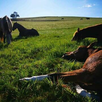
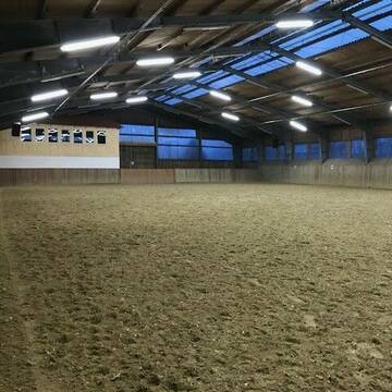
Einstellplatz frei – familiär, sportlich & p...
Remptendorf
Natur Erlebnisstall
@Natur-Erlebnisstall
Freizeitstall
Pferdeausbildung
Vermieten
Hunde willkommen
Krankenbox
Allergikerstall
Fohlenaufzucht möglich
27 weitere...
P
Deprecated: Creation of dynamic property Zend_View_Helper_Ads::$adLink is deprecated in /var/www/stall-frei/htdocs/staging.stall-frei.de/library/Psf/View/Helper/Ads.php on line 108

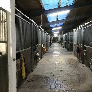
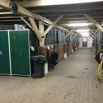
Pferdepension Hit Aktivstall Kürmerhof
Hohenkammer
Kuermerhof
@Kuermerhof
*******JETZT NEU MIT ENTSTAUBTEM BIOHEU*********
*******Demnächst mit einem Abenteuerspielplatz für Pferde ( Extrem Trail/Pa
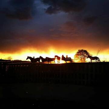


Offenstall/Laufstall/Paddocktrail FREI
Wurzbach
Sarah-Kreuter
@Sarah-Kreuter
Freizeitstall
Gangpferdereiten
Vermieten
Hunde willkommen
Krankenbox
Allergikerstall
Fohlenaufzucht möglich
39 weitere...
P+
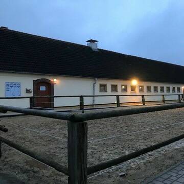
Reitverein Heideland e.V.
Heideland OT Etzdorf
Reitverein-Heideland-e-V
@Reitverein-Heideland-e-V
Fahrstall, Kutschwagen
FN-Mitglied
Vermieten
Hunde willkommen
Krankenbox
Allergikerstall
Gnadenbrothof
34 weitere...
S
Leider kein Vorschaubild
Leider kein Vorschaubild
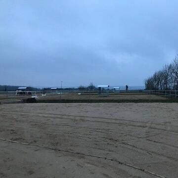
Offenstallplatz mit Unterstand
Berga / Elster
Leah Imkeit
@Leah3
Freizeitstall
Wanderreiten
Vermieten
Hunde willkommen
Sommerweide
Gnadenbrothof
Notfallboxen
5 weitere...
aktuell
B

Freizeitreiter-Hof
Bayern - Hof
Janett
@Janett
FN-Mitglied
Freizeitstall
Vermieten
Hunde willkommen
Longierzirkel/Roundpen
Außenbox mit Paddock
Außenboxen
20 weitere...
P
Leider kein Vorschaubild
Leider kein Vorschaubild
1 Offenstallplatz frei 24/7 Heu, Reitplatz
Berg
Bettina Hofmann
@BettinaHofmann
Vermieten
Longierzirkel/Roundpen
Paddock
Hufrehe geeignet
Innenbox
Offenstall
9 weitere...
B

Heu und Heulage verkaufen
Mechtersen
STALL-FREIde Marketing
@STALL-FREI-Marketing
Verkaufen Sie Ihr Heu und Ihre Heulage direkt an Reiter, Pferdeställe und Reitanlagen
Leider kein Vorschaubild
Leider kein Vorschaubild
Offenstallplätze frei / auch Rehepferd
Berg
Bettina Hofmann
@BettinaHofmann
Freizeitstall
Reitlehrer und -unterricht
Vermieten
Longierzirkel/Roundpen
Paddock
Hufrehe geeignet
Notfallboxen
11 weitere...
B
Leider kein Vorschaubild
Leider kein Vorschaubild
Einstellplatz frei.
Berga-Wünschendorf
ISARO-HILL-RANCH
@ISARO-HILL-RANCH
FN-Mitglied
Freizeitstall
Longierzirkel/Roundpen
Parkplatz für Pferdeanhänger
Fohlenaufzucht möglich
Außenboxen
Innenbox
19 weitere...
B
Leider kein Vorschaubild
Leider kein Vorschaubild
Paddockbox
Lichtenberg
reiterhof-doerflas
@reiterhof-doerflas
Freizeitstall
Vermieten
Hunde willkommen
Paddock
Außenbox mit Paddock
12 weitere...
B
Leider kein Vorschaubild
Leider kein Vorschaubild
Offenstall
Lichtenberg
reiterhof-doerflas
@reiterhof-doerflas
Freizeitstall
Vermieten
Hunde willkommen
Krankenbox
Notfallboxen
15 weitere...
B
Deprecated: Creation of dynamic property Zend_View::$pageCount is deprecated in /var/www/stall-frei/htdocs/staging.stall-frei.de/library/vendor/shardj/zf1-future/library/Zend/View/Abstract.php on line 308
Deprecated: Creation of dynamic property Zend_View::$itemCountPerPage is deprecated in /var/www/stall-frei/htdocs/staging.stall-frei.de/library/vendor/shardj/zf1-future/library/Zend/View/Abstract.php on line 308
Deprecated: Creation of dynamic property Zend_View::$first is deprecated in /var/www/stall-frei/htdocs/staging.stall-frei.de/library/vendor/shardj/zf1-future/library/Zend/View/Abstract.php on line 308
Deprecated: Creation of dynamic property Zend_View::$current is deprecated in /var/www/stall-frei/htdocs/staging.stall-frei.de/library/vendor/shardj/zf1-future/library/Zend/View/Abstract.php on line 308
Deprecated: Creation of dynamic property Zend_View::$last is deprecated in /var/www/stall-frei/htdocs/staging.stall-frei.de/library/vendor/shardj/zf1-future/library/Zend/View/Abstract.php on line 308
Deprecated: Creation of dynamic property Zend_View::$next is deprecated in /var/www/stall-frei/htdocs/staging.stall-frei.de/library/vendor/shardj/zf1-future/library/Zend/View/Abstract.php on line 308
Deprecated: Creation of dynamic property Zend_View::$pagesInRange is deprecated in /var/www/stall-frei/htdocs/staging.stall-frei.de/library/vendor/shardj/zf1-future/library/Zend/View/Abstract.php on line 308
Deprecated: Creation of dynamic property Zend_View::$firstPageInRange is deprecated in /var/www/stall-frei/htdocs/staging.stall-frei.de/library/vendor/shardj/zf1-future/library/Zend/View/Abstract.php on line 308
Deprecated: Creation of dynamic property Zend_View::$lastPageInRange is deprecated in /var/www/stall-frei/htdocs/staging.stall-frei.de/library/vendor/shardj/zf1-future/library/Zend/View/Abstract.php on line 308
Deprecated: Creation of dynamic property Zend_View::$currentItemCount is deprecated in /var/www/stall-frei/htdocs/staging.stall-frei.de/library/vendor/shardj/zf1-future/library/Zend/View/Abstract.php on line 308
Deprecated: Creation of dynamic property Zend_View::$totalItemCount is deprecated in /var/www/stall-frei/htdocs/staging.stall-frei.de/library/vendor/shardj/zf1-future/library/Zend/View/Abstract.php on line 308
Deprecated: Creation of dynamic property Zend_View::$firstItemNumber is deprecated in /var/www/stall-frei/htdocs/staging.stall-frei.de/library/vendor/shardj/zf1-future/library/Zend/View/Abstract.php on line 308
Deprecated: Creation of dynamic property Zend_View::$lastItemNumber is deprecated in /var/www/stall-frei/htdocs/staging.stall-frei.de/library/vendor/shardj/zf1-future/library/Zend/View/Abstract.php on line 308
Deprecated: Creation of dynamic property Zend_View::$router is deprecated in /var/www/stall-frei/htdocs/staging.stall-frei.de/library/vendor/shardj/zf1-future/library/Zend/View/Abstract.php on line 308
Deprecated: Creation of dynamic property Zend_View::$urlParams is deprecated in /var/www/stall-frei/htdocs/staging.stall-frei.de/library/vendor/shardj/zf1-future/library/Zend/View/Abstract.php on line 308
Deprecated: Creation of dynamic property Zend_View::$showAds is deprecated in /var/www/stall-frei/htdocs/staging.stall-frei.de/library/vendor/shardj/zf1-future/library/Zend/View/Abstract.php on line 308
Deprecated: Creation of dynamic property Zend_View::$objectIds is deprecated in /var/www/stall-frei/htdocs/staging.stall-frei.de/library/vendor/shardj/zf1-future/library/Zend/View/Abstract.php on line 308
Deprecated: Creation of dynamic property Zend_View::$showNavbar is deprecated in /var/www/stall-frei/htdocs/staging.stall-frei.de/library/vendor/shardj/zf1-future/library/Zend/View/Abstract.php on line 308
Deprecated: Creation of dynamic property Zend_View::$showBreadcrumb is deprecated in /var/www/stall-frei/htdocs/staging.stall-frei.de/library/vendor/shardj/zf1-future/library/Zend/View/Abstract.php on line 308
Deprecated: Creation of dynamic property Zend_View::$showFooter is deprecated in /var/www/stall-frei/htdocs/staging.stall-frei.de/library/vendor/shardj/zf1-future/library/Zend/View/Abstract.php on line 308
Deprecated: Creation of dynamic property Zend_View::$showInternalAds is deprecated in /var/www/stall-frei/htdocs/staging.stall-frei.de/library/vendor/shardj/zf1-future/library/Zend/View/Abstract.php on line 308
Deprecated: Creation of dynamic property Zend_View::$blNoContent is deprecated in /var/www/stall-frei/htdocs/staging.stall-frei.de/library/vendor/shardj/zf1-future/library/Zend/View/Abstract.php on line 308
Deprecated: Creation of dynamic property Zend_View::$sMetaDesc is deprecated in /var/www/stall-frei/htdocs/staging.stall-frei.de/library/vendor/shardj/zf1-future/library/Zend/View/Abstract.php on line 308
Deprecated: Creation of dynamic property Zend_View::$useGmaps is deprecated in /var/www/stall-frei/htdocs/staging.stall-frei.de/library/vendor/shardj/zf1-future/library/Zend/View/Abstract.php on line 308
Deprecated: Creation of dynamic property Zend_View::$touches is deprecated in /var/www/stall-frei/htdocs/staging.stall-frei.de/library/vendor/shardj/zf1-future/library/Zend/View/Abstract.php on line 308
Deprecated: Creation of dynamic property Zend_View::$oProject is deprecated in /var/www/stall-frei/htdocs/staging.stall-frei.de/library/vendor/shardj/zf1-future/library/Zend/View/Abstract.php on line 308
Deprecated: Creation of dynamic property Zend_View::$pageHeadline is deprecated in /var/www/stall-frei/htdocs/staging.stall-frei.de/library/vendor/shardj/zf1-future/library/Zend/View/Abstract.php on line 308
Deprecated: Creation of dynamic property Zend_View::$disableLocationField is deprecated in /var/www/stall-frei/htdocs/staging.stall-frei.de/library/vendor/shardj/zf1-future/library/Zend/View/Abstract.php on line 308
Deprecated: Creation of dynamic property Zend_View::$isSearch is deprecated in /var/www/stall-frei/htdocs/staging.stall-frei.de/library/vendor/shardj/zf1-future/library/Zend/View/Abstract.php on line 308
Deprecated: Creation of dynamic property Zend_View::$pageTitle is deprecated in /var/www/stall-frei/htdocs/staging.stall-frei.de/library/vendor/shardj/zf1-future/library/Zend/View/Abstract.php on line 308
Deprecated: Creation of dynamic property Psf_Form_Element_Text::$class is deprecated in /var/www/stall-frei/htdocs/staging.stall-frei.de/library/vendor/shardj/zf1-future/library/Zend/Form/Element.php on line 874
Deprecated: Creation of dynamic property Psf_Form_Element_Text::$size is deprecated in /var/www/stall-frei/htdocs/staging.stall-frei.de/library/vendor/shardj/zf1-future/library/Zend/Form/Element.php on line 874
Deprecated: Creation of dynamic property Psf_Form_Element_Text::$placeholder is deprecated in /var/www/stall-frei/htdocs/staging.stall-frei.de/library/vendor/shardj/zf1-future/library/Zend/Form/Element.php on line 874
Deprecated: Creation of dynamic property Psf_Form_Element_Hidden::$class is deprecated in /var/www/stall-frei/htdocs/staging.stall-frei.de/library/vendor/shardj/zf1-future/library/Zend/Form/Element.php on line 874
Deprecated: Creation of dynamic property Psf_Form_Element_Hidden::$class is deprecated in /var/www/stall-frei/htdocs/staging.stall-frei.de/library/vendor/shardj/zf1-future/library/Zend/Form/Element.php on line 874
Deprecated: Creation of dynamic property Psf_Form_Element_Hidden::$class is deprecated in /var/www/stall-frei/htdocs/staging.stall-frei.de/library/vendor/shardj/zf1-future/library/Zend/Form/Element.php on line 874
Deprecated: Creation of dynamic property Psf_Form_Element_Hidden::$class is deprecated in /var/www/stall-frei/htdocs/staging.stall-frei.de/library/vendor/shardj/zf1-future/library/Zend/Form/Element.php on line 874
Deprecated: Creation of dynamic property Psf_Form_Element_Select::$class is deprecated in /var/www/stall-frei/htdocs/staging.stall-frei.de/library/vendor/shardj/zf1-future/library/Zend/Form/Element.php on line 874
Deprecated: Creation of dynamic property Psf_Form_Element_Select::$class is deprecated in /var/www/stall-frei/htdocs/staging.stall-frei.de/library/vendor/shardj/zf1-future/library/Zend/Form/Element.php on line 874
Deprecated: Creation of dynamic property Psf_Form_Element_Select::$class is deprecated in /var/www/stall-frei/htdocs/staging.stall-frei.de/library/vendor/shardj/zf1-future/library/Zend/Form/Element.php on line 874
Deprecated: Creation of dynamic property Psf_Form_Element_Select::$class is deprecated in /var/www/stall-frei/htdocs/staging.stall-frei.de/library/vendor/shardj/zf1-future/library/Zend/Form/Element.php on line 874
Deprecated: Creation of dynamic property Psf_Form_Element_Text::$class is deprecated in /var/www/stall-frei/htdocs/staging.stall-frei.de/library/vendor/shardj/zf1-future/library/Zend/Form/Element.php on line 874
Deprecated: Creation of dynamic property Psf_Form_Element_Checkbox::$label is deprecated in /var/www/stall-frei/htdocs/staging.stall-frei.de/library/vendor/shardj/zf1-future/library/Zend/Form/Element.php on line 874
Deprecated: Creation of dynamic property Zend_View::$sort is deprecated in /var/www/stall-frei/htdocs/staging.stall-frei.de/library/vendor/shardj/zf1-future/library/Zend/View/Abstract.php on line 308
Deprecated: Creation of dynamic property Zend_View::$searchLocation is deprecated in /var/www/stall-frei/htdocs/staging.stall-frei.de/library/vendor/shardj/zf1-future/library/Zend/View/Abstract.php on line 308
Deprecated: Creation of dynamic property Zend_View::$locationHint is deprecated in /var/www/stall-frei/htdocs/staging.stall-frei.de/library/vendor/shardj/zf1-future/library/Zend/View/Abstract.php on line 308
Psf_GeoCoder_Abstract::getLocation: Löhma Get Location CachedOrLive
Psf_GeoCoder_Abstract::getCachedOrLive: Löhma
Psf_GeoCoder_OpenCageData::makeApiRequest: response:
Array
(
[documentation] => https://opencagedata.com/api
[licenses] => Array
(
[0] => Array
(
[name] => see attribution guide
[url] => https://opencagedata.com/credits
)
)
[results] => Array
(
[0] => Array
(
[bounds] => Array
(
[northeast] => Array
(
[lat] => 50.6382608
[lng] => 11.8825568
)
[southwest] => Array
(
[lat] => 50.5838478
[lng] => 11.8185614
)
)
[components] => Array
(
[ISO_3166-1_alpha-2] => DE
[ISO_3166-1_alpha-3] => DEU
[ISO_3166-2] => Array
(
[0] => DE-TH
)
[_category] => place
[_normalized_city] => Löhma
[_type] => village
[continent] => Europe
[country] => Deutschland
[country_code] => de
[county] => Saale-Orla-Kreis
[municipality] => Seenplatte
[political_union] => European Union
[state] => Thüringen
[state_code] => TH
[village] => Löhma
)
[confidence] => 7
[formatted] => Löhma, Thüringen, Deutschland
[geometry] => Array
(
[lat] => 50.6125335
[lng] => 11.8510929
)
)
[1] => Array
(
[bounds] => Array
(
[northeast] => Array
(
[lat] => 50.6114449
[lng] => 11.4830427
)
[southwest] => Array
(
[lat] => 50.5714449
[lng] => 11.4430427
)
)
[components] => Array
(
[ISO_3166-1_alpha-2] => DE
[ISO_3166-1_alpha-3] => DEU
[ISO_3166-2] => Array
(
[0] => DE-TH
)
[_category] => place
[_normalized_city] => Leutenberg
[_type] => hamlet
[continent] => Europe
[country] => Deutschland
[country_code] => de
[county] => Landkreis Saalfeld-Rudolstadt
[hamlet] => Löhma
[municipality] => Leutenberg
[political_union] => European Union
[postcode] => 07338
[state] => Thüringen
[state_code] => TH
)
[confidence] => 7
[formatted] => Löhma, 07338 Leutenberg, Deutschland
[geometry] => Array
(
[lat] => 50.5914449
[lng] => 11.4630427
)
)
[2] => Array
(
[bounds] => Array
(
[northeast] => Array
(
[lat] => 50.9040926
[lng] => 12.3090357
)
[southwest] => Array
(
[lat] => 50.8640926
[lng] => 12.2690357
)
)
[components] => Array
(
[ISO_3166-1_alpha-2] => DE
[ISO_3166-1_alpha-3] => DEU
[ISO_3166-2] => Array
(
[0] => DE-TH
)
[_category] => place
[_normalized_city] => Schmölln
[_type] => city
[continent] => Europe
[country] => Deutschland
[country_code] => de
[county] => Altenburger Land
[political_union] => European Union
[postcode] => 04626
[state] => Thüringen
[state_code] => TH
[town] => Schmölln
)
[confidence] => 7
[formatted] => 04626 Schmölln, Deutschland
[geometry] => Array
(
[lat] => 50.8840926
[lng] => 12.2890357
)
)
[3] => Array
(
[components] => Array
(
[ISO_3166-1_alpha-2] => FR
[ISO_3166-1_alpha-3] => FRA
[ISO_3166-2] => Array
(
[0] => FR-NAQ
[1] => FR-19
)
[_category] => road
[_normalized_city] => Le Pescher
[_type] => road
[city] => Le Pescher
[continent] => Europe
[country] => France
[country_code] => fr
[county] => Corrèze
[local_authority] => Communauté de communes Midi Corrézien
[political_union] => European Union
[postcode] => 19190
[road] => route de lama
[state] => Nouvelle-Aquitaine
[state_code] => NAQ
)
[confidence] => 2
[formatted] => route de lama, 19190 Le Pescher, France
[geometry] => Array
(
[lat] => 45.071085
[lng] => 1.752207
)
)
[4] => Array
(
[components] => Array
(
[ISO_3166-1_alpha-2] => FR
[ISO_3166-1_alpha-3] => FRA
[ISO_3166-2] => Array
(
[0] => FR-OCC
[1] => FR-32
)
[_category] => road
[_normalized_city] => Marsan
[_type] => road
[city] => Marsan
[continent] => Europe
[country] => France
[country_code] => fr
[county] => Gers
[local_authority] => Communauté de communes des Coteaux Arrats Gimone
[political_union] => European Union
[postcode] => 32270
[road] => Route de Lama
[state] => Occitanie
[state_code] => OCC
)
[confidence] => 2
[formatted] => Route de Lama, 32270 Marsan, France
[geometry] => Array
(
[lat] => 43.652514
[lng] => 0.721833
)
)
[5] => Array
(
[components] => Array
(
[ISO_3166-1_alpha-2] => FR
[ISO_3166-1_alpha-3] => FRA
[ISO_3166-2] => Array
(
[0] => FR-NAQ
[1] => FR-24
)
[_category] => road
[_normalized_city] => Coulaures
[_type] => road
[city] => Coulaures
[continent] => Europe
[country] => France
[country_code] => fr
[county] => Dordogne
[local_authority] => Communauté de communes Isle-Loue-Auvézère en Périgord
[political_union] => European Union
[postcode] => 24420
[road] => Route de Lamas
[state] => Nouvelle-Aquitaine
[state_code] => NAQ
)
[confidence] => 2
[formatted] => Route de Lamas, 24420 Coulaures, France
[geometry] => Array
(
[lat] => 45.288763
[lng] => 1.026581
)
)
[6] => Array
(
[components] => Array
(
[ISO_3166-1_alpha-2] => FR
[ISO_3166-1_alpha-3] => FRA
[ISO_3166-2] => Array
(
[0] => FR-NAQ
[1] => FR-24
)
[_category] => road
[_normalized_city] => Tourtoirac
[_type] => road
[city] => Tourtoirac
[continent] => Europe
[country] => France
[country_code] => fr
[county] => Dordogne
[local_authority] => Communauté de communes Terrassonnais Haut Périgord Noir
[political_union] => European Union
[postcode] => 24390
[road] => Route de Lamas
[state] => Nouvelle-Aquitaine
[state_code] => NAQ
)
[confidence] => 2
[formatted] => Route de Lamas, 24390 Tourtoirac, France
[geometry] => Array
(
[lat] => 45.289649
[lng] => 1.028461
)
)
[7] => Array
(
[components] => Array
(
[ISO_3166-1_alpha-2] => FR
[ISO_3166-1_alpha-3] => FRA
[ISO_3166-2] => Array
(
[0] => FR-HDF
[1] => FR-60
)
[_category] => road
[_normalized_city] => Précy-sur-Oise
[_type] => road
[city] => Précy-sur-Oise
[continent] => Europe
[country] => France
[country_code] => fr
[county] => Oise
[local_authority] => Communauté de communes Thelloise
[political_union] => European Union
[postcode] => 60460
[road] => Chemin des Lamas
[state] => Hauts-de-France
[state_code] => HDF
)
[confidence] => 2
[formatted] => Chemin des Lamas, 60460 Précy-sur-Oise, France
[geometry] => Array
(
[lat] => 49.211605
[lng] => 2.379727
)
)
[8] => Array
(
[components] => Array
(
[ISO_3166-1_alpha-2] => FR
[ISO_3166-1_alpha-3] => FRA
[ISO_3166-2] => Array
(
[0] => FR-OCC
[1] => FR-82
)
[_category] => road
[_normalized_city] => Asques
[_type] => road
[city] => Asques
[continent] => Europe
[country] => France
[country_code] => fr
[county] => Tarn-et-Garonne
[local_authority] => Communauté de communes de la Lomagne Tarn et Garonnaise
[political_union] => European Union
[postcode] => 82120
[road] => Chemin de Lamat
[state] => Occitanie
[state_code] => OCC
)
[confidence] => 2
[formatted] => Chemin de Lamat, 82120 Asques, France
[geometry] => Array
(
[lat] => 43.991778
[lng] => 0.960648
)
)
[9] => Array
(
[components] => Array
(
[ISO_3166-1_alpha-2] => FR
[ISO_3166-1_alpha-3] => FRA
[ISO_3166-2] => Array
(
[0] => FR-20R
[1] => FR-2B
)
[_category] => place
[_normalized_city] => Prunelli-di-Fiumorbo
[_type] => place
[city] => Prunelli-di-Fiumorbo
[continent] => Europe
[country] => France
[country_code] => fr
[county] => Haute-Corse
[local_authority] => Communauté de communes de Fium'orbu Castellu
[place] => Lama Vechja
[political_union] => European Union
[postcode] => 20243
[state] => Corse
[state_code] => COR
)
[confidence] => 2
[formatted] => Lama Vechja, 20243 Prunelli-di-Fiumorbo, France
[geometry] => Array
(
[lat] => 42.033302
[lng] => 9.34095
)
)
)
[status] => Array
(
[code] => 200
[message] => OK
)
[stay_informed] => Array
(
[blog] => https://blog.opencagedata.com
[mastodon] => https://en.osm.town/@opencage
)
[thanks] => For using an OpenCage API
[timestamp] => Array
(
[created_http] => Sun, 08 Feb 2026 10:59:14 GMT
[created_unix] => 1770548354
)
[total_results] => 10
)
Psf_GeoCoder_Abstract::convertLocationResult
{"documentation":"https:\/\/opencagedata.com\/api","licenses":[{"name":"see attribution guide","url":"https:\/\/opencagedata.com\/credits"}],"results":[{"bounds":{"northeast":{"lat":50.6382608,"lng":11.8825568},"southwest":{"lat":50.5838478,"lng":11.8185614}},"components":{"ISO_3166-1_alpha-2":"DE","ISO_3166-1_alpha-3":"DEU","ISO_3166-2":["DE-TH"],"_category":"place","_normalized_city":"L\u00f6hma","_type":"village","continent":"Europe","country":"Deutschland","country_code":"de","county":"Saale-Orla-Kreis","municipality":"Seenplatte","political_union":"European Union","state":"Th\u00fcringen","state_code":"TH","village":"L\u00f6hma"},"confidence":7,"formatted":"L\u00f6hma, Th\u00fcringen, Deutschland","geometry":{"lat":50.6125335,"lng":11.8510929}},{"bounds":{"northeast":{"lat":50.6114449,"lng":11.4830427},"southwest":{"lat":50.5714449,"lng":11.4430427}},"components":{"ISO_3166-1_alpha-2":"DE","ISO_3166-1_alpha-3":"DEU","ISO_3166-2":["DE-TH"],"_category":"place","_normalized_city":"Leutenberg","_type":"hamlet","continent":"Europe","country":"Deutschland","country_code":"de","county":"Landkreis Saalfeld-Rudolstadt","hamlet":"L\u00f6hma","municipality":"Leutenberg","political_union":"European Union","postcode":"07338","state":"Th\u00fcringen","state_code":"TH"},"confidence":7,"formatted":"L\u00f6hma, 07338 Leutenberg, Deutschland","geometry":{"lat":50.5914449,"lng":11.4630427}},{"bounds":{"northeast":{"lat":50.9040926,"lng":12.3090357},"southwest":{"lat":50.8640926,"lng":12.2690357}},"components":{"ISO_3166-1_alpha-2":"DE","ISO_3166-1_alpha-3":"DEU","ISO_3166-2":["DE-TH"],"_category":"place","_normalized_city":"Schm\u00f6lln","_type":"city","continent":"Europe","country":"Deutschland","country_code":"de","county":"Altenburger Land","political_union":"European Union","postcode":"04626","state":"Th\u00fcringen","state_code":"TH","town":"Schm\u00f6lln"},"confidence":7,"formatted":"04626 Schm\u00f6lln, Deutschland","geometry":{"lat":50.8840926,"lng":12.2890357}},{"components":{"ISO_3166-1_alpha-2":"FR","ISO_3166-1_alpha-3":"FRA","ISO_3166-2":["FR-NAQ","FR-19"],"_category":"road","_normalized_city":"Le Pescher","_type":"road","city":"Le Pescher","continent":"Europe","country":"France","country_code":"fr","county":"Corr\u00e8ze","local_authority":"Communaut\u00e9 de communes Midi Corr\u00e9zien","political_union":"European Union","postcode":"19190","road":"route de lama","state":"Nouvelle-Aquitaine","state_code":"NAQ"},"confidence":2,"formatted":"route de lama, 19190 Le Pescher, France","geometry":{"lat":45.071085,"lng":1.752207}},{"components":{"ISO_3166-1_alpha-2":"FR","ISO_3166-1_alpha-3":"FRA","ISO_3166-2":["FR-OCC","FR-32"],"_category":"road","_normalized_city":"Marsan","_type":"road","city":"Marsan","continent":"Europe","country":"France","country_code":"fr","county":"Gers","local_authority":"Communaut\u00e9 de communes des Coteaux Arrats Gimone","political_union":"European Union","postcode":"32270","road":"Route de Lama","state":"Occitanie","state_code":"OCC"},"confidence":2,"formatted":"Route de Lama, 32270 Marsan, France","geometry":{"lat":43.652514,"lng":0.721833}},{"components":{"ISO_3166-1_alpha-2":"FR","ISO_3166-1_alpha-3":"FRA","ISO_3166-2":["FR-NAQ","FR-24"],"_category":"road","_normalized_city":"Coulaures","_type":"road","city":"Coulaures","continent":"Europe","country":"France","country_code":"fr","county":"Dordogne","local_authority":"Communaut\u00e9 de communes Isle-Loue-Auv\u00e9z\u00e8re en P\u00e9rigord","political_union":"European Union","postcode":"24420","road":"Route de Lamas","state":"Nouvelle-Aquitaine","state_code":"NAQ"},"confidence":2,"formatted":"Route de Lamas, 24420 Coulaures, France","geometry":{"lat":45.288763,"lng":1.026581}},{"components":{"ISO_3166-1_alpha-2":"FR","ISO_3166-1_alpha-3":"FRA","ISO_3166-2":["FR-NAQ","FR-24"],"_category":"road","_normalized_city":"Tourtoirac","_type":"road","city":"Tourtoirac","continent":"Europe","country":"France","country_code":"fr","county":"Dordogne","local_authority":"Communaut\u00e9 de communes Terrassonnais Haut P\u00e9rigord Noir","political_union":"European Union","postcode":"24390","road":"Route de Lamas","state":"Nouvelle-Aquitaine","state_code":"NAQ"},"confidence":2,"formatted":"Route de Lamas, 24390 Tourtoirac, France","geometry":{"lat":45.289649,"lng":1.028461}},{"components":{"ISO_3166-1_alpha-2":"FR","ISO_3166-1_alpha-3":"FRA","ISO_3166-2":["FR-HDF","FR-60"],"_category":"road","_normalized_city":"Pr\u00e9cy-sur-Oise","_type":"road","city":"Pr\u00e9cy-sur-Oise","continent":"Europe","country":"France","country_code":"fr","county":"Oise","local_authority":"Communaut\u00e9 de communes Thelloise","political_union":"European Union","postcode":"60460","road":"Chemin des Lamas","state":"Hauts-de-France","state_code":"HDF"},"confidence":2,"formatted":"Chemin des Lamas, 60460 Pr\u00e9cy-sur-Oise, France","geometry":{"lat":49.211605,"lng":2.379727}},{"components":{"ISO_3166-1_alpha-2":"FR","ISO_3166-1_alpha-3":"FRA","ISO_3166-2":["FR-OCC","FR-82"],"_category":"road","_normalized_city":"Asques","_type":"road","city":"Asques","continent":"Europe","country":"France","country_code":"fr","county":"Tarn-et-Garonne","local_authority":"Communaut\u00e9 de communes de la Lomagne Tarn et Garonnaise","political_union":"European Union","postcode":"82120","road":"Chemin de Lamat","state":"Occitanie","state_code":"OCC"},"confidence":2,"formatted":"Chemin de Lamat, 82120 Asques, France","geometry":{"lat":43.991778,"lng":0.960648}},{"components":{"ISO_3166-1_alpha-2":"FR","ISO_3166-1_alpha-3":"FRA","ISO_3166-2":["FR-20R","FR-2B"],"_category":"place","_normalized_city":"Prunelli-di-Fiumorbo","_type":"place","city":"Prunelli-di-Fiumorbo","continent":"Europe","country":"France","country_code":"fr","county":"Haute-Corse","local_authority":"Communaut\u00e9 de communes de Fium'orbu Castellu","place":"Lama Vechja","political_union":"European Union","postcode":"20243","state":"Corse","state_code":"COR"},"confidence":2,"formatted":"Lama Vechja, 20243 Prunelli-di-Fiumorbo, France","geometry":{"lat":42.033302,"lng":9.34095}}],"status":{"code":200,"message":"OK"},"stay_informed":{"blog":"https:\/\/blog.opencagedata.com","mastodon":"https:\/\/en.osm.town\/@opencage"},"thanks":"For using an OpenCage API","timestamp":{"created_http":"Sun, 08 Feb 2026 10:59:14 GMT","created_unix":1770548354},"total_results":10}Array
(
[0] => stdClass Object
(
[bounds] => stdClass Object
(
[northeast] => stdClass Object
(
[lat] => 50.6382608
[lng] => 11.8825568
)
[southwest] => stdClass Object
(
[lat] => 50.5838478
[lng] => 11.8185614
)
)
[components] => stdClass Object
(
[ISO_3166-1_alpha-2] => DE
[ISO_3166-1_alpha-3] => DEU
[ISO_3166-2] => Array
(
[0] => DE-TH
)
[_category] => place
[_normalized_city] => Löhma
[_type] => village
[continent] => Europe
[country] => Deutschland
[country_code] => de
[county] => Saale-Orla-Kreis
[municipality] => Seenplatte
[political_union] => European Union
[state] => Thüringen
[state_code] => TH
[village] => Löhma
)
[confidence] => 7
[formatted] => Löhma, Thüringen, Deutschland
[geometry] => stdClass Object
(
[lat] => 50.6125335
[lng] => 11.8510929
)
)
[1] => stdClass Object
(
[bounds] => stdClass Object
(
[northeast] => stdClass Object
(
[lat] => 50.6114449
[lng] => 11.4830427
)
[southwest] => stdClass Object
(
[lat] => 50.5714449
[lng] => 11.4430427
)
)
[components] => stdClass Object
(
[ISO_3166-1_alpha-2] => DE
[ISO_3166-1_alpha-3] => DEU
[ISO_3166-2] => Array
(
[0] => DE-TH
)
[_category] => place
[_normalized_city] => Leutenberg
[_type] => hamlet
[continent] => Europe
[country] => Deutschland
[country_code] => de
[county] => Landkreis Saalfeld-Rudolstadt
[hamlet] => Löhma
[municipality] => Leutenberg
[political_union] => European Union
[postcode] => 07338
[state] => Thüringen
[state_code] => TH
)
[confidence] => 7
[formatted] => Löhma, 07338 Leutenberg, Deutschland
[geometry] => stdClass Object
(
[lat] => 50.5914449
[lng] => 11.4630427
)
)
[2] => stdClass Object
(
[bounds] => stdClass Object
(
[northeast] => stdClass Object
(
[lat] => 50.9040926
[lng] => 12.3090357
)
[southwest] => stdClass Object
(
[lat] => 50.8640926
[lng] => 12.2690357
)
)
[components] => stdClass Object
(
[ISO_3166-1_alpha-2] => DE
[ISO_3166-1_alpha-3] => DEU
[ISO_3166-2] => Array
(
[0] => DE-TH
)
[_category] => place
[_normalized_city] => Schmölln
[_type] => city
[continent] => Europe
[country] => Deutschland
[country_code] => de
[county] => Altenburger Land
[political_union] => European Union
[postcode] => 04626
[state] => Thüringen
[state_code] => TH
[town] => Schmölln
)
[confidence] => 7
[formatted] => 04626 Schmölln, Deutschland
[geometry] => stdClass Object
(
[lat] => 50.8840926
[lng] => 12.2890357
)
)
[3] => stdClass Object
(
[components] => stdClass Object
(
[ISO_3166-1_alpha-2] => FR
[ISO_3166-1_alpha-3] => FRA
[ISO_3166-2] => Array
(
[0] => FR-NAQ
[1] => FR-19
)
[_category] => road
[_normalized_city] => Le Pescher
[_type] => road
[city] => Le Pescher
[continent] => Europe
[country] => France
[country_code] => fr
[county] => Corrèze
[local_authority] => Communauté de communes Midi Corrézien
[political_union] => European Union
[postcode] => 19190
[road] => route de lama
[state] => Nouvelle-Aquitaine
[state_code] => NAQ
)
[confidence] => 2
[formatted] => route de lama, 19190 Le Pescher, France
[geometry] => stdClass Object
(
[lat] => 45.071085
[lng] => 1.752207
)
)
[4] => stdClass Object
(
[components] => stdClass Object
(
[ISO_3166-1_alpha-2] => FR
[ISO_3166-1_alpha-3] => FRA
[ISO_3166-2] => Array
(
[0] => FR-OCC
[1] => FR-32
)
[_category] => road
[_normalized_city] => Marsan
[_type] => road
[city] => Marsan
[continent] => Europe
[country] => France
[country_code] => fr
[county] => Gers
[local_authority] => Communauté de communes des Coteaux Arrats Gimone
[political_union] => European Union
[postcode] => 32270
[road] => Route de Lama
[state] => Occitanie
[state_code] => OCC
)
[confidence] => 2
[formatted] => Route de Lama, 32270 Marsan, France
[geometry] => stdClass Object
(
[lat] => 43.652514
[lng] => 0.721833
)
)
[5] => stdClass Object
(
[components] => stdClass Object
(
[ISO_3166-1_alpha-2] => FR
[ISO_3166-1_alpha-3] => FRA
[ISO_3166-2] => Array
(
[0] => FR-NAQ
[1] => FR-24
)
[_category] => road
[_normalized_city] => Coulaures
[_type] => road
[city] => Coulaures
[continent] => Europe
[country] => France
[country_code] => fr
[county] => Dordogne
[local_authority] => Communauté de communes Isle-Loue-Auvézère en Périgord
[political_union] => European Union
[postcode] => 24420
[road] => Route de Lamas
[state] => Nouvelle-Aquitaine
[state_code] => NAQ
)
[confidence] => 2
[formatted] => Route de Lamas, 24420 Coulaures, France
[geometry] => stdClass Object
(
[lat] => 45.288763
[lng] => 1.026581
)
)
[6] => stdClass Object
(
[components] => stdClass Object
(
[ISO_3166-1_alpha-2] => FR
[ISO_3166-1_alpha-3] => FRA
[ISO_3166-2] => Array
(
[0] => FR-NAQ
[1] => FR-24
)
[_category] => road
[_normalized_city] => Tourtoirac
[_type] => road
[city] => Tourtoirac
[continent] => Europe
[country] => France
[country_code] => fr
[county] => Dordogne
[local_authority] => Communauté de communes Terrassonnais Haut Périgord Noir
[political_union] => European Union
[postcode] => 24390
[road] => Route de Lamas
[state] => Nouvelle-Aquitaine
[state_code] => NAQ
)
[confidence] => 2
[formatted] => Route de Lamas, 24390 Tourtoirac, France
[geometry] => stdClass Object
(
[lat] => 45.289649
[lng] => 1.028461
)
)
[7] => stdClass Object
(
[components] => stdClass Object
(
[ISO_3166-1_alpha-2] => FR
[ISO_3166-1_alpha-3] => FRA
[ISO_3166-2] => Array
(
[0] => FR-HDF
[1] => FR-60
)
[_category] => road
[_normalized_city] => Précy-sur-Oise
[_type] => road
[city] => Précy-sur-Oise
[continent] => Europe
[country] => France
[country_code] => fr
[county] => Oise
[local_authority] => Communauté de communes Thelloise
[political_union] => European Union
[postcode] => 60460
[road] => Chemin des Lamas
[state] => Hauts-de-France
[state_code] => HDF
)
[confidence] => 2
[formatted] => Chemin des Lamas, 60460 Précy-sur-Oise, France
[geometry] => stdClass Object
(
[lat] => 49.211605
[lng] => 2.379727
)
)
[8] => stdClass Object
(
[components] => stdClass Object
(
[ISO_3166-1_alpha-2] => FR
[ISO_3166-1_alpha-3] => FRA
[ISO_3166-2] => Array
(
[0] => FR-OCC
[1] => FR-82
)
[_category] => road
[_normalized_city] => Asques
[_type] => road
[city] => Asques
[continent] => Europe
[country] => France
[country_code] => fr
[county] => Tarn-et-Garonne
[local_authority] => Communauté de communes de la Lomagne Tarn et Garonnaise
[political_union] => European Union
[postcode] => 82120
[road] => Chemin de Lamat
[state] => Occitanie
[state_code] => OCC
)
[confidence] => 2
[formatted] => Chemin de Lamat, 82120 Asques, France
[geometry] => stdClass Object
(
[lat] => 43.991778
[lng] => 0.960648
)
)
[9] => stdClass Object
(
[components] => stdClass Object
(
[ISO_3166-1_alpha-2] => FR
[ISO_3166-1_alpha-3] => FRA
[ISO_3166-2] => Array
(
[0] => FR-20R
[1] => FR-2B
)
[_category] => place
[_normalized_city] => Prunelli-di-Fiumorbo
[_type] => place
[city] => Prunelli-di-Fiumorbo
[continent] => Europe
[country] => France
[country_code] => fr
[county] => Haute-Corse
[local_authority] => Communauté de communes de Fium'orbu Castellu
[place] => Lama Vechja
[political_union] => European Union
[postcode] => 20243
[state] => Corse
[state_code] => COR
)
[confidence] => 2
[formatted] => Lama Vechja, 20243 Prunelli-di-Fiumorbo, France
[geometry] => stdClass Object
(
[lat] => 42.033302
[lng] => 9.34095
)
)
)
Psf_GeoCoder_OpenCageData::getKeyMap: 0
stdClass Object
(
    [bounds] => stdClass Object
        (
            [northeast] => stdClass Object
                (
                    [lat] => 50.6382608
                    [lng] => 11.8825568
                )

            [southwest] => stdClass Object
                (
                    [lat] => 50.5838478
                    [lng] => 11.8185614
                )

        )

    [components] => stdClass Object
        (
            [ISO_3166-1_alpha-2] => DE
            [ISO_3166-1_alpha-3] => DEU
            [ISO_3166-2] => Array
                (
                    [0] => DE-TH
                )

            [_category] => place
            [_normalized_city] => Löhma
            [_type] => village
            [continent] => Europe
            [country] => Deutschland
            [country_code] => de
            [county] => Saale-Orla-Kreis
            [municipality] => Seenplatte
            [political_union] => European Union
            [state] => Thüringen
            [state_code] => TH
            [village] => Löhma
        )

    [confidence] => 7
    [formatted] => Löhma, Thüringen, Deutschland
    [geometry] => stdClass Object
        (
            [lat] => 50.6125335
            [lng] => 11.8510929
        )

)
Psf_GeoCoder_OpenCageData::getCounty: Saale-Orla-Kreis
Psf_GeoCoder_OpenCageData::addMissingData REFETCH!
Array
(
    [address] => Löhma, Thüringen, Deutschland
    [type] => village
    [street] =>
    [city] => Löhma
    [county] => Saale-Orla-Kreis
    [state] => Thüringen
    [zip] =>
    [country] => Deutschland
    [suburb] =>
    [countrycode] => de
    [latitude] => 50.6125335
    [longitude] => 11.8510929
    [accuracy] => 1
    [confidence] => 7
    [bounds] => stdClass Object
        (
            [northeast] => stdClass Object
                (
                    [lat] => 50.6382608
                    [lng] => 11.8825568
                )

            [southwest] => stdClass Object
                (
                    [lat] => 50.5838478
                    [lng] => 11.8185614
                )

        )

)
reformat!
Array
(
    [address] => Löhma, Thüringen, Deutschland
    [type] => village
    [street] =>
    [city] => Löhma
    [county] => Saale-Orla-Kreis
    [state] => Thüringen
    [zip] =>
    [country] => Deutschland
    [suburb] =>
    [countrycode] => de
    [latitude] => 50.6125335
    [longitude] => 11.8510929
    [accuracy] => 1
    [confidence] => 7
    [bounds] => stdClass Object
        (
            [northeast] => stdClass Object
                (
                    [lat] => 50.6382608
                    [lng] => 11.8825568
                )

            [southwest] => stdClass Object
                (
                    [lat] => 50.5838478
                    [lng] => 11.8185614
                )

        )

    [place] => Löhma, Thüringen
    [hash] => e4ab3300acb6a535a04e877003568831
)
Psf_GeoCoder_OpenCageData::getKeyMap: 1
stdClass Object
(
    [bounds] => stdClass Object
        (
            [northeast] => stdClass Object
                (
                    [lat] => 50.6114449
                    [lng] => 11.4830427
                )

            [southwest] => stdClass Object
                (
                    [lat] => 50.5714449
                    [lng] => 11.4430427
                )

        )

    [components] => stdClass Object
        (
            [ISO_3166-1_alpha-2] => DE
            [ISO_3166-1_alpha-3] => DEU
            [ISO_3166-2] => Array
                (
                    [0] => DE-TH
                )

            [_category] => place
            [_normalized_city] => Leutenberg
            [_type] => hamlet
            [continent] => Europe
            [country] => Deutschland
            [country_code] => de
            [county] => Landkreis Saalfeld-Rudolstadt
            [hamlet] => Löhma
            [municipality] => Leutenberg
            [political_union] => European Union
            [postcode] => 07338
            [state] => Thüringen
            [state_code] => TH
        )

    [confidence] => 7
    [formatted] => Löhma, 07338 Leutenberg, Deutschland
    [geometry] => stdClass Object
        (
            [lat] => 50.5914449
            [lng] => 11.4630427
        )

)
Psf_GeoCoder_OpenCageData::getCounty: Saalfeld-Rudolstadt
Psf_GeoCoder_OpenCageData::addMissingData REFETCH!
Array
(
    [address] => Löhma, 07338 Leutenberg, Deutschland
    [type] => hamlet
    [street] => Löhma
    [city] =>
    [county] => Saalfeld-Rudolstadt
    [state] => Thüringen
    [zip] => 07338
    [country] => Deutschland
    [suburb] =>
    [countrycode] => de
    [latitude] => 50.5914449
    [longitude] => 11.4630427
    [accuracy] => 1
    [confidence] => 7
    [bounds] => stdClass Object
        (
            [northeast] => stdClass Object
                (
                    [lat] => 50.6114449
                    [lng] => 11.4830427
                )

            [southwest] => stdClass Object
                (
                    [lat] => 50.5714449
                    [lng] => 11.4430427
                )

        )

)
reformat!
Array
(
    [address] => Löhma, 07338 Leutenberg, Deutschland
    [type] => hamlet
    [street] => Löhma
    [city] =>
    [county] => Saalfeld-Rudolstadt
    [state] => Thüringen
    [zip] => 07338
    [country] => Deutschland
    [suburb] =>
    [countrycode] => de
    [latitude] => 50.5914449
    [longitude] => 11.4630427
    [accuracy] => 1
    [confidence] => 7
    [bounds] => stdClass Object
        (
            [northeast] => stdClass Object
                (
                    [lat] => 50.6114449
                    [lng] => 11.4830427
                )

            [southwest] => stdClass Object
                (
                    [lat] => 50.5714449
                    [lng] => 11.4430427
                )

        )

    [place] => Löhma, 07338 , Thüringen
    [hash] => 0c3226b85a997e1e9e4c885be59ba56c
)
Psf_GeoCoder_OpenCageData::getKeyMap: 2
stdClass Object
(
    [bounds] => stdClass Object
        (
            [northeast] => stdClass Object
                (
                    [lat] => 50.9040926
                    [lng] => 12.3090357
                )

            [southwest] => stdClass Object
                (
                    [lat] => 50.8640926
                    [lng] => 12.2690357
                )

        )

    [components] => stdClass Object
        (
            [ISO_3166-1_alpha-2] => DE
            [ISO_3166-1_alpha-3] => DEU
            [ISO_3166-2] => Array
                (
                    [0] => DE-TH
                )

            [_category] => place
            [_normalized_city] => Schmölln
            [_type] => city
            [continent] => Europe
            [country] => Deutschland
            [country_code] => de
            [county] => Altenburger Land
            [political_union] => European Union
            [postcode] => 04626
            [state] => Thüringen
            [state_code] => TH
            [town] => Schmölln
        )

    [confidence] => 7
    [formatted] => 04626 Schmölln, Deutschland
    [geometry] => stdClass Object
        (
            [lat] => 50.8840926
            [lng] => 12.2890357
        )

)
Psf_GeoCoder_OpenCageData::getCounty: Altenburger Land
Psf_GeoCoder_OpenCageData::addMissingData REFETCH!
Array
(
    [address] => 04626 Schmölln, Deutschland
    [type] => city
    [street] =>
    [city] => Schmölln
    [county] => Altenburger Land
    [state] => Thüringen
    [zip] => 04626
    [country] => Deutschland
    [suburb] =>
    [countrycode] => de
    [latitude] => 50.8840926
    [longitude] => 12.2890357
    [accuracy] => 1
    [confidence] => 7
    [bounds] => stdClass Object
        (
            [northeast] => stdClass Object
                (
                    [lat] => 50.9040926
                    [lng] => 12.3090357
                )

            [southwest] => stdClass Object
                (
                    [lat] => 50.8640926
                    [lng] => 12.2690357
                )

        )

)
reformat!
Array
(
    [address] => 04626 Schmölln, Deutschland
    [type] => city
    [street] =>
    [city] => Schmölln
    [county] => Altenburger Land
    [state] => Thüringen
    [zip] => 04626
    [country] => Deutschland
    [suburb] =>
    [countrycode] => de
    [latitude] => 50.8840926
    [longitude] => 12.2890357
    [accuracy] => 1
    [confidence] => 7
    [bounds] => stdClass Object
        (
            [northeast] => stdClass Object
                (
                    [lat] => 50.9040926
                    [lng] => 12.3090357
                )

            [southwest] => stdClass Object
                (
                    [lat] => 50.8640926
                    [lng] => 12.2690357
                )

        )

    [place] => 04626 Schmölln, Thüringen
    [hash] => 0e9aab2ebbd3bfc7c9d204c39e8115e7
)
Psf_GeoCoder_OpenCageData::getKeyMap: 3
stdClass Object
(
    [components] => stdClass Object
        (
            [ISO_3166-1_alpha-2] => FR
            [ISO_3166-1_alpha-3] => FRA
            [ISO_3166-2] => Array
                (
                    [0] => FR-NAQ
                    [1] => FR-19
                )

            [_category] => road
            [_normalized_city] => Le Pescher
            [_type] => road
            [city] => Le Pescher
            [continent] => Europe
            [country] => France
            [country_code] => fr
            [county] => Corrèze
            [local_authority] => Communauté de communes Midi Corrézien
            [political_union] => European Union
            [postcode] => 19190
            [road] => route de lama
            [state] => Nouvelle-Aquitaine
            [state_code] => NAQ
        )

    [confidence] => 2
    [formatted] => route de lama, 19190 Le Pescher, France
    [geometry] => stdClass Object
        (
            [lat] => 45.071085
            [lng] => 1.752207
        )

)
Psf_GeoCoder_OpenCageData::getCounty: Corrèze
Psf_GeoCoder_OpenCageData::addMissingData REFETCH!
Array
(
    [address] => route de lama, 19190 Le Pescher, France
    [type] => road
    [street] => route de lama
    [city] => Le Pescher
    [county] => Corrèze
    [state] => Nouvelle-Aquitaine
    [zip] => 19190
    [country] => France
    [suburb] =>
    [countrycode] => fr
    [latitude] => 45.071085
    [longitude] => 1.752207
    [accuracy] => 1
    [confidence] => 2
    [bounds] =>
)
reformat!
Array
(
    [address] => route de lama, 19190 Le Pescher, France
    [type] => road
    [street] => route de lama
    [city] => Le Pescher
    [county] => Corrèze
    [state] => Nouvelle-Aquitaine
    [zip] => 19190
    [country] => France
    [suburb] =>
    [countrycode] => fr
    [latitude] => 45.071085
    [longitude] => 1.752207
    [accuracy] => 1
    [confidence] => 2
    [bounds] =>
    [place] => route de lama, 19190 Le Pescher, Nouvelle-Aquitaine
    [hash] => 8bd0c9cdeeb800e60a8e70309a0c6406
)
Psf_GeoCoder_OpenCageData::getKeyMap: 4
stdClass Object
(
    [components] => stdClass Object
        (
            [ISO_3166-1_alpha-2] => FR
            [ISO_3166-1_alpha-3] => FRA
            [ISO_3166-2] => Array
                (
                    [0] => FR-OCC
                    [1] => FR-32
                )

            [_category] => road
            [_normalized_city] => Marsan
            [_type] => road
            [city] => Marsan
            [continent] => Europe
            [country] => France
            [country_code] => fr
            [county] => Gers
            [local_authority] => Communauté de communes des Coteaux Arrats Gimone
            [political_union] => European Union
            [postcode] => 32270
            [road] => Route de Lama
            [state] => Occitanie
            [state_code] => OCC
        )

    [confidence] => 2
    [formatted] => Route de Lama, 32270 Marsan, France
    [geometry] => stdClass Object
        (
            [lat] => 43.652514
            [lng] => 0.721833
        )

)
Psf_GeoCoder_OpenCageData::getCounty: Gers
Psf_GeoCoder_OpenCageData::addMissingData REFETCH!
Array
(
    [address] => Route de Lama, 32270 Marsan, France
    [type] => road
    [street] => Route de Lama
    [city] => Marsan
    [county] => Gers
    [state] => Occitanie
    [zip] => 32270
    [country] => France
    [suburb] =>
    [countrycode] => fr
    [latitude] => 43.652514
    [longitude] => 0.721833
    [accuracy] => 1
    [confidence] => 2
    [bounds] =>
)
reformat!
Array
(
    [address] => Route de Lama, 32270 Marsan, France
    [type] => road
    [street] => Route de Lama
    [city] => Marsan
    [county] => Gers
    [state] => Occitanie
    [zip] => 32270
    [country] => France
    [suburb] =>
    [countrycode] => fr
    [latitude] => 43.652514
    [longitude] => 0.721833
    [accuracy] => 1
    [confidence] => 2
    [bounds] =>
    [place] => Route de Lama, 32270 Marsan, Occitanie
    [hash] => 7a2982ede9cb861f55dceeb9902a6505
)
Psf_GeoCoder_OpenCageData::getKeyMap: 5
stdClass Object
(
    [components] => stdClass Object
        (
            [ISO_3166-1_alpha-2] => FR
            [ISO_3166-1_alpha-3] => FRA
            [ISO_3166-2] => Array
                (
                    [0] => FR-NAQ
                    [1] => FR-24
                )

            [_category] => road
            [_normalized_city] => Coulaures
            [_type] => road
            [city] => Coulaures
            [continent] => Europe
            [country] => France
            [country_code] => fr
            [county] => Dordogne
            [local_authority] => Communauté de communes Isle-Loue-Auvézère en Périgord
            [political_union] => European Union
            [postcode] => 24420
            [road] => Route de Lamas
            [state] => Nouvelle-Aquitaine
            [state_code] => NAQ
        )

    [confidence] => 2
    [formatted] => Route de Lamas, 24420 Coulaures, France
    [geometry] => stdClass Object
        (
            [lat] => 45.288763
            [lng] => 1.026581
        )

)
Psf_GeoCoder_OpenCageData::getCounty: Dordogne
Psf_GeoCoder_OpenCageData::addMissingData REFETCH!
Array
(
    [address] => Route de Lamas, 24420 Coulaures, France
    [type] => road
    [street] => Route de Lamas
    [city] => Coulaures
    [county] => Dordogne
    [state] => Nouvelle-Aquitaine
    [zip] => 24420
    [country] => France
    [suburb] =>
    [countrycode] => fr
    [latitude] => 45.288763
    [longitude] => 1.026581
    [accuracy] => 1
    [confidence] => 2
    [bounds] =>
)
reformat!
Array
(
    [address] => Route de Lamas, 24420 Coulaures, France
    [type] => road
    [street] => Route de Lamas
    [city] => Coulaures
    [county] => Dordogne
    [state] => Nouvelle-Aquitaine
    [zip] => 24420
    [country] => France
    [suburb] =>
    [countrycode] => fr
    [latitude] => 45.288763
    [longitude] => 1.026581
    [accuracy] => 1
    [confidence] => 2
    [bounds] =>
    [place] => Route de Lamas, 24420 Coulaures, Nouvelle-Aquitaine
    [hash] => c2a5598ec9197b901db37f535a24c3eb
)
Psf_GeoCoder_OpenCageData::getKeyMap: 6
stdClass Object
(
    [components] => stdClass Object
        (
            [ISO_3166-1_alpha-2] => FR
            [ISO_3166-1_alpha-3] => FRA
            [ISO_3166-2] => Array
                (
                    [0] => FR-NAQ
                    [1] => FR-24
                )

            [_category] => road
            [_normalized_city] => Tourtoirac
            [_type] => road
            [city] => Tourtoirac
            [continent] => Europe
            [country] => France
            [country_code] => fr
            [county] => Dordogne
            [local_authority] => Communauté de communes Terrassonnais Haut Périgord Noir
            [political_union] => European Union
            [postcode] => 24390
            [road] => Route de Lamas
            [state] => Nouvelle-Aquitaine
            [state_code] => NAQ
        )

    [confidence] => 2
    [formatted] => Route de Lamas, 24390 Tourtoirac, France
    [geometry] => stdClass Object
        (
            [lat] => 45.289649
            [lng] => 1.028461
        )

)
Psf_GeoCoder_OpenCageData::getCounty: Dordogne
Psf_GeoCoder_OpenCageData::addMissingData REFETCH!
Array
(
    [address] => Route de Lamas, 24390 Tourtoirac, France
    [type] => road
    [street] => Route de Lamas
    [city] => Tourtoirac
    [county] => Dordogne
    [state] => Nouvelle-Aquitaine
    [zip] => 24390
    [country] => France
    [suburb] =>
    [countrycode] => fr
    [latitude] => 45.289649
    [longitude] => 1.028461
    [accuracy] => 1
    [confidence] => 2
    [bounds] =>
)
reformat!
Array
(
    [address] => Route de Lamas, 24390 Tourtoirac, France
    [type] => road
    [street] => Route de Lamas
    [city] => Tourtoirac
    [county] => Dordogne
    [state] => Nouvelle-Aquitaine
    [zip] => 24390
    [country] => France
    [suburb] =>
    [countrycode] => fr
    [latitude] => 45.289649
    [longitude] => 1.028461
    [accuracy] => 1
    [confidence] => 2
    [bounds] =>
    [place] => Route de Lamas, 24390 Tourtoirac, Nouvelle-Aquitaine
    [hash] => 89598e534f46d1a1ef87c1f2b151f861
)
Psf_GeoCoder_OpenCageData::getKeyMap: 7
stdClass Object
(
    [components] => stdClass Object
        (
            [ISO_3166-1_alpha-2] => FR
            [ISO_3166-1_alpha-3] => FRA
            [ISO_3166-2] => Array
                (
                    [0] => FR-HDF
                    [1] => FR-60
                )

            [_category] => road
            [_normalized_city] => Précy-sur-Oise
            [_type] => road
            [city] => Précy-sur-Oise
            [continent] => Europe
            [country] => France
            [country_code] => fr
            [county] => Oise
            [local_authority] => Communauté de communes Thelloise
            [political_union] => European Union
            [postcode] => 60460
            [road] => Chemin des Lamas
            [state] => Hauts-de-France
            [state_code] => HDF
        )

    [confidence] => 2
    [formatted] => Chemin des Lamas, 60460 Précy-sur-Oise, France
    [geometry] => stdClass Object
        (
            [lat] => 49.211605
            [lng] => 2.379727
        )

)
Psf_GeoCoder_OpenCageData::getCounty: Oise
Psf_GeoCoder_OpenCageData::addMissingData REFETCH!
Array
(
    [address] => Chemin des Lamas, 60460 Précy-sur-Oise, France
    [type] => road
    [street] => Chemin des Lamas
    [city] => Précy-sur-Oise
    [county] => Oise
    [state] => Hauts-de-France
    [zip] => 60460
    [country] => France
    [suburb] =>
    [countrycode] => fr
    [latitude] => 49.211605
    [longitude] => 2.379727
    [accuracy] => 1
    [confidence] => 2
    [bounds] =>
)
reformat!
Array
(
    [address] => Chemin des Lamas, 60460 Précy-sur-Oise, France
    [type] => road
    [street] => Chemin des Lamas
    [city] => Précy-sur-Oise
    [county] => Oise
    [state] => Hauts-de-France
    [zip] => 60460
    [country] => France
    [suburb] =>
    [countrycode] => fr
    [latitude] => 49.211605
    [longitude] => 2.379727
    [accuracy] => 1
    [confidence] => 2
    [bounds] =>
    [place] => Chemin des Lamas, 60460 Précy-sur-Oise, Hauts-de-France
    [hash] => 3c6bad3fc1d36333e25db3eb6a2d6a8a
)
Psf_GeoCoder_OpenCageData::getKeyMap: 8
stdClass Object
(
    [components] => stdClass Object
        (
            [ISO_3166-1_alpha-2] => FR
            [ISO_3166-1_alpha-3] => FRA
            [ISO_3166-2] => Array
                (
                    [0] => FR-OCC
                    [1] => FR-82
                )

            [_category] => road
            [_normalized_city] => Asques
            [_type] => road
            [city] => Asques
            [continent] => Europe
            [country] => France
            [country_code] => fr
            [county] => Tarn-et-Garonne
            [local_authority] => Communauté de communes de la Lomagne Tarn et Garonnaise
            [political_union] => European Union
            [postcode] => 82120
            [road] => Chemin de Lamat
            [state] => Occitanie
            [state_code] => OCC
        )

    [confidence] => 2
    [formatted] => Chemin de Lamat, 82120 Asques, France
    [geometry] => stdClass Object
        (
            [lat] => 43.991778
            [lng] => 0.960648
        )

)
Psf_GeoCoder_OpenCageData::getCounty: Tarn-et-Garonne
Psf_GeoCoder_OpenCageData::addMissingData REFETCH!
Array
(
    [address] => Chemin de Lamat, 82120 Asques, France
    [type] => road
    [street] => Chemin de Lamat
    [city] => Asques
    [county] => Tarn-et-Garonne
    [state] => Occitanie
    [zip] => 82120
    [country] => France
    [suburb] =>
    [countrycode] => fr
    [latitude] => 43.991778
    [longitude] => 0.960648
    [accuracy] => 1
    [confidence] => 2
    [bounds] =>
)
reformat!
Array
(
    [address] => Chemin de Lamat, 82120 Asques, France
    [type] => road
    [street] => Chemin de Lamat
    [city] => Asques
    [county] => Tarn-et-Garonne
    [state] => Occitanie
    [zip] => 82120
    [country] => France
    [suburb] =>
    [countrycode] => fr
    [latitude] => 43.991778
    [longitude] => 0.960648
    [accuracy] => 1
    [confidence] => 2
    [bounds] =>
    [place] => Chemin de Lamat, 82120 Asques, Occitanie
    [hash] => ab1681b317cd7d48c2b0ead660afa116
)
Psf_GeoCoder_OpenCageData::getKeyMap: 9
stdClass Object
(
    [components] => stdClass Object
        (
            [ISO_3166-1_alpha-2] => FR
            [ISO_3166-1_alpha-3] => FRA
            [ISO_3166-2] => Array
                (
                    [0] => FR-20R
                    [1] => FR-2B
                )

            [_category] => place
            [_normalized_city] => Prunelli-di-Fiumorbo
            [_type] => place
            [city] => Prunelli-di-Fiumorbo
            [continent] => Europe
            [country] => France
            [country_code] => fr
            [county] => Haute-Corse
            [local_authority] => Communauté de communes de Fium'orbu Castellu
            [place] => Lama Vechja
            [political_union] => European Union
            [postcode] => 20243
            [state] => Corse
            [state_code] => COR
        )

    [confidence] => 2
    [formatted] => Lama Vechja, 20243 Prunelli-di-Fiumorbo, France
    [geometry] => stdClass Object
        (
            [lat] => 42.033302
            [lng] => 9.34095
        )

)
Psf_GeoCoder_OpenCageData::getCounty: Haute-Corse
Psf_GeoCoder_OpenCageData::addMissingData REFETCH!
Array
(
    [address] => Lama Vechja, 20243 Prunelli-di-Fiumorbo, France
    [type] => place
    [street] =>
    [city] => Prunelli-di-Fiumorbo
    [county] => Haute-Corse
    [state] => Corse
    [zip] => 20243
    [country] => France
    [suburb] =>
    [countrycode] => fr
    [latitude] => 42.033302
    [longitude] => 9.34095
    [accuracy] => 1
    [confidence] => 2
    [bounds] =>
)
reformat!
Array
(
    [address] => Lama Vechja, 20243 Prunelli-di-Fiumorbo, France
    [type] => place
    [street] =>
    [city] => Prunelli-di-Fiumorbo
    [county] => Haute-Corse
    [state] => Corse
    [zip] => 20243
    [country] => France
    [suburb] =>
    [countrycode] => fr
    [latitude] => 42.033302
    [longitude] => 9.34095
    [accuracy] => 1
    [confidence] => 2
    [bounds] =>
    [place] => 20243 Prunelli-di-Fiumorbo, Corse
    [hash] => a664ab41683b95da63a171d861e8a919
)
Deprecated: Creation of dynamic property Zend_View::$locationHintStyle is deprecated in /var/www/stall-frei/htdocs/staging.stall-frei.de/library/vendor/shardj/zf1-future/library/Zend/View/Abstract.php on line 308
Deprecated: Creation of dynamic property Zend_View::$adGeoLocation is deprecated in /var/www/stall-frei/htdocs/staging.stall-frei.de/library/vendor/shardj/zf1-future/library/Zend/View/Abstract.php on line 308
Deprecated: Creation of dynamic property Zend_View::$recordCount is deprecated in /var/www/stall-frei/htdocs/staging.stall-frei.de/library/vendor/shardj/zf1-future/library/Zend/View/Abstract.php on line 308
Deprecated: explode(): Passing null to parameter #2 ($string) of type string is deprecated in /var/www/stall-frei/htdocs/staging.stall-frei.de/application/models/SearchAgent.php on line 100
Deprecated: explode(): Passing null to parameter #2 ($string) of type string is deprecated in /var/www/stall-frei/htdocs/staging.stall-frei.de/application/models/SearchAgent.php on line 100
Deprecated: explode(): Passing null to parameter #2 ($string) of type string is deprecated in /var/www/stall-frei/htdocs/staging.stall-frei.de/application/models/SearchAgent.php on line 100
Deprecated: explode(): Passing null to parameter #2 ($string) of type string is deprecated in /var/www/stall-frei/htdocs/staging.stall-frei.de/application/models/SearchAgent.php on line 100
Deprecated: explode(): Passing null to parameter #2 ($string) of type string is deprecated in /var/www/stall-frei/htdocs/staging.stall-frei.de/application/models/SearchAgent.php on line 100
Deprecated: explode(): Passing null to parameter #2 ($string) of type string is deprecated in /var/www/stall-frei/htdocs/staging.stall-frei.de/application/models/SearchAgent.php on line 100
Deprecated: explode(): Passing null to parameter #2 ($string) of type string is deprecated in /var/www/stall-frei/htdocs/staging.stall-frei.de/application/models/SearchAgent.php on line 100
Deprecated: explode(): Passing null to parameter #2 ($string) of type string is deprecated in /var/www/stall-frei/htdocs/staging.stall-frei.de/application/models/SearchAgent.php on line 100
Deprecated: explode(): Passing null to parameter #2 ($string) of type string is deprecated in /var/www/stall-frei/htdocs/staging.stall-frei.de/application/models/SearchAgent.php on line 100
Deprecated: trim(): Passing null to parameter #1 ($string) of type string is deprecated in /var/www/stall-frei/htdocs/staging.stall-frei.de/application/models/Account/Search.php on line 82
Warning: Cannot modify header information - headers already sent by (output started at /var/www/stall-frei/htdocs/staging.stall-frei.de/library/vendor/shardj/zf1-future/library/Zend/View/Abstract.php:308) in /var/www/stall-frei/htdocs/staging.stall-frei.de/application/models/Account/Search.php on line 71
Deprecated: Creation of dynamic property Zend_View::$paginationParams is deprecated in /var/www/stall-frei/htdocs/staging.stall-frei.de/library/vendor/shardj/zf1-future/library/Zend/View/Abstract.php on line 308
Deprecated: Creation of dynamic property Zend_View::$objectPaginator is deprecated in /var/www/stall-frei/htdocs/staging.stall-frei.de/library/vendor/shardj/zf1-future/library/Zend/View/Abstract.php on line 308
Deprecated: Creation of dynamic property Zend_View::$featuredObjects is deprecated in /var/www/stall-frei/htdocs/staging.stall-frei.de/library/vendor/shardj/zf1-future/library/Zend/View/Abstract.php on line 308
Deprecated: Creation of dynamic property Zend_View::$hints is deprecated in /var/www/stall-frei/htdocs/staging.stall-frei.de/library/vendor/shardj/zf1-future/library/Zend/View/Abstract.php on line 308
Deprecated: Creation of dynamic property Zend_View::$attributeHints is deprecated in /var/www/stall-frei/htdocs/staging.stall-frei.de/library/vendor/shardj/zf1-future/library/Zend/View/Abstract.php on line 308
Deprecated: Creation of dynamic property Zend_View::$oSearchForm is deprecated in /var/www/stall-frei/htdocs/staging.stall-frei.de/library/vendor/shardj/zf1-future/library/Zend/View/Abstract.php on line 308