Deprecated: Creation of dynamic property Zend_View::$sMode is deprecated in /var/www/stall-frei/htdocs/staging.stall-frei.de/library/vendor/shardj/zf1-future/library/Zend/View/Abstract.php on line 308
Stallplatz oder Offenstall in Sensenbach
Gesucht wird in "57614 Sensenbach, Deutschland"
6.326 Einträge
Deprecated: Creation of dynamic property Zend_View::$listObjects is deprecated in /var/www/stall-frei/htdocs/staging.stall-frei.de/library/vendor/shardj/zf1-future/library/Zend/View/Abstract.php on line 308
Gesponsort


Deprecated: Creation of dynamic property Zend_View::$listMode is deprecated in /var/www/stall-frei/htdocs/staging.stall-frei.de/library/vendor/shardj/zf1-future/library/Zend/View/Abstract.php on line 308
Deprecated: Creation of dynamic property Zend_View::$renderedObjects is deprecated in /var/www/stall-frei/htdocs/staging.stall-frei.de/library/vendor/shardj/zf1-future/library/Zend/View/Abstract.php on line 308
Deprecated: Creation of dynamic property Zend_View::$index is deprecated in /var/www/stall-frei/htdocs/staging.stall-frei.de/library/vendor/shardj/zf1-future/library/Zend/View/Abstract.php on line 308
Deprecated: Creation of dynamic property Zend_View::$displayMode is deprecated in /var/www/stall-frei/htdocs/staging.stall-frei.de/library/vendor/shardj/zf1-future/library/Zend/View/Abstract.php on line 308
Deprecated: Creation of dynamic property Zend_View::$remarketingIds is deprecated in /var/www/stall-frei/htdocs/staging.stall-frei.de/library/vendor/shardj/zf1-future/library/Zend/View/Abstract.php on line 308
Deprecated: Creation of dynamic property Zend_View::$listItem is deprecated in /var/www/stall-frei/htdocs/staging.stall-frei.de/library/vendor/shardj/zf1-future/library/Zend/View/Abstract.php on line 308
Deprecated: Creation of dynamic property Zend_View::$object is deprecated in /var/www/stall-frei/htdocs/staging.stall-frei.de/library/vendor/shardj/zf1-future/library/Zend/View/Abstract.php on line 308
Deprecated: Creation of dynamic property Zend_View::$attributes is deprecated in /var/www/stall-frei/htdocs/staging.stall-frei.de/library/vendor/shardj/zf1-future/library/Zend/View/Abstract.php on line 308


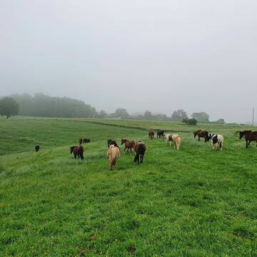
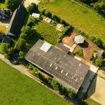
Boxen zu vermieten
Waldbreitbach
Jaqueline-Salz
@Jaqueline-Salz
FN-Mitglied
Freizeitstall
Longierzirkel/Roundpen
Paddock
Hufrehe geeignet
Außenbox mit Paddock
Innenbox
13 weitere...
S
Deprecated: Creation of dynamic property Zend_View_Helper_Ads::$adLink is deprecated in /var/www/stall-frei/htdocs/staging.stall-frei.de/library/Psf/View/Helper/Ads.php on line 108

Das Beste für die Hufe
Mechtersen
STALL-FREIde Marketing
@STALL-FREI-Marketing
Hufschmiede und Hufpfleger in Ihrer Nähe


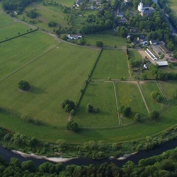
Offenstall-Plätze frei, Neueröffnung in 2026
Urbach
Hof am Hasenhain
@AnneFischerFlohr
Pferdeausbildung
Rehabilitationsstall
Hunde willkommen
Krankenbox
Allergikerstall
bedampftes/gewaschenes Heu
Außenbox mit Paddock
Bewegungsstall
18 weitere...
P+


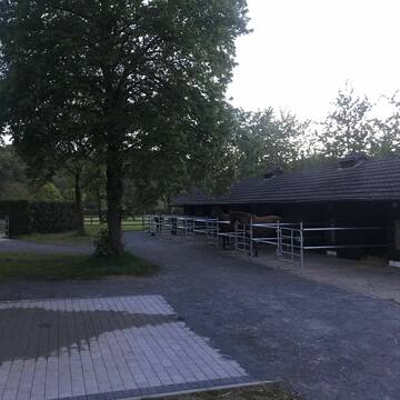
Paddockboxen & Offenstall
Marienhausen
Saggese/Hof
@Marienhof1
Freizeitstall
Reitlehrer und -unterricht
Krankenbox
Paddock
Fohlenaufzucht möglich
Gnadenbrothof
Außenbox mit Paddock
Außenboxen
18 weitere...
P+


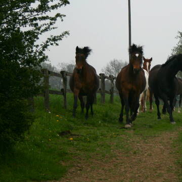
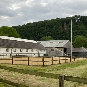
Pferdepension, Pferdebox, Einstellplatz
Orfgen
Pferdepension AnnAHof
@SanOffzVet
Freizeitstall
Geländestrecke
Hunde willkommen
Longierzirkel/Roundpen
Innenbox
Biofutter
Vollpension
13 weitere...
ganz aktuell
P+


Pferdebox, Pferdepension, Einstellplatz
Orfgen
Pferdepension AnnAHof
@AnnAHof
Freizeitstall
Geländestrecke
Hunde willkommen
Longierzirkel/Roundpen
Innenbox
Biofutter
Vollpension
13 weitere...
P+
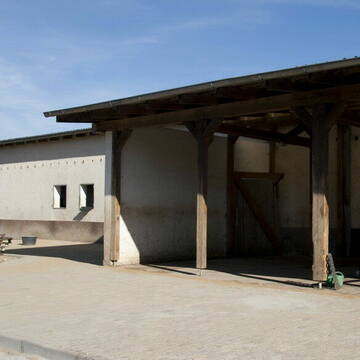
Hof Waldwiese 5 Sterne LAG-Stall
Kescheid
Melanie-Liebscher
@Melanie-Liebscher
Freizeitstall
Pferdeausbildung
Krankenbox
Longierzirkel/Roundpen
Gnadenbrothof
Außenbox mit Paddock
Außenboxen
19 weitere...
P+


Schöne Anlage mit vielen Möglichkeiten fürs Pfer...
Neustadt/Wied
Reit-und-PensionsstallZentgraf
@Reit-und-PensionsstallZentgraf
FN-Mitglied
Freizeitstall
Krankenbox
Longierzirkel/Roundpen
Allergikerstall
bedampftes/gewaschenes Heu
Außenbox mit Paddock
Außenboxen
24 weitere...
P+


Union-Gestüt, Artgerechte Pferdehaltung im Siegt...
Eitorf
Union Gestüt
@Union-Gestuet
Freizeitstall
Vermieten
Führanlage
Hunde willkommen
Gnadenbrothof
Notfallboxen
23 weitere...
S

Frisches Stroh zu verkaufen!
Mechtersen
STALL-FREIde Marketing
@STALL-FREI-Marketing
Kaufe frisches Stroh für dein Pferd!


Riesengroße aussenbox , Allergiker geeignet
Steinebach
Nadine Ladewig
@NadineLadewig
Freizeitstall
Pferdeausbildung
Vermieten
Reithalle
Sattelkammer/Sattelschränke
Allergikerstall
Hufrehe geeignet
12 weitere...
P+
Leider kein Vorschaubild
Leider kein Vorschaubild
Offenstall
Niederdreis
r.enns86
@Ramona86
Hunde willkommen
Reitplatz (z.B. Dressur, Springen, Reining)
Offenstall
Halbpension
Selbstversorgung
7 weitere...
B
Deprecated: Creation of dynamic property Zend_View::$pageCount is deprecated in /var/www/stall-frei/htdocs/staging.stall-frei.de/library/vendor/shardj/zf1-future/library/Zend/View/Abstract.php on line 308
Deprecated: Creation of dynamic property Zend_View::$itemCountPerPage is deprecated in /var/www/stall-frei/htdocs/staging.stall-frei.de/library/vendor/shardj/zf1-future/library/Zend/View/Abstract.php on line 308
Deprecated: Creation of dynamic property Zend_View::$first is deprecated in /var/www/stall-frei/htdocs/staging.stall-frei.de/library/vendor/shardj/zf1-future/library/Zend/View/Abstract.php on line 308
Deprecated: Creation of dynamic property Zend_View::$current is deprecated in /var/www/stall-frei/htdocs/staging.stall-frei.de/library/vendor/shardj/zf1-future/library/Zend/View/Abstract.php on line 308
Deprecated: Creation of dynamic property Zend_View::$last is deprecated in /var/www/stall-frei/htdocs/staging.stall-frei.de/library/vendor/shardj/zf1-future/library/Zend/View/Abstract.php on line 308
Deprecated: Creation of dynamic property Zend_View::$next is deprecated in /var/www/stall-frei/htdocs/staging.stall-frei.de/library/vendor/shardj/zf1-future/library/Zend/View/Abstract.php on line 308
Deprecated: Creation of dynamic property Zend_View::$pagesInRange is deprecated in /var/www/stall-frei/htdocs/staging.stall-frei.de/library/vendor/shardj/zf1-future/library/Zend/View/Abstract.php on line 308
Deprecated: Creation of dynamic property Zend_View::$firstPageInRange is deprecated in /var/www/stall-frei/htdocs/staging.stall-frei.de/library/vendor/shardj/zf1-future/library/Zend/View/Abstract.php on line 308
Deprecated: Creation of dynamic property Zend_View::$lastPageInRange is deprecated in /var/www/stall-frei/htdocs/staging.stall-frei.de/library/vendor/shardj/zf1-future/library/Zend/View/Abstract.php on line 308
Deprecated: Creation of dynamic property Zend_View::$currentItemCount is deprecated in /var/www/stall-frei/htdocs/staging.stall-frei.de/library/vendor/shardj/zf1-future/library/Zend/View/Abstract.php on line 308
Deprecated: Creation of dynamic property Zend_View::$totalItemCount is deprecated in /var/www/stall-frei/htdocs/staging.stall-frei.de/library/vendor/shardj/zf1-future/library/Zend/View/Abstract.php on line 308
Deprecated: Creation of dynamic property Zend_View::$firstItemNumber is deprecated in /var/www/stall-frei/htdocs/staging.stall-frei.de/library/vendor/shardj/zf1-future/library/Zend/View/Abstract.php on line 308
Deprecated: Creation of dynamic property Zend_View::$lastItemNumber is deprecated in /var/www/stall-frei/htdocs/staging.stall-frei.de/library/vendor/shardj/zf1-future/library/Zend/View/Abstract.php on line 308
Deprecated: Creation of dynamic property Zend_View::$router is deprecated in /var/www/stall-frei/htdocs/staging.stall-frei.de/library/vendor/shardj/zf1-future/library/Zend/View/Abstract.php on line 308
Deprecated: Creation of dynamic property Zend_View::$urlParams is deprecated in /var/www/stall-frei/htdocs/staging.stall-frei.de/library/vendor/shardj/zf1-future/library/Zend/View/Abstract.php on line 308
Deprecated: Creation of dynamic property Zend_View::$showAds is deprecated in /var/www/stall-frei/htdocs/staging.stall-frei.de/library/vendor/shardj/zf1-future/library/Zend/View/Abstract.php on line 308
Deprecated: Creation of dynamic property Zend_View::$objectIds is deprecated in /var/www/stall-frei/htdocs/staging.stall-frei.de/library/vendor/shardj/zf1-future/library/Zend/View/Abstract.php on line 308
Deprecated: Creation of dynamic property Zend_View::$showNavbar is deprecated in /var/www/stall-frei/htdocs/staging.stall-frei.de/library/vendor/shardj/zf1-future/library/Zend/View/Abstract.php on line 308
Deprecated: Creation of dynamic property Zend_View::$showBreadcrumb is deprecated in /var/www/stall-frei/htdocs/staging.stall-frei.de/library/vendor/shardj/zf1-future/library/Zend/View/Abstract.php on line 308
Deprecated: Creation of dynamic property Zend_View::$showFooter is deprecated in /var/www/stall-frei/htdocs/staging.stall-frei.de/library/vendor/shardj/zf1-future/library/Zend/View/Abstract.php on line 308
Deprecated: Creation of dynamic property Zend_View::$showInternalAds is deprecated in /var/www/stall-frei/htdocs/staging.stall-frei.de/library/vendor/shardj/zf1-future/library/Zend/View/Abstract.php on line 308
Deprecated: Creation of dynamic property Zend_View::$blNoContent is deprecated in /var/www/stall-frei/htdocs/staging.stall-frei.de/library/vendor/shardj/zf1-future/library/Zend/View/Abstract.php on line 308
Deprecated: Creation of dynamic property Zend_View::$sMetaDesc is deprecated in /var/www/stall-frei/htdocs/staging.stall-frei.de/library/vendor/shardj/zf1-future/library/Zend/View/Abstract.php on line 308
Deprecated: Creation of dynamic property Zend_View::$useGmaps is deprecated in /var/www/stall-frei/htdocs/staging.stall-frei.de/library/vendor/shardj/zf1-future/library/Zend/View/Abstract.php on line 308
Deprecated: Creation of dynamic property Zend_View::$touches is deprecated in /var/www/stall-frei/htdocs/staging.stall-frei.de/library/vendor/shardj/zf1-future/library/Zend/View/Abstract.php on line 308
Deprecated: Creation of dynamic property Zend_View::$oProject is deprecated in /var/www/stall-frei/htdocs/staging.stall-frei.de/library/vendor/shardj/zf1-future/library/Zend/View/Abstract.php on line 308
Deprecated: Creation of dynamic property Zend_View::$pageHeadline is deprecated in /var/www/stall-frei/htdocs/staging.stall-frei.de/library/vendor/shardj/zf1-future/library/Zend/View/Abstract.php on line 308
Deprecated: Creation of dynamic property Zend_View::$disableLocationField is deprecated in /var/www/stall-frei/htdocs/staging.stall-frei.de/library/vendor/shardj/zf1-future/library/Zend/View/Abstract.php on line 308
Deprecated: Creation of dynamic property Zend_View::$isSearch is deprecated in /var/www/stall-frei/htdocs/staging.stall-frei.de/library/vendor/shardj/zf1-future/library/Zend/View/Abstract.php on line 308
Deprecated: Creation of dynamic property Zend_View::$pageTitle is deprecated in /var/www/stall-frei/htdocs/staging.stall-frei.de/library/vendor/shardj/zf1-future/library/Zend/View/Abstract.php on line 308
Deprecated: Creation of dynamic property Psf_Form_Element_Text::$class is deprecated in /var/www/stall-frei/htdocs/staging.stall-frei.de/library/vendor/shardj/zf1-future/library/Zend/Form/Element.php on line 874
Deprecated: Creation of dynamic property Psf_Form_Element_Text::$size is deprecated in /var/www/stall-frei/htdocs/staging.stall-frei.de/library/vendor/shardj/zf1-future/library/Zend/Form/Element.php on line 874
Deprecated: Creation of dynamic property Psf_Form_Element_Text::$placeholder is deprecated in /var/www/stall-frei/htdocs/staging.stall-frei.de/library/vendor/shardj/zf1-future/library/Zend/Form/Element.php on line 874
Deprecated: Creation of dynamic property Psf_Form_Element_Hidden::$class is deprecated in /var/www/stall-frei/htdocs/staging.stall-frei.de/library/vendor/shardj/zf1-future/library/Zend/Form/Element.php on line 874
Deprecated: Creation of dynamic property Psf_Form_Element_Hidden::$class is deprecated in /var/www/stall-frei/htdocs/staging.stall-frei.de/library/vendor/shardj/zf1-future/library/Zend/Form/Element.php on line 874
Deprecated: Creation of dynamic property Psf_Form_Element_Hidden::$class is deprecated in /var/www/stall-frei/htdocs/staging.stall-frei.de/library/vendor/shardj/zf1-future/library/Zend/Form/Element.php on line 874
Deprecated: Creation of dynamic property Psf_Form_Element_Hidden::$class is deprecated in /var/www/stall-frei/htdocs/staging.stall-frei.de/library/vendor/shardj/zf1-future/library/Zend/Form/Element.php on line 874
Deprecated: Creation of dynamic property Psf_Form_Element_Select::$class is deprecated in /var/www/stall-frei/htdocs/staging.stall-frei.de/library/vendor/shardj/zf1-future/library/Zend/Form/Element.php on line 874
Deprecated: Creation of dynamic property Psf_Form_Element_Select::$class is deprecated in /var/www/stall-frei/htdocs/staging.stall-frei.de/library/vendor/shardj/zf1-future/library/Zend/Form/Element.php on line 874
Deprecated: Creation of dynamic property Psf_Form_Element_Select::$class is deprecated in /var/www/stall-frei/htdocs/staging.stall-frei.de/library/vendor/shardj/zf1-future/library/Zend/Form/Element.php on line 874
Deprecated: Creation of dynamic property Psf_Form_Element_Select::$class is deprecated in /var/www/stall-frei/htdocs/staging.stall-frei.de/library/vendor/shardj/zf1-future/library/Zend/Form/Element.php on line 874
Deprecated: Creation of dynamic property Psf_Form_Element_Text::$class is deprecated in /var/www/stall-frei/htdocs/staging.stall-frei.de/library/vendor/shardj/zf1-future/library/Zend/Form/Element.php on line 874
Deprecated: Creation of dynamic property Psf_Form_Element_Checkbox::$label is deprecated in /var/www/stall-frei/htdocs/staging.stall-frei.de/library/vendor/shardj/zf1-future/library/Zend/Form/Element.php on line 874
Deprecated: Creation of dynamic property Zend_View::$sort is deprecated in /var/www/stall-frei/htdocs/staging.stall-frei.de/library/vendor/shardj/zf1-future/library/Zend/View/Abstract.php on line 308
Deprecated: Creation of dynamic property Zend_View::$searchLocation is deprecated in /var/www/stall-frei/htdocs/staging.stall-frei.de/library/vendor/shardj/zf1-future/library/Zend/View/Abstract.php on line 308
Deprecated: Creation of dynamic property Zend_View::$locationHint is deprecated in /var/www/stall-frei/htdocs/staging.stall-frei.de/library/vendor/shardj/zf1-future/library/Zend/View/Abstract.php on line 308
Psf_GeoCoder_Abstract::getLocation: Sensenbach Get Location CachedOrLive
Psf_GeoCoder_Abstract::getCachedOrLive: Sensenbach
Psf_GeoCoder_OpenCageData::makeApiRequest: response:
Array
(
[documentation] => https://opencagedata.com/api
[licenses] => Array
(
[0] => Array
(
[name] => see attribution guide
[url] => https://opencagedata.com/credits
)
)
[results] => Array
(
[0] => Array
(
[bounds] => Array
(
[northeast] => Array
(
[lat] => 50.6423637
[lng] => 7.6448592
)
[southwest] => Array
(
[lat] => 50.6023637
[lng] => 7.6048592
)
)
[components] => Array
(
[ISO_3166-1_alpha-2] => DE
[ISO_3166-1_alpha-3] => DEU
[ISO_3166-2] => Array
(
[0] => DE-RP
)
[_category] => place
[_normalized_city] => Steimel
[_type] => village
[city] => Steimel
[continent] => Europe
[country] => Deutschland
[country_code] => de
[county] => Landkreis Neuwied
[municipality] => Puderbach
[political_union] => European Union
[postcode] => 57614
[state] => Rheinland-Pfalz
[state_code] => RP
[village] => Sensenbach
)
[confidence] => 7
[formatted] => 57614 Sensenbach, Deutschland
[geometry] => Array
(
[lat] => 50.6223637
[lng] => 7.6248592
)
)
[1] => Array
(
[bounds] => Array
(
[northeast] => Array
(
[lat] => 49.4510684
[lng] => 10.3565088
)
[southwest] => Array
(
[lat] => 49.4502064
[lng] => 10.3553234
)
)
[components] => Array
(
[ISO_3166-1_alpha-2] => DE
[ISO_3166-1_alpha-3] => DEU
[ISO_3166-2] => Array
(
[0] => DE-BY
)
[_category] => natural/water
[_normalized_city] => Marktbergel
[_type] => stream
[city] => Marktbergel
[continent] => Europe
[country] => Deutschland
[country_code] => de
[county] => Landkreis Neustadt an der Aisch-Bad Windsheim
[municipality] => Burgbernheim (VGem)
[political_union] => European Union
[postcode] => 91613
[state] => Bayern
[state_code] => BY
[stream] => Sensenbach
)
[confidence] => 9
[formatted] => Sensenbach, 91613 Marktbergel, Deutschland
[geometry] => Array
(
[lat] => 49.4506374
[lng] => 10.3559161
)
)
[2] => Array
(
[components] => Array
(
[ISO_3166-1_alpha-2] => FR
[ISO_3166-1_alpha-3] => FRA
[ISO_3166-2] => Array
(
[0] => FR-GES
[1] => FR-6AE
[2] => FR-68
)
[_category] => road
[_normalized_city] => Muhlbach-sur-Munster
[_type] => road
[city] => Muhlbach-sur-Munster
[continent] => Europe
[country] => France
[country_code] => fr
[county] => Haut-Rhin
[local_authority] => Communauté de communes de la Vallée de Munster
[political_union] => European Union
[postcode] => 68380
[road] => Chemin du Sendenbach
[state] => Grand Est
[state_code] => GES
)
[confidence] => 3
[formatted] => Chemin du Sendenbach, 68380 Muhlbach-sur-Munster, France
[geometry] => Array
(
[lat] => 48.023528
[lng] => 7.092167
)
)
[3] => Array
(
[components] => Array
(
[ISO_3166-1_alpha-2] => FR
[ISO_3166-1_alpha-3] => FRA
[ISO_3166-2] => Array
(
[0] => FR-GES
[1] => FR-6AE
[2] => FR-68
)
[_category] => road
[_normalized_city] => Muhlbach-sur-Munster
[_type] => road
[city] => Muhlbach-sur-Munster
[continent] => Europe
[country] => France
[country_code] => fr
[county] => Haut-Rhin
[local_authority] => Communauté de communes de la Vallée de Munster
[political_union] => European Union
[postcode] => 68380
[road] => Rue du Sendenbach
[state] => Grand Est
[state_code] => GES
)
[confidence] => 3
[formatted] => Rue du Sendenbach, 68380 Muhlbach-sur-Munster, France
[geometry] => Array
(
[lat] => 48.024194
[lng] => 7.09165
)
)
[4] => Array
(
[components] => Array
(
[ISO_3166-1_alpha-2] => FR
[ISO_3166-1_alpha-3] => FRA
[ISO_3166-2] => Array
(
[0] => FR-NAQ
[1] => FR-24
)
[_category] => road
[_normalized_city] => Brantôme en Périgord
[_type] => road
[city] => Brantôme en Périgord
[continent] => Europe
[country] => France
[country_code] => fr
[county] => Dordogne
[local_authority] => Communauté de communes Dronne et Belle
[political_union] => European Union
[postcode] => 24310
[road] => Route de Sencenac
[state] => Nouvelle-Aquitaine
[state_code] => NAQ
)
[confidence] => 2
[formatted] => Route de Sencenac, 24310 Brantôme en Périgord, France
[geometry] => Array
(
[lat] => 45.310512
[lng] => 0.697485
)
)
[5] => Array
(
[components] => Array
(
[ISO_3166-1_alpha-2] => FR
[ISO_3166-1_alpha-3] => FRA
[ISO_3166-2] => Array
(
[0] => FR-NAQ
[1] => FR-24
)
[_category] => road
[_normalized_city] => Brantôme en Périgord
[_type] => road
[city] => Brantôme en Périgord
[continent] => Europe
[country] => France
[country_code] => fr
[county] => Dordogne
[local_authority] => Communauté de communes Dronne et Belle
[political_union] => European Union
[postcode] => 24310
[road] => Route de la Besse
[state] => Nouvelle-Aquitaine
[state_code] => NAQ
)
[confidence] => 10
[formatted] => Route de la Besse, 24310 Brantôme en Périgord, France
[geometry] => Array
(
[lat] => 45.317976
[lng] => 0.66752
)
)
[6] => Array
(
[components] => Array
(
[ISO_3166-1_alpha-2] => FR
[ISO_3166-1_alpha-3] => FRA
[ISO_3166-2] => Array
(
[0] => FR-NAQ
[1] => FR-24
)
[_category] => road
[_normalized_city] => Brantôme en Périgord
[_type] => road
[city] => Brantôme en Périgord
[continent] => Europe
[country] => France
[country_code] => fr
[county] => Dordogne
[local_authority] => Communauté de communes Dronne et Belle
[political_union] => European Union
[postcode] => 24310
[road] => Impasse des Genêts
[state] => Nouvelle-Aquitaine
[state_code] => NAQ
)
[confidence] => 10
[formatted] => Impasse des Genêts, 24310 Brantôme en Périgord, France
[geometry] => Array
(
[lat] => 45.30597
[lng] => 0.680317
)
)
[7] => Array
(
[components] => Array
(
[ISO_3166-1_alpha-2] => FR
[ISO_3166-1_alpha-3] => FRA
[ISO_3166-2] => Array
(
[0] => FR-NAQ
[1] => FR-24
)
[_category] => road
[_normalized_city] => Brantôme en Périgord
[_type] => road
[city] => Brantôme en Périgord
[continent] => Europe
[country] => France
[country_code] => fr
[county] => Dordogne
[local_authority] => Communauté de communes Dronne et Belle
[political_union] => European Union
[postcode] => 24310
[road] => Route de la Rousselie
[state] => Nouvelle-Aquitaine
[state_code] => NAQ
)
[confidence] => 10
[formatted] => Route de la Rousselie, 24310 Brantôme en Périgord, France
[geometry] => Array
(
[lat] => 45.313866
[lng] => 0.664009
)
)
[8] => Array
(
[components] => Array
(
[ISO_3166-1_alpha-2] => FR
[ISO_3166-1_alpha-3] => FRA
[ISO_3166-2] => Array
(
[0] => FR-NAQ
[1] => FR-24
)
[_category] => road
[_normalized_city] => Brantôme en Périgord
[_type] => road
[city] => Brantôme en Périgord
[continent] => Europe
[country] => France
[country_code] => fr
[county] => Dordogne
[local_authority] => Communauté de communes Dronne et Belle
[political_union] => European Union
[postcode] => 24310
[road] => Chemin de la Séguinie
[state] => Nouvelle-Aquitaine
[state_code] => NAQ
)
[confidence] => 10
[formatted] => Chemin de la Séguinie, 24310 Brantôme en Périgord, France
[geometry] => Array
(
[lat] => 45.311791
[lng] => 0.664405
)
)
[9] => Array
(
[components] => Array
(
[ISO_3166-1_alpha-2] => FR
[ISO_3166-1_alpha-3] => FRA
[ISO_3166-2] => Array
(
[0] => FR-NAQ
[1] => FR-24
)
[_category] => road
[_normalized_city] => Brantôme en Périgord
[_type] => road
[city] => Brantôme en Périgord
[continent] => Europe
[country] => France
[country_code] => fr
[county] => Dordogne
[local_authority] => Communauté de communes Dronne et Belle
[political_union] => European Union
[postcode] => 24310
[road] => Route des Manoirs
[state] => Nouvelle-Aquitaine
[state_code] => NAQ
)
[confidence] => 10
[formatted] => Route des Manoirs, 24310 Brantôme en Périgord, France
[geometry] => Array
(
[lat] => 45.313765
[lng] => 0.698197
)
)
)
[status] => Array
(
[code] => 200
[message] => OK
)
[stay_informed] => Array
(
[blog] => https://blog.opencagedata.com
[mastodon] => https://en.osm.town/@opencage
)
[thanks] => For using an OpenCage API
[timestamp] => Array
(
[created_http] => Sun, 08 Feb 2026 09:16:32 GMT
[created_unix] => 1770542192
)
[total_results] => 10
)
Psf_GeoCoder_Abstract::convertLocationResult
{"documentation":"https:\/\/opencagedata.com\/api","licenses":[{"name":"see attribution guide","url":"https:\/\/opencagedata.com\/credits"}],"results":[{"bounds":{"northeast":{"lat":50.6423637,"lng":7.6448592},"southwest":{"lat":50.6023637,"lng":7.6048592}},"components":{"ISO_3166-1_alpha-2":"DE","ISO_3166-1_alpha-3":"DEU","ISO_3166-2":["DE-RP"],"_category":"place","_normalized_city":"Steimel","_type":"village","city":"Steimel","continent":"Europe","country":"Deutschland","country_code":"de","county":"Landkreis Neuwied","municipality":"Puderbach","political_union":"European Union","postcode":"57614","state":"Rheinland-Pfalz","state_code":"RP","village":"Sensenbach"},"confidence":7,"formatted":"57614 Sensenbach, Deutschland","geometry":{"lat":50.6223637,"lng":7.6248592}},{"bounds":{"northeast":{"lat":49.4510684,"lng":10.3565088},"southwest":{"lat":49.4502064,"lng":10.3553234}},"components":{"ISO_3166-1_alpha-2":"DE","ISO_3166-1_alpha-3":"DEU","ISO_3166-2":["DE-BY"],"_category":"natural\/water","_normalized_city":"Marktbergel","_type":"stream","city":"Marktbergel","continent":"Europe","country":"Deutschland","country_code":"de","county":"Landkreis Neustadt an der Aisch-Bad Windsheim","municipality":"Burgbernheim (VGem)","political_union":"European Union","postcode":"91613","state":"Bayern","state_code":"BY","stream":"Sensenbach"},"confidence":9,"formatted":"Sensenbach, 91613 Marktbergel, Deutschland","geometry":{"lat":49.4506374,"lng":10.3559161}},{"components":{"ISO_3166-1_alpha-2":"FR","ISO_3166-1_alpha-3":"FRA","ISO_3166-2":["FR-GES","FR-6AE","FR-68"],"_category":"road","_normalized_city":"Muhlbach-sur-Munster","_type":"road","city":"Muhlbach-sur-Munster","continent":"Europe","country":"France","country_code":"fr","county":"Haut-Rhin","local_authority":"Communaut\u00e9 de communes de la Vall\u00e9e de Munster","political_union":"European Union","postcode":"68380","road":"Chemin du Sendenbach","state":"Grand Est","state_code":"GES"},"confidence":3,"formatted":"Chemin du Sendenbach, 68380 Muhlbach-sur-Munster, France","geometry":{"lat":48.023528,"lng":7.092167}},{"components":{"ISO_3166-1_alpha-2":"FR","ISO_3166-1_alpha-3":"FRA","ISO_3166-2":["FR-GES","FR-6AE","FR-68"],"_category":"road","_normalized_city":"Muhlbach-sur-Munster","_type":"road","city":"Muhlbach-sur-Munster","continent":"Europe","country":"France","country_code":"fr","county":"Haut-Rhin","local_authority":"Communaut\u00e9 de communes de la Vall\u00e9e de Munster","political_union":"European Union","postcode":"68380","road":"Rue du Sendenbach","state":"Grand Est","state_code":"GES"},"confidence":3,"formatted":"Rue du Sendenbach, 68380 Muhlbach-sur-Munster, France","geometry":{"lat":48.024194,"lng":7.09165}},{"components":{"ISO_3166-1_alpha-2":"FR","ISO_3166-1_alpha-3":"FRA","ISO_3166-2":["FR-NAQ","FR-24"],"_category":"road","_normalized_city":"Brant\u00f4me en P\u00e9rigord","_type":"road","city":"Brant\u00f4me en P\u00e9rigord","continent":"Europe","country":"France","country_code":"fr","county":"Dordogne","local_authority":"Communaut\u00e9 de communes Dronne et Belle","political_union":"European Union","postcode":"24310","road":"Route de Sencenac","state":"Nouvelle-Aquitaine","state_code":"NAQ"},"confidence":2,"formatted":"Route de Sencenac, 24310 Brant\u00f4me en P\u00e9rigord, France","geometry":{"lat":45.310512,"lng":0.697485}},{"components":{"ISO_3166-1_alpha-2":"FR","ISO_3166-1_alpha-3":"FRA","ISO_3166-2":["FR-NAQ","FR-24"],"_category":"road","_normalized_city":"Brant\u00f4me en P\u00e9rigord","_type":"road","city":"Brant\u00f4me en P\u00e9rigord","continent":"Europe","country":"France","country_code":"fr","county":"Dordogne","local_authority":"Communaut\u00e9 de communes Dronne et Belle","political_union":"European Union","postcode":"24310","road":"Route de la Besse","state":"Nouvelle-Aquitaine","state_code":"NAQ"},"confidence":10,"formatted":"Route de la Besse, 24310 Brant\u00f4me en P\u00e9rigord, France","geometry":{"lat":45.317976,"lng":0.66752}},{"components":{"ISO_3166-1_alpha-2":"FR","ISO_3166-1_alpha-3":"FRA","ISO_3166-2":["FR-NAQ","FR-24"],"_category":"road","_normalized_city":"Brant\u00f4me en P\u00e9rigord","_type":"road","city":"Brant\u00f4me en P\u00e9rigord","continent":"Europe","country":"France","country_code":"fr","county":"Dordogne","local_authority":"Communaut\u00e9 de communes Dronne et Belle","political_union":"European Union","postcode":"24310","road":"Impasse des Gen\u00eats","state":"Nouvelle-Aquitaine","state_code":"NAQ"},"confidence":10,"formatted":"Impasse des Gen\u00eats, 24310 Brant\u00f4me en P\u00e9rigord, France","geometry":{"lat":45.30597,"lng":0.680317}},{"components":{"ISO_3166-1_alpha-2":"FR","ISO_3166-1_alpha-3":"FRA","ISO_3166-2":["FR-NAQ","FR-24"],"_category":"road","_normalized_city":"Brant\u00f4me en P\u00e9rigord","_type":"road","city":"Brant\u00f4me en P\u00e9rigord","continent":"Europe","country":"France","country_code":"fr","county":"Dordogne","local_authority":"Communaut\u00e9 de communes Dronne et Belle","political_union":"European Union","postcode":"24310","road":"Route de la Rousselie","state":"Nouvelle-Aquitaine","state_code":"NAQ"},"confidence":10,"formatted":"Route de la Rousselie, 24310 Brant\u00f4me en P\u00e9rigord, France","geometry":{"lat":45.313866,"lng":0.664009}},{"components":{"ISO_3166-1_alpha-2":"FR","ISO_3166-1_alpha-3":"FRA","ISO_3166-2":["FR-NAQ","FR-24"],"_category":"road","_normalized_city":"Brant\u00f4me en P\u00e9rigord","_type":"road","city":"Brant\u00f4me en P\u00e9rigord","continent":"Europe","country":"France","country_code":"fr","county":"Dordogne","local_authority":"Communaut\u00e9 de communes Dronne et Belle","political_union":"European Union","postcode":"24310","road":"Chemin de la S\u00e9guinie","state":"Nouvelle-Aquitaine","state_code":"NAQ"},"confidence":10,"formatted":"Chemin de la S\u00e9guinie, 24310 Brant\u00f4me en P\u00e9rigord, France","geometry":{"lat":45.311791,"lng":0.664405}},{"components":{"ISO_3166-1_alpha-2":"FR","ISO_3166-1_alpha-3":"FRA","ISO_3166-2":["FR-NAQ","FR-24"],"_category":"road","_normalized_city":"Brant\u00f4me en P\u00e9rigord","_type":"road","city":"Brant\u00f4me en P\u00e9rigord","continent":"Europe","country":"France","country_code":"fr","county":"Dordogne","local_authority":"Communaut\u00e9 de communes Dronne et Belle","political_union":"European Union","postcode":"24310","road":"Route des Manoirs","state":"Nouvelle-Aquitaine","state_code":"NAQ"},"confidence":10,"formatted":"Route des Manoirs, 24310 Brant\u00f4me en P\u00e9rigord, France","geometry":{"lat":45.313765,"lng":0.698197}}],"status":{"code":200,"message":"OK"},"stay_informed":{"blog":"https:\/\/blog.opencagedata.com","mastodon":"https:\/\/en.osm.town\/@opencage"},"thanks":"For using an OpenCage API","timestamp":{"created_http":"Sun, 08 Feb 2026 09:16:32 GMT","created_unix":1770542192},"total_results":10}Array
(
[0] => stdClass Object
(
[bounds] => stdClass Object
(
[northeast] => stdClass Object
(
[lat] => 50.6423637
[lng] => 7.6448592
)
[southwest] => stdClass Object
(
[lat] => 50.6023637
[lng] => 7.6048592
)
)
[components] => stdClass Object
(
[ISO_3166-1_alpha-2] => DE
[ISO_3166-1_alpha-3] => DEU
[ISO_3166-2] => Array
(
[0] => DE-RP
)
[_category] => place
[_normalized_city] => Steimel
[_type] => village
[city] => Steimel
[continent] => Europe
[country] => Deutschland
[country_code] => de
[county] => Landkreis Neuwied
[municipality] => Puderbach
[political_union] => European Union
[postcode] => 57614
[state] => Rheinland-Pfalz
[state_code] => RP
[village] => Sensenbach
)
[confidence] => 7
[formatted] => 57614 Sensenbach, Deutschland
[geometry] => stdClass Object
(
[lat] => 50.6223637
[lng] => 7.6248592
)
)
[1] => stdClass Object
(
[bounds] => stdClass Object
(
[northeast] => stdClass Object
(
[lat] => 49.4510684
[lng] => 10.3565088
)
[southwest] => stdClass Object
(
[lat] => 49.4502064
[lng] => 10.3553234
)
)
[components] => stdClass Object
(
[ISO_3166-1_alpha-2] => DE
[ISO_3166-1_alpha-3] => DEU
[ISO_3166-2] => Array
(
[0] => DE-BY
)
[_category] => natural/water
[_normalized_city] => Marktbergel
[_type] => stream
[city] => Marktbergel
[continent] => Europe
[country] => Deutschland
[country_code] => de
[county] => Landkreis Neustadt an der Aisch-Bad Windsheim
[municipality] => Burgbernheim (VGem)
[political_union] => European Union
[postcode] => 91613
[state] => Bayern
[state_code] => BY
[stream] => Sensenbach
)
[confidence] => 9
[formatted] => Sensenbach, 91613 Marktbergel, Deutschland
[geometry] => stdClass Object
(
[lat] => 49.4506374
[lng] => 10.3559161
)
)
[2] => stdClass Object
(
[components] => stdClass Object
(
[ISO_3166-1_alpha-2] => FR
[ISO_3166-1_alpha-3] => FRA
[ISO_3166-2] => Array
(
[0] => FR-GES
[1] => FR-6AE
[2] => FR-68
)
[_category] => road
[_normalized_city] => Muhlbach-sur-Munster
[_type] => road
[city] => Muhlbach-sur-Munster
[continent] => Europe
[country] => France
[country_code] => fr
[county] => Haut-Rhin
[local_authority] => Communauté de communes de la Vallée de Munster
[political_union] => European Union
[postcode] => 68380
[road] => Chemin du Sendenbach
[state] => Grand Est
[state_code] => GES
)
[confidence] => 3
[formatted] => Chemin du Sendenbach, 68380 Muhlbach-sur-Munster, France
[geometry] => stdClass Object
(
[lat] => 48.023528
[lng] => 7.092167
)
)
[3] => stdClass Object
(
[components] => stdClass Object
(
[ISO_3166-1_alpha-2] => FR
[ISO_3166-1_alpha-3] => FRA
[ISO_3166-2] => Array
(
[0] => FR-GES
[1] => FR-6AE
[2] => FR-68
)
[_category] => road
[_normalized_city] => Muhlbach-sur-Munster
[_type] => road
[city] => Muhlbach-sur-Munster
[continent] => Europe
[country] => France
[country_code] => fr
[county] => Haut-Rhin
[local_authority] => Communauté de communes de la Vallée de Munster
[political_union] => European Union
[postcode] => 68380
[road] => Rue du Sendenbach
[state] => Grand Est
[state_code] => GES
)
[confidence] => 3
[formatted] => Rue du Sendenbach, 68380 Muhlbach-sur-Munster, France
[geometry] => stdClass Object
(
[lat] => 48.024194
[lng] => 7.09165
)
)
[4] => stdClass Object
(
[components] => stdClass Object
(
[ISO_3166-1_alpha-2] => FR
[ISO_3166-1_alpha-3] => FRA
[ISO_3166-2] => Array
(
[0] => FR-NAQ
[1] => FR-24
)
[_category] => road
[_normalized_city] => Brantôme en Périgord
[_type] => road
[city] => Brantôme en Périgord
[continent] => Europe
[country] => France
[country_code] => fr
[county] => Dordogne
[local_authority] => Communauté de communes Dronne et Belle
[political_union] => European Union
[postcode] => 24310
[road] => Route de Sencenac
[state] => Nouvelle-Aquitaine
[state_code] => NAQ
)
[confidence] => 2
[formatted] => Route de Sencenac, 24310 Brantôme en Périgord, France
[geometry] => stdClass Object
(
[lat] => 45.310512
[lng] => 0.697485
)
)
[5] => stdClass Object
(
[components] => stdClass Object
(
[ISO_3166-1_alpha-2] => FR
[ISO_3166-1_alpha-3] => FRA
[ISO_3166-2] => Array
(
[0] => FR-NAQ
[1] => FR-24
)
[_category] => road
[_normalized_city] => Brantôme en Périgord
[_type] => road
[city] => Brantôme en Périgord
[continent] => Europe
[country] => France
[country_code] => fr
[county] => Dordogne
[local_authority] => Communauté de communes Dronne et Belle
[political_union] => European Union
[postcode] => 24310
[road] => Route de la Besse
[state] => Nouvelle-Aquitaine
[state_code] => NAQ
)
[confidence] => 10
[formatted] => Route de la Besse, 24310 Brantôme en Périgord, France
[geometry] => stdClass Object
(
[lat] => 45.317976
[lng] => 0.66752
)
)
[6] => stdClass Object
(
[components] => stdClass Object
(
[ISO_3166-1_alpha-2] => FR
[ISO_3166-1_alpha-3] => FRA
[ISO_3166-2] => Array
(
[0] => FR-NAQ
[1] => FR-24
)
[_category] => road
[_normalized_city] => Brantôme en Périgord
[_type] => road
[city] => Brantôme en Périgord
[continent] => Europe
[country] => France
[country_code] => fr
[county] => Dordogne
[local_authority] => Communauté de communes Dronne et Belle
[political_union] => European Union
[postcode] => 24310
[road] => Impasse des Genêts
[state] => Nouvelle-Aquitaine
[state_code] => NAQ
)
[confidence] => 10
[formatted] => Impasse des Genêts, 24310 Brantôme en Périgord, France
[geometry] => stdClass Object
(
[lat] => 45.30597
[lng] => 0.680317
)
)
[7] => stdClass Object
(
[components] => stdClass Object
(
[ISO_3166-1_alpha-2] => FR
[ISO_3166-1_alpha-3] => FRA
[ISO_3166-2] => Array
(
[0] => FR-NAQ
[1] => FR-24
)
[_category] => road
[_normalized_city] => Brantôme en Périgord
[_type] => road
[city] => Brantôme en Périgord
[continent] => Europe
[country] => France
[country_code] => fr
[county] => Dordogne
[local_authority] => Communauté de communes Dronne et Belle
[political_union] => European Union
[postcode] => 24310
[road] => Route de la Rousselie
[state] => Nouvelle-Aquitaine
[state_code] => NAQ
)
[confidence] => 10
[formatted] => Route de la Rousselie, 24310 Brantôme en Périgord, France
[geometry] => stdClass Object
(
[lat] => 45.313866
[lng] => 0.664009
)
)
[8] => stdClass Object
(
[components] => stdClass Object
(
[ISO_3166-1_alpha-2] => FR
[ISO_3166-1_alpha-3] => FRA
[ISO_3166-2] => Array
(
[0] => FR-NAQ
[1] => FR-24
)
[_category] => road
[_normalized_city] => Brantôme en Périgord
[_type] => road
[city] => Brantôme en Périgord
[continent] => Europe
[country] => France
[country_code] => fr
[county] => Dordogne
[local_authority] => Communauté de communes Dronne et Belle
[political_union] => European Union
[postcode] => 24310
[road] => Chemin de la Séguinie
[state] => Nouvelle-Aquitaine
[state_code] => NAQ
)
[confidence] => 10
[formatted] => Chemin de la Séguinie, 24310 Brantôme en Périgord, France
[geometry] => stdClass Object
(
[lat] => 45.311791
[lng] => 0.664405
)
)
[9] => stdClass Object
(
[components] => stdClass Object
(
[ISO_3166-1_alpha-2] => FR
[ISO_3166-1_alpha-3] => FRA
[ISO_3166-2] => Array
(
[0] => FR-NAQ
[1] => FR-24
)
[_category] => road
[_normalized_city] => Brantôme en Périgord
[_type] => road
[city] => Brantôme en Périgord
[continent] => Europe
[country] => France
[country_code] => fr
[county] => Dordogne
[local_authority] => Communauté de communes Dronne et Belle
[political_union] => European Union
[postcode] => 24310
[road] => Route des Manoirs
[state] => Nouvelle-Aquitaine
[state_code] => NAQ
)
[confidence] => 10
[formatted] => Route des Manoirs, 24310 Brantôme en Périgord, France
[geometry] => stdClass Object
(
[lat] => 45.313765
[lng] => 0.698197
)
)
)
Psf_GeoCoder_OpenCageData::getKeyMap: 0
stdClass Object
(
    [bounds] => stdClass Object
        (
            [northeast] => stdClass Object
                (
                    [lat] => 50.6423637
                    [lng] => 7.6448592
                )

            [southwest] => stdClass Object
                (
                    [lat] => 50.6023637
                    [lng] => 7.6048592
                )

        )

    [components] => stdClass Object
        (
            [ISO_3166-1_alpha-2] => DE
            [ISO_3166-1_alpha-3] => DEU
            [ISO_3166-2] => Array
                (
                    [0] => DE-RP
                )

            [_category] => place
            [_normalized_city] => Steimel
            [_type] => village
            [city] => Steimel
            [continent] => Europe
            [country] => Deutschland
            [country_code] => de
            [county] => Landkreis Neuwied
            [municipality] => Puderbach
            [political_union] => European Union
            [postcode] => 57614
            [state] => Rheinland-Pfalz
            [state_code] => RP
            [village] => Sensenbach
        )

    [confidence] => 7
    [formatted] => 57614 Sensenbach, Deutschland
    [geometry] => stdClass Object
        (
            [lat] => 50.6223637
            [lng] => 7.6248592
        )

)
Psf_GeoCoder_OpenCageData::getCounty: Neuwied
Psf_GeoCoder_OpenCageData::addMissingData REFETCH!
Array
(
    [address] => 57614 Sensenbach, Deutschland
    [type] => village
    [street] =>
    [city] => Sensenbach
    [county] => Neuwied
    [state] => Rheinland-Pfalz
    [zip] => 57614
    [country] => Deutschland
    [suburb] =>
    [countrycode] => de
    [latitude] => 50.6223637
    [longitude] => 7.6248592
    [accuracy] => 1
    [confidence] => 7
    [bounds] => stdClass Object
        (
            [northeast] => stdClass Object
                (
                    [lat] => 50.6423637
                    [lng] => 7.6448592
                )

            [southwest] => stdClass Object
                (
                    [lat] => 50.6023637
                    [lng] => 7.6048592
                )

        )

)
reformat!
Array
(
    [address] => 57614 Sensenbach, Deutschland
    [type] => village
    [street] =>
    [city] => Sensenbach
    [county] => Neuwied
    [state] => Rheinland-Pfalz
    [zip] => 57614
    [country] => Deutschland
    [suburb] =>
    [countrycode] => de
    [latitude] => 50.6223637
    [longitude] => 7.6248592
    [accuracy] => 1
    [confidence] => 7
    [bounds] => stdClass Object
        (
            [northeast] => stdClass Object
                (
                    [lat] => 50.6423637
                    [lng] => 7.6448592
                )

            [southwest] => stdClass Object
                (
                    [lat] => 50.6023637
                    [lng] => 7.6048592
                )

        )

    [place] => 57614 Sensenbach, Rheinland-Pfalz
    [hash] => 767684a3de1ee68f088c7e87262af47c
)
Psf_GeoCoder_OpenCageData::getKeyMap: 1
stdClass Object
(
    [bounds] => stdClass Object
        (
            [northeast] => stdClass Object
                (
                    [lat] => 49.4510684
                    [lng] => 10.3565088
                )

            [southwest] => stdClass Object
                (
                    [lat] => 49.4502064
                    [lng] => 10.3553234
                )

        )

    [components] => stdClass Object
        (
            [ISO_3166-1_alpha-2] => DE
            [ISO_3166-1_alpha-3] => DEU
            [ISO_3166-2] => Array
                (
                    [0] => DE-BY
                )

            [_category] => natural/water
            [_normalized_city] => Marktbergel
            [_type] => stream
            [city] => Marktbergel
            [continent] => Europe
            [country] => Deutschland
            [country_code] => de
            [county] => Landkreis Neustadt an der Aisch-Bad Windsheim
            [municipality] => Burgbernheim (VGem)
            [political_union] => European Union
            [postcode] => 91613
            [state] => Bayern
            [state_code] => BY
            [stream] => Sensenbach
        )

    [confidence] => 9
    [formatted] => Sensenbach, 91613 Marktbergel, Deutschland
    [geometry] => stdClass Object
        (
            [lat] => 49.4506374
            [lng] => 10.3559161
        )

)
Psf_GeoCoder_OpenCageData::getCounty: Neustadt an der Aisch-Bad Windsheim
Psf_GeoCoder_OpenCageData::addMissingData REFETCH!
Array
(
    [address] => Sensenbach, 91613 Marktbergel, Deutschland
    [type] => stream
    [street] =>
    [city] => Marktbergel
    [county] => Neustadt an der Aisch-Bad Windsheim
    [state] => Bayern
    [zip] => 91613
    [country] => Deutschland
    [suburb] =>
    [countrycode] => de
    [latitude] => 49.4506374
    [longitude] => 10.3559161
    [accuracy] => 1
    [confidence] => 9
    [bounds] => stdClass Object
        (
            [northeast] => stdClass Object
                (
                    [lat] => 49.4510684
                    [lng] => 10.3565088
                )

            [southwest] => stdClass Object
                (
                    [lat] => 49.4502064
                    [lng] => 10.3553234
                )

        )

)
reformat!
Array
(
    [address] => Sensenbach, 91613 Marktbergel, Deutschland
    [type] => stream
    [street] =>
    [city] => Marktbergel
    [county] => Neustadt an der Aisch-Bad Windsheim
    [state] => Bayern
    [zip] => 91613
    [country] => Deutschland
    [suburb] =>
    [countrycode] => de
    [latitude] => 49.4506374
    [longitude] => 10.3559161
    [accuracy] => 1
    [confidence] => 9
    [bounds] => stdClass Object
        (
            [northeast] => stdClass Object
                (
                    [lat] => 49.4510684
                    [lng] => 10.3565088
                )

            [southwest] => stdClass Object
                (
                    [lat] => 49.4502064
                    [lng] => 10.3553234
                )

        )

    [place] => 91613 Marktbergel, Bayern
    [hash] => da8ffcbd258b9243c1fbc63e5b829850
)
Psf_GeoCoder_OpenCageData::getKeyMap: 2
stdClass Object
(
    [components] => stdClass Object
        (
            [ISO_3166-1_alpha-2] => FR
            [ISO_3166-1_alpha-3] => FRA
            [ISO_3166-2] => Array
                (
                    [0] => FR-GES
                    [1] => FR-6AE
                    [2] => FR-68
                )

            [_category] => road
            [_normalized_city] => Muhlbach-sur-Munster
            [_type] => road
            [city] => Muhlbach-sur-Munster
            [continent] => Europe
            [country] => France
            [country_code] => fr
            [county] => Haut-Rhin
            [local_authority] => Communauté de communes de la Vallée de Munster
            [political_union] => European Union
            [postcode] => 68380
            [road] => Chemin du Sendenbach
            [state] => Grand Est
            [state_code] => GES
        )

    [confidence] => 3
    [formatted] => Chemin du Sendenbach, 68380 Muhlbach-sur-Munster, France
    [geometry] => stdClass Object
        (
            [lat] => 48.023528
            [lng] => 7.092167
        )

)
Psf_GeoCoder_OpenCageData::getCounty: Haut-Rhin
Psf_GeoCoder_OpenCageData::addMissingData REFETCH!
Array
(
    [address] => Chemin du Sendenbach, 68380 Muhlbach-sur-Munster, France
    [type] => road
    [street] => Chemin du Sendenbach
    [city] => Muhlbach-sur-Munster
    [county] => Haut-Rhin
    [state] => Grand Est
    [zip] => 68380
    [country] => France
    [suburb] =>
    [countrycode] => fr
    [latitude] => 48.023528
    [longitude] => 7.092167
    [accuracy] => 1
    [confidence] => 3
    [bounds] =>
)
reformat!
Array
(
    [address] => Chemin du Sendenbach, 68380 Muhlbach-sur-Munster, France
    [type] => road
    [street] => Chemin du Sendenbach
    [city] => Muhlbach-sur-Munster
    [county] => Haut-Rhin
    [state] => Grand Est
    [zip] => 68380
    [country] => France
    [suburb] =>
    [countrycode] => fr
    [latitude] => 48.023528
    [longitude] => 7.092167
    [accuracy] => 1
    [confidence] => 3
    [bounds] =>
    [place] => Chemin du Sendenbach, 68380 Muhlbach-sur-Munster, Grand Est
    [hash] => 16d13f4d7a7939a2397034bfd6d1aa01
)
Psf_GeoCoder_OpenCageData::getKeyMap: 3
stdClass Object
(
    [components] => stdClass Object
        (
            [ISO_3166-1_alpha-2] => FR
            [ISO_3166-1_alpha-3] => FRA
            [ISO_3166-2] => Array
                (
                    [0] => FR-GES
                    [1] => FR-6AE
                    [2] => FR-68
                )

            [_category] => road
            [_normalized_city] => Muhlbach-sur-Munster
            [_type] => road
            [city] => Muhlbach-sur-Munster
            [continent] => Europe
            [country] => France
            [country_code] => fr
            [county] => Haut-Rhin
            [local_authority] => Communauté de communes de la Vallée de Munster
            [political_union] => European Union
            [postcode] => 68380
            [road] => Rue du Sendenbach
            [state] => Grand Est
            [state_code] => GES
        )

    [confidence] => 3
    [formatted] => Rue du Sendenbach, 68380 Muhlbach-sur-Munster, France
    [geometry] => stdClass Object
        (
            [lat] => 48.024194
            [lng] => 7.09165
        )

)
Psf_GeoCoder_OpenCageData::getCounty: Haut-Rhin
Psf_GeoCoder_OpenCageData::addMissingData REFETCH!
Array
(
    [address] => Rue du Sendenbach, 68380 Muhlbach-sur-Munster, France
    [type] => road
    [street] => Rue du Sendenbach
    [city] => Muhlbach-sur-Munster
    [county] => Haut-Rhin
    [state] => Grand Est
    [zip] => 68380
    [country] => France
    [suburb] =>
    [countrycode] => fr
    [latitude] => 48.024194
    [longitude] => 7.09165
    [accuracy] => 1
    [confidence] => 3
    [bounds] =>
)
reformat!
Array
(
    [address] => Rue du Sendenbach, 68380 Muhlbach-sur-Munster, France
    [type] => road
    [street] => Rue du Sendenbach
    [city] => Muhlbach-sur-Munster
    [county] => Haut-Rhin
    [state] => Grand Est
    [zip] => 68380
    [country] => France
    [suburb] =>
    [countrycode] => fr
    [latitude] => 48.024194
    [longitude] => 7.09165
    [accuracy] => 1
    [confidence] => 3
    [bounds] =>
    [place] => Rue du Sendenbach, 68380 Muhlbach-sur-Munster, Grand Est
    [hash] => 104b6fe74d5d20839bfd8d17b2f31de1
)
Psf_GeoCoder_OpenCageData::getKeyMap: 4
stdClass Object
(
    [components] => stdClass Object
        (
            [ISO_3166-1_alpha-2] => FR
            [ISO_3166-1_alpha-3] => FRA
            [ISO_3166-2] => Array
                (
                    [0] => FR-NAQ
                    [1] => FR-24
                )

            [_category] => road
            [_normalized_city] => Brantôme en Périgord
            [_type] => road
            [city] => Brantôme en Périgord
            [continent] => Europe
            [country] => France
            [country_code] => fr
            [county] => Dordogne
            [local_authority] => Communauté de communes Dronne et Belle
            [political_union] => European Union
            [postcode] => 24310
            [road] => Route de Sencenac
            [state] => Nouvelle-Aquitaine
            [state_code] => NAQ
        )

    [confidence] => 2
    [formatted] => Route de Sencenac, 24310 Brantôme en Périgord, France
    [geometry] => stdClass Object
        (
            [lat] => 45.310512
            [lng] => 0.697485
        )

)
Psf_GeoCoder_OpenCageData::getCounty: Dordogne
Psf_GeoCoder_OpenCageData::addMissingData REFETCH!
Array
(
    [address] => Route de Sencenac, 24310 Brantôme en Périgord, France
    [type] => road
    [street] => Route de Sencenac
    [city] => Brantôme en Périgord
    [county] => Dordogne
    [state] => Nouvelle-Aquitaine
    [zip] => 24310
    [country] => France
    [suburb] =>
    [countrycode] => fr
    [latitude] => 45.310512
    [longitude] => 0.697485
    [accuracy] => 1
    [confidence] => 2
    [bounds] =>
)
reformat!
Array
(
    [address] => Route de Sencenac, 24310 Brantôme en Périgord, France
    [type] => road
    [street] => Route de Sencenac
    [city] => Brantôme en Périgord
    [county] => Dordogne
    [state] => Nouvelle-Aquitaine
    [zip] => 24310
    [country] => France
    [suburb] =>
    [countrycode] => fr
    [latitude] => 45.310512
    [longitude] => 0.697485
    [accuracy] => 1
    [confidence] => 2
    [bounds] =>
    [place] => Route de Sencenac, 24310 Brantôme en Périgord, Nouvelle-Aquitaine
    [hash] => dcb3760ae51b55118291e99bc04a6be3
)
Psf_GeoCoder_OpenCageData::getKeyMap: 5
stdClass Object
(
    [components] => stdClass Object
        (
            [ISO_3166-1_alpha-2] => FR
            [ISO_3166-1_alpha-3] => FRA
            [ISO_3166-2] => Array
                (
                    [0] => FR-NAQ
                    [1] => FR-24
                )

            [_category] => road
            [_normalized_city] => Brantôme en Périgord
            [_type] => road
            [city] => Brantôme en Périgord
            [continent] => Europe
            [country] => France
            [country_code] => fr
            [county] => Dordogne
            [local_authority] => Communauté de communes Dronne et Belle
            [political_union] => European Union
            [postcode] => 24310
            [road] => Route de la Besse
            [state] => Nouvelle-Aquitaine
            [state_code] => NAQ
        )

    [confidence] => 10
    [formatted] => Route de la Besse, 24310 Brantôme en Périgord, France
    [geometry] => stdClass Object
        (
            [lat] => 45.317976
            [lng] => 0.66752
        )

)
Psf_GeoCoder_OpenCageData::getCounty: Dordogne
Psf_GeoCoder_OpenCageData::addMissingData REFETCH!
Array
(
    [address] => Route de la Besse, 24310 Brantôme en Périgord, France
    [type] => road
    [street] => Route de la Besse
    [city] => Brantôme en Périgord
    [county] => Dordogne
    [state] => Nouvelle-Aquitaine
    [zip] => 24310
    [country] => France
    [suburb] =>
    [countrycode] => fr
    [latitude] => 45.317976
    [longitude] => 0.66752
    [accuracy] => 1
    [confidence] => 10
    [bounds] =>
)
reformat!
Array
(
    [address] => Route de la Besse, 24310 Brantôme en Périgord, France
    [type] => road
    [street] => Route de la Besse
    [city] => Brantôme en Périgord
    [county] => Dordogne
    [state] => Nouvelle-Aquitaine
    [zip] => 24310
    [country] => France
    [suburb] =>
    [countrycode] => fr
    [latitude] => 45.317976
    [longitude] => 0.66752
    [accuracy] => 1
    [confidence] => 10
    [bounds] =>
    [place] => Route de la Besse, 24310 Brantôme en Périgord, Nouvelle-Aquitaine
    [hash] => 4dfe6546baf968d83845127b9671535a
)
Psf_GeoCoder_OpenCageData::getKeyMap: 6
stdClass Object
(
    [components] => stdClass Object
        (
            [ISO_3166-1_alpha-2] => FR
            [ISO_3166-1_alpha-3] => FRA
            [ISO_3166-2] => Array
                (
                    [0] => FR-NAQ
                    [1] => FR-24
                )

            [_category] => road
            [_normalized_city] => Brantôme en Périgord
            [_type] => road
            [city] => Brantôme en Périgord
            [continent] => Europe
            [country] => France
            [country_code] => fr
            [county] => Dordogne
            [local_authority] => Communauté de communes Dronne et Belle
            [political_union] => European Union
            [postcode] => 24310
            [road] => Impasse des Genêts
            [state] => Nouvelle-Aquitaine
            [state_code] => NAQ
        )

    [confidence] => 10
    [formatted] => Impasse des Genêts, 24310 Brantôme en Périgord, France
    [geometry] => stdClass Object
        (
            [lat] => 45.30597
            [lng] => 0.680317
        )

)
Psf_GeoCoder_OpenCageData::getCounty: Dordogne
Psf_GeoCoder_OpenCageData::addMissingData REFETCH!
Array
(
    [address] => Impasse des Genêts, 24310 Brantôme en Périgord, France
    [type] => road
    [street] => Impasse des Genêts
    [city] => Brantôme en Périgord
    [county] => Dordogne
    [state] => Nouvelle-Aquitaine
    [zip] => 24310
    [country] => France
    [suburb] =>
    [countrycode] => fr
    [latitude] => 45.30597
    [longitude] => 0.680317
    [accuracy] => 1
    [confidence] => 10
    [bounds] =>
)
reformat!
Array
(
    [address] => Impasse des Genêts, 24310 Brantôme en Périgord, France
    [type] => road
    [street] => Impasse des Genêts
    [city] => Brantôme en Périgord
    [county] => Dordogne
    [state] => Nouvelle-Aquitaine
    [zip] => 24310
    [country] => France
    [suburb] =>
    [countrycode] => fr
    [latitude] => 45.30597
    [longitude] => 0.680317
    [accuracy] => 1
    [confidence] => 10
    [bounds] =>
    [place] => Impasse des Genêts, 24310 Brantôme en Périgord, Nouvelle-Aquitaine
    [hash] => 254ad7d7f462d6653ad094c7ebf42a7f
)
Psf_GeoCoder_OpenCageData::getKeyMap: 7
stdClass Object
(
    [components] => stdClass Object
        (
            [ISO_3166-1_alpha-2] => FR
            [ISO_3166-1_alpha-3] => FRA
            [ISO_3166-2] => Array
                (
                    [0] => FR-NAQ
                    [1] => FR-24
                )

            [_category] => road
            [_normalized_city] => Brantôme en Périgord
            [_type] => road
            [city] => Brantôme en Périgord
            [continent] => Europe
            [country] => France
            [country_code] => fr
            [county] => Dordogne
            [local_authority] => Communauté de communes Dronne et Belle
            [political_union] => European Union
            [postcode] => 24310
            [road] => Route de la Rousselie
            [state] => Nouvelle-Aquitaine
            [state_code] => NAQ
        )

    [confidence] => 10
    [formatted] => Route de la Rousselie, 24310 Brantôme en Périgord, France
    [geometry] => stdClass Object
        (
            [lat] => 45.313866
            [lng] => 0.664009
        )

)
Psf_GeoCoder_OpenCageData::getCounty: Dordogne
Psf_GeoCoder_OpenCageData::addMissingData REFETCH!
Array
(
    [address] => Route de la Rousselie, 24310 Brantôme en Périgord, France
    [type] => road
    [street] => Route de la Rousselie
    [city] => Brantôme en Périgord
    [county] => Dordogne
    [state] => Nouvelle-Aquitaine
    [zip] => 24310
    [country] => France
    [suburb] =>
    [countrycode] => fr
    [latitude] => 45.313866
    [longitude] => 0.664009
    [accuracy] => 1
    [confidence] => 10
    [bounds] =>
)
reformat!
Array
(
    [address] => Route de la Rousselie, 24310 Brantôme en Périgord, France
    [type] => road
    [street] => Route de la Rousselie
    [city] => Brantôme en Périgord
    [county] => Dordogne
    [state] => Nouvelle-Aquitaine
    [zip] => 24310
    [country] => France
    [suburb] =>
    [countrycode] => fr
    [latitude] => 45.313866
    [longitude] => 0.664009
    [accuracy] => 1
    [confidence] => 10
    [bounds] =>
    [place] => Route de la Rousselie, 24310 Brantôme en Périgord, Nouvelle-Aquitaine
    [hash] => 19a898572a04f0ed2df4a01a58dbfb2a
)
Psf_GeoCoder_OpenCageData::getKeyMap: 8
stdClass Object
(
    [components] => stdClass Object
        (
            [ISO_3166-1_alpha-2] => FR
            [ISO_3166-1_alpha-3] => FRA
            [ISO_3166-2] => Array
                (
                    [0] => FR-NAQ
                    [1] => FR-24
                )

            [_category] => road
            [_normalized_city] => Brantôme en Périgord
            [_type] => road
            [city] => Brantôme en Périgord
            [continent] => Europe
            [country] => France
            [country_code] => fr
            [county] => Dordogne
            [local_authority] => Communauté de communes Dronne et Belle
            [political_union] => European Union
            [postcode] => 24310
            [road] => Chemin de la Séguinie
            [state] => Nouvelle-Aquitaine
            [state_code] => NAQ
        )

    [confidence] => 10
    [formatted] => Chemin de la Séguinie, 24310 Brantôme en Périgord, France
    [geometry] => stdClass Object
        (
            [lat] => 45.311791
            [lng] => 0.664405
        )

)
Psf_GeoCoder_OpenCageData::getCounty: Dordogne
Psf_GeoCoder_OpenCageData::addMissingData REFETCH!
Array
(
    [address] => Chemin de la Séguinie, 24310 Brantôme en Périgord, France
    [type] => road
    [street] => Chemin de la Séguinie
    [city] => Brantôme en Périgord
    [county] => Dordogne
    [state] => Nouvelle-Aquitaine
    [zip] => 24310
    [country] => France
    [suburb] =>
    [countrycode] => fr
    [latitude] => 45.311791
    [longitude] => 0.664405
    [accuracy] => 1
    [confidence] => 10
    [bounds] =>
)
reformat!
Array
(
    [address] => Chemin de la Séguinie, 24310 Brantôme en Périgord, France
    [type] => road
    [street] => Chemin de la Séguinie
    [city] => Brantôme en Périgord
    [county] => Dordogne
    [state] => Nouvelle-Aquitaine
    [zip] => 24310
    [country] => France
    [suburb] =>
    [countrycode] => fr
    [latitude] => 45.311791
    [longitude] => 0.664405
    [accuracy] => 1
    [confidence] => 10
    [bounds] =>
    [place] => Chemin de la Séguinie, 24310 Brantôme en Périgord, Nouvelle-Aquitaine
    [hash] => 2cfee65ab16bd66deaa06d9674321fe7
)
Psf_GeoCoder_OpenCageData::getKeyMap: 9
stdClass Object
(
    [components] => stdClass Object
        (
            [ISO_3166-1_alpha-2] => FR
            [ISO_3166-1_alpha-3] => FRA
            [ISO_3166-2] => Array
                (
                    [0] => FR-NAQ
                    [1] => FR-24
                )

            [_category] => road
            [_normalized_city] => Brantôme en Périgord
            [_type] => road
            [city] => Brantôme en Périgord
            [continent] => Europe
            [country] => France
            [country_code] => fr
            [county] => Dordogne
            [local_authority] => Communauté de communes Dronne et Belle
            [political_union] => European Union
            [postcode] => 24310
            [road] => Route des Manoirs
            [state] => Nouvelle-Aquitaine
            [state_code] => NAQ
        )

    [confidence] => 10
    [formatted] => Route des Manoirs, 24310 Brantôme en Périgord, France
    [geometry] => stdClass Object
        (
            [lat] => 45.313765
            [lng] => 0.698197
        )

)
Psf_GeoCoder_OpenCageData::getCounty: Dordogne
Psf_GeoCoder_OpenCageData::addMissingData REFETCH!
Array
(
    [address] => Route des Manoirs, 24310 Brantôme en Périgord, France
    [type] => road
    [street] => Route des Manoirs
    [city] => Brantôme en Périgord
    [county] => Dordogne
    [state] => Nouvelle-Aquitaine
    [zip] => 24310
    [country] => France
    [suburb] =>
    [countrycode] => fr
    [latitude] => 45.313765
    [longitude] => 0.698197
    [accuracy] => 1
    [confidence] => 10
    [bounds] =>
)
reformat!
Array
(
    [address] => Route des Manoirs, 24310 Brantôme en Périgord, France
    [type] => road
    [street] => Route des Manoirs
    [city] => Brantôme en Périgord
    [county] => Dordogne
    [state] => Nouvelle-Aquitaine
    [zip] => 24310
    [country] => France
    [suburb] =>
    [countrycode] => fr
    [latitude] => 45.313765
    [longitude] => 0.698197
    [accuracy] => 1
    [confidence] => 10
    [bounds] =>
    [place] => Route des Manoirs, 24310 Brantôme en Périgord, Nouvelle-Aquitaine
    [hash] => 783b599fcd98ac78777db15d4319c88c
)
Deprecated: Creation of dynamic property Zend_View::$locationHintStyle is deprecated in /var/www/stall-frei/htdocs/staging.stall-frei.de/library/vendor/shardj/zf1-future/library/Zend/View/Abstract.php on line 308
Deprecated: Creation of dynamic property Zend_View::$adGeoLocation is deprecated in /var/www/stall-frei/htdocs/staging.stall-frei.de/library/vendor/shardj/zf1-future/library/Zend/View/Abstract.php on line 308
Deprecated: Creation of dynamic property Zend_View::$recordCount is deprecated in /var/www/stall-frei/htdocs/staging.stall-frei.de/library/vendor/shardj/zf1-future/library/Zend/View/Abstract.php on line 308
Deprecated: explode(): Passing null to parameter #2 ($string) of type string is deprecated in /var/www/stall-frei/htdocs/staging.stall-frei.de/application/models/SearchAgent.php on line 100
Deprecated: explode(): Passing null to parameter #2 ($string) of type string is deprecated in /var/www/stall-frei/htdocs/staging.stall-frei.de/application/models/SearchAgent.php on line 100
Deprecated: explode(): Passing null to parameter #2 ($string) of type string is deprecated in /var/www/stall-frei/htdocs/staging.stall-frei.de/application/models/SearchAgent.php on line 100
Deprecated: explode(): Passing null to parameter #2 ($string) of type string is deprecated in /var/www/stall-frei/htdocs/staging.stall-frei.de/application/models/SearchAgent.php on line 100
Deprecated: explode(): Passing null to parameter #2 ($string) of type string is deprecated in /var/www/stall-frei/htdocs/staging.stall-frei.de/application/models/SearchAgent.php on line 100
Deprecated: explode(): Passing null to parameter #2 ($string) of type string is deprecated in /var/www/stall-frei/htdocs/staging.stall-frei.de/application/models/SearchAgent.php on line 100
Deprecated: explode(): Passing null to parameter #2 ($string) of type string is deprecated in /var/www/stall-frei/htdocs/staging.stall-frei.de/application/models/SearchAgent.php on line 100
Deprecated: explode(): Passing null to parameter #2 ($string) of type string is deprecated in /var/www/stall-frei/htdocs/staging.stall-frei.de/application/models/SearchAgent.php on line 100
Deprecated: explode(): Passing null to parameter #2 ($string) of type string is deprecated in /var/www/stall-frei/htdocs/staging.stall-frei.de/application/models/SearchAgent.php on line 100
Deprecated: trim(): Passing null to parameter #1 ($string) of type string is deprecated in /var/www/stall-frei/htdocs/staging.stall-frei.de/application/models/Account/Search.php on line 82
Warning: Cannot modify header information - headers already sent by (output started at /var/www/stall-frei/htdocs/staging.stall-frei.de/library/vendor/shardj/zf1-future/library/Zend/View/Abstract.php:308) in /var/www/stall-frei/htdocs/staging.stall-frei.de/application/models/Account/Search.php on line 71
Deprecated: Creation of dynamic property Zend_View::$paginationParams is deprecated in /var/www/stall-frei/htdocs/staging.stall-frei.de/library/vendor/shardj/zf1-future/library/Zend/View/Abstract.php on line 308
Deprecated: Creation of dynamic property Zend_View::$objectPaginator is deprecated in /var/www/stall-frei/htdocs/staging.stall-frei.de/library/vendor/shardj/zf1-future/library/Zend/View/Abstract.php on line 308
Deprecated: Creation of dynamic property Zend_View::$featuredObjects is deprecated in /var/www/stall-frei/htdocs/staging.stall-frei.de/library/vendor/shardj/zf1-future/library/Zend/View/Abstract.php on line 308
Deprecated: Creation of dynamic property Zend_View::$hints is deprecated in /var/www/stall-frei/htdocs/staging.stall-frei.de/library/vendor/shardj/zf1-future/library/Zend/View/Abstract.php on line 308
Deprecated: Creation of dynamic property Zend_View::$attributeHints is deprecated in /var/www/stall-frei/htdocs/staging.stall-frei.de/library/vendor/shardj/zf1-future/library/Zend/View/Abstract.php on line 308
Deprecated: Creation of dynamic property Zend_View::$oSearchForm is deprecated in /var/www/stall-frei/htdocs/staging.stall-frei.de/library/vendor/shardj/zf1-future/library/Zend/View/Abstract.php on line 308