Deprecated: Creation of dynamic property Zend_View::$sMode is deprecated in /var/www/stall-frei/htdocs/staging.stall-frei.de/library/vendor/shardj/zf1-future/library/Zend/View/Abstract.php on line 308
Stallplatz oder Offenstall in Bad Godesberg
Gesucht wird in "Bad Godesberg, Bonn, Nordrhein-Westfalen, Deutschland"
6.334 Einträge
Deprecated: Creation of dynamic property Zend_View::$listObjects is deprecated in /var/www/stall-frei/htdocs/staging.stall-frei.de/library/vendor/shardj/zf1-future/library/Zend/View/Abstract.php on line 308
Gesponsort


Deprecated: Creation of dynamic property Zend_View::$listMode is deprecated in /var/www/stall-frei/htdocs/staging.stall-frei.de/library/vendor/shardj/zf1-future/library/Zend/View/Abstract.php on line 308
Deprecated: Creation of dynamic property Zend_View::$renderedObjects is deprecated in /var/www/stall-frei/htdocs/staging.stall-frei.de/library/vendor/shardj/zf1-future/library/Zend/View/Abstract.php on line 308
Deprecated: Creation of dynamic property Zend_View::$index is deprecated in /var/www/stall-frei/htdocs/staging.stall-frei.de/library/vendor/shardj/zf1-future/library/Zend/View/Abstract.php on line 308
Deprecated: Creation of dynamic property Zend_View::$displayMode is deprecated in /var/www/stall-frei/htdocs/staging.stall-frei.de/library/vendor/shardj/zf1-future/library/Zend/View/Abstract.php on line 308
Deprecated: Creation of dynamic property Zend_View::$remarketingIds is deprecated in /var/www/stall-frei/htdocs/staging.stall-frei.de/library/vendor/shardj/zf1-future/library/Zend/View/Abstract.php on line 308
Deprecated: Creation of dynamic property Zend_View::$listItem is deprecated in /var/www/stall-frei/htdocs/staging.stall-frei.de/library/vendor/shardj/zf1-future/library/Zend/View/Abstract.php on line 308
Deprecated: Creation of dynamic property Zend_View::$object is deprecated in /var/www/stall-frei/htdocs/staging.stall-frei.de/library/vendor/shardj/zf1-future/library/Zend/View/Abstract.php on line 308
Deprecated: Creation of dynamic property Zend_View::$attributes is deprecated in /var/www/stall-frei/htdocs/staging.stall-frei.de/library/vendor/shardj/zf1-future/library/Zend/View/Abstract.php on line 308

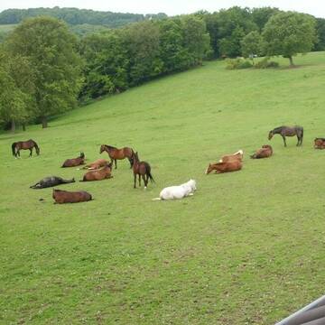

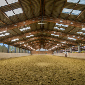
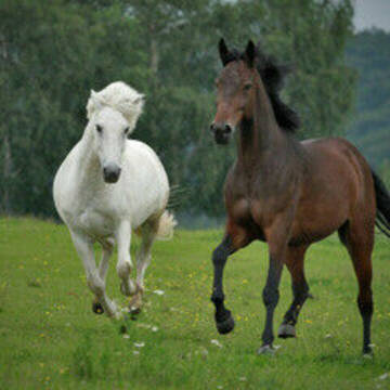
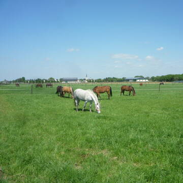
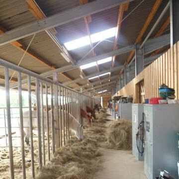
Mayerhof in Hennef Lichtenberg
Hennef Lichtenberg
Ursula Mayer
@Markus-Ursula-und-Marius-Mayer
FN-Mitglied
Freizeitstall
Führanlage
Krankenbox
Notfallboxen
Außenbox mit Paddock
Außenboxen
23 weitere...
S
Deprecated: Creation of dynamic property Zend_View_Helper_Ads::$adLink is deprecated in /var/www/stall-frei/htdocs/staging.stall-frei.de/library/Psf/View/Helper/Ads.php on line 108

Frisches Stroh zu verkaufen!
Mechtersen
STALL-FREIde Marketing
@STALL-FREI-Marketing
Kaufe frisches Stroh für dein Pferd!
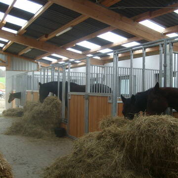
Reitanlage Margarethenhof
Swisttal Miel
Reitanlage-Margarethenhof
@Reitanlage-Margarethenhof
Freizeitstall
Pferdeausbildung
Vermieten
Verpachten
Führanlage
Hunde willkommen
Einhornhaltung möglich
22 weitere...
S
Pferdeboxen in toller Stallgemeinschaft, Wachtberg
Wachtberg
A. Strang
@Stallgemeinschaft_Wiesenau
Freizeitstall
Vermieten
Longierzirkel/Roundpen
Paddock
bedampftes/gewaschenes Heu
Hufrehe geeignet
11 weitere...
P
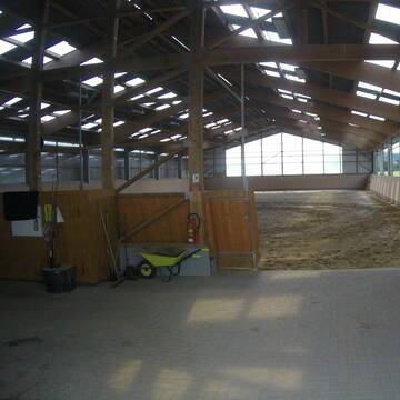
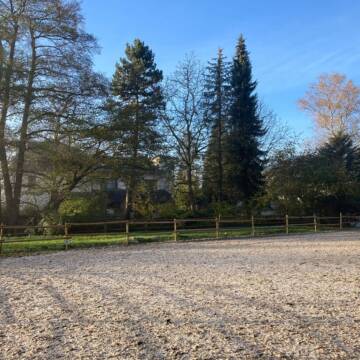
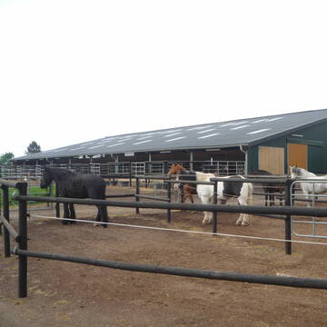
Gut Bentgerhof
Grafschaft
Oliver Heinen
@Oliver-Heinen1
Freizeitstall
Krankenbox
Longierzirkel/Roundpen
Allergikerstall
Hufrehe geeignet
Bewegungsstall
Offenstall
14 weitere...
P+
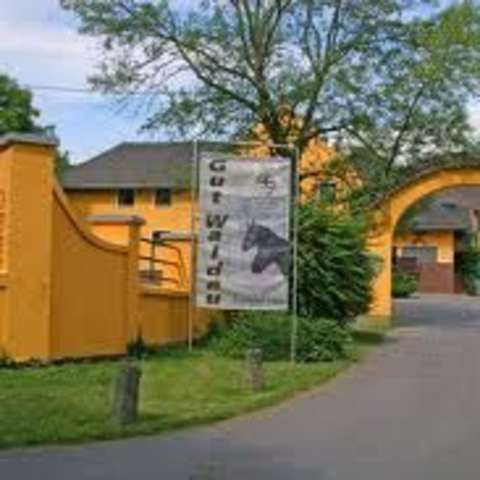
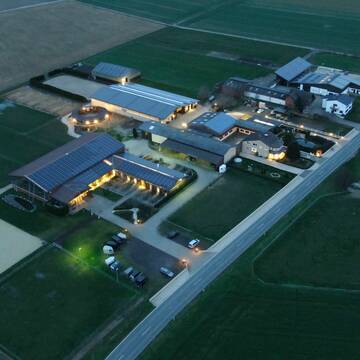
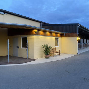
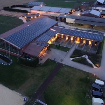
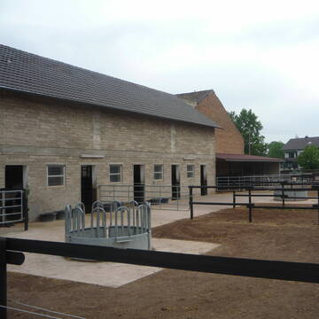
Gut Waldau - Die Reitanlage in Region Köln/Bonn
Rheinbach
Horseconcept Gut Waldau GmbH
@Horseconcept-Gut-Waldau-GmbH
FN-Mitglied
Freizeitstall
Vermieten
Verpachten
Führanlage
Hunde willkommen
Allergikerstall
Fohlenaufzucht möglich
34 weitere...
aktuell
S

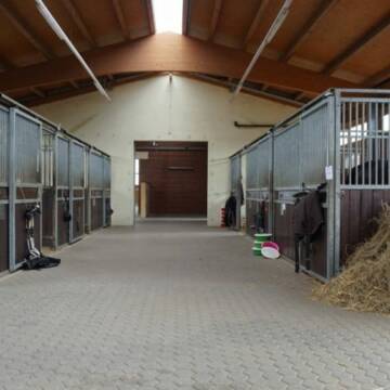
Hof Bongartz • Paddockboxen + HIT-Aktivställe
Hennef-Heisterschoß
Hof-Bongartz
@Hof-Bongartz
Freizeitstall
Reitlehrer und -unterricht
Vermieten
Führanlage
Hunde willkommen
Allergikerstall
22 weitere...
ganz aktuell
S

Aktivlaufstall für Pferde in Wachtberg
Wachtberg
Reit- und Aktivstall Lammerich
@Lisa-Lammerich
FN-Mitglied
Freizeitstall
Vermieten
Hunde willkommen
Krankenbox
Allergikerstall
Notfallboxen
19 weitere...
P

Futtersack HeuToy, Fressbremse in pink
Mechtersen
STALL-FREIde Marketing
@STALL-FREI-Marketing
Stundenlange Beschäftigung die
Koliken vorbeugt, geringe Staubinhalation mit
steuerbarer Futterentnahme

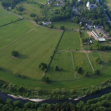

Union-Gestüt, Artgerechte Pferdehaltung im Siegt...
Eitorf
Union Gestüt
@Union-Gestuet
Freizeitstall
Vermieten
Führanlage
Hunde willkommen
Gnadenbrothof
Notfallboxen
23 weitere...
S
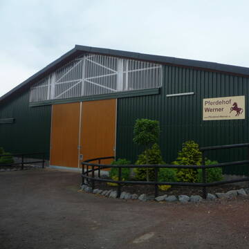
Pferdehof WERNER
Rheinbach-Flerzheim
Hubert-Werner
@Hubert-Werner
Freizeitstall
Longierzirkel/Roundpen
Paddock
Notfallboxen
Außenbox mit Paddock
Laufstall
7 weitere...
P+
Deprecated: Creation of dynamic property Zend_View::$pageCount is deprecated in /var/www/stall-frei/htdocs/staging.stall-frei.de/library/vendor/shardj/zf1-future/library/Zend/View/Abstract.php on line 308
Deprecated: Creation of dynamic property Zend_View::$itemCountPerPage is deprecated in /var/www/stall-frei/htdocs/staging.stall-frei.de/library/vendor/shardj/zf1-future/library/Zend/View/Abstract.php on line 308
Deprecated: Creation of dynamic property Zend_View::$first is deprecated in /var/www/stall-frei/htdocs/staging.stall-frei.de/library/vendor/shardj/zf1-future/library/Zend/View/Abstract.php on line 308
Deprecated: Creation of dynamic property Zend_View::$current is deprecated in /var/www/stall-frei/htdocs/staging.stall-frei.de/library/vendor/shardj/zf1-future/library/Zend/View/Abstract.php on line 308
Deprecated: Creation of dynamic property Zend_View::$last is deprecated in /var/www/stall-frei/htdocs/staging.stall-frei.de/library/vendor/shardj/zf1-future/library/Zend/View/Abstract.php on line 308
Deprecated: Creation of dynamic property Zend_View::$next is deprecated in /var/www/stall-frei/htdocs/staging.stall-frei.de/library/vendor/shardj/zf1-future/library/Zend/View/Abstract.php on line 308
Deprecated: Creation of dynamic property Zend_View::$pagesInRange is deprecated in /var/www/stall-frei/htdocs/staging.stall-frei.de/library/vendor/shardj/zf1-future/library/Zend/View/Abstract.php on line 308
Deprecated: Creation of dynamic property Zend_View::$firstPageInRange is deprecated in /var/www/stall-frei/htdocs/staging.stall-frei.de/library/vendor/shardj/zf1-future/library/Zend/View/Abstract.php on line 308
Deprecated: Creation of dynamic property Zend_View::$lastPageInRange is deprecated in /var/www/stall-frei/htdocs/staging.stall-frei.de/library/vendor/shardj/zf1-future/library/Zend/View/Abstract.php on line 308
Deprecated: Creation of dynamic property Zend_View::$currentItemCount is deprecated in /var/www/stall-frei/htdocs/staging.stall-frei.de/library/vendor/shardj/zf1-future/library/Zend/View/Abstract.php on line 308
Deprecated: Creation of dynamic property Zend_View::$totalItemCount is deprecated in /var/www/stall-frei/htdocs/staging.stall-frei.de/library/vendor/shardj/zf1-future/library/Zend/View/Abstract.php on line 308
Deprecated: Creation of dynamic property Zend_View::$firstItemNumber is deprecated in /var/www/stall-frei/htdocs/staging.stall-frei.de/library/vendor/shardj/zf1-future/library/Zend/View/Abstract.php on line 308
Deprecated: Creation of dynamic property Zend_View::$lastItemNumber is deprecated in /var/www/stall-frei/htdocs/staging.stall-frei.de/library/vendor/shardj/zf1-future/library/Zend/View/Abstract.php on line 308
Deprecated: Creation of dynamic property Zend_View::$router is deprecated in /var/www/stall-frei/htdocs/staging.stall-frei.de/library/vendor/shardj/zf1-future/library/Zend/View/Abstract.php on line 308
Deprecated: Creation of dynamic property Zend_View::$urlParams is deprecated in /var/www/stall-frei/htdocs/staging.stall-frei.de/library/vendor/shardj/zf1-future/library/Zend/View/Abstract.php on line 308
Deprecated: Creation of dynamic property Zend_View::$showAds is deprecated in /var/www/stall-frei/htdocs/staging.stall-frei.de/library/vendor/shardj/zf1-future/library/Zend/View/Abstract.php on line 308
Deprecated: Creation of dynamic property Zend_View::$objectIds is deprecated in /var/www/stall-frei/htdocs/staging.stall-frei.de/library/vendor/shardj/zf1-future/library/Zend/View/Abstract.php on line 308
Deprecated: Creation of dynamic property Zend_View::$showNavbar is deprecated in /var/www/stall-frei/htdocs/staging.stall-frei.de/library/vendor/shardj/zf1-future/library/Zend/View/Abstract.php on line 308
Deprecated: Creation of dynamic property Zend_View::$showBreadcrumb is deprecated in /var/www/stall-frei/htdocs/staging.stall-frei.de/library/vendor/shardj/zf1-future/library/Zend/View/Abstract.php on line 308
Deprecated: Creation of dynamic property Zend_View::$showFooter is deprecated in /var/www/stall-frei/htdocs/staging.stall-frei.de/library/vendor/shardj/zf1-future/library/Zend/View/Abstract.php on line 308
Deprecated: Creation of dynamic property Zend_View::$showInternalAds is deprecated in /var/www/stall-frei/htdocs/staging.stall-frei.de/library/vendor/shardj/zf1-future/library/Zend/View/Abstract.php on line 308
Deprecated: Creation of dynamic property Zend_View::$blNoContent is deprecated in /var/www/stall-frei/htdocs/staging.stall-frei.de/library/vendor/shardj/zf1-future/library/Zend/View/Abstract.php on line 308
Deprecated: Creation of dynamic property Zend_View::$sMetaDesc is deprecated in /var/www/stall-frei/htdocs/staging.stall-frei.de/library/vendor/shardj/zf1-future/library/Zend/View/Abstract.php on line 308
Deprecated: Creation of dynamic property Zend_View::$useGmaps is deprecated in /var/www/stall-frei/htdocs/staging.stall-frei.de/library/vendor/shardj/zf1-future/library/Zend/View/Abstract.php on line 308
Deprecated: Creation of dynamic property Zend_View::$touches is deprecated in /var/www/stall-frei/htdocs/staging.stall-frei.de/library/vendor/shardj/zf1-future/library/Zend/View/Abstract.php on line 308
Deprecated: Creation of dynamic property Zend_View::$oProject is deprecated in /var/www/stall-frei/htdocs/staging.stall-frei.de/library/vendor/shardj/zf1-future/library/Zend/View/Abstract.php on line 308
Deprecated: Creation of dynamic property Zend_View::$pageHeadline is deprecated in /var/www/stall-frei/htdocs/staging.stall-frei.de/library/vendor/shardj/zf1-future/library/Zend/View/Abstract.php on line 308
Deprecated: Creation of dynamic property Zend_View::$disableLocationField is deprecated in /var/www/stall-frei/htdocs/staging.stall-frei.de/library/vendor/shardj/zf1-future/library/Zend/View/Abstract.php on line 308
Deprecated: Creation of dynamic property Zend_View::$isSearch is deprecated in /var/www/stall-frei/htdocs/staging.stall-frei.de/library/vendor/shardj/zf1-future/library/Zend/View/Abstract.php on line 308
Deprecated: Creation of dynamic property Zend_View::$pageTitle is deprecated in /var/www/stall-frei/htdocs/staging.stall-frei.de/library/vendor/shardj/zf1-future/library/Zend/View/Abstract.php on line 308
Deprecated: Creation of dynamic property Psf_Form_Element_Text::$class is deprecated in /var/www/stall-frei/htdocs/staging.stall-frei.de/library/vendor/shardj/zf1-future/library/Zend/Form/Element.php on line 874
Deprecated: Creation of dynamic property Psf_Form_Element_Text::$size is deprecated in /var/www/stall-frei/htdocs/staging.stall-frei.de/library/vendor/shardj/zf1-future/library/Zend/Form/Element.php on line 874
Deprecated: Creation of dynamic property Psf_Form_Element_Text::$placeholder is deprecated in /var/www/stall-frei/htdocs/staging.stall-frei.de/library/vendor/shardj/zf1-future/library/Zend/Form/Element.php on line 874
Deprecated: Creation of dynamic property Psf_Form_Element_Hidden::$class is deprecated in /var/www/stall-frei/htdocs/staging.stall-frei.de/library/vendor/shardj/zf1-future/library/Zend/Form/Element.php on line 874
Deprecated: Creation of dynamic property Psf_Form_Element_Hidden::$class is deprecated in /var/www/stall-frei/htdocs/staging.stall-frei.de/library/vendor/shardj/zf1-future/library/Zend/Form/Element.php on line 874
Deprecated: Creation of dynamic property Psf_Form_Element_Hidden::$class is deprecated in /var/www/stall-frei/htdocs/staging.stall-frei.de/library/vendor/shardj/zf1-future/library/Zend/Form/Element.php on line 874
Deprecated: Creation of dynamic property Psf_Form_Element_Hidden::$class is deprecated in /var/www/stall-frei/htdocs/staging.stall-frei.de/library/vendor/shardj/zf1-future/library/Zend/Form/Element.php on line 874
Deprecated: Creation of dynamic property Psf_Form_Element_Select::$class is deprecated in /var/www/stall-frei/htdocs/staging.stall-frei.de/library/vendor/shardj/zf1-future/library/Zend/Form/Element.php on line 874
Deprecated: Creation of dynamic property Psf_Form_Element_Select::$class is deprecated in /var/www/stall-frei/htdocs/staging.stall-frei.de/library/vendor/shardj/zf1-future/library/Zend/Form/Element.php on line 874
Deprecated: Creation of dynamic property Psf_Form_Element_Select::$class is deprecated in /var/www/stall-frei/htdocs/staging.stall-frei.de/library/vendor/shardj/zf1-future/library/Zend/Form/Element.php on line 874
Deprecated: Creation of dynamic property Psf_Form_Element_Select::$class is deprecated in /var/www/stall-frei/htdocs/staging.stall-frei.de/library/vendor/shardj/zf1-future/library/Zend/Form/Element.php on line 874
Deprecated: Creation of dynamic property Psf_Form_Element_Text::$class is deprecated in /var/www/stall-frei/htdocs/staging.stall-frei.de/library/vendor/shardj/zf1-future/library/Zend/Form/Element.php on line 874
Deprecated: Creation of dynamic property Psf_Form_Element_Checkbox::$label is deprecated in /var/www/stall-frei/htdocs/staging.stall-frei.de/library/vendor/shardj/zf1-future/library/Zend/Form/Element.php on line 874
Deprecated: Creation of dynamic property Zend_View::$sort is deprecated in /var/www/stall-frei/htdocs/staging.stall-frei.de/library/vendor/shardj/zf1-future/library/Zend/View/Abstract.php on line 308
Deprecated: Creation of dynamic property Zend_View::$searchLocation is deprecated in /var/www/stall-frei/htdocs/staging.stall-frei.de/library/vendor/shardj/zf1-future/library/Zend/View/Abstract.php on line 308
Deprecated: Creation of dynamic property Zend_View::$locationHint is deprecated in /var/www/stall-frei/htdocs/staging.stall-frei.de/library/vendor/shardj/zf1-future/library/Zend/View/Abstract.php on line 308
Psf_GeoCoder_Abstract::getLocation: Heiderhof Get Location CachedOrLive
Psf_GeoCoder_Abstract::getCachedOrLive: Heiderhof
Psf_GeoCoder_OpenCageData::makeApiRequest: response:
Array
(
[documentation] => https://opencagedata.com/api
[licenses] => Array
(
[0] => Array
(
[name] => see attribution guide
[url] => https://opencagedata.com/credits
)
)
[results] => Array
(
[0] => Array
(
[bounds] => Array
(
[northeast] => Array
(
[lat] => 50.6721241
[lng] => 7.1638286
)
[southwest] => Array
(
[lat] => 50.6471979
[lng] => 7.1214862
)
)
[components] => Array
(
[ISO_3166-1_alpha-2] => DE
[ISO_3166-1_alpha-3] => DEU
[ISO_3166-2] => Array
(
[0] => DE-NW
)
[_category] => place
[_normalized_city] => Bonn
[_type] => neighbourhood
[city] => Bonn
[continent] => Europe
[country] => Deutschland
[country_code] => de
[political_union] => European Union
[quarter] => Heiderhof
[state] => Nordrhein-Westfalen
[state_code] => NW
[suburb] => Bad Godesberg
)
[confidence] => 7
[formatted] => Bad Godesberg, Bonn, Nordrhein-Westfalen, Deutschland
[geometry] => Array
(
[lat] => 50.6631054
[lng] => 7.1529503
)
)
[1] => Array
(
[bounds] => Array
(
[northeast] => Array
(
[lat] => 51.0218178
[lng] => 7.8042002
)
[southwest] => Array
(
[lat] => 50.9818178
[lng] => 7.7642002
)
)
[components] => Array
(
[ISO_3166-1_alpha-2] => DE
[ISO_3166-1_alpha-3] => DEU
[ISO_3166-2] => Array
(
[0] => DE-NW
)
[_category] => place
[_normalized_city] => Drolshagen
[_type] => hamlet
[continent] => Europe
[country] => Deutschland
[country_code] => de
[county] => Kreis Olpe
[hamlet] => Heiderhof
[political_union] => European Union
[postcode] => 57489
[state] => Nordrhein-Westfalen
[state_code] => NW
[town] => Drolshagen
)
[confidence] => 7
[formatted] => Heiderhof, 57489 Drolshagen, Deutschland
[geometry] => Array
(
[lat] => 51.0018178
[lng] => 7.7842002
)
)
[2] => Array
(
[bounds] => Array
(
[northeast] => Array
(
[lat] => 49.5743757
[lng] => 7.1738887
)
[southwest] => Array
(
[lat] => 49.5742757
[lng] => 7.1737887
)
)
[components] => Array
(
[ISO_3166-1_alpha-2] => DE
[ISO_3166-1_alpha-3] => DEU
[ISO_3166-2] => Array
(
[0] => DE-SL
)
[_category] => building
[_normalized_city] => Nohfelden
[_type] => building
[city] => Nohfelden
[continent] => Europe
[country] => Deutschland
[country_code] => de
[county] => Landkreis St. Wendel
[isolated_dwelling] => Heiderhof
[political_union] => European Union
[postcode] => 66625
[state] => Saarland
[state_code] => SL
[village] => Wolfersweiler
)
[confidence] => 10
[formatted] => Heiderhof, 66625 Wolfersweiler, Deutschland
[geometry] => Array
(
[lat] => 49.5743257
[lng] => 7.1738387
)
)
[3] => Array
(
[bounds] => Array
(
[northeast] => Array
(
[lat] => 51.7331828
[lng] => 6.6830015
)
[southwest] => Array
(
[lat] => 51.7322777
[lng] => 6.6813563
)
)
[components] => Array
(
[ISO_3166-1_alpha-2] => DE
[ISO_3166-1_alpha-3] => DEU
[ISO_3166-2] => Array
(
[0] => DE-NW
)
[_category] => agriculture
[_normalized_city] => Hamminkeln
[_type] => farmyard
[continent] => Europe
[country] => Deutschland
[country_code] => de
[county] => Kreis Wesel
[farmyard] => Heiderhof
[political_union] => European Union
[postcode] => 46499
[state] => Nordrhein-Westfalen
[state_code] => NW
[suburb] => Brünen
[town] => Hamminkeln
)
[confidence] => 9
[formatted] => Heiderhof, 46499 Hamminkeln, Deutschland
[geometry] => Array
(
[lat] => 51.7327423
[lng] => 6.6821576
)
)
[4] => Array
(
[bounds] => Array
(
[northeast] => Array
(
[lat] => 51.3216641
[lng] => 6.7788065
)
[southwest] => Array
(
[lat] => 51.3212466
[lng] => 6.7780397
)
)
[components] => Array
(
[ISO_3166-1_alpha-2] => DE
[ISO_3166-1_alpha-3] => DEU
[ISO_3166-2] => Array
(
[0] => DE-NW
)
[_category] => agriculture
[_normalized_city] => Düsseldorf
[_type] => farmyard
[city] => Düsseldorf
[city_district] => Stadtbezirk 5
[continent] => Europe
[country] => Deutschland
[country_code] => de
[farmyard] => Heiderhof
[political_union] => European Union
[postcode] => 40489
[state] => Nordrhein-Westfalen
[state_code] => NW
[suburb] => Angermund
)
[confidence] => 9
[formatted] => Heiderhof, 40489 Düsseldorf, Deutschland
[geometry] => Array
(
[lat] => 51.3214147
[lng] => 6.7783731
)
)
[5] => Array
(
[bounds] => Array
(
[northeast] => Array
(
[lat] => 51.0018071
[lng] => 7.7896604
)
[southwest] => Array
(
[lat] => 50.9983787
[lng] => 7.7785161
)
)
[components] => Array
(
[ISO_3166-1_alpha-2] => DE
[ISO_3166-1_alpha-3] => DEU
[ISO_3166-2] => Array
(
[0] => DE-NW
)
[_category] => road
[_normalized_city] => Drolshagen
[_type] => road
[continent] => Europe
[country] => Deutschland
[country_code] => de
[county] => Kreis Olpe
[hamlet] => Heiderhof
[political_union] => European Union
[postcode] => 57489
[road] => Heiderhof
[road_type] => residential
[state] => Nordrhein-Westfalen
[state_code] => NW
[town] => Drolshagen
)
[confidence] => 9
[formatted] => Heiderhof, 57489 Drolshagen, Deutschland
[geometry] => Array
(
[lat] => 51.001529
[lng] => 7.7836296
)
)
[6] => Array
(
[bounds] => Array
(
[northeast] => Array
(
[lat] => 50.5989702
[lng] => 7.4990558
)
[southwest] => Array
(
[lat] => 50.5925122
[lng] => 7.4939693
)
)
[components] => Array
(
[ISO_3166-1_alpha-2] => DE
[ISO_3166-1_alpha-3] => DEU
[ISO_3166-2] => Array
(
[0] => DE-RP
)
[_category] => road
[_normalized_city] => Obersteinebach
[_type] => road
[continent] => Europe
[country] => Deutschland
[country_code] => de
[county] => Landkreis Altenkirchen (Westerwald)
[municipality] => Altenkirchen-Flammersfeld
[political_union] => European Union
[postcode] => 56593
[road] => Heiderhof
[road_type] => residential
[state] => Rheinland-Pfalz
[state_code] => RP
[village] => Obersteinebach
)
[confidence] => 9
[formatted] => Heiderhof, 56593 Obersteinebach, Deutschland
[geometry] => Array
(
[lat] => 50.5944274
[lng] => 7.4942116
)
)
[7] => Array
(
[bounds] => Array
(
[northeast] => Array
(
[lat] => 51.0554342
[lng] => 7.1152112
)
[southwest] => Array
(
[lat] => 51.0543932
[lng] => 7.113919
)
)
[components] => Array
(
[ISO_3166-1_alpha-2] => DE
[ISO_3166-1_alpha-3] => DEU
[ISO_3166-2] => Array
(
[0] => DE-NW
)
[_category] => road
[_normalized_city] => Odenthal
[_type] => road
[continent] => Europe
[country] => Deutschland
[country_code] => de
[county] => Rheinisch-Bergischer Kreis
[hamlet] => Holz
[political_union] => European Union
[postcode] => 51519
[road] => Heiderhof
[road_type] => living_street
[state] => Nordrhein-Westfalen
[state_code] => NW
[town] => Odenthal
)
[confidence] => 9
[formatted] => Heiderhof, 51519 Odenthal, Deutschland
[geometry] => Array
(
[lat] => 51.0549145
[lng] => 7.1145214
)
)
[8] => Array
(
[bounds] => Array
(
[northeast] => Array
(
[lat] => 51.1016911
[lng] => 6.2177414
)
[southwest] => Array
(
[lat] => 51.1013662
[lng] => 6.2172528
)
)
[components] => Array
(
[ISO_3166-1_alpha-2] => DE
[ISO_3166-1_alpha-3] => DEU
[ISO_3166-2] => Array
(
[0] => DE-NW
)
[_category] => road
[_normalized_city] => Erkelenz
[_type] => road
[continent] => Europe
[country] => Deutschland
[country_code] => de
[county] => Kreis Heinsberg
[hamlet] => Fronderath
[political_union] => European Union
[postcode] => 41812
[road] => Heiderhof
[road_type] => residential
[state] => Nordrhein-Westfalen
[state_code] => NW
[town] => Erkelenz
)
[confidence] => 9
[formatted] => Heiderhof, 41812 Erkelenz, Deutschland
[geometry] => Array
(
[lat] => 51.1015287
[lng] => 6.2174971
)
)
[9] => Array
(
[components] => Array
(
[ISO_3166-1_alpha-2] => FR
[ISO_3166-1_alpha-3] => FRA
[ISO_3166-2] => Array
(
[0] => FR-GES
[1] => FR-57
)
[_category] => road
[_normalized_city] => Lafrimbolle
[_type] => road
[city] => Lafrimbolle
[continent] => Europe
[country] => France
[country_code] => fr
[county] => Moselle
[local_authority] => Communauté de communes Sarrebourg Moselle Sud
[political_union] => European Union
[postcode] => 57560
[road] => Route de Niderhoff
[state] => Grand Est
[state_code] => GES
)
[confidence] => 3
[formatted] => Route de Niderhoff, 57560 Lafrimbolle, France
[geometry] => Array
(
[lat] => 48.610558
[lng] => 7.017099
)
)
)
[status] => Array
(
[code] => 200
[message] => OK
)
[stay_informed] => Array
(
[blog] => https://blog.opencagedata.com
[mastodon] => https://en.osm.town/@opencage
)
[thanks] => For using an OpenCage API
[timestamp] => Array
(
[created_http] => Sat, 07 Feb 2026 15:32:07 GMT
[created_unix] => 1770478327
)
[total_results] => 10
)
Psf_GeoCoder_Abstract::convertLocationResult
{"documentation":"https:\/\/opencagedata.com\/api","licenses":[{"name":"see attribution guide","url":"https:\/\/opencagedata.com\/credits"}],"results":[{"bounds":{"northeast":{"lat":50.6721241,"lng":7.1638286},"southwest":{"lat":50.6471979,"lng":7.1214862}},"components":{"ISO_3166-1_alpha-2":"DE","ISO_3166-1_alpha-3":"DEU","ISO_3166-2":["DE-NW"],"_category":"place","_normalized_city":"Bonn","_type":"neighbourhood","city":"Bonn","continent":"Europe","country":"Deutschland","country_code":"de","political_union":"European Union","quarter":"Heiderhof","state":"Nordrhein-Westfalen","state_code":"NW","suburb":"Bad Godesberg"},"confidence":7,"formatted":"Bad Godesberg, Bonn, Nordrhein-Westfalen, Deutschland","geometry":{"lat":50.6631054,"lng":7.1529503}},{"bounds":{"northeast":{"lat":51.0218178,"lng":7.8042002},"southwest":{"lat":50.9818178,"lng":7.7642002}},"components":{"ISO_3166-1_alpha-2":"DE","ISO_3166-1_alpha-3":"DEU","ISO_3166-2":["DE-NW"],"_category":"place","_normalized_city":"Drolshagen","_type":"hamlet","continent":"Europe","country":"Deutschland","country_code":"de","county":"Kreis Olpe","hamlet":"Heiderhof","political_union":"European Union","postcode":"57489","state":"Nordrhein-Westfalen","state_code":"NW","town":"Drolshagen"},"confidence":7,"formatted":"Heiderhof, 57489 Drolshagen, Deutschland","geometry":{"lat":51.0018178,"lng":7.7842002}},{"bounds":{"northeast":{"lat":49.5743757,"lng":7.1738887},"southwest":{"lat":49.5742757,"lng":7.1737887}},"components":{"ISO_3166-1_alpha-2":"DE","ISO_3166-1_alpha-3":"DEU","ISO_3166-2":["DE-SL"],"_category":"building","_normalized_city":"Nohfelden","_type":"building","city":"Nohfelden","continent":"Europe","country":"Deutschland","country_code":"de","county":"Landkreis St. Wendel","isolated_dwelling":"Heiderhof","political_union":"European Union","postcode":"66625","state":"Saarland","state_code":"SL","village":"Wolfersweiler"},"confidence":10,"formatted":"Heiderhof, 66625 Wolfersweiler, Deutschland","geometry":{"lat":49.5743257,"lng":7.1738387}},{"bounds":{"northeast":{"lat":51.7331828,"lng":6.6830015},"southwest":{"lat":51.7322777,"lng":6.6813563}},"components":{"ISO_3166-1_alpha-2":"DE","ISO_3166-1_alpha-3":"DEU","ISO_3166-2":["DE-NW"],"_category":"agriculture","_normalized_city":"Hamminkeln","_type":"farmyard","continent":"Europe","country":"Deutschland","country_code":"de","county":"Kreis Wesel","farmyard":"Heiderhof","political_union":"European Union","postcode":"46499","state":"Nordrhein-Westfalen","state_code":"NW","suburb":"Br\u00fcnen","town":"Hamminkeln"},"confidence":9,"formatted":"Heiderhof, 46499 Hamminkeln, Deutschland","geometry":{"lat":51.7327423,"lng":6.6821576}},{"bounds":{"northeast":{"lat":51.3216641,"lng":6.7788065},"southwest":{"lat":51.3212466,"lng":6.7780397}},"components":{"ISO_3166-1_alpha-2":"DE","ISO_3166-1_alpha-3":"DEU","ISO_3166-2":["DE-NW"],"_category":"agriculture","_normalized_city":"D\u00fcsseldorf","_type":"farmyard","city":"D\u00fcsseldorf","city_district":"Stadtbezirk 5","continent":"Europe","country":"Deutschland","country_code":"de","farmyard":"Heiderhof","political_union":"European Union","postcode":"40489","state":"Nordrhein-Westfalen","state_code":"NW","suburb":"Angermund"},"confidence":9,"formatted":"Heiderhof, 40489 D\u00fcsseldorf, Deutschland","geometry":{"lat":51.3214147,"lng":6.7783731}},{"bounds":{"northeast":{"lat":51.0018071,"lng":7.7896604},"southwest":{"lat":50.9983787,"lng":7.7785161}},"components":{"ISO_3166-1_alpha-2":"DE","ISO_3166-1_alpha-3":"DEU","ISO_3166-2":["DE-NW"],"_category":"road","_normalized_city":"Drolshagen","_type":"road","continent":"Europe","country":"Deutschland","country_code":"de","county":"Kreis Olpe","hamlet":"Heiderhof","political_union":"European Union","postcode":"57489","road":"Heiderhof","road_type":"residential","state":"Nordrhein-Westfalen","state_code":"NW","town":"Drolshagen"},"confidence":9,"formatted":"Heiderhof, 57489 Drolshagen, Deutschland","geometry":{"lat":51.001529,"lng":7.7836296}},{"bounds":{"northeast":{"lat":50.5989702,"lng":7.4990558},"southwest":{"lat":50.5925122,"lng":7.4939693}},"components":{"ISO_3166-1_alpha-2":"DE","ISO_3166-1_alpha-3":"DEU","ISO_3166-2":["DE-RP"],"_category":"road","_normalized_city":"Obersteinebach","_type":"road","continent":"Europe","country":"Deutschland","country_code":"de","county":"Landkreis Altenkirchen (Westerwald)","municipality":"Altenkirchen-Flammersfeld","political_union":"European Union","postcode":"56593","road":"Heiderhof","road_type":"residential","state":"Rheinland-Pfalz","state_code":"RP","village":"Obersteinebach"},"confidence":9,"formatted":"Heiderhof, 56593 Obersteinebach, Deutschland","geometry":{"lat":50.5944274,"lng":7.4942116}},{"bounds":{"northeast":{"lat":51.0554342,"lng":7.1152112},"southwest":{"lat":51.0543932,"lng":7.113919}},"components":{"ISO_3166-1_alpha-2":"DE","ISO_3166-1_alpha-3":"DEU","ISO_3166-2":["DE-NW"],"_category":"road","_normalized_city":"Odenthal","_type":"road","continent":"Europe","country":"Deutschland","country_code":"de","county":"Rheinisch-Bergischer Kreis","hamlet":"Holz","political_union":"European Union","postcode":"51519","road":"Heiderhof","road_type":"living_street","state":"Nordrhein-Westfalen","state_code":"NW","town":"Odenthal"},"confidence":9,"formatted":"Heiderhof, 51519 Odenthal, Deutschland","geometry":{"lat":51.0549145,"lng":7.1145214}},{"bounds":{"northeast":{"lat":51.1016911,"lng":6.2177414},"southwest":{"lat":51.1013662,"lng":6.2172528}},"components":{"ISO_3166-1_alpha-2":"DE","ISO_3166-1_alpha-3":"DEU","ISO_3166-2":["DE-NW"],"_category":"road","_normalized_city":"Erkelenz","_type":"road","continent":"Europe","country":"Deutschland","country_code":"de","county":"Kreis Heinsberg","hamlet":"Fronderath","political_union":"European Union","postcode":"41812","road":"Heiderhof","road_type":"residential","state":"Nordrhein-Westfalen","state_code":"NW","town":"Erkelenz"},"confidence":9,"formatted":"Heiderhof, 41812 Erkelenz, Deutschland","geometry":{"lat":51.1015287,"lng":6.2174971}},{"components":{"ISO_3166-1_alpha-2":"FR","ISO_3166-1_alpha-3":"FRA","ISO_3166-2":["FR-GES","FR-57"],"_category":"road","_normalized_city":"Lafrimbolle","_type":"road","city":"Lafrimbolle","continent":"Europe","country":"France","country_code":"fr","county":"Moselle","local_authority":"Communaut\u00e9 de communes Sarrebourg Moselle Sud","political_union":"European Union","postcode":"57560","road":"Route de Niderhoff","state":"Grand Est","state_code":"GES"},"confidence":3,"formatted":"Route de Niderhoff, 57560 Lafrimbolle, France","geometry":{"lat":48.610558,"lng":7.017099}}],"status":{"code":200,"message":"OK"},"stay_informed":{"blog":"https:\/\/blog.opencagedata.com","mastodon":"https:\/\/en.osm.town\/@opencage"},"thanks":"For using an OpenCage API","timestamp":{"created_http":"Sat, 07 Feb 2026 15:32:07 GMT","created_unix":1770478327},"total_results":10}Array
(
[0] => stdClass Object
(
[bounds] => stdClass Object
(
[northeast] => stdClass Object
(
[lat] => 50.6721241
[lng] => 7.1638286
)
[southwest] => stdClass Object
(
[lat] => 50.6471979
[lng] => 7.1214862
)
)
[components] => stdClass Object
(
[ISO_3166-1_alpha-2] => DE
[ISO_3166-1_alpha-3] => DEU
[ISO_3166-2] => Array
(
[0] => DE-NW
)
[_category] => place
[_normalized_city] => Bonn
[_type] => neighbourhood
[city] => Bonn
[continent] => Europe
[country] => Deutschland
[country_code] => de
[political_union] => European Union
[quarter] => Heiderhof
[state] => Nordrhein-Westfalen
[state_code] => NW
[suburb] => Bad Godesberg
)
[confidence] => 7
[formatted] => Bad Godesberg, Bonn, Nordrhein-Westfalen, Deutschland
[geometry] => stdClass Object
(
[lat] => 50.6631054
[lng] => 7.1529503
)
)
[1] => stdClass Object
(
[bounds] => stdClass Object
(
[northeast] => stdClass Object
(
[lat] => 51.0218178
[lng] => 7.8042002
)
[southwest] => stdClass Object
(
[lat] => 50.9818178
[lng] => 7.7642002
)
)
[components] => stdClass Object
(
[ISO_3166-1_alpha-2] => DE
[ISO_3166-1_alpha-3] => DEU
[ISO_3166-2] => Array
(
[0] => DE-NW
)
[_category] => place
[_normalized_city] => Drolshagen
[_type] => hamlet
[continent] => Europe
[country] => Deutschland
[country_code] => de
[county] => Kreis Olpe
[hamlet] => Heiderhof
[political_union] => European Union
[postcode] => 57489
[state] => Nordrhein-Westfalen
[state_code] => NW
[town] => Drolshagen
)
[confidence] => 7
[formatted] => Heiderhof, 57489 Drolshagen, Deutschland
[geometry] => stdClass Object
(
[lat] => 51.0018178
[lng] => 7.7842002
)
)
[2] => stdClass Object
(
[bounds] => stdClass Object
(
[northeast] => stdClass Object
(
[lat] => 49.5743757
[lng] => 7.1738887
)
[southwest] => stdClass Object
(
[lat] => 49.5742757
[lng] => 7.1737887
)
)
[components] => stdClass Object
(
[ISO_3166-1_alpha-2] => DE
[ISO_3166-1_alpha-3] => DEU
[ISO_3166-2] => Array
(
[0] => DE-SL
)
[_category] => building
[_normalized_city] => Nohfelden
[_type] => building
[city] => Nohfelden
[continent] => Europe
[country] => Deutschland
[country_code] => de
[county] => Landkreis St. Wendel
[isolated_dwelling] => Heiderhof
[political_union] => European Union
[postcode] => 66625
[state] => Saarland
[state_code] => SL
[village] => Wolfersweiler
)
[confidence] => 10
[formatted] => Heiderhof, 66625 Wolfersweiler, Deutschland
[geometry] => stdClass Object
(
[lat] => 49.5743257
[lng] => 7.1738387
)
)
[3] => stdClass Object
(
[bounds] => stdClass Object
(
[northeast] => stdClass Object
(
[lat] => 51.7331828
[lng] => 6.6830015
)
[southwest] => stdClass Object
(
[lat] => 51.7322777
[lng] => 6.6813563
)
)
[components] => stdClass Object
(
[ISO_3166-1_alpha-2] => DE
[ISO_3166-1_alpha-3] => DEU
[ISO_3166-2] => Array
(
[0] => DE-NW
)
[_category] => agriculture
[_normalized_city] => Hamminkeln
[_type] => farmyard
[continent] => Europe
[country] => Deutschland
[country_code] => de
[county] => Kreis Wesel
[farmyard] => Heiderhof
[political_union] => European Union
[postcode] => 46499
[state] => Nordrhein-Westfalen
[state_code] => NW
[suburb] => Brünen
[town] => Hamminkeln
)
[confidence] => 9
[formatted] => Heiderhof, 46499 Hamminkeln, Deutschland
[geometry] => stdClass Object
(
[lat] => 51.7327423
[lng] => 6.6821576
)
)
[4] => stdClass Object
(
[bounds] => stdClass Object
(
[northeast] => stdClass Object
(
[lat] => 51.3216641
[lng] => 6.7788065
)
[southwest] => stdClass Object
(
[lat] => 51.3212466
[lng] => 6.7780397
)
)
[components] => stdClass Object
(
[ISO_3166-1_alpha-2] => DE
[ISO_3166-1_alpha-3] => DEU
[ISO_3166-2] => Array
(
[0] => DE-NW
)
[_category] => agriculture
[_normalized_city] => Düsseldorf
[_type] => farmyard
[city] => Düsseldorf
[city_district] => Stadtbezirk 5
[continent] => Europe
[country] => Deutschland
[country_code] => de
[farmyard] => Heiderhof
[political_union] => European Union
[postcode] => 40489
[state] => Nordrhein-Westfalen
[state_code] => NW
[suburb] => Angermund
)
[confidence] => 9
[formatted] => Heiderhof, 40489 Düsseldorf, Deutschland
[geometry] => stdClass Object
(
[lat] => 51.3214147
[lng] => 6.7783731
)
)
[5] => stdClass Object
(
[bounds] => stdClass Object
(
[northeast] => stdClass Object
(
[lat] => 51.0018071
[lng] => 7.7896604
)
[southwest] => stdClass Object
(
[lat] => 50.9983787
[lng] => 7.7785161
)
)
[components] => stdClass Object
(
[ISO_3166-1_alpha-2] => DE
[ISO_3166-1_alpha-3] => DEU
[ISO_3166-2] => Array
(
[0] => DE-NW
)
[_category] => road
[_normalized_city] => Drolshagen
[_type] => road
[continent] => Europe
[country] => Deutschland
[country_code] => de
[county] => Kreis Olpe
[hamlet] => Heiderhof
[political_union] => European Union
[postcode] => 57489
[road] => Heiderhof
[road_type] => residential
[state] => Nordrhein-Westfalen
[state_code] => NW
[town] => Drolshagen
)
[confidence] => 9
[formatted] => Heiderhof, 57489 Drolshagen, Deutschland
[geometry] => stdClass Object
(
[lat] => 51.001529
[lng] => 7.7836296
)
)
[6] => stdClass Object
(
[bounds] => stdClass Object
(
[northeast] => stdClass Object
(
[lat] => 50.5989702
[lng] => 7.4990558
)
[southwest] => stdClass Object
(
[lat] => 50.5925122
[lng] => 7.4939693
)
)
[components] => stdClass Object
(
[ISO_3166-1_alpha-2] => DE
[ISO_3166-1_alpha-3] => DEU
[ISO_3166-2] => Array
(
[0] => DE-RP
)
[_category] => road
[_normalized_city] => Obersteinebach
[_type] => road
[continent] => Europe
[country] => Deutschland
[country_code] => de
[county] => Landkreis Altenkirchen (Westerwald)
[municipality] => Altenkirchen-Flammersfeld
[political_union] => European Union
[postcode] => 56593
[road] => Heiderhof
[road_type] => residential
[state] => Rheinland-Pfalz
[state_code] => RP
[village] => Obersteinebach
)
[confidence] => 9
[formatted] => Heiderhof, 56593 Obersteinebach, Deutschland
[geometry] => stdClass Object
(
[lat] => 50.5944274
[lng] => 7.4942116
)
)
[7] => stdClass Object
(
[bounds] => stdClass Object
(
[northeast] => stdClass Object
(
[lat] => 51.0554342
[lng] => 7.1152112
)
[southwest] => stdClass Object
(
[lat] => 51.0543932
[lng] => 7.113919
)
)
[components] => stdClass Object
(
[ISO_3166-1_alpha-2] => DE
[ISO_3166-1_alpha-3] => DEU
[ISO_3166-2] => Array
(
[0] => DE-NW
)
[_category] => road
[_normalized_city] => Odenthal
[_type] => road
[continent] => Europe
[country] => Deutschland
[country_code] => de
[county] => Rheinisch-Bergischer Kreis
[hamlet] => Holz
[political_union] => European Union
[postcode] => 51519
[road] => Heiderhof
[road_type] => living_street
[state] => Nordrhein-Westfalen
[state_code] => NW
[town] => Odenthal
)
[confidence] => 9
[formatted] => Heiderhof, 51519 Odenthal, Deutschland
[geometry] => stdClass Object
(
[lat] => 51.0549145
[lng] => 7.1145214
)
)
[8] => stdClass Object
(
[bounds] => stdClass Object
(
[northeast] => stdClass Object
(
[lat] => 51.1016911
[lng] => 6.2177414
)
[southwest] => stdClass Object
(
[lat] => 51.1013662
[lng] => 6.2172528
)
)
[components] => stdClass Object
(
[ISO_3166-1_alpha-2] => DE
[ISO_3166-1_alpha-3] => DEU
[ISO_3166-2] => Array
(
[0] => DE-NW
)
[_category] => road
[_normalized_city] => Erkelenz
[_type] => road
[continent] => Europe
[country] => Deutschland
[country_code] => de
[county] => Kreis Heinsberg
[hamlet] => Fronderath
[political_union] => European Union
[postcode] => 41812
[road] => Heiderhof
[road_type] => residential
[state] => Nordrhein-Westfalen
[state_code] => NW
[town] => Erkelenz
)
[confidence] => 9
[formatted] => Heiderhof, 41812 Erkelenz, Deutschland
[geometry] => stdClass Object
(
[lat] => 51.1015287
[lng] => 6.2174971
)
)
[9] => stdClass Object
(
[components] => stdClass Object
(
[ISO_3166-1_alpha-2] => FR
[ISO_3166-1_alpha-3] => FRA
[ISO_3166-2] => Array
(
[0] => FR-GES
[1] => FR-57
)
[_category] => road
[_normalized_city] => Lafrimbolle
[_type] => road
[city] => Lafrimbolle
[continent] => Europe
[country] => France
[country_code] => fr
[county] => Moselle
[local_authority] => Communauté de communes Sarrebourg Moselle Sud
[political_union] => European Union
[postcode] => 57560
[road] => Route de Niderhoff
[state] => Grand Est
[state_code] => GES
)
[confidence] => 3
[formatted] => Route de Niderhoff, 57560 Lafrimbolle, France
[geometry] => stdClass Object
(
[lat] => 48.610558
[lng] => 7.017099
)
)
)
Psf_GeoCoder_OpenCageData::getKeyMap: 0
stdClass Object
(
    [bounds] => stdClass Object
        (
            [northeast] => stdClass Object
                (
                    [lat] => 50.6721241
                    [lng] => 7.1638286
                )

            [southwest] => stdClass Object
                (
                    [lat] => 50.6471979
                    [lng] => 7.1214862
                )

        )

    [components] => stdClass Object
        (
            [ISO_3166-1_alpha-2] => DE
            [ISO_3166-1_alpha-3] => DEU
            [ISO_3166-2] => Array
                (
                    [0] => DE-NW
                )

            [_category] => place
            [_normalized_city] => Bonn
            [_type] => neighbourhood
            [city] => Bonn
            [continent] => Europe
            [country] => Deutschland
            [country_code] => de
            [political_union] => European Union
            [quarter] => Heiderhof
            [state] => Nordrhein-Westfalen
            [state_code] => NW
            [suburb] => Bad Godesberg
        )

    [confidence] => 7
    [formatted] => Bad Godesberg, Bonn, Nordrhein-Westfalen, Deutschland
    [geometry] => stdClass Object
        (
            [lat] => 50.6631054
            [lng] => 7.1529503
        )

)
Psf_GeoCoder_OpenCageData::getCounty: Bonn
Psf_GeoCoder_OpenCageData::addMissingData REFETCH!
Array
(
    [address] => Bad Godesberg, Bonn, Nordrhein-Westfalen, Deutschland
    [type] => neighbourhood
    [street] =>
    [city] => Bad Godesberg
    [county] => Bonn
    [state] => Nordrhein-Westfalen
    [zip] =>
    [country] => Deutschland
    [suburb] => Bad Godesberg
    [countrycode] => de
    [latitude] => 50.6631054
    [longitude] => 7.1529503
    [accuracy] => 1
    [confidence] => 7
    [bounds] => stdClass Object
        (
            [northeast] => stdClass Object
                (
                    [lat] => 50.6721241
                    [lng] => 7.1638286
                )

            [southwest] => stdClass Object
                (
                    [lat] => 50.6471979
                    [lng] => 7.1214862
                )

        )

)
reformat!
Array
(
    [address] => Bad Godesberg, Bonn, Nordrhein-Westfalen, Deutschland
    [type] => neighbourhood
    [street] =>
    [city] => Bad Godesberg
    [county] => Bonn
    [state] => Nordrhein-Westfalen
    [zip] =>
    [country] => Deutschland
    [suburb] => Bad Godesberg
    [countrycode] => de
    [latitude] => 50.6631054
    [longitude] => 7.1529503
    [accuracy] => 1
    [confidence] => 7
    [bounds] => stdClass Object
        (
            [northeast] => stdClass Object
                (
                    [lat] => 50.6721241
                    [lng] => 7.1638286
                )

            [southwest] => stdClass Object
                (
                    [lat] => 50.6471979
                    [lng] => 7.1214862
                )

        )

    [place] => Bad Godesberg, Nordrhein-Westfalen
    [hash] => 8c3b7c694cb8e546d009536d49077138
)
Psf_GeoCoder_OpenCageData::getKeyMap: 1
stdClass Object
(
    [bounds] => stdClass Object
        (
            [northeast] => stdClass Object
                (
                    [lat] => 51.0218178
                    [lng] => 7.8042002
                )

            [southwest] => stdClass Object
                (
                    [lat] => 50.9818178
                    [lng] => 7.7642002
                )

        )

    [components] => stdClass Object
        (
            [ISO_3166-1_alpha-2] => DE
            [ISO_3166-1_alpha-3] => DEU
            [ISO_3166-2] => Array
                (
                    [0] => DE-NW
                )

            [_category] => place
            [_normalized_city] => Drolshagen
            [_type] => hamlet
            [continent] => Europe
            [country] => Deutschland
            [country_code] => de
            [county] => Kreis Olpe
            [hamlet] => Heiderhof
            [political_union] => European Union
            [postcode] => 57489
            [state] => Nordrhein-Westfalen
            [state_code] => NW
            [town] => Drolshagen
        )

    [confidence] => 7
    [formatted] => Heiderhof, 57489 Drolshagen, Deutschland
    [geometry] => stdClass Object
        (
            [lat] => 51.0018178
            [lng] => 7.7842002
        )

)
Psf_GeoCoder_OpenCageData::getCounty: Olpe
Psf_GeoCoder_OpenCageData::addMissingData REFETCH!
Array
(
    [address] => Heiderhof, 57489 Drolshagen, Deutschland
    [type] => hamlet
    [street] => Heiderhof
    [city] => Drolshagen
    [county] => Olpe
    [state] => Nordrhein-Westfalen
    [zip] => 57489
    [country] => Deutschland
    [suburb] =>
    [countrycode] => de
    [latitude] => 51.0018178
    [longitude] => 7.7842002
    [accuracy] => 1
    [confidence] => 7
    [bounds] => stdClass Object
        (
            [northeast] => stdClass Object
                (
                    [lat] => 51.0218178
                    [lng] => 7.8042002
                )

            [southwest] => stdClass Object
                (
                    [lat] => 50.9818178
                    [lng] => 7.7642002
                )

        )

)
reformat!
Array
(
    [address] => Heiderhof, 57489 Drolshagen, Deutschland
    [type] => hamlet
    [street] => Heiderhof
    [city] => Drolshagen
    [county] => Olpe
    [state] => Nordrhein-Westfalen
    [zip] => 57489
    [country] => Deutschland
    [suburb] =>
    [countrycode] => de
    [latitude] => 51.0018178
    [longitude] => 7.7842002
    [accuracy] => 1
    [confidence] => 7
    [bounds] => stdClass Object
        (
            [northeast] => stdClass Object
                (
                    [lat] => 51.0218178
                    [lng] => 7.8042002
                )

            [southwest] => stdClass Object
                (
                    [lat] => 50.9818178
                    [lng] => 7.7642002
                )

        )

    [place] => Heiderhof, 57489 Drolshagen, Nordrhein-Westfalen
    [hash] => fb3257967ac0fac8b64702fa97c8a3d3
)
Psf_GeoCoder_OpenCageData::getKeyMap: 2
stdClass Object
(
    [bounds] => stdClass Object
        (
            [northeast] => stdClass Object
                (
                    [lat] => 49.5743757
                    [lng] => 7.1738887
                )

            [southwest] => stdClass Object
                (
                    [lat] => 49.5742757
                    [lng] => 7.1737887
                )

        )

    [components] => stdClass Object
        (
            [ISO_3166-1_alpha-2] => DE
            [ISO_3166-1_alpha-3] => DEU
            [ISO_3166-2] => Array
                (
                    [0] => DE-SL
                )

            [_category] => building
            [_normalized_city] => Nohfelden
            [_type] => building
            [city] => Nohfelden
            [continent] => Europe
            [country] => Deutschland
            [country_code] => de
            [county] => Landkreis St. Wendel
            [isolated_dwelling] => Heiderhof
            [political_union] => European Union
            [postcode] => 66625
            [state] => Saarland
            [state_code] => SL
            [village] => Wolfersweiler
        )

    [confidence] => 10
    [formatted] => Heiderhof, 66625 Wolfersweiler, Deutschland
    [geometry] => stdClass Object
        (
            [lat] => 49.5743257
            [lng] => 7.1738387
        )

)
Psf_GeoCoder_OpenCageData::getCounty: St. Wendel
Psf_GeoCoder_OpenCageData::addMissingData REFETCH!
Array
(
    [address] => Heiderhof, 66625 Wolfersweiler, Deutschland
    [type] => building
    [street] =>
    [city] => Wolfersweiler
    [county] => St. Wendel
    [state] => Saarland
    [zip] => 66625
    [country] => Deutschland
    [suburb] =>
    [countrycode] => de
    [latitude] => 49.5743257
    [longitude] => 7.1738387
    [accuracy] => 1
    [confidence] => 10
    [bounds] => stdClass Object
        (
            [northeast] => stdClass Object
                (
                    [lat] => 49.5743757
                    [lng] => 7.1738887
                )

            [southwest] => stdClass Object
                (
                    [lat] => 49.5742757
                    [lng] => 7.1737887
                )

        )

)
reformat!
Array
(
    [address] => Heiderhof, 66625 Wolfersweiler, Deutschland
    [type] => building
    [street] =>
    [city] => Wolfersweiler
    [county] => St. Wendel
    [state] => Saarland
    [zip] => 66625
    [country] => Deutschland
    [suburb] =>
    [countrycode] => de
    [latitude] => 49.5743257
    [longitude] => 7.1738387
    [accuracy] => 1
    [confidence] => 10
    [bounds] => stdClass Object
        (
            [northeast] => stdClass Object
                (
                    [lat] => 49.5743757
                    [lng] => 7.1738887
                )

            [southwest] => stdClass Object
                (
                    [lat] => 49.5742757
                    [lng] => 7.1737887
                )

        )

    [place] => 66625 Wolfersweiler, Saarland
    [hash] => b88907b6eabdb09b22b2e0f8efa88893
)
Psf_GeoCoder_OpenCageData::getKeyMap: 3
stdClass Object
(
    [bounds] => stdClass Object
        (
            [northeast] => stdClass Object
                (
                    [lat] => 51.7331828
                    [lng] => 6.6830015
                )

            [southwest] => stdClass Object
                (
                    [lat] => 51.7322777
                    [lng] => 6.6813563
                )

        )

    [components] => stdClass Object
        (
            [ISO_3166-1_alpha-2] => DE
            [ISO_3166-1_alpha-3] => DEU
            [ISO_3166-2] => Array
                (
                    [0] => DE-NW
                )

            [_category] => agriculture
            [_normalized_city] => Hamminkeln
            [_type] => farmyard
            [continent] => Europe
            [country] => Deutschland
            [country_code] => de
            [county] => Kreis Wesel
            [farmyard] => Heiderhof
            [political_union] => European Union
            [postcode] => 46499
            [state] => Nordrhein-Westfalen
            [state_code] => NW
            [suburb] => Brünen
            [town] => Hamminkeln
        )

    [confidence] => 9
    [formatted] => Heiderhof, 46499 Hamminkeln, Deutschland
    [geometry] => stdClass Object
        (
            [lat] => 51.7327423
            [lng] => 6.6821576
        )

)
Psf_GeoCoder_OpenCageData::getCounty: Wesel
Psf_GeoCoder_OpenCageData::addMissingData REFETCH!
Array
(
    [address] => Heiderhof, 46499 Hamminkeln, Deutschland
    [type] => farmyard
    [street] =>
    [city] => Hamminkeln
    [county] => Wesel
    [state] => Nordrhein-Westfalen
    [zip] => 46499
    [country] => Deutschland
    [suburb] => Brünen
    [countrycode] => de
    [latitude] => 51.7327423
    [longitude] => 6.6821576
    [accuracy] => 1
    [confidence] => 9
    [bounds] => stdClass Object
        (
            [northeast] => stdClass Object
                (
                    [lat] => 51.7331828
                    [lng] => 6.6830015
                )

            [southwest] => stdClass Object
                (
                    [lat] => 51.7322777
                    [lng] => 6.6813563
                )

        )

)
reformat!
Array
(
    [address] => Heiderhof, 46499 Hamminkeln, Deutschland
    [type] => farmyard
    [street] =>
    [city] => Hamminkeln
    [county] => Wesel
    [state] => Nordrhein-Westfalen
    [zip] => 46499
    [country] => Deutschland
    [suburb] => Brünen
    [countrycode] => de
    [latitude] => 51.7327423
    [longitude] => 6.6821576
    [accuracy] => 1
    [confidence] => 9
    [bounds] => stdClass Object
        (
            [northeast] => stdClass Object
                (
                    [lat] => 51.7331828
                    [lng] => 6.6830015
                )

            [southwest] => stdClass Object
                (
                    [lat] => 51.7322777
                    [lng] => 6.6813563
                )

        )

    [place] => 46499 Hamminkeln, Nordrhein-Westfalen
    [hash] => 897174e51cd494d83d87b539366632dc
)
Psf_GeoCoder_OpenCageData::getKeyMap: 4
stdClass Object
(
    [bounds] => stdClass Object
        (
            [northeast] => stdClass Object
                (
                    [lat] => 51.3216641
                    [lng] => 6.7788065
                )

            [southwest] => stdClass Object
                (
                    [lat] => 51.3212466
                    [lng] => 6.7780397
                )

        )

    [components] => stdClass Object
        (
            [ISO_3166-1_alpha-2] => DE
            [ISO_3166-1_alpha-3] => DEU
            [ISO_3166-2] => Array
                (
                    [0] => DE-NW
                )

            [_category] => agriculture
            [_normalized_city] => Düsseldorf
            [_type] => farmyard
            [city] => Düsseldorf
            [city_district] => Stadtbezirk 5
            [continent] => Europe
            [country] => Deutschland
            [country_code] => de
            [farmyard] => Heiderhof
            [political_union] => European Union
            [postcode] => 40489
            [state] => Nordrhein-Westfalen
            [state_code] => NW
            [suburb] => Angermund
        )

    [confidence] => 9
    [formatted] => Heiderhof, 40489 Düsseldorf, Deutschland
    [geometry] => stdClass Object
        (
            [lat] => 51.3214147
            [lng] => 6.7783731
        )

)
Psf_GeoCoder_OpenCageData::getCounty: Düsseldorf
Psf_GeoCoder_OpenCageData::addMissingData REFETCH!
Array
(
    [address] => Heiderhof, 40489 Düsseldorf, Deutschland
    [type] => farmyard
    [street] =>
    [city] => Angermund
    [county] => Düsseldorf
    [state] => Nordrhein-Westfalen
    [zip] => 40489
    [country] => Deutschland
    [suburb] => Angermund
    [countrycode] => de
    [latitude] => 51.3214147
    [longitude] => 6.7783731
    [accuracy] => 1
    [confidence] => 9
    [bounds] => stdClass Object
        (
            [northeast] => stdClass Object
                (
                    [lat] => 51.3216641
                    [lng] => 6.7788065
                )

            [southwest] => stdClass Object
                (
                    [lat] => 51.3212466
                    [lng] => 6.7780397
                )

        )

)
reformat!
Array
(
    [address] => 40489 Angermund
    [type] => farmyard
    [street] =>
    [city] => Angermund
    [county] => Düsseldorf
    [state] => Nordrhein-Westfalen
    [zip] => 40489
    [country] => Deutschland
    [suburb] => Angermund
    [countrycode] => de
    [latitude] => 51.3214147
    [longitude] => 6.7783731
    [accuracy] => 1
    [confidence] => 9
    [bounds] => stdClass Object
        (
            [northeast] => stdClass Object
                (
                    [lat] => 51.3216641
                    [lng] => 6.7788065
                )

            [southwest] => stdClass Object
                (
                    [lat] => 51.3212466
                    [lng] => 6.7780397
                )

        )

    [place] => 40489 Angermund, Nordrhein-Westfalen
    [hash] => 02140d26a7507944cca4bb2df4e3fd01
)
Psf_GeoCoder_OpenCageData::getKeyMap: 5
stdClass Object
(
    [bounds] => stdClass Object
        (
            [northeast] => stdClass Object
                (
                    [lat] => 51.0018071
                    [lng] => 7.7896604
                )

            [southwest] => stdClass Object
                (
                    [lat] => 50.9983787
                    [lng] => 7.7785161
                )

        )

    [components] => stdClass Object
        (
            [ISO_3166-1_alpha-2] => DE
            [ISO_3166-1_alpha-3] => DEU
            [ISO_3166-2] => Array
                (
                    [0] => DE-NW
                )

            [_category] => road
            [_normalized_city] => Drolshagen
            [_type] => road
            [continent] => Europe
            [country] => Deutschland
            [country_code] => de
            [county] => Kreis Olpe
            [hamlet] => Heiderhof
            [political_union] => European Union
            [postcode] => 57489
            [road] => Heiderhof
            [road_type] => residential
            [state] => Nordrhein-Westfalen
            [state_code] => NW
            [town] => Drolshagen
        )

    [confidence] => 9
    [formatted] => Heiderhof, 57489 Drolshagen, Deutschland
    [geometry] => stdClass Object
        (
            [lat] => 51.001529
            [lng] => 7.7836296
        )

)
Psf_GeoCoder_OpenCageData::getCounty: Olpe
Psf_GeoCoder_OpenCageData::addMissingData REFETCH!
Array
(
    [address] => Heiderhof, 57489 Drolshagen, Deutschland
    [type] => road
    [street] => Heiderhof
    [city] => Drolshagen
    [county] => Olpe
    [state] => Nordrhein-Westfalen
    [zip] => 57489
    [country] => Deutschland
    [suburb] =>
    [countrycode] => de
    [latitude] => 51.001529
    [longitude] => 7.7836296
    [accuracy] => 1
    [confidence] => 9
    [bounds] => stdClass Object
        (
            [northeast] => stdClass Object
                (
                    [lat] => 51.0018071
                    [lng] => 7.7896604
                )

            [southwest] => stdClass Object
                (
                    [lat] => 50.9983787
                    [lng] => 7.7785161
                )

        )

)
reformat!
Array
(
    [address] => Heiderhof, 57489 Drolshagen, Deutschland
    [type] => road
    [street] => Heiderhof
    [city] => Drolshagen
    [county] => Olpe
    [state] => Nordrhein-Westfalen
    [zip] => 57489
    [country] => Deutschland
    [suburb] =>
    [countrycode] => de
    [latitude] => 51.001529
    [longitude] => 7.7836296
    [accuracy] => 1
    [confidence] => 9
    [bounds] => stdClass Object
        (
            [northeast] => stdClass Object
                (
                    [lat] => 51.0018071
                    [lng] => 7.7896604
                )

            [southwest] => stdClass Object
                (
                    [lat] => 50.9983787
                    [lng] => 7.7785161
                )

        )

    [place] => Heiderhof, 57489 Drolshagen, Nordrhein-Westfalen
    [hash] => fb3257967ac0fac8b64702fa97c8a3d3
)
Psf_GeoCoder_OpenCageData::getKeyMap: 6
stdClass Object
(
    [bounds] => stdClass Object
        (
            [northeast] => stdClass Object
                (
                    [lat] => 50.5989702
                    [lng] => 7.4990558
                )

            [southwest] => stdClass Object
                (
                    [lat] => 50.5925122
                    [lng] => 7.4939693
                )

        )

    [components] => stdClass Object
        (
            [ISO_3166-1_alpha-2] => DE
            [ISO_3166-1_alpha-3] => DEU
            [ISO_3166-2] => Array
                (
                    [0] => DE-RP
                )

            [_category] => road
            [_normalized_city] => Obersteinebach
            [_type] => road
            [continent] => Europe
            [country] => Deutschland
            [country_code] => de
            [county] => Landkreis Altenkirchen (Westerwald)
            [municipality] => Altenkirchen-Flammersfeld
            [political_union] => European Union
            [postcode] => 56593
            [road] => Heiderhof
            [road_type] => residential
            [state] => Rheinland-Pfalz
            [state_code] => RP
            [village] => Obersteinebach
        )

    [confidence] => 9
    [formatted] => Heiderhof, 56593 Obersteinebach, Deutschland
    [geometry] => stdClass Object
        (
            [lat] => 50.5944274
            [lng] => 7.4942116
        )

)
Psf_GeoCoder_OpenCageData::getCounty: Altenkirchen (Westerwald)
Psf_GeoCoder_OpenCageData::addMissingData REFETCH!
Array
(
    [address] => Heiderhof, 56593 Obersteinebach, Deutschland
    [type] => road
    [street] => Heiderhof
    [city] => Obersteinebach
    [county] => Altenkirchen (Westerwald)
    [state] => Rheinland-Pfalz
    [zip] => 56593
    [country] => Deutschland
    [suburb] =>
    [countrycode] => de
    [latitude] => 50.5944274
    [longitude] => 7.4942116
    [accuracy] => 1
    [confidence] => 9
    [bounds] => stdClass Object
        (
            [northeast] => stdClass Object
                (
                    [lat] => 50.5989702
                    [lng] => 7.4990558
                )

            [southwest] => stdClass Object
                (
                    [lat] => 50.5925122
                    [lng] => 7.4939693
                )

        )

)
reformat!
Array
(
    [address] => Heiderhof, 56593 Obersteinebach, Deutschland
    [type] => road
    [street] => Heiderhof
    [city] => Obersteinebach
    [county] => Altenkirchen (Westerwald)
    [state] => Rheinland-Pfalz
    [zip] => 56593
    [country] => Deutschland
    [suburb] =>
    [countrycode] => de
    [latitude] => 50.5944274
    [longitude] => 7.4942116
    [accuracy] => 1
    [confidence] => 9
    [bounds] => stdClass Object
        (
            [northeast] => stdClass Object
                (
                    [lat] => 50.5989702
                    [lng] => 7.4990558
                )

            [southwest] => stdClass Object
                (
                    [lat] => 50.5925122
                    [lng] => 7.4939693
                )

        )

    [place] => Heiderhof, 56593 Obersteinebach, Rheinland-Pfalz
    [hash] => f8267a39beced908e4bb2e0a5784fc4e
)
Psf_GeoCoder_OpenCageData::getKeyMap: 7
stdClass Object
(
    [bounds] => stdClass Object
        (
            [northeast] => stdClass Object
                (
                    [lat] => 51.0554342
                    [lng] => 7.1152112
                )

            [southwest] => stdClass Object
                (
                    [lat] => 51.0543932
                    [lng] => 7.113919
                )

        )

    [components] => stdClass Object
        (
            [ISO_3166-1_alpha-2] => DE
            [ISO_3166-1_alpha-3] => DEU
            [ISO_3166-2] => Array
                (
                    [0] => DE-NW
                )

            [_category] => road
            [_normalized_city] => Odenthal
            [_type] => road
            [continent] => Europe
            [country] => Deutschland
            [country_code] => de
            [county] => Rheinisch-Bergischer Kreis
            [hamlet] => Holz
            [political_union] => European Union
            [postcode] => 51519
            [road] => Heiderhof
            [road_type] => living_street
            [state] => Nordrhein-Westfalen
            [state_code] => NW
            [town] => Odenthal
        )

    [confidence] => 9
    [formatted] => Heiderhof, 51519 Odenthal, Deutschland
    [geometry] => stdClass Object
        (
            [lat] => 51.0549145
            [lng] => 7.1145214
        )

)
Psf_GeoCoder_OpenCageData::getCounty: Rheinisch-Bergischer Kreis
Psf_GeoCoder_OpenCageData::addMissingData REFETCH!
Array
(
    [address] => Heiderhof, 51519 Odenthal, Deutschland
    [type] => road
    [street] => Heiderhof
    [city] => Odenthal
    [county] => Rheinisch-Bergischer Kreis
    [state] => Nordrhein-Westfalen
    [zip] => 51519
    [country] => Deutschland
    [suburb] =>
    [countrycode] => de
    [latitude] => 51.0549145
    [longitude] => 7.1145214
    [accuracy] => 1
    [confidence] => 9
    [bounds] => stdClass Object
        (
            [northeast] => stdClass Object
                (
                    [lat] => 51.0554342
                    [lng] => 7.1152112
                )

            [southwest] => stdClass Object
                (
                    [lat] => 51.0543932
                    [lng] => 7.113919
                )

        )

)
reformat!
Array
(
    [address] => Heiderhof, 51519 Odenthal, Deutschland
    [type] => road
    [street] => Heiderhof
    [city] => Odenthal
    [county] => Rheinisch-Bergischer Kreis
    [state] => Nordrhein-Westfalen
    [zip] => 51519
    [country] => Deutschland
    [suburb] =>
    [countrycode] => de
    [latitude] => 51.0549145
    [longitude] => 7.1145214
    [accuracy] => 1
    [confidence] => 9
    [bounds] => stdClass Object
        (
            [northeast] => stdClass Object
                (
                    [lat] => 51.0554342
                    [lng] => 7.1152112
                )

            [southwest] => stdClass Object
                (
                    [lat] => 51.0543932
                    [lng] => 7.113919
                )

        )

    [place] => Heiderhof, 51519 Odenthal, Nordrhein-Westfalen
    [hash] => 1d2ba26716ca88a6e6f90935e78e0f25
)
Psf_GeoCoder_OpenCageData::getKeyMap: 8
stdClass Object
(
    [bounds] => stdClass Object
        (
            [northeast] => stdClass Object
                (
                    [lat] => 51.1016911
                    [lng] => 6.2177414
                )

            [southwest] => stdClass Object
                (
                    [lat] => 51.1013662
                    [lng] => 6.2172528
                )

        )

    [components] => stdClass Object
        (
            [ISO_3166-1_alpha-2] => DE
            [ISO_3166-1_alpha-3] => DEU
            [ISO_3166-2] => Array
                (
                    [0] => DE-NW
                )

            [_category] => road
            [_normalized_city] => Erkelenz
            [_type] => road
            [continent] => Europe
            [country] => Deutschland
            [country_code] => de
            [county] => Kreis Heinsberg
            [hamlet] => Fronderath
            [political_union] => European Union
            [postcode] => 41812
            [road] => Heiderhof
            [road_type] => residential
            [state] => Nordrhein-Westfalen
            [state_code] => NW
            [town] => Erkelenz
        )

    [confidence] => 9
    [formatted] => Heiderhof, 41812 Erkelenz, Deutschland
    [geometry] => stdClass Object
        (
            [lat] => 51.1015287
            [lng] => 6.2174971
        )

)
Psf_GeoCoder_OpenCageData::getCounty: Heinsberg
Psf_GeoCoder_OpenCageData::addMissingData REFETCH!
Array
(
    [address] => Heiderhof, 41812 Erkelenz, Deutschland
    [type] => road
    [street] => Heiderhof
    [city] => Erkelenz
    [county] => Heinsberg
    [state] => Nordrhein-Westfalen
    [zip] => 41812
    [country] => Deutschland
    [suburb] =>
    [countrycode] => de
    [latitude] => 51.1015287
    [longitude] => 6.2174971
    [accuracy] => 1
    [confidence] => 9
    [bounds] => stdClass Object
        (
            [northeast] => stdClass Object
                (
                    [lat] => 51.1016911
                    [lng] => 6.2177414
                )

            [southwest] => stdClass Object
                (
                    [lat] => 51.1013662
                    [lng] => 6.2172528
                )

        )

)
reformat!
Array
(
    [address] => Heiderhof, 41812 Erkelenz, Deutschland
    [type] => road
    [street] => Heiderhof
    [city] => Erkelenz
    [county] => Heinsberg
    [state] => Nordrhein-Westfalen
    [zip] => 41812
    [country] => Deutschland
    [suburb] =>
    [countrycode] => de
    [latitude] => 51.1015287
    [longitude] => 6.2174971
    [accuracy] => 1
    [confidence] => 9
    [bounds] => stdClass Object
        (
            [northeast] => stdClass Object
                (
                    [lat] => 51.1016911
                    [lng] => 6.2177414
                )

            [southwest] => stdClass Object
                (
                    [lat] => 51.1013662
                    [lng] => 6.2172528
                )

        )

    [place] => Heiderhof, 41812 Erkelenz, Nordrhein-Westfalen
    [hash] => e7003d03e5867d5a3b88a04560690e34
)
Psf_GeoCoder_OpenCageData::getKeyMap: 9
stdClass Object
(
    [components] => stdClass Object
        (
            [ISO_3166-1_alpha-2] => FR
            [ISO_3166-1_alpha-3] => FRA
            [ISO_3166-2] => Array
                (
                    [0] => FR-GES
                    [1] => FR-57
                )

            [_category] => road
            [_normalized_city] => Lafrimbolle
            [_type] => road
            [city] => Lafrimbolle
            [continent] => Europe
            [country] => France
            [country_code] => fr
            [county] => Moselle
            [local_authority] => Communauté de communes Sarrebourg Moselle Sud
            [political_union] => European Union
            [postcode] => 57560
            [road] => Route de Niderhoff
            [state] => Grand Est
            [state_code] => GES
        )

    [confidence] => 3
    [formatted] => Route de Niderhoff, 57560 Lafrimbolle, France
    [geometry] => stdClass Object
        (
            [lat] => 48.610558
            [lng] => 7.017099
        )

)
Psf_GeoCoder_OpenCageData::getCounty: Moselle
Psf_GeoCoder_OpenCageData::addMissingData REFETCH!
Array
(
    [address] => Route de Niderhoff, 57560 Lafrimbolle, France
    [type] => road
    [street] => Route de Niderhoff
    [city] => Lafrimbolle
    [county] => Moselle
    [state] => Grand Est
    [zip] => 57560
    [country] => France
    [suburb] =>
    [countrycode] => fr
    [latitude] => 48.610558
    [longitude] => 7.017099
    [accuracy] => 1
    [confidence] => 3
    [bounds] =>
)
reformat!
Array
(
    [address] => Route de Niderhoff, 57560 Lafrimbolle, France
    [type] => road
    [street] => Route de Niderhoff
    [city] => Lafrimbolle
    [county] => Moselle
    [state] => Grand Est
    [zip] => 57560
    [country] => France
    [suburb] =>
    [countrycode] => fr
    [latitude] => 48.610558
    [longitude] => 7.017099
    [accuracy] => 1
    [confidence] => 3
    [bounds] =>
    [place] => Route de Niderhoff, 57560 Lafrimbolle, Grand Est
    [hash] => c5ca9b5ff7ef67eacc527bc71c4512c2
)
Deprecated: Creation of dynamic property Zend_View::$locationHintStyle is deprecated in /var/www/stall-frei/htdocs/staging.stall-frei.de/library/vendor/shardj/zf1-future/library/Zend/View/Abstract.php on line 308
Deprecated: Creation of dynamic property Zend_View::$adGeoLocation is deprecated in /var/www/stall-frei/htdocs/staging.stall-frei.de/library/vendor/shardj/zf1-future/library/Zend/View/Abstract.php on line 308
Deprecated: Creation of dynamic property Zend_View::$recordCount is deprecated in /var/www/stall-frei/htdocs/staging.stall-frei.de/library/vendor/shardj/zf1-future/library/Zend/View/Abstract.php on line 308
Deprecated: explode(): Passing null to parameter #2 ($string) of type string is deprecated in /var/www/stall-frei/htdocs/staging.stall-frei.de/application/models/SearchAgent.php on line 100
Deprecated: explode(): Passing null to parameter #2 ($string) of type string is deprecated in /var/www/stall-frei/htdocs/staging.stall-frei.de/application/models/SearchAgent.php on line 100
Deprecated: explode(): Passing null to parameter #2 ($string) of type string is deprecated in /var/www/stall-frei/htdocs/staging.stall-frei.de/application/models/SearchAgent.php on line 100
Deprecated: explode(): Passing null to parameter #2 ($string) of type string is deprecated in /var/www/stall-frei/htdocs/staging.stall-frei.de/application/models/SearchAgent.php on line 100
Deprecated: explode(): Passing null to parameter #2 ($string) of type string is deprecated in /var/www/stall-frei/htdocs/staging.stall-frei.de/application/models/SearchAgent.php on line 100
Deprecated: explode(): Passing null to parameter #2 ($string) of type string is deprecated in /var/www/stall-frei/htdocs/staging.stall-frei.de/application/models/SearchAgent.php on line 100
Deprecated: explode(): Passing null to parameter #2 ($string) of type string is deprecated in /var/www/stall-frei/htdocs/staging.stall-frei.de/application/models/SearchAgent.php on line 100
Deprecated: explode(): Passing null to parameter #2 ($string) of type string is deprecated in /var/www/stall-frei/htdocs/staging.stall-frei.de/application/models/SearchAgent.php on line 100
Deprecated: explode(): Passing null to parameter #2 ($string) of type string is deprecated in /var/www/stall-frei/htdocs/staging.stall-frei.de/application/models/SearchAgent.php on line 100
Deprecated: trim(): Passing null to parameter #1 ($string) of type string is deprecated in /var/www/stall-frei/htdocs/staging.stall-frei.de/application/models/Account/Search.php on line 82
Warning: Cannot modify header information - headers already sent by (output started at /var/www/stall-frei/htdocs/staging.stall-frei.de/library/vendor/shardj/zf1-future/library/Zend/View/Abstract.php:308) in /var/www/stall-frei/htdocs/staging.stall-frei.de/application/models/Account/Search.php on line 71
Deprecated: Creation of dynamic property Zend_View::$paginationParams is deprecated in /var/www/stall-frei/htdocs/staging.stall-frei.de/library/vendor/shardj/zf1-future/library/Zend/View/Abstract.php on line 308
Deprecated: Creation of dynamic property Zend_View::$objectPaginator is deprecated in /var/www/stall-frei/htdocs/staging.stall-frei.de/library/vendor/shardj/zf1-future/library/Zend/View/Abstract.php on line 308
Deprecated: Creation of dynamic property Zend_View::$featuredObjects is deprecated in /var/www/stall-frei/htdocs/staging.stall-frei.de/library/vendor/shardj/zf1-future/library/Zend/View/Abstract.php on line 308
Deprecated: Creation of dynamic property Zend_View::$hints is deprecated in /var/www/stall-frei/htdocs/staging.stall-frei.de/library/vendor/shardj/zf1-future/library/Zend/View/Abstract.php on line 308
Deprecated: Creation of dynamic property Zend_View::$attributeHints is deprecated in /var/www/stall-frei/htdocs/staging.stall-frei.de/library/vendor/shardj/zf1-future/library/Zend/View/Abstract.php on line 308
Deprecated: Creation of dynamic property Zend_View::$oSearchForm is deprecated in /var/www/stall-frei/htdocs/staging.stall-frei.de/library/vendor/shardj/zf1-future/library/Zend/View/Abstract.php on line 308