Deprecated: Creation of dynamic property Zend_View::$sMode is deprecated in /var/www/stall-frei/htdocs/staging.stall-frei.de/library/vendor/shardj/zf1-future/library/Zend/View/Abstract.php on line 308
Stallplatz oder Offenstall in Obernau
Gesucht wird in "Obernau, Rheinland-Pfalz, Deutschland"
6.334 Einträge
Deprecated: Creation of dynamic property Zend_View::$listObjects is deprecated in /var/www/stall-frei/htdocs/staging.stall-frei.de/library/vendor/shardj/zf1-future/library/Zend/View/Abstract.php on line 308
Gesponsort


Deprecated: Creation of dynamic property Zend_View::$listMode is deprecated in /var/www/stall-frei/htdocs/staging.stall-frei.de/library/vendor/shardj/zf1-future/library/Zend/View/Abstract.php on line 308
Deprecated: Creation of dynamic property Zend_View::$renderedObjects is deprecated in /var/www/stall-frei/htdocs/staging.stall-frei.de/library/vendor/shardj/zf1-future/library/Zend/View/Abstract.php on line 308
Deprecated: Creation of dynamic property Zend_View::$index is deprecated in /var/www/stall-frei/htdocs/staging.stall-frei.de/library/vendor/shardj/zf1-future/library/Zend/View/Abstract.php on line 308
Deprecated: Creation of dynamic property Zend_View::$displayMode is deprecated in /var/www/stall-frei/htdocs/staging.stall-frei.de/library/vendor/shardj/zf1-future/library/Zend/View/Abstract.php on line 308
Deprecated: Creation of dynamic property Zend_View::$remarketingIds is deprecated in /var/www/stall-frei/htdocs/staging.stall-frei.de/library/vendor/shardj/zf1-future/library/Zend/View/Abstract.php on line 308
Deprecated: Creation of dynamic property Zend_View::$listItem is deprecated in /var/www/stall-frei/htdocs/staging.stall-frei.de/library/vendor/shardj/zf1-future/library/Zend/View/Abstract.php on line 308
Deprecated: Creation of dynamic property Zend_View::$object is deprecated in /var/www/stall-frei/htdocs/staging.stall-frei.de/library/vendor/shardj/zf1-future/library/Zend/View/Abstract.php on line 308
Deprecated: Creation of dynamic property Zend_View::$attributes is deprecated in /var/www/stall-frei/htdocs/staging.stall-frei.de/library/vendor/shardj/zf1-future/library/Zend/View/Abstract.php on line 308


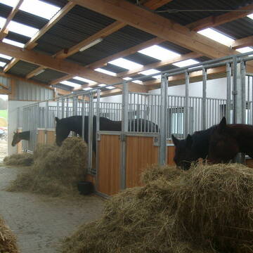
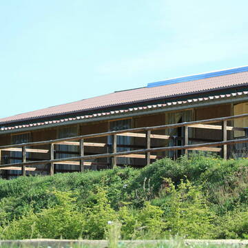
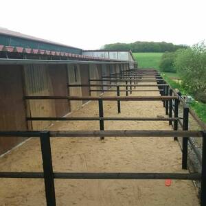
Pferdebox, Pferdepension, Einstellplatz
Orfgen
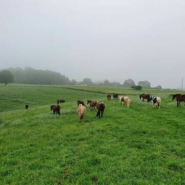
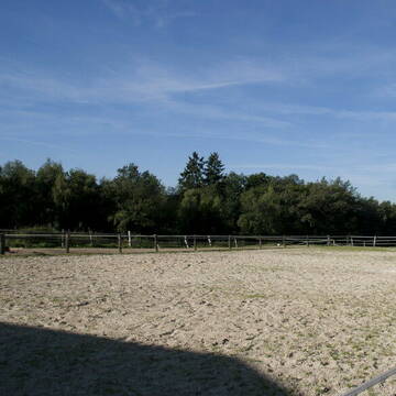
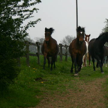
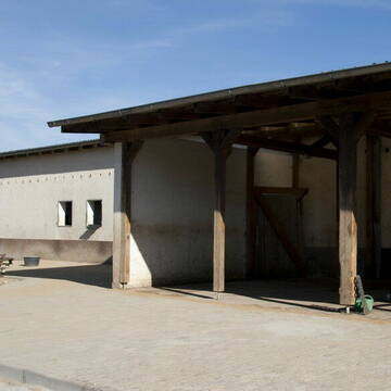
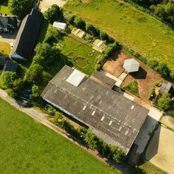
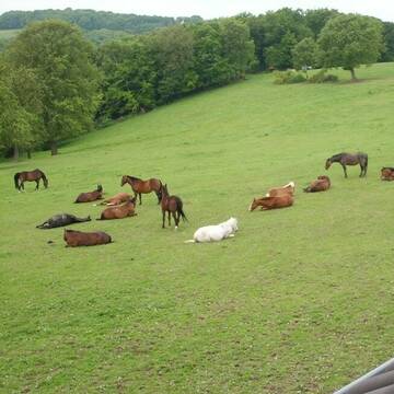
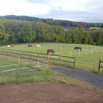
Pferdepension AnnAHof
@AnnAHof
Freizeitstall
Geländestrecke
Hunde willkommen
Longierzirkel/Roundpen
Innenbox
Biofutter
Vollpension
13 weitere...
P+
Deprecated: Creation of dynamic property Zend_View_Helper_Ads::$adLink is deprecated in /var/www/stall-frei/htdocs/staging.stall-frei.de/library/Psf/View/Helper/Ads.php on line 108

Frisches Stroh zu verkaufen!
Mechtersen
STALL-FREIde Marketing
@STALL-FREI-Marketing
Kaufe frisches Stroh für dein Pferd!


Pferdepension, Pferdebox, Einstellplatz
Orfgen
Pferdepension AnnAHof
@SanOffzVet
Freizeitstall
Geländestrecke
Hunde willkommen
Longierzirkel/Roundpen
Innenbox
Biofutter
Vollpension
13 weitere...
P+
Hof Waldwiese 5 Sterne LAG-Stall
Kescheid
Melanie-Liebscher
@Melanie-Liebscher
Freizeitstall
Pferdeausbildung
Krankenbox
Longierzirkel/Roundpen
Gnadenbrothof
Außenbox mit Paddock
Außenboxen
19 weitere...
P+


Union-Gestüt, Artgerechte Pferdehaltung im Siegt...
Eitorf
Union Gestüt
@Union-Gestuet
Freizeitstall
Vermieten
Führanlage
Hunde willkommen
Gnadenbrothof
Notfallboxen
23 weitere...
S


Boxen zu vermieten
Waldbreitbach
Jaqueline-Salz
@Jaqueline-Salz
FN-Mitglied
Freizeitstall
Longierzirkel/Roundpen
Paddock
Hufrehe geeignet
Außenbox mit Paddock
Innenbox
13 weitere...
S

Faberhof
Walterschen
Faberhof
@Faberhof
Freizeitstall
Pferdeausbildung
Hunde willkommen
Krankenbox
Allergikerstall
Fohlenaufzucht möglich
Außenbox mit Paddock
Innenbox
34 weitere...
P

Persönlichkeitsentwicklung mit Pferden
Bad Salzuflen
Katja Dors
@Pferdezeiten
Begleite andere auf ihrem Entwicklungsweg und entdecke die transformative Kraft der pferdegestützten Persönlichkeitsentwicklung !
neu
R

Einstellplätze in Gruppenhaltung im Bewegungssta...
Orfgen
Hof Holzweg
@Hof-Holzweg
Geländestrecke
Vermieten
Hunde willkommen
Krankenbox
Bewegungsstall
Laufstall
13 weitere...
P


Mayerhof in Hennef Lichtenberg
Hennef Lichtenberg
Ursula Mayer
@Markus-Ursula-und-Marius-Mayer
FN-Mitglied
Freizeitstall
Führanlage
Krankenbox
Notfallboxen
Außenbox mit Paddock
Außenboxen
23 weitere...
S
Reitanlage bietet große Paddockboxen-Rehe geeign...
Birkenbeul
Reitanlage-Weissenbruechen
@Reitanlage-Weissenbruechen
FN-Mitglied
Freizeitstall
Vermieten
Verpachten
Hunde willkommen
Longierzirkel/Roundpen
Allergikerstall
Hufrehe geeignet
28 weitere...
P+
Plätze in schönem Offenlaufstall frei!
Mehren
Hof-Hommelshecke
@Hof-Hommelshecke
Fahrstall, Kutschwagen
Freizeitstall
Hunde willkommen
Krankenbox
Allergikerstall
Gnadenbrothof
Außenbox mit Paddock
Bewegungsstall
24 weitere...
P
Deprecated: Creation of dynamic property Zend_View::$pageCount is deprecated in /var/www/stall-frei/htdocs/staging.stall-frei.de/library/vendor/shardj/zf1-future/library/Zend/View/Abstract.php on line 308
Deprecated: Creation of dynamic property Zend_View::$itemCountPerPage is deprecated in /var/www/stall-frei/htdocs/staging.stall-frei.de/library/vendor/shardj/zf1-future/library/Zend/View/Abstract.php on line 308
Deprecated: Creation of dynamic property Zend_View::$first is deprecated in /var/www/stall-frei/htdocs/staging.stall-frei.de/library/vendor/shardj/zf1-future/library/Zend/View/Abstract.php on line 308
Deprecated: Creation of dynamic property Zend_View::$current is deprecated in /var/www/stall-frei/htdocs/staging.stall-frei.de/library/vendor/shardj/zf1-future/library/Zend/View/Abstract.php on line 308
Deprecated: Creation of dynamic property Zend_View::$last is deprecated in /var/www/stall-frei/htdocs/staging.stall-frei.de/library/vendor/shardj/zf1-future/library/Zend/View/Abstract.php on line 308
Deprecated: Creation of dynamic property Zend_View::$next is deprecated in /var/www/stall-frei/htdocs/staging.stall-frei.de/library/vendor/shardj/zf1-future/library/Zend/View/Abstract.php on line 308
Deprecated: Creation of dynamic property Zend_View::$pagesInRange is deprecated in /var/www/stall-frei/htdocs/staging.stall-frei.de/library/vendor/shardj/zf1-future/library/Zend/View/Abstract.php on line 308
Deprecated: Creation of dynamic property Zend_View::$firstPageInRange is deprecated in /var/www/stall-frei/htdocs/staging.stall-frei.de/library/vendor/shardj/zf1-future/library/Zend/View/Abstract.php on line 308
Deprecated: Creation of dynamic property Zend_View::$lastPageInRange is deprecated in /var/www/stall-frei/htdocs/staging.stall-frei.de/library/vendor/shardj/zf1-future/library/Zend/View/Abstract.php on line 308
Deprecated: Creation of dynamic property Zend_View::$currentItemCount is deprecated in /var/www/stall-frei/htdocs/staging.stall-frei.de/library/vendor/shardj/zf1-future/library/Zend/View/Abstract.php on line 308
Deprecated: Creation of dynamic property Zend_View::$totalItemCount is deprecated in /var/www/stall-frei/htdocs/staging.stall-frei.de/library/vendor/shardj/zf1-future/library/Zend/View/Abstract.php on line 308
Deprecated: Creation of dynamic property Zend_View::$firstItemNumber is deprecated in /var/www/stall-frei/htdocs/staging.stall-frei.de/library/vendor/shardj/zf1-future/library/Zend/View/Abstract.php on line 308
Deprecated: Creation of dynamic property Zend_View::$lastItemNumber is deprecated in /var/www/stall-frei/htdocs/staging.stall-frei.de/library/vendor/shardj/zf1-future/library/Zend/View/Abstract.php on line 308
Deprecated: Creation of dynamic property Zend_View::$router is deprecated in /var/www/stall-frei/htdocs/staging.stall-frei.de/library/vendor/shardj/zf1-future/library/Zend/View/Abstract.php on line 308
Deprecated: Creation of dynamic property Zend_View::$urlParams is deprecated in /var/www/stall-frei/htdocs/staging.stall-frei.de/library/vendor/shardj/zf1-future/library/Zend/View/Abstract.php on line 308
Deprecated: Creation of dynamic property Zend_View::$showAds is deprecated in /var/www/stall-frei/htdocs/staging.stall-frei.de/library/vendor/shardj/zf1-future/library/Zend/View/Abstract.php on line 308
Deprecated: Creation of dynamic property Zend_View::$objectIds is deprecated in /var/www/stall-frei/htdocs/staging.stall-frei.de/library/vendor/shardj/zf1-future/library/Zend/View/Abstract.php on line 308
Deprecated: Creation of dynamic property Zend_View::$showNavbar is deprecated in /var/www/stall-frei/htdocs/staging.stall-frei.de/library/vendor/shardj/zf1-future/library/Zend/View/Abstract.php on line 308
Deprecated: Creation of dynamic property Zend_View::$showBreadcrumb is deprecated in /var/www/stall-frei/htdocs/staging.stall-frei.de/library/vendor/shardj/zf1-future/library/Zend/View/Abstract.php on line 308
Deprecated: Creation of dynamic property Zend_View::$showFooter is deprecated in /var/www/stall-frei/htdocs/staging.stall-frei.de/library/vendor/shardj/zf1-future/library/Zend/View/Abstract.php on line 308
Deprecated: Creation of dynamic property Zend_View::$showInternalAds is deprecated in /var/www/stall-frei/htdocs/staging.stall-frei.de/library/vendor/shardj/zf1-future/library/Zend/View/Abstract.php on line 308
Deprecated: Creation of dynamic property Zend_View::$blNoContent is deprecated in /var/www/stall-frei/htdocs/staging.stall-frei.de/library/vendor/shardj/zf1-future/library/Zend/View/Abstract.php on line 308
Deprecated: Creation of dynamic property Zend_View::$sMetaDesc is deprecated in /var/www/stall-frei/htdocs/staging.stall-frei.de/library/vendor/shardj/zf1-future/library/Zend/View/Abstract.php on line 308
Deprecated: Creation of dynamic property Zend_View::$useGmaps is deprecated in /var/www/stall-frei/htdocs/staging.stall-frei.de/library/vendor/shardj/zf1-future/library/Zend/View/Abstract.php on line 308
Deprecated: Creation of dynamic property Zend_View::$touches is deprecated in /var/www/stall-frei/htdocs/staging.stall-frei.de/library/vendor/shardj/zf1-future/library/Zend/View/Abstract.php on line 308
Deprecated: Creation of dynamic property Zend_View::$oProject is deprecated in /var/www/stall-frei/htdocs/staging.stall-frei.de/library/vendor/shardj/zf1-future/library/Zend/View/Abstract.php on line 308
Deprecated: Creation of dynamic property Zend_View::$pageHeadline is deprecated in /var/www/stall-frei/htdocs/staging.stall-frei.de/library/vendor/shardj/zf1-future/library/Zend/View/Abstract.php on line 308
Deprecated: Creation of dynamic property Zend_View::$disableLocationField is deprecated in /var/www/stall-frei/htdocs/staging.stall-frei.de/library/vendor/shardj/zf1-future/library/Zend/View/Abstract.php on line 308
Deprecated: Creation of dynamic property Zend_View::$isSearch is deprecated in /var/www/stall-frei/htdocs/staging.stall-frei.de/library/vendor/shardj/zf1-future/library/Zend/View/Abstract.php on line 308
Deprecated: Creation of dynamic property Zend_View::$pageTitle is deprecated in /var/www/stall-frei/htdocs/staging.stall-frei.de/library/vendor/shardj/zf1-future/library/Zend/View/Abstract.php on line 308
Deprecated: Creation of dynamic property Psf_Form_Element_Text::$class is deprecated in /var/www/stall-frei/htdocs/staging.stall-frei.de/library/vendor/shardj/zf1-future/library/Zend/Form/Element.php on line 874
Deprecated: Creation of dynamic property Psf_Form_Element_Text::$size is deprecated in /var/www/stall-frei/htdocs/staging.stall-frei.de/library/vendor/shardj/zf1-future/library/Zend/Form/Element.php on line 874
Deprecated: Creation of dynamic property Psf_Form_Element_Text::$placeholder is deprecated in /var/www/stall-frei/htdocs/staging.stall-frei.de/library/vendor/shardj/zf1-future/library/Zend/Form/Element.php on line 874
Deprecated: Creation of dynamic property Psf_Form_Element_Hidden::$class is deprecated in /var/www/stall-frei/htdocs/staging.stall-frei.de/library/vendor/shardj/zf1-future/library/Zend/Form/Element.php on line 874
Deprecated: Creation of dynamic property Psf_Form_Element_Hidden::$class is deprecated in /var/www/stall-frei/htdocs/staging.stall-frei.de/library/vendor/shardj/zf1-future/library/Zend/Form/Element.php on line 874
Deprecated: Creation of dynamic property Psf_Form_Element_Hidden::$class is deprecated in /var/www/stall-frei/htdocs/staging.stall-frei.de/library/vendor/shardj/zf1-future/library/Zend/Form/Element.php on line 874
Deprecated: Creation of dynamic property Psf_Form_Element_Hidden::$class is deprecated in /var/www/stall-frei/htdocs/staging.stall-frei.de/library/vendor/shardj/zf1-future/library/Zend/Form/Element.php on line 874
Deprecated: Creation of dynamic property Psf_Form_Element_Select::$class is deprecated in /var/www/stall-frei/htdocs/staging.stall-frei.de/library/vendor/shardj/zf1-future/library/Zend/Form/Element.php on line 874
Deprecated: Creation of dynamic property Psf_Form_Element_Select::$class is deprecated in /var/www/stall-frei/htdocs/staging.stall-frei.de/library/vendor/shardj/zf1-future/library/Zend/Form/Element.php on line 874
Deprecated: Creation of dynamic property Psf_Form_Element_Select::$class is deprecated in /var/www/stall-frei/htdocs/staging.stall-frei.de/library/vendor/shardj/zf1-future/library/Zend/Form/Element.php on line 874
Deprecated: Creation of dynamic property Psf_Form_Element_Select::$class is deprecated in /var/www/stall-frei/htdocs/staging.stall-frei.de/library/vendor/shardj/zf1-future/library/Zend/Form/Element.php on line 874
Deprecated: Creation of dynamic property Psf_Form_Element_Text::$class is deprecated in /var/www/stall-frei/htdocs/staging.stall-frei.de/library/vendor/shardj/zf1-future/library/Zend/Form/Element.php on line 874
Deprecated: Creation of dynamic property Psf_Form_Element_Checkbox::$label is deprecated in /var/www/stall-frei/htdocs/staging.stall-frei.de/library/vendor/shardj/zf1-future/library/Zend/Form/Element.php on line 874
Deprecated: Creation of dynamic property Zend_View::$sort is deprecated in /var/www/stall-frei/htdocs/staging.stall-frei.de/library/vendor/shardj/zf1-future/library/Zend/View/Abstract.php on line 308
Deprecated: Creation of dynamic property Zend_View::$searchLocation is deprecated in /var/www/stall-frei/htdocs/staging.stall-frei.de/library/vendor/shardj/zf1-future/library/Zend/View/Abstract.php on line 308
Deprecated: Creation of dynamic property Zend_View::$locationHint is deprecated in /var/www/stall-frei/htdocs/staging.stall-frei.de/library/vendor/shardj/zf1-future/library/Zend/View/Abstract.php on line 308
Psf_GeoCoder_Abstract::getLocation: Obernau Get Location CachedOrLive
Psf_GeoCoder_Abstract::getCachedOrLive: Obernau
Psf_GeoCoder_OpenCageData::makeApiRequest: response:
Array
(
[documentation] => https://opencagedata.com/api
[licenses] => Array
(
[0] => Array
(
[name] => see attribution guide
[url] => https://opencagedata.com/credits
)
)
[results] => Array
(
[0] => Array
(
[bounds] => Array
(
[northeast] => Array
(
[lat] => 50.6743901
[lng] => 7.5868955
)
[southwest] => Array
(
[lat] => 50.653866
[lng] => 7.5568083
)
)
[components] => Array
(
[ISO_3166-1_alpha-2] => DE
[ISO_3166-1_alpha-3] => DEU
[ISO_3166-2] => Array
(
[0] => DE-RP
)
[_category] => place
[_normalized_city] => Neitersen
[_type] => village
[city] => Neitersen
[continent] => Europe
[country] => Deutschland
[country_code] => de
[county] => Landkreis Altenkirchen (Westerwald)
[municipality] => Altenkirchen-Flammersfeld
[political_union] => European Union
[state] => Rheinland-Pfalz
[state_code] => RP
[village] => Obernau
)
[confidence] => 7
[formatted] => Obernau, Rheinland-Pfalz, Deutschland
[geometry] => Array
(
[lat] => 50.6673455
[lng] => 7.5716048
)
)
[1] => Array
(
[bounds] => Array
(
[northeast] => Array
(
[lat] => 48.4769468
[lng] => 8.8937858
)
[southwest] => Array
(
[lat] => 48.4518529
[lng] => 8.8424785
)
)
[components] => Array
(
[ISO_3166-1_alpha-2] => DE
[ISO_3166-1_alpha-3] => DEU
[ISO_3166-2] => Array
(
[0] => DE-BW
)
[_category] => place
[_normalized_city] => Rottenburg am Neckar
[_type] => village
[continent] => Europe
[country] => Deutschland
[country_code] => de
[county] => Landkreis Tübingen
[municipality] => VVG der Stadt Rottenburg am Neckar
[political_union] => European Union
[state] => Baden-Württemberg
[state_code] => BW
[town] => Rottenburg am Neckar
[village] => Obernau
)
[confidence] => 7
[formatted] => Obernau, Baden-Württemberg, Deutschland
[geometry] => Array
(
[lat] => 48.458692
[lng] => 8.8706173
)
)
[2] => Array
(
[bounds] => Array
(
[northeast] => Array
(
[lat] => 49.9528986
[lng] => 9.1689039
)
[southwest] => Array
(
[lat] => 49.9200613
[lng] => 9.1082666
)
)
[components] => Array
(
[ISO_3166-1_alpha-2] => DE
[ISO_3166-1_alpha-3] => DEU
[ISO_3166-2] => Array
(
[0] => DE-BY
)
[_category] => place
[_normalized_city] => Obernau
[_type] => village
[continent] => Europe
[country] => Deutschland
[country_code] => de
[county] => Aschaffenburg
[political_union] => European Union
[state] => Bayern
[state_code] => BY
[village] => Obernau
)
[confidence] => 7
[formatted] => Obernau, Bayern, Deutschland
[geometry] => Array
(
[lat] => 49.9357609
[lng] => 9.1329803
)
)
[3] => Array
(
[bounds] => Array
(
[northeast] => Array
(
[lat] => 50.8060144
[lng] => 7.6324081
)
[southwest] => Array
(
[lat] => 50.7660144
[lng] => 7.5924081
)
)
[components] => Array
(
[ISO_3166-1_alpha-2] => DE
[ISO_3166-1_alpha-3] => DEU
[ISO_3166-2] => Array
(
[0] => DE-NW
)
[_category] => place
[_normalized_city] => Windeck
[_type] => village
[continent] => Europe
[country] => Deutschland
[country_code] => de
[county] => Rhein-Sieg-Kreis
[political_union] => European Union
[postcode] => 51570
[state] => Nordrhein-Westfalen
[state_code] => NW
[town] => Windeck
[village] => Obernau
)
[confidence] => 7
[formatted] => 51570 Obernau, Deutschland
[geometry] => Array
(
[lat] => 50.7860144
[lng] => 7.6124081
)
)
[4] => Array
(
[bounds] => Array
(
[northeast] => Array
(
[lat] => 47.6791755
[lng] => 11.0749582
)
[southwest] => Array
(
[lat] => 47.6391755
[lng] => 11.0349582
)
)
[components] => Array
(
[ISO_3166-1_alpha-2] => DE
[ISO_3166-1_alpha-3] => DEU
[ISO_3166-2] => Array
(
[0] => DE-BY
)
[_category] => place
[_normalized_city] => Bad Kohlgrub
[_type] => hamlet
[continent] => Europe
[country] => Deutschland
[country_code] => de
[county] => Landkreis Garmisch-Partenkirchen
[hamlet] => Obernau
[political_union] => European Union
[postcode] => 82433
[state] => Bayern
[state_code] => BY
[town] => Bad Kohlgrub
)
[confidence] => 7
[formatted] => Obernau, 82433 Bad Kohlgrub, Deutschland
[geometry] => Array
(
[lat] => 47.6591755
[lng] => 11.0549582
)
)
[5] => Array
(
[bounds] => Array
(
[northeast] => Array
(
[lat] => 50.9263641
[lng] => 8.1600596
)
[southwest] => Array
(
[lat] => 50.9170658
[lng] => 8.1409254
)
)
[components] => Array
(
[ISO_3166-1_alpha-2] => DE
[ISO_3166-1_alpha-3] => DEU
[ISO_3166-2] => Array
(
[0] => DE-NW
)
[_category] => natural/water
[_normalized_city] => Netphen
[_type] => stream
[continent] => Europe
[country] => Deutschland
[country_code] => de
[county] => Kreis Siegen-Wittgenstein
[political_union] => European Union
[postcode] => 57250
[state] => Nordrhein-Westfalen
[state_code] => NW
[stream] => Obernau
[suburb] => Brauersdorf
[town] => Netphen
)
[confidence] => 8
[formatted] => Obernau, 57250 Netphen, Deutschland
[geometry] => Array
(
[lat] => 50.9207727
[lng] => 8.150792
)
)
[6] => Array
(
[components] => Array
(
[ISO_3166-1_alpha-2] => FR
[ISO_3166-1_alpha-3] => FRA
[ISO_3166-2] => Array
(
[0] => FR-GES
[1] => FR-6AE
[2] => FR-67
)
[_category] => road
[_normalized_city] => Obernai
[_type] => road
[city] => Obernai
[continent] => Europe
[country] => France
[country_code] => fr
[county] => Bas-Rhin
[local_authority] => Communauté de communes du Pays de Sainte-Odile
[political_union] => European Union
[postcode] => 67210
[road] => Route de Boersch
[state] => Grand Est
[state_code] => GES
)
[confidence] => 3
[formatted] => Route de Boersch, 67210 Obernai, France
[geometry] => Array
(
[lat] => 48.466869
[lng] => 7.471102
)
)
[7] => Array
(
[components] => Array
(
[ISO_3166-1_alpha-2] => FR
[ISO_3166-1_alpha-3] => FRA
[ISO_3166-2] => Array
(
[0] => FR-GES
[1] => FR-6AE
[2] => FR-67
)
[_category] => road
[_normalized_city] => Obernai
[_type] => road
[city] => Obernai
[continent] => Europe
[country] => France
[country_code] => fr
[county] => Bas-Rhin
[local_authority] => Communauté de communes du Pays de Sainte-Odile
[political_union] => European Union
[postcode] => 67210
[road] => Rue de la Lauter
[state] => Grand Est
[state_code] => GES
)
[confidence] => 3
[formatted] => Rue de la Lauter, 67210 Obernai, France
[geometry] => Array
(
[lat] => 48.465594
[lng] => 7.500152
)
)
[8] => Array
(
[components] => Array
(
[ISO_3166-1_alpha-2] => FR
[ISO_3166-1_alpha-3] => FRA
[ISO_3166-2] => Array
(
[0] => FR-GES
[1] => FR-6AE
[2] => FR-67
)
[_category] => road
[_normalized_city] => Obernai
[_type] => road
[city] => Obernai
[continent] => Europe
[country] => France
[country_code] => fr
[county] => Bas-Rhin
[local_authority] => Communauté de communes du Pays de Sainte-Odile
[political_union] => European Union
[postcode] => 67210
[road] => Rue du Landsberg
[state] => Grand Est
[state_code] => GES
)
[confidence] => 3
[formatted] => Rue du Landsberg, 67210 Obernai, France
[geometry] => Array
(
[lat] => 48.456581
[lng] => 7.481861
)
)
[9] => Array
(
[components] => Array
(
[ISO_3166-1_alpha-2] => FR
[ISO_3166-1_alpha-3] => FRA
[ISO_3166-2] => Array
(
[0] => FR-GES
[1] => FR-6AE
[2] => FR-67
)
[_category] => road
[_normalized_city] => Obernai
[_type] => road
[city] => Obernai
[continent] => Europe
[country] => France
[country_code] => fr
[county] => Bas-Rhin
[local_authority] => Communauté de communes du Pays de Sainte-Odile
[political_union] => European Union
[postcode] => 67210
[road] => Rue de la Haute Corniche
[state] => Grand Est
[state_code] => GES
)
[confidence] => 3
[formatted] => Rue de la Haute Corniche, 67210 Obernai, France
[geometry] => Array
(
[lat] => 48.469009
[lng] => 7.472112
)
)
)
[status] => Array
(
[code] => 200
[message] => OK
)
[stay_informed] => Array
(
[blog] => https://blog.opencagedata.com
[mastodon] => https://en.osm.town/@opencage
)
[thanks] => For using an OpenCage API
[timestamp] => Array
(
[created_http] => Sat, 07 Feb 2026 15:07:42 GMT
[created_unix] => 1770476862
)
[total_results] => 10
)
Psf_GeoCoder_Abstract::convertLocationResult
{"documentation":"https:\/\/opencagedata.com\/api","licenses":[{"name":"see attribution guide","url":"https:\/\/opencagedata.com\/credits"}],"results":[{"bounds":{"northeast":{"lat":50.6743901,"lng":7.5868955},"southwest":{"lat":50.653866,"lng":7.5568083}},"components":{"ISO_3166-1_alpha-2":"DE","ISO_3166-1_alpha-3":"DEU","ISO_3166-2":["DE-RP"],"_category":"place","_normalized_city":"Neitersen","_type":"village","city":"Neitersen","continent":"Europe","country":"Deutschland","country_code":"de","county":"Landkreis Altenkirchen (Westerwald)","municipality":"Altenkirchen-Flammersfeld","political_union":"European Union","state":"Rheinland-Pfalz","state_code":"RP","village":"Obernau"},"confidence":7,"formatted":"Obernau, Rheinland-Pfalz, Deutschland","geometry":{"lat":50.6673455,"lng":7.5716048}},{"bounds":{"northeast":{"lat":48.4769468,"lng":8.8937858},"southwest":{"lat":48.4518529,"lng":8.8424785}},"components":{"ISO_3166-1_alpha-2":"DE","ISO_3166-1_alpha-3":"DEU","ISO_3166-2":["DE-BW"],"_category":"place","_normalized_city":"Rottenburg am Neckar","_type":"village","continent":"Europe","country":"Deutschland","country_code":"de","county":"Landkreis T\u00fcbingen","municipality":"VVG der Stadt Rottenburg am Neckar","political_union":"European Union","state":"Baden-W\u00fcrttemberg","state_code":"BW","town":"Rottenburg am Neckar","village":"Obernau"},"confidence":7,"formatted":"Obernau, Baden-W\u00fcrttemberg, Deutschland","geometry":{"lat":48.458692,"lng":8.8706173}},{"bounds":{"northeast":{"lat":49.9528986,"lng":9.1689039},"southwest":{"lat":49.9200613,"lng":9.1082666}},"components":{"ISO_3166-1_alpha-2":"DE","ISO_3166-1_alpha-3":"DEU","ISO_3166-2":["DE-BY"],"_category":"place","_normalized_city":"Obernau","_type":"village","continent":"Europe","country":"Deutschland","country_code":"de","county":"Aschaffenburg","political_union":"European Union","state":"Bayern","state_code":"BY","village":"Obernau"},"confidence":7,"formatted":"Obernau, Bayern, Deutschland","geometry":{"lat":49.9357609,"lng":9.1329803}},{"bounds":{"northeast":{"lat":50.8060144,"lng":7.6324081},"southwest":{"lat":50.7660144,"lng":7.5924081}},"components":{"ISO_3166-1_alpha-2":"DE","ISO_3166-1_alpha-3":"DEU","ISO_3166-2":["DE-NW"],"_category":"place","_normalized_city":"Windeck","_type":"village","continent":"Europe","country":"Deutschland","country_code":"de","county":"Rhein-Sieg-Kreis","political_union":"European Union","postcode":"51570","state":"Nordrhein-Westfalen","state_code":"NW","town":"Windeck","village":"Obernau"},"confidence":7,"formatted":"51570 Obernau, Deutschland","geometry":{"lat":50.7860144,"lng":7.6124081}},{"bounds":{"northeast":{"lat":47.6791755,"lng":11.0749582},"southwest":{"lat":47.6391755,"lng":11.0349582}},"components":{"ISO_3166-1_alpha-2":"DE","ISO_3166-1_alpha-3":"DEU","ISO_3166-2":["DE-BY"],"_category":"place","_normalized_city":"Bad Kohlgrub","_type":"hamlet","continent":"Europe","country":"Deutschland","country_code":"de","county":"Landkreis Garmisch-Partenkirchen","hamlet":"Obernau","political_union":"European Union","postcode":"82433","state":"Bayern","state_code":"BY","town":"Bad Kohlgrub"},"confidence":7,"formatted":"Obernau, 82433 Bad Kohlgrub, Deutschland","geometry":{"lat":47.6591755,"lng":11.0549582}},{"bounds":{"northeast":{"lat":50.9263641,"lng":8.1600596},"southwest":{"lat":50.9170658,"lng":8.1409254}},"components":{"ISO_3166-1_alpha-2":"DE","ISO_3166-1_alpha-3":"DEU","ISO_3166-2":["DE-NW"],"_category":"natural\/water","_normalized_city":"Netphen","_type":"stream","continent":"Europe","country":"Deutschland","country_code":"de","county":"Kreis Siegen-Wittgenstein","political_union":"European Union","postcode":"57250","state":"Nordrhein-Westfalen","state_code":"NW","stream":"Obernau","suburb":"Brauersdorf","town":"Netphen"},"confidence":8,"formatted":"Obernau, 57250 Netphen, Deutschland","geometry":{"lat":50.9207727,"lng":8.150792}},{"components":{"ISO_3166-1_alpha-2":"FR","ISO_3166-1_alpha-3":"FRA","ISO_3166-2":["FR-GES","FR-6AE","FR-67"],"_category":"road","_normalized_city":"Obernai","_type":"road","city":"Obernai","continent":"Europe","country":"France","country_code":"fr","county":"Bas-Rhin","local_authority":"Communaut\u00e9 de communes du Pays de Sainte-Odile","political_union":"European Union","postcode":"67210","road":"Route de Boersch","state":"Grand Est","state_code":"GES"},"confidence":3,"formatted":"Route de Boersch, 67210 Obernai, France","geometry":{"lat":48.466869,"lng":7.471102}},{"components":{"ISO_3166-1_alpha-2":"FR","ISO_3166-1_alpha-3":"FRA","ISO_3166-2":["FR-GES","FR-6AE","FR-67"],"_category":"road","_normalized_city":"Obernai","_type":"road","city":"Obernai","continent":"Europe","country":"France","country_code":"fr","county":"Bas-Rhin","local_authority":"Communaut\u00e9 de communes du Pays de Sainte-Odile","political_union":"European Union","postcode":"67210","road":"Rue de la Lauter","state":"Grand Est","state_code":"GES"},"confidence":3,"formatted":"Rue de la Lauter, 67210 Obernai, France","geometry":{"lat":48.465594,"lng":7.500152}},{"components":{"ISO_3166-1_alpha-2":"FR","ISO_3166-1_alpha-3":"FRA","ISO_3166-2":["FR-GES","FR-6AE","FR-67"],"_category":"road","_normalized_city":"Obernai","_type":"road","city":"Obernai","continent":"Europe","country":"France","country_code":"fr","county":"Bas-Rhin","local_authority":"Communaut\u00e9 de communes du Pays de Sainte-Odile","political_union":"European Union","postcode":"67210","road":"Rue du Landsberg","state":"Grand Est","state_code":"GES"},"confidence":3,"formatted":"Rue du Landsberg, 67210 Obernai, France","geometry":{"lat":48.456581,"lng":7.481861}},{"components":{"ISO_3166-1_alpha-2":"FR","ISO_3166-1_alpha-3":"FRA","ISO_3166-2":["FR-GES","FR-6AE","FR-67"],"_category":"road","_normalized_city":"Obernai","_type":"road","city":"Obernai","continent":"Europe","country":"France","country_code":"fr","county":"Bas-Rhin","local_authority":"Communaut\u00e9 de communes du Pays de Sainte-Odile","political_union":"European Union","postcode":"67210","road":"Rue de la Haute Corniche","state":"Grand Est","state_code":"GES"},"confidence":3,"formatted":"Rue de la Haute Corniche, 67210 Obernai, France","geometry":{"lat":48.469009,"lng":7.472112}}],"status":{"code":200,"message":"OK"},"stay_informed":{"blog":"https:\/\/blog.opencagedata.com","mastodon":"https:\/\/en.osm.town\/@opencage"},"thanks":"For using an OpenCage API","timestamp":{"created_http":"Sat, 07 Feb 2026 15:07:42 GMT","created_unix":1770476862},"total_results":10}Array
(
[0] => stdClass Object
(
[bounds] => stdClass Object
(
[northeast] => stdClass Object
(
[lat] => 50.6743901
[lng] => 7.5868955
)
[southwest] => stdClass Object
(
[lat] => 50.653866
[lng] => 7.5568083
)
)
[components] => stdClass Object
(
[ISO_3166-1_alpha-2] => DE
[ISO_3166-1_alpha-3] => DEU
[ISO_3166-2] => Array
(
[0] => DE-RP
)
[_category] => place
[_normalized_city] => Neitersen
[_type] => village
[city] => Neitersen
[continent] => Europe
[country] => Deutschland
[country_code] => de
[county] => Landkreis Altenkirchen (Westerwald)
[municipality] => Altenkirchen-Flammersfeld
[political_union] => European Union
[state] => Rheinland-Pfalz
[state_code] => RP
[village] => Obernau
)
[confidence] => 7
[formatted] => Obernau, Rheinland-Pfalz, Deutschland
[geometry] => stdClass Object
(
[lat] => 50.6673455
[lng] => 7.5716048
)
)
[1] => stdClass Object
(
[bounds] => stdClass Object
(
[northeast] => stdClass Object
(
[lat] => 48.4769468
[lng] => 8.8937858
)
[southwest] => stdClass Object
(
[lat] => 48.4518529
[lng] => 8.8424785
)
)
[components] => stdClass Object
(
[ISO_3166-1_alpha-2] => DE
[ISO_3166-1_alpha-3] => DEU
[ISO_3166-2] => Array
(
[0] => DE-BW
)
[_category] => place
[_normalized_city] => Rottenburg am Neckar
[_type] => village
[continent] => Europe
[country] => Deutschland
[country_code] => de
[county] => Landkreis Tübingen
[municipality] => VVG der Stadt Rottenburg am Neckar
[political_union] => European Union
[state] => Baden-Württemberg
[state_code] => BW
[town] => Rottenburg am Neckar
[village] => Obernau
)
[confidence] => 7
[formatted] => Obernau, Baden-Württemberg, Deutschland
[geometry] => stdClass Object
(
[lat] => 48.458692
[lng] => 8.8706173
)
)
[2] => stdClass Object
(
[bounds] => stdClass Object
(
[northeast] => stdClass Object
(
[lat] => 49.9528986
[lng] => 9.1689039
)
[southwest] => stdClass Object
(
[lat] => 49.9200613
[lng] => 9.1082666
)
)
[components] => stdClass Object
(
[ISO_3166-1_alpha-2] => DE
[ISO_3166-1_alpha-3] => DEU
[ISO_3166-2] => Array
(
[0] => DE-BY
)
[_category] => place
[_normalized_city] => Obernau
[_type] => village
[continent] => Europe
[country] => Deutschland
[country_code] => de
[county] => Aschaffenburg
[political_union] => European Union
[state] => Bayern
[state_code] => BY
[village] => Obernau
)
[confidence] => 7
[formatted] => Obernau, Bayern, Deutschland
[geometry] => stdClass Object
(
[lat] => 49.9357609
[lng] => 9.1329803
)
)
[3] => stdClass Object
(
[bounds] => stdClass Object
(
[northeast] => stdClass Object
(
[lat] => 50.8060144
[lng] => 7.6324081
)
[southwest] => stdClass Object
(
[lat] => 50.7660144
[lng] => 7.5924081
)
)
[components] => stdClass Object
(
[ISO_3166-1_alpha-2] => DE
[ISO_3166-1_alpha-3] => DEU
[ISO_3166-2] => Array
(
[0] => DE-NW
)
[_category] => place
[_normalized_city] => Windeck
[_type] => village
[continent] => Europe
[country] => Deutschland
[country_code] => de
[county] => Rhein-Sieg-Kreis
[political_union] => European Union
[postcode] => 51570
[state] => Nordrhein-Westfalen
[state_code] => NW
[town] => Windeck
[village] => Obernau
)
[confidence] => 7
[formatted] => 51570 Obernau, Deutschland
[geometry] => stdClass Object
(
[lat] => 50.7860144
[lng] => 7.6124081
)
)
[4] => stdClass Object
(
[bounds] => stdClass Object
(
[northeast] => stdClass Object
(
[lat] => 47.6791755
[lng] => 11.0749582
)
[southwest] => stdClass Object
(
[lat] => 47.6391755
[lng] => 11.0349582
)
)
[components] => stdClass Object
(
[ISO_3166-1_alpha-2] => DE
[ISO_3166-1_alpha-3] => DEU
[ISO_3166-2] => Array
(
[0] => DE-BY
)
[_category] => place
[_normalized_city] => Bad Kohlgrub
[_type] => hamlet
[continent] => Europe
[country] => Deutschland
[country_code] => de
[county] => Landkreis Garmisch-Partenkirchen
[hamlet] => Obernau
[political_union] => European Union
[postcode] => 82433
[state] => Bayern
[state_code] => BY
[town] => Bad Kohlgrub
)
[confidence] => 7
[formatted] => Obernau, 82433 Bad Kohlgrub, Deutschland
[geometry] => stdClass Object
(
[lat] => 47.6591755
[lng] => 11.0549582
)
)
[5] => stdClass Object
(
[bounds] => stdClass Object
(
[northeast] => stdClass Object
(
[lat] => 50.9263641
[lng] => 8.1600596
)
[southwest] => stdClass Object
(
[lat] => 50.9170658
[lng] => 8.1409254
)
)
[components] => stdClass Object
(
[ISO_3166-1_alpha-2] => DE
[ISO_3166-1_alpha-3] => DEU
[ISO_3166-2] => Array
(
[0] => DE-NW
)
[_category] => natural/water
[_normalized_city] => Netphen
[_type] => stream
[continent] => Europe
[country] => Deutschland
[country_code] => de
[county] => Kreis Siegen-Wittgenstein
[political_union] => European Union
[postcode] => 57250
[state] => Nordrhein-Westfalen
[state_code] => NW
[stream] => Obernau
[suburb] => Brauersdorf
[town] => Netphen
)
[confidence] => 8
[formatted] => Obernau, 57250 Netphen, Deutschland
[geometry] => stdClass Object
(
[lat] => 50.9207727
[lng] => 8.150792
)
)
[6] => stdClass Object
(
[components] => stdClass Object
(
[ISO_3166-1_alpha-2] => FR
[ISO_3166-1_alpha-3] => FRA
[ISO_3166-2] => Array
(
[0] => FR-GES
[1] => FR-6AE
[2] => FR-67
)
[_category] => road
[_normalized_city] => Obernai
[_type] => road
[city] => Obernai
[continent] => Europe
[country] => France
[country_code] => fr
[county] => Bas-Rhin
[local_authority] => Communauté de communes du Pays de Sainte-Odile
[political_union] => European Union
[postcode] => 67210
[road] => Route de Boersch
[state] => Grand Est
[state_code] => GES
)
[confidence] => 3
[formatted] => Route de Boersch, 67210 Obernai, France
[geometry] => stdClass Object
(
[lat] => 48.466869
[lng] => 7.471102
)
)
[7] => stdClass Object
(
[components] => stdClass Object
(
[ISO_3166-1_alpha-2] => FR
[ISO_3166-1_alpha-3] => FRA
[ISO_3166-2] => Array
(
[0] => FR-GES
[1] => FR-6AE
[2] => FR-67
)
[_category] => road
[_normalized_city] => Obernai
[_type] => road
[city] => Obernai
[continent] => Europe
[country] => France
[country_code] => fr
[county] => Bas-Rhin
[local_authority] => Communauté de communes du Pays de Sainte-Odile
[political_union] => European Union
[postcode] => 67210
[road] => Rue de la Lauter
[state] => Grand Est
[state_code] => GES
)
[confidence] => 3
[formatted] => Rue de la Lauter, 67210 Obernai, France
[geometry] => stdClass Object
(
[lat] => 48.465594
[lng] => 7.500152
)
)
[8] => stdClass Object
(
[components] => stdClass Object
(
[ISO_3166-1_alpha-2] => FR
[ISO_3166-1_alpha-3] => FRA
[ISO_3166-2] => Array
(
[0] => FR-GES
[1] => FR-6AE
[2] => FR-67
)
[_category] => road
[_normalized_city] => Obernai
[_type] => road
[city] => Obernai
[continent] => Europe
[country] => France
[country_code] => fr
[county] => Bas-Rhin
[local_authority] => Communauté de communes du Pays de Sainte-Odile
[political_union] => European Union
[postcode] => 67210
[road] => Rue du Landsberg
[state] => Grand Est
[state_code] => GES
)
[confidence] => 3
[formatted] => Rue du Landsberg, 67210 Obernai, France
[geometry] => stdClass Object
(
[lat] => 48.456581
[lng] => 7.481861
)
)
[9] => stdClass Object
(
[components] => stdClass Object
(
[ISO_3166-1_alpha-2] => FR
[ISO_3166-1_alpha-3] => FRA
[ISO_3166-2] => Array
(
[0] => FR-GES
[1] => FR-6AE
[2] => FR-67
)
[_category] => road
[_normalized_city] => Obernai
[_type] => road
[city] => Obernai
[continent] => Europe
[country] => France
[country_code] => fr
[county] => Bas-Rhin
[local_authority] => Communauté de communes du Pays de Sainte-Odile
[political_union] => European Union
[postcode] => 67210
[road] => Rue de la Haute Corniche
[state] => Grand Est
[state_code] => GES
)
[confidence] => 3
[formatted] => Rue de la Haute Corniche, 67210 Obernai, France
[geometry] => stdClass Object
(
[lat] => 48.469009
[lng] => 7.472112
)
)
)
Psf_GeoCoder_OpenCageData::getKeyMap: 0
stdClass Object
(
    [bounds] => stdClass Object
        (
            [northeast] => stdClass Object
                (
                    [lat] => 50.6743901
                    [lng] => 7.5868955
                )

            [southwest] => stdClass Object
                (
                    [lat] => 50.653866
                    [lng] => 7.5568083
                )

        )

    [components] => stdClass Object
        (
            [ISO_3166-1_alpha-2] => DE
            [ISO_3166-1_alpha-3] => DEU
            [ISO_3166-2] => Array
                (
                    [0] => DE-RP
                )

            [_category] => place
            [_normalized_city] => Neitersen
            [_type] => village
            [city] => Neitersen
            [continent] => Europe
            [country] => Deutschland
            [country_code] => de
            [county] => Landkreis Altenkirchen (Westerwald)
            [municipality] => Altenkirchen-Flammersfeld
            [political_union] => European Union
            [state] => Rheinland-Pfalz
            [state_code] => RP
            [village] => Obernau
        )

    [confidence] => 7
    [formatted] => Obernau, Rheinland-Pfalz, Deutschland
    [geometry] => stdClass Object
        (
            [lat] => 50.6673455
            [lng] => 7.5716048
        )

)
Psf_GeoCoder_OpenCageData::getCounty: Altenkirchen (Westerwald)
Psf_GeoCoder_OpenCageData::addMissingData REFETCH!
Array
(
    [address] => Obernau, Rheinland-Pfalz, Deutschland
    [type] => village
    [street] =>
    [city] => Obernau
    [county] => Altenkirchen (Westerwald)
    [state] => Rheinland-Pfalz
    [zip] =>
    [country] => Deutschland
    [suburb] =>
    [countrycode] => de
    [latitude] => 50.6673455
    [longitude] => 7.5716048
    [accuracy] => 1
    [confidence] => 7
    [bounds] => stdClass Object
        (
            [northeast] => stdClass Object
                (
                    [lat] => 50.6743901
                    [lng] => 7.5868955
                )

            [southwest] => stdClass Object
                (
                    [lat] => 50.653866
                    [lng] => 7.5568083
                )

        )

)
reformat!
Array
(
    [address] => Obernau, Rheinland-Pfalz, Deutschland
    [type] => village
    [street] =>
    [city] => Obernau
    [county] => Altenkirchen (Westerwald)
    [state] => Rheinland-Pfalz
    [zip] =>
    [country] => Deutschland
    [suburb] =>
    [countrycode] => de
    [latitude] => 50.6673455
    [longitude] => 7.5716048
    [accuracy] => 1
    [confidence] => 7
    [bounds] => stdClass Object
        (
            [northeast] => stdClass Object
                (
                    [lat] => 50.6743901
                    [lng] => 7.5868955
                )

            [southwest] => stdClass Object
                (
                    [lat] => 50.653866
                    [lng] => 7.5568083
                )

        )

    [place] => Obernau, Rheinland-Pfalz
    [hash] => bbaa234519b67648427cb89cef946269
)
Psf_GeoCoder_OpenCageData::getKeyMap: 1
stdClass Object
(
    [bounds] => stdClass Object
        (
            [northeast] => stdClass Object
                (
                    [lat] => 48.4769468
                    [lng] => 8.8937858
                )

            [southwest] => stdClass Object
                (
                    [lat] => 48.4518529
                    [lng] => 8.8424785
                )

        )

    [components] => stdClass Object
        (
            [ISO_3166-1_alpha-2] => DE
            [ISO_3166-1_alpha-3] => DEU
            [ISO_3166-2] => Array
                (
                    [0] => DE-BW
                )

            [_category] => place
            [_normalized_city] => Rottenburg am Neckar
            [_type] => village
            [continent] => Europe
            [country] => Deutschland
            [country_code] => de
            [county] => Landkreis Tübingen
            [municipality] => VVG der Stadt Rottenburg am Neckar
            [political_union] => European Union
            [state] => Baden-Württemberg
            [state_code] => BW
            [town] => Rottenburg am Neckar
            [village] => Obernau
        )

    [confidence] => 7
    [formatted] => Obernau, Baden-Württemberg, Deutschland
    [geometry] => stdClass Object
        (
            [lat] => 48.458692
            [lng] => 8.8706173
        )

)
Psf_GeoCoder_OpenCageData::getCounty: Tübingen
Psf_GeoCoder_OpenCageData::addMissingData REFETCH!
Array
(
    [address] => Obernau, Baden-Württemberg, Deutschland
    [type] => village
    [street] =>
    [city] => Rottenburg am Neckar
    [county] => Tübingen
    [state] => Baden-Württemberg
    [zip] =>
    [country] => Deutschland
    [suburb] =>
    [countrycode] => de
    [latitude] => 48.458692
    [longitude] => 8.8706173
    [accuracy] => 1
    [confidence] => 7
    [bounds] => stdClass Object
        (
            [northeast] => stdClass Object
                (
                    [lat] => 48.4769468
                    [lng] => 8.8937858
                )

            [southwest] => stdClass Object
                (
                    [lat] => 48.4518529
                    [lng] => 8.8424785
                )

        )

)
reformat!
Array
(
    [address] => Rottenburg am Neckar
    [type] => village
    [street] =>
    [city] => Rottenburg am Neckar
    [county] => Tübingen
    [state] => Baden-Württemberg
    [zip] =>
    [country] => Deutschland
    [suburb] =>
    [countrycode] => de
    [latitude] => 48.458692
    [longitude] => 8.8706173
    [accuracy] => 1
    [confidence] => 7
    [bounds] => stdClass Object
        (
            [northeast] => stdClass Object
                (
                    [lat] => 48.4769468
                    [lng] => 8.8937858
                )

            [southwest] => stdClass Object
                (
                    [lat] => 48.4518529
                    [lng] => 8.8424785
                )

        )

    [place] => Rottenburg am Neckar, Baden-Württemberg
    [hash] => 547947e310cc67af748843fed389485f
)
Psf_GeoCoder_OpenCageData::getKeyMap: 2
stdClass Object
(
    [bounds] => stdClass Object
        (
            [northeast] => stdClass Object
                (
                    [lat] => 49.9528986
                    [lng] => 9.1689039
                )

            [southwest] => stdClass Object
                (
                    [lat] => 49.9200613
                    [lng] => 9.1082666
                )

        )

    [components] => stdClass Object
        (
            [ISO_3166-1_alpha-2] => DE
            [ISO_3166-1_alpha-3] => DEU
            [ISO_3166-2] => Array
                (
                    [0] => DE-BY
                )

            [_category] => place
            [_normalized_city] => Obernau
            [_type] => village
            [continent] => Europe
            [country] => Deutschland
            [country_code] => de
            [county] => Aschaffenburg
            [political_union] => European Union
            [state] => Bayern
            [state_code] => BY
            [village] => Obernau
        )

    [confidence] => 7
    [formatted] => Obernau, Bayern, Deutschland
    [geometry] => stdClass Object
        (
            [lat] => 49.9357609
            [lng] => 9.1329803
        )

)
Psf_GeoCoder_OpenCageData::getCounty: Aschaffenburg
Psf_GeoCoder_OpenCageData::addMissingData REFETCH!
Array
(
    [address] => Obernau, Bayern, Deutschland
    [type] => village
    [street] =>
    [city] => Obernau
    [county] => Aschaffenburg
    [state] => Bayern
    [zip] =>
    [country] => Deutschland
    [suburb] =>
    [countrycode] => de
    [latitude] => 49.9357609
    [longitude] => 9.1329803
    [accuracy] => 1
    [confidence] => 7
    [bounds] => stdClass Object
        (
            [northeast] => stdClass Object
                (
                    [lat] => 49.9528986
                    [lng] => 9.1689039
                )

            [southwest] => stdClass Object
                (
                    [lat] => 49.9200613
                    [lng] => 9.1082666
                )

        )

)
reformat!
Array
(
    [address] => Obernau, Bayern, Deutschland
    [type] => village
    [street] =>
    [city] => Obernau
    [county] => Aschaffenburg
    [state] => Bayern
    [zip] =>
    [country] => Deutschland
    [suburb] =>
    [countrycode] => de
    [latitude] => 49.9357609
    [longitude] => 9.1329803
    [accuracy] => 1
    [confidence] => 7
    [bounds] => stdClass Object
        (
            [northeast] => stdClass Object
                (
                    [lat] => 49.9528986
                    [lng] => 9.1689039
                )

            [southwest] => stdClass Object
                (
                    [lat] => 49.9200613
                    [lng] => 9.1082666
                )

        )

    [place] => Obernau, Bayern
    [hash] => 950c3a3611edcad447ee3a21132fd123
)
Psf_GeoCoder_OpenCageData::getKeyMap: 3
stdClass Object
(
    [bounds] => stdClass Object
        (
            [northeast] => stdClass Object
                (
                    [lat] => 50.8060144
                    [lng] => 7.6324081
                )

            [southwest] => stdClass Object
                (
                    [lat] => 50.7660144
                    [lng] => 7.5924081
                )

        )

    [components] => stdClass Object
        (
            [ISO_3166-1_alpha-2] => DE
            [ISO_3166-1_alpha-3] => DEU
            [ISO_3166-2] => Array
                (
                    [0] => DE-NW
                )

            [_category] => place
            [_normalized_city] => Windeck
            [_type] => village
            [continent] => Europe
            [country] => Deutschland
            [country_code] => de
            [county] => Rhein-Sieg-Kreis
            [political_union] => European Union
            [postcode] => 51570
            [state] => Nordrhein-Westfalen
            [state_code] => NW
            [town] => Windeck
            [village] => Obernau
        )

    [confidence] => 7
    [formatted] => 51570 Obernau, Deutschland
    [geometry] => stdClass Object
        (
            [lat] => 50.7860144
            [lng] => 7.6124081
        )

)
Psf_GeoCoder_OpenCageData::getCounty: Rhein-Sieg-Kreis
Psf_GeoCoder_OpenCageData::addMissingData REFETCH!
Array
(
    [address] => 51570 Obernau, Deutschland
    [type] => village
    [street] =>
    [city] => Windeck
    [county] => Rhein-Sieg-Kreis
    [state] => Nordrhein-Westfalen
    [zip] => 51570
    [country] => Deutschland
    [suburb] =>
    [countrycode] => de
    [latitude] => 50.7860144
    [longitude] => 7.6124081
    [accuracy] => 1
    [confidence] => 7
    [bounds] => stdClass Object
        (
            [northeast] => stdClass Object
                (
                    [lat] => 50.8060144
                    [lng] => 7.6324081
                )

            [southwest] => stdClass Object
                (
                    [lat] => 50.7660144
                    [lng] => 7.5924081
                )

        )

)
reformat!
Array
(
    [address] => 51570 Windeck
    [type] => village
    [street] =>
    [city] => Windeck
    [county] => Rhein-Sieg-Kreis
    [state] => Nordrhein-Westfalen
    [zip] => 51570
    [country] => Deutschland
    [suburb] =>
    [countrycode] => de
    [latitude] => 50.7860144
    [longitude] => 7.6124081
    [accuracy] => 1
    [confidence] => 7
    [bounds] => stdClass Object
        (
            [northeast] => stdClass Object
                (
                    [lat] => 50.8060144
                    [lng] => 7.6324081
                )

            [southwest] => stdClass Object
                (
                    [lat] => 50.7660144
                    [lng] => 7.5924081
                )

        )

    [place] => 51570 Windeck, Nordrhein-Westfalen
    [hash] => 6090a73b27ca0a1827276789a6f134fb
)
Psf_GeoCoder_OpenCageData::getKeyMap: 4
stdClass Object
(
    [bounds] => stdClass Object
        (
            [northeast] => stdClass Object
                (
                    [lat] => 47.6791755
                    [lng] => 11.0749582
                )

            [southwest] => stdClass Object
                (
                    [lat] => 47.6391755
                    [lng] => 11.0349582
                )

        )

    [components] => stdClass Object
        (
            [ISO_3166-1_alpha-2] => DE
            [ISO_3166-1_alpha-3] => DEU
            [ISO_3166-2] => Array
                (
                    [0] => DE-BY
                )

            [_category] => place
            [_normalized_city] => Bad Kohlgrub
            [_type] => hamlet
            [continent] => Europe
            [country] => Deutschland
            [country_code] => de
            [county] => Landkreis Garmisch-Partenkirchen
            [hamlet] => Obernau
            [political_union] => European Union
            [postcode] => 82433
            [state] => Bayern
            [state_code] => BY
            [town] => Bad Kohlgrub
        )

    [confidence] => 7
    [formatted] => Obernau, 82433 Bad Kohlgrub, Deutschland
    [geometry] => stdClass Object
        (
            [lat] => 47.6591755
            [lng] => 11.0549582
        )

)
Psf_GeoCoder_OpenCageData::getCounty: Garmisch-Partenkirchen
Psf_GeoCoder_OpenCageData::addMissingData REFETCH!
Array
(
    [address] => Obernau, 82433 Bad Kohlgrub, Deutschland
    [type] => hamlet
    [street] => Obernau
    [city] => Bad Kohlgrub
    [county] => Garmisch-Partenkirchen
    [state] => Bayern
    [zip] => 82433
    [country] => Deutschland
    [suburb] =>
    [countrycode] => de
    [latitude] => 47.6591755
    [longitude] => 11.0549582
    [accuracy] => 1
    [confidence] => 7
    [bounds] => stdClass Object
        (
            [northeast] => stdClass Object
                (
                    [lat] => 47.6791755
                    [lng] => 11.0749582
                )

            [southwest] => stdClass Object
                (
                    [lat] => 47.6391755
                    [lng] => 11.0349582
                )

        )

)
reformat!
Array
(
    [address] => Obernau, 82433 Bad Kohlgrub, Deutschland
    [type] => hamlet
    [street] => Obernau
    [city] => Bad Kohlgrub
    [county] => Garmisch-Partenkirchen
    [state] => Bayern
    [zip] => 82433
    [country] => Deutschland
    [suburb] =>
    [countrycode] => de
    [latitude] => 47.6591755
    [longitude] => 11.0549582
    [accuracy] => 1
    [confidence] => 7
    [bounds] => stdClass Object
        (
            [northeast] => stdClass Object
                (
                    [lat] => 47.6791755
                    [lng] => 11.0749582
                )

            [southwest] => stdClass Object
                (
                    [lat] => 47.6391755
                    [lng] => 11.0349582
                )

        )

    [place] => Obernau, 82433 Bad Kohlgrub, Bayern
    [hash] => 6e1c3f43c4e1f237e50b4948eeaf428a
)
Psf_GeoCoder_OpenCageData::getKeyMap: 5
stdClass Object
(
    [bounds] => stdClass Object
        (
            [northeast] => stdClass Object
                (
                    [lat] => 50.9263641
                    [lng] => 8.1600596
                )

            [southwest] => stdClass Object
                (
                    [lat] => 50.9170658
                    [lng] => 8.1409254
                )

        )

    [components] => stdClass Object
        (
            [ISO_3166-1_alpha-2] => DE
            [ISO_3166-1_alpha-3] => DEU
            [ISO_3166-2] => Array
                (
                    [0] => DE-NW
                )

            [_category] => natural/water
            [_normalized_city] => Netphen
            [_type] => stream
            [continent] => Europe
            [country] => Deutschland
            [country_code] => de
            [county] => Kreis Siegen-Wittgenstein
            [political_union] => European Union
            [postcode] => 57250
            [state] => Nordrhein-Westfalen
            [state_code] => NW
            [stream] => Obernau
            [suburb] => Brauersdorf
            [town] => Netphen
        )

    [confidence] => 8
    [formatted] => Obernau, 57250 Netphen, Deutschland
    [geometry] => stdClass Object
        (
            [lat] => 50.9207727
            [lng] => 8.150792
        )

)
Psf_GeoCoder_OpenCageData::getCounty: Siegen-Wittgenstein
Psf_GeoCoder_OpenCageData::addMissingData REFETCH!
Array
(
    [address] => Obernau, 57250 Netphen, Deutschland
    [type] => stream
    [street] =>
    [city] => Netphen
    [county] => Siegen-Wittgenstein
    [state] => Nordrhein-Westfalen
    [zip] => 57250
    [country] => Deutschland
    [suburb] => Brauersdorf
    [countrycode] => de
    [latitude] => 50.9207727
    [longitude] => 8.150792
    [accuracy] => 1
    [confidence] => 8
    [bounds] => stdClass Object
        (
            [northeast] => stdClass Object
                (
                    [lat] => 50.9263641
                    [lng] => 8.1600596
                )

            [southwest] => stdClass Object
                (
                    [lat] => 50.9170658
                    [lng] => 8.1409254
                )

        )

)
reformat!
Array
(
    [address] => Obernau, 57250 Netphen, Deutschland
    [type] => stream
    [street] =>
    [city] => Netphen
    [county] => Siegen-Wittgenstein
    [state] => Nordrhein-Westfalen
    [zip] => 57250
    [country] => Deutschland
    [suburb] => Brauersdorf
    [countrycode] => de
    [latitude] => 50.9207727
    [longitude] => 8.150792
    [accuracy] => 1
    [confidence] => 8
    [bounds] => stdClass Object
        (
            [northeast] => stdClass Object
                (
                    [lat] => 50.9263641
                    [lng] => 8.1600596
                )

            [southwest] => stdClass Object
                (
                    [lat] => 50.9170658
                    [lng] => 8.1409254
                )

        )

    [place] => 57250 Netphen, Nordrhein-Westfalen
    [hash] => 49bc0f63e85b87b135f58eb4effaa5ca
)
Psf_GeoCoder_OpenCageData::getKeyMap: 6
stdClass Object
(
    [components] => stdClass Object
        (
            [ISO_3166-1_alpha-2] => FR
            [ISO_3166-1_alpha-3] => FRA
            [ISO_3166-2] => Array
                (
                    [0] => FR-GES
                    [1] => FR-6AE
                    [2] => FR-67
                )

            [_category] => road
            [_normalized_city] => Obernai
            [_type] => road
            [city] => Obernai
            [continent] => Europe
            [country] => France
            [country_code] => fr
            [county] => Bas-Rhin
            [local_authority] => Communauté de communes du Pays de Sainte-Odile
            [political_union] => European Union
            [postcode] => 67210
            [road] => Route de Boersch
            [state] => Grand Est
            [state_code] => GES
        )

    [confidence] => 3
    [formatted] => Route de Boersch, 67210 Obernai, France
    [geometry] => stdClass Object
        (
            [lat] => 48.466869
            [lng] => 7.471102
        )

)
Psf_GeoCoder_OpenCageData::getCounty: Bas-Rhin
Psf_GeoCoder_OpenCageData::addMissingData REFETCH!
Array
(
    [address] => Route de Boersch, 67210 Obernai, France
    [type] => road
    [street] => Route de Boersch
    [city] => Obernai
    [county] => Bas-Rhin
    [state] => Grand Est
    [zip] => 67210
    [country] => France
    [suburb] =>
    [countrycode] => fr
    [latitude] => 48.466869
    [longitude] => 7.471102
    [accuracy] => 1
    [confidence] => 3
    [bounds] =>
)
reformat!
Array
(
    [address] => Route de Boersch, 67210 Obernai, France
    [type] => road
    [street] => Route de Boersch
    [city] => Obernai
    [county] => Bas-Rhin
    [state] => Grand Est
    [zip] => 67210
    [country] => France
    [suburb] =>
    [countrycode] => fr
    [latitude] => 48.466869
    [longitude] => 7.471102
    [accuracy] => 1
    [confidence] => 3
    [bounds] =>
    [place] => Route de Boersch, 67210 Obernai, Grand Est
    [hash] => dabe01bca2e0c4f012090b654248d257
)
Psf_GeoCoder_OpenCageData::getKeyMap: 7
stdClass Object
(
    [components] => stdClass Object
        (
            [ISO_3166-1_alpha-2] => FR
            [ISO_3166-1_alpha-3] => FRA
            [ISO_3166-2] => Array
                (
                    [0] => FR-GES
                    [1] => FR-6AE
                    [2] => FR-67
                )

            [_category] => road
            [_normalized_city] => Obernai
            [_type] => road
            [city] => Obernai
            [continent] => Europe
            [country] => France
            [country_code] => fr
            [county] => Bas-Rhin
            [local_authority] => Communauté de communes du Pays de Sainte-Odile
            [political_union] => European Union
            [postcode] => 67210
            [road] => Rue de la Lauter
            [state] => Grand Est
            [state_code] => GES
        )

    [confidence] => 3
    [formatted] => Rue de la Lauter, 67210 Obernai, France
    [geometry] => stdClass Object
        (
            [lat] => 48.465594
            [lng] => 7.500152
        )

)
Psf_GeoCoder_OpenCageData::getCounty: Bas-Rhin
Psf_GeoCoder_OpenCageData::addMissingData REFETCH!
Array
(
    [address] => Rue de la Lauter, 67210 Obernai, France
    [type] => road
    [street] => Rue de la Lauter
    [city] => Obernai
    [county] => Bas-Rhin
    [state] => Grand Est
    [zip] => 67210
    [country] => France
    [suburb] =>
    [countrycode] => fr
    [latitude] => 48.465594
    [longitude] => 7.500152
    [accuracy] => 1
    [confidence] => 3
    [bounds] =>
)
reformat!
Array
(
    [address] => Rue de la Lauter, 67210 Obernai, France
    [type] => road
    [street] => Rue de la Lauter
    [city] => Obernai
    [county] => Bas-Rhin
    [state] => Grand Est
    [zip] => 67210
    [country] => France
    [suburb] =>
    [countrycode] => fr
    [latitude] => 48.465594
    [longitude] => 7.500152
    [accuracy] => 1
    [confidence] => 3
    [bounds] =>
    [place] => Rue de la Lauter, 67210 Obernai, Grand Est
    [hash] => 96f0bbbd4c12e0f2874f47aa7a16b8c3
)
Psf_GeoCoder_OpenCageData::getKeyMap: 8
stdClass Object
(
    [components] => stdClass Object
        (
            [ISO_3166-1_alpha-2] => FR
            [ISO_3166-1_alpha-3] => FRA
            [ISO_3166-2] => Array
                (
                    [0] => FR-GES
                    [1] => FR-6AE
                    [2] => FR-67
                )

            [_category] => road
            [_normalized_city] => Obernai
            [_type] => road
            [city] => Obernai
            [continent] => Europe
            [country] => France
            [country_code] => fr
            [county] => Bas-Rhin
            [local_authority] => Communauté de communes du Pays de Sainte-Odile
            [political_union] => European Union
            [postcode] => 67210
            [road] => Rue du Landsberg
            [state] => Grand Est
            [state_code] => GES
        )

    [confidence] => 3
    [formatted] => Rue du Landsberg, 67210 Obernai, France
    [geometry] => stdClass Object
        (
            [lat] => 48.456581
            [lng] => 7.481861
        )

)
Psf_GeoCoder_OpenCageData::getCounty: Bas-Rhin
Psf_GeoCoder_OpenCageData::addMissingData REFETCH!
Array
(
    [address] => Rue du Landsberg, 67210 Obernai, France
    [type] => road
    [street] => Rue du Landsberg
    [city] => Obernai
    [county] => Bas-Rhin
    [state] => Grand Est
    [zip] => 67210
    [country] => France
    [suburb] =>
    [countrycode] => fr
    [latitude] => 48.456581
    [longitude] => 7.481861
    [accuracy] => 1
    [confidence] => 3
    [bounds] =>
)
reformat!
Array
(
    [address] => Rue du Landsberg, 67210 Obernai, France
    [type] => road
    [street] => Rue du Landsberg
    [city] => Obernai
    [county] => Bas-Rhin
    [state] => Grand Est
    [zip] => 67210
    [country] => France
    [suburb] =>
    [countrycode] => fr
    [latitude] => 48.456581
    [longitude] => 7.481861
    [accuracy] => 1
    [confidence] => 3
    [bounds] =>
    [place] => Rue du Landsberg, 67210 Obernai, Grand Est
    [hash] => 16d7862b540468db45bad32fab0dc332
)
Psf_GeoCoder_OpenCageData::getKeyMap: 9
stdClass Object
(
    [components] => stdClass Object
        (
            [ISO_3166-1_alpha-2] => FR
            [ISO_3166-1_alpha-3] => FRA
            [ISO_3166-2] => Array
                (
                    [0] => FR-GES
                    [1] => FR-6AE
                    [2] => FR-67
                )

            [_category] => road
            [_normalized_city] => Obernai
            [_type] => road
            [city] => Obernai
            [continent] => Europe
            [country] => France
            [country_code] => fr
            [county] => Bas-Rhin
            [local_authority] => Communauté de communes du Pays de Sainte-Odile
            [political_union] => European Union
            [postcode] => 67210
            [road] => Rue de la Haute Corniche
            [state] => Grand Est
            [state_code] => GES
        )

    [confidence] => 3
    [formatted] => Rue de la Haute Corniche, 67210 Obernai, France
    [geometry] => stdClass Object
        (
            [lat] => 48.469009
            [lng] => 7.472112
        )

)
Psf_GeoCoder_OpenCageData::getCounty: Bas-Rhin
Psf_GeoCoder_OpenCageData::addMissingData REFETCH!
Array
(
    [address] => Rue de la Haute Corniche, 67210 Obernai, France
    [type] => road
    [street] => Rue de la Haute Corniche
    [city] => Obernai
    [county] => Bas-Rhin
    [state] => Grand Est
    [zip] => 67210
    [country] => France
    [suburb] =>
    [countrycode] => fr
    [latitude] => 48.469009
    [longitude] => 7.472112
    [accuracy] => 1
    [confidence] => 3
    [bounds] =>
)
reformat!
Array
(
    [address] => Rue de la Haute Corniche, 67210 Obernai, France
    [type] => road
    [street] => Rue de la Haute Corniche
    [city] => Obernai
    [county] => Bas-Rhin
    [state] => Grand Est
    [zip] => 67210
    [country] => France
    [suburb] =>
    [countrycode] => fr
    [latitude] => 48.469009
    [longitude] => 7.472112
    [accuracy] => 1
    [confidence] => 3
    [bounds] =>
    [place] => Rue de la Haute Corniche, 67210 Obernai, Grand Est
    [hash] => 7fe2b3ce9ed1a1d8120d5031e99fe16c
)
Deprecated: Creation of dynamic property Zend_View::$locationHintStyle is deprecated in /var/www/stall-frei/htdocs/staging.stall-frei.de/library/vendor/shardj/zf1-future/library/Zend/View/Abstract.php on line 308
Deprecated: Creation of dynamic property Zend_View::$adGeoLocation is deprecated in /var/www/stall-frei/htdocs/staging.stall-frei.de/library/vendor/shardj/zf1-future/library/Zend/View/Abstract.php on line 308
Deprecated: Creation of dynamic property Zend_View::$recordCount is deprecated in /var/www/stall-frei/htdocs/staging.stall-frei.de/library/vendor/shardj/zf1-future/library/Zend/View/Abstract.php on line 308
Deprecated: explode(): Passing null to parameter #2 ($string) of type string is deprecated in /var/www/stall-frei/htdocs/staging.stall-frei.de/application/models/SearchAgent.php on line 100
Deprecated: explode(): Passing null to parameter #2 ($string) of type string is deprecated in /var/www/stall-frei/htdocs/staging.stall-frei.de/application/models/SearchAgent.php on line 100
Deprecated: explode(): Passing null to parameter #2 ($string) of type string is deprecated in /var/www/stall-frei/htdocs/staging.stall-frei.de/application/models/SearchAgent.php on line 100
Deprecated: explode(): Passing null to parameter #2 ($string) of type string is deprecated in /var/www/stall-frei/htdocs/staging.stall-frei.de/application/models/SearchAgent.php on line 100
Deprecated: explode(): Passing null to parameter #2 ($string) of type string is deprecated in /var/www/stall-frei/htdocs/staging.stall-frei.de/application/models/SearchAgent.php on line 100
Deprecated: explode(): Passing null to parameter #2 ($string) of type string is deprecated in /var/www/stall-frei/htdocs/staging.stall-frei.de/application/models/SearchAgent.php on line 100
Deprecated: explode(): Passing null to parameter #2 ($string) of type string is deprecated in /var/www/stall-frei/htdocs/staging.stall-frei.de/application/models/SearchAgent.php on line 100
Deprecated: explode(): Passing null to parameter #2 ($string) of type string is deprecated in /var/www/stall-frei/htdocs/staging.stall-frei.de/application/models/SearchAgent.php on line 100
Deprecated: explode(): Passing null to parameter #2 ($string) of type string is deprecated in /var/www/stall-frei/htdocs/staging.stall-frei.de/application/models/SearchAgent.php on line 100
Deprecated: trim(): Passing null to parameter #1 ($string) of type string is deprecated in /var/www/stall-frei/htdocs/staging.stall-frei.de/application/models/Account/Search.php on line 82
Warning: Cannot modify header information - headers already sent by (output started at /var/www/stall-frei/htdocs/staging.stall-frei.de/library/vendor/shardj/zf1-future/library/Zend/View/Abstract.php:308) in /var/www/stall-frei/htdocs/staging.stall-frei.de/application/models/Account/Search.php on line 71
Deprecated: Creation of dynamic property Zend_View::$paginationParams is deprecated in /var/www/stall-frei/htdocs/staging.stall-frei.de/library/vendor/shardj/zf1-future/library/Zend/View/Abstract.php on line 308
Deprecated: Creation of dynamic property Zend_View::$objectPaginator is deprecated in /var/www/stall-frei/htdocs/staging.stall-frei.de/library/vendor/shardj/zf1-future/library/Zend/View/Abstract.php on line 308
Deprecated: Creation of dynamic property Zend_View::$featuredObjects is deprecated in /var/www/stall-frei/htdocs/staging.stall-frei.de/library/vendor/shardj/zf1-future/library/Zend/View/Abstract.php on line 308
Deprecated: Creation of dynamic property Zend_View::$hints is deprecated in /var/www/stall-frei/htdocs/staging.stall-frei.de/library/vendor/shardj/zf1-future/library/Zend/View/Abstract.php on line 308
Deprecated: Creation of dynamic property Zend_View::$attributeHints is deprecated in /var/www/stall-frei/htdocs/staging.stall-frei.de/library/vendor/shardj/zf1-future/library/Zend/View/Abstract.php on line 308
Deprecated: Creation of dynamic property Zend_View::$oSearchForm is deprecated in /var/www/stall-frei/htdocs/staging.stall-frei.de/library/vendor/shardj/zf1-future/library/Zend/View/Abstract.php on line 308