Deprecated: Creation of dynamic property Zend_View::$sMode is deprecated in /var/www/stall-frei/htdocs/staging.stall-frei.de/library/vendor/shardj/zf1-future/library/Zend/View/Abstract.php on line 308
Stallplatz oder Offenstall in Hardtberg
Gesucht wird in "53123 Hardtberg"
6.335 Einträge
Deprecated: Creation of dynamic property Zend_View::$listObjects is deprecated in /var/www/stall-frei/htdocs/staging.stall-frei.de/library/vendor/shardj/zf1-future/library/Zend/View/Abstract.php on line 308
Gesponsort


Deprecated: Creation of dynamic property Zend_View::$listMode is deprecated in /var/www/stall-frei/htdocs/staging.stall-frei.de/library/vendor/shardj/zf1-future/library/Zend/View/Abstract.php on line 308
Deprecated: Creation of dynamic property Zend_View::$renderedObjects is deprecated in /var/www/stall-frei/htdocs/staging.stall-frei.de/library/vendor/shardj/zf1-future/library/Zend/View/Abstract.php on line 308
Deprecated: Creation of dynamic property Zend_View::$index is deprecated in /var/www/stall-frei/htdocs/staging.stall-frei.de/library/vendor/shardj/zf1-future/library/Zend/View/Abstract.php on line 308
Deprecated: Creation of dynamic property Zend_View::$displayMode is deprecated in /var/www/stall-frei/htdocs/staging.stall-frei.de/library/vendor/shardj/zf1-future/library/Zend/View/Abstract.php on line 308
Deprecated: Creation of dynamic property Zend_View::$remarketingIds is deprecated in /var/www/stall-frei/htdocs/staging.stall-frei.de/library/vendor/shardj/zf1-future/library/Zend/View/Abstract.php on line 308
Deprecated: Creation of dynamic property Zend_View::$listItem is deprecated in /var/www/stall-frei/htdocs/staging.stall-frei.de/library/vendor/shardj/zf1-future/library/Zend/View/Abstract.php on line 308
Deprecated: Creation of dynamic property Zend_View::$object is deprecated in /var/www/stall-frei/htdocs/staging.stall-frei.de/library/vendor/shardj/zf1-future/library/Zend/View/Abstract.php on line 308
Deprecated: Creation of dynamic property Zend_View::$attributes is deprecated in /var/www/stall-frei/htdocs/staging.stall-frei.de/library/vendor/shardj/zf1-future/library/Zend/View/Abstract.php on line 308
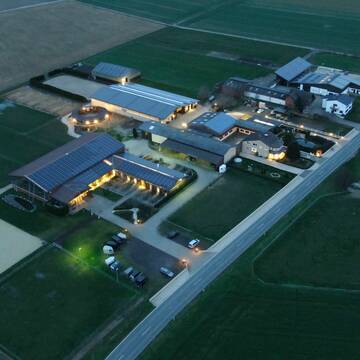
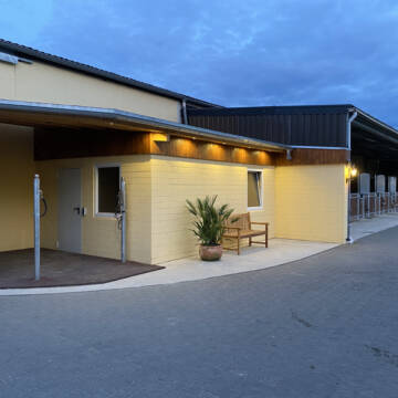
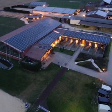
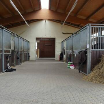
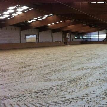
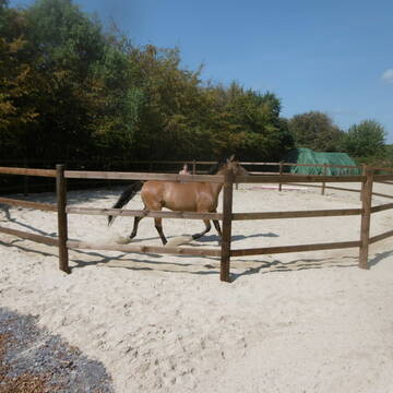
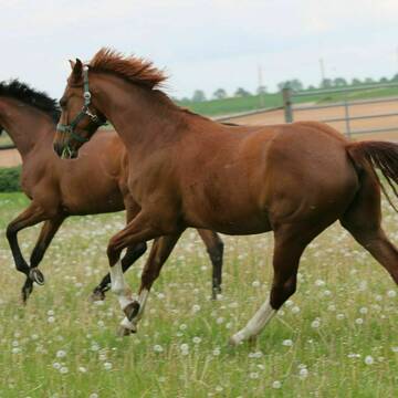
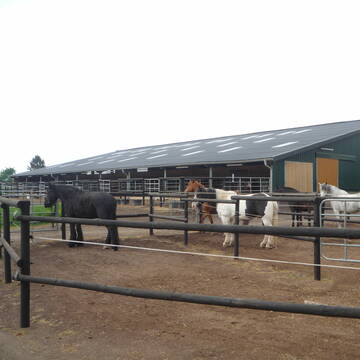
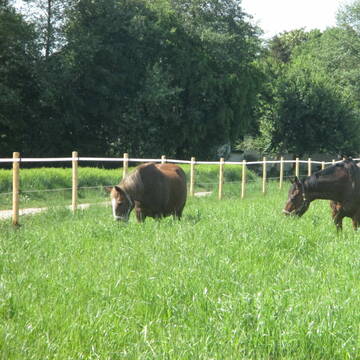
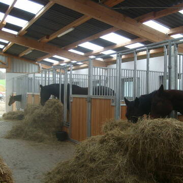
Reitanlage Margarethenhof
Swisttal Miel
Reitanlage-Margarethenhof
@Reitanlage-Margarethenhof
Freizeitstall
Pferdeausbildung
Vermieten
Verpachten
Führanlage
Hunde willkommen
Einhornhaltung möglich
22 weitere...
S
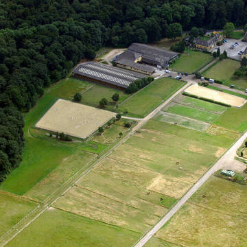
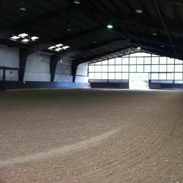
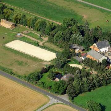
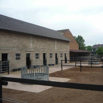
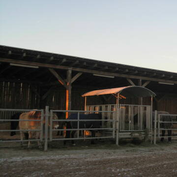
Gut Waldau - Die Reitanlage in Region Köln/Bonn
Rheinbach
Horseconcept Gut Waldau GmbH
@Horseconcept-Gut-Waldau-GmbH
FN-Mitglied
Freizeitstall
Vermieten
Verpachten
Führanlage
Hunde willkommen
Allergikerstall
Fohlenaufzucht möglich
34 weitere...
aktuell
S
Deprecated: Creation of dynamic property Zend_View_Helper_Ads::$adLink is deprecated in /var/www/stall-frei/htdocs/staging.stall-frei.de/library/Psf/View/Helper/Ads.php on line 108

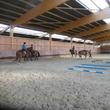
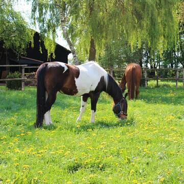
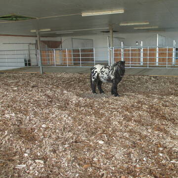
***Reitstall Birkenhof*** Pferdegerechte Haltung
Köln
Daniele-Fazzi
@Daniele-Fazzi
Herzlich Willkommen
auf dem Reitstall Birkenhof
Jetzt neu ‼️ auf dem Birkenhof:
Private Geländestrecke rund um unser

Reiterhof am Brombeerweg / Pferdepensionsbetrieb
Bornheim
Reiterhof am Brombeerweg
@Uwe-Heynmoeller
FN-Mitglied
Freizeitstall
Vermieten
Krankenbox
Longierzirkel/Roundpen
Fohlenaufzucht möglich
Notfallboxen
24 weitere...
P+


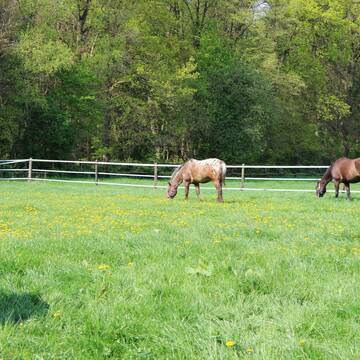
nur 30 Pferde privat und pferdegerecht
Weilerswist
Beate Horn-Moll&Mike Horn
@SchwalbenhofGBR
Freizeitstall
Geländestrecke
Vermieten
Hunde willkommen
Longierzirkel/Roundpen
Fohlenaufzucht möglich
Notfallboxen
23 weitere...
S
Reitstall Schlaeger - Tomberger Mühle
Euskirchen
Reitstall-Schlaeger
@Reitstall-Schlaeger
FN-Mitglied
Freizeitstall
Vermieten
Führanlage
Hunde willkommen
Außenboxen
Innenbox
20 weitere...
S
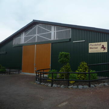
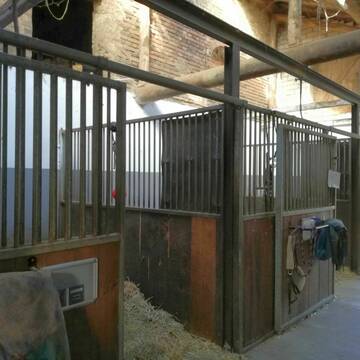
Pferdehof WERNER
Rheinbach-Flerzheim
Hubert-Werner
@Hubert-Werner
Freizeitstall
Longierzirkel/Roundpen
Paddock
Notfallboxen
Außenbox mit Paddock
Laufstall
7 weitere...
P+
Pferdepension Bahners
Rheinbach- Ramershoven
Andreas-Bahners
@Andreas-Bahners
Freizeitstall
Krankenbox
Longierzirkel/Roundpen
Allergikerstall
Fohlenaufzucht möglich
Laufstall
Offenstall
13 weitere...
P+


Mayerhof in Hennef Lichtenberg
Hennef Lichtenberg
Ursula Mayer
@Markus-Ursula-und-Marius-Mayer
FN-Mitglied
Freizeitstall
Führanlage
Krankenbox
Notfallboxen
Außenbox mit Paddock
Außenboxen
23 weitere...
S

Heu aus neuer Ernte
Mechtersen
STALL-FREIde Marketing
@STALL-FREI-Marketing
Heulage und Pferdeheu aus der neuen Ernte findest du in unserem Futtermarkt


Stall-WG hat freie Stallplätze
Bornheim
Veronica Maacks-Cammarata
@StallWG
Freizeitstall
Hunde willkommen
Krankenbox
Innenbox
Offenstall
Halbpension
Selbstversorgung
7 weitere...
P+
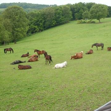
Aufzuchtplätze, Zuchtstutenplätze im Rheinland
Bornheim
Reiterhof am Brombeerweg
@Uwe-Heynmoeller
FN-Mitglied
Freizeitstall
Vermieten
Verpachten
Krankenbox
Longierzirkel/Roundpen
Pferdezucht
Zuchtstutenhaltung möglich
20 weitere...
P
Deprecated: Creation of dynamic property Zend_View::$pageCount is deprecated in /var/www/stall-frei/htdocs/staging.stall-frei.de/library/vendor/shardj/zf1-future/library/Zend/View/Abstract.php on line 308
Deprecated: Creation of dynamic property Zend_View::$itemCountPerPage is deprecated in /var/www/stall-frei/htdocs/staging.stall-frei.de/library/vendor/shardj/zf1-future/library/Zend/View/Abstract.php on line 308
Deprecated: Creation of dynamic property Zend_View::$first is deprecated in /var/www/stall-frei/htdocs/staging.stall-frei.de/library/vendor/shardj/zf1-future/library/Zend/View/Abstract.php on line 308
Deprecated: Creation of dynamic property Zend_View::$current is deprecated in /var/www/stall-frei/htdocs/staging.stall-frei.de/library/vendor/shardj/zf1-future/library/Zend/View/Abstract.php on line 308
Deprecated: Creation of dynamic property Zend_View::$last is deprecated in /var/www/stall-frei/htdocs/staging.stall-frei.de/library/vendor/shardj/zf1-future/library/Zend/View/Abstract.php on line 308
Deprecated: Creation of dynamic property Zend_View::$next is deprecated in /var/www/stall-frei/htdocs/staging.stall-frei.de/library/vendor/shardj/zf1-future/library/Zend/View/Abstract.php on line 308
Deprecated: Creation of dynamic property Zend_View::$pagesInRange is deprecated in /var/www/stall-frei/htdocs/staging.stall-frei.de/library/vendor/shardj/zf1-future/library/Zend/View/Abstract.php on line 308
Deprecated: Creation of dynamic property Zend_View::$firstPageInRange is deprecated in /var/www/stall-frei/htdocs/staging.stall-frei.de/library/vendor/shardj/zf1-future/library/Zend/View/Abstract.php on line 308
Deprecated: Creation of dynamic property Zend_View::$lastPageInRange is deprecated in /var/www/stall-frei/htdocs/staging.stall-frei.de/library/vendor/shardj/zf1-future/library/Zend/View/Abstract.php on line 308
Deprecated: Creation of dynamic property Zend_View::$currentItemCount is deprecated in /var/www/stall-frei/htdocs/staging.stall-frei.de/library/vendor/shardj/zf1-future/library/Zend/View/Abstract.php on line 308
Deprecated: Creation of dynamic property Zend_View::$totalItemCount is deprecated in /var/www/stall-frei/htdocs/staging.stall-frei.de/library/vendor/shardj/zf1-future/library/Zend/View/Abstract.php on line 308
Deprecated: Creation of dynamic property Zend_View::$firstItemNumber is deprecated in /var/www/stall-frei/htdocs/staging.stall-frei.de/library/vendor/shardj/zf1-future/library/Zend/View/Abstract.php on line 308
Deprecated: Creation of dynamic property Zend_View::$lastItemNumber is deprecated in /var/www/stall-frei/htdocs/staging.stall-frei.de/library/vendor/shardj/zf1-future/library/Zend/View/Abstract.php on line 308
Deprecated: Creation of dynamic property Zend_View::$router is deprecated in /var/www/stall-frei/htdocs/staging.stall-frei.de/library/vendor/shardj/zf1-future/library/Zend/View/Abstract.php on line 308
Deprecated: Creation of dynamic property Zend_View::$urlParams is deprecated in /var/www/stall-frei/htdocs/staging.stall-frei.de/library/vendor/shardj/zf1-future/library/Zend/View/Abstract.php on line 308
Deprecated: Creation of dynamic property Zend_View::$showAds is deprecated in /var/www/stall-frei/htdocs/staging.stall-frei.de/library/vendor/shardj/zf1-future/library/Zend/View/Abstract.php on line 308
Deprecated: Creation of dynamic property Zend_View::$objectIds is deprecated in /var/www/stall-frei/htdocs/staging.stall-frei.de/library/vendor/shardj/zf1-future/library/Zend/View/Abstract.php on line 308
Deprecated: Creation of dynamic property Zend_View::$showNavbar is deprecated in /var/www/stall-frei/htdocs/staging.stall-frei.de/library/vendor/shardj/zf1-future/library/Zend/View/Abstract.php on line 308
Deprecated: Creation of dynamic property Zend_View::$showBreadcrumb is deprecated in /var/www/stall-frei/htdocs/staging.stall-frei.de/library/vendor/shardj/zf1-future/library/Zend/View/Abstract.php on line 308
Deprecated: Creation of dynamic property Zend_View::$showFooter is deprecated in /var/www/stall-frei/htdocs/staging.stall-frei.de/library/vendor/shardj/zf1-future/library/Zend/View/Abstract.php on line 308
Deprecated: Creation of dynamic property Zend_View::$showInternalAds is deprecated in /var/www/stall-frei/htdocs/staging.stall-frei.de/library/vendor/shardj/zf1-future/library/Zend/View/Abstract.php on line 308
Deprecated: Creation of dynamic property Zend_View::$blNoContent is deprecated in /var/www/stall-frei/htdocs/staging.stall-frei.de/library/vendor/shardj/zf1-future/library/Zend/View/Abstract.php on line 308
Deprecated: Creation of dynamic property Zend_View::$sMetaDesc is deprecated in /var/www/stall-frei/htdocs/staging.stall-frei.de/library/vendor/shardj/zf1-future/library/Zend/View/Abstract.php on line 308
Deprecated: Creation of dynamic property Zend_View::$useGmaps is deprecated in /var/www/stall-frei/htdocs/staging.stall-frei.de/library/vendor/shardj/zf1-future/library/Zend/View/Abstract.php on line 308
Deprecated: Creation of dynamic property Zend_View::$touches is deprecated in /var/www/stall-frei/htdocs/staging.stall-frei.de/library/vendor/shardj/zf1-future/library/Zend/View/Abstract.php on line 308
Deprecated: Creation of dynamic property Zend_View::$oProject is deprecated in /var/www/stall-frei/htdocs/staging.stall-frei.de/library/vendor/shardj/zf1-future/library/Zend/View/Abstract.php on line 308
Deprecated: Creation of dynamic property Zend_View::$pageHeadline is deprecated in /var/www/stall-frei/htdocs/staging.stall-frei.de/library/vendor/shardj/zf1-future/library/Zend/View/Abstract.php on line 308
Deprecated: Creation of dynamic property Zend_View::$disableLocationField is deprecated in /var/www/stall-frei/htdocs/staging.stall-frei.de/library/vendor/shardj/zf1-future/library/Zend/View/Abstract.php on line 308
Deprecated: Creation of dynamic property Zend_View::$isSearch is deprecated in /var/www/stall-frei/htdocs/staging.stall-frei.de/library/vendor/shardj/zf1-future/library/Zend/View/Abstract.php on line 308
Deprecated: Creation of dynamic property Zend_View::$pageTitle is deprecated in /var/www/stall-frei/htdocs/staging.stall-frei.de/library/vendor/shardj/zf1-future/library/Zend/View/Abstract.php on line 308
Deprecated: Creation of dynamic property Psf_Form_Element_Text::$class is deprecated in /var/www/stall-frei/htdocs/staging.stall-frei.de/library/vendor/shardj/zf1-future/library/Zend/Form/Element.php on line 874
Deprecated: Creation of dynamic property Psf_Form_Element_Text::$size is deprecated in /var/www/stall-frei/htdocs/staging.stall-frei.de/library/vendor/shardj/zf1-future/library/Zend/Form/Element.php on line 874
Deprecated: Creation of dynamic property Psf_Form_Element_Text::$placeholder is deprecated in /var/www/stall-frei/htdocs/staging.stall-frei.de/library/vendor/shardj/zf1-future/library/Zend/Form/Element.php on line 874
Deprecated: Creation of dynamic property Psf_Form_Element_Hidden::$class is deprecated in /var/www/stall-frei/htdocs/staging.stall-frei.de/library/vendor/shardj/zf1-future/library/Zend/Form/Element.php on line 874
Deprecated: Creation of dynamic property Psf_Form_Element_Hidden::$class is deprecated in /var/www/stall-frei/htdocs/staging.stall-frei.de/library/vendor/shardj/zf1-future/library/Zend/Form/Element.php on line 874
Deprecated: Creation of dynamic property Psf_Form_Element_Hidden::$class is deprecated in /var/www/stall-frei/htdocs/staging.stall-frei.de/library/vendor/shardj/zf1-future/library/Zend/Form/Element.php on line 874
Deprecated: Creation of dynamic property Psf_Form_Element_Hidden::$class is deprecated in /var/www/stall-frei/htdocs/staging.stall-frei.de/library/vendor/shardj/zf1-future/library/Zend/Form/Element.php on line 874
Deprecated: Creation of dynamic property Psf_Form_Element_Select::$class is deprecated in /var/www/stall-frei/htdocs/staging.stall-frei.de/library/vendor/shardj/zf1-future/library/Zend/Form/Element.php on line 874
Deprecated: Creation of dynamic property Psf_Form_Element_Select::$class is deprecated in /var/www/stall-frei/htdocs/staging.stall-frei.de/library/vendor/shardj/zf1-future/library/Zend/Form/Element.php on line 874
Deprecated: Creation of dynamic property Psf_Form_Element_Select::$class is deprecated in /var/www/stall-frei/htdocs/staging.stall-frei.de/library/vendor/shardj/zf1-future/library/Zend/Form/Element.php on line 874
Deprecated: Creation of dynamic property Psf_Form_Element_Select::$class is deprecated in /var/www/stall-frei/htdocs/staging.stall-frei.de/library/vendor/shardj/zf1-future/library/Zend/Form/Element.php on line 874
Deprecated: Creation of dynamic property Psf_Form_Element_Text::$class is deprecated in /var/www/stall-frei/htdocs/staging.stall-frei.de/library/vendor/shardj/zf1-future/library/Zend/Form/Element.php on line 874
Deprecated: Creation of dynamic property Psf_Form_Element_Checkbox::$label is deprecated in /var/www/stall-frei/htdocs/staging.stall-frei.de/library/vendor/shardj/zf1-future/library/Zend/Form/Element.php on line 874
Deprecated: Creation of dynamic property Zend_View::$sort is deprecated in /var/www/stall-frei/htdocs/staging.stall-frei.de/library/vendor/shardj/zf1-future/library/Zend/View/Abstract.php on line 308
Deprecated: Creation of dynamic property Zend_View::$searchLocation is deprecated in /var/www/stall-frei/htdocs/staging.stall-frei.de/library/vendor/shardj/zf1-future/library/Zend/View/Abstract.php on line 308
Deprecated: Creation of dynamic property Zend_View::$locationHint is deprecated in /var/www/stall-frei/htdocs/staging.stall-frei.de/library/vendor/shardj/zf1-future/library/Zend/View/Abstract.php on line 308
Psf_GeoCoder_Abstract::getLocation: Hardtberg Get Location CachedOrLive
Psf_GeoCoder_Abstract::getCachedOrLive: Hardtberg
Psf_GeoCoder_OpenCageData::makeApiRequest: response:
Array
(
[documentation] => https://opencagedata.com/api
[licenses] => Array
(
[0] => Array
(
[name] => see attribution guide
[url] => https://opencagedata.com/credits
)
)
[results] => Array
(
[0] => Array
(
[bounds] => Array
(
[northeast] => Array
(
[lat] => 50.727027
[lng] => 7.0792511
)
[southwest] => Array
(
[lat] => 50.6806472
[lng] => 7.0225354
)
)
[components] => Array
(
[ISO_3166-1_alpha-2] => DE
[ISO_3166-1_alpha-3] => DEU
[ISO_3166-2] => Array
(
[0] => DE-NW
)
[_category] => place
[_normalized_city] => Bonn
[_type] => neighbourhood
[city] => Bonn
[continent] => Europe
[country] => Deutschland
[country_code] => de
[political_union] => European Union
[postcode] => 53123
[state] => Nordrhein-Westfalen
[state_code] => NW
[suburb] => Hardtberg
)
[confidence] => 7
[formatted] => 53123 Bonn, Deutschland
[geometry] => Array
(
[lat] => 50.7063244
[lng] => 7.0518064
)
)
[1] => Array
(
[bounds] => Array
(
[northeast] => Array
(
[lat] => 51.2648091
[lng] => 7.1683925
)
[southwest] => Array
(
[lat] => 51.2647091
[lng] => 7.1682925
)
)
[components] => Array
(
[ISO_3166-1_alpha-2] => DE
[ISO_3166-1_alpha-3] => DEU
[ISO_3166-2] => Array
(
[0] => DE-NW
)
[_category] => natural/water
[_normalized_city] => Wuppertal
[_type] => peak
[city] => Wuppertal
[continent] => Europe
[country] => Deutschland
[country_code] => de
[peak] => Hardtberg
[political_union] => European Union
[postcode] => 42285
[state] => Nordrhein-Westfalen
[state_code] => NW
)
[confidence] => 9
[formatted] => Hardtberg, 42285 Wuppertal, Deutschland
[geometry] => Array
(
[lat] => 51.2647591
[lng] => 7.1683425
)
)
[2] => Array
(
[bounds] => Array
(
[northeast] => Array
(
[lat] => 50.1760428
[lng] => 8.482735
)
[southwest] => Array
(
[lat] => 50.1759428
[lng] => 8.482635
)
)
[components] => Array
(
[ISO_3166-1_alpha-2] => DE
[ISO_3166-1_alpha-3] => DEU
[ISO_3166-2] => Array
(
[0] => DE-HE
)
[_category] => natural/water
[_normalized_city] => Königstein im Taunus
[_type] => peak
[continent] => Europe
[country] => Deutschland
[country_code] => de
[county] => Hochtaunuskreis
[municipality] => Königstein im Taunus
[peak] => Hardtberg
[political_union] => European Union
[postcode] => 61462
[state] => Hessen
[state_code] => HE
)
[confidence] => 9
[formatted] => Hardtberg, 61462 Königstein im Taunus, Deutschland
[geometry] => Array
(
[lat] => 50.1759928
[lng] => 8.482685
)
)
[3] => Array
(
[bounds] => Array
(
[northeast] => Array
(
[lat] => 49.7689641
[lng] => 9.0013936
)
[southwest] => Array
(
[lat] => 49.7688641
[lng] => 9.0012936
)
)
[components] => Array
(
[ISO_3166-1_alpha-2] => DE
[ISO_3166-1_alpha-3] => DEU
[ISO_3166-2] => Array
(
[0] => DE-HE
)
[_category] => natural/water
[_normalized_city] => Mümling-Grumbach
[_type] => peak
[continent] => Europe
[country] => Deutschland
[country_code] => de
[county] => Odenwaldkreis
[municipality] => Höchst im Odenwald
[peak] => Hardtberg
[political_union] => European Union
[postcode] => 64732
[state] => Hessen
[state_code] => HE
[village] => Mümling-Grumbach
)
[confidence] => 9
[formatted] => Hardtberg, 64732 Mümling-Grumbach, Deutschland
[geometry] => Array
(
[lat] => 49.7689141
[lng] => 9.0013436
)
)
[4] => Array
(
[bounds] => Array
(
[northeast] => Array
(
[lat] => 51.0322265
[lng] => 7.6461843
)
[southwest] => Array
(
[lat] => 51.0321265
[lng] => 7.6460843
)
)
[components] => Array
(
[ISO_3166-1_alpha-2] => DE
[ISO_3166-1_alpha-3] => DEU
[ISO_3166-2] => Array
(
[0] => DE-NW
)
[_category] => natural/water
[_normalized_city] => Bergneustadt
[_type] => peak
[continent] => Europe
[country] => Deutschland
[country_code] => de
[county] => Oberbergischer Kreis
[peak] => Hardtberg
[political_union] => European Union
[postcode] => 51702
[state] => Nordrhein-Westfalen
[state_code] => NW
[town] => Bergneustadt
)
[confidence] => 9
[formatted] => Hardtberg, 51702 Bergneustadt, Deutschland
[geometry] => Array
(
[lat] => 51.0321765
[lng] => 7.6461343
)
)
[5] => Array
(
[bounds] => Array
(
[northeast] => Array
(
[lat] => 51.0808009
[lng] => 8.9098899
)
[southwest] => Array
(
[lat] => 51.0807009
[lng] => 8.9097899
)
)
[components] => Array
(
[ISO_3166-1_alpha-2] => DE
[ISO_3166-1_alpha-3] => DEU
[ISO_3166-2] => Array
(
[0] => DE-HE
)
[_category] => natural/water
[_normalized_city] => Allendorf/Hardtberg
[_type] => peak
[continent] => Europe
[country] => Deutschland
[country_code] => de
[county] => Landkreis Waldeck-Frankenberg
[municipality] => Frankenau
[peak] => Hardtberg
[political_union] => European Union
[postcode] => 35110
[state] => Hessen
[state_code] => HE
[village] => Allendorf/Hardtberg
)
[confidence] => 9
[formatted] => Hardtberg, 35110 Allendorf/Hardtberg, Deutschland
[geometry] => Array
(
[lat] => 51.0807509
[lng] => 8.9098399
)
)
[6] => Array
(
[bounds] => Array
(
[northeast] => Array
(
[lat] => 50.7639257
[lng] => 11.5016007
)
[southwest] => Array
(
[lat] => 50.7638257
[lng] => 11.5015007
)
)
[components] => Array
(
[ISO_3166-1_alpha-2] => DE
[ISO_3166-1_alpha-3] => DEU
[ISO_3166-2] => Array
(
[0] => DE-TH
)
[_category] => natural/water
[_normalized_city] => Uhlstädt-Kirchhasel
[_type] => peak
[city] => Uhlstädt-Kirchhasel
[continent] => Europe
[country] => Deutschland
[country_code] => de
[county] => Landkreis Saalfeld-Rudolstadt
[peak] => Hardtberg
[political_union] => European Union
[state] => Thüringen
[state_code] => TH
)
[confidence] => 9
[formatted] => Hardtberg, Uhlstädt-Kirchhasel, Thüringen, Deutschland
[geometry] => Array
(
[lat] => 50.7638757
[lng] => 11.5015507
)
)
[7] => Array
(
[bounds] => Array
(
[northeast] => Array
(
[lat] => 51.4640651
[lng] => 8.3777595
)
[southwest] => Array
(
[lat] => 51.4639651
[lng] => 8.3776595
)
)
[components] => Array
(
[ISO_3166-1_alpha-2] => DE
[ISO_3166-1_alpha-3] => DEU
[ISO_3166-2] => Array
(
[0] => DE-NW
)
[_category] => natural/water
[_normalized_city] => Warstein
[_type] => peak
[continent] => Europe
[country] => Deutschland
[country_code] => de
[county] => Kreis Soest
[peak] => Hardtberg
[political_union] => European Union
[state] => Nordrhein-Westfalen
[state_code] => NW
[town] => Warstein
)
[confidence] => 9
[formatted] => Hardtberg, Warstein, Nordrhein-Westfalen, Deutschland
[geometry] => Array
(
[lat] => 51.4640151
[lng] => 8.3777095
)
)
[8] => Array
(
[bounds] => Array
(
[northeast] => Array
(
[lat] => 50.5155643
[lng] => 6.7715013
)
[southwest] => Array
(
[lat] => 50.5154643
[lng] => 6.7714013
)
)
[components] => Array
(
[ISO_3166-1_alpha-2] => DE
[ISO_3166-1_alpha-3] => DEU
[ISO_3166-2] => Array
(
[0] => DE-NW
)
[_category] => natural/water
[_normalized_city] => Bad Münstereifel
[_type] => peak
[continent] => Europe
[country] => Deutschland
[country_code] => de
[county] => Kreis Euskirchen
[peak] => Hardtberg
[political_union] => European Union
[postcode] => 53902
[state] => Nordrhein-Westfalen
[state_code] => NW
[town] => Bad Münstereifel
)
[confidence] => 9
[formatted] => Hardtberg, 53902 Bad Münstereifel, Deutschland
[geometry] => Array
(
[lat] => 50.5155143
[lng] => 6.7714513
)
)
[9] => Array
(
[bounds] => Array
(
[northeast] => Array
(
[lat] => 53.7940826
[lng] => 12.6921855
)
[southwest] => Array
(
[lat] => 53.7939826
[lng] => 12.6920855
)
)
[components] => Array
(
[ISO_3166-1_alpha-2] => DE
[ISO_3166-1_alpha-3] => DEU
[ISO_3166-2] => Array
(
[0] => DE-MV
)
[_category] => natural/water
[_normalized_city] => Alt Sührkow
[_type] => peak
[continent] => Europe
[country] => Deutschland
[country_code] => de
[county] => Landkreis Rostock
[municipality] => Mecklenburgische Schweiz
[peak] => Hardtberg
[political_union] => European Union
[state] => Mecklenburg-Vorpommern
[state_code] => MV
[village] => Alt Sührkow
)
[confidence] => 9
[formatted] => Hardtberg, Alt Sührkow, Mecklenburg-Vorpommern, Deutschland
[geometry] => Array
(
[lat] => 53.7940326
[lng] => 12.6921355
)
)
)
[status] => Array
(
[code] => 200
[message] => OK
)
[stay_informed] => Array
(
[blog] => https://blog.opencagedata.com
[mastodon] => https://en.osm.town/@opencage
)
[thanks] => For using an OpenCage API
[timestamp] => Array
(
[created_http] => Sat, 07 Feb 2026 12:14:51 GMT
[created_unix] => 1770466491
)
[total_results] => 10
)
Psf_GeoCoder_Abstract::convertLocationResult
{"documentation":"https:\/\/opencagedata.com\/api","licenses":[{"name":"see attribution guide","url":"https:\/\/opencagedata.com\/credits"}],"results":[{"bounds":{"northeast":{"lat":50.727027,"lng":7.0792511},"southwest":{"lat":50.6806472,"lng":7.0225354}},"components":{"ISO_3166-1_alpha-2":"DE","ISO_3166-1_alpha-3":"DEU","ISO_3166-2":["DE-NW"],"_category":"place","_normalized_city":"Bonn","_type":"neighbourhood","city":"Bonn","continent":"Europe","country":"Deutschland","country_code":"de","political_union":"European Union","postcode":"53123","state":"Nordrhein-Westfalen","state_code":"NW","suburb":"Hardtberg"},"confidence":7,"formatted":"53123 Bonn, Deutschland","geometry":{"lat":50.7063244,"lng":7.0518064}},{"bounds":{"northeast":{"lat":51.2648091,"lng":7.1683925},"southwest":{"lat":51.2647091,"lng":7.1682925}},"components":{"ISO_3166-1_alpha-2":"DE","ISO_3166-1_alpha-3":"DEU","ISO_3166-2":["DE-NW"],"_category":"natural\/water","_normalized_city":"Wuppertal","_type":"peak","city":"Wuppertal","continent":"Europe","country":"Deutschland","country_code":"de","peak":"Hardtberg","political_union":"European Union","postcode":"42285","state":"Nordrhein-Westfalen","state_code":"NW"},"confidence":9,"formatted":"Hardtberg, 42285 Wuppertal, Deutschland","geometry":{"lat":51.2647591,"lng":7.1683425}},{"bounds":{"northeast":{"lat":50.1760428,"lng":8.482735},"southwest":{"lat":50.1759428,"lng":8.482635}},"components":{"ISO_3166-1_alpha-2":"DE","ISO_3166-1_alpha-3":"DEU","ISO_3166-2":["DE-HE"],"_category":"natural\/water","_normalized_city":"K\u00f6nigstein im Taunus","_type":"peak","continent":"Europe","country":"Deutschland","country_code":"de","county":"Hochtaunuskreis","municipality":"K\u00f6nigstein im Taunus","peak":"Hardtberg","political_union":"European Union","postcode":"61462","state":"Hessen","state_code":"HE"},"confidence":9,"formatted":"Hardtberg, 61462 K\u00f6nigstein im Taunus, Deutschland","geometry":{"lat":50.1759928,"lng":8.482685}},{"bounds":{"northeast":{"lat":49.7689641,"lng":9.0013936},"southwest":{"lat":49.7688641,"lng":9.0012936}},"components":{"ISO_3166-1_alpha-2":"DE","ISO_3166-1_alpha-3":"DEU","ISO_3166-2":["DE-HE"],"_category":"natural\/water","_normalized_city":"M\u00fcmling-Grumbach","_type":"peak","continent":"Europe","country":"Deutschland","country_code":"de","county":"Odenwaldkreis","municipality":"H\u00f6chst im Odenwald","peak":"Hardtberg","political_union":"European Union","postcode":"64732","state":"Hessen","state_code":"HE","village":"M\u00fcmling-Grumbach"},"confidence":9,"formatted":"Hardtberg, 64732 M\u00fcmling-Grumbach, Deutschland","geometry":{"lat":49.7689141,"lng":9.0013436}},{"bounds":{"northeast":{"lat":51.0322265,"lng":7.6461843},"southwest":{"lat":51.0321265,"lng":7.6460843}},"components":{"ISO_3166-1_alpha-2":"DE","ISO_3166-1_alpha-3":"DEU","ISO_3166-2":["DE-NW"],"_category":"natural\/water","_normalized_city":"Bergneustadt","_type":"peak","continent":"Europe","country":"Deutschland","country_code":"de","county":"Oberbergischer Kreis","peak":"Hardtberg","political_union":"European Union","postcode":"51702","state":"Nordrhein-Westfalen","state_code":"NW","town":"Bergneustadt"},"confidence":9,"formatted":"Hardtberg, 51702 Bergneustadt, Deutschland","geometry":{"lat":51.0321765,"lng":7.6461343}},{"bounds":{"northeast":{"lat":51.0808009,"lng":8.9098899},"southwest":{"lat":51.0807009,"lng":8.9097899}},"components":{"ISO_3166-1_alpha-2":"DE","ISO_3166-1_alpha-3":"DEU","ISO_3166-2":["DE-HE"],"_category":"natural\/water","_normalized_city":"Allendorf\/Hardtberg","_type":"peak","continent":"Europe","country":"Deutschland","country_code":"de","county":"Landkreis Waldeck-Frankenberg","municipality":"Frankenau","peak":"Hardtberg","political_union":"European Union","postcode":"35110","state":"Hessen","state_code":"HE","village":"Allendorf\/Hardtberg"},"confidence":9,"formatted":"Hardtberg, 35110 Allendorf\/Hardtberg, Deutschland","geometry":{"lat":51.0807509,"lng":8.9098399}},{"bounds":{"northeast":{"lat":50.7639257,"lng":11.5016007},"southwest":{"lat":50.7638257,"lng":11.5015007}},"components":{"ISO_3166-1_alpha-2":"DE","ISO_3166-1_alpha-3":"DEU","ISO_3166-2":["DE-TH"],"_category":"natural\/water","_normalized_city":"Uhlst\u00e4dt-Kirchhasel","_type":"peak","city":"Uhlst\u00e4dt-Kirchhasel","continent":"Europe","country":"Deutschland","country_code":"de","county":"Landkreis Saalfeld-Rudolstadt","peak":"Hardtberg","political_union":"European Union","state":"Th\u00fcringen","state_code":"TH"},"confidence":9,"formatted":"Hardtberg, Uhlst\u00e4dt-Kirchhasel, Th\u00fcringen, Deutschland","geometry":{"lat":50.7638757,"lng":11.5015507}},{"bounds":{"northeast":{"lat":51.4640651,"lng":8.3777595},"southwest":{"lat":51.4639651,"lng":8.3776595}},"components":{"ISO_3166-1_alpha-2":"DE","ISO_3166-1_alpha-3":"DEU","ISO_3166-2":["DE-NW"],"_category":"natural\/water","_normalized_city":"Warstein","_type":"peak","continent":"Europe","country":"Deutschland","country_code":"de","county":"Kreis Soest","peak":"Hardtberg","political_union":"European Union","state":"Nordrhein-Westfalen","state_code":"NW","town":"Warstein"},"confidence":9,"formatted":"Hardtberg, Warstein, Nordrhein-Westfalen, Deutschland","geometry":{"lat":51.4640151,"lng":8.3777095}},{"bounds":{"northeast":{"lat":50.5155643,"lng":6.7715013},"southwest":{"lat":50.5154643,"lng":6.7714013}},"components":{"ISO_3166-1_alpha-2":"DE","ISO_3166-1_alpha-3":"DEU","ISO_3166-2":["DE-NW"],"_category":"natural\/water","_normalized_city":"Bad M\u00fcnstereifel","_type":"peak","continent":"Europe","country":"Deutschland","country_code":"de","county":"Kreis Euskirchen","peak":"Hardtberg","political_union":"European Union","postcode":"53902","state":"Nordrhein-Westfalen","state_code":"NW","town":"Bad M\u00fcnstereifel"},"confidence":9,"formatted":"Hardtberg, 53902 Bad M\u00fcnstereifel, Deutschland","geometry":{"lat":50.5155143,"lng":6.7714513}},{"bounds":{"northeast":{"lat":53.7940826,"lng":12.6921855},"southwest":{"lat":53.7939826,"lng":12.6920855}},"components":{"ISO_3166-1_alpha-2":"DE","ISO_3166-1_alpha-3":"DEU","ISO_3166-2":["DE-MV"],"_category":"natural\/water","_normalized_city":"Alt S\u00fchrkow","_type":"peak","continent":"Europe","country":"Deutschland","country_code":"de","county":"Landkreis Rostock","municipality":"Mecklenburgische Schweiz","peak":"Hardtberg","political_union":"European Union","state":"Mecklenburg-Vorpommern","state_code":"MV","village":"Alt S\u00fchrkow"},"confidence":9,"formatted":"Hardtberg, Alt S\u00fchrkow, Mecklenburg-Vorpommern, Deutschland","geometry":{"lat":53.7940326,"lng":12.6921355}}],"status":{"code":200,"message":"OK"},"stay_informed":{"blog":"https:\/\/blog.opencagedata.com","mastodon":"https:\/\/en.osm.town\/@opencage"},"thanks":"For using an OpenCage API","timestamp":{"created_http":"Sat, 07 Feb 2026 12:14:51 GMT","created_unix":1770466491},"total_results":10}Array
(
[0] => stdClass Object
(
[bounds] => stdClass Object
(
[northeast] => stdClass Object
(
[lat] => 50.727027
[lng] => 7.0792511
)
[southwest] => stdClass Object
(
[lat] => 50.6806472
[lng] => 7.0225354
)
)
[components] => stdClass Object
(
[ISO_3166-1_alpha-2] => DE
[ISO_3166-1_alpha-3] => DEU
[ISO_3166-2] => Array
(
[0] => DE-NW
)
[_category] => place
[_normalized_city] => Bonn
[_type] => neighbourhood
[city] => Bonn
[continent] => Europe
[country] => Deutschland
[country_code] => de
[political_union] => European Union
[postcode] => 53123
[state] => Nordrhein-Westfalen
[state_code] => NW
[suburb] => Hardtberg
)
[confidence] => 7
[formatted] => 53123 Bonn, Deutschland
[geometry] => stdClass Object
(
[lat] => 50.7063244
[lng] => 7.0518064
)
)
[1] => stdClass Object
(
[bounds] => stdClass Object
(
[northeast] => stdClass Object
(
[lat] => 51.2648091
[lng] => 7.1683925
)
[southwest] => stdClass Object
(
[lat] => 51.2647091
[lng] => 7.1682925
)
)
[components] => stdClass Object
(
[ISO_3166-1_alpha-2] => DE
[ISO_3166-1_alpha-3] => DEU
[ISO_3166-2] => Array
(
[0] => DE-NW
)
[_category] => natural/water
[_normalized_city] => Wuppertal
[_type] => peak
[city] => Wuppertal
[continent] => Europe
[country] => Deutschland
[country_code] => de
[peak] => Hardtberg
[political_union] => European Union
[postcode] => 42285
[state] => Nordrhein-Westfalen
[state_code] => NW
)
[confidence] => 9
[formatted] => Hardtberg, 42285 Wuppertal, Deutschland
[geometry] => stdClass Object
(
[lat] => 51.2647591
[lng] => 7.1683425
)
)
[2] => stdClass Object
(
[bounds] => stdClass Object
(
[northeast] => stdClass Object
(
[lat] => 50.1760428
[lng] => 8.482735
)
[southwest] => stdClass Object
(
[lat] => 50.1759428
[lng] => 8.482635
)
)
[components] => stdClass Object
(
[ISO_3166-1_alpha-2] => DE
[ISO_3166-1_alpha-3] => DEU
[ISO_3166-2] => Array
(
[0] => DE-HE
)
[_category] => natural/water
[_normalized_city] => Königstein im Taunus
[_type] => peak
[continent] => Europe
[country] => Deutschland
[country_code] => de
[county] => Hochtaunuskreis
[municipality] => Königstein im Taunus
[peak] => Hardtberg
[political_union] => European Union
[postcode] => 61462
[state] => Hessen
[state_code] => HE
)
[confidence] => 9
[formatted] => Hardtberg, 61462 Königstein im Taunus, Deutschland
[geometry] => stdClass Object
(
[lat] => 50.1759928
[lng] => 8.482685
)
)
[3] => stdClass Object
(
[bounds] => stdClass Object
(
[northeast] => stdClass Object
(
[lat] => 49.7689641
[lng] => 9.0013936
)
[southwest] => stdClass Object
(
[lat] => 49.7688641
[lng] => 9.0012936
)
)
[components] => stdClass Object
(
[ISO_3166-1_alpha-2] => DE
[ISO_3166-1_alpha-3] => DEU
[ISO_3166-2] => Array
(
[0] => DE-HE
)
[_category] => natural/water
[_normalized_city] => Mümling-Grumbach
[_type] => peak
[continent] => Europe
[country] => Deutschland
[country_code] => de
[county] => Odenwaldkreis
[municipality] => Höchst im Odenwald
[peak] => Hardtberg
[political_union] => European Union
[postcode] => 64732
[state] => Hessen
[state_code] => HE
[village] => Mümling-Grumbach
)
[confidence] => 9
[formatted] => Hardtberg, 64732 Mümling-Grumbach, Deutschland
[geometry] => stdClass Object
(
[lat] => 49.7689141
[lng] => 9.0013436
)
)
[4] => stdClass Object
(
[bounds] => stdClass Object
(
[northeast] => stdClass Object
(
[lat] => 51.0322265
[lng] => 7.6461843
)
[southwest] => stdClass Object
(
[lat] => 51.0321265
[lng] => 7.6460843
)
)
[components] => stdClass Object
(
[ISO_3166-1_alpha-2] => DE
[ISO_3166-1_alpha-3] => DEU
[ISO_3166-2] => Array
(
[0] => DE-NW
)
[_category] => natural/water
[_normalized_city] => Bergneustadt
[_type] => peak
[continent] => Europe
[country] => Deutschland
[country_code] => de
[county] => Oberbergischer Kreis
[peak] => Hardtberg
[political_union] => European Union
[postcode] => 51702
[state] => Nordrhein-Westfalen
[state_code] => NW
[town] => Bergneustadt
)
[confidence] => 9
[formatted] => Hardtberg, 51702 Bergneustadt, Deutschland
[geometry] => stdClass Object
(
[lat] => 51.0321765
[lng] => 7.6461343
)
)
[5] => stdClass Object
(
[bounds] => stdClass Object
(
[northeast] => stdClass Object
(
[lat] => 51.0808009
[lng] => 8.9098899
)
[southwest] => stdClass Object
(
[lat] => 51.0807009
[lng] => 8.9097899
)
)
[components] => stdClass Object
(
[ISO_3166-1_alpha-2] => DE
[ISO_3166-1_alpha-3] => DEU
[ISO_3166-2] => Array
(
[0] => DE-HE
)
[_category] => natural/water
[_normalized_city] => Allendorf/Hardtberg
[_type] => peak
[continent] => Europe
[country] => Deutschland
[country_code] => de
[county] => Landkreis Waldeck-Frankenberg
[municipality] => Frankenau
[peak] => Hardtberg
[political_union] => European Union
[postcode] => 35110
[state] => Hessen
[state_code] => HE
[village] => Allendorf/Hardtberg
)
[confidence] => 9
[formatted] => Hardtberg, 35110 Allendorf/Hardtberg, Deutschland
[geometry] => stdClass Object
(
[lat] => 51.0807509
[lng] => 8.9098399
)
)
[6] => stdClass Object
(
[bounds] => stdClass Object
(
[northeast] => stdClass Object
(
[lat] => 50.7639257
[lng] => 11.5016007
)
[southwest] => stdClass Object
(
[lat] => 50.7638257
[lng] => 11.5015007
)
)
[components] => stdClass Object
(
[ISO_3166-1_alpha-2] => DE
[ISO_3166-1_alpha-3] => DEU
[ISO_3166-2] => Array
(
[0] => DE-TH
)
[_category] => natural/water
[_normalized_city] => Uhlstädt-Kirchhasel
[_type] => peak
[city] => Uhlstädt-Kirchhasel
[continent] => Europe
[country] => Deutschland
[country_code] => de
[county] => Landkreis Saalfeld-Rudolstadt
[peak] => Hardtberg
[political_union] => European Union
[state] => Thüringen
[state_code] => TH
)
[confidence] => 9
[formatted] => Hardtberg, Uhlstädt-Kirchhasel, Thüringen, Deutschland
[geometry] => stdClass Object
(
[lat] => 50.7638757
[lng] => 11.5015507
)
)
[7] => stdClass Object
(
[bounds] => stdClass Object
(
[northeast] => stdClass Object
(
[lat] => 51.4640651
[lng] => 8.3777595
)
[southwest] => stdClass Object
(
[lat] => 51.4639651
[lng] => 8.3776595
)
)
[components] => stdClass Object
(
[ISO_3166-1_alpha-2] => DE
[ISO_3166-1_alpha-3] => DEU
[ISO_3166-2] => Array
(
[0] => DE-NW
)
[_category] => natural/water
[_normalized_city] => Warstein
[_type] => peak
[continent] => Europe
[country] => Deutschland
[country_code] => de
[county] => Kreis Soest
[peak] => Hardtberg
[political_union] => European Union
[state] => Nordrhein-Westfalen
[state_code] => NW
[town] => Warstein
)
[confidence] => 9
[formatted] => Hardtberg, Warstein, Nordrhein-Westfalen, Deutschland
[geometry] => stdClass Object
(
[lat] => 51.4640151
[lng] => 8.3777095
)
)
[8] => stdClass Object
(
[bounds] => stdClass Object
(
[northeast] => stdClass Object
(
[lat] => 50.5155643
[lng] => 6.7715013
)
[southwest] => stdClass Object
(
[lat] => 50.5154643
[lng] => 6.7714013
)
)
[components] => stdClass Object
(
[ISO_3166-1_alpha-2] => DE
[ISO_3166-1_alpha-3] => DEU
[ISO_3166-2] => Array
(
[0] => DE-NW
)
[_category] => natural/water
[_normalized_city] => Bad Münstereifel
[_type] => peak
[continent] => Europe
[country] => Deutschland
[country_code] => de
[county] => Kreis Euskirchen
[peak] => Hardtberg
[political_union] => European Union
[postcode] => 53902
[state] => Nordrhein-Westfalen
[state_code] => NW
[town] => Bad Münstereifel
)
[confidence] => 9
[formatted] => Hardtberg, 53902 Bad Münstereifel, Deutschland
[geometry] => stdClass Object
(
[lat] => 50.5155143
[lng] => 6.7714513
)
)
[9] => stdClass Object
(
[bounds] => stdClass Object
(
[northeast] => stdClass Object
(
[lat] => 53.7940826
[lng] => 12.6921855
)
[southwest] => stdClass Object
(
[lat] => 53.7939826
[lng] => 12.6920855
)
)
[components] => stdClass Object
(
[ISO_3166-1_alpha-2] => DE
[ISO_3166-1_alpha-3] => DEU
[ISO_3166-2] => Array
(
[0] => DE-MV
)
[_category] => natural/water
[_normalized_city] => Alt Sührkow
[_type] => peak
[continent] => Europe
[country] => Deutschland
[country_code] => de
[county] => Landkreis Rostock
[municipality] => Mecklenburgische Schweiz
[peak] => Hardtberg
[political_union] => European Union
[state] => Mecklenburg-Vorpommern
[state_code] => MV
[village] => Alt Sührkow
)
[confidence] => 9
[formatted] => Hardtberg, Alt Sührkow, Mecklenburg-Vorpommern, Deutschland
[geometry] => stdClass Object
(
[lat] => 53.7940326
[lng] => 12.6921355
)
)
)
Psf_GeoCoder_OpenCageData::getKeyMap: 0
stdClass Object
(
    [bounds] => stdClass Object
        (
            [northeast] => stdClass Object
                (
                    [lat] => 50.727027
                    [lng] => 7.0792511
                )

            [southwest] => stdClass Object
                (
                    [lat] => 50.6806472
                    [lng] => 7.0225354
                )

        )

    [components] => stdClass Object
        (
            [ISO_3166-1_alpha-2] => DE
            [ISO_3166-1_alpha-3] => DEU
            [ISO_3166-2] => Array
                (
                    [0] => DE-NW
                )

            [_category] => place
            [_normalized_city] => Bonn
            [_type] => neighbourhood
            [city] => Bonn
            [continent] => Europe
            [country] => Deutschland
            [country_code] => de
            [political_union] => European Union
            [postcode] => 53123
            [state] => Nordrhein-Westfalen
            [state_code] => NW
            [suburb] => Hardtberg
        )

    [confidence] => 7
    [formatted] => 53123 Bonn, Deutschland
    [geometry] => stdClass Object
        (
            [lat] => 50.7063244
            [lng] => 7.0518064
        )

)
Psf_GeoCoder_OpenCageData::getCounty: Bonn
Psf_GeoCoder_OpenCageData::addMissingData REFETCH!
Array
(
    [address] => 53123 Bonn, Deutschland
    [type] => neighbourhood
    [street] =>
    [city] => Hardtberg
    [county] => Bonn
    [state] => Nordrhein-Westfalen
    [zip] => 53123
    [country] => Deutschland
    [suburb] => Hardtberg
    [countrycode] => de
    [latitude] => 50.7063244
    [longitude] => 7.0518064
    [accuracy] => 1
    [confidence] => 7
    [bounds] => stdClass Object
        (
            [northeast] => stdClass Object
                (
                    [lat] => 50.727027
                    [lng] => 7.0792511
                )

            [southwest] => stdClass Object
                (
                    [lat] => 50.6806472
                    [lng] => 7.0225354
                )

        )

)
reformat!
Array
(
    [address] => 53123 Hardtberg
    [type] => neighbourhood
    [street] =>
    [city] => Hardtberg
    [county] => Bonn
    [state] => Nordrhein-Westfalen
    [zip] => 53123
    [country] => Deutschland
    [suburb] => Hardtberg
    [countrycode] => de
    [latitude] => 50.7063244
    [longitude] => 7.0518064
    [accuracy] => 1
    [confidence] => 7
    [bounds] => stdClass Object
        (
            [northeast] => stdClass Object
                (
                    [lat] => 50.727027
                    [lng] => 7.0792511
                )

            [southwest] => stdClass Object
                (
                    [lat] => 50.6806472
                    [lng] => 7.0225354
                )

        )

    [place] => 53123 Hardtberg, Nordrhein-Westfalen
    [hash] => e753326f4f9848ff54658e255807bc92
)
Psf_GeoCoder_OpenCageData::getKeyMap: 1
stdClass Object
(
    [bounds] => stdClass Object
        (
            [northeast] => stdClass Object
                (
                    [lat] => 51.2648091
                    [lng] => 7.1683925
                )

            [southwest] => stdClass Object
                (
                    [lat] => 51.2647091
                    [lng] => 7.1682925
                )

        )

    [components] => stdClass Object
        (
            [ISO_3166-1_alpha-2] => DE
            [ISO_3166-1_alpha-3] => DEU
            [ISO_3166-2] => Array
                (
                    [0] => DE-NW
                )

            [_category] => natural/water
            [_normalized_city] => Wuppertal
            [_type] => peak
            [city] => Wuppertal
            [continent] => Europe
            [country] => Deutschland
            [country_code] => de
            [peak] => Hardtberg
            [political_union] => European Union
            [postcode] => 42285
            [state] => Nordrhein-Westfalen
            [state_code] => NW
        )

    [confidence] => 9
    [formatted] => Hardtberg, 42285 Wuppertal, Deutschland
    [geometry] => stdClass Object
        (
            [lat] => 51.2647591
            [lng] => 7.1683425
        )

)
Psf_GeoCoder_OpenCageData::getCounty: Wuppertal
Psf_GeoCoder_OpenCageData::addMissingData REFETCH!
Array
(
    [address] => Hardtberg, 42285 Wuppertal, Deutschland
    [type] => peak
    [street] =>
    [city] => Wuppertal
    [county] => Wuppertal
    [state] => Nordrhein-Westfalen
    [zip] => 42285
    [country] => Deutschland
    [suburb] =>
    [countrycode] => de
    [latitude] => 51.2647591
    [longitude] => 7.1683425
    [accuracy] => 1
    [confidence] => 9
    [bounds] => stdClass Object
        (
            [northeast] => stdClass Object
                (
                    [lat] => 51.2648091
                    [lng] => 7.1683925
                )

            [southwest] => stdClass Object
                (
                    [lat] => 51.2647091
                    [lng] => 7.1682925
                )

        )

)
reformat!
Array
(
    [address] => Hardtberg, 42285 Wuppertal, Deutschland
    [type] => peak
    [street] =>
    [city] => Wuppertal
    [county] => Wuppertal
    [state] => Nordrhein-Westfalen
    [zip] => 42285
    [country] => Deutschland
    [suburb] =>
    [countrycode] => de
    [latitude] => 51.2647591
    [longitude] => 7.1683425
    [accuracy] => 1
    [confidence] => 9
    [bounds] => stdClass Object
        (
            [northeast] => stdClass Object
                (
                    [lat] => 51.2648091
                    [lng] => 7.1683925
                )

            [southwest] => stdClass Object
                (
                    [lat] => 51.2647091
                    [lng] => 7.1682925
                )

        )

    [place] => 42285 Wuppertal, Nordrhein-Westfalen
    [hash] => feb450a3215eb7b9a4f0def7dfa587bf
)
Psf_GeoCoder_OpenCageData::getKeyMap: 2
stdClass Object
(
    [bounds] => stdClass Object
        (
            [northeast] => stdClass Object
                (
                    [lat] => 50.1760428
                    [lng] => 8.482735
                )

            [southwest] => stdClass Object
                (
                    [lat] => 50.1759428
                    [lng] => 8.482635
                )

        )

    [components] => stdClass Object
        (
            [ISO_3166-1_alpha-2] => DE
            [ISO_3166-1_alpha-3] => DEU
            [ISO_3166-2] => Array
                (
                    [0] => DE-HE
                )

            [_category] => natural/water
            [_normalized_city] => Königstein im Taunus
            [_type] => peak
            [continent] => Europe
            [country] => Deutschland
            [country_code] => de
            [county] => Hochtaunuskreis
            [municipality] => Königstein im Taunus
            [peak] => Hardtberg
            [political_union] => European Union
            [postcode] => 61462
            [state] => Hessen
            [state_code] => HE
        )

    [confidence] => 9
    [formatted] => Hardtberg, 61462 Königstein im Taunus, Deutschland
    [geometry] => stdClass Object
        (
            [lat] => 50.1759928
            [lng] => 8.482685
        )

)
Psf_GeoCoder_OpenCageData::getCounty: Hochtaunuskreis
Psf_GeoCoder_OpenCageData::addMissingData REFETCH!
Array
(
    [address] => Hardtberg, 61462 Königstein im Taunus, Deutschland
    [type] => peak
    [street] =>
    [city] =>
    [county] => Hochtaunuskreis
    [state] => Hessen
    [zip] => 61462
    [country] => Deutschland
    [suburb] =>
    [countrycode] => de
    [latitude] => 50.1759928
    [longitude] => 8.482685
    [accuracy] => 1
    [confidence] => 9
    [bounds] => stdClass Object
        (
            [northeast] => stdClass Object
                (
                    [lat] => 50.1760428
                    [lng] => 8.482735
                )

            [southwest] => stdClass Object
                (
                    [lat] => 50.1759428
                    [lng] => 8.482635
                )

        )

)
reformat!
Array
(
    [address] => Hardtberg, 61462 Königstein im Taunus, Deutschland
    [type] => peak
    [street] =>
    [city] =>
    [county] => Hochtaunuskreis
    [state] => Hessen
    [zip] => 61462
    [country] => Deutschland
    [suburb] =>
    [countrycode] => de
    [latitude] => 50.1759928
    [longitude] => 8.482685
    [accuracy] => 1
    [confidence] => 9
    [bounds] => stdClass Object
        (
            [northeast] => stdClass Object
                (
                    [lat] => 50.1760428
                    [lng] => 8.482735
                )

            [southwest] => stdClass Object
                (
                    [lat] => 50.1759428
                    [lng] => 8.482635
                )

        )

    [place] => 61462 , Hessen
    [hash] => 7d95cb516c9113798728c5065f7d64d5
)
Psf_GeoCoder_OpenCageData::getKeyMap: 3
stdClass Object
(
    [bounds] => stdClass Object
        (
            [northeast] => stdClass Object
                (
                    [lat] => 49.7689641
                    [lng] => 9.0013936
                )

            [southwest] => stdClass Object
                (
                    [lat] => 49.7688641
                    [lng] => 9.0012936
                )

        )

    [components] => stdClass Object
        (
            [ISO_3166-1_alpha-2] => DE
            [ISO_3166-1_alpha-3] => DEU
            [ISO_3166-2] => Array
                (
                    [0] => DE-HE
                )

            [_category] => natural/water
            [_normalized_city] => Mümling-Grumbach
            [_type] => peak
            [continent] => Europe
            [country] => Deutschland
            [country_code] => de
            [county] => Odenwaldkreis
            [municipality] => Höchst im Odenwald
            [peak] => Hardtberg
            [political_union] => European Union
            [postcode] => 64732
            [state] => Hessen
            [state_code] => HE
            [village] => Mümling-Grumbach
        )

    [confidence] => 9
    [formatted] => Hardtberg, 64732 Mümling-Grumbach, Deutschland
    [geometry] => stdClass Object
        (
            [lat] => 49.7689141
            [lng] => 9.0013436
        )

)
Psf_GeoCoder_OpenCageData::getCounty: Odenwaldkreis
Psf_GeoCoder_OpenCageData::addMissingData REFETCH!
Array
(
    [address] => Hardtberg, 64732 Mümling-Grumbach, Deutschland
    [type] => peak
    [street] =>
    [city] => Mümling-Grumbach
    [county] => Odenwaldkreis
    [state] => Hessen
    [zip] => 64732
    [country] => Deutschland
    [suburb] =>
    [countrycode] => de
    [latitude] => 49.7689141
    [longitude] => 9.0013436
    [accuracy] => 1
    [confidence] => 9
    [bounds] => stdClass Object
        (
            [northeast] => stdClass Object
                (
                    [lat] => 49.7689641
                    [lng] => 9.0013936
                )

            [southwest] => stdClass Object
                (
                    [lat] => 49.7688641
                    [lng] => 9.0012936
                )

        )

)
reformat!
Array
(
    [address] => Hardtberg, 64732 Mümling-Grumbach, Deutschland
    [type] => peak
    [street] =>
    [city] => Mümling-Grumbach
    [county] => Odenwaldkreis
    [state] => Hessen
    [zip] => 64732
    [country] => Deutschland
    [suburb] =>
    [countrycode] => de
    [latitude] => 49.7689141
    [longitude] => 9.0013436
    [accuracy] => 1
    [confidence] => 9
    [bounds] => stdClass Object
        (
            [northeast] => stdClass Object
                (
                    [lat] => 49.7689641
                    [lng] => 9.0013936
                )

            [southwest] => stdClass Object
                (
                    [lat] => 49.7688641
                    [lng] => 9.0012936
                )

        )

    [place] => 64732 Mümling-Grumbach, Hessen
    [hash] => 9e946617c872f419762bf9848f3595cc
)
Psf_GeoCoder_OpenCageData::getKeyMap: 4
stdClass Object
(
    [bounds] => stdClass Object
        (
            [northeast] => stdClass Object
                (
                    [lat] => 51.0322265
                    [lng] => 7.6461843
                )

            [southwest] => stdClass Object
                (
                    [lat] => 51.0321265
                    [lng] => 7.6460843
                )

        )

    [components] => stdClass Object
        (
            [ISO_3166-1_alpha-2] => DE
            [ISO_3166-1_alpha-3] => DEU
            [ISO_3166-2] => Array
                (
                    [0] => DE-NW
                )

            [_category] => natural/water
            [_normalized_city] => Bergneustadt
            [_type] => peak
            [continent] => Europe
            [country] => Deutschland
            [country_code] => de
            [county] => Oberbergischer Kreis
            [peak] => Hardtberg
            [political_union] => European Union
            [postcode] => 51702
            [state] => Nordrhein-Westfalen
            [state_code] => NW
            [town] => Bergneustadt
        )

    [confidence] => 9
    [formatted] => Hardtberg, 51702 Bergneustadt, Deutschland
    [geometry] => stdClass Object
        (
            [lat] => 51.0321765
            [lng] => 7.6461343
        )

)
Psf_GeoCoder_OpenCageData::getCounty: Oberbergischer Kreis
Psf_GeoCoder_OpenCageData::addMissingData REFETCH!
Array
(
    [address] => Hardtberg, 51702 Bergneustadt, Deutschland
    [type] => peak
    [street] =>
    [city] => Bergneustadt
    [county] => Oberbergischer Kreis
    [state] => Nordrhein-Westfalen
    [zip] => 51702
    [country] => Deutschland
    [suburb] =>
    [countrycode] => de
    [latitude] => 51.0321765
    [longitude] => 7.6461343
    [accuracy] => 1
    [confidence] => 9
    [bounds] => stdClass Object
        (
            [northeast] => stdClass Object
                (
                    [lat] => 51.0322265
                    [lng] => 7.6461843
                )

            [southwest] => stdClass Object
                (
                    [lat] => 51.0321265
                    [lng] => 7.6460843
                )

        )

)
reformat!
Array
(
    [address] => Hardtberg, 51702 Bergneustadt, Deutschland
    [type] => peak
    [street] =>
    [city] => Bergneustadt
    [county] => Oberbergischer Kreis
    [state] => Nordrhein-Westfalen
    [zip] => 51702
    [country] => Deutschland
    [suburb] =>
    [countrycode] => de
    [latitude] => 51.0321765
    [longitude] => 7.6461343
    [accuracy] => 1
    [confidence] => 9
    [bounds] => stdClass Object
        (
            [northeast] => stdClass Object
                (
                    [lat] => 51.0322265
                    [lng] => 7.6461843
                )

            [southwest] => stdClass Object
                (
                    [lat] => 51.0321265
                    [lng] => 7.6460843
                )

        )

    [place] => 51702 Bergneustadt, Nordrhein-Westfalen
    [hash] => 6b96bd734bb17c9f761c772fb2ad2516
)
Psf_GeoCoder_OpenCageData::getKeyMap: 5
stdClass Object
(
    [bounds] => stdClass Object
        (
            [northeast] => stdClass Object
                (
                    [lat] => 51.0808009
                    [lng] => 8.9098899
                )

            [southwest] => stdClass Object
                (
                    [lat] => 51.0807009
                    [lng] => 8.9097899
                )

        )

    [components] => stdClass Object
        (
            [ISO_3166-1_alpha-2] => DE
            [ISO_3166-1_alpha-3] => DEU
            [ISO_3166-2] => Array
                (
                    [0] => DE-HE
                )

            [_category] => natural/water
            [_normalized_city] => Allendorf/Hardtberg
            [_type] => peak
            [continent] => Europe
            [country] => Deutschland
            [country_code] => de
            [county] => Landkreis Waldeck-Frankenberg
            [municipality] => Frankenau
            [peak] => Hardtberg
            [political_union] => European Union
            [postcode] => 35110
            [state] => Hessen
            [state_code] => HE
            [village] => Allendorf/Hardtberg
        )

    [confidence] => 9
    [formatted] => Hardtberg, 35110 Allendorf/Hardtberg, Deutschland
    [geometry] => stdClass Object
        (
            [lat] => 51.0807509
            [lng] => 8.9098399
        )

)
Psf_GeoCoder_OpenCageData::getCounty: Waldeck-Frankenberg
Psf_GeoCoder_OpenCageData::addMissingData REFETCH!
Array
(
    [address] => Hardtberg, 35110 Allendorf/Hardtberg, Deutschland
    [type] => peak
    [street] =>
    [city] => Allendorf/Hardtberg
    [county] => Waldeck-Frankenberg
    [state] => Hessen
    [zip] => 35110
    [country] => Deutschland
    [suburb] =>
    [countrycode] => de
    [latitude] => 51.0807509
    [longitude] => 8.9098399
    [accuracy] => 1
    [confidence] => 9
    [bounds] => stdClass Object
        (
            [northeast] => stdClass Object
                (
                    [lat] => 51.0808009
                    [lng] => 8.9098899
                )

            [southwest] => stdClass Object
                (
                    [lat] => 51.0807009
                    [lng] => 8.9097899
                )

        )

)
reformat!
Array
(
    [address] => Hardtberg, 35110 Allendorf/Hardtberg, Deutschland
    [type] => peak
    [street] =>
    [city] => Allendorf/Hardtberg
    [county] => Waldeck-Frankenberg
    [state] => Hessen
    [zip] => 35110
    [country] => Deutschland
    [suburb] =>
    [countrycode] => de
    [latitude] => 51.0807509
    [longitude] => 8.9098399
    [accuracy] => 1
    [confidence] => 9
    [bounds] => stdClass Object
        (
            [northeast] => stdClass Object
                (
                    [lat] => 51.0808009
                    [lng] => 8.9098899
                )

            [southwest] => stdClass Object
                (
                    [lat] => 51.0807009
                    [lng] => 8.9097899
                )

        )

    [place] => 35110 Allendorf/Hardtberg, Hessen
    [hash] => 3191f4300fcdd4b6747468631da87960
)
Psf_GeoCoder_OpenCageData::getKeyMap: 6
stdClass Object
(
    [bounds] => stdClass Object
        (
            [northeast] => stdClass Object
                (
                    [lat] => 50.7639257
                    [lng] => 11.5016007
                )

            [southwest] => stdClass Object
                (
                    [lat] => 50.7638257
                    [lng] => 11.5015007
                )

        )

    [components] => stdClass Object
        (
            [ISO_3166-1_alpha-2] => DE
            [ISO_3166-1_alpha-3] => DEU
            [ISO_3166-2] => Array
                (
                    [0] => DE-TH
                )

            [_category] => natural/water
            [_normalized_city] => Uhlstädt-Kirchhasel
            [_type] => peak
            [city] => Uhlstädt-Kirchhasel
            [continent] => Europe
            [country] => Deutschland
            [country_code] => de
            [county] => Landkreis Saalfeld-Rudolstadt
            [peak] => Hardtberg
            [political_union] => European Union
            [state] => Thüringen
            [state_code] => TH
        )

    [confidence] => 9
    [formatted] => Hardtberg, Uhlstädt-Kirchhasel, Thüringen, Deutschland
    [geometry] => stdClass Object
        (
            [lat] => 50.7638757
            [lng] => 11.5015507
        )

)
Psf_GeoCoder_OpenCageData::getCounty: Saalfeld-Rudolstadt
Psf_GeoCoder_OpenCageData::addMissingData REFETCH!
Array
(
    [address] => Hardtberg, Uhlstädt-Kirchhasel, Thüringen, Deutschland
    [type] => peak
    [street] =>
    [city] => Uhlstädt-Kirchhasel
    [county] => Saalfeld-Rudolstadt
    [state] => Thüringen
    [zip] =>
    [country] => Deutschland
    [suburb] =>
    [countrycode] => de
    [latitude] => 50.7638757
    [longitude] => 11.5015507
    [accuracy] => 1
    [confidence] => 9
    [bounds] => stdClass Object
        (
            [northeast] => stdClass Object
                (
                    [lat] => 50.7639257
                    [lng] => 11.5016007
                )

            [southwest] => stdClass Object
                (
                    [lat] => 50.7638257
                    [lng] => 11.5015007
                )

        )

)
reformat!
Array
(
    [address] => Hardtberg, Uhlstädt-Kirchhasel, Thüringen, Deutschland
    [type] => peak
    [street] =>
    [city] => Uhlstädt-Kirchhasel
    [county] => Saalfeld-Rudolstadt
    [state] => Thüringen
    [zip] =>
    [country] => Deutschland
    [suburb] =>
    [countrycode] => de
    [latitude] => 50.7638757
    [longitude] => 11.5015507
    [accuracy] => 1
    [confidence] => 9
    [bounds] => stdClass Object
        (
            [northeast] => stdClass Object
                (
                    [lat] => 50.7639257
                    [lng] => 11.5016007
                )

            [southwest] => stdClass Object
                (
                    [lat] => 50.7638257
                    [lng] => 11.5015007
                )

        )

    [place] => Uhlstädt-Kirchhasel, Thüringen
    [hash] => 359c0fcc8da10193126f596742b4b457
)
Psf_GeoCoder_OpenCageData::getKeyMap: 7
stdClass Object
(
    [bounds] => stdClass Object
        (
            [northeast] => stdClass Object
                (
                    [lat] => 51.4640651
                    [lng] => 8.3777595
                )

            [southwest] => stdClass Object
                (
                    [lat] => 51.4639651
                    [lng] => 8.3776595
                )

        )

    [components] => stdClass Object
        (
            [ISO_3166-1_alpha-2] => DE
            [ISO_3166-1_alpha-3] => DEU
            [ISO_3166-2] => Array
                (
                    [0] => DE-NW
                )

            [_category] => natural/water
            [_normalized_city] => Warstein
            [_type] => peak
            [continent] => Europe
            [country] => Deutschland
            [country_code] => de
            [county] => Kreis Soest
            [peak] => Hardtberg
            [political_union] => European Union
            [state] => Nordrhein-Westfalen
            [state_code] => NW
            [town] => Warstein
        )

    [confidence] => 9
    [formatted] => Hardtberg, Warstein, Nordrhein-Westfalen, Deutschland
    [geometry] => stdClass Object
        (
            [lat] => 51.4640151
            [lng] => 8.3777095
        )

)
Psf_GeoCoder_OpenCageData::getCounty: Soest
Psf_GeoCoder_OpenCageData::addMissingData REFETCH!
Array
(
    [address] => Hardtberg, Warstein, Nordrhein-Westfalen, Deutschland
    [type] => peak
    [street] =>
    [city] => Warstein
    [county] => Soest
    [state] => Nordrhein-Westfalen
    [zip] =>
    [country] => Deutschland
    [suburb] =>
    [countrycode] => de
    [latitude] => 51.4640151
    [longitude] => 8.3777095
    [accuracy] => 1
    [confidence] => 9
    [bounds] => stdClass Object
        (
            [northeast] => stdClass Object
                (
                    [lat] => 51.4640651
                    [lng] => 8.3777595
                )

            [southwest] => stdClass Object
                (
                    [lat] => 51.4639651
                    [lng] => 8.3776595
                )

        )

)
reformat!
Array
(
    [address] => Hardtberg, Warstein, Nordrhein-Westfalen, Deutschland
    [type] => peak
    [street] =>
    [city] => Warstein
    [county] => Soest
    [state] => Nordrhein-Westfalen
    [zip] =>
    [country] => Deutschland
    [suburb] =>
    [countrycode] => de
    [latitude] => 51.4640151
    [longitude] => 8.3777095
    [accuracy] => 1
    [confidence] => 9
    [bounds] => stdClass Object
        (
            [northeast] => stdClass Object
                (
                    [lat] => 51.4640651
                    [lng] => 8.3777595
                )

            [southwest] => stdClass Object
                (
                    [lat] => 51.4639651
                    [lng] => 8.3776595
                )

        )

    [place] => Warstein, Nordrhein-Westfalen
    [hash] => 8f6fb6d13029cbafa14d73e38bb978f7
)
Psf_GeoCoder_OpenCageData::getKeyMap: 8
stdClass Object
(
    [bounds] => stdClass Object
        (
            [northeast] => stdClass Object
                (
                    [lat] => 50.5155643
                    [lng] => 6.7715013
                )

            [southwest] => stdClass Object
                (
                    [lat] => 50.5154643
                    [lng] => 6.7714013
                )

        )

    [components] => stdClass Object
        (
            [ISO_3166-1_alpha-2] => DE
            [ISO_3166-1_alpha-3] => DEU
            [ISO_3166-2] => Array
                (
                    [0] => DE-NW
                )

            [_category] => natural/water
            [_normalized_city] => Bad Münstereifel
            [_type] => peak
            [continent] => Europe
            [country] => Deutschland
            [country_code] => de
            [county] => Kreis Euskirchen
            [peak] => Hardtberg
            [political_union] => European Union
            [postcode] => 53902
            [state] => Nordrhein-Westfalen
            [state_code] => NW
            [town] => Bad Münstereifel
        )

    [confidence] => 9
    [formatted] => Hardtberg, 53902 Bad Münstereifel, Deutschland
    [geometry] => stdClass Object
        (
            [lat] => 50.5155143
            [lng] => 6.7714513
        )

)
Psf_GeoCoder_OpenCageData::getCounty: Euskirchen
Psf_GeoCoder_OpenCageData::addMissingData REFETCH!
Array
(
    [address] => Hardtberg, 53902 Bad Münstereifel, Deutschland
    [type] => peak
    [street] =>
    [city] => Bad Münstereifel
    [county] => Euskirchen
    [state] => Nordrhein-Westfalen
    [zip] => 53902
    [country] => Deutschland
    [suburb] =>
    [countrycode] => de
    [latitude] => 50.5155143
    [longitude] => 6.7714513
    [accuracy] => 1
    [confidence] => 9
    [bounds] => stdClass Object
        (
            [northeast] => stdClass Object
                (
                    [lat] => 50.5155643
                    [lng] => 6.7715013
                )

            [southwest] => stdClass Object
                (
                    [lat] => 50.5154643
                    [lng] => 6.7714013
                )

        )

)
reformat!
Array
(
    [address] => Hardtberg, 53902 Bad Münstereifel, Deutschland
    [type] => peak
    [street] =>
    [city] => Bad Münstereifel
    [county] => Euskirchen
    [state] => Nordrhein-Westfalen
    [zip] => 53902
    [country] => Deutschland
    [suburb] =>
    [countrycode] => de
    [latitude] => 50.5155143
    [longitude] => 6.7714513
    [accuracy] => 1
    [confidence] => 9
    [bounds] => stdClass Object
        (
            [northeast] => stdClass Object
                (
                    [lat] => 50.5155643
                    [lng] => 6.7715013
                )

            [southwest] => stdClass Object
                (
                    [lat] => 50.5154643
                    [lng] => 6.7714013
                )

        )

    [place] => 53902 Bad Münstereifel, Nordrhein-Westfalen
    [hash] => eea22d29b1a18d587bcf26987879e30a
)
Psf_GeoCoder_OpenCageData::getKeyMap: 9
stdClass Object
(
    [bounds] => stdClass Object
        (
            [northeast] => stdClass Object
                (
                    [lat] => 53.7940826
                    [lng] => 12.6921855
                )

            [southwest] => stdClass Object
                (
                    [lat] => 53.7939826
                    [lng] => 12.6920855
                )

        )

    [components] => stdClass Object
        (
            [ISO_3166-1_alpha-2] => DE
            [ISO_3166-1_alpha-3] => DEU
            [ISO_3166-2] => Array
                (
                    [0] => DE-MV
                )

            [_category] => natural/water
            [_normalized_city] => Alt Sührkow
            [_type] => peak
            [continent] => Europe
            [country] => Deutschland
            [country_code] => de
            [county] => Landkreis Rostock
            [municipality] => Mecklenburgische Schweiz
            [peak] => Hardtberg
            [political_union] => European Union
            [state] => Mecklenburg-Vorpommern
            [state_code] => MV
            [village] => Alt Sührkow
        )

    [confidence] => 9
    [formatted] => Hardtberg, Alt Sührkow, Mecklenburg-Vorpommern, Deutschland
    [geometry] => stdClass Object
        (
            [lat] => 53.7940326
            [lng] => 12.6921355
        )

)
Psf_GeoCoder_OpenCageData::getCounty: Rostock
Psf_GeoCoder_OpenCageData::addMissingData REFETCH!
Array
(
    [address] => Hardtberg, Alt Sührkow, Mecklenburg-Vorpommern, Deutschland
    [type] => peak
    [street] =>
    [city] => Alt Sührkow
    [county] => Rostock
    [state] => Mecklenburg-Vorpommern
    [zip] =>
    [country] => Deutschland
    [suburb] =>
    [countrycode] => de
    [latitude] => 53.7940326
    [longitude] => 12.6921355
    [accuracy] => 1
    [confidence] => 9
    [bounds] => stdClass Object
        (
            [northeast] => stdClass Object
                (
                    [lat] => 53.7940826
                    [lng] => 12.6921855
                )

            [southwest] => stdClass Object
                (
                    [lat] => 53.7939826
                    [lng] => 12.6920855
                )

        )

)
reformat!
Array
(
    [address] => Hardtberg, Alt Sührkow, Mecklenburg-Vorpommern, Deutschland
    [type] => peak
    [street] =>
    [city] => Alt Sührkow
    [county] => Rostock
    [state] => Mecklenburg-Vorpommern
    [zip] =>
    [country] => Deutschland
    [suburb] =>
    [countrycode] => de
    [latitude] => 53.7940326
    [longitude] => 12.6921355
    [accuracy] => 1
    [confidence] => 9
    [bounds] => stdClass Object
        (
            [northeast] => stdClass Object
                (
                    [lat] => 53.7940826
                    [lng] => 12.6921855
                )

            [southwest] => stdClass Object
                (
                    [lat] => 53.7939826
                    [lng] => 12.6920855
                )

        )

    [place] => Alt Sührkow, Mecklenburg-Vorpommern
    [hash] => a3d3adf5e14a0f504d7c2c26daeb35f4
)
Deprecated: Creation of dynamic property Zend_View::$locationHintStyle is deprecated in /var/www/stall-frei/htdocs/staging.stall-frei.de/library/vendor/shardj/zf1-future/library/Zend/View/Abstract.php on line 308
Deprecated: Creation of dynamic property Zend_View::$adGeoLocation is deprecated in /var/www/stall-frei/htdocs/staging.stall-frei.de/library/vendor/shardj/zf1-future/library/Zend/View/Abstract.php on line 308
Deprecated: Creation of dynamic property Zend_View::$recordCount is deprecated in /var/www/stall-frei/htdocs/staging.stall-frei.de/library/vendor/shardj/zf1-future/library/Zend/View/Abstract.php on line 308
Deprecated: explode(): Passing null to parameter #2 ($string) of type string is deprecated in /var/www/stall-frei/htdocs/staging.stall-frei.de/application/models/SearchAgent.php on line 100
Deprecated: explode(): Passing null to parameter #2 ($string) of type string is deprecated in /var/www/stall-frei/htdocs/staging.stall-frei.de/application/models/SearchAgent.php on line 100
Deprecated: explode(): Passing null to parameter #2 ($string) of type string is deprecated in /var/www/stall-frei/htdocs/staging.stall-frei.de/application/models/SearchAgent.php on line 100
Deprecated: explode(): Passing null to parameter #2 ($string) of type string is deprecated in /var/www/stall-frei/htdocs/staging.stall-frei.de/application/models/SearchAgent.php on line 100
Deprecated: explode(): Passing null to parameter #2 ($string) of type string is deprecated in /var/www/stall-frei/htdocs/staging.stall-frei.de/application/models/SearchAgent.php on line 100
Deprecated: explode(): Passing null to parameter #2 ($string) of type string is deprecated in /var/www/stall-frei/htdocs/staging.stall-frei.de/application/models/SearchAgent.php on line 100
Deprecated: explode(): Passing null to parameter #2 ($string) of type string is deprecated in /var/www/stall-frei/htdocs/staging.stall-frei.de/application/models/SearchAgent.php on line 100
Deprecated: explode(): Passing null to parameter #2 ($string) of type string is deprecated in /var/www/stall-frei/htdocs/staging.stall-frei.de/application/models/SearchAgent.php on line 100
Deprecated: explode(): Passing null to parameter #2 ($string) of type string is deprecated in /var/www/stall-frei/htdocs/staging.stall-frei.de/application/models/SearchAgent.php on line 100
Deprecated: trim(): Passing null to parameter #1 ($string) of type string is deprecated in /var/www/stall-frei/htdocs/staging.stall-frei.de/application/models/Account/Search.php on line 82
Warning: Cannot modify header information - headers already sent by (output started at /var/www/stall-frei/htdocs/staging.stall-frei.de/library/vendor/shardj/zf1-future/library/Zend/View/Abstract.php:308) in /var/www/stall-frei/htdocs/staging.stall-frei.de/application/models/Account/Search.php on line 71
Deprecated: Creation of dynamic property Zend_View::$paginationParams is deprecated in /var/www/stall-frei/htdocs/staging.stall-frei.de/library/vendor/shardj/zf1-future/library/Zend/View/Abstract.php on line 308
Deprecated: Creation of dynamic property Zend_View::$objectPaginator is deprecated in /var/www/stall-frei/htdocs/staging.stall-frei.de/library/vendor/shardj/zf1-future/library/Zend/View/Abstract.php on line 308
Deprecated: Creation of dynamic property Zend_View::$featuredObjects is deprecated in /var/www/stall-frei/htdocs/staging.stall-frei.de/library/vendor/shardj/zf1-future/library/Zend/View/Abstract.php on line 308
Deprecated: Creation of dynamic property Zend_View::$hints is deprecated in /var/www/stall-frei/htdocs/staging.stall-frei.de/library/vendor/shardj/zf1-future/library/Zend/View/Abstract.php on line 308
Deprecated: Creation of dynamic property Zend_View::$attributeHints is deprecated in /var/www/stall-frei/htdocs/staging.stall-frei.de/library/vendor/shardj/zf1-future/library/Zend/View/Abstract.php on line 308
Deprecated: Creation of dynamic property Zend_View::$oSearchForm is deprecated in /var/www/stall-frei/htdocs/staging.stall-frei.de/library/vendor/shardj/zf1-future/library/Zend/View/Abstract.php on line 308